Earth observations for water resource management: Current practice and examples NEW OPPORTUNITIES IN SATELLITE AND AIRBORNE REMOTE SENSING: Hydrological and Environmental Applications DTU Environment │Lyngby │ 11 December 2017 Christian Tottrup, Senior Project Manager

Welcome message from author
This document is posted to help you gain knowledge. Please leave a comment to let me know what you think about it! Share it to your friends and learn new things together.
Transcript

Earth observations for water resource management:Current practice and examplesNEW OPPORTUNITIES IN SATELLITE AND AIRBORNE REMOTE SENSING: Hydrological and Environmental Applications
DTU Environment │Lyngby │ 11 December 2017
Christian Tottrup, Senior Project Manager

DHI GRAS
• Part of DHI - International consultants group specializedin water environments
• Specialized in Earth Observation (EO)applications
Mainstream and transfer EO into operational working processes of Official Development Assistance (2016-2019)
EO in support of inventorying, mapping and monitoring of Wetlands (2015-2018)
Supporting IWRM in Afrcia (2012-2015)

Earth Observation of water resources
Most major components of the hydrological cycle can be estimated with Earth Observation including:• Precipitation• Evapotranspiration• Soil moisture• Vegetation• Surface water• Water Quality• Water Level• Snow cover• Water storage dynamics• …
Potential to support WRM
@World Bank
Why Earth Observation?
© DHI
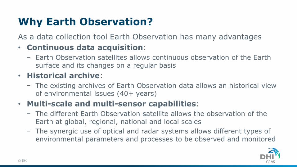
As a data collection tool Earth Observation has many advantages
• Continuous data acquisition:
− Earth Observation satellites allows continuous observation of the Earth surface and its changes on a regular basis
• Historical archive:
− The existing archives of Earth Observation data allows an historical view of environmental issues (40+ years)
• Multi-scale and multi-sensor capabilities:
− The different Earth Observation satellite allows the observation of the Earth at global, regional, national and local scales
− The synergic use of optical and radar systems allows different types of environmental parameters and processes to be observed and monitored

EO for basin monitoring and informinghydromodels
Zambezi Water Resource Information System Providing the Riparian States with an efficient and timely means of sharing data and information on water resources in the basin (@DHI)
Informing hydrological models in poorlygauged basins with EO e.g. DEM,
precipiation, water levels, total waterstorage (@DTU ENV / Globwetland Africa)
Location:
Ogooué, GabonEO data:
• Rainfall
• Soil moisture
• Vegetation
• Evapotranspiration
• Land surface temp.
• Flood frequency
• Water quality
• Land cover
• Tree cover perc.
• Tree cover loss

New data -> New opportunities
• There is a new generation of satellite sensors becoming available which deliver free and open data with unprecedented spatial and temporal resolutions
• These data, combined with data from long-term archives, can and should be put into practice to support water resource management
Sentinel-3
Sentinel-2
Sentinel-1

www.eo4sd-water.net

Surface water monitoring(Zimbabwe)
• Challenge
− Official measurement of water resources is limited to major dams and river flow stations. This represents only a small portion of the overall water resources where substantial portions of water are stored in privately held infrastructure such as farm dams
• Solution
− EO allow for bi-weekly monitoring of surface water resources in 10 m resolution for more efficient planning and decision making, and for operational actions related to e.g. drought mitigation.
Water frequency map from Sentinel-2 (@GeoVille / EO4SD).

Irrigation mapping (Malawi)• Challenge
− Irrigation is recognized as one of the main economic drivers in the Zambezi, yet recent studies reveal that there are differences in reported numbers of irrigated areas, and that significant knowledge gaps and uncertainties remain to inform investment decisions and policy making
• Solution
− EO based national map of irrigation extent to be integrated into the national water licensing system in order for the Malawi National Water Resource Authority to compare with the actual licensed area and identification of non-licensed water usage
Irrigated cropland in Munjabe porovince Malawi. Satellite data with frequent coverage can easily spot irrigated crops vs rainfed crops(@DHI GRAS / EO4SD).

Irrigation management (Sahel)• Challenge
− Low level of agricultural intensification resulting in low incomes and uncertainties on food security -> need to expand irrigation and improve water efficiency
• Solution
− EO information will provide regular updates on water use in-season allowing irrigation schedules and water distribution to be adjusted and provides valuable insights on how water management can be improved Actual evapotranspiration, yield and water productivity in the Office du
Niger irrigation scheme, Mali (@eLeaf / EO4SD).

Water quality (Lake Titicaca) • Challenge
− Lake Titicaca System is of particular relevance as a source of drinking water, yet ecosystem contamination from agricultural activities and from urban / industrial waste discharge is prevalent
• Solution
− EO information to provide valuable information & input for the evaluation of anthropogenic and natural impacts on Lake Titicaca e.g. for identification of point source pollution and better understanding of eutrophication processes and for regular reporting obligations
. Sentinel-3 time series map of suspended sediment, Lake Titicaca (@DHI GRAS / EO4SD).
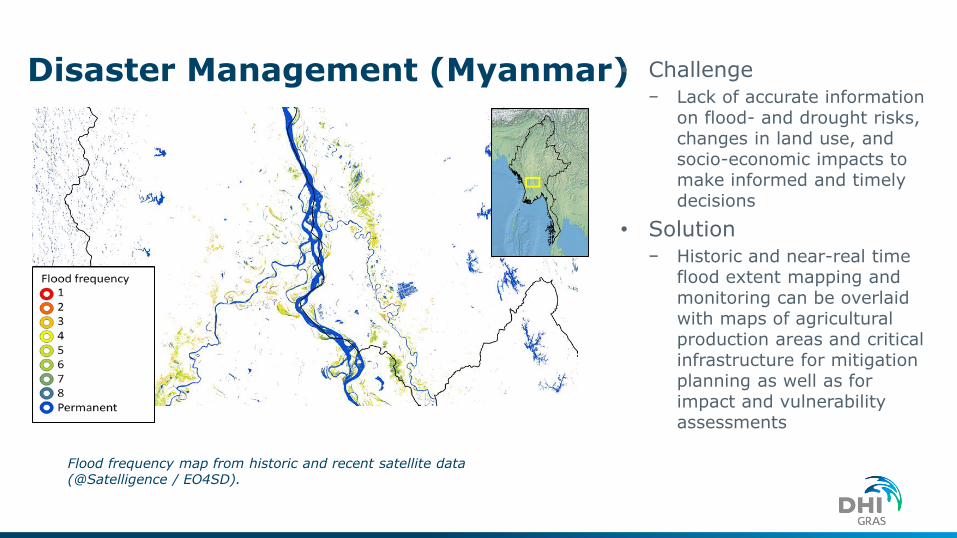
Disaster Management (Myanmar)• Challenge
− Lack of accurate information on flood- and drought risks, changes in land use, and socio-economic impacts to make informed and timely decisions
• Solution
− Historic and near-real time flood extent mapping and monitoring can be overlaid with maps of agricultural production areas and critical infrastructure for mitigation planning as well as for impact and vulnerability assessments
Flood frequency map from historic and recent satellite data (@Satelligence / EO4SD).
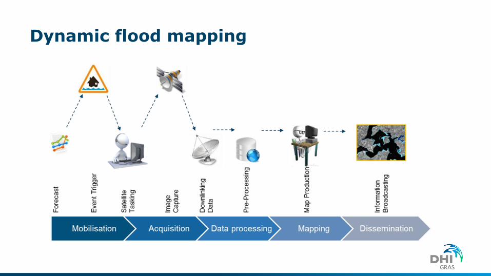
Dynamic flood mapping

Case study: Hurricane Nargis
1989
2003
2008
C
h
a
n
g
e
s
Flood extent
Around half of the flooded area comprised reclaimed mangroves, mostly cleared since 1989

The SDG Water targets
© DHI

Wetlands Monitoring with Earth Observation Data
• Development of SDG monitoring system based on earth observation (EO) data for taking stock of and monitoring of extent of water-related ecosystems (SDG 6.6.1)

DK examples Ecological status of freshwater lakes in DenmarkMapping floods
National Crop monitoring
Storm damage

Conclusion
• Earth observations is a cost-effective monitoring tool used for many water resource management applications
− it is especially useful in many developing countries where reliable water information is scarce, but also increasingly interesting in a DK/European context and in support for the SDG monitoring requirements
• Challenge
− The data volumes of the Sentinels is many times biggerthan previous missions
− Full advantage only possible with large scale ICT infrastrucure -> move processing to the cloud
Related Documents


