Welcome message from author
This document is posted to help you gain knowledge. Please leave a comment to let me know what you think about it! Share it to your friends and learn new things together.
Transcript


AGENCY ACTIONS SECTION 343-5(B), HRS
PUBLICATION FORM (FEBRUARY 2013 REVISION)
Project Name: Ōneo Lane
Island: Hawai‘i
District: North Kona
TMK: 7-5-009:021, 022, 023, and 025; and roadway right-of-way
Permits: Special Management Area and National Pollutant Discharge Elimination System
Proposing/ Determination Agency:
County of Hawai‘i, Department of Public Works Aupuni Center 101 Pauahi Street, Suite 7 Hilo, Hawai‘i 96720 Contact: Mr. Ben Ishii Phone: (808) 961-8327
Consultant: Parsons Brinckerhoff 1001 Bishop Street, Suite 2400 Honolulu, Hawai‘i 96813 Contact: Ms. Rachel Adams Phone: (808) 566-2257
Status (check one only):
X DEA-AFONSI
Submit the proposing agency notice of determination/transmittal on agency letterhead, a hard copy of DEA, a completed OEQC publication form, along with an electronic word processing summary and a PDF copy (you may send both summary and PDF to [email protected]); a 30-day comment period ensues upon publication in the periodic bulletin.
FEA-FONSI Submit the proposing agency notice of determination/transmittal on agency letterhead, a hard copy of the FEA, an OEQC publication form, along with an electronic word processing summary and a PDF copy (send both summary and PDF to [email protected]); no comment period ensues upon publication in the periodic bulletin.
FEA-EISPN Submit the proposing agency notice of determination/transmittal on agency letterhead, a hard copy of the FEA, an OEQC publication form, along with an electronic word processing summary and PDF copy (you may send both summary and PDF to [email protected]); a 30-day consultation period ensues upon publication in the periodic bulletin.
Act 172-12 EISPN
Submit the proposing agency notice of determination on agency letterhead, an OEQC publication form, and an electronic word processing summary (you may send the summary to [email protected]). NO environmental assessment is required and a 30-day consultation period upon publication in the periodic bulletin.
DEIS The proposing agency simultaneously transmits to both the OEQC and the accepting authority, a hard copy of the DEIS, a completed OEQC publication form, a distribution list, along with an electronic word processing summary and PDF copy of the DEIS (you may send both the summary and PDF to [email protected]); a 45-day comment period ensues upon publication in the periodic bulletin.
FEIS The proposing agency simultaneously transmits to both the OEQC and the accepting authority, a hard copy of the FEIS, a completed OEQC publication form, a distribution list, along with an electronic word processing summary and PDF copy of the FEIS (you may send both the summary and PDF to [email protected]); no comment period ensues upon publication in the periodic bulletin.
Section 11-200-23 Determination
The accepting authority simultaneously transmits its determination of acceptance or nonacceptance (pursuant to Section 11-200-23, HAR) of the FEIS to both OEQC and the proposing agency. No comment period ensues upon publication in the periodic bulletin.
Section 11-200-27 Determination
The accepting authority simultaneously transmits its notice to both the proposing agency and the OEQC that it has reviewed (pursuant to Section 11-200-27, HAR) the previously accepted FEIS and determines that a supplemental EIS is not required. No EA is required and no comment period ensues upon publication in the periodic bulletin.
Withdrawal (explain)
Summary (Provide proposed action and purpose/need in less than 200 words. Please keep the summary brief and on this one page):
The County of Hawai‘i is proposing the construction of Ōneo Lane from Kuakini Highway to Ali‘i Drive. The project is being proposed to provide additional mauka-makai connectivity/mobility within the area and relieve traffic congestion at the Hualālai Road/Ali‘i Drive intersection by redirecting some traffic off Ali‘i Drive and onto Kuakini Highway. The project is a portion of the “Nani Kailua Road Extension Project” that has been envisioned in planning documents, including the Kona Community Development Plan.
Ōneo Lane is proposed to consist of two through lanes, one in each direction, a center turn lane, bike lanes, and sidewalks. The entire length of the proposed alignment is currently undeveloped vacant land. The primary considerations in selecting the proposed roadway alignment have been (a) avoiding historic sites, and (b) minimizing impacts on land owners.

Environmental Assessmentand Anticipated Finding of
No Significant Impact
Oneo Lane
Prepared for
County of Hawaii
Department of Public Works
Aupuni Center
101 Pauahi Street
Suite 7
Hilo, Hawaii 96720
July 2015
Draft

DRAFT ENVIRONMENTAL ASSESSMENT
Ōneo Lane Kailua-Kona, Hawai‘i Island, Hawai‘i
Submitted pursuant to the:
Hawai‘i Environmental Policy Act, Chapter 343, Hawai‘i Revised Statutes, and Title 11, Chapter 200, Hawai‘i Department of Health Administrative Rules
by the:
Department of Public Works County of Hawai‘i State of Hawai‘i
The following person may be contacted for additional information concerning this document:
Mr. Ben Ishii Department of Public Works County of Hawai‘i 101 Pauahi Street, Suite 7 Hilo, Hawai‘i 96720 Phone: (808) 961-8327
This Draft Environmental Assessment (EA) documents a provisional finding that there would be no significant environmental impacts if the proposed project proceeds. The proposed project would construct a new road connecting Ali‘i Drive to Kuakini Highway.
Comments on this Draft EA are due by September 8, 2015, and should be sent to the Department of Public Works at the address above with copies to the Office of Environmental Quality Control, 235 South Beretania Street, Suite 702, Honolulu, Hawai‘i 96813 and Rachel Adams, Parsons Brinckerhoff, 1001 Bishop Street, Suite 2400, Honolulu, Hawai‘i 96813.
JULY 2015
Ōneo Lane Draft Environmental Assessment
July 2015 Page | i
TABLE OF CONTENTS
Section Page
1.0 DESCRIPTION OF THE PROPOSED ACTION ........................................................ 1-1
1.1 Introduction ...................................................................................................................... 1-1 1.1.1 Purpose of this Document .......................................................................................... 1-1 1.1.2 Organization of this Document .................................................................................. 1-2 1.1.3 Naming Conventions in this Document ..................................................................... 1-2
1.2 Project Purpose and Need ................................................................................................ 1-2 1.2.1 Improve Kailua-Kona’s Roadway Network .............................................................. 1-2 1.2.2 Improve Pedestrian and Bicycle Facilities ................................................................. 1-3
1.3 Alternatives Addressed in this EA ................................................................................... 1-3 1.3.1 No-Build Alternative ................................................................................................. 1-3 1.3.2 Build Alternatives ...................................................................................................... 1-3
1.4 Alternatives Considered but Rejected .............................................................................. 1-5 1.4.1 Straight North Alignment .......................................................................................... 1-6 1.4.2 Central Alignment ...................................................................................................... 1-7 1.4.3 Straight South Alignment .......................................................................................... 1-7 1.4.4 Far South Alignment .................................................................................................. 1-7
1.5 Consistency with Government Plans, Policies, and Controls .......................................... 1-7 1.5.1 Hawai‘i State Plan ...................................................................................................... 1-7 1.5.2 Hawai‘i State Land Use Controls .............................................................................. 1-8 1.5.3 Federal-Aid Highways 2035 Transportation Plan for the District of Hawai‘i ........... 1-8 1.5.4 Hawai‘i County General Plan .................................................................................... 1-8 1.5.5 Kona Community Development Plan ........................................................................ 1-9 1.5.6 Master Plan for Kailua-Kona ..................................................................................... 1-9
1.6 Consistency with Non-Governmental Plans .................................................................... 1-9
1.7 Project Cost and Schedule ............................................................................................. 1-10
1.8 Permits and Approvals ................................................................................................... 1-10
2.0 AFFECTED ENVIRONMENT, POTENTIAL ENVIRONMENTAL CONSEQUENCES, AND PROPOSED MITIGATION MEASURES ..................... 2-1
2.1 Roadways and Traffic ...................................................................................................... 2-1 2.1.1 Existing Conditions .................................................................................................... 2-1 2.1.2 Basic Transportation Assumptions ............................................................................ 2-6 2.1.3 Potential Impacts ........................................................................................................ 2-6 2.1.4 Avoidance, Minimization, and Mitigation Measures ................................................ 2-7
2.2 Land Use .......................................................................................................................... 2-8 2.2.1 Existing Conditions .................................................................................................... 2-8
Ōneo Lane Draft Environmental Assessment
July 2015 Page | ii
2.2.2 Land Use Development Trends ................................................................................. 2-9 2.2.3 Potential Impacts ...................................................................................................... 2-10 2.2.4 Avoidance, Minimization, and Mitigation Measures .............................................. 2-12
2.3 Historic and Archaeological Resources ......................................................................... 2-12 2.3.1 Existing Conditions .................................................................................................. 2-12 2.3.2 Potential Impacts ...................................................................................................... 2-14 2.3.3 Avoidance, Minimization, and Mitigation Measures .............................................. 2-14
2.4 Coastal Zone Management/Special Management Area ................................................. 2-15 2.4.1 Recreational Resources ............................................................................................ 2-16 2.4.2 Historic Resources ................................................................................................... 2-16 2.4.3 Scenic and Open Space Resources .......................................................................... 2-16 2.4.4 Coastal Ecosystems .................................................................................................. 2-16 2.4.5 Economic Uses ......................................................................................................... 2-16 2.4.6 Coastal Hazards ....................................................................................................... 2-17
2.5 Noise .............................................................................................................................. 2-17 2.5.1 Existing Conditions .................................................................................................. 2-18 2.5.2 Potential Impacts ...................................................................................................... 2-19 2.5.3 Avoidance, Minimization, and Mitigation Measures .............................................. 2-19
2.6 Air Quality ..................................................................................................................... 2-20 2.6.1 Existing Conditions .................................................................................................. 2-20 2.6.2 Potential Impacts ...................................................................................................... 2-20 2.6.3 Avoidance, Minimization, and Mitigation Measures .............................................. 2-20
2.7 Visual and Aesthetic Resources ..................................................................................... 2-20 2.7.1 Existing Conditions .................................................................................................. 2-20 2.7.2 Potential Impacts ...................................................................................................... 2-21 2.7.3 Mitigation Measures ................................................................................................ 2-21
2.8 Social, Economic, and Cultural Conditions ................................................................... 2-21 2.8.1 Existing Conditions .................................................................................................. 2-21 2.8.2 Potential Impacts ...................................................................................................... 2-22 2.8.3 Avoidance, Minimization, and Mitigation Measures .............................................. 2-23
2.9 Water Resources ............................................................................................................ 2-23 2.9.1 Existing Conditions .................................................................................................. 2-23 2.9.2 Potential Impacts ...................................................................................................... 2-23 2.9.3 Avoidance, Minimization, and Mitigation Measures .............................................. 2-23
2.10 Biological Resources ..................................................................................................... 2-23 2.10.1 Existing Conditions .................................................................................................. 2-24 2.10.2 Potential Impacts ...................................................................................................... 2-24 2.10.3 Avoidance, Minimization, and Mitigation Measures .............................................. 2-24
2.11 Construction Impacts ..................................................................................................... 2-24 2.11.1 Maintenance of Traffic ............................................................................................ 2-25
Ōneo Lane Draft Environmental Assessment
July 2015 Page | iii
2.11.2 Air Quality ............................................................................................................... 2-25 2.11.3 Noise ........................................................................................................................ 2-25 2.11.4 Water Resources ...................................................................................................... 2-26 2.11.5 Solid Waste Management and Hazardous Waste .................................................... 2-26 2.11.6 Historic and Archeological Resources ..................................................................... 2-26 2.11.7 Utilities ..................................................................................................................... 2-27
2.12 Secondary and Cumulative Impacts Analysis ................................................................ 2-27 2.12.1 Potential Secondary Impacts .................................................................................... 2-27 2.12.2 Potential Cumulative Impacts .................................................................................. 2-27
2.13 Irreversible and Irretrievable Commitments of Resources ............................................ 2-28
3.0 COMMENTS AND COORDINATION ......................................................................... 3-1
3.1 Agency and Stakeholder Consultation ............................................................................. 3-1 3.1.1 Agency Scoping Meeting ........................................................................................... 3-1 3.1.2 Public Scoping Meeting ............................................................................................. 3-2 3.1.3 Other Meetings........................................................................................................... 3-2
3.2 Future Public Outreach .................................................................................................... 3-3
4.0 ANTICIPATED FONSI STATEMENT ......................................................................... 4-1
5.0 REFERENCES ................................................................................................................. 5-1
Ōneo Lane Draft Environmental Assessment
July 2015 Page | iv
LIST OF FIGURES
Figure 1-1: Location Map ........................................................................................................... 1-1
Figure 1-2: Typical Section ........................................................................................................ 1-4
Figure 1-3: Build Alternatives .................................................................................................... 1-5
Figure 1-4: Alternatives Considered but Rejected ...................................................................... 1-6
Figure 2-1: Existing Roadways ................................................................................................... 2-3
Figure 2-2: Existing Lane Configurations .................................................................................. 2-4
Figure 2-3: 2007 Traffic Volumes .............................................................................................. 2-4
Figure 2-4: Proposed Lane Configurations ................................................................................. 2-7
Figure 2-5: Projected Year 2020 PM Travel Time Comparison ................................................. 2-7
Figure 2-6: Existing and Planned Land Uses* ............................................................................ 2-9
Figure 2-7: Parcel Map ............................................................................................................. 2-13
Figure 2-8: Map of Archaeological Sites .................................................................................. 2-13
Figure 2-9: Noise Map of Noise Monitoring Locations ............................................................ 2-18
LIST OF TABLES
Table 1-1: Build Alternatives Summary ..................................................................................... 1-5
Table 1-2: Permits and Approvals ............................................................................................ 1-10
Table 2-1: Delay Thresholds for Level of Service ...................................................................... 2-5
Table 2-2: 2007 Intersection LOS and Delay in seconds/vehicle ............................................... 2-5
Table 2-3: Red Alignment ROW by Parcel .............................................................................. 2-11
Table 2-4: Green Alignment ROW by Parcel ........................................................................... 2-11
Table 2-5: Summary of Archaeological Sites ........................................................................... 2-14
Table 2-6: Potential Archaeological Sites Impacts ................................................................... 2-14
Table 2-7: Proposed Archaeological Sites Mitigation Measures .............................................. 2-15
Table 2-8: Noise Abatement Criteria ........................................................................................ 2-17
Table 2-9: Summary of Noise Study ........................................................................................ 2-19
Table 2-10: Population of North Kona, 1970 to 2040 .............................................................. 2-22
Table 2-11: Construction Equipment Noise Levels .................................................................. 2-26
Ōneo Lane Draft Environmental Assessment
July 2015 Page | v
LIST OF APPENDICES
APPENDIX A TRAFFIC REPORT
APPENDIX B ARCHAEOLOGICAL SURVEY REPORT
APPENDIX C CULTURAL IMPACT ASSESSMENT
APPENDIX D BIOLOGICAL REPORT
APPENDIX E SCOPING PERIOD COMMENTS AND INFORMATION
APPENDIX F PRELIMINARY DRAFT SMA PERMIT APPLICATION
Ōneo Lane Draft Environmental Assessment
July 2015 Page | vi
LIST OF ACRONYMS
AASHTO American Association of State Highway and Transportation Officials
AFONSI Anticipated Finding of No Significant Impact
ATR automatic traffic recorder
AWSC all-way stop control
BMP Best Management Practices
CEQ Council on Environmental Quality
CIA Cultural Impact Assessment
CO carbon monoxide
CZM Coastal Zone Management
DA Department of the Army
DOH State Department of Health
EA Environmental Assessment
EB eastbound
FHWA Federal Highway Administration
FONSI Finding of No Significant Impact
HAR Hawai‘i Administrative Rules
HCM Highway Capacity Manual
HDOT State Department of Transportation
HRS Hawai‘i Revised Statutes
KCDP Kona Community Development Plan
KVBID Kona Village Business Improvement District
LOS Level of Service
MSAT mobile source air toxics
MPH miles per hour
NAC noise abatement criteria
NB northbound
NGPC Notice of General Permit Coverage
Ōneo Lane Draft Environmental Assessment
July 2015 Page | vii
NOx nitrogen oxide
NPDES National Pollutant Discharge Elimination System
O3 ozone
PM2.5 Particulate matter
PM10 Particulate matter
SB southbound
SHPD State Historic Preservation Division
SLUC State Land Use Commission
SMA Special Management Area
ROW right-of-way
TWSC two-way stop control
VOC volatile organic compound
WB westbound
Ōneo Lane Draft Environmental Assessment
July 2015 Page | 1-1
1.0 DESCRIPTION OF THE PROPOSED ACTION
1.1 Introduction
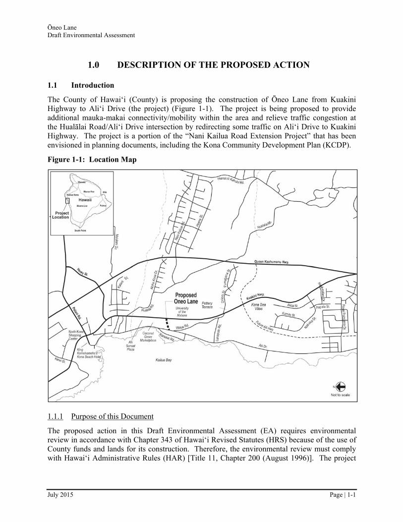
The County of Hawai‘i (County) is proposing the construction of Ōneo Lane from Kuakini Highway to Ali‘i Drive (the project) (Figure 1-1). The project is being proposed to provide additional mauka-makai connectivity/mobility within the area and relieve traffic congestion at the Hualālai Road/Ali‘i Drive intersection by redirecting some traffic on Ali‘i Drive to Kuakini Highway. The project is a portion of the “Nani Kailua Road Extension Project” that has been envisioned in planning documents, including the Kona Community Development Plan (KCDP).
Figure 1-1: Location Map
1.1.1 Purpose of this Document
The proposed action in this Draft Environmental Assessment (EA) requires environmental review in accordance with Chapter 343 of Hawai‘i Revised Statutes (HRS) because of the use of County funds and lands for its construction. Therefore, the environmental review must comply with Hawai‘i Administrative Rules (HAR) [Title 11, Chapter 200 (August 1996)]. The project
Ōneo Lane Draft Environmental Assessment
July 2015 Page | 1-2
will also require a Special Management Area (SMA) permit, which necessitates an environmental review.
This Draft EA discloses the environmental and social impacts that could result from the project’s implementation and commits to the employment of specific measures to avoid, minimize, or mitigate adverse impacts to the environment. The County has determined that the proposed action is not likely to have a “significant” impact in accordance with HRS Chapter 343. Therefore, the County anticipates issuing a “Finding of No Significant Impact” (FONSI). After receipt of comments on this Draft EA, the County will either (a) issue a Final EA/FONSI document, or (b) if a significant impact is identified during the analysis, issue a Final EA/Environmental Impact Statement Preparation Notice.
1.1.2 Organization of this Document
Chapter 1 discusses the purpose and need for the proposed project. It introduces the alternatives that were considered and the project’s anticipated schedule and cost. It also lists permits and approvals that may be required. Chapter 2 describes existing environmental conditions, potential environmental impacts, and any mitigation measures that are proposed to reduce the level of adverse impact. Chapter 3 documents agency and public coordination conducted to date with respect to the project. Chapter 4 provides the Anticipated Finding of No Significant Impact (AFONSI) statement, pursuant to HRS Chapter 343. Chapter 5 consists of a list of references used in the preparation of this Draft EA. The Appendices contain records of comments and coordination conducted for the proposed project as well as various technical reports prepared for this project.
1.1.3 Naming Conventions in this Document
This document generally uses the directional terms north, south, east, and west. However, the terms “mauka” and “makai” (towards the mountains and towards the ocean, respectively) are also used, especially where these terms may be the most convenient to describe a direction or location. For this project area, mauka generally corresponds to an easterly direction, and makai is a westerly direction.
1.2 Project Purpose and Need
Based on an analysis of current conditions and forecast growth, the following project purposes have been established:
Provide greater connectivity within the rapidly developing Kailua-Kona area.
Improve pedestrian and bicycle facilities.
The project purposes are consistent with the KCDP, which has set guiding principles for Kona development, one of which is to “provide connectivity and transportation choices.”
1.2.1 Improve Kailua-Kona’s Roadway Network
Traffic congestion in Kona has resulted from rapid population growth and, among other reasons, poor roadway connectivity. Traffic conditions within the project area, particularly on Ali‘i

Ōneo Lane Draft Environmental Assessment
July 2015 Page | 1-3
Drive, are congested and are expected to become more congested in the future. Section 2.1 describes traffic conditions in more detail.
The KCDP identified the necessity for projects to divert traffic from main roads through connecting roadways in order to reduce traffic congestion and increase mobility within the district. Such projects that increase local road connectivity ensure residents can reach their destinations easily and reduce local traffic reliance on regional roads. Although there are several north-south roadways (Ali‘i Drive, Kuakini Highway, and Queen Ka‘ahumanu Highway Extension) in the project area, there are few mauka-makai roads that provide relatively direct connections between the north-south roadways (Figure 1-1).
Palani Road is the only mauka-makai roadway in the area that provides direct connectivity between the three north-south roadways. Hualālai Road and Lunapule Road, south of Palani Road, are about a mile apart and provide limited mauka-makai connectivity. The proposed project would provide a direct mauka-makai alternative connecting Ali‘i Drive and Kuakini Highway.
1.2.2 Improve Pedestrian and Bicycle Facilities
The proposed project provides the opportunity to provide pedestrian and bicycle facilities to help create a safe, direct, and convenient multi-modal system. Such facilities promote livable and walkable communities and are consistent with the County’s Complete Streets policies and the transportation objectives in the KCDP.
1.3 Alternatives Addressed in this EA
In this section, the no-build and build alternatives are discussed. Alternative alignments that were considered but rejected are addressed in Section 1.4.
1.3.1 No-Build Alternative
The No-Build Alternative assumes that the proposed project would not be completed by 2020 but other proposed transportation projects would proceed. There are several other proposed transportation projects in the area that, under this alternative, are assumed to be constructed by 2020, including the widening of State Route 11 (Queen Ka‘ahumanu Highway Extension/ Kuakini Highway) by the State of Hawai‘i Department of Transportation (HDOT), Lako Street Extension, and La‘aloa Street Extension.
The No-Build Alternative provides a frame of reference for the comparison of the Build Alternatives. The No-Build Alternative only assumes this proposed project would not proceed; other developments could occur (i.e. condominium development or commercial development) that would result in other impacts to the environment in the project area.
1.3.2 Build Alternatives
The Build Alternatives generally consist of the following:
The County acquiring a new 70-foot wide right-of-way (ROW) from current property owners between Kuakini Highway and Ali‘i Drive,
Ōneo Lane Draft Environmental Assessment
July 2015 Page | 1-4
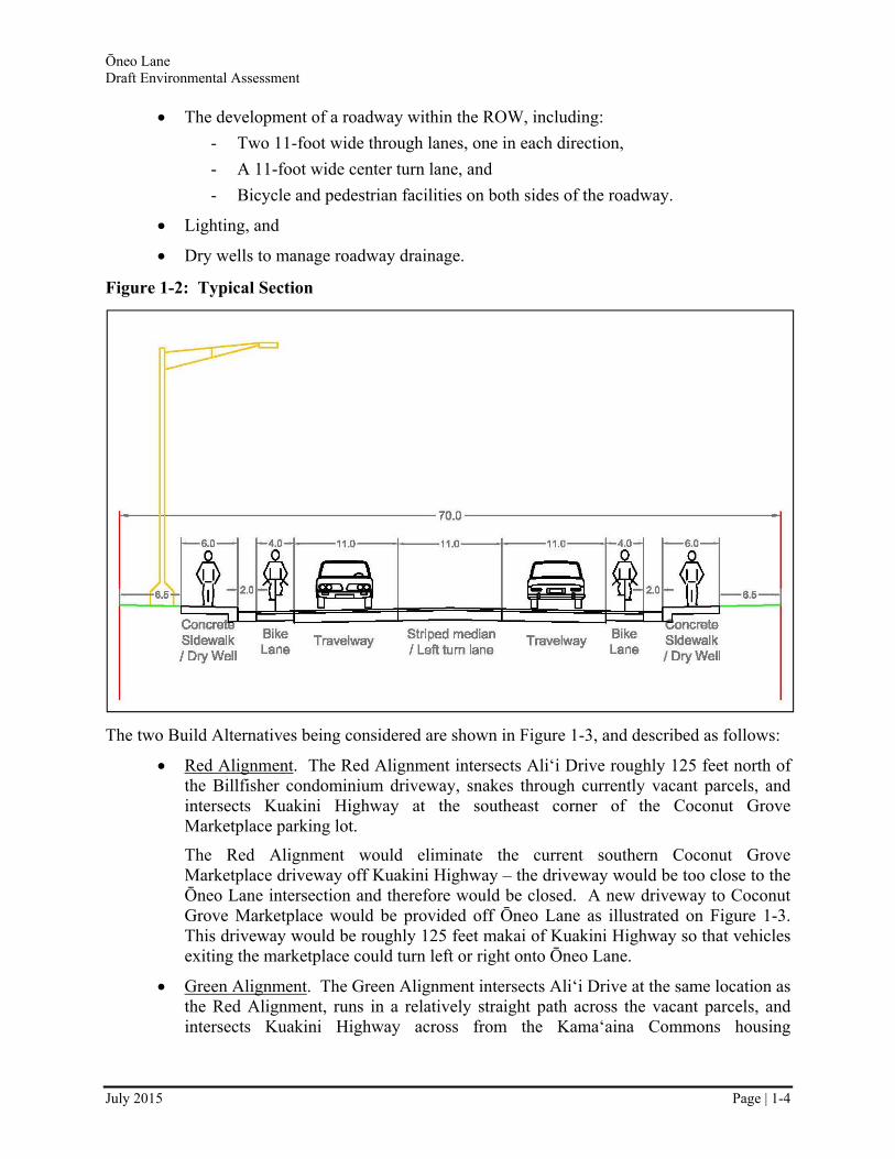
The development of a roadway within the ROW, including:
- Two 11-foot wide through lanes, one in each direction,
- A 11-foot wide center turn lane, and
- Bicycle and pedestrian facilities on both sides of the roadway.
Lighting, and
Dry wells to manage roadway drainage.
Figure 1-2: Typical Section
The two Build Alternatives being considered are shown in Figure 1-3, and described as follows:
Red Alignment. The Red Alignment intersects Ali‘i Drive roughly 125 feet north of the Billfisher condominium driveway, snakes through currently vacant parcels, and intersects Kuakini Highway at the southeast corner of the Coconut Grove Marketplace parking lot.
The Red Alignment would eliminate the current southern Coconut Grove Marketplace driveway off Kuakini Highway – the driveway would be too close to the Ōneo Lane intersection and therefore would be closed. A new driveway to Coconut Grove Marketplace would be provided off Ōneo Lane as illustrated on Figure 1-3. This driveway would be roughly 125 feet makai of Kuakini Highway so that vehicles exiting the marketplace could turn left or right onto Ōneo Lane.
Green Alignment. The Green Alignment intersects Ali‘i Drive at the same location as the Red Alignment, runs in a relatively straight path across the vacant parcels, and intersects Kuakini Highway across from the Kama‘aina Commons housing

Ōneo Lane Draft Environmental Assessment
July 2015 Page | 1-5
development driveway. Although the Green Alignment intersects Ali‘i Drive at the same location, the intersection is at a slightly different angle.
Various attributes of the two Build Alternatives are presented in Table 1-1.
Figure 1-3: Build Alternatives
Table 1-1: Build Alternatives Summary
Alternative Length (feet)1
ROW Area (acres)
Relative intersection angle – Kuakini
Highway (degrees)2
Relative intersection angle – Ali‘i Drive
(degrees)
Minimum Roadway Curvature (feet
radius)3 Red ~630 ~0.95 90 ~95 ~320
Green ~618 ~0.92 ~93 ~104 300 1Length is measure from the centerline of Ali‘i Drive to the centerline of Kuakini Highway. 2Angles are measured from the centerline of the north side of Ali‘i Drive and Kuakini Highway to the centerline of the
new road. 3Minimum radius for a 30 mile per hour (MPH) design speed is 300 feet per American Association of State Highway
and Transportation Officials (AASHTO) Design Guide.
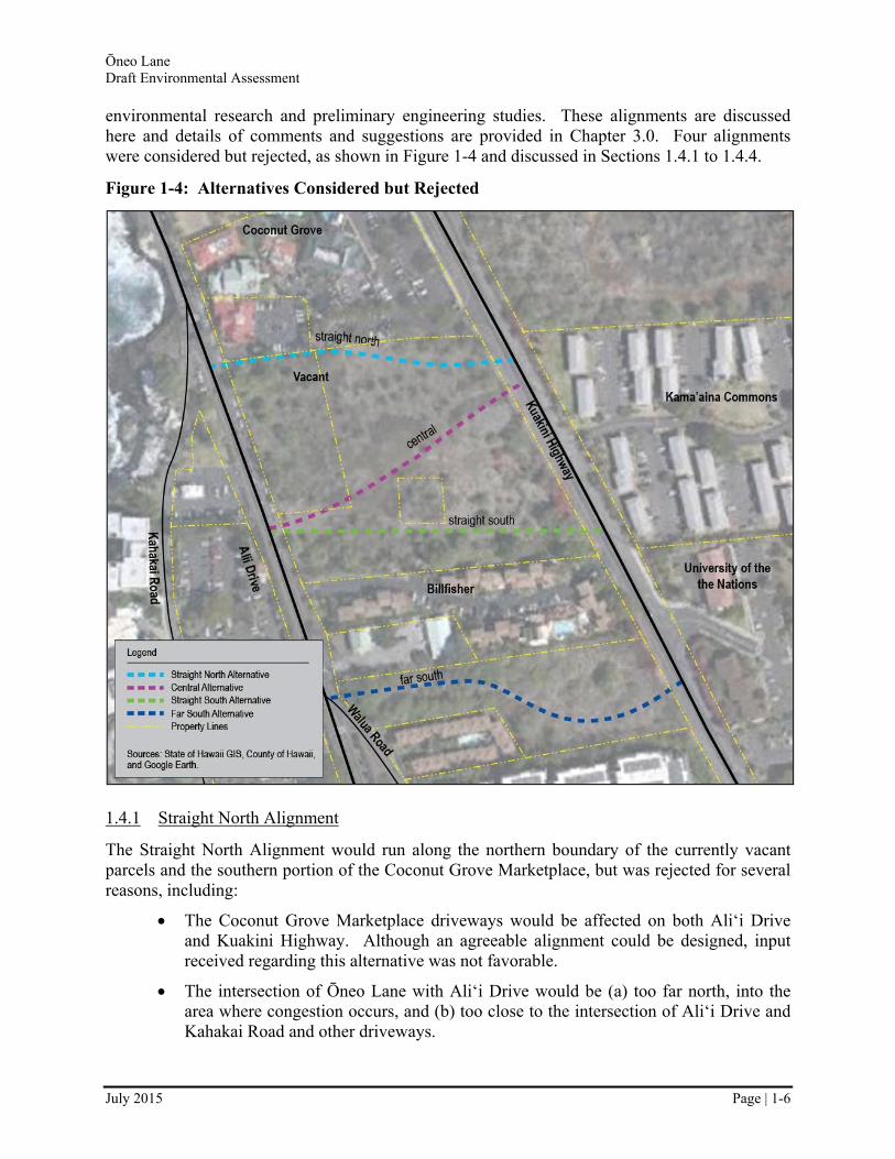
1.4 Alternatives Considered but Rejected
This section consists of brief descriptions of alternative alignments that were considered but rejected based on input received during the pre-assessment consultation period, as well as
Ōneo Lane Draft Environmental Assessment
July 2015 Page | 1-6
environmental research and preliminary engineering studies. These alignments are discussed here and details of comments and suggestions are provided in Chapter 3.0. Four alignments were considered but rejected, as shown in Figure 1-4 and discussed in Sections 1.4.1 to 1.4.4.
Figure 1-4: Alternatives Considered but Rejected
1.4.1 Straight North Alignment
The Straight North Alignment would run along the northern boundary of the currently vacant parcels and the southern portion of the Coconut Grove Marketplace, but was rejected for several reasons, including:
The Coconut Grove Marketplace driveways would be affected on both Ali‘i Drive and Kuakini Highway. Although an agreeable alignment could be designed, input received regarding this alternative was not favorable.
The intersection of Ōneo Lane with Ali‘i Drive would be (a) too far north, into the area where congestion occurs, and (b) too close to the intersection of Ali‘i Drive and Kahakai Road and other driveways.

Ōneo Lane Draft Environmental Assessment
July 2015 Page | 1-7
1.4.2 Central Alignment
The Central Alignment is generally between the Red and Green Alignments discussed in Section 1.3.2, which are considered the Build Alternatives discussed throughout this Draft EA. This alternative was considered separately because it would intersect Kuakini Highway equally distant from the Coconut Grove Marketplace and Kamaaina Commons driveways. The Central Alignment was eliminated because the Red and Green Alignments provided greater distances between the driveways on Kuakini Highway.
1.4.3 Straight South Alignment
The Straight South Alignment would provide a relatively straight path from Kuakini Highway to Ali‘i Drive along the southern portion of the currently vacant parcels. The Straight South Alignment was rejected because the alignment would intersect Kuakini Highway and Ali‘i Drive less than 60 feet from the Billfisher’s driveway.
1.4.4 Far South Alignment
The Far South Alignment would curve through a vacant parcel between the Billfisher and Kona Pacific condominiums. This alignment was rejected for several reasons, including:
There is an archaeological site buffer in the vacant parcel (which has been negotiated by the land owner with the State Historic Preservation Division [SHPD]) that ends roughly 55 feet from the corner of the neighboring Malia Kai parcel. The ROW planned for the project would require at least 60 feet and infringe on this buffer or the proposed improvements would have to be reduced (e.g., sidewalks couldn’t be provided).
This alignment would probably require full acquisition of the vacant parcel because the proposed alignment would leave small islands of leftover property that would be severely limited in their potential use.
The intersection of Ōneo Lane with Ali‘i Drive would be shared with Walua Road making it a 4-way intersection with difficult geometry.
1.5 Consistency with Government Plans, Policies, and Controls
1.5.1 Hawai‘i State Plan
The Hawai‘i State Plan (June 1991), as codified in HRS Chapter 226, serves as a guide for the future long-range development of the state. It consists of comprehensive goals, objectives, and policies for determining priorities and allocating resources. The State Plan promotes the growth and diversification of the state’s economy, the protection of the physical environment, the provision of public facilities, and the promotion of and assistance to socio-cultural advancement.
The proposed project would support the goals and objectives of the Hawai‘i State Plan dealing with the economic, physical, and natural environment, and transportation objectives and policies. The No-Build Alternative would do little to support the goals and objectives of the Hawai‘i State Plan because it would not provide the transportation improvements needed to facilitate economic development in this urban region.
Ōneo Lane Draft Environmental Assessment
July 2015 Page | 1-8
In accordance with the plan’s economic objectives and policies, the proposed project would facilitate commerce through improved transportation service. It would also contribute to the local and state economies by providing construction jobs. In addition, the project would facilitate commerce without damaging the natural environment. As described in this Draft EA, the proposed project would avoid, minimize, or mitigate impacts to historic, physical, and natural resources.
1.5.2 Hawai‘i State Land Use Controls
The State Land Use Commission (SLUC), under the authority granted in HRS Chapter 205, regulates land use through classification of state lands into four districts: Urban, Agriculture, Conservation, and Rural. The intent of the land classification is to accommodate growth and development while retaining the natural and agricultural resources of the state. Each district has specific land use objectives and development constraints.
The area within the project limits is classified Urban. The proposed configuration of the project would include sidewalks, curbs, and gutters, which is typical of roads within such environments and, therefore, the proposed project would be consistent with the land use classification of the study area.
1.5.3 Federal-Aid Highways 2035 Transportation Plan for the District of Hawai‘i
The Draft Federal-Aid Highways 2035 Transportation Plan for the District of Hawai‘i (March 2014) was developed to guide land-based transportation decisions for the federal-aid highway network in the District of Hawai‘i through the year 2035. By defining goals and needs and recommending multimodal solutions specific to the District of Hawai‘i, it sets the direction for land-based transportation system improvements for which priorities and funding can be developed.
The proposed project is consistent with the following goals:
Freight Movement and Economic Vitality - improve freight networks, strengthen the ability of rural communities to access national and international trade markets, and support regional economic development.
Congestion Reduction - significantly reduce congestion on the National Highway System.
System Reliability - improve the efficiency of the surface transportation system.
1.5.4 Hawai‘i County General Plan
The County of Hawai‘i’s General Plan (February 2005) is the policy document for the long range comprehensive development of Hawai‘i Island. Its purpose is to guide the pattern of future development on the island; provide the framework for regulatory decisions, capital improvement priorities, acquisition strategies, and other pertinent government programs; and improve the physical environment of the county, among other purposes. In the area of transportation, the following goals were identified:
Provide a system of roadways for the safe, efficient and comfortable movement of people and goods.

Ōneo Lane Draft Environmental Assessment
July 2015 Page | 1-9
Provide an integrated State and County transportation system so that new major routes will complement and encourage proposed land policies.
The General Plan’s Land Use Pattern Allocation Guide Map shows most of the project area as Resort Node. The proposed project would be consistent with the Resort Node land use designations.
1.5.5 Kona Community Development Plan
Mapping Kona’s Future, the current KCDP (September 2008), encompasses the North and South Kona areas. The KCDP identifies some priority roadway improvements needed to accommodate traffic volumes and transportation goals, objectives, policies, and actions. One of its “Guiding Principles” is to “provide connectivity and transportation choices.” Additionally, the KCDP identifies one of its strategies as creating “a network of interconnected bike lanes, trails, and sidewalks within and outside road right-of ways.”
The KCDP recognized the Nani Kailua Drive Extension Project (from Hualālai Road to Ali‘i Drive) as one of its top priority transportation improvement projects based on connectivity, as well as its multimodal potential. The proposed project will fulfill the makai portion (from Kuakini Highway to Ali‘i Drive) of the Nani Kailua Drive Extension Project.
1.5.6 Master Plan for Kailua-Kona
The Master Plan for Kailua-Kona (April 1994) is a comprehensive plan that addresses various aspects of the “Kailua Village Special District” as described in Chapter 25 of the County of Hawai‘i Zoning Code and Kailua Village Design Commissions, Article 24, Section 25-265(a)(1) to (8).
The Master Plan recommends a vehicular increase in mauka-makai connections and references a “Village Bypass Road,” indicating that it would “divert some of the traffic demand of Hualālai Road and into the Village Core by routing traffic around the area.” The Master Plan also describes Kailua Village parking as “deficient”. This deficiency is addressed by the Kailua Village Business Improvement District’s (KVBID’s) Five-Year Strategic Plan (see Section 1.6).
This project would provide a portion of the proposed “Village Bypass Road” and provide a much needed mauka-makai connection.
1.6 Consistency with Non-Governmental Plans
The KVBID Strategic Plan is a collaborative effort between business, government, and area residents to develop and implement creative solutions to improve the cleanliness, attractiveness, community, and economic vibrancy of Historic Kailua Village. The project area is within the KVBID.
The KVBID Five-Year Strategic Plan (June 2013) provides ongoing direction for the KVBID and one of its functions is to provide a basis for more detailed implementation and funding planning. As stated in its Economic Development objectives, the KVBID seeks to advocate for the extension of Nani Kailua Drive and a permanent parking lot. This project fulfills the makai portion of the Nani Kailua Drive Extension Project described in the plan.

Ōneo Lane Draft Environmental Assessment
July 2015 Page | 1-10
1.7 Project Cost and Schedule
Based on conceptual engineering, the estimated construction cost of the entire project is $4.6 million (2014 dollars) for the Red Alignment and $4.5 million (2014 dollars) for the Green Alignment. These estimates include landscaping, drainage, roadway lighting, traffic control measures, roadway signs and striping, appurtenances, paving, and environmental mitigation costs, but do not include ROW acquisition or final design costs. The cost estimates are very preliminary and rough in nature; the cost estimate will be further refined as the design matures following the selection of a preferred alternative. This project is proposed to be built entirely with County funds.
The following provides a potential schedule for project implementation:
Completion of Environmental Planning: Summer-2015
Begin Preliminary/Final Engineering and Permitting: Fall-2015
Complete Engineering and Permitting: Summer-2016
Advertise/Award Construction Contract: Winter-2016
Start Construction/End Construction: early-2017 to mid-2019
1.8 Permits and Approvals
Table 1-2 lists approvals and permits that may be required for the Build Alternatives. These permits and approvals would be obtained during final design or prior to construction.
Table 1-2: Permits and Approvals
Agency Permit or Approval County of Hawai‘i, Planning Department Special Management Area (SMA) Permit
State of Hawai‘i, Department of Health National Pollutant Discharge Elimination System (NPDES) Permit for storm water discharges relating to construction activities
State of Hawai‘i, Department of Health Noise Permit County of Hawai‘i, Department of Public Works Grading, Grubbing, Stockpiling, and Excavation Permit

Ōneo Lane Draft Environmental Assessment
July 2015 Page | 2-1
2.0 AFFECTED ENVIRONMENT, POTENTIAL ENVIRONMENTAL CONSEQUENCES, AND PROPOSED MITIGATION MEASURES
This chapter summarizes the evaluation of existing conditions of the study area that includes the study of roadways and traffic, historical and archaeological resources, land use, noise, air quality, aesthetic resources, socioeconomics, cultural conditions, water resources, and biological resources. Also in this chapter is a discussion on potential construction impacts, secondary and cumulative impacts, and commitments of resources.
Following the description of each resource, the potential impacts of the No-Build Alternative and Build Alternative are described, along with the threshold that was used to determine the level of impact. Measures to avoid, minimize, or mitigate the impacts to environmental resources are then presented.
2.1 Roadways and Traffic
A detailed technical report regarding traffic conditions is available in Appendix F.
2.1.1 Existing Conditions
The Kailua-Kona area of Hawai‘i has experienced rapid growth over the last few decades. The population of Kona nearly tripled from 1980 to 2010, driven by resort development and the second-home residential market. Due to this growth, and the projected continued future growth in the area, traffic congestion is a major concern in this area. There are few roadways that run mauka-makai on this portion of the island, thus causing congestion on the north-south roadways. This project proposes a new mauka-makai connector that will reduce congestion on existing roadways.
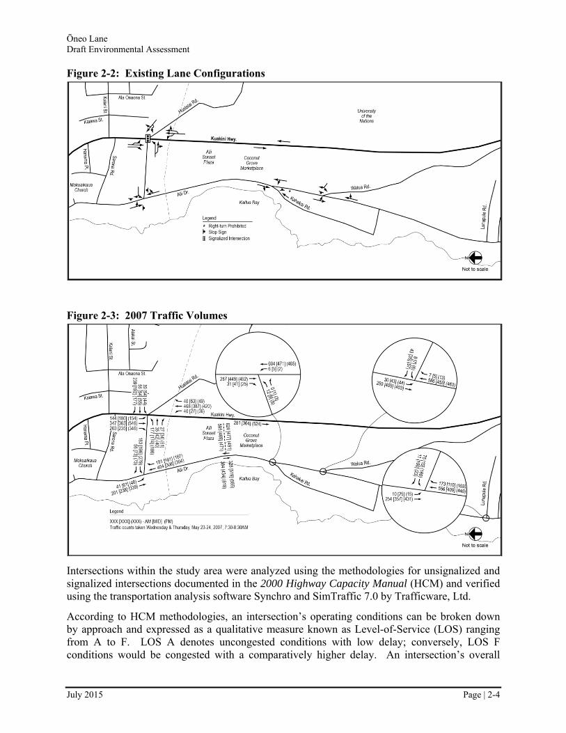
Within the study area, Queen Ka‘ahumanu Highway Extension, Kuakini Highway, and Ali‘i Drive provide regional north-south mobility. Hualālai Road, Walua Road, and Lunapule Road provide limited mauka-makai circulation. Intersections within the study area operate with Two-Way-STOP-Control (TWSC) except for Hualālai Road/Kuakini Highway which is a signalized intersection and Hualālai Road/Ali‘i Drive which is All-Way-STOP-Controlled (AWSC). The following roadways are described here and shown in Figure 2-1:
Ali‘i Drive. Ali‘i Drive is an undivided two-lane collector roadway that begins at Kuakini Highway in Kailua-Kona and continues south to Keauhou traveling along the coastline. Ali‘i Drive provides north-south circulation as well as access to many resort businesses and lodgings. Cross streets in the study area include Hualālai Road, Kahakai Road, Walua Road, and Lunapule Road. South of Kahakai Road at Huggo’s, Ali‘i Drive has paved shoulders and no sidewalks, curbs, or gutters; north of this, Ali‘i Drive has intermittent sidewalks, curbs, and gutters. Within the study area, the speed limit is 30 miles per hour (MPH) south of Walua Road and then transitions to 15 MPH immediately north of Walua Road, continuing all the way past the Hualālai Road intersection.
Kuakini Highway. Kuakini Highway is an undivided two-lane arterial roadway that extends from Kailua-Kona to Honalo. The segment from Makala Boulevard to
Ōneo Lane Draft Environmental Assessment
July 2015 Page | 2-2
Queen Ka‘ahumanu Highway Extension is under the jurisdiction of the County; the State of Hawai‘i has jurisdiction over the segment from Queen Ka‘ahumanu Highway Extension to Honalo. Kuakini Highway has widened to four lanes between Palani Street and Hualālai Road. The next planned widening will be from Hualālai Road to the future Ali‘i Highway, and will provide two lanes in each direction, median turn lanes, sidewalks, and bike lanes. Speed limits along Kuakini Highway start at 25 MPH in Kailua Town, transition to 35 MPH at the Kona Islander Inn south of Hualālai Road, and reach 45 MPH immediately south of the Oni Oni Street/Walua Road intersection.
Queen Ka‘ahumanu Highway Extension (Route 19/11). Queen Ka‘ahumanu Highway/Queen Ka‘ahumanu Highway Extension is an undivided two-lane arterial roadway that extends from Kawaihae to immediately south of Kailua-Kona where it transitions into Kuakini Highway. HDOT has widened the highway to at least four lanes from Malulani Road, just south of Henry Street in Kona Village, to near Kealakehe Parkway. HDOT plans to continue the widening to Kona Airport. HDOT is also starting the planning process to improve Queen Ka‘ahumanu Highway Extension/Kuakini Highway (Route 11) from Henry Street to Kamehameha III Road.
Planned Ali‘i Parkway. The future Ali‘i Parkway would provide north-south mobility between Kailua-Kona and South Kona. Ali‘i Parkway is planned to begin at Queen Kaahumanu Highway Extension, cross Kuakini Highway near Waiaha Stream about 1.5 miles south of Kailua-Kona, and connect to Ali‘i Drive in Keauhou. It is not known when construction of the Ali‘i Parkway will commence.
Hualālai Road. Hualālai Road is an undivided two-lane roadway that provides mauka-makai circulation between Mamalahoa Highway and Ali‘i Drive, terminating at Ali‘i Drive at an unsignalized T-intersection. The Hualālai Road/Kuakini Highway intersection is signalized.
Walua Road. Walua Road provides mauka-makai circulation between Kuakini Highway and Ali‘i Drive. Mauka of Kuakini Highway, Walua Road transitions into Oni Oni Street, providing access to a residential area between Queen Ka‘ahumanu Highway and Kuakini Highway. Makai of Kuakini Highway, Walua Road provides access to residential uses, as well as to Lunapule Road. Walua Road exists as a two-lane undivided cross-section at Kuakini Highway, widens to two lanes, with left-turn lanes and wide paved shoulders, as it passes recent developments, and again narrows to a two-lane undivided cross-section as it approaches Ali‘i Drive.
Lunapule Road. Lunapule Road is a two-lane undivided local roadway that provides a direct connection between Walua Road and Ali‘i Drive. It provides access to residential and small commercial areas.
Ōneo Lane Draft Environmental Assessment
July 2015 Page | 2-3
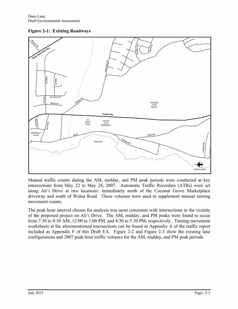
Figure 2-1: Existing Roadways
Manual traffic counts during the AM, midday, and PM peak periods were conducted at key intersections from May 22 to May 24, 2007. Automatic Traffic Recorders (ATRs) were set along Ali‘i Drive at two locations: immediately north of the Coconut Grove Marketplace driveway and south of Walua Road. These volumes were used to supplement manual turning movement counts.
The peak hour interval chosen for analysis was most consistent with intersections in the vicinity of the proposed project on Ali‘i Drive. The AM, midday, and PM peaks were found to occur from 7:30 to 8:30 AM, 12:00 to 1:00 PM, and 4:30 to 5:30 PM, respectively. Turning movement worksheets at the aforementioned intersections can be found in Appendix A of the traffic report included as Appendix F of this Draft EA. Figure 2-2 and Figure 2-3 show the existing lane configurations and 2007 peak hour traffic volumes for the AM, midday, and PM peak periods.
Ōneo Lane Draft Environmental Assessment
July 2015 Page | 2-4
Figure 2-2: Existing Lane Configurations
Figure 2-3: 2007 Traffic Volumes
Intersections within the study area were analyzed using the methodologies for unsignalized and signalized intersections documented in the 2000 Highway Capacity Manual (HCM) and verified using the transportation analysis software Synchro and SimTraffic 7.0 by Trafficware, Ltd.
According to HCM methodologies, an intersection’s operating conditions can be broken down by approach and expressed as a qualitative measure known as Level-of-Service (LOS) ranging from A to F. LOS A denotes uncongested conditions with low delay; conversely, LOS F conditions would be congested with a comparatively higher delay. An intersection’s overall
Ōneo Lane Draft Environmental Assessment
July 2015 Page | 2-5
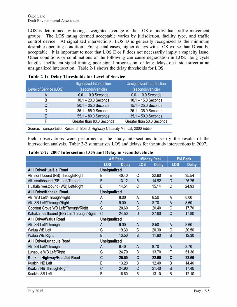
LOS is determined by taking a weighted average of the LOS of individual traffic movement groups. The LOS rating deemed acceptable varies by jurisdiction, facility type, and traffic control device. At signalized intersections, LOS D is generally recognized as the minimum desirable operating condition. For special cases, higher delays with LOS worse than D can be acceptable. It is important to note that LOS E or F does not necessarily imply a capacity issue. Other conditions or combinations of the following can cause degradation in LOS: long cycle lengths, inefficient signal timing, poor signal progression, or long delays on a side street at an unsignalized intersection. Table 2-1 shows the delay thresholds for LOS.
Table 2-1: Delay Thresholds for Level of Service
Level of Service (LOS) Signalized Intersection
(seconds/vehicle) Unsignalized Intersection
(seconds/vehicle) A 0.0 – 10.0 Seconds 0.0 – 10.0 Seconds B 10.1 – 20.0 Seconds 10.1 – 15.0 Seconds C 20.1 – 35.0 Seconds 15.1 – 25.0 Seconds D 35.1 – 55.0 Seconds 25.1 – 35.0 Seconds E 55.1 – 80.0 Seconds 35.1 – 50.0 Seconds F Greater than 80.0 Seconds Greater than 50.0 Seconds
Source: Transportation Research Board, Highway Capacity Manual, 2000 Edition.
Field observations were performed at the study intersections to verify the results of the intersection analysis. Table 2-2 summarizes LOS and delays for the study intersections in 2007.
Table 2-2: 2007 Intersection LOS and Delay in seconds/vehicle
AM Peak Midday Peak PM Peak LOS Delay LOS Delay LOS Delay
Ali‘i Drive/Hualālai Road Unsignalized Ali‘i northbound (NB) Through/Right E 40.40 C 22.60 E 35.54 Ali‘i southbound (SB) Left/Through B 13.12 B 14.92 D 26.25 Hualālai westbound (WB) Left/Right B 14.54 C 15.14 C 24.93 Ali‘i Drive/Kahakai Road Unsignalized Ali‘i WB Left/Through/Right A 8.00 A 8.50 A 8.00 Ali‘i SB Left/Through/Right A 9.00 A 8.70 A 8.60 Coconut Grove WB Left/Through/Right C 20.60 C 20.40 C 17.70 Kahakai eastbound (EB) Left/Through/Right C 24.50 D 27.60 C 17.80 Ali‘i Drive/Walua Road Unsignalized Ali‘i SB Left/Through A 9.00 A 8.50 A 8.60 Walua WB Left C 19.30 C 20.30 C 20.50 Walua WB Right B 13.50 B 11.80 B 12.30 Ali‘i Drive/Lunapule Road Unsignalized Ali‘i SB Left/Through A 9.40 A 8.70 A 8.70 Lunapule WB Left/Right C 24.70 B 13.70 F 51.30 Kuakini Highway/Hualālai Road C 25.50 C 22.00 C 23.60 Kuakini NB Left B 13.20 B 12.40 B 14.40 Kuakini NB Through/Right C 24.90 C 21.40 B 17.40 Kuakini SB Left B 16.60 B 13.10 B 12.10

Ōneo Lane Draft Environmental Assessment
July 2015 Page | 2-6
AM Peak Midday Peak PM Peak LOS Delay LOS Delay LOS Delay
Kuakini SB Through C 32.00 C 25.40 C 31.80 Kuakini SB Right C 22.90 C 21.60 C 21.60 Hualālai WB Left C 21.80 C 23.00 C 24.40 Hualālai WB Through/Right C 34.80 C 30.40 C 34.20 Hualālai EB Left B 18.60 B 17.50 C 20.80 Hualālai EB Through/Right B 13.50 B 14.30 B 15.70 Kuakini Highway/Coconut Grove Unsignalized Kuakini NB Left/Through A 7.90 A 8.20 A 8.80 Coconut Grove EB Left/Right C 15.50 B 12.50 C 19.60
2.1.2 Basic Transportation Assumptions
The analysis presented below is based on certain transportation network assumptions. It is assumed that all projects in the STIP and other County roadway projects are implemented. In particular, it is assumed that the following key roadway projects proceed:
Phase I of Ali‘i Parkway, which would connect it to Kuakini Highway, was assumed to be completed before or simultaneously with the completion of this proposed project. However, since the analysis was completed the time table for the construction of Ali‘i Parkway has been pushed back and it is likely that the proposed project would be constructed prior to Phase I of Ali‘i Parkway.
Phase 2 of Queen Ka‘ahumanu Highway Extension and Kuakini Highway (Route 11), between Henry Street and Kamehameha III Road is assumed to be widened by HDOT.
2.1.3 Potential Impacts
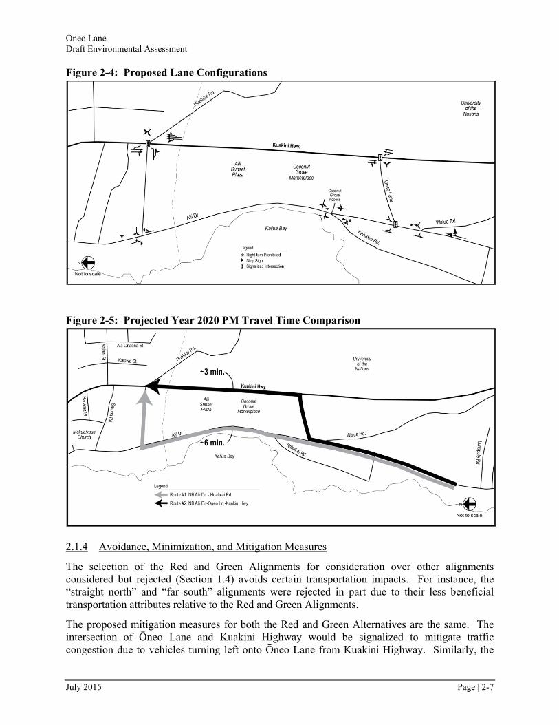
The two build alternatives (Red and Green alignments) were selected based on an evaluation of the potential impacts of several proposed alignments. With regards to traffic, the Red and Green Alignments were chosen as the build alternatives based on several factors, including adequate distance from existing driveways and intersection geometry (see Section 1.4). There is no significant difference between the Red and Green Alignments with regards to traffic operations – both provide connectivity between Ali‘i Drive and Kuakini Highway and allow for access to neighboring land uses. The proposed lane configurations would be the same between both alternatives, and are shown in Figure 2-4. The build alternatives would decrease travel time for commuters traveling between the residential area to the south and Kona village to the north as illustrated in Figure 2-5.
The no-build scenario would not address congestion issues, nor would it provide improved mobility within the Kailua-Kona district. Traffic conditions would continue to worsen under the no-build alternative.
According to the criteria set forth in HAR Section 11-200-12 and HRS Chapter 343, there would be no adverse significant effect on the quality of the transportation environment in the build or no build scenario.
Ōneo Lane Draft Environmental Assessment
July 2015 Page | 2-7
Figure 2-4: Proposed Lane Configurations
Figure 2-5: Projected Year 2020 PM Travel Time Comparison
2.1.4 Avoidance, Minimization, and Mitigation Measures
The selection of the Red and Green Alignments for consideration over other alignments considered but rejected (Section 1.4) avoids certain transportation impacts. For instance, the “straight north” and “far south” alignments were rejected in part due to their less beneficial transportation attributes relative to the Red and Green Alignments.
The proposed mitigation measures for both the Red and Green Alternatives are the same. The intersection of Ōneo Lane and Kuakini Highway would be signalized to mitigate traffic congestion due to vehicles turning left onto Ōneo Lane from Kuakini Highway. Similarly, the
Ōneo Lane Draft Environmental Assessment
July 2015 Page | 2-8
intersection of Ōneo Lane and Ali‘i Drive would be signalized to mitigate traffic congestion due to vehicles turning left onto Ōneo Lane from Ali‘i Drive.
2.2 Land Use
2.2.1 Existing Conditions
2.2.1.1 Surrounding Area
The proposed project would be located partially within the southern border of Kailua Village. Kailua-Kona is West Hawai‘i’s primary and largest urban area. Kailua Village is clustered around the northern section of Ali‘i Drive between Palani Road and Kahakai Road. This town center is Kailua-Kona’s primary visitor attraction supporting a few hotels, retail establishments, and restaurants. Cruise ships often dock offshore of the historic section of Kailua Village.
2.2.1.2 Project Area
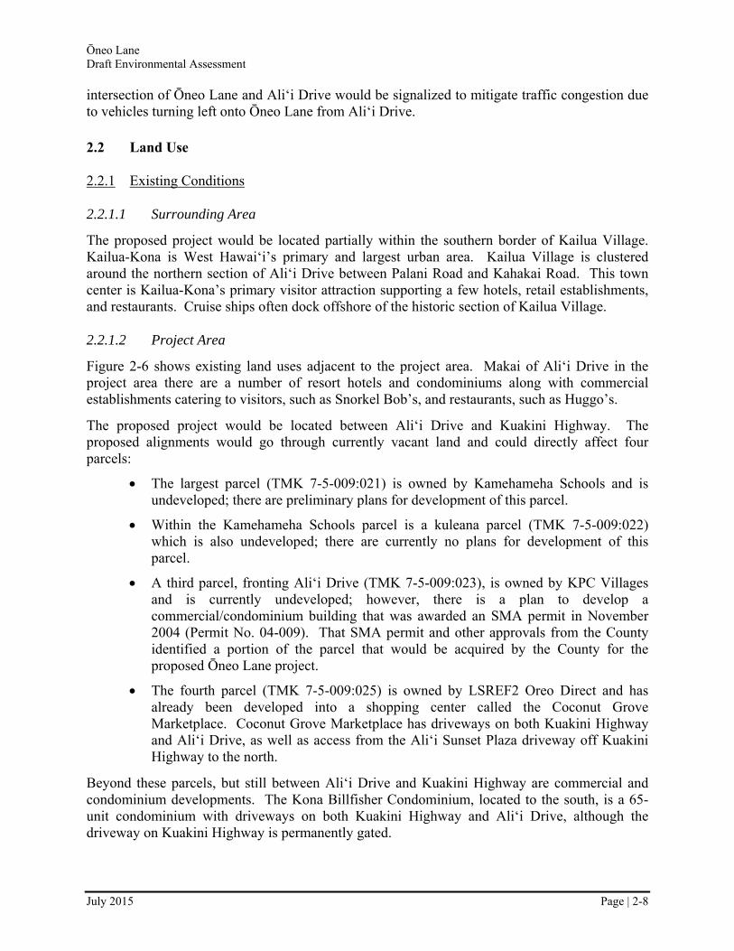
Figure 2-6 shows existing land uses adjacent to the project area. Makai of Ali‘i Drive in the project area there are a number of resort hotels and condominiums along with commercial establishments catering to visitors, such as Snorkel Bob’s, and restaurants, such as Huggo’s.
The proposed project would be located between Ali‘i Drive and Kuakini Highway. The proposed alignments would go through currently vacant land and could directly affect four parcels:
The largest parcel (TMK 7-5-009:021) is owned by Kamehameha Schools and is undeveloped; there are preliminary plans for development of this parcel.
Within the Kamehameha Schools parcel is a kuleana parcel (TMK 7-5-009:022) which is also undeveloped; there are currently no plans for development of this parcel.
A third parcel, fronting Ali‘i Drive (TMK 7-5-009:023), is owned by KPC Villages and is currently undeveloped; however, there is a plan to develop a commercial/condominium building that was awarded an SMA permit in November 2004 (Permit No. 04-009). That SMA permit and other approvals from the County identified a portion of the parcel that would be acquired by the County for the proposed Ōneo Lane project.
The fourth parcel (TMK 7-5-009:025) is owned by LSREF2 Oreo Direct and has already been developed into a shopping center called the Coconut Grove Marketplace. Coconut Grove Marketplace has driveways on both Kuakini Highway and Ali‘i Drive, as well as access from the Ali‘i Sunset Plaza driveway off Kuakini Highway to the north.
Beyond these parcels, but still between Ali‘i Drive and Kuakini Highway are commercial and condominium developments. The Kona Billfisher Condominium, located to the south, is a 65-unit condominium with driveways on both Kuakini Highway and Ali‘i Drive, although the driveway on Kuakini Highway is permanently gated.

Ōneo Lane Draft Environmental Assessment
July 2015 Page | 2-9
Mauka of Kuakini Highway the developments are less resort-oriented. Mauka of Coconut Grove is vacant land, Kama‘aina Commons is an affordable housing development just south of the vacant land, and the University of the Nations’ Kona Campus (a Christian Missionary training school) is located just south of Kama‘aina Commons.
Figure 2-6: Existing and Planned Land Uses*
2.2.2 Land Use Development Trends
The County of Hawai‘i General Plan designates most of the project area as resort node. Resort node areas, according to the Land Use Pattern Allocation Guide Map, include a mix of visitor-related uses such as hotels, condominium-hotels (condominiums developed and/or operated as hotels), single family and multiple family residential units, golf courses, and other typical resort recreational facilities, resort commercial complexes, and other support services.
The project area is still being developed. A proposed KPC Villages commercial/condo development as well as preliminary sketches of Kamehameha Schools’ plans include ROW for
Ōneo Lane Draft Environmental Assessment
July 2015 Page | 2-10
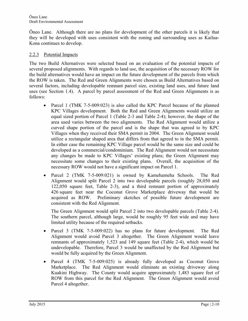
Ōneo Lane. Although there are no plans for development of the other parcels it is likely that they will be developed with uses consistent with the zoning and surrounding uses as Kailua-Kona continues to develop.
2.2.3 Potential Impacts
The two Build Alternatives were selected based on an evaluation of the potential impacts of several proposed alignments. With regards to land use, the acquisition of the necessary ROW for the build alternatives would have an impact on the future development of the parcels from which the ROW is taken. The Red and Green Alignments were chosen as Build Alternatives based on several factors, including developable remnant parcel size, existing land uses, and future land uses (see Section 1.4). A parcel by parcel assessment of the Red and Green Alignments is as follows:
Parcel 1 (TMK 7-5-009:023) is also called the KPC Parcel because of the planned KPC Villages development. Both the Red and Green Alignments would utilize an equal sized portion of Parcel 1 (Table 2-3 and Table 2-4); however, the shape of the area used varies between the two alignments. The Red Alignment would utilize a curved shape portion of the parcel and is the shape that was agreed to by KPC Villages when they received their SMA permit in 2004. The Green Alignment would utilize a rectangular shaped area that differs from that agreed to in the SMA permit. In either case the remaining KPC Village parcel would be the same size and could be developed as a commercial/condominium. The Red Alignment would not necessitate any changes be made to KPC Villages’ existing plans; the Green Alignment may necessitate some changes to their existing plans. Overall, the acquisition of the necessary ROW would not have a significant impact on Parcel 1.
Parcel 2 (TMK 7-5-009:021) is owned by Kamehameha Schools. The Red Alignment would split Parcel 2 into two developable parcels (roughly 28,050 and 122,050 square feet, Table 2-3), and a third remnant portion of approximately 426 square feet near the Coconut Grove Marketplace driveway that would be acquired as ROW. Preliminary sketches of possible future development are consistent with the Red Alignment.
The Green Alignment would split Parcel 2 into two developable parcels (Table 2-4). The southern parcel, although large, would be roughly 95 feet wide and may have limited utility because of the required setbacks.
Parcel 3 (TMK 7-5-009:022) has no plans for future development. The Red Alignment would avoid Parcel 3 altogether. The Green Alignment would leave remnants of approximately 1,523 and 149 square feet (Table 2-4), which would be undevelopable. Therefore, Parcel 3 would be unaffected by the Red Alignment but would be fully acquired by the Green Alignment.
Parcel 4 (TMK 7-5-009:025) is already fully developed as Coconut Grove Marketplace. The Red Alignment would eliminate an existing driveway along Kuakini Highway. The County would acquire approximately 1,483 square feet of ROW from this parcel for the Red Alignment. The Green Alignment would avoid Parcel 4 altogether.
Ōneo Lane Draft Environmental Assessment
July 2015 Page | 2-11
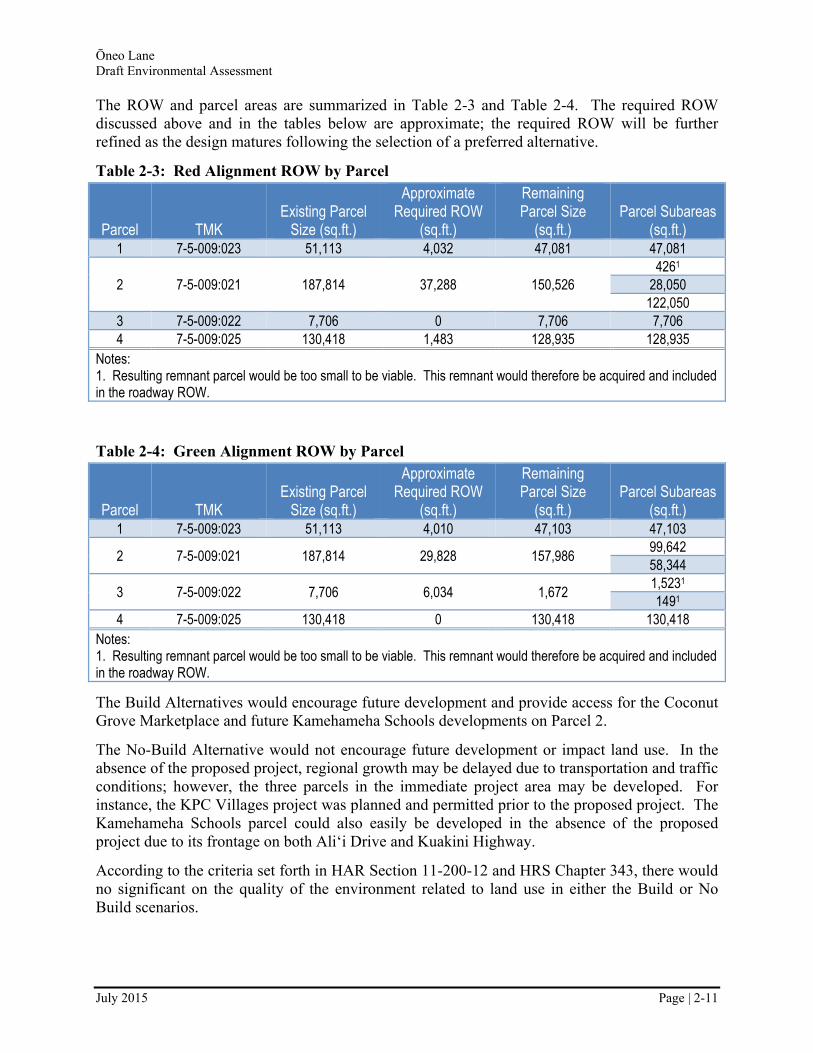
The ROW and parcel areas are summarized in Table 2-3 and Table 2-4. The required ROW discussed above and in the tables below are approximate; the required ROW will be further refined as the design matures following the selection of a preferred alternative.
Table 2-3: Red Alignment ROW by Parcel
Parcel TMK Existing Parcel
Size (sq.ft.)
Approximate Required ROW
(sq.ft.)
Remaining Parcel Size
(sq.ft.) Parcel Subareas
(sq.ft.) 1 7-5-009:023 51,113 4,032 47,081 47,081
2 7-5-009:021 187,814 37,288 150,526 4261
28,050 122,050
3 7-5-009:022 7,706 0 7,706 7,706 4 7-5-009:025 130,418 1,483 128,935 128,935
Notes: 1. Resulting remnant parcel would be too small to be viable. This remnant would therefore be acquired and included in the roadway ROW.
Table 2-4: Green Alignment ROW by Parcel
Parcel TMK Existing Parcel
Size (sq.ft.)
Approximate Required ROW
(sq.ft.)
Remaining Parcel Size
(sq.ft.) Parcel Subareas
(sq.ft.) 1 7-5-009:023 51,113 4,010 47,103 47,103
2 7-5-009:021 187,814 29,828 157,986 99,642 58,344
3 7-5-009:022 7,706 6,034 1,672 1,5231 1491
4 7-5-009:025 130,418 0 130,418 130,418 Notes: 1. Resulting remnant parcel would be too small to be viable. This remnant would therefore be acquired and included in the roadway ROW.
The Build Alternatives would encourage future development and provide access for the Coconut Grove Marketplace and future Kamehameha Schools developments on Parcel 2.
The No-Build Alternative would not encourage future development or impact land use. In the absence of the proposed project, regional growth may be delayed due to transportation and traffic conditions; however, the three parcels in the immediate project area may be developed. For instance, the KPC Villages project was planned and permitted prior to the proposed project. The Kamehameha Schools parcel could also easily be developed in the absence of the proposed project due to its frontage on both Ali‘i Drive and Kuakini Highway.
According to the criteria set forth in HAR Section 11-200-12 and HRS Chapter 343, there would no significant on the quality of the environment related to land use in either the Build or No Build scenarios.
Ōneo Lane Draft Environmental Assessment
July 2015 Page | 2-12
2.2.4 Avoidance, Minimization, and Mitigation Measures
The No Build scenario would not directly conflict with existing land uses or proposed development and no mitigation would be necessary.
The selection of the Red and Green Alignments for consideration over others alignments considered but rejected (Section 1.4) avoids certain land use impacts. For instance, the “straight south” and “straight north” alignments were partially rejected due to their greater land use impacts relative to the Red and Green Alignments.
The potential impact of the Red and Green Alignments has been minimized by utilizing 11-foot wide travel lanes rather than 12-foot wide lanes, which would be standard. This narrows the required ROW, minimizing the impact to existing and future land uses. Furthermore, although the Red Alignment would eliminate the Coconut Grove Marketplace’s southern driveway on Kuakini Highway, the effect of that would be minimized and mitigated by providing a new driveway to that land use off Ōneo Lane. Additionally, access would continue to be provided from the driveway on Ali‘i Drive, as well as from the Ali‘i Sunset Plaza driveway off Kuakini Highway to the north.
As discussed above, the Red and Green Alignments are consistent with existing plans, therefore no mitigation related to land use would be necessary. The County would seek to acquire the required ROW from the current property owners through a negotiation process that would result in fair market compensation for the land acquired, which will adequately mitigate the land acquisition.
2.3 Historic and Archaeological Resources
Chapter 6E of the Hawai‘i Revised Statutes (HRS), as described in regulations provided in Title 13, Chapter 275 of the HAR, places responsibilities on State agencies to evaluate the impacts of its projects on historic resources.
Chapter 6E-8 states that “Before any agency or officer of the State or its political subdivisions commences any project which may affect historic property, aviation artifact, or a burial site, the agency or officer shall advise the department and allow the department an opportunity for review of the effect of the proposed project on historic properties, aviation artifacts, or burial sites, consistent with section 6E-43, especially those listed on the Hawai‘i register of historic places. The proposed project shall not be commenced, or in the event it has already begun, continued, until the department shall have given its written concurrence.”
2.3.1 Existing Conditions
According to a 2009 Archaeological Survey performed for the proposed project by Rechtman Consulting of the proposed project area, there are several archaeological sites within three parcels (TMKs 7-5-009:021, 7-5-009:022, and 7-5-009:023). Those archaeological sites are illustrated in Figure 2-7 and described in Table 2-5. The full Archaeological Survey is provided in Appendix C.

Ōneo Lane Draft Environmental Assessment
July 2015 Page | 2-13
Figure 2-7: Parcel Map
Figure 2-8: Map of Archaeological Sites

Ōneo Lane Draft Environmental Assessment
July 2015 Page | 2-14
Table 2-5: Summary of Archaeological Sites
Site # Discussion
26920
SIHP Site 26920 is an early twentieth century core-filled wall that surrounds three sides of Parcel 021. This property boundary wall has been documented during the current study and is considered significant under Criterion D for the data it has already yielded relative to turn-of-the-century land use patterns, and further study is not likely to produce any new information.
26915
SIHP Site 26915, a mid to late nineteenth century residential compound, is considered significant under Criterion D. While some integrity has been lost, this site still has the potential for yielding information relative to the period of transition that took place in many Hawai‘ian households just prior to and following the Māhele.
26916 SIHP Site 26916 is a collection of mortars and shallow basins in exposed pāhoehoe bedrock. This site may have seen use during both Precontact and Historic times. It is evaluated as significant under Criterion D for the information it has yielded. Further study is not likely to produce new information.
26917 26918 26919
SIHP Sites 26917, 26918 and 26919 are concentrations of boulders and cobbles with sparse midden deposits that represent the remains of small habitation sites that have been nearly completely destroyed by bulldozer activity. As a result, the features lack much if not all of their original integrity and it is suggested that further work at these sites is unlikely to yield any significant amount of useful new information.
2.3.2 Potential Impacts
The no-build alternative would avoid disturbance of archaeology sites in the area. However, future development of the parcels in the project area could have direct or indirect effects on the historic resources present.
Table 2-6 summarizes the potential effect of the two Build Alternative Alignments. Both the Red and Green Alignments would require the removal of portions of Site 26920 which is a rock boundary wall. The Green Alignment would also require the removal of Site 26915, thought to be a residential compound.
Table 2-6: Potential Archaeological Sites Impacts
Site # Criteria / Site Type Green Alignment Red Alignment No Build
26920 D / core-filled boundary wall Portions removed at Ali‘i Drive and Kuakini Highway
Portions removed at Ali‘i Drive and Kuakini Highway
No impact
26915 D / mid to late nineteenth century residential compound
Site removed No direct impact No impact
26916 D / mortars and shallow basins in exposed pāhoehoe bedrock
No direct impact No direct impact No impact
26917 26918 26919
D / remains of small habitation sites
No direct impact No direct impact No impact
2.3.3 Avoidance, Minimization, and Mitigation Measures
The selection of the Red and Green Alignments for consideration over others alignments considered but rejected (Section 1.4) avoids certain impacts to archaeological sites. For instance, the “far south” alignment was rejected in part due to its potential impacts to an archaeological site on TMK 5-7-009:040 and the Red Alignment avoids all the sites except 26920.
Ōneo Lane Draft Environmental Assessment
July 2015 Page | 2-15
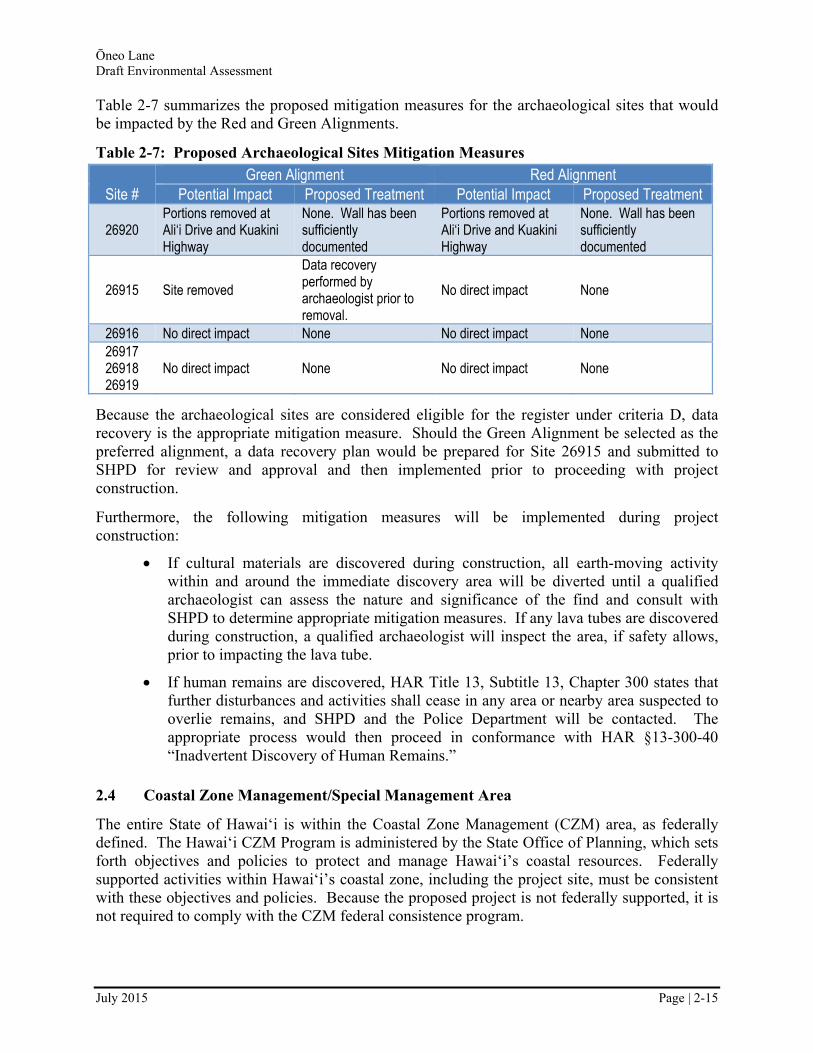
Table 2-7 summarizes the proposed mitigation measures for the archaeological sites that would be impacted by the Red and Green Alignments.
Table 2-7: Proposed Archaeological Sites Mitigation Measures
Site # Green Alignment Red Alignment
Potential Impact Proposed Treatment Potential Impact Proposed Treatment
26920 Portions removed at Ali‘i Drive and Kuakini Highway
None. Wall has been sufficiently documented
Portions removed at Ali‘i Drive and Kuakini Highway
None. Wall has been sufficiently documented
26915 Site removed
Data recovery performed by archaeologist prior to removal.
No direct impact None
26916 No direct impact None No direct impact None 26917 26918 26919
No direct impact None No direct impact None
Because the archaeological sites are considered eligible for the register under criteria D, data recovery is the appropriate mitigation measure. Should the Green Alignment be selected as the preferred alignment, a data recovery plan would be prepared for Site 26915 and submitted to SHPD for review and approval and then implemented prior to proceeding with project construction.
Furthermore, the following mitigation measures will be implemented during project construction:
If cultural materials are discovered during construction, all earth-moving activity within and around the immediate discovery area will be diverted until a qualified archaeologist can assess the nature and significance of the find and consult with SHPD to determine appropriate mitigation measures. If any lava tubes are discovered during construction, a qualified archaeologist will inspect the area, if safety allows, prior to impacting the lava tube.
If human remains are discovered, HAR Title 13, Subtitle 13, Chapter 300 states that further disturbances and activities shall cease in any area or nearby area suspected to overlie remains, and SHPD and the Police Department will be contacted. The appropriate process would then proceed in conformance with HAR §13-300-40 “Inadvertent Discovery of Human Remains.”
2.4 Coastal Zone Management/Special Management Area
The entire State of Hawai‘i is within the Coastal Zone Management (CZM) area, as federally defined. The Hawai‘i CZM Program is administered by the State Office of Planning, which sets forth objectives and policies to protect and manage Hawai‘i’s coastal resources. Federally supported activities within Hawai‘i’s coastal zone, including the project site, must be consistent with these objectives and policies. Because the proposed project is not federally supported, it is not required to comply with the CZM federal consistence program.
Ōneo Lane Draft Environmental Assessment
July 2015 Page | 2-16
The SMA permitting system is part of the overall CZM Program and the proposed project does need an SMA Permit, regardless of funding. The following is a discussion of the project’s (Build Alternative) consistency with the SMA requirements.
2.4.1 Recreational Resources
Objective: Provide coastal recreational opportunities accessible to the public.
The project would provide increased access to and facilitate nearby coastal recreational opportunities for the public to enjoy Ōneo Bay.
2.4.2 Historic Resources
Objective: Protect, preserve, and, where desirable, restore those natural and manmade historic and prehistoric resources in the coastal zone management area that are significant in Hawai‘ian and American history and culture.
The proposed project area includes several archaeological sites. As discussed in Section 2.3, the archaeological sites are all considered eligible for the historic registry under criteria D; therefore, impacts to them can be mitigated through data recovery. The project would avoid disturbance of sites where possible but some sites would be affected. Because the sites are criteria D sites and data recovery would be done, it is anticipated that a “no adverse effect” determination would be made and that the impact would be less than significant.
2.4.3 Scenic and Open Space Resources
Objective: Protect, preserve, and, where desirable, restore or improve the quality of coastal scenic and open space resources.
The project area is not an open space resource, it is an urban area. The proposed project would not create any visual intrusions out of context in this urban area.
2.4.4 Coastal Ecosystems
Objective: Protect valuable coastal ecosystems, including reefs, from disruption and minimize adverse impacts on all coastal ecosystems.
Construction operations would be managed to prevent pollutant discharge. The contractor would practice good housekeeping and implement best management practices (BMPs), as required by State Department of Health, Clean Water Branch regulations. Stormwater from the roadway would be managed using dry wells. The proposed project itself would not impact any costal ecosystems.
2.4.5 Economic Uses
Objective: Provide public or private facilities and improvements important to the State's economy in suitable locations.
As stated in Section 2.8, the economy of West Hawai‘i and Kailua-Kona is largely dependent on the visitor industry. The proposed project would benefit the visitor industry and local residents by providing improved circulation at the south end of Kona Village. The County has deemed the
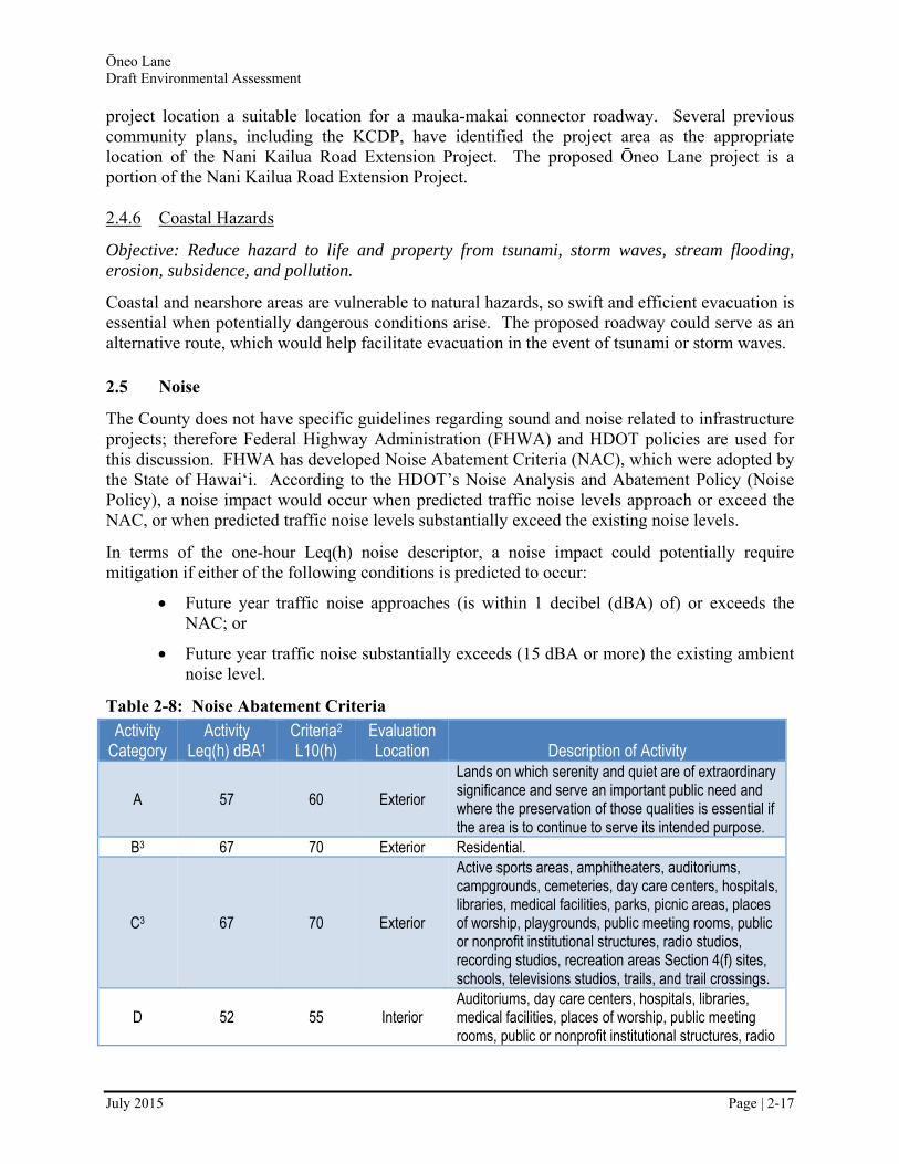
Ōneo Lane Draft Environmental Assessment
July 2015 Page | 2-17
project location a suitable location for a mauka-makai connector roadway. Several previous community plans, including the KCDP, have identified the project area as the appropriate location of the Nani Kailua Road Extension Project. The proposed Ōneo Lane project is a portion of the Nani Kailua Road Extension Project.
2.4.6 Coastal Hazards
Objective: Reduce hazard to life and property from tsunami, storm waves, stream flooding, erosion, subsidence, and pollution.
Coastal and nearshore areas are vulnerable to natural hazards, so swift and efficient evacuation is essential when potentially dangerous conditions arise. The proposed roadway could serve as an alternative route, which would help facilitate evacuation in the event of tsunami or storm waves.
2.5 Noise
The County does not have specific guidelines regarding sound and noise related to infrastructure projects; therefore Federal Highway Administration (FHWA) and HDOT policies are used for this discussion. FHWA has developed Noise Abatement Criteria (NAC), which were adopted by the State of Hawai‘i. According to the HDOT’s Noise Analysis and Abatement Policy (Noise Policy), a noise impact would occur when predicted traffic noise levels approach or exceed the NAC, or when predicted traffic noise levels substantially exceed the existing noise levels.
In terms of the one-hour Leq(h) noise descriptor, a noise impact could potentially require mitigation if either of the following conditions is predicted to occur:
Future year traffic noise approaches (is within 1 decibel (dBA) of) or exceeds the NAC; or
Future year traffic noise substantially exceeds (15 dBA or more) the existing ambient noise level.
Table 2-8: Noise Abatement Criteria
Activity Category
Activity Leq(h) dBA1
Criteria2 L10(h)
Evaluation Location Description of Activity
A 57 60 Exterior
Lands on which serenity and quiet are of extraordinary significance and serve an important public need and where the preservation of those qualities is essential if the area is to continue to serve its intended purpose.
B3 67 70 Exterior Residential.
C3 67 70 Exterior
Active sports areas, amphitheaters, auditoriums, campgrounds, cemeteries, day care centers, hospitals, libraries, medical facilities, parks, picnic areas, places of worship, playgrounds, public meeting rooms, public or nonprofit institutional structures, radio studios, recording studios, recreation areas Section 4(f) sites, schools, televisions studios, trails, and trail crossings.
D 52 55 Interior Auditoriums, day care centers, hospitals, libraries, medical facilities, places of worship, public meeting rooms, public or nonprofit institutional structures, radio

Ōneo Lane Draft Environmental Assessment
July 2015 Page | 2-18
Activity Category
Activity Leq(h) dBA1
Criteria2 L10(h)
Evaluation Location Description of Activity
studios, recording studios, schools, and television studios.
E3 72 75 Exterior Hotels, motels, offices, restaurants/bars, and other developed lands, properties or activities not included in A-D or F.
F ---- ---- ----
Agriculture, airports, bus yards, emergency services, industrial, logging, maintenance facilities, manufacturing, mining, rail yards, retail facilities, shipyards, utilities, (water resources, water treatment, electrical), and warehousing.
G ---- ---- ---- Undeveloped lands that are not permitted. Notes: 1 Either Leq(h) or L10(h) (but not both) may be used on a project. 2 The Leq(h) and the L10(h) Activity Criteria values are for impact determination only, and are not design
standards for noise abatement measures. 3 Includes undeveloped lands permitted for this activity category. Source: Federal Highway Administration
2.5.1 Existing Conditions
A noise study was conducted and several sites in the project area were analyzed (see Figure 2-9). The sites were selected based on location of existing residential uses south of the proposed project and two sites north of the proposed project. The noise readings are summarized in Table 2-9, which shows that the average Leq(h), is currently 57.3 dBA. This sound level is typical for suburban land uses.
Figure 2-9: Noise Map of Noise Monitoring Locations
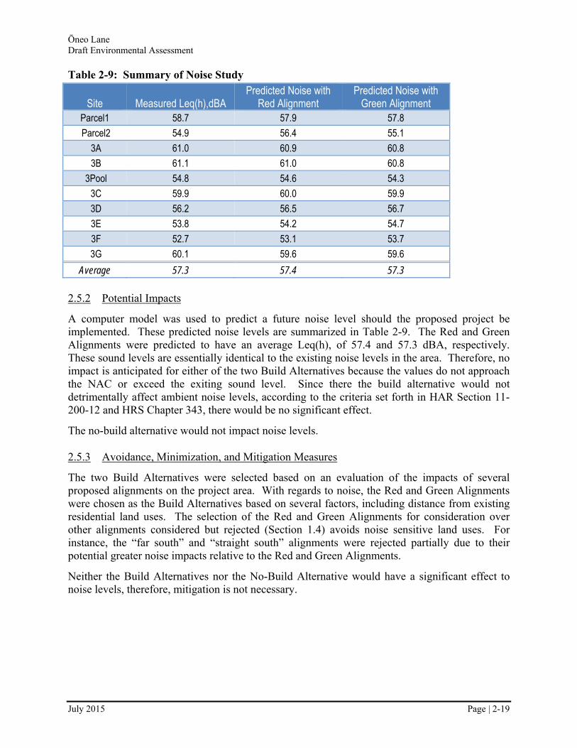
Ōneo Lane Draft Environmental Assessment
July 2015 Page | 2-19
Table 2-9: Summary of Noise Study
Site Measured Leq(h),dBA Predicted Noise with
Red Alignment Predicted Noise with
Green Alignment Parcel1 58.7 57.9 57.8
Parcel2 54.9 56.4 55.1
3A 61.0 60.9 60.8
3B 61.1 61.0 60.8
3Pool 54.8 54.6 54.3
3C 59.9 60.0 59.9
3D 56.2 56.5 56.7
3E 53.8 54.2 54.7
3F 52.7 53.1 53.7
3G 60.1 59.6 59.6
Average 57.3 57.4 57.3
2.5.2 Potential Impacts
A computer model was used to predict a future noise level should the proposed project be implemented. These predicted noise levels are summarized in Table 2-9. The Red and Green Alignments were predicted to have an average Leq(h), of 57.4 and 57.3 dBA, respectively. These sound levels are essentially identical to the existing noise levels in the area. Therefore, no impact is anticipated for either of the two Build Alternatives because the values do not approach the NAC or exceed the exiting sound level. Since there the build alternative would not detrimentally affect ambient noise levels, according to the criteria set forth in HAR Section 11-200-12 and HRS Chapter 343, there would be no significant effect.
The no-build alternative would not impact noise levels.
2.5.3 Avoidance, Minimization, and Mitigation Measures
The two Build Alternatives were selected based on an evaluation of the impacts of several proposed alignments on the project area. With regards to noise, the Red and Green Alignments were chosen as the Build Alternatives based on several factors, including distance from existing residential land uses. The selection of the Red and Green Alignments for consideration over other alignments considered but rejected (Section 1.4) avoids noise sensitive land uses. For instance, the “far south” and “straight south” alignments were rejected partially due to their potential greater noise impacts relative to the Red and Green Alignments.
Neither the Build Alternatives nor the No-Build Alternative would have a significant effect to noise levels, therefore, mitigation is not necessary.
Ōneo Lane Draft Environmental Assessment
July 2015 Page | 2-20
2.6 Air Quality
2.6.1 Existing Conditions
The State of Hawai‘i is designated as an attainment area for carbon monoxide (CO), ozone (O3), particulate matter smaller than 10 microns (PM10), and particulate matter smaller than 2.5 microns (PM2.5). There are occasional National air quality standard exceedences in the project area for sulfur dioxide and PM2.5; such exceedences are more common in Pahala and Ocean View. These exceedences are primarily attributed to volcanic activity (known as vog), and occasionally brush fires.
The pollutants relevant to evaluating the air quality impacts of a roadway project are those contained in motor vehicle emissions. Vehicles emit CO, volatile organic compounds (VOCs), the six priority mobile source air toxics (MSAT), nitrogen oxide (NOx), and lead (lead levels have decreased substantially and will continue to do so due to the mandated elimination of lead in gasoline). Those pollutants can react in the atmosphere to generate PM10 and PM2.5 on a regional basis. CO air pollution is generally considered to be a microscale problem that can be addressed locally to some extent and primarily governed by vehicle speed and delay in each microscale area (e.g., around an intersection) and can be related to intersection LOS. The other pollutants degrade air quality at a regional scale.
Regional air quality impacts related to VOC, the six priority MSAT, NOx, PM10, and PM2.5 are primarily dependent on changes in vehicle miles traveled (VMT), vehicle hours traveled (VHT), and vehicle mix (gasoline-fueled cars vs. diesel-fueled trucks and buses).
2.6.2 Potential Impacts
On a regional basis VMT, VHT, and vehicle mix are not predicted to change due to the project. Therefore, the Build Alternatives would have similar impacts as the No-Build Alternative on VOC, MSAT, NOx, PM10, and PM2.5.
An analysis of the expected travel patterns within the project indicate that the LOS would not fall below level D at any of the intersections within the project (Section 2.1). Therefore, microscale adverse impacts associated with CO are not considered a threat.
Neither the Build Alternatives nor the No-Build Alternatiave would detrimentally affect air quality; therefore, according to the criteria set forth in HAR Section 11-200-12 and HRS Chapter 343, there would be no significant effect on air quality in the project area.
2.6.3 Avoidance, Minimization, and Mitigation Measures
Neither the proposed project, nor no-build alternative would have a significant effect to air quality, therefore, mitigation is not necessary.
2.7 Visual and Aesthetic Resources
2.7.1 Existing Conditions
The project area is mainly vacant land with obstructed views of the ocean and mountains. The obstructions are associated with vegetation and surrounding development. Generally the area
Ōneo Lane Draft Environmental Assessment
July 2015 Page | 2-21
between Ali‘i Drive and Kuakini Highway is not considered a visual resource; only scrub trees on the vacant parcels are visible from the nearby roadways or neighboring land uses. No existing resources depend on the project area for views.
Ali‘i Drive and Kuakini Highway both have overhead utility lines, street lights, and traffic signals at major intersections.
2.7.2 Potential Impacts
The Build Alternatives would require clearing, grading, and limited construction of retaining walls that would modify the look of the immediate project area. The scope of those changes would not be visible beyond the immediate project area. The proposed project facilities that would be most visible would be the new traffic signals at the two intersections and street lights along the road. These facilities would, by necessity, be visible to vehicles on Ali‘i Drive, Ōneo Lane, and Kuakini Highway. The traffic signals and street lights would be similar to those already present on Ali‘i Drive and Kuakini Highway, including the use of shades. Therefore, the traffic signals and street lights would fit within the context of the existing environment.
Neither the Build Alternatives nor the No-Build Alternative would substantially affect scenic vistas or viewplains identified in County or State plans or studies; therefore, according to the criteria set forth in HAR Section 11-200-12 and HRS Chapter 343, there would be no significant effect on visual and aesthetic resources in the project area.
2.7.3 Mitigation Measures
Neither the Build Alternative nor No-Build Alternative would have a significant effect to scenic vistas or view plains; therefore, mitigation is not necessary. Nevertheless, the traffic signals will be designed to fit within the context of the Kailua Village setting, which may require some exemptions from standard design guidelines.
2.8 Social, Economic, and Cultural Conditions
The study area falls within the Pua‘a 1 ahupua‘a (traditional Hawai‘ian land unit). Nearby, remnants of prehistoric and historical uses of the area are still found in features such as historical walls, fence enclosures, burials, and heiau (religious shrines of varied significance). Kailua is one of the few areas in Hawai‘i that offers an opportunity to look at human settlement, spanning from the earliest chiefdoms known to the present day.
In the general vicinity of the study area, no traditional gathering or land use activities were observed or determined by oral accounts based on a Cultural Impact Assessment (CIA) that was conducted in 2010 (Appendix D0). Plantation agriculture and ranching were the dominant economic activities on Hawai‘i Island through the early and mid-20th century, but were overtaken by the visitor industry by the 1970s.
2.8.1 Existing Conditions
The economy of West Hawai‘i and Kailua-Kona has changed over the years and is now largely dependent on the visitor industry. Hotels in Kailua Village are located mostly along the more tourist-oriented Ali‘i Drive. Ali‘i Drive also supports a large number of restaurants and shops
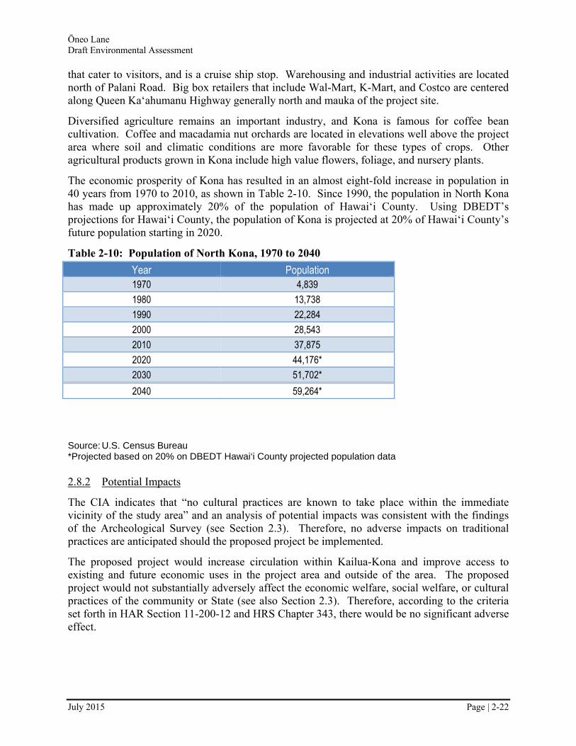
Ōneo Lane Draft Environmental Assessment
July 2015 Page | 2-22
that cater to visitors, and is a cruise ship stop. Warehousing and industrial activities are located north of Palani Road. Big box retailers that include Wal-Mart, K-Mart, and Costco are centered along Queen Ka‘ahumanu Highway generally north and mauka of the project site.
Diversified agriculture remains an important industry, and Kona is famous for coffee bean cultivation. Coffee and macadamia nut orchards are located in elevations well above the project area where soil and climatic conditions are more favorable for these types of crops. Other agricultural products grown in Kona include high value flowers, foliage, and nursery plants.
The economic prosperity of Kona has resulted in an almost eight-fold increase in population in 40 years from 1970 to 2010, as shown in Table 2-10. Since 1990, the population in North Kona has made up approximately 20% of the population of Hawai‘i County. Using DBEDT’s projections for Hawai‘i County, the population of Kona is projected at 20% of Hawai‘i County’s future population starting in 2020.
Table 2-10: Population of North Kona, 1970 to 2040
Year Population 1970 4,839
1980 13,738
1990 22,284
2000 28,543
2010 37,875
2020 44,176*
2030 51,702*
2040 59,264*
Source: U.S. Census Bureau *Projected based on 20% on DBEDT Hawai‘i County projected population data
2.8.2 Potential Impacts
The CIA indicates that “no cultural practices are known to take place within the immediate vicinity of the study area” and an analysis of potential impacts was consistent with the findings of the Archeological Survey (see Section 2.3). Therefore, no adverse impacts on traditional practices are anticipated should the proposed project be implemented.
The proposed project would increase circulation within Kailua-Kona and improve access to existing and future economic uses in the project area and outside of the area. The proposed project would not substantially adversely affect the economic welfare, social welfare, or cultural practices of the community or State (see also Section 2.3). Therefore, according to the criteria set forth in HAR Section 11-200-12 and HRS Chapter 343, there would be no significant adverse effect.

Ōneo Lane Draft Environmental Assessment
July 2015 Page | 2-23
The No-Build Alternative would not have any direct impact on the economy or cultural uses within or around the project area. The No Build Alternative may delay economic development in the project area relative to the Build Alternatives.
2.8.3 Avoidance, Minimization, and Mitigation Measures
Neither the Build Alternatives nor the No-Build Alternative would have a significant adverse effect to social, economic, or cultural resources, therefore, mitigation is not necessary. Should any traditional gathering or land use activities become known, proper care would be taken to protect access to resources that are culturally important to native Hawai‘ians.
2.9 Water Resources
2.9.1 Existing Conditions
North Kona is characterized by underdeveloped, shallow, and poorly defined drainage ways due to the steep topography, porous geology, and relatively recent volcanic activity. Due to these conditions, in times of intense rainfall or storms, extensive overland sheet flow often occurs and drainage systems are often unable to contain storm waters during these storms.
There are two major streams, Keopu Stream and Waiaha Stream, located north and south of the study area, but no major drainage ways or wetlands located within the study area. The area is classified as flood zone X, which means flooding is not anticipated.
2.9.2 Potential Impacts
Neither the Build Alternatives nor the No-Build Alternative is anticipated to result in substantial degradation of environmental quality associated with water resources or water quality. Therefore according to the criteria set forth in HAR Section 11-200-12 and HRS Chapter 343, there would be no significant effect.
2.9.3 Avoidance, Minimization, and Mitigation Measures
Neither the Build Alternatives nor No-Build Alternative would have a significant effect to water resources; therefore, mitigation is not necessary.
2.10 Biological Resources
In accordance with the Chapter 343 significance criteria, the proposed project would result in a significant effect to the existing biological resources if it (1) caused/involved an action that irrevocably commits a natural resource, (2) curtails the range of beneficial uses of the environment, or (3) or substantially affects a rare, threatened, or endangered species, or its habitat.
Therefore, a significant adverse impact would occur if the proposed project caused long-term loss or impairment of a substantial portion of local habitat of indigenous Hawai‘ian species; caused a substantial reduction in the population of a protected species, as designated by federal and state agencies, or a species with regional and local significance; introduced or increased the prevalence of undesirable non-native species; curtailed the range of a native Hawai‘ian species;
Ōneo Lane Draft Environmental Assessment
July 2015 Page | 2-24
or otherwise reduced the range of beneficial uses of the environment. This can occur with a reduction in numbers; by alteration in behavior, reproduction, or survival; or by loss or disturbance of critical habitat.
2.10.1 Existing Conditions
Site visits were conducted between May and July 2009 to determine if different species might be observed due to changes such as rainfall, or the application of herbicide. A summary is provided below. The full report is provided in Appendix E0.
Vegetation
The vegetative communities observed and described from the study area are not unique and are the result of human activity whether from agricultural practices or urban development.
Wildlife
The faunal community in the project area is typical of urban areas in Hawai‘i. Terrestrial mammals typically found in the project area are all introduced, such as mice, mongoose, rats, feral cats, and dogs. Because the area has been extensively modified from its original state, it has little value as native bird habitat. A field study conducted for the Lako Street extension project, which is located about one mile south of the project limits noted the common mynah, sparrows, cardinals, finches, egrets, and doves - all introduced species common in Hawai‘i. The study noted that native birds, such as the Hawai‘ian Hawk (‘Io), Hawai‘ian Owl (Pueo), the Pacific Golden Plover (Kolea), and the Ruddy Turnstone (‘Akekeke) may occasionally fly over the region.
2.10.2 Potential Impacts
The study area does not contain any plants species that are listed as being rare or endangered by either the Federal Government or the State of Hawai‘i, therefore, the statutes, rules, and regulations pertaining to rare and endangered species do not need to be addressed. Neither the Build Alternatives nor the No-Build Alternative is anticipated to substantially affect rare, threatened, or endangered species, or its habitat. Therefore, according to the criteria set forth in HAR Section 11-200-12 and HRS Chapter 343, there would be no significant effect on any biological resources.
2.10.3 Avoidance, Minimization, and Mitigation Measures
Because no significant effect to any biological resources is anticipated, mitigation is not necessary.
2.11 Construction Impacts
Implementation of the proposed project may result in some short-term impacts on the built and natural environment during construction. Construction of new roadways generally results in temporary increases in noise, dust, and traffic disruption in the area. The primary effects of these activities would be experienced by residents and workers in the immediate project area. Delays and other transportation-related impacts may also be encountered by vehicles and passengers

Ōneo Lane Draft Environmental Assessment
July 2015 Page | 2-25
traveling to and from the study area. In summary, short-term uses would be localized and may include the following:
Traffic disruption to local streets;
Temporary soil erosion, though prevented from leaving the site;
Loss of vegetation due to clearing for construction; and
Short-term utilities impacts.
2.11.1 Maintenance of Traffic
Since the project is the construction of a new roadway, the impact to motorists on existing roadways would be minimal. There would be brief periods of time where project construction would occur at the intersections of the proposed roadway and Kuakini Highway and Ali‘i Drive. During these times, measures would be taken to minimize impacts to motorists.
2.11.2 Air Quality
Air quality impacts during roadway construction generally consist of fugitive dust and mobile source emissions from construction equipment. Fugitive dust is airborne particulate matter, of usually large particle size, generated by construction vehicles operating around construction sites and from material blown from uncovered haul trucks, stockpiles, and exposed areas. The emission rate for fugitive dust emissions from construction activities is difficult to estimate accurately because its generation varies greatly depending upon the type of soil, the amount and type of dirt-disturbing activity, the moisture content of exposed soil, and wind speed.
Frequent watering would be employed to control fugitive dust at construction sites; water for dust control would be applied in a manner so as not to cause runoff from the sites. In addition, wind screens may be used in areas near residences and commercial districts, as well as limiting the areas of disturbance at any given time. Landscaping would be re-established as early as possible. To prevent haul trucks from tracking dirt onto paved streets, tire washing or road cleaning may be appropriate. State regulations further stipulate that open-bodied trucks be covered at all times when in motion if they are transporting wind-erodible materials.
Construction vehicles and equipment would emit engine exhaust. The largest of this equipment is usually diesel-powered, which emit relatively high levels of NOx in comparison to gasoline powered equipment. However, standards for such pollutants are set on an annual basis and will therefore not likely be violated by short-term construction equipment emissions.
2.11.3 Noise
Construction would involve the use of heavy machinery that may cause temporary noise impacts to adjacent noise sensitive land uses. Table 2-11 presents a range of noise levels for various construction equipment anticipated to be used during construction of the proposed project. Equipment noise levels vary depending on the make and model of the equipment, the operation being performed, the condition of the equipment, and other variables. The noise levels listed are based on published measurement taken at a distance of 50 feet from the equipment.
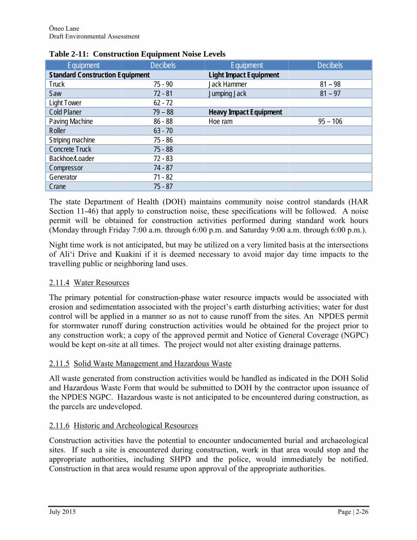
Ōneo Lane Draft Environmental Assessment
July 2015 Page | 2-26
Table 2-11: Construction Equipment Noise Levels
Equipment Decibels Equipment Decibels Standard Construction Equipment Light Impact Equipment Truck 75 - 90 Jack Hammer 81 – 98 Saw 72 - 81 Jumping Jack 81 – 97 Light Tower 62 - 72 Cold Planer 79 – 88 Heavy Impact Equipment Paving Machine 86 - 88 Hoe ram 95 – 106 Roller 63 - 70 Striping machine 75 - 86 Concrete Truck 75 - 88 Backhoe/Loader 72 - 83 Compressor 74 - 87 Generator 71 - 82 Crane 75 - 87
The state Department of Health (DOH) maintains community noise control standards (HAR Section 11-46) that apply to construction noise, these specifications will be followed. A noise permit will be obtained for construction activities performed during standard work hours (Monday through Friday 7:00 a.m. through 6:00 p.m. and Saturday 9:00 a.m. through 6:00 p.m.).
Night time work is not anticipated, but may be utilized on a very limited basis at the intersections of Ali‘i Drive and Kuakini if it is deemed necessary to avoid major day time impacts to the travelling public or neighboring land uses.
2.11.4 Water Resources
The primary potential for construction-phase water resource impacts would be associated with erosion and sedimentation associated with the project’s earth disturbing activities; water for dust control will be applied in a manner so as not to cause runoff from the sites. An NPDES permit for stormwater runoff during construction activities would be obtained for the project prior to any construction work; a copy of the approved permit and Notice of General Coverage (NGPC) would be kept on-site at all times. The project would not alter existing drainage patterns.
2.11.5 Solid Waste Management and Hazardous Waste
All waste generated from construction activities would be handled as indicated in the DOH Solid and Hazardous Waste Form that would be submitted to DOH by the contractor upon issuance of the NPDES NGPC. Hazardous waste is not anticipated to be encountered during construction, as the parcels are undeveloped.
2.11.6 Historic and Archeological Resources
Construction activities have the potential to encounter undocumented burial and archaeological sites. If such a site is encountered during construction, work in that area would stop and the appropriate authorities, including SHPD and the police, would immediately be notified. Construction in that area would resume upon approval of the appropriate authorities.
Ōneo Lane Draft Environmental Assessment
July 2015 Page | 2-27
2.11.7 Utilities
No utilities are located in the project area with the exception of intersections and a sewer line in the Kamehameha Schools-owned parcel. Caution would be used when constructing in areas where there are existing power, water, cable, and sewer lines. No service disruptions are anticipated.
2.12 Secondary and Cumulative Impacts Analysis
2.12.1 Potential Secondary Impacts
Secondary, or indirect, impacts are defined by Council on Environmental Quality (CEQ) as “effects which are caused by the [proposed] action and are later in time or further removed in distance, but are still reasonably foreseeable. Indirect effect may include growth-inducing effects and other effects related to changes in the pattern of land use, population density, or growth rate…”
Secondary impacts are anticipated to incrementally improve the economic situation of the Kailua-Kona area, as well as help the residents by giving them an alternative mauka-makai transportation choice. The impacts of the proposed project are not anticipated to be significant; the small project will enhance existing and future developments rather than directly induce development in the region.
Under both the Build Alternatives and No-Build Alternative, the region is anticipated to continue to develop into an urban center.
2.12.2 Potential Cumulative Impacts
Cumulative impacts are defined by CEQ as “the impact on the environment which results from the incremental impact of the action when added to other past, present, and reasonably foreseeable future actions regardless of what agency (federal or non-federal) or person undertakes such actions. Cumulative impacts can result from individually minor, but collectively significant, actions taking place over a period of time.” Cumulative impacts include the direct and indirect impacts of a project together with the reasonably foreseeable future actions of others.
As stated in Section 2.1.2, there are a few proposed projects in the area and none are directly depending on the proposed project. The cumulative impacts of these additional projects and the proposed project would benefit the Kailua-Kona community by providing much needed mauka-makai connections and further reduce traffic congestion. The economic benefits of the additional connections are also anticipated to reach beyond the Kailua-Kona district, to the north and south. The cumulative impacts of the past, present, and future project have resulted in the urbanization of the Kailua-Kona area. This impact is not considered significant because the area has been and continues to be planned for urbanization.
Although not yet in the planning stage, one foreseeable future action is a roadway between Hualālai Road and Kuakini Road mauka of the proposed project. As mentioned above, the proposed project is a portion of the “Nani Kailua Road Extension Project” that has been envisioned in planning documents, including the KCDP. The proposed project combined with a
Ōneo Lane Draft Environmental Assessment
July 2015 Page | 2-28
roadway between Kuakini Highway and Hualālai Road would complete the Nani Kailua Road Extension Project. The terminus of the proposed project at Kuakini Highway does not lock the County to a particular future roadway alignment mauka of Kuakini Highway. The County would prefer that the proposed project and a future mauka road result in a 4-way intersection at Kuakini Highway; however, it would not be a requirement if it resulted in unacceptable environmental impacts. An EA of the mauka roadway will be completed at the appropriate time. Environmental impacts associated with the mauka roadway are anticipated to be similar to the impacts associated with the proposed project discussed above.
2.13 Irreversible and Irretrievable Commitments of Resources
Implementation of the proposed action involves a commitment of a range of natural, physical, human, and fiscal resources. Fossil fuels, labor, and construction materials will be expended during construction. Additionally, large amounts of labor and natural resources will be used in the fabrication and preparation of construction materials. These materials are generally not retrievable. Their availability for the project is not limited and their use will not have an adverse impact on their continued availability. The commitment of these resources is based on the concept that residents in the immediate area and larger island community will benefit by the improved quality of the transportation system. These benefits will consist of improved accessibility and safety, savings in time, and greater availability of quality services which are anticipated to outweigh the commitment of these resources.
Construction of the proposed project would permanently alter the use and character of the area. The Proposed Action would require the expenditure of energy in the form of fuel for construction vehicles and equipment and the consumption of natural and man-made resources in the form of construction materials (e.g., metal, glass, concrete, asphalt, wood, plastic, etc.). The project would require the investment of human labor that might otherwise be employed elsewhere. No other irreversible and irretrievable commitments have been identified.
Ōneo Lane Draft Environmental Assessment
July 2015 Page | 3-1
3.0 COMMENTS AND COORDINATION
3.1 Agency and Stakeholder Consultation
Early coordination was held with various agencies, stakeholders, and the public. The purpose of these meetings was to allow solicit comments on the original project, which had a “mauka” phase (from Nani Kailua Drive at Hualālai Road to Kuakini Highway) in addition to the proposed project (formerly called the “makai” phase). For the purposes of understanding the comments in relation to the entire project, comments regarding the “mauka” phase have been left in this discussion. Additional information, including letters, mailing lists, and handouts are provided in Appendix A.
3.1.1 Agency Scoping Meeting
An agency scoping meeting was held on June 10, 2009, at 9:00 a.m. in the City Council Kona Room. Representatives from the Fire Department, Police Department, and Department of Public Works attended and provided comments. Discussion highlights from the meeting:
The elderly housing (mauka phase) has only one ingress/egress – if another access route could be added that would be helpful.
The intersection of Nani Kailua and Queen Ka‘ahumanu Highway Extension has a short light and leads to accidents.
Watch the effects on the intersection of Nani Kailua and Hualālai (mauka phase) for back-ups.
The approach along Hualālai (mauka phase) has a blind curve just before Nani Kailua – this may require signage.
Perhaps the makai phase of the project could be one-way mauka.
Maybe the makai and mauka phases get constructed in such a manner that they are not contiguous.
A different alternative could include shifting the “straight” alignment to be more south and parallel with the “curvy” alignment.
Letters were received for the following agencies:
Department of Education (no comment)
County of Hawai‘i, Department of Environmental Management (no comment)
Department of Accounting and General Services (no comment)
County of Hawai‘i Department of Environmental Management (no comment)
Department of the Army (letter states that upon receipt of the Draft EA, DA will “provide a determination whether waters of the U.S. maybe affected and whether a Department of the Army (DA) permit for Section 404 activities of the Clean Water
Ōneo Lane Draft Environmental Assessment
July 2015 Page | 3-2
Act and/or Section 10 activities of the Rivers and Harbors Act of 1899 may, or may not be, required”)
3.1.2 Public Scoping Meeting
A public scoping meeting was held on June 10, 2009, from 5:30 to 8:00 p.m. at the Kahakai Elementary School. A comment form, fact sheet on the project, and the proposed alternatives were provided as handouts to the public. A slide presentation was given at the meeting. Two people submitted written comments, which are summarized below.
Recommend constructing at least 6-foot wide sidewalks as there will be inevitable encroachments that constrain the ROW.
Recommend working with Kamehameha Schools on potential redevelopment of their property, through which one of proposed alternatives is proposed to run.
Recommend keeping in touch with Peoples Advocacy for Trails Hawai‘i regarding plans for Ōneo Bay. There is an EA either underway or completed that could be beneficial to the Nani Kailua EA.
Pedestrian-scale lighting should be considered.
Drainage must be considered in the Keopo and Heinaloli floodways. Consider “green” drainage systems since the project is so close to the bay.
3.1.3 Other Meetings
Several meetings and teleconferences were held to initiate coordination between the county and some of the landowners potentially affected by the proposed project:
The County met with Kamehameha Schools four times during project planning. Kamehameha Schools requested that the Nani Kailua Road (later Ōneo Lane) – Ali‘i Drive intersection be located at the property lines of Kamehameha Schools and KPC Villages. This would maintain the continuity of Kamehameha School’s Ali‘i Drive frontage and avoid creating a potentially unusable remnant. While the Kamehameha School’s lot between Kuakini Highway and Ali‘i Drive is currently undeveloped, they have been considering options and may develop the lot in the not too distant future. Preliminary sketches show an alignment similar to the Red Alignment.
The County met with KPC Villages three times during project planning. KPC Villages is currently pursuing plan approval for developing their lot on Ali‘i Drive. The KPC Villages rezoning agreement included a provision to cede certain right-of-way to the County for the Nani Kailua Road Extension. The KPC Villages plan shows a roadway ROW of 55 feet, but the County stated that the ROW would have to be wider than that. The amount of ROW from KPC Villages would not be sufficient for the full roadway ROW, so some land would be needed from Kamehameha Schools. The current KPC Villages plan show a curved shape portion of the parcel set aside for Ōneo Lane ROW. Significant changes to this curvature may result in changes to the proposed plans.
Ōneo Lane Draft Environmental Assessment
July 2015 Page | 3-3
The County held several teleconferences with the representatives of the Coconut Grove Marketplace to discuss the driveway alternatives in the Red Alignment. Coconut Grove Marketplace prefers the Green Alignment, which does not impact the southern driveway off Kuakini Highway.
3.2 Future Public Outreach
There will be a 30-day review period for this Draft EA. Comments will be accepted during this period.
Ōneo Lane Draft Environmental Assessment
July 2015 Page | 4-1
4.0 ANTICIPATED FONSI STATEMENT
The County of Hawai‘i is proposing the construction of Ōneo Lane from Kuakini Highway to Ali‘i Drive. The project is anticipated to provide additional mauka-makai mobility within the area and relieve traffic demand at the Hualālai Road/Ali‘i Drive intersection by redirecting some traffic off Ali‘i Drive and onto Kuakini Highway.
The proposed action in this Draft EA requires environmental review in accordance with Chapter 343 of Hawai‘i Revised Statutes (HRS) because of the use of County funds and lands for its construction. Therefore the environmental review must comply with Hawai‘i Administrative Rules [Title 11, Chapter 200 (August 1996)].
This Draft EA discloses the environmental and social impacts that could result from the project’s implementation, and commits to the employment of specific measures to avoid, minimize, or mitigate adverse impacts to the environment. The County has determined that the proposed action is not likely to have a “significant” impact in accordance with HRS Chapter 343. Therefore, the County anticipates issuing a “Finding of No Significant Impact” (FONSI). The Significance Criteria appear below in italics, followed by a discussion of the project in relation to the specific criterion. The nature of the project’s potential impacts is discussed in detail in Chapter Two.
Involves an irrevocable commitment to loss or destruction of any natural or cultural resource – The area that would be affected by construction of the proposed project does not contain important natural or cultural resources (see Sections 2.3 and 2.10).
Curtails the beneficial uses of the environment – the proposed project would be within the urban environment and not curtail the beneficial uses of the environment in its context. The project would support the surrounding urban land uses instead of being considered a detriment to the beneficial uses of the environment.
Conflicts with the State’s long-term environmental policies or goals and guidelines expressed in Chapter 344, HRS, and any revisions thereof and amendments thereto, court decisions, or executive orders – the proposed project is consistent with the environmental goals and objectives of the State of Hawai‘i (see Section 1.5).
Substantially affects the economic welfare, social welfare and social practices of the community or State – the proposed project would not adversely affect the economic or social well-being of the community or State; the proposed would support the economy and continued vitality of the Kailua Village area by providing needed transportation connectivity (Section 2.8).
Substantially affects public health – the proposed project is not anticipated to affect public health. The inclusion of pedestrian and bicycle facilities could encourage active transportation modes, which can beneficially affect public health.
Ōneo Lane Draft Environmental Assessment
July 2015 Page | 4-2
Involves substantial secondary impacts, such as population changes or effects on public facilities – the proposed project is not anticipated to have substantial secondary impacts, the project area has been planned as an urban area and continued growth is expected with or without the proposed project (see Section 2.12).
Involves substantial degradation of environmental quality – the proposed project would not affect environmental quality. The project site is not located in an environmentally sensitive area.
Is individually limited but cumulatively has considerable effect upon the environment or involves a commitment for larger actions – the proposed project would have individual functional utility and does not involve a commitment to a larger action. Adverse cumulative impacts are not anticipated because the project area is a designated urban center which is expected to continue to grow.
Substantially affects a rare, threatened or endangered species, or its habitat –the project site does not contain rare, threatened or endangered plant or animal species (see Section 2.10).
Detrimentally affects air or water quality or ambient noise levels – the project is not anticipated to detrimentally affect air quality because it will reduce VMT and VHT relate to the No Build Alternative (Section 2.6), water quality due to the use of BMPs during construction and dry wells for managing stormwater (Section 2.9), or ambient noise levels because noise levels are currently typical for an urban environment and not anticipated to change due to the project (Section 2.5).
Affects or is likely to suffer damage by being located in an environmentally sensitive area such as a floodplain, tsunami zone, beach, erosion-prone area, geologically hazardous land, estuary, fresh water, or coastal waters – the proposed project is not located in an area that is particularly vulnerable to flooding, tsunami, subsidence, fresh or coastal waters, or other environmentally sensitive areas.
Substantially affects scenic vistas and viewplanes identified in county or state plans or studies – the proposed project would not affect scenic vistas or important viewsheds and would fit within the context of the urban environment in the region (see Section 2.7).
Requires substantial energy consumption – gas- and diesel-powered equipment would be build the proposed project, but once built only small amounts of energy would be used to maintain the roadway. Energy consumption would be low.
Ōneo Lane Draft Environmental Assessment
July 2015 Page | 5-1
5.0 REFERENCES
County of Hawai‘i, General Plan, February 2005, Pursuant Ord. No. 05-025 (Amended December 2006 by Ord. No. 06-153, May 2007 by Ord. No. 07-070, December 2009 by Ord. No. 09-150 and 09-161, and June 2012 by Ord. No. 12-089).
County of Hawai‘i, Mapping Kona’s Future, Kona Community Development Plan, September 2008.
County of Hawai‘i, Planning Department, Master Plan for Kailua-Kona, April 1994.
International Archaeological Research Institute, Inc., A Cultural Impact Assessment for Nani Kailua Road Extension, Island of Hawai‘i, February 2010.
Kailua Village Business Improvement District, Five-Year Strategic Plan 2013-2018, June 2013.
PB Americas, Inc., Traffic Report, Nani Kailua Drive Extension, Kona, Hawai‘i, March 2009.
Rechtman Consulting, LLC, An Archaeological Survey for the Proposed Extension of Nani Kailua Drive (TMK: (3) 7-5-10:006, 084; (3) 7-5-09:010, 021, 022, 057) Pua‘a 1st, Pua‘a 2nd, ‘Auhaukea‘ē 2nd ahupua‘a, North Kona District, Island of Hawai‘i, Draft Version, September 2009.
State of Hawai‘i, Hawai‘i State Plan, June 1991, as codified in Chapter 226 of the Hawai‘i Revised Statutes.
State of Hawai‘i Department of Transportation Highways Division, Draft Federal-Aid Highways 2035 Transportation Plan for the District of Hawai‘i, March 2014.
State of Hawaiʻi, Department of Business, Economic Development & Tourism, 2010 Census Data Book Table 1.12 Resident Population of Counties and Districts: 1990, 2000 and 2010.
State of Hawaiʻi, Department of Business, Economic Development & Tourism, 1990 Census Data Book Table 1.10 Resident Population of Counties and Districts: 1980, 1990 and 2000.
Yoshida, Layne, Discussion of the Vegetation of the Nani Kailua Study Area, August 11, 2009.

Ōneo Lane Draft Environmental Assessment
July 2015
APPENDIX A TRAFFIC REPORT

TRAFFIC REPORT
NANI KAILUA DRIVE EXTENSION
KONA, HAWAII
March 2009
PB Americas, Inc.
Over a Century of Engineering Excellence
TRAFFIC REPORT

NANI KAILUA DRIVE EXTENSION
Kona, Hawaii
March 2009
Prepared For:
Hawaii County Department of Public Works 101 Pauahi Street, #7
Hilo, Hawaii 96720-4224
Prepared By:
PB Americas, Inc. American Savings Bank Tower - Suite 2400
1001 Bishop Street Honolulu, HI 96813
(808) 531-7094
PBQD Reference Number: 16468A

PB Americas, Inc. i Nani Kailua Drive Extension March 2009
TABLE OF CONTENTS
I. INTRODUCTION ............................................................................................................. 1
II. EXISTING CONDITIONS................................................................................................. 3
A. Existing Land Use..................................................................................................... 3
B. Existing Roadway Networks ..................................................................................... 3 1. Nani Kailua Drive.................................................................................................................... 3 2. Alii Drive.................................................................................................................................. 5 3. Kuakini Highway ..................................................................................................................... 5 4. Queen Kaahumanu Highway.................................................................................................. 5 5. Alii Highway ............................................................................................................................ 6 6. Hualalai Road ......................................................................................................................... 6 7. Walua Road ............................................................................................................................ 6 8. Lunapule Road ....................................................................................................................... 6
C. Existing Traffic Volumes ........................................................................................... 7
D. Existing Intersection Operations ............................................................................. 10 1. Hualalai Road and Kuakini Highway .................................................................................... 10 2. Hualalai Road and Nani Kailua Drive ................................................................................... 10 3. Kuakini Highway and Mauka Coconut Grove Access .......................................................... 12 4. Hualalai Road and Alii Drive................................................................................................. 12 5. Alii Drive and Kahakai Road/ Makai Coconut Grove Access............................................... 14 6. Alii Drive and Walua Road.................................................................................................... 14 7. Alii Drive and Lunapule Road............................................................................................... 14
III. Future Conditions ....................................................................................................... 15
A. Future Roadway Network ....................................................................................... 15
B. Year 2020 Traffic Volumes ..................................................................................... 16
C. Year 2020 Traffic Operations.................................................................................. 19
D. Findings .................................................................................................................. 21
E. Recommendations ..................................................................................................... 26

PB Americas, Inc. ii Nani Kailua Drive Extension March 2009
1. Roadway Geometry.............................................................................................................. 26 2. Intersection Configurations................................................................................................... 26 3. Intersection Location Along Alii Drive................................................................................... 30 4. Intersection Operations ........................................................................................................ 33
F. Conclusion.................................................................................................................. 34
LIST OF FIGURES
Figure 1 Location Map .......................................................................................................... 2
Figure 2 Existing Land Use and Accesses Along Alii Drive .................................................. 4
Figure 3 Existing Lane Configurations .................................................................................. 8
Figure 4 Existing Peak Hour Traffic Volumes ....................................................................... 9
Figure 5 Existing Peak Hour Traffic Queues Observed ...................................................... 13
Figure 6 Year 2020 Peak Hour Traffic Volumes – Without Nani Kailua Drive Extension.... 17
Figure 7 Year 2020 Peak Hour Traffic Volumes – With Nani Kailua Drive Extension......... 18
Figure 8 Projected Year 2020 AM Peak Hour Traffic Queues ............................................ 22
Figure 9 Projected Year 2020 PM Peak Hour Traffic Queues ............................................ 23
Figure 10 Projected Year 2020 PM Travel Time Comparison ............................................ 24
Figure 11 Recommended Nani Kailua Drive Extension Alignment ..................................... 27
Figure 12 Year 2020 Lane Configurations .......................................................................... 28
Figure 13 Recommended Lane Configurations at Hualalai Road and Nani Kailua Drive ... 29
Figure 14 Recommended Lane Configurations at Kuakini Highway and Nani Kailua Drive31
Figure 15 Recommended Lane Configurations at Alii Drive and Nani Kailua Drive ........... 32
PB Americas, Inc. iii Nani Kailua Drive Extension March 2009
LIST OF TABLES
Table 1 Existing Intersection LOS and Delay in seconds/vehicle ....................................... 11
Table 2 Year 2020 SimTraffic Delay Summary................................................................... 20
Table 3 Left-Turn Bay Length Analysis for Year 2020 ........................................................ 30
APPENDIX
Appendix A Existing Traffic Data...........................................................................................A
Appendix B Intersection Level of Service Definitions............................................................B
Appendix C Intersection Capacity Analysis Worksheets...................................................... C
Appendix D SimTraffic Simulation Summaries .................................................................... D
Appendix E Traffic Signal Warrant Analysis Worksheets......................................................E

PB Americas, Inc. 1 Nani Kailua Drive Extension March 2009
I. INTRODUCTION
As part of several initiatives by the County of Hawaii Department of Public Works (DPW)
and the State of Hawaii Department of Transportation (HDOT) to improve the roadway
network in the West Hawaii area, the County of Hawaii is proposing to extend Nani Kailua
Drive to Alii Drive. This project would help to increase mauka-makai circulation in the South
Kona area. The first phase, makai section, of the Nani Kailua Road Extension will be
constructed between Kuakini Highway and Alii Drive. The mauka section between Hualalai
Road and Kuakini Highway is projected to be completed by Year 2020. For the purposes of
this study, it was assumed that the both mauka and makai portions of Nani Kailua Drive
Extension will be completed by year 2020.
As shown in Figure 1, the existing Nani Kailua Drive currently terminates at Hualalai Road.
The proposed connection with Kuakini Highway would be close to the existing southern
Coconut Grove access. The terminus at Alii Drive would occur between Coconut Grove
Marketplace and Bill Fisher Condominium.
Design requirements for the proposed extension pertaining to this traffic study include:
• Two-lane general purpose roadway with pedestrian and bike facilities
• Possible turn lanes at intersections
• Location of intersections at Kuakini Highway and Alii Drive
This report documents the assumptions and methodology used and summarizes the
findings and recommendations of a corridor transportation study for the proposed Nani
Kailua Drive Extension. Existing and projected Year 2020 traffic conditions within the study
area were evaluated. The transportation study area includes: Alii Drive between Hualalai
Road and Lunapule Road, Kuakini Highway between Hualalai Road and Coconut Grove
Marketplace, Hualalai Road makai of Queen Kaahumanu Highway, and Nani Kailua Drive.

Future Alii Hwy.
Kuakini Hwy.
Queen Kaahumanu Hwy.
ProposedNani Kailua Rd.
Extension
Alii Dr.
Nani
Kailu
a Rd.
Hoen
e St.
Walua Rd.
Palani Rd.
Kaiwi St.
Pume
hana
St.
Luna
pule
Rd.
Royal Poinc ia na Dr.
MalulaniDr.
Hienaloli Kahului Rd.
Onion
i St.
Hualalai Rd.
Hualalai Rd.
Kailua Bay
PotteryTerrace
Kona SeaVillas
KingKamehameha'sKona Beach Hotel
North KonaShoppingCenter
AliiSunsetPlaza
CoconutGrove
Marketplace
Universityof the
Nations
Henry St.
Kalan
i St.
Papala St.
Keake alan i Dr.
Akoa St.
Nakukui D
r.
Kamilo St.
Kahakai Rd.
Waimea
HiloKailua-Kona
Mauna Loa
Mauna Kea
Pahoa
South Point
Hawaii
ProjectLocation
Aloh
a Kon
a Dr.
aulia
K ina
N March 2009
.cnI
,sac
ire
mA
BP
Figure
1Location Map
N
Not to scale
PB Americas, Inc. 3 Nani Kailua Drive Extension March 2009
II. EXISTING CONDITIONS
A. Existing Land Use
One of the proposed Nani Kailua Drive Extension alignment options currently sits on
undeveloped land owned by Kamehameha Schools, KPC Villages, and the James
Greenwell and family. The second alignment option may cross through a multi-family
residential complex owned by Kamehameha Schools located on the mauka side of Kuakini
Highway. Uses in the vicinity of the future Nani Kailua Drive Extension include a mix of
business, hotel, and residential uses. Along Alii Drive, the proposed extension is
surrounded by predominantly residential uses to the south, and commercial uses to the
north including the Coconut Grove Marketplace, Alii Sunset Plaza, and Huggo’s On The
Rocks. Figure 2 shows the uses and nearby accesses in the vicinity of the proposed
extension along Alii Drive. Along Kuakini Highway, multi-family residential and hotel
development occur primarily south of the proposed extension and Coconut Grove
Marketplace. The existing Nani Kailua Drive terminates at Hualalai Road in a residential
neighborhood.
B. Existing Roadway Networks
Within the study area, Queen Kaahumanu Highway, Kuakini Highway and Alii Drive provide
regional north-south mobility. Hualalai Road, Walua Road and Lunapule Road provide
mauka-makai circulation. Intersections within the study area operate with Two-Way-STOP-
Control (TWSC) except for Hualalai Road/Kuakini Highway which is a signalized intersection
and Hualalai Road/Alii Drive which is All-Way-STOP-Controlled (AWSC).
1. Nani Kailua Drive
Nani Kailua Drive is a wide, two-lane undivided collector roadway that runs between
Hualalai Road and Hienaloli Road. It provides mauka-makai circulation within the Kailua-
Kona corridor, as well as access to Queen Kaahumanu Highway and Kuakini Highway.
Makai of Queen Kaahumanu Highway, Nani Kailua Drive provides access for The Pines I
and II neighborhoods. There are no sidewalks or curb and gutter along the existing Nani
Kailua Drive; there are very wide paved shoulders with large drain inlets. The posted speed
limit along Nani Kailua Drive is 25 MPH.

Alii Drive
Coconut GroveMarketplace
.dR a
kaha
K
.dR aulaW
Huggo’s & Snorkel Bob’s Parking Royal Kona Resort
Bill FisherCondos
Dr. HirataOrthodontist &
Pediatric Dentistry
245’
XXX - Approximate distance in feet
360’ 130’
500’ 170’ 65’
Legend
aulia
K ina
N.c
nI ,s
acir
em
A BP
Figure
2Existing Land Use and Accesses Along Alii Drive
N
Not to scale
March 2009

PB Americas, Inc. 5 Nani Kailua Drive Extension March 2009
2. Alii Drive
Alii Drive is an undivided two-lane collector roadway that begins at Kuakini Highway in
Kailua-Kona and continues south to Keauhou traveling along the coastline. Alii Drive
provides north-south circulation as well as access to many resort businesses and lodging.
Cross streets in the study area include Hualalai Road, Kahakai Road, Walua Road, and
Lunapule Road. South of Kahakai Road at Huggo’s, Alii Drive has paved shoulders and no
sidewalks, curb and gutter. North of Kahakai Road, Alii Drive has intermittent sidewalks and
curb and gutter. Within the study area, the speed limit is 30 MPH south of Walua Road, and
then transitions to 15 MPH immediately north of Walua Road, continuing all the way past the
Hualalai Road intersection.
3. Kuakini Highway
Kuakini Highway is an undivided two-lane arterial roadway which extends from Kailua-Kona
to Honalo. The segment from Makala Boulevard to Queen Kaahumanu Highway Extension
is under County of Hawaii jurisdiction. The State of Hawaii has jurisdiction over the segment
from Queen Kaahumanu Highway Extension to Honalo. Kuakini Highway was recently
widened between Palani Street and Hualalai Road. The next planned widening will be from
Hualalai Road to the future Alii Highway. The widening will provide two lanes in each
direction, median turn lanes, sidewalks and bike paths. Speed limits along Kuakini Highway
start at 25 miles per hour (MPH) in Kailua town, transitions to 35 MPH at the Kona Islander
Inn south of Hualalai Road and finally to 45 MPH immediately south of the Oni Oni
Street/Walua Road intersection.
4. Queen Kaahumanu Highway
Queen Kaahumanu Highway is an undivided two-lane arterial roadway which extends from
Kawaihae to immediately south of Kailua-Kona where it transitions into Kuakini Highway.
State DOT plans to widen a 7.5-mile stretch of Queen Kaahumanu Highway from Kailua-
Kona town to Kona Airport. The project will create two traffic lanes in each direction and a
median. Currently, the first phase of this project, widening a 2.5-mile section of the highway
from Henry Street to Kealakehe Parkway has been completed. Phase II of this project,
widening a 5.2 mile section of the Highway from Kealakehe Parkway to Keahole Airport
Access Road, is scheduled to start in 2009.
PB Americas, Inc. 6 Nani Kailua Drive Extension March 2009
5. Alii Highway
The future Alii Highway would provide north-south mobility between Kailua-Kona and South
Kona. Alii Highway is planned to begin at Queen Kaahumanu Highway, cross Kuakini
Highway near Waiaha Stream, about 1.5 miles south of Kailua-Kona, connect to Alii Drive in
Keauhou, and eventually continue south to Captain Cook via the Mamalahoa Bypass
through the Hokulia development.
6. Hualalai Road
Hualalai Road is an undivided two-lane roadway which provides mauka-makai circulation
between Mamalahoa Highway and Alii Drive, terminating at Alii Drive at an unsignalized T-
intersection. The Hualalai Road / Kuakini Highway intersection is signalized.
7. Walua Road
Walua Road provides mauka-makai circulation between Kuakini Highway and Alii Drive.
Mauka of Kuakini Highway, Walua Road transitions into Oni Oni Street, providing access to
a residential area between Queen Kaahumanu Highway and Kuakini Highway. Makai of
Kuakini Highway, Walua Road provides access to residential uses, as well as to Lunapule
Road. Walua Road has a two-lane undivided cross-section at Kuakini Highway, widens to
two lanes, left-turn lanes, and wide paved shoulders as it goes past development currently
under construction, and narrows to a two-lane undivided cross-section as it approaches Alii
Drive.
8. Lunapule Road
Lunapule Road is a two-lane undivided local roadway that provides a direct connection
between Walua Road and Alii Drive. It provides access to residential and small commercial
areas.
PB Americas, Inc. 7 Nani Kailua Drive Extension March 2009
C. Existing Traffic Volumes
Manual traffic counts during the AM, midday, and PM peak periods were conducted by PB
employees at the following intersections on Tuesday, May 22 to Thursday, May 24, 2007:
• Hualalai Road and Kuakini Highway
• Hualalai Road and Nani Kailua Drive
• Kuakini Highway and Mauka Coconut Grove Access
• Hualalai Road and Alii Drive
• Alii Drive and Kahakai Road/ Makai Coconut Grove Access
• Alii Drive and Walua Road
• Alii Drive and Lunapule Road
Automatic Traffic Recorders (ATRs) were set along Alii Drive at two locations: immediately
north of Coconut Grove Shopping Center access and south of Walua Road. These volumes
were used to supplement manual turning movement counts.
The peak hour interval chosen for analysis was most consistent with intersections in the
vicinity of the future Nani Kailua Drive Extension intersection on Alii Drive. The AM, midday,
and PM peaks were found to occur from 7:30 to 8:30 AM, 12:00 to 1:00 PM, and 4:30 to
5:30 PM, respectively. Turning movement worksheets at the aforementioned intersections
can be found in Appendix A. Figures 3 and 4 show the existing lane configurations and
peak hour traffic volumes for the AM, midday, and PM peak periods, respectively.

Queen Kaahumanu Hwy.
Walua Rd.
Luna
pule
Rd.
Kailua Bay
PotteryTerrace
AliiSunsetPlaza
CoconutGrove
Marketplace
Universityof the
Nations
Kahakai Rd.
KalaniSt.
Hualalai Rd.
Malulani Dr.
Kuakini Hwy.
Alii Dr. Coco
nutG
rove
Acce
ss
Aloh
a Kon
a Dr.
NaniKailuaD r.
LegendRight-turn ProhibitedStop SignSignalized Intersection
*
*
aulia
K ina
N.c
nI ,s
acir
em
A BP
Figure
3Existing Lane Configurations
N
Not to scale
March 2009

Queen Kaahumanu Hwy.
Walua Rd.
Luna
pule
Rd.
Kailua Bay
AliiSunsetPlaza
CoconutGrove
MarketplaceFutureKPC
Develop-ment
Universityof the
Nations
Kahakai Rd.
KalaniSt.
Hualalai Rd.
Malulani Dr.
Coco
nut G
rove Access
)44(
]45[
93)5
5( ]4
5[ 65
)771
( ]29
1[ 93
2
144 [180] (154)347 [363] (546)203 [235] (346)
)15(
]43[
72)0
4( ]2
4[ 53
)681
( ]47
1[ 77
1
40 [63] (49)468 [387] (420)40 [27] (36)
Aloh
a Kon
a Dr.
aulia
K ina
N.c
nI ,s
acir
em
A BP
Figure
4Existing Peak Hour Traffic Volumes
N
Not to scale
)972
( ]69
1[ 38
1)3
7( ]3
7[ 65
)84( ]16[ 14 )933( ]832[ 102
)761( ]161[ 191 )403( ]803[ 404
411 [334] (360)11 [10] (18)
)425( ]463[ 182)04( ]02[ 31)8
2( ]4
2[ 1
)83(
]01[
81
)555
( ]91
5[ 82
3)8
16( ]
434[
483
)194
( ]77
4[ 42
6)1
74( ]
964[
595
) 6( ]
7[ 8
) 75(
] 53[
34
)44( ]34[ 03)304( ]504[ 952
)31( ]5[ 7
)364( ]354[ 685
)061
( ]51[
57
) 32(
] 001[
11
10 [25] (15)254 [357] (431)
)301( ]011[ 371)044( ]904[ 655
Legend
XXX [XXX] (XXX) - AM [MID] (PM)Traffic counts taken Wednesday & Thursday, May 23-24, 2007, 7:30-8:30AM
)8( ]11[ 34)78( ]57[ 46)7(
]5[ 6
1)2
01( ]8
21[ 1
41
)411( ]48[ 91
)101( ]98[ 371
March 2009
)22(
]61[
21)4
( ]3[
2)8
1( ]2
2[ 8
10 [29] (38)287 [449] (492)
31 [41] (25)
)3( ]
1[ 0
)1( ]
1[ 1
)8( ]
9[ 21
15 [39] (40)604 [471] (465)6 [5] (2)
PB Americas, Inc. 10 Nani Kailua Drive Extension March 2009
D. Existing Intersection Operations
Intersections within the study area were analyzed using the methodologies for unsignalized
and signalized intersections documented in the 2000 Highway Capacity Manual (HCM) and
verified using the transportation analysis software Synchro and SimTraffic 7.0 by
Trafficware, Ltd. Synchro provides macro-level analyses consistent with methodologies of
the 2000 Highway Capacity Manual. SimTraffic provides micro-level analyses which take
into account such factors as excessive queue and signal coordination with adjacent
intersections.
According to HCM methodologies, an intersection’s operating conditions can be broken
down by approach and expressed as a qualitative measure known as Level-of-Service
(LOS) ranging from A to F. LOS A denotes uncongested conditions with low delay;
conversely, LOS F conditions would be congested with a comparatively higher delay. An
intersection’s overall LOS is determined by taking a weighted average of the LOS of
individual traffic movement groups. Field observations were performed at the study
intersections to verify the results of the intersection analysis. Appendix B has more detailed
definitions of intersection LOS and delay for signalized and unsignalized intersections.
Table 1 summarizes existing condition LOS and delays for the study intersections. For
detailed analysis information, refer to Appendix C for intersection capacity analysis
worksheets.
1. Hualalai Road and Kuakini Highway
Overall, this intersection operated at LOS C or better in all peak hours analyzed.
Occasional queuing of about 10-15 vehicles in the southbound direction was observed
during the PM peak hour, but was able to clear within the next cycle. In the morning, the
peak direction was northbound, while the southbound direction peaked during the evening.
2. Hualalai Road and Nani Kailua Drive
This unsignalized intersection operated well at LOS B and better. No excessive queuing or
delays were observed. During the AM peak hour, the major movements were the Hualalai
Road maukabound through movement towards Queen Kaahumanu Highway and the Nani
Kailua Drive southbound right-turn towards Kuakini Highway. During the PM peak hour,

PB Americas, Inc. 11 Nani Kailua Drive Extension March 2009
Table 1 Existing Intersection LOS and Delay in seconds/vehicle
AM Peak Midday Peak PM Peak LOS Delay LOS Delay LOS Delay
Alii Drive/Hualalai Road Unsignalized Alii NB Through/Right E 40.40 C 22.60 E 35.54 Alii SB Left/Through B 13.12 B 14.92 D 26.25
Hualalai WB Left/Right B 14.54 C 15.14 C 24.93
Alii Drive/Kahakai Road Unsignalized Alii WB Left/Through/Right A 8.00 A 8.50 A 8.00 Alii SB Left/Through/Right A 9.00 A 8.70 A 8.60 Coconut Grove WB Left/Through/Right C 20.60 C 20.40 C 17.70
Kahakai EB Left/Through/Right C 24.50 D 27.60 C 17.80
Alii Drive/Walua Road Unsignalized Alii SB Left/Through A 9.00 A 8.50 A 8.60 Walua WB Left C 19.30 C 20.30 C 20.50
Walua WB Right B 13.50 B 11.80 B 12.30
Alii Drive/Lunapule Road Unsignalized Alii SB Left/Through A 9.40 A 8.70 A 8.70
Lunapule WB Left/Right C 24.70 B 13.70 F 51.30
Kuakini Highway/Hualalai Road C 25.50 C 22.00 C 23.60 Kuakini NB Left B 13.20 B 12.40 B 14.40 Kuakini NB Through/Right C 24.90 C 21.40 B 17.40 Kuakini SB Left B 16.60 B 13.10 B 12.10 Kuakini SB Through C 32.00 C 25.40 C 31.80 Kuakini SB Right C 22.90 C 21.60 C 21.60 Hualalai WB Left C 21.80 C 23.00 C 24.40 Hualalai WB Through/Right C 34.80 C 30.40 C 34.20 Hualalai EB Left B 18.60 B 17.50 C 20.80
Hualalai EB Through/Right B 13.50 B 14.30 B 15.70
Kuakini Highway/Coconut Grove Unsignalized Kuakini NB Left/Through A 7.90 A 8.20 A 8.80
Coconut Grove EB Left/Right C 15.50 B 12.50 C 19.60
Hualalai Road/Nani Kailua Drive Unsignalized Hualalai SB Left A 7.50 A 7.60 A 7.60 Nani Kailua WB Left B 10.60 B 11.30 B 12.10
Nani Kailua WB Right A 9.40 A 9.40 A 9.20

PB Americas, Inc. 12 Nani Kailua Drive Extension March 2009
the major movements were the aforementioned movements in addition to the Hualalai Road
makai bound through movement.
3. Kuakini Highway and Mauka Coconut Grove Access
Vehicles turning out of Coconut Grove Marketplace onto Kuakini Highway experienced
some delay due to high volumes along Kuakini Highway. However, this movement still
operated acceptably at LOS C during the AM and PM peak hours and LOS B during the
midday peak hour. The Kuakini northbound left/through movement operated at LOS A
during all peak hours. During the PM peak hour, it was observed that vehicles waiting to
turn left into the adjacent Kamehameha condominium just south of the driveway caused
temporary queues of about 9-10 vehicles. These queues quickly dispersed when the
vehicle attempting to turn left was able to complete the movement.
4. Hualalai Road and Alii Drive
As illustrated in Figure 5, northbound queuing along Alii Drive was observed during all peak
periods, although it was most pronounced during the AM and PM peak hours. In some
instances during the PM peak hour, the queue was observed to extend back as far as
Coconut Grove Marketplace.
Delays to the Alii southbound approach were caused by significant Hualalai makaibound
left-turns and pedestrians crossing Alii Drive, especially during the PM peak hour.
Southbound queuing was observed during the midday and PM peak hour; however, the
duration of this queuing was less than the northbound queuing during the same time
periods.
Queuing along the Hualalai approach was observed to some extent during all peak hours.
During the AM and midday peak hours, the queuing would occasionally extend to just before
the Hualalai Road/Kuakini Highway intersection. This queue would dissipate quickly and did
not last the entire peak hour. During the PM peak hour, the queue was observed to be the
most severe. For about 30-45 minutes of the peak hour, the queue extended back to the
Hualalai Road/Kuakini Highway intersection and denied access to vehicles attempting to
turn into the makai Hualalai Road approach.

ProposedNani Kailua Rd.
Extension
Walua Rd.Palani Rd.
Hualalai Rd.
Kailua Bay
KingKamehameha'sKona Beach Hotel
AliiSunsetPlaza
CoconutGrove
Marketplace
Universityof the
NationsKama’ainaHale
Condos
Henry St.
Kalan
iSt
.
Alii Dr.
Aloh
a Kon
a Dr.
Queen Kaahumanu Hwy.
Kahakai Rd.
Kuakini Hwy.
Huli He’ePalace
Likana Ln.
NaniKailua Rd.
PM Peak Hour Queue ObservedMid-day Peak Hour Queue ObservedAM Peak Hour Queue Observed
Legend
aulia
K ina
N.c
nI ,s
acir
em
A BP
Figure
5Existing Peak Hour Traffic Queues Observed
N
Not to scale
March 2009

PB Americas, Inc. 14 Nani Kailua Drive Extension March 2009
5. Alii Drive and Kahakai Road/ Makai Coconut Grove Access
This intersection operated at LOS D or better. Higher vehicular and pedestrian volumes at
this intersection caused higher delays for vehicles turning into and out of Kahakai Road and
the Coconut Grove Marketplace driveway. The volume coming out of Kahakai Road was
slightly less than the Coconut Grove driveway. However, because of the skewed alignment
and grade change at the Kahakai approach, it was more difficult for drivers to find adequate
gaps to complete their movements. The Kahakai maukabound and Coconut Grove
makaibound approaches operated at LOS C during AM and PM peak hours. During the
midday peak hour, these approaches operated at LOS D and C, respectively.
6. Alii Drive and Walua Road
This intersection operated well at LOS B or better. The Walua makaibound left-turn and Alii
northbound right-turn movements had few vehicles observed during the peak hours. This
could be because drivers have the option of taking Lunapule Road to Alii Drive, which is a
more direct route to Alii Drive if they are destined for areas to the south.
7. Alii Drive and Lunapule Road
Overall this intersection operated acceptably at LOS C or better. The Lunapule Road
makaibound approach operated at LOS C during both the AM and PM peak hours.
Maximum queue on Lunapule Road was observed to be around 7 vehicles during the PM
peak hour and 5 vehicles during the AM peak hour.
Overall, all study intersections operated acceptably, with the exception of the Alii
Drive/Hualalai Road intersection that experienced higher delays due to heavy queuing
during the AM and PM peak hours.
PB Americas, Inc. 15 Nani Kailua Drive Extension March 2009
III. Future Conditions
The proposed alignment assumed for this traffic study starts at Nani Kailua Drive and
Hualalai Road, curves makai between the Kamaaina Hale apartment lot and the elderly care
home, and crosses Kuakini Highway where the existing mauka Coconut Grove access is. It
was also assumed that the southern Coconut Grove access on Kuakini Highway be
relocated to the proposed Nani Kailua Drive Extension. Two future scenarios were analyzed
for the year 2020 time frame: “With Nani Kailua Drive Extension” and “Without Nani Kailua
Drive Extension”.
A. Future Roadway Network
The extension of Nani Kailua Drive from Hualalai Road to Alii Drive is one of many projects
being planned and implemented by the County of Hawaii DPW and the State of Hawaii DOT
to improve the roadway network in the West Hawaii region. Other major projects planned or
completed in the region include:
• Future Alii Highway between Keauhou Shopping Center and Queen Kaahumanu
Highway extension;
• Widening of Kuakini Highway between Palani Road and Hualalai Road;
• Widening of Kuakini Highway between Hualalai Road and the future Alii Highway;
• Extension of Lako Street to connect to Alii Drive;
• Widening of Queen Kaahumanu Highway between landfill road and Kona Airport
Road;
• Extension of mid-level road (Keohokalole Highway) to Palani Road;
• Extension of Hienalole Street to Palani Road.
Extending Nani Kailua Drive to Alii Drive would be consistent with the future roadway
network by providing additional mauka-makai mobility between Queen Kaahumanu
Highway, Kuakini Highway, and Alii Drive. With the widening of Kuakini Highway there will

PB Americas, Inc. 16 Nani Kailua Drive Extension March 2009
be added width for appropriate channelization where Nani Kailua Drive would cross Kuakini
Highway.
B. Year 2020 Traffic Volumes
Future AM and PM traffic volumes within the study area were estimated based on the 2020
travel demand model for the Hawaii Long Range Land Transportation Plan. Peak hour
volumes at the intersections within the study area were estimated in a manner consistent
with the regional forecast of traffic volumes. Traffic generated by future development along
Kuakini Highway and Alii Drive were added to these volumes. Traffic generated from these
developments were distributed and assigned onto the network based on Year 2020
employment and residential land use data. Figure 6 summarizes Year 2020 peak hour
traffic volumes without the proposed Nani Kailua Drive Extension. Nani Kailua Drive
Extension was then added into the roadway network and traffic volumes were reallocated.
Of the vehicles that currently travel along Alii Drive south of Hualalai Road, and Hualalai
Road between Kuakini Highway and Alii Drive:
• 50% of those turning left onto Kuakini Highway from eastbound Hualalai Road were
reassigned through Nani Kailua Drive, and
• 100% of only those turning right from northbound Alii Drive to Hualalai Road and
traveled through or turned right at Kuakini Highway were assigned through Nani
Kailua Drive.
Projected year 2020 volumes with Nani Kailua Drive Extension constructed were
summarized in Figure 7.
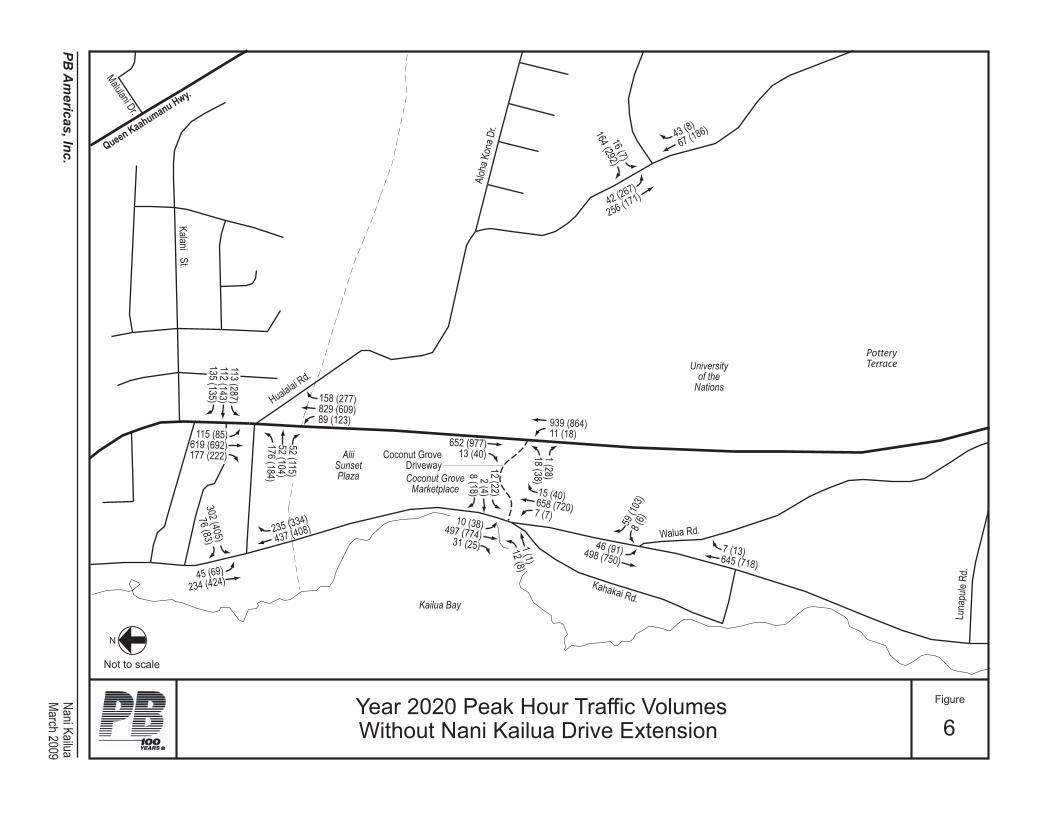
Queen Kaahumanu Hwy.
Walua Rd.
Luna
pule
Rd.
Kailua Bay
PotteryTerrace
AliiSunsetPlaza Coconut Grove
Marketplace
Universityof the
Nations
Kahakai Rd.
KalaniS t.
Hualalai Rd.
Malulani Dr.
Coconut GroveDriveway
Aloh
a Kon
a Dr.
aulia
K ina
N.c
nI ,s
acir
em
A BP
Figure
6Year 2020 Peak Hour Traffic VolumesWithout Nani Kailua Drive Extension
N
Not to scale
)8( 34 )681( 76
)772( 851)906( 928
)321( 98
)04( 51)027( 856
)7( 7
)31( 7)817( 546
)301( 95)6( 8)83( 01
)477( 794)52( 13
)22(
21)4
( 2)8
1( 8
)19( 64)057( 894)1(
1)8(
21
)468( 939)81( 11
)779( 256)04( 31
)82(
1) 8
3( 81
)433( 532 )804( 734
)782
( 311
) 341
( 211
) 531
( 531
)504
( 203
)38(
67
)58( 511)296( 916)222( 771
)96( 54 )424( 432
)762( 24 )171( 652
)7( 6
1)2
92( 4
61
)511(
25
) 401
( 25
) 481
( 671
March 2009

Queen Kaahumanu Hwy.
ProposedNani Kailua Rd.
Extension
Walua Rd.
Luna
pule
Rd.
Kailua Bay
AliiSunsetPlaza
CoconutGrove
Marketplace
FutureKPC
Development
Universityof the
Nations
Kahakai Rd.
KalaniSt.
Hualalai Rd.
Malulani Dr.
Coco
nut G
rove Access
Aloh
a Kon
a Dr.
aulia
K ina
N.c
nI ,s
acir
em
A BP
Figure
7Year 2020 Peak Hour Traffic Volumes
With Nani Kailua Drive Extension
N
Not to scale
LegendXX (XX) - AM (PM) Peak Hour Volumes
)772( 851)107( 719
)14( 83
)04( 51)474( 505
)7( 7
)31( 7)975( 945
)181( 011)105( 894
)83( 01)274( 282)52( 13
)19( 64)706( 604)5(
5)8(
21
)5( 5)777( 078
)93( 42)4
4( 6
)78(
14)7
71( 9
11
)29( 88 )804( 734
)782
( 311
) 24(
83) 5
31( 5
31
) 5( 5) 101
( 47
) 5( 5
)111(
98
)38(
67
)58( 511)308( 707)111( 98 )5( 5
)909( 195)212( 931
)96( 54 )424( 432
)25(
43) 7
1( 11
) 29(
88
)301( 95)6( 8)16( 73
)874( 292
)022
( 061
)47(
35)81( 8
)5( 5)22( 21
)8( 34)641( 54 )04( 22
)512( 63)631( 122
)5( 5
)53(
53)2
5( 6
)5( 5
)7( 6
1)1
6( 25
)132(
211
March 2009
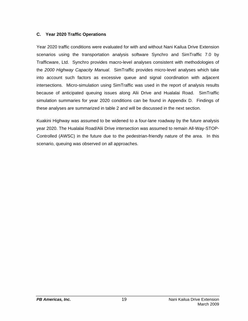
PB Americas, Inc. 19 Nani Kailua Drive Extension March 2009
C. Year 2020 Traffic Operations
Year 2020 traffic conditions were evaluated for with and without Nani Kailua Drive Extension
scenarios using the transportation analysis software Synchro and SimTraffic 7.0 by
Trafficware, Ltd. Synchro provides macro-level analyses consistent with methodologies of
the 2000 Highway Capacity Manual. SimTraffic provides micro-level analyses which take
into account such factors as excessive queue and signal coordination with adjacent
intersections. Micro-simulation using SimTraffic was used in the report of analysis results
because of anticipated queuing issues along Alii Drive and Hualalai Road. SimTraffic
simulation summaries for year 2020 conditions can be found in Appendix D. Findings of
these analyses are summarized in table 2 and will be discussed in the next section.
Kuakini Highway was assumed to be widened to a four-lane roadway by the future analysis
year 2020. The Hualalai Road/Alii Drive intersection was assumed to remain All-Way-STOP-
Controlled (AWSC) in the future due to the pedestrian-friendly nature of the area. In this
scenario, queuing was observed on all approaches.

PB Americas, Inc. 20 Nani Kailua Drive Extension March 2009
Table 2 Year 2020 SimTraffic Delay Summary
2020 Without Project
2020 With Project Intersection
AM Pk Hr PM Pk hr AM Pk Hr PM Pk hr
Alii Drive/ Hualalai Road NB Approach 224.7 412.2 26.2 161.9 SB Approach 14.8 290.4 13.8 167.9 WB Approach 22.6 268.8 10.0 19.9
Alii Drive/ Kahakai Road NB Approach 10.7 102.5 1.2 2.0 SB Approach 5.5 5.2 4.9 4.0 EB Approach 108.6 161.4 17.5 22.2 WB Approach 18.7 225.9 14.1 9.6
Alii Drive/ Nani Kailua Drive NB Approach 4.5 8.6 SB Approach 5.5 6.3 WB Approach
Does Not Exist in this
Scenario 13.7 12.4
Alii Drive/ Walua Road NB Approach 4.8 60.3 4.7 4.7 SB Approach 9.9 8.1 6.6 7.9 WB Approach 20.3 133.2 19.2 19.9
Kuakini Highway/ Hualalai Road NB Approach 21.1 27.7 8.8 8.9 SB Approach 21.0 31.3 8.7 12.2 EB Approach 24.4 15.5 15.6 12.2 WB Approach 33.6 81.4 13.7 17.9
Kuakini Highway/ CG Access NB Approach 2.2 1.0 SB Approach 0.4 0.5 EB Approach 8.1 10.0
Does Not Exist in this
Scenario
Kuakini Highway/ Nani Kailua Drive
Kuakini NB Approach 5.7 13.0 Kuakini SB Approach 4.1 14.2 Nani Kailua EB Approach 21.6 14.0 Nani Kailua WB Approach
Does Not Exist in this
Scenario
16.7 25.6
Hualalai Road/ Nani Kailua Drive Nani Kailua NB Approach -- -- 1.8 9.2 Nani Kailua SB Approach 3.6 6.4 6.6 2.8 Hualalai EB Approach 6.4 9.6 6.2 10.4 Hualalai WB Approach 1.7 2.4 5.4 7.7 -- Does not exist in this scenario XX.X - Delay in seconds

PB Americas, Inc. 21 Nani Kailua Drive Extension March 2009
D. Findings
Constructing the Nani Kailua Drive Extension is anticipated to provide additional mauka-
makai mobility within the area and relieve traffic demand at the Hualalai Road/Alii Drive
intersection by redirecting some traffic traveling through the study area onto Nani Kailua
Drive and Kuakini Highway. Without the Nani Kailua Drive Extension, all traffic along Alii
Drive destined for Queen Kaahumanu Highway or other attractions to the north have to pass
through the already-congested Hualalai Road/Alii Drive intersection. Analyses have shown
positive impacts on existing intersections within the corridor associated with the reallocation
of traffic volume. The exception is the Hualalai Road/Nani Kailua Drive intersection which
experienced slight increases in delays between future year without and with project
scenarios. This occurred because certain movements will inevitably experience more delay
with the addition of new movements since it will be modified from a T-intersection to a four-
leg intersection.
By year 2020, traffic along Alii Drive is projected to be even more congested than existing
conditions. As illustrated in Figures 8 and 9, significant queuing is anticipated along Alii
Drive and Hualalai Road without the proposed Nani Kailua Drive extension. The queuing
along Alii Drive during the PM peak hour is expected to extend south of Walua Road for
vehicles traveling in the northbound direction, and north of Likana Lane for southbound
vehicles. Queuing along Hualalai Road from Alii Drive to Kuakini Highway will prevent
vehicles from entering at the Kuakini Highway/Hualalai Road intersection. This will also
cause some queuing along the southbound approach on Kuakini Highway as well as along
the westbound approach of Hualalai Road. With Nani Kailua Drive Extension, the severity
of these queues will be minimized. During the AM peak hour, queuing along northbound Alii
Drive will be dissipated if Nani Kailua Drive extension is constructed.
A travel time analysis was done for the PM peak hour which was the most congested of the
year 2020 analysis time periods. The starting point was between Walua Road and Lunapule
Road; the ending point was the intersection of Hualalai Road and Kuakini Highway. The
results of this analysis are summarized in Figure 10. Route 1 is a vehicle traveling
northbound on Alii Drive, then turning on to Hualalai Road until the designated

ProposedNani Kailua Rd.
Extension
Walua Rd.Palani Rd.
Hualalai Rd.
Kailua Bay
KingKamehameha'sKona Beach Hotel
AliiSunsetPlaza
CoconutGrove
Marketplace
Universityof the
NationsKama’ainaHale
Condos
Henry St.
Kalan
iSt
.
Alii Dr.
Aloh
a Kon
a Dr.
Queen Kaahumanu Hwy.
Kahakai Rd.
Kuakini Hwy.
Huli He’ePalace
Likana Ln.
NaniKailua Rd.
Legend
Without Nani Kailua Drive
WithNani Kailua Drive
aulia
K ina
N.c
nI ,s
acir
em
A BP
Figure
8Projected Year 2020 AM Peak Hour Traffic Queues
N
Not to scale
March 2009
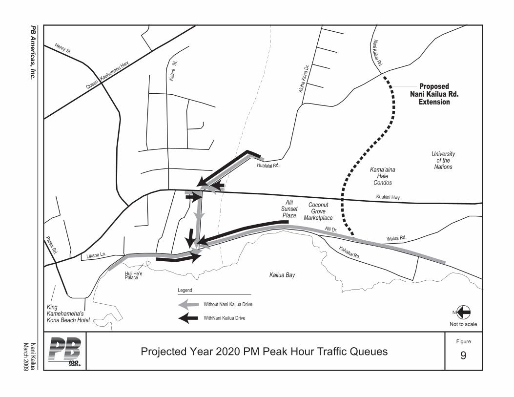
ProposedNani Kailua Rd.
Extension
Walua Rd.Palani Rd.
Hualalai Rd.
Kailua Bay
KingKamehameha'sKona Beach Hotel
AliiSunsetPlaza
CoconutGrove
Marketplace
Universityof the
NationsKama’ainaHale
Condos
Henry St.
Kalan
iSt
.
Alii Dr.
Aloh
a Kon
a Dr.
Queen Kaahumanu Hwy.
Kahakai Rd.
Kuakini Hwy.
Huli He’ePalace
Likana Ln.
NaniKailua Rd.
aulia
K ina
N.c
nI ,s
acir
em
A BP
Figure
9Projected Year 2020 PM Peak Hour Traffic Queues
N
Not to scale
March 2009
Legend
Without Nani Kailua Drive
WithNani Kailua Drive
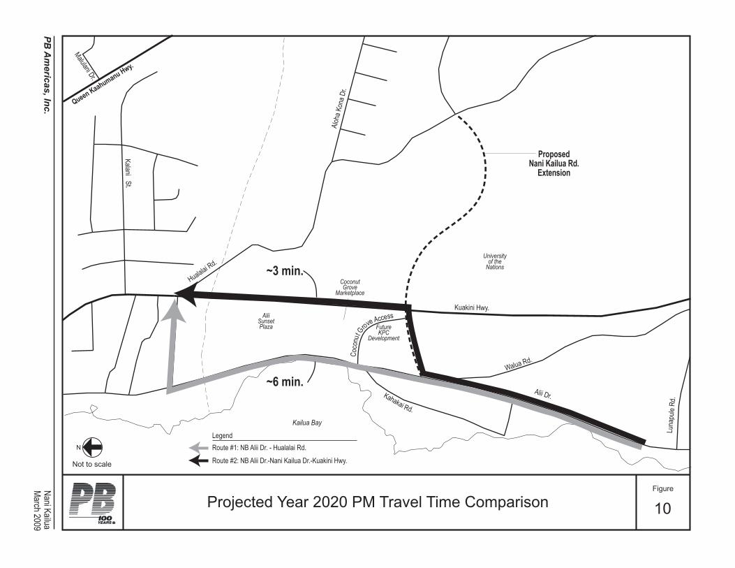
Queen Kaahumanu Hwy.
ProposedNani Kailua Rd.
Extension
Walua Rd.
Luna
pule
Rd.
Kailua Bay
AliiSunsetPlaza
CoconutGrove
Marketplace
FutureKPC
Development
Universityof the
Nations
Kahakai Rd.
KalaniSt.
Hualalai Rd.
Malulani Dr.
Coco
nut G
rove Access
Kuakini Hwy.
Alii Dr.
Aloh
a Kon
a Dr.
aulia
K ina
N.c
nI ,s
acir
em
A BP
Figure
10Projected Year 2020 PM Travel Time Comparison
N
Not to scale
LegendRoute #1: NB Alii Dr. - Hualalai Rd.
Route #2: NB Alii Dr.-Nani Kailua Dr.-Kuakini Hwy.
~3 min.
~6 min.
March 2009

PB Americas, Inc. 25 Nani Kailua Drive Extension March 2009
ending point. Route 2 takes the vehicle along Alii Drive, turns onto Nani Kailua Drive, and
left onto Kuakini Highway until the end point. Route 1 is the path a vehicle would need to
travel without the proposed Nani Kailua Drive extension and Route 2 is an alternative path
vehicles can take if Nani Kailua Drive extension is constructed. Utilizing the Nani Kailua
Drive extension (Route 2) will take approximately half the time it takes a vehicle to travel
along Alii Drive all the way to Hualalai Road.

PB Americas, Inc. 26 Nani Kailua Drive Extension March 2009
E. Recommendations
The recommended alignment for the proposed Nani Kailua Drive Extension is illustrated in
Figure 11. Recommended features of this alignment include:
• Hualalai Road/Nani Kailua Drive T-intersection converted to a four-leg intersection,
• New intersections at Kuakini Highway and Alii Drive,
• Kuakini Highway/Nani Kailua Drive intersection located approximately where the
existing Coconut Grove Marketplace access is on Kuakini Highway,
• Existing Coconut Grove Marketplace access on Kuakini Highway relocated to Nani
Kailua Drive makai segment between Kuakini Highway and Alii Drive.
1. Roadway Geometry
A two-lane cross-section with channelized left-turn bays is recommended for the proposed
extension of Nani Kailua Drive. Sidewalks, curb and gutter, and bike facilities are also
recommended along the proposed roadway. Currently there are no plans for bike facilities
along Nani Kailua Drive within the Bike Plan Hawaii. However, bike facilities are
recommended to provide additional mauka-makai mobility for bicyclists.
2. Intersection Configurations
Hualalai Road/Nani Kailua Drive - Existing right-of-way along Hualalai Road will allow for
exclusive left-turn bays on Hualalai Road and the existing Nani Kailua Drive segment. It is
recommended that all approaches have an exclusive left-turn bay and shared through-right
lane. Recommended lane configurations at this intersection are summarized in Figures 12
and 13. Left-turn lane lengths along the proposed Nani Kailua Drive segment were
calculated with the cumulative Poisson distribution method and summarized in table 3. The
left-turn movements that were projected to be minimal at the Kuakini Highway/Nani Kailua
Drive and Hualalai Road/Nani Kailua Drive intersections are recommended to be
constructed to a minimum 100 feet to accommodate higher vehicular speeds and grade
changes.

iila
Nani Kail
uaRd
.
Hualala
i Rd.
Kuakini Hwy.
Kahakai Rd.
Walua Rd.
Nani KailuaPB Americas, Inc.
Figure
11Recommended Nani Kailua Drive
Extension Alignment
N
Not to scale
Alii Dr.
March 2009
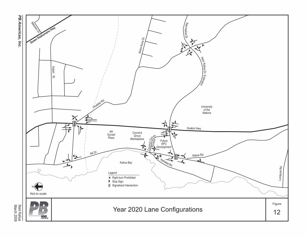
Queen Kaahumanu Hwy.
Walua Rd.
Luna
pule
Rd.
Kailua Bay
AliiSunsetPlaza
CoconutGrove
Marketplace FutureKPC
Development
Universityof the
Nations
Kahakai Rd.
KalaniSt.
Hualalai Rd.
Malulani Dr.
Kuakini Hwy.
Alii Dr.
Aloh
a Kon
a Dr.
NaniKailuaD r.
Coco
nutG
rove
Acce
ss
Nani Kailua Dr.Extension
*
aulia
K ina
N.c
nI ,s
acir
em
A BP
Figure
12Year 2020 Lane Configurations
N
Not to scale
LegendRight-turn ProhibitedStop SignSignalized Intersection
*
March 2009

.rD a
uliaK
inaN
Hualalai Rd.
to Queen Kaahumanu Hwy.
to Queen Kaahumanu Hwy.
to Kuakini Hwy.
to Kuakini Hwy.
LegendStop Sign
aulia
K ina
N.c
nI ,s
acir
em
A BP
Figure
13Recommended Lane Configurationsat Hualalai Road & Nani Kailua Drive
N
Not to scale
Legend
Stop Sign
March 2009
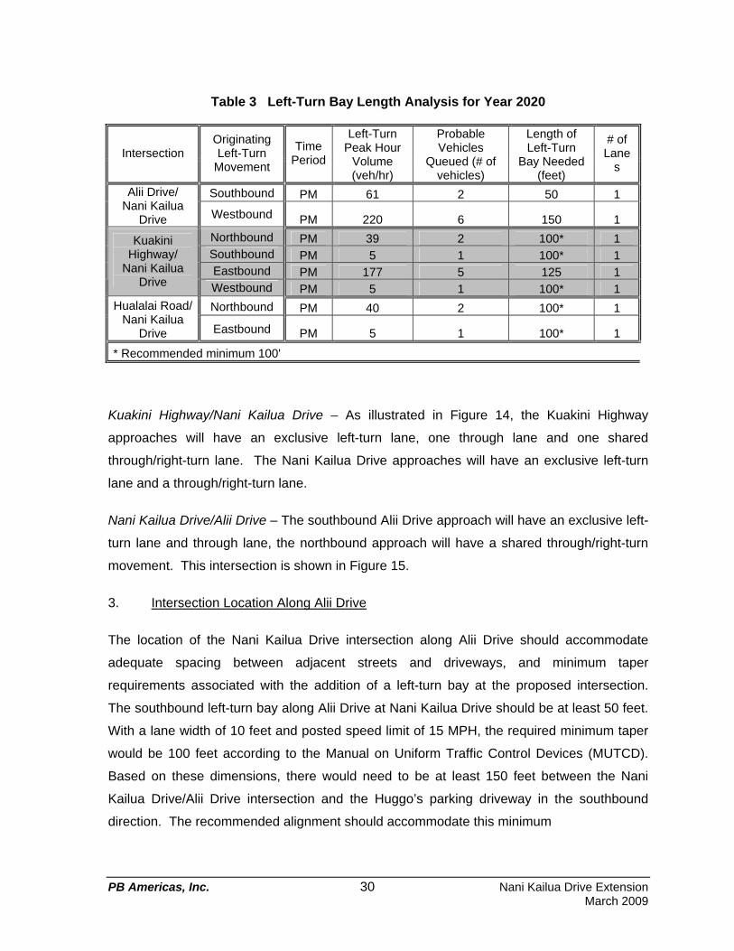
PB Americas, Inc. 30 Nani Kailua Drive Extension March 2009
Table 3 Left-Turn Bay Length Analysis for Year 2020
Intersection Originating Left-Turn
Movement
Time Period
Left-Turn Peak Hour
Volume (veh/hr)
Probable Vehicles
Queued (# of vehicles)
Length of Left-Turn
Bay Needed (feet)
# of Lane
s
Southbound PM 61 2 50 1 Alii Drive/ Nani Kailua
Drive Westbound PM 220 6 150 1
Northbound PM 39 2 100* 1 Southbound PM 5 1 100* 1 Eastbound PM 177 5 125 1
Kuakini Highway/
Nani Kailua Drive Westbound PM 5 1 100* 1
Northbound PM 40 2 100* 1 Hualalai Road/ Nani Kailua
Drive Eastbound PM 5 1 100* 1
* Recommended minimum 100'
Kuakini Highway/Nani Kailua Drive – As illustrated in Figure 14, the Kuakini Highway
approaches will have an exclusive left-turn lane, one through lane and one shared
through/right-turn lane. The Nani Kailua Drive approaches will have an exclusive left-turn
lane and a through/right-turn lane.
Nani Kailua Drive/Alii Drive – The southbound Alii Drive approach will have an exclusive left-
turn lane and through lane, the northbound approach will have a shared through/right-turn
movement. This intersection is shown in Figure 15.
3. Intersection Location Along Alii Drive
The location of the Nani Kailua Drive intersection along Alii Drive should accommodate
adequate spacing between adjacent streets and driveways, and minimum taper
requirements associated with the addition of a left-turn bay at the proposed intersection.
The southbound left-turn bay along Alii Drive at Nani Kailua Drive should be at least 50 feet.
With a lane width of 10 feet and posted speed limit of 15 MPH, the required minimum taper
would be 100 feet according to the Manual on Uniform Traffic Control Devices (MUTCD).
Based on these dimensions, there would need to be at least 150 feet between the Nani
Kailua Drive/Alii Drive intersection and the Huggo’s parking driveway in the southbound
direction. The recommended alignment should accommodate this minimum

.rD a
uliaK
inaN
Kuakini Hwy.
to Hualalai Rd.
to Walua Rd.
to Hualalai Rd.
to Alii Dr.
aulia
K ina
N.c
nI ,s
acir
em
A BP
Figure
14Recommended Lane Configurations
at Kuakini Highway and Nani Kailua Drive
N
Not to scale
March 2009

50’
150’
100’
100’
HuggosParking
Lot
Nani Kailua Dr.
Bill FisherCondos
Alii Drive
Signalized Intersection
Legend
Nani KailuaPB Americas, Inc.
Figure
15Recommended Lane Configurationsat Alii Drive and Nani Kailua Drive
N
Not to scale
March 2009
PB Americas, Inc. 33 Nani Kailua Drive Extension March 2009
150-foot distance between intersections. Figure 15 illustrates the recommended location of
the Nani Kailua Drive/Alii Drive intersection.
4. Intersection Operations
With the projected 2020 volumes along the corridor and the proposed Nani Kailua Drive
extension, the intersections of Kuakini Highway/Nani Kailua Drive and Alii Drive/Nani Kailua
Drive are expected to warrant signalization based on peak hour warrant criteria in the
MUTCD. Signalization at these intersections may attract more regional drivers away from
the congested Hualalai Road/Alii Drive intersection. The current projected demand at
Hualalai Road/Nani Kailua Drive does not warrant signalization at this time, however, traffic
signal warrant analyses should be done as the Kuakini Highway corridors builds out. Traffic
signal warrant analysis worksheets can be found in Appendix E.

PB Americas, Inc. 34 Nani Kailua Drive Extension March 2009
F. Conclusion
Nani Kailua Drive Extension will facilitate regional mauka-makai mobility which is consistent
with West Hawaii regional transportation goals. However, the Nani Kailua Drive Extension
will most beneficial to the Kailua-Kona area by providing an additional mauka-makai
connector roadway for those traveling along Alii Drive or Kuakini Highway. It will help to
mitigate existing and projected traffic queuing along Alii Drive in the vicinity of Hualalai
Road, as well as improve intersection operations at the Alii Drive/Hualalai Road and
Hualalai Road/Kuakini Highway intersections.

PB Americas, Inc. 35 Nani Kailua Drive Extension March 2009
APPENDICES

PB Americas, Inc. A Nani Kailua Drive Extension March 2009
Appendix A
Existing Traffic Data


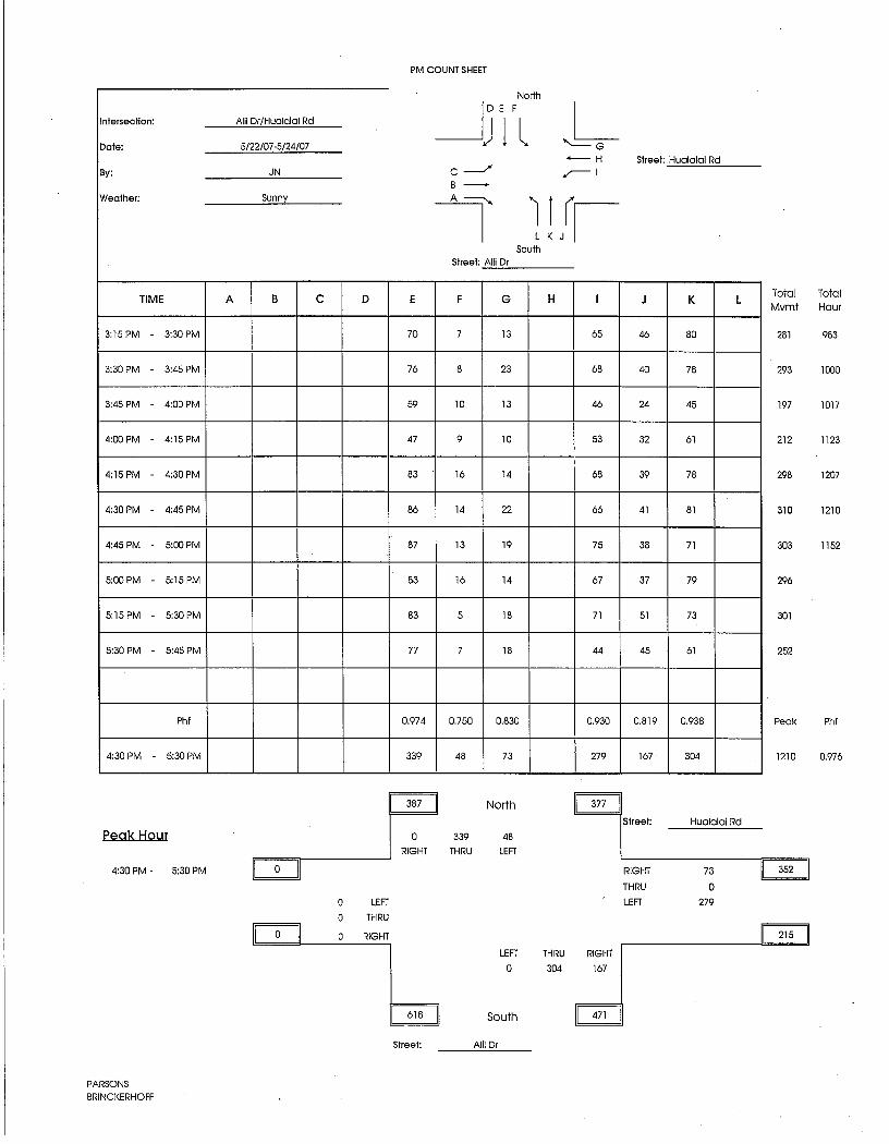
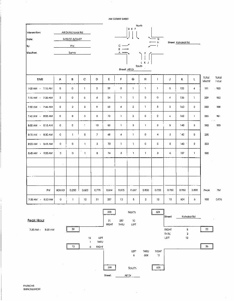
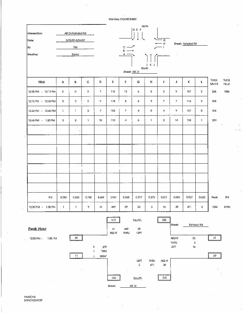
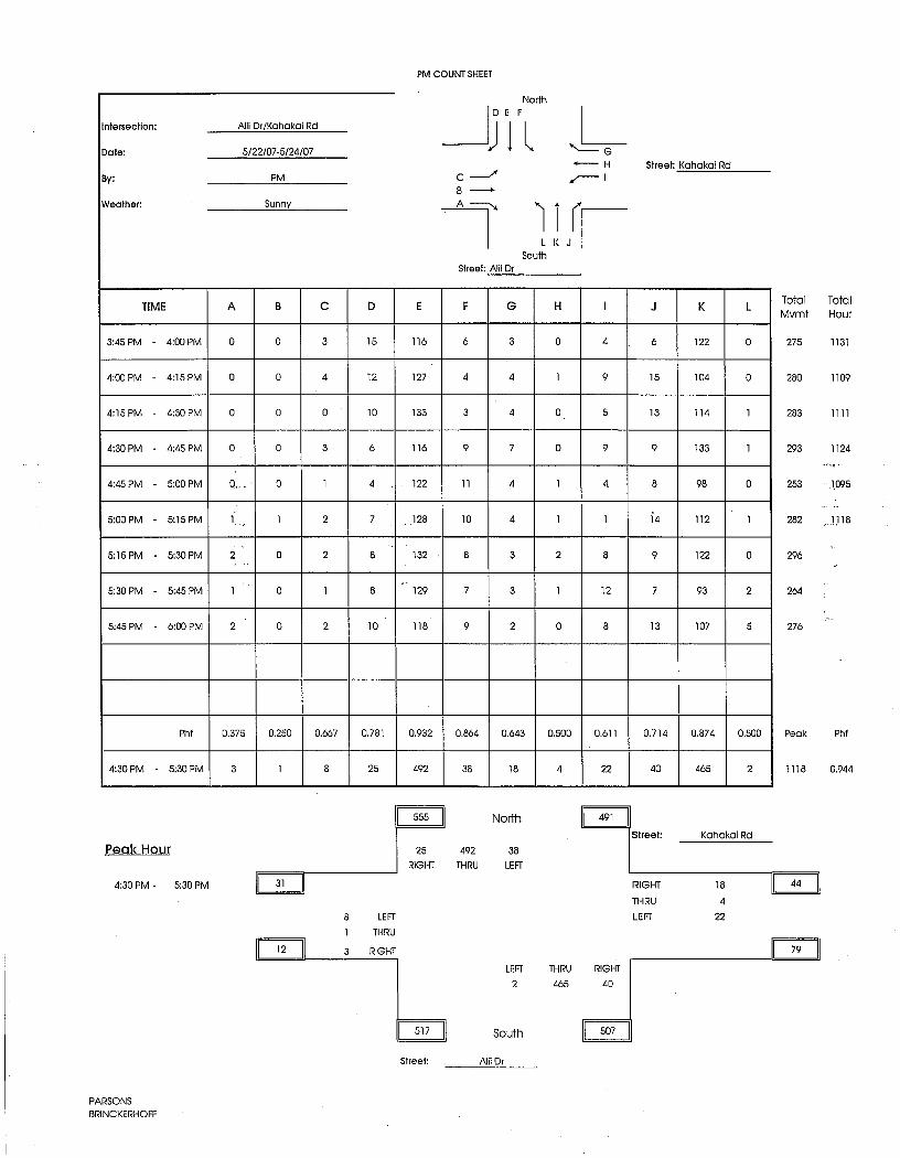
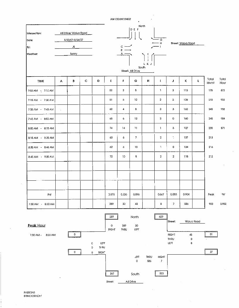


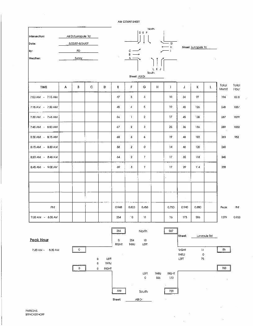
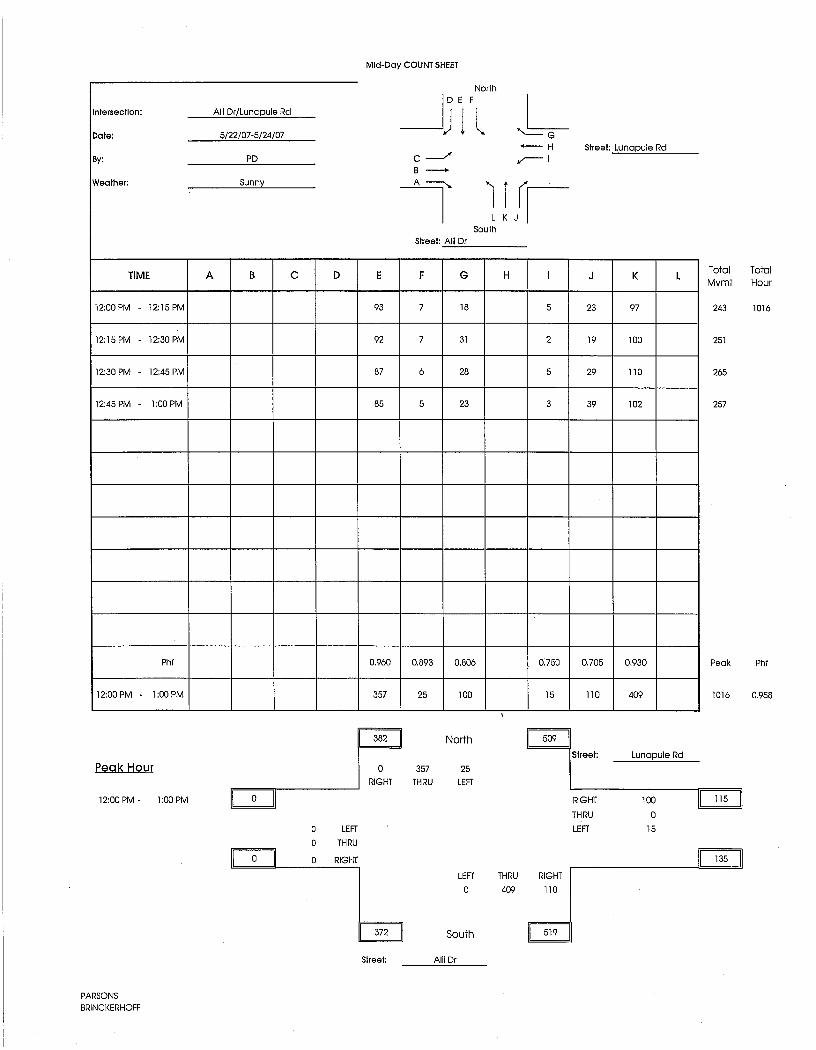
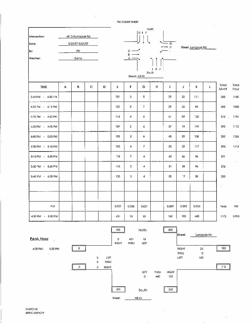


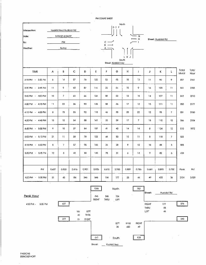
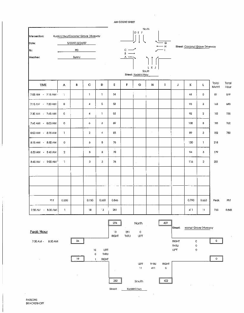
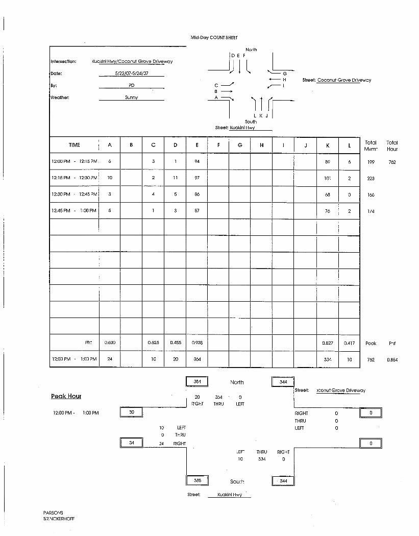
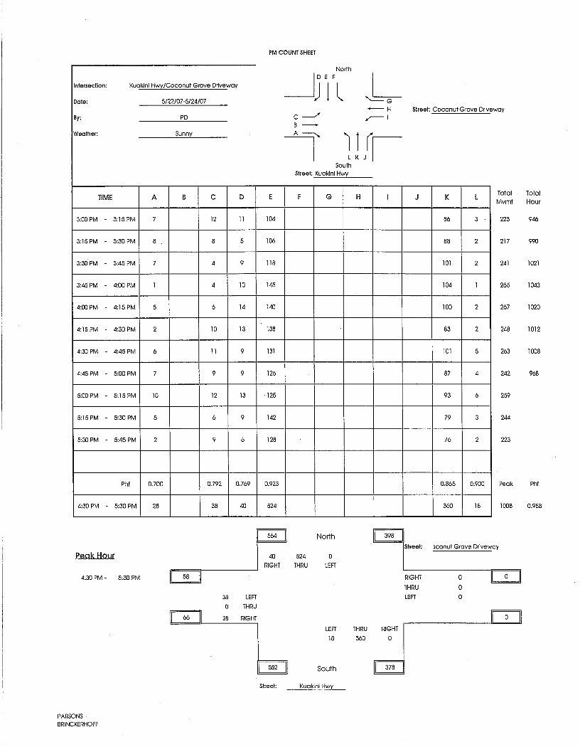
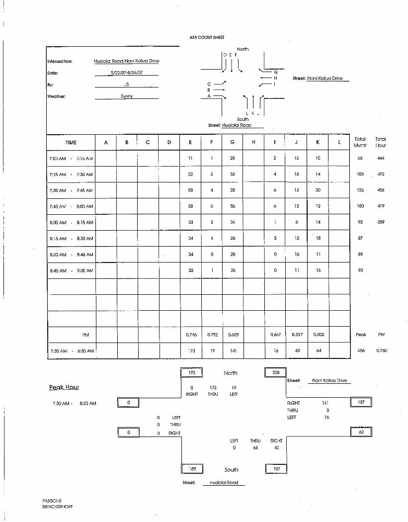
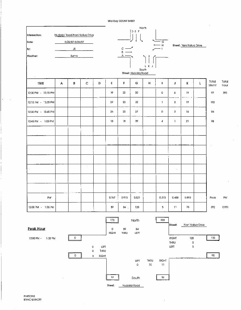
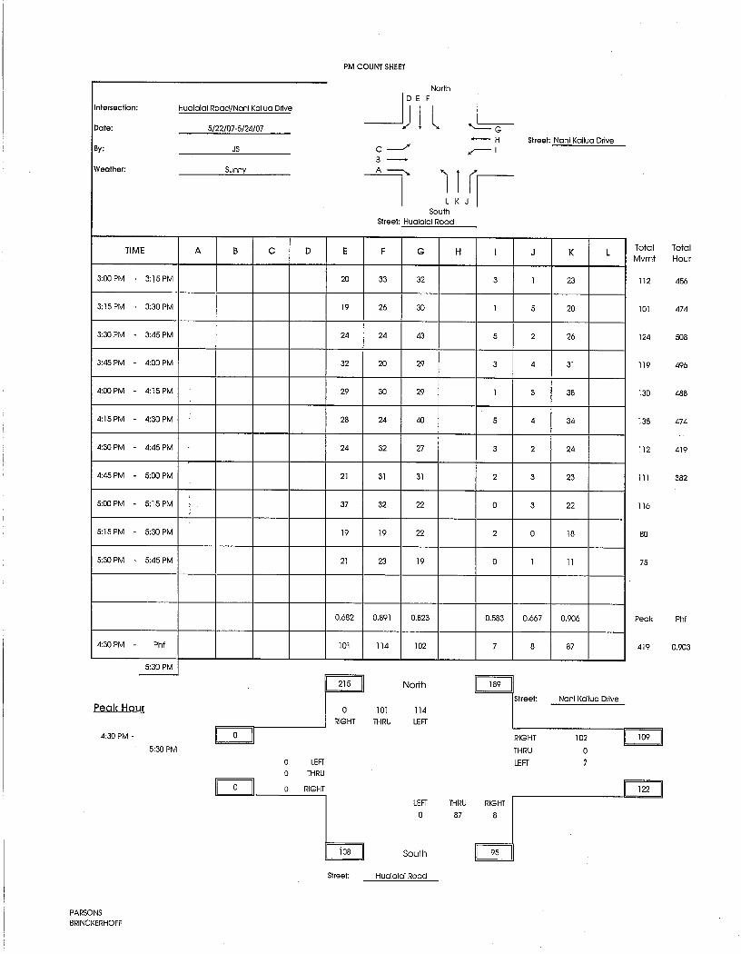

PB Americas, Inc. B Nani Kailua Drive Extension March 2009
Appendix B
Intersection Level of Service Definitions


Appendix B
Intersection Level of Service Definitions
The Highway Capacity Manual defines six Intersection Levels of Service (LOS), labeled A
through F, from free flow to congested conditions.
Levels of Service for signalized intersections is defined in terms of control delay, which is a
measure of driver discomfort, frustration, fuel consumption, and increased travel time. The
delay experienced by a motorist is made up of a number of factors that relate to control,
geometrics, traffic, and incidents. Total delay is the difference between the travel time
actually experienced and the reference travel time that would result during base conditions:
in the absence of traffic control, geometric delay, any incidents, and any other vehicles.
Specifically, LOS criteria for traffic signals are stated in terms of the average control delay
per vehicle, typically for a 15-minute analysis period. Delay is a complex measure and
depends on a number of variables, including the quality of progression, the cycle length, the
green ratio, and the v/c ratio for the lane group.
LEVEL-OF-SERVICE A: Low control delay, up to 10 s/veh. This LOS occurs when
progression is extremely favorable and most vehicles arrive during the green phase. Many
vehicles do not stop at all. Short cycle lengths may tend to contribute to low delay values.
LEVEL-OF-SERVICE B: Control delay greater than 10 and up to 20 s/veh. This level
generally occurs with good progression, short cycle lengths, or both. More vehicles stop
than with LOS A, causing higher levels of delay.
LEVEL-OF-SERVICE C: Control delay greater than 20 and up to 35 s/veh. These
higher delays may result from only fair progression, longer cycle lengths, or both. Individual
cycle failures may begin to appear at this level. Cycle failure occurs when a given green
phase does not serve queued vehicles, and overflows occur. The number of vehicles
stopping is significant at this level, though many still pass through the intersection without
stopping.
PB Americas B Nani Kailua Drive Extension October 2007
miyasaki
Rectangle
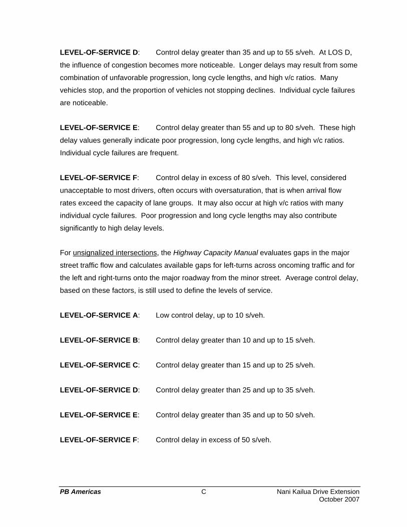
LEVEL-OF-SERVICE D: Control delay greater than 35 and up to 55 s/veh. At LOS D,
the influence of congestion becomes more noticeable. Longer delays may result from some
combination of unfavorable progression, long cycle lengths, and high v/c ratios. Many
vehicles stop, and the proportion of vehicles not stopping declines. Individual cycle failures
are noticeable.
LEVEL-OF-SERVICE E: Control delay greater than 55 and up to 80 s/veh. These high
delay values generally indicate poor progression, long cycle lengths, and high v/c ratios.
Individual cycle failures are frequent.
LEVEL-OF-SERVICE F: Control delay in excess of 80 s/veh. This level, considered
unacceptable to most drivers, often occurs with oversaturation, that is when arrival flow
rates exceed the capacity of lane groups. It may also occur at high v/c ratios with many
individual cycle failures. Poor progression and long cycle lengths may also contribute
significantly to high delay levels.
For unsignalized intersections, the Highway Capacity Manual evaluates gaps in the major
street traffic flow and calculates available gaps for left-turns across oncoming traffic and for
the left and right-turns onto the major roadway from the minor street. Average control delay,
based on these factors, is still used to define the levels of service.
LEVEL-OF-SERVICE A: Low control delay, up to 10 s/veh.
LEVEL-OF-SERVICE B: Control delay greater than 10 and up to 15 s/veh.
LEVEL-OF-SERVICE C: Control delay greater than 15 and up to 25 s/veh.
LEVEL-OF-SERVICE D: Control delay greater than 25 and up to 35 s/veh.
LEVEL-OF-SERVICE E: Control delay greater than 35 and up to 50 s/veh.
LEVEL-OF-SERVICE F: Control delay in excess of 50 s/veh.
PB Americas C Nani Kailua Drive Extension October 2007
miyasaki
Rectangle

PB Americas, Inc. C Nani Kailua Drive Extension March 2009
Appendix C
Intersection Capacity Analysis Worksheets


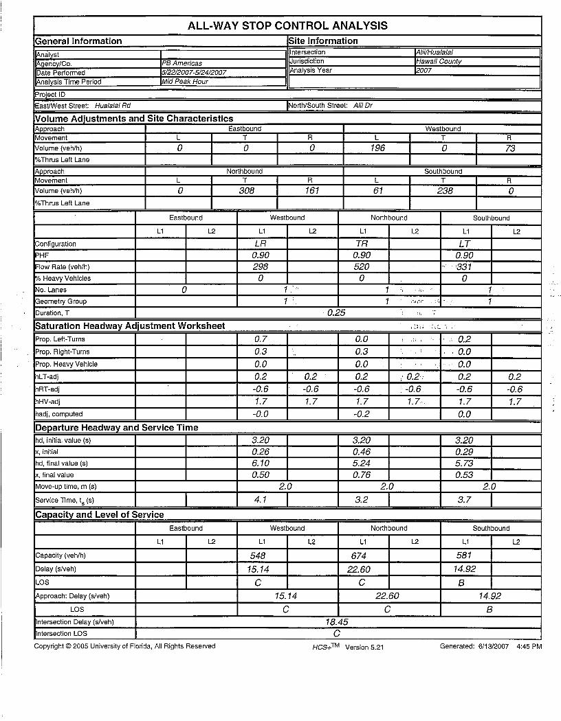

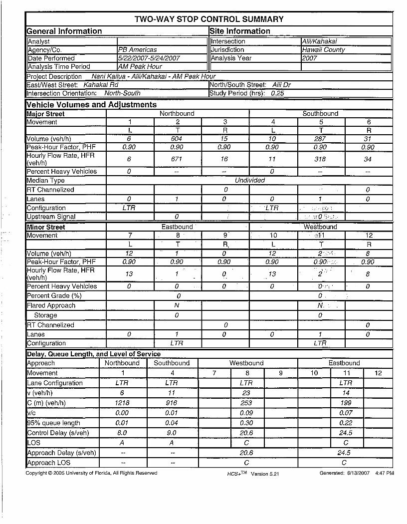

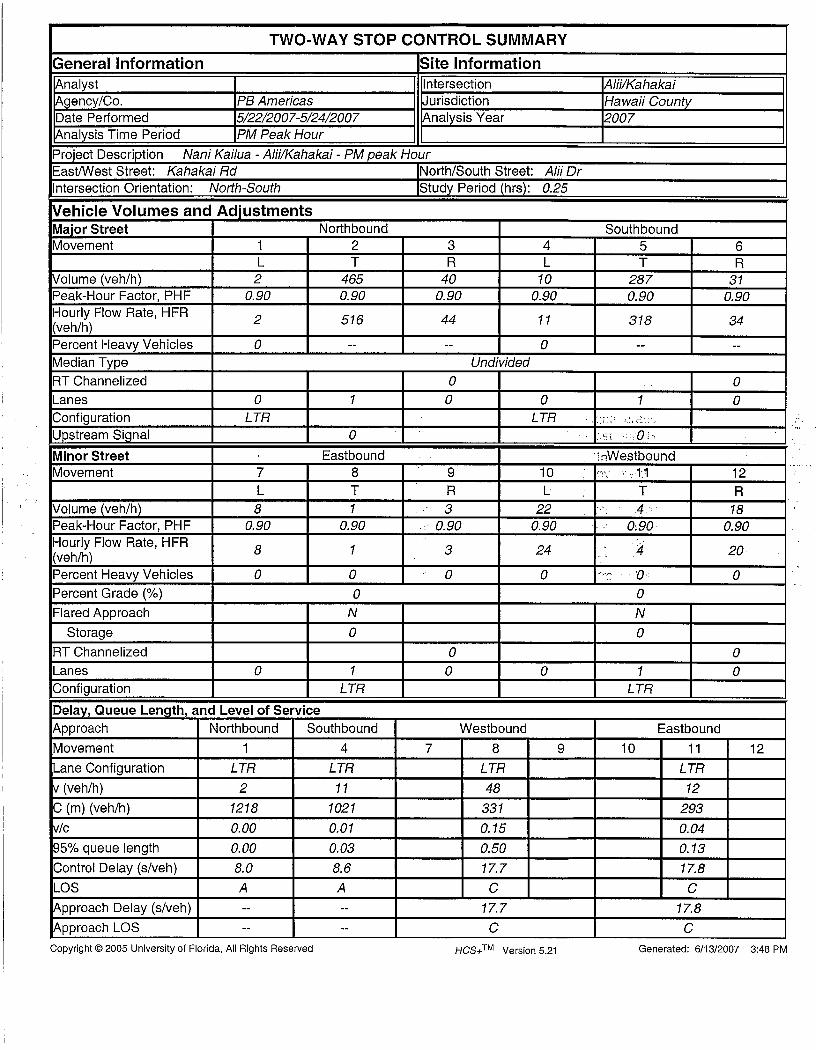
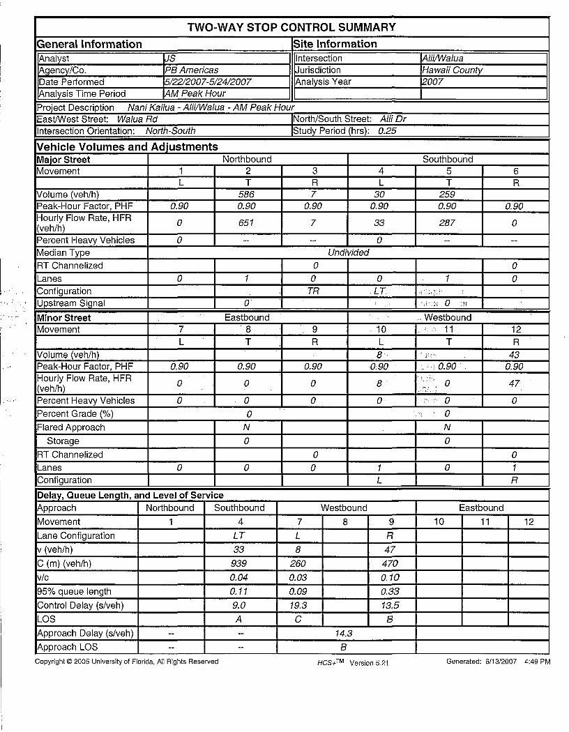
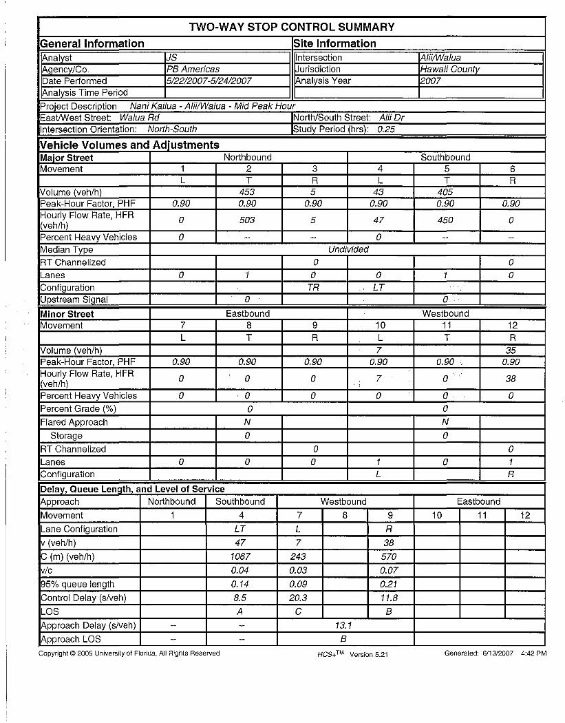
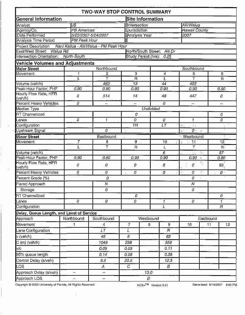
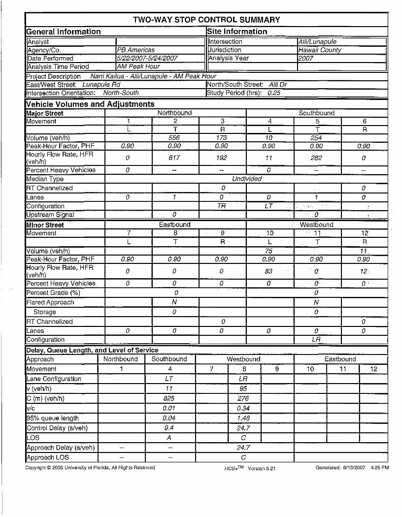


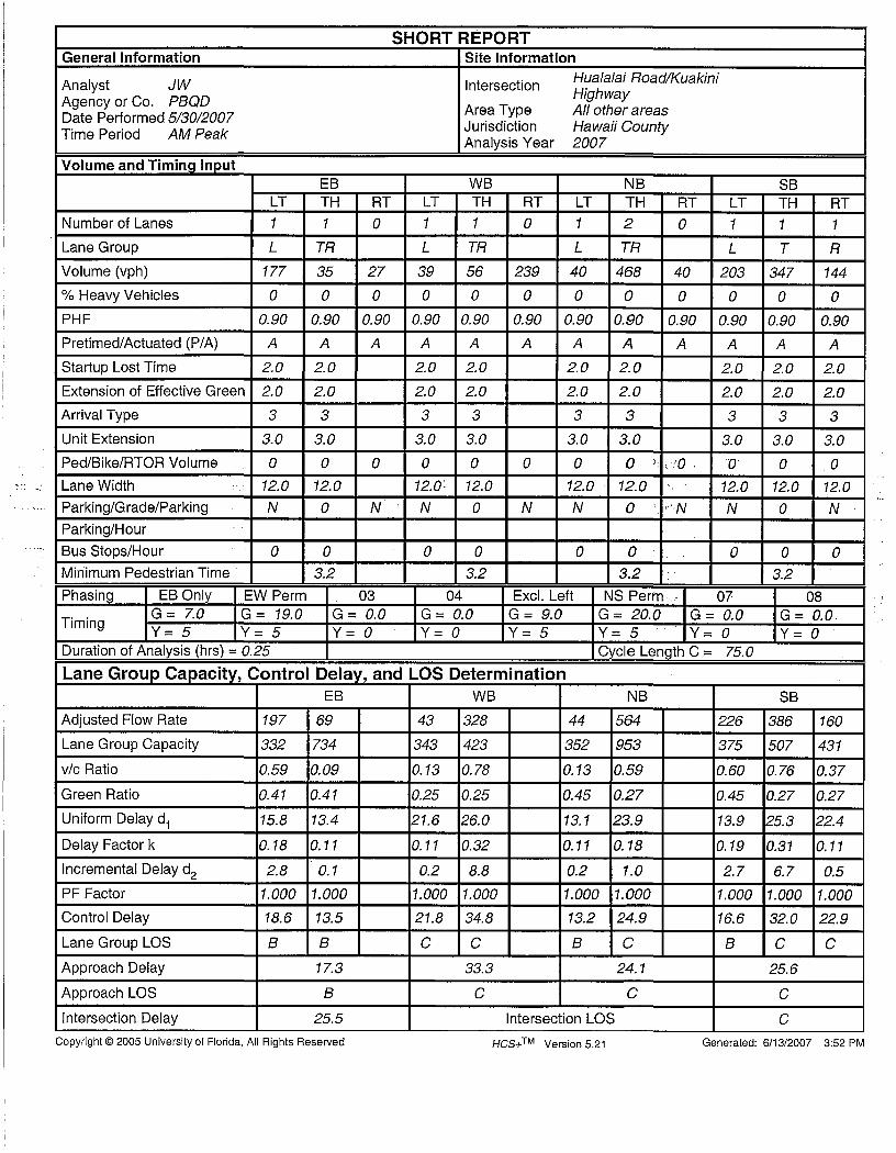


PB Americas, Inc. D Nani Kailua Drive Extension March 2009
Appendix D
SimTraffic Simulation Summaries

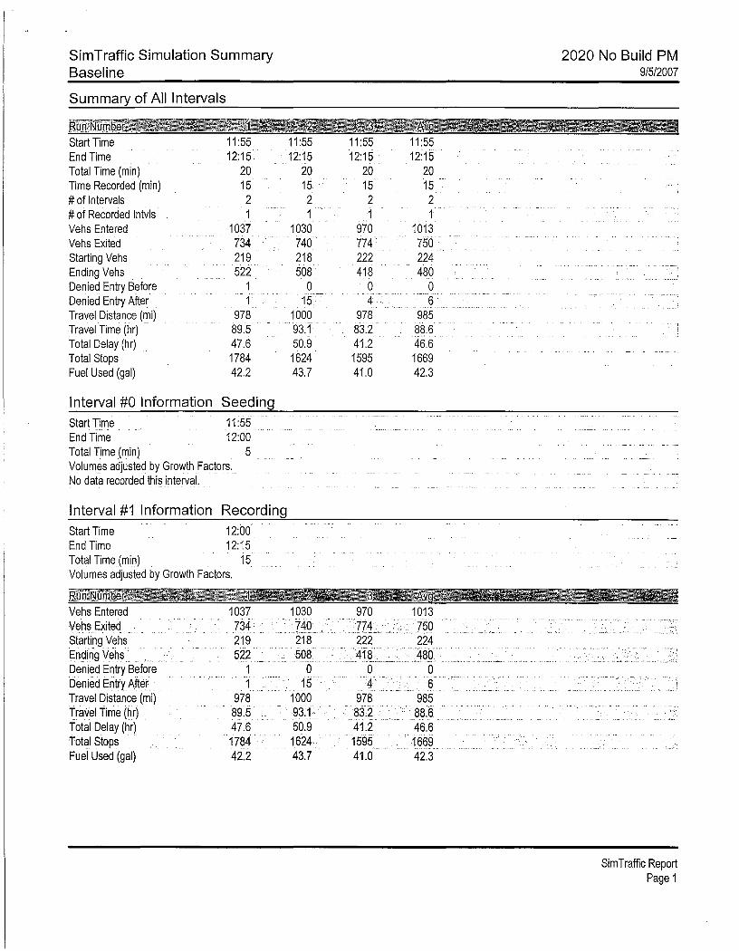


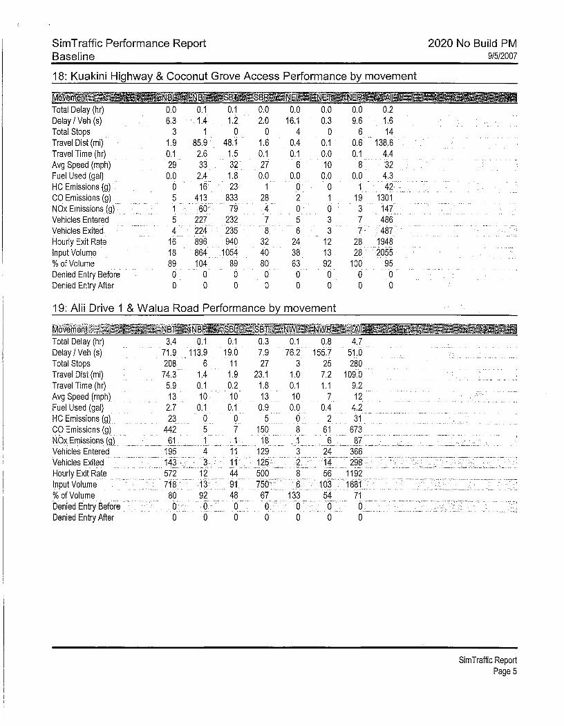

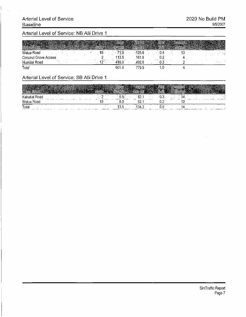
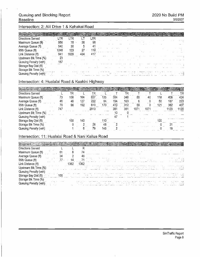
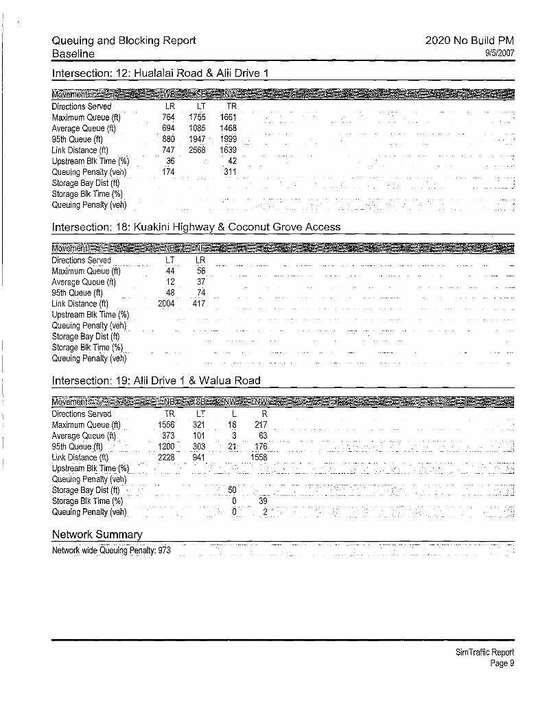
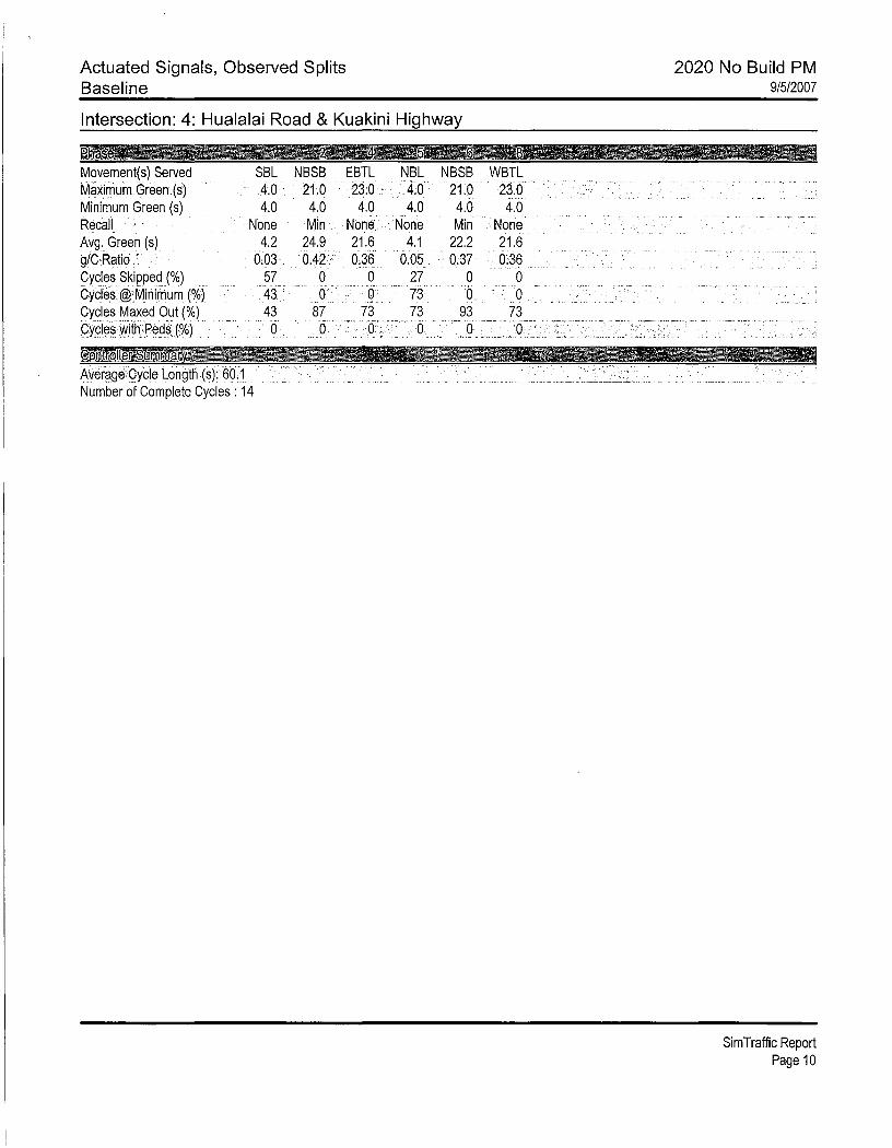

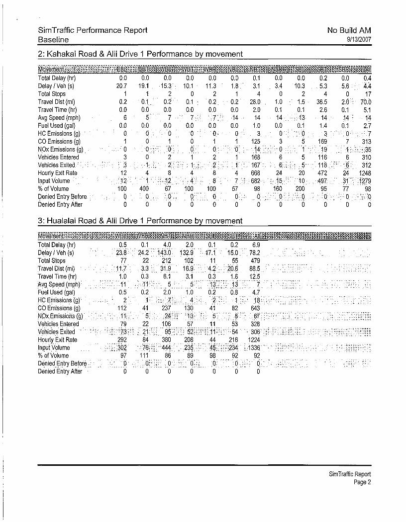
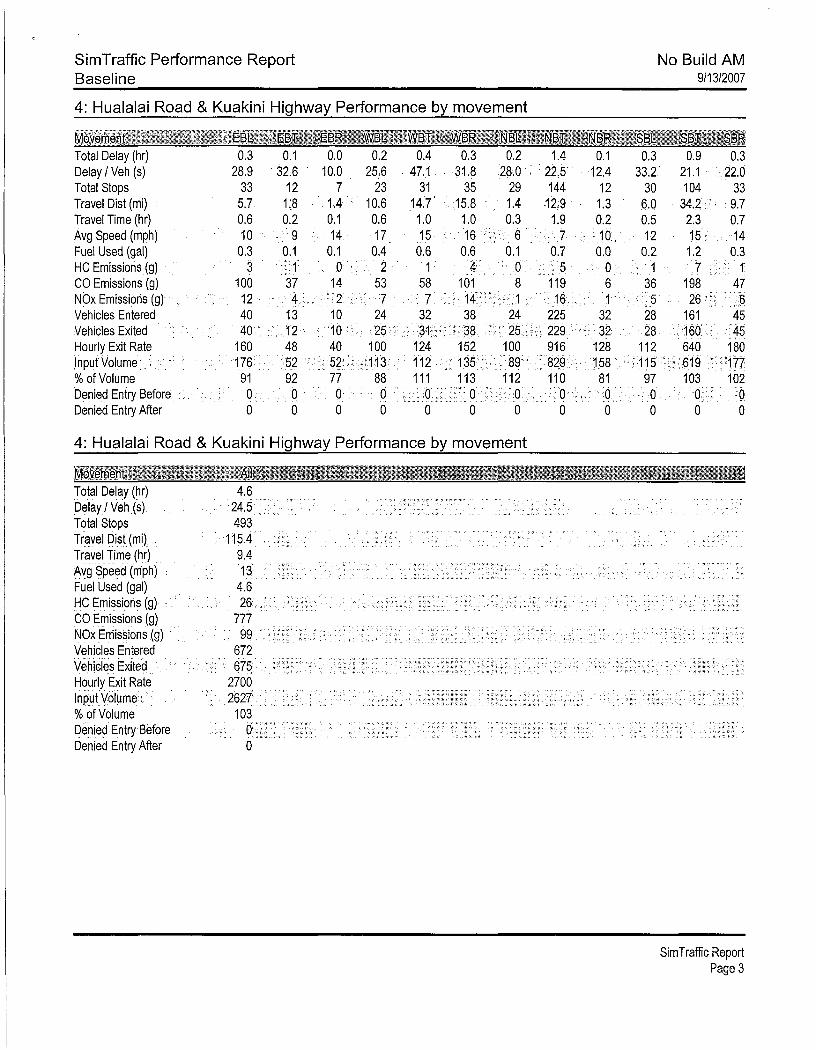
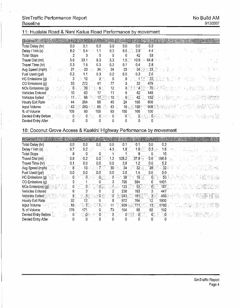
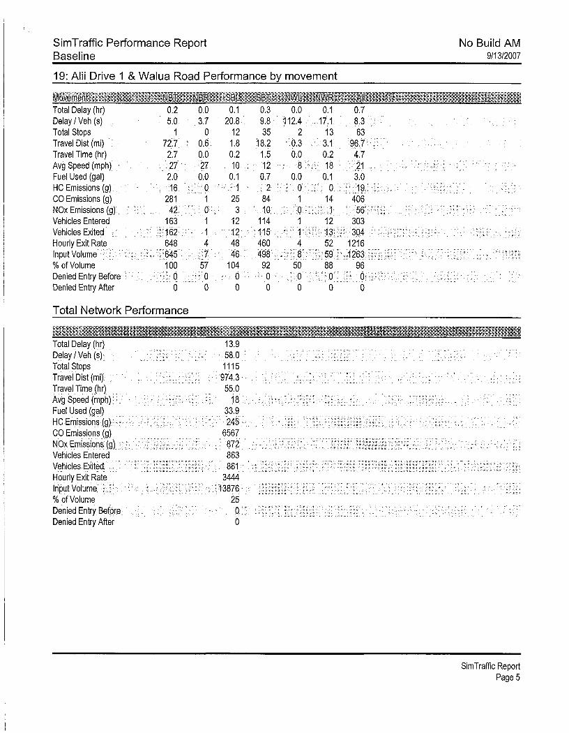
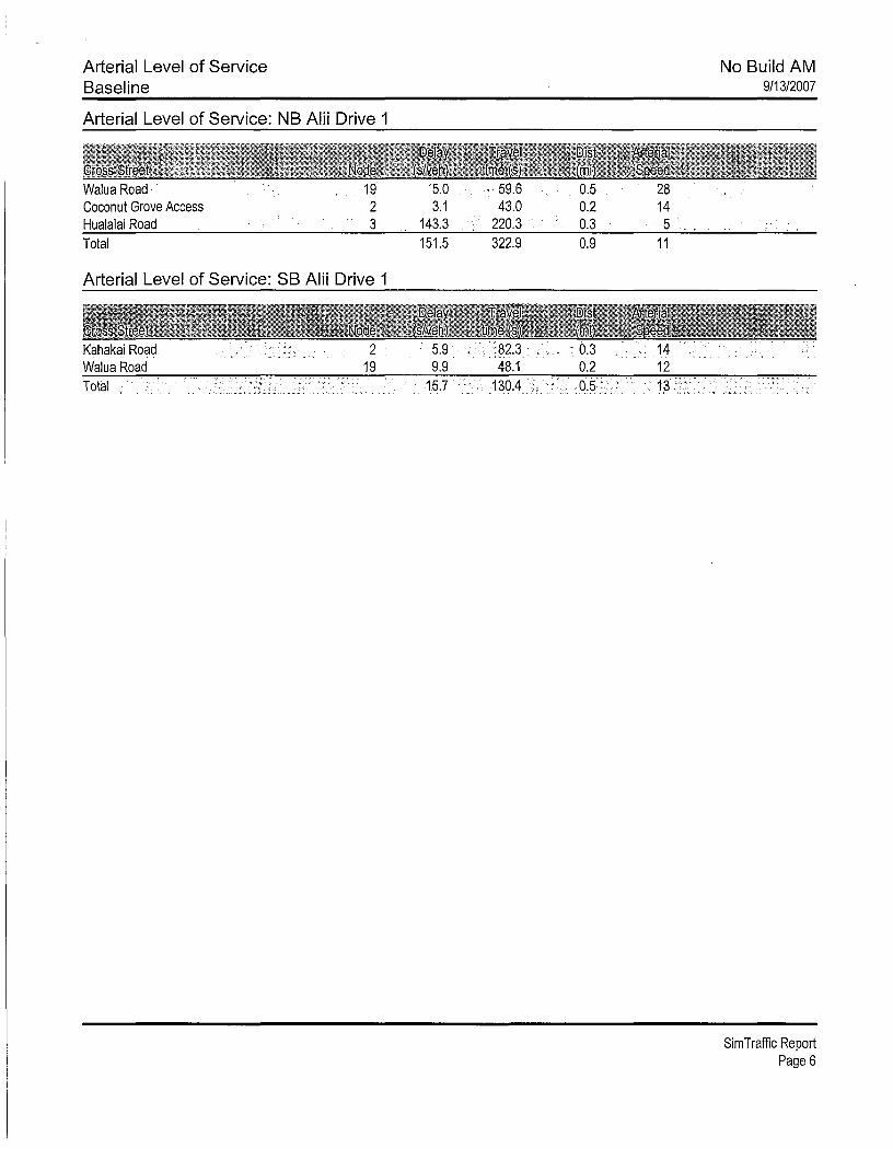
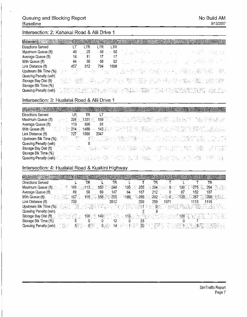
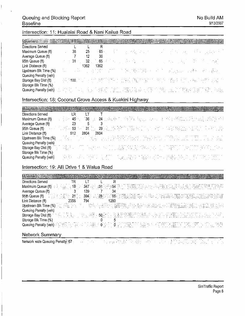


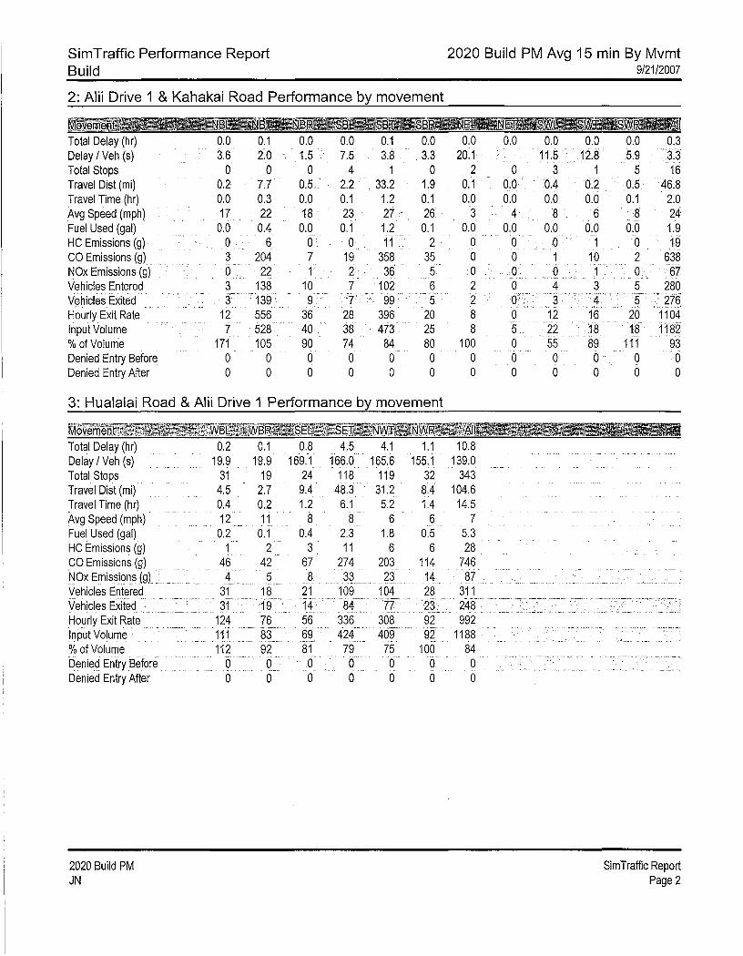
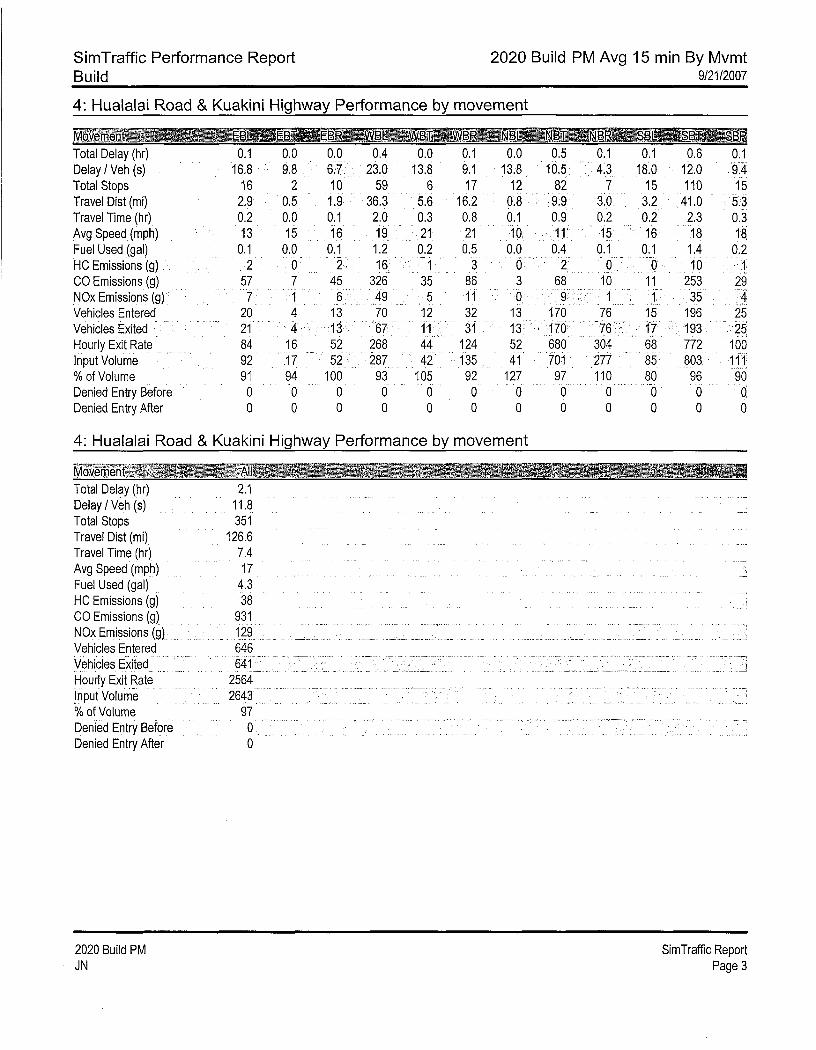
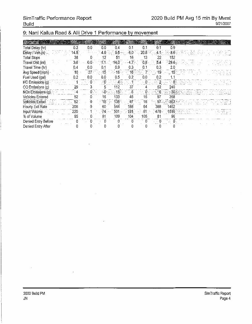

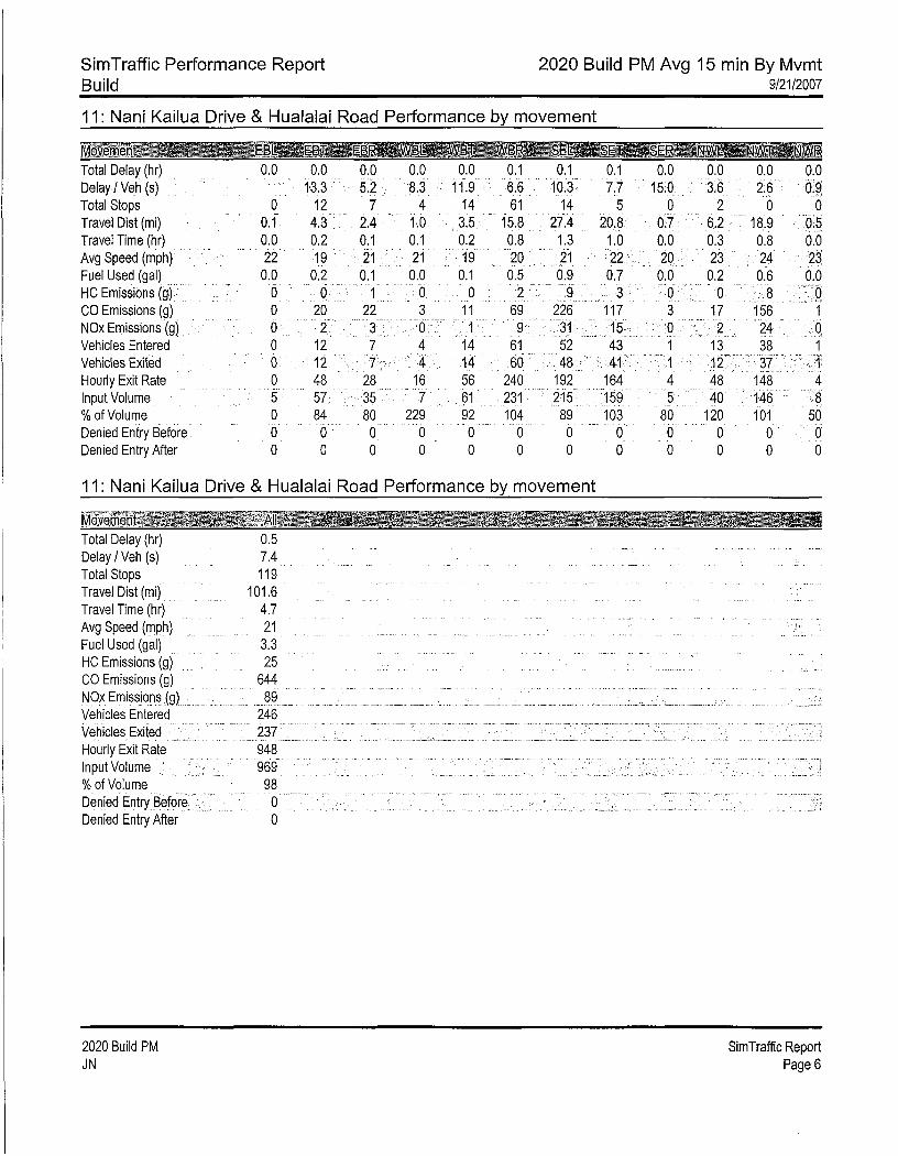


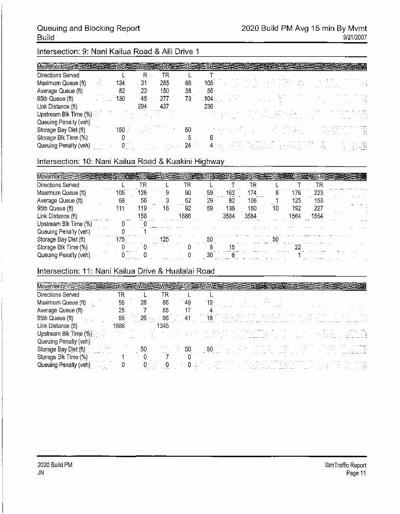
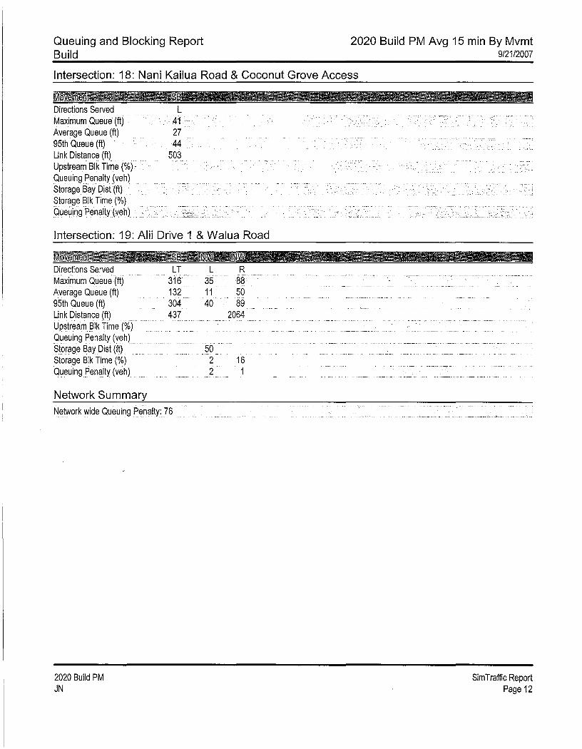

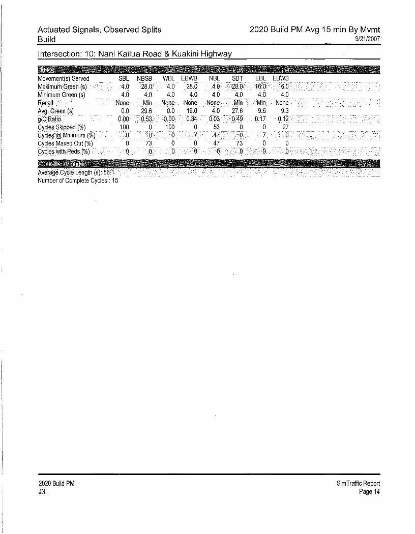
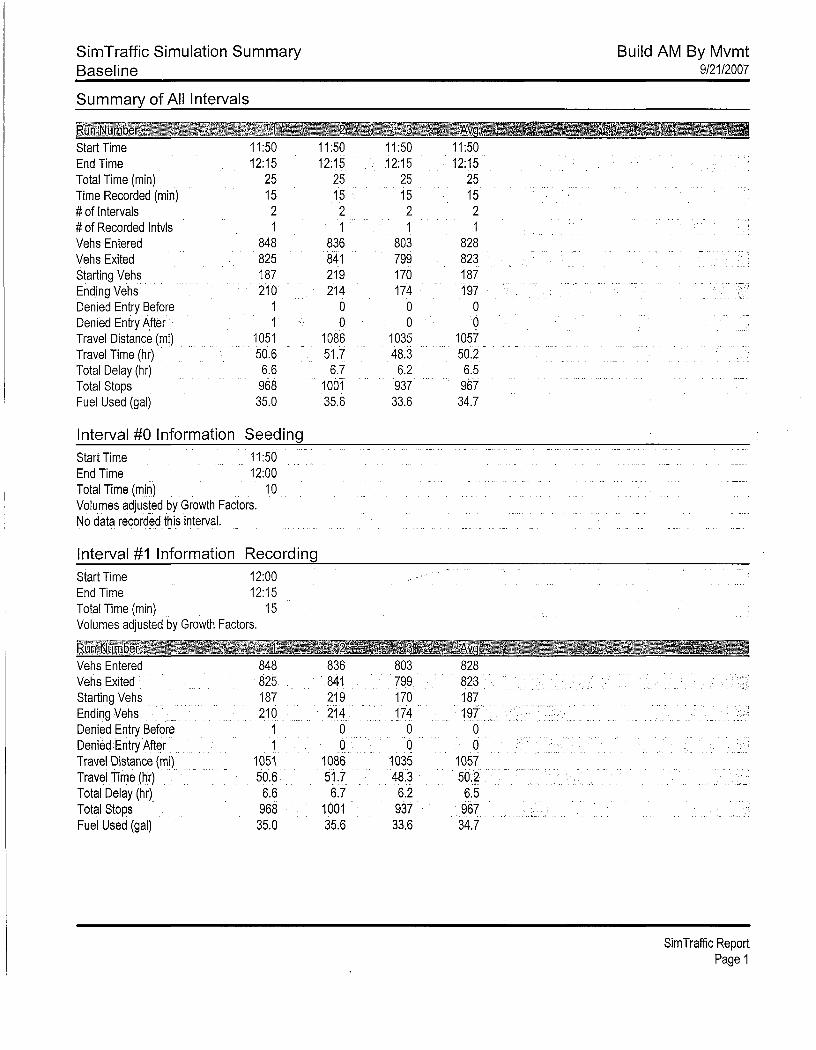

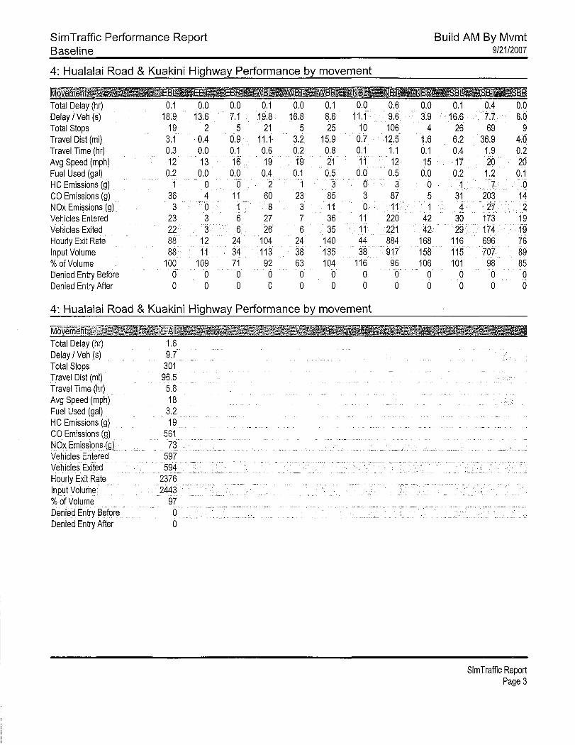
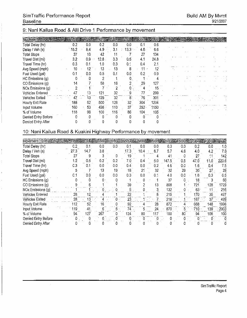
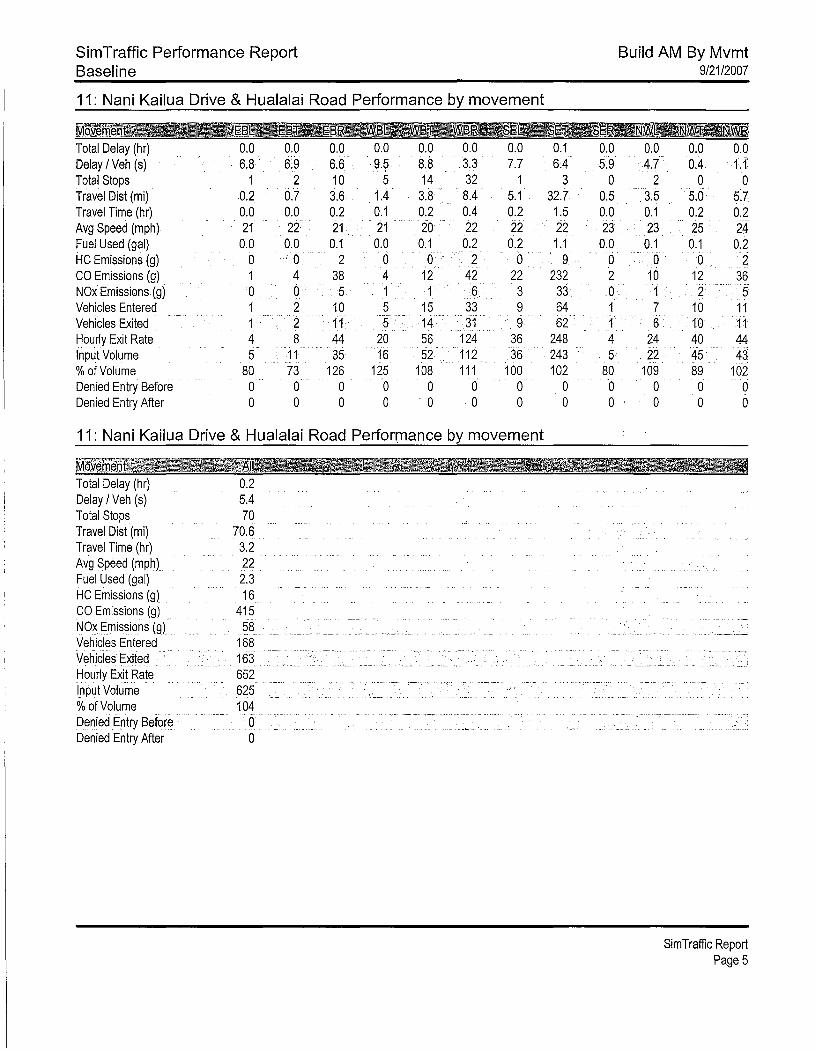
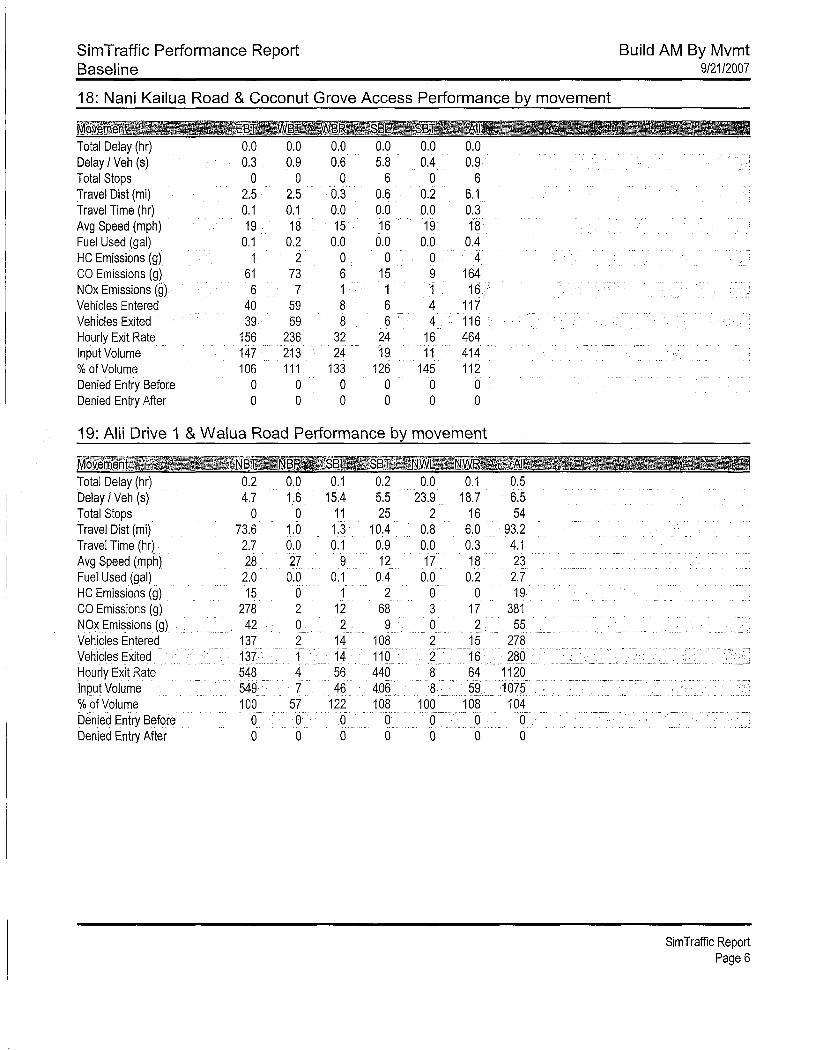

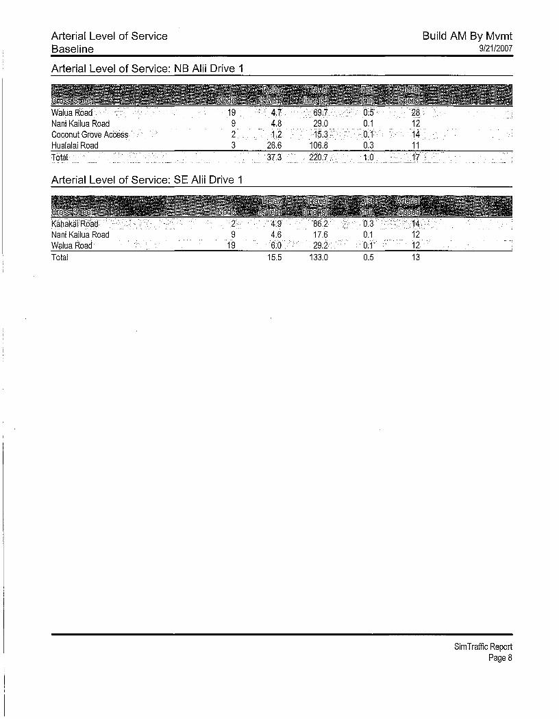
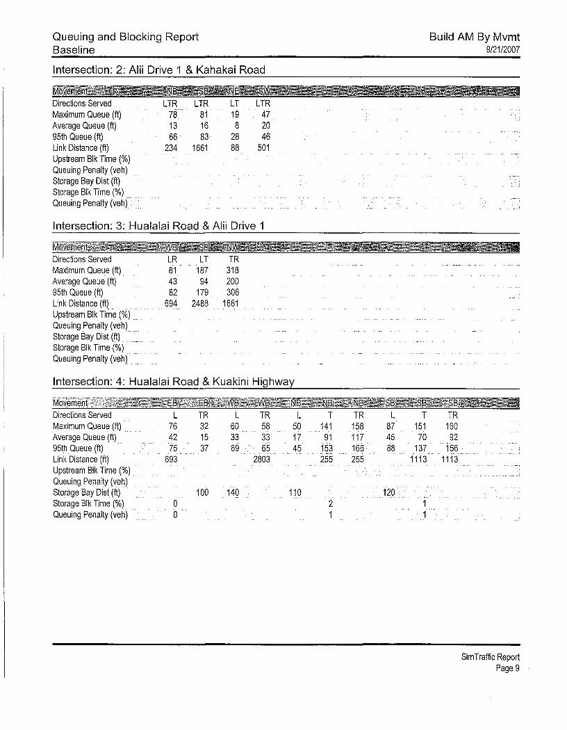
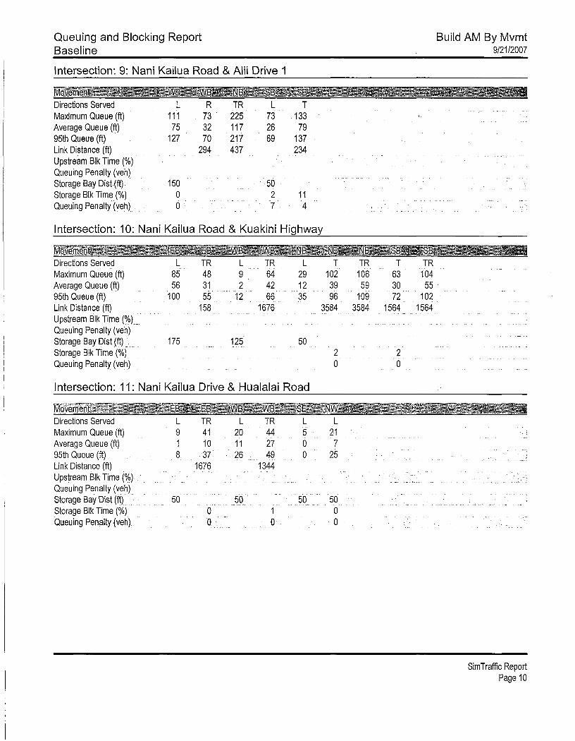

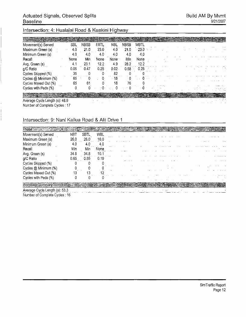


PB Americas, Inc. E Nani Kailua Drive Extension March 2009
Appendix E
Traffic Signal Warrant Analysis Worksheets

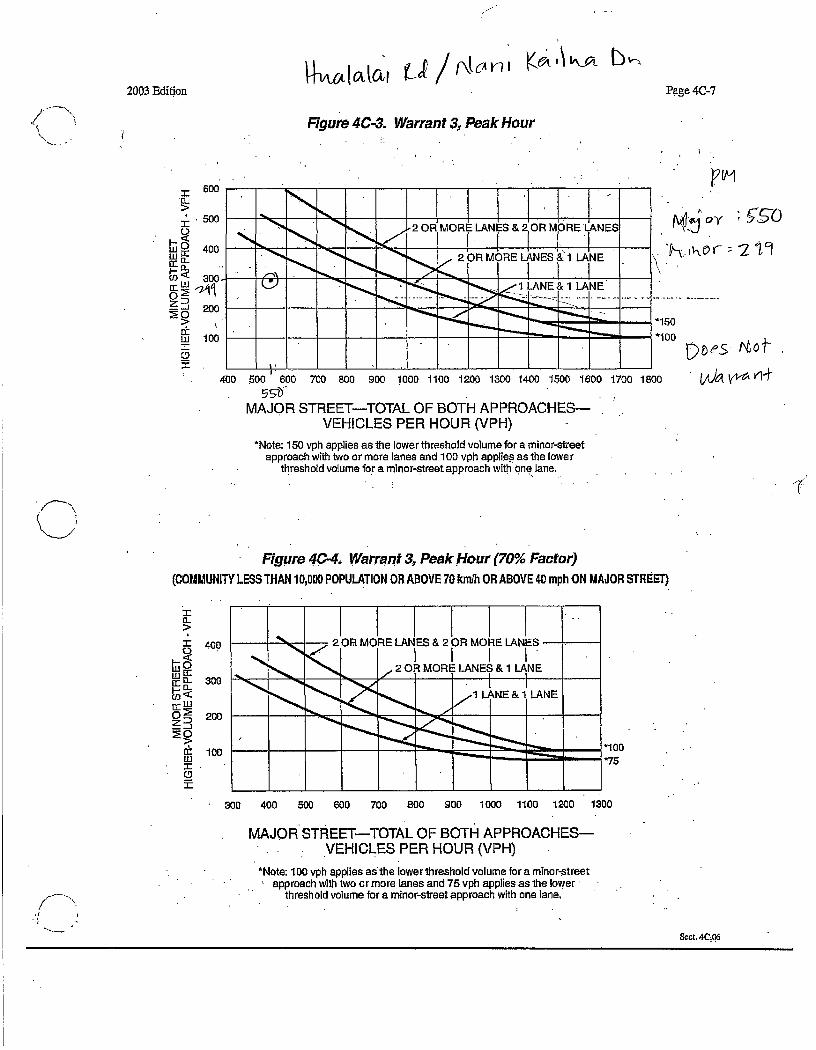
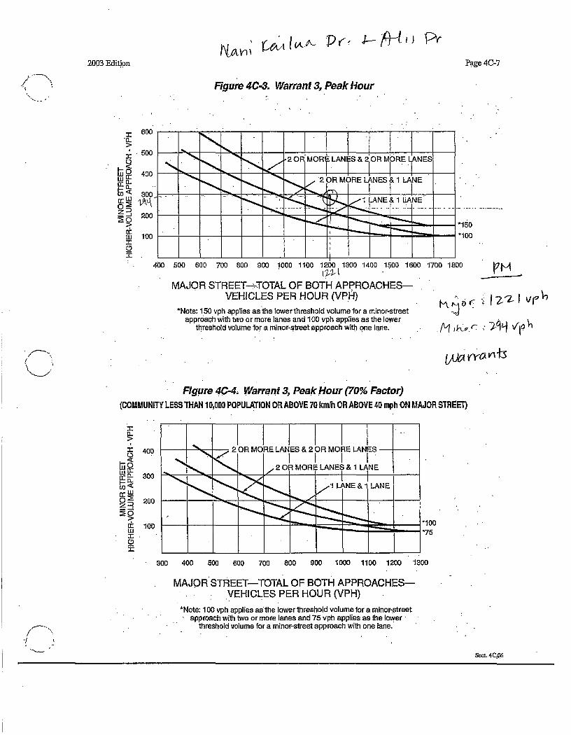

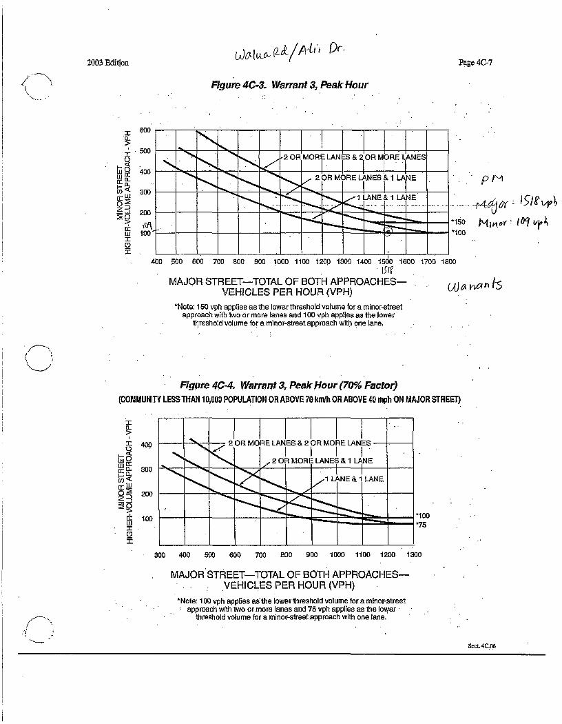
Ōneo Lane Draft Environmental Assessment
July 2015
APPENDIX B ARCHAEOLOGICAL SURVEY REPORT

RC-0446
An Archaeological Survey for the Proposed Extension of Nani Kailua Drive (TMK: (3) 7-5-10:006, 084; (3) 7-5-09:010, 021, 022, 057)
Pua‘a 1st, Puaóa 2nd,‘Auhaukea‘ē 2nd ahupua‘a North Kona District Island of Hawai‘i
Draft Version
PREPARED BY:
Robert B. Rechtman, Ph.D. Lizabeth E. Hauani‘o, B.A.
and Ashton K. Dircks Ah Sam, B.A.
PREPARED FOR:
PB Americas, Inc. 1001 Bishop Street
ASB Tower, Suite 2400 Honolulu, HI 96813
September 2009

An Archaeological Survey for the Proposed Extension of Nani Kailua Drive
(TMK: (3) 7-5-10:006, 084; (3) 7-5-09:010, 021, 022, 057)
Pua‘a 1st, Puaóa 2nd,‘Auhaukea‘ē 2nd ahupua‘a North Kona District
Island of Hawai‘i

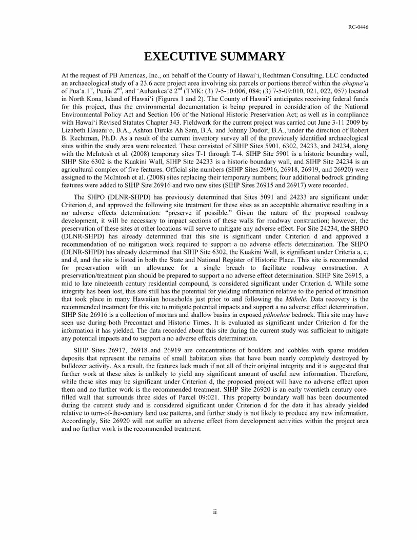
RC-0446
EXECUTIVE SUMMARY
At the request of PB Americas, Inc., on behalf of the County of Hawai‘i, Rechtman Consulting, LLC conducted an archaeological study of a 23.6 acre project area involving six parcels or portions thereof within the ahupua‘a of Pua‘a 1st, Puaóa 2nd, and ‘Auhaukea‘ē 2nd (TMK: (3) 7-5-10:006, 084; (3) 7-5-09:010, 021, 022, 057) located in North Kona, Island of Hawai‘i (Figures 1 and 2). The County of Hawai‘i anticipates receiving federal funds for this project, thus the environmental documentation is being prepared in consideration of the National Environmental Policy Act and Section 106 of the National Historic Preservation Act; as well as in compliance with Hawai‘i Revised Statutes Chapter 343. Fieldwork for the current project was carried out June 3-11 2009 by Lizabeth Hauani‘o, B.A., Ashton Dircks Ah Sam, B.A. and Johnny Dudoit, B.A., under the direction of Robert B. Rechtman, Ph.D. As a result of the current inventory survey all of the previously identified archaeological sites within the study area were relocated. These consisted of SIHP Sites 5901, 6302, 24233, and 24234, along with the McIntosh et al. (2008) temporary sites T-1 through T-4. SIHP Site 5901 is a historic boundary wall, SIHP Site 6302 is the Kuakini Wall, SIHP Site 24233 is a historic boundary wall, and SIHP Site 24234 is an agricultural complex of five features. Official site numbers (SIHP Sites 26916, 26918, 26919, and 26920) were assigned to the McIntosh et al. (2008) sites replacing their temporary numbers; four additional bedrock grinding features were added to SIHP Site 26916 and two new sites (SIHP Sites 26915 and 26917) were recorded.
The SHPO (DLNR-SHPD) has previously determined that Sites 5091 and 24233 are significant under Criterion d, and approved the following site treatment for these sites as an acceptable alternative resulting in a no adverse effects determination: “preserve if possible.” Given the nature of the proposed roadway development, it will be necessary to impact sections of these walls for roadway construction; however, the preservation of these sites at other locations will serve to mitigate any adverse effect. For Site 24234, the SHPO (DLNR-SHPD) has already determined that this site is significant under Criterion d and approved a recommendation of no mitigation work required to support a no adverse effects determination. The SHPO (DLNR-SHPD) has already determined that SIHP Site 6302, the Kuakini Wall, is significant under Criteria a, c, and d, and the site is listed in both the State and National Register of Historic Place. This site is recommended for preservation with an allowance for a single breach to facilitate roadway construction. A preservation/treatment plan should be prepared to support a no adverse effect determination. SIHP Site 26915, a mid to late nineteenth century residential compound, is considered significant under Criterion d. While some integrity has been lost, this site still has the potential for yielding information relative to the period of transition that took place in many Hawaiian households just prior to and following the Māhele. Data recovery is the recommended treatment for this site to mitigate potential impacts and support a no adverse effect determination. SIHP Site 26916 is a collection of mortars and shallow basins in exposed pāhoehoe bedrock. This site may have seen use during both Precontact and Historic Times. It is evaluated as significant under Criterion d for the information it has yielded. The data recorded about this site during the current study was sufficient to mitigate any potential impacts and to support a no adverse effects determination.
SIHP Sites 26917, 26918 and 26919 are concentrations of boulders and cobbles with sparse midden deposits that represent the remains of small habitation sites that have been nearly completely destroyed by bulldozer activity. As a result, the features lack much if not all of their original integrity and it is suggested that further work at these sites is unlikely to yield any significant amount of useful new information. Therefore, while these sites may be significant under Criterion d, the proposed project will have no adverse effect upon them and no further work is the recommended treatment. SIHP Site 26920 is an early twentieth century core-filled wall that surrounds three sides of Parcel 09:021. This property boundary wall has been documented during the current study and is considered significant under Criterion d for the data it has already yielded relative to turn-of-the-century land use patterns, and further study is not likely to produce any new information. Accordingly, Site 26920 will not suffer an adverse effect from development activities within the project area and no further work is the recommended treatment.
ii
RC-0446
Contents
INTRODUCTION..................................................................................................................... 1
BACKGROUND....................................................................................................................... 1
Project Area Description ........................................................................................................... 1
Culture Historical Context......................................................................................................... 6
Previous Archaeological Research .......................................................................................... 11
PROJECT AREA EXPECTATIONS...................................................................................... 18
FIELDWORK ......................................................................................................................... 19
Methods ................................................................................................................................... 19
Findings ................................................................................................................................... 20
Summary ................................................................................................................................. 50
SIGNIFICANCE EVALUATION, DETERMINATION OF EFFECTS, AND
TREATMENT RECOMMENDATIONS ............................................................................... 50
REFERENCES CITED ........................................................................................................... 52
Figures 1. Project area location. ............................................................................................................. 2
2. TMK:3-7-5 showing the current study area (Parcels 09:010, 021, 022, 057
and 10:006, 084). .................................................................................................................. 3
3. Vegetation in the makai portion of the project area, view to the west (note bulldozing)...... 4
4. Typical landscaped vegetation in the central portion of the project area, view to the east. .. 5
5. Vegetation in the mauka portion of the project area, view to the southwest......................... 5
6. TMK:3-7-5-9 showing kuleana awards in the vicinity of the current study area. ................. 9
7. Previous archaeological studies in the vicinity of the current project area.......................... 12
8. Map from Connolly 1974 showing current study area. ....................................................... 13
9. SIHP Site 26915 1979 Soehren photograph of stone seats, view to south. ......................... 15
10. SIHP Site 26915 1979 Soehren photograph house floor, near southeast corner, view to east. ...................................................................................................................... 15
11. SIHP Site 26915 1979 Soehren photograph makai side of platform, view to north.......... 16
12. SIHP Site 26915 1979 Soehren photograph northwest corner, view to southeast. ........... 16
13. Project area plan view. ...................................................................................................... 21
iii
RC-0446
14. SIHP Site 6302 near the junction with SIHP Site 5091, view to southeast. ...................... 22
15. Collapsed portions of SIHP Site 6302 behind Kama‘āina Hale, view to northeast........... 22
16. Portion of 1880 Emerson and Kanakanui map of Kailua town and vicinity (retraced by Lane in 1928). ............................................................................................... 23
17. Portion of SIHP Site 5091 along northern boundary of Parcel 09-057, view to the west. 24
18. SIHP Site 24233 remnants of a wooden cattle gate, view to north. .................................. 25
19. SIHP Site 24234 plan view showing test unit location...................................................... 26
20. SIHP Site 24234 Feature A, view to southeast.................................................................. 27
21. SIHP Site 24234 Feature A, TU-1 north wall profile........................................................ 28
22. SIHP Site 24234 Feature A, TU-1 base of excavation, view to north............................... 28
23. SIHP Site 24234 Feature B, view to south. ....................................................................... 29
24. SIHP Site 24234 Feature C, view to south. ....................................................................... 30
25. SIHP Site 24234 Feature C, TU-2 profile and photograph from....................................... 31
26. SIHP Site 24234 Feature D, view to south........................................................................ 30
27. SIHP Site 24234 Feature E, view to east from the western end of the feature.................. 32
28. SIHP Site 24234 Feature F, view to east. .......................................................................... 33
29. SIHP Site 26915 plan view................................................................................................ 34
30. Site 26915, Feature A cross section of makai (west) wall, view to south. ........................ 35
31. SIHP Site 26915 Feature A interior of mauka wall, view to northeast. ............................ 35
32. Site 26915 Feature A interior of south wall, intact section, view to south........................ 36
33. SIHP Site 26915, Feature B northeast corner showing remnant paving. .......................... 37
34. SIHP Site 26915, Feature B makai side showing paved lanai area................................... 37
35. SIHP Site 26915, Feature B central portion showing paving and edge of feature. ........... 38
36. SIHP Site 26915 Feature B, TU-1 surface, view to the east.............................................. 39
37. SIHP Site 26915 1830s-1870s era sauce bottle fragment, base view................................ 40
38. SIHP Site 26915 1830s-1870s era sauce bottle fragment, side view. ............................... 40
39. SIHP Site 26915 Feature B, TU-1 west wall profile. ........................................................ 41
40. SIHP Site 26915 Feature B, TU-1 west wall profile. ........................................................ 41
41. SIHP Site 26915 Feature B TU-1 pearlware fragment exterior view................................ 42
42. SIHP Site 26915 Feature B TU-1 pearlware fragment interior view. ............................... 42
43. SIHP Site 26916, Features A, B, C, D and E, view to the northwest. ............................... 43
44. SIHP Site 26916 plan view................................................................................................ 44
45. SIHP Site 26916 Feature D, mortar next to modern core sample hole, overview............. 45
46. SIHP Site 26917, view to northwest.................................................................................. 46
iv
RC-0446
v
47. SIHP Site 26918, view to northwest.................................................................................. 47
48. SIHP Site 26919, view to east. .......................................................................................... 47
49. Constructed break and remnant wooden gate in mauka section of SHIP Site 26920........ 48
50. SIHP Site 26920 makai (west) wall with Ali‘i Drive in rear, view to northwest. ............. 49
51. SIHP Site 26920 south wall, view to southwest. ............................................................... 49
Tables 1. Kuleana Māhele awards in the vicinity of the current study area. ........................................ 8
2. Sites identified by McIntosh et al. (2008) within the current study area............................. 18
3. Sites within the current project area. ................................................................................... 20
4. Cultural material recovered from SIHP Site 26915 Feature B, TU-1. ................................ 39
5. Significance, effects, and treatment recommendations. ...................................................... 51

RC-0446
INTRODUCTION At the request of PB Americas, Inc., on behalf of the County of Hawai‘i, Rechtman Consulting, LLC conducted an archaeological study of a 23.6 acre project area involving six parcels or portions thereof within the ahupua‘a of Pua‘a 1st, Pua‘a 2nd, and ‘Auhaukea‘ē 2nd (TMK: (3) 7-5-10:006, 084; (3) 7-5-09:010, 021, 022, 057) located in North Kona, Island of Hawai‘i (Figures 1 and 2). The County of Hawai‘i anticipates receiving federal funds for this project, thus the environmental documentation is being prepared in consideration of the National Environmental Policy Act and Section 106 of the National Historic Preservation Act; as well as in compliance with Hawai‘i Revised Statutes Chapter 343. This study was undertaken in accordance with Hawai‘i Administrative Rules 13§13–275, and was performed consistent with the Rules Governing Minimal Standards for Archaeological Inventory Surveys and Reports as contained in Hawai‘i Administrative Rules 13§13–276. Compliance with the above standards is sufficient for meeting the initial historic preservation review process requirements of the State Historic Preservation Officer (SHPO), the Department of Land and Natural Resources–State Historic Preservation Division (DLNR–SHPD) and the County of Hawai‘i Planning Department. This report contains background information outlining the project area’s physical and cultural contexts, a presentation of previous archaeological work in the area and current survey expectations based on that previous work, an explanation of the project methods, detailed descriptions of the archaeological resources encountered, interpretation and evaluation of those resources, and lastly, treatment recommendations for all of the documented sites.
BACKGROUND To generate expectations regarding the nature of the historic properties that might exist within the study area, and to provide an appropriate background to assess any resources that are encountered, specific as well as general physical and cultural contexts are presented along with prior archaeological studies relevant to the project area.
Project Area Description The current study area is almost completely located in Pua‘a 1st Ahupua‘a, with one small portion (2 acres) in the northeast corner within ‘Auhaukea‘ē 2nd Ahupua‘a, and one very small portion (0.1 acres) in the southwest corner in Pua‘a 2nd Ahupua‘a (see Figure 2). As can be seen on Figure 3, Kuakini Highway bisects the project area toward its makai end. Three of the study area parcels (TMK: (3)7-5-09:021, 059 and 7-5-10:006) are owned by Kamehameha Schools; Parcel (3)7-5-09:022 is owned by a private individual, Parcel (3)7-5-010:084 is owned by The Hawai‘i Island Development Corporation; and Parcel (3)7-5-09:010 is owned by the Billfisher Condominium Association.
1
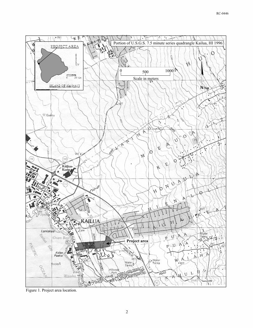

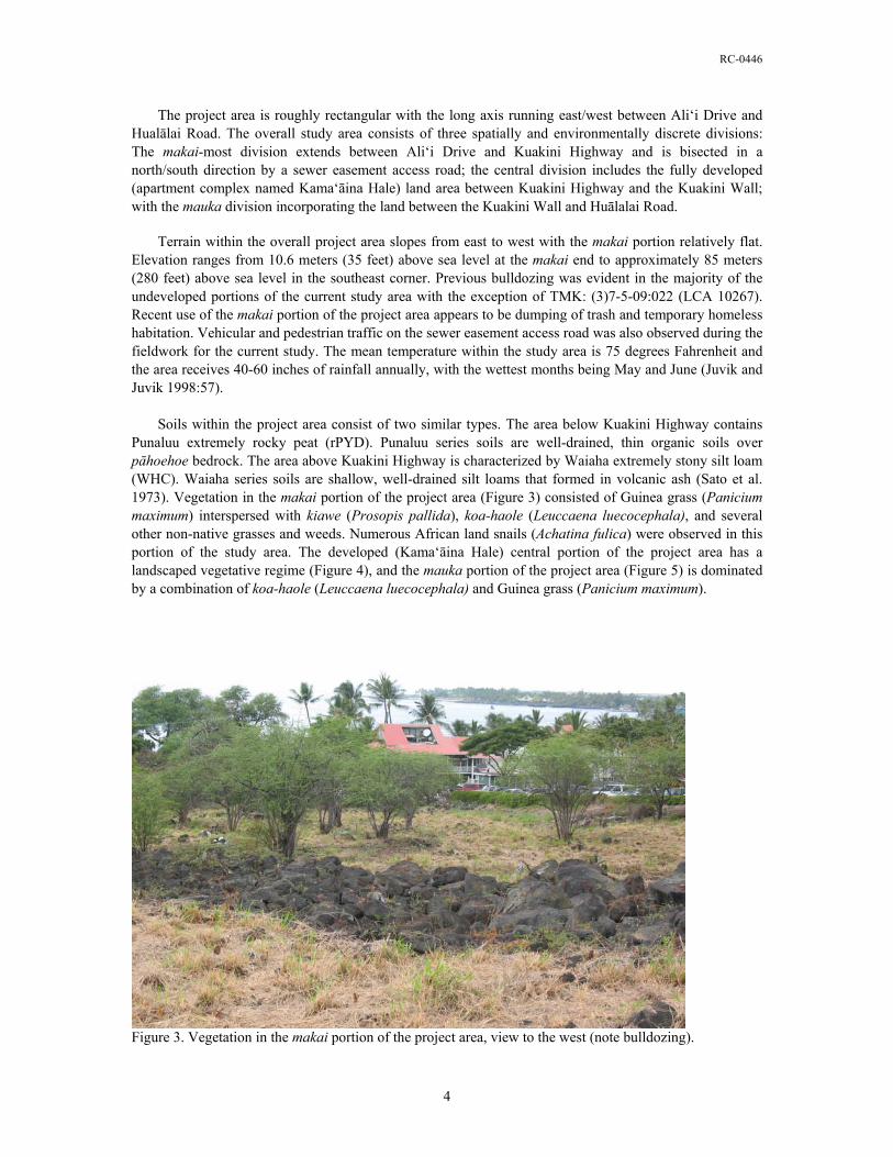
RC-0446
The project area is roughly rectangular with the long axis running east/west between Ali‘i Drive and Hualālai Road. The overall study area consists of three spatially and environmentally discrete divisions: The makai-most division extends between Ali‘i Drive and Kuakini Highway and is bisected in a north/south direction by a sewer easement access road; the central division includes the fully developed (apartment complex named Kama‘āina Hale) land area between Kuakini Highway and the Kuakini Wall; with the mauka division incorporating the land between the Kuakini Wall and Huālalai Road. Terrain within the overall project area slopes from east to west with the makai portion relatively flat. Elevation ranges from 10.6 meters (35 feet) above sea level at the makai end to approximately 85 meters (280 feet) above sea level in the southeast corner. Previous bulldozing was evident in the majority of the undeveloped portions of the current study area with the exception of TMK: (3)7-5-09:022 (LCA 10267). Recent use of the makai portion of the project area appears to be dumping of trash and temporary homeless habitation. Vehicular and pedestrian traffic on the sewer easement access road was also observed during the fieldwork for the current study. The mean temperature within the study area is 75 degrees Fahrenheit and the area receives 40-60 inches of rainfall annually, with the wettest months being May and June (Juvik and Juvik 1998:57). Soils within the project area consist of two similar types. The area below Kuakini Highway contains Punaluu extremely rocky peat (rPYD). Punaluu series soils are well-drained, thin organic soils over pāhoehoe bedrock. The area above Kuakini Highway is characterized by Waiaha extremely stony silt loam (WHC). Waiaha series soils are shallow, well-drained silt loams that formed in volcanic ash (Sato et al. 1973). Vegetation in the makai portion of the project area (Figure 3) consisted of Guinea grass (Panicium maximum) interspersed with kiawe (Prosopis pallida), koa-haole (Leuccaena luecocephala), and several other non-native grasses and weeds. Numerous African land snails (Achatina fulica) were observed in this portion of the study area. The developed (Kama‘āina Hale) central portion of the project area has a landscaped vegetative regime (Figure 4), and the mauka portion of the project area (Figure 5) is dominated by a combination of koa-haole (Leuccaena luecocephala) and Guinea grass (Panicium maximum).
Figure 3. Vegetation in the makai portion of the project area, view to the west (note bulldozing).
4
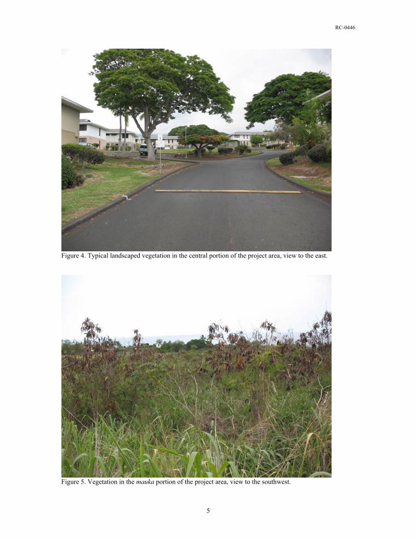
RC-0446
Figure 4. Typical landscaped vegetation in the central portion of the project area, view to the east.
Figure 5. Vegetation in the mauka portion of the project area, view to the southwest.
5

RC-0446
Culture Historical Context The project area occupies the coastal kula portion of the Kona Field System (Cordy 1995, Newman 1970, Schilt 1984). As defined, the Kona Field System extends north at least to Kaū Ahupua‘a and south to Honaunau, west from the coastline and east to the forested slopes of Hualālai (Cordy 1995). A large portion of this area is designated in the Hawai‘i SIHP (State Inventory of Historic Places) as Site 50-10-37-6601 and has been determined eligible for inclusion in the National Register of Historic Places. The basic characteristics and elevationally delimited zones within this agricultural/residential system as presented in Newman (1970) have been confirmed and elaborated on by ethnohistorical investigations (Kelly 1983). The west-central coast of the island of Hawai‘i includes the western slopes of the dormant Hualālai volcano. The Kona coast is for the most part covered with barren Hualālai lava flows broken only occasionally by fertile patches of land. The successive lava flows contain numerous tubes and blisters. The abundance of volcanic rock provided readily-available building material for house platforms, temples, fences, agricultural terraces, and Historic Period stock enclosures. The many crevices and caves created by the numerous lava flows afforded convenient locales for habitation, refuge, storage, refuse disposal, and burial. The current study parcel is located within the kula zone. This is the area from sea level to 150 meters elevation. Annual rainfall in the kula zone is 75 to 125 centimeters. Because it seldom rains on the leeward coast, West Hawai‘i is characterized by a paucity of stream drainages and a tendency to aridity; any surface water is quickly absorbed in the porous bedrock. In the early nineteenth century Ellis (1963) observed this water shortage, finding on his journey through the area that the populous Kailua is destitute of fresh water, except what is found in pools, or small streams, normally at higher elevations. Native Hawaiian people, however, had no problem drinking from the brackish springs on the coast (Cheever 1851:110). This lower elevation zone is traditionally associated with habitation and the cultivation of sweet potatoes, paper mulberry, and gourds. Agricultural features, such as clearing mounds, planting mounds, planting depressions, modified outcrops, pavements, enclosures, and planting terraces, are common throughout much of this zone (Hammatt and Clark 1980, Hammatt and Folk 1980, Haun et al. 1998, Schilt 1984). Dwellings were scattered throughout the agricultural portion of the kula, but they are commonly concentrated along the shoreline (Cordy 1981, Hammatt 1980). The shoreline portion of the kula zone extended inland approximately 200 meters and was used primarily for permanent habitation and other non-agricultural activities, such as canoe storage, ceremonial and burial practices, recreation, and fishing-related activities. Remnants of early house platforms near the Kaloko coast in North Kona have yielded radiocarbon dates between AD 920 and AD 1290 (Cordy 2000:132). This area is known for its large brackish ponds and flowing drainage around their edges. In Lanihau Ahupua‘a, also north of the current study area, midden deposits below stone platforms yielded charcoal that was dated to between AD 1055 and AD 1270. A lava tube shelter near Kahalu‘u Bay, to the south of the study area, yielded a date of between AD 1000 and AD 1280 (ibid. 132-133). These sites are considered to represent temporary habitations of pioneers utilizing the nearby coastal resources. Charcoal dates from walled upland fields suggest that cultivation of the Kona uplands started between AD 1000 and AD 1200 (ibid. 133). Considered together these roughly contemporary dates suggest the small pioneering communities that exploited coastal resources also cultivated the uplands. Most of the Hawaiians living on the west coast chose to settle in small villages near the shore or clustered around bays where canoes could be launched or landed. Fish and marine resources were nearby and plentiful. The moister uplands could be reached by trails several miles long (Holland 1971:32). Upland forests contained a smaller number of people, in temporary settlements, who hunted birds, harvested timber and bark, and logged sandalwood (ibid. 35). The seaward slope eventually became a mixed agricultural zone, with breadfruit planted on the lower slopes and large sweet potato and dry land taro plantations established in the higher elevations that received more rain (ibid. 33). With the decline of the breadfruit
6
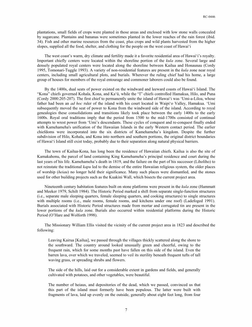
RC-0446
plantations, small fields of crops were planted in those areas and enclosed with low stone walls concealed by sugarcane. Plantains and bananas were sometimes planted in the lower reaches of the rain forest (ibid. 34). Fish and other marine resources from the coast, plus crops and wild plants harvested from the higher slopes, supplied all the food, shelter, and clothing for the people on the west coast of Hawai‘i The west coast’s warm, dry climate and fertility made it a favorite residential area of Hawai‘i’s royalty. Important chiefly centers were located within the shoreline portion of the kula zone. Several large and densely populated royal centers were located along the shoreline between Kailua and Honaunau (Cordy 1995, Tomonari-Tuggle 1993). A variety of non-residential features are present in the kula zone near royal centers, including small agricultural plots, and burials. Wherever the ruling chief had his home, a large group of houses for members of the royal entourage and commoner laborers could also be found. By the 1400s, dual seats of power existed on the windward and leeward coasts of Hawai‘i Island. The “Kona” chiefs governed Kohala, Kona, and Ka‘ū, while the “I” chiefs controlled Hamakua, Hilo, and Puna (Cordy 2000:205-207). The first chief to permanently unite the island of Hawai‘i was ‘Umi-a-Liloa, whose father had been an ad hoc ruler of the island with his court located in Waipi‘o Valley, Hamakua. ‘Umi subsequently moved the seat of power to Kona from the windward side of the island. According to royal genealogies these consolidations and transitions likely took place between the early 1400s to the early 1600s. Royal oral traditions imply that the period from 1500 to the mid-1700s consisted of continual attempts to wrest power from ‘Umi’s descendants. These cycles of conquest and re-conquest finally ended with Kamehameha's unification of the Hawaiian Islands in the early Western contact period. The earlier chiefdoms were incorporated into the six districts of Kamehameha’s kingdom. Despite the further subdivision of Hilo, Kohala, and Kona into northern and southern portions, the original district boundaries of Hawai‘i Island still exist today, probably due to their separation along natural physical barriers. The town of Kailua-Kona, has long been the residence of Hawaiian chiefs. Kailua is also the site of Kamakahonu, the parcel of land containing King Kamehameha’s principal residence and court during the last years of his life. Kamehameha’s death in 1819, and the failure on the part of his successor (Liholiho) to not reinstate the traditional kapu led to the demise of the entire Hawaiian religious system, the older places of worship (heiau) no longer held their significance. Many such places were dismantled, and the stones used for other building projects such as the Kuakini Wall, which bisects the current project area. Nineteenth century habitation features built on stone platforms were present in the kula zone (Hammatt and Meeker 1979, Schilt 1984). The Historic Period marked a shift from separate single-function structures (i.e., separate male sleeping quarters, female sleeping quarters, and cooking structures) to single structures with multiple rooms (i.e., male rooms, female rooms, and kitchens under one roof) (Ladefoged 1991). Burials associated with Historic Period structures made from mortar and corrugated tin are present in the lower portions of the kula zone. Burials also occurred within residential platforms during the Historic Period (O’Hare and Wolforth 1998). The Missionary William Ellis visited the vicinity of the current project area in 1823 and described the following:
Leaving Kairua [Kailua], we passed through the villages thickly scattered along the shore to the southward. The country around looked unusually green and cheerful, owing to the frequent rain, which for some months past have fallen on this side of the island. Even the barren lava, over which we traveled, seemed to veil its sterility beneath frequent tufts of tall waving grass, or spreading shrubs and flowers. The side of the hills, laid out for a considerable extent in gardens and fields, and generally cultivated with potatoes, and other vegetables, were beautiful. The number of heiaus, and depositories of the dead, which we passed, convinced us that this part of the island must formerly have been populous. The latter were built with fragments of lava, laid up evenly on the outside, generally about eight feet long, from four
7
RC-0446
to six broad, and about four feet high. Some appeared very ancient, other had evidently been standing but a few years. (1963[1823]:72–73).
The religious, socioeconomic, and demographic changes that took place in the period between 1790 and the 1840s promoted the establishment of a Euro-American style of land ownership and the Great Māhele was the vehicle for determining ownership of the native land. During this period (1848-1899), the Māhele defined the land interests of the King (Kamehameha III), the high-ranking chiefs, and the low-ranking chiefs, the konohiki. The chiefs and konohiki were required to present their claims to the Land Commission to receive awards for lands provided to them by Kamehameha III. They were also required to provide commutations to the government in order to receive royal patents on their awards. The lands were identified by name only, with the understanding that the ancient boundaries would prevail until the land could be surveyed. This process expedited the work of the Land Commission and speeded the transfers (Chinen 1961:13). During this process all lands were placed in one of three categories: Crown Lands (for the occupant of the throne), Government Lands, and Konohiki Lands. All three types of land were subject to the rights of the native tenants. Commoners could make claims for land, and if substantiated, they would receive awards referred to as kuleana, from the Land Commission. During this period, other land grants were also made to individuals directly from the Kingdom. The majority of Pua‘a 1st Ahupua‘a, was awarded to Lot Kapuāiwa as Land Commission Award (LCAw.) 7715:13. Lot Kapuāiwa later become King Kamehameha V and ruled Hawai‘i for 9 years from 1863-1872. After his death his hanai sister, Bernice Pauahi Bishop, inherited his lands. With her death in 1884, the land was placed into the Kamehameha Schools Bishop Estate Trust (KSBE). Pua‘a 2nd and 3rd were retained as Government Lands during the Māhele. In addition to the Lot Kapuāiwa’s 850 acre konohiki award, there were two kuleana awarded in the study area, makai of Kuakini Highway (Table 1; Figure 7). LCAw. 10267 was awarded to Molowaole as an enclosed house lot. This kuleana is roughly coterminous with TMK:3-7-5-09:022. And, within the northern portion of TMK:3-7-5-09:021, LCAw. 7074 was awarded to Kanewaahilani and reportedly contained two houses. As indicated in the Māhele records, four other kuleana house lots were located in the vicinity of the project area (see Table 1 and Figure 6). LCAw. 4140 (1.172 acres) is located adjacent to, and makai of TMK: (3)7-5-09:021. This award was made to Kamanawa and may have contained two houses. LCAw. 4140 is not part of the current study and was not surveyed, although several walls and modified outcrops were observed within that area during the current study. The remaining kuleana awards (LCAw., 7078, 7080, and 7968:1) are located on the makai side of Ali‘i Drive, and each reportedly was a house lot. Table 1. Kuleana Māhele awards in the vicinity of the current study area.
LCA number Awardee Acerage Comments 7074 Kanewaahilani 0.16 House lot (2 houses) 10267 Molowaole 0.18 Enclosure/house lot 4140 Kamanawa 1.6 2 houses 7078 Keulua 0.69 House lot 7080 Kahaulelio 0.18 House lot 7968:1 Kahaunapa 0.3 House lot
8
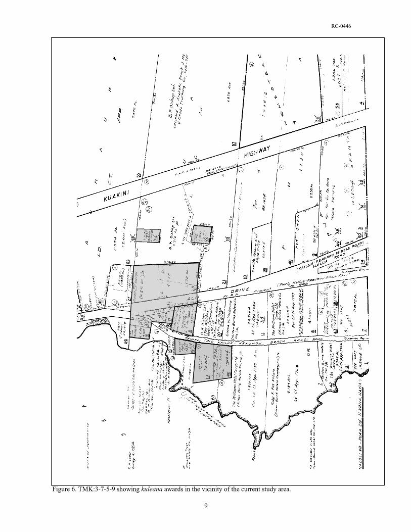
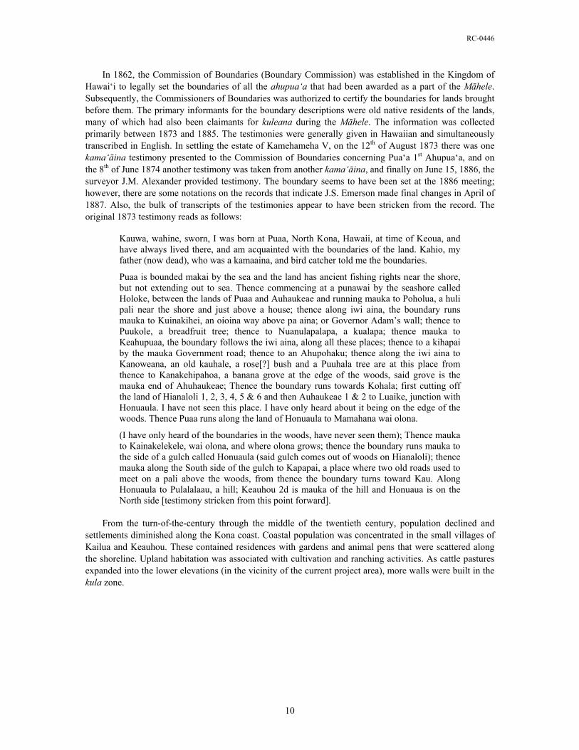
RC-0446
In 1862, the Commission of Boundaries (Boundary Commission) was established in the Kingdom of Hawai‘i to legally set the boundaries of all the ahupua‘a that had been awarded as a part of the Māhele. Subsequently, the Commissioners of Boundaries was authorized to certify the boundaries for lands brought before them. The primary informants for the boundary descriptions were old native residents of the lands, many of which had also been claimants for kuleana during the Māhele. The information was collected primarily between 1873 and 1885. The testimonies were generally given in Hawaiian and simultaneously transcribed in English. In settling the estate of Kamehameha V, on the 12th of August 1873 there was one kama‘āina testimony presented to the Commission of Boundaries concerning Pua‘a 1st Ahupua‘a, and on the 8th of June 1874 another testimony was taken from another kama‘āina, and finally on June 15, 1886, the surveyor J.M. Alexander provided testimony. The boundary seems to have been set at the 1886 meeting; however, there are some notations on the records that indicate J.S. Emerson made final changes in April of 1887. Also, the bulk of transcripts of the testimonies appear to have been stricken from the record. The original 1873 testimony reads as follows:
Kauwa, wahine, sworn, I was born at Puaa, North Kona, Hawaii, at time of Keoua, and have always lived there, and am acquainted with the boundaries of the land. Kahio, my father (now dead), who was a kamaaina, and bird catcher told me the boundaries.
Puaa is bounded makai by the sea and the land has ancient fishing rights near the shore, but not extending out to sea. Thence commencing at a punawai by the seashore called Holoke, between the lands of Puaa and Auhaukeae and running mauka to Poholua, a huli pali near the shore and just above a house; thence along iwi aina, the boundary runs mauka to Kuinakihei, an oioina way above pa aina; or Governor Adam’s wall; thence to Puukole, a breadfruit tree; thence to Nuanulapalapa, a kualapa; thence mauka to Keahupuaa, the boundary follows the iwi aina, along all these places; thence to a kihapai by the mauka Government road; thence to an Ahupohaku; thence along the iwi aina to Kanoweana, an old kauhale, a rose[?] bush and a Puuhala tree are at this place from thence to Kanakehipahoa, a banana grove at the edge of the woods, said grove is the mauka end of Ahuhaukeae; Thence the boundary runs towards Kohala; first cutting off the land of Hianaloli 1, 2, 3, 4, 5 & 6 and then Auhaukeae 1 & 2 to Luaike, junction with Honuaula. I have not seen this place. I have only heard about it being on the edge of the woods. Thence Puaa runs along the land of Honuaula to Mamahana wai olona.
(I have only heard of the boundaries in the woods, have never seen them); Thence mauka to Kainakelekele, wai olona, and where olona grows; thence the boundary runs mauka to the side of a gulch called Honuaula (said gulch comes out of woods on Hianaloli); thence mauka along the South side of the gulch to Kapapai, a place where two old roads used to meet on a pali above the woods, from thence the boundary turns toward Kau. Along Honuaula to Pulalalaau, a hill; Keauhou 2d is mauka of the hill and Honuaua is on the North side [testimony stricken from this point forward].
From the turn-of-the-century through the middle of the twentieth century, population declined and settlements diminished along the Kona coast. Coastal population was concentrated in the small villages of Kailua and Keauhou. These contained residences with gardens and animal pens that were scattered along the shoreline. Upland habitation was associated with cultivation and ranching activities. As cattle pastures expanded into the lower elevations (in the vicinity of the current project area), more walls were built in the kula zone.
10
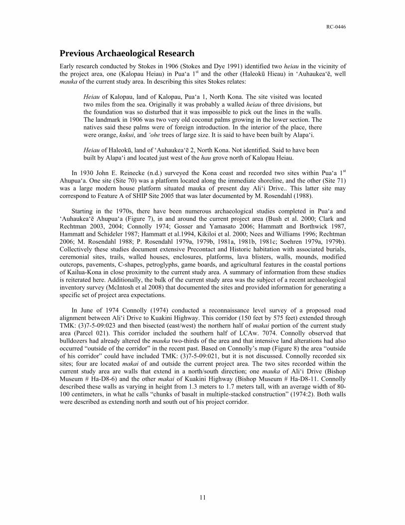
RC-0446
Previous Archaeological Research Early research conducted by Stokes in 1906 (Stokes and Dye 1991) identified two heiau in the vicinity of the project area, one (Kalopau Heiau) in Pua‘a 1st and the other (Haleokū Hieau) in ‘Auhaukea‘ē, well mauka of the current study area. In describing this sites Stokes relates:
Heiau of Kalopau, land of Kalopau, Pua‘a 1, North Kona. The site visited was located two miles from the sea. Originally it was probably a walled heiau of three divisions, but the foundation was so disturbed that it was impossible to pick out the lines in the walls. The landmark in 1906 was two very old coconut palms growing in the lower section. The natives said these palms were of foreign introduction. In the interior of the place, there were orange, kukui, and ‘ohe trees of large size. It is said to have been built by Alapa‘i. Heiau of Haleokū, land of ‘Auhaukea‘ē 2, North Kona. Not identified. Said to have been built by Alapa‘i and located just west of the hau grove north of Kalopau Heiau.
In 1930 John E. Reinecke (n.d.) surveyed the Kona coast and recorded two sites within Pua‘a 1st Ahupua‘a. One site (Site 70) was a platform located along the immediate shoreline, and the other (Site 71) was a large modern house platform situated mauka of present day Ali‘i Drive.. This latter site may correspond to Feature A of SHIP Site 2005 that was later documented by M. Rosendahl (1988). Starting in the 1970s, there have been numerous archaeological studies completed in Pua‘a and ‘Auhaukea‘ē Ahupua‘a (Figure 7), in and around the current project area (Bush et al. 2000; Clark and Rechtman 2003, 2004; Connolly 1974; Gosser and Yamasato 2006; Hammatt and Borthwick 1987, Hammatt and Schideler 1987; Hammatt et al.1994, Kikiloi et al. 2000; Nees and Williams 1996; Rechtman 2006; M. Rosendahl 1988; P. Rosendahl 1979a, 1979b, 1981a, 1981b, 1981c; Soehren 1979a, 1979b). Collectively these studies document extensive Precontact and Historic habitation with associated burials, ceremonial sites, trails, walled houses, enclosures, platforms, lava blisters, walls, mounds, modified outcrops, pavements, C-shapes, petroglyphs, game boards, and agricultural features in the coastal portions of Kailua-Kona in close proximity to the current study area. A summary of information from these studies is reiterated here. Additionally, the bulk of the current study area was the subject of a recent archaeological inventory survey (McIntosh et al 2008) that documented the sites and provided information for generating a specific set of project area expectations. In June of 1974 Connolly (1974) conducted a reconnaissance level survey of a proposed road alignment between Ali‘i Drive to Kuakini Highway. This corridor (150 feet by 575 feet) extended through TMK: (3)7-5-09:023 and then bisected (east/west) the northern half of makai portion of the current study area (Parcel 021). This corridor included the southern half of LCAw. 7074. Connolly observed that bulldozers had already altered the mauka two-thirds of the area and that intensive land alterations had also occurred “outside of the corridor” in the recent past. Based on Connolly’s map (Figure 8) the area “outside of his corridor” could have included TMK: (3)7-5-09:021, but it is not discussed. Connolly recorded six sites; four are located makai of and outside the current project area. The two sites recorded within the current study area are walls that extend in a north/south direction; one mauka of Ali‘i Drive (Bishop Museum # Ha-D8-6) and the other makai of Kuakini Highway (Bishop Museum # Ha-D8-11. Connolly described these walls as varying in height from 1.3 meters to 1.7 meters tall, with an average width of 80-100 centimeters, in what he calls “chunks of basalt in multiple-stacked construction” (1974:2). Both walls were described as extending north and south out of his project corridor.
11
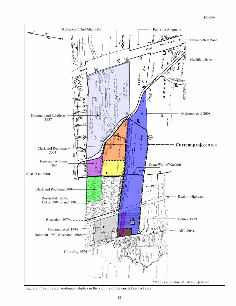
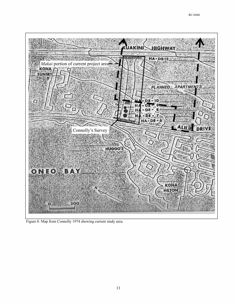
RC-0446
In July of 1979 Soehren (1979a) conducted a reconnaissance level survey of TMK: (3)7-5-09:021 and 022, which is the makai portion of the current study area. Soehren recorded that extensive bulldozing had occurred on Parcel 021, and identified two areas as probable house platforms that were substantially bulldozed. In the northwest corner of Parcel 21 Soehren described a probable house platform destroyed by bulldozing based on observations of a three feet long exposure of terrace facing, one foot high, and remnant “paving with coral and shell fragments”. In the area of LCAw. 7074 within Parcel 021, he described another bulldozed probable platform. Regarding Parcel 022, Soehren stated that:
Within the enclosure is a very well preserved kahua hale, or house platform, four by five fathoms (24 x 30 feet), in extent, and oriented mauka-makai (east-west). The mauka half is finely paved with small field stones… In front of the house, on the makai half of the platform, is a lanai floor paved with somewhat larger stones and slightly lower than the house floor. (Soehren 1979a:1)
Photographs contained in Soehren’s report, reproduced here as Figures 9, 10, 11 and 12, show a house platform with architectural integrity, with facing evident and containing two distinct pavements. In the center of the feature, in a place Soehren identified as a possible doorway to the house; are large, flat, waterworn boulders that he described as stone seats. Soehren also described a lack of “historic detritus” at the site and suggested that this kuleana house site is “…one of the few remaining in the vicinity of Kailua…an excellent example of its kind.” (Soehren 1979a:2). In 1979 Soehren (1979b) also conducted a reconnaissance survey of TMK: (3)7-5-10:006, a parcel that make up the bulk of the mauka portion of the current study area. Soehren reported that the entire parcel had been grubbed by bulldozers and no sites were recorded. In the late 1970s and early 1980s Paul H. Rosendahl, Ph. D, Inc. (PHRI) conducted several phases of archaeological study at an approximately 15-acre project area (TMK: (3)7-5-09:54, 55) located directly adjacent to the middle portion of the current study area within ‘Auhaukea‘ē 1st and 2nd ahupua‘a (Rosendahl 1979a, 1979b, 1981a, 1981b, and 1981c). PHRI recorded a single site (SIHP Site 5608) distributed across both parcels, with seventy-five features. Three of the largest structural features were interpreted as “possible heiau” (Rosendahl 1981c). Of the remaining seventy-two features, twenty-nine were listed as possible burials, five were confirmed burials, and three others were considered probable burials (Rosendahl 1981b). Four of the recorded features were interpreted as residential, eight as retaining walls, one as a cairn, one as a bedrock activity area, one as a possible walled terrace, one as a storage feature, one as a modern construction, and sixteen were of unknown or undetermined functions. Rosendahl (1981a) recommended further subsurface testing and detailed mapping. In 1987, Cultural Surveys Hawaii (Hammatt and Schideler 1987) conducted archaeological excavations at two sites within ‘Auhaukea‘ē Ahupua‘a mauka of the current project area (TMK: (3)7-5-10:8 and 57). The sites were located on a 28-acre parcel that had been extensively bulldozed prior to any fieldwork. One recorded site was a modified bluff that was interpreted as a Precontact temporary habitation site. Basaltic glass flakes and cores and sparse marine shell were recovered from this site. The other site was a large paved platform from which 1,670 grams of marine shell and 220 artifacts were recovered. Hammatt and Schideler wrote that, “both the midden and artifact assemblages suggest that this site was not only utilized intensively or over a long period of time, but that there was high status and/or ritual utilization of the structure” (1987:42). In October of 1987 Cultural Surveys Hawaii (Hammatt and Borthwick 1987) conducted a reconnaissance survey of five acres (TMK: (3)7-5-09:025, 028, and 043) adjacent to and north of the makai portion of the current study area. A total of ten sites were recorded which included terraces, modified outcrops and three large house platforms, two of which were inside of enclosure walls, and a probable coral paved burial. Hammatt and Borthwick recommended data recovery prior to development. Subsequent development activity in this area revealed several more burial features, especially in the area near Kuakini Highway.
14

RC-0446
Figure 9. SIHP Site 26915 1979 Soehren photograph of stone seats, view to south.
Figure 10. SIHP Site 26915 1979 Soehren photograph house floor, near southeast corner, view to east.
15

RC-0446
Figure 11. SIHP Site 26915 1979 Soehren photograph makai side of platform, view to north.
Figure 12. SIHP Site 26915 1979 Soehren photograph northwest corner, view to southeast.
16
RC-0446
PHRI (M. Rosendahl 1988) conducted an intensive archaeological survey and limited data recovery on 1.35 acres in TMK: (3)7-5-09:023 in December of 1987. This parcel is adjacent to, and makai of, the current study area. The focus of the project was SIHP Site 50-10-28 2005, a large, walled enclosure with a platform and another smaller enclosure, also described as ‘Auhaukea’ē Platform. Data recovery results indicated that, prior to historic use of the platform the site may have been occupied during Precontact times. In 1996, Ogden Environmental, Inc. conducted an archaeological inventory survey of a roughly 3-acre parcel within ‘Auhaukea‘ē 1st Ahupua‘a (TMK: (3)7-5-10:010) for the Phase I development of the Hualalai Elderly Housing Project (Nees and Williams 1996). As a result of that survey three archaeological sites were recorded; (1) a grouping of eight clearing mounds and three walls (Site 21134) that Nees and Williams suggest “are the result of clearing the area for use during the Historic Period” (1996:22); (2) a Precontact temporary habitation/use area consisting of a lava blister and a sparse artifact scatter (Site 21176); and (3) the Kuakini Wall (Site 7276). One test unit, two test trenches and four test probes were excavated at Sites 21134 and 21176. No cultural material was recovered from testing at Site 21134, but metal wire, and a fallen telephone pole were observed on ground surface within the site area. Artifacts recovered from testing at Site 21176 included seven volcanic glass flakes and a waterworn basalt hammerstone. Also, a coral abrader fragment was observed on ground surface in the vicinity of the site, but not collected.
In 2000, Cultural Surveys Hawaii (Bush et al. 2000) conducted an archaeological inventory survey of a roughly 4-acre parcel (TMK: (3)7-5-10:007) within ‘Auhaukea‘ē 2nd Ahupua‘a, directly north of the current project area for Phase II development of the Hualalai Elderly Housing Project. As a result of that survey three archaeological sites were recorded; (1) a Historic core-filled boundary wall (Site 5091) that exists within the current project area; (2) a complex of modified outcrops and clearing mounds interpreted as Precontact agricultural features (Site 21829); and (3) the Kuakini Wall (Site 6302/7276). The Bush et al. (2000) study led to the preparation of a preservation plan for portions of the Kuakini Wall and Site 5091 (Kikiloi et al. 2000).
In 2004, Rechtman Consulting, LLC conducted an update archaeological inventory survey (Clark and Rechtman 2004a) on a 4 acre portion of TMK: (3)7-5-09:54 that was previously surveyed by PHRI (Rosendahl 1981a). Fifteen features of Site 5608 were relocated and recorded. One of these features was actually the Kuakini Wall, which was assigned the designation SIHP Site 6302. The other features recorded within the study area included three platforms, two terraces, two walls, four rubble piles, two filled cracks, and one modified outcrop. Ten of these features were listed by Rosendahl (1981a) as “possible burials”, two were considered retaining walls, and two were of unknown or undetermined functions. During the update inventory survey (Clark and Rechtman 2004a) test units were excavated at all of the possible burial features and at one of the walls of unknown function. Subsurface testing at Site 5608 revealed the presence of human skeletal remains at one of the platforms (Feature U), an activity area between two of the features (a wall and rubble pile; Features T and III), and a nearly complete lack of cultural material at the other eight features that were tested. Rechtman Consulting, LLC (Clark and Rechtman 2004b) conducted an inventory survey in TMK: (3)7-5-10:84. As a result of that study, six previously unrecorded archaeological sites (Sites 24233, 24234, 24235, 24246, 24237, and 24238) and one previously recorded site (Site 5091) were located and recorded. Three of these sites (Sites 5091, 24233, and 24234) are located within the current project area. Site 5091 is a Historic Period core-filled boundary wall that marks the boundary between ‘Auhaukea‘ē 2nd and Pua‘a 1st ahupua‘a. Site 5091 runs along the majority of northern boundary of the mauka portion of the current study area. Site 24233 is a core-filled wall that runs along the southern edge of Hualālai Drive. Although Site 24233 was likely once freestanding, currently the majority of the wall is below the level of the adjacent roadbed. Essentially, the wall now acts as a retaining wall for fill material that was imported for the construction of Hualālai Drive, which abuts its northeast face. Clark and Rechtman (2004b) concluded that Site 24233 was likely constructed sometime in the late 19th or early 20th century to keep cattle off of the Kailua-Hōlualoa Road (constructed in the late 1880s and currently referred to as Hualālai Drive). The SHPO/SHPD approved treatment for these two walls was “preserve if possible.” (Clark and Rechtman 2004:39). Site 24234 encompasses five features contained within a roughly 45 meter by 25 meter area that
17
RC-0446
is located within the northeast edge of the current project area. The features consist of four modified outcrops (Features A, B, C, and D) and one small rock pile (Feature E). It was suggested (Clark and Rechtman 2004b) that the features of this site were utilized for agricultural purposes during the Precontact Period and perhaps into early Historic times. Their interpretations matched those from the studies on the parcels immediately makai (Nees and Williams 1996; Bush et al. 2000). No further work was the SHPO/SHPD-approved treatment for this site. In December of 2005 PCSI conducted an inventory survey (Gosser and Yamasato 2006) for a proposed sewer line easement between Kuakini Highway and Huālalai Road on TMK: (3)7-5-09:055, 057 and (3)7-5-10-006. Their project area incorporated the northern extremes of both the middle and mauka portions of the current project area. Within the current project area they only identified two previously recorded sites, the Kuakini Wall (Site 6302) and the boundary wall along the Pua‘a/‘Auhaukea‘ē boundary (Site 5901). No additional sites were found within either Parcel 09-057 or 10-006. Within Parcel 09-055, the parcel subject to the earlier PHRI studies (Rosendahl 1979a, 1979b, 1981a, 1981b, 1981c), Gosser and Yamasato (2006) re-documented nine of the previously recorded features and conducted test excavations at seven features that PHRI had previously suggested might be burials; no burials were found, and the features were interpreted to have been agriculturally related. Archaeological monitoring work conducted within the travel lanes of Kuakini Highway just to the north of the current study area revealed the presence of multiple burial sites (Rechtman 2006). This information was consistent with the findings of the earlier Hammatt and Borthwick (1987) study. The vast majority of the current study area was the subject of an archaeological survey conducted by Pacific Legacy, Inc. in June 2008 (McIntosh et al 2008). Their survey did not include TMK: (3)7-5-009:022 (LCAw. 10267), but the enclosure walls on this parcel were noted. No subsurface testing was conducted, no SIHP numbers were acquired, and the report was not submitted to SHPD. The survey resulted in the discovery of four archaeological sites located on TMK: (3)7-5-09:021 (Table 2). The recorded features included two midden scatters, a parcel boundary wall, and a bedrock outcrop containing two mortars. Three portable artifacts were documented but not collected. The locations of archaeological features were plotted on a map of the property, the sites recorded and mapped and brief descriptions and possible interpretations were provided. At the time of the survey, KSBE had no plans for development of the parcels and no further work was recommended. It was however, recommended if development were to proceed on the parcels in the future that (1) identified artifacts should be collected and transferred to KSBE, (2) Sites T-1 and T-2 (midden scatters) should be thoroughly analyzed; (3) The walls located in all parcels should be preserved if possible and (4) lava tubes and subsurface voids could still be present on the property (even in those areas that have been grubbed and disturbed) thus monitoring during construction was highly recommended. (McIntosh et al 2008:27)
Table 2. Sites identified by McIntosh et al. (2008) within the current study area. Site No. Formal Type
T-1 Midden scatter T-2 Midden scatter T-3 Boundary walls T-4 Bedrock mortars
SIHP 6302 Kuakini Wall SIHP 5901 Boundary wall
PROJECT AREA EXPECTATIONS Generally speaking, the coastal kula of greater Kailua-Kona contains numerous late prehistoric and early historic residential sites. Many of these were associated with the more privileged members of Hawaiian society. Also known to exist in this region are heiau and burial features. Burial sites both within habitation features and in dedicated burial features are not uncommon in the area (Rosendahl 1981a, 1981b; Clark and Rechtman 2003, 2004a). In upland areas (above the Kuakini Wall) studies have documented extensive agricultural fields with scattered habitations, burials, and ceremonial sites connected to the coastal resources by mauka/makai trails (Clark and Rechtman 2003; Kawachi 1989; Schilt 1984). Also common in
18

RC-0446
this area are small agricultural features, most often associated with the residential sites. Historic Period sites, frequently related to cattle ranching, also left their mark on the landscape; stone walls and cattle enclosures are found consistently along the area mauka of present day Ali‘i Drive. By analyzing the results of the previous archaeological studies conducted within and outside of the current project area, a fairly specific set of project expectations can also be generated. It is expected that the vast majority of the study area will have been impacted by bulldozing, with the exception of LCAw. 10267 (TMK: (3)7-5-09:022) and moderate vegetation will cover much of the property. It is also expected that six distinct archaeological sites should be present within the makai portion of the study area: on Parcel (3)7-5-09:022 an enclosure wall surrounding a low platform; and on Parcel (3)7-5-09-022 a historic rock wall along three (east, west and south) of the parcel boundaries, an area of relatively flat bedrock containing mortar features, and at least two separate midden scatters. Expected disturbances include degradation caused by vegetation and time, modern dumping and the continued use as a modern homeless habitation. Expectations for the middle portion (TMK: (3)7-5-09:059) of the project area are limited to the identification of Site 6302, the Kuakini Wall, and Site 5091 a property boundary wall. This parcel is entirely developed into housing units. In the mauka portion of the study area, the expectations are that Sites 24233 and 5091 (boundary walls), and Site 24234 with its six agricultural features, will be easily relocated and the probability of finding additional archaeological features is highly unlikely. It appears that this area was completely bulldozed and moderate to dense vegetation will cover much of the property.
FIELDWORK Fieldwork for the current project was carried out June 3-11 2009 by Lizabeth Hauani‘o, B.A., Ashton Dircks Ah Sam, B.A. and Johnny Dudoit, B.A., under the direction of Robert B. Rechtman, Ph.D.
Methods Fieldwork in the makai portions of the study area included an intensive pedestrian survey and test excavations at one site. Survey transects were oriented north/south and the fieldworkers maintained a 10-meter spacing interval. Although tall grass covered a significant portion of the project area at the time of the fieldwork, the area was small enough and fieldworkers stayed close enough together, that it is believed all of the archaeological resources on the surface were located. The findings of the prior McIntosh et al. (2008) study, in terms of the frequency and distribution of features, closely matched those of the current study, further supporting the notion that all of archaeological resources present were identified and recorded. Features discovered during the pedestrian survey were flagged and plotted on a field map. These features were later cleared of vegetation, recorded in detail, photographed and placed on a large-scale map of the project area. A single 1 x 1 meter test unit (TU-1) was excavated at Site 26915, Feature B. The excavation unit was dug following natural strata until bedrock was encountered. All excavated material was passed through ¼-inch screening in an attempt to recover diagnostic cultural material. Excavation record forms were maintained for each layer and level, stratigraphic information was recorded, a profile drawn, and photographs were taken. Upon completion of the unit, the excavated matrix was returned and the feature was restored as close to its original specifications as possible. Recovered cultural material (albeit limited) was remanded to the laboratory for detailed analysis. Fieldwork for middle portion of the study area (TMK: (3)7-5-09:059) included a pedestrian survey of the perimeter of the parcel and documentation of both the Kuakini Wall and Site 5091. The bulk of the parcel is developed with apartment units and paved parking. Fieldwork for the mauka portion of the project area included a brief pedestrian survey to reconfirm the bulldozing that was observed during previous surveys in the area, and relocation of Sites 5091, 24233 and 24234 (see Previous Archaeological Studies section above).
19

RC-0446
Findings During the current archaeological study all previously identified sites (Clark and Rechtman 2004; McIntosh et al 2008) were relocated, one previously unidentified site and three new features were also recorded. One test unit (TU-1) was excavated at Site 29615 Feature B. Descriptions of the sites and of the test unit are presented below. A listing of the sites including formal type, function interpretation, and temporal affiliation can be found in Table 3, and the location of each site is shown on Figure 13.
Table 3. Sites within the current project area. SIHP Site No. Form Function Temporal Association
5901 Wall Boundary marker Historic 6302 Wall Historic
24234 Agricultural Precontact/Historic 29615 Enclosure/Platform Habitation Historic 29616 Bedrock basin/mortar Precontact/Historic 29617 Habitation Precontact/Historic 29618 Habitation Precontact/Historic 29619 Habitation Precontact/Historic 29620 Wall Boundary marker Historic
SIHP Site 6302
Site 6302 is the Statewide Inventory of Historic Places (SIHP) designation for The Kuakini Wall, also known as The Great Wall of Kuakini or Na Pā Nui o Kuakini. A 125 meter section of Site 6302 extends along the mauka boundary of Parcel 09-059 and the makai boundary of Parcel 10-006, trending northeast/southwest and bisecting the current project area (see Figure 13). The wall extends completely along this boundary except for a 5 meter gap at the southern end of the parcels. Within the project area, Site 6302 stands up to 2.3 meters tall and measures up to 1.5 meters wide. The wall is core-filled and while most of the wall is intact (Figure 14), it has collapsed in a couple of places (Figure 15). It is generally cited in the archaeological literature (c.f. O’Hare and Wolforth 1998) that the construction of the Kuakini Wall began in the early 1800s as a response to the growing number of feral animals (i.e. cattle, goats, and pigs) running rampant in Kona. Although no record exists of Governor Kuakini having ordered the wall built, its final configuration was attributed to him. John Adams Kuakini was governor of Hawai‘i Island between 1820 and 1844. According to Kelly (1983), prior to 1855 this wall was simply known as the Great Wall or the Great Stone Wall. It is perhaps a result of the Reverend Albert Baker’s 1915 account of the wall that it has commonly become known as the Kuakini Wall:
Just a little above [the stone church at Kahalu‘u], and continuing all the way to Kailua, is a huge stone wall built in Kuakini’s time to keep pigs from the cultivated lands above. (Baker 1916:83)
Other early references to this wall are contained in Māhele records for kuleana awarded bordering the wall. Typical of these is a ca. 1880 map of Kailua town (Figure 16) prepared by J. S. Emerson and S. M. Kanakanui. On this map the Great Wall is shown bisecting the greater Kailua-Kona area.
20
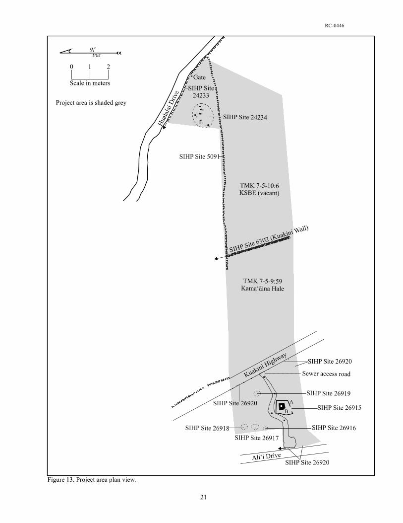
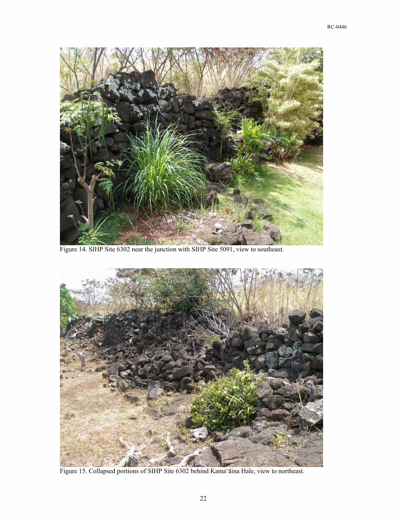
RC-0446
Figure 14. SIHP Site 6302 near the junction with SIHP Site 5091, view to southeast.
Figure 15. Collapsed portions of SIHP Site 6302 behind Kama‘āina Hale, view to northeast.
22
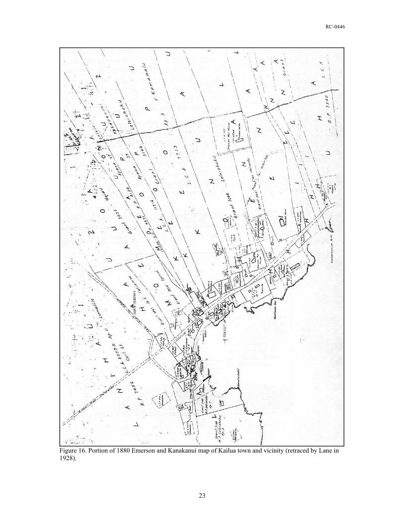
RC-0446
Figure 16. Portion of 1880 Emerson and Kanakanui map of Kailua town and vicinity (retraced by Lane in 1928).
23
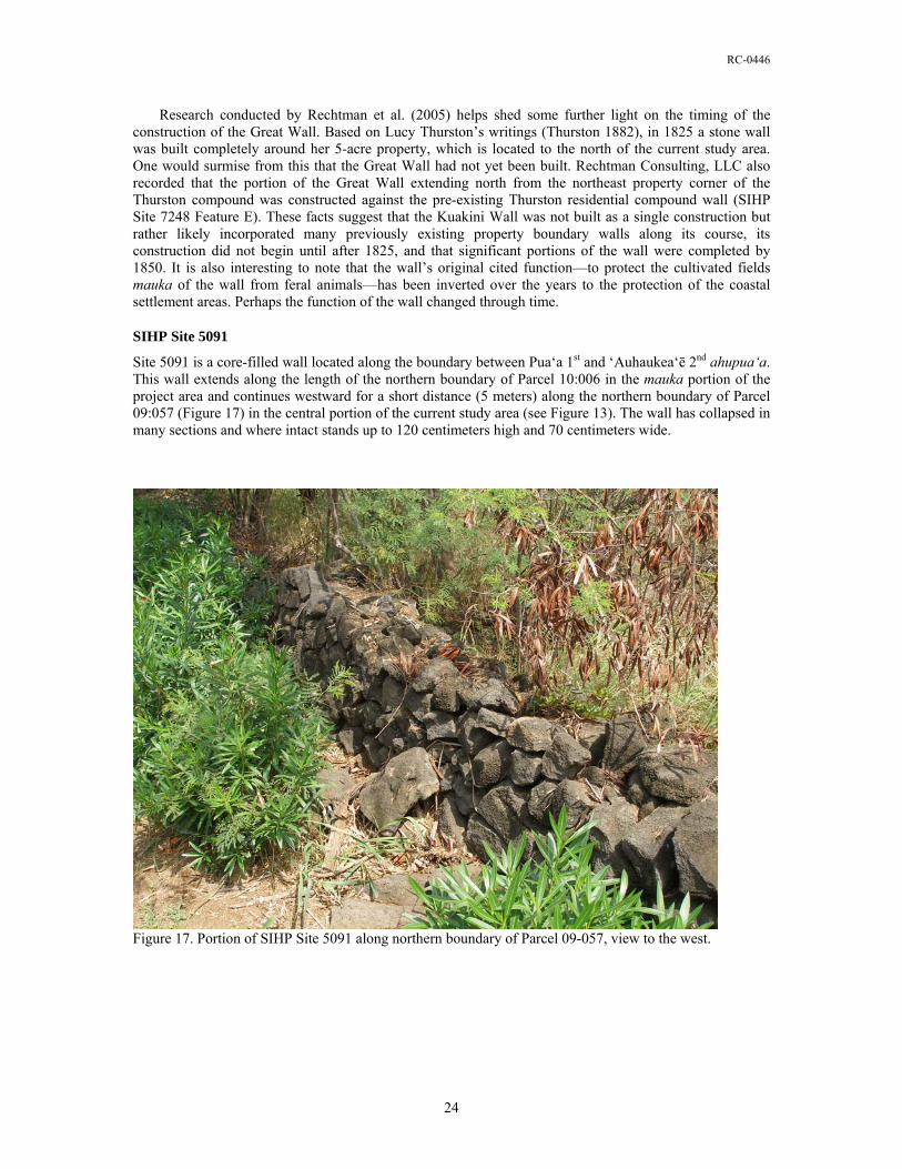
RC-0446
Research conducted by Rechtman et al. (2005) helps shed some further light on the timing of the construction of the Great Wall. Based on Lucy Thurston’s writings (Thurston 1882), in 1825 a stone wall was built completely around her 5-acre property, which is located to the north of the current study area. One would surmise from this that the Great Wall had not yet been built. Rechtman Consulting, LLC also recorded that the portion of the Great Wall extending north from the northeast property corner of the Thurston compound was constructed against the pre-existing Thurston residential compound wall (SIHP Site 7248 Feature E). These facts suggest that the Kuakini Wall was not built as a single construction but rather likely incorporated many previously existing property boundary walls along its course, its construction did not begin until after 1825, and that significant portions of the wall were completed by 1850. It is also interesting to note that the wall’s original cited function—to protect the cultivated fields mauka of the wall from feral animals—has been inverted over the years to the protection of the coastal settlement areas. Perhaps the function of the wall changed through time.
SIHP Site 5091
Site 5091 is a core-filled wall located along the boundary between Pua‘a 1st and ‘Auhaukea‘ē 2nd ahupua‘a. This wall extends along the length of the northern boundary of Parcel 10:006 in the mauka portion of the project area and continues westward for a short distance (5 meters) along the northern boundary of Parcel 09:057 (Figure 17) in the central portion of the current study area (see Figure 13). The wall has collapsed in many sections and where intact stands up to 120 centimeters high and 70 centimeters wide.
Figure 17. Portion of SIHP Site 5091 along northern boundary of Parcel 09-057, view to the west.
24
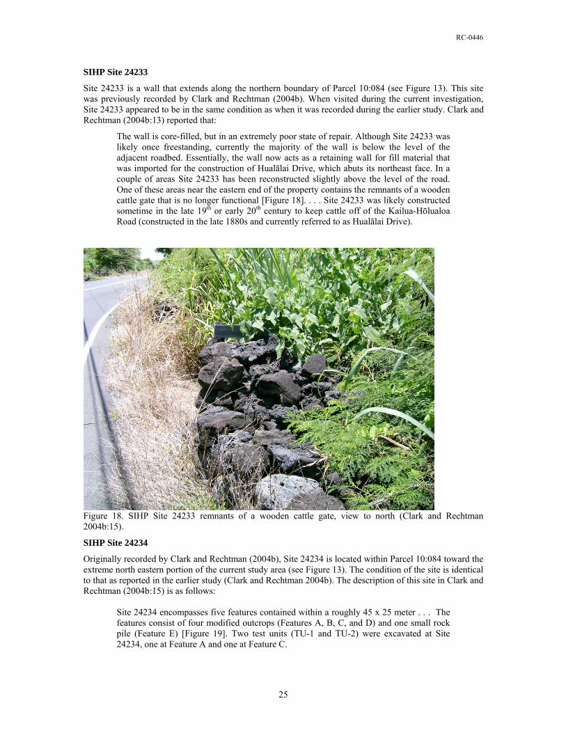
RC-0446
SIHP Site 24233
Site 24233 is a wall that extends along the northern boundary of Parcel 10:084 (see Figure 13). This site was previously recorded by Clark and Rechtman (2004b). When visited during the current investigation, Site 24233 appeared to be in the same condition as when it was recorded during the earlier study. Clark and Rechtman (2004b:13) reported that:
The wall is core-filled, but in an extremely poor state of repair. Although Site 24233 was likely once freestanding, currently the majority of the wall is below the level of the adjacent roadbed. Essentially, the wall now acts as a retaining wall for fill material that was imported for the construction of Hualālai Drive, which abuts its northeast face. In a couple of areas Site 24233 has been reconstructed slightly above the level of the road. One of these areas near the eastern end of the property contains the remnants of a wooden cattle gate that is no longer functional [Figure 18]. . . . Site 24233 was likely constructed sometime in the late 19th or early 20th century to keep cattle off of the Kailua-Hōlualoa Road (constructed in the late 1880s and currently referred to as Hualālai Drive).
Figure 18. SIHP Site 24233 remnants of a wooden cattle gate, view to north (Clark and Rechtman 2004b:15).
SIHP Site 24234
Originally recorded by Clark and Rechtman (2004b), Site 24234 is located within Parcel 10:084 toward the extreme north eastern portion of the current study area (see Figure 13). The condition of the site is identical to that as reported in the earlier study (Clark and Rechtman 2004b). The description of this site in Clark and Rechtman (2004b:15) is as follows:
Site 24234 encompasses five features contained within a roughly 45 x 25 meter . . . The features consist of four modified outcrops (Features A, B, C, and D) and one small rock pile (Feature E) [Figure 19]. Two test units (TU-1 and TU-2) were excavated at Site 24234, one at Feature A and one at Feature C.
25
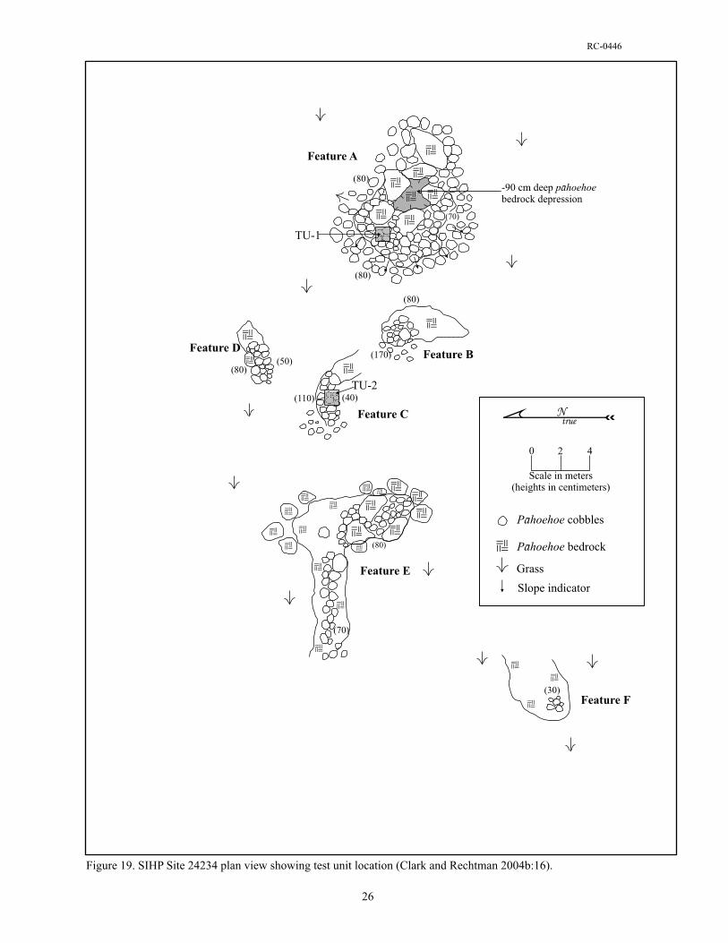

RC-0446
Feature A is a modified outcrop located at the eastern end of Site 24234 [see Figure 19]. Feature A consists of piled pāhoehoe cobbles and boulders that slope approximately 80 to 130 centimeters from ground surface to the top of the outcrop [Figure 20]. The modified portion of the outcrop measures approximately ten meters east/west by nine meters north/south. The top of the outcrop is a relatively level area measuring approximately six meters by six meters with large sections of exposed bedrock interspersed with piled cobbles. There is a 90-centimeter deep bedrock depression on top of the outcrop to the east.
A 1 x 1 meter test unit (TU-1) was excavated in the northwestern portion of the feature on top of the outcrop [see Figure 20]. Excavation of TU-1 revealed an approximately 55-centimeter thick architectural layer (Layer I) of piled cobbles and boulders resting on bedrock [Figure 21]. A small amount of very dark brown (7.5YR 2.5/3) silty loam was collected in the bedrock low spots at the base of the unit (Layer II). This soil was removed and sifted through 1/4-inch mesh screen. A fragment of Cypraea shell was recovered from Layer II. Excavation of TU-1 terminated at undulating bedrock 55 to 60 centimeters below the unit’s surface [Figure 22].
Feature B is a modified outcrop located approximately three meters west of Feature A [see Figure 20]. The modified portion of the outcrop measures 1.9 meters long by 1.5 meters wide and stands up to 0.9 meters high along its eastern edge including the bedrock [Figure 23]. In the northwestern portion of the feature the outcrop rises 0.8 meters from ground surface to where the modification begins. No cultural debris was observed at Feature B.
Figure 20. SIHP Site 24234 Feature A, view to southeast (Clark and Rechtman 2004b:17).
27


RC-0446
Figure 23. SIHP Site 24234 Feature B, view to south (Clark and Rechtman 2004b:19).
Feature C is a modified outcrop located approximately four meters northwest of Feature B [see Figure 19]. The feature is constructed against/along a north facing bedrock outcrop [Figure 24]. It measures 3.4 meters long (east/west) by 1.9 meters wide (north/south) and stands up to 1.1 meters high along its northern edge and 0.4 meters high along its southern edge. Feature C is constructed of piled pāhoehoe cobbles and small boulders on top of and against bedrock.
A 1 x 1 meter test unit (TU-2) was excavated in the central portion of Feature C along its southern edge (see Figure 19). Excavation of TU-2 revealed an approximately 45-centimeter thick architectural layer (Layer I) of piled cobbles and boulders partially resting on bedrock and partially covering a soil filled crack in the bedrock [Figure 24]. The crack measured 30 to 40 centimeters wide beneath Layer I, but the width gradually decreased with depth. It obtained a maximum depth of 30 centimeters below the level of the surrounding bedrock, and stretched east to west across the entire unit and continued beyond the confines of TU-2. The crack was filled with a very dark brown (7.5YR 2.5/3) silty loam (Layer II). This soil was removed as a single layer and sifted through 1/4-inch mesh screen. Two small fragments of Cypraea shell were recovered from Layer II. Excavation of the crack and TU-2 terminated at bedrock 75 centimeters below the unit’s surface [Figure 25].
Feature D is a modified outcrop located approximately four meters north of Feature C (see Figure 19). The modified portion of the outcrop measures 2.4 meters long (east/west) by 1.6 meters (north/south) and stands up 0.8 meters high along its north edge and 0.5 meters high along its south edge [Figure 26]. Feature D is constructed of small to large sized pāhoehoe cobbles piled against the north and west edges of a larger outcrop.
29
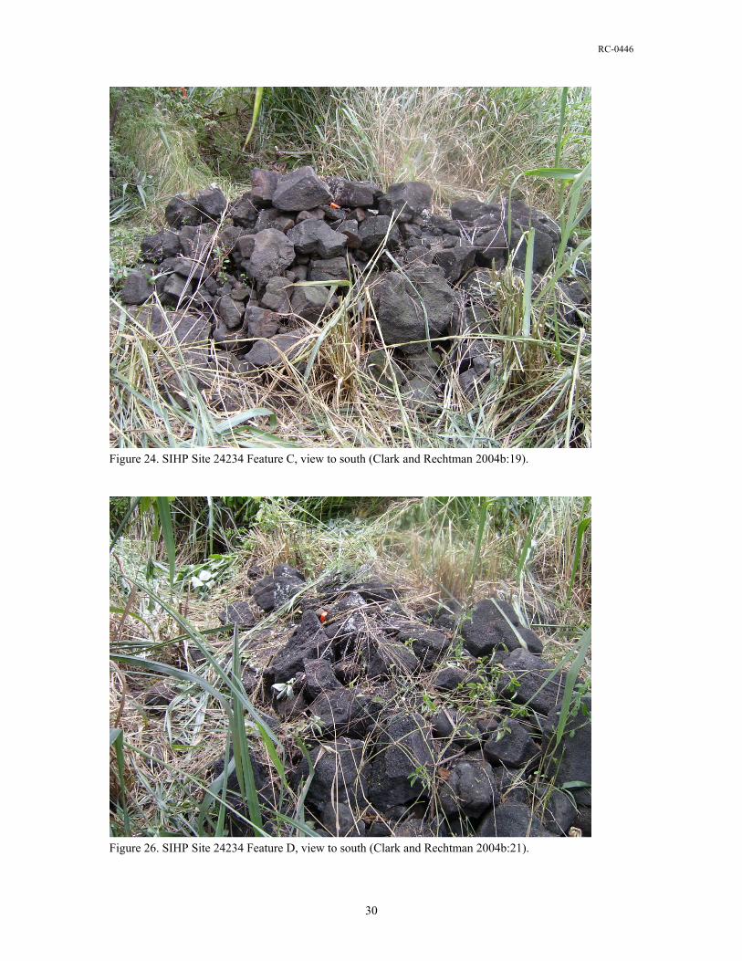
RC-0446
Figure 24. SIHP Site 24234 Feature C, view to south (Clark and Rechtman 2004b:19).
Figure 26. SIHP Site 24234 Feature D, view to south (Clark and Rechtman 2004b:21).
30
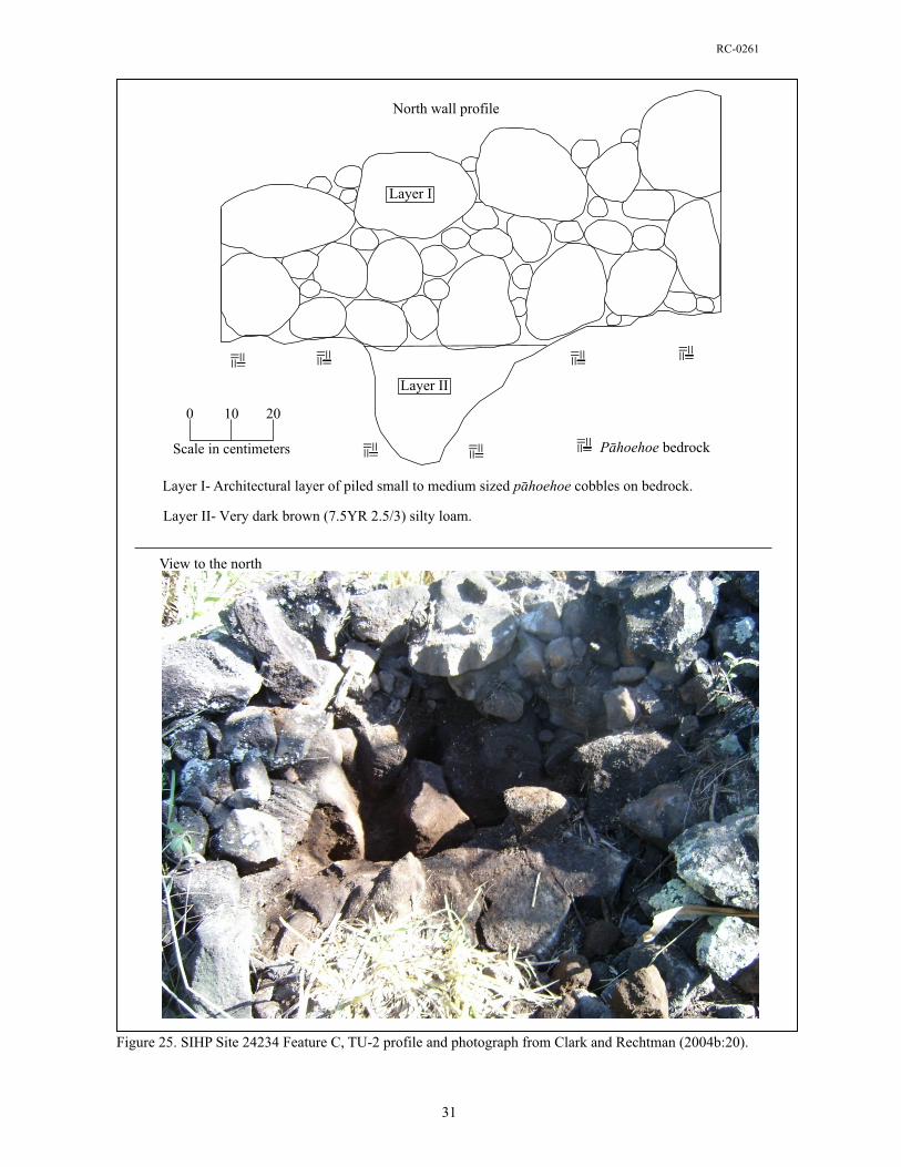

RC-0446
Feature E is a modified outcrop located approximately five meters west of Feature C (see Figure 19). The outcrop that contains Feature E is L-shaped and measures eleven meters east/west by nine meters north/south. Portions of this outcrop have been modified with piled pāhoehoe cobbles. There is a linear alignment of cobbles that stretches seven meters east from the western end of the outcrop (Figure 27). This alignment is approximately one meter wide and rises up to 0.7 meters above the outcrop’s surface. At the southeastern end of the outcrop it appears as though a few cobbles may have been deposited amongst decomposing bedrock cobbles on top of the outcrop, but overall the modification is minimal.
Feature F is located approximately fifteen meters south of Feature E (see Figure 19). It consists of eight medium sized pāhoehoe cobbles piled on pāhoehoe bedrock (Figure 28). The cobbles may have been stacked at one point, but have since fallen over. Feature F measures 0.7 meters long by 0.6 meters wide by up to 0.3 meters high. No cultural debris was observed in the vicinity of Feature F. It is possible that Feature F represents the remains of a collapsed cairn.
Figure 27. SIHP Site 24234 Feature E, view to east from the western end of the feature (Clark and Rechtman 2004b:22).
32

RC-0446
Figure 28. SIHP Site 24234 Feature F, view to east (Clark and Rechtman 2004b:22).
SIHP Site 26915
Site 26915 is a habitation complex consisting of two features, an enclosure (Feature A) and a platform (Feature B) whose location is coincident with Parcel 09:022 in the makai portion of the study area (see Figure 13). The site measures 28 meters north/south by 26 meters east/west, and represents the Māhele kuleana award (LCAw. 10267) to Molowaole. Feature A is a roughly square shaped enclosure which measures 26 meters (east/west) by 28 meters (north/south) (Figure 29). The enclosure surrounds a platform (Feature B). Feature A is both core-filled and stacked, it is constructed of pāhoehoe cobbles. Intact sections stand up to 120 centimeters tall, with an average width of 80 centimeters. Collapse is evident throughout this feature. There are differing architectural styles between the east (mauka), north, and west (makai) walls. While the intact sections of the makai and north walls clearly exhibit core-filled construction (Figure 30), the mauka wall is stacked in either a more traditional style or as a result of more recent activity. This wall retains the most architectural integrity with approximately 60 percent intact, perhaps suggesting the latter situation. Several waterworn stones were noted in the collapse at the south end of this section and in the collapsed sections of the north wall. The north wall is 60-75 percent collapsed with small, intact sections of stacked facing observed. At the eastern end of the north wall is an opening; which measures roughly 3 meters wide. Collapsed portions of the enclosure wall extend approximately 2 meters to the north on either side of the opening (similar to a constructed entrance to the enclosure area but just as easily interpreted as an product of impact by mechanical device). Bulldozing of the adjacent sewer line access road has impacted this feature at the western end of the north wall (a survey pipe is located there) and the northern end of the makai wall, The makai wall (Figure 31) contains an intact section of approximately 5 meters on its south end, with the remainder of the wall mostly collapsed. This could be the result of bulldozing the sewer access road. The south wall is almost completely collapsed except for a small (2.5 linear meters) intact portion near its junction with the makai wall (Figure 32).
33

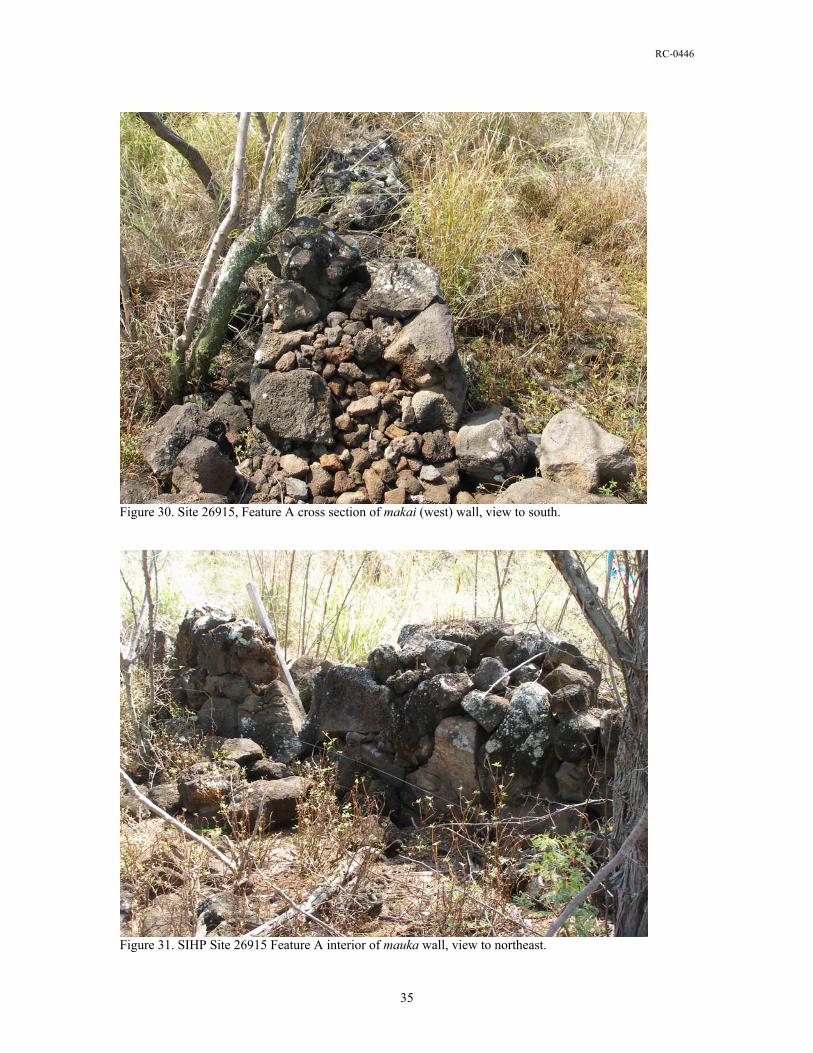
RC-0446
Figure 30. Site 26915, Feature A cross section of makai (west) wall, view to south.
Figure 31. SIHP Site 26915 Feature A interior of mauka wall, view to northeast.
35
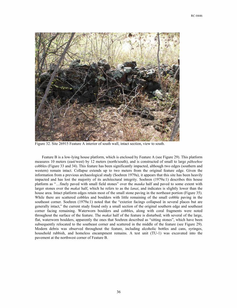
RC-0446
Figure 32. Site 26915 Feature A interior of south wall, intact section, view to south.
Feature B is a low-lying house platform, which is enclosed by Feature A (see Figure 29). This platform measures 10 meters (east/west) by 12 meters (north/south), and is constructed of small to large pāhoehoe cobbles (Figure 33 and 34). This feature has been significantly impacted, although two edges (southern and western) remain intact. Collapse extends up to two meters from the original feature edge. Given the information from a previous archaeological study (Soehren 1979a), it appears that this site has been heavily impacted and has lost the majority of its architectural integrity. Soehren (1979a:1) describes this house platform as “…finely paved with small field stones” over the mauka half and paved to some extent with larger stones over the makai half, which he refers to as the lanai, and indicates is slightly lower than the house area. Intact platform edges retain most of the small stone paving in the northeast portion (Figure 35). While there are scattered cobbles and boulders with little remaining of the small cobble paving in the southeast corner. Soehren (1979a:1) noted that the “exterior facings collapsed in several places but are generally intact,” the current study found only a small section of the original southern edge and southeast corner facing remaining. Waterworn boulders and cobbles, along with coral fragments were noted throughout the surface of the feature. The makai half of the feature is disturbed; with several of the large, flat, waterworn boulders, apparently the ones that Soehren described as “sitting stones”, which have been subsequently relocated to the southeast corner and scattered in the middle of the feature (see Figure 29). Modern debris was observed throughout the feature, including alcoholic bottles and cans, syringes, household rubbish, and homeless encampment remains. A test unit (TU-1) was excavated into the pavement at the northwest corner of Feature B.
36

RC-0446
Figure 33. SIHP Site 26915, Feature B northeast corner showing remnant paving.
Figure 34. SIHP Site 26915, Feature B makai side showing paved lanai area.
37
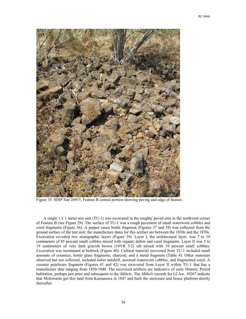
RC-0446
Figure 35. SIHP Site 26915, Feature B central portion showing paving and edge of feature. A single 1 x 1 meter test unit (TU-1) was excavated in the roughly paved area in the northwest corner of Feature B (see Figure 29). The surface of TU-1 was a rough pavement of small waterworn cobbles and coral fragments (Figure 36). A pepper sauce bottle fragment (Figures 37 and 38) was collected from the ground surface of the test unit; the manufacture dates for this artifact are between the 1830s and the 1870s. Excavation revealed two stratigraphic layers (Figure 39). Layer I, the architectural layer, was 7 to 10 centimeters of 85 percent small cobbles mixed with organic debris and coral fragments. Layer II was 5 to 19 centimeters of very dark grayish brown (10YR 3/2) silt mixed with 10 percent small cobbles. Excavation was terminated at bedrock (Figure 40). Cultural material recovered from TU-1 included small amounts of ceramics, bottle glass fragments, charcoal, and a metal fragment (Table 4). Other materials observed but not collected, included kukui nutshell, assorted waterworn cobbles, and fragmented coral. A ceramic pearlware fragment (Figures 41 and 42) was recovered from Layer II within TU-1 that has a manufacture date ranging from 1830-1840. The recovered artifacts are indicative of early Historic Period habitation, perhaps just prior and subsequent to the Māhele. The Māhele records for LCAw. 10267 indicate that Molowaole got this land from Kamanawa in 1847 and built the enclosure and house platform shortly thereafter.
38
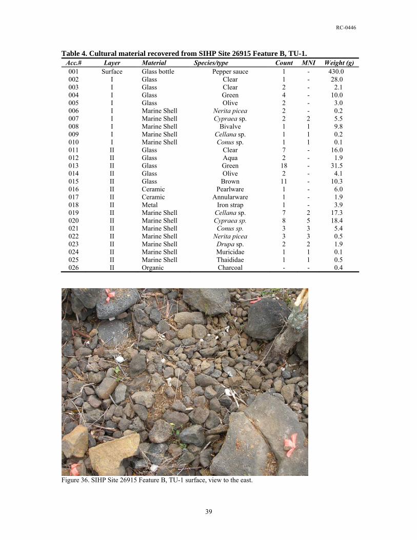
RC-0446
Table 4. Cultural material recovered from SIHP Site 26915 Feature B, TU-1. Acc.# Layer Material Species/type Count MNI Weight (g) 001 Surface Glass bottle Pepper sauce 1 - 430.0 002 I Glass Clear 1 - 28.0 003 I Glass Clear 2 - 2.1 004 I Glass Green 4 - 10.0 005 I Glass Olive 2 - 3.0 006 I Marine Shell Nerita picea 2 - 0.2 007 I Marine Shell Cypraea sp. 2 2 5.5 008 I Marine Shell Bivalve 1 1 9.8 009 I Marine Shell Cellana sp. 1 1 0.2 010 I Marine Shell Conus sp. 1 1 0.1 011 II Glass Clear 7 - 16.0 012 II Glass Aqua 2 - 1.9 013 II Glass Green 18 - 31.5 014 II Glass Olive 2 - 4.1 015 II Glass Brown 11 - 10.3 016 II Ceramic Pearlware 1 - 6.0 017 II Ceramic Annularware 1 - 1.9 018 II Metal Iron strap 1 - 3.9 019 II Marine Shell Cellana sp. 7 2 17.3 020 II Marine Shell Cypraea sp. 8 5 18.4 021 II Marine Shell Conus sp. 3 3 5.4 022 II Marine Shell Nerita picea 3 3 0.5 023 II Marine Shell Drupa sp. 2 2 1.9 024 II Marine Shell Muricidae 1 1 0.1 025 II Marine Shell Thaididae 1 1 0.5 026 II Organic Charcoal - - 0.4
Figure 36. SIHP Site 26915 Feature B, TU-1 surface, view to the east.
39

RC-0446
Figure 37. SIHP Site 26915 1830s-1870s era sauce bottle fragment, base view.
Figure 38. SIHP Site 26915 1830s-1870s era sauce bottle fragment, side view.
40

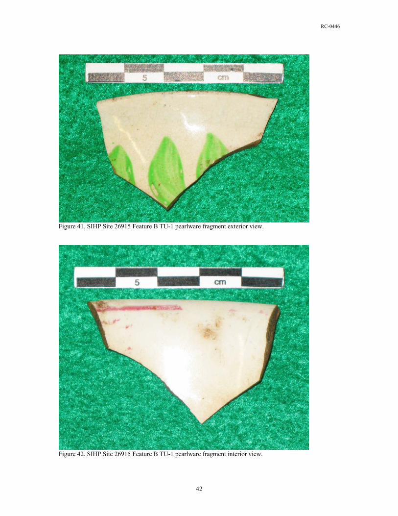
RC-0446
Figure 41. SIHP Site 26915 Feature B TU-1 pearlware fragment exterior view.
Figure 42. SIHP Site 26915 Feature B TU-1 pearlware fragment interior view.
42
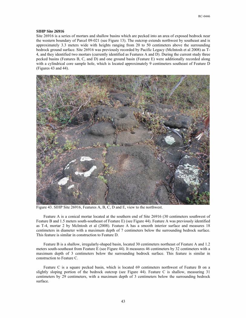
RC-0446
SIHP Site 26916 Site 26916 is a series of mortars and shallow basins which are pecked into an area of exposed bedrock near the western boundary of Parcel 09-021 (see Figure 13). The outcrop extends northwest by southeast and is approximately 3.3 meters wide with heights ranging from 20 to 50 centimeters above the surrounding bedrock ground surface. Site 26916 was previously recorded by Pacific Legacy (McIntosh et al 2008) as T-4, and they identified two mortars (currently identified as Features A and D). During the current study three pecked basins (Features B, C, and D) and one ground basin (Feature E) were additionally recorded along with a cylindrical core sample hole, which is located approximately 9 centimeters southeast of Feature D (Figures 43 and 44).
Figure 43. SIHP Site 26916, Features A, B, C, D and E, view to the northwest. Feature A is a conical mortar located at the southern end of Site 26916 (30 centimeters southwest of Feature B and 1.5 meters south-southeast of Feature E) (see Figure 44). Feature A was previously identified as T-4, mortar 2 by McIntosh et al (2008). Feature A has a smooth interior surface and measures 18 centimeters in diameter with a maximum depth of 7 centimeters below the surrounding bedrock surface. This feature is similar in construction to Feature D. Feature B is a shallow, irregularly-shaped basin, located 30 centimeters northeast of Feature A and 1.2 meters south-southeast from Feature E (see Figure 44). It measures 46 centimeters by 32 centimeters with a maximum depth of 3 centimeters below the surrounding bedrock surface. This feature is similar in construction to Feature C. Feature C is a square pecked basin, which is located 69 centimeters northwest of Feature B on a slightly sloping portion of the bedrock outcrop (see Figure 44). Feature C is shallow, measuring 31 centimeters by 29 centimeters, with a maximum depth of 3 centimeters below the surrounding bedrock surface.
43
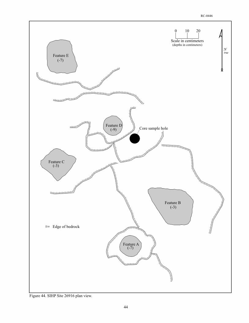
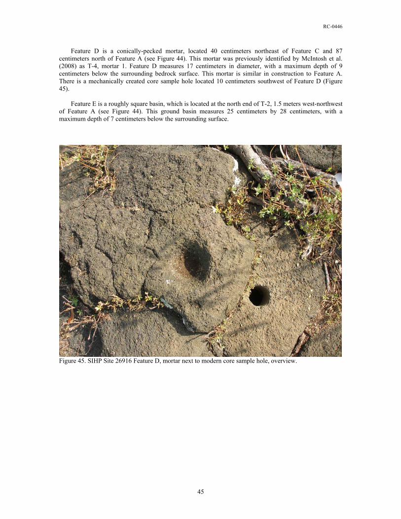
RC-0446
Feature D is a conically-pecked mortar, located 40 centimeters northeast of Feature C and 87 centimeters north of Feature A (see Figure 44). This mortar was previously identified by McIntosh et al. (2008) as T-4, mortar 1. Feature D measures 17 centimeters in diameter, with a maximum depth of 9 centimeters below the surrounding bedrock surface. This mortar is similar in construction to Feature A. There is a mechanically created core sample hole located 10 centimeters southwest of Feature D (Figure 45). Feature E is a roughly square basin, which is located at the north end of T-2, 1.5 meters west-northwest of Feature A (see Figure 44). This ground basin measures 25 centimeters by 28 centimeters, with a maximum depth of 7 centimeters below the surrounding surface.
Figure 45. SIHP Site 26916 Feature D, mortar next to modern core sample hole, overview.
45

RC-0446
SIHP Site 26917 Site 26917 is an 8 meter by 6 meter area of bulldozed boulders and cobbles, located roughly 15 meters north of Site 26916 and 10 meters south of Site 26918 (see Figure 13). The concentration of rocks is accompanied by a surface scatter of coral and marine shell, and appears to have once been either an enclosure or a platform. There are also numerous waterworn cobbles that were possibly used in the construction of the original feature. There is little, if any, architectural integrity left at Site 26917 (Figure 46), and very little potential for encountering intact subsurface deposits.
Figure 46. SIHP Site 26917, view to northwest. SIHP Site 26918 Site 26918 is a heavily impacted remnant of an enclosure located in the northeastern corner of Parcel 09:021 (see Figure 13). This feature was previously identified as a midden scatter measuring 2 meters by 2 meters by Pacific Legacy (McIntosh et al 2008) and designated T-2. The overall dimensions for Site 26918 as recorded during the current study are roughly 8 meters by 6 meters, which includes the disturbed construction rocks and a scatter of coral and marine shell (Figure 47). This site seems to match the location of the bulldozer-destroyed site described by Connolly (1974) and also by Soehren (1979a). There is little, if any, architectural integrity left at Site 26918, and very little potential for encountering intact subsurface deposits.
46
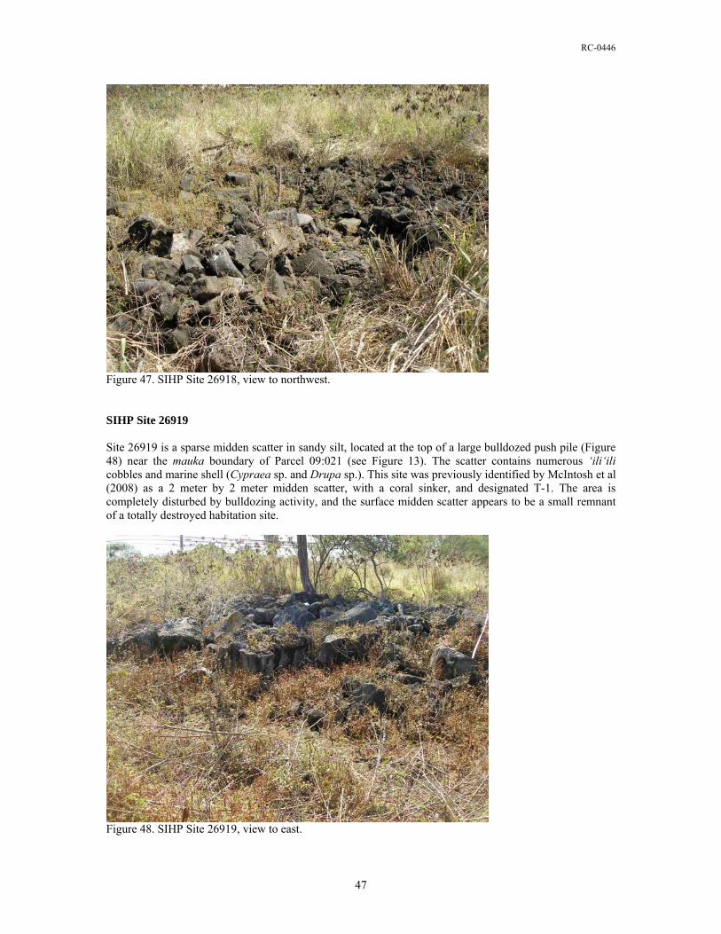
RC-0446
Figure 47. SIHP Site 26918, view to northwest. SIHP Site 26919 Site 26919 is a sparse midden scatter in sandy silt, located at the top of a large bulldozed push pile (Figure 48) near the mauka boundary of Parcel 09:021 (see Figure 13). The scatter contains numerous ‘ili‘ili cobbles and marine shell (Cypraea sp. and Drupa sp.). This site was previously identified by McIntosh et al (2008) as a 2 meter by 2 meter midden scatter, with a coral sinker, and designated T-1. The area is completely disturbed by bulldozing activity, and the surface midden scatter appears to be a small remnant of a totally destroyed habitation site.
Figure 48. SIHP Site 26919, view to east.
47
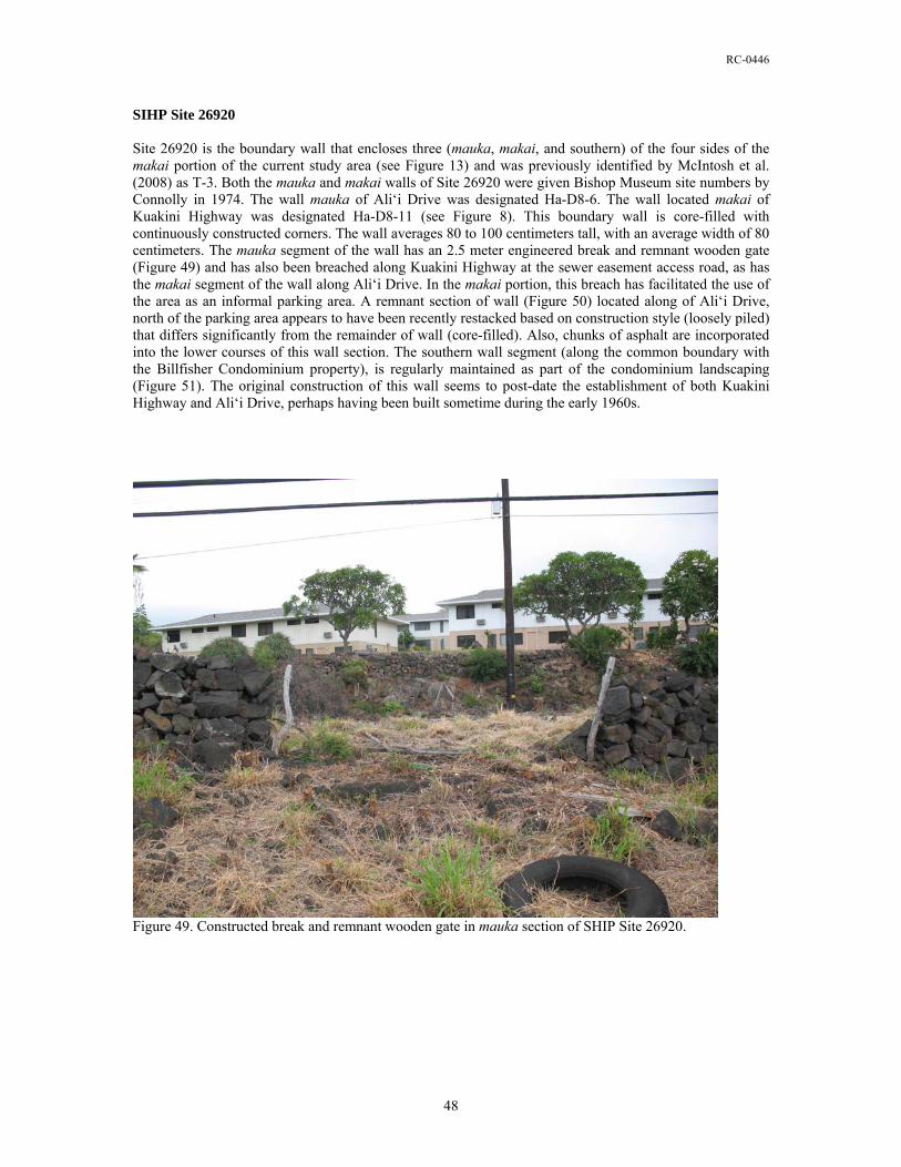
RC-0446
SIHP Site 26920 Site 26920 is the boundary wall that encloses three (mauka, makai, and southern) of the four sides of the makai portion of the current study area (see Figure 13) and was previously identified by McIntosh et al. (2008) as T-3. Both the mauka and makai walls of Site 26920 were given Bishop Museum site numbers by Connolly in 1974. The wall mauka of Ali‘i Drive was designated Ha-D8-6. The wall located makai of Kuakini Highway was designated Ha-D8-11 (see Figure 8). This boundary wall is core-filled with continuously constructed corners. The wall averages 80 to 100 centimeters tall, with an average width of 80 centimeters. The mauka segment of the wall has an 2.5 meter engineered break and remnant wooden gate (Figure 49) and has also been breached along Kuakini Highway at the sewer easement access road, as has the makai segment of the wall along Ali‘i Drive. In the makai portion, this breach has facilitated the use of the area as an informal parking area. A remnant section of wall (Figure 50) located along of Ali‘i Drive, north of the parking area appears to have been recently restacked based on construction style (loosely piled) that differs significantly from the remainder of wall (core-filled). Also, chunks of asphalt are incorporated into the lower courses of this wall section. The southern wall segment (along the common boundary with the Billfisher Condominium property), is regularly maintained as part of the condominium landscaping (Figure 51). The original construction of this wall seems to post-date the establishment of both Kuakini Highway and Ali‘i Drive, perhaps having been built sometime during the early 1960s.
Figure 49. Constructed break and remnant wooden gate in mauka section of SHIP Site 26920.
48
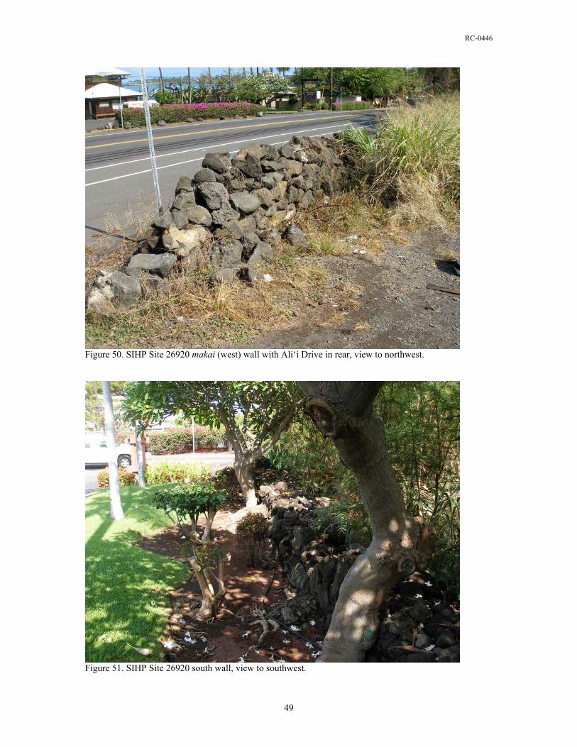
RC-0446
Figure 50. SIHP Site 26920 makai (west) wall with Ali‘i Drive in rear, view to northwest.
Figure 51. SIHP Site 26920 south wall, view to southwest.
49
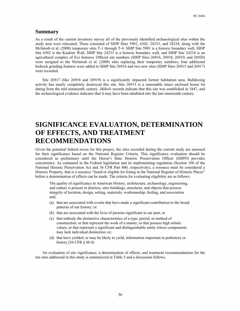
RC-0446
Summary As a result of the current inventory survey all of the previously identified archaeological sites within the study area were relocated. These consisted of SIHP Sites 5901, 6302, 24233, and 24234, along with the McIntosh et al. (2008) temporary sites T-1 through T-4. SIHP Site 5901 is a historic boundary wall, SIHP Site 6302 is the Kuakini Wall, SIHP Site 24233 is a historic boundary wall, and SIHP Site 24234 is an agricultural complex of five features. Official site numbers (SIHP Sites 26916, 26918, 26919, and 26920) were assigned to the McIntosh et al. (2008) sites replacing their temporary numbers; four additional bedrock grinding features were added to SIHP Site 26916 and two new sites (SIHP Sites 26915 and 26917) were recorded. Site 26917 (like 26918 and 26919) is a significantly impacted former habitation area. Bulldozing activity has nearly completely destroyed this site. Site 26915 is a reasonable intact enclosed house lot dating from the mid nineteenth century. Māhele records indicate that this site was established in 1847, and the archaeological evidence indicates that it may have been inhabited into the late nineteenth century.
SIGNIFICANCE EVALUATION, DETERMINATION OF EFFECTS, AND TREATMENT RECOMMENDATIONS Given the potential federal nexus for this project, the sites recorded during the current study are assessed for their significance based on the National Register Criteria. This significance evaluation should be considered as preliminary until the Hawai‘i State Historic Preservation Officer (SHPO) provides concurrence. As contained in the Federal legislation and its implementing regulation (Section 106 of the National Historic Preservation Act and 36 CFR Part 800, respectively), a resource must be considered a Historic Property, that is a resource “listed or eligible for listing in the National Register of Historic Places” before a determination of effects can be made. The criteria for evaluating eligibility are as follows:
The quality of significance in American History, architecture, archaeology, engineering, and culture is present in districts, sites buildings, structures, and objects that possess integrity of location, design, setting, materials, workmanship, feeling, and association and,
(a) that are associated with events that have made a significant contribution to the broad patterns of our history; or
(b) that are associated with the lives of persons significant in our past; or
(c) that embody the distinctive characteristics of a type, period, or method of construction; or that represent the work of a master; or that possess high artistic values, or that represent a significant and distinguishable entity whose components may lack individual distinction; or;
(d) that have yielded, or may be likely to yield, information important in prehistory or history [36 CFR § 60.4)
An evaluation of site significance, a determination of effects, and treatment recommendations for the ten sites addressed in this study is summarized in Table 5 and a discussion follows.
50

RC-0446
Table 5. Significance, effects, and treatment recommendations.
SIHP Site No. Significance Effect* Recommended Treatment 5091 d No adverse effects No further work 6302 a, c, d No adverse effects Preservation
24233 d No adverse effects No further work 24234 d No adverse effects No further work 26915 d No adverse effects Data Recovery 26916 d No adverse effects No further work 26917 d No adverse effects No further work 26918 d No adverse effects No further work 26919 d No adverse effects No further work 26920 d No adverse effects No further work
* if the treatment recommendations are followed.
The SHPO (DLNR-SHPD) has previously determined that Sites 5091 and 24233 are significant under Criterion d, and approved the following site treatment for these sites as an acceptable alternative resulting in a no adverse effects determination: “preserve if possible.” Given the nature of the proposed roadway development, it will be necessary to impact sections of these walls for roadway construction; however, the preservation of these sites at other locations will serve to mitigate any adverse effect. For Site 24234, the SHPO (DLNR-SHPD) has already determined that this site is significant under Criterion d and approved a recommendation of no mitigation work required to support a no adverse effects determination. The SHPO (DLNR-SHPD) has already determined that SIHP Site 6302, the Kuakini Wall, is significant under Criteria a, c, and d, and the site is listed in both the State and National Register of Historic Place. This site is recommended for preservation with the allowance of a single breach to facilitate roadway construction. A preservation/treatment plan should be prepared to support a no adverse effect determination. SIHP Site 26915, a mid to late nineteenth century residential compound, is considered significant under Criterion d. While some integrity has been lost, this site still has the potential for yielding information relative to the period of transition that took place in many Hawaiian households just prior to and following the Māhele. Data recovery is the recommended treatment for this site to mitigate potential impacts and support a no adverse effect determination. SIHP Site 26916 is a collection of mortars and shallow basins in exposed pāhoehoe bedrock. This site may have seen use during both Precontact and Historic Times. It is evaluated as significant under Criterion d for the information it has yielded. The data recorded about this site during the current study was sufficient to mitigate any potential impacts and to support a no adverse effects determination. SIHP Sites 26917, 26918 and 26919 are concentrations of boulders and cobbles with sparse midden deposits that represent the remains of small habitation sites that have been nearly completely destroyed by bulldozer activity. As a result, the features lack much if not all of their original integrity and it is suggested that further work at these sites is unlikely to yield any significant amount of useful new information. Therefore, while these sites may be significant under Criterion d, the proposed project will have no adverse effect upon them and no further work is the recommended treatment. SIHP Site 26920 is an early twentieth century core-filled wall that surrounds three sides of Parcel 09:021. This property boundary wall has been documented during the current study and is considered significant under Criterion d for the data it has already yielded relative to turn-of-the-century land use patterns, and further study is not likely to produce any new information. Accordingly, Site 26920 will not suffer an adverse effect from development activities within the project area and no further work is the recommended treatment.
51
RC-0446
REFERENCES CITED Bush, A., D. Shideler, D. Borthwick, K. Souza, and H. Hammatt
2000 Archaeological Inventory Survey for Hualalai Elderly Housing, Phase II at a 4-Acre Parcel (TMK 7-5-10:7), ‘Auhaukea‘ē, Kona, Hawai‘I Island. Cultural Surveys Hawaii, Inc. Prepared for Hawai‘I Island Community Development Corporation.
Cheever, H. 1851 Life in the Sandwich Islands. IN Emory et al., 1971, Archaeological Excavations at
Kahalu‘u, North Kona, Island of Hawaii. Departmental Report Series 73-1. Department of Anthropology, B.P. Bishop Museum, Honolulu.
Chinen, J. 1961 Original Land Titles in Hawaii. Honolulu: privately published.
Clark, M., and R. Rechtman 2003 An Archaeological Inventory Survey of TMKs: 3-7-5-10:85 and 3-7-5-17:06 Wai‘aha
Ahupua‘a, North Kona District, Island of Hawai‘i. Rechtman Consulting , LLC Report RC-0153. Prepared for U of N BENCORP, Kailua-Kona.
2004a An Update Archaeological Inventory Survey of TMK:3-7-5-09:54 por. ‘Auhaukea‘ē 1st Ahupua‘a, North Kona District, Island of Hawai‘i. Rechtman Consulting Report RC-0205. Prepared for Robert Saunders, CSV Hospitality Management LLC, Hilo, Hawai‘i.
2004b An Archaeological Survey of TMK:3-7-5-10:84 in Compliance with Section 106 of the National Historic Preservation Act, ‘Auhaukea‘ē 2nd Ahupua‘a, North Kona District, Island of Hawai‘i. Rechtman Consulting Report RC-0261. Prepared for Brian Nishimura, Hilo, Hawai‘i.
Connolly III, R. 1974 Archaeological Walk-Through Survey of the Proposed Road Alignment in Kailua, North
Kona District, Hawaii. B.P. Bishop Museum Ms. No. 070174.
Cordy, R. 1981 A Study of Prehistoric Social Change: The Development of Complex Societies in the
Hawaiian Islands. New York: Academic Press.
1995 Central Kona Archaeological Settlement Patterns. State Historic Preservation Division, DLNR, State of Hawai‘i. Prepared for the Planning Department, County of Hawai‘i.
2000 Exalted Sits the Chief, The Ancient History of Hawai‘i Island. Mutual Publishing, Honolulu, Hawai‘i.
Ellis, W. 1963 Journal of William Ellis, Narrative of a Tour of Hawaii, or Owhyee... [1823] Honolulu:
Advertiser Publishing Co.
Gosser, D. and R. Yamasato 2006 An Archaeological Inventory Report for Portions of Three Contiguous Parcels: TMK: 3-
7-5-009:055, TMK: 3-7-5-009:057, and TMK: 3-7-5-010:006, ‘Auhaukea‘ē 2 and Pua‘a 1 Ahupua‘a. North Kona District, Island of Hawai‘i. Pacific Consulting Services, Inc. Prepared for Granite Bay Holdings, LLC., Granite Bay, CA.
52
RC-0446
Hammatt, H. 1980 Archaeological Reconnaissance Survey of 51,000 Square foot lot, Pua‘a, Kona, Hawaii
Island. ARCH Ms. 14-182..
Hammatt, H., and D. Borthwick 1987 Archaeological Testing and Salvage Excavations of a 155 Acre Parcel in Na Ahupua‘a
Pahoehoe, La‘aloa and Kapala‘aea, Kona, Hawai’i. Archaeological Research Center Hawaii Report 14-152 III. Prepared for Pacific Basin Resorts, Inc.
Hammatt, H., D. Borthwick, and D. Shideler 1994 Archaeological Excavstions at a 5-Acre Parcel (TMK 7-5-09:25, 28, 43), ‘Auhaukea‘e,
Kona, Hawaii Island. Prepared by Cultural Surveys Hawaii.
Hammatt, H., and S. Clark 1980 Archaeological Reconnaissance Survey of Two Parcels in Kailua-Kona, Island of Hawaii.
Ms., Cultural Surveys Hawaii.
Hammatt, H., and W. Folk 1980 Archaeological Survey and Excavations of Coastal Sites, Ouli, Kohala, Hawai‘i Island.
Archaeological Research Center Hawaii, Inc. Report 14-185 II. Prepared for Mauna Kea Properties, Inc.
Hammatt, H., and V. Meeker 1979 Archaeological Excavations and Heiau Stabilization at Kahalu‘u, Kona, Hawaii Island.
Archaeological Research Center Hawaii Report 14-172 (II). Prepared for Gerald Park, Urban Planner.
Hammatt, H., and D. Shideler 1987 Archaeological Excavations of Two Sites Lower Greenwell property, Auhaukea‘a, Kona,
Hawaii Island. Cultural Surveys Hawaii. Prepared for Project Planners Hawaii.
Haun, A., J. Henry, J. Jimenex, M. Kirkendall, K. Maly, and T. Wolforth 1998 Ali‘i Highway Phased Mitigation Program Phase I – Archaeological Intensive Survey,
North Kona District, Island of Hawai‘i, vol. 1, Summary. PHRI Report 1320-052798. Submitted to the County of Hawai‘i c/o R. M. Towill Corporation.
Holland, J. 1971 Land and livelihood: The Kona Coast about 1825. Master’s thesis. University of Hawaii
at Manoa.
Juvik, S., and J. Juvik (editors) 1998 Atlas of Hawaii. Third Edition. University of Hawaii Press. Honolulu.
Kawachi, C. 1989 An Upland Habitation and Agricultural Complex in North Kona, Hawai‘i Island.
Master’s thesis, Department of Anthropology, University of Hawaii.
Kelly, M. 1983 Na Mala O Kona: Gardens of Kona. A History of Land Use in Kona, Hawai‘i.
Departmental Report Series 83-2. Department of Anthropology, B. P. Bishop Museum, Honolulu. Prepared for the Department of Transportation, State of Hawai‘i.
Kikiloi, S., D. Borthwick, and H. Hammatt 2000 Historic Preservation Plan: Portions of the Kuakini Wall (50-10-28-6302/-7276) and
Southern Boundary Wall (50-10-28-5091) for the Proposed Hualalai Elderly Housing
53

RC-0446
Project Phase II, at a 4-acre parcel (TMK-7-5-10:7), ‘Auhaukea‘e, Kona, Hawaii Island. Report on file at the State Historic preservation Division, Kapolei.
Ladefoged, T. 1991 Hawaiian Architectural Transformations during the Early Historic Era. Asian
Perspectives 30(1):55–70.
McIntosh, J., R. Reeve, and P. Cleghorn 2008 Archaeological Inventory Survey of Three Parcels in Pua‘a 1, North Kona, Island of
Hawaii. TMK: (3) 7-5-009:021, 057 and 7-5-010:006. Pacific Legacy, Inc. Prepared for Kamehameha Schools, Land Assets Division, Honolulu, Hawai‘i.
Nees, R., and S. Williams 1996 Archaeological Inventory Survey of the Propsed Hualalai Elderly Housing Project,
‘Ahuakea‘ē 1-2 Ahupua‘a, Kailua, North Kona District, Hawai‘i Island, (TMK: 7-5-10:10). Report available at Pacific Consulting Services Inc., Honolulu, Hawai‘i.
Newman, T. 1970 Report on Reconnaissance at Old Kona Airport. Letter. Historic Sites Section,
Department of Land and Natural Resources, State of Hawai‘i.
O’Hare, C, and T. Wolforth 1997 Archaeological Inventory Survey of the Gomes Property Parcel, Land of Hahalui 1st,
Island of Hawaii (TMK: 3-7-5-19:5, 38, 40). PHRI Report 1807-10197. Submitted to Towne Development of Hawai‘i, Inc.
Rechtman, R. 2006 A Treatment Plan for Human Remains Inadvertently Discovered within a Water Line
Trench in Kuakini Highway, ‘Auhaukea‘ē Ahupua‘a, North Kona, Hawai‘i Island. Rechtman Consulting Letter report RC-0411. Prepared for E.M. Rivera.
Rechtman, R., M. Clark, and A. Ketner 2005 An Archaeological Inventory Survey of TMKs:3-7-5-03:2, 35 and 3-7-5-22:173,
Honua‘ula and Heinaloli 1st ahupua‘a, North Kona District, Island of Hawai‘i. Rechtman Consulting Report RC-0211. Prepared for The Laniākea Foundation, Honolulu, Hawai‘i.
Reinecke, J. n.d. Survey of Sites on West Hawaii. Unpublished manuscript, Department of
Anthropology, B.P. Bishop Museum, Honolulu (1930).
Rosendahl, M. 1988 Intensive Archaeological Survey and Limited Data Recovery, Site 50-10-28-2005, Land
of Puaa 1st, North Kona District, Island of Hawaii. PHRI Report 383-041388. Prepared for Libbie & Company, Inc. (April)
Rosendahl, P. 1978 Archaeological Reconnaissance Survey of the Kona Pacific Partners Condominium Site
(TMK:3-7-5-09:3,38,49,60,61,62), Kailua-Kona, Island of Hawaii. Department of Anthropology, B.P. Bishop Museum. Prepared for Architects Hawaii Ltd
1979a Archaeological Reconnaissance Survey of the Lanihau Corporation Project 30 Site (TMK:3-7-5-09:54,55; and 3-7-5-10:7,10), Kailua-Kona, Island of Hawaii. Manuscript. PHRI 12-040979. Prepared for Belt, Collins & Associates.
54
RC-0446
55
1979b Evaluation of Archaeological Features Located in the Seaward Portion of the Lanihau Corporation Project 30 Site (TMK:3-7-5-09:54,55; and 3-7-5-10:7, 10), Kailua-Kona, Island of Hawaii. Manuscript. PHRI 12-073179. Prepared for Belt, Collins & Associates.
1981a Intensive Archaeological Survey of the Seaward Portion of the Lanihau Corporation Project 30 Site, Kailua-Kona, Island of Hawaii. Phase I—Detailed Recording (Part 1) and Historical Documentary Research. PHRI Report 8-070180. Prepared for Lanihau Corporation.
1981b Archaeological Reconnaissance Testing of Suspected Burial Features in the Seaward Portion of the Lanihau Corporation Project 30 Site, Kailua-Kona, Island of Hawaii: Preliminary Report upon Completion of Fieldwork. PHRI Report 29-040281. Prepared for Gregg Kashiwa, T & K Enterprises, Inc.
1981c Test Excavations of Major Structural Features Located in the Seaward Portion of the Lanihau Corporation Project 30 Site, Kailua-Kona, Island of Hawaii: Preliminary Report upon Completion of Fieldwork. PHRI Report 31-042181. Prepared for Lanihau Corporation.
Sato, H. H., W. Ikeda, R. Paeth, R. Smythe, and M. Takehiro, Jr. 1973 Soil Survey of the Island of Hawaii, State of Hawaii. U.S. Department of Agriculture,
Soil Conservation Service and University of Hawai‘i Agricultural Experiment Station. Washington, D.C.: Government Printing Office.
Schilt, A. R. 1984 Subsistence and Conflict in Kona, Hawaii. An Archaeological Study of the Kuakini
Highway Realignment Corridor. Departmental Report Series 84-1. Department of Anthropology, B.P. Bishop Museum, Honolulu. Prepared for the Department of Transportation, State of Hawai‘i.
Soehren, L. 1979a Letter Report, Reconnaissance: Pua‘a 1st, North Kona Hawaii. Report Available at State
Historic preservation Division, Kapolei.
1979b Archaeological Reconnaissance, TMK 7-5-10:6, Pua‘a 1st Ahupua‘a. Report Available at State Historic preservation Division, Kapolei.
Stokes, J., and T. Dye 1991 Heiau of the Island of Hawai‘i: A Historic Survey of Native Hawaiian Temple Sites.
Bishop Museum Bulletin in Anthropology 2. Bishop Museum Press, Honolulu.
Thurston, L. 1882 Life and times, of Mrs. Lucy G. Thurston, wife of Rev. Asa Thurston, pioneer missionary
to the Sandwich islands, gathered from letters and journals of extending over a period of more than fifty years. Selected and arranged by herself. S.C. Andrews: Ann Arbor Michigan.
Tomonari-Tuggle, M. 1993 Draft Report, the Archaeology of the ‘Ohi‘a Preserve; An Inventory Survey of Surface
Structures. International Archaeological Research Institute, Inc. (IARII). Submitted to Kamehameha Investment Corporation, Honolulu.


Ōneo Lane Draft Environmental Assessment
July 2015
APPENDIX C CULTURAL IMPACT ASSESSMENT

A Cultural Impact Assessment for Nani Kailua Road Extension, Island of Hawai‘i
by
Usha K. Prasad
Prepared for:
PB Americas, Inc. American Savings Bank Tower 1001 Bishop Street, Suite 2400
Honolulu, Hawai‘i 96813
INTERNATIONAL ARCHAEOLOGICAL RESEARCH INSTITUTE, INC.
FEBRUARY 2010

IARII 200721
A CULTURAL IMPACT ASSESSMENT FOR
NANI KAILUA ROAD EXTENSION,
ISLAND OF HAWAI‘I
by Usha K. Prasad, Ph.D.
Usha K. Prasad, LLC. 667 Old Mokapu Road Kailua, Hawai‘i 96734
Prepared for:
PB Americas, Inc. American Savings Bank Tower 1001 Bishop Street, Suite 2400
Honolulu, Hawai‘i 96813
Under contract with
International Archaeological Research Institute, Inc. 2081 Young Street
Honolulu, Hawai‘i 96826
February 2010

ii
iii
TABLE OF CONTENTS
LIST OF FIGURES ........................................................................................................................... v
LIST OF TABLES ............................................................................................................................. vi
INTRODUCTION ............................................................................................................................. 1 Project Goals......................................................................................................................... 1 Project Location .................................................................................................................... 2
Alignment 1: Curvy route ........................................................................................ 2 Alignment 2: Straight route ..................................................................................... 2 Special Management Area (SMA)........................................................................... 5 Traditional Land Units within the Study Area......................................................... 5
PROJECT METHODOLOGY........................................................................................................... 7
CULTURAL AND HISTORICAL SIGNIFICANCE OF THE STUDY AREA................................ 9 The Cultural Makeup of Kailua-Kona Today: Relevance of Ka Pa‘Akai O Ka‘Aina
v. Land Use Commission Ruling and PASH for the Project Area ................................. 16 Ka Pa‘akai O Ka‘aina v. Land Use Commission ..................................................... 16 Public Access Shoreline Hawaii (PASH)................................................................. 17
Future Plans for Kailua-Kona: KCDP .................................................................................. 18
STUDY RESULTS: IDENTIFICATION (AND MITIGATION) OF POTENTIAL CULTURAL IMPACTS FOR THE EXPANSION OF KUAKINI HIGHWAY... 21
Completing CIA Studies in Hawai‘i’s Non-Traditional Communities ................................. 21 Concerns about Burials/Iwi in the Kona area........................................................... 22 Traditional Cultural Practices – Caring for the Iwi.................................................. 23 Access to Traditional Cultural Resources................................................................ 24
Potential Cultural Impacts: A Summary ............................................................................... 25 Impacts from Alternative 1 ...................................................................................... 25 Impacts from Alternative 2 ...................................................................................... 27 Impacts to Traditional Gathering and Traditional Land Use Practices.................... 28 Determining a Need for the Nani Kailua Road Extension....................................... 28
CONCLUSIONS................................................................................................................................ 31
REFERENCES CITED...................................................................................................................... 33
APPENDIX A: GUIDELINES FOR ASSESSING CULTURAL IMPACTS ADOPTED BY THE ENVIRONMENTAL COUNCIL, STATE OF HAWAI‘I NOVEMBER 19, 1997 ...... 37
APPENDIX B: KŪPUNA AND OTHERS CONSULTED FOR INFORMATION ABOUT TRADITIONAL BELIEFS AND LAND USES IN THE STUDY AREA.................................. 43
APPENDIX C: TRANSCRIPTS OF INTERVIEWS ....................................................................... 47
APPENDIX D: NATIONAL REGISTER OF HISTORIC PLACES (NRHP) CRITERIA.................................................................................................................................. 59

iv
TABLE OF CONTENTS (continued)
APPENDIX E: CULTURAL RESOURCE PROGRAMS INCLUDED IN THE 2008 KONA COMMUNITY DEVELOPMENT PLAN ............................................... 63
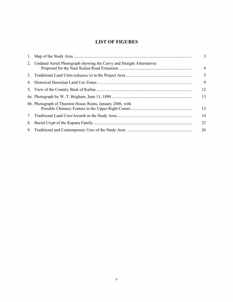
v
LIST OF FIGURES
1. Map of the Study Area ................................................................................................................ 3 2. Undated Aerial Photograph showing the Curvy and Straight Alternatives
Proposed for the Nani Kailua Road Extension ..................................................................... 4 3. Traditional Land Units (ahupua‘a) in the Project Area .............................................................. 5 4. Historical Hawaiian Land Use Zones.............................................................................................................................. 9 5. View of the Country Back of Kailua ........................................................................................... 12 6a. Photograph by W. T. Brigham, June 11, 1890 ............................................................................ 13
6b. Photograph of Thurston House Ruins, January 2006, with Possible Chimney Feature in the Upper Right Corner.......................................................... 13
7. Traditional Land Uses/Awards in the Study Area....................................................................... 14 8. Burial Crypt of the Kapana Family ............................................................................................. 23 9. Traditional and Contemporary Uses of the Study Area ............................................................. 26

vi
LIST OF TABLES
1. Ahupua‘a Names and their Possible Meanings ........................................................................... 6 2. Land Commission Awards in the Nani Kailua Road Extension Study Area .............................. 15
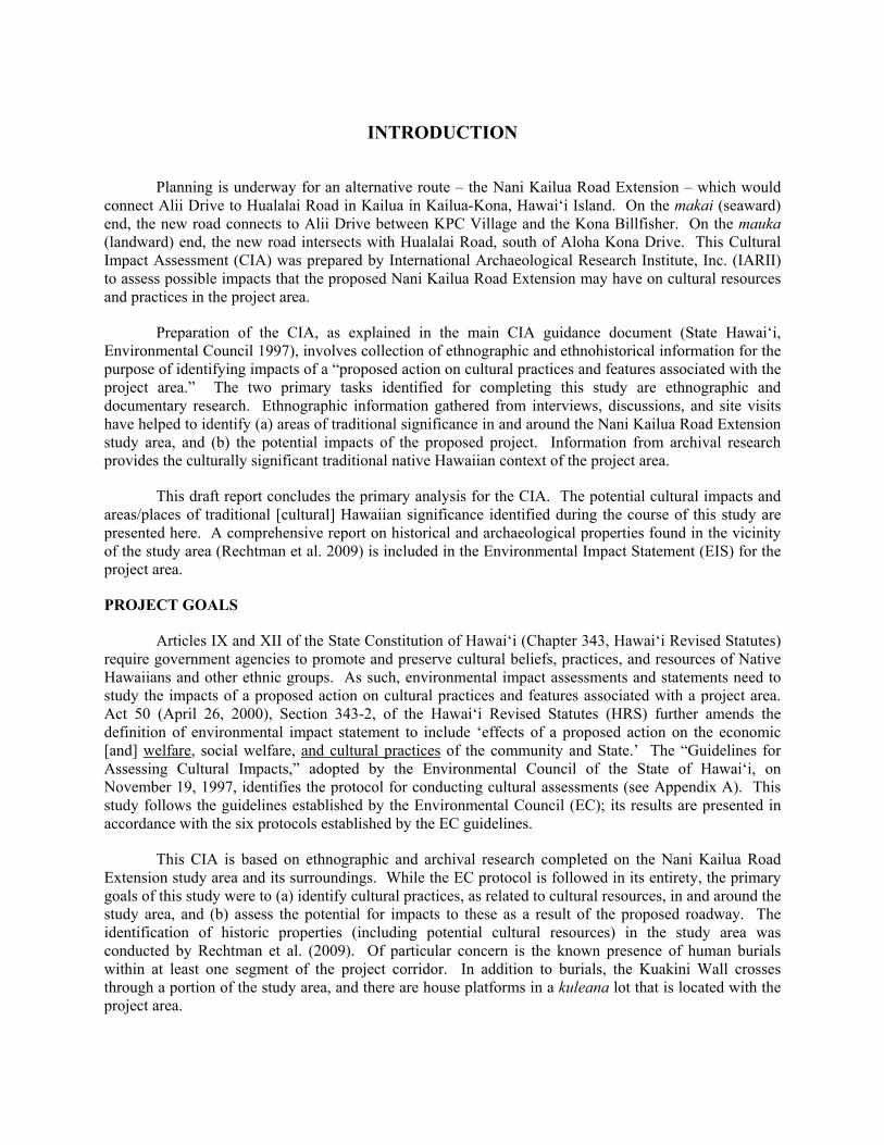
INTRODUCTION
Planning is underway for an alternative route – the Nani Kailua Road Extension – which would connect Alii Drive to Hualalai Road in Kailua in Kailua-Kona, Hawai‘i Island. On the makai (seaward) end, the new road connects to Alii Drive between KPC Village and the Kona Billfisher. On the mauka (landward) end, the new road intersects with Hualalai Road, south of Aloha Kona Drive. This Cultural Impact Assessment (CIA) was prepared by International Archaeological Research Institute, Inc. (IARII) to assess possible impacts that the proposed Nani Kailua Road Extension may have on cultural resources and practices in the project area.
Preparation of the CIA, as explained in the main CIA guidance document (State Hawai‘i, Environmental Council 1997), involves collection of ethnographic and ethnohistorical information for the purpose of identifying impacts of a “proposed action on cultural practices and features associated with the project area.” The two primary tasks identified for completing this study are ethnographic and documentary research. Ethnographic information gathered from interviews, discussions, and site visits have helped to identify (a) areas of traditional significance in and around the Nani Kailua Road Extension study area, and (b) the potential impacts of the proposed project. Information from archival research provides the culturally significant traditional native Hawaiian context of the project area.
This draft report concludes the primary analysis for the CIA. The potential cultural impacts and areas/places of traditional [cultural] Hawaiian significance identified during the course of this study are presented here. A comprehensive report on historical and archaeological properties found in the vicinity of the study area (Rechtman et al. 2009) is included in the Environmental Impact Statement (EIS) for the project area.
PROJECT GOALS
Articles IX and XII of the State Constitution of Hawai‘i (Chapter 343, Hawai‘i Revised Statutes) require government agencies to promote and preserve cultural beliefs, practices, and resources of Native Hawaiians and other ethnic groups. As such, environmental impact assessments and statements need to study the impacts of a proposed action on cultural practices and features associated with a project area. Act 50 (April 26, 2000), Section 343-2, of the Hawai‘i Revised Statutes (HRS) further amends the definition of environmental impact statement to include ‘effects of a proposed action on the economic [and] welfare, social welfare, and cultural practices of the community and State.’ The “Guidelines for Assessing Cultural Impacts,” adopted by the Environmental Council of the State of Hawai‘i, on November 19, 1997, identifies the protocol for conducting cultural assessments (see Appendix A). This study follows the guidelines established by the Environmental Council (EC); its results are presented in accordance with the six protocols established by the EC guidelines.
This CIA is based on ethnographic and archival research completed on the Nani Kailua Road Extension study area and its surroundings. While the EC protocol is followed in its entirety, the primary goals of this study were to (a) identify cultural practices, as related to cultural resources, in and around the study area, and (b) assess the potential for impacts to these as a result of the proposed roadway. The identification of historic properties (including potential cultural resources) in the study area was conducted by Rechtman et al. (2009). Of particular concern is the known presence of human burials within at least one segment of the project corridor. In addition to burials, the Kuakini Wall crosses through a portion of the study area, and there are house platforms in a kuleana lot that is located with the project area.
2
In order to meet the goals identified for this study, interviews and site visits were completed with individuals who are knowledgeable about the area, at least one of whom has ancestral ties to the lands and spoke about the native Hawaiian cultural properties and practices. The present land owner and some of the occupants (lessees) were also interviewed. It should be noted that the CIA guidelines emphasize that these policies require government agencies to promote and preserve the cultural beliefs, practices, and resources of native Hawaiians, as well as those of other ethnic groups. An important consideration for the Kailua-Kona area is that the present community is predominantly of non-Hawaiian ancestry.
Of the cultural resources identified in the project area, burials of native Hawaiians who were once kupa (citizen/resident) to these lands remain of primary concern as these may be found in locations other than those already identified for the study area. In addition to the burial features in the undeveloped lands mauka of Kuakini Highway, several burial sites, two of which have modern markers, lie in the makai portion of the study area. One of these is an individual burial marker built on the sidewalk along the existing Kuakini Highway, fronting Coconut Grove Marketplace. The second lies adjacent to the southeastern edge of the parking lot of Coconut Grove Marketplace.
PROJECT LOCATION
The study area is located on the western slopes of Hualālai Mountain on the island of Hawai‘i (Fig. 1). It is a total of 34.9 acres and is located within the traditional land district of Kona. There are two alternative alignments – straight and curvy – under consideration, both of which extend from Alii Drive to Hualalai Road, crossing Kuakini Highway. At the makai end of the project area, both alignments would begin (or terminate) between Kahakai and Walua roads; at the mauka end, both alignments would conclude at the intersection of Hualalai Road and the existing Nani Kailua Drive.
The study area includes both developed and undeveloped parcels of land. The 600 foot makai segment has been given more priority (Jensen 2009) as there is a more immediate need for this option to help ease traffic through the busy Alii Drive. The 2,000 foot mauka segment crosses through mostly undeveloped parcels, and is of a lesser priority.
ALIGNMENT 1: CURVY ROUTE
Alternative 1 is known as the ‘Curvy’ alignment (Fig. 2), shaped somewhat like a large figure ‘S,’ from Alii Drive to Hualalai Road. As seen above, Alternative 1 traverses through undeveloped parcels almost exclusively; only a short segment meanders through the Coconut Grove Marketplace.
ALIGNMENT 2: STRAIGHT ROUTE
Alternative 2 is known as the ‘Straight’ alignment (Fig. 2) as it offers a more direct route from Alii Drive to Hualalai Road. This alternative crosses through a development known as Kama‘āina Hale, which is situated just mauka of Kuakini Highway. Unlike Alternative 1, this alignment stays within the undeveloped lands between the Alii Drive and Kuakini Highway segment.

3
Figure 1. Map of the Study Area.

4
Figure 2. Undated Aerial Photograph showing the Curvy and Straight Alternatives Proposed for the Nani Kailua Road Extension.

5
SPECIAL MANAGEMENT AREA (SMA)
The makai portion of the study area falls within the Special Management Area (SMA). Boundaries of the SMA include all those lands below Kuakini Highway to the shoreline below Alii Drive. Kuakini Highway in essence forms the mauka boundary of the SMA. Any undertaking that occurs within the SMA requires special permitting from the County of Hawai‘i.
TRADITIONAL LAND UNITS WITHIN THE STUDY AREA
The study area falls within three traditional land units or ahupua‘a (see Fig. 3 and Table 1). Kuakini Highway, which bisects the study area, serves as a major corridor1 through the busy town of Kailua. The highway crosses through a historically significant native Hawaiian settlement area. Remnants of prehistoric and historical uses of the area are still found in features such as historical walls, fence enclosures, burials, and heiau (religious shrines of varied significance). Kailua is one of the few areas in Hawai‘i that offers an opportunity to look at human settlement, spanning from the earliest chiefdoms known, to the present day. In this time, land use [of Kailua as well as the remainder of Kona] has changed dramatically, as has the population. This temporal history of Kailua-Kona is briefly discussed in the following section.
Figure 3. Traditional Land Units (ahupua‘a) in the Project Area.
1 Alii Drive, which runs parallel to the shoreline, forms the other major thoroughfare in Kailua.
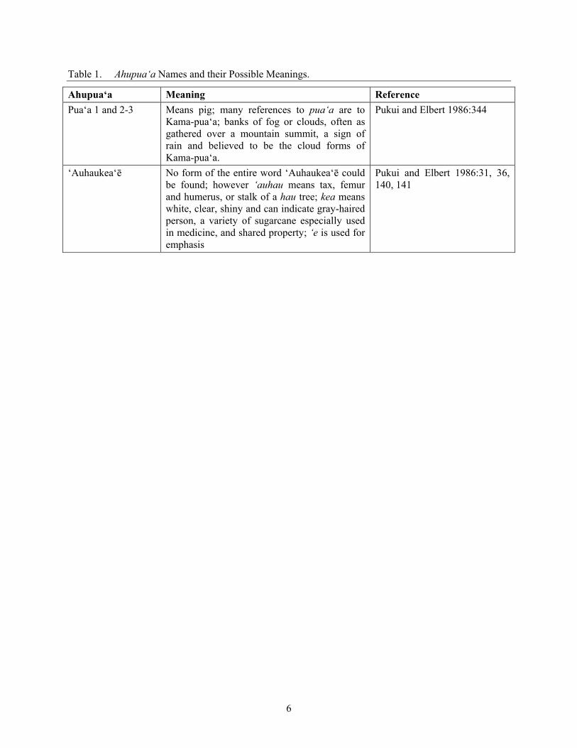
6
Table 1. Ahupua‘a Names and their Possible Meanings.
Ahupua‘a Meaning Reference Pua‘a 1 and 2-3 Means pig; many references to pua‘a are to
Kama-pua‘a; banks of fog or clouds, often as gathered over a mountain summit, a sign of rain and believed to be the cloud forms of Kama-pua‘a.
Pukui and Elbert 1986:344
‘Auhaukea‘ē No form of the entire word ‘Auhaukea‘ē could be found; however ‘auhau means tax, femur and humerus, or stalk of a hau tree; kea means white, clear, shiny and can indicate gray-haired person, a variety of sugarcane especially used in medicine, and shared property; ‘e is used for emphasis
Pukui and Elbert 1986:31, 36, 140, 141
7
PROJECT METHODS
The goal of a CIA is to study the impacts of a proposed action on cultural practices and features associated with a project area. There are six protocols (App. A) identified by the Office of Environmental Quality Control (OEQC) for conducting cultural impact assessments; the following explains how each of the council’s protocol was followed/adhered to in completing the present CIA study:
1. Most of the participants in this study and those who have contributed to earlier studies completed by this researcher are individuals (see Appendix B) who have knowledge and expertise in the cultural resources and native Hawaiian cultural practices and beliefs of the Kailua-Kona area. These include kūpuna and kama‘āina and non-Hawaiian residents of the general study area.
2. The following community organizations and/or their representatives were contacted for this CIA study:
Office of Hawaiian Affairs Hawaii Community Development Corporation Bishop Estate/Kamehameha Schools
3. Formal and informal interviews completed with kūpuna, kama‘āina, and non-Hawaiian residents have been completed for the present study and for earlier studies in the vicinity of the study area. Transcripts that provide information more relevant to the current study area are found in Appendix C.
4. Documentary research, particularly on identifying traditional and cultural uses of the area, was completed throughout the duration of this study. Much of what is known about the pre-Contact and historical uses of the area comes from written records.
5. Based on the criteria of the federal government (National Register of Historic Places) and the State of Hawai‘i historic preservation rules and regulations, there are many culturally significant properties associated with the project area. All of these properties have been or are being considered as significant under Criteria A, C, D and E2 (see App. D); these are described in various archaeological reports. Included among these properties is the Kuakini Wall (SIHP Site 6302), which is listed on the State and National Historic Register of Places as being significant under Criteria A, C and D. Observations and oral histories were completed to identify if any cultural practices associated with these properties are currently taking place.
2 The State of Hawai‘i has an additional criterion (E) that a site is significant if it has important historical cultural
value to an ethnic group of the State (SHPD rules and regulations).

8
6. The proposed action is for two road alignments that would cross through developed and undeveloped parcels of land. Of the two alternatives, one will have greater cultural impacts as it crosses an area known to have significant cultural resources that includes Hawaiian burial features. Both alignments also approach an existing elderly housing project. In completing the assessment, potential impacts of Alternative 1 and Alternative 2 are addressed, along with impacts to traditional gathering and land use practices. An evaluation of the need for a new road, with the makai segment having a more immediate need than the mauka segment, is offered as an alternative to the proposed action.

9
CULTURAL AND HISTORICAL SIGNIFICANCE OF THE STUDY AREA
The lands within which the project area falls form a very significant part of Hawai‘i’s history. Settlement and use of Kona lands is known from as early as the 1400s, when ‘Ehu-kai-malino was chief. According to Kamakau (1961:32), ‘Ehu ranked second only to Liloa and was his contemporary. The greatest of all kings was perhaps ‘Umi-a-Liloa, the son of Liloa who is known for conquering and uniting and island of Hawai‘i. These early kingdoms would involve significant economic, political and religious development of the area. Population would have increased, as would have the number of permanent settlements in and around the kingdom. In order to accommodate the needs of a larger, more settled population, food resources (agriculture, fishponds,) and religious features (heiau) would have increased. The growing (and sedentary) population gave impetus for large scale developments such as the Kona Field System. The Kona Field System would have made up a significant portion of the Wao Kanaka (Fig. 4) traditional land use zone of the early Hawaiians.
Figure 4. Historical Hawaiian Land Use Zones (from the Kona Community Development Plan, Fig.
4-9).
10
T. Stell Newman (1970), who completed one of the earliest archaeological studies of this agricultural system, estimated that it was up to three miles wide and eighteen miles long (National Register of Historic Places, Site 10-37-6601). The fields continued north to include the area in back of Kailua town and somewhat beyond. According to Kelly (1983:70-71) what is known today as the Kona Field System is based on claims to cultivated lands documented in the Native Register (prior to passage of the Kuleana Act in 1850). Plants such as taro, sweet potato, breadfruit, sugarcane, plantains and paper mulberry were cultivated in elaborate terraces that spanned from Kailua to Kealakekua (Handy and Handy 1991:525-527).
Once he united all of the districts on Hawai‘i (through warfare), the great chief ‘Umi-a-Liloa wanted to make Kona his new home. Under his rule, the island was divided into two kingdoms – one located in Kona and the other in Hilo (Kamakau 1992:34). After ‘Umi’s time, a succession of chiefs reigned in Kona. In historic times, following the death of Captain Cook, the great chief Ka-lani-‘opu‘u moved to Kailua after brief stays in Kainaliu and Keauhou (Kamakau 1992:105). Kuakini, whose name is used on several sites and features in Kailua including the project area, was one of the last of the Hawaiian high chiefs to live in Kailua.
Early historical accounts of Kailua describe how the town appeared to these visitors. Commonly cited for his detailed description of the town of Kailua, the missionary William Ellis left a lasting impression of his visit to Hawai‘i in 1823. In the following account, Ellis describes what he saw as he walked from the shoreline further inland and eventually to points south of Kailua:
The houses, which are neat, are generally built on the sea-shore, shaded with cocoanut [sic] and kou trees, which greatly enliven the scene. The environs were cultivated to a considerable extent in every direction. Small gardens were seen among the barren rocks on which the houses are built, wherever soil could be found sufficient to nourish the sweet potato, the water melon, or even a few plants of tobacco, which in many places seemed to be growing literally in the fragments of lava collected in small heaps around their roots (Ellis 1963:27).
After traveling over the lava for about a mile, the hollows in the rocks began to be filled with a light brown soil; and about half a mile further, the surface was entirely covered with a rich mould, formed by decayed vegetation and decomposed lava. Here they enjoyed the agreeable shade of bread-fruit and ohia trees….The path now lay through a beautiful part of the country, quite a garden compared with that through which they had passed, on first leaving the town. It was generally divided into small fields, about fifteen rods square, fenced with low stone walls, made of fragments of lava which had been gathered from the surface of the enclosures. These fields were planted with bananas, sweet potatoes, mountain taro, tapa trees, melons and sugar-cane, flourishing luxuriantly in every direction. Having travelled about three to four miles thorough this delightful region, and passed several valuable pools of fresh water, they arrived at the thick woods, which extends several miles up the sides of the lofty mountain that rises immediately behind Kairua.
Leaving Kairua, we passed through the villages thickly scattered along the shore to the southward. The country around looked unusually green and cheerful, owning to the frequent rains, which for some months past have fallen on this side of the island. Even the barren lava, over which we travelled [sic], seemed to veil its sterility beneath frequent tufts of tall waving grass, or spreading shrubs and flowers.
The sides of the hills, laid out for considerable extent in gardens and fields, and generally cultivated with potatoes, and other vegetables, were beautiful.
The number of heiaus, and depositories of the dead, which we passed, convinced us that this part of the island must formerly have been populous. The latter were built with fragments of lava, laid up evenly on the outside, generally about eight feet long, from four to six broad, and about four
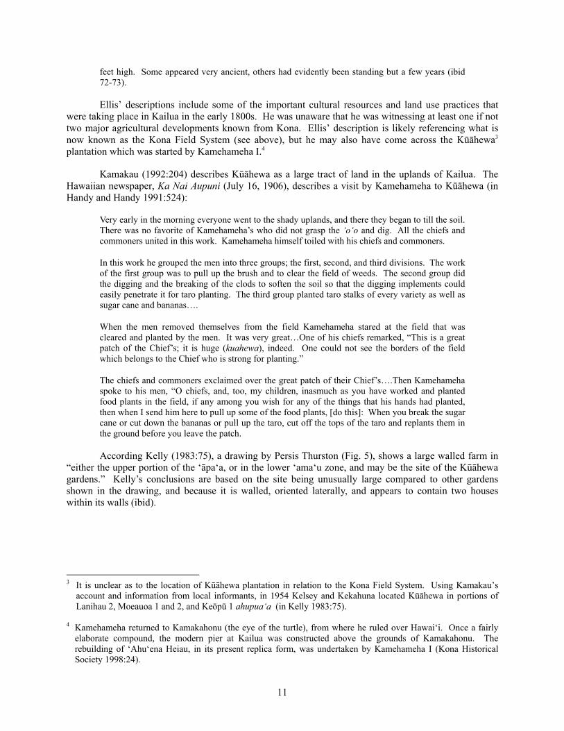
11
feet high. Some appeared very ancient, others had evidently been standing but a few years (ibid 72-73).
Ellis’ descriptions include some of the important cultural resources and land use practices that were taking place in Kailua in the early 1800s. He was unaware that he was witnessing at least one if not two major agricultural developments known from Kona. Ellis’ description is likely referencing what is now known as the Kona Field System (see above), but he may also have come across the Kūāhewa3 plantation which was started by Kamehameha I.4
Kamakau (1992:204) describes Kūāhewa as a large tract of land in the uplands of Kailua. The Hawaiian newspaper, Ka Nai Aupuni (July 16, 1906), describes a visit by Kamehameha to Kūāhewa (in Handy and Handy 1991:524):
Very early in the morning everyone went to the shady uplands, and there they began to till the soil. There was no favorite of Kamehameha’s who did not grasp the ‘o‘o and dig. All the chiefs and commoners united in this work. Kamehameha himself toiled with his chiefs and commoners.
In this work he grouped the men into three groups; the first, second, and third divisions. The work of the first group was to pull up the brush and to clear the field of weeds. The second group did the digging and the breaking of the clods to soften the soil so that the digging implements could easily penetrate it for taro planting. The third group planted taro stalks of every variety as well as sugar cane and bananas….
When the men removed themselves from the field Kamehameha stared at the field that was cleared and planted by the men. It was very great…One of his chiefs remarked, “This is a great patch of the Chief’s; it is huge (kuahewa), indeed. One could not see the borders of the field which belongs to the Chief who is strong for planting.”
The chiefs and commoners exclaimed over the great patch of their Chief’s….Then Kamehameha spoke to his men, “O chiefs, and, too, my children, inasmuch as you have worked and planted food plants in the field, if any among you wish for any of the things that his hands had planted, then when I send him here to pull up some of the food plants, [do this]: When you break the sugar cane or cut down the bananas or pull up the taro, cut off the tops of the taro and replants them in the ground before you leave the patch.
According Kelly (1983:75), a drawing by Persis Thurston (Fig. 5), shows a large walled farm in “either the upper portion of the ‘āpa‘a, or in the lower ‘ama‘u zone, and may be the site of the Kūāhewa gardens.” Kelly’s conclusions are based on the site being unusually large compared to other gardens shown in the drawing, and because it is walled, oriented laterally, and appears to contain two houses within its walls (ibid).
3 It is unclear as to the location of Kūāhewa plantation in relation to the Kona Field System. Using Kamakau’s
account and information from local informants, in 1954 Kelsey and Kekahuna located Kūāhewa in portions of Lanihau 2, Moeauoa 1 and 2, and Keōpū 1 ahupua‘a (in Kelly 1983:75).
4 Kamehameha returned to Kamakahonu (the eye of the turtle), from where he ruled over Hawai‘i. Once a fairly
elaborate compound, the modern pier at Kailua was constructed above the grounds of Kamakahonu. The rebuilding of ‘Ahu‘ena Heiau, in its present replica form, was undertaken by Kamehameha I (Kona Historical Society 1998:24).
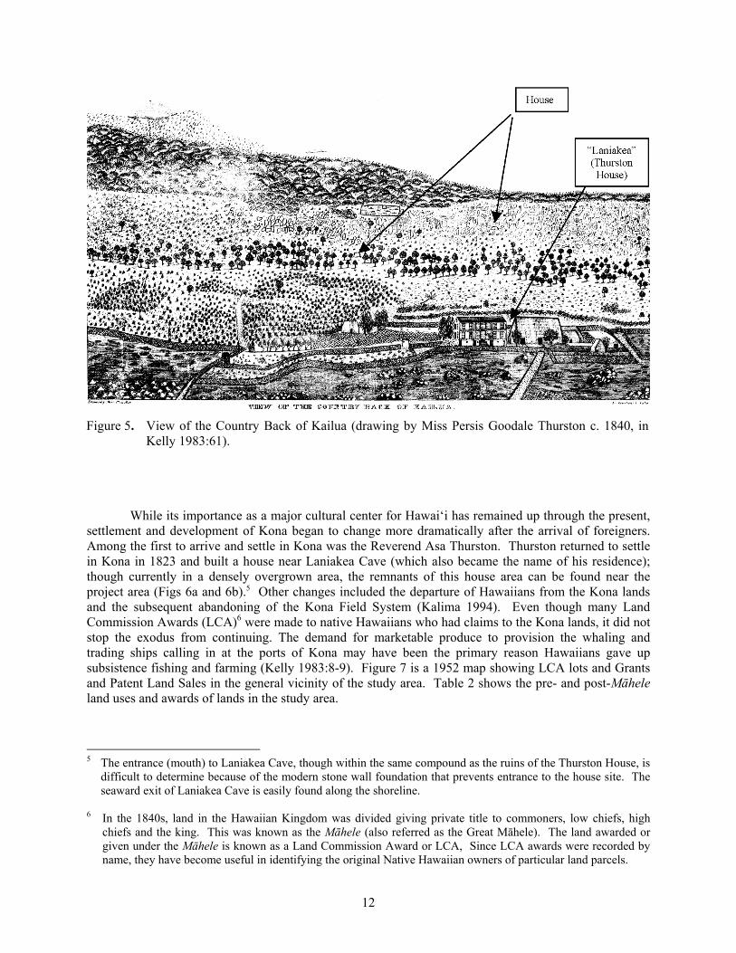
12
Figure 5. View of the Country Back of Kailua (drawing by Miss Persis Goodale Thurston c. 1840, in
Kelly 1983:61).
While its importance as a major cultural center for Hawai‘i has remained up through the present, settlement and development of Kona began to change more dramatically after the arrival of foreigners. Among the first to arrive and settle in Kona was the Reverend Asa Thurston. Thurston returned to settle in Kona in 1823 and built a house near Laniakea Cave (which also became the name of his residence); though currently in a densely overgrown area, the remnants of this house area can be found near the project area (Figs 6a and 6b).5 Other changes included the departure of Hawaiians from the Kona lands and the subsequent abandoning of the Kona Field System (Kalima 1994). Even though many Land Commission Awards (LCA)6 were made to native Hawaiians who had claims to the Kona lands, it did not stop the exodus from continuing. The demand for marketable produce to provision the whaling and trading ships calling in at the ports of Kona may have been the primary reason Hawaiians gave up subsistence fishing and farming (Kelly 1983:8-9). Figure 7 is a 1952 map showing LCA lots and Grants and Patent Land Sales in the general vicinity of the study area. Table 2 shows the pre- and post-Māhele land uses and awards of lands in the study area.
5 The entrance (mouth) to Laniakea Cave, though within the same compound as the ruins of the Thurston House, is
difficult to determine because of the modern stone wall foundation that prevents entrance to the house site. The seaward exit of Laniakea Cave is easily found along the shoreline.
6 In the 1840s, land in the Hawaiian Kingdom was divided giving private title to commoners, low chiefs, high
chiefs and the king. This was known as the Māhele (also referred as the Great Māhele). The land awarded or given under the Māhele is known as a Land Commission Award or LCA, Since LCA awards were recorded by name, they have become useful in identifying the original Native Hawaiian owners of particular land parcels.

13
Figure 6a. Photograph by W. T. Brigham, June 11, 1890, showing “Laniakea” on the left and
the Thurston Schoolhouse on the right (Fig. 12 in Kelly 1983:13).
Figure 6b. Photograph of Thurston House Ruins, January
2006, with Possible Chimney Feature in the Upper Right Corner.
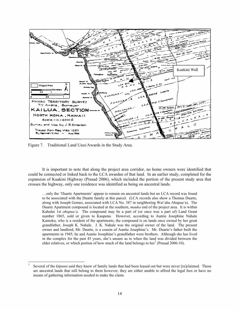
14
Figure 7. Traditional Land Uses/Awards in the Study Area.
It is important to note that along the project area corridor, no home owners were identified that could be connected or linked back to the LCA awardee of that land. In an earlier study, completed for the expansion of Kuakini Highway (Prasad 2006), which included the portion of the present study area that crosses the highway, only one residence was identified as being on ancestral lands.
…only the ‘Duarte Apartments’ appear to remain on ancestral lands but no LCA record was found to be associated with the Duarte family at this parcel. (LCA records also show a Thomas Duarte, along with Joseph Gomes, associated with LCA No. 387 in neighboring Wai‘aha Ahupua‘a). The Duarte Apartment compound is located at the southern, mauka end of the project area. It is within Kahului 1st ahupua‘a. The compound may be a part of (or once was a part of) Land Grant number 1865, sold or given to Kaupena. However, according to Auntie Josephine Nahale Kamoku, who is a resident of the apartments, the compound is on lands once owned by her great grandfather, Joseph K. Nahale. J. K. Nahale was the original owner of the land. The present owner and landlord, Mr. Duarte, is a cousin of Auntie Josephine’s. Mr. Duarte’s father built the apartments in 1945; he and Auntie Josephine’s grandfather were brothers. Although she has lived in the complex for the past 45 years, she’s unsure as to when the land was divided between the elder relatives, or which portion of how much of the land belongs to her7 (Prasad 2006:10).
7 Several of the kūpuna said they knew of family lands that had been leased out but were never [re]claimed. These
are ancestral lands that still belong to them however, they are either unable to afford the legal fees or have no means of gathering information needed to make the claim.
15
Table 2. Land Commission Awards in the Nani Kailua Road Extension Study Area.
Ahupua‘a Pre-Māhele History
Land Comm. Award
Awardee Post Māhele History Land Use
‘Auhaukea‘ē William Pitt Leleiohoku, son of Kalaniomoku (adopted son of Kuakini); heirs gave land to government
11216 M. Kekauonohi Inherited by second husband, Levi Haalelea in 1851
Eventually became part of Greenwell Ranch
Pua‘a 1st 7715:13 Kamehameha V, Lot Kapuaiwa; house
After his death in 1872, part of the land was sold and part returned to the government; Waahila granted 1 lot after his request to buy the land from the ocean to Kuakini’s wall
7074 Kanewaahilani; house
10267 Malowaole; house surrounded by a low stone wall
Pua‘a 2nd 7419 Lot 1 was purchased by Waahila, between the ocean and Kuakini’s wall
4102 Lot 2 was purchased by Papa in 1897, between the ocean and Kuakini’s wall
The movement out of Kailua town continues to the present day. Of the Hawaiians and kama‘āina who have been interviewed for studies done in the study area, only a handful remain either on family lands or within Kailua town.8 At present, the population of Kailua is predominantly non-Hawaiian. According to the latest census (U.S. Census Bureau, 2000) out of an estimated 9,870 residents, only 10.8 percent are native Hawaiians. Mixed native Hawaiian and other Pacific Islander constitutes a total of 32.9 percent. Also, nearly half of the current residents of Kailua were not born in Hawai‘i; only 52 percent were born in the State of Hawai‘i. These figures demonstrate that in a little more than 200 years, the native Hawaiian population that was once formed Kailua town (prior to the introduction of new diseases,
8 Many of these former residents of Kailua town moved upland (mauka), where they still had family lands.
16
non-traditional job opportunities, commercial farming and ranching ventures, etc.) has dwindled to a small minority. Based on the level of development underway, it would appear that the native population will decrease even further.
All places in Hawai‘i are of importance to native Hawaiians. And all places have some cultural value. But the significance of the native Hawaiian history in Kailua (Kona) presents a unique temporal context unlike any other in the islands:
• First, the native Hawaiian history of Kailua (and Kona) has been continuous; it extends back 600+ years. It is also fairly well documented through genealogical records, in chants, myths, and in the historical records left by the early visitors to the islands.
• Second, in the post-Māhele period (after 1840) there were numerous LCA awards (given) in the Kailua area. (Some native Hawaiians also purchased lands from the government). Even though some of these lands have since been abandoned, vacated or sold, family names from the initial LCA awards, land grants, and patent records can still be associated with parcels or areas of land. The combined number of LCA awards, land grants, and patents indicate that there is a fairly large number of native Hawaiians who could lay ancestral (or land use) claim to the lands.
• Third, the native Hawaiians who lived, worked, and played in these lands left some
imprints. The project area, though largely surrounded by modern development (concrete buildings, other roadways, sidewalks, etc.) is also surrounded by remnants of structures and features of the earlier Hawaiian occupants. Among these features are stone walls, housing platforms, and boundary markers that represent the transitional period when Kailua was being introduced to plantation and ranching.
THE CULTURAL MAKEUP OF KAILUA-KONA TODAY: RELEVANCE OF KA PA‘AKAI O KA‘AINA v. LAND USE COMMISSION RULING AND PASH FOR THE PROJECT AREA
This long-standing history, first of native Hawaiian settlement and land use, followed by plantation and ranch related uses of the land, has several implications for the intended goals of this CIA study. The use of the land, native and otherwise, that has contributed to the culture that presently exists in Kailua is an important consideration in addressing impacts. Much of the culture that remains in Kailua is no longer native Hawaiian…neither are many of the current land use practices. But there are some native Hawaiians who continue to live in Kailua, and there are many historic features that tell of the life that once was. Two separate court decisions - Ka Pa‘akai O Ka‘aina v. Land Use Commission and PASH - have been made in the past 25 years which call attention to the need to recognize native Hawaiian cultural practices in the face of development.
KA PA‘AKAI O KA‘AINA V. LAND USE COMMISSION
In response to the disappearing cultural practices in rapidly growing areas such as Kona, the Hawai‘i Supreme Court (2000) made a decision regarding land use on the island of Hawai‘i. This ruling calls attention to the need to recognize native Hawaiian cultural practices in the face of development (Ka Pa‘akai o Ka‘aina v. Land Use Commission 2000).
[T]he past failure to require native Hawaiian cultural impact assessments has resulted in the loss and destruction of many important cultural resources and has interfered with the exercise of native Hawaiian culture. The legislature further finds that due consideration of the effects of human activities on native Hawaiian culture and the exercise thereof is necessary to ensure the continued existence, development, and exercise of native Hawaiian culture (Ka Pa‘akai O Ka‘aina v. Land Use Commission 2000:26-27).
17
The importance of the above Supreme Court determination is that it emphasizes the need to identify/address impacts on cultural resources, which includes “activities of native Hawaiian culture,” by land development projects before they occur.9 The current study area is largely undeveloped. The area is not pristine as very few sections within such close proximity to Kailua town or along Kuakini Highway have been left undisturbed in the last 200 years. Yet there are potential traditional land units (LCA, land, Royal Patents, kuleana lots, etc.) that remain in the vicinity of the project area. Also, cultural resources remain throughout the makai and mauka portions of the study area. The archaeological survey report (Rechtman et al. 2009) completed for the current study area identifies 12 historical sites. While these sites are not new discoveries, they form an important part of Kailua-Kona’s historic past that included native Hawaiian land uses and early post-Contact historical uses of this part of Hawai‘i Island. Today’s Kailua-Kona reflects more of a modern tourist town than a town that once had high status Hawaiians living along the coastal portion, other Hawaiians who perhaps worked in the Kona Field System or provided support for the ali‘i, and still others who fished in the bountiful waters along the Kailua coastline. It is rare to find native Hawaiians residing on lands that may have once belonged to their ancestors. Auntie Josephine Nahale Kamoku and Junior Kanuha are among native Hawaiians who still live on lands inherited from their parents and grandparents.
The identification of cultural resources, as done by archaeological studies, helps to identify native Hawaiian10 (and other) uses of the lands. While nearly all of these resources are prehistoric and historical – no longer in use by native Hawaiians – the concern of “the effects of human activities on native Hawaiian culture and exercise,” is best defined by proper caretaking of these resources. This includes identifying proper measures to avoid further harm and damage to important cultural resources that may lie along the chosen road alignment.
PUBLIC ACCESS SHORELINE HAWAII (PASH)
Public Access Shoreline Hawaii (PASH), as it concerns this report, is the resulting court decision based on a series of three cases brought before the Hawaii Supreme Court. These three cases have culminated in what is otherwise known as the PASH decision. The first of these, Kalipi v. Hawaiian Trust Co., Ltd., was brought before the court system in 1982, and concerned balancing the rights of land owners and native practitioners (Native Hawaiian Bar Association 1997). The Pele Defense Fund vs. Paty, was brought before the courts in 1992, and expanded customary and traditional gathering rights of native Hawaiians beyond the boundaries of the ahupua‘a of residence (Native Hawaiian Bar Association 1997). In the final case, Public Access Shoreline Hawaii vs. County Hawaii, July 1997 (also known as the Kohanaiki ruling), the court’s rulings determined the following: 1) the right of each ahupua‘a tenant to exercise traditional and customary practices remains intact, notwithstanding arguable abandonment of a particular site; 2) continuous exercise is not absolutely required to maintain validity of a custom; 3) the western concept of exclusivity is not universally applicable in Hawaii; and 4) the state is obligated to protect customary and traditional rights normally associated with residency in an ahupua‘a, [and] may also apply to the exercise of the rights beyond the physical boundaries of that particular ahupua‘a (Native Hawaiian Advisory Council 1997).
The results of PASH rulings such as the above help define the criteria and establish the groundwork for addressing issues associated with access to areas used for traditional and customary practices by Hawaiians. Some questions about Hawaiian traditional and customary practices remain
9 The land area which this Supreme Court decision references is in the ahupua‘a of Ka‘upulehu; it is a short
driving distance north of the current project area. 10 Some of the historic features identified are not native Hawaiian but represent the early historical settlement and
use of the project area.
18
unresolved; these are addressed by House Resolution No.197, HD1 (Office of Planning 1998). The current project area crosses three ahupua‘a, which all border Kailua’s shoreline.
PASH is not a consideration for the current project area. As described above, the application of PASH rights encompasses issues that relate to the broader concept of ahupua‘a, which includes the shoreline. Access to shoreline areas for traditional and customary practices by native Hawaiians is a major concern of PASH and this is not a concern in the present study area. There are no activities currently taking place that will be affected by the Nani Kailua Road Extension proposal. At present, Hawaiian groups (surfers, fishermen, swimmers, canoe paddlers, etc.) have access to the shoreline from the beach parks and public access along Alii Drive. Access will also not be denied access as a result of future developments related to the current project. It is also highly likely that PASH rights are already in effect for traditional uses of some of the shoreline areas that have historic features such as Ma‘o or Nalupo‘o Heiau in Wai‘aha Ahupua‘a, Kauakaiakaola Heiau, and ‘Ahu‘ena Heiau.
FUTURE PLANS FOR KAILUA-KONA: KONA COMMUNITY DEVELOPMENT PLAN
Kona has become one of the fastest growing areas on the Hawai‘i Island. In an effort to guide future development in Kona, the Kona Community Development Plan [KCDP] (Wilson Okamoto Corporation 2008) was created. The KCDP identifies eight guiding principles for future development of the area, the first of which is the need to protect Kona’s natural resources and culture:
Natural resources. The watershed, including coastline, flood plains, important agricultural land, open space, and areas mauka of Māmalahoa Highway shall be protected. Guided by a principle of respect for the land, environment and natural resources shall be preserved and protected to ensure clean air and water, thriving native species, conservation of shorelines and open space, improvements in watershed management and flood control, and reductions in solid waste.
Culture. The multi-ethnic culture is preserved, protected, and restored in a manner that perpetuates all aspects of the aloha spirit (Wilson Okamoto Corporation 2008:3-1,2).
Incorporation of the cultural landscape into modern land use planning is a major objective of the KCDP. In an effort to direct how cultural resources can be protected and incorporated into future development plans, the KCDP recommends that a Kona Cultural Resources Committee (KCRC) be formed by the County of Hawai‘i. The KCRC will assist in implementing KCDP’s goals (see App. D), and it will be made of up residents of Kona (KCDP 2008:4-77). According to the KCDP:
Present Conditions: Kona’s physical and cultural landscape has undergone tremendous change since Statehood, and with the ever increasing influx of new residents and visitors, the pace of this change has been more rapid, especially with new coastal and upland development taking place.
Despite these changes, many areas of Kona still contain undisturbed historical and cultural resources which are significant and valued, not only by the Hawaiian people, but the Kona community, as well. While some sites are well known, most sites are not apparent and are only found during archaeological surveys. There is a need to enhance the contribution that these sites can provide to the day to day lives of people in Kona, rather than merely creating database inventories. At the same time, there is the issue of not disclosing the locations of sites for fear of looting or damage by the curious public.
The extensive Kona Field System from Hu‘ehu‘e to Honaunau and beyond, are the lands that were intensively cultivated and yielded significant agricultural production. Portions of this field system have been recorded and can still be seen throughout Kona today. Kona contains approximately 40 sites listed on the National and State Historic Register. Most of these sites are of traditional Hawaiian origin and can yield information vital to reconstructing Hawai‘i’s early history. Equally,

19
and perhaps more significantly, however, are the thousands of recorded historical and cultural sites and resources from the pre-contact Hawaiian period which are not listed on the Register (KCDP 2008:4-75).
While the KCDP identifies the historical and cultural value of Kona lands, it also points to the problems that have neglected to acknowledge culturally significant resources. It would appear that KCDP’s goals are not to discourage future development but rather to ‘manage’ further development of Kona in a way which incorporates its historical significance.

20
21
STUDY RESULTS: IDENTIFICATION (AND MITIGATION) OF POTENTIAL CULTURAL IMPACTS FOR THE EXPANSION OF KUAKINI HIGHWAY
The purpose of Articles IX and XII of the Hawai‘i State Constitution is to “promote and preserve cultural beliefs, practices, and resources of Native Hawaiians and other ethnic groups.” The goal of a CIA is to study the impacts of a proposed action on cultural practices and features associated with a project area. Included in these impacts are ‘effects of a proposed action on the economic [and] welfare, social welfare, and cultural practices of the community and State.’
The OEQC guidelines (see App. A) identify several possible types of cultural practices and beliefs that are subject to assessment. These include subsistence, commercial, residential, agricultural, access-related, recreational, and religious and spiritual customs. The guidelines also identify the types of potential cultural resources associated with cultural practices and beliefs that are subject to assessment. “The types of cultural resources subject to assessment may include traditional cultural properties11 [TCPs] or other types of historic sites, both man made and natural, including submerged cultural resources, which support such cultural practices and beliefs.” (CIA Guidelines 1997:2).
COMPLETING CIA STUDIES IN HAWAII’S NON-TRADITIONAL COMMUNITIES
For CIAs completed in the state of Hawai‘i, it is important to gather information from kūpuna12about cultural practices and beliefs. The kūpuna are the bearers of traditional and cultural knowledge of Hawaiian culture. While the kūpuna provide knowledge about traditional Hawaiian culture, members of the community most directly affected by project related changes often will include non-Hawaiians. The ethnic or cultural background of these individuals differs from their host (Hawaiian) culture and they too are likely to be affected. Thus an assessment of cultural impacts in Hawai‘i, more often than not, considers the effects of an undertaking on the culture(s) directly impacted. That being said, it is important to reiterate that the ethnic make-up of the community that surrounds the Nani Kailua Road Extension study area is predominantly non-Hawaiian. The current land owners of the project area, perhaps excluding Bishop Estate as it is a trust that is intended to represent native Hawaiian interests, are all non-Hawaiian. Family’s such as the Greenwells however, have been a very significant part of Hawaii’s historic ranching culture. They are kama‘āina13 to these lands.
In brief, the information gathered shows that that:
1. There is concern for impacts to known cultural features and sites that are located within the study area. The majority of these properties have been documented in the various archaeological studies that have been completed for the study area.
2. There is a concern about potential impacts to sites that have not yet been identified or may be inadvertently encountered once work begins on the road.
11 Briefly, a TCP is a historic property that is eligible for the nomination to the National Register of Historic Places
(NRHP) in part because of its association with the cultural practices and beliefs of a living community. 12 Kūpuna are grandparents, ancestors, and relatives of the grandparent’s generation (Pukui et al. 1975:79). 13 A kama‘āina is someone who is native born; host; land child (Pukui et al. 1975:54).

22
3. There were no traditional cultural practices/activities that were observed during the study period. However, one human burial, which is located in close proximity to Alternative 1, is attended to by the familial descendents.
4. Properties such as the known and possible burial features in the Greenwell property which borders the mauka boundary of Kuakini Highway, call for special attention as these are also of “important historical cultural value to an [living] ethnic group” under Criterion E of the State of Hawai‘i. The burials are associated with native Hawaiians that once lived in this part of Kona.
5. There may be potential cultural impacts to tenants of the elderly housing projects located in the northern end of the study area. Some of these individuals are no longer mobile and are fully dependent on and cared for within these residential dwellings.
6. There are also some social and economic concerns with regards to the potential impacts of the proposed project but these are beyond the scope of the present study.
Several kūpuna shared their knowledge and experiences of living in Kailua or visiting Kailua in the early 1900s. Auntie Elizabeth Lee and Auntie Mildred Awong Arjona were particularly informative about the changes each has witnessed in Kailua and Kona from the early to the mid 1900s. While their accounts are not included in the body of this report, the information shared by both women helped to develop a ‘picture’ of the changing Hawaiian culture that once thrived in Kona. Also, information learned from kupuna Francis Keanaaina, who was interviewed by this author for an earlier oral history of the Kailua area, has been very helpful. Uncle Francis has spent his entire life in the Kailua area. He is the fifth generation of the Keanaaina family from the Kailua area. According to Ruby McDonald, who is the niece of Uncle Francis, her family comes from five ahupua‘a in Kailua. These are ‘Auhaukea‘ē, Pua‘a, Kahului, Keōpū, and Lanihau; the current project area corridor crosses through the first two (see Fig. 3).
CONCERNS ABOUT BURIALS/IWI IN THE KONA AREA
All kūpuna believe that undiscovered burials still exist, though it is uncertain whether these are in the vicinity of the project area. Every one of them also recalls visiting or being told childhood stories about the use of caves in the Kailua area. Uncle Francis knows there are burials and caves throughout Kona, a few of which he has been able to [re-]locate. According to Ruby, in 1954 her uncle John Keanaaina was asked to enter a cave (to give a blessing), which had been inadvertently found during the construction of Kuakini Highway. It is unclear which cave this was but according to Ruby, her uncle found many burials inside the cave some of which were wrapped in lauhala mats. Ruby is uncertain if this is Laniakea Cave14 but she does know that the cave her uncle entered is in the same general area.
Another account was provided by Helen Weeks to the Kona Outdoor Circle which included a map that her husband, John Weeks, had worked with while surveying the original corridor alignment for Kuakini Highway. (John Weeks was the resident engineer for the initial Kuakini Highway project.) In this account (H. Weeks n.d.), Mrs. Weeks notes that her husband discovered Halehau- Kealakō wa‘a
14 The entrance (mouth) to Laniakea Cave is located in the same compound as the ruins of the Thurston House (see
Fig. 6a). The seaward exit of Laniakea Cave is easily found along the shoreline

23
(Kealakōwa‘a Heiau). The discovery led to Mr. Henry Kekahuna’s drawing (ca. 1955) of the “various platforms and dimensions,” and subsequent realignment of the original surveyor’s design.
One of the main concerns expressed by Mr. Junior Kanuha, whose family once lived very close to the project area, is the “need to take care of the iwis” during construction projects. Mr. Kanuha believes that there are likely to be burials found in the widening of the existing Kuakini Highway corridor. Mr. Curtis Tyler has echoed similar concerns and he is also a descendant of families who once lived in close proximity to the project area.
TRADITIONAL CULTURAL PRACTICES – CARING FOR THE IWI
Associated with familial burials is the practice of caring for the ancestors of these Hawaiian families. A burial crypt (Fig. 8), which has the remains of twenty-one members of the Kapana family, lies a short distance west of the project area; it is still visited and cared for by the lineal descendants of those buried here. The burials in this crypt were moved to its current location by its lineal descendants.
Ruby McDonald is one of the lineal descendants; the lands on which the crypt is situated once belonged to her relatives. A second burial mound lies in the sidewalk adjacent to the existing Kuakini Highway. It is positioned almost due east (towards the highway) from the crypt shown in Figure 8 and has not been directly associated with a specific family. There are however, some possible lineal descendants. According to Ruby, the remains likely belong to a relative of Keōpūlani, and members of the Kanuha, Kapena and Tyler families may be among its possible lineal descendants. Auntie Josephine Nahale Kamoku thought the burial may belong to a member of the Kamaka family. While a definite familial name or lineal descendant has not been identified, several descendants of lineal groups in the area developed a Burial Treatment Plan (BTP) which led to the building of the burial mound (Inadvertent Discovery of Human Remains – various documents, 1998).
Figure 8. Burial Crypt of the Kapana Family.
As with burials, there is also knowledge about caves in the general vicinity of the project area;
some of these are based on actual experiences of visits to the caves, while others are based on information learned from other family members. It is important to note that not all known caves that are known are associated with burials. Likewise, it is equally important to note that the exact location of these caves is no longer known. According to Ruby, who resided in the family home in Kailua until 1972, her children frequently played inside Laniakea Cave. (Her family home was located next to the present day “Kona Marketplace”, which is a short distance from the entrance and exit of Laniakea Cave.) Ruby recalls that her children would enter the cave near the Thurston residence (Fig. 5a), and come out near the shoreline

24
exit (near Hale Hālāwai).15 (There is no mention of caves in the archaeological study [Rechtman et al. 2009] completed for present study area).
Of the historic properties identified in the general vicinity of the project area, one feature could be impacted due to its proximity.16 This is the modern burial mound that is situated within the sidewalk adjacent to the existing highway, near Coconut Grove Marketplace. Interviews completed for an earlier CIA for expansion of the Kuakini Highway Corridor (Prasad 2006), attempts were made to associate the burial mound17 with a family name of its lineal descendants. Names of several families who are currently known to be from or once have lived in the area include the Tyler, Kanuha, and possibly Kapena and Kamaka families. But none of these family names could be associated with the burial remains in the mound. However, any ‘reburial’ concerns and/or potential disturbance to the existing feature will need to be addressed by the State Historic Preservation Division (SHPD). All of the families mentioned here, along with attempts to identify others yet unknown, should be contacted according to the guidelines that led to creating the BTP originally developed for this burial.
For the burials at Site 5608, a BTP was created when there was interest in developing the parcel on which the burials are located. According to David Greenwell, no lineal descendants have been identified as being associated with these burials. There are no known caretakers of the iwi at this site.
Auntie Josephine, who grew up in the “Kalākaua House” (her family home is in Kahalu‘u Ahupua‘a) recalls that her brother Joseph would frequently explore caves in the Kailua-Keauhou area. He would tell her about finding bones and other items inside these caves. She spent time visiting relatives at the Makuakane House which was near the Wai‘aha Bridge (near what is present day Kona Village). Although never having visited the caves nor seeing the burials which they contained, she believes that this general [project] area is likely to have more ‘unknown’ caves and burials.
Along with caves and burials, there is also some concern about structural features such as heiau, house foundations, stone walls, and other indicators of previous native Hawaiian land use. However, most individuals, including the kūpuna are quick to point out that few ‘active’ cultural uses of the lands remain, and very few associations can be made between the use and ownership of the features and family lands.
ACCESS TO TRADITIONAL CULTURAL RESOURCES
Associated with cultural impacts is the issue of access to resources. It does not appear that access to areas [resources] on either side of the highway will be compromised or change from its present situation. The resources identified - historical (structural) features that are TCPs – are found in both sections of the study area. Of these, Site 5608 is the most extensive and is within an undeveloped parcel of land.
15 The original Hale Hālāwai was built in 1855 as a meeting house for Hawaiian Christians; it was abandoned in the
early 1920s and rebuilt at a later time. The seashore exit of Laniakea Cave, shown by Ruby, is behind the present Hale Hālāwai structure/compound.
16 According to Parsons Brinkerhoff Quade and Douglas Inc., the burial mound feature will not be disturbed by
project-related construction activities. 17 Based on information from the SHPD office in Kona, the mound does not contain an actual burial but rather
covers the fragments of some human bones that likely belong to one individual. A review of the Burial Treatment Plan design needs to be made in order to determine if the mound is situated directly over the actual fragments of the bone or if it is within close proximity to it.
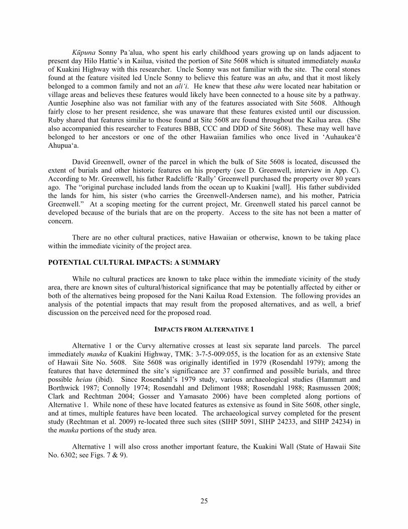
25
Kūpuna Sonny Pa‘alua, who spent his early childhood years growing up on lands adjacent to present day Hilo Hattie’s in Kailua, visited the portion of Site 5608 which is situated immediately mauka of Kuakini Highway with this researcher. Uncle Sonny was not familiar with the site. The coral stones found at the feature visited led Uncle Sonny to believe this feature was an ahu, and that it most likely belonged to a common family and not an ali‘i. He knew that these ahu were located near habitation or village areas and believes these features would likely have been connected to a house site by a pathway. Auntie Josephine also was not familiar with any of the features associated with Site 5608. Although fairly close to her present residence, she was unaware that these features existed until our discussion. Ruby shared that features similar to those found at Site 5608 are found throughout the Kailua area. (She also accompanied this researcher to Features BBB, CCC and DDD of Site 5608). These may well have belonged to her ancestors or one of the other Hawaiian families who once lived in ‘Auhaukea‘ē Ahupua‘a.
David Greenwell, owner of the parcel in which the bulk of Site 5608 is located, discussed the extent of burials and other historic features on his property (see D. Greenwell, interview in App. C). According to Mr. Greenwell, his father Radcliffe ‘Rally’ Greenwell purchased the property over 80 years ago. The “original purchase included lands from the ocean up to Kuakini [wall]. His father subdivided the lands for him, his sister (who carries the Greenwell-Andersen name), and his mother, Patricia Greenwell.” At a scoping meeting for the current project, Mr. Greenwell stated his parcel cannot be developed because of the burials that are on the property. Access to the site has not been a matter of concern.
There are no other cultural practices, native Hawaiian or otherwise, known to be taking place within the immediate vicinity of the project area.
POTENTIAL CULTURAL IMPACTS: A SUMMARY
While no cultural practices are known to take place within the immediate vicinity of the study area, there are known sites of cultural/historical significance that may be potentially affected by either or both of the alternatives being proposed for the Nani Kailua Road Extension. The following provides an analysis of the potential impacts that may result from the proposed alternatives, and as well, a brief discussion on the perceived need for the proposed road.
IMPACTS FROM ALTERNATIVE 1
Alternative 1 or the Curvy alternative crosses at least six separate land parcels. The parcel immediately mauka of Kuakini Highway, TMK: 3-7-5-009:055, is the location for as an extensive State of Hawaii Site No. 5608. Site 5608 was originally identified in 1979 (Rosendahl 1979); among the features that have determined the site’s significance are 37 confirmed and possible burials, and three possible heiau (ibid). Since Rosendahl’s 1979 study, various archaeological studies (Hammatt and Borthwick 1987; Connolly 1974; Rosendahl and Delimont 1988; Rosendahl 1988; Rasmussen 2008; Clark and Rechtman 2004; Gosser and Yamasato 2006) have been completed along portions of Alternative 1. While none of these have located features as extensive as found in Site 5608, other single, and at times, multiple features have been located. The archaeological survey completed for the present study (Rechtman et al. 2009) re-located three such sites (SIHP 5091, SIHP 24233, and SIHP 24234) in the mauka portions of the study area.
Alternative 1 will also cross another important feature, the Kuakini Wall (State of Hawaii Site No. 6302; see Figs. 7 & 9).
26
Figure 9. Traditional and Contemporary Uses of the Study Area (1=Kapana Burial Crypt; 2=Burial
Marker on Kuakini Highway; 3=Site 5608; 4-6=Existing Hualālai Elderly Housing Projects; 7=Proposed site of Hualālai Elderly Housing Project phase 4).
Two other existing features of cultural significance situated near Alternative 1 are the Kapana family burial crypt (see discussion under Protocol 5), and a modern day burial monument. The family burial crypt is located in the Coconut Grove Marketplace, just makai of the proposed corridor for Alternative 1. The burial monument is located on the makai sidewalk of Kuakini Highway.
In addition to the historical features that have been identified along Alternative 1, this path will also alter existing plans for a Phase 4 senior center to be built in the vacant lot (TMK:(3) 7-5-10:084) where the new road would meet up with existing Nani Kailua Drive. Keith Kato of Hawaii Community Development Corporation18 (HCDC) is concerned about how the road will impact on the seniors who currently live in the Hualālai Elderly Housing (see Fig. 9) projects. Mr. Paul Sopoaga, Resident Manager of the Hualālai Elderly Housing, sent a brief note stating how the proposed may affect the residents:
18 Hawaii Community Development Corporation, based out of Hilo, is the developer of the Hualälai Elderly
Housing projects, located in the mauka portion of the study area.

27
…this is an Elderly/disabled housing project. Tenants here love the quiet & peaceful surroundings, and also are very concerned about the environment. They love to grow vegetables & work in the garden with the plants, etc. They will be very disturbed about the Road going right through the Hualalai Elderly.
Hualālai Elderly Housing project currently has between 110-120 residents in 96 units. A proposal is underway for Phase 4, which would be to build a senior center in the ‘vacant’ lot (see item #7 in Fig. 9) that is on the mauka end of the study area. According to Mr. Kato, both Alternatives 1 and 2 would “take ¼ of the land from phase 4…cutting off the right corner” of the project. The property owner, David Greenwell, is very much in favor of additional senior housing units being constructed on his lands (D. Greenwell pers. comm.).
Another affordable housing project – Kama‘āina Hale – is situated in the parcel immediately mauka of Kuakini Highway (see Fig. 9). Originally developed about 10 years ago by the State of Hawai‘i for families with low-income, the project is on lands leased from Kamehameha School/Bishop Estate (KSBE). At present, the continuation of this project is in flux as there appears to be issues and problems surrounding the cost of the original lease.
Recommendation:
a. Reference should be made to the Burial Treatment Plan (BTP) designed to address each of the burial features that would be potentially impacted by construction of Alternative 1. As with all of its features, the burials which make up Site 5608 are zoned for preservation en mass. For the ahupua‘a of ‘Auhaukea‘ē and Pua‘a, potential impacts to any burial feature should be discussed with Ruby McDonald who is a lineal descendant of these lands. Other names associated with the general vicinity of the project area include the Tyler, Kanuha, and possibly Kapena and Kamaka families. The BTP guiding the archaeological work should make all attempts to locate any lineal descendants of these Pua‘a lands.
b. A reconsideration of Alternative 1 with a design/path that allows the construction of Phase 4 of the Hualālai Elderly Housing project. The adjoining lot immediately south of the proposed parcel for the Phase 4 is vacant, and can perhaps be considered in a realignment design.
IMPACTS FROM ALTERNATIVE 2
With the exception of the Kuakini Wall (Site No. 6302), no other cultural sites of significance were found to have been identified in archaeological studies completed for the Alternative 2 corridor. As currently proposed, Alternative 2 will be at a fair distance from the three culturally significant sites noted above.
However, since Alternative 2 passes through TMK: 3-7-5-009:057, which is borders TMK: 3-7-5-009:55, it is entirely possible that burial and other historic features may be found once construction for this alternate route begins. The traditional cultural landscape through which the project area passes, though significantly altered from its original of pre-Kuakini Highway stage, is known to have had extensive settlement and use by native Hawaiians. There are individuals who are kupa to this land and can tell about their individual (and family) histories. The kūpuna, many of who have lived and/or spent their earlier years in this part of Kona, strongly believe that there are burials throughout the area. Very few, however, appear to know if there are any burials on their family lands, or what the disposition of these might be. Because the land was extensively settled and used by native Hawaiians, and because there is little knowledge about the exact location of most family burials, it is possible that burials do exist
28
in the vicinity of the proposed roadway corridor. It is also possible that burials will be encountered during construction.
As with Alternative 1, Alternative 2 also follows the same route once it reaches the Hualālai Elderly Housing Project’s proposed area for Phase 4. It would create the same concerns and impacts as Alternative 1.
Recommendation:
a. In accordance with the Burial Treatment Plan, in the event that a burial is found during construction the police, the medical examiner, and either the Hawai‘i office or the State office of the State Historic Preservation Division must be notified immediately. If the burial is more than 50 years old, then SHPD will be responsible for determining the proper disposition of the remains. Following consultation with appropriate parties, if the SHPD determines that removal of the remains is warranted, than the agency overseeing the road widening project will be responsible for developing a mitigation plan prior to removal of the remains. For purposes of consultation, the present document can assist the SHPD in attempts to identify family names and locate possible descendants who once lived in the area.
b. As with Alternative 1, a reconsideration of Alternative 2 with a design/path that allows the construction of Phase 4 of the Hualālai Elderly Housing project. As noted above, the adjoining lot immediately south of the proposed parcel for Phase 4 is also vacant.
IMPACTS TO TRADITIONAL GATHERING AND TRADITIONAL LAND USE PRACTICES
There are various historic features in the general vicinity of the study area. None of these features have been identified (linked) to a specific family or former resident of the land by this CIA study. Attempts have previously been made to locate families that may have had lineal ties to the partial burial that is situated on Kuakini Highway. These were not successful. Similarly, visits to features in Site 5608 with Kupuna Sonny Pa‘alua and Ruby McDonald, both of whom are from these lands, did not indicate that traditional gathering or traditional land use involving such features were taking place.
In addition to gathering and land use that involves specific features or the caring of iwi, no gathering of plants (for medicinal purposes, hula, etc.) or other resources were observed in the study area during the course of the current and previous CIA studies. The current land owners/land users also have not observed nor are aware of any traditional Hawaiians gathering or land use practices in the study area. It is possible that the undeveloped parcels have plants that are of importance and the gathering of these plants has simply not been observed. For instance, in the Ane Keohokalole project area which is close to the current study area, puakini kini, ala, and ilima (Belt Collins HI Ltd. 2009) have been found; all of these plants are known to be gathered and used by contemporary Hawaiians.
Recommendation: If gathering of plants from the study area is taking place, care should be taken in preserving these plants and efforts should be made to allow continued access to the use of these cultural and natural resources.
DETERMINING A NEED FOR THE NANI KAILUA ROAD EXTENSION
All three people who gave interviews for this study – Ruby McDonald, David Greenwell, and Keith Kato – expressed similar opinions with regards to the proposed Nani Kailua Road Extension. In
29
general, all three feel that the mauka segment of both Alternatives 1 and 2 are not needed or should have low priority with regards to further development around Kailua town. However, they all agree that the makai segment of either Alternative 1 or Alternative 2 could fulfill a need for better traffic flow in the Kailua area. [The makai segments of both Alternatives 1 and 2 connect Alii Drive to Kuakini Highway]. Essentially, all three strongly support construction of a connector road between Alii Drive and Kuakini Highway is needed (see discussion in earlier sections of this report).
Ms. McDonald does not know who will benefit from the Nani Kailua Road Extension. She also believes that other road proposals for the town of Kailua should be considered as high priority as there is a need to alleviate traffic congestion along both Alii Drive and Kuakini Highway.
Mr. Kato of HCDP feels that a makai connector, such as the one proposed for the makai sections of Alternatives 1 and 2 of the Nani Kailua Road Extension, is what is needed; not the mauka connector. Mr. Kato also notes that the “proposed Alii Highway will alleviate traffic congestion…[it will] offer a much needed connector road between Alii Drive and Kuakini Highway.”
According to David Greenwell, the Nani Kailua Road Extension is not needed. He feels it would be better to improve the existing Hualalai Road:
Hualalai Road is quite twisty and turny; it can be changed so it goes through less development. Straightening and improving Hualalai Road would be wiser and will be more useful for the driver. Some of the turns are really sharp…try a bit of realignment. I’m sure that these will be cheaper in the long run than putting in a new road.
It [new road proposal] doesn’t make sense. The people they’re gonna get here are going to the hotel for a service job, etc. They’re gonna move the County offices up north. The new Civic Center is at Kealakehe. There’s no more real shopping in Kona, its all outside the town area…It doesn’t make sense because Kuakini used to be the main drag but now its Queen K. They’re supposed to expanding Queen K. from Honokohau to the airport. But there’s lots of problems with the developers. Its supposed to connect to Keauhou but can’t cause of Alii Parkway.
Whether it’s a good thing or a bad thing, I don’t really know. But what I do know is that money would be better spent if they fixed Hualalai Road. It needs to be fixed. It needs to be upgraded. That should be able to solve the problem. If everything is going to be moved north like they plan, than the traffic will go down in the area.
An Environmental Assessment study recently completed for the Ane Keohokalole Mid-Level Highway (Belt Collins Hawaii Ltd. 2009), found similar responses from residents of Kona. The majority of individuals who attended scoping meetings for this project questioned its need or priority over other areas that appear to have higher congestion and fewer outlets and connector roads to the main arteries. On the other hand, an EIS (Hilo Engineering Corp. 2009) completed for the extension of Lako Street, which connects to Alii Drive further south of the current project area, found the opposite reaction from the community. Most individuals were very much in support of the extension as it would help to alleviate the traffic congestion along Alii Drive. It would also help to move traffic from Alii Drive to Kuakini Highway.
In the goals, objectives, policies and actions of the KCDP, transportation is identified as the number one element that needs to be addressed by the plan. According to the KCDP, traffic congestion is a major concern for all of Kona:
Existing Conditions: Traffic congestion in Kona is bad and grows worse with time. The congestion is fueled by the rapid growth and exacerbated by the road network, land use patterns and dependence on the automobile. Road improvements have not kept pace with development.
30
Poor management of past development has eliminated or compromised future roadway corridor options. Major road improvements take a long time to complete and limited financial resources have to be prioritized and supplemented by innovative funding sources.
Two major north/south roadways, Queen Ka‘ahumanu/Kuakini (Highway 19) and Māmalahoa Highway (Highway 190), are well beyond capacity and carry the majority of the north/south traffic through and within Kona. Both State and County share jurisdiction over the roads in Kona
Widening, improving, and extending major arterials, as well as increasing connectivity between and within existing and future development are necessary to enhance mobility in Kona (Wilson Okamoto Corporation 2008:4-3,4,5).
Based on the above, there is a clear need for relief from existing traffic problems in Kona, including Kailua town. The proposal to add an extension to the existing Nani Kailua Drive may add some relief, however it is unclear as to how much relief will come directly from this new road. What is more apparent is the need for a Alii Drive to Kuakini Highway connector road. If the proposed Alii Highway is constructed, it will serve to ease the movement of traffic from Alii Drive to Kuakini Highway. The same affect would be realized if the Lako Street Extension is constructed.
31
CONCLUSIONS
The proposal for extending Nani Kailua Road dates to 1994 (Jensen 2009). If developed as planned fifteen years ago, the makai segment of this Nani Kailua Drive, would have fulfilled a future need. However, fifteen years later, development along and use of Alii Drive has multiplied many times over. The need for a makai-mauka connection between Alii Drive and Kuakini Highway is perhaps needed even more so now. According to the Kona Community Development Plan (Wilson Okamoto 2008), there are insufficient connecting roads between Alii Drive beach road and Kuakini Highway, going towards Keauhou. The same sentiment is echoed by individuals such as Keith Kato who are involved in planning and developing the Kona area, David Greenwell who is the owner of some of the properties in the study area, and Ruby McDonald who regularly commutes to Kailua for work.
The makai segment of the proposed Nani Kailua Road Extension would provide a connection between the two major north-south roadways that cross through Kailua town. The new road would need to work around the development that has already taken place in this smaller but much more densely populated segment of the study area.
The mauka segment of the proposed Nani Kailua Road Extension is opposed by some as not needed in view of other more pressing projects. Also, there is some concern about how much the new road would impact the seniors who are tenants of the elderly housing in the study area.
The proposed mauka roadway will cross through an undeveloped urban area, surrounded on either side by residential and commercial properties. There are parcels within the study area which approach known historical cultural properties that include multiple burials. A Burial Treatment Plan has already been approved for guiding their future treatment (Keith Kato and David Greenwell, pers. comm.). As a result of its cultural significance, Alternative 1 under its present design is not recommended.
Other potential cultural impacts may be to the existing burial/mound that is situated on the sidewalk of Kuakini Highway. There may also be inadvertent burial finds during construction activities as the area was extensively settled by native Hawaiians in the past. In the event that a burial is found, the State Historic Preservation Division will need to be notified, and, if the burial is more than 50 years old, the Division will make the decision regarding treatment of the burial. Attempts should be made to locate lineal descendants of the lands. Ruby McDonald is a lineal descendant of ‘Auhaukea‘ē and Pua‘a Ahupua‘a and should be contacted in the event such findings occur in any portion of the study area.
No traditional gathering or land use activities were observed or determined by oral accounts during the current and previous studies in the general vicinity of the study area. However, should such activities become known, proper care needs to be taken to protect access to resources that are culturally important to native Hawaiians.
There may also be potential cultural impacts to the known historic features such as heiau, house foundations and stone walls in the study area. The archaeological report completed for the Nani Kailua Road Extension Project includes recommendations for treatment of these historical properties.

32
33
REFERENCES
Belt Collins Hawaii Ltd. 2009 Draft Environmental Assessment: Ane Keohokalole Mid-level Highway. Report prepared by
Belt Collins Hawaii Ltd., Honolulu, for Department of Public Works, County of Hawaii.
Connolly, Robert D. 1974 Archaeological Walk-Through Survey of the Proposed Road Alignment in Kailua, North
Kona District, Island of Hawaii. Prepared for Tryck, Nyman, and Hayes, Inc., Kamuela, Hawai‘i. Department of Anthropology, Bishop Museum, Honolulu.
Ellis, W. 1963 Journal of William Ellis, Narrative of a Tour of Hawaii, or Owhyee…Honolulu: Advertiser
Publishing Co.
Gosser, Dennis C. and Reid Yamasato 2006 An Archaeological Inventory Survey Report for Portions of Three Contiguous Parcels: TMK:
3-7-5-009:55, TMK: 3-7-5-009057, and TMK: 3-7-5-010:—6, ‘‘Auhaukea‘ē 2 and Pua‘a 1 Ahupua‘a, North Kona District, Island of Hawai‘i. Pacific Consulting Services, Inc. for Granite Bay Holdings LLC.
Handy, E. S. Craighill, and Elizabeth Green Handy 1991 Native Planters in Old Hawaii: Their Life, Lore, and Environment. Bernice P. Bishop
Museum Bulletin, 233. Bernice P. Bishop Museum Press, Honolulu.
Hammatt, Hallett, and Douglas Borthwick 1987 Archaeological Reconnaissance Survey of a 5-Acre Parcel, ‘Auhaukea‘ē, Kona, Hawaii.
Prepared for Lanihau Partners. Cultural Surveys Hawaii.
Hilo Engineering, Inc. 2004 Final Environmental Assessment: Lako Street Extension, Holualoa 3 and 4, North Kona,
Hawaii TMK:7-07-04. Report prepared for Department of Public Works, Hilo, Hawaii.
Inadvertent Discovery of Human Remains – various documents 1998 Inadvertent Discovery of Human Remains – A second burial at Coconut Grove Marketplace
in Kailua-Kona. Case Number: State Site Number: 50-10-28-21,189, Auhaukeae, North Kona, Hawaii Island TMK: 7-5-09:25.
Jensen, Chelsea 2009 Proposed Nani Kailua extension hits delay. Newspaper article in West Hawaii Today, June
10, 2009.
Kalima, Lehua 1994 Appendix B: Historical Documentary Research. In Head, Goodfellow and Rosendahl.
Kamakau, S.M. 1992 Ruling Chiefs of Hawaii: Revised Edition. The Kamehameha Schools Press, Honolulu.

34
Kelly, Marion 1983 Nā Māla o Kona: Gardens of Kona, A History of Land Use in Kona, Hawai‘i. Dept. of
Anthropology, Bernice P. Bishop Museum, Honolulu.
Kona Historical Society 2000 A Guide to Old Kona. Kona Historical Society, Kalukalu, Hawai‘i. Native Hawaiian Advisory Council, Inc.
1997 Summary of the Kohanaiki Decision (Public Access Shoreline Hawaii vs. Hawaii County Planning Commission). Kailua, Hawaii. July 1997.
Native Hawaiian Bar Association 1997 Life with PASH. Results of the 1997 Native Hawaiian Bar Association Convention held at
Sheraton Waikiki Hotel, Honolulu.
Newman, T. Stell 1970 Hawaiian Fishing and Farming on the Island of Hawaii in A.D. 1778. State of Hawai‘i,
Dept. Land and Natural Resources, Div. State Parks.
Office of Planning 1998 “PASH/Kohanaiki Study Group Report.” Prepared by the Department of Business,
Economic Development and Tourism, Office of Planning, January 20, 1998.
Prasad, Usha K. 2006 A Cultural Impact Assessment Study for the Kuakini Highway Improvements Project, Phase 2
Hualalai Road to Alii Highway, Kailua-Kona, Island of Hawaii. Report prepared for International Archaeological Research Institute, Inc., for Parsons Brinkerhoff Quade & Douglas, Inc.
Pukui, Mary Kawena, and Samuel H. Elbert 1986 Hawaiian Dictionary: Hawaiian-English, English-Hawaiian, Rev. Edition. University of
Hawaii Press, Honolulu.
Pukui, Mary Kawena, Samuel H. Elbert and Esther T. Mookini 1975 The Pocket Hawaiian Dictionary. The University of Hawaii Press, Honolulu.
Rasmussen, Coral M. 2008 Archaeological Inventory Survey for the Realignment of Kuakini Highway, Kailua-Kona,
Hawai‘i, TMK: 7-5-8, 9, 10, 17, 18, 19 and 30 (por.). Prepared for Parsons Brinkerhoff Quade and Douglas, Inc. International Archaeological Research Institute, Inc., Honolulu.
Rechtman, Robert B., Lizabeth E. Hauani‘o, and Ashton K. Dircks Ah Sam 2009 An Archaeological Survey for the Proposed Extension of Nani Kailua Drive (TMK:(3)7-5-
10:006, 084; (3)7-5-09:10, 021, 022, 057), Pua‘a 1st, Pua‘a 2nd, ‘Auhaukea‘ē 2nd ahupua‘a, North Kona District, Island of Hawaii. Report prepared for PB Americas, Inc., Honolulu.
Rosendahl, Margaret 1988 Intensive Archaeological Survey and Limited Data Recovery Site 50-10-28-2005, Land of
Pua‘a 1st, North Kona District, Island of Hawai‘i. Prepared for Libby and Company, Inc., Honolulu. Paul H. Rosendahl (PHRI), PhD. Inc., Hilo, Hawai‘i.
35
Rosendahl, Margaret and Karen Delimont 1988 Additional Analysis of Portable Remains: Site 2005, Land of Pua‘a 1st , District of North
Kona, Island of Hawai‘i (TMK: 7-5-09:23). Prepared for Libbie and Company, Inc., Honolulu. Paul H. Rosendahl (PHRI), PhD. Inc., Hilo, Hawai‘i.
Rosendahl, Paul 1979a Archaeological Reconnaissance Survey of the Lanihau Corporation Project 30 Site (TMK: 3-
7-5-09:54-55, and 3-7-5-10:7,10), Kailua-Kona, Island of Hawaii. Prepared for Belt, Collins and Associates, Honolulu. Paul H. Rosendahl, Ph.D., Inc., Hilo, Hawai‘i.
Supreme Court of Hawai‘i 2000 Ka Pa‘akai O Ka‘aina v. Land Use Commission. Appeals from the Third Circuit Court (CIV
NOS. 96-189K & 96-190K). September 11, 2000.
U.S. Census Bureau 2000 Profile of General Demographic Characteristics, Kailua CDP, Hawai‘i.
Weeks, Helen n.d. The Rediscovery of Kealakowa‘a Heiau. Letter report presented to the Kona Outdoor Circle
by Helen Weeks, Project Chair. (Copy of letter and accompanying map provided courtesy of Ruby McDonald).
Wilson Okamoto Corporation 2008 Mapping Kona’s Future: Kona Community Development Plan Volume 1, September 2008,
FINAL. Prepared for County of Hawaii Planning Department.

36

37
APPENDIX A:
GUIDELINES FOR ASSESSING CULTURAL IMPACTS ADOPTED BY THE ENVIRONMENTAL COUNCIL, STATE OF HAWAI‘I
NOVEMBER 19, 1997

38

39

40

41
42

43
APPENDIX B:
KŪPUNA AND OTHERS CONSULTED FOR INFORMATION ABOUT TRADITIONAL BELIEFS AND LAND USES IN THE STUDY AREA

44
45
Individuals interviewed for the Nani Kailua Road Extension
Ruby McDonald, Office of Hawaiian Affairs David Greenwell, property owner Keith Kato, property developer Paul Sopoaga, Resident Manager, Hualālai Elderly Housing (Lessee)
Organizations:
Office of Hawaiian Affairs (OHA), West Hawaii The Kona Historical Society Kamehameha Schools Bishop Estate County of Hawaii
Kūpuna interviewed for studies of the Kailua-Kona area of Hawaii Island
Kūpuna Annie Arakaki Navas Kūpuna Elizabeth Lee Kūpuna Francis Keanaaina Kūpuna Gabriel Makuakane Kūpuna Josephine Nahale Kamoku Kūpuna Mildred Awong Arjona Kūpuna Sonny Pa‘alua
Individuals interviewed for previous ethnographic studies of Kailua-Kona
Iwalai Arakaki Jo-Anne Kahanamoku-Sterling, kahu for Kealakowaa Heiau Junior Kanuha Kala`a Willis Kelly Greenwell Radcliffe ‘Rally’ Greenwell Patricia Greenwell Ruth Greenwell Keone Atkinson Mikahala Roy, kahu for Ahuena Heiau Pete Hendricks Rene (Kimura) Fujita Curtis Tyler

46

47
APPENDIX C:
TRANSCRIPTS OF INTERVIEWS

48
49
DAVID GREENWELL
Interview completed in Waimea on June 17, 2009
David Greenwell works for Yamashita farms in Lalamilo, which is where I met him for this interview. David plays a central role in helping to manage the farm’s daily operations; its main produce is tomato. David, the son of Rally and Pat Greenwell, lives just below Rally and Pat’s house in Waimea. I told David that I had interviewed his father about four or five years back. (His dad passed away in 2006.) After we chatted for a bit about the farm, I asked David about the property [project area] in Kona.
UP: Do you own the property at Nani Kailua? DG: Yes, it’s owned by my sister and myself. UP: Ruby [McDonald] told me that the Andersen’s also own this property. DG: The Andersen’s only connection to this property is that my sister is married to Andy Anderson,
the son. D.G. Anderson is the father. The reason that Anderson’s on there (maps) is because that is my sister’s married name. It’s only because my sister married Anderson; Anderson don’t have one-cent in there.
My father [Rally] bought that property himself, 80+ years ago. Just so you hear it from the
horse’s mouth…this property [pointing to map] went all the way from the ocean up to in the vicinity of Kuakini. Do you know where Nani Kailua Drive goes up to Kuakini? Okay, my father bought that whole thing, from the ocean up, this whole strip right up, in the 30s. Now the upper portion, he sold in the first Japanese land bubble or whatever you call that. The rest of it is retained in the family. Now the Coconut Grove portion, my mother and father have assigned that lease to my sister and her husband. This portion here (referring to the project area), is still owned by my sister and myself. This portion here, below Coconut Grove is technically owned by my mother.
UP: Who did your father buy the land from? DG: KSBE is Bishop Estate (he showed me on the map). As far as I know, that was Bishop Estate. UP: The other day at the meeting, you were suggesting something that you would like to see done. DG: Quite sometime back, maybe six, eight years…I got a letter from the County saying that they
were interested in widening the and they were looking for ten feet frontage along Hualalai Road. And there was no mention in there about compensation of anything like that. And I said to myself, you know they’re sending me a letter and they’re looking for ten feet frontage on Hualalai Road. We’ve been paying taxes on that for seventy odd years. I said, they can go pound salt! They can better make an appointment with me and turn their reputation off because this letter doesn’t mean anything to me. Because it’s a dream, its an idea, its an abstract idea or whatever it is…until they come out and they start talking seriously about it. In the meantime, this property and this property have been parceled out and (owned by him and his sister) are leased out to Hualalai Development for elderly housing. Keith Kato who sat next to me at the hearing the other night. He is the one that put this deal together. He works for a federal housing development, I don’t know exactly what it is but he puts the project together. He’s the one.
50
So on this on this roadway here that we were talking about, I was thinking if this road came up along this boundary here, and bended in like this (showing the curvy alignment), it comes through the middle of these properties. Naturally the property owners are gonna be a little resistant. There is a need to redo the curvy alignment!
I can talk to you about it but when it comes to state people, they don’t listen. The county came and talked to us. Asked us for the right of entry. One year plus lapsed never heard anything. After a couple o months, we get a letter asking if they can have another right of entry. I dare say that come September of this year, that entry permit will expire again. As far as I’m concerned, I explained everything to Ray in the beginning. I offered to sell my property to the county for its assessed value [this is the 7.80 ac. that lies just above Kuakini Highway]. I offered it at a one time good deal. Not market value but assessed value. He kind of looked at me.
What do you guys think? You think you’re gonna just put the road through here. There’s graveyards in here to the max. Why do you think we can’t develop it. We would lie to develop it. We can’t develop it cause there’s so much graveyards in here. Now, Usha, put two and two together…they put the road in, the Burial Council comes in and they’ll say you can move the burials any place on the TMK. You won’t be able to move them to Kohala! I said to the county, you guys buy this whole piece of property. I don’t want to be left with graveyards on the part of the property the county doesn’t buy or doesn’t put the road in on. I said that’s the problem we have. Paperwork documenting where all the graves area.
UP: You had mentioned that an archaeology report was done a while back that showed the amount
of burials and sites in the project area. Which report were you referencing? DG: I don’t know who did the archaeology; it was about twenty years ago. I told the county that
whoever you send in there, they’re gonna find more stuff and it will get worse. I said, you’ll never get through here.
Up at top, now that’s another valuable piece of property. This area is good (above Regent Hualalai) and has medical offices. There are other elderly housing up there already. The elderly housing is a good tenant – there’s no raising hell, they’re good.
UP: In your opinion, why do they even want to put the road in? DG: Hualalai Road is quite twisty and turny; it can be changed so it goes through less development. UP: The road doesn’t appear to be a high priority in anyone’s mind. Few people showed up at the
community meeting the other night. DG: I think the road is going in because the County doesn’t know what to do. It doesn’t make
sense. The people they’re gonna get here are going to the hotel for a service job, etc. They’re gonna move the County offices up north. The new Civic Center is at Kealakehe. There’s no more real shopping in Kona, its all outside the town area.
It doesn’t make sense because Kuakini used to be the main drag but now its Queen K. They’re supposed to expanding Queen K. from Honokohau to the airport. But there’s lots of problems with the developers. Its supposed to connect to Keauhou but can’t cause of Alii Parkway.
51
That’s why I say develop the Kawaihae Bypass Road. Even if you guys go in there and cut the rough way, we can wait two or three years. If you set it up, than people will poke wanting the road completed. But the way they doing it now, all those house is gonna be built along Kawaihae. Only reason there is a deadline because there is federal stimulus money. If it wasn’t for that, nothing would happen. They had a meeting about five years ago, I was one of the farmers, and I said we put the road in and it ends at Micah Kane’s doorstep (DHHL Administrator).
The damn people of Waimea are the biggest obstacle to people from Kona and Hilo. This was a one-horse town but now we’re a hindrance. They need to make the alignment closer to Waimea Town so that people from Hamakua don’t have to take a big detour.
I asked Cindy Evans, where does it say that you cannot take away the DHHL lands? Its leased lands; the people lease it, they don’t own it. Jim DuPont is a wimp. Its Micah Kane who has to make a decision.
My grandfather was a county councilman; he put the road and paved only half of it. Enough to get us into Huehue Ranch. So they could get the way in.
UP: Do you think this road is worthwhile to be put in? You’ve talked about there being a little
more. DG: No. I may not be able to see the big picture but I can tell you right now, that if you develop this
property this way and this property another way, you’ll have pieces remaining. They cannot go through here (Hualalai Development area) cause its already developed. If they did it fifteen years ago, it could have been done.
This other area here, the bulldozer has already went through there. Its where the keawe trees are…did they find stuff? I’m sure they did.
Straightening and improving Hualalai Road would be wiser and will be more useful for the driver. Some of the turns are really sharp…try a bit of realignment. I’m sure that there will be cheaper in the long run than putting in a new road. I don’t trust the county and the state…they don’t know what they’re talking about. He also described how ‘things go on in the back room.’ I think of poor Obama…I wouldn’t want his job for nothing. They’ve stacked the odds against him.
UP: Can I talk to you in the future if I need to about this project? DG: It pays the grocery bills. UP: Any final comment on the project? DG: Whether it’s a good thing or a bad thing, I don’t really know. But what I do know is that
money would be better spent if they fixed Hualalai road. It needs to be fixed. It needs to be upgraded. That should be able to solve the problem. If everything is going to be moved north like they plan, than the traffic will go down in the area.
52
KEITH KATO
Interview completed at the office of the Hawaii Community Development Corporation Hilo, September 29, 2009
Mr. Kato works for the Hawaii Community Development Corporation (HCDC) which is based
out of Hilo. According to Mr. Kato, there are three senior housing projects within the current study area, known as phases 1 through 3. HCDC is proposing to add another project or phase 4 which would be a senior center (not housing per se). KK: The [Hawaii] county office is looking for a project that is about 4,000 square feet. The proposed
location is most logical as it is close to the three existing senior housing projects. This is the largest concentration of senior housing in Kona. The first senior housing project was built in 1998. We just finished the construction of phase 3. Currently, there are ninety-six units with up to One hundred ten-one hundred twenty residents…mostly singles, but with a few couples. Phase 4 is currently on hold until the landowners [Greenwell family] work out their lease agreement.
UP: Who are these seniors or tenants? KK: The low income seniors. U.S. Department of Agriculture’s rural development division subsidizes
the payment, up to 70%. The tenant share is about 30% of the total rent…they pay up to $150.00. The tenants (not residents) themselves have about $700-1,000.00/monthly income, mainly social security.
UP: Is there an ethnic or predominant ethnic grouping of these seniors? KK: They are mostly Caucasian. UP: I imagine this reflects the general Kona population. KK: The Hilo project, for instance, there are few Caucasians and more Japanese. So, the tenant
population generally reflects the community population. Hilo is no longer a typical Hawaii community…most communities in Hawaii have changed.
UP: I think its good that Hilo has been able to maintain its old or original character. KK: Its changing. The younger generation is leaving…many are having a hard time making a living
here. Housing has really become unaffordable. But Puna is really drawing a crowd. We have a higher percentage of migrants from New York in Puna than any other group. On the West (Kona) side, a lot of the migrants came from California. I don’t know what it is but there is this great difference in who has settled on the east side of Hawaii Island vs. who has settled on the west side.
UP: I think at times, that it’s the network that gets set up…I’ve seen where real estate agents target
specific ‘potential buying’ populations. I think something as subtle as that can have tremendous influence on the ‘home buying population’ of an area.
KK: I think people tend to move in groups…relatives and such. UP: Where is your senior housing unit here in Hilo?
53
KK: Its on Kino’ole Street, towards Puainako. UP: How would your project (phase 4) be affected by the current proposals? KK: Alternative 4 would take one-quarter of the land from phase 4; it cuts off the right corner (he
showed this on a diagram of the study area). The project is right here (easternmost end of the property, bordering with Hualalai Road)…Keith showed the exact location of phases 1-3 of HCDC’s projects, and phase 4.
UP: The lines on the three diagrams are not consistent. They supposedly have already eliminated
alternative 1 because it is said to cross through the Greenwell property that has a large number of burials and historic sites.
KK: Yes, there are a lot of sites in there…its loaded. (Keith drew out the existing phases of the HCDC
project). UP: Have you actually seen these sites/features? KK: Yes. Like I said, I’ve been there and the archaeological report was done quite a while back.
David Greenwell has a copy of that report. It’s a very old report…was done a long time ago. UP: Were you or your group at one time contemplating using the area that has the large number of
historic sites? KK: Yes, it would have been a direct connection to the projects up above. UP: How about the areas that you did develop? Are there any historic sites in those? KK: There were a couple of small sites found in the earlier developments. We went through the
process of recording-documenting the sites. These sites were pretty disturbed already. UP: I know from ranching and such activities, there has been quite a bit of disturbance in the area
already. KK: I don’t know about ranching in the area but there were ranches up there. UP: So the finding of these other sites didn’t hold up the project from going forward? KK: No. UP: Its interesting to know that you were contemplating developing the larger parcel where the burials
and historic sites have been found. But you didn’t because of the features located in there. KK: Yeah, that’s why. UP: I gather from David Greenwell that he too is in favor of preserving the area. KK: Yeah, and the [Hawaii Island] Burial Council has already made their decision about the area. UP: Do you know anything about these other lots (pointing to the KSBE vacant lots in the study
area)?
54
KK: I’ve been told by archaeologists that there may be some other sites in the area. UP: You know Bob Rechtman who is doing the archaeology for this project? KK: No, I don’t know who is. I haven’t met him. UP: He was at the Scoping Meeting in Kona the night we were all there. UP: Do you have any seniors (tenants) that may be from the area? Is that too far-fetched of a question
to ask? KK: The area [referring to the project area], back when I visited there in the 70s, I don’t remember any
families living in the study area. Aloha Kona Dr. is one of the first roads to have been built in this area; it dates way back. May have been an old trail going up to Holualoa.
Hualalai Road was there…its an old road…“the first water system came down Hualalai Road into
Kona, right up to the Kona Inn.” UP: I didn’t know that Hualalai Road had such a long history. Was the water system under or above
ground? KK: I don’t know that. UP: Its interesting that you didn’t see any residences and things in the study area during the 70s. KK: I remember that Queen Kaahumanu Highway was built in 1974. And all the traffic ran up and
down Kuakini [built in the 60s]. And up on Mamalahoa. The road called Mamalahoa Highway has been there for a long time [this is documented in earlier oral histories with the Waimea cowboys].
[We stopped to talk about Holualoa and the Kimura Store. Keith really likes the area. I
recounted my earlier interview with Yukata Kimura, who operated the store until its closing about ten years back].
UP: Is there anyone else or any group that you can recommend to me whom I can talk with about the
area. KK: The only person I can think of is Ruby [McDonald]. UP: Yes, Ruby is who I start with…she is very helpful. Partly its protocol, but I also really enjoy
talking with her. And she is from Auhuakeae Ahupuaa. Do you know Rubilite Johnson? KK: No. UP: One other question, has anyone ever spoken out against the development? Anyone who has
expressed concerns about this area? KK: No, we’ve never had anyone who has said anything.

55
UP: So let me ask you, in your personal opinion, do you think that this road (Nani-Kailua Extension) is really needed?
KK: Personally I’m not sure that this leg, from Hualalai Road to Kuakini Highway is really necessary.
I don’t live in Kailua but I think the main need is to get the traffic from Alii Road to Kuakini Highway. This Walua Road thing, going back the other way, is pretty inconvenient.
UP: So the makai portion is needed more…is more important? KK: Yes. The other thing is that there is going to be a connection when the Alii Highway is built.
That connection is further south of the study area. [Keith showed where it will cross on the diagram]. It will swing up from Alii Drive to Kuakini Highway. So I’m thinking that all of the traffic that is down here will move towards Kuakini Highway before getting to the current study area. If that happens, than there’ll be less need for a makai connector down here.
UP: So am I understanding this correctly…you think if the Alii Highway is built than the makai
portion will also not been needed? KK: I think that there is still a need to have a connector road between Alii Drive and Kuakini which is
closer to the town end. If they [contractor] run a traffic monitor than the need for this connector road can be better determined.
UP: I just read the Environmental Assessment for the Lako Street Extension, and they did complete a
traffic study which was fairly extensive. KK: The analyses presented at the Scoping Meeting didn’t really show much. UP: Yes, and I think there’s been some rethinking since or during that presentation as to if alternative
1 is even feasible. KK: The tenants at some of centers would tell you how they would feel having a road coming nearby. UP: Is there a resident manager that I can talk to about if there are tenants whom I can speak with? KK: Paul Sapoanga is the Resident Manager and would be able to tell you which of the residents are
medically sound or can be approached UP: What about these properties that lie adjacent to your projects? KK: Kamaaina Hale is owned by KSBE, and is leased to the State of Hawaii. It is affordable housing
(not senior housing). The state developed Kamaaina Hale but when KSBE raised the price of the lease, the state tried to get out of the deal. [The lease price went up substantially in a few years time]. The grounds are really attractive but the buildings are a little run down. The original lease was really cheap, at least for the first ten years. So the project is in a bit of question or not sure of its tenure.
The proposed alternative would benefit KSBE. They may want to see that the alternative is built
through these lands.

56
RUBY MCDONALD
Summary of various informal interviews and site visits with Mrs. Ruby McDonald Office of Hawaiian Affairs (OHA), Kona, Hawaii
Ruby McDonald is the great granddaughter of William Keanaaina, who once ran the Kaloko Fishpond. The Keanaaina family of Kona goes back at least six generations. According to Ruby, her great grandfather was a businessman who married Malaia Ha‘ao. The Keanaaina family come from the ahupua‘a of ‘Auhaukea‘ē and Pua‘a. Ruby McDonald is a lineal descendant of these lands. Ruby herself spent her younger years, growing up in the area that is now Kona Marketplace. She attended Holualoa School for third and fourth grades. Until 1972, Ruby lived in the ‘green house’ that was situated along the southern boundaries of the marketplace. [Ruby pointed out where the house was once located.] None of her family remains in the immediate area…“the area that I knew is gone…paved over.” Ruby also pointed out the Kapana Family Burial Crypt (see Fig. 8 in this report). The crypt is situated about midway, along the southern edge of the Kona Marketplace. Ruby herself, as well as some of her cousins, tend to the burial site. Along with the family burial crypt, Ruby has shown me the opening of Laniakea Cave at its seaward end; she recalls her children playing inside the cave. Also visited were features, among them Site 5608, which are situated along the mauka boundaries of Kuakini Highway (none of which are in the immediate vicinity of the current project area). With regards to the Nani-Kailua Road Extension Project, I asked Ruby for her comments about the proposed road. Her general sense is that she does not know who will benefit from the Nani Kailua Road Extension. She also believes that other road proposals for the town of Kailua should be considered as high priority as there is a need to alleviate traffic congestion along both Alii Drive and Kuakini Highway.
In reviewing the diagrams which show both of the road alternatives, Ruby’s opinion is that the mauka segment of both Alternatives 1 and 2 are not needed. Or at the least, this portion of the proposed alignment should be given low priority, with higher priority being given for other more urgently needed roadways around Kailua. However, Ruby does feel that the makai segment, connecting Alii Drive to Kuakini Highway, would help alleviate some of the existing traffic problems close to Kailua town. Ruby pointed out that the main congestion problem is below (makai) of Kuakini Highway, not above it.
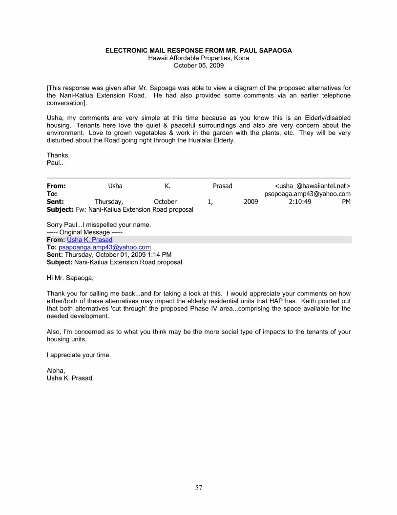
57
ELECTRONIC MAIL RESPONSE FROM MR. PAUL SAPAOGA Hawaii Affordable Properties, Kona
October 05, 2009 [This response was given after Mr. Sapoaga was able to view a diagram of the proposed alternatives for the Nani-Kailua Extension Road. He had also provided some comments via an earlier telephone conversation]. Usha, my comments are very simple at this time because as you know this is an Elderly/disabled housing. Tenants here love the quiet & peaceful surroundings and also are very concern about the environment. Love to grown vegetables & work in the garden with the plants, etc. They will be very disturbed about the Road going right through the Hualalai Elderly. Thanks, Paul..
From: Usha K. Prasad <[email protected]> To: [email protected] Sent: Thursday, October 1, 2009 2:10:49 PM Subject: Fw: Nani-Kailua Extension Road proposal
Sorry Paul...I misspelled your name. ----- Original Message ----- From: Usha K. Prasad To: [email protected] Sent: Thursday, October 01, 2009 1:14 PM Subject: Nani-Kailua Extension Road proposal Hi Mr. Sapaoga, Thank you for calling me back...and for taking a look at this. I would appreciate your comments on how either/both of these alternatives may impact the elderly residential units that HAP has. Keith pointed out that both alternatives 'cut through' the proposed Phase IV area...comprising the space available for the needed development. Also, I'm concerned as to what you think may be the more social type of impacts to the tenants of your housing units. I appreciate your time. Aloha, Usha K. Prasad

58

59
APPENDIX D
National Register of Historic Places (NRHP) Criteria

60

61
National Register of Historic Places (NRHP) Criteria (CFR Part 60:4)
The quality of significance in American history, architecture, archaeology, and culture is present in districts, sites, buildings, structures, and objects of state and local importance that possess integrity of location, design, setting, materials, workmanship, feeling, and association and:
A. That are associated with events that have made a significant contribution to the broad patterns of our history; or
B. That are associated with the lives of persons significant in our past; or C. That embody the distinctive characteristics of a type, period, or method of construction,
or that represent the work of a master, or that possess high artistic values, or that represent a significant and distinguishable entity whose components may lack individual distinction; or
D. That have yielded, or may be likely to yield, information important in prehistory of
history.

62

63
APPENDIX E:
Cultural Resource Programs Included in the 2008 Kona Community Development Plan

64
65
PROGRAMS
CR-1.1a: Establish the Kona Cultural Resources Committee PD CR-1.1b: Identify by GPS Coordinates all existing historic trail alignments that (a) have been recommended for preservation by SHPD, (b) appear on historic maps and/or are known by oral tradition, and incorporate these into the County GIS database
PD, KCRC, SHPD, NPS
CR-1.1c: On a continuing basis, identify by GPS coordinates, all cultural resource sites, recommended for preservation by SHPD and KCRC and incorporate in County's GIS database
PD, KCRC, SHPD
CR-1.1d: Budget sufficient County funding to provide for administrative and technical support to KCRC to complete its duties listed in Policy CR-1.1
PD, KCRC
CR-1.1e: Establish a work plan to accomplish the duties in Policy CR-1.1 KCRC, PD CR-1.1f: Prepare Cultural Landscape Report KCRC, PD CR-2.1a: The County shall apply for certification as a Certified Local Government (CLG) under the National Historic Preservation CLG Program in order to be eligible to apply for and receive preservation funding administered through SHPD
KCRC, PD
CR-2.2a: The County shall convene a workshop(s) that would include government agency representatives, cultural representatives and other stakeholders to review and make recommendations on the current programs intended to protect cultural resources and other historic sites
HCCRC
CR-2.2b: The County shall recommend amendments to appropriate ordinances to incorporate the stewardship and protection of historic sites, buildings and artifacts (Grubbing and Grading, Subdivision Code)
HCCRC
CR-2.2c: The County shall recommend amendments to appropriate ordinances to incorporate the appropriate use and implementation of native plants in the landscaping of public facilities such as schools, government buildings, and parks
HCCRC
CR-3.1a: Ensure the existence of and support for public and private entities that further the betterment of Kanaka Maoli public and private agencies, community
CR-3.1b: Increase fluency in Kanaka Maoli language public and private agencies, community
CR-3.1c: Sponsor cross-sector dialogue on Kanaka Maoli culture and island values public and private agencies, community
CR-3.1d: Protect Kanaka Maoli intellectual property and related traditional knowledge public and private agencies, community
CR-3.1e: Provide Kanaka Maoli cultural education for residents, visitors and the general public public and private agencies, community
CR-3.2a: Increase the number of educators who teach cultural and historic education public and private agencies, community
CR-3.3a: Provide Kanaka Maoli mentors with opportunities to pass on Hawaiian culture and knowledge to the next generation of Kanaka Maoli and others public and private agencies, community
CR-3.3b: Perpetuate Kanaka Maoli food production associated with land and ocean traditions and practices public and private agencies, community
Policy CR-3.4: Provide support for subsistence-based businesses and economies public and private agencies, community
CR-3.5a: Apply the ahupuaa concept in action plan for the Kona Mauka Watershed Management Program public and private agencies, community

66

Ōneo Lane Draft Environmental Assessment
July 2015
APPENDIX D BIOLOGICAL REPORT


DISCUSSION OF THE VEGETATION OF THE NANI KAILUA STUDY AREA
Date: August 11, 2009
By: Layne Yoshida
This botanical report was prepared for the Nani Kailua Highway Extension Project between Hualalai Road and Alii Drive.
The field work for this report was done during the months of May, June and July 2009.
Methodology:
Prior to engaging in the actual fieldwork, aerial photographs of the study area were examined. The aerial photographs were of sufficient quality to allow a preliminary assessment of the topography and general vegetative communities within the study area.
The study area was surveyed by foot and the undeveloped areas were crossed several times in an attempt to locate and identify all plants growing naturally within the study area. Further, the undeveloped areas within the area were surveyed at different times during May and July 2009 to determine if different species might be observed due to changes such as rainfall, or the application of herbicide.
A species list was developed and is included as an attachment to this report. Since Rare, Endangered, or Threatened species were not identified within the study area, the species on the plant list are identified as being Alien or Indigenous. The designation of Rare, Endangered or Threatened is based on the appropriate federal or State of Hawaii registries. The growth form and common name of the species are also included in the list.
Vegetative Communities:
The Nani Kailua study area is entirely contained within the urban corridor of Kailua-Kona on the Island of Hawaii. The general area has been inhabited since before European contact and the area was extensively used for grazing prior to being urbanized. The undeveloped areas of the study area still contain artifacts from the grazing period, i.e., barbed wire, stone walls and fence post.
The area can be divided into three general vegetative communities, all of which are secondary to the intervention of humans. The first category is the developed and maintained area in and around the Kama’aina Housing Project, the Coconut Grove Shopping Center and the Hualalai Elderly Housing complex.
These areas have been developed and the vegetation consists of maintained lawns, ornamental plantings, and gardens. There are vegetable gardens occurring at the Hualalai Elderly Housing complex and also around the units at Kama’aina Housing. Clippings and cuttings from the maintained areas and gardens are being discarded into the fallow land surrounding these developed areas. Also, since some of the gardens are planted close to the
border of the developments some fruits or vegetables such as Papaya (Carica papaya) and Sweet Potato (Ipomoea batatas) have escaped into the undeveloped areas.
The plants in these developed areas may be subject to periodic and abrupt change since the vegetation is subject to the direct intervention of residents and maintenance personnel. Also, the use of herbicide on the border of these developed areas allows for the rapid introduction of many weedy species such as Boeharvia coccinea, Chloris sp., Elusine indica and Sida spp..
The second vegetation type is a Guinea grass (Panicum maximum) / Haole Koa (Leuceana leucocephala) dominated community. In this community the Guinea grass is dominant and may comprise from 30 to 90% of the ground cover in some areas. The indigenous plants, koali’awa (Ipomoea indica) and Uhaloa (Waltheria indica) can be found either growing over or among the dominant exotic species. Both of these species are relatively weedy and can commonly be found in habitats similar to the study area. This vegetative community has been impacted by fire, as burnt branches and burn marks on growing trees were observed while surveying the area.
The grass-dominated community was the most carefully examined since it would be in these areas that either non-weedy or rare native species would most likely be located.
This vegetative community can further be subdivided into two distinct types. In the first, Guinea Grass is dominant and the vegetation is uniform throughout the community. In the second community, while Guinea Grass is still the dominant species, the community is more mixed and much less uniform. The difference between the two communities appears to be linked to the recent mechanical clearing and leveling of the lot area on which the first community grows.
The undeveloped lot listed as TMK 7-5-10:6 (KSBE Vacant) has been almost completely mechanically cleared and the surface of the lot has been leveled so that the vegetation on this lot is uniform. There are a few areas in the lot where either fill or the debris from high spots in the lot has been piled. These areas have a greater density of haole koa than the rest of the lot.
A portion of lot TMK 7-5-9:22 (Cascavilla Vacant) is located within the study area. On this lot a substantial portion of the area within the study area has been bulldozed and a jeep trail has also been cleared between Kuakini Highway and Alii Drive. A portion of this lot was recently burned and the vegetation in the burnt area may be more closely related to the third vegetative type of community, the roadside and border vegetative community, which is described in greater detail below. Over a relatively short period the Guinea grass will overgrow the pioneering weedy species and become the dominant ground cover again.
Also included in this vegetation type are TMK 7-5-10:84 (Greenwell Vacant) and TMK 7-5-9:55 (Greenwell Vacant). While Guinea grass is still the dominant species in the vegetative community on these lots, the ground has not been mechanically graded and the Pahoehoe lava outcroppings break up the Guinea grass ground cover. The Pahoehoe lava outcropping has two consequences: (1) the Guinea grass cover is less than in the mechanically leveled areas, and the breaking up of the Guinea grass cover allows for the growth of other weedy species such as Fountain grass (Pennisetum setaceum), Chinese Violet (Asystasia gangetica) and Golden Crown Beard (Verbesina encelioides).

The third vegetative community is the transient vegetative community located along the side of the roads and developed lots located in the study area. This vegetative community is subject to rapid changes due to frequent application of herbicides or the dumping of plant trimmings or cuttings from the developed lots.
The application of herbicide removes the ground cover and creates an environment where primary colonizers and weedy species are able to establish themselves. This community is a mixed vegetative type and is constantly changing.
The vegetative communities observed and described from the study area are not unique and are the result of human activity whether from agricultural practices or urban development.
Species:
The species list submitted with this report does not include many of the plants that were either clearly planted as a part of the landscaping or observed in tenant’s gardens in the developed areas. Many of these plants are hybrids or cultivars that do not naturally exist in nature. The plants that have escaped cultivation or appeared to have established themselves outside the developed areas are included in the submitted species list.
Of the over 100 species recorded during the field survey, over 95% are exotic, whether weeds or escapees from gardens or landscaping. The few indigenous plant species observed in the study area are weedy, in that they are able to become established and, in many instances, thrive in habitats that have been greatly altered by human activity. These species of indigenous plants can be found throughout the west side of the Island of Hawaii or in areas that are ecologically similar to the Kailua-Kona area.
Rare and Endangered Species:
The Nani Kailua study area does not contain any Endangered, Rare or Threatened species as listed under the federal or State of Hawaii regulations. Further, none of the plants recorded during the field survey are at present being proposed for placement on the Federal or State Registry for Rare or Endangered Plants.

NANI KAILUA SPECIES LIST
Submitted Aug, 10, 2009 Scientific Name Family Common Name Life Form Status*
Abutilon grandifolium Malvaceae Mao Shrub A Acacia farnesiana Fabaceae Klu Shrub A Agave sp. Agavaceae Agave Shrub A Aleurites moluccana Euphorbiaceae Kukui Tree A Aloe vera Aloeaceae Common Aloe Herb A Alternanthera sp. Amaranthaceae Alternanthera Herb A Amaranthus spinosus Amaranthaceae Spiny Amaranth Herb A Araucaria columnaris Araucariaceae Cook Pine Tree A Asystasia gangetica Acanthaceae Chinese Violet Vine A Barleria repens Acanthaceae Pink Ruellia Herb A Bidens cynapiifolia Asteraceae Bidens Herb A Bidens pilosa Asteraceae Beggartick Herb A Boerhavia coccinea Nyctaginaceae Boerhavia Herb A Bougainvillea sp. Nyctaginaceae Bougainvillea Shrub A Carica papaya Caricaceae Papaya Tree A Carissa macrocarpa Apocynaceae Natal Plum Shrub A Cenchrus ciliaris Poaceae Buffelgrass Herb A Cenchrus echinatus Poaceae Sandbur Herb A Chamaecrista nictitans Fabaceae Partridge Pea Herb A Chamaesyce hirta Euphorbiaceae Garden Spurge Herb A Chamaesyce hypericifolia Euphorbiaceae Graceful Spurge Herb A Chamaesyce prostrata Euphorbiaceae Prostrate Spurge Herb A Chloris barbata Poaceae Swollen Fingergrass Herb A Cleome gynandra Capparaceae Spider Wisp Herb A Clusia rosea Clusiaceae Autograph Tree Tree A Coccinia grandis Cucurbitaceae Ivy Gourd Vine A Cocos nucifera Arecaceae Niu Tree A Codiaeum variegatum Euphorbiaceae Croton Shrub A Commelina benghalensis Commelinaceae Hairy Honohono Herb A Cordyline fruticosa Agavaceae Ki Shrub A Crinum sp. Liliaceae Crinum Herb A Crotalaria sp. Fabaceae Crotalaria Shrub A Cynodon dactylon Poaceae Bermuda Grass Herb A Dactyloctenium aegyptium Poaceae Beach Wiregrass Herb A Desmanthus virgatus Fabaceae Slender Mimosa Herb A Desmodium sandwicense Fabaceae Spanish Clover Herb A Desmodium tortuosum Fabaceae Beggarweed Herb A Digitaria insularis Poaceae Sourgrass Herb A Dracaena sp. Agavaceae Dracaena Shrub A Eclipta prostrata Asteraceae False Daisy Herb A Eleusine indica Poaceae Goose Grass Herb A Emilia fosbergii Asteraceae Pualele Herb A Eragrostis sp. Poaceae Lovegrass Herb A
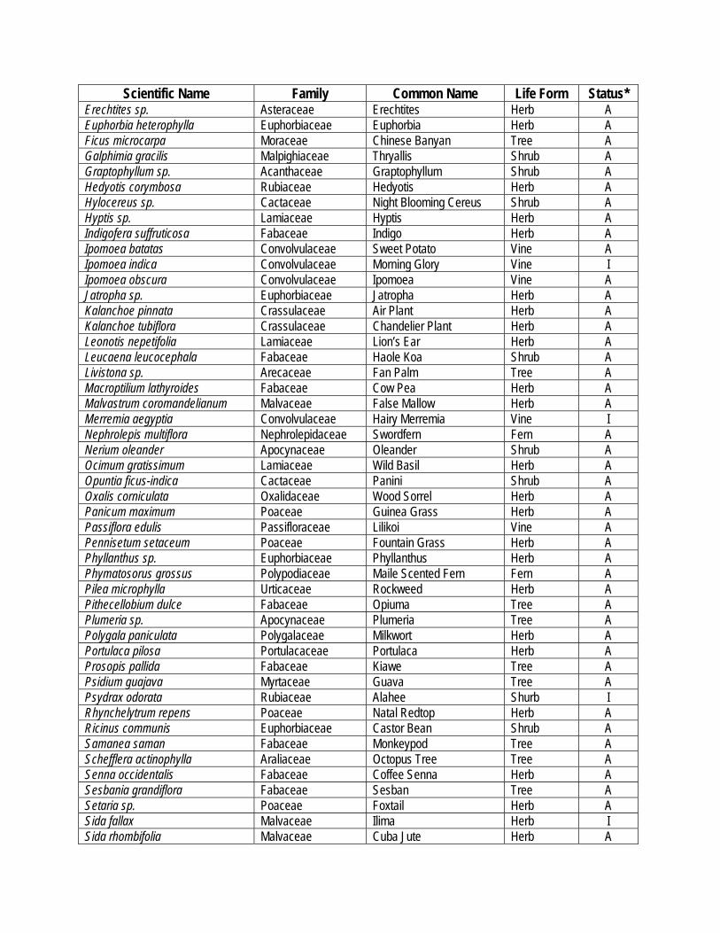
Scientific Name Family Common Name Life Form Status* Erechtites sp. Asteraceae Erechtites Herb A Euphorbia heterophylla Euphorbiaceae Euphorbia Herb A Ficus microcarpa Moraceae Chinese Banyan Tree A Galphimia gracilis Malpighiaceae Thryallis Shrub A Graptophyllum sp. Acanthaceae Graptophyllum Shrub A Hedyotis corymbosa Rubiaceae Hedyotis Herb A Hylocereus sp. Cactaceae Night Blooming Cereus Shrub A Hyptis sp. Lamiaceae Hyptis Herb A Indigofera suffruticosa Fabaceae Indigo Herb A Ipomoea batatas Convolvulaceae Sweet Potato Vine A Ipomoea indica Convolvulaceae Morning Glory Vine I Ipomoea obscura Convolvulaceae Ipomoea Vine A Jatropha sp. Euphorbiaceae Jatropha Herb A Kalanchoe pinnata Crassulaceae Air Plant Herb A Kalanchoe tubiflora Crassulaceae Chandelier Plant Herb A Leonotis nepetifolia Lamiaceae Lion’s Ear Herb A Leucaena leucocephala Fabaceae Haole Koa Shrub A Livistona sp. Arecaceae Fan Palm Tree A Macroptilium lathyroides Fabaceae Cow Pea Herb A Malvastrum coromandelianum Malvaceae False Mallow Herb A Merremia aegyptia Convolvulaceae Hairy Merremia Vine I Nephrolepis multiflora Nephrolepidaceae Swordfern Fern A Nerium oleander Apocynaceae Oleander Shrub A Ocimum gratissimum Lamiaceae Wild Basil Herb A Opuntia ficus-indica Cactaceae Panini Shrub A Oxalis corniculata Oxalidaceae Wood Sorrel Herb A Panicum maximum Poaceae Guinea Grass Herb A Passiflora edulis Passifloraceae Lilikoi Vine A Pennisetum setaceum Poaceae Fountain Grass Herb A Phyllanthus sp. Euphorbiaceae Phyllanthus Herb A Phymatosorus grossus Polypodiaceae Maile Scented Fern Fern A Pilea microphylla Urticaceae Rockweed Herb A Pithecellobium dulce Fabaceae Opiuma Tree A Plumeria sp. Apocynaceae Plumeria Tree A Polygala paniculata Polygalaceae Milkwort Herb A Portulaca pilosa Portulacaceae Portulaca Herb A Prosopis pallida Fabaceae Kiawe Tree A Psidium guajava Myrtaceae Guava Tree A Psydrax odorata Rubiaceae Alahee Shurb I Rhynchelytrum repens Poaceae Natal Redtop Herb A Ricinus communis Euphorbiaceae Castor Bean Shrub A Samanea saman Fabaceae Monkeypod Tree A Schefflera actinophylla Araliaceae Octopus Tree Tree A Senna occidentalis Fabaceae Coffee Senna Herb A Sesbania grandiflora Fabaceae Sesban Tree A Setaria sp. Poaceae Foxtail Herb A Sida fallax Malvaceae Ilima Herb I Sida rhombifolia Malvaceae Cuba Jute Herb A

Scientific Name Family Common Name Life Form Status* Sida spinosa Malvaceae Prickly Sida Herb A Solanum americanum Solanaceae Popolo Herb I Sonchus oleraceus Asteraceae Pualele Herb A Spathodea campanulata Bignoniaceae African Tulip Tree A Stachytarpheta sp. Verbenaceae Stachytarpheta Herb A Tagetes sp. Asteraceae Marigold Herb A Talinum sp. Portulacaceae Talinum Herb A Thevetia peruviana Apocynaceae Be-Still Tree Shrub A Tridax procumbens Asteraceae Coat Buttons Herb A Triumfetta sp. Tiliaceae Bur Bush Shrub A Veitchia sp. Arecaceae Vietchia Tree A Verbena litoralis Verbenaceae Owi Herb A Verbesina encelioides Asteraceae Golden Crown Beard Herb A Waltheria indica Sterculiaceae Uhaloa Herb I (*) A = Alien, E = Endemic, I = Indigenous, End = Federal and/ or State listed Endangered Species
Ōneo Lane Draft Environmental Assessment
July 2015
APPENDIX E SCOPING PERIOD COMMENTS AND INFORMATION


William P. Kenoi
Mayor
County of Hawai‘i PLANNING DEPARTMENT
101 Pauahi Street, Suite 3 Hilo, Hawaii 96720-4224 (808) 961-8288 FAX (808) 961-8742
Bobby Jean Leithead-Todd Director
May 21, 2009 Department of Transportation Brennen Morioka Director 869 Punchbowl Honolulu HI 96813-5097 Subject: Agency Scoping Meeting – June 10, 2009 Nani Kailua Road Extension Environmental Assessment Dear Brennen Morioka:
The County of Hawai‘i has initiated a study for the potential construction of a new roadway that would extend Nani Kailua Drive from its current terminus at Hualālai Road to Ali‘i Drive. You are invited to attend a scoping meeting for resource and other agency representatives. The meeting will consist of a short office meeting (agenda attached) with continental breakfast, followed by a field trip of the project area. Meeting specifics are provided below:
Date: Wednesday, June 10, 2009
Time: 9:00 am
Location: Planning Department West Hawai‘i office – 75-5706 Kuakini Highway, Suite 109
We would also like to take this opportunity to request any information that your agency may have on file for the study area, which is shown in the attached scoping packet. Any information you have can be sent electronically to Kara Swanson of Parsons Brinckerhoff at [email protected] or you may bring along any hard copy information to the meeting. If you have any questions or comments, please contact me at 808-961-8288, extension 271.
We look forward to seeing you on June 10th.
Sincerely,
County of Hawai‘i
Crysttal Atkins County Project Manager Attachments: Agency Scoping Meeting Agenda Scoping Package (brief description of project and existing conditions)

NANI KAILUA ROAD EXTENSION PROJECT
AGENDA: AGENCY SCOPING MEETING
Date: June 10, 2009
Time: 9:00 am
Location: Planning Department West Hawai‘i office – 75-5706 Kuakini Highway, Suite 109
1. Introductions
- Planning Department staff and project consultants
- Agencies participating
2. Review agenda/Purpose of meeting
3. Review project
- Makai segment
- Mauka segment
4. Review study area
- Undeveloped land and existing or proposed developments
- Archaeological preserve
5. Review Chapter 343/NEPA process
6. Site visit
7. Follow-up action items
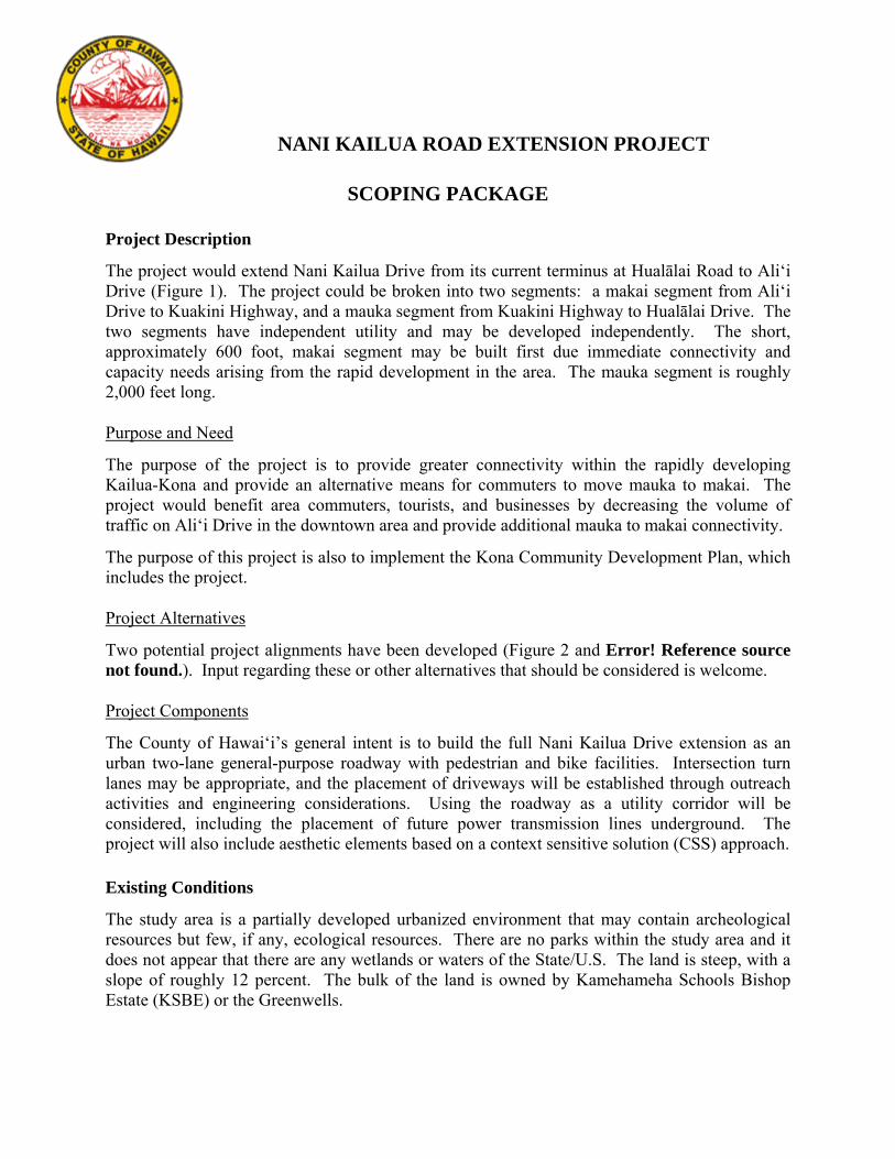
NANI KAILUA ROAD EXTENSION PROJECT
SCOPING PACKAGE
Project Description
The project would extend Nani Kailua Drive from its current terminus at Hualālai Road to Ali‘i Drive (Figure 1). The project could be broken into two segments: a makai segment from Ali‘i Drive to Kuakini Highway, and a mauka segment from Kuakini Highway to Hualālai Drive. The two segments have independent utility and may be developed independently. The short, approximately 600 foot, makai segment may be built first due immediate connectivity and capacity needs arising from the rapid development in the area. The mauka segment is roughly 2,000 feet long.
Purpose and Need
The purpose of the project is to provide greater connectivity within the rapidly developing Kailua-Kona and provide an alternative means for commuters to move mauka to makai. The project would benefit area commuters, tourists, and businesses by decreasing the volume of traffic on Ali‘i Drive in the downtown area and provide additional mauka to makai connectivity.
The purpose of this project is also to implement the Kona Community Development Plan, which includes the project.
Project Alternatives
Two potential project alignments have been developed (Figure 2 and Error! Reference source not found.). Input regarding these or other alternatives that should be considered is welcome.
Project Components
The County of Hawai‘i’s general intent is to build the full Nani Kailua Drive extension as an urban two-lane general-purpose roadway with pedestrian and bike facilities. Intersection turn lanes may be appropriate, and the placement of driveways will be established through outreach activities and engineering considerations. Using the roadway as a utility corridor will be considered, including the placement of future power transmission lines underground. The project will also include aesthetic elements based on a context sensitive solution (CSS) approach.
Existing Conditions
The study area is a partially developed urbanized environment that may contain archeological resources but few, if any, ecological resources. There are no parks within the study area and it does not appear that there are any wetlands or waters of the State/U.S. The land is steep, with a slope of roughly 12 percent. The bulk of the land is owned by Kamehameha Schools Bishop Estate (KSBE) or the Greenwells.
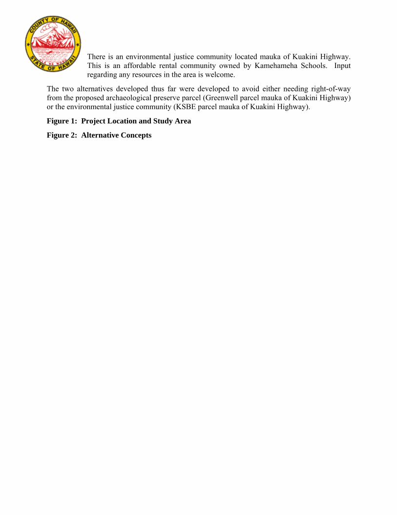
There is an environmental justice community located mauka of Kuakini Highway. This is an affordable rental community owned by Kamehameha Schools. Input regarding any resources in the area is welcome.
The two alternatives developed thus far were developed to avoid either needing right-of-way from the proposed archaeological preserve parcel (Greenwell parcel mauka of Kuakini Highway) or the environmental justice community (KSBE parcel mauka of Kuakini Highway).
Figure 1: Project Location and Study Area
Figure 2: Alternative Concepts
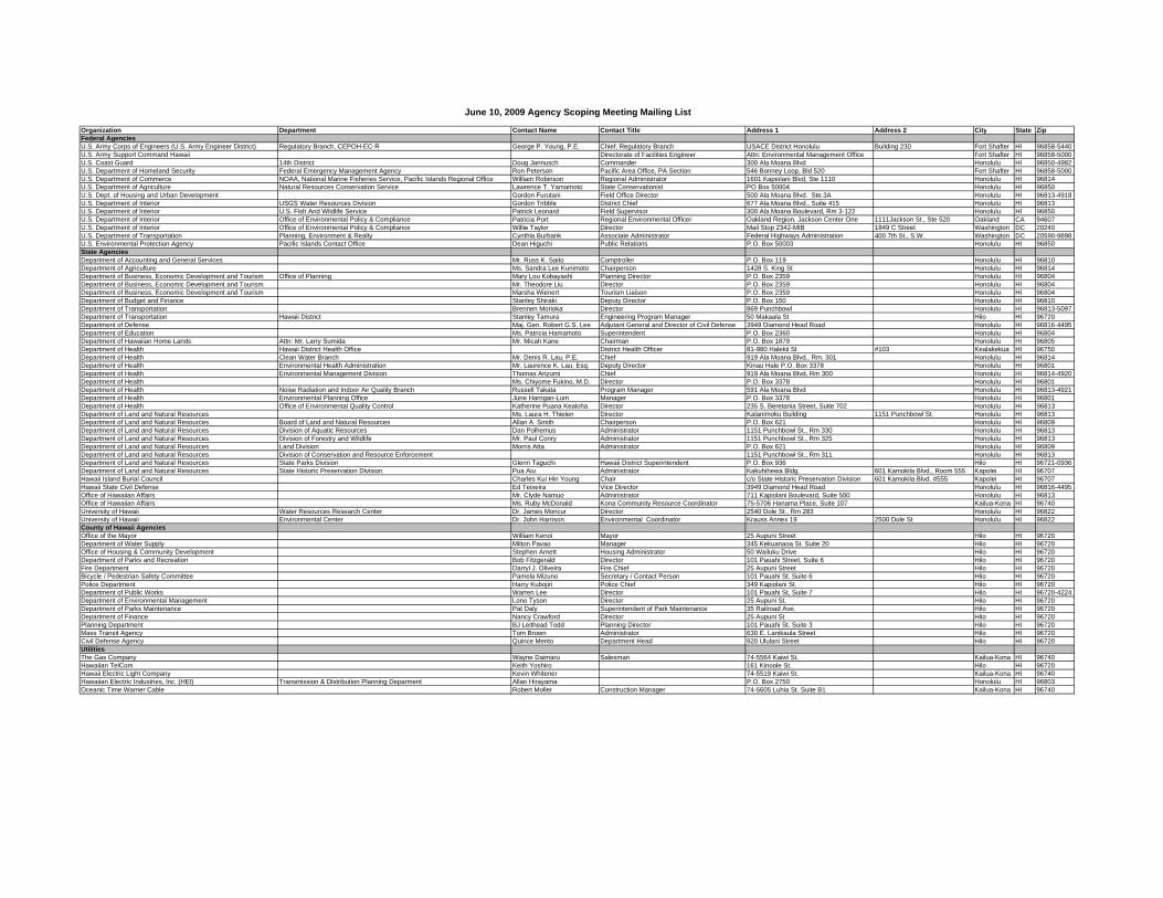
Organization Department Contact Name Contact Title Address 1 Address 2 City State ZipFederal AgenciesU.S. Army Corps of Engineers (U.S. Army Engineer District) Regulatory Branch, CEPOH-EC-R George P. Young, P.E. Chief, Regulatory Branch USACE District Honolulu Building 230 Fort Shafter HI 96858-5440U.S. Army Support Command Hawaii Directorate of Facilities Engineer Attn: Environmental Management Office Fort Shafter HI 96858-5000U.S. Coast Guard 14th District Doug Jannusch Commander 300 Ala Moana Blvd Honolulu HI 96850-4982U.S. Department of Homeland Security Federal Emergency Management Agency Ron Peterson Pacific Area Office, PA Section 546 Bonney Loop, Bld 520 Fort Shafter HI 96858-5000U.S. Department of Commerce NOAA, National Marine Fisheries Service, Pacific Islands Regional Office William Robinson Regional Administrator 1601 Kapiolani Blvd, Ste 1110 Honolulu HI 96814U.S. Department of Agriculture Natural Resources Conservation Service Lawrence T. Yamamoto State Conservationist PO Box 50004 Honolulu HI 96850U.S. Dept. of Housing and Urban Development Gordon Furutani Field Office Director 500 Ala Moana Blvd. Ste.3A Honolulu HI 96813-4918U.S. Department of Interior USGS Water Resources Division Gordon Tribble District Chief 677 Ala Moana Blvd., Suite 415 Honolulu HI 96813U.S. Department of Interior U.S. Fish And Wildlife Service Patrick Leonard Field Supervisor 300 Ala Moana Boulevard, Rm 3-122 Honolulu HI 96850U.S. Department of Interior Office of Environmental Policy & Compliance Patricia Port Regional Environmental Officer Oakland Region, Jackson Center One 1111Jackson St., Ste 520 Oakland CA 94607U.S. Department of Interior Office of Environmental Policy & Compliance Willie Taylor Director Mail Stop 2342-MIB 1849 C Street Washington DC 20240U.S. Department of Transportation Planning, Environment & Realty Cynthia Burbank Associate Administrator Federal Highways Administration 400 7th St., S.W. Washington DC 20590-9898U.S. Environmental Protection Agency Pacific Islands Contact Office Dean Higuchi Public Relations P.O. Box 50003 Honolulu HI 96850State AgenciesDepartment of Accounting and General Services Mr. Russ K. Saito Comptroller P.O. Box 119 Honolulu HI 96810Department of Agriculture Ms. Sandra Lee Kunimoto Chairperson 1428 S. King St Honolulu HI 96814Department of Business, Economic Development and Tourism Office of Planning Mary Lou Kobayashi Planning Director P.O. Box 2359 Honolulu HI 96804Department of Business, Economic Development and Tourism Mr. Theodore Liu Director P.O. Box 2359 Honolulu HI 96804Department of Business, Economic Development and Tourism Marsha Wienert Tourism Liaison P.O. Box 2359 Honolulu HI 96804Department of Budget and Finance Stanley Shiraki Deputy Director P.O. Box 150 Honolulu HI 96810Department of Transportation Brennen Morioka Director 869 Punchbowl Honolulu HI 96813-5097Department of Transportation Hawaii District Stanley Tamura Engineering Program Manager 50 Makaala St Hilo HI 96720Department of Defense Maj. Gen. Robert G.S. Lee Adjutant General and Director of Civil Defense 3949 Diamond Head Road Honolulu HI 96816-4495Department of Education Ms. Patricia Hamamoto Superintendent P.O. Box 2360 Honolulu HI 96804Department of Hawaiian Home Lands Attn: Mr. Larry Sumida Mr. Micah Kane Chairman P.O. Box 1879 Honolulu HI 96805Department of Health Hawaii District Health Office District Health Officer 81-980 Halekii St #103 Kealakekua HI 96750Department of Health Clean Water Branch Mr. Denis R. Lau, P.E. Chief 919 Ala Moana Blvd., Rm. 301 Honolulu HI 96814Department of Health Environmental Health Administration Mr. Laurence K. Lau, Esq. Deputy Director Kinau Hale P.O. Box 3378 Honolulu HI 96801Department of Health Environmental Management Division Thomas Arizumi Chief 919 Ala Moana Blvd, Rm 300 Honolulu HI 96814-4920Department of Health Ms. Chiyome Fukino, M.D. Director P.O. Box 3378 Honolulu HI 96801Department of Health Noise Radiation and Indoor Air Quality Branch Russell Takata Program Manager 591 Ala Moana Blvd Honolulu HI 96813-4921Department of Health Environmental Planning Office June Harrigan-Lum Manager P.O. Box 3378 Honolulu HI 96801Department of Health Office of Environmental Quality Control Katherine Puana Kealoha Director 235 S. Beretania Street, Suite 702 Honolulu HI 96813Department of Land and Natural Resources Ms. Laura H. Thielen Director Kalanimoku Building 1151 Punchbowl St. Honolulu HI 96813Department of Land and Natural Resources Board of Land and Natural Resources Allan A. Smith Chairperson P.O. Box 621 Honolulu HI 96809Department of Land and Natural Resources Division of Aquatic Resources Dan Polhemus Administrator 1151 Punchbowl St., Rm 330 Honolulu HI 96813Department of Land and Natural Resources Division of Forestry and Wildlife Mr. Paul Conry Administrator 1151 Punchbowl St., Rm 325 Honolulu HI 96813Department of Land and Natural Resources Land Division Morris Atta Administrator P.O. Box 621 Honolulu HI 96809Department of Land and Natural Resources Division of Conservation and Resource Enforcement 1151 Punchbowl St., Rm 311 Honolulu HI 96813Department of Land and Natural Resources State Parks Division Glenn Taguchi Hawaii District Superintendent P.O. Box 936 Hilo HI 96721-0936Department of Land and Natural Resources State Historic Preservation Division Pua Aiu Administrator Kakuhihewa Bldg. 601 Kamokila Blvd., Room 555 Kapolei HI 96707Hawaii Island Burial Council Charles Kui Hin Young Chair c/o State Historic Preservation Division 601 Kamokila Blvd. #555 Kapolei HI 96707Hawaii State Civil Defense Ed Teixeira Vice Director 3949 Diamond Head Road Honolulu HI 96816-4495Office of Hawaiian Affairs Mr. Clyde Namuo Administrator 711 Kapiolani Boulevard, Suite 500 Honolulu HI 96813Office of Hawaiian Affairs Ms. Ruby McDonald Kona Community Resource Coordinator 75-5706 Hanama Place, Suite 107 Kailua-Kona HI 96740University of Hawaii Water Resources Research Center Dr. James Moncur Director 2540 Dole St., Rm 283 Honolulu HI 96822University of Hawaii Environmental Center Dr. John Harrison Environmental Coordinator Krauss Annex 19 2500 Dole St Honolulu HI 96822County of Hawaii AgenciesOffice of the Mayor William Kenoi Mayor 25 Aupuni Street Hilo HI 96720Department of Water Supply Milton Pavao Manager 345 Kekuanaoa St. Suite 20 Hilo HI 96720Office of Housing & Community Development Stephen Arnett Housing Administrator 50 Wailuku Drive Hilo HI 96720Department of Parks and Recreation Bob Fitzgerald Director 101 Pauahi Street, Suite 6 Hilo HI 96720Fire Department Darryl J. Oliveira Fire Chief 25 Aupuni Street Hilo HI 96720Bicycle / Pedestrian Safety Committee Pamela Mizuno Secretary / Contact Person 101 Pauahi St. Suite 6 Hilo HI 96720Police Department Harry Kubojiri Police Chief 349 Kapiolani St. Hilo HI 96720Department of Public Works Warren Lee Director 101 Pauahi St, Suite 7 Hilo HI 96720-4224Department of Environmental Management Lono Tyson Director 25 Aupuni St. Hilo HI 96720Department of Parks Maintenance Pat Daly Superintendent of Park Maintenance 35 Railroad Ave. Hilo HI 96720Department of Finance Nancy Crawford Director 25 Aupuni St Hilo HI 96720Planning Department BJ Leithead Todd Planning Director 101 Pauahi St. Suite 3 Hilo HI 96720Mass Transit Agency Tom Brown Administrator 630 E. Lanikaula Street Hilo HI 96720Civil Defense Agency Quince Mento Department Head 920 Ululani Street Hilo HI 96720UtilitiesThe Gas Company Wayne Daimaru Salesman 74-5564 Kaiwi St. Kailua-Kona HI 96740Hawaiian TelCom Keith Yoshiro 161 Kinoole St. Hilo HI 96720Hawaii Electric Light Company Kevin Whitener 74-5519 Kaiwi St. Kailua-Kona HI 96740Hawaiian Electric Industries, Inc. (HEI) Transmission & Distribution Planning Deparment Allan Hirayama P.O. Box 2750 Honolulu HI 96803Oceanic Time Warner Cable Robert Moller Construction Manager 74-5605 Luhia St. Suite B1 Kailua-Kona HI 96740
June 10, 2009 Agency Scoping Meeting Mailing List
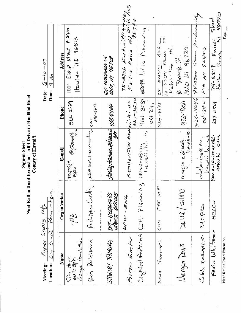
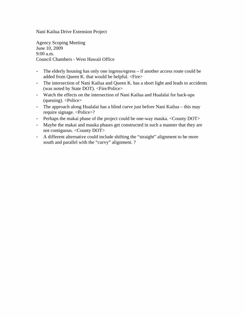
Nani Kailua Drive Extension Project Agency Scoping Meeting June 10, 2009 9:00 a.m. Council Chambers - West Hawaii Office - The elderly housing has only one ingress/egress – if another access route could be
added from Queen K. that would be helpful. <Fire> - The intersection of Nani Kailua and Queen K. has a short light and leads to accidents
(was noted by State DOT). <Fire/Police> - Watch the effects on the intersection of Nani Kailua and Hualalai for back-ups
(queuing). <Police> - The approach along Hualalai has a blind curve just before Nani Kailua – this may
require signage. <Police>? - Perhaps the makai phase of the project could be one-way mauka. <County DOT> - Maybe the makai and mauka phases get constructed in such a manner that they are
not contiguous. <County DOT> - A different alternative could include shifting the “straight” alignment to be more
south and parallel with the “curvy” alignment. ?

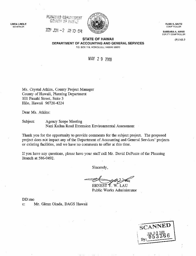

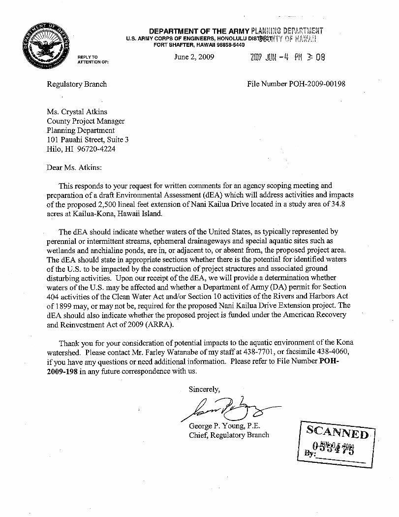


William P. Kenoi Mayor
County of Hawai‘i PLANNING DEPARTMENT
101 Pauahi Street, Suite 3 Hilo, Hawaii 96720-4224 (808) 961-8288 FAX (808) 961-8742
Bobby Jean Leithead-Todd Director
May 21, 2009 Doug Wilkerson P.O. Box 1107 Kailua-Kona, HI 96745 Subject: Public Scoping Meeting – June 10, 2009 Nani Kailua Road Extension Environmental Assessment Dear Doug Wilkerson:
The County of Hawai‘i has initiated a study for the potential construction of a new roadway that would extend Nani Kailua Drive from its current terminus at Hualālai Road makai to Ali‘i Drive. You are invited to attend a public meeting to give your opinion on the improvements that are being considered. There will be a brief open house before a presentation by the project team. The presentation will focus on the planning process, project schedule, presentation of potential alternatives for the Draft Environmental Assessment (EA), ways to make comments, the type of input being sought at this time, and future public involvement. Meeting specifics are provided below:
Date: Wednesday, June 10, 2009
Time: 5:30 p.m. (presentation at 6)
Location: Kahakai Elementary School, 76-147 Royal Poinciana Drive
If you have any questions regarding the project, please contact me at 808-961-8288, extension 271. Persons needing assistance to attend or participate in the meeting may contact our office to arrange for special services; please inform us of your needs at least 72 hours in advance of the meeting.
We look forward to seeing you on June 10th.
Sincerely,
County of Hawaii
Crysttal Atkins County Project Manager
Organization Department Contact Name Contact Title Address 1 Address 2 City State ZipElected OfficialsU.S. Senate Daniel K. Inouye Senator 300 Ala Moana Blvd., Rm. 7-212 Honolulu HI 96850U.S. Senate Daniel K. Akaka Senator 300 Ala Moana Blvd., Rm. 3-106 Honolulu HI 96850U.S. House of Representatives 2nd District Representative Mazie K. Hirono 5104 Prince Kuhio Federal Bldg. Honolulu HI 96850Hawaii State House of Representatives 5th District Representative Robert Herkes 415 South Beretania Street, Rm. 320 Honolulu HI 96813Hawaii State House of Representatives 6th District Representative Denny Coffman 415 South Beretania Street, Rm. 317 Honolulu HI 96813Hawaii State Senate 3rd District Senator Josh Green 415 South Beretania Street, Rm. 223 Honolulu HI 96813Hawaii County Council County of Hawaii Mr. Guy Enriques Councilmember, District 6 75-5706 Hanama Place Suite 109 Kailua-Kona HI 96740Hawaii County Council County of Hawaii Ms. Brenda Ford Councilmember, District 7 75-5706 Hanama Place Suite 109 Kailua-Kona HI 96740Hawaii County Council County of Hawaii Mr. Kelly Greenwell Councilmember, District 8 75-5706 Hanama Place Suite 109 Kailua-Kona HI 96740Office of the Governor West Hawaii Andy Smith Governor's Liaison 75-5722 Kuakini Hwy., Suite 215 Kailua-Kona HI 96740Transportation-Related Organizations and Delivery/Highway UsersHawaii Transportation Association P.O. Box 30166 Honolulu HI 96820AARP Hawaii 1132 Bishop St., Suite 1920 Honolulu HI 96813BusinessesA'ama Surf & Sport Troy T. Fujitani Owner 75-5741 Kuakini Highway Kailua-Kona HI 96745Major Land Owners, Private Developers and ConsultantsUniversity of Nations Ed Pike 75-5851 Kuakini Hwy. Kailua-Kona HI 96740University of the Nations - Kona Campus Ken Clewett 75-5787 Kakalina St. Kailua-Kona HI 96740Landowners
David R. Greenwell PO Box 1964 Kamuela HI 96743Joan L. Anderson PO Box 1237 Kamuela HI 96743
Cascavilla Land Equities LLC Philip J. Cascavilla 920 Tension Memorial Rd Dallas TX 75223Kamehameha Schools Jeff Mau PO Box 3466 Honolulu HI 96801LRG Real Estate LP Coconut Grove Marketplace PO Box 306 Kamuela HI 96743The Kona Billfisher 75-5841 Alii Drive Kailua Kona HI 96740KPC Villages Priscilla Nee 656 S Hudson Ave Los Angeles CA 90005
Margaret Okabayashi 45-012 Oopuhue Kaneohe HI 96744Evelyn Foo c/o Tamio Iwado 296-A Alamaha St Kahului HI 96732
Olu Kai, Ltd. 75-5828 Kahakai St Kailua-Kona HI 96740Community Members/Stakeholders
Laura Aquino 75-5751 Kuakini Hwy Kailua-Kona HI 96740Kona Pacific OA Andy Archibald P.O. Box 460 Kailua-Kona HI 96740
George Bembenek 75-5766 Kuakini Hwy Kailua-Kona HI 96740Royal Kailuan Joe Birong 75-5863 Kuakini Hwy Kailua-Kona HI 96740
Paul Bleck 75-5885 Walua Rd Kailua-Kona HI 96740Nancy Burns 73-1487 Hao St. Kailua-Kona HI 96740Joseph N. Castelli 78-6800 Alii Drive 27 Kailua-Kona HI 96740George (Denny) Coffman 77-203 Maliko St. Kailua-Kona HI 96740Wattie M. Hedemann 78-6863 Kuakini Hwy Kailua-Kona HI 96740Denise Hernandez 77-180 Kapukapu St. Kailua-Kona HI 96740
Kona Sunset Villa Greta Horton 77-6585 Sea View Circle Kailua-Kona HI 96740Virginia Isbell PO Box 926 Kailua-Kona HI 96740Clyde W. Jackson 75-5766 Kuakini Hwy, Apt # 504 Kailua-Kona HI 96740-1722Marion Pualani Keliikipi P.O. Box 3047 Kailua-Kona HI 96745Josephine Keliipio 76-168 Royal Poinciana Dr Kailua-Kona HI 96740Lily Kong 78-6797 Mamalahoa Hwy. Holualoa HI 96725
West Hawaii Today Carolyn Lucas 75-5580 Kuakini Hwy Kailua-Kona HI 96740Sally Marone 77-6128A Mamalahoa Hwy Holualoa HI 96725
Kona Sunset Villas Rose Mesick 77-6585 Seaview Circle, #201 Kailua-Kona HI 96740Islander Inn Jim Metcalf P.O. Box 39 Kailua-Kona HI 96745
Adele and David Nelsen 75-5919 Alii Drive, H-3 Kailua-Kona HI 96740Piper Designs Peter Piper 75-5944 Kuakini Hwy, #2 Kailua-Kona HI 96740
Tom Reilly 75-6060 Kuakini Hwy (Kona Sea Villas) Kailua-Kona HI 96740Dan Sabo 76-6306 Mahuahua Pl. Kailua-Kona HI 96740George Sandusky 77-6300 Alii Drive Kailua-Kona HI 96740Merry Anne Stone 77-159 Kai Poi Pl. Kailua-Kona HI 96740Phil Tinguely P.O. Box 2747 Kailua-Kona HI 96740
Tinguely Development Phil Tinguely P.O. Box 9013 Kailua-Kona HI 96745Joe Trent 75-5921 Walua Rd. Kailua-Kona HI 96740Todd Ussery 75-5851 Kuakini Hwy, #301 Kailua-Kona HI 96740
Kona Sea Villas Tom and Brenda Walton 75-6060 Kuakini Hwy Kailua-Kona HI 96740Bob Ward 77-6526 Hoolaupai St. Kailua-Kona HI 96740Doug Wilkerson 74-1525 Hau Kuni Kailua-Kona HI 96740Doug Wilkerson P.O. Box 1107 Kailua-Kona HI 96745
General Construction Pacific Roger Pammer 75-5944 Kuakini Hwy Kailua-Kona HI 96740Community and Environmental Organizations American Lung Asociation of Hawaii Director of Environmental Health 245 North Kukui Street Honolulu HI 96817Big Island Visitors Bureau 75-5751 Kuakini Highway, Suite 202 Kailua-Kona HI 96740Daughters of Hawaii Huihe'e Palace Fanny AuHoy 75-5718 Alii Drive Kailua-Kona HI 96740Laniakea Foundation 765 Kumukahi Place Honolulu HI 96825-1114Hawaii Audubon Society 850 Richards St, Ste 505 Honolulu HI 96813-4709Hawaii Bicycle League Mitchell S. Nakagawa Executive Director 3442 Waialae Ave. Suite 1 Honolulu HI 96816
June 10, 2009 Public Scoping Meeting Mailing List

Hawaii Grotto of the NSS Ric Elhard Chairman P.O. Box 6313 Ocean View HI 96737Hawaii Hotel Association Murray Towill President 2270 Kalakaua Ave. #1103 Honolulu HI 96815Hawaii Island Community Development Corporation Keith Kato 99 Aupuni Street, Suite 104 Hilo HI 96720Hawaii Island Economic Development Board Paula Helfrich Executive Director 1999 Ainaola Drive Hilo HI 96720Hawaii Leeward Planning Conference H. Peter L'Orange President P.O. Box 635 Kailua-Kona HI 96745-0635Hawaii Speleological Survey William R. Halliday 101 Aupuni Street, #911 Hilo HI 96720Historic Hawaii Foundation David Scott Director PO Box 1658 Honolulu HI 96806Historic Kealakowa'a Heiau Preservation Council c/o Kona Outdoor Circle Educational Center Jo-Anne Kahanamoku-Sterling Committtee Chair 76-6280 Kuakini Hwy. Kailua-Kona HI 96740Hui Malama I Na Kupuna O Hawaii Nei Kunani Nihipali PO Box 967 Kailua HI 96734-0967Kailua-Kona Chamber of Commerce Marni Herkes Executive Director 75-5737 Kuakini Hwy. Suite 207 Kailua-Kona HI 96740Kailua Village Design Commission c/o County of Hawaii Planning Dept Sally Marone Chairperson Aupuni Center, 101 Pauahi Street, Suite 3 Hilo HI 96720Kailua Village Improvement Assocation James S. Greenwell President c/o 3465 Waialae Ave Suite 260 Honolulu HI 96816Ka Lahui Hawaii P.O. Box 4964 Hilo HI 96720Kona Board of Realtors Jacqueline Parkinson 75-240 Nani Kailua Drive #157 Kailua-Kona HI 96740Kona Community Safety Lane Scott Sharpe President 77-363 Sunset Drive Kailua-Kona HI 96740Kona Hawaiian Civic Club Pesident P.O. Box 4098 Kailua-Kona HI 96745Kona-Kohala Chamber of Commerce Bev Fraser 75-5737 Kuakini Hwy. Suite #208 Kailua-Kona HI 96740Kona Outdoor Circle Betty Meyerson President 76-6280 Kuakini Hwy. Kailua-Kona HI 96740Kona Soil and Water Conservation District Phil Motooka Chairman 81-948 Waena'Oihana Loop #101 Kealakekua HI 96750Kona Traffic Safety Committee Joel E. Gimpel Chair, Public Affairs 75-344 Nani Kailua Dr. Kailua-Kona HI 96740Na Ala Hele Big Island Council Mike Tomich Chair 72-3403 Mamalahoa Highway Kailua-Kona HI 96740Native Hawaiian Legal Corporation Mahealani Kamauu Executive Director 1164 Bishop St. Suite 1205 Honolulu HI 96813PATH - Peoples Advocacy for Trails Hawaii Bettina Arrigoni President Attn: Laura Dierenfield, Executive Director P.O. Box 62 Kailua-Kona HI 96745Plan to Protect Kona Duane Erway President 74-5602-A Alapa St. Suite 725 Kailua-Kona HI 96740Pulama Ia Kona Heritage Preservation Council Scott Seymour President P.O. Box 398 Captain Cook HI 96704Sierra Club Hawaii Chapter Robert Harris P.O. Box 2577 Honolulu HI 96803Sierra Club Moku Loa Group Roberta Brashear-Kaulfers Chair, ExCom P.O. Box 1137 Hilo HI 96721-1137West Hawaii Committee P.O. Box 1761 Kailua-Kona HI 96740
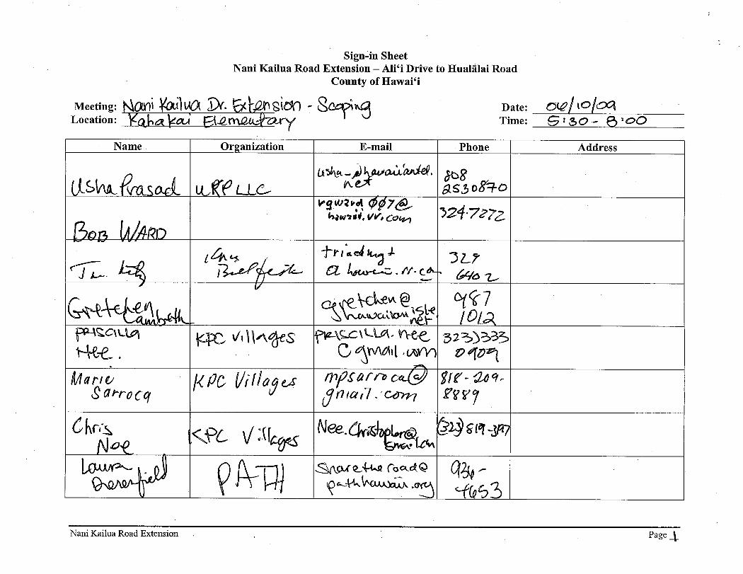


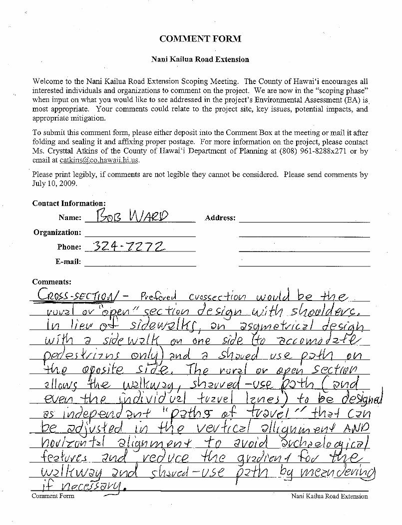


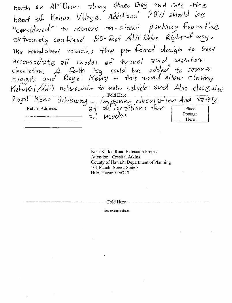
1
Nelson, Michelle
From: Laura Dierenfield [[email protected]]Sent: Friday, June 12, 2009 10:31 AMTo: [email protected]; Hayes, James (Honolulu)Subject: comments on Nani Kailua Extension
Aloha Jim, Crysttal: Thank you for hosting the scoping meeting at Kahakai Elementary Wednesday night. Here are some comments on the project for your consideration:
1) Cross Section: It was good to see the section include 11 foot travel lanes, 5 foot bike lanes and a 7 foot landscaped pedestrian offset and 5 foot sidewalks. We would recommend at least 6 foot sidewalks because there will be the inevitable encroachments that will constrain this ROW. As an alternative, a asymmetrical design that features a meandering pathway on one side may provide a more enjoyable and ADA accessible pathway to compensate for the 13% grade in some places.
2) Alignment: I understand you have significant archeological challenges with the “Curvy”
Alternative making this a remote possibility for phase 2 from Kuakini to Hualalai Road. We have concerns about taking the road through Kamaaina Hale as it is now with families living on both sides. However, we also understanding that Kamehameha Schools (owner of the property) has expressed a desire to rebuild the property because as much as a third of the apartments are not currently habitable. If that is the case, we suggest working with KS now to determine a favorable alignment with a newly designed residential area, perhaps taking into consideration an asymmetrical design with a shared use pathway accessible to residents of this area.
3) Oneo Bay: The intersection at Alii Drive has the potential to really improve circulation through
and around the village of Kailua. We would highly recommend keeping in touch with us (PATH) and HDOT to understand plans for Oneo Bay. Apparently an EA is underway or completed on this. I think the EA would be very helpful for you in preparing the EA for Nani Kailua in terms of informing what types of scenarios are possible for Alii Drive along Oneo Bay with and without the Nani Kailua Extension.
Mahalo, Laura Dierenfield ~~~~~~~~~~~~~~~~~~~~~~~~~~~~~~~~~~ Laura Dierenfield Executive Director PATH ~ Peoples Advocacy for Trails Hawaii PO Box 62 Kailua-Kona, Hawaii 96745 Phone: 808-936-4653 Email: [email protected] Website: www.pathhawaii.org Build a better future for Hawaii! Join PATH! Membership is online and free.


Ōneo Lane Draft Environmental Assessment
July 2015
APPENDIX F PRELIMINARY DRAFT SMA PERMIT APPLICATION


East Hawai‘i Office · 101 Pauahi Street, Suite 3 · Hilo, Hawai‘i 96720 Phone (808) 961-8288 · Fax (808) 961-8742
West Hawai‘i Office · 74-5044 Ane Keohokalole Hwy · Kailua-Kona, Hawai‘i 96740 Phone (808) 323-4770 · Fax (808) 327-3563
County of Hawai‘i Planning Department www.cohplanningdept.com · [email protected]
SPECIAL MANAGEMENT AREA USE PERMIT ASSESSMENT APPLICATION
APPLICANT INFORMATION (Applicant is the person or entity actually responsible for the proposed use, activity or operation—typically the landowner or lessee.)
APPLICANT’S NAME(S): County of Hawai‘i, Department of Public Works
ADDRESS: 101 Pauahi Street, Suite 7
CITY: Hilo STATE: HI ZIP CODE: 96720
EMAIL:
PHONE NUMBER(S): bus: 961-8327 hm /cell:
SIGNATURE(S): DATE:
LANDOWNER INFORMATION SAME AS APPLICANT (may leave this section blank)
LANDOWNER’S NAME(S): Property is being acquired by the County
ADDRESS:
CITY: STATE: ZIP CODE:
EMAIL:
PHONE NUMBER(S): bus: hm /cell:
SIGNATURE(S): DATE:
Landowner agrees to grant representatives of the County of Hawai‘i the right to enter the property at reasonable business hours for the purpose of site inspection.
AUTHORIZED AGENT/ CONTACT PERSON
CONTACT NAME(S): Rachel Adams, Parsons Brinckerhoff
ADDRESS: 1001 Bishop Street, Suite 2400
CITY: Honolulu STATE: HI ZIP CODE: 96813
EMAIL: [email protected]
PHONE NUMBER(S): bus: 808-566-2239 hm /cell: 808-354-4553
SIGNATURE(S): DATE:
TAX MAP KEY(S): 7-5-009:021, 022, 023, and 025; and roadway right-of-way

FLOOD ZONE (Can be obtained from the Department of Public Works- Engineering Division):
NATURE OF DEVELOPMENT / ACTIVITY: The County of Hawai‘i is proposing the construction of Oneo Lane from Kuakini Highway to Ali‘i Drive. Oneo Lane will generally consist of the following:
The County acquiring a new 70-foot wide right-of-way (ROW) from current property owners between Kuakini Highway and Ali‘i Drive,
The development of a roadway within the ROW, including: - Two 11-foot wide through lanes, one in each direction, - A 11-foot wide center turn lane, and - Bicycle and pedestrian facilities on both sides of the roadway.
Lighting, and
Dry wells to manage roadway drainage.
TOTAL COST / FAIR MARKET VALUE OF DEVELOPMENT: $
DATE OF APPLICATION

East Hawai‘i Office · 101 Pauahi Street, Suite 3 · Hilo, Hawai‘i 96720 Phone (808) 961-8288 · Fax (808) 961-8742
West Hawai‘i Office · 74-5044 Ane Keohokalole Hwy · Kailua-Kona, Hawai‘i 96740 Phone (808) 323-4770 · Fax (808) 327-3563
1.2 County of Hawai‘i Planning Department
ADDITIONAL INFORMATION
1.0 PROJECT DESCRIPTION
A description of the proposed development in sufficient detail to convey the full extent of the improvement proposed to and upon the land. For example, in the construction of a structure, specify the amount of land area to be graded and leveled to accommodate the proposed structure, parking area and other related facilities.
The proposed development is described and assessed in detail in the Environmental Assessment (EA) prepared for it.
The County of Hawai‘i is proposing the construction of Oneo Lane from Kuakini Highway to Ali‘i Drive (Figure 1-1). The project is a portion of the “Nani Kailua Road Extension” that has been envisioned in planning documents, including the Kona Community Development Plan (KCDP).
Figure 1-1: Location Map
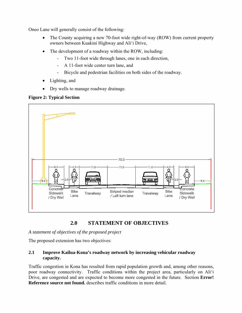
Oneo Lane will generally consist of the following:
The County acquiring a new 70-foot wide right-of-way (ROW) from current property owners between Kuakini Highway and Ali‘i Drive,
The development of a roadway within the ROW, including:
- Two 11-foot wide through lanes, one in each direction,
- A 11-foot wide center turn lane, and
- Bicycle and pedestrian facilities on both sides of the roadway.
Lighting, and
Dry wells to manage roadway drainage.
Figure 2: Typical Section
2.0 STATEMENT OF OBJECTIVES
A statement of objectives of the proposed project
The proposed extension has two objectives:
2.1 Improve Kailua-Kona’s roadway network by increasing vehicular roadway capacity.
Traffic congestion in Kona has resulted from rapid population growth and, among other reasons, poor roadway connectivity. Traffic conditions within the project area, particularly on Ali‘i Drive, are congested and are expected to become more congested in the future. Section Error! Reference source not found. describes traffic conditions in more detail.
The KCDP identified the necessity for projects to divert traffic from main roads through connecting roadways in order to reduce traffic congestion and increase mobility within the district. Such projects that increase local road connectivity, ensure residents can reach their destinations easily and reduce local traffic reliance on regional roads. Although there are several north-south roadways (Ali‘i Drive, Kuakini Highway, and Queen Ka‘ahumanu Highway Extension) in the project area, there are few mauka-makai roads that provide relatively direct connections between the north-south roadways (Figure 1-1).
Palani Road is the only mauka-makai roadway in the area that provides direct connectivity between the three north-south roadways. Hualālai Road and Lunapule Road, south of Palani Road are about a mile apart and provide limited mauka-makai connectivity. The proposed project would provide a direct mauka-makai alternative connecting Ali‘i Drive and Kuakini Highway.
2.2 Improve Pedestrian and Bicycle Facilities.
The proposed project provides the opportunity to provide pedestrian and bicycle facilities to help create a safe, direct, and convenient multi-modal system. Such facilities promote livable and walkable communities, and are consistent with County Complete Streets policies and transportation objectives in the KCDP.
3.0 DESCRIPTION OF ANTICIPATED IMPACTS
A description of the anticipated impacts of the proposed project on the Special Management Area (SMA).
The proposed development is described and assessed in detail, including its anticipated impacts and mitigation measures, in the Environmental Assessment (EA) prepared for it.
3.1 Description of the area involved, including existing uses, structures, vegetation, and other features
The proposed project would be located partially within the southern border of Kailua Village. Kailua-Kona is West Hawai‘i’s primary and largest urban area. Kailua Village is clustered around the northern section of Ali‘i Drive between Palani Road and Kahakai Road. This town center is Kailua-Kona’s primary visitor attraction supporting a few hotels, retail establishments, and restaurants. Cruise ships often dock offshore of the historic section of Kailua Village.
The area is generally urban in nature with undeveloped lots scattered around. The proposed Oneo Lane would be located primarily in what are undeveloped lots today. There are no structures that would be affected by the project and the vegetation is weedy dry scrub in nature.
3.2 Description of surrounding area and land uses
Figure 1 shows existing land uses adjacent to the project area. Makai of Ali‘i Drive in the project area there are a number of resort hotels and condominiums along with commercial establishments catering to visitors, such as Snorkel Bob’s, and restaurants, such as Huggo’s.
The proposed project would be located between Ali‘i Drive and Kuakini Highway. The proposed alignments would go through currently vacant land and could directly affect four parcels:
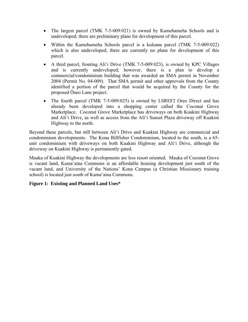
The largest parcel (TMK 7-5-009:021) is owned by Kamehameha Schools and is undeveloped; there are preliminary plans for development of this parcel.
Within the Kamehameha Schools parcel is a kuleana parcel (TMK 7-5-009:022) which is also undeveloped; there are currently no plans for development of this parcel.
A third parcel, fronting Ali‘i Drive (TMK 7-5-009:023), is owned by KPC Villages and is currently undeveloped; however, there is a plan to develop a commercial/condominium building that was awarded an SMA permit in November 2004 (Permit No. 04-009). That SMA permit and other approvals from the County identified a portion of the parcel that would be acquired by the County for the proposed Ōneo Lane project.
The fourth parcel (TMK 7-5-009:025) is owned by LSREF2 Oreo Direct and has already been developed into a shopping center called the Coconut Grove Marketplace. Coconut Grove Marketplace has driveways on both Kuakini Highway and Ali‘i Drive, as well as access from the Ali‘i Sunset Plaza driveway off Kuakini Highway to the north.
Beyond these parcels, but still between Ali‘i Drive and Kuakini Highway are commercial and condominium developments. The Kona Billfisher Condominium, located to the south, is a 65-unit condominium with driveways on both Kuakini Highway and Ali‘i Drive, although the driveway on Kuakini Highway is permanently gated.
Mauka of Kuakini Highway the developments are less resort oriented. Mauka of Coconut Grove is vacant land, Kama‘aina Commons is an affordable housing development just south of the vacant land, and University of the Nations’ Kona Campus (a Christian Missionary training school) is located just south of Kama‘aina Commons.
Figure 1: Existing and Planned Land Uses*
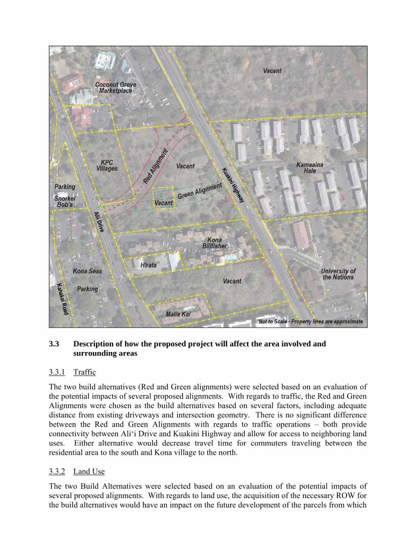
3.3 Description of how the proposed project will affect the area involved and surrounding areas
3.3.1 Traffic
The two build alternatives (Red and Green alignments) were selected based on an evaluation of the potential impacts of several proposed alignments. With regards to traffic, the Red and Green Alignments were chosen as the build alternatives based on several factors, including adequate distance from existing driveways and intersection geometry. There is no significant difference between the Red and Green Alignments with regards to traffic operations – both provide connectivity between Ali‘i Drive and Kuakini Highway and allow for access to neighboring land uses. Either alternative would decrease travel time for commuters traveling between the residential area to the south and Kona village to the north.
3.3.2 Land Use
The two Build Alternatives were selected based on an evaluation of the potential impacts of several proposed alignments. With regards to land use, the acquisition of the necessary ROW for the build alternatives would have an impact on the future development of the parcels from which

the ROW is taken. The Red and Green Alignments were chosen as Build Alternatives based on several factors, including developable remnant parcel size, existing land uses, and future land uses. A parcel by parcel assessment of the Red and Green Alignments affects on private parcels is as follows:
Parcel 1 (TMK 7-5-009:023) is also called the KPC Parcel because of the planned KPC Villages development. Both the Red and Green Alignments would utilize an equal sized portion of Parcel 1; however, the shape of the area used varies between the two alignments. The Red Alignment would utilize a curved shape portion of the parcel and is the shape that was agreed to by KPC Villages when they received their SMA permit in 2004. The Green Alignment would utilize a rectangular shaped area that differs from that agreed to in the SMA permit. In either case the remaining KPC Village parcel would be the same size and could be developed as a commercial/condominium. The Red Alignment would not necessitate any changes be made to KPC Villages’ existing plans; the Green Alignment may necessitate some changes to their existing plans. Overall, the acquisition of the necessary ROW would not have a significant impact on Parcel 1.
Parcel 2 (TMK 7-5-009:021) is owned by Kamehameha Schools. The Red Alignment would split Parcel 2 into two developable parcels (roughly 28,050 and 122,050 square feet), and a third remnant portion of approximately 426 square feet near the Coconut Grove Marketplace driveway that would be acquired as ROW. Preliminary sketches of possible future development are consistent with the Red Alignment.
The Green Alignment would split Parcel 2 into two developable parcels. The southern parcel, although large, would be roughly 95 feet wide and may have limited utility because of the required setbacks.
Parcel 3 (TMK 7-5-009:022) has no plans for future development. The Red Alignment would avoid Parcel 3 altogether. The Green Alignment would leave remnants of approximately 1,523 and 149 square feet, which would be undevelopable. Therefore, Parcel 3 would be unaffected by the Red Alignment but would be fully acquired by the Green Alignment.
Parcel 4 (TMK 7-5-009:025) is already fully developed as Coconut Grove Marketplace. The Red Alignment would eliminate an existing driveway along Kuakini Highway. The County would acquire approximately 1,483 square feet of ROW from this parcel for the Red Alignment. The Green Alignment would avoid Parcel 4 altogether.
3.3.3 Noise
A computer model was used to predict a future noise level should the proposed project be implemented. The Red and Green Alignments were predicted to have an average Leq(h), of 57.4 and 57.3 dBA, respectively. These sound levels are essentially identical to the existing noise levels in the area. Therefore, no impact is anticipated for either of the two Build Alternatives because the values do not approach the NAC or exceed the existing sound level. Since there the build alternative would not detrimentally affect ambient noise levels, according to the criteria set forth in HAR Section 11-200-12 and HRS Chapter 343, there would be no significant effect.
3.3.4 Visual and Aesthetic Resources
The proposed project would require clearing, grading, and limited construction of retaining walls that would modify the look of the immediate project area. The scope of those changes would not be visible beyond the immediate project area. The proposed project facilities that would be most visible would be the new traffic signals at the two intersections and street lights along the road. These facilities would, by necessity, be visible to vehicles on Ali‘i Drive, Ōneo Lane, and Kuakini Highway. The traffic signals and street lights would be similar to those already present on Ali‘i Drive and Kuakini Highway, including the use of shades. Therefore, the traffic signals and street lights would fit within the context of the existing environment.
The project would not substantially affect scenic vistas or viewplains identified in County or State plans or studies; therefore, according to the criteria set forth in HAR Section 11-200-12 and HRS Chapter 343, there would be no significant effect on visual and aesthetic resources in the project area.
3.3.5 Social, Economic, and Cultural Conditions
The Cultural Impact Assessment (CIA) indicates that “no cultural practices are known to take place within the immediate vicinity of the study area” and an analysis of potential impacts was consistent with the findings of the Archeological Survey. Therefore, no adverse impacts on traditional practices are anticipated should the proposed project be implemented.
The proposed project would increase circulation within Kailua-Kona and improve access to existing and future economic uses in the project area and outside of the area. The proposed project would not substantially adversely affect the economic welfare, social welfare, or cultural practices of the community or State. Therefore, according to the criteria set forth in HAR Section 11-200-12 and HRS Chapter 343, there would be no significant adverse effect.
3.3.6 Water Resources
The proposed project is not anticipated to result in substantial degradation of environmental quality associated with water resources or water quality. Therefore according to the criteria set forth in HAR Section 11-200-12 and HRS Chapter 343, there would be no significant effect..
3.3.7 Biological Resources
The study area does not contain any plants species that are listed as being rare or endangered by either the Federal Government or the State of Hawai‘i, therefore, the statutes, rules, and regulations pertaining to rare and endangered species do not need to be addressed. The project is not anticipated to substantially affect rare, threatened, or endangered species, or its habitat. Therefore, according to the criteria set forth in HAR Section 11-200-12 and HRS Chapter 343, there would be no significant effect on any biological resources.
3.3.8 Construction Impacts
Implementation of the proposed project may result in some short-term impacts on the built and natural environment during construction. Construction of new roadways generally results in temporary increases in noise, dust, and traffic disruption in the area. The primary effects of these activities would be experienced by residents and workers in the immediate project area. Delays and other transportation-related impacts may also be encountered by vehicles and passengers
traveling to and from the study area. In summary, short-term uses would be localized and may include the following:
Traffic disruption to local streets;
Temporary soil erosion, though prevented from leaving the site;
Loss of vegetation due to clearing for construction; and
Short-term utilities impacts.
3.4 Description of impacts which cannot be avoided and mitigating measures proposed to minimize that impact
3.4.1 Land Use
The taking of ROW from private parcels, as described above, cannot be avoided.
The need for ROW has been minimized by utilizing 11-foot wide travel lanes rather than 12-foot wide lanes, which would be standard. This narrows the required ROW, minimizing the impact to existing and future land uses. Furthermore, although the Red Alignment would eliminate the Coconut Grove Marketplace’s southern driveway on Kuakini Highway, the effect of that would be minimized and mitigated by providing a new driveway to that land use off Oneo Lane.
The County would seek to acquire the required ROW from the current property owners through a negotiation process that would result in fair market compensation for the land acquired. This will adequately mitigate the land acquisition.
3.4.2 Historic and Archeological Resources
As discussed above, there will be no adverse effect to historic resources; however, at least a portion of a historic boundary wall will have to be removed. Because the wall has been fully documented no further work is necessary prior to its removal where required by the project and no further mitigation is needed.
3.5 Alternatives to the proposed project
Two Build Alternatives were considered in the Environmental Assessment (EA) and four additional alignments were considered prior to selecting the two examined in detail in the EA. Based on the analysis presented in the EA the other potential Oneo Road alignments were rejected.
3.6 Any irreversible and irretrievable commitment of resources
Implementation of the proposed action involves a commitment of a range of natural, physical, human, and fiscal resources. Fossil fuels, labor, and construction materials will be expended during construction. Additionally, large amounts of labor and natural resources will be used in the fabrication and preparation of construction materials. These materials are generally not retrievable. Their availability for the project is not limited and their use will not have an adverse impact on their continued availability. The commitment of these resources is based on the concept that residents in the immediate area and larger island community will benefit by the improved quality of the transportation system. These benefits will consist of improved
accessibility and safety, savings in time, and greater availability of quality services which are anticipated to outweigh the commitment of these resources.
Construction of the proposed project would permanently alter the use and character of the area. The Proposed Action would require the expenditure of energy in the form of fuel for construction vehicles and equipment and the consumption of natural and man-made resources in the form of construction materials (metal, glass, concrete, asphalt, wood, plastic, etc.). The project would require the investment of human labor that might otherwise be employed elsewhere. No other irreversible and irretrievable commitments have been identified.
4.0 A WRITTEN STATEMENT DISCUSSING THE PROPOSED DEVELOPMENT IN RELATIONSHIP TO THE OBJECTIVES AND POLICIES AS CONTAINED IN CHAPTER 205A, HRS, AND THE
SMA GUIDELINES
The proposed development is described and assessed in detail in the Environmental Assessment (EA) prepared for it.
4.1 Recreational resources
Objective: Provide coastal recreational opportunities accessible to the public.
The project would provide increased access to and facilitate nearby coastal recreational opportunities for the public to enjoy Ōneo Bay.
4.2 Historic resources
Objective: Protect, preserve, and, where desirable, restore those natural and manmade historic and prehistoric resources in the coastal zone management area that are significant in Hawaiian and American history and culture.
The proposed project area includes some archaeological sites. The archaeological sites are all considered eligible for the historic registry under criteria D; therefore, impacts to them can be mitigated through data recovery. The project would avoid disturbance of sites where possible but at least one site would be affected; that site has already been fully documented and do further work is deemed necessary.
4.3 Scenic and Open Space resources
Objective: Protect, preserve, and, where desirable, restore or improve the quality of coastal scenic and open space resources.
The project area is not an open space resource, it is an urban area. The proposed project would not create any visual intrusions out of context in this urban area.
4.4 Coastal Ecosystems
Objective: Protect valuable coastal ecosystems, including reefs, from disruption and minimize adverse impacts on all coastal ecosystems.
Construction operations would be managed to prevent pollutant discharge. The contractor would practice good housekeeping and implement best management practices (BMPs), as required by

HDOH-CWB regulations. Stormwater from the roadway would be managed using dry wells. Therefore, the proposed project would not impact costal ecosystems.
4.5 Economic Uses
Objective: Provide public or private facilities and improvements important to the State's economy in suitable locations.
The economy of West Hawai‘i and Kailua-Kona is largely dependent on the visitor industry. The proposed project would benefit the visitor industry and local residents by providing improved circulation at the south end of Kona Village. The County of Hawai‘i has deemed the project location a suitable location for a mauka-makai connector roadway. Several previous community plans, including the KCDP, have identified the project area as the appropriate location of the Nani Kailua Road Extension project. The proposed Oneo Lane project is a portion of the Nani Kailua Road Extension project.
4.6 Coastal Hazards
Objective: Reduce hazard to life and property from tsunami, storm waves, stream flooding, erosion, subsidence, and pollution.
Coastal and nearshore areas are vulnerable to natural hazards, so swift and efficient evacuation is essential when potentially dangerous conditions arise. The proposed roadway could serve as an alternative route, which would help facilitate evacuation in the event of tsunami or storm waves.
Related Documents