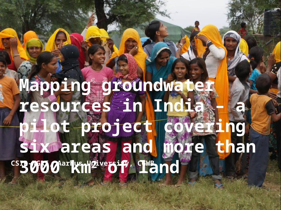
CSIR-NGRI, Aarhus University, CGWB Mapping groundwater resources in India – a pilot project covering six areas and more than 3000 km 2 of land

CSIR-NGRI, Aarhus University, CGWB Mapping groundwater resources in India – a pilot project covering six areas and more than 3000 km 2 of land.
Dec 16, 2015
Welcome message from author
This document is posted to help you gain knowledge. Please leave a comment to let me know what you think about it! Share it to your friends and learn new things together.
Transcript
CSIR-NGRI, Aarhus University, CGWB
Mapping groundwater resources in India – a pilot project covering six areas and more than 3000 km2 of land
CGWB
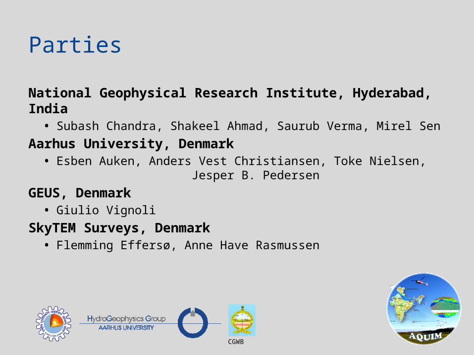
Parties
National Geophysical Research Institute, Hyderabad, India• Subash Chandra, Shakeel Ahmad, Saurub Verma, Mirel Sen
Aarhus University, Denmark• Esben Auken, Anders Vest Christiansen, Toke Nielsen,
Jesper B. Pedersen
GEUS, Denmark• Giulio Vignoli
SkyTEM Surveys, Denmark• Flemming Effersø, Anne Have Rasmussen

• Identify and map aquifers on the micro level: 100 .. 1000 km2
• Identify groundwater resources
• Propose management plans appropriate to the scale of demand
Vision for Aquifer Management – AQUIM

• Pilot study of 6 areas in different hydrogeological terrains
• Integration of multiple disciplines and scientific approaches • Hydrogeology
• Geophysics
• Hydrochemistry
• Drilling
• Groundwater modeling
• Management approaches
• Pave the way for the National Aquifer Mapping program NAQUIM
Establishing a Methodology
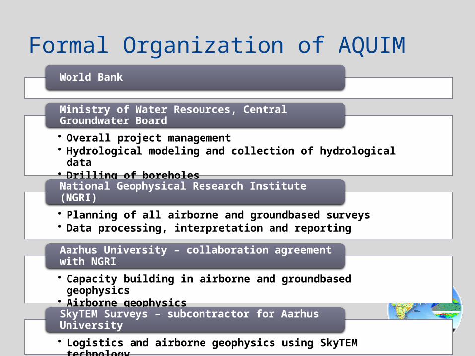
World Bank
• Overall project management• Hydrological modeling and collection of hydrological data• Drilling of boreholes
Ministry of Water Resources, Central Groundwater Board
• Planning of all airborne and groundbased surveys• Data processing, interpretation and reporting
National Geophysical Research Institute (NGRI)
• Capacity building in airborne and groundbased geophysics• Airborne geophysics
Aarhus University – collaboration agreement with NGRI
• Logistics and airborne geophysics using SkyTEM technology
SkyTEM Surveys – subcontractor for Aarhus University
Formal Organization of AQUIM

• The water problem in a nut shell
• Airborne electromagnetic data
• Status
• Conclusion
Presentation Layout
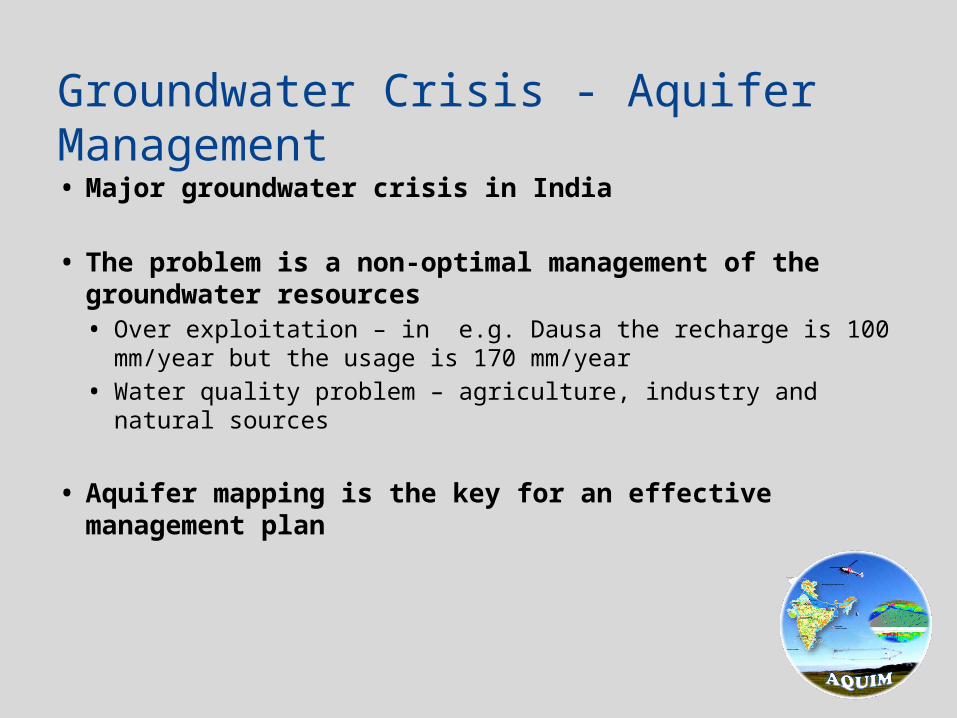
• Major groundwater crisis in India
• The problem is a non-optimal management of the groundwater resources• Over exploitation – in e.g. Dausa the recharge is 100 mm/year but the
usage is 170 mm/year
• Water quality problem – agriculture, industry and natural sources
• Aquifer mapping is the key for an effective management plan
Groundwater Crisis - Aquifer Management

Boreholes Groundwater level
Groundwater Depletion Trend – 1980’s
2 borewells
Boreholes Groundwater level
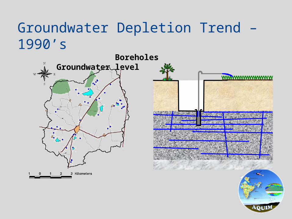
Groundwater Depletion Trend – 1990’s

Boreholes Groundwater level
Groundwater Depletion Trend – 1995

Boreholes Groundwater level
Groundwater Depletion Trend – 2000

Boreholes Groundwater level
Groundwater Depletion Trend – 2010
935 bore wells:- 707 in use- 228 not used
NO WATER - NO CROPS• Uneven spatial distribution of water resources and misuse of the resources
• Need better groundwater management plans
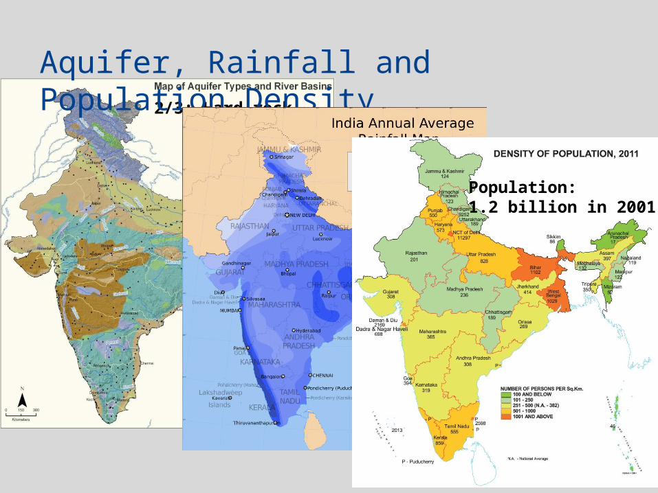
2/3: Hard rock
Aquifer, Rainfall and Population Density
Population:1.2 billion in 2001

AQMAH
AQKARAQTND
AQDRT
AQBHR
Desert underlined by Limestone at
Jaisalmer, Rajasthan
Granite hard rock at Tumkur, Karnataka
Deccan Basalt at Nagpur,
Maharastra
Sea Coast at Cuddalore, T.N.
Hard rock covered by ~70 m thick alluvial
in Rajasthan
Alluvial at MGP, Bihar
Survey Areas
Anders
Not clear

Problem: • Salinity, fluoride, iron, nitrate
contaminations)• Overexploitation: 170%
AQTNDAQKAR
AQMAH
AQBHRAQRAJAQDRT
AQRAJ

AQTNDAQKAR
AQMAH
AQBHRAQRAJAQDRT
AQKARGranite Hard Rock Terrain
• The water problem in a nut shell
• Airborne electromagnetic data
• Status
• Conclusion
Presentation Layout

• The best and most reliable method for aquifer mapping was Schlumberger soundings (VES) – the method of the 1970’s!
• Long discussions with CGWB on replacing VES with
• Electrical Resistivity Imaging – 2D profiles
• Transient electromagnetic soundings
• SkyTEM for full area coverage
A Geophysical Paradigm Shift in India

Heliborne Technology
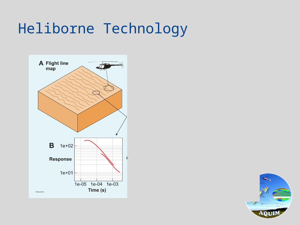
Heliborne Technology

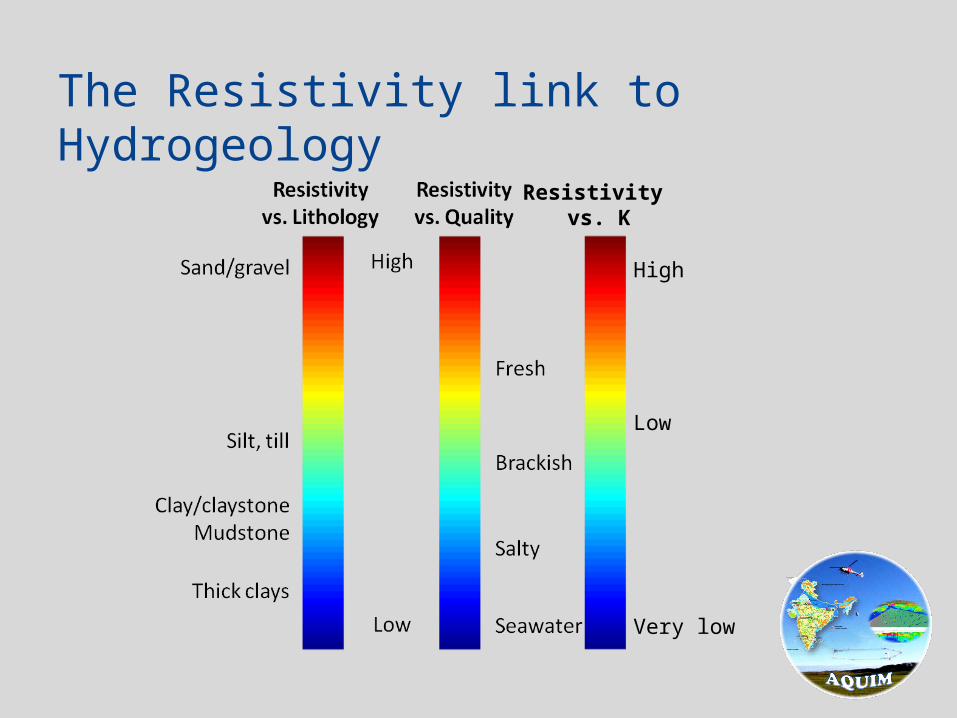
The Resistivity link to Hydrogeology
High
Low
Very low
Resistivity vs. K

The Resistivity link to Hydrogeology
High
Low
Very low
Resistivity vs. K
The Resistivity link to Hydrogeology
High
Low
Very low
Resistivity vs. K
• The water problem in a nut shell
• Airborne electromagnetic data
• Status
• Conclusion
Presentation Layout

• Training courses for ERT, groundbased TEM and SkyTEM
• Training courses in data processing and inversion using Aarhus Workbench and ViewTEM (developed in Aarhus)
• Training courses in extracting simple hydrogeological surfaces
• Processing crew of four at the NRGI campus receiving SkyTEM data twice a week
• Interpretation crew of two making the hydrogeological interpretations
Capacity Building in 2012 - 2013

• Staff from Aarhus in Hyderabad about every month for a year
• Daily contact on email or Skype
• Training and instrument calibration in Denmark
• Participation in all major meetings in India
Capacity Building in 2012 - 2013

• 11000 km of SkyTEM data with the 304 and the 504 system• 4 areas of each 1000 – 3000 km
• The last 3000 km is being flown as we speak
• Very bureaucratic system• Every move requires permission and takes a long time
• Data has not been released by the military• No results yet!
• No data can leave the field area!• All data quality control and on-site inversion in the field
• Hundreds of VES soundings, TEM soundings and ERT profiles has been done before the SkyTEM – internal politics
• Many new boreholes – another story…..
Collected Geophysical Data

• “In the four areas already flown results are spectacular” - the World Bank says!• Alluvium mapping
• Depth to bedrock
• Scapolite thickness
Results so far
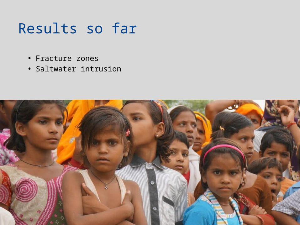
• Fracture zones
• Saltwater intrusion
Results so far
• Yes, but results will not be taken in detail into the hydrological modeling because of lack of expertise and time
• Results will be used to form the NAQUIM project but it is still unclear to which office the authority will be given
Will we succeed?

• The water problem in a nut shell
• Airborne electromagnetic data
• Status
• Conclusion
Presentation Layout
• Aquifer based groundwater management • Precise aquifer mapping • Establishing geophysical methodology to be up-scaled to entire
country
• Successful collaboration despite different cultures, bureaucratic system, and technical skills
• We need to be there and work with our partners
• Huge potential for export of Danish Water Resource Mapping Technology
Conclusion

Thanks for listening!
Related Documents