Cartographic Perspective on Precision Navigation (NOAA/NOS/OCS/MCD) Shachak Pe’eri, Elizabeth Kretovic, John Nyberg, Greg Seroka, Neil Weston, Craig Winn, Matthew Forney , Noel Dyerand Tara Wallace Office of Coast Survey Contact info: [email protected]

Welcome message from author
This document is posted to help you gain knowledge. Please leave a comment to let me know what you think about it! Share it to your friends and learn new things together.
Transcript

Cartographic Perspective on Precision Navigation(NOAA/NOS/OCS/MCD)
Shachak Pe’eri, Elizabeth Kretovic, John Nyberg, Greg Seroka, Neil Weston, Craig Winn,
Matthew Forney , Noel Dyerand Tara Wallace
Office of Coast Survey
Contact info: [email protected]

Motivation – Keeping up with the times
Gerardus Mercator Henry Pelham
1714 AD 2018 AD

Current Electronic
Chart Suite
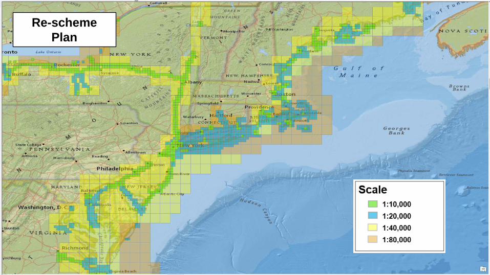
Re-scheme
Plan

So much data, so many wonderful products to create
Data sets collected by NOAA (to name a few):• Bathymetry• Shoreline• Tides• Currents• Gravity• Sediment type• Bottom vegetation• Fish and other critter feeding grounds and migration patters• Hydrothermal vents• ….
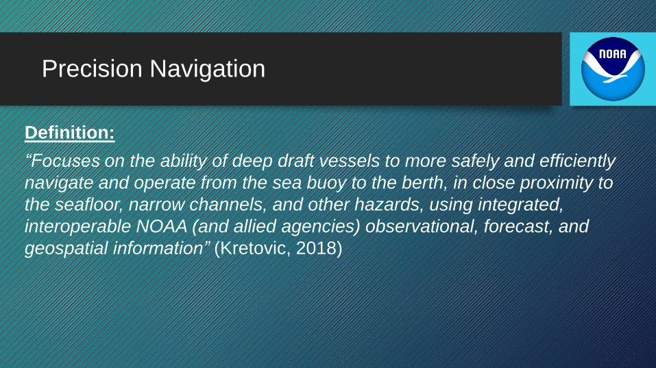
Precision Navigation
Definition:
“Focuses on the ability of deep draft vessels to more safely and efficiently
navigate and operate from the sea buoy to the berth, in close proximity to
the seafloor, narrow channels, and other hazards, using integrated,
interoperable NOAA (and allied agencies) observational, forecast, and
geospatial information” (Kretovic, 2018)
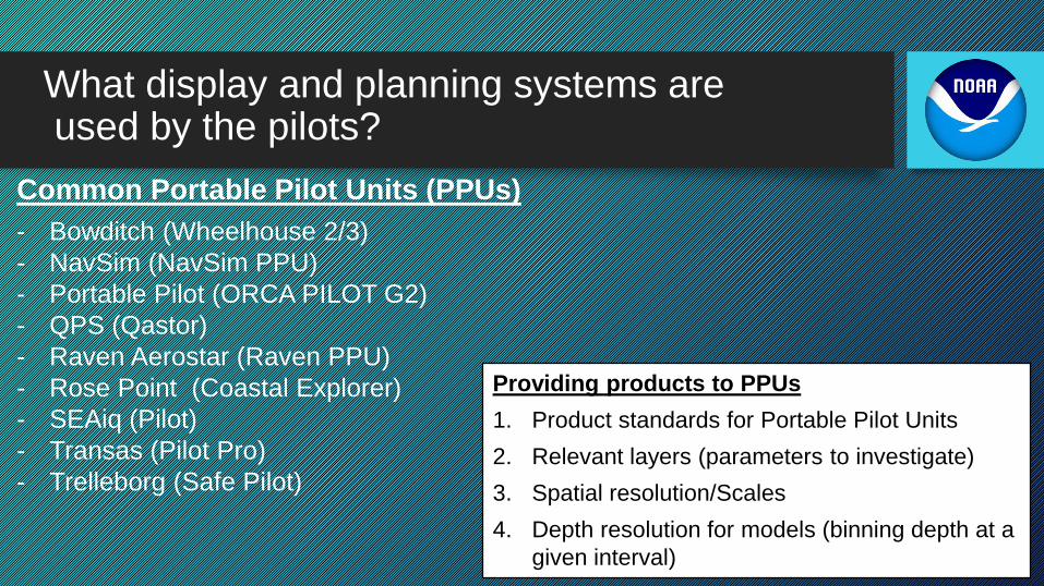
What display and planning systems areused by the pilots?
Common Portable Pilot Units (PPUs)
- Bowditch (Wheelhouse 2/3)
- NavSim (NavSim PPU)
- Portable Pilot (ORCA PILOT G2)
- QPS (Qastor)
- Raven Aerostar (Raven PPU)
- Rose Point (Coastal Explorer)
- SEAiq (Pilot)
- Transas (Pilot Pro)
- Trelleborg (Safe Pilot)
Providing products to PPUs
1. Product standards for Portable Pilot Units
2. Relevant layers (parameters to investigate)
3. Spatial resolution/Scales
4. Depth resolution for models (binning depth at a
given interval)

What can MCD bring to the Table? (i.e., working with F4)
Depth (m)
Sandy Hook, NJ
8531680
The Narrows, NY
n3020

Navigating through Sandy Hook Channel(Band 6 – 1:5K)


Planning a course
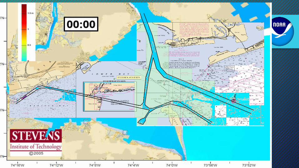


Planning accordingly with all resources available
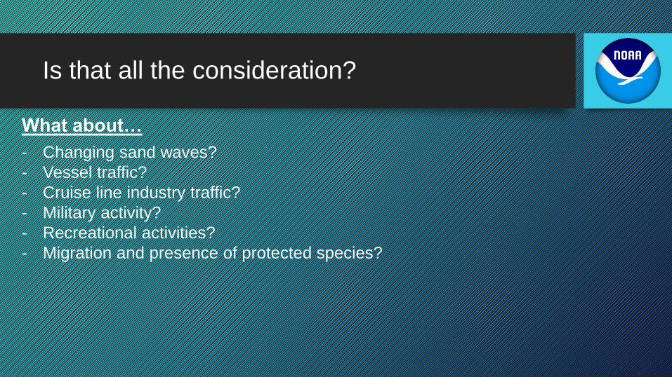
Is that all the consideration?
What about…
- Changing sand waves?
- Vessel traffic?
- Cruise line industry traffic?
- Military activity?
- Recreational activities?
- Migration and presence of protected species?

Precision Navigation Decision Support
Wind Forecasts
Dredged Areas
Wind
Obs

Discussion points
1. Presenting a planned path every 6 minutes rather than 1 hour?
2. Relevant layers (parameters to investigate)?
3. Spatial resolution - 5 to 10 m?
4. Depth resolution for models – 5 m ?
5. Product standards for Portable Pilot Units?
Note: The cartographic goal for precision navigation is to keep the current
formats and scales of incoming sources.

Next steps
In the Works…
New York/New Jersey
Lower Mississippi River
Questions?Comments?
Compliments?
Thanks
Related Documents