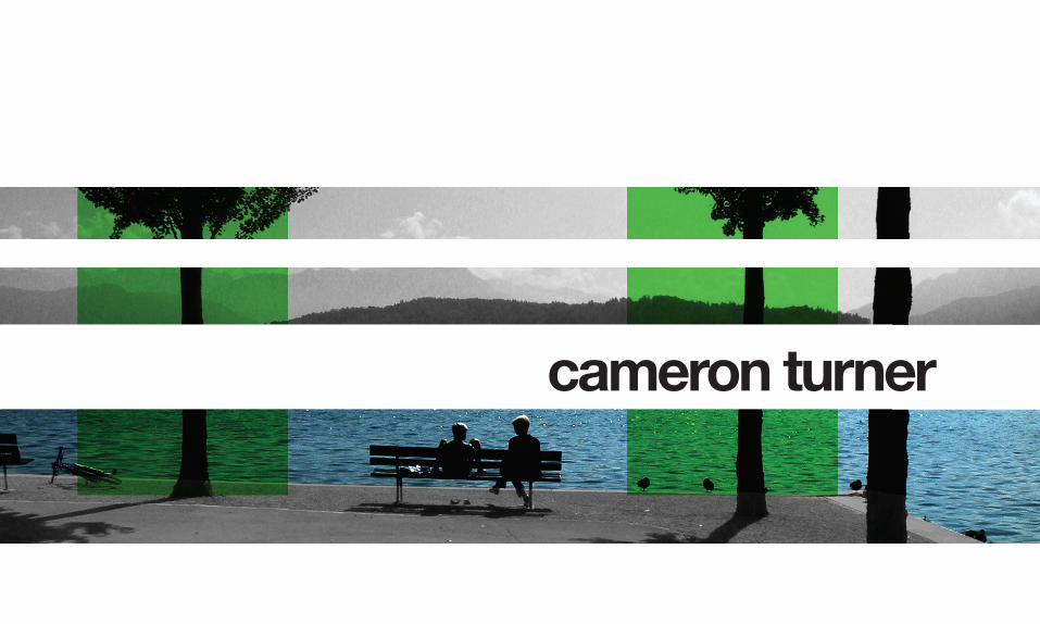
cameron turner

C. Turner Portfolio
Mar 23, 2016
4th year landscape architecture student
Welcome message from author
This document is posted to help you gain knowledge. Please leave a comment to let me know what you think about it! Share it to your friends and learn new things together.
Transcript
cameron turner

index1.0 theory2.0 sunset junction3.0 oceano streetscape4.0 miscellaneous


LANDSCAPE - a [ubiquitous] physical manifestation of temporal conditions that forms a dense interwoven fabric of connections & associations between perceptible “native” objects [fauna, flora, climate, etc] and mental projections [related to human activity / human based-dimension]
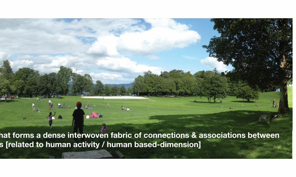
LANDSCAPE - a [ubiquitous] physical manifestation of temporal conditions that forms a dense interwoven fabric of connections & associations between perceptible “native” objects [fauna, flora, climate, etc] and mental projections [related to human activity / human based-dimension]

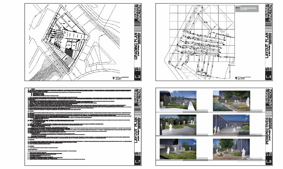
sunset junctionsilver lake, ca

project descriptioninterdisciplinary studio // worked in collaboration with an architecture
student to create a “urban monastery” - a space that serves as a resource to the surrounding community, providing users full access to a catalog of books,
music, and movies, and fosters the continued production of new artwork.
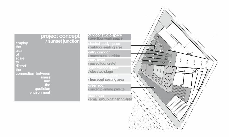
project concept/ sunset junctionemploy
theuseofscaletodistorttheconnection between
usersandthe
quotidianenvironment

MANZANITA st.
MYRA ave.
SUNSET blvd.
SITE SECTION
Commercial use occupies half the site and continues along Sunset Blvd., connecting with the major commercial center one block further east. Residential use occupies the south-west corner of the site and encompasses the neighboring blocks. Situated at the intersection of these two uses, the site serves as a transitional space between the residential use sitting below Sunset and the commercial use elevated above.
MANZANITA st. SUNSET blvd.
MYRA ave. “SOUND SPECTRUM”
The existing topography and building locations on the site create a embedded “sound spectrum” that produces an unusual tension within the space with the high volume traffic activity on Sunset and Manzanita clashing against the relative calm found in the lower half of the site.
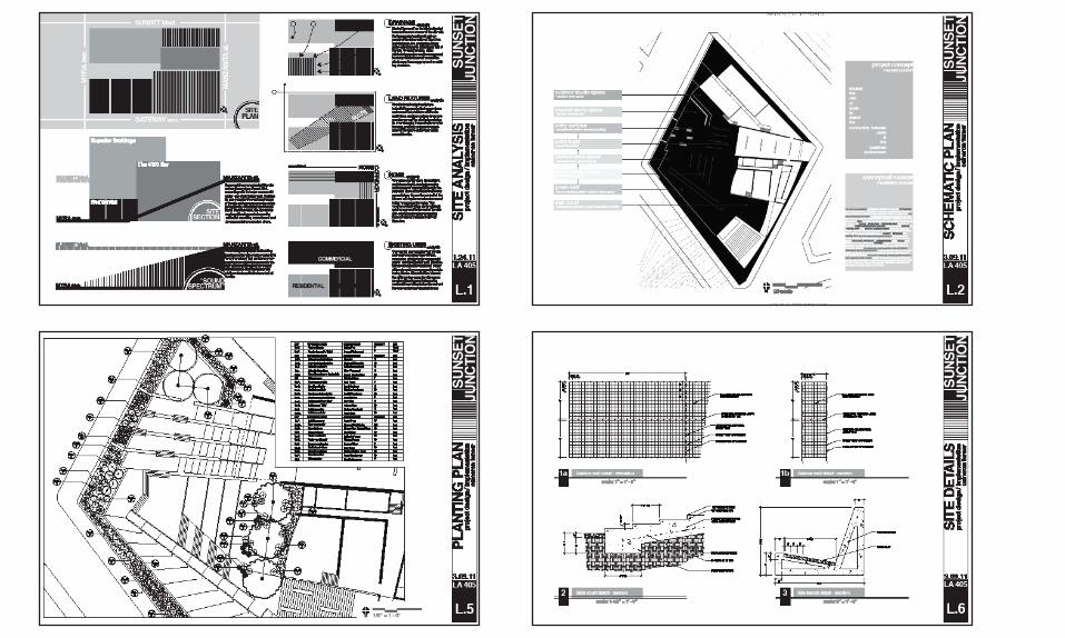
site analysis/sunset junction
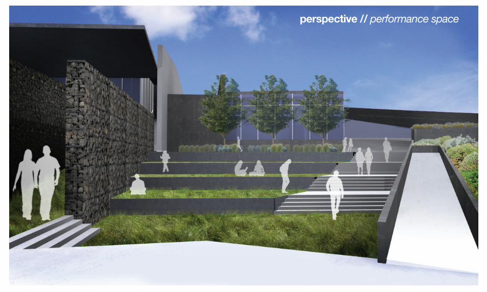
perspective // performance space

perspective // entry foyer
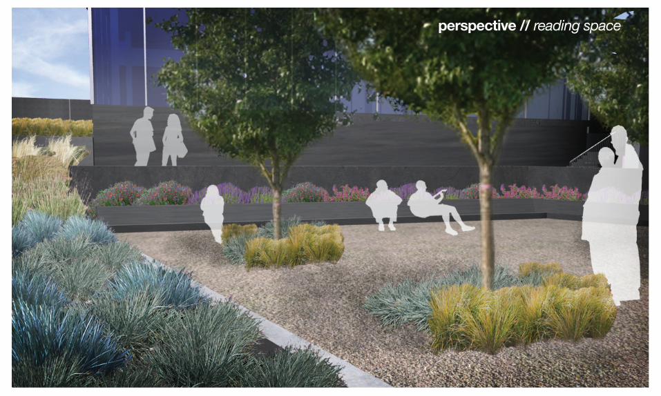
perspective // reading space
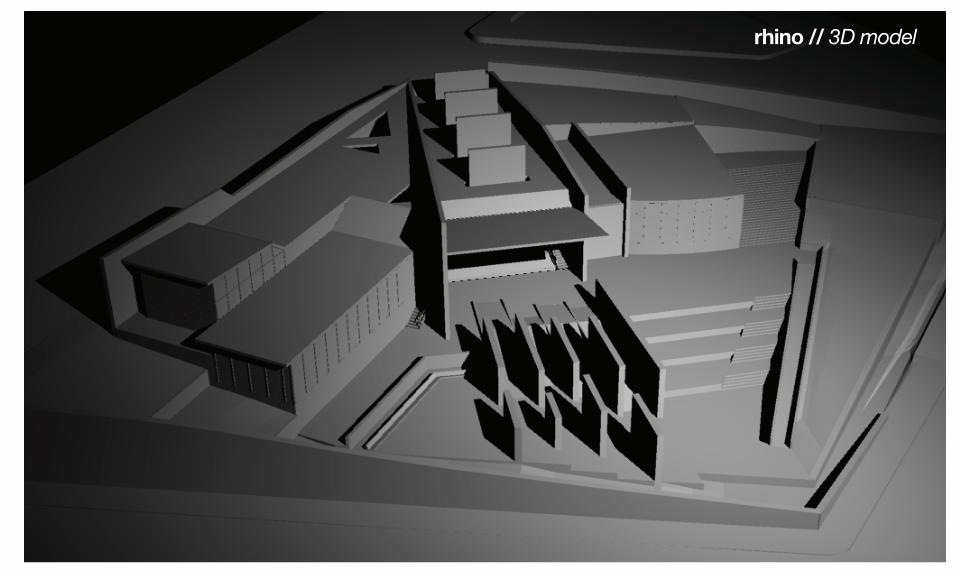
perspective // reading space rhino // 3D model
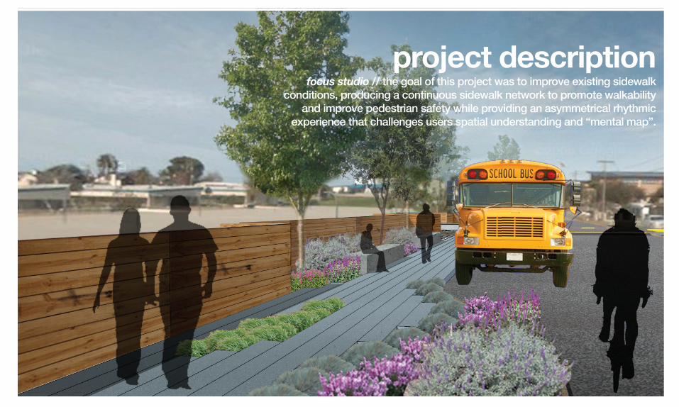
project descriptionfocus studio // the goal of this project was to improve existing sidewalk
conditions, producing a continuous sidewalk network to promote walkability and improve pedestrian safety while providing an asymmetrical rhythmic
experience that challenges users spatial understanding and “mental map”.
nineteenth streetoceano, ca
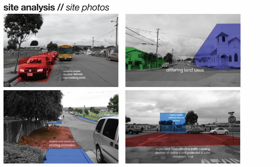
site analysis // site photos
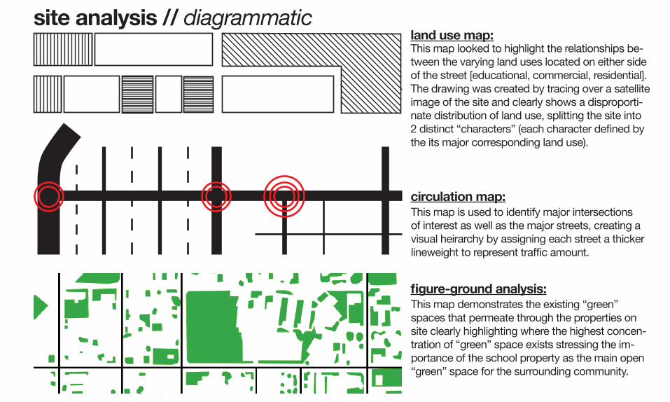
site analysis // diagrammatic land use map:
circulation map:
fi gure-ground analysis:This map demonstrates the existing “green” spaces that permeate through the properties on site clearly highlighting where the highest concen-tration of “green” space exists stressing the im-portance of the school property as the main open “green” space for the surrounding community.
This map is used to identify major intersections of interest as well as the major streets, creating a visual heirarchy by assigning each street a thicker lineweight to represent traffi c amount.
This map looked to highlight the relationships be-tween the varying land uses located on either side of the street [educational, commercial, residential]. The drawing was created by tracing over a satellite image of the site and clearly shows a disproporti-nate distribution of land use, splitting the site into 2 distinct “characters” (each character defi ned by the its major corresponding land use).

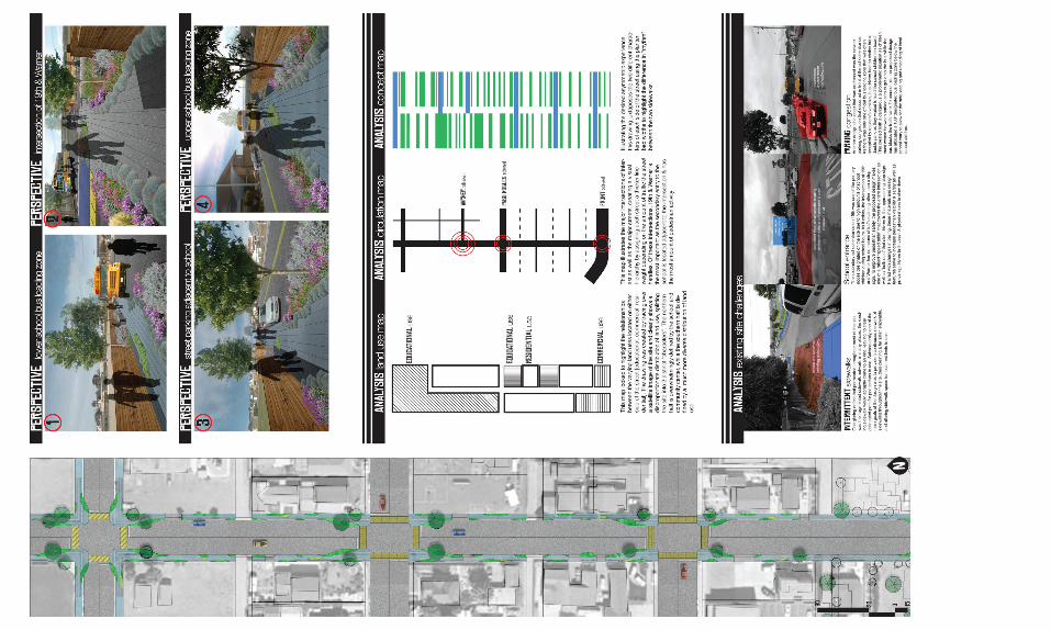

perspective // 19th & Wilmar perspective // 19th & Paso Robles

perspective // school entry perspective // bus loading zone
miscellaneous projectsmovie posters
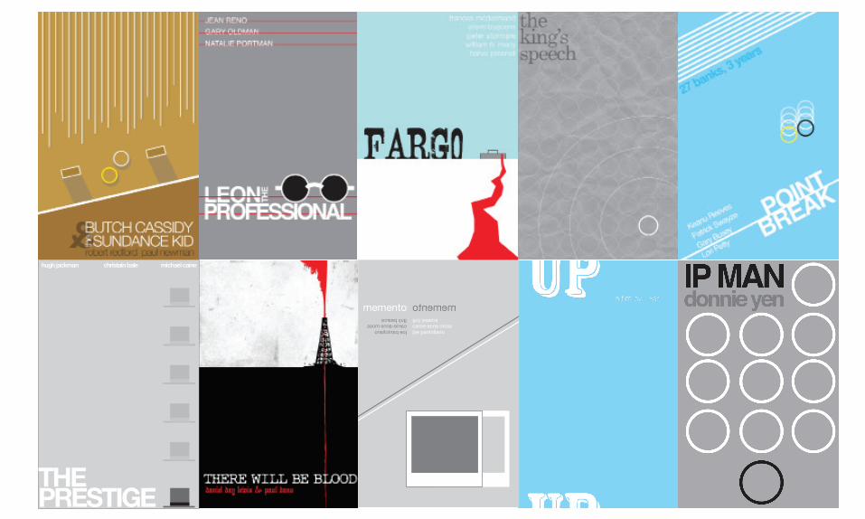
THEPRESTIGE
hugh jackman christain bale michael caine
memento mementoguy pearcecarrie-anne mossjoe pantoliano
guy pearcecarrie-anne mossjoe pantoliano
Related Documents


