Slide #1 Beaufort Sea Engineering Database Agenda Item 7.5 BREA Results Forum, February 21, 2013 Ivana Kubat NRC – Ocean, Coastal and River Engineering Ottawa, Ontario

Welcome message from author
This document is posted to help you gain knowledge. Please leave a comment to let me know what you think about it! Share it to your friends and learn new things together.
Transcript

Slide #1
Beaufort Sea Engineering Database Agenda Item 7.5
BREA Results Forum, February 21, 2013
Ivana Kubat NRC – Ocean, Coastal and River Engineering
Ottawa, Ontario

Slide #2
Outline
• Background
• Project Objective and Benefits
• Project team and partners
• Database description
• Database demonstration
• Work progress and future work Courtesy of Garry Timco Beaufort Sea

Slide #3
Background
• Renewed interest in Beaufort oil & gas
• Harsh and variable environment
• Lots of data exists but is widely scattered
• Good data informs good decisions
Panorama of rubble field in front of the Kulluk, Dec.11, 1983 (Figure 4.19 Gulf Reports/Studies)

Slide #4
Background – cont’d
• Using existing data sources is very time consuming
è Different sources and file formats
è Different software products and specialized knowledge required
è No central repository, no standard process
Panorama of rubble field in front of the Kulluk, Dec.11, 1983 (Figure 4.19 Gulf Reports/Studies)

Slide #5
Project Overall Objective
• An integrated database è Storage, query and visualization
è Include applications for determining the design ice loads
• Common reference source for Industry and regulators
Courtesy of Anne Barker Beaufort Sea
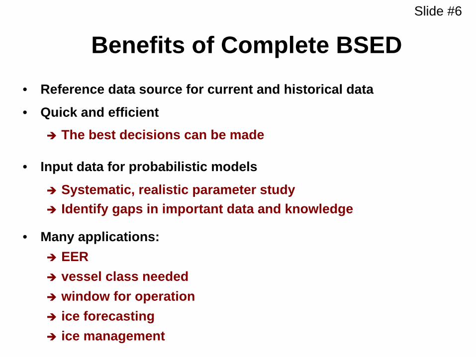
Slide #6
Benefits of Complete BSED
• Reference data source for current and historical data
• Quick and efficient è The best decisions can be made
• Input data for probabilistic models
è Systematic, realistic parameter study è Identify gaps in important data and knowledge
• Many applications: è EER è vessel class needed è window for operation è ice forecasting è ice management

Slide #7
BREA context and purpose
§ Produce regional information and results that simplify project level environmental assessments
§ Strengthen assessment processes and integrated management
§ Engage Communities and advance their priorities for oil and gas preparedness
The project was largely funded by Industry, AADNC was a member representing Regulators. They all steered directions of the project to meet their community needs (NRC didn’t directly engage with Communities)
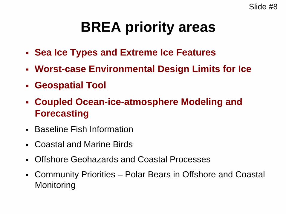
Slide #8
BREA priority areas § Sea Ice Types and Extreme Ice Features
§ Worst-case Environmental Design Limits for Ice § Geospatial Tool
§ Coupled Ocean-ice-atmosphere Modeling and Forecasting
§ Baseline Fish Information
§ Coastal and Marine Birds
§ Offshore Geohazards and Coastal Processes
§ Community Priorities – Polar Bears in Offshore and Coastal Monitoring
Slide #9
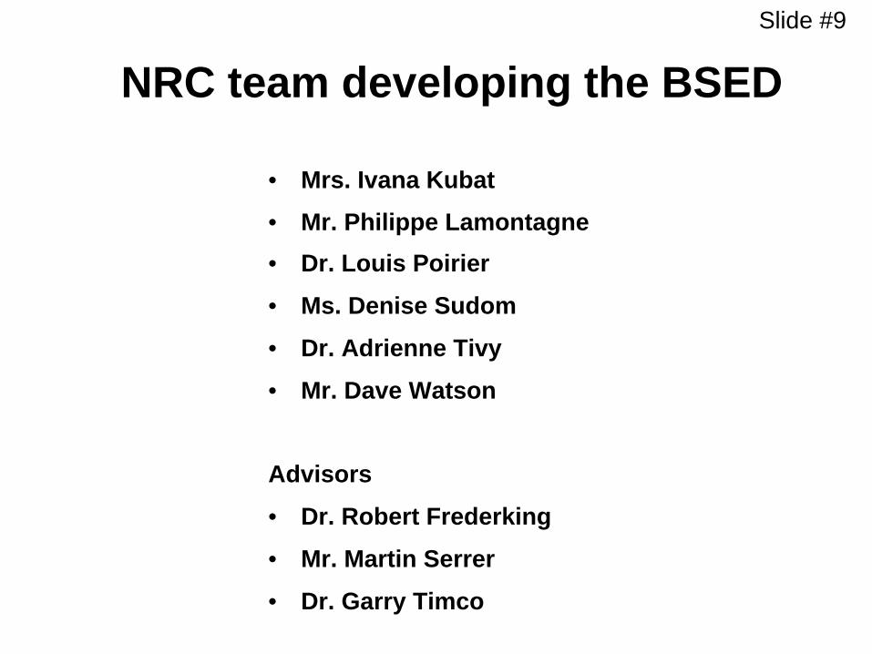
NRC team developing the BSED
• Mrs. Ivana Kubat
• Mr. Philippe Lamontagne • Dr. Louis Poirier
• Ms. Denise Sudom
• Dr. Adrienne Tivy
• Mr. Dave Watson
Advisors
• Dr. Robert Frederking
• Mr. Martin Serrer
• Dr. Garry Timco
Slide #10
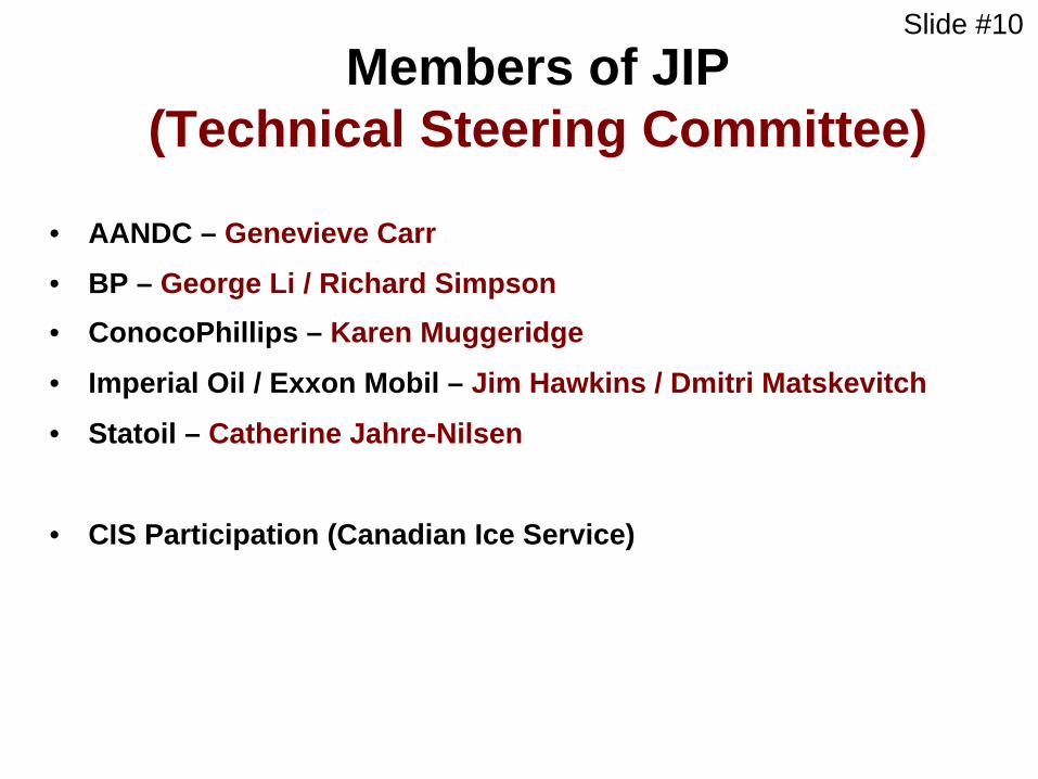
Members of JIP (Technical Steering Committee)
• AANDC – Genevieve Carr
• BP – George Li / Richard Simpson • ConocoPhillips – Karen Muggeridge
• Imperial Oil / Exxon Mobil – Jim Hawkins / Dmitri Matskevitch
• Statoil – Catherine Jahre-Nilsen
• CIS Participation (Canadian Ice Service)
Slide #11
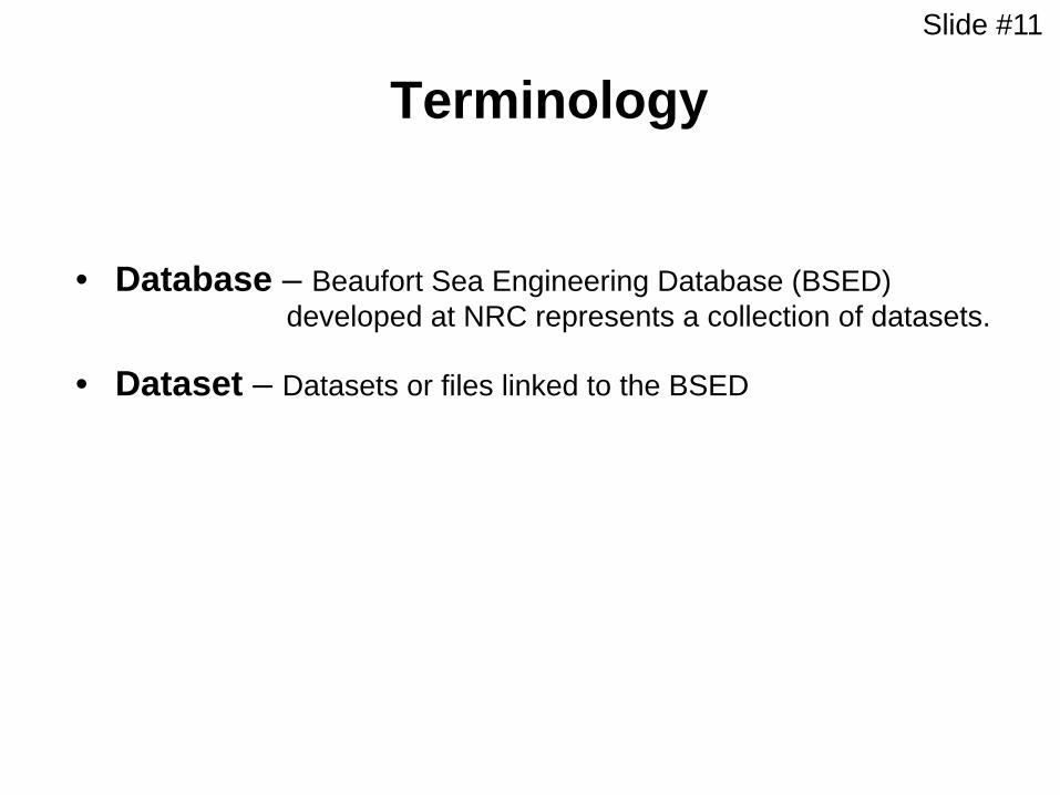
Terminology
• Database – Beaufort Sea Engineering Database (BSED) developed at NRC represents a collection of datasets.
• Dataset – Datasets or files linked to the BSED

Slide #12
Database Functionalities
• Display Functions è Addition or modification of base maps è Map customization è Latitude-Longitude or Polar Stereographic projection è Interactive zoom and pan functionalities
• Query Functions è Query multiple datasets simultaneously è Allows for user drawn search area (polygon)
• Export Capabilities è To printer, plus ASCII, Shapefile, CSV, Surfer grid
Slide #13
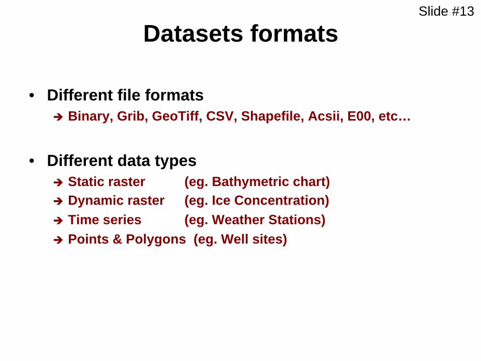
Datasets formats
• Different file formats è Binary, Grib, GeoTiff, CSV, Shapefile, Acsii, E00, etc…
• Different data types è Static raster (eg. Bathymetric chart) è Dynamic raster (eg. Ice Concentration) è Time series (eg. Weather Stations) è Points & Polygons (eg. Well sites)
Slide #14
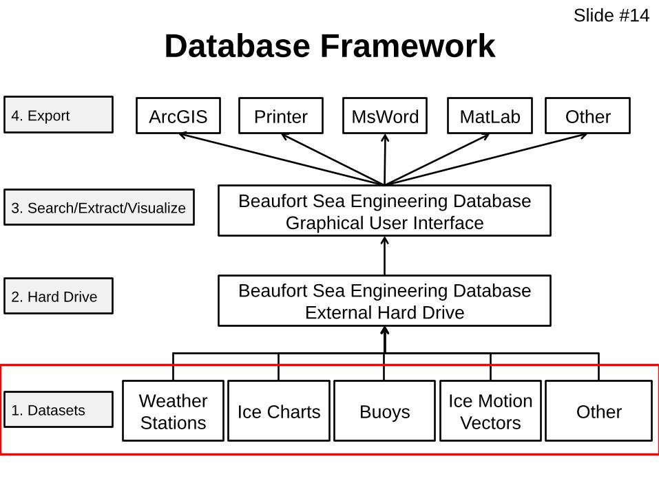
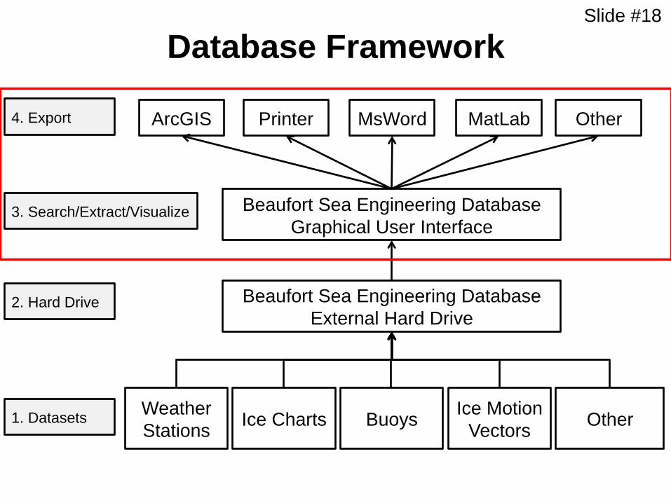
Database Framework
Weather Stations Ice Charts Buoys Other Ice Motion
Vectors
Beaufort Sea Engineering Database External Hard Drive
Beaufort Sea Engineering Database Graphical User Interface
ArcGIS MatLab Printer MsWord 4. Export
2. Hard Drive
1. Datasets
Other
3. Search/Extract/Visualize

Slide #15
64 Datasets included
• Ice Motion • Ice Velocity (IABP-D) • Moored Upward Looking Sonar (Ice Velocity) • Polar PathFinder – Daily ice motion • Polar PathFinder – Weekly ice motion • Polar PathFinder – Monthly ice motion • Polar PathFinder – Yearly ice motion
• Ice Properties • ArcticNet HEMI • CIS Ice Thickness • Hourly Ice Observations (Molikpaq) • Ice Concentration derived from AMRS-E • Moored Upward Looking Sonar (Ice Draft) • Submarine Upward Looking Sonar (Ice Draft)
• MetOcean • Buoys Temperature and Pressure • Wind&Wave Hindcast • Tide Stations • Weather Stations CDCD • Weather Stations daily GSOD • Weather Stations hourly SDHG • NARR data (Wind, temperature, …)
• Bathymetry • ArcticNet Base maps • ArcticNet Beaufort Shelf • IBCAO
• Buoys • Buoys - IABP-C • Buoys - SEDNA • ArcticNet Beacons
• Hazardous Ice • NRC MY Ice Dataset • NRC Ice Ridges Dataset • Extreme Ice Features • Historical Ice Islands Drift • Ice Island Surveys
• Ice Charts • Ice Charts CIS – Western Arctic • Ice Charts CIS – Daily • Ice Charts CIS – Historical • Ice Charts CIS – PCSP • Ice Charts NIC • Ice Atlas 1980-2010
• Navigation • Shipping Safety Control Zones • Nautical Charts USA • Nautical Charts Canada
• Stakeholders • Community Conservation Plans • Frontier Well Sites • Oil and Gas Rights
• Subsurface • Soils Map • Geological map of the arctic • Artificial Islands • OCS Study
Slide #16
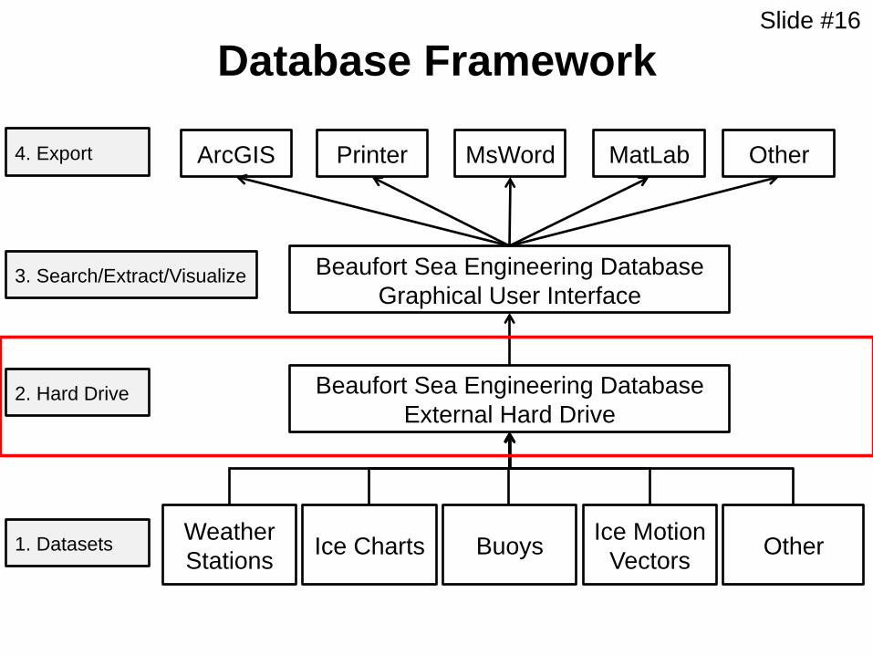
Database Framework
Weather Stations Ice Charts Buoys Other Ice Motion
Vectors
Beaufort Sea Engineering Database External Hard Drive
Beaufort Sea Engineering Database Graphical User Interface
ArcGIS MatLab Printer MsWord 4. Export
2. Hard Drive
1. Datasets
Other
3. Search/Extract/Visualize
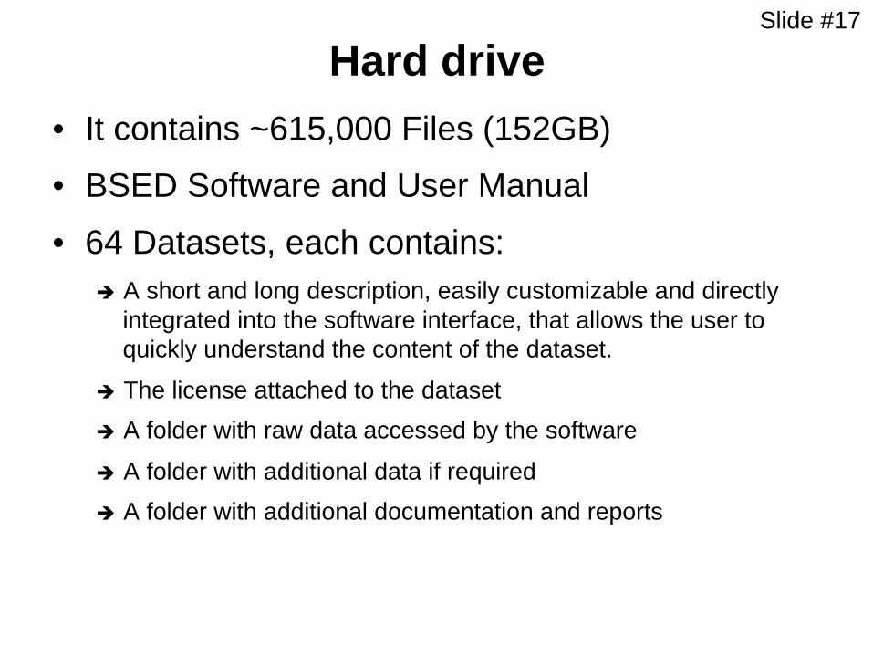
Slide #17
Hard drive • It contains ~615,000 Files (152GB)
• BSED Software and User Manual
• 64 Datasets, each contains: è A short and long description, easily customizable and directly
integrated into the software interface, that allows the user to quickly understand the content of the dataset.
è The license attached to the dataset è A folder with raw data accessed by the software
è A folder with additional data if required è A folder with additional documentation and reports
Slide #18
Database Framework
Weather Stations Ice Charts Buoys Other Ice Motion
Vectors
Beaufort Sea Engineering Database External Hard Drive
Beaufort Sea Engineering Database Graphical User Interface
ArcGIS MatLab Printer MsWord 4. Export
2. Hard Drive
1. Datasets
Other
3. Search/Extract/Visualize

Slide #19
Database demonstration
Slide #20
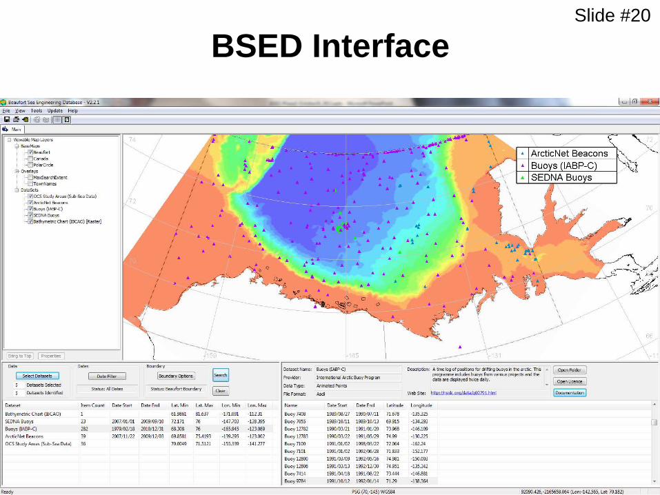
BSED Interface

Slide #21
User Manual

Slide #22
Select base maps to display on the interface. Other base maps can be added by the
user by editing the configuration file.
Select/overlay base maps

Slide #23 Select databases
The user can search all databases, a subset of databases or within
a specific one.
Slide #24
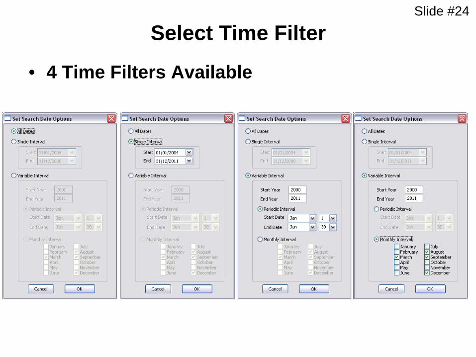
Select Time Filter
• 4 Time Filters Available
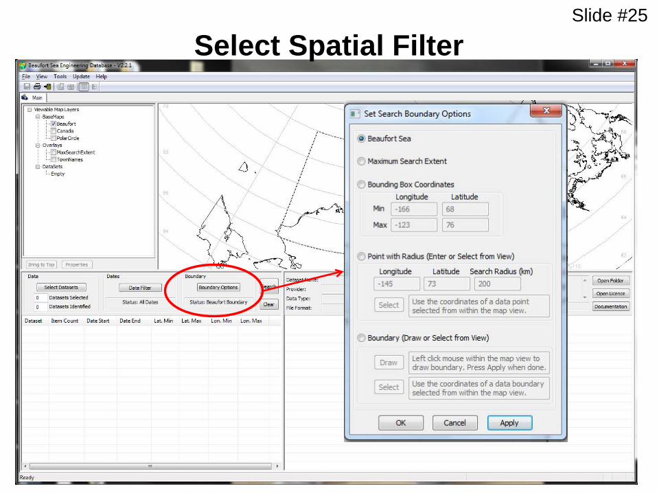
Slide #25
Select Spatial Filter

Slide #26
Select Spatial Filter - Boundary
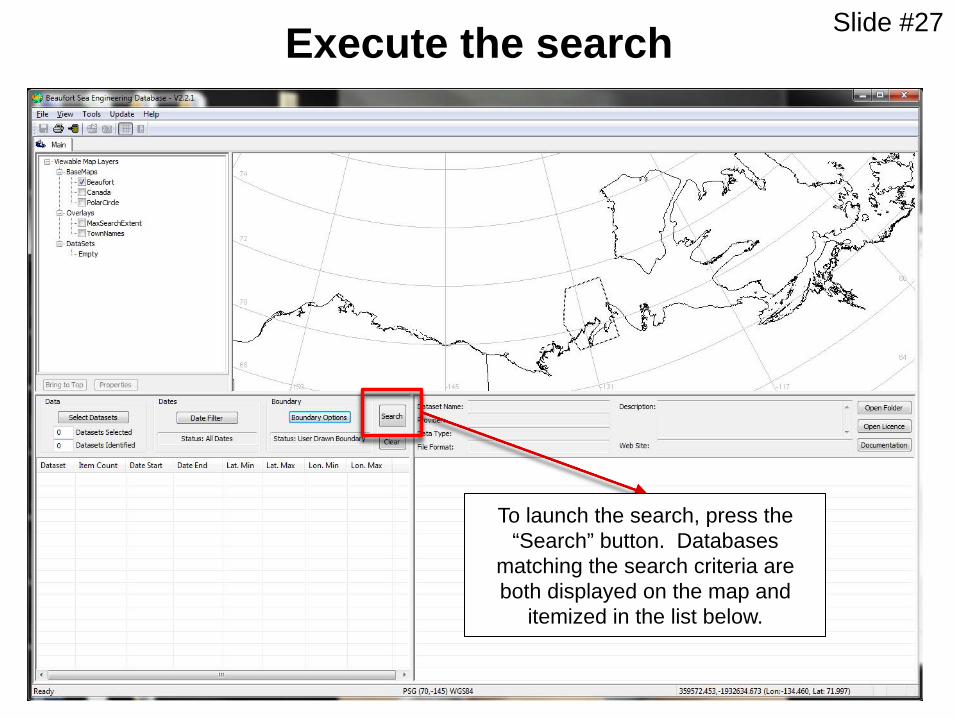
Slide #27 Execute the search
To launch the search, press the “Search” button. Databases
matching the search criteria are both displayed on the map and
itemized in the list below.
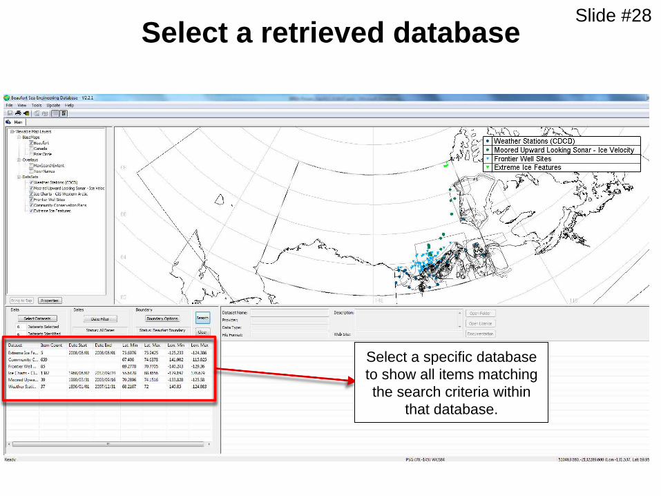
Slide #28 Select a retrieved database
Select a specific database to show all items matching the search criteria within
that database.

Slide #29 Select items (example: Weather Station)
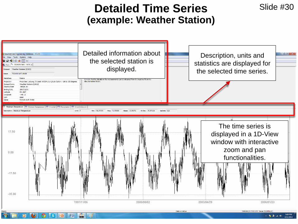
Slide #30 Detailed Time Series (example: Weather Station)
Detailed information about the selected station is
displayed.
Description, units and statistics are displayed for the selected time series.
The time series is displayed in a 1D-View window with interactive
zoom and pan functionalities.
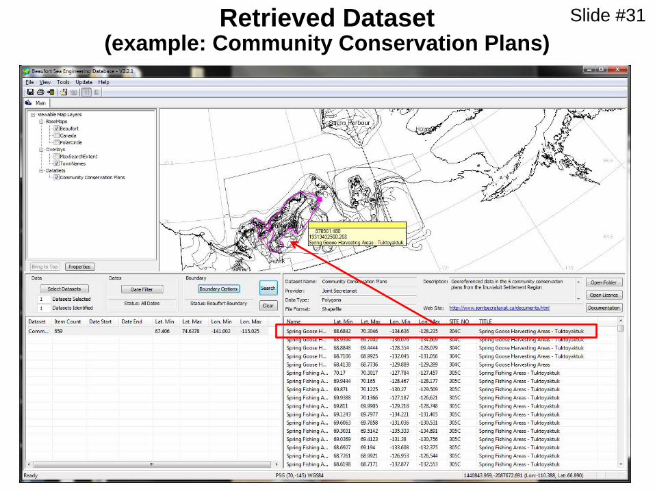
Slide #31 Retrieved Dataset (example: Community Conservation Plans)

Slide #32
Additional BSED demonstration
• 10:10 – 10:30 during BREAK (CanICE and BSED)
• 4:45 – 6:00 additional opportunities to demo databases

Slide #33
Work progress
Meeting/ training in October 2012 • BSED draft version on external hard drive distributed to JIP
partners • Draft of End-user Manual
Remaining • Populating datasets • Final End-user Manual • Synchronize clients’ BSED with the most updated NRC version
(Master Database)
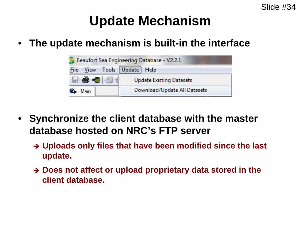
Slide #34
Update Mechanism • The update mechanism is built-in the interface
• Synchronize the client database with the master database hosted on NRC’s FTP server è Uploads only files that have been modified since the last
update. è Does not affect or upload proprietary data stored in the
client database.

Slide #35
Future Work
• Continued Database maintenance
Slide #36
Future Work – cont’d
• Include new datasets
è Primary focus would be on geotechnical data such as permafrost data, scour maps, etc.; other data should include breakup patterns of the landfast ice, extent and degradation of landfast ice, seismic lines, etc.
• Traditional and local knowledge could be used to validate or augment site specific information such as ice conditions, breakup patterns of landfast ice, etc.
Slide #37
Potential Use of BSED
• The complete comprehensive integrated database will ensure that engineering decisions are made with the best available regional information.
• It becomes a primary point of reference for regional environmental information for Regulators responsible for reviewing project applications in the Beaufort Sea.
• The database will collect diverse existing historical datasets before the data is lost , evaluate the quality and quantity of available data and make them available for future projects in Beaufort Sea region.
• The database and analysis can be used to identify gaps in important data and knowledge. Once identified, these gaps can be used to select the most beneficial and cost effective research required to close the gaps or for mitigation.
Slide #38
Potential Use of BSED – cont’d
• It can be used for many other engineering applications and operations in the Beaufort Sea:
è The information on ice conditions will be a major driving factor for decisions related to the types of emergency evacuation systems that must be in place on the platform;
è Analysis of BSED data provides direct input on the shipping regulations and severity of ice conditions throughout the year in the Beaufort Sea. This information can be used to evaluate required vessel class, windows of operation for both platform supplies, and offloading of the hydrocarbons (if done using a tanker), routes for tankers and supply vessels, etc;
Slide #39
Potential Use of BSED – cont’d è Historical information on winds, waves, ice movement, etc. can
be used as background (default) information for ice forecasting models and ice movement severity at any location in the Beaufort Sea.
è Information on seabed scour and seabed properties could be used to evaluate suitable pipeline routes;
è Defining historic windows of opportunity for seismic vessels;
The use of BSED will lead to safe and efficient operations in the Beaufort Sea ensuring that needs of Communities are met
Slide #40
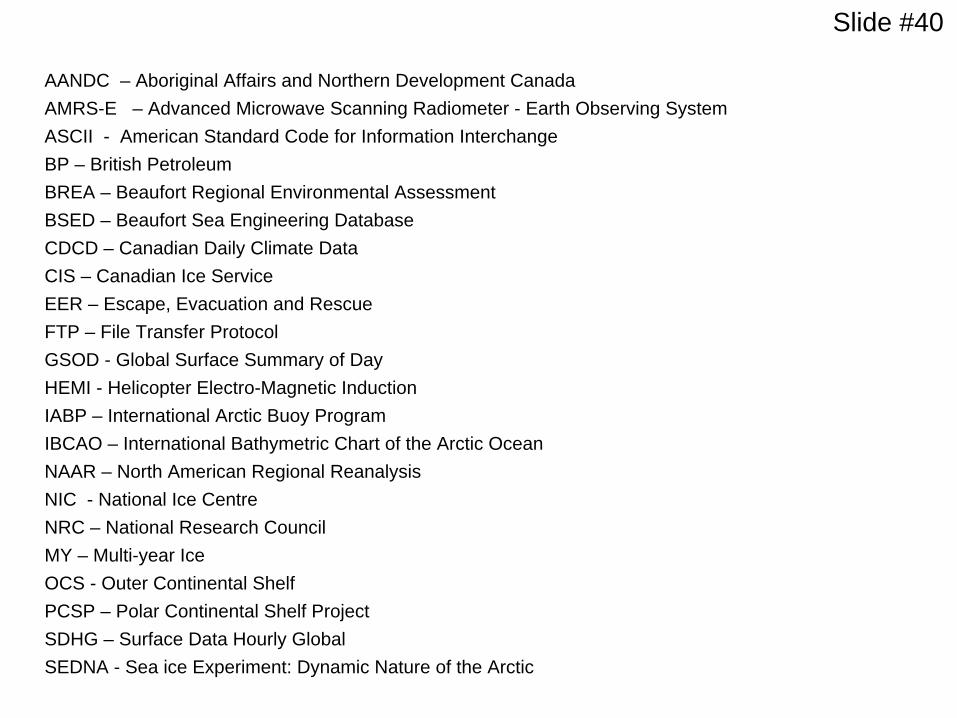
AANDC – Aboriginal Affairs and Northern Development Canada AMRS-E – Advanced Microwave Scanning Radiometer - Earth Observing System ASCII - American Standard Code for Information Interchange BP – British Petroleum BREA – Beaufort Regional Environmental Assessment BSED – Beaufort Sea Engineering Database CDCD – Canadian Daily Climate Data CIS – Canadian Ice Service EER – Escape, Evacuation and Rescue FTP – File Transfer Protocol GSOD - Global Surface Summary of Day HEMI - Helicopter Electro-Magnetic Induction IABP – International Arctic Buoy Program IBCAO – International Bathymetric Chart of the Arctic Ocean NAAR – North American Regional Reanalysis NIC - National Ice Centre NRC – National Research Council MY – Multi-year Ice OCS - Outer Continental Shelf PCSP – Polar Continental Shelf Project SDHG – Surface Data Hourly Global SEDNA - Sea ice Experiment: Dynamic Nature of the Arctic

Related Documents


