1 ASPRS AWARDS PROGRAM 2021 March 29-April 2, 2021

Welcome message from author
This document is posted to help you gain knowledge. Please leave a comment to let me know what you think about it! Share it to your friends and learn new things together.
Transcript
1
ASPRS
AWARDS PROGRAM
2021
March 29-April 2, 2021
2
AWARDS AND SCHOLARSHIPS Awards for Outstanding Papers, Professional Achievement, and Service activities are determined by committee selection; scholarships and academic awards are also determined by committee selection but are chosen from among current applications. For details on the application process, see: https://www.asprs.org/education/asprs-awards-and-scholarships
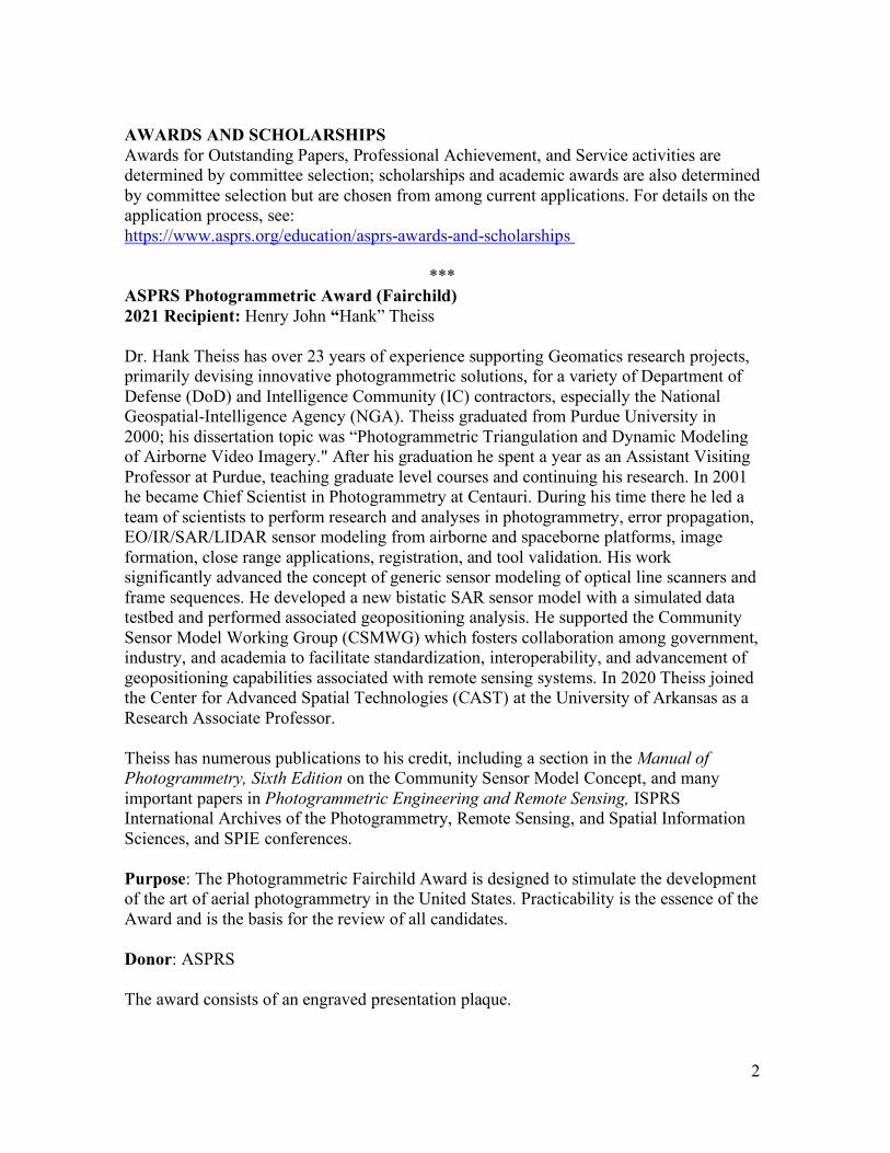
*** ASPRS Photogrammetric Award (Fairchild) 2021 Recipient: Henry John “Hank” Theiss Dr. Hank Theiss has over 23 years of experience supporting Geomatics research projects, primarily devising innovative photogrammetric solutions, for a variety of Department of Defense (DoD) and Intelligence Community (IC) contractors, especially the National Geospatial-Intelligence Agency (NGA). Theiss graduated from Purdue University in 2000; his dissertation topic was “Photogrammetric Triangulation and Dynamic Modeling of Airborne Video Imagery." After his graduation he spent a year as an Assistant Visiting Professor at Purdue, teaching graduate level courses and continuing his research. In 2001 he became Chief Scientist in Photogrammetry at Centauri. During his time there he led a team of scientists to perform research and analyses in photogrammetry, error propagation, EO/IR/SAR/LIDAR sensor modeling from airborne and spaceborne platforms, image formation, close range applications, registration, and tool validation. His work significantly advanced the concept of generic sensor modeling of optical line scanners and frame sequences. He developed a new bistatic SAR sensor model with a simulated data testbed and performed associated geopositioning analysis. He supported the Community Sensor Model Working Group (CSMWG) which fosters collaboration among government, industry, and academia to facilitate standardization, interoperability, and advancement of geopositioning capabilities associated with remote sensing systems. In 2020 Theiss joined the Center for Advanced Spatial Technologies (CAST) at the University of Arkansas as a Research Associate Professor. Theiss has numerous publications to his credit, including a section in the Manual of Photogrammetry, Sixth Edition on the Community Sensor Model Concept, and many important papers in Photogrammetric Engineering and Remote Sensing, ISPRS International Archives of the Photogrammetry, Remote Sensing, and Spatial Information Sciences, and SPIE conferences. Purpose: The Photogrammetric Fairchild Award is designed to stimulate the development of the art of aerial photogrammetry in the United States. Practicability is the essence of the Award and is the basis for the review of all candidates. Donor: ASPRS The award consists of an engraved presentation plaque.
3
*** The ASPRS Lifetime Achievement Award 2021 Recipient: Virginia T. Norwood Virginia Norwood is known as the “Mother of Landsat.” When interviewed by Laura Rocchio for a NASA Landsat Science article, Ms. Norwood was asked if she is comfortable with this title and she replied, “Yes. I like it, and it’s apt. I created it. I birthed it; and I fought for it.” In recognition of her contributions to satellite communications and optics for over 40 years, including the design, building, promotion, and operation of the first multispectral scanner (MSS) on-board Landsat-1, Ms. Norwood was awarded the 2021 ASPRS Lifetime Achievement Award. As documented in Rocchio (2020), Ms. Norwood graduated from MIT in 1947 at the age of 20 with a degree in mathematical physics. A year later, she and her husband were hired by the U.S. Army Signal Corps in New Jersey where she worked in weather radar. At the age of 22, Ms. Norwood received the first of her three first U.S. patents, for the invention of a weather balloon radar reflector that allowed storms to be detected and tracked from a distance. Turning to microwave antenna design, she and her husband moved to California to work at Sylvania Electronic Defense Labs. The following year she was hired by the Hughes Aircraft Company where she worked for 36 years until her retirement in 1990. In her capacity as the company’s first female member of the technical staff, she received two more patents for her designs of antennae, communication links and optics. When she became the head of the microwave division, one male engineer quit rather than work for a woman and another told her a woman with children had no business working at Hughes. Fortunately for the global remote sensing community, she turned to NASA’s need for spaceborne multispectral imagery of the Earth. After conducting a users’ needs study that included interviewing resource managers, collecting field measurements with agronomists and consulting with laboratories at Purdue University and the Environmental Research Institute of Michigan acquiring airborne multispectral imagery, Ms Norwood compiled the specifications for a scanner that would meet the requirements of a broad range of applications. Although interested in scanner technology, NASA engineers were focused on the Return Beam Vidicon (RBV) as the primary sensor for the first Landsat satellite, then named the Earth Resources Technology Satellite (ERTS). The television-like system that had been previously used in TIROS weather satellites and the Surveyor moon missions was similar to the images from traditional cameras and preferred scientists and cartographers of the U.S. Geological Survey. It was finally decided that the multispectral scanner would be added as an experimental payload to ERTS, and Norwood and her team proceeded to modify airborne scanning technology to a spaceborne platform with no gravity or air and the need to transmit data extremely long distances. Working with Hughes engineer, Jack Lansing, Ms Norwood refined existing scanner designs to meet spectral and spatial resolutions that exceeded those of weather satellites to produce 4-band multispectral images extending from blue to near-infrared with a pixel size of 79 m. The rotating scan mirror and her decision to transmit the MSS data digitally to the Earth were questioned by NASA, but Ms. Norwood intended the 6-bit image and calibration data from an internal lamp
4
calibrator on-board the satellite would be transmitted digitally to the ground and calibrated to allow spatial and temporal comparisons. As noted in Roccio (2020), “The MSS radiometrically-corrected digital data pioneered quantitative satellite remote sensing, taking the science of Earth observation digital, where it has stayed ever since.” ERTS-1, later renamed Landsat-1, was launched on July 23, 1972 with both the RBV and MSS sensors. Two days later the first images were received at the NASA Goddard Space Flight Center and all were amazed by the quality of the MSS images. Within two weeks, the RBV experienced an electrical anomaly that ended its image acquisition and the MSS took over as the primary sensor for moderate-resolution Earth observations. Rocchio, L., 2020. Virginia T. Norwood: The Mother of Landsat, Land Science, National Aeronautics and Space Administration: https://landsat.gsfc.nasa.gov/article/virginia-t-norwood-mother-landsat The ASPRS Lifetime Achievement Award (formerly the Honorary Lifetime Achievement Award and the Honorary Member Award) is the highest award an ASPRS member can receive, and there are only 25 living Lifetime Achievement Awardees of the Society at any given time. Candidates are chosen by a Nominating Committee made up of the past five recipients of the award and chaired by the most recent recipient. Purpose: Initiated in 1937, this life-time award is given in recognition of individuals who have rendered distinguished service to ASPRS and/or who have attained distinction in advancing the science and use of the geospatial information sciences. It is awarded for professional excellence and for at least 20 years of service to ASPRS and consists of a plaque and a certificate. Donor: ASPRS
*** The ASPRS Outstanding Technical Achievement Award 2021 recipient: Steve Coast ASPRS has selected Steve Coast for its prestigious Outstanding Technical Achievement Award, recognizing the game-changing and persistent impact of OpenStreetMap (OSM). This initiative has grown, since its inaugural release in 2004, from a small group in London to a worldwide community of both users and contributors. Because of Coast’s vision then and development over nearly two decades, today millions of people use their own resources to easily acquire and to openly share geospatial data acquired with smart devices, low-cost GPS receivers, and airborne or handheld imaging. The development of OSM was revolutionary. This innovation cultivated the first wide-spread, crowd-sourced earth-observation data acquisition campaign in the mapping community. Coast’s work released a novel way to produce useful maps for the public as well as in professional applications. In 2006, the OpenStreetMap Foundation was established to encourage the growth, development, and distribution of free geospatial data for anybody to use and share
5
anywhere. Industry took notice quickly. In December 2006, Yahoo! confirmed that OSM could use its aerial photography as a backdrop for map production. By 2008, OSM data was available for downloading to GPS receivers, and its popularity further increased. Big companies, such as Apple started to use OSM data. OSM impact continues to expand. The OSM community often surveys areas that can be ignored, as fiscally insignificant to large companies, such as jogging trails, footpaths, bicycle routes, and boating areas. With the need for anywhere and anytime navigation, OSM recently added path planning functionality, one of the most frequently used mapping-services on smart devices. Often, special events, named Mapathons, are used to instruct non-professionals, from young students to senior adults, about how to accurately extract data from imagery using readily available applications, including OSM, and how to increase or update geospatial data in key areas, whether locally or in places fraught by the effects of natural events that cause location and content changes. Other examples of the impact of OSM include:
• Humanitarian OpenStreetMap Team (HOT), a nonprofit organization which was created in the immediate aftermath of the 2010 Haiti earthquake
• The Missing Maps project, founded by HOT, Medecins Sans Frontieres/Doctors Without Borders, and the American and British Red Cross, which aims to map the world’s most vulnerable people.
• YouthMappers, founded in 2014 by faculty from Texas Tech University, The George Washington University, and West Virginia University, with support from the US Agency for International Development’s GeoCenter, and now administered by Arizona State University and organized as a network of chapters on university campuses, run by student leadership under the guidance of university professor mentors with 143 campus chapters as of 2018.
• GeoChicas, a group of women volunteers who map in OSM and work to close the significant gender gap within the OSM community by promoting mapping campaigns that address women’s issues such as mapping gender violence and by creating more training spaces for women and ensuring harassment-free mapping.
• Crowd2Map Tanzania established in 2015 to improve the rural maps of Tanzania to fight female mutilation and improve development of the region.
Visit the OSM website at www.openstreetmap.org to understand more about the activity that Coast initiated and learn why the organization can claim: “OpenStreetMap is a map of the world, created by people like you and free to use under an open license.” Learn more about Coast from his own description: https://wiki.openstreetmap.org/wiki/User:Steve or from his The Book of OSM published in November of 2015. Steve Coast is a brilliant visionary, an exceptional professional, a successful entrepreneur, a devoted volunteer to the geospatial science and engineering community worldwide, author, moderator, and a staunch advocate of citizen-science contributions.
6
The ASPRS Outstanding Technical Achievement Award was introduced for the first time in 2012. This Award consists of a silver presentation plaque mounted on a wood panel plus a check for $6,000. Purpose: This grant is designed to reward the developer[s] of a specific breakthrough technology which causes quantum advances in the practice of photogrammetry, remote sensing or geographic information systems in the United States. Donor: In 2011, the ASPRS Foundation received a very generous individual donation from Lifetime Achievement Awardee and ASPRS Fellow Clifford W. Greve to endow a new Outstanding Technical Achievement Award. This award is now fully endowed at the $6,000 level.
*** Outstanding Paper Awards John I. Davidson President’s Award for Practical Papers Davidson 1st Place “Edge-Reinforced Convolutional Neural Network for Road Detection in Very-High-Resolution Remote Sensing Imagery.” Authors: Lu, Xiaoyan; Zhong, Yanfei; Zheng, Zhuo; Zhao, Ji; Zhang, Liangpei PE&RS, Volume 86, Number 3, March 2020, pp. 153-160(8) 2nd Place “Semi-Automatic Building Extraction from WorldView-2 Imagery Using Taguchi Optimization.” Authors: Tonbul, Hasan; Kavzoglu, Taskin. PE&RS, Volume 86, Number 9, September 2020, pp. 547-555(9). 3rd Place “Building Facade Reconstruction Using Crowd- Sourced Photos and Two-Dimensional Maps.” Authors: Wu, Jie; Mao, Junya; Chen, Song; Zhuoma, Gesang; Cheng, Liang; Zhang, Rongchun. PE&RS, Volume 86, Number 11, November 2020, pp. 677-694(18). Purpose: The John I. Davidson President’s Award for Practical Papers was established in 1979 to encourage and commend individuals who publish papers of practical or applied value in PE&RS. Donor: The ASPRS Foundation in memory of ASPRS Past President John I. Davidson. The First-Place award includes a cash award of $1,000 and a certificate; Second Place is a cash award of $600 and a certificate; Third Place is a cash award of $400 and a certificate.
***
7
The Esri Award for Best Scientific Paper in GIS 1st Place “Topographic and Geomorphological Mapping and Analysis of the Chang'E-4 Landing Site on the Far Side of the Moon.” Authors: Wu, Bo; Li, Fei; Hu, Han; Zhao, Yang; Wang, Yiran; Xiao, Peipei; Li, Yuan; Liu, Wai Chung; Chen, Long; Ge, Xuming; Yang, Mei; Xu, Yingqiao; Ye, Qing; Wu, Xueying; Zhang, He. PE&RS, Volume 86, Number 4, April 2020, pp. 247-258(12). Purpose: Established in 1991, the fully endowed Esri Award honors individuals who publish papers of scientific merit that advance our knowledge about GIS technology. Donor: Esri, Inc. through the ASPRS Foundation The Esri Award first prize is $1,000 and a certificate.
*** Talbert Abrams Award 2021 recipients: Grand Award: “A History of Laser Scanning, Part 1: Space and Defense Applications.” Author: Spring, Adam P. PE&RS, Volume 86, Number 7, July 2020, pp. 419-429. First Honorable Mention “A History of Laser Scanning, Part 2: The Later Phase of Industrial and Heritage Applications.” Author: Spring, Adam P. PE&RS, Volume 86, Number 8, August 2020, pp. 479-501. Second Honorable Mention Performance Analysis of Advanced Decision Forest Algorithms in Hyperspectral Image Classification Authors: Colkesen, Ismail; Ertekin, Omer Habib PE&RS, Volume 86, Number 9, September 2020, pp. 571-580(10) Purpose: The Talbert Abrams Award was established in 1945 to encourage the authorship and recording of current, historical, engineering, and scientific developments in photogrammetry. The Award is determined from papers published in PE&RS. Donor: The ASPRS Foundation The award consists of a check for $3,000 and an engraved plaque for the Grand Award, and an award certificate for the First and Second Honorable Mentions.
***
8
ASPRS Presidential Citations 2021 recipients: Lindi Quackenbush – for her expert management and diligent work on the ASPRS Awards Committee. Peng Fu – for his professional supervision of the ASPRS scholarship application process. Chris Lee, Steve Yool, and Mike Abrams for their many years of service on the William A. Fischer Memorial Scholarship Committee Youssef Kaddoura – for his innovative work in leading the Student Advisory Council. Tommy Jordan – for continuing the work started by past president Anne Hillyer in developing our online learning program. Purpose: First awarded in 1992, Presidential Citations are presented by the ASPRS President to members of ASPRS and other societies, family members, and friends in recognition of special, personal, and meritorious contributions to the operation or advancement of the Society and its interests during the presidential year. Donor: ASPRS The Presidential Citation is a hand-engrossed certificate.
***
ASPRS Fellow Award 2021 recipients: John McCombs, Alper Yilmaz and Ramesh Sivanpillai John McCombs has been a contractor with the National Oceanic and Atmospheric Administration (NOAA) Office for Coastal Management (OCM) in Charleston, SC since 2003. He was hired to help standardize and operationalize the NOAA Coastal Change Analysis Program (C-CAP), NOAA’s land cover and land cover change mapping program. At the time, several federal agencies interested in land cover and change were working in the Multi-Resolution Land Characteristics consortium, of which NOAA was a member, to help coordinate federal mapping efforts. McCombs was instrumental in ensuring the land cover produced by NOAA in the coastal regions of the US met the specifications, quality, and timeliness for incorporation into the National Land Cover Database. Over time, NOAA created land cover from 1996 to 2016 on a 5-year repeat cycle, with many areas of the US having additional dates of land cover as far back as 1975. With each iteration of land cover, significant efforts were taken to not only produce the newest land cover, but improve the full time-series, resulting in a more accurate suite of data. As part of this work, McCombs helped in the development of the C-CAP Land Cover Atlas (an intuitive web-based viewer which provides access to the data) and published a PE&RS article on the accuracy assessment of the 2010 (and 2006-2010 change) land cover. McCombs was named a 2016 NOAA Bronze recipient for building
9
innovative partnerships, furthering community resilience, and protecting coastal habitats through the Great Lakes. For several years, he also served as a Technical Program Lead within the Coastal Remote Sensing Program at OCM. In this role, he helped coordinate activities across projects, ensure personnel were available, and quality assurance steps were established and followed. In the spring of 2019, McCombs switched roles and became the Southeast and Caribbean Region Geospatial Coordinator. He now acts as the liaison between NOAA OCM and regional coastal management communities for geospatial activities, needs, and training. He provides outreach and technical support to help the coastal management community with geospatial needs, and capture the needs of the region to inform future NOAA OCM plans. He recently was on the planning team for the first Drones in the Coastal Zone workshop series held in October 2020. This series of webinars was aimed at Southeast and Caribbean drone users and was attended by over 100 people for each of the six sessions from across the region. Prior to coming to NOAA, McCombs helped oversee two remote sensing labs at Mississippi State University in the Department of Forestry (1997-2003) and took graduate level coursework. While at Mississippi State, he created the initial statewide National GAP Analysis land cover map, performed research using lidar and imagery-derived products for automating common forestry measurements, advised and helped multiple forestry and remote sensing graduate students, and established the MSU Student Chapter of ASPRS and served as the initial President. He received the College of Forest Resources Research Support Staff Award in 2001. McCombs received his MS degree from Virginia Tech in Wildlife Management (1997) and a BS degree from Michigan State in Fisheries and Wildlife Management (1994). McCombs has been an active member of ASPRS since 1999. His first deep involvement with ASPRS was through the establishment of the student chapter at MSU. For the next several years, he would attend annual conferences, present multiple times, and publish in PE&RS. In 2011, he served as the lead for the review and editing of remote sensing terms for the ASPRS Glossary of the Mapping Sciences, which involved coordinating multiple reviewers, compiling feedback, and working with the project lead to ensure work was completed. McCombs has also served as the Climate Change Committee lead (2011-2013), ASPRS Remote Sensing Applications Division, Assistant Director and Director (2013-2017), ASPRS Technical Division Directors Council, Assistant Chair and Chair (2015-2019), Board of Directors Member (2017-2019), and Technical Program lead for multiple ASPRS annual conferences, for which he received an ASPRS Presidential Citation. During the most recent ASPRS GeoWeek conference, McCombs worked with a team to help convert the in-person conference to a fully virtual format. This involved rescheduling and compiling all presentations into a series of webinars, helping ensure presenters were able to share their work with ASPRS members, and acting as session moderator and host. Through this effort, ASPRS was able to provide its members with an innovative educational experience, expand the opportunities to host these events in the future, and help prevent unexpected budget shortfalls. Alper Yilmaz Alper Yilmaz is Professor with appointments in Civil Environmental and Geodetic Engineering and Computer Science and Engineering (courtesy) Departments at The Ohio State University. He was inducted to the U.S. National Academy of Inventors in 2020, is a
10
senior member of IEEE and an active member of ASPRS, ISPRS, IEEE and IAPR professional societies. Yilmaz is currently chairing the Working Group 5 on Dynamic Scene Understanding of ISPRS Technical Commission II. He is serving as Editor-In-Chief for the ASPRS journal Photogrammetric Engineering and Remote Sensing (PE&RS). He served as Associate Editor for the Computer Vision and Image Understanding Journal from 2014-2016 and the Machine Vision and Applications Journal from 2006-2011. During his leadership of PE&RS, the impact factor increased to its highest since its first volume in 1934. In 2019, PE&RS was ranked 19th most downloaded journal among all 11,000 titles on the Ingenta Connect Platform. As of 2019, the PE&RS 5-year impact factor is at its highest 2.985 according to “InCites Journal Citation Reports.” Yilmaz’s research focusses on biomimetic navigation systems for unmanned systems, mining anomalies in multi-physics and multi-dimensional data for surveillance, and learning geospatial information for scene understanding. On these topics, he has organized several conferences in the fields of Photogrammetry, Remote Sensing and Computer Vision. Yilmaz’s research has received over $11M in extramural funding from The National Aeronautics and Space Administration, National Science Foundation, Air Force Research Labs, Counterintelligence Field Activity Agency, Department of Energy, Ford, Trimble, and others which resulted in over 180 publications and patents. According to Google Scholar, Yilmaz’s publications have received over 11,000 citations. His recent research on biomimetic navigation systems has resulted in a successful start-up company, UbiHere Inc., an Ohio State University spin off, which he founded in 2018. Its hardware and software platforms are being installed in US Air Force bases and hospital systems for tracking and localization of assets and personnel. Yilmaz has been awarded the Innovator of Year of the Ohio State University in 2020, Presidential Citation in 2019 from ASPRS, honorable mention for the Masao Horiba Award (Japan) in 2016, the Ohio State University College of Engineering Lumley Interdisciplinary Research Award in 2015, and the Ohio State University College of Engineering Lumley Research Award in 2012. He has advised 22 PhD and 15 M.Sc. students to completion on topics ranging from navigation, object tracking, 3D scene recovery, machine learning to data mining who have subsequently found positions in prominent academic institutions, industry and government.
*** Purpose: Started in 1992, the designation of Fellow is conferred on Society members who have been active for a total of at least ten years and who have performed exceptional service in advancing the science and use of the mapping sciences and related disciplines. It is awarded for professional excellence and for service to the Society.
Donor: ASPRS The ASPRS Fellow Award includes a lapel pin and a hand-engrossed certificate.
***
11
ASPRS Outstanding Service Award 2021 recipients: Stuart Marsh – For his 25 years of service as Chair of the William A. Fischer Memorial Scholarship Committee. Karen Schuckman – For her tireless leadership through COVID, improving and stabilizing our financial position, and organizing and leading a successful virtual conference. Lorraine Amenda for revitalizing and inspiring the Region Officers Council
*** Purpose: Established in 1991, The Outstanding Service Award is given in recognition of outstanding and unusual efforts in helping ASPRS develop and carry out its program over a sustained period. Recipients have performed outstanding service at the chapter, regional, or national level. Awardees’ service includes any activities, including professional, that have helped the Society achieve its goals and objectives. Donor: ASPRS The Outstanding Service Award consists of a bronze plaque.
*** Presentation of Birdseye Citation and President’s Key to Retiring President Jason Stoker Jeff Lovin, Immediate Past-President
*** Purpose: The Col. Claude H. Birdseye President’s Citation was established in 1965 as a tribute to one of the founders and the first president of the Society. Each year at the Annual Convention it is conferred on the outgoing president in recognition of her/his contributions to the Society. Donor: ASPRS The Birdseye Citation carries with it a gold Past President’s Key, and a hand-engrossed certificate. The retiring President will also receive the Presidential Gavel mounted on a walnut plaque.
*** Region Awards 2021 recipients: Region of the Year: 1st Place Pacific Southwest Region 2nd Place: Potomac Region 3rd Place: Rocky Mountain Region
12
Region Web Site and Newsletter of the Year: 1st Place: Rocky Mountain Region 2nd Place: Eastern Great Lakes Region 3rd Place: Potomac Region
*** Roger Hoffer Membership Award 2021 recipient: Jonathan Li 2021 Honorable Mention:
Dewberry Karen L. Schuckman Purpose: First awarded in 1968 as the ASPRS Ford Bartlett Membership Award (which was originally sponsored by the firm of Lockwood, Kessler, and Bartlett, Inc.) to honor members for actively promoting membership in ASPRS. This award now marks the exceptional efforts of ASPRS Past President Roger Hoffer in managing the Membership Committee and recruiting hundreds of student members. Donor: ASPRS A member is eligible to receive the Award after sponsoring ten or more members in one year. Each recipient receives a hand-engrossed certificate and a one-year membership in the Society. An Honorable Mention is awarded to those who sponsor at least five new members.
*** Scholarships Robert E. Altenhofen Memorial Scholarship 2021 recipient: Oscar Duran Oscar Duran is pursuing his master’s degree Geomatics Engineering at the California State University, Fresno, California. His current research is to assess the reliability of Photogrammetric software used in Precision Agriculture by comparing the analysis of the techniques and algorithms used in Classic Photogrammetry and 3D Computer Vision techniques. His long-range plan is to continue his academic studies by pursuing his Ph.D. degree in Photogrammetry and become an educator in the field of Photogrammetry. In addition to his education Duran is working for an aerial mapping company where he is in charge for the Aerotriangulation portion for Photogrammetric projects. Purpose: First given in 1986, the Robert E. Altenhofen Memorial Scholarship is intended to encourage and commend college students who display exceptional interest and ability in the theoretical aspects of photogrammetry. Donor: The ASPRS Foundation. This award was originally established by Mrs. Helen Altenhofen as a memorial to her husband, Robert E. Altenhofen, past president of ASPRS. He was an outstanding practitioner of photogrammetry and made notable contributions to
13
the mathematical aspects of the science. The Altenhofen Scholarship consists of a check for $2,000 and a hand-engrossed certificate.
*** Abraham Anson Memorial Scholarship 2021 recipient: Alberto Loera Alberto Loera is a senior at California State University of Fresno enrolled in a major of Geomatics Engineering specializing in Land Surveying. He intends to graduate in the spring of 2021. He was the Valedictorian of his high school and has been on either the Dean’s or President’s List in each of his semesters at Fresno and has a GPA of 3.73. Loera has been active in multiple volunteer activities both professionally and in his community. He is involved in several relevant clubs at his university and has obtained professional experience as a survey technician for several years. He has licenses as a Land Surveyor in Training and as a UAS Remote Pilot. His accomplishments and interests are an excellent match for the Anson Award. It is a tribute to Mr. Loera that this is the second time he has received the Anson award. Purpose: To encourage students who have an exceptional interest in pursuing scientific research or education in geospatial science or technology related to photogrammetry, remote sensing, surveying and mapping to enter a professional field where they can use the knowledge of their discipline to excel in their profession. Donor: This award is presented by the ASPRS Foundation from funds donated by the Anson bequest and contributions from the Society and the Potomac Region as a tribute to Abe Anson's many contributions to the field of photogrammetry, remote sensing, and long, dedicated service to the Society. The award consists of a certificate, a check in the amount of $2,000 and a one-year student membership (new or renewal) in the Society.
*** John O. Behrens Institute for Land Information (ILI) Memorial Scholarship 2021 recipient: Matthew Jacobson Matthew Jacobson is a role model for the John O. Behrens Institute for Land Information (ILI) Memorial Scholarship. Jacobson is a senior majoring in Civil Engineering with Geospatial option at the California State Polytechnic Institute in Pomona and expects to graduate in May 2021. He has made the Dean’s list for three semesters, is a member of the Chi Epsilon Honor Society, and has been the recipient of 18 scholarships and awards over the past 3 years. Jacobson is active in student civic and professional organizations including serving in leadership roles on the California State Polytechnic American Society of Civil Engineers serving as President, Past -President, and Student Ambassador. Jacobson maintains membership with the California Land Surveyor’s Association and the California Institute for Transportation Engineers and also is an Engineer in Training with the Board for Professional Engineers, Land Surveyors and Geologists. Jacobson has
14
worked as a summer intern for Kimley-Horn and Associates as well as Hicks and Hartwick Civil Engineers where, in both roles, he worked on drafting site plans for engineering assessments. Moving forward, Jacobson has long-range goals including obtaining the Professional Engineering and Professional Land Surveying licenses and working in land development on projects that improve the quality of life for people all across Southern California. The John O. Behrens ILI Memorial Scholarship was established by the Institute for Land Information (since officially dissolved) as a tribute to the many contributions of Mr. Behrens to the field of geographic and land related information and technology. John O. Behrens was a founder of the ILI and the author of many articles about the value of spatial information, land assessment and taxation, and land information policy. In recognition of Mr. Behrens outstanding contributions over his distinguished career, funds from the ILI have been donated to the ASPRS Foundation to be administered for the John O. Behrens ILI Memorial Scholarship. Purpose: To encourage students/persons who have an exceptional interest in pursuing scientific research or education in geospatial science or technology or land information systems/records to enter a professional field where they can use the knowledge of this discipline to excel in their profession. Donor: The ASPRS Foundation from funds donated by the ILI. The Award consists of a certificate, a check in the amount of $2,000 and a one-year membership renewal in the Society.
*** Robert N. Colwell Memorial Fellowship 2021 Recipient: Patrick Gray Patrick Gray completed a B.A. degree in Computer Science from the University of North Carolina at Chapel Hill (2014) and he is currently pursuing a Ph.D. degree in Marine Science and Conservation at Duke University with focus on the integration of deep learning, remote sensing and marine science. He is framing his dissertation research around the concept of “tip-and-cue” that uses machine learning to compare regular, synoptic coverage of Earth resources by Landsat to prior conditions with the aim of automatically triggering further in-depth Earth observations for areas of detected change. Gray’s background in computer science, space systems and planetary science led him to applied science focused on Earth natural resources. He fell in love with field work by testing, modifying, and repairing UAS aircraft in challenging settings such as Antarctica and Iceland. He decided to continue his graduate studies to understand how coastal areas, like the North Carolina Outer Banks where he grew up, are changing. Recognizing the value of combining computer science and remote sensing to assess impacts on coastal ecosystems, his research in the Duke Johnston Lab includes the use of drone, satellite and in-situ remote sensing for coastal change and marine science applications using deep learning tools. He plans to join the NASA Geosynchronous Littoral Imaging and Monitoring Radiometer (GLIMR) mission science team to further explore coastal remote
15
sensing applications. Gray values education, outreach, and science communication to his peers and the public. He has been the Instructor of Record for Coastal Remote Sensing and Deep Learning for two semesters and Graduate Teaching Assistant for three different Marine Science courses. He created an introductory, open-access geospatial/remote sensing online course that has already been taken by hundreds of students all over the world. He also developed a number of advanced tutorials on how to access and process remotely sensed data including Landsat 8, SMAP and UAS imagery with applied machine learning algorithms. Gray’s peer-review publications appear in several remote sensing and ecological journals such as Remote Sensing in Ecology and Conservation, Applied Earth Observations and Remote Sensing, Methods in Ecology and Evolution, Remote Sensing, and The Condor. His publications address the use of drone and Convoluted Neural Networks (CNN) for cetacean species and sea turtle identification, the integration of drone and high-resolution satellite imagery for estuarine environments and using a deep learning approach to detecting and counting albatrosses and penguins from drone imagery. Gray is the recipient of numerous awards, especially Future Investigator in NASA Earth and Space Science and Technology (2019), NC Space Grant Graduate and Undergraduate Research Fellow/Scholar (2019 and 2012) and DigitalGlobe Foundation Satellite Imagery Grant (2017). Over the course of more than a half century, Dr. Robert N. Colwell developed a reputation as one of the world’s most respected leaders in remote sensing, a field that he stewarded from the interpretation of aerial photographs during World War II, to the advanced acquisition and analysis of many types of geospatial data from military and civilian satellite platforms. His career included nearly 40 years of teaching and research at the University of California, Berkeley, a distinguished record of military service reaching the rank of Rear Admiral, and prominent roles in private industry and as a consultant for many U.S. and international agencies. Among the many awards bestowed upon him, Dr. Colwell had the distinction of being one of the 25 Honorary Members of ASPRS. Purpose: Established in 2006 to encourage and commend college/university graduate students or post-doctoral researchers who display exceptional interest, desire, ability, and aptitude in the field of remote sensing or other related geospatial information technologies, and who have a special interest in developing practical uses of these technologies. Donor: The ASPRS Foundation, from funds donated by students, associates, colleagues and friends of Robert N. Colwell. The Award consists of a grant of $7,000 and a one-year student or associate membership (new or renewal) in ASPRS.
*** William A. Fischer Memorial Scholarship 2021 recipient: Michelle Bester Michelle Bester, currently a Ph.D. student at West Virginia University has been selected to receive the 2021 William A. Fischer Memorial Scholarship. Bester is being presented
16
this award in recognition of her important research and teaching accomplishments, significant analytical skills, impressive academic record, and commitment to engaging new professionals into the geospatial sciences. Bester has clearly demonstrated the ability to combine her significant research and advanced analytical skills to help us address important environmental issues. Her research has focused on the use of lidar for characterizing wildfire hazard and is funded by the USDA US Forest Service. She is building models of understory shrubs and herbs from terrestrial laser scanning data and then using these models to develop measures of flammability. Bester’s work is highly innovative and should make a major contribution in modeling fire behavior. Her work exhibits the kind of practical application of advanced remote sensing data and analysis techniques that William Fischer would have wanted recognized. Purpose: The William A. Fischer Scholarship facilitates graduate studies and career goals of a worthy student adjudged to address new and innovative uses of remote sensing data and techniques that relate to the natural, cultural, or agricultural resources of the Earth. It was established in 1984. Donor: the ASPRS Foundation through individual and corporate contributions in memory of William A. Fischer. The William A. Fischer Memorial Scholarship consists of a $2,000 check and a hand-engrossed certificate.
*** Francis H. Moffitt Memorial Scholarship 2021 recipient: Ashish Pandey Ashish Pandey is attending Nicholls State University, Thibodaux, Louisiana seeking a Bachelor of Science in Geomatics. Pandey is currently a junior and will be completing the BS in May 2022 and has been active in student organizations and is providing advanced tutoring in mathematics. His experience includes volunteering for Raleigh International in Nepal. His awards and honors include three academic honor scholarships and an NSPS scholarship. He is also working as an undergraduate research assistant and working with the latest technologies in the Geospatial Sciences field. His long-range goal is to continue graduate studies for a Ph.D. and become a professor of Geomatics. Purpose: The award was first presented in 2008 with the purpose of encouraging upper-division, undergraduate-level and graduate-level college students to pursue a course of study in surveying and photogrammetry leading to a career in the geospatial mapping profession. Donor: The ASPRS Foundation from funds donated to the Foundation from former students, associates, colleagues and friends of Francis Moffitt. The award consists of a certificate and a check in the amount of $7,000 and a renewal membership in ASPRS.
17
***
The Kenneth J. Osborn Memorial Scholarship 2021 recipient: Keenan Ganz Keenan Ganz is pursuing a Bachelor of Science degree in Biochemistry & Environmental Science with a Geoinformatics Concentration from Rensselaer Polytechnic Institute in New York and plans to graduate in May of 2022. Following his BS, he plans to pursue a doctorate in a conservation-related field where geographic information systems are the central research tools. Ganz exemplified the Osborn qualities of communication and collaboration through participation in volunteer activities wherein he applied his extensive computer programming skills to conservation efforts, such as the Ocean Observatories Initiative. Ganz’s faculty advisor is Dr. Karyn L. Rogers. Purpose: to encourage and commend college students who display exceptional interest, desire, ability, and aptitude to enter the profession of surveying, mapping, photogrammetry, or geospatial information and technology. In addition, the Award recognizes students who excel at an aspect of the profession that Ken demonstrated so very well, that of communications and collaboration. Donor: The ASPRS Foundation from funds donated by the friends and colleagues of Kenneth J. Osborn. Recognized nationally and internationally, Ken was an outstanding practitioner of surveying, mapping, photogrammetry, and geospatial information and technology, and a great friend of the Society. As a professional cartographer with the U.S. Geological Survey, Ken made significant contributions to these fields. The award was first offered in 2005. The Award consists of a check in the amount of $2,000, an engrossed certificate and a membership renewal in the Society,
*** Ta Liang Memorial Award 2021 recipient: Anais Zimmer Anais Zimmer is a third-year Doctoral Candidate and Graduate Research Assistant in the Department of Geography and the Environment at the University of Texas at Austin. Zimmer is currently projected to complete all degree requirements in May 2023. A French native speaker and fluent in Spanish and English, Zimmer has contributed to peer-reviewed articles, chapters and further contributed research and expertise as part of various conferences, workshops, and invited lectures. Zimmer’s academic honors include the Juliet Flynt Marillonnet Memorial Scholarship in 2019 and a Franco-American Fulbright Commission in 2018, among others. Zimmer’s work focuses on producing remotely sensed outputs suitable to bridge the gaps between policymakers, resource managers and the indigenous groups fighting to curtail existential environmental change. This work combines inputs from in-situ surveys, laboratory analyses as well as multispectral imagery and derivative products from UAV and satellite platforms.
18
Purpose: To facilitate research-related travel by outstanding graduate students in remote sensing, including field investigations, agency visits, participation in conferences, or other travel which enhances or facilitates graduate research.
Donor: Individual and corporate contributions to the ASPRS Foundation in memory of Ta Liang, a skilled civil engineer, an excellent teacher, and one of the world's foremost airphoto interpreters, the award consists of a $2,000 grant and a hand-engrossed certificate.
*** Paul R. Wolf Memorial Scholarship 2021 recipient: Innocensia Owuor Innocensia Owuor is being presented this award in recognition of her outstanding academic credentials and her plans and enthusiasm to become an education professional in Surveying, Mapping, Photogrammetry, and related fields. Owuor is currently a Doctoral candidate in Forest Resources and Conservation (Geomatics major) at the University of Florida with a projected graduation date of December 2023. Owuor has demonstrated a continued interest, dedication, enthusiasm, passion, and aptitude to become an education professional and has been recognized at all levels. Owuor’s career goal is to become a tenured teaching/research faculty member at a university, wishing to grow her skill set and continually learn with special interest in the use of geospatial data from non-traditional sources. Purpose: To encourage and commend college students who display exceptional interest, desire, ability, and aptitude to enter the profession of teaching surveying, mapping, or photogrammetry. Donor: the ASPRS Foundation from funds donated by the friends and colleagues of Paul R. Wolf. Recognized nationally and internationally, Paul was an outstanding educator and practitioner of surveying, mapping, and photogrammetry and a great friend of the Society. As author, teacher, and mentor, Paul made significant educational and academic contributions to these fields. The award was inaugurated in 2003 and includes a grant of $4,000, a hand-engrossed certificate and a one-year membership renewal in the Society.
*** The International Educational Literature Award (IELA) 2021 recipient: Federal Institute of Education, Science and Technology Surveying and Cartography Department, Minas Gerais State, Brazil The educational material provided by the IELA will be widely used by students from four undergraduate degree programs and two Professional Technical Courses. Currently, the Afonso Arinos Library does not have a significant international collection. The award will provide access to traditional books and knowledge of the state-of-the-art through access to the PE&RS Journal. The bibliographic library collection is a public and free patrimony available to IFSULDEMINAS students. The literature provided by the IELA will be
19
useful in the classrooms and will also benefit scientific initiation work, course completion, and research groups. The Afonso Arinos Library's mission is to promote efficient and updated access to information, using the largest number of resources available to meet user's needs with quality. The library strives to maintain the commitment to the democratization of access to information. Its vision is to be a center of excellence in information, with a commitment to meet user's expectations and needs with quality and efficiency. The library has 665 m2 (7158 square feet), and has an updated collection with approximately 20,000 titles, which serves the various areas of knowledge. Library users have access to two systems: Meu Pergamum and Minha Biblioteca. In the Meu Pergamum system, the user can consult available collections, reserve materials, and renew online. In the Minha Biblioteca system, the user has access to a base of e-books in several knowledge areas. The Award consists of the following: A set of manuals published by ASPRS; A five-year e-subscription to Photogrammetric Engineering & Remote Sensing; Proceedings of the annual conference for a five-year period. Purpose: to improve the quantity and quality of the literature in the library of the recipient Institution that deals with the mapping sciences (i.e., photogrammetry, remote sensing, GIS, and related disciplines). Donor: ASPRS
*** George E. Brown, Jr. Congressional Honor Award 2021 recipient: Congresswoman Betty McCollum (D-MN) ASPRS awards the 2021 George E. Brown, Jr. Congressional Honor Award to Congresswoman Betty McCollum (D-MN) for her support of remote sensing and mapping programs through her leadership role as the Chairwoman for the House Appropriations Subcommittee on Interior, Environment, and Related Agencies and as the Vice Chairwoman for the House Appropriations Defense Subcommittee. Specifically, over the past 4 years, a collaboration between government agencies including the National Science Foundation (NSF), National Geospatial-Intelligence Agency (NGA), NASA, and the Universities of Minnesota, Illinois, Texas, Washington and Ohio State have developed techniques for producing EarthDEM - a global scale topographic dataset using high resolution, time-dependent, satellite optical imagery, open-source software and U.S. Government-funded, high-performance computing (Blue Waters) to produce a large volume of high-quality, publicly distributed geospatial data. In 2012, she was given the USGS Coalition Leadership Award and in 2013, she was the recipient of the 2013 Pick and Gavel Award from the American Association of State Geologists where she has spoken up for geologic mapping. She unknowingly has also been partially responsible for the creation of the binational Great Lakes Remote Sensing guild.

20
Purpose: This award was established in honor of Congressman George E. Brown, Jr. and the contributions he made to advance the benefits of imagery and geospatial information to society. The award is given periodically to recognize members of the U.S. Congress whose leadership and personal efforts have advanced the science, engineering, application, education, and commerce of imaging and geospatial information.
Donor: ASPRS
***
Related Documents