Achieving the Socio-Economic Re-use of Former Military Land and Heritage. Model Management Framework ASCEND

Welcome message from author
This document is posted to help you gain knowledge. Please leave a comment to let me know what you think about it! Share it to your friends and learn new things together.
Transcript
Achievingthe Socio-Economic
Re-use of Former
Military Landand Heritage.
Model Management Framework
ASCEND
ASC
EN
D M
od
el M
an
ag
em
en
t Fram
ew
ork
Contents.
Introduction
Foreword by E.U. Commissioner for Regional Policy, Danuta Hübner 2Foreword by Richard Ashworth, MEP for South East England 3
Background Descriptions
Medway 4New Dutch Waterline 6Cartagena 8Rostock 10Venice 12Charente-Maritime 14Karlskrona 16Thessaloniki 18
Process Model 20Case Studies
Medway:Planning for a Sustainable Heritage Environment 32Developing a Mixed-Use Site 37Volunteer Management and Engagement 39Hosting Events in Former Military Heritage 46The Conversion of HMS Pembroke to University Facilities 50New Dutch Waterline: Fort Voordorp: Private Investment in Public Hire 55Fort Vechten: The Development of Market Activities 59Fort de Bilt: an Anti-Discrimination Exhibition Centre 63Cartagena: The Spanish Civil War Air Raid Shelters 67The Development of Large-Scale Barracks Facilities into a “City of Culture” 73Navidad Fortess, and the Establishment of Cartagena: Port of Cultures 79The Development of Alcalá de Henares University from the Former Military Facilities 85Conversion of the Former Military Hospital to the Polytechnic University of Cartagena 90Rostock:The Establishment of the Heinkel Commission 94The Conversion of the Former Barracks to University Facilities 102Venice:Strategies for the Defence System 107Pact between the Volunteer Association and the Municipality 114The System Development Model of the Defence System 119Thetis - A Private Company within the Arsenale 124Charente-Maritime:Diversity of Visitor Attractions at Brouage 130The Creation of the Syndicat Mixte of Brouage 135Theatre and Art Performances at Brouage 140Artisans' Workshops and Educational Activities 142Karlskrona:The Development of Telecom City 147Mobile Tourism - Combining an Old Legacy with New Techniques 151The Transformation of Stumholmen Island 153The Former Remand Prison becomes Hyper Island 158ThessalonikiThe Case of Eptapyrgion 167
Introducton to Additional Case Studies 167Appendix
Glossary 178Bibliography 187Contributors' List 182Map and Contact Details Inside back cover
1

2
Introduction from Danuta Hübner,European Commissioner for Regional Policy
Territorial co-operation is a key part of the regional policy of the European Union,embodying a principle of increasing importance as the EU continues to expand anddevelop: partnership working.
From the European Union's perspective, the main objective of territorial co-operation isreducing disparities in the levels of development between regions. ASCEND partnershave epitomised this objective in their approach to the regeneration of former militaryland and heritage, in a project funded by Interreg IIIC, the specific financial instrumentof the European Union supporting the development of partnerships to tackle economic,social and environmental challenges, and thereby strengthen regional economic andsocial cohesion.
In sharing their information and experience ASCEND partners have embraced an issuethat impacts on regions worldwide. They have used their combined expertise of manyyears of military withdrawal, and its economic, social, cultural and environmentalimpacts to suggest reuse opportunities for significant dockyard sites which onceemployed over 5,000 people; for defensive sets which include over sixty individualconstructions; for barracks blocks capable of accommodating 23,000 soldiers; forfortified towns still home to over 100 residents; for sites redolent of an unfortunate anddevastating past…
The ASCEND Model Management Framework is the zenith of their collaboration. Inaddition to a detailed and considered analysis of the stages that optimise the success ofa military regeneration project, the eight partners have shared their experience in 28comprehensive case studies, and numerous smaller examples, all with excellent potentialto transfer expertise.
I am delighted that the INTERREG Community Initiative has contributed to the success ofASCEND, and moreover that the current partners have shown outstanding commitmentto disseminating knowledge to other regions, who I am confident will perceive greatvalue in their findings. This form of co-operation is the cornerstone of efforts to reducedisparities between regions and the value that this can add to EU regions must never beunderestimated.
ASCEND concludes as we embark on a new programming period for the EuropeanUnion, promising a continuation of our commitment to the transfer of knowledge andexpertise throughout a harmonious Europe. I wish everyone who uses the ASCENDFramework the greatest success with their regeneration projects.

3
Introduction from Richard Ashworth,MEP for South East England
As Member of the European Parliament for South East England, I am very familiar withthe ongoing regeneration at the former dockyard site in Chatham. I have followed itsdevelopment over a number of years, visiting most recently in May 2006. I am delightedto witness that in common with all ASCEND partners, local, regional, national andEuropean stakeholders continue to face the socio-economic challenges of their militarylegacy with commitment, innovation and enthusiasm. I am delighted moreover thatsharing their experience with others remains at the core of all operational objectives.
Commissioner Hübner emphasised in her introduction the importance of partnershipworking within successful territorial co-operation. One of the most valuable partnershipsis the exchange between governments, and government departments, at European,national, regional and local levels - within regions and between regions. In this way,lessons learned are consolidated at their source, and imbued with renewed value as theyare integrated in fresh initiatives. Moreover, important economies of funding can beachieved: territorial co-operation is about not reinventing the wheel.
The ASCEND project highlights how European funding has added significant value to thedomestic funding supporting many military regeneration projects across Europe, withmore than half of the case studies included in this Framework having utilised EuropeanFunds in their development to date. Yet the absolute value of ASCEND has been indeveloping a substantial exchange mechanism to increase the initial investment of allgovernment tiers in both value and scope. The value of the initial capital investment issignificantly enhanced by the investment in transfer of expertise.
European funding has thus twice enhanced many of ASCEND's case studies: impactingon the society, economy and environment of the site's locality, and then transporting thisonto a European platform. Thanks to ASCEND, innumerable years of extensive expertisehave been shared across eight partner regions. Through the publication of its ModelManagement Framework the fruits of their collaboration can be shared with anunlimited audience.
The history of many of ASCEND's case studies is redolent of a Europe divided. Withinthe European Union today, citizens can live and work together freely, comparing theircultures, and understanding their differences. Today's Europe recognises the value ofdialogue, and this is enshrined in the text that I am delighted to present to you.

PANORAMA OF THE RIVER MEDWAY
UNIVERSITIES AT MEDWAY
BUILDINGS WITHIN THE HISTORIC DOCKYARD
UPNOR CASTLE
4
Medway, United Kingdom.
Geographical Location Medway is in the county of Kent, 50km from London and 75km from Dover.
Size of population 251,100 inhabitants, expected to rise to 300,000 by 2021.
Size of region 260km2
Administrative body Medway Council is a unitary authority (single tier local government authority).
Military heritage in A section of the former Chatham Dockyard is public ownership owned and run by an Independent Charitable
Trust, as is Fort Amherst. Other former dockyard land is used for a university complex, a large residential housing estate (St Mary's Island), and a commercial port.
Military heritage in Fort Horsted - business headquarters, and private ownership incubation centre: Fort Clarence - private
apartments: Fort Borstal - a private residence, with plans to open tourist accommodation: Fort Luton - a former model museum, now closed.
Medway aspires to be “a city of culture, tourism, learning and enterprise”.Centred along its namesake river, Medway incorporates five main towns(Strood, Rochester, Chatham, Gillingham and Rainham) and several smallervillages. Medway is growing both physically and economically. Its location in theThames Gateway growth area has led to significant levels of regenerationinvestment from national government, with designated regeneration zones atthe heart of Chatham and along the waterfront. Development depends initiallyon investment in flood defence and land remediation works to enable privatesector investment. The Medway Waterfront Strategy aims to open up access tothe River Medway and link the main development sites with riverside walks andcycleways. It is also an opportunity to concentrate development in existingurban areas, and thereby resist greenfield development.
In 1995, Medway was the largest urban area in the country without auniversity. Yet by 2006, the Universities at Medway campus (a ground-breakingcollaboration of four universities and a further education institute) had 6,000students, and continues to expand. Medway's regeneration has been supportedby over €130m from the Office of the Deputy Prime Minister (ODPM), €36mfrom the South East England Development Agency (SEEDA) and €43m fromMedway Council. Government-set targets include 16,000 new homes, and23,000 new jobs.
The Royal Dockyard at Chatham was once the most important naval dockyardin Britain. Dating from 1570, it served to defend the country from the SpanishArmada, and built Nelson's flagship HMS Victory. Today it is one of southeastEngland's premier visitor attractions, and houses residential and businessaccommodation. However, its closure in 1984 devastated Medway, with a lossof 5,000 direct jobs, and many more indirect losses.
The Dockyard was defended by a complex land defence system, the most wellpreserved example of which is Fort Amherst. The military tradition of Medway iscelebrated today in the Royal Engineers' Museum providing an insight into thelives of soldiers throughout the ages, and the Royal School of MilitaryEngineering, an active training establishment. The Dockyard was also defendedby the Elizabethan castle at Upnor, which survives today as a tourist attraction.
The uniqueness and significance of the Dockyard's legacy are recognised in thefact that the Historic Dockyard and its immediate defensive system have beenshortlisted by the UK government for inclusion on UNESCO's World HeritageSite List.
Since the Dockyard's closure, public and private investment have helped torebuild the local economy, including the creation of the Medway City Estate (anenterprise zone) and the development of Chatham Maritime in the formerdockyard as a flagship residential, business and education quarter. The localeconomy is now dominated by financial and business services, hi-techmanufacturing, health, retail, education, construction, the creative industriesand tourism.
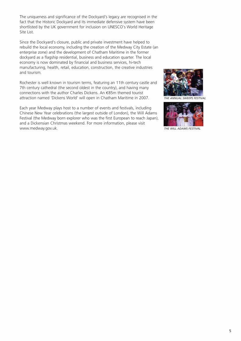
Rochester is well known in tourism terms, featuring an 11th century castle and7th century cathedral (the second oldest in the country), and having manyconnections with the author Charles Dickens. An €85m themed touristattraction named 'Dickens World' will open in Chatham Maritime in 2007.
Each year Medway plays host to a number of events and festivals, includingChinese New Year celebrations (the largest outside of London), the Will AdamsFestival (the Medway born explorer who was the first European to reach Japan),and a Dickensian Christmas weekend. For more information, please visitwww.medway.gov.uk.
5
THE ANNUAL SWEEPS FESTIVAL
THE WILL ADAMS FESTIVAL

New Dutch Waterline, The Netherlands.
Geographical Location The New Dutch Waterline defended Holland from landward attack from the east.
Size of population The New Dutch Waterline includes many cities and towns. The largest is Utrecht with c. 232,700 residents. Other important cities include: Muiden (6,900), Weesp (18,000), Naarden (17,000), Hilversum (82,000), Nieuwegein (69,000), Culemborg (25,000), Leerdam (21,000), Gorinchem(34,000) and Werkendam (26,000).
Size of region 85km long (from Muiden to the Biesbosch NationalPark), and 3-5km wide, the New Dutch Waterline covers 50,000 hectares.
Administrative bodies Five Provinces (Noord Holland, Utrecht, Zuid Holland, Gelderland, Noord Brabant) and 25 municipalities.
Military heritage in 12 sites belong to the various Ministries and 19 to public ownership the Municipalities. Two are owned by the provinces
(Noord Holland and Utrecht) and one by the University of Utrecht. 20 sites belong to other public bodies.
Military heritage in • Two owned by associations, and eight private ownership private properties.
The New Dutch Waterline was not the first water defence line in Holland, as itsname suggests. In the 17th century the Old Dutch Waterline was built. Unlikethe Old Waterline, the New Dutch Waterline (built between 1815 and thebeginning of the Second World War) also protected the city of Utrecht. Itrepresents a typical Dutch area, flat and with some areas under sea level TheWaterline borders the Randstad conurbation (Rotterdam, The Hague,Amsterdam, and Utrecht), where space is scarce.
The fundamental aspect of the line was a streak of water 85km long. To floodthe land, the Dutch used an ingenious system of sluices, dikes and canals. Ashallow layer of water, 40-50cm deep, was enough to make the land virtuallyimpassable by foot, wagon or horse. Yet at the same time, the water was tooshallow to navigate by boat.
The line comprised about 60 defence works, ten flood basins, five fortifiedcities (Muiden, Weesp, Naarden, Gorinchem, and Woudrichem) and over 1,000elements (sluices, dikes, bunkers etc). The majority of the forts conformed tothe bastion system, but two are built according to the polygonal system (FortsRijnauwen and Vechten) and there are several tower fortresses. 21 aredesignated national monuments.
The line was brought into a state of emergency three times: during the Franco-Prussian war (1870), during World War I, and at the beginning of World War II.After World War II, the waterline lost its function. Nonetheless, several fortscontinued to be used, for example, as munitions depots.
In war, an open line of fire was important. The region surrounding the defensiveworks was divided into concentric zones of 300, 600 and 1000m - the ProhibitedAreas. Within these zones, increased construction and agricultural regulationsapplied. For example, the Prohibited Areas Act of 1853 (repealed in 1963)specified that only wood-frame houses could be built in the middle zone (300-600m). The act granted the power to destroy all buildings, houses and cropswithin the Prohibited Areas during times of war, to maintain an open line of fire.
6
PROPAGANDA PHOTO FROM THE MINISTRY OFDEFENCE IN 1939
AERIAL PHOTO OF FORT ASPEREN
MAP OF KEY SITES OF THE NEW DUTCH WATERLINE

In the Belvedere Policy Document the Waterline is a designated national project,treating the fortifications and inundation fields as one. Different elements willadopt various functions related to tourism, recreation and the environment. Thecollective vision for the Waterline is described in the planning document'Linieperspectief for 2020'. In addition, the Line will be proposed for UNESCO'sWorld Heritage List.
Since 2001 a steering committee and supporting project office have been inplace, now under the responsibility of the Ministry of Agriculture, Nature andFood Quality. Their primary task is to create and help implement the vision toensure the conservation of the Waterline as a recognizable spatial entity.Exploring opportunities for public-private partnerships are high on the agenda.Today, more and more defence works are receiving a new purpose.
The development of the New Dutch Waterline as an ecological area for tourism,recreation and leisure is one of the important targets of the national project(“Deltametropol”). The New Dutch Waterline will become a green sash for theRandstad, maintaining the atmosphere of a unique military past, with space fornature, and recreation. A special aspect is the search for creative uses of theformer flood basins, such as drinking water reservoirs, temporary storage ofsurplus rainwater, or flood catchment areas. For more information, visitwww.hollandsewaterlinie.nl
7
FORT HOOFDDIJK -TODAY IN USE AS AUNIVERSITY BOTANIC GARDEN
AERIAL PHOTO OF CASTLE LOEVESTEIN
TOURISTS BY A BUNKER
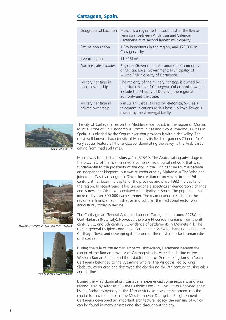
Cartagena, Spain.
Geographical Location Murcia is a region to the southeast of the Iberian Peninsula, between Andalusia and Valencia. Cartagena is its second largest municipality.
Size of population 1.3m inhabitants in the region, and 175,000 in Cartagena city.
Size of region 11,315km2
Administrative bodies Regional Government: Autonomous Communityof Murcia. Local Government: Municipality of Murcia / Municipality of Cartagena.
Military heritage in The majority of the military heritage is owned by public ownership the Municipality of Cartagena. Other public owners
include the Ministry of Defence, the regional authority and the State.
Military heritage in San Julián Castle is used by Telefónica, S.A. as a private ownership telecommunications aerials base. Lo Poyo Tower is
owned by the Armengal family
The city of Cartagena lies on the Mediterranean coast, in the region of Murcia.Murcia is one of 17 Autonomous Communities and two Autonomous Cities inSpain. It is divided by the Segura river that provides it with a rich valley. Themost well known characteristic of Murcia is its fields or gardens ("huerta”). Avery special feature of the landscape, dominating the valley, is the Arab castledating from medieval times.
Murcia was founded as “Mursiya” in 825AD. The Arabs, taking advantage ofthe proximity of the river, created a complex hydrological network that wasfundamental to the prosperity of the city. In the 11th century Murcia becamean independent kingdom, but was re-conquered by Alphonse X The Wise andjoined the Castillian kingdom. Since the creation of provinces, in the 19thcentury, it has been the capital of the province and since 1982 the capital ofthe region. In recent years it has undergone a spectacular demographic change,and is now the 7th most populated municipality in Spain. The population canincrease by over 500,000 each summer. The main economic sectors in theregion are financial, administrative and cultural; the traditional sector wasagricultural, today in decline.
The Carthaginian General Asdrúbal founded Cartagena in around 227BC asQart Hadasth (New City). However, there are Phoenician remains from the 8thcentury BC, and 5th century BC evidence of settlements in Molinete hill. Theroman general Escipión conquered Cartagena in 209AD, changing its name toCarthago Nova, and developing it into one of the most important roman citiesof Hispania.
During the rule of the Roman emperor Diocleciano, Cartagena became thecapital of the Roman province of Carthaginiensis. After the decline of theWestern Roman Empire and the establishment of German kingdoms in Spain,Cartagena belonged to the Byzantine Empire. The Visigoths, led by KingSisebuto, conquered and destroyed the city during the 7th century causing crisisand decline.
During the Arab domination, Cartagena experienced some recovery, and wasreconquered by Alfonso XII - the Catholic King - in 1245. It was boosted againby the Borbones dynasty of the 18th century, as it was transformed into thecapital for naval defence in the Mediterranean. During the EnlightenmentCartagena developed an important architectural legacy, the remains of whichcan be found in many palaces and sites throughout the city.
8
GALERAS CASTLE
REHABILITATION OF THE ROMAN THEATRE
THE SURVEILLANCE TOWER

In the 19th century the Cantonal Revolution signalled a movement for theindependence of Cartagena from the nation. It had quite significantmomentum, until the troops of General López Domínguez crushed the rising.During the Civil War (1936-1939) Cartagena was the only naval base for theRepublican army, and the last city to be conquered.
The first agreement to transfer ownership between the Ministry of Defence andthe Municipality of Cartagena was signed in 1993, and encompassed: the NavalHospital and nearby barracks, Antiguones barracks, the hill and castle ofDespeñaperros, Los Juncos Field, areas of the Artillery Park, the Subsistence andDressing barracks, and land near to the road of Canteras. The Ministry ofDefence still owns: Galeras Castle, several batteries, Navidad Tower and theArsenal. It also owns Navidad Fortress, but has transferred its use to theMunicipality. The Municipality owns: Concepción Castle, Carlos II Wall, LosMoros Castle, Despeñaperros Fort, Carlos III (Dean) Tower, San Leandro Batteryand La Parajola Battery. The regional authority owns Las Cenizas Battery, whilstthe State owns La Atalaya Castle.
The main economic sectors for the city are: petrol and chemical industries,energy, agriculture, tourism, commercial and military port activities, and thedockyard. Key buildings include the former military hospital and Antiguonesbarracks, owned by the Polytechnic University of Cartagena; the Spanish CivilWar Shelters, the Archaeological and Naval Museums, and the NationalMuseum of Underwater Archaeology, the Arsenal, and various coastal batteriesand towers.
The Centro de Investigación para el Desarrollo, the project partner in ASCEND,is developing several European initiatives to valorise and promote the vastheritage of Cartagena. European funds (under the Euromed Heritage initiative)are currently helping rehabilitate one of the batteries as an interpretation centrefor the ensemble.
9
THE MUNICIPALITY HALL
ENTRANCE TO THE ARSENAL
THE ENTRANCE TO THE ARSENAL TODAY
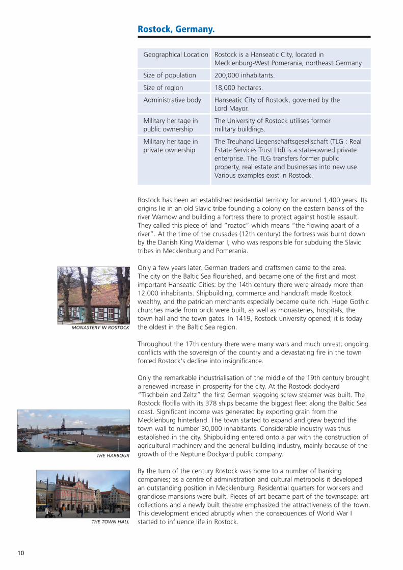
Rostock, Germany.
Geographical Location Rostock is a Hanseatic City, located in Mecklenburg-West Pomerania, northeast Germany.
Size of population 200,000 inhabitants.
Size of region 18,000 hectares.
Administrative body Hanseatic City of Rostock, governed by theLord Mayor.
Military heritage in The University of Rostock utilises former public ownership military buildings.
Military heritage in The Treuhand Liegenschaftsgesellschaft (TLG : Real private ownership Estate Services Trust Ltd) is a state-owned private
enterprise. The TLG transfers former public property, real estate and businesses into new use. Various examples exist in Rostock.
Rostock has been an established residential territory for around 1,400 years. Itsorigins lie in an old Slavic tribe founding a colony on the eastern banks of theriver Warnow and building a fortress there to protect against hostile assault.They called this piece of land “roztoc” which means “the flowing apart of ariver”. At the time of the crusades (12th century) the fortress was burnt downby the Danish King Waldemar I, who was responsible for subduing the Slavictribes in Mecklenburg and Pomerania.
Only a few years later, German traders and craftsmen came to the area. The city on the Baltic Sea flourished, and became one of the first and mostimportant Hanseatic Cities: by the 14th century there were already more than12,000 inhabitants. Shipbuilding, commerce and handcraft made Rostockwealthy, and the patrician merchants especially became quite rich. Huge Gothicchurches made from brick were built, as well as monasteries, hospitals, thetown hall and the town gates. In 1419, Rostock university opened; it is todaythe oldest in the Baltic Sea region.
Throughout the 17th century there were many wars and much unrest; ongoingconflicts with the sovereign of the country and a devastating fire in the townforced Rostock's decline into insignificance.
Only the remarkable industrialisation of the middle of the 19th century broughta renewed increase in prosperity for the city. At the Rostock dockyard“Tischbein and Zeltz” the first German seagoing screw steamer was built. TheRostock flotilla with its 378 ships became the biggest fleet along the Baltic Seacoast. Significant income was generated by exporting grain from theMecklenburg hinterland. The town started to expand and grew beyond thetown wall to number 30,000 inhabitants. Considerable industry was thusestablished in the city. Shipbuilding entered onto a par with the construction ofagricultural machinery and the general building industry, mainly because of thegrowth of the Neptune Dockyard public company.
By the turn of the century Rostock was home to a number of bankingcompanies; as a centre of administration and cultural metropolis it developedan outstanding position in Mecklenburg. Residential quarters for workers andgrandiose mansions were built. Pieces of art became part of the townscape: artcollections and a newly built theatre emphasized the attractiveness of the town.This development ended abruptly when the consequences of World War Istarted to influence life in Rostock.
10
THE HARBOUR
MONASTERY IN ROSTOCK
THE TOWN HALL
The years of the Weimar Republic brought a new industrial sector to Rostock:aircraft construction. Against the background of fascist war rearmaments thecity grew and by 1942 it was home to 135,000 inhabitants. The armamentsindustry, with aircraft construction and marine armaments, attracted significantmanpower. Aircrafts built in Rostock did immense damage throughout Europeduring World War II. One of the most famous names associated with theaircraft industry in Rostock is Ernst Heinkel.
The city of Rostock itself was bombed several times by British and Americanbomber formations. Hundreds of people were killed in these raids. Just underhalf of the flats in Rostock and various historic buildings were destroyed.
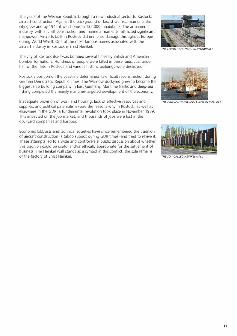
Rostock's position on the coastline determined its difficult reconstruction duringGerman Democratic Republic times. The Warnow dockyard grew to become thebiggest ship building company in East Germany. Maritime traffic and deep-seafishing completed the mainly maritime-targeted development of the economy.
Inadequate provision of work and housing, lack of effective resources andsupplies, and political paternalism were the reasons why in Rostock, as well aselsewhere in the GDR, a fundamental revolution took place in November 1989.This impacted on the job market, and thousands of jobs were lost in thedockyard companies and harbour.
Economic lobbyists and technical societies have since remembered the traditionof aircraft construction (a taboo subject during GDR times) and tried to revive it.These attempts led to a wide and controversial public discussion about whetherthis tradition could be useful and/or ethically appropriate for the settlement ofbusiness. The Heinkel wall stands as a symbol in this conflict, the sole remainsof the factory of Ernst Heinkel.
11
THE ANNUAL HANSE SAIL EVENT IN ROSTOCK
THE FORMER SHIPYARD NEPTUNWERFT
THE SO - CALLED HEINKELWALL
Venice, Italy.
Geographical Location The Province of Venice is in the Region of Veneto, northeast Italy. The Arsenale is located in the historical centre of Venice.
Size of population Province of Venice 813,294 (source: ISTAT).Venice Municipality 271,073 (source: Venice Municipality).
Size of region Veneto Region: 18,391km2. Venice Municipality: 457km2.
Administrative bodies Veneto Region (containing seven provinces and 581 municipalities), the Province of Venice and the Municipality of Venice.
Military heritage in The military heritage is shared between the public ownership Ministry of Defence, the Civilian State Property
Board and the Municipality of Venice.
Military heritage in Only one fort out of almost 70 sites (Fort Sirtori) is private ownership privately owned, by a society of architects.
The Venetian Fortification System (Piazza di Difesa Marittima) is an extensive setof Modern Age fortifications and 20th century buildings. It lies across theterritory of six municipalities: mainly within the Venice Municipality itself butalso Chioggia, Cavallino, Mira, Spinea and Marcon.
From the early Middle Ages, towers, fortifications and castles increasinglyappeared on the lidos, defending the port openings and inner canals of Venice.These buildings created the framework for the defence system which grew toinclude nearly 70 sites divided into an entrenched field on the dry land (CampoTrincerato di Mestre: developed since 1882 around the Napoleonic FortMarghera), and a complex coastal defence line around the lagoon area. Nowcovering 580km2 it represents one of Italy's most important defence systems. It includes many typologies of military architecture: from the most prestigious16th century Sant'Andrea fort to World War I buildings.
The majority of the Modern Age defence system is found at the port openingsand was built between the 15th and 16th centuries. Between the 17th and18th centuries lagoon batteries were added to defend the navigable canals.During the 19th century the system was reinforced and enlarged by the Frenchand Austrian armies. This was particularly evident during the second Austriandomination (1815-1866). The system was enlarged and completed during the19th and 20th centuries by the Italian kingdom.
Today, the easiest to use buildings are on the entrenched field, and some havealready been regenerated. The most important site, Forte Marghera, isundergoing detailed planning for re-use. The combined surface area of theentrenched field is 153 hectares, with a built surface area of 42 hectares. Thefortification system presents a strong opportunity to create new cultural routesin Venice, offering sustainable alternatives to the usual tourist routes. The dryland fortifications constitute an important green belt within a chaotic urbandevelopment.
Since the 1970s the army has abandoned several fortifications. Many buildingswere not maintained, and this has been a major contributor to their decay. Inthe mid 1990s, groups of volunteers were granted the temporary use of part ofthese forts, after nearly twenty years of lobbying to demonstrate their greatpotential for re-use. Thanks to this process seven of the 12 dry land forts havebeen bought by the Venice Municipality.
12
THE DEFENSIVE SYSTEM OF VENICE
FORTE MARGHERA, AUSTRIAN PHOTO OF 1866
The Venice Lagoon and historic centre were granted World Heritage Site statusin 1987. The development of the area is governed by regional, provincial andmunicipal planning regulations, and in many cases the buildings are protectedby the National Act 1089/39. The whole system is protected by the Special Actfor the Safeguarding of Venice. The area is included in a Lagoon Master Planand in the main Master Plan on regional development.
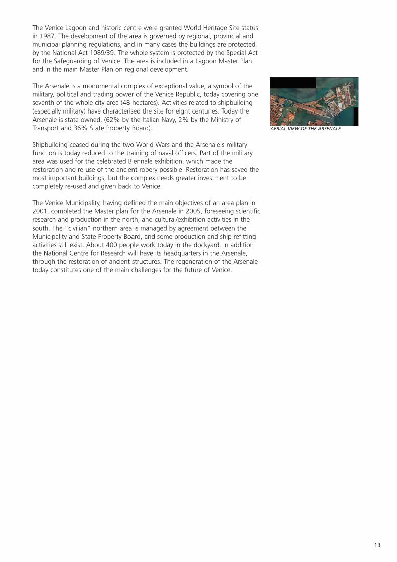
The Arsenale is a monumental complex of exceptional value, a symbol of themilitary, political and trading power of the Venice Republic, today covering oneseventh of the whole city area (48 hectares). Activities related to shipbuilding(especially military) have characterised the site for eight centuries. Today theArsenale is state owned, (62% by the Italian Navy, 2% by the Ministry ofTransport and 36% State Property Board).
Shipbuilding ceased during the two World Wars and the Arsenale's militaryfunction is today reduced to the training of naval officers. Part of the militaryarea was used for the celebrated Biennale exhibition, which made therestoration and re-use of the ancient ropery possible. Restoration has saved themost important buildings, but the complex needs greater investment to becompletely re-used and given back to Venice.
The Venice Municipality, having defined the main objectives of an area plan in2001, completed the Master plan for the Arsenale in 2005, foreseeing scientificresearch and production in the north, and cultural/exhibition activities in thesouth. The “civilian” northern area is managed by agreement between theMunicipality and State Property Board, and some production and ship refittingactivities still exist. About 400 people work today in the dockyard. In additionthe National Centre for Research will have its headquarters in the Arsenale,through the restoration of ancient structures. The regeneration of the Arsenaletoday constitutes one of the main challenges for the future of Venice.
13
AERIAL VIEW OF THE ARSENALE
14
Charente-Maritime, France.
Geographical Location The department of Charente-Maritime lies in mid-France, on the Atlantic Coast.
Size of population 576,855 (2003)
Size of region 6,864km2
Administrative bodies The General Council is responsible for the management of the Department of Charente-Maritime. 472 district authorities operate within it.
Military heritage in 48 fortifications in total, 26 belonging the district public ownership authorities and eight belonging to the French Navy.
The remainder belong to either the Coastal Conservation Department, the Ministry of Culture or the Ministry of Transport and Infrastructure.
Military heritage in Nine fortifications - mainly used as private private ownership residences.
Charente-Maritime is characterised by land and sea. With an exceptional420km coastline, including 120km of natural beaches, 50 trade and fishingports and marinas, a coastal climate, four islands and two estuaries, Charente-Maritime has become the foremost tourist destination on the Atlantic coast.
Charente-Maritime is the 16th largest French department and represents 27%of the total area of the Poitou-Charente region. Thanks to its coastline,Charente-Maritime enjoys an eminently strategic position. Its numerousmaritime fortresses, batteries, citadels, and arsenals recall the battles wagedagainst sea-born enemy attacks. A significant asset is the natural protectionafforded to the mainland by the islands of Ré, Oléron and Aix.
Charente-Maritime unveils its heritage through the rich history of its cities (LaRochelle, Saintes, and Rochefort, the latter having been declared a city of artand history) as well as its cultural treasures, including 240 listed historicalmonuments.
Whether heritage is publicly- or privately-owned, a single objective prevails: thatof protecting and developing heritage through the pooling of efforts.
The General Council is composed of an Assembly of Councillors who representthe 51 cantons (townships) of the department and who are elected for six-yearterms. They oversee a wide range of departmental development activitiesincluding, the improvement of social conditions, economic development,infrastructure, environmental and heritage conservation, education, training,sports, and tourism.
The President of the General Council serves a three-year term and is in chargeof carrying out the Assembly's decisions. Reports submitted to the Assembly areexamined by specialised committees. Once the Assembly has voted in favour ofa decision, the ensuing measures are carried out by public officials.
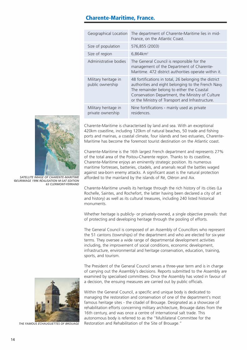
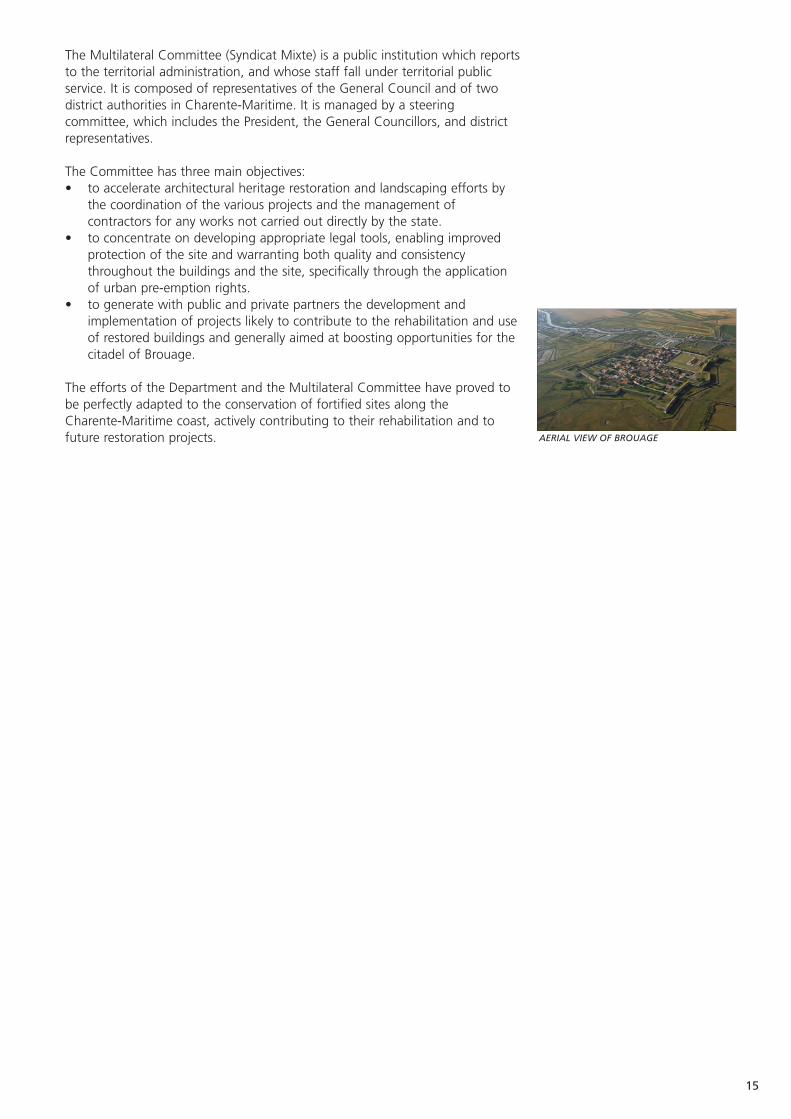
Within the General Council, a specific and unique body is dedicated tomanaging the restoration and conservation of one of the department's mostfamous heritage sites - the citadel of Brouage. Designated as a showcase ofrehabilitation efforts concerning military architecture, Brouage dates from the16th century, and was once a centre of international salt trade. Thisautonomous body is referred to as the “Multilateral Committee for theRestoration and Rehabilitation of the Site of Brouage.”
SATELLITE IMAGE OF CHARENTE-MARITIME ©EURIMAGE 1996 RÉALISATION M-SAT EDITION
63 CLERMONT-FERRAND
THE FAMOUS ÉCHAUGUETTES OF BROUAGE
15
The Multilateral Committee (Syndicat Mixte) is a public institution which reportsto the territorial administration, and whose staff fall under territorial publicservice. It is composed of representatives of the General Council and of twodistrict authorities in Charente-Maritime. It is managed by a steeringcommittee, which includes the President, the General Councillors, and districtrepresentatives.
The Committee has three main objectives:• to accelerate architectural heritage restoration and landscaping efforts by
the coordination of the various projects and the management ofcontractors for any works not carried out directly by the state.
• to concentrate on developing appropriate legal tools, enabling improvedprotection of the site and warranting both quality and consistencythroughout the buildings and the site, specifically through the applicationof urban pre-emption rights.
• to generate with public and private partners the development andimplementation of projects likely to contribute to the rehabilitation and useof restored buildings and generally aimed at boosting opportunities for thecitadel of Brouage.
The efforts of the Department and the Multilateral Committee have proved tobe perfectly adapted to the conservation of fortified sites along theCharente-Maritime coast, actively contributing to their rehabilitation and tofuture restoration projects. AERIAL VIEW OF BROUAGE
16
Karlskrona, Sweden.
Geographical Location Karlskrona is in the county of Blekinge, in southeast Sweden.
Size of population 150,000 in Blekinge.
Size of region 2,941 km2
Administrative bodies Five Municipalities operate within Blekinge County.
Military heritage in The dockyard still retains a military function.public ownership
Military heritage in Hyper Island, Skärfva estate and Telecom City.private ownership
Blekinge county is one of the most densely populated in Sweden (excluding themajor metropolitan areas). From the north to the south, the county extendsabout 40km and from east to west, 110km. Blekinge has about 950 lakes and12 watercourses and around 800 islands. Karlskrona, which is the seat ofBlekinge county, has a population of 62,000.
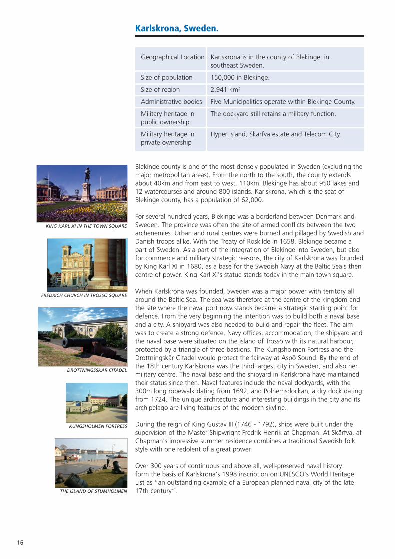
For several hundred years, Blekinge was a borderland between Denmark andSweden. The province was often the site of armed conflicts between the twoarchenemies. Urban and rural centres were burned and pillaged by Swedish andDanish troops alike. With the Treaty of Roskilde in 1658, Blekinge became apart of Sweden. As a part of the integration of Blekinge into Sweden, but alsofor commerce and military strategic reasons, the city of Karlskrona was foundedby King Karl XI in 1680, as a base for the Swedish Navy at the Baltic Sea's thencentre of power. King Karl XI's statue stands today in the main town square.
When Karlskrona was founded, Sweden was a major power with territory allaround the Baltic Sea. The sea was therefore at the centre of the kingdom andthe site where the naval port now stands became a strategic starting point fordefence. From the very beginning the intention was to build both a naval baseand a city. A shipyard was also needed to build and repair the fleet. The aimwas to create a strong defence. Navy offices, accommodation, the shipyard andthe naval base were situated on the island of Trossö with its natural harbour,protected by a triangle of three bastions. The Kungsholmen Fortress and theDrottningskär Citadel would protect the fairway at Aspö Sound. By the end ofthe 18th century Karlskrona was the third largest city in Sweden, and also hermilitary centre. The naval base and the shipyard in Karlskrona have maintainedtheir status since then. Naval features include the naval dockyards, with the300m long ropewalk dating from 1692, and Polhemsdockan, a dry dock datingfrom 1724. The unique architecture and interesting buildings in the city and itsarchipelago are living features of the modern skyline.
During the reign of King Gustav III (1746 - 1792), ships were built under thesupervision of the Master Shipwright Fredrik Henrik af Chapman. At Skärfva, afChapman's impressive summer residence combines a traditional Swedish folkstyle with one redolent of a great power.
Over 300 years of continuous and above all, well-preserved naval history form the basis of Karlskrona's 1998 inscription on UNESCO's World HeritageList as “an outstanding example of a European planned naval city of the late17th century”.
FREDRICH CHURCH IN TROSSÖ SQUARE
THE ISLAND OF STUMHOLMEN
KING KARL XI IN THE TOWN SQUARE
DROTTNINGSSKÄR CITADEL
KUNGSHOLMEN FORTRESS

17
Karlskrona has experienced the strongest growth in I.T. in Sweden. The TelecomCity network has been developed, as has the Blekinge Institute of Technology,which has a high profile in I.T. and research. The geographical position isfavourable, and several of the town's industrial companies operate globally. Nevertheless, the fortifications have remained virtually untouched since thebeginning of the 18th century.
BASTION AURORA
18
Thessaloniki, Greece.
Geographical Location Central Macedonia, northern Greece.
Size of population 1m in the city of Thessaloniki, and 1.8m in the region.
Size of region 68 km2
Administrative body Municipality of Thessaloniki.
Military heritage in All military heritage is owned by the Ministry public ownership of Defence.
Military heritage in None.private ownership
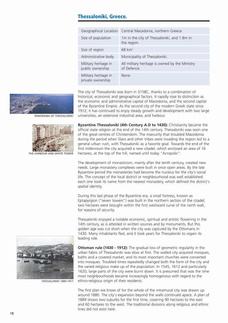
The city of Thessaloniki was born in 315BC, thanks to a combination ofhistorical, economic and geographical factors. It rapidly rose to distinction asthe economic and administrative capital of Macedonia, and the second capitalof the Byzantine Empire. As the second city of the modern Greek state since1912, it has continued to enjoy steady growth and development with two largeuniversities, an extensive industrial area, and harbour.
Byzantine Thessaloniki (4th Century A.D to 1430): Christianity became theofficial state religion at the end of the 14th century. Thessaloniki was soon oneof the great centres of Christendom. The insecurity that troubled Macedoniaduring the period when Slavs and other tribes were invading the region led to ageneral urban rush, with Thessaloniki as a favorite goal. Towards the end of thefirst millennium the city acquired a new citadel, which enclosed an area of 16hectares, at the top of the hill, named until today “Acropolis”.
The development of monasticism, mainly after the tenth century, created newneeds. Large monastery complexes were built in once open areas. By the lateByzantine period the monasteries had become the nucleus for the city's sociallife. The concept of the local district or neighbourhood was well established:each one took its name from the nearest monastery, which defined the district'sspatial identity.
During this last phase of the Byzantine era, a small fortress, known asEptapyrgion (“seven towers”) was built in the northern section of the citadel;two hectares were brought within the first westward curve of the north wall,for reasons of security.
Thessaloniki enjoyed a notable economic, spiritual and artistic flowering in the14th century, as is attested in written sources and by monuments. But thisgolden age was cut short when the city was captured by the Ottomans in1430. Many inhabitants fled, and it took years for Thessaloniki to regain itsleading role.
Ottoman rule (1430 - 1912): The gradual loss of geometric regularity in theurban fabric of Thessaloniki was slow at first. The walled city acquired mosques,baths and a covered market, and its most important churches were convertedinto mosques. Troubled times repeatedly changed both the form of the city andthe varied religious make up of the population. In 1545, 1612 and particularly1620, large parts of the city were burnt down. It is presumed that was the timemost neighbourhoods became increasingly homogenous with regard to theethno-religious origin of their residents.
The first plan we know of for the whole of the intramural city was drawn uparound 1880. The city's expansion beyond the walls continued apace. A plan of1889 shows two suburbs for the first time, covering 90 hectares to the eastand 60 hectares to the west. The traditional divisions along religious and ethniclines did not exist here.
THE HARBOUR AND WHITE TOWER
PANORAMA OF THESSALONIKI
THESSALONIKI 1800-1917

19
Thessaloniki since 1912: Thessaloniki acquired its official Greek identity in1912 after the first Balkan war. Equally important landmarks include the fire of1917 which destroyed the historic city centre, and the compulsory exchange ofpopulations between Greece and Turkey in 1922, resulting in Thessaloniki'smuslim population being replaced by a vast number of Greeks from Asia Minor.The fire devastated 120 hectares of the most important part of the city (leaving70,000 homeless) and essentially wiped out the city's oriental aspect andtraditional layout. Embracing the latest ideas in modern town planning the thenGreek government decided to ignore the pre-existing ownership and traditionaluses of the land and use the rebuilding as a basis for social, economic andspatial modernisation.
An international planning committee was established. The new plan gavethe city a classical layout (formal geometry; diagonal streets; monuments asfocal points) a hierarchical street network and a civic centre on the newAristotelous Square.
The pilot plan for the revival of the city's commercial centre, which wassponsored by the E.U. (16th Directorate) from 1992- 1994 helped focus intereston the city's markets, (such as the harbour market) and bazaars. The E.U. alsofunded the restoration of the market bathhouse and the excavation of theancient Agora. In 1994, a large part of the intramural area and the harbourwere declared historic sites.
ARISTOTELOUS SQUARE
THE WHITE TOWER AND SEA FRONT AT NIGHT
MODERN VIEW OF THE HARBOUR
20
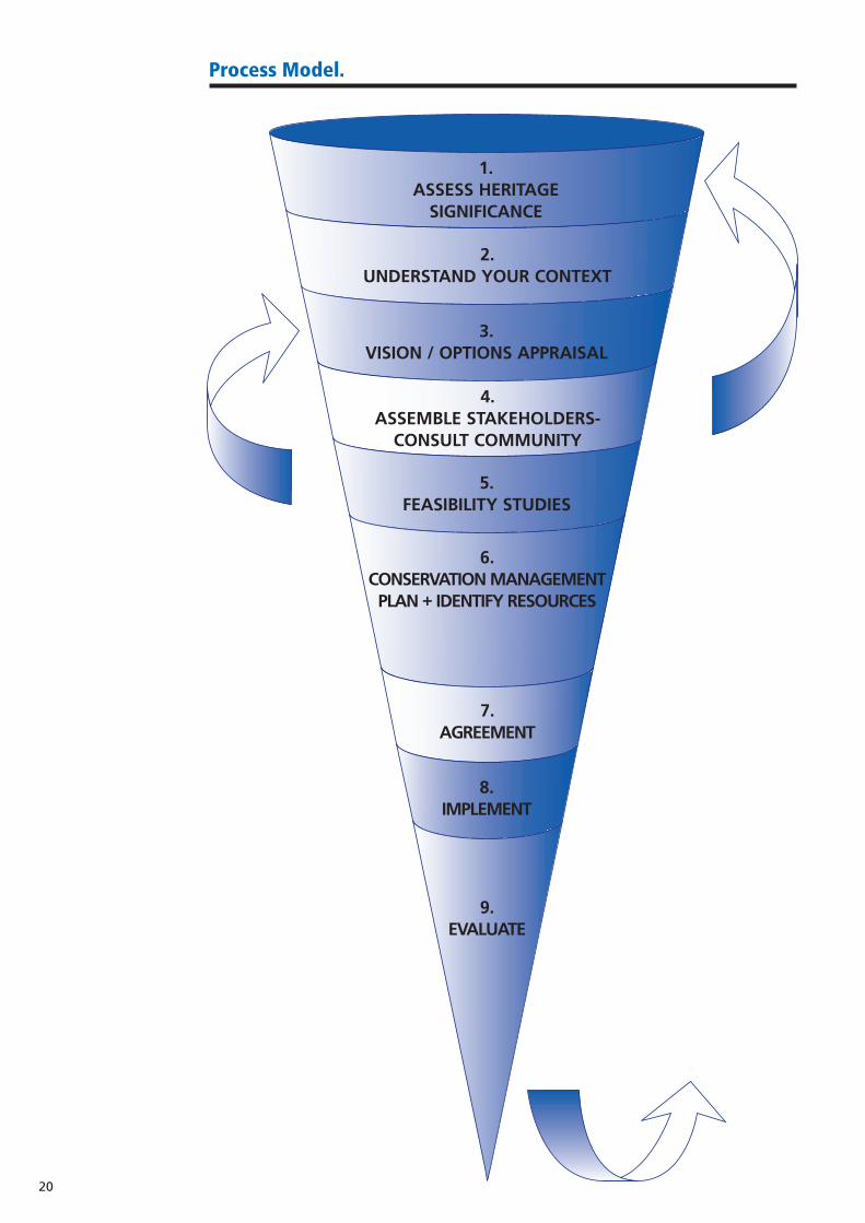
1. ASSESS HERITAGE
SIGNIFICANCE
2.UNDERSTAND YOUR CONTEXT
5.FEASIBILITY STUDIES
6.CONSERVATION MANAGEMENT
PLAN + IDENTIFY RESOURCES
7.AGREEMENT
8.IMPLEMENT
9.EVALUATE
4.ASSEMBLE STAKEHOLDERS-
CONSULT COMMUNITY
3.VISION / OPTIONS APPRAISAL
Process Model.

21
Introduction
The ASCEND process model, intended to demonstrate the key stages indeveloping a socio-economic re-use for a site or building leaving militaryownership, took shape over several months. It was originally foreseen as a flowdiagram, or a series of flow diagrams that led the reader to a selection ofpossible uses for a former military facility.
However, ASCEND partners noted that key stage (2) in the process -'understand your context' could not be adequately weighted in a flow chart.Furthermore, matters such as “heritage worth” are much more difficult toquantify than is allowed by a flow diagram, with its restriction to 'yes' and 'no'answers (weighted matrices were considered, but rejected as not adequatelysimplifying the process for the reader, and potentially likely to introduce bias).Finally, we opted to avoid the implication that our flowchart could provide theanswers, or that a single specific solution could easily emerge from a uniformset of options. What the ASCEND process model provides is the context, orframework for defining and narrowing possibilities.
The model is designed to be used by anyone responsible for a piece of formermilitary land or heritage, whether in the public or private sector. It can be usedto test a proposal for re-use, to broaden options for re-use, or to provideconsidered inspiration if no concrete proposals have been made.
The process model is a working model - at several stages, readers are promptedto re-enter the triangle at a higher stage: mainly to verify that assumptions andfindings hold true in practice, and to accommodate new information orstakeholders. Key stage (9) however, should be revisited at regular periodsagreed by the management plan / management group. Whilst preserving andre-using military land and heritage requires tremendous effort in the theoreticalsphere - devising, planning, conceptualising and integrating to list but a few ofthe activities involved - heritage is firmly rooted in the physical, practical world,and complacency in equating the two (by relying on a static correlation) maydetract from the optimum outcome.
The main premise that underpins the model is that whenever possible, militaryheritage must pay its way. We live in a world with increasing numbers of sitesof great significance - from military, industrial, religious, natural, cultural andmany other spheres - and sustaining each and every one in a display case isboth highly impractical and frequently undesirable. These sites once breathedlife and generated their own, often substantial, wealth - to deny them thechance to do this again may seem at least unfair, if not overbearing. Allowingthem to integrate once more with their surrounding land and communityrestores their importance and potential, and gives them a renewed purpose.
The ASCEND process model takes as its starting point a site that is clear ofcontamination (pollutants and residual arms / mines etc), and is environmentallysafe for re-use. Readers who are at an earlier stage, needing still to addressthese issues, are invited to consult the many publications produced by theNATO Committee on the Challenges of the Modern Society on these subjects.(A full list can be found at www.nato.int/ccms/publi-2.htm)
It should be noted at an early stage that the costs of decontamination canoften outweigh the commercial value of the site. These costs must however beconsidered alongside the cost implicated in simply making the site safe andsecure, and the quality-of-life and environmental impact of leaving redundantbrownfield land (and thereby forcing new development onto greenfield land).Furthermore, varying levels of decontamination can be considered appropriate(fit for purpose) depending upon circumstance. For example, contaminationlevels in soil beneath a car park can be acceptable at a much higher level thangrounds which will be landscaped for public access (see key stage (2) below).

Our readership will comprise those working with small individual sites, such asfortifications and batteries, and larger sites of many hectares, including militaryand naval bases and training grounds. The following detailed explanation ofeach stage aims to cater for those dealing with the largest of these sites, andwe ask readers with smaller interests to use their discretion in tailoring oursuggestions to their own example.
(1) Assess Heritage Worth:
Aim: To determine what aspects of a site need to be preserved due to historic,architectural or other, significance, and to what extent. This allows preliminaryscoping of re-use options.
It is vital to fully understand the parameters of any site before intervention.Without knowing how, or why (or if) a site achieved significance, it isimpossible to plan adequately for its future, and to decide who should beinvolved in the planning process.
There is no universally accepted method of determining significance:significance is difficult to quantify and frequently intangible. This iscompounded by the fact that objects of significance vary considerably - uniformguidelines to equate Hadrian's Wall and the Siegfried Line, for example, wouldbe of the utmost complexity.
In practice, most nations operate listing, or grading systems to provide statutoryprotection for significant buildings and structures, and this will provide apreliminary yardstick for fresh assessment. (Although property that has justbeen transferred from the military sector may not always have been assessedbeforehand). In the United Kingdom, for example, the government Departmentfor Culture, Media and Sport is charged with the scheduling of ancientmonuments, advised by English Heritage (a government-funded body), whilstEnglish Heritage alone is responsible for listing buildings. In Spain, it is theMinistry of Culture which is responsible for assessing heritage worth, usuallyprompted by the regional Heritage Departments. Procedures and priorities canbe somewhat complex - as merited by the nature of the task - and adequatetime should be allowed for a thorough review. Published guidance by bodiesinvolved runs to many pages.
As with the process model itself however, these listing and schedulings shouldbe regularly reviewed, to reflect changing knowledge and circumstances (notethat buildings and structures can move up or - more rarely - down a list). Thisshould form a part of the planning process if the original listing seems dated.
In cases of exceptional significance, a site should be considered in the broadestinternational context, and advice can be sought from organisations such asICOMOS (the International Council on Monuments and Sites, an affiliate ofUNESCO), dedicated to the conservation of historic monuments, areas and sitesthroughout the world. They are also a professional advisor to the UNESCOWorld Heritage Committee. (Other advisors are the World Conservation Union(IUCN) and ICCROM, the International Centre for the Study of the Preservationand Restoration of Cultural Property).
The site must also be assessed in terms of the environmental value of itssurrounding land, as this can often carry statutory protection. In the UK, forexample, designation as an area of outstanding natural beauty (AONBs) or siteof special scientific interest (SSSIs) provides protection for the natural landscape(whilst conservation area designation provides protection for the builtlandscape).Indicators that underpin any assessment will include, but are not limited to, the site's:
22
23
• history (e.g. its importance in defence of the realm)• commemorative value (tribute to people or events)• age and rarity• associations with people and events• shaping of local, regional, national, European and international identity• area designation (conservation areas; SSSIs; AONBs) • association with the local community• architectural value and spatial character • matrix significance / group value (how important the site is in relation to
surroundings / linked sites)• below ground archaeology • ecological appraisal • comparative value with sites locally, regionally, nationally and internationally• inherent interrelation i.e. between buildings and areas of the site • aesthetic value• association with literature and art• technological developments
Remember also to include as many experts as possible in the process (bothformal, professional expertise, and also the more informal expertise of thecommunity). It can be worth investing funds to hire specialist consultants - aswith any process, accurate work in the early stages is an investment in latersuccess.
It should be noted that aesthetic qualities do not directly correlate withsignificance - just because a building is deemed 'beautiful' by popular culturedoes not necessarily imply it is important. Furthermore, 'unsightly' buildingsmay have significance quite unexpected from their physical appearance. Onlythorough investigation can establish the case.
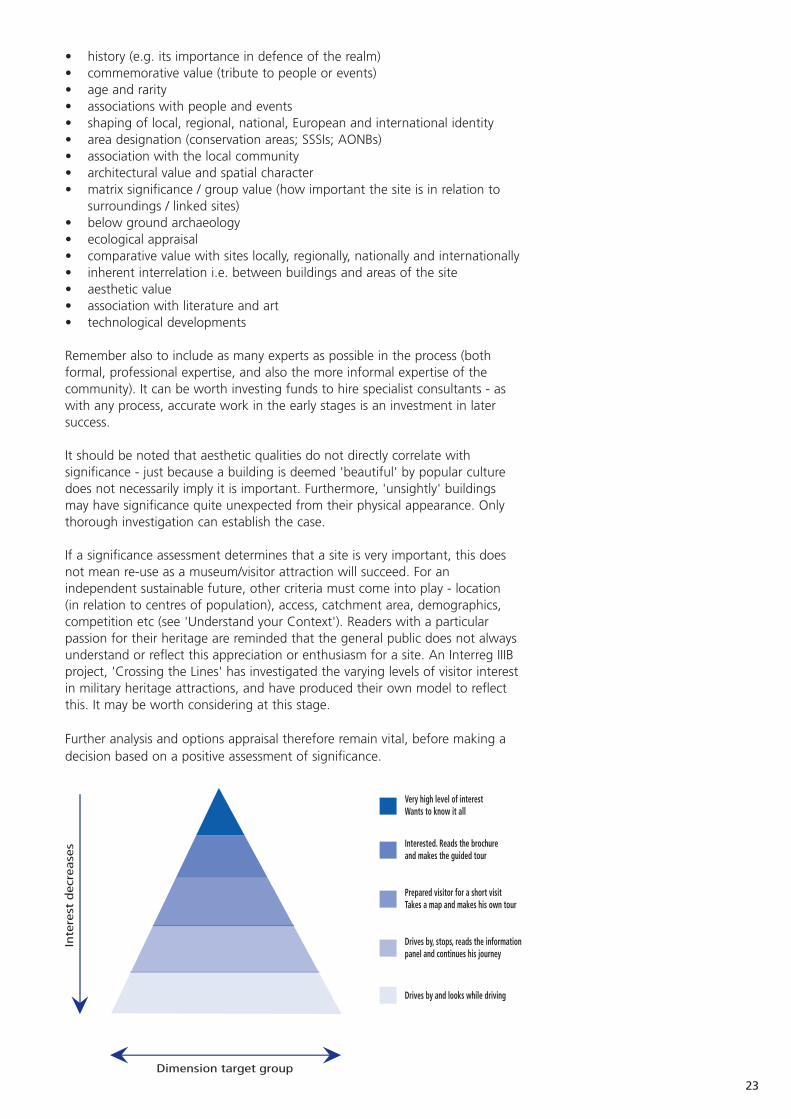
If a significance assessment determines that a site is very important, this doesnot mean re-use as a museum/visitor attraction will succeed. For anindependent sustainable future, other criteria must come into play - location (in relation to centres of population), access, catchment area, demographics,competition etc (see 'Understand your Context'). Readers with a particularpassion for their heritage are reminded that the general public does not alwaysunderstand or reflect this appreciation or enthusiasm for a site. An Interreg IIIBproject, 'Crossing the Lines' has investigated the varying levels of visitor interestin military heritage attractions, and have produced their own model to reflectthis. It may be worth considering at this stage.
Further analysis and options appraisal therefore remain vital, before making adecision based on a positive assessment of significance.

Combined use of a site as a visitor attraction and a museum can also be aparticularly sensitive issue, with regard to interpretation messages. With militaryheritage in particular, significance from a personal / community context mayhave negative connotations, and its interpretation must be handled verycarefully, in order for it not to be perceived as exploitation (see for example thecase studies on the Heinkel Wall and the Spanish Civil War Shelters).
The ecological significance of a site can also have a strong influence on possibledevelopment options. Does a rare breed of bats occupy the buildings, forexample (see the case study on Fort Voordorp)? Is the flora or fauna of yoursurroundings unique or protected? These factors should be considered at a veryearly stage, as their impact on plans can be immense.
(2) Understand your Context:
Aim: To set significance within parameters that allow the information to betranslated into a provisional set of ideas.
We note above that a museum will likely fail, irrespective of a site's significanceif it is poorly located or poorly accessible (two features that often afflict militaryheritage). Costs associated with enhancing transport infrastructure will tend toundermine these proposals. However, if local, regional or indeed national planspropose major development nearby, this may assist the viability of proposalsthat assume income from visitors. Yet if the site is just a short distance from apopular tourist destination (as with the land defence system in Venice) thescene changes once again. If buildings require drastic structural intervention tomake them safe to use, or to restore them to their former character, the scopeof the project may be dictated by the funds available.
The vital lesson of key stage (2) is that a 'one size fits all approach' cannot betaken. Just because a particular approach worked in one location, does notmean it can be directly translated to another - unless all parameters areidentical, and this is unlikely to be the case. In creating the case studies whichfollow, ASCEND partners have endeavoured to draw out their key success (orfailure) factors, and the case studies are to be read as learning curves withtransferable aspects of best practice - they are by no means intended asproscriptive blueprints.
Context should be considered at local and regional level as appropriate. The following list of factors is not exhaustive, but should act as a springboardfor discussion:
• Accessibility- transport (rail, road, waterways: availability of public transport)- infrastructure (water, electricity, gas, sewage)- facilities (parking, toilets, rest areas, catering)- disabled access
• Condition- structural works required- restoration work required to the physical fabric of the site- remediation work required to the land- potential internal modifications- vulnerability (structural condition surveys may be required, not just
visual appraisals)- residual contamination
• Current development strategies- economic development- tourism / culture / leisure- planning policy- investment framework- funding opportunities
24

25
• Current local / regional provision- tourist facilities / visitor attractions (contrasting or complementary?)- education facilities- residential accommodation- parks and green spaces- private-sector presence
• Population demographics- age- prevalent industries- education levels- unemployment rate- employment rate- growth- long-term predictions
• Sensitivity- preserving memories- relationship with community- community conflict- community identity- negative connotations
• Environment- biodiversity- AONBs, conservation areas- soil / land contamination
In many cases, several of these criteria will be adequately assessed in existinglocal studies and strategies.
(3) Vision / Options Appraisal:
Aim: To funnel the information gained from key stages (1) and (2) to produce aset of viable re-use options for comparison.
By now, many options will have been eliminated, and a select choice ofpotentially viable options will remain. This is not to say that these will all offerthe same degree of success, however, and key stage (3) represents the initialtesting of a specific set of ideas.
At this stage there is a risk that enthusiasm for one particular course of actionwill take hold. Whilst vision and determination are key qualities for the successof any endeavour, this stage, will ensure that a resultant 'blindness' does notintroduce potentially damaging bias.
With this in mind, key stage (3) can be a suitable opportunity for engagingconsultants to carry out an objective appraisal of options for the site. If budgetspermit, this is highly recommended. At the very least the appraisal should beundertaken by a panel of interested parties, of various origins - i.e. not allrepresenting a single interest.
It is important to remember that the appraisal should also consider anintegration of uses - one single course of action is not often the optimumchoice, and sites with a mixed-use strategy are often more prepared towithstand economic changes (see the case study on Chatham Dockyard). Inaddition, certain areas of the site can support and sustain others if thisapproach is adopted (see Venice case study). A mixed-use approach is alsooften well adapted to the unique features of a site, recognising that contextand preservation requirements can vary between and within buildings. Forexample, whilst the ropery within Chatham Dockyard has been preservedexternally, and still showcases original rope-making skills on the ground floor,the upper floor is used commercially as archive storage.
(4) Assemble Stakeholders - Consult Community
Aim: To ensure that a chosen course of action is approved by all those with alegitimate interest, and to refine plans based on additional knowledge from thecommunity.
This is crucial to ensure:• socio-economic impact, • that the proposals being implemented receive the support desired,• that all regulatory bodies are involved,• that no false assumptions have been made during the planning process e.g.
significance levels or presumed support,• that proposals receive support from all quarters - including financial, where
this has been assumed,• that stakeholders and the community begin to feel appropriate ownership
of the site / project.
In some cases, demonstrable community support can be crucial in engaging thecommitment of politicians and stakeholders.
Methods of consultation will vary, but the most effective approach is one whichgenuinely seeks the participation of those affected, rather than a tokenistic orsuperficial exercise. The importance of community and stakeholder supportshould not be under-estimated, and nor should the value of their variedexpertise and knowledge - or the support they may wish to offer as the projectprogresses. This is why ASCEND partners strongly recommend key stage (1) isrevisited following consultation - the broader viewpoints expressed may alterthe perception of significance or context, with consequential effects on viableoptions. Hitherto unrecognised joint working opportunities may also emerge,and seeds can be sown for partnership working.
The types of organisations who may be consulted include, but are not limitedto:
• local and regional government authorities: planning, tourism (culture),regeneration, conservation, economic development, European orinternational affairs, environment and leisure departments
• national government• regional development agencies• the Ministry of Defence• the Ministry of Culture• the Ministry of the Environment• business support agencies• neighbouring businesses and land owners• heritage organisations• existing visitor and heritage attractions• higher education and research institutes• property developers• tourist boards and associations• the local community• volunteer associationsHaving clear parameters of involvement from the outset will ensure that allpotential partners and stakeholders understand how they can add value to theproject's development. This stage will moreover then represent the first steps ofthe marketing process for re-use, by promoting the project to a relevantaudience.
26
27
(5) Feasibility Analysis:
Aim: To explore in depth a limited set of re-use alternatives, to facilitateoptimum approach and to provide guidelines and a context for thedevelopment of a master plan (action plan and business plan).
The brief for the feasibility analysis should be drawn up in close consultationwith stakeholders, and may include individual analyses of the following points:
• the broader socio-economic impact impact of the proposals • environmental and cultural implications• the impact on existing local and regional strategies• outline costings of implementation• potential timescales• recommendations for funding opportunities• synergies with existing projects and stakeholders• opportunities for joint working - locally, regionally, nationally and
internationally• legal surveys• analyses of similar case studies and sites, incorporating lessons learned• further studies that could add value to plans• recommendations to inform management and conservation plans• recommendations for a framework for evaluation• recommendations for further consultation, marketing and community
engagement.
Clear and specific recommendations will emerge from this stage, not just aboutthe overall direction of the re-use initiative, but about how the finer points ofthis will integrate and contribute to the whole (a detailed action plan). Ifmultiple options are still being considered, the strongest contender will besuggested by the analysis.
The analysis will take all previous stages of the process model into account, andintegrate individual viewpoints, requirements and considerations into a holisticplan. This stage can prove crucial when demonstrating the viability of plans topotential funders.
Once more, the outsourcing of this stage to external consultants can highlightrequirements and opportunities that those closer to the project may notperceive.
The final analysis should be approved by all stakeholders, and act as a workingdocument for the implementation of plans.
ASCEND partners recommend that the site owner be fully prepared to revisitkey stage (3) of the process if any elements of the Feasibility Report contradictor lean away from findings to date.
NB: Whilst conservation is most often desirable, it should be noted that incertain cases complete redevelopment or abandonment may be acceptable ornecessary. If findings indicate this, additional advice should be sought fromother sources of expertise.
(6) Conservation Management Plans and Identifying Resources
Aim: To ensure that the significance of the site is respected and reflected indevelopment plans for the site and for the region, and thereby preserved forfuture generations. To provide a tool for the implementation of plans, and forthe presentation of objectives to funders. To define key development constraints.Based on the synthesis of significance, vulnerability, impact and interests, aseries of policies for managing and developing the site - appropriate to the

context - will be proposed in a Conservation Management Plan, demonstratinghow the necessary elements of significance will be preserved in the site'smodern context. The plan will propose a series of measures for the ongoingmanagement and implementation of the policies, including the integration andinteraction of parts of the site of varying significance. The plan should beintegrated with other key outputs, such as business plans, and forwardplanning strategies that seek to deliver complementary outcomes.
This will enshrine plans in a long-term vision, and break overall aims andobjectives down into manageable tasks over the short-, medium- and long-term. It will provide indications of levels of investment and staffing required toachieve these objectives and determine the role of partners and stakeholders insuccess. It will act in the interests of the site, incorporating and respecting, butexceeding, individual interests.
The plan will help maintain momentum, and can be an asset to furtherengagement. It will clearly set out any compromises expected by stakeholdersto achieve an over-arching goal.
Conservation Management Planning is more prevalent in some countries thanothers. Guidance can be found in many cases from funding bodies (e.g. theHeritage Lottery Fund in the UK produces its own guide), but also from nationalagencies such as English Heritage - or from international experts such asICOMOS.
Whilst advice and experience dictate that a concrete project proposal shouldalways precede funding being sought, we cannot claim that solid and coherentplans will immediately result in an offer of funding (this is of course dependenton the priorities of funding bodies, and the resources available). Indeed, whilstideas, enthusiasm and commitment are often abundant (requiring the aboveprocess model to harness them), appropriate funding often seems to be inshort supply. Whilst we cannot, of course, provide a list of guaranteed fundingsources, the case studies will provide many and various examples of sources offunding, and the following recommendations may assist:
• By involving as wide an appropriate partnership as possible from the earlieststages of project development, doors are open for potential partners to seethe value of making a financial commitment themselves, in an overallregional or local interest. Taking into account local and regional strategiesshould ensure shared objectives, and increase the chances of externalfunding. Consortia are powerful sources of funding, and ensure partnershipcohesion (see the Cartagena case study).
• Stakeholders may also have previous experience of sourcing funds forsimilar projects, and can make recommendations based on this experience.Local authorities may have specialists in external funding opportunities.
• Sponsorship deals are a modern way of bringing funds into a project(although the interests of the site and sponsor must both be respected).
• Partnership projects - and in particular European funded projects such asInterreg - are a good way of obtaining funds to enable the transfer ofexisting expertise. In addition to helping achieve the core aims of a project,new partners will themselves bring new contacts, and broaden a site'ssphere of activity and influence.
• The E.U. funded Euromed Heritage Programme can also offer advice, andoccasional funding, regarding restoration training activities and techniques(www.euromedheritage.net).
• Skills projects can also assist regeneration works - for example, a shortageof skilled heritage restoration workers has been identified within the UK.The use of the European Social Fund to train workers in declining specialistrestoration techniques will help remedy this, whilst greatly assisting thebuilding(s) where they train.
28
29
(7) Agreement:
Aim: To convert the expertise gained and the vision formulated into a formalcontract or partnership agreement that establishes the roles, responsibilities andtimescales for all actors in the project.
Not until the funding source(s) has been identified can true agreement bereached, since the funds are vital in defining the scope of activity. Althoughconsensus is growing from key stage (1) of the process model onwards, it cannow achieve definition, and the specific roles and responsibilities of eachpartner can be enshrined in a partnership agreement or formal contract with afunding body (or private sector partner). Timescales for development will alsobecome much more concrete when the funding source is identified. Now is thetime to synthesise the potentially conflicting timescales of the different partiesimplicated in the project, and commit to time-bound targets for achievement ofthe overall objectives.
The formal agreement should include a management mechanism such as aSteering Group who have delegated powers to make decisions in the project'sinterest as activity unfolds. The frequency of its meetings should be outlinedfrom the start, as should its formal reporting arrangements. Agreeing thisprocedure in advance is the most effective way of ensuring project delivery is toplan and to budget.
At this stage, further marketing and publicity can be launched, so that broaderstakeholders and the local community remain integrated with the project, fullyaware of what to expect over coming months and years.
(8) Implement:
Aim: To translate the results of the theoretical exercises into the practical realm,and begin to realise the vision.
Once all action plans and strategies have been combined in cohesivedocuments that reflect the future direction of the site or building, the first stepscan be taken to implement the project.
Be aware that whilst following a pre-agreed procedure, elements may changethat can alter the timing or direction of the project (positively or negatively),despite the best-laid plans. These could be for example, the discovery ofunsuspected archaeological remains or unexploded ordnance; and a resultantneed for a re-assessment of significance; difficulty in sourcing appropriatelyskilled restoration workers; inclement weather hampering restoration; theinterest of new potential partners…
Therefore, whilst the considerable effort put into producing the project planshould be respected, it should not become dictatorial. Flexibility is to beencouraged when it is in the interest of the project, and when consensus canbe reached by the partners. This is why the next key stage is so important.
(9) Evaluation:
Aim: To ensure that activity is achieving the goals desired within the agreedparameters (time, cost etc). To determine whether the project is unfolding aspredicted, and in the best interests of all concerned. To verify if the work planremains the most appropriate course of action. To see if any areas of theproject could be improved by an alternative approach….Evaluation is much more than an add-on at the end of a project. Indeed thetwo arrows at the top of the process model demonstrate that review is acyclical and integral part of the process. Readers are positively encouraged tore-enter the triangle after any major decision or undertaking.
Regular monitoring and review should be enshrined in the project's workplanand partnership agreement. Even with the most thorough and conscientiousplanning, change must be expected when theory is put into practice. This iswhy the best plans allow for change by evaluation.
The evaluation methodology and timeframe should be agreed in advance, andan evaluation team identified. This should reflect the major stages of projectactivity. Ad-hoc evaluation is also to be encouraged if significant eventsthreaten the pre-defined workplan or goals.
The evaluation framework will be specific to each project, and may include, butis not limited to questions such as:
• what percentage of the required workforce or volunteers have beenrecruited?
• what percentage of the land has been remediated?• what percentage of the community are aware of the project?• how long are major restoration works now predicted to take?• does the actual price of contracts reflect the original profile costings?• has appropriate restoration expertise been identified?• will any factors experienced so far affect the timescales for the project?• are all partners engaged to the degree expected?• do all the project goals remain the same?• do the costs remain balanced with the outcomes?
On the basis of each evaluation, a decision should be made as to which stagesof the process model should be revisited.
The triangular shape of the process model - narrowing to a point at theevaluation stage - reflects the sharpening of focus as the various stages ofpreparation are complete, and the corresponding restriction of options to onlythe most viable and beneficial. However, the arrow that leads back into thetriangle is a crucial stage, and reflects that regeneration projects andactivity are never truly terminated.
We referred above to the importance of sites and buildings being able tobreathe life, and integrate once more with their surrounding community. Theprocess model reflects this constant movement, and should itself be viewed asa continuous, dynamic guide.
30

31

32
Medway, The Historic Dockyard, Chatham:Planning for a sustainable heritage environment.
Current condition Generally very good. Only one building remains on the ‘at risk’ register.
Current use Visitor attraction; commercial and residential units.
Statistics 130,000 visitors per annum; 100+ small businesses with 1,000 employees. 100 residential properties.
Date of Construction 1613 onwards.
Purpose of Construction To build and maintain ships for the Royal Navy.
Construction Materials Various.
Scale of land 100 buildings and structures set within 80 acres and buildings (the full original site was over 400 acres, but the
Trust occupies just part of this).
Number of 5 volunteer groups provide over 18,000 hours staff / volunteers labour each year. 87 staff (full time equivalent).
Location, and nearest 50km from London and 75km from Dover, located population centre in the heart of Medway with c.250,000 residents.
Major works The restoration of three historic warships; the undertaken ropery; covered slips. Conversion of storehouses
and Mast House to accommodate museum galleries. Numerous other buildings over 20 years.
Protection in place 47 scheduled ancient monuments.
Unique features The most complete surviving dockyard of the Age of Sail.
Accessibility Very good road and transport links; ample car and coach parking.
Proximity to The closest dockyard of a similar scale is similar sites Portsmouth (170km). The town of Rochester (2km)
is a popular tourist destination. The nearest day visitor attraction is Leeds Castle (30km).
Impulse for The closure of the Royal Dockyard was announced the conversion in 1981 and took place in 1984. The military had
no further use for the land.
Organisations consulted Kent County Council; commercial developers.
Structure of the Chatham Historic Dockyard Trust was established managing body by government in 1984 as a registered charity and
museum. It is managed by a board of trustees, including representatives of the local community. The Secretaries of State for Defence, and Culture, Media and Sport are also trustees.
Rules / Regulations The objectives of the Trust are:imposed • To secure for the public benefit the preservation
of the Historic Dockyard in a manner appropriate to its archaeological, historical and architectural importance.
• To promote and foster for the public benefit a wide knowledge and understanding of the archaeological, historical and architectural importance of the Historic Dockyard.
Source of funding The government provided the Dockyard with an for conversion works £11m endowment (c.€17m).
Conditions attached Trust objectives, outlined above.to funding
Website www.chdt.org.uk

33
Current sources Heritage Lottery Fund; English Heritage; Medway of income Council; Interreg IIIA; Department for Culture,
Media and Sport; rental income from commercial and residential premises; visitor entrance fees.
Sources of funds Rental income is reinvested in the development of for maintenance the overall site.
Sources of funds Rental and visitor admissions income.for staffing
Key to sustainability The Dockyard would not survive if it were dependent on visitor income alone. Diversification of income streams by renting properties for commercial and residential purposes is vital.
Overall management The Trust will continue to follow a strategy of strategy preservation through re-use and appropriate
development of the site and its buildings to foster a vibrant, sustainable mixed-use community with commercial and residential uses and as wide as possible public access.
Current funded Renaissance South East - further development of initiatives museum, curatorial and conservation services.
No 3 Covered Slip - visitor access and large object storage display.
Aspirations To secure the Historic Dockyard’s position as one ofthe world’s leading maritime heritage sites and a successful exemplar of the sustainable regenerationof an historic environment. Projects include:
• The appropriate and sensitive redevelopment (with SEEDA) of land to the north of The Historic Dockyard.
• National Museums at Chatham - a partnership with three national museums to create new visitor galleries within a restored No 1 Smithery.
• Preservation and interpretation of an important collection of 18th century ship’s timbers.
Chatham Dockyard played a crucial role in support of the Royal Navy for over400 years. For much of this time, Britain depended almost solely on the RoyalNavy for her defence and for the protection of her interests and trade. In turn,the Royal Navy depended on Royal Dockyards like Chatham to design, buildand repair the ships of the fleet, maintaining their readiness for sea in bothpeace and war.
In 1984, the dockyard closed with the loss of 5,000 direct jobs and many moreindirectly. The closure was a serious blow to the economy of North Kent as thedockyard had been the main source of employment for the Medway area forseveral hundred years. Its closure also came at a time when the economy ofNorth Kent, based on engineering and manufacturing (cement and paper), wasrestructuring, with further significant job losses.
At the time of its closure, Chatham Dockyard occupied 162 hectares at theheart of Medway. Included within this large land holding was a 32 hectare sitethat encompassed a range of buildings erected between 1704 and 1855 tosupport the Navy of the ‘Age of Sail’. The remainder of the site, taken intonaval ownership from1855, supported extensive shipbuilding and repairfacilities for the steam navy and an early 20th century naval barracks.
AERIAL VIEW OF THEFORMER DOCKYARD SITE, CHATHAM
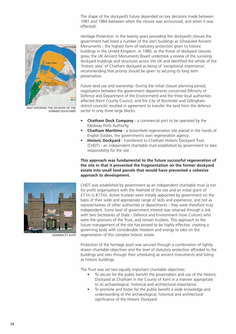
The shape of the dockyard’s future depended on key decisions made between1981 and 1984 (between when the closure was announced, and when it waseffected):
Heritage Protection. In the twenty years preceding the dockyard’s closure thegovernment had listed a number of the site’s buildings as Scheduled AncientMonuments - the highest form of statutory protection given to historicbuildings in the United Kingdom. In 1980, as the threat of dockyard closuresgrew, the UK Ancient Monuments Board undertook a review of the survivingdockyard buildings and structures across the UK and identified the whole of the‘historic area’ of Chatham dockyard as being of ‘exceptional importance’,recommending that priority should be given to securing its long termpreservation.
Future land use and ownership: During the initial closure planning period,negotiation between the government departments concerned (Ministry ofDefence and Department of the Environment) and the three local authoritiesaffected (Kent County Council, and the City of Rochester and Gillinghamdistrict councils) resulted in agreement to transfer the land from the defencesector in only three large blocks:
• Chatham Dock Company - a commercial port to be operated by theMedway Ports Authority.
• Chatham Maritime - a brownfield regeneration site placed in the hands ofEnglish Estates, the government’s own regeneration agency.
• Historic Dockyard - transferred to Chatham Historic Dockyard Trust(CHDT) - an independent charitable trust established by government to takeresponsibility for the site.
This approach was fundamental to the future successful regeneration ofthe site in that it prevented the fragmentation on the former dockyardestate into small land parcels that would have prevented a cohesiveapproach to development.
CHDT was established by government as an independent charitable trust (a notfor profit organisation) with the freehold of the site and an initial grant of£11m (c.€17m). Active trustees were initially appointed by government on thebasis of their wide and appropriate range of skills and experience, and not asrepresentatives of other authorities or departments - they were therefore trulyindependent. Some level of government interest was retained through a linkwith two Secretaries of State - Defence and Environment (now Culture) whowere the sponsors of the Trust, and remain trustees. This approach to thefuture management of the site has proved to be highly effective, creating agoverning body with considerable freedom and energy to take on theregeneration of this complex historic estate.
Protection of the heritage asset was secured through a combination of tightlydrawn charitable objectives and the level of statutory protection afforded to thebuildings and sites through their scheduling as ancient monuments and listingas historic buildings.
The Trust was set two equally important charitable objectives: • To secure for the public benefit the preservation and use of the Historic
Dockyard at Chatham in the County of Kent in a manner appropriate to its archaeological, historical and architectural importance.
• To promote and foster for the public benefit a wide knowledge and understanding of the archaeological, historical and architectural significance of the Historic Dockyard.
34
MAP SHOWING THE DIVISION OF THEFORMER DOCKYARD
ADMIRALTY GATE
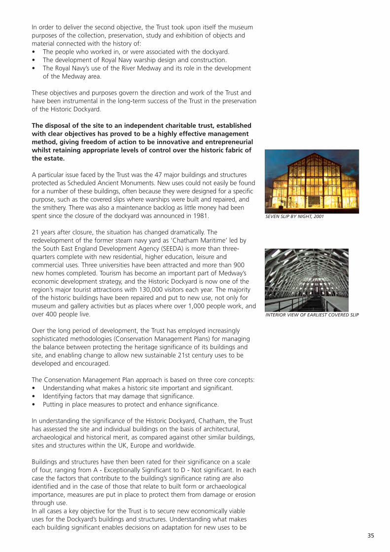
In order to deliver the second objective, the Trust took upon itself the museumpurposes of the collection, preservation, study and exhibition of objects andmaterial connected with the history of: • The people who worked in, or were associated with the dockyard. • The development of Royal Navy warship design and construction. • The Royal Navy’s use of the River Medway and its role in the development
of the Medway area.
These objectives and purposes govern the direction and work of the Trust andhave been instrumental in the long-term success of the Trust in the preservationof the Historic Dockyard.
The disposal of the site to an independent charitable trust, establishedwith clear objectives has proved to be a highly effective managementmethod, giving freedom of action to be innovative and entrepreneurialwhilst retaining appropriate levels of control over the historic fabric ofthe estate.
A particular issue faced by the Trust was the 47 major buildings and structuresprotected as Scheduled Ancient Monuments. New uses could not easily be foundfor a number of these buildings, often because they were designed for a specificpurpose, such as the covered slips where warships were built and repaired, andthe smithery. There was also a maintenance backlog as little money had beenspent since the closure of the dockyard was announced in 1981.
21 years after closure, the situation has changed dramatically. Theredevelopment of the former steam navy yard as ‘Chatham Maritime’ led bythe South East England Development Agency (SEEDA) is more than three-quarters complete with new residential, higher education, leisure andcommercial uses. Three universities have been attracted and more than 900new homes completed. Tourism has become an important part of Medway’seconomic development strategy, and the Historic Dockyard is now one of theregion’s major tourist attractions with 130,000 visitors each year. The majorityof the historic buildings have been repaired and put to new use, not only formuseum and gallery activities but as places where over 1,000 people work, andover 400 people live.
Over the long period of development, the Trust has employed increasinglysophisticated methodologies (Conservation Management Plans) for managingthe balance between protecting the heritage significance of its buildings andsite, and enabling change to allow new sustainable 21st century uses to bedeveloped and encouraged.
The Conservation Management Plan approach is based on three core concepts:• Understanding what makes a historic site important and significant.• Identifying factors that may damage that significance.• Putting in place measures to protect and enhance significance.
In understanding the significance of the Historic Dockyard, Chatham, the Trusthas assessed the site and individual buildings on the basis of architectural,archaeological and historical merit, as compared against other similar buildings,sites and structures within the UK, Europe and worldwide.
Buildings and structures have then been rated for their significance on a scaleof four, ranging from A - Exceptionally Significant to D - Not significant. In eachcase the factors that contribute to the building’s significance rating are alsoidentified and in the case of those that relate to built form or archaeologicalimportance, measures are put in place to protect them from damage or erosionthrough use. In all cases a key objective for the Trust is to secure new economically viableuses for the Dockyard’s buildings and structures. Understanding what makeseach building significant enables decisions on adaptation for new uses to be
35
SEVEN SLIP BY NIGHT, 2001
INTERIOR VIEW OF EARLIEST COVERED SLIP
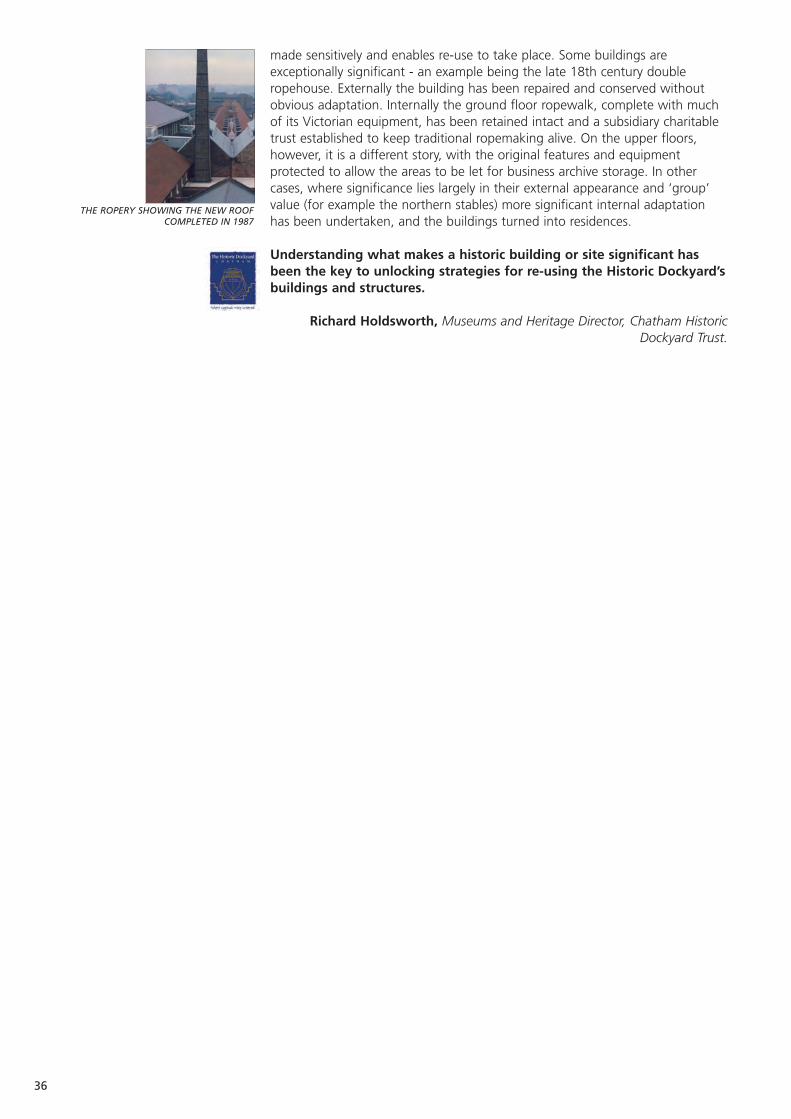
made sensitively and enables re-use to take place. Some buildings areexceptionally significant - an example being the late 18th century doubleropehouse. Externally the building has been repaired and conserved withoutobvious adaptation. Internally the ground floor ropewalk, complete with muchof its Victorian equipment, has been retained intact and a subsidiary charitabletrust established to keep traditional ropemaking alive. On the upper floors,however, it is a different story, with the original features and equipmentprotected to allow the areas to be let for business archive storage. In othercases, where significance lies largely in their external appearance and ‘group’value (for example the northern stables) more significant internal adaptationhas been undertaken, and the buildings turned into residences.
Understanding what makes a historic building or site significant hasbeen the key to unlocking strategies for re-using the Historic Dockyard’sbuildings and structures.
Richard Holdsworth, Museums and Heritage Director, Chatham HistoricDockyard Trust.
36
THE ROPERY SHOWING THE NEW ROOFCOMPLETED IN 1987

37
Medway, The Historic Dockyard, Chatham: Developing amixed use site.
The Historic Dockyard, Chatham is owned and operated by an independentcharitable trust (see ‘Planning for a sustainable heritage environment’) that hasto generate over 75% of the income required to meet its operating expenditurefrom activities on the 32 hectare site itself. From the outset it was clear totrustees that this could not be achieved via income from visitors alone. Also, itwas apparent that the site - with its 100 buildings and structures - was on toolarge a scale to be treated as a traditional open air museum: that the site wouldhave to be developed on a mixed use basis if an economically sustainablefuture was to be secured.
In 1984, the Trust embarked on a strategy to create a living working museum -not though in the form being developed elsewhere in the United Kingdom atthe time, which sought to create places where the ways of the past arepreserved through recreation and subsidy of preserved crafts - but one wherereal maritime crafts and businesses would be encouraged to locate in theHistoric Dockyard and provide a visitor attraction by their ongoing activities.
In encouraging activity, the Trust developed a range of museum galleries andlocated them in historically appropriate buildings in an attempt to draw visitorsacross the site. Financial pressure to generate income led to the more easilyadaptable buildings being converted for new uses and a wide range of tenants,from small individual craftsmen to marine ship repairing industries, wereattracted to the dockyard.
By the early 1990s the Trust was in serious financial difficulty - failing togenerate sufficient income to maintain the site and with limited developmentpotential. The reasons for this were various:• Visitor numbers failed to meet projections - visitors were finding it difficult
to understand the ‘living working museum’ concept, and those that did visitthe site found it unwelcoming and difficult to navigate.
• Insufficient funding to begin to adapt the larger and more difficultbuildings.
• Co-location of incompatible uses.
The living working museum strategy did, however, lay the foundations for thepresent successful mixed use site.
In 1995, the UK government launched the National Lottery to generate incomefor a number of good causes including ‘Heritage’. Following protractednegotiations, a partnership was established between the new Heritage LotteryFund, Medway Council, English Heritage and the government’s Department forCulture Media and Sport to fund a £14m development programme for thedockyard (c.€21m).
The development programme enabled essential infrastructure work to takeplace - including the renewal of the electrical infrastructure distribution system -and a major programme of backlog maintenance to be undertaken, so that anumber of buildings could be restored and adapted for new uses, including thedevelopment of new museum galleries, and a three ship attraction in the yard’sdry docks. This completed the restoration of a Victorian naval sloop HMSGannet, the relocation of the dockyard’s submarine, Ocelot and the addition ofthe Royal Navy’s last Second World War destroyer, HMS Cavalier.
In parallel a ‘soft zoning’ plan was instituted with the dockyard dividedlongitudinally into three use zones - residential towards the rear, commercial inthe centre and museum/visitor along the riverside. Smaller museum galleries -
HMS GANNET
HMS CAVALIER
SCHOOLCHILDREN ENJOY A VISIT TO THE ROPERY

38
created under the living working museum strategy - were closed and theircontents relocated to a new Museum of the Royal Dockyard in the FittedRigging House. In doing so, the site became easier to navigate and understandas a museum and visitor attraction.
Today the Historic Dockyard is a successful mixed-use community:• Commercial - approximately 100 tenants, employing or engaging with
1,000 people, generating an income of over £1m per annum (c.€1.5m).• Residential community - 400 residents living on site in a mix of converted
historic properties or new build residential development. Capital returnsfrom the development have been reinvested in the development of the restof the site.
• Education and tourism - 130,000 visitors per annum, providing an incomeof £0.75m (c.€1.2m) including 16,000 formal school visits each year.
The success of the strategy to develop the site can be traced to a number ofkey factors:• Strategy - a comprehensive and well thought through business plan based
on clarity of purpose for site usage, realistic assessment of potential andclose monitoring of performance.
• Conservation Management - developing a thorough understanding of theimportance and significance of the site, its buildings and structures andusing this to guide development - enabling re-use to take place withoutcompromising the historic character and importance of the site.
• Partnerships - managing complex partnerships with funders, commercialand residential tenants, staff, volunteers and other stakeholders.
In 2004 Chatham Historic Dockyard Trust was awarded a Europa Nostra /European Union prize for Cultural Heritage (Cultural Landscapes Medal) inrecognition of its work in carrying out “a programme of conservationundertaken to the highest professional standards, whilst retaining theatmosphere of a working dockyard site which successfully blends newincome-generating activities with the display of historic artefacts”.
Richard Holdsworth, Museums and Heritage Director, Chatham HistoricDockyard Trust.
RESIDENTIAL AREA WITHIN THE DOCKYARD
EDUCATIONAL ATIVITIES AT THE DOCKYARD

39
Medway, Fort Amherst and Chatham Historic DockyardTrust: Volunteer management and engagement.
Fort Amherst
Current condition Around 50% restored. Maintenance problems withrestored areas.
Current use Heritage visitor attraction.
Statistics 15,000 visitors per year.
Date of Construction 1756-1812.
Purpose of Construction Artillery defence of Chatham Dockyard.
Construction Materials Brick and earth.
Scale of land 20 acres, 10 buildings, 1.5km of tunnels.and buildings
Number of staff / Two paid staff, 14 volunteer managers, and over volunteers 80 other volunteers.
Location, and nearest Centrally located in Medway, just a few minutes population centre walk from Chatham town centre.
Major works Restoration of 50% of site. Construction of visitor undertaken centre and car park.
Protection in place Scheduled Ancient Monument.
Unique features Most complete 18th century landward defence system in the UK.
Accessibility Good road and public transport links, with on site car parking.
Proximity to similar sites Dover 80km and Portsmouth 170km.
Impulse for the Declared surplus to military need in 1981, with conversion proposals to develop a housing and hotel complex.
Structure of the Registered Charity with a managing board of managing body trustees, appointed by election at annual general
meetings.
Organisations consulted English Heritage, Local Authority, wider community.
Rules / Regulations Governed by a Trust Deed document, the principle imposed aim is to secure the preservation of Fort Amherst
and the Chatham Lines, and establish exhibitions and promote the history of the site.
Source of funding for Central and local government, some conversion works charitable trusts.
Conditions attached Only material costs tend to be covered by external to funding funding, and there are covenants around the use
of the site.
Website www.fortamherst.com
Current sources Visitor and commercial income, some targeted of income funding as part of local regeneration initiatives.
Sources of funds for Visitor income only.maintenance
Sources of funds Visitor income onlyfor staffing
Key to sustainability Following trends in visitor interest and diversification, and pursuing commercial activity.
Overall management Seek funding to continue restoration, and tostrategy promote integration into wider Chatham Lines
conservation (e.g. World Heritage Site application). Continue to promote the site as a diverse leisure and heritage location.
Current funded Preservation of historical ordnance collection.initiatives
Aspirations To develop an on site museum and interpretative displays. To seek inclusion of most of the site as part of a wider urban park. To secure commercial use/sponsorship for areas of the site.
This case study will examine the background to the ethos of volunteeringwithin the United Kingdom, in order to explain both the history and importanceof the voluntary sector in relation to heritage preservation and management.The case study will then examine the volunteer management structure at FortAmherst, how its members are selected, sustained, and how they interface withpaid staff. The final section will contrast the approach of Fort Amherst with thatof Chatham Historic Dockyard Trust.
Interim sections will explore the various roles played by volunteers at FortAmherst, in terms of its maintenance and operation as a heritage attraction.This will cover the recruitment of volunteers, the support that they require, andmethods to ensure that good volunteers continue to work for the project.Finally the case study will discuss both the problems associated with workingwith volunteers and the advantages that they bring to heritage projects withinthe UK.
Volunteering, a UK historical context.
The UK has a long history of individuals offering their time, skills and energy toa variety of causes, without any expectation of financial or material reward. Theroots of voluntary service to the community can be traced to the early 19thcentury and have two distinct arms, which by the time of the Second WorldWar had almost merged.
From the period of the Napoleonic Wars and right through the 19th century,political upheaval in Europe and intermittent wars created fear and uncertaintyin the UK. The UK had traditionally only ever maintained a relatively smallstanding army for its home defence. Throughout the 19th century, at varioustimes of international tension, large volunteer armies were formed as a result ofpolitical necessity and a public wish to have a practical way of expressingpatriotism. These citizen armies were often equipped at their members’ ownexpense and trained in their own time for no payment. During the SecondWorld War, after the crisis of the Dunkirk evacuation, a volunteer army, theHome Guard, was raised which numbered over a million men at its peak.
The second root of volunteering was the philanthropic movement, arising fromthe wishes of the newly wealthy middle classes in Victorian Britain to put someof their wealth and time to good use, and improve the lot of the ordinarycitizen. 19th century Britain was a country of stark contrasts, with a newwealthy middle class and an impoverished working class. Many of the socialreforms in Victorian Britain have their roots in the voluntary campaigning workof this group, who were often women with little to occupy their time. Anexample of this is Elizabeth Fry (the wife of a successful Quaker chocolatemanufacturer) who successfully campaigned for improvements to theconditions of UK prisons after spending time working there as a volunteer.
40
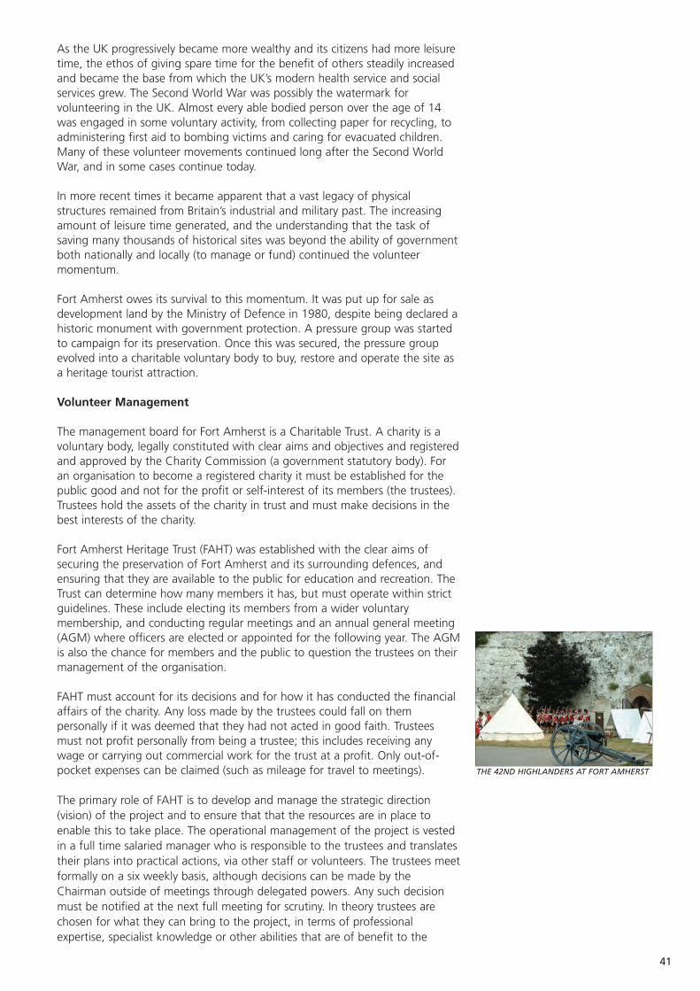
41
As the UK progressively became more wealthy and its citizens had more leisuretime, the ethos of giving spare time for the benefit of others steadily increasedand became the base from which the UK’s modern health service and socialservices grew. The Second World War was possibly the watermark forvolunteering in the UK. Almost every able bodied person over the age of 14was engaged in some voluntary activity, from collecting paper for recycling, toadministering first aid to bombing victims and caring for evacuated children.Many of these volunteer movements continued long after the Second WorldWar, and in some cases continue today.
In more recent times it became apparent that a vast legacy of physicalstructures remained from Britain’s industrial and military past. The increasingamount of leisure time generated, and the understanding that the task ofsaving many thousands of historical sites was beyond the ability of governmentboth nationally and locally (to manage or fund) continued the volunteermomentum.
Fort Amherst owes its survival to this momentum. It was put up for sale asdevelopment land by the Ministry of Defence in 1980, despite being declared ahistoric monument with government protection. A pressure group was startedto campaign for its preservation. Once this was secured, the pressure groupevolved into a charitable voluntary body to buy, restore and operate the site asa heritage tourist attraction.
Volunteer Management
The management board for Fort Amherst is a Charitable Trust. A charity is avoluntary body, legally constituted with clear aims and objectives and registeredand approved by the Charity Commission (a government statutory body). Foran organisation to become a registered charity it must be established for thepublic good and not for the profit or self-interest of its members (the trustees).Trustees hold the assets of the charity in trust and must make decisions in thebest interests of the charity.
Fort Amherst Heritage Trust (FAHT) was established with the clear aims ofsecuring the preservation of Fort Amherst and its surrounding defences, andensuring that they are available to the public for education and recreation. TheTrust can determine how many members it has, but must operate within strictguidelines. These include electing its members from a wider voluntarymembership, and conducting regular meetings and an annual general meeting(AGM) where officers are elected or appointed for the following year. The AGMis also the chance for members and the public to question the trustees on theirmanagement of the organisation.
FAHT must account for its decisions and for how it has conducted the financialaffairs of the charity. Any loss made by the trustees could fall on thempersonally if it was deemed that they had not acted in good faith. Trusteesmust not profit personally from being a trustee; this includes receiving anywage or carrying out commercial work for the trust at a profit. Only out-of-pocket expenses can be claimed (such as mileage for travel to meetings).
The primary role of FAHT is to develop and manage the strategic direction(vision) of the project and to ensure that that the resources are in place toenable this to take place. The operational management of the project is vestedin a full time salaried manager who is responsible to the trustees and translatestheir plans into practical actions, via other staff or volunteers. The trustees meetformally on a six weekly basis, although decisions can be made by theChairman outside of meetings through delegated powers. Any such decisionmust be notified at the next full meeting for scrutiny. In theory trustees arechosen for what they can bring to the project, in terms of professionalexpertise, specialist knowledge or other abilities that are of benefit to the
THE 42ND HIGHLANDERS AT FORT AMHERST

project as a whole. However, the reality is that most trustees are elected byvirtue of the fact that they are willing to serve. There is sufficient flexibility toco-opt additional trustees at any point of the year if an opportunity arises.
Fort Amherst uses volunteers in all aspects of its operations, however these fallinto two broad areas: maintenance of the site and visitor support.
Maintenance includes work to the physical structure of the site (painting,repairs to brickwork, carpentry and fixtures etc) and grounds maintenance(grass cutting, litter removal, cutting back trees and undergrowth etc). With anywork that involves the use of tools, or a degree of skill and knowledge, greatcare has to be taken to ensure that people are competent to carry out the tasksthat have been selected for them.
Particular care must be taken in respect of health and safety considerations. Inlegal terms, volunteers must be treated as employees. This involves providinginsurance cover and health and safety instructions, conducting risk assessmentson all tasks and providing the correct tools as well as any safety equipmentrequired. Volunteers must also be supervised by a competent person actingunder the authorisation of the organisation.
Visitor support includes acting as guides, performing historical re-enactments tobring the site to life, serving in the café, collecting entrance fees and beinginvolved in elaborate special events such as the Fort’s Hallowe’en five day event,which depends on around 80 unpaid volunteers. As with site maintenance,volunteers must be provided with health and safety instructions, protectiveclothing if required and supervision. However, there are also other requirementsfor volunteers who interact with visitors. They must be credible, i.e. able toexplain correctly and accurately the history and story of the heritage site. Inaddition they must also be presentable, and able to act as competentambassadors for the organisation. Conversely, badly managed and turned outvolunteers can do considerable damage to an organisation’s reputation!
The recruitment of volunteers has many parallels with practices in the paidemployment market. Some volunteers will just turn up to offer their services,but in most cases the organisation must go out and look for their volunteers.This can be undertaken through articles or advertisements in local media, orapproaches to schools, colleges and youth organisations.
For older volunteers, word of mouth is probably the most fruitful means ofgaining volunteers. It is also useful to make approaches through other voluntarygroups, for it is not uncommon for people to be associated with a number oforganisations or projects. Groups supporting the unemployed or the disabledare useful sources of volunteers.
There are also a number of specialist volunteer fairs held locally, and establishedvolunteer bureaux that seek to match those seeking to volunteer withorganisations looking for skills and commitment.
In terms of a selection process, the reality is that you cannot be as selective asyou could be if you were paying wages. There is usually a requirement tocompromise in terms of age, experience and competence, in a manner thatwould not be deemed acceptable within a commercial context. However it isstill important to achieve a degree of matching between what is being offered,and what is required by the organisation.
Volunteers must be treated as a sparse commodity, and as such requirenurturing and encouraging, as there are many other organisations who willtake on volunteers if they no longer feel appreciated. The policy at FortAmherst is to encourage volunteers to specialise in areas where their interestlies. The result of this is distinct groups of volunteers. Examples of this are
42
A HALLOWE'EN FRIGHT NIGHT DISPLAY
PREPARATIONS FOR A HISTORIC REENACTMENT
43
historic re-enactments, where the fort encourages autonomous groups to usethe fort as a backdrop to their activities for the benefit of visitors. In return thefort provides a place to change in and out of uniform, and to rest when not inthe public eye.
Other volunteers are supported in terms of clothing and training if required tointerface with visitors. Training can be important in raising the skill levels ofvolunteers, whilst also improving their usefulness to the project, and can inaddition help the volunteer to improve their own employment prospects. FortAmherst may subsidise travel costs for those who are unemployed or on lowincomes. All volunteers are offered reduced prices in the cafeteria, well belowthe charges made to visitors. It is also important to reward volunteers bypraising their efforts and explaining the difference their contribution is makingtowards the overall objectives of the project.
It is important to generate a feeling of belonging amongst the volunteers. Thisis achieved through the organisation of social events to thank them for theirefforts throughout the year. These events are open to partners and familymembers, and this is important in maintaining their tolerance and support, asthey have to endure the volunteer’s absence from home on numerousoccasions.
Problem Areas
Volunteers are not plentiful, and there are many organisations seekingvolunteers for a wide variety of tasks. It is no longer as fashionable to volunteeras it once was, especially for young people. It can be very hard to attractvolunteers and harder still to get the ones you really want. Sometimes difficultchoices may have to be made: if a volunteer is clearly unsuitable for a task andcannot be given suitable alternative work then it is better to decline theirservices than take on an unacceptable liability or risk.
Furthermore, as volunteers are unpaid, they are in a strong position to dictatewhen they work and what they will do. This does not always fit with therequirements of the organisation. For Fort Amherst, the greatest need forvolunteers is often when they are at their normal place of paid work, orcollege. It can sometimes be difficult to motivate volunteers to undertake thetasks that you want completed rather than what they would prefer to do.Good supervision and task planning is very important. Volunteers acting outsideof agreed plans can at best be chaotic and at worst dangerous and costly.
Volunteers must not be seen as a no cost option: there are a great manyhidden costs that must be taken into account. Volunteers must be regarded asemployees for the purposes of insurance and health and safety requirements.Insurance cover must be in place, appropriate training given in terms of safeworking practices, risk assessments completed on all tasks, and the appropriatesafety equipment provided. All of this costs money.
In the UK there are now strict guidelines around checks for people who workwith children and young people, including volunteers. Suitable criminal recordschecks must be undertaken on any individual before they can be allowed nearyoung visitors or other young volunteers. These checks can be expensive andhave to be paid for by the organisation.
Many volunteers are not skilled or experienced craftsmen, and can proveexpensive in terms of material wastage, and wear and tear on equipment. Theadditional costs that volunteers may place on the material costs of any projectshould be taken into account when building budgets. Again, good supervisionand appropriate training is important.

The Rewards.
Rewards are for both the organisation and for the volunteer. The organisationreceives labour to carry out tasks at no direct costs. This has the benefit oflimited resources being channelled directly into the materials of any task orproject. This has other corresponding benefits - almost all potential donors andgrant funders prefer to support capital or material costs rather than revenuelabour.
Additional benefits come in the value of volunteer labour. Many heritageprojects in the UK are heavily dependent on grants from the National Lottery;such grants almost always require a portion of the project costs to be matchedfrom elsewhere. The value of volunteer labour can be included at specifiedrates. Such funding ‘in kind’ is a vital element in many UK heritage projectsundertaken by the voluntary sector.
The rewards for individuals cover a number of areas. The majority of volunteersat Fort Amherst undertake something that gives pleasure, or allows them toachieve something outside of their normal profession. For young people thereare schemes where voluntary service can be counted towards applications forcollege places or for employment, if there is no previous paid experience todraw upon. Many employers and academic institutions place a great deal ofcurrency on the voluntary activities of applicants. In addition many largecompanies encourage their employees to take an active role in the localcommunity.
The use of volunteers within the UK heritage setting is now well establishedand increases the value of projects to an extent that could not be matched bygovernment or other agencies. Fort Amherst would not exist in its current formwithout the input of hundreds of volunteers throughout a twenty year period.
Volunteering creates a unique partnership between the volunteer and the hostorganisation in terms of what is achieved, how it is achieved and thesatisfaction of achievement. Fort Amherst does not claim to have always got itright, and has on many occasions learnt the lessons the hard way. This hassometimes been with both material cost, and with the loss of some very goodvolunteers. However, in the final analysis, the partnership is very rewarding, andhas endured over two decades.
The Historic Dockyard, Chatham.
The Historic Dockyard operates with a mix of permanent and seasonal paidstaff supported by a large number of highly active volunteers. Organised intofive support groups, around 150 volunteers commit upwards of 18,000 hoursof their time each year to help the Trust run the site and its programme ofactivities.
Each of the volunteer groups has a separate identity and focus:
Chatham Dockyard Historical Society - formed as the dockyard was closing,the CDHS helped save a large number of historical artefacts and now helps runone of the dockyard’s main core museum galleries - the Museum of the RoyalDockyard. They provide members to staff the gallery seven days a weekbetween mid February and the end of October.
Ship Volunteers - assist the dockyard’s ship keeping team to maintain,preserve and repair the dockyard’s three historic ships, HMS Gannet - an 1878Victorian sloop; HMS Cavalier - the Royal Navy’s last operational Second WorldWar destroyer; and HM Submarine Ocelot. Many have high-level technical andengineering skills, and either served at sea with the Royal Navy, or are formerdockyard workers.
44
A CHILDREN'S PARTY AT THE FORT
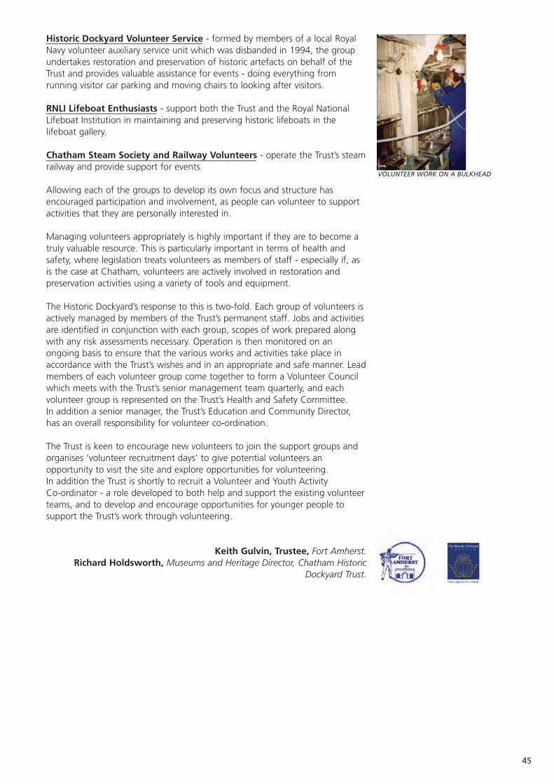
45
Historic Dockyard Volunteer Service - formed by members of a local RoyalNavy volunteer auxiliary service unit which was disbanded in 1994, the groupundertakes restoration and preservation of historic artefacts on behalf of theTrust and provides valuable assistance for events - doing everything fromrunning visitor car parking and moving chairs to looking after visitors.
RNLI Lifeboat Enthusiasts - support both the Trust and the Royal NationalLifeboat Institution in maintaining and preserving historic lifeboats in thelifeboat gallery.
Chatham Steam Society and Railway Volunteers - operate the Trust’s steamrailway and provide support for events.
Allowing each of the groups to develop its own focus and structure hasencouraged participation and involvement, as people can volunteer to supportactivities that they are personally interested in.
Managing volunteers appropriately is highly important if they are to become atruly valuable resource. This is particularly important in terms of health andsafety, where legislation treats volunteers as members of staff - especially if, asis the case at Chatham, volunteers are actively involved in restoration andpreservation activities using a variety of tools and equipment.
The Historic Dockyard’s response to this is two-fold. Each group of volunteers isactively managed by members of the Trust’s permanent staff. Jobs and activitiesare identified in conjunction with each group, scopes of work prepared alongwith any risk assessments necessary. Operation is then monitored on anongoing basis to ensure that the various works and activities take place inaccordance with the Trust’s wishes and in an appropriate and safe manner. Leadmembers of each volunteer group come together to form a Volunteer Councilwhich meets with the Trust’s senior management team quarterly, and eachvolunteer group is represented on the Trust’s Health and Safety Committee. In addition a senior manager, the Trust’s Education and Community Director,has an overall responsibility for volunteer co-ordination.
The Trust is keen to encourage new volunteers to join the support groups andorganises ‘volunteer recruitment days’ to give potential volunteers anopportunity to visit the site and explore opportunities for volunteering. In addition the Trust is shortly to recruit a Volunteer and Youth Activity Co-ordinator - a role developed to both help and support the existing volunteerteams, and to develop and encourage opportunities for younger people tosupport the Trust’s work through volunteering.
Keith Gulvin, Trustee, Fort Amherst.Richard Holdsworth, Museums and Heritage Director, Chatham Historic
Dockyard Trust.
VOLUNTEER WORK ON A BULKHEAD
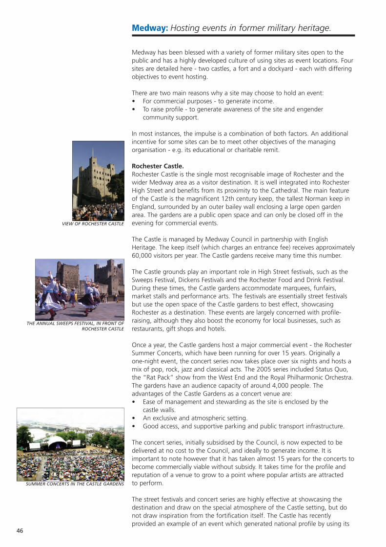
Medway: Hosting events in former military heritage.
Medway has been blessed with a variety of former military sites open to thepublic and has a highly developed culture of using sites as event locations. Foursites are detailed here - two castles, a fort and a dockyard - each with differingobjectives to event hosting.
There are two main reasons why a site may choose to hold an event: • For commercial purposes - to generate income.• To raise profile - to generate awareness of the site and engender
community support.
In most instances, the impulse is a combination of both factors. An additionalincentive for some sites can be to meet other objectives of the managingorganisation - e.g. its educational or charitable remit.
Rochester Castle.Rochester Castle is the single most recognisable image of Rochester and thewider Medway area as a visitor destination. It is well integrated into RochesterHigh Street and benefits from its proximity to the Cathedral. The main featureof the Castle is the magnificent 12th century keep, the tallest Norman keep inEngland, surrounded by an outer bailey wall enclosing a large open gardenarea. The gardens are a public open space and can only be closed off in theevening for commercial events.
The Castle is managed by Medway Council in partnership with EnglishHeritage. The keep itself (which charges an entrance fee) receives approximately60,000 visitors per year. The Castle gardens receive many time this number.
The Castle grounds play an important role in High Street festivals, such as theSweeps Festival, Dickens Festivals and the Rochester Food and Drink Festival.During these times, the Castle gardens accommodate marquees, funfairs,market stalls and performance arts. The festivals are essentially street festivalsbut use the open space of the Castle gardens to best effect, showcasingRochester as a destination. These events are largely concerned with profile-raising, although they also boost the economy for local businesses, such asrestaurants, gift shops and hotels.
Once a year, the Castle gardens host a major commercial event - the RochesterSummer Concerts, which have been running for over 15 years. Originally aone-night event, the concert series now takes place over six nights and hosts amix of pop, rock, jazz and classical acts. The 2005 series included Status Quo,the “Rat Pack” show from the West End and the Royal Philharmonic Orchestra.The gardens have an audience capacity of around 4,000 people. Theadvantages of the Castle Gardens as a concert venue are:• Ease of management and stewarding as the site is enclosed by the
castle walls.• An exclusive and atmospheric setting.• Good access, and supportive parking and public transport infrastructure.
The concert series, initially subsidised by the Council, is now expected to bedelivered at no cost to the Council, and ideally to generate income. It isimportant to note however that it has taken almost 15 years for the concerts tobecome commercially viable without subsidy. It takes time for the profile andreputation of a venue to grow to a point where popular artists are attractedto perform.
The street festivals and concert series are highly effective at showcasing thedestination and draw on the special atmosphere of the Castle setting, but donot draw inspiration from the fortification itself. The Castle has recentlyprovided an example of an event which generated national profile by using its
46
VIEW OF ROCHESTER CASTLE
THE ANNUAL SWEEPS FESTIVAL, IN FRONT OF ROCHESTER CASTLE
SUMMER CONCERTS IN THE CASTLE GARDENS
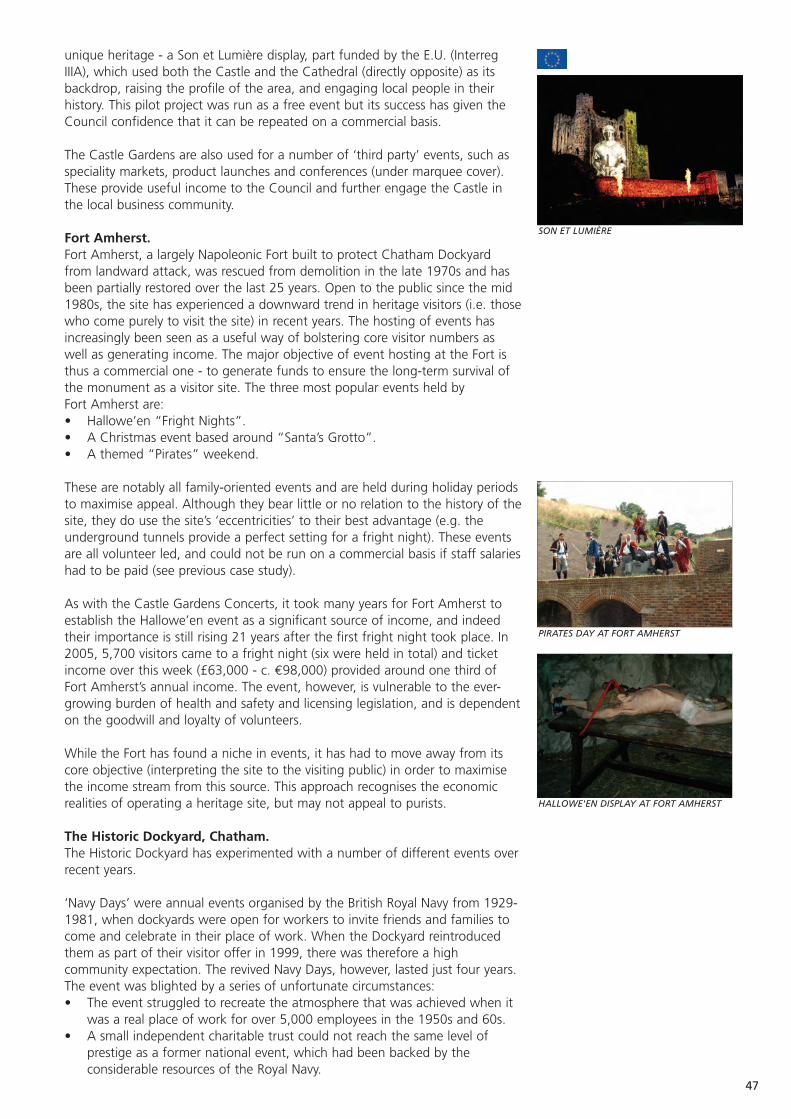
47
unique heritage - a Son et Lumière display, part funded by the E.U. (InterregIIIA), which used both the Castle and the Cathedral (directly opposite) as itsbackdrop, raising the profile of the area, and engaging local people in theirhistory. This pilot project was run as a free event but its success has given theCouncil confidence that it can be repeated on a commercial basis.
The Castle Gardens are also used for a number of ‘third party’ events, such asspeciality markets, product launches and conferences (under marquee cover).These provide useful income to the Council and further engage the Castle inthe local business community.
Fort Amherst.Fort Amherst, a largely Napoleonic Fort built to protect Chatham Dockyardfrom landward attack, was rescued from demolition in the late 1970s and hasbeen partially restored over the last 25 years. Open to the public since the mid1980s, the site has experienced a downward trend in heritage visitors (i.e. thosewho come purely to visit the site) in recent years. The hosting of events hasincreasingly been seen as a useful way of bolstering core visitor numbers aswell as generating income. The major objective of event hosting at the Fort isthus a commercial one - to generate funds to ensure the long-term survival ofthe monument as a visitor site. The three most popular events held byFort Amherst are:• Hallowe’en “Fright Nights”.• A Christmas event based around “Santa’s Grotto”.• A themed “Pirates” weekend.
These are notably all family-oriented events and are held during holiday periodsto maximise appeal. Although they bear little or no relation to the history of thesite, they do use the site’s ‘eccentricities’ to their best advantage (e.g. theunderground tunnels provide a perfect setting for a fright night). These eventsare all volunteer led, and could not be run on a commercial basis if staff salarieshad to be paid (see previous case study).
As with the Castle Gardens Concerts, it took many years for Fort Amherst toestablish the Hallowe’en event as a significant source of income, and indeedtheir importance is still rising 21 years after the first fright night took place. In2005, 5,700 visitors came to a fright night (six were held in total) and ticketincome over this week (£63,000 - c. €98,000) provided around one third ofFort Amherst’s annual income. The event, however, is vulnerable to the ever-growing burden of health and safety and licensing legislation, and is dependenton the goodwill and loyalty of volunteers.
While the Fort has found a niche in events, it has had to move away from itscore objective (interpreting the site to the visiting public) in order to maximisethe income stream from this source. This approach recognises the economicrealities of operating a heritage site, but may not appeal to purists.
The Historic Dockyard, Chatham.The Historic Dockyard has experimented with a number of different events overrecent years.
‘Navy Days’ were annual events organised by the British Royal Navy from 1929-1981, when dockyards were open for workers to invite friends and families tocome and celebrate in their place of work. When the Dockyard reintroducedthem as part of their visitor offer in 1999, there was therefore a highcommunity expectation. The revived Navy Days, however, lasted just four years.The event was blighted by a series of unfortunate circumstances:• The event struggled to recreate the atmosphere that was achieved when it
was a real place of work for over 5,000 employees in the 1950s and 60s.• A small independent charitable trust could not reach the same level of
prestige as a former national event, which had been backed by theconsiderable resources of the Royal Navy.
SON ET LUMIÈRE
HALLOWE'EN DISPLAY AT FORT AMHERST
PIRATES DAY AT FORT AMHERST
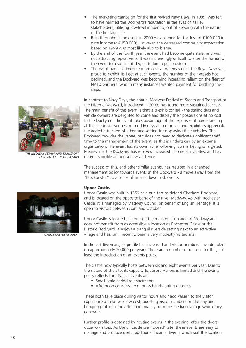
• The marketing campaign for the first revived Navy Days, in 1999, was feltto have harmed the Dockyard’s reputation in the eyes of its keystakeholders, utilising low-level innuendo, out of keeping with the natureof the heritage site.
• Rain throughout the event in 2000 was blamed for the loss of £100,000 ingate income (c.€150,000). However, the decreased community expectationbased on 1999 was most likely also to blame.
• By the end of the fourth year the event had become quite stale, and wasnot attracting repeat visits. It was increasingly difficult to alter the format ofthe event to a sufficient degree to lure repeat custom.
• The event had also become more costly - whereas once the Royal Navy wasproud to exhibit its fleet at such events, the number of their vessels haddeclined, and the Dockyard was becoming increasing reliant on the fleet ofNATO partners, who in many instances wanted payment for berthing theirships.
In contrast to Navy Days, the annual Medway Festival of Steam and Transport atthe Historic Dockyard, introduced in 2003, has found more sustained success.The main benefit of this event is that it is exhibitor led - the stallholders andvehicle owners are delighted to come and display their possessions at no costto the Dockyard. The event takes advantage of the expanses of hard-standingat the site (grass venues on muddy days are not ideal) and exhibitors appreciatethe added attraction of a heritage setting for displaying their vehicles. TheDockyard provides the venue, but does not need to dedicate significant stafftime to the management of the event, as this is undertaken by an externalorganisation. The event has its own niche following, so marketing is targeted.Meanwhile, the Dockyard has received increased income at its gates, and hasraised its profile among a new audience.
The success of this, and other similar events, has resulted in a changedmanagement policy towards events at the Dockyard - a move away from the“blockbuster” to a series of smaller, lower risk events.
Upnor Castle.Upnor Castle was built in 1559 as a gun fort to defend Chatham Dockyard,and is located on the opposite bank of the River Medway. As with RochesterCastle, it is managed by Medway Council on behalf of English Heritage. It isopen to visitors between April and October.
Upnor Castle is located just outside the main built-up area of Medway anddoes not benefit from as accessible a location as Rochester Castle or theHistoric Dockyard. It enjoys a tranquil riverside setting next to an attractivevillage and has, until recently, been a very modestly visited site.
In the last five years, its profile has increased and visitor numbers have doubled(to approximately 20,000 per year). There are a number of reasons for this, notleast the introduction of an events policy.
The Castle now typically hosts between six and eight events per year. Due tothe nature of the site, its capacity to absorb visitors is limited and the eventspolicy reflects this. Typical events are:
• Small-scale period re-enactments.• Afternoon concerts - e.g. brass bands, string quartets.
These both take place during visitor hours and “add value” to the visitorexperience at relatively low cost, boosting visitor numbers on the day andbringing profile to the attraction, mainly from the media coverage which theygenerate.
Further profile is obtained by hosting events in the evening, after the doorsclose to visitors. As Upnor Castle is a “closed” site, these events are easy tomanage and produce useful additional income. Events which suit the location
48
THE MEDWAY STEAM AND TRANSPORTFESTIVAL AT THE DOCKYARD
UPNOR CASTLE AT NIGHT
49
are open air theatre and, at certain times of year, guided ghost tours. Risk canbe reduced from hosting these events by charging a fixed “venue hire” fee tothe event organisers. Upnor Castle has also promoted itself successfully as acharacter wedding venue over the last five years, generating useful additionalincome with minimal impact on core visitor activity.
The Need for an Events Strategy.From this brief summary of events held at four military related tourist sites inMedway, it can be seen that there is no ‘one sizes fits all’ approach to eventorganisation. Indeed, the specific approach taken by each venue needs to beinformed by a tailored events strategy, with clear objectives. The objectives -whether related to income generation or profile - need to be achieved withoutdamaging the integrity of the site.
A successful events strategy should bring the desired benefits and shouldalways be a key feature of an overall site management strategy. However, thereare numerous potential pitfalls. These need to be fully considered prior tocommitting a site to hosting an event, and should be integrated into the eventsstrategy. It is all too easy for an event to cost more than it generates, in eitherfinancial or reputation terms.
Full consideration should be given to the following.• The weather, which can, of course, be unpredictable for outdoor events.
Advance ticketing is recommended to reduce the risk.• Volunteers may not always be available at peak times, when visitors are
most likely to be attracted to a site.• If an event does not go to plan the consequent damage to reputation may
be long term. Even if a site only provides the venue for an event and has norole in its organisation, the public will still associate any mishaps with thesite. External funding agencies may also take the same view.
• Potential damage to the fabric of the site caused by third parties may bedifficult and costly to repair.
• Management time dedicated to the event may be more cost-effective ifspent on other initiatives.
• Local residents need to be considered in terms of noise, traffic and wastegenerated by an event, in order to engender community support.
• The costs of adhering to insurance, health and safety and licensinglegislation are growing year by year.
Ultimately, if these considerations are met, event management can beenormously rewarding both for the site and the staff who participate.Furthermore, it can be instrumental in developing the economic sustainability ofa heritage attraction.
Simon Curtis, Tourism Manager, Medway Council.
A WEDDING AT UPNOR CASTLE

50
Medway: The conversion of HMS Pembroke to universityfacilities.
Current condition Very good / excellent condition for the majority of buildings.
Current use University and enterprise campus.
Statistics Over 2,500 students.
Date of Construction 1897 - 1903
Purpose of Construction Royal naval barracks, to support Chatham Dockyard.
Construction Materials Traditional brick.
Scale of land Several large buildings within approximately and buildings 30 hectares.
Number of staff / 1,000 employees are anticipated by 2010.volunteers
Location, and nearest In Chatham Maritime, on the site of the formerpopulation centre Dockyard. Less than 2km from the town centres of
Chatham and Gillingham.
Major works undertaken Minimal structural works required. Mainly refitting and refurbishment.
Protection in place All Grade II listed buildings.
Unique features A unique collaboration of four higher education institutes and a further education college on a single campus.
Accessibility Excellent accessibility by road and public transport. In a priority area for British Telecom I.T. connectivity(e.g. broadband).
Proximity to The University of Kent at Canterbury is 50km away;similar sites the University of Greenwich campus in Greenwich
itself is 45km.
Impulse for the The large-scale military withdrawal made available conversion for re-use a facility of significant scale, in an area
with no major higher education presence. The project was informed by a range of government, institutional and development agency policies, and specifically by an H.E. demand study (KPMG 2000).
Structure of the Typical academic structures govern the individual managing body institutions. The Universities at Medway initiative is
a partner project between them.
Organisations consulted English Heritage, South East EnglandDevelopment Agency (SEEDA), English Partnerships,Local Authorities.
Rules / Regulations Those required for listed buildings.imposed
Source of funding for National funds via the Office of the Deputy Prime conversion works Minister; the South East England Development
Agency (SEEDA); Medway Council; Mid Kent College; Universities of Kent and Greenwich; Higher Education Funding Council for England (HEFCE). Total funds in the region of €75m. €
Conditions attached Protection of the buildings’ listed status, and to funding creation of a public education facility open to as
wide a public as possible.
Website www.medway.ac.uk; www.gre.ac.ukwww.canterbury.ac.uk; www.midkent.ac.uk www.open.ac.uk
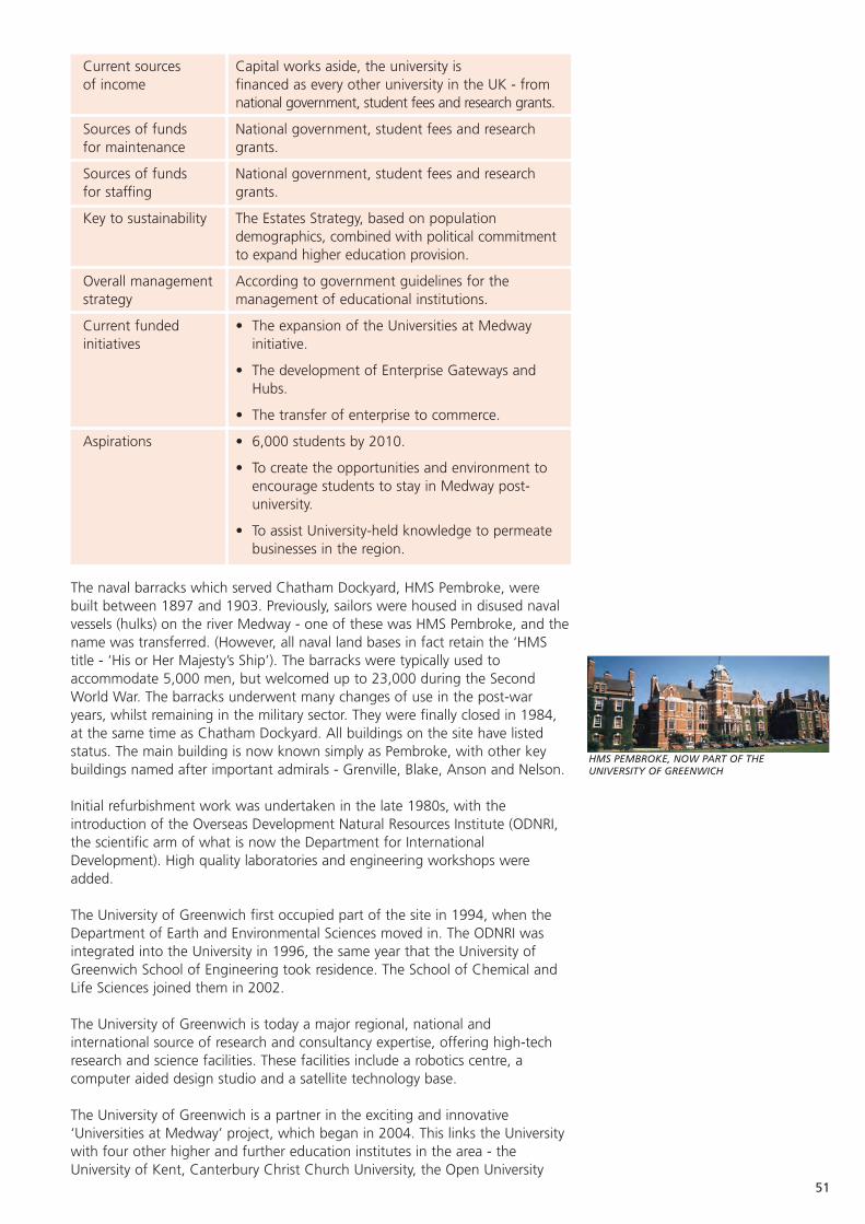
51
HMS PEMBROKE, NOW PART OF THE UNIVERSITY OF GREENWICH
Current sources Capital works aside, the university is of income financed as every other university in the UK - from
national government, student fees and research grants.
Sources of funds National government, student fees and research for maintenance grants.
Sources of funds National government, student fees and research for staffing grants.
Key to sustainability The Estates Strategy, based on population demographics, combined with political commitmentto expand higher education provision.
Overall management According to government guidelines for the strategy management of educational institutions.
Current funded • The expansion of the Universities at Medway initiatives initiative.
• The development of Enterprise Gateways and Hubs.
• The transfer of enterprise to commerce.
Aspirations • 6,000 students by 2010.
• To create the opportunities and environment to encourage students to stay in Medway post-university.
• To assist University-held knowledge to permeate businesses in the region.
The naval barracks which served Chatham Dockyard, HMS Pembroke, werebuilt between 1897 and 1903. Previously, sailors were housed in disused navalvessels (hulks) on the river Medway - one of these was HMS Pembroke, and thename was transferred. (However, all naval land bases in fact retain the ‘HMStitle - ‘His or Her Majesty’s Ship’). The barracks were typically used toaccommodate 5,000 men, but welcomed up to 23,000 during the SecondWorld War. The barracks underwent many changes of use in the post-waryears, whilst remaining in the military sector. They were finally closed in 1984,at the same time as Chatham Dockyard. All buildings on the site have listedstatus. The main building is now known simply as Pembroke, with other keybuildings named after important admirals - Grenville, Blake, Anson and Nelson.
Initial refurbishment work was undertaken in the late 1980s, with theintroduction of the Overseas Development Natural Resources Institute (ODNRI,the scientific arm of what is now the Department for InternationalDevelopment). High quality laboratories and engineering workshops wereadded.
The University of Greenwich first occupied part of the site in 1994, when theDepartment of Earth and Environmental Sciences moved in. The ODNRI wasintegrated into the University in 1996, the same year that the University ofGreenwich School of Engineering took residence. The School of Chemical andLife Sciences joined them in 2002.
The University of Greenwich is today a major regional, national andinternational source of research and consultancy expertise, offering high-techresearch and science facilities. These facilities include a robotics centre, acomputer aided design studio and a satellite technology base.
The University of Greenwich is a partner in the exciting and innovative‘Universities at Medway’ project, which began in 2004. This links the Universitywith four other higher and further education institutes in the area - theUniversity of Kent, Canterbury Christ Church University, the Open University
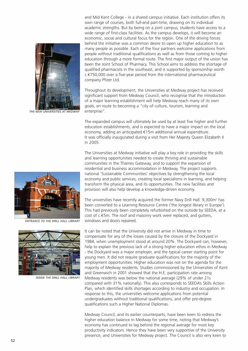
and Mid Kent College - in a shared campus initiative. Each institution offers itsown range of courses, both full-and part-time, drawing on its individualacademic strengths. But by being on a joint campus, students have access to awide range of first-class facilities. As the campus develops, it will become aneconomic, social and cultural focus for the region. One of the driving forcesbehind the initiative was a common desire to open up higher education to asmany people as possible. Each of the four partners welcome applications frompeople without traditional qualifications as well as from those coming to highereducation through a more formal route. The first major output of the union hasbeen the Joint School of Pharmacy. This School aims to address the shortage ofqualified pharmacists in the southeast, and is supported by sponsorship worthc.€750,000 over a five-year period from the international pharmaceuticalcompany Pfizer Ltd.
Throughout its development, the Universities at Medway project has receivedsignificant support from Medway Council, who recognise that the introductionof a major learning establishment will help Medway reach many of its owngoals, en route to becoming a “city of culture, tourism, learning andenterprise”.
The expanded campus will ultimately be used by at least five higher and furthereducation establishments, and is expected to have a major impact on the localeconomy, adding an anticipated €15m additional annual expenditure. It was officially inaugurated during a visit from Her Majesty Queen Elizabeth II in 2005.
The Universities at Medway initiative will play a key role in providing the skillsand learning opportunities needed to create thriving and sustainablecommunities in the Thames Gateway, and to support the expansion ofresidential and business accommodation in Medway. The project supportsnational ‘Sustainable Communities’ objectives by strengthening the localeconomy and public services, creating local specialisms in learning, and helpingtransform the physical area, and its opportunities. The new facilities andprovision will also help develop a knowledge-driven economy.
The universities have recently acquired the former Navy Drill Hall: 9,300m2 hasbeen converted to a Learning Resource Centre (‘the longest library in Europe’).This had previously been completely refurbished on the outside by SEEDA, at acost of c.€5m. The roof and masonry work were replaced, and gutters,windows and doors repaired.
It can be noted that the University did not arrive in Medway in time tocompensate for any of the losses caused by the closure of the Dockyard in1984, when unemployment stood at around 20%. The Dockyard can, however,help to explain the previous lack of a strong higher education ethos in Medway- the Dockyard was a major employer, and the typical career starting point foryoung men. It did not require graduate qualifications for the majority of theemployment opportunities. Higher education was not on the agenda for themajority of Medway residents. Studies commissioned by the Universities of Kentand Greenwich in 2001 showed that the H.E. participation rate amongMedway residents was below the national average (29% of under 21scompared with 31% nationally). This also corresponds to SEEDA’s Skills ActionPlan, which identified skills shortages according to industry and occupation. Inresponse to this, the universities welcome applications from potentialundergraduates without traditional qualifications, and offer pre-degreequalifications such a Higher National Diplomas.
Medway Council, and its earlier counterparts, have been keen to redress thehigher education balance in Medway for some time, noting that Medway’seconomy has continued to lag behind the regional average for most keyproductivity indicators. Hence they have been very supportive of the Universitypresence, and Universities for Medway project. The Council is also very keen to
THE NEW UNIVERSITIES AT MEDWAY
ENTRANCE TO THE DRILL HALL LIBRARY
INSIDE THE DRILL HALL LIBRARY
52

53
OFFICE POD FACILITIES AT THE MEDWAY ENTERPRISE GATEWAY
THE MEDWAY ENTERPRISE GATEWAY
promote the permeation of the benefits of the University presence into thewider business and local community, and has helped fund many initiatives toforge links between higher education and business - for example, by fundingthe posts of two Creative Intermediates at the University College for theCreative Arts (UCCA) who advise undergraduates on self-employment andentrepreneurial opportunities.
As part of the drive to consolidate and grow Medway’s increasing knowledgebase, an Enterprise Gateway has been introduced. This is one of 16 EnterpriseGateways in the southeast, part of a regional initiative, jointly funded by SEEDAand Business Link Kent (a government-funded Business Support Agency).Enterprise Gateways focus on developing and nurturing entrepreneurs andyoung companies within the general business community. Their main aims are:• Increasing the survival rate of new businesses.• Accelerating the growth and expansion of young companies.• Encouraging entrepreneurial thinking.The Gateway also provides physical business incubation accommodation,business support networks, financial advice, and other targeted services.
Medway’s Enterprise Gateway is also supported by Medway Council, theUniversity College for the Creative Arts (UCCA), and the private sector. It has aparticular focus on the cultural and creative sector.
In addition to the Gateways, SEEDA also lead on the development of EnterpriseHubs, which provide network facilities for maturing SMEs, typically related tohigh-tech professions, and ‘clustered’ around them. Here, the support tends tobe more intensive, and more specific. Again, there is direct access to businesssupport, a knowledge base of research and development, flexible workspace,business finance and business-to-business mentoring and networking. Themajor expansion of education facilities in Medway, combined with increasingexpansion into enterprise activities and the planned development of aninnovation centre in Medway all indicate that the time is right for theintroduction of an Enterprise Hub.
Full integration of students with the business community is also supported bynational initiatives, and the UK government (via the Department of Trade andIndustry: DTI) has a number of mechanisms to aid in the transfer of knowledgefrom higher education institutes to SMEs (small to medium enterprises). Theseinclude for example the Shell STEP programme. Originally set up by the oilcompany Shell, but now run jointly with the DTI, this 20-year-old programmeplaces undergraduate students into an SME for 8 weeks during the summervacation of their second year of study. The employer pays below the standardmarket rate for the expertise (typically in the field of business modernisation,such as website or database creation/upgrades, or product development) anddoes not need to issue a permanent contract. The graduate receives a wage tosupport his vacation, and the experience of implementing his learning in abusiness environment, whilst the employer receives access to skills andknowledge he would not be able to afford on a permanent basis. The similarKnowledge Transfer Programme (KTP) provides SMEs with access to a graduatefull time, and a half-day per week of their academic supervisor’s time, as well asuniversity facilities. A KTP placement typically lasts between one and threeyears.
Other support for SMEs includes the Research and Development Grant, whichprovides match funding for SMEs pursuing innovative research that will allowtheir company to grow. Knowledge Transfer Networks are national networks inspecific fields of technology or business application, bringing together a varietyof organisations such as businesses (suppliers and customers), universities,research and technology organisations, the finance community and otherintermediaries who provide a range of activities and initiatives, to enable theexchange of knowledge and stimulation of innovation within the particularfield. The Collaborative Research and Development Grant allows the
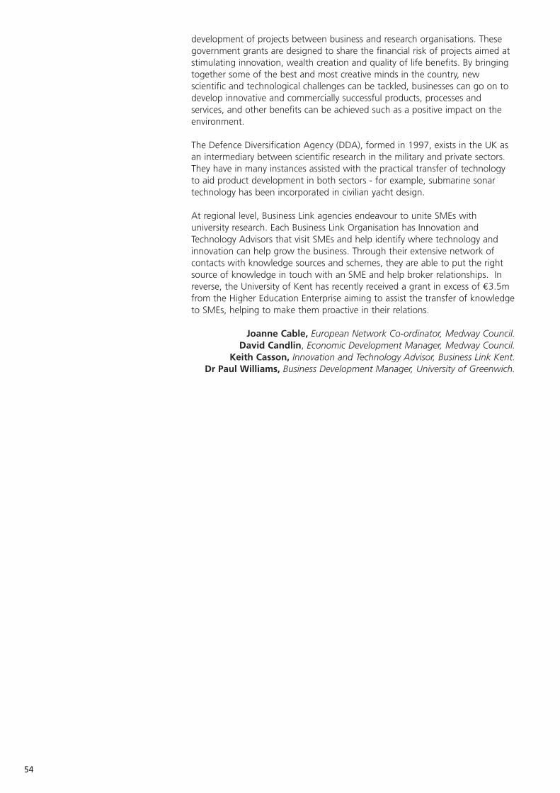
development of projects between business and research organisations. Thesegovernment grants are designed to share the financial risk of projects aimed atstimulating innovation, wealth creation and quality of life benefits. By bringingtogether some of the best and most creative minds in the country, newscientific and technological challenges can be tackled, businesses can go on todevelop innovative and commercially successful products, processes andservices, and other benefits can be achieved such as a positive impact on theenvironment.
The Defence Diversification Agency (DDA), formed in 1997, exists in the UK asan intermediary between scientific research in the military and private sectors.They have in many instances assisted with the practical transfer of technologyto aid product development in both sectors - for example, submarine sonartechnology has been incorporated in civilian yacht design.
At regional level, Business Link agencies endeavour to unite SMEs withuniversity research. Each Business Link Organisation has Innovation andTechnology Advisors that visit SMEs and help identify where technology andinnovation can help grow the business. Through their extensive network ofcontacts with knowledge sources and schemes, they are able to put the rightsource of knowledge in touch with an SME and help broker relationships. Inreverse, the University of Kent has recently received a grant in excess of €3.5mfrom the Higher Education Enterprise aiming to assist the transfer of knowledgeto SMEs, helping to make them proactive in their relations.
Joanne Cable, European Network Co-ordinator, Medway Council.David Candlin, Economic Development Manager, Medway Council.
Keith Casson, Innovation and Technology Advisor, Business Link Kent.Dr Paul Williams, Business Development Manager, University of Greenwich.
54
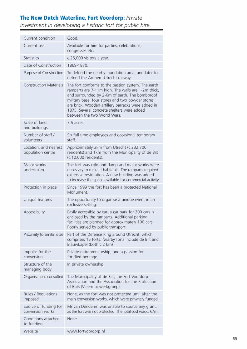
55
The New Dutch Waterline, Fort Voordorp: Privateinvestment in developing a historic fort for public hire.
Current condition Good.
Current use Available for hire for parties, celebrations, congresses etc.
Statistics c.25,000 visitors a year.
Date of Construction 1869-1870.
Purpose of Construction To defend the nearby inundation area, and later to defend the Arnhem-Utrecht railway.
Construction Materials The fort conforms to the bastion system. The earth ramparts are 7-11m high. The walls are 1-2m thick,and surrounded by 2-6m of earth. The bombproof military base, four stores and two powder stores are brick. Wooden artillery barracks were added in 1875. Several concrete shelters were added between the two World Wars.
Scale of land 7.5 acres. and buildings
Number of staff / Six full time employees and occasional temporary volunteers staff.
Location, and nearest Approximately 3km from Utrecht (c.232,700 population centre residents) and 1km from the Municipality of de Bilt
(c.10,000 residents).
Major works The fort was cold and damp and major works wereundertaken necessary to make it habitable. The ramparts required
extensive restoration. A new building was addedto increase the space available for commercial activity.
Protection in place Since 1999 the fort has been a protected National Monument.
Unique features The opportunity to organise a unique event in an exclusive setting.
Accessibility Easily accessible by car: a car park for 200 cars is enclosed by the ramparts. Additional parking facilities are planned for approximately 100 cars. Poorly served by public transport.
Proximity to similar sites Part of the Defence Ring around Utrecht, which comprises 15 forts. Nearby forts include de Bilt andBlauwkapel (both c.2 km)
Impulse for the Private entrepreneurship, and a passion forconversion fortified heritage.
Structure of the In private ownership.managing body
Organisations consulted The Municipality of de Bilt, the Fort Voordorp Association and the Association for the Protection of Bats (Vleermuiswerkgroep).
Rules / Regulations None, as the fort was not protected until after the imposed main conversion works, which were privately funded.
Source of funding for Mr van Denderen was unable to source any grant, conversion works as the fort was not protected. The total cost was c.€7m.
Conditions attached None.to funding
Website www.fortvoordorp.nl
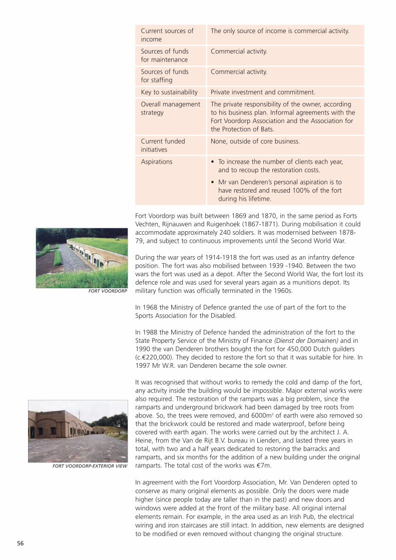
FORT VOORDORP
FORT VOORDORP-EXTERIOR VIEW
56
Current sources of The only source of income is commercial activity. income
Sources of funds Commercial activity.for maintenance
Sources of funds Commercial activity.for staffing
Key to sustainability Private investment and commitment.
Overall management The private responsibility of the owner, according strategy to his business plan. Informal agreements with the
Fort Voordorp Association and the Association for the Protection of Bats.
Current funded None, outside of core business.initiatives
Aspirations • To increase the number of clients each year, and to recoup the restoration costs.
• Mr van Denderen’s personal aspiration is to have restored and reused 100% of the fort during his lifetime.
Fort Voordorp was built between 1869 and 1870, in the same period as FortsVechten, Rijnauwen and Ruigenhoek (1867-1871). During mobilisation it couldaccommodate approximately 240 soldiers. It was modernised between 1878-79, and subject to continuous improvements until the Second World War.
During the war years of 1914-1918 the fort was used as an infantry defenceposition. The fort was also mobilised between 1939 -1940. Between the twowars the fort was used as a depot. After the Second World War, the fort lost itsdefence role and was used for several years again as a munitions depot. Itsmilitary function was officially terminated in the 1960s.
In 1968 the Ministry of Defence granted the use of part of the fort to theSports Association for the Disabled.
In 1988 the Ministry of Defence handed the administration of the fort to theState Property Service of the Ministry of Finance (Dienst der Domainen) and in1990 the van Denderen brothers bought the fort for 450,000 Dutch guilders(c.€220,000). They decided to restore the fort so that it was suitable for hire. In1997 Mr W.R. van Denderen became the sole owner.
It was recognised that without works to remedy the cold and damp of the fort,any activity inside the building would be impossible. Major external works werealso required. The restoration of the ramparts was a big problem, since theramparts and underground brickwork had been damaged by tree roots fromabove. So, the trees were removed, and 6000m3 of earth were also removed sothat the brickwork could be restored and made waterproof, before beingcovered with earth again. The works were carried out by the architect J. A.Heine, from the Van de Rijt B.V. bureau in Lienden, and lasted three years intotal, with two and a half years dedicated to restoring the barracks andramparts, and six months for the addition of a new building under the originalramparts. The total cost of the works was €7m.
In agreement with the Fort Voordorp Association, Mr. Van Denderen opted toconserve as many original elements as possible. Only the doors were madehigher (since people today are taller than in the past) and new doors andwindows were added at the front of the military base. All original internalelements remain. For example, in the area used as an Irish Pub, the electricalwiring and iron staircases are still intact. In addition, new elements are designedto be modified or even removed without changing the original structure.
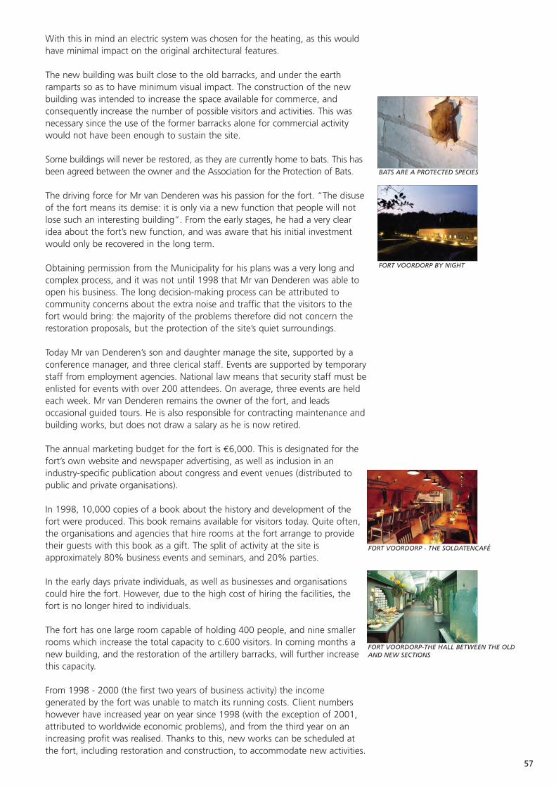
57
With this in mind an electric system was chosen for the heating, as this wouldhave minimal impact on the original architectural features.
The new building was built close to the old barracks, and under the earthramparts so as to have minimum visual impact. The construction of the newbuilding was intended to increase the space available for commerce, andconsequently increase the number of possible visitors and activities. This wasnecessary since the use of the former barracks alone for commercial activitywould not have been enough to sustain the site.
Some buildings will never be restored, as they are currently home to bats. This hasbeen agreed between the owner and the Association for the Protection of Bats.
The driving force for Mr van Denderen was his passion for the fort. “The disuseof the fort means its demise: it is only via a new function that people will notlose such an interesting building”. From the early stages, he had a very clearidea about the fort’s new function, and was aware that his initial investmentwould only be recovered in the long term.
Obtaining permission from the Municipality for his plans was a very long andcomplex process, and it was not until 1998 that Mr van Denderen was able toopen his business. The long decision-making process can be attributed tocommunity concerns about the extra noise and traffic that the visitors to thefort would bring: the majority of the problems therefore did not concern therestoration proposals, but the protection of the site’s quiet surroundings.
Today Mr van Denderen’s son and daughter manage the site, supported by aconference manager, and three clerical staff. Events are supported by temporarystaff from employment agencies. National law means that security staff must beenlisted for events with over 200 attendees. On average, three events are heldeach week. Mr van Denderen remains the owner of the fort, and leadsoccasional guided tours. He is also responsible for contracting maintenance andbuilding works, but does not draw a salary as he is now retired.
The annual marketing budget for the fort is €6,000. This is designated for thefort’s own website and newspaper advertising, as well as inclusion in anindustry-specific publication about congress and event venues (distributed topublic and private organisations).
In 1998, 10,000 copies of a book about the history and development of thefort were produced. This book remains available for visitors today. Quite often,the organisations and agencies that hire rooms at the fort arrange to providetheir guests with this book as a gift. The split of activity at the site isapproximately 80% business events and seminars, and 20% parties.
In the early days private individuals, as well as businesses and organisationscould hire the fort. However, due to the high cost of hiring the facilities, thefort is no longer hired to individuals.
The fort has one large room capable of holding 400 people, and nine smallerrooms which increase the total capacity to c.600 visitors. In coming months anew building, and the restoration of the artillery barracks, will further increasethis capacity.
From 1998 - 2000 (the first two years of business activity) the incomegenerated by the fort was unable to match its running costs. Client numbershowever have increased year on year since 1998 (with the exception of 2001,attributed to worldwide economic problems), and from the third year on anincreasing profit was realised. Thanks to this, new works can be scheduled atthe fort, including restoration and construction, to accommodate new activities.
BATS ARE A PROTECTED SPECIES
FORT VOORDORP BY NIGHT
FORT VOORDORP - THE SOLDATENCAFÉ
FORT VOORDORP-THE HALL BETWEEN THE OLDAND NEW SECTIONS

It must however be noted that the restoration costs will only be recovered inthe long-term. Private investment and commitment has been crucial to therevitalisation of Fort Voordorp.
Mr van Denderen, Owner of Fort Voordorp.Maurizio Purcaro, International Contact,Project Bureau Nieuwe
Hollandse Waterlinie.FORT VOORDORP-REFRESHMENT FACILITIES
58
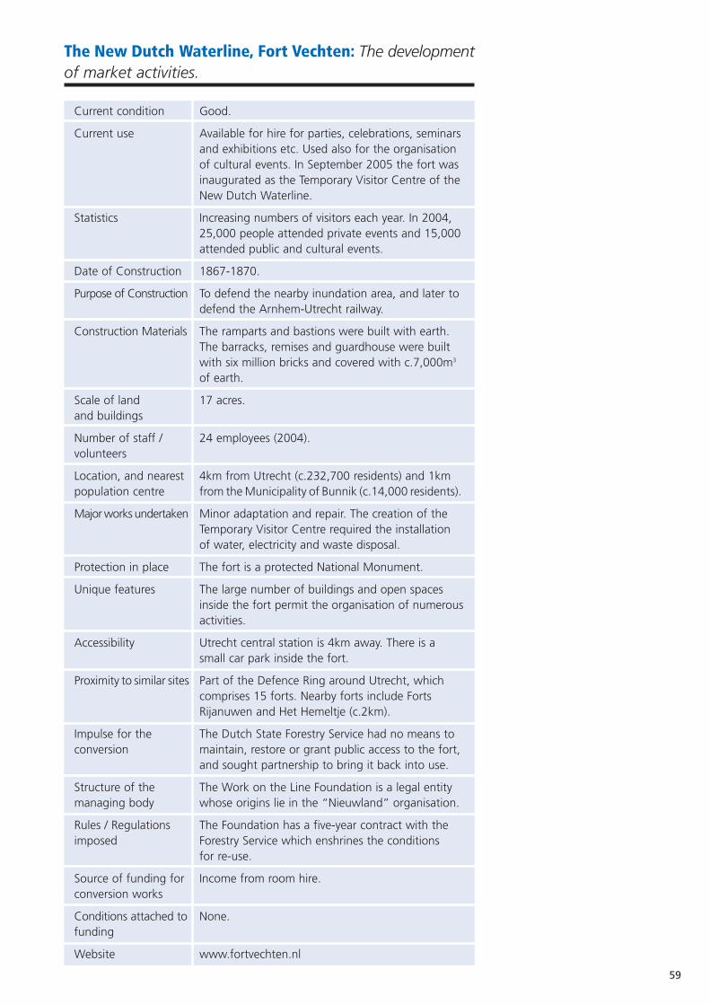
59
The New Dutch Waterline, Fort Vechten: The developmentof market activities.
Current condition Good.
Current use Available for hire for parties, celebrations, seminarsand exhibitions etc. Used also for the organisation of cultural events. In September 2005 the fort was inaugurated as the Temporary Visitor Centre of the New Dutch Waterline.
Statistics Increasing numbers of visitors each year. In 2004, 25,000 people attended private events and 15,000 attended public and cultural events.
Date of Construction 1867-1870.
Purpose of Construction To defend the nearby inundation area, and later to defend the Arnhem-Utrecht railway.
Construction Materials The ramparts and bastions were built with earth. The barracks, remises and guardhouse were built with six million bricks and covered with c.7,000m3
of earth.
Scale of land 17 acres.and buildings
Number of staff / 24 employees (2004). volunteers
Location, and nearest 4km from Utrecht (c.232,700 residents) and 1km population centre from the Municipality of Bunnik (c.14,000 residents).
Major works undertaken Minor adaptation and repair. The creation of the Temporary Visitor Centre required the installation of water, electricity and waste disposal.
Protection in place The fort is a protected National Monument.
Unique features The large number of buildings and open spaces inside the fort permit the organisation of numerousactivities.
Accessibility Utrecht central station is 4km away. There is a small car park inside the fort.
Proximity to similar sites Part of the Defence Ring around Utrecht, which comprises 15 forts. Nearby forts include Forts Rijanuwen and Het Hemeltje (c.2km).
Impulse for the The Dutch State Forestry Service had no means to conversion maintain, restore or grant public access to the fort,
and sought partnership to bring it back into use.
Structure of the The Work on the Line Foundation is a legal entity managing body whose origins lie in the “Nieuwland” organisation.
Rules / Regulations The Foundation has a five-year contract with the imposed Forestry Service which enshrines the conditions
for re-use.
Source of funding for Income from room hire.conversion works
Conditions attached to None.funding
Website www.fortvechten.nl
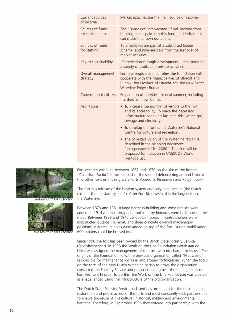
Current sources Market activities are the main source of income.of income
Sources of funds The “Friends of Fort Vechten” fund. Income from for maintenance building hire is paid into this fund, and individuals
can make their own donations.
Sources of funds 15 employees are part of a subsidised labour for staffing scheme, and nine are paid from the turnover of
market activities.
Key to sustainability “Preservation through development”: incorporatinga variety of public and private activities.
Overall management For new projects and activities the foundation will strategy cooperate with the Municipalities of Utrecht and
Bunnik, the Province of Utrecht and the New DutchWaterline Project Bureau.
Currentfundedinitiatives Preparation of activities for next summer, including the third Summer Camp.
Aspirations • To increase the number of visitors to the fort, and its accessibility. To make the necessary infrastructure works to facilitate this (water, gas, sewage and electricity).
• To develop the fort as the Waterline’s National Centre for culture and recreation.
• The collective vision of the Waterline region is described in the planning document “Linieperspectief for 2020”. The Line will be proposed for inclusion in UNESCO’s World Heritage List.
Fort Vechten was built between 1867 and 1870 on the site of the Roman“Castellum Factio”. It formed part of the second defence ring around Utrecht(the other forts in this ring were Forts Voordorp, Rijnauwen and Ruigenhoek).
The fort is a mixture of the bastion system and polygonal system (the Dutchcalled it the “bastard system”). After Fort Rijnauwen, it is the largest fort ofthe Waterline.
Between 1879 and 1881 a large barracks building and some remises wereadded. In 1914 a dozen shrapnel-proof infantry hideouts were built outside themoat. Between 1939 and 1940 various bombproof infantry shelters wereconstructed outside the moat, and three concrete covered machinegunpositions with steel cupolas were added on top of the fort. During mobilisation600 soldiers could be housed inside.
Since 1996 the fort has been owned by the Dutch State Forestry Service(Staatsbosbeheer). In 1998 the Work on the Line Foundation (Werk aan deLinie) was assigned the management of the fort, with no charge for its use. Theorigins of the Foundation lie with a previous organisation called “Nieuwland”,responsible for maintenance works in and around fortifications. When the focuson the forts of the New Dutch Waterline began to grow, the organisationcontacted the Forestry Service and proposed taking over the management ofFort Vechten. In order to do this, the Work on the Line Foundation was createdas a legal entity, using the infrastructure of the old organisation.
The Dutch State Forestry Service had, and has, no means for the maintenance,restoration and public access of the forts and must constantly seek partnershipsto enable the reuse of this cultural, historical, military and environmentalheritage. Therefore, in September 1998 they entered into partnership with the
BARRACKS AT FORT VECHTEN
THE REDUIT AT FORT VECHTEN
60
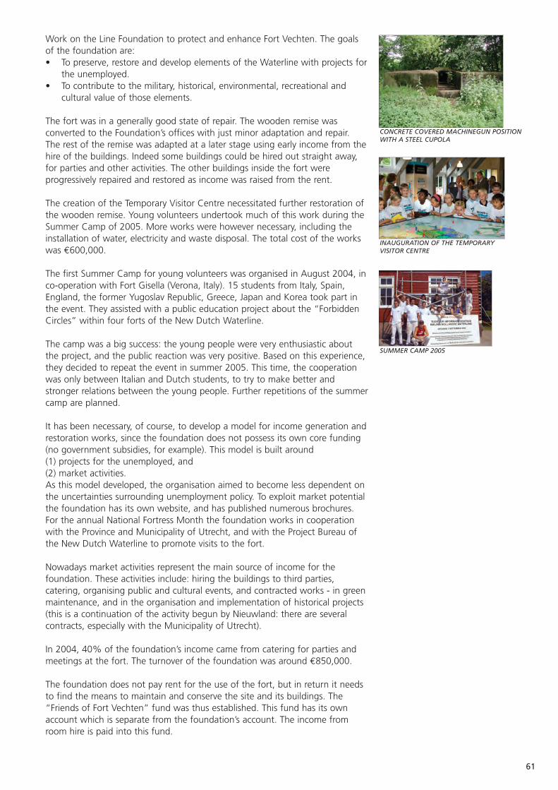
61
Work on the Line Foundation to protect and enhance Fort Vechten. The goalsof the foundation are:• To preserve, restore and develop elements of the Waterline with projects for
the unemployed.• To contribute to the military, historical, environmental, recreational and
cultural value of those elements.
The fort was in a generally good state of repair. The wooden remise wasconverted to the Foundation’s offices with just minor adaptation and repair. The rest of the remise was adapted at a later stage using early income from thehire of the buildings. Indeed some buildings could be hired out straight away,for parties and other activities. The other buildings inside the fort wereprogressively repaired and restored as income was raised from the rent.
The creation of the Temporary Visitor Centre necessitated further restoration ofthe wooden remise. Young volunteers undertook much of this work during theSummer Camp of 2005. More works were however necessary, including theinstallation of water, electricity and waste disposal. The total cost of the workswas €600,000.
The first Summer Camp for young volunteers was organised in August 2004, inco-operation with Fort Gisella (Verona, Italy). 15 students from Italy, Spain,England, the former Yugoslav Republic, Greece, Japan and Korea took part inthe event. They assisted with a public education project about the “ForbiddenCircles” within four forts of the New Dutch Waterline.
The camp was a big success: the young people were very enthusiastic aboutthe project, and the public reaction was very positive. Based on this experience,they decided to repeat the event in summer 2005. This time, the cooperationwas only between Italian and Dutch students, to try to make better andstronger relations between the young people. Further repetitions of the summercamp are planned.
It has been necessary, of course, to develop a model for income generation andrestoration works, since the foundation does not possess its own core funding(no government subsidies, for example). This model is built around (1) projects for the unemployed, and (2) market activities. As this model developed, the organisation aimed to become less dependent onthe uncertainties surrounding unemployment policy. To exploit market potentialthe foundation has its own website, and has published numerous brochures.For the annual National Fortress Month the foundation works in cooperationwith the Province and Municipality of Utrecht, and with the Project Bureau ofthe New Dutch Waterline to promote visits to the fort.
Nowadays market activities represent the main source of income for thefoundation. These activities include: hiring the buildings to third parties,catering, organising public and cultural events, and contracted works - in greenmaintenance, and in the organisation and implementation of historical projects(this is a continuation of the activity begun by Nieuwland: there are severalcontracts, especially with the Municipality of Utrecht).
In 2004, 40% of the foundation’s income came from catering for parties andmeetings at the fort. The turnover of the foundation was around €850,000.
The foundation does not pay rent for the use of the fort, but in return it needsto find the means to maintain and conserve the site and its buildings. The“Friends of Fort Vechten” fund was thus established. This fund has its ownaccount which is separate from the foundation’s account. The income fromroom hire is paid into this fund.
CONCRETE COVERED MACHINEGUN POSITIONWITH A STEEL CUPOLA
INAUGURATION OF THE TEMPORARY VISITOR CENTRE
SUMMER CAMP 2005

Since 2003, individuals can also become “friends” of the fort, and theirdonations are paid into the same account. In 2004, this fund totalled around€65,000. This fund is used to maintain the site and its buildings, and allowpublic access and cultural events. Money from the fund also contributestowards cultural and historical projects of the Forestry Service, and thefoundation.
Fort Vechten is today a good example of “preservation through development”.A variety of activities take place, not only private events, but also public ones,such as the open days on Sundays (from May until mid July, and from midAugust until the third weekend in October); the “National Fortress Month” inSeptember and the “National Day for Public Access of Monuments”, also inSeptember.
Plans are in place to develop the fort as the Waterline’s National Centre forculture and recreation. The province of Utrecht has joined forces with theForestry Service, the city of Bunnik, the New Dutch Waterline Project Bureauand the management of the fort to build a plan for the fort’s future (includingmodern culture, a children’s playground, a party centre and potentially ahostel).
Fort Vechten also hosts cultural activities like theatre performances of “TheCherry Garden”, the “Utrecht Monument Night” and the largest public arts andcrafts event using European wood in the Netherlands: “Designers in Wood”.
Martin Vastenhout, Director, Werk aan de Linie.Marijke Bekkenkamp, Project Leader, Province of Utrecht.
Maurizio Purcaro, International Contact, Project Bureau NieuweHollandse Waterlinie.
VISITORS TO FORT VECHTEN
KERSENTUIN EVENT AT FORT VECHTEN
62
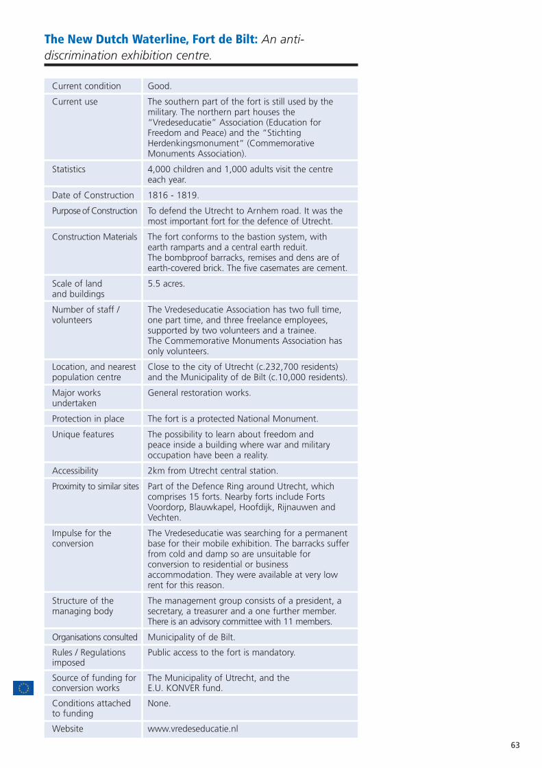
63
The New Dutch Waterline, Fort de Bilt: An anti-discrimination exhibition centre.
Current condition Good.
Current use The southern part of the fort is still used by the military. The northern part houses the “Vredeseducatie” Association (Education for Freedom and Peace) and the “Stichting Herdenkingsmonument” (Commemorative Monuments Association).
Statistics 4,000 children and 1,000 adults visit the centre each year.
Date of Construction 1816 - 1819.
Purpose of Construction To defend the Utrecht to Arnhem road. It was the most important fort for the defence of Utrecht.
Construction Materials The fort conforms to the bastion system, with earth ramparts and a central earth reduit.The bombproof barracks, remises and dens are of earth-covered brick. The five casemates are cement.
Scale of land 5.5 acres.and buildings
Number of staff / The Vredeseducatie Association has two full time, volunteers one part time, and three freelance employees,
supported by two volunteers and a trainee. The Commemorative Monuments Association hasonly volunteers.
Location, and nearest Close to the city of Utrecht (c.232,700 residents) population centre and the Municipality of de Bilt (c.10,000 residents).
Major works General restoration works.undertaken
Protection in place The fort is a protected National Monument.
Unique features The possibility to learn about freedom andpeace inside a building where war and military occupation have been a reality.
Accessibility 2km from Utrecht central station.
Proximity to similar sites Part of the Defence Ring around Utrecht, which comprises 15 forts. Nearby forts include Forts Voordorp, Blauwkapel, Hoofdijk, Rijnauwen and Vechten.
Impulse for the The Vredeseducatie was searching for a permanentconversion base for their mobile exhibition. The barracks suffer
from cold and damp so are unsuitable for conversion to residential or business accommodation. They were available at very low rent for this reason.
Structure of the The management group consists of a president, a managing body secretary, a treasurer and a one further member.
There is an advisory committee with 11 members.
Organisations consulted Municipality of de Bilt.
Rules / Regulations Public access to the fort is mandatory.imposed
Source of funding for The Municipality of Utrecht, and the conversion works E.U. KONVER fund.
Conditions attached None.to funding
Website www.vredeseducatie.nl

THE FORT DIVIDED FROM THE NEW ROAD
AERIAL VIEW OF FORT DE BILT
64
Current sources Private donations; the Municipalities of Utrecht andof income de Bilt; entrance fees and the sale of educational
products and publications.
Sources of funds The Municipality of Utrecht, and the support of afor maintenance group of volunteers who carry out light
maintenance and cleaning.
Sources of funds The majority of the funding is reserved for the for staffing development of educational material, meaning that
the association itself cannot fund many staff. They are paid by the Ministry of Welfare, and private funds. The Commemorative Monuments Association does not get any subsidy, and thus is dependent on donations.
Key to sustainability • Thanks to the way the exhibition is organised (visitors follow the route by themselves) the association does not require many employees and has found equilibrium between budget and activities.
• Income from rent, entrance fees and sales are used to finance the production of educational products, and to improve the exhibition.
Overall management The association will follow the same re-use strategystrategy to involve all buildings in the fort complex in the
educational exhibition.
Current funded The association has proposed to the Waterline initiatives Commission a project to expand the educational
exhibition to the ramparts, to better connect with the historical role of the fort and the New Dutch Waterline.
Aspirations • To improve visitor numbers and strengthen links with the whole of the New Dutch Waterline.
• The collective vision of the Waterline region is described in the planning document “Linieperspectief for 2020”. The Line will be proposed for inclusion in UNESCO’s World Heritage List.
Fort de Bilt was built between 1816-1819 and was part of the first defence ringof forts around Utrecht. It was improved throughout the 19th and 20thcenturies, with the construction of the guardhouse in 1850, the bombproofbarracks in 1875-77, and various remises and dens.
During the three mobilisations (the 1870 Franco-Prussian war, and both WorldWars) 250 soldiers lived in the fort, and it was armed with 34 cannons. In 1930the street dividing the fort was extended and the bombproof barracks and fortwere separated into two. The reduit and guardhouse were demolished and ascompensation, five new cement casemates were built into the ramparts. A newguardhouse was added in 1935.
During the German occupation, 140 Dutch resistance workers were shot deadin the fort.
The fort remains divided in two today. The southern part of the fort containsresidential houses and is still used by the military as barracks for the “RoyalMarechausse”. Since 1997, the Municipality of Utrecht has owned the northernpart of the fort. The passage from the Ministry of Defence to the Municipalityof Utrecht was quick and easy: the municipality paid only a symbolic amount ofone Dutch guilder (€0.50).
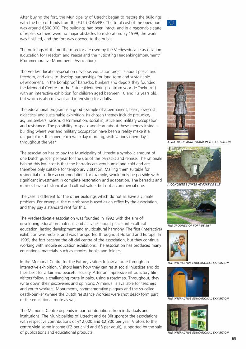
65
After buying the fort, the Municipality of Utrecht began to restore the buildingswith the help of funds from the E.U. (KONVER). The total cost of the operationwas around €500,000. The buildings had been intact, and in a reasonable stateof repair, so there were no major obstacles to restoration. By 1999, the workwas finished, and the fort was opened to the public.
The buildings of the northern sector are used by the Vredeseducatie association(Education for Freedom and Peace) and the “Stichting Herdenkingsmonument”(Commemorative Monuments Association).
The Vredeseducatie association develops education projects about peace andfreedom, and aims to develop partnerships for long-term and sustainabledevelopment. In the bombproof barracks, bunkers and depots they foundedthe Memorial Centre for the Future (Herinneringscentrum voor de Toekomst)with an interactive exhibition for children aged between 10 and 13 years old,but which is also relevant and interesting for adults.
The educational program is a good example of a permanent, basic, low-costdidactical and sustainable exhibition. Its chosen themes include prejudice,asylum seekers, racism, discrimination, social injustice and military occupationand resistance. The possibility to speak and learn about these themes inside abuilding where war and military occupation have been a reality make it aunique place. It is open each weekday morning, with various open daysthroughout the year.
The association has to pay the Municipality of Utrecht a symbolic amount ofone Dutch guilder per year for the use of the barracks and remise. The rationalebehind this low cost is that the barracks are very humid and cold and aretherefore only suitable for temporary visitation. Making them suitable forresidential or office accommodation, for example, would only be possible withsignificant investment in complete restoration and adaptation. The barracks andremises have a historical and cultural value, but not a commercial one.
The case is different for the other buildings which do not all have a climateproblem. For example, the guardhouse is used as an office by the association,and they pay a standard rent for this.
The Vredeseducatie association was founded in 1992 with the aim ofdeveloping education materials and activities about peace, interculturaleducation, lasting development and multicultural harmony. The first (interactive)exhibition was mobile, and was transported throughout Holland and Europe. In1999, the fort became the official centre of the association, but they continueworking with mobile education exhibitions. The association has produced manyeducational materials, such as movies, books and folders.
In the Memorial Centre for the Future, visitors follow a route through aninteractive exhibition. Visitors learn how they can resist social injustices and dotheir best for a fair and peaceful society. After an impressive introductory film,visitors follow a challenging route in pairs, using a roadmap. Throughout, theywrite down their discoveries and opinions. A manual is available for teachersand youth workers. Monuments, commemorative plaques and the so-calleddeath-bunker (where the Dutch resistance workers were shot dead) form partof the educational route as well.
The Memorial Centre depends in part on donations from individuals andinstitutions. The Municipalities of Utrecht and de Bilt sponsor the associationswith respective contributions of €12,000 and €2,300 per year. Visitors to thecentre yield some income (€2 per child and €3 per adult), supported by the saleof publications and educational products.
A STATUE OF ANNE FRANK IN THE EXHIBITION
A CONCRETE BUNKER AT FORT DE BILT
THE GROUNDS OF FORT DE BILT
THE INTERACTIVE EDUCATIONAL EXHIBITION
THE INTERACTIVE EDUCATIONAL EXHIBITION
THE INTERACTIVE EDUCATIONAL EXHIBITION

66
Main sponsors and donators include:• The National Committee for International Cooperation and
Sustainable Development.• The Dutch Foundation for Children’s Welfare Stamps.• The European Union (TACIS Democracy Programme).• The National Bank Lottery. • The Haëlla Foundation.• The Municipality of Utrecht.• The Province of Utrecht.• The Dutch Ministry of Wellbeing, Public Health and Sport.• The Dutch Ministry of Education, Culture and Science. • The Flemish Ministry of Education.• The Dialogue Foundation.• The National Committee of the 4th and 5th May.• The Catholic Needs Association.• Rabobank Utrecht.• The Madurodam Support Fund.• The K.F. Heyn Fund Association.• The Elise Mathilde Fund.• The VSB Fund.• Kerckebosch Printing.• The Utrecht Construction Association.• The Lions Club of Utrecht. • AutoRent Vitesse.
One problem for the association is that the major part of the funding isreserved for the development of educational materials. So, the association hasonly minimal resources to pay for staff to work in the centre. In fact, only twopeople work full time, whilst a third person works part-time. They are paid by asubsidy from the Ministry of Welfare, and supported by two volunteers and atrainee. Except for special occasions, there are no other economic activities inthe fort and the socio-economic impact on the area is very low.
The association publicises its activities by advertising on television and radio,and by articles in newspapers. But the most important marketing tool is simplyinforming the schools of what is available, by sending a yearly letter to allschools in the Municipalities of Utrecht and de Bilt. The association offers a busto transport the children from their school, the costs of which are funded bythe Dutch Bank Rabobank, from their fund for good causes.
The Commemorative Monuments Association works to conserve the“Fusilladeplaats” of “Bloedbaan” (Site of the Fusillade’s Bloodbath). Since1946, they have organised an annual commemoration of the shooting of 140people during the German occupation (each Saturday prior to 4th May).
Mr Geu Visser, Manager, Vredeseducatie Association. Maurizio Purcaro, International Contact, Project Bureau Nieuwe
Hollandse Waterlinie.
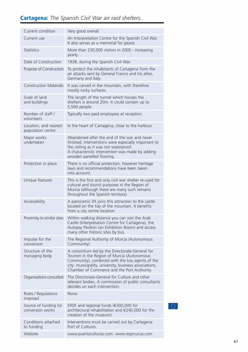
67
Cartagena: The Spanish Civil War air raid shelters.
Current condition Very good overall.
Current use An Interpretation Centre for the Spanish Civil War.It also serves as a memorial for peace.
Statistics More than 230,000 visitors in 2005 - increasing yearly.
Date of Construction 1938, during the Spanish Civil War.
Purpose of Construction To protect the inhabitants of Cartagena from the air attacks sent by General Franco and his allies, Germany and Italy.
Construction Materials It was carved in the mountain, with therefore mostly rocky surfaces.
Scale of land The length of the tunnel which houses the and buildings shelters is around 20m. It could contain up to
5,500 people.
Number of staff / Typically two paid employees at reception.volunteers
Location, and nearest In the heart of Cartagena, close to the harbour.population centre
Major works Abandoned after the end of the war and never undertaken finished. Interventions were especially important to
the ceiling as it was not waterproof.A characteristic intervention was made by adding wooden panelled flooring.
Protection in place There is no official protection, however heritage laws and recommendations have been takeninto account.
Unique features This is the first and only civil war shelter re-used forcultural and tourist purposes in the Region of Murcia (although there are many such remains throughout the Spanish territory).
Accessibility A panoramic lift joins this attraction to the castle located on the top of the mountain. It benefits from a city centre location.
Proximity to similar sites Within walking distance you can visit the Arab Castle (Interpretation Centre for Cartagena), the Autopsy Pavilion (an Exhibition Room) and access many other historic sites by bus.
Impulse for the The Regional Authority of Murcia (Autonomous conversion Community).
Structure of the A consortium led by the Directorate-General for managing body Tourism in the Region of Murcia (Autonomous
Community), combined with the key agents of the city: municipality, university, business associations, Chamber of Commerce and the Port Authority.
Organisations consulted The Directorate-General for Culture and other relevant bodies. A commission of public consultantsdecides on each intervention.
Rules / Regulations None.imposed
Source of funding for ERDF and regional funds (€300,000 for conversion works architectural rehabilitation and €240,000 for the
creation of the museum).
Conditions attached Interventions must be carried out by Cartagena: to funding Port of Cultures.
Website www.puertoculturas.com. www.regmurcia.com
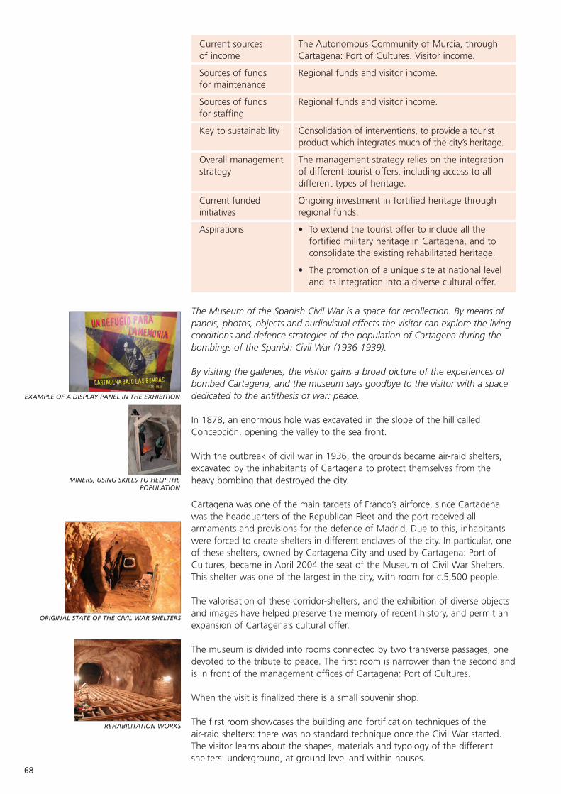
EXAMPLE OF A DISPLAY PANEL IN THE EXHIBITION
MINERS, USING SKILLS TO HELP THEPOPULATION
ORIGINAL STATE OF THE CIVIL WAR SHELTERS
REHABILITATION WORKS
68
Current sources The Autonomous Community of Murcia, through of income Cartagena: Port of Cultures. Visitor income.
Sources of funds Regional funds and visitor income.for maintenance
Sources of funds Regional funds and visitor income.for staffing
Key to sustainability Consolidation of interventions, to provide a tourist product which integrates much of the city’s heritage.
Overall management The management strategy relies on the integration strategy of different tourist offers, including access to all
different types of heritage.
Current funded Ongoing investment in fortified heritage through initiatives regional funds.
Aspirations • To extend the tourist offer to include all the fortified military heritage in Cartagena, and to consolidate the existing rehabilitated heritage.
• The promotion of a unique site at national level and its integration into a diverse cultural offer.
The Museum of the Spanish Civil War is a space for recollection. By means ofpanels, photos, objects and audiovisual effects the visitor can explore the livingconditions and defence strategies of the population of Cartagena during thebombings of the Spanish Civil War (1936-1939).
By visiting the galleries, the visitor gains a broad picture of the experiences ofbombed Cartagena, and the museum says goodbye to the visitor with a spacededicated to the antithesis of war: peace.
In 1878, an enormous hole was excavated in the slope of the hill calledConcepción, opening the valley to the sea front.
With the outbreak of civil war in 1936, the grounds became air-raid shelters,excavated by the inhabitants of Cartagena to protect themselves from theheavy bombing that destroyed the city.
Cartagena was one of the main targets of Franco’s airforce, since Cartagenawas the headquarters of the Republican Fleet and the port received allarmaments and provisions for the defence of Madrid. Due to this, inhabitantswere forced to create shelters in different enclaves of the city. In particular, oneof these shelters, owned by Cartagena City and used by Cartagena: Port ofCultures, became in April 2004 the seat of the Museum of Civil War Shelters.This shelter was one of the largest in the city, with room for c.5,500 people.
The valorisation of these corridor-shelters, and the exhibition of diverse objectsand images have helped preserve the memory of recent history, and permit anexpansion of Cartagena’s cultural offer.
The museum is divided into rooms connected by two transverse passages, onedevoted to the tribute to peace. The first room is narrower than the second andis in front of the management offices of Cartagena: Port of Cultures.
When the visit is finalized there is a small souvenir shop.
The first room showcases the building and fortification techniques of the air-raid shelters: there was no standard technique once the Civil War started.The visitor learns about the shapes, materials and typology of the differentshelters: underground, at ground level and within houses.
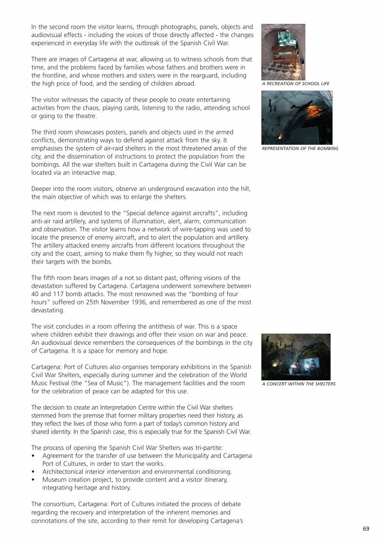
69
In the second room the visitor learns, through photographs, panels, objects andaudiovisual effects - including the voices of those directly affected - the changesexperienced in everyday life with the outbreak of the Spanish Civil War.
There are images of Cartagena at war, allowing us to witness schools from thattime, and the problems faced by families whose fathers and brothers were inthe frontline, and whose mothers and sisters were in the rearguard, includingthe high price of food, and the sending of children abroad.
The visitor witnesses the capacity of these people to create entertainingactivities from the chaos, playing cards, listening to the radio, attending schoolor going to the theatre.
The third room showcases posters, panels and objects used in the armedconflicts, demonstrating ways to defend against attack from the sky. Itemphasises the system of air-raid shelters in the most threatened areas of thecity, and the dissemination of instructions to protect the population from thebombings. All the war shelters built in Cartagena during the Civil War can belocated via an interactive map.
Deeper into the room visitors, observe an underground excavation into the hill,the main objective of which was to enlarge the shelters.
The next room is devoted to the “Special defence against aircrafts”, includinganti-air raid artillery, and systems of illumination, alert, alarm, communicationand observation. The visitor learns how a network of wire-tapping was used tolocate the presence of enemy aircraft, and to alert the population and artillery.The artillery attacked enemy aircrafts from different locations throughout thecity and the coast, aiming to make them fly higher, so they would not reachtheir targets with the bombs.
The fifth room bears images of a not so distant past, offering visions of thedevastation suffered by Cartagena. Cartagena underwent somewhere between40 and 117 bomb attacks. The most renowned was the “bombing of fourhours” suffered on 25th November 1936, and remembered as one of the mostdevastating.
The visit concludes in a room offering the antithesis of war. This is a spacewhere children exhibit their drawings and offer their vision on war and peace.An audiovisual device remembers the consequences of the bombings in the cityof Cartagena. It is a space for memory and hope.
Cartagena: Port of Cultures also organises temporary exhibitions in the SpanishCivil War Shelters, especially during summer and the celebration of the WorldMusic Festival (the “Sea of Music”). The management facilities and the roomfor the celebration of peace can be adapted for this use.
The decision to create an Interpretation Centre within the Civil War sheltersstemmed from the premise that former military properties need their history, asthey reflect the lives of those who form a part of today’s common history andshared identity. In the Spanish case, this is especially true for the Spanish Civil War.
The process of opening the Spanish Civil War Shelters was tri-partite:• Agreement for the transfer of use between the Municipality and Cartagena
Port of Cultures, in order to start the works.• Architectonical interior intervention and environmental conditioning.• Museum creation project, to provide content and a visitor itinerary,
integrating heritage and history.
The consortium, Cartagena: Port of Cultures initiated the process of debateregarding the recovery and interpretation of the inherent memories andconnotations of the site, according to their remit for developing Cartagena’s
A RECREATION OF SCHOOL LIFE
REPRESENTATION OF THE BOMBING
A CONCERT WITHIN THE SHELTERS
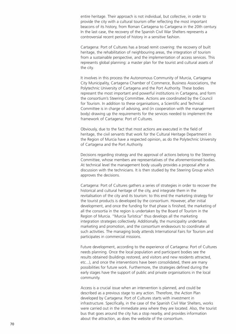
70
entire heritage. Their approach is not individual, but collective, in order toprovide the city with a cultural tourism offer reflecting the most importantbeacons of its history, from Roman Cartagena to Cartagena in the 20th century.In the last case, the recovery of the Spanish Civil War Shelters represents acontroversial recent period of history in a sensitive fashion.
Cartagena: Port of Cultures has a broad remit covering: the recovery of builtheritage, the rehabilitation of neighbouring areas, the integration of tourismfrom a sustainable perspective, and the implementation of access services. Thisrepresents global planning: a master plan for the tourist and cultural assets ofthe city.
It involves in this process the Autonomous Community of Murcia, CartagenaCity Municipality, Cartagena Chamber of Commerce, Business Associations, thePolytechnic University of Cartagena and the Port Authority. These bodiesrepresent the most important and powerful institutions in Cartagena, and formthe consortium’s Steering Committee. Actions are coordinated by the Councilfor Tourism. In addition to these organisations, a Scientific and TechnicalCommittee is in charge of advising, and (in cooperation with the managementbody) drawing up the requirements for the services needed to implement theframework of Cartagena: Port of Cultures.
Obviously, due to the fact that most actions are executed in the field ofheritage, the civil servants that work for the Cultural Heritage Department inthe Region of Murcia have a respected opinion, as do the Polytechnic Universityof Cartagena and the Port Authority.
Decisions regarding strategy and the approval of actions belong to the SteeringCommittee, whose members are representatives of the aforementioned bodies.At technical level the management body usually provides a proposal after adiscussion with the technicians. It is then studied by the Steering Group whichapproves the decisions.
Cartagena: Port of Cultures gathers a series of strategies in order to recover thehistorical and cultural heritage of the city, and integrate them in therevitalisation of the city and its tourism: to this end the marketing strategy forthe tourist products is developed by the consortium. However, after initialdevelopment, and once the funding for that phase is finished, the marketing ofall the consortia in the region is undertaken by the Board of Tourism in theRegion of Murcia. “Murcia Turística” thus develops all the marketingintegration strategies collectively. Additionally, the municipality undertakesmarketing and promotion, and the consortium endeavours to coordinate allsuch activities. The managing body attends International Fairs for Tourism andparticipates in commercial missions.
Future development, according to the experience of Cartagena: Port of Culturesneeds planning. Once the local population and participant bodies see theresults obtained (buildings restored, and visitors and new residents attracted,etc...), and once the interventions have been consolidated, there are manypossibilities for future work. Furthermore, the strategies defined during theearly stages have the support of public and private organisations in the localcommunity.
Access is a crucial issue when an intervention is planned, and could bedescribed as a previous stage to any action. Therefore, the Action Plandeveloped by Cartagena: Port of Cultures starts with investment ininfrastructure. Specifically, in the case of the Spanish Civil War Shelters, workswere carried out in the immediate area where they are located. Also, the touristbus that goes around the city has a stop nearby, and provides informationabout the attraction, as does the website of the consortium.
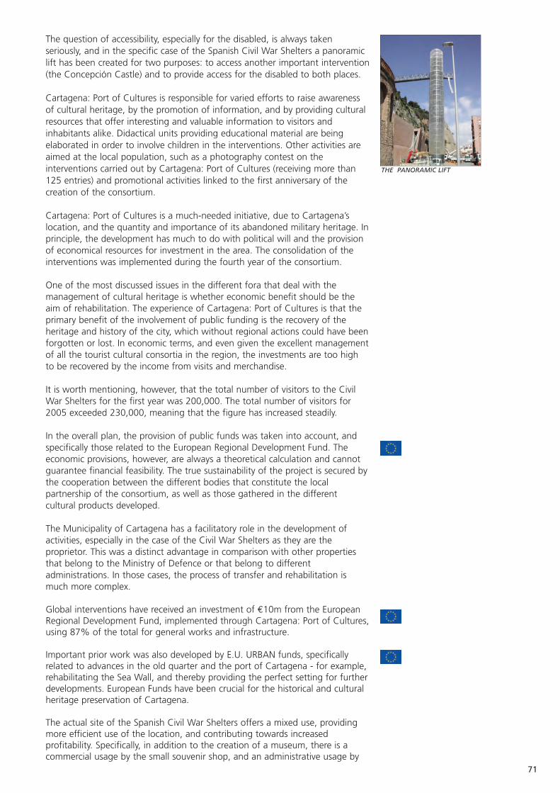
71
The question of accessibility, especially for the disabled, is always takenseriously, and in the specific case of the Spanish Civil War Shelters a panoramiclift has been created for two purposes: to access another important intervention(the Concepción Castle) and to provide access for the disabled to both places.
Cartagena: Port of Cultures is responsible for varied efforts to raise awarenessof cultural heritage, by the promotion of information, and by providing culturalresources that offer interesting and valuable information to visitors andinhabitants alike. Didactical units providing educational material are beingelaborated in order to involve children in the interventions. Other activities areaimed at the local population, such as a photography contest on theinterventions carried out by Cartagena: Port of Cultures (receiving more than125 entries) and promotional activities linked to the first anniversary of thecreation of the consortium.
Cartagena: Port of Cultures is a much-needed initiative, due to Cartagena’slocation, and the quantity and importance of its abandoned military heritage. Inprinciple, the development has much to do with political will and the provisionof economical resources for investment in the area. The consolidation of theinterventions was implemented during the fourth year of the consortium.
One of the most discussed issues in the different fora that deal with themanagement of cultural heritage is whether economic benefit should be theaim of rehabilitation. The experience of Cartagena: Port of Cultures is that theprimary benefit of the involvement of public funding is the recovery of theheritage and history of the city, which without regional actions could have beenforgotten or lost. In economic terms, and even given the excellent managementof all the tourist cultural consortia in the region, the investments are too highto be recovered by the income from visits and merchandise.
It is worth mentioning, however, that the total number of visitors to the CivilWar Shelters for the first year was 200,000. The total number of visitors for2005 exceeded 230,000, meaning that the figure has increased steadily.
In the overall plan, the provision of public funds was taken into account, andspecifically those related to the European Regional Development Fund. Theeconomic provisions, however, are always a theoretical calculation and cannotguarantee financial feasibility. The true sustainability of the project is secured bythe cooperation between the different bodies that constitute the localpartnership of the consortium, as well as those gathered in the differentcultural products developed.
The Municipality of Cartagena has a facilitatory role in the development ofactivities, especially in the case of the Civil War Shelters as they are theproprietor. This was a distinct advantage in comparison with other propertiesthat belong to the Ministry of Defence or that belong to differentadministrations. In those cases, the process of transfer and rehabilitation ismuch more complex.
Global interventions have received an investment of €10m from the EuropeanRegional Development Fund, implemented through Cartagena: Port of Cultures,using 87% of the total for general works and infrastructure.
Important prior work was also developed by E.U. URBAN funds, specificallyrelated to advances in the old quarter and the port of Cartagena - for example,rehabilitating the Sea Wall, and thereby providing the perfect setting for furtherdevelopments. European Funds have been crucial for the historical and culturalheritage preservation of Cartagena.
The actual site of the Spanish Civil War Shelters offers a mixed use, providingmore efficient use of the location, and contributing towards increasedprofitability. Specifically, in addition to the creation of a museum, there is acommercial usage by the small souvenir shop, and an administrative usage by
THE PANORAMIC LIFT

72
the offices of Cartagena: Port of Cultures, attached to the entrance of the shelters.
The Spanish Civil War Shelters have contributed to the regeneration of a wholeneighbourhood, as is complemented by the neighbouring Polytechnic University(a former naval hospital) and another of Cartagena: Port of Cultures’interventions, the Autopsy Pavilion. A wide area that was abandoned long agois in use for the local community.
The work undertaken therefore represents a new lease of life for this area,being much more visited and used than ever. The direct impact is important butthe indirect impact is noticeable throughout Cartagena.
The keys to success can be identified as:• The vital support of the public administration, and the different bodies that
keep the city alive. • The possibility of using European funding at least for the first steps, in
addition to other private and public funds.• The integrated management of the sites, taking into account prior studies
in the fields of planning, strategy and financial feasibility.• A professional managing body agreed by all, and the partnership working
of the most relevant “living powers” of the city.• The integral intervention not only in the city, but also in the region.• Commitment to the vision of a project of importance, a product based in
the reality and identity of the city.
Centro de Investigación para el Desarrollo.
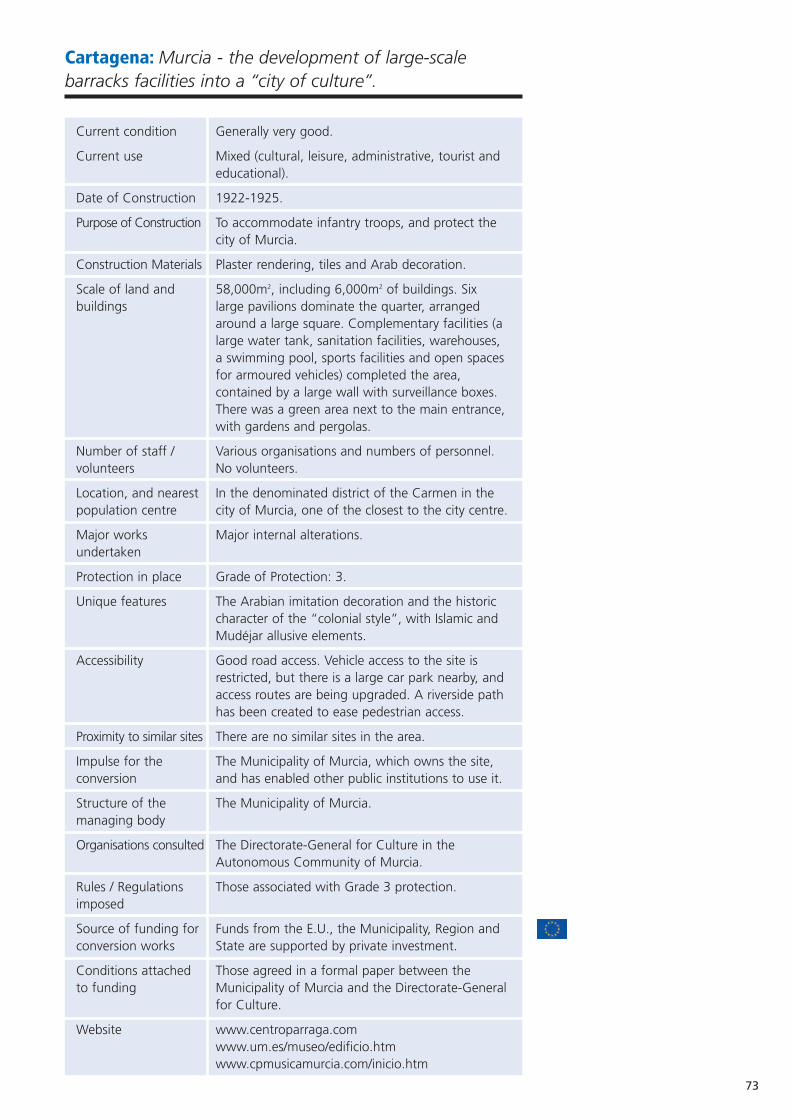
73
Cartagena: Murcia - the development of large-scalebarracks facilities into a “city of culture”.
Current condition Generally very good.
Current use Mixed (cultural, leisure, administrative, tourist and educational).
Date of Construction 1922-1925.
Purpose of Construction To accommodate infantry troops, and protect the city of Murcia.
Construction Materials Plaster rendering, tiles and Arab decoration.
Scale of land and 58,000m2, including 6,000m2 of buildings. Six buildings large pavilions dominate the quarter, arranged
around a large square. Complementary facilities (a large water tank, sanitation facilities, warehouses, a swimming pool, sports facilities and open spaces for armoured vehicles) completed the area, contained by a large wall with surveillance boxes. There was a green area next to the main entrance, with gardens and pergolas.
Number of staff / Various organisations and numbers of personnel. volunteers No volunteers.
Location, and nearest In the denominated district of the Carmen in the population centre city of Murcia, one of the closest to the city centre.
Major works Major internal alterations. undertaken
Protection in place Grade of Protection: 3.
Unique features The Arabian imitation decoration and the historic character of the “colonial style”, with Islamic and Mudéjar allusive elements.
Accessibility Good road access. Vehicle access to the site is restricted, but there is a large car park nearby, and access routes are being upgraded. A riverside path has been created to ease pedestrian access.
Proximity to similar sites There are no similar sites in the area.
Impulse for the The Municipality of Murcia, which owns the site, conversion and has enabled other public institutions to use it.
Structure of the The Municipality of Murcia.managing body
Organisations consulted The Directorate-General for Culture in the Autonomous Community of Murcia.
Rules / Regulations Those associated with Grade 3 protection.imposed
Source of funding for Funds from the E.U., the Municipality, Region and conversion works State are supported by private investment.
Conditions attached Those agreed in a formal paper between the to funding Municipality of Murcia and the Directorate-General
for Culture.
Website www.centroparraga.com www.um.es/museo/edificio.htmwww.cpmusicamurcia.com/inicio.htm
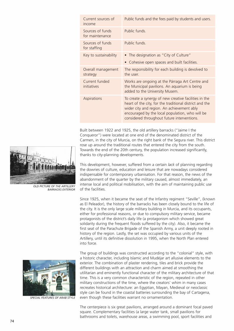
Current sources of Public funds and the fees paid by students and users.income
Sources of funds Public funds.for maintenance
Sources of funds Public funds.for staffing
Key to sustainability • The designation as “City of Culture”
• Cohesive open spaces and built facilities.
Overall management The responsibility for each building is devolved to strategy the user.
Current funded Works are ongoing at the Párraga Art Centre and initiatives the Municipal pavilions. An aquarium is being
added to the University Musem.
Aspirations To create a synergy of new creative facilities in the heart of the city, for the traditional district and the wider city and region. An achievement ably encouraged by the local population, who will be considered throughout future interventions.
Built between 1922 and 1925, the old artillery barracks (“Jaime I theConqueror”) were located at one end of the denominated district of theCarmen, in the city of Murcia, on the right bank of the Segura river. This districtrose up around the traditional routes that entered the city from the south.Towards the end of the 20th century, the population increased significantly,thanks to city-planning developments.
This development, however, suffered from a certain lack of planning regardingthe dowries of culture, education and leisure that are nowadays consideredindispensable for contemporary urbanisation. For that reason, the news of theabandonment of the quarter by the military caused, almost immediately, anintense local and political mobilisation, with the aim of maintaining public useof the facilities.
Since 1925, when it became the seat of the Infantry regiment “Seville”, (knownas El Peleador), the history of the barracks has been closely bound to the life ofthe city. It is the only large scale military building in Murcia, and its occupants,either for professional reasons, or due to compulsory military service, becameprotagonists of the district’s daily life (a protagonism which showed greatsolidarity during the frequent floods suffered by the city). Also, it became thefirst seat of the Parachute Brigade of the Spanish Army, a unit deeply rooted inhistory of the region. Lastly, the set was occupied by various units of theArtillery, until its definitive dissolution in 1995, when the North Plan enteredinto force.
The group of buildings was constructed according to the “colonial” style, witha historic character, including Islamic and Mudéjar art allusive elements to theexterior. The combination of plaster rendering, tiles and brick provide thedifferent buildings with an attraction and charm aimed at smoothing theutilitarian and eminently functional character of the military architecture of thattime. This is a very common characteristic of the region, repeated in othermilitary constructions of the time, where the creators’ whim in many casesrecreates historical architecture: an Egyptian, Mayan, Medieval or neoclassicstyle can be found in the coastal batteries surrounding the bay of Cartagena,even though these facilities warrant no ornamentation.
The centerpiece is six great pavilions, arranged around a dominant focal pavedsquare. Complementary facilities (a large water tank, small pavilions forbathrooms and toilets, warehouse areas, a swimming pool, sport facilities and
OLD PICTURE OF THE ARTILLERY BARRACKS EXTERIOR
SPECIAL FEATURES OF ARAB STYLE
74
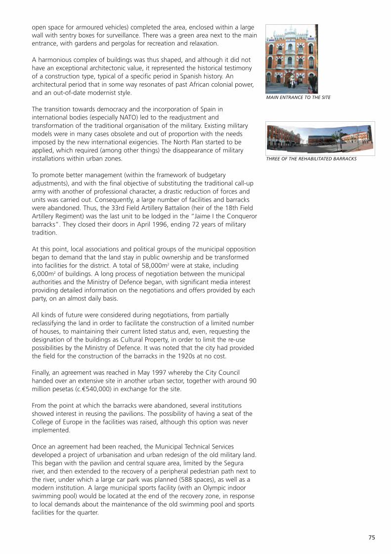
75
open space for armoured vehicles) completed the area, enclosed within a largewall with sentry boxes for surveillance. There was a green area next to the mainentrance, with gardens and pergolas for recreation and relaxation.
A harmonious complex of buildings was thus shaped, and although it did nothave an exceptional architectonic value, it represented the historical testimonyof a construction type, typical of a specific period in Spanish history. Anarchitectural period that in some way resonates of past African colonial power,and an out-of-date modernist style.
The transition towards democracy and the incorporation of Spain ininternational bodies (especially NATO) led to the readjustment andtransformation of the traditional organisation of the military. Existing militarymodels were in many cases obsolete and out of proportion with the needsimposed by the new international exigencies. The North Plan started to beapplied, which required (among other things) the disappearance of militaryinstallations within urban zones.
To promote better management (within the framework of budgetaryadjustments), and with the final objective of substituting the traditional call-uparmy with another of professional character, a drastic reduction of forces andunits was carried out. Consequently, a large number of facilities and barrackswere abandoned. Thus, the 33rd Field Artillery Battalion (heir of the 18th FieldArtillery Regiment) was the last unit to be lodged in the “Jaime I the Conquerorbarracks”. They closed their doors in April 1996, ending 72 years of militarytradition.
At this point, local associations and political groups of the municipal oppositionbegan to demand that the land stay in public ownership and be transformedinto facilities for the district. A total of 58,000m2 were at stake, including6,000m2 of buildings. A long process of negotiation between the municipalauthorities and the Ministry of Defence began, with significant media interestproviding detailed information on the negotiations and offers provided by eachparty, on an almost daily basis.
All kinds of future were considered during negotiations, from partiallyreclassifying the land in order to facilitate the construction of a limited numberof houses, to maintaining their current listed status and, even, requesting thedesignation of the buildings as Cultural Property, in order to limit the re-usepossibilities by the Ministry of Defence. It was noted that the city had providedthe field for the construction of the barracks in the 1920s at no cost.
Finally, an agreement was reached in May 1997 whereby the City Councilhanded over an extensive site in another urban sector, together with around 90million pesetas (c.€540,000) in exchange for the site.
From the point at which the barracks were abandoned, several institutionsshowed interest in reusing the pavilions. The possibility of having a seat of theCollege of Europe in the facilities was raised, although this option was neverimplemented.
Once an agreement had been reached, the Municipal Technical Servicesdeveloped a project of urbanisation and urban redesign of the old military land.This began with the pavilion and central square area, limited by the Segurariver, and then extended to the recovery of a peripheral pedestrian path next tothe river, under which a large car park was planned (588 spaces), as well as amodern institution. A large municipal sports facility (with an Olympic indoorswimming pool) would be located at the end of the recovery zone, in responseto local demands about the maintenance of the old swimming pool and sportsfacilities for the quarter.
MAIN ENTRANCE TO THE SITE
THREE OF THE REHABILITATED BARRACKS

PAVILLION OF THE UNIVERSITY OFMURCIA MUSEUM
76
Although their architectonic value was not exceptional, the pavilions werecatalogued as a set within the General Regulations of Urban Planning inMurcia. This degree of cataloguing meant that the buildings and their originalstructure had to be maintained (i.e. demolition was prevented), as well as theornamentation and motifs on the façades (including plaster renderings, tilesand mouldings etc). Some alterations, however, were agreed to the roof tofacilitate the new uses. This has partly weakened the traditional character ofthe set that they had tried to maintain.
Three of the pavilions were designated for municipal use, while the remainderwere given to the Council of Education and Culture (to develop the Párraga ArtCentre), the University of Murcia and the Conservatory of Music. The latterhave already been rehabilitated, with costs totaling €3m and €1.6mrespectively.
Project within individual buildings are as follows:
University of Murcia Museum. The museum is located in Pavilion 4 of theformer barracks and was inaugurated in July 2003. It occupies the first, secondand third floors of the building and houses two halls with permanentexhibitions related to the history and current reality of the different colleges andschools of the University, and a temporary exhibition room, open to all types ofexpression and event. An aquarium on the ground floor will be opened soon.The facilities are complemented by a large reading room (for up to 120students), an assembly hall, archives, a documentation centre, storage spaceand offices.
The exhibition rooms are open to the public each weekday morning andafternoon, for private and didactic visits. Entrance is free and guided tours foreducational centres from the metropolitan area of Murcia, and senior citizensassociations can be arranged.
In the early stages, the rehabilitation and consolidation of the existing structurewas considered, but owing to the poor state of repair, the demolition of theinterior structure was deemed the best option, including the roof, butmaintaining the exterior walls.
The conversion was undertaken by the construction company FerrovialAgroman, S.A, and was finalised in just over two years (2000-2002) followingthe drafting of plans between 1999 and 2000. Roque Salinas Estañ was thechief architect, and Teófilo Martín Jiménez the chief engineer.
The importance of the new museum of the University of Murcia is more thanregional, as it is one of the first university museums in Spain. It is significant notonly as an open cultural space for Murcian society, but as a testimony to thepreservation, study and exhibition of the 100 years of the University’s existence.
The public aquarium complements the region’s cultural offer and reflects theinnovation of the city. The aquarium has secured its funding, and its locationand closeness to the Museum of Science consolidates its reception by thepublic.
The aquarium will not only be a collection of aquatic organisms in crystal urns,but will have coherence and an educational base. Someone entering theaquarium should leave with new knowledge. Furthermore, it is not just a staticexhibition, but continuously evolves, due to the changing condition of theorganisms and the development of the species in the different environmentsrepresented. Thus, the exhibition will change from month to month, sofrequent visits can be foreseen.
The aquarium exhibition contains geographical research about the planet’smarine fauna, trying to include the most representative, interesting or rare of

77
each zone. The aquarium will be a "biotope aquarium” recreating differentaquatic environments. Visitors will find different areas of coral reef and fishfrom the Indian and Pacific Oceans, the Red Sea, the Caribbean Sea and, ofcourse, extensive representation of the different communities in theMediterranean Sea. A smaller tank is devoted to the environment of the nearerMar Menor (Minor Sea). Tank volumes vary between 9,000 and 150,000 litres.Maintenance of the required chemical balance of the water is guaranteed bythe use of the most up-to-date filtration systems, designed by the University’sown laboratory.
Conservatory of Music. The Conservatory has a library, training and educationrooms, and study cabins, as well as a wide space under the large vaulted ceilingthat completely transformed the roofspace, permitting different uses such as concerts.
Párraga Art Centre (works ongoing). This project will create a multidisciplinarycentre for visual and scenic arts, facilitating new ways of expression, andtargeting young artists who will find facilities to boost their artistic interest. Itwill have classrooms for workshops, modern theatre space, a music recordingstudio and film recording facilities. The budget is around €2.5m. Párraga ArtCentre will be located in Pavilion 5 of the former barracks, and the architect isAntonio Abellán.
Párraga Art Centre aims to promote an understanding of the creation andrelation of different styles of different disciplines. All artistic expressions havespace within the concept. Plastic, visual, scenic or musical art, emerge fromtraditional support coexist with new technologies.
Facilities include the necessary workspaces and equipment for developingcourses, workshops, seminars, conferences and concerts etc. The intention is toutilise convertible and dynamic spaces, adaptable to creative needs. In order toachieve a dynamic programme, the Párraga Art Centre pays attention to thetheoretical sphere (conferences, seminars and specific interventions) andpractical realm (workshops, courses, productions, concerts, auditions…).Projects submitted can have an individual or collective character: for theiradmission the quality, innovation, interactivity with other displays and exchangeof artistic languages will be assessed, as well as the availability of the centreand resources. The Directors of the Centre facilitate the development of theseideas, by press adverts and their website.
The interdisciplinary nature of this centre must be emphasised. Its objective is topromote the cross-fertilisation and subjective sensations of the differentdisciplines as a cohesion tool. Importance is also conferred to the creativeprocess of production: far from just focusing on the end product, the workingprocess and development of the idea should be rewarded as an end in theirown right. Therefore, the concept of artistic research prevails (includinginnovation and experimentation) as one of the most enriching and dynamicformulae of contemporary culture.
Municipal pavilions (at planning stage). Two will be used for administrativepurposes, as council seats, while the third will have different tourist/culturaluses, including a toy library, a mainstream library, and computer rooms withfree access to the Internet, as well as two rooms related to the most popularfestivities in the city: the Moors and Christians Festival, and the Burial of theSardine. The total estimated cost is €7.3m.
The largest new construction is INACUA - the largest and most modern sportsfacility in the region. The Mayor of the City, Mr Miguel Ángel Cámara, presidedover its official opening in 2004. The sports centre can accommodate 8,000users, reflecting current demand.
REHABILITATION IN PLACE FOR PARRAGA ART CENTRE
REHABILITATION PROJECT FOR PARRAGA CENTRE OF MODERN ART
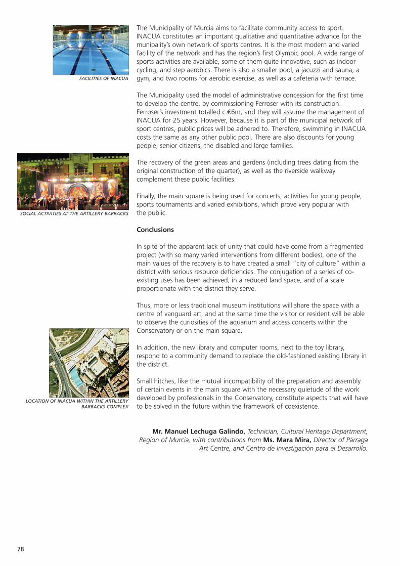
FACILITIES OF INACUA
SOCIAL ACTIVITIES AT THE ARTILLERY BARRACKS
LOCATION OF INACUA WITHIN THE ARTILLERYBARRACKS COMPLEX
78
The Municipality of Murcia aims to facilitate community access to sport.INACUA constitutes an important qualitative and quantitative advance for themunipality’s own network of sports centres. It is the most modern and variedfacility of the network and has the region’s first Olympic pool. A wide range ofsports activities are available, some of them quite innovative, such as indoorcycling, and step aerobics. There is also a smaller pool, a jacuzzi and sauna, agym, and two rooms for aerobic exercise, as well as a cafeteria with terrace.
The Municipality used the model of administrative concession for the first timeto develop the centre, by commissioning Ferroser with its construction.Ferroser’s investment totalled c.€6m, and they will assume the management ofINACUA for 25 years. However, because it is part of the municipal network ofsport centres, public prices will be adhered to. Therefore, swimming in INACUAcosts the same as any other public pool. There are also discounts for youngpeople, senior citizens, the disabled and large families.
The recovery of the green areas and gardens (including trees dating from theoriginal construction of the quarter), as well as the riverside walkwaycomplement these public facilities.
Finally, the main square is being used for concerts, activities for young people,sports tournaments and varied exhibitions, which prove very popular withthe public.
Conclusions
In spite of the apparent lack of unity that could have come from a fragmentedproject (with so many varied interventions from different bodies), one of themain values of the recovery is to have created a small “city of culture” within adistrict with serious resource deficiencies. The conjugation of a series of co-existing uses has been achieved, in a reduced land space, and of a scaleproportionate with the district they serve.
Thus, more or less traditional museum institutions will share the space with acentre of vanguard art, and at the same time the visitor or resident will be ableto observe the curiosities of the aquarium and access concerts within theConservatory or on the main square.
In addition, the new library and computer rooms, next to the toy library,respond to a community demand to replace the old-fashioned existing library inthe district.
Small hitches, like the mutual incompatibility of the preparation and assemblyof certain events in the main square with the necessary quietude of the workdeveloped by professionals in the Conservatory, constitute aspects that will haveto be solved in the future within the framework of coexistence.
Mr. Manuel Lechuga Galindo, Technician, Cultural Heritage Department,Region of Murcia, with contributions from Ms. Mara Mira, Director of Párraga
Art Centre, and Centro de Investigación para el Desarrollo.

79
Cartagena: Navidad Fortress, and the establishment ofCartagena: Port of Cultures.
Current condition Neglected, although structurally sound.
Current use Presently unused. It will become an interpretation centre for fortified heritage.
Statistics The tourist boat (the main access method) will visit Navidad. The boat registered 220,000 passengers in 2005.
Date of Construction 19th century (built upon the former 18th century Navidad Battery).
Purpose of Construction To protect the entrance to the port of Cartagena, by crossing fire with Trincabotijas battery.
Construction Materials Mainly mortar and ashlar. Ceramics were used for the flooring in the original construction.
Scale of land The fort occupies 1,310m2. The attached tower and buildings and back pit occupy 100m2 and 295m2
respectively, and the ramparts 902m2.
Number of staff / No personnel as yet. Proposals suggest a minimum volunteers of two people will be recruited. No volunteering
work is foreseen.
Location, and nearest Navidad Fortress is situated at the start of the dock population centre of the same name, a few minutes drive from
Cartagena centre.
Major works The whole building is to be rehabilitated.undertaken
Protection in place The highest protection given by law (first degree), granted by Cartagena General Town Planning Department.
Unique features The tower attached to the fortress has been revealed as a former lighthouse. This was only uncovered during rehabilitation.
Accessibility A good quality road from the town centre. Vehiclesmust be parked at the Museum of Maritime Archaeology and the final metres covered on foot.
Proximity to similar sites The bay is full of fortresses mainly from the 18th century.
Impulse for the The Region of Murcia, in cooperation with conversion Cartagena: Port of Cultures.
Structure of the Cartagena: Port of Cultures is a consortium uniting managing body the Directorate-General for Tourism in the
Autonomous Community of Murcia with other key agents in the city.
Organisations consulted The Directorate-General for Culture.
Rules / Regulations Those related to the site’s legal protection.imposed
Source of funding Infrastructure: Regional funds provided by the for conversion works Council for Education and Culture through the E.U.
project “Defence Systems on the Mediterranean Coast”, (Euromed Heritage, €290,000) and the Council for Tourism (€1.15m).Museum creation: Regional funds provided by the Council for Education and Culture €300,000).
Conditions attached Heritage Laws regarding listed monuments must beto funding respected.
Website www.puertoculturas.com; www.medanet.info; www.centroid.info
END OF THE DOCK
MAIN ENTRANCE FROM BELOW
INTERIOR OF THE CASEMATES
MAP SHOWING THE BAY OF CARTAGENA
80
Current sources of The site will be maintained by the Autonomous income Community of Murcia via Cartagena: Port of
Cultures. Entrance fees will cover some expenses.
Sources of funds Regional funds and entrance fees.for maintenance
Sources of funds Regional funds and entrance fees.for staffing
Key to sustainability Consolidation of interventions, and the use of an appropriate site to integrate the fortified heritage of Cartagena.
Overall management The management strategy relies on the integration strategy of different tourist offers, including access to all
different types of heritage.
Current funded Cartagena: Port of Cultures is leading the museum initiatives creation project. A project has been approved to
develop boat access to Navidad.
Aspirations To include the remaining fortified heritage within Cartagena’s cultural offer, and to consolidate the existing rehabilitated heritage.
The Fuerte de Navidad fortress is situated at the southeastern end of the Bay ofCartagena, holding a dominant position on the headland of the same name.The harbour of Cartagena is a natural bay whose entrance is defined by twodocks: Navidad (to the right) and La Curra (to the left). Navidad Fortress issituated at the start of the dock of the same name, at the foot of Fajardo Hill.Despite its strong position, it is nearly at sea level in order to keep watch overand protect the harbour-mouth. The fort may be reached by a narrow road thatpasses alongside the Arsenal, follows the coastline through the shipyard andeventually comes to the Faro de Navidad lighthouse.
With its polygonal layout, the fortress reflects advances made by the artillery inthe first half of the 19th century, and individual firearms advances, such as therifle. It has wide ventilated casemates favouring a quick disappearance of gunsmoke, directly aiming at the bay mouth through impressive embrasures. Thefortress is enclosed at the wings and rear by a group of walls to the north, withrifle holes through the embrasures, taking advantage of the hillside. The mainsection hosting the casemates, and the second section enclosing the fortress atthe rear, surround an open-air courtyard.
The fortress, together with the lighthouse of the same name, constitute a sitewhich is much loved by townsfolk, as a fine view may be had of both the opensea and the harbour mouth. In addition to the value of its natural surroundings,the fortress evokes the important role which the port of Cartagena has playedthroughout history, a fact which has always determined the need for it to bewell defended. Today, Navidad and its setting is a part of the local scenery, andwill be revitalised for the town’s enjoyment.
Navidad tower could already be seen on a plan dated 1726, drawn up by VillerLangot. However, on a plan dating from 1740, the description states “towerbegun but not completed”. Around 1740, slightly lower down, and followingthe design by the military engineer Esteban de Panón, a fort was built to holdgun emplacements, although it is very likely that building work was carried outeven earlier. This gun-battery was already mentioned in a document dated 16thJune 1639, where the Marquis of Camarasa decrees: “that Felipe Gil may begiven an iron needle which is in Casas del Rey, and other irons which serve tomake the charges which are needed to blow up the hillside where the fort is tobe raised…” In 1739, Panón states that: “Navidad battery has been finished offwith every guarantee”. And in 1741, it is stated anew that: “It can hold fourguns, although it is enclosed by a mere wall and defended from the rear”.

81
Situated on a contour line 12-16m above sea-level, in accordance with thecustoms of the time, this installation had to be able to shoot level with anyships which tried to enter the harbour. Its lines of fire crossed those of SantaAna and Trincabotijas.
The present Navidad fortress was constructed on the terrace of the previousbattery, for eight pieces of artillery in bunkers and as many again in the vaults,according to the O´Donnel Defence Plan of 1860. During the War of theCantones it was renamed “Juan Bravo”, holding two 16cm reinforced ironcannons and a mortar. Able to hold 38 men, it lost its original role at thebeginning of the 20th century, when it was used as a salute battery from whichsalvoes were fired with campaign guns. The last time the fort was put tomilitary use was in 1941.
Navidad fortress consists of two clearly differentiated buildings: a) the battery, with a series of eight sheltered bunkers. Above these is anemplacement which holds nine guns. The battery is set at an angle, like thefaces of a stronghold, with the curved vertex facing the sea. Access is by meansof a circular staircase at each end. b) Surrounding the mouth of the battery is a wall to support troops as they firetheir rifles. There is a series of small adjacent rooms, which are in ruins. Two main building materials have been used: stone and brick. The stone is oftwo types: the stronger is white, and is used in more visible areas. The other ismulticoloured, predominantly grey, and complements the first, with an effect atone and the same time rational and aesthetic. Brick is the main element in theshelters, adjoining buildings and for finishing off the interiors and parapets.
The battery does not present major structural problems: it has been damagedby plundering, petty vandalism and disuse, but it is perfectly feasible to repairthese defects. Rampant vegetation, the erosion of the stone-work (exacerbatedby the sea air), deliberate destruction, seepage of water through the roof, lackof facilities, and the disorderly way in which the land has been used constitutethe main problems which the building faces at present. Navidad fortress is oneof the coastal features addressed in the Action Plan for the Defence of theArchitectural Heritage of the Bay of Cartagena, drawn up in 2001. Since thisdate, plans of the building, an initial project draft, and a restoration projecthave been prepared. The Council for Education and Culture of the Region ofMurcia is at present tendering for contracts.
The whole building is to be rehabilitated. The casemates will be developed asexhibition spaces, with three main topics: Batteries of the Mediterranean,Batteries in the Bay of Cartagena, and the History of Navidad Fortress. Theterrace area will be converted to a viewing point, with special attentionfocussed on disabled access.
Navidad Fortress is one of the most important buildings and defence elementsin the bay of Cartagena. It was released to the Municipality of Cartagena bythe Ministry of Defence, to be recovered for cultural and tourist purposes,within a joint project run by the Municipality and the Autonomous Communityof the Region of Murcia. However, a private initiative, represented by anassociation for the Defence of Heritage called MASSIENA, denounced the CityCouncil since the building had been in a terrible state since the transfer. Theyobtained a sentence from the High Tribunal for Justice in Madrid that obligedthe City Council to take care of the building and its surroundings. The regionalauthority was obliged to monitor their adherence to this decision.
There was thus great interest in finding funding for the rehabilitation of thebuilding. The Research and Development Centre in Cartagena (the partner inASCEND) was asked by the Heritage Department of the Region of Murcia todesign a project for its rehabilitation and reuse, and to search for support fromEuropean Union programmes and initiatives. Once the project was approved,the City Council met the Ministry of Defence to sign an official agreementwhich conferred usage of the building (although not ownership) to the CityCouncil. Therefore, the money obtained for the project (approved in April 2003)
LATERAL FAÇADE
UPPER FLOOR INTERIOR
LATERAL WALL FROM THE INSIDE

THE CASTLE OF LA CONCEPCIÓN
INTERPRETATION CENTRE FOR THE HISTORY OFCARTAGENA AT THE CASTLE OF LA CONCEPCIÓN
82
was used for the rehabilitation of the building. In order to finalise the works,the Tourist Board for the Region of Murcia will also invest public funds.
Cartagena: Port of Cultures has been commissioned to create the interpretationmuseum for the batteries in the bay of Cartagena, and to undertake themanagement of the site.
Navidad fortress is an example of how starting points of a technical, social andeconomic nature may be established within a general action plan, in order torecover heritage. For this to be set in motion, it is necessary not only to lookinto the technical aspects of the work, but also to implicate the localcommunity in a multi-disciplinary way. In order to achieve the involvement ofthe local population, the Regional Authorities have established a consortium tomanage many of the historical sites recovered in Cartagena (Cartagena: Port ofCultures). The starting point for their work is the creation of a SteeringCommittee that gathers all the powers of the city: the municipality, thePolytechnic University, the Chamber of Commerce, the Heritage and TourismDepartments of the Region, the Port Authority and the Business Confederationof Cartagena, to jointly work on this issue. In order to make the project areality, private companies have also been invited to take part.
Each member of the consortium recognises that the set of fortifications aroundCartagena and its bay constitutes the widest and richest proof of militaryarchitecture in the Region of Murcia. They are committed to the rehabilitationand social and tourist valorisation of Cartagena’s heritage that has beendeveloped in recent years.
Legally, Cartagena: Port of Cultures is established as a limited liability company.The Steering Committee is in charge of the consortium, and establishing amanager and a series of staff.
Cartagena: Port of Cultures aims to position Cartagena as a main touristdestination by taking advantage of its extensive cultural and heritage-basedassets. The aim is to offer a thematic area that opens up an extensive range ofpossibilities to present the invaluable cultural assets offered by the town. Theyseek to present the town’s history and culture by taking advantage of thehistorical potential of Cartagena and its harbour as interpretative resources.
Indeed taking advantage of Cartagena’s rich heritage will be to the benefit ofall. In addition to enhancing the town’s tourist image, this action willstrengthen the identity of the inhabitants of Cartagena, whilst helping todevelop the business sector throughout the area.
Measures implemented by Cartagena: Port of Cultures Project include:
1. An Interpretation Centre for the History of Cartagena:The Castle of La Concepción houses the Centre for Interpretation of the Historyof Cartagena. The hill on which the Castle is located delivers a breath-taking viewof the town. A series of intelligent telescopes help gain closer knowledge ofCartagena, whilst the Tower of El Homenaje contains an exhibition of its history.
2. An Interpretation Centre for the Punic Wall:The Punic Wall opens a door to the past. This interpretation centre for Punicculture includes games, exhibitions and projections for visitors to experiencePunic Cartagena.
3. Decumano-Plaza de los Tres Reyes:The Plaza de los Tres Reyes ("Square of the Three Kings") offers an explorationof the Roman period. Visitors can discover one of the main streets of all Romancities, the "Decumano" (Roman Road), providing an insight into trade andcustoms of the time.
83
4. Augusteum: The Augusteum, located at what was once the Forum, allows visitors todiscover the fascinating life that revolved around the central part of the Romancity, and admire "in situ" one of the most important buildings of the RomanAge, the temple devoted to Augustus.
5. Tourist Bus:Visitors can admire the heritage of Cartagena in comfort on the Tourist Bus.The tour stops at the most important sights throughout the town.
6. Tourist Sign-posting:Special tourist sign-posting has been installed to ensure visitors do not lose theirway as they tour the town. Thematic itineraries aid the discovery of thearchaeological remains and sites that have been preserved, dating from thethird century BC.
7. Tourist Boat:The boat tours the docks of Cartagena, offering an alternative perspective ofthe landscape of coastal batteries, castles and fortifications.
8. Casa de la Fortuna (“House of Fortune”):Visitors can observe the structure of a Roman house and its main decorativeelements, including murals and mosaics, recreating daily life in Roman times.
9. Autopsy Pavilion:Belonging to the Royal Naval Hospital, it was here in the 18th century thatlectures on anatomy were imparted and autopsies carried out. Inside thePavilion visitors can enjoy concerts, debates and lectures, as the venue is nowbeing adapted as a multi-disciplinary exhibition hall.
10. Panoramic Lift:Offering a bird’s eye view of the town, the panoramic lift takes visitors to theCastle of La Concepción, where breath-taking views of some of the town’smost significant architectural sights can be enjoyed.
11. Spanish Civil War Shelters:The bomb shelters that were used during the Spanish Civil War have beenrestored as an interpretation centre. (Please see the specific case study).
The Region of Murcia offers excellent potential for tourism based on a vastheritage wealth. No less significant are the green areas and mountains withrural accommodation widely available; the sun, beach and established sailingfacilities; the spa waters, and health and beauty tourism widely developed sinceRoman times.
A strategy has been developed to diversify the tourist pattern for Murciafocusing on diverse types of tourism (cultural, sailing, religious, language,health and beauty, conferences and seminars, environmental and outdoor, andrural).
The development of the cultural process and products is one of the main aimsof the Council of Tourism in the Region of Murcia. The process has two stages:the planning and design of the cultural product, and its implementation andmanagement.
The first stage implies a series of actions: an assessment of the current situationin tourist terms (demands and resources), the definition of the strategic aimsand targets, the definitions of outputs and the development of action plans.
In the second stage, there are other issues to define: the programme andintervention criteria, the management model, the action plan, the investmentplan and the management of the resources.
84
A key step is the Priority Action Plan, defining the most important and urgentactions to implement. The main objective is the sustainable development of thetourist industry through investment in patrimonial, cultural and tourist resourcesas well as optimum promotion and marketing. The goal of sustainabledevelopment is achieved by prioritising investments, valorising the historicalresources, promoting the image of cities, developing a business fabric andcreating an environment for sustainable management.
There are four consortia operating in the Region of Murcia related to culturaltourism: Lorca Time Workshop, Caravaca Holy City, Cartagena: Port of Culturesand Murcia Crossroads. Action Plans have developed criteria for the recovery ofheritage in these cities: interventions are improved by the understanding of theheritage, with updated museum-creation techniques, the organisation ofattractions in thematic itineraries around the city and the enhancement of thevisitor’s experience by attractive transport and infrastructure.
The Management Model (of which the Region of Murcia is a pioneer in Spain)is the consortium, in which the participation of the most important entities inthe city is a must. It is being part-financed by the European Union, via theRegional Development Fund.
There are a series of programmes or steps to be followed in the creation of aconsortium. The programmes are: A, infrastructure; B, cultural resources; C,promotion and D, tourist management of the resources.
An Action Plan was designed for Cartagena: Port of Cultures between 2001-2004. Within the different programmes some interventions have already beenimplemented.
Programme A: Infrastructure.• Passage/Lift.• Tourist Sign-posting.• Access to Castle of La Concepción.• Landscaping Pavillion and Gisbert St.• Overground and maritime transport.
Programme B: Cultural Resources.• Interpretation Centre for the History of Cartagena.• Interpretation Centre for the Punic Wall.• Casa de la Fortuna (“House of Fortune”).• Spanish Civil War Shelters.• Autopsy Pavillion.• The Decumano. • The Defensive Architecture Masterplan.
Programme C: Promotion.• Launching the “Cartagena: Port of Cultures” trademark.• Development of a marketing plan for the cultural products.• Implementation of the marketing plan and product development.
Programme D: Management.• Creating the “Cartagena: Port of Cultures” consortium.• Creating the “Cartagena: Port of Cultures” corporation.• Recruiting staff for the management of visitor centres.
The keys to the success of the consortium are identified as:• Professional management implemented by an elected governing body.• A cultural product based on the cultural identity of the city, focusing on
different kinds of heritage (archaeological, roman, neoclassical,contemporary and military).
• The joint efforts around a mutual and exciting project. • The integrated development of the city and broader region.
Centro de Investigación para el Desarrollo.
FACILITATING ACCESS

Cartagena: The development of Alcalá de Henares Universityfrom former military facilities.
Current condition Very good.
Current use University facilities.
Statistics 30,000 students.
Date of Construction The university was founded by the Regent of Spain,in 1499.
Purpose of Construction The university was to be a crucible where clergy could be educated, together with the new functionaries required by the monarchy.
Construction Materials Diverse.
Scale of land 175,000m2, including renovated 16th and 17th and buildings century buildings in the city centre. New faculties
and university schools were built on a campus just outside the city. Guadalajara Campus has been added as part of the expansion process.
Number of staff / c.4,000 personnel.volunteers
Location, and nearest The town of Alcalá de Henares is c.30km population centre from Madrid.
Major works Rehabilitation of the cavalry barracks; the military undertaken command centre; the headquarters; the military
hospital and prison; the stables, the Lepanto and Píncipe barracks, and the military aerodrome Barbera.
Protection in place Varying degrees of protection. Most are listed buildings.
Unique features The world's first planned university city, and the first university in the world to be declared a UNESCO World Heritage Site.
Accessibility In the heart of the city and easily accessible by train, bus and car. There is a free train between University buildings.
Proximity to similar sites Many buildings around Alcalá have a military legacy. Certain religious buildings have been rehabilitated for university purposes.
Impulse for the The managers of the university (Cardinal Cisteros,conversion and later the Vice-Chancellor).
Structure of the A typical university structure.managing body
Organisations consulted The relevant Ministries, and the Municipalities of Alcalá, Madrid and Guadalajara.
Rules / Regulations The regulations imposed by the public bodies in aimposed co-operation agreement.
Source of funding for Municipalities of Madrid, Alcalá and Guadalajara, conversion works the Vice-Chancellorship of the university, the
Ministries for Education, Culture, Public Works and Justice.
Conditions attached The works had to be supervised by a Technical to funding Office, managed by the University and the Ministry
for Public Works.
Website www.uah.es
85
MODERN AERIAL VIEW
86
Current sources of Student fees. Investments from companies that income co-operate with the university. Public funds.
Sources of funds Student fees. Investments from companies that for maintenance co-operate with the university. Public funds.
Sources of funds Student fees. Investments from companies that for staffing co-operate with the university. Public funds.
Key to sustainability Co-operation between different public and private bodies, and the commitment to have one of the oldest European universities at the forefront of innovation.
Overall management The management strategy considers restoration and heritage to be added value.
Current funded Various initiatives are supporting University initiatives expansion.
Aspirations To be one of the leading universities in Spain, thanks to the quality of the studies.
On 19th October 2004, the King of Spain presented the University of Alcaláwith the Royal Toledo Foundation Heritage Award, covering six of the ninemilitary properties that the University had recovered. In 1997, these buildingshad been awarded the Europa Nostra Medal, covering 17 interventions initiatedby the University of Alcalá and Guadalajara in rehabilitating historical buildings.In 1998, it was the first University to be declared a World Heritage Site. (Todate, only two other universities in the world - Central University in Caracas,and the University of Stanford in the USA - have been declared World HeritageSites). The University, together with the institutions that have co-operated withits recovery, have received four further international accolades.
The most important of these is the declaration of the Council of Europe thatthe University should be considered a Project of European Interest, as a modelfor Multi Departmental Co-operation (to date awarded to only Alcalá and theSave Venice project).
This award originated in the Ministry of Defence Agreement to sell the firstthree barracks within the historical quarter to the Municipality of Alcalá, and inthe Multi-Departmental Agreement (developed months later) for theirrestoration for University purposes: including the joint mechanisms of deliveryand funding, and incorporating other buildings of the historical quarter.
The funding in the last Agreement was supported by University projects -related to the needs identified by the Ministry of Education, and thanks to thesupport of the Ministry of Public Works for the technical co-ordination of thepublic administrations. The Ministry of Defence, however, was trulyinstrumental in fostering and facilitating the historic signature of thatAgreement.
The military buildings purchased from the Ministry of Defence are:
1. The Mendigorria Cavalry Barracks (a former institute for Jesuits)rehabilitated as the Faculty of Law (19,000m2).
2. Military Command Centre. Former Ministry of the Air, rehabilitated as theInternational Centre for Humanities (7,500m2).
3. Headquarters (the former school of Caracciolos) rehabilitated as the Facultyof Philology and Theatre (9,000m2).
4. Military Hospital (the former school of Mínimos) rehabilitated as the Facultyfor Business and Economical Sciences (10,000m2).
5. Military Prison (the former 19th century Cavalry Academy) rehabilitated asthe Arts Centre.
6. School of Carmen Calzado, rehabilitated as the School of Architecture(8,000m2).
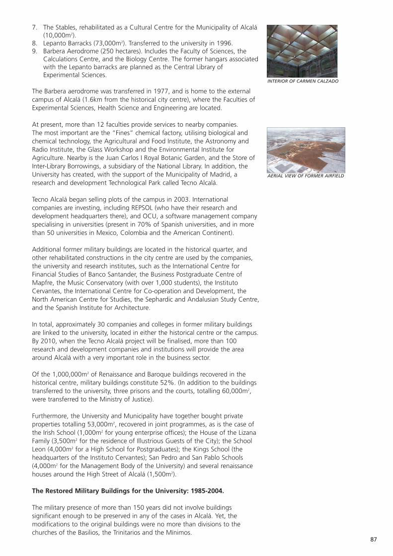
87
7. The Stables, rehabilitated as a Cultural Centre for the Municipality of Alcalá(10,000m2).
8. Lepanto Barracks (73,000m2). Transferred to the university in 1996.9. Barbera Aerodrome (250 hectares). Includes the Faculty of Sciences, the
Calculations Centre, and the Biology Centre. The former hangars associatedwith the Lepanto barracks are planned as the Central Library ofExperimental Sciences.
The Barbera aerodrome was transferred in 1977, and is home to the externalcampus of Alcalá (1.6km from the historical city centre), where the Faculties ofExperimental Sciences, Health Science and Engineering are located.
At present, more than 12 faculties provide services to nearby companies. The most important are the “Fines” chemical factory, utilising biological andchemical technology, the Agricultural and Food Institute, the Astronomy andRadio Institute, the Glass Workshop and the Environmental Institute forAgriculture. Nearby is the Juan Carlos I Royal Botanic Garden, and the Store ofInter-Library Borrowings, a subsidiary of the National Library. In addition, theUniversity has created, with the support of the Municipality of Madrid, aresearch and development Technological Park called Tecno Alcalá.
Tecno Alcalá began selling plots of the campus in 2003. Internationalcompanies are investing, including REPSOL (who have their research anddevelopment headquarters there), and OCU, a software management companyspecialising in universities (present in 70% of Spanish universities, and in morethan 50 universities in Mexico, Colombia and the American Continent).
Additional former military buildings are located in the historical quarter, andother rehabilitated constructions in the city centre are used by the companies,the university and research institutes, such as the International Centre forFinancial Studies of Banco Santander, the Business Postgraduate Centre ofMapfre, the Music Conservatory (with over 1,000 students), the InstitutoCervantes, the International Centre for Co-operation and Development, theNorth American Centre for Studies, the Sephardic and Andalusian Study Centre,and the Spanish Institute for Architecture.
In total, approximately 30 companies and colleges in former military buildingsare linked to the university, located in either the historical centre or the campus.By 2010, when the Tecno Alcalá project will be finalised, more than 100research and development companies and institutions will provide the areaaround Alcalá with a very important role in the business sector.
Of the 1,000,000m2 of Renaissance and Baroque buildings recovered in thehistorical centre, military buildings constitute 52%. (In addition to the buildingstransferred to the university, three prisons and the courts, totalling 60,000m2,were transferred to the Ministry of Justice).
Furthermore, the University and Municipality have together bought privateproperties totalling 53,000m2, recovered in joint programmes, as is the case ofthe Irish School (1,000m2 for young enterprise offices); the House of the LizanaFamily (3,500m2 for the residence of Illustrious Guests of the City); the SchoolLeon (4,000m2 for a High School for Postgraduates); the Kings School (theheadquarters of the Instituto Cervantes); San Pedro and San Pablo Schools(4,000m2 for the Management Body of the University) and several renaissancehouses around the High Street of Alcalá (1,500m2).
The Restored Military Buildings for the University: 1985-2004.
The military presence of more than 150 years did not involve buildingssignificant enough to be preserved in any of the cases in Alcalá. Yet, themodifications to the original buildings were no more than divisions to thechurches of the Basilios, the Trinitarios and the Mínimos.
INTERIOR OF CARMEN CALZADO
AERIAL VIEW OF FORMER AIRFIELD
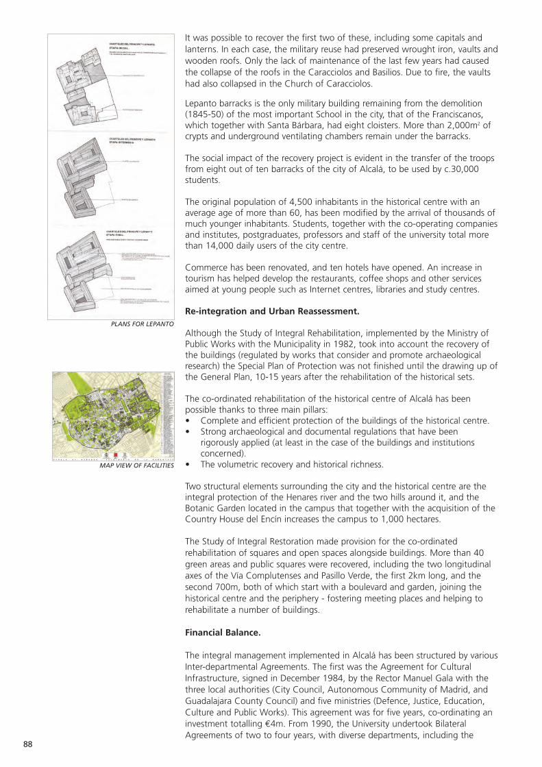
It was possible to recover the first two of these, including some capitals andlanterns. In each case, the military reuse had preserved wrought iron, vaults andwooden roofs. Only the lack of maintenance of the last few years had causedthe collapse of the roofs in the Caracciolos and Basilios. Due to fire, the vaultshad also collapsed in the Church of Caracciolos.
Lepanto barracks is the only military building remaining from the demolition(1845-50) of the most important School in the city, that of the Franciscanos,which together with Santa Bárbara, had eight cloisters. More than 2,000m2 ofcrypts and underground ventilating chambers remain under the barracks.
The social impact of the recovery project is evident in the transfer of the troopsfrom eight out of ten barracks of the city of Alcalá, to be used by c.30,000students.
The original population of 4,500 inhabitants in the historical centre with anaverage age of more than 60, has been modified by the arrival of thousands ofmuch younger inhabitants. Students, together with the co-operating companiesand institutes, postgraduates, professors and staff of the university total morethan 14,000 daily users of the city centre.
Commerce has been renovated, and ten hotels have opened. An increase intourism has helped develop the restaurants, coffee shops and other servicesaimed at young people such as Internet centres, libraries and study centres.
Re-integration and Urban Reassessment.
Although the Study of Integral Rehabilitation, implemented by the Ministry ofPublic Works with the Municipality in 1982, took into account the recovery ofthe buildings (regulated by works that consider and promote archaeologicalresearch) the Special Plan of Protection was not finished until the drawing up ofthe General Plan, 10-15 years after the rehabilitation of the historical sets.
The co-ordinated rehabilitation of the historical centre of Alcalá has beenpossible thanks to three main pillars: • Complete and efficient protection of the buildings of the historical centre. • Strong archaeological and documental regulations that have been
rigorously applied (at least in the case of the buildings and institutionsconcerned).
• The volumetric recovery and historical richness.
Two structural elements surrounding the city and the historical centre are theintegral protection of the Henares river and the two hills around it, and theBotanic Garden located in the campus that together with the acquisition of theCountry House del Encín increases the campus to 1,000 hectares.
The Study of Integral Restoration made provision for the co-ordinatedrehabilitation of squares and open spaces alongside buildings. More than 40green areas and public squares were recovered, including the two longitudinalaxes of the Vía Complutenses and Pasillo Verde, the first 2km long, and thesecond 700m, both of which start with a boulevard and garden, joining thehistorical centre and the periphery - fostering meeting places and helping torehabilitate a number of buildings.
Financial Balance.
The integral management implemented in Alcalá has been structured by variousInter-departmental Agreements. The first was the Agreement for CulturalInfrastructure, signed in December 1984, by the Rector Manuel Gala with thethree local authorities (City Council, Autonomous Community of Madrid, andGuadalajara County Council) and five ministries (Defence, Justice, Education,Culture and Public Works). This agreement was for five years, co-ordinating aninvestment totalling €4m. From 1990, the University undertook BilateralAgreements of two to four years, with diverse departments, including the
88
MAP VIEW OF FACILITIES
PLANS FOR LEPANTO
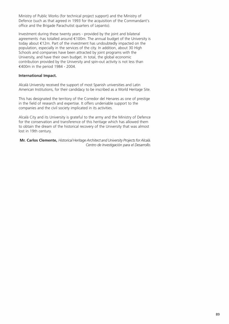
89
Ministry of Public Works (for technical project support) and the Ministry ofDefence (such as that agreed in 1993 for the acquisition of the Commandant'soffice and the Brigade Parachutist quarters of Lepanto).
Investment during these twenty years - provided by the joint and bilateralagreements -has totalled around €100m. The annual budget of the University istoday about €12m. Part of the investment has undoubtedly impacted on thepopulation, especially in the services of the city. In addition, about 30 HighSchools and companies have been attracted by joint programs with theUniversity, and have their own budget. In total, the global economiccontribution provided by the University and spin-out activity is not less than€400m in the period 1984 - 2004.
International Impact.
Alcalá University received the support of most Spanish universities and LatinAmerican Institutions, for their candidacy to be inscribed as a World Heritage Site.
This has designated the territory of the Corredor del Henares as one of prestigein the field of research and expertise. It offers undeniable support to thecompanies and the civil society implicated in its activities.
Alcalá City and its University is grateful to the army and the Ministry of Defencefor the conservation and transference of this heritage which has allowed themto obtain the dream of the historical recovery of the University that was almostlost in 19th century.
Mr. Carlos Clemente, Historical Heritage Architect and University Projects for Alcalá.Centro de Investigación para el Desarrollo.
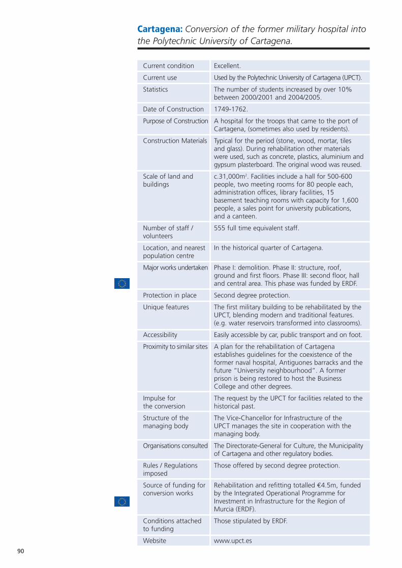
90
Cartagena: Conversion of the former military hospital intothe Polytechnic University of Cartagena.
Current condition Excellent.
Current use Used by the Polytechnic University of Cartagena (UPCT).
Statistics The number of students increased by over 10% between 2000/2001 and 2004/2005.
Date of Construction 1749-1762.
Purpose of Construction A hospital for the troops that came to the port of Cartagena, (sometimes also used by residents).
Construction Materials Typical for the period (stone, wood, mortar, tiles and glass). During rehabilitation other materials were used, such as concrete, plastics, aluminium andgypsum plasterboard. The original wood was reused.
Scale of land and c.31,000m2. Facilities include a hall for 500-600 buildings people, two meeting rooms for 80 people each,
administration offices, library facilities, 15 basement teaching rooms with capacity for 1,600 people, a sales point for university publications, and a canteen.
Number of staff / 555 full time equivalent staff.volunteers
Location, and nearest In the historical quarter of Cartagena.population centre
Major works undertaken Phase I: demolition. Phase II: structure, roof, ground and first floors. Phase III: second floor, hall and central area. This phase was funded by ERDF.
Protection in place Second degree protection.
Unique features The first military building to be rehabilitated by the UPCT, blending modern and traditional features. (e.g. water reservoirs transformed into classrooms).
Accessibility Easily accessible by car, public transport and on foot.
Proximity to similar sites A plan for the rehabilitation of Cartagena establishes guidelines for the coexistence of the former naval hospital, Antiguones barracks and thefuture “University neighbourhood”. A former prison is being restored to host the Business College and other degrees.
Impulse for The request by the UPCT for facilities related to thethe conversion historical past.
Structure of the The Vice-Chancellor for Infrastructure of the managing body UPCT manages the site in cooperation with the
managing body.
Organisations consulted The Directorate-General for Culture, the Municipalityof Cartagena and other regulatory bodies.
Rules / Regulations Those offered by second degree protection.imposed
Source of funding for Rehabilitation and refitting totalled €4.5m, funded conversion works by the Integrated Operational Programme for
Investment in Infrastructure for the Region of Murcia (ERDF).
Conditions attached Those stipulated by ERDF.to funding
Website www.upct.es
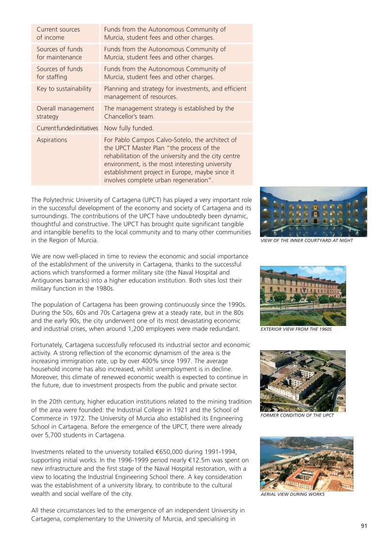
91
VIEW OF THE INNER COURTYARD AT NIGHT
EXTERIOR VIEW FROM THE 1960S
FORMER CONDITION OF THE UPCT
AERIAL VIEW DURING WORKS
Current sources Funds from the Autonomous Community of of income Murcia, student fees and other charges.
Sources of funds Funds from the Autonomous Community of for maintenance Murcia, student fees and other charges.
Sources of funds Funds from the Autonomous Community of for staffing Murcia, student fees and other charges.
Key to sustainability Planning and strategy for investments, and efficientmanagement of resources.
Overall management The management strategy is established by the strategy Chancellor’s team.
Currentfundedinitiatives Now fully funded.
Aspirations For Pablo Campos Calvo-Sotelo, the architect of the UPCT Master Plan “the process of the rehabilitation of the university and the city centre environment, is the most interesting university establishment project in Europe, maybe since it involves complete urban regeneration”.
The Polytechnic University of Cartagena (UPCT) has played a very important rolein the successful development of the economy and society of Cartagena and itssurroundings. The contributions of the UPCT have undoubtedly been dynamic,thoughtful and constructive. The UPCT has brought quite significant tangibleand intangible benefits to the local community and to many other communitiesin the Region of Murcia.
We are now well-placed in time to review the economic and social importanceof the establishment of the university in Cartagena, thanks to the successfulactions which transformed a former military site (the Naval Hospital andAntiguones barracks) into a higher education institution. Both sites lost theirmilitary function in the 1980s.
The population of Cartagena has been growing continuously since the 1990s.During the 50s, 60s and 70s Cartagena grew at a steady rate, but in the 80sand the early 90s, the city underwent one of its most devastating economicand industrial crises, when around 1,200 employees were made redundant.
Fortunately, Cartagena successfully refocused its industrial sector and economicactivity. A strong reflection of the economic dynamism of the area is theincreasing immigration rate, up by over 400% since 1997. The averagehousehold income has also increased, whilst unemployment is in decline.Moreover, this climate of renewed economic wealth is expected to continue inthe future, due to investment prospects from the public and private sector.
In the 20th century, higher education institutions related to the mining traditionof the area were founded: the Industrial College in 1921 and the School ofCommerce in 1972. The University of Murcia also established its EngineeringSchool in Cartagena. Before the emergence of the UPCT, there were alreadyover 5,700 students in Cartagena.
Investments related to the university totalled €650,000 during 1991-1994,supporting initial works. In the 1996-1999 period nearly €12.5m was spent onnew infrastructure and the first stage of the Naval Hospital restoration, with aview to locating the Industrial Engineering School there. A key considerationwas the establishment of a university library, to contribute to the culturalwealth and social welfare of the city.
All these circumstances led to the emergence of an independent University inCartagena, complementary to the University of Murcia, and specialising in
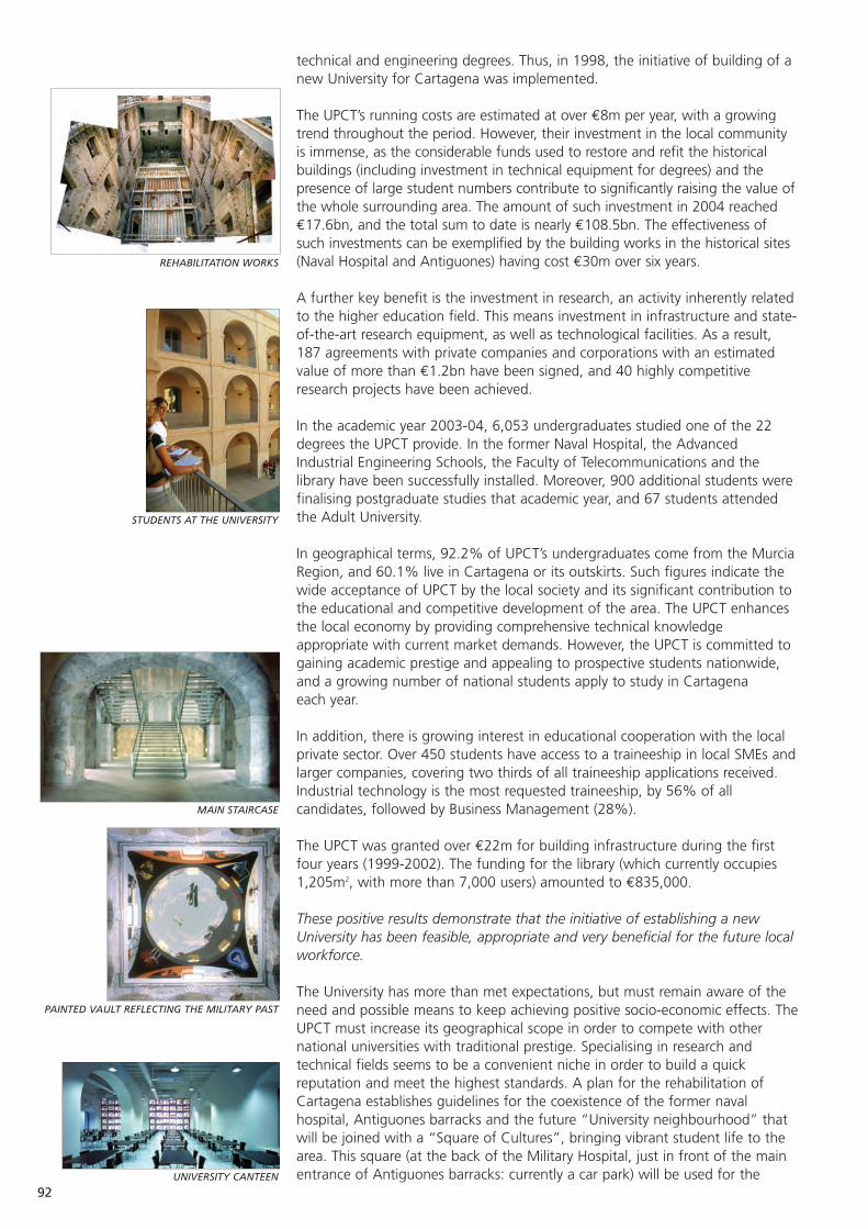
92
REHABILITATION WORKS
STUDENTS AT THE UNIVERSITY
MAIN STAIRCASE
UNIVERSITY CANTEEN
PAINTED VAULT REFLECTING THE MILITARY PAST
technical and engineering degrees. Thus, in 1998, the initiative of building of anew University for Cartagena was implemented.
The UPCT’s running costs are estimated at over €8m per year, with a growingtrend throughout the period. However, their investment in the local communityis immense, as the considerable funds used to restore and refit the historicalbuildings (including investment in technical equipment for degrees) and thepresence of large student numbers contribute to significantly raising the value ofthe whole surrounding area. The amount of such investment in 2004 reached€17.6bn, and the total sum to date is nearly €108.5bn. The effectiveness ofsuch investments can be exemplified by the building works in the historical sites(Naval Hospital and Antiguones) having cost €30m over six years.
A further key benefit is the investment in research, an activity inherently relatedto the higher education field. This means investment in infrastructure and state-of-the-art research equipment, as well as technological facilities. As a result,187 agreements with private companies and corporations with an estimatedvalue of more than €1.2bn have been signed, and 40 highly competitiveresearch projects have been achieved.
In the academic year 2003-04, 6,053 undergraduates studied one of the 22degrees the UPCT provide. In the former Naval Hospital, the AdvancedIndustrial Engineering Schools, the Faculty of Telecommunications and thelibrary have been successfully installed. Moreover, 900 additional students werefinalising postgraduate studies that academic year, and 67 students attendedthe Adult University.
In geographical terms, 92.2% of UPCT’s undergraduates come from the MurciaRegion, and 60.1% live in Cartagena or its outskirts. Such figures indicate thewide acceptance of UPCT by the local society and its significant contribution tothe educational and competitive development of the area. The UPCT enhancesthe local economy by providing comprehensive technical knowledgeappropriate with current market demands. However, the UPCT is committed togaining academic prestige and appealing to prospective students nationwide,and a growing number of national students apply to study in Cartagena each year.
In addition, there is growing interest in educational cooperation with the localprivate sector. Over 450 students have access to a traineeship in local SMEs andlarger companies, covering two thirds of all traineeship applications received.Industrial technology is the most requested traineeship, by 56% of allcandidates, followed by Business Management (28%).
The UPCT was granted over €22m for building infrastructure during the firstfour years (1999-2002). The funding for the library (which currently occupies1,205m2, with more than 7,000 users) amounted to €835,000.
These positive results demonstrate that the initiative of establishing a newUniversity has been feasible, appropriate and very beneficial for the future localworkforce.
The University has more than met expectations, but must remain aware of theneed and possible means to keep achieving positive socio-economic effects. TheUPCT must increase its geographical scope in order to compete with othernational universities with traditional prestige. Specialising in research andtechnical fields seems to be a convenient niche in order to build a quickreputation and meet the highest standards. A plan for the rehabilitation ofCartagena establishes guidelines for the coexistence of the former navalhospital, Antiguones barracks and the future “University neighbourhood” thatwill be joined with a “Square of Cultures”, bringing vibrant student life to thearea. This square (at the back of the Military Hospital, just in front of the mainentrance of Antiguones barracks: currently a car park) will be used for the
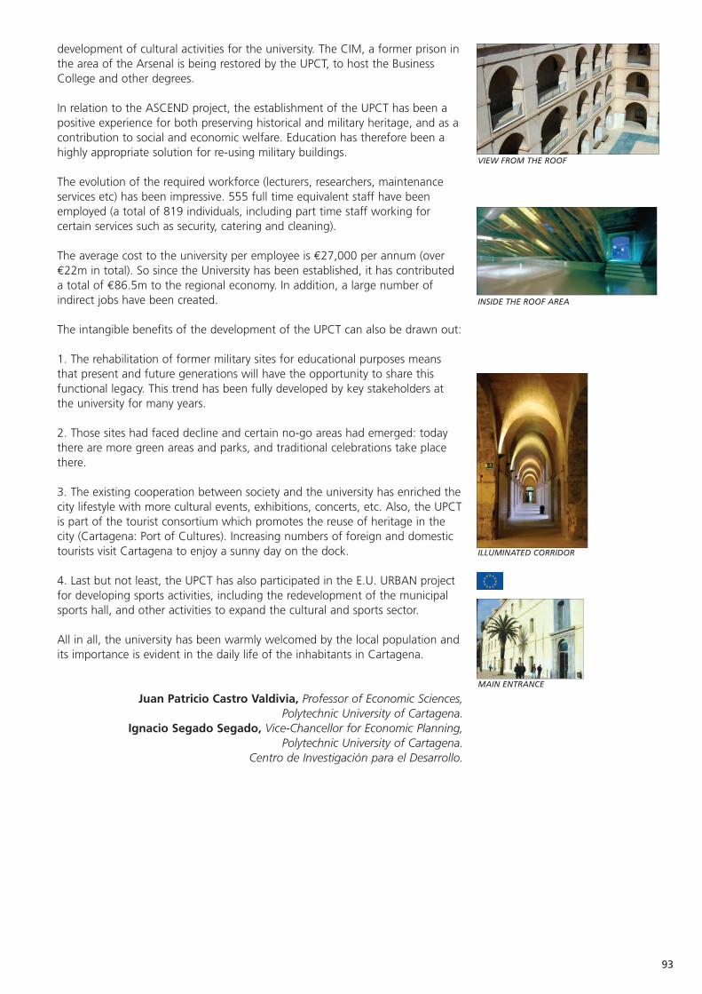
93
VIEW FROM THE ROOF
INSIDE THE ROOF AREA
ILLUMINATED CORRIDOR
MAIN ENTRANCE
development of cultural activities for the university. The CIM, a former prison inthe area of the Arsenal is being restored by the UPCT, to host the BusinessCollege and other degrees.
In relation to the ASCEND project, the establishment of the UPCT has been apositive experience for both preserving historical and military heritage, and as acontribution to social and economic welfare. Education has therefore been ahighly appropriate solution for re-using military buildings.
The evolution of the required workforce (lecturers, researchers, maintenanceservices etc) has been impressive. 555 full time equivalent staff have beenemployed (a total of 819 individuals, including part time staff working forcertain services such as security, catering and cleaning).
The average cost to the university per employee is €27,000 per annum (over€22m in total). So since the University has been established, it has contributeda total of €86.5m to the regional economy. In addition, a large number ofindirect jobs have been created.
The intangible benefits of the development of the UPCT can also be drawn out:
1. The rehabilitation of former military sites for educational purposes meansthat present and future generations will have the opportunity to share thisfunctional legacy. This trend has been fully developed by key stakeholders atthe university for many years.
2. Those sites had faced decline and certain no-go areas had emerged: todaythere are more green areas and parks, and traditional celebrations take placethere.
3. The existing cooperation between society and the university has enriched thecity lifestyle with more cultural events, exhibitions, concerts, etc. Also, the UPCTis part of the tourist consortium which promotes the reuse of heritage in thecity (Cartagena: Port of Cultures). Increasing numbers of foreign and domestictourists visit Cartagena to enjoy a sunny day on the dock.
4. Last but not least, the UPCT has also participated in the E.U. URBAN projectfor developing sports activities, including the redevelopment of the municipalsports hall, and other activities to expand the cultural and sports sector.
All in all, the university has been warmly welcomed by the local population andits importance is evident in the daily life of the inhabitants in Cartagena.
Juan Patricio Castro Valdivia, Professor of Economic Sciences, Polytechnic University of Cartagena.
Ignacio Segado Segado, Vice-Chancellor for Economic Planning, Polytechnic University of Cartagena.
Centro de Investigación para el Desarrollo.
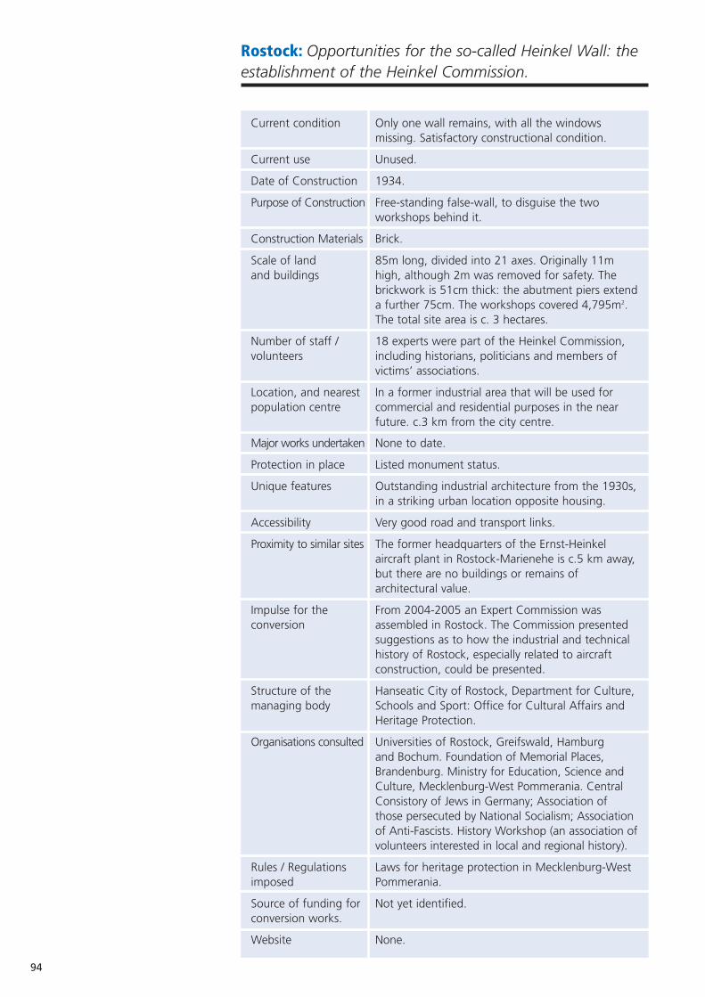
94
Rostock: Opportunities for the so-called Heinkel Wall: theestablishment of the Heinkel Commission.
Current condition Only one wall remains, with all the windows missing. Satisfactory constructional condition.
Current use Unused.
Date of Construction 1934.
Purpose of Construction Free-standing false-wall, to disguise the two workshops behind it.
Construction Materials Brick.
Scale of land 85m long, divided into 21 axes. Originally 11m and buildings high, although 2m was removed for safety. The
brickwork is 51cm thick: the abutment piers extenda further 75cm. The workshops covered 4,795m2. The total site area is c. 3 hectares.
Number of staff / 18 experts were part of the Heinkel Commission, volunteers including historians, politicians and members of
victims’ associations.
Location, and nearest In a former industrial area that will be used for population centre commercial and residential purposes in the near
future. c.3 km from the city centre.
Major works undertaken None to date.
Protection in place Listed monument status.
Unique features Outstanding industrial architecture from the 1930s,in a striking urban location opposite housing.
Accessibility Very good road and transport links.
Proximity to similar sites The former headquarters of the Ernst-Heinkel aircraft plant in Rostock-Marienehe is c.5 km away,but there are no buildings or remains of architectural value.
Impulse for the From 2004-2005 an Expert Commission was conversion assembled in Rostock. The Commission presented
suggestions as to how the industrial and technical history of Rostock, especially related to aircraft construction, could be presented.
Structure of the Hanseatic City of Rostock, Department for Culture, managing body Schools and Sport: Office for Cultural Affairs and
Heritage Protection.
Organisations consulted Universities of Rostock, Greifswald, Hamburgand Bochum. Foundation of Memorial Places, Brandenburg. Ministry for Education, Science and Culture, Mecklenburg-West Pommerania. Central Consistory of Jews in Germany; Association of those persecuted by National Socialism; Association of Anti-Fascists. History Workshop (an association ofvolunteers interested in local and regional history).
Rules / Regulations Laws for heritage protection in Mecklenburg-West imposed Pommerania.
Source of funding for Not yet identified.conversion works.
Website None.
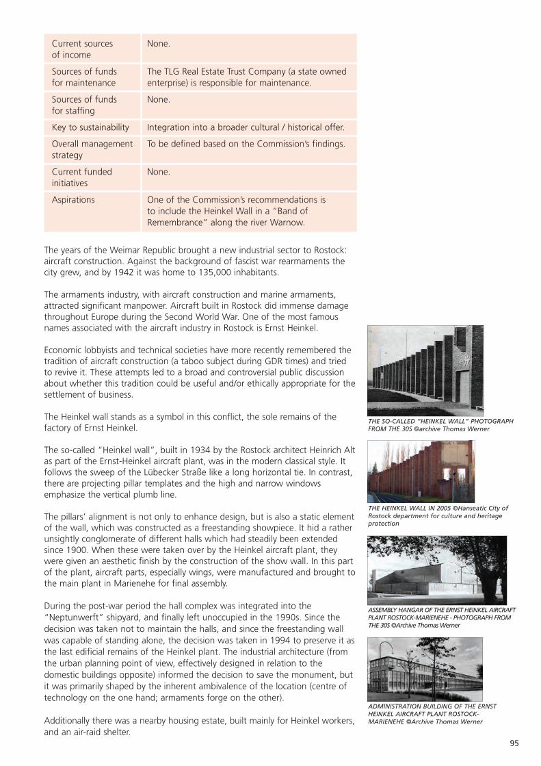
95
THE SO-CALLED “HEINKEL WALL“ PHOTOGRAPH FROM THE 30S ©archive Thomas Werner
THE HEINKEL WALL IN 2005 ©Hanseatic City ofRostock department for culture and heritageprotection
ASSEMBLY HANGAR OF THE ERNST HEINKEL AIRCRAFTPLANT ROSTOCK-MARIENEHE - PHOTOGRAPH FROMTHE 30S ©Archive Thomas Werner
ADMINISTRATION BUILDING OF THE ERNSTHEINKEL AIRCRAFT PLANT ROSTOCK-MARIENEHE ©Archive Thomas Werner
Current sources None.of income
Sources of funds The TLG Real Estate Trust Company (a state ownedfor maintenance enterprise) is responsible for maintenance.
Sources of funds None.for staffing
Key to sustainability Integration into a broader cultural / historical offer.
Overall management To be defined based on the Commission’s findings.strategy
Current funded None.initiatives
Aspirations One of the Commission’s recommendations is to include the Heinkel Wall in a “Band of Remembrance” along the river Warnow.
The years of the Weimar Republic brought a new industrial sector to Rostock:aircraft construction. Against the background of fascist war rearmaments thecity grew, and by 1942 it was home to 135,000 inhabitants.
The armaments industry, with aircraft construction and marine armaments,attracted significant manpower. Aircraft built in Rostock did immense damagethroughout Europe during the Second World War. One of the most famousnames associated with the aircraft industry in Rostock is Ernst Heinkel.
Economic lobbyists and technical societies have more recently remembered thetradition of aircraft construction (a taboo subject during GDR times) and triedto revive it. These attempts led to a broad and controversial public discussionabout whether this tradition could be useful and/or ethically appropriate for thesettlement of business.
The Heinkel wall stands as a symbol in this conflict, the sole remains of thefactory of Ernst Heinkel.
The so-called “Heinkel wall”, built in 1934 by the Rostock architect Heinrich Altas part of the Ernst-Heinkel aircraft plant, was in the modern classical style. Itfollows the sweep of the Lübecker Straße like a long horizontal tie. In contrast,there are projecting pillar templates and the high and narrow windowsemphasize the vertical plumb line.
The pillars’ alignment is not only to enhance design, but is also a static elementof the wall, which was constructed as a freestanding showpiece. It hid a ratherunsightly conglomerate of different halls which had steadily been extendedsince 1900. When these were taken over by the Heinkel aircraft plant, theywere given an aesthetic finish by the construction of the show wall. In this partof the plant, aircraft parts, especially wings, were manufactured and brought tothe main plant in Marienehe for final assembly.
During the post-war period the hall complex was integrated into the“Neptunwerft” shipyard, and finally left unoccupied in the 1990s. Since thedecision was taken not to maintain the halls, and since the freestanding wallwas capable of standing alone, the decision was taken in 1994 to preserve it asthe last edificial remains of the Heinkel plant. The industrial architecture (fromthe urban planning point of view, effectively designed in relation to thedomestic buildings opposite) informed the decision to save the monument, butit was primarily shaped by the inherent ambivalence of the location (centre oftechnology on the one hand; armaments forge on the other).
Additionally there was a nearby housing estate, built mainly for Heinkel workers,and an air-raid shelter.

96
The director of the Real Estate Trust Company (an enterprise belonging to theFederal Republic of Germany) objected to the official protection andconservation of the Heinkel Wall under Federal Law in 1996: “The Heinkel plantis still a vital reference for the devastating effects that the Fascist war machineryhad in Nazi times …. It is quite surprising that Rostock, which of all cities likesto refer to its own Hanseatic tradition, does itself the doubtable honour ofplacing a showcase example of Nazi architecture - without special edificialhistorical meaning or even artistic significance - on the heritage list. It is morethe thought of death and disaster that is linked with this example ofarchitecture than vital edificial history.”
However, a true monument does not always have to be beautiful, but shouldtransport history. If the wall had been brought down, as the Real Estate TrustCompany wished, there would not have been such a stumbling block. And thewall still is a stumbling block. Passing the wall you can hear words like:“eyesore” and “ruin”, with people questioning, “when will it be knockeddown?”
The public discussion about the future of the Heinkel Wall reached its peak in2002. A Rostock society, supported by the administration of the Hanseatic Cityof Rostock, developed an exhibition entitled “The Establishment of the ErnstHeinkel Aircraft Plant 80 years ago in Rostock”. It was criticised for its allegedlyone-sided appreciation of the technical merits of the Heinkel Company, and itwas felt that the exhibition did not tell enough about the forced labour,concentration camp detainees and involvement of Ernst Heinkel with the Nazisystem.
In this debate, that at times actually occupied the courts, the Heinkel Wallalways stood as a symbol.
After interminable discussions by the boards of Rostock City Council, the LordMayor appointed in 2004 a commission of experts entitled “Technology andResponsibility”. Representatives of the following institutions were appointed:
• Universities of Rostock, Greifswald, Hamburg and Bochum. • Foundation of Memorial Places, Brandenburg. • Ministry for Education, Science and Culture, Mecklenburg-West
Pommerania. • Central Consistory of Jews in Germany. • Association of those persecuted by National Socialism. • Association of Anti-Fascists. • One representative of each faction of the City Council.
In the course of three meetings, the commission strove to answer “how theindustrial and technical history, with a particular focus on the aircraft industryand Ernst Heinkel as a person during the time of the national socialist regime,could be presented”. Connected to this, the Commission undertook expertsurveys. Guest speakers, from, among others, the Memorial Mittelbau-Dora, theWestphalian Museum for Industry, the Volkswagen Corporation, and theUniversities of Tübingen, Munich and Vienna were invited.
In May 2005, the Commission gave its recommendations to the Lord Mayor.These were preceded by a historical survey that is summarised below, to aidunderstanding of the roots of the recommendations:
“A politically determined rapid industrialisation connects the city of Rostockwith the name of Ernst Heinkel. This turned out to be long-term relationship,significant and full of consequences, permeated by armament, war,dictatorship, racism, forced labour and remoteness from the market. Full ofconsequences, furthermore, because of the connection with the second rapidindustrialisation period, that of the shipyards, which was characterised bypolitical determination, dictatorship and remoteness from the market as well.Thus, Rostock’s current economic situation is directly connected with the
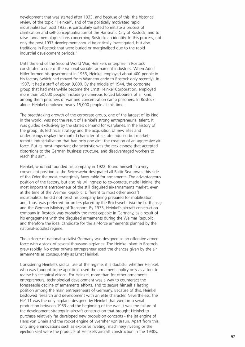
97
development that was started after 1933, and because of this, the historicalreview of the topic “Heinkel”, and of the politically motivated rapidindustrialisation post 1933, is particularly suited to initiate a process ofclarification and self-conceptualisation of the Hanseatic City of Rostock, and toraise fundamental questions concerning Rostockean identity. In this process, notonly the post 1933 development should be critically investigated, but alsotraditions in Rostock that were buried or marginalised due to the rapidindustrial development periods.”
Until the end of the Second World War, Heinkel’s enterprise in Rostockconstituted a core of the national socialist armament industries. When AdolfHitler formed his government in 1933, Heinkel employed about 400 people inhis factory (which had moved from Warnemuende to Rostock only recently). In1937, it had a staff of about 9,000. By the middle of 1944, the corporategroup that had meanwhile become the Ernst Heinkel Corporation, employedmore than 50,000 people, including numerous forced labourers of all kind,among them prisoners of war and concentration camp prisoners. In Rostockalone, Heinkel employed nearly 15,000 people at this time.
The breathtaking growth of the corporate group, one of the largest of its kindin the world, was not the result of Heinkel’s strong entrepreneurial talent. Itwas guided exclusively by the state’s demand for warplanes. In the history ofthe group, its technical strategy and the acquisition of new sites andundertakings display the morbid character of a state-induced but market-remote industrialisation that had only one aim: the creation of an aggressive air-force. But its most important characteristic was the recklessness that accepteddistortions to the German business structure, and disadvantaged workers toreach this aim.
Heinkel, who had founded his company in 1922, found himself in a veryconvenient position as the Reichswehr designated all Baltic Sea towns this sideof the Oder the most strategically favourable for armaments. The advantageousposition of the factory, but also his willingness to co-operate, made Heinkel themost important entrepreneur of the still disguised air-armaments market, evenat the time of the Weimar Republic. Different to most other aircraftindustrialists, he did not resist his company being prepared for mobilisation,and, thus, was preferred for orders placed by the Reichswehr (via the Lufthansa)and the German Ministry of Transport. By 1933, Heinkel’s aircraft constructioncompany in Rostock was probably the most capable in Germany, as a result ofhis engagement with the disguised armaments during the Weimar Republic,and therefore the ideal candidate for the air-force armaments planned by thenational-socialist regime.
The airforce of national-socialist Germany was designed as an offensive armedforce with a stock of several thousand airplanes. The Heinkel plant in Rostockgrew rapidly. No other private entrepreneur used the chances given by the airarmaments as consequently as Ernst Heinkel.
Considering Heinkel’s radical use of the regime, it is doubtful whether Heinkel,who was thought to be apolitical, used the armaments policy only as a tool torealise his technical visions. For Heinkel, more than for other armamentsentrepreneurs, technological development was a way to counteract theforeseeable decline of armaments efforts, and to secure himself a lastingposition among the main entrepreneurs of Germany. Because of this, Heinkelbestowed research and development with an elite character. Nevertheless, theHe111 was the only airplane designed by Heinkel that went into serialproduction between 1933 and the beginning of the war. It was the failure ofthe development strategy in aircraft construction that brought Heinkel topurchase relatively far developed new propulsion concepts - the jet engine ofHans von Ohain and the rocket engine of Wernher von Braun. Apart from this,only single innovations such as explosive riveting, machinery riveting or theejection seat were the products of Heinkel’s aircraft construction in the 1930s.
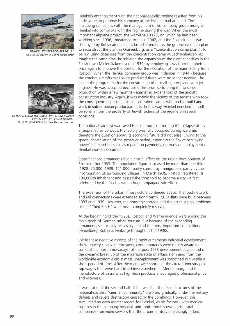
98
HEINKEL FIGHTER BOMBER HE 111ABOVE WARSAW IN SEPTEMBER 1939
POSTCARD FROM THE SERIES 'WIR FLIEGEN NACHENGELLAND' ED. ERNST HEINKEL
FLUGZEUGWERKE ©Archive Thomas Werner
Heinkel’s entanglement with the national-socialist regime resulted from hisendeavours to preserve his company at the level he had attained. Theincreasing difficulties with the management of his company group broughtHeinkel into complicity with the regime during the war. When the mostimportant airplane project, the warplane He177, on which he had beenworking since 1936, threatened to fail in 1942, and the Rostock plant wasdestroyed by British air raids that lasted several days, he got involved in a planto reconstruct the plant in Oranienburg, as a “concentration camp plant”, tobe run using detainees from the concentration camp at Sachsenhausen. Atroughly the same time, he initiated the expansion of the plant capacities in thePolish town Mielec (taken over in 1939) by employing Jews from the ghettos -once again to improve the position for the relocation of the main factory fromRostock. When the Heinkel company group was in danger in 1944 - becausethe combat aircrafts exclusively produced there were no longer needed - hejoined the programme for the construction of a small fighter plane with jetengines. He was accepted because of his promise to bring it into seriesproduction within a few months - against all experiences of the aircraftconstruction industry. Again, it was mainly the victims of the regime who tookthe consequences: prisoners in concentration camps who had to build andwork in subterranean production halls. In this way, Heinkel enriched himselfpersonally from the property of Jewish victims of the regime on severaloccasions.
The national-socialist war saved Heinkel from confronting the collapse of hisentrepreneurial concept. His factory was fully occupied during wartime,therefore the question about its economic future did not arise. Owing to thespecial constellation of the post-war period, especially the Soviet occupyingpower’s demand for ships as reparation payments, no mass-unemployment ofHeinkel workers occurred.
State-financed armaments had a crucial effect on the urban development ofRostock after 1933. The population figure increased by more than one third(1928: 75,000, 1939: 121,000), partly caused by immigration, partly by theincorporation of surrounding villages. In March 1935, Rostock registered its100,000th inhabitant and passed the threshold to become a city - a factcelebrated by the fascists with a huge propagandistic effort.
The expansion of the urban infrastructure continued apace. The road networkand rail connections were extended significantly. 7,034 flats were built between1933 and 1939. However, the housing shortage and the acute supply problemsof the “Third Reich” were never completely resolved.
At the beginning of the 1920s, Rostock and Warnemuende were among themain goals of German urban tourism. But because of the expandingarmaments sector they fell visibly behind the most important competitors(Heidelberg, Koblenz, Freiburg) throughout the 1930s.
While these negative aspects of the rapid armaments industrial developmentshow up very clearly in retrospect, contemporaries were mainly aware (andsome of them even nowadays) of the post-1933 development as a period ofthe dynamic break up of the miserable state of affairs stemming from theworldwide economic crisis: mass unemployment was smoothed out within ashort period of time. After the manpower shortage, the aircraft industry paidtop wages that were hard to achieve elsewhere in Mecklenburg, and themanufacture of aircrafts as high-tech products encouraged professional prideand eliteness.
It was not until the second half of the war that the fixed structures of thenational-socialist “German community” dissolved gradually, under the militarydefeats and severe destruction caused by the bombings. However, thisstimulated an even greater regard for Heinkel, as his factory - with medicalsupplies in the company hospital, and food from his own agriculturalcompanies - provided services that the urban territory increasingly lacked.
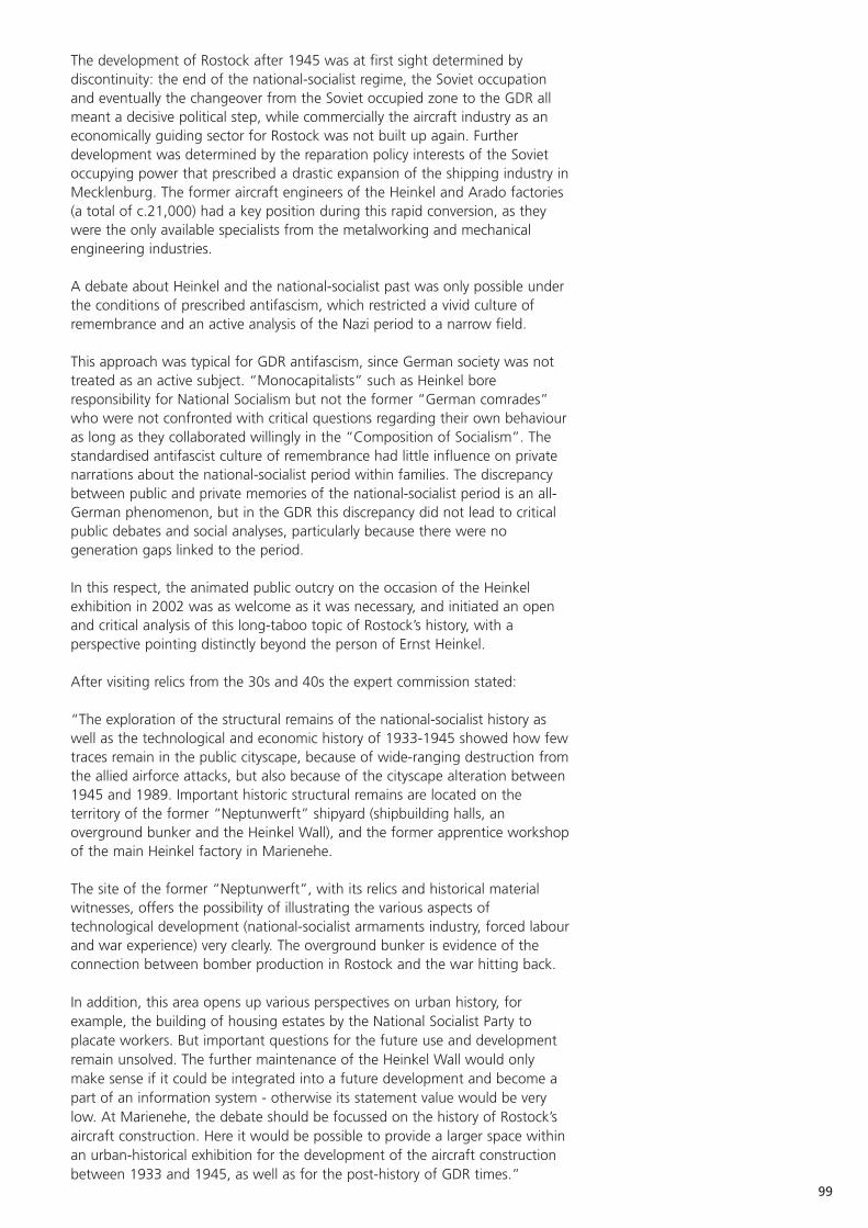
99
The development of Rostock after 1945 was at first sight determined bydiscontinuity: the end of the national-socialist regime, the Soviet occupationand eventually the changeover from the Soviet occupied zone to the GDR allmeant a decisive political step, while commercially the aircraft industry as aneconomically guiding sector for Rostock was not built up again. Furtherdevelopment was determined by the reparation policy interests of the Sovietoccupying power that prescribed a drastic expansion of the shipping industry inMecklenburg. The former aircraft engineers of the Heinkel and Arado factories(a total of c.21,000) had a key position during this rapid conversion, as theywere the only available specialists from the metalworking and mechanicalengineering industries.
A debate about Heinkel and the national-socialist past was only possible underthe conditions of prescribed antifascism, which restricted a vivid culture ofremembrance and an active analysis of the Nazi period to a narrow field.
This approach was typical for GDR antifascism, since German society was nottreated as an active subject. “Monocapitalists” such as Heinkel boreresponsibility for National Socialism but not the former “German comrades”who were not confronted with critical questions regarding their own behaviouras long as they collaborated willingly in the “Composition of Socialism”. Thestandardised antifascist culture of remembrance had little influence on privatenarrations about the national-socialist period within families. The discrepancybetween public and private memories of the national-socialist period is an all-German phenomenon, but in the GDR this discrepancy did not lead to criticalpublic debates and social analyses, particularly because there were nogeneration gaps linked to the period.
In this respect, the animated public outcry on the occasion of the Heinkelexhibition in 2002 was as welcome as it was necessary, and initiated an openand critical analysis of this long-taboo topic of Rostock’s history, with aperspective pointing distinctly beyond the person of Ernst Heinkel.
After visiting relics from the 30s and 40s the expert commission stated:
“The exploration of the structural remains of the national-socialist history aswell as the technological and economic history of 1933-1945 showed how fewtraces remain in the public cityscape, because of wide-ranging destruction fromthe allied airforce attacks, but also because of the cityscape alteration between1945 and 1989. Important historic structural remains are located on theterritory of the former “Neptunwerft” shipyard (shipbuilding halls, anoverground bunker and the Heinkel Wall), and the former apprentice workshopof the main Heinkel factory in Marienehe.
The site of the former “Neptunwerft”, with its relics and historical materialwitnesses, offers the possibility of illustrating the various aspects oftechnological development (national-socialist armaments industry, forced labourand war experience) very clearly. The overground bunker is evidence of theconnection between bomber production in Rostock and the war hitting back.
In addition, this area opens up various perspectives on urban history, forexample, the building of housing estates by the National Socialist Party toplacate workers. But important questions for the future use and developmentremain unsolved. The further maintenance of the Heinkel Wall would onlymake sense if it could be integrated into a future development and become apart of an information system - otherwise its statement value would be verylow. At Marienehe, the debate should be focussed on the history of Rostock’saircraft construction. Here it would be possible to provide a larger space withinan urban-historical exhibition for the development of the aircraft constructionbetween 1933 and 1945, as well as for the post-history of GDR times.”

100
THE HEINKEL WALL IN 2005 ©Hanseatic City ofRostock department for culture and
heritage protection
THE REAR OF THE HEINKEL WALL WITH THEOPPOSITE HOUSING FROM THE 30S IN 2005©Hanseatic City of Rostock, department for
culture and heritage protection
The expert commission gave the following recommendations to the Lord Mayor:“The integration of technological history and national-socialist history into a‘blue ribbon’, or Cultural Boulevard along the river Warnow promises greatattractiveness, a publicly successful presentation within a scenic environment,and the connection of various historical sites with different subject references toa ribbon of remembrance, allowing a multi-perspectival view of urban history.This gains central meaning from the protection, preservation and integration ofthe various historic remains between the city harbour, the “Neptunwerft”,Marienehe, the IGA territory (the area of a former garden exhibition on thebank of the River Warnow that now serves as a municipal park next to the shipmuseum) and Warnemuende. The content bracket around these different siteswould be the multi-faceted industrial history of Rostock in the 20th century.The conceptual preparation, and the preparation of content for such a ribbonof remembrance should be assigned to one institution, with professionalassistance from an advisory board. A first, noteworthy step would be theinstallation of an open-air exhibition on the former “Neptunwerft” territory thatanalyses the de-limitation of technology and industry during the Second WorldWar, but also the leeway of the agents. The panels that are installed in thepublic space could be the start of a guidance path network about the topic.”
Based on these recommendations, the Hanseatic City of Rostock tasked thehistorian Dr. Florian Ostrop in summer 2005 with the conceptual design of alearning path about Rostock’s industrial history, incorporating the Heinkel wall.
To conclude, we summarise the key points of the report:
"It is the task of a democratic community to counter such a unidimensionalinterpretation of history that conjures up the alleged ideal world of dictatorship.As a first step there will therefore be a learning path about Rostock’s industrialhistory along the river Warnow. This path is intended to be a low thresholdeducational opportunity, available for citizens and tourists free of charge at alltimes. The aim of the learning path is to give information at the sites inquestion, factually precise and generally comprehensible. For this reason, therewill be up to ten stations between the city harbour and the modern ferryterminal.
At these stations, citizens and tourists will have the opportunity to look intoimportant chapters of Rostock’s industrial and technical history, and to file thelocal events in their national and international context. In the followingparagraphs we shortly introduce the stations:
1. The city harbour as a symbol for the beginning of forced shipbuilding in the19th century. Here we can recall that in July 1851 the first German seagoingiron screw steamer was launched. But it is also important to refer to the naturalcharacter of the harbour that set boundaries to the building and traffic ofoffshore ships. The use of the harbour as a regional shipment centre foragricultural products and for parades of the naval forces are to be mentioned.
2. In 1970, a large memorial was erected to remember the German revolutionthat took place in 1918. As a result of this revolution, the first democraticcommunity was formed in Germany. On the basis of this memorial, the publicdisplay of history in the GDR district capital can be discussed.
3. The former Neptune dockyard is where the traces of industrial shipbuildingunder authoritarian, dictatorial and also democratic conditions can be shown,as well as the downfall of a large firm with a centenarian history.
4. The so-called Heinkel Wall, where the business policy of Heinkel during theWeimar Republic, as well as the continuities and changes in this strategy at thebeginning of the national-socialist governance, take centre stage.
5. The powerhouse in Bramow that may serve as an example for the businessconnection between the municipality and industry.
101
6. The former Heinkel aircraft plant in Rostock-Marienehe that is a symbol forthe outstanding meaning of this company as part of the armaments industry ofthe Third Reich. Here, the area of conflict in which Ernst Heinkel as a personmoved during the governance of the National Socialist party can beexperienced: the promotion of groundbreaking technical achievements thatwere intrinsically tied to the unscrupulous exploitation of the corporatepossibilities that the National Socialist regime offered.
7. The former fishing harbour in Rostock-Marienehe where the seriousconsequences for Rostock and its citizens of the politically motivatedrequirements of the centrally planned economy that were announced by theGDR leadership are reflected.
8. The former ARADO aircraft building plant that unlike the Heinkel aircraftplant had been a state-owned enterprise during the Third Reich. The ARADOplant is not to be underestimated in its meaning for Rostock’s urbandevelopment, especially in Warnemuende, but is often forgotten in thisdiscourse.”
Next year the Hanseatic City of Rostock will attempt to develop the learningpath and, thus, give the Heinkel Wall a meaning in this context.
Thomas Werner, Cultural and Heritage Department, Hansestadt Rostock.
102
Rostock: The conversion of former barracks to Universityfacilities.
Current condition Restoration over a two year period, completed in 2002, means that the facilities are generally in very good condition.
Current use Faculty of Social and Economic Sciences, University of Rostock.
Statistics c.3,000 students per year.
Date of Construction 1890.
Purpose of Construction City centre barracks accommodation.
Construction Materials Traditional: decorated brickwork, concrete ceilings and trusses.
Scale of land In excess of 4 hectares; the two historic and buildings accommodation blocks each occupy c.5,000m2.
There is a lecture hall for c.500 students.
Number of staff / 23 lecturers and 40 administrative officers.volunteers
Location, and nearest The Elm Barracks were erected at the untilled population centre outskirts of the city, today situated in the built-up
Kröpelin Gate suburb, c.3km from the city centre.
Major works undertaken Complete restoration: brickwork repair, roof reconstruction, cellar drainage, replacement floors, ceilings, windows and doors.
Protection in place The whole university complex is listed.
Unique features The redesign into an urban collegiate green space, with exemplary Wilhelminian architecture.
Accessibility Very good public transport links by tram and coach. Can be reached on foot from the city centrein 15 minutes.
Proximity to similar sites Schwerin - capital of Mecklenburg-West Pommerania - has artillery barracks converted to a museum, c.80km from Rostock.
Impulse for the When the CIS military left Germany, the main conversion barracks area was given to the Federal State of
Mecklenburg-West Pommerania. The Ministry of Education and Science and the Ministry of Finance decided jointly that the university should open a main site at the Ulmenstraße.
Structure of the Government of Mecklenburg-West Pommerania:managing body 1) Ministry of Education and Science, University of
Rostock.2) Ministry of Finance, Department for Building
and Real Estate Management.
Organisations consulted Department for Cultural Affairs and Heritage Protection, Hanseatic City of Rostock.
Rules / Regulations Laws for heritage protection in Mecklenburg-West imposed Pommerania: the Federal Building Code: the
Building Code of Mecklenburg-West Pommerania.
Source of funding for Tax from the Government and Federal State (in the conversion works framework of a law for the enhancement of
university buildings).
Conditions attached The planning process aimed to prove that the to funding restoration decision was sustainable and
economically viable.
Website www.uni-rostock.de

103
THE BARRACKS IN 1993
POSTCARD, 1915 ©Hanseatic City of Rostock,Department for cultural affairs and monumentheritage
MAIN ENTRANCE 2004 ©BBL-MV
1The institutions of the former GDR weretransformed into a new Federal-Germanauthority structure, based on three pillars.Thus, for example, schools were assigned tothe municipality, police buildings to the FederalState and the German Federal Armed Forces tothe Federal Republic.
Current sources Federal State of Mecklenburg-West Pommerania.of income
Sources of funds Federal State of Mecklenburg-West Pommerania.for maintenance
Sources of funds Federal State of Mecklenburg-West Pommerania.for staffing
Key to sustainability Sustainability featuring in all planning stages.
Overall management In response to demographic changes, there is a strategy complex process of spatial planning for the Federal
State of Mecklenburg-West Pommerania; part of this is a centrally developed framework for university buildings to ensure sustainable planning and development.
Current funded initiatives All investments that form part of the common framework are equally funded by the Federal Republic and the Federal State.
Aspirations Joint strategic planning with other university sites in Mecklenburg-West Pommerania.
The infantry barracks on Rostock’s Ulmenstraße were built from 1886-1890.There are two barracks, each 110m long, and some functional buildings, suchas car sheds and a washhouse. The former infantry barracks now form anindependent quarter within the surrounding urban area. The barracks yard issurrounded by buildings on three sides, and is characterised by the two formeraccommodation buildings in New Gothic style. After the imperial troops hadbeen broken up, the “Reichswehr” (the army of the Reich) used the buildings,and from 1933 the “Wehrmacht” (German Armed Forces) moved in. In 1945,the Soviet Army took over and from 1966 onwards, the “NationaleVolksarmee” (the army of the GDR) used the buildings.
Thus, the infantry barracks had been a restricted area for more than a hundredyears. Today, the Faculty of Economic and Social Sciences of the University ofRostock, and the Federal Border Guard have their seat there. The majority ofthe wall that had surrounded the infantry barracks has been demolished andnew parking facilities for university staff have been built. A train station thatconnects with Rostock’s main station and Warnemuende is nearby, and a busand a tram station are five minutes’ walk. The neighbouring residential areawas and still is ‘students territory’.
The University of Rostock, founded in 1419, is one of the oldest universities ofGermany and the oldest within the Baltic Sea Region. Nowadays, it has eightfaculties subdivided into departments, institutes and teaching hospitals. Morethan 50 courses of study are offered. At present, there are nearly 12,000enrolled students, including 400 foreign students, from over 80 countries.
Correspondingly, there are 3,100 members of staff within the Faculty ofMedical Sciences, and 1,600 within the other faculties. Thus, the University ofRostock is the city’s largest employer.
The initial impulse for the conversion.
From the end of the Second World War until the re-unification of Germany, thebarracks were used for military purposes by two countries: 1. the CIS states (thefollow-up organisation of the Soviet Union) and 2. the Border Guard of theGerman Democratic Republic. The facilities were divided between the twoarmies and used separately. After the re-unification, the barracks facilities wereagain divided between the corresponding West German institutions1. When theSoviet Army was withdrawn, the Russian part of the barracks was transferred tothe Federal Republic of Germany. The Border-Guard section was assigned to the

104
Federal Republic as well and is used by the Federal Border Guards even today.The former Russian part was designated for transfer to the Federal State ofMecklenburg-West Pommerania for a symbolic price of €1, as there was nolonger a need for barracks facilities on inner-city territory. Thus, the Ministry ofFinance of Mecklenburg-West Pommerania tasked the subordinated regionalauthority, regional planning department and building control authority ofRostock, with investigating the possible development of parts of the estate foruniversity purposes, from the planner’s perspective. In co-ordination with theUniversity of Rostock and the City Department for the Preservation ofMonuments and Historic Buildings, an economic reuse was developed. Evenduring the first planning steps, it was obvious that the restoration of thepreserved building fabric would cost as much as new buildings.
Before the decision was taken as to whether the real estate should be used bythe university, multiple criteria were identified and considered. The userequirements of a modern educational institution were transposed on themilitary building structure. Favourable and unfavourable conditions wererevealed that impacted on the efficiency of the planned building tasks:
PRO CONTRAAdequate space in Building 1. Not barrier free.Adequate transport routes. Unsatisfactory building security
standards.Adequate cubature (volume of air). Heritage protection requirements.Adequately representative building. Construction in poor condition.Central urban location. High expenses for maintenance.The real estate, with open space, has all the conditions for an academic campus.Potential for future development.
PRODuring preliminary planning, the space requirements (said to be c.5000 m2 floorspace) were thoroughly examined, in conjunction with the university. Theaccommodation floors were reached by wide staircases. There were centralsanitation rooms on the ground floor, divided according to service grades.Because the living and sleeping rooms were planned for a multitude of soldiers,the cubature of the rooms (air volume) was ample for today’s circumstances. Onthe one hand the breadth of the building made it easy to establish large lectureand seminar rooms, but on the other hand, smaller rooms could only beestablished by finding compromises, because the room breadths and resultingdistances between windows and internal walls did not accord to today’sstandards.
The existing floors and staircases were very well suited for evacuation of therequired number of people in case of danger. The representative façades andparts of the structure were quite appealing for a public educational institution.
CONTRAThe ramshackle state that the building was in was a distinct disadvantage. Theornamental brick facade was heavily weather beaten, the cellar stonework waswater-damaged and the majority of the trusses were corroded by mould. Inaddition, the building had totally out-dated standards of safety, finishing andbuilding services engineering: the entire water, wastewater, electrics, andtelecommunications infrastructure had to be replaced throughout the estate.Unlike before, the building had to be easily accessible by the disabled, and as aconsequence there had to be major changes to the building fabric. Many of thenecessary constructional changes furthermore conflicted with the aims ofheritage protection.
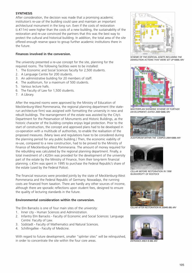
105
SYNTHESISAfter consideration, the decision was made that a promising academicinstitution’s re-use of the building could save and maintain an importantarchitectural monument in the long run. Even if the costs of restoration(c.€11m) were higher than the costs of a new building, the sustainability of therestoration and re-use convinced the partners that this was the best way toprotect the cultural and historical building. In addition, the total area of the siteoffered enough reserve space to group further academic institutions there inthe future.
Finances involved in the conversion.
The university presented a re-use concept for the site, planning for therequired rooms. The following facilities were to be installed: 1. The Economic and Social Sciences faculty for 2,500 students. 2. A Language Centre for 200 students.3. An administrative building for 20 members of staff. 4. The auditorium, for a maximum of 500 students.5. Various lecture halls. 6. The Faculty of Law for 1,500 students.7. A Library.
After the required rooms were approved by the Ministry of Education ofMecklenburg-West Pommerania, the regional planning department (the state-run architecture firm) was assigned with formatting the university in new andrebuilt buildings. The rearrangement of the estate was assisted by the City’sDepartment for the Preservation of Monuments and Historic Buildings, as thehistoric character of the building complex enjoys legal protection. Prior to thestart of construction, the concept and approved plans had to be developed inco-operation with a multitude of authorities, to enable the realisation of theproposed measures. (Many laws and regulations have to be considered duringthe planning period for any public building.) Then, the economic viability of re-use, compared to a new construction, had to be proved to the Ministry ofFinance of Mecklenburg-West Pommerania. The amount of money required forthe rebuilding was calculated by the regional planning department. Finally, atotal investment of c.€20m was provided for the development of the universitypart of the estate by the Ministry of Finance, from their long-term financialplanning. c.€3m was spent in 1995 to purchase the Federal Republic’s share ofthe estate (used by the Federal Police).
The financial resources were provided jointly by the state of Mecklenburg-WestPommerania and the Federal Republic of Germany. Nowadays, the runningcosts are financed from taxation. There are hardly any other sources of income,although there are sporadic reflections upon student fees, designed to ensurethe quality of lecturing standards in the future.
Environmental consideration within the conversion.
The Elm Barracks is one of four main sites of the university:1. Inner city - Human Sciences and Administration. 2. Infantry Elm Barracks - Faculty of Economic and Social Sciences: Language
Centre: Faculty of Law. 3. Südstadt - Faculty of Mathematics and Natural Sciences. 4. Schillingallee - Faculty of Medicine.
With regard to future development, smaller “splinter sites” will be relinquished,in order to concentrate the site within the four core areas.
SCHEME OF THE EDIFICIAL ASSETS INCLUDING THEDEMOLITION ACTIONS THAT WERE SET UP ©BBL-MV
MASTERPLAN SHOWING SCHEME OF FURTHERDEVELOPMENT; DATED 2000 ©BBL-MV
AUDITORIUM WITHIN THE CAMPUS 2004 ©BBL-MV
CELLAR BEFORE RESTORATION IN 1998 ©UNIVERSITY OF ROSTOCK
CELLAR AFTER RESTORATION IN 2004© BBL-MV
ENTRANCE AREA © BBL-MV

106
Urban development and green space planning
A prime planning aim of all participants was the opening of the formerlycordoned-off barracks yard as a green area for students. The constructionmeasures planned should shape or formulate the green territories morestrongly.
Pedestrian access to the railway station was developed, to stimulate the use ofpublic transport. Paths were planned to line up diagonally, according to thetarget and source traffic. The new green centre can be reached easily andlogically. Although 300 new parking places were required within the estate, itwas agreed that the inner yard be kept free of cars under all circumstances. Thelime trees surrounding the site were to be maintained and supplemented wherenecessary. Trees were used to enhance the car park design.
Future development of the area
Today there are 3,000 students registered at the Faculty of Social and EconomicSciences. New demographic studies demonstrate that due to decliningbirthrates, the demand for admission to the Mecklenburg-West Pommeraniauniversities will decline drastically. The two universities of Mecklenburg- WestPommerania (Rostock and Greifswald) have been tasked by government withadapting their main focusses (content and admission rates) according to thedemand that is expected - since the funding of every faculty can (in thesecircumstances) no longer be guaranteed by income from taxation.
In January 2006, the Principal of the University of Rostock decided that onecourse belonging to the Faculty of Social and Economic Sciences would becancelled. This means that approximately 30% of the space in Building 1 willbe unused. Because of the flexibility of the building, another course can beaccommodated there as needed.
The centrally situated former toilet facilities are no longer required since thereare built facilities in each main building. The building is in a ramshackle state,and will be restored and modernised for a new use.
Building 3 was previously used by the German police force. It has since beensold to the Federal State and will be used by the law school and as a faculties’library.
Building 8, the former indoor riding hall (c.500m2), will be used as anexperimental lecture hall for physics, and as a sports hall for the Faculty ofSports Science. As soon as possible, the whole building will be reactivated, andits original appearance as a gymnasium restored.
In addition, the area offers many more possibilities. On a fresh developmentarea, further actions to concentrate institutions and buildings are possible. Acafeteria, and a building exclusively for lecture halls are already underdiscussion.
Thomas Werner, Cultural and Heritage Department, Hansestadt Rostock
107
Venice: Strategies for the Defence System.
Current condition The external areas are fair. The condition of the walls varies from very bad to quite good.
Current use Visits, didactical and cultural activities.
Statistics 50,000 visitors each year, to the main sites of Carpenedo, Bazzera, Tron and Marghera.
Date of Construction 1805 -1910.
Purpose of Construction To defend the city of Venice from landward attack.
Construction Materials Stone/brick for the First Generation forts, and reinforced concrete for later developments.
Scale of land The dry land defence system covers 153 hectares. and buildings There are 12 sites:
Fort Marghera covers 33 hectares, with 17,300m2
of buildings. Fort Manin (1806-1814) has only some built remains. Three First Generation forts, from the late 19th century, cover c.60,000m2, with 4,000m2 of buildings. The Second Generation forts are usually 6m high, 25m wide and 120m long, with c.90,000 m2 of surroundinggreen area. One gunpowder magazine, called Bazzera.
Number of staff / 10 paid employees and 30 volunteers.volunteers
Location, and nearest The system is located in the Municipality of Venice. population centre Mestre and Venice are the nearest population
centres, a short distance away.
Major works Decontamination (standard transfer procedure); undertaken cleaning and grounds maintenance; restoration of
some buildings.
Protection in place Protected under the Cultural Heritage Act (1089)of 1939.
Unique features One of the main fortified systems in Italy.
Accessibility All the forts are accessible by car and rail. In most cases there are bus stops nearby.
Proximity to similar sites The Verona fortified defence system is about 100km away.
Impulse for The fortifications were first abandoned by the the conversion Italian Army in the 1970s. During the 80s and
especially the 90s, many volunteer organisations started their recovery.
Structure of the The Municipality of Venice, owner of most of the managing body forts since 2003, will create a specialist office for
their management. Marco Polo System g.e.i.e. is currently fulfilling this role.
Organisations consulted • The Superintendence on Cultural Heritage.
• Representatives of the four district councils concerned.
• Stakeholders via the co-ordinating body of the volunteer associations, and local historians’ associations.
108
Rules / Regulations • The Regional Territorial Co-ordination Plan of imposed 1992 (PTRC) declares the forts environmental
areas and entrusts the Province with the regeneration policy, and the Municipality with the technical rules.
• The Venetian Lagoon Area Plan of 1999 (PALAV)declares the forts cultural heritage to be protected. The Municipality should act for their conservation and valorisation by identifying suitable interventions and promoting compatible re-uses.
• The Provincial Territorial Plan underlines the importance of the green areas around the forts.
• A Variante to the Dry Land Master Plan of Venice Municipality defines the acceptable activities to be encouraged within the fort areas, as: recreational, cultural, social, zoophilous (e.g. bird watching), botanic, sport and leisure. Forts can also provide meeting rooms, exhibition areas, and small-scale refreshment services. Only existing buildings canbe used for these aims, through restoration.
Source of funding for Venice Municipality provides funds for the most conversion works. urgent works and maintenance.
Conditions attached Objectives of the above-mentioned Master Plan.to funding
Website www.marcopolosystem.it
Current sources Today there are no sources of income generated byof income the use of the forts.
Sources of funds Venice Municipality.for maintenance
Sources of funds Venice Municipality.for staffing
Key to sustainability Sustainability is planned for the system overall. In some forts income will be obtained by long and short-term rent of the buildings, and by economic activities. Other sites will develop cultural and environmental uses, where the lower income will be sustained by the economic activities at other sites.
Overall management To develop Marghera Fort with the aim of strategy substantial economic income. This site will become
the driving force of the whole system.
Current funded • Drawing up the guidelines for the future Masterinitiatives Plan of the Forts.
• TUDESLOVE II an Interreg IIIA PHARE project between Italy and Slovenia. This project builds on two previous E.U. projects1 from the tourist and economic point of view through:
• the implementation of itineraries devised during Tudeslove.
• the integration of new themed paths not affected by mass tourism.
1“Tudeslove” (Decentralised Tourism Slovenia-Venice) and Cultucadses
(Establishing a tourist-cultural system in the Adriatic-Danube area)
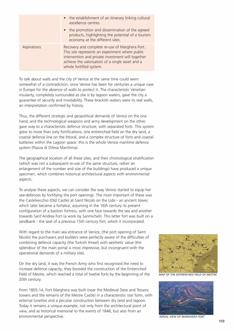
109
• the establishment of an itinerary linking culturalexcellence centres.
• the promotion and dissemination of the agreed products, highlighting the potential of a tourismeconomy at the different sites.
Aspirations Recovery and complete re-use of Marghera Fort. This site represents an experiment where public intervention and private investment will together achieve the valorisation of a single asset and a whole fortified system.
To talk about walls and the city of Venice at the same time could seemsomewhat of a contradiction, since Venice has been for centuries a unique casein Europe for the absence of walls to protect it. The characteristic Venetianinsularity, completely surrounded as she is by lagoon waters, gave the city aguarantee of security and inviolability. These brackish waters were its real walls,an interpretation confirmed by history.
Thus, the different strategic and geopolitical demands of Venice on the onehand, and the technological weapons and army development on the other,gave way to a characteristic defence structure, with separated forts. This systemgrew to more than sixty fortifications, one entrenched field on the dry land, acoastal defence line on the littoral, and a complex structure of forts and coastalbatteries within the Lagoon space: this is the whole Venice maritime defencesystem (Piazza di Difesa Marittima).
The geographical location of all these sites, and their chronological stratification(which was not a subsequent re-use of the same structure, rather anenlargement of the number and size of the buildings) have produced a uniquespecimen, which combines historical architectural aspects with environmentalaspects.
To analyse these aspects, we can consider the way Venice started to equip hersea-defences by fortifying the port openings. The most important of these wasthe Castelvecchio (Old Castle) at Saint Nicolò on the Lido - an ancient tower,which later became a fortalice, assuming in the 16th century its presentconfiguration of a bastion fortress, with one face towards the sea and anothertowards Sant’Andrea Fort (a work by Sanmicheli). This latter fort was built on asandbank - the seat of a previous 15th century fort, which it incorporated.
With regard to the main sea entrance of Venice, (the port opening of SaintNicolò) the purchasers and builders were perfectly aware of the difficulties ofcombining defence capacity (the Turkish threat) with aesthetic value (thesplendour of the main portal is most impressive, but incongruent with theoperational demands of a military site).
On the dry land, it was the French Army who first recognised the need toincrease defence capacity; they boosted the construction of the EntrenchedField of Mestre, which reached a total of twelve forts by the beginning of the20th century.
From 1805-14, Fort Marghera was built (near the Medieval Dese and Tesseratowers and the remains of the Mestre Castle) in a characteristic star form, withexternal lunettes and a peculiar construction between dry land and lagoon.Today it remains a unique example, not only from the architectural point ofview, and as historical memorial to the events of 1848, but also from anenvironmental perspective.
MAP OF THE ENTRENCHED FIELD OF MESTRE
AERIAL VIEW OF MARGHERA FORT
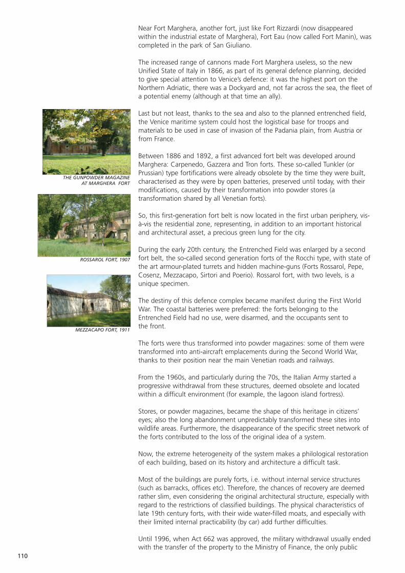
110
THE GUNPOWDER MAGAZINE AT MARGHERA FORT
ROSSAROL FORT, 1907
MEZZACAPO FORT, 1911
Near Fort Marghera, another fort, just like Fort Rizzardi (now disappearedwithin the industrial estate of Marghera), Fort Eau (now called Fort Manin), wascompleted in the park of San Giuliano.
The increased range of cannons made Fort Marghera useless, so the newUnified State of Italy in 1866, as part of its general defence planning, decidedto give special attention to Venice’s defence: it was the highest port on theNorthern Adriatic, there was a Dockyard and, not far across the sea, the fleet ofa potential enemy (although at that time an ally).
Last but not least, thanks to the sea and also to the planned entrenched field,the Venice maritime system could host the logistical base for troops andmaterials to be used in case of invasion of the Padania plain, from Austria orfrom France.
Between 1886 and 1892, a first advanced fort belt was developed aroundMarghera: Carpenedo, Gazzera and Tron forts. These so-called Tunkler (orPrussian) type fortifications were already obsolete by the time they were built,characterised as they were by open batteries, preserved until today, with theirmodifications, caused by their transformation into powder stores (atransformation shared by all Venetian forts).
So, this first-generation fort belt is now located in the first urban periphery, vis-à-vis the residential zone, representing, in addition to an important historicaland architectural asset, a precious green lung for the city.
During the early 20th century, the Entrenched Field was enlarged by a secondfort belt, the so-called second generation forts of the Rocchi type, with state ofthe art armour-plated turrets and hidden machine-guns (Forts Rossarol, Pepe,Cosenz, Mezzacapo, Sirtori and Poerio). Rossarol fort, with two levels, is aunique specimen.
The destiny of this defence complex became manifest during the First WorldWar. The coastal batteries were preferred: the forts belonging to theEntrenched Field had no use, were disarmed, and the occupants sent to the front.
The forts were thus transformed into powder magazines: some of them weretransformed into anti-aircraft emplacements during the Second World War,thanks to their position near the main Venetian roads and railways.
From the 1960s, and particularly during the 70s, the Italian Army started aprogressive withdrawal from these structures, deemed obsolete and locatedwithin a difficult environment (for example, the lagoon island fortress).
Stores, or powder magazines, became the shape of this heritage in citizens’eyes; also the long abandonment unpredictably transformed these sites intowildlife areas. Furthermore, the disappearance of the specific street network ofthe forts contributed to the loss of the original idea of a system.
Now, the extreme heterogeneity of the system makes a philological restorationof each building, based on its history and architecture a difficult task.
Most of the buildings are purely forts, i.e. without internal service structures(such as barracks, offices etc). Therefore, the chances of recovery are deemedrather slim, even considering the original architectural structure, especially withregard to the restrictions of classified buildings. The physical characteristics oflate 19th century forts, with their wide water-filled moats, and especially withtheir limited internal practicability (by car) add further difficulties.
Until 1996, when Act 662 was approved, the military withdrawal usually endedwith the transfer of the property to the Ministry of Finance, the only public

111
MAIN ENTRANCE TO FORT CARPENEDO
CARPENEDO FORT
body which could decide on the final destination of State property assets.During this period, many forts were granted, via various juridical routes, to theMunicipality of Venice, while two of the twelve were entrusted to privatesubjects for six years. This entrusting to private hands proved to be a badexperience, as the private use was not consistent with the architectural andhistorical value of the building (the forts were used as mushroom beds).
Act 662 completely changed the procedure of public property transfer: this Actenabled the Ministry of Defence to directly sell its assets, without entrustingthem to the Ministry of Finance. The MOD could now sell the property withoutan intermediary and this cancelled the operating transfers of some properties tothe Municipality of Venice. The Municipality was left without sufficientdocumentation of title regarding the ownership of these forts.
For example the KONVER funding stream of 1994-97 could not be used by theMunicipality, as it was not the legal owner of the forts, despite being chargedwith drawing up the area master plan. At this time, difficult recovery work wasstarted by a volunteer initiative. Subsequently, the Municipality administrationdecided to support it.
The volunteer work was a highly original initiative, born from spontaneousteams of citizens, who cared enough to preserve this heritage from naturaldeterioration and vandalism. In the early stages, the main target was notmaterial recovery. From the 80s, for over ten years, the “battle” for the fortswas mainly to try to find out who their managing authorities were, within thecomplex world of army property. The citizens could not identify thoseresponsible for the management of the structures, so re-use proposals wereprepared without clarifying the ownership situation.
The weakness of this phase lay in the separate action of each group of citizens,working for individual forts, without a common strategy.
From 1994, a specific agreement for the management and administration ofFort Carpenedo was signed between a citizens’ group and the Municipality: thisagreement granted the area to the volunteer group for a couple of years toensure its protection.
The Ministry of Defence, in fact, reserved the use of the fort for VeniceMunicipality, which then entrusted it to this volunteer group. The groupmanaged the general maintenance and the opening to the public.
This system proved to be highly successful, with thousands of visitors during theSunday openings, all year round. The hard work of the volunteers hadpermitted a new use and new life for the fort.
This good practice was imitated by other citizens’ groups, and new agreementswere signed for Forts Bazzera, Tron and Gazzera.
This experience, complemented by the organisation of work camps with theInternational Civil Service, led to proposals for the setting up of a Committee toco-ordinate actions and proposals for the whole defence system.
Thanks to this Committee, Fort Sant’Andrea also became the object of recoveryand agreement, followed by other important buildings (San Nicolò fortress, theAustrian Redoubt of San Nicolò, the Maximilian tower on Saint Erasmo island).
Another interesting and original point to emphasise, is the social element in themanagement of this heritage. Supported by the success of the initiative, someof the volunteers created a social co-operative, called Città del Sole, intended tocombine volunteer work and employment, through new possibilities related tothe forts.
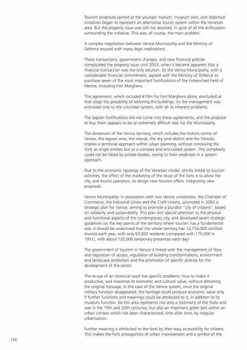
112
Tourism proposals (aimed at the younger market), museum sites, and didacticalinitiatives began to represent an alternative tourist system within the Venetianarea. But the property issue was still not resolved, in spite of all the enthusiasmsurrounding the initiative. This was, of course, the main problem.
A complex negotiation between Venice Municipality and the Ministry ofDefence ensued with many legal implications.
These transactions, government changes, and new financial policiescomplicated the property issue until 2003, when it became apparent that afinancial transaction was the only solution. So the Venice Municipality, with aconsiderable financial commitment, agreed with the Ministry of Defence topurchase seven of the most important fortifications of the Entrenched Field ofMestre, including Fort Marghera.
This agreement, which included €10m for Fort Marghera alone, precluded atthat stage the possibility of restoring the buildings. So the management wasentrusted only to the volunteer system, with all its inherent problems.
The lagoon fortifications did not come into these agreements, and the proposalto buy them appears to be an extremely difficult task for the Municipality.
The dimension of the Venice territory, which includes the historic centre ofVenice, the lagoon area, the islands, the dry land district and the littorals,implies a territorial approach within urban planning, without conceiving theforts as single entities but as a complex and articulated system. This complexitycould not be faced by private bodies, owing to their weakness in a systemapproach.
Due to the economic typology of the Venetian model, strictly linked to tourismactivities, the effect of the marketing of the reuse of the forts is to allow thecity, and tourist operators, to design new tourism offers, integrating newproposals.
Venice Municipality, in association with two Venice universities, the Chamber ofCommerce, the Industrial Union and the Craft Unions, promoted in 2003 astrategic plan for Venice, aiming to promote a pluralist “city of citizens”, basedon solidarity and sustainability. This plan lent special attention to the physicaland functional aspects of the contemporary city, and developed seven strategicguidelines on the key points of the territory where tourism has a fundamentalrole. It should be underlined that the whole territory has 12,154,000 certifiedtourists each year, with only 63,000 residents (compared with 175,000 in1951), with about 120,000 temporary presences each day!
The government of tourism in Venice is linked with the management of flowand regulation of access, regulation of building transformations, environmentand landscape protection and the promotion of specific policies for thedevelopment of the sector.
The re-use of an historical asset has specific problems: how to make itproductive, and maximise its economic and cultural value, without distortingthe original message. In the case of the Venice system, once the originalmilitary function disappeared, the heritage could produce economic value onlyif further functions and meanings could be attributed to it, in addition to itsmuseum function. So this area represents not only a testimony of the State andwar in the 19th and 20th centuries, but also an important green belt within anurban context which has been characterised, time after time, by irregularurbanisation.
Further meaning is attributed to the forts by their easy accessibility for citizens.This makes the forts protagonists of urban improvement and a symbol of the
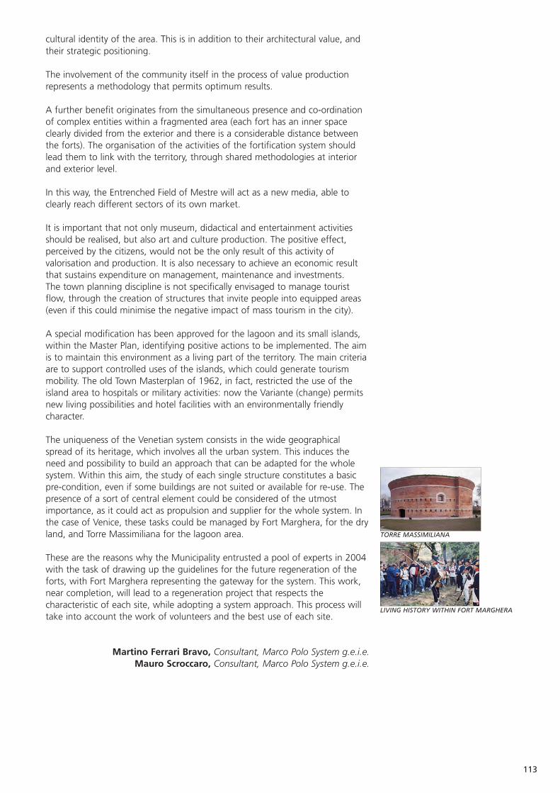
113
TORRE MASSIMILIANA
LIVING HISTORY WITHIN FORT MARGHERA
cultural identity of the area. This is in addition to their architectural value, andtheir strategic positioning.
The involvement of the community itself in the process of value productionrepresents a methodology that permits optimum results.
A further benefit originates from the simultaneous presence and co-ordinationof complex entities within a fragmented area (each fort has an inner spaceclearly divided from the exterior and there is a considerable distance betweenthe forts). The organisation of the activities of the fortification system shouldlead them to link with the territory, through shared methodologies at interiorand exterior level.
In this way, the Entrenched Field of Mestre will act as a new media, able toclearly reach different sectors of its own market.
It is important that not only museum, didactical and entertainment activitiesshould be realised, but also art and culture production. The positive effect,perceived by the citizens, would not be the only result of this activity ofvalorisation and production. It is also necessary to achieve an economic resultthat sustains expenditure on management, maintenance and investments.The town planning discipline is not specifically envisaged to manage touristflow, through the creation of structures that invite people into equipped areas(even if this could minimise the negative impact of mass tourism in the city).
A special modification has been approved for the lagoon and its small islands,within the Master Plan, identifying positive actions to be implemented. The aimis to maintain this environment as a living part of the territory. The main criteriaare to support controlled uses of the islands, which could generate tourismmobility. The old Town Masterplan of 1962, in fact, restricted the use of theisland area to hospitals or military activities: now the Variante (change) permitsnew living possibilities and hotel facilities with an environmentally friendlycharacter.
The uniqueness of the Venetian system consists in the wide geographicalspread of its heritage, which involves all the urban system. This induces theneed and possibility to build an approach that can be adapted for the wholesystem. Within this aim, the study of each single structure constitutes a basicpre-condition, even if some buildings are not suited or available for re-use. Thepresence of a sort of central element could be considered of the utmostimportance, as it could act as propulsion and supplier for the whole system. Inthe case of Venice, these tasks could be managed by Fort Marghera, for the dryland, and Torre Massimiliana for the lagoon area.
These are the reasons why the Municipality entrusted a pool of experts in 2004with the task of drawing up the guidelines for the future regeneration of theforts, with Fort Marghera representing the gateway for the system. This work,near completion, will lead to a regeneration project that respects thecharacteristic of each site, while adopting a system approach. This process willtake into account the work of volunteers and the best use of each site.
Martino Ferrari Bravo, Consultant, Marco Polo System g.e.i.e.Mauro Scroccaro, Consultant, Marco Polo System g.e.i.e.
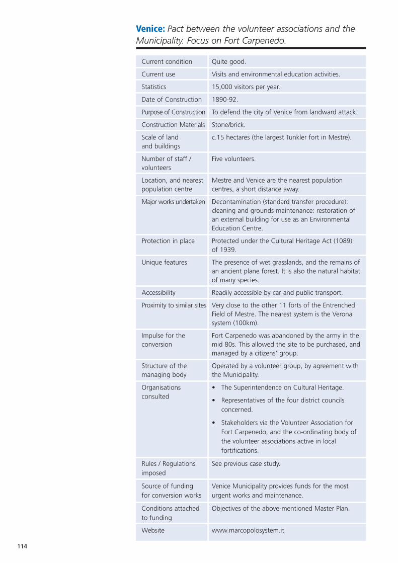
114
Venice: Pact between the volunteer associations and theMunicipality. Focus on Fort Carpenedo.
Current condition Quite good.
Current use Visits and environmental education activities.
Statistics 15,000 visitors per year.
Date of Construction 1890-92.
Purpose of Construction To defend the city of Venice from landward attack.
Construction Materials Stone/brick.
Scale of land c.15 hectares (the largest Tunkler fort in Mestre).and buildings
Number of staff / Five volunteers.volunteers
Location, and nearest Mestre and Venice are the nearest population population centre centres, a short distance away.
Major works undertaken Decontamination (standard transfer procedure): cleaning and grounds maintenance: restoration of an external building for use as an Environmental Education Centre.
Protection in place Protected under the Cultural Heritage Act (1089) of 1939.
Unique features The presence of wet grasslands, and the remains ofan ancient plane forest. It is also the natural habitatof many species.
Accessibility Readily accessible by car and public transport.
Proximity to similar sites Very close to the other 11 forts of the Entrenched Field of Mestre. The nearest system is the Verona system (100km).
Impulse for the Fort Carpenedo was abandoned by the army in theconversion mid 80s. This allowed the site to be purchased, and
managed by a citizens’ group.
Structure of the Operated by a volunteer group, by agreement withmanaging body the Municipality.
Organisations • The Superintendence on Cultural Heritage.consulted • Representatives of the four district councils
concerned.
• Stakeholders via the Volunteer Association for Fort Carpenedo, and the co-ordinating body of the volunteer associations active in local fortifications.
Rules / Regulations See previous case study.imposed
Source of funding Venice Municipality provides funds for the most for conversion works urgent works and maintenance.
Conditions attached Objectives of the above-mentioned Master Plan.to funding
Website www.marcopolosystem.it
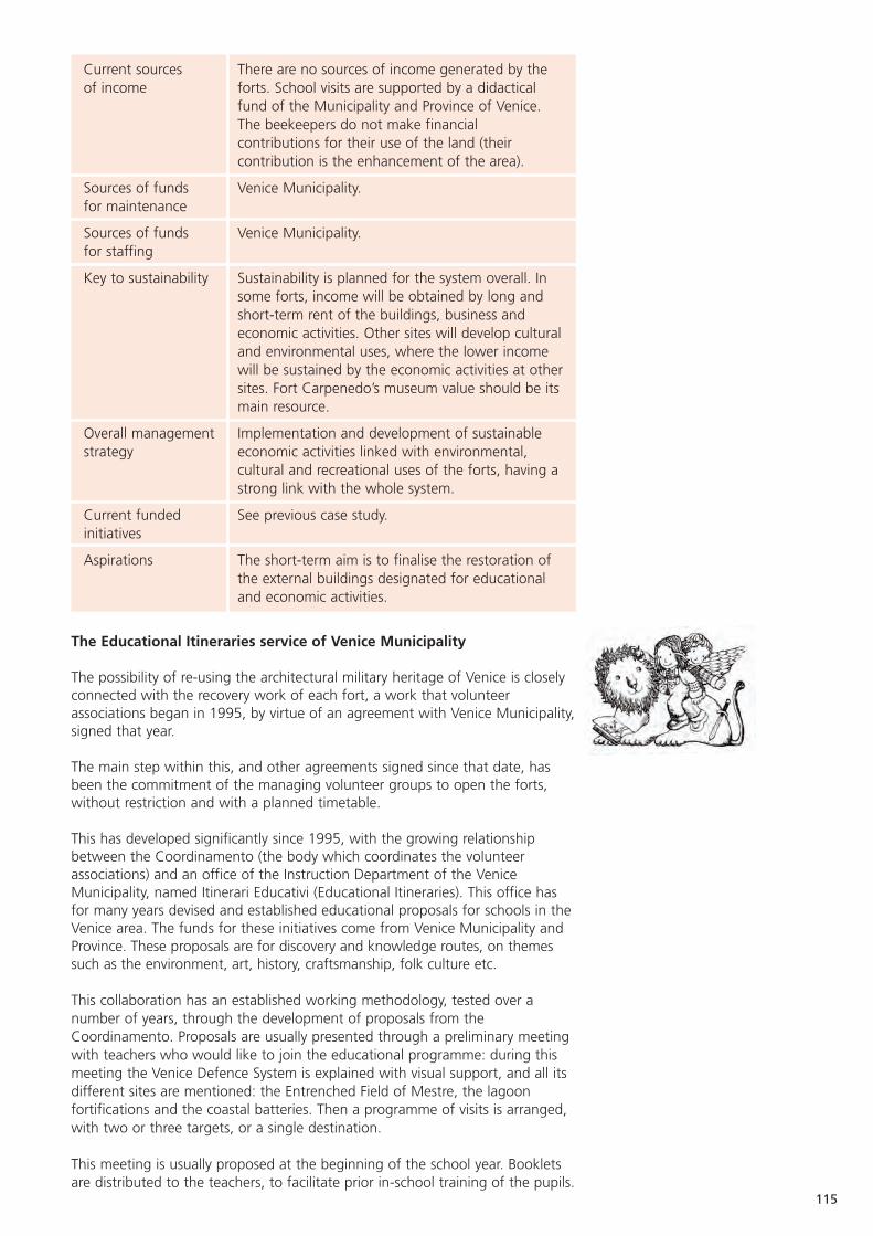
115
Current sources There are no sources of income generated by the of income forts. School visits are supported by a didactical
fund of the Municipality and Province of Venice. The beekeepers do not make financial contributions for their use of the land (their contribution is the enhancement of the area).
Sources of funds Venice Municipality.for maintenance
Sources of funds Venice Municipality.for staffing
Key to sustainability Sustainability is planned for the system overall. In some forts, income will be obtained by long and short-term rent of the buildings, business and economic activities. Other sites will develop culturaland environmental uses, where the lower income will be sustained by the economic activities at othersites. Fort Carpenedo’s museum value should be itsmain resource.
Overall management Implementation and development of sustainable strategy economic activities linked with environmental,
cultural and recreational uses of the forts, having a strong link with the whole system.
Current funded See previous case study.initiatives
Aspirations The short-term aim is to finalise the restoration of the external buildings designated for educational and economic activities.
The Educational Itineraries service of Venice Municipality
The possibility of re-using the architectural military heritage of Venice is closelyconnected with the recovery work of each fort, a work that volunteerassociations began in 1995, by virtue of an agreement with Venice Municipality,signed that year.
The main step within this, and other agreements signed since that date, hasbeen the commitment of the managing volunteer groups to open the forts,without restriction and with a planned timetable.
This has developed significantly since 1995, with the growing relationshipbetween the Coordinamento (the body which coordinates the volunteerassociations) and an office of the Instruction Department of the VeniceMunicipality, named Itinerari Educativi (Educational Itineraries). This office hasfor many years devised and established educational proposals for schools in theVenice area. The funds for these initiatives come from Venice Municipality andProvince. These proposals are for discovery and knowledge routes, on themessuch as the environment, art, history, craftsmanship, folk culture etc.
This collaboration has an established working methodology, tested over anumber of years, through the development of proposals from theCoordinamento. Proposals are usually presented through a preliminary meetingwith teachers who would like to join the educational programme: during thismeeting the Venice Defence System is explained with visual support, and all itsdifferent sites are mentioned: the Entrenched Field of Mestre, the lagoonfortifications and the coastal batteries. Then a programme of visits is arranged,with two or three targets, or a single destination.
This meeting is usually proposed at the beginning of the school year. Bookletsare distributed to the teachers, to facilitate prior in-school training of the pupils.

116
MAIN ENTRANCE TO CARPENEDO FORT
INSIDE CARPENEDO FORT
CARPENEDO FORT, AN OFFICER’S ROOM
Then, an introductory tour is planned with teachers to the different potentialareas of a visit: Fort Carpenedo, Fort Gazzera, Fort Marghera, Fort Bazzera andthe Ridotto Austriaco (Austrian Redoubt).
The choice of these structures is not only due to the signed agreements, but isintended to show different architectural typologies related to the age of thebuildings and the historical events which unfolded there.
Fort Marghera represents the last example of a bastioned fortification from thebeginning of the 19th century. It was built by the Austrian and French armiesbetween 1805 and 1814, in an attractive area between the dry land and thelagoon. The fort was involved in three sieges, the most important lasting oneyear (1848-49) and led by the Absburg troops against the army of the newVenice Republic.
Fort Carpenedo and Fort Gazzera have architectural importance, as late 19thcentury forts (the so-called Tunkler type) from an age when the structure itselfwas conceived as a war-machine: some new interior structures were designed,very well connected and extremely functional, allowing the internal movementsof the troops, protected by long underground corridors.
Bazzera gunpowder magazine represents state-of-the-art building techniquesfrom the First World War, when reinforced concrete became the main buildingmaterial, and aesthetic value was paid no heed; it is also characterised by agood position at the edge of the lagoon, in front of Venice city.
The Ridotto Austriaco is witness to the Absburg period, and is located withinthe 16th century fortress of San Nicolò, on the north side of the Lido island,where the most ancient barracks survive, the so-called caserma San Marco(1591). The Redoubt of 1840, and the coastal batteries of 1910, can all bevisited in an attractive tour of about 30 minutes, which starts and finishes bythe stately portal of Sant’Andrea fort, guardian of the entrance to the Port of Venice.
With this formula, the proposed itineraries have been very successful, and haveinvolved, during later interpretations, the neighbouring municipalities of theProvince of Venice and Treviso. About 40 tours a year are organised, with atleast two classes each.
Each visit includes a brief introduction (about 30 minutes) to set the history ofthe fort within the Venice Defence System; the visit of the structures usuallythen takes 1 1/2 -2hours. At the end of the visit, the classes move to therefreshment areas, where questions can be asked directly on the site.
For tours involving more than one fort, an introduction is made by the guide onthe bus between the school and the first fort, and the history of the otherstructures and the urban development of the whole city are raised.
The visits are usually organised during spring time, the most suitable foroutdoor tours. An interactive experience was developed during the first year,within the area of Fort Gazzera and Fort Carpenedo. It was organised especiallyfor the youngest pupils, expressly conceived for lower attention spans regardinghistorical content. During these visits, actors with ancient military uniform orreproductions of 19th century handwork are involved, to attract the attentionof the pupils. The eagerly-awaited Commander of the Fort also appears at theend of the tour, distributing gifts and postcards.
These proposals obtained such success with pupils and teachers that they werelater adapted for an adult public and proposed to different age groups.

117
SANT’ERASMO ISLAND
BEE HIVES IN CARPENEDO FORT
Group tourism proposal - boat excursions.
The geographic configuration of the Venetian territory was the impulse for aproposal aimed at integrating a visit to the dry land and coastal structures witha tour of the lagoon fortifications. This ‘water itineraries’ proposal was linkedwith cycle tourism.
Two main initiatives were proposed to identified targets: the first was aimed atresidents of the Province area, who could board at Fort Marghera. The proposalincluded visits to the three most significant structures from an architectural andhistorical point of view. This tour, which took place each Sunday in July andAugust, for a period of two years, departed from Fort Marghera, through alagoon itinerary, reaching the island of Sant’Andrea (with its 16th century fort)and the 19th century Torre Massimiliana, on the island of Sant’Erasmo.
The uniqueness of this itinerary consisted also in the use of the ancient channelof San Secondo, the traditional access to Venice from the dry land, before theconstruction of the railway bridge (1840) and the road bridge (1930). This tourintegrated the discovery and knowledge of the areas with that of the ancienturban dimension and the link between Mestre and Venice. This tour, whichlasted a half-day, was publicised through newspapers, radio and television; itwas aimed at individuals, with some limited provision for self-organised groups.The maximum number of participants was 60 each tour.
In July and August of 1987, through an agreement between the socialcooperative Città del Sole, the Coordinamento, and the managers of thecampsite on the littoral of Cavallino, a new proposal was addressed to campers.This was an excursion including a guided visit of the ancient historic centre ofCavallino, then, through the lagoon channels, to the island of Sant’Erasmo,visiting the Torre Massimiliana. The visit included also the circumnavigation ofthe island of Vignole, with Sant’Andrea fort and the complex of San Nicolò ofthe Lido.
These excursions usually took place during late afternoon, after the usualactivities of sunbathing and swimming. The problem with this initiative was thehigh cost of transport (especially in the lagoon area), which resulted in aneconomic loss in cases of bad weather.
It led however to an initiative (1998-99), called Bicilaguna. This was a tour,departing from Fort Marghera, with an intermediate stopover on Sant’Erasmoisland, and ending with a tour of the fortifications on the littoral of Cavallino.This lasted for a whole day, and foresaw two boats, one for foot passengersand one for bicycles. The high level of satisfaction with this tour inspired thelocal transport agency (ACTV) to organise a permanent service, every Saturdayand Sunday from June to September, with a boat especially adapted forbicycles. The service is so appreciated that it is impossible to board withoutbooking. The itinerary is more or less the same as the original and, with afurther stop at the island of Lido, it meets the needs of cycle tourists andbathers with bicycles.
A re-use proposal - beekeeping at Fort Carpenedo.
The beekeeping farm Miele dei Forti (Fort Honey) is found in the area aroundFort Carpenedo. Its main activity is the production of honey, beeswax and asmall line of cosmetic products. Fort Carpenedo was the first ever home to thisspecific activity, and the place characterised the name and approach of thefarm; objectives include the environmental re-use of the structures of Mestre,and the didactical dissemination of the extraordinary world of bees.
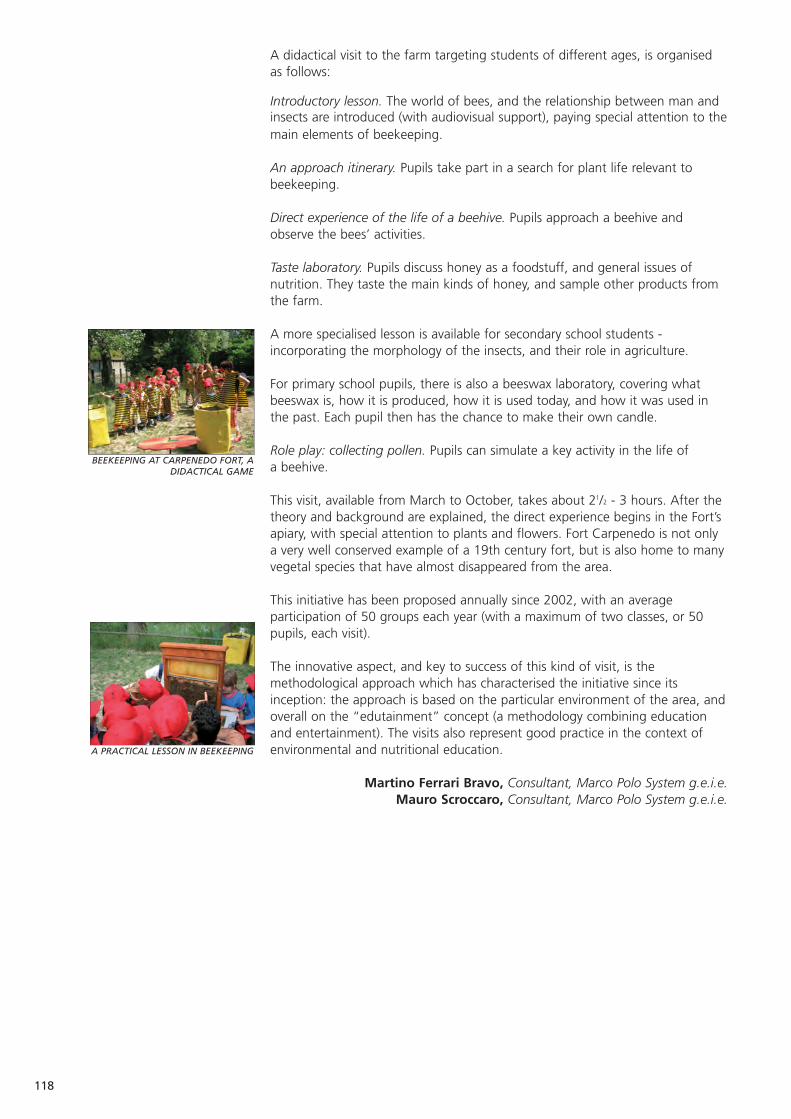
118
BEEKEEPING AT CARPENEDO FORT, ADIDACTICAL GAME
A PRACTICAL LESSON IN BEEKEEPING
A didactical visit to the farm targeting students of different ages, is organisedas follows:
Introductory lesson. The world of bees, and the relationship between man andinsects are introduced (with audiovisual support), paying special attention to themain elements of beekeeping.
An approach itinerary. Pupils take part in a search for plant life relevant tobeekeeping.
Direct experience of the life of a beehive. Pupils approach a beehive andobserve the bees’ activities.
Taste laboratory. Pupils discuss honey as a foodstuff, and general issues ofnutrition. They taste the main kinds of honey, and sample other products fromthe farm.
A more specialised lesson is available for secondary school students -incorporating the morphology of the insects, and their role in agriculture.
For primary school pupils, there is also a beeswax laboratory, covering whatbeeswax is, how it is produced, how it is used today, and how it was used inthe past. Each pupil then has the chance to make their own candle.
Role play: collecting pollen. Pupils can simulate a key activity in the life of a beehive.
This visit, available from March to October, takes about 21/2 - 3 hours. After thetheory and background are explained, the direct experience begins in the Fort’sapiary, with special attention to plants and flowers. Fort Carpenedo is not onlya very well conserved example of a 19th century fort, but is also home to manyvegetal species that have almost disappeared from the area.
This initiative has been proposed annually since 2002, with an averageparticipation of 50 groups each year (with a maximum of two classes, or 50pupils, each visit).
The innovative aspect, and key to success of this kind of visit, is themethodological approach which has characterised the initiative since itsinception: the approach is based on the particular environment of the area, andoverall on the “edutainment” concept (a methodology combining educationand entertainment). The visits also represent good practice in the context ofenvironmental and nutritional education.
Martino Ferrari Bravo, Consultant, Marco Polo System g.e.i.e.Mauro Scroccaro, Consultant, Marco Polo System g.e.i.e.
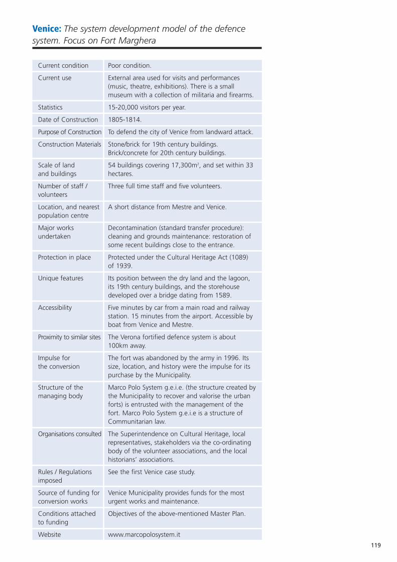
119
Venice: The system development model of the defencesystem. Focus on Fort Marghera
Current condition Poor condition.
Current use External area used for visits and performances (music, theatre, exhibitions). There is a small museum with a collection of militaria and firearms.
Statistics 15-20,000 visitors per year.
Date of Construction 1805-1814.
Purpose of Construction To defend the city of Venice from landward attack.
Construction Materials Stone/brick for 19th century buildings. Brick/concrete for 20th century buildings.
Scale of land 54 buildings covering 17,300m2, and set within 33and buildings hectares.
Number of staff / Three full time staff and five volunteers.volunteers
Location, and nearest A short distance from Mestre and Venice.population centre
Major works Decontamination (standard transfer procedure): undertaken cleaning and grounds maintenance: restoration of
some recent buildings close to the entrance.
Protection in place Protected under the Cultural Heritage Act (1089) of 1939.
Unique features Its position between the dry land and the lagoon, its 19th century buildings, and the storehouse developed over a bridge dating from 1589.
Accessibility Five minutes by car from a main road and railway station. 15 minutes from the airport. Accessible by boat from Venice and Mestre.
Proximity to similar sites The Verona fortified defence system is about 100km away.
Impulse for The fort was abandoned by the army in 1996. Its the conversion size, location, and history were the impulse for its
purchase by the Municipality.
Structure of the Marco Polo System g.e.i.e. (the structure created bymanaging body the Municipality to recover and valorise the urban
forts) is entrusted with the management of the fort. Marco Polo System g.e.i.e is a structure of Communitarian law.
Organisations consulted The Superintendence on Cultural Heritage, local representatives, stakeholders via the co-ordinating body of the volunteer associations, and the local historians’ associations.
Rules / Regulations See the first Venice case study.imposed
Source of funding for Venice Municipality provides funds for the most conversion works urgent works and maintenance.
Conditions attached Objectives of the above-mentioned Master Plan.to funding
Website www.marcopolosystem.it
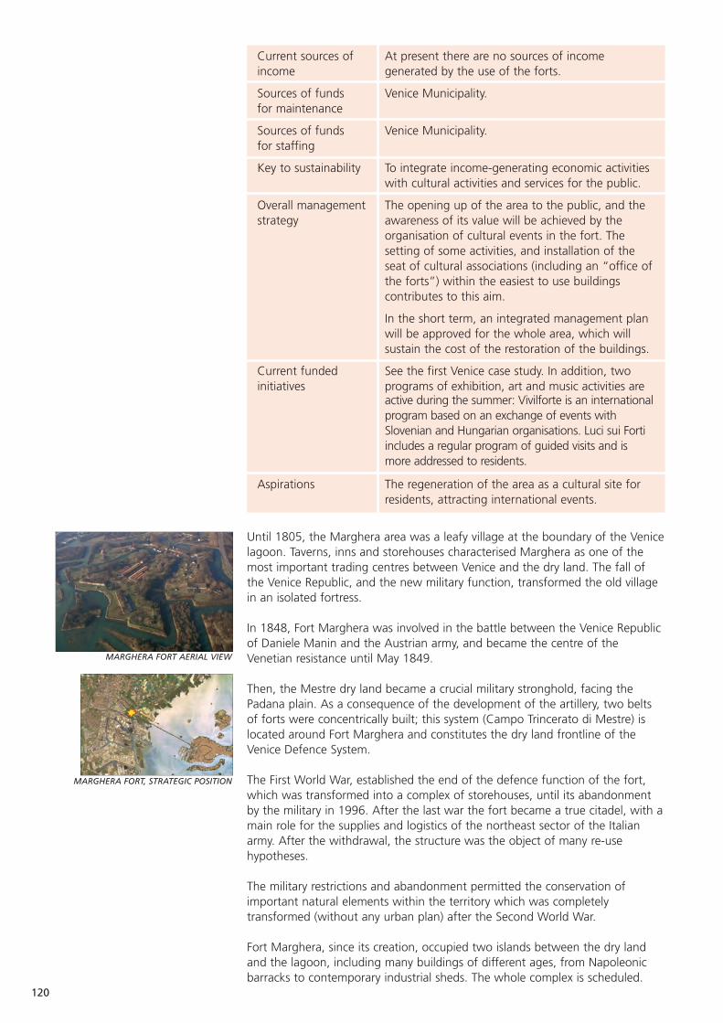
120
MARGHERA FORT AERIAL VIEW
MARGHERA FORT, STRATEGIC POSITION
Current sources of At present there are no sources of income income generated by the use of the forts.
Sources of funds Venice Municipality.for maintenance
Sources of funds Venice Municipality.for staffing
Key to sustainability To integrate income-generating economic activities with cultural activities and services for the public.
Overall management The opening up of the area to the public, and the strategy awareness of its value will be achieved by the
organisation of cultural events in the fort. The setting of some activities, and installation of the seat of cultural associations (including an “office ofthe forts”) within the easiest to use buildings contributes to this aim.
In the short term, an integrated management plan will be approved for the whole area, which will sustain the cost of the restoration of the buildings.
Current funded See the first Venice case study. In addition, two initiatives programs of exhibition, art and music activities are
active during the summer: Vivilforte is an internationalprogram based on an exchange of events with Slovenian and Hungarian organisations. Luci sui Forti includes a regular program of guided visits and is more addressed to residents.
Aspirations The regeneration of the area as a cultural site for residents, attracting international events.
Until 1805, the Marghera area was a leafy village at the boundary of the Venicelagoon. Taverns, inns and storehouses characterised Marghera as one of themost important trading centres between Venice and the dry land. The fall ofthe Venice Republic, and the new military function, transformed the old villagein an isolated fortress.
In 1848, Fort Marghera was involved in the battle between the Venice Republicof Daniele Manin and the Austrian army, and became the centre of theVenetian resistance until May 1849.
Then, the Mestre dry land became a crucial military stronghold, facing thePadana plain. As a consequence of the development of the artillery, two beltsof forts were concentrically built; this system (Campo Trincerato di Mestre) islocated around Fort Marghera and constitutes the dry land frontline of theVenice Defence System.
The First World War, established the end of the defence function of the fort,which was transformed into a complex of storehouses, until its abandonmentby the military in 1996. After the last war the fort became a true citadel, with amain role for the supplies and logistics of the northeast sector of the Italianarmy. After the withdrawal, the structure was the object of many re-usehypotheses.
The military restrictions and abandonment permitted the conservation ofimportant natural elements within the territory which was completelytransformed (without any urban plan) after the Second World War.
Fort Marghera, since its creation, occupied two islands between the dry landand the lagoon, including many buildings of different ages, from Napoleonicbarracks to contemporary industrial sheds. The whole complex is scheduled.
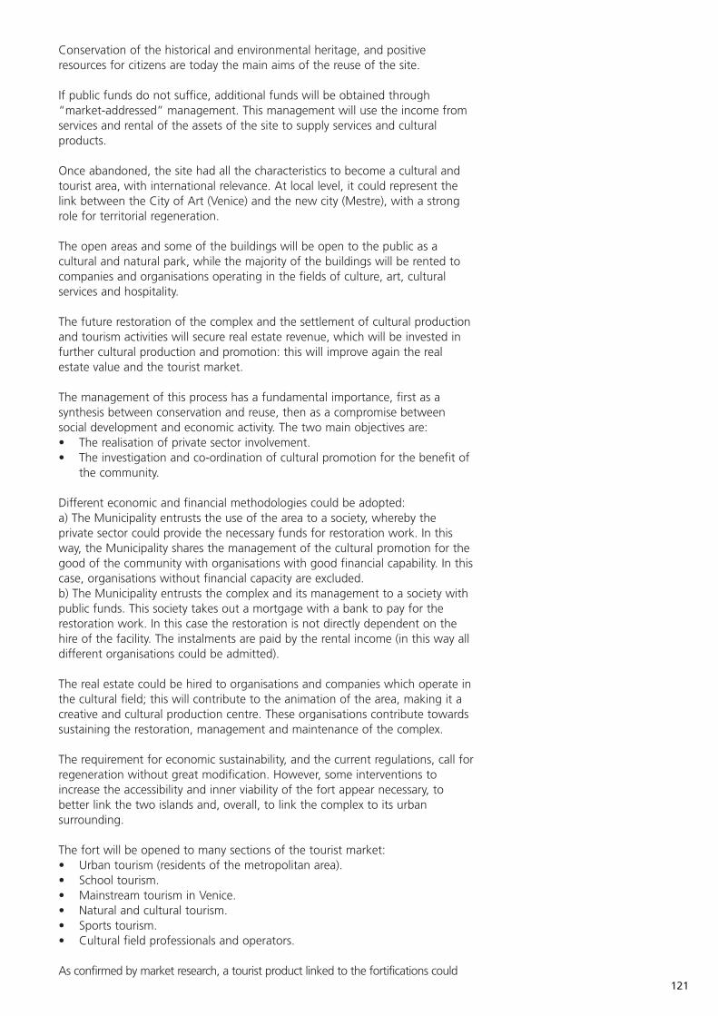
121
Conservation of the historical and environmental heritage, and positiveresources for citizens are today the main aims of the reuse of the site.
If public funds do not suffice, additional funds will be obtained through“market-addressed” management. This management will use the income fromservices and rental of the assets of the site to supply services and culturalproducts.
Once abandoned, the site had all the characteristics to become a cultural andtourist area, with international relevance. At local level, it could represent thelink between the City of Art (Venice) and the new city (Mestre), with a strongrole for territorial regeneration.
The open areas and some of the buildings will be open to the public as acultural and natural park, while the majority of the buildings will be rented tocompanies and organisations operating in the fields of culture, art, culturalservices and hospitality.
The future restoration of the complex and the settlement of cultural productionand tourism activities will secure real estate revenue, which will be invested infurther cultural production and promotion: this will improve again the realestate value and the tourist market.
The management of this process has a fundamental importance, first as asynthesis between conservation and reuse, then as a compromise betweensocial development and economic activity. The two main objectives are:• The realisation of private sector involvement. • The investigation and co-ordination of cultural promotion for the benefit of
the community.
Different economic and financial methodologies could be adopted:a) The Municipality entrusts the use of the area to a society, whereby theprivate sector could provide the necessary funds for restoration work. In thisway, the Municipality shares the management of the cultural promotion for thegood of the community with organisations with good financial capability. In thiscase, organisations without financial capacity are excluded.b) The Municipality entrusts the complex and its management to a society withpublic funds. This society takes out a mortgage with a bank to pay for therestoration work. In this case the restoration is not directly dependent on thehire of the facility. The instalments are paid by the rental income (in this way alldifferent organisations could be admitted).
The real estate could be hired to organisations and companies which operate inthe cultural field; this will contribute to the animation of the area, making it acreative and cultural production centre. These organisations contribute towardssustaining the restoration, management and maintenance of the complex.
The requirement for economic sustainability, and the current regulations, call forregeneration without great modification. However, some interventions toincrease the accessibility and inner viability of the fort appear necessary, tobetter link the two islands and, overall, to link the complex to its urbansurrounding.
The fort will be opened to many sections of the tourist market:• Urban tourism (residents of the metropolitan area).• School tourism.• Mainstream tourism in Venice.• Natural and cultural tourism.• Sports tourism.• Cultural field professionals and operators.
As confirmed by market research, a tourist product linked to the fortifications could
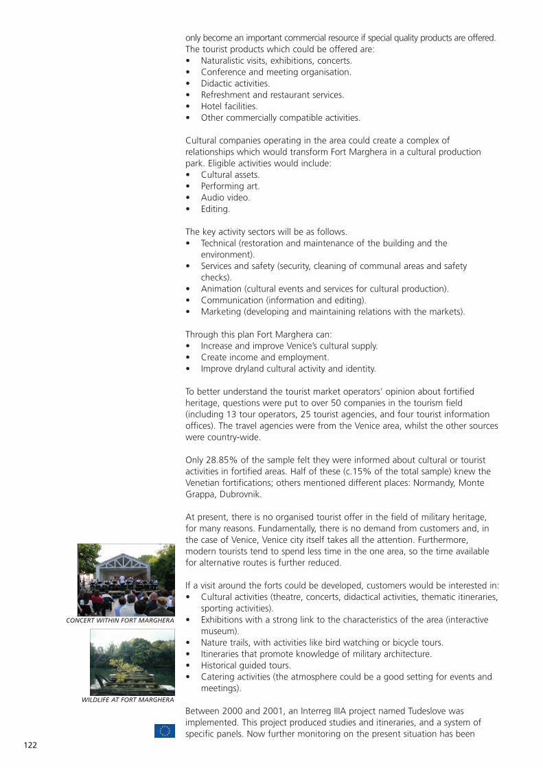
122
CONCERT WITHIN FORT MARGHERA
WILDLIFE AT FORT MARGHERA
only become an important commercial resource if special quality products are offered.The tourist products which could be offered are:• Naturalistic visits, exhibitions, concerts.• Conference and meeting organisation.• Didactic activities.• Refreshment and restaurant services.• Hotel facilities.• Other commercially compatible activities.
Cultural companies operating in the area could create a complex ofrelationships which would transform Fort Marghera in a cultural productionpark. Eligible activities would include:• Cultural assets.• Performing art.• Audio video.• Editing.
The key activity sectors will be as follows.• Technical (restoration and maintenance of the building and the
environment).• Services and safety (security, cleaning of communal areas and safety
checks).• Animation (cultural events and services for cultural production).• Communication (information and editing).• Marketing (developing and maintaining relations with the markets).
Through this plan Fort Marghera can:• Increase and improve Venice’s cultural supply.• Create income and employment.• Improve dryland cultural activity and identity.
To better understand the tourist market operators’ opinion about fortifiedheritage, questions were put to over 50 companies in the tourism field(including 13 tour operators, 25 tourist agencies, and four tourist informationoffices). The travel agencies were from the Venice area, whilst the other sourceswere country-wide.
Only 28.85% of the sample felt they were informed about cultural or touristactivities in fortified areas. Half of these (c.15% of the total sample) knew theVenetian fortifications; others mentioned different places: Normandy, MonteGrappa, Dubrovnik.
At present, there is no organised tourist offer in the field of military heritage,for many reasons. Fundamentally, there is no demand from customers and, inthe case of Venice, Venice city itself takes all the attention. Furthermore,modern tourists tend to spend less time in the one area, so the time availablefor alternative routes is further reduced.
If a visit around the forts could be developed, customers would be interested in:• Cultural activities (theatre, concerts, didactical activities, thematic itineraries,
sporting activities).• Exhibitions with a strong link to the characteristics of the area (interactive
museum).• Nature trails, with activities like bird watching or bicycle tours.• Itineraries that promote knowledge of military architecture.• Historical guided tours.• Catering activities (the atmosphere could be a good setting for events and
meetings).
Between 2000 and 2001, an Interreg IIIA project named Tudeslove wasimplemented. This project produced studies and itineraries, and a system ofspecific panels. Now further monitoring on the present situation has been
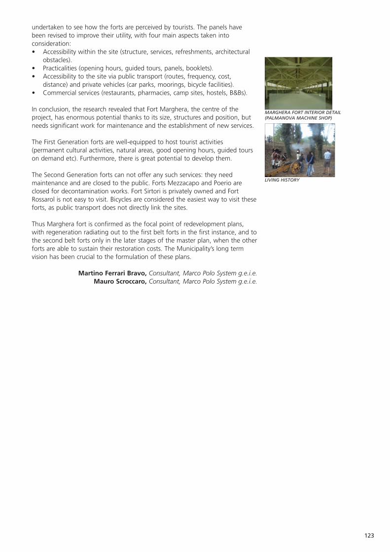
123
MARGHERA FORT INTERIOR DETAIL(PALMANOVA MACHINE SHOP)
LIVING HISTORY
undertaken to see how the forts are perceived by tourists. The panels havebeen revised to improve their utility, with four main aspects taken intoconsideration:• Accessibility within the site (structure, services, refreshments, architectural
obstacles).• Practicalities (opening hours, guided tours, panels, booklets).• Accessibility to the site via public transport (routes, frequency, cost,
distance) and private vehicles (car parks, moorings, bicycle facilities).• Commercial services (restaurants, pharmacies, camp sites, hostels, B&Bs).
In conclusion, the research revealed that Fort Marghera, the centre of theproject, has enormous potential thanks to its size, structures and position, butneeds significant work for maintenance and the establishment of new services.
The First Generation forts are well-equipped to host tourist activities(permanent cultural activities, natural areas, good opening hours, guided tourson demand etc). Furthermore, there is great potential to develop them.
The Second Generation forts can not offer any such services: they needmaintenance and are closed to the public. Forts Mezzacapo and Poerio areclosed for decontamination works. Fort Sirtori is privately owned and FortRossarol is not easy to visit. Bicycles are considered the easiest way to visit theseforts, as public transport does not directly link the sites.
Thus Marghera fort is confirmed as the focal point of redevelopment plans,with regeneration radiating out to the first belt forts in the first instance, and tothe second belt forts only in the later stages of the master plan, when the otherforts are able to sustain their restoration costs. The Municipality’s long termvision has been crucial to the formulation of these plans.
Martino Ferrari Bravo, Consultant, Marco Polo System g.e.i.e.Mauro Scroccaro, Consultant, Marco Polo System g.e.i.e.

124
Venice: Thetis - a private company within the Arsenale
Current condition Very good.
Current use The seat of Thetis, an advanced engineering and systems integration company.
Statistics Capital of over €6m. Revenue in 2004 exceeded €12m, with a turnover of €1m.
Date of Construction 16th - 19th century.
Purpose of Construction One building was expressly made for Venetian galley construction, while the others were stores.
Construction Materials Brick.
Scale of land Four ancient buildings, within the Arsenale and buildings Novissimo: 4,500m2 of buildings and 6,500m2 of
open space.
Number of staff / 120 employees in 2005, most educated to volunteers degree level.
Location, and nearest The historic centre of Venice.population centre
Major works Restoration works, all capable of being reversed.undertaken
Protection in place Protected under the Cultural Heritage Act (1089) of 1939.
Unique features The establishment of a high technology service provider by the functional recovery of an ancient area.
Accessibility By water bus, although not open to the general public.
Proximity to similar sites There are many similar buildings in the Arsenale, but the whole complex is a unique example.
Impulse for the In 1989, the Architectural Institute of Venice beganconversion a thesis on the recovery of the Arsenale. This was
presented to local government in 1991, and then to the E.U. (as an URBAN pilot project) in 1992.
Structure of the Shareholder owned, with shareholders largely frommanaging body public bodies.
Organisations consulted Venice Municipality and Veneto region (1991). European Union (1992).
Rules / Regulations Those imposed by the Superintendence on Culturalimposed Heritage, including reversibility criterion for
the interventions.
Source of funding for The restoration and infrastructure development conversion works cost c.€10m.
35% came from industrial partners.
40% from the E.U. (ERDF).
25% from the Region of Veneto and Venice Municipality.
Conditions attached Three shareholders are local government to funding authorities (Veneto Region, Province of Venice,
Venice Municipality).
Website www.thetis.it
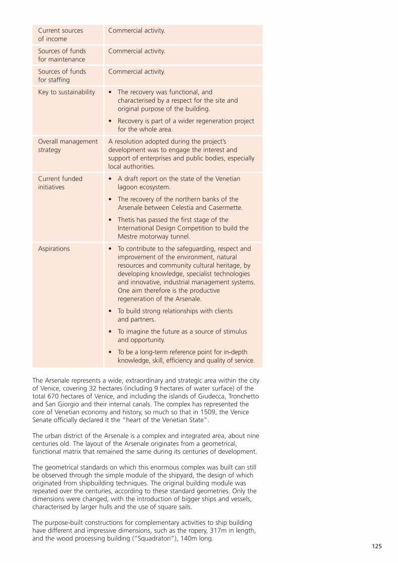
125
Current sources Commercial activity.of income
Sources of funds Commercial activity.for maintenance
Sources of funds Commercial activity.for staffing
Key to sustainability • The recovery was functional, and characterised by a respect for the site and original purpose of the building.
• Recovery is part of a wider regeneration project for the whole area.
Overall management A resolution adopted during the project’sstrategy development was to engage the interest and
support of enterprises and public bodies, especially local authorities.
Current funded • A draft report on the state of the Venetian initiatives lagoon ecosystem.
• The recovery of the northern banks of the Arsenale between Celestia and Casermette.
• Thetis has passed the first stage of the International Design Competition to build the Mestre motorway tunnel.
Aspirations • To contribute to the safeguarding, respect and improvement of the environment, natural resources and community cultural heritage, by developing knowledge, specialist technologies and innovative, industrial management systems.One aim therefore is the productive regeneration of the Arsenale.
• To build strong relationships with clients and partners.
• To imagine the future as a source of stimulus and opportunity.
• To be a long-term reference point for in-depth knowledge, skill, efficiency and quality of service.
The Arsenale represents a wide, extraordinary and strategic area within the cityof Venice, covering 32 hectares (including 9 hectares of water surface) of thetotal 670 hectares of Venice, and including the islands of Giudecca, Tronchettoand San Giorgio and their internal canals. The complex has represented thecore of Venetian economy and history, so much so that in 1509, the VeniceSenate officially declared it the “heart of the Venetian State”.
The urban district of the Arsenale is a complex and integrated area, about ninecenturies old. The layout of the Arsenale originates from a geometrical,functional matrix that remained the same during its centuries of development.
The geometrical standards on which this enormous complex was built can stillbe observed through the simple module of the shipyard, the design of whichoriginated from shipbuilding techniques. The original building module wasrepeated over the centuries, according to these standard geometries. Only thedimensions were changed, with the introduction of bigger ships and vessels,characterised by larger hulls and the use of square sails.
The purpose-built constructions for complementary activities to ship buildinghave different and impressive dimensions, such as the ropery, 317m in length,and the wood processing building (“Squadratori”), 140m long.
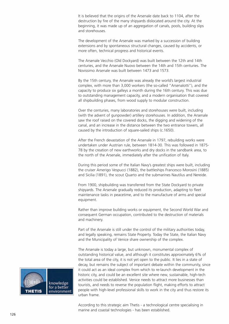
126
It is believed that the origins of the Arsenale date back to 1104, after thedestruction by fire of the many shipyards dislocated around the city. At thebeginning, it was made up of an aggregation of canals, pools, building slipsand storehouses.
The development of the Arsenale was marked by a succession of buildingextensions and by spontaneous structural changes, caused by accidents, ormore often, technical progress and historical events.
The Arsenale Vecchio (Old Dockyard) was built between the 12th and 14thcenturies, and the Arsenale Nuovo between the 14th and 15th centuries. TheNovissimo Arsenale was built between 1473 and 1573.
By the 15th century, the Arsenale was already the world’s largest industrialcomplex, with more than 3,000 workers (the so-called “Arsenalotti”), and thecapacity to produce six galleys a month during the 16th century. This was dueto outstanding management capacity, and a modern organisation that coveredall shipbuilding phases, from wood supply to modular construction.
Over the centuries, many laboratories and storehouses were built, including(with the advent of gunpowder) artillery storehouses. In addition, the Arsenalesaw the roof raised on the covered docks, the digging and widening of thecanal, and an increase in the distance between the two entrance towers, allcaused by the introduction of square-sailed ships (c.1650).
After the French devastation of the Arsenale in 1797, rebuilding works wereundertaken under Austrian rule, between 1814-30. This was followed in 1875-78 by the creation of new earthworks and dry docks in the sandbank area, tothe north of the Arsenale, immediately after the unification of Italy.
During this period some of the Italian Navy’s greatest ships were built, includingthe cruiser Amerigo Vespucci (1882), the battleships Francesco Morosini (1885)and Sicilia (1891), the scout Quarto and the submarines Nautilus and Nereide.
From 1900, shipbuilding was transferred from the State Dockyard to privateshipyards. The Arsenale gradually reduced its production, adapting to fleetmaintenance tasks in peacetime, and to the manufacture of arms and specialequipment.
Rather than improve building works or equipment, the Second World War andconsequent German occupation, contributed to the destruction of materialsand machinery.
Part of the Arsenale is still under the control of the military authorities today,and legally speaking, remains State Property. Today the State, the Italian Navyand the Municipality of Venice share ownership of the complex.
The Arsenale is today a large, but unknown, monumental complex ofoutstanding historical value, and although it constitutes approximately 6% ofthe total area of the city, it is not yet open to the public. It lies in a state ofdecay, but remains the subject of important debate within the community, sinceit could act as an ideal complex from which to re-launch development in thehistoric city, and could be an excellent site where new, sustainable, high-techactivities could be established. Venice needs to attract more businesses thantourists, and needs to reverse the population flight, making efforts to attractpeople with high-level professional skills to work in the city and thus restore itsurban frame.
According to this strategic aim Thetis - a technological centre specialising inmarine and coastal technologies - has been established.
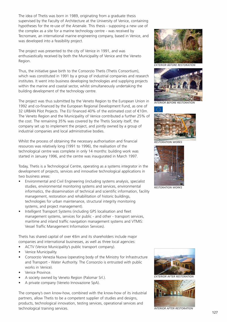
127
EXTERIOR BEFORE RESTORATION
INTERIOR BEFORE RESTORATION
RESTORATION WORKS
RESTORATION WORKS
EXTERIOR AFTER RESTORATION
INTERIOR AFTER RESTORATION
The idea of Thetis was born in 1989, originating from a graduate thesissupervised by the Faculty of Architecture at the University of Venice, containinghypotheses for the re-use of the Arsenale. This thesis - supposing a new use ofthe complex as a site for a marine technology centre - was received byTecnomare, an international marine engineering company, based in Venice, andwas developed into a feasibility project.
The project was presented to the city of Venice in 1991, and wasenthusiastically received by both the Municipality of Venice and the VenetoRegion.
Thus, the initiative gave birth to the Consorzio Thetis (Thetis Consortium),which was constituted in 1991 by a group of industrial companies and researchinstitutes. It went into business developing technologies and supplying projectswithin the marine and coastal sector, whilst simultaneously undertaking thebuilding development of the technology centre.
The project was thus submitted by the Veneto Region to the European Union in1992 and co-financed by the European Regional Development Fund, as one of32 URBAN Pilot Projects. The EU financed 40% of the estimated cost of €10m.The Veneto Region and the Municipality of Venice contributed a further 25% ofthe cost. The remaining 35% was covered by the Thetis Society itself, thecompany set up to implement the project, and jointly owned by a group ofindustrial companies and local administrative bodies.
Whilst the process of obtaining the necessary authorisation and financialresources was relatively long (1991 to 1996), the realisation of thetechnological centre was complete in only 14 months: building work wasstarted in January 1996, and the centre was inaugurated in March 1997.
Today, Thetis is a Technological Centre, operating as a systems integrator in thedevelopment of projects, services and innovative technological applications intwo business areas:• Environmental and Civil Engineering (including systems analysis, specialist
studies, environmental monitoring systems and services, environmentalinformatics, the dissemination of technical and scientific information, facilitymanagement, restoration and rehabilitation of historic buildings,technologies for urban maintenance, structural integrity monitoringsystems, and project management).
• Intelligent Transport Systems (including GPS localisation and fleetmanagement systems, services for public - and other - transport services,maritime and inland traffic navigation management systems and VTMIS:Vessel Traffic Management Information Services).
Thetis has shared capital of over €6m and its shareholders include majorcompanies and international businesses, as well as three local agencies:• ACTV (Venice Municipality’s public transport company).• Venice Municipality.• Consorzio Venezia Nuova (operating body of the Ministry for Infrastructure
and Transport - Water Authority. The Consorzio is entrusted with publicworks in Venice).
• Venice Province.• A society owned by Veneto Region (Palomar Srl.).• A private company (Veneto Innovazione SpA).
The company’s own know-how, combined with the know-how of its industrialpartners, allow Thetis to be a competent supplier of studies and designs,products, technological innovation, testing services, operational services andtechnological training services.

128
LABORATORIES AT THETIS
MEETING ROOM
Within their 4,500m2 site in the Arsenale, Thetis has state of the art offices,laboratories and equipment for the production and certification of systems. Italso has equipment for environmental monitoring, remote measurement,transport management, remote robotics operation and submarine activities.
Thetis customers include port authorities, shipping companies, the NationalResearch Council, Venetian public bodies, cultural trusts, the Ministries ofEnvironment and Education, the Italian provinces, Veneto region and theregional Highways Agency.
Thetis’s offices were developed through the functional recovery and high-techequipment of 16th and 19th century buildings, one of which forms part of thecovered docks where galleys were built. Thetis occupies four buildings withinthe Arsenale Novissimo, and 6,500m2 of open space. The central part consistsof two buildings, linked by a wall of arches. One of these buildings has beenequipped with a workshop and test area, with a test tank. The other is builtover three levels, and the ground floor is equipped with laboratories.
A smaller, brick building has been rehabilitated, and is equipped for trainingactivities. It has a conference theatre on a raised level, which from belowresembles the hull of an ancient ship. The lecture room, library and technicaloffices are located on the ground floor.
The fourth building, which faces the basin of the old Arsenale, is currently usedas storehouse, ready for future development.
The functional and productive recovery of this historical, monumental andhighly significant area was a great task, especially as the aim was to build atechnological structure equipped with complex laboratories, systems andequipment.
The Venetian architects Iginio Cappai and Pietro Mainardis harmoniouslyintegrated these old structures with their new functions, creating an interplaybetween their innovative design and the historical framework. So, these newstructures were built inside the historic ones, but preserved their autonomouscharacter.
The new structures combined distinctive materials and solutions, and usedbright and contrasting colours to produce a lively and innovative atmosphere.The intervention respected the concept of reversibility, which is an acceptedcriterion within the recovery of such important, historic buildings. These newstructures therefore could, if desired, be dismantled, without altering theoriginal state of the ancient buildings.
The realisation of the Thetis Technological Centre within the site of the Arsenaleis a successful example of the functional recovery of an ancient industrial area.Although Thetis occupies only a small part of the complex of the Arsenale, theexperience shows how the area could be reused for an activity related to itsoriginal task: technological production related to the sea.
Moreover, Thetis constitutes the first stage of a wider requalification project,which is important for future urban planning. The key factors for the success ofthe initiative were: • The company’s determination, which stimulated the interest and
commitment of private companies and public bodies.• The enthusiastic support of local government bodies.• The financial support of the European Union.
The Agreed Plan for the recovery of the northern part of the Arsenale - acomplex of feasibility studies, projects, and interventions for the re-use of

129
ancient buildings and the realisation of new structures - was signed inSeptember 2003 by the State Property Board, the Municipality of Venice andthe National Research Council. It foresees the realisation of a programme for:• The planning of interventions.• Feasibility studies.• The realisation of activities.
Thetis is responsible for carrying out these activities.
Martino Ferrari Bravo, Consultant, Marco Polo System g.e.i.e.Mauro Scroccaro, Consultant, Marco Polo System g.e.i.e.

130
Charente-Maritime: Diversity of visitor attractions at Brouage.
Current condition Very good condition.
Current use Activities related to heritage. Permanent exhibitionsin the food store and house of Samuel Champlain, temporary exhibitions in the coopers’ store and powder store. The European Centre of Military architecture has its seat at Brouage, and there are open air festivals, as well as educational activities for children, and guided tours.
Statistics c.350 000 visitors each year.
Date of Construction The city of Brouage appeared in 1555, and the construction of fortifications began in 1569. From 1627, the fortification of Brouage as we know it today took shape. Buildings were erected within the citadel from 1628-1642.
Purpose of Construction Originally a centre of salt trade. The city was fortified to protect the wealth and for strategic interest: to protect the coast.
Construction Materials Stones. Bricks for the parapet.
Scale of land and 2.5km of ramparts, within 16 hectares: eight listed buildings buildings and 20 blocks of buildings.
Number of staff / 20 full time employees, and five seasonal workers. volunteers Between five and 15 volunteers during the
excavation period.
Location, and nearest The citadel of Brouage is 2.5km from Hiers population centre Brouage, 20km from Rochefort, and 50km from
La Rochelle.
Majorworksundertaken General restoration: more than half of the rampartshave been restored, and all historic buildings.
Protection in place All the buildings are listed and the ramparts are classified.
Unique features A unique citadel from the early 17th century and one of the first dockyards in France.
Accessibility Either by a main departmental road, or a marshland track.
Proximity to similar sites 20km from the arsenal at Rochefort and 20km from the fortress of Oléron, on the island of Oléron.
Impulse for the Conscious of the heritage interest of the site, the conversion Department, through the Syndicat Mixte, has
developed a general policy of restoration and re-use of the citadel.
Structure of the The Syndicat Mixte of Brouage is a public structure,managing body composed of members of the General Council and
the commune of Hiers-Brouage.
Organisations consulted The General Council, the Ministry of Culture, the Ministry of Tourism and the Department of the Environment.
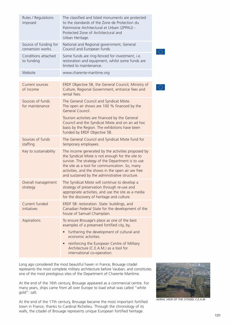
131
Rules / Regulations The classified and listed monuments are protected imposed to the standards of the Zone de Protection du
Patrimoine Architectural et Urbain (ZPPAU) - Protected Zone of Architectural and Urban Heritage.
Source of funding for National and Regional government, General conversion works. Council and European funds.
Conditions attached Some funds are ring-fenced for investment, i.e. to funding restoration and equipment, whilst some funds are
limited to maintenance.
Website www.charente-maritime.org
Current sources ERDF Objective 5B, the General Council, Ministry ofof income Culture, Regional Government, entrance fees and
rental fees.
Sources of funds The General Council and Syndicat Mixte.for maintenance The open air shows are 100 % financed by the
General Council.
Tourism activities are financed by the General Council and the Syndicat Mixte and on an ad hocbasis by the Region. The exhibitions have been funded by ERDF Objective 5B.
Sources of funds The General Council and Syndicat Mixte fund forstaffing temporary employees.
Key to sustainability The income generated by the activities proposed bythe Syndicat Mixte is not enough for the site to survive. The strategy of the Department is to use the site as a tool for communication. So, many activities, and the shows in the open air are free and sustained by the administrative structure.
Overall management The Syndicat Mixte will continue to develop a strategy strategy of preservation through re-use and
appropriate activities, and use the site as a media for the discovery of heritage and culture.
Current funded ERDF 5B: restoration. State: buildings, and initiatives Canadian Federal State for the development of the
house of Samuel Champlain.
Aspirations To ensure Brouage’s place as one of the best examples of a preserved fortified city, by;
• furthering the development of cultural and economic activities.
• reinforcing the European Centre of Military Architecture (C.E.A.M.) as a tool for international co-operation.
Long ago considered the most beautiful haven in France, Brouage citadelrepresents the most complete military architecture before Vauban, and constitutesone of the most prestigious sites of the Department of Charente Maritime.
At the end of the 16th century, Brouage appeared as a commercial centre. Formany years, ships came from all over Europe to load what was called “whitegold”: salt.
At the end of the 17th century, Brouage became the most important fortifiedtown in France, thanks to Cardinal Richelieu. Through the chronology of itswalls, the citadel of Brouage represents unique European fortified heritage.
AERIAL VIEW OF THE CITADEL C.E.A.M.
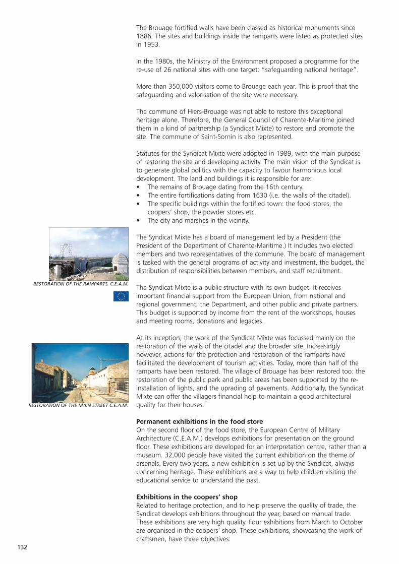
RESTORATION OF THE RAMPARTS. C.E.A.M.
RESTORATION OF THE MAIN STREET C.E.A.M.
132
The Brouage fortified walls have been classed as historical monuments since1886. The sites and buildings inside the ramparts were listed as protected sitesin 1953.
In the 1980s, the Ministry of the Environment proposed a programme for there-use of 26 national sites with one target: “safeguarding national heritage”.
More than 350,000 visitors come to Brouage each year. This is proof that thesafeguarding and valorisation of the site were necessary.
The commune of Hiers-Brouage was not able to restore this exceptionalheritage alone. Therefore, the General Council of Charente-Maritime joinedthem in a kind of partnership (a Syndicat Mixte) to restore and promote thesite. The commune of Saint-Sornin is also represented.
Statutes for the Syndicat Mixte were adopted in 1989, with the main purposeof restoring the site and developing activity. The main vision of the Syndicat isto generate global politics with the capacity to favour harmonious localdevelopment. The land and buildings it is responsible for are:• The remains of Brouage dating from the 16th century.• The entire fortifications dating from 1630 (i.e. the walls of the citadel).• The specific buildings within the fortified town: the food stores, the
coopers’ shop, the powder stores etc.• The city and marshes in the vicinity.
The Syndicat Mixte has a board of management led by a President (thePresident of the Department of Charente-Maritime.) It includes two electedmembers and two representatives of the commune. The board of managementis tasked with the general programs of activity and investment, the budget, thedistribution of responsibilities between members, and staff recruitment.
The Syndicat Mixte is a public structure with its own budget. It receivesimportant financial support from the European Union, from national andregional government, the Department, and other public and private partners.This budget is supported by income from the rent of the workshops, housesand meeting rooms, donations and legacies.
At its inception, the work of the Syndicat Mixte was focussed mainly on therestoration of the walls of the citadel and the broader site. Increasinglyhowever, actions for the protection and restoration of the ramparts havefacilitated the development of tourism activities. Today, more than half of theramparts have been restored. The village of Brouage has been restored too: therestoration of the public park and public areas has been supported by the re-installation of lights, and the uprading of pavements. Additionally, the SyndicatMixte can offer the villagers financial help to maintain a good architecturalquality for their houses.
Permanent exhibitions in the food storeOn the second floor of the food store, the European Centre of MilitaryArchitecture (C.E.A.M.) develops exhibitions for presentation on the groundfloor. These exhibitions are developed for an interpretation centre, rather than amuseum. 32,000 people have visited the current exhibition on the theme ofarsenals. Every two years, a new exhibition is set up by the Syndicat, alwaysconcerning heritage. These exhibitions are a way to help children visiting theeducational service to understand the past.
Exhibitions in the coopers’ shopRelated to heritage protection, and to help preserve the quality of trade, theSyndicat develops exhibitions throughout the year, based on manual trade.These exhibitions are very high quality. Four exhibitions from March to Octoberare organised in the coopers’ shop. These exhibitions, showcasing the work ofcraftsmen, have three objectives:
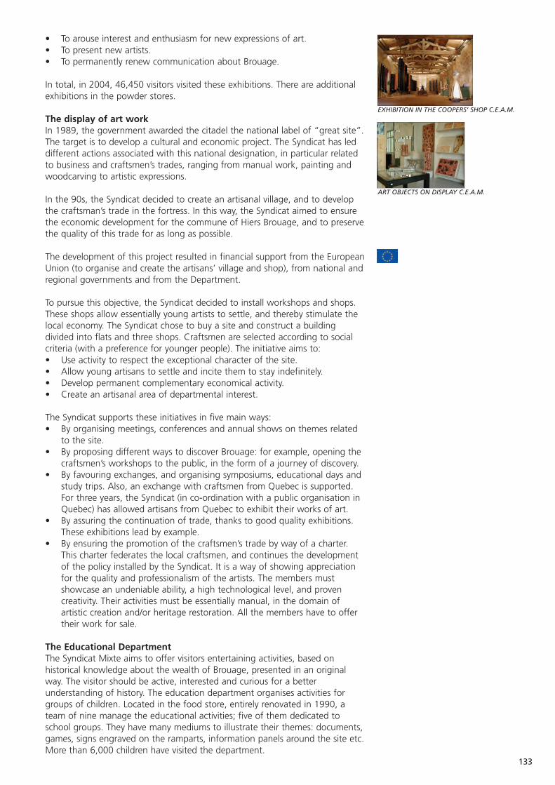
133
EXHIBITION IN THE COOPERS’ SHOP C.E.A.M.
ART OBJECTS ON DISPLAY C.E.A.M.
• To arouse interest and enthusiasm for new expressions of art.• To present new artists.• To permanently renew communication about Brouage.
In total, in 2004, 46,450 visitors visited these exhibitions. There are additionalexhibitions in the powder stores.
The display of art workIn 1989, the government awarded the citadel the national label of “great site”.The target is to develop a cultural and economic project. The Syndicat has leddifferent actions associated with this national designation, in particular relatedto business and craftsmen’s trades, ranging from manual work, painting andwoodcarving to artistic expressions.
In the 90s, the Syndicat decided to create an artisanal village, and to developthe craftsman’s trade in the fortress. In this way, the Syndicat aimed to ensurethe economic development for the commune of Hiers Brouage, and to preservethe quality of this trade for as long as possible.
The development of this project resulted in financial support from the EuropeanUnion (to organise and create the artisans’ village and shop), from national andregional governments and from the Department.
To pursue this objective, the Syndicat decided to install workshops and shops.These shops allow essentially young artists to settle, and thereby stimulate thelocal economy. The Syndicat chose to buy a site and construct a buildingdivided into flats and three shops. Craftsmen are selected according to socialcriteria (with a preference for younger people). The initiative aims to:• Use activity to respect the exceptional character of the site.• Allow young artisans to settle and incite them to stay indefinitely.• Develop permanent complementary economical activity.• Create an artisanal area of departmental interest.
The Syndicat supports these initiatives in five main ways:• By organising meetings, conferences and annual shows on themes related
to the site.• By proposing different ways to discover Brouage: for example, opening the
craftsmen’s workshops to the public, in the form of a journey of discovery.• By favouring exchanges, and organising symposiums, educational days and
study trips. Also, an exchange with craftsmen from Quebec is supported.For three years, the Syndicat (in co-ordination with a public organisation inQuebec) has allowed artisans from Quebec to exhibit their works of art.
• By assuring the continuation of trade, thanks to good quality exhibitions.These exhibitions lead by example.
• By ensuring the promotion of the craftsmen’s trade by way of a charter.This charter federates the local craftsmen, and continues the developmentof the policy installed by the Syndicat. It is a way of showing appreciationfor the quality and professionalism of the artists. The members mustshowcase an undeniable ability, a high technological level, and provencreativity. Their activities must be essentially manual, in the domain ofartistic creation and/or heritage restoration. All the members have to offertheir work for sale.
The Educational DepartmentThe Syndicat Mixte aims to offer visitors entertaining activities, based onhistorical knowledge about the wealth of Brouage, presented in an originalway. The visitor should be active, interested and curious for a betterunderstanding of history. The education department organises activities forgroups of children. Located in the food store, entirely renovated in 1990, ateam of nine manage the educational activities; five of them dedicated toschool groups. They have many mediums to illustrate their themes: documents,games, signs engraved on the ramparts, information panels around the site etc.More than 6,000 children have visited the department.

134
Each year, more and more tourists visit Brouage. Thanks to all these activities,people arrive not only during the summer, but also between March and June,and September and October. This has allowed new projects, with new artists,and increased economic development in the citadel.
A new exhibition is open to the public in the House of Samuel Champlain; thishouse was built by a partnership between the Department of Charente-Maritime and the Canadian government. The building boasts a virtualexhibition, inaugurated in November 2004, and rooms with computers forresearch workers and the public. The themes so far developed discuss therelationships between Brouage and Canada, and also between all countrieswhich traded in the 17th century - the Atlantic coast, from north to south, theWest Indies, and the American continent.
Laetitia Fayemendy, ASCEND Local Project Manager, Conseil Général de laCharente Maritime.
Nathalie Fiquet, Curator of Brouage.
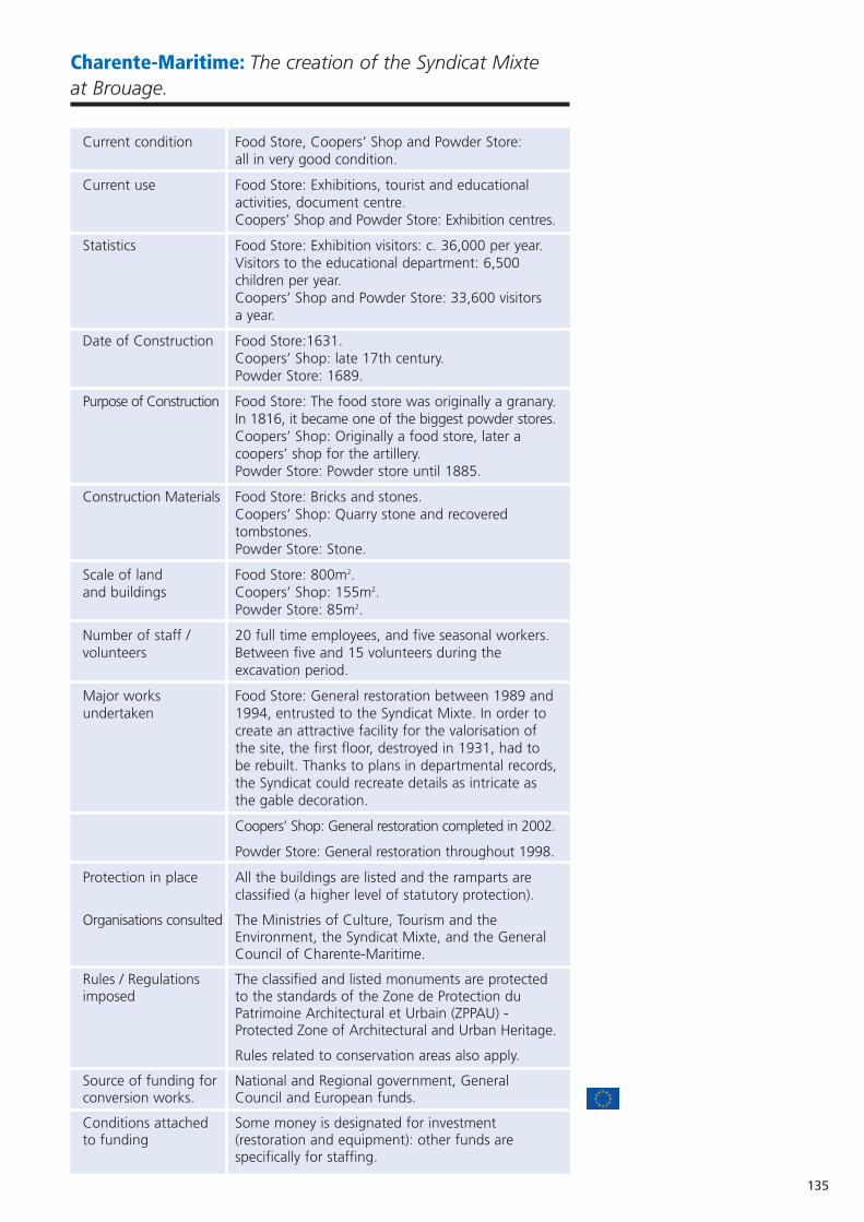
135
Charente-Maritime: The creation of the Syndicat Mixteat Brouage.
Current condition Food Store, Coopers’ Shop and Powder Store: all in very good condition.
Current use Food Store: Exhibitions, tourist and educational activities, document centre. Coopers’ Shop and Powder Store: Exhibition centres.
Statistics Food Store: Exhibition visitors: c. 36,000 per year.Visitors to the educational department: 6,500 children per year.Coopers’ Shop and Powder Store: 33,600 visitorsa year.
Date of Construction Food Store:1631.Coopers’ Shop: late 17th century.Powder Store: 1689.
Purpose of Construction Food Store: The food store was originally a granary.In 1816, it became one of the biggest powder stores.Coopers’ Shop: Originally a food store, later a coopers’ shop for the artillery.Powder Store: Powder store until 1885.
Construction Materials Food Store: Bricks and stones.Coopers’ Shop: Quarry stone and recovered tombstones. Powder Store: Stone.
Scale of land Food Store: 800m2.and buildings Coopers’ Shop: 155m2.
Powder Store: 85m2.
Number of staff / 20 full time employees, and five seasonal workers. volunteers Between five and 15 volunteers during the
excavation period.
Major works Food Store: General restoration between 1989 andundertaken 1994, entrusted to the Syndicat Mixte. In order to
create an attractive facility for the valorisation of the site, the first floor, destroyed in 1931, had to be rebuilt. Thanks to plans in departmental records,the Syndicat could recreate details as intricate as the gable decoration.
Coopers’ Shop: General restoration completed in 2002.
Powder Store: General restoration throughout 1998.
Protection in place All the buildings are listed and the ramparts are classified (a higher level of statutory protection).
Organisations consulted The Ministries of Culture, Tourism and the Environment, the Syndicat Mixte, and the General Council of Charente-Maritime.
Rules / Regulations The classified and listed monuments are protected imposed to the standards of the Zone de Protection du
Patrimoine Architectural et Urbain (ZPPAU) - Protected Zone of Architectural and Urban Heritage.
Rules related to conservation areas also apply.
Source of funding for National and Regional government, General conversion works. Council and European funds.
Conditions attached Some money is designated for investment to funding (restoration and equipment): other funds are
specifically for staffing.

136
Current sources ERDF Objective 5B, Department, Ministry of of income Culture, Regional government, entrance fees and
rental income.
Sources of funds Department and Syndicat Mixte.for maintenance
Sources of funds Department, and Syndicat Mixte for temporary for staffing employees.
Key to sustainability The income generated by the activities proposed bythe Syndicat Mixte are not enough for the site to survive. The strategy of the Department is to use the site as a tool for communication. So, many activities are free and sustained by this administrative structure.
Overall management The Syndicat Mixte will continue to develop a strategy strategy of preservation through re-use and
appropriate activities, and use the site as a media for the discovery of heritage and culture.
Current funded ERDF Objective 5B: restoration. State: buildings, initiatives and Canadian Federal State for the development of
the house of Samuel Champlain.
Aspirations To ensure Brouage’s place as one of the best examples of a preserved fortified city, by;
• furthering the development of cultural and economic activities.
• reinforcing the European Centre of Military Architecture (CEAM) as a tool for international co-operation.
The Charente-Maritime coast was originally protected by a number offortifications. In a significant conservation effort, the department hasendeavoured for a number of years to restore and utilise various military andhistorical buildings. Tourism development policy has brought to light severalexamples of renowned architecture heritage enhancement projects, such as theBrouage citadel.
In order to preserve the site, the General Council of the Department ofCharente-Maritime, has joined with the commune of Hiers Brouage, in a sort ofa public partnership, the Syndicat Mixte of Brouage, to restore and promote the site.
The structure of the Syndicat:
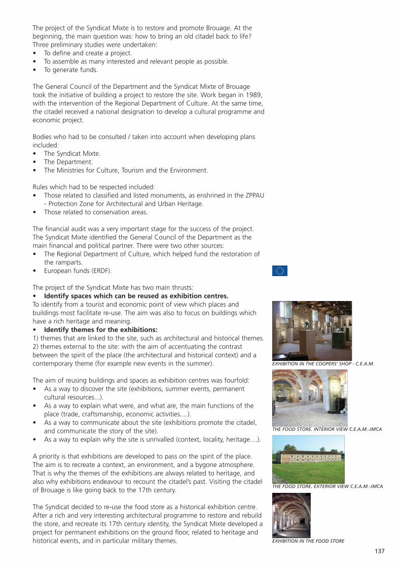
137
The project of the Syndicat Mixte is to restore and promote Brouage. At thebeginning, the main question was: how to bring an old citadel back to life?Three preliminary studies were undertaken:• To define and create a project.• To assemble as many interested and relevant people as possible.• To generate funds.
The General Council of the Department and the Syndicat Mixte of Brouagetook the initiative of building a project to restore the site. Work began in 1989,with the intervention of the Regional Department of Culture. At the same time,the citadel received a national designation to develop a cultural programme andeconomic project.
Bodies who had to be consulted / taken into account when developing plansincluded:• The Syndicat Mixte.• The Department.• The Ministries for Culture, Tourism and the Environment.
Rules which had to be respected included:• Those related to classified and listed monuments, as enshrined in the ZPPAU
- Protection Zone for Architectural and Urban Heritage.• Those related to conservation areas.
The financial audit was a very important stage for the success of the project.The Syndicat Mixte identified the General Council of the Department as themain financial and political partner. There were two other sources:• The Regional Department of Culture, which helped fund the restoration of
the ramparts.• European funds (ERDF).
The project of the Syndicat Mixte has two main thrusts:• Identify spaces which can be reused as exhibition centres.To identify from a tourist and economic point of view which places andbuildings most facilitate re-use. The aim was also to focus on buildings whichhave a rich heritage and meaning.• Identify themes for the exhibitions: 1) themes that are linked to the site, such as architectural and historical themes.2) themes external to the site: with the aim of accentuating the contrastbetween the spirit of the place (the architectural and historical context) and acontemporary theme (for example new events in the summer).
The aim of reusing buildings and spaces as exhibition centres was fourfold:• As a way to discover the site (exhibitions, summer events, permanent
cultural resources...).• As a way to explain what were, and what are, the main functions of the
place (trade, craftsmanship, economic activities....).• As a way to communicate about the site (exhibitions promote the citadel,
and communicate the story of the site).• As a way to explain why the site is unrivalled (context, locality, heritage....).
A priority is that exhibitions are developed to pass on the spirit of the place.The aim is to recreate a context, an environment, and a bygone atmosphere.That is why the themes of the exhibitions are always related to heritage, andalso why exhibitions endeavour to recount the citadel’s past. Visiting the citadelof Brouage is like going back to the 17th century.
The Syndicat decided to re-use the food store as a historical exhibition centre.After a rich and very interesting architectural programme to restore and rebuildthe store, and recreate its 17th century identity, the Syndicat Mixte developed aproject for permanent exhibitions on the ground floor, related to heritage andhistorical events, and in particular military themes.
EXHIBITION IN THE COOPERS’ SHOP - C.E.A.M.
THE FOOD STORE. INTERIOR VIEW C.E.A.M.-JMCA
THE FOOD STORE. EXTERIOR VIEW C.E.A.M.-JMCA
EXHIBITION IN THE FOOD STORE
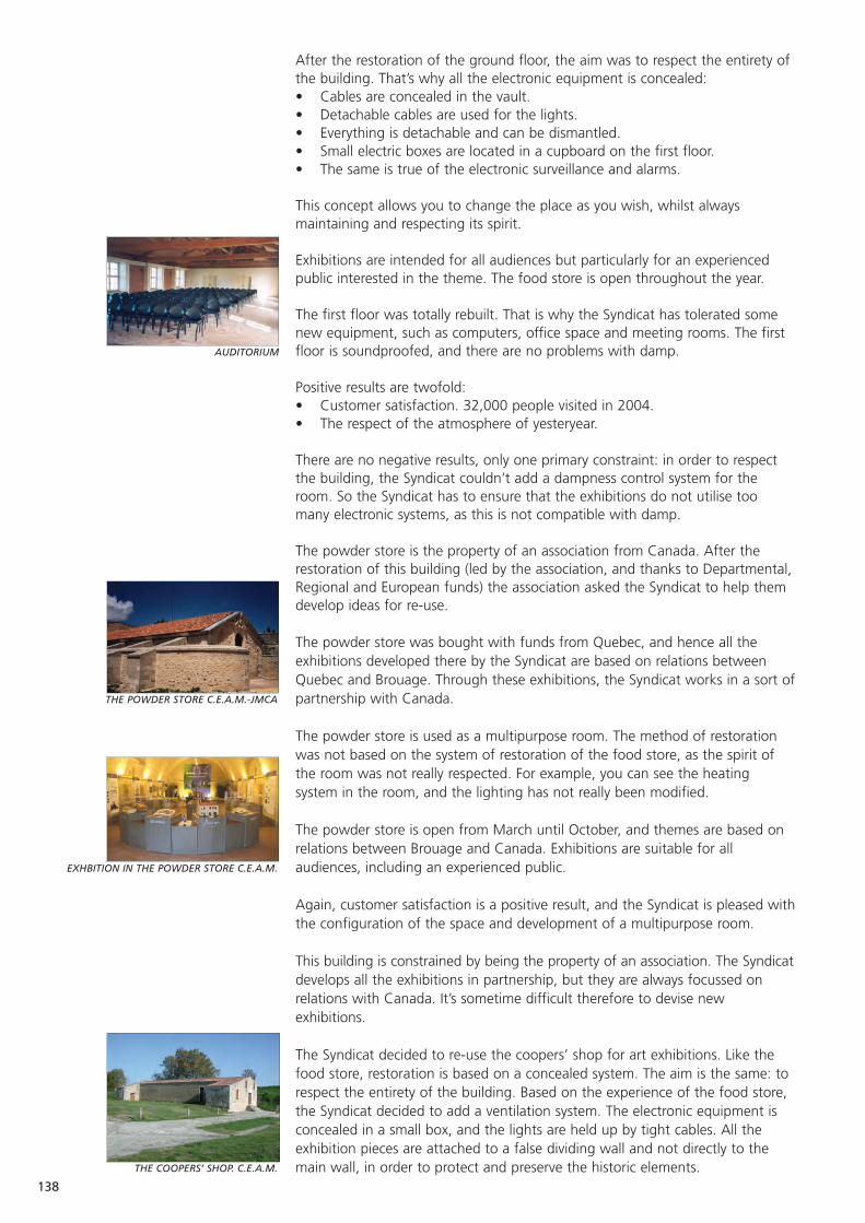
AUDITORIUM
138
After the restoration of the ground floor, the aim was to respect the entirety ofthe building. That’s why all the electronic equipment is concealed:• Cables are concealed in the vault.• Detachable cables are used for the lights.• Everything is detachable and can be dismantled.• Small electric boxes are located in a cupboard on the first floor.• The same is true of the electronic surveillance and alarms.
This concept allows you to change the place as you wish, whilst alwaysmaintaining and respecting its spirit.
Exhibitions are intended for all audiences but particularly for an experiencedpublic interested in the theme. The food store is open throughout the year.
The first floor was totally rebuilt. That is why the Syndicat has tolerated somenew equipment, such as computers, office space and meeting rooms. The firstfloor is soundproofed, and there are no problems with damp.
Positive results are twofold:• Customer satisfaction. 32,000 people visited in 2004.• The respect of the atmosphere of yesteryear.
There are no negative results, only one primary constraint: in order to respectthe building, the Syndicat couldn’t add a dampness control system for theroom. So the Syndicat has to ensure that the exhibitions do not utilise toomany electronic systems, as this is not compatible with damp.
The powder store is the property of an association from Canada. After therestoration of this building (led by the association, and thanks to Departmental,Regional and European funds) the association asked the Syndicat to help themdevelop ideas for re-use.
The powder store was bought with funds from Quebec, and hence all theexhibitions developed there by the Syndicat are based on relations betweenQuebec and Brouage. Through these exhibitions, the Syndicat works in a sort ofpartnership with Canada.
The powder store is used as a multipurpose room. The method of restorationwas not based on the system of restoration of the food store, as the spirit ofthe room was not really respected. For example, you can see the heatingsystem in the room, and the lighting has not really been modified.
The powder store is open from March until October, and themes are based onrelations between Brouage and Canada. Exhibitions are suitable for allaudiences, including an experienced public.
Again, customer satisfaction is a positive result, and the Syndicat is pleased withthe configuration of the space and development of a multipurpose room.
This building is constrained by being the property of an association. The Syndicatdevelops all the exhibitions in partnership, but they are always focussed onrelations with Canada. It’s sometime difficult therefore to devise newexhibitions.
The Syndicat decided to re-use the coopers’ shop for art exhibitions. Like thefood store, restoration is based on a concealed system. The aim is the same: torespect the entirety of the building. Based on the experience of the food store,the Syndicat decided to add a ventilation system. The electronic equipment isconcealed in a small box, and the lights are held up by tight cables. All theexhibition pieces are attached to a false dividing wall and not directly to themain wall, in order to protect and preserve the historic elements.
THE POWDER STORE C.E.A.M.-JMCA
EXHBITION IN THE POWDER STORE C.E.A.M.
THE COOPERS’ SHOP. C.E.A.M.
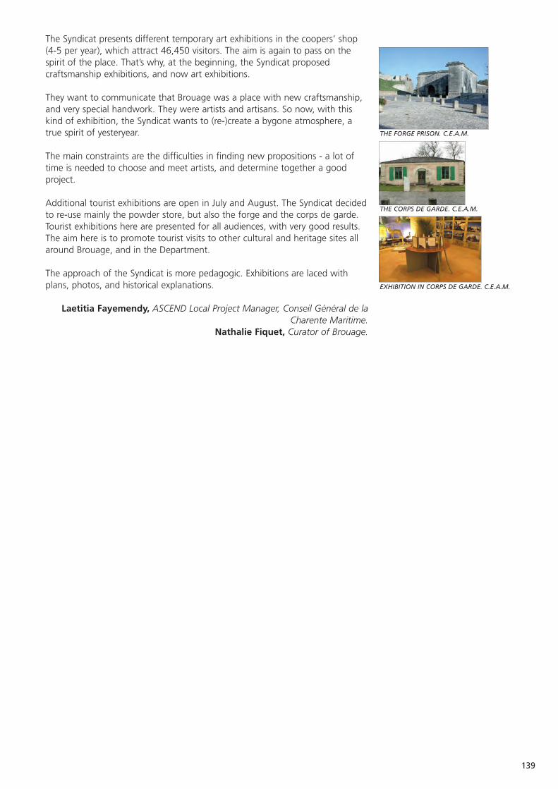
139
EXHIBITION IN CORPS DE GARDE. C.E.A.M.
THE CORPS DE GARDE. C.E.A.M.
THE FORGE PRISON. C.E.A.M.
The Syndicat presents different temporary art exhibitions in the coopers’ shop(4-5 per year), which attract 46,450 visitors. The aim is again to pass on thespirit of the place. That’s why, at the beginning, the Syndicat proposedcraftsmanship exhibitions, and now art exhibitions.
They want to communicate that Brouage was a place with new craftsmanship,and very special handwork. They were artists and artisans. So now, with thiskind of exhibition, the Syndicat wants to (re-)create a bygone atmosphere, atrue spirit of yesteryear.
The main constraints are the difficulties in finding new propositions - a lot oftime is needed to choose and meet artists, and determine together a goodproject.
Additional tourist exhibitions are open in July and August. The Syndicat decidedto re-use mainly the powder store, but also the forge and the corps de garde.Tourist exhibitions here are presented for all audiences, with very good results.The aim here is to promote tourist visits to other cultural and heritage sites allaround Brouage, and in the Department.
The approach of the Syndicat is more pedagogic. Exhibitions are laced withplans, photos, and historical explanations.
Laetitia Fayemendy, ASCEND Local Project Manager, Conseil Général de laCharente Maritime.
Nathalie Fiquet, Curator of Brouage.
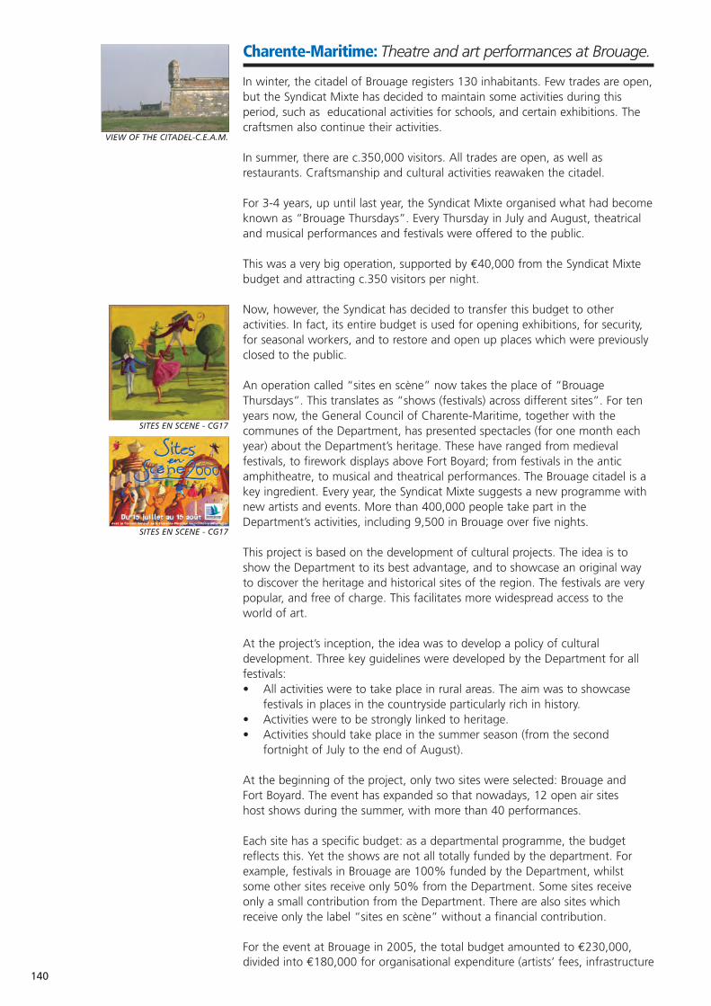
140
SITES EN SCENE - CG17
SITES EN SCENE - CG17
Charente-Maritime: Theatre and art performances at Brouage.
In winter, the citadel of Brouage registers 130 inhabitants. Few trades are open,but the Syndicat Mixte has decided to maintain some activities during thisperiod, such as educational activities for schools, and certain exhibitions. Thecraftsmen also continue their activities.
In summer, there are c.350,000 visitors. All trades are open, as well asrestaurants. Craftsmanship and cultural activities reawaken the citadel.
For 3-4 years, up until last year, the Syndicat Mixte organised what had becomeknown as “Brouage Thursdays”. Every Thursday in July and August, theatricaland musical performances and festivals were offered to the public.
This was a very big operation, supported by €40,000 from the Syndicat Mixtebudget and attracting c.350 visitors per night.
Now, however, the Syndicat has decided to transfer this budget to otheractivities. In fact, its entire budget is used for opening exhibitions, for security,for seasonal workers, and to restore and open up places which were previouslyclosed to the public.
An operation called “sites en scène” now takes the place of “BrouageThursdays”. This translates as “shows (festivals) across different sites”. For tenyears now, the General Council of Charente-Maritime, together with thecommunes of the Department, has presented spectacles (for one month eachyear) about the Department’s heritage. These have ranged from medievalfestivals, to firework displays above Fort Boyard; from festivals in the anticamphitheatre, to musical and theatrical performances. The Brouage citadel is akey ingredient. Every year, the Syndicat Mixte suggests a new programme withnew artists and events. More than 400,000 people take part in theDepartment’s activities, including 9,500 in Brouage over five nights.
This project is based on the development of cultural projects. The idea is toshow the Department to its best advantage, and to showcase an original wayto discover the heritage and historical sites of the region. The festivals are verypopular, and free of charge. This facilitates more widespread access to theworld of art.
At the project’s inception, the idea was to develop a policy of culturaldevelopment. Three key guidelines were developed by the Department for allfestivals:• All activities were to take place in rural areas. The aim was to showcase
festivals in places in the countryside particularly rich in history.• Activities were to be strongly linked to heritage.• Activities should take place in the summer season (from the second
fortnight of July to the end of August).
At the beginning of the project, only two sites were selected: Brouage and Fort Boyard. The event has expanded so that nowadays, 12 open air sites host shows during the summer, with more than 40 performances.
Each site has a specific budget: as a departmental programme, the budgetreflects this. Yet the shows are not all totally funded by the department. Forexample, festivals in Brouage are 100% funded by the Department, whilstsome other sites receive only 50% from the Department. Some sites receiveonly a small contribution from the Department. There are also sites whichreceive only the label “sites en scène” without a financial contribution.
For the event at Brouage in 2005, the total budget amounted to €230,000,divided into €180,000 for organisational expenditure (artists’ fees, infrastructure
VIEW OF THE CITADEL-C.E.A.M.
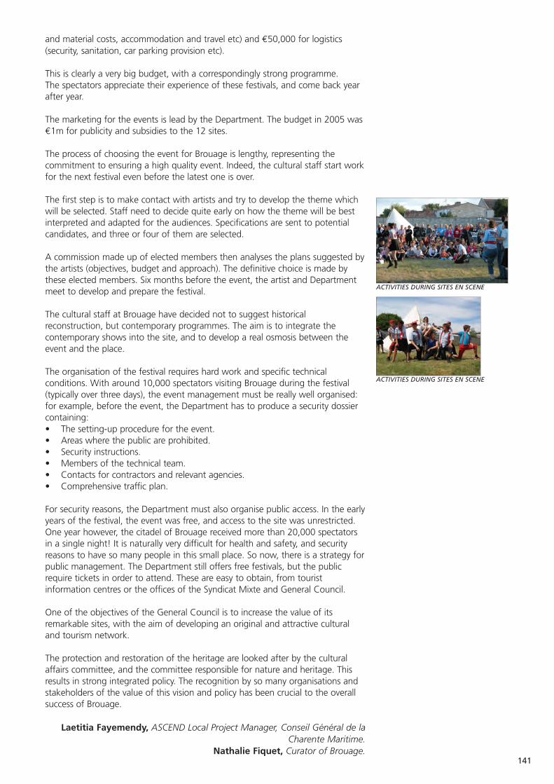
141
ACTIVITIES DURING SITES EN SCENE
ACTIVITIES DURING SITES EN SCENE
and material costs, accommodation and travel etc) and €50,000 for logistics(security, sanitation, car parking provision etc).
This is clearly a very big budget, with a correspondingly strong programme. The spectators appreciate their experience of these festivals, and come back yearafter year.
The marketing for the events is lead by the Department. The budget in 2005 was€1m for publicity and subsidies to the 12 sites.
The process of choosing the event for Brouage is lengthy, representing thecommitment to ensuring a high quality event. Indeed, the cultural staff start workfor the next festival even before the latest one is over.
The first step is to make contact with artists and try to develop the theme whichwill be selected. Staff need to decide quite early on how the theme will be bestinterpreted and adapted for the audiences. Specifications are sent to potentialcandidates, and three or four of them are selected.
A commission made up of elected members then analyses the plans suggested bythe artists (objectives, budget and approach). The definitive choice is made bythese elected members. Six months before the event, the artist and Departmentmeet to develop and prepare the festival.
The cultural staff at Brouage have decided not to suggest historicalreconstruction, but contemporary programmes. The aim is to integrate thecontemporary shows into the site, and to develop a real osmosis between theevent and the place.
The organisation of the festival requires hard work and specific technicalconditions. With around 10,000 spectators visiting Brouage during the festival(typically over three days), the event management must be really well organised:for example, before the event, the Department has to produce a security dossiercontaining:• The setting-up procedure for the event.• Areas where the public are prohibited.• Security instructions.• Members of the technical team.• Contacts for contractors and relevant agencies.• Comprehensive traffic plan.
For security reasons, the Department must also organise public access. In the earlyyears of the festival, the event was free, and access to the site was unrestricted.One year however, the citadel of Brouage received more than 20,000 spectatorsin a single night! It is naturally very difficult for health and safety, and securityreasons to have so many people in this small place. So now, there is a strategy forpublic management. The Department still offers free festivals, but the publicrequire tickets in order to attend. These are easy to obtain, from touristinformation centres or the offices of the Syndicat Mixte and General Council.
One of the objectives of the General Council is to increase the value of itsremarkable sites, with the aim of developing an original and attractive culturaland tourism network.
The protection and restoration of the heritage are looked after by the culturalaffairs committee, and the committee responsible for nature and heritage. Thisresults in strong integrated policy. The recognition by so many organisations andstakeholders of the value of this vision and policy has been crucial to the overallsuccess of Brouage.
Laetitia Fayemendy, ASCEND Local Project Manager, Conseil Général de laCharente Maritime.
Nathalie Fiquet, Curator of Brouage.
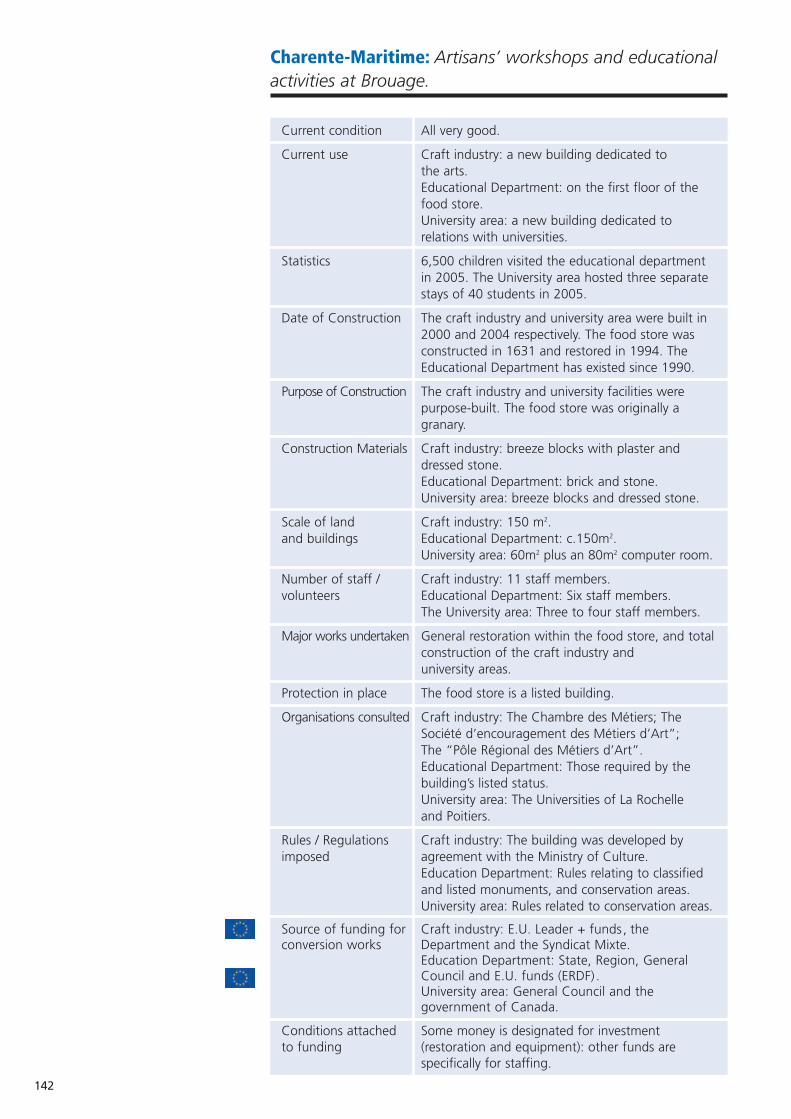
142
Charente-Maritime: Artisans’ workshops and educationalactivities at Brouage.
Current condition All very good.
Current use Craft industry: a new building dedicated to the arts.Educational Department: on the first floor of the food store.University area: a new building dedicated to relations with universities.
Statistics 6,500 children visited the educational department in 2005. The University area hosted three separate stays of 40 students in 2005.
Date of Construction The craft industry and university area were built in 2000 and 2004 respectively. The food store was constructed in 1631 and restored in 1994. The Educational Department has existed since 1990.
Purpose of Construction The craft industry and university facilities were purpose-built. The food store was originally a granary.
Construction Materials Craft industry: breeze blocks with plaster and dressed stone. Educational Department: brick and stone.University area: breeze blocks and dressed stone.
Scale of land Craft industry: 150 m2.and buildings Educational Department: c.150m2.
University area: 60m2 plus an 80m2 computer room.
Number of staff / Craft industry: 11 staff members.volunteers Educational Department: Six staff members.
The University area: Three to four staff members.
Major works undertaken General restoration within the food store, and totalconstruction of the craft industry and university areas.
Protection in place The food store is a listed building.
Organisations consulted Craft industry: The Chambre des Métiers; The Société d’encouragement des Métiers d’Art”; The “Pôle Régional des Métiers d’Art”. Educational Department: Those required by the building’s listed status.University area: The Universities of La Rochelle and Poitiers.
Rules / Regulations Craft industry: The building was developed by imposed agreement with the Ministry of Culture.
Education Department: Rules relating to classified and listed monuments, and conservation areas.University area: Rules related to conservation areas.
Source of funding for Craft industry: E.U. Leader + funds, theconversion works Department and the Syndicat Mixte.
Education Department: State, Region, General Council and E.U. funds (ERDF) .University area: General Council and the government of Canada.
Conditions attached Some money is designated for investment to funding (restoration and equipment): other funds are
specifically for staffing.
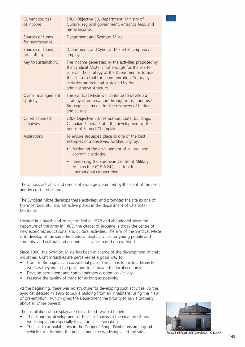
Current sources ERDF Objective 5B, Department, Ministry of of income Culture, regional government, entrance fees, and
rental income.
Sources of funds Department and Syndicat Mixte.for maintenance
Sources of funds Department, and Syndicat Mixte for temporary for staffing employees.
Key to sustainability The income generated by the activities proposed bythe Syndicat Mixte is not enough for the site to survive. The strategy of the Department is to use the site as a tool for communication. So, many activities are free and sustained by the administrative structure.
Overall management The Syndicat Mixte will continue to develop a strategy strategy of preservation through re-use, and use
Brouage as a media for the discovery of heritage and culture.
Current funded ERDF Objective 5B: restoration. State: buildings. initiatives Canadian Federal State: the development of the
house of Samuel Champlain.
Aspirations To ensure Brouage’s place as one of the best examples of a preserved fortified city, by;
• furthering the development of cultural and economic activities.
• reinforcing the European Centre of Military Architecture (C.E.A.M.) as a tool for international co-operation.
The various activities and events at Brouage are united by the spirit of the past,and by craft and culture.
The Syndicat Mixte develops these activities, and promotes the site as one ofthe most beautiful and attractive places in the department of Charente-Maritime.
Located in a marshland zone, fortified in 1578 and abandoned since thedeparture of the army in 1885, the citadel of Brouage is today the centre ofnew economic educational and cultural activities. The aim of the Syndicat Mixteis to develop at the same time educational activities for young people andstudents, and cultural and economic activities based on craftwork.
Since 1990, the Syndicat Mixte has been in charge of the development of craftindustries. Craft industries are perceived as a good way to:• Confirm Brouage as an exceptional place. The aim is to incite artisans to
work as they did in the past, and to stimulate the local economy.• Develop permanent and complementary economical activity.• Preserve the quality of trade for as long as possible.
At the beginning, there was no structure for developing such activities. So theSyndicat decided in 1999 to buy a building from an inhabitant, using the “lawof pre-emption” (which gives the Department the priority to buy a propertyabove all other buyers).
The installation of a display area for art had twofold benefit:• The economic development of the site, thanks to the creation of two
workshops, one especially for an artists’ association.• The link to art exhibitions in the Coopers’ Shop. Exhibitions are a good
vehicle for informing the public about the workshops and the site.143
HOUSE BEFORE RESTORATION - C.E.A.M.
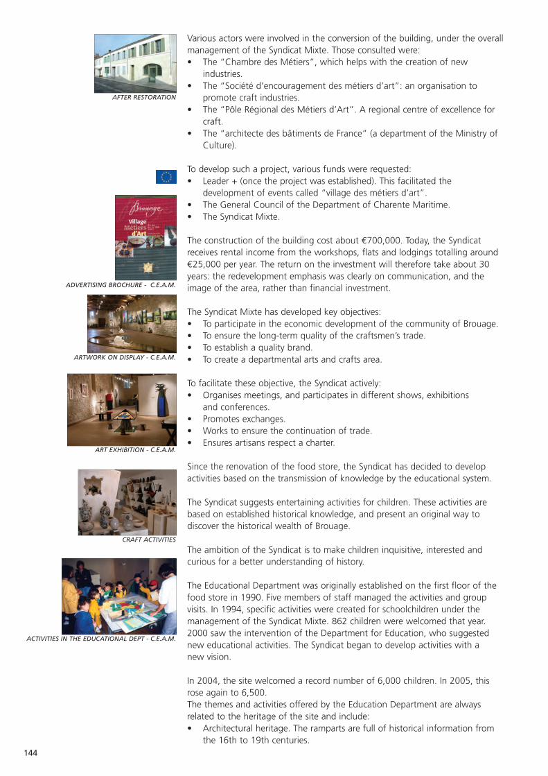
144
AFTER RESTORATION
ADVERTISING BROCHURE - C.E.A.M.
CRAFT ACTIVITIES
ACTIVITIES IN THE EDUCATIONAL DEPT - C.E.A.M.
ART EXHIBITION - C.E.A.M.
ARTWORK ON DISPLAY - C.E.A.M.
Various actors were involved in the conversion of the building, under the overallmanagement of the Syndicat Mixte. Those consulted were: • The “Chambre des Métiers”, which helps with the creation of new
industries.• The “Société d’encouragement des métiers d’art”: an organisation to
promote craft industries.• The “Pôle Régional des Métiers d’Art”. A regional centre of excellence for
craft.• The “architecte des bâtiments de France” (a department of the Ministry of
Culture).
To develop such a project, various funds were requested:• Leader + (once the project was established). This facilitated the
development of events called “village des métiers d’art”.• The General Council of the Department of Charente Maritime.• The Syndicat Mixte.
The construction of the building cost about €700,000. Today, the Syndicatreceives rental income from the workshops, flats and lodgings totalling around€25,000 per year. The return on the investment will therefore take about 30years: the redevelopment emphasis was clearly on communication, and theimage of the area, rather than financial investment.
The Syndicat Mixte has developed key objectives:• To participate in the economic development of the community of Brouage.• To ensure the long-term quality of the craftsmen’s trade.• To establish a quality brand.• To create a departmental arts and crafts area.
To facilitate these objective, the Syndicat actively:• Organises meetings, and participates in different shows, exhibitions
and conferences.• Promotes exchanges.• Works to ensure the continuation of trade.• Ensures artisans respect a charter.
Since the renovation of the food store, the Syndicat has decided to developactivities based on the transmission of knowledge by the educational system.
The Syndicat suggests entertaining activities for children. These activities arebased on established historical knowledge, and present an original way todiscover the historical wealth of Brouage.
The ambition of the Syndicat is to make children inquisitive, interested andcurious for a better understanding of history.
The Educational Department was originally established on the first floor of thefood store in 1990. Five members of staff managed the activities and groupvisits. In 1994, specific activities were created for schoolchildren under themanagement of the Syndicat Mixte. 862 children were welcomed that year.2000 saw the intervention of the Department for Education, who suggestednew educational activities. The Syndicat began to develop activities with a new vision.
In 2004, the site welcomed a record number of 6,000 children. In 2005, thisrose again to 6,500.The themes and activities offered by the Education Department are alwaysrelated to the heritage of the site and include:• Architectural heritage. The ramparts are full of historical information from
the 16th to 19th centuries.
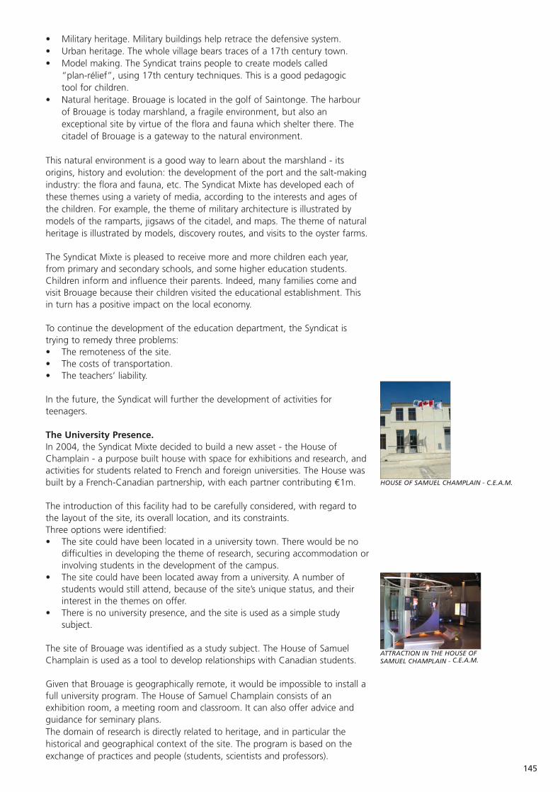
145
HOUSE OF SAMUEL CHAMPLAIN - C.E.A.M.
ATTRACTION IN THE HOUSE OF SAMUEL CHAMPLAIN - C.E.A.M.
• Military heritage. Military buildings help retrace the defensive system.• Urban heritage. The whole village bears traces of a 17th century town.• Model making. The Syndicat trains people to create models called
“plan-rélief”, using 17th century techniques. This is a good pedagogic tool for children.
• Natural heritage. Brouage is located in the golf of Saintonge. The harbourof Brouage is today marshland, a fragile environment, but also anexceptional site by virtue of the flora and fauna which shelter there. Thecitadel of Brouage is a gateway to the natural environment.
This natural environment is a good way to learn about the marshland - itsorigins, history and evolution: the development of the port and the salt-makingindustry: the flora and fauna, etc. The Syndicat Mixte has developed each ofthese themes using a variety of media, according to the interests and ages ofthe children. For example, the theme of military architecture is illustrated bymodels of the ramparts, jigsaws of the citadel, and maps. The theme of naturalheritage is illustrated by models, discovery routes, and visits to the oyster farms.
The Syndicat Mixte is pleased to receive more and more children each year,from primary and secondary schools, and some higher education students.Children inform and influence their parents. Indeed, many families come andvisit Brouage because their children visited the educational establishment. Thisin turn has a positive impact on the local economy.
To continue the development of the education department, the Syndicat istrying to remedy three problems:• The remoteness of the site.• The costs of transportation.• The teachers’ liability.
In the future, the Syndicat will further the development of activities forteenagers.
The University Presence.In 2004, the Syndicat Mixte decided to build a new asset - the House ofChamplain - a purpose built house with space for exhibitions and research, andactivities for students related to French and foreign universities. The House wasbuilt by a French-Canadian partnership, with each partner contributing €1m.
The introduction of this facility had to be carefully considered, with regard tothe layout of the site, its overall location, and its constraints.Three options were identified:• The site could have been located in a university town. There would be no
difficulties in developing the theme of research, securing accommodation orinvolving students in the development of the campus.
• The site could have been located away from a university. A number ofstudents would still attend, because of the site’s unique status, and theirinterest in the themes on offer.
• There is no university presence, and the site is used as a simple studysubject.
The site of Brouage was identified as a study subject. The House of SamuelChamplain is used as a tool to develop relationships with Canadian students.
Given that Brouage is geographically remote, it would be impossible to install afull university program. The House of Samuel Champlain consists of anexhibition room, a meeting room and classroom. It can also offer advice andguidance for seminary plans. The domain of research is directly related to heritage, and in particular thehistorical and geographical context of the site. The program is based on theexchange of practices and people (students, scientists and professors).
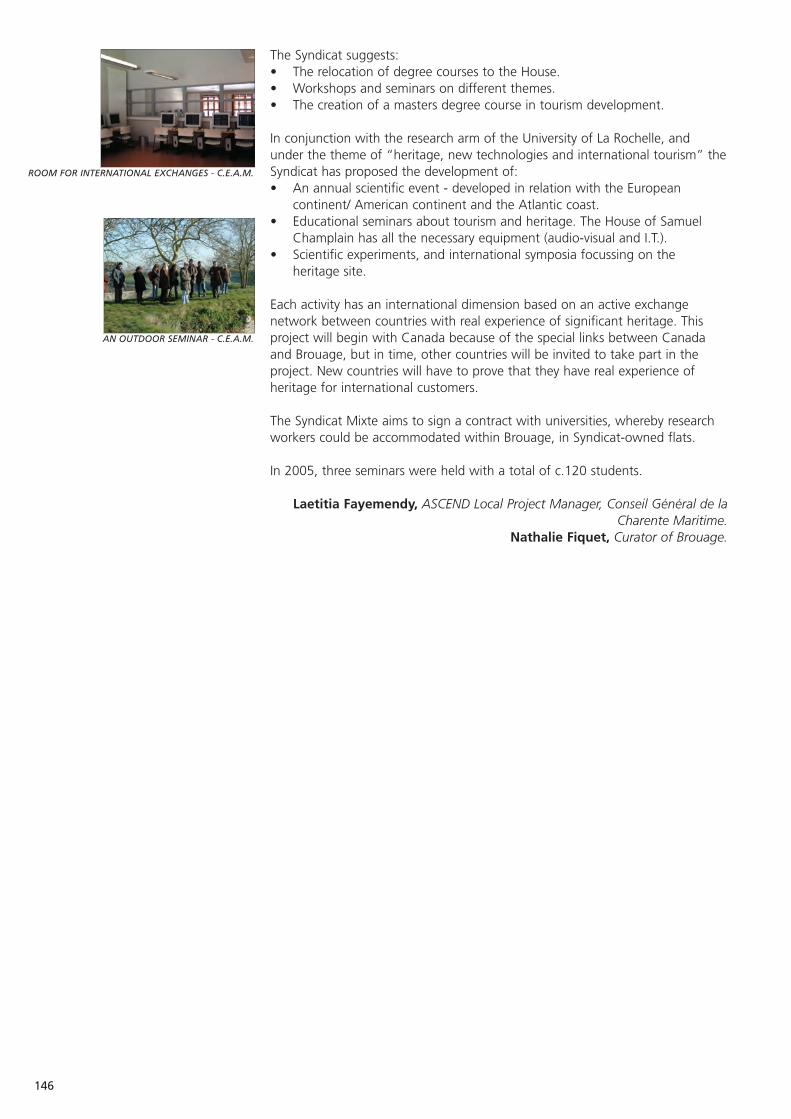
146
ROOM FOR INTERNATIONAL EXCHANGES - C.E.A.M.
AN OUTDOOR SEMINAR - C.E.A.M.
The Syndicat suggests:• The relocation of degree courses to the House.• Workshops and seminars on different themes.• The creation of a masters degree course in tourism development.
In conjunction with the research arm of the University of La Rochelle, and under the theme of “heritage, new technologies and international tourism” theSyndicat has proposed the development of:• An annual scientific event - developed in relation with the European
continent/ American continent and the Atlantic coast.• Educational seminars about tourism and heritage. The House of Samuel
Champlain has all the necessary equipment (audio-visual and I.T.).• Scientific experiments, and international symposia focussing on the
heritage site.
Each activity has an international dimension based on an active exchangenetwork between countries with real experience of significant heritage. Thisproject will begin with Canada because of the special links between Canadaand Brouage, but in time, other countries will be invited to take part in theproject. New countries will have to prove that they have real experience ofheritage for international customers.
The Syndicat Mixte aims to sign a contract with universities, whereby researchworkers could be accommodated within Brouage, in Syndicat-owned flats.
In 2005, three seminars were held with a total of c.120 students.
Laetitia Fayemendy, ASCEND Local Project Manager, Conseil Général de laCharente Maritime.
Nathalie Fiquet, Curator of Brouage.
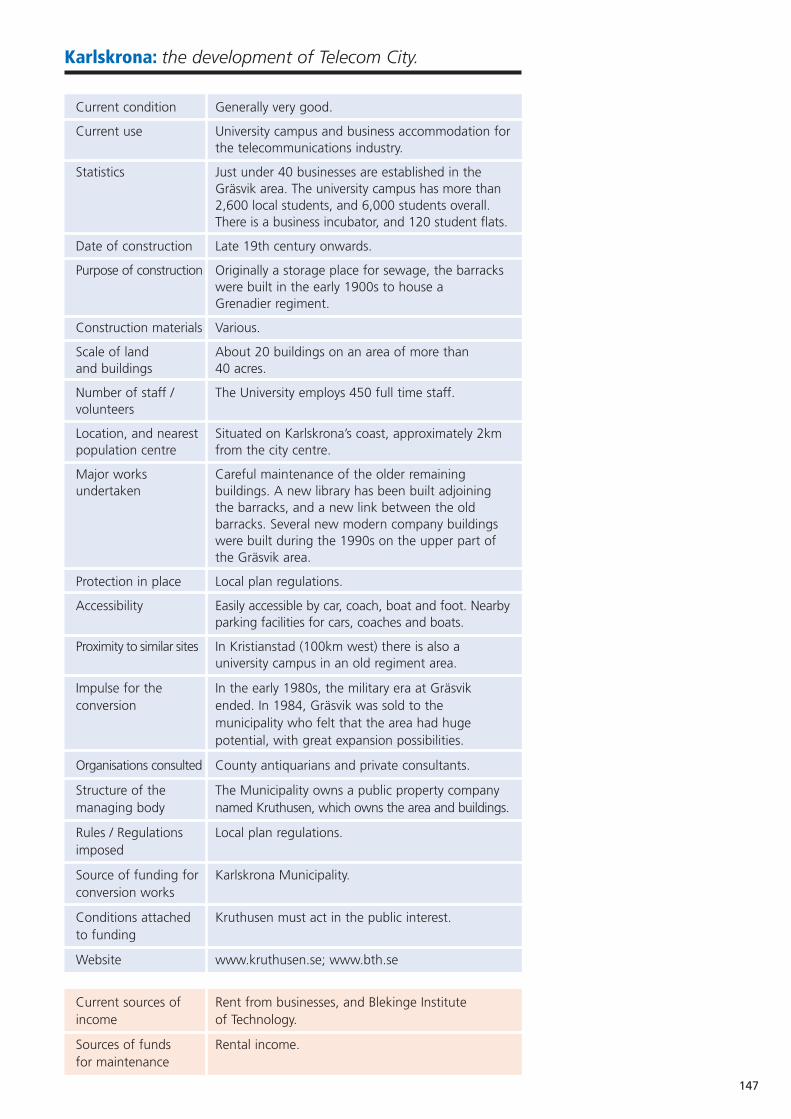
147
Karlskrona: the development of Telecom City.
Current condition Generally very good.
Current use University campus and business accommodation forthe telecommunications industry.
Statistics Just under 40 businesses are established in the Gräsvik area. The university campus has more than 2,600 local students, and 6,000 students overall. There is a business incubator, and 120 student flats.
Date of construction Late 19th century onwards.
Purpose of construction Originally a storage place for sewage, the barracks were built in the early 1900s to house a Grenadier regiment.
Construction materials Various.
Scale of land About 20 buildings on an area of more than and buildings 40 acres.
Number of staff / The University employs 450 full time staff.volunteers
Location, and nearest Situated on Karlskrona’s coast, approximately 2km population centre from the city centre.
Major works Careful maintenance of the older remaining undertaken buildings. A new library has been built adjoining
the barracks, and a new link between the old barracks. Several new modern company buildings were built during the 1990s on the upper part of the Gräsvik area.
Protection in place Local plan regulations.
Accessibility Easily accessible by car, coach, boat and foot. Nearbyparking facilities for cars, coaches and boats.
Proximity to similar sites In Kristianstad (100km west) there is also a university campus in an old regiment area.
Impulse for the In the early 1980s, the military era at Gräsvik conversion ended. In 1984, Gräsvik was sold to the
municipality who felt that the area had huge potential, with great expansion possibilities.
Organisations consulted County antiquarians and private consultants.
Structure of the The Municipality owns a public property company managing body named Kruthusen, which owns the area and buildings.
Rules / Regulations Local plan regulations.imposed
Source of funding for Karlskrona Municipality.conversion works
Conditions attached Kruthusen must act in the public interest.to funding
Website www.kruthusen.se; www.bth.se
Current sources of Rent from businesses, and Blekinge Institute income of Technology.
Sources of funds Rental income.for maintenance
148
Sources of funds Rental income.for staffing
Key to sustainability A specific focus on telecommunications companies.
Overall management Co-operation between telecommunications strategy companies, TelecomCity and the incubator.
Current funded None.initiatives
Aspirations The continued growth of all TelecomCity companies.
During the latter part of the 19th century, several so-called farms, similar tothose earlier established on outer Wämö in Karlskrona, grew up on innerWämö. One of these farms was Gräsvik, which became a storage place for rawsewage. The sewage was kept in stone basins and was dried to be used asfertiliser by farmers and gardeners in the area. Between 1902-1906, thetreatment of sewage was moved away from Gräsvik and instead barracks andother buildings were built to house a Grenadier regiment, led by lieutenantcolonel J. C. Lemchen.
During late summer 1904, the northern barracks came into use and during thefollowing year the eastern barracks were prepared. In 1906, the regiment wascomplete - diet staples purchased this year included 145,000kg of bread,100,000 litres of milk, 60,500kg of potatoes, 3,000kg of cheese and 6,000kgof butter and margarine.
The new Grenadier regiment was originally organised in two battalions, consistingof four companies. In 1914, it was increased by one battalion. In the 1920s, afterthe peace treaty in Versailles, and after the foundation of the League of Nations,the Swedish army started an extensive disarmament programme, and two thirdsof the regiments within the Swedish army were closed down. The Grenadierregiment in Karlskrona was one of these, closed in 1927.
In January 1928, the defunct Grenadier regiment was replaced by adetachment from the Kronoberg regiment, which in turn was disbanded in1936. Three years later a final closing down ceremony was conducted atGräsvik. However, due to the worldwide situation, the need for militaryinstallations significantly increased over coming years, and between 1940-1942the area once again had a military function - this time as a camp for veteranreserves in Blekinge. One year later, in 1943, Karlskrona coast artillery, KA2, wasinstalled at Gräsvik.
In the early 1980s, however, KA2 moved to the Rosenholm area and themilitary era at Gräsvik thereby ended. The eastern barracks were leased to theMunicipality of Karlskrona to house parts of the upper secondary school. Intime, the northern barracks were also used for this purpose. In 1984, the landat Gräsvik was sold to the Municipality for approximately 2,000,000 SEK, as thearea was considered to have huge potential, with its different buildings situatedon a hill by the sea giving it great expansion possibilities. In 1991, the uppersecondary school moved back to Trossö, in the centre of Karlskrona, and thearea was available for other purposes. In 1992, the Board of Public Buildings inKarlskrona reached an agreement with the municipality concerning theplacement of a university at Gräsvik, and one year later the inaugurationceremony was held.
Today, the lower area of Gräsvik houses the Blekinge Institute of Technology.Some of the old buildings have been demolished, while others have beenrefurbished and are still in use. For example, the two four-storey barrack blocksare today connected by a link building housing a coffee shop. In the oldbarracks there are now lecture rooms, and a new library building has been builtadjoining the barracks.
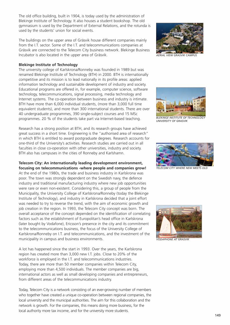
149
AERIAL VIEW GRASVIK CAMPUS
TELECOM CITY WHERE NEW MEETS OLD
BLEKINGE INSTITUTE OF TECHNOLOGYUNIVERSITY OF GRASVIK
VODAPHONE AT GRASVIK
The old office building, built in 1904, is today used by the administration ofBlekinge Institute of Technology. It also houses a student bookshop. The oldgymnasium is used by the Department of External Relations, and the rotunda isused by the students’ union for social events.
The buildings on the upper area of Gräsvik house different companies mainlyfrom the I.T. sector. Some of the I.T. and telecommunications companies atGräsvik are connected to the Telecom City business network. Blekinge BusinessIncubator is also located in the upper area of Gräsvik.
Blekinge Institute of Technology The university college of Karlskrona/Ronneby was founded in 1989 but wasrenamed Blekinge Institute of Technology (BTH) in 2000. BTH is internationallycompetitive and its mission is to lead nationally in its profile areas: appliedinformation technology and sustainable development of industry and society.Educational programs are offered in, for example, computer science, softwaretechnology, telecommunications, signal processing, media technology andInternet systems. The co-operation between business and industry is intimate.BTH have more than 6,000 individual students, (more than 3,000 full timeequivalent students), and more than 300 international students. There are over40 undergraduate programmes, 390 single-subject courses and 15 MScprogrammes. 20 % of the students take part via Internet-based teaching.
Research has a strong position at BTH, and its research groups have achievedgreat success in a short time. Engineering is the “authorised area of research”in which BTH is entitled to award postgraduate degrees. Research accounts forone-third of the University’s activities. Research studies are carried out in allfaculties in close co-operation with other universities, industry and society. BTH also has campuses in the cities of Ronneby and Karlshamn.
Telecom City: An internationally leading development environment,focusing on telecommunications -where people and companies grow!At the end of the 1980s, the trade and business industry in Karlskrona waspoor. The town was strongly dependent on the Swedish navy, the defenceindustry and traditional manufacturing industry where new job opportunitieswere rare or even non-existent. Considering this, a group of people from theMunicipality, the University College of Karlskrona/Ronneby (today the BlekingeInstitute of Technology), and industry in Karlskrona decided that a joint effortwas needed to try to reverse the trend, with the aim of economic growth andjob creation in the region. In 1993, the Telecom City concept was born. Theoverall acceptance of the concept depended on the identification of correlatingfactors such as the establishment of Europolitan’s head office in Karlskrona(later bought by Vodafone), Ericsson’s presence in the city and its commitmentto the telecommunications business, the focus of the University College ofKarlskrona/Ronneby on I.T. and telecommunications, and the investment of themunicipality in campus and business environments.
A lot has happened since the start in 1993. Over the years, the Karlskronaregion has created more than 3,000 new I.T. jobs. Close to 20% of theworkforce is employed in the I.T. and telecommunications industries. Today, there are more than 50 member companies within Telecom City,employing more than 4,500 individuals. The member companies are big,international actors as well as small developing companies and entrepreneurs,from different areas of the telecommunications industry.
Today, Telecom City is a network consisting of an ever-growing number of memberswho together have created a unique co-operation between regional companies, thelocal university and the municipal authorities. The aim for this collaboration and thenetwork is growth. For the companies, this means doing more business, for thelocal authority more tax income, and for the university more students.
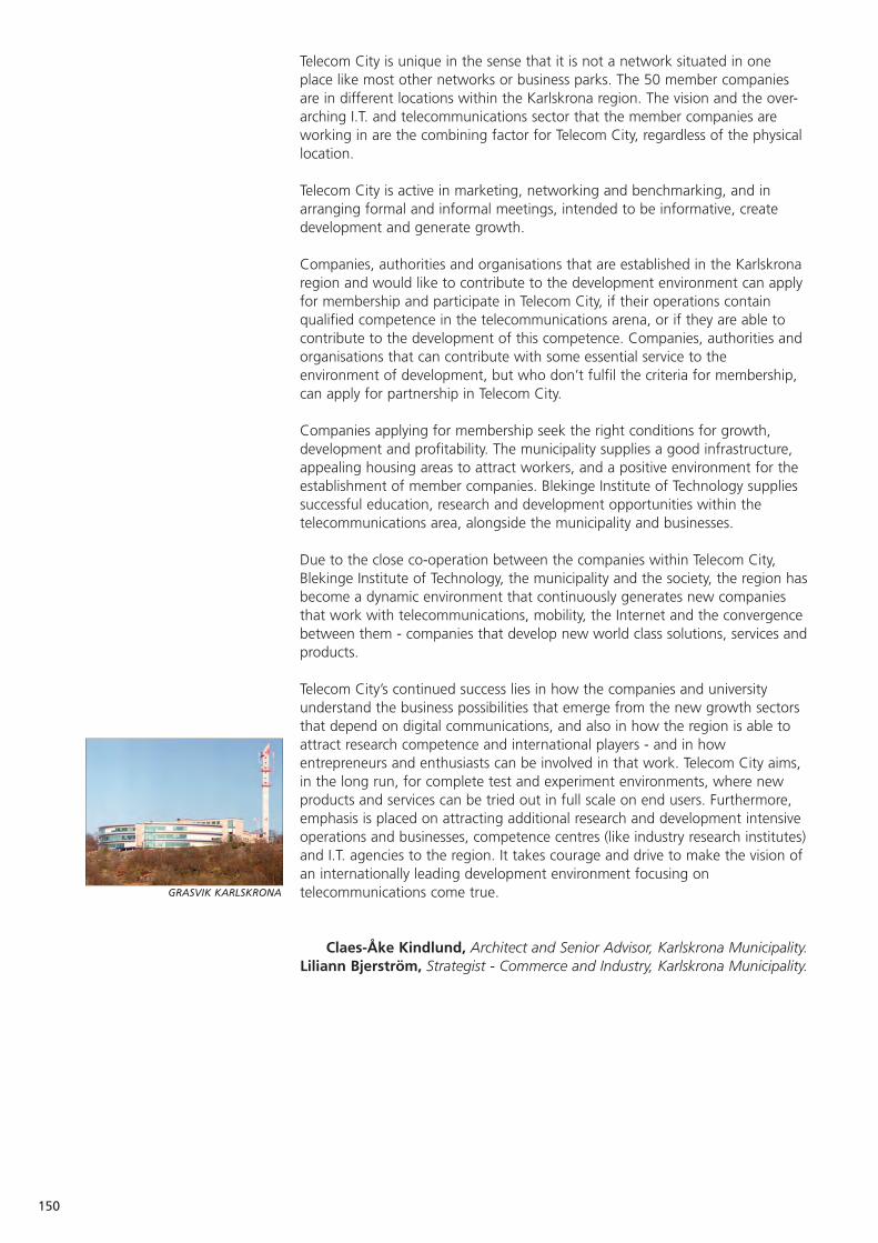
150
GRASVIK KARLSKRONA
Telecom City is unique in the sense that it is not a network situated in oneplace like most other networks or business parks. The 50 member companiesare in different locations within the Karlskrona region. The vision and the over-arching I.T. and telecommunications sector that the member companies areworking in are the combining factor for Telecom City, regardless of the physicallocation.
Telecom City is active in marketing, networking and benchmarking, and inarranging formal and informal meetings, intended to be informative, createdevelopment and generate growth.
Companies, authorities and organisations that are established in the Karlskronaregion and would like to contribute to the development environment can applyfor membership and participate in Telecom City, if their operations containqualified competence in the telecommunications arena, or if they are able tocontribute to the development of this competence. Companies, authorities andorganisations that can contribute with some essential service to theenvironment of development, but who don’t fulfil the criteria for membership,can apply for partnership in Telecom City.
Companies applying for membership seek the right conditions for growth,development and profitability. The municipality supplies a good infrastructure,appealing housing areas to attract workers, and a positive environment for theestablishment of member companies. Blekinge Institute of Technology suppliessuccessful education, research and development opportunities within thetelecommunications area, alongside the municipality and businesses.
Due to the close co-operation between the companies within Telecom City,Blekinge Institute of Technology, the municipality and the society, the region hasbecome a dynamic environment that continuously generates new companiesthat work with telecommunications, mobility, the Internet and the convergencebetween them - companies that develop new world class solutions, services andproducts.
Telecom City’s continued success lies in how the companies and universityunderstand the business possibilities that emerge from the new growth sectorsthat depend on digital communications, and also in how the region is able toattract research competence and international players - and in howentrepreneurs and enthusiasts can be involved in that work. Telecom City aims,in the long run, for complete test and experiment environments, where newproducts and services can be tried out in full scale on end users. Furthermore,emphasis is placed on attracting additional research and development intensiveoperations and businesses, competence centres (like industry research institutes)and I.T. agencies to the region. It takes courage and drive to make the vision ofan internationally leading development environment focusing ontelecommunications come true.
Claes-Åke Kindlund, Architect and Senior Advisor, Karlskrona Municipality.Liliann Bjerström, Strategist - Commerce and Industry, Karlskrona Municipality.

151
MOBILE GUIDE
Karlskrona: Mobile Tourism - combining an old legacywith new techniques.
When Karlskrona was founded in 1680, Sweden was a major power withterritory all around the Baltic Sea. The sea was therefore at the centre of thekingdom and the site where the naval port now stands became a strategicstarting point for defence. From the very beginning, the intention was to buildboth a naval base and a city. A shipyard was also needed to build and repairthe fleet. The aim was to create a strong defence. Navy offices,accommodation, the shipyard and the naval base were situated on the island ofTrossö with its natural harbour, protected by a triangle of three bastions. TheKungsholmen Fortress and the Drottningskär Citadel would protect the fairwayat Aspö Sound. By the end of the 18th century, Karlskrona was the third largestcity in Sweden, and also her military centre. The naval base and the shipyard inKarlskrona have maintained their status since then. Over 300 years ofcontinuous and above all, well-preserved naval history form the basis ofKarlskrona’s nomination to the World Heritage List. The unique architecture andinteresting buildings in the city and its archipelago are living features of themodern skyline.
From 1980-1990, the county of Blekinge suffered from huge unemploymentand a significant decline in industry. The town was highly dependent on theSwedish Navy and the defence industry. The turning point came with a visionand the concept of Telecom City in 1993.
And so the idea of “mobile tourism” started as a student project at BlekingeInstitute of Technology. In 2001, the students together with atelecommunications company called WIP (Wireless Independent Provider) -which is also a member of the Telecom City network - developed a guide in ahandheld computer for a place called Brunnsparken in the city of Ronneby.During the development of the handheld guide other regional areas becameinterested in the project.
In 2002, the project became a co-operation project between the NationalProperty Board, the Naval Museum of Karlskrona, Blekinge Museum, theMunicipality of Karlskrona (Department of Culture and Tourism), the TelecomCity network and WIP. The idea was to develop a guide that visualisedKarlskrona’s cultural heritage and at the same time promoted its world heritage,presenting historical information and legacy in an interesting, instructive and funway, using something people carry with them all the time - a mobile phone.
In 2003, a letter of intent between the partners concerning co-operation andfinancing for the project was signed. The mobile guide was developed usingGSM and 3G technologies. The first guide was made for Stumholmen Island inKarlskrona. In 2004, the guide expanded to the entire city of Karlskrona with40 different spots bearing a connection to the world heritage of Karlskrona.
From a student project to a concept presenting Karlskrona in a new andinnovative way, the success of the project could not have happened if all thepartners had not shared the same vision to reach the goals.
The project is a collaboration between partners with different objectives. Inorder to make things happen, it started by establishing the different areas ofresponsibility for the partners in the project. The National Property Board, theNaval Museum of Karlskrona and Blekinge Museum were responsible forgathering, writing and verifying the historical information, old pictures andfacts. The WIP company was responsible for developing the software. TelecomCity and the Municipality of Karlskrona were in charge of project management.Every partner in the project contributed both economic resources andmanpower to make this work.

152
MOBILE GUIDE IN FRONT OF THE NAVAL MUSEUM
USING THE MOBILE GUIDE INSIDE THE NAVAL MUSEUM
The mobile guide makes it possible for the visitor to get information aboutpoints of interest during a walk around the city. The mobile guide informs theuser by text, images and sound and can make them aware of their position onthe map using GPS positioning. Today, visitors can either rent a mobile guide atthe tourist office or download the software from the internet to their ownmobile phone.
The target group for the mobile guide is also the inhabitants of Karlskrona, andespecially schoolchildren. Some of the schools in Karlskrona are using the guideto teach 17th and 18th century history. The mobile guide is something residentscan use as a part of living in Karlskrona, if they want to know more about aparticular area or feature.
In 2005, a destination game played in the city with mobile phones using SMS,MMS and WAP was tested. Visitors play the game by walking aroundKarlskrona getting clues to places to go to, questions to answer and thentaking pictures. The destination game was tested on students at the upper levelof secondary school with positive results. This was, and is, a fun, educational,subtle and innovative way to learn more about Karlskrona and its history.
The mobile tourism project represents for Karlskrona a new way of promotingits legacy and increasing knowledge about the city and its world heritage, usingeasy and existing technology. It is also a new and different way to learn,discover and explore history and new technology. It is creating new businessopportunities for the tourism market, and makes it possible to reach new targetgroups that a short while ago had no interest in history. With this new way ofpresenting the 17th and 18th century naval architecture and baroque grandeur,visitors as well as inhabitants, young and old, have started to build up aninterest - with consequent benefits for the whole town.
Claes-Åke Kindlund, Architect and Senior Advisor, Karlskrona Municipality.Liliann Bjerström, Strategist - Commerce and Industry, Karlskrona Municipality.
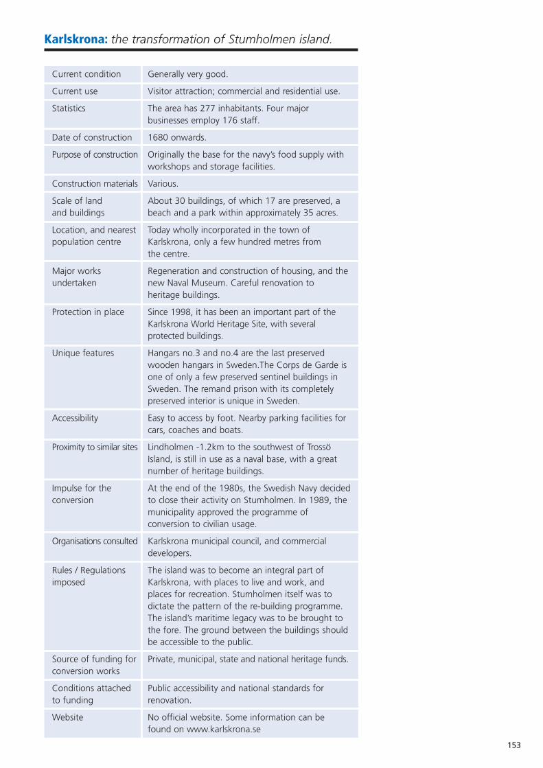
153
Karlskrona: the transformation of Stumholmen island.
Current condition Generally very good.
Current use Visitor attraction; commercial and residential use.
Statistics The area has 277 inhabitants. Four major businesses employ 176 staff.
Date of construction 1680 onwards.
Purpose of construction Originally the base for the navy’s food supply with workshops and storage facilities.
Construction materials Various.
Scale of land About 30 buildings, of which 17 are preserved, a and buildings beach and a park within approximately 35 acres.
Location, and nearest Today wholly incorporated in the town of population centre Karlskrona, only a few hundred metres from
the centre.
Major works Regeneration and construction of housing, and theundertaken new Naval Museum. Careful renovation to
heritage buildings.
Protection in place Since 1998, it has been an important part of the Karlskrona World Heritage Site, with several protected buildings.
Unique features Hangars no.3 and no.4 are the last preserved wooden hangars in Sweden.The Corps de Garde is one of only a few preserved sentinel buildings in Sweden. The remand prison with its completely preserved interior is unique in Sweden.
Accessibility Easy to access by foot. Nearby parking facilities for cars, coaches and boats.
Proximity to similar sites Lindholmen -1.2km to the southwest of Trossö Island, is still in use as a naval base, with a great number of heritage buildings.
Impulse for the At the end of the 1980s, the Swedish Navy decidedconversion to close their activity on Stumholmen. In 1989, the
municipality approved the programme of conversion to civilian usage.
Organisations consulted Karlskrona municipal council, and commercial developers.
Rules / Regulations The island was to become an integral part of imposed Karlskrona, with places to live and work, and
places for recreation. Stumholmen itself was to dictate the pattern of the re-building programme. The island’s maritime legacy was to be brought to the fore. The ground between the buildings shouldbe accessible to the public.
Source of funding for Private, municipal, state and national heritage funds.conversion works
Conditions attached Public accessibility and national standards for to funding renovation.
Website No official website. Some information can be found on www.karlskrona.se

154
AERIAL VIEW OF STUMHOLMEN
REAR VIEW OF THE NAVAL MUSEUM
Current sources Great diversity. of income
Sources of funds Property owners, municipality and jointly-owned for maintenance property establishment.
Sources of funds Jointly-owned establishment.for staffing
Key to sustainability Effective area regulations.
Overall management As a part of the city centre.strategy
Current funded By the National Property Board and Hyper Island.initiatives
Aspirations To develop a management manual for Stumholmen.
The Island of Stumholmen was originally three islands filled in and made intoone; Stumholmen, Laboratorieholmen, and Bastion Kungshall. Stumholmen isnow wholly incorporated in the town of Karlskrona, but for most of theprevious 300 years (since 1680) it was the base for the navy’s food supply andcivilian admittance was subject to rigorous restrictions.
The planners’ intention was that Stumholmen and a part of Trossö wouldprovide the navy with workshops and storage facilities. At one time or another,there have been bakers, distillers, brewers, butchers, a textiles factory and, asboth water and provisions were generally stored in barrels, a coopers’workshop on the island. Stumholmen was not ravaged by the fire that sweptthrough the town in 1790, and many of the buildings, whose functional needshave strongly influenced their location and design, have therefore survived untilthe present day. Stumholmen is today an important part of the KarlskronaWorld Heritage site (1998).
At the end of the 1980s, the head of the Swedish navy decided to close downactivity on Stumholmen. In June 1989, the municipal council approved theprogramme of conversion to civilian usage, providing it with a firm official base.The first step for the conversion was an architects’ competition. A mixture oflarge well-known architects’ offices and smaller, less well-known firms (with themain emphasis on southern Sweden and Denmark) were nominated by themunicipal architect Claes-Åke Kindlund. Introductory seminars and study visitswere arranged by the municipal authority to give the architects’ offices a feelfor the area, and an awareness of the general expectations for Stumholmen.
In May 1990, Hederus-Malmström architects’ office was awarded first prize inthe competition, in co-operation with the Landskapslaget firm of architects. Theoriginality of the winning proposal clearly lay in the location and design of thenew naval museum.
In May 1991, the local housing committee put forward a proposal for areaplanning regulations for Stumholmen Island. A number of reasons governed thechoice of plan. Area planning regulations guarantee, for example, long-termenvironmental quality, whilst the exactness of the size or purpose of thebuildings is less important. The most important factor, however, was the wishto test a basic supposition in the Planning and Building Act; namely that issuesdecided at an early stage in the planning process should not need to bediscussed at a later stage.
The responsibility for the transformation of Stumholmen was placed in thehands of the architects at an early stage. A housing rental association, HSB, wasbrought in to provide financial backing for the project, supported by numeroussub-agreements. The theme which gradually evolved was: a quality consciousconversion of an historic environment.

155
ROOF VIEW OF STUMHOLMEN
AERIAL VIEW OF STUMHOLMEN SHOWINGNAVAL MUSEUM
ARCHITECTURE ON STUMHOLMEN
PUBLIC DIVING FACILITIES
After an inventory of historic buildings, 17 buildings were preserved onStumholmen.
The inventory led to the special properties and qualities of the buildingsbecoming widely recognised, and they were allowed to influence planning. Inaccordance with a proposal from the Christian Democratic Party, it was decidedby the municipal council that planning should be steered by ecologicalprinciples. Environmentally friendly building materials were chosen and recyclingsystems for the water supply and rubbish collection were introduced.
As it had been decided that the open spaces on the island should be accessibleby the public, there are no private outdoor terraces or spaces. The generalfeeling of space is clearly perceptible, particularly around the barracks and theclothes workshop. The closeness to nature and the sea, and yet the location inthe middle of the town, have been significant parameters for the creation ofthe space between buildings in Stumholmen.
There are more than 150 residential flats in Stumholmen. There are flats for rentand purchase, and flats exclusively for senior citizens. All inhabitants of Stumholmenare offered a private car parking space as well as a boat space nearby.
One of the distinctive qualities of Stumholmen is the mixture of purelyfunctional buildings and the obvious urban character of the island. There is anoverarching marine atmosphere all over the island and the well preservedbuildings give a rich picture of the island’s history.
In addition to the art galleries and exhibitions on the island, there are, all overthe island, small works of art; on buildings, in the playground, sitting down to rest etc.
The different projects in Stumholmen are framed by a park designed byLandskapslaget: the Strand Park. It is situated in the centre of the island andwas created at an early stage. It has been a real success, both for inhabitantsand visitors.
The beach at Stumholmen, with its three-storey diving tower and playground, hasbeen given the Blue Flag environmental award (an exclusive eco-label awarded tobeaches and marinas in 29 countries across Europe, South Africa and theCaribbean). The Blue Flag campaign is owned and run by the independent non-profit organisation Foundation for Environmental Education (FEE).
Since its inception in 1923, HSB has taken on responsibility regarding thedevelopment of its idea that residential areas shall function as a social centrearound which different social activities take place. After the National BuildingExhibition in 1993 (Bo93) the inhabitants of Stumholmen took over, and theisland is now alive with social activities. Various neighbour and friend serviceshave been developed by the senior citizens’ association Barkassen.
The Stumholmen cooperative nursery was initiated in 1994, by parents living onthe island. HSB assisted them with the planning. In 1995, the municipalityagreed to the initiative and the nursery opened. The aim of the nursery was,and still is, to focus on nature and culture, which is well in line with otheractivities on the island.
Some of the preserved buildings
The naval museum.The museum has a long tradition stretching back to 1752, when Adolf Fredrik,then King of Sweden, decreed that a Ship’s Model Room be established inKarlskrona. Ever since, the Museum has been charged with the collection andconservation of artefacts which would document the history and developmentof Sweden’s Navy.
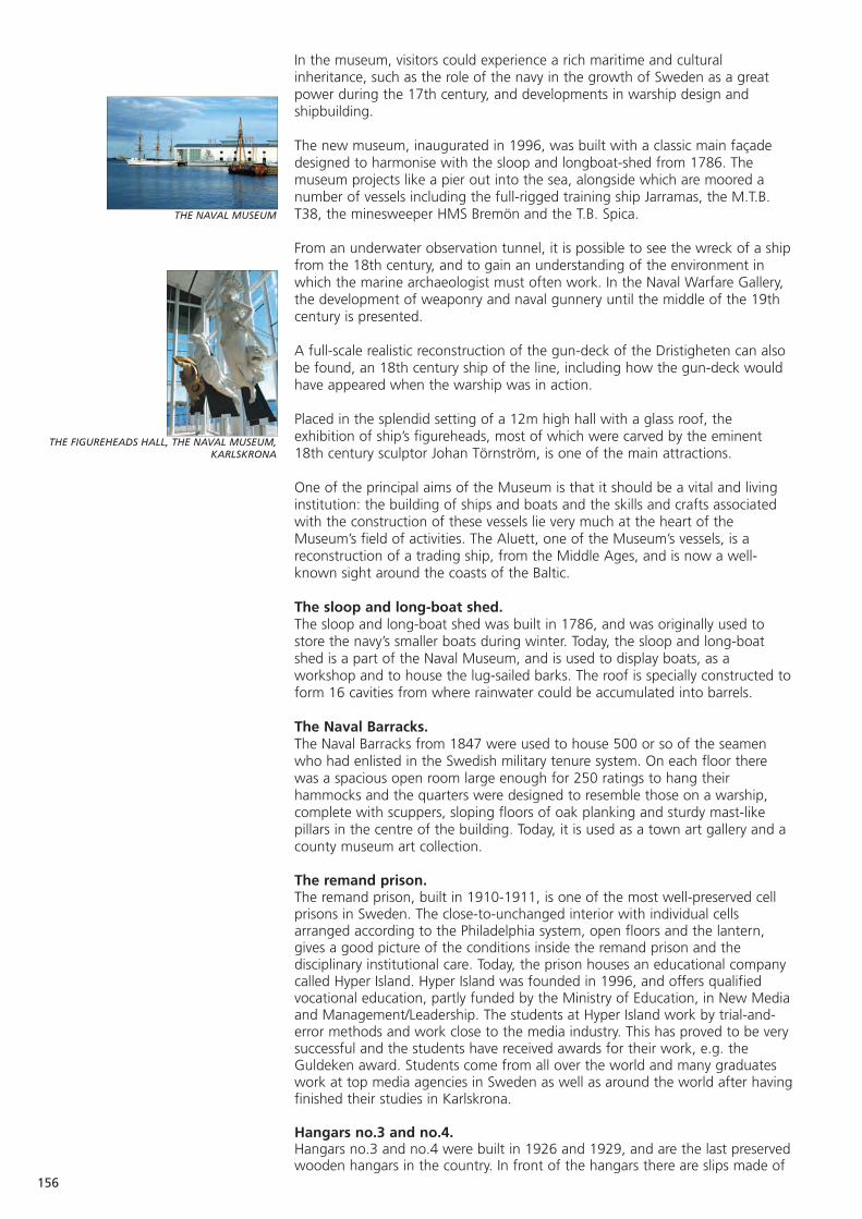
156
THE NAVAL MUSEUM
THE FIGUREHEADS HALL, THE NAVAL MUSEUM,KARLSKRONA
In the museum, visitors could experience a rich maritime and culturalinheritance, such as the role of the navy in the growth of Sweden as a greatpower during the 17th century, and developments in warship design andshipbuilding.
The new museum, inaugurated in 1996, was built with a classic main façadedesigned to harmonise with the sloop and longboat-shed from 1786. Themuseum projects like a pier out into the sea, alongside which are moored anumber of vessels including the full-rigged training ship Jarramas, the M.T.B.T38, the minesweeper HMS Bremön and the T.B. Spica.
From an underwater observation tunnel, it is possible to see the wreck of a shipfrom the 18th century, and to gain an understanding of the environment inwhich the marine archaeologist must often work. In the Naval Warfare Gallery,the development of weaponry and naval gunnery until the middle of the 19thcentury is presented.
A full-scale realistic reconstruction of the gun-deck of the Dristigheten can alsobe found, an 18th century ship of the line, including how the gun-deck wouldhave appeared when the warship was in action.
Placed in the splendid setting of a 12m high hall with a glass roof, theexhibition of ship’s figureheads, most of which were carved by the eminent18th century sculptor Johan Törnström, is one of the main attractions.
One of the principal aims of the Museum is that it should be a vital and livinginstitution: the building of ships and boats and the skills and crafts associatedwith the construction of these vessels lie very much at the heart of theMuseum’s field of activities. The Aluett, one of the Museum’s vessels, is areconstruction of a trading ship, from the Middle Ages, and is now a well-known sight around the coasts of the Baltic.
The sloop and long-boat shed.The sloop and long-boat shed was built in 1786, and was originally used tostore the navy’s smaller boats during winter. Today, the sloop and long-boatshed is a part of the Naval Museum, and is used to display boats, as aworkshop and to house the lug-sailed barks. The roof is specially constructed toform 16 cavities from where rainwater could be accumulated into barrels.
The Naval Barracks.The Naval Barracks from 1847 were used to house 500 or so of the seamenwho had enlisted in the Swedish military tenure system. On each floor therewas a spacious open room large enough for 250 ratings to hang theirhammocks and the quarters were designed to resemble those on a warship,complete with scuppers, sloping floors of oak planking and sturdy mast-likepillars in the centre of the building. Today, it is used as a town art gallery and acounty museum art collection.
The remand prison.The remand prison, built in 1910-1911, is one of the most well-preserved cellprisons in Sweden. The close-to-unchanged interior with individual cellsarranged according to the Philadelphia system, open floors and the lantern,gives a good picture of the conditions inside the remand prison and thedisciplinary institutional care. Today, the prison houses an educational companycalled Hyper Island. Hyper Island was founded in 1996, and offers qualifiedvocational education, partly funded by the Ministry of Education, in New Mediaand Management/Leadership. The students at Hyper Island work by trial-and-error methods and work close to the media industry. This has proved to be verysuccessful and the students have received awards for their work, e.g. theGuldeken award. Students come from all over the world and many graduateswork at top media agencies in Sweden as well as around the world after havingfinished their studies in Karlskrona.
Hangars no.3 and no.4.Hangars no.3 and no.4 were built in 1926 and 1929, and are the last preservedwooden hangars in the country. In front of the hangars there are slips made of
wood and concrete going down into the water, for taking up and launchingthe naval sea airplanes stationed at Stumholmen between 1914 and 1949.Today, the hangars are used as a storage place for the coast guard and carparking provision for inhabitants.
The Bastion Kungshall.The Kungshall bastion was built in the middle of the 1680s. For almost acentury, it was used as fortification. From 1787-1792, it was rebuilt to functionas a slaughterhouse, and storage house for meat and groceries. Today, theKungshall bastion is used by Blekinge museum to store their artefacts.Admission to the exhibition has been free since January 2005. There is also ashop and playground.
The guns at the bastion belong to one of the three permanent batteries inSweden from which ceremonial salutes are fired on occasions of nationalimportance.
The Coopers’ Storehouse.The Coopers’ Storehouse was built in 1718, to house the enormous numbers of barrels that the Navy needed for its water and provisions. It is now theOperational Headquarters of the Swedish Coastguard.
The Pilot’s Cottage.The pilot’s cottage was built in 1861. It was used as night quarters for pilots on duty at Aspö, Ungskär and Långören. Today the building is used by The Swedish Pilotage Service, Lotsverket.
The Crown Bakery.The Crown Bakery was a three-storey bakery built in the 1730s. It was here that “hardtack”, the Navy’s sea biscuits were made and the ships laden with ryeflour from the Crown Mill at Lyckeby could moor at the nearby quay.
In 1908, an extra floor was added to the building and it was used as a clothingstorehouse. The present-day building has retained its somewhat severeappearance, and in 1990, was converted into residential apartments.
The Master Baker’s House.The master baker’s house was built at the end of the 17th century. Initially, itwas used as an artillery forge, but from 1863 it was used as a place to live foremployees of the bakery. Today, it has been converted into flats (Karlskronahem).
The Disinfection House, the Quarantine Hospital and the Fumigation Shed.The disinfection house, the quarantine hospital and the fumigation shed wereoriginally built as a temporary place to take care of navy seamen returning fromthe Russian campaign of 1788-90 infected with ship’s fever, a form of typhus.In time, the hospital became permanent. It was one of the country’s firstcholera and epidemic hospitals.
The Navy’s Main Clothing Factory.The Navy’s main clothing factory was housed in this building from 1921, andbecame a prototype for similar industries in Europe. The former factory hasnow been converted into flats, and with its clear classical lines is a fine exampleof industrial architecture from the 1920s.
Other companies on the island.SITAC is a subsidiary company to the SP Swedish National Testing and Researchinstitute issuing European Technical Approvals (ETA) for construction productsand personal skills within the construction industry. The head office is situatedon Stumholmen.
The Nurse Partner Group, including Nurse Partner and Doc Partner, wasfounded in 1999 and is one of the leading recruitment and staffing agencies inScandinavia focusing on health care. Their headquarters are on Stumholmen.They also have offices in Oslo (Norway) and Copenhagen (Denmark).
Claes-Åke Kindlund, Architect and Senior Advisor, Karlskrona Municipality,Liliann Bjerström, Strategist - Commerce and Industry, Karlskrona Municipality.
157
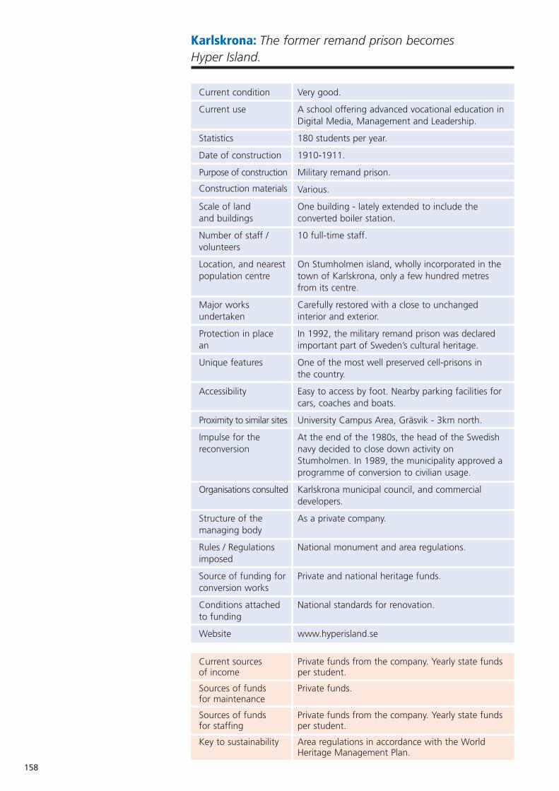
158
Karlskrona: The former remand prison becomes Hyper Island.
Current condition Very good.
Current use A school offering advanced vocational education inDigital Media, Management and Leadership.
Statistics 180 students per year.
Date of construction 1910-1911.
Purpose of construction Military remand prison.
Construction materials Various.
Scale of land One building - lately extended to include the and buildings converted boiler station.
Number of staff / 10 full-time staff.volunteers
Location, and nearest On Stumholmen island, wholly incorporated in the population centre town of Karlskrona, only a few hundred metres
from its centre.
Major works Carefully restored with a close to unchanged undertaken interior and exterior.
Protection in place In 1992, the military remand prison was declaredan important part of Sweden’s cultural heritage.
Unique features One of the most well preserved cell-prisons in the country.
Accessibility Easy to access by foot. Nearby parking facilities for cars, coaches and boats.
Proximity to similar sites University Campus Area, Gräsvik - 3km north.
Impulse for the At the end of the 1980s, the head of the Swedish reconversion navy decided to close down activity on
Stumholmen. In 1989, the municipality approved a programme of conversion to civilian usage.
Organisations consulted Karlskrona municipal council, and commercial developers.
Structure of the As a private company.managing body
Rules / Regulations National monument and area regulations.imposed
Source of funding for Private and national heritage funds.conversion works
Conditions attached National standards for renovation.to funding
Website www.hyperisland.se
Current sources Private funds from the company. Yearly state funds of income per student.
Sources of funds Private funds.for maintenance
Sources of funds Private funds from the company. Yearly state funds for staffing per student.
Key to sustainability Area regulations in accordance with the World Heritage Management Plan.

Overall management As a public company.strategy
Current funded To serve as a small conference centre.initiatives
Aspirations Further expansion of profile, and increase in student numbers.
The old remand prison is one of 17 preserved military buildings on the island ofStumholmen in Karlskrona. Stumholmen is now wholly incorporated in thetown, but for most of the previous 300 years (since 1680) it was the base forthe navy’s food supply and civilian admittance to the area was subject torigorous restrictions.
In the late 1980s, the head of the Swedish navy decided to close down theactivity on Stumholmen. In June 1989, the municipal council approved theprogramme of conversion to civil usage, providing it with a firm official base.
The remand prisonThe prison was built in 1910-1911, following construction drawings made by F. Bothén in 1894. A revised version was made by Sixten C:son Sparre in 1908,but the changes were insignificant.
The military remand prison on Stumholmen is one of the most well preservedcell-prisons in the country. The cells are arranged according to the Philadelphiasystem with open floors to make supervision easier. Originally, the prisoncontained 20 cells on the upper floor and 14 cells on the ground floor. Therewas also a barracks room, a guardroom, an office and a special departmentwith ordinary doors and windows for the officers. Heating was provided by hotair channels in the walls, a system which at this time must have been asobsolete as the construction drawings of the prison.
In the mid 1900s, the prison was still used when arresting seamen who had notreturned in time after their leave, who appeared to be drunk or who in anyother way misbehaved. Often, they were given five to fifteen days in detention.Upon arrival at the prison, the prisoner had to undress. As it was forbidden forprisoners to smoke, a guard went through all the clothing and removedcigarettes, tobacco and snuff. This was, however, returned to the prisonerwhen released.
Sometimes prisoners had to take part in unskilled labour, within Stumholmen,such as digging. In these cases, the prisoners chosen for the task were pickedup in the morning, returned for lunch, picked up again after lunch and thenreturned again in the evening.
Since 1992, the military remand prison on Stumholmen has been declared animportant part of Sweden’s cultural heritage. This means that the building isnot to be moved or demolished. The exterior is not to be changed. The buildingshould be well-maintained, and maintenance should be done with traditionalbuilding material and paint, in such a way that the historical value does notdecay. Also, measures which change the character of the building are notallowed, and interior changes should be preceded by an antiquariandocumentation of surface, coloration and construction details. Therefore nocomprehensive changes of the building are allowed without consultation withthe county administrative board.
Hyper Island In April 1996, Hyper Island, an educational company, was established in the oldmilitary remand prison by three men; Jonathan Briggs, David Erixon and LarsLundh. The first education programme run by the school was a 90-weekvocational course in Digital Media, and was partly funded by the SwedishMinistry of Education. Since 2004, the school has also run a two-year advancedvocational programme in Management and Leadership.
159
HYPER ISLAND EXTERIOR VIEW
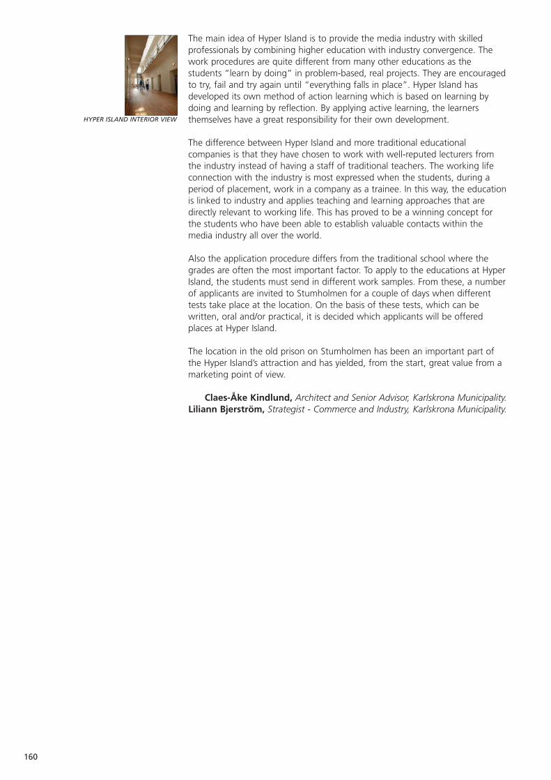
160
HYPER ISLAND INTERIOR VIEW
The main idea of Hyper Island is to provide the media industry with skilledprofessionals by combining higher education with industry convergence. Thework procedures are quite different from many other educations as thestudents “learn by doing” in problem-based, real projects. They are encouragedto try, fail and try again until “everything falls in place”. Hyper Island hasdeveloped its own method of action learning which is based on learning bydoing and learning by reflection. By applying active learning, the learnersthemselves have a great responsibility for their own development.
The difference between Hyper Island and more traditional educationalcompanies is that they have chosen to work with well-reputed lecturers fromthe industry instead of having a staff of traditional teachers. The working lifeconnection with the industry is most expressed when the students, during aperiod of placement, work in a company as a trainee. In this way, the educationis linked to industry and applies teaching and learning approaches that aredirectly relevant to working life. This has proved to be a winning concept forthe students who have been able to establish valuable contacts within themedia industry all over the world.
Also the application procedure differs from the traditional school where thegrades are often the most important factor. To apply to the educations at HyperIsland, the students must send in different work samples. From these, a numberof applicants are invited to Stumholmen for a couple of days when differenttests take place at the location. On the basis of these tests, which can bewritten, oral and/or practical, it is decided which applicants will be offeredplaces at Hyper Island.
The location in the old prison on Stumholmen has been an important part ofthe Hyper Island’s attraction and has yielded, from the start, great value from amarketing point of view.
Claes-Åke Kindlund, Architect and Senior Advisor, Karlskrona Municipality.Liliann Bjerström, Strategist - Commerce and Industry, Karlskrona Municipality.
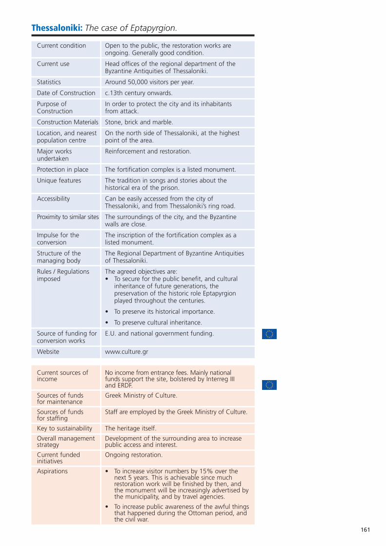
161
Thessaloniki: The case of Eptapyrgion.
Current condition Open to the public, the restoration works are ongoing. Generally good condition.
Current use Head offices of the regional department of the Byzantine Antiquities of Thessaloniki.
Statistics Around 50,000 visitors per year.
Date of Construction c.13th century onwards.
Purpose of In order to protect the city and its inhabitants Construction from attack.
Construction Materials Stone, brick and marble.
Location, and nearest On the north side of Thessaloniki, at the highest population centre point of the area.
Major works Reinforcement and restoration. undertaken
Protection in place The fortification complex is a listed monument.
Unique features The tradition in songs and stories about the historical era of the prison.
Accessibility Can be easily accessed from the city of Thessaloniki, and from Thessaloniki’s ring road.
Proximity to similar sites The surroundings of the city, and the Byzantine walls are close.
Impulse for the The inscription of the fortification complex as a conversion listed monument.
Structure of the The Regional Department of Byzantine Antiquities managing body of Thessaloniki.
Rules / Regulations The agreed objectives are:imposed • To secure for the public benefit, and cultural
inheritance of future generations, the preservation of the historic role Eptapyrgion played throughout the centuries.
• To preserve its historical importance.
• To preserve cultural inheritance.
Source of funding for E.U. and national government funding.conversion works
Website www.culture.gr
Current sources of No income from entrance fees. Mainly nationalincome funds support the site, bolstered by Interreg III
and ERDF.
Sources of funds Greek Ministry of Culture.for maintenance
Sources of funds Staff are employed by the Greek Ministry of Culture.for staffing
Key to sustainability The heritage itself.
Overall management Development of the surrounding area to increase strategy public access and interest.
Current funded Ongoing restoration.initiatives
Aspirations • To increase visitor numbers by 15% over the next 5 years. This is achievable since much restoration work will be finished by then, and the monument will be increasingly advertised bythe municipality, and by travel agencies.
• To increase public awareness of the awful thingsthat happened during the Ottoman period, and the civil war.

AERIAL VIEW OF EPTAPYRGION
162
The Eptapyrgion fort, the last refuge of the city’s defenders, has not been dated precisely. The fort consists of ten towers, three-sided and four-sided, andthe walls which join them. The five outer towers form part of the Acropoliswalls and belong to the first phase of construction, while the inner towers are of a later date. Ongoing investigation has identified the followingconstruction phases:
1. The first phase dates probably from the Early Christian period, althoughthere is a possibility that it might be assigned to the 9th century. This formspart of the Acropolis walls and consists of the outer towers and theirconnecting walls.
2. The five inner towers were built in the 12th century. At the same time theearlier towers were re-constructed.
3. The third phase completed the work of the second and is assigned to thePalaeologean period (late 13th - 14th century).
4. The defensive character of the Byzantine fort was altered by the Ottomans,a year after they captured Thessaloniki in 1431. This phase is recorded inthe Ottoman inscription on the entrance tower.
Since the Ottomans conquered the city, the Eptapyrgion was used as theheadquarters of the Ottoman administration.
No large-scale modifications have yet been identified from the period of Turkishrule, although investigation continues.
The construction of the prison complex must have begun in the 1890s. A mapof the prison was already in existence at that time. No systematic historicalaccount of this latter period is yet available. In 1989, a joint ministerialagreement transferred the Eptapyrgion complex to the Ministry of Culture andthe 9th Ephoreia of Byzantine Monuments Service (a governmental authority)took over the maintenance and restoration of the monument.
Between the removal of the prison and the commencement of the restorationwork, the prison area was cleaned and disinfected, and a work-site wasorganised in preparation for the preliminary restoration work.
Preparatory study of the monument prior to restoration began in 1990, and isstill in progress. Because of the size and nature of the monument, the study isbeing carried out simultaneously on individual features and on the complex as awhole. Various services are co-operating in the project: the 9th Ephoreia ofByzantine Monuments Service, the City Council, the Ministry of Macedonia andThrace, and the Aristotle University of Thessaloniki.
Various study projects are focused on individual integral parts of the complex,such as the towers and curtain walls. Measurements and simple analyses havebeen carried out by: the Regional Public Works Department (durability ofmaterials and mortars), the Chemical Laboratory of the Prehistoric and ClassicalMonuments Service (chemical analysis of materials), the Cement Department ofthe University of Thessaloniki, the Dendrochronological Program of CornellUniversity, USA (dating events by the study of growth rings) and collaborativeefforts have already yielded important conclusions. In addition, measurementsand observations of cracks in the complex have been ongoing since 1989.
The projects include a study of the history of the fort as well as: 1. A description of the logical organisation of the towers. 2. An analysis of the various stages of construction. 3. An investigation of structural damage, damp and cracking. 4. A static study and proposals for restoration.
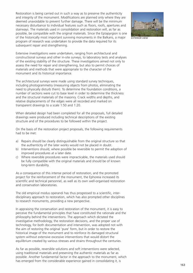
Restoration is being carried out in such a way as to preserve the authenticityand integrity of the monument. Modifications are planned only where they aredeemed unavoidable to prevent further damage. There will be the minimumnecessary disturbance to individual features such as floors, roofs, apertures andstairways. The materials used in consolidation and restoration will, as far aspossible, be compatible with the original materials. Since the Eptapyrgion is oneof the historically most important surviving monuments in the Balkans, a majorprogram of research was undertaken to provide the data required for itssubsequent repair and strengthening.
Extensive investigations were undertaken, ranging from architectural andconstructional surveys and other in-site surveys, to laboratory tests and analysesof the existing stability of the structure. These investigations aimed not only toassess the need for repair and strengthening, but also to permit choices ofmaterials and methods that were appropriate to the character of themonument and its historical importance.
The architectural surveys were made using standard survey techniques,including photogrammetry (measuring objects from photos, eliminating theneed to physically disturb them). To determine the foundation conditions, anumber of sections were cut to base level in order to determine the thicknessand the structural materials of the masonry. Crack widths and depths, andrelative displacements of the edges were all recorded and marked ontransparent drawings to a scale 1:50 and 1:20.
When detailed design had been completed for all the proposals, full detaileddrawings were produced including technical descriptions of the existingstructure and of the procedures to be followed within the project.
On the basis of the restoration project proposals, the following requirementshad to be met:
a) Repairs should be clearly distinguishable from the original structure so thatthe authenticity of the later works would not be placed in doubt.
b) Interventions should, where possible be reversible to permit the adoption ofimproved procedures at a later date.
c) Where reversible procedures were impracticable, the materials used shouldbe fully compatible with the original materials and should be of knownlong-term durability.
As a consequence of this intense period of restoration, and the promotedproject for the reinforcement of the monument, the Ephoreia increased itsscientific and technical personnel, as well as its own well-organised restorationand conservation laboratories.
The old empirical modus operandi has thus progressed to a scientific, inter-disciplinary approach to restoration, which has also prompted other disciplinesto research monuments, providing a new perspective.
In appraising the conservation and restoration of the monument, it is easy toperceive the fundamental principles that have constituted the rationale and thephilosophy behind the interventions. The approach which dictated theinvestigative methodology, the restoration decisions, and the proper use oftechnology, for both documentation and intervention, was adopted not withthe aim of restoring the original ‘pure’ form, but in order to restore thehistorical image of the monument and to reinforce its damaged structuralsystem without extensive excessive interventions that would distort theequilibrium created by various stresses and strains throughout the centuries.
As far as possible, reversible solutions and soft interventions were selected,using traditional materials and preserving the authentic materials as far aspossible. Another fundamental factor in the approach to the monument, whichhas emerged from the considerable experience gained in consolidating it, is
163
EXTERIOR VIEW
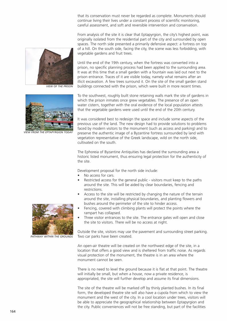
164
VIEW OF THE PRISON
VIEW FROM THE EPTAPYRGION TODAY
PATHWAY WITHIN THE GROUNDS
that its conservation must never be regarded as complete. Monuments shouldcontinue living their lives under a constant process of scientific monitoring,careful assessment, and soft and reversible intervention and conservation.
From analysis of the site it is clear that Eptapyrgion, the city’s highest point, wasoriginally isolated from the residential part of the city and surrounded by openspaces. The north side presented a primarily defensive aspect: a fortress on topof a hill. On the south side, facing the city, the scene was less forbidding, withvegetable gardens and fruit trees.
Until the end of the 19th century, when the fortress was converted into aprison, no specific planning process had been applied to the surrounding area.It was at this time that a small garden with a fountain was laid out next to theprison entrance. Traces of it are visible today, namely what remains after anillicit excavation. A few trees surround it. On the site of the small garden standbuildings connected with the prison, which were built in more recent times.
To the southwest, roughly built stone retaining walls mark the site of gardens inwhich the prison inmates once grew vegetables. The presence of an openwater cistern, together with the oral evidence of the local population atteststhat the vegetable gardens were used until the end of the 20th century.
It was considered best to redesign the space and include some aspects of theprevious use of the land. The new design had to provide solutions to problemsfaced by modern visitors to the monument (such as access and parking) and topreserve the authentic image of a Byzantine fortress surrounded by land withvegetation representative of the Greek landscape, wild on the north side,cultivated on the south.
The Ephoreia of Byzantine Antiquities has declared the surrounding area ahistoric listed monument, thus ensuring legal protection for the authenticity ofthe site.
Development proposal for the north side include: • No access for cars.• Restricted access for the general public - visitors must keep to the paths
around the site. This will be aided by clear boundaries, fencing andrestrictions.
• Access to the site will be restricted by changing the nature of the terrainaround the site, installing physical boundaries, and planting flowers andbushes around the perimeter of the site to hinder access.
• Fencing, covered with climbing plants will protect the points where therampart has collapsed.
• Three visitor entrances to the site. The entrance gates will open and closethe site to visitors. There will be no access at night.
Outside the site, visitors may use the pavement and surrounding street parking. Two car parks have been created.
An open-air theatre will be created on the northwest edge of the site, in alocation that offers a good view and is sheltered from traffic noise. As regardsvisual protection of the monument, the theatre is in an area where themonument cannot be seen.
There is no need to level the ground because it is flat at that point. The theatrewill initially be small, but when a house, now a private residence, isappropriated, the site will further develop and assume its final dimensions.
The site of the theatre will be marked off by thinly planted bushes. In its finalform, the developed theatre site will also have a cupola from which to view themonument and the west of the city. In a cool location under trees, visitors willbe able to appreciate the geographical relationship between Eptapyrgion andthe city. Public conveniences will not be free standing, but part of the facilities
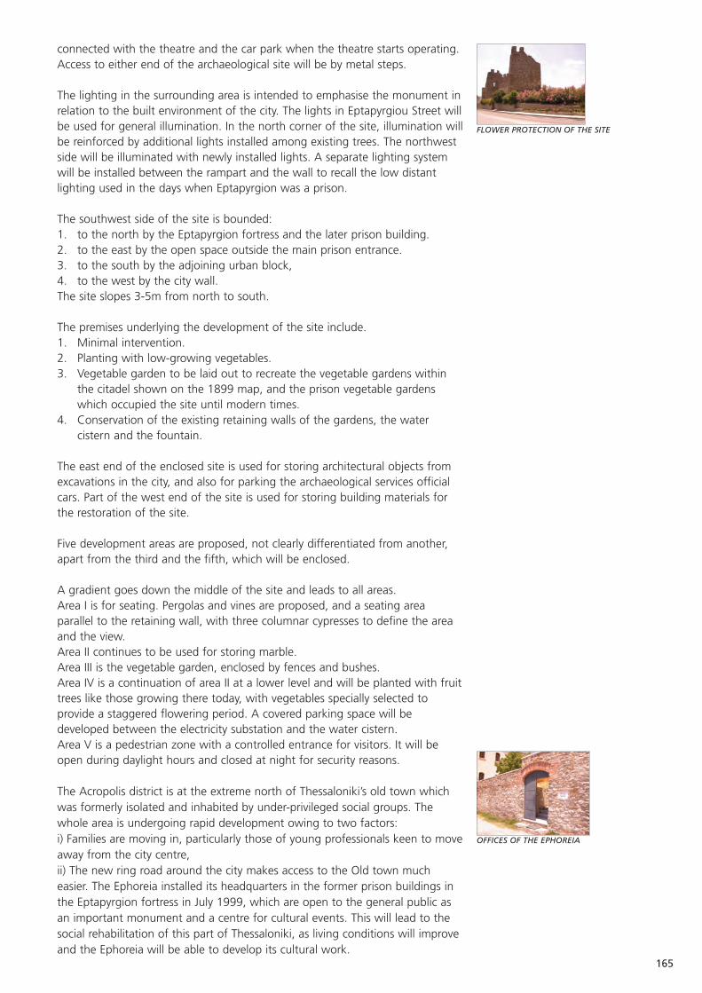
165
FLOWER PROTECTION OF THE SITE
OFFICES OF THE EPHOREIA
connected with the theatre and the car park when the theatre starts operating. Access to either end of the archaeological site will be by metal steps.
The lighting in the surrounding area is intended to emphasise the monument inrelation to the built environment of the city. The lights in Eptapyrgiou Street willbe used for general illumination. In the north corner of the site, illumination willbe reinforced by additional lights installed among existing trees. The northwestside will be illuminated with newly installed lights. A separate lighting systemwill be installed between the rampart and the wall to recall the low distantlighting used in the days when Eptapyrgion was a prison.
The southwest side of the site is bounded: 1. to the north by the Eptapyrgion fortress and the later prison building.2. to the east by the open space outside the main prison entrance.3. to the south by the adjoining urban block, 4. to the west by the city wall. The site slopes 3-5m from north to south.
The premises underlying the development of the site include. 1. Minimal intervention. 2. Planting with low-growing vegetables.3. Vegetable garden to be laid out to recreate the vegetable gardens within
the citadel shown on the 1899 map, and the prison vegetable gardenswhich occupied the site until modern times.
4. Conservation of the existing retaining walls of the gardens, the watercistern and the fountain.
The east end of the enclosed site is used for storing architectural objects fromexcavations in the city, and also for parking the archaeological services officialcars. Part of the west end of the site is used for storing building materials forthe restoration of the site.
Five development areas are proposed, not clearly differentiated from another,apart from the third and the fifth, which will be enclosed.
A gradient goes down the middle of the site and leads to all areas. Area I is for seating. Pergolas and vines are proposed, and a seating areaparallel to the retaining wall, with three columnar cypresses to define the areaand the view. Area II continues to be used for storing marble. Area III is the vegetable garden, enclosed by fences and bushes. Area IV is a continuation of area II at a lower level and will be planted with fruittrees like those growing there today, with vegetables specially selected toprovide a staggered flowering period. A covered parking space will bedeveloped between the electricity substation and the water cistern. Area V is a pedestrian zone with a controlled entrance for visitors. It will beopen during daylight hours and closed at night for security reasons.
The Acropolis district is at the extreme north of Thessaloniki’s old town whichwas formerly isolated and inhabited by under-privileged social groups. Thewhole area is undergoing rapid development owing to two factors: i) Families are moving in, particularly those of young professionals keen to moveaway from the city centre, ii) The new ring road around the city makes access to the Old town mucheasier. The Ephoreia installed its headquarters in the former prison buildings inthe Eptapyrgion fortress in July 1999, which are open to the general public asan important monument and a centre for cultural events. This will lead to thesocial rehabilitation of this part of Thessaloniki, as living conditions will improveand the Ephoreia will be able to develop its cultural work.
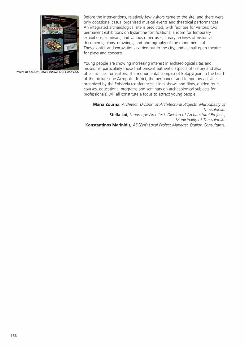
166
Before the interventions, relatively few visitors came to the site, and there wereonly occasional casual organised musical events and theatrical performances.An integrated archaeological site is predicted, with facilities for visitors; twopermanent exhibitions on Byzantine fortifications; a room for temporaryexhibitions, seminars, and various other uses; library archives of historicaldocuments, plans, drawings, and photography of the monuments ofThessaloniki, and excavations carried out in the city; and a small open theatrefor plays and concerts.
Young people are showing increasing interest in archaeological sites andmuseums, particularly those that present authentic aspects of history and alsooffer facilities for visitors. The monumental complex of Eptapyrgion in the heartof the picturesque Acropolis district, the permanent and temporary activitiesorganized by the Ephoreia (conferences, slides shows and films, guided tours,courses, educational programs and seminars on archaeological subjects forprofessionals) will all constitute a focus to attract young people.
Maria Zourna, Architect, Division of Architectural Projects, Municipality ofThessaloniki.
Stella Loi, Landscape Architect, Division of Architectural Projects,Municipality of Thessaloniki.
Konstantinos Marinidis, ASCEND Local Project Manager, Exallon Consultants.
INTERPRETATION PANEL INSIDE THE COMPLEX.
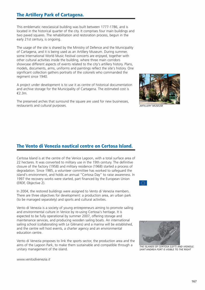
167
The Artillery Park of Cartagena.
This emblematic neoclassical building was built between 1777-1786, and islocated in the historical quarter of the city. It comprises four main buildings andtwo paved squares. The rehabilitation and restoration process, begun in theearly 21st century, is ongoing.
The usage of the site is shared by the Ministry of Defence and the Municipalityof Cartagena, and it is being used as an Artillery Museum. During summer,some International World Music Festival concerts are enjoyed, together withother cultural activities inside the building, where three main corridorsshowcase different aspects of events related to the city's artillery history. Plans,models, documents, arms, uniforms and paintings reflect the site's history. Onesignificant collection gathers portraits of the colonels who commanded theregiment since 1940.
A project under development is to use it as centre of historical documentationand archive storage for the Municipality of Cartagena. The estimated cost is€2.3m.
The preserved arches that surround the square are used for new businesses,restaurants and cultural purposes.
The Vento di Venezia nautical centre on Certosa Island.
Certosa Island is at the centre of the Venice Lagoon, with a total surface area of22 hectares. It was converted to military use in the 19th century. The definitiveclosure of the factory (1958) and military residence (1968) started a process ofdegradation. Since 1985, a volunteer committee has worked to safeguard theisland's environment, and holds an annual “Certosa Day” to raise awareness. In1997 the recovery works were started, part financed by the European Union(ERDF, Objective 2).
In 2004, the restored buildings were assigned to Vento di Venezia members.There are three objectives for development: a production area, an urban park(to be managed separately) and sports and cultural activities.
Vento di Venezia is a society of young entrepreneurs aiming to promote sailingand environmental culture in Venice by re-using Certosa's heritage. It isexpected to be fully operational by summer 2007, offering storage andmaintenance services, and producing wooden sailing boats. An internationalsailing school (collaborating with Le Glénans) and a marina will be established,and the centre will host events, a charter agency and an environmentaleducation centre.
Vento di Venezia proposes to link the sports sector, the production area and theaims of the Lagoon Park, to make them sustainable and compatible through aunitary management of the island.
www.ventodivenezia.it
ARTILLERY MUSEUM
THE ISLANDS OF CERTOSA (LEFT) AND VIGNOLE.SANT'ANDREA FORT IS VISIBLE TO THE RIGHT
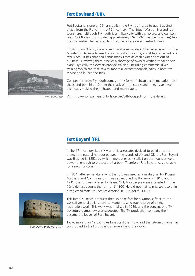
168
Fort Bovisand (UK).
Fort Bovisand is one of 22 forts built in the Plymouth area to guard againstattack from the French in the 19th century. The South West of England is atourist area, although Plymouth is a military city with a shipyard, and garrisonfeel. Fort Bovisand is situated approximately 15km (3km as the crow flies) fromthe city centre. The last couple of kilometres are on single-track roads.
In 1970, two divers (one a retired naval commander) obtained a lease from theMinistry of Defence to use the fort as a diving centre, and it has remained oneever since. It has changed hands many times as each owner goes out ofbusiness. However, there is never a shortage of owners waiting to take theirplace. Typically, the owners provide training (including commercial divertraining which can take several months), accommodation, sales, a boat taxiservice and launch facilities.
Competition from Plymouth comes in the form of cheap accommodation, diveshops and boat hire. Due to their lack of protected status, they have loweroverheads making them cheaper and more viable.
Visit http://www.palmerstonforts.org.uk/pdf/bovis.pdf for more details.
Fort Boyard (FR).
In the 17th century, Louis XIV and his associates decided to build a fort toprotect the natural harbour between the islands of Aix and Oléron. Fort Boyardwas finished in 1852, by which time batteries installed on the two isles werepowerful enough to protect the harbour. Therefore, Fort Boyard was availablefor a new function.
In 1864, after some alterations, the fort was used as a military jail for Prussians,Austrians and Communards. It was abandoned by the army in 1913, and in1931, the fort was offered for lease. Only two people were interested. In the70s a dentist bought the fort for €4,300. He did not maintain it, yet it sold, ina neglected state, to Jacques Antoine in 1979 for €230,000.
This famous French producer then sold the fort for a symbolic franc to theConseil Général de la Charente Maritime, who took charge of all therestoration work. This work was finalised in 1989, and the concept of a TVadventure gameshow was suggested. The TV production company thenbecame the lodger of Fort Boyard.
Today, more than 19 countries broadcast the show, and the televised game hascontributed to the Fort Boyard's fame around the world.
FORT BOVISAND
FORT BOYARD (ROYALTIES LF)

169
REVIT: Towards more effective brownfield revitalisation policies.
REVIT partners understand that brownfield land is prevalent in most majorcities. The revitalisation of brownfield land can enhance coherent urbandevelopment, create new employment, and stimulate the local economy.
Every country and city has its own approach to the regeneration of brownfields,mainly due to specific national legislation, administrative instruments or thelocal economic situation. The partner areas in REVIT however confrontbrownfield problems that are essentially very similar, and can be tackled moreeffectively by improved interregional co-operation. The overall goal of REVIT isto significantly increase the efficiency and sustainability of applied brownfieldregeneration policy.
REVIT is part funded by the Interreg IIIB (North West Europe) programme. Theproject is led by Stuttgart (DE), and partnered by Nantes (FR), Tilburg andHengelo (NL) and Medway and Torfaen (UK).
www.revit-nweurope.org.
The Vodafone Rosenholm Arena (SW).
Rosenholm was initially an arena for military exercise, and the home of theKarlskrona coast artillery KA2. KA2 was closed in 2001.
In 2001, a government owned real-estate company (Vasallen AB) bought partof the Rosenholm KA2 property from The National Fortifications Administration.In May 2003, the Municipality decided to buy the ground where the sportsarena was to be built, and pay for the construction of the arena. The vision isthat Karlskrona will be a leading centre for sport and health in the Baltic regionwithin ten years. Arena Rosenholm is the hub of this process.
The arena has many benefits. It will attract visitors all year round, and make theregion a more attractive place to work. It will provide a place for interactionbetween people from different businesses and cultures. Furthermore, it willincrease co-operation between clubs, keep promising athletes in the area andencourage more people to take part in physical activity. In October 2005,Vodafone became the main sponsor of the arena. Over five years, Vodafone willinvest c.€1.1m in the arena, and in promoting sport in Karlskrona.
The arena can seat 3,500 people for ice hockey, figure skating, concerts andexhibitions.
There is also a training ice rink, 11 tennis courts, 12 badminton courts, agymnastics hall and a ball sports pitch. The Municipality invested €17m. THE VODAFONE ARENA ROSENHOLM
170
Thessaloniki: Sedes Military Airport.
The military airport is in the outskirts of Thessaloniki. It covers 179 hectaresand development is proposed for a commerce centre including: business units,research and development facilities (in co-operation with the University,focusing on new technologies and products, which can be promoted to theBalkans); sports and cultural facilities; hotels and convention centres.
The military airport would become a pole of innovation. This plan would becarried out by the Region of Central Macedonia, the Information Society andthe Fourth Community Support Framework. The relocation of the university'sFaculty of Engineering is also possible, which would support the technopolis. Its location near Thessaloniki's International Airport is an advantage.
Other University departments have already been relocated nearby. Soon, thearea could house all the Faculties of the Aristotelian University of Thessaloniki,which would release a huge campus area in Thessaloniki town.
The released area could be turned into a public open space, something that iscurrently lacking.
Skärfva Manor (SW).
Skärfva was built between 1785-86, for the Admiral Superintendent of theNavy Yard, Fredric Henric af Chapman, and is a singular architectural creation.The somewhat unlikely marriage of Swedish neo-classical and traditional rusticelements was designed by af Chapman, together with the philosopher andartist, Admiral Carl August Ehrensvvärd.
Skärfva is today a privately owned World Heritage building. Cecilia Skröder-Wachtmeister and her husband Thomas Skröder are the latest link in a familytradition of more than 140 years.“(Our) vision is to create a meeting place forculture and education, using the rich and inspiring estate and its fascinatinghistory”. Ongoing activities are cultural tourism with guided tours, concerts andart exhibitions etc. Skärfva has more than 40,000 visitors each year.
The Skärfva Village project also exists, to recreate life on the estate all yearround. A modern village for c.400 inhabitants is being built according tonatural and social values. The Wachtmeister family, in cooperation withBlekinge Institute of Technology, has incorporated education and humandevelopment. A qualified gardening course was introduced in 2003.
AIRPLANE OVER SEDES
THE ESTATE OF SKÄRFVA

171
FORT de la RADE (FR): Creation of a hotel complex.
The creation of the arsenal at Rochefort led to the fortification of the island ofAix, including the creation of Fort de la Rade, to protect the entrance to theroadstead of Rochefort. Situated at the end of the island, the fort faces FortBoyard.
In 1757, the English succeeded in entering the island, and destroyed it. In1814, the small town became a real military centre, with Fort de la Rade as acitadel. Yet after the decline of the harbour of Rochefort, the fort was declaredobsolete in 1920. During the Second World War it was reoccupied by Germany.
In 1955, the fort was used as reseach laboratory by the Ministry of Agriculture,and in 1986, a holiday village was created. Today, a hotel complex (open duringthe summer) is located inside the fortified wall. It offers studios for two - fourpeople, and fully-equipped four to six roomed flats. There is also a swimmingpool, and leisure activities such as: ping-pong, piano, billiards, and children'splay areas. Shops and the beach are within 100m
New Dutch Waterline: Fort Werk IV.
Built in 1870, Fort Werk IV lost its military function in 1926, and became aprotected National Monument in 1969. Today it is owned by the Municipalityof Bussum. In 1998, the Municipality gave the administration of the fort to theAssociation for the Conservation of Werk IV (www.fortwerk4.nl). With the helpof a young persons' project, and the Royal Infantry, the Association began torepair the fort.
The Province of Noord-Holland and the City of Amsterdam co-operate in aunique employment scheme for young people with little or no work experience,enabling them to participate in the maintenance of the Defence Line ofAmsterdam. This successful project offers participants the chance to prepare fora regular job or professional training. Often these people have social problems,such as drug, or alcohol addictions.
The Association for the Conservation of Werk IV rents the casemates and theartillery shed for a very low price, to support private activity. Since 2000, theStudio Vernissage (www.vernissage.nl) has used the artillery shed for artcourses. In 2004, restoration of the Potern Gate and right casemate wasfinished. The first is used as exhibition area, and the second as space forcookery courses. The fort was previously virtually unknown, and poorly visible,due to vegetation surrounding the fort. Now the fort is increasing its profile.
FORT DE LA RADE (Royalties phD)
Fort Werk IV. Exhibitions in the Potern Gate

172
Thessaloniki: The Pavlos Melas Military Campground.
In December 2003, the camp of Pavlos Melas began to relocate. Its 38 hectareswill be handed to the municipalities of Thessaloniki, Stavroupoli and Polichni.Proposals for the camp's future (drafted by the City's Town Planning andEnvironment Bureau, and the Development Association of NorthwesternThessaloniki) include: an urban park; athletic facilities; a Museum for Emigrantand Displaced Greeks; a health and social work centre; administration andeducation facilities; the relocation of the School of Fine Arts of Thessaloniki.
There is ongoing public discussion about alternatives.
The camp's buildings and area are designated architectural heritage landmarks.The camp was one of the first organised military camps in Greece, and containsan ottoman temple. It was named after the Greek hero Pavlos Melas. Duringthe Second World War, the camp was under German occupation and used as amilitary prison.
The camp's historic and architectural significance is an advantage for thesurrounding area. It will create a number of much-needed new jobs. The FineArts School will revitalise the area, not only by its classes, but also by its artisticand cultural events. Redevelopment will be a life long investment inThessaloniki's upgrading.
Portsmouth Dockyard (UK).
There has been a dockyard in Portsmouth since 1495. The Royal Dockyard titledisappeared in 1984, but the naval base remains the home of the Royal Navy.Ships based at Portsmouth include the aircraft carriers HMS Invincible, Illustriousand Ark Royal. The dockyard and historic dockyard are next to each other,allowing people who visit the historic ships to get a glimpse of the up to datenaval ships.
In 1985, the British Government granted a long lease over the most historicpart of the Dockyard to the Portsmouth Naval Base Property Trust, a registeredcharity charged with conserving its many historic buildings by finding neweconomic uses. This part of the dockyard is now open to the public, withattractions such as HMS Victory, the Mary Rose & HMS Warrior.
Unlike the Dockyard in Chatham, entrance to the Historic Dockyard itself, theshops and catering outlets, is free except during special events. See www.flagship.org.uk.
PAVLOS MELA
HMS VICTORY AT PORTSMOUTH HISTORICDOCKYARD
173
Crossing the Lines - Interreg IIIB.
The Crossing the Lines Interreg IIIB project unites Utrecht (NL), Mortsel (BE) andEssex (UK) in protecting and redeveloping defence lines in northwest Europe ina sustainable way.
The project develops and implements knowledge on restoration techniques(such as climate control and brick work) and the use of sustainable energythrough transnational studies and investment pilots. Placement visits areincluded.
Partners are investing in opening fortification sites to the public, and developingnew presentation techniques. Jaywick Tower (Essex) will be developed into amultifunctional visitors' centre, using arts to communicate its historical value.For Tilbury Fort (Essex), emphasis is on developing its general appeal to thepublic. Fort aan de Klop (Utrecht) will be redeveloped with a hostel, teahouseand a small campground for low impact tourism. Fort IV (Mortsel) will betransformed into "creative barracks", for local, and other, functions.
www.crossingthelines.com.
CULTURED: Cultural heritage and regional development.
The New Dutch Waterline is involved the Interreg IIIC project CULTURED,concerning cultural heritage and regional development.
Every region in Europe is proud of its built heritage and cultural identity. Re-appraising how a building can be used within the specific identity of aregion can stimulate economic development and renew interest in the heritage.
CULTURED unites 14 partners from nine countries in sharing best practice ofusing built heritage and cultural identity as an engine for regional development.
A key output will be best practice guidelines on how to use built heritage andcultural identity as an instrument of regional development, preserving historicintegrity whilst using a market led approach. Partners will developdemonstration projects which aim to show how cultural heritage can be used inthe redevelopment of a region, and how this can strengthen its identity. Theywill provide a framework for attracting funding, and a frame of reference forgood practice. The CULTURED project will furthermore develop a knowledgebase for European policy makers and planners, and regional organisations and actors.
For more information: www.culturedeu.org.

174
The ASCEND Database Map.
A key output of the ASCEND project is its database map, an instrument toaccelerate knowledge exchange about the re-use of military heritage in Europe.The former military sites of the ASCEND partners are shown on this maptogether with relevant data which will facilitate efficient knowledge exchange.Furthermore, the map will attract new potential partners from throughoutEurope, so the map can continue to develop after ASCEND, uniting a growingnetwork of organisations involved with the re-use of military heritage.
The network map can be found at www.ascendpartnership.net andwww.hollandsewaterlinie.nl. The map shows geographical and historicalinformation, as well as information about the re-use. The information isillustrated with pictures and maps. It is possible to look for different kinds of re-use by using the 'search' tool. This makes it easier to look for best practicesacross Europe.
The database map was created by the participation and co-operation of allASCEND partners. Each partner delivered their data in accordance with aformat of questions related to the history, present and the future of theirdefence system.
Fort Horsted (UK): private investment.
Fort Horsted was built in 1889, to protect Chatham Dockyard. It was listed asan ancient monument in 1972, and purchased by its current owner andoccupier, Avondale Ltd, in 1997.
The site had been on English Heritage's 'at risk' register due to neglect and fire.Avondale had to remove over 100,000 dumped tyres from the moat andcasements, and were unable to move into the premises until 2001.
The Director recognises that his passion for military sites was a major factor inthe decision to purchase the fort: and also the fact that his business inEnvironmental Services meant a lot of the renovation work could be undertakenin-house. He is proud of the unique and prestigious business environment hehas created.
To aid the financial viability of the site, the company have converted thecasements into workspaces for small businesses, and have introducedcommunal support facilities. This involved c.€3m private investment, but wasconsidered of long-term benefit, bringing the whole site into re-use. Avondalewere supported in this venture by, among others, Medway Council andBusiness Link Kent. Please visit www.avondaleuk.com.FORT HORSTED - PRESENT
FORT HORSTED - PAST
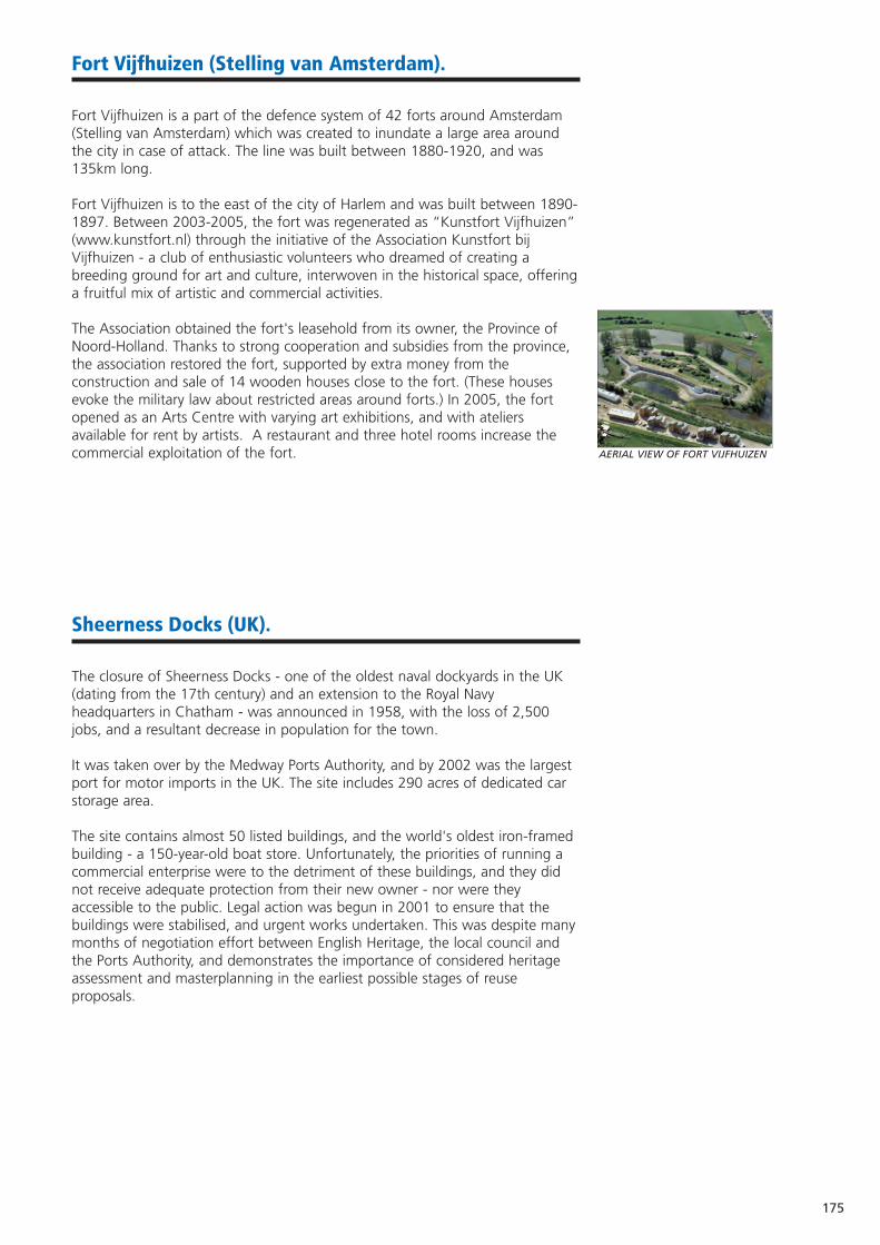
175
Fort Vijfhuizen (Stelling van Amsterdam).
Fort Vijfhuizen is a part of the defence system of 42 forts around Amsterdam(Stelling van Amsterdam) which was created to inundate a large area aroundthe city in case of attack. The line was built between 1880-1920, and was135km long.
Fort Vijfhuizen is to the east of the city of Harlem and was built between 1890-1897. Between 2003-2005, the fort was regenerated as “Kunstfort Vijfhuizen”(www.kunstfort.nl) through the initiative of the Association Kunstfort bijVijfhuizen - a club of enthusiastic volunteers who dreamed of creating abreeding ground for art and culture, interwoven in the historical space, offeringa fruitful mix of artistic and commercial activities.
The Association obtained the fort's leasehold from its owner, the Province ofNoord-Holland. Thanks to strong cooperation and subsidies from the province,the association restored the fort, supported by extra money from theconstruction and sale of 14 wooden houses close to the fort. (These housesevoke the military law about restricted areas around forts.) In 2005, the fortopened as an Arts Centre with varying art exhibitions, and with ateliersavailable for rent by artists. A restaurant and three hotel rooms increase thecommercial exploitation of the fort.
Sheerness Docks (UK).
The closure of Sheerness Docks - one of the oldest naval dockyards in the UK(dating from the 17th century) and an extension to the Royal Navyheadquarters in Chatham - was announced in 1958, with the loss of 2,500jobs, and a resultant decrease in population for the town.
It was taken over by the Medway Ports Authority, and by 2002 was the largestport for motor imports in the UK. The site includes 290 acres of dedicated carstorage area.
The site contains almost 50 listed buildings, and the world's oldest iron-framedbuilding - a 150-year-old boat store. Unfortunately, the priorities of running acommercial enterprise were to the detriment of these buildings, and they didnot receive adequate protection from their new owner - nor were theyaccessible to the public. Legal action was begun in 2001 to ensure that thebuildings were stabilised, and urgent works undertaken. This was despite manymonths of negotiation effort between English Heritage, the local council andthe Ports Authority, and demonstrates the importance of considered heritageassessment and masterplanning in the earliest possible stages of reuseproposals.
AERIAL VIEW OF FORT VIJFHUIZEN
176
Former Military Buildings used for Document Stor age.
UK Government regulations require companies to keep records for a minimumof six years. Storing archive documents can take up valuable office space.Outsourcing document archiving to a secure storage facility frees up costly floorarea. A range of former military buildings are suited to the task. Benefitsinclude security, significant available space, protection against flood and firedamage, and stable humidity: this accurately describes a range of formermilitary buildings, such as hangars, stores, (nuclear) bunkers and magazines.
The Chatham Archive and Document Storage Company LimitedIncorporated in 1993, with the specific aim of establishing a high securityarchive storage company inside the walls of Chatham's former Naval Dockyard,this is a 16,000m2 storage facility purpose built by the Royal Navy to meet itsstorage requirements. The warehouse is built into rising ground. Its atmosphereis thus very stable, at a cool temperature and has a low relative humidity.www.chathamarchive.co.uk
ARK Secure StorageA former Centre of Regional Government in the event of nuclear attack, withover 2,000m2 of humidity free document storage. Documents are stored behindone-metre thick reinforced concrete walls, with steel blast doors and perimeterfencing. www.arksecurestorage.co.uk
Endnote
Medway Council would like to gratefully acknowledge the support and dedication of the ASCEND partners in compiling the Model
Management Framework.
The expertise and commitment of all partners has been invaluable throughout the lifetime of the project, and in crystallising years of experience
in the Framework.
We also gratefully acknowledge the support of the Interreg IIIC West ZoneSecretariat, and the assistance of the European Union in part-financing
ASCEND.
www.ascendpartnership.net

Appendix
177
178
Glossary.
AONB (Area of Outstanding Natural Beauty - UK)A precious landscape whose character and natural beauty are so outstanding that it is in thenation's interest to safeguard them.
BarracksA building for the accommodation of soldiers.
Bastard SystemA mixture of the bastion and polygonal fort-building systems.
Bastion Fortification work, usually four-sided, situated in the corners of a wall, for active defence andflanking fire.
BatteryAny place where guns or mortars are mounted.
Business LinkA UK national independent business advice service.
Caponier / CaponnièreCovered communication leading to outworks. Also a casemated work projecting into or across aditch to provide flanking fire.
Casemate / CasementBombproof vaulted chamber in the walls of a fortification, providing an emplacement for a gun, orbarrack room.
Chamber of CommerceThe structure of a Chamber of Commerce varies between countries, but their primary goal is toimprove the business climate in a locality, typically through business networks, lobbying, commonprojects and a selection of business services.
CIS States (Commonwealth of Independent States)Created in 1991 to unite: Azerbaijan, Armenia, Belarus, Georgia, Kazakhstan, Kyrgyzstan, Moldova,Russia, Tajikistan, Uzbekistan and Ukraine.
CitadelSelf-contained fortress, usually within a town's fortifications.
Classified MonumentA building that has been either scheduled or listed, i.e. protected by national law. In France, thehighest degree of statutory protection.
ClusterGeographically close, interconnected companies and suppliers within specific business fields thatwork and co-operate together, as well as being competitors.
Conservation Area (UK)An area of special architectural or historic interest, whose character or appearance it is desirable topreserve or enhance.
Curtain WallStretch of wall between two towers.
Department (FR)An administrative area, part of a region.
EchaugetteSentry box, projecting from the angle of a bastion at parapet level.
EmbrasureOpening in a wall for gun fire.
English HeritageThe UK government statutory advisor on the historic environment.
Entrenched CampProtected area for the assembly / regrouping of an army.
EphoroeiaA Greek governmental authority.
ERDF (European Regional Development Fund)A major E.U. funding instrument for helping to redress regional imbalances.
179
ESF (European Social Fund)An E.U. Structural Fund designed to strengthen economic and social cohesion.
Forbidden CirclesThe prohibited areas around fortifications where building was banned, owing to the need tomaintain an open line of fire.
FortaliceA small fort or defensive structure.
Further EducationEducation after mandatory schooling, but before University, i.e. 16 - 18.
GDR (German Democratic Republic)The socialist state that existed in East Germany between 1949 and 1990.
Higher EducationUniversity level education.
ICOMOS (International Council on Monuments and Sites)A non-governmental affiliate organisation of UNESCO, dedicated to the conservation of historicmonuments, areas and sites.
Incubation CentreNurtured and supported space and facilities for new businesses to start-up and grow.
InterregAn E.U. initiative to strengthen economic and social cohesion by promoting cross-border (strand A),transnational (strand B) and interregional (strand C) co-operation.
KONVERA former E.U. Fund to foster the conversion of regions highly dependent on the defence sector.
The LinesAn abbreviation for 'lines of defence'.
Listed BuildingA building of particular architectural or historical importance, on a list of structures that cannot bedemolished or altered without government permission.
LunetteA half-moon shaped space, either masonry or void.
Not-for-profit Organisation (NPO)An organisation whose primary objective is to support a matter of private interest or public concernfor non-commercial purposes.
ODPM (Office of the Deputy Prime Minister - UK)A government department responsible for housing, local government, regeneration, planning andurban and regional issues. (Renamed in May 2006, as the Department for Communities and LocalGovernment, and no longer associated with the Deputy Prime Minister).
Philadelphia StyleA 'hub and spoke' prison design, with cells facing a central area.
Polygonal SystemA fort bounded by five (or more) sides.
PosternA small entrance into a fortification, often with a tunnel approach.
RavelinFortified structure in a ditch to defend the curtain wall.
Redoubt / ReduitSmall detached independent outwork.
RocchiGeneral Enrico Rocchi (IT), considered an expert in military construction.
Scheduled (Ancient) Monument (UK)A protected archaeological site or historic building considered to be of national importance.
SSSI (Site of Special Scientific Interest - UK)A conservation designation denoting an area protected for its wildlife or geology.
SustainabilityEnsuring that activity / development meets the needs of the present generation withoutcompromising the ability of future generations to meet their needs.
180
Syndicat Mixte (FR)A joint venture between various public authorities.
Triple helixDescribes the interaction between business, universities and local government.
TunklerAn Austrian colonel who had a strong influence on fort design in Italy.
UNESCO (United Nations Educational, Scientific and Cultural Organisation)A specialist branch of the United Nations, founded in 1946. Their remit includes increasingappreciation and awareness of the world's cultural and natural heritage.
ValorisationThe processing of assessing the historical significance of a site or building.
VaubanA Marshal of France (1633-1707), considered the foremost military engineer of his age.
World Heritage SiteOne of (currently) 812 sites which form part of the cultural and natural heritage which the WorldHeritage Committee considers as having outstanding universal value.
181
Bibliography
De Nieuwe Hollandse WaterlinieNicolaas Mastsier, Carl de Keyzer, Selma SchepelISBN 904009553
Sterk Water (De Nieuwe Hollandse Waterlinie)Chris WillISBN 9053452044
Panorama Krayenhoff (Linieperspectief)Stuurgroep National Project Nieuwe Hollandse Waterlinie (Utrecht, 2004)
The Napoleonic Defences of Rochester and Chatham Keith GulvinISBN 0-95070-890-X
NAVARCH, Guidebook on Naval ArchitectureISBN 9163122774
Framtidens vägvisare (Stumholmen - with an English summary)ISBN 9171471464
SKÄRVA - Creating a place in the CountryISBN 9179880568
Ville RoyaleFiquet and LeblancISBN 2910137252
Les Fortifications du littoral: la Charente-MaritimeFaucherre, Prost, Charette, LeblancISBN 29101137171
Dentro e fuori le mura. Problemi di acquisizione, conservazione e recupero. Proceedings of the conference hosted in Palzzo Ducale (Venice) January 27th 2001, Venice 2001.
Arsenale e/è museo. Due modi per un uso unitario. Proceedings of the conference hosted in Palazzo Ducale, January 25th 2002. Venice 2002.
ASCEND, Interreg III C: “Transforming abandoned military heritage into proven tourism assets”. Proceedings of the Seminar hosted in Verona November 26th - 27th 2004.Verona 2005.
Progetti per l'Arsenale di Venezia (Projects for the Arsenale of Venice)F. CalzolaioVenice 2001
La rinascita dell'Arsenale.A. DinaVenice 2004
Il forte Sirtori a Spinea, Scorzè G. Facca, C. ZanlorenziVenice 2003.
Gli artigli del Leon. La batteria Amalfi e le fortificazioni costiere di Venezia nelle due guerre mondialiF. Lazzarini, C.A. ClericiParma 1997.
Linee guida al Piano per il riuso e la valorizzazione del Campo trincerato di Mestre. Venice 2005.
Il forte Mezzacapo a ZelarinoR. Marcolin, C. ZanlorenziSpinea 2004
The re-use of large European complexes in the list of redundancies Europa Nostra Scientific Bulletin 59 (2005)
L'esperienza del volontariato e della cooperazione sociale nel territorio veneziano, Project Tudeslove, Interreg IIAVenice 2001
Studio dei siti e manufatti di interesse storico-architettonico.Project Tudeslove, Interreg IIAM. ScroccaroVenice 2001
I forti di Mestre. Storia di un Campo TrinceratoC. ZanlorenziVerona 1997
182
The success of the ASCEND project is thanks to valued contribut ions from:
Aspasia Abatzoglou Architect, Municipality of Thessaloniki
Nonito Aneiros General Secretariat, Ferrol Metropolis Foundation
Fulgencio Avilés Architect (rehabilitation of Antigüones Barracks, Cartagena)
Martina Bade Cultural and Heritage Department, Hansestadt Rostock
Rosa Beaumont Calabuig IDEAS Project Manager, Polytechnic University of Valencia
Marijke Bekkenkamp Province of Utrecht
José María Bernal Palacios Director, Centro de Investigación para el Desarrollo
Liliann Bjerström Strategist - Commerce & Industry, Karlskrona Municipality
Benito Burgos Barrantes Technician, Spanish Ministry of Culture
Joanne Cable European Network Co-ordinator, Medway Council
David Candlin Economic Development Manager, Medway Council
Keith Casson Innovation and Technology Advisor, Business Link Kent
Dr. Juan Patricio Castro Valdivia Professor of Economics, Polytechnic University of Cartagena
José Manuel Chacón Bulnes Architect (Castle of La Concepción and the Punic Wall)
Pedro E. Collado Espejo Professor of Technical Architecture, Polytechnic University of Cartagena
Simon Curtis Tourism Manager, Medway Council
Peter Danker-Carstensen Schiffbau- und Schiffahrtsmuseum, Rostock
Alfonso Escuadra Sánchez Councillor for Heritage, Municipality of La Línea de la Concepción
Laetitia Fayemendy Local Project Manager (ASCEND), Conseil Général de la
Charente-Maritime
Martino Ferrari Bravo Local Project Manager (ASCEND), Marco Polo System g.e.i.e.
José Manuel Ferrer Cànovas Regional Secretariat for Tourism, Region of Murcia
Luis Anselmo Ferrer López Interpreter, Centro de Investigación para el Desarrollo
Bill Ferris Chief Executive, Chatham Historic Dockyard Trust
Nathalie Fiquet Curator of Brouage
Clarisse Forgues International Financial Manager (ASCEND), Medway Council
Prof Jose Antonio Franco Leemhuis Vice-Chancellor for Innovation, Polytechnic University of Cartagena
Raquel Galarza Ruiz Local Project Manager (ASCEND), Centro de Investigación para
el Desarrollo
Michel Gallice Director, Conseil Général de la Charente-Maritime
Antonio García Sanchez Professor of Economic Analysis, Polytechnic University of Cartagena
Aureliano Gómez Vizcaíno President of the Association for the Fortifications of Cartagena
Rienke Groot Projectbureau New Dutch Waterline
Keith Gulvin Trustee, Fort Amherst
John Guy Tourism Project Officer, Medway Council
Richard Holdsworth Museums and Heritage Director, Chatham Historic Dockyard Trust
Alberto Íberos Architect (Castle of La Concepción and the Punic Wall)
Angel Iniesta Sanmartìn Head of the Historical Heritage Department, Region of Murcia
Uwe Jannsen Betrieb für Bau und Liegenschaft, Mecklenburg-Vorpommern
Peter Kendall Inspector of Ancient Monuments, English Heritage
Claes-Åke Kindlund Architect and Senior Advisor, Karlskrona Municipality
Bas Kreuger The Netherlands Fortress Museum
Sevasti Laftsidou Civil Engineer, Municipality of Thessaloniki
Manuel Lechuga Galindo Technician, Cultural Heritage Department, Region of Murcia
Martín Lejárrega Architect (rehabilitation of the Military Naval Hospital and
Antigüones Barracks, Cartagena)
Mª Ángeles Lirón Sandoval Manager, Lorca: Workshop of Time
Stiliani Loi Landscape Architect, Municipality of Thessaloniki
Colin Lovell Regeneration Projects Manager, Medway Council
Juan Madrigal de Torres Manager, Polytechnic University of Cartagena
Konstantinos Marinidis Local Project Manager (ASCEND), Exallon Technical Consultants,
Thessaloniki
Miguel Martínez Bernal President of the Association of Constructors, Cartagena
Rafael Martínez Fernández Co-ordinator, Innovation Area, INFO
Antonia Martínez Inglés Professor of Technical Architecture, Polytechnic University of Cartagena
Agustina Martínez Molina Manager, Cartagena: Port of Cultures
Manuel Martínez Pastor Lawyer (Financial study: Master Plan for the bay of Cartagena)
Luis de Miquel Santed Archaeologist, Representative Federation of Neighbours in Cartagena
Mara Mira Director of Párraga Art Centre
183
Pedro Morillas Architect, Former Manager for Urbanism, Municipality of Murcia
José Miguel Noguera Celdrán General Director for Culture, Region of Murcia
Robert Orémus Syndicat Mixte de Brouage
Florian Ostrop Historian, Rostock
Arch. Javier Padín Martínez Historian, Municipality of Coruña
Athanassios Papageorgiou Special Advisor to the Mayor of Thessaloniki.
Rafael Pedraza Urbanism Manager, San Fernando, Cádiz
María Jesus Peñalver Martínez Professor of Architecture, Polytechnic University of Cartagena
Manuela Pérez Jiménez President, Centro de Investigación para el Desarrollo
Diego Peris Sánchez Architect (rehabilitation of the University of Castilla la Mancha)
Pietrangelo Pettenó Administrator, Marco Polo System g.e.i.e.
Alexander Plum Local FinancialManager (ASCEND),ProjectbureauNewDutchWaterline
MaurizioPurcaro Local Project Manager (ASCEND), Projectbureau New Dutch Waterline
Juan Isidro Ros Espín Manager of Azuche 98, Heritage Restoration Company
Mariano Rosique President of the Chamber of Commerce in Cartagena
José Pablo Ruiz Abellàn Regional Councillor for Tourism, Region of Murcia
Admiral Mario Sánchez-Barriga
Fernández Spanish Ministry of Defence
Jose Antonio Sande Cortizo Vice-Director, Infrastructures of Defence, Spanish Ministry of Defence
Andreas Schubert Expert on Urban and Regional Development, Hansestadt Rostock
Mauro Scroccaro Consultant, Marco Polo System g.e.i.e.
Dr Ignacio Segado Segado Vice-Chancellor for Economic Development, Polytechnic
University of Cartagena
Daniele Sferra Consultant, Marco Polo System g.e.i.e.
Clem Smith Social Regeneration & European Affairs Manager, Medway Council
Stefan Stübe Deputy Manager for the Seaplane Event, Rostock
Steffen Stuth Museum for Culture and History, Rostock
Nicolaos Tachiaos Deputy Mayor of Thessaloniki
Els ten Napel Province of North Holland
Adelaida Tuñón Álvarez Lawyer, Municipality of La Unión, Cartagena
Dimitrios Tzioras Civil Engineer, Municipality of Thessaloniki
Mr van Denderen Owner, Fort Voordorp
Nanette van Goor Regional Co-ordinator from the Province of North Holland
Arnold van Vuuren Director, Projectbureau New Dutch Waterline
Martin Vastenhout President, Werk aan de Linie, Holland
Anne Visser Fortifications Expert, New Dutch Waterline
Geu Visser Manager, Vredeseducatie Association
Rob Vrolijks Crossing the Lines, Interreg IIIB project, NWE
Titus Weijschedé Researcher, Alterra Green World Research
Thomas Werner Cultural and Heritage Department, Hansestadt Rostock
Paul Williams Business Development Manager, University of Greenwich
Peter Writschan Cultural and Heritage Department, Hansestadt Rostock
Rob Zakee Projectbureau New Dutch Waterline
Gilberto Zinzani Director, Marco Polo System g.e.i.e.
Maria Zourna Architect, Head of Department of Urban Projects, Municipality
of Thessaloniki

184
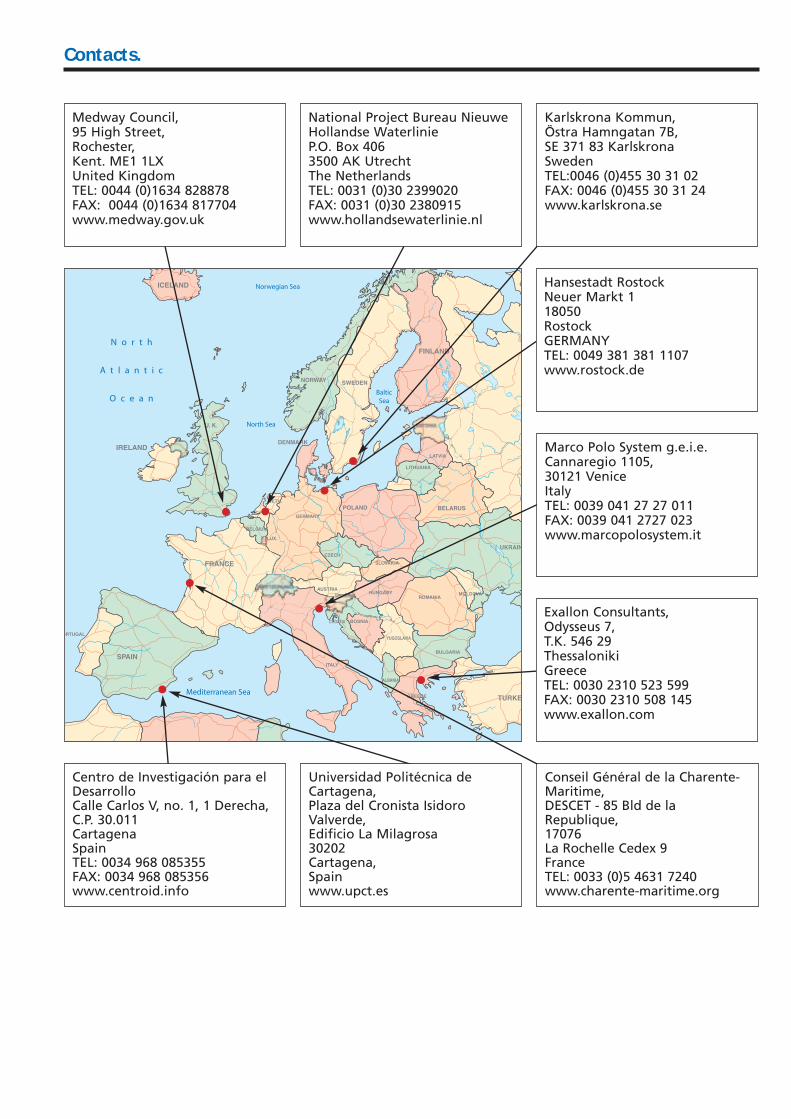
Contacts.
Medway Council,95 High Street,Rochester,Kent. ME1 1LXUnited KingdomTEL: 0044 (0)1634 828878FAX: 0044 (0)1634 817704www.medway.gov.uk
National Project Bureau NieuweHollandse WaterlinieP.O. Box 4063500 AK UtrechtThe NetherlandsTEL: 0031 (0)30 2399020FAX: 0031 (0)30 2380915www.hollandsewaterlinie.nl
Karlskrona Kommun,Östra Hamngatan 7B,SE 371 83 KarlskronaSwedenTEL:0046 (0)455 30 31 02FAX: 0046 (0)455 30 31 24www.karlskrona.se
Hansestadt RostockNeuer Markt 118050RostockGERMANYTEL: 0049 381 381 1107www.rostock.de
Marco Polo System g.e.i.e. Cannaregio 1105,30121 VeniceItalyTEL: 0039 041 27 27 011FAX: 0039 041 2727 023www.marcopolosystem.it
Exallon Consultants,Odysseus 7,T.K. 546 29ThessalonikiGreeceTEL: 0030 2310 523 599FAX: 0030 2310 508 145www.exallon.com
Centro de Investigación para elDesarrolloCalle Carlos V, no. 1, 1 Derecha,C.P. 30.011CartagenaSpainTEL: 0034 968 085355FAX: 0034 968 085356www.centroid.info
Universidad Politécnica deCartagena,Plaza del Cronista IsidoroValverde,Edificio La Milagrosa30202Cartagena,Spainwww.upct.es
Conseil Général de la Charente-Maritime,DESCET - 85 Bld de laRepublique,17076La Rochelle Cedex 9FranceTEL: 0033 (0)5 4631 7240www.charente-maritime.org
Achievingthe Socio-Economic
Re-use of Former
Military Landand Heritage.
Model Management Framework
ASCEND
ASC
EN
D M
od
el M
an
ag
em
en
t Fram
ew
ork
Related Documents