A Historical GIS of Nubia based on the William John Bankes Archive (1815-1822) Daniele Salvoldi Freie Universität Berlin, Dahlem Research School, POINT Postdoc Fellow Göttingen Dialog in Digital Humanities – Göttingen, 09.06.2015

Welcome message from author
This document is posted to help you gain knowledge. Please leave a comment to let me know what you think about it! Share it to your friends and learn new things together.
Transcript

A Historical GIS of Nubia
based on the William
John Bankes Archive
(1815-1822)Daniele Salvoldi
Freie Universität Berlin, Dahlem Research School, POINT Postdoc Fellow
Göttingen Dialog in Digital Humanities – Göttingen, 09.06.2015

Outline
The Authors: Bankes, Linant, Ricci
Turco-Egyptian expedition to Dongola, Sinnar, Darfur and Kordofan
The Bankes Archive: Overview
The Loss of Nubia
Research Questions
The Sources
Methodology
Data Collection
Gazetteer
Access Database
ArcGIS HGIS, Layers drawing
Interpretation

William John Bankes (1786-1855)
Esquire, rich family
Cambridge graduate (Greek inscriptions)
Friend of Byron
Started travelling in 1813 (Iberian Peninsula, Italy,
Greece, Levante, Egypt, and Nubia), until 1819
„The Nubian Explorer“
Philae Obelisk
MP (1820s and 1830s)
Arrested in 1841, he flees the country and lives in exile
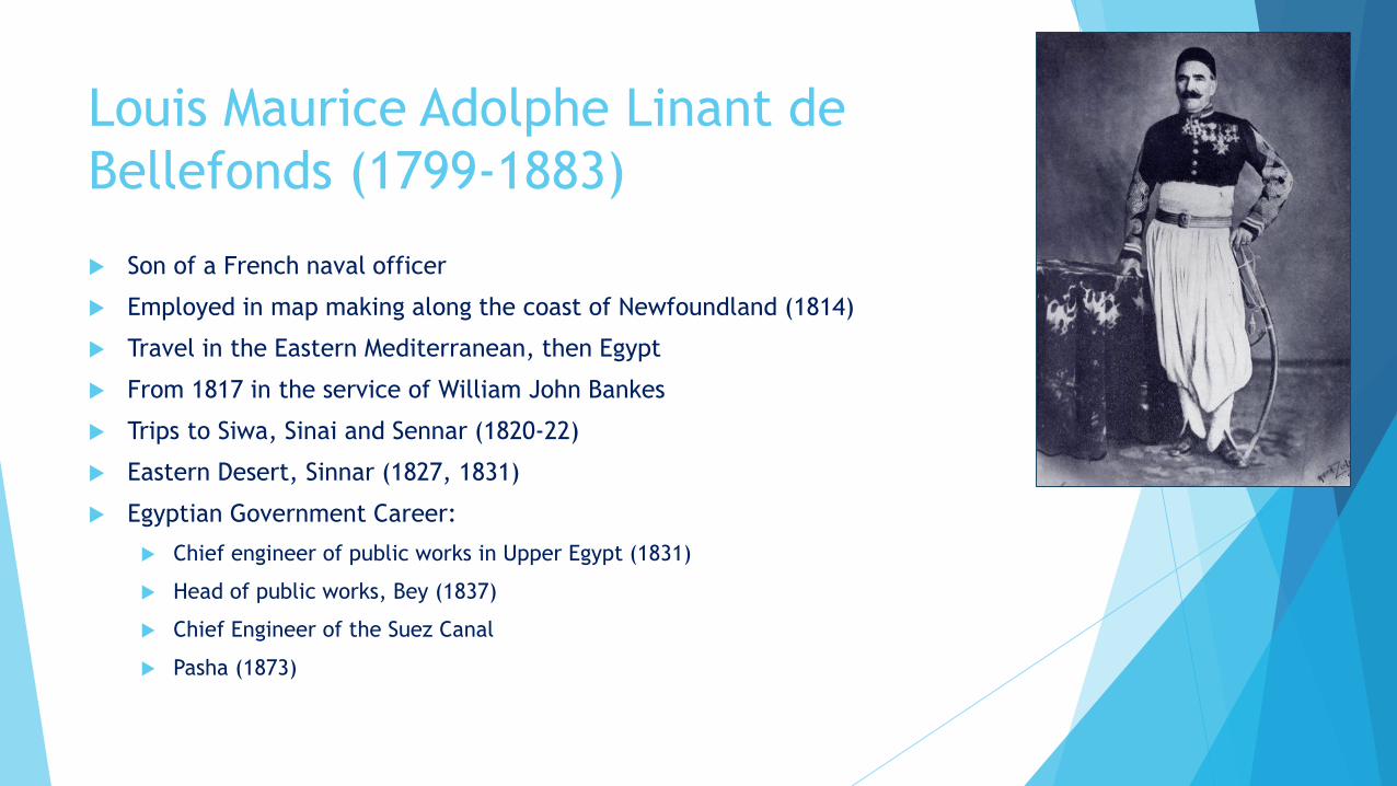
Louis Maurice Adolphe Linant de
Bellefonds (1799-1883)
Son of a French naval officer
Employed in map making along the coast of Newfoundland (1814)
Travel in the Eastern Mediterranean, then Egypt
From 1817 in the service of William John Bankes
Trips to Siwa, Sinai and Sennar (1820-22)
Eastern Desert, Sinnar (1827, 1831)
Egyptian Government Career:
Chief engineer of public works in Upper Egypt (1831)
Head of public works, Bey (1837)
Chief Engineer of the Suez Canal
Pasha (1873)

Alessandro Ricci (ca. 1794-1834)
Physician
Travel to Egypt in 1817
Work for Belzoni, then Salt and Bankes
Travel with Bankes to Nubia (1819)
Travel with Linant to Siwa and Sinai (1820)
Travel with Linant to Sennar (1821-22)
Collection of Egyptian antiquities
Acquaintance with Rosellini and Champollion
Franco-Tuscan expedition (1829-29)
Sickness (1832) and death (1834)

Expedition to Dongola, Sinnar, Darfur,
and Kordofan (1820-22)
Isma‘il Pasha (August 1820)
Mehmed Defterdar Bey (early 1821)
Ibrahim Pasha (June 1821)
Defeat of the Mameluk remnants
Collection of taxes
Exploitation of mines
Slaves
Many Europeans and Americans within the army (doctors, pharmacists, andofficers)

The Bankes Archive
Travel notes, drawings, plans,
and maps
Letters
How can we manage all this
information?
Subject Quantity
Non-hieroglyphic inscriptions 67
Plans and sections 162
Landscape views 307
Egyptian epigraphy 567
Maps 12
Architectural details 69
Anthropology, fauna & flora 35
Objects, statues 16
Notes and sketches 457
Total 1,692

The Loss of Nubia
Champollion, Note remise au Vice-Roi pour la conservation des Monuments de
l’Égypt (1829); in the years following the Napoleonic expedition no less than
thirteen entire temples were completely destroyed.
“The apparent woodedness of the countryside seeming almost unbelievable
to those who know the modern Sudan, while any report of a lion roaring near
Ed Debba would nowadays be regarded as a figment of the wildest
imagination” (Shinnie 1958)

Dams on the Nile
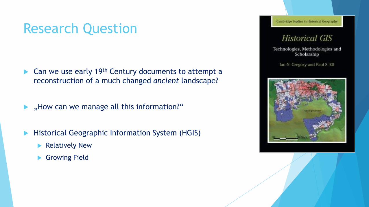
Research Question
Can we use early 19th Century documents to attempt a
reconstruction of a much changed ancient landscape?
„How can we manage all this information?“
Historical Geographic Information System (HGIS)
Relatively New
Growing Field

The Sources
Landscape Drawings (Dorset History Centre, DHC)
Inscriptions Copies (DHC, Florence Egyptian Museum)
Maps (DHC, Florence Egyptian Museum)
Plans and Cross Sections
Fauna, Flora, Ethnography
Notes
Sheets (DHC)
Two Volumes (British Museum)
Journals
Linant‘s Voyage (Kingston Lacy House)
Linant‘s Notices (Kingston Lacy House)
Ricci‘s Viaggi (National Archives of Egypt)

Accuracy
Not artists
Technical and Academic knowledge (drawing,
inscriptions, map making)
Experience
Ease of travel
Publication (Linant vs. Ricci)
Cross-check

Data (Nature)
Nature – Biotic
Vegetation
Fauna
Wild fauna
Domesticated animals
Nature – Abiotic
Climate
Floods, precipitations
Winds
Atmospheric and Water temperature
Earthquakes
Geology
Types of rocks, soil
Charles L. Redman, Human Impact on
Ancient Environments (Tucson: University of
Arizona Press, 1999)

Data (Culture)
Culture – Biotic Ethnic Groups
Tribes (distribution, migration patterns)
Immigrated communities
Anthropology Rites, customs, religions, etc.
Handcrafts
Social structures, languages, etc.
Traffic Trade routes, river or land ancient routes
Roads and dirt tracks
Sea and river harbours
Historical Data Battles, important events, epidemics, etc.
Culture – Abiotic Archaeological Heritage
Ancient Egyptian monuments
Medieval sites (Nobatia, Makuria, Alodia)
Modern & Traditional buildings
Settlements Cities, towns and villages with toponyms
Temporary settlements (Bedouins, trade, military camps)
Water management Wells, springs, wadis, oases, dams and submerged areas
Economy Crops, orchards, agricultural plots, gardens
Market sites, products traded, slave caravanserai, mining sites

Gazetteer

Coordinate Retrieval (1)
Topographical Maps + Google Earth


Coordinate Retrieval (2) Topographical Maps + GIS
Georeferencing the maps
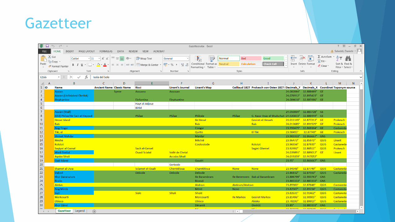
Gazetteer

Access Database

Access Database

Access Database

Access Database

Access Database

Access Database

GIS Layers
Data from Access Database > Queries
Ad hoc symbology
Colour, size, and shape coding
Specifically drawn layers:
Nile course and islands
Route taken by travellers
Temple plans
Regional borders

Interpretation
The maps will visualize an environment no longer extant and much closer to the ancient landscape, where ancient Egyptians, Nubians and Byzantines were making successful choices of exploitation and building. Maps will help to detect specific relations between different settlements and the natural environment, the concept of space itself and its organisation/modification through parameters like distance, river/road practicability, travel time, river flood range, climate, water and trade resources, etc.
Ancient written sources: ancient Egyptian, Nubian and Meroitic literary and non-literary texts, religious compositions, and monumental inscriptions, as well as classical historical sources (Herodotus, Strabo, Cassius Dio, Procopius of Caesarea).
Modern archaeological/ethnographical data: archaeological field reports, iconographical and architectural analysis, and ethnographic surveys. Starting from the 1905-07 Oriental Institute Expedition and the following Coxe Expeditions (1907-10), archaeological and ethnographic work in the area intensified in the 1960s before the completion of the Aswan High Dam and produced a rich collection of data.

Outcome
On-line open HGIS
(TOPOI WebGIS)
Accessibility of georeferenced original drawings
(National Trust, Dorset History Centre)

Thank you very much for your attention [email protected]
Related Documents