ABCD-GIS and ABCD-WWW combined meeting Survey of Web Mapping Projects January 19 th , 2011

ABCD-GIS and ABCD-WWW combined meeting Survey of Web Mapping Projects January 19 th, 2011.
Dec 21, 2015
Welcome message from author
This document is posted to help you gain knowledge. Please leave a comment to let me know what you think about it! Share it to your friends and learn new things together.
Transcript

ABCD-GIS and ABCD-WWW combined meeting
Survey of Web Mapping Projects
January 19th, 2011

ABCD-GIS and ABCD-WWW combined meeting
Survey of Web Mapping Projects
Part 1 of 8: Introduction to GISDesktop vs. Web mapping
Wendy Guan, CGA [email protected]
Wendy GuanJan.19, 2011

What is GIS
A pan-able and zoom-able map – so that little girl could see places above Argentina and Chile.

A peel-able map – so you can decide what to see and what to hide (turn on and off layers, overlay with semi-transparency, …).
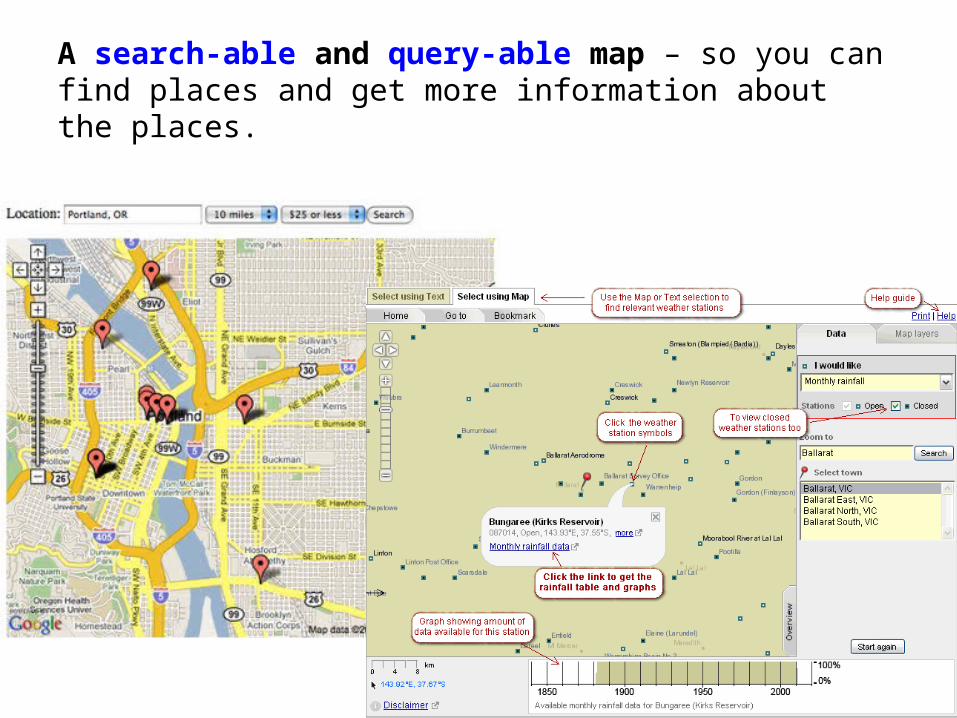
A search-able and query-able map – so you can find places and get more information about the places.
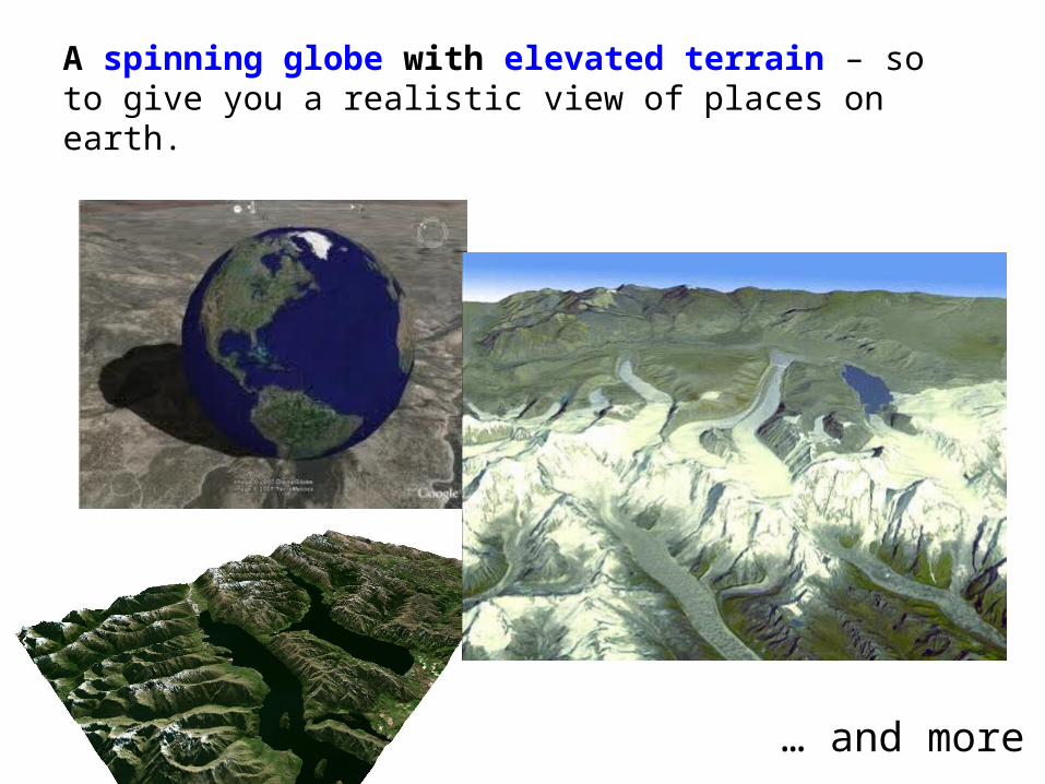
A spinning globe with elevated terrain – so to give you a realistic view of places on earth.
… and more
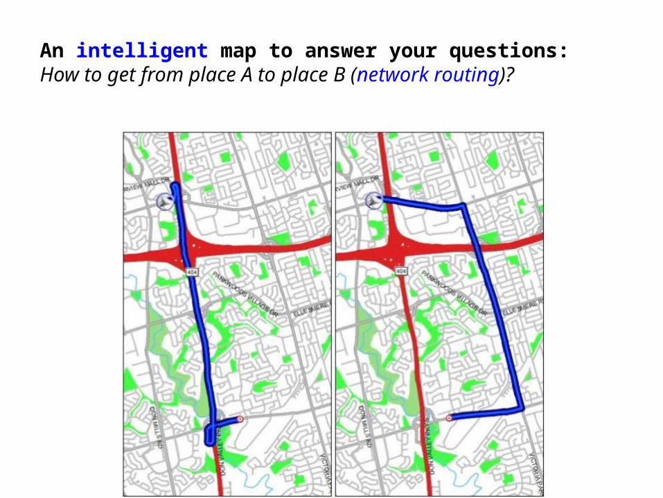
An intelligent map to answer your questions: How to get from place A to place B (network routing)?

An intelligent map to answer your questions: Where is this address on the map (geocoding)?
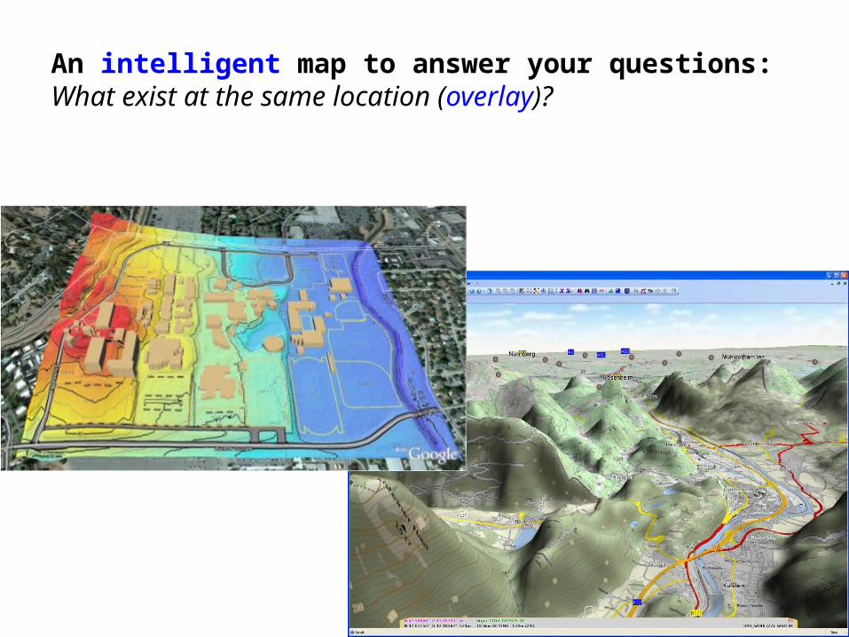
An intelligent map to answer your questions: What exist at the same location (overlay)?

An intelligent map to answer your questions: Who are my neighbors?How close are these places?What is visible from here? … …(adjacency, surface model)
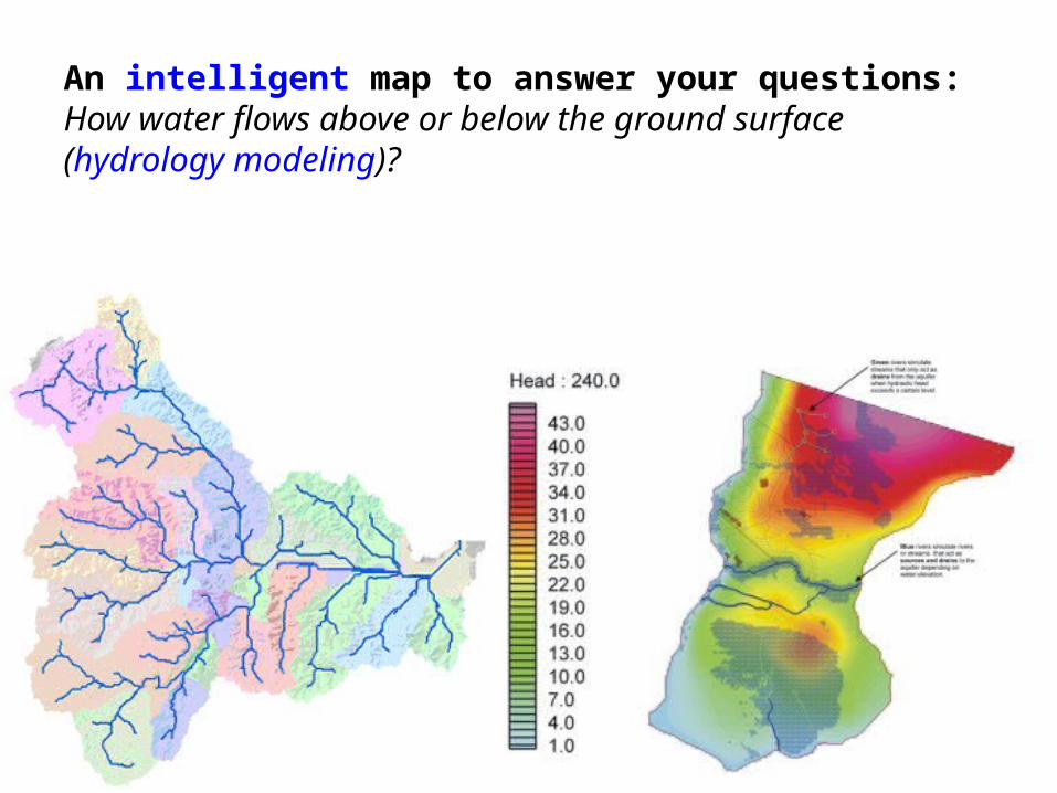
An intelligent map to answer your questions: How water flows above or below the ground surface (hydrology modeling)?

An intelligent map to answer your questions: Where and how hard will this hurricane hit (buffer, interpolation, spatial model)?
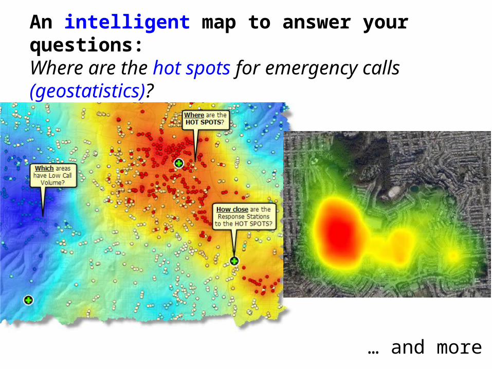
An intelligent map to answer your questions: Where are the hot spots for emergency calls (geostatistics)?
… and more
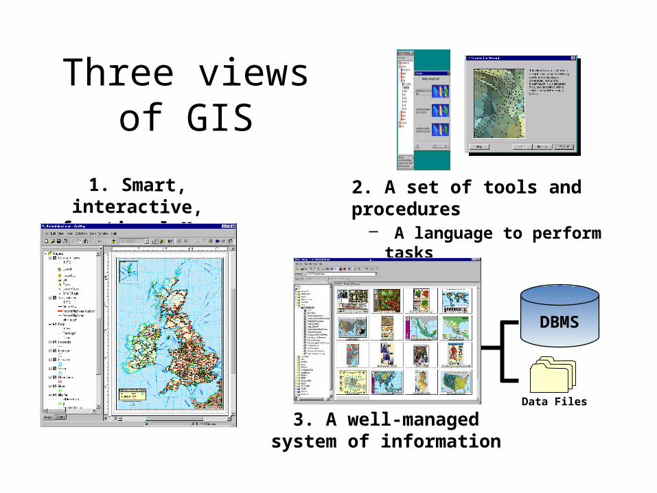
2. A set of tools and procedures – A language to perform tasks
1. Smart, interactive, functional Map
DBMS
3. A well-managed system of information
Data Files
Three views of GIS
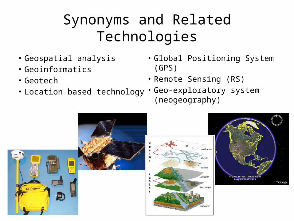
Synonyms and Related Technologies
• Geospatial analysis• Geoinformatics• Geotech• Location based technology
• Global Positioning System (GPS)
• Remote Sensing (RS)• Geo-exploratory system
(neogeography)
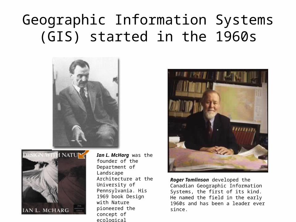
Geographic Information Systems (GIS) started in the 1960s
Roger Tomlinson developed the Canadian Geographic Information Systems, the first of its kind. He named the field in the early 1960s and has been a leader ever since.
Ian L. McHarg was the founder of the Department of Landscape Architecture at the University of Pennsylvania. His 1969 book Design with Nature pioneered the concept of ecological planning.

The Harvard Laboratory for Computer Graphics and Spatial Analysis (1965-1991) is regarded by many as the birthplace of GIS
Nicholas Chrisman (Professor, Geomatic Sciences, Université Laval) speaking about the Lab at the CGA launch event in 2006

Innovation in the1960s• US Bureau of the Census implemented
the GBF/DIME (Geographic Base File using Dual Independent Map Encoding) system in 1967, in preparation for the automation of geocoding of the 1970 census.
• ESRI (Environmental Systems Research Institute) and Intergraph, two major GIS companies, were both formed in 1969.

Evolution through the Decades• Computer Mapping in the 1970s
– The LandSat program launched its first satellite in 1972– First International Symposium on Computer-Assisted Cartography
(AUTOCARTO) was held in Reston, Virginia in 1974.• Spatial Database Management in the 1980s
– Raster and vector data models– Topology– Compression
• Map Analysis and Modeling in the 1990s– Integration with Numerical Models– Graphic User Interface– Global Positioning System completed its 24 satellites
constellation in 1993
Image sources: http://msl.jpl.nasa.gov/QuickLooks/landsatQL.htmlhttp://www.defenseindustrydaily.com/images/SPAC_GPS_NAVSTAR_IIA_IIR_IIF_Constellation_lg.gif

Current and Future Status
• Enterprise and Social GIS in the 2000s– Server GIS– Embedded GIS– Web GIS– Mobil GIS
• Going into a new decade– Volunteered Geographic Information (e.g.
OpenStreetMap)– Cloud based GIS services– Open access (data), open source (software), open
standard (services)

Web GIS still lacks analytical power
• Short history– MapQuest web service started in 1996– ArcView IMS 1.0 was released in 1998– Google Earth started in 2005
• User driven development– The general public wants “eye candy”– High end analysis users are minorities, and already have access to
desktop solutions• Technology limitations
– Spatial analyses are data heavy and computation heavy– Most analyses require unique configuration, not suitable for the
general public use without training
Related Documents