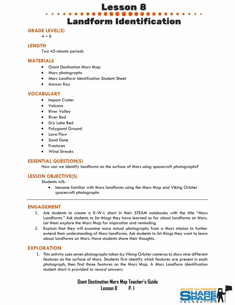
Giant Destination Mars Map Teacher’s Guide Lesson 8 P. 1 GRADE LEVEL(S) 4 – 6 LENGTH Two 45-minute periods MATERIALS Giant Destination Mars Map Mars photographs Mars Landform Identification Student Sheet Answer Key VOCABULARY Impact Crater Volcano River Valley River Bed Dry Lake Bed Polygonal Ground Lava Flow Sand Dune Fractures Wind Streaks ESSENTIAL QUESTION(S) How can we identify landforms on the surface of Mars using spacecraft photographs? LESSON OBJECTIVE(S) Students will: become familiar with Mars landforms using the Mars Map and Viking Orbiter spacecraft photographs ENGAGEMENT 1. Ask students to create a K-W-L chart in their STEAM notebooks with the title “Mars Landforms.” Ask students to list things they have learned so far about landforms on Mars. Let them explore the Mars Map for inspiration and reminding. 2. Explain that they will examine more actual photographs from a Mars mission to further extend their understanding of Mars landforms. Ask students to list things they want to learn about landforms on Mars. Have students share their thoughts. EXPLORATION 1. This activity uses seven photographs taken by Viking Orbiter cameras to show nine different features on the surface of Mars. Students first identify which features are present in each photograph, then find those features on the Mars Map. A Mars Landform Identification student chart is provided to record answers.

Welcome message from author
This document is posted to help you gain knowledge. Please leave a comment to let me know what you think about it! Share it to your friends and learn new things together.
Transcript
Giant Destination Mars Map Teacher’s Guide
Lesson 8 P. 1
GRADE LEVEL(S) 4 – 6
LENGTH Two 45-minute periods
MATERIALS Giant Destination Mars Map
Mars photographs
Mars Landform Identification Student Sheet
Answer Key
VOCABULARY Impact Crater
Volcano
River Valley
River Bed
Dry Lake Bed
Polygonal Ground
Lava Flow
Sand Dune
Fractures
Wind Streaks
ESSENTIAL QUESTION(S) How can we identify landforms on the surface of Mars using spacecraft photographs?
LESSON OBJECTIVE(S) Students will:
become familiar with Mars landforms using the Mars Map and Viking Orbiterspacecraft photographs
ENGAGEMENT 1. Ask students to create a K-W-L chart in their STEAM notebooks with the title “Mars
Landforms.” Ask students to list things they have learned so far about landforms on Mars.Let them explore the Mars Map for inspiration and reminding.
2. Explain that they will examine more actual photographs from a Mars mission to furtherextend their understanding of Mars landforms. Ask students to list things they want to learnabout landforms on Mars. Have students share their thoughts.
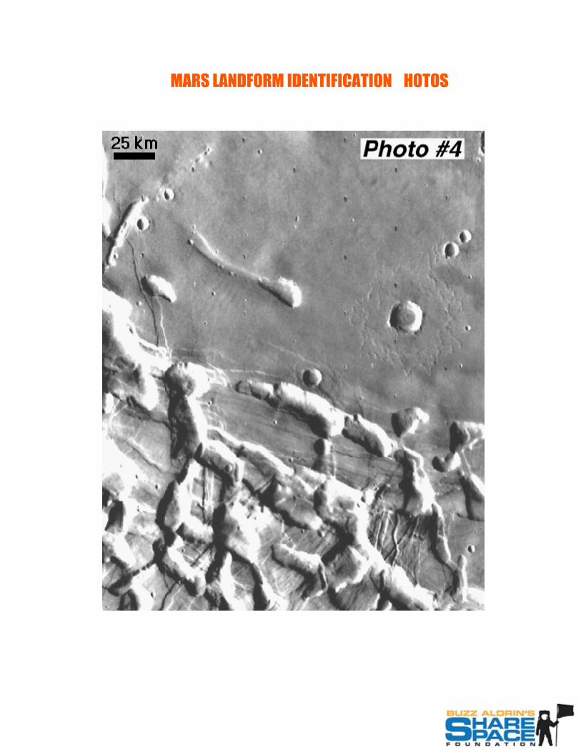
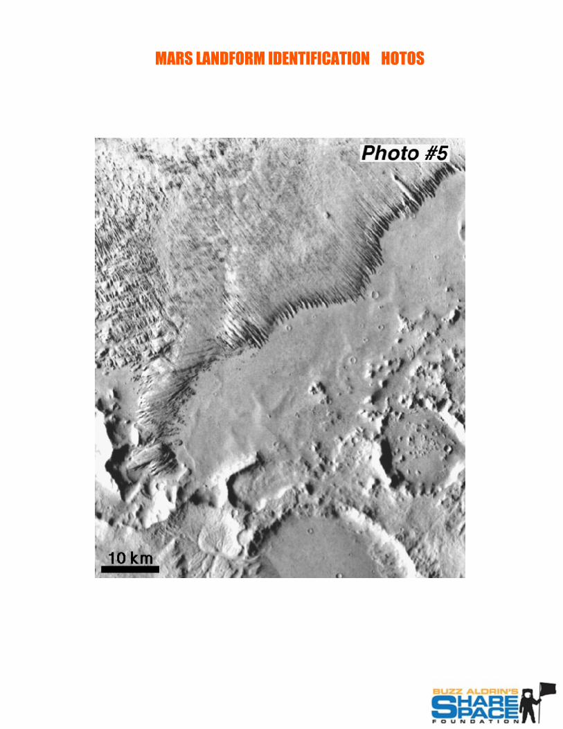
EXPLORATION 1. This activity uses seven photographs taken by Viking Orbiter cameras to show nine different
features on the surface of Mars. Students first identify which features are present in eachphotograph, then find those features on the Mars Map. A Mars Landform Identificationstudent chart is provided to record answers.

Giant Destination Mars Map Teacher’s Guide
Lesson 8 P. 2
2. Prepare the Giant Mars Map by labeling it with coordinates A-Z (or as far as needed) across the top of the map, spaced ten centimeters apart. Do the same down the left side of the map in ten-centimeter increments using numbers 1-50 or as far as needed. This will allow students to find the coordinates of where they believe the photographs are located on the Mars Map for the Exploration.
3. Students will work with a partner to complete this investigation. The first thing the groups will do is lay out all of the photographs and examine them closely.
4. Next students will create a chart in their STEAM notebooks with two columns and multiple rows. The columns will be labeled “picture number” and “coordinates”. Explain to students how to read coordinates on a map (example A12, B5, etc.).
5. Ask students to work with their partner to find the location of each of the photos on the Mars Map. Once located, they will record the closest coordinate in their notebooks.
EXPLANATION 1. At the conclusion of the activity, have students record their findings on a classroom collective
chart on the board. Have student groups with different findings discuss and go back to the map and check their work.
EXTENSION 1. Have students go back to their K-W-L charts and record their learning. Ask them to write
one question they would like to explore further and have them share their questions with the class.
EVALUATION 1. During this lesson, the teacher is encouraged to use formative assessment such as questioning
and examining student responses/notes throughout the lesson to elicit evidence of learning and deepen student understanding. Teachers may wish to grade student handouts and notebooks to formally assess student understanding.
2. Teachers are encouraged to create their own grade-level and ability-level assessment so as to best meet the needs of their students.

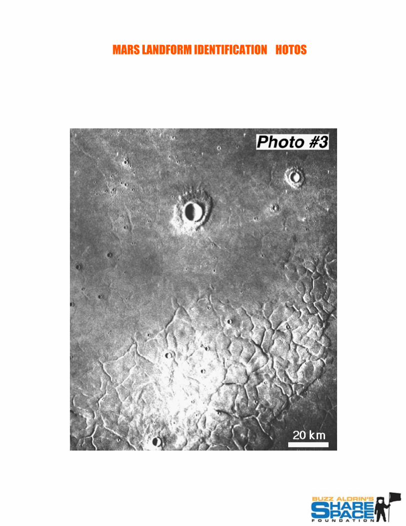
MARS LANDFORM IDENTIFICATION OTOS

MARS LANDFORM IDENTIFICATION OTOS
MARS LANDFORM IDENTIFICATION OTOS
MARS LANDFORM IDENTIFICATION OTOS
MARS LANDFORM IDENTIFICATION OTOS

MARS LANDFORM IDENTIFICATION OTOS

MARS LANDFORM IDENTIFICATION OTOS
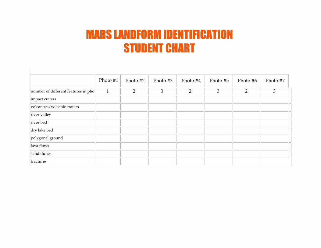
Photo #1 Photo #2 Photo #3 Photo #4 Photo #5 Photo #6 Photo #7
number of different features in photo 1 2 3 2 3 2 3 impact craters volcanoes/volcanic craters river valley river bed dry lake bed polygonal ground lava flows sand dunes fractures
MARS LANDFORM IDENTIFICATIONSTUDENT CHART
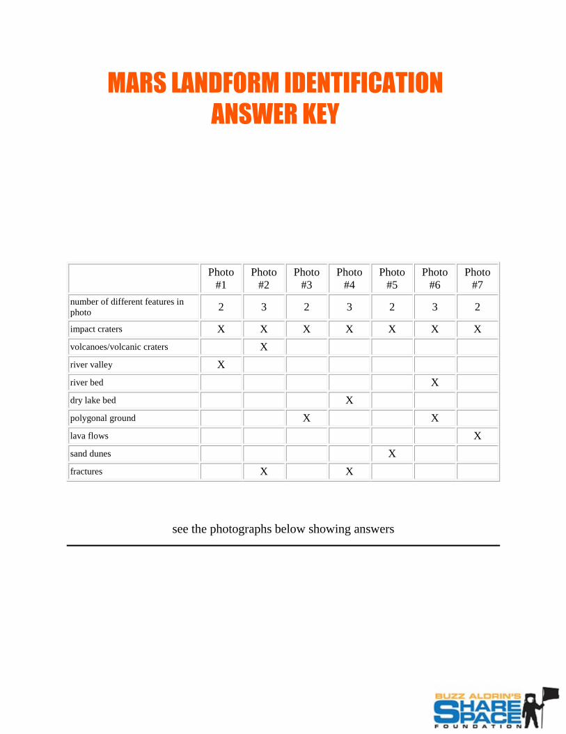
Photo #1
Photo #2
Photo #3
Photo #4
Photo #5
Photo #6
Photo #7
number of different features in photo 2 3 2 3 2 3 2
impact craters X X X X X X X volcanoes/volcanic craters X river valley X river bed X dry lake bed X polygonal ground X X lava flows X sand dunes X fractures X X
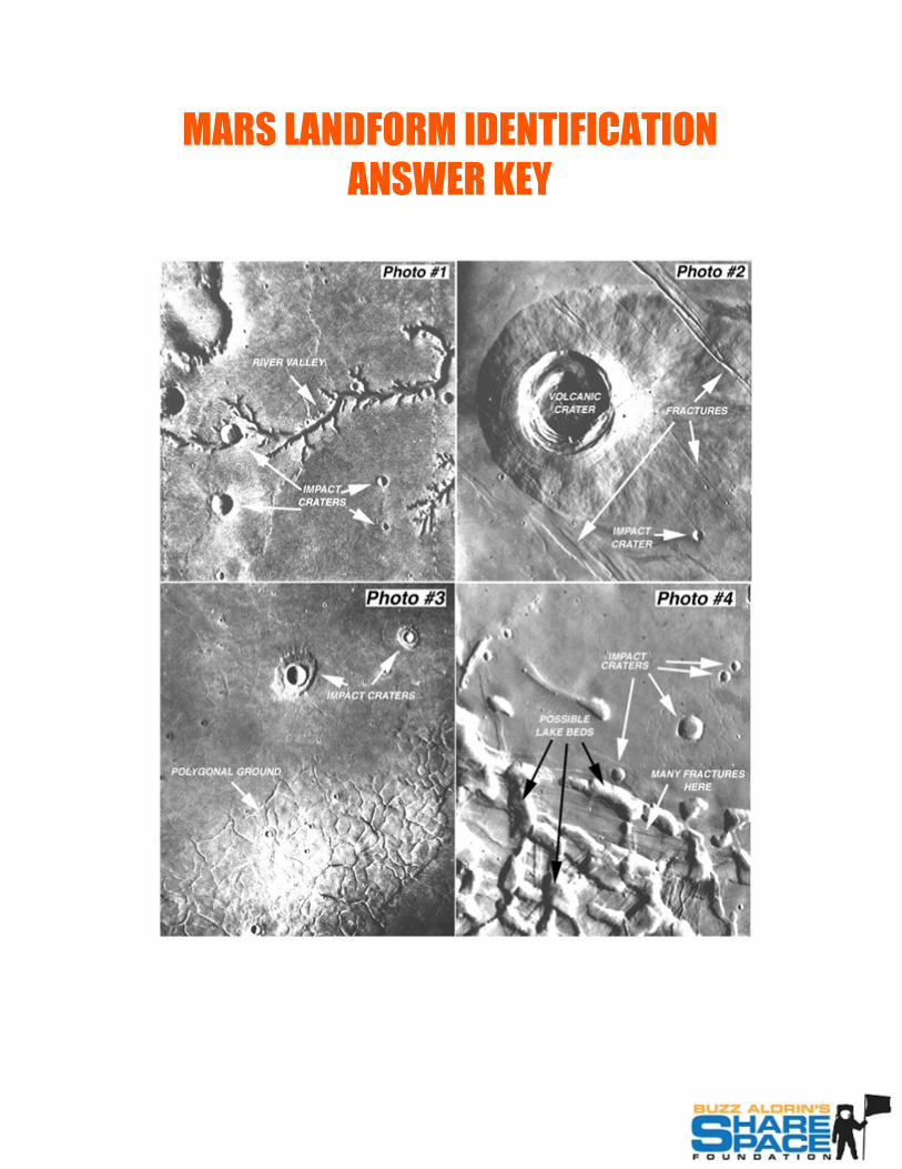
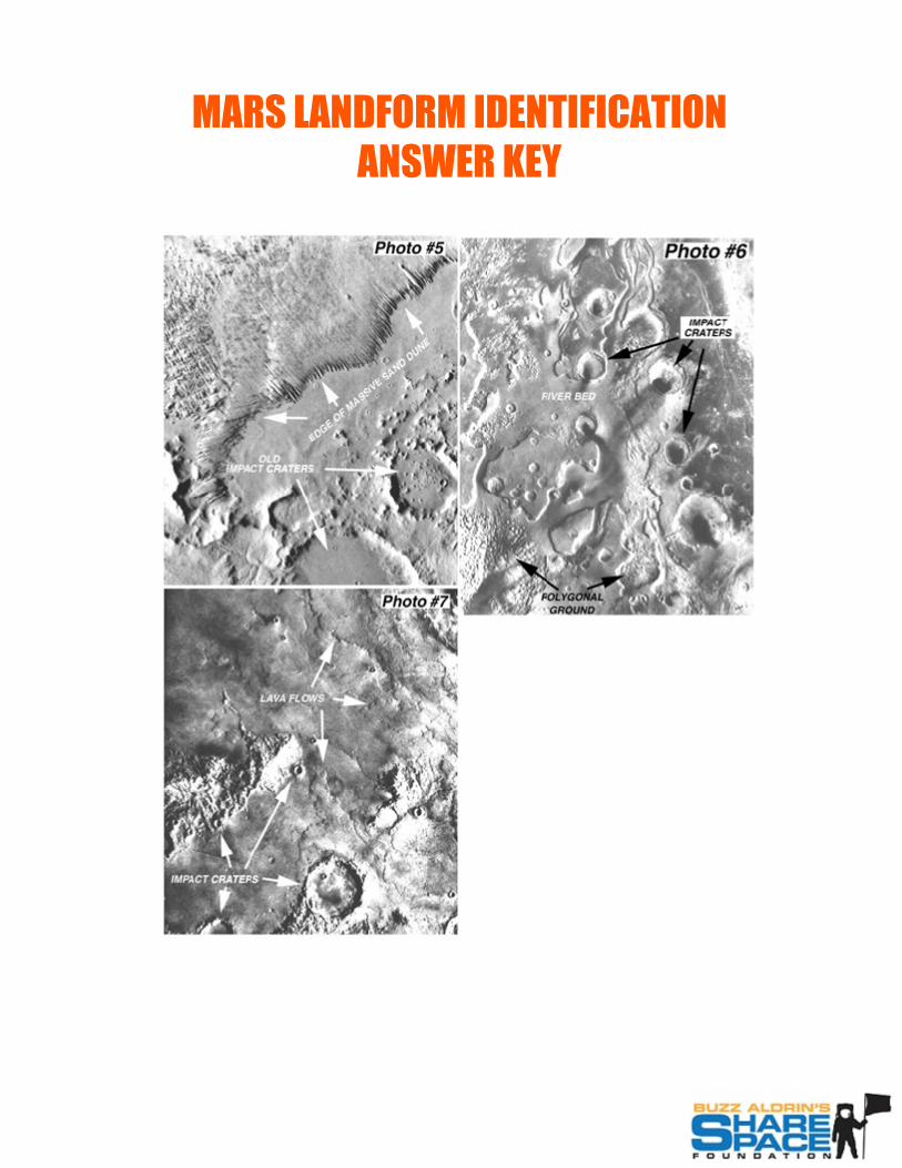
see the photographs below showing answers
MARS LANDFORM IDENTIFICATION ANSWER KEY
MARS LANDFORM IDENTIFICATION ANSWER KEY
MARS LANDFORM IDENTIFICATION ANSWER KEY
Related Documents