X-Mass X-Mass Olive Tree Olive Tree Under Israeli Under Israeli Occupation Occupation Land Confiscation Uprooting Trees Destroying Infrastructure Closure Water Depletion Poverty Despair & Extremism Migration Obstacles against Overall Development Planning Increase Unemployment Rate Decrease in Agricultural Production Absence of Geographical Integrity Land Fragmentation Lack of Open Space Increased Urban density Investment shortages Limited Economic Opportunities Social& Health Problems

X-Mass Olive Tree Under Israeli Occupation Occupation Land Confiscation Uprooting Trees Destroying Infrastructure Closure Water Depletion Poverty Despair.
Jan 02, 2016
Welcome message from author
This document is posted to help you gain knowledge. Please leave a comment to let me know what you think about it! Share it to your friends and learn new things together.
Transcript

X-MassX-MassOlive Tree Olive Tree
Under IsraeliUnder Israeli
OccupationOccupation
Land Confiscation
Uprooting Trees
Destroying Infrastructure
Closure
Water Depletion
Poverty
Despair &Extremism
Migration
Obstacles against Overall Development Planning
IncreaseUnemployment
Rate
Decrease in Agricultural Production
Absence of Geographical
Integrity
Land FragmentationLand Fragmentation
Lack of Open SpaceLack of Open Space
Increased Urban density
Increased Urban densityInvestment
shortages
Limited Economic
Opportunities
Social&Health
Problems

X-MassX-MassOlive Tree IsraeliOlive Tree Israeli
OccupationOccupation
Land Confiscation
Uprooting Trees
Destroying Infrastructure
Closure
Water Depletion
Poverty
Despair &Extremism
Migration
Obstacles against Overall Development Planning
IncreaseUnemployment
Rate
Decrease in Agricultural Production
Absence of Geographical
Integrity
Land FragmentationLand Fragmentation
Lack of Open SpaceLack of Open Space
Increased Urban density
Increased Urban densityInvestment
shortages
Limited Economic
Opportunities
Social&Health
Problems

Israeli colonies and colony Master Plans in the West Bank
Israeli colonies and colony Master Plans in the West Bank
Next

XX Closed Military Closed Military AreaAreaXX Protected Area Protected AreaXX Settlements Settlements
Next

Between 2000 – 2002,
Satellite images show that there were 24 new Israeli colonies and 113 new outposts established on Palestinian lands as nucleii for new colonies
Next
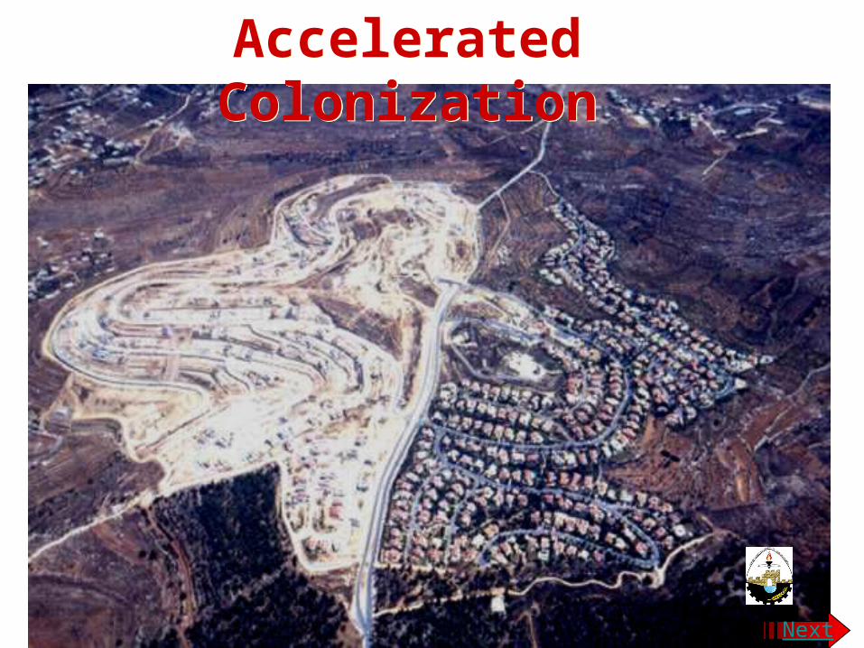
Accelerated ColonizationAccelerated Colonization
Next
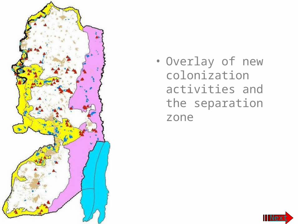
• Overlay of new colonization activities and the separation zone
Next

The Separation Wall
Separating Palestinian Towns and Villages from their valuable agricultural lands.
Separating Palestinian and Israeli built-up areas
All on the expense of Palestinian LandsAll on the expense of Palestinian Lands
Next

Razor Wires, trenches and Israeli Military Road at Bethlehem Northern Boundary
Separating Bethlehemfrom Jerusalem Separating Bethlehemfrom Jerusalem
The military road divides an olive grove…
END

Destruction of the Palestinian Authority Headquarter in Bethlehem By Israeli F16 Jet Fighters
Next
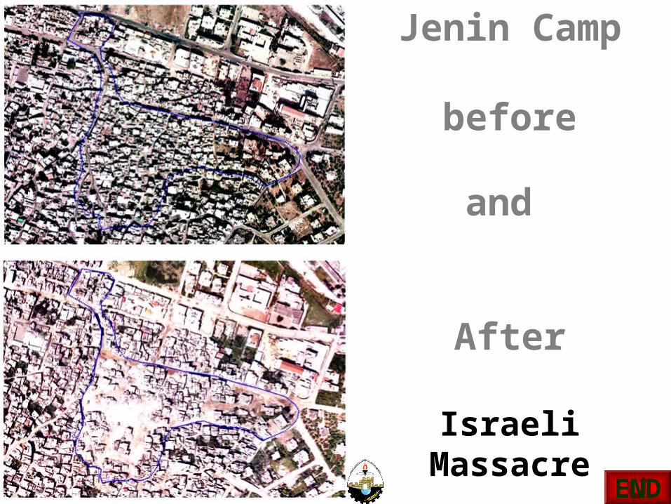
Jenin Camp
before
and
After
Israeli Massacre
END

Israeli Bypass Roads divide the West Bank into 64 small Cantoons
There are 125 Israeli checkpoints within West Bank March 2002
Next

RoadblocksRamallah-Birzeit
Alternative routes Al-Ram- Ramallah
Next
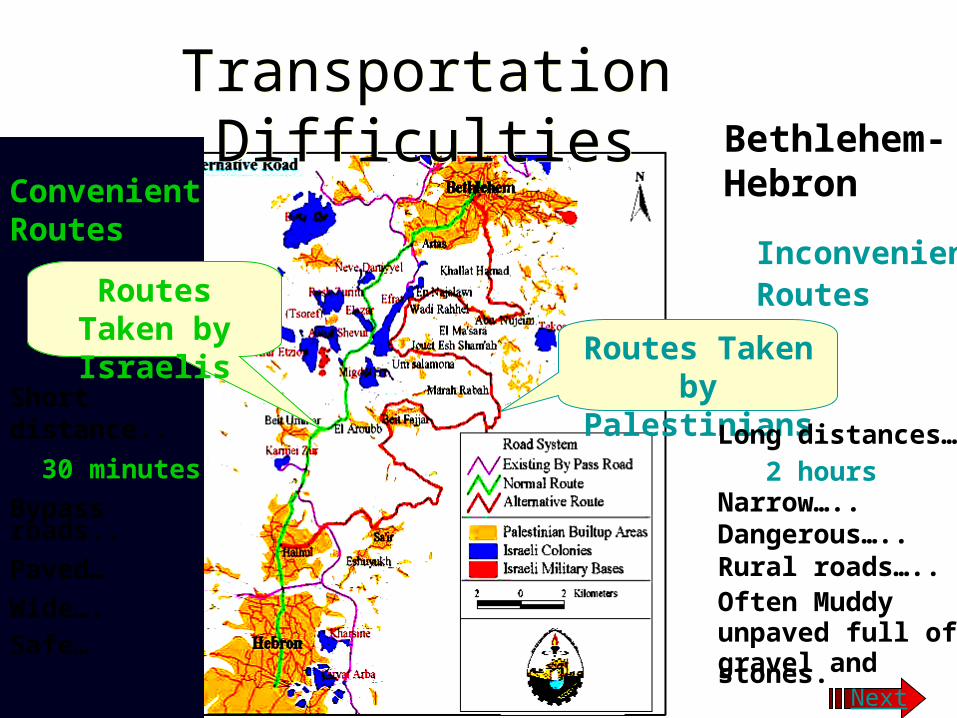
Routes Taken by Palestinians
Routes Taken by Israelis
Inconvenient Routes
Long distances… 2 hoursNarrow…..Dangerous…..Rural roads….. Often Muddyunpaved full of gravel and stones.
Convenient Routes
Short distance..
30 minutes
Bypass roads..
Paved…
Wide…. Safe…
Transportation DifficultiesTransportation DifficultiesBethlehem-Hebron
Next

Checkpoint at Qalandiya
Checkpoint at Qalandiya
Next

Human suffering at
check points In Gaza Strip
END

Shavingin Huwwara
Shavingin Aboud
Uprooting of trees and Shaving of Palestinian Lands
Uprooting of trees and Shaving of Palestinian Lands
Next

Abu Ghunaim MountainMarch 1997
Abu Ghunaim mountain January 2001
The only forest in Bethlehem
Environmental Terrorism
New Israeli Colony of Har Homa
Degradation of the Palestinian Environment Next

Uprooting of trees in Bethlehem
Israeli Bulldozers supported by Military Israeli Forces Next

750,000 trees have been uprooted since September 2000
Next

Israeli Colony
END

Depletion of water resources
Next
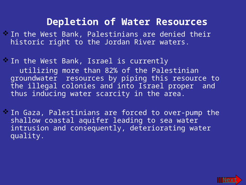
Depletion of Water Resources In the West Bank, Palestinians are denied their historic right
to the Jordan River waters.
In the West Bank, Israel is currently utilizing more than 82% of the Palestinian groundwater
resources by piping this resource to the illegal colonies and into Israel proper and thus inducing water scarcity in the area.
In Gaza, Palestinians are forced to over-pump the shallow coastal aquifer leading to sea water intrusion and consequently, deteriorating water quality.
Next

• The Western Basin is the largest and has an annual safe yield of 362 MCM. Palestinians consume only about 7.5% of its safe yield.
• The Northeastern Basin has an annual safe yield of 145 MCM. Palestinians consume about 18% of its safe yield.
• The Eastern Basin has an annual safe yield of 172 MCM. Palestinians are utilizing 50% of the waters of this basin.
•
END
Related Documents