By: Anfal, Anna, Kidist, Mercedes

Welcome message from author
This document is posted to help you gain knowledge. Please leave a comment to let me know what you think about it! Share it to your friends and learn new things together.
Transcript

By: Anfal, Anna, Kidist, Mercedes

Largest water users in Wyoming
Forge crop production
✓ Driven by the need to produce feed for livestock.Source: wy.water.usgs.gov

Major water supply sources in Wyoming
• Surface water from the major river basins: the Missouri-Mississippi, Green-Colorado, Snake-Columbia, and Great Salt Lake.
• Groundwater: can be found throughout the state, and a substantial amount of it is available for future use
• Mountain Snowpack: around 70% of Wyoming's water supply comes in the form of snow.
• Reservoir storage: Reservoir storage has a high demand in summer and fall due to limited precipitation. In Wyoming, much of the water is supplied by snow melt.
Wyoming is the 5th driest state in the country

Names and Sizes of Reservoirs in Wyoming
Source:
library.wrds.uwyo.edu
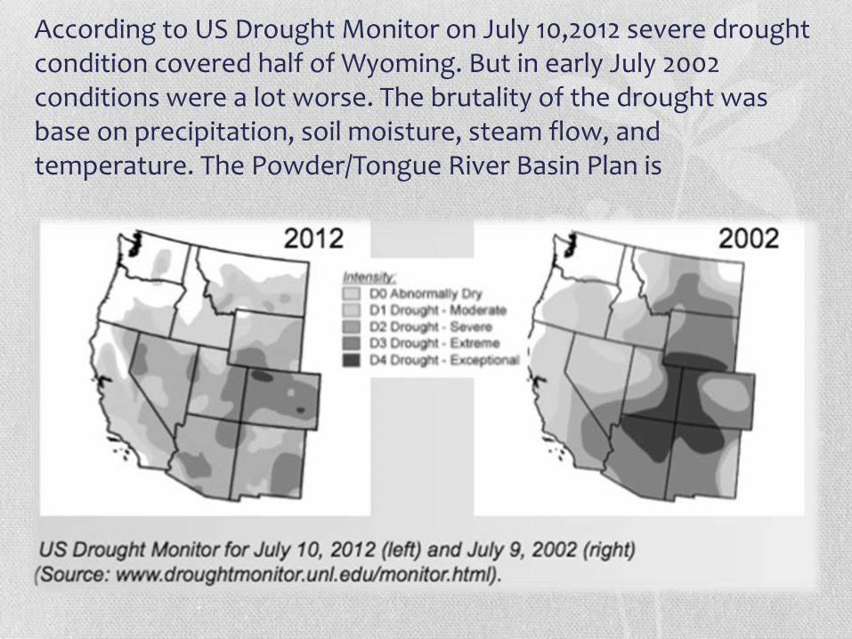
According to US Drought Monitor on July 10,2012 severe drought condition covered half of Wyoming. But in early July 2002 conditions were a lot worse. The brutality of the drought was base on precipitation, soil moisture, steam flow, and temperature. The Powder/Tongue River Basin Plan is
•“Wyoming is limited in the amount that streamflows can be depleted by interstate water compacts established with other states and by court decrees.”

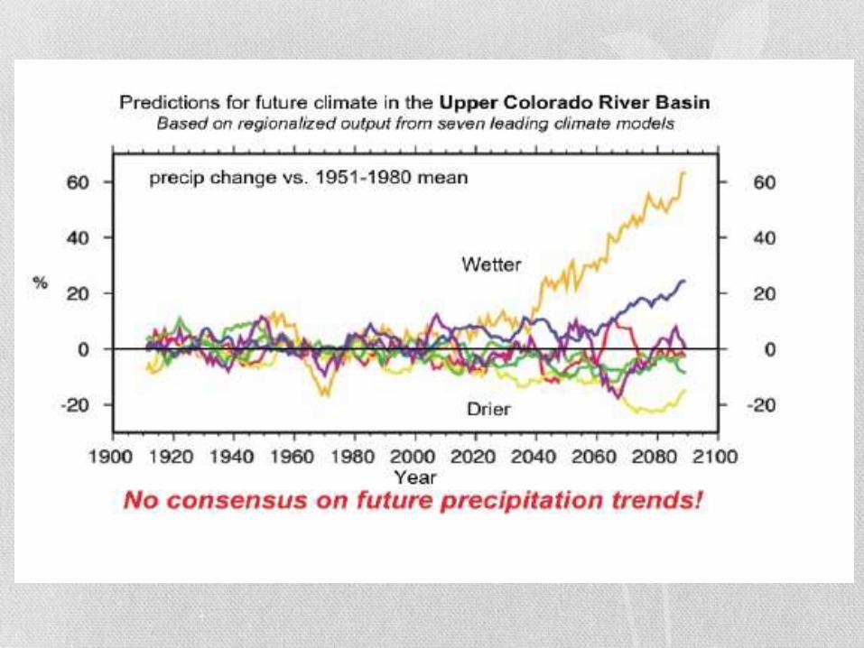
Upper Colorado River Basin

Wyoming Water Resources & Climate Change
• Why is Wyoming water resources so vulnerable to climate change?
• Like mentioned before that Wyoming relies on mountain snowpack hugely, so these sources are sensitive on the change in climate for many reasons:
1. Rely heavily on snowpack
2. The regional climate is semi-arid
3. The geographical features of the regionals watersheds makes it difficult to capture all available water supplies.
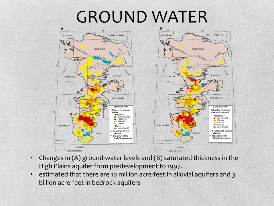
• Changes in (A) ground-water levels and (B) saturated thickness in the High Plains aquifer from predevelopment to 1997.
• estimated that there are 10 million acre-feet in alluvial aquifers and 3 billion acre-feet in bedrock aquifers
GROUND WATER
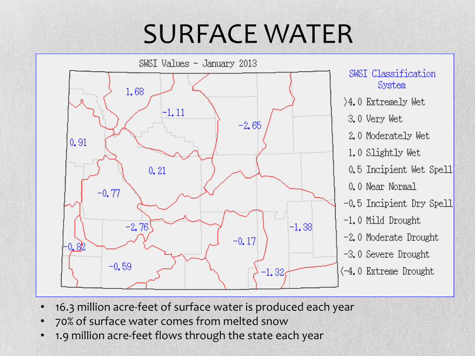
• 16.3 million acre-feet of surface water is produced each year• 70% of surface water comes from melted snow• 1.9 million acre-feet flows through the state each year
SURFACE WATER


Basins help develop water and land resources to help make better use of our sources.

THANK YOU
Related Documents