Week 17 – Hydrology Ocean Floor Topography Mr. White 6 th Grade Earth Science

Www.free-ppt-templates.com Mr. White 6 th Grade Earth Science.
Dec 14, 2015
Welcome message from author
This document is posted to help you gain knowledge. Please leave a comment to let me know what you think about it! Share it to your friends and learn new things together.
Transcript
Week 17 – Hydrology
Ocean Floor Topography
Mr. White6th Grade Earth Science

Ocean floor Features• Ocean Basin- This is the actual
depression in Earth’s surface that holds the ocean water
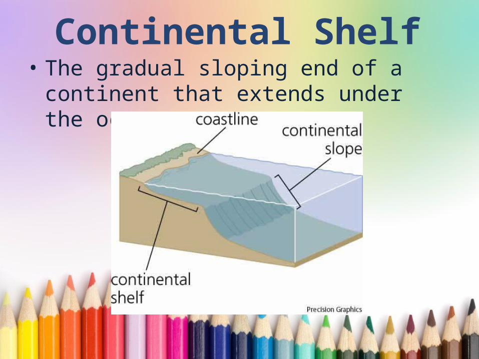
Continental Shelf• The gradual sloping end of a
continent that extends under the ocean

Continental Slope• The continental slope drops more
steeply, and extends from the outer edge of the shelf to the ocean floor
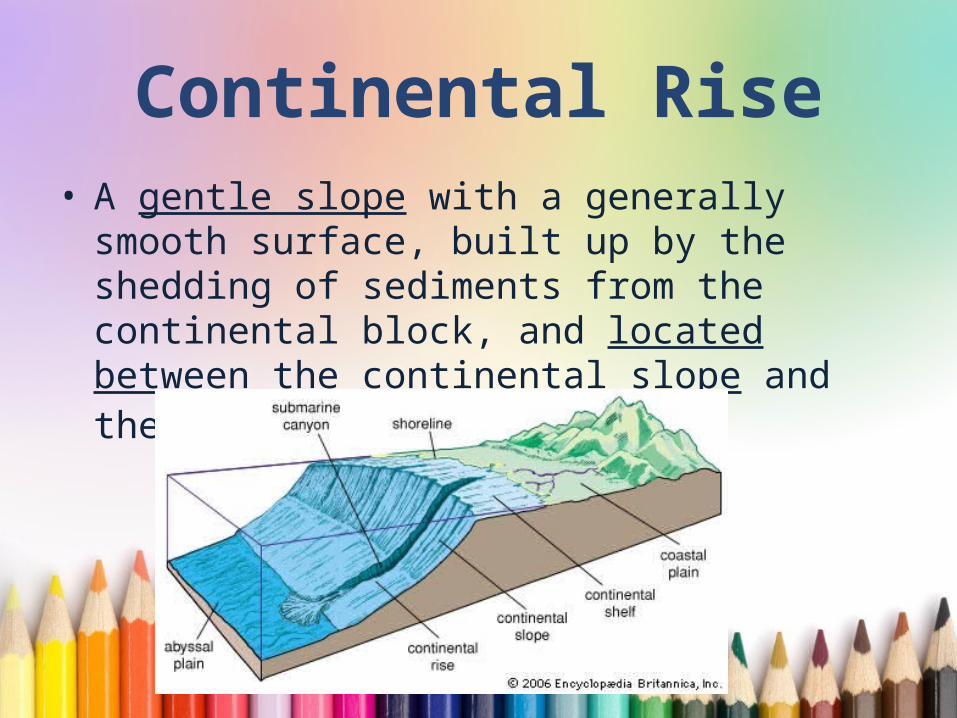
Continental Rise• A gentle slope with a generally smooth
surface, built up by the shedding of sediments from the continental block, and located between the continental slope and the abyssal plain.
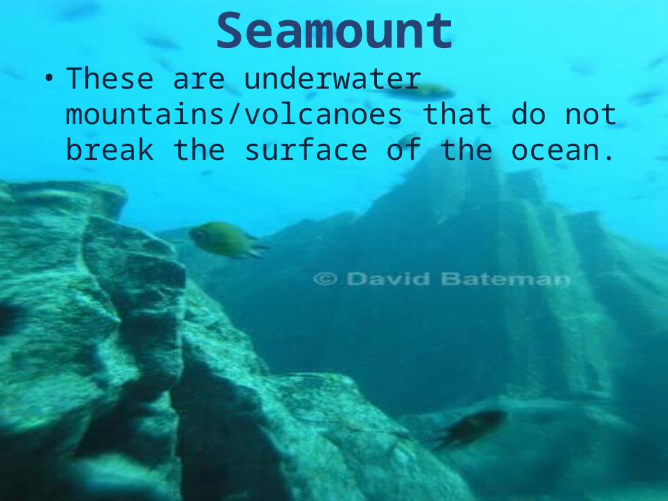
Seamount• These are underwater
mountains/volcanoes that do not break the surface of the ocean.
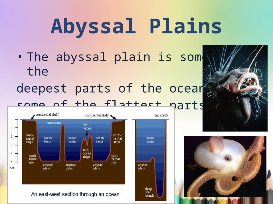
Abyssal Plains• The abyssal plain is some of the deepest parts of the ocean, and some of the flattest parts of Earth
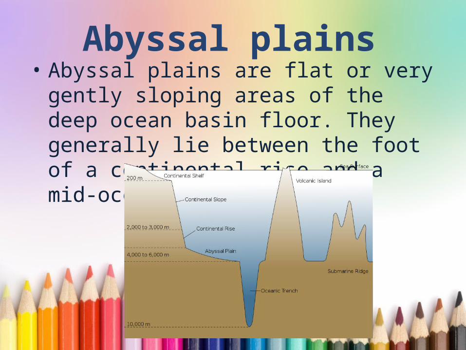
Abyssal plains• Abyssal plains are flat or very gently
sloping areas of the deep ocean basin floor. They generally lie between the foot of a continental rise and a mid-oceanic ridge.
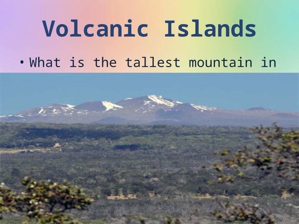
Volcanic Islands• What is the tallest mountain in the
world?
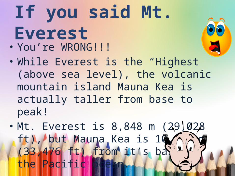
If you said Mt. Everest• You’re WRONG!!!• While Everest is the “Highest” (above
sea level), the volcanic mountain island Mauna Kea is actually taller from base to peak!
• Mt. Everest is 8,848 m (29,028 ft), but Mauna Kea is 10,203 m (33,476 ft) from it’s base in the Pacific ocean.
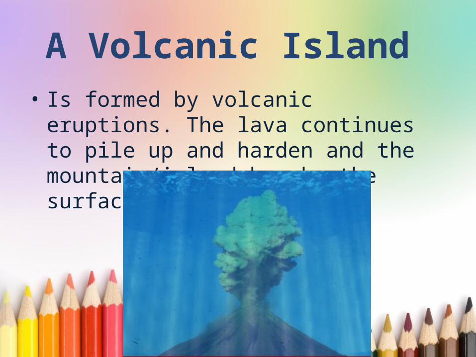
A Volcanic Island • Is formed by volcanic eruptions. The
lava continues to pile up and harden and the mountain/island breaks the surface of the ocean.
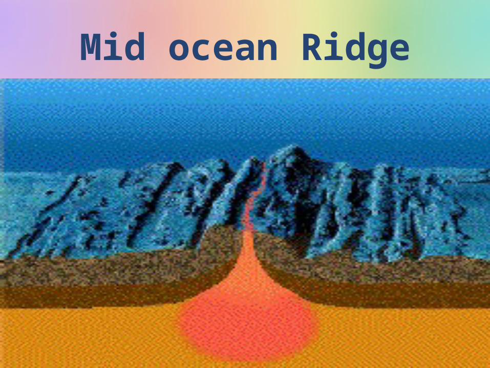
Mid ocean Ridge
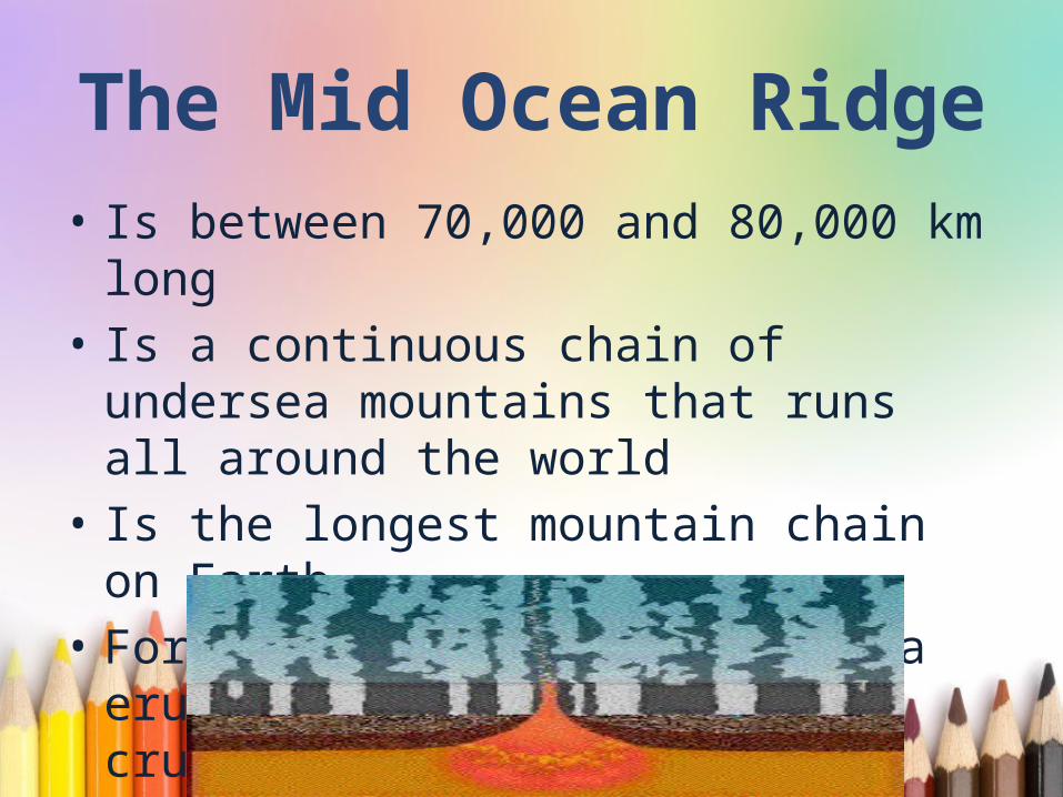
The Mid Ocean Ridge
• Is between 70,000 and 80,000 km long
• Is a continuous chain of undersea mountains that runs all around the world
• Is the longest mountain chain on Earth
• Forms new ocean floor as lava erupts through the Earth’s crust
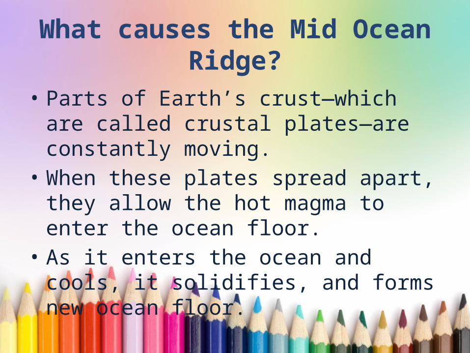
What causes the Mid Ocean Ridge?
• Parts of Earth’s crust—which are called crustal plates—are constantly moving.
• When these plates spread apart, they allow the hot magma to enter the ocean floor.
• As it enters the ocean and cools, it solidifies, and forms new ocean floor.
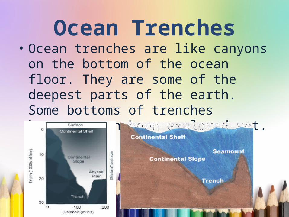
Ocean Trenches• Ocean trenches are like canyons on
the bottom of the ocean floor. They are some of the deepest parts of the earth. Some bottoms of trenches haven’t even been explored yet.

Oceanic Trenches• The oceanic trenches are
hemispheric-scale (one hemisphere to another) long but narrow topographic depressions of the sea floor. They are also the deepest parts of the ocean floor.
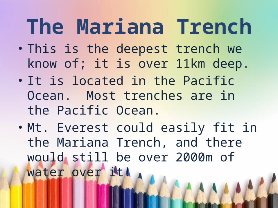
The Mariana Trench• This is the deepest trench we know
of; it is over 11km deep.• It is located in the Pacific Ocean.
Most trenches are in the Pacific Ocean.
• Mt. Everest could easily fit in the Mariana Trench, and there would still be over 2000m of water over it!
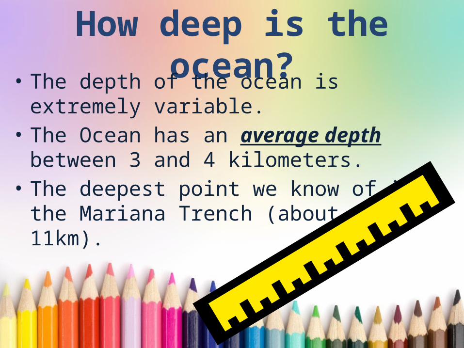
How deep is the ocean?• The depth of the ocean is extremely
variable. • The Ocean has an average depth
between 3 and 4 kilometers.• The deepest point we know of is the
Mariana Trench (about 11km).
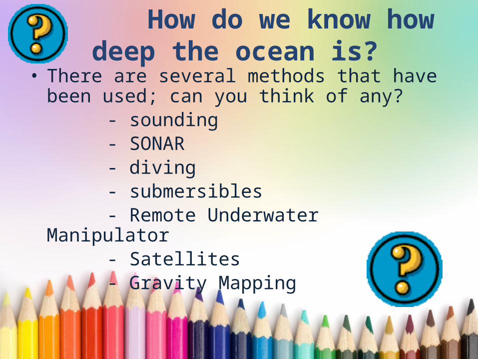
How do we know how deep the ocean is?
• There are several methods that have been used; can you think of any?
- sounding - SONAR - diving - submersibles - Remote Underwater Manipulator - Satellites - Gravity Mapping
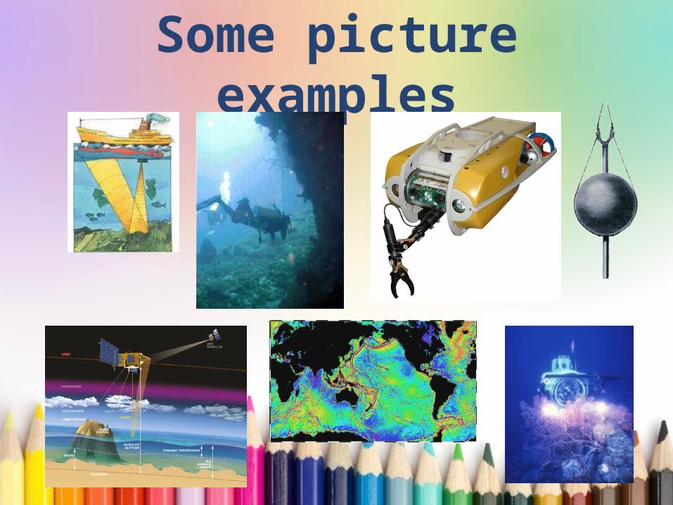
Some picture examples
Did you know we map the ocean floor?
• Why do we map it?• So ships know the best travel routes.• So we can understand the different
depth of the ocean and the different effects it has on life, as well as the minerals that are available.
• So we can better understand the formation of the Earth, and all of the valuable resources it has.
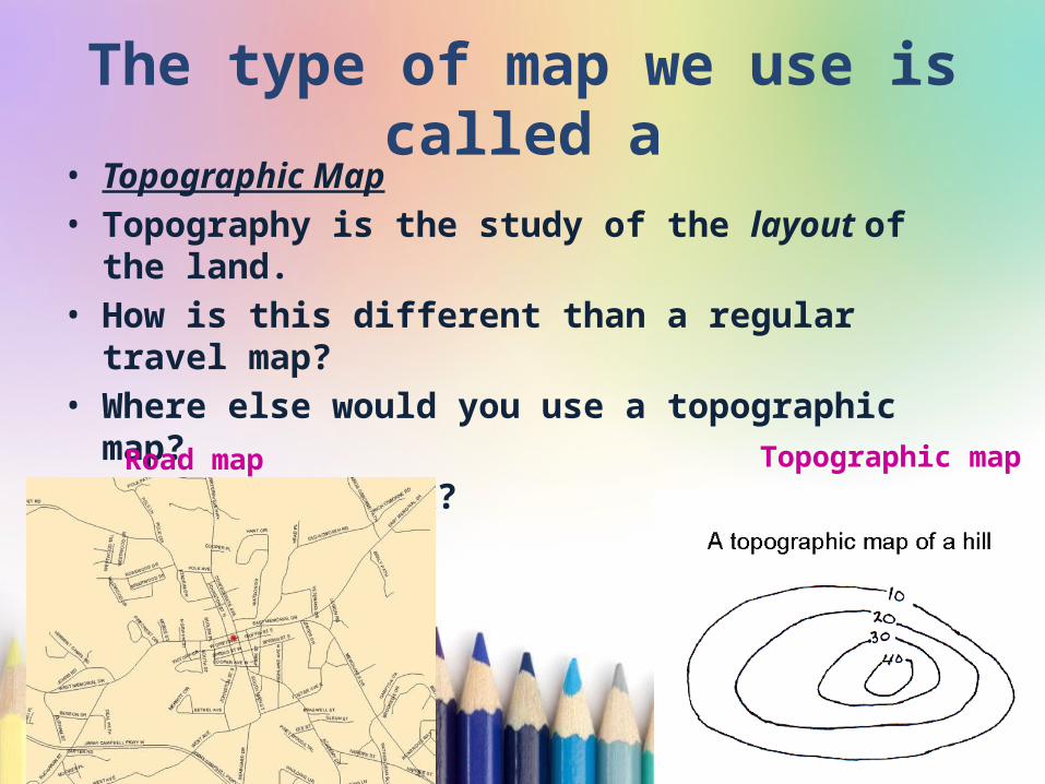
The type of map we use is called a
• Topographic Map• Topography is the study of the layout of the
land.• How is this different than a regular travel
map?• Where else would you use a topographic
map?• How do they work?
Road map Topographic map
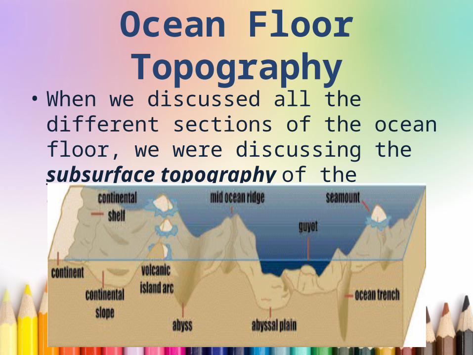
Ocean Floor Topography
• When we discussed all the different sections of the ocean floor, we were discussing the subsurface topography of the ocean.

Wrap It UpLet’s do an exit ticket!
Related Documents