What’s New in ArcGIS 10 Trent Hare June 2011

What’s New in ArcGIS 10
Mar 24, 2016
What’s New in ArcGIS 10. Trent Hare June 2011. Major upgrade. ESRI’s “what’s new” – 177 pages! http://help.arcgis.com/en/arcgisdesktop/10.0/pdf/whats_new_in_arcgis_10.pdf. 1.) Direct support for PDS and ISIS2,3 support and current limitations - PowerPoint PPT Presentation
Welcome message from author
This document is posted to help you gain knowledge. Please leave a comment to let me know what you think about it! Share it to your friends and learn new things together.
Transcript

What’s New in ArcGIS 10
Trent HareJune 2011

Major upgrade ESRI’s “what’s new” – 177 pages!
http://help.arcgis.com/en/arcgisdesktop/10.0/pdf/whats_new_in_arcgis_10.pdf
1.) Direct support for PDS and ISIS2,3 support and current limitations2.) New editing capabilities (interface changes)3.) New mosaic raster type (virtual mosaics)4.) New virtual image processing chainable functions (called Image Analyst).5.) Hardware acceleration and new basemap layers (local cache)6.) A few new toolbox helper functions and tips for background processing.7.) Changes to 3D and Spatial Analyst (raster environment)8.) New add-in environment9.) if time: New temporal tools10.) slide: new location for planetary radii definitions11.) Python fully integrated
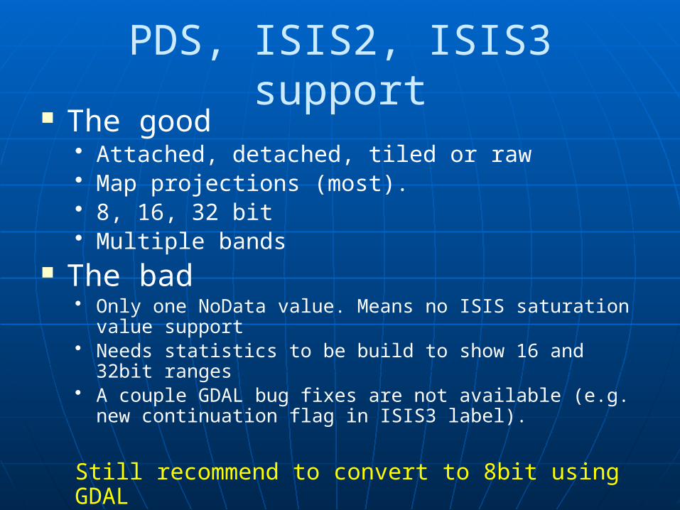
PDS, ISIS2, ISIS3 support The good
• Attached, detached, tiled or raw• Map projections (most).• 8, 16, 32 bit• Multiple bands
The bad• Only one NoData value. Means no ISIS saturation value
support• Needs statistics to be build to show 16 and 32bit ranges• A couple GDAL bug fixes are not available (e.g. new
continuation flag in ISIS3 label).
Still recommend to convert to 8bit using GDAL

Editing The Editor toolbar has been redesigned. Feature templates (more like Illustrator editing). New snapping environment – on by default. Start editing by right-clicking a layer. The Attributes and other editing windows have been
redesigned. Selecting features and editing vertices is easier - select,
add, and remove multiple vertices by drawing a box.
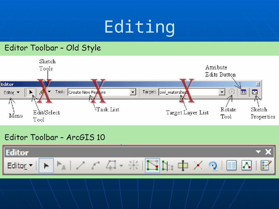
Editing
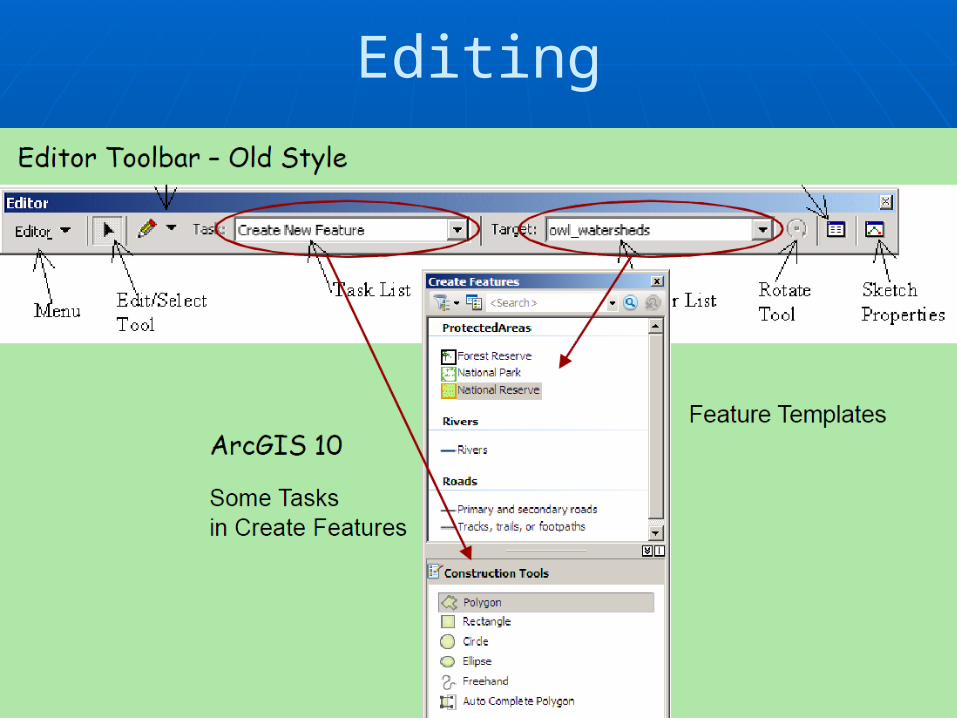
Editing

USGS Crater Helper Tools (upgraded) Facilitates feature mapping (craters, linear,
closed) Still testing but available (linked below).
http://resources.arcgis.com/gallery/file/arcobjects-net-api/details?entryID=B8D12158-1422-2418-3433-E1667CA43176

Mosaic Raster TypeA mosaic dataset is a collection of raster datasets (images) stored as a catalog & viewed as a dynamically mosaicked image.
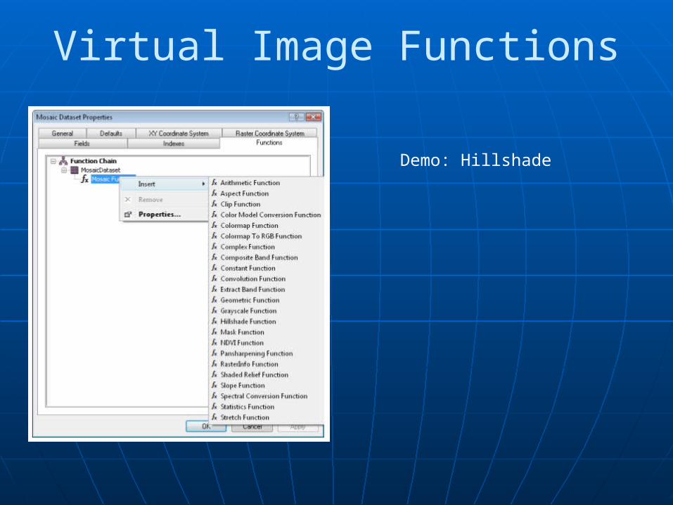
Virtual Image Functions
Demo: Hillshade
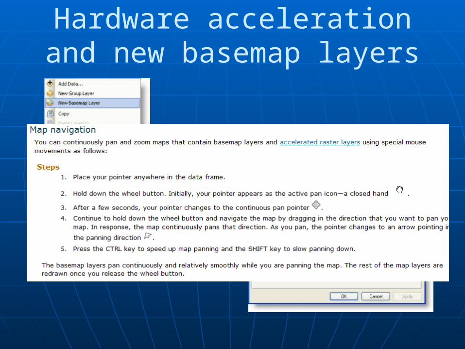
Hardware acceleration and new basemap layers
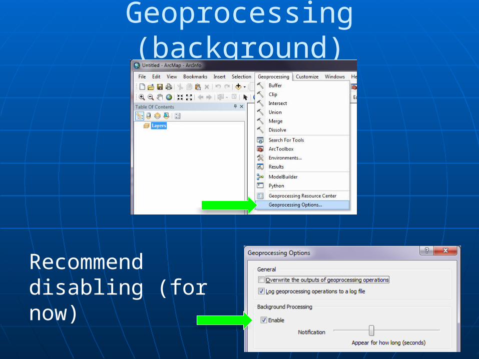
Geoprocessing (background)
Recommend disabling (for now)
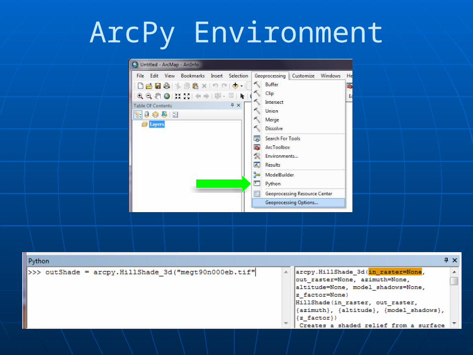
ArcPy Environment
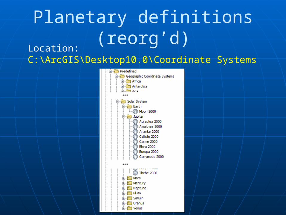
Planetary definitions (reorg’d)Location:C:\ArcGIS\Desktop10.0\Coordinate Systems
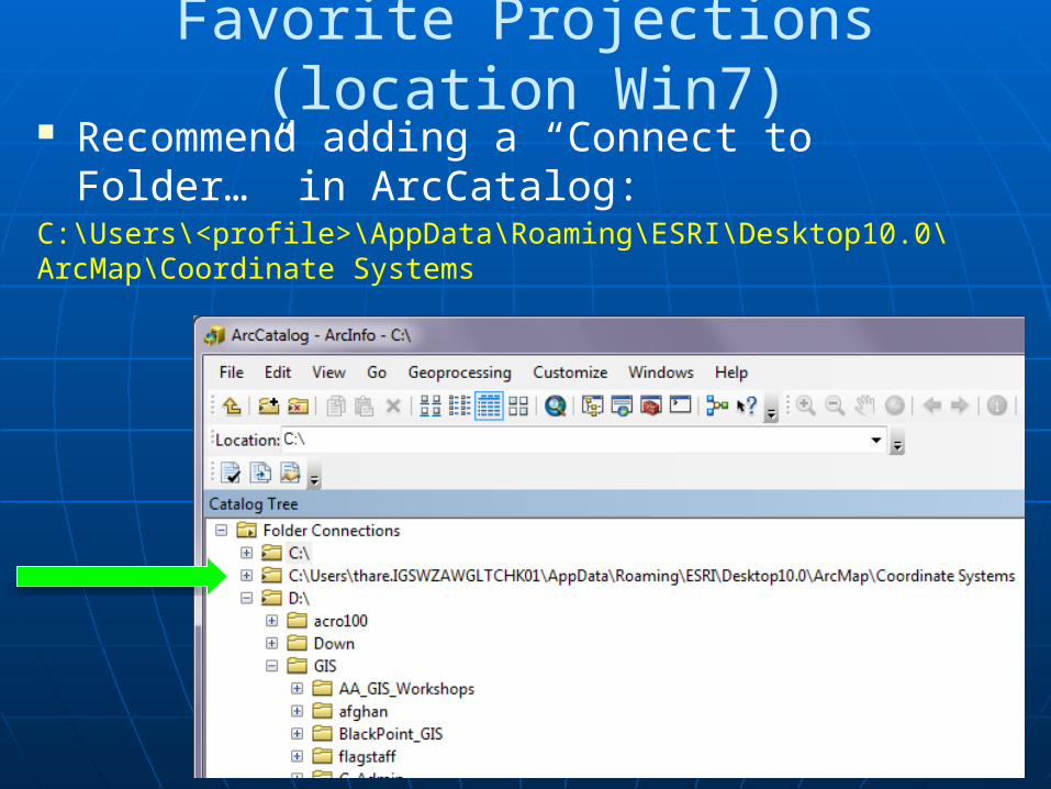
Favorite Projections (location Win7) Recommend adding a “Connect to Folder…”
in ArcCatalog:C:\Users\<profile>\AppData\Roaming\ESRI\Desktop10.0\ArcMap\Coordinate Systems
Related Documents