What Geoprocessing? Geoprocessing is the processing of geographic information. Commonly used to describe a process when geographic objects are manipulated to create a new dataset. Many examples of geoprocessing…

Welcome message from author
This document is posted to help you gain knowledge. Please leave a comment to let me know what you think about it! Share it to your friends and learn new things together.
Transcript

What Geoprocessing
Geoprocessing is the processing of geographic information
Commonly used to describe a process when geographic objects are manipulated to create a new dataset
Many examples of geoprocessinghellip
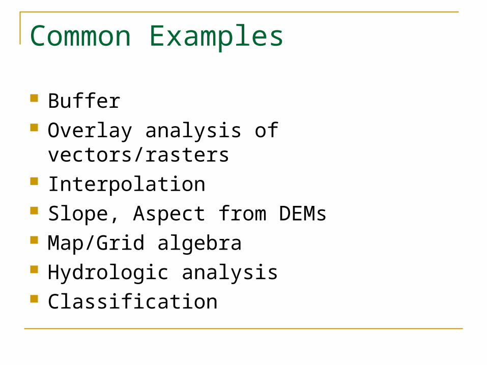
Common Examples
Buffer Overlay analysis of vectorsrasters Interpolation Slope Aspect from DEMs MapGrid algebra Hydrologic analysis Classification
Not-so-Common Examples
Geocoding Converting between file formats Projecting Select and export Zonal statistics Proximity analysis Editing
What is Geoprocessing
So itrsquos just about everything Well not reallyhellip
Geoprocessing is not cartography 2-D and 3-D symbolization numerical statistics querys labeling and annotation GDB schema metadata
A few noteshellip
Geoprocessing is just beginning in the 3-D world and will likely increase
Temporal modeling Significant improvements in 9x Incorporated into SA ModelBuilder 3-D
Solar radiation model into Framework Process-oriented GIS (not by ESRI)
Geoprocessing in ArcGIS
Focus on ArcGIS Desktop applications
Wersquoll use ArcMap
Wersquoll use ArcInfo Desktop
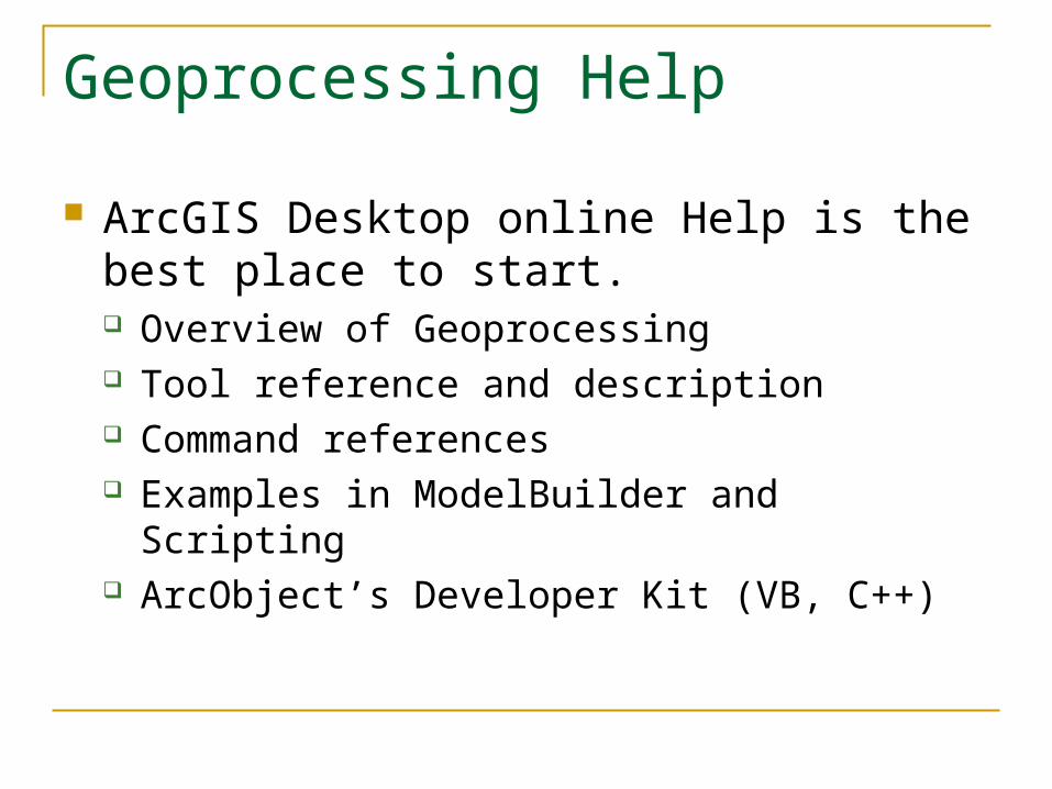
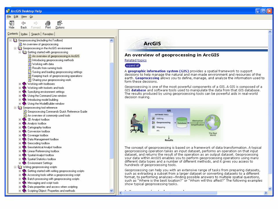
Geoprocessing Help
ArcGIS Desktop online Help is the best place to start Overview of Geoprocessing Tool reference and description Command references Examples in ModelBuilder and Scripting ArcObjectrsquos Developer Kit (VB C++)
Geoprocessing Help
PDFs in ESRI Library Geoprocessing in ArcGIS Geoprocessing Quick Reference Guide Writing Geoprocessing Scripts
ESRI Support Center ndash Geoprocessing Scripts Models Docs Forums
Five Ways to Work With Tools
Command line Dialogs Models Scripting ArcObjects
Five Ways to Work With Tools
Command line Dialogs Models Scripting ArcObjects Intelligent Command LineIntelligent Command Line
Command Line
Command line window is aware of layers in ArcMap session
Auto-complete and parameter options Load and Save As from text files Show History and Recall Variables Formatting of window
Five Ways to Work With Tools
Command line Dialogs
ArcToolbox Models Scripting ArcObjects
ArcToolbox Dialogs
Most dialogs are aware of layers in ArcMap session
Help available per parameter Dialogs have link to environment settings Easy to use
Five Ways to Work With Tools
Command line Dialogs Models
ModelBuilder Scripting ArcObjects
Five Ways to Work With Tools
Command line Dialogs Models Scripting
Python VBScript JavaScript
ArcObjects
Five Ways to Work With Tools
Command line Dialogs Models Scripting ArcObjects
VBA VB C++ C (COM)
ArcToolbox
ArcToolbox is now a dockable window within ArcMap and ArcCatalog
ArcToolbox
Geoprocessing tools are available through toolboxes or toolsets Categorized by process type Create your own toolboxes and tools
Full tool index and search functions Locate tool function Interface to ModelBuilder
Geoprocessing Wizard
The ArcView 8x Geoprocessing Wizard has been removed from the ArcMap interface
However the functions are still available just located in separate toolsets
Geoprocessing Wizard
Dissolvemdash Data Management gt Generalization gt Dissolve tool
Mergemdash Data Management gt General gt Append tool
Clipmdash Analysis gt Extract gt Clip tool Intersectmdash Analysis gt Overlay gt Intersect tool Unionmdash Analysis gt Overlay gt Union tool
MergeAppend
MergeAppend operation ndash two or more layers
Append adjacent layers Appends data source(s) or
feature class(es) to an existing Example MergeAppend several counties Notice when layers overlap Features are not intersected Features and attributes are
only appended
Dissolve
Dissolve operation ndash one layer process1048713 Aggregate features by value of attribute when it is the same1048713 Creates new data source or feature classExample1048713 Landuse Level 2 to Level 11048713 Parcels based on ownership
Dissolve
Dissolving features - simplify the data based on common attribute values
Buffer
Buffers are rings drawn around features at a distance
1048713 By distance or attribute value
1048713 All features or only selected features
1048713 Outside within multiple rings
1048713 New layer or graphic
Clip
Clip operation ndash two layer process1048713 Reduce spatial extent of one layer based on spatial extent of other1048713 Cookie cutter analogy1048713 Creates new data source or feature class1048713 Same attribute table as input layer but a subset1048713 Clip layer must be a polygon input layer any feature class1048713 Output layer feature class same as input layerExample1048713 Limit area of geographic interest1048713 Only Ontario not all of Canada
Overlay Analysis GeoProcessing
Overlay analysis functions
Intersect
Intersect overlay ndash two layers necessary 1048713 New layer with spatial extent only
common to two layers 1048713 Attribute table inherits from both layers 1048713 Creates new data source or feature class 1048713 Input layer determines feature class for
output layer 1048713 Overlay layer must be a polygon Example 1048713 Intersection of Roads with several
counties 1048713 Intersection of Pollution point with
counties
Union
Union overlay ndash two layers necessary1048713 Combine two polygon feature classes and only polygon feature classes1048713 Attribute table inherits from both layers1048713 Creates new data source or polygon feature classExampleSoil layer with crop productivity
Union example
Find out influence of soil type over crop productivity
1048713 Get a soils layer 1048713 Get a crop productivity layer 1048713 Use Union overlay to combine both layers in
one 1048713 Query Display Analyze the new layer based
on the new joint attributes to determine if there is a relationship
between the soil type and the crop productivity
Important
The output from the GeoProcessing operation will be in the same coordinate system as the Data Frame irrespective of the coordinate system of the data sources of the input layers
ArcMap Settings
ArcMap
Tools
Options
Geoprocessing
ArcMap Settings
CArcGISUtilitiesAdvancedArcMapSettingsexe
Environment Settings
Used by all geoprocessing tasks Settings include
Workspace and mask Coordinate system Cell size and extent Resampling method Coverage and Geodatabase setting etchellip
Common Examples
Buffer Overlay analysis of vectorsrasters Interpolation Slope Aspect from DEMs MapGrid algebra Hydrologic analysis Classification
Not-so-Common Examples
Geocoding Converting between file formats Projecting Select and export Zonal statistics Proximity analysis Editing
What is Geoprocessing
So itrsquos just about everything Well not reallyhellip
Geoprocessing is not cartography 2-D and 3-D symbolization numerical statistics querys labeling and annotation GDB schema metadata
A few noteshellip
Geoprocessing is just beginning in the 3-D world and will likely increase
Temporal modeling Significant improvements in 9x Incorporated into SA ModelBuilder 3-D
Solar radiation model into Framework Process-oriented GIS (not by ESRI)
Geoprocessing in ArcGIS
Focus on ArcGIS Desktop applications
Wersquoll use ArcMap
Wersquoll use ArcInfo Desktop
Geoprocessing Help
ArcGIS Desktop online Help is the best place to start Overview of Geoprocessing Tool reference and description Command references Examples in ModelBuilder and Scripting ArcObjectrsquos Developer Kit (VB C++)
Geoprocessing Help
PDFs in ESRI Library Geoprocessing in ArcGIS Geoprocessing Quick Reference Guide Writing Geoprocessing Scripts
ESRI Support Center ndash Geoprocessing Scripts Models Docs Forums
Five Ways to Work With Tools
Command line Dialogs Models Scripting ArcObjects
Five Ways to Work With Tools
Command line Dialogs Models Scripting ArcObjects Intelligent Command LineIntelligent Command Line
Command Line
Command line window is aware of layers in ArcMap session
Auto-complete and parameter options Load and Save As from text files Show History and Recall Variables Formatting of window
Five Ways to Work With Tools
Command line Dialogs
ArcToolbox Models Scripting ArcObjects
ArcToolbox Dialogs
Most dialogs are aware of layers in ArcMap session
Help available per parameter Dialogs have link to environment settings Easy to use
Five Ways to Work With Tools
Command line Dialogs Models
ModelBuilder Scripting ArcObjects
Five Ways to Work With Tools
Command line Dialogs Models Scripting
Python VBScript JavaScript
ArcObjects
Five Ways to Work With Tools
Command line Dialogs Models Scripting ArcObjects
VBA VB C++ C (COM)
ArcToolbox
ArcToolbox is now a dockable window within ArcMap and ArcCatalog
ArcToolbox
Geoprocessing tools are available through toolboxes or toolsets Categorized by process type Create your own toolboxes and tools
Full tool index and search functions Locate tool function Interface to ModelBuilder
Geoprocessing Wizard
The ArcView 8x Geoprocessing Wizard has been removed from the ArcMap interface
However the functions are still available just located in separate toolsets
Geoprocessing Wizard
Dissolvemdash Data Management gt Generalization gt Dissolve tool
Mergemdash Data Management gt General gt Append tool
Clipmdash Analysis gt Extract gt Clip tool Intersectmdash Analysis gt Overlay gt Intersect tool Unionmdash Analysis gt Overlay gt Union tool
MergeAppend
MergeAppend operation ndash two or more layers
Append adjacent layers Appends data source(s) or
feature class(es) to an existing Example MergeAppend several counties Notice when layers overlap Features are not intersected Features and attributes are
only appended
Dissolve
Dissolve operation ndash one layer process1048713 Aggregate features by value of attribute when it is the same1048713 Creates new data source or feature classExample1048713 Landuse Level 2 to Level 11048713 Parcels based on ownership
Dissolve
Dissolving features - simplify the data based on common attribute values
Buffer
Buffers are rings drawn around features at a distance
1048713 By distance or attribute value
1048713 All features or only selected features
1048713 Outside within multiple rings
1048713 New layer or graphic
Clip
Clip operation ndash two layer process1048713 Reduce spatial extent of one layer based on spatial extent of other1048713 Cookie cutter analogy1048713 Creates new data source or feature class1048713 Same attribute table as input layer but a subset1048713 Clip layer must be a polygon input layer any feature class1048713 Output layer feature class same as input layerExample1048713 Limit area of geographic interest1048713 Only Ontario not all of Canada
Overlay Analysis GeoProcessing
Overlay analysis functions
Intersect
Intersect overlay ndash two layers necessary 1048713 New layer with spatial extent only
common to two layers 1048713 Attribute table inherits from both layers 1048713 Creates new data source or feature class 1048713 Input layer determines feature class for
output layer 1048713 Overlay layer must be a polygon Example 1048713 Intersection of Roads with several
counties 1048713 Intersection of Pollution point with
counties
Union
Union overlay ndash two layers necessary1048713 Combine two polygon feature classes and only polygon feature classes1048713 Attribute table inherits from both layers1048713 Creates new data source or polygon feature classExampleSoil layer with crop productivity
Union example
Find out influence of soil type over crop productivity
1048713 Get a soils layer 1048713 Get a crop productivity layer 1048713 Use Union overlay to combine both layers in
one 1048713 Query Display Analyze the new layer based
on the new joint attributes to determine if there is a relationship
between the soil type and the crop productivity
Important
The output from the GeoProcessing operation will be in the same coordinate system as the Data Frame irrespective of the coordinate system of the data sources of the input layers
ArcMap Settings
ArcMap
Tools
Options
Geoprocessing
ArcMap Settings
CArcGISUtilitiesAdvancedArcMapSettingsexe
Environment Settings
Used by all geoprocessing tasks Settings include
Workspace and mask Coordinate system Cell size and extent Resampling method Coverage and Geodatabase setting etchellip

Geoprocessing Help
ArcGIS Desktop online Help is the best place to start Overview of Geoprocessing Tool reference and description Command references Examples in ModelBuilder and Scripting ArcObjectrsquos Developer Kit (VB C++)
Geoprocessing Help
PDFs in ESRI Library Geoprocessing in ArcGIS Geoprocessing Quick Reference Guide Writing Geoprocessing Scripts
ESRI Support Center ndash Geoprocessing Scripts Models Docs Forums
Five Ways to Work With Tools
Command line Dialogs Models Scripting ArcObjects
Five Ways to Work With Tools
Command line Dialogs Models Scripting ArcObjects Intelligent Command LineIntelligent Command Line
Command Line
Command line window is aware of layers in ArcMap session
Auto-complete and parameter options Load and Save As from text files Show History and Recall Variables Formatting of window
Five Ways to Work With Tools
Command line Dialogs
ArcToolbox Models Scripting ArcObjects
ArcToolbox Dialogs
Most dialogs are aware of layers in ArcMap session
Help available per parameter Dialogs have link to environment settings Easy to use
Five Ways to Work With Tools
Command line Dialogs Models
ModelBuilder Scripting ArcObjects
Five Ways to Work With Tools
Command line Dialogs Models Scripting
Python VBScript JavaScript
ArcObjects
Five Ways to Work With Tools
Command line Dialogs Models Scripting ArcObjects
VBA VB C++ C (COM)
ArcToolbox
ArcToolbox is now a dockable window within ArcMap and ArcCatalog
ArcToolbox
Geoprocessing tools are available through toolboxes or toolsets Categorized by process type Create your own toolboxes and tools
Full tool index and search functions Locate tool function Interface to ModelBuilder
Geoprocessing Wizard
The ArcView 8x Geoprocessing Wizard has been removed from the ArcMap interface
However the functions are still available just located in separate toolsets
Geoprocessing Wizard
Dissolvemdash Data Management gt Generalization gt Dissolve tool
Mergemdash Data Management gt General gt Append tool
Clipmdash Analysis gt Extract gt Clip tool Intersectmdash Analysis gt Overlay gt Intersect tool Unionmdash Analysis gt Overlay gt Union tool
MergeAppend
MergeAppend operation ndash two or more layers
Append adjacent layers Appends data source(s) or
feature class(es) to an existing Example MergeAppend several counties Notice when layers overlap Features are not intersected Features and attributes are
only appended
Dissolve
Dissolve operation ndash one layer process1048713 Aggregate features by value of attribute when it is the same1048713 Creates new data source or feature classExample1048713 Landuse Level 2 to Level 11048713 Parcels based on ownership
Dissolve
Dissolving features - simplify the data based on common attribute values
Buffer
Buffers are rings drawn around features at a distance
1048713 By distance or attribute value
1048713 All features or only selected features
1048713 Outside within multiple rings
1048713 New layer or graphic
Clip
Clip operation ndash two layer process1048713 Reduce spatial extent of one layer based on spatial extent of other1048713 Cookie cutter analogy1048713 Creates new data source or feature class1048713 Same attribute table as input layer but a subset1048713 Clip layer must be a polygon input layer any feature class1048713 Output layer feature class same as input layerExample1048713 Limit area of geographic interest1048713 Only Ontario not all of Canada
Overlay Analysis GeoProcessing
Overlay analysis functions
Intersect
Intersect overlay ndash two layers necessary 1048713 New layer with spatial extent only
common to two layers 1048713 Attribute table inherits from both layers 1048713 Creates new data source or feature class 1048713 Input layer determines feature class for
output layer 1048713 Overlay layer must be a polygon Example 1048713 Intersection of Roads with several
counties 1048713 Intersection of Pollution point with
counties
Union
Union overlay ndash two layers necessary1048713 Combine two polygon feature classes and only polygon feature classes1048713 Attribute table inherits from both layers1048713 Creates new data source or polygon feature classExampleSoil layer with crop productivity
Union example
Find out influence of soil type over crop productivity
1048713 Get a soils layer 1048713 Get a crop productivity layer 1048713 Use Union overlay to combine both layers in
one 1048713 Query Display Analyze the new layer based
on the new joint attributes to determine if there is a relationship
between the soil type and the crop productivity
Important
The output from the GeoProcessing operation will be in the same coordinate system as the Data Frame irrespective of the coordinate system of the data sources of the input layers
ArcMap Settings
ArcMap
Tools
Options
Geoprocessing
ArcMap Settings
CArcGISUtilitiesAdvancedArcMapSettingsexe
Environment Settings
Used by all geoprocessing tasks Settings include
Workspace and mask Coordinate system Cell size and extent Resampling method Coverage and Geodatabase setting etchellip
Five Ways to Work With Tools
Command line Dialogs Models Scripting ArcObjects
Five Ways to Work With Tools
Command line Dialogs Models Scripting ArcObjects Intelligent Command LineIntelligent Command Line
Command Line
Command line window is aware of layers in ArcMap session
Auto-complete and parameter options Load and Save As from text files Show History and Recall Variables Formatting of window
Five Ways to Work With Tools
Command line Dialogs
ArcToolbox Models Scripting ArcObjects
ArcToolbox Dialogs
Most dialogs are aware of layers in ArcMap session
Help available per parameter Dialogs have link to environment settings Easy to use
Five Ways to Work With Tools
Command line Dialogs Models
ModelBuilder Scripting ArcObjects
Five Ways to Work With Tools
Command line Dialogs Models Scripting
Python VBScript JavaScript
ArcObjects
Five Ways to Work With Tools
Command line Dialogs Models Scripting ArcObjects
VBA VB C++ C (COM)
ArcToolbox
ArcToolbox is now a dockable window within ArcMap and ArcCatalog
ArcToolbox
Geoprocessing tools are available through toolboxes or toolsets Categorized by process type Create your own toolboxes and tools
Full tool index and search functions Locate tool function Interface to ModelBuilder
Geoprocessing Wizard
The ArcView 8x Geoprocessing Wizard has been removed from the ArcMap interface
However the functions are still available just located in separate toolsets
Geoprocessing Wizard
Dissolvemdash Data Management gt Generalization gt Dissolve tool
Mergemdash Data Management gt General gt Append tool
Clipmdash Analysis gt Extract gt Clip tool Intersectmdash Analysis gt Overlay gt Intersect tool Unionmdash Analysis gt Overlay gt Union tool
MergeAppend
MergeAppend operation ndash two or more layers
Append adjacent layers Appends data source(s) or
feature class(es) to an existing Example MergeAppend several counties Notice when layers overlap Features are not intersected Features and attributes are
only appended
Dissolve
Dissolve operation ndash one layer process1048713 Aggregate features by value of attribute when it is the same1048713 Creates new data source or feature classExample1048713 Landuse Level 2 to Level 11048713 Parcels based on ownership
Dissolve
Dissolving features - simplify the data based on common attribute values
Buffer
Buffers are rings drawn around features at a distance
1048713 By distance or attribute value
1048713 All features or only selected features
1048713 Outside within multiple rings
1048713 New layer or graphic
Clip
Clip operation ndash two layer process1048713 Reduce spatial extent of one layer based on spatial extent of other1048713 Cookie cutter analogy1048713 Creates new data source or feature class1048713 Same attribute table as input layer but a subset1048713 Clip layer must be a polygon input layer any feature class1048713 Output layer feature class same as input layerExample1048713 Limit area of geographic interest1048713 Only Ontario not all of Canada
Overlay Analysis GeoProcessing
Overlay analysis functions
Intersect
Intersect overlay ndash two layers necessary 1048713 New layer with spatial extent only
common to two layers 1048713 Attribute table inherits from both layers 1048713 Creates new data source or feature class 1048713 Input layer determines feature class for
output layer 1048713 Overlay layer must be a polygon Example 1048713 Intersection of Roads with several
counties 1048713 Intersection of Pollution point with
counties
Union
Union overlay ndash two layers necessary1048713 Combine two polygon feature classes and only polygon feature classes1048713 Attribute table inherits from both layers1048713 Creates new data source or polygon feature classExampleSoil layer with crop productivity
Union example
Find out influence of soil type over crop productivity
1048713 Get a soils layer 1048713 Get a crop productivity layer 1048713 Use Union overlay to combine both layers in
one 1048713 Query Display Analyze the new layer based
on the new joint attributes to determine if there is a relationship
between the soil type and the crop productivity
Important
The output from the GeoProcessing operation will be in the same coordinate system as the Data Frame irrespective of the coordinate system of the data sources of the input layers
ArcMap Settings
ArcMap
Tools
Options
Geoprocessing
ArcMap Settings
CArcGISUtilitiesAdvancedArcMapSettingsexe
Environment Settings
Used by all geoprocessing tasks Settings include
Workspace and mask Coordinate system Cell size and extent Resampling method Coverage and Geodatabase setting etchellip

Five Ways to Work With Tools
Command line Dialogs Models Scripting ArcObjects Intelligent Command LineIntelligent Command Line
Command Line
Command line window is aware of layers in ArcMap session
Auto-complete and parameter options Load and Save As from text files Show History and Recall Variables Formatting of window
Five Ways to Work With Tools
Command line Dialogs
ArcToolbox Models Scripting ArcObjects
ArcToolbox Dialogs
Most dialogs are aware of layers in ArcMap session
Help available per parameter Dialogs have link to environment settings Easy to use
Five Ways to Work With Tools
Command line Dialogs Models
ModelBuilder Scripting ArcObjects
Five Ways to Work With Tools
Command line Dialogs Models Scripting
Python VBScript JavaScript
ArcObjects
Five Ways to Work With Tools
Command line Dialogs Models Scripting ArcObjects
VBA VB C++ C (COM)
ArcToolbox
ArcToolbox is now a dockable window within ArcMap and ArcCatalog
ArcToolbox
Geoprocessing tools are available through toolboxes or toolsets Categorized by process type Create your own toolboxes and tools
Full tool index and search functions Locate tool function Interface to ModelBuilder
Geoprocessing Wizard
The ArcView 8x Geoprocessing Wizard has been removed from the ArcMap interface
However the functions are still available just located in separate toolsets
Geoprocessing Wizard
Dissolvemdash Data Management gt Generalization gt Dissolve tool
Mergemdash Data Management gt General gt Append tool
Clipmdash Analysis gt Extract gt Clip tool Intersectmdash Analysis gt Overlay gt Intersect tool Unionmdash Analysis gt Overlay gt Union tool
MergeAppend
MergeAppend operation ndash two or more layers
Append adjacent layers Appends data source(s) or
feature class(es) to an existing Example MergeAppend several counties Notice when layers overlap Features are not intersected Features and attributes are
only appended
Dissolve
Dissolve operation ndash one layer process1048713 Aggregate features by value of attribute when it is the same1048713 Creates new data source or feature classExample1048713 Landuse Level 2 to Level 11048713 Parcels based on ownership
Dissolve
Dissolving features - simplify the data based on common attribute values
Buffer
Buffers are rings drawn around features at a distance
1048713 By distance or attribute value
1048713 All features or only selected features
1048713 Outside within multiple rings
1048713 New layer or graphic
Clip
Clip operation ndash two layer process1048713 Reduce spatial extent of one layer based on spatial extent of other1048713 Cookie cutter analogy1048713 Creates new data source or feature class1048713 Same attribute table as input layer but a subset1048713 Clip layer must be a polygon input layer any feature class1048713 Output layer feature class same as input layerExample1048713 Limit area of geographic interest1048713 Only Ontario not all of Canada
Overlay Analysis GeoProcessing
Overlay analysis functions
Intersect
Intersect overlay ndash two layers necessary 1048713 New layer with spatial extent only
common to two layers 1048713 Attribute table inherits from both layers 1048713 Creates new data source or feature class 1048713 Input layer determines feature class for
output layer 1048713 Overlay layer must be a polygon Example 1048713 Intersection of Roads with several
counties 1048713 Intersection of Pollution point with
counties
Union
Union overlay ndash two layers necessary1048713 Combine two polygon feature classes and only polygon feature classes1048713 Attribute table inherits from both layers1048713 Creates new data source or polygon feature classExampleSoil layer with crop productivity
Union example
Find out influence of soil type over crop productivity
1048713 Get a soils layer 1048713 Get a crop productivity layer 1048713 Use Union overlay to combine both layers in
one 1048713 Query Display Analyze the new layer based
on the new joint attributes to determine if there is a relationship
between the soil type and the crop productivity
Important
The output from the GeoProcessing operation will be in the same coordinate system as the Data Frame irrespective of the coordinate system of the data sources of the input layers
ArcMap Settings
ArcMap
Tools
Options
Geoprocessing
ArcMap Settings
CArcGISUtilitiesAdvancedArcMapSettingsexe
Environment Settings
Used by all geoprocessing tasks Settings include
Workspace and mask Coordinate system Cell size and extent Resampling method Coverage and Geodatabase setting etchellip

Five Ways to Work With Tools
Command line Dialogs
ArcToolbox Models Scripting ArcObjects
ArcToolbox Dialogs
Most dialogs are aware of layers in ArcMap session
Help available per parameter Dialogs have link to environment settings Easy to use
Five Ways to Work With Tools
Command line Dialogs Models
ModelBuilder Scripting ArcObjects
Five Ways to Work With Tools
Command line Dialogs Models Scripting
Python VBScript JavaScript
ArcObjects
Five Ways to Work With Tools
Command line Dialogs Models Scripting ArcObjects
VBA VB C++ C (COM)
ArcToolbox
ArcToolbox is now a dockable window within ArcMap and ArcCatalog
ArcToolbox
Geoprocessing tools are available through toolboxes or toolsets Categorized by process type Create your own toolboxes and tools
Full tool index and search functions Locate tool function Interface to ModelBuilder
Geoprocessing Wizard
The ArcView 8x Geoprocessing Wizard has been removed from the ArcMap interface
However the functions are still available just located in separate toolsets
Geoprocessing Wizard
Dissolvemdash Data Management gt Generalization gt Dissolve tool
Mergemdash Data Management gt General gt Append tool
Clipmdash Analysis gt Extract gt Clip tool Intersectmdash Analysis gt Overlay gt Intersect tool Unionmdash Analysis gt Overlay gt Union tool
MergeAppend
MergeAppend operation ndash two or more layers
Append adjacent layers Appends data source(s) or
feature class(es) to an existing Example MergeAppend several counties Notice when layers overlap Features are not intersected Features and attributes are
only appended
Dissolve
Dissolve operation ndash one layer process1048713 Aggregate features by value of attribute when it is the same1048713 Creates new data source or feature classExample1048713 Landuse Level 2 to Level 11048713 Parcels based on ownership
Dissolve
Dissolving features - simplify the data based on common attribute values
Buffer
Buffers are rings drawn around features at a distance
1048713 By distance or attribute value
1048713 All features or only selected features
1048713 Outside within multiple rings
1048713 New layer or graphic
Clip
Clip operation ndash two layer process1048713 Reduce spatial extent of one layer based on spatial extent of other1048713 Cookie cutter analogy1048713 Creates new data source or feature class1048713 Same attribute table as input layer but a subset1048713 Clip layer must be a polygon input layer any feature class1048713 Output layer feature class same as input layerExample1048713 Limit area of geographic interest1048713 Only Ontario not all of Canada
Overlay Analysis GeoProcessing
Overlay analysis functions
Intersect
Intersect overlay ndash two layers necessary 1048713 New layer with spatial extent only
common to two layers 1048713 Attribute table inherits from both layers 1048713 Creates new data source or feature class 1048713 Input layer determines feature class for
output layer 1048713 Overlay layer must be a polygon Example 1048713 Intersection of Roads with several
counties 1048713 Intersection of Pollution point with
counties
Union
Union overlay ndash two layers necessary1048713 Combine two polygon feature classes and only polygon feature classes1048713 Attribute table inherits from both layers1048713 Creates new data source or polygon feature classExampleSoil layer with crop productivity
Union example
Find out influence of soil type over crop productivity
1048713 Get a soils layer 1048713 Get a crop productivity layer 1048713 Use Union overlay to combine both layers in
one 1048713 Query Display Analyze the new layer based
on the new joint attributes to determine if there is a relationship
between the soil type and the crop productivity
Important
The output from the GeoProcessing operation will be in the same coordinate system as the Data Frame irrespective of the coordinate system of the data sources of the input layers
ArcMap Settings
ArcMap
Tools
Options
Geoprocessing
ArcMap Settings
CArcGISUtilitiesAdvancedArcMapSettingsexe
Environment Settings
Used by all geoprocessing tasks Settings include
Workspace and mask Coordinate system Cell size and extent Resampling method Coverage and Geodatabase setting etchellip

Five Ways to Work With Tools
Command line Dialogs Models Scripting
Python VBScript JavaScript
ArcObjects
Five Ways to Work With Tools
Command line Dialogs Models Scripting ArcObjects
VBA VB C++ C (COM)
ArcToolbox
ArcToolbox is now a dockable window within ArcMap and ArcCatalog
ArcToolbox
Geoprocessing tools are available through toolboxes or toolsets Categorized by process type Create your own toolboxes and tools
Full tool index and search functions Locate tool function Interface to ModelBuilder
Geoprocessing Wizard
The ArcView 8x Geoprocessing Wizard has been removed from the ArcMap interface
However the functions are still available just located in separate toolsets
Geoprocessing Wizard
Dissolvemdash Data Management gt Generalization gt Dissolve tool
Mergemdash Data Management gt General gt Append tool
Clipmdash Analysis gt Extract gt Clip tool Intersectmdash Analysis gt Overlay gt Intersect tool Unionmdash Analysis gt Overlay gt Union tool
MergeAppend
MergeAppend operation ndash two or more layers
Append adjacent layers Appends data source(s) or
feature class(es) to an existing Example MergeAppend several counties Notice when layers overlap Features are not intersected Features and attributes are
only appended
Dissolve
Dissolve operation ndash one layer process1048713 Aggregate features by value of attribute when it is the same1048713 Creates new data source or feature classExample1048713 Landuse Level 2 to Level 11048713 Parcels based on ownership
Dissolve
Dissolving features - simplify the data based on common attribute values
Buffer
Buffers are rings drawn around features at a distance
1048713 By distance or attribute value
1048713 All features or only selected features
1048713 Outside within multiple rings
1048713 New layer or graphic
Clip
Clip operation ndash two layer process1048713 Reduce spatial extent of one layer based on spatial extent of other1048713 Cookie cutter analogy1048713 Creates new data source or feature class1048713 Same attribute table as input layer but a subset1048713 Clip layer must be a polygon input layer any feature class1048713 Output layer feature class same as input layerExample1048713 Limit area of geographic interest1048713 Only Ontario not all of Canada
Overlay Analysis GeoProcessing
Overlay analysis functions
Intersect
Intersect overlay ndash two layers necessary 1048713 New layer with spatial extent only
common to two layers 1048713 Attribute table inherits from both layers 1048713 Creates new data source or feature class 1048713 Input layer determines feature class for
output layer 1048713 Overlay layer must be a polygon Example 1048713 Intersection of Roads with several
counties 1048713 Intersection of Pollution point with
counties
Union
Union overlay ndash two layers necessary1048713 Combine two polygon feature classes and only polygon feature classes1048713 Attribute table inherits from both layers1048713 Creates new data source or polygon feature classExampleSoil layer with crop productivity
Union example
Find out influence of soil type over crop productivity
1048713 Get a soils layer 1048713 Get a crop productivity layer 1048713 Use Union overlay to combine both layers in
one 1048713 Query Display Analyze the new layer based
on the new joint attributes to determine if there is a relationship
between the soil type and the crop productivity
Important
The output from the GeoProcessing operation will be in the same coordinate system as the Data Frame irrespective of the coordinate system of the data sources of the input layers
ArcMap Settings
ArcMap
Tools
Options
Geoprocessing
ArcMap Settings
CArcGISUtilitiesAdvancedArcMapSettingsexe
Environment Settings
Used by all geoprocessing tasks Settings include
Workspace and mask Coordinate system Cell size and extent Resampling method Coverage and Geodatabase setting etchellip
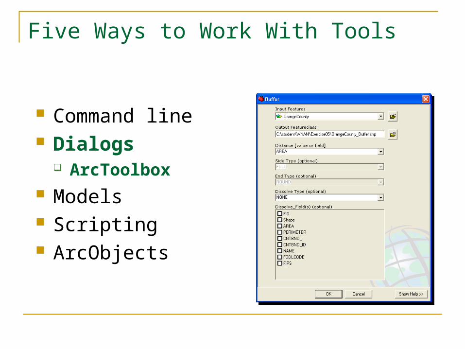
Five Ways to Work With Tools
Command line Dialogs Models Scripting ArcObjects
VBA VB C++ C (COM)
ArcToolbox
ArcToolbox is now a dockable window within ArcMap and ArcCatalog
ArcToolbox
Geoprocessing tools are available through toolboxes or toolsets Categorized by process type Create your own toolboxes and tools
Full tool index and search functions Locate tool function Interface to ModelBuilder
Geoprocessing Wizard
The ArcView 8x Geoprocessing Wizard has been removed from the ArcMap interface
However the functions are still available just located in separate toolsets
Geoprocessing Wizard
Dissolvemdash Data Management gt Generalization gt Dissolve tool
Mergemdash Data Management gt General gt Append tool
Clipmdash Analysis gt Extract gt Clip tool Intersectmdash Analysis gt Overlay gt Intersect tool Unionmdash Analysis gt Overlay gt Union tool
MergeAppend
MergeAppend operation ndash two or more layers
Append adjacent layers Appends data source(s) or
feature class(es) to an existing Example MergeAppend several counties Notice when layers overlap Features are not intersected Features and attributes are
only appended
Dissolve
Dissolve operation ndash one layer process1048713 Aggregate features by value of attribute when it is the same1048713 Creates new data source or feature classExample1048713 Landuse Level 2 to Level 11048713 Parcels based on ownership
Dissolve
Dissolving features - simplify the data based on common attribute values
Buffer
Buffers are rings drawn around features at a distance
1048713 By distance or attribute value
1048713 All features or only selected features
1048713 Outside within multiple rings
1048713 New layer or graphic
Clip
Clip operation ndash two layer process1048713 Reduce spatial extent of one layer based on spatial extent of other1048713 Cookie cutter analogy1048713 Creates new data source or feature class1048713 Same attribute table as input layer but a subset1048713 Clip layer must be a polygon input layer any feature class1048713 Output layer feature class same as input layerExample1048713 Limit area of geographic interest1048713 Only Ontario not all of Canada
Overlay Analysis GeoProcessing
Overlay analysis functions
Intersect
Intersect overlay ndash two layers necessary 1048713 New layer with spatial extent only
common to two layers 1048713 Attribute table inherits from both layers 1048713 Creates new data source or feature class 1048713 Input layer determines feature class for
output layer 1048713 Overlay layer must be a polygon Example 1048713 Intersection of Roads with several
counties 1048713 Intersection of Pollution point with
counties
Union
Union overlay ndash two layers necessary1048713 Combine two polygon feature classes and only polygon feature classes1048713 Attribute table inherits from both layers1048713 Creates new data source or polygon feature classExampleSoil layer with crop productivity
Union example
Find out influence of soil type over crop productivity
1048713 Get a soils layer 1048713 Get a crop productivity layer 1048713 Use Union overlay to combine both layers in
one 1048713 Query Display Analyze the new layer based
on the new joint attributes to determine if there is a relationship
between the soil type and the crop productivity
Important
The output from the GeoProcessing operation will be in the same coordinate system as the Data Frame irrespective of the coordinate system of the data sources of the input layers
ArcMap Settings
ArcMap
Tools
Options
Geoprocessing
ArcMap Settings
CArcGISUtilitiesAdvancedArcMapSettingsexe
Environment Settings
Used by all geoprocessing tasks Settings include
Workspace and mask Coordinate system Cell size and extent Resampling method Coverage and Geodatabase setting etchellip

ArcToolbox
ArcToolbox is now a dockable window within ArcMap and ArcCatalog
ArcToolbox
Geoprocessing tools are available through toolboxes or toolsets Categorized by process type Create your own toolboxes and tools
Full tool index and search functions Locate tool function Interface to ModelBuilder
Geoprocessing Wizard
The ArcView 8x Geoprocessing Wizard has been removed from the ArcMap interface
However the functions are still available just located in separate toolsets
Geoprocessing Wizard
Dissolvemdash Data Management gt Generalization gt Dissolve tool
Mergemdash Data Management gt General gt Append tool
Clipmdash Analysis gt Extract gt Clip tool Intersectmdash Analysis gt Overlay gt Intersect tool Unionmdash Analysis gt Overlay gt Union tool
MergeAppend
MergeAppend operation ndash two or more layers
Append adjacent layers Appends data source(s) or
feature class(es) to an existing Example MergeAppend several counties Notice when layers overlap Features are not intersected Features and attributes are
only appended
Dissolve
Dissolve operation ndash one layer process1048713 Aggregate features by value of attribute when it is the same1048713 Creates new data source or feature classExample1048713 Landuse Level 2 to Level 11048713 Parcels based on ownership
Dissolve
Dissolving features - simplify the data based on common attribute values
Buffer
Buffers are rings drawn around features at a distance
1048713 By distance or attribute value
1048713 All features or only selected features
1048713 Outside within multiple rings
1048713 New layer or graphic
Clip
Clip operation ndash two layer process1048713 Reduce spatial extent of one layer based on spatial extent of other1048713 Cookie cutter analogy1048713 Creates new data source or feature class1048713 Same attribute table as input layer but a subset1048713 Clip layer must be a polygon input layer any feature class1048713 Output layer feature class same as input layerExample1048713 Limit area of geographic interest1048713 Only Ontario not all of Canada
Overlay Analysis GeoProcessing
Overlay analysis functions
Intersect
Intersect overlay ndash two layers necessary 1048713 New layer with spatial extent only
common to two layers 1048713 Attribute table inherits from both layers 1048713 Creates new data source or feature class 1048713 Input layer determines feature class for
output layer 1048713 Overlay layer must be a polygon Example 1048713 Intersection of Roads with several
counties 1048713 Intersection of Pollution point with
counties
Union
Union overlay ndash two layers necessary1048713 Combine two polygon feature classes and only polygon feature classes1048713 Attribute table inherits from both layers1048713 Creates new data source or polygon feature classExampleSoil layer with crop productivity
Union example
Find out influence of soil type over crop productivity
1048713 Get a soils layer 1048713 Get a crop productivity layer 1048713 Use Union overlay to combine both layers in
one 1048713 Query Display Analyze the new layer based
on the new joint attributes to determine if there is a relationship
between the soil type and the crop productivity
Important
The output from the GeoProcessing operation will be in the same coordinate system as the Data Frame irrespective of the coordinate system of the data sources of the input layers
ArcMap Settings
ArcMap
Tools
Options
Geoprocessing
ArcMap Settings
CArcGISUtilitiesAdvancedArcMapSettingsexe
Environment Settings
Used by all geoprocessing tasks Settings include
Workspace and mask Coordinate system Cell size and extent Resampling method Coverage and Geodatabase setting etchellip
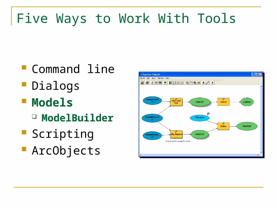
ArcToolbox
Geoprocessing tools are available through toolboxes or toolsets Categorized by process type Create your own toolboxes and tools
Full tool index and search functions Locate tool function Interface to ModelBuilder
Geoprocessing Wizard
The ArcView 8x Geoprocessing Wizard has been removed from the ArcMap interface
However the functions are still available just located in separate toolsets
Geoprocessing Wizard
Dissolvemdash Data Management gt Generalization gt Dissolve tool
Mergemdash Data Management gt General gt Append tool
Clipmdash Analysis gt Extract gt Clip tool Intersectmdash Analysis gt Overlay gt Intersect tool Unionmdash Analysis gt Overlay gt Union tool
MergeAppend
MergeAppend operation ndash two or more layers
Append adjacent layers Appends data source(s) or
feature class(es) to an existing Example MergeAppend several counties Notice when layers overlap Features are not intersected Features and attributes are
only appended
Dissolve
Dissolve operation ndash one layer process1048713 Aggregate features by value of attribute when it is the same1048713 Creates new data source or feature classExample1048713 Landuse Level 2 to Level 11048713 Parcels based on ownership
Dissolve
Dissolving features - simplify the data based on common attribute values
Buffer
Buffers are rings drawn around features at a distance
1048713 By distance or attribute value
1048713 All features or only selected features
1048713 Outside within multiple rings
1048713 New layer or graphic
Clip
Clip operation ndash two layer process1048713 Reduce spatial extent of one layer based on spatial extent of other1048713 Cookie cutter analogy1048713 Creates new data source or feature class1048713 Same attribute table as input layer but a subset1048713 Clip layer must be a polygon input layer any feature class1048713 Output layer feature class same as input layerExample1048713 Limit area of geographic interest1048713 Only Ontario not all of Canada
Overlay Analysis GeoProcessing
Overlay analysis functions
Intersect
Intersect overlay ndash two layers necessary 1048713 New layer with spatial extent only
common to two layers 1048713 Attribute table inherits from both layers 1048713 Creates new data source or feature class 1048713 Input layer determines feature class for
output layer 1048713 Overlay layer must be a polygon Example 1048713 Intersection of Roads with several
counties 1048713 Intersection of Pollution point with
counties
Union
Union overlay ndash two layers necessary1048713 Combine two polygon feature classes and only polygon feature classes1048713 Attribute table inherits from both layers1048713 Creates new data source or polygon feature classExampleSoil layer with crop productivity
Union example
Find out influence of soil type over crop productivity
1048713 Get a soils layer 1048713 Get a crop productivity layer 1048713 Use Union overlay to combine both layers in
one 1048713 Query Display Analyze the new layer based
on the new joint attributes to determine if there is a relationship
between the soil type and the crop productivity
Important
The output from the GeoProcessing operation will be in the same coordinate system as the Data Frame irrespective of the coordinate system of the data sources of the input layers
ArcMap Settings
ArcMap
Tools
Options
Geoprocessing
ArcMap Settings
CArcGISUtilitiesAdvancedArcMapSettingsexe
Environment Settings
Used by all geoprocessing tasks Settings include
Workspace and mask Coordinate system Cell size and extent Resampling method Coverage and Geodatabase setting etchellip

Geoprocessing Wizard
Dissolvemdash Data Management gt Generalization gt Dissolve tool
Mergemdash Data Management gt General gt Append tool
Clipmdash Analysis gt Extract gt Clip tool Intersectmdash Analysis gt Overlay gt Intersect tool Unionmdash Analysis gt Overlay gt Union tool
MergeAppend
MergeAppend operation ndash two or more layers
Append adjacent layers Appends data source(s) or
feature class(es) to an existing Example MergeAppend several counties Notice when layers overlap Features are not intersected Features and attributes are
only appended
Dissolve
Dissolve operation ndash one layer process1048713 Aggregate features by value of attribute when it is the same1048713 Creates new data source or feature classExample1048713 Landuse Level 2 to Level 11048713 Parcels based on ownership
Dissolve
Dissolving features - simplify the data based on common attribute values
Buffer
Buffers are rings drawn around features at a distance
1048713 By distance or attribute value
1048713 All features or only selected features
1048713 Outside within multiple rings
1048713 New layer or graphic
Clip
Clip operation ndash two layer process1048713 Reduce spatial extent of one layer based on spatial extent of other1048713 Cookie cutter analogy1048713 Creates new data source or feature class1048713 Same attribute table as input layer but a subset1048713 Clip layer must be a polygon input layer any feature class1048713 Output layer feature class same as input layerExample1048713 Limit area of geographic interest1048713 Only Ontario not all of Canada
Overlay Analysis GeoProcessing
Overlay analysis functions
Intersect
Intersect overlay ndash two layers necessary 1048713 New layer with spatial extent only
common to two layers 1048713 Attribute table inherits from both layers 1048713 Creates new data source or feature class 1048713 Input layer determines feature class for
output layer 1048713 Overlay layer must be a polygon Example 1048713 Intersection of Roads with several
counties 1048713 Intersection of Pollution point with
counties
Union
Union overlay ndash two layers necessary1048713 Combine two polygon feature classes and only polygon feature classes1048713 Attribute table inherits from both layers1048713 Creates new data source or polygon feature classExampleSoil layer with crop productivity
Union example
Find out influence of soil type over crop productivity
1048713 Get a soils layer 1048713 Get a crop productivity layer 1048713 Use Union overlay to combine both layers in
one 1048713 Query Display Analyze the new layer based
on the new joint attributes to determine if there is a relationship
between the soil type and the crop productivity
Important
The output from the GeoProcessing operation will be in the same coordinate system as the Data Frame irrespective of the coordinate system of the data sources of the input layers
ArcMap Settings
ArcMap
Tools
Options
Geoprocessing
ArcMap Settings
CArcGISUtilitiesAdvancedArcMapSettingsexe
Environment Settings
Used by all geoprocessing tasks Settings include
Workspace and mask Coordinate system Cell size and extent Resampling method Coverage and Geodatabase setting etchellip

Dissolve
Dissolving features - simplify the data based on common attribute values
Buffer
Buffers are rings drawn around features at a distance
1048713 By distance or attribute value
1048713 All features or only selected features
1048713 Outside within multiple rings
1048713 New layer or graphic
Clip
Clip operation ndash two layer process1048713 Reduce spatial extent of one layer based on spatial extent of other1048713 Cookie cutter analogy1048713 Creates new data source or feature class1048713 Same attribute table as input layer but a subset1048713 Clip layer must be a polygon input layer any feature class1048713 Output layer feature class same as input layerExample1048713 Limit area of geographic interest1048713 Only Ontario not all of Canada
Overlay Analysis GeoProcessing
Overlay analysis functions
Intersect
Intersect overlay ndash two layers necessary 1048713 New layer with spatial extent only
common to two layers 1048713 Attribute table inherits from both layers 1048713 Creates new data source or feature class 1048713 Input layer determines feature class for
output layer 1048713 Overlay layer must be a polygon Example 1048713 Intersection of Roads with several
counties 1048713 Intersection of Pollution point with
counties
Union
Union overlay ndash two layers necessary1048713 Combine two polygon feature classes and only polygon feature classes1048713 Attribute table inherits from both layers1048713 Creates new data source or polygon feature classExampleSoil layer with crop productivity
Union example
Find out influence of soil type over crop productivity
1048713 Get a soils layer 1048713 Get a crop productivity layer 1048713 Use Union overlay to combine both layers in
one 1048713 Query Display Analyze the new layer based
on the new joint attributes to determine if there is a relationship
between the soil type and the crop productivity
Important
The output from the GeoProcessing operation will be in the same coordinate system as the Data Frame irrespective of the coordinate system of the data sources of the input layers
ArcMap Settings
ArcMap
Tools
Options
Geoprocessing
ArcMap Settings
CArcGISUtilitiesAdvancedArcMapSettingsexe
Environment Settings
Used by all geoprocessing tasks Settings include
Workspace and mask Coordinate system Cell size and extent Resampling method Coverage and Geodatabase setting etchellip
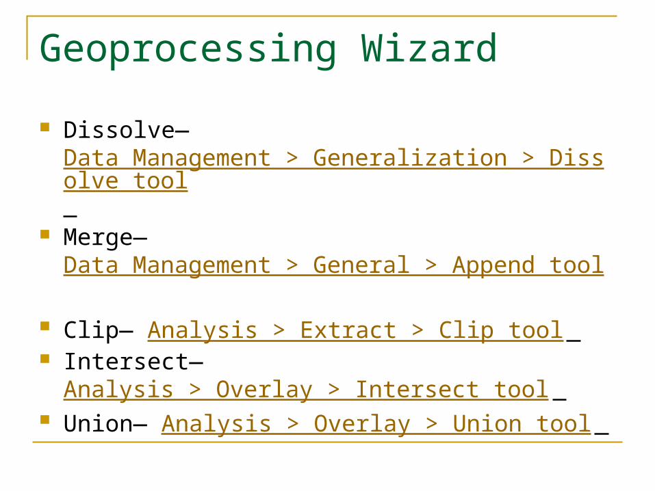
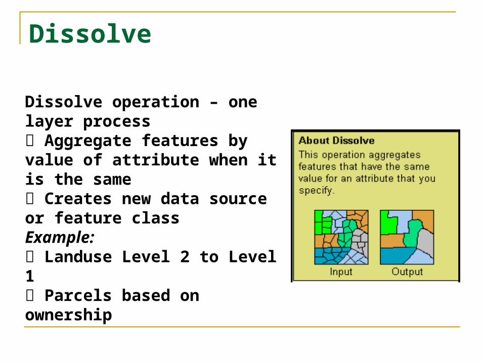

ArcMap Settings
ArcMap
Tools
Options
Geoprocessing
ArcMap Settings
CArcGISUtilitiesAdvancedArcMapSettingsexe
Environment Settings
Used by all geoprocessing tasks Settings include
Workspace and mask Coordinate system Cell size and extent Resampling method Coverage and Geodatabase setting etchellip

ArcMap Settings
CArcGISUtilitiesAdvancedArcMapSettingsexe
Environment Settings
Used by all geoprocessing tasks Settings include
Workspace and mask Coordinate system Cell size and extent Resampling method Coverage and Geodatabase setting etchellip
Environment Settings
Used by all geoprocessing tasks Settings include
Workspace and mask Coordinate system Cell size and extent Resampling method Coverage and Geodatabase setting etchellip
Related Documents