We’re All GEOINTers 2016 Annual Report

Welcome message from author
This document is posted to help you gain knowledge. Please leave a comment to let me know what you think about it! Share it to your friends and learn new things together.
Transcript

We’re All GEOINTers
2016 Annual Report

The United States Geospatial Intelligence Foundation (USGIF)
was founded in 2004 as a 501(c)(3) non-lobbying, nonprofit
educational foundation dedicated to promoting the geospatial
intelligence tradecraft with government, industry, academia,
professional organizations, and individuals.
“USGIF is a forward-thinking organization with their finger on the GEOINT Community’s pulse.”- Sean Smeltzer, Blue Canopy Group LLC
BUILD THE COMMUNITY
U S G I F E X E C U T E S I T S M I S S I O N T H R O U G H I T S S T R A T E G I C P I L L A R S
USGIF builds the community by engaging defense, intelligence, and homeland security professionals, industry, academia, non-governmental organizations, international partners, and individuals to discuss the importance and power of geospatial intelligence.
ADVANCE THE TRADECRAFT ACCELERATE INNOVATIONGEOINT is only as good as the tradecraft driving it. We are dedicated to working with our industry, university, and government partners to push the envelope on tradecraft. Through education and lifelong professional development, USGIF provides ample opportunities to gain needed knowledge, skills, and abilities.
Innovation is at the heart of GEOINT. We work hard to provide our members the opportunity to share innovations, speed up technology adoption, and accelerate innovation.

OUR LEADERSFrom the Chairman . . . . . . . . . . . . . . . . . . . . . . . . . . . . . . . . . . . . . . . . . . . . . . . . . . . 2
From the CEO . . . . . . . . . . . . . . . . . . . . . . . . . . . . . . . . . . . . . . . . . . . . . . . . . . . . . . . 3
Board of Directors . . . . . . . . . . . . . . . . . . . . . . . . . . . . . . . . . . . . . . . . . . . . . . . . . . . . 4
Staff . . . . . . . . . . . . . . . . . . . . . . . . . . . . . . . . . . . . . . . . . . . . . . . . . . . . . . . . . . . . . 5
EDUCATION IN ACTION Collegiate Accreditation Program. . . . . . . . . . . . . . . . . . . . . . . . . . . . . . . . . . . . . . . . . 7
Scholarship Program. . . . . . . . . . . . . . . . . . . . . . . . . . . . . . . . . . . . . . . . . . . . . . . . . . 8
Professional Development . . . . . . . . . . . . . . . . . . . . . . . . . . . . . . . . . . . . . . . . . . . . . 10
Events. . . . . . . . . . . . . . . . . . . . . . . . . . . . . . . . . . . . . . . . . . . . . . . . . . . . . . . . . . . . 12
Young Professionals Group . . . . . . . . . . . . . . . . . . . . . . . . . . . . . . . . . . . . . . . . . . . . 18
INVOLVEMENT Working Groups . . . . . . . . . . . . . . . . . . . . . . . . . . . . . . . . . . . . . . . . . . . . . . . . . . . . 21
Committees . . . . . . . . . . . . . . . . . . . . . . . . . . . . . . . . . . . . . . . . . . . . . . . . . . . . . . . 23
PUBLICATIONS � � � � � � � � � � � � � � � � � � � � � � � � � � � � � � � � � � � � � � � � � � � � � � � � 24
OUTREACH & COMMUNITY ENGAGEMENT� � � � � � � � � � � � � � � � � � � � � � � � � � � 28
FUNDRAISING� � � � � � � � � � � � � � � � � � � � � � � � � � � � � � � � � � � � � � � � � � � � � � � � � 34
FINANCIAL REPORT � � � � � � � � � � � � � � � � � � � � � � � � � � � � � � � � � � � � � � � � � � � � 36
MEMBERSHIP � � � � � � � � � � � � � � � � � � � � � � � � � � � � � � � � � � � � � � � � � � � � � � � � � 38

United States Geospatial Intelligence Foundation2
From the ChairmanFor the individuals, agencies, and corporations that we serve, we endeavor each day to improve our community and tradecraft. As we reflect on our accomplishments in this 2016 annual report, we want to share with you a snapshot of the diverse portfolio of our activities supporting education, training, and professional development. Each time the Foundation adds events and initiatives to our programming, we always keep in mind the educational nature of our work and our ability to drive positive impacts to the GEOINT Community. You are our stakeholders and we are investing the resources you entrust with us to further the Foundation’s objectives.
The mission demands for the GEOINT Community are complex, often global in nature, and require the meshing of analytic expertise and advanced visualization that leverages advanced information technologies. For your reference, a companion to this document is The State and Future of GEOINT 2017 report where the USGIF thought leaders are providing insight into their conversations about the future of GEOINT across the defense, intelligence, civil, and commercial communities.
I became the Chairman of the Board in April 2014, and since then our Community and USGIF has made great strides. Membership has grown, we’ve accredited more colleges and universities, and we have in place a professional certification program. Our expanded K-12 educational and outreach services are building the workforce pipeline, providing an avenue for our young professionals to help foster the next generation.
USGIF has finalized a strategic plan that will help guide us to better serve our members. We are mindful that we must continue to adapt to unforeseen challenges, technologies, and opportunities. On behalf of the entire USGIF Board of Directors, I thank you for your continued support of the Foundation and our GEOINT Community.
The Honorable Jeffrey K� Harris Chairman of the Board

2016 Annual Report 3
From the CEOWe at USGIF are pleased to present this annual report to our members, stakeholders, and partners. As a nonprofit educational Foundation, we are committed to providing transparent insight regarding our activities and funding. We believe this is part of the contract we maintain with those who provide us funding and those whom we serve. Further, transparency sustains the trust and confidence our members have placed in USGIF since our founding in January 2004. We’re proud of that long record of responsibility and accomplishment, and depend on the generous investment of the GEOINT Community to continue to meet our mission.
The USGIF Board of Directors exercises oversight of the Foundation’s spending consistent with applicable policy and law. The Board directs me to contract for an annual third party audit of our finances, so there can be no question regarding our fiscal controls and adherence to those controls. I am fully accountable to the Board, and in turn, I hold every employee accountable for their professional conduct and fiscal responsibility. We’re proud that the audit referenced in this report discovered $0.89 of every dollar we accrue is channeled back into USGIF programs.
Our membership is consistent in their praise of the Foundation’s staff, and that praise is well deserved. The USGIF staff numbers about 15 full-time employees, including interns and our government detailee. They are experienced, educated professionals, and, where applicable, have multiple professional certifications in their areas of responsibility. They are dedicated to personal professional development, as part of a larger team culture of continuous learning, adaptation, and growth. USGIF staff is committed to the mission of the Foundation and works closely as a team. The Foundation’s remarkably low turnover rate is a testament to the constructive working environment their synergy creates. I’m particularly proud of their unceasing dedication to our members, volunteers, event attendees and sponsors, and the students and educators with whom we engage.
Everyone associated with USGIF should be justifiably proud of the contents of this report—a snapshot of just one year of the organization’s activities. I’m humbled by the support the extended GEOINT Community provides, and excited by what lies ahead in the era of the GEOINT Revolution. I’m further humbled by the tremendous time and effort our volunteers invest in the organization. They are at the center of everything USGIF achieves. I could never adequately express our continuing appreciation for their efforts; they epitomize the spirit of USGIF and our collective dedication to Build the Community, Advance the Tradecraft, and Accelerate Innovation.
Keith J� Masback Chief Executive Officer

United States Geospatial Intelligence Foundation4
USGIF Board of DirectorsChairman of the Board of Directors The Honorable Jeffrey K� HarrisJKH Consulting LLC
Dr� Peggy AgourisDean, College of Science, George Mason University
Julia BowersIndependent Consultant
John FenwickFormer Head, Terra Bella Operations, Google
Paul L� GrazianiChief Executive Officer & Co-Founder, Analytical Graphics Inc.
Michael C� GrocholPrincipal & Senior Partner, ISPA TechnologyYPWG
Josh HartmanManaging Partner, Renaissance Strategic Advisors
Dewey R� Houck IIIndependent Advisor
Joanne O� IshamPresident, Isham Associates LLC
Jeff JonasFounder and Chief Scientist, Senzing Inc.
Brig� Gen� Michael G� Lee, U�S� Air Force (Ret�)Partner, National Security, Blue Canopy Group LLC
Keith E� Littlefield, Ph�D�Vice President, National Intelligence Account, TASC, an Engility Company
Letitia A� LongFormer Director, NGA
Keith J� MasbackChief Executive Officer, USGIF
Dr� L� Roger Mason Jr�Senior Vice President, National Security and Intelligence; and Chief Security Officer, Noblis
Aimee McGranahanChief Operating Officer, USGIF
Carmen MedinaFounder, MedinAnalytics; Co-Founder, RebelsatWork.com
Stephen S� OswaldFounding Partner, SYZYGY Enterprises
Mahn PhamIT Project Manager, Accenture Federal Services
Jeffrey R� TarrPresident and Chief Executive Officer, DigitalGlobe
Christopher K� TuckerPrincipal, Yale House Ventures
Isaac ZaworskiVice President, VRICON
Board AdvisorsDr� David AlexanderChief Geospatial Scientist, First Responders Group, Science & Technology, U.S. Department of Homeland Security
Susan M� GordonDeputy Director, NGA
Lidia LopezGEOINT Analyst, Office of Geography, NGA

52016 Annual Report
USGIF StaffKeith J� MasbackChief Executive Officer
Aimee McGranahanChief Operating Officer
Jordan N� FuhrVice President of Strategic Communications & Marketing
Jeffrey T� Ley, CEM, CMMVice President of Business Development & Exhibitions
Darryl Murdock, Ph�D�Vice President of Professional Development
Christopher ViselliSenior Operations Executive
Bill Allder III, CAESenior Membership Development Manager
Justin FranzVolunteer Engagement Manager
Ashley Jones, CEM, CMP, CTSMSenior Manager, Exhibit and Sponsorship Services
Shameka JordanSenior Marketing Manager
Anna KimmelDirector of Events
Lindsay MitchellMarketing & Communications Assistant
Kristin QuinnEditorial Director
Shai SobrinoOffice Manager
Julia VanarsdallEvent Coordinator
USGIF staff, its partners, and interns at the conclusion of the GEOINT 2016 Symposium.
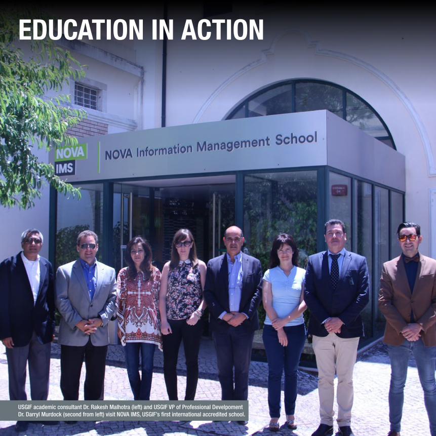
EDUCATION IN ACTION
USGIF academic consultant Dr. Rakesh Malhotra (left) and USGIF VP of Professional Develpoment Dr. Darryl Murdock (second from left) visit NOVA IMS, USGIF’s first international accredited school.

2016 Annual Report 7
USGIF Collegiate Accreditation ProgramThe Collegiate Accreditation Program creates a pipeline for undergraduate and graduate students to gain the necessary knowledge to join the GEOINT Community. Accredited schools can be certain they are providing real-world applicable education and graduates know they will have a competitive advantage with USGIF’s academic GEOINT Certificate. Hiring organizations can be assured any student with a certificate can speak GEOINT their first day on the job.
MAYNOVA IMS becomes first international USGIF-accredited university.
DECEMBER105 students receive USGIF academic GEOINT Certificates in 2016.
JUNEUSGIF accredits James Madison University.
students have earned a USGIF GEOINT Certificate at accredited schools.MORE THAN 700
EDUCATION IN ACTION
14 Accredited Geospatial Intelligence Certificate Programs Northeastern
West Point
Penn State
George MasonJames Madison
USC Redlands
Air Force Academy
U� of Utah
UM Columbia
Fayetteville State
UT Dallas U� of South Carolina
Universidade Nova de Lisboa
Portugal

United States Geospatial Intelligence Foundation820
16 S
CHOL
ARSH
IP R
ECIP
IENT
S2016 USGIF Scholarship ProgramUSGIF is dedicated to assisting promising students interested in the geospatial sciences with scholarship awards. The annual USGIF Scholarship Program recognizes student achievements and helps further the advancement of the geospatial intelligence tradecraft.
Ken Miller Scholarship for Advanced Remote Sensing ApplicationsAnne Aryadne Bennett, University of Southern California
Doctorate• Michael Brady, Rutgers University• Monica Medel, Texas State University• Brad G. Peter, Michigan State University• Emanuel Arnal Storey, University of California, Santa Barbara/San Diego State University• Jennifer L. Whytlaw, Rutgers University
Graduate• Roxanne Ahmadi, Pennsylvania State University• Allison Bohlman, Alabama A&M University• James Osundwa, University of Redlands• Andrew Ryan, George Mason University• Christopher Smith, Delta State University• Zachary Toll, George Mason University• Claire Weber, University of Utah
Undergraduate• James Christianson, Delta State University/Mississippi Delta Community College• Hailee Hettrick, Cornell University• Tilden Remerleitch, University of Vermont• Kristin Sonsteby, Pennsylvania State University• Elijah Staple, University of Colorado, Boulder
Graduating High School Seniors• Georgia Bass, Monument Mountain Regional High School, Great Barrington, Mass.;
now attending University of Massachusetts, Amherst• Courtney Fassett, Northwood High School, Irvine, Calif.; now attending University of Southern California• John Golden, Archer High School, Lawrenceville, Ga.; now attending Georgia Institute of Technology• Emma McFee, Bainbridge-Guilford, Bainbridge, N.Y.; now attending University of Utah• Gillian Sullivan, Fairfax High School, Fairfax, Va.; now attending University of Mary Washington• Grayson Sullivan, Westlake High School, Austin, Texas; now attending University of Utah
2016 scholarship recipients
USGIF in partnership with Riverside Research
awarded the first $10,000 Ken Miller Scholarship
for Advanced Remote Sensing Applications in 2016.

2016 Annual Report 9
As of August 2016, USGIF totaled $1,003,000 in scholarships awarded since the program began in 2004.
2016
SCH
OLAR
SHIP
REC
IPIE
NTS EDUCATION IN ACTION
“The scholarship has helped prepare me for a career involving the intersection of science and policy with a focus on geospatial intelligence and analysis.”
- Kristin Sonsteby, 2016 Scholarship Winner, Penn State University Student

ON THE ROAD AGAIN…USGIF education and professional development staff spoke at a number of educational venues in 2016.
• NOVA Information Management School, Universidade Nova de Lisboa, Lisbon, Portugal
• Civil Applications Committee, Reston, Va.
• Defense Security Services, Linthicum, Md.
• University of Southern California Student Conference, Los Angeles, Calif.
• HBCU Summit, Fayetteville State University, Fayetteville, N.C.
• Upper Midwest GEOCON, La Crosse, Wis.
• UAS Mapping Conference, Palm Springs, Calif.
• James Madison University, Harrisonburg, Va.
• Southeast Division of the Association of American Geographers, Columbia, S.C.
• Claflin University, Orangeburg, S.C.
• University of South Carolina, Columbia, S.C.
United States Geospatial Intelligence Foundation10
Professional Development
Training
USGIF offers training opportunities to help GEOINT professionals enhance their professional development and better understand various aspects of the GEOINT tradecraft.
For instance, during the GEOINT 2016 Symposium, USGIF offered training sessions that were accredited by the International Association for Continuing Education and Training. Attendees received 0.2 CEUs per course.
• 30 courses were offered for a total of more than 60 hours of training
• 765 attendees
• Popular courses included:
– Linking Geospatial Data in Space and Time by IBM
– Leveraging Open-Source Intelligence for Fusion and Activity-Based Intelligence by Aptima
– Geospatial Predictive Analytics Tools: Theory and Practice by Novetta
Universal GEOINT Certification Program
In 2016, USGIF finalized its Universal GEOINT Certification program for
both U.S. and international GEOINT practitioners across multiple industries, military, academia, and federal, state, and local government.
The certification program, built on an extensive essential body of knowledge, is beneficial to
anyone who wants to further his or her education and training, take
the next step in career advancement, or showcase a deep understanding of GEOINT.
• March - Pilot exams completed
• April - Certification Governance Board finalizes Candidate Handbook
• May - Certification officially launched at the GEOINT 2016 Symposium. USGIF recognized the first six recipients who earned the Universal GEOINT Professional (UGP) certification.
• September - Awarded 89 certificates to individuals who passed one or more exams
– Certified GEOINT Professional - GIS & Analysis Tools (CGP-G): 27
– Certified GEOINT Professional - Remote Sensing & Imagery Analysis (CGP-R): 34
– Certified GEOINT Professional - Geospatial Data Management (CGP-D): 28
UN
IVERSAL GEOIN
T
CE
RTIFICATION PROG
RA
M“Certification represents a way to identify geospatial professionals invested in lifelong learning. Given two applicants for a geospatial position, a manager will likely choose the one who is already certified.”
- LTC Michael L. Wood, UGP Army Geospatial Information & Services Officer

2016 Annual Report 11
EDUCATION IN ACTION
USGIF recognizes onstage at GEOINT 2016 four of the first six professionals to earn the Foundation’s UGP certification.
“The UGP designation sends a signal to anyone who is tuned in. It plainly describes the level of expertise a certificate holder maintains. Because of the weight the candidate review process places on contributing back to the community, the designation also has a lot to say about a certificate holder’s values.”
- Christopher Johnson, UGP ArdentMC

USGIF Workshop Series
USGIF workshops bring the GEOINT Community together to discuss relevant issues in tradecraft and innovation. The workshops tackle topics that span the defense, intelligence, and homeland security communities and beyond.
Data Analytics Forum: April 25USGIF’s Data Analytics Forum brought together a diverse group from government, industry, and academia to discuss challenges and success stories related to how geospatial intelligence can be derived from and enhanced by data analytics.
“Excellent event overall. I thought the speakers and topics were of tremendous quality. I liked how it covered a spectrum of topics from challenges in the community to emerging trends and practices.”
- Anonymous Survey Respondent
Small Satellite Workshop: November 14-15As part of 2016 GEOINT Community Week, USGIF and its SmallSat Working Group put together a two-day (unclassified & classified) workshop focused on the uses, trends, and challenges associated with commercial small satellites.
GEOINT Workforce and Emerging Technology Workshop: November 15The Foundation’s Young Professionals Group hosted a workshop during USGIF’s 2016 GEOINT Community Week. The event featured a keynote on machine learning and artificial intelligence by Boeing’s Dewey R. Houck II, a USGIF Board Member, as well as a panel discussion on transitioning between government and industry careers.
Geospatial & Remote Sensing Law Workshop: December 7USGIF’s Geospatial & Remote Sensing Law Working Group offered a free, half-day program on legal and policy matters critical to the GEOINT Community.
United States Geospatial Intelligence Foundation12
EventsProviding forums for teaching, learning, and networking is at the core of who we are as an organization. USGIF produces a number of events throughout the year that reach thousands of consituents.
GEOINT Community Job Fair
The annual GEOINT Community Job Fair provides a free opportunity for job seekers to directly connect with employers in the defense, intelligence, and homeland security communities. Held January 11, the event attracted 187 job seekers and 42 hiring companies�
“Great event. Liked it more than any other job fair I’ve attended in the past. Look forward to the next one!”
- Anonymous Survey Respondent
GEOINTeraction Tuesday
Held the second Tuesday of every other month (except July), GEOINTeraction Tuesday is a casual networking event featuring a guest speaker. The events draw more than 100 attendees from across the GEOINT Community.
JANUARYJohn Goolgasian, Former Director, Source Operations Management Directorate, NGA
MARCHJames “Jimmy” Comfort, Deputy and Technical Director of the Imagery Intelligence Systems Acquisition Directorate, NRO
MAY David J. Gauthier, Director, Office of Strategic Operations, NGA
SEPTEMBER Elizabeth Hoag, eNGAge Program Manager, NGA
NOVEMBERMaj. Gen. Linda Urrutia-Varhall, Director of Operations, NGA, with Heidi Smith, Deputy Director of Plans and Programs, NGA
GEOINT 2016 Sneak Peek
The GEOINT 2016 Sneak Peek held April 7 provided a preview of the GEOINT 2016 Symposium. NGA Chief of Staff Ed Mornston and Industry Innovation Advocate Mike Geggus shared their plans with more than 100 attendees for GEOINT 2016 and discussed what agency attendees would like to see from industry. DIA’s Terry Busch also talked about what the agency was interested in and would be looking to discuss with attendees and exhibitors while in Orlando.

2016 Annual Report 13
EDUCATION IN ACTION
“AECOM chooses to support USGIF events because they offer a variety of ways to get involved within the community; whether it be through GEOINTeraction Tuesday, Tech Showcases, Community Week, or the annual GEOGala, USGIF helps bring together government, industry, academia, and individuals who share a common goal of promoting geospatial intelligence.”
- Michael Eiden, AECOM
John Goolgasian, Former NGA Director, Source Operations Management Directorate, speaking at GEOINTeraction Tuesday at The Children’s Science Center.

United States Geospatial Intelligence Foundation14
“This year’s GEOINT Symposium again demonstrated why it is the foremost gathering of GEOINT practitioners in the world. The keynote speakers are world-class, and the exhibit hall contains new and state-of-the-art examples of leading-edge technologies at almost every booth.”
- Bruce F. Molnia, Ph.D., USGS National Civil Applications Center
“Since 2004, MDA has been a proud member of USGIF and an exhibitor at the GEOINT Symposium. The GEOINT Symposium provides a critical and valuable opportunity for us to collaborate directly with the global geospatial community in a single venue.”
- Wendy Keyzer, MDA
“The GEOINT Symposium is the event I depend on to see the past, present, and future of our industry.”
- Tony Frazier, DigitalGlobe
Parag Khanna, Global Strategist, and Managing Partner of Hybrid Reality, speaks at the GEONT 2016 Symposium.

2016 Annual Report 15
GEOINT 2016 SymposiumThe nation’s preeminent geospatial intelligence event
GEOINT 2016, held May 15-18 at the Gaylord Palms Resort and Convention Center in Orlando, Fla�, was the 12th annual Symposium. Themed “The GEOINT Revolution,” the Symposium focused on how adjacent markets and emerging technologies influence the GEOINT Community.
• 512 attendees participated in GEOINT Foreword, which featured presentations from DARPA, IARPA, NGA Research, and four U.S. national laboratories
• The Allder Golf Classic raised just more than $8,600 for the USGIF Scholarship Program
• 765 individuals, some who participated in multiple sessions, attended the 30 professional development trainings
• 10 USGIF Working Group meetings were held
• The Government Pavilion Stage featured 12 sessions with more than 25 government speakers
• A classified day as held at the Air Force Technical Applications Center (AFTAC), May 19
EDUCATION IN ACTION
International
participation from
19 countries.
600 government personnel,
including more than 200
intelligence professionals from NGA as
well as members from each branch of the
U.S. military, and employees from the U.S.
State Department, Congress, the National
Institutes of Health, the Securities and
Exchange Commission, the U.S. Geological
Survey, the National Oceanic and
Atmospheric Administration, and more.
94% of attendees would recommend the GEOINT Symposium to a friend/colleague
93% plan to exhibit at GEOINT 2017
150+ speakers participated in keynotes, panels, trainings, working group sessions, and more
3,561 total attendees
• trajectory magazine’s Show Daily produced 92 pages of content in 5 days and trajectory on Location produced 51 videos
• 1,211 iOS & 509 Android mobile app downloads
• GeoBowl, a bowling fundraiser event on the exhibit hall floor, raised $5,145 with proceeds going to Boulder Crest Retreat, Freedom Alliance, and USGIF educational programs
• 74 sponsors
• 265 exhibitors
• Nearly 100,000 square feet of exhibit space
SHOWDAILYTUESDAY MAY 17, 2016
THE GEOINT 2016 SYMPOSIUM
B R O U G H T T O Y O U B Y U S G I F ’ S T R A J E C T O R Y M A G A Z I N E
A New Age of GEOINT
NGA DIRECTOR REFLECTS ON GEOINT’S PAST, CHARTS COURSE FOR ITS FUTURE
By Mat t A lder ton
W hat do Presidents George Washington,
Thomas Jefferson, Theodore Roosevelt, and Abraham Lincoln
have in common with the National Geospatial-Intelligence
Agency (NGA)? A lot, actually,
according to NGA Director Robert Cardillo, who used the
celebrated American leaders to
illustrate the continued evolution
of geospatial intelligence during
his keynote address Monday morning at GEOINT 2016.
“Seventy-� ve years ago, the
Mt. Rushmore National Memo-
rial was dedicated in the Black
Hills of South Dakota,” Cardi-
llo said. “It was a phenomenal
achievement of art and science
resulting in an iconic memorial
to four great Americans … So
let’s use these four remarkable
Americans as a framework to look
at our progress.”During his � rst address as direc-
tor of NGA at the GEOINT 2015
National Geospatial-Intelligence Agency Director Robert Cardillo discussed the future of his
agency’s research efforts, workforce development, industry engagement, and more in his
GEOINT 2016 keynote.
see A New Age p. 16
Symposium, Cardillo introduced a
new NGA Strategy focused on four
distinct pillars: people, partners,
profession, and value. Because he
would have been an avid NGA
customer, President Washington,
Cardillo told the audience, per-
soni� es value.“Enabling customer success is
what compels [NGA] every day.
We’re driven forward by our fear
of failing them. They—you—are
our reason for being,” Cardillo
said, stressing the importance
of NGA’s GEOINT Services initiative in creating customer
value. GEOINT Services, the
Intelligence Community’s enterprise-wide GEOINT delivery
platform that spans all security
domains, is on track to deliver
geospatial content fully in the
cloud by the end of 2017.When it does, NGA will be
even closer to achieving his vision
of succeeding “in the open,” according to Cardillo.The Director then turned
to President Jefferson, who
“ We must go wherever the data, technology,
and people exist, and apply that knowledge
wherever the customers demand.”
—ROBERT CARDILLO, DIRECTOR, NGA
Missed a keynote or panel?Catch the latest videos at vimeo.com/trajectoryonlocation
SHOWDAILYMONDAY
MAY 16, 2016THE GEOINT 2016 SYMPOSIUM
B R O U G H T T O Y O U B Y U S G I F ’ S T R A J E C T O R Y M A G A Z I N E
Professionalizing the GEOINT WorkforceUSGIF OFFICIALLY LAUNCHES ITS UNIVERSAL GEOINT CERT IF ICATION PROGRAM AT GEOINT 2016By Dr. Darr y l Murdock, Vice Pres ident o f Profess ional Deve lopment , USGIF
G eospatial intelligence has grown far beyond the banks of the Potomac and
is now a global phenomenon. In just more than a decade since the term was coined, a large GEOINT Community has sprung up around the world that is significantly impacting commercial business as well as the more traditional defense, intelligence, and homeland security communities.
Workers across the globe and in varied industries are becoming GEOINTers by the very nature and requirements of their jobs. And as the world demands more precision location information, geographical representations, and data visualization, the most chal-lenging issue the community faces is ensuring the professional work-force has the right knowledge, skills, and attitudes (KSAs), as well as a way to demonstrate this domain expertise—or a pathway to achieve such proficiency.
Dr. Darryl Murdock, USGIF’s vice president of professional development, announced Sunday morning during his GEOINT Foreword welcome address that USGIF’s Universal GEOINT Certification Program has completed the pilot testing phase and official program testing will begin in July.
DOWNLOAD THE OFFICIAL
SYMPOSIUM APP
for the most up-to-date event information atapp.geoint2016.comGEOINT 2016
Available on android and apple
see Certification p. 11
USGIF officially launches its Universal GEOINT Certification Program this week at GEOINT 2016, having just last week completed its pilot exam phase and awarded the first certifications to those who passed pilot exams. This marks an exciting milestone for the GEOINT Community as USGIF broadens its GEOINT pipeline from university accredita-tion and scholarships to include the professionalization of the GEOINT workforce.
USGIF’s certification program includes three exams with cor-responding certifications: GIS and Analysis Tools (CGP-G); Remote Sensing and Imagery Analysis (CGP-R); and Geospatial Data Management (CGP-D). A fourth competency—data visualiza-tion—is incorporated throughout all of the exams.
Each of the three exams and subsequent professional certifica-tions are valuable as standalone credentials. Many GIS, remote sensing, or data management
“ Workers across the globe and in varied industries are becoming GEOINTers by the very nature and requirements of their jobs.” —DR. DARRYL MURDOCK, USGIF
SHOWDAILYSUNDAY
MAY 15, 2016
THE GEOINT 2016 SYMPOSIUM
B R O U G H T T O Y O U B Y U S G I F ’ S T R A J E C T O R Y M A G A Z I N E
Designing for the End User
PHIL GILBERT OF IBM TO SHARE DESIGN THINKING APPROACH DURING GEOINT FOREWORD KEYNOTE
by Kr i s t in Quinn
Today, nearly 40,000
IBM employees practice
design thinking—a
human-centric process
of creating products specifically
to meet user needs by applying
empathy and insight. Phil
Gilbert, general manager for
IBM Design, aims to make that
number 100,000 by the end of
2016, and for everyone at IBM to
be a “design thinker” by the end
of 2017.
Gilbert will give a keynote
address Sunday at 8:45 a.m.
during GEOINT Foreword, the
pre-conference science and tech-
nology day that precedes USGIF’s
GEOINT 2016 Symposium.
“In a very specific way, I will
talk about using design thinking,
empathy, and fairly lightweight
and easy-to-use tools to deeply
understand the human beings that
we are developing applications
for,” he said.
“The need to understand
human beings becomes even
more critical when you have
Phil Gilbert addresses IBM designers on the 2016 vision for the IBM Design program.
DOWNLOAD THE OFFICIAL
SYMPOSIUM APP
for the most up-to-date
event information at
app.geoint2016.com
GEOINT 2016 Available on android and apple
see GEOINT Foreword p. 8
dependent networks of people
receiving the same information
but working in very differ ent
contexts,” Gilbert continued. “We
need new ways to understand
these people because they each
expect different tools even though
the underlying information is the
same.” For example, a warfighter
in the field, an admiral at the
Pentagon, or a civilian at the
White House may need the same
information delivered in very
different contexts in order to make
the quickest and best-informed
decisions, he explained.
“In order for them to under-
stand that information, the
development of the tool being
used has really got to understand
and empathize at a deep level
with each of those individuals
uniquely,” Gilbert said. “Other-
wise you’re developing a generic
tool which none of those people
will be able to make sense of in
the timeframes needed.”
Design thinking is fueled by
two strategic drivers, according to
“ I will talk about using design thinking...
to deeply understand the human beings
that we are developing applications for.”
—PHIL GILBERT, GENERAL MANAGER, IBM DESIGN
United States Geospatial Intelligence Foundation16
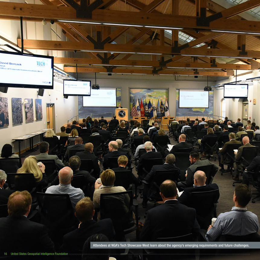
Attendees at NGA’s Tech Showcase West learn about the agency’s emerging requirements and future challenges.

State of GEOINT Content Exchange in Fairfax, VA.
2016 Annual Report 17
Thinker’s Series
USGIF Thinker’s lunches and dinners provide industry and government leaders an opportunity to discuss pressing challenges and innovative solutions. USGIF hosts a variety of discussions focused on specific issues as well as broad discussions about the future of the community. Three focus groups of 40 people gathered three times in 2016 to discuss the future of the GEOINT Community.
GeoAcademic Week
USGIF annually hosts a series of events in Northern Virginia over several days in October, inviting GEOINT professionals to collaborate on a variety of the Foundation’s education and professional development initiatives.
In 2016, events included the USGIF-Accredited Collegiate Programs Summit (Oct. 2-3) as well as the first of three State of GEOINT Content Exchanges (Oct. 4). Eleven of USGIF’s 14 schools discussed trends and issues in GEOINT education during the summit.
State of GEOINT Content Exchanges
In three unclassified sessions held in Fairfax, Va., Denver, Colo., and St. Louis, Mo., more than 150 participants discussed and documented current and future global geospatial intelligence trends and challenges. Teams self-selected to further develop topics of interest into short articles for inclusion in USGIF’s State and Future of GEOINT 2017 report.
NGA Tech Showcase East & West
USGIF provides the GEOINT Community with two unparalleled, classified events to witness NGA tech demos up close, tour facilities, and discuss challenges and solutions.
Tech Showcase West: October 18-19In 2016, Tech Showcase West kicked off with USGIF’s first Innovation Day focused on industry-government hybrid collaboration at the Cortex Innovation Community campus in downtown St. Louis, Mo. Day two, NGA Tech Showcase West, featured demos, briefings, and tours at NGA Campus West. The two-day event attracted 278 attendees and 30+ exhibitors�
Tech Showcase East: November 16USGIF's NGA Tech Showcase East was a full-day, classified event offering 174 attendees the opportunity to listen to briefings and see 20+ demos at NGA Campus East.
EDUCATION IN ACTION
2016 GEOINT Community Week: November 12-18
For one week each November participants from the defense, intelligence, and homeland security communities and beyond come together to engage in workshops and briefings, tour technology exhibits, and network with government and industry colleagues. Events take place throughout Northern Virginia and at partner events throughout the country.
• November 12: GEOGala
• November 14-15: Small Satellite Workshop
• November 15: GEOINT Workforce and Emerging Technology Workshop
• November 15: GEOINTeraction Tuesday
• November 16: Tech Showcase East
• November 16: GIS Day events at George Mason University and Moorefield Elementary School in Ashburn, Va.
• November 17-18: Geography 2050, Columbia University, New York City
More than 1,200 attendees
40+ speakers

United States Geospatial Intelligence Foundation18
USGIF Young Professionals GroupThe USGIF Young Professionals Group (YPG) serves to unite GEOINT professionals who are in the early stages of their career. YPG offers events and programs that parallel the Foundation’s mission of advancing the geospatial intelligence tradecraft yet are tailored to the unique needs of the younger workforce. The group is composed of and managed by young professional volunteers.
2016 in Review• YPG held at least one event each month.
• Partnered with the USGIF Small Sats Working Group for a presentation on “Commercial Small Satellites and Open Source Analytics.”
• Participated with ASPRS for a joint networking and tech showcase event attracting more than 40 participants.
• Taught families about satellites and imagery at the International Spy Museum’s annual Spy Fest event.
• Selected 26 individuals for the GEOINT 2016 Symposium Golden Ticket Program, an exclusive opportunity for young professionals to earn complimentary registration to the GEOINT 2016 Symposium and participate in special mentoring and networking sessions with senior GEOINT leaders.
• Collected 30 new toys during YPG’s annual holiday party that were donated to Toys for Tots.
• Created an Acquisitions 101 series in conjunction with the NRO ASP Industry Working Group.
• Elected to the USGIF Board of Directors two young professionals.
Successful Firsts: YPG hosted a “Mappy Hour” during Tech Showcase West in St. Louis and put together a “GEOINT Workforce and Emerging Technology Workshop” during the 2016 GEOINT Community Week.
International Spy Museum’s Spy Fest
Annual Toys for Tots drive
YPG mentoring session during the GEOINT 2016 Symposium
Young professionals pose with Jeff Jonas, IBM Fellow and Chief Scientist of IBM Context Computing

2016 Annual Report 19
EDUCATION IN ACTION
Young professionals from USGIF’s Golden Ticket Program meet with Director of National Intelligence James R. Clapper during GEOINT 2016.

United States Geospatial Intelligence Foundation20
INVOLVEMENT
The SmallSat Working Group held a panel at the GEOINT 2016 Symposium.

2016 Annual Report 21
Working GroupsThere are a variety of ways for employees of USGIF Member Organizations and Individual USGIF Members to get involved with the Foundation. USGIF currently has seven working groups and six committees serving various needs and interests across the GEOINT Community.
Activity-Based Intelligence Working GroupThe Activity-Based Intelligence Working Group (ABI WG) informs and educates the GEOINT Community on a common understanding of Activity-Based Intelligence and enhances communication of the ABI value proposition. Co-chairs include Erf Porter (Areté Associates) & John Delay (Harris Corporation).
Through ongoing dialogue, the ABI WG created opportunities for traditional and nontraditional ABI providers to participate, collaborate, and exchange ideas.
• In partnership with the MITRE Corporation, the ABI WG sponsored data collection during the GEOINT 2016 Symposium.
• The ABI WG held a two-day workshop emphasizing strategic application of ABI in partnership with the Military Operations Research Society.
• 2016 ended with providing a working group summary of activities and outcomes to the Principal Deputy Director of National Intelligence.
Geospatial and Remote Sensing Law Working GroupThe Geospatial and Remote Sensing Law Working Group educates its members on legal issues and development related to geospatial information. Membership for this working group is in-house counsel or legal representation for USGIF Member organizations. The working group is chaired by John Martinez (Raytheon).
The Geospatial and Remote Sensing Law Working Group held two discussions during the GEOINT 2016 Symposium on Spatial Law & Policy and Geolocation Privacy. The group also hosted a Geospatial and Remote Sensing Law Workshop in December, which offered Continuing Legal Education (CLE) credits.
NGA Advisory Working GroupThe NGA Advisory Working Group (NAWG) brings industry and academia together to advise, recommend, and promote actionable ideas to improve NGA’s acquisition processes. The NAWG is co-chaired by Jim Kwolek (Kwolek Consulting LLC) and Skip Maselli (Raytheon).
The NAWG 2016 activities included:
• Holding a discussion at the GEOINT 2016 Symposium on “Evolving to a Sustainable Government/Industry Business Model in an IC-ITE and Cloud-based environment.”
• Developing the NGA/Industry Mock Acquisition Program (NIMAP) to increase transparency between industry and NGA activities throughout the contract procurement and acquisition process. The NIMAP allows stakeholders to closely and directly observe, share, and discuss processes and experiences during a notional (mock event) scenario-based acquisition cycle.
NRO ASP Industry Advisory Working GroupThe NRO ASP Industry Advisory Working Group (NAIAWG) brings together industry professionals from hardware, software, systems integrator, and SETA/FFRDC organizations to help the government achieve its agency transformation objectives. The NAIAWG continued working on the Software Business 101 curriculum, which has drawn considerable interest from government and industry. Co-Chairs include Keith Barber (Quaestor Federal Consulting) and Nick Buck (Buck Consulting Group).
Small Business Advisory Working GroupWith more than 150 members, the Small Business Advisory Working Group (SBAWG) assists small business members seeking to gain traction in the GEOINT market by facilitating opportunities to build relationships with the Intelligence Community, Department of Defense, civil agencies, prime contractors, and other small businesses. Bruce Donaldson (InTec, LLC) and Kathy Pherson (Pherson Associates, LLC) co-chair the working group.
Over the last year the SBAWG continued its efforts to raise the profile and respond to concerns of small businesses seeking to contribute to NGA’s mission. This included:
• Meeting with the new Director of NGA’s Small Business Program Office, Diana Hughes.
• Sponsoring a panel for small business at the GEOINT 2016 Symposium featuring Hughes, Deputy Component Acquisition Executive Bill Young, and Source Software Development Lead Chris Rasmussen.
• NGA Business Services Portfolio Manager Heidi Smith speaking to the working group about her plans and activities.
I N V O L V E M E N T
United States Geospatial Intelligence Foundation22
Working Groups (cont�)
Small Satellite Working Group
The Small Satellite Working Group educates the USGIF stakeholder community on the user needs for and technical capabilities of small sats and associated tasking, processing, exploitation, and dissemination systems. The ever-increasing knowledge about small satellite utility to the DoD and the IC is due in no small part to the efforts of this working group. The working group is co-chaired by Jessica (JB) Young (Lockheed Martin Space Systems Company) and Rob Zitz (Leidos).
During 2016 the Small Satellite Working Group grew its base of membership across government, industry, and academia. Activities included:
• Holding a very well attended panel at the Utah State University SmallSat Conference in August.
• Two successful panels at the GEOINT 2016 Symposium demonstrating small satellite support to nuclear treaty monitoring.
• As the year’s capstone, the working group orchestrated a major workshop at NGA Nov. 14-15.
Young Professionals Working Group
The Young Professionals Working Group (YPWG) is dedicated to promoting, supporting, and encouraging active involvement in the GEOINT Community through the development of projects and activities for young professionals. As the coordinator of USGIF’s Young Professionals Group, YPWG planned at least one event per month to include YPG Third Thursdays, the Golden Ticket Program, participation in the International Spy Museum’s Spy Fest, and a Toys for Tots toy drive. Co-chairs include Michael Grochol (ISPA Technology); Manh Pham (Accenture Federal Services); and Issac Zaworski (VRICON).
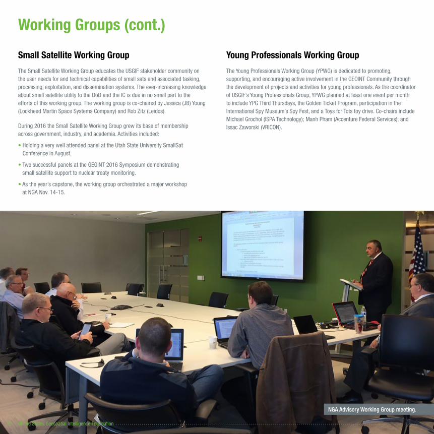
NGA Advisory Working Group meeting.

2016 Annual Report 23
Committees
Academic Committee
The Academic Committee is responsible for USGIF’s educational initiatives. In addition to providing scholarships for high school, undergraduate, and graduate students, the committee spearheads USGIF’s Collegiate Accreditation program.
USGIF Academic Advisory Board Members- Dr. Todd S. Bacastow, Penn State World Campus- Dr. Budhendra Bhaduri, Oak Ridge National Laboratory- David DiBiase, Esri- Col. Steven D. Fleming, University of Southern California- Dr. Joseph F. Fontanella, U.S. Army Corps of Engineers- Dr. Daniel W. Goldberg, Texas A&M GeoInnovation Service Center- Dr. Shawn Kalis, Riverside Research- Karen Kemp, University of Southern California- Dr. Rakesh Malhotra, Fayetteville State University- Dr. Colleen McCue, CACI – National Services- Dr. David Messinger, Rochester Institute of Technology- Sherry Olson, The MITRE Corporation- Dr. Anthony Stefanidis, George Mason University- E. Lynn Usery, U.S. Geological Survey- May Yuan, University of Texas at Dallas
Outreach Committee
The Outreach Committee is responsible for delivering USGIF’s message to public and private partners as well as policy and decision-makers. The Outreach Committee oversees congressional education initiatives, the Interagency Working Group, and the USGIF Awards Subcommittee.
Planning Committee
The Planning Committee is responsible for overseeing all USGIF events, to include the GEOINT Symposium, GEOINT Community Week, the USGIF Workshop Series, GEOINTeraction Tuesdays, and more. Comprising volunteer members, the group meets monthly to help USGIF focus on the topics most critical to the Community.
Strategic Committee
The Strategic Committee, which meets as needed, sets the direction of the Foundation and is composed of Strategic Partner Member representatives. Subject to oversight by the Board of Directors, this committee researches and recommends areas of strategic opportunity for Foundation operations.
Technical Committee
The Technical Committee identifies emerging trends and is a collection point for community needs, developing technical aspects of the tradecraft to demonstrate true interoperability from common community standards. Subcommittees include the Interoperability Outreach Subcommittee and the Emerging Technologies Subcommittee. Co-chairs include Barry Barlow (Vencore) and Robert Mott (Hexagon U.S. Federal).
Tradecraft and Professional Development Committee
The Tradecraft and Professional Development Committee (TC&PDC) determines the basic and advanced qualifications for GEOINT professionals and assesses education and training programs, which prepare individuals for entry into or advancement in the profession. Additionally, the committee assists with USGIF’s Universal GEOINT Certification program.
The 2016 activities of the USGIF TC&PDC were chaired by Lisa Bishop (Booz Allen Hamilton) and co-chaired by Skip Maselli (Raytheon).
• The year began with the 14 committee members focusing on two areas: providing support to the development of USGIF’s Universal GEOINT Certification program, and support for GEOINT Foreword.
• TC&PDC members supported certification program development by providing ideas and inputs for the program framework in addition to assistance with determining the basic and advanced qualifications for geospatial intelligence professionals. The TC&PDC also provided support with creating the charter for the Certification Governance Board (CGB) as well as provided members to serve on the CGB and on the interview panel for the first Universal GEOINT Professional (UGP) candidates.
• TC&PDC members also assisted with the planning, development, and execution of GEOINT Foreword during the GEOINT 2016 Symposium, placing an emphasis on the National Laboratories, IARPA, DARPA, and NGA Research.
• In preparation for 2017, the new chair, Skip Maselli, and co-chair, Dr. Shawn Kalis (Riverside Research), along with the committee members, established an initial plan to review and update the TC&PDC Charter & Bylaws. The committee is soliciting ideas for greater TC&PDC involvement with industry and academia as well as to encourage outreach to other committees and working groups, seek various grant options and possibilities, recruit new members, and update professional development activities, especially mentorship and internship opportunities.
I N V O L V E M E N T
United States Geospatial Intelligence Foundation24
PUBLICATIONS
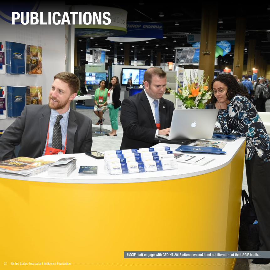
USGIF staff engage with GEOINT 2016 attendees and hand out literature at the USGIF booth.
2016 Annual Report 25
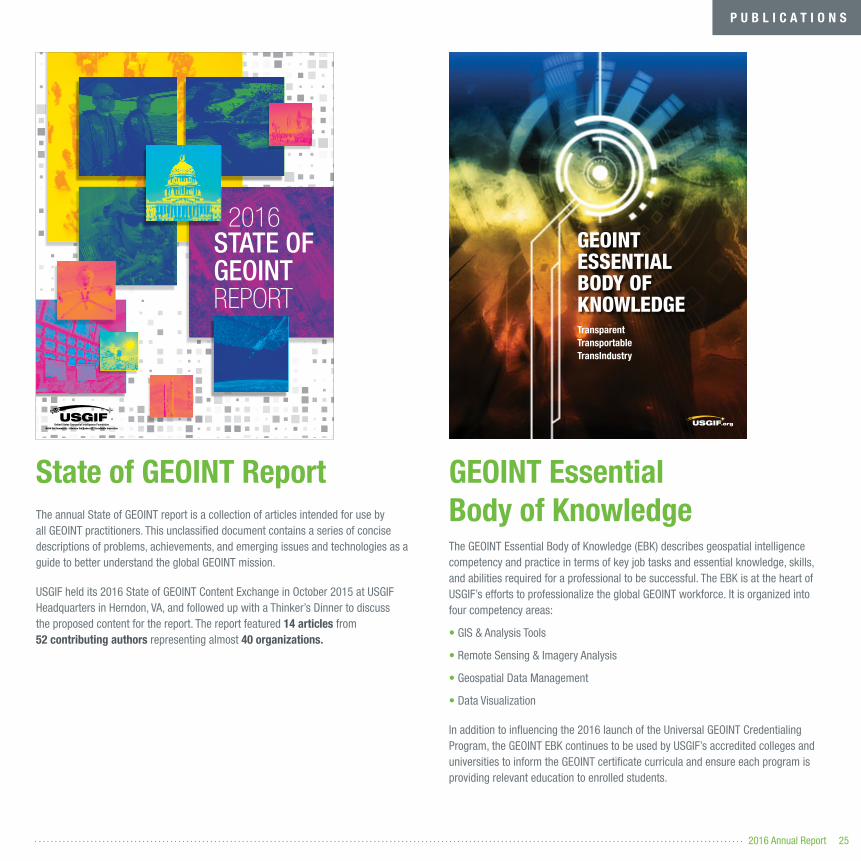
State of GEOINT ReportThe annual State of GEOINT report is a collection of articles intended for use by all GEOINT practitioners. This unclassified document contains a series of concise descriptions of problems, achievements, and emerging issues and technologies as a guide to better understand the global GEOINT mission.
USGIF held its 2016 State of GEOINT Content Exchange in October 2015 at USGIF Headquarters in Herndon, VA, and followed up with a Thinker’s Dinner to discuss the proposed content for the report. The report featured 14 articles from 52 contributing authors representing almost 40 organizations�
GEOINT Essential Body of KnowledgeThe GEOINT Essential Body of Knowledge (EBK) describes geospatial intelligence competency and practice in terms of key job tasks and essential knowledge, skills, and abilities required for a professional to be successful. The EBK is at the heart of USGIF’s efforts to professionalize the global GEOINT workforce. It is organized into four competency areas:
• GIS & Analysis Tools
• Remote Sensing & Imagery Analysis
• Geospatial Data Management
• Data Visualization
In addition to influencing the 2016 launch of the Universal GEOINT Credentialing Program, the GEOINT EBK continues to be used by USGIF’s accredited colleges and universities to inform the GEOINT certificate curricula and ensure each program is providing relevant education to enrolled students.
P U B L I C A T I O N S
GEOINTESSENTIALBODY OF KNOWLEDGETransparent Transportable TransIndustry
STATE OF GEOINTREPORT
2016

THE OFFICIAL MAGAZINE OF THE UNITED STATES GEOSPATIAL INTELLIGENCE FOUNDATION
2016 ISSUE 1
» CRITICAL INFRASTRUCTURE » COMPETITIVE ORIENTEERING » USGIF INDIVIDUAL MEMBERSHIP
THE INTELLIGENCE AND DEFENSE COMMUNITIES OVERHAUL IT ARCHITECTURE TO EMBRACE DATA SHARING
A GLOBALINTELLIGENCE ENTERPRISE
THE OFFICIAL MAGAZINE OF THE UNITED STATES GEOSPATIAL INTELLIGENCE FOUNDATION
2016 ISSUE 2
» Q&A FEATURE SERIES » IMAGING SCIENCE AT RIT » USGIF CERTIFICATION UPDATE
‘RECALCULATING’
GPSGPS IS THE GOLD STANDARD OF POSITIONING, NAVIGATION, AND TIMING—BUT WHAT HAPPENS WHEN IT ISN’T?
THE OFFICIAL MAGAZINE OF THE UNITED STATES GEOSPATIAL INTELLIGENCE FOUNDATION
2016 ISSUE 3
» 2016 USGIF MEMBERSHIP DIRECTORY » A LOOK INSIDE IARPA » GEOINT 2016 RECAPS
MACHINE LEARNING,BIG UNDERSTANDING
2016USGIF MEMBERSHIP DIRECTORY(SEE BACK C0VER)
HOW WILL THE IC HARNESS ADVANCEMENTS IN ARTIFICIAL INTELLIGENCE?
THE OFFICIAL MAGAZINE OF THE UNITED STATES GEOSPATIAL INTELLIGENCE FOUNDATION
2016 ISSUE 4
» HUMAN TRAFFICKING » FUTURE GEOINT LEADERS » OPEN GEOSPATIAL STANDARDS
Sophisticated sensors can see things humans can’t.
MORE THAN MEETS
EYETHE
United States Geospatial Intelligence Foundation26
Mor
e Th
an 1
4,00
0Pr
int S
ubsc
ribe
rs

2016 Annual Report 27
TrajectoryTrajectory, the official publication of USGIF, provides high-level thought leadership for the broad, global GEOINT Community. The magazine provides relevant, actionable content through a compelling presentation, and it fosters knowledge sharing, discussion, and awareness via a blend of hard-hitting information coupled with lighter lifestyle pieces.
In 2016, trajectory produced feature articles on• The Defense Intelligence Enterprise: A comprehensive look at IC ITE, JIE, and DI2E
• The importance of GEOINT in critical infrastructure protection
• The future of positioning, navigation, and timing
• An exploration of artificial intelligence, including machine and deep learning technology and cognitive computing
• An exclusive profile of the Intelligence Advanced Research Projects Activity
• A look at diverse remote sensing phenomenology to include the many types of new sensors
• The role of geospatial technology in the fight against child sex trafficking in the U.S.
By the numbers• 189 articles were posted on the trajectory website
• The trajectory website had more than 70,000 visits by nearly 50,000 users
• The most popular online article was “The GEOINT Revolution” with 3,336 views
• @trajectorymag sent 314 tweets and had more than 1,300 engagements
“Trajectory has earned its award-winning reputation as USGIF’s publication. The articles are relevant, current, and professionally written and packaged. With subject matter that could easily be dry and technical, it’s a compelling read.”
- Collin A. Agee, U.S. Army G-2
The Library of Congress obtained the complete trajectory archives and all print editions moving forward in September 2016.
P U B L I C A T I O N S
More Than 18,000 Email Subscribers
United States Geospatial Intelligence Foundation28
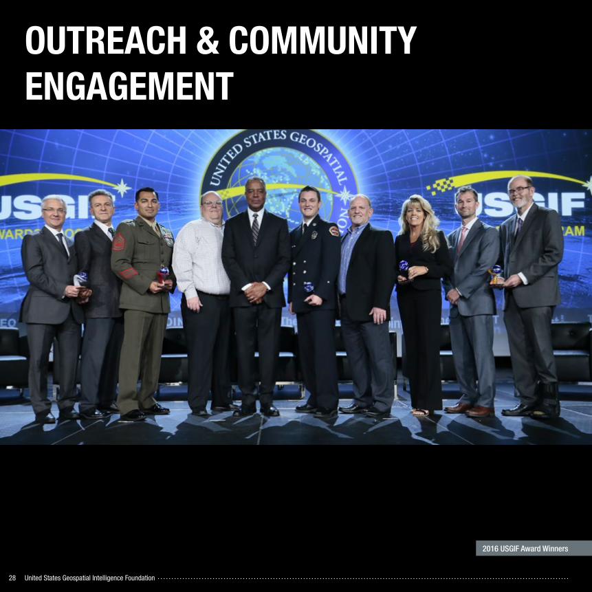
OUTREACH & COMMUNITY ENGAGEMENT
2016 USGIF Award Winners
2016 Annual Report 29
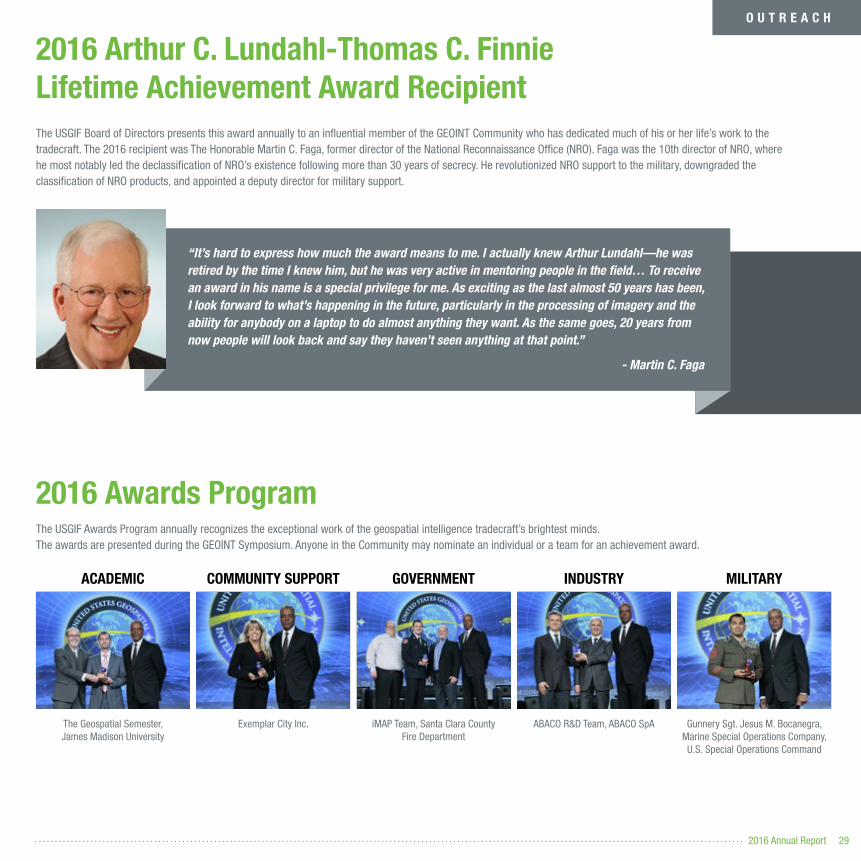
2016 Arthur C� Lundahl-Thomas C� Finnie Lifetime Achievement Award Recipient
2016 Awards ProgramThe USGIF Awards Program annually recognizes the exceptional work of the geospatial intelligence tradecraft’s brightest minds. The awards are presented during the GEOINT Symposium. Anyone in the Community may nominate an individual or a team for an achievement award.
The USGIF Board of Directors presents this award annually to an influential member of the GEOINT Community who has dedicated much of his or her life’s work to the tradecraft. The 2016 recipient was The Honorable Martin C. Faga, former director of the National Reconnaissance Office (NRO). Faga was the 10th director of NRO, where he most notably led the declassification of NRO’s existence following more than 30 years of secrecy. He revolutionized NRO support to the military, downgraded the classification of NRO products, and appointed a deputy director for military support.
O U T R E A C H
Gunnery Sgt. Jesus M. Bocanegra, Marine Special Operations Company, U.S. Special Operations Command
ABACO R&D Team, ABACO SpAiMAP Team, Santa Clara County Fire Department
Exemplar City Inc.The Geospatial Semester, James Madison University
COMMUNITY SUPPORTACADEMIC GOVERNMENT INDUSTRY MILITARY
“It’s hard to express how much the award means to me. I actually knew Arthur Lundahl—he was retired by the time I knew him, but he was very active in mentoring people in the field… To receive an award in his name is a special privilege for me. As exciting as the last almost 50 years has been, I look forward to what’s happening in the future, particularly in the processing of imagery and the ability for anybody on a laptop to do almost anything they want. As the same goes, 20 years from now people will look back and say they haven’t seen anything at that point.”
- Martin C. Faga

United States Geospatial Intelligence Foundation30
“Using the giant map was an eye-opening experience as an educator. To observe the students applying their knowledge of geography while standing on the map was something a teacher dreams of creating for their students. Through the partnership with USGIF, the students were able to apply their knowledge and understanding even further by making real-life connections with mapping and geospatial careers.”
– Tricia Furtek, 3rd Grade Teacher Moorefield Station Elementary School, Ashburn, VA
A Moorefield Station Elementary School third grader using satellite imagery on National Geographic’s Giant Traveling Map.

2016 Annual Report 31
K-12 STEM Education and OutreachThe Foundation’s goal for K-12 students is to foster general awareness of GEOINT and the role it plays in their everyday lives, as well as the myriad career opportunities the field offers.
Giant Traveling Maps ProgramUSGIF created fun and interactive activities with National Geographic’s Giant Traveling Maps, introducing geography and map reading skills for children in grades K-8.
• In May, USGIF brought the Giant Traveling Map of the Pacific Ocean to the GEOINT
2016 Symposium. 80 fifth grade students from Celebration and Flora Ridge Elementary Schools in Orlando, Fla�, participated in geospatial activities on the map throughout the week� Volunteers from DigitalGlobe shared the
importance of satellite imagery and told stories of three unique locations in the
Pacific. The students also had the opportunity to explore the Symposium exhibit
hall and see GEOINT technologies.
• Additionally, 50 JROTC cadets from Oak Ridge High School in Orlando visited the Giant Map for a lesson from NGA’s Capt. Dave Blakesley before touring the exhibit hall.
• In October, during USGIF’s Tech Showcase West event in St. Louis, USGIF hosted 15 fifth through eighth grade students from La Salle Middle School for activities using the Giant Traveling Map of the Solar System as well as the Giant State Map of Missouri. USGIF then donated the Solar System map to the St. Louis Science Center.
GEOINT 101 Presentation
USGIF staff created a GEOINT 101 presentation for 70 fifth through eighth grade students in partnership with DigitalGlobe. The presentation provides a basic overview of GEOINT to include the discipline’s history, tools, platforms used to collect data, and potential career paths.
Moorefield Station Elementary School
Moorefield Station Elementary School fifth graders pose with USGIF swag on GIS Day.
O U T R E A C H
A Moorefield Station Elementary School fifth grader shows off her got geoint? T-shirt.
Became STEM partner with Moorefield
Station; giant map activity
Participated in STEM Night
Visited on GIS Day
Presented GEOINT 101 & completed
giant map activity
FEBRUARY MARCH NOVEMBER DECEMBER
United States Geospatial Intelligence Foundation32
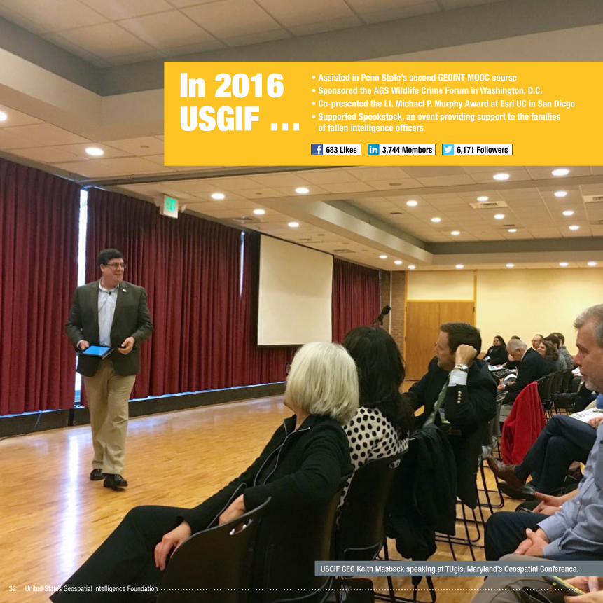
USGIF CEO Keith Masback speaking at TUgis, Maryland’s Geospatial Conference.
In 2016 USGIF …
• Assisted in Penn State’s second GEOINT MOOC course• Sponsored the AGS Wildlife Crime Forum in Washington, D�C�• Co-presented the Lt� Michael P� Murphy Award at Esri UC in San Diego• Supported Spookstock, an event providing support to the families
of fallen intelligence officers
683 Likes 3,744 Members 6,171 Followers

2016 Annual Report 33
GEOINT 2016 Symposium Student Assistant ProgramThe student assistant program is a fantastic opportunity for students from USGIF-accredited or affiliated schools to experience the GEOINT Symposium. These volunteers assisted with manning training rooms and handing out literature. Time was also built in throughout the day for student assistants to network and engage with GEOINT professionals.
USGIF hosted 12 volunteers from 11 schools at the GEOINT 2016 Symposium. With the help of this program many had the opportunity to schedule interviews and make connections, which resulted in two students securing full-time employment�
Schools Represented
Fayetteville StateGeorge Mason University James Madison UniversityLakeland Community CollegeNortheastern UniversityPennsylvania State University
University of AkronUniversity of South CarolinaUniversity of Texas at DallasUniversity of Utah Washington College
Externship ProgramIn the summer of 2016, USGIF hosted Gettysburg College students for a nonprofit and association overview. The externs learned how to create a nonprofit entity, how USGIF grew from an idea into a 501(c)(3) educational nonprofit, and the skills needed to both build and lead nonprofits and associations.
Taylor Beck, an undergraduate student studying political science at Gettysburg College, was choosen as a GEOINT Symposium extern. Beck attended the GEOINT 2016 Symposium in May and worked as a personal assistant to USGIF CEO Keith Masback. Through the externship, she had the opportunity to meet Intelligence Community leaders and learn about career possibilities in the field.
Panelist discussing Geospatial Impact on Policing Effectiveness at the IJIS Institute Mid-Year Briefing in Arlington, Va.
Keynote at the NWGIS Conference in Salem, Ore.
Keynote during NSA’s Kinetics Session
Keynote at the InfraGard National Members Alliance’s 2016 Annual Congress and Conference during the ASIS International 2016 Annual Seminar and Exhibits
Named Vice-Chair of the National Geospatial Advisory Committee
JANUARY FEBRUARY MARCH APRIL MAY JUNE JULY AUGUST SEPTEMBER OCTOBER NOVEMBER DECEMBER
Spoke at the New Jersey Emergency Preparedness Association’s Annual Conference
Spoke as part of Greater Reston Chamber of Commerce GovCon Series - IC panel
Keynote on Strengthening the Geospatial Intelligence Tradecraft for Enhanced Public Safety at the National Geospatial Preparedness Summit in Washington, D.C.
Spoke at a TUgis event in Baltimore, Md.
Panelist on Diversity in GIS at Esri UC in San Diego
Keeping up with USGIF CEO Keith Masback
O U T R E A C H
USGIF was a co-recipient of the 2016 GeoTech Center Distinguished Geospatial Education Partner award�
Extern Taylor Beck, with USGIF CEO Keith Masback (left) and the Director of the National Geospatial-Intelligence Agency Robert Cardillo (right).

United States Geospatial Intelligence Foundation34
#88693
FUNDRAISING
USGIF staff participate in CFC charity fair at USDA.

2016 Annual Report 35
Giving CampaignIn October, USGIF launched its first EdGEOcation Giving Campaign in support of the Foundation’s educational programs with a goal to raise $5,000 by Dec. 31. Donations were accepted via The Combined Federal Campaign National Capital Area (CFCNCA), PayPal, Cash/Check, and AmazonSmile.
Donations help USGIF:
• Award scholarships to students studying geospatial sciences
• Provide academic certificates to students who graduate from USGIF’s 14 accredited colleges and universities
• Deliver STEM materials to K-12 classrooms
• Administer professional certifications
“The scholarships were able to take my research to the next level. The USGIF Scholarship program opens doors for students to look at their research passion and figure out its next steps.”
Dr. Jennifer Veilleux, Geographer/Water Security Analyst– 2010 & 2011 USGIF Scholarship Recipient
USGIF scholarship recpient Dr. Jennifer Veilleux (right) works with many ongoing water and human security research projects, all with a focus on human geography, water security, and the development of transboundary rivers.
Raised $8,909
Donation dollars at work ���
F U N D R A I S I N G
USGIF participated in the following CFCNCA charity fairs:
$5,000GOAL

United States Geospatial Intelligence Foundation36
FINANCIAL REPORT

2016 Annual Report 37
Financial ReportOverhead RateUSGIF has maintained a very low overhead rate since its founding, this year reporting less than 11% overhead by our third-party auditors. USGIF is proud of the ability to put back into programming 89 cents of every dollar we received in fiscal 2016*.
Revenue & ExpensesIn fiscal 2016, USGIF saw slight increases in membership dues, trajectory advertising, and event revenues while reducing costs associated with producing its events. Significant to note, was the decreased expense of operating the GEOINT Symposium in Orlando during FY16 vs. Washington DC in FY15.
*USGIF’s fiscal calendar ends June 30; FY16 financials are reported for July 1, 2015, through June 30, 2016.
FINANCIAL REPORT
10�9%Overhead
89�1%Programming
$6�93M $6�86M
Revenue Expenses
Year Ended June 30, 2016
Revenue
Convention and trade show $5,427,752
Membership dues 1,225,325
trajectory magazine 272,750
Other revenue 6,331
Total revenue 6,932,158
Expense
Program services
Convention and trade show 5,951,715
trajectory magazine 258,521
Total program services 6,210,236
Supporting services
General and administrative 648,092
Total expense 6,858,328
Change in net assets before investment income 73,830
Investment income 20,653
Change in net assets 94,483
Net assets, beginning of year 2,854,141
Net assets, end of year $2,948,624
United States Geospatial Intelligence Foundation38
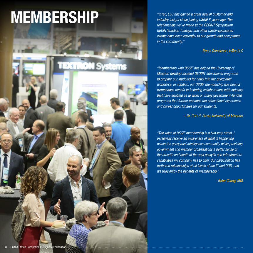
MEMBERSHIP “InTec, LLC has gained a great deal of customer and industry insight since joining USGIF 8 years ago. The relationships we’ve made at the GEOINT Symposium, GEOINTeraction Tuedays, and other USGIF-sponsored events have been essential to our growth and acceptance in the community.”
- Bruce Donaldson, InTec LLC
“Membership with USGIF has helped the University of Missouri develop focused GEOINT educational programs to prepare our students for entry into the geospatial workforce. In addition, our USGIF membership has been a tremendous benefit in fostering collaborations with industry that have enabled us to work on many government-funded programs that further enhance the educational experience and career opportunities for our students.
- Dr. Curt H. Davis, University of Missouri
“The value of USGIF membership is a two-way street. I personally receive an awareness of what is happening within the geospatial intelligence community while providing government and member organizations a better sense of the breadth and depth of the vast analytic and infrastructure capabilities my company has to offer. Our participation has furthered relationships at all levels of the IC and DOD, and we truly enjoy the benefits of membership.”
- Gabe Chang, IBM

2016 Annual Report 39
MembershipUSGIF offers organizational and individual membership, each of which provides its own unique set of benefits to different subsets of the GEOINT Community. Individual membership provides opportunities to network, stay informed of the latest industry trends, and receive discounted or complimentary event attendance. Organizations seeking to establish themselves as thought leaders in the GEOINT industry, raise brand awareness, or participate in the GEOINT Symposium are well served by becoming organizational members.
248 Organizational Members - 86% Retention Rate
Affinity Partner ProgramWhile organizational and individual USGIF
members join for different reasons, they share
some common needs and interests. Thus, USGIF
has established partnerships with a variety of
organizations who serve the GEOINT Community
in myriad ways. Discounts and special offers are
made available to all USGIF members.
Northwest Federal Credit Union added as Affinity Program partner in 2016�
1,440 Individual Members
M E M B E R S H I P
*All stats as of December 31, 2016
Not Identified 19
Government 3
Academia 11
Academic 11
Associate 22
Law Enforcement/First Responder 14
Small Business
49
Strategic29
Sustaining137 Medium 56
Small 104
Large 69
Young Professional 169
Lifetime 41
Government/Military 186
Academic 170
January 922
December 1,440
Individual Members
Industry 860
Cloud Computing Services & Support
Geospatial SoftwareConsulting
Geographic Information Systems
Visualization SoftwareData Fusion
Open Source Intelligence
Activity-Based IntelligenceData ManagementAnalytic Software
Mapping/Geospatial Data
Computers/SoftwareAnalytic Data Visualization
Industry 234
Top Organizational Capabilities

United States Geospatial Intelligence Foundation40
Organizational Members ListSTRATEGIC PARTNERAccenture Federal Services
Adobe Systems
AECOM
Analytical Graphics Inc.
BAE Systems
Ball Aerospace
The Boeing Co.
Booz Allen Hamilton
CACI
Carahsoft Technology Corp.
DigitalGlobe
Esri
General Dynamics
Harris Corporation
Hewlett Packard Enterprise
IBM
Intergraph Government Solutions
KEYW Corporation
Leidos
Lockheed Martin
MDA
National Geospatial-Intelligence Agency (NGA)
Northrop Grumman Corp.
OGSystems
Oracle America Inc.
Raytheon Co.
TASC, an Engility Company
Textron Systems
Vencore
ASSOCIATE PARTNERBlue Canopy Group
DataDirect Networks Federal
Dell Inc.
Dewberry
Digital Reasoning
H2M Group LLC
HP Inc.
ICES
InTec LLC
Integrity Applications Incorporated
NetApp
Next Tier Concepts Inc. (NT Concepts)
Novetta
Planet
SAP National Security Services (SAP NS2)
SDL Government
SGI
Solers Inc.
Terra Bella
The Aerospace Corporation
Vricon
Woolpert
SUSTAINING PARTNER377 Omega Inc.
Abacus Technology Corporation
Airbus Defense & Space
Alaska Satellite Facility
Altamira Technologies Corp.
Amazon Web Services
Applied Imagery
Aruba, a Hewlett Packard Enterprise Company
Aspera, an IBM Company
AT&T Global Business - Public Sector Solutions
Basis Technology
Boundless Spatial Inc.
Braxton Science & Technology Group
Brocade
CA Technologies
CAE
Center for Southeastern Tropical Advanced Remote Sensing (CSTARS), University of Miami
Cherokee Nation Technology Solutions
Cisco Systems Inc.
Civil Applications Committee
ClearTerra
Cloudera
CMX Technologies, an Xator Corp.
Compass Inc.
Compusult Limited
Concurrent Technologies Corp.
Continental Mapping Consultants Inc.
COPT Data Center Solutions
Cray Inc.
CSG Solutions
CSRA
Cubic Global Defense
D-Wave Systems
Deloitte LLP
DLT Solutions
Dynamic Graphics Inc.
e-GEOS
Eagle Ray Inc.
East View Geospatial
EMC Corp.
Envitia
Euroconsult USA
F5 Networks
Freedom Consulting Group Inc.
Fulcrum
General Atomics Aeronautical Systems Inc.
Geographic Services Inc.
Global Marketing Insights Inc.
GuidePoint Security
HERE
HHB Systems
The HumanGeo Group LLC
i3 ICS
In-Q-Tel
Insitu Inc.
Intelligent Decisions Inc.
IvySys Technologies LLC
Jacobs
Juniper Networks
KaDSci LLC
Keeper Technology
Kongsberg Geospatial
Learning Tree International
LexisNexis
LGS Innovations
LizardTech
Luciad Inc.
Mapbox
MapLarge
MapR Technologies

2016 Annual Report 41
MarkLogic Corporation
Meadowgate Technologies
Mellanox Federal Systems
Mercom Corporation
Micron Technology Inc.
The MITRE Corp.
MotionDSP Inc.
New World Solutions, a SOSi Company
Next Century Corp.
NJVC LLC
Noblis
NVIDIA
Oasys International Corp.
Observera Inc.
Octo Consulting Group Inc.
Open Geospatial Consortium (OGC)
Orbit Logic
Orbital ATK Inc.
PAR Government Systems Corp. (PAR Government)
Pherson Associates
Pitney Bowes
PIXIA Corp.
The Potomac Advocates (PRASAM, LLC)
ProCleared LLC
PTFS (Progressive Technology Federal Systems) Inc.
PwC
Quantum Corp.
Radiance Technologies Inc.
RadiantBlue Technologies Inc.
Red Hen Systems LLC
Riegl USA
Riverside Research
S2 Analytical Solutions
Safe Software Inc.
SAIC
The Sanborn Map Company
SanDisk, a Western Digital brand
SAS
Seagate Government Solutions
Sierra Nevada Corp.
Sigma Space
Simulyze Inc.
Skyline Software Systems Inc.
Software AG Government Solutions
Solvarus
SOS International LLC
Spatial Networks Inc.
SRC Inc.
SRI International
Stellar Solutions Inc.
Surrey Satellite Technology US LLC
Teledyne Optech
Tenax Aerospace
TerraGo Technologies
Thinklogical
TomTom North America Inc.
TransVoyant
Trinity Global Consulting LLC
TVAR Solutions
United States Army Geospatial Center
UrtheCast
ViaSat
ViON Corporation
Westway Development Services LLC
WISER
World Wide Technology Inc.
Zodiac Data Systems - Zodiac Aerospace
SMALL BUSINESS PARTNERALQIMI National Security Inc.
Ankura Consulting Group
APG Technologies LLC
Applied Research Associates Inc.
Aspiration Software LLC
BlackSky
Cardio Logic Inc.
Commonwealth Computer Research Inc. (CCRi)
CompassData Inc.
Compusult Systems Inc.
Consolidated Resource Imaging (CRI)
Crunchy Data
DataFission Inc.
DataRobot Inc.
Geo Owl LLC
GeoNorth LLC
Geoweb3d
Grover Consulting Services (GCS)
Helm Point Solutions Inc.
Hera Systems Inc.
Image Matters LLC
Immersive Media
Innovative Analytics & Training LLC
InQuisient
International Spy Museum
ISPA Technology
Knowledge Link Inc.
LAND INFO Worldwide Mapping LLC
MemSQL USG
Monitor 360
Nelson Intelligence Solutions LLC
Neptune
New Light Technologies, Inc. (NLT)
NextFED Inc.
OmniEarth Inc.
Optensity Inc.
Pentaho, A Hitachi Group Company
PlanetRisk (formerly iMapData)
Polyverse Corporation
Quadrint Inc.
Reinventing Geospatial Inc. (RGi)
Spaceknow Inc.
Terran Orbital
Tesla Government Inc.
Trident Systems Inc.
Trusted Knowledge Options Inc.
Ursa Space Systems Inc.
Video Inform
Voyager Search
ACADEMIC PARTNERAmerican Public University System
Center for Geospatial Intelligence
Delta State University Center for Interdisciplinary Geospatial Information Technologies
George Mason University
James Madison University
Johns Hopkins University
Northeastern University
NOVA Information Management School
Penn State University
Space Dynamics Laboratory
University of Southern California Spatial Sciences Institute
M E M B E R S H I P
2325 Du l l e s Co rne r Bou leva rd , Su i t e 450 , He rndon , VA 20171 • 888 .MY.USG IF • usg i f . o rg
The only organization dedicated to promoting the geospatial intelligence tradecraft and building a stronger community of interest across industry, academia, government, professional organizations, and individuals.
Related Documents