Web-based Interactive Landform Simulation Model – Grand Canyon (WILSIM–GC) Wei Luo 1 , Jon Pelletier 2 , Kirk Duffin 1 , Carol Ormand 3 , Weichen Hung 1 , Ellen Iverson 3 , David Shernoff 1 , Xiaoming Zhai 4 , Anjana Chowdary 1 1. Northern Illinois University 2. University of Arizona 3. Carleton College 4. College of Lake County Project Funded by NSF TUES (Award No. DUE1140375)

Welcome message from author
This document is posted to help you gain knowledge. Please leave a comment to let me know what you think about it! Share it to your friends and learn new things together.
Transcript

Web-based Interactive Landform Simulation Model – Grand Canyon
(WILSIM–GC) Wei Luo1, Jon Pelletier2, Kirk Duffin1, Carol Ormand3, Weichen Hung1,
Ellen Iverson3, David Shernoff1, Xiaoming Zhai4, Anjana Chowdary1
1. Northern Illinois University
2. University of Arizona 3. Carleton College
4. College of Lake County
Project Funded by NSF TUES (Award No. DUE1140375)

Outline
• Introduction • Purposes of WILSIM • WILSIM-CA (cellular automata) • WILSIM-GC and initial results • Ongoing and future work

Introduction • Landform evolution: an important aspect of
physical geography – involves multiple processes over long geologic
time • Long-term landform evolution cannot be
observed directly • We need interactive tools to help better
understand how Earth systems work over geologic time scales
• Usually requires special programs or visualization software that is not easily accessible to students

Purpose of WILSIM
• To offers an easily accessible environment for students to engage in explorative and inquiry-based learning
• To enable and enhance students’ understanding of the processes involved in landform evolution through interactively changing parameters/conditions and observing their results
WILSIM – CA
• First version of WILSIM • Cellular Automata model (Chase, 1992)
– Rule based (local rules > global pattern) – Simple – Captures first order features
• Implemented as Java Applet • Accessible from anywhere with Internet • http://www.niu.edu/landform


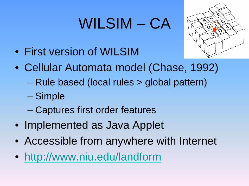
WILSIM – CA (cont’d)
• WILSIM does improve students’ learning as demonstrated by the statistically significant increase in average score from pre- to post-tests
WILSIM – CA (cont’d)
• Shortcomings: – cannot easily relate model results to real
world measurements quantitatively – Spatial scale (m, km) – Time scale (millions of years)
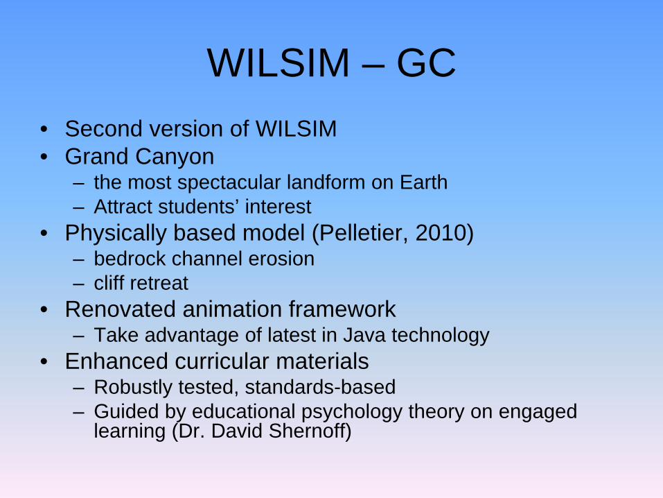
WILSIM – GC • Second version of WILSIM • Grand Canyon
– the most spectacular landform on Earth – Attract students’ interest
• Physically based model (Pelletier, 2010) – bedrock channel erosion – cliff retreat
• Renovated animation framework – Take advantage of latest in Java technology
• Enhanced curricular materials – Robustly tested, standards-based – Guided by educational psychology theory on engaged
learning (Dr. David Shernoff)
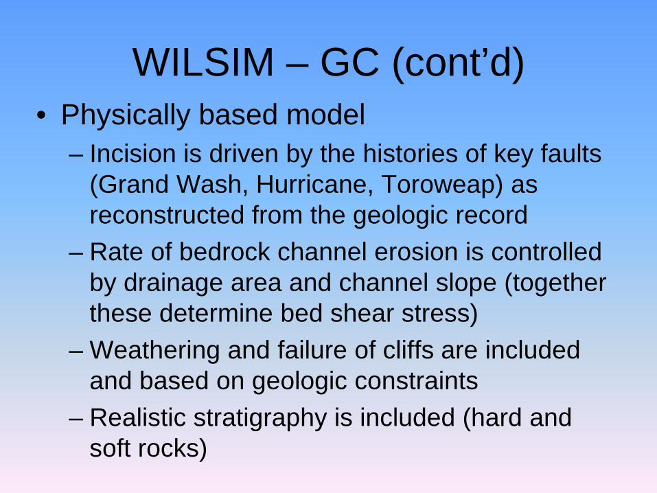
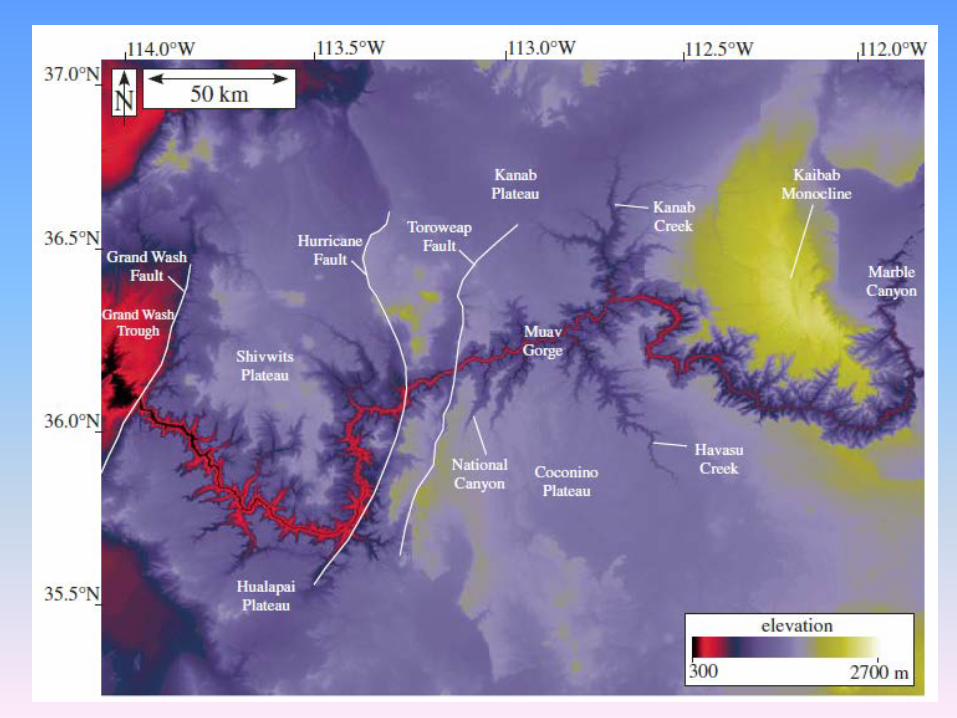
WILSIM – GC (cont’d) • Physically based model
– Incision is driven by the histories of key faults (Grand Wash, Hurricane, Toroweap) as reconstructed from the geologic record
– Rate of bedrock channel erosion is controlled by drainage area and channel slope (together these determine bed shear stress)
– Weathering and failure of cliffs are included and based on geologic constraints
– Realistic stratigraphy is included (hard and soft rocks)
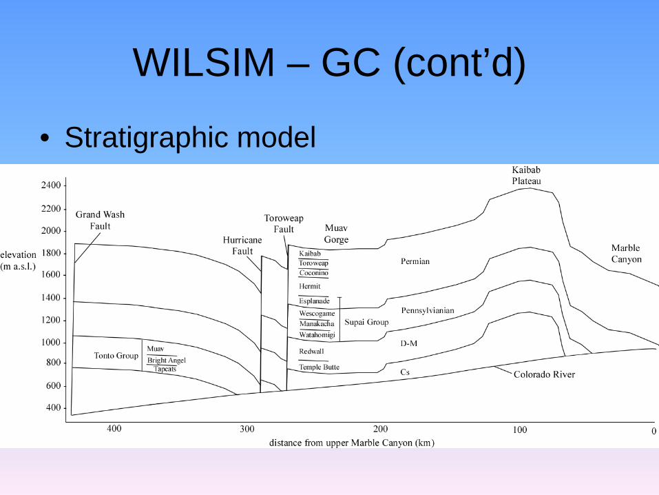
WILSIM – GC (cont’d)
• Stratigraphic model

WILSIM – GC (cont’d)
• Java implementation (graphics) – Original WILSIM used customized rendering
engine for increased general availability – Current implementation uses Java OpenGL
(JOGL) for access to ubiquitous fast graphics hardware
– Same graphics library used in many computer games
WILSIM – GC (cont’d)
• Java implementation (I/O) – Original WILSIM applet had no ability to write
out intermediate results. – Standard applet security feature, but limiting. – Current implementation uses Trusted Applet
model which allows file input and output
WILSIM GC (cont'd)
• Java implementation (Computation) – Original WILSIM was multithreaded to simplify
code development – Current implementation maintains
multithreaded ability which takes advantage of modern multi-core CPUs.
• One thread for model computation. • One thread for visualization. • One thread for user interface.
– Standard Model-View-Controller (MVC) design pattern

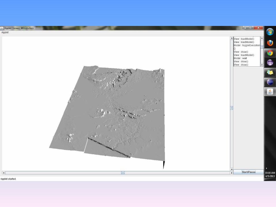
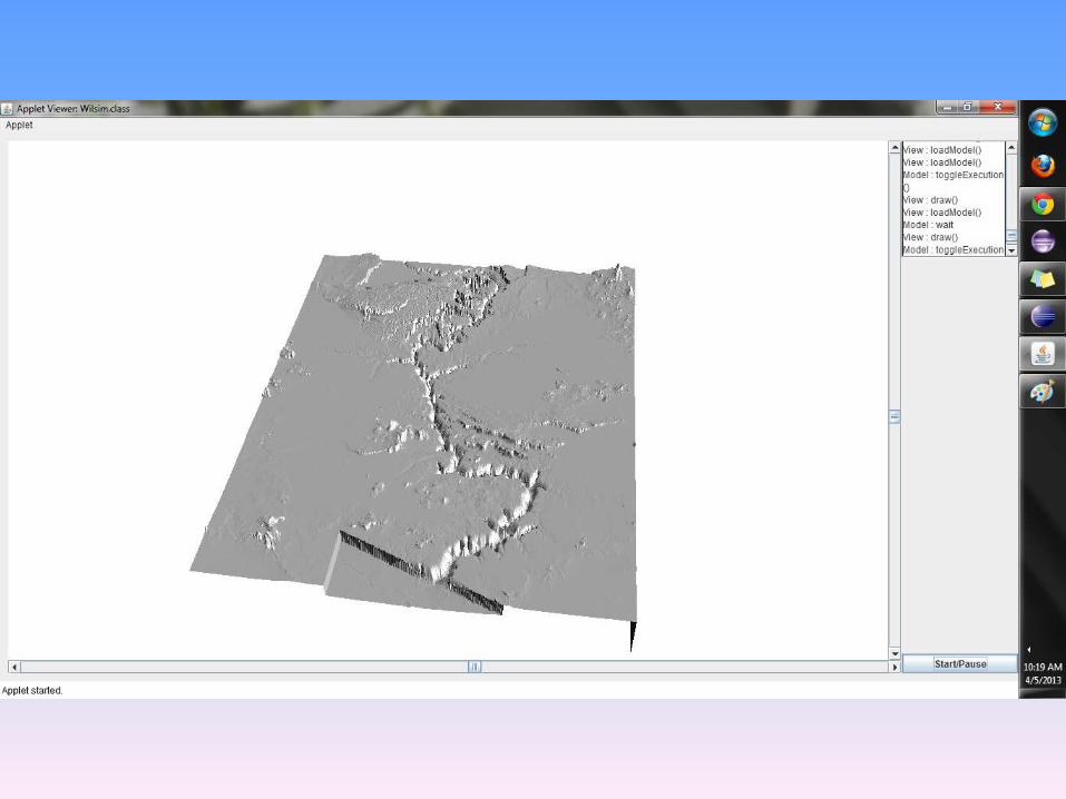
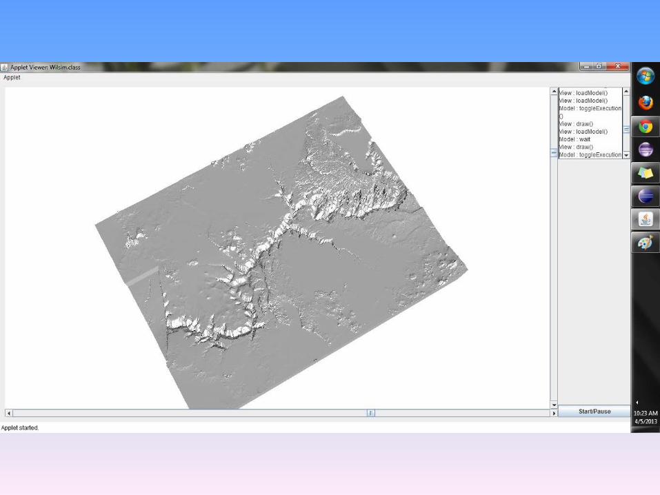
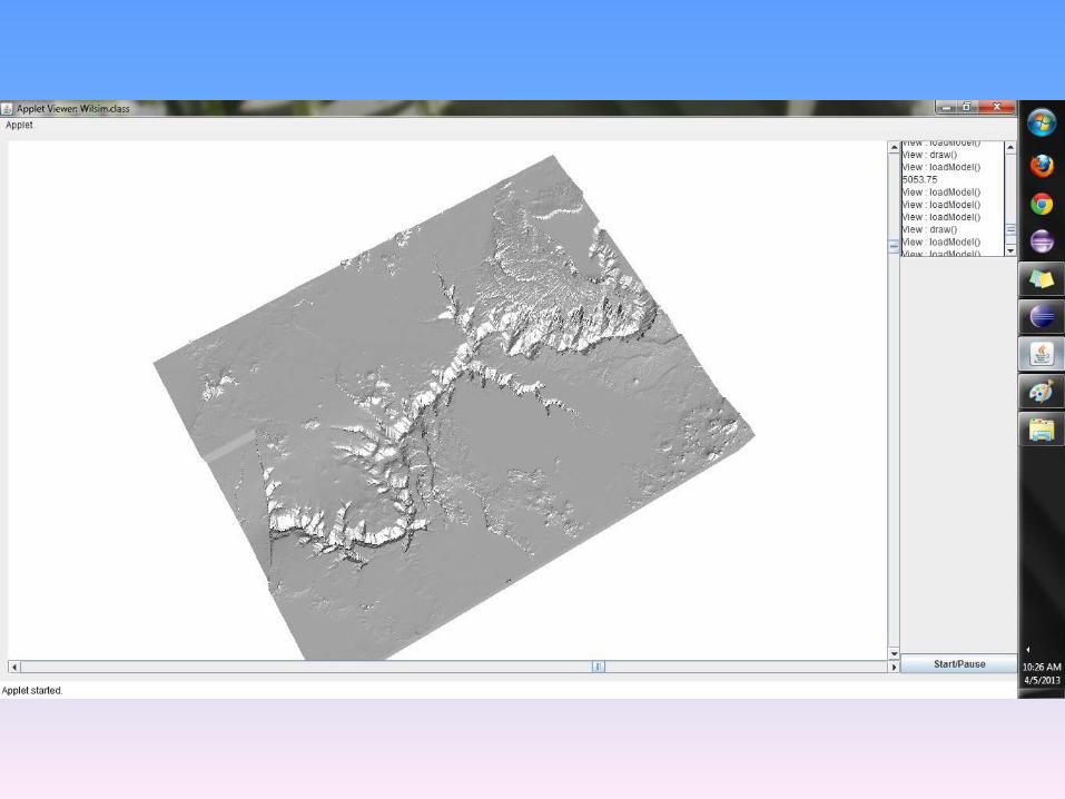
Preliminary Result
• Some model specifics: – resolution of 720 m/pixel (runtime < 1 min at
this resolution) – the initial topography – constructed from
modern topography by backfilling the Canyon – Runs for 6 Ma
• Screen captures • No parameters, no color yet


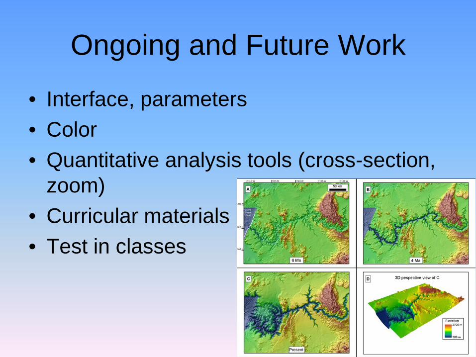
Ongoing and Future Work
• Interface, parameters • Color • Quantitative analysis tools (cross-section,
zoom) • Curricular materials • Test in classes

Questions?
• Suggestions/ideas are welcome and appreciated.
• Website http://serc.carleton.edu/landform • Join our email list
http://serc.carleton.edu/mailman/listinfo/wilsim
Related Documents