I:\WO\W0500\SHERWM\35882-LTR.DOC 15 March 2006 Mr. Todd Gmitro United States Environmental Protection Agency – Region V Waste, Pesticides and Toxics Branch Enforcement and Compliance Assurance Branch, DRE-9J 77 West Jackson Blvd Chicago, IL 60604 Work Order Nos.: 00709.033.041 00709.033.043 Re: Remedial Measures Design Report – 30% Submittal The Sherwin-Williams Company Chicago, Illinois Dear Mr. Gmitro: Weston Solutions, Inc. (WESTON ® ) is pleased to present, on behalf of The Sherwin-Williams Company (Sherwin-Williams), three copies of the Remedial Measures Design Report – 30% Submittal, as required by the Consent Decree between Sherwin-Williams and the United States Environmental Protection Agency. One copy of the report has also been submitted to the Illinois Environmental Protection Agency as required by paragraph 84b of the Consent Decree. The following aspects of the Remedial Measures Design Report either contain information that has been revised from the Remedial Measures Study (RMS) Report or new information. The extent of engineered barriers within Areas 1 and 2 West have been enlarged from the extents proposed in the RMS Report (WESTON, 2003). The engineered barrier extents were enlarged based on the results of the Predesign Investigation. The type of hydraulic containment barrier proposed in the remedial measure for Area 2 East has been specified to be hot-rolled interlocking steel sheet piling sealed with a water-swelling joint filler as opposed to a Waterloo Barrier®, which was proposed in the RMS Report (WESTON, 2003). Justification for this modification is included within Section 5 of the attached Remedial Measures Design Report. The engineered barrier proposed for containment of potential source material in Area 2 East has been modified from six inches of asphalt underlain by a High-Density Polyethylene (HDPE) membrane to a six-inch layer of Modified Asphalt Technology for Waste Control (MatCon ™ ). MatCon is a proprietary modified asphalt concrete that has a

Welcome message from author
This document is posted to help you gain knowledge. Please leave a comment to let me know what you think about it! Share it to your friends and learn new things together.
Transcript

I:\WO\W0500\SHERWM\35882-LTR.DOC
15 March 2006 Mr. Todd Gmitro United States Environmental Protection Agency – Region V Waste, Pesticides and Toxics Branch Enforcement and Compliance Assurance Branch, DRE-9J 77 West Jackson Blvd Chicago, IL 60604
Work Order Nos.: 00709.033.041 00709.033.043
Re: Remedial Measures Design Report – 30% Submittal The Sherwin-Williams Company Chicago, Illinois Dear Mr. Gmitro: Weston Solutions, Inc. (WESTON®) is pleased to present, on behalf of The Sherwin-Williams Company (Sherwin-Williams), three copies of the Remedial Measures Design Report – 30% Submittal, as required by the Consent Decree between Sherwin-Williams and the United States Environmental Protection Agency. One copy of the report has also been submitted to the Illinois Environmental Protection Agency as required by paragraph 84b of the Consent Decree. The following aspects of the Remedial Measures Design Report either contain information that has been revised from the Remedial Measures Study (RMS) Report or new information.
The extent of engineered barriers within Areas 1 and 2 West have been enlarged from the extents proposed in the RMS Report (WESTON, 2003). The engineered barrier extents were enlarged based on the results of the Predesign Investigation.
The type of hydraulic containment barrier proposed in the remedial measure for Area 2
East has been specified to be hot-rolled interlocking steel sheet piling sealed with a water-swelling joint filler as opposed to a Waterloo Barrier®, which was proposed in the RMS Report (WESTON, 2003). Justification for this modification is included within Section 5 of the attached Remedial Measures Design Report.
The engineered barrier proposed for containment of potential source material in Area 2
East has been modified from six inches of asphalt underlain by a High-Density Polyethylene (HDPE) membrane to a six-inch layer of Modified Asphalt Technology for Waste Control (MatCon™). MatCon is a proprietary modified asphalt concrete that has a

Mr. Todd Gmitro -2- 15 March 2006 United States Environmental Protection Agency
I:\WO\W0500\SHERWM\35882-LTR.DOC
hydraulic conductivity of less than 1.0 x 10⁻⁷ centimeters per second which is technically equivalent to the asphalt and HDPE membrane combination.
The duration of the groundwater collection system proposed as part of the remedial
measure for Area 2 East has been modified. In the RMS Report (WESTON, 2003), it was assumed that the dewatering system will be operated as necessary with an unknown duration following installation of the vertical and horizontal containment in Area 2 East, and the storage tanks were to remain at the site indefinitely. This has been modified with the assumption that the dewatering system will be used continuously to dewater the contained area after installation of the sheet piles and MatCon barrier, and the temporary storage tanks will then be removed. Justification for this modification is included within Section 5 of the attached Remedial Measures Design Report.
One of the areas within Area 3 West where an engineered barrier was proposed in the
RMS Report (WESTON, 2003) will now be excavated and consolidated on-site within the on-site 25-Acre Fill Area, under the engineered cap. The proposed excavation boundaries and confirmation sampling procedures are detailed Section 5 of the attached Remedial Measures Design Report.
The ex-situ bioremediation of soils from Area 3 East will be conducted in the 25-Acre
Fill Area, not within Area 3 East, as specified in the RMS Report (WESTON, 2003). In addition, the treated soil will be consolidated within the 25-Acre Fill Area under the engineered cap, and will not be re-placed in the open excavation, as specified previously. Clean soil from off-site will be used to backfill the excavation following confirmation sampling. In addition, the verification sampling criteria and treatment objectives have been modified. Detailed discussions of these modifications are included in Section 5 of the attached Remedial Measures Design Report.
The proposed end-use of the 5-Acre Fill Area is a truck parking lot for the Chicago
Emulsion Plant. The parking lot will include both asphalt and concrete pavement, will have a truck scale at a convenient location within the parking lot, and a building located within the 5-Acre Fill Area. Also, the results of the Predesign Investigation indicated that the fill material within the 5-Acre Fill Area will have significant settlement under the anticipated loading conditions and therefore will require deep dynamic compaction prior to construction at the site. The proposed layout of the remedial measures for the 5-Acre Fill Area is detailed in Section 5 of the attached Remedial Measures Design Report.
I certify that the information contained in or accompanying the above referenced documents is true, accurate, and complete. As to those portions of the above referenced documents for which I cannot personally verify their truth and accuracy, I certify as the Supervising Contractor having
Mr. Todd Gmitro -3- 15 March 2006 United States Environmental Protection Agency
I:\WO\W0500\SHERWM\35882-LTR.DOC
supervisory responsibility for the person(s) who, acting under my direct instructions, made the verification, that this information is true, accurate, and complete. If you have any questions or comments regarding these documents, please feel free to contact Dr. Gordon Kuntz at (216) 566-2889 of myself at (847) 918-4045.
Very truly yours,
WESTON SOLUTIONS, INC.
Stephen R. Clough, P.G. Project Director Supervising Contractor cc: Jonathan Adenuga (without enclosure)
James Moore, IEPA (1 copy) John Gerulis, Sherwin-Williams (without enclosure) Gordon Kuntz, Sherwin-Williams (2 copies) Alan Danzig (without enclosure)


I:\WO\W0500\SHERWM\35882-TOC.DOC i
TABLE OF CONTENTS
Section Page
1 INTRODUCTION ........................................................................................................... 1-1 1.1 Purpose................................................................................................................. 1-1 1.2 Report Organization............................................................................................. 1-2 2 SITE BACKGROUND.................................................................................................... 2-1 2.1 Site Location ........................................................................................................ 2-1 2.2 Site History .......................................................................................................... 2-1 2.3 Summary of Previous Work................................................................................. 2-2 2.3.1 Facility Investigation ............................................................................... 2-2 2.3.2 Human Health and Screening-Level Ecological Risk Assessments ........ 2-5 2.3.3 Remedial Measures Study........................................................................ 2-8 3 SITE-SPECIFIC INFORMATION.................................................................................. 3-1 3.1 General Site Setting ............................................................................................. 3-1 3.2 Geology................................................................................................................ 3-1 3.2.1 Description of Fill Material ..................................................................... 3-1 3.2.2 Description of Glacial Till ....................................................................... 3-2 3.2.3 Description of Bedrock ............................................................................ 3-3 3.3 Hydrogeology ...................................................................................................... 3-4 3.3.1 Groundwater Occurrence ......................................................................... 3-4 3.3.2 Perched Shallow Water-Bearing Zone..................................................... 3-6 3.3.3 Intermediate Water-Bearing Zone ........................................................... 3-6 3.3.4 Bedrock Water-Bearing Zone .................................................................. 3-7 3.4 Groundwater Flow ............................................................................................... 3-7 3.5 Hydraulic Conductivity........................................................................................ 3-7 3.6 Groundwater Flow Velocity ................................................................................ 3-9 3.7 Justification for Groundwater Classifications.................................................... 3-11 3.7.1 Shallow Perched Water-Bearing Zone................................................... 3-13 3.7.2 Intermediate Water-Bearing Zone ......................................................... 3-14 3.7.3 Bedrock Water-Bearing Zone ................................................................ 3-15 4 PREDESIGN INVESTIGATION RESULTS ................................................................. 4-1 4.1 Site Survey........................................................................................................... 4-1 4.2 Chemical Investigation ........................................................................................ 4-1 4.2.1 Landscape Area Investigation.................................................................. 4-2 4.2.2 Area 1 Investigation................................................................................. 4-2 4.2.3 Area 2 Investigation................................................................................. 4-3 4.2.4 Area 3 Investigation................................................................................. 4-4 4.2.5 Area 4 Investigation................................................................................. 4-5 4.3 Geotechnical Investigation................................................................................... 4-6 4.3.1 Area 2 East Sheet Pile Wall Investigation ............................................... 4-6 4.3.2 Area 2 East Cap Investigation.................................................................. 4-7 4.3.3 5-Acre Fill Area Cap Investigation.......................................................... 4-7
TABLE OF CONTENTS (CONTINUED)
Section Page
I:\WO\W0500\SHERWM\35882-TOC.DOC ii
4.3.4 25-Acre Fill Area Cap Investigation........................................................ 4-8 4.4 Steel Sheet Pile Corrosion Testing ...................................................................... 4-9 4.5 Bioremediation Bench-Scale Study ................................................................... 4-10 4.5.1 Bioremediation Treatment ..................................................................... 4-10 4.5.2 Laboratory Analysis Results .................................................................. 4-11 4.6 Landfill Gas Generation Investigation............................................................... 4-13 4.6.1 Sampling Procedures ............................................................................. 4-14 4.6.2 Analytical Procedures ............................................................................ 4-15 4.6.3 Analytical Results .................................................................................. 4-15 5 REMEDIAL MEASURES DESIGN............................................................................... 5-1 5.1 Typical Engineered Barrier Design – Areas 1, 2 West, 3 East, 3 West, and 4 .... 5-1 5.1.1 Design Criteria ......................................................................................... 5-1 5.1.2 Design Basis............................................................................................. 5-1 5.2 Engineered Barrier Design – Area 2 East ............................................................ 5-4 5.2.1 Design Criteria ......................................................................................... 5-4 5.2.2 Design Basis............................................................................................. 5-4 5.3 5-Acre Fill Area Cap Design ............................................................................... 5-7 5.3.1 Design Criteria ......................................................................................... 5-7 5.3.2 Design Basis............................................................................................. 5-7 5.4 25-Acre Fill Area Engineered Cap Design ........................................................ 5-11 5.4.1 Design Criteria ....................................................................................... 5-11 5.4.2 Design Basis........................................................................................... 5-11 5.5 Sheet Pile Design ............................................................................................... 5-18 5.5.1 Design Criteria ....................................................................................... 5-18 5.5.2 Design Basis........................................................................................... 5-19 5.6 Groundwater Collection System Design............................................................ 5-22 5.6.1 Design Criteria ....................................................................................... 5-22 5.6.2 Design Basis........................................................................................... 5-23 5.7 Bioremediation System Design.......................................................................... 5-23 5.7.1 Design Criteria ....................................................................................... 5-23 5.7.2 Design Basis........................................................................................... 5-24 5.8 Excavation and On-Site Consolidation.............................................................. 5-32 5.8.1 Excavation.............................................................................................. 5-32 5.8.2 Verification Sampling............................................................................ 5-33 5.8.3 Consolidation ......................................................................................... 5-34 6 GROUNDWATER MONITORING PLAN.................................................................... 6-1 6.1 Short-Term Monitoring........................................................................................ 6-2 6.1.1 Short-Term Sampling and Analysis......................................................... 6-2 6.1.2 Sampling Frequency ................................................................................ 6-2 6.1.3 Reporting.................................................................................................. 6-3 6.2 Long-Term Monitoring........................................................................................ 6-3 6.2.1 Area 2 East............................................................................................... 6-3 6.2.2 25-Acre Fill Area ..................................................................................... 6-6

TABLE OF CONTENTS (CONTINUED)
Section Page
I:\WO\W0500\SHERWM\35882-TOC.DOC iii
7 SPECIFICATIONS.......................................................................................................... 7-1 8 INSTITUTIONAL CONTROLS..................................................................................... 8-1 9 PERMITS......................................................................................................................... 9-1 10 PROJECT SCHEDULE................................................................................................. 10-1 11 COST ............................................................................................................................. 11-1 12 SUPPORTING PLANS ................................................................................................. 12-1 12.1 Pre-Construction Plans....................................................................................... 12-1 12.1.1 Construction Work Plan......................................................................... 12-1 12.1.2 Health and Safety Program .................................................................. 12-10 12.2 Post-Construction Plans ................................................................................... 12-10 12.2.1 Remedial Measures Implementation Report........................................ 12-11 12.2.2 Operation and Maintenance Plan ......................................................... 12-11 12.2.3 Soil Management Plan ......................................................................... 12-13 12.2.4 Contingency Plan ................................................................................. 12-13 13 REFERENCES .............................................................................................................. 13-1

I:\WO\W0500\SHERWM\35882-TOC.DOC iv
LIST OF TABLES
Section Title
2-1 Media Cleanup Standards: Future Commercial/Industrial Land Use 2-2 Media Cleanup Standards: Future Recreational and/or Commercial Land Use 4-1 Predesign Landscape Sampling Results 4-2 Predesign Chemical Investigation Sampling Results 4-3 Water Level Measurements 4-4 Subsurface Obstruction Geoprobe Investigation Results 4-5 Geotechnical Analysis Summary 4-6 Bioremediation Sampling Results VOC Concentrations (ug/kg) 4-7 Bioremediation Sampling Results Inorganic Concentrations (mg/kg) 4-8 Bioremediation Sampling Results Microbial Hydrocarbon Degrader Concentrations
(CFU/g) 4-9 Landfill Gas Analytical Results 5-1 Geotechnical Summary DDC Analysis 5-2 Sheet Pile Seepage Calculation Summary 7-1 Preliminary Table of Contents for Technical Specifications 11-1 Cost Estimate for Remedial Measures Implementation

I:\WO\W0500\SHERWM\35882-TOC.DOC v
LIST OF FIGURES
Section Title
2-1 Site Location Map 2-2 Facility Layout Map 4-1 Topographic Survey Map 4-2 Predesign Sampling Locations 4-3 Landscape Sampling Results 4-4 Area 1-Sampling Results and Revised Extent of Engineered Barrier 4-5 Area 2-Sampling Results and Revised Extent of Engineered Barrier 4-6 Area 3- Sampling Results and Extent of Contamination 4-7 Area 4-Extent of Engineered Barrier 4-8 Cross Section Location Map 4-9 Surface Obstruction Geoprobe Investigation Results 4-10 Geologic Cross Section A-A’ 4-11 Geologic Cross Section B-B’ 4-12 Geologic Cross Section C-C’ 4-13 Geologic Cross Section D-D’ 4-14 Geologic Cross Section E-E’ 4-15 Geologic Cross Section F-F’ 4-16 Geologic Cross Section G-G’ 4-17 Gologic Cross Section H-H’ 4-18 Percent BTEX vs. Time 4-19 Benzene Concentration vs. Time 4-20 Toluene Concentration vs. Time 4-21 Xylene Concentration vs. Time 4-22 Microbial Counts vs. Time 5-1 Preliminary Site Layout – 5-Acre Fill Area 5-2 Deep Dynamic Compaction – 3 Zone Plot 5-3 Preliminary Grading Plan – 30% Design 5-4 Second Iteration Grading Plan – 30% Design 5-5 Anticipated Settlement Based on Preliminary Grading Plan 5-6 Area of Excavation for Bioremediation 5-7 Sheet Pile Cross Section 5-8 Area of Hotspot Excavation 6-1 Short Term Shallow Monitoring Wells 6-2 Long-Term Shallow Groundwater Monitoring Wells – Area 2 East 6-3 Long-Term Shallow Groundwater Monitoring Wells – 25-Acre Fill Area 8-1 Areas Where Vapor Barriers Will Be Required 10-1 Project Schedule

I:\WO\W0500\SHERWM\35882-TOC.DOC vi
LIST OF APPENDICES
APPENDIX
A Predesign Investigation Results Predesign Work Plan Boring Logs Corrosion Testing Report Bioremediation Testing Report Soil-Gas Testing Report Analytical Data – Chemical Laboratory Analytical Data – Geotechnical Laboratory
B Borrow Source Analysis C Design Calculations
Veneer Stability Calculations Settlement Calculations Deep Dynamic Compaction Calculations Driving Stress Calculations Sheet Pile Seepage and Corrosion Calculations
D Design Drawings E Work Plan for Baseline Quarterly Groundwater Monitoring

I:\WO\W0500\SHERWM\35882 AC LIST.DOC
ACRONYMS AND ABBREVIATIONS
"C Degrees Celsius "F Degrees Fahrenheit % Percent µg/kg microgram per kilogram ASTM American Society for Testing and Materials Beacon Beacon Environmental Services, Inc. bgs below ground surface BTEX Benzene, Toluene, Ethylbenzene, and Xylene C Carbon CAMU Corrective Actions Management Unit CEP Chicago Emulsion Plant CFR Code of Federal Regulations CFU/g Colony Forming Units per Gram CL low plasticity silty clay cm/day centimeters per day cm/sec centimeters per second COPC Contaminant of potential concern COPEC Contaminant of potential environmental concern CQA Construction Quality Assurance CQAP Construction Quality Assurance Plan CSF cancer slope factors CTL Corrosion Testing Laboratories, Inc. DDC Deep Dynamic Compaction DTM Digital Terrain Modeling FI Facility Investigation FID Flame Ionization Detector FML Flexible Membrane Liner ft2 square foot feet per day ft/day ft/year Feet per Year GC/MS Gas Chromatograph/Mass Spectrometer GPS Global Positioning System g gram GPR Ground Penetrating Radar GRT Global Remediation Technologies, Inc. HASP Health and Safety Plan HDPE High-Density Polyethylene HELP Hydrologic Evaluation of Landfill Performance HHRA Human Health Risk Assessment HQ Hazard Quotient HSA Hollow-stem Auger I-94 Interstate 94, the Bishop Ford Freeway IAC Illinois Administrative Code IDOT Illinois Department of Transportation

ACRONYMS AND ABBREVIATIONS
I:\WO\W0500\SHERWM\35882 AC LIST.DOC
Illinois EPA Illinois Environmental Protection Agency in3/ft cubic inches per foot IRIS Integrated Risk Information System IWBZ intermediate water-bearing zone lb/yd3 pounds per cubic yard LDPE Low-density Polyethylene LDR Land Disposal Restrictions LF linear feet LOAEL lowest-observed-asverse-exposure-level MatCon™ Modified Asphalt Technology for Waste Control MCS Media Cleanup Standards meq Milliequivelent ML low plasticity clayey silt MTR Minimum Technology Requirements N Nitrogen ng Nanogram ng/m2/min Nanograms per Square Meter per Minute NPDES National Pollutant Discharge Elimination System Nreqd standard penetration resistance value P Phospahte PAH Polyaromatic Hydrocarbons PCB Poly-chlorinated Biphenyl pcf pounds per cubic foot PI plasticity index PID Photoionization Detector PNA polynuclear aromatic hydrocarbon PPE Personal Protective Equipment QA Quality Assurance QAPP Quality Assurance Project Plan QC Quality Control RCRA Resource Conservation and Recovery Act RfD Reference Dose RMI Remedial Measures Implementation RMS Remedial Messages Study Sact actual section modulus SC clayey sand SCS Soil Conservation Services Sherwin-Williams The Sherwin-Williams company SITE Superfund Innovative Technology Evaluation SLERA Screening-level Environmental Risk Assessment SM silty sand SMP Soil Management Plan Sreqd minimum requires section modulus SVOC Semi-Volatile Organic Compound TCLP Toxicity Characteristic Leaching Procedure

ACRONYMS AND ABBREVIATIONS
I:\WO\W0500\SHERWM\35882 AC LIST.DOC
USCS Unified Soil Classification System U.S. EPA United States Environmental Protection Agency VOC Volatile Organic Compound WESTON Weston Solutions, Inc.

I:\WO\W0500\SHERWM\35882S-1.DOC 1-1
SECTION 1
INTRODUCTION
This Preliminary (30%) Design Report has been prepared by The Sherwin-Williams Company
(Sherwin-Williams) in accordance with the requirements specified in Attachment 3 of the
Consent Decree. Weston Solutions, Inc. (WESTON®) was retained to complete the Remedial
Measures Design required in the Consent Decree. This submittal, consisting of the 30% Design
Report and the accompanying design drawings, presents the design of remedial measures that
will be implemented at the Sherwin-Williams Facility, located in Chicago, Illinois. Pursuant to
the Consent Decree, Sherwin-Williams has also been performing closure activities at 26 former
hazardous waste management units (10 container storage areas, 15 tanks, and one waste pile)
under the oversight of the Illinois Environmental Protection Agency (IEPA) in accordance with
35 Illinois Administrative Code (IAC) Part 725. IEPA has determined that Resource
Conservation and Recovery Act (RCRA) closure activities have been completed at 14 of the
tanks (IEPA letter dated 23 June, 2000). Sherwin-Williams has requested, and the IEPA has
approved, to incorporate the closure of the remaining units into the Remedial Measures. The
closure of the following hazardous waste management units (10 container storage areas, one
tank, and one waste pile) are incorporated into the Remedial Measures:
Suspected Chromium Soil Pile Aboveground Caustic Dip Tank Inside Building 440 Hazardous Waste Container Storage Area – Yard P Pumping Pad Former Container Storage Areas Inside Building 28 (5 individual units) Former Container Storage Area Outside Building 28 Paint Plant and A.W. Stuedel Center Container Storage Areas Container Storage Area at the Resin Plant Paint Overstock Container Storage Area
1.1 PURPOSE
The purpose of the 30% Design Report is to outline important design components, determine the
criteria on which the design will be based, and identify potential problems which could influence
the final design.

I:\WO\W0500\SHERWM\35882S-1.DOC 1-2
1.2 REPORT ORGANIZATION
The 30% Design Report includes the following sections:
Introduction – The purpose of the 30% Design Report and how this report is organized.
Site Background – The location, operational history, and a summary of the previous work performed at the Sherwin-Williams site.
Site-Specific Information – Specific information regarding the site setting, geology, hydrogeology, groundwater flow properties, hydraulic conductivity, and the Sherwin-Williams site’s Media Cleanup Standards (MCS).
Predesign Investigation Results – Results of the predesign investigation conducted in 2005.
Remedial Measures Design – Preliminary design for each of the remedial measures, including the design criteria and basis of design.
Groundwater Monitoring Plan – The Groundwater Monitoring Plan, which describes the short- and long-term monitoring that will be implemented as part of the remedial measures at the facility.
Specifications – The specifications that support the design and construction of the remedial measures.
Institutional Controls – Deed restrictions that will be utilized as institutional controls, and will be established as part of the remedial measures.
Permits – Information about the permits required for the Remedial Measures Implementation.
Project Schedule – A comprehensive project schedule, which details the critical steps in the Remedial Measures Implementation.
Cost Estimate – A detailed cost estimate for the implementation of the remedial measures.
Supporting Plans – The supporting plans that will be required for the Remedial Measures Implementation, including Pre- and Post-Construction Plans. Pre-Construction plans include the following: Construction Work Plan and Health and Safety Plan (HASP). Post-Construction Plans include the following: Remedial Measures Implementation Report, Operation and Maintenance Plan, Soil Management Plan, and Contingency Plan.
References – References used during the preparation of this report.
I:\WO\W0500\SHERWM\35882S-2.DOC 2-1
SECTION 2
SITE BACKGROUND
2.1 SITE LOCATION
The Sherwin-Williams facility is located in Chicago, Illinois. The facility comprises
approximately 81 acres and is bounded on the north by 115th Street, on the south by 119th Street,
on the west by Cottage Grove Avenue, and on the east by Doty Avenue (also called Frontage
Road). The Calumet Expressway (Interstate 94), also called the Bishop Ford Freeway (I-94),
runs parallel to Doty Avenue along the east side of the property. Entry to the facility is south on
Champlain Avenue off of 115th Street. Figure 2-1, the Site Location Map, shows the location of
the Sherwin-Williams Chicago facility. Figure 2-2, the Detailed Site Map, details the important
features of the site.
2.2 SITE HISTORY
Sherwin-Williams has maintained operations at the subject property since the late 1800s. The
exact dates of initial ownership and affected parcels are not known. However, Sherwin-Williams
has not owned the entire site since the late 1800s. As Sanborn maps, site diagrams, and aerial
photographs indicate, the Sherwin-Williams Chicago facility grew by acquiring adjacent
property parcels and expanding operations. Additionally, the Lake Calumet shoreline once
extended west of its current configuration by at least 1,000 feet.
The Sherwin-Williams Chicago facility currently contains two active operations. The Chicago
Emulsions Plant (CEP) manufactures water-based latex coatings, and the Steudel Center is a
coatings research and development facility. The former Paint Plant (deactivated in May 1997)
produced organic solvent-based paints and special-purpose coatings. The former Resin Plant
operations (deactivated in 1992) manufactured resins to be used as raw materials in the paint
manufacturing process.
The CEP plant manufactures water-based latex paints and has been in operation since 1979. The
Steudel Center is a research and development laboratory, which conducts development work on
I:\WO\W0500\SHERWM\35882S-2.DOC 2-2
organic solvent-based paints and resins. Four general categories of organic, solvent-based
coatings were historically produced at the former Paint Plant. These include reactive coatings,
general metal market paints, water-reducible paints, and wood product coatings. Principal raw
materials in each of these coatings categories include resin, pigments, solvents, and additives.
Resins used in the paint manufacturing process that were made at the former Resin Plant were of
two major types, alkyd and acrylic resin.
2.3 SUMMARY OF PREVIOUS WORK
2.3.1 Facility Investigation
Between 1998 and 2001, WESTON, on behalf of Sherwin-Williams, performed Phases I, II, and
III of the Facility Investigation (FI).
Phase I
The Phase I Investigation was performed at the Sherwin-Williams Chicago site, beginning in
November of 1998. The purpose of the investigation was to determine if any environmental
impacts had occurred during historical operations at the site.
WESTON completed a geophysical (EM-1) survey was completed within both the 5-Acre Fill
Area and 25-Acre Fill Area. Additionally, WESTON completed a ground penetrating radar
(GPR) survey was completed within the 25-Acre Fill Area.
Following completion of the geophysical survey, soil borings were advanced in the 5-Acre and
25-Acre Fill Areas to investigate subsurface magnetic anomalies detected during the geophysical
survey. Four soil borings were advanced in the 5-Acre Fill Area, with one sample collected from
each location; and 12 soil borings were advanced in the 25-Acre Fill, with 21 samples collected.
Samples were analyzed for Target Appendix IX constituents, specifically VOCs, SVOCs,
organochlorine pesticides, organophosphorous pesticides, PCBs, and inorganics, as well as
corrosivity, ignitablility and reactivity. In addition, groundwater samples were collected from
two temporary monitoring well locations in the 5-Acre Fill Area and from three temporary

I:\WO\W0500\SHERWM\35882S-2.DOC 2-3
monitoring well locations in the 25-Acre Fill Area. Groundwater samples were analyzed for
Target Appendix IX constituents, including volatile organic compounds (VOC), semi-volatile
organic compounds (SVOC), organochlorine pesticides, organophosphorus pesticides,
polychlorinated biphenyls (PCB), dioxins, furans and total and soluble metals.
Soil samples were collected from three perimeter borings and analyzed for geotechnical
parameters, including moisture content, specific gravity, porosity, hydraulic conductivity, dry
density, and cation exchange capacity. Upon completion of drilling, nested monitoring wells
were also installed at each of the perimeter boring locations. Two monitoring wells screened in
the intermediate and deep aquifers were installed at Monitoring Well (MW) 001 and three
monitoring wells, screened within the shallow, intermediate, and deep aquifers, respectively,
were installed at MW002 and MW003. Following development, rising and falling head slug
tests were completed at each monitoring well. One groundwater sample was collected from each
monitoring well, and the samples were analyzed for Target Appendix IX constituents.
The Phase I Investigation also included advancing 35 soil borings throughout Areas 1, 2, 3, and
4. A total of 74 soil samples were collected. Soil samples were analyzed for Target Appendix
IX VOCs, SVOCs, organochlorine pesticides, organophosphorous pesticides, PCBs, and
inorganics. Soil samples from Yard M were also analyzed for Target Appendix IX
dioxins/furans.
Phase II
In 2000, WESTON conducted a Phase II Investigation at the Sherwin-Williams Chicago facility
to collect information to fill in data gaps from the previous investigation.
Activities conducted during the Phase II Investigation included advancing 13 soil borings along
the north and west perimeters of the site to determine background levels and aid in the
development of groundwater screening levels. Soil samples were collected and analyzed for
Target Appendix IX VOCs, SVOCs and metals. Three groundwater samples were collected
from three off-site temporary monitoring wells to determine background levels and groundwater

I:\WO\W0500\SHERWM\35882S-2.DOC 2-4
screening levels. Groundwater samples were analyzed for Target Appendix IX VOCs, SVOCs
and metals.
Sixteen additional soil borings were advanced within Areas 2 and 3. The soil samples were
analyzed for Target Appendix IX constituents, specifically VOCs, SVOCs and inorganics.
Seven permanent monitoring wells were installed during the Phase II investigation. Six of the
wells were screened within the shallow water-bearing zone and one well was screened within the
intermediate water-bearing zone. Following development of the monitoring wells, rising and
falling head slug tests were performed to determine the hydraulic conductivity of the geologic
formations.
Groundwater samples were collected from two temporary monitoring wells in the 5-Acre Fill
area and all permanent shallow monitoring wells. Groundwater samples were analyzed for
Target Appendix IX SVOCs and inorganics.
Phase III
In 2001, WESTON conducted a Phase III Investigation at the Sherwin-Williams Chicago facility
to fill in data gaps from previous investigations.
Activities conducted during the Phase III investigation included the installation and development
of four permanent shallow monitoring wells. Following development, rising and falling head
slug tests were performed on the four newest wells. Groundwater samples were then collected
from all shallow monitoring wells at the facility and analyzed for Target Appendix IX VOCs,
SVOCs, pesticides and metals. One round of water levels was collected from all existing
permanent monitoring wells.
Nine soil samples were collected from three soil boring locations in Area 2. Ten soil samples
were collected from eight soil boring locations in Area 3. All soil samples collected from Area 2
and four soil samples collected from Area 3 were analyzed for Target Appendix IX SVOCs and
metals. Five soil samples from Area 3 were analyzed for Target Appendix IX metals and

I:\WO\W0500\SHERWM\35882S-2.DOC 2-5
hexavalent chromium. One soil sample from Area 3 was analyzed for Target Appendix IX
SVOCs.
2.3.2 Human Health and Screening-Level Ecological Risk Assessments
For the FI, the property was split into investigational units based on historical activities
conducted within certain sub-areas at the facility (Area 1, Area 2, Area 3, Area 4, 5-Acre Fill,
and 25-Acre Fill). These investigational areas were used as exposure units within the risk
assessment to determine exposure point concentrations. Area 3, however, was further
subdivided in two exposure areas – Areas 3A and 3B. The chemicals present and their
respective concentrations vary by investigational area. The risk assessment evaluated each area
separately not only to follow methods used in the FI Report but also to aid in determining which
area(s) of the site should be considered for remediation. In addition, the areas are physically
separated by buildings or roadways that limit movement among areas.
Media investigated during the FI at the Sherwin-Williams site included soil and groundwater.
The 5-Acre Fill and 25-Acre Fill Areas were targeted for a landfill presumptive remedy since
these areas are currently capped landfills and only subsurface fill material is present. Both areas
are currently covered with a soil cap and vegetation. Subsurface fill material and native soil
samples were collected to characterize the source material and potential extent of vertical
migration within the 5-Acre Fill Area and 25-Acre Fill Area. Surface and subsurface soil
samples were collected from Areas 1, 2, 3, and 4. Each sample was analyzed for VOCs, SVOCs,
organochlorine pesticides, PCBs, organophosphorous pesticides, and inorganics. Additionally,
samples collected from Yard M, the 5-Acre Fill Area, and the 25-Acre Fill Area were analyzed
for dioxins/furans. Contaminants of potential concern (COPC) identified for the Human Health
risk Assessment (HHRA) included both organic and inorganic compounds detected at levels
above risk-based screening levels and/or background. In order to provide a more conservative
screening and to account for similar cancer and non-cancer endpoints, a risk level of 1E-07 and a
Hazard Quotient (HQ) of 0.1 were used in the screening.
Based on current site conditions and site ownership, the HHRA evaluated commercial/industrial
users and trespassers/site visitors as current/future receptor groups at this site. Future residential
I:\WO\W0500\SHERWM\35882S-2.DOC 2-6
use of the site was not evaluated because the property is zoned industrial and is not intended for
residential redevelopment. Workers employed in current and future construction or utility repair
may also be exposed to subsurface soil. Therefore, the human health risk to
commercial/industrial users, construction workers, and trespassers/site visitors from exposure to
COPCs in soil was quantitatively evaluated for Areas 1, 2, 3A, 3B, and 4.
The HHRA quantitatively evaluated the risk to construction workers for the 5-Acre Fill and 25-
Acre Fill areas. Both areas are currently covered with a soil cap and vegetated, though the cap is
not a RCRA (Subtitle C) cap. Current receptor groups are not exposed to source material. In
addition, both the areas were targeted for the landfill presumptive remedy. Therefore, future
exposure of commercial/industrial users and trespassers/site visitors in the 5-Acre Fill and 25-
Acre Fill areas was assumed to be an incomplete exposure pathway at the time the HHRA was
completed. As part of the risk assessment, future exposure to commercial/industrial users was
considered a potential pathway at the 5-Acre Fill area based on potential redevelopment plans.
In addition, as discussed in Section 3, a recreational end use for the 25-Acre Fill area is
considered a viable option, and thus MCSs for children have been developed.
While chemical constituents have been detected in groundwater, this exposure pathway is
incomplete since the City of Chicago has an ordinance prohibiting installation and use of private
wells for drinking water purposes.
Applicable human toxicity values from United States Environmental Protection Agency (U.S.
EPA) sources (primarily Integrated Risk Information System [IRIS]) were identified for each
COPC for the relevant exposure routes. These toxicity values include reference doses (RfDs) for
evaluating potential noncarcinogenic health effects and cancer slope factors (CSFs) for
evaluating carcinogenic risks. In a risk characterization, the results of the exposure assessment
and the toxicity assessment are integrated to quantitatively evaluate the potential current and
future risk to human health. Carcinogenic risks and noncarcinogenic hazard quotients were
estimated for each COPC through each exposure route of concern and for all COPCs through all
exposure routes combined. In general, carcinogenic polyaromatic hydrocarbons (PAHs) and
arsenic pose the greatest risk to on-site workers and trespassers/site visitors via ingestion and
inhalation; however, other VOCs, SVOCs, and inorganics were identified at elevated
I:\WO\W0500\SHERWM\35882S-2.DOC 2-7
concentrations in isolated locations. No individual cancer risks for the current/future
construction worker greater than 1E-06 or noncancer HQs greater than one were estimated for
the 25-Acre Fill Area.
A screening-level environmental risk assessment (SLERA) was conducted at this site to
quantitatively evaluate which chemical constituents pose a potential to adversely impact
ecological receptors inhabiting the site. An insectivorous bird (robin), an insectivorous mammal
(shrew), and an herbivorous mammal (vole), which represent several trophic levels, were
selected as target receptors. Direct ingestion of contaminants of potential ecological concern
(COPECs) in soil and indirect ingestion through the food chain (i.e., ingestion of plants and
earthworms) were considered in this assessment. The conservative SLERA found that there is a
potential for adverse effects on higher-level organisms from site-related chemicals (including
several VOCs, phthalate esters, PAHs, and heavy metals) in on-site surface soil.
A refinement of the preliminary COPEC was performed and included a recalculation of HQs
using an average exposure point concentration and an evaluation to determine background levels
and aid in the development of groundwater screening levels (LOAEL)-based TRVs. Refinement
of the preliminary COPECs found that there continues to be a potential for adverse effects from
PAHs and metals. While 2,6-dinitrotoluene, acetone, benzene, toluene, xylene, bis(2-
ethylhexyl)phthalate, and di-n-butylphthalate had recalculated HQs greater than unity after
refinement of COPEC, there is considerable uncertainty associated with the plant and earthworm
uptake factors applied for these constituents. Biomagnification of these chemicals is not
expected because these chemicals are readily metabolized. In addition, 2,6-dinitrotoluene was
only detected in one sample. Affects on ecological receptors were not evaluated in the 5-Acre
Fill Area and the 25-Acre Fill Area since fill material is present in these areas at depths
ecological receptors would not typically reach. In addition, both these landfilled areas were
assumed to employ the landfill presumptive remedy as the remedial measure thereby eliminating
potential risks to ecological receptors.
While the chemical constituents in soil pose a potential for adverse impacts to ecological
receptors, land use at the Areas 1, 2, 3A, 3B, and 4 is industrial and is located in a highly
industrialized area. The habitat provided by Areas 1, 2, 3A, 3B, and 4 is limited to mowed lawn
I:\WO\W0500\SHERWM\35882S-2.DOC 2-8
and scattered pockets of old field grasses and shrubs of low quality. Since these areas provide
little habitat and are anticipated to remain industrial, implementation of remedial measures to
protect human health is anticipated to be adequate to manage potential ecological risks.
2.3.3 Remedial Measures Study
WESTON, on behalf of Sherwin-Williams, performed a RMS for the purposes of developing and
evaluating remedial measure alternatives and to recommend the remedial measures that should
be implemented at the facility. The first step in the RMS process was to prepare a RMS Work
Plan (WESTON, 2003b), which documented the overall management strategy for the RMS and
included the following: a discussion of the technical approach for the RMS, the personnel
performing the RMS, the qualifications of personnel, and a schedule for completing the RMS-
related activities. In addition, the RMS Work Plan summarized the development of the soil and
groundwater MCSs. The RMS Work Plan also included a scope-of-work for additional data
collection activities that were necessary to resolve the data gaps remaining after completion of
the FI.
Following completion and approval of the RMS Work Plan, WESTON prepared the RMS Report
(WESTON, 2003a). The RMS Report included the following: a description of the current
conditions of the site, the MCS for soil and groundwater, a screening of remedial measure
technologies and assembly of remedial measure alternatives, a detailed description of the
identified remedial measure alternatives, a detailed evaluation and comparison of remedial
measure alternatives, and a recommendation of the remedial measure alternatives that should be
implemented at the site. The RMS evaluated the remedial measure alternatives based on the four
general standards specified in the RCRA Corrective Action Plan Guidance (May 1994):
protection of human health and the environment, attainment of MCSs, control of the source of
releases, and compliance with applicable standards for the management of wastes. U.S. EPA
approved the remedial measures recommended in the RMS Report, which are detailed below in
subsection 2.3.3.2.

I:\WO\W0500\SHERWM\35882S-2.DOC 2-9
2.3.3.1 Remedial Measures Objectives
The remedial measures objectives for the Sherwin-Williams Chicago Facility are based on
information gathered during the FI and developed in the HHRA, SLERA, and RMS. The
remedial measures objectives are as follows:
Attain MCSs – This involves establishing MCSs for soil and groundwater. Tables 2-1 and
2-2 present the MCSs for commercial/industrial and recreational/commercial/industrial land use, respectively.
Control sources of releases – This addresses how the remedial measures reduce or
eliminate, to the maximum extent possible, further releases. Comply with applicable standards for the management of waste – This requires that the
remedial measures assure that wastes generated during the implementation of the remedial measures are managed in a protective manner and in accordance with applicable regulations.
2.3.3.2 U.S. EPA Proposed Remedy
The selected remedial measures, as detailed in the Final Decision/Response to Comments
Document (U.S. EPA, 2005a) for each of the areas are detailed below:
Areas 1, 2 West, 3 West, and 4 Remedial Measures: o Soil – Institutional controls and an engineered barrier o Groundwater – Short-term groundwater monitoring (5 years) and development of a
contingency plan
Area 2 East Remedial Measures: o Soil – Institutional controls and an engineered barrier o Groundwater – Hydraulic containment barrier, groundwater collection system, long-
term groundwater monitoring (30 years), and development of a contingency plan
Area 3 East Remedial Measures: o Soil – Institutional controls, excavation, ex-situ biological treatment, backfilling of
treated soil, and an engineered barrier o Groundwater – Short-term groundwater monitoring (5 years) and development of a
contingency plan
5-Acre Fill Area Remedial Measures: o Soil – Institutional controls and an engineered barrier

I:\WO\W0500\SHERWM\35882S-2.DOC 2-10
o Groundwater – Short-term groundwater monitoring (5 years) and development of a contingency plan
25-Acre Fill Area Remedial Measures: o Soil – Institutional controls, vehicular restrictions, and an engineered, multi-layered
cap o Groundwater – Long-term groundwater monitoring (30 years) and development of a
contingency plan
Institutional controls will consist of a deed restriction that limits the future uses of the property to
industrial or recreational (25-Acre Fill Area only) use, and requires all future excavations to be
conducted in accordance with a Soil Management Plan (SMP). The SMP will be developed
following implementation of the remedial measures, and will ensure that future workers are
protected and excavated soils are handled, classified, transported, and disposed of properly. The
deed restriction will also prevent all future excavation within the 25-Acre Fill Area, and will
require the use of vapor barriers beneath floor slabs or subsurface walls in areas within Area 3
East where VOCs are present above an inhalation risk.
The engineered barrier for Areas 1, 2 West, 3 West, and 4 will consist of either asphalt, concrete,
soil, or buildings. The engineered barrier in Area 2 East will consist of an HDPE membrane
beneath six inches of asphalt. The engineered barrier in Area 3 East will consist of either
asphalt, concrete, or buildings, and will not include any soil engineered barriers. The engineered
barrier in the 5-Acre Fill Area will consist of six inches of asphalt, underlain with a 12-inch sub-
grade layer. The engineered, multi-layer cap in the 25-Acre Fill Area will consist of (from top to
bottom): a top vegetative layer, a protective layer, a drainage layer, a low-permeability
membrane, and a grading layer.
The soil in Area 3 East will be treated using ex-situ biological treatment, which is a controlled
biological process by which organic constituents are converted by microorganisms into
innocuous, stabilized byproducts. The ex-situ biological treatment will consist of excavation,
removing large debris, forming soil into windrows, mechanical turning of the windrows, addition
of soil amendments, off-gas treatment (if necessary), and verification sampling.
I:\WO\W0500\SHERWM\35882S-2.DOC 2-11
The contingency plans that will be developed as part of all of the areas’ remedial measures will
document the procedures that will be followed in the event that monitoring results from the
short- or long-term monitoring indicate any of the following:
The natural attenuation process is ineffective The hydraulic containment wall is ineffective (Area 2 East only) Groundwater is migrating in an unexpected direction
A hydraulic containment barrier will be installed around the perimeter of Area 2 East to prevent
migration of groundwater constituents. A groundwater collection system will be installed within
the hydraulic containment barrier in order to maintain an inward gradient and ensure that
migration of the constituents via groundwater has been mitigated. This collection system used to
withdraw the groundwater will be utilized to first create an inward gradient, and second, manage
any water that infiltrates through the cap.
The groundwater monitoring program, either short- or long-term, will consist of utilizing existing
and additional wells at the site to monitor the progress of the natural attenuation process. Short-
term monitoring will consist of a minimum of five years of monitoring and long-term monitoring
will consist of 30 years of monitoring. The groundwater monitoring programs will be utilized to
evaluate if any contingency remedial measures are required in any of the areas.

I:\WO\W0500\SHERWM\35882S-3.DOC 3-1
SECTION 3
SITE-SPECIFIC INFORMATION
3.1 GENERAL SITE SETTING
The Sherwin-Williams facility is located in the southern portion of Cook County. In this area,
winters are cold and snowy with average temperatures of 25 degrees Fahrenheit (º F), and
summers are warm with average temperatures of 71º F. From late fall through winter, snow
squalls are frequent, and total snowfall is normally heavy. Average seasonal snowfall is 39
inches. Total annual precipitation averages 33 inches with 67% of precipitation typically
occurring from April through September. Thunderstorms occur on about 37 days of the year,
and most occur in summer (Mapes, 1976).
3.2 GEOLOGY
This section describes the geologic setting in the vicinity of the Sherwin-Williams facility.
Geologic conditions at the site have been characterized through the compilation of data from the
FI, historical geotechnical borings, and from information contained in published reports.
3.2.1 Description of Fill Material
Prior to construction of I-94 and expansion of industrial operations in the area, Lake Calumet
was much larger in areal extent. Historical aerial photos and evidence from boring logs indicate
that Lake Calumet once extended approximately to the center of the Sherwin-Williams facility.
Due to historical backfilling of the area, the western portion of the lake no longer exists. Lake
Calumet is now located entirely east of I-94. The location of the former shoreline was identified
through a review of all soil borings associated within this area, and historical Sanborn fire
insurance maps from 1897 and 1911 (Figures 2-4 and 2-5 of the Description of Current
Conditions Report, WESTON, 1998).
The geology of the Sherwin-Williams facility was characterized through the review of numerous
historical geotechnical borings (presented in the Description of Current Conditions Report,

I:\WO\W0500\SHERWM\35882S-3.DOC 3-2
WESTON, 1998) and the completion of soil borings (some over 91 feet in depth) during the
RCRA closure and FI activities. Based on the observations made during these activities, the
entire site appears to be underlain by fill material. The average fill thickness ranges from
approximately 5 to 10 feet. However, thicknesses ranging up to approximately 26 feet were
noted during the drilling of soil boring CHSPL-SB048 in the south parking lot area. The fill
material consists predominantly of silty clay fill with sandy fill located east of Champlain
Avenue within the former lake bed of Lake Calumet; however, numerous references to cinders,
ash, stone, tile, glass, metal fragments, masonry fill, bricks, slag, and foundry sand were also
noted on historical geotechnical boring logs.
3.2.2 Description of Glacial Till
Silty clay/clayey silt was encountered underlying the fill at nearly all locations. The silty
clay/clayey silt commonly contained pebbles and interbedded lenses of silt or sand and gravel
(generally less than five feet thick). The silty clay/clayey silt unit ranged in thickness from 44
feet to 67.5 feet in the deep borings at the facility. Bedrock was encountered underlying the silty
clay/clayey silt unit. A more permeable layer of sand and/or silt with weathered bedrock was
also encountered directly above the bedrock in all of the deep borings.
Geotechnical analysis of samples from the silty clay/clayey silt unit indicates that soil in this
glacial unit exhibits similar characteristics at all three deep boring locations. The results of the
geotechnical analyses from the silty clay/clayey silt unit are summarized as follows:
Classification of the samples ranged from silty clay with trace sand and gravel to silt with clay and some fine gravel and fine-to-coarse sand.
Moisture content in the samples ranged from 12.5 to 13.17% (average – 12.81).
Specific gravity ranged from 2.70 to 2.72 (average – 2.71).
Porosity ranged from 0.26 to 0.33 (average – 0.29).
Vertical hydraulic conductivity ranged from 7.7x10⁻⁹ to 3.9x10⁻⁸ centimeters per second
(cm/sec) (average – 1.9x10⁻⁸ cm/sec). Dry density ranged from 113.6 to 122 pounds per cubic foot (pcf) (average – 120.3 pcf).

I:\WO\W0500\SHERWM\35882S-3.DOC 3-3
Cation exchange capacity ranged from 5.5 to 7.1 milliequivalents (meq)/100 grams (g)
(average – 6.2 meq/100g).
Hydraulic conductivity in the upper portion of the glacial till is sufficiently low that vertical
groundwater flow is expected to be minimal. Due to its thickness and low hydraulic
conductivity, the silty clay/clayey silt unit acts as a confining layer across the entire facility.
3.2.3 Description of Bedrock
In the Chicago area, approximately 5,000 feet of consolidated sedimentary bedrock formations of
Paleozoic age underlie the glacial deposits. The bedrock formations are exposed at the surface
only in the southwestern portion of the Chicago area where bedrock highs are present, where
modern streams have eroded the glacial deposits, or where overburden has been removed for
quarries and mines. The uppermost bedrock formation in much of the Chicago area is Silurian
dolomite of the Joliet formation. The Joliet formation is discontinuous on a regional scale due to
erosion prior to the Wisconsinan glaciation, which occurred at several locations in the western
portion of the Chicago area. During the FI, the Joliet formation was encountered at all of the
monitoring well nest locations and, therefore, appears to be continuous across the Sherwin-
Williams facility.
Along the eastern edge of the facility, bedrock was encountered at 62 feet and 61 feet below
ground surface (bgs) at wells MW002B and MW003B, respectively. At well MW001B, located
at the western edge of the property, bedrock was encountered at 72.5 feet bgs. Although not a
bedrock well, centrally located well MW008I encountered refusal (interpreted as bedrock) at 61
feet bgs. Based on ground surface elevations at the monitoring wells and the above depths to
bedrock, the bedrock surface appears to be irregular across the site. The highest bedrock
elevation was encountered at MW008I, which was almost 10 feet higher than at MW001B and
about 4 feet higher than at MW002B and MW003B.
In general, rock cores from wells MW001B and MW002B were characterized as thinly
laminated dolomite with interbedded lenses of shale and occasional fractures with some solution
cavities. The rock core sample collected from well MW003B was composed completely of

I:\WO\W0500\SHERWM\35882S-3.DOC 3-4
thinly laminated dolomite. Shale lenses, fractures, and solution cavities were not observed in
this sample.
3.3 HYDROGEOLOGY
This section describes the regional and local hydrogeologic setting in the vicinity of the Sherwin-
Williams facility. Based on the hydrogeologic characteristics of the geologic units underlying
the facility, subsurface soils and rock formations are then divided into hydrostratigraphic units.
A hydrostratigraphic unit is one or more water-bearing geologic units grouped together based on
similarities in hydraulic conductivity and other groundwater flow characteristics. For example,
several geologic units may comprise one hydrostratigraphic unit if groundwater behaves
similarly throughout the units. Hydrogeologic conditions at the site have been characterized
through the compilation of data from the FI and from information contained in published reports.
3.3.1 Groundwater Occurrence
In northeastern Illinois, groundwater has been historically obtained from three major sources:
glacial drift aquifers, shallow bedrock (limestone/dolomite) aquifers, and deep bedrock
(sandstone) aquifers. The Ordovician-age St. Peter Sandstone and the Cambrian-age Mt. Simon
sandstone have historically been major sources of potable groundwater in the Chicago area.
Sherwin-Williams historically operated three on-site production wells, which were constructed at
depths of 420; 1,634; and 1,648 feet bgs. The shallow well was constructed in Silurian dolomite
while the deeper wells were constructed in Cambrian sandstone. Groundwater withdrawal
within the Lake Calumet area decreased during the 1980s, and many of the production wells
completed within the Silurian dolomite aquifer have been abandoned or taken out of service.
Currently, the water supply source for all of the City of Chicago and much of the Chicago area is
Lake Michigan.
During the Phase I FI activities, a hydrogeologic investigation consisting of the installation of
three monitoring well nests was conducted. Shallow, intermediate, and bedrock wells were
installed (where water-bearing units were identified) to investigate the characteristics of the
hydrostratigraphic units underlying the facility. During the Phase II FI activities, four shallow

I:\WO\W0500\SHERWM\35882S-3.DOC 3-5
wells and one intermediate well were installed (MW004S through MW008S and MW008I).
During the Phase III FI activities, four additional shallow wells were installed (MW009S through
MW012S).
Perched water within the shallow zone was continuous within the 25-Acre fill area; however, it
was discontinuous or absent throughout the majority of the eastern portion of the site. Based on
these findings, saturated conditions in the shallow zone are discontinuous across the facility with
the exception of the 25-Acre fill area. Saturated soil conditions were not encountered during the
RCRA closure activities (completed during the summer of 1998) except at the Paint
Overstock/Resin Plant container storage areas. Temporary monitoring wells were installed
during the FI at select locations where saturated conditions were encountered in the investigative
borings.
During Phase I of the FI hydrogeologic investigation, shallow, intermediate, and bedrock water-
bearing zones were encountered at each of the three well nest areas with the exception of area
MW001, where perched water was not encountered in the shallow water-bearing zone. To
investigate the characteristics of these hydrostratigraphic units, two wells were installed at well
cluster MW001 (MW001I and MW001B), and three wells were installed at well clusters MW002
and MW003 (MW002S, I, B; and MW003S, I, B).
Based on U.S. EPA comments and recommendations presented in the Phase I FI Report, six
shallow monitoring wells were installed during the Phase II activities. During the Phase II
activities, a shallow water-bearing zone was encountered in the area of well nest MW001, and
well MW001S was installed. Perched water was also encountered in the shallow water-bearing
zone at locations MW004 through MW007, and wells MW004S through MW007S were
installed during Phase II of the FI. Both shallow and intermediate water-bearing zones were
encountered in the area of well nest MW008, and wells MW008S and MW008I were installed
during Phase II of the FI.
In Phase III of the FI, four additional shallow monitoring wells were installed. A shallow water-
bearing zone was encountered in all four of the monitoring wells (MW009S through MW012S).
I:\WO\W0500\SHERWM\35882S-3.DOC 3-6
These four wells were installed to further investigate the extent of elevated constituents and
hydrostratigraphic characteristics of the shallow water-bearing unit.
3.3.2 Perched Shallow Water-Bearing Zone
The shallow hydrostratigraphic unit was encountered across most of the entire facility and
typically occurred within the fill material. However, in three borings in the Building 440 and
Yard P areas (temporary wells CH440-TW035, CH440-TW036, and CHYPP-TW041), the
shallow zone consisted of a variety of geologic units, which included fill material, thin seams of
sand and gravel, and thin seams of silt and clay. Collectively, these units are interpreted as one
hydrostratigraphic unit.
Perched water is discontinuous within the shallow hydrostratigraphic unit. The fill material is
generally more granular and more capable of storing water than the underlying glacial deposits.
Therefore, water has a tendency to remain at the bottom of the fill material perched on the fine-
grained (clay and silt) glacial deposits. The discontinuous nature of perched water is attributed
to the absence of widespread coarse-grained fill material underlying the facility. As such,
perched water is retained within localized pockets minimizing horizontal flow. Silty clay/clayey
silt thicker than 30 feet separates the perched shallow water-bearing zone from the intermediate
water-bearing zone.
Due to the shallow nature of perched groundwater at the site, water is expected to seep into Doty
Avenue ditch located east of the facility. However, due to the shallow nature of the ditch,
groundwater is expected to continue flowing down gradient of the ditch.
3.3.3 Intermediate Water-Bearing Zone
Water-bearing zones were encountered at separate intervals in the silty clay/clayey silt unit.
Wells MW002I and MW003I were screened at the bottom of the glacial till unit at approximately
five to ten feet above bedrock where the soil was more granular and groundwater yield was
expected to be higher than in the upper portion of the unit. Well MW001I and MW008I were
screened at higher intervals where granular zones were encountered within the glacial till unit.

I:\WO\W0500\SHERWM\35882S-3.DOC 3-7
Granular water-bearing zones were not encountered immediately above bedrock at well clusters
MW001 and MW008. The water-bearing zones encountered in wells MW002I and MW003I are
separated from the water-bearing zone encountered at wells MW001I and MW008I by at least
ten vertical feet of silty clay/clayey silt. It appears that the intermediate water-bearing zones
(granular zones within the glacial till) are discontinuous across the facility site and are
encountered where lenses of higher permeable material are present within the silty clay/clayey
silt or mantling the bedrock surface.
3.3.4 Bedrock Water-Bearing Zone
Bedrock at the MW001B and MW002B locations consisted of thinly laminated dolomite with
solution cavities and fractures with interbedded lenses of shale. The rock core from well
MW003B was made up entirely of thinly laminated dolomite. In all three cases, the bedrock
zone was saturated.
3.4 GROUNDWATER FLOW
The migration of groundwater is determined by the direction and velocity of groundwater flow
and is dictated by the hydraulic properties of the hydrostratigraphic units and by the hydraulic
gradient of either the water table (unconfined units) or the potentiometric surface (confined
units). The velocity of groundwater flow was calculated using the water-bearing zones’
hydraulic properties, which were obtained from water elevation data and hydraulic conductivity
testing WESTON conducted in May and June 1999, May 2000, and September 2001. The
following subsections provide a detailed description of the information obtained and the resulting
conclusions concerning groundwater migration.
3.5 HYDRAULIC CONDUCTIVITY
Hydraulic conductivity testing (slug tests) was conducted in all permanent monitoring wells to
characterize the horizontal permeability of the water-bearing zone. The perched shallow water-
bearing zone generally exhibited the highest hydraulic conductivity of the three zones with
values ranging from 9.74x10⁻⁴ to 1.17x10⁻¹ cm/sec. During Phases I, II, and III, hydraulic

I:\WO\W0500\SHERWM\35882S-3.DOC 3-8
conductivity testing was conducted for intermediate and bedrock water-bearing zones to
determine the flow properties of these water-bearing zones. The results of the slug tests showed
that the hydraulic conductivity ranged from 7.52x10⁻⁷ to 4.98x10⁻⁴ cm/sec in the intermediate
water-bearing zone and from 5.28x10⁻⁸ to 1.30x10⁻³ cm/sec in the bedrock water-bearing zone.
A geometric mean of all of the hydraulic conductivity values for each water-bearing zone was
computed. A geometric mean was used because the values of hydraulic conductivity spanned
several orders of magnitude, and a geometric mean reduces bias toward the highest of value.
The geometric mean of the hydraulic conductivity values for the shallow water-bearing zone is
3.35x10⁻³ cm/sec. The geometric mean of the hydraulic conductivity values for the intermediate
water-bearing zone is 2.96x10⁻⁵ cm/sec. The geometric mean of the hydraulic conductivity
values for the bedrock water-bearing zone is 6.68x10⁻⁵ cm/sec.
Due to the discontinuity of groundwater occurrence in the perched shallow water-bearing zone
and the low permeability and discontinuity of the intermediate water-bearing zone, the Silurian
dolomite is considered the first significant water-bearing unit underlying the site. The dolomite
yields water primarily from joints, fractures, solution cavities, and bedding planes. In
northeastern Illinois, this unit is generally recharged from the downward vertical migration
through the overlying glacial drift material. Due to the predominantly clay till composition of
the Chicago Lake Plain overburden in the area, the upper portion of the dolomite aquifer is
typically a poor source of groundwater due to its low hydraulic conductivity and slow rate of
recharge from the overlying till.
Hydraulic conductivity was determined to be highly variable in the three bedrock wells installed
during the FI. Permeability was thought to be controlled by fractures, joints, solution cavities,
and bedding planes; however, the in-situ hydraulic conductivity results did not support this
theory. Well MW002B was determined to have the lowest hydraulic conductivity with values
ranging from 5.28x10⁻⁸ to 1.16x10⁻⁵ cm/sec. However, the bedrock core from this well exhibited
several fractures and solution cavities, which are normally associated with higher hydraulic
conductivities. Well MW003B, where no fractures or solution cavities were noted along the
entire core, was determined to have a relatively high hydraulic conductivity with values ranging
from 1.86x10⁻⁴ to 2.63x10⁻⁴ cm/sec. Well MW001B was the only bedrock well with an

I:\WO\W0500\SHERWM\35882S-3.DOC 3-9
abundance of fractures and solution cavities and an associated high permeability. Hydraulic
conductivity values for this well ranged from 1.13x10⁻³ to 2.55x10⁻³ cm/sec.
3.6 GROUNDWATER FLOW VELOCITY
Horizontal groundwater flow velocity was calculated for the shallow and bedrock water-bearing
zones. The shallow horizontal groundwater flow was calculated in all three phases of the FI
investigation, and the flow direction has not significantly changed throughout the phases. The
potentiometric surface of the shallow aquifer still shows an easterly to northeasterly flow
direction with a groundwater mound in the vicinity of MW003 on the PMC site. Based on the
elevation of Doty Avenue ditch, the direction of groundwater flow, and the elevation of the water
table, shallow groundwater appears to partially discharge to the ditch. However, flow is likely to
continue beneath the ditches and continue towards Lake Calumet.
Sherwin-Williams’ conclusion of groundwater flow direction from the site is based on eight
rounds of groundwater elevation data collected between April 2000 and June 2002. This data
was collected from both the Sherwin-Williams facility and the adjacent Chicago Specialties,
LLC site (located downgradient of Sherwin-Williams). This data clearly indicates that
groundwater flows from the Sherwin-Williams facility eastward towards Lake Calumet. The
groundwater flow data does not show local mounding or a change in flow direction along the
eastern property boundary indicative of a hydraulic barrier and thus I-94 does not appear to be
impacting groundwater flow. Based on the proximity of the facility to Lake Calumet, the
elevation of the piezometric surface within the shallow perched water-bearing zone, and the
approximate depth of Lake Calumet, it is reasonable to assume that groundwater at the site will
continue to flow eastward after leaving the facility and ultimately discharge to Lake Calumet.
This hypothesis has been discussed with Mr. George Roadcap of the Illinois State Water Survey
(personal communication, November 2002) who has been conducting hydrologic studies of the
Lake Calumet area for over 8 years. Mr. Roadcap believes this hypothesis to be correct.
The groundwater velocity for the shallow water-bearing zone only applies to the eastern portion
of the facility where perched water was continuously present. Due to the discontinuous nature of

I:\WO\W0500\SHERWM\35882S-3.DOC 3-10
the intermediate water-bearing zone, horizontal groundwater flow direction and gradient cannot
be calculated.
The shallow water-bearing zone has a potentiometric surface that changes by one vertical foot
over a horizontal distance that ranges from 75 to 220 feet. This yields a horizontal flow gradient
that ranges between 0.0045 and 0.014 feet/feet. The geometric mean of hydraulic conductivity
of the shallow water-bearing zone is 3.35x10⁻³ cm/sec. Based on split-spoon samples, the fill
material is frequently a granular material whose hydraulic properties can be compared to sand or
gravel. Thus, it is reasonable to assume an effective porosity of 30% for the fill material. Based
on these values, the lower and upper limits of horizontal flow velocity (linear seepage velocity)
are 52 feet per year (ft/year) and 162 ft/year.
Based on water level measurements taken on 19 June 1999; 13 April, 24 May, 6 July, and 28
July 2000 for the bedrock water-bearing zone, the potentiometric surface has a slope that ranges
across the site from one vertical foot per 900 horizontal feet to one vertical foot per 1,120
horizontal feet. This yields an average horizontal flow gradient of 0.0009 feet/feet. The
geometric mean of hydraulic conductivity of the bedrock water-bearing unit is 6.68x10⁻⁵ cm/sec.
A horizontal flow velocity range may be calculated using the upper and lower limits of the
effective porosity of limestone as measured by Domenico and Schwartz (1990), where 1%
effective porosity was measured for massive limestone, and 24% was measured for fractured
limestone. Dolomite bedrock, which occurs below the Sherwin-Williams facility, and limestone
have virtually identical hydraulic properties. Additionally, both fractured dolomite and massive
dolomite were observed in bedrock cores at the site. Therefore, the values of Domenico and
Schwartz (1990) are considered representative of site conditions. The upper and lower limit
velocities are calculated using the effective porosity range of limestone. The values obtained for
upper and lower limits of horizontal flow velocity (linear seepage velocity) for the bedrock
water-bearing unit are 5.98 ft/year and 0.24 ft/year.
The vertical flow velocity can be used to determine groundwater seepage velocity from the
perched shallow water-bearing zone through the glacial till to the bedrock water-bearing unit.
For this calculation, hydraulic gradient is determined by taking the head difference between the
shallow and bedrock wells in a well cluster and dividing by the vertical distance between the

I:\WO\W0500\SHERWM\35882S-3.DOC 3-11
midpoint of the two well screens. The values of vertical gradient are the averages from multiple
rounds of water level measurements. The vertical hydraulic conductivities were determined
through laboratory testing of shelby-tube samples collected from the glacial till.
The vertical seepage velocity range obtained for well cluster MW001 is from 0.015 centimeters
per day (cm/day) (4.9x10⁻⁴ feet per day [ft/day]) to 0.051 cm/day (1.67x10⁻³ ft/day).
Groundwater traveling at this velocity will migrate from the shallow water-bearing unit to the
bedrock water-bearing unit in a minimum of 361 years. For well cluster MW002, the vertical
seepage velocity range is from 0.026 cm/day (8.53x10⁻⁴ ft/day) to 0.075 cm/day (2.46x10⁻³
ft/day). At this rate, groundwater will migrate from the shallow water-bearing unit to the
bedrock water-bearing unit in a minimum of 60 years. For well cluster MW003, the vertical
seepage velocity range is from 0.0089 cm/day (2.92x10⁻⁴ ft/day) to 0.027 cm/day (8.86x10⁻⁴
ft/day). At this rate, groundwater will migrate from the shallow water-bearing unit to the
bedrock water-bearing unit in a minimum of 162 years.
3.7 JUSTIFICATION FOR GROUNDWATER CLASSIFICATION
As previously stated, three water-bearing zones have been identified at the Sherwin-Williams
facility. These zones are the shallow perched water-bearing zone, the intermediate water-bearing
zones, and the dolomite bedrock. In accordance with 35 IAC Section 620.201, all groundwater
in the State of Illinois is designated as Class I (Potable Resource Groundwater), Class II (General
Resource Groundwater), Class III (Special Resource Groundwater), or Class IV (Other
Groundwater). For purposes of establishing a Tier I soil remediation objective for the soil
component of the groundwater ingestion exposure route, only Class I and Class II groundwater
are considered. Based on the information presented in Subsections 3.5 and 3.6, the three water-
bearing zones identified at the facility should be designated as Class I or Class II.
As specified in 35 IAC Section 620.210, Class I (Potable Resource Groundwater) is:
a) Groundwater located 10 feet or more below the land surface and within:
1) The minimum setback zone of a well which serves as a potable water supply and to the bottom of such well;

I:\WO\W0500\SHERWM\35882S-3.DOC 3-12
2) Unconsolidated sand, gravel or sand and gravel that is 5 feet or more in thickness and that contains 12 percent or less of fines (i.e. fines which pass through a No. 200 sieve tested according to ASTM [American Society for Testing and Materials] Standard Practice D2488-84, incorporated by reference at Section 620.125);
3) Sandstone which is 10 feet or more in thickness, or fractured carbonate which is 15
feet or more in thickness; or
4) Any geologic material which is capable of a:
A) Sustained groundwater yield, from up to a 12 inch borehole, of 150 gallons per day or more from a thickness of 15 feet or less; or
B) Hydraulic conductivity of 1 x 10(-4) cm/sec or greater using one of the following
test methods or its equivalent:
i) Permeameter; ii) Slug test; or iii) Pump test.
b) Any groundwater which is determined by the Board pursuant to petition procedures set
forth in Section 620.260, to be capable of potable use. (Board Note: Any portion of the thickness associated with the geologic materials as described in subsections 620.210(a)(2), (a)(3) or (a)(4) should be designated as Class I: Potable Resource Groundwater if located 10 feet or more below the land surface.)
The characteristics of each water-bearing zone will be applied to 35 IAC Section 620.210 to
determine if the water-bearing zone should be designated as Class I (Potable Resource
Groundwater). If the water-bearing zone does not meet the requirements of 35 IAC Section
620.210, the aquifer characteristics will be applied to 35 IAC Section 620.220 (General Resource
Groundwater) to determine if the zone should be designated as Class II (General Resource
Groundwater). 35 IAC Section 620.220 specifies that Class II (General Resource Groundwater)
is:
a) Groundwater which does not meet the provisions of Section 620.210 (Class I), Section 620.230 (Class III), or Section 620.240 (Class IV).
b) Groundwater which is found by the Board, pursuant to the petition procedures set forth in
Section 620.260, to be capable of agricultural, industrial, recreational or other beneficial uses.

I:\WO\W0500\SHERWM\35882S-3.DOC 3-13
Each water-bearing zone has been evaluated separately and is presented in the following
subsections.
3.7.1 Shallow Perched Water-Bearing Zone
As previously described, the perched water-bearing zone is located within the upper ten feet of
the subsurface (with the exception of the area of the 25-Acre Fill Area). This unit consists of fill
material that ranges from sand and gravel to silty clay. In addition, varying percentages of
cinders, ash, stone, tile, glass, bricks, slag, metal fragments, masonry fill, and foundry sand have
been identified in areas at the facility. Water has been detected within this fill unit on a sporadic
basis within the western portions of the facility (generally west of Champlain Avenue). The
discontinuous nature of perched water is attributed to the absence of widespread coarse-grained
fill material underlying the facility. As such, perched water is retained within localized pockets
minimizing horizontal flow. A thickness of greater than 30 feet of silty clay/clayey silt separates
the perched shallow water-bearing zone from the intermediate water-bearing zone.
Hydraulic conductivity testing from permanent wells installed in this unit indicates that the fill is
relatively permeable, where water has been encountered. The hydraulic conductivity of the
perched water-bearing zone ranges from 9.74x10⁻⁴ to 1.17x10⁻¹ cm/sec. The geometric mean of
the hydraulic conductivity values for the shallow water-bearing zone is 3.35x10⁻³ cm/sec. In
general, permanent monitoring wells have only been installed within the eastern portions of the
facility where the fill material is coarser in nature.
Based on the information contained in this document, Sherwin-Williams believes that this unit
should be designated as Class II (General Resource Groundwater) for the following reasons:
The unit is not located below 10 feet or more below the land surface and;
1) The unit is not located within the minimum setback zone of a well which serves as a potable water supply and to the bottom of such well;
2) The unit is not an unconsolidated sand, gravel or sand and gravel which is 5 feet or
more in thickness and that contains 12 percent or less of fines (i.e. fines which pass through a No. 200 sieve tested according to ASTM Standard Practice D2488-84, incorporated by reference at Section 620.125);

I:\WO\W0500\SHERWM\35882S-3.DOC 3-14
3) The unit is not a sandstone which is 10 feet or more in thickness, or fractured
carbonate which is 15 feet or more in thickness;
The quality of groundwater within this unit has been degraded due to historical filling activities (late 1800s and early 1900s) conducted by parties (other than Sherwin-Williams) that supported the production of railroad cars.
The fine grained nature of fill material west of the former Lake Calumet shoreline
inhibits the horizontal migration of perched water to nearby surface water bodies.
The perched water-bearing zone is underlain by glacial till which consists of silty clay/clayey
silt. The intermediate water-bearing zone is detected within this glacial till.
3.7.2 Intermediate Water-Bearing Zone
The intermediate water-bearing unit is located within the glacial till. This silty clay/clayey silt
unit commonly contained pebbles and interbedded lenses of silt or sand and gravel (generally
less than five feet thick). The silty clay/clayey silt unit ranged in thickness from 44 feet to 67.5
feet in the deep borings at the facility. Within the western portion of the facility (west of the
former Lake Calumet shoreline) intermediate water-bearing zone (IWBZ) No. 1 was detected at
approximately 42 feet bgs. This unit, consisting of saturated sandy silt up to one foot thick, and
was observed at well locations MW001I and MW008I. Within the eastern portion of the facility,
a separate intermediate zone (IWBZ No. 2) was detected immediately above bedrock at a depth
of approximately 60 feet below grade. The thickness of this lower unit ranges from one to five
feet. Based on the geologic information for the site, it appears that these two intermediate water-
bearing zones are discontinuous in nature. With their horizontal extent limited and
approximately 18 feet of silty clay/clayey silt separating them vertically, a hydraulic connection
does not appear to exist.
Hydraulic conductivity testing from permanent wells installed in these units indicates that the
two intermediate water-bearing units are less permeable than the shallow zone. The hydraulic
conductivity of the intermediate water-bearing zone ranges from 7.52x10⁻⁷ to 4.98x10⁻⁴ cm/sec.
Hydraulic conductivity data indicated that IWBZ No. 1 is less permeable than IWBZ No. 2. The
I:\WO\W0500\SHERWM\35882S-3.DOC 3-15
geometric mean of the hydraulic conductivity values for both intermediate water-bearing zones is
2.96x10⁻⁵ cm/sec.
Based on the information contained in this document, Sherwin-Williams believes that IWBZ No.
1 should be designated as Class II (General Resource Groundwater) for the following reasons:
The unit is not located within the minimum setback zone of a well which serves as a potable water supply and to the bottom of such well;
The unit is not an unconsolidated sand, gravel or sand and gravel which is five feet or
more thick and that contains 12 percent or less of fines (i.e. fines which pass through a No. 200 sieve tested according to ASTM Standard Practice D2488-84, incorporated by reference at Section 620.125);
The unit is not a sandstone which is ten feet or more thick, or fractured carbonate which
is 15 feet or more thick; The unit is not a geologic material which is capable of a sustained groundwater yield,
from up to a 12-inch borehole, of 150 gallons per day or more from a thickness of 15 feet or less; or
The unit is not a geologic material with a hydraulic conductivity of 1x10⁻⁴ cm/sec.
Based on the hydraulic conductivity data for IWBZ No. 2 and the fact that this unit rests directly
on top of the dolomite bedrock, Sherwin-Williams believes that this unit should be designated as
Class I (Potable Resource Groundwater).
3.7.3 Bedrock Water-Bearing Zone
The first bedrock unit encountered below the facility was a thinly laminated dolomite. This unit
also contained interbedded lenses of shale and occasional fractures with some solution cavities.
The bedrock surface is irregular with its highest elevation detected in the center of the facility (at
well MW008I). The upper portion of the dolomite yielded water to the installed wells at a
relatively low rate. The bedrock water-bearing zone hydraulic conductivity ranged from
5.28x10⁻⁸ to 1.30x10⁻³ cm/sec. The geometric mean of the hydraulic conductivity values for the
bedrock water-bearing zone is 6.68x10⁻⁵ cm/sec. Based on the hydraulic conductivity data and

I:\WO\W0500\SHERWM\35882S-3.DOC 3-16
the fact that this unit is a fractured carbonate which is 15 feet or more thick, Sherwin-Williams
believes that this unit should be designated as Class I (Potable Resource Groundwater).

I:\WO\W0500\SHERWM\35882S-4.DOC 4-1
SECTION 4
PREDESIGN INVESTIGATION RESULTS
A Predesign Investigation was conducted at the Sherwin-Williams Chicago Facility to assist with
the Remedial Measures Design. Information gathered and analytical results obtained during this
investigation are included within this section of the 30% Remedial Measures Design Submittal.
The Predesign Investigation included a site survey, chemical investigation, geotechnical
investigation, steel sheet pile corrosion testing, bioremediation bench-scale study, and landfill
gas generation investigation. The results of the individual elements of the Predesign
Investigation are detailed in the following sections.
4.1 SITE SURVEY
A survey of the entire site was completed utilizing aerial photography and Digital Terrain
Modeling (DTM) in conjunction with a control survey. The aerial photography control survey
was conducted by a survey crew using standard survey equipment, and vertical and horizontal
control points will be established at the site. A fly-over survey was then conducted to collect
color aerial photographs at a scale of 1 inch equals 50 feet. Following collection of the aerial
photographs, a digital mosaic of the color aerial photography was prepared in AutoCAD. The
final drawing includes one-foot contours and planimetric features, and is included as Figure 4-1.
In addition, a certified property boundary survey and title search for the Sherwin-Williams
Chicago Facility is currently underway. The results of the certified property boundary survey
and title search will be included with the 95% design submittal.
4.2 CHEMICAL INVESTIGATION
A chemical investigation was completed at the site during the Predesign Investigation to
determine the extents of the proposed engineered barriers within Areas 1, 2 East, 2 West, 3 West,
and 4. In addition, the chemical investigation attempted to define the extents of the engineered
barriers required in landscaped areas along Cottage Grove Avenue and 115th Street. Soil
borings advanced during the chemical investigation were advanced using a Geoprobe, in
accordance with standard procedures detailed in the approved Quality Assurance Project Plan

I:\WO\W0500\SHERWM\35882S-4.DOC 4-2
(QAPP). A qualified geologist used the Unified Soil Classification System (USCS) to describe
each soil boring in accordance with ASTM method D2488. Boring logs generated from the
geotechnical investigation are included within Appendix A. The chemical investigation in each
area is detailed below in the following subsections.
4.2.1 Landscape Area Investigation
Soil borings were advanced approximately every 200 feet along Cottage Grove Avenue and
115th Street, which resulted in 14 soil borings (Figure 4-2). These samples were collected to
determine if soil within the landscaped areas exceeded MCSs and/or exhibited characteristics of
hazardous waste. The original scope of work specified that 17 soil borings be advanced, but
three were unable to be advanced because of existing landscaping. One soil sample was
collected from each soil boring from 1 to 2 feet bgs. Samples were analyzed for flashpoint;
mercury; metals; paint filter; pesticides/PCBs; pH; phenolics; reactive cyanide; reactive sulfide;
SVOCs; VOCs; and toxicity characteristic leaching procedure (TCLP) herbicides, metals,
pesticides/PCBs, SVOCs, VOCs. Table 4-1 presents analytical results.
Table 4-1 also provides a comparison of the analytical results to the MCS (for chemical
constituents) and the RCRA Hazardous Waste Characteristics as defined by 40 Code of Federal
Regulations (CFR) Part 261 (for disposal parameters). The constituents exceeding the
comparison criteria in Table 4-1 are shown on Figure 4-3. As shown in Table 4-1 and Figure 4-
3, multiple constituents (including SVOCs, VOCs, and metals) in multiple borings exceeded the
MCS. However, no concentrations exceeded the RCRA Hazardous Waste Characteristics
comparison criteria.
4.2.2 Area 1 Investigation
Two soil borings, SB083 and SB084 (Figure 4-2) were advanced in Area 1, with two soil
samples (1 to 2 and 8 to 9 feet bgs) collected from each boring. The two samples from SB083
were analyzed for arsenic and lead to attempt to define the proposed eastern extent of the
engineered barrier within Area 1. The only analytical result that exceeded the MCS was lead in
the sample from 1 to 2 feet bgs.

I:\WO\W0500\SHERWM\35882S-4.DOC 4-3
The samples from soil boring SB084 were initially held pending the results for samples from
SB083; and were only to be analyzed if the analytical results for the samples from SB083
exceeded the MCS. Based on the results of the samples from SB083, the sample from 1 to 2 feet
bgs in SB084 was analyzed for lead, and the result of this analysis did not exceed the MCS for
lead.
The analytical results are presented in Table 4-2, which also provides a comparison with the
MCSs. The constituents exceeding the MCSs in Table 4-2 are shown on Figure 4-4. Figure 4-4
also illustrates the revised extent of engineered barrier required in Area 1, which is based on the
analytical results shown in Table 4-2.
4.2.3 Area 2 Investigation
Six soil borings were advanced in Areas 2 West and 2 East. The two soil borings advanced in
Area 2 West (SB085 and SB086) had two soil samples collected from each boring, from 1 to 2
and 4 to 5 feet bgs. The samples from SB085 were analyzed for acetophenone and arsenic in an
attempt to define the proposed eastern extent of the engineered barrier in Area 2 West. None of
the analytical results associated with the samples from SB085 exceeded the MCS. The samples
from SB086 were initially held pending the results for samples from SB085, and were not
analyzed because the analytical results for samples from SB085 did not exceed the MCS.
The four soil borings advanced in Area 2 East, SB087 through SB090, had one soil sample
collected from each boring from 1 to 2 feet bgs. The samples from Area 2 East were analyzed
for the following:
SB087 was analyzed for arsenic, lead, and chromium; SB088 was analyzed for arsenic; SB089 was analyzed for arsenic; SB090 was held for later analysis pending the results for the sample from SB089.
All of the analytical results of samples from SB087, SB088, and SB089 exceeded the MCS for
all analysis. Therefore, analysis of the sample from SB090 was performed for arsenic. The
I:\WO\W0500\SHERWM\35882S-4.DOC 4-4
analytical results of SB090 also exceeded the MCS. The analytical results are presented in Table
4-2, which also provides a comparison with the MCSs. The constituents exceeding the MCSs in
Table 4-2 are shown on Figure 4-5.
Based on the analytical results in Table 4-2, the extent of the engineered barrier proposed in the
RMS Report (WESTON, 2003a) is accurate for Area 2 West; however, the extent of engineered
barrier in Area 2 East as presented in the RMS Report (WESTON, 2003a) requires revision.
Figure 4-5 illustrates the extent of the engineered barrier in Area 2 West, which is the same as
the extent proposed in the RMS Report (WESTON, 2003a). In addition, Figure 4-5 illustrates
the revised extent of the engineered barrier required in Area 2 East, which is based on the
analytical results shown in Table 4-2.
4.2.4 Area 3 Investigation
Eight total soil borings (SB091 through SB098) were advanced in Area 3 West. Soil boring
SB091 was advanced at location YPP-SB040 with two samples collected, from 1 to 2 and 2 to 3
feet bgs. The sample from 1 to 2 feet bgs in SB091 was analyzed for chromium, and did not
exceed the MCS. The deeper sample from SB091 was held for later analysis pending the results
of the shallow sample. The deeper sample was not analyzed because the shallow sample from
SB091 did not exceed the MCS.
Soil borings SB092 through SB095 were advanced 20 feet to the north, east, south, and west of
SB091, respectively. One soil sample was collected from 0 to 1 foot bgs in each of these borings
and analyzed for chromium. The only sample with a chromium concentration that exceeded the
MCS was the sample from SB094.
In addition, SB096 (1 to 2 feet bgs), SB097 (0 to 1 foot bgs), and SB098 (0 to 1 foot bgs) were
also advanced in Area 3. The soil samples from these three borings were analyzed for the
following:
SB096 was analyzed for chromium and benzo(a)pyrene; SB097 analyzed for chromium, benzo(a)pyrene, and dibenzo(a,h)anthracene; SB098 was held for later analysis pending the results for the sample from SB097.
I:\WO\W0500\SHERWM\35882S-4.DOC 4-5
The analytical results of the samples from SB096 and SB097 did not exceed the MCSs. The
analysis was never performed on SB098 because the analytical results of the sample from SB097
did not exceed the MCS. The analytical results are presented in Table 4-2, which also provides a
comparison with the MCSs. The constituents exceeding the MCSs in Table 4-2 are shown on
Figure 4-6. In addition, the approximated extent of contamination within this area is illustrated
on Figure 4-6. The northern engineered barrier proposed for use in the RMS Report (WESTON,
2003a) has been replaced with excavation and on-site consolidation beneath the engineered cap
in the 25-Acre Fill Area. Additional detail regarding this removal and relocation of the Area 3
West soil is discussed further in Section 5.
In addition, Figure 4-6 shows the revised extent of engineered barrier in Area 3 East. This area
was added because the extent of excavation for the benzene-impacted soils was refined since the
RMS. The extent of excavation of benzene-impacted soils is discussed further in Section 5.7.
Based on the revised extent of excavation in Area 2 East, the extent of engineered barrier was
extended to include soil borings where arsenic, benzo(a)pyrene, chromium, or lead
concentrations exceeded MCSs.
4.2.5 Area 4 Investigation
Two soil borings, SB099 and SB100 (Figure 4-2) were advanced in Area 4, with one soil sample
(1 to 2 feet bgs) collected from each boring. The soil sample from SB099 was analyzed for
arsenic and was collected to define the extent of the engineered barrier in Area 4. The analytical
results of the soil sample from SB099 did not exceed MCS. Analysis of the soil sample from
SB100 was held pending the results of the sample from SB099. The analysis was never
performed on SB100 because the analytical results from SB099 did not exceed the MCS. The
analytical results are presented in Table 4-2, which also provides a comparison with the MCSs.
In addition, based on the results of the sampling, the extent of the engineered barrier in Area 4
(Figure 4-7) is the same as the extent proposed in the RMS Report (WESTON, 2003a).
I:\WO\W0500\SHERWM\35882S-4.DOC 4-6
4.3 GEOTECHNICAL INVESTIGATION
A geotechnical investigation was completed at the site during the Predesign Investigation to
determine important aspects of the subsurface conditions in Area 2 East, the 5-Acre Fill Area,
and the 25-Acre Fill Area. The following subsections describe the geotechnical investigation
that was conducted during the Predesign Investigation within each area. The majority of soil
borings advanced during the geotechnical investigation were advanced using a hollow-stem
auger (HSA). The cross-sections’ locations that were generated based on the results of this
investigation are shown in Figure 4-8. Some soil borings in Area 2 East were advanced using a
Geoprobe®. A full description of the procedures is included in the Predesign Work Plan
(WESTON, 2005a) included in Appendix A. In addition to the soil sampling described below,
multiple rounds of water level measurements were collected from the shallow wells on the site.
Table 4-3 summarizes the water level measurements.
All HSA borings were split-spoon sampled through the fill material and at least ten feet (three
consecutive split-spoon samples) into the underlying clay using a 24-inch spoon at five-foot
depth intervals. The split spoon sampling was completed using the procedures of ASTM D1586,
the Standard Penetration Test, so that the Standard Penetration Resistance (i.e., “N”) values of
the fill material and underlying clay soil could be determined. A qualified geologist used the
USCS to describe each soil boring in accordance with ASTM method D2488. Boring logs
generated from the geotechnical investigation are included within Appendix A.
4.3.1 Area 2 East Sheet Pile Wall Investigation
Prior to initiating this investigation, the vertical barrier horizontal alignment was established by
Global Positioning System (GPS). A Geoprobe was then used to determine if historical building
foundations and/or slabs are present along the proposed alignment of the sheet pile barrier wall.
Each Geoprobe boring was advanced no more than eight feet bgs to locate historical foundations.
The locations where subsurface obstructions were encountered, and the depth at which these
obstructions were encountered, are summarized in Table 4-4 and illustrated in Figure 4-9. The
results of the subsurface obstruction investigation are discussed further in Section 5.5.2.1.

I:\WO\W0500\SHERWM\35882S-4.DOC 4-7
Following the exploratory Geoprobe borings, geotechnical soil borings along the sheet pile
barrier wall alignment were completed in the locations shown on Figure 4-2. Geotechnical
laboratory tests were completed on selected samples of the fill material and the clay as part of
this geotechnical investigation. The soil samples selected for analysis and the analytical
parameters are summarized in Table 4-5. Results of the geotechnical analysis are included
within Appendix A. In addition, geologic cross-section A-A’ (Figure 4-10) was created based on
the information obtained during the geotechnical investigation of the sheet pile wall in Area 2
East. The results of the geotechnical investigation were necessary for the driving stress analysis,
which is discussed further in Section 5.5.2.1.
4.3.2 Area 2 East Cap Investigation
Additional geotechnical soil borings were completed within the area encompassed by the vertical
barrier to assist with the design of the proposed cap within Area 2 East. These soil borings were
advanced within this area using an HSA and were split-spoon sampled through the fill material
and at least ten feet (three consecutive split-spoon samples) into the underlying clay using a 24-
inch spoon at five-foot depth intervals to an approximate depth of 45 feet bgs.
Geotechnical laboratory tests were completed on selected samples of the fill material and the
clay as part of this geotechnical investigation. The soil samples selected for analysis and the
analytical parameters are summarized in Table 4-5. Results of the geotechnical analysis are
included within Appendix A. In addition, geologic cross-sections B-B’, C-C’, and D-D’ (Figures
4-11 through 4-13, respectively) were created based on the information obtained during the
geotechnical investigation of the cap in Area 2 East. The results of the geotechnical
investigation were necessary to analyze the potential for settlement, which will be discussed for
Area 2 East in the 95% design.
4.3.3 5-Acre Fill Area Cap Investigation
Geotechnical soil borings were completed within the 5-Acre Fill Area to assist with the design of
the proposed cap. The subsurface conditions within the 5-Acre Fill Area are an important
parameter in determining the amount of soil settlement that will occur following installation of

I:\WO\W0500\SHERWM\35882S-4.DOC 4-8
the cap and during loading that occurs following completion of the Remedial Measures. Four
temporary peizometers were installed in the abandoned soil borings to determine shallow water
levels in this area. These borings were extended to 30 feet bgs in order to adequately
characterize the fill material and the clay layer under the proposed cap.
Geotechnical laboratory tests were completed on selected samples of the fill material and the
clay as part of this geotechnical investigation. The soil samples selected for analysis and the
analytical parameters are summarized in Table 4-5. Results of the geotechnical analysis are
included within Appendix A. In addition, geologic cross-sections E-E’ and F-F’ (Figures 4-14
and 4-15, respectively) were created based on the information obtained during the geotechnical
investigation of the cap in the 5-Acre Fill Area. The results of this geotechnical investigation
and water level measurements were necessary to analyze the potential for and effective
management of settlement, which is discussed further in Section 5.3.2.5.
4.3.4 25-Acre Fill Area Cap Investigation
Geotechnical soil borings were completed within the 25-Acre Fill Area to assist with the design
of the proposed cap. The subsurface conditions within the 25-Acre Fill Area are an important
parameter in determining the amount of soil settlement to occur following installation of the cap.
A total of six borings were advanced within this area using an HSA and were split-spoon
sampled through the fill material and at least ten feet (three consecutive split-spoon samples) into
the underlying clay using a 24-inch spoon at five-foot depth intervals to refusal on bedrock.
Cased borings were advanced in the 25-Acre Fill Area to prevent hydraulic communication
between the shallow and intermediate aquifers. These borings extended to bedrock in order to
adequately characterize the fill material and the clay layer under the proposed cap. Immediately
following completion of the drilling at each boring, the hole was sealed with a cement-bentonite
slurry.
Geotechnical laboratory tests were completed on selected samples of the fill material and the
clay as part of this geotechnical investigation. The soil samples selected for analysis and the
analytical parameters are summarized in Table 4-5. Results of the geotechnical analysis are

I:\WO\W0500\SHERWM\35882S-4.DOC 4-9
included within Appendix A. In addition, geologic cross-sections G-G’ and H-H’ (Figures 4-16
and 4-17, respectively) were created based on the information obtained during the geotechnical
investigation of the cap in the 25-Acre Fill Area. The results of the geotechnical investigation
were necessary to analyze the settlement and veneer stability of the engineered cap, which is
discussed further in Section 5.4.2.6.
4.4 STEEL SHEET PILE CORROSION TESTING
Corrosion testing of the steel proposed for use as the sheet pile barrier was conducted to ensure
an adequate design life of the steel sheet pile wall in Area 2 East. Corrosion Testing
Laboratories, Inc. (CTL) conducted the tests in accordance with ASTM Method G31 – Standard
Practice for Laboatory Immersion Corrosion Testing of Materials using a sample of the sheet
pile, one gallon of impacted soil, and one gallon of impacted groundwater collected from Area 2
East during the Predesign Investigation. Soil was collected from the drill cuttings of the
geotechnical soil borings conducted around the perimeter of the proposed sheet pile wall
location. Groundwater was collected from the shallow wells located within Area 2 East.
Eight corrosion tests were conducted on the ASTM 572 Grade 50 alloy steel samples, four with
natural moisture conditions and four with soil saturated with groundwater. The steel samples
were given a 120-grit finish, cleaned, dimensioned, and weighted prior to beginning the
corrosion testing. The soil was blended to obtain a representative mixture and placed into two
test vessels, one with natural moisture content and one with saturated conditions. Two of the
steel specimens were buried in the soil in each vessel and two were suspended so that they were
partly exposed to the vapor phase in the headspace and partially buried in the soil. The test
vessels were sealed and held at room temperature (approximately 22 degrees Celsius [° C])for 30
days.
At the end of the test period, the steel specimens were removed, cleaned, and reweighed.
Corrosion rates were calculated based on the measured mass loss. The full report prepared by
CTL summarizing the results of the corrosion testing is included in Appendix A. The average
corrosion rates and type of corrosion are as follows:

I:\WO\W0500\SHERWM\35882S-4.DOC 4-10
Sample 1 – Natural Moisture Content, Partially Buried: average corrosion of 2.5 mils (0.001 inches) per year with non-uniform corrosion, up to 2 mils deep.
Sample 2 – Natural Moisture Content, Buried: average corrosion of 5.1 mils per year with
non-uniform corrosion, up to 1 mil deep. Sample 3 – Saturated Moisture Content, Partially Buried: average corrosion of 3.2 mils
per year with non-uniform corrosion, less than 1 mil deep. Sample 4 – Saturated Moisture Content, Buried: average corrosion of 3.3 mils per year
with uniform corrosion.
The results of the corrosion testing will be examined further in Section 5.
4.5 BIOREMEDIATION BENCH-SCALE STUDY
During the Predesign Investigation, a bench-scale study was conducted to determine the design
parameters for ex-situ bioremediation. This study examined the rate of ex-situ bioremediation to
reduce concentrations of organics within the soil and also attempted to determine the optimum
treatment parameters to be used while implementing the full-scale bioremediation. Further
discussion of the objectives of the full-scale bioremediation process is included within Section 5.
A representative sample of soil with elevated organic constituent concentrations was collected
using an HSA and shipped to Global Remediation Technologies, Inc. (GRT). The conclusions
related to the bioremediation bench-scale study will be examined further in Section 5.
4.5.1 Bioremediation Treatment
Eight individual treatment samples were produced from the overall composite sample. The eight
samples included:
Standard Control Sample (Control) Sterile Control Sample
Sample T1, which includes tilling of the soil, moisture addition, and nutrient addition
Sample T2, which includes tilling of the soil, moisture addition, nutrient addition, and
addition of Alken Murray’s Alken Clear-Flo 7037 microbe mixture

I:\WO\W0500\SHERWM\35882S-4.DOC 4-11
Sample T3, which includes tilling of the soil, moisture addition, nutrient addition, and
addition of Alken Murray’s Alken Clear-Flo 7038 microbe mixture Sample T4, which includes tilling of the soil, moisture addition, nutrient addition, and
aeration of the soil Sample T5, which includes tilling of the soil, moisture addition, nutrient addition,
addition of Alken Murray’s Alken Clear-Flo 7037 microbe mixture, and aeration of the soil
Sample T6, which includes tilling of the soil, moisture addition, nutrient addition,
addition of Alken Murray’s Alken Clear-Flo 7038 microbe mixture, and aeration of the soil
The microbe addition rate used was recommended by the manufacturer as 0.5 pounds per cubic
yard (lb/yd3). Soil nutrient levels (carbon [C], nitrogen [N], and phosphate [P]) levels were
maintained at a level of C:N:P = 100:10:1 to ensure microbial growth. A detailed discussion of
each of these sample types and the methods used during the study was included in the Predesign
Work Plan (WESTON, 2005a), which is included in Appendix A. In addition, the methods used
during the study are detailed within the Ex-situ Bioremediation Potential Bench Study Report
(GRT, 2005) in Appendix A. The laboratory results for each of the test types are discussed in the
following subsections.
4.5.2 Laboratory Analysis Results
Analytical samples were collected prior to initiating the study (time = 0), after two days, and
weekly for two months (10 times). The initial analysis included Benzene, Toluene,
Ethylbenzene, and Xylene (BTEX), ammonia-N, nitrate-N, ortho-phosphate, percent water,
arsenic, chromium, and lead. The remainder of the samples were analyzed for BTEX, PNAs,
ammonia-N, nitrate-N, ortho-phosphate, and percent water. Analytical results are presented in
Tables 4-6 through 4-8. The following subsections will discuss each important factor (VOCs,
inorganics, and microbes) and the associated analytical results.
I:\WO\W0500\SHERWM\35882S-4.DOC 4-12
4.5.2.1 VOCs
VOC analytical data is presented in Table 4-6. Initial concentrations of BTEX ranged from
800,000 to 3,500,000 micrograms per kilogram (µg/kg). Ethylbenzene concentrations did not
exceeded its MCS (42,000 µg/kg), so ethylbenzene will not be discussed further. Figure 4-18
illustrates the percent reduction of total BTEX over time. Also, Figures 4-19, 4-20, and 4-21
show benzene, toluene, and xylene concentrations over time, respectively.
As shown in Figure 4-20, all toluene concentrations were eventually reduced to below the MCS
(11,400 µg/kg), excluding the final sample of the Control sample. The final toluene sample of
the Control, appears to be an anomaly because the two samples collected prior to the final
sample (21 July 2005) were below the MCS. The amount of time required to reduce the toluene
varied, but was generally five weeks or longer.
As shown in Figure 4-21, all xylene concentrations were eventually reduced to below the MCS
(165,000 µg/kg). Generally, xylene concentrations were reduced to below the MCS in the first
one or two weeks of bioremediation.
As shown in Figure 4-19, none of the benzene concentrations were reduced to below the MCS
(63.5 µg/kg) during the 57-day study. However, the estimated duration of treatment required to
reduce the benzene concentrations below the MCS can be estimated by determining the first-
order linear reduction rate of benzene concentrations (from day 28 to day 56) and interpolating
forward. Based on this linear reduction rate, it is estimated that the benzene concentration could
be reduced to below the MCS after an additional ten to 12 weeks of treatment (total treatment
duration of 18 to 20 weeks).
Laboratory results indicate that the amount of VOC mass reduction due to volatilization is
approximately 15%. Therefore, any loss of VOC mass is approximately 85% due to microbial
degradation and 15% due to volatilization.
I:\WO\W0500\SHERWM\35882S-4.DOC 4-13
4.5.2.2 Inorganics
Inorganic analytical data is presented in Table 4-7. Inorganic concentrations were not compared
to the MCSs because the analysis performed was only to determine if the elevated inorganic
constituents would have inhibitory effects on the bioremediation. If any of the treatment samples
would have been ineffective, the amount of inorganic constituents in the sample would have
been examined to determine if the inorganic concentrations had inhibitory effects on the
bioremediation process. Based on the inorganic concentrations shown in Table 4-8, the inorganic
constituents should not inhibit ex-situ bioremediation.
4.5.2.3 Microbes
Microbial analytical data is presented in Table 4-8, and includes a detection limit of 100 colony
forming units per gram (CFU/g). Figure 4-22 illustrates the microbial hydrocarbon
concentrations over time.
4.6 LANDFILL GAS GENERATION INVESTIGATION
A landfill gas generation investigation was conducted to determine the gas generation capacity of
the fill material within the 25-Acre Fill Area. Determination of the gas generation rate (if any) is
essential for the proper design of the cap system proposed as part of the Remedial Measures for
the 25-Acre Fill Area. If the fill material within the 25-Acre Fill Area were to generate gas
during organic degradation, the design of the cap would have to incorporate a gas collection
system. This landfill gas investigation included collection of 10 soil-gas samples using both
passive surface flux chamber samplers to sample soil-gas at the ground surface, and subsurface
soil-gas sampling ports to sample soil-gas at shallow depths. Passive soil-gas samples were
collected following the protocols of the EMFLUX® Passive Soil-Gas Method, as described in
U.S. EPA Report EPA/600/R-98/096. Laboratory analysis was performed on the samples to
determine the concentrations (reported as nanograms [ng]) and emission flux rates (reported as
ng per square centimeter per second) of methane and selected VOCs.

I:\WO\W0500\SHERWM\35882S-4.DOC 4-14
4.6.1 Sampling Procedures
Soil-gas sampling ports at each of the ten sample locations shown in Figure 4-2 were installed
and developed to measure the percent methane present. Soil-gas sampling ports were intended to
be placed adjacent to the passive soil-gas samplers, but due to debris encountered while hand-
augering the holes, some locations were offset, sometime substantially. To create a sampling
port, a one-inch diameter hole was advanced to a two-foot depth. Tubing was then lowered into
the hole and the lower 12 inches of the hole around the tube was filled with clean dry sand. The
upper 12 inches of the hole was filled to grade with grout to effectively seal the tube in the
ground. A sampling valve was then attached to the end of the tubing, the tubing was purged of
air, and the sampling valve was set to the closed position. Following installation of the sampling
ports, the soil-gas was allowed to reach equilibrium over 12 to 24 hours. After the soil-gas had
reached equilibrium, an infrared gas analyzer was used to measure the percent methane present
in each sampling port. The lower reporting limit of the infrared gas analyzer instrument is 0.1%
methane and the upper reporting limit is 100% methane. Each sampling port was measured with
the infrared gas analyzer three times with three hours between sampling events. All
measurements were recorded in a field log.
In addition, an EMFLUX® Surface Flux Chamber (Flux Chamber) was installed at each of the
10 sample locations following established protocols. A Flux Chamber was installed by first
clearing each sample location of vegetation and debris to expose a flat surface. Two
laboratory-prepared adsorbent cartridges containing standardized adsorbent were then affixed to
a support stake, and the sampler assembly was secured to the ground at the specified sampling
point. The Flux Chamber was then immediately placed on the ground, with the open end on the
ground surface, over the sampler assembly and was surrounded with a collar of sand. The Flux
Chamber was then covered with camouflage cloth, which was secured with additional sand. The
adsorbent cartridges were exposed to subsurface gasses for approximately 72 hours, which was
the predetermined time period predicted by the EMFLUX® Timing Model to maximize the
collection of soil gas. The cartridges were then retrieved and shipped to Beacon Environmental
Services, Inc. (Beacon) for analysis. A trip blank, which remained with the other EMFLUX
samples during preparation, shipment, and storage, was included with the field samples during
shipment.
I:\WO\W0500\SHERWM\35882S-4.DOC 4-15
4.6.2 Analytical Procedures
Soil gas samples were analyzed by Beacon using a gas chromatography/mass spectrometer
(GC/MS), following modified U.S. EPA Method 8260B procedures. Samples were analyzed for
the compounds listed in Table 4-10. Additional detail regarding the analytical procedures is
included within the Soil-Gas Survey Report included within Appendix A.
4.6.3 Analytical Results
A total of 30 methane readings were collected during the three rounds of sampling. Only two of
the methane gas readings collected on 25 May 2005 had methane present, both from the first
sampling round (7:20 to 7:56 AM). Sample location MP-2 and MP-9 both had readings of 0.1%
methane detected during the first sample round, but no further readings were recorded during the
next two rounds of sampling.
The results of the laboratory analysis of the sample cartridges is included in Table 4-10. Only
1,2-dichlorobenzene was detected above laboratory reporting limits, at a concentration of 75 ng
per sample cartridge. This result translates to an estimated emission rate of 2.85 ng per square
meter per minute (ng/m2/min). The results of the landfill gas sampling will be examined further
in Section 5.
I:\WO\W0500\SHERWM\35882S-5.DOC 5-1
SECTION 5
REMEDIAL MEASURES DESIGN
This section presents the 30% design of the Remedial Measures planned for the Sherwin-
Williams Chicago Facility. Each of the remedial measures are presented in a section below, with
the design criteria and design basis detailed for each component. All of the designs presented
below will be modified, as necessary based on comments received from the U.S. EPA and the
finalized redevelopment plans. Design modifications will be presented as part of the 95% design
submittal. In addition, all of the designs presented below are based on sound engineering
principals and comply with all applicable local, state, and federal regulations.
5.1 TYPICAL ENGINEERED BARRIER DESIGN – AREAS 1, 2 WEST, 3 EAST, 3 WEST, AND 4
5.1.1 Design Criteria
The design criteria for the engineered barriers in Areas 1, 2 West, 3 East, 3 West, and 4 are as
follows:
Install one of three types of engineered barriers over the soil in each of the areas specified in Figures 4-4 through 4-7 to prevent ingestion and direct contact with the soil exceeding MCSs.
Install HDPE membranes in areas where soil presents an inhalation risk to eliminate the
inhalation exposure pathway. Select the type of engineered barrier for each area based on the facility redevelopment
plans.
5.1.2 Design Basis
As per the Final Decision Document (U.S. EPA, 2005a), one of three types of engineered
barriers will be placed over the areas of impacted soil within Areas 1, 2 West, 3 East, 3 West,
and 4. The three types of engineered barriers consist of the following:
Asphalt or concrete pavement
I:\WO\W0500\SHERWM\35882S-5.DOC 5-2
Buildings Soil/Geotextile (12 inches of soil with an underlying geotextile)
A detailed discussion of each of the three types of engineered barriers is presented in the
following subsections.
5.1.2.1 Asphalt or Concrete Pavement
The asphalt and concrete engineered barriers will generally be composed of either asphalt or
concrete underlain with a compacted sub-grade layer. The exact features that will be included as
part of the engineered barrier in Areas 1, 2 West, 3 East, 3 West, and 4 will be specified in the
95% design, and will be determined based on the redevelopment plans for the facility. Details of
all types of pavement, e.g., parking lots, driveways, sidewalks, curbs, gutters, and loading dock
ramps will be included within the Design Drawings, which will be included in the 95% design.
5.1.2.2 Buildings
The foundations and floor slabs of the buildings anticipated during redevelopment will act as the
required engineered barriers. The exact features of the buildings are not yet determined, but will
be specified in the 95% design, and will be determined based on the redevelopment plans for the
facility. Details of all types and features of the buildings slabs and foundations will be included
within the Design Drawings, which will be included within the 95% design.
5.1.2.3 Soil/Geotextile
Soil/geotextile engineered barriers will be composed of 12-inches of soil underlain by a
geotextile. Soil/geotextile engineered barriers will not be installed in areas where soil
concentrations exceed inhalation standards. The soil/geotextile engineered barrier is designed to
prevent direct contact and ingestion of impacted soils.
I:\WO\W0500\SHERWM\35882S-5.DOC 5-3
Soil
The 12-inch engineered barrier will generally be composed of 6 inches of general fill material
beneath 6 inches of topsoil rich in organic content and nutrients necessary to support plant
growth. All fill material will be obtained from off-site sources. Some potential sources of off-
site fill (general and topsoil) are listed in Appendix B. The specifications that will be included in
the 95% design will specify the required properties of general fill and topsoil, and will detail
installation procedures.
Geotextile
The geotextile used at the site will be selected based on effectiveness, cost, availability, and ease
of installation. The following criteria will be examined during the 95% design to determine the
effectiveness of different geotextiles:
Puncture strength – the ability of the geotextile to withstand punctures from a handheld digging or probing instrument (as determined by testing method ASTM D4833-88).
Tensile strength – the overall strength of the geotextile under horizontal strain, which will
be encountered during the installation process (as determined by testing method ASTM D4595-86).
Tearing strength – the ability of the geotextile to not tear during horizontal strains, which
will be encountered during the installation process (as determined by testing method ASTM D4533-91).
Deterioration rate from exposure to ultraviolet light and water – the effective design life
of the geotextile (as determined by testing method ASTM D4595-86). Apparent opening size – the overall ground coverage of the geotextile, which relates to its
ability to act as an adequate barrier between the impacted soil and the clean soil (as determined by testing method ASTM D4751-87).
Water permeability – the vertical hydraulic conductivity of the geotextile, which needs to
allow adequate vertical migration of precipitation to not produce standing water (as determined by testing method ASTM 4491-92).
In addition, the visibility of the geotextile will be taken into account. The visibility of the
geotextile is an important aspect that is not accounted for in any of the standard testing methods

I:\WO\W0500\SHERWM\35882S-5.DOC 5-4
listed above. Visibility will be important to illustrate to anyone performing unauthorized digging
at the site with hand tools that an engineered barrier exists.
The specification for the geotextile to be used as part of the soil/geotextile engineered barrier in
Areas 1, 2 West, 3 East, 3 West, and 4 will include one or more acceptable options that will be
selected by the construction contractor based on cost, availability, and ease of installation.
5.2 ENGINEERED BARRIER DESIGN – AREA 2 EAST
5.2.1 Design Criteria
The design criteria for the engineered barrier in Area 2 East are as follows:
Install an impermeable cap over the soil in Area 2 East to accomplish the following:
o Prevent infiltration of precipitation into the soil, o Prevent ingestion and direct contact with soil that exceeds MCSs, o Eliminate the inhalation exposure pathway.
Install asphalt paving in the area as part of the impermeable cap.
5.2.2 Design Basis
As per the Final Decision Document (U.S. EPA, 2005a), an impermeable engineered barrier will
be installed Area 2 East. The area where this barrier will be installed is shown in Figure 4-5.
The basis of this design is to determine the most effective type of barrier that will accomplish the
design criteria listed above, based on cost, availability, and ease of construction. The two
alternatives that will be examined are standard asphalt underlain with a geomembrane and
impermeable asphalt. Each of the two alternatives are discussed in the following subsections. A
comparative analysis and selection of the preferred alternative is also presented. In addition, an
analysis of the potential settlement at the site will be performed during the 95% design.
I:\WO\W0500\SHERWM\35882S-5.DOC 5-5
5.2.2.1 Asphalt and Geomembrane Alternative
The first impermeable engineered barrier option for Area 2 East is standard asphalt overlaying a
flexible membrane liner (FML). Additional detail related to the FML is included in Section
5.4.2.3. Components of the asphalt paving incorporating an FML, from bottom to top, will
consist of the following:
Bedding Layer Flexible Membrane Liner Bedding Layer Crushed Aggregate Layer Asphalt Paving Layer
The exact specifications for each of these layers will be developed during the 95% design if this
engineered barrier is selected. Details that will be determined include: thickness of each layer,
type and thickness of FML, necessity of bedding layer (to protect membrane), construction
material of bedding layer (typically sand), construction of crushed aggregate layer (typically CA-
6 crushed stone), need for and type of drainage system used between the pavement and the FML,
and the exact thickness of the asphalt paving layer.
5.2.2.2 Impermeable Asphalt Alternative
MatCon is the impermeable asphalt selected for analysis. MatCon consists of a proprietary
binder with very specific aggregates. MatCon was specifically designed for situations where a
permeability of 1x10⁻⁷ cm/sec is required. The performance of this technology was tested by
U.S. EPA during a Superfund Innovative Technology Evaluation (SITE) using both field and
laboratory testing. MatCon is installed using standard asphalt installation equipment, and will be
certified to have an in-place hydraulic conductivity less than 1x10⁻⁷ cm/sec, based on laboratory
testing. If this engineered barrier is selected for use, specifications and further detail will be
provided in the 95% design.

I:\WO\W0500\SHERWM\35882S-5.DOC 5-6
5.2.2.3 Feasibility Analysis and Selection of Alternative
The major disadvantage to the asphalt/geomembrane engineered barrier is the difficulty of
ensuring that the FML is acting as an effective impermeable layer after installation. Another
disadvantage of this alternative is that two additional layers of bedding material will be required,
therefore increasing the overall thickness of the engineered barrier, and increasing costs over
standard installation of asphalt paving. The major advantage associated with the
asphalt/geomembrane engineered barrier is that installation is very standard and could be
performed by a large number of firms, which would lead to a competitive bidding process on the
overall scope of work.
The major disadvantage to the impermeable asphalt is that only one manufacturer can provide
the proprietary binding agent, preventing competitive bidding on the overall scope of work.
However, a large number of firms could bid on the installation process because of the standard
equipment used. Another disadvantage of the impermeable asphalt is the increased cost over an
asphalt/geomembrane engineered barrier. The major advantage of the impermeable asphalt is
the ability to determine if the engineered barrier is performing properly and obstructing water
from entering the soil. Since the asphalt is essentially impermeable, if the surface of the
pavement does not show any cracking, then the technology is properly working. This is in
contrast to the asphalt/geomembrane engineered barrier, in which it will be very difficult to
ensure that the membrane under the pavement, aggregate, and bedding layer has retained its
effectiveness following installation of all layers. Two final advantages of the impermeable
asphalt is the reduced thickness of the barrier and the superior wearing characteristics.
Based on the advantages and disadvantages of the asphalt/geomembrane and impermeable
asphalt, it has been decided that the impermeable asphalt will be utilized as the engineered
barrier in Area 2 East. The 95% design will include further detail regarding the impermeable
asphalt, and will include a specification and drawing detailing the construction techniques. The
cost estimate included in Section 11 includes MatCon as the engineered barrier for Area 2 East.
I:\WO\W0500\SHERWM\35882S-5.DOC 5-7
5.3 5-ACRE FILL AREA CAP DESIGN
5.3.1 Design Criteria
The design criteria for the cap in the 5-Acre Fill Area are as follows:
Install an asphalt, concrete, or structure cap over the impacted soil in the 5-Acre Fill Area to prevent ingestion and direct contact with soil exceeding MCSs.
Select the type of cap (asphalt, concrete, soil, or structure) throughout the 5-Acre Fill
Area based on the redevelopment plans for the facility.
5.3.2 Design Basis
As per the Final Decision Document (U.S. EPA, 2005a), an asphalt cap will be installed in the 5-
Acre Fill Area. Based on the proposed redevelopment plans for the facility, the uses of three
types of caps (asphalt, concrete, structures, or soil) are proposed for the 5-Acre Fill Area. The
basis of this design is to determine the effectiveness of the four types of caps that will
accomplish the design criteria listed above. The construction of the four types of caps is
discussed in the following subsections. In addition, an analysis of the potential settlement at the
site and the planned surface water management system will also be presented in subsections
below.
5.3.2.1 Asphalt
The exact design of the asphalt pavement that will be used in the 5-Acre Fill Area cap will be
based on the final redevelopment plans. The preliminary site layout illustrated in Figure 5-1
details the proposed location of the asphalt, concrete, and structures within the 5-Acre Fill Area.
Design details and specifications will be included within the 95% design submittal.
5.3.2.2 Concrete
The exact design of the concrete pavement that will be used in the 5-Acre Fill Area cap will be
based on the final redevelopment plans. The preliminary site layout illustrated in Figure 5-1
I:\WO\W0500\SHERWM\35882S-5.DOC 5-8
details the proposed location of the asphalt, concrete, and structures within the 5-Acre Fill Area.
Design details and specifications will be included within the 95% design submittal.
5.3.2.3 Structures
The exact design of the structures (building and truck-scale) that will be included as part of the
cap used in the 5-Acre Fill Area will be based on the final redevelopment plans. The preliminary
site layout illustrated in Figure 5-1 details the proposed location of the asphalt, concrete, and
structures within the 5-Acre Fill Area. Design details and specifications will be included within
the 95% design submittal.
5.3.2.4 Soil
Soil engineered barriers will be required on the side slopes of the 5-Acre Fill Area. The exact
dimensions of the soil barriers will be determined based on the final redevelopment plans. The
soil engineered barrier used on the side slopes of the 5-Acre Fill Area will be composed of 12
inches of soil underlain by a geotextile. The geotextile used as part of the soil cap on the side
slopes of the 5-Acre Fill Area will be similar to the geotextile described in Subsection 5.1.2.3.
The specification for the geotextile, which will be included in the 95% design submittal, will
include one or more acceptable options that will be selected by the construction contractor based
on cost, availability, and ease of installation.
5.3.2.5 Settlement Analysis
Based on the proposed redevelopment use of the 5-Acre Fill Area as a truck parking lot,
settlement of the fill was examined. Although the amount of soil and asphalt will not create a
significant bearing load on the fill material, the loads generated by the trucks are significant
enough to warrant analysis.
A total of 8 soil borings (SB135 through SB142) were completed within the 5-Acre Fill Area as
shown on Figure 4-2. Subsurface profiles (i.e., cross-sections) developed from the soil borings
are presented as Figures 4-14 and 4-15. The locations of these cross-sections are shown on

I:\WO\W0500\SHERWM\35882S-5.DOC 5-9
Figure 4-8. As shown on the cross-sections, the site is underlain by a surficial layer of fill soils
(Stratum 1) and natural clay soils (Stratum 2). The Standard Penetration Resistance values (i.e.,
“N”) based on split spoon sampling of soil using the ASTM D1586 sampling procedures are
highly variable within Stratum 1, ranging from 7 to greater than 100 blows per foot (i.e., the
52/6” N value in boring SB-140). The average N value is 21.4, neglecting the value in SB-140
and directly averaging the remaining 23 N values within Stratum 1. In addition, groundwater
was encountered within the Stratum 1 fill soils in five of the eight completed borings at an
approximate depth of 10 feet bgs.
The soils within Stratum 1 are also highly variable as evidenced by a total of 13 gradation tests
(included within the Geotechnical Analytical Results included in Appendix A) completed within
the stratum. Stratum 1 soil types include low placiticity silty clay (CL), low plasticity clayey silt
(ML), silty sand (SM), clayey sand (SC), and poorly graded sand with silt fines (5 to 12%) (SP-
SM). Table 5-1 summarizes data from these 13 tests including the boring and depth interval
relevant to the tested sample, the USCS classification symbol, the percentage of fines, and the
plasticity index (PI) of plastic soils if measured. The geotechnical variability of the Stratum 1
fill soils is evident in Table 5-1, and, therefore, soil stabilization should be completed prior to
redevelopment and paving.
Proposed Soil Stabilization
The soil stabilization technique proposed for use at the 5-Acre Fill Area is deep dynamic
compaction (DDC). DDC consists of the repeated dropping of heavy weights (tampers) on the
ground requiring stabilization. DDC is generally performed in a square grid pattern and is
completed in multiple passes. The following subsections include the basis of designing the DDC
program proposed for the 5-Acre Fill Area.
Applicability of DDC to the Stratum 1 soils of the 5-Acre Fill Area
The applicability of a given soil type to stabilization (i.e., densification) by DDC is generally
assessed via correlation to soil physical properties (i.e., gradation and plasticity). This
assessment is generally quantified consistent with the three-zone plot system shown on Figure 5-
2. As is evident from this plot, the three classifications of soil can be completed using the
I:\WO\W0500\SHERWM\35882S-5.DOC 5-10
gradation requirement of percentage fines (i.e., soil fraction by weight which passes a number
200 sieve) and the plasticity property of PI. As shown on Figure 5-2, there are three zones of
soils that have the following properties:
Zone 1 – has less than 29% fines and a PI equal to 0, and is the most suitable for DDC. Zone 2 – has less than 90% fines and a PI greater than 0 but less than 8, and is less
suitable than Zone 1 but acceptable for DDC. Zone 3 – has greater than or equal to 90% fines and a PI greater than 8, and is least
suitable for DDC. The previously listed criteria have been used to assign a zone number (1, 2, or 3) to the data
summary of the gradation tests presented in Table 5-1. As evident from this data, seven of the 13
samples classify as Zone 1, three of the 13 samples classify as Zone 2, one of 13 samples
classifies as Zone 3, and two of 13 samples classify as Zones 2 or 3 (i.e., conflicting
classification based on gradation results and PI value).
Based on the above discussion in which a total of 77% (10 of 13 samples) of the tested soil
samples classify as either Zone 1 or Zone 2 soil types, DDC should represent a technically viable
and efficient stabilization technique for densifying the loose soils of Stratum 1 at the 5-Acre Fill
Area.
5.3.2.6 Surface Water Management
After installation of the cap in the 5-Acre Fill Area, the stormwater runoff generated from the
impermeable surfaces (asphalt, concrete, and structures) will require management. The 95%
design submittal will include design calculations related to the management of stormwater, and
will be designed using the Soil Conservation Service (SCS) Runoff Curve Number method.
Discussions are currently ongoing with the City of Chicago Department of Water Management
regarding discharge of surface water from the site.

I:\WO\W0500\SHERWM\35882S-5.DOC 5-11
5.4 25-ACRE FILL AREA ENGINEERED CAP DESIGN
5.4.1 Design Criteria
The design criteria for the engineered cap in the 25-Acre Fill Area are as follows:
Install a multilayered engineered cap over the impacted soil in the 25-Acre Fill Area to accomplish the following:
o Prevent infiltration of precipitation into the soil, o Prevent ingestion and direct contact with soil that exceeds MCSs, o Eliminate the inhalation exposure pathway.
Comply with all applicable regulations and guidance ARARs regarding construction of
an engineered cap.
5.4.2 Design Basis
As per the Final Decision Document (U.S. EPA, 2005a), an engineered cap will be placed over
the 25-Acre Fill Area. Components of the engineered cap, from bottom to top, will consist of the
following:
Grading Layer Flexible Membrane Liner Drainage Layer Fill Layer Vegetative Layer
A detailed discussion of each component of the engineered cap and geotechnical analysis based
on the results of the Predesign Investigation are presented in the following subsections.
5.4.2.1 Borrow Source Analysis
The engineered cap system requires various types of soil materials not available on site.
Therefore, a borrow source search was initiated to identify locations capable of supplying the
necessary materials in the required quantities. The borrow source analysis can be found in
Appendix B.
I:\WO\W0500\SHERWM\35882S-5.DOC 5-12
5.4.2.2 Grading Layer
The purpose of the grading layer is to prepare a suitable base on which to construct the cover and
to create the necessary grades required for effective drainage prior to construction of the
engineered cap system. Two grading plans were developed for this 30% design, the first grading
plan (preliminary), shown in Figure 5-3, was developed as a “worst-case scenario”. This grading
plan assumed that interior slopes were 5% and swale slopes were 0.5%, and was used in the
design calculations discussed below in Subsection 5.4.2.6. The second grading plan (second
iteration), shown in Figure 5-4 was developed after the design calculations were completed and
assumed interior slopes were 4% and swale slopes were 1%.
The interior slopes were decreased in the grading plan in Figure 5-4 based on the results of the
design calculations, which illustrated that an initial designed slope of less than 5% could be used
to still meet the slope requirements following settlement. Also, the slopes of the swales were
increased to ensure that ponding within the swales did not occur. Based on the grading plan
shown in Figure 5-4, some excavation will be required within the limits of the 25-Acre Fill Area.
The excavation is necessary to minimize the amount of fill required for the grading layer and to
minimize the overall height of the final layers of the engineered cap.
Prior to undertaking any excavation deeper than 2 ft bgs within the 25-Acre Fill Area, an
exploratory soil boring program will be undertaken. Excavations that do not extend beneath 2 ft
bgs will not be investigated because they will not extend beneath the existing soil cap. In areas
where excavation will extend deeper than 2 ft bgs, a Geoprobe will be used to advance a stainless
steel sampling core to an approximate depth of 4 ft bgs in the areas where excavation into the
existing material are planned. Descriptions of the soil samples recovered from the Geoprobe
investigation will be recorded on field logs. It is estimated that one soil probe will be completed
every 25 ft2. The probe will be advanced to determine if any obstructions exist in the area, and
to determine the thickness of the existing soil cap in the areas where excavation will occur.
The grading layer will be comprised of clean off-site fill. Some potential sources of off-site fill
are listed in Appendix B. It is very likely that soil used for the grading layer may be obtained

I:\WO\W0500\SHERWM\35882S-5.DOC 5-13
from the Illinois Department of Transportation (IDOT) from the Dan Ryan Expressway
Reconstruction Project. It is anticipated that this soil will be obtained prior to full-scale
implementation of the remedial measures, and very likely that the soil will be in-place prior to
submittal of the 95% design. The acceptance of IDOT soil will be addressed in a separate work
plan that will be submitted to U.S. EPA for approval. If the IDOT soil is placed prior to
submittal of the 95% design, the results of this soil acceptance, including analytical data and
survey results.
5.4.2.3 Flexible Membrane Liner
Applicable regulations require that the FML have a minimum thickness of 30-mils, and have a
minimum thickness of 60-mils when HDPE is used as the FML. On slopes steeper than 10%, a
textured FML will be used, and a smooth FML will be used in all other areas. During the 95%
design, the material used and required thickness of the FML will be specified. The specification
regarding the FML that will be included in the 95% design will for the material type and
thickness of FML that will be used, such as 60-mil HDPE or 40-mil low-density polyethylene
(LDPE).
5.4.2.4 Drainage Layer
The drainage layer included as part of the engineered cap will either consist of granular material
or a geocomposite drainage net. Either alternative will incorporate a geotextile between the
drainage layer and the FML, either as a separate entity, or as part of the geocomposite drainage
net. The choice between these two alternatives will be based on cost, availability, and ease of
construction. An analysis will be performed during the 95% design phase to determine whether
granular material or a geocomposite drainage net will be used as the drainage layer. For the
purposes of this 30% design, it is assumed that a geocomposite drainage net will be used as the
drainage layer.

I:\WO\W0500\SHERWM\35882S-5.DOC 5-14
5.4.2.5 Fill Layer and Vegetative Layer
The final portions of the cover system, an 18-inch thick fill layer and a 6-inch vegetative layer,
will be placed using standard construction equipment and methods. Low-ground-pressure
construction equipment will be used so as not to damage the geosynthetic components during
placement. Temporary haul roads about three feet thick will be constructed to support trucks.
The specifications, which will be prepared for the 95% design, will require periodic compaction
testing and/or proof rolling to verify cover stability. Appropriate compaction will increase soil
strength and essentially eliminate any post-construction settlement of the fill material.
Following the construction of the soil cover, the 25-Acre Fill Area will be vegetated. The
vegetative layer will consist of pre-selected topsoil rich in organic content and nutrients
necessary to support vigorous plant growth. The soil may be augmented with additional
nutrients or fertilizer to enhance plant propagation. The vegetative layer will use area-
appropriate seed mixtures, which will be specified in the 95% design.
5.4.2.6 Engineered Cap Design Analysis
The following subsections detail the design analyses that were completed to ensure that the
composite cap meets or exceeds applicable regulations.
Hydrologic Performance Analysis
The hydrologic performance of the cover alternatives will be evaluated in the 95% design using
the U.S. EPA’s Hydrologic Evaluation of Landfill Performance (HELP) model (Shroeder et al.,
1994). The HELP model will be used to determine the performance of sand versus a
geocomposite drainage net.
Geotechnical Analysis
Geotechnical analysis was completed based on the results of the Predesign Investigation
geotechnical sampling and analysis. The following subsections detail the settlement analysis and

I:\WO\W0500\SHERWM\35882S-5.DOC 5-15
the veneer stability analysis completed for the engineered cap that will be placed on the 25-Acre
Fill Area. All calculations were based on the preliminary grading plan presented in Figure 5-3.
Settlement Analysis
An analysis was completed to assess the impacts of settlement on the drainage slopes of the 25-
Acre Fill Area. The site is comprised of predominantly granular fill which overlies a stiff clay
stratum of native soil. Placement of fill material will impose stress on the compressible soils at
the site which will result in consolidation of those materials and settlement of the ground surface.
Thickness of the fill material was based on recent soil borings are estimated on profiles G-G’ and
H-H’ shown on Figures 4-16 and 4-17, respectively. The profiles illustrate the fine grained fill
material as well as the lower stratum of stiff clay. The thickness of fill material ranges up to 21
feet, and the clay stratum to 50 feet.
The 25-Acre Fill Area was subdivided into a 200-foot grid comprised of 29 nodal points
encompassing the site. The grid was superimposed on site grading and topographic survey plans.
Contour lines showing the top and bottom of the clay layer (Appendix C) were developed using
boring logs from historical investigations and the Predesign Investigation.
Primary Settlement was estimated using conventional engineering procedures and considered the
thickness of future cover materials to be placed, thickness of fill and the thickness of the clay
stratum. The subsurface stratigraphy was estimated at each nodal point using the clay contour
plans discussed previously in combination with the topographic survey information and the
preliminary grading plan (Figure 5-3). The maximum thickness of cover material that will be
placed over the original grade elevation will be approximately 11.6 feet. Groundwater levels
were based on an existing groundwater map obtained from the elevations reported in a number of
monitoring wells from the site. Further analysis of the settlement, including design calculations
are included in Appendix C. Figure 5-5 illustrates the anticipated settlement based on the
preliminary grading plan, which ranged from 0 to 7.7 inches. Future revisions of the grading
plan will require settlement calculations to be recalculated to ensure that, after settlement, the
slope of the engineered cap will meet the minimum requirements.

I:\WO\W0500\SHERWM\35882S-5.DOC 5-16
Veneer Stability Analysis
The objectives of the veneer stability analysis are as follows:
Determine the stability of the cover soil atop the geosynthetic components of the cover system.
Determine the minimum required interface friction shear strength necessary to achieve a
static factor of safety of 1.3 with seepage forces. Determine the minimum required interface friction shear strength necessary to achieve a
long-term, static factor of safety of 1.5. Assess the availability of materials that can potentially satisfy the requirements based on
published data. Estimate the amount of deformation the landfill side-slopes will experience as a result of
a seismic event.
The specific components of the capping system for the 25-Acre Fill Area have not yet been
identified. However, it is assumed that a typical geosynthetic cap will be installed with 2 feet of
protective cover soil. Based on the preliminary grading plan, the steepest slopes were located
around the perimeter of the site beyond the perimeter drainage ditch. The inclination of these
slopes was no steeper than 3H:1V (33% or 18.4°). The maximum slope length was found to be
30 feet. The flat areas of the site are inclined at a slope of 5%. The maximum length was
estimated to be about 180 feet. The preliminary grading plan is presented in Figure 5-3.
Analyses have not yet been completed to determine the potential hydrostatic head build up
within the cover soil. Therefore, the stability analyses will also be completed to determine the
maximum allowable head build-up. Further analysis of the veneer stability, including design
calculations are included in Appendix C.
The analysis of veneer stability included evaluation of three critical factors, internal stability
(sloughing) of the cover soils, slippage between any two components of the cover system, and
permanent deformation analysis. Each of the three analyses are discussed below.
Sloughing is evaluated to account for possible shallow failure within the final cover soil and is a
function of the soil strength properties, density, and moisture conditions. Two conditions were
I:\WO\W0500\SHERWM\35882S-5.DOC 5-17
evaluated, a dry condition and a condition considering hydrostatic seepage force. The results of
these analysis based on the slopes of the preliminary grading plan resulted in factors of safety
greater than 1.5, which indicates that the preliminary grading plan design is acceptable.
Slippage between any two components of the cover system was evaluated using a system
developed by Koerner and Soong (1998), which evaluates the minimum interface shear strength
required to achieve the minimum factor-of-safety. The calculations included in Appendix C
detail the minimum required friction angle for steady state conditions (21°) and the maximum
allowable head buildup of 5.1 inches, with respect to 3H:1V sideslopes.
Permanent deformation analysis was evaluated using a system developed by Matasovic (1991),
Makdisi, and Seed (1978) to evaluate the stability of the cover system under a seismic event.
The analysis was based on the minimum shear strength calculated to be required to provide an
adequate static factor-of-safety (1.0) against instability on the 3H:1V sideslopes. The result of
this analysis was an anticipated deformation of less than 3 inches following a seismic event,
which should not pose a significant risk to the integrity and performance of the engineered cap.
Drainage Layer Transmissivity
The purpose of a drainage layer is to transmit precipitation that percolates downward through the
cover soil layers to an outlet. This minimizes the time water is in contact with the FML and
reduces the hydraulic head over the FML, thereby reducing the potential for sloughing and
instability of the overlying soil layers. During the 95% design phase, the drainage layer will be
analyzed to ensure that transmissivity of the layer will adequately drain percolated water from
the cover system.
Vegetative Layer Erosion
The primary purpose of the vegetative cover soil layer is to sustain vegetative growth. A good
stand of vegetation will reduce the potential for erosion, thus protecting the entire final cover
system section. Excessive erosion creates maintenance problems. Erosion is also a factor in
assessing the adequacy of the thickness of the surface soil, which protects the underlying layers.
I:\WO\W0500\SHERWM\35882S-5.DOC 5-18
The cover system will be evaluated on the basis of potential soil loss using the Universal Soil
Loss Equation (USLE) in the 95% design submittal.
Landfill Gas
As shown in the Predesign Investigation results presented in Section 4, the landfill gas
generation within the 25-Acre Fill Area is extremely minimal. However, because any
accumulation of landfill gas under the FML can jeopardize the integrity of the cap, landfill gas
vents will be installed at the points of highest elevation to ensure adequate long-term
performance of the engineered cap. The exact construction and number of gas vents will be
specified in the 95% design submittal. Based on the results of the Predesign Investigation, no
monitoring of the gas vents will be required following installation.
5.4.2.7 Surface Water Management
After installation of the engineered cap, the stormwater runoff generated from the impermeable
FML will require management. The 95% design submittal will include design calculations
related to the management of stormwater, and will be designed using the SCS Runoff Curve
Number method. Discussions are currently ongoing with the City of Chicago Department of
Water Management regarding discharge of surface water from the site.
5.5 SHEET PILE DESIGN
5.5.1 Design Criteria
The design criteria for the steel sheet pile wall in Area 2 East are as follows:
Install a steel sheet pile wall around Area 2 East to accomplish the following:
o Prevent migration of constituents in soil that exceed MCSs, thereby eliminating the
migration of groundwater pathway, o Minimize infiltration of perched water from other areas into Area 2 East, o Maintain adequate thickness and integrity of steel to ensure the proposed design life
of 50 years is achieved.

I:\WO\W0500\SHERWM\35882S-5.DOC 5-19
Comply with all applicable regulations and guidance ARARs regarding construction of a hydraulic containment barrier.
5.5.2 Design Basis
The design of the steel sheet pile wall will be based on the following parameters: driving stress,
ability to withstand corrosion and obtain the effective design life of 50 years, and the amount of
seepage that will occur through the sheet pile wall.
5.5.2.1 Driving Stress
The purposes of evaluating the required driving stress of the steel sheet piles is to determine an
acceptable hot-rolled steel sheet piling section as well as driving hammer characteristics that will
allow efficient and effective installation of the sheets without structurally damaging the sheets
(e.g. bending, cracking) during their installation.
The minimum required structural characteristics of sheet pile, consistent with the subsurface
environment the sheets are to be driven into, may be developed through correlating minimum
required section modulus (Sreqd) versus a representative standard penetration resistance value
(Nreqd) for the subsurface conditions. Boring logs and geotechnical data generated during the
Predesign Investigation were used to determine the standard penetration resistance value. Also,
the required sheet depth was determined by plotting standard-size sheets along the subsurface
profile for Area 2 East generated previously (Figure 4-10). The approximated sheet lengths and
the depth of driving to ensure a minimum of 3 feet penetration into the clay stratum soils are
shown in Figure 5-6. Further analysis of the driving stress, including design calculations, are
included in Appendix C.
Based on the design calculations listed in Appendix C, the minimum required section modulus is
28.3 cubic inches per foot (in3/ft). Two common steel sheet piling sections have actual section
moduli (Sact) that satisfy this criterion, AZ-18 (Sact = 33.5 in3/ft) and PZ-27 (Sact = 31.0 in3/ft).
AZ-18 is manufactured by Arcelor S.A., and marketed by Skyline Steel, LLC. PZ-27 is
manufactured and marketed by Chaparral Steel Company.
I:\WO\W0500\SHERWM\35882S-5.DOC 5-20
The Final Decision Document (U.S. EPA, 2005a) states that a Waterloo Barrier will be used as
the hydraulic containment barrier in Area 2 East. Based on the above calculations, the Waterloo
Barrier cannot be used as the hydraulic containment barrier because the steel sheets
manufactured by Waterloo Barrier are only available with two section moduli, 15.9 and 24.9
in3/ft, which are both below the Sreqd of 28.3 in3/ft.
In the design calculations (Appendix C), a number of parameters are calculated that will be
specified in the specifications that will be included in the 95% design. The parameter calculated
for the two sections of steel include the maximum permissible rated hammer energy of an impact
pile hammer, and the ability to drive steel sheets with a vibratory pile hammer and maximum
permissible vibratory hammer energy. In addition, the specifications included in the 95% design
will incorporate the results of the subsurface obstruction investigation summarized in Section
4.3.1. The results of this investigation will allow the sheet pile installation subcontractor to
accurately determine the best method of sheet pile installation and subsurface obstruction
removal. In addition, the sheet pile specification that will be included in the 95% design
submittal will detail the procedures for either abandonment or relocation of the underground
utilities in Area 2 East.
5.5.2.2 Corrosion Evaluation
The corrosion of the steel sheet piles in contact with site soil and groundwater is an important
design consideration. The results of the corrosion testing analysis completed during the
Predesign Investigation (Section 4.4) were used to ensure that the sections of steel sheet piling
have an adequate design life of 50 years. The corrosion testing indicated a maximum corrosion
rate of 5.1 mils per year, which equates to 0.0051 inches per year. The design calculations
included in Appendix C examined both potential steel sections (AZ-18 and PZ-27) to calculate
the estimated design life based on the thickness of steel (flange and web). The estimated design
life of both AZ-18 and PZ-27 were calculated to be 73.5 years, which is acceptable, based on an
anticipated design life of 50 years.

I:\WO\W0500\SHERWM\35882S-5.DOC 5-21
5.5.2.3 Seepage Analysis
The final design consideration for the steel sheet pile wall that will be installed in Area 2 East is
the amount of seepage that will occur between the sheet pile joints, based on the assumption that
the site will be dewatered by the groundwater collection system, which will create an inward
hydraulic gradient. The amount of seepage will be used as a design consideration in the
groundwater collection system (Section 5.6).
For this analysis, it is assumed that either AZ-17 or PZ-27 hot-rolled steel sheet piles with ball
and socket interlocks will be used at the site. It is also assumed that the sheet piles will be driven
into the clay stratum to a minimum depth of 3 feet and the area within the sheet pile wall will be
capped with an impervious surface. The soil properties and groundwater elevations used for
these calculations were obtained from the information generated during the Predesign
Investigation. The groundwater elevation outside of the sheet pile wall was conservatively
assumed to exist at a constant elevation equal to the highest elevation at which groundwater was
encountered during the Predesign Investigation. The final assumption used when calculating
seepage is that the steel sheet piles are impervious surfaces, and seepage will only occur through
the sheet piling interlocks.
The seepage calculations were performed on the following six scenarios for the two types of
steel:
Standard interlocks, single sheets – all sheets will be driven individually and nothing will be added to the interlocks.
Welding of interlock joint, double sheets – each pair of sheets will be welded together
before installation (reducing the number of interlocks by half). Interlocks with bituminous filler material, single sheets – all sheets will be driven
individually and all female sheet pile interlocks will be treated with a bituminous filler material before installation.
Interlocks with bituminous filler material, double sheets – all sheets will be driven as a
pair after welding of joints (reducing the number of interlocks by half) and every non-welded female sheet pile interlock will be treated with a bituminous filler material before installation.

I:\WO\W0500\SHERWM\35882S-5.DOC 5-22
Interlocks with water-swelling filler, single sheets – all sheets will be driven individually and all female sheet pile interlocks will be treated with a water-swelling product before installation.
Interlocks with bituminous filler material, double sheets – all sheets will be driven as a
pair after welding of joints (reducing the number of interlocks by half) and every other female sheet pile interlock will be treated with a water-swelling material before installation.
The results of these calculations are summarized in Table 5-2. Total volume of inflow, which
ranges from approximately 105,000 to 4.4x10⁸ gallons, is illustrated in Table 5-2, along with the
associated amount of groundwater elevation increase, which ranges from approximately 6 inches
to 2,200 feet. These calculations assumed that the inflow rate listed was constant and the fill
soils in Area 2 East have a porosity of 30%. Table 5-2 clearly illustrates that a one-time
dewatering effort could not be undertaken unless the water-swelling joint filler is used (because
the elevations listed for the other options exceed the depth of fill in Area 2 East). Also, the
difference in seepage between the driving single and double sheets is minimal and the cost to
weld the sheets together is significant. Therefore, the specifications that will be included in the
95% design will specify that either AZ-17 or PZ-27 hot-rolled steel sheet piles with ball and
socket interlocks will be used, single sheets will be driven, and every other female sheet pile
interlock will be treated with a water-swelling joint filler.
5.6 GROUNDWATER COLLECTION SYSTEM DESIGN
5.6.1 Design Criteria
The design criteria for the groundwater collection system in Area 2 East are as follows:
Install a groundwater collection system inside of the sheet pile wall in Area 2 East to accomplish the following:
o Collect groundwater that contains concentrations above MCSs, o Create an inward gradient to ensure that water inside the sheet pile wall does not
migrate, o Effectively dewater the area within the sheet pile wall to eliminate the need for
further water collection.

I:\WO\W0500\SHERWM\35882S-5.DOC 5-23
Comply with all applicable regulations and guidance ARARs regarding collection, transportation, and disposal of groundwater.
5.6.2 Design Basis
The design of the groundwater collection system was based on the following parameters:
Groundwater collection will not begin until the sheet pile wall and impermeable asphalt
cap have been installed in Area 2 East. Groundwater collection will occur only once (unless monitoring indicates otherwise) to
dewater as much of the area as possible and the extremely minimal seepage through the sheet pile wall and impermeable asphalt will ensure that further pumping will not be required.
The groundwater collection system will utilize submersible pumps within newly installed
wells. Groundwater collected will be pumped from the wells to temporary storage tanks located
in close proximity to the pumps. Groundwater collection will be completed during warmer months and therefore will not
require freeze protection of the above-ground piping system. The amount of seepage will be negligible.
Further detail regarding the pumps, wells (location and size), piping, and storage tanks will be
provided in the 95% design.
5.7 BIOREMEDIATION SYSTEM DESIGN
5.7.1 Design Criteria
This subsection provides a summary of the state and federal regulations related to the design and
operation of the ex-situ bioremediation system. The design constraints were based on the
following regulations:
35 IAC Part 215: Emission Standards and Limitations for Stationary Sources – Organic Material Emissions Standards and Limitations

I:\WO\W0500\SHERWM\35882S-5.DOC 5-24
40 CFR Part 63: National Emission Standards for Hazardous Air Pollutants for Source Categories
Additional design criteria will be identified, as necessary, during the 95% Design phase.
5.7.2 Design Basis
The bench-scale study conducted during the Predesign Investigation forms the basis for the
design for the bioremediation system planned for the benzene-impacted soils in Area 2 East. The
design of the bioremediation system will be based on using the full-scale bioremediation
treatment to reduce concentrations of benzene to acceptable levels. Further detail regarding
treatment objectives is included in the consolidation discussion below. The results of the bench-
scale study are discussed in detail in Section 4.5. The following elements will be examined
during the design of the ex-situ bioremediation system:
Treatment pad, location, and design Excavation Debris Removal and soil handling Moisture content Soil nutrients Microbes Soil tilling/aeration Sampling and analysis Off-gas controls and treatment
A detailed discussion of each component of the ex-situ bioremediation process based on the
results of the Predesign Investigation is presented in the following subsections.
The remedial measures associated with soil allow for the use of the 25-Acre Fill Area as an on-
site consolidation option for excavated soil, including the soil from Area 3 East that will undergo
ex-situ bioremediation. The 25-Acre Fill Area where excavated soil could be consolidated would
be designated as a Corrective Action Management Unit (CAMU), and therefore excavation of
soil from other areas and consolidation within the 25-Acre Fill Area under the engineered cap
would not trigger land disposal restrictions (LDRs) or minimum technology requirements
(MTRs), in accordance with 40 CFR 264.552. The CAMU regulations state the following
regarding CAMU eligible wastes: “All solid and hazardous wastes, and all media (including

I:\WO\W0500\SHERWM\35882S-5.DOC 5-25
ground water, surface water, soils, and sediments) and debris, that are managed for implementing
cleanup.” Therefore, soil can be consolidated within the 25-Acre Fill Area under the CAMU rule
since it is ‘CAMU-eligible waste’.
In addition, 40 CFR 264.552 (e)(4)(iv)(A) states that the amount of reduction of organic
constituents “must achieve 90 percent reduction in total principal hazardous constituent
concentrations”. Therefore, the bioremediation process will be designed to reduce the benzene
concentrations within the impacted soil by 90%. The determination of the overall treatment
standard is discussed further in the sampling and analysis subsection.
5.7.2.1 Treatment Pad, Location, and Design
The specifics regarding the treatment pad, location, and design features will not be discussed in
detail in this 30% design, but will be included within the bioremediation specification that will
be included within the 95% design. The treatment pad location will be determined following
placement of the grading layer soil that will be obtained from the Dan Ryan Expressway
Reconstruction project. In general, the treatment pad will have the following characteristics:
Located within the extent of the 25-Acre Fill Area (prior to implementation of the remedial measure for the 25-Acre Fill Area)
Constructed of an impermeable material, such as asphalt, concrete, or a FML
Sufficient size for treatment
Ability to contain excess treatment water runoff or stormwater that may have come in
contact with the soil Ability to easily collect any contained water, such as a blind sump
5.7.2.2 Excavation and Backfill
The area that will be excavated is shown in Figure 5-7. The depth of excavation is anticipated to
vary across the area. Soil will be direct-loaded into trucks for transportation to the treatment area
within the 25-Acre Fill Area. Large sections of debris will not be loaded into trucks, but will be
stockpiled for transportation and disposal at an appropriate off-site facility in accordance with all

I:\WO\W0500\SHERWM\35882S-5.DOC 5-26
state and federal requirements. The horizontal and vertical limits of excavation are illustrated in
Figure 5-7. The vertical extent of excavation varies throughout the excavation, and is based on
the vertical delineation provided by the soil samples. When the limits of the excavation have
extended to the limits shown in Figure 5-7, verification samples will be collected and analyzed
for BTEX.
Analytical results of the verification samples will be compared against an “excavation criteria” to
determine if excavation should continue. The excavation criteria is proposed as 10% of the soil
saturation limits (Csat) for the BTEX compounds, as specified in 35 IAC Part 724, Table A. The
excavation criteria for this area are as follows:
Benzene – 87 mg/kg (Csat = 870 mg/kg) Toluene – 65 mg/kg (Csat = 650 mg/kg) Ethylbenzene – 40 mg/kg (Csat = 400 mg/kg) Total Xylene – 32 mg/kg (Csat = 320 mg/kg)
If verification sampling results indicate that BTEX concentrations exceed the excavation criteria,
then excavation will continue. After the continued excavation, additional verification samples
will be collected. This cycle will continue until verification samples indicate that BTEX
concentrations are below the excavation criteria.
Following completion of excavation activities and successful verification sampling, the
excavation will be backfilled. If groundwater is present within the excavation, it will be pumped
out by a vacuum truck and transported off-site for treatment and disposal in accordance with
state and federal regulations. The open excavation will be backfilled with clean soil or aggregate
obtained from an off-site source. Further detail on the backfilling and compaction process will
be included within the specifications, which will be included in the 95% design.
5.7.2.3 Debris Removal and Soil Handling
After the soil is moved to the treatment area within the 25-Acre Fill Area, it will be placed from
the trucks onto the treatment pad. The first step in the treatment process will be to remove the
oversize debris from the soil that will be treated. The exact definition of “oversize debris” is
I:\WO\W0500\SHERWM\35882S-5.DOC 5-27
dependent on the material handling equipment that will be used to turn the treatment piles or
windrows. The anticipated equipment will be specified in the specifications, which will be
included in the 95% design. Therefore, the 95% design will also include the definition of
oversize debris, and will specify the anticipated removal methods (exact method will be
determined by subcontractor). It is anticipated that a multi-step physical removal method, such
as screening the soil with a grizzly screen or punch-plate (to remove the large debris), followed
by the use of a vibratory screen or screen-mill (to remove smaller debris down to the optimal
size). Debris removal is extremely important to allow for adequate mixing of the soil during the
treatment process, which ensures uniform removal of organic constituents.
Following removal of oversize debris, the soil will be formed into windrows. The exact number
and placement of the windrows will be determined in the 95% design. The bioremediation
specification that will be included in the 95% design will specify the exact windrow forming
procedures, including the maximum height and width of windrows.
5.7.2.4 Moisture Content
As specified in the Bench-Scale Bioremediation Study, the ideal soil moisture level ranges from
30 to 40 percent (%) of the soil’s water holding capacity, which equates to an approximate
moisture content of 20%. Moisture content of the soil being bioremediated will be maintained at
the optimal level (approximately 20%) during the duration of the study. Additional water will be
added to the treatment windrows by the use of automatic sprinklers, or by hand-watering. All
water added to the soil during the bioremediation will be potable, municipal water from the City
of Chicago, and will be obtained from an on-site fire hydrant. Optimal moisture content will be
monitored by periodic sampling, which is further discussed in Subsection 5.7.2.8.
5.7.2.5 Soil Nutrients
The microbes responsible for the biodegradation of organic constituents need nutrients, in
addition to organic constituents, to effectively function. The macronutrients carbon, nitrogen,
and phosphorus should ideally be present in the soil at a ratio of 100:10:1, respectively. The
I:\WO\W0500\SHERWM\35882S-5.DOC 5-28
commercially-available nutrient used in the bench-scale study was Alken Murray’s Bio-Nutrient
4.
5.7.2.6 Microbes
The commercially-available microbes used in the bench-scale study were Alken Murray’s diesel
degrader, Alken Clear-Flo® 7037 and gasoline degrader, Alken Clear-Flo® 7038. Both blends of
microbes are highly concentrated, with a microbial concentration of 3x10⁹ CFU/g. The
manufacturer suggests, and the study utilized, an inoculation rate of 0.5 lb/yd3. Inoculations
were performed initially, and after the second week of the study. Either of these microbes or an
equivalent type of microbe will be used during the full-scale treatment. The final selection of
microbes will be based on availability and cost.
As shown in Table 4-8 and Figure 4-22, the overall concentration of microbes was below
detection limits or extremely low within all of the test samples during the first 5 to 6 weeks of
the study. Based on these low levels, it is anticipated that one additional inoculation will be
performed. During full-scale treatment, an inoculation will be performed initially, after the first
week, and after the third week of treatment. The additional microbes induced into the treatment
process will accelerate the treatment process. In addition, based on the sampling and analysis
discussed below, if the microbe concentration begins to decrease significantly during the later
phases of the study, another inoculation will be performed.
5.7.2.7 Soil Tilling/Aeration
The specifics regarding the tilling/aeration will not be discussed in detail in this 30% design, but
will be included within the bioremediation specification that will be included within the 95%
design. In general, it is assumed that soil tilling and/or aeration will be used to ensure that
aerobic conditions are maintained within the treatment piles. The soil tilling will be completed
mechanically by a material handling machine that will be specified in the specifications included
in the 95% design. The aeration system can either be a positive pressure air system (blowing air
into the soil), or a negative pressure air system (drawing air into and through the soil). The
I:\WO\W0500\SHERWM\35882S-5.DOC 5-29
design of the aeration system will depend on the calculations performed in the 95% design
relating to the off-gas treatment or lack thereof (Subsection 5.7.2.9).
5.7.2.8 Sampling and Analysis
The sampling and analysis program will be composed of the following components:
Initial sampling Verification sampling Baseline sampling Weekly sampling Final sampling
Each of the sampling portions will be discussed in further detail in the subsections below.
Initial Sampling
Initial sampling will be completed during the excavation process to establish the treatment
objectives, which is a reduction in concentration by 90%. A total of 10 grab samples will be
collected from the excavation and/or the excavated soil for analysis of BTEX. The treatment
objectives will be determined by first calculating the arithmetic average of all of the
concentrations. Any samples where BTEX compounds are below the laboratory detection limits
will not be included in this arithmetic average. The treatment objectives for each of the BTEX
compounds would then be determined by calculating 10% of the initial concentration arithmetic
average.
Verification Sampling
Verification sampling will be completed following the planned excavation. All verification
samples will be collected as grab samples. No compositing of samples will be completed during
verification sampling. Samples will be collected from the following locations in the excavation:
Vertical verification samples will not be required in the majority of the excavation
because the benzene-impacted soil has been previously delineated. As shown in Figure
I:\WO\W0500\SHERWM\35882S-5.DOC 5-30
5-7, there are nine sections of excavation that will be excavated to varying depths. Only the southern section (around CDT-SB006) will require vertical verification sampling.
One verification sample from the floor of the excavation around CDT-SB006 will be
collected for every 500 square feet (ft2) of floor area, with a minimum of two samples collected, and the number of samples will be rounded up when the area exceeds a multiple of 500 ft2. For example, if the excavation floor has an area of 1,800 ft2, then 4 samples will be collected.
Two verification samples from each wall of the excavation will be collected for every 20
linear feet (LF) of wall length, with a minimum of two samples collected per wall, and the number of samples will be rounded up when the length exceeds a multiple of 20 LF. For example, if one of the excavation walls has a length of 42 LF, then 6 samples will be collected from this wall.
All samples will be collected from areas where signs of organic constituents are present, such as
odors, staining, or indication by field screening methods (FID/PID). If signs of organic
constituents are not present, then the Field Engineer will determine logical points where samples
will be collected. Verification samples will be collected in accordance with the QAPP, which is
further discussed in Subsection 12.1.1.4.
Baseline Sampling
Prior to initiating treatment, samples will be collected to adequately characterize the baseline
concentrations in the soil that will be undergoing bioremediation. The number of samples
required will be specified in the bioremediation specification, which will be included in the 95%
design. The following analysis will be performed on the initial samples:
BTEX Ammonia-N Nitrate-N Orthophosphate Moisture content
Weekly Sampling
Weekly sampling of all of the treatment piles will be conducted in order to monitor the progress
of the treatment process, determine if treatment parameters are sufficient (nutrient levels,

I:\WO\W0500\SHERWM\35882S-5.DOC 5-31
moisture content, and microbial count), and to determine if treatment has adequately reduced the
concentrations below the treatment objectives.
The exact number of samples and sample collection methods will be detailed in the QAPP,
which is further discussed in Subsection 12.1.1.4. Weekly samples will be analyzed for the
following:
BTEX Ammonia-N Nitrate-N Orthophosphate Moisture content Microbial count
The Field Engineer will be able to adjust the sample collection frequency during the study
duration if necessary. For example, if weekly sampling indicates that BTEX concentrations are
approaching the treatment objectives, the next round of samples may be collected before the
scheduled weekly sampling. Also, during the initial phase of the study, it may be determined
that weekly sampling may be more than is necessary, and the sample duration may be extended.
Final Sampling
When the weekly sampling indicates that the BTEX concentrations within a treatment pile or a
section of a treatment pile have been reduced to meet the treatment objectives, final sampling of
that pile or section of pile will be conducted. Final sampling will consist of collection of two
verification samples per 100 yd3, or a minimum of one sample per treatment pile (regardless of
size) that will be analyzed for BTEX.
5.7.2.9 Off-Gas Controls and Treatment
During the 95% design, the state, local, and federal regulations will be reviewed to determine if
off-gases from the treatment process will need to be captured and treated. This determination
will be made by comparing the allowable emission rates (pounds per hour or pounds per year)
with the anticipated emissions from the treatment process. The anticipated emission rates from

I:\WO\W0500\SHERWM\35882S-5.DOC 5-32
the treatment process will be estimated by determining the total emissions, which is the total
concentration in the soil being treated (average concentration of VOC multiplied by total mass of
soil) multiplied by a factor of 0.15 (factor generated from bench-scale study stating that 15% of
organic constituent reduction is due to volatilization) and dividing by the estimated treatment
duration. If off-gas controls and treatment is required, the specific treatment elements will be
detailed in the bioremediation specification that will be included in the 95% design. In addition,
if off-gas controls and treatment are required, sampling of the off-gasses (to determine if controls
and treatment are still necessary as treatment progresses) and the treatment process (to determine
that the treatment process is effective) will be detailed in the QAPP.
5.7.2.10 Completion of Study
After the final sampling (discussed above) indicates that BTEX concentrations have met the
treatment objectives, the soil will be removed from the treatment pad and graded in the 25-Acre
Fill Area as part of the grading layer.
Grading and compaction of this treated soil will be completed according to the specifications
detailing grading and compaction of general fill at the site. In addition, after treatment of all soil
has been completed, the treatment pad will be removed and recycled or disposed of at an off-site
facility in accordance with state and federal regulations.
5.8 EXCAVATION AND ON-SITE CONSOLIDATION
This section presents the 30% design of the proposed excavation within Area 3 West and on-site
consolidation within the 25-Acre Fill Area. This planned excavation and on-site consolidation
will only be possible if the remedial measure for Area 3 West is completed prior to completion
of the remedial measure for the 25-Acre Fill Area.
5.8.1 Excavation
The area shown on Figure 5-8 will be excavated to remove the soil with chromium
concentrations exceeding the MCS. The area of excavation is anticipated to extend

I:\WO\W0500\SHERWM\35882S-5.DOC 5-33
approximately 15 feet south of soil boring YPP-SB094. The northern, eastern, and western
extents of the excavation are defined by YPP-SB092, YPP-SB093, and YPP-SB095,
respectively. In addition, the northern extent of the excavation is, and extending to YPP-SB091
and YPP-SB095 to the north. The excavation will extend to a depth of 2 feet bgs, as the soil
samples with chromium concentrations exceeding the MCS were collected from a depth of 0 to 1
foot bgs, and therefore the vertical extent of contamination has been defined. Following
excavation, verification samples will be collected and analyzed for chromium to determine if the
excavation removed the impacted soil. Further information regarding verification sampling is
detailed in Subsection 5.8.2. If the verification sampling analytical results show that
concentrations of organic constituents above the MCS still remains, excavation will continue and
additional verification samples will be collected. This process of verification sampling and
further excavation would continue until verification sampling indicates that all soil with elevated
concentrations of organic constituents has been excavated.
5.8.2 Verification Sampling
Verification sampling will be completed following the planned excavation. All verification
samples will be collected as grab samples. No compositing of samples will be completed during
verification sampling. Verification samples from the floor of the excavation will not be
necessary, as the vertical extent of contamination (2 feet bgs) has been determined from previous
soil samples. Samples will be collected from the following locations in the excavation:
Two verification samples will be collected from the southern wall of the excavation.
Each of the four walls of the excavation (assuming that all wall lengths are equal to or less than 20 LF; if any wall length exceeds 20 LF, then one additional sample will be collected for every 20 LF of wall exceeding 20 LF).
Excavation wall samples will be collected from the mid-point of the wall height (i.e., if the
excavation is 2 feet deep, samples will be collected from 1 foot bgs) and length (i.e., if an
excavation wall is 45 LF, the samples will be collected 15 feet from the edges of excavation
walls). Verification samples will be collected in accordance with the QAPP, which is further
discussed in Subsection 12.1.1.4.

I:\WO\W0500\SHERWM\35882S-5.DOC 5-34
5.8.3 Consolidation
Soil will be excavated and direct-loaded into trucks for relocation to the 25-Acre Fill Area. The
excavated soil will only be consolidated on the 25-Acre Fill area if it is determined by the Field
Engineer that no large debris is present and the excavated soil is of sufficient geotechnical
quality to be acceptable for use as the grading layer under the engineered cap in the 25-Acre Fill
Area. Following transportation to the 25-Acre Fill Area, the soil will be deposited in lifts (where
space is available) as part of the grading layer, which is located beneath the protective layers of
the engineered cap. Field notes will be collected, and a rough as-built drawing will be prepared
showing the areas where on-site soils were consolidated. Consolidated soil will be placed in lifts
and compacted in a similar manner to the other soils being used for the grading layer.
I:\WO\W0500\SHERWM\35882S-6.DOC 6-1
SECTION 6
GROUNDWATER MONITORING PLAN
This groundwater monitoring plan has been prepared in accordance with Attachment A, Task II
of the Consent Decree, which outlines the remedial measures to be implemented based on the Final
RMS Report Approval and Final Decision and Response to Comments (U.S. EPA, 2005). This
plan outlines the groundwater sampling of the shallow groundwater at the site. Plan
modifications, if any, will be submitted as part of the 95% design report.
Short-term and long-term groundwater monitoring have been identified as the remedial measures
as outlined in the Final RMS Report Approval and Final Decision and Response to Comments
(U.S. EPA, 2005). This document identifies the monitoring wells to be sampled and describes
the scheduled frequency of sampling and analysis over the course of the short- or long-term
monitoring period. The objectives of establishing the groundwater monitoring program include:
Ensure constituents in groundwater do not migrate from the site at concentrations that
would present an unacceptable risk to human health and the environment; Confirm the reduction in constituent levels in groundwater beneath the site over time; and
Determine whether MCSs for shallow groundwater are achieved.
This groundwater monitoring plan outlines the procedures for effectively accomplishing these
objectives.
The first step in both the short- and long-term groundwater monitoring is to establish a baseline.
The baseline for the Facility will be established by performing one year of quarterly sampling
(four rounds). The quarterly baseline sampling for all areas, excluding Area 2 East (which will
begin after installation of the sheet pile wall and impermeable asphalt), will begin prior to
completion of the remedial measures design process. A work plan for this baseline sampling,
Work Plan for Baseline Quarterly Groundwater Monitoring (WESTON, 2006) was submitted to
U.S. EPA for review, and the approval letter was issued on 3 March 2006. Additional detail
regarding the four quarters of baseline monitoring are included within the approved Work Plan,
which has been included as Appendix E. Therefore, additional detail regarding the baseline

I:\WO\W0500\SHERWM\35882S-6.DOC 6-2
sampling will only be discussed below for Area 2 East, which was not included in the approved
work plan included in Appendix E.
6.1 SHORT-TERM MONITORING
A short-term groundwater monitoring program focusing on shallow groundwater will be
implemented for Areas 1, 2 West, 3 East, 3 West, 4, and the 5-Acre Fill Area. It is assumed that
short-term shallow groundwater monitoring will be used to evaluate if any contingency remedial
measures are required. The baseline sampling for these areas is detailed in the approved Work
Plan, which is included in Appendix E.
6.1.1 Short-Term Sampling and Analysis
All shallow groundwater monitoring wells shown in Figure 6-1 will be sampled and analyzed for
total and dissolved metals using SW-846 methods 6010, 6020 and 7470; VOCs using method
8260B; and SVOCs using method 8270C. The project-specific laboratory reporting limits for the
analysis list will be included in the QAPP that will be submitted during the 95% design phase.
In addition, the sampling procedures will also be detailed in the QAPP that will be included
within the 95% design.
6.1.2 Sampling Frequency
Shallow groundwater samples will be collected on an annual basis for the estimated five-year
duration of the short-term monitoring program. However, if analytical data indicates that
contamination is migrating or has greatly increased since the previous sampling event, the
sampling frequency may be increased. An increase in sampling frequency may be recommended
for one or more of the areas undergoing short-term monitoring. Recommendations regarding any
increase of sampling frequency would be included within the annual groundwater monitoring
report, which is discussed in further detail in the following subsection.

I:\WO\W0500\SHERWM\35882S-6.DOC 6-3
6.1.3 Reporting
Following each annual sampling, an annual short-term groundwater report will be prepared and
submitted to U.S. EPA for review. This report will be comprehensive for all areas undergoing
short-term groundwater monitoring, including Areas 1, 2 West, 3 East, 3 West, 4, and the 5-Acre
Fill Area. The annual report will include the following: a summary of the groundwater
elevations from the previous sampling rounds, potentiometric surface maps showing seasonal
variations in groundwater flow direction, a comprehensive summary of the analytical results, and
a statistical evaluation of the analytical data. This report will also contain recommendations for
each area regarding further courses of action regarding sampling (i.e., if annual monitoring
should continue beyond the initial 5-year program or if the monitoring program should be
switched to quarterly or semi-annual sampling).
6.2 LONG-TERM MONITORING
A long-term groundwater monitoring program focusing on shallow groundwater will be
implemented for Area 2 East and the 25-Acre Fill Area. It is assumed that long-term shallow
groundwater monitoring in Area 2 East and the 25-Acre Fill Area will be used to evaluate if any
contingency remedial measures are required.
6.2.1 Area 2 East
A long-term groundwater monitoring program focusing on shallow groundwater will be
implemented for Area 2 East. It is assumed that long-term shallow groundwater monitoring will
be used to evaluate the effectiveness of the soil and groundwater remedial measures and to
determine if any contingency remedial measures are required. During all sampling events
(baseline and long-term), water level measurements will be collected from inside and outside of
the sheet pile wall to ensure that an inward gradient exists.
I:\WO\W0500\SHERWM\35882S-6.DOC 6-4
6.2.1.1 Baseline Sampling
The baseline sampling of the long-term monitoring program for Area 2 East will consist of well
installation, four rounds of quarterly sampling and reporting, and the preparation of an annual
report. The following subsections provide additional detail on each of the components of the
baseline sampling portion of long-term groundwater monitoring program.
Monitoring Well Installation
A total of five monitoring wells will be installed in Area 2 East prior to initiating the baseline
quarterly sampling. The locations of these proposed wells are shown in Figure 6-2, and will be
installed and constructed similar to the existing monitoring wells at the site, which were installed
and constructed in accordance with Section 4 and the standard operating procedures included in the
Facility Investigation Work Plan (WESTON, 1998). The exact installation and construction
procedures will be detailed in the specifications that will be included in the 95% design.
Quarterly Sampling and Analysis
The quarterly groundwater sampling at the site will be performed by collecting groundwater
samples from the proposed shallow monitoring wells (Figure 6-2). In addition, groundwater
elevation measurements will be collected from all of the wells during each sampling event. All
groundwater samples will be collected in accordance with the procedures outlined in the QAPP,
which will be included in the 95% design submittal. All shallow groundwater monitoring wells
shown in Figure 6-1 will be sampled and analyzed for total and dissolved metals using SW-846
methods 6010, 6020 and 7470; VOCs using method 8260B; and SVOCs using method 8270C.
Quarterly Reporting
Following completion of each of the four rounds of sampling, a Quarterly Groundwater
Sampling Report will be prepared and submitted to U.S. EPA for approval. This report will
include the following: a summary of the groundwater elevation measurements, a potentiometric
surface map showing the direction of groundwater flow, a summary of the analytical results, a
I:\WO\W0500\SHERWM\35882S-6.DOC 6-5
comparison of the analytical results with the MCSs, and a comparison of the results of the
current round of sampling to the previous results.
Annual Reporting
Following completion of the four rounds of baseline sampling, an Annual Groundwater
Sampling Report will be prepared and submitted to U.S. EPA for approval. This report will
include the following: a summary of the groundwater elevations from the four sampling rounds,
potentiometric surface maps showing seasonal variations in groundwater flow direction, a
comprehensive summary of the analytical results, and a statistical evaluation of the analytical
data. This report will also contain recommendations regarding further courses of action
regarding sampling (i.e., if quarterly monitoring should continue or if the monitoring program
should be switched to semiannual or annual sampling).
6.2.1.2 Long-Term Sampling and Analysis
All shallow groundwater monitoring wells shown in Figure 6-2 will be sampled and analyzed for
total and dissolved metals using SW-846 methods 6010, 6020 and 7470; VOCs using method
8260B; and SVOCs using method 8270C. The project specific laboratory reporting limits for the
analysis list will be included in the QAPP that will be submitted during the 95% design phase.
In addition, the sampling procedures will also be detailed in the QAPP that will be included
within the 95% design.
6.2.1.3 Sampling Frequency
Shallow groundwater samples will be collected on an annual basis for the estimated 20-year
duration of the long-term monitoring program. However, if analytical data indicates that
contamination is migrating unexpectedly or has greatly increased since the previous sampling
event, the sampling frequency may be increased. Recommendations regarding any increase of
sampling frequency would be included within the annual groundwater monitoring report, which
is discussed in further detail in the following subsection.

I:\WO\W0500\SHERWM\35882S-6.DOC 6-6
6.2.1.4 Reporting
Following each annual sampling, an annual long-term groundwater report will be prepared and
submitted to U.S. EPA for review. The annual report will include the following: a summary of
the groundwater elevations from the previous sampling rounds, potentiometric surface maps
showing seasonal variations in groundwater flow direction, a comprehensive summary of the
analytical results, and a statistical evaluation of the analytical data. This report will also contain
recommendations regarding further courses of action regarding sampling (i.e., if annual
monitoring should continue or if the monitoring program should be switched to quarterly or
semi-annual sampling).
6.2.2 25-Acre Fill Area
A long-term groundwater monitoring program focusing on shallow groundwater will be
implemented for the 25-Acre Fill Area. It is assumed that long-term shallow groundwater
monitoring will be used to evaluate if any contingency remedial measures are required. The
baseline sampling for this area is detailed in the approved Work Plan, which is included in
Appendix E.
6.2.2.1 Long-Term Sampling and Analysis
All shallow groundwater monitoring wells shown in Figure 6-3 will be sampled and analyzed for
total and dissolved metals using SW-846 methods 6010, 6020 and 7470; VOCs using method
8260B; SVOCs using method 8270C; pesticides by method 8081A; and PCBs using method
8082. The project specific laboratory reporting limits for the analysis list will be included in the
QAPP that will be submitted during the 95% design phase. In addition, the sampling procedures
will also be detailed in the QAPP that will be included within the 95% design.
6.2.2.2 Sampling Frequency
Shallow groundwater samples will be collected on an annual basis for the estimated 20-year
duration of the long-term monitoring program. However, if analytical data indicates that

I:\WO\W0500\SHERWM\35882S-6.DOC 6-7
contamination is migrating unexpectedly or has greatly increased since the previous sampling
event, the sampling frequency may be increased. Recommendations regarding any increase of
sampling frequency would be included within the annual groundwater monitoring report, which
is discussed in further detail in the following subsection.
6.2.2.3 Reporting
Following each annual sampling, an annual long-term groundwater report will be prepared and
submitted to U.S. EPA for review. The annual report will include the following: a summary of
the groundwater elevations from the previous sampling rounds, potentiometric surface maps
showing seasonal variations in groundwater flow direction, a comprehensive summary of the
analytical results, and a statistical evaluation of the analytical data. This report will also contain
recommendations regarding further courses of action regarding sampling (i.e., if annual
monitoring should continue or if the monitoring program should be switched to quarterly or
semiannual sampling).

I:\WO\W0500\SHERWM\35882S-7.DOC 7-1
SECTION 7
SPECIFICATIONS
Design specifications will be provided as part of the 95% Submittal. Table 7-1 lists the
specifications anticipated to be included as part of the 95% Submittal.

I:\WO\W0500\SHERWM\35882S-8.DOC 8-1
SECTION 8
INSTITUTIONAL CONTROLS
The institutional controls included within the remedial measures consist of a deed restriction that
limits the future uses of the property to industrial or recreational (25-Acre Fill Area only) use,
and requires all future excavations to be conducted in accordance with a SMP, which is
discussed in greater detail in Section 12. The SMP will ensure that future workers are protected
and excavated soils are handled, classified, transported, and disposed of properly. The deed
restriction will also prevent all future excavation within the 25-Acre Fill Area, and will require
the use of vapor barriers beneath floor slabs or subsurface walls in areas within Area 3 East
where VOCs are present above an inhalation risk. Figure 8-1 details the areas within Area 3 East
where vapor barriers will be required during any future redevelopment. The process of
implementing the deed restrictions will begin following U.S. EPA approval of the 100% Design
Report, and will be completed prior to initiation of the Remedial Measures Implementation.
I:\WO\W0500\SHERWM\35882S-9.DOC 9-1
SECTION 9
PERMITS
A number of permits will be required during the remedial measures implementation. The
tentative list of permits, subject to revisions and updates during the 95% design phase, are:
City of Chicago:
o Department of Underground – Will require notification and possible permits for all work regarding underground utility installation, relocation, or removal. In addition, the department will be notified and a permit may be required for the DDC.
o Department of Water Management – Will require notification and will review and
approve all stormwater management plans. o Department of Transportation – Will require notification regarding increased truck
traffic during construction activities. Will also issue permit for any intrusive activities completed within the City of Chicago right-of-way. Will be notified of the DDC activities.
o Department of Streets and Sanitation – Will be notified of construction activities and
planned street-sweeping.
Illinois EPA:
o A National Pollutant Discharge Elimination System (NPDES) permit may be required to authorize stormwater discharges associated with construction activity during implementation of the remedial measures.
o An air permit may be required for the off-gasses generated during the ex-situ
bioremediation of soils from Area 3 East.
Local Utility Companies: Existing above-ground or underground utilities, including underground utilities that cross the steel sheet pile wall, may require temporary or permanent relocation. In addition, if redevelopment of the site is performed simultaneously with the remedial measures, local utilities will be required to install utilities to the buildings included in the redevelopment.
Local Railroads: The owner of the railroad located east of the 5-Acre Fill Area will be notified of construction activities, and a permit may be required for any temporary or permanent railroad crossings or any activities conducted within the railroad right-of-way.

I:\WO\W0500\SHERWM\35882S-10.DOC 10-1
SECTION 10
PROJECT SCHEDULE
The project schedule for the remedial measures design is included in Figure 10-1. This schedule
assumes a U.S. EPA review period of 30 days for each submittal. The submittals will be as
follows:
Preliminary (30%) Remedial Measures Design Report Pre-Final (95%) Remedial Measures Design Report Final (100%) Remedial Measures Design Report
The Intermediate (60%) Remedial Measures Design Report that is stipulated in the Consent
Decree will not be submitted during the remedial measures design phase. The exclusion of the
60% Design Report was approved by the U.S. EPA Project Manager, Todd Gmitro. U.S. EPA
comments from the 30% Remedial Measures Design Report will be incorporated into the 95%
Remedial Measures Design Report. U.S. EPA comments from the 95% Remedial Measures
Design Report will be incorporated into the 100% Remedial Measures Design Report.

I:\WO\W0500\SHERWM\35882S-11.DOC 11-1
SECTION 11
COST
A cost estimate for design, construction, oversight, and operation and maintenance of the
remedial measures implementation is provided in Table 11-1. Table 11-1 also lists the materials
needed for construction of the remedial measures, estimated quantities, unit cost of materials,
labor costs, and total construction costs. Included in the direct costs are the individual items
composing the remedial measures, separated into general costs for the site, groundwater remedy
costs, and soil remedy costs. Each of the remedy costs are further subdivided to examine the
remedial measure for each area or group of areas (i.e., Areas 1, 2 West, 3 West, and 4). Indirect
costs include construction management, health and safety, and construction quality assurance
costs.
Also included is an estimate of costs for the operation and maintenance of the remedial
measures. The estimate includes costs for annual repairs to the engineered barriers and
engineered cap, fencing repairs, mowing, long-term and short-term monitoring of the shallow
groundwater at the site, and preparation of annual reports.
The total estimated construction cost for the remedial measures implementation is approximately
$16,359,000.

I:\WO\W0500\SHERWM\35882S-12.DOC 12-1
SECTION 12
SUPPORTING PLANS
12.1 PRE-CONSTRUCTION PLANS
Prior to implementation of the remedial measures, the following plans will be submitted to the
U.S. EPA: community relations plan, data management plan, construction work plan, and HASP.
Each of these plans are detailed further in the following sections.
12.1.1 Construction Work Plan
This subsection details the construction work plan, which will be followed during the
implementation of the Remedial Measures. The tentative requirements of this work plan will
ensure that the completed remedial measures will meet or exceed all design criteria, plans, and
specifications. This section includes procedures associated with waste management, sampling
and analysis, construction contingency, construction safety, and also includes documentation
requirements for the RMS.
12.1.1.1 Project Management
The overall project organization and key personnel for the overall Remedial Measures
Implementation (RMI) is detailed in the Remedial Measures Implementation Program Plan
(WESTON, 2005b). Roles and responsibilities for key construction Quality Assurance (QA) and
Quality Control (QC) personnel are described below. All QA/QC personnel have the authority
to stop work if any work is found to be non-compliant with the approved plans and
specifications. Non-compliant work will be corrected to the satisfaction of the QA staff. An
attachment containing resumes and qualifications of key construction QA/QC personnel will be
submitted prior to start of construction.
The team members who will likely be utilized during the construction phase of the RMI will be
specified prior to start of construction. As long as a conflict of interest does not exist, on-site
personnel may fill multiple positions to limit the number of personnel required on-site. A list of

I:\WO\W0500\SHERWM\35882S-12.DOC 12-2
project personnel positions and responsibilities is included below (likely personnel that will be
utilized are listed where applicable):
WESTON Project Manager – The WESTON Project Manager, Mr. Mark Kleiner, will be
responsible for the overall project, including management of funds and schedule, staffing all
field and technical staff, health and safety, and quality of the project. The WESTON Project
Manager may delegate various responsibilities and tasks to qualified individuals. The WESTON
Project Manager will be the point of contact with the regulatory agencies (U.S. EPA and Illinois
EPA) and Sherwin-Williams.
WESTON Site Manager – The WESTON Site Manager will be responsible for oversight of all
field activities, including coordination of field staff, equipment, and materials. The WESTON
Site Manager will work closely with the construction contractors and the design engineers to
ensure that the project is executed effectively and in compliance with applicable plans and
specifications.
WESTON Site Health and Safety Officer – The WESTON Site Health and Safety Officer will be
responsible for the implementation and enforcement of the WESTON health and safety program.
The WESTON Site Health and Safety Officer will ensure that the health and safety of personnel
are not jeopardized during field activities. Work will be conducted to meet the quality
objectives, however, safety will not be compromised in any case. The WESTON Site Health and
Safety Officer will work closely with the WESTON Site Manager, Subcontractors, and any other
applicable personnel for all field activities.
WESTON Design Team Manager – The WESTON Design Team Manager, Mr. William
Karlovitz, P.E., is responsible for designing and specifying the construction details for various
components of the Remedial Measures. Mr. Karlovitz is registered in the states of Illinois, Iowa,
and Wisconsin and is responsible for approving the design plans and specifications. QA/QC
personnel will work closely with Mr. Karlovitz to ensure that the various site features are
constructed as intended. In the event of a discrepancy, changed field conditions, or clarifications
required, Mr. Karlovitz will be consulted for support and guidance.

I:\WO\W0500\SHERWM\35882S-12.DOC 12-3
WESTON Certifying Professional Engineer –Mr. William Karlovitz will be the Certifying
Professional Engineer and provide QA/QC for this project.
Construction Quality Assurance Manager – The Construction Quality Assurance (CQA)
Manager will be a professional engineer, licensed in the State of Illinois with previous
experience in similar construction projects. The CQA Manager will be responsible for all CQA
activities associated with the construction phase of the RMI.
WESTON Site QA/QC Representative – Specific responsibilities of the WESTON Site QA/QC
Representative include, but are not limited to, the following:
Supervision of sampling. The WESTON Site QA/QC Representative will ensure QC samples, measurements, and documentation are collected by the Subcontractors or WESTON with proper methods and at the proposed frequency. WESTON’s Site QA/QC Representative will coordinate all sample management, including assigning sample identification numbers to each unique sample collected.
Oversight and documentation of all construction activities. WESTON will maintain a
written log, photographs, and videotape (if necessary) of all significant construction activities.
Oversight of Collection of QC samples. WESTON will witness and/or perform
collection and packaging of QC samples for all samples immediately after they are collected and containerized.
Site Health and Safety. Provide overall direction to the development, implementation,
and oversight of health and safety-related aspects of the project.
Specialty QA staff, such as engineers, chemists, and geologists, may be brought on during
applicable phases of the project, as necessary.
Subcontractor QC Manager – All labor and materials needed for certain aspects of QC shall be
supplied by the subcontractor. QC responsibilities of the subcontractor include the following:
Subcontractor’s QC personnel performing tests. Furnish and maintain QC and construction equipment. Collect QC samples and perform field tests as required.

I:\WO\W0500\SHERWM\35882S-12.DOC 12-4
WESTON Project Geologist – The WESTON Project Geologist will work with the WESTON
Site QA/QC Representative to ensure the geologic work is performed in accordance with the
applicable design documents and any other local, county, state, and federal regulations and
requirements.
WESTON Project Engineer – The WESTON Project Engineer will work with the WESTON Site
QA/QC Representative to ensure the engineering work is performed in accordance with the
applicable design documents and any other local, county, state, and federal regulations and
requirements.
12.1.1.2 Construction Quality Assurance/Quality Control Programs
A Construction QA/QC program for the RMI at the Sherwin-Williams facility will be
implemented to ensure that completed remedial measures will meet or exceed all design criteria,
plans, and specifications. The focal point of the Construction QA/QC program will be the
Construction Quality Assurance Plan (CQAP), which will be included as an attachment to the
95% Design Submittal. The CQAP will be completed in accordance with U.S. EPA’s Guidance
on Quality Assurance for Environmental Technology, Design, Construction, and Operation (U.S.
EPA, 2005b). The purpose of the CQAP is to outline the QA and QC measures to be
implemented for construction of the remedial measures in accordance with the Final Remedial
Measures Design. Specifically, the CQAP will provide the necessary procedures, controls, tests,
records, and inspections to ensure that the project has been properly constructed in accordance
with the intended design. The CQAP will list all of the regulations relevant to CQA and
construction requirements, including City of Chicago, IEPA and U.S. EPA regulations.
12.1.1.3 Waste Management Procedures
Erosion Control An erosion control plan will be detailed within the construction work plan. This section will
detail erosion control techniques and devices that will be used to ensure that erosion does not
transport any soil off-site during construction.

I:\WO\W0500\SHERWM\35882S-12.DOC 12-5
Personal Protective Equipment
It is anticipated that Personal Protective Equipment (PPE) generated during the RMI will be non-
hazardous and may be disposed of as solid waste.
Well Development/Purge Water
Well development and purge water will be containerized and disposed of according to federal,
state, and local regulations.
Drilling Cuttings
Drilling cuttings produced from the installation of new monitoring wells during the RMI will be
drummed and disposed of at a permitted off-site facility in accordance with federal, state, and
local regulations. The 95% Design Submittal will include a list of available facilities with the
capability to receive drummed cuttings.
Excavated Soil
The remedial measures associated with soil allow for the use of the 25-Acre Fill Area as an on-
site consolidation option for excavated soil, including the soil from Area 3 East that will undergo
ex-situ bioremediation. The 25-Acre Fill Area where excavated soil could be consolidated would
be designated as a CAMU, and therefore excavation of soil from other areas and consolidation
within the 25-Acre Fill Area under the engineered cap would not trigger LDRs or MTRs, in
accordance with 40 CFR 264.552. The Amendment to the Final CAMU Rule (67 CFR 2962,
effective 22 April 2002) states the following regarding CAMU-eligible wastes: “All solid and
hazardous wastes, and all media (including ground water, surface water, soils, and sediments)
and debris, that are managed for implementing cleanup.” Therefore, soil can be consolidated
within the 25-Acre Fill Area under the CAMU rule since it is ‘CAMU eligible waste’.
I:\WO\W0500\SHERWM\35882S-12.DOC 12-6
12.1.1.4 Sampling and Analysis
Sampling and monitoring activities will be used for construction QA/QC and for other
construction-related purposes. In order to ensure that all information, data, and resulting
decisions are technically sound, statistically valid, and properly documented, a QAPP will be
prepared. The QAPP will document all monitoring procedures, sampling, field measurements,
and sample analysis performed during all on-site activities. The QAPP will be prepared in
accordance with EPA Requirements for QAPPs for Environmental Data Operations (U.S. EPA,
2001). A draft version of the QAPP will be prepared and submitted with the 95% Design
Submittal.
12.1.1.5 Construction Contingency Procedures
The purpose of this subsection is to identify contingency procedures to be followed if unforeseen
events occur.
Changes in Design/Specifications
During construction, unforeseen problems encountered at the facility may affect the original
design of the remedial measures. A list of potential problems that might be encountered will be
included with the 95% Design Submittal.
All major changes in the design/specifications will be brought to the attention of the Sherwin-
Williams Project Director, WESTON Project Manager, and the U.S. EPA Corrective Action
Project Manager. All parties involved will discuss possible solutions to the situation and
determine the most appropriate course of action.
Construction Emergency
Sherwin-Williams will orally notify U.S. EPA within 24 hours of any construction emergency
(e.g., fire or earthwork failure) and will notify U.S. EPA in writing within 72 hours of the event.
The written notification will, at a minimum, specify what happened, what response action is

I:\WO\W0500\SHERWM\35882S-12.DOC 12-7
being taken and/or is planned, and any potential impacts on human health and/or the
environment.
Unforeseen Events
Although not anticipated, if it is determined in the field that the RMI construction cannot be
completed, U.S. EPA will be notified orally within 24 hours of this determination and will be
notified in writing within 72 hours. A conference call between all parties involved including
U.S. EPA will be conducted to discuss the problem and possible solutions. The 95% Design
Submittal will include likely scenarios in which unforeseen problems could be encountered.
Each scenario of unforeseen problems will be presented with one or more proposed solutions.
Emergency Contacts
Table 12-1 lists all emergency contacts (Note: Table 12-1 is not included with this submittal).
This list will be included in the HASP and 95% Design submittal
12.1.1.6 Construction Safety Procedures
Construction safety procedures will be specified within the site-specific HASP, which is
discussed in detail in Subsection 12.1.2 of the this document.
12.1.1.7 Documentation Requirements
In order to document project progress throughout the life of the project, the WESTON Site
QA/QC Representative will maintain accurate records of all work verifying proper construction
of the remedial measures. Verbal communication during meetings, discussions with project staff
and subcontractors, and telephone conversations will be summarized in writing. Copies of all
communications, both written and verbal will be sent to the Site Manager, and will be distributed
further if necessary. Additional record keeping and reporting is discussed in the following
sections.

I:\WO\W0500\SHERWM\35882S-12.DOC 12-8
Photographic Record
A project photographic record will be made and kept as part of the CQA record. In addition to
recording construction progress and “as-built” installation details, the photographic record will
be used to document deviations from the design and nonconformance items or work. Each
photograph will be marked with a sequence number, date, location, photographer, and
description. Any on-site personnel may photograph work for record purposes. The Site
Manager will maintain the photographic record file.
Daily Reporting
The WESTON and subcontractor’s project staff will maintain daily inspection reports. At the
end of each shift, copies of the daily report will be submitted to the Site Manager. Each daily
report will be completed in ink with each workday consecutively numbered in a bound
document. The content of the report will include, at minimum (where applicable): weather
conditions, personnel on-site, list of major equipment on-site, substantive conversations held
between project staff, a log of work in progress and new work started, location and description of
work, summary of verification testing performed, summary of verification surveying, and
signature of the report preparer with name, title, and date.
Logbooks
The Site Manager will maintain a field logbook. The field logbook will be a bound, hard cover
logbook in which the Site Manager records specific field incidents as they occur. The logbook
will also be used to document general site conditions, visitors, incidents or specific visual
inspections for use at a later date in recreating events of the day. Each log entry will be dated,
each event’s time of occurrence logged, and the preparer of the logbook will sign the daily entry.
Monthly Inspections
The WESTON design engineer will conduct a series of site inspections. These site inspections
will be conducted on a monthly basis. During the inspections, specific areas of the construction
I:\WO\W0500\SHERWM\35882S-12.DOC 12-9
will be reviewed and documented. The specific areas that will require inspection will be
specified in the 95% Design Submittal. The results of these monthly inspections will be included
within the monthly reports that will be submitted to U.S. EPA during the Remedial Measures
Construction.
The findings of the inspection will be documented in a written report and submitted to the U.S.
EPA with the monthly progress reports that will be submitted during the Remedial Measures
Construction. The inspection reports will form the basis for the RMI Report.
Monthly Progress Reporting
As directed by the Consent Decree, Sherwin-Williams will submit monthly progress reports to
U.S. EPA. Monthly progress will contain the following:
A description of the work performed during the reporting period and an estimate of the percentage of the RMI completed;
Summaries of all findings;
Summaries of all changes made in the RMI during the reporting period;
Summaries of all contacts with representatives of the local community, public interest
groups, or State government during the reporting period; Summaries of all problems or potential problems encountered during the reporting
period; Actions being taken to rectify the problems;
Changes in personnel during the reporting period;
Projected work for the next reporting period; and
Copies of daily reports, inspection records, laboratory/monitoring data, etc.

I:\WO\W0500\SHERWM\35882S-12.DOC 12-10
12.1.2 Health and Safety Program
This subsection provides an overview of the Health and Safety Program for the Sherwin-
Williams facility during the RMI. The Health and Safety Program will be split into two main
categories: the WESTON site-specific Health and Safety Program and the Contractor Health and
Safety Program.
12.1.2.1 WESTON Health and Safety Program
WESTON will develop a site-specific HASP for use at the Sherwin-Williams facility during the
upcoming RMI activities. The Draft HASP will be included in the 95% Design Report. The
HASP will specify employee training, PPE, medical surveillance requirements, standard
operating procedures, and a contingency plan in accordance with 29 CFR 1910.120.
12.1.2.2 Contractor Health and Safety Program
The remedial measures construction Contractor will be required to supply a site-specific HASP
for the activities associated with the RMI construction, and will comply with 29 CFR 1926
Safety and Health Regulations for Construction, 29 CFR 1910 Occupation Safety and Health
Standards, and 29 CFR 1910.120 Hazardous Operations and Emergency Response. The
requirements for the construction Contractor’s HASP will be contained within the specifications
that will be submitted with the 95% Design Report.
12.2 POST-CONSTRUCTION PLANS
Following the implementation of the remedial measures, the following reports and plans will be
submitted to the U.S. EPA: RMI Report, Operations and Maintenance (O&M) Plan, SMP, and
Contingency Plan. Each of these plans are detailed further in the following sections.
I:\WO\W0500\SHERWM\35882S-12.DOC 12-11
12.2.1 Remedial Measures Implementation Report
The RMI Report will document that the construction project is consistent with the design
specifications, and that the remedial measures are performing adequately. The RMI Report will
include the following:
A synopsis of the remedial measures and certification of the designs and construction; An explanation of any modifications to the plans and why these were necessary for the
project; Listing of the criteria, established before the remedial action was initiated, for judging the
functioning of the remedial action and also providing explanation of any modification to these criteria;
Results of monitoring, indicating that the remedial action will meet or exceed the
performance criteria; Explanation of the operation and maintenance, including monitoring, to be undertaken
with respect to the remedial measures; Data demonstrating that the MCSs have been achieved.
The RMI Report will be submitted following completion of the remedial measures construction,
and will document site conditions at the beginning of the O&M phase of the remediation.
12.2.2 Operation and Maintenance Plan
This preliminary O&M Plan includes an outline detailing the anticipated sections that will be
included in the O&M Plan in more detail in the 95% Design Report. As required by the Consent
Decree, the Final O&M Plan will be submitted concurrently with the Final (100%) Design
Report. The plan will assume an O&M period of 20 years for Area 1, Area 2 West, Area 2 East,
Area 3 West, Area 3 East, Area 4, 5-Acre Fill Area, and 25-Acre Fill Area. The following is an
outline specifying the important sections of the O&M Plan:
1) Description of normal O&M a) Description of tasks for operation b) Description of tasks for maintenance
I:\WO\W0500\SHERWM\35882S-12.DOC 12-12
c) Description of prescribed treatment or operation conditions d) Schedule showing frequency of each O&M task
2) Description of potential operating problems
a) Description and analysis of potential operation problems b) Sources of information regarding problems c) Common and/or anticipated remedies
3) Description of routine monitoring and laboratory testing
a) Description of monitoring tasks b) Description of required laboratory tasks and their interpretation c) Required data collection and QAPP d) Schedule of monitoring frequency e) Description of triggering mechanisms for groundwater monitoring results
4) Description of alternate O&M
a) Should any system fail, alternate procedures to prevent release or threatened releases of hazardous substances, pollutants, or contaminants which may endanger public health and the environment or exceed MCSs
b) Analysis of vulnerability and additional resource requirements should a failure occur
5) Corrective Steps a) Description of corrective steps to be implemented in the event that cleanup or
performance standards are not met b) Schedule for implementing corrective steps
6) Safety Plan
a) Description of precautions for site personnel b) Safety tasks required in the event of systems failure
7) Description of equipment
a) Equipment identification b) Installation of monitoring components c) Maintenance of site equipment d) Replacement schedule for equipment and installed components
8) Records and reporting mechanisms required
a) Daily operating logs b) Laboratory records c) Records for operating costs d) Mechanism for reporting emergencies e) Personnel and maintenance records f) Monthly/annual reporting to regulatory agencies
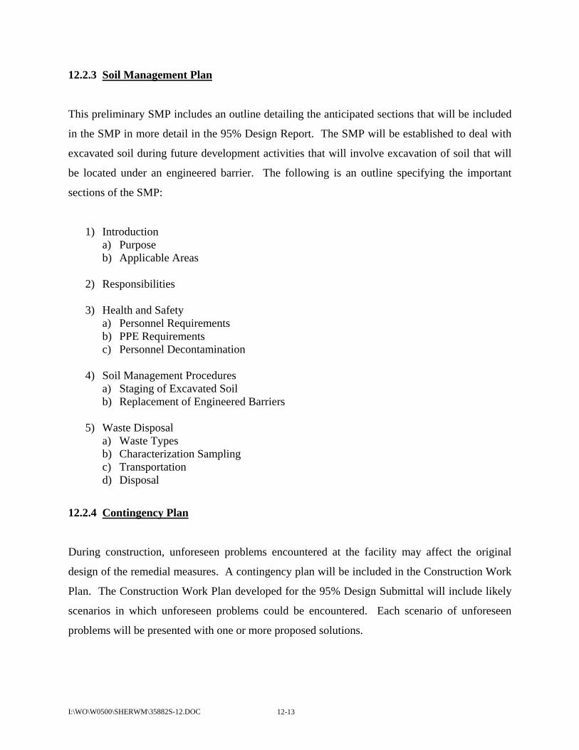
I:\WO\W0500\SHERWM\35882S-12.DOC 12-13
12.2.3 Soil Management Plan
This preliminary SMP includes an outline detailing the anticipated sections that will be included
in the SMP in more detail in the 95% Design Report. The SMP will be established to deal with
excavated soil during future development activities that will involve excavation of soil that will
be located under an engineered barrier. The following is an outline specifying the important
sections of the SMP:
1) Introduction a) Purpose b) Applicable Areas
2) Responsibilities
3) Health and Safety
a) Personnel Requirements b) PPE Requirements c) Personnel Decontamination
4) Soil Management Procedures
a) Staging of Excavated Soil b) Replacement of Engineered Barriers
5) Waste Disposal
a) Waste Types b) Characterization Sampling c) Transportation d) Disposal
12.2.4 Contingency Plan
During construction, unforeseen problems encountered at the facility may affect the original
design of the remedial measures. A contingency plan will be included in the Construction Work
Plan. The Construction Work Plan developed for the 95% Design Submittal will include likely
scenarios in which unforeseen problems could be encountered. Each scenario of unforeseen
problems will be presented with one or more proposed solutions.

I:\WO\W0500\SHERWM\35882S-12.DOC 12-14
In addition, the O&M Plan outlines contingency procedures to follow in case of failure of any of
the remedial measures. Detailed contingency plans included in the O&M Plan will be developed
and included in the 95% Design Submittal.

I:\WO\W0500\SHERWM\35882S-13.DOC 13-1
SECTION 13
REFERENCES
United States Environmental Protection Agency (U.S. EPA), Design and Construction of RCRA/CERCLA Final Covers. May 1991.
United States Environmental Protection Agency (U.S. EPA), Final RMS Report Approval and
Final Decision and Response to Comments. July 2005a. United States Environmental Protection Agency (U.S. EPA), Guidance on Quality Assurance for
Environmental Technology, Design, Construction, and Operation. January 2005b. United States Environmental Protection Agency (U.S. EPA), RCRA Corrective Action Plan
Guidance. May 1994. United States Environmental Protection Agency (U.S. EPA), Requirements for Quality
Assurance Project Plans for Environmental Data Operations. March 2001. United States Environmental Protection Agency (U.S. EPA), Statement of Basis for the Selection
of Corrective Measures. February 2005c. Weston Solutions, Inc., Description of Current Conditions Report, The Sherwin-Williams
Company, Chicago, Illinois. February 1998a.
Weston Solutions, Inc., Facility Investigation Work Plan, The Sherwin-Williams Company, Chicago, Illinois. August 1998b.
Weston Solutions, Inc., Human Health and Screening Level Ecological Risk Assessment, The Sherwin-Williams Company, Chicago, Illinois. July 2001.
Weston Solutions, Inc., Predesign Work Plan, The Sherwin-Williams Company, Chicago, Illinois. May 2005a.
Weston Solutions, Inc., Remedial Measures Implementation Program Plan, The Sherwin-
Williams Company, Chicago, Illinois. November 2005b. Weston Solutions, Inc., Remedial Measures Study Report, The Sherwin-Williams Company,
Chicago, Illinois. December 2003a.
Weston Solutions, Inc., Remedial Measures Study Work Plan, The Sherwin-Williams Company, Chicago, Illinois. August 2003b.
Related Documents