WASH Cluster Gap Analysis Punjab Province Information Management Officer WASH Cluster‐Multan 21 November, 2010

Welcome message from author
This document is posted to help you gain knowledge. Please leave a comment to let me know what you think about it! Share it to your friends and learn new things together.
Transcript

WASH Cluster Gap Analysis
Punjab Province
Information Management Officer
WASH Cluster‐Multan 21 November, 2010

Table of Contents Methodology 1
Results 2
Conclusions 5
List Of Maps
Map 1: Tehsil in Flood Districts of Punjab With Reported WASH Cluster Activities
Map 2: Tehsil in Flood Districts of Punjab With Reported Hygiene Activities
Map 3: Tehsil in Flood Districts of Punjab With Reported NFI Activities
Map 4: Tehsil in Flood Districts of Punjab With Reported Sanitation Activities
Map 5: Tehsil in Flood Districts of Punjab With Reported Water Activities
Map 6: Tehsil With Activities Of WASH Cluster Partners Punjab Province
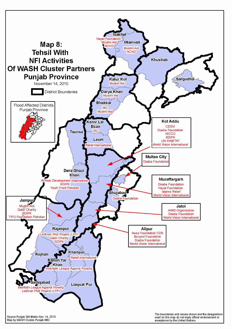
Map 7: Tehsil With Hygiene Activities Of WASH Cluster Partners Punjab Province
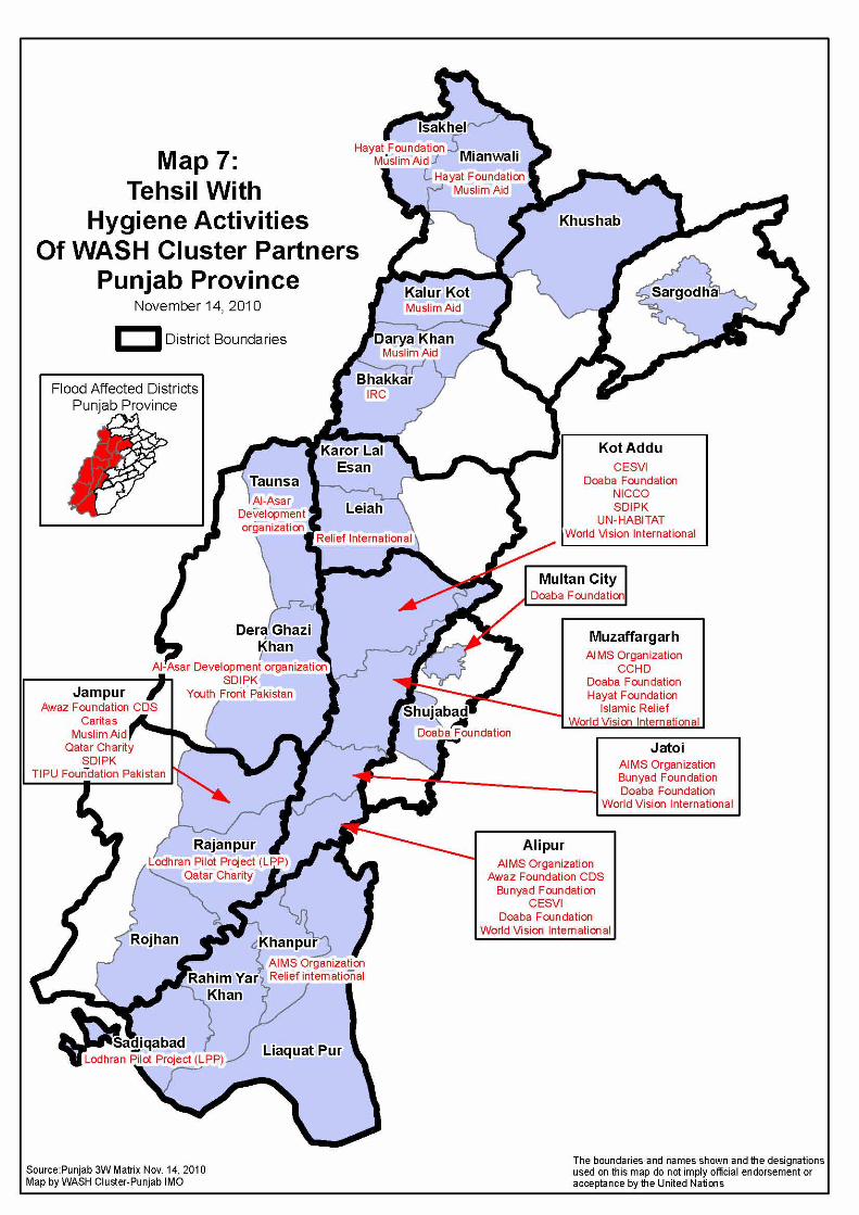
Map 8: Tehsil With NFI Activities Of WASH Cluster Partners Punjab Province
Map 9: Tehsil With Sanitation Activities Of WASH Cluster Partners Punjab Province
Map 10: Tehsil With Water Activities Of WASH Cluster Partners Punjab Province
1
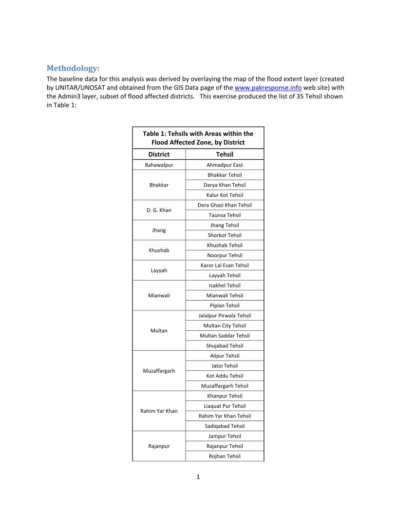
Methodology: The baseline data for this analysis was derived by overlaying the map of the flood extent layer (created by UNITAR/UNOSAT and obtained from the GIS Data page of the www.pakresponse.info web site) with the Admin3 layer, subset of flood affected districts. This exercise produced the list of 35 Tehsil shown in Table 1:
Table 1: Tehsils with Areas within the Flood Affected Zone, by District
District Tehsil
Bahawalpur Ahmadpur East
Bhakkar
Bhakkar Tehsil
Darya Khan Tehsil
Kalur Kot Tehsil
D. G. Khan Dera Ghazi Khan Tehsil
Taunsa Tehsil
Jhang Jhang Tehsil
Shorkot Tehsil
Khushab Khushab Tehsil
Noorpur Tehsil
Layyah Karor Lal Esan Tehsil
Layyah Tehsil
Mianwali
Isakhel Tehsil
Mianwali Tehsil
Piplan Tehsil
Multan
Jalalpur Pirwala Tehsil
Multan City Tehsil
Multan Saddar Tehsil
Shujabad Tehsil
Muzaffargarh
Alipur Tehsil
Jatoi Tehsil
Kot Addu Tehsil
Muzaffargarh Tehsil
Rahim Yar Khan
Khanpur Tehsil
Liaquat Pur Tehsil
Rahim Yar Khan Tehsil
Sadiqabad Tehsil
Rajanpur
Jampur Tehsil
Rajanpur Tehsil
Rojhan Tehsil

2
Sargodha
Sillanwali Tehsil
Bhalwal Tehsil
Sahiwal Tehsil
Sargodha Tehsil
Shahpur Tehsil
The second step in the process was to compile the 3W Matrix reports that all of the Punjab WASH Cluster partners have made up to this date with respect to their activities. These data were then overlaid on the Tehsil boundary base maps, first with a compilation of all WASH activities (map 1), and subsequently for each separate WASH activity: Hygiene, NFI, Sanitation and Water (maps 2 through 5). These maps were used to locate Tehsil with areas that were affected by the flood, but for which there were gaps in the WASH activities. These gaps are reported in the results section, below.
Results: Table 2 contains a list of the Tehsils with flood affected areas for which no WASH activities of any kind have been reported:
Table 2: Flood Affected Tehsils With No Reported WASH Cluster Activities District Tehsil
Bahawalpur Ahmadpur East
Jhang Jhang Tehsil Shorkot Tehsil
Khushab Noorpur Tehsil Mianwali Piplan Tehsil
Multan Jalalpur Pirwala Tehsil Multan Saddar Tehsil
Sargodha
Sillanwali Tehsil Bhalwal Tehsil Sahiwal Tehsil
Shahpur Tehsil

3
Table 3 contains a list of the Tehsils with flood affected areas for which no hygiene activities have been reported. This table does not include the Tehsils reported in table 2:
Table 3: Flood Affected Tehsils With No Reported Hygiene Activities District Tehsil
Khushab Khushab Tehsil
Rahim Yar Khan
Liaquat Pur Tehsil Rahim Yar Khan Tehsil
Rajanpur Rojhan Tehsil
Sargodha Sargodha Tehsil Table 4 contains a list of the Tehsils with flood affected areas for which no NFI activities have been reported. This table does not include the Tehsils reported in table 2:
Table 4: Flood Affected Tehsils With No Reported NFI Activities
District Tehsil
D. G. Khan Taunsa Tehsil Khushab Khushab Tehsil
Rahim Yar Khan Liaquat Pur Tehsil Rajanpur Rojhan Tehsil
Sargodha Sargodha Tehsil

4
Table 5 contains a list of the Tehsils with flood affected areas for which no sanitation activities have been reported. This table does not include the Tehsils reported in table 2:
Table 5: Flood Affected Tehsils With No Reported Sanitation Activities District Tehsil
Bhakkar Bhakkar Tehsil
Darya Khan Tehsil Kalur Kot Tehsil
D. G. Khan Taunsa Tehsil
Khushab Khushab Tehsil Layyah Karor Lal Esan Tehsil Mianwali Mianwali Tehsil Multan Shujabad Tehsil
Muzaffargarh Jatoi Tehsil
Rajanpur Rojhan Tehsil
Sargodha Sargodha Tehsil Table 6 contains a list of the Tehsils with flood affected areas for which no Water activities have been reported. This table does not include the Tehsils reported in table 2:
Table 6: Flood Affected Tehsils With No Reported Water Activities District Tehsil
Bhakkar Darya Khan Tehsil Kalur Kot Tehsil
D. G. Khan Taunsa Tehsil Layyah Karor Lal Esan Tehsil Multan Shujabad Tehsil
Muzaffargarh Alipur Tehsil Jatoi Tehsil

5
Conclusions: The 3W Matrix reporting clearly indicates that there are significant gaps in the reported coverage of WASH Cluster activities in the Punjab. The un‐answered question is, “Do these gaps reflect actual gaps in coverage, or does this data reflect a gap in 3W matrix reporting?” The answer probably is that there is some of the one and some of the other. Hopefully it is mostly a gap in the reporting and little real gap in the activities, but either way this information points to a very real need to motivate the partners to maintain a timely and accurate 3W reporting regime, and to intensify the search for organizations who are not reporting. The more serious possibility is that there are real gaps in the activity coverage. In that case immediate efforts must be made to find the means to cover these gaps. The nature of the necessary efforts is beyond the competence of the Information Management Office staff, but it is hoped that the information presented here will be useful in focusing the efforts of those who do deal with these matters.


Related Documents