September 2015 Volume 47, Number 3 U T A H G E O L O G I C A L S U R V E Y SURVEY NOTES A small step for Utahraptor , ONE BIG FOSSIL BLOCK FOR UGS PALEONTOLOGISTS

Welcome message from author
This document is posted to help you gain knowledge. Please leave a comment to let me know what you think about it! Share it to your friends and learn new things together.
Transcript

September 2015Volume 47, Number 3
U T A H G E O L O G I C A L S U R V E Y
SURVEY NOTES
A small step for Utahraptor,
O N E B I G F O S S I L B L O C KFOR UG S PA L EON TOLO GIS TS

State of Utah Gary R. Herbert, Governor
Department of Natural Resources Michael Styler, Executive Director
UGS Board Tom Tripp, Chair
William Loughlin, Marc Eckels, Pete Kilbourne, Ken Fleck, Sam Quigley, Elissa Richards Kevin Carter (Trust Lands Administration-ex officio)
UGS STAFFAdministration Richard G. Allis, Director Kimm Harty, Deputy Director Starr Soliz, Secretary/Receptionist
Dianne Davis, Administrative Secretary Jodi Patterson, Financial Manager Linda Bennett, Accounting Technician Michael Hylland, Technical Reviewer Stephanie Carney, Technical Reviewer Editorial Staff | Vicky Clarke Lori Steadman, Jay Hill, Nikki Simon, John Good
Geologic Hazards | Steve Bowman Richard Giraud, William Lund, Jessica Castleton,
Gregg Beukelman, Tyler Knudsen, Greg McDonald, Adam McKean, Ben Erickson, Pam Perri, Adam Hiscock, Gordon Douglass
Geologic Information and Outreach | Michael Hylland
Christine Wilkerson, Mark Milligan, Lance Weaver, Gentry Hammerschmid, Jim Davis, Marshall Robinson, Brian Butler, Robyn Keeling, Andrew Cvar
Geologic Mapping | Grant Willis Jon King, Douglas Sprinkel, Kent Brown,
Basia Matyjasik, Donald Clark, Bob Biek, Zach Anderson
Energy and Minerals | David Tabet Craig Morgan, Jeff Quick, Taylor Boden,
Thomas Chidsey, Cheryl Gustin, Tom Dempster, Stephanie Carney, Ken Krahulec, Mike Vanden Berg, Andrew Rupke, Mark Gwynn, Christian Hardwick, Peter Nielsen, Hobie Willis, Rebekah W. Stimpson
Groundwater and Paleontology | Mike Lowe James Kirkland, Janae Wallace, Martha Hayden,
Hugh Hurlow, Don DeBlieux, Paul Inkenbrandt, Lucy Jordan, Walid Sabbah, Rich Emerson, Stefan Kirby, Diane Menuz, Brittany Dame, Nathan Payne
Survey Notes is published three times yearly by the Utah Geological Survey, 1594 W. North Temple, Suite 3110, Salt Lake City, Utah 84116; (801) 537-3300. The UGS provides timely scientific information about Utah’s geologic environment, resources, and hazards. The UGS is a division of the Department of Natural Resources. Single copies of Survey Notes are distributed free of charge within the United States and reproduction is encouraged with recognition of source. Copies are available at geology.utah.gov/map-pub/survey-notes/. ISSN 1061-7930
ContentsUGS Paleontolgists Collect
Dinosaur Megablock ............................1Deep Nitrate in an Alluvial Valley:
Potential Mechanisms for Transport ....4Energy News .............................................6Teacher's Corner .......................................7Glad You Asked ........................................8GeoSights ................................................10Survey News ............................................12New Publications ....................................13
Design | Nikki Simon
Cover | A track hoe pulls a nine-ton field jacket containing hundreds of bones of Utahraptor and iguanodont dinosaurs from the Stikes Quarry in eastern Utah. INSET PHOTO A reconstruction of the Stikes dinosaur death trap. Adult and juvenile Utahraptor dinosaurs attack an iquanodont dinosaur trapped in quicksand. By Julius Costonyi.
Although the Utah Geo-logical Survey (UGS) has been struggling with a large decrease in exter-nal funding, we are part of a team that recently received an award for geothermal research. The Geothermal Tech-nology Office of the federal Department of Energy (DOE) issued a solicitation for proposals to find a dedicated site (termed the Frontier Obser-vatory for Research on Geother-mal Energy [FORGE]) where sci-entists and engineers will be able to develop, test, and accelerate breakthroughs in enhanced geo-thermal system (EGS) technologies and techniques. These techniques involve drilling multiple wells into hot, crystalline rock with near-hor-izontal legs, and creating fractures so that water can be circulated between injection and production wells, sweeping out the interven-ing heat for possible power gen-eration at the surface. Although horizontal drilling and hydrofrac-turing is now common in tight oil and gas plays, these techniques have not been successful in geo-thermal applications.
The UGS joined with the Energy & Geoscience Institute at the Univer-sity of Utah in proposing a FORGE site about 10 miles north of Mil-ford, Beaver County, and three to five miles west of Pacificorp Ener-gy’s 36 MWe geothermal plants at Roosevelt Hot Springs. The site is also adjacent to SunEdison’s 306 MWe wind farm and a future 240 MWe solar power plant that should be commissioned in 2016, making this region a unique renewable energy cluster. The Milford site has the required temperatures of about 400°F in impermeable gran-
ite at a depth of 5000 to 10,000 feet, easy all-year access, supportive land owners (Murphy Brown, LLC and Utah School and Institutional Trust Lands Administration), and mini-mal environmental issues. The UGS has already acquired the water rights necessary for developing
the new geothermal technologies.
Selection of the final FORGE site is a three-phase process. The DOE announced Phase 1 awards to five prospective sites in Utah, Idaho, Oregon, California, and Nevada. After a nine month desk-top char-acterization of each site in Phase 1, the best two or three sites will be chosen for Phase 2 with more intensive resource assessment and completion of environmental per-mitting. About two years from the start of Phase 1, the best site will be chosen, instrumented, and readied for monitoring for Phase 3 testing. Phase 3 will be five years in duration and will include deep drilling, stimulation, monitoring for induced seismicity, and flow testing reservoir analysis, with sci-entists and engineers visiting from around the world.
The UGS has an important role throughout this project, assum-ing Utah is chosen for the FORGE site. In addition to assisting characterization of the geo-thermal potential of the future reservoir, the UGS has responsi-bilities for oversight of environ-mental compliance and outreach to stakeholders, which includes managing the main website for the project. This exciting project could be a major source of fund-ing for the UGS over the next few years.
THE DIRECTOR'S PERSPECTIVE
by Richard G. Allis

“If we knew how much work it was going to be we would have kicked some dirt over it and walked away!” says Utah Geological Survey (UGS) Paleontologist Scott Madsen. Although he was joking, this is how the UGS paleontology team felt many times over the nine years it took to collect the enormous block of rock containing the fossilized bones of numerous plant-eating iguanodont and carnivorous Utahraptor dinosaurs. The site is located on a scenic ridge overlooking Arches National Park with Castle Valley and the La Sal Mountains visible in the distance. The marvelous view comes at a price—a steep climb up a slope of mudstone covered in loose rock and carbonate nodules. “When we first visited the site there was not even a place to stand without sliding down the hill, and we had to hack out a platform just to begin to evaluate the site,” says Utah State Paleontologist Jim Kirkland.
Discovered by Northern Arizona University graduate student Matthew Stikes during his thesis research, the so-called Stikes Quarry is in rocks of the Yellow Cat Member of the Early
UGS PALEONTOLGISTS COLLECT
DINOSAUR MEGABLOCK
B Y Don DeBlieux
Cretaceous Cedar Mountain Formation. During our preliminary exploration of the site in 2005, one of the first rocks that Jim split open contained the front end of a Utahraptor lower jaw with all the teeth in place. The fact that the delicate teeth were still in place meant that the jaw had not traveled far, if at all, after the death of the animal. As we dug further we realized that there were many well-preserved fossils at this site, which turned out to be one of the most remarkable and important dinosaur sites that Jim, Scott, and I have ever worked on.
The following year (2006), the UGS paleontology section was busy with several other excavations, so we enticed some colleagues from Washington University in St. Louis, Missouri, to take over, and with our help, they began excavating the site that summer. In a typical dinosaur excavation, rock is removed until a bone is found, and then rock surrounding the bone is removed until the bone is left sitting on a pedestal of rock. The pedestalled bone is covered in a protective jacket using either a plaster medical bandage if it is small, or casting plaster and burlap if it is large. After the jacket hardens, the pedestal is undermined, flipped over, and the bottom side is jacketed. Sometimes bones are so tightly packed that it is impossible to isolate individual bones for jacketing and larger blocks need to be excavated. We excavated a number of fossils, including a roughly 1000-pound jacketed block that was slid down the slope on an old car hood and brought to St. Louis for preparation. The bones from this block became the subject of a master’s thesis by Washington University student Karen Poole.
Regrettably, the Washington University group was unable to continue their work at the site. In the summer of 2007, I visited the site with our intern Gary Hunt and we found that a number of large blocks of rock had fallen from the cliff above and knocked off a chunk of bone-bearing rock that had been jacketed the year before. We salvaged what we could, including a section of a large adult Utahraptor jaw and part of the back of its skull, and re-jacketed the damaged area. This was a wake-up-call for us, and we realized we would have to make it a priority to continue work at the site.
For the next several years we tried to get to the site whenever possible to collect more of these important fossils. Each day at the site began with several trips up and down the steep slope carrying supplies such as plaster and water on our backs. One of our main concerns was to separate bones to make the size of the jackets manageable. Using small hand
tools, such as ice picks and dental tools, we began to separate individual bones. However, the bones were too tightly packed to isolate them in the field. We decided to try and collect an enormous block to avoid damaging any bones. Fortunately, separating the block was straightforward because the bone-bearing mass was restricted to an isolated blob of green sandstone surrounded by red mudstone. Based on the geometry of the sediments and by comparing them with modern analogs, we hypothesized that this site represented a dewatering feature, essentially a quicksand, which trapped, killed, and preserved the animals found here. The shape of the blob made it easier to isolate without having to cut through bone. The block, however, would be one of the largest fossil blocks that anyone had ever tried to collect, and certainly one of the largest from such a difficult location. We initially Jim Kirkland holding his initial Utahraptor jaw discovery.
SEPTEMBER 2015 1
Karen Poole and Jim Kirkland
inspecting the bottom of the first block after flipping,
summer 2006.
Don DeBlieux and Scott Madsen
jackhammering and mucking in 2013.
The main block on two pedestals at the end of the 2013 field
season.
Moving the main block from the
site to be loaded and shipped to Salt Lake City,
November 2014.
2 SURVEY NOTES

of a bulldozer and a track hoe to complete the track to the site and drag the frame and block down the mesa.
In November 2014, everything was in place to begin final assembly of the frame under the block. It took two weeks of steady effort to trim the block to accommodate the frame, assemble the frame under the block, remove the pillars from under the frame, plaster and shim the underside of the block, and strap it to the frame to ready it for the drag down the mesa. We were relieved that we accomplished this without any movement of the block and no injuries to any members of our team. It was an exciting day when the track hoe arrived to begin the drag down the mesa. National Geographic sent a videographer to the site to document the move. Our nerves were on edge as the track hoe began to pull and we heard the creaking of the frame as it ground over the rocky surface, but all stayed rigid and secure as the block moved from its resting place for the first time in 125 million years. Despite a few hiccups, we successfully dragged the block off of the mesa and loaded it onto a semi truck for transport to Salt Lake City. The realization of our goal would not have been possible without the labors of many students and volunteers who spent hundreds of hours assisting us.
With the block collected, our next hurdle was to find a large space to prepare the fossils since the block would not fit in the UGS preparation lab. Ultimately, the North American Museum of Ancient Life at Thanksgiving Point in Lehi, Utah, agreed to provide a space in their preparation lab. We are now working to obtain the necessary funding so that a UGS paleontologist can oversee the preparation of the block, a process that will likely take many years. We are excited to begin this next phase of the project and begin to reap the scientific and educational rewards of so many years of back-breaking labor.
VIDEO LINKS http://www.discovery.com/tv-shows/dirty-jobs/videos/fossil-hunter/
http://news.nationalgeographic.com/news/2015/01/150106-utahraptor-death-trap-fossil/
tried to secure a heavy-lift helicopter to fly the block off the hill. We worked hard to publicize the project with the hope that a company might donate the use of a helicopter since our budget would not allow us to pay for such an expensive piece of equipment. In 2011, we filmed an episode of the Discovery Channel program Dirty Jobs at Stikes Quarry. The show aired that fall, and though it was quite popular, no offers for helicopters were forthcoming. Recognizing that we would have to find an alternative, we enlisted the help of Don Brummel from Ames Construction to build a track up to the site that could be used to drag the block off the mesa with heavy equipment. This road would also facilitate the transport of materials and equipment necessary to build a frame around the block to support it during the removal.
A rough preliminary track was completed in 2012, and in the fall of 2013 a volunteer provided an ATV to bring supplies to the site. We spent several weeks using an electric jackhammer powered by a gas generator and air hammers powered by an air compressor to move tons of rock from around the block. The power tools sped up the process, but the work was still very strenuous, and we had to muck out our trenches by hand. We covered newly exposed surfaces with plaster and burlap to stabilize them, and added many hundreds of pounds of plaster to the block, including the sides and bottom. We used a great deal of finesse to make the plaster a proper consistency so it would stick to vertical and overhanging surfaces. By the end of the 2013 field season, we were able to tunnel underneath the center of the block until it was sitting on two large pillars.
In 2014, veteran Utah Friends of Paleontology volunteer and mechanical engineer Phil Policelli helped design a wooden frame to place under the block that would also serve as a sled to be pulled down the slope. Jim Cross of Cross Marine Projects, Inc., a long-time supporter of the UGS Paleontology Program, provided space, supplemental material, and manpower to help Phil manufacture a frame that could be disassembled, transported to the site, and reassembled in place under the block. It took two weeks of full-time work to manufacture the frame, which consisted of 10 x 10-inch and 8 x 8-inch wooden beams up to 10 feet long that were bolted together and reinforced by large metal hardware. To get the disassembled frame to the site, Dan Harrison and his son Bo, of High Desert Excavating in Green River, Utah, offered the use
Don DeBlieux has been with the Utah Geological Survey for the past 14 years where he serves as the Utah Assistant State Paleontologist. Don oversees the UGS field paleontology program and fossil preparation lab. He has authored and coauthored over 20 professional papers, and helped to discover and name six new dinosaurs and two new fossil mammals from Utah. Over the past 30 years, he has helped to lead dozens of field expeditions searching for vertebrate fossils in the western U.S., Egypt, Madagascar, Namibia, and Tanzania.
A B O U T T H E A U T H O R
SEPTEMBER 2015 3

Goshen Valley, home to the agricultural communities of Goshen, Genola, and Elberta, occupies the southwestern boundary of Utah Lake—Utah’s largest freshwater lake. Like other Wasatch Front valleys to the north, Goshen Valley was once inundated by ancient lake systems, including Lake Bonneville, which eventually filled the basin with clay, silt, and sand hundreds of feet thick. These deposits now host an underground aquifer supplying water to these communities. Many water users also rely on surface water from canals, streams, and Utah Lake to irrigate; eventually a portion of that irrigation water recharges the aquifer. However, the communities rely solely on groundwater to quench their thirst. Water can contain a variety of dissolved chemical constituents that are derived from both natural and human-related sources. Dissolved elements such as calcium, sodium, and iron occur naturally in groundwater, but sometimes constituents such as mercury or nitrate can be present, and if in high concentrations, can be a health hazard. If water from a public water-supply system contains any constituent that exceeds the U.S. Environmental Protection Agency’s (EPA) water-quality standards, it is deemed unfit for consumption and taken off line, which can be quite costly. Water from several deep wells in Goshen Valley has high nitrate concentrations, which is a unique problem since nitrate contamination is typically associated with shallow wells located near common surficial sources of nitrate.
Aquifers in agricultural valleys typically have groundwater with measurable nitrate concentrations. Why does nitrate matter? Nitrate is considered a health risk by the EPA when concentrations, measured as nitrogen, exceed 10 milligrams per liter (mg/L). Under aerobic (high oxygen) conditions, ammonium from septic-tank effluent or animal manure can convert to nitrate, contaminate groundwater, and pose potential health risks to humans.
High nitrate levels in groundwater in Goshen Valley have been documented in a handful of deep, alluvial (>150 feet) wells or in bedrock wells (a rarity). For example, Elberta’s original public-supply well (359 feet deep) located near the town center was taken off line due to elevated nitrate concentrations (up to 44 mg/L) in 1975. High nitrate levels in deep groundwater are uncommon in other, similar agricultural settings in Utah. So, why is Goshen Valley different?
Nitrate is mostly associated with surficial processes and conditions and is sourced from
DEEP NITRATE IN AN ALLUVIAL VALLEY: POTENTIAL M ECHANIS M S
FO R TR AN S PO RTB Y JANAE WALLACE and J. LUCY JORDAN
Potentiometric map (water-level elevation) showing depth to water from ground surface, sample site location and type, and nitrate ranges for select sites. The western part of the valley has a lower hydraulic gradient, likely from pumping of deep irrigation wells in the area, some of which have the highest nitrate concentrations in the valley with record values around 25 times greater than the EPA standard of 10 milligrams per liter.
4 SURVEY NOTES

12
irrigated lands (fertilizer), concentrated animal operations (manure), septic tanks, organic soil, and/or precipitation. A less common source is bedrock. But, how does nitrate reach the subsurface aquifer? Several possible ways include leaching in areas with high rainfall and excessive irrigation rates; traveling down poorly constructed or improperly protected wells; and natural geologic conduits such as faults, fractures, and fissures. In Goshen Valley, residents rely on septic-tank systems for wastewater disposal, and drain fields from these systems may also leach water and associated contaminants to the aquifer. After leaching into the subsurface, surface water with potentially elevated nitrate concentrations may mix with older groundwater within the aquifer, and one way to identify sources of nitrate is through geochemical analysis of groundwater samples.
During spring 2013 and 2014, the Utah Geological Survey (UGS) sampled water from 38 sites (mostly wells and some surface waters) in Goshen Valley to analyze for general chemistry and nitrate. Samples from several locations were analyzed for oxygen and nitrogen isotopes in nitrate (16 sites) to help us pinpoint the source of nitrate. Most of the wells sampled are completed in unconsolidated basin sediments; only five are thought to draw water from bedrock. Water levels were measured or compiled for 138 wells.
From the compiled water levels, a potentiometric map was created and shows that groundwater flows into Goshen Valley from the mountains west and south of the valley and from neighboring valleys toward Utah Lake. The water table occurs at shallower depths in the southeast, possibly due to more surface recharge sources and
Nitrogen versus oxygen isotope ratios in nitrate for nine samples that have relatively high nitrate concentration (>3 mg/L) (blue diamonds) and seven samples that have lower nitrate concentrations (~1 mg/L) (red squares) in groundwater. Green triangle corresponds to a 2010 analysis of site 12 well water that had a nitrate concentration of 270 mg/L, and plots near a 2013 sample collected from the same well that had a nitrate concentration of 256 mg/L. Data fall into three categories: manure and septic waste, soil nitrogen, and ammonia (NH4) fertilizer and rain.
inter-basin groundwater flow than in the south and west. In contrast, pumping from deep irrigation wells in the western part of the valley has lowered the water table as much as 50 feet in the past 30 years and has created an area of low hydraulic gradient.
Compared to other rural, agricultural areas in Utah, Goshen Valley is unique because the majority of wells have low nitrate concentrations, whereas the deepest wells have high concentrations—one well has the highest nitrate concentration ever documented by UGS. Nitrate concentrations in our samples range from less than 0.1 to 256 mg/L, with an average nitrate concentration of ~11 mg/L, but a low median value of 0.8 mg/L due to the majority of samples (73%) having nitrate concentrations less than 2 mg/L. Ten percent of samples have concentrations that exceed the EPA water quality standard and 55% have concentrations less than 1 mg/L.
The majority of samples with nitrate concentrations at or above 1 mg/L (16 sites) were analyzed for nitrogen and oxygen isotopes in nitrate to help delineate the source(s) of the nitrate. A graph of the ratios of oxygen and nitrogen isotopes in the nitrogen molecule (δ18O and δ15N, respectively) shows Goshen samples plot in the overlapping fields of fertilizers, precipitation, and manure and septic waste, and within the range of soil nitrogen. Generally, water having nitrate concentrations around 1 mg/L (red boxes) (except for site ID 17, a well completed in bedrock supplying water to a gravel pit on the eastern basin margin) are more depleted in δ18O than the water samples with nitrate concentrations >3 mg/L (blue diamonds). Site ID 12 is an irrigation well having the anomalously high nitrate concentration of 256 mg/L.
For wells on agriculture land dominated by feed lots, dairy operations, and homes having septic systems, the amount of δ15N in water is expected to be greater than 10 parts per thousand; most values for our samples fall between 5.1 and 7.8 parts per thousand. We suspect that nitrate with a depleted δ15N signature, as found in soil and fertilizer, is mixing with nitrate enriched in 15N, likely from a manure source. Our results indicate that dilution, not denitrification, is the dominant process of nitrate removal from the environment in Goshen Valley.
In most valley groundwater systems, water having high nitrate concentration is often correlated with wells completed in shallow unconsolidated sediments (e.g., wells less than 150 feet deep). Shallow wells are more susceptible to surficial nitrate contamination by virtue of their proximity to the source. The highest nitrate concentrations in Goshen Valley are atypical; they occur in the deeper wells (>150 feet deep) and/or bedrock wells, which are nearly all located in the irrigated western and southwestern part of the basin. Because of a low hydraulic gradient, fresh recharge with low nitrate concentrations from mountain sources likely moves more slowly through the western part of the basin than recharge in other areas of the valley. The longer residence time of groundwater on this side of the valley (corroborated by groundwater dating methods) may contribute to the elevated nitrate concentrations in the deep wells; high-nitrate water is not being flushed out of the system. In contrast, the east and southeast areas of the basin have a relatively higher water table and likely receive more recharge from surface water with lower nitrate concentration. Additionally, groundwater dating methods show that the eastern side of the valley is a mixture of young mountain recharge and older groundwater that may have been recharged outside of the immediate region. If nitrate contamination is occurring in the eastern side of the basin, the short-residence-time flow regime may move it out of the basin system more quickly than the western side.
Our data represent only a snapshot in time. Nitrate concentrations and nitrogen-oxygen isotopes in nitrate can vary seasonally and annually. What is not known about these high nitrate-water wells is whether the concentrations of nitrogen and oxygen isotope species have changed through time or with depth through the water column. Further analysis of these data will help determine whether denitrification or dilution is dominant and occurring throughout the year to keep overall nitrate concentrations lower in Goshen Valley than other similar agricultural valleys in Utah. With continued population growth and installation of septic tanks in new developments, or substandard agricultural practices, the potential for nitrate contamination will increase. The UGS continues to evaluate the data to better understand the complexity of the groundwater system and the nitrate sources.
SEPTEMBER 2015 5

B Y REBEKAH W. STIMPSON
Updated Map Shows Utah’s Many Oil and Gas Fields
INTRODUCTION
Utah is an important source of crude oil and natural gas and is currently ranked 11th in United States production. Driven by a decades-long increase in Utah’s oil and gas production, the Utah Geological Survey (UGS) recently released an updated Oil and Gas Fields Map of Utah that shows where all successful drilling activity has occurred, most of which is within the Uinta Basin of northeastern Utah and Paradox Basin in southeastern Utah.
EXPLORATION AND PRODUCTION HISTORY
Hydrocarbons in Utah were first recognized in 1850 by Captain Howard Stansbury in the form of oil seeps at Rozel Point along the northern shore of Great Salt Lake. Exploration throughout the state became more common in the late 1800s through the 1920s and slowed during the Great Depression. The first commercial oil field, Ashley Valley (~8 miles southeast of Vernal), was discovered in 1948 and initiated a focus on drilling deeper wells. Production in the Paradox Basin began to flourish in the 1950s with the discovery of the Greater Aneth field. Since then, other major discoveries include, but are not limited to: Altamont, Bluebell, and Monument Butte oil fields and Greater Natural Buttes natural gas field in the Uinta Basin; Anschutz Ranch, Pineview, and Covenant oil fields in the Utah thrust belt; and Lisbon, Big Flat, and Salt Wash oil fields in the northern Paradox Basin near Moab.
Not all of Utah’s produced oil flows as easily as Jed Clampett’s “bubblin’ crude.” Although there are some crude oil plays that have low viscosity (little resistance to flow) and require less refining, much of the crude extracted in the Uinta Basin contains significant amounts of paraffin. This oil is referred to as “yellow wax” and “black wax,” and requires special refining to make more commonly recognized products. These waxy crude oils are found within the Tertiary Green River and Wasatch Formations and are sourced from lacustrine organic-rich rocks.
MAP UPDATES
Previous versions of Utah’s oil and gas fields map were published in 1983 and 2004.
The recently published version displays all producing fields that have been discovered since 2004 as well as field expansions and additional pipelines, like the 42-inch diameter Ruby natural gas pipeline in northern Utah. This updated map also displays the names and ages of all oil, gas, and carbon dioxide (CO2) reservoirs and gas storage fields.
USING THE MAP
Each field label is colored according to the primary commodity produced (oil-green, gas-red, or CO2-purple). Beneath the field name is listed any field designation that applies. After the field designations are the field’s producing or abandoned (A) reservoirs. For example, Lodgepole field in Summit County produces oil (note the green label). Listed following the field name are “(D) (HD) Jtc, Jn (A)” meaning Lodgepole hosts a produced water disposal project (D), at least one horizontal well (HD), current production is in the Jurassic-age Twin Creek Limestone (Jtc), and though there used to be production in the Jurassic Nugget Sandstone, the reservoir is now abandoned. Each field has similar information, thus providing the current field status and also the field’s history. Each field polygon is colored according to the age of the predominant reservoir rock. For example, many of the fields within the Uinta Basin produce from the Tertiary Green River and Wasatch Formations and are colored orange. Most of the production in the Paradox Basin is from the Middle Pennsylvanian Paradox Formation represented with blue. Because the map displays the boundaries for major basins and uplifts, it is a quick reference to ascertain where each field fits geographically and geologically.
In addition to the designations and history for each field, the map contains active pipelines colored by commodity and labeled with the last known operator, flow direction, and diameter. Pipelines transport crude oil, natural gas, CO2, or refined products to refineries, processing plants, and distributors. Ownership for several of the pipelines has passed through numerous hands since the previous map version. The map also shows the name and capacity of oil refineries located north of Salt Lake City and natural gas processing plants throughout the state.
The information on the map is beneficial for geologists, engineers, investors, landowners, and other stakeholders, as well as state, federal, and county government regulators and planners. In addition to easily identifying areas of current production and potential exploration,
ENERGY NEWS
Altamont, Bluebell, and Monument Butte are a few of the major oil fields in the Uinta Basin.
The Uinta Basin in the 2004 edition of the oil and gas fields map displays significantly less
development than the 2015 version.
6 SURVEY NOTES

Lodgepole is an active oil field in Summit County producing from the Jurassic Twin Creek Limestone. Also shown are several
large-diameter gas pipelines.
Operators target the Cane Creek shale within the Pennsylvanian Paradox Formation in many
oil fields near Moab.
the map also shows areas that cannot be developed such as national parks and monuments, recreation areas, historic sites, and rock units not expected to contain oil and gas resources such as most volcanic rocks and ancient Precambrian rocks.
The UGS and State of Utah School and Institutional Trust Lands Administration funded this map with the intent to provide an up-to-date, quick reference for Utah’s oil and gas resources, production, transportation, and processing. The map, UGS Circular 119, is available for purchase on CD with GIS files, or as a print-on-demand map at the Utah Department of Natural Resources Map and Bookstore, 1-888-UTAHMAP, http://www.mapstore.utah.gov/. In the future we intend to have this as an interactive map on our website.
T E A C H E R ' S C O R N E RE A R T H SC I EN CE W EEK 2015 | O C TO B ER 5 – 8 , 2015
Hands-on Activities for School GroupsCome celebrate Earth Science Week with the Utah Geological Survey! This annual event features educational activities that are particularly suited for the 4th and 5th grades, where Earth science concepts are taught as outlined in the Utah Science Core Curriculum standards. Earth Science Week activities take place at the Utah Core Research Center and include panning for “gold,” identifying rocks and minerals, experimenting with erosion and deposition on a stream table, and examining dinosaur bones and other fossils.
Groups are scheduled for 1½-hour sessions. Reservations typically fill early; to inquire about an available time slot for your group, contact Jim Davis at 801-537-3306.
For more information, please visit our website at http://geology.utah.gov/teachers/earth-science-week/.
SEPTEMBER 2015 7

What is an Earthquake Early Warning System, A N D D O E S U TA H
H AV E O N E ?Can earthquakes be predicted? In a word, no. Of course, our understanding of earthquake processes and occurrence has increased tremendously since the first earthquake-detection instrument was invented in China nearly 2,000 years ago, and even since 1935 when Charles Richter helped develop the earthquake magnitude scale bearing his name. Our current state of knowledge allows us to forecast the likelihood of a damaging earthquake in a particular region within some given amount of time. But, we remain unable to predict specific earthquakes in a time frame that allows actions to be taken to reduce damage, injuries, and loss of life.
Although earthquakes cannot be predicted, technology now exists that can detect earthquakes quickly and predict the arrival times of ground motions (shaking), and the severity (intensity) of shaking, at sites in the region of the earthquake epicenter. These Earthquake Early Warning (EEW) systems are designed to send alerts that can prompt actions to protect life and property before strong shaking arrives.
EEW systems work on the principle that electronic warning signals can be transmitted almost instantaneously, whereas earthquake ground motions travel through the Earth’s shallow crust at speeds of around 0.5 to 3 miles per second. An earthquake begins when movement
occurs along a fault in the Earth’s crust; for large earthquakes in Utah, this movement typically initiates about 10 miles beneath the ground surface. The movement occurs when crustal stresses build up and finally exceed the frictional forces that normally hold the bedrock in place along the fault. All that built-up energy is released suddenly and radiates outward in waves, like the ripples on a pond that radiate outward from the rock that was thrown in.
An earthquake produces different kinds of seismic waves that move at different speeds. The fastest waves, P waves (primary waves), are compressional waves that travel through the interior of the Earth similar to how a sound wave travels through the atmosphere. These waves are the first to arrive at a site, produce the smallest ground motions, and are typically felt as a “bump.” The next waves to arrive are S waves (secondary, or shear waves), which travel through the interior of the Earth with a side-to-side motion (like the motion produced by snapping a garden hose). Because these waves have a higher amplitude than P waves, they are felt more strongly. The last waves to arrive at a site are waves that travel along the Earth’s surface. These surface waves generally cause the most damage during an earthquake.
BY Michael Hylland
Earthquake Alert Center
I-15
Seismic Waves Bedrock
Basin-fill Sediments
10 m
i (15
km
)
FOCUS
EPICENTER
GREAT SALT LAKE
WASATCH RANGE
Wasatch Fault
Fault Scarp
S Wave P Wave
Sensors
Earthquake Early Warning (EEW) systems work on the principle that an alert signal can be transmitted almost instantaneously, whereas seismic waves take longer to travel through the Earth’s crust. Sensors detect the first-arriving P wave and trigger the sending of an alert signal, which can give people and automated systems some time to take action before the arrival of stronger S waves and surface waves. This diagram illustrates a conceptual EEW system in the Wasatch Front urban corridor.
G la dYo u
Asked
8 SURVEY NOTES

The first component of an EEW system is a dense network of sensors that can detect P waves and then trigger the alert. An alert center that nearly instantaneously receives signals from the sensors can use computer algorithms to quickly estimate the earthquake’s location and magnitude, map the resulting intensity in the region of the earthquake, and calculate the arrival times of damaging ground motions. This information can then be sent in a mass communication via public emergency alert systems, smartphone apps, social media, and other electronic alert technologies before strong shaking begins.
Depending on how far a site is from where the earthquake occurred, an EEW system can provide seconds to minutes of advance warning. Even a few seconds of warning can be enough to allow property- and life-saving actions to be set in motion. For example, schoolchildren and others can be alerted to “drop, cover, and hold on,” industrial workers can move away from dangerous machines or chemicals, and surgeons can suspend delicate operations. Automated responses can also be triggered, such as slowing down or stopping trains or taxiing airplanes, opening doors at ambulance and fire stations, and initiating safety and back-up protocols at power plants.
Several countries, including Japan, Mexico, and Turkey, have EEW systems in place and have demonstrated their effectiveness. A similar system has not yet been fully implemented in the U.S., but a demonstration EEW called ShakeAlert has been developed for California, Oregon, and Washington by the U.S. Geological Survey (USGS) and university partners. ShakeAlert has been sending alerts to test users, including the San Francisco Bay Area Rapid Transit (BART) system, since 2012. During the magnitude (M) 6.0 South Napa earthquake on August 24, 2014, the shaking intensity in the BART service area was not sufficiently high to prompt emergency actions, but the BART offices received an alert 10 seconds before shaking began.
Utah does not currently have an EEW system, but several factors make a future system attractive for Utah’s Wasatch Front, including the likelihood of large earthquakes (M 7); a high population density; heavily used transportation systems including freight, commuter,
and light rail, and a major international airport hub; and numerous vulnerable commercial and service facilities such as oil refineries and hospitals. At the same time, several factors present significant challenges, including the fact that about 80 percent of Utah’s 2.9 million residents live within 15 miles of the Wasatch fault (the most geologically active fault in Utah), meaning that alert times related to a Wasatch fault earthquake could be very short. Also, costs associated with implementation, operation, and maintenance would likely be in the tens of millions of dollars. Still, numerous other sources of large earthquakes exist in the Wasatch Front region, and as the saying goes, “an ounce of prevention is worth a pound of cure.” Conceivably, an effective Wasatch Front EEW system could save Utah billions of dollars, as well as many lives, when the Big One happens.
Additional information sources:ShakeAlert Earthquake Early Warning system http://www.shakealert.org/
Earthquake monitoring in the Utah region http://www.quake.utah.edu/
Utah earthquake hazards information http://geology.utah.gov/hazards/earthquakes-faults/
Earthquake risk in Utah http://ussc.utah.gov/
Earthquake preparedness http://dem.utah.gov/hazards-and-mitigation/utah-earthquake-program/
http://www.shakeout.org/utah/
https://www.fema.gov/earthquake
Example screen shot that a ShakeAlert user would see on their personal computer or mobile device in the event of a large southern California earthquake. Information includes earthquake magnitude and epicenter location, current position of P and S waves, time remaining until strong shaking arrives at the user’s location, and expected shaking intensity at the user’s location. From USGS Fact Sheet 2014-3083.
Distribution of shaking intensity, or ShakeMap, developed for a scenario M 7.0 earthquake on the Weber segment of the Wasatch fault zone (i.e., Davis and Weber Counties). A large earthquake on any of the central segments of the Wasatch fault zone would produce strong shaking throughout much of the Wasatch Front urban corridor. ShakeMap from University of Utah Seismograph Stations.
SEPTEMBER 2015 9
Most previous GeoSights have featured a single geologic site or view. This article, however, features a series of sites along a 17-mile paved, but less traveled, road officially known as Emery County Road 803 and locally known as Moore Cutoff. What makes Moore Cutoff spectacular and worthy of a GeoSights article? Located on the western flank of the San Rafael Swell, Moore Cutoff travels across and through a sequence of some of Utah’s most famous geologic formations. From the Ferron Sandstone Member of the Mancos Shale down to the Navajo Sandstone, these rock layers represent nearly 100 million years of Utah’s geologic history. Here you can see some of the same grandiose rocks found in Arches, Canyonlands, Capitol Reef, and Zion National
BY MARK MILLIGAN
Marvelous Moore Cutoff – Emery County
Parks; Dinosaur National Monument; and other national and state parks and monuments, but without the crowds.
This article highlights just a few of the many sites to be found when exploring Moore Cutoff between the former townsite of Moore and Interstate 70 (I-70). All mileage referred to in the site descriptions is from the intersection of County Roads 802 and 803 at the north end of Moore Cutoff. Some of the sites are immediately adjacent to Moore Cutoff, whereas others require travel on unpaved side roads. Warning: do not attempt off-pavement travel in wet weather. Moisture on the Tununk Member of the Mancos Shale and Brushy Basin Member of the Morrison Formation makes for extremely hazardous to impossible driving conditions.
DINOSAUR TRACKS AND
PETROGLYPHS Mile 3.5 – Pullout on the left (north) side of the road near the base of Molen Reef, an asymmetrical ridge composed of the approximately 90 million year old (Late Cretaceous) Mancos Shale. The Mancos Shale’s hard and resistant Ferron Sandstone Member caps the ridge, and the underlying Tununk Member is exposed on the ridge’s cliff face. West of the pullout, various petroglyphs are etched on fallen blocks of Ferron Sandstone. East of the pullout, a roughly 40-foot-diameter block exposes a dinosaur trackway (tracks highlighted on the right photo). Please respect the petroglyphs and trackway, which are protected by the U.S. Archeological Resources Protection Act and the Antiquities Act respectively. In addition to this trackway, other dinosaur tracks and bones can be found in the Moore Cutoff area but are illegal to collect without a permit, and permits are only issued to qualified institutions for scientific research.
GIANT CONCRETIONARY SPHERES Mile 5.0 – Turn left (north) onto an unnamed dirt road and travel 2.5 miles to a jeep trail on the left. A half-mile walk or drive up the jeep trail leads to large sandstone concretions scattered around the cliff base (the trail continues to Short Canyon and more concretions). These 1- to 10-foot-diameter spherical concretions weather out of a sandy, ledge-forming rock layer mid-way up the cliff within the Tununk Member of the Mancos Shale. This concretion-bearing layer is informally called the Moore sandstone. Though not well studied or well understood, groundwater circulating through this layer is thought to have preferentially deposited mineral cements that glue the spherical concretions together.
COLORFUL STRATA AND POPCORN
CLAYS Mile 5.9 – Turn left (northeast) onto an unnamed dirt road and travel roughly a quarter mile to views of the brightly banded and purple units of the Brushy Basin Member of the Morrison Formation. Brown limestone nodules weather out of the purple unit and litter the ground (middle right of photo), and expansive clays show popcorn weathering (left foreground). These “bentonitic” clays contain minerals such as “smectites” that swell when wet and then dry with a popcorn-textured surface. With rain or melting snow, roads that cross bentonititic clays
BUCKHORN CONGLOMERATE
PURPLE UNIT
BRIGHTLY BANDED UNIT
10 SURVEY NOTES

Moore Cutoff road connects the former townsite of Moore (located between Emery and Ferron) to exit 116 on I-70 (located between Salina and Green River). From the Wasatch Front, take I-15 towards Spanish Fork, then take exit 257 for U.S. Route 6 towards Price. Travel southeast on U.S. Route 6 for 67.4 miles to exit 241 for Utah Highway 10 towards Castle Dale. Travel south on Utah Highway 10 for 46.2 miles, then turn left onto County Road 801 towards Moore. Travel south on County Road 801 (which becomes County Road 802 after 2 miles) for 3.7 miles until it ends at County Road 803. Turn left
onto County Road 803. This intersection is the start of mileage referred to in the site descriptions.
From southern Utah take I-70 to exit 91 (between Salina and Green River) for Utah Highway 10 towards Price and Emery. Travel north on Utah Highway 10 for 16.2 miles, then turn right onto County Road 801 towards Moore. Travel east and north on County Road 801 (which becomes County Road 803) for 3.1 miles to the “T” intersection with County Road 802 (on the left). Continue on County Road 803. This intersection is the start of mileage referred to in the site descriptions.
Note: County Roads 803 and 801 west of Moore have entirely new sections as of 2010. Therefore, web-based mapping services and GPS devices may give different or inaccurate directions. Such was the case as of the writing of this article in summer of 2015.
CLIFFTOP VIEWS Mile 17 – I-70 rest area and viewpoint at the southern end of Moore Cutoff (County Road 803). Approximately 185 million years ago (Early Jurassic), these cliffs were part of an enormous “sea” of dune fields called the Navajo erg. This erg covered most of eastern and southern Utah as well as parts of Idaho, Wyoming, Colorado, New Mexico, Arizona, Nevada, and California. This vast and ancient sand sea is now exposed as the Navajo, Nugget, Aztec, and Glen Canyon Sandstones (the name varies with location). These formations tend to form colorful and massive cliff faces that play leading, supporting, or cameo roles in the spectacular scenery of at least 17 national and state parks and monuments in Utah, Wyoming, and Nevada. Perhaps the cliffs of Zion National Park display the most famous views of the Navajo Sandstone, but the view at this unassuming road-side pullout rivals in beauty.
HOW TO GET THERE
Geologic column of rock formations of the Moore Cutoff area (modified from Doelling and Kuehne, 2013, UGS Map 255DM, and Doelling, 2002, UGS Open-File Report 404).
become impassible to cars, trucks, bicycles, and potentially even foot traffic! The Morrison Formation is a superstar for its bounty of dinosaur bones found in many locations, including Dinosaur National Monument.
GOBLINESQUE BOULDERS AND CLIFF
FACES Mile 9.3 – Turn right (southwest) onto an unnamed dirt road and travel less than a half mile for views of the Entrada Sandstone which are reminiscent of Goblin Valley State Park. Here, as at Goblin Valley, vertical joints and horizontal bedding form intersecting planes of weakness which initially form sharp edges and corners that are more susceptible to weathering. Called spheroidal weathering, the preferential breakdown of edges and corners imparts a spherical shape to the weathered boulders. The Entrada Sandstone is also famous for its depiction on Utah license plates; Delicate Arch (and most of the arches in Arches National Park) is formed within the Entrada Sandstone.
SEPTEMBER 2015 11

2015 Crawford Award |
2015 Frye Award |
The prestigious 2015 Crawford Award was presented to UGS geologists Hugh Hurlow, Stefan Kirby, Lucy Jordan, Paul Inkenbrandt, Janae Wallace, and Mike Lowe in recognition of their combined work on the outstanding geologic publication Hydrogeologic Studies and Groundwater Monitoring in Snake Valley and Adjacent Hydrographic Areas, West-Central Utah and East-Central Nevada (UGS Bulletin 135).
This 294-page book presents hydrogeologic, groundwater-monitoring, and hydrochemical studies in Snake Valley, Tule Valley, and Fish Springs Flat in Millard and Juab Counties. Data from a new UGS groundwater-monitoring network establishes current baseline conditions and will help quantify the effects of future variations in climate and groundwater pumping. Hydrochemical data show that groundwater quality is generally good and suggest that most groundwater was recharged over one thousand years ago, implying low recharge rates and/or long or slow flow paths. Variations in the potentiometric surface, hydrogeology, and hydrochemistry are consistent with the hypothesis of regional groundwater flow from Snake
Valley northeast to Tule Valley and Fish Springs. Collectively, this work delineates groundwater levels, flow, and chemistry in Snake Valley and adjacent basins to a much greater degree than previously possible and emphasizes the sensitivity of the groundwater system to possible increases in groundwater pumping.
The Crawford Award recognizes outstanding achievement, accomplishments, or contributions by a current UGS scientist to the understanding of some aspect of Utah geology or Earth science. The award is named in honor of Arthur L. Crawford, first director of the UGS.
Utah Geological Survey Special Study 150, Investigation of Land Subsidence and Earth Fissures in Cedar Valley, Iron County, Utah, by Tyler Knudsen, Paul Inkenbrandt, William Lund, Mike Lowe, and Steve Bowman (2014) has received the 2015 John C. Frye Memorial Award in Environmental Geology. This prestigious award is presented annually by the Association of American State Geologists and the Geological Society of America (GSA) to the best environmental geology report published by either the GSA or a state geological survey during the previous three years. Formal presentation of the award will take place this November at the GSA annual meeting in Baltimore, Maryland.
Special Study 150 documents a lowering of the water table beneath Cedar Valley in southwestern Utah by as much as 114 feet since 1939 due to groundwater pumping. Declining groundwater levels have caused permanent compaction of fine-grained sediment within the Cedar Valley aquifer, resulting in ground subsidence over an area of more than 100 square miles and formation of more than 8 linear miles of ground cracks (earth fissures). In the northern part of the valley, a 2.5-mile long fissure severely damaged roads, sidewalks, and utilities in a partially developed residential subdivision. The report includes recommendations for best aquifer management practices and recommended guidelines for conducting subsidence- and earth-fissure-hazard investigations prior to new development in subsiding areas.
Special Study 150 can be viewed on the UGS website at http://geology.utah.gov/online/ss/ss-150.pdf.
BOB BLACKETTretired on July 15, 2015, after a 28-year career with the UGS. Bob got his bachelor’s degree in geology from Weber State University in 1971, and a master’s degree in geological engineering from the University of Utah in 1979. He began working at the UGS in 1987 and specialized in energy and mineral assessments of Utah. His work focused extensively on the geothermal resources of the state, but he also worked on the geology and coal deposits of the Kaiparowits Plateau area, tar sands deposits of the Uinta Basin, and gold prospects and mines of the state. Bob was loaned to the U.S. Bureau of Land Management for two years to help put together the initial management plan for the Grand Staircase–Escalante National Monument after its creation in September 1996. Subsequent to that stint, he returned to the UGS as a staff member in our southern regional office in Cedar City, where he remained until retirement.
HUGH HURLOW, STEFAN KIRBY, LUCY JORDAN, PAUL INKENBRANDT, JANAE WALLACE, MIKE LOWE
TYLER KNUDSEN, PAUL INKENBRANDT, WILLIAM LUND, MIKE LOWE, STEVE BOWMAN
UGS geologist Tyler Knudsen examines roadway damage from a subsidence-related earth fissure in a partially developed residential
subdivision in northern Cedar Valley, Utah. Photo date: July 2, 2015.
Adam Hiscock accepted a geologist position with the Geologic Hazards Program. His duties include creating maps for geologic hazards in Utah, running UGS paleoseismology studies, and contributing to various other projects and emergency response activities for the program. Congratulations!
by Richard A. Robison, Loren E. Babcock, and Val G. Gunther
MISCELLANEOUS PUBLICATION 15-1
UTAH GEOLOGICAL SURVEY
a division of
UTAH DEPARTMENT OF NATURAL RESOURCES
2015
EXCEPTIONAL CAMBRIAN FOSSILS
FROM UTAH
A WINDOW INTO THE AGE OF TRILOBITES
12 SURVEY NOTES
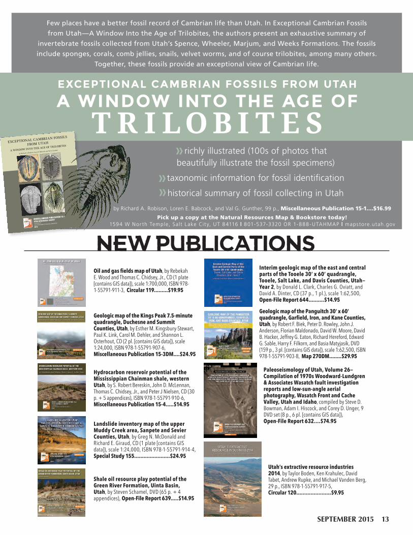
Oil and gas fields map of Utah, by Rebekah E. Wood and Thomas C. Chidsey, Jr., CD (1 plate [contains GIS data]), scale 1:700,000, ISBN 978-1-55791-911-3, Circular 119.........$19.95
Interim geologic map of the east and central parts of the Tooele 30’ x 60’ quadrangle, Tooele, Salt Lake, and Davis Counties, Utah—Year 2, by Donald L. Clark, Charles G. Oviatt, and David A. Dinter, CD (37 p., 1 pl.), scale 1:62,500, Open-File Report 644..........$14.95
Geologic map of the Panguitch 30' x 60' quadrangle, Garfield, Iron, and Kane Counties, Utah, by Robert F. Biek, Peter D. Rowley, John J. Anderson, Florian Maldonado, David W. Moore, David B. Hacker, Jeffrey G. Eaton, Richard Hereford, Edward G. Sable, Harry F. Filkorn, and Basia Matyjasik, DVD (159 p., 3 pl. [contains GIS data]), scale 1:62,500, ISBN 978-1-55791-903-8, Map 270DM........$29.95
Utah’s extractive resource industries 2014, by Taylor Boden, Ken Krahulec, David Tabet, Andrew Rupke, and Michael Vanden Berg, 29 p., ISBN 978-1-55791-917-5, Circular 120......................$9.95
Hydrocarbon reservoir potential of the Mississippian Chainman shale, western Utah, by S. Robert Bereskin, John D. McLennan, Thomas C. Chidsey, Jr., and Peter J Nielsen, CD (30 p. + 5 appendices), ISBN 978-1-55791-910-6, Miscellaneous Publication 15-4.....$14.95
Shale oil resource play potential of the Green River Formation, Uinta Basin, Utah, by Steven Schamel, DVD (65 p. + 4 appendices), Open-File Report 639.....$14.95
Landslide inventory map of the upper Muddy Creek area, Sanpete and Sevier Counties, Utah, by Greg N. McDonald and Richard E. Giraud, CD (1 plate [contains GIS data]), scale 1:24,000, ISBN 978-1-55791-914-4, Special Study 155.......................$24.95
Paleoseismology of Utah, Volume 26—Compilation of 1970s Woodward-Lundgren & Associates Wasatch fault investigation reports and low-sun-angle aerial photography, Wasatch Front and Cache Valley, Utah and Idaho, compiled by Steve D. Bowman, Adam I. Hiscock, and Corey D. Unger, 9 DVD set (8 p., 6 pl. [contains GIS data]), Open-File Report 632....$74.95
Geologic map of the Kings Peak 7.5-minute quadrangle, Duchesne and Summit Counties, Utah, by Esther M. Kingsbury-Stewart, Paul K. Link, Carol M. Dehler, and Shannon L. Osterhout, CD (2 pl. [contains GIS data]), scale 1:24,000, ISBN 978-1-55791-907-6, Miscellaneous Publication 15-3DM....$24.95
NEW PUBLICATIONS
Few places have a better fossil record of Cambrian life than Utah. In Exceptional Cambrian Fossils
from Utah—A Window Into the Age of Trilobites, the authors present an exhaustive summary of
invertebrate fossils collected from Utah’s Spence, Wheeler, Marjum, and Weeks Formations. The fossils
include sponges, corals, comb jellies, snails, velvet worms, and of course trilobites, among many others.
Together, these fossils provide an exceptional view of Cambrian life.
Pick up a copy at the Natural Resources Map & Bookstore today! 1594 W Nor th Temple, Salt Lake Cit y, UT 84116 | 801-537-3320 OR 1-888-UTAHMAP | mapstore.utah.gov
by Richard A. Robison, Loren E. Babcock, and Val G. Gunther, 99 p., Miscellaneous Publication 15-1....$16.99
richly illustrated (100s of photos that beautifully illustrate the fossil specimens)
taxonomic information for fossil identification
historical summary of fossil collecting in Utah
by Richard A. Robison, Loren E. Babcock, and Val G. Gunther
MISCELLANEOUS PUBLICATION 15-1
UTAH GEOLOGICAL SURVEY
a division of
UTAH DEPARTMENT OF NATURAL RESOURCES
2015
EXCEPTIONAL CAMBRIAN FOSSILS
FROM UTAH
A WINDOW INTO THE AGE OF TRILOBITES
SEPTEMBER 2015 13

2016 CALENDAR OF
UTAH GEOLOGYO RD E R N OW!
Featuring scenic photographs highlighting Utah’s geologic diversity. The photographs
were taken by UGS employees who are often on assignment in some of the state’s most interesting and unique locations. Pictures
are accompanied by geologic descriptions and location information. The calendar is available at the Natural Resources Map &
Bookstore, so order now and don’t miss out.
FO LLOW US!
PRSRT STD U.S. Postage
PAID Salt Lake City, UT Permit No. 4728
UTAH GEOLOGICAL SURVEY 1594 W North Temple, Suite 3110 PO Box 146100 Salt Lake City, UT 84114-6100
Address service requested Survey Notes
Mon–Fri 8AM–5PM | 801-537-3320 OR 1-888-UTAHMAP | [email protected] | mapstore.utah.gov
Natural Resources Map & Bookstore
1594 W North Temple Salt Lake City, UT 84116|
UGS Blog geology.utah.gov/blog UGS TwitterUGS Facebook
January Little Grand Canyon of the San Rafael River,
Emery County † Photographer: Zach Anderson
Short days and low winter sun cause ice to form along the San Rafael River where it
cuts through the west flank of the San Rafael Swell. The 1,100-foot-deep canyon exposes the
Jurassic-Triassic-age Glen Canyon Group along the cliffs and ledges of the canyon walls.
FEBRUARY
S M T W T F S1 2 3 4 5 67 8 9 10 11 12 1314 15 16 17 18 19 2021 22 23 24 25 26 27
28 29
5
12
19
26
6
13
20
27
7
14
21
28
1
8
15
22
29
2
9
16
23
30
4
11
18
25
3
10
17
S U N D A YM O N D A Y
T U E S D A YW E D N E S D A Y
T H U R S D A YF R I D A Y
S A T U R D A Y
Wasatch Range east of Layton, Davis County † Photographer: Ken Krahulec
New Year's Day
Martin LutherKing Day
DECEMBER
S M T W T F S1 2 3 4 56 7 8 9 10 11 1213 14 15 16 17 18 1920 21 22 23 24 25 2627 28 29 30 31
2431
UTAHgeology
Related Documents