VISUALISATION TOOLS FOR NOISE AND QUIET. LITHUANIA Valdas Uscila Ministry of Health of the Republic of Lithuania Eionet Noise Workshop 22–23 October 2015, The National Institute for Public Health and the Environment (RIVM), Bilthoven, Utrecht, The Netherlands

VISUALISATION TOOLS FOR NOISE AND QUIET. LITHUANIA Valdas Uscila Ministry of Health of the Republic of Lithuania Eionet Noise Workshop 22–23 October 2015,
Jan 18, 2016
Welcome message from author
This document is posted to help you gain knowledge. Please leave a comment to let me know what you think about it! Share it to your friends and learn new things together.
Transcript

VISUALISATION TOOLS FOR NOISE AND QUIET.LITHUANIAValdas Uscila
Ministry of Health of the Republic of Lithuania
Eionet Noise Workshop
22–23 October 2015, The National Institute for Public Health and the Environment (RIVM), Bilthoven, Utrecht, The Netherlands

CONTENTS
Strategic noise maps of Vilnius agglomeration as a part of environmental information system
Brief information about quiet areas in Lithuania
Strategic noise maps of major roads as a part of road traffic information system
Strategic noise maps of major railways as a part railway traffic information system
Easy tools to share spatial information for small/medium projects

ENVIRONMENTAL INFORMATION WEBSITE OF VILNIUS CITY MUNICIPALITYHTTP://APLINKA.VILNIUS.LT/Main blocks:
Environmental quality maps and other relevant spatial information
Air quality
Noise
Waste
Surface water
Drinking water
Contaminated sites
Sewage
Bio-diversity
Landscape
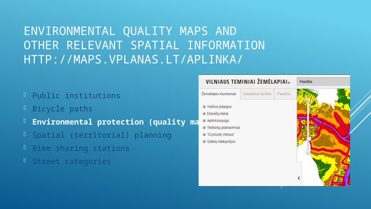
ENVIRONMENTAL QUALITY MAPS AND OTHER RELEVANT SPATIAL INFORMATIONHTTP://MAPS.VPLANAS.LT/APLINKA/
Public institutions
Bicycle paths
Environmental protection (quality maps)
Spatial (territorial) planning
Bike sharing stations
Street categories
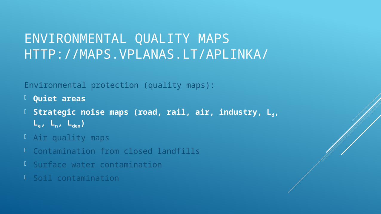
ENVIRONMENTAL QUALITY MAPSHTTP://MAPS.VPLANAS.LT/APLINKA/
Environmental protection (quality maps):
Quiet areas
Strategic noise maps (road, rail, air, industry, Ld, Le, Ln, Lden)
Air quality maps
Contamination from closed landfills
Surface water contamination
Soil contamination
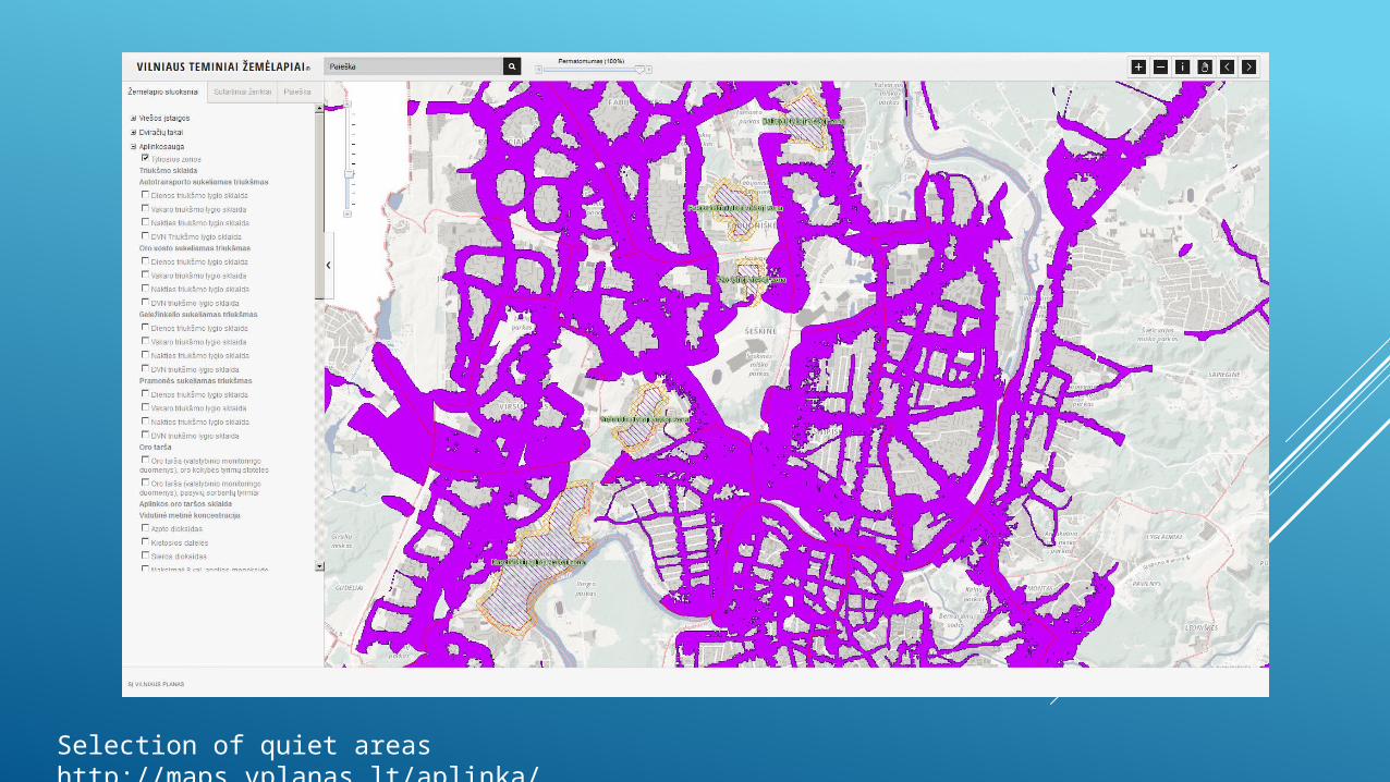
Selection of quiet areas http://maps.vplanas.lt/aplinka/

Selection of road transport noise map, Lden http://maps.vplanas.lt/aplinka/
CONTENTS
Strategic noise maps of Vilnius agglomeration as a part of environmental information system
Brief information about quiet areas in Lithuania
Strategic noise maps of major roads as a part of road traffic information system
Strategic noise maps of major railways as a part railway traffic information system
Easy tools to share spatial information for small/medium projects
QUIET AREAS IN LITHUANIA
Councils of municipalities are obliged to determine (adopt) quiet areas (by official decision (legal act) of the municipality council)
Administrations of municipalities are obliged to monitor noise within quiet areas
3 types of quiet areas: quiet area in an agglomeration
(adopted in 2 of 4 agglomerations, the rest 2 agglomerations adopted quiet public areas)
quiet area in open country
(adopted in 37 of total 60 municipalities)
quiet public area
(adopted in 57 of total 60 municipalities)

CONTENTS
Strategic noise maps of Vilnius agglomeration as a part of environmental information system
Brief information about quiet areas in Lithuania
Strategic noise maps of major roads as a part of road traffic information system
Strategic noise maps of major railways as a part railway traffic information system
Easy tools to share spatial information for small/medium projects
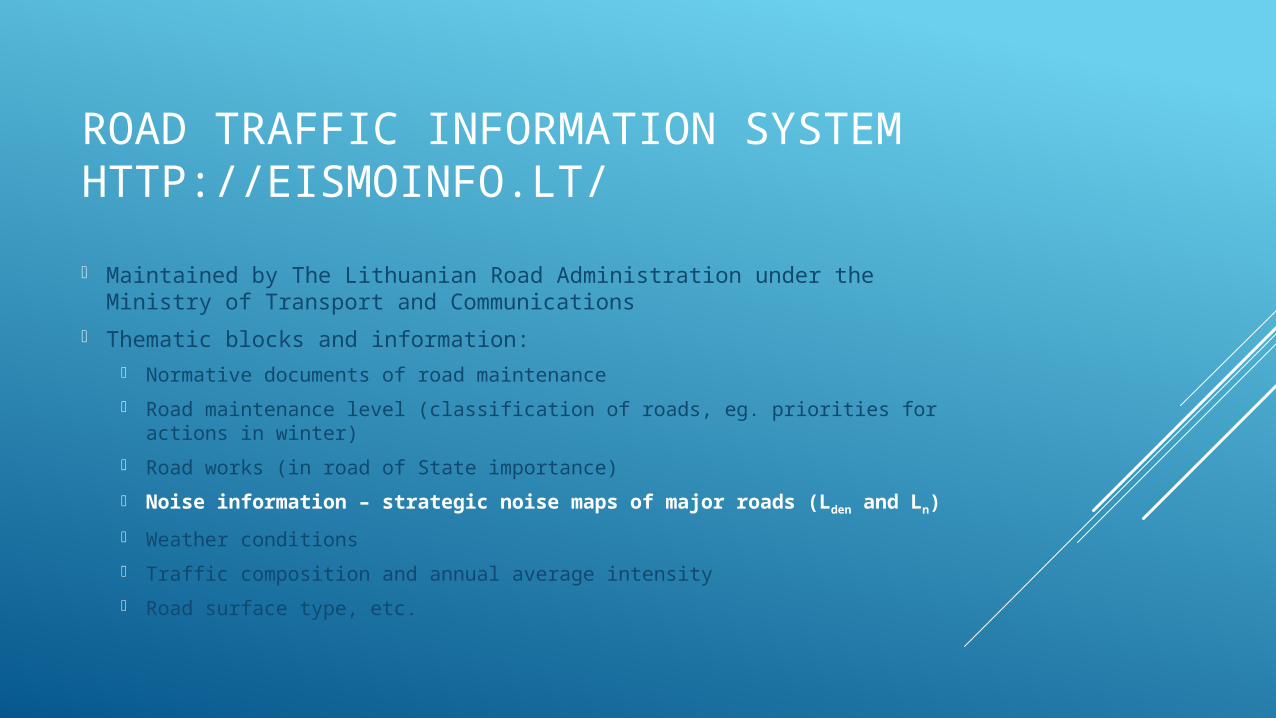
ROAD TRAFFIC INFORMATION SYSTEMHTTP://EISMOINFO.LT/
Maintained by The Lithuanian Road Administration under the Ministry of Transport and Communications
Thematic blocks and information: Normative documents of road maintenance
Road maintenance level (classification of roads, eg. priorities for actions in winter)
Road works (in road of State importance)
Noise information – strategic noise maps of major roads (Lden and Ln)
Weather conditions
Traffic composition and annual average intensity
Road surface type, etc.
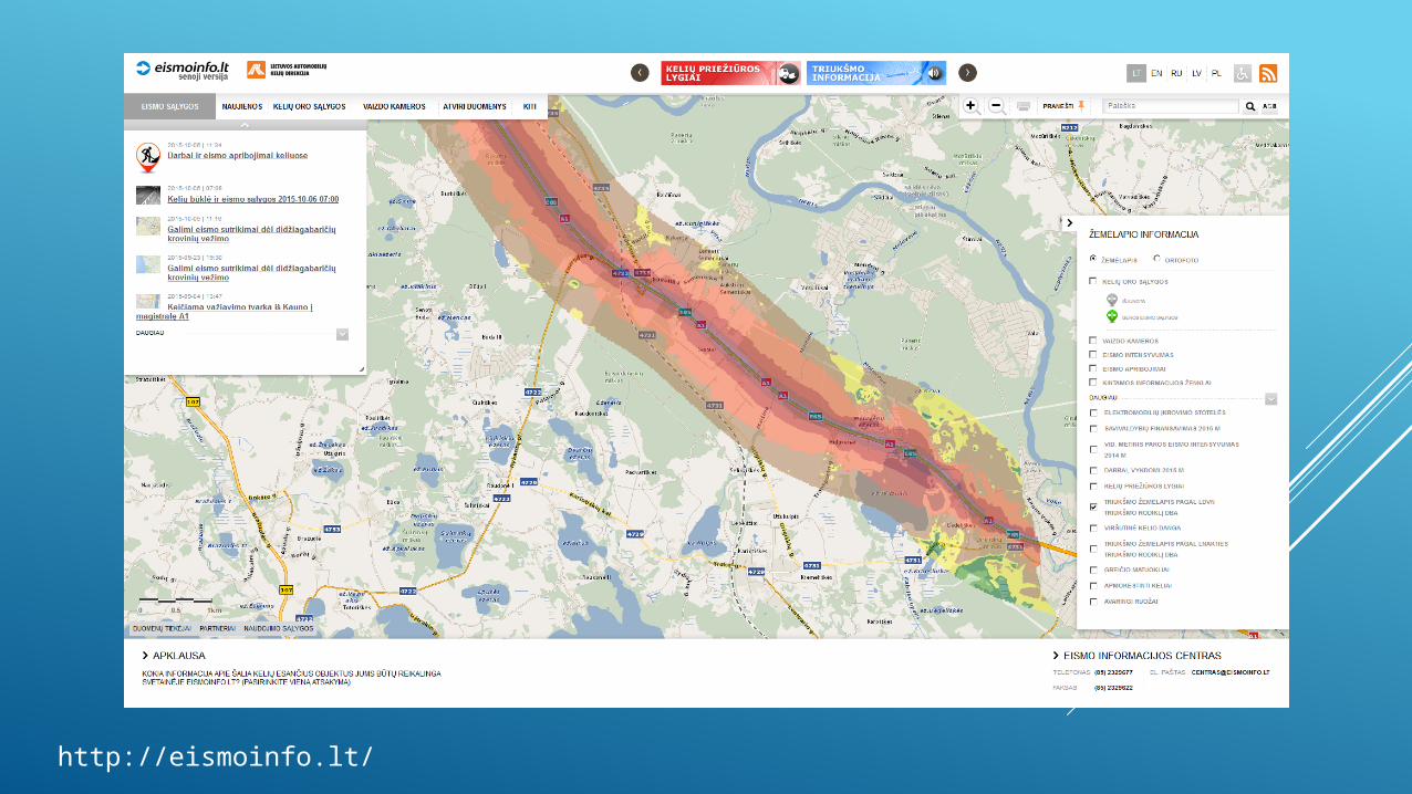
http://eismoinfo.lt/

CONTENTS
Strategic noise maps of Vilnius agglomeration as a part of environmental information system
Brief information about quiet areas in Lithuania
Strategic noise maps of major roads as a part of road traffic information system
Strategic noise maps of major railways as a part railway traffic information system
Easy tools to share spatial information for small/medium projects
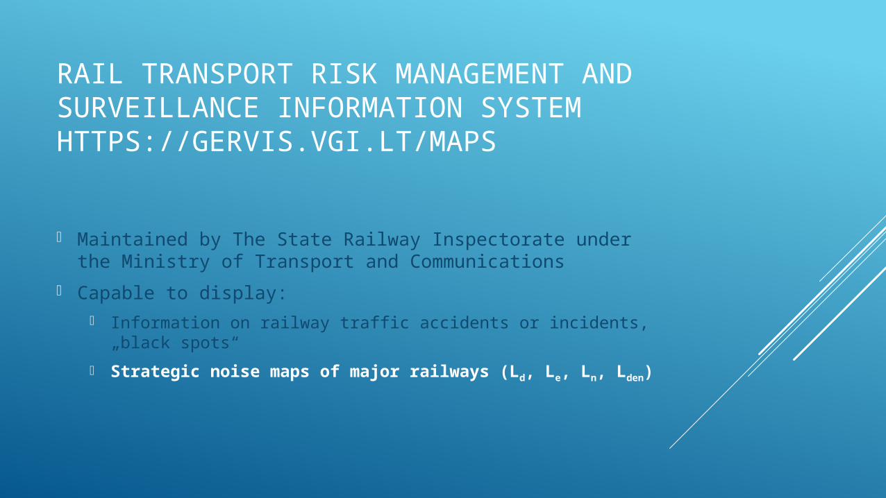
RAIL TRANSPORT RISK MANAGEMENT AND SURVEILLANCE INFORMATION SYSTEMHTTPS://GERVIS.VGI.LT/MAPS
Maintained by The State Railway Inspectorate under the Ministry of Transport and Communications
Capable to display: Information on railway traffic accidents or incidents, „black spots“
Strategic noise maps of major railways (Ld, Le, Ln, Lden)

https://gervis.vgi.lt/maps
CONTENTS
Strategic noise maps of Vilnius agglomeration as a part of environmental information system
Brief information about quiet areas in Lithuania
Strategic noise maps of major roads as a part of road traffic information system
Strategic noise maps of major railways as a part railway traffic information system
Easy tools to share spatial information for small/medium projects
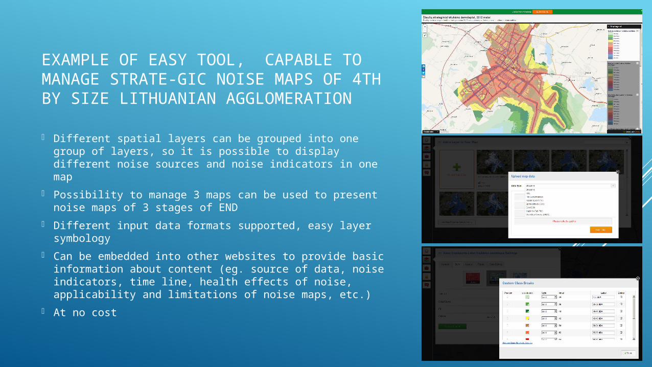
EXAMPLE OF EASY TOOL, CAPABLE TO MANAGE STRATE-GIC NOISE MAPS OF 4TH BY SIZE LITHUANIAN AGGLOMERATION
Different spatial layers can be grouped into one group of layers, so it is possible to display different noise sources and noise indicators in one map
Possibility to manage 3 maps can be used to present noise maps of 3 stages of END
Different input data formats supported, easy layer symbology
Can be embedded into other websites to provide basic information about content (eg. source of data, noise indicators, time line, health effects of noise, applicability and limitations of noise maps, etc.)
At no cost
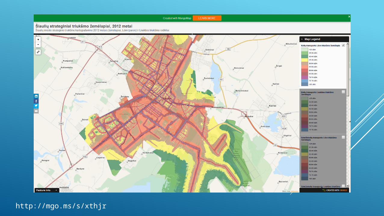
http://mgo.ms/s/xthjr

EXAMPLE OF DISSEMINATION OF NOISE MONITORING DATA IN QUIET AREAS OF SMALL MUNICIPALITY
http://www.utenosmonitoringas.lt/?vieta=antrop_aplinkos_triuksmo

THANK YOU FOR YOUR ATTENTION
Related Documents