Vehicle-to-Infrastructure Research - Track 1 Enabling Technologies Industry Day 2012 Chicago, IL September 26, 2012 Ben McKeever Federal Highway Administration

Welcome message from author
This document is posted to help you gain knowledge. Please leave a comment to let me know what you think about it! Share it to your friends and learn new things together.
Transcript
Vehicle-to-Infrastructure Research - Track 1
Enabling Technologies
Industry Day 2012
Chicago, IL September 26, 2012
Ben McKeever Federal Highway Administration
2 U.S. Department of Transportation
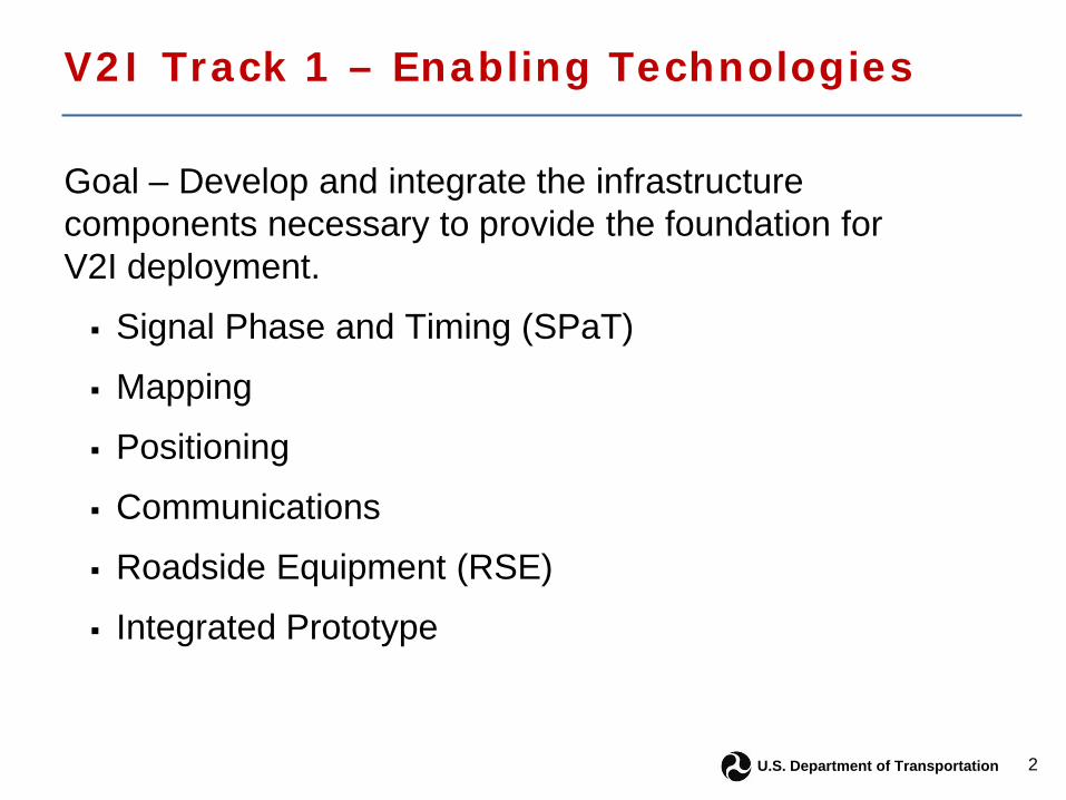
V2I Track 1 – Enabling Technologies
Goal – Develop and integrate the infrastructure components necessary to provide the foundation for V2I deployment.
Signal Phase and Timing (SPaT)
Mapping
Positioning
Communications
Roadside Equipment (RSE)
Integrated Prototype
3 U.S. Department of Transportation
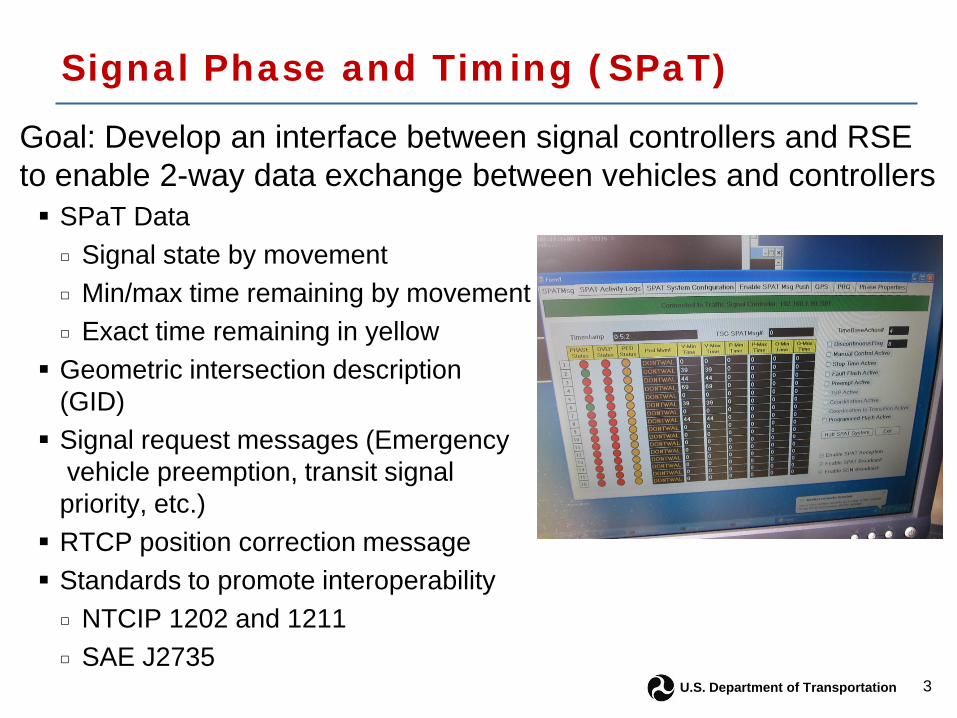
Signal Phase and Timing (SPaT)
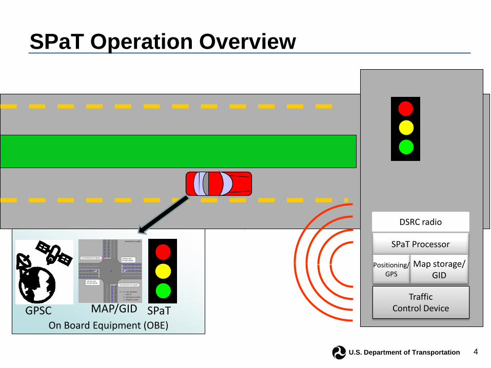
Goal: Develop an interface between signal controllers and RSE to enable 2-way data exchange between vehicles and controllers SPaT Data
□ Signal state by movement □ Min/max time remaining by movement □ Exact time remaining in yellow Geometric intersection description
(GID) Signal request messages (Emergency
vehicle preemption, transit signal priority, etc.) RTCP position correction message Standards to promote interoperability
□ NTCIP 1202 and 1211 □ SAE J2735
4 U.S. Department of Transportation
SPaT Operation Overview
On Board Equipment (OBE)
No Dedicated turn signals
No Dedicated turn signals
Left turn and through signals
Left turn and through signals
X
Lane Centerline
Intersection Location X
X
X
X
X
Stopping Location X
Intersection ID: 23983
1 2
3
4
5
6 7
10
9
8
Lane ID 5 Traffic Control Device
DSRC radio
SPaT Processor
Positioning/ GPS
Map storage/ GID
MAP/GID GPSC SPaT
5 U.S. Department of Transportation
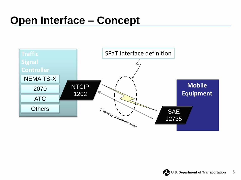
Open Interface – Concept
SPaT Interface definition
Mobile Equipment
SAE J2735
Traffic Signal Controller
NTCIP 1202
NEMA TS-X
2070
ATC
Others

6 U.S. Department of Transportation
Signal Phase and Timing (SPaT)
Interface tested in the Connected Vehicle Highway Testbed (CVHT) at the Turner Fairbank Highway Research Center (TFHRC) Safety Pilot - 12 intersections equipped □ broadcast the SPaT information ▪ Transit apps plan to use data, required a new field for pedestrian detection
□ SPaT data will be logged to facilitate future application development
Safety, mobility and environmental V2I applications will need SPaT data
7 U.S. Department of Transportation
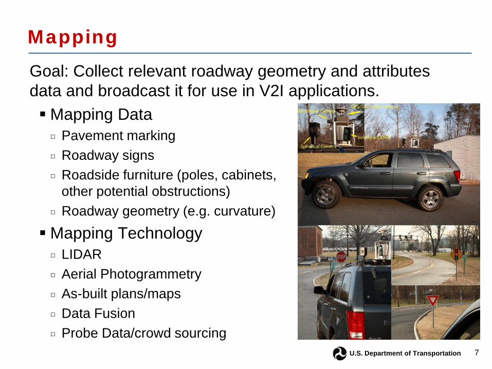
Mapping
Goal: Collect relevant roadway geometry and attributes data and broadcast it for use in V2I applications. Mapping Data
□ Pavement marking □ Roadway signs □ Roadside furniture (poles, cabinets,
other potential obstructions) □ Roadway geometry (e.g. curvature)
Mapping Technology □ LIDAR □ Aerial Photogrammetry □ As-built plans/maps □ Data Fusion □ Probe Data/crowd sourcing
8 U.S. Department of Transportation
Mapping Findings Vehicle mounted technologies solution (LIDAR) provides the most
detailed data for use as a core mapping solution Vehicle mounted technologies solution is relatively costly and requires
an investment in resources including skilled personnel and equipment. The other mapping solutions will remain useful for change detection
as well as for mapping under certain specific conditions. Collection, preparation, and use of mapping data completed at the
TFHRC Testbed May 2012. Three lane-level applications were demonstrated using decimeter-
level positioning techniques □ Lane departure warning □ Curve speed warning □ Signal Phase and Timing, at lane-level

9 U.S. Department of Transportation
Positioning
Goal: Ascertain which current or near-term positioning technologies can meet requirements of V2I applications
– Which road? – Which lane? – Within lane?
• Two technology platforms for positioning
• On-board vehicle equipment • Infrastructure-based correction
messages
10 U.S. Department of Transportation
Positioning Findings
• Positioning and mapping are closely related • Two approaches based on application type
• V2I relies on absolute positioning solution • V2V relies on relative positioning solution
• Accurate vehicle position at intersection is critical • SPaT information is based on a phase to lane assignment • Requires lane-level accuracy
• Testing technologies at the CVHT in early fall – Baseline OEM grade GPS – Inertial Measurement Units (IMU) – GPS code and carrier solutions (correction messages)

11 U.S. Department of Transportation
Communications Goal: To test multiple communication technologies for potential use in V2I applications
– Quantify capabilities of the technologies against requirements of key V2I applications
– Gather subject matter expert opinions to select the most promising candidates
• Dedicated Short Range Communications (DSRC)
• Cellular 4G/LTE • High definition radio
– Test the technologies in a laboratory field test at CVHT this fall

12 U.S. Department of Transportation
Communications Findings
• Connected vehicle program will likely utilize multiple technologies – Active safety applications to use DSRC – mobility and environmental applications to use DSRC
and/or cellular (4G/LTE)
• Deployment of 4G/LTE is limited and dependent on private development
• DSRC has limited bandwidth and footprint • Some wireless communications appear to
interfere with GPS signals

13 U.S. Department of Transportation
Roadside Equipment (RSE)
Goal: Foster the development of RSE that meets the requirements of the connected vehicle program
– Current RSE to broadcast and receive using DSRC – Modular in both physical and logical architectures – Immediate forwarding (e.g. SPaT) – Store and replay (mapping data, traffic incident
management messages) – Connected to backhaul for data logging

14 U.S. Department of Transportation
Roadside Equipment (RSE)
• 5 vendors participated in prototyping • Research qualified products list (rQPL) issued
5/11/12 for use by Safety Pilot • Development will continue
to refine design based on Safety Pilot results
• Refinements will be made to incorporate multiple radio chipsets, if warranted
15 U.S. Department of Transportation
Integrated V2I Prototype
• Comprehensive solution to connected vehicle infrastructure needs – Incorporate all parts of Track 1 to work seamlessly to
enable V2I applications – Comprehensive review of V2I system requirements – Integration and testing of a complete infrastructure
system. • Data flows • Information exchange • Standards
16 U.S. Department of Transportation
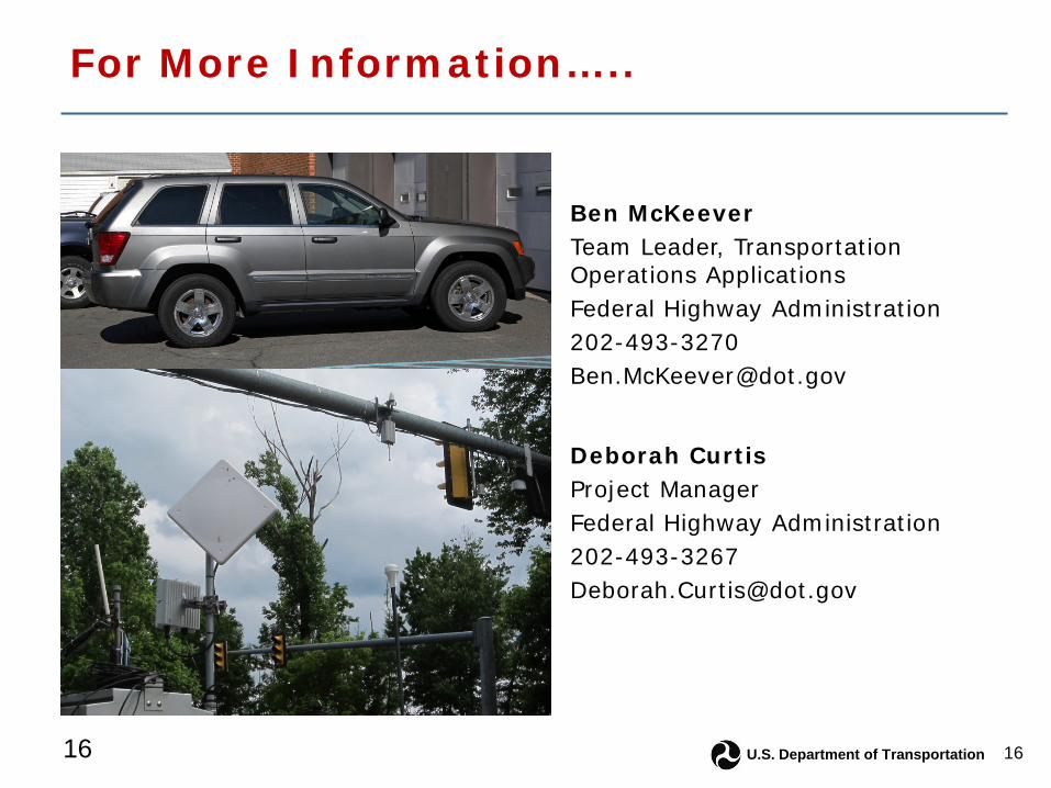
For More Information…..
16
Deborah Curtis Project Manager Federal Highway Administration 202-493-3267 [email protected]
Ben McKeever Team Leader, Transportation Operations Applications Federal Highway Administration 202-493-3270 [email protected]
Related Documents