Valemount & Area Environmental Background Report Prepared to provide background information to support the development of the Valemount and Area Integrated Land Use Development Plan Prepared By : Beryl Nesbit, Planning Biologist MSRM Rhonda Thibeault, Land and Resource Analyst MSRM Gordon Borgstrom, Manager of Regional Planning Specialists & Tourism Land Use, MSRM

Welcome message from author
This document is posted to help you gain knowledge. Please leave a comment to let me know what you think about it! Share it to your friends and learn new things together.
Transcript
Valemount & Area
Environmental Background Report
Prepared to provide background information to support the development of the
Valemount and Area Integrated Land Use Development Plan
Prepared By :
Beryl Nesbit, Planning Biologist MSRM
Rhonda Thibeault, Land and Resource Analyst MSRM
Gordon Borgstrom, Manager of Regional Planning Specialists & Tourism Land Use, MSRM
2
FOREWORD
The area surrounding the Village of Valemount is poised for significant change. Although the landscape
of the area has already been altered by settlement, major infrastructure corridors and natural resource
extraction activities, it seems very likely that major resort developments will significantly increase the
population and ecological “footprint” of the community in the next two decades.
The purpose of this paper is two-fold: first, to identify and discuss the existing environmental information
knowledge base for the area – specifically, known sensitive and environmentally important species, lands,
waters, and ecological parameters for the region; second, recognizing that the area is likely to see
significant population and settlement growth in the near future, the paper makes recommendations on
appropriate actions for the Village, Regional District, and Provincial governments to consider in order to
help preserve important environmental attributes in the area.
This paper has been prepared by Ministry of Sustainable Resource Management (MSRM) staff as a
technical background paper to support the completion and preparation of the Valemount and Area
Integrated Land Use Development Plan. MSRM is appreciative of the support of Ministry of Water,
Land, and Air Protection Environmental Stewardship staff that have reviewed and commented on this
paper.
1
1 Canoe Mountain as viewed from Highway 5 south of Valemount
3
Table of Contents
Foreword pg.2
1.0 Purpose and Background pg.6
2.0 Introduction pg.7
3.0 Fish and Wildlife Species in the Planning Area pg.9
3.1 Fish and Wildlife Overview pg.9
3.2 Fish pg. 12
3.3 Resident and Migratory Birds pg. 12
3.4 Wildlife pg. 14
3.4.1 Mountain Caribou (southern population): Rangifer tarandus
3.4.2 Fisher: Martes pennati
3.4.3 Northern Long-eared Myotis: Myotis septentrionalis
3.4.4 Grizzly Bear: Ursus arctos & Black Bear: Ursus americanus
3.4.5 Wolverine: Gulo gulo luscus
3.4.6 Mountain Goat: Oreamnos americanus
3.4.7 Moose: Alces alces
3.4.8 White-tailed Deer: Odocoileus virginianus
& Mule Deer: Odocoileus hemionus
3.4.9 Cougar: Puma concolor & Lynx: Lynx Canadensis
3.5 Summary pg. 21
4.0 Environmentally Important and Sensitive Areas
4.1 Land Designations for Important
Wildlife and Fish Habitat Areas pg. 21
4.2 Wildlife Habitat Areas pg. 23
4.3 Key Fish Habitat Areas pg. 25
4.4 Riparian Buffers pg. 27
4.5 Domestic Water Use pg. 31
4.6 Jackman Flats Provincial Park pg. 32
4.7 Robert W. Starratt Wildlife Sanctuary:
Cranberry Marsh pg. 32
4.8 Other Protected Areas of Interest in and
Adjacent to the Study Area pg. 34
4
5.0 Wildlife Movement in the Study Area
5.1 Wildlife Movement Corridors, Urban Development,
and Resource Extraction pg. 35
5.2 Identified Wildlife Movement in the Study Area
- Potential Corridors pg. 39
6.0 Maintaining Landscape Level Biodiversity
6.1 Importance of Biodiversity pg. 42
6.2 Landscape Level Biodiversity pg. 43
6.3 Maintaining Biodiversity within
the Valemount ILUDP Study Area pg. 44
7.0 Conclusions and Recommendations pg. 47
7.1 Presentation Summary pg. 47
7.2 A Recommended Environmentally Important
Lands Network pg. 47
7.3 Recommendations from Partner Agencies pg. 49
Village of Valemount pg. 49
Regional District of Fraser Fort George pg. 49
Ministry of Sustainable Resource Management pg. 50
Land and Water BC pg. 52
References pg. 53
List of Figures
Figure 1: Robson Valley LRMP RMZ Designations within
the Planning Area
Figure 2: Robson Valley LU’s within the Planning Area
Figure 3: Caribou and Mule Deer UWR within the
Planning Area
Figure 4: Important Wildlife Habitat Features within the
Planning Area
Figure 5: Points of Diversion within the Planning Area
5
List of Tables
Table 1: Major Species and Conservation Status pg. 11
Table 2: Classified Streams in the Fraser River Watershed Area
within the Planning Area pg. 29
Table 3: Classified Streams of the Columbia River Watershed Area
within the Planning Area pg. 30
Table 4: Water License Locations requiring riparian protection pg.
Table 5: BCEAG Summary pg. 38
Table 6: Animal – Vehicle Collisions per year Between the CN Overpass pg. 40
and Chappell Creek on Highway 5 from 1999-2000
Graphs
Graph 1: Total Mortalities / Km
List of Appendices
Appendix 1: Robson Valley Crown Land Plan (1992)
Appendix 2: Domestic Water Users Detailed Information
Appendix 3: Draft Fig. 6
Appendix 4: Literature that provides information for wildlife corridors within the Fraser and
Columbia River Watersheds
6
1. PURPOSE & BACKGROUND
The Valemount area is a region of beautiful scenery, significant natural resources, and recreational
amenities. It is also an area on the brink of significant potential growth and expansion. Two major resort
proposals are currently in the planning stages. If built to full capacity these would nearly double the
population of the area. The land area surrounding Valemount already supports significant winter
recreational use. As the area becomes increasingly recognized and developed as a four-season resort area,
the recreational and commercial use of mid and backcountry areas will also increase. Given the probable
growth of the Valemount area and all the resulting subsequent pressures of increased land demand and
settlement infrastructure on the valley floor, and the increased public and commercial use of mid and
backcountry areas, there is an urgent need to examine probable growth-related impacts and to develop
appropriate planning responses.
As the Village of Valemount has attempted to diversify its economic base, it has become clear that the
Village’s economy is directly tied to the use and management of the Crown lands surrounding the
Village. Likewise, the demands and use of Crown land and resources in the region are directly impacted
by the growth and development activities of the Village and its residents. Recognizing this
interdependency and the need for a strategic and integrative approach to land and resource management in
the region, the Village, Regional District of Fraser-Fort George, Ministry of Sustainable Resource
Management (MSRM), and Land and Water British Columbia (LWBC), agreed to undertake a Valemount
and Area Integrated Land Use Development Plan (VILUDP) for the area. These four agencies,
representing the three levels of government in British Columbia, are the major agencies responsible for
determining, managing, and regulating land use in the area. The major objectives of the VILUDP are to
examine and determine the most appropriate actions to undertake in order to manage growth-related
impacts, and to ensure that land and resource use in the area reflects the Village’s development
aspirations. In order to effectively implement the final VILUDP; the four partner agencies will
incorporate the recommendations of the final VILUDP into their own separate formal land and resource
planning processes.
This paper has been prepared to help inform the preparation and completion of the VILUDP. It will also
be used by MSRM and LWBC respectively in their Sustainable Resource Management Planning and
Crown Land Plan planning processes.
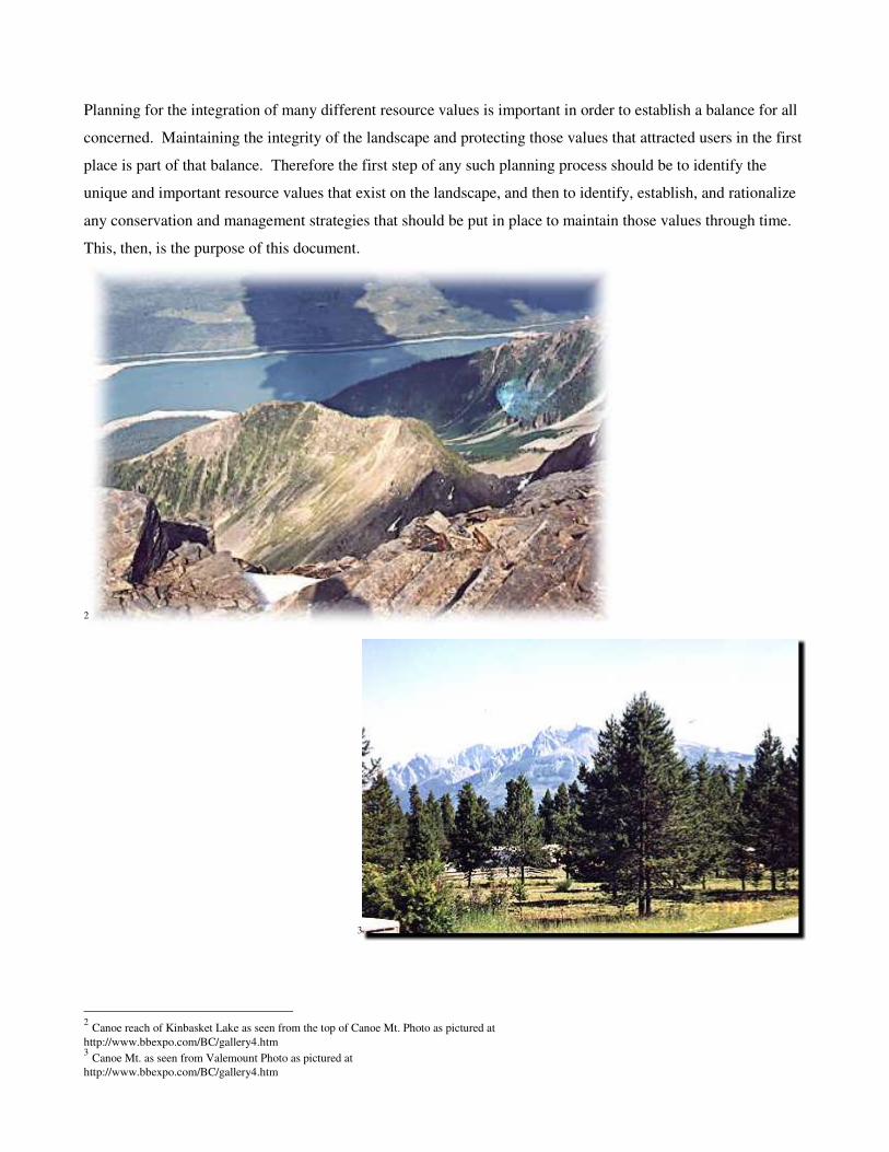
Planning for the integration of many different resource values is important in order to establish a balance for all
concerned. Maintaining the integrity of the landscape and protecting those values that attracted users in the first
place is part of that balance. Therefore the first step of any such planning process should be to identify the
unique and important resource values that exist on the landscape, and then to identify, establish, and rationalize
any conservation and management strategies that should be put in place to maintain those values through time.
This, then, is the purpose of this document.
2
3
2 Canoe reach of Kinbasket Lake as seen from the top of Canoe Mt. Photo as pictured at
http://www.bbexpo.com/BC/gallery4.htm 3 Canoe Mt. as seen from Valemount Photo as pictured at
http://www.bbexpo.com/BC/gallery4.htm
2. INTRODUCTION
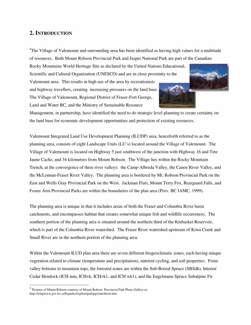
4The Village of Valemount and surrounding area has been identified as having high values for a multitude
of resources. Both Mount Robson Provincial Park and Jasper National Park are part of the Canadian
Rocky Mountains World Heritage Site as declared by the United Nations Educational,
Scientific and Cultural Organization (UNESCO) and are in close proximity to the
Valemount area. This results in high use of the area by recreationists
and highway travellers, creating increasing pressures on the land base.
The Village of Valemount, Regional District of Fraser-Fort George,
Land and Water BC, and the Ministry of Sustainable Resource
Management, in partnership, have identified the need to do strategic level planning to create certainty on
the land base for economic development opportunities and protection of existing resources.
Valemount Integrated Land Use Development Planning (ILUDP) area, henceforth referred to as the
planning area, consists of eight Landscape Units (LU’s) located around the Village of Valemount. The
Village of Valemount is located on Highway 5 just southwest of the junction with Highway 16 and Tete
Jaune Cache, and 34 kilometres from Mount Robson. The Village lies within the Rocky Mountain
Trench, at the convergence of three river valleys: the Camp-Albreda Valley, the Canoe River Valley, and
the McLennan-Fraser River Valley. The planning area is bordered by Mt. Robson Provincial Park on the
East and Wells Gray Provincial Park on the West. Jackman Flats, Mount Terry Fox, Rearguard Falls, and
Foster Arm Provincial Parks are within the boundaries of the plan area (Prov. BC IAMC, 1999).
The planning area is unique in that it includes areas of both the Fraser and Columbia River basin
catchments, and encompasses habitat that creates somewhat unique fish and wildlife occurrences. The
southern portion of the planning area is situated around the northern third of the Kinbasket Reservoir,
which is part of the Columbia River watershed. The Fraser River watershed upstream of Kiwa Creek and
Small River are in the northern portion of the planning area.
Within the Valemount ILUD plan area there are seven different biogeoclimatic zones, each having unique
vegetation related to climate (temperature and precipitation), nutrient cycling, and soil properties. From
valley bottoms to mountain tops, the forested zones are within the Sub-Boreal Spruce (SBSdh), Interior
Cedar Hemlock (ICH mm, ICHvk, ICHvk1, and ICH wk1), and the Engelmann Spruce Subalpine Fir
4 Pictures of Mount Robson courtesy of Mount Robson Provincial Park Photo Gallery at:
http://wlapwww.gov.bc.ca/bcparks/explore/parkpgs/mtrobson.htm
9
(ESSFmm1 and ESSFwc2) biogeoclimatic zones. There are vast areas of un-forested Alpine Tundra
(AT) resulting from the presence of the Rocky Mountains, Cariboo Mountains, and Monashee Mountains
within the plan boundaries. Within the Alpine Tundra, there are numerous ice fields, icefalls, glaciers,
and alpine meadows.
The Robson Valley Land and Resource Management Plan (LRMP) was signed off for approval by the
provincial government in the spring of 1999. LRMPs were intended to provide broad direction for the
sustainable use of Crown land and resources and designate new provincial parks as part of the Protected
Area Strategy. The VILUDP study area encompasses a series of Resource Management Zones (RMZ’s)
as designated by the Robson Valley LRMP (see Figure 1), that are afforded different resource
management emphasis as described below (Prov. BC IAMC, 1999).
General RMZ’s are designated where one use is not to be emphasized over another. The area is
to be managed for a wide array of resource values, such as wildlife, recreation, and timber.
General use RMZ’s within the study area include; Upper Canoe / Premier Range, and the Upper
Canoe / Premier Range - Tete Creek sub-zone.
Settlement and Agriculture RMZ’s include agriculture and settlement area in the main valley
floor of the Rocky Mountain Trench.
Resource Development Emphasis RMZ’s areas are identified for intensive development of
resources such as timber and minerals. Areas include; West Kinbasket, East Kinbasket, and East
Kinbasket – Selwyn sub-zone.
Special Management Zone’s (SMZ’s) are areas for which the conservation of one or more values
are a priority. The intent at the time was that water quality, fish and wildlife habitat, recreation,
and scenery protection were given priority in SMZ’s. The community watershed for Valemount
is included in this category as well as the Rocky Mountain Trench and the Rocky Mountain
Trench – Tete Creek sub-zone
Because the LRMP dealt with a very large land base, it does not provide enough detail on strategies to
protect landscape level biodiversity. The next planning process introduced by government to deal with
Crown land management was Landscape Unit Planning (LUP). The Forest Practices Code of British
Columbia Act (FPC) provided the framework for landscape-level biodiversity management through the
Biodiversity Guidebook and the Landscape Unit Planning Guide.
Valemount Integrated Land Use Development Planning (ILUDP) area consists of eight Landscape Units
(LU’s) located around the Village of Valemount. The Village of Valemount is located on Highway 5, just
southwest of the junction with Highway 16 and Tete Jaune Cache, and 34 kilometres from Mount
Robson. The eight LU’s within the planning area are Kiwa-Tete, Canoe, South Trench, West Kinbasket,
Dawson, East Kinbasket, Hugh Allen, and Foster as shown in Figure 2. Since Landscape Units and
Resource Management Units were created through different processes and for different reasons, their
boundaries do not match. Landscape Units are based on biological features and most of the provincial
government’s resource information database is oriented to LU's. Therefore LU’s are the major reference
unit for this report.
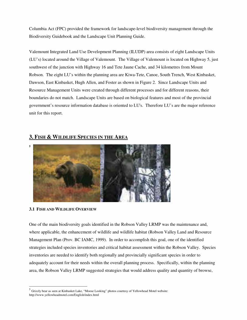
3. FISH & WILDLIFE SPECIES IN THE AREA 5
3.1 FISH AND WILDLIFE OVERVIEW
One of the main biodiversity goals identified in the Robson Valley LRMP was the maintenance and,
where applicable, the enhancement of wildlife and wildlife habitat (Robson Valley Land and Resource
Management Plan (Prov. BC IAMC, 1999). In order to accomplish this goal, one of the identified
strategies included species inventories and critical habitat assessment within the Robson Valley. Species
inventories are needed to identify both regionally and provincially significant species in order to
adequately account for their needs within the overall planning process. Specifically, within the planning
area, the Robson Valley LRMP suggested strategies that would address quality and quantity of browse,
5 Grizzly bear as seen at Kinbasket Lake, “Moose Looking” photos courtesy of Yellowhead Motel website:
http://www.yellowheadmotel.com/English/index.html
riparian habitats, and guidelines for critical habitat attributes where ungulate winter range is identified
(Prov. BC IAMC, 1999). While fish and wildlife values are becoming more recognized and programs
such as Forest Renewal BC, the Mica Fisheries Compensation Program (MFCP), and the Columbia Basin
Fish and Wildlife Compensation Program (CBFWCP) have provided a means of collecting important
species information, it has only been in recent years that comprehensive species inventory and habitat
classification work has been carried out in the planning area.
Species at risk or of concern in the Robson Valley Forest District as identified through the BC
Conservation Data Centre (CDC), and regionally important species in the planning area, are located in
Table 1 (MWLAP and SRM, 2003). The ranking for each species is based on a scientific standard and is
applied by scientists, specialists, and experts throughout the Province (Vennesland, Harcombe, Cannings,
& Darling, 2002). The level of threat to a species determines it as any of three colour-coded rankings;
red, blue or yellow. As outlined by the Canadian Conservation Data Centre, these colour codes are
defined by one or more of five threat ratings: extirpated, endangered, threatened, vulnerable, or non-
threatened (MWLAP and SRM, 2003). Red-listed species include those that have been determined as
endangered, threatened, extirpated, or at risk of such designation. Extirpated species are no longer
located in BC but may be found elsewhere. Endangered species face impending extirpation or extinction,
and threatened species are those considered likely to become endangered if there is no change in what is
limiting the species. Blue-listed species are those considered under no immediate threat but are
vulnerable. Vulnerable species are at risk because of characteristics that make them sensitive to
disturbance. Yellow-listed species include any species not designated as red or blue-listed. These species
are non-threatened or subject to no immediate risks. Those yellow-listed species included in Table 1 are
species that are considered regionally important. This designation is given to species that have very
specific habitat requirements or are of higher concern for management purposes. They have been chosen
based on their sensitivity to human interactions as determined by their Provincial colour ranking, and their
importance to the people of the region.
Regionally important species, as well as those red and blue-listed species threatened by forest practices,
are identified under the Forest Practices Code (FPC) as “Identified Wildlife” and are afforded special
management guidelines in order to protect critical habitat and habitat threatened by forest harvesting
(Ministry of Forests [MOF] and MELP, 1999; Vennesland et al., 2002). Protection for these species can
be achieved through both Wildlife Habitat Management Areas (WHMA’s) designated under the Land Act
and reserves called Wildlife Habitat Areas (WHA’s) established through the FPC.
12
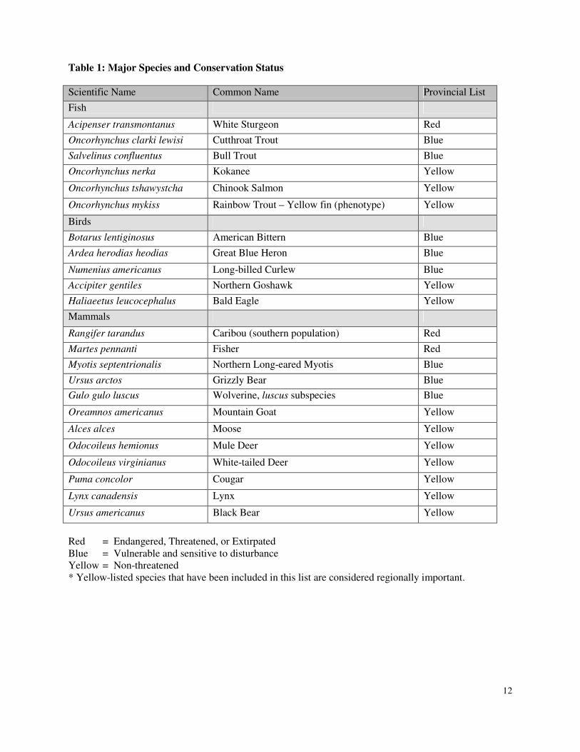
Table 1: Major Species and Conservation Status
Scientific Name Common Name Provincial List
Fish
Acipenser transmontanus White Sturgeon Red
Oncorhynchus clarki lewisi Cutthroat Trout Blue
Salvelinus confluentus Bull Trout Blue
Oncorhynchus nerka Kokanee Yellow
Oncorhynchus tshawystcha Chinook Salmon Yellow
Oncorhynchus mykiss Rainbow Trout – Yellow fin (phenotype) Yellow
Birds
Botarus lentiginosus American Bittern Blue
Ardea herodias heodias Great Blue Heron Blue
Numenius americanus Long-billed Curlew Blue
Accipiter gentiles Northern Goshawk Yellow
Haliaeetus leucocephalus Bald Eagle Yellow
Mammals
Rangifer tarandus Caribou (southern population) Red
Martes pennanti Fisher Red
Myotis septentrionalis Northern Long-eared Myotis Blue
Ursus arctos Grizzly Bear Blue
Gulo gulo luscus Wolverine, luscus subspecies Blue
Oreamnos americanus Mountain Goat Yellow
Alces alces Moose Yellow
Odocoileus hemionus Mule Deer Yellow
Odocoileus virginianus White-tailed Deer Yellow
Puma concolor Cougar Yellow
Lynx canadensis Lynx Yellow
Ursus americanus Black Bear Yellow
Red = Endangered, Threatened, or Extirpated
Blue = Vulnerable and sensitive to disturbance
Yellow = Non-threatened
* Yellow-listed species that have been included in this list are considered regionally important.
13
3.2 Fisheries
The rivers and streams surrounding the Valemount area support many regionally important populations of
fish species. Red-listed White Sturgeon (Acipenser transmontanus) are known to exist within the Fraser
River drainage. A small but relatively stable sub-population inhabits the upper reaches of the Fraser
River, although the true extent of its range is unknown (Pers. Comm. Ray Pillipow). Blue-listed species
such as Bull trout (Salvelinus confluentus) and Cutthroat trout (Oncorhynchus clarki lewisi) populate
many of the surrounding watersheds (Fisheries and Oceans Canada, 2003). The McLennan River and its
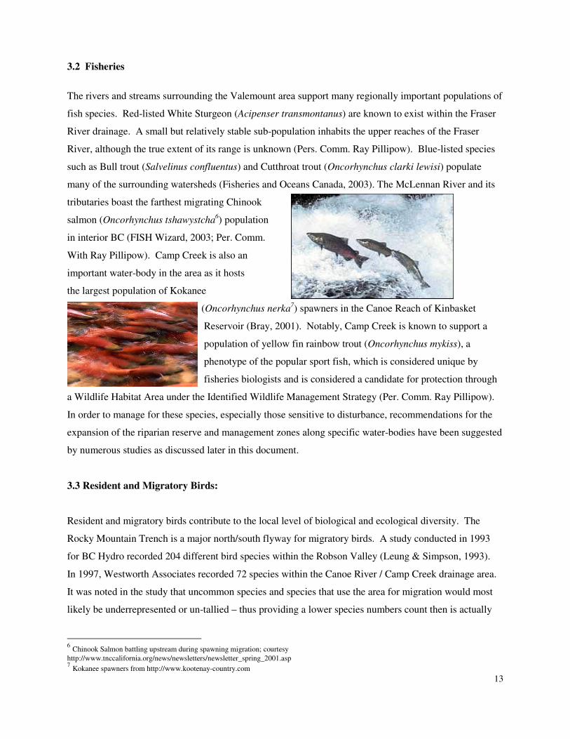
tributaries boast the farthest migrating Chinook
salmon (Oncorhynchus tshawystcha6) population
in interior BC (FISH Wizard, 2003; Per. Comm.
With Ray Pillipow). Camp Creek is also an
important water-body in the area as it hosts
the largest population of Kokanee
(Oncorhynchus nerka7) spawners in the Canoe Reach of Kinbasket
Reservoir (Bray, 2001). Notably, Camp Creek is known to support a
population of yellow fin rainbow trout (Oncorhynchus mykiss), a
phenotype of the popular sport fish, which is considered unique by
fisheries biologists and is considered a candidate for protection through
a Wildlife Habitat Area under the Identified Wildlife Management Strategy (Per. Comm. Ray Pillipow).
In order to manage for these species, especially those sensitive to disturbance, recommendations for the
expansion of the riparian reserve and management zones along specific water-bodies have been suggested
by numerous studies as discussed later in this document.
3.3 Resident and Migratory Birds:
Resident and migratory birds contribute to the local level of biological and ecological diversity. The
Rocky Mountain Trench is a major north/south flyway for migratory birds. A study conducted in 1993
for BC Hydro recorded 204 different bird species within the Robson Valley (Leung & Simpson, 1993).
In 1997, Westworth Associates recorded 72 species within the Canoe River / Camp Creek drainage area.
It was noted in the study that uncommon species and species that use the area for migration would most
likely be underrepresented or un-tallied – thus providing a lower species numbers count then is actually
6 Chinook Salmon battling upstream during spawning migration; courtesy
http://www.tnccalifornia.org/news/newsletters/newsletter_spring_2001.asp 7 Kokanee spawners from http://www.kootenay-country.com
14
present. Diversity of bird species was noted to be highest in deciduous riparian and aspen-dominated,
mixed-wood habitats, and at its lowest in pine and alpine tundra habitats (Leung & Simpson, 1993;
Westworth, 1997).
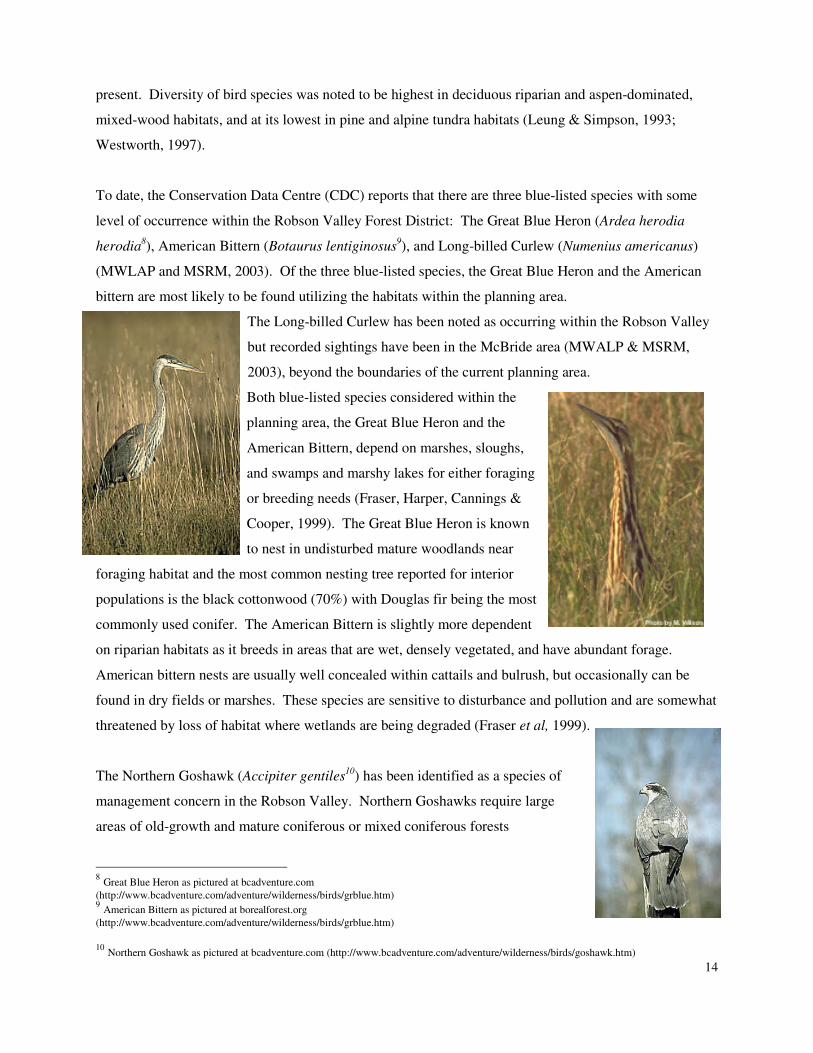
To date, the Conservation Data Centre (CDC) reports that there are three blue-listed species with some
level of occurrence within the Robson Valley Forest District: The Great Blue Heron (Ardea herodia
herodia8), American Bittern (Botaurus lentiginosus
9), and Long-billed Curlew (Numenius americanus)
(MWLAP and MSRM, 2003). Of the three blue-listed species, the Great Blue Heron and the American
bittern are most likely to be found utilizing the habitats within the planning area.
The Long-billed Curlew has been noted as occurring within the Robson Valley
but recorded sightings have been in the McBride area (MWALP & MSRM,
2003), beyond the boundaries of the current planning area.
Both blue-listed species considered within the
planning area, the Great Blue Heron and the
American Bittern, depend on marshes, sloughs,
and swamps and marshy lakes for either foraging
or breeding needs (Fraser, Harper, Cannings &
Cooper, 1999). The Great Blue Heron is known
to nest in undisturbed mature woodlands near
foraging habitat and the most common nesting tree reported for interior
populations is the black cottonwood (70%) with Douglas fir being the most
commonly used conifer. The American Bittern is slightly more dependent
on riparian habitats as it breeds in areas that are wet, densely vegetated, and have abundant forage.
American bittern nests are usually well concealed within cattails and bulrush, but occasionally can be
found in dry fields or marshes. These species are sensitive to disturbance and pollution and are somewhat
threatened by loss of habitat where wetlands are being degraded (Fraser et al, 1999).
The Northern Goshawk (Accipiter gentiles10
) has been identified as a species of
management concern in the Robson Valley. Northern Goshawks require large
areas of old-growth and mature coniferous or mixed coniferous forests
8 Great Blue Heron as pictured at bcadventure.com
(http://www.bcadventure.com/adventure/wilderness/birds/grblue.htm) 9 American Bittern as pictured at borealforest.org
(http://www.bcadventure.com/adventure/wilderness/birds/grblue.htm)
10
Northern Goshawk as pictured at bcadventure.com (http://www.bcadventure.com/adventure/wilderness/birds/goshawk.htm)
15
(Ministry of Environment , Lands, and Parks [MELP], 1998). They build nests up to 1.5 m wide in the
canopy of large trees in nesting territories that may encompass large areas of old-growth forest.
Goshawks will use the same nesting territory for years, alternating between as many as eight nests.
Foraging takes place in the surrounding open under-story, forest edges, and riparian areas (MELP, 1998;
Westworth, 1997).
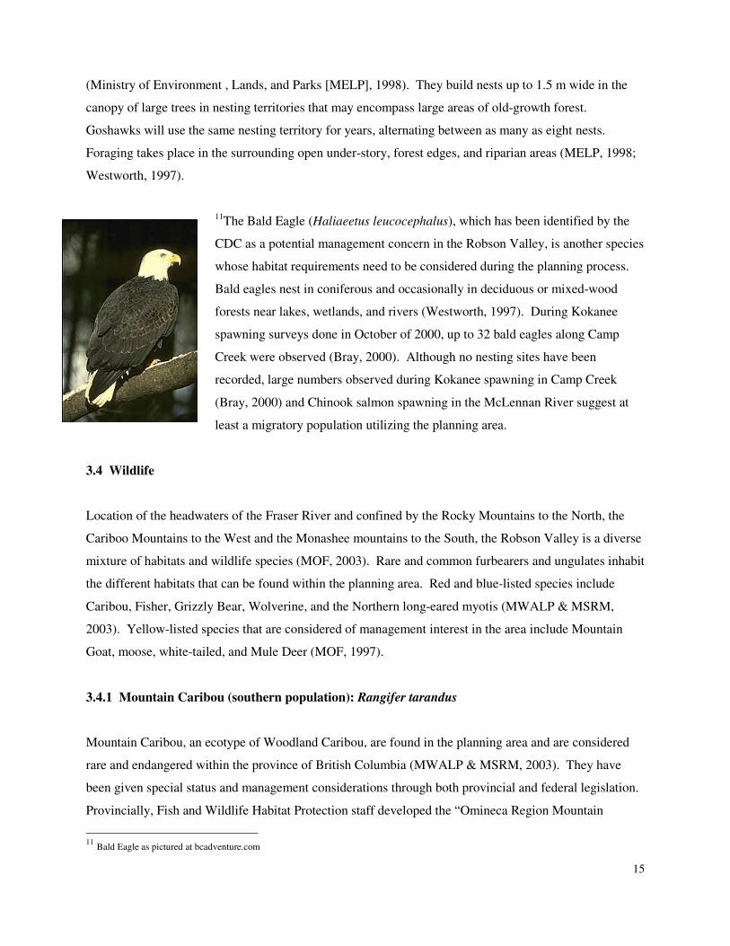
11The Bald Eagle (Haliaeetus leucocephalus), which has been identified by the
CDC as a potential management concern in the Robson Valley, is another species
whose habitat requirements need to be considered during the planning process.
Bald eagles nest in coniferous and occasionally in deciduous or mixed-wood
forests near lakes, wetlands, and rivers (Westworth, 1997). During Kokanee
spawning surveys done in October of 2000, up to 32 bald eagles along Camp
Creek were observed (Bray, 2000). Although no nesting sites have been
recorded, large numbers observed during Kokanee spawning in Camp Creek
(Bray, 2000) and Chinook salmon spawning in the McLennan River suggest at
least a migratory population utilizing the planning area.
3.4 Wildlife
Location of the headwaters of the Fraser River and confined by the Rocky Mountains to the North, the
Cariboo Mountains to the West and the Monashee mountains to the South, the Robson Valley is a diverse
mixture of habitats and wildlife species (MOF, 2003). Rare and common furbearers and ungulates inhabit
the different habitats that can be found within the planning area. Red and blue-listed species include
Caribou, Fisher, Grizzly Bear, Wolverine, and the Northern long-eared myotis (MWALP & MSRM,
2003). Yellow-listed species that are considered of management interest in the area include Mountain
Goat, moose, white-tailed, and Mule Deer (MOF, 1997).
3.4.1 Mountain Caribou (southern population): Rangifer tarandus
Mountain Caribou, an ecotype of Woodland Caribou, are found in the planning area and are considered
rare and endangered within the province of British Columbia (MWALP & MSRM, 2003). They have
been given special status and management considerations through both provincial and federal legislation.
Provincially, Fish and Wildlife Habitat Protection staff developed the “Omineca Region Mountain
11
Bald Eagle as pictured at bcadventure.com
16
Caribou Management Zone Strategy of 1990 (Ritchie, 2003). The new federal Species at Risk Act
(SARA), passed in December of 2002, requires the development and publishing of “A Strategy for the
Recovery of Mountain Caribou in British Columbia” (Ritchie, 2003).
Mountain Caribou are sensitive to habitat fragmentation and disturbance, and require large undisturbed
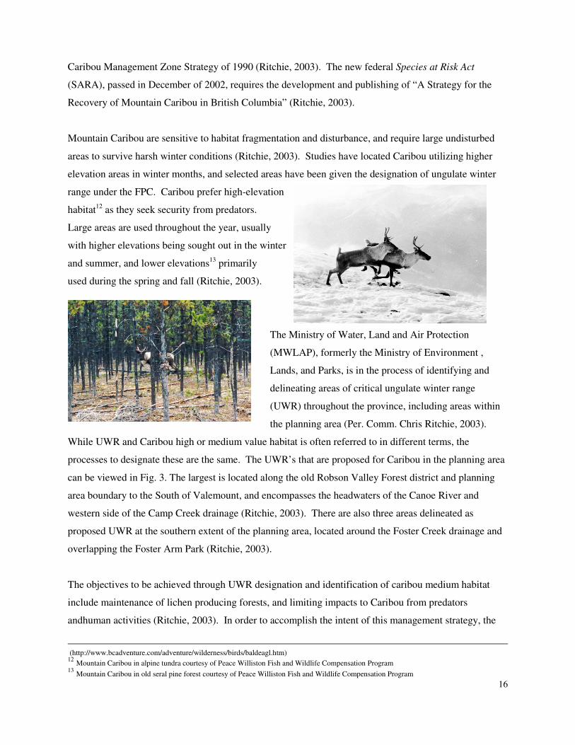
areas to survive harsh winter conditions (Ritchie, 2003). Studies have located Caribou utilizing higher
elevation areas in winter months, and selected areas have been given the designation of ungulate winter
range under the FPC. Caribou prefer high-elevation
habitat12
as they seek security from predators.
Large areas are used throughout the year, usually
with higher elevations being sought out in the winter
and summer, and lower elevations13
primarily
used during the spring and fall (Ritchie, 2003).
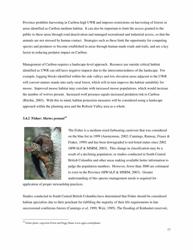
The Ministry of Water, Land and Air Protection
(MWLAP), formerly the Ministry of Environment ,
Lands, and Parks, is in the process of identifying and
delineating areas of critical ungulate winter range
(UWR) throughout the province, including areas within
the planning area (Per. Comm. Chris Ritchie, 2003).
While UWR and Caribou high or medium value habitat is often referred to in different terms, the
processes to designate these are the same. The UWR’s that are proposed for Caribou in the planning area
can be viewed in Fig. 3. The largest is located along the old Robson Valley Forest district and planning
area boundary to the South of Valemount, and encompasses the headwaters of the Canoe River and
western side of the Camp Creek drainage (Ritchie, 2003). There are also three areas delineated as
proposed UWR at the southern extent of the planning area, located around the Foster Creek drainage and
overlapping the Foster Arm Park (Ritchie, 2003).
The objectives to be achieved through UWR designation and identification of caribou medium habitat
include maintenance of lichen producing forests, and limiting impacts to Caribou from predators
andhuman activities (Ritchie, 2003). In order to accomplish the intent of this management strategy, the
(http://www.bcadventure.com/adventure/wilderness/birds/baldeagl.htm) 12
Mountain Caribou in alpine tundra courtesy of Peace Williston Fish and Wildlife Compensation Program 13
Mountain Caribou in old seral pine forest courtesy of Peace Williston Fish and Wildlife Compensation Program
17
Province prohibits harvesting in Caribou high UWR and imposes restrictions on harvesting of forests in
areas identified as Caribou medium habitat. It can also be important to limit the access granted to the
public to these areas through road deactivation and managed recreational and industrial access, so that the
animals are not stressed by human contact. Strategies such as these limit the opportunity for competing
species and predators to become established in areas through human-made roads and trails, and are a key
factor in reducing predator impact on Caribou.
Management of Caribou requires a landscape-level approach. Resource use outside critical habitat
identified as UWR can still have negative impacts due to the interconnectedness of the landscape. For
example, logging blocks identified within the side valleys and low elevation areas adjacent to the UWR
will convert mature stands into early seral forest, which will in turn improve the habitat suitability for
moose. Improved moose habitat may correlate with increased moose populations, which would increase
the number of wolves present. Increased wolf presence equals increased predation risk to Caribou
(Ritchie, 2003). With this in mind, habitat protection measures will be considered using a landscape
approach within the planning area and the Robson Valley area as a whole.
3.4.2 Fisher: Martes pennati14
The Fisher is a medium-sized furbearing carnivore that was considered
on the blue list in 1999 (Anonymous, 2002; Cannings, Ramsay, Fraser &
Fraker, 1999) and has been downgraded to red-listed status since 2002
(MWALP & MSRM, 2003). This change in classification may be a
result of a declining population, or studies conducted in South Central
British Columbia and other areas making available better information to
judge the population numbers. However, fewer than 3000 are estimated
to exist in the Province (MWALP & MSRM, 2003). Greater
understanding of this species management needs is required for
application of proper stewardship practices.
Studies conducted in South Central British Columbia have determined that Fisher should be considered
habitat specialists due to their penchant for fulfilling the majority of their life requirements in late
successional coniferous forests (Cannings et al, 1999; Weir, 1995). The flooding of Kinbasket reservoir,
14
Fisher photo: copywrite Erwin and Peggy Bauer www.agpix.com/epbauer
and specifically the flooding of the lower Canoe drainage, may have contributed to the rarity of this
species within the ILUD area when large areas of riparian habitat were submerged. This mammal is
considered vulnerable to habitat loss due to industrial activities including: land-use changes, logging,
hydroelectric expansion, and trapping (Cannings et al, 1999). Specific habitat needs have been identified
as low-elevation riparian systems with older forest characteristics and available home ranges up to 30km2
with large diameter trees, movement corridors and continuous forest cover. This species will avoid areas
that do not provide overhead cover, and in British Columbia studies have shown that riparian
cottonwoods are especially important as they may become quite large and contain large cavities
appropriate for denning. The prevailing opinion of professionals is that protecting riparian zones is very
important for management and stewardship of this species (Cannings et al, 1999).
3.4.3 Northern Long-eared Myotis: Myotis septentrionalis
The Northern Long-eared Myotis is a blue-listed bat species that although considered widely distributed,
has population numbers that are sparse and population trends that are unknown (Cannings et al, 1999).
This species is associated with both boreal forests and the wet forests of the ICH BEC zone in British
Columbia. They are known to nest in buildings and under the bark of trees, emerging at dusk to hunt
above small ponds and forest clearings for a variety of invertebrate species. In fall this species is known
to move to hibernacula, up to 56 kilometres away, where they hibernate alone or in small groups and
where mating will occur (Cannings et al, 1999).
Not much is known about this bat and research is needed into all aspects of its life requirements.
Research suggests that this is a species dependent on areas of mature forest and is most likely threatened
by forest harvesting (Cannings et al, 1999). More information is required on the contributing factors and
occurrence of hibernacula disturbance. Old wildlife trees are required for day roosts and nursery
colonies, and proximity to foraging areas may be an important success factor. Like many species, the
protection of riparian habitats and the attributes that they provide may be an important step for managing
aspects of this species life history (Cannings et al, 1999).
3.4.4 Grizzly Bear: Ursus arctos & Black Bear: Ursus americanus
Both species of bear, Grizzly and Black Bear, occur within the planning area. While Black Bears are
common across the landscape and under no immediate threat, Grizzly Bear are recognized by the CDC as
a blue-listed species threatened by the loss of habitat associated with human development (Cannings et al,
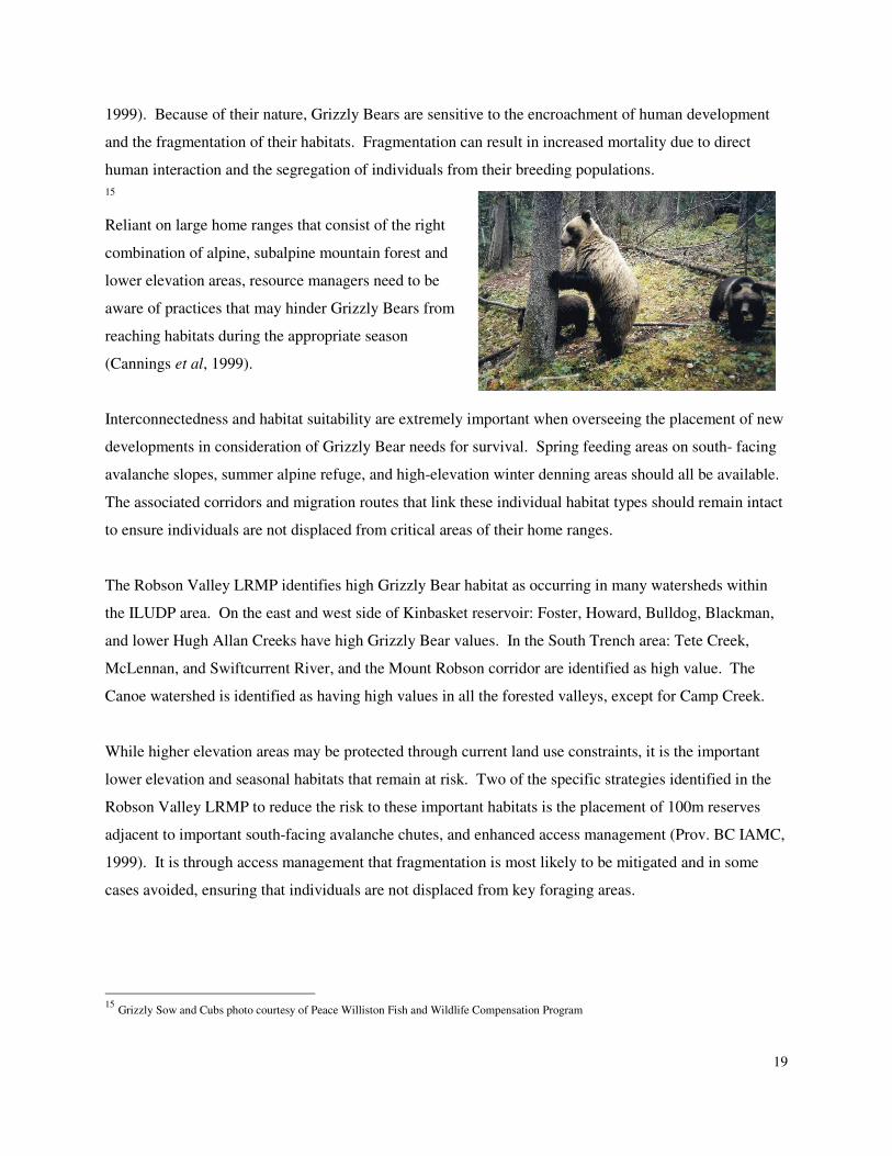
19
1999). Because of their nature, Grizzly Bears are sensitive to the encroachment of human development
and the fragmentation of their habitats. Fragmentation can result in increased mortality due to direct
human interaction and the segregation of individuals from their breeding populations.
15
Reliant on large home ranges that consist of the right
combination of alpine, subalpine mountain forest and
lower elevation areas, resource managers need to be
aware of practices that may hinder Grizzly Bears from
reaching habitats during the appropriate season
(Cannings et al, 1999).
Interconnectedness and habitat suitability are extremely important when overseeing the placement of new
developments in consideration of Grizzly Bear needs for survival. Spring feeding areas on south- facing
avalanche slopes, summer alpine refuge, and high-elevation winter denning areas should all be available.
The associated corridors and migration routes that link these individual habitat types should remain intact
to ensure individuals are not displaced from critical areas of their home ranges.
The Robson Valley LRMP identifies high Grizzly Bear habitat as occurring in many watersheds within
the ILUDP area. On the east and west side of Kinbasket reservoir: Foster, Howard, Bulldog, Blackman,
and lower Hugh Allan Creeks have high Grizzly Bear values. In the South Trench area: Tete Creek,
McLennan, and Swiftcurrent River, and the Mount Robson corridor are identified as high value. The
Canoe watershed is identified as having high values in all the forested valleys, except for Camp Creek.
While higher elevation areas may be protected through current land use constraints, it is the important
lower elevation and seasonal habitats that remain at risk. Two of the specific strategies identified in the
Robson Valley LRMP to reduce the risk to these important habitats is the placement of 100m reserves
adjacent to important south-facing avalanche chutes, and enhanced access management (Prov. BC IAMC,
1999). It is through access management that fragmentation is most likely to be mitigated and in some
cases avoided, ensuring that individuals are not displaced from key foraging areas.
15
Grizzly Sow and Cubs photo courtesy of Peace Williston Fish and Wildlife Compensation Program
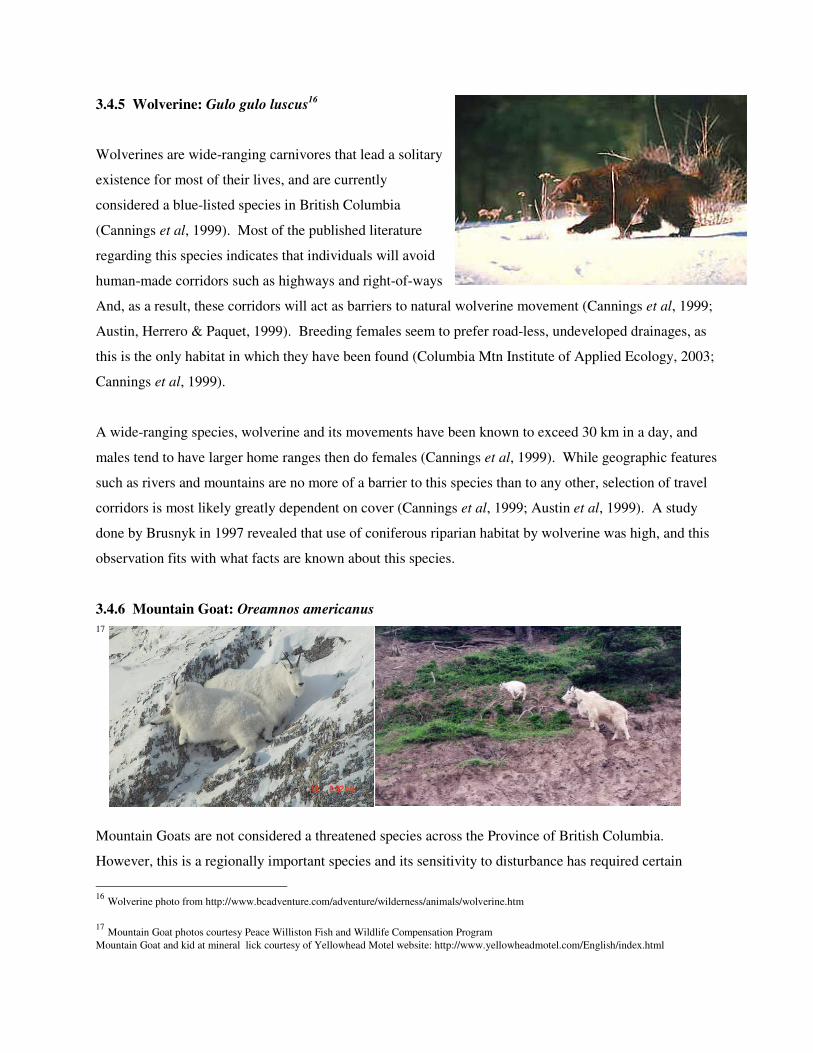
3.4.5 Wolverine: Gulo gulo luscus16
Wolverines are wide-ranging carnivores that lead a solitary
existence for most of their lives, and are currently
considered a blue-listed species in British Columbia
(Cannings et al, 1999). Most of the published literature
regarding this species indicates that individuals will avoid
human-made corridors such as highways and right-of-ways
And, as a result, these corridors will act as barriers to natural wolverine movement (Cannings et al, 1999;
Austin, Herrero & Paquet, 1999). Breeding females seem to prefer road-less, undeveloped drainages, as
this is the only habitat in which they have been found (Columbia Mtn Institute of Applied Ecology, 2003;
Cannings et al, 1999).
A wide-ranging species, wolverine and its movements have been known to exceed 30 km in a day, and
males tend to have larger home ranges then do females (Cannings et al, 1999). While geographic features
such as rivers and mountains are no more of a barrier to this species than to any other, selection of travel
corridors is most likely greatly dependent on cover (Cannings et al, 1999; Austin et al, 1999). A study
done by Brusnyk in 1997 revealed that use of coniferous riparian habitat by wolverine was high, and this
observation fits with what facts are known about this species.
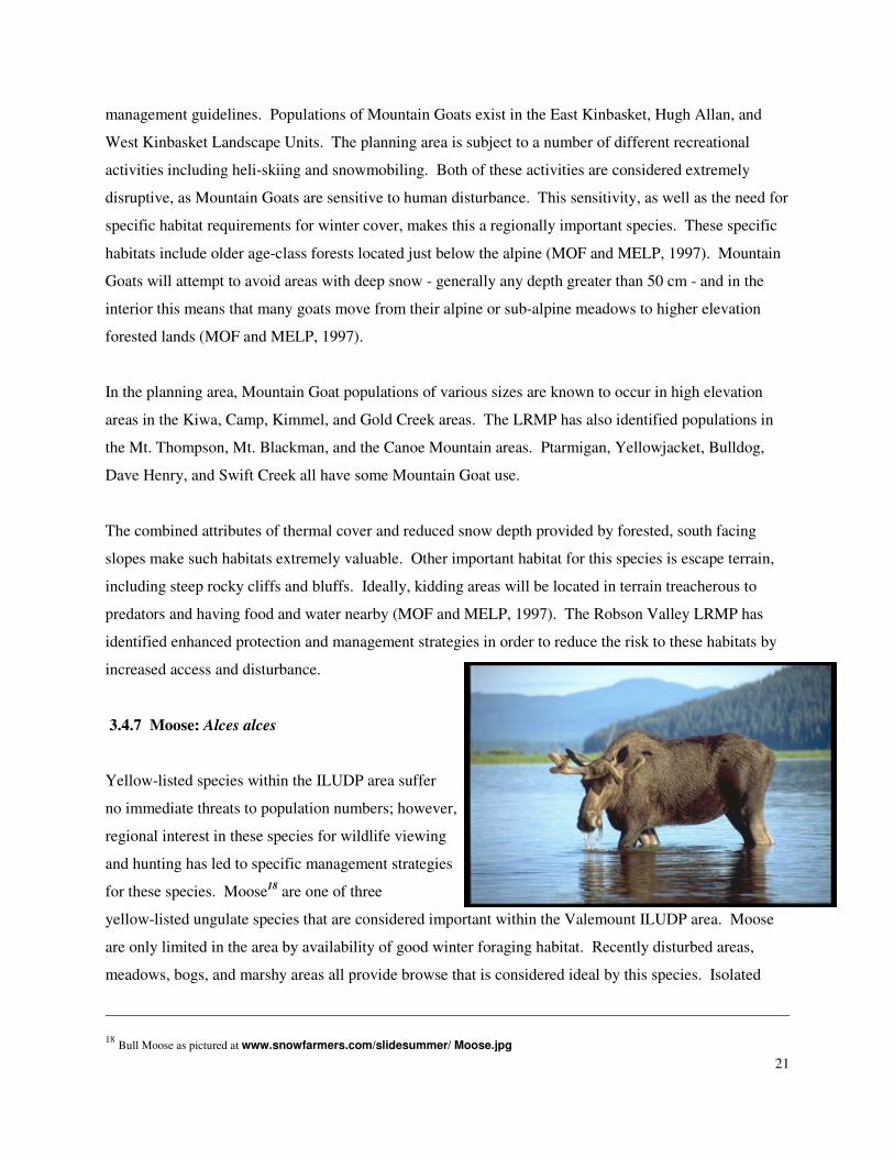
3.4.6 Mountain Goat: Oreamnos americanus
17
Mountain Goats are not considered a threatened species across the Province of British Columbia.
However, this is a regionally important species and its sensitivity to disturbance has required certain
16
Wolverine photo from http://www.bcadventure.com/adventure/wilderness/animals/wolverine.htm
17
Mountain Goat photos courtesy Peace Williston Fish and Wildlife Compensation Program
Mountain Goat and kid at mineral lick courtesy of Yellowhead Motel website: http://www.yellowheadmotel.com/English/index.html
21
management guidelines. Populations of Mountain Goats exist in the East Kinbasket, Hugh Allan, and
West Kinbasket Landscape Units. The planning area is subject to a number of different recreational
activities including heli-skiing and snowmobiling. Both of these activities are considered extremely
disruptive, as Mountain Goats are sensitive to human disturbance. This sensitivity, as well as the need for
specific habitat requirements for winter cover, makes this a regionally important species. These specific
habitats include older age-class forests located just below the alpine (MOF and MELP, 1997). Mountain
Goats will attempt to avoid areas with deep snow - generally any depth greater than 50 cm - and in the
interior this means that many goats move from their alpine or sub-alpine meadows to higher elevation
forested lands (MOF and MELP, 1997).
In the planning area, Mountain Goat populations of various sizes are known to occur in high elevation
areas in the Kiwa, Camp, Kimmel, and Gold Creek areas. The LRMP has also identified populations in
the Mt. Thompson, Mt. Blackman, and the Canoe Mountain areas. Ptarmigan, Yellowjacket, Bulldog,
Dave Henry, and Swift Creek all have some Mountain Goat use.
The combined attributes of thermal cover and reduced snow depth provided by forested, south facing
slopes make such habitats extremely valuable. Other important habitat for this species is escape terrain,
including steep rocky cliffs and bluffs. Ideally, kidding areas will be located in terrain treacherous to
predators and having food and water nearby (MOF and MELP, 1997). The Robson Valley LRMP has
identified enhanced protection and management strategies in order to reduce the risk to these habitats by
increased access and disturbance.
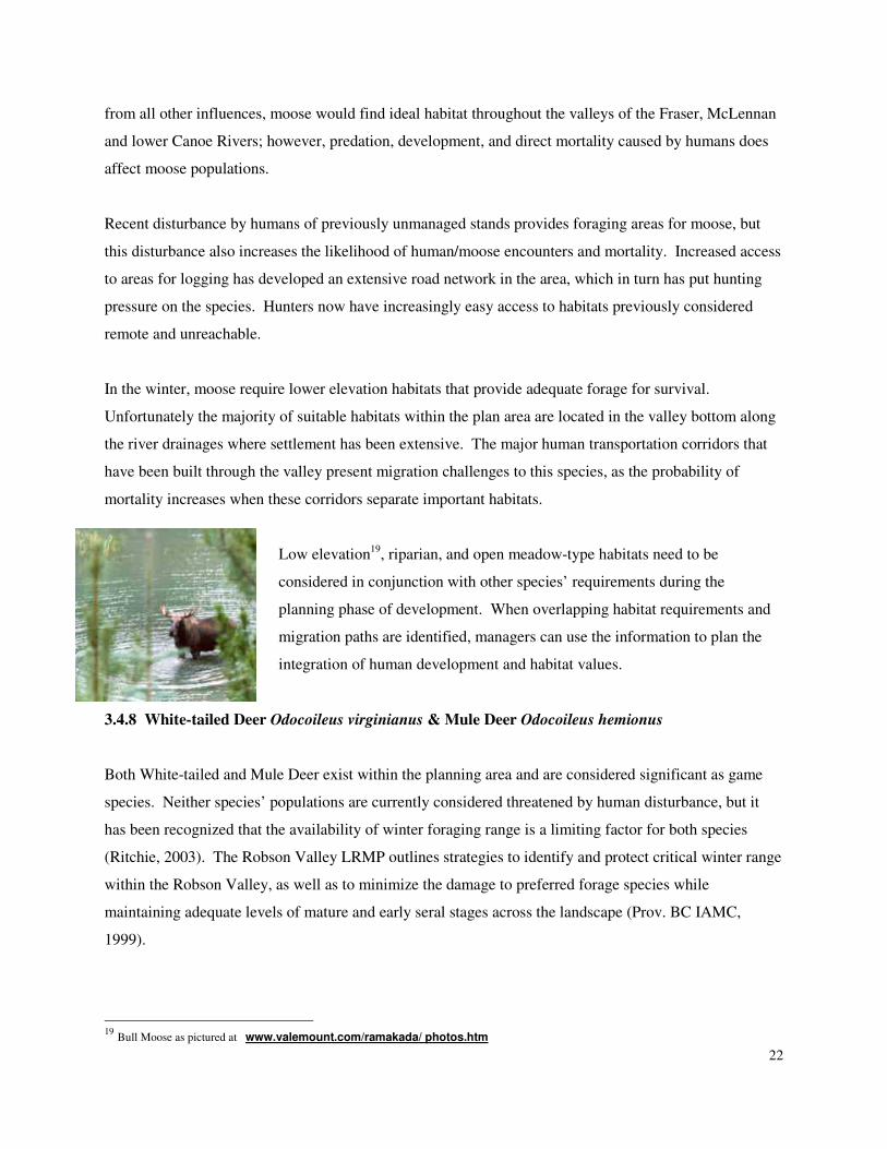
3.4.7 Moose: Alces alces
Yellow-listed species within the ILUDP area suffer
no immediate threats to population numbers; however,
regional interest in these species for wildlife viewing
and hunting has led to specific management strategies
for these species. Moose18
are one of three
yellow-listed ungulate species that are considered important within the Valemount ILUDP area. Moose
are only limited in the area by availability of good winter foraging habitat. Recently disturbed areas,
meadows, bogs, and marshy areas all provide browse that is considered ideal by this species. Isolated
18
Bull Moose as pictured at www.snowfarmers.com/slidesummer/ Moose.jpg
22
from all other influences, moose would find ideal habitat throughout the valleys of the Fraser, McLennan
and lower Canoe Rivers; however, predation, development, and direct mortality caused by humans does
affect moose populations.
Recent disturbance by humans of previously unmanaged stands provides foraging areas for moose, but
this disturbance also increases the likelihood of human/moose encounters and mortality. Increased access
to areas for logging has developed an extensive road network in the area, which in turn has put hunting
pressure on the species. Hunters now have increasingly easy access to habitats previously considered
remote and unreachable.
In the winter, moose require lower elevation habitats that provide adequate forage for survival.
Unfortunately the majority of suitable habitats within the plan area are located in the valley bottom along
the river drainages where settlement has been extensive. The major human transportation corridors that
have been built through the valley present migration challenges to this species, as the probability of
mortality increases when these corridors separate important habitats.
Low elevation19
, riparian, and open meadow-type habitats need to be
considered in conjunction with other species’ requirements during the
planning phase of development. When overlapping habitat requirements and
migration paths are identified, managers can use the information to plan the
integration of human development and habitat values.
3.4.8 White-tailed Deer Odocoileus virginianus & Mule Deer Odocoileus hemionus
Both White-tailed and Mule Deer exist within the planning area and are considered significant as game
species. Neither species’ populations are currently considered threatened by human disturbance, but it
has been recognized that the availability of winter foraging range is a limiting factor for both species
(Ritchie, 2003). The Robson Valley LRMP outlines strategies to identify and protect critical winter range
within the Robson Valley, as well as to minimize the damage to preferred forage species while
maintaining adequate levels of mature and early seral stages across the landscape (Prov. BC IAMC,
1999).
19
Bull Moose as pictured at www.valemount.com/ramakada/ photos.htm
23
The Ministry of Water, Land and Air Protection is also working to identify areas of winter range for deer
through the same legislation as that for classification of Caribou winter range. Once established they will
have legal designation on Provincial forest land20
(Ritchie & Safford, 2003). Currently, there is one
candidate Mule Deer UWR identified within the
planning area. This UWR is located upslope of the
Highway 5 and Highway 16 intersection at Tete Jaune
Cache, just south of the Lost Lake recreational area.
The area was identified as important for Mule Deer
through a study conducted by the Columbia Basin Fish
and Wildlife Program (Safford, 2002). Fig. 3: Caribou and Mule Deer UWR within the Planning Area,
identifies the location of this candidate UWR.
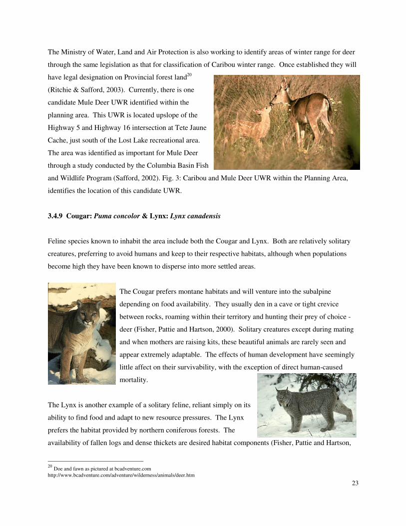
3.4.9 Cougar: Puma concolor & Lynx: Lynx canadensis
Feline species known to inhabit the area include both the Cougar and Lynx. Both are relatively solitary
creatures, preferring to avoid humans and keep to their respective habitats, although when populations
become high they have been known to disperse into more settled areas.
The Cougar prefers montane habitats and will venture into the subalpine
depending on food availability. They usually den in a cave or tight crevice
between rocks, roaming within their territory and hunting their prey of choice -
deer (Fisher, Pattie and Hartson, 2000). Solitary creatures except during mating
and when mothers are raising kits, these beautiful animals are rarely seen and
appear extremely adaptable. The effects of human development have seemingly
little affect on their survivability, with the exception of direct human-caused
mortality.
The Lynx is another example of a solitary feline, reliant simply on its
ability to find food and adapt to new resource pressures. The Lynx
prefers the habitat provided by northern coniferous forests. The
availability of fallen logs and dense thickets are desired habitat components (Fisher, Pattie and Hartson,
20
Doe and fawn as pictured at bcadventure.com
http://www.bcadventure.com/adventure/wilderness/animals/deer.htm
24
2000). This species relies heavily on the population of Snowshoe Hare, and as a result have been known
to follow the “boom and bust” cycle associated with hare populations. Mothers only share their den until
the kits are mature enough to venture out on their own. Adult contact within this species is strictly related
to mating.
3.5 Summary
When considering all the species that inhabit the planning area, the literature suggests that the protection
of old seral and riparian habitats is extremely important for a variety of species at different levels of
resource use. Because the tree species and other vegetation produced in riparian habitats can grow larger,
denser, and older due to increased moisture and nutrient levels, their value is of extreme importance. As
well, riparian areas - as a consequent of their very nature - follow water bodies across the landscape. This
in turn provides connectivity from high elevations to valley bottoms and along valley floors. All or some
of these attributes are required by most of the previously identified species; hence managing for these
areas would provide a significant portion of the required resources for species across the landscape.
4. ENVIRONMENTALLY IMPORTANT AND SENSITIVE AREAS
4.1 Land Designations for Important Wildlife and Fish Habitat areas
As outlined in the fish and wildlife overview, there are a number of different species and associated
habitats within the Robson Valley and within the Valemount ILUD planning area. While some species
seem to be able to adapt quickly to human activity and landscape changes, and therefore are of less
concern to wildlife managers, other species have been identified as requiring special management action.
For example, there are species whose habitat requirements are so specialized, and whose habitats have
become so rare, that special attention must be given to identifying these specific habitats. Once these
areas have been identified resource managers can work towards affording them some form of protection
to ensure their endurance, and ensuring that their usefulness is not diminished through degradation of
surrounding areas (i.e. that there remains a corridor or connection between specialized habitats and the
more common habitat areas).
There are a number of different habitat areas identified as important for wildlife and fish species within
the planning area (see Fig. 4). Under the Land Act, protection of environmental or physical biological
25
features found on Crown Land can be afforded protection through identification of a land reserve or
designated area where only uses compatible with the biophysical characteristics of the lands are
permitted. The current Robson Valley Crown Land Plan (CLP) was completed in 1985 and updated in
1992. The CLP defines and identifies: five Wildlife Habitat Management Area’s (WHMA’s), two
identified Wildlife Habitat Emphasis Areas (WHE’s), seven Recreation Conservation Management
Area’s (RCMA’s), and numerous Natural Environment Areas (NEA’s) along important fish production
streams within the valley (see Figure 4). Other important habitat areas identified in the planning area
include: four proposed Ungulate Winter Range (UWR) areas, Jackman Flats Provincial Park, the Starratt
Wildlife Sanctuary, Wells Grey Provincial Park, Mount Robson Provincial Park, and Foster Arm
Provincial Park. Each of these land classifications is important to wildlife and fish species for the specific
reasons discussed in this document.
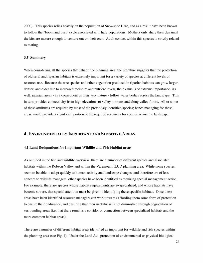
21
As part of the Robson Valley Reserve Land Plan Project in 1992, WHMA’s were identified on Crown
land within the Robson Valley and each was subject to inventory procedures and a resulting management
plan. WHMA’s are areas that maintain habitat in its natural state to provide options for managing
regionally important wildlife and fisheries habitats (SEE ME, 1993). WHE’s are identified and function
to alert people of areas significant for wildlife. RCMA’s are lands that were set aside as potential future
parks, recreation areas, and for the management of heritage areas. NEA’s are sensitive areas that were
21
Looking west at the Cariboo Mountains from Starratt Wildlife Sanctuary as pictured at
http://www.valemount.com/ramakada/photos.htm
26
identified in order to monitor and assess activities proposed for these areas. A range of activities may be
carried out, including selective logging, as long as the integrity of the area is not compromised. Where
NEA’s have been identified on streams with high fish values there is a requirement of wind-firm green
belts as a buffer to any activity. UWR designations are the responsibility of the Ministry of Water, Land
and Air Protection, and biologists are currently in the process of identifying and delineating these areas
under the auspices of the FPC.
In 1993-1994, the Mica Wildlife Compensation Program and the Wildlife Branch of Ministry of
Environment Lands and Parks jointly sponsored “The Robson Valley Wildlife Enhancement Plan
Development Project” (WEPDP), to identify high quality wildlife habitat areas that exist on private land
within the Robson Valley (SEE ME, 1994). Although the information generated provided managers with
knowledge regarding important habitat areas, the provincial government did not follow through with the
purchase of any of the identified lands. Currently these areas remain privately owned and therefore
beyond current management legislation.
4.2 Key Wildlife Habitat Areas
As discussed in detail later in this section, the VILUD planning area contains a number of different
habitat areas identified as important, primarily for ungulate species. The habitat most likely to be a
limiting factor for ungulates is winter foraging range. Moose and deer are unable to thrive at elevations
greater than 1000 m in the winter, as the snow-pack limits the ability to move quickly and locate adequate
food supplies. Caribou species do not have this constraint and rely heavily on high elevation, older
forests in winter months for protection against predators and a sufficient food source.
There are four Caribou UWR’s currently proposed for the plan area, the largest of which encompasses a
considerable portion of the Canoe River, including its headwaters. The area extends from the outer
boundary of the planning region to the area around Albreda (Ritchie, 2003). The remaining three UWR
proposed areas are located in the Foster Landscape Unit. They are all located within proximity of Foster
Arm Provincial Park; one almost completely overlapping the park boundaries.
Deer and Moose winter range in the Camp – Albreda valley is considered to occur only at lower
elevations along the highway corridor (Spencer Environmental Management Services Ltd., 2002). A
WHE has been identified along Camp Creek and the associated valley bottom where deer wintering range
occurs (Spencer Environmental Management Services Ltd., 2002).
27
The Canoe River meanders through a flat area at the base of Canoe Mountain, periodically flooding and
disturbing the surrounding vegetation and creating a dynamic system ideal for ungulate species and their
predators. This area has been described as important for wildlife and wildlife movement (Norecol, 1992;
Spencer Environmental Management Services Ltd., 2002; Thompson Forest Management and
Forestscape Consulting Ltd., 2002).
There are a number of different wildlife features within this area, most of which are captured within
existing WHMA or WHE designations. WHMA 7390 is located along the Canoe River and encompasses
an area of semi-bog, riparian grassland, with little forested area (SEE MEc 1993). White-tailed Deer
utilize this area and doe with fawn have been known to make use of the southern portion of the area that
abuts a bench of pine-forested land. It is also considered good Moose winter habitat and Black Bear
utilize the land along the Canoe for forage in the summer and fall (SEE ME, 1993). Located at the base
of Canoe Mt. along the reservoir, is a WHE that encompasses an area known as East Ponds where Moose
and Deer are known to travel for fresh water (Thompson Forest Management et.al, 2002). There is a deer
rutting and calving site near the northeast end of the reservoir. A wolf den has been reported in close
proximity to WHMA 7390 as well. Other records have also stated that Grizzly Bear can occasionally be
seen from the Forest Service Road along the sides of the reservoir and in the avalanche tracts of the
mountains that slope down towards Kinbasket Lake (Thompson Forest Management et al, 2002).
North of the lower Canoe River, the McLennan River flows into the town of Valemount, joins with Swift
Creek, and then proceeds to drain north into the Fraser River. This river is important, as mentioned
previously, because of its contribution to the sustainability of the furthest travelled spawning population
of interior Chinook Salmon. During spawning season carcasses act to attract many different wildlife
species, and those that are not consumed enrich the surrounding lands with nitrogen and other nutrients.
Black Bears are suspected of utilizing this food source during the fall, and many other species would
potentially benefit. Eagles, Coyotes, Marten, and other opportunistic omnivores may take advantage of
this food source.
Located north of Valemount and just south of Jackman Flats is the second WHMA that provides wildlife
habitat features. WHMA 883 is 256 ha and covers a variety of habitat types that support a diverse
number of species (SEE MEd, 1993). The area consists of low level river channels, old oxbow meadows,
and esker uplands. Large mammals known to use this area are Mule and White-tailed Deer, Moose, Elk,
Black Bear, and Cougar. The mixture of riparian and forested uplands makes this area attractive to many
28
species for forage and it is considered a “winter range on which animals from surrounding areas depend”
(SEE MEd, 1993). Private land that abuts this WHMA was identified as a candidate for purchase by BC
Hydro in 1994 under the Robson Valley Wildlife Enhancement Plan Development Project because of its
unique habitat features (SEE ME, 1994), but this suggestion has never been acted upon. The parcel of
private land extends north of WHMA 883, encompassing a portion of Lower Hogan Creek, several
sections of marsh and swampland, and stops just below the southern boundary of Jackman Flats
Provincial Park. Great Blue Heron have been sighted in the area in spring and fall, and the area is
considered one of the most-used moose habitat areas within the Robson Valley (SEE ME, 1994).
At the confluence of Tete Creek and the McLennan and Fraser Rivers is the third WHMA with important
wildlife attributes. WHMA 3155 is 120 ha surrounding a complex arrangement of islands, deltas,
marshlands and forested uplands (SEE MEa, 1993). A valuable White Spruce riparian area exists in a
backwater of the Fraser River within this area (Leung and Simpson, 1993). Believed to contain high
habitat diversity, including an ungulate migratory corridor and winter range, this WHMA provides much
more than just protection of salmon habitat. Great Blue Heron have been noted as utilizing this area for
nesting and Bald Eagle use is extremely high during the salmon spawning season (SEE MEa, 1993).
It is believed that wildlife, including ungulates, bear and other mammal species utilize WHMA 3155 as a
component for movement from the Upper Fraser River wetlands, or the uplands of the Mount Robson
area, to the lower elevation Fraser and McLennan Rivers (SEE MEa, 1993). Dispersal, migration, forage,
and any other number of reasons can influence animals to move from one area to another, and habitat as
supplied by this WHMA is critical. The large trees located on the islands and along the river banks
provide important habitat requirements for many species sensitive to cold temperatures and deep snow
pack, and the quality browse that is available attracts ungulate species to the area (SEE MEa, 1993).
4.3 Key Fish Habitat Areas
There are specific requirements of fish species that must be met in order to fulfil certain life stages. From
spawning gravels which can be very limiting, to the ideal habitat sought by adults, fish species can
depend on a variety of different habitat types throughout their life span. For example, Kokanee will
return to spawn in their brood stream in the fall, laying thousands of eggs into a redd constructed of
gravels that will allow aeration and survival of their young. Temperature is extremely important in
determining the emergence timing, and once hatched the young will require rearing habitat that will
protect them from predators and provide enough food so that they will remain healthy and competitive
29
once they reach open water. Universal for most fish species, these requirements are dependant on factors
that extend beyond the banks or the wetted edge of streams.
Riparian vegetation is extremely important for maintaining the quality and quantity of fish habitat that is
available. Roots strengthen banks and help reduce or prevent erosion. Leaves support insects and these,
in turn, provide fish species with food. Fragments from the vegetation also provide a food source for fish
species, while enriching the water with organic matter. Shade from the branches and leaves protect the
water, keeping it cool, and once they have died, these structures fall into the water and provide
complexity to the aquatic environment. Overall, it is important to have diverse vegetation and associated
structures in order to provide fish species with all the requirements needed to utilize a water body.
Suggested protection of riparian vegetation in the planning area will benefit all species known to utilize
these systems, including: Bull trout, Yellow-fin Rainbow Trout and the sports fish occurring in the
reservoir.22
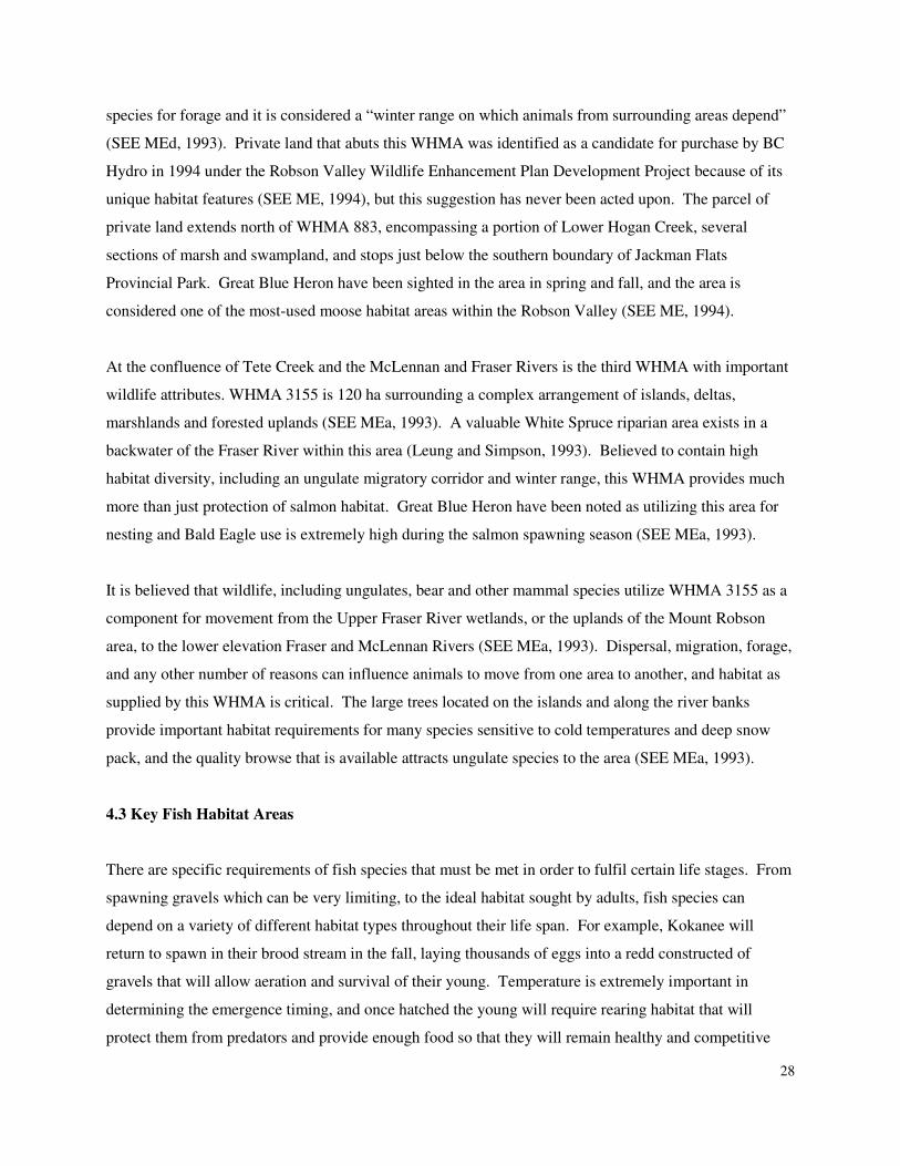
The McLennan River, Swift Creek, and Fraser River are all known important fish-
bearing streams and have associated NEA designation. There are known Chinook
Salmon spawning areas within these water bodies and popular public viewing areas
include a recreation site on the Fraser River by Tete Jaune Cache and on Swift Creek in George Hicks
Regional Park, adjacent to the Village of Valemount. The observation platform in George Hicks
Regional Park is maintained by the village of Valemount and is operated for public education and viewing
of spawning Chinook Salmon. The Crown land around the spawning grounds at Tete Jaune Cache has
been identified for protection under WHMA designation.
There are two WHMA’s with significant fisheries values that have been identified within the Tete Jaune
Cache area. WHMA 3155, is located at the confluence of the McLennan and Fraser Rivers where the
largest Chinook salmon spawning grounds in the Upper Fraser River have been identified (SEE MEa,
1993), and the other, WHMA 6012, is located downstream of Tete Jaune Cache on the south side of the
river near an old side channel (SEE MEb, 1993). The downstream side channel is very important for
salmon populations as it provides critical habitat for young migrating salmon seeking refuge from high
water and access to rearing habitat in the spring before starting their long journey to the ocean.
The largest spawning population of Kokanee within the Canoe Reach of Kinbasket Reservoir is known to
spawn within Camp Creek, and are considered a regionally important population. Resource managers
should be aware of the key spawning areas for this species. There is a natural fish barrier 13 km upstream
30
on Camp Creek and this is the extent of the range for this species. Where Camp Creek connects with
Canoe River and continues to flow into Kinbasket Reservoir, there are a number of areas considered
important to fish. There is NEA designation on public lands along Camp Creek and Canoe River, as
identified in the existing Robson Valley Crown Land Plan, however it is felt at this time that increasing
the riparian buffer width would provide greater protection for this system.
Within the planning area there are a number of fish species that are considered important for the local area
and these species need to be examined, and known occurrences of important habitat needs to be recorded.
Substrate, water body size, and the riparian elements that influence stream productivity must be
considered when determining suitability of a stream section for fulfilling life stages of these fish species.
Riparian health is an important contributing factor in the health of fish populations. As riparian health is
degraded by development activities, sensitive fish species are put under stress.
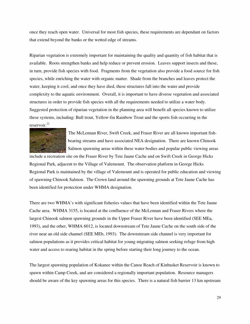
23
4.4 Riparian Buffers
Riparian areas occur next to the banks of streams, lakes, and wetlands, and include both the area
dominated by continuous high moisture content and the adjacent upland vegetation that is influenced by
the moisture. Plant diversity and structural complexity resulting from the proximity to water provide
many different habitats in a relatively small area. Riparian areas are also highly productive for wildlife as
a result of the plant communities and water associated with them. (Stevens, Backhouse, & Eriksson,
1995). Most of British Columbia’s amphibians spend some part of their life cycle in riparian habitats.
22
Chinook Salmon spawning in McLennan River courtesy of Yellowhead Motel website: http://www.yellowheadmotel.com/English/index.html 23
Swift Creek Backwater channel as pictured at
http://www.yellowheadmotel.com/English/scenery.htm
31
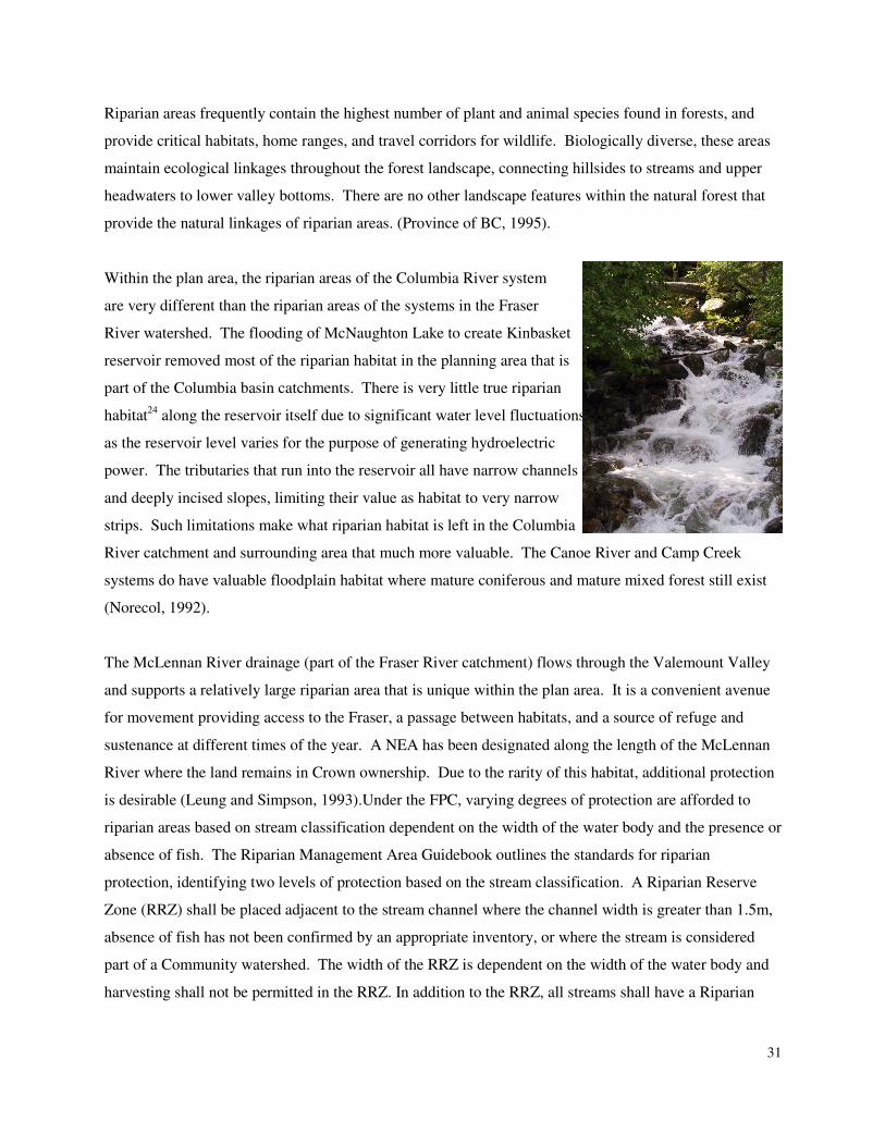
Riparian areas frequently contain the highest number of plant and animal species found in forests, and
provide critical habitats, home ranges, and travel corridors for wildlife. Biologically diverse, these areas
maintain ecological linkages throughout the forest landscape, connecting hillsides to streams and upper
headwaters to lower valley bottoms. There are no other landscape features within the natural forest that
provide the natural linkages of riparian areas. (Province of BC, 1995).
Within the plan area, the riparian areas of the Columbia River system
are very different than the riparian areas of the systems in the Fraser
River watershed. The flooding of McNaughton Lake to create Kinbasket
reservoir removed most of the riparian habitat in the planning area that is
part of the Columbia basin catchments. There is very little true riparian
habitat24
along the reservoir itself due to significant water level fluctuations
as the reservoir level varies for the purpose of generating hydroelectric
power. The tributaries that run into the reservoir all have narrow channels
and deeply incised slopes, limiting their value as habitat to very narrow
strips. Such limitations make what riparian habitat is left in the Columbia
River catchment and surrounding area that much more valuable. The Canoe River and Camp Creek
systems do have valuable floodplain habitat where mature coniferous and mature mixed forest still exist
(Norecol, 1992).
The McLennan River drainage (part of the Fraser River catchment) flows through the Valemount Valley
and supports a relatively large riparian area that is unique within the plan area. It is a convenient avenue
for movement providing access to the Fraser, a passage between habitats, and a source of refuge and
sustenance at different times of the year. A NEA has been designated along the length of the McLennan
River where the land remains in Crown ownership. Due to the rarity of this habitat, additional protection
is desirable (Leung and Simpson, 1993).Under the FPC, varying degrees of protection are afforded to
riparian areas based on stream classification dependent on the width of the water body and the presence or
absence of fish. The Riparian Management Area Guidebook outlines the standards for riparian
protection, identifying two levels of protection based on the stream classification. A Riparian Reserve
Zone (RRZ) shall be placed adjacent to the stream channel where the channel width is greater than 1.5m,
absence of fish has not been confirmed by an appropriate inventory, or where the stream is considered
part of a Community watershed. The width of the RRZ is dependent on the width of the water body and
harvesting shall not be permitted in the RRZ. In addition to the RRZ, all streams shall have a Riparian
32
Management Zone, regardless of channel width or presence of fish. Only the width of the Riparian
Management Zone is determined by the channel width. Some constraints to harvesting shall be applied
within the Riparian Management Zone. Where both a RRZ and a Riparian Management Zone exist they
are considered a Riparian Management Area (RMA).
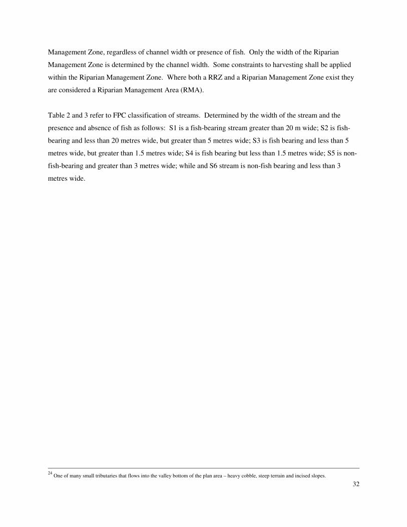
Table 2 and 3 refer to FPC classification of streams. Determined by the width of the stream and the
presence and absence of fish as follows: S1 is a fish-bearing stream greater than 20 m wide; S2 is fish-
bearing and less than 20 metres wide, but greater than 5 metres wide; S3 is fish bearing and less than 5
metres wide, but greater than 1.5 metres wide; S4 is fish bearing but less than 1.5 metres wide; S5 is non-
fish-bearing and greater than 3 metres wide; while and S6 stream is non-fish bearing and less than 3
metres wide.
24
One of many small tributaries that flows into the valley bottom of the plan area – heavy cobble, steep terrain and incised slopes.
33
Table 2 Classified Streams in the Fraser River Watershed area of the ILUDP Area
Waterbody Classification
Under the
FPC
FPC
RRZ
width
FPC
RMZ
width
FPC Total
RMA width
LRMP
Recommended2
Other
Studies*,5,7
Fraser River S1 0 100 100 50 RRZ and 50
RMZ
Norecol-b
19921
Leung and
Simpson
19934
Kiwa Ck S1 50 20 70 None
Tete Ck S1 50 20 70 None Norecol-b
19921
Leung and
Simpson
19934
McLennan
River
S1 50 20 70 60 RRZ and 20
RMA
Norecol
1992-b 19921
Leung and
Simpson
19934
Westworth
Assoc- a&b,
19976&8
Spencer Env,
2002
Hogan Creek S3z
20 20 40 Westworth
Assoc- a&b,
19976&8
Spencer Env,
2002
Teepee Creek S2
30 20 50 Westworth
Assoc- a&b,
19976&8
Spencer Env,
2002
Crooked
Creek
S3z
20 20 40 Westworth
Assoc- a&b,
19976&8
Spencer Env,
2002
Swift Ck
Community
watershed
S1 50 20 70 none3
Norecol-b
19921
• Other studies noted here have suggested that the current protection of riparian areas under the FPC is not adequate for species other than fish
and as such have encouraged the expansion of this protection. Exact recommendations may not have been stated.
• z – classification was calculated using Trim II digital information. Once additional information is
forthcoming, this will be confirmed or altered.
34
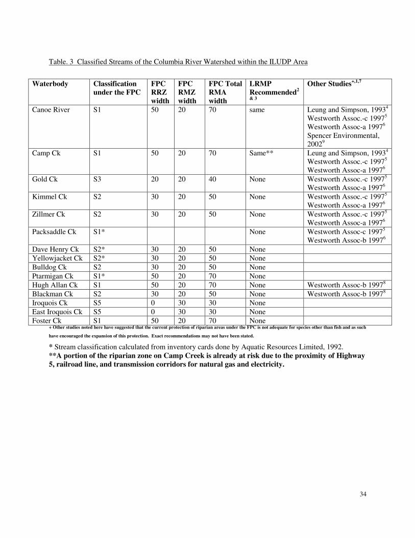
Table. 3 Classified Streams of the Columbia River Watershed within the ILUDP Area
Waterbody Classification
under the FPC
FPC
RRZ
width
FPC
RMZ
width
FPC Total
RMA
width
LRMP
Recommended2
& 3
Other Studies+,1,7
Canoe River S1 50 20 70 same Leung and Simpson, 19934
Westworth Assoc.-c 19975
Westworth Assoc-a 19976
Spencer Environmental,
20029
Camp Ck S1 50 20 70 Same** Leung and Simpson, 19934
Westworth Assoc.-c 19975
Westworth Assoc-a 19976
Gold Ck S3 20 20 40 None Westworth Assoc.-c 19975
Westworth Assoc-a 19976
Kimmel Ck S2 30 20 50 None Westworth Assoc.-c 19975
Westworth Assoc-a 19976
Zillmer Ck S2 30 20 50 None Westworth Assoc.-c 19975
Westworth Assoc-a 19976
Packsaddle Ck S1* None Westworth Assoc-c 19975
Westworth Assoc-b 19976
Dave Henry Ck S2* 30 20 50 None
Yellowjacket Ck S2* 30 20 50 None
Bulldog Ck S2 30 20 50 None
Ptarmigan Ck S1* 50 20 70 None
Hugh Allan Ck S1 50 20 70 None Westworth Assoc-b 19978
Blackman Ck S2 30 20 50 None Westworth Assoc-b 19978
Iroquois Ck S5 0 30 30 None
East Iroquois Ck S5 0 30 30 None
Foster Ck S1 50 20 70 None + Other studies noted here have suggested that the current protection of riparian areas under the FPC is not adequate for species other than fish and as such
have encouraged the expansion of this protection. Exact recommendations may not have been stated.
* Stream classification calculated from inventory cards done by Aquatic Resources Limited, 1992.
**A portion of the riparian zone on Camp Creek is already at risk due to the proximity of Highway
5, railroad line, and transmission corridors for natural gas and electricity.
i
FPC-designated Riparian classifications are implemented on Crown land only. On private land, the regulatory
protection of riparian areas comes from the Regional District. Development permits are one tool available to
local governments, which can place restrictions on location of development for the protection of riparian area
habitat. The Federal Department of Fisheries and Oceans, affords protection to riparian areas through Section
35 of the federal Fisheries Act. This section does not provide the same detail as the FPC but prohibits the
harmful alteration, disruption, or destruction of fish habitat unless authorized by the Minister.
Other studies and planning documents may have identified additional protection to be given to water bodies or
increased riparian buffers for connectivity reasons as noted in Table 2 and 3 with rationale provided in
Appendix 4
The Rocky Mountain Trench is a major north-south flyway for migrating birds, including waterfowl, other
aquatic birds, raptors, and songbirds. Riparian areas and wetlands play a major part in the success of migratory
birds reaching their breeding grounds as they provide “migratory connectivity” between breeding and non-
breeding areas (Webster, Marra, Haig, Bensch and Holmes, 2002). As well as facilitating migration, riparian
habitats are used by some species for breeding and the late summer moulting period (Norecol, 1992). Both the
blue-listed Great Blue Heron and American Bittern have been observed in riparian areas within the boundaries
of the planning area ((MWLAP and MSRM, 2003).
Leung and Simpson (1993) identified in their study that wetlands, riparian habitats, and mature mixed deciduous
or old-growth forest provided habitat for the greatest number of bird species in the Robson Valley. They also
identified that these habitats have a restricted distribution and occurrence and are the habitats most threatened by
human activities. They recommend that lowland riparian and old-growth forests need protection in the Robson
Valley because of their rarity and the value of the habitats they provide for a wide range of species, and
specifically identify Cottonwood and Spruce as species that should be protected wherever possible.
The valley bottoms of both the Fraser and Columbia rivers have been altered by land clearing, logging, and
agricultural use of the area. These areas provide suitable habitat for a variety of birds of prey including Bald
Eagle, Osprey (Pandion haliaetus), American Kestrel (Falco sparverius), and a wide variety of hawks and owls.
(Norecol, 1992).
ii
Domestic Water Use
In British Columbia all water is owned by the Crown. The two pieces of legislation that impact domestic water
users include; the Water Act which provides authority for permission or rights to use surface water through
licensing or approval documents obtained through Land and Water British Columbia Inc (LWBC) and the
Drinking Water Protection Act which provides for safe water used for human consumption, food preparation or
sanitation.
In the planning area, there are a large number of licenses issued for either domestic, irrigation, or waterworks
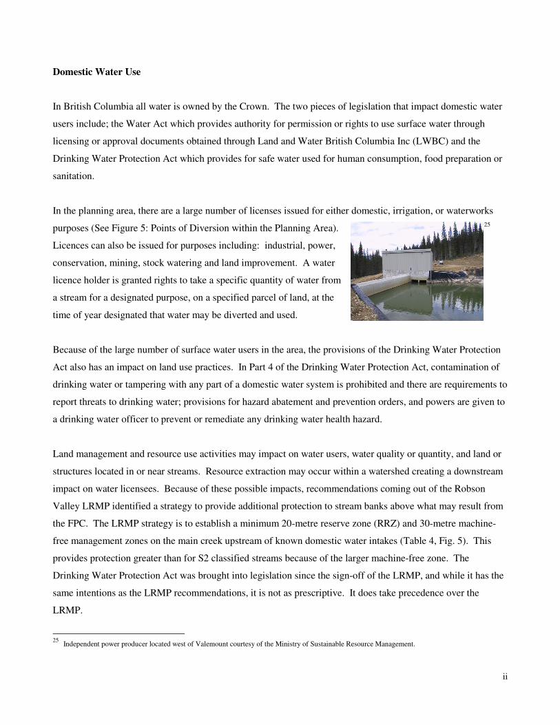
purposes (See Figure 5: Points of Diversion within the Planning Area). 25
Licences can also be issued for purposes including: industrial, power,
conservation, mining, stock watering and land improvement. A water
licence holder is granted rights to take a specific quantity of water from
a stream for a designated purpose, on a specified parcel of land, at the
time of year designated that water may be diverted and used.
Because of the large number of surface water users in the area, the provisions of the Drinking Water Protection
Act also has an impact on land use practices. In Part 4 of the Drinking Water Protection Act, contamination of
drinking water or tampering with any part of a domestic water system is prohibited and there are requirements to
report threats to drinking water; provisions for hazard abatement and prevention orders, and powers are given to
a drinking water officer to prevent or remediate any drinking water health hazard.
Land management and resource use activities may impact on water users, water quality or quantity, and land or
structures located in or near streams. Resource extraction may occur within a watershed creating a downstream
impact on water licensees. Because of these possible impacts, recommendations coming out of the Robson
Valley LRMP identified a strategy to provide additional protection to stream banks above what may result from
the FPC. The LRMP strategy is to establish a minimum 20-metre reserve zone (RRZ) and 30-metre machine-
free management zones on the main creek upstream of known domestic water intakes (Table 4, Fig. 5). This
provides protection greater than for S2 classified streams because of the larger machine-free zone. The
Drinking Water Protection Act was brought into legislation since the sign-off of the LRMP, and while it has the
same intentions as the LRMP recommendations, it is not as prescriptive. It does take precedence over the
LRMP.
25
Independent power producer located west of Valemount courtesy of the Ministry of Sustainable Resource Management.
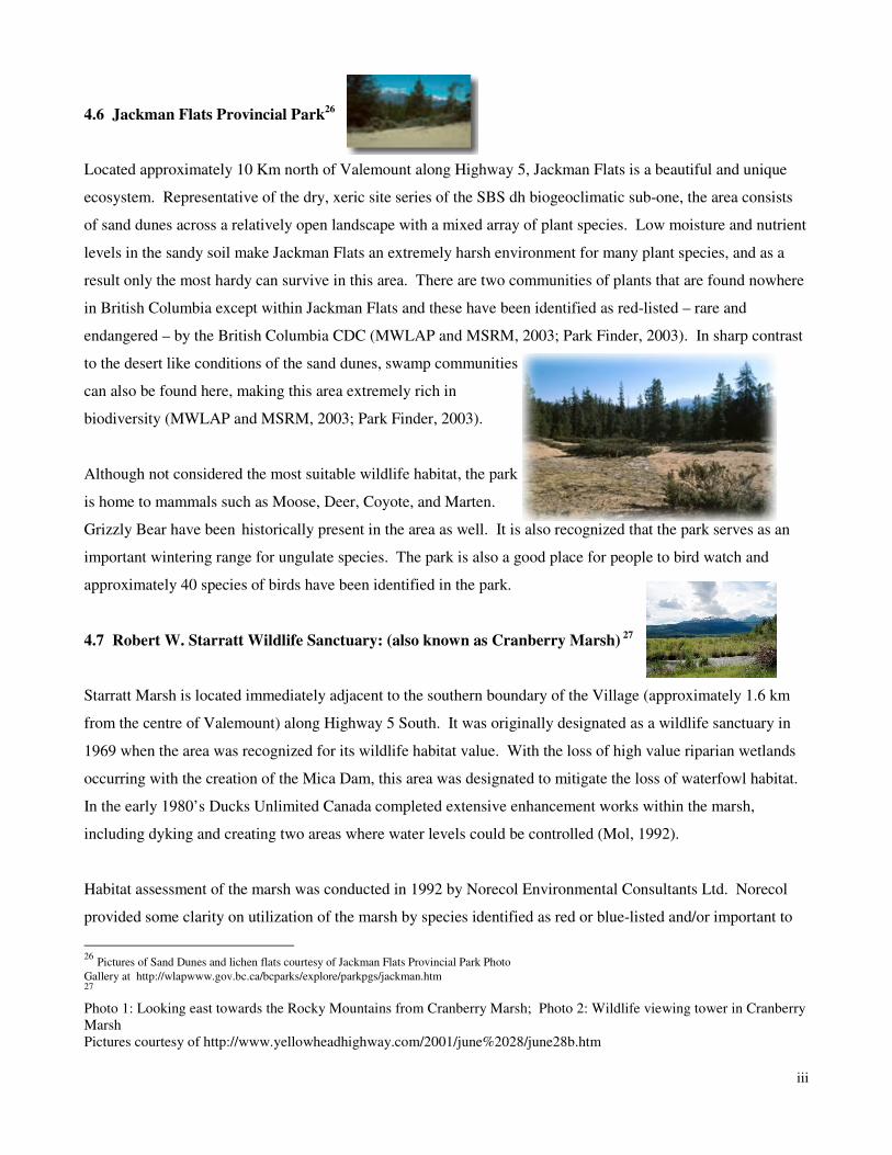
iii
4.6 Jackman Flats Provincial Park26
Located approximately 10 Km north of Valemount along Highway 5, Jackman Flats is a beautiful and unique
ecosystem. Representative of the dry, xeric site series of the SBS dh biogeoclimatic sub-one, the area consists
of sand dunes across a relatively open landscape with a mixed array of plant species. Low moisture and nutrient
levels in the sandy soil make Jackman Flats an extremely harsh environment for many plant species, and as a
result only the most hardy can survive in this area. There are two communities of plants that are found nowhere
in British Columbia except within Jackman Flats and these have been identified as red-listed – rare and
endangered – by the British Columbia CDC (MWLAP and MSRM, 2003; Park Finder, 2003). In sharp contrast
to the desert like conditions of the sand dunes, swamp communities
can also be found here, making this area extremely rich in
biodiversity (MWLAP and MSRM, 2003; Park Finder, 2003).
Although not considered the most suitable wildlife habitat, the park
is home to mammals such as Moose, Deer, Coyote, and Marten.
Grizzly Bear have been historically present in the area as well. It is also recognized that the park serves as an
important wintering range for ungulate species. The park is also a good place for people to bird watch and
approximately 40 species of birds have been identified in the park.
4.7 Robert W. Starratt Wildlife Sanctuary: (also known as Cranberry Marsh) 27
Starratt Marsh is located immediately adjacent to the southern boundary of the Village (approximately 1.6 km
from the centre of Valemount) along Highway 5 South. It was originally designated as a wildlife sanctuary in
1969 when the area was recognized for its wildlife habitat value. With the loss of high value riparian wetlands
occurring with the creation of the Mica Dam, this area was designated to mitigate the loss of waterfowl habitat.
In the early 1980’s Ducks Unlimited Canada completed extensive enhancement works within the marsh,
including dyking and creating two areas where water levels could be controlled (Mol, 1992).
Habitat assessment of the marsh was conducted in 1992 by Norecol Environmental Consultants Ltd. Norecol
provided some clarity on utilization of the marsh by species identified as red or blue-listed and/or important to
26
Pictures of Sand Dunes and lichen flats courtesy of Jackman Flats Provincial Park Photo
Gallery at http://wlapwww.gov.bc.ca/bcparks/explore/parkpgs/jackman.htm 27
Photo 1: Looking east towards the Rocky Mountains from Cranberry Marsh; Photo 2: Wildlife viewing tower in Cranberry
Marsh
Pictures courtesy of http://www.yellowheadhighway.com/2001/june%2028/june28b.htm
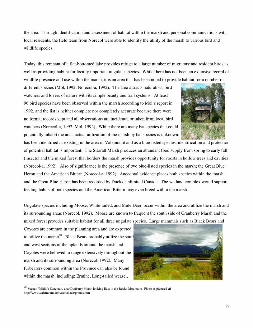
iv
the area. Through identification and assessment of habitat within the marsh and personal communications with
local residents, the field team from Norecol were able to identify the utility of the marsh to various bird and
wildlife species.
Today, this remnant of a flat-bottomed lake provides refuge to a large number of migratory and resident birds as
well as providing habitat for locally important ungulate species. While there has not been an extensive record of
wildlife presence and use within the marsh, it is an area that has been noted to provide habitat for a number of
different species (Mol, 1992; Norecol-a, 1992). The area attracts naturalists, bird
watchers and lovers of nature with its simple beauty and trail systems. At least
96 bird species have been observed within the marsh according to Mol’s report in
1992, and the list is neither complete nor completely accurate because there were
no formal records kept and all observations are incidental or taken from local bird
watchers (Norecol-a, 1992; Mol, 1992). While there are many bat species that could
potentially inhabit the area, actual utilization of the marsh by bat species is unknown. The long-eared myotis
has been identified as existing in the area of Valemount and as a blue-listed species, identification and protection
of potential habitat is important. The Starratt Marsh produces an abundant food supply from spring to early fall
(insects) and the mixed forest that borders the marsh provides opportunity for roosts in hollow trees and cavities
(Norecol-a, 1992). Also of significance is the presence of two blue-listed species in the marsh; the Great Blue
Heron and the American Bittern (Norecol-a, 1992). Anecdotal evidence places both species within the marsh,
and the Great Blue Heron has been recorded by Ducks Unlimited Canada. The wetland complex would support
feeding habits of both species and the American Bittern may even breed within the marsh.
Ungulate species including Moose, White-tailed, and Mule Deer, occur within the area and utilize the marsh and
its surrounding areas (Norecol, 1992). Moose are known to frequent the south side of Cranberry Marsh and the
mixed forest provides suitable habitat for all three ungulate species. Large mammals such as Black Bears and
Coyotes are common in the planning area and are expected
to utilize the marsh28
. Black Bears probably utilize the south
and west sections of the uplands around the marsh and
Coyotes were believed to range extensively throughout the
marsh and its surrounding area (Norecol, 1992). Many
furbearers common within the Province can also be found
within the marsh, including: Ermine, Long-tailed weasel,
28
Starratt Wildlife Sanctuary aka Cranberry Marsh looking East to the Rocky Mountains Photo as pictured at http://www.valemount.com/ramakada/photos.htm
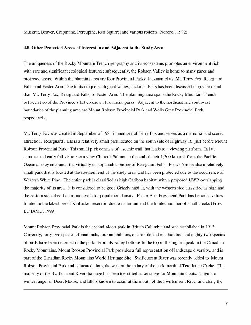
v
Muskrat, Beaver, Chipmunk, Porcupine, Red Squirrel and various rodents (Norecol, 1992).
4.8 Other Protected Areas of Interest in and Adjacent to the Study Area
The uniqueness of the Rocky Mountain Trench geography and its ecosystems promotes an environment rich
with rare and significant ecological features; subsequently, the Robson Valley is home to many parks and
protected areas. Within the planning area are four Provincial Parks; Jackman Flats, Mt. Terry Fox, Rearguard
Falls, and Foster Arm. Due to its unique ecological values, Jackman Flats has been discussed in greater detail
than Mt. Terry Fox, Rearguard Falls, or Foster Arm. The planning area spans the Rocky Mountain Trench
between two of the Province’s better-known Provincial parks. Adjacent to the northeast and southwest
boundaries of the planning area are Mount Robson Provincial Park and Wells Grey Provincial Park,
respectively.
Mt. Terry Fox was created in September of 1981 in memory of Terry Fox and serves as a memorial and scenic
attraction. Rearguard Falls is a relatively small park located on the south side of Highway 16, just before Mount
Robson Provincial Park. This small park consists of a scenic trail that leads to a viewing platform. In late
summer and early fall visitors can view Chinook Salmon at the end of their 1,200 km trek from the Pacific
Ocean as they encounter the virtually unsurpassable barrier of Rearguard Falls. Foster Arm is also a relatively
small park that is located at the southern end of the study area, and has been protected due to the occurrence of
Western White Pine. The entire park is classified as high Caribou habitat, with a proposed UWR overlapping
the majority of its area. It is considered to be good Grizzly habitat, with the western side classified as high and
the eastern side classified as moderate for population density. Foster Arm Provincial Park has fisheries values
limited to the lakeshore of Kinbasket reservoir due to its terrain and the limited number of small creeks (Prov.
BC IAMC, 1999).
Mount Robson Provincial Park is the second-oldest park in British Columbia and was established in 1913.
Currently, forty-two species of mammals, four amphibians, one reptile and one hundred and eighty-two species
of birds have been recorded in the park. From its valley bottoms to the top of the highest peak in the Canadian
Rocky Mountains, Mount Robson Provincial Park provides a full representation of landscape diversity., and is
part of the Canadian Rocky Mountains World Heritage Site. Swiftcurrent River was recently added to Mount
Robson Provincial Park and is located along the western boundary of the park, north of Tete Jaune Cache. The
majority of the Swiftcurrent River drainage has been identified as sensitive for Mountain Goats. Ungulate
winter range for Deer, Moose, and Elk is known to occur at the mouth of the Swiftcurrent River and along the
vi
Fraser River, and the same area is known to be summer range for bears. Grizzly Bear habitat in forested regions
is considered high, while alpine areas have been rated low for Grizzly Bear densities (Prov. BC IAMC, 1999).
Wells Grey Provincial Park was established in 1939 and has had several lands added to it since that time.
Extinct volcanoes, mineral springs, glaciers, and waterfalls are only a few of the many natural attractions that
can be found in the park. Excellent examples of dense forest and wildlife species abound throughout the park
and its many different habitats.
Finally, it must be recognized that the parks and species inhabiting them can be significantly influenced by
activity outside of the parks’ boundaries. Therefore for gateway communities such as Valemount, it is critically
important that there be open and ongoing discussion between the Village and parks staff regarding park
management issues.
4.9 Mount Robson Ecosystem Management Planning and Mountain Pine Beetle.
A Mount Robson Provincial Park Ecosystem Management Plan (2000) recommended that the following three
inter-related ecosystem management issues needed to be addressed: seral stage distribution, Mountain Pine
Beetle hazard, and fire hazard. 1913-1915 fires created an even-aged forest over a significant area within the
main valley and travel corridor through the park. Effective fire suppression has maintained this distribution.
Since 1996 it has been well documented that these forests are currently susceptible, and will increase in
susceptibility to Mountain Pine Beetle. The Mountain Pine Beetle has been active in or adjacent to the park
since 1997 and the infestation continues to grow. A fire management strategy was developed which divided the
affected area into three management zones: Suppression Zone, Prescription Zone and Natural Zone. In 2000 a
prescribed fire planning process was undertaken to address the three inter-related issues identified above within
the Prescription Management Zone. A detailed burn prescription was developed. Over the past four years fire
weather indices were in prescription, but lack of funding and/or availability of resources has precluded the
implementation of the burn plan.

vii
5. WILDLIFE MOVEMENT IN THE STUDY AREA
5.1 Wildlife Movement Corridors: Connectivity, Urban Development and Resource Extraction
Human beings affect the natural flows of nature. Forestry, agriculture, and settlement-related development
radically change the natural state of the landscape. Historically, the designation of conservation and reserve
areas has been applied to landscapes; however human modification continues to contribute to an overall loss and
fragmentation of natural ecosystems and habitats.
Habitat fragmentation isolates populations adversely affecting species, especially those at greater risk to
extinction because of their small numbers. As these populations disappear from the land there is a reduction in
biological diversity (Rosenberg, Noon & Meslow, 1997; Dawson, 1997; Wilcove, 1986). Sustaining linkages
between habitats allows organisms to disperse and move across the landscape, effectively revitalizing and
maintaining genetic complexity within populations. Connectivity across the landscape is essential for ecological
systems to remain healthy, alive and functioning (Dawson, 1997).
Ecologists recognize that there exists interconnectedness between populations of species, and that some of these
species require linkages between habitats for fulfilment of life requisites (Dawson, 1997). Corridors are
important components of landscape structure. Usually remnants of naturally occurring vegetation, these
‘corridors of green’ link contiguous patches of undisturbed habitat and facilitate the movement of individuals or
their genes (Dawson, 1997). Forage, seasonal habitat, mating, and dispersal are all reasons for wildlife species
to move throughout the landscape and from habitat to habitat. Each of these is a necessity that, if not provided
within a single habitat, must be accessed through some form of movement or migration.
Protecting the existence of natural corridors has been suggested to promote ecological processes and to benefit
both regional and local biodiversity (Rosenberg et al, 1997). The importance of reserve patches for the
persistence of organisms is recognized by many, and the equally important concept of interconnected landscapes
and biodiversity is becoming increasingly accepted by managers (Dawson, 1997; Rosenberg et al, 1997).
Multiple reserves connected by corridors can offer regional solutions to protecting many different species
(Dawson, 1997; Wilcove, 1986). Studies on the importance of landscape connectivity repeatedly conclude that
isolation of small populations will certainly lead to reduced fertility and survivability of species (Dawson, 1997;
Rosenberg et al, 1997). Where small habitat islands have maintained linkages to large tracts of forested land,
studies have shown that inhabitants are more likely to persist (Dawson, 1997; Rosenberg et al, 1997).
viii
Much of the forested lands within the study area have been impacted by some form of human use – settlement;
agricultural, or forestry activities, and recreational use. As resource extraction activity continues, new
developments (e.g. Canoe Mountain Resort) are built and the population of the area increases, increased
landscape alteration will occur. As noted above, corridors of undisturbed vegetation situated in landscapes that
have been modified by humans provide a path for the movement of organisms. The likelihood of use increases
as the degree of modification and natural habitat destruction increases in the surrounding landscape. In order to
avoid fragmentation and possible extinction of species it is important for land managers to include corridor
design in their landscape level planning (Rosenberg et al, 1997; Wilcove, 1986). Recognition of natural
movement patterns, and plan development with understanding of local species may alleviate some threats to
biodiversity, especially those posed by isolation. Conscious effort must be given to preventing the loss of
biodiversity, especially in those instances where opportunity exists to be proactive, planning alterations rather
than salvaging the remnants of development (Dawson, 1997; Rosenberg et al, 1997; Wilcove, 1986).
The importance of identifying and protecting wildlife movement corridors in landscapes subject to rapid
settlement expansion or other forms of landscape change has been increasingly recognized. For example, the
communities of Jasper, Banff, and Canmore Alberta are all currently attempting to identify, protect and manage
wildlife corridors in areas within or adjacent to the communities. Given that Valemount is on the verge of
significant potential growth, the Village can learn from the experiences of these communities.
Currently, it would seem that the most recognized and used science on designing and protecting wildlife
movement corridors near urban areas is the work completed by the Bow Corridor Ecosystem Advisory Group
(BCEAG). In 1998, as part of an effort to ensure the viability of a system of wildlife corridors in the Bow
Valley, BCEAG developed and issued a set of science-based guidelines for the design and assessment of
wildlife corridors and habitat patches. The BCEAG guidelines set out minimum acceptable design standards
regarding corridor width, slope, hiding cover and other critical design specifications for achieving functional
wildlife corridors. The BCEAG guidelines published in 1998 were approved by the Town of Canmore, the
Municipal District of Bighorn, Banff National Park, Alberta Environmental Protection, and Alberta Agriculture,
Food & Rural Development. The Town of Canmore subsequently incorporated the BCEAG guidelines into the
Town of Canmore Municipal Development Plan.
A key element of the BCEAG design guidelines is the determination of the width of individual corridors based
on a combination of factors including the major species intended to use the corridors, corridor length, nature of
the terrain and whether the corridor is intended to be a primary or secondary movement corridor. Major
elements of the BCEAG design guidelines are summarized in the table below.
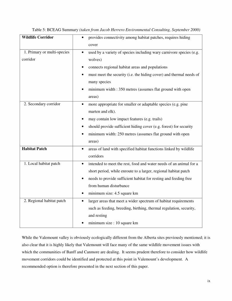
ix
Table 5: BCEAG Summary (taken from Jacob Herrero Environmental Consulting, September 2000)
Wildlife Corridor • provides connectivity among habitat patches, requires hiding
cover
1. Primary or multi-species
corridor
• used by a variety of species including wary carnivore species (e.g.
wolves)
• connects regional habitat areas and populations
• must meet the security (i.e. the hiding cover) and thermal needs of
many species
• minimum width : 350 metres (assumes flat ground with open
areas)
2. Secondary corridor • more appropriate for smaller or adaptable species (e.g. pine
marten and elk).
• may contain low impact features (e.g. trails)
• should provide sufficient hiding cover (e.g. forest) for security
• minimum width: 250 metres (assumes flat ground with open
areas)
Habitat Patch • areas of land with specified habitat functions linked by wildlife
corridors
1. Local habitat patch • intended to meet the rest, food and water needs of an animal for a
short period, while enroute to a larger, regional habitat patch
• needs to provide sufficient habitat for resting and feeding free
from human disturbance
• minimum size: 4.5 square km
2. Regional habitat patch • larger areas that meet a wider spectrum of habitat requirements
such as feeding, breeding, birthing, thermal regulation, security,
and resting
• minimum size : 10 square km
While the Valemount valley is obviously ecologically different from the Alberta sites previously mentioned; it is
also clear that it is highly likely that Valemount will face many of the same wildlife movement issues with
which the communities of Banff and Canmore are dealing. It seems prudent therefore to consider how wildlife
movement corridors could be identified and protected at this point in Valemount’s development. A
recommended option is therefore presented in the next section of this paper.
x
5.2 Identified Wildlife Movement within the Study Area – Potential Wildlife Corridors
Four major transportation corridors currently run through the planning area: Highway 5, the Canadian National
Rail line, and the pipeline and powerlines with their respective right-of-ways. These corridors bisect the area
and effectively divide the west and the east sides of the valley. While each of these divisions poses varying
degrees of disruption for individual species, they cannot always be considered barriers to migration. Ribbons of
disturbance can effectively separate home ranges of certain species too timid, small, or sensitive to cross wide-
open and dangerous stretches. However, there are some species that find such structures and openings to be no
barrier at all, and will in fact utilize them to facilitate movement and migration. Such species include Moose,
Deer, Wolves, Coyotes, Cougars, and Black Bear. However, utilization of these corridors increases opportunity
for human interaction and thus the chance of mortality. Vehicle, train, hunter, trapper, and of course human-
conflict mortalities become more prevalent when species become adapted to utilizing human-made corridors
bringing them into closer contact with human populations.
Steep terrain and constrained valleys can force animals to cross from one side of the valley to the other in search
of lower elevations and flatter ground while they move from one habitat to another. Consequently, the
probability of vehicle/animal collisions would increase as more animals cross the highway. Vehicle collision
data have been collected within the planning area along Highway 5, specifically from just south of Tete Jaune
Cache to Chappell Creek, south of Dominion and Allan Creeks (see Fig. 4, Graph 1, and Table 6). Analysis of
vehicle collisions over a ten-year period demonstrated a pattern of collision mortality that corresponded with
one of two theories: site-specific movement corridors induced by terrain pressures, or where the highway spans
a corridor between critical habitats or resources (Spencer Environmental Management Services Ltd., 2002).
Vehicle collision data indicate that there are three major species that experience high collision mortalities in the
study area: Moose, Deer, and Bear. There were also reports of Lynx, Cougar, Coyote, Porcupine and Wolf
mortalities, although numbers were very low and sporadic throughout the ten years evaluated. Trends for these
other species could be attributed to a number of reasons, including: population densities, less likely, or less
frequent and more cautious crossing behaviour, size of the animal, or less diligent reporting when collisions
occur. Visibility while travelling on the road way, such as brush height and density in the right of way, whether
the road is straight or on a corner, presence of hills creating blind spots, as well as the damage to vehicles, all
play a factor in vehicle collisions and reporting.
Where trends were determined, it was important to evaluate the possible reasons for crossing areas and the
number of species mortalities that were reported. Graph 1 outlines the total reported animal mortalities per
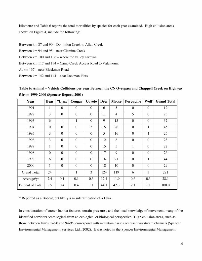
xi
kilometre and Table 6 reports the total mortalities by species for each year examined. High collision areas
shown on Figure 4, include the following:
Between km 87 and 90 – Dominion Creek to Allan Creek
Between km 94 and 95 – near Clemina Creek
Between km 100 and 106 – where the valley narrows
Between km 117 and 134 – Camp Creek Access Road to Valemount
At km 137 – near Blackman Road
Between km 142 and 144 – near Jackman Flats
Table 6: Animal – Vehicle Collisions per year Between the CN Overpass and Chappell Creek on Highway
5 from 1999-2000 (Spencer Report, 2001)
Year Bear *Lynx Cougar Coyote Deer Moose Porcupine Wolf Grand Total
1991 1 0 0 0 6 5 0 0 12
1992 3 0 0 0 11 4 5 0 23
1993 6 1 1 0 9 15 0 0 32
1994 0 0 0 3 15 26 0 1 45
1995 3 0 0 0 5 16 0 1 25
1996 3 0 0 0 12 8 0 0 23
1997 1 0 0 0 15 5 1 0 22
1998 0 0 0 0 17 9 0 0 26
1999 6 0 0 0 16 21 0 1 44
2000 1 0 0 0 18 10 0 0 29
Grand Total 24 1 1 3 124 119 6 3 281
Average/yr 2.4 0.1 0.1 0.3 12.4 11.9 0.6 0.3 28.1
Percent of Total 8.5 0.4 0.4 1.1 44.1 42.3 2.1 1.1 100.0
* Reported as a Bobcat, but likely a misidentification of a Lynx.
In consideration of known habitat features, terrain pressures, and the local knowledge of movement, many of the
identified corridors seem logical from an ecological or biological perspective. High collision areas, such as
those between Km’s 87-90 and 94-95, correspond with mountain passes accessed via stream channels (Spencer
Environmental Management Services Ltd., 2002). It was noted in the Spencer Environmental Management
xii
Services Ltd report (2002) that the collision areas at the southern end of the highway (Km’s 81-99) may
correspond with a regional corridor that moves animals from the upper North Thompson River into the
Dominion Creek drainage. Between Km 100 and 106, the valley narrows and steep terrain constraints most
likely influence animals to move from one side of the valley to the other. Animals travelling these passes may
need to cross the highway in order to avoid sections of steep channels or in order to access forage that is
available along the valley bottom. The northern end of the Camp Creek – Albreda River valley contains sedge
meadows at Albreda Lake that may attract ungulates (Spencer Environmental Management Services Ltd., 2002).
There are also sections along this stretch of highway that have been identified as important Mule Deer wintering
range (Ritchie, 2003).
Similarly, between Km’s 142 and 144, Mt. Terry Fox of the Selwyn Range is adjacent the highway and the
resulting steep terrain may be causing animals to move across the highway to the west side. Along the northwest
slope of Mt. Terry Fox, between Km 144 and the Fraser River, a bench provides easy and direct access to the
Fraser River Valley from the McLennan Valley. The reported high number of bear kills along this section may
represent bears seeking forage at lower elevations, including seasonally available food sources (Spencer
Environmental Management Services Ltd., 2002).
The long stretch between Km 117 and 134 encompasses the town of Valemount and all its associated rural and
industrial areas. Human development within the area is at its highest and so there may be an increased
probability of vehicle collisions (Spencer Environmental Management Services Ltd., 2002). It is interesting to
note that this stretch reported 103 collision mortalities, while the section between Km 100 and 106 only had 28
mortality reports. Along this stretch of highway, there are a number of factors that may affect the movements of
animals. The area around Km 117 represents some habitat that would make good forage and winter habitat for
ungulates (pine flats and power line access). Between Km’s 122 and 126 there are swamp and herbaceous areas
associated with Cranberry Lake and Starratt Marsh that could provide good ungulate forage. The major
development in the area is located between Km’s 125 and 130, including the actual town of Valemount and the
Slocan mill site. Beyond the town site, an increased number of collisions reported between Km’s 130 and 134
may be representative of animals attempting to avoid the town site by using the valley edge when travelling
north/south (Spencer Environmental Management Services Ltd., 2002). There is a variety of reasons that could
explain the higher mortality rate within this stretch of highway. Additional studies should be considered to
attempt to confirm the actual reasons for these mortalities.
Reports prepared for Ministry of Environment , Lands, and Parks identified private lands along the McLennan
River and Blackman Road that are well used by animals. These lands are interspersed with Crown land
xiii
identified and designated as important wildlife habitat. This information would appear to support the suggestion
of movement corridors at Km 137 and Km’s 142-144, as the location of these sites along Highway 5 coincide
with Blackman Road and Jackman Flats respectively. This identified section of highway has movement limiting
terrain on the eastern side and animals may be crossing the highway for both foraging opportunities and ease of
travel along the valley (Spencer Environmental Management Services Ltd., 2002).
6.0 MAINTAINING LANDSCAPE LEVEL BIODIVERSITY
6.1 Importance of Biodiversity
Biodiversity, or biological diversity, refers to the number, variety, and variability of all living organisms. This
includes species diversity, genetic diversity, and ecosystem diversity. It is about quantity and quality across
multiple organisms and within species of organisms. It is about the species themselves and the habitats that they
live in. Managing habitats for biodiversity means maintaining the native diversity of genes, species,
populations, habitats, and ecosystems. (Province of BC). Our economy relies on biodiversity since it provides
renewable economic resources and ecosystem services, medical and scientific benefits, and is priceless in terms
of cultural and aesthetic values. (Warman, L. and L. Lucas, 2002).
Biodiversity concepts that need to be dealt with concurrently at the landscape level for natural resource
management purposes include: natural disturbance ecology, spatial patterns, connectivity, riparian areas and
wetlands, interior habitats and edge effects, and seral stages across landscapes.
The approach used to maintain biodiversity in the managed forests of British Columbia is that of maintaining
habitat patterns and attributes that mimic natural disturbances. This means managing for the resemblance to the
size, shape, location and content of a variety of habitats that would occur in an unmanaged situation. The
principle being that most species would be better able to use these attributes to maintain their existence. Given
the great variety of plant and animal species in British Columbia, it is not possible to manage for all species
individually so resource managers look for habitat attributes that are shared by as many species as possible or
for the most vulnerable species and manage for those.
In the unmanaged forest (i.e. without intervention by humans) wildfires, insect outbreaks, diseases, avalanches,
and windthrow shape the structure and pattern of habitats across the landscape. The field of landscape ecology
integrates natural disturbance regimes and their effects on the distribution of ecological types across a landscape,
xiv
the dispersal and movement of plant and animal species, and the flow of energy and nutrients (Parminter, J. and
P. Daigle, 1997). Human intervention in our forests affects biodiversity by changing the natural disturbances for
economic uses. These changes include: the structure and composition of individual stands or treatment units;
the distribution of treatment units through space and time; and processes such as predation, dispersal, and
migration that sustain plant and animal communities.
Threats to biodiversity in the Valemount planning area are mainly caused by habitat fragmentation and exotic
species introduction. To mitigate our practices on the landscape and at the stand level, managing for
biodiversity involves the following approaches: managing landscapes to reflect historic ecosystem patterns,
retaining networks of older forests and special habitats, and maintaining important habitat attributes in
individual stands.
Resource management for biodiversity is easier to implement and see at the stand level. Legislation is in place
in the FPC to protect the three habitat features that are most important at the stand level. these include: large,
live, old conifer and deciduous trees, as well as snags and dying trees preserved as wildlife trees or wildlife tree
patches, and down wood, or coarse woody debris. (Klenner, W. and L. Kremsater). These three features support
foraging, nesting, cover, perch sites, and growing sites for many plants and micro-organisms.
6.2 Landscape Level Biodiversity
Because we continue to learn new information about the impacts of our actions on the landscape, we must alter
our management practices to incorporate this information the best way possible. We inherit a history of land use
that we need to work with to reach our goals, since past land use practices have not mimicked what naturally
would have occurred in the absence of human intervention. The result is vastly different attributes, size, and
shape of forested patches, the age and species composition of remaining forests, and the connections between
the remaining forests. To sustain biodiversity at the landscape level, the idea is to maintain a network of
representative ecosystems and special habitats that would provide habitat for the majority of species. The
Protected Area Strategy and Provincial Parks are in place to protect special habitats; as are Wildlife
Management Areas, Sensitive Areas, Ungulate Winter Range, Ecological Reserves, and other designations.
Other reserve zones such as Old-growth Management Areas (OGMA’s) will also serve as larger patches of
habitat for old-growth dependant species. Most of these areas are large enough to support some individuals of
many species but may not be large enough to support entire populations of all species. In addition, many
animals have home ranges or practice migration during different seasons of the year. Riparian buffer strips play
a role in allowing many species to live within or travel through undisturbed areas.
xv
In order to mitigate effects to timber supply from various constraints on the landscape, a maximum 4% short-
term timber supply impact is current policy under the FPC. Where possible, different constraints to timber
supply such as visual quality objectives, Ungulate Winter Range, riparian buffers, and old-growth management
areas are layered over top of each other to reduce impacts on timber access
Forest Harvesting generally increases the amount of young forest and decreases the amount of older forest,
because commercial forest rotations are generally shorter than natural disturbance return periods. The more that
managed forests diverge from natural disturbance regimes, the greater the risk of loss of biodiversity.
The most recent information on natural disturbance ecology in the planning area comes from DeLong, 2002.
This work identifies that in the Moist Trench, there are stand replacement disturbance events with a 150-year
cycle for SBS and 300 for the ESSF. In the absence of stand replacement disturbance, stands are affected by
damaging agents such as Mountain Pine Beetle (Dendroctonus ponderosae), Spruce Beetle (Dendroctonus
rufipennis) Western Balsam Bark Beetle (Dryocoetes confuses), Tomentosus root disease (Inonotus
tomentosus), and Armillaria root disease (Armillaria ostoyae). . Fire control over the past 40-50 years has likely
slowed the natural disturbance rate in this area (DeLong, 2002). This has increased the amount of old forest in
remote areas where harvesting has not occurred and has reduced young forests established by fire. Currently,
disturbance rates associated with harvesting are higher than those previously associated with wildfire, especially
at higher elevations. This pattern, combined with the concentration of harvesting older forest has likely resulted
in an overall decrease in older stands and reduced seral stages across the landscape.
DeLong further goes on to note that connectivity between old forest patches should be managed for since there
was always a fair degree of connectivity of old forest in the natural landscape, especially at higher elevations.
6.3 Maintaining Biodiversity in the Valemount ILUDP Area
To maintain biodiversity in the planning area, landscape level attributes and features need to be studied. Old-
growth Management Areas (OGMA’s) and wildlife corridors are the elements this planning process identifies to
meet this need. A Forest Ecosystem Network (FEN) is a contiguous network of representative old-growth and
mature forests delineated in a managed landscape. This includes both OGMA’s and wildlife corridors.
To delineate wildlife corridors, the most recent information on connectivity and wildlife corridor widths was
reviewed. The general acceptance is that corridor width is dependant on the species and that placement along
xvi
natural features that ease movement will garner the most frequent use. In the Valemount planning area, the
mountain ranges that exist create distinctive corridors of travel for different species. Valley bottoms that get less
snowfall are critical for movement by ungulate species except Caribou. Furbearers do not like open areas as a
general rule and will avoid travelling across them. They are very dependant on leave areas with interior forest
conditions. (i.e. un-impacted by light and climate from outside influences). Amphibian species and bird species
are highly reliant on access to water and as such, concentrate in riparian areas.
To delineate OGMA’s a combination of information was used. Taking the recent work done on natural
disturbance regimes by DeLong 2002, the biogeoclimatic sub-zones and variants for all eight of the landscape
units in the planning area were combined. This allowed flexibility to meet target areas of old growth across a
larger landscape than using individual landscape units would allow. This flexibility also enabled placement of
OGMA’s to better meet biological needs and processes. The process for ranking biodiversity emphasis options
is outlined in the FPC Biodiversity Guidebook, which provides a risk assessment based on the value of the
biodiversity features and the impact of different activities on the existing value within a geographic area. The
Landscape Unit Planning Guide sets out the rules and hierarchy for placement of OGMA’s and other
biodiversity tools across the landscape.
Of the eight Landscape Units included in the planning area, Hugh Allan and South Trench are identified as
having intermediate biodiversity emphasis, and the remaining units have low biodiversity. The low biodiversity
emphasis option is used for areas where other social and economic demands are the primary management
objectives. This option will provide habitat for a wide range of native species, but the pattern of natural
biodiversity will be significantly altered, and the risk of some native species being unable to survive in the area
will be relatively high. Intermediate biodiversity will provide more natural levels of biodiversity and a reduced
risk of eliminating native species from the area (Province of British Columbia, 1995). Given the biodiversity
emphasis option, data sets were prepared to determine forest biodiversity targets in each landscape unit.
The approach to developing objectives for old-growth retention is through the establishment of OGMA’s and
associated landscape unit objectives that will ensure retention and/or recruitment of old-growth structure over
time. The rules for landscape unit planning are; 1) old-growth representation must be calculated at the variant
level only, 2) the impact of the biodiversity objectives will result in an overall timber supply impact no greater
than outlined in the FPC Timber Supply Analysis, 1996, 3) old-growth targets must be met using the non-
contributing lands base first, 3i) where targets cannot be met entirely in the non-contributing land base, consider
partially constrained areas, 3ii) in intermediate and high biodiversity emphasis landscape units, establish
OGMA’s to the full target determined by the analysis. Where a shortfall exists, develop a recruitment strategy,

xvii
3iii) in low emphasis landscape units, only 1/3 of the OGMA target will be established unless it can be met
using the non-contributing land base., 3iv) the criteria to capture interior forest conditions and rare old forest
ecosystems must be met to the limit set by the variant-level representation rule (MOF & MELP, 1999).
When reviewing landscape units to determine placement of OGMA’s the entire unit was examined for available
old timber types. Then three major criteria were assessed.
The first criteria used for placement is biological. Does the identified OGMA exhibit old-growth
characteristics? What is the proximity to other biologically significant features such as water bodies, avalanche
tracts, swamps, important spawning, or winter range? What is the existing wildlife use? Are there studies done
to determine habitat capability, suitability and probability? Is the area large enough to provide interior forest
conditions, and are there unacceptable levels of edge effect relative to the size and placement of the proposed
OGMA? What is the position of the area in relation to the landscape? Is there connectivity across the landscape
in terms of riparian areas, and protected areas and parks? Is there connectivity between elevation? There should
be connectivity from mountain top, to valley bottom, back up to mountain top where possible. Is the proposed
area likely to be maintained in an undisturbed condition for a foreseeable period of time?
The second criterion used was that of operational considerations. Where are areas already constrained for other
values such as riparian buffers, UWR, visual quality objectives, community watersheds? Are there areas that
contain constraints for green-up, soil steepness, or high soil disturbance hazards? Are these areas biologically
appropriate for OGMA placement? Where are proposed areas in relation to road locations and what conflicts
might occur in future? From current Forest Development Plans (FDP), where are proposed, approved or
information blocks located? What other tenures are on the area? Are there licensed water users, recreation
tenures, trapping concerns?
And thirdly, the other criteria considered when looking at OGMA placement were: Are there significant
recreational values in the area? Would OGMA placement create or remove conflict for recreational users?
What type of wildlife habitat would be maintained or protected with the placement, and lastly, are there unique
biological features that could be afforded additional protection by placement of OGMAs adjacent to the feature?
xviii
7. CONCLUSIONS & RECOMMENDATIONS
7.1 Presentation Summary
The information reviewed and discussed within this report indicates that the Valemount planning area includes
several important areas from an environmental and habitat perspective. It is also clear from the information
reviewed that it is important to recognize the linkages and connections between these specialized habitat
“patches” and the larger landscape in terms of animal movements.
As noted in this report, the various riparian areas within the planning area serve not only very important
ecological and specialized habitat roles, but also serve as natural corridors for animal movement throughout the
planning area. The importance of the planning area should also be recognized in terms of its location between
two of the larger blocks of parks and protected areas in the Province – the Mt. Robson/Jasper National Park
system to the East of the planning area and the Cariboo Mountains/Wells Gray/Bowron Lakes Park system to
the West.
It is also recognized that the Valemount area is being actively considered for significant resort developments.
Developments such as the Canoe Mountain Resort and the resulting increase in population and related business
operations will have a significant impact on the landscape in the area. As noted in this report the experience of
other rapidly growing communities (and/or communities located in environmentally sensitive areas) have
indicated the importance of identifying, protecting, and managing environmentally sensitive and important lands
and waterways. It is also clear from the experience of Jasper, Banff, and Canmore that it is important to
recognize and include wildlife movement corridors in urban and regional planning.
Finally, although the land base of the planning area is made up of both private and publicly owned lands; and
falls under the jurisdiction of a variety of agencies within three levels of government, from an ecological
perspective it is one large, interrelated landscape that would benefit from being managed as such.
7.2 A Recommended Environmentally Important Lands Network
Within the context of the above issues, MSRM staff has examined key habitat areas, riparian areas, candidate
areas for potential Old-growth Management Areas, and wildlife movement patterns within the study area.
Based on the need to protect both key habitat areas and maintain landscape connectivity, MSRM staff
recommends the creation of an environmental landscape network as shown in Figure 6. The network shown in
xix
Figure 6 is comprised of a variety of individual land designations, which in combination create a significant
potential wildlife movement corridor through the middle of the study area. This proposed environmental land
network also provides a landscape linkage between Mt. Robson and Wells Gray Provincial Parks. MSRM staff
feels that this proposed pattern best protects the environmentally important and sensitive land and water areas in
the plan area. However, identifying and designating such lands is only one half of the equation; maintaining the
ecological attributes of those lands over the long term is also essential. Therefore MSRM staff recommends that
the lands identified within Figure 6 be kept in as natural a state as possible. Therefore resource development
activity and the creation of built structures within these areas should be minimized and only allowed if they will
not have any negative ecological impact. Finally, although small portions of appropriately placed recreational
trails may be appropriate within some of these areas, every attempt should be made to limit further landscape
alterations of this environmental land network in order to maximize its potential as a permanent primary wildlife
movement corridor.
All of the areas identified in Figure 6 for environmental designation are Crown lands. The areas in Figure 6 that
are coloured yellow are privately owned lands. As noted throughout this report, some private lands in the study
area, especially those containing riparian areas, include environmentally important lands. For these private
owned lands it will be important to work with landowners to try and maintain the ecological integrity of these
environmentally sensitive and important lands wherever possible.
xx
7.3 Recommendations from Partner Agencies:
While it is important to examine and strategically plan for the VILUDP area as a single landscape entity, in
reality the three levels of government have various legal and regulatory authorities and responsibilities to
manage the land and resource use in the planning area. Therefore, in order to effectively achieve and maintain
the environmental land pattern proposed in Figure 6, the following recommendations for action are made to each
of the four VILVDP partner agencies:
Village of Valemount
(Note : the following recommendations are for demonstration and discussion purposes only – actual final
recommendations will be developed in partnership with Village staff.)
1. That the Village review and consider formally endorsing the concept of attempting to maintain the
integrity and ecological functioning of the environmental land pattern shown in Figure 6.
2. That the Village use this report to identify environmentally sensitive and important lands within the
Village boundary or immediately adjacent to the Village boundary, and ensure that the Village’s
planning and development processes recognize the environmental importance of these lands and
waterbodies.
3. That for new developments adjacent to riparian areas within the Village boundary, that the Village
consider maintaining development setbacks similar to the Regional District setback requirements (see
next section).
4. That the Village consider implementing development control by-laws on new developments on, or
adjacent to, lands and waterbodies identified as environmentally important or significant in this report.
Regional District of Fraser Fort George
Staff from the Regional District of Fraser Fort George (RDFFG) worked with MSRM staff in preparing this
report. The following recommendations will be considered by RDFFG staff and the RDFFG Board as part of
the Official Community Plan update for the planning area.
xxi
5. For privately owned lands within the study area that include, or are adjacent to, riparian areas the
RDFFG will consider implementing development permit requirements. A permit requirement for any
proposed development within the identified development permit area will involve an environmental
assessment of the proposed development. The following Development Permit areas along watercourses
are as follows (these have not been approved by RD Board or taken to the Public for input.)
o Fraser River - 100m (Tete Jaune Cache area only)
o Mclennan River - 60m
o Tete Creek - 60m
o Swift Creek - 50m
o Canoe River - 50m
o Camp Creek - 50m
Note: other identified environmentally sensitive areas on Crown land ie. WHMAs, will be identified within the
OCP as Environmentally Sensitive Areas.
Ministry of Sustainable Resource Management
That MSRM uses its authority and powers through Landscape Unit Objectives and Sustainable Resource
Management Planning to implement the landscape pattern and function shown in Figure 6 (on Crown lands
within the plan area) through the following actions.
6. Formal recognition and protection of the environmental attributes of the identified Wildlife Habitat
Management Areas, Wildlife Habitat Emphasis Areas; Natural Environment Areas and Recreation
Conservation Management Areas within a MSRM SRMP for the area.
7. Identification and designation of the Riparian Buffer zones as shown in the following table in a MSRM
SRMP for the area:
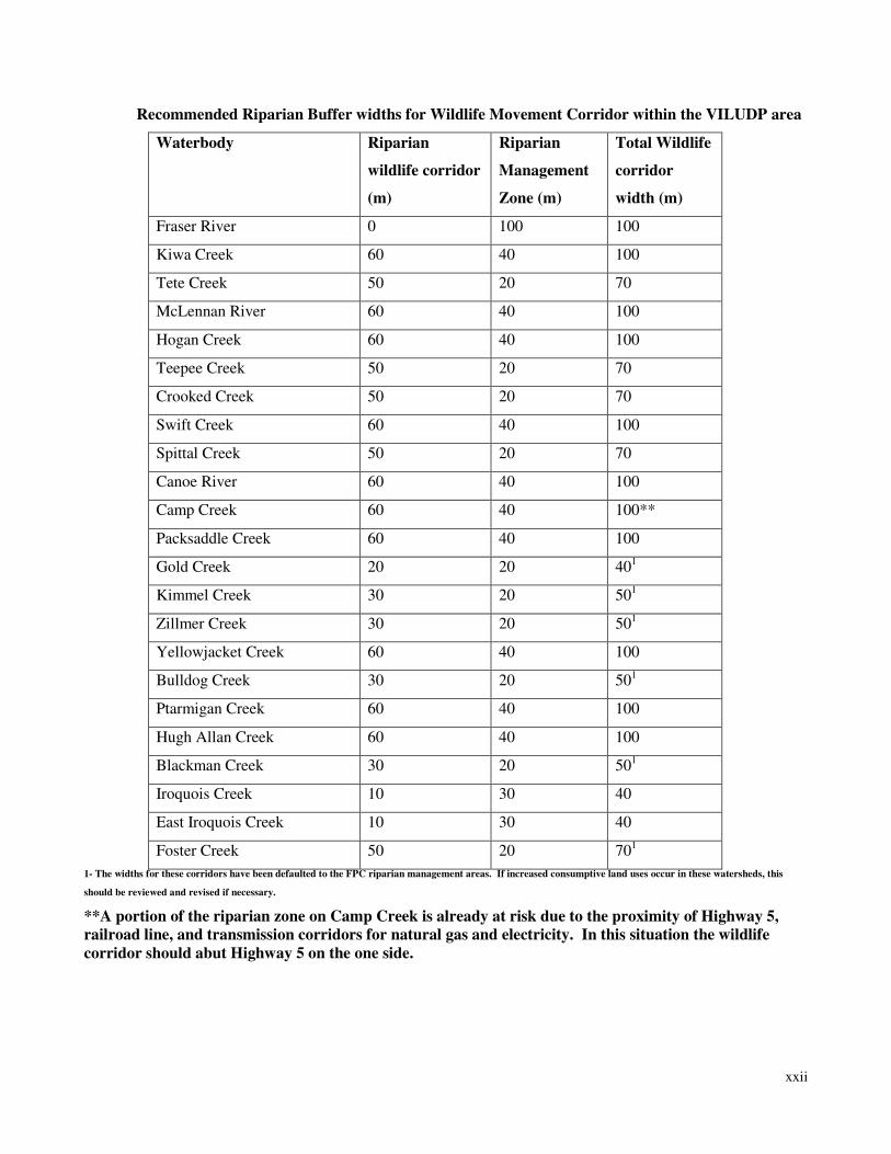
xxii
Recommended Riparian Buffer widths for Wildlife Movement Corridor within the VILUDP area
Waterbody Riparian
wildlife corridor
(m)
Riparian
Management
Zone (m)
Total Wildlife
corridor
width (m)
Fraser River 0 100 100
Kiwa Creek 60 40 100
Tete Creek 50 20 70
McLennan River 60 40 100
Hogan Creek 60 40 100
Teepee Creek 50 20 70
Crooked Creek 50 20 70
Swift Creek 60 40 100
Spittal Creek 50 20 70
Canoe River 60 40 100
Camp Creek 60 40 100**
Packsaddle Creek 60 40 100
Gold Creek 20 20 401
Kimmel Creek 30 20 501
Zillmer Creek 30 20 501
Yellowjacket Creek 60 40 100
Bulldog Creek 30 20 501
Ptarmigan Creek 60 40 100
Hugh Allan Creek 60 40 100
Blackman Creek 30 20 501
Iroquois Creek 10 30 40
East Iroquois Creek 10 30 40
Foster Creek 50 20 701
1- The widths for these corridors have been defaulted to the FPC riparian management areas. If increased consumptive land uses occur in these watersheds, this
should be reviewed and revised if necessary.
**A portion of the riparian zone on Camp Creek is already at risk due to the proximity of Highway 5,
railroad line, and transmission corridors for natural gas and electricity. In this situation the wildlife
corridor should abut Highway 5 on the one side.
xxiii
8. Through SRMP and Landscape Unit Objectives management of land use and resource development
activities within, and adjacent to, environmentally important lands, habitat areas, and riparian buffers in
order to ensure protection of their ecological functions.
9. Use of the proposed OGMA placements shown in Figure 5 for stakeholder and public consultations.
Wherever possible use of OGMA placement to gain secondary benefits such as connectivity or visual
landscape management benefits. After stakeholder and public consultations, formalization of final
OGMA placements through a SRMP and Landscape Unit Order.
Land & Water BC
(Note : the following recommendations are for demonstration and discussion purposes only – actual final
recommendations will be developed in partnership with LWBC staff.)
10. LWBC should consider incorporating the recommended environmental land use designations shown in
Figure 5 into an updated Crown Land Plan for the area.
11. LWBC should consider the recommendations of this report in future decisions regarding Crown land
sales and tenure granting in the area.
xxiv
References
Aquatic Resources Limited. (1992). Survey of Tributaries to Kinbasket Reservoir. Report prepared for: MICA
Wildlife Compensation Program, BC Hydro, and Ministry of Environment, Lands, and Parks, Vancouver B.C.
100 pp.
Aquatic Resources Limited. (1994). Cranberry Marsh Water Transfer Project Assessment. Report prepared for:
MICA Wildlife Compensation Program, Ministry of Environment, Lands, and Parks, & BC Hydro, Vancouver,
B.C. 50 pp.
Austin M.A., S. Herrero, and P. Paquet. (1999). Wolverine Winter Travel Routes and Response to
Transportation Corridors in Kicking Horse Pass Between Yoho and Banff National Parks in Proceedings of a
Conference on the Biology and Management of Species and Habitats at Risk; Kamloops, B.C., 15-19 Feb.,
1999. B.C. Ministry of Environment, Lands, and Parks, Victoria B.C., and University College of the Cariboo.
520 pp.
BC Fisheries and Fisheries and Oceans Canada. (2003). Fish Wizard. Province of British Columbia. Available:
http://www.fishwizard.com/ Accessed 06/06/2003
Bray, Karen. 2003. Camp Creek Kokanee Spawner Survey. (2000). Columbia Basin Fish & Wildlife
Compensation Program. Nelson, B.C. Available: http://www.cbfishwildlife.org/reports/index.php Accessed
21/02/2003
Cannings, S.G., L.R. Ramsay, D.F. Fraser, and M.A. Fraker. (1999). Rare amphibians, reptiles, and mammals of
British Columbia. Wildlife Branch and Resource. Inv. Branch, B.C. Ministry of Environ., Lands, and Parks.
Victoria, BC. 198 pp.
Columbia Mountains Institute of Applied Ecology. (2003). Mountain Caribou in 21st Century Ecosystems.
Available: www.cmiae.org/ Accessed 06/06/2003
Daigle, Patrick and Rick Dawson, (1996). Management Concepts for Landscape Ecology, Ministry of Forests
Research Program, Victoria, B.C. Extension Note 07, 7 pp.
xxv
Dawson, Rick. (1997). Landscape Ecology and Connectivity, Ministry of Forests Research Program, Victoria,
B.C. Extension Note 15, 9 pp.
Delong S.C. (2002). Natural disturbance units of the Prince George Forest Region: Guidance for sustainable
forest management. B.C. Ministry of Forests. Prince George, B.C. Internal Report 37 pp.
Fraser Basin Council. (2003). Our Publications. Fraser Basin Council. Available:
http://www.fraserbasin.bc.ca/publications.html Accessed 06/06/2003
Fraser, D.F., W.L. Harper, S.G. Cannings, and J.M. Cooper. (1999) Rare birds of British Columbia. Ministry of
Environment, Lands, and Parks. Victoria, BC. 244 pp.
Jacob Herrero Environmental Consulting. (2000). Assessing the Design and Functionality of Wildlife
Movement Corridors in the Southern Canmore Region. Prepared for BowCORD, Bow Valley Naturalists,
Canadians for Corridors, Canadian Parks and Wilderness Society, and UTSB Research. 28 pp Available:
http://www.stratalink.com/corridors/report1.htm Accessed 01/28/2003
Klenner, W and L.Kremsater. Approaches to Maintaining Biological Diversity in British Columbia’s Forests;
An Introduction for Resource Managers. Province of British Columbia, Environment Canada, Fraser River
Action Plan, The Centre for Applied Conservation Biology, University of British Columbia, 10 pp.
Kyle, Christopher J. and Curtis Strobeck. (1999). Microsatellite Analysis of North American Wolverines in
Proceedings of a Conference on the Biology and Management of Species and Habitats at Risk; Kamloops, BC,
15-19 Feb., 1999. B.C. Ministry of Environment, Lands, and Parks, Victoria B.C., and University College of the
Cariboo. 520 pp.
Land and Water British Columbia Inc. (2003). Information Sheet: Water Rights in British Columbia. Province
of British Columbia. Available: i:\\watershare\water\water_licensing\app_package\rights.doc Accessed
23/07/2003
Land and Water British Columbia Inc. (2003). Information Sheet: Water Licence Holders Rights and
Obligations. Province of British Columbia. Available:
i:\\watershare\water\water_licensing\app_package\rights.doc Accessed 23/07/2003

xxvi
Land and Water British Columbia Inc. (2003). Tenure / Purchase Policy. Land and Water British Columbia Inc.
Available: http://lwbc.bc.ca/applying_for_land/policy.htm Accessed 23/07/2003
Leung, Maria, & Keith Simpson. (1993). Robson Valley Bird Survey: Summer / Fall 1992. B.C. Hydro and
Ministry of Environment, Lands, and Parks. Prince George, B.C. 54 pp.
Ministr of Environment, Lands, and Parks. (1995). Biodiversity Guidebook. Forest Practices Code of British
Columbia. Province of British Columbia. 99 pp.
Ministry of Forests and Ministry of Environment, Lands, and Parks. (1999). Landscape Unit Planning Guide.
Forest Practices Code of British Columbia. Province of British Columbia. 180 pp.
Ministry of Forests and Ministry of Environment, Lands, and Parks. (1999). Managing Identified Wildlife:
Procedures and Measures Forest Practices Code of British Columbia. Province of British Columbia. 99 pp.
Ministry of Forests and Ministry of Environment, Lands, and Parks. (1997). Mountain Goat in Species and
Plant Community Accounts for Identified Wildlife, Forest Practices Code of British Columbia. Province of
British Columbia. 171pp.
Ministry of Forests and Ministry of Environment , Lands, and Parks. (1995). Riparian Management
Guidebook. Forest Practices Code of British Columbia. Province of British Columbia. 68 pp.
Ministry of Forests. (2003). Robson Valley Forest District. Province of British Columbia. Available:
http://www.for.gov.bc.ca/pgeorge/district/robson/districtinfo.htm Accessed 10/06/2003
Ministries of Water, Land and Air Protection and Sustainable Resource Management. (2003). BC Species and
Ecosystems Explorer. Victoria, British Columbia, Canada. Available: http://srmapps.gov.bc.ca/apps/eswp/
Accessed 06/09/2003
Ministry of Water, Land and Air Protection.. (2003). B.C. Parks Recreation: Mount Robson Provincial Park.
Province of British Columbia. Available: http://wlapwww.gov.bc.ca/bcparks/explore/parkspgs/mtrobson.htm
Accessed 11/07/2003
xxvii
Ministry of Water, Land and Air Protection. (2003). B.C. Parks Recreation: Mount Terry Fox. Province of
British Columbia. Available: http://wlapwww.gov.bc.ca/bcparks/explore/parkpgs/mt_terry.htm Accessed
11/07/2003
Ministry of Water, Land and Air Protection. (2003). B.C. Parks Recreation: Wells Gray Provincial Park.
Province of British Columbia. Available: http://wlapwww.gov.bc.ca/bcparks/explore/parkspgs/wells.htm
Accessed 11/07/2003
Mol, April L. (1992). Cranberry Marsh (R.W. Starratt Wildlife Area) Wildlife Viewing Development Plan.
Ministry of Water, Land and Parks, Prince George, BC. 46 pp.
Norecol Environmental Consultants Ltd. [Norecol-a]. (1992). Cranberry Marsh Habitat Assessment. Report
Prepared for Habitat Conservation Fund: MELP, Prince George, B.C. 19 pp.
Norecol Environmental Consultants Ltd. [Norecol-b]. (1992) Riparian Habitat Mapping Project in Robson
Valley. Mica Wildlife Technical Committee, Ministry of Environment , Lands, and Parks, Prince George, B.C.
77 pp..
Parminter, J. and P. Daigle. (1997). Landscape Ecology and Natural Disturbances: Relationships to
Biodiversity. Ministry of Forests Research Program. Victoria, B.C. Extension Note 10. 9 pp.
Pillipow, Ray. Personal Communication, 18/06/2003. Ministry of Water, Land and Air Protection, Prince
George, B.C.
Proulx, Gilbert. (1998). Connectivity Corridors in the Northwood’s Harvest Cells of the Fort St. James Forest
District. Northwood Wood Products Group. Prince George, B.C. 37 pp.
Province of British Columbia. Biodiversity Facts. Ministry of Forests Research Branch Brochure. Victoria,
B.C. 4 pp.
Province of British Columbia. (1998). British Columbia Wildlife at Risk: Northern Goshawks. Conservation
Data Centre and Ministry of Environment, Lands, and Parks Wildlife Branch. Brochure. Victoria, B.C. 3 pp.
xxviii
Province of British Columbia. (2000). Mountain Goat in British Columbia: Ecology, Conservation, and
Management. Habitat Conservation Trust Fund & Ministry of Environment, Lands, and Parks, Victoria, B.C.
Brochure 6 pp.
Province of British Columbia Interagency Management Committee (Robson Valley). (1999). Robson Valley
Land and Resource Management Plan. Ministry of Environment, Lands, and Parks. Prince George. LRMP 242
pp.
Ritchie, Chris. (2003). Draft Report: Omineca Region Mountain Caribou Ungulate Winter Range Proposal.
Ministry of Water Land and Air Protection. Prince George, B.C. 14 pp.
Ritchie, Chris. Personal Communication, 05/05/2003. Ministry of Water, Land and Air Protection, Prince
George, B.C.
Ritchie, C. and K. Safford. (2003). Mule Deer Ungulate Winter Range Areas for Designation in the Robson
Valley, Ministry of Water, Land and Air Protection, Prince George, B.C. 28 pp.
Rosenberg, Daniel, K., Barry R. Noon, and E. Charles Meslow. (1997). Biological Corridors: Form, Function
and Efficacy. BioScience Vol.47:10, 677-686pp.
Safford.R.K., (2002). Candidate Mule Deer Ungulate Winter Range Areas For Designation In The Robson
Valley: Final Report. Environmental Stewardship Division: Ministry of Water Land and Air Protection. Prince
George, BC. Final Report 25 pp..
SEE ME Consultations. [SEE MEa]. (1993). Inventory and Management Plan: Robson Valley Wildlife Habitat
Management Area 6012. Crescent Spur. Report prepared for the Ministry of Environment, Lands, and Parks 34
pp.
SEE ME Consultations [SEE MEb]. (1993). Inventory and Management Plan: Robson Valley Wildlife Habitat
Management Area 7390. Crescent Spur. Report prepared for Ministry of Environment, Lands, and Parks 26 pp.
SEE ME Consultations [SEE MEc]. (1993). Inventory and Management Plan: Robson Valley Wildlife Habitat
Management Area 3155. Crescent Spur. Report prepared for Ministry of Environment, Lands, and Parks 47 pp.
xxix
SEE ME Consultations [SEE MEd]. (1993). Inventory and Management Plan: Robson Valley Wildlife Habitat
Management Area 883. Crescent Spur. Report prepared for Ministry of Environment, Lands, and Parks 57 pp.
SEE ME Consultations. (1994). Wildlife Enhancement Plan Development Project Land Acquisition List for
Robson Valley. Crescent Spur. Document prepared for Ministry of Environment, Lands, and Parks: Fish and
Wildlife Branch & Mica Compensation Program 42 pp.
Simpson, K. and E. Terry. (2000). Impacts of Backcountry Recreation Activities on Mountain Caribou-
Management Concerns, Interim Management Guidelines, and Research Needs, British Columbia Ministry of
Environment, Lands, and Parks, Wildlife Branch, Victoria, British Columbia, Wildlife Working Report WR-99.
11pp.
Spencer Environmental Management Services Ltd. (2002). Canoe Mountain Gondola Resort Wildlife Corridor
Study: Final Report. Sunrise International Inc. Spruce Grove, Alberta. 66 pp.
Steeger, Christoph, Burke Korol, and Marlene Machmer. (1997). Literature Review and Methodology for the
Assessment of Forest Interior Habitat in the Columbia Basin. Columbia Basin Fish and Wildlife Compensation
Program, Nelson, B.C. 48 pp.
Stevens, Victoria, F. Backhouse, & A. Eriksson. (1995). Riparian Management in British Columbia: An
Important Step Towards Maintaining Biodiversity. Province of British Columbia. Victoria, BC. Working Paper
30 pp.
Thompson Forest Management and Forestscape Consulting Ltd. (2002). SMZ Pilot Project: Canoe Mountain
Ecosystem Design, Robson Valley Enhanced Forest Management Pilot Project, McBride, B.C.
Vennesland, Ross, Andrew Harcombe, Syd Cannings, and Laura Darling. (2002). Species Ranking in British
Columbia. Ministry of Sustainable Resource Management. Victoria, B.C. Brochure 4 pp.
Warman. L. and L. Luca. (2002). Biodiversity in British Columbia, The Nature Trust of British Columbia.
Brochure 8 pp.
Watts, Glen. Personal Communication, 14/08/2003. Ministry of Water, Land and Air Protection, Prince
George, B.C.
xxx
Webster, Michael, Marra, Peter, Haig, Susan, Bensch, Staffan, and Holmes, Richard. (2002). Links between
worlds: unravelling migratory connectivity. Trends in Ecology and Evolution Vol. 17 No. 2 February 2002
Weir, Richard D. (1995). Status and Conservation of Fishers in the Robson Valley. Project Working Plan for
Columbia Basin Fish and Wildlife Compensation Program, Nelson, B.C. 20 pp.
Westworth Associates Environmental Ltd.-a (1998). Wildlife Inventories: Canoe River/Camp Creek
Watersheds. Ministry of Environment , Lands, and Parks, Prince George, B.C. 170pp.
Westworth Associates Environmental Ltd.-b (1998). Wildlife Inventories: Hugh Allen Creek/Blackman Creek
Watershed. Ministry of Environment , Lands, and Parks, Prince George, B.C. 183 pp.
Westworth Associates Environmental Ltd.-c (1999). Canoe River/Camp Creek Watershed Reconnaissance Fish
and Fish Habitat Inventory, 1997. Slocan Forest Products Ltd., Valemount, BC. 645 pp.
Wilcove, David S. (1987) From Fragmentation to Extinction. Natural Areas Journal Vol.7:1, 23-29
Wilson, Doug. Personal Communication, 08/07/2003. Ministry of Water, Land and Air Protection
xxxi
APPENDIX I
ROBSON VALLEY CROWN LAND PLAN
i
APPENDIX II
DOMESTIC WATER USERS DETAILED INFORMATION
ii
TP
OD
_B
C_
TP
OD
_B
C_ID
F
CO
DE
T
PO
D_T
AG
W
RM
AP
_R
EF
S
TR
M_N
AM
E
2961
0
8
EA
830
100
00
PD
76
80
1
83D
/NW
(14-a
) M
M
(PD
76
801)
Packsaddle
Cre
ek
2961
1
9
EA
830
100
00
PD
74
73
9
83D
/NW
(14-b
) JJ
(PD
74
739)
Packsaddle
Cre
ek
2961
2
10
EA
830
100
00
PD
73
03
5
83D
/NW
(14-b
) G
G
(PD
73
035)
Packsaddle
Cre
ek
2961
3
11
EA
830
100
00
PD
75
12
8
83D
/NW
(14-b
) K
K
(PD
75
128)
Packsaddle
Cre
ek
2961
4
12
EA
830
100
00
PD
36
55
7
83D
/NW
(14-b
) L (P
D36
55
7)
McK
ird
y C
reek
2961
5
13
EA
830
100
00
PD
36
55
5
83D
/NW
(14-b
) J (P
D3655
5)
Sno
wco
urs
e C
reek
2961
7
15
EA
830
100
00
PD
66
99
5
83D
/NW
(14-b
) Z
(P
D6699
5)
McK
ird
y C
reek
2961
9
17
EA
830
100
00
PD
73
36
7
83D
/NW
(14-b
) H
H
(PD
73
367)
McK
ird
y C
reek
2962
0
18
EA
830
100
00
PD
36
46
1
83.D
.084.2
P (P
D364
61)
McK
ird
y C
reek
2962
1
19
EA
830
100
00
PD
76
79
8
83.D
.084.4
K (P
D767
98)
Sw
ift C
reek
2962
2
20
EA
830
100
00
PD
61
50
7
83D
/NW
(14-b
) V
(P
D61
50
7)
McK
ird
y C
reek
2962
3
21
EA
830
100
00
PD
61
50
6
83D
/NW
(14-b
) T
(P
D6150
6)
McK
ird
y C
reek
2962
4
22
EA
830
100
00
PD
36
55
9
83D
/NW
(14-b
) R
(P
D365
59)
McK
ird
y C
reek
2962
5
23
EA
830
100
00
PD
36
45
8
83.D
.084.2
Q (P
D36
458)
McK
ird
y C
reek
2962
6
24
EA
830
100
00
PD
36
45
9
83.D
.084.2
R (P
D3
645
9)
McK
ird
y C
reek
2962
7
25
EA
830
100
00
PD
36
45
7
83.D
.084.2
S (P
D364
57)
Tapli
Cre
ek
2962
8
26
EA
830
100
00
PD
36
57
4
83E
/SW
(3-b
) D
(P
D3657
4)
Cochra
ne
Cre
ek
2962
9
27
EA
830
100
00
PD
36
57
3
83E
/SW
(3-b
) C
(P
D3657
3)
Carr
Spri
ng
2963
0
28
EA
830
100
00
PD
36
45
4
83.D
.084.2
H (P
D3
645
4)
Selk
irk C
reek
2963
1
29
EA
830
100
00
PD
36
45
3
83.D
.084.2
J (P
D364
53)
Selk
irk C
reek
2963
2
30
EA
830
100
00
PD
36
45
2
83.D
.084.2
K (P
D364
52)
Selk
irk C
reek
2963
3
31
EA
830
100
00
PD
36
45
1
83.D
.084.2
L
(PD
3645
1)
Selk
irk C
reek
2963
4
32
EA
830
100
00
PD
36
45
0
83.D
.084.2
M
(PD
364
50)
Selk
irk C
reek
2963
5
33
EA
830
100
00
PD
36
45
6
83.D
.084.2
N (P
D3
645
6)
Selk
irk C
reek
2963
6
34
EA
830
100
00
PD
69
07
9
83.D
.084.2
Z (P
D69
079)
Selk
irk C
reek
2963
7
35
EA
830
100
00
PD
36
57
5
83E
/SW
(3-b
) B
(P
D365
75)
Fra
ser
Riv
er
2963
8
36
EA
830
100
00
PD
36
43
2
83.D
.074.4
D (P
D3
643
2)
Cano
e R
iver
2963
9
37
EA
830
100
00
PD
36
47
7
83.D
.084.4
A (P
D364
77)
Dyson B
rook
2964
0
38
EA
830
100
00
PD
36
43
0
83.D
.074.4
B (P
D364
30)
Cam
p C
reek
2964
1
39
EA
830
100
00
PD
36
43
1
83.D
.074.4
C (P
D3
643
1)
Cam
p C
reek
2964
2
40
EA
830
100
00
PD
36
42
9
83.D
.074.4
A (P
D364
29)
Little C
ranb
err
y L
ake
2964
3
41
EA
830
100
00
PD
76
79
9
83.D
.084.4
L
(PD
7679
9)
Sw
ift C
reek
2964
4
42
EA
830
100
00
PD
36
44
9
83.D
.084.2
G (P
D36
449)
Cra
nberr
y L
ake
iii
2964
5
43
EA
830
100
00
PD
36
44
8
83.D
.084.2
F (P
D36
448)
Cra
nberr
y L
ake
2964
6
44
EA
830
100
00
PD
36
46
3
83.D
.084.2
U (P
D3
646
3)
Sw
ift C
reek
2964
7
45
EA
830
100
00
PD
64
97
8
83.D
.084.2
X (P
D649
78)
Robson P
ond
2964
8
46
EA
830
100
00
PD
66
74
6
83E
/SW
(3-c
) H
(P
D667
46)
Nystr
om
Spring
2964
9
47
EA
830
100
00
PD
63
65
6
83.D
.084.4
G (P
D63
656)
Cro
oked C
reek
2965
0
48
EA
830
100
00
PD
62
38
4
83E
/SW
(3-c
) G
(P
D6238
4)
O'D
onag
hue
Spri
ng
2965
1
49
EA
830
100
00
PD
36
44
7
83.D
.084.2
E (P
D364
47)
Cra
nberr
y L
ake
2965
2
50
EA
830
100
00
PD
36
44
4
83.D
.084.2
C (P
D3
644
4)
Sw
ift C
reek
2965
3
51
EA
830
100
00
PD
36
43
9
83.D
.084.2
B (P
D364
39)
Sw
ift C
reek
2965
4
52
EA
830
100
00
PD
36
43
8
83.D
.084.2
A (P
D364
38)
Sw
ift C
reek
2965
5
53
EA
830
100
00
PD
36
57
1
83E
/SW
(3-c
) A
(P
D36
571)
Norla
nder
Spri
ng
2965
6
54
EA
830
100
00
PD
65
48
2
83.D
.084.2
Y (P
D654
82)
Cra
nberr
y C
reek
2965
7
55
EA
830
100
00
PD
36
44
5
83.D
.084.2
D (P
D3
644
5)
Cra
nberr
y C
reek
2965
8
56
EA
830
100
00
PD
70
67
7
83.D
.084.2
AA
(P
D7
067
7)
Sw
ift C
reek
2965
9
57
EA
830
100
00
PD
36
47
4
83.D
.084.4
C (P
D3
647
4)
Cro
oked C
reek
2966
0
58
EA
830
100
00
PD
36
47
6
83.D
.084.4
E (P
D364
76)
Cro
oked C
reek
2966
1
59
EA
830
100
00
PD
36
46
2
83.D
.084.2
T (P
D36
462)
Sw
ift C
reek
2966
2
60
EA
830
100
00
PD
73
72
9
83.D
.084.4
J (P
D737
29)
Cro
oked C
reek
2966
3
61
EA
830
100
00
PD
36
47
3
83.D
.084.4
F (P
D36
473)
Cro
oked C
reek
2966
4
62
EA
830
100
00
PD
77
68
4
83E
/SW
(3-c
) (
PD
7768
4)
Carm
en S
pring
2966
5
63
EA
830
100
00
PD
36
47
2
83.D
.084.4
D (P
D3
647
2)
Cro
oked C
reek
2966
6
64
EA
830
100
00
PD
36
47
1
83.D
.084.3
H (P
D3
647
1)
Cro
oked C
reek
2966
7
65
EA
830
100
00
PD
36
47
0
83.D
.084.3
G (P
D36
470)
Fitzgera
ld B
rook
2966
8
66
EA
830
100
00
PD
70
67
6
83.D
.084.1
H (P
D7
067
6)
McLenn
an R
iver
2966
9
67
EA
830
100
00
PD
36
46
9
83.D
.084.3
F (P
D36
469)
Fitzgera
ld B
rook
2967
0
68
EA
830
100
00
PD
36
43
4
83.D
.084.1
A (P
D364
34)
MacM
illan C
reek
2967
1
69
EA
830
100
00
PD
36
46
8
83.D
.084.3
E (P
D364
68)
Beb
el B
rook
2967
2
70
EA
830
100
00
PD
36
46
7
83.D
.084.3
D (P
D3
646
7)
Teepee C
reek
2967
3
71
EA
830
100
00
PD
36
51
2
83.D
.094.3
A (P
D365
12)
Cin
nam
on S
pri
ng
2967
4
72
EA
830
100
00
PD
70
32
7
83.D
.084.1
G (P
D70
327)
Jack A
dam
s S
wam
p
2967
5
73
EA
830
100
00
PD
36
43
5
83.D
.084.1
B (P
D364
35)
Sta
rratt S
pri
ng
2967
6
74
EA
830
100
00
PD
36
44
1
83.D
.084.1
E (P
D364
41)
West C
ranberr
y C
reek
2967
7
75
EA
830
100
00
PD
75
91
2
83.D
.084.3
L
(PD
7591
2)
Teepee C
reek
2967
8
76
EA
830
100
00
PD
75
06
9
83E
/SW
(3-c
) J (P
D75069)
ZZ
Cre
ek (
75068 )
2967
9
77
EA
830
100
00
PD
36
46
6
83.D
.084.3
B (P
D364
66)
Teepee C
reek
2968
0
78
EA
830
100
00
PD
71
43
1
83.D
.084.1
K (P
D714
31)
Zorn
Spri
ng
2968
1
79
EA
830
100
00
PD
36
50
6
83.D
.094.1
D (P
D3
650
6)
Hoga
n C
reek
2968
2
80
EA
830
100
00
PD
36
43
6
83.D
.084.1
D (P
D3
643
6)
Leag
h C
reek
iv
2968
3
81
EA
830
100
00
PD
36
43
7
83.D
.084.1
C (P
D3
643
7)
Leag
h C
reek
2968
4
82
EA
830
100
00
PD
75
63
9
83.D
.084.3
K (P
D756
39)
Hoga
n C
reek
2968
5
83
EA
830
100
00
PD
36
46
5
83.D
.084.3
A (P
D364
65)
Hoga
n C
reek
2968
6
84
EA
830
100
00
PD
73
67
4
83.D
.084.3
J (P
D736
74)
Hoga
n C
reek
2968
7
85
EA
830
100
00
PD
36
46
4
83.D
.084.3
C (P
D3
646
4)
Hoga
n C
reek
2968
8
86
EA
830
100
00
PD
70
67
9
83.D
.084.1
J (P
D706
79)
Caru
so S
prin
g
2968
9
87
EA
830
100
00
PD
36
50
8
83.D
.094.1
B (P
D365
08)
Poo
li B
rook
2969
0
88
EA
830
100
00
PD
36
50
9
83.D
.094.1
C (P
D3
650
9)
Hord
ea
e S
wam
p
2969
1
89
EA
830
100
00
PD
36
50
7
83.D
.094.1
A (P
D365
07)
Little J
ackm
an C
reek
2969
2
90
EA
830
100
00
PD
61
65
3
83.D
.084.1
F (P
D61
653)
Hysta
d C
reek
2969
3
91
EA
830
100
00
PD
76
79
5
83.D
.084.1
L
(PD
7679
5)
Hysta
d C
reek
2969
4
92
EA
830
100
00
PD
36
51
0
83.D
.094.1
E (P
D365
10)
Hord
ea
e C
reek
2969
5
93
EA
830
100
00
PD
36
48
1
83.D
.093.4
Q (P
D36
481)
Bra
gg
Sw
am
p
2969
6
94
EA
830
100
00
PD
36
50
2
83.D
.093.4
AA
(P
D3
650
2)
Fra
ser
Riv
er
2969
7
95
EA
830
100
00
PD
36
48
9
83.D
.093.4
Y (P
D364
89)
L'E
str
ang
e C
reek
2969
8
96
EA
830
100
00
PD
36
48
0
83.D
.093.4
R (P
D3
648
0)
Maho
ne
y S
pri
ng
2969
9
97
EA
830
100
00
PD
62
80
4
83.D
.093.4
BB
(P
D6
280
4)
Lid
o C
reek
2970
0
98
EA
830
100
00
PD
36
48
7
83.D
.093.4
Z (P
D36
487)
L'E
str
ang
e C
reek
2970
1
99
EA
830
100
00
PD
36
48
3
83.D
.093.4
X (P
D364
83)
L'E
str
ang
e C
reek
2970
2
100
EA
830
100
00
PD
36
48
8
83.D
.093.4
U (P
D3
648
8)
L'E
str
ang
e C
reek
2970
3
101
EA
830
100
00
PD
36
48
5
83.D
.093.4
N (P
D3
648
5)
L'E
str
ang
e C
reek
2970
4
102
EA
830
100
00
PD
36
48
4
83.D
.093.4
W (P
D36484)
L'E
str
ang
e C
reek
2970
5
103
EA
830
100
00
PD
36
50
1
83.D
.093.4
T (P
D36
501)
Bla
ck B
ear
Spri
ng
2970
6
104
EA
830
100
00
PD
36
48
6
83.D
.093.4
V (P
D364
86)
L'E
str
ang
e C
reek
2970
7
105
EA
830
100
00
PD
36
50
3
83.D
.093.4
A (P
D365
03)
L'H
eure
ux C
reek
2970
8
106
EA
830
100
00
PD
36
50
4
83.D
.093.4
K (P
D365
04)
L'H
eure
ux C
reek
2970
9
107
EA
830
100
00
PD
36
49
1
83.D
.093.4
C (P
D3
649
1)
Goslin
Cre
ek
2971
0
108
EA
830
100
00
PD
36
49
2
83.D
.093.4
B (P
D364
92)
Goslin
Cre
ek
2971
1
109
EA
830
100
00
PD
36
49
4
83.D
.093.4
D (P
D3
649
4)
Goslin
Cre
ek
2971
2
110
EA
830
100
00
PD
36
49
5
83.D
.093.4
E (P
D364
95)
Goslin
Cre
ek
2971
3
111
EA
830
100
00
PD
36
49
6
83.D
.093.4
F (P
D36
496)
Goslin
Cre
ek
2971
4
112
EA
830
100
00
PD
36
49
7
83.D
.093.4
G (P
D36
497)
Goslin
Cre
ek
2971
5
113
EA
830
100
00
PD
36
49
8
83.D
.093.4
H (P
D3
649
8)
Goslin
Cre
ek
2971
6
114
EA
830
100
00
PD
36
49
9
83.D
.093.4
J (P
D364
99)
Goslin
Cre
ek
2971
7
115
EA
830
100
00
PD
36
50
0
83.D
.093.4
L
(PD
3650
0)
Beck S
pring
2971
8
116
EA
830
100
00
PD
36
48
2
83.D
.093.4
S (P
D364
82)
Otis S
pri
ng
2971
9
117
EA
830
100
00
PD
36
50
5
83.D
.093.4
M
(PD
365
05)
Goslin
Cre
ek
2972
0
118
EA
830
100
00
PD
76
31
2
83.D
.093.2
A (P
D763
12)
ZZ
Cre
ek (
76310 )
v
2972
1
119
EA
830
100
00
PD
65
22
6
83.D
.093.4
CC
(P
D6
52
26)
Fra
ser
Riv
er
2972
2
120
EA
830
100
00
PD
76
31
3
83.D
.093.2
B (P
D763
13)
ZZ
Cre
ek (
76311 )
2972
3
121
EA
830
100
00
PD
69
63
6
83.E
.00
3 V
(P
D696
36)
Spitta
l C
reek
2972
4
122
EA
830
100
00
PD
70
98
9
83.E
.00
3 W
(P
D70989)
Serb
ia S
pri
ng
2972
5
123
EA
830
100
00
PD
36
47
9
83.D
.093.3
B (P
D364
79)
Bo
wm
an C
reek
2972
6
124
EA
830
100
00
PD
73
38
4
83.E
.00
3 X
(P
D733
84)
ZZ
Spri
ng (
7338
3 )
2972
7
125
EA
830
100
00
PD
36
56
5
83D
/NW
(13-h
) U
(P
D365
65)
Tete
Cre
ek
2972
8
126
EA
830
100
00
PD
44
06
6
83.E
.00
3 Q
(P
D44
066)
Spitta
l C
reek
2972
9
127
EA
830
100
00
PD
36
47
8
83.D
.093.3
A (P
D364
78)
Spitta
l C
reek
2973
0
128
EA
830
100
00
PD
64
55
8
83.E
.00
3 U
(P
D6
455
8)
Leon
a C
reek
2973
1
129
EA
830
100
00
PD
44
07
8
83.E
.00
3 K
(P
D440
78)
Leon
a C
reek
2973
2
130
EA
830
100
00
PD
44
08
1
83.E
.00
3 N
(P
D4
408
1)
Leon
a C
reek
2973
3
131
EA
830
100
00
PD
61
04
7
83.E
.00
3 R
(P
D6
104
7)
Eustis C
reek
2973
4
132
EA
830
100
00
PD
61
04
6
83.E
.00
3 J
(P
D610
46)
Eustis C
reek
2973
6
134
EA
830
100
00
PD
44
07
0
83.E
.00
3 G
(P
D44
070)
Eustis C
reek
2973
7
135
EA
830
100
00
PD
61
60
8
83.E
.00
3 T
(P
D61
608)
Rosbar
Sprin
g
2973
8
136
EA
830
100
00
PD
44
08
6
83.E
.00
3 L
(P
D4
408
6)
San
dy C
reek
2973
9
137
EA
830
100
00
PD
73
91
5
83.E
.00
3 Y
(P
D739
15)
Eustis C
reek
2974
0
138
EA
830
100
00
PD
75
47
9
83.E
.00
3 Z
(P
D75
479)
Pan
dora
Spri
ng
2974
1
139
EA
830
100
00
PD
44
08
4
83.E
.00
3 H
(P
D4
408
4)
San
dy C
reek
2974
2
140
EA
830
100
00
PD
44
06
9
83.E
.00
3 A
(P
D440
69)
Davis
Spri
ng
2974
4
142
EA
830
100
00
PD
44
07
2
83.E
.00
3 D
(P
D4
407
2)
Kiw
a C
reek
2974
5
143
EA
830
100
00
PD
44
07
5
83.E
.00
3 C
(P
D4
407
5)
Kiw
a C
reek
2974
6
144
EA
830
100
00
PD
44
08
7
83.E
.00
3 M
(P
D4
408
7)
Nearg
uard
Cre
ek
2974
7
145
EA
830
100
00
PD
44
21
0
83.E
.00
2 K
(P
D442
10)
Sm
all
Cre
ek
2974
8
146
EA
830
100
00
PD
62
37
3
83.E
.00
2 M
M (P
D62
373)
Sm
all
Cre
ek
2974
9
147
EA
830
100
00
PD
77
33
4
83.E
.00
2 (P
D77
334)
Sm
all
Spri
ng
2975
0
148
EA
830
100
00
PD
44
20
9
83.E
.00
2 J
(P
D442
09)
Fis
ter
Cre
ek
2975
1
149
EA
830
100
00
PD
44
20
8
83.E
.00
2 H
(P
D4
420
8)
Nort
h F
iste
r C
reek
2975
5
153
EA
830
100
00
PD
44
21
1
83.E
.00
2 J
J (P
D4
421
1)
Tin
dill
Cre
ek
2975
6
154
EA
830
100
00
PD
71
58
9
83.E
.00
2 N
N (P
D7
158
9)
Tin
dill
Cre
ek

i
APPENDIX III
FIGURE 6
i
APPENDIX IV
LITERATURE PROVIDING INFORMATION FOR WILDLIFE CORRIDORS
WITHIN THE FRASER AND COLUMBIA WATERSHEDS
ii
Literature providing information for wildlife movement corridors for Fraser River watersheds
1-Norecol-b, 1992 does not make specific width recommendations. It identifies the unique riparian habitats and
values that exist along these water bodies, and makes recommendations to preserve the areas for corridors or
reserves.
2-Overall Biodiversity Goal from the LRMP is to establish Forest Ecosystem Networks (FENs) where
appropriate during landscape unit planning. FEN designs should maintain continuity/linkages between: critical
wildlife habitat, protected areas, travel corridors, various landscapes (alpine, early seral, mature forests, old-
growth, etc.) and where possible incorporate inoperable and/or unmerchantable forested areas. From the Overall
Environment Goal for water quality, the LRMP states that there should be established windfirm Riparian
Management Areas along watercourses and prevent encroachment on the floodplains through appropriate
development setbacks and covenants.
3-In the LRMP there is no specific direction provided for the community watershed in terms of additional
protection. Swift Creek falls under the requirements of the Forest Practices Code Act of BC. More broadly, the
recommendations for all domestic water use is to establish a minimum 20-metre reserve zone and 30-metre
machine-free zone on the main creek upstream of known domestic water intakes. Side tributaries are to be
assessed during operational planning and in consultation with the volunteer domestic water liaison committee.
(Unable to confirm if this committee exists)
4- Leung and Simpson identify the rarity of riparian habitats in the Robson Valley and the value to bird species
provided by these habitats. They further recommend protection of Cottonwood and Spruce wherever possible.
6-Westworth Associates Environmental Ltd-a & b, 1997: Sighted 81% of Moose in survey in the SBSdh and
75% of total within 500 metres of the Canoe River or Camp Creek. Also recommend protection of S4- S6
streams of 40 m. or 10m. beyond ravine edges, whichever is greater. Cites Thomas et al. (1979) to define hiding
cover as the amount of cover that hides 90% of an animal from human view at a distance of 61 m or less. Also
cites Bloomfield (1979) as suggesting a width of at least 400 m of forest habitat to provide protective cover for
Woodland Caribou along travel routes.
7-Proulx, 1998: For wildlife corridors, recommends widths from 20m for Black Bear to 100 plus m. for
American Marten, Cougar, and ungulates. He further states that the effect of width on corridor utilization
depends on vegetation, proximity of connected habitats, the time of year, the species of interest, and the
surrounding vegetation and activity outside the corridor. His experience with wildlife corridors is that most
corridors should consist of riparian habitats of mature and old forest stands representative of the locally
harvested stands. The objective of movement corridors is to provide a continuum of sufficient cover for larger
animals to allow security of movement from one habitat type to another.
8- Spencer Environmental Management Services Ltd., 2002
iii
Literature that provides information for wildlife movement corridors for Columbia watershed
1-Norecol-b, 1992 does not make specific width recommendations. It identifies the unique riparian habitats and
values that exist along these water bodies, and makes recommendations to preserve the areas for corridors or
reserves.
2-Overall Biodiversity Goal from the LRMP is to establish Forest Ecosystem Networks (FENs) where
appropriate during landscape unit planning. FEN designs should maintain continuity/linkages between: critical
wildlife habitat, protected areas, travel corridors, various landscapes (alpine, early seral, mature forests, old-
growth, etc.), and where possible incorporate inoperable and/or unmerchantable forested areas. From the
Overall Environment Goal for water quality, the LRMP states that there should be established windfirm
Riparian Management Areas along watercourses and prevent encroachment on the floodplains through
appropriate development setbacks and covenants.
3-In the LRMP: the recommendations for all domestic water use is to establish a minimum 20-metre reserve
zone and 30-metre machine-free zone on the main creek upstream of known domestic water intakes. Side
tributaries are to be assessed during operational planning and in consultation with the volunteer domestic water
liaison committee. (Unable to confirm if this committee exists)
4- Leung and Simpson: identify the rarity of riparian habitats in the Robson Valley and the value to bird species
these habitats provide. They further recommend protection of Cottonwood and Spruce wherever possible.
5-Westworth Associates Environmental Ltd.-c, 1999: raises specific concerns about future development in the
Canoe River watershed that will occur along the low gradient floodplains. These areas provide important
rearing habitat, holding areas, and potential spawning grounds.
6-Westworth Associates Environmental Ltd-a & b, 1997: Sighted 81% of Moose in survey in the SBSdh and
75% of total within 500 metres of the Canoe River or Camp Creek. Also recommend protection of S4- S6
beyond ravine edges, whichever is greater. In winter tracking surveys, they found 14 species in the
Camp/Canoe watersheds. In identifying these species, it has been shown that the species in this study area used
a variety of habitat classes, which emphasizes the importance of maintaining a range of forest stand types across
the landscape. It is suggested that the old-growth forest requirements of Fisher and Marten can only be met by
following the recommended seral stage distributions for intermediate to high biodiversity emphasis for the BEC
sub-zones in the Canoe River/Camp Creek watershed. Connectivity between stands of suitable habitat is
essential for many carnivores, and can be ensured by maintaining late successional forest linkages within Forest
Ecosystem Networks. Cites Thomas et al. (1979) to define hiding cover as the amount of cover that hides 90%
of an animal from human view at a distance of 61 m or less. Also cites Bloomfield (1979) as suggesting a width
of at least 400 m of forest habitat to provide protective cover for Woodland Caribou along travel routes.
iv
Records of incidental observations of ungulates obtained from CMH Heli-skiing suggest that Mountain Goats
are present in the Canoe River/Camp Creek watershed at larger numbers than previous surveys have identified.
7-Proulx, 1998: For wildlife corridors, recommends widths from 20m for Black Bear to 100 plus m. for
American Marten, Cougar, and ungulates. He further states that the effect of width on corridor utilization
depends on vegetation, proximity of connected habitats, the time of year, the species of interest, and the
surrounding vegetation and activity outside the corridor. His experience with wildlife corridors is that most
corridors should consist of riparian habitats of mature and old forest stands representative of the locally
harvested stands. The objective of movement corridors is to provide a continuum of sufficient cover for larger
animals to allow security of movement from one habitat type to another.
8-Westworth Associates Environmental Ltd-b, 1997: Inventory found Harlequin Ducks in Spruce wetland
habitat and in the main stem of lower Hugh Allan Creek. In a study conducted by Crowley, 1993, Harlequin
Ducks were found nesting in small first-order tributaries near timberline, which would not be afforded any
riparian protection under the FPC. Harlequin Ducks may be sensitive to activities that cause siltation and human
disturbance while breeding. Mineral licks for Mountain Goats were identified in four separate locations along
the Hugh Allan main stem.
9-Spencer Environmental Management Services Ltd., 2002: Specific studies found Lynx, Moose, Deer, and
Bear use along Camp Creek and the lower Canoe River.
Related Documents