Using Satellites to Extract Insights on the Ground Dr. Boris Babenko, Orbital Insight May 2017

"Using Satellites to Extract Insights on the Ground," a Presentation from Orbital Insight
Jan 23, 2018
Welcome message from author
This document is posted to help you gain knowledge. Please leave a comment to let me know what you think about it! Share it to your friends and learn new things together.
Transcript

Copyright © 2017 Orbital Insight 1
Using Satellites to Extract Insights
on the Ground
Dr. Boris Babenko, Orbital Insight
May 2017

Copyright © 2017 Orbital Insight 2
• Founded in 2013
• Our mission: to understand socio-economic trends on a global scale,
using aerial imagery
• Our technology: deep learning and computer vision + data science
• Our partners: Airbus, DigitalGlobe, Planet, ImageSat, MDA Corporation,
Urthecast, USGS Landsat
• Our customers: >70 asset management firms, several U.S. government
agencies, 2 global nonprofits
About Orbital Insight

Copyright © 2017 Orbital Insight 3
Background: Why Space Now?

Copyright © 2017 Orbital Insight 4
• Building and launching a satellite is
cheaper than ever before
• Artificial intelligence has made great
advances
• Satellite imagery: a previously untapped
resource outside of government
The Perfect Combination
Image Credit: NASA

Copyright © 2017 Orbital Insight 5
• In a few years, you’d need every person in New York City to spend all
day, every day, looking at photos in order to have humans lay eyes on
each satellite image being generated daily.
Why Do We Need Artificial Intelligence?
Image Credit: matheuslotero, Flickr, CC Attribution license

Copyright © 2017 Orbital Insight 6
Satellites: Not One-Size-Fits-All

Copyright © 2017 Orbital Insight 7
• Bigger satellites
• More expensive to make & launch (~5,000 lb),
so fewer in orbit
• As a result, less frequent imagery
• Higher resolution photos (e.g., 0.5 m)
• Smaller satellites (nanosats, cubesats, etc.)
• Less expensive to make & launch (~10 lb), so
more in orbit
• As a result, more frequent imagery
• Lower resolution photos (e.g., 3 m)
Size, Frequency and Detail
Photo Credit: DigitalGlobe
Photo Credit: Planet
Copyright © 2017 Orbital Insight 8
What Can We Measure?

Copyright © 2017 Orbital Insight 9
• Convolutional neural network
trained to detect cars in 0.5 m
imagery – cars are only a few
pixels in size
• Track hundreds of retail chains,
malls, etc.
• Parking lot traffic correlates
with sales
Retail Sales Forecasting
Photo Credit: Orbital Insight/satellite imagery: DigitalGlobe

Copyright © 2017 Orbital Insight 10
0
0.05
0.1
0.15
0.2
0.25
0.3
$0
$100
$200
$300
$400
$500
$600
$700
$800
1/1/10 7/1/10 1/1/11 7/1/11 1/1/12 7/1/12 1/1/13 7/1/13 1/1/14 7/1/14 1/1/15 7/1/15 1/1/16 7/1/16
CM
G In
de
xed
Tra
ffic
CM
G S
tock
Pri
ce
CMG Stock Price CMG Indexed Traffic
Street consensus estimates fail to pickup ongoing slowdown in traffic, stock corrects -40% after six-month dislocation
Orbital Insight uncovers a slowdown in traffic, missed by consensus
Stock declines -20% after nine-month
dislocation from traffic patterns
Stock declines -45% to more closely correlate to the 12 month deterioration in traffic
Orbital Insight observes traffic peak in early 2015, stock continues to deviate from underlying deterioration in traffic
Orbital Insight uncovers deterioration in traffic, dislocation from Wall Street expectations.
Helping Uncover Dislocations to Street
Expectations

Copyright © 2017 Orbital Insight 11
-0.25
-0.2
-0.15
-0.1
-0.05
0
0.05
$0
$5
$10
$15
$20
$25
$30
$35
$40
$45
$50
1/1/10 7/1/10 1/1/11 7/1/11 1/1/12 7/1/12 1/1/13 7/1/13 1/1/14 7/1/14 1/1/15 7/1/15 1/1/16 7/1/16
JCP
In
de
xed
Tra
ffic
JCP
Sto
ck P
rice
JCP Stock Price JCP Indexed Traffic
JCP stock price performance mirrors traffic after three year
period
Uncovering Early Short Opportunities

Copyright © 2017 Orbital Insight 12
What else can be done with a car detector?
Nanjing, China
• Detect cars across an entire city
• Proxy for: urban development,
population, income, gasoline
demand

Copyright © 2017 Orbital Insight 13
• Estimating how much oil
is in each tank
• Tracking 20,000+ tanks
worldwide
Tracking worldwide crude oil inventory
Photo Credit: Orbital Insight/satellite imagery: DigitalGlobe, Planet
0.5 m imagery 3 m imagery

Copyright © 2017 Orbital Insight 14
Tracking worldwide crude oil inventory

Copyright © 2017 Orbital Insight 15
Previously knownFound by Orbital Insight
• Ran CNN across all China to find
unknown oil tank farms
Building a complete catalog of tanks

Copyright © 2017 Orbital Insight 16
• Never enough data
• Trade-off between spatial resolution and temporal frequency
• Clouds
• Can’t count cars if they’re covered by clouds
• Cloud computing
• Computational resources seem infinite and inexpensive… until you start using GPUs
• Recruiting engineers (we’re hiring!)
Challenges
Photo Credit: Orbital Insight/satellite imagery: DigitalGlobe, Planet, USGS

Copyright © 2017 Orbital Insight 17
Future Possibilities
Copyright © 2017 Orbital Insight 18
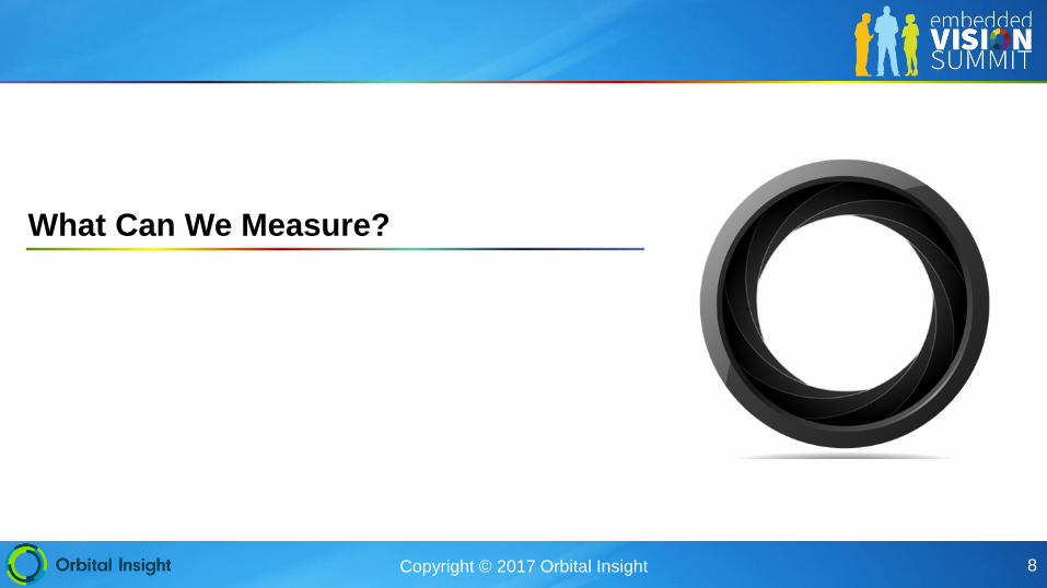
Railcar storage Landuse classification
Iron ore stockpiles Aircraft monitoring Heavy industry
Photo Credit: Orbital Insight/satellite imagery: DigitalGlobe, Planet, USGS
Other applications

Copyright © 2017 Orbital Insight 19
• More verticals
• Infrastructure and asset monitoring
• Agriculture
• Integrating more data
• More satellite imagery
• Beyond optical: SAR
• Beyond satellites: UAV/Drone imagery
• Beyond imagery: AIS, other GIS datasets
Where We Go From Here
Copyright © 2017 Orbital Insight 20
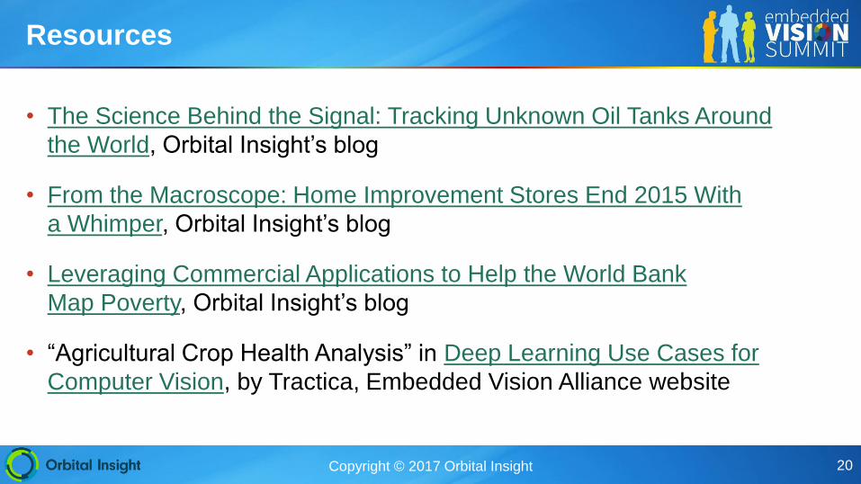
• The Science Behind the Signal: Tracking Unknown Oil Tanks Around
the World, Orbital Insight’s blog
• From the Macroscope: Home Improvement Stores End 2015 With
a Whimper, Orbital Insight’s blog
• Leveraging Commercial Applications to Help the World Bank
Map Poverty, Orbital Insight’s blog
• “Agricultural Crop Health Analysis” in Deep Learning Use Cases for
Computer Vision, by Tractica, Embedded Vision Alliance website
Resources
Related Documents