Using Radar Interferometric Satellite Data for Groundwater Management in the Arno River Basin Bernardo Mazzanti, Giovanni Montini Arno River Basin Authority (I)

Using Radar Interferometric Satellite Data for Groundwater Management in the Arno River Basin
Jul 29, 2015
Welcome message from author
This document is posted to help you gain knowledge. Please leave a comment to let me know what you think about it! Share it to your friends and learn new things together.
Transcript
Using Radar Interferometric Satellite Data for Groundwater Management in the Arno
River Basin
Bernardo Mazzanti, Giovanni MontiniArno River Basin Authority (I)
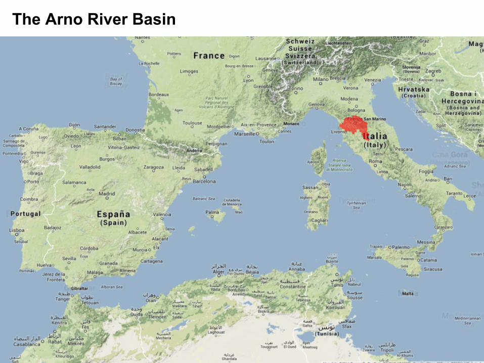
The Arno River Basin
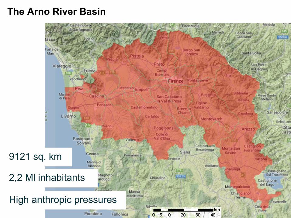
The Arno River Basin
9121 sq. km
High anthropic pressures
2,2 Ml inhabitants
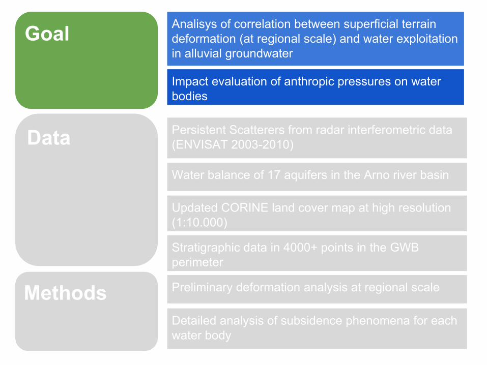
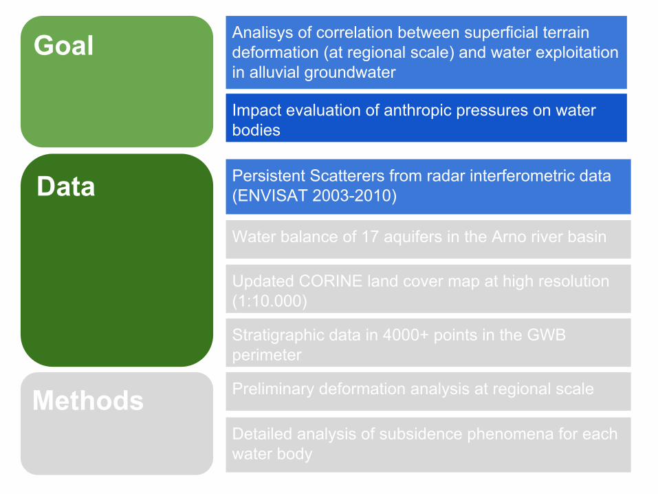
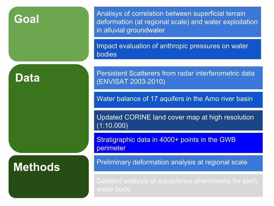
Goal
Methods
Data
Analisys of correlation between superficial terrain deformation (at regional scale) and water exploitation in alluvial groundwater
Impact evaluation of anthropic pressures on water bodies
Persistent Scatterers from radar interferometric data(ENVISAT 2003-2010)
Water balance of 17 aquifers in the Arno river basin
Updated CORINE land cover map at high resolution (1:10.000)
Preliminary deformation analysis at regional scale
Detailed analysis of subsidence phenomena for each water body
Stratigraphic data in 4000+ points in the GWB perimeter
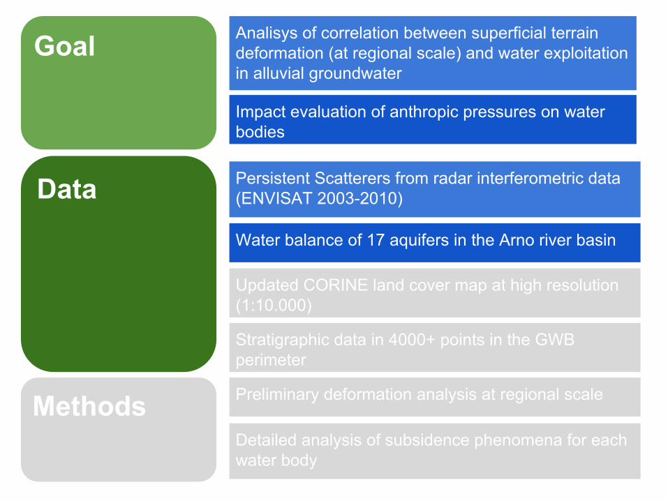

PSInSar Technique (TRE - Univ. of Milano)PSP-DIFSAR Technique (Telespazio)
Goal
Methods
Data
Analisys of correlation between superficial terrain deformation (at regional scale) and water exploitation in alluvial groundwater
Impact evaluation of anthropic pressures on water bodies
Persistent Scatterers from radar interferometric data(ENVISAT 2003-2010)
Water balance of 17 aquifers in the Arno river basin
Updated CORINE land cover map at high resolution (1:10.000)
Preliminary deformation analysis at regional scale
Detailed analysis of subsidence phenomena for each water body
Stratigraphic data in 4000+ points in the GWB perimeter
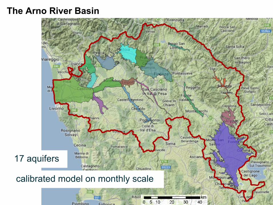
The Arno River Basin
17 aquifers
calibrated model on monthly scale
Goal
Methods
Data
Analisys of correlation between superficial terrain deformation (at regional scale) and water exploitation in alluvial groundwater
Impact evaluation of anthropic pressures on water bodies
Persistent Scatterers from radar interferometric data(ENVISAT 2003-2010)
Water balance of 17 aquifers in the Arno river basin
Updated CORINE land cover map at high resolution (1:10.000)
Preliminary deformation analysis at regional scale
Detailed analysis of subsidence phenomena for each water body
Stratigraphic data in 4000+ points in the GWB perimeter

Land cover map Corine Land cover Level III

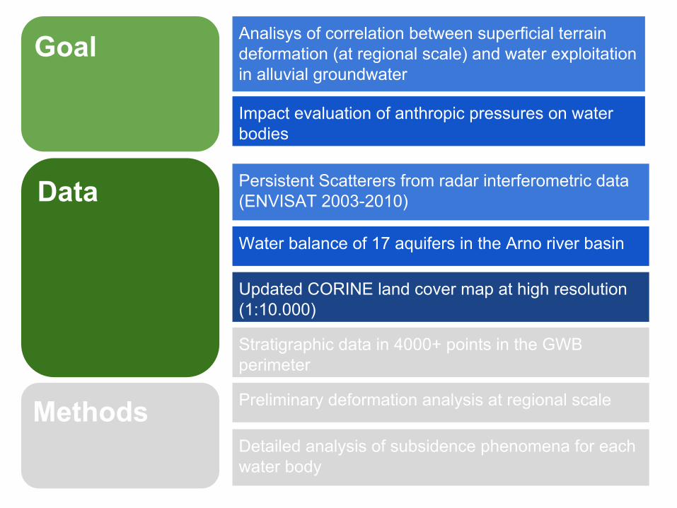
Goal
Methods
Data
Analisys of correlation between superficial terrain deformation (at regional scale) and water exploitation in alluvial groundwater
Impact evaluation of anthropic pressures on water bodies
Persistent Scatterers from radar interferometric data(ENVISAT 2003-2010)
Water balance of 17 aquifers in the Arno river basin
Updated CORINE land cover map at high resolution (1:10.000)
Preliminary deformation analysis at regional scale
Detailed analysis of subsidence phenomena for each water body
Stratigraphic data in 4.000+ points in the GWB perimeter

Stratigraphic data in more than 4000 point in every GWB
Goal
Methods
Data
Analisys of correlation between superficial terrain deformation (at regional scale) and water exploitation in alluvial groundwater
Impact evaluation of anthropic pressures on water bodies
Persistent Scatterers from radar interferometric data(ENVISAT 2003-2010)
Water balance of 17 aquifers in the Arno river basin
Updated CORINE land cover map at high resolution (1:10.000)
Preliminary deformation analysis at regional scale
Detailed analysis of subsidence phenomena for each water body
Stratigraphic data in 4000+ points in the GWB perimeter
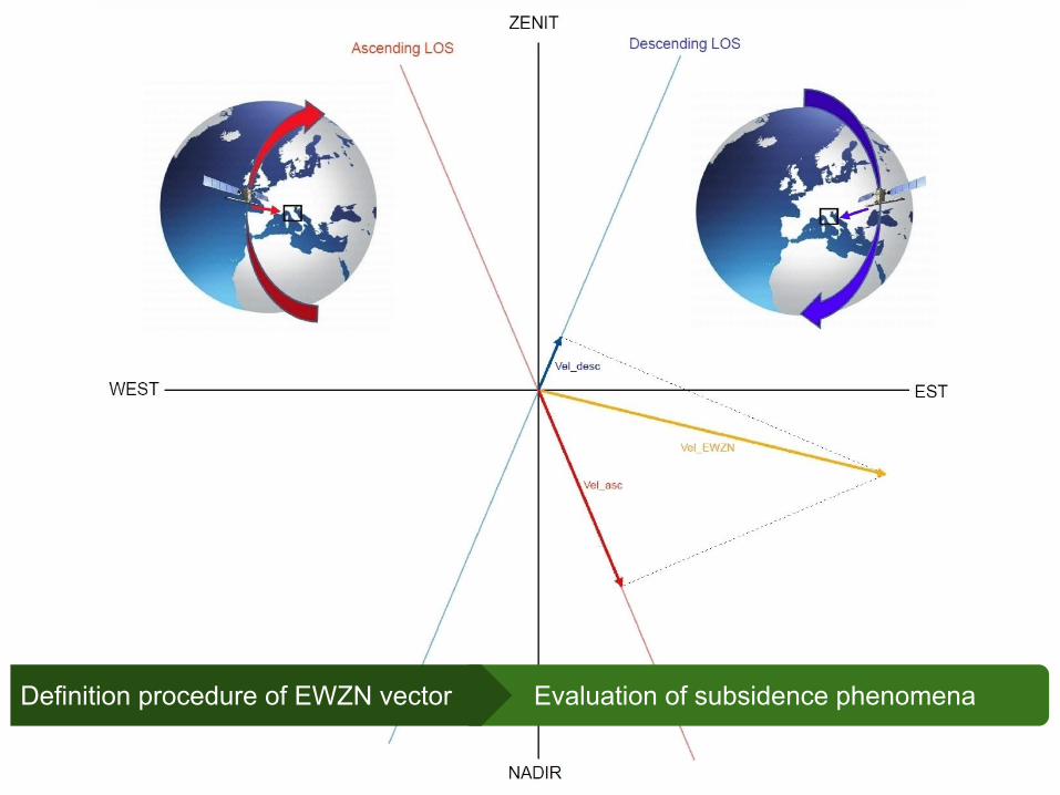
Evaluation of subsidence phenomenaDefinition procedure of EWZN vector
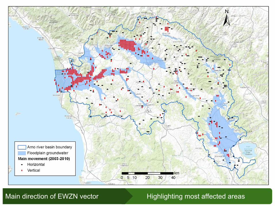
Highlighting most affected areasMain direction of EWZN vector
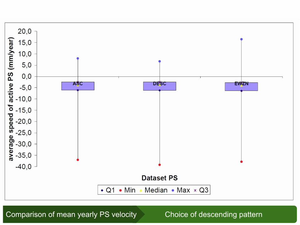
Choice of descending patternComparison of mean yearly PS velocity
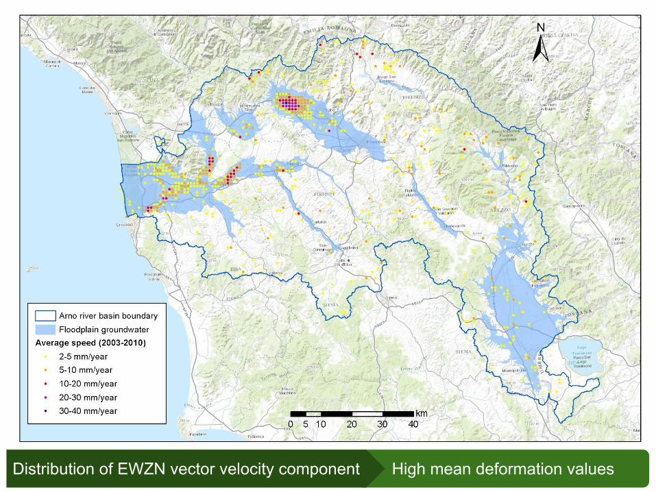
High mean deformation valuesDistribution of EWZN vector velocity component

Goal
Methods
Data
Analisys of correlation between superficial terrain deformation (at regional scale) and water exploitation in alluvial groundwater
Impact evaluation of anthropic pressures on water bodies
Persistent Scatterers from radar interferometric data(ENVISAT 2003-2010)
Water balance of 17 aquifers in the Arno river basin
Updated CORINE land cover map at high resolution (1:10.000)
Preliminary deformation analysis at regional scale
Detailed analysis of subsidence phenomena for each water body
Stratigraphic data in 4000+ points in the GWB perimeter
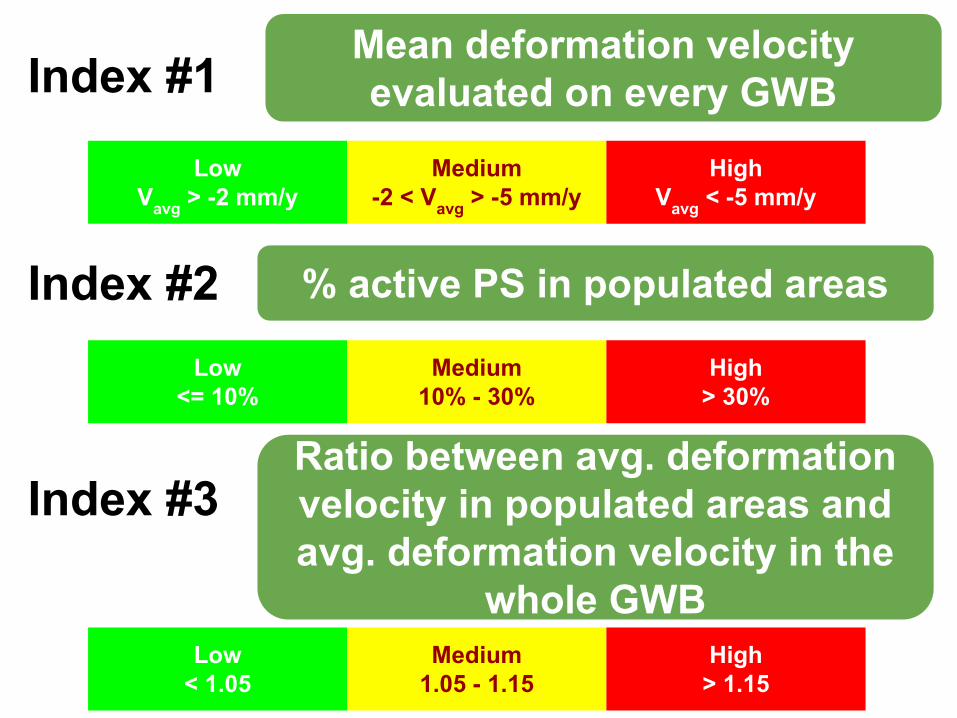
Index #1Mean deformation velocity evaluated on every GWB
LowVavg > -2 mm/y
Medium-2 < Vavg > -5 mm/y
HighVavg < -5 mm/y
Index #2 % active PS in populated areas
Low<= 10%
Medium10% - 30%
High> 30%
Index #3Ratio between avg. deformation velocity in populated areas and avg. deformation velocity in the
whole GWBLow
< 1.05Medium
1.05 - 1.15High
> 1.15
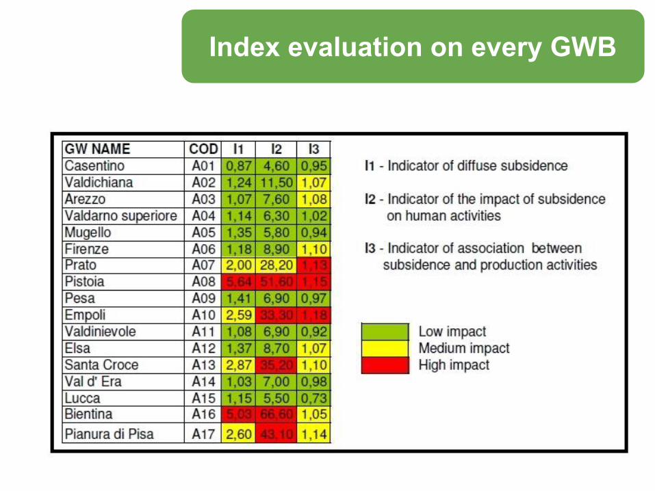
Index evaluation on every GWB
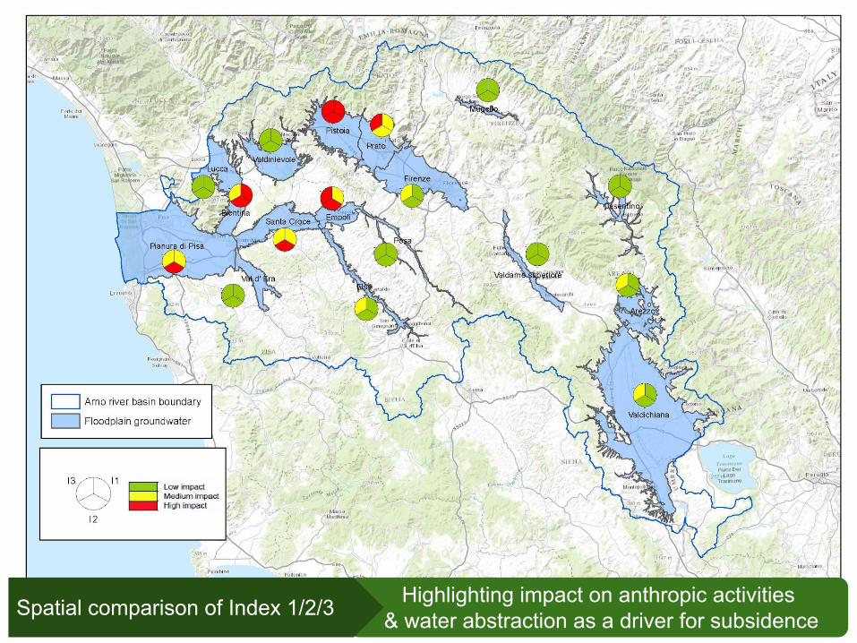
Highlighting impact on anthropic activities & water abstraction as a driver for subsidenceSpatial comparison of Index 1/2/3

Mid-term exploitation evaluationGWB critical condition classificationfrom water balance and quality monitoring
low
medium
high

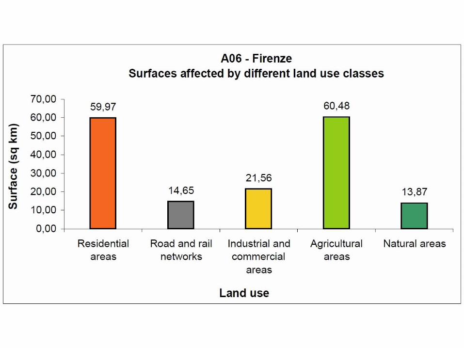
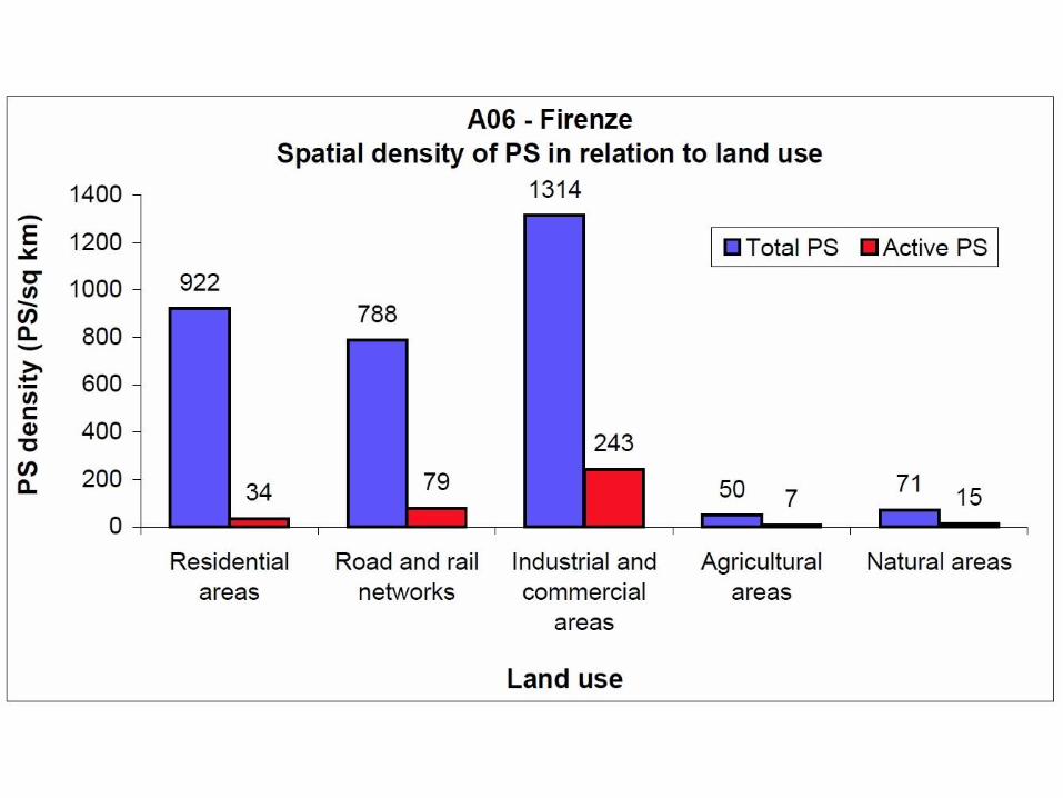
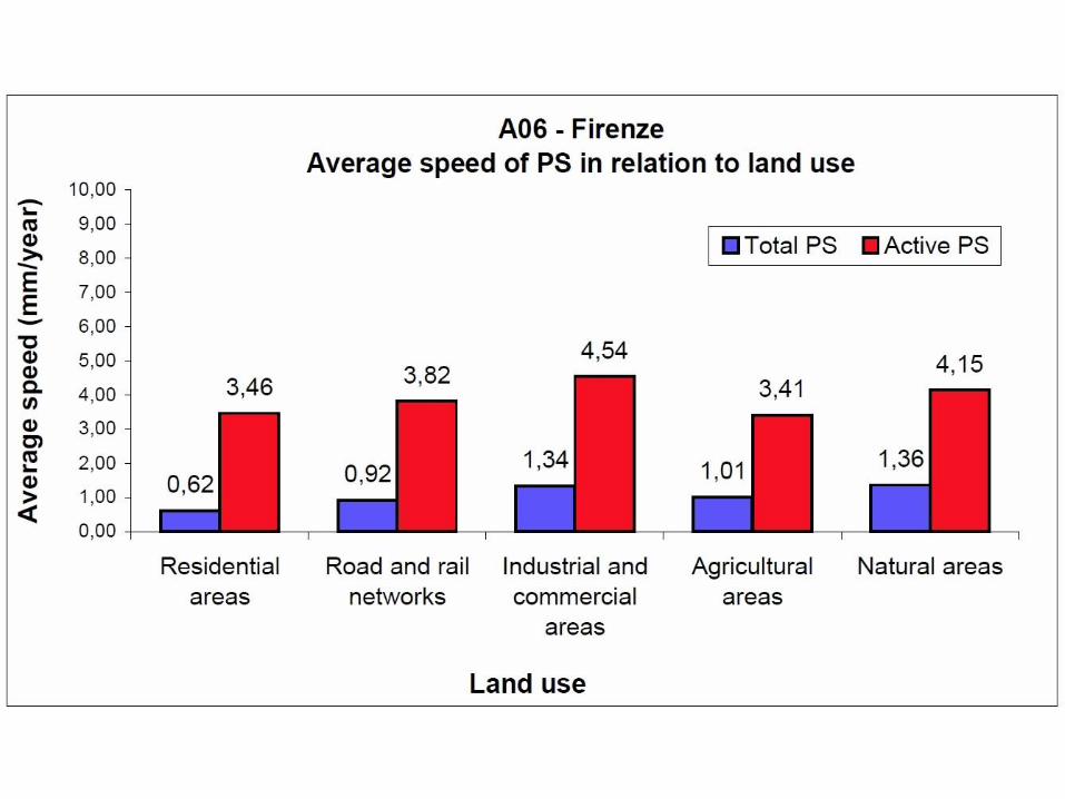
Highlighting most affected areasStatistical analysis of deformations according to land cover type
Index evaluation on a single GWB

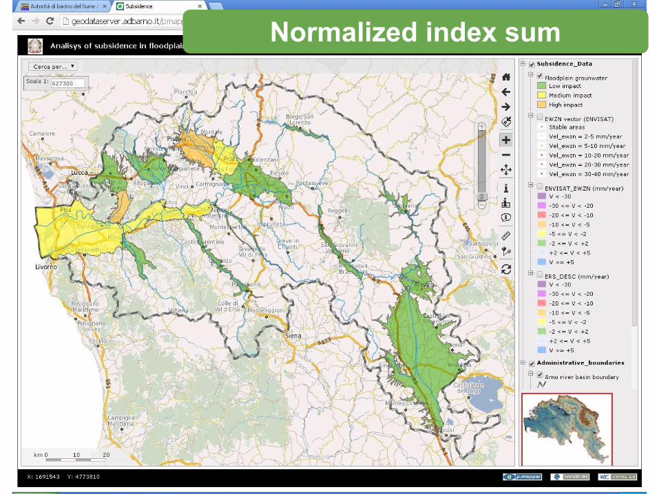
Normalized index sum
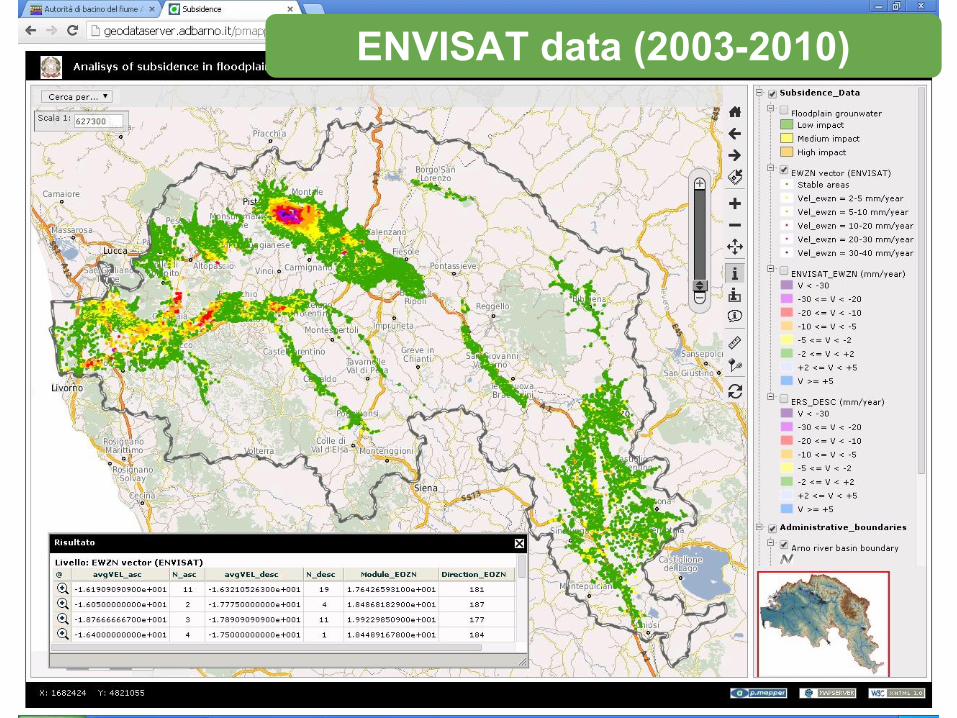
ENVISAT data (2003-2010)
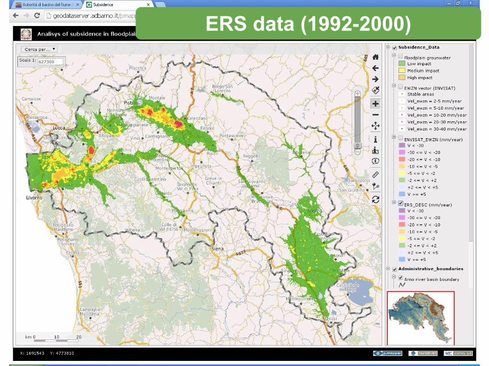
ERS data (1992-2000)
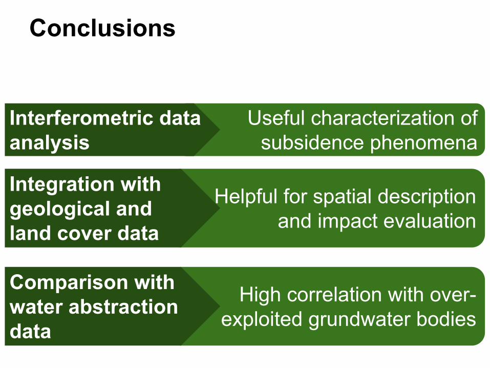
Conclusions
Useful characterization of subsidence phenomena
Interferometric data analysis
Helpful for spatial description and impact evaluation
Integration with geological and land cover data
High correlation with over-exploited grundwater bodies
Comparison with water abstraction data

Thank YouMerciجراتسي
Bernardo MazzantiArno River Basin Authorityvia dei Servi 15 - 50122 - Florence (Italy)http://www.adbarno.it
Thanks to:
Related Documents