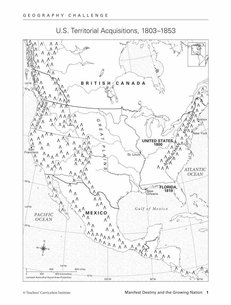
GEOGRAPHY CHALLENGE Manifest Destiny and the Growing Nation 1 © Teachers’ Curriculum Institute N S E W 0 400 800 kilometers 0 Lambert Azimuthal Equal-Area Projection 400 800 miles PACIFIC OCEAN ATLANTIC OCEAN Gulf of Mexico G R E A T P L A I N S APP A L A C H I A N M O U N T A IN S C A S C A D E R A N G E UNITED STATES, 1800 FLORIDA, 1819 MEXICO BRITISH CANADA St. Louis New York Boston New Orleans San Francisco 10°N 120°W 30°N 20°N 130°W 50°N 80°W 90°W 100°W 110°W N S E W 0 400 800 kilometers 0 Lambert Azimuthal Equal-Area Projection 400 800 miles U.S. Territorial Acquisitions, 1803–1853

Welcome message from author
This document is posted to help you gain knowledge. Please leave a comment to let me know what you think about it! Share it to your friends and learn new things together.
Transcript
G E O G R A P H Y C H A L L E N G E
Manifest Destiny and the Growing Nation 1© Teachers’ Curriculum Institute
N
S
EW
0 400 800 kilometers
0
Lambert Azimuthal Equal-Area Projection
400 800 miles
PACIFICOCEAN
ATLANTICOCEAN
G u l f o f M e x i c o
GR
EA
T
PL
AI
NS
APPALA
CHIA
N
MO
UN
TAIN
S
CASC
AD
E R
AN
GE
UNITED STATES,1800
FLORIDA,1819
M E X I C O
B R I T I S H C A N A D A
St. Louis
New York
Boston
NewOrleans
SanFrancisco
10°N
120°W
30°N
20°N
130°W
50°N
80°W90°W100°W
110°W
N
S
EW
0 400 800 kilometers
0
Lambert Azimuthal Equal-Area Projection
400 800 miles
USI_ISN_U05_01U.S. Territorial Acquisitions, 1803–1853Third ProofTCI19 82
U.S. Territorial Acquisitions, 1803–1853
G E O G R A P H Y C H A L L E N G E
Manifest Destiny and the Growing Nation 2© Teachers’ Curriculum Institute
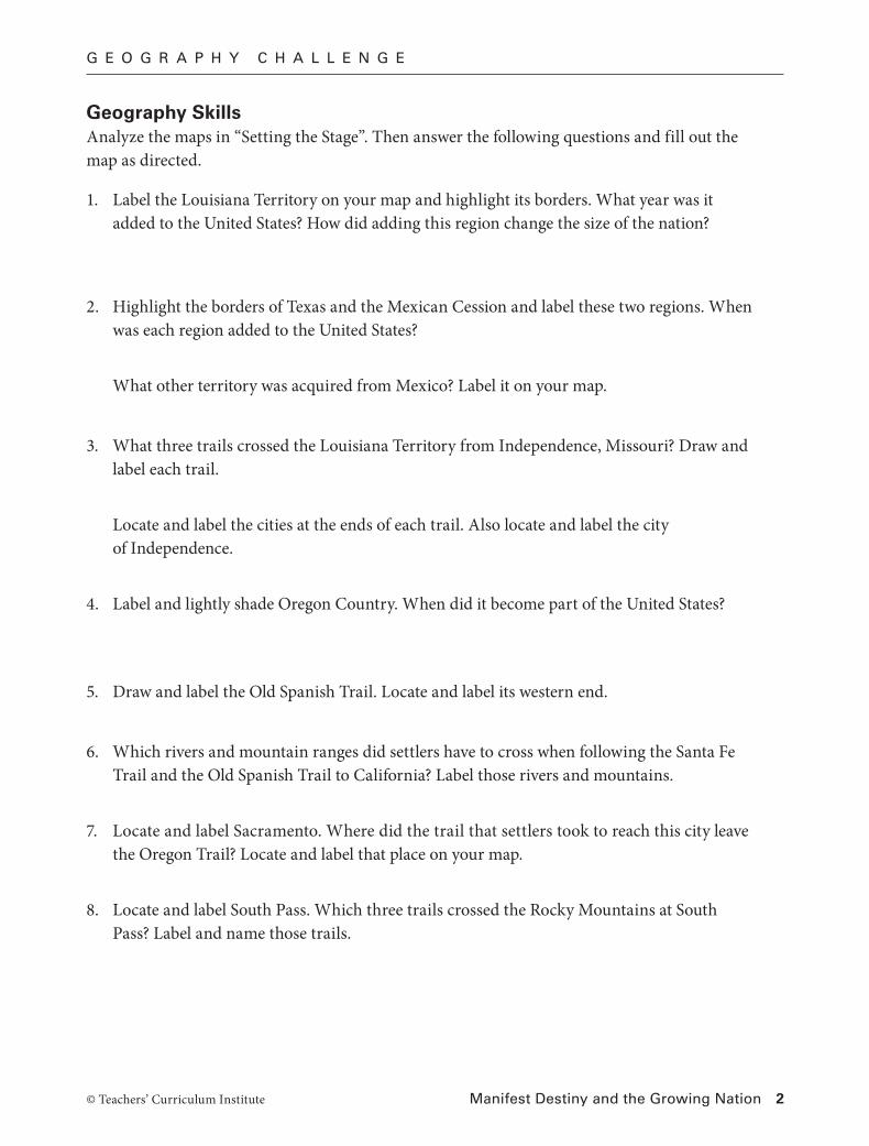
Geography SkillsAnalyze the maps in “Setting the Stage”. Then answer the following questions and fill out the map as directed.
1. Label the Louisiana Territory on your map and highlight its borders. What year was it added to the United States? How did adding this region change the size of the nation?
2. Highlight the borders of Texas and the Mexican Cession and label these two regions. When was each region added to the United States?
What other territory was acquired from Mexico? Label it on your map.
3. What three trails crossed the Louisiana Territory from Independence, Missouri? Draw and label each trail.
Locate and label the cities at the ends of each trail. Also locate and label the city of Independence.
4. Label and lightly shade Oregon Country. When did it become part of the United States?
5. Draw and label the Old Spanish Trail. Locate and label its western end.
6. Which rivers and mountain ranges did settlers have to cross when following the Santa Fe Trail and the Old Spanish Trail to California? Label those rivers and mountains.
7. Locate and label Sacramento. Where did the trail that settlers took to reach this city leave the Oregon Trail? Locate and label that place on your map.
8. Locate and label South Pass. Which three trails crossed the Rocky Mountains at South Pass? Label and name those trails.

G E O G R A P H Y C H A L L E N G E
Manifest Destiny and the Growing Nation 3© Teachers’ Curriculum Institute
Critical Thinking Answer the following questions in complete sentences.
9. Why do you think the Mormon, Oregon, and Santa Fe trails each followed rivers for such a long distance? What benefit would such a route have for travelers?
10. Why would travel by wagon through the mountains have been slower than travel across desert or plains?
11. How might the United States’ purchase of the Louisiana Territory from France have helped encourage American settlers to later travel to Oregon and California?

I N T E R A C T I V E S T U D E N T N O T E B O O K
Manifest Destiny and the Growing Nation 4© Teachers’ Curriculum Institute
R E A D I N G N O T E S
P R E V I E W
1. Why were the city of New Orleans and the Mississippi River important to farmers in the early 1800s?
2. What was Napoleon’s plan for Louisiana? Why were American farmers alarmed by it?
Your teacher will display a painting that is also reproduced at the beginning of the lesson. Begin to analyze the painting with your class, and then continue on your own or with a partner. On a separate sheet of paper, answer the questions below. Support your answers with evidence from the painting.
1. Which groups in the painting are moving from the east toward the west? What are they bringing with them?
2. What are some possible reasons these groups are moving west?
3. Which groups were already in the West? What is happening to them?
4. Who is the main figure in the center of the painting? What might she represent?
5. John Gast painted American Progress in 1872. Do you think he believed that U.S. expansion in the 1800s was justifiable? Why or why not?
Key Content TermsAs you complete the Reading Notes, use these terms in your answers.
territory Texas War for Independence manifest destinydiplomacy annex Mexican-American War
Section 2
How justifiable was U.S. expansion in the 1800s?
Manifest Destiny and the Growing Nation
I N T E R A C T I V E S T U D E N T N O T E B O O K
Manifest Destiny and the Growing Nation 5© Teachers’ Curriculum Institute
Section 4
1. List two complaints of American settlers in Texas in 1830. Then list two complaints of Tejanos in 1830.
3. What deal was made on April 30, 1803? Give two reasons why Napoleon was willing to make this deal with the United States.
4. List two pros and two cons of the Louisiana Purchase.
Section 3
1. What did President Monroe order Andrew Jackson to do in 1818? What did Jackson do instead?
2. Explain the deal that the United States made with Spain in 1819 to end the conflict over Florida.
American settlers:
Tejanos:
Pros of the Louisiana Purchase Cons of the Louisiana Purchase
I N T E R A C T I V E S T U D E N T N O T E B O O K
Manifest Destiny and the Growing Nation 6© Teachers’ Curriculum Institute
2. Complete the timeline with important events that led Texas to win its independence. Write a one- or two-sentence summary next to each date. Use all of the words in the Word Bank somewhere on the timeline. Also, create illustrations for two of the events.
3. What happened to Texas in 1845? Give one argument against and one argument in favor of this decision.
Word Bank
the Alamo
General Santa Anna
immigration
Republic of Texas
“Remember the Alamo”
slavery
Stephen F. Austin
Tejanos
Moses Austin is granted a huge tract of land in Texas for an American colony.
1821
1835
April 1836
1833
1830
1829
March 1836
1836–1845

I N T E R A C T I V E S T U D E N T N O T E B O O K
Manifest Destiny and the Growing Nation 7© Teachers’ Curriculum Institute
1. What agreement did Great Britain and the United States make in the 1820s concerning Oregon?
2. Why Oregon was called a “pioneer’s paradise”?
3. What did James Polk mean when he declared “Fifty-four forty or fight!” in the 1844 presidential campaign? Did he follow through with this campaign promise? Explain.
Section 6
1. Why did President Polk think the Mexican government might want to sell California and New Mexico?
2. Label the map with sentences to explain why the U.S. Congress declared war on Mexico in 1846.
Rio GrandeNueces River
M E X I C O
U N I T E DS T A T E S
Disputedarea Texas
USI_ISN_15_01.epsDisputed Texas, 1846Second ProofTCI19 33
Disputed Texas, 1846
Section 5

I N T E R A C T I V E S T U D E N T N O T E B O O K
Manifest Destiny and the Growing Nation 8© Teachers’ Curriculum Institute
4. List three details of the Treaty of Guadalupe Hidalgo. Then give two reasons some U.S. senators opposed this treaty.
5. Why did the United States buy the Gadsden Purchase in 1853?
3. Choose two of these Mexican-American War battle locations: New Mexico, California, Monterrey, Buena Vista, or Chapultepec. Then create two historical newspaper headlines for each of your two battle locations. Write the first headline for a U.S. newspaper whose editors agreed with manifest destiny. Write the second headline for a newspaper in Mexico.
Location 1: Location 2:
I N T E R A C T I V E S T U D E N T N O T E B O O K
Manifest Destiny and the Growing Nation 9© Teachers’ Curriculum Institute
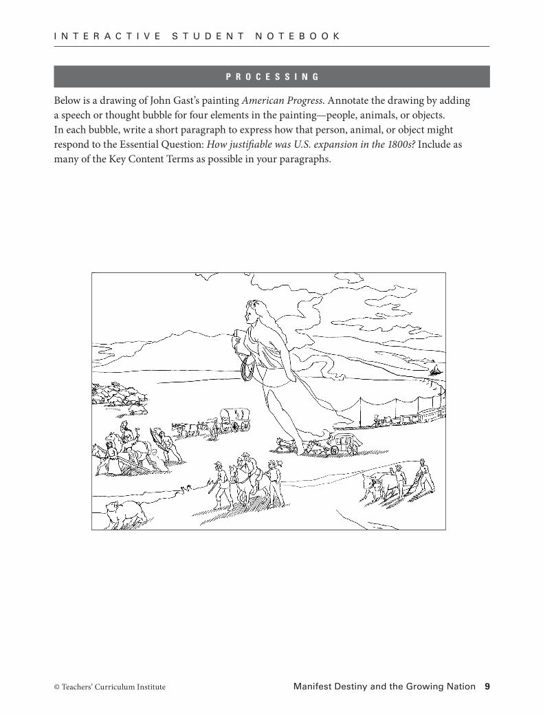
Below is a drawing of John Gast’s painting American Progress. Annotate the drawing by adding a speech or thought bubble for four elements in the painting—people, animals, or objects. In each bubble, write a short paragraph to express how that person, animal, or object might respond to the Essential Question: How justifiable was U.S. expansion in the 1800s? Include as many of the Key Content Terms as possible in your paragraphs.
P R O C E S S I N G
I N T E R A C T I V E S T U D E N T N O T E B O O K
© Teachers’ Curriculum Institute Manifest Destiny and the Growing Nation 10
R E A D I N G F U R T H E R
Preparing to Write: Taking Notes on DetailsIn her journal, Susan Magoffin recorded descriptions and details about her travels along the Santa Fe Trail. Because of this record, readers today can share her experiences. Take notes about the trip based on the descriptions in the reading.
When and where did the expedition begin?
Describe how the Magoffins outfitted themselves for the trip.
What happened at Pawnee Rock?
Describe Susan Magoffin’s accident.
Explain why the Magoffins stopped at Bent’s Fort.

I N T E R A C T I V E S T U D E N T N O T E B O O K
© Teachers’ Curriculum Institute Manifest Destiny and the Growing Nation 11
Writing a PostcardSuppose you were part of the Magoffin expedition. What if you could have sent a message home during your journey on the Santa Fe Trail? Use the space below to write a postcard to someone you have left behind in the United States. On your postcard, include• descriptionsanddetailsaboutwhatyouareseeing.• adescriptionofwhatyoulikeanddislikeaboutthetrip.• thedate,agreeting,aclosing,andyoursignature.
Use this rubric to evaluate your postcard. Make changes in your postcard if you need to.
Score Description
3 The postcard has accurate descriptions and details. It is well constructed. There are no spelling or grammar errors.
2 The postcard has descriptions and details. It is well constructed. There are some spelling or grammar errors.
1 The postcard does not have descriptions and details. It is not well constructed. There are many spelling or grammar errors.
Related Documents