Urban Progress The Story of Burlington’s Lost Ravine John Goff NOAA/NWS Burlington, VT

Urban Progress The Story of Burlington’s Lost Ravine John Goff NOAA/NWS Burlington, VT.
Dec 15, 2015
Welcome message from author
This document is posted to help you gain knowledge. Please leave a comment to let me know what you think about it! Share it to your friends and learn new things together.
Transcript
Urban Progress
The Story of Burlington’s Lost Ravine
John GoffNOAA/NWS Burlington, VT
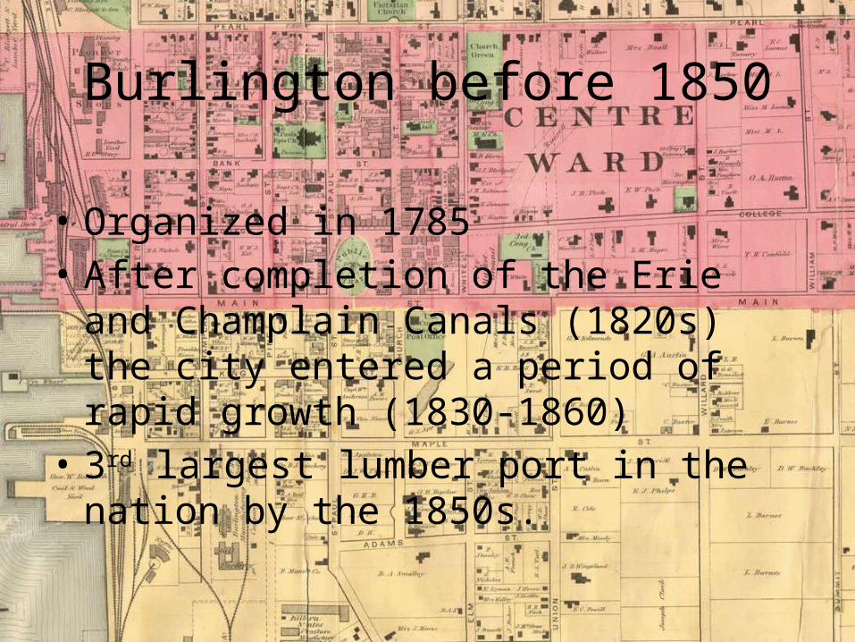
Burlington before 1850
• Organized in 1785• After completion of the Erie and Champlain
Canals (1820s) the city entered a period of rapid growth (1830-1860)
• 3rd largest lumber port in the nation by the 1850s.

Burlington Before 1850
• Early maps and artist depictions clearly showed a natural ravine or creek channel that flowed northeast to southwest through the city.

Artist Copy from a c. 1812 Map
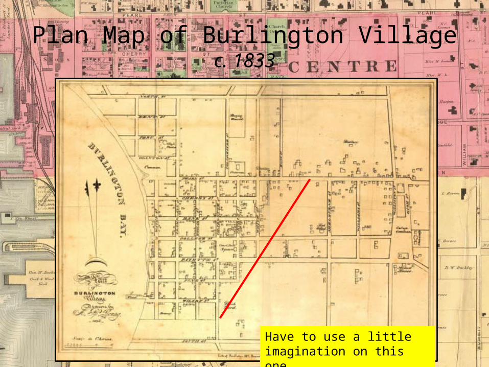
Plan Map of Burlington Villagec. 1833
Have to use a little imagination on this one
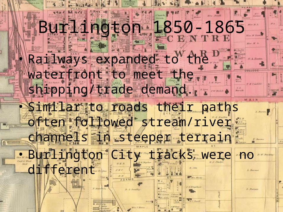
Burlington 1850-1865
• Railways expanded to the waterfront to meet the shipping/trade demand.
• Similar to roads their paths often followed stream/river channels in steeper terrain
• Burlington City tracks were no different
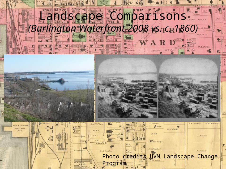
Landscape Comparisons(Burlington Waterfront 2008 vs. c. 1860)
Photo credits UVM Landscape Change Program
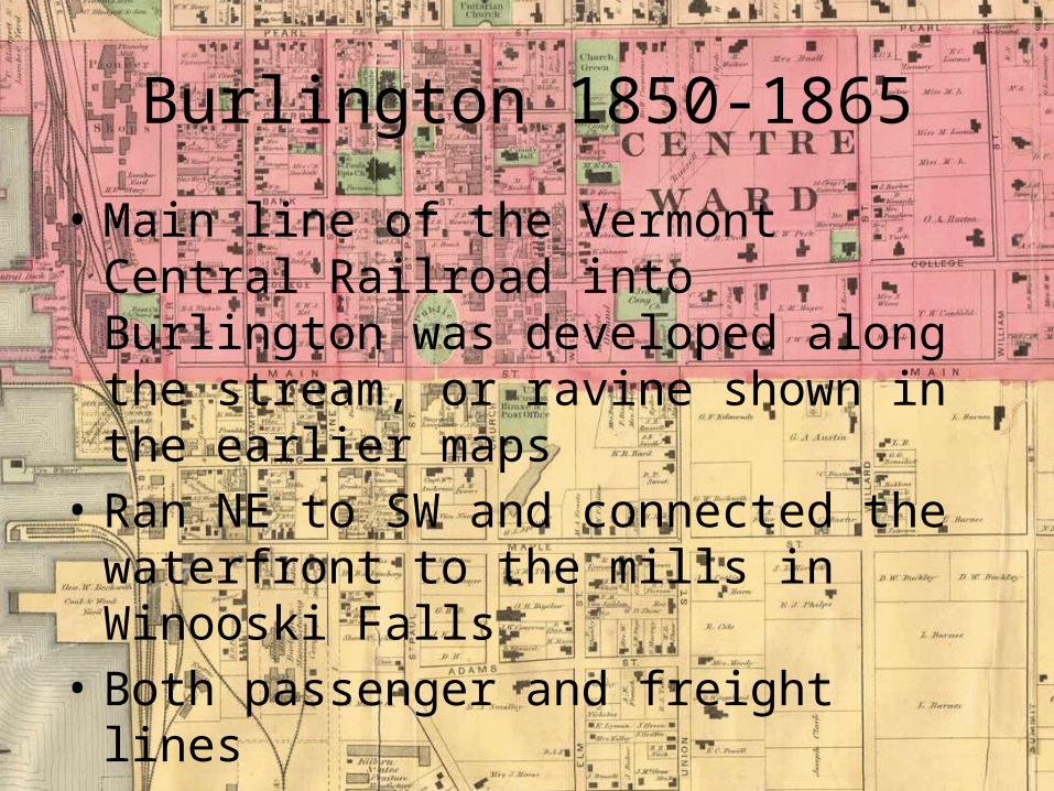
Burlington 1850-1865
• Main line of the Vermont Central Railroad into Burlington was developed along the stream, or ravine shown in the earlier maps
• Ran NE to SW and connected the waterfront to the mills in Winooski Falls
• Both passenger and freight lines• Old Depot now the Burlington Fire Station
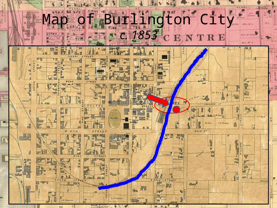
Map of Burlington Cityc. 1853

Archival Evidence
- College St Congregational Church 1866
- Deep enough for a locomotive to pass under
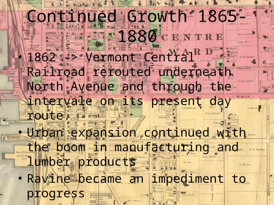
Continued Growth 1865-1880
• 1862 -> Vermont Central Railroad rerouted underneath North Avenue and through the intervale on its present day route.
• Urban expansion continued with the boom in manufacturing and lumber products
• Ravine became an impediment to progress
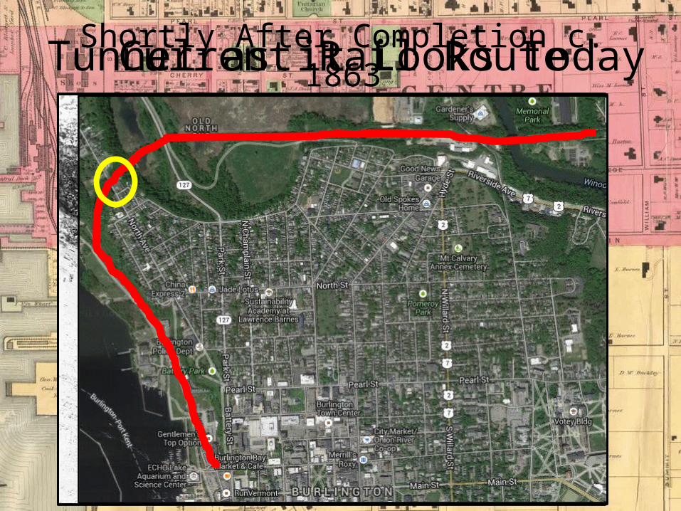
Current Rail Route
Shortly After Completion c. 1863Tunnel as it Looks Today
Continued Growth 1865-1880
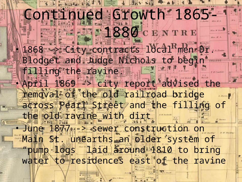
• 1868 -> City contracts local men Dr. Blodget and Judge Nichols to begin filling the ravine.
• April 1869 -> city report advised the removal of the old railroad bridge across Pearl Street and the filling of the old ravine with dirt
• June 1877 -> sewer construction on Main St. unearths an older system of “pump logs” laid around 1810 to bring water to residences east of the ravine

1869 Beers Wall Map
1872 Coast Survey Map

Late 1800s to the Turn of the Centuryc. 1880-1910
• By 1880 city planners commissioned the building of the city’s first comprehensive sewer system, with the ravine serving as the system backbone
• Built of stone and brick sluices and culverts• Discharged at a single and most likely foul
point near the end of current day Maple St. along the lake

Archival Free Press Clips
“The work of filling up the Main Street ravine with old crockery, tomato cans, dead cats and brush is going triumphantly on. This combination will make a very solid and rich foundation”- c. 1880
“The dumping of filth and garbage was confined to the ravine at the head of Intervale Avenue and dumping was absolutely forbidden along Main, College, Pearl and Church Streets. Where the ravine crosses these streets, the dump heaps were an eyesore”- July 1884
Late 1800s to the Turn of the Centuryc. 1880-1910
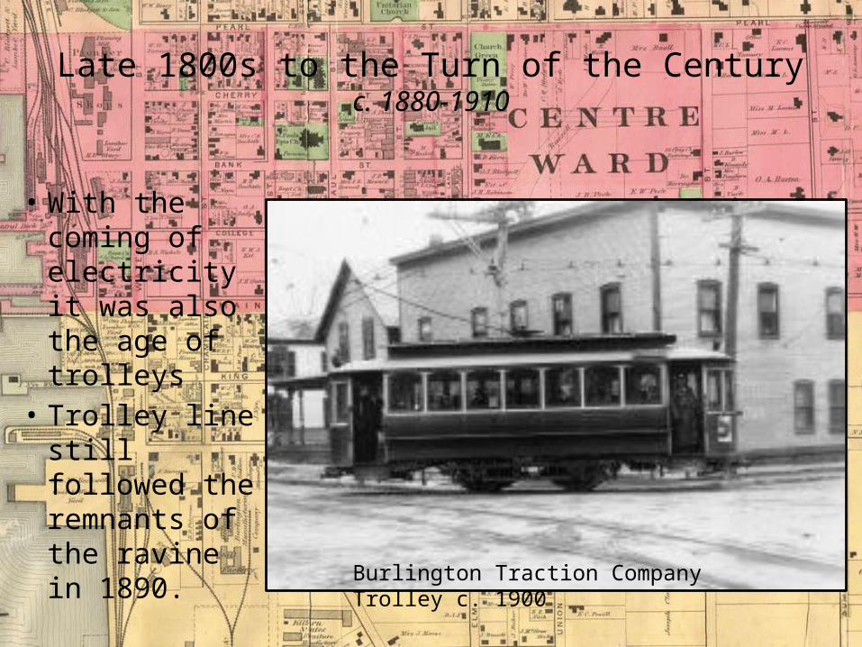
• With the coming of electricity it was also the age of trolleys
• Trolley line still followed the remnants of the ravine in 1890.
Burlington Traction Company Trolley c. 1900
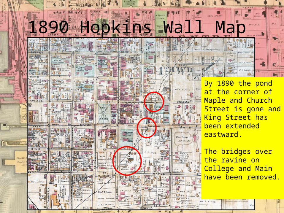
1890 Hopkins Wall Map
By 1890 the pond at the corner of Maple and Church Street is gone and King Street has been extended eastward.
The bridges over the ravine on College and Main have been removed.
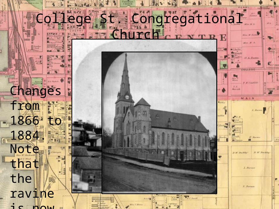
College St. Congregational Church
Changes from 1866 to 1884.
Note that the ravine is now gone.

Entering the Modern Erac. 1920 onward
• By the early 20th century the project of filling in the ravine and laying the miles of sewer line were essentially complete and as the years rolled by the feature was largely forgotten
• …”it appears that this problematic and mysterious piece of Burlington geography has been lost to redevelopment, and countless piles of hundred year old garbage”
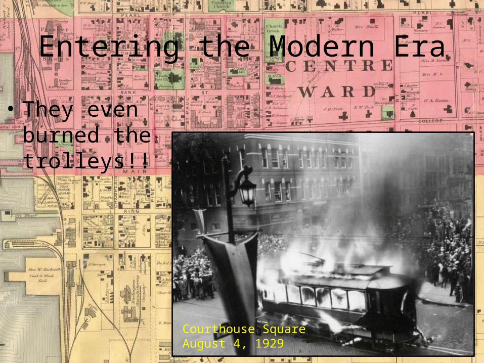
Entering the Modern Era
• They even burned the trolleys!!
Courthouse SquareAugust 4, 1929

But all is not what it seems. The evidence still exists…
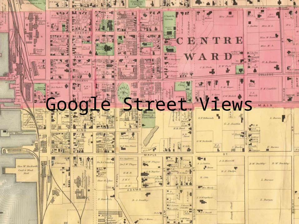
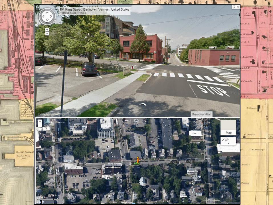
Google Street Views

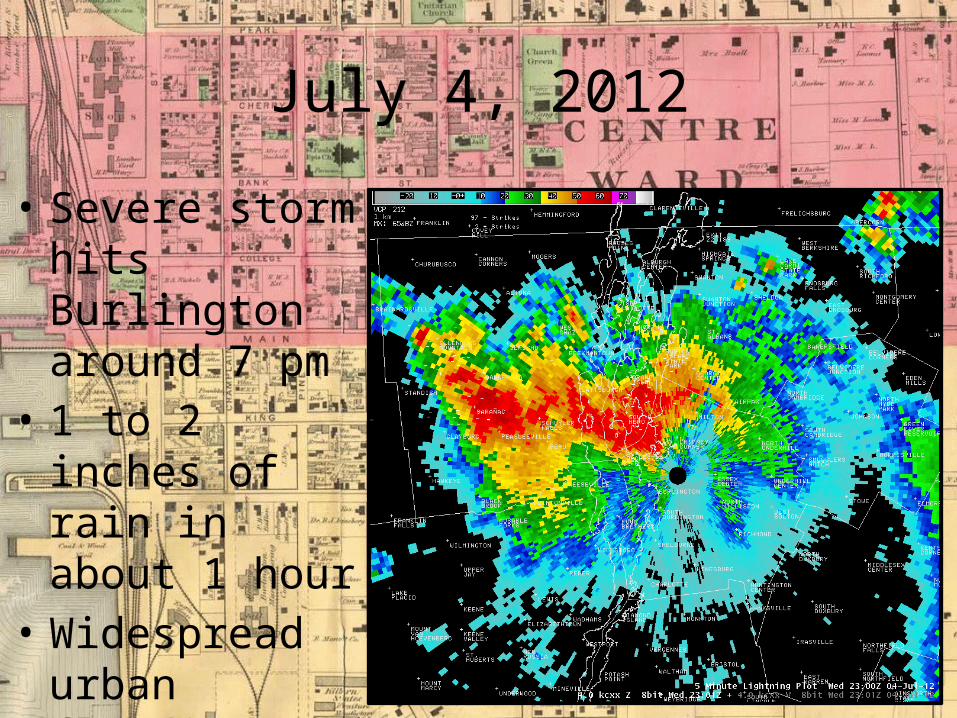
July 4, 2012
• Severe storm hits Burlington around 7 pm
• 1 to 2 inches of rain in about 1 hour
• Widespread urban flooding
July 4, 2012
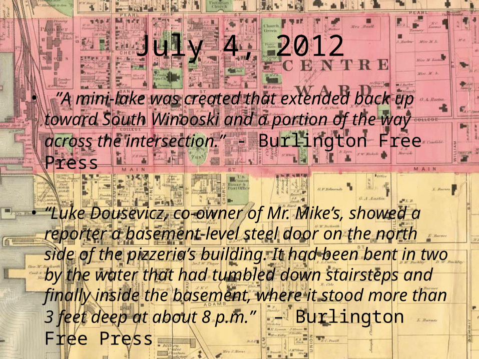
• ”A mini-lake was created that extended back up toward South Winooski and a portion of the way across the intersection.” - Burlington Free Press
• “Luke Dousevicz, co-owner of Mr. Mike’s, showed a reporter a basement-level steel door on the north side of the pizzeria’s building. It had been bent in two by the water that had tumbled down stairsteps and finally inside the basement, where it stood more than 3 feet deep at about 8 p.m.” – Burlington Free Press
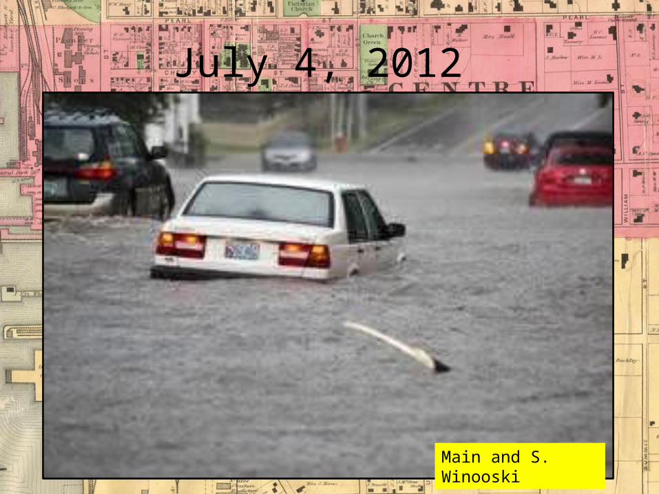
July 4, 2012
Main and S. Winooski
July 4, 2012
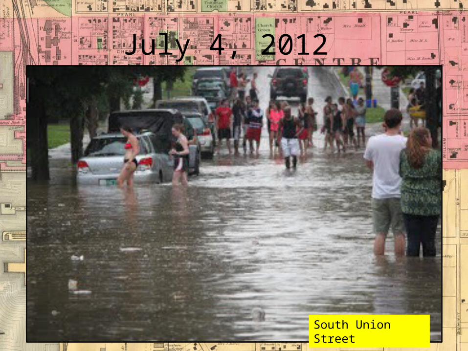
South Union Street

July 4, 2012
South Winooski Ave.
July 4, 2012
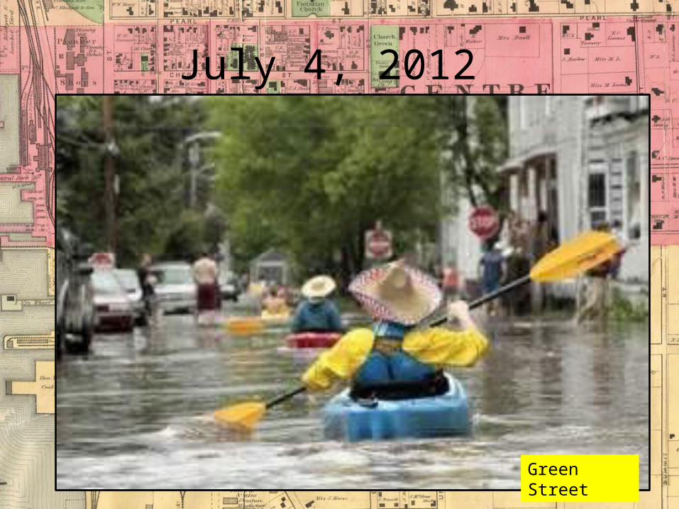
Green Street
July 4, 2012
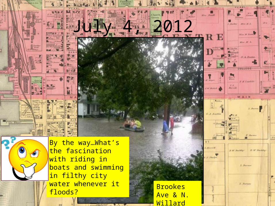
Brookes Ave & N. Willard
By the way…What’s the fascination with riding in boats and swimming in filthy city water whenever it floods?
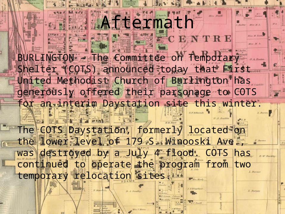
BURLINGTON – The Committee on Temporary Shelter (COTS) announced today that First United Methodist Church of Burlington has generously offered their parsonage to COTS for an interim Daystation site this winter.
The COTS Daystation, formerly located on the lower level of 179 S. Winooski Ave., was destroyed by a July 4 flood. COTS has continued to operate the program from two temporary relocation sites.
Aftermath
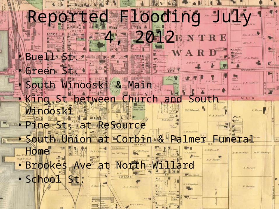
Reported Flooding July 4, 2012
• Buell St.• Green St.• South Winooski & Main• King St between Church and South Winooski• Pine St. at ReSource• South Union at Corbin & Palmer Funeral Home• Brookes Ave at North Willard• School St.

Map Overlays
• Plotted the original course of the ravine on a modern map of the city
• Overlaid the reports of flooding from the July 4th event (archived BFP, local TV media website articles, StormData)

Any questions???
And Some Other Recent Events…
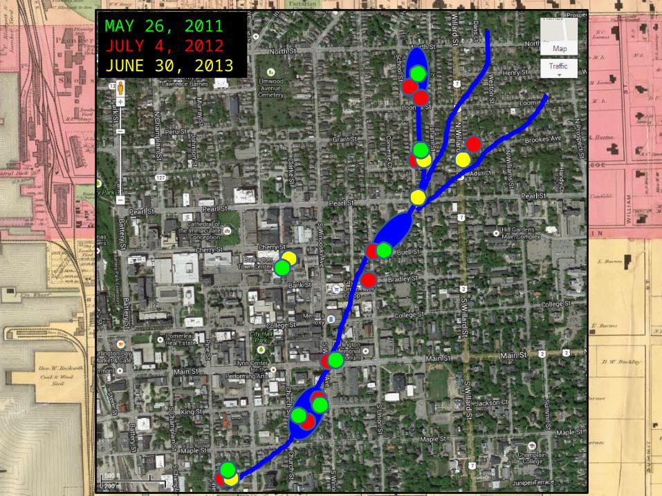
MAY 26, 2011JULY 4, 2012JUNE 30, 2013
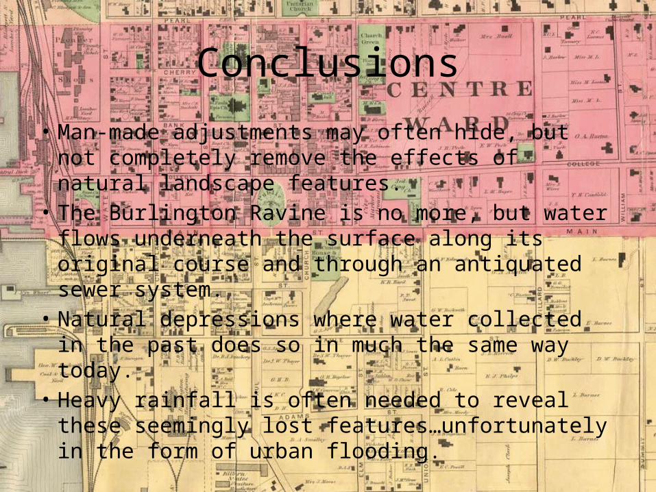
Conclusions
• Man-made adjustments may often hide, but not completely remove the effects of natural landscape features.
• The Burlington Ravine is no more, but water flows underneath the surface along its original course and through an antiquated sewer system.
• Natural depressions where water collected in the past does so in much the same way today.
• Heavy rainfall is often needed to reveal these seemingly lost features…unfortunately in the form of urban flooding.

Urban Flooding Conclusions
And sometimes it’s just birdbrained development…

Conclusions
Street level at the former COTS…
References• Burlington Free Press (flood photos and archival news clips) http://www.burlingtonfreepress.com/
http://chroniclingamerica.loc.gov/lccn/sn86072143/issues/
• WPTZ-TV (flood photos) http://www.wptz.com/
• Archival photographs courtesy the University of Vermont Landscape Change website at:
http://www.uvm.edu/landscape/
• Free historical Burlington maps online at: http://www.old-maps.com/vermont.htm
http://www.geographicus.com/P/AntiqueMap/BurlingtonVermont-uscs-1872
Thank You
Related Documents