URBAN PLANNING AND DESIGN AT UN-HABITAT

Welcome message from author
This document is posted to help you gain knowledge. Please leave a comment to let me know what you think about it! Share it to your friends and learn new things together.
Transcript
URBAN PLANNING AND DESIGN AT UN-HABITAT
The United Nations Human Settlements Programme (UN-
Habitat) is the United Nations programme working towards
a better urban future. Its mission is to promote socially and
environmentally sustainable human settlements development
and the achievement of adequate shelter for all.
Cities are facing unprecedented demographic, environmental,
economic, social and spatial challenges. There has been a
phenomenal shift towards urbanization, with 6 out of every
10 people in the world expected to reside in urban areas by
2030. More than 90 per cent of this growth will take place
in Africa, Asia, Latin America and the Caribbean. Mindsets,
policies and approaches towards urbanization need to change
for the growth of cities and urban areas to be turned into
opportunities that will leave nobody behind.
UN-Habitat assumes a natural leadership and catalytic role
in urban matters. It is a knowledgeable institution on urban
UN-HABITAT AT A GLANCE
...TO PROMOTE SOCIALLY AND ENVIRONMENTALLY SUSTAINABLE HUMAN
SETTLEMENTS DEVELOPMENT AND THE ACHIEVEMENT OF ADEQUATE SHELTER FOR ALL.
development processes, understands the aspirations of cities
and their residents and is mandated by the United Nations
General Assembly to address the issues of urbanization.
For almost 40 years, UN-Habitat has worked in human
settlements throughout the world, focusing on building
a brighter future for villages, towns, and cities of all sizes.
These four decades of experience, from the highest levels
of policy to a range of specific technical issues, gives UN-
Habitat a unique and a universally acknowledged expertise in
all things urban and placed it in the best position to provide
answers and achievable solutions to the current challenges
faced by the world’s cities. UN-Habitat works to ensure that
cities become inclusive and affordable drivers of economic
growth and social development to formulate the urban vision
of tomorrow.
UN-HABITAT VISION AND APPROACH
VISIONUN-Habitat promotes the stronger commitment of national
and local governments, as well as other relevant stakeholders,
to work towards the realization of a world with economically
productive, socially inclusive and environmentally sustainable
human settlements.
WHAT WE AIM FOR
UN-Habitat has focused its efforts on developing cities,
as they are most in need of support through urbanization,
and centred on three fundamental generators of wealth
and employment: planning and design, law and economy.
UN-Habitat’s methodology eschews existing models and
theoretical concepts and focuses instead on the direct
participation of the communities. Community management
is the best way to begin reconstruction following armed
conflicts or natural disasters, and for implementing affordable
housing projects and basic primary services.
Often, it is not financial constraints that impede the
needed transformation of a city, but the impossibility of
finding agreement among stakeholders. What counts is
building community institutions and mechanisms capable of
circumventing the disagreements, misunderstandings and
conflicts that get in the way of the kind of urbanization that
generates prosperity. No urban transformation is possible
without consensus. Over the next 30 years, the urban
population of the world will increase by at least 2.5 billion.
Investment in cities during this period will exceed the total
sum of all expenditure on urbanization over the entire history
of humankind.
The policy decisions must take into account the experiences
in urban transformation in recent years. The objective is to
shape good cities, where inhabitants live together in density
and diversity, where the economies of agglomeration are able
to generate prosperity and where the public spaces which
guarantee equality and justice are respected and inspire
respect.
Urbanization, if adequately planned, can be a transformative
power providing prosperity, development and well-being to
societies.
The new vision makes a shift in focus and incorporates three
essential urban elements into a new, integrated working
methodology: urban legislation, design and finance, as a
three-legged strategy in advancing sustainable urbanization.
Well-planned, well-governed and efficient human settlements with adequate infrastructure and universal access to employment, land and basic services such as housing, water, sanitation, energy and transport.
Good cities do not come about by accident. The prerequisites
are broad community consensus, long-standing political
determination and sound urban planning, which create urban
environments that provide wellbeing and security, guarantee
the supply of urban services, and promote a compact and
diverse structure where innovation, trade and economic
prosperity are encouraged and which protects that communal
space in which individual rights and opportunities flourish.
For more than 20 years, UN-Habitat has been leading research,
policies and projects on urban settlements throughout the
world. Our best practices should serve as a model of urban
planning and reconstruction and as a measure of the potential
in the decades to come for a well-made city is so difficult to
achieve and maintain.
In the developing world the overriding tendencies are for an
often dizzying rate of urban population growth. Many cities
grow spontaneously and lack capacity for the development
of basic services and inadequate safeguards for public spaces,
with significant impacts on traffic and connectivity. There is an
emerging pattern of urbanization based on low productivity,
in which the informal economy and underemployment
flourish, when the average age of the population is 20. Every
year millions of people, in an unprecedented population
movement, migrate from the countryside, believing that
prosperity is to be found in urban settings.
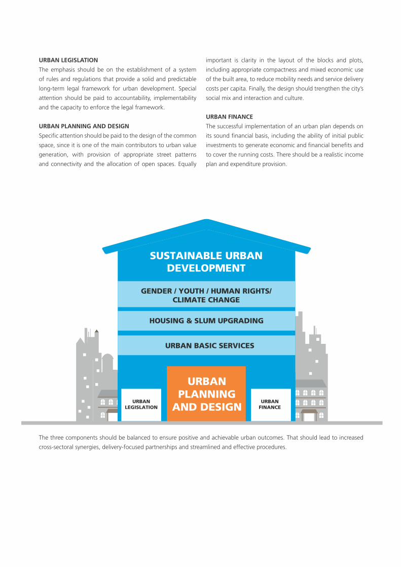
URBAN LEGISLATION The emphasis should be on the establishment of a system
of rules and regulations that provide a solid and predictable
long-term legal framework for urban development. Special
attention should be paid to accountability, implementability
and the capacity to enforce the legal framework.
URBAN PLANNING AND DESIGN Specific attention should be paid to the design of the common
space, since it is one of the main contributors to urban value
generation, with provision of appropriate street patterns
and connectivity and the allocation of open spaces. Equally
important is clarity in the layout of the blocks and plots,
including appropriate compactness and mixed economic use
of the built area, to reduce mobility needs and service delivery
costs per capita. Finally, the design should trengthen the city’s
social mix and interaction and culture.
URBAN FINANCEThe successful implementation of an urban plan depends on
its sound financial basis, including the ability of initial public
investments to generate economic and financial benefits and
to cover the running costs. There should be a realistic income
plan and expenditure provision.
The three components should be balanced to ensure positive and achievable urban outcomes. That should lead to increased
cross-sectoral synergies, delivery-focused partnerships and streamlined and effective procedures.
HOUSING & SLUM UPGRADING
URBAN BASIC SERVICES
GENDER / YOUTH / HUMAN RIGHTS/CLIMATE CHANGE
SUSTAINABLE URBANDEVELOPMENT
URBANLEGISLATION
URBANFINANCE
URBANPLANNING
AND DESIGN

Our aim is to support city, regional and national authorities to
implement policies, plans and designs through a participatory
process including all different actors, such as civil society
and poor people, for more compact, better integrated and
connected cities that foster equitable sustainable urban
development and are resilient to climate change.
Many cities are currently facing serious challenges of
ineffective development control systems, in-formal and often
chaotic peri-urban expansion, a proliferation of informal
housing and livelihood activities, poor connectivity, traffic
congestion and energy inefficiency, among others. Cities are
in-creasingly facing environmental challenges, including how
to curb rising greenhouse gas emissions and the increasing
impacts of anthropogenic climate change.
To address these challenges, UN-Habitat will provide city
and national Governments with a set of tested approaches,
guidelines, and tools to support the management of growth
and improved sus-tainability, efficiency and equity of cities
through planning and design at different scales, the slum and
neighbourhood, city, regional, national and supra-national
scales. This will be achieved through: (a) improved policies
and legislation regarding urban planning and sustainability,
URBAN PLANNING AND DESIGN AT UN-HABITAT
...TO SUPPORT THE MANAGEMENT OF GROWTH AND IMPROVED SUSTAINABILITY, EFFICIENCY AND EQUITY OF CITIES THROUGH PLANNING AND DESIGN AT DIFFERENT SCALES...
based on the principle of subsidiarity; (b) increased capacities
of institutions and stakeholders to under-take and effectively
implement, in participatory and inclusive ways, urban planning
processes at the most appropriate and adequate scale; and (c)
new urban planning and design initiatives in selected cities.
UN-Habitat will assist making urban planning and design a
more effective tool for governments and local authorities to
achieve sustainable urban development.
The overall approach will focus on the creation of a spatial
structure in cities and larger territories to facilitate sustainable
urbanization. Special attention will be paid to promoting,
within the context of decentralization and multilevel
governance, a number of critical principles, such as optimizing
the population and economic density of urban settlements,
mixed land-use, diversity and better connectivity in order to
take advantage of agglomeration economies and to minimize
mobility de-mand. In particular, the new approach will
emphasize the need to plan in advance of urban popula-tion
growth; the need to plan at the scale of the challenges; the
need to plan in phases; and the need to plan for job creation,
while respecting locally and regionally defined urban planning
and design traditions.
Saudi Arabia
Philippines
Nepal
South Africa
RwandaColombia
Brazil
Burkina FasoIndonesiaKenya
India
Uganda
Sri Lankaankk
PR China
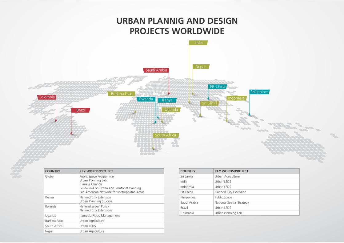
URBAN PLANNIG AND DESIGN PROJECTS WORLDWIDE
COUNTRY KEY WORDS/PROJECT
Global Public Space ProgrammeUrban Planning LabClimate ChangeGuidelines on Urban and Territorial PlanningPan American Network for Metropolitan Areas
Kenya Planned City ExtensionUrban Planning Studios
Rwanda National urban PolicyPlanned City Extensions
Uganda Kampala Flood Management
Burkina Faso Urban Agriculture
South Africa Urban LEDS
Nepal Urban Agriculture
COUNTRY KEY WORDS/PROJECT
Sri Lanka Urban Agriculture
India Urban LEDS
Indonesia Urban LEDS
PR China Planned City Extension
Philippines Public Space
Saudi Arabia National Spatial Strategy
Brazil Urban LEDS
Colombia Urban Planning Lab
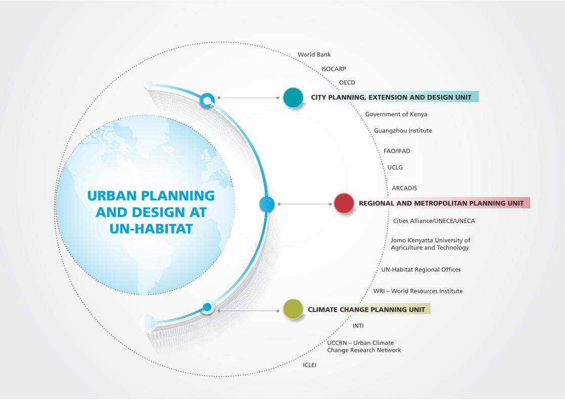
URBAN PLANNING AND DESIGN AT
UN-HABITAT
REGIONAL AND METROPOLITAN PLANNING UNIT
CLIMATE CHANGE PLANNING UNIT
CITY PLANNING, EXTENSION AND DESIGN UNIT
ISOCARP
Guangzhou Institute
Jomo Kenyatta University ofAgriculture and Technology
Government of Kenya
INTI
Cities Alliance/UNECE/UNECA
OECD
World Bank
FAO/IFAD
UCLG
UN-Habitat Regional Offices
ICLEI
WRI – World Resources Institute
ARCADIS
UCCRN – Urban ClimateChange Research Network
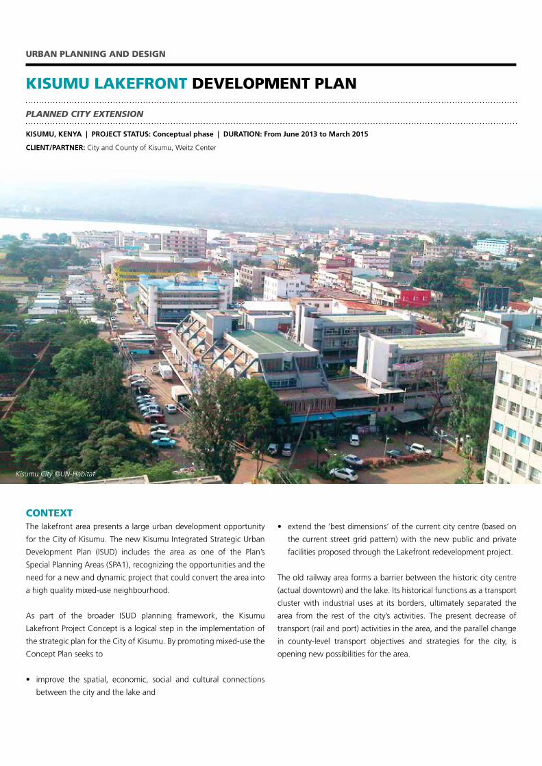
KISUMU LAKEFRONT DEVELOPMENT PLAN
URBAN PLANNING AND DESIGN
PLANNED CITY EXTENSION
KISUMU, KENYA | PROJECT STATUS: Conceptual phase | DURATION: From June 2013 to March 2015
CLIENT/PARTNER: City and County of Kisumu, Weitz Center
CONTEXTThe lakefront area presents a large urban development opportunity
for the City of Kisumu. The new Kisumu Integrated Strategic Urban
Development Plan (ISUD) includes the area as one of the Plan’s
Special Planning Areas (SPA1), recognizing the opportunities and the
need for a new and dynamic project that could convert the area into
a high quality mixed-use neighbourhood.
As part of the broader ISUD planning framework, the Kisumu
Lakefront Project Concept is a logical step in the implementation of
the strategic plan for the City of Kisumu. By promoting mixed-use the
Concept Plan seeks to
• improve the spatial, economic, social and cultural connections
between the city and the lake and
• extendthe‘bestdimensions’ofthecurrentcitycentre(basedon
the current street grid pattern) with the new public and private
facilities proposed through the Lakefront redevelopment project.
The old railway area forms a barrier between the historic city centre
(actual downtown) and the lake. Its historical functions as a transport
cluster with industrial uses at its borders, ultimately separated the
area from the rest of the city’s activities. The present decrease of
transport (rail and port) activities in the area, and the parallel change
in county-level transport objectives and strategies for the city, is
opening new possibilities for the area.
Kisumu City ©UN-Habitat
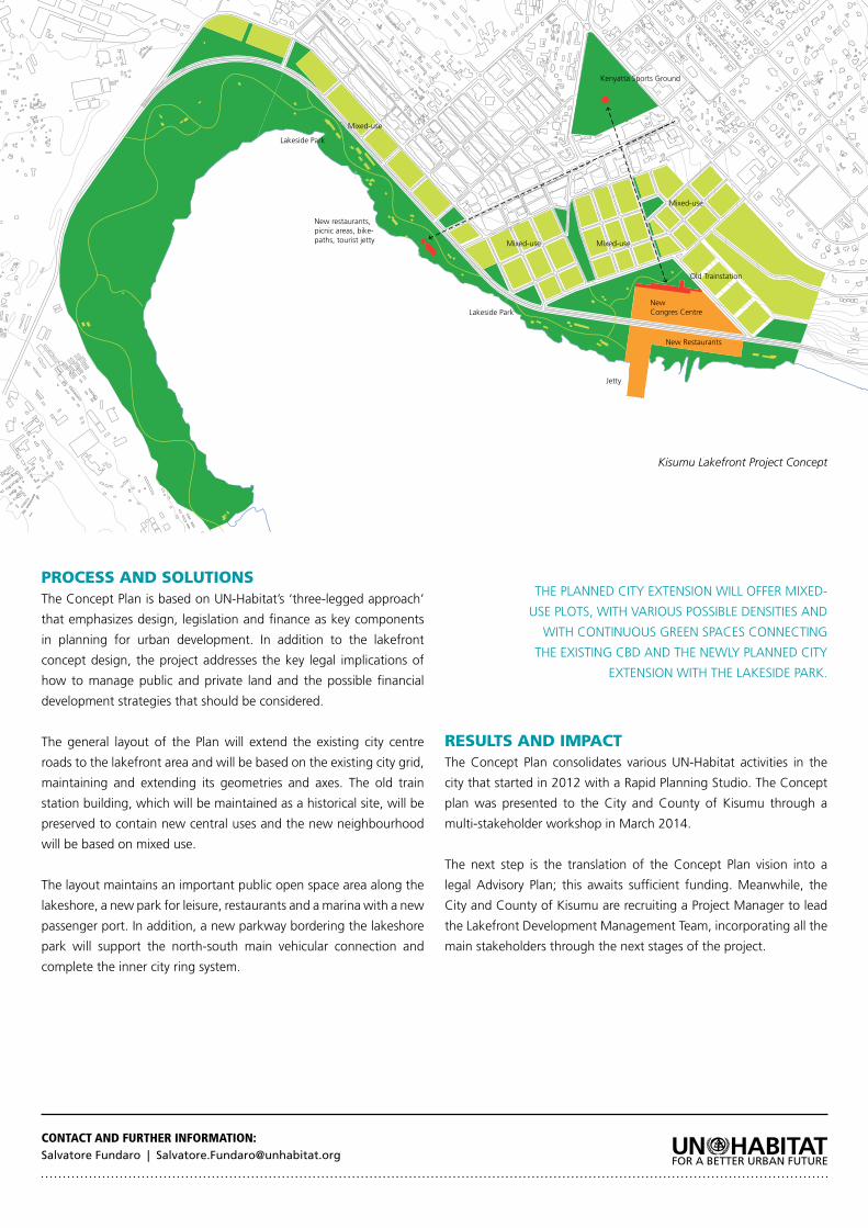
PROCESS AND SOLUTIONSTheConceptPlanisbasedonUN-Habitat’s‘three-leggedapproach’
that emphasizes design, legislation and finance as key components
in planning for urban development. In addition to the lakefront
concept design, the project addresses the key legal implications of
how to manage public and private land and the possible financial
development strategies that should be considered.
The general layout of the Plan will extend the existing city centre
roads to the lakefront area and will be based on the existing city grid,
maintaining and extending its geometries and axes. The old train
station building, which will be maintained as a historical site, will be
preserved to contain new central uses and the new neighbourhood
will be based on mixed use.
The layout maintains an important public open space area along the
lakeshore, a new park for leisure, restaurants and a marina with a new
passenger port. In addition, a new parkway bordering the lakeshore
park will support the north-south main vehicular connection and
complete the inner city ring system.
RESULTS AND IMPACTThe Concept Plan consolidates various UN-Habitat activities in the
city that started in 2012 with a Rapid Planning Studio. The Concept
plan was presented to the City and County of Kisumu through a
multi-stakeholder workshop in March 2014.
The next step is the translation of the Concept Plan vision into a
legal Advisory Plan; this awaits sufficient funding. Meanwhile, the
City and County of Kisumu are recruiting a Project Manager to lead
the Lakefront Development Management Team, incorporating all the
main stakeholders through the next stages of the project.
CONTACT AND FURTHER INFORMATION:Salvatore Fundaro | [email protected]
Old Trainstation
Lakeside Park
Lakeside Park
New Restaurants
Mixed-useMixed-use
Mixed-use
Mixed-use
New restaurants, picnic areas, bike-paths, tourist jetty
NewCongres Centre
Jetty
Kenyatta Sports Ground
THE PLANNED CITY EXTENSION WILL OFFER MIXED-
USE PLOTS, WITH VARIOUS POSSIBLE DENSITIES AND
WITH CONTINUOUS GREEN SPACES CONNECTING
THE EXISTING CBD AND THE NEWLY PLANNED CITY
EXTENSION WITH THE LAKESIDE PARK.
Kisumu Lakefront Project Concept
SUPPORT TO SUSTAINABLE URBAN SECTOR DEVELOPMENT IN KENYA – URBAN PLANNING STUDIOS COMPONENT
URBAN PLANNING AND DESIGN
CAPACITY BUILDING FOR URBAN PLANNING IN KENYAN COUNTIES
Eldoret, Embu, Kericho, Kitui, Machakos, Malindi, Mombasa, Naivasha, Nakuru, Nyeri , Thika, KENYA | PROJECT STATUS: In progress DURATION: Started May 2014, ending June 2015
CLIENT/PARTNER: Government of Kenya, 8 County governments and 12 towns.
CONTEXTKenya is a rapidly-urbanizing country which has recently created
a devolved system of governance. The role of urban planning is
recognized in the new constitution and the national government
is supporting county governments to undertake planning exercises
for urban centres through The Kenya Municipal Programme (KMP)
which is supported by the World Bank and SIDA. The KMP has four
components: Institutional Support; Participatory Urban Planning;
Infrastructure investment and Monitoring and Evaluation and aims to
build institutional capacity and citywide infrastructure at the county
level.
UN-Habitat is supporting the KMP in the delivery of capacity and
directing the planning process in 12 towns, clustered in five groups:
Cluster I (Mombasa), Cluster II ( Kitui and Malindi), Cluster III (Thika,
Machakos and Embu) and Cluster IV (Naivasha, Nakuru and Nyeri).
The objective of UN-Habitat’s support is to equip county and leaders
and practitioners with the understanding of planning and the
capacity to guide the process.
PROCESS AND SOLUTIONSThe project runs in parallel with and is synchronized with a planning
exercise conducted by a team of consultants hired by the KMP. The
project process includes:
1. Identification of needs
2. Development of an adequate technical support programme
including training for county planners and political leaders as well
as community leaders and reviewing the planning consultants’
work and coaching the county planning teams
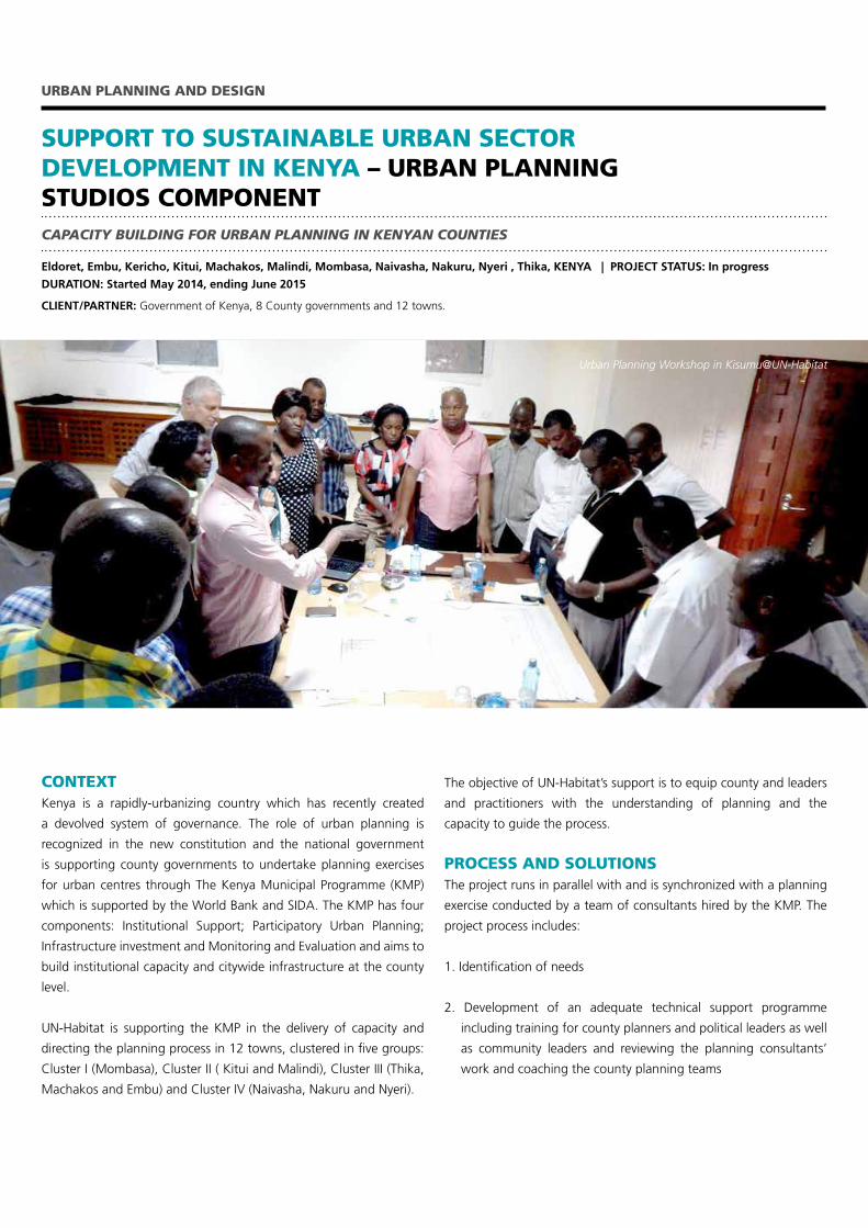
Urban Planning Workshop in Kisumu@UN-Habitat
3. Documentation and development of tools to consolidate the
discussion and approach
The project uses different tools to achieve its objectives:
• Conceptual training. This is largely based on UN-Habitat’s
Urban Planning for City Leaders guide
• Practicaltrainingthroughrapidplanningstudioswhichaddress
specific planning issues at town level
• Sessionstoreviewandcommentonconsultants’outputssuch
as inception reports, assessment reports and plans proposals
In each participating town, a series of three workshops is held:
A one-day Assembly Learning Session for For political leaders -
the members of the county assembly - and a one-day Learning Session for County Government executives to deliberate on
the importance and necessity of formulating appropriate planning
instruments;
A two-day Rapid Planning Studios session for the technical staff (county planners) to enhance their hands-on skills and
the application of various urban planning tools and approaches,
particularly planning for streets, public spaces and mixed-use
developments, the application of urban legislation and leveraging
urban planning for local economic development
Two-day sessions for community and civil society leaders to discuss and demystify the planning exercise, identify common areas of
interest and concern, familiarise themselves with planning concepts
and objectives and enhance the capacity of these key stakeholders to
participate adequately in the planning process
The sessions’ content and delivery is focused on an integrated urban
planning methodology based on Un-Habitat’s three–legged approach
which incorporates planning and design; legislation and regulation
and economy and finance.
RESULTS AND IMPACTUN-Habitat has successfully conducted trainings for nine towns,
which fall under Clusters I, II, III, and IV. The different types of training
tools engaged different targeted groups to promote awareness about
the importance of urban planning to achieve sustainable compact,
connected, integrated and socially inclusive urban development. The
training sessions also provided an opportunity for policy makers,
leaders and technical staff to identify crosscutting issues that need to
be addressed. Additional counties have expressed interest to engage
with UN-Habitat on a similar urban planning support programme
and several Memoranda of Understanding to this effect are under
development.
The project builds on existing material, particularly the Urban Planning
for City Leaders guide and has developed relevant documentation. It
now seeks to establish training tools that can be of relevance for
other contexts in Africa and beyond.
CONTACT AND FURTHER INFORMATION:Yuka Terada | [email protected]
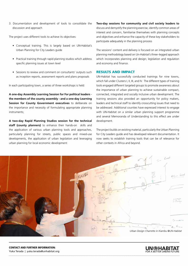
Urban Design Charrette in Kiambu @UN-Habitat
CONTEXTFaced with unprecedented urban growth, many cities in the
developing world struggle with managing the explosive growth of
their populations and built-up areas. The Urban Planning and Design
Laboratory (UPD Lab) was created as a response to the growing
demand from local, regional and national governments for assistance
in sustainable urban planning. The Lab translates UN-Habitat
planning principles into practice by developing plans and designs that
can be implemented locally. It also enhances the implementation of
these plans and designs by linking the legal, financial and planning
instruments.
With a global reach the Lab has created an international portfolio that
allows the comparison of applied planning tools and methodologies
to different local conditions. Additionally, the Lab is involved in
URBAN PLANNING AND DESIGN LABORATORY
URBAN PLANNING AND DESIGN
DEVELOPING CONCEPT PLANS, CITY-WIDE STRATEGIES, CITY IN-FILLS, NEW TOWNS
COUNTRIES: China, Colombia, Egypt, Ghana, Kenya, Mozambique, Philippines, Rwanda, Saudi Arabia, South Africa
CITIES: Wuzhou; Medellin & Santa Marta; Al Alamein & Banha; Ningo-Prampram & Accra; Kisumu; Mampula &, Nakala; Silay, Iloilo & Cagayan de Oro; Nyagatare & Rubavu; Riyad, Dammam, Albahaa & Brieda-Eniza; Johannesburg
PROJECT STATUS: In Progress | DURATION: : January 2014 - continuous | PROJECT PARTNERS: Respective local and city authorities
reviewing documents at the request of local, regional and national
governments, resulting in quick, high-impact responses to legal
planning documents that are under development.
PROCESS AND SOLUTIONSThe Lab is a UN-Habitat in-house design studio that offers urban
planning and design solutions from concept plans to detailed ones.
The Lab has a network of highly skilled planners that work locally and
it collaborates with global planning institutes and private partners.
It has a global reach and an overview of applicable tools and
methodologies in various contexts; advises on the application of UN-
Habitat’s Sustainable Urban Development principles; offers a neutral
voice and knowledge on how to pitch urban projects to international
investment opportunities and the Lab offers various services related
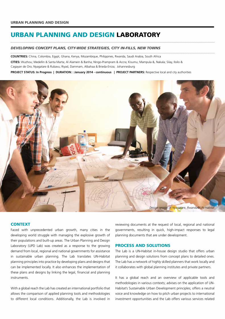
Design session in Nyagatare, Rwanda@UN-Habitat
to Spatial Analysis, Project Definition and Project Documents, Urban
Planning and Design, Supervision + design and project management,
Case studies and Best Practices and Planning Document Reviews.
The Planning and Design component of the Lab focuses on City-Wide
Strategies, Planned City Extension, Urban Renewal + Transformation
and New Town Development as described below.
City Wide Strategies are an integrated approach to infrastructure
development, urban extension, densification and rural/agricultural
linkages. They create a strategic framework for decision making
and define key projects for the short, medium and long term. By
identifying and structuring planned expansion areas that are near
to the existing urban fabric and at an adequate scale, Planned City
Extensions address the pressure for affordable housing and accessible
basic services brought about by a growing urban population.
When Urban Renewal and Transformation Strategies are applied
to the existing urban fabric, they help to achieve a structure that
minimizes transport and service delivery costs, optimizes the use of
land and supports the protection and organization of open spaces.
Benefits include street life, economic viability of activities, proximity
and walkability. New town development is particularly relevant
when balancing population distribution and expanding the national
system of cities is critical, especially in urbanizing countries. Its
adoption, however, needs to be evaluated carefully to build on real
development dynamics.
RESULTS AND IMPACTIn its first year of operation, the Lab successfully supported urban
planning in various cities around the globe. The Lab is currently
assisting the development of the Johannesburg’s Spatial Development
Framework 2040, due for finalization in 2015. The Lab has also
prepared concept plans for planned city extensions for Silay, Iloilo and
Cagayan de Oro in the Philippines, Santa Marta (Colombia), Kisumu
(Kenya), Ningo-Prampram (Ghana) and Nyagatare and Rubavu
(Rwanda).
For the city of Johannesburg the Lab is currently assisting in the
development of the city’s Spatial Development Framework 2040,
due for finalization in 2015. This document will influence the
future development of the city, focusing in achieving a more
compact, connected and integrated city through spatial connection,
transportation and provision of public space and services.
In 2014 the Lab, in conjunction with the planning department of
Medellin (Colombia), developed a concept plan for urban renewal in
the neighbourhood of La Candelaria. Once implemented, the poor
living conditions of 3,500 people will be improved by better-quality
public and commercial services and the increased density in the
neighbourhood – including an improved social mix of residents made
possible through the provision of middle class apartments,
Working with the city authority and private consultants, the Lab
developed a concept plan for a new town for Al-Alamein New City
inEgypt.This‘fourthgeneration’NewTownwillbebasedonnew
strategies to create a place that can grow in stages and that views
developing housing and jobs as equally important
CONTACT AND FURTHER INFORMATION:
Rogier van den Berg | [email protected]
http://unhabitat.org/urban-themes/planning-and-design
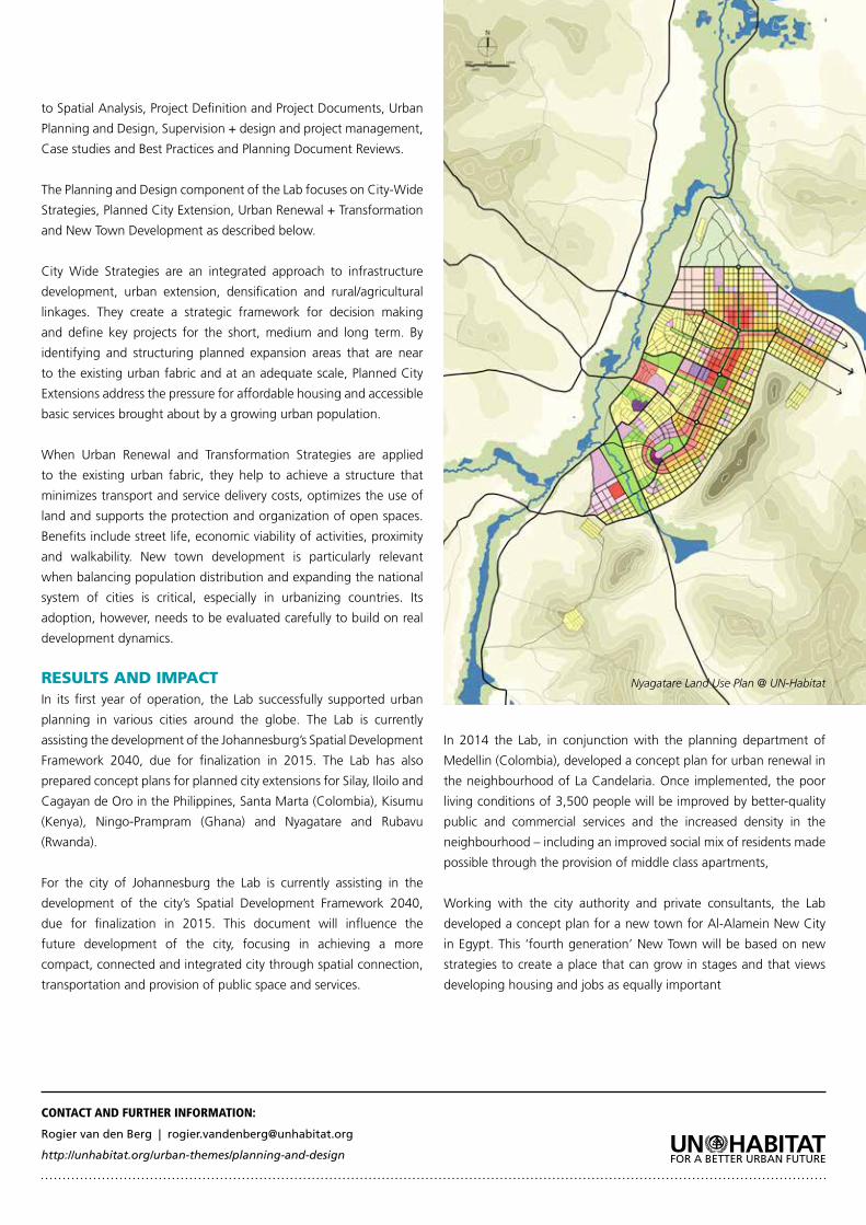
Nyagatare Land Use Plan @ UN-Habitat
CONTEXTProsperous cities must consider the importance of the public realm.
Cities that prioritize quality of life for all their citizens experience
higher levels of prosperity. Such cities strive towards social equity by
providing access to urban commons such as green areas, squares,
ample pavements and streets, recreation facilities and other public
spaces. Providing public spaces enhances community cohesion and
civic identity and supports the levels of urban density required for
environmentally and economically sustainable cities.. The role of
urban planning is to organize public spaces and the role of urban
design to encourage their use.
The overall objective of the UN-Habitat led public space programme
is to support local governments in creating and promoting socially
inclusive, integrated, connected, environmentally sustainable and safe
streets and public spaces, especially for the most vulnerable. More
specifically the programme promotes public space as an important
element for creating sustainable cities, for improving the quality of life
GLOBAL PROGRAMME ON PUBLIC SPACE
URBAN PLANNING AND DESIGN
IMPROVING PUBLIC SPACE IN URBAN AREAS
COUNTRIES: Argentina, Bangladesh, Burkina Faso, Colombia, Ethiopia, Haiti, India, Kenya, Kosovo, Mexico, Nepal, Nigeria, Peru, Philippines, Rwanda, Solomon Islands, Somalia, South Africa, Vietnam
CITIES: Buenos Aires; Kulnar; Ouagadougou; Medellin; Addis Ababa; Les Cayes; Mumbai & Pune; Nairobi; Pristina; Mexico City; Kirtipur; Akure and Lokoja, Lima, 2 cities in the Philippines, Kigali; Honiara; Mogadishu; Johannesburg; Ho Chi Minh City or Hanoi.
PROJECT STATUS: : Completed ( 4 ) In progress ( 14 ) Conceptual phase (8 )
DURATION: (e.g. from May to June, 2015): November 2012 – December 2016
PROJECT PARTNERS: Swedish International Development Co-operation Agency (Sida), Mojang
of urban citizens, and as a key message in the global dialogue leading
up to Habitat III. The intention of the public space programme is to
impact on the development of the whole city, to improve capacity
of local institutions and communities and to contribute to long-
term change. UN-habitat takes a city-wide approach to public space
and supports local government in developing strategies, polices,
action plans on public space. In addition, UN-Habitat supports local
governments to develop working partnerships with a range of
organisations, including multilaterals, civil society, academia and the
private sector around the issues of public space.
PROCESS AND SOLUTIONSThe Global Programme on Public Space has 3 main components:
supporting local and national governments in developing city-
wide strategies/policies and demonstration projects; establishing
partnerships on public space at the local, national and international
levels; and facilitating advocacy, capacity development, knowledge
management and tool development.
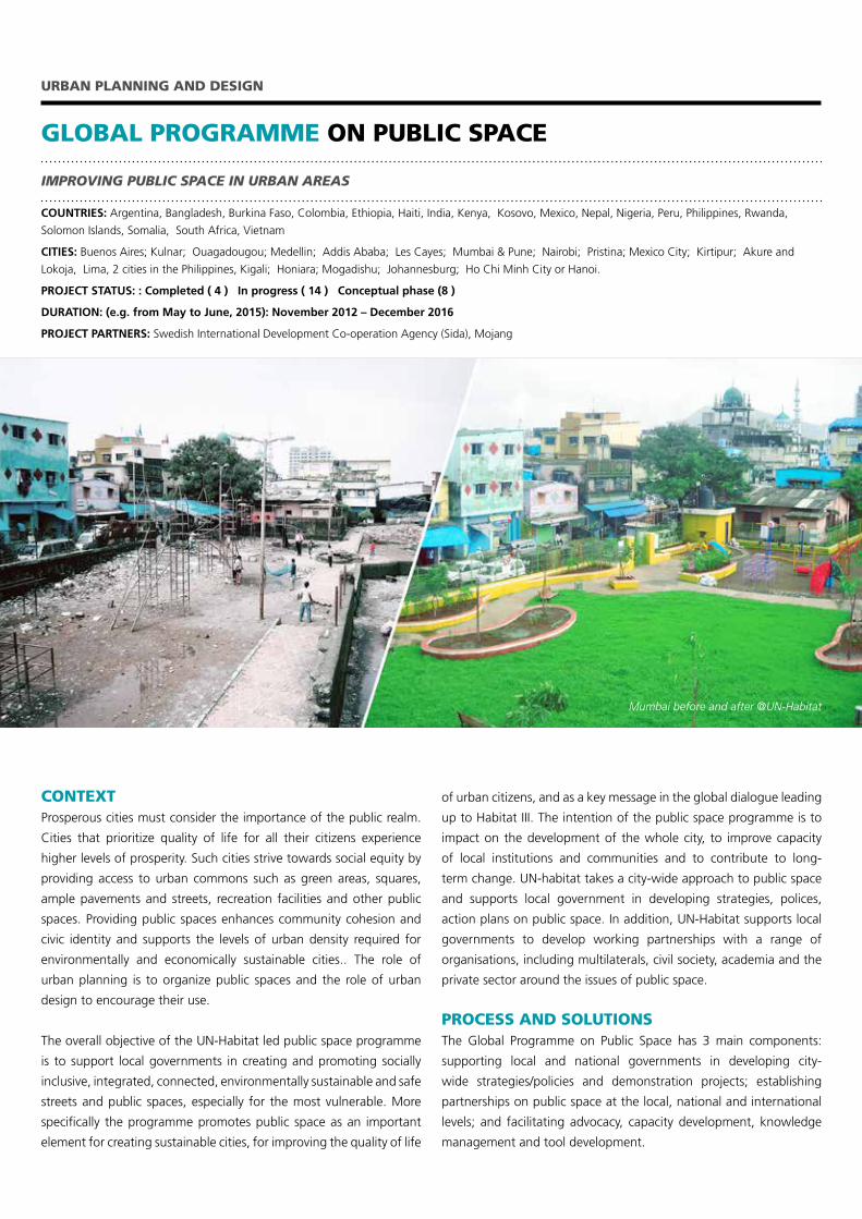
Mumbai before and after @UN-Habitat
Through pilot projects that are developed in partnership with cities,
the programme exemplifies the importance of public spaces in
achieving social, economic, environmental and other benefits to
cities. Community participation workshops using the Minecraft tool
facilitate the involvement of the community throughout the planning
and designing of public spaces in their neighbourhoods and cities.
This gives the community a sense of ownership of the public space
that often translates positively in the management, maintenance and
protection of the public space by the community. Figure 1 below
illustrates the public space process at the city level.
To promote advocacy for good public spaces in cities and support local
governments in developing and maintaining them, the programme
also works to consolidate knowledge, good approaches, indicators,
tools and methodologies on public space and to make these
accessible to local government and other partners. It also engages
a broader network of partners and public space practitioners in the
global promotion of good practices on public space.
RESULTS AND IMPACTDuring 2014, four pilot projects were completed – Jeevanje Gardens (
Nairobi), Dey Pukhu, (Kirtipur), Lotus Garden, (Mumbai) and Place de la
Paix,( Les Cayes). A further 14 are in progress or under development –
Addis Ababa (Ethiopia), Kigali (Rwanda), Mogadishu (Somalia), Akure
and Lokoja (Nigeria), Lima (Peru), Buenos Aires (Argentina), Medellin
(Colombia), Khulna (Bangladesh), Kirtipur (Nepal) phase II, Gautam
Nagar (Mumbai) phase II, Honiara (Solomon Islands) and La Touterelle
(Les Cayes). An additional four pilot projects are in the pipeline -
Pristina (Kosovo), Ho Chi Minh City or Hanoi (Vietnam), Mexico City
(Mexico), and Ouagadougou (Burkina Faso), Johannesburg (South
Africa), Pune (India) and 2 cities in the Philippines.
CONTACT AND FURTHER INFORMATION:
Cecilia Andersson, United Nations Human Settlements Programme (UN-Habitat)
P.O. Box 30030, GPO Nairobi 00100, Kenya | Tel: +254 20 762 4570
[email protected] or [email protected]
Nairobi, Kirtipur, Mumbai, Les Cayes , Mogadishu and Lima have
prepared public space designs and plans at the neighbourhood
level. Further, Nairobi, Kirtipur and Mogadishu are developing city-
wide public space strategies/plans based on UN-Habitat’s sustainable
planning principles. In Nairobi, the first phase of upgrading Jeevanjee
Garden located in the city centre, is almost complete and includes
improving security, making the park more appealing to the public
and providing services such as a stage and free WiFi. In Les Cayes ,
the upgrading and revitalization of Parc de la Paix was completed in
2014. It included fixing the broken play equipment, installing and
repairing the concrete benches, fixing the open drainage which
runs alongside the park, repainting the park walls and pavilion and
installing lighting. The revamped park is a popular spot for young
people.
In addition to the pilot projects, community participation public
space design trainings have taken place in Mexico City, Les Cayes,
Mogadishu, Lokoja and Akure, Kirtipur, Khulna, Honiara, Philippines,
and Lima. The programme is currently working on an advanced draft
of the publication: “Public Space Principles, Policies and Practices:
Towards a Global Toolkit”, which is under revision and will be
published in the course of 2015.
UN-Habitat collaborates with the following partners to promote
the public space agenda: Mojang, a key partner, in supporting the
participatory public space design process and also the implementation
of the actual public space interventions in select sites; the National
Planning Institute (INU) in Rome in the development of Global Charter
on Public Space and the publication “Public Space Principles, Policies
and Practices: Towards a Global Toolkit”; UCLG in establishing
networks of cities working on public space; Fundacion Avina in
supporting the public space implementation in two cities in Latin
America. Other partners include: Project for Public Spaces (PPS), Gehl
Architects, White Architects, Ax:son Jonsson Foundation, Yellow
Design Foundation, Institute pour la Ville en Movement, Svensk
Byggtjanst, FyreUK, Telmex, Foundation of Puerto Rico, League of
Cities of the Philippines and Slum Dwellers International (SDI). The
programme also collaborates with a multitude of local partners
– universities, NGO’s, communities, etc. – as well as supporting in-
house UN-Habitat Branches, such as Participatory Slum Upgrading
Programme, Urban Mobility Unit, Safer Cities Programme, Gender
Unit and Youth Unit. Further, partnerships are developing with other
UN Agencies, such as WHO and UNESCO.
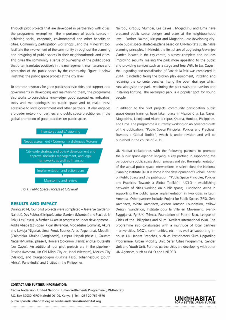
Inventory / audit / visioning
Needs assessment / Community dialogues /Forums
City-wide strategy and policy/ development and approval (includes management, and legal
frameworks as well as finances)
Implementation and action plan
Monitoring and review
Fig 1. Public Space Process at City level
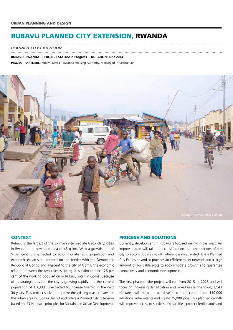
CONTEXTRubavu is the largest of the six main intermediate (secondary) cities
in Rwanda and covers an area of 45sq km. With a growth rate of
5 per cent it is expected to accommodate rapid population and
economic expan-sion. Located on the border with the Democratic
Republic of Congo and adjacent to the city of Goma, the economic
relation between the two cities is strong. It is estimated that 25 per
cent of the working popula-tion in Rubavu work in Goma. Because
of its strategic position the city is growing rapidly and the current
population of 150,000 is expected to increase fivefold in the next
30 years. This project seeks to improve the existing master plans for
the urban area in Rubavu District and offers a Planned City Extension
based on UN-Habitat’s principles for Sustainable Urban Development.
RUBAVU PLANNED CITY EXTENSION, RWANDA
URBAN PLANNING AND DESIGN
PLANNED CITY EXTENSION
RUBAVU, RWANDA | PROJECT STATUS: In Progress | DURATION: June 2014
PROJECT PARTNERS: Rubavu District, Rwanda Housing Authority, Ministry of Infrastructure
PROCESS AND SOLUTIONSCurrently, development in Rubavu is focused mainly in the west. An
improved plan will take into consideration the other sectors of the
city to accommodate growth where it is most suited. It is a Planned
City Extension and so provides an efficient street network and a large
amount of buildable plots to accommodate growth and guarantee
connectivity and economic development.
The first phase of the project will run from 2015 to 2025 and will
focus on increasing densification and mixed use in the town; 1,543
Hectares will need to be developed to accommodate 110,000
additional inhab-itants and create 75,000 jobs. This planned growth
will improve access to services and facilities, protect fertile lands and
Rubavu, Rwanda ©UN-Habitat
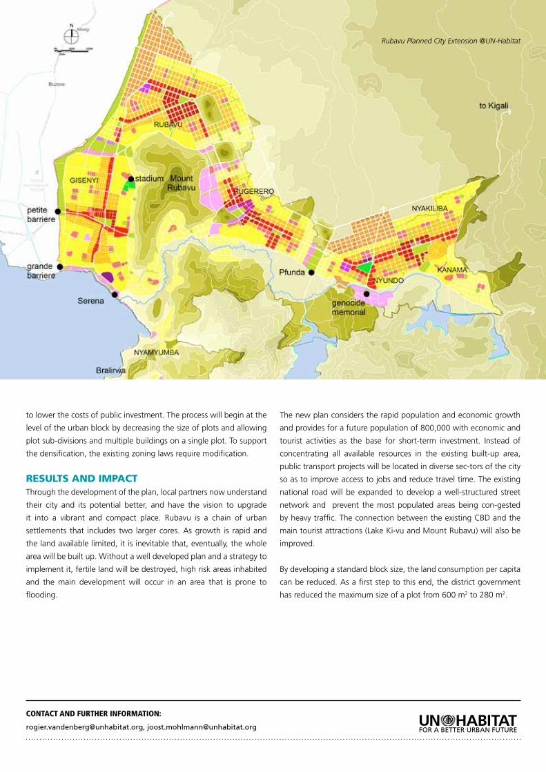
to lower the costs of public investment. The process will begin at the
level of the urban block by decreasing the size of plots and allowing
plot sub-divisions and multiple buildings on a single plot. To support
the densification, the existing zoning laws require modification.
RESULTS AND IMPACTThrough the development of the plan, local partners now understand
their city and its potential better, and have the vision to upgrade
it into a vibrant and compact place. Rubavu is a chain of urban
settlements that includes two larger cores. As growth is rapid and
the land available limited, it is inevitable that, eventually, the whole
area will be built up. Without a well developed plan and a strategy to
implement it, fertile land will be destroyed, high risk areas inhabited
and the main development will occur in an area that is prone to
flooding.
The new plan considers the rapid population and economic growth
and provides for a future population of 800,000 with economic and
tourist activities as the base for short-term investment. Instead of
concentrating all available resources in the existing built-up area,
public transport projects will be located in diverse sec-tors of the city
so as to improve access to jobs and reduce travel time. The existing
national road will be expanded to develop a well-structured street
network and prevent the most populated areas being con-gested
by heavy traffic. The connection between the existing CBD and the
main tourist attractions (Lake Ki-vu and Mount Rubavu) will also be
improved.
By developing a standard block size, the land consumption per capita
can be reduced. As a first step to this end, the district government
has reduced the maximum size of a plot from 600 m2 to 280 m2.
CONTACT AND FURTHER INFORMATION:
[email protected], [email protected]
Rubavu Planned City Extension @UN-Habitat
CONTEXTWuzhou is a city in Eastern Guangxi Province on the banks of the Xi
River, a tributary of the Pearl River in China. The district currently has
a population of more than 3 million people, with 500,000 inhabitants
living and working in the city. A policy to partly shift the industrial
complex from the coastal areas of China towards the Midwest gave
Wuzhou a new challenge: how to accommodate new industries and
a forecasted million new citizens by 2030. The Urban Planning and
Design Lab collaborated with the Guangzhou Planning Institute to
rethink and redraw the Wuzhou District Plan to meet sustainable
urban development goals.
CITY-WIDE STRATEGY WUZHOU, CHINA
URBAN PLANNING AND DESIGN
CITY-WIDE STRATEGY
WUZHOU, PEOPLES REPUBLIC OF CHINA | PROJECT STATUS: Completed | DURATION: April 2014 – November 2014
PROJECT PARTNERS: City of Wuzhou/ Guangzhou Planning Institute
PROCESS AND SOLUTIONSThe new Wuzhou District Plan is based on the concept of the compact
and connected city. The plan reduces industrial areas and clusters
them around a southern transport axis that combines road, rail and
port logistics in multi-modal hubs. The southbound highway gets
separate lanes for pass through traffic and traffic dedicated to the
industrial complexes, while the large industrial areas are separated
from the city model by a park that forms the natural southern border,
connects on both sides to the river and offers green space and
leisure activities. Three areas in the city core have been selected for
densification, all waterfront locations with good connectivity to the
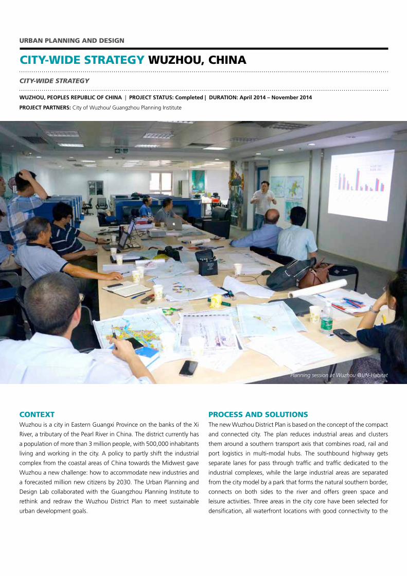
Planning session at Wuzhou @UN-Habitat
rest of the city. The former planned logistic areas close to the city
centre will be replaced by an urban district with a passenger station
and a park. A new Bus Rapid Transit (BRT) system connects various
parts of the city.
RESULTS AND IMPACTCurrently, the new district plan for Wuzhou is under approval.
Prepared by Guangzhou Planning Institute technical staff in
collaboration with UN-Habitat’s Urban Planning and Design Lab, the
plan successfully includes all UN-Habitat principles and proposals on
urban compactness and connectivity.
As a result, the new plan clusters larger industries around connected
hubs and creates a compact city core with higher density and proximity.
This reduces the possible constraints of a fast hyper-industrialization
process, concentrating industries in the better-connected southern
part of the city and avoiding the creation, as in the former plan, of an
industrial circular ring around the city. Underpinned by a BRT system,
the plan will allow residential settlements to be located away from
industrial pollution and further separated by the new park.
CONTACT AND FURTHER INFORMATION:
Rogier van den Berg | [email protected]
Wuzhou City-Wide Strategy @UN-Habitat
‘CITY’ INITIATIVES LAUNCHED AT UN CLIMATE SUMMIT
URBAN PLANNING AND DESIGN
CITIES AND CLIMATE CHANGE INITIATIVE (CCCI)
GLOBAL INITIATIVE | PROJECT STATUS: In Progress | DURATION: 2014 to 2015 and beyond
CLIENT/PARTNER: UN Secretariat / Secretary General’s Office/ Various other partner organizations
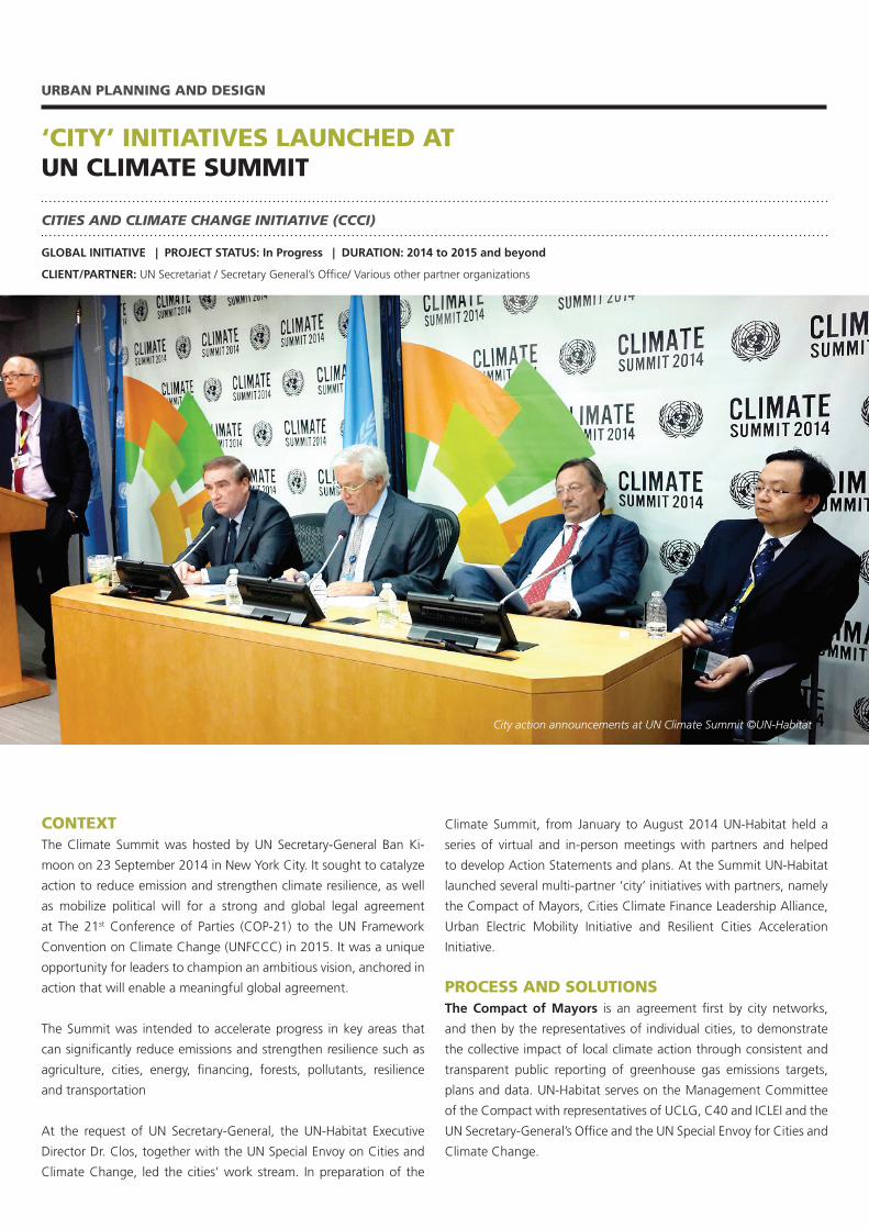
CONTEXTThe Climate Summit was hosted by UN Secretary-General Ban Ki-
moon on 23 September 2014 in New York City. It sought to catalyze
action to reduce emission and strengthen climate resilience, as well
as mobilize political will for a strong and global legal agreement
at The 21st Conference of Parties (COP-21) to the UN Framework
Convention on Climate Change (UNFCCC) in 2015. It was a unique
opportunity for leaders to champion an ambitious vision, anchored in
action that will enable a meaningful global agreement.
The Summit was intended to accelerate progress in key areas that
can significantly reduce emissions and strengthen resilience such as
agriculture, cities, energy, financing, forests, pollutants, resilience
and transportation
At the request of UN Secretary-General, the UN-Habitat Executive
Director Dr. Clos, together with the UN Special Envoy on Cities and
Climate Change, led the cities’ work stream. In preparation of the
Climate Summit, from January to August 2014 UN-Habitat held a
series of virtual and in-person meetings with partners and helped
to develop Action Statements and plans. At the Summit UN-Habitat
launched several multi-partner ‘city’ initiatives with partners, namely
the Compact of Mayors, Cities Climate Finance Leadership Alliance,
Urban Electric Mobility Initiative and Resilient Cities Acceleration
Initiative.
PROCESS AND SOLUTIONSThe Compact of Mayors is an agreement first by city networks,
and then by the representatives of individual cities, to demonstrate
the collective impact of local climate action through consistent and
transparent public reporting of greenhouse gas emissions targets,
plans and data. UN-Habitat serves on the Management Committee
of the Compact with representatives of UCLG, C40 and ICLEI and the
UN Secretary-General’s Office and the UN Special Envoy for Cities and
Climate Change.
City action announcements at UN Climate Summit ©UN-Habitat
The Cities Climate Finance Leadership Alliance is a strong
partnership between UN-Habitat and public financial and private
investors, development agencies and NGOs to catalyze and
accelerate capital flows to cities to maximize investment on low-
carbon and climate-resilient infrastructure in urban areas. The
Alliance is structured through working groups including Research and
Knowledge Management; Policy and Advocacy; Good Practice and
Barriers to showcase action on the ground and Fundraising, Member
Outreach and Partnerships. Its success will be measured by its ability
to stimulate the flow of investment in climate-related infrastructure
projects in cities.
The Urban Electric Mobility Initiative seeks to promote the
widespread adoption of electric vehicles in cities to reduce emissions
from transport and air pollution and limit the increase in global mean
temperature to two degrees Celsius.
The Resilient Cities Acceleration Initiative seeks to accelerate the
design and implementation of integrated strategies to strengthen
urban systems.
RESULTS AND IMPACTAt present (March 2015) these initiatives are still in their initial stages
of organization and fundraising so it is too early to expect results and
impact. However, expected initial outputs and results by the time of
COP-21, and/or expected results and impacts in the longer term, are
as follows:
For the Compact of Mayors, the target at COP-21 is to announce
that the Mayors of a thousand cities have committed to increased
action on reducing emissions and building climate resilience.
For the Cities Climate Finance Leadership Alliance, the COP-21
target is to release an inaugural ‘State of the Cities Climate Finance
Report’ and six case studies of innovative finance for low carbon or
climate resilient urban development. This is expected to lead to at
least one financial institution announcing that it intends to replicate
one of those models.
The Urban Electric Mobility Initiative strives to increase the global
market share of electric vehicles in cities to reach at least 30 per cent
of vehicles sales by 2030.
The Resilient Cities Acceleration Initiative aims to double the
number of cities and partners in support of city resilience building
by the end of 2015; to assist 500 local governments to develop
resilience action plans and to generate US$2 billion of in-kind and
direct support for cities’ action plans by 2020.
CONTACT AND FURTHER INFORMATION:
Mr. Robert Kehew | [email protected]://unhabitat.org/ccci
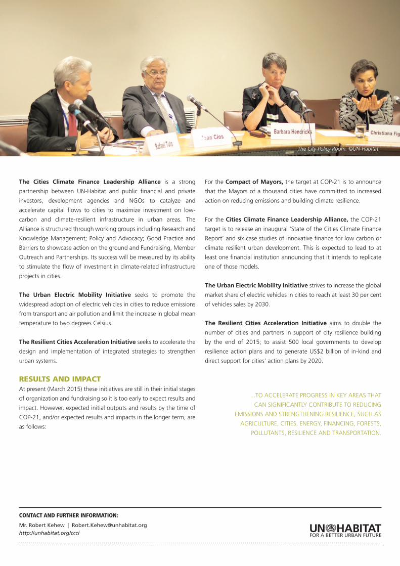
The City Policy Room. ©UN-Habitat
...TO ACCELERATE PROGRESS IN KEY AREAS THAT
CAN SIGNIFICANTLY CONTRIBUTE TO REDUCING
EMISSIONS AND STRENGTHENING RESILIENCE, SUCH AS
AGRICULTURE, CITIES, ENERGY, FINANCING, FORESTS,
POLLUTANTS, RESILIENCE AND TRANSPORTATION.
INTEGRATED FLOOD MANAGEMENT IN KAMPALA
URBAN PLANNING AND DESIGN
CITIES AND CLIMATE CHANGE INITIATIVE (CCCI)
KAMPALA, UGANDA | PROJECT STATUS: Completed | DURATION: January 2012 – December 2013
CLIENT/PARTNER: University of Twente; Makerere University; Kampala Capital City Authority; National Slum Dwellers Federation; Buganda Land Board; Office of the Prime Minister
CONTEXTFlooding is an urgent environmental concern in Kampala as much
of the city is built on former wetlands. Due to climate change the
region’s rainfall patters are changing and flooding is occurring
more frequently, a situation that is forecasted to worsen. A large
percentage of the city’s low-income residents live in these flood-
prone areas. Previous flood management efforts in Kampala focused
on a traditional sectorial engineering solution: the development and
implementation of storm-water drainage for the city’s major water
catchment areas. Frequent and worsening flooding led the Kampala
Capital City Authority (KCCA) to review and evaluate the master plan
and develop and propose a coherent solution addressing flooding, as
part of a response to climate change under the UN-Habitat Cities and
Climate Change Initiative.
PROCESS AND SOLUTIONSThe Project on Integrated Flood-Risk Management (IFM) in Kampala
was intended to show how flood risk can be addressed in an integrated,
multi-dimensional and participatory way. The objectives were to carry
out a comprehensive, city-wide assessment of the flooding risks based
on the principles of integrated flood management; to undertake
a more detailed spatial flood risk assessment in a representative
vulnerable neighbourhood (Bwaise slum area) and to offer a leading
to mainstreaming improved and integrated flood management into
Kampala Capital City Authorities’ practices and operations.
A combination of catchment management and engineering
solutions that is particular to IFM is the utilization of Sustainable
Drainage Systems (SuDS) to prevent runoff through flood retention
upstream,The success of such measures depends to a large extent
on the level of support and maintenance from public bodies and civil
society actors.
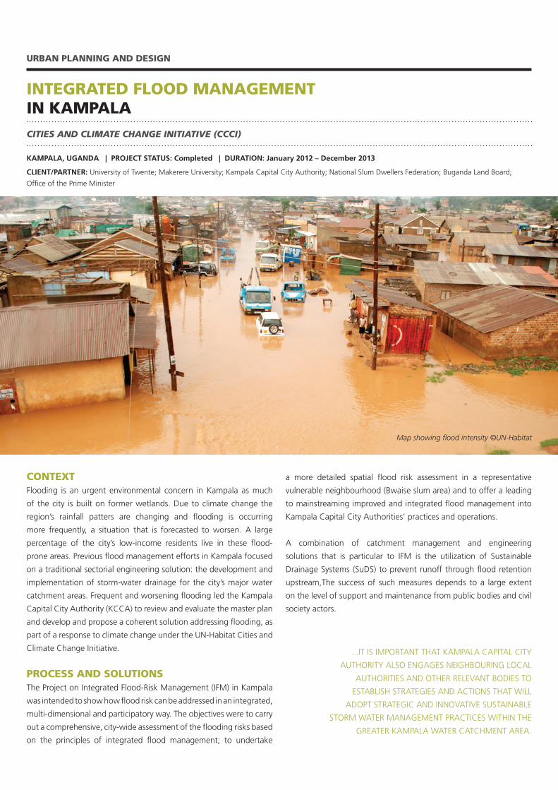
Map showing flood intensity ©UN-Habitat
...IT IS IMPORTANT THAT KAMPALA CAPITAL CITY
AUTHORITY ALSO ENGAGES NEIGHBOURING LOCAL
AUTHORITIES AND OTHER RELEVANT BODIES TO
ESTABLISH STRATEGIES AND ACTIONS THAT WILL
ADOPT STRATEGIC AND INNOVATIVE SUSTAINABLE
STORM WATER MANAGEMENT PRACTICES WITHIN THE
GREATER KAMPALA WATER CATCHMENT AREA.
RESULTS AND IMPACTThe main output is an Action Plan for Integrated Flood Risk
Management for Kampala, which proposes four concrete action
packages that address the major strategic responses to flood risk in
Kampala. These action areas as follows:
• Reducing flooding, involving a combination of improved
drainage maintenance and solid waste management practices
along draining systems together with SuDS measures that
together will reduce the extent, depth and duration of future
floods.
• Mitigatingtheeffectsoffloodingandcombiningmeasuresto
improve sewerage disposal to reduce health risks associated
with faecal waste dispersal, and enhancing the data and
information services needed to plan and manage development
in flood-prone areas.
• Reducing susceptibility to flooding through legal, planning
and information awareness measures that aim to reduce the
number of structures and people exposed to flooding and
must incorporate public awareness campaigns and a strict
enforcement regime.
• Preserving natural resources of flood plains, legally defining
and protecting the remaining natural flood plains in Kampala.
A clear and enforceable boundary definition of flood plains,
including a hazard zonation, is important.
It is also important that KCCA also engages neighbouring local
authorities and other relevant bodies to adopt strategic and
innovative sustainable storm water management practices within the
Greater Kampala water catchment area and so avoid the replication
of past practices of urban planning and development that are major
determinants of the scale and severity of floods.
Officials have used these recommendations in their plans and
actions. In late 2014, KCCA secured funds and prepared the Terms
of Reference for a major consultancy to update the 2003 Kampala
Drainage Master Plan in a manner that reflects approaches advocated
by the project. KCCA is in the process of formulating and updating
its storm water management policy in support of the proper
implementation of the drainage master plan.
CONTACT AND FURTHER INFORMATION:
Mr. Robert Kehew | [email protected]://unhabitat.org/ccci
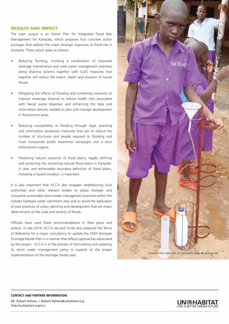
Schoolchild collection of rainwater data @UN-Habitat
CONTEXTUrban and peri-urban agriculture and forestry (UPAF) provide an
opportunity to reduce greenhouse gas emissions while also enhancing
adaptation and resilience efforts and additional benefits can include
increased food security.
With support from the Government of Norway and in collaboration
with RUAF, UN-Habitat Cities and Climate Change Initiative (CCCI)
carried out pilot projects in Bobo Dioulasso, Burkina Faso; Kathmandu
in Nepal and Kesbewa, Sri Lanka.
PROCESS AND SOLUTIONSThe activities in Bobo Dioulasso involved the preservation and
protection of the border zones between the city and its forests in
addition to preserving and redesigning the city’s Trames Vertes
(open urban lots used for agroforestry activities) as areas with multi-
functional and productive land uses. In Kathmandu, CCCI promoted
productive rooftops, coupled with harvesting rainwater, recycling
organic household waste and using climate-smart production
technologies. The Kesbewa activities involved the productive
INTEGRATING URBAN AGRICULTURE INTO CITY-LEVEL CLIMATE CHANGE STRATEGIES
URBAN PLANNING AND DESIGN
URBAN AND PERI-URBAN AGRICULTURE AND FORESTRY
COUNTRIES: Burkina Faso; Nepal; Sri Lanka | CITIES: Bobo Dioulasso; Kathmandu; Kesbewa
PROJECT STATUS: completed (X) | DURATION: 2012-2014
PROJECT PARTNERS: International network of Resource Centres on Urban Agriculture and Food Security (RUAF) Foundation (coordination, the Netherlands); Ministry of Western Province (Sri Lanka); Janathakshan (Sri Lanka); University of Moratuwa and the University of Colombo (Sri Lanka); The International Water Management Institute (Sri Lanka); Kathmandu Metropolitan City (KMC, Nepal); Environment and Public Health Organisation (ENPHO, Nepal); The Institute for Social and Environmental Transition (ISET, Nepal); Municipality of Bobo Dioulasso (Burkina Faso); and l’Institut d’Application et de Vulgarisation en Science (IAVS, Burkina Faso).
rehabilitation of low-lying flood zones and wetlands to create a
buffer zone and the establishment of 150 home garden units in
village clusters.
The activities aimed to build resilience by enhancing the supply of
locally-produced food, reducing their dependency on food imports,
improving urban food security, and generating income through job
creation. Additionally, they sought to enhance the collaboration
between local governments and stakeholders involved in horticulture,
livestock, agro-forestry, and aquaculture.
Work began with a review and analysis of UPAF existing experiences,
land use, policy frameworks, urban food flows and local climate
change vulnerability in the three cities. There was an assessment and
design of different replicable models of UPAF with high potential for
climate change adaptation and mitigation impacts.
Training was conducted for key partners in urban agriculture and
climate change in project planning, research, policy influencing and
formulation, project design and impact monitoring. The three cities
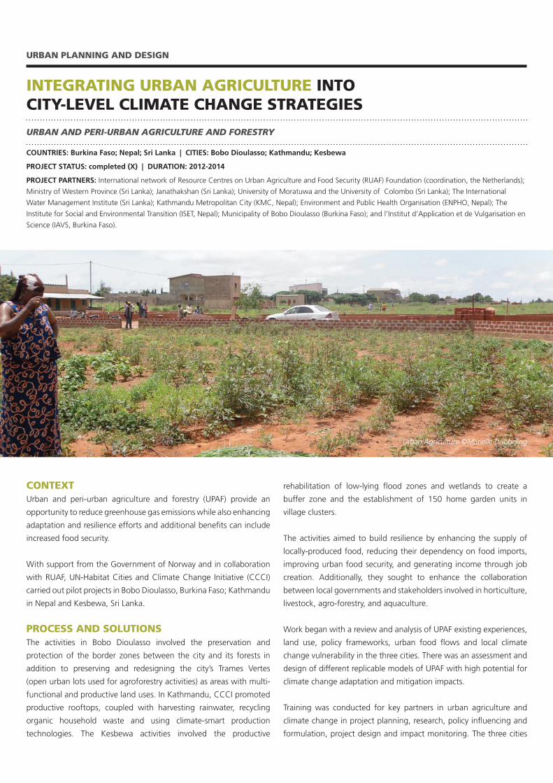
Urban Agriculture ©Marielle Dubbeling
implemented demonstration projects to showcase replicable UPAF
models and facilitate learning from practice.
The project supported policy formulation and uptake and brought
the experiences gained into the dissemination of project results and
monitored the contributions of UPAF to climate change adaptation
and mitigation and developmental co-benefits.
RESULTS AND IMPACTThere has been improvement in local project partners’ capacity in
design, implementation and monitoring of UPAF projects in the
context of climate change mitigation and adaptation programmes.
Additional and more specific results by city are as follows:
In Bobo Dioulasso: • Three policy texts on themanagement and use of the Trames
Vertes have been developed and adopted by the Environmental
Commission of the Commune de Bobo Dioulasso
• Participatinghouseholdsoftheprojectareexpectedtosave,on
average, the equivalent of 6 per cent of their monthly expenditures
In Kathmandu:• In2014,KMCsignedanagreementwiththeMinistryofFederal
Affairs and Local Development to ensure that by the end of 2016
at least 20 per cent of all city households produce vegetables from
their rooftop
• More than 250 households have been trained in rooftop
gardening, and USD30,000 was allocated by the city in the 2014
municipal budget for the expansion of the programme.
• A draft rooftop garden policy has been formulated and put
forward for formal approval.
In Kesbewa:• DuringtheOctober-Januarysowingseasonin2014,43acresof
paddy field located in flood risk zones were put into cultivation
• ThenewUPAFmodelforlow-lyingfloodzonesandpaddylands
has been taken up in recent circulars under the National Agrarian
Policy
• The draft Kesbewa Urban Development Plan now seeks to
integrate UPAF in its environmental protection zones.
• TheWesternProvincehastakeninitialstepstodevelopaProvincial
Climate Change Action Plan, featuring urban and peri-urban
agriculture
• Aninitialsurveyshowsthat,onaverage,thehouseholdspracticing
in intensive home gardening are able to sell 53 per cent more
produce than they were before training.
CONTACT AND FURTHER INFORMATION:
Mr. Robert Kehew | [email protected]://unhabitat.org/ccci
RUAF Foundation: http://www.ruaf.org
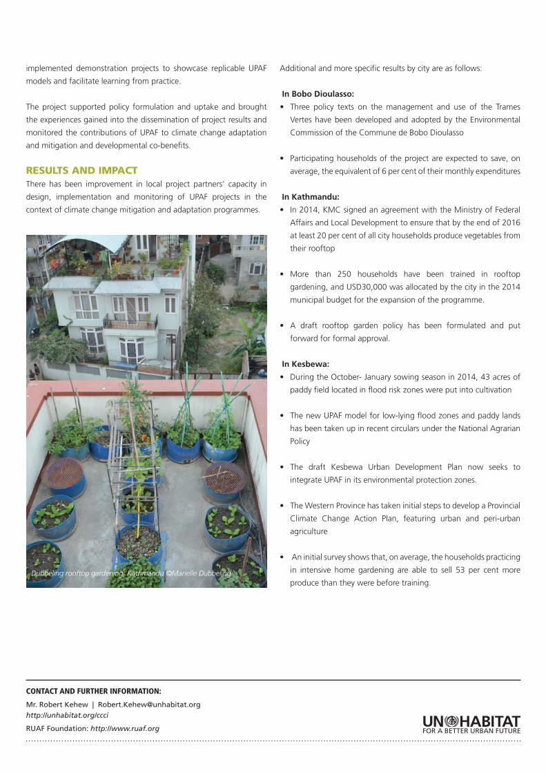
Dubbeling rooftop gardening, Kathmandu ©Marielle Dubbeling
CONTEXTThe Urban-LEDS project has been run by UN-Habitat and ICLEI in
Brazil, Indonesia, India and South Africa to help the transition to low-
emission urban development by offering selected local governments
a comprehensive methodological framework to integrate low-carbon
strategies into all sectors of urban planning and development.
The main project outputs and benefits to project cities are
stakeholder identification and engagement plans, GHG inventory,
identifying development needs and opportunities, finding solutions
for low emissions development (LED) at sectorial and cross-sectorial
level, assessing alternative low emissions development solutions,
identification of financing models and opportunities and integration
of local action with NAMAs and other national processes.
PROMOTING LOW EMISSION URBAN DEVELOPMENT STRATEGIES IN EMERGING ECONOMIES (URBAN LEDS)
URBAN PLANNING AND DESIGN
CLIMATE CHANGE MITIGATION PROJECT
COUNTRIES: Brazil, Indonesia, India, South Africa -
CITIES: Recife, Fortaleza
Belo Horizonte, Betim, Curitiba, Rio de Janeiro, Porto Alegre, Sorocaba; (ii) Indonesia: Balikpapan, Bogor, Bontang, Kabupaten Bogor, Tangerang Selatan,
Tarakan, (iii) India: Rajkot, Thane, Coimbatore, Nagpur, Pimpri- Chinchwad, Gwalior, Panaji, Shimia, (iv) South Africa: KwaDukuza Municipality, Steve
Tshwete Municipality, Mogale City Local Municipality, Saldanha Bay Municipality, uMhlathuze Local Municipality, Nelson Mandela Bay Municipality, Sol
Plaatje Municipality
PROJECT STATUS: In Progress | DURATION: From March 2012 to August 2015
PROJECT PARTNERS: The Urban-LEDS project is funded by the European Commission, and implemented by UN-Habitat and ICLEI
In Brazil, a voluntary commitment adopted in 2009 aims at
reducing emissions by between 36 per cent and 39 per cent below
the business-as-usual scenario by 2020. Aligned to this, is Brazil`s
commitment to cut deforestation by 80 per cent from historic levels
by 2020. The Federal Government has defined sectoral mitigation
plans and many of them relevant to cities, where emissions are
increasing. The project is supporting vertical integration between
different levels of government in addressing climate change and to
ensure continued local engagement and coordinated approaches for
planning, implementation and reporting.
PROCESS AND SOLUTIONS
UN-Habitat and ICLEI are providing the participant cities with a
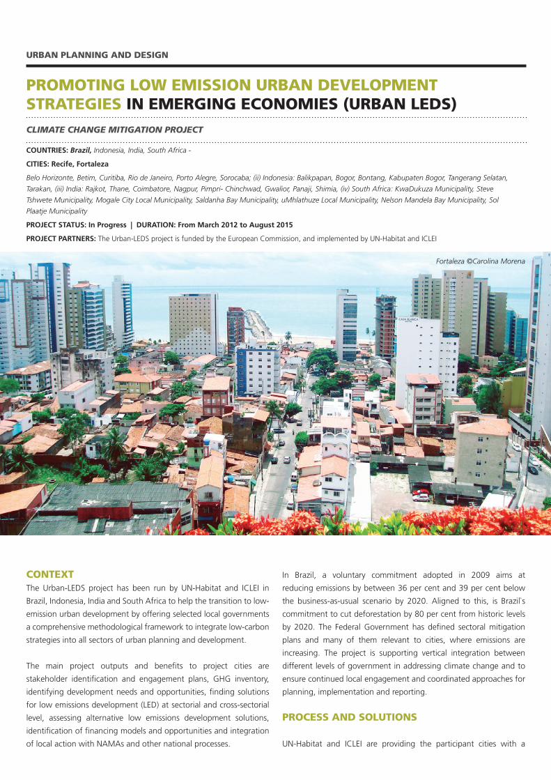
Fortaleza ©Carolina Morena
comprehensive and effective methodology for institutionalizing low-
emission development. Each phase offers tools and guidance on
creating political processes, compiling a greenhouse gas inventory,
setting targets and key performance indicators, identifying LEDS
priorities, reviewing relevant contexts, building internal capacity and
engaging with stakeholders.
In Recife and Fortaleza, the project is supporting model and satellite
cities´ implementation process through tailor-made training to local
governments; access to GreenClimateCities Methodology, GHGs
emissions quantification and monitoring software (HEAT+), global
reporting platform (carbonn Cities Climate Registry); access to Urban
LEDS Pool of Experts and Solutions Gateway for guidance on LED
options and support in integration of local action in the global climate
change regime and establish processes for appropriate verification
(MRV).
RESULTS AND IMPACTRecife has developed a Municipal Policy on Climate Change and
Sustainability to guide actions on climate change mitigation and
adaptation. A future LED Strategy will include the following actions,
some of which already have been approved by City Council and thus
represent early results: a recently-adopted code and certification
for sustainable construction; the Municipal Integrated Waste
Management Plan (collection of electronic waste, implementation of
waste separation systems); the Public LED Lightning and Biofuel for
the Municipal Fleet Project, piloted in the historical centre is planned
to extend in 2015 to public spaces and buildings with the target of
saving 50-70 per cent in energy consumption in the pilot area.
Recife’s afforestation is among the priorities of the urban and
environmental development policy and 6,716 trees will be planted
in eight neighbourhoods. Recife will start a domestic composting
programme, scheduled to begin in 2015, as well as a programme
for using boats to transport passengers. Recife will also be the first
city in Brazil to have an electric car-sharing scheme in partnership
with the State Government. The proposed creation of bus corridors
and bike lanes will improve passenger transport flow in Recife. Some
of the implementation support comes from co-funding mobilized by
UN-Habitat, using the expertise of a certified International Society of
City and Regional Planners (ISOCARP) urban planner supervised by
UN-Habitat.
Fortaleza intends to become an eco-efficient and resilient city by
achieving an economic growth compatible with environmental
conservation. In addition, the city’s low carbon vision is currently
being outlined, planned for finalization in early 2015.The main
priority sectors for Low Emissions Urban Development are waste,
mobility, urban planning, and spatial development, street lighting
and renewable energy.
A future Urban LEDS strategy likely will include most or all of the
following actions: Fortaleza Afforestation Plan, established to
increase tree cover in the municipality, aiming at neutralizing CO2
emissions and while reducing atmospheric pollution; the Minha
Casa, Minha Vida (My home, my life) programme should include
a new element that involves installing solar systems on homes for
water heating (solar thermal) and electricity; a Municipal Integrated
Waste Management Plan developed by the local government for
dealing with waste management problems; Fortaleza`s first GHG
inventory for a better understanding of here and how emissions can
be decreased and a efficient building pilot project was launched, with
13 schools being made more energy efficient.
CONTACT AND FURTHER INFORMATION:
Robert Kehew | [email protected]
www.urbanleds.iclei.org
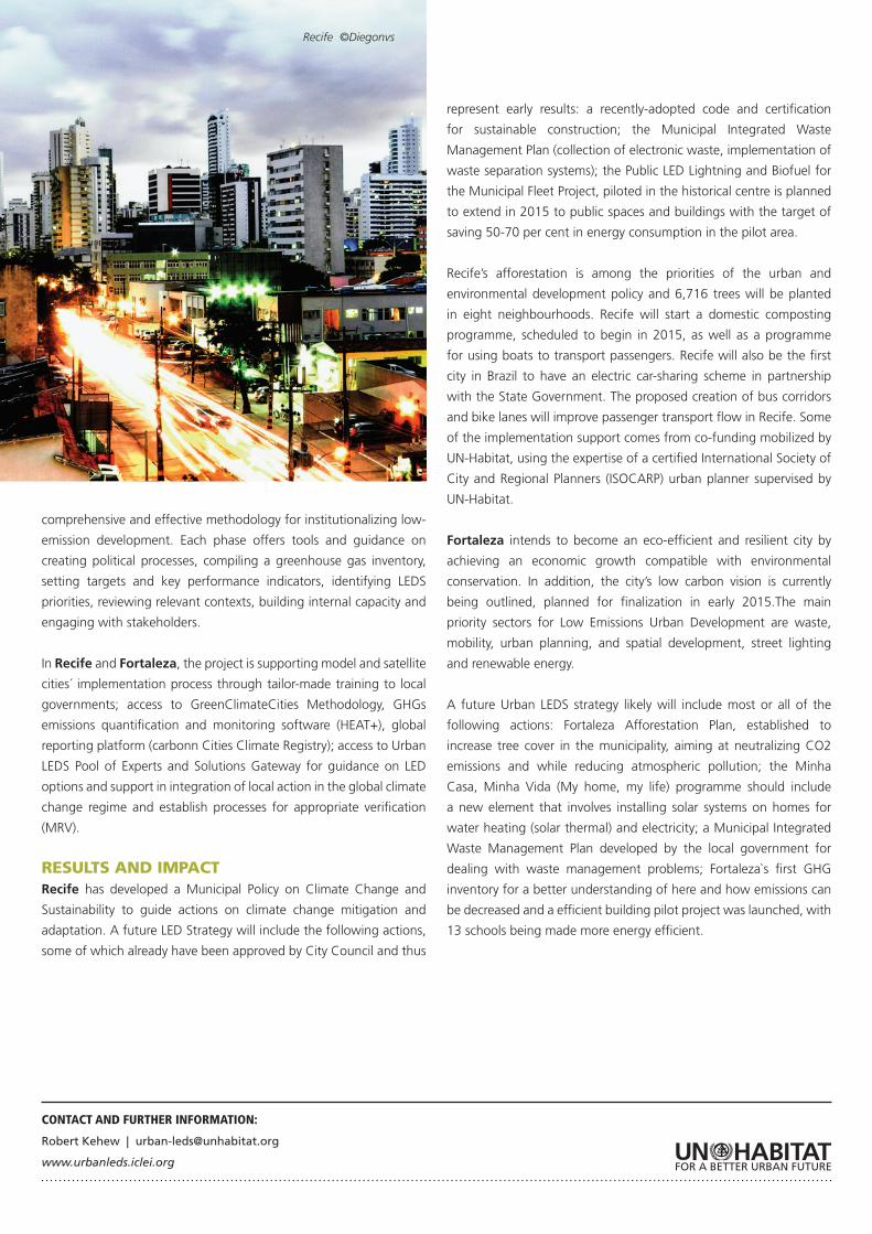
Recife ©Diegonvs
INTERNATIONAL GUIDELINES ON URBAN AND TERRITORIAL PLANNING
URBAN PLANNING AND DESIGN
URBAN PLANNING AND DESIGN
GLOBAL | PROJECT STATUS: In progress | DURATION: Since April 2013
CLIENT/PARTNER: Naitonal Governments, Local Authorities, United Cities and Local Governments (UCLG), International Society of City and
CONTEXTThe principles contained in the International Guidelines on Urban and
Territorial Planning (IG-UTP) aim to promote sustainable development
of cities and human settlements from a social, economic and
environmental perspective.
The main goals of the IG-UTP are to develop a universally-applicable
reference framework to guide urban policy reforms; capture universal
principles from national and local experience that could support the
development of diverse planning approaches adapted to different
contexts and scales; complement and link to other international
guidelines aimed at fostering sustainable urban development and
raise the urban and territorial dimensions of the development
agendas of national, regional and local governments.
The IG-UTP complement the International Guidelines on
Decentralization and Strengthening of Local Authorities (2007) and
the International Guidelines on Access to Basic Services for All (2009),
which were adopted by the Governing Council of UN-Habitat and
implemented in a number of countries.
PROCESS AND SOLUTIONSIn response to the UN-Habitat Governing Council Resolution 24/3 of
April 2013, the Executive Director of UN-Habitat established an ad
hoc group of experts to advise on the structure, content and wording
of the proposed International Guidelines on Urban and Territorial
Panning (IG-UTP).
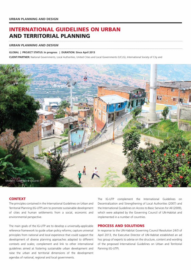
Medellin, Colombia @ Eduardo F
Members of the Group were nominated by national governments,
associations of local authorities, associations of professional planners
and international institutions, representing experience and practice
from Africa, Asia, Europe and America.
The drafting process was structured through three Expert Group
Meetings. The first took place in Paris, France, (October 2013) and
the second in Medellin, Colombia, (April 2014), in conjunction with
the 7th session of the World Urban Forum. The third was in Fukuoka,
Japan, (November 2014) and produced the Fukuoka Communiqué,
endorsing the outcomes of the process. In April 2015, the Guidelines
will be submitted for consideration and approval to the 25th session
of the Governing Council of UN-Habitat.
RESULTS AND IMPACT (EVOLUTION)The Guidelines are expected to provide a global framework for
improving policies, plans, designs and implementation processes for
more compact, socially inclusive, better integrated and connected
cities and territories that foster sustainable urban development and
are resilient to climate change. A compendium of inspiring practices
has been developed to illustrate the conditions and benefits of the
key principles included in the IG-UTP, while providing relevant facts
and figures and concrete evidence of impacts of sound urban and
territorial planning.
Once adopted, UN-Habitat and other development partners may be
asked to support countries and cities in using the guidelines. The
IG-UTP are also expected to be an significant tool to highlight the
importance of sustainable urbanization in the Post-2015 Development
Agenda as well as the Third United Nations Conference on Housing
and Sustainable Urban Development (Habitat III), scheduled to take
place in 2016.
CONTACT AND FURTHER INFORMATION:Remy Sietchiping | [email protected]
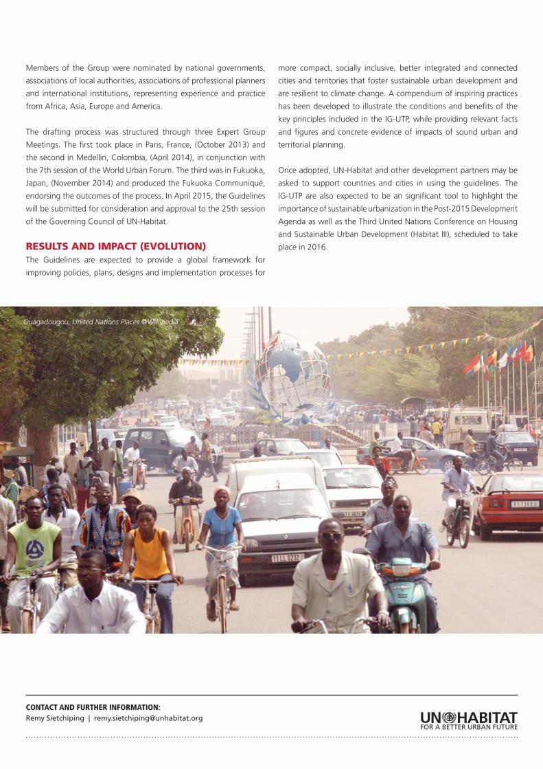
Ouagadougou, United Nations Places @Wikipedia
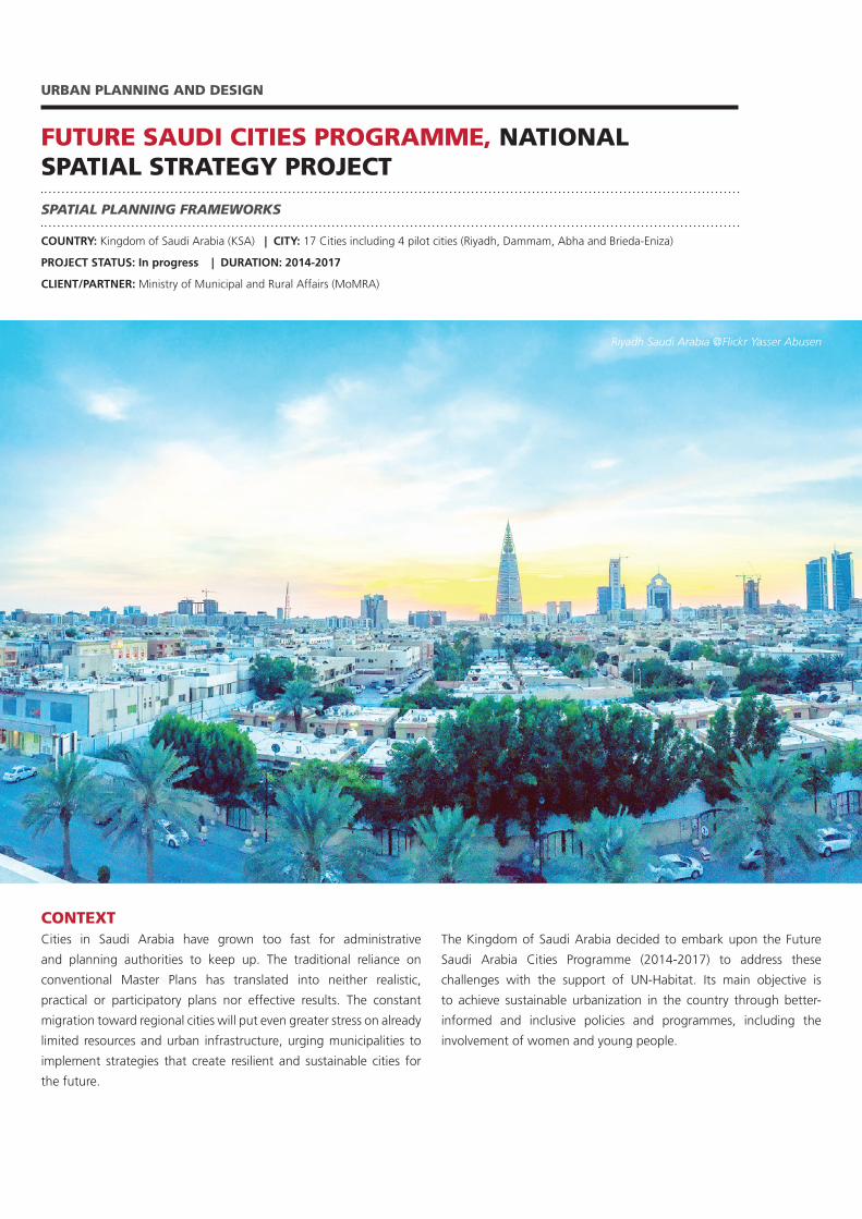
FUTURE SAUDI CITIES PROGRAMME, NATIONAL SPATIAL STRATEGY PROJECT
URBAN PLANNING AND DESIGN
SPATIAL PLANNING FRAMEWORKS
COUNTRY: Kingdom of Saudi Arabia (KSA) | CITY: 17 Cities including 4 pilot cities (Riyadh, Dammam, Abha and Brieda-Eniza)
PROJECT STATUS: In progress | DURATION: 2014-2017
CLIENT/PARTNER: Ministry of Municipal and Rural Affairs (MoMRA)
CONTEXTCities in Saudi Arabia have grown too fast for administrative
and planning authorities to keep up. The traditional reliance on
conventional Master Plans has translated into neither realistic,
practical or participatory plans nor effective results. The constant
migration toward regional cities will put even greater stress on already
limited resources and urban infrastructure, urging municipalities to
implement strategies that create resilient and sustainable cities for
the future.
The Kingdom of Saudi Arabia decided to embark upon the Future
Saudi Arabia Cities Programme (2014-2017) to address these
challenges with the support of UN-Habitat. Its main objective is
to achieve sustainable urbanization in the country through better-
informed and inclusive policies and programmes, including the
involvement of women and young people.
Riyadh Saudi Arabia @Flickr Yasser Abusen
PROCESS AND SOLUTIONSA key part of the Programme is to review and improve the National
Spatial Strategy (NSS) that was approved by the Council of Ministers
in 2000 and updated in 2005. The main objective of the NSS is
balanced development between and within regions, with emphasis
on integrating rural and urban areas. It will provide recommendations
to inform the prospective Urban Planning Act.
RESULTS AND IMPACTThe renewed NSS is expected to help generate endogenous economic
growth and employment while addressing the needs of the most
vulnerable, marginalised or underserved groups. This will lead to
promoting a balanced pattern of population distribution on national
space; ensure efficient utilization of infrastructure and public services
already in place; directly support the growth of small and medium
cities and diversify the economic base of regions. The NSS project will
be a major achievement of the Programme in the lead-up to the first
Saudi National Urban Forum to be held in 2016.
CONTACT AND FURTHER INFORMATION:Remy Sietchiping | [email protected]://unhabitat.org/about-us/our-secretariat/branches/urban-planning-and-design-branch/
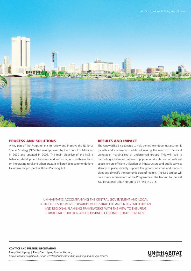
Jeddah city center @ Flickr_Henri Quatre
UN-HABITAT IS ACCOMPANYING THE CENTRAL GOVERNMENT AND LOCAL AUTHORITIES TO MOVE TOWARDS MORE STRATEGIC AND INTEGRATED URBAN
AND REGIONAL PLANNING FRAMEWORKS WITH THE VIEW TO ENSURING TERRITORIAL COHESION AND BOOSTING ECONOMIC COMPETITIVENESS.
CONTEXTMetropolitan areas are national engines of economic growth and
prosperity in most of the countries in the Americas. In Latin America
and the Caribbean between 60 and 70 per cent of GDP is currently
generated in urban areas, with 40 cities producing more than 30 per
cent of the regional income. Despite this, metropolitan identities and
dynamics are often not recognised in national or regional strategies
and plans.
The Pan-American Network for Metropolitan Areas (RAMA) was
launched in November 2014 to promote cooperation and exchange
RAMA: PAN-AMERICAN NETWORK FOR METROPOLITAN AREAS
URBAN PLANNING AND DESIGN
DEVELOPING CONCEPT PLANS, CITY-WIDE STRATEGIES, CITY IN-FILLS, NEW TOWNS
COUNTRIES: The Americas: North America, Latin America and the Caribbean
CITIES: Bucaramanga, Valle de Aburra, Bogota (Colombia), Montreal (Canada), San Salvador (El Salvador), Sao Paulo, Rio de Janeiro (Brazil), Guadalajara (Mexico), Cordoba (Argentina)
PROJECT STATUS: In Progress | DURATION: Since November 2014
PROJECT PARTNERS: Communauté Métropolitaine de Montréal (CMM), Area Metropolitana del Valle Aburrá (AMVA), Association of Metropolitan Areas of Colombia, São Paulo Metropolitan Planning Company (Emplasa), Planning Office of the Metropolitan Area of San Salvador (OPAMSS), Instituto Metropolitano de Planeación of Guadalajara
on metropolitan issues and strengthen the technical and political
dialogue amongst the metropolitan institutions of America. It is a
cooperation network of voluntary adherence which gathers public
institutions of metropolitan character from North America, Latin
America and the Caribbean. UN-Habitat, through its regional office
in Rio de Janeiro, will host the Technical Secretariat of RAMA.
The specific objectives of RAMA are to promote cooperation and
strengthen capacities of member institutions, share experience
and practice, foster political dialogue and collaborate with relevant
institutions and development banks.
Morro do Alemao cable cars, Rio de Janeiro, Brazil @ Flickr, Clément Jacquard
PROCESS AND SOLUTIONSThe creation of RAMA is a reflection of the growing interest in new
forms of metropolitan cooperation in the Pan-American region. Seven
metropolitan institutions and UN-Habitat met in November 2014
to formalize the creation of RAMA. RAMA will comprise a General
Assembly, an Executive Committee and a Technical Secretariat.
Three focus areas have been identified in the work plan 2015:
planning, governance and finance and three technical meetings have
been scheduled for 2015 accordingly.
RAMA aims at advancing the metropolitan agenda in the preparatory
process of the Third United Nations Conference on Housing and
Sustainable Urban Development (Habitat III).
RESULTS AND IMPACTRAMA is an inspiring example of cooperation towards Habitat III,
which will enable bringing the metropolitan issues and main regional
priorities in to the mainstream. Similar initiatives might emerge in
other regions which would facilitate cross-fertilization of ideas and
global partnerships on metropolitan issues.
CONTACT AND FURTHER INFORMATION:
Remy Sietchiping | [email protected]
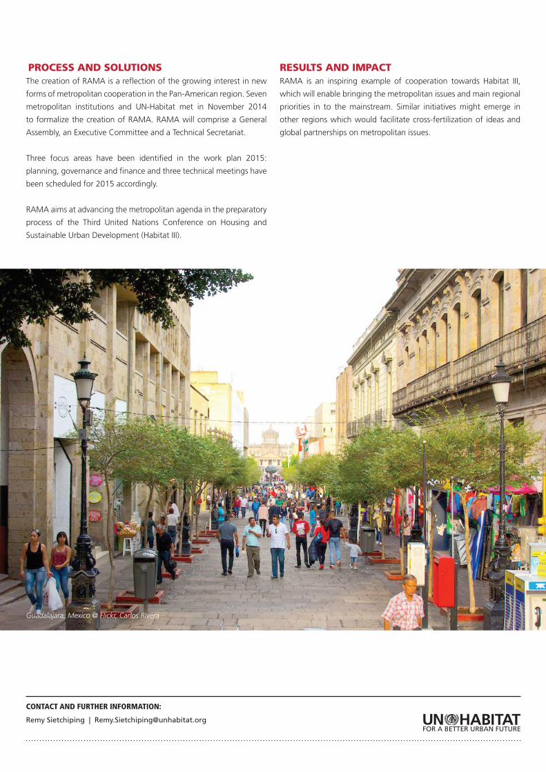
Guadalajara, Mexico @ Flickr, Carlos Rivera
CONTEXTLocated in the heart of Africa, Rwanda has 25,340 km2 of habitable
land with an estimated population of 10.5 million in 2012, resulting
in an average density of 415 habitants/km2. The share of the urban
population has increased progressively from 2 per cent in 1960 to
4.6 per cent in 1978 and 16.5 per cent in 2012. The current annual
urban growth rate is 4.5 per cent.
The Government of Rwanda aims to increase the rate of urbanisation
from 10 per cent in 2000 to 35 per cent by 2020 as ascribed in the
country’s Vision 2020. The Government is aware that urbanization
is key to the sustainable development of Rwanda and is aimed at
triggering economic growth and contribute to improve the quality of
life of all. As part of its urban development strategy, the Government
of Rwanda (GoR) has identified six secondary cities as ‘poles of urban
ACHIEVING SUSTAINABLE URBAN DEVELOPMENT IN RWANDA-DEVELOPMENT OF THE NATIONAL URBANISATION POLICY
URBAN PLANNING AND DESIGN
NATIONAL URBANISATION POLICY - Achieving Sustainable Urban Development (ASUD)
RWANDA | PROJECT STATUS: In progress | DURATION: 2013-2015 (Phase 1)
PROJECT PARTNERS: Government of Spain, Ministry of Infrastructure (MININFRA) Rwanda Housing Authority (RHA); Center for GIS (University of Rwanda); All provinces and districts.
growth’ where significant transformation should take place in the
coming years to balance the urban hierarchy.
The Government, with UN-Habitat, developed a National Urbanisation
Policy (NUP) to provide the overarching coordinating framework to
address the most pressing issues related to urbanisation.
PROCESS AND SOLUTIONSThe first phase in developing a national urbanisation policy of Rwanda
aimed at understanding the context and engaging stakeholders.
Seven consultative meetings were held across the country with
the involvement of decision makers at national levels and other
stakeholders. The second phase assessed the state of urbanisation
and coordination of urban development in Rwanda.
Kigali, Rwanda 2012 ©UN-Habitat Julius Mwelu
The Programme is now in the final stages of formulating the National
Urban Policy. This process underscores the importance of a policy that
provides institutional framework for urbanisation and for improving
the advocacy and enforcement of a coordinated urban development
process.
RESULTS AND IMPACTThe National Urbanisation Policy of Rwanda will guide future
development of the national urban system. It will provide a
framework for increased and more coordinated private and public
investments in urban development and consequent improvement of
cities’ productivity, inclusiveness and environmental conditions.
CONTACT AND FURTHER INFORMATION:
Remy Sietchiping | [email protected]
UN-Habitat (RMPU): http://unhabitat.org/initiatives-programmes/national-urban-policies/
This programme will create a Spatial Development Framework will be
created to ensure balanced growth of cities across Rwanda, including
the small and intermediate ones, through increased investment and
job creation.
It is envisioned that the policy framework will enhance technical
and administrative capacities in government, private sector and civil
society to ensure a coherent urbanization process.
“UN-HABITAT HAS HAD AN IMPORTANT IMPACT IN RWANDA BY PROVIDING TECHNICAL ASSISTANCE AND CAPACITY BUILDING TO
DEVELOP LOCAL URBAN MASTER PLANS,”
Christian Rwakunda, Permanent Secretary in the Ministry of Infrastructure.
Related Documents