Updated June 2008

Welcome message from author
This document is posted to help you gain knowledge. Please leave a comment to let me know what you think about it! Share it to your friends and learn new things together.
Transcript
Updated June 2008

Updated June 2008
Updated June 2008

Updated June 2008
Updated June 2008
PREFACE
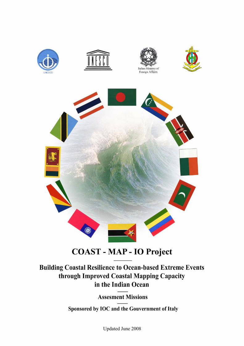
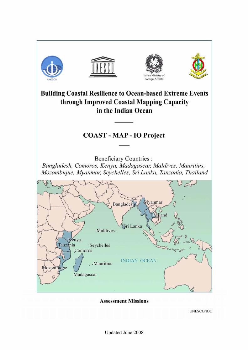
The tsunami of 26 Dec 2004 in the Indian Ocean with its resulting enormous loss of life emphasized the need for scientists to bring science to decision-makers. Responding to this event, many organizations and agencies have been involved with several programs of action. These have ranged from the aid and recovery phases immediately following the event, to the present reconstruction phase, which will be followed by other longer-term measures. The IOC has been widely recognized, at a number of high-profile meetings [1] as the appropriate intergovernmental body to facilitate the development of both interim and permanent tsunami warning systems for the Indian Ocean. Much progress has been achieved including an adequately staffed Tsunami Coordinating Unit at the Commission's Secretariat funded by several donors. The project summarized here and entitled COAST-MAP-IO, is one element in the suite of long-term responses to develop mitigating capacity to ocean-based extreme events occurring in the region. COAST-MAP-IO, sponsored by the Government of Italy, will allow states to compute where and in what direction destructive waves will impact their coastlines - a critical detail that international warning systems cannot provide in the absence of high resolution coastal bathymetric information that some member states consider sensitive. This project therefore respects the sensitivities of regions vis-à-vis coastal bathymetry. To be in-line with IOC Principles of Capacity-building, the high resolution data sets will be used to provide effective science not only for disaster mitigation but also for coastal planning. Taught survey skills will continue to be useful because coastal bathymetry will continue changing due to a variety of reasons. COAST-MAP-IO is part of the larger proposal (TSU-REG-05/CSS10-REGION) "Indian Ocean Tsunami Warning System" presented at the 2nd International Coordination Meeting of An Indian Ocean Tsunami Warning and Mitigation System, Grand Baie, Mauritius (April 14-16, 2005). In particular it responds to components:
4.8. Development of high resolution near shore bathymetry, and 4.10. Preparation of tsunami inundation maps.
COAST-MAP-IO addresses the need for countries to acquire and utilize coastal bathymetry to develop various products mitigating against ocean-based extreme events. It further proposes maximizing benefits from coastal bathymetry by transferring skills to create products for zonation decisions and equitable use of coastal spaces, and is therefore an important factor in meeting IOC Principles of Capacity-building. COAST-MAP-IO consists of two Phases where Assessment missions belong to Phase I and eight of them have been realized in cooperation with the International Hydrographic Bureau and co-sponsored by IOC and the Government of Italy.

Updated June 2008
Updated June 2008
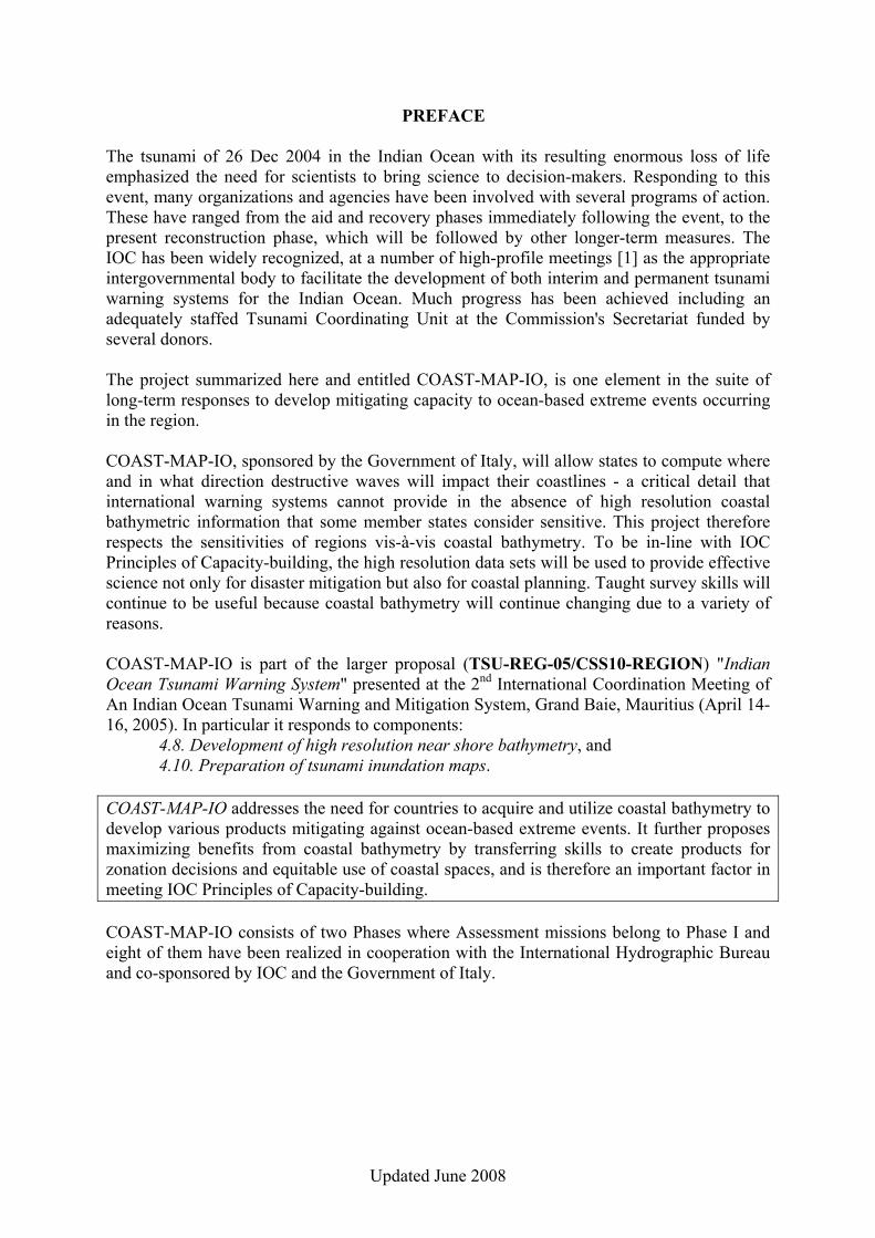
OVERVIEW OF ASSESSMENT MISSIONS
No. Topic BAN MAD MAU MAL MOZ MYA SEY SRI TAN THA 1. Focal Point / Coordinating Institution BNHD FTM MHL MCPI INAHINA MFA GD-
MLUH DM IMS HDRTN
2. Responsibility for the COAST-MAP-IO bathymetric & topographic database
BNHD FTM MHL MCPI INAHINA CNHD GD-MLUH
NHO-NARA
HSS-SMD & IMS
HDRTN
2.1 Need for database management tools
2.2 Need for database management training
3. Responsibility for providing bathymetric data
BNHD & SSD-
BWDB
FTM HU-MHL MCPI INAHINA CNHD HB-SCG & GD-MLUH
NHO-NARA
HSS-SMD & TPA
HDRTN
3.1 Availability of digital bathymetric data
3.2 Availability of analogue bathymetric data
3.3 Need for hydrographic survey vessel
3.4 Need for hydrographic survey tools
3.5 Need for multibeam echosounder(s)
3.6 Need for multibeam training
3.7 Need for survey sheet / chart digitizing tools
3.8 Need for coastal hydrographic surveys
4. Responsibility for providing topographic data
SOB & BIWTA
FTM HU-MHL MHUD CENACARTA
DS GD-MLUH
SD HSS-SMD RTSD
4.1 Availability of digital topographic data
4.2 Availability of analogue topographic data
4.3 Need for satellite images on coastal areas
4.4 Need for satellite image / Lidar data processing tools
4.5 Need for training on satellite images / Lidar data processing
4.6 Need for topographic sheet / map digitizing tools
4.7 Need for coastal topographic surveys
Updated June 2008
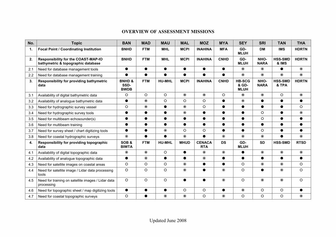
5. Responsibility for tsunami / mathematical modelling
BUET &BMD
IOGA MOI METEO INAHINA & INAM
DMH SCMRT DCE-UM IMS & TMA
HDRTN
5.1 Need for tsunami / mathematical modelling tools
5.2 Need for training on for tsunami / mathematical modelling
6. Responsibility for inundation map construction
BUET IOGA MOI METEO INAHINA & INAM
DMH SCMRT DCE-UM IMS HDRTN
6.1 Need for inundation map construction tools
6.2 Need for training on inundation map construction
7. Pilot project area identified
8. Need for improved cooperation between the concerned institutions
Notes:
= No BAN = Bangladesh MAU = Mauritius SEY = Seychelles THA = Thailand = Partial Yes MAD = Madagascar MOZ = Mozambique SRI = Sri Lanka = Yes MAL = Maldives MYA = Myanmar TAN = Tanzania
HDRTN = Hydrographic Department of the Royal Thai Navy CNHD = Central Naval Hydrographic Depot (MYA) RTSD = Royal Thai Survey Department DS = Directorate of Survey (MYA) BNHD = Bangladesh Navy Hydrographic Department DMH = Department of Meteorology and Hydrology (MYA) SSD-BWDB = Survey and Study Division of Bangladesh Water Development Board DM = Disaster Management (SRI) SOB = Survey of Bangladesh NHO-NARA = National Hydrographic Office of the National Aquatic
Resources Research & Development Agency (SRI) BIWTA = Bangladesh Inland Water Transport Authority SD = Survey Department (SRI) BUET = Bangladesh University of Engineering and Technology DCE-UM = Department of Civil Engineering of the University of
Moratuwa (SRI) BMD = Bangladesh Meteorological Department INAHINA = National Institute of Hydrography and Navigation (MOZ) GD-MLUH = Geoinformatic Division, Ministry of Land Use and Habitat (SEY) CENACARTA = Remote Sensing & Cartography National Centre (MOZ) HB-SCG = Hydrographic Brigade of the Seychelles Coast Guard INAM = National Institute of Meteorology (MOZ) SCMRT = Seychelles Centre of Marine Research and Technology HSS-SMD = Hydrographic Surveys Section, Surveys and Mapping Division,
Ministry of Lands, Housing & Human Settlements Developt. (TAN) MHL = Ministry of Housing and Lands (MAU) TPA = Tanzania Ports Authority HU-MHL = Hydrographic Unit of the Ministry of Housing and Lands (MAU) IMS = Institute of Marine Sciences (TAN) MOI = Mauritius Oceanographic Institute TMA = Tanzania Meteorological Agency FTM = National Institute for Cartography and Hydrography (MAD) MCPI = Ministry of Construction and Public Infrastructure (MAL) IOGA = Institut et Observatoire de Géophysique d’Antananarivo (MAD) MHUD = Ministry of Housing and Urban Development (MAL) MFA = Ministry of Foreign Affairs (MYA) METEO = Department of Meteorology, Ministry of Environment (MAL)

Updated June 2008
Updated June 2008
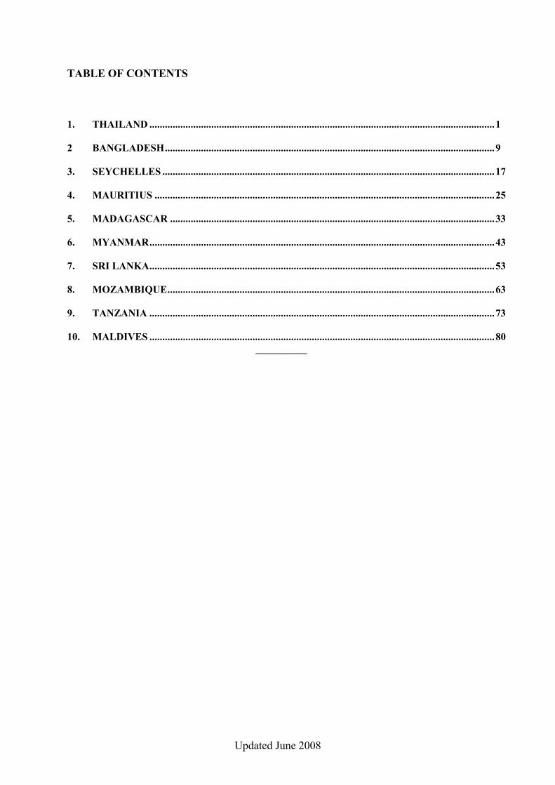
TABLE OF CONTENTS
1. THAILAND ......................................................................................................................................1 2 BANGLADESH................................................................................................................................9 3. SEYCHELLES .................................................................................................................................17 4. MAURITIUS ....................................................................................................................................25 5. MADAGASCAR ..............................................................................................................................33 6. MYANMAR......................................................................................................................................43 7. SRI LANKA......................................................................................................................................53 8. MOZAMBIQUE...............................................................................................................................63 9. TANZANIA ......................................................................................................................................73 10. MALDIVES ......................................................................................................................................80
__________

Updated June 2008

1
Updated June 2008
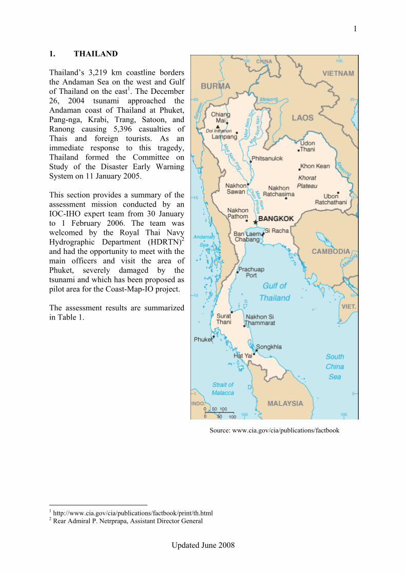
1. THAILAND Thailand’s 3,219 km coastline borders the Andaman Sea on the west and Gulf of Thailand on the east1. The December 26, 2004 tsunami approached the Andaman coast of Thailand at Phuket, Pang-nga, Krabi, Trang, Satoon, and Ranong causing 5,396 casualties of Thais and foreign tourists. As an immediate response to this tragedy, Thailand formed the Committee on Study of the Disaster Early Warning System on 11 January 2005. This section provides a summary of the assessment mission conducted by an IOC-IHO expert team from 30 January to 1 February 2006. The team was welcomed by the Royal Thai Navy Hydrographic Department (HDRTN)2 and had the opportunity to meet with the main officers and visit the area of Phuket, severely damaged by the tsunami and which has been proposed as pilot area for the Coast-Map-IO project. The assessment results are summarized in Table 1.
1 http://www.cia.gov/cia/publications/factbook/print/th.html 2 Rear Admiral P. Netrprapa, Assistant Director General
Source: www.cia.gov/cia/publications/factbook
2
Updated June 2008
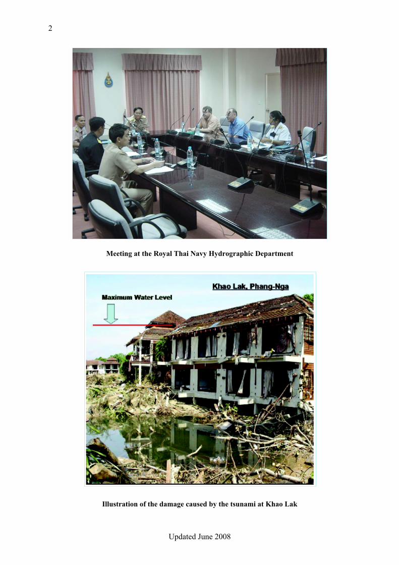
Meeting at the Royal Thai Navy Hydrographic Department
Illustration of the damage caused by the tsunami at Khao Lak
3
Updated June 2008
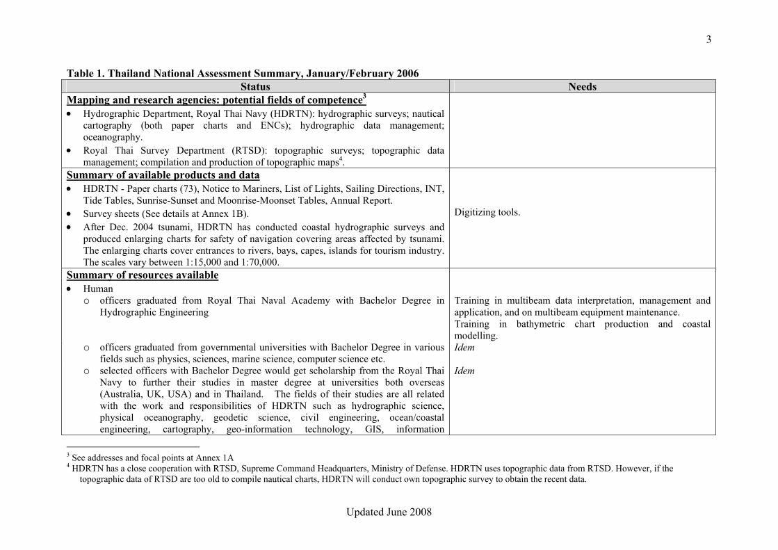
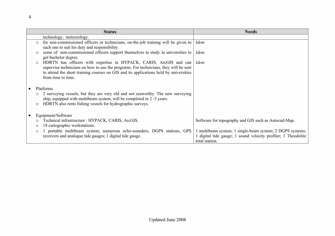
Table 1. Thailand National Assessment Summary, January/February 2006 Status Needs
Mapping and research agencies: potential fields of competence3 • Hydrographic Department, Royal Thai Navy (HDRTN): hydrographic surveys; nautical
cartography (both paper charts and ENCs); hydrographic data management; oceanography.
• Royal Thai Survey Department (RTSD): topographic surveys; topographic data management; compilation and production of topographic maps4.
Summary of available products and data • HDRTN - Paper charts (73), Notice to Mariners, List of Lights, Sailing Directions, INT,
Tide Tables, Sunrise-Sunset and Moonrise-Moonset Tables, Annual Report.
• Survey sheets (See details at Annex 1B). Digitizing tools. • After Dec. 2004 tsunami, HDRTN has conducted coastal hydrographic surveys and
produced enlarging charts for safety of navigation covering areas affected by tsunami. The enlarging charts cover entrances to rivers, bays, capes, islands for tourism industry. The scales vary between 1:15,000 and 1:70,000.
Summary of resources available • Human
o officers graduated from Royal Thai Naval Academy with Bachelor Degree in Hydrographic Engineering
Training in multibeam data interpretation, management and application, and on multibeam equipment maintenance. Training in bathymetric chart production and coastal modelling.
o officers graduated from governmental universities with Bachelor Degree in various fields such as physics, sciences, marine science, computer science etc.
Idem
o selected officers with Bachelor Degree would get scholarship from the Royal Thai Navy to further their studies in master degree at universities both overseas (Australia, UK, USA) and in Thailand. The fields of their studies are all related with the work and responsibilities of HDRTN such as hydrographic science, physical oceanography, geodetic science, civil engineering, ocean/coastal engineering, cartography, geo-information technology, GIS, information
Idem
3 See addresses and focal points at Annex 1A 4 HDRTN has a close cooperation with RTSD, Supreme Command Headquarters, Ministry of Defense. HDRTN uses topographic data from RTSD. However, if the
topographic data of RTSD are too old to compile nautical charts, HDRTN will conduct own topographic survey to obtain the recent data.
4
Updated June 2008
Status Needs technology, meteorology.
o for non-commissioned officers or technicians, on-the-job training will be given to each one to suit his duty and responsibility.
Idem
o some of non-commissioned officers support themselves to study in universities to get bachelor degree.
Idem
o HDRTN has officers with expertise in HYPACK, CARIS, ArcGIS and can supervise technicians on how to use the programs. For technicians, they will be sent to attend the short training courses on GIS and its applications held by universities from time to time.
Idem
• Platforms
o 2 surveying vessels, but they are very old and not seaworthy. The new surveying ship, equipped with multibeam system, will be completed in 2 -3 years.
o HDRTN also rents fishing vessels for hydrographic surveys. • Equipment/Software
o Technical infrastructure : HYPACK, CARIS, ArcGIS. Software for topography and GIS such as Autocad-Map. o 18 cartographic workstations. o 1 portable multibeam system; numerous echo-sounders, DGPS stations, GPS
receivers and analogue tide gauges; 1 digital tide gauge. 1 multibeam system; 1 single-beam system; 2 DGPS systems; 1 digital tide gauge; 1 sound velocity profiler; 1 Theodolite total station.
5
Updated June 2008
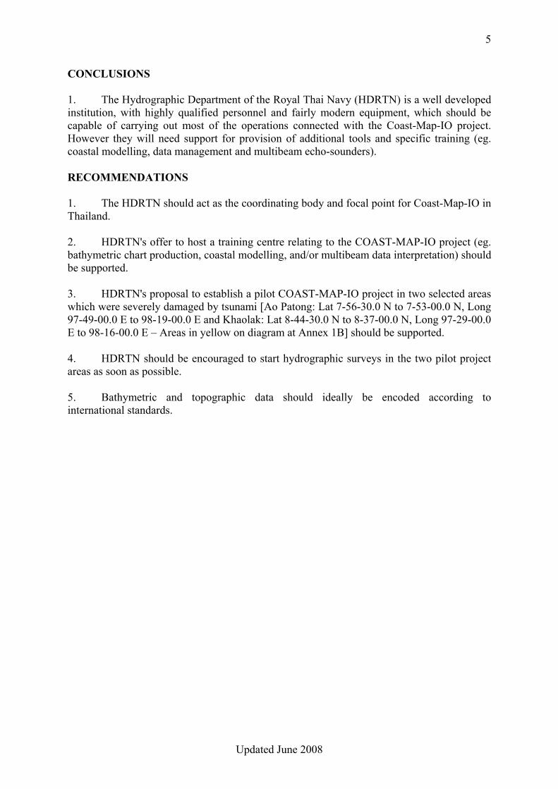
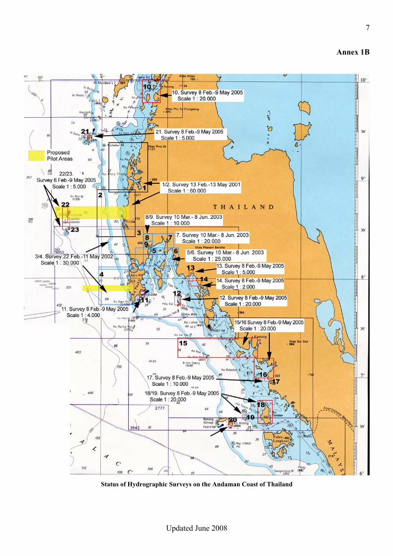
CONCLUSIONS 1. The Hydrographic Department of the Royal Thai Navy (HDRTN) is a well developed institution, with highly qualified personnel and fairly modern equipment, which should be capable of carrying out most of the operations connected with the Coast-Map-IO project. However they will need support for provision of additional tools and specific training (eg. coastal modelling, data management and multibeam echo-sounders). RECOMMENDATIONS 1. The HDRTN should act as the coordinating body and focal point for Coast-Map-IO in Thailand. 2. HDRTN's offer to host a training centre relating to the COAST-MAP-IO project (eg. bathymetric chart production, coastal modelling, and/or multibeam data interpretation) should be supported. 3. HDRTN's proposal to establish a pilot COAST-MAP-IO project in two selected areas which were severely damaged by tsunami [Ao Patong: Lat 7-56-30.0 N to 7-53-00.0 N, Long 97-49-00.0 E to 98-19-00.0 E and Khaolak: Lat 8-44-30.0 N to 8-37-00.0 N, Long 97-29-00.0 E to 98-16-00.0 E – Areas in yellow on diagram at Annex 1B] should be supported. 4. HDRTN should be encouraged to start hydrographic surveys in the two pilot project areas as soon as possible. 5. Bathymetric and topographic data should ideally be encoded according to international standards.
6
Updated June 2008
Annex 1A
MAPPING AND RESEARCH AGENCIES IN THAILAND Addresses and Focal Points
• Hydrographic Department, Royal Thai Navy (HDRTN)
The Director, HDRTN 222 Rimtangrodfaikao Road, Bangna, Bangkok 10260
Tel: +662-3614-822 Fax : +662-3613-596 E-mail : [email protected]
• Royal Thai Survey Department (RTSD)
The Director, RTSD Kalayanamaitri Road, Bangkok 10200 E-mail : [email protected]
7
Updated June 2008
Annex 1B
Status of Hydrographic Surveys on the Andaman Coast of Thailand

8
Updated June 2008
9
Updated June 2008
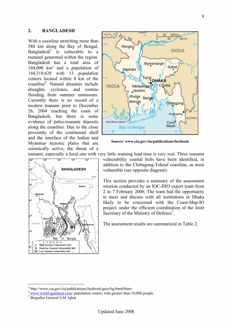
2. BANGLADESH With a coastline stretching more than 580 km along the Bay of Bengal, Bangladesh5 is vulnerable to a tsunami generated within the region. Bangladesh has a total area of 144,000 km² and a population of 144,319,628 with 13 population centers located within 8 km of the coastline6. Natural disasters include droughts, cyclones, and routine flooding from summer monsoons. Currently there is no record of a modern tsunami prior to December 26, 2004 reaching the coast of Bangladesh, but there is some evidence of paleo-tsunami deposits along the coastline. Due to the close proximity of the continental shelf and the interface of the Indian and Myanmar tectonic plates that are seismically active, the threat of a tsunami, especially a local one with very little warning lead time is very real. Three tsunami
vulnerability coastal belts have been identified, in addition to the Chittagong-Teknaf coastline, as most vulnerable (see opposite diagram). This section provides a summary of the assessment mission conducted by an IOC-IHO expert team from 2 to 7 February 2006. The team had the opportunity to meet and discuss with all institutions in Dhaka likely to be concerned with the Coast-Map-IO project, under the efficient coordination of the Joint Secretary of the Ministry of Defence7. The assessment results are summarized in Table 2.
5 http://www.cia.gov/cia/publications/factbook/geos/bg.html#Intro 6 www.world-gazetteer.com; population centers with greater than 10,000 people 7 Brigadier General S.M. Iqbal
Source: www.cia.gov/cia/publications/factbook
10
Updated June 2008
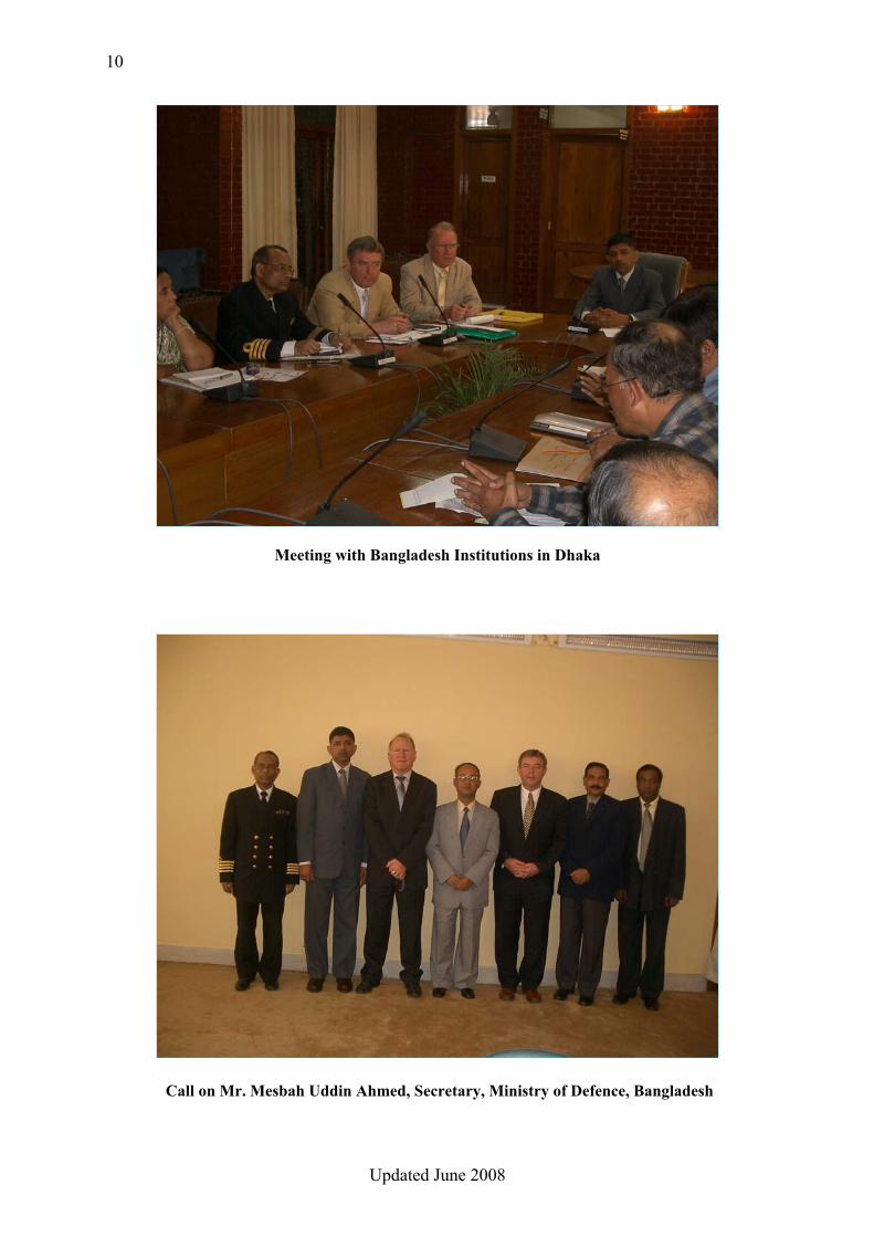
Meeting with Bangladesh Institutions in Dhaka
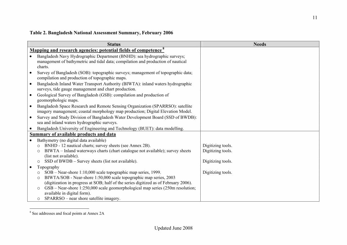
Call on Mr. Mesbah Uddin Ahmed, Secretary, Ministry of Defence, Bangladesh
11
Updated June 2008
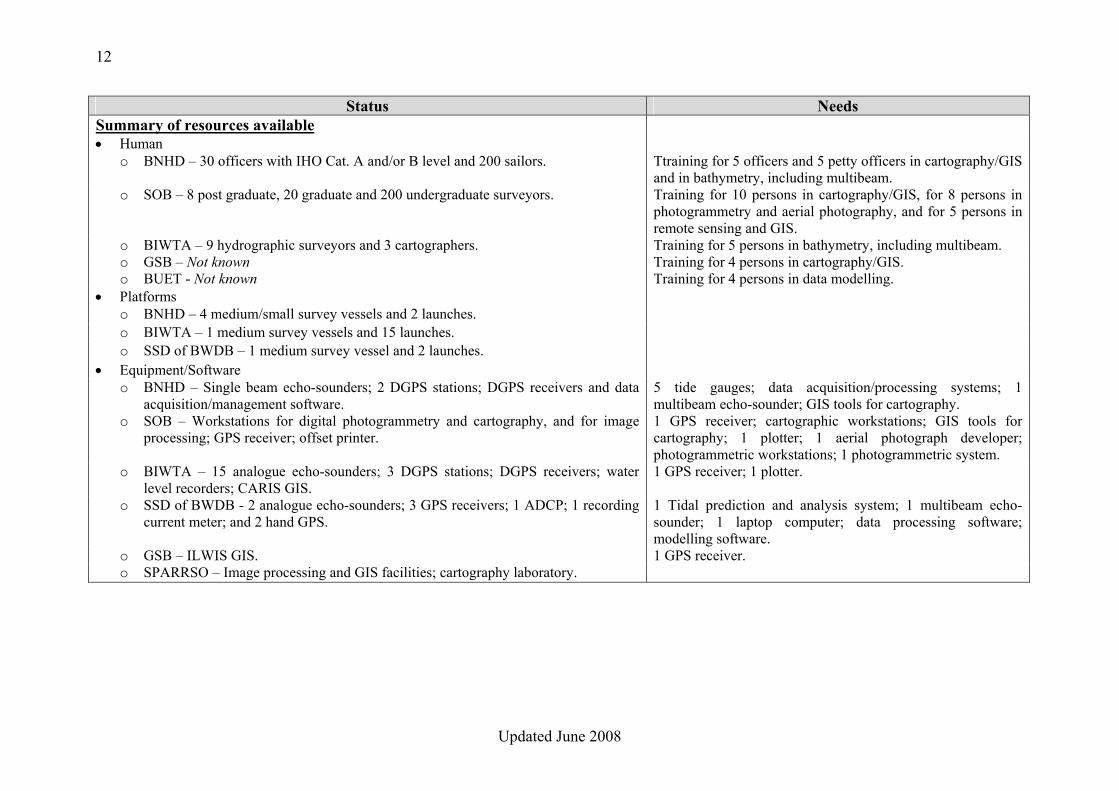
Table 2. Bangladesh National Assessment Summary, February 2006
Status Needs Mapping and research agencies: potential fields of competence 8 • Bangladesh Navy Hydrographic Department (BNHD): sea hydrographic surveys;
management of bathymetric and tidal data; compilation and production of nautical charts.
• Survey of Bangladesh (SOB): topographic surveys; management of topographic data; compilation and production of topographic maps.
• Bangladesh Inland Water Transport Authority (BIWTA): inland waters hydrographic surveys, tide gauge management and chart production.
• Geological Survey of Bangladesh (GSB): compilation and production of geomorphologic maps.
• Bangladesh Space Research and Remote Sensing Organization (SPARRSO): satellite imagery management; coastal morphology map production; Digital Elevation Model.
• Survey and Study Division of Bangladesh Water Development Board (SSD of BWDB): sea and inland waters hydrographic surveys.
• Bangladesh University of Engineering and Technology (BUET): data modelling. Summary of available products and data • Bathymetry (no digital data available)
o BNHD - 12 nautical charts; survey sheets (see Annex 2B). Digitizing tools. o BIWTA – Inland waterways charts (chart catalogue not available); survey sheets
(list not available). Digitizing tools.
o SSD of BWDB – Survey sheets (list not available). Digitizing tools. • Topography
o SOB – Near-shore 1:10,000 scale topographic map series, 1999. Digitizing tools. o BIWTA/SOB - Near-shore 1:50,000 scale topographic map series, 2003
(digitization in progress at SOB; half of the series digitized as of February 2006).
o GSB – Near-shore 1:250,000 scale geomorphological map series (250m resolution; available in digital form).
o SPARRSO – near shore satellite imagery.
8 See addresses and focal points at Annex 2A
12
Updated June 2008
Status Needs Summary of resources available • Human
o BNHD – 30 officers with IHO Cat. A and/or B level and 200 sailors. Ttraining for 5 officers and 5 petty officers in cartography/GIS and in bathymetry, including multibeam.
o SOB – 8 post graduate, 20 graduate and 200 undergraduate surveyors. Training for 10 persons in cartography/GIS, for 8 persons in photogrammetry and aerial photography, and for 5 persons in remote sensing and GIS.
o BIWTA – 9 hydrographic surveyors and 3 cartographers. Training for 5 persons in bathymetry, including multibeam. o GSB – Not known Training for 4 persons in cartography/GIS. o BUET - Not known Training for 4 persons in data modelling.
• Platforms o BNHD – 4 medium/small survey vessels and 2 launches. o BIWTA – 1 medium survey vessels and 15 launches. o SSD of BWDB – 1 medium survey vessel and 2 launches.
• Equipment/Software o BNHD – Single beam echo-sounders; 2 DGPS stations; DGPS receivers and data
acquisition/management software. 5 tide gauges; data acquisition/processing systems; 1 multibeam echo-sounder; GIS tools for cartography.
o SOB – Workstations for digital photogrammetry and cartography, and for image processing; GPS receiver; offset printer.
1 GPS receiver; cartographic workstations; GIS tools for cartography; 1 plotter; 1 aerial photograph developer; photogrammetric workstations; 1 photogrammetric system.
o BIWTA – 15 analogue echo-sounders; 3 DGPS stations; DGPS receivers; water level recorders; CARIS GIS.
1 GPS receiver; 1 plotter.
o SSD of BWDB - 2 analogue echo-sounders; 3 GPS receivers; 1 ADCP; 1 recording current meter; and 2 hand GPS.
1 Tidal prediction and analysis system; 1 multibeam echo-sounder; 1 laptop computer; data processing software; modelling software.
o GSB – ILWIS GIS. 1 GPS receiver. o SPARRSO – Image processing and GIS facilities; cartography laboratory.
13
Updated June 2008
CONCLUSIONS 1. The existing survey data in analogue form (BNHD), as described in Annex C, is sufficiently accurate and dense to create an initial version of the COAST-MAP-IO bathymetric database. 2. The topographic maps at scale 1:50,000 covering the entire near-shore of Bangladesh (SOB/BIWTA) should be adequate to create an initial version of the COAST-MAP-IO topographic database. 3. National institutions likely to participate in the project are clearly lacking modern and efficient equipment (eg. hydrographic vessels, multibeam echo-sounders, or hydrographic/cartographic workstations), as reflected in Table 2. RECOMMENDATIONS 1. Due to the crucial role of bathymetry in the project, the Bangladesh Navy Hydrographic Department should act as the coordinating body and focal point for Coast-Map-IO in Bangladesh, under the leadership of the Secretary of Ministry of Defence. 2. Priority should be given to the provision of digitizing tools, with adequate training, for the digitization of the existing survey sheets and topographic maps. 3. Appropriate means must be provided to manage and process the bathymetric / topographic database which will result from Recommendation 2 above. 4. Bathymetric and topographic data should ideally be encoded according to international standards.
14
Updated June 2008
Annex 2A
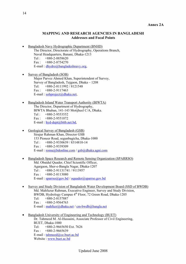
MAPPING AND RESEARCH AGENCIES IN BANGLADESH Addresses and Focal Points
• Bangladesh Navy Hydrographic Department (BNHD)
The Director, Directorate of Hydrography, Operations Branch, Naval Headquarters, Banani, Dhaka-1213 Tel : +880-2-8858620 Fax : +880-2-8754270 E-mail : [email protected],
• Survey of Bangladesh (SOB) Major Parvez Ahmed Khan, Superintendent of Survey, Survey of Bangladesh, Tejgaon, Dhaka – 1208
Tel: +880-2-8111992 / 8121548 Fax : +880-2-9117463 E-mail : [email protected],
• Bangladesh Inland Water Transport Authority (BIWTA) The Director, Department of Hydrography, BIWTA Bhaban, 141-143 Motijheel C/A, Dhaka. Tel : +880-2-9553552 Fax : +880-2-9551072 E-mail : [email protected],
• Geological Survey of Bangladesh (GSB)
Sirajur Rahman Khan, Director GSB 153 Pioneer Road, segunbagicha, Dhaka-1000 Tel : +880-2-9330639 / 8314810-14 Fax : +880-2-9339309 E-mail : [email protected] / [email protected]
• Bangladesh Space Research and Remote Sensing Organization (SPARRSO) Md. Obaidul Quader, Chief Scientific Officer, Agargaon, Sher-e-Bangla Nagar, Dhaka-1207 Tel : +880-2-91131741 / 9113957 Fax : +880-2-8113080 E-mail : [email protected] / [email protected]
• Survey and Study Division of Bangladesh Water Development Board (SSD of BWDB)
Md. Mahfuzur Rahman, Executive Engineer, Survey and Study Division, BWDB, Hydrology Campus 4th Floor, 72 Green Road, Dhaka-1205 Tel: +880-2-8157887 Fax : +880-2-9564763 E-mail : [email protected] / [email protected]
• Bangladesh University of Engineering and Technology (BUET) Dr. Tahmeed M. Al-Hussaini, Associate Professor of Civil Engineering, BUET, Dhaka-1000
Tel: +880-2-9665650 Ext. 7626 Fax : +880-2-9665639 E-mail : [email protected]
Website : www.buet.ac.bd

15
Updated June 2008
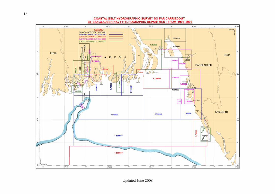
Annex 2B
16
Updated June 2008

17
Updated June 2008
18
Updated June 2008
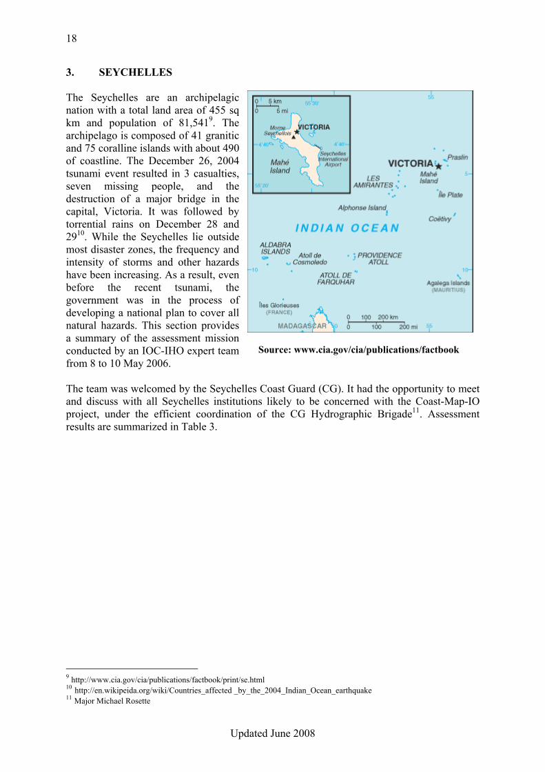
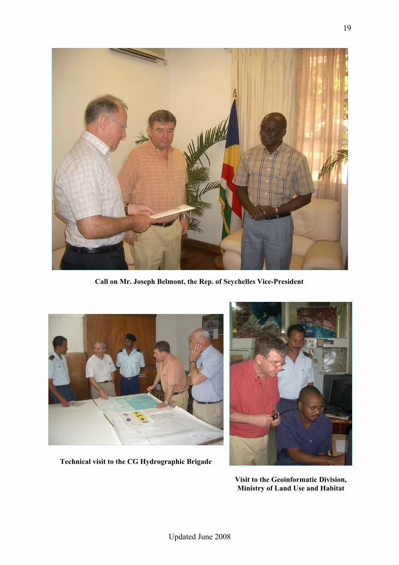
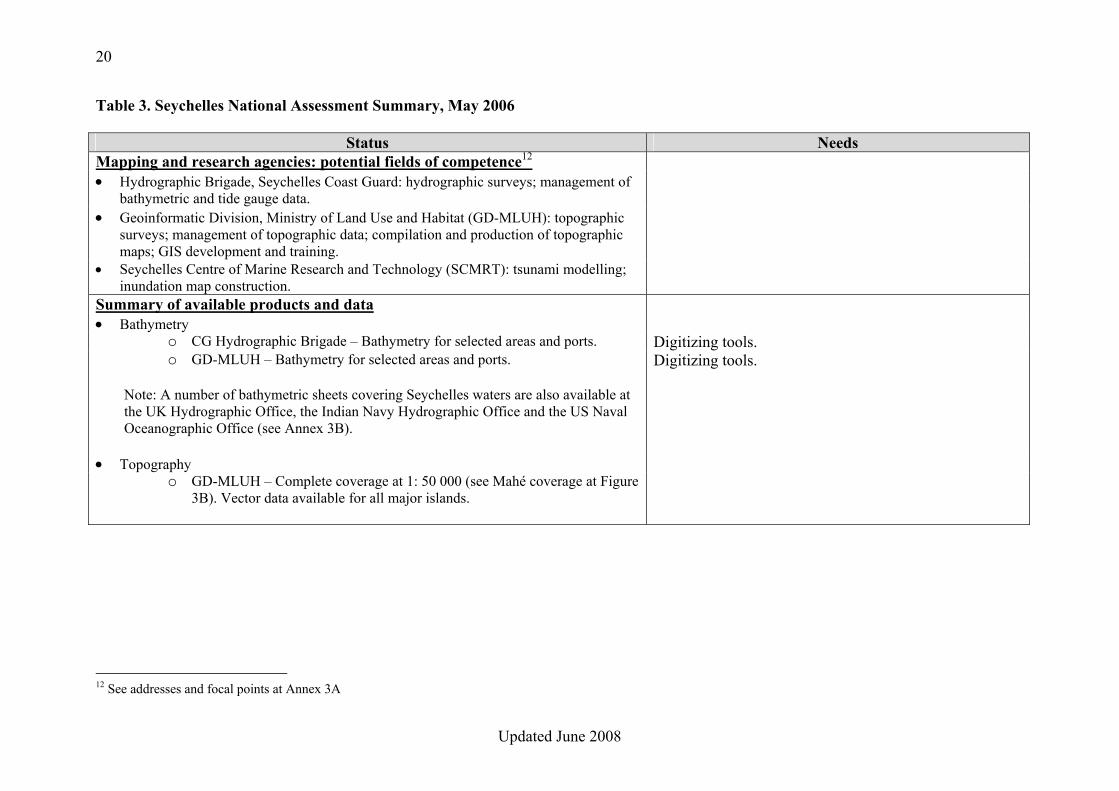
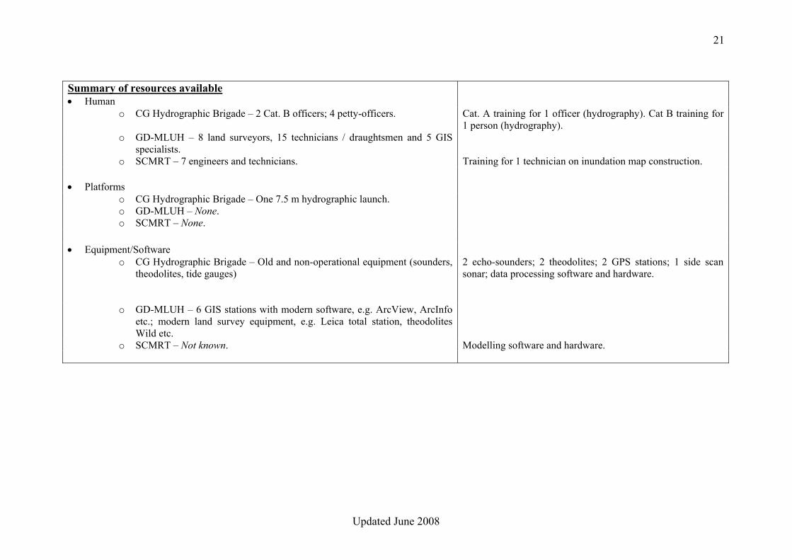
3. SEYCHELLES The Seychelles are an archipelagic nation with a total land area of 455 sq km and population of 81,5419. The archipelago is composed of 41 granitic and 75 coralline islands with about 490 of coastline. The December 26, 2004 tsunami event resulted in 3 casualties, seven missing people, and the destruction of a major bridge in the capital, Victoria. It was followed by torrential rains on December 28 and 2910. While the Seychelles lie outside most disaster zones, the frequency and intensity of storms and other hazards have been increasing. As a result, even before the recent tsunami, the government was in the process of developing a national plan to cover all natural hazards. This section provides a summary of the assessment mission conducted by an IOC-IHO expert team from 8 to 10 May 2006. The team was welcomed by the Seychelles Coast Guard (CG). It had the opportunity to meet and discuss with all Seychelles institutions likely to be concerned with the Coast-Map-IO project, under the efficient coordination of the CG Hydrographic Brigade11. Assessment results are summarized in Table 3.
9 http://www.cia.gov/cia/publications/factbook/print/se.html 10 http://en.wikipeida.org/wiki/Countries_affected _by_the_2004_Indian_Ocean_earthquake 11 Major Michael Rosette
Source: www.cia.gov/cia/publications/factbook
19
Updated June 2008
Call on Mr. Joseph Belmont, the Rep. of Seychelles Vice-President
Technical visit to the CG Hydrographic Brigade
Visit to the Geoinformatic Division, Ministry of Land Use and Habitat
20
Updated June 2008
Table 3. Seychelles National Assessment Summary, May 2006
Status Needs Mapping and research agencies: potential fields of competence12 • Hydrographic Brigade, Seychelles Coast Guard: hydrographic surveys; management of
bathymetric and tide gauge data.
• Geoinformatic Division, Ministry of Land Use and Habitat (GD-MLUH): topographic surveys; management of topographic data; compilation and production of topographic maps; GIS development and training.
• Seychelles Centre of Marine Research and Technology (SCMRT): tsunami modelling; inundation map construction.
Summary of available products and data • Bathymetry
o CG Hydrographic Brigade – Bathymetry for selected areas and ports. Digitizing tools. o GD-MLUH – Bathymetry for selected areas and ports. Digitizing tools.
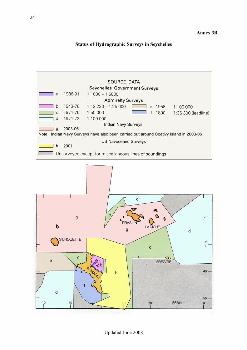
Note: A number of bathymetric sheets covering Seychelles waters are also available at the UK Hydrographic Office, the Indian Navy Hydrographic Office and the US Naval Oceanographic Office (see Annex 3B).
• Topography o GD-MLUH – Complete coverage at 1: 50 000 (see Mahé coverage at Figure
3B). Vector data available for all major islands.
12 See addresses and focal points at Annex 3A
21
Updated June 2008
Summary of resources available • Human
o CG Hydrographic Brigade – 2 Cat. B officers; 4 petty-officers. Cat. A training for 1 officer (hydrography). Cat B training for 1 person (hydrography).
o GD-MLUH – 8 land surveyors, 15 technicians / draughtsmen and 5 GIS specialists.
o SCMRT – 7 engineers and technicians. Training for 1 technician on inundation map construction.
• Platforms o CG Hydrographic Brigade – One 7.5 m hydrographic launch. o GD-MLUH – None. o SCMRT – None.
• Equipment/Software o CG Hydrographic Brigade – Old and non-operational equipment (sounders,
theodolites, tide gauges) 2 echo-sounders; 2 theodolites; 2 GPS stations; 1 side scan sonar; data processing software and hardware.
o GD-MLUH – 6 GIS stations with modern software, e.g. ArcView, ArcInfo etc.; modern land survey equipment, e.g. Leica total station, theodolites Wild etc.
o SCMRT – Not known. Modelling software and hardware.
22
Updated June 2008
CONCLUSIONS 1. The Geoinformatic Division, Ministry of Land Use and Habitat (GD-MLUH), is a well developed institution, with qualified personnel and modern equipment, which should be capable of coordinating all operations connected with the Coast-Map-IO project. In addition GD-MLUH has the necessary competence to assume land topography management. 2. Hydrographic survey data in Seychelles waters is generally old. Recent major surveys covered mostly the Seychelles Bank, Constant Bank and Coetivy Island (see Annex 3B). An initial version of the COAST-MAP-IO bathymetric database could be established from the survey data recently collected by the Indian Navy Hydrographic Office (HO) and the US Naval Oceanographic Office (Navoceano). This could be complemented by digitizing older survey sheets which are held by the UK Hydrographic Office. 3. The Hydrographic Brigade of the Seychelles Coast Guard is virtually non operational, due to unserviceable survey equipment, and needs strong support through provision of appropriate tools and specific training to conduct hydrographic surveys. 4. Vector topographic data at scale 1:50,000 is available at GD-MLUH for all major islands. It could be used to create an initial version of the COAST-MAP-IO topographic database. RECOMMENDATIONS 1. With its modern equipment and qualified personnel, GD-MLUH should act as the coordinating body, focal point and main actor for Coast-Map-IO in Seychelles. In addition, GD-MLUH should be in charge of managing and processing the topographic and bathymetric databases. 2. Due to recent hydrographic surveys in the area adjacent to the south-eastern coast of Mahé Island (see Annex 3B), the area between Ile du Suète and Pointe du Sud should preferably be used as pilot area for the project. 3. Priority should be given to the acquisition of the recently collected digital bathymetric data from the Indian Navy HO and US Navoceano, and the provision of digitizing tools, with adequate training, for the digitization of additional survey sheets to be obtained from the UKHO. 4. Appropriate survey equipment/systems and training should be provided to the Hydrographic Brigade of the Seychelles Coast Guard. 5. Bathymetric and topographic data should ideally be encoded according to international standards. 7. SCMRT’s expertise and experience should be used for tsunami modelling and inundation map construction.
23
Updated June 2008
Annex 3A
MAPPING AND RESEARCH AGENCIES IN SEYCHELLES Addresses and Focal Points
• Hydrographic Brigade, Seychelles Coast Guard
Major Michael Rosette, Officer-in-charge Bois de Rose, P.O. Box 257, Victoria, Mahé, Seychelles Tel : +248-224-411 Fax : +248-224-665 E-mail : [email protected]
• Geoinformatic Division, Ministry of Land Use and Habitat Mr. Patrick Lablache, Principal Secretary Independence House, P.O. Box 199, Victoria, Mahé, Seychelles
Tel : +248-284-444 Fax : +248-224-084 E-mail : [email protected]
• Seychelles Centre of Marine Research and Technology P.O. Box 1240, Victoria, Mahé, Seychelles Tel : +248-225-114 Fax : +248-224-388 E-mail : [email protected]
24
Updated June 2008
Annex 3B
Status of Hydrographic Surveys in Seychelles

25
Updated June 2008
26
Updated June 2008
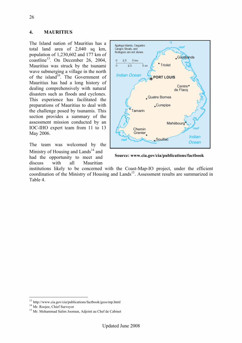
4. MAURITIUS The Island nation of Mauritius has a total land area of 2,040 sq km, population of 1,230,602 and 177 km of coastline13. On December 26, 2004, Mauritius was struck by the tsunami wave submerging a village in the north of the island10. The Government of Mauritius has had a long history of dealing comprehensively with natural disasters such as floods and cyclones. This experience has facilitated the preparations of Mauritius to deal with the challenge posed by tsunamis. This section provides a summary of the assessment mission conducted by an IOC-IHO expert team from 11 to 13 May 2006. The team was welcomed by the Ministry of Housing and Lands14 and had the opportunity to meet and discuss with all Mauritian institutions likely to be concerned with the Coast-Map-IO project, under the efficient coordination of the Ministry of Housing and Lands15. Assessment results are summarized in Table 4.
13 http://www.cia.gov/cia/publications/factbook/geos/mp.html 14 Mr. Roojee, Chief Surveyor 15 Mr. Mohammad Salim Joomun, Adjoint au Chef de Cabinet
Source: www.cia.gov/cia/publications/factbook
27
Updated June 2008
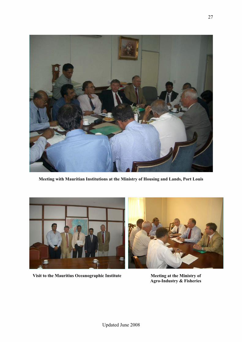
Meeting with Mauritian Institutions at the Ministry of Housing and Lands, Port Louis
Visit to the Mauritius Oceanographic Institute Meeting at the Ministry of Agro-Industry & Fisheries
28
Updated June 2008
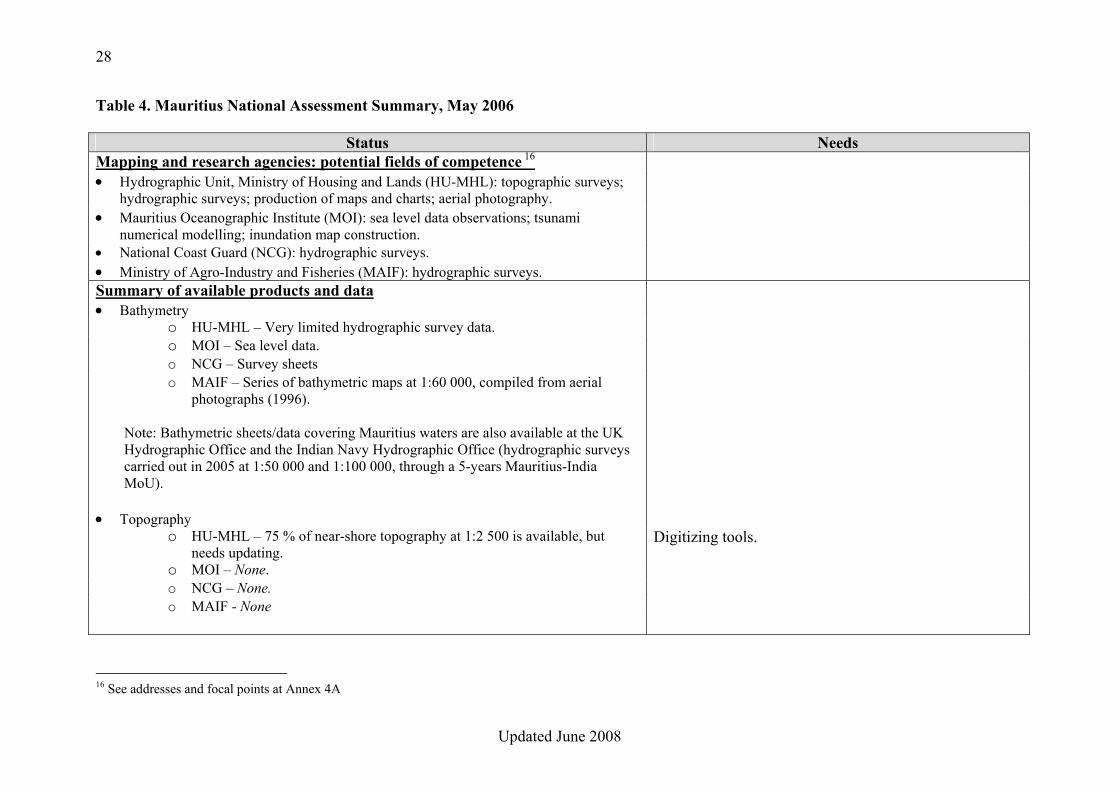
Table 4. Mauritius National Assessment Summary, May 2006
Status Needs Mapping and research agencies: potential fields of competence 16 • Hydrographic Unit, Ministry of Housing and Lands (HU-MHL): topographic surveys;
hydrographic surveys; production of maps and charts; aerial photography.
• Mauritius Oceanographic Institute (MOI): sea level data observations; tsunami numerical modelling; inundation map construction.
• National Coast Guard (NCG): hydrographic surveys. • Ministry of Agro-Industry and Fisheries (MAIF): hydrographic surveys. Summary of available products and data • Bathymetry
o HU-MHL – Very limited hydrographic survey data. o MOI – Sea level data. o NCG – Survey sheets o MAIF – Series of bathymetric maps at 1:60 000, compiled from aerial
photographs (1996).
Note: Bathymetric sheets/data covering Mauritius waters are also available at the UK Hydrographic Office and the Indian Navy Hydrographic Office (hydrographic surveys carried out in 2005 at 1:50 000 and 1:100 000, through a 5-years Mauritius-India MoU).
• Topography o HU-MHL – 75 % of near-shore topography at 1:2 500 is available, but
needs updating. Digitizing tools.
o MOI – None. o NCG – None. o MAIF - None
16 See addresses and focal points at Annex 4A
29
Updated June 2008
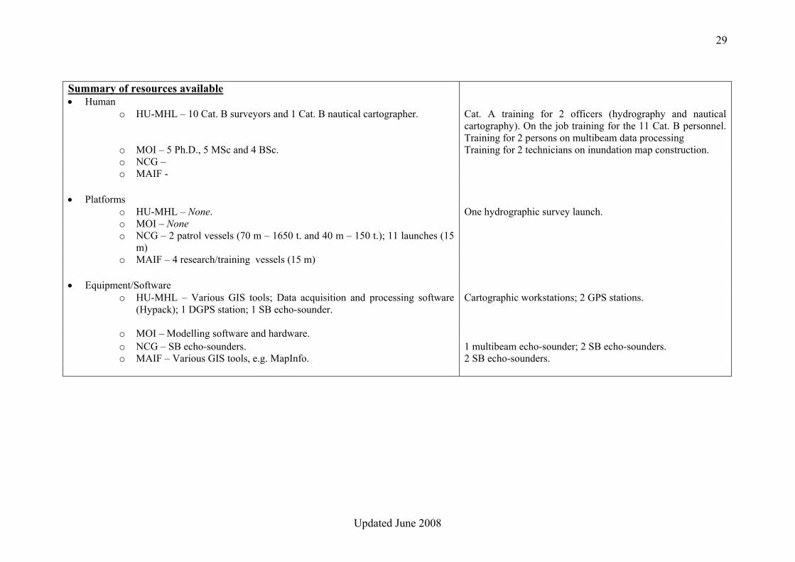
Summary of resources available • Human
o HU-MHL – 10 Cat. B surveyors and 1 Cat. B nautical cartographer. Cat. A training for 2 officers (hydrography and nautical cartography). On the job training for the 11 Cat. B personnel. Training for 2 persons on multibeam data processing
o MOI – 5 Ph.D., 5 MSc and 4 BSc. Training for 2 technicians on inundation map construction. o NCG – o MAIF -
• Platforms o HU-MHL – None. One hydrographic survey launch. o MOI – None o NCG – 2 patrol vessels (70 m – 1650 t. and 40 m – 150 t.); 11 launches (15
m)
o MAIF – 4 research/training vessels (15 m)
• Equipment/Software o HU-MHL – Various GIS tools; Data acquisition and processing software
(Hypack); 1 DGPS station; 1 SB echo-sounder. Cartographic workstations; 2 GPS stations.
o MOI – Modelling software and hardware. o NCG – SB echo-sounders. 1 multibeam echo-sounder; 2 SB echo-sounders. o MAIF – Various GIS tools, e.g. MapInfo. 2 SB echo-sounders.
30
Updated June 2008
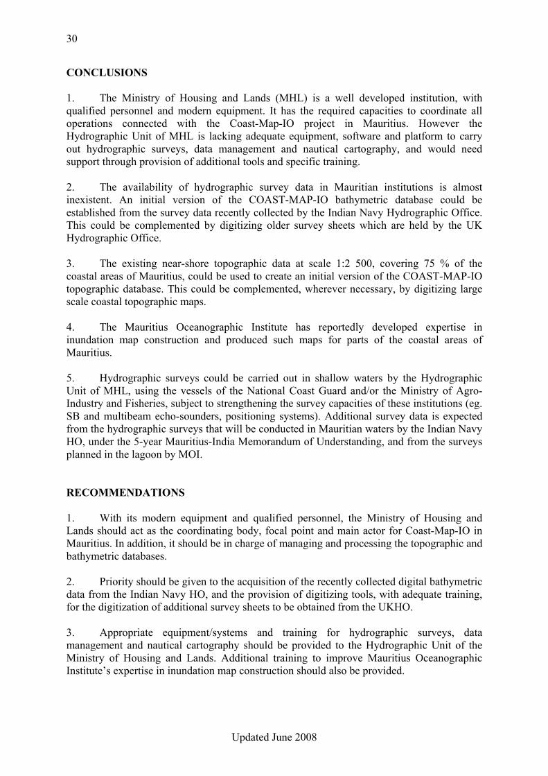
CONCLUSIONS 1. The Ministry of Housing and Lands (MHL) is a well developed institution, with qualified personnel and modern equipment. It has the required capacities to coordinate all operations connected with the Coast-Map-IO project in Mauritius. However the Hydrographic Unit of MHL is lacking adequate equipment, software and platform to carry out hydrographic surveys, data management and nautical cartography, and would need support through provision of additional tools and specific training. 2. The availability of hydrographic survey data in Mauritian institutions is almost inexistent. An initial version of the COAST-MAP-IO bathymetric database could be established from the survey data recently collected by the Indian Navy Hydrographic Office. This could be complemented by digitizing older survey sheets which are held by the UK Hydrographic Office. 3. The existing near-shore topographic data at scale 1:2 500, covering 75 % of the coastal areas of Mauritius, could be used to create an initial version of the COAST-MAP-IO topographic database. This could be complemented, wherever necessary, by digitizing large scale coastal topographic maps. 4. The Mauritius Oceanographic Institute has reportedly developed expertise in inundation map construction and produced such maps for parts of the coastal areas of Mauritius. 5. Hydrographic surveys could be carried out in shallow waters by the Hydrographic Unit of MHL, using the vessels of the National Coast Guard and/or the Ministry of Agro-Industry and Fisheries, subject to strengthening the survey capacities of these institutions (eg. SB and multibeam echo-sounders, positioning systems). Additional survey data is expected from the hydrographic surveys that will be conducted in Mauritian waters by the Indian Navy HO, under the 5-year Mauritius-India Memorandum of Understanding, and from the surveys planned in the lagoon by MOI. RECOMMENDATIONS 1. With its modern equipment and qualified personnel, the Ministry of Housing and Lands should act as the coordinating body, focal point and main actor for Coast-Map-IO in Mauritius. In addition, it should be in charge of managing and processing the topographic and bathymetric databases. 2. Priority should be given to the acquisition of the recently collected digital bathymetric data from the Indian Navy HO, and the provision of digitizing tools, with adequate training, for the digitization of additional survey sheets to be obtained from the UKHO. 3. Appropriate equipment/systems and training for hydrographic surveys, data management and nautical cartography should be provided to the Hydrographic Unit of the Ministry of Housing and Lands. Additional training to improve Mauritius Oceanographic Institute’s expertise in inundation map construction should also be provided.
31
Updated June 2008
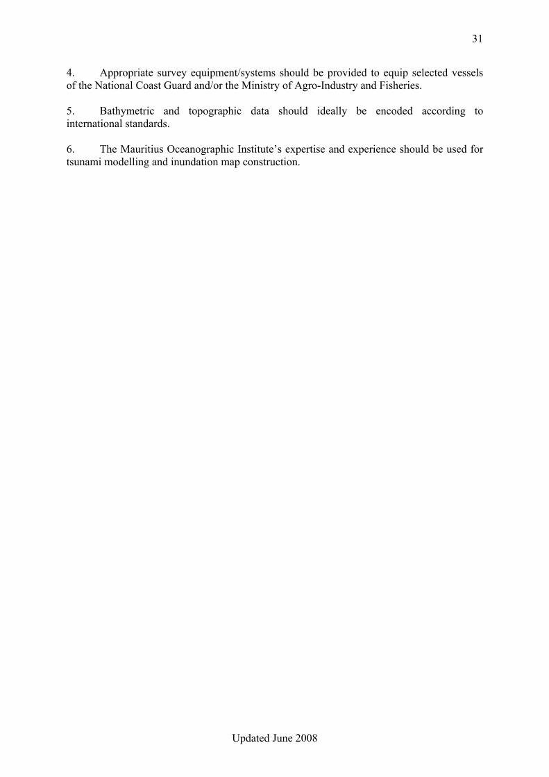
4. Appropriate survey equipment/systems should be provided to equip selected vessels of the National Coast Guard and/or the Ministry of Agro-Industry and Fisheries. 5. Bathymetric and topographic data should ideally be encoded according to international standards. 6. The Mauritius Oceanographic Institute’s expertise and experience should be used for tsunami modelling and inundation map construction.
32
Updated June 2008
Annex 4A
MAPPING AND RESEARCH AGENCIES IN MAURITIUS Addresses and Focal Points
• Hydrographic Unit, Ministry of Housing and Lands
Mr. Roojee, Chief Surveyor Rainbow House (5th floor), Edith Cavell Street, Port Louis Tel : +230-208-2831 Fax : +230-212-9369 E-mail : [email protected]
• Mauritius Oceanographic Institute Dr. Mitrasen Bhikajee, Director France Centre (4th floor), Victoria Av., Quatre Bornes
Tel : +230-427-4432 Fax : +230-427-4433 E-mail : [email protected]
• National Coast Guard Commander in Chief, NCG Headquarters, Fort William, Les Salines, Port Louis Tel : +230-212-2747 Fax : +230-212-2770 E-mail : [email protected]
• Ministry of Agro Industry and Fisheries
Levels 8 & 9, Renganaden Seeneevassen Building Cnr Jules Koenig & Maillard Streets, Port Louis Tel : +230-212-2335 Fax : +230-212-4427 E-mail : [email protected]

33
Updated June 2008
34
Updated June 2008
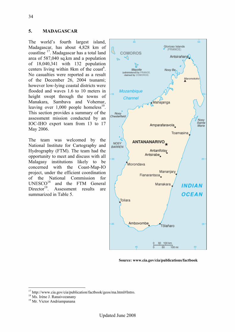
5. MADAGASCAR The world’s fourth largest island, Madagascar, has about 4,828 km of coastline 17. Madagascar has a total land area of 587,040 sq.km and a population of 18,040,341 with 132 population centers living within 8km of the coast6. No casualties were reported as a result of the December 26, 2004 tsunami; however low-lying coastal districts were flooded and waves 1.6 to 10 meters in height swept through the towns of Manakara, Sambava and Vohemar, leaving over 1,000 people homeless10. This section provides a summary of the assessment mission conducted by an IOC-IHO expert team from 13 to 17 May 2006. The team was welcomed by the National Institute for Cartography and Hydrography (FTM). The team had the opportunity to meet and discuss with all Malagasy institutions likely to be concerned with the Coast-Map-IO project, under the efficient coordination of the National Commission for UNESCO18 and the FTM General Director19. Assessment results are summarized in Table 5.
17 http://www.cia.gov/cia/publication/factbook/geos/ma.html#Intro. 18 Ms. Irène J. Ranaivozanany 19 Mr. Victor Andriampanana
Source: www.cia.gov/cia/publications/factbook
35
Updated June 2008
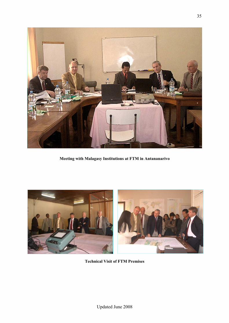
Meeting with Malagasy Institutions at FTM in Antananarivo
Technical Visit of FTM Premises
36
Updated June 2008
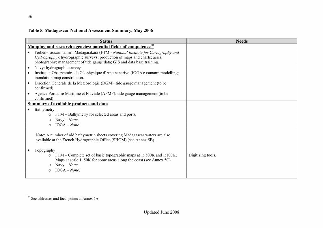
Table 5. Madagascar National Assessment Summary, May 2006
Status Needs Mapping and research agencies: potential fields of competence20 • Foiben-Taosarintanin’i Madagasikara (FTM - National Institute for Cartography and
Hydrography): hydrographic surveys; production of maps and charts; aerial photography; management of tide gauge data; GIS and data base training.
• Navy: hydrographic surveys. • Institut et Observatoire de Géophysique d’Antananarivo (IOGA): tsunami modelling;
inondation map construction.
• Direction Générale de la Météorologie (DGM): tide gauge management (to be confirmed)
• Agence Portuaire Maritime et Fluviale (APMF): tide gauge management (to be confirmed)
Summary of available products and data • Bathymetry
o FTM – Bathymetry for selected areas and ports. o Navy – None. o IOGA – None.
Note: A number of old bathymetric sheets covering Madagascar waters are also available at the French Hydrographic Office (SHOM) (see Annex 5B).
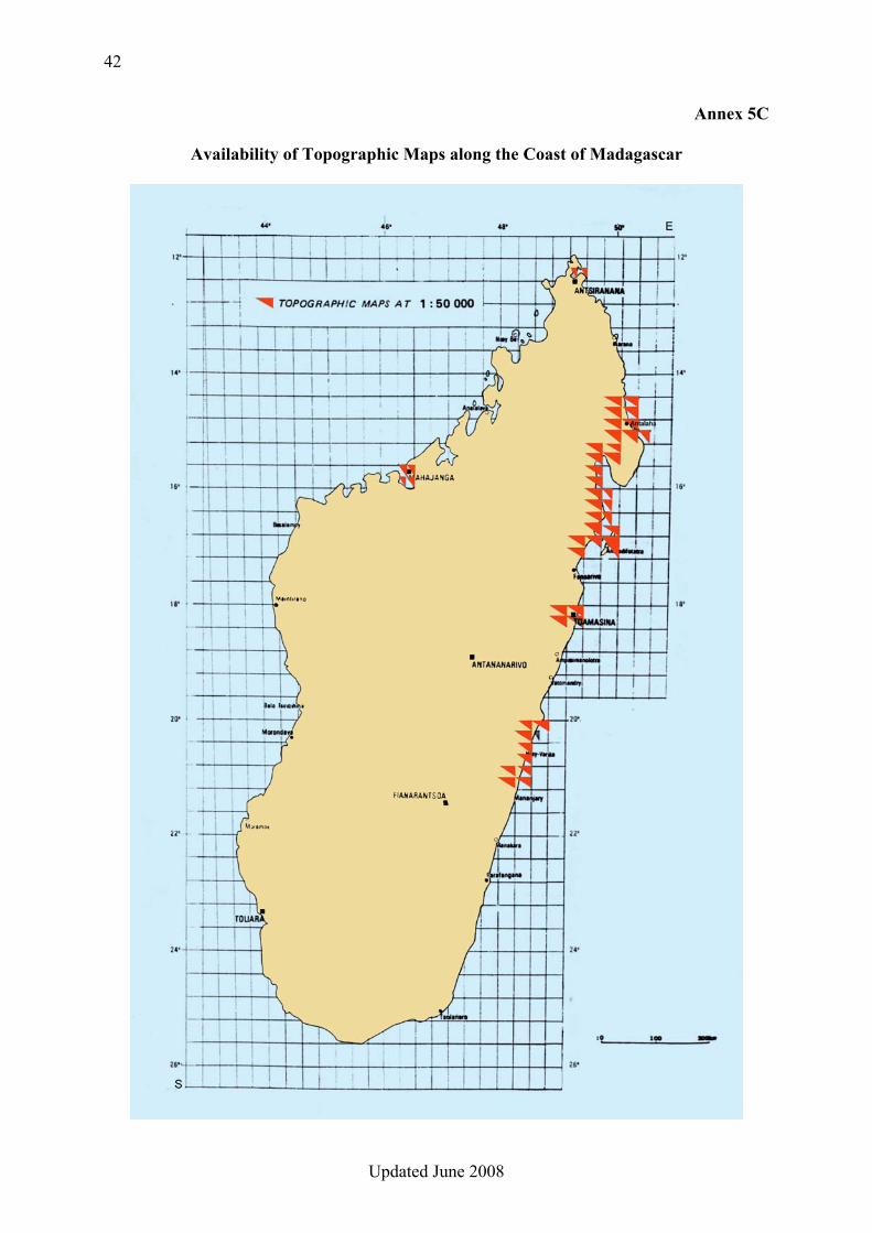
• Topography o FTM – Complete set of basic topographic maps at 1: 500K and 1:100K;
Maps at scale 1: 50K for some areas along the coast (see Annex 5C). Digitizing tools.
o Navy – None. o IOGA – None.
20 See addresses and focal points at Annex 5A
37
Updated June 2008
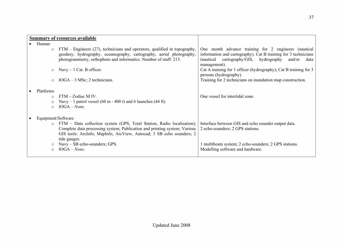
Summary of resources available • Human
o FTM – Engineers (27), technicians and operators, qualified in topography, geodesy, hydrography, oceanography, cartography, aerial photography, photogrammetry, orthophoto and informatics. Number of staff: 213.
One month advance training for 2 engineers (nautical information and cartography). Cat B training for 3 technicians (nautical cartography/GIS, hydrography and/or data management).
o Navy – 1 Cat. B officer. Cat A training for 1 officer (hydrography); Cat B training for 3 persons (hydrography).
o IOGA – 3 MSc; 2 technicians. Training for 2 technicians on inundation map construction.
• Platforms o FTM – Zodiac M IV. One vessel for intertidal zone. o Navy – 1 patrol vessel (60 m - 400 t) and 6 launches (44 ft). o IOGA – None.
• Equipment/Software o FTM – Data collection system (GPS, Total Station, Radio localisation);
Complete data processing system; Publication and printing system; Various GIS tools: ArcInfo, MapInfo, ArcView, Autocad; 3 SB echo sounders; 2 tide gauges.
Interface between GIS and echo sounder output data. 2 echo-sounders; 2 GPS stations.
o Navy – SB echo-sounders; GPS. 1 multibeam system; 2 echo-sounders; 2 GPS stations. o IOGA – None. Modelling software and hardware.
38
Updated June 2008
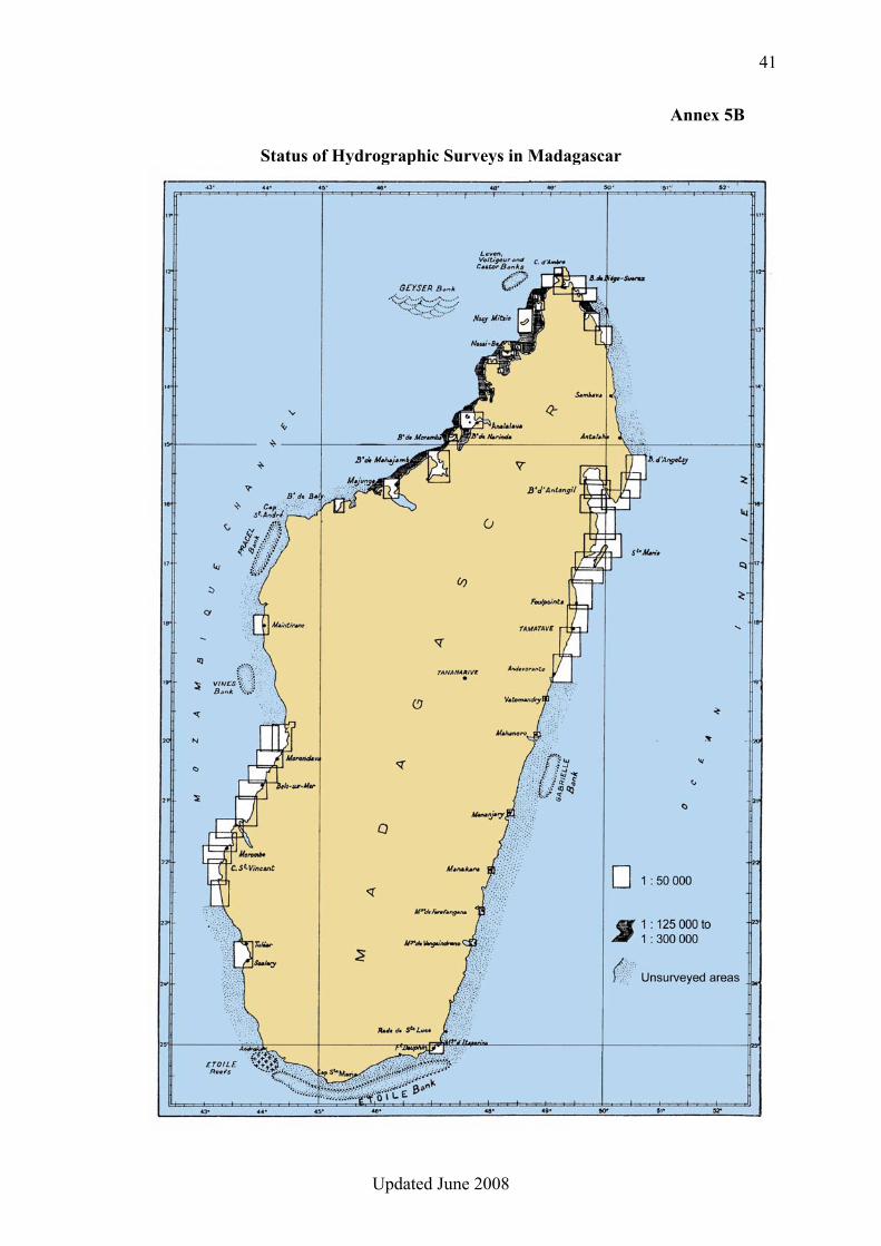
CONCLUSIONS 1. The National Institute for Cartography and Hydrography (FTM) is a fairly developed institution, with qualified personnel, which should be capable of carrying out most of the operations connected with the Coast-Map-IO project. However they will need support through provision of additional tools and specific training, e.g. hydrographic surveys, data management, or nautical cartography. 2. The only existing survey data covering Madagascar’s coastal waters are held by the French Hydrographic Office (SHOM) in analogue form and are outdated (see Annex 5B); however they could be digitized to create an initial version of the COAST-MAP-IO bathymetric database. The sparse surveys carried out by FTM, although accurate and dense, are insufficient for the project. 3. The existing topographic maps at scale 1:50,000 (see Annex 5C), BD10, BD100 … covering part of the coastal areas of Madagascar (FTM), complemented wherever necessary with those at scale 1:100,000, could be digitized (contours) to create an initial version of the COAST-MAP-IO topographic database. 4. The very limited bathymetric and topographic data available would require that initial tests be conducted on the north eastern coast, between Toamasina (Tamatave) and Antalaha. 5. National institutions likely to participate in the project are clearly lacking modern and efficient equipment, (eg. hydrographic vessels, multibeam echo-sounders, or hydrographic/cartographic workstations), and properly trained personnel. RECOMMENDATIONS 1. As FTM is formally in charge of hydrography and topography in Madagascar, and that knowledge of coastal bathymetry and topography is of utmost importance to the project, this institute should act as the coordinating body, focal point and main actor for Coast-Map-IO in Madagascar. 2. In accordance with Conclusion 2, the area on the north eastern coast, between Toamasina (Tamatave) and Antalaha, which is also a tsunami-vulnerable zone, should be used as pilot area for the project. For this area, relevant survey sheets should be obtained from SHOM. 3. Priority should be given to the provision of digitizing tools, with adequate training, for the digitization of the existing survey sheets and topographic maps. 4. Appropriate means should be provided to manage and process the bathymetric / topographic database, ideally in gridded form, which will result from Recommendation 3 above. 5. Additional survey equipment/systems should be provided to conduct hydrographic surveys, as necessary, in pilot areas. In this exercise, cooperation with other institutions, e.g. Forces Navales, should be sought.
39
Updated June 2008
6. Bathymetric and topographic data should ideally be encoded according to international standards. 7. IOGA’s expertise and experience should be used for tsunami modelling and inundation map construction.
40
Updated June 2008
Annex 5A
MAPPING AND RESEARCH AGENCIES IN MADAGASCAR Addresses and Focal Points
• Foiben-Taosarintanin’i Madagasikara (FTM - National Institute for Cartography and
Hydrography) ANDRIAMPANANA Victor, General Director, BP 323 Lalana Dama Ntsoha Ambanidia, Antananarivo Tel : +261-20-22 229 35 Fax : +261-20- 22 252 64 E-mail : [email protected]
• Navy CF RANAIVOSEHENO L.A. Padoue, Commandement des Forces Navales, B.P. 9 Bis Ambatonakanga, 101 - Antananarivo
Tel : +261-20-22 213 93 Fax : E-mail : [email protected]
• Institut et Observatoire de Géophysique d’Antananarivo (IOGA) Prof. RAMBOLAMANANA Gérard, IOGA, B.P 3843, 101 – Antananarivo. Tel : +261-20-22 301 82 Fax : +261-20-22 301 82 E-mail : [email protected] / [email protected]
• Direction Générale de la Météorologie
RAELINERA Nimbol, Directeur Général DGM, B.P 1254, Ampandrianomby, 101 - Antananarivo Tel : +261-20-22 405 35 Fax : +261-20-22 408 23 E-mail : [email protected] / [email protected]
• Agence Portuaire Maritime et Fluviale (APMF) Directeur Général, APMF, 3e étage Immeuble Grand Ciel, Route des Hydrocarbures, Ivandry, 101 - Antananarivo Tel : +261-20-24 257 00 Fax : +261-20-24 257 00 E-mail : [email protected]
41
Updated June 2008
Annex 5B
Status of Hydrographic Surveys in Madagascar
42
Updated June 2008
Annex 5C
Availability of Topographic Maps along the Coast of Madagascar

43
Updated June 2008
44
Updated June 2008
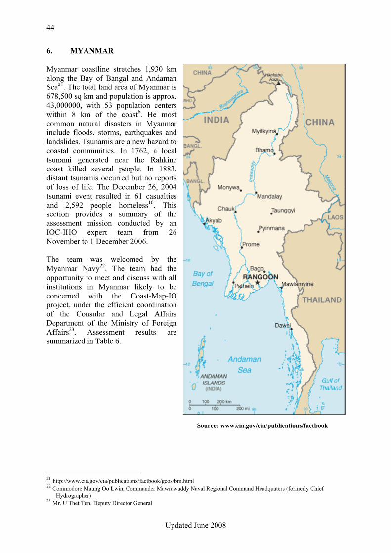
6. MYANMAR Myanmar coastline stretches 1,930 km along the Bay of Bangal and Andaman Sea21. The total land area of Myanmar is 678,500 sq km and population is approx. 43,000000, with 53 population centers within 8 km of the coast6. He most common natural disasters in Myanmar include floods, storms, earthquakes and landslides. Tsunamis are a new hazard to coastal communities. In 1762, a local tsunami generated near the Rahkine coast killed several people. In 1883, distant tsunamis occurred but no reports of loss of life. The December 26, 2004 tsunami event resulted in 61 casualties and 2,592 people homeless10. This section provides a summary of the assessment mission conducted by an IOC-IHO expert team from 26 November to 1 December 2006. The team was welcomed by the Myanmar Navy22. The team had the opportunity to meet and discuss with all institutions in Myanmar likely to be concerned with the Coast-Map-IO project, under the efficient coordination of the Consular and Legal Affairs Department of the Ministry of Foreign Affairs23. Assessment results are summarized in Table 6.
21 http://www.cia.gov/cia/publications/factbook/geos/bm.html 22 Commodore Maung Oo Lwin, Commander Mawrawaddy Naval Regional Command Headquaters (formerly Chief
Hydrographer) 23 Mr. U Thet Tun, Deputy Director General
Source: www.cia.gov/cia/publications/factbook
45
Updated June 2008
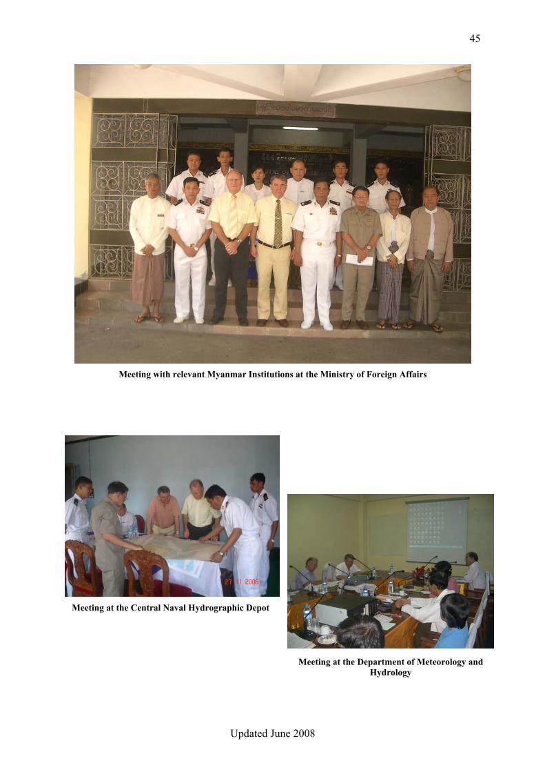
Meeting with relevant Myanmar Institutions at the Ministry of Foreign Affairs
Meeting at the Central Naval Hydrographic Depot
Meeting at the Department of Meteorology and Hydrology

46
Updated June 2008
Table 6. Myanmar National Assessment Summary, November 2006
Status Needs Mapping and research agencies: potential fields of competence24 • Central Naval Hydrographic Depot (CNHD): hydrographic surveying; nautical charting;
tide / water level measurement; data management.
• Department of Meteorology and Hydrology (DMH): tide / water level measurement; tsunami / coastal / storm surge modelling.
• Directorate of Survey: topographic surveys; management of topographic data; compilation and production of topographic maps.
Summary of available products and data • Bathymetry
o Naval Hydrographic Office – Nautical charts; Survey sheets; Tide Tables. Digitizing tools. o DMH25 – River sounding profiles; Water level data. o Directorate of Survey – None.
• Topography
o Naval Hydrographic Office – None. o DMH – None. o Directorate of Survey – Complete series of topographic maps at 1: 50K;
approx. 80 % of the coastal topography available in digital form in end 2006.
Digitizing tools.
Summary of resources available • Human
o Naval Hydrographic Office – Naval officers (10), including 1 Cat. A and 6 Cat. B; Petty officers (13), including 4 Cat B. Qualifications include hydrography, nautical cartography, oceanography, GIS and tide prediction. Total number of staff: 278.
Cat. A training for 6 officers (hydrography and cartography). Cat B training for 10 non commissioned officers (hydrography and cartography). Training on multibeam for 1 officer and 2 non commissioned officers, and on tidal
24 See addresses and focal points at Annex 6A 25 DMH has also developed an empirical storm surge model
47
Updated June 2008
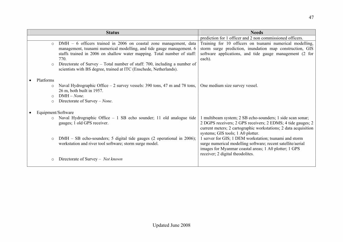
Status Needs prediction for 1 officer and 2 non commissioned officers.
o DMH – 6 officers trained in 2006 on coastal zone management, data management, tsunami numerical modelling, and tide gauge management. 6 staffs trained in 2006 on shallow water mapping. Total number of staff: 770.
Training for 10 officers on tsunami numerical modelling, storm surge prediction, inundation map construction, GIS software applications, and tide gauge management (2 for each).
o Directorate of Survey – Total number of staff: 700, including a number of scientists with BS degree, trained at ITC (Enschede, Netherlands).
• Platforms
o Naval Hydrographic Office – 2 survey vessels: 390 tons, 47 m and 78 tons, 26 m, both built in 1957.
One medium size survey vessel.
o DMH – None. o Directorate of Survey – None.
• Equipment/Software o Naval Hydrographic Office – 1 SB echo sounder; 11 old analogue tide
gauges; 1 old GPS receiver. 1 multibeam system; 2 SB echo-sounders; 1 side scan sonar; 2 DGPS receivers; 2 GPS receivers; 2 EDMS; 4 tide gauges; 2 current meters; 2 cartographic workstations; 2 data acquisition systems; GIS tools; 1 A0 plotter.
o DMH – SB echo-sounders; 5 digital tide gauges (2 operational in 2006); workstation and river tool software; storm surge model.
1 server for GIS; 1 DEM workstation; tsunami and storm surge numerical modelling software; recent satellite/aerial images for Myanmar coastal areas; 1 A0 plotter; 1 GPS receiver; 2 digital theodolites.
o Directorate of Survey – Not known
48
Updated June 2008
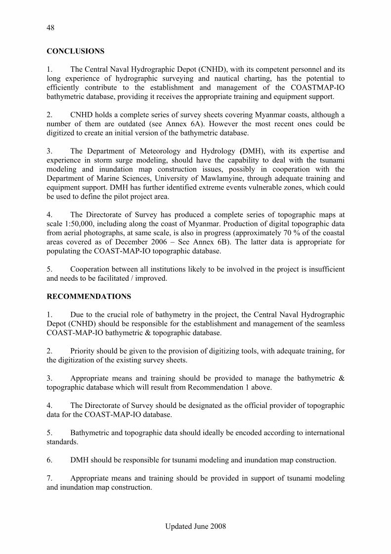
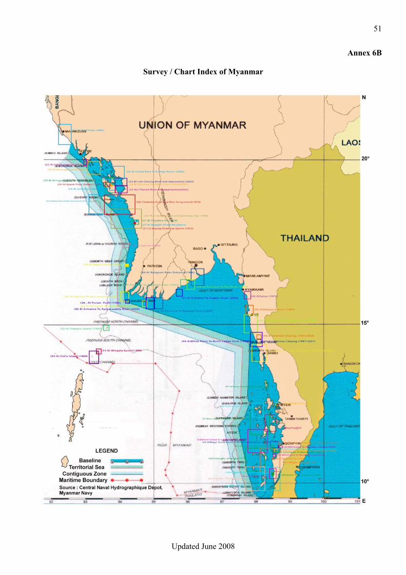
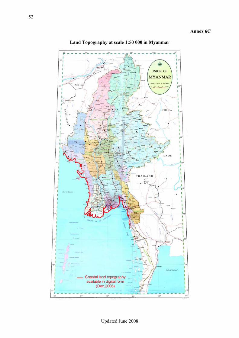
CONCLUSIONS 1. The Central Naval Hydrographic Depot (CNHD), with its competent personnel and its long experience of hydrographic surveying and nautical charting, has the potential to efficiently contribute to the establishment and management of the COASTMAP-IO bathymetric database, providing it receives the appropriate training and equipment support. 2. CNHD holds a complete series of survey sheets covering Myanmar coasts, although a number of them are outdated (see Annex 6A). However the most recent ones could be digitized to create an initial version of the bathymetric database. 3. The Department of Meteorology and Hydrology (DMH), with its expertise and experience in storm surge modeling, should have the capability to deal with the tsunami modeling and inundation map construction issues, possibly in cooperation with the Department of Marine Sciences, University of Mawlamyine, through adequate training and equipment support. DMH has further identified extreme events vulnerable zones, which could be used to define the pilot project area. 4. The Directorate of Survey has produced a complete series of topographic maps at scale 1:50,000, including along the coast of Myanmar. Production of digital topographic data from aerial photographs, at same scale, is also in progress (approximately 70 % of the coastal areas covered as of December 2006 – See Annex 6B). The latter data is appropriate for populating the COAST-MAP-IO topographic database. 5. Cooperation between all institutions likely to be involved in the project is insufficient and needs to be facilitated / improved. RECOMMENDATIONS 1. Due to the crucial role of bathymetry in the project, the Central Naval Hydrographic Depot (CNHD) should be responsible for the establishment and management of the seamless COAST-MAP-IO bathymetric & topographic database. 2. Priority should be given to the provision of digitizing tools, with adequate training, for the digitization of the existing survey sheets. 3. Appropriate means and training should be provided to manage the bathymetric & topographic database which will result from Recommendation 1 above. 4. The Directorate of Survey should be designated as the official provider of topographic data for the COAST-MAP-IO database. 5. Bathymetric and topographic data should ideally be encoded according to international standards. 6. DMH should be responsible for tsunami modeling and inundation map construction. 7. Appropriate means and training should be provided in support of tsunami modeling and inundation map construction.
49
Updated June 2008
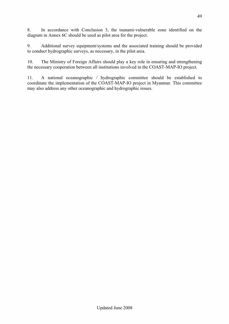
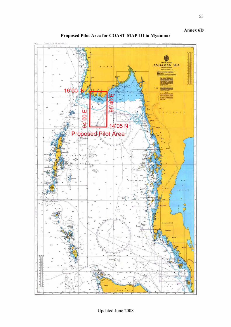
8. In accordance with Conclusion 3, the tsunami-vulnerable zone identified on the diagram in Annex 6C should be used as pilot area for the project. 9. Additional survey equipment/systems and the associated training should be provided to conduct hydrographic surveys, as necessary, in the pilot area. 10. The Ministry of Foreign Affairs should play a key role in ensuring and strengthening the necessary cooperation between all institutions involved in the COAST-MAP-IO project. 11. A national oceanographic / hydrographic committee should be established to coordinate the implementation of the COAST-MAP-IO project in Myanmar. This committee may also address any other oceanographic and hydrographic issues.
50
Updated June 2008
Annex 6A
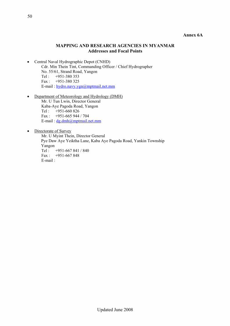
MAPPING AND RESEARCH AGENCIES IN MYANMAR
Addresses and Focal Points • Central Naval Hydrographic Depot (CNHD)
Cdr. Min Thein Tint, Commanding Officer / Chief Hydrographer No. 55/61, Strand Road, Yangon Tel : +951-380 353 Fax : +951-380 325 E-mail : [email protected]
• Department of Meteorology and Hydrology (DMH) Mr. U Tun Lwin, Director General Kaba-Aye Pagoda Road, Yangon
Tel : +951-660 826 Fax : +951-665 944 / 704 E-mail : [email protected]
• Directorate of Survey Mr. U Myint Thein, Director General Pye Daw Aye Yeiktha Lane, Kaba Aye Pagoda Road, Yankin Township Yangon Tel : +951-667 841 / 840 Fax : +951-667 848 E-mail :
51
Updated June 2008
Annex 6B
Survey / Chart Index of Myanmar
52
Updated June 2008
Annex 6C
Land Topography at scale 1:50 000 in Myanmar
53
Updated June 2008
Annex 6D Proposed Pilot Area for COAST-MAP-IO in Myanmar
54
Updated June 2008
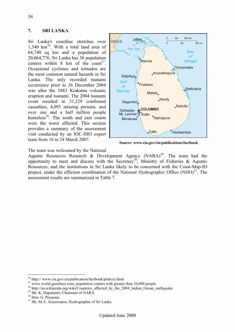
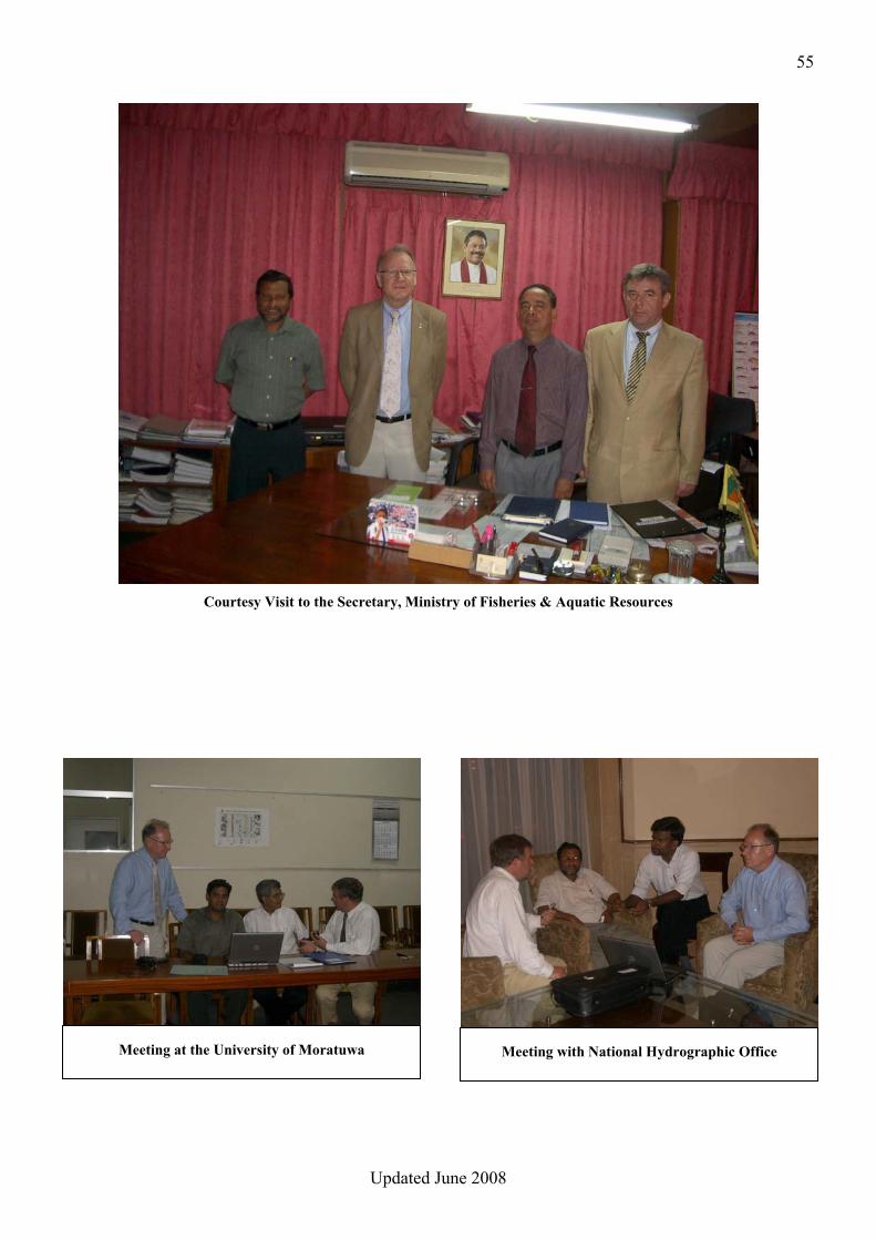
7. SRI LANKA Sri Lanka's coastline stretches over 1,340 km26. With a total land area of 64,740 sq km and a population of 20,064,776, Sri Lanka has 36 population centres within 8 km of the coast27. Occasional cyclones and tornados are the most common natural hazards in Sri Lanka. The only recorded tsunami occurrence prior to 26 December 2004 was after the 1883 Krakatau volcanic eruption and tsunami. The 2004 tsunami event resulted in 31,229 confirmed casualties, 4,093 missing persons, and over one and a half million people homeless28. The south and east coasts were the worst affected. This section provides a summary of the assessment visit conducted by an IOC-IHO expert team from 16 to 24 March 2007. The team was welcomed by the National Aquatic Resources Research & Development Agency (NARA)29. The team had the opportunity to meet and discuss with the Secretary30, Ministry of Fisheries & Aquatic Resources, and the institutions in Sri Lanka likely to be concerned with the Coast-Map-IO project, under the efficient coordination of the National Hydrographic Office (NHO)31. The assessment results are summarized in Table 7.
26 http:// www.cia.gov/cia/publication/factbook/print/ce.html 27 www.world-gazetteer.com; population centers with greater than 10,000 people 28 http://en.wikipeida.org/wiki/Countries_affected_by_the_2004_Indian_Ocean_earthquake 29 Mr. K. Haputantri, Chairman of NARA 30 Hon. G. Piyasena 31 Mr. M.A. Ariyawansa, Hydrographer of Sri Lanka
Source: www.cia.gov/cia/publications/factbook
55
Updated June 2008
Courtesy Visit to the Secretary, Ministry of Fisheries & Aquatic Resources
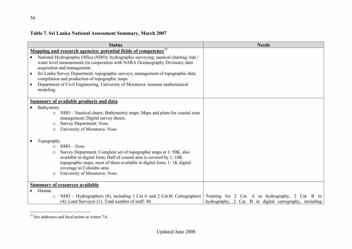
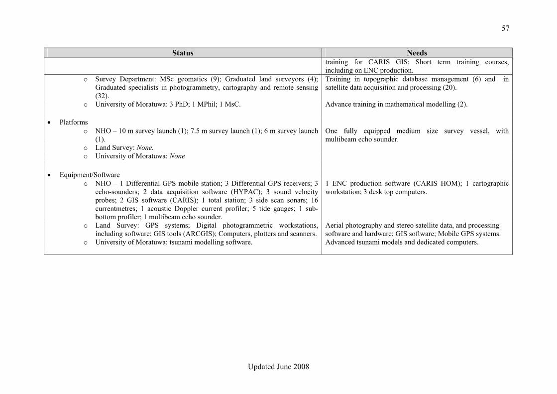
Meeting with National Hydrographic Office Meeting at the University of Moratuwa
56
Updated June 2008
Table 7. Sri Lanka National Assessment Summary, March 2007
Status Needs Mapping and research agencies: potential fields of competence32 • National Hydrographic Office (NHO): hydrographic surveying; nautical charting; tide /
water level measurement (in cooperation with NARA Oceanography Division); data acquisition and management.
• Sri Lanka Survey Department: topographic surveys; management of topographic data; compilation and production of topographic maps.
• Department of Civil Engineering, University of Moratuwa: tsunami mathematical modeling.
Summary of available products and data • Bathymetry
o NHO – Nautical charts; Bathymetric maps; Maps and plans for coastal zone management; Digital survey sheets.
o Survey Department: None. o University of Moratuwa: None.
• Topography
o NHO – None. o Survey Department: Complete set of topographic maps at 1: 50K, also
available in digital form; Half of coastal area is covered by 1: 10K topographic maps, most of them available in digital form; 1: 1K digital coverage in Colombo area.
o University of Moratuwa: None.
Summary of resources available • Human
o NHO – Hydrographers (8), including 1 Cat.A and 2 Cat.B; Cartographers (4); Land Surveyor (1). Total number of staff: 40.
Training for 2 Cat. A in hydrography, 2 Cat. B in hydrography, 2 Cat. B in digital cartography, including
32 See addresses and focal points at Annex 7A
57
Updated June 2008
Status Needs training for CARIS GIS; Short term training courses, including on ENC production.
o Survey Department: MSc geomatics (9); Graduated land surveyors (4); Graduated specialists in photogrammetry, cartography and remote sensing (32).
Training in topographic database management (6) and in satellite data acquisition and processing (20).
o University of Moratuwa: 3 PhD; 1 MPhil; 1 MsC. Advance training in mathematical modelling (2).
• Platforms o NHO – 10 m survey launch (1); 7.5 m survey launch (1); 6 m survey launch
(1). One fully equipped medium size survey vessel, with multibeam echo sounder.
o Land Survey: None. o University of Moratuwa: None
• Equipment/Software o NHO – 1 Differential GPS mobile station; 3 Differential GPS receivers; 3
echo-sounders; 2 data acquisition software (HYPAC); 3 sound velocity probes; 2 GIS software (CARIS); 1 total station; 3 side scan sonars; 16 currentmetres; 1 acoustic Doppler current profiler; 5 tide gauges; 1 sub-bottom profiler; 1 multibeam echo sounder.
1 ENC production software (CARIS HOM); 1 cartographic workstation; 3 desk top computers.
o Land Survey: GPS systems; Digital photogrammetric workstations, including software; GIS tools (ARCGIS); Computers, plotters and scanners.
Aerial photography and stereo satellite data, and processing software and hardware; GIS software; Mobile GPS systems.
o University of Moratuwa: tsunami modelling software. Advanced tsunami models and dedicated computers.
58
Updated June 2008
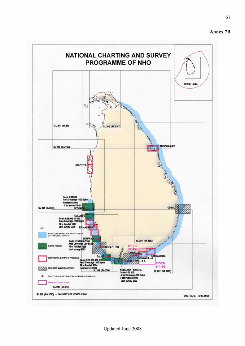
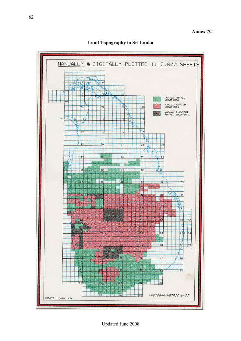
CONCLUSIONS 1. The National Hydrographic Office (NHO) of NARA, with its competent personnel, its experience of hydrographic surveying and nautical charting, and its modern equipment, particularly that supplied by Germany, has the potential to efficiently contribute to the establishment and management of the COAST-MAP-IO bathymetric and topographic seamless database, provided that it receives additional training and equipment. 2. An initial version of the bathymetric database could be populated from the existing survey digital data held by the NHO, to be complemented by the data which will result from surveys in progress and planned (see Annex 7B). The planned UK – Sri Lanka project to survey a large part of Sri Lanka shallow waters, by means of Lidar system (i.e. up to approx. 30 meters depth), should result in very useful bathymetric data for COAST-MAP-IO. Same applies to a hydrographic survey by a French hydrographic vessel, which is planned in the area of Hambantota on the SE coast, in cooperation with the NHO. 3. In order to conduct hydrographic surveys in the 30–200 metre depth area, as required for this project, NHO will need a medium size survey vessel which is currently lacking. However, the team was informed that a government decision to build such vessel has been taken. 4. Approximatively half of the coastal area (Southern part) is covered by 1: 10,000 scale topographic maps, most of which are available in digital form (see Annex 7C). The Survey Department has also produced a complete series of topographic maps at scale 1:50,000, available in digital form. The COAST-MAP-IO topographic database could be populated with the 1:10,000 data and complemented for the Northern part with 1:50,000 data. Assistance in production of digital data was provided to the Survey Department by an Italian institution33. 5. NHO has identified the extreme events vulnerable zones, which could be used to define the pilot project area. 6. The Department of Civil Engineering of the University of Moratuwa, with its expertise and experience in tsunami modeling, has the capability to deal with modeling and inundation map construction matters. 7. Cooperation between all institutions likely to be involved in the project is insufficient and needs to be facilitated / improved. RECOMMENDATIONS 1. Due to the crucial role of bathymetry in the project, the National Hydrographic Office (NHO) of NARA should be responsible for the establishment and management of the seamless COAST-MAP-IO bathymetric and topographic database. 2. Appropriate means and training should be provided to manage the bathymetric and topographic database which will result from Recommendation 1 above.
33 Istituto Nazionale di Oceanografia e di geofisica Sperimentale, Trieste
59
Updated June 2008
3. The Survey Department should be designated as the official provider of topographic data for the COAST-MAP-IO database. 4. Bathymetric and topographic data should ideally be encoded according to international standards. 5. The Department of Civil Engineering of the University of Moruwata should be responsible for tsunami modeling and inundation map construction. 6. Appropriate means and training should be provided in support of tsunami modeling and inundation map construction, if needed. 7. In accordance with Conclusion 5, the tsunami-vulnerable zone identified on the diagram in Annex 7B should be used as pilot area for the project. 8. The Disaster Management Centre should be the focal point, and ensure and strengthen the necessary cooperation between the institutions involved in the COAST-MAP-IO project.
60
Updated June 2008
Annex 7A
MAPPING AND RESEARCH AGENCIES IN SRI LANKA
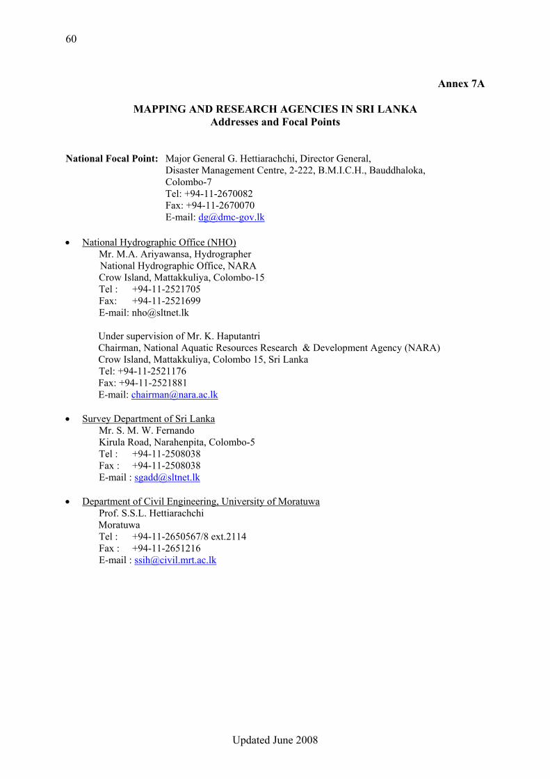
Addresses and Focal Points National Focal Point: Major General G. Hettiarachchi, Director General,
Disaster Management Centre, 2-222, B.M.I.C.H., Bauddhaloka, Colombo-7
Tel: +94-11-2670082 Fax: +94-11-2670070 E-mail: [email protected] • National Hydrographic Office (NHO)
Mr. M.A. Ariyawansa, Hydrographer National Hydrographic Office, NARA
Crow Island, Mattakkuliya, Colombo-15 Tel : +94-11-2521705 Fax: +94-11-2521699 E-mail: [email protected]
Under supervision of Mr. K. Haputantri Chairman, National Aquatic Resources Research & Development Agency (NARA) Crow Island, Mattakkuliya, Colombo 15, Sri Lanka
Tel: +94-11-2521176 Fax: +94-11-2521881 E-mail: [email protected]
• Survey Department of Sri Lanka Mr. S. M. W. Fernando Kirula Road, Narahenpita, Colombo-5
Tel : +94-11-2508038 Fax : +94-11-2508038 E-mail : [email protected]
• Department of Civil Engineering, University of Moratuwa Prof. S.S.L. Hettiarachchi Moratuwa Tel : +94-11-2650567/8 ext.2114 Fax : +94-11-2651216 E-mail : [email protected]
61
Updated June 2008
Annex 7B
62
Updated June 2008
Annex 7C
Land Topography in Sri Lanka

63
Updated June 2008
64
Updated June 2008
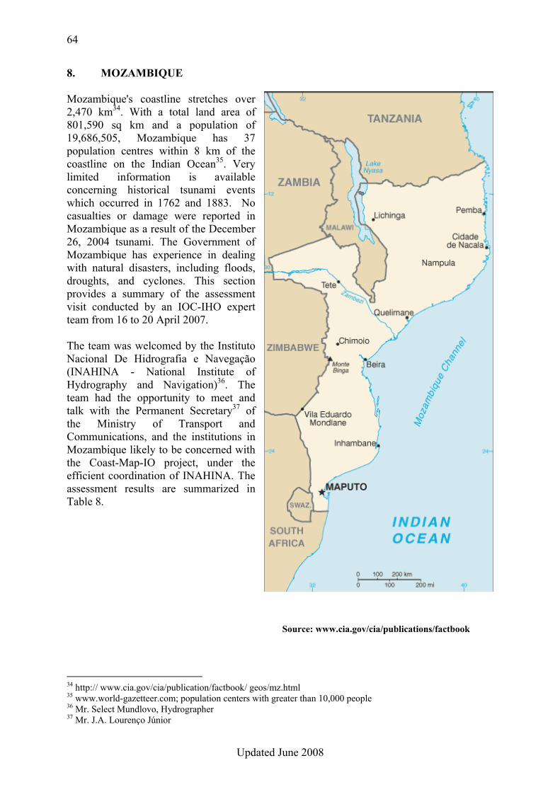
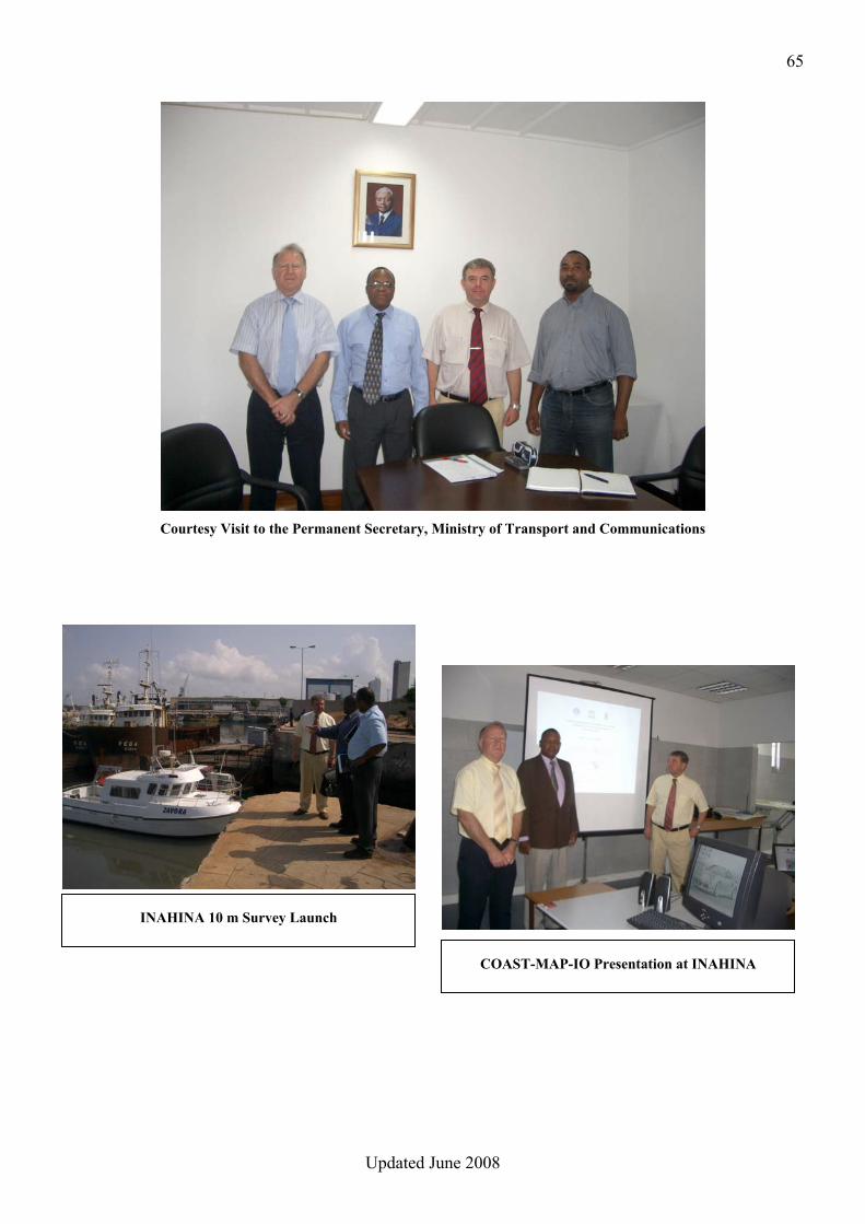
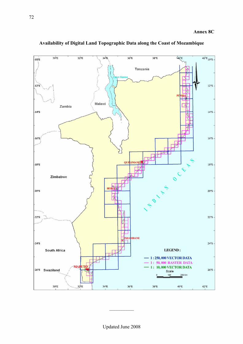
8. MOZAMBIQUE Mozambique's coastline stretches over 2,470 km34. With a total land area of 801,590 sq km and a population of 19,686,505, Mozambique has 37 population centres within 8 km of the coastline on the Indian Ocean35. Very limited information is available concerning historical tsunami events which occurred in 1762 and 1883. No casualties or damage were reported in Mozambique as a result of the December 26, 2004 tsunami. The Government of Mozambique has experience in dealing with natural disasters, including floods, droughts, and cyclones. This section provides a summary of the assessment visit conducted by an IOC-IHO expert team from 16 to 20 April 2007. The team was welcomed by the Instituto Nacional De Hidrografia e Navegação (INAHINA - National Institute of Hydrography and Navigation)36. The team had the opportunity to meet and talk with the Permanent Secretary37 of the Ministry of Transport and Communications, and the institutions in Mozambique likely to be concerned with the Coast-Map-IO project, under the efficient coordination of INAHINA. The assessment results are summarized in Table 8.
34 http:// www.cia.gov/cia/publication/factbook/ geos/mz.html 35 www.world-gazetteer.com; population centers with greater than 10,000 people 36 Mr. Select Mundlovo, Hydrographer 37 Mr. J.A. Lourenço Júnior
Source: www.cia.gov/cia/publications/factbook
65
Updated June 2008
Courtesy Visit to the Permanent Secretary, Ministry of Transport and Communications
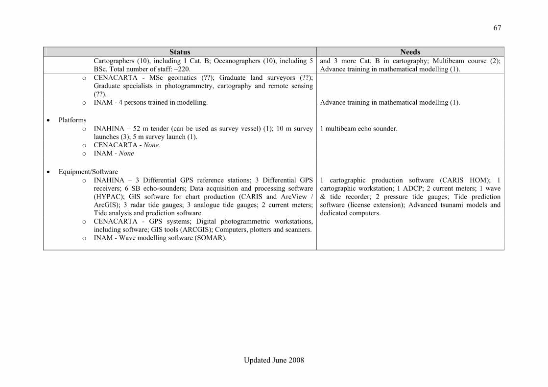
COAST-MAP-IO Presentation at INAHINA
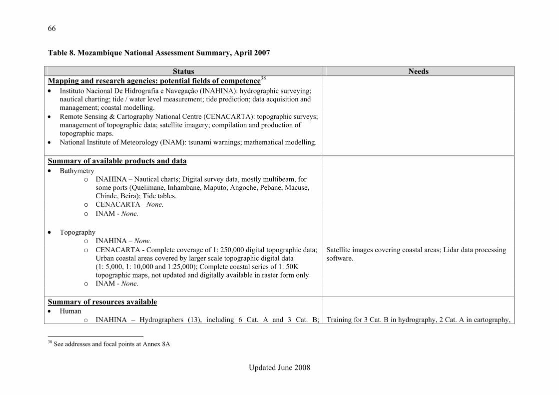
INAHINA 10 m Survey Launch
66
Updated June 2008
Table 8. Mozambique National Assessment Summary, April 2007
Status Needs Mapping and research agencies: potential fields of competence38 • Instituto Nacional De Hidrografia e Navegação (INAHINA): hydrographic surveying;
nautical charting; tide / water level measurement; tide prediction; data acquisition and management; coastal modelling.
• Remote Sensing & Cartography National Centre (CENACARTA): topographic surveys; management of topographic data; satellite imagery; compilation and production of topographic maps.
• National Institute of Meteorology (INAM): tsunami warnings; mathematical modelling. Summary of available products and data • Bathymetry
o INAHINA – Nautical charts; Digital survey data, mostly multibeam, for some ports (Quelimane, Inhambane, Maputo, Angoche, Pebane, Macuse, Chinde, Beira); Tide tables.
o CENACARTA - None. o INAM - None.
• Topography
o INAHINA – None. o CENACARTA - Complete coverage of 1: 250,000 digital topographic data;
Urban coastal areas covered by larger scale topographic digital data (1: 5,000, 1: 10,000 and 1:25,000); Complete coastal series of 1: 50K topographic maps, not updated and digitally available in raster form only.
Satellite images covering coastal areas; Lidar data processing software.
o INAM - None.
Summary of resources available • Human
o INAHINA – Hydrographers (13), including 6 Cat. A and 3 Cat. B; Training for 3 Cat. B in hydrography, 2 Cat. A in cartography,
38 See addresses and focal points at Annex 8A
67
Updated June 2008
Status Needs Cartographers (10), including 1 Cat. B; Oceanographers (10), including 5 BSc. Total number of staff: ~220.
and 3 more Cat. B in cartography; Multibeam course (2); Advance training in mathematical modelling (1).
o CENACARTA - MSc geomatics (??); Graduate land surveyors (??); Graduate specialists in photogrammetry, cartography and remote sensing (??).
o INAM - 4 persons trained in modelling. Advance training in mathematical modelling (1).
• Platforms o INAHINA – 52 m tender (can be used as survey vessel) (1); 10 m survey
launches (3); 5 m survey launch (1). 1 multibeam echo sounder.
o CENACARTA - None. o INAM - None
• Equipment/Software o INAHINA – 3 Differential GPS reference stations; 3 Differential GPS
receivers; 6 SB echo-sounders; Data acquisition and processing software (HYPAC); GIS software for chart production (CARIS and ArcView / ArcGIS); 3 radar tide gauges; 3 analogue tide gauges; 2 current meters; Tide analysis and prediction software.
1 cartographic production software (CARIS HOM); 1 cartographic workstation; 1 ADCP; 2 current meters; 1 wave & tide recorder; 2 pressure tide gauges; Tide prediction software (license extension); Advanced tsunami models and dedicated computers.
o CENACARTA - GPS systems; Digital photogrammetric workstations, including software; GIS tools (ARCGIS); Computers, plotters and scanners.
o INAM - Wave modelling software (SOMAR).
68
Updated June 2008
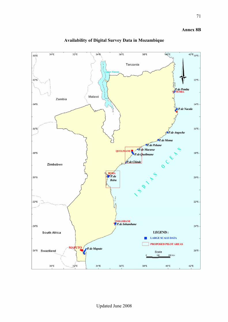
CONCLUSIONS 1. The Instituto Nacional De Hidrografia e Navegação (INAHINA), with its competent personnel, its experience of hydrographic surveying and nautical charting and its equipment, has the potential to efficiently contribute to the establishment and management of the COAST-MAP-IO bathymetric and topographic seamless database, provided that additional training and equipment are provided. 2. An initial version of the bathymetric database could be established from the existing digital survey data (see Annex 8B). This can subsequently be complemented by the data which will result from surveys in progress and planned. Reportedly, the Russian Hydrographic Office (HDNO) conducted extensive coastal surveys in Mozambique in the 1980’s and the resulting survey sheets were passed to the relevant Mozambican Authorities; however these sheets, which would be very useful to the project, are not held by INAHINA. Additionally, INAHINA has digital survey data on tapes from coastal surveys conducted in the 1990’s; however this data cannot be exploited as the tape-reading system is out of order. 3. CENACARTA has a comprehensive coverage of 1: 250,000 digital topographic data; however this is not suitable for the COAST-MAP-IO project which requires at least 1: 50,000 data. Some areas of the coast of Mozambique are covered with large scale topographic digital vector data (1: 5,000, 1: 10,000 and 1: 25,000) (see Annex 8C). Additionally, CENACARTA holds a complete series of digital topographic maps at scale 1:50,000, available in raster form only. 4. INAHINA has identified the extreme events vulnerable zones, which could be used to define the pilot project area. 5. INAHINA and INAM have some expertise and/or experience in mathematical modelling, and should be able to jointly handle tsunami modelling and inundation map construction matters. RECOMMENDATIONS 1. Due to the essential role of bathymetry in the project, the Instituto Nacional De Hidrografia e Navegação (INAHINA) should be responsible for the establishment and management of the seamless COAST-MAP-IO bathymetric and topographic database. 2. Appropriate means and training should be provided to manage the bathymetric and topographic database which will result from Recommendation 1 above. 3. The bathymetric database should initially be populated from the existing digital survey data held by INAHINA. All efforts should be made to retrieve the survey sheets resulting from the Russian hydrographic surveys in the 1980’s, which could then be digitized, as well as the digital survey data held on tapes by INAHINA (see Conclusion 2).
69
Updated June 2008
4. CENACARTA should be designated as the official provider of topographic data for the COAST-MAP-IO database. Initially, the existing large scale digital vector data should be used to populate the topographic database. It might be necessary to consider the possibility of acquiring and processing coastal satellite images to complement this database. 5. Bathymetric and topographic data should ideally be encoded according to international standards. 6. INAHINA should be responsible for tsunami modelling and inundation map construction, in cooperation with INAM. 7. Appropriate means and training should be provided in support of tsunami modelling and inundation map construction. 8. In accordance with Conclusion 4, one of the tsunami-vulnerable zones, as identified on the diagram in Annex 8B, should be used as the pilot area for the project. 9. INAHINA should be the focal point for COAST-MAP-IO and ensure and strengthen the necessary cooperation between the institutions involved in the project.
70
Updated June 2008
Annex 8A
MAPPING AND RESEARCH AGENCIES IN MOZAMBIQUE
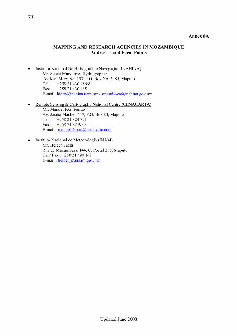
Addresses and Focal Points • Instituto Nacional De Hidrografia e Navegação (INAHINA)
Mr. Select Mundlovo, Hydrographer Av Karl Marx No. 153, P.O. Box No. 2089, Maputo
Tel : +258 21 430 186/8 Fax: +258 21 430 185 E-mail: [email protected] / [email protected]
• Remote Sensing & Cartography National Centre (CENACARTA) Mr. Manuel F.G. Ferrão Av. Josina Machel, 537, P.O. Box 83, Maputo
Tel : +258 21 324 791 Fax : +258 21 321959 E-mail : [email protected]
• Instituto Nacional de Meteorologia (INAM) Mr. Helder Sueia Rua de Mucumbura, 144, C. Postal 256, Maputo Tel / Fax : +258 21 490 148 E-mail : [email protected]
71
Updated June 2008
Annex 8B
Availability of Digital Survey Data in Mozambique
72
Updated June 2008
Annex 8C
Availability of Digital Land Topographic Data along the Coast of Mozambique
__________

73
Updated June 2008
74
Updated June 2008
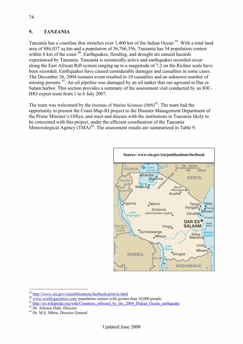
9. TANZANIA Tanzania has a coastline that stretches over 1,400 km of the Indian Ocean 39. With a total land area of 886,037 sq km and a population of 36,766,356, Tanzania has 34 population centers within 8 km of the coast 40. Earthquakes, flooding, and drought are natural hazards experienced by Tanzania. Tanzania is seismically active and earthquakes recorded occur along the East African Rift system ranging up to a magnitude of 7.2 on the Richter scale have been recorded. Earthquakes have caused considerable damages and casualties in some cases. The December 26, 2004 tsunami event resulted in 10 casualties and an unknown number of missing persons 41. An oil pipeline was damaged by an oil tanker that ran aground in Dar es Salam harbor. This section provides a summary of the assessment visit conducted by an IOC-IHO expert team from 1 to 6 July 2007. The team was welcomed by the Institute of Marine Sciences (IMS)42. The team had the opportunity to present the Coast-Map-IO project to the Disaster Management Department of the Prime Minister’s Office, and meet and discuss with the institutions in Tanzania likely to be concerned with this project, under the efficient coordination of the Tanzania Meteorological Agency (TMA)43. The assessment results are summarized in Table 9.
39 http://www.cia.gov/cia/publications/factbook/print/tz.html 40 www.world-gazetteer.com; population centers with greater than 10,000 people. 41 http://en.wikipeida.org/wiki/Countries_affected_by_the_2004_INdian_Ocean_earthquake 42 Dr. Alfonse Dubi, Director 43 Dr. M.S. Mhita, Director General
Source: www.cia.gov/cia/publications/factbook
75
Updated June 2008
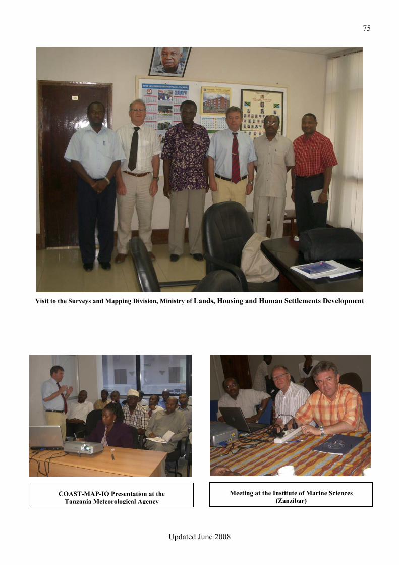
Visit to the Surveys and Mapping Division, Ministry of Lands, Housing and Human Settlements Development
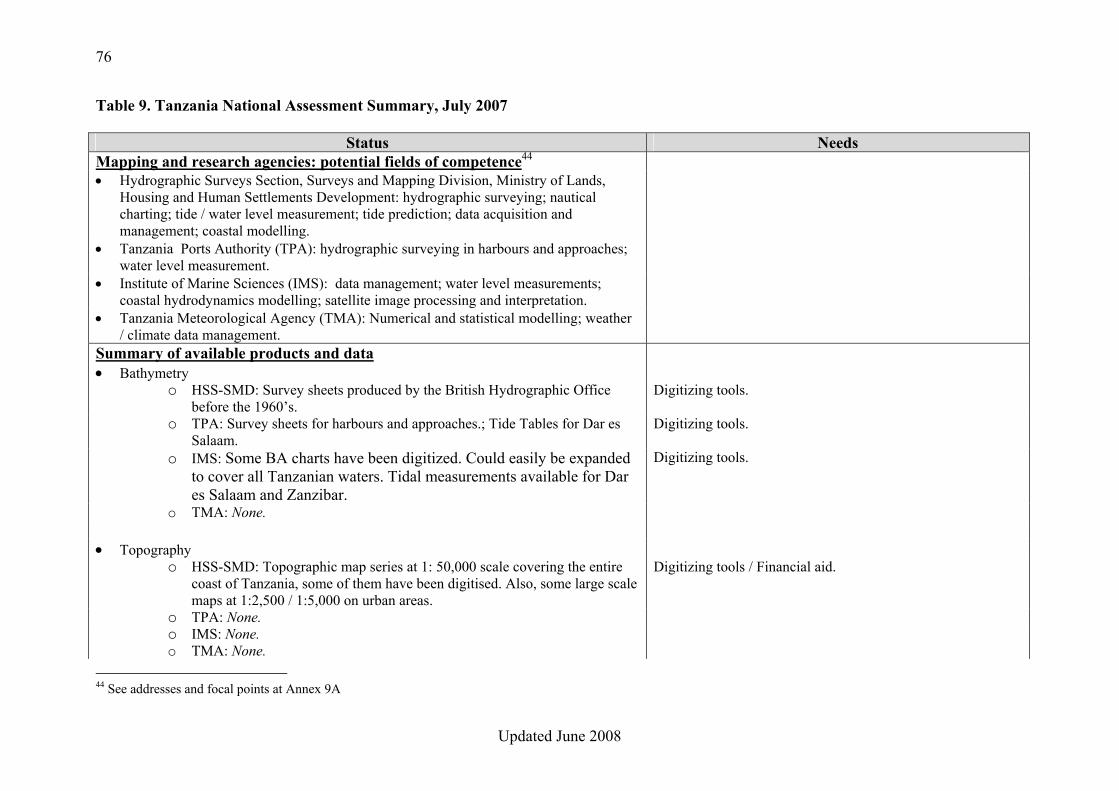
Meeting at the Institute of Marine Sciences (Zanzibar)
COAST-MAP-IO Presentation at the Tanzania Meteorological Agency
76
Updated June 2008
Table 9. Tanzania National Assessment Summary, July 2007
Status Needs Mapping and research agencies: potential fields of competence44 • Hydrographic Surveys Section, Surveys and Mapping Division, Ministry of Lands,
Housing and Human Settlements Development: hydrographic surveying; nautical charting; tide / water level measurement; tide prediction; data acquisition and management; coastal modelling.
• Tanzania Ports Authority (TPA): hydrographic surveying in harbours and approaches; water level measurement.
• Institute of Marine Sciences (IMS): data management; water level measurements; coastal hydrodynamics modelling; satellite image processing and interpretation.
• Tanzania Meteorological Agency (TMA): Numerical and statistical modelling; weather / climate data management.
Summary of available products and data • Bathymetry
o HSS-SMD: Survey sheets produced by the British Hydrographic Office before the 1960’s.
Digitizing tools.
o TPA: Survey sheets for harbours and approaches.; Tide Tables for Dar es Salaam.
Digitizing tools.
o IMS: Some BA charts have been digitized. Could easily be expanded to cover all Tanzanian waters. Tidal measurements available for Dar es Salaam and Zanzibar.
Digitizing tools.
o TMA: None.
• Topography o HSS-SMD: Topographic map series at 1: 50,000 scale covering the entire
coast of Tanzania, some of them have been digitised. Also, some large scale maps at 1:2,500 / 1:5,000 on urban areas.
Digitizing tools / Financial aid.
o TPA: None. o IMS: None. o TMA: None.
44 See addresses and focal points at Annex 9A
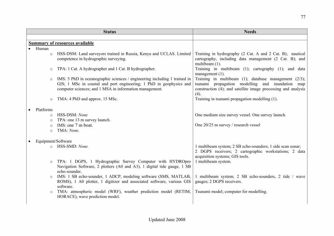
77
Updated June 2008
Status Needs
Summary of resources available • Human
o HSS-DSM: Land surveyors trained in Russia, Kenya and UCLAS. Limited competence in hydrographic surveying.
Training in hydrography (2 Cat. A and 2 Cat. B); nautical cartography, including data management (2 Cat. B); and multibeam (1).
o TPA: 1 Cat. A hydrographer and 1 Cat. B hydrographer. Training in multibeam (1); cartography (1); and data management (1).
o IMS: 5 PhD in oceanographic sciences / engineering including 1 trained in GIS; 1 MSc in coastal and port engineering; 1 PhD in geophysics and computer sciences; and 1 MSA in information management.
Training in multibeam (1); database management (2/3); tsunami propagation modelling and inundation map construction (4); and satellite image processing and analysis (4).
o TMA: 4 PhD and approx. 15 MSc. Training in tsunami propagation modelling (1).
• Platforms o HSS-DSM: None One medium size survey vessel. One survey launch. o TPA: one 13 m survey launch. o IMS: one 7 m boat. One 20/25 m survey / research vessel o TMA: None.
• Equipment/Software o HSS-SMD: None. 1 multibeam system; 2 SB echo-sounders; 1 side scan sonar;
2 DGPS receivers; 2 cartographic workstations; 2 data acquisition systems; GIS tools.
o TPA: 1 DGPS, 1 Hydrographic Survey Computer with HYDROpro Navigation Software, 2 plotters (A0 and A3), 1 digital tide gauge, 1 SB echo-sounder.
1 multibeam system.
o IMS: 1 SB echo-sounder, 1 ADCP, modeling software (SMS, MATLAB, ROMS), 1 A0 plotter, 1 digitizer and associated software, various GIS software.
1 multibeam system; 2 SB echo-sounders, 2 tide / wave gauges; 2 DGPS receivers.
o TMA: atmospheric model (WRF), weather prediction model (RETIM, HORACE), wave prediction model.
Tsunami model; computer for modelling.
78
Updated June 2008
CONCLUSIONS 1. The Institute of Marine Sciences (IMS) hosts the National Oceanographic Data Centre and, with its competent personnel, has experience and expertise in database management. IMS is also a centre of excellence for coastal hydrodynamics modelling and has the potential to lead tsunami modelling activities and inundation map construction. Due to the above mentioned competences, IMS could play the role of Focal Point for the project. 2. There are almost no bathymetric-related activities in Tanzania. Only the Tanzania Port Authorities (TPA) is occasionally conducting hydrographic surveys in harbours and approaches. However, the Hydrographic Survey Section of the Surveys and Mapping Division (HSS-SMD) holds hard copies of the hydrographic survey sheets produced by the British Hydrographic Office before the 1960’s. HSS-SMD also holds topographic maps at 1: 50,000 scale covering the entire coast of Tanzania, some of them have been digitised. 3. An initial version of the seamless COAST-MAP-IO bathymetric and topographic database could be established from digitising the existing hydrographic survey and topographic sheets/maps. This will subsequently be complemented by the data which will result from surveys in progress and planned. 4. HSS-SMD is the national institution responsible for hydrography, through its Hydrographic Survey Section, and for land topography. It would therefore seem logical that the COAST-MAP-IO database be hosted by HSS-SMD, although provision of appropriate training and tools would then be required. IMS’ expertise in database management would be useful in setting up and operating the database in cooperation with HSS-SMD. 5. Tanzania Meteorological Agency’s expertise in weather and wave prediction models could be useful for tsunami modelling. 6. There is a National Hydrographic Committee, chaired by the IMS Director. However, its activities would need better support at Government level. 7. As a potential beneficiary of the project, the Tanzania Disaster Management Centre would be expected to actively support it.
79
Updated June 2008
RECOMMENDATIONS 1. Due to its responsibility for hydrography and topography at national level, HSS-SMD should be responsible for the establishment and management of the seamless COAST-MAP-IO bathymetric and topographic database. IMS’ expertise in database management will be necessary in this exercise, which will require mirroring the database at IMS. 2. Appropriate means and training should be provided to manage the bathymetric and topographic database. 3. The existing hydrographic survey and topographic sheets / maps at HSS-SMD and TPA should be digitised to create the initial database. Additional hydrographic surveys may be required in selected places where data of good quality is insufficient. 4. Bathymetric and topographic data should ideally be encoded according to international standards. 5. IMS should be responsible for tsunami modelling and inundation map construction, through cooperation with TMA. 6. Appropriate means and training should be provided in support of tsunami modelling and inundation map construction. 7. IMS should be the focal point for COAST-MAP-IO, and ensure and strengthen the necessary cooperation between the institutions involved in the project. 8. The National Hydrographic Committee should receive appropriate support at Government level.
80
Updated June 2008
Annex 9A
MAPPING AND RESEARCH AGENCIES IN TANZANIA
Addresses and Focal Points • Hydrographic Surveys Section, Surveys and Mapping Division (SMD)
Ministry of Lands, Housing and Human Settlements Development Mr. Justo Nicholas Lyamuya, Assistant Director for Hydrography
P.O. Box 9201, Dar es Salaam Tel : + 255 22 2121894 Fax: + 255 22 2138962 E-mail: [email protected] or [email protected] or [email protected] or [email protected]
• Tanzania Ports Authority (TPA) Mr. Ignace Nhyete, Director P.O. Box 9184, Dar es Salaam
Tel : +255 22 211 0401/9 or 212 1694 Fax : +255 22 211 3938 or 211 3432 E-mail : [email protected] or [email protected]
• Institute of Marine Sciences (IMS) Dr. Alphonse Dubi, Director Mizingani Rd. P.O. Box 668, Zanzibar Tel : +255 24 223 2128 / 0741 Fax : +255 24 223 3050 E-mail : [email protected] or [email protected]
• Tanzania Meteorological Agency (TMA)
Dr M.S. Mhita, Director General P.O. Box 3056, Dar es Salaam Tel : +255 22 246 0718 / 0722 Fax : +255 22 246 0735 E-mail : [email protected]
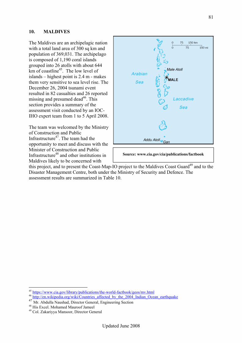
81
Updated June 2008
10. MALDIVES The Maldives are an archipelagic nation with a total land area of 300 sq km and population of 369,031. The archipelago is composed of 1,190 coral islands grouped into 26 atolls with about 644 km of coastline45. The low level of islands – highest point is 2.4 m - makes them very sensitive to sea level rise. The December 26, 2004 tsunami event resulted in 82 casualties and 26 reported missing and presumed dead46. This section provides a summary of the assessment visit conducted by an IOC-IHO expert team from 1 to 5 April 2008. The team was welcomed by the Ministry of Construction and Public Infrastructure47. The team had the opportunity to meet and discuss with the Minister of Construction and Public Infrastructure48 and other institutions in Maldives likely to be concerned with this project, and to present the Coast-Map-IO project to the Maldives Coast Guard49 and to the Disaster Management Centre, both under the Ministry of Security and Defence. The assessment results are summarized in Table 10.
45 https://www.cia.gov/library/publications/the-world-factbook/geos/mv.html 46 http://en.wikipedia.org/wiki/Countries_affected_by_the_2004_Indian_Ocean_earthquake 47 Mr. Abdulla Naushad, Director General, Engineering Section 48 His Excel. Mohamed Mauroof Jameel 49 Col. Zakariyya Mansoor, Director General
Source: www.cia.gov/cia/publications/factbook
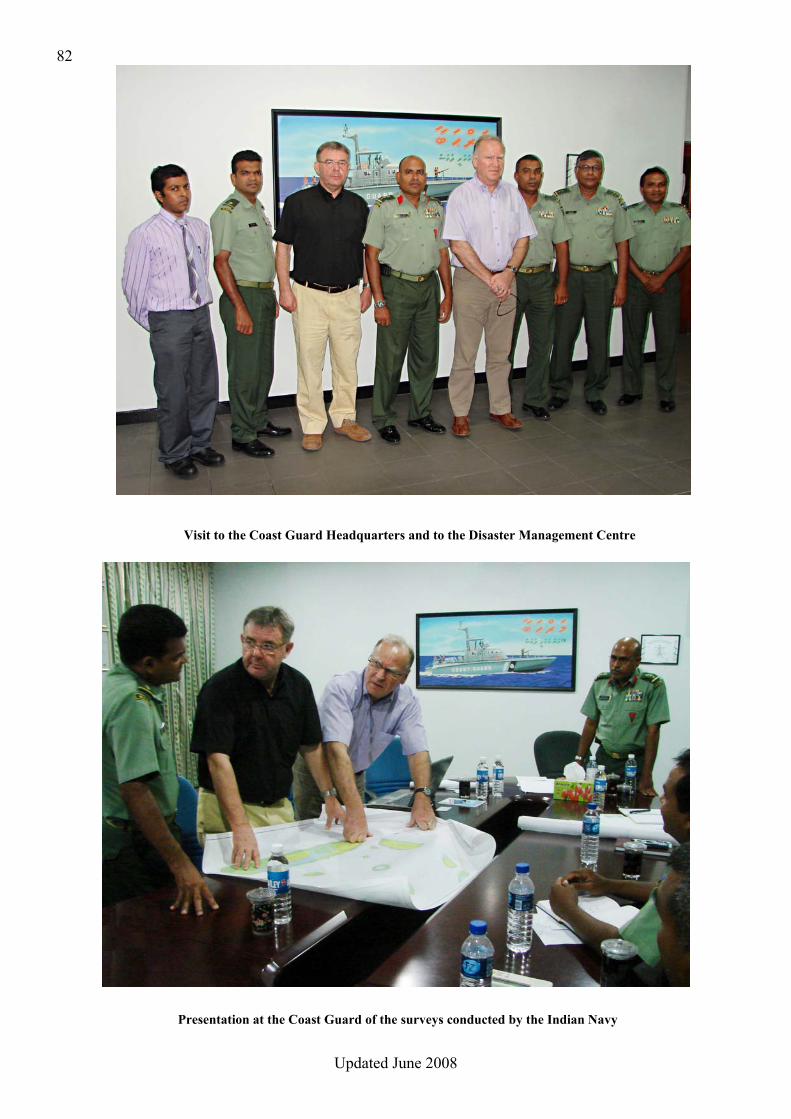
82
Updated June 2008
Visit to the Coast Guard Headquarters and to the Disaster Management Centre
Presentation at the Coast Guard of the surveys conducted by the Indian Navy
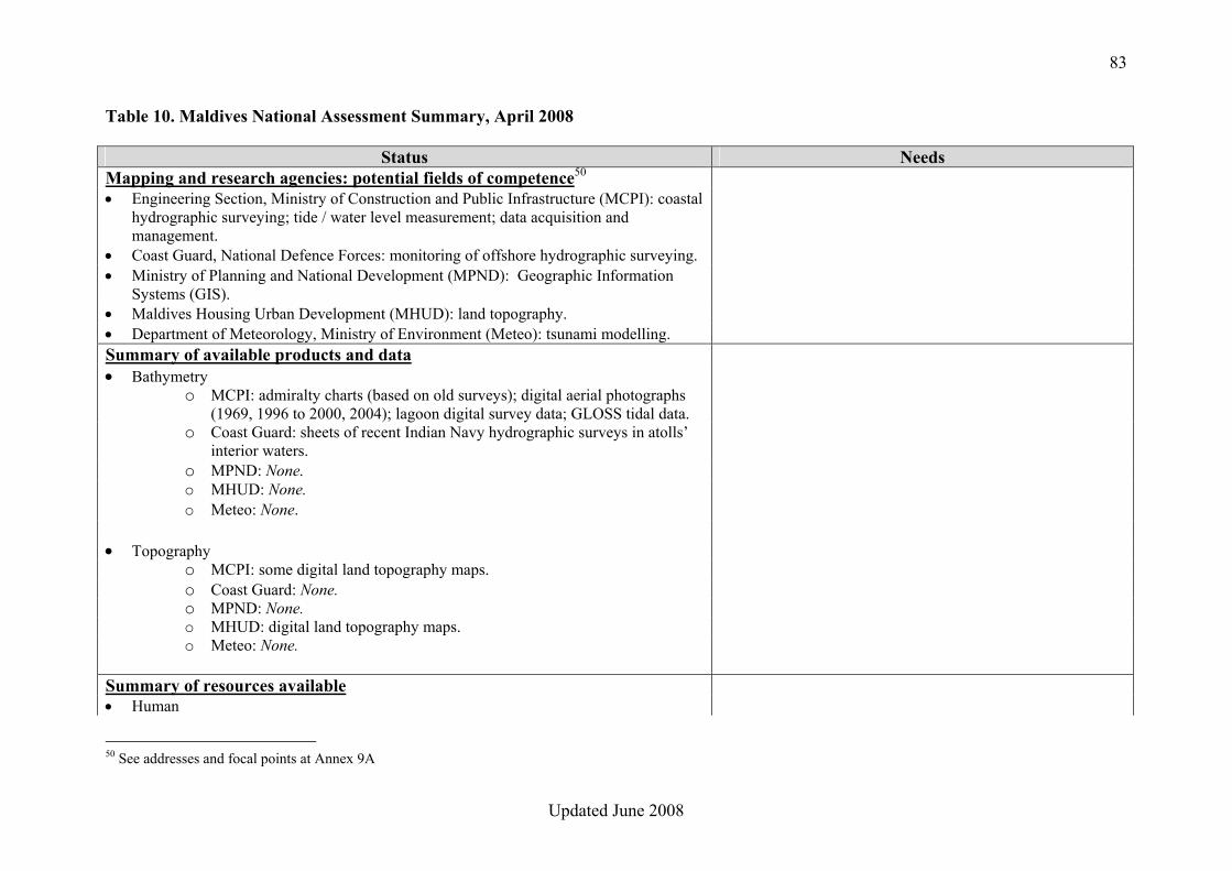
83
Updated June 2008
Table 10. Maldives National Assessment Summary, April 2008
Status Needs Mapping and research agencies: potential fields of competence50 • Engineering Section, Ministry of Construction and Public Infrastructure (MCPI): coastal
hydrographic surveying; tide / water level measurement; data acquisition and management.
• Coast Guard, National Defence Forces: monitoring of offshore hydrographic surveying. • Ministry of Planning and National Development (MPND): Geographic Information
Systems (GIS).
• Maldives Housing Urban Development (MHUD): land topography. • Department of Meteorology, Ministry of Environment (Meteo): tsunami modelling. Summary of available products and data • Bathymetry
o MCPI: admiralty charts (based on old surveys); digital aerial photographs (1969, 1996 to 2000, 2004); lagoon digital survey data; GLOSS tidal data.
o Coast Guard: sheets of recent Indian Navy hydrographic surveys in atolls’ interior waters.
o MPND: None. o MHUD: None. o Meteo: None.
• Topography
o MCPI: some digital land topography maps. o Coast Guard: None. o MPND: None. o MHUD: digital land topography maps. o Meteo: None.
Summary of resources available • Human
50 See addresses and focal points at Annex 9A
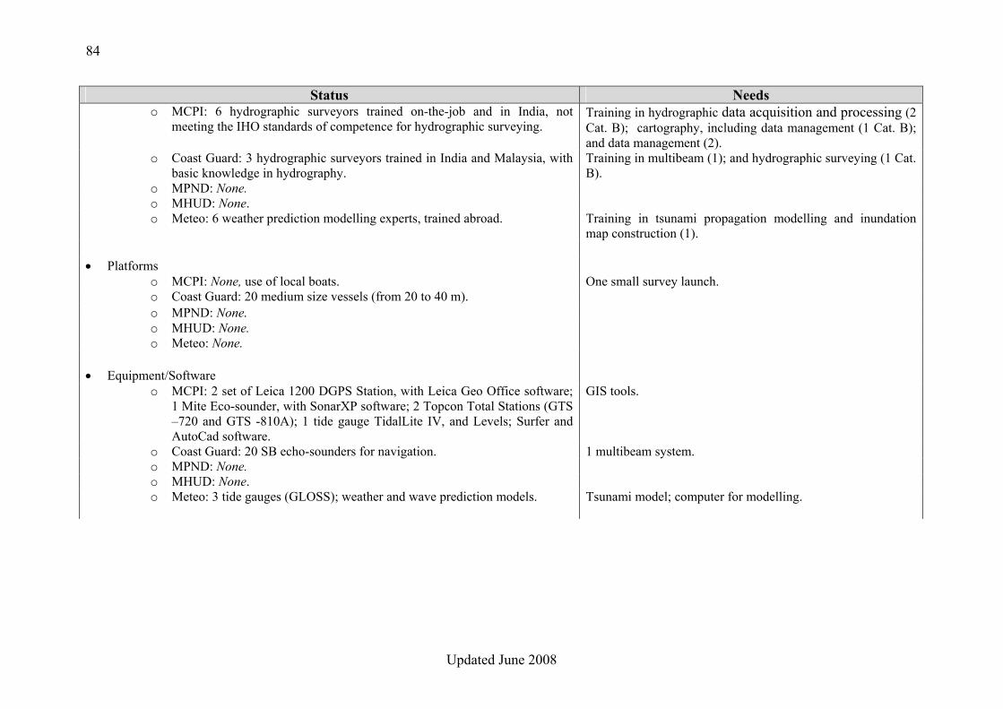
84
Updated June 2008
Status Needs o MCPI: 6 hydrographic surveyors trained on-the-job and in India, not
meeting the IHO standards of competence for hydrographic surveying. Training in hydrographic data acquisition and processing (2 Cat. B); cartography, including data management (1 Cat. B); and data management (2).
o Coast Guard: 3 hydrographic surveyors trained in India and Malaysia, with basic knowledge in hydrography.
Training in multibeam (1); and hydrographic surveying (1 Cat. B).
o MPND: None. o MHUD: None. o Meteo: 6 weather prediction modelling experts, trained abroad. Training in tsunami propagation modelling and inundation
map construction (1).
• Platforms o MCPI: None, use of local boats. One small survey launch. o Coast Guard: 20 medium size vessels (from 20 to 40 m). o MPND: None. o MHUD: None. o Meteo: None.
• Equipment/Software o MCPI: 2 set of Leica 1200 DGPS Station, with Leica Geo Office software;
1 Mite Eco-sounder, with SonarXP software; 2 Topcon Total Stations (GTS –720 and GTS -810A); 1 tide gauge TidalLite IV, and Levels; Surfer and AutoCad software.
GIS tools.
o Coast Guard: 20 SB echo-sounders for navigation. 1 multibeam system. o MPND: None. o MHUD: None. o Meteo: 3 tide gauges (GLOSS); weather and wave prediction models. Tsunami model; computer for modelling.
85
Updated June 2008
CONCLUSIONS 1. The main competence in hydrographic surveying and data management, although limited to lagoon areas, is held by the Ministry of Construction and Public Infrastructure (MCPI). It would therefore seem logical that the COAST-MAP-IO database be hosted by MCPI, providing that appropriate training and tools be supplied. In addition, due to the above mentioned competences, MCPI could play the role of Focal Point for the project. 2. The Coast Guard has a real potential to contribute to hydrographic surveying in offshore waters, due to their numerous platforms and their privileged relationship with, and support from the Indian Navy, providing they receive appropriate equipment and training. 3. An initial version of the seamless COAST-MAP-IO bathymetric and topographic database could be established from the digital survey data held by MCPI in lagoon areas, to be complemented by the survey data recently collected by the Indian Navy in atolls’ interior waters, in cooperation with the Coast Guard. The topography component of the database can be populated from digital data held by MCPI and the Maldives Housing Urban Development (MHUD). 4. A national GIS is planned at the MPND, which should include bathymetric and topographic information. MPND would therefore be a potential beneficiary of the COAST-MAP-IO project and, as a result, would be expected to actively support it. 5. The National Disaster Management Centre, as the main potential beneficiary of the project, is expected to also actively support it. 6. There is a need for improved cooperation between all institutions involved in bathymetry and tsunami-related activities. 7. The expertise available in the Department of Meteorology for weather and wave prediction models could be useful for tsunami modelling.
86
Updated June 2008
RECOMMENDATIONS 1. Due to its competence in hydrographic surveying, and also its responsibility for hydrography at national level, the Ministry of Construction and Public Infrastructure (MCPI) should be responsible for the establishment and management of the seamless COAST-MAP-IO bathymetric and topographic database. 2. Appropriate equipment and training should be provided to MCPI to manage the bathymetric and topographic database. 3. The existing hydrographic survey data held by MCPI and the topographic data held by MCPI and MHUD should be used to create the initial database. The database should be complemented with the atoll’s interior waters survey data recently collected by the Indian Navy, to be obtained by MCPI via the Coast Guard. Additional surveys should be planned and conducted in identified vulnerable areas where data is insufficient. 4. Bathymetric and topographic data should ideally be encoded according to international standards. 5. The Department of Meteorology should be responsible for tsunami modelling and inundation map construction. 6. Appropriate means and training should be provided in support of tsunami modelling and inundation map construction. 7. MCPI should be the focal point for COAST-MAP-IO, and ensure and strengthen the necessary cooperation between the institutions involved in the project. 8. A National Hydrographic Committee should be established to coordinate the implementation of the COAST-MAP-IO project in Maldives. This committee may also address any other oceanographic and hydrographic issues. The National Hydrographic Committee should receive appropriate support at Government level.
87
Updated June 2008
Annex 10A
MAPPING AND RESEARCH AGENCIES IN REPUBLIC OF MALDIVES
Addresses and Focal Points • Engineering Section, Ministry of Construction and Public Infrastructure (MCPI)
Mr. Abdulla Naushad, Director General Izzudheen Magu, Male’ Tel: +960 332 3234 Fax: +960 332 8300 E-mail: [email protected] http://www.construction.gov.mv
• Coast Guard, National Defence Forces Col. Zakariyya Mansoor, Director General Bandaara Koshi, Ameer Ahmed Magu, Male’
Tel : +960 331 8819 Fax : +960 331 0054 E-mail : [email protected] http://www.mdnf.gov.mv
• Ministry of Planning and National Development (MPND) Mr. Ihsan Sadiq, Planning Officer
Ghazee Building, 3rd Floor, Ameer Ahmed Magu, Male’, 20125 Tel : +960 776 7007
Fax : +960 332 5371 E-mail : [email protected] http://www.planning.gov.mv
• Maldives Housing Urban Development (MHUD) Mr. Zuhurullah Siyaad, Director of Planning Section
MTCC Tower, 2nd Floor, Boduthakurufaanu Magu, Male’ Tel : +960 778 1725 Fax : +960 3328999 E-mail : [email protected]
http://www.mhud.gov.mv
• Department of Meteorology, Ministry of Environment Mr. Abdulla Algeen, Director General Hulhule-2200, Male’ Tel: +960 332 3302 / 332 4524 Fax: +960 332 0021 E-mail: [email protected], [email protected] http://www.meteorology.gov.mv
Related Documents