NPS Form 10-900 OMB No. 1024-0018 Expires 5/31/2020) 1 United States Department of the Interior National Park Service National Register of Historic Places Registration Form This form is for use in nominating or requesting determinations for individual properties and districts. See instructions in National Register Bulletin, How to Complete the National Register of Historic Places Registration Form. If any item does not apply to the property being documented, enter "N/A" for "not applicable." For functions, architectural classification, materials, and areas of significance, enter only categories and subcategories from the instructions. Place additional certification comments, entries, and narrative items on continuation sheets if needed (NPS Form 10-900a). 1. Name of Property historic name Central Oregon Canal Historic District (Ward Road – Gosney Road Segment) other names/site number N/A multiple property document N/A (Enter "N/A" if property is not part of a multiple property listing) 2. Location street & number Roughly bounded by Bear Creek Rd. to the north, Gosney Rd. to the east, Somerset Dr. to the south, and Ward Rd. to the west. not for publication city or town Unincorporated Deschutes County vicinity state Oregon code OR county Deschutes code 017 zip code 97701 3. State/Federal Agency Certification As the designated authority under the National Historic Preservation Act, as amended, I hereby certify that this X nomination request for determination of eligibility meets the documentation standards for registering properties in the National Register of Historic Places and meets the procedural and professional requirements set forth in 36 CFR Part 60. In my opinion, the property__ meets does not meet the National Register Criteria. I recommend that this property be considered significant at the following level(s) of significance: national statewide X local Applicable National Register Criteria: X A B C D Signature of certifying official/Title: Interim Deputy State Historic Preservation Officer Date Oregon State Historic Preservation Office State or Federal agency/bureau or Tribal Government In my opinion, the property meets does not meet the National Register criteria. Signature of commenting official Date Title State or Federal agency/bureau or Tribal Government 4. National Park Service Certification I hereby certify that this property is: entered in the National Register determined eligible for the National Register determined not eligible for the National Register removed from the National Register other (explain:) Signature of the Keeper Date of Action

Welcome message from author
This document is posted to help you gain knowledge. Please leave a comment to let me know what you think about it! Share it to your friends and learn new things together.
Transcript
NPS Form 10-900 OMB No. 1024-0018 Expires 5/31/2020)
1
United States Department of the Interior
National Park Service
National Register of Historic Places Registration Form
This form is for use in nominating or requesting determinations for individual properties and districts. See instructions in National Register Bulletin, How to Complete the National Register of Historic Places Registration Form. If any item does not apply to the property being documented, enter "N/A" for "not applicable." For functions, architectural classification, materials, and areas of significance, enter only categories and subcategories from the instructions. Place additional certification comments, entries, and narrative items on continuation sheets if needed (NPS Form 10-900a).
1. Name of Property
historic name Central Oregon Canal Historic District (Ward Road – Gosney Road Segment) other names/site number N/A multiple property document N/A (Enter "N/A" if property is not part of a multiple property listing)
2. Location
street & number Roughly bounded by Bear Creek Rd. to the north, Gosney Rd. to the east, Somerset Dr. to the south, and Ward Rd. to the west.
not for publication
city or town Unincorporated Deschutes County
vicinity
state Oregon code OR county Deschutes code 017 zip code 97701
3. State/Federal Agency Certification
As the designated authority under the National Historic Preservation Act, as amended,
I hereby certify that this X nomination request for determination of eligibility meets the documentation standards for registering properties in the National Register of Historic Places and meets the procedural and professional requirements set forth in 36 CFR Part 60.
In my opinion, the property__ meets does not meet the National Register Criteria. I recommend that this property be considered significant at the following level(s) of significance: national statewide X local
Applicable National Register Criteria: X A B C D
Signature of certifying official/Title: Interim Deputy State Historic Preservation Officer Date
Oregon State Historic Preservation Office State or Federal agency/bureau or Tribal Government
In my opinion, the property meets does not meet the National Register criteria.
Signature of commenting official Date
Title State or Federal agency/bureau or Tribal Government
4. National Park Service Certification
I hereby certify that this property is:
entered in the National Register determined eligible for the National Register
determined not eligible for the National Register removed from the National Register
other (explain:)
Signature of the Keeper Date of Action
United States Department of the Interior National Park Service / National Register of Historic Places Registration Form NPS Form 10-900 OMB No. 1024-0018 (Expires 5/31/2020)
Central Oregon Canal Historic District Deschutes County, Oregon Name of Property County and State
2
5. Classification Ownership of Property (Check as many boxes as apply.)
Category of Property (Check only one box.)
Number of Resources within Property (Do not include previously listed resources in the count.)
Contributing Non-contributing
X private building(s) 0 0 buildings
X public - Local X district 0 0 site
public - State site 13 11 structure
public - Federal structure 0 0 object
object 13 11 Total Number of contributing resources previously listed in the National Register
0
6. Function or Use
Historic Functions (Enter categories from instructions.)
Current Functions (Enter categories from instructions.)
AGRICULTURE/SUBSISTENCE: AGRICULTURE/SUBSISTENCE: Irrigation facility, canal Irrigation facility, canal 7. Description
Architectural Classification (Enter categories from instructions.)
Materials (Enter categories from instructions.)
NO ARCHITECTURAL STYLE foundation: N/A walls: N/A roof: N/A other: EARTH; STONE, basalt

United States Department of the Interior National Park Service / National Register of Historic Places Registration Form NPS Form 10-900 OMB No. 1024-0018 (Expires 5/31/2020)
Central Oregon Canal Historic District Deschutes County, Oregon Name of Property County and State
3
Narrative Description (Describe the historic and current physical appearance and condition of the property. Describe contributing and non-contributing resources if applicable. Begin with a summary paragraph that briefly describes the general characteristics of the property, such as its location, type, style, method of construction, setting, size, and significant features. Indicate whether the property has historic integrity).
Summary Paragraph The 1902-1914 Central Oregon Canal is in the Upper Deschutes River Basin, near the center of Oregon, in Deschutes and Crook Counties. (See Figure 1.) The main canal is 47 miles long and heads northeast from the city of Bend across the high desert plateau to the rural communities of Alfalfa and Powell Butte. (See Figure 8.) The canal drops about 701’ in elevation from the diversion point at the Deschutes River to its terminus just south of the Crooked River, allowing the water to flow entirely by gravity.1 From the main canal, the water flows through successively narrower and shallower laterals and ditches on its way to those who hold water rights. The canal delivers water to 25,257 acres today.2 Excepting the two non-historic stretches that are piped, the historic, roughly trapezoidal shaped, open canal is made of native soil and irregularly shaped and sized lava rock that was scraped out of the bed and moved onto the sides by laborers to create embankments on the lower side of the channel. The historic district begins 7.75 miles east of the diversion point and ¾ mile east of the Bend city limits in Deschutes County. The district is 3.4 miles long, running across rural land between the Ward Road Bridge on the western edge and the Gosney Road Bridge on the eastern edge. The canal in the historic district ranges in width from 34’ to 78’, averaging around 50’, and its depth varies from 1’ to 9’, averaging around 4’ deep, depending on the amount of volcanic rock flows encountered, the terrain, and slope. The canal was built in irregular profiles, often wider and shallower than it was designed, in order to avoid expensive rock blasting and excavation.3 Areas of steeper drops in elevation are generally narrower or shallower than portions of the canal that flow through flat terrain, which are generally wider and deeper. The canal through the historic district carries nearly the full amount of water diverted from the river, 530 cubic feet per second during the irrigation season, April through October.4 The elevation of the canal on the western historic district boundary is 3,658 feet and water gradually drops 50 feet before it reaches the eastern boundary. The historic district is in rolling terrain, from the southwest quarter through the northeast quarter of Township 18 South, Range 12 East, Section 1, W. M. (T18S, R12E, Section1), from the northwest quarter to the southeast quarter of T18S, R13E, Section 6, through the southwest quarter of Section 5 and ends in the center of the north half of Section 8. (See Figures 15-20.) The historic district encompasses 50’ on either side of the canal centerline to create a 100’ corridor that includes all of the contributing resources. Many property owners in the district, where parcels range from 1 acre to 80 acres in size, hold water rights. (See Figures 4a-4f.) Much of the historic setting, including farms, irrigation ponds and native vegetation, remains. The nominated canal, with its winding, character-defining, rocky, uneven canal bed and irregular slopes, cuts, and tall embankments is historic contributing. The historic design and materials, tool marks, and blasting drill holes, are evident and tell the narrative of its construction through solid basalt rock flows that were blasted apart and moved with horse teams. Contributing structures are the historic main canal, a wooden bridge, a concrete flume, remains of a wooden flume, a metal irrigation pipe, headgates to two laterals and seven headgates to irrigation ditches. Two metal catwalks across the canal and associated headgates, nine headgates to ditches and one to a sub-lateral, and a set of three waste discharge gates are non-historic structures. (See Figure 5)
1 Google Earth 2017 2 Central Oregon Irrigation District, Executive Summary, Preliminary System Development Plan, September 19, 2016. 3 Dubuis, John, Report to Desert Land Board on Central Oregon Project, 1914, p. 5.
4 Oregon Department of Water Resources, 2016 averages
United States Department of the Interior National Park Service / National Register of Historic Places Registration Form NPS Form 10-900 OMB No. 1024-0018 (Expires 5/31/2020)
Central Oregon Canal Historic District Deschutes County, Oregon Name of Property County and State
4
__________________________________________________________________________________________________________________
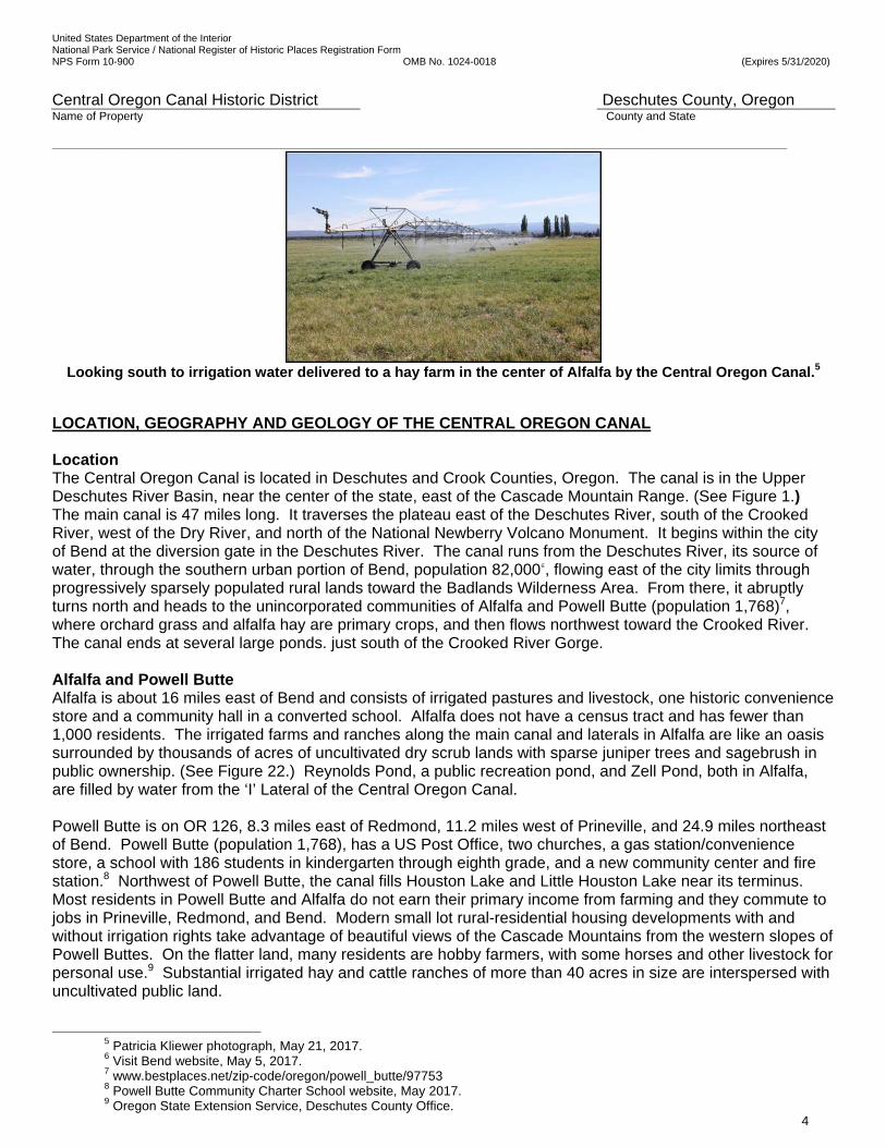
Looking south to irrigation water delivered to a hay farm in the center of Alfalfa by the Central Oregon Canal.5
LOCATION, GEOGRAPHY AND GEOLOGY OF THE CENTRAL OREGON CANAL Location The Central Oregon Canal is located in Deschutes and Crook Counties, Oregon. The canal is in the Upper Deschutes River Basin, near the center of the state, east of the Cascade Mountain Range. (See Figure 1.) The main canal is 47 miles long. It traverses the plateau east of the Deschutes River, south of the Crooked River, west of the Dry River, and north of the National Newberry Volcano Monument. It begins within the city of Bend at the diversion gate in the Deschutes River. The canal runs from the Deschutes River, its source of water, through the southern urban portion of Bend, population 82,0006, flowing east of the city limits through progressively sparsely populated rural lands toward the Badlands Wilderness Area. From there, it abruptly turns north and heads to the unincorporated communities of Alfalfa and Powell Butte (population 1,768)7, where orchard grass and alfalfa hay are primary crops, and then flows northwest toward the Crooked River. The canal ends at several large ponds. just south of the Crooked River Gorge. Alfalfa and Powell Butte Alfalfa is about 16 miles east of Bend and consists of irrigated pastures and livestock, one historic convenience store and a community hall in a converted school. Alfalfa does not have a census tract and has fewer than 1,000 residents. The irrigated farms and ranches along the main canal and laterals in Alfalfa are like an oasis surrounded by thousands of acres of uncultivated dry scrub lands with sparse juniper trees and sagebrush in public ownership. (See Figure 22.) Reynolds Pond, a public recreation pond, and Zell Pond, both in Alfalfa, are filled by water from the ‘I’ Lateral of the Central Oregon Canal. Powell Butte is on OR 126, 8.3 miles east of Redmond, 11.2 miles west of Prineville, and 24.9 miles northeast of Bend. Powell Butte (population 1,768), has a US Post Office, two churches, a gas station/convenience store, a school with 186 students in kindergarten through eighth grade, and a new community center and fire station.8 Northwest of Powell Butte, the canal fills Houston Lake and Little Houston Lake near its terminus. Most residents in Powell Butte and Alfalfa do not earn their primary income from farming and they commute to jobs in Prineville, Redmond, and Bend. Modern small lot rural-residential housing developments with and without irrigation rights take advantage of beautiful views of the Cascade Mountains from the western slopes of Powell Buttes. On the flatter land, many residents are hobby farmers, with some horses and other livestock for personal use.9 Substantial irrigated hay and cattle ranches of more than 40 acres in size are interspersed with uncultivated public land.
5 Patricia Kliewer photograph, May 21, 2017. 6 Visit Bend website, May 5, 2017. 7 www.bestplaces.net/zip-code/oregon/powell_butte/97753 8 Powell Butte Community Charter School website, May 2017. 9 Oregon State Extension Service, Deschutes County Office.

United States Department of the Interior National Park Service / National Register of Historic Places Registration Form NPS Form 10-900 OMB No. 1024-0018 (Expires 5/31/2020)
Central Oregon Canal Historic District Deschutes County, Oregon Name of Property County and State
5
Roads and Highways Around the Central Oregon Canal The north-south four-lane US Highway 97 runs through Bend. The Central Oregon Canal flows under a Highway 97 overpass in the downtown commercial area. The west-east US Highway 20 crosses over the Central Oregon Canal and Laterals ‘A’, ‘B’, ‘C’, and ‘D’, between downtown Bend and Dodds Road. The primary roads to Alfalfa and Powell Butte are the Alfalfa Market Road, Johnson Market Road, Dodds Road, the Powell Butte Highway #371, and the Ochoco Highway #126, which runs between Redmond and Prineville. All of them cross the canal with modern concrete bridges. The O’Neil Highway runs between northern Redmond and western Prineville along the Crooked River and the northern edge of the canal. The Cascade Mountain Range and Precipitation The Cascade Range blocks rainclouds coming from the west. Therefore, the high desert area receives a relatively sparse average of ten inches of precipitation annually, including 15 inches of snow.10 The Cascade Range is a spectacular chain of mountains which present a formidable climactic barrier. Running north-south nearly parallel to the Pacific Ocean, the range creates great precipitation as the marine air rises and cools, condensing and falling as rain or snow. The Three Sisters are volcanic peaks west of Bend that form a complex volcano in the Cascade Volcanic Arc. Each peak is between 10,000 and 11,000 feet above sea level.11 The western side of the mountain range is lush with diverse vegetation and populous timber lands. On the eastern side, the rich flora quickly changes to an arid plateau.12 The country east of the Cascades presents a series of broad plains and mesas covered with lava of various ages, from some that outpoured as recently as 7,000 year ago to the ancient flows whose surface has largely changed into soil. This supports a growth of sagebrush, bunchgrasses, and juniper in varying proportions. The vegetation becomes sparse out on the broad plateaus, though grasses are found.13 The Deschutes River14 drains the eastern slope of the Cascades from a point a few miles north of Crater Lake National Park, northward to the Columbia River. The Deschutes Basin is roughly 75 miles long and 30 miles wide, with an elevation that ranges from about 3,000’ to 5,000’. A vast stretch of desert laying on the east side of the river sweeps to the east and southeast for many miles, while the largest virgin pine forest in the nation covers the hills on the west side of the river up into the Cascades. The Oregon High Desert slopes easterly from the Cascade Mountain Range which runs south-north from Northern California to British Columbia and through the center of Oregon. The lands in Central Oregon slope down from the mountain range toward the south-to-north flowing Deschutes River. From the river, the land slopes to the east another 701 feet east across the high plateau to Powell Butte. It slopes nd down 600 feet across the plateau from south to the north, where it meets the Crooked River. The Crooked River flows west from the rural Paulina area through Prineville and Smith Rock State Park to the confluence with Deschutes River. The Deschutes River flows north to join the east-to-west flowing Columbia River. In Bend, the mountainous ponderosa pine forest transitions into high desert, characterized by arid land, volcanic soils, sparse grasses, evergreen juniper trees, sagebrush, rabbitbrush, bitterbrush, bunch grass, and bear grass. Climate in Bend and Crops Grown with Irrigation Water
10 Weather.com 11 Wikipedia, Three Sisters Peaks in the Cascade Mountain Range. 12 Natural Resources Conservation Service, Soil Survey: Deschutes Area, (Series 1945, No. 2, U.S. Department of Agriculture,
Soil Conservation Service in Cooperation with Oregon Agricultural Experiment Station, Washington: Government Printing Office, December 1958), 63. This mix and its density, each species’ size and the overall composition of vegetation vary by location.
13 Newell, Frederick Haynes, Irrigation In The United States, (New York: Thomas Y. Crowell, 1902), 350-51. Newell became the first Director in 1907 when the Reclamation Service broke away from the U.S. Geological Survey (USGS) to become a separate agency under the Department of the Interior. Among many activities and accomplishments, he was a hydraulic engineer and an expert on irrigation for the Eleventh and Twelfth United States Census.
15. McArthur, Lewis L., Oregon Geographic Names, (Portland: Western Imprints, Fifth Edition, Revised & Enlarged, 1982), 218-19. Lewis and Clark discovered the Deschutes River on October 22, 1805; however, on the return journey the explorers called it Clarks River, presumably for William Clark. In the fur trading period, the stream was known as Riviere des Chutes or Riviere aux Chutes, meaning River of the Falls. The trappers applied their name because the river flowed into the Columbia near the falls of that river and not because of any falls on the Deschutes itself.
United States Department of the Interior National Park Service / National Register of Historic Places Registration Form NPS Form 10-900 OMB No. 1024-0018 (Expires 5/31/2020)
Central Oregon Canal Historic District Deschutes County, Oregon Name of Property County and State
6
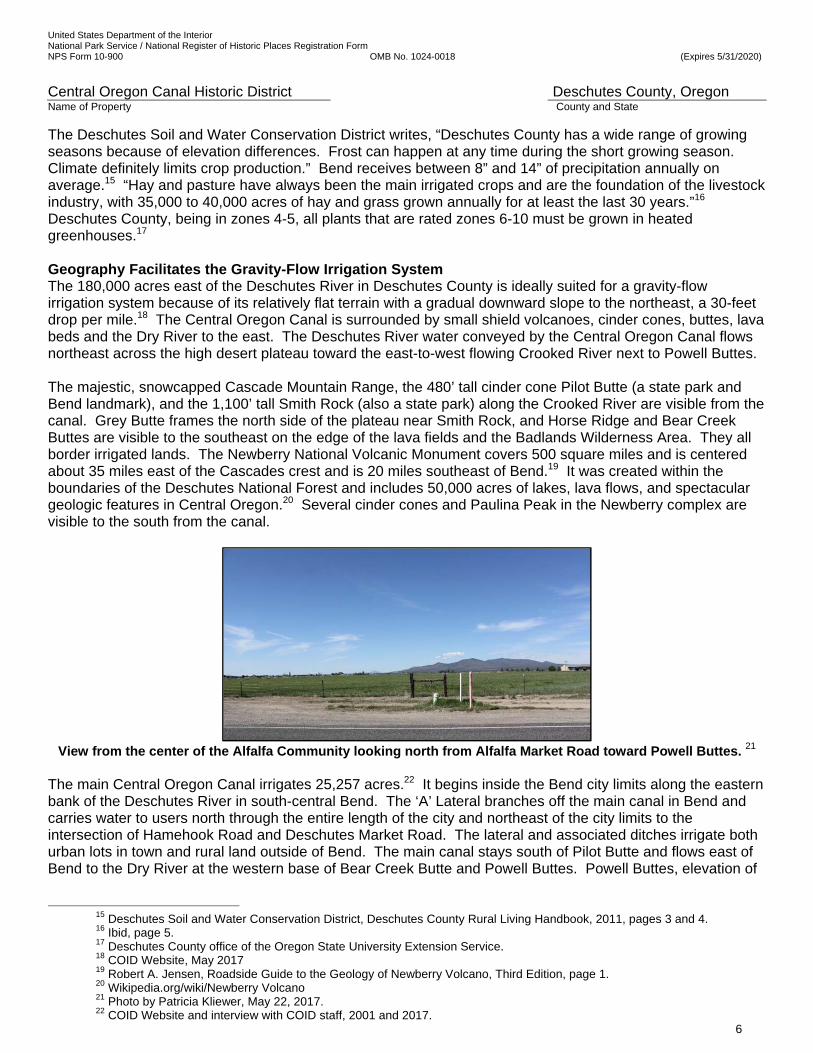
The Deschutes Soil and Water Conservation District writes, “Deschutes County has a wide range of growing seasons because of elevation differences. Frost can happen at any time during the short growing season. Climate definitely limits crop production.” Bend receives between 8” and 14” of precipitation annually on average.15 “Hay and pasture have always been the main irrigated crops and are the foundation of the livestock industry, with 35,000 to 40,000 acres of hay and grass grown annually for at least the last 30 years.”16 Deschutes County, being in zones 4-5, all plants that are rated zones 6-10 must be grown in heated greenhouses.17 Geography Facilitates the Gravity-Flow Irrigation System The 180,000 acres east of the Deschutes River in Deschutes County is ideally suited for a gravity-flow irrigation system because of its relatively flat terrain with a gradual downward slope to the northeast, a 30-feet drop per mile.18 The Central Oregon Canal is surrounded by small shield volcanoes, cinder cones, buttes, lava beds and the Dry River to the east. The Deschutes River water conveyed by the Central Oregon Canal flows northeast across the high desert plateau toward the east-to-west flowing Crooked River next to Powell Buttes. The majestic, snowcapped Cascade Mountain Range, the 480’ tall cinder cone Pilot Butte (a state park and Bend landmark), and the 1,100’ tall Smith Rock (also a state park) along the Crooked River are visible from the canal. Grey Butte frames the north side of the plateau near Smith Rock, and Horse Ridge and Bear Creek Buttes are visible to the southeast on the edge of the lava fields and the Badlands Wilderness Area. They all border irrigated lands. The Newberry National Volcanic Monument covers 500 square miles and is centered about 35 miles east of the Cascades crest and is 20 miles southeast of Bend.19 It was created within the boundaries of the Deschutes National Forest and includes 50,000 acres of lakes, lava flows, and spectacular geologic features in Central Oregon.20 Several cinder cones and Paulina Peak in the Newberry complex are visible to the south from the canal.
View from the center of the Alfalfa Community looking north from Alfalfa Market Road toward Powell Buttes. 21
The main Central Oregon Canal irrigates 25,257 acres.22 It begins inside the Bend city limits along the eastern bank of the Deschutes River in south-central Bend. The ‘A’ Lateral branches off the main canal in Bend and carries water to users north through the entire length of the city and northeast of the city limits to the intersection of Hamehook Road and Deschutes Market Road. The lateral and associated ditches irrigate both urban lots in town and rural land outside of Bend. The main canal stays south of Pilot Butte and flows east of Bend to the Dry River at the western base of Bear Creek Butte and Powell Buttes. Powell Buttes, elevation of
15 Deschutes Soil and Water Conservation District, Deschutes County Rural Living Handbook, 2011, pages 3 and 4. 16 Ibid, page 5.
17 Deschutes County office of the Oregon State University Extension Service. 18 COID Website, May 2017 19 Robert A. Jensen, Roadside Guide to the Geology of Newberry Volcano, Third Edition, page 1. 20 Wikipedia.org/wiki/Newberry Volcano 21 Photo by Patricia Kliewer, May 22, 2017. 22 COID Website and interview with COID staff, 2001 and 2017.

United States Department of the Interior National Park Service / National Register of Historic Places Registration Form NPS Form 10-900 OMB No. 1024-0018 (Expires 5/31/2020)
Central Oregon Canal Historic District Deschutes County, Oregon Name of Property County and State
7
about 5,100’, frames the east side of the farming area. The buttes between Redmond and Prineville are named “Powell Buttes” while the unincorporated community is called “Powell Butte”. The rural agricultural acreage served by the canal and its laterals are clustered near the canal in three relatively distinct areas: between Bend and Alfalfa, between Alfalfa and the community of Powell Butte and in the irrigated gentle hills northwest of Powell Butte. (See Figures 1, 22, and 23.) Geology The canal is made of native rock and soil. Section 8 will describe the construction process. The canal near Bend is very rocky, with land north of US Highway 20 having progressively less rock. The Deschutes Soil and Water Conservation District states in Deschutes County Rural Living Handbook, a Resource for Country Living and Land Stewardship, “In Deschutes County, geology includes basalt bedrock, pumice rock, volcanic ash, glacial deposits, and materials deposited by water. The majority of soils occur over basalt bedrock with a mantle of sandy pumice volcanic ash. Due to the volcanic ash, the soils tend to be fragile and are susceptible to wind and water erosion when not adequately protected. Soils are composed of clay, silt, and sand.”23 The Oregon State Engineer, John Dubuis, described the character of the soil in the 1914 report to the Oregon Desert Land Board as “disintegrated volcanic rock intermixed with volcanic ash, sandy, and silty loam.”24 “Dykes of cooled lava, caves, and pumiceous deposits occur here and there over the project.”25 In Geology of Oregon, Elizabeth and William Orr and Ewart Baldwin explain: “The Deschutes-Columbia River Plateau is predominantly a volcanic province…Geologic events in the Deschutes-Columbia province took place on a grand scale. Immense outpourings of lavas during the Miocene created one of the largest flood basalt provinces in the world, second only to the Deccan Plateau in India.”26 Volcanoes erupted particularly near Bend and southward. From volcanoes near Bend and perhaps from local vents elsewhere, very liquid olivine-basalt lava flowed great distances northward and in places spilled into the valleys of the Crooked and Deschutes River. This basalt covered most of the area in Deschutes County east of the Deschutes River.27 The Deschutes River is the Source of Water for Irrigation. The water for the Central Oregon Canal is diverted from the Deschutes River at elevation 3,758’ near the southern city limits of Bend in Township 18 South, Range 11 East, Section 13 W.M. (T18S, R11E, Section 13). The diversion point was about four miles south of the historic downtown and five miles west of the historic district when it was constructed. The 252-mile long Deschutes River is a major tributary of the Columbia River. The Deschutes River flows north from Little Lava Lake in southern Deschutes County, about 23 miles southwest of Bend, to the Columbia River, near Biggs Junction. Over-allocation of the river water has been a constant problem for the past 100 years, requiring cooperation among the irrigation districts and water right holders, and construction of federal reservoirs to augment seasonal flows. Within the city of Bend, much of the water in the river is diverted for irrigation by several irrigation districts. In addition to the Central Oregon Canal serving Bend, Alfalfa and Powell Butte, Swalley Irrigation Canal serves the area between the Deschutes River and Highway 97 and between Bend and Redmond; the Pilot Butte Canal serves Bend, Deschutes Junction, Redmond, and Terrebonne; the Arnold Irrigation Canal serves southern Bend and an area southeast of Bend; and the North Unit Irrigation Canal serves Jefferson County to
23 Deschutes Soil and Water Conservation District, Deschutes County Rural Living Handbook, 2011, page 16.
24 John Dubuis, Report to Desert Land Board, 1914, p 9. 25 ibid 26 Orr, Elizabeth L. and William N., and Ewart M. Baldwin, Geology of Oregon, (Dubuque: Kendall/Hunt, Fourth Edition, 1992),
121; William N. Orr, Professor Emeritus of Geology at University of Oregon, director of the Condon Collection, and Elizabeth L. Orr, collections manager of the Condon Collection at the Museum of Natural and Cultural History at the University of Oregon. Both received PhDs in Geology. In Memorial to Ewart M. Baldwin, University of Oregon, Department of Geology. Ewart M. Baldwin received a PhD in Geology and was Professor of the Department of Geological Sciences at the University of Oregon from 1947-1980. 27 Natural Resources Conservation Service, Soil Survey: Deschutes Area, (Series 1945, No. 2, U.S. Department of Agriculture, Soil Conservation Service in Cooperation with Oregon Agricultural Experiment Station, Washington: Government Printing Office, December 1958), 72-73.
United States Department of the Interior National Park Service / National Register of Historic Places Registration Form NPS Form 10-900 OMB No. 1024-0018 (Expires 5/31/2020)
Central Oregon Canal Historic District Deschutes County, Oregon Name of Property County and State
8
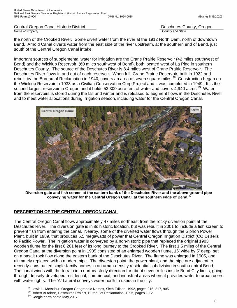
the north of the Crooked River. Some divert water from the river at the 1912 North Dam, north of downtown Bend. Arnold Canal diverts water from the east side of the river upstream, at the southern end of Bend, just south of the Central Oregon Canal intake. Important sources of supplemental water for irrigation are the Crane Prairie Reservoir (42 miles southwest of Bend) and the Wickiup Reservoir, (60 miles southwest of Bend), both located west of La Pine in southern Deschutes County. The source of the Deschutes River is 8.4 miles west of Crane Prairie Reservoir. The Deschutes River flows in and out of each reservoir. When full, Crane Prairie Reservoir, built in 1922 and rebuilt by the Bureau of Reclamation in 1940, covers an area of seven square miles.28 Construction began on the Wickiup Reservoir in 1938 as a Civilian Conservation Corp Project and it was completed in 1949. It is the second largest reservoir in Oregon and it holds 53,300 acre-feet of water and covers 4,940 acres.29 Water from the reservoirs is stored during the fall and winter and is released to augment flows in the Deschutes River and to meet water allocations during irrigation season, including water for the Central Oregon Canal.
Diversion gate and fish screen at the eastern bank of the Deschutes River and the above-ground pipe
conveying water for the Central Oregon Canal, at the southern edge of Bend.30 DESCRIPTION OF THE CENTRAL OREGON CANAL The Central Oregon Canal flows approximately 47 miles northeast from the rocky diversion point at the Deschutes River. The diversion gate is in its historic location, but was rebuilt in 2001 to include a fish screen to prevent fish from entering the canal. Nearby, some of the diverted water flows through the Siphon Power Plant, built in 1989, that produces 5.5 megawatts of power that Central Oregon Irrigation District (COID) sells to Pacific Power. The irrigation water is conveyed by a non-historic pipe that replaced the original 1903 wooden flume for the first 6,261 feet of its long journey to the Crooked River. The first 1.5 miles of the Central Oregon Canal at the diversion point in 1905 consisted of an enlarged wooden flume, 16’ wide by 5’ deep, set on a basalt rock flow along the eastern bank of the Deschutes River. The flume was enlarged in 1905, and ultimately replaced with a modern pipe. The diversion point, the power plant, and the pipe are adjacent to recently-constructed single-family homes in an urban-density residential subdivision in south-central Bend. The canal winds with the terrain in a northeasterly direction for about seven miles inside Bend City limits, going through densely-developed residential, commercial, and industrial areas where it provides water to urban users with water rights. The ‘A’ Lateral conveys water north to users in the city.
28 Lewis L. McArthur, Oregon Geographic Names, Sixth Edition, 1992, pages 216, 217, 905. 29 Robert Autobee, Deschutes Project, Bureau of Reclamation, 1996, pages 1-12 30 Google earth photo May 2017.
United States Department of the Interior National Park Service / National Register of Historic Places Registration Form NPS Form 10-900 OMB No. 1024-0018 (Expires 5/31/2020)
Central Oregon Canal Historic District Deschutes County, Oregon Name of Property County and State
9
At the eastern Bend city limits, the canal winds through small-acreage hobby farms with pastures for horses, cattle, sheep, and goats for the first two miles, then through larger parcels that are partially cultivated or are scrub land. At about three miles east of Bend, the canal flows through public recreational land that has never been cleared or cultivated. East of Gosney Road, many publicly-owned parcels of rocky scrub land that are each over 80 acres in size are interspersed with privately-owned parcels that are generally between 10 and 40 acres, with portions under cultivation and irrigation. This pattern of dry native vegetation on rocky, unirrigated public land, interspersed with irrigated private land, continues to the end of the canal system. The Central Oregon Canal turns north 16 miles east of Bend near US Highway 20 where it encounters the lava bed and volcanic rock formations of the Oregon Badlands Wilderness Area, owned by the federal government and managed by the BLM, Prineville Office. From there, it follows the Dry River Canyon and enters the Alfalfa area, which appears to be an irrigated oasis in the desert. It continues north into Crook County to the community of Powell Butte. At the Powell Butte community, it winds through hilly land to its terminus northwest of Houston Lake and Little Houston Lake. The main canal ends at a large pond at T14S, R14 E, Section 26, on SW Lark Meadow Lane near Lark Gardens Cattle Ranch, Powell Butte, just south of the Crooked River and Dry River, elevation 3057. (See Figures 1, 7 and 8.) The elevation at the diversion point is 3,758’ and is 3057’ on Lark Meadow Lane. The canal drops about 701’ in elevation to its end. It drops 736’ to its low point near the ditch serving Houston Lake at elevation 3022, allowing the water to flow entirely by gravity.31 32 33 DESCRIPTION OF THE CENTRAL OREGON CANAL HISTORIC DISTRICT (WARD ROAD – GOSNEY ROAD SEGMENT) Historic District Boundary and Dimensions The Central Oregon Canal Historic District (Ward Road -Gosney Road Segment) is about 7.75 miles northeast of the canal’s diversion point at the Deschutes River. It is located 0.75 mile from the eastern Bend City limit line that is near the intersection of 27th Street and Stevens Road. The nominated area in the historic district includes the length of the Central Oregon Canal within the west half and the northeast quarter of Township 18 South, Range 12 East, Section 1, W.M.; the northwest quarter and east half of Section 6 and the southwest quarter of Section 5 and the northwest quarter of Section 8 of Township 18 South, Range 13 East, W.M. (See Figures 2, 3, 11, 12 and 14a-c.) The Central Oregon Canal Historic District begins at the Ward Road Bridge. Its western boundary is the eastern edge of the Deschutes County right-of-way for Ward Road, as it crosses the canal. Ward Road runs north-south along the western section line of T18S, R12W Section 1. The historic district ends at the Gosney Road Bridge. Its eastern boundary is the western edge of the Deschutes County right-of-way for Gosney Road, as it crosses the canal. Gosney Road generally follows the north-south midsection line through Sections 5 and 8 of T18S, R13E. The northern and southern boundaries of the winding historic district are lines drawn 50’ on either side of the centerline of the Central Oregon Canal, establishing a 100’ wide corridor. The 100’ total width of this historic district is adequate to include the main canal and its embankment and all contributing features. The nominated segment of the canal is approximately 18,013’ (3.4-miles) long, as measured down the centerline of the canal. The 3.4 miles of the canal span only 2.50 miles between Ward Road and Gosney Road, as the crow flies. The canal flows northeast for about a half a mile and then southeast for nearly a mile in the district. The nominated district includes just over 41 acres. All of the land is in rural Deschutes County.
31 Energy Trust of Oregon, Inc. Open Solicitation, Juniper Ridge 3/27 MW Hydropower, January 23, 2008, page 1.
32 Ibid. 33 Google Earth 2014 web site.
United States Department of the Interior National Park Service / National Register of Historic Places Registration Form NPS Form 10-900 OMB No. 1024-0018 (Expires 5/31/2020)
Central Oregon Canal Historic District Deschutes County, Oregon Name of Property County and State
10
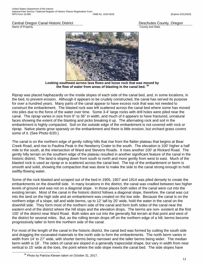
Roads and Streets Around the Historic District The historic district is about a third of a mile south of US Highway 20. Ward Road is a two-lane paved county road on the west side of the historic district. The Ward Road right-of-way and the non-historic bridge over the canal at Ward Road are not included in the historic district. Gosney Road is a two-lane paved county road on the east side of the historic district. The Gosney Road right-of-way and the non-historic bridge over the canal at Gosney Road are not included in the historic district. Dobbin Road, Walter Court and Teal Road are residential neighborhood roads north of the historic district. Bear Creek Road was the original primary east- west road from Bend to Powell Butte and Prineville in the historic period. None of those roads is within the historic district. Somerset Drive, Obsidian Avenue, Wickiup Road, Tomahawk Street, and Arrow Avenue are neighborhood roads south of the historic district and none of those roads and streets are within the historic district. Many of the mentioned surrounding local roads and streets are unimproved and unpaved. Teal Road, that T’s into the historic district, is a one-lane dirt road. Elevation in the Historic District Because the water in the canal flows by gravity, gradual drops in elevation are important to move the water on its journey and were a factor in determining the necessary placement and size of the canal. Slow-moving places are caused by flatter terrain. The canal is generally narrower in fast-moving places that are due to larger drops in elevation. The elevation at the west end of the district is 3,658 feet above sea level. The elevation at the east end of the district is 3,608 feet.34 The water in the canal drops 50 feet as it flows through the historic district.35 Canal Bed and Embankments in the Historic District The canal in the district carries nearly the full amount of water, 530 cubic feet per second, diverted from the Deschutes River, with only the ‘A’ Lateral being upstream of the district, diverting some water away from the main canal before it reaches the historic district. Metal gates allow water to flow into two laterals that head north from the canal in the historic district. The canal in the historic district has no straight-a-ways and is characterized by a significantly winding canal bed that heads nearly a half mile north and then a mile south as it flows 2.5 miles east, as the crow flies. The canal is made of native earth and rock. The rocks vary greatly in size from pebbles, to immovable boulders, to lava flows that extend beyond the edges of the canal. Some rocks were dug from the canal bed and others with sharper angles were fractured from larger rock by blasting. The district’s nearly solid rock in many places made this segment of the canal challenging to construct, but the drops in the terrain and building it on the northern edge of a hillside made it difficult as well, resulting in the construction of unusually tall berms that may be the tallest on the entire canal, and two flumes. Today, the 1905 challenges and methodology of construction which will be further described in Section 8 of this nomination are easily observed in the character and appearance of the canal. Drill holes, rock fractured by picks and blasting, and places where soil was scooped out by Fresno scrapers as it was needed to layer with rock to form the embankments are visible in the district. The stretch in the district has a character-defining uneven bed and highly irregular width, depth, slopes, cuts, and embankments. Extensive, impervious lava flows form the bed in about a fourth of the length of the district. Much of the bed holds pools of standing water year-around providing habitat for water plants, young fish and crawfish. Fifty rocks with 2.25” diameter drill holes that were used to place blasting power to blast the solid rock into small rocks were noted on the survey of the historic district. Widths between the sides of the canal at daylight, where the top of the water meets the sides, are variable; typical width is 45-60 feet, but varies from 33.8 to 78.1 feet. The bed is also undulating and irregular in depth, varying from 1.3’ to over 9’ at the deepest points. The bed is not flat. Typically, low points are in depressions where rock was blasted out, while high points are at the tops of lava flows and large rocks left in place during construction.
34 Google earth, 2017. 35 Elevations taken from Google Earth and Figure 6.
United States Department of the Interior National Park Service / National Register of Historic Places Registration Form NPS Form 10-900 OMB No. 1024-0018 (Expires 5/31/2020)
Central Oregon Canal Historic District Deschutes County, Oregon Name of Property County and State
11
Looking southeast across lava flows and loose rock that was moved by
the flow of water from areas of blasting in the canal bed. 36
Riprap was placed haphazardly on the inside slopes of each side of the canal bed, and, in some locations, in the bed, to prevent erosion. Although it appears to be crudely constructed, the canal has served its purpose for over a hundred years. Many parts of the canal appear to have excess rock that was not needed to construct the embankment. The blasted rock was left scattered across the canal bed where some has moved into piles due to the force of the water over time. Some 3-4’ large rocks with drill holes were piled near the canal. The riprap varies in size from 6” to 36” in width, and much of it appears to have fractured, unnatural faces showing the extent of the blasting and picks breaking it up. The alternating rock and soil in the embankment is highly compacted. Soil on the outside edge of the embankment is not covered with rock or riprap. Native plants grow sparsely on the embankment and there is little erosion, but orchard grass covers some of it. (See Photo 6/20.) The canal is on the northern edge of gently rolling hills that rise from the flatter plateau that begins at Bear Creek Road, and rise to Paulina Peak in the Newberry Crater to the south. The elevation is 100’ higher a half mile to the south, at the intersection of Ward and Stevens Roads. It rises another 100’ at Rickard Road. The gently hilly terrain on the southern edge of the plateau resulted in another significant feature of the canal in the historic district. The land is sloping down from south to north and more gently from west to east. Much of the blasted rock is used as riprap or is scattered across the canal bed. The top of the embankment or berm is smooth and solid, showing the compaction that was done to make the side to the canal strong enough to hold swiftly-flowing water. Some of the rock blasted and scraped out of the bed in 1905, 1907 and 1914 was piled densely to create the embankments on the downhill side. In many locations in the district, the canal was cradled between two higher levels of ground and was not on a diagonal slope. In those places both sides of the canal were cut into the existing terrain. Most of the canal in the historic district follows a diagonal slope, therefore, the canal was cut into the land on the high side and an embankment was created on the low side. Because the canal is on the northern edge of a slope, tall and wide berms, up to 12’ tall by 20’ wide, hold the water in the canal on the downhill side. They form most of the northern side of the canal and form both sides of the canal near the eastern end of the district where the hill stops and the elevation drops. The berms are non- existent at the first 100’ of the district near Ward Road. Both sides are cut into the generally flat terrain at that point and west of the district for several miles. But, as the rolling terrain drops off on the northern edge of a hill, berms become progressively taller to form the northern side of the canal. For most of the length of the canal in the historic district, the canal bed was formed by cutting the south side and dragging the excavated materials to the north side to form the embankments. The north berm varies in width from 14’ to 27’ wide, with shorter berms being narrower and the taller berms being wider. The median berm width is 18’. The sides of canal are sloped in a generally trapezoidal shape, but vary in width from near vertical to 15’ wide at the toes, the point where the side slope meets the canal bed. The side slopes have
36 Photo by Patricia Kliewer taken on October 31, 2017.

United States Department of the Interior National Park Service / National Register of Historic Places Registration Form NPS Form 10-900 OMB No. 1024-0018 (Expires 5/31/2020)
Central Oregon Canal Historic District Deschutes County, Oregon Name of Property County and State
12
haphazardly placed broken lava rock riprap. Carefully-stacked and fitted rock on the side slopes on the outside edge of curves are in three areas. Ditch-Rider Road The ditch rider road is not a structure, but is instead the location that a horseback rider rode near or alongside the canal to check on its condition, to adjust headgates to laterals and ditches, and to make repairs. In some areas, the rider got a better view from the top of embankments, while in most areas he rode alongside the canal. Since motorized vehicles have been used by staff for their inspections and maintenance, parallel tire tracks reduce vegetation where trucks are driven along the canal. An approximately 12’ wide strip on the northern embankment and through the native terrain running the full length of the canal in the historic district has no wheel or wagon ruts, but only parallel tire tracks through sparse native vegetation. The ditch rider road is intermittently improved with red or brown crushed cinder rock to reduce the growth of native plants. Gates to the Canal Green metal gates at each end of the historic district control vehicular access along the canal from Ward Road and Gosney Road and discourage unauthorized motor vehicles. The parcels of land underlying the ditch rider road, embankments and canal are owned by 43 private and 2 public parties.37 One gate is next to the Ward Road Bridge and the other is 0.1 mile west of Gosney Road. Two more green metal gates along northern fence lines allow the COID staff to access the ditch rider road from Bear Creek Road at Laterals ‘B’ and ’C’.
The Central Oregon Canal Historic District displays evidence of its construction techniques,
including dozens of 2.25” holes drilled for explosives that broke up volcanic rock flows.38 Parcels in the Historic District, Subdivisions and Ranches The western 1/4 of the historic district is in rural residential subdivisions. Many of the lots in various phases of the Dobbin Acres subdivision on the northern side of the canal were platted since 1972 and extend to the centerline of the canal. Most of the 1.5 to 3.5 acre lots have irrigation water rights served by two headgates on the Central Oregon Canal. The terrain drops down to Dobbin Road from the canal. The berm forming the northern side of the canal is higher than the roofs of houses below it in Dobbin Acres. Agricultural fencing runs along the berm to contain horses, goats, and sheep. One undeveloped parcel bordering the canal has native vegetation of juniper trees, bitterbrush, and sagebrush. South of the centerline of the canal on the western third of the district are various phases of the Arrowhead Acres subdivision, originally platted in 1966. The 1- to 7-acre lots with irrigation water rights are served by the Arnold Irrigation District. Somerset subdivision was originally carved from a 121-acre ranch in 1976, resulting in lots of around 3 acres in size. Most of the lots in Arrowhead Acres and Somerset extend to the centerline of the canal. A few of the unfenced lots have lawn running up to the water’s edge. Others have undeveloped scrub land or livestock fencing and pasture next to the canal. At the Bear Creek Ranch Bridge that crosses the canal, the setting changes abruptly from rural residential subdivisions to ranches and large parcels for the eastern ¾ of the historic district. Three non-historic houses
37 List of property owners provided by the Oregon SHPO, August 2017. 38 Patricia Kliewer photograph April 3, 2017, Photographer looking north.
United States Department of the Interior National Park Service / National Register of Historic Places Registration Form NPS Form 10-900 OMB No. 1024-0018 (Expires 5/31/2020)
Central Oregon Canal Historic District Deschutes County, Oregon Name of Property County and State
13
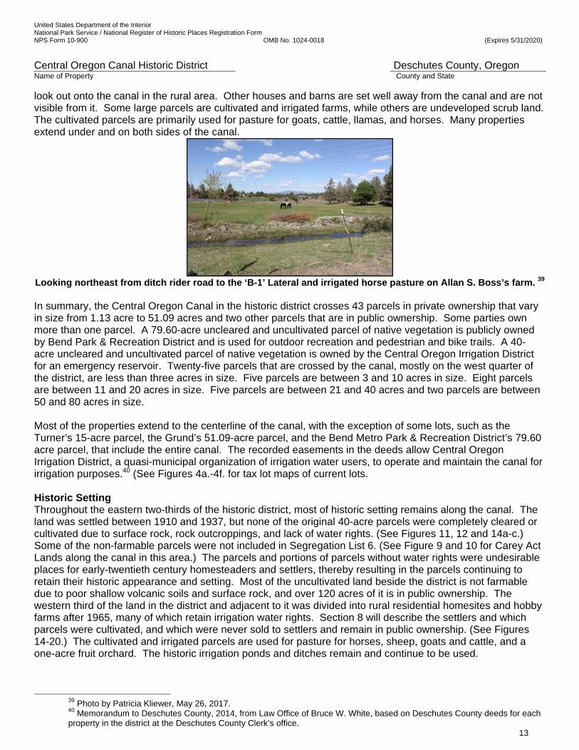
look out onto the canal in the rural area. Other houses and barns are set well away from the canal and are not visible from it. Some large parcels are cultivated and irrigated farms, while others are undeveloped scrub land. The cultivated parcels are primarily used for pasture for goats, cattle, llamas, and horses. Many properties extend under and on both sides of the canal.
Looking northeast from ditch rider road to the ‘B-1’ Lateral and irrigated horse pasture on Allan S. Boss’s farm. 39 In summary, the Central Oregon Canal in the historic district crosses 43 parcels in private ownership that vary in size from 1.13 acre to 51.09 acres and two other parcels that are in public ownership. Some parties own more than one parcel. A 79.60-acre uncleared and uncultivated parcel of native vegetation is publicly owned by Bend Park & Recreation District and is used for outdoor recreation and pedestrian and bike trails. A 40-acre uncleared and uncultivated parcel of native vegetation is owned by the Central Oregon Irrigation District for an emergency reservoir. Twenty-five parcels that are crossed by the canal, mostly on the west quarter of the district, are less than three acres in size. Five parcels are between 3 and 10 acres in size. Eight parcels are between 11 and 20 acres in size. Five parcels are between 21 and 40 acres and two parcels are between 50 and 80 acres in size. Most of the properties extend to the centerline of the canal, with the exception of some lots, such as the Turner’s 15-acre parcel, the Grund’s 51.09-acre parcel, and the Bend Metro Park & Recreation District’s 79.60 acre parcel, that include the entire canal. The recorded easements in the deeds allow Central Oregon Irrigation District, a quasi-municipal organization of irrigation water users, to operate and maintain the canal for irrigation purposes.40 (See Figures 4a.-4f. for tax lot maps of current lots. Historic Setting Throughout the eastern two-thirds of the historic district, most of historic setting remains along the canal. The land was settled between 1910 and 1937, but none of the original 40-acre parcels were completely cleared or cultivated due to surface rock, rock outcroppings, and lack of water rights. (See Figures 11, 12 and 14a-c.) Some of the non-farmable parcels were not included in Segregation List 6. (See Figure 9 and 10 for Carey Act Lands along the canal in this area.) The parcels and portions of parcels without water rights were undesirable places for early-twentieth century homesteaders and settlers, thereby resulting in the parcels continuing to retain their historic appearance and setting. Most of the uncultivated land beside the district is not farmable due to poor shallow volcanic soils and surface rock, and over 120 acres of it is in public ownership. The western third of the land in the district and adjacent to it was divided into rural residential homesites and hobby farms after 1965, many of which retain irrigation water rights. Section 8 will describe the settlers and which parcels were cultivated, and which were never sold to settlers and remain in public ownership. (See Figures 14-20.) The cultivated and irrigated parcels are used for pasture for horses, sheep, goats and cattle, and a one-acre fruit orchard. The historic irrigation ponds and ditches remain and continue to be used.
39 Photo by Patricia Kliewer, May 26, 2017. 40 Memorandum to Deschutes County, 2014, from Law Office of Bruce W. White, based on Deschutes County deeds for each property in the district at the Deschutes County Clerk’s office.
United States Department of the Interior National Park Service / National Register of Historic Places Registration Form NPS Form 10-900 OMB No. 1024-0018 (Expires 5/31/2020)
Central Oregon Canal Historic District Deschutes County, Oregon Name of Property County and State
14
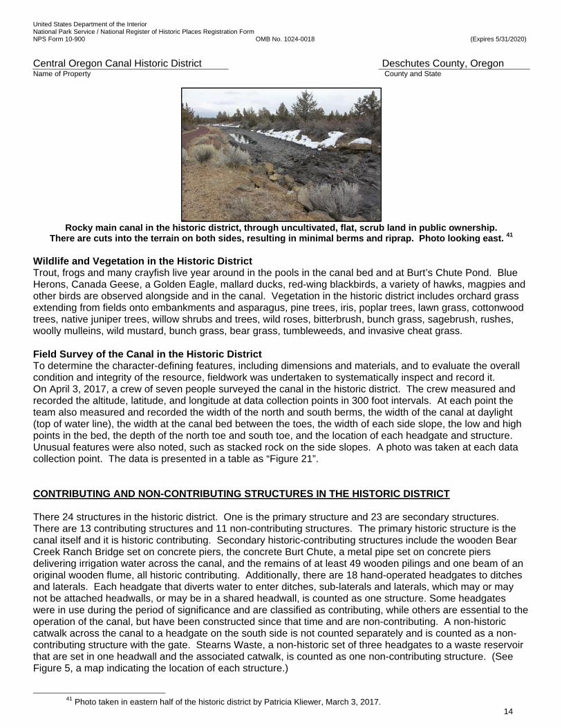
Rocky main canal in the historic district, through uncultivated, flat, scrub land in public ownership.
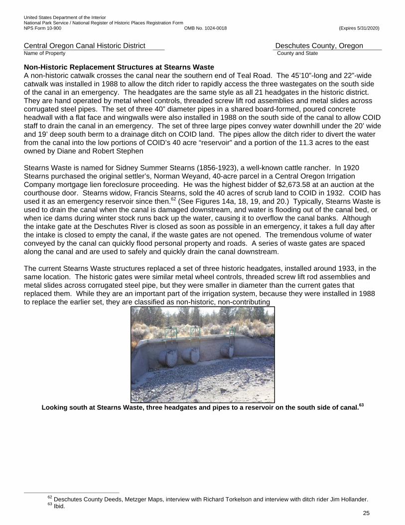
There are cuts into the terrain on both sides, resulting in minimal berms and riprap. Photo looking east. 41 Wildlife and Vegetation in the Historic District Trout, frogs and many crayfish live year around in the pools in the canal bed and at Burt’s Chute Pond. Blue Herons, Canada Geese, a Golden Eagle, mallard ducks, red-wing blackbirds, a variety of hawks, magpies and other birds are observed alongside and in the canal. Vegetation in the historic district includes orchard grass extending from fields onto embankments and asparagus, pine trees, iris, poplar trees, lawn grass, cottonwood trees, native juniper trees, willow shrubs and trees, wild roses, bitterbrush, bunch grass, sagebrush, rushes, woolly mulleins, wild mustard, bunch grass, bear grass, tumbleweeds, and invasive cheat grass. Field Survey of the Canal in the Historic District To determine the character-defining features, including dimensions and materials, and to evaluate the overall condition and integrity of the resource, fieldwork was undertaken to systematically inspect and record it. On April 3, 2017, a crew of seven people surveyed the canal in the historic district. The crew measured and recorded the altitude, latitude, and longitude at data collection points in 300 foot intervals. At each point the team also measured and recorded the width of the north and south berms, the width of the canal at daylight (top of water line), the width at the canal bed between the toes, the width of each side slope, the low and high points in the bed, the depth of the north toe and south toe, and the location of each headgate and structure. Unusual features were also noted, such as stacked rock on the side slopes. A photo was taken at each data collection point. The data is presented in a table as “Figure 21”. CONTRIBUTING AND NON-CONTRIBUTING STRUCTURES IN THE HISTORIC DISTRICT There 24 structures in the historic district. One is the primary structure and 23 are secondary structures. There are 13 contributing structures and 11 non-contributing structures. The primary historic structure is the canal itself and it is historic contributing. Secondary historic-contributing structures include the wooden Bear Creek Ranch Bridge set on concrete piers, the concrete Burt Chute, a metal pipe set on concrete piers delivering irrigation water across the canal, and the remains of at least 49 wooden pilings and one beam of an original wooden flume, all historic contributing. Additionally, there are 18 hand-operated headgates to ditches and laterals. Each headgate that diverts water to enter ditches, sub-laterals and laterals, which may or may not be attached headwalls, or may be in a shared headwall, is counted as one structure. Some headgates were in use during the period of significance and are classified as contributing, while others are essential to the operation of the canal, but have been constructed since that time and are non-contributing. A non-historic catwalk across the canal to a headgate on the south side is not counted separately and is counted as a non-contributing structure with the gate. Stearns Waste, a non-historic set of three headgates to a waste reservoir that are set in one headwall and the associated catwalk, is counted as one non-contributing structure. (See Figure 5, a map indicating the location of each structure.)
41 Photo taken in eastern half of the historic district by Patricia Kliewer, March 3, 2017.
United States Department of the Interior National Park Service / National Register of Historic Places Registration Form NPS Form 10-900 OMB No. 1024-0018 (Expires 5/31/2020)
Central Oregon Canal Historic District Deschutes County, Oregon Name of Property County and State
15
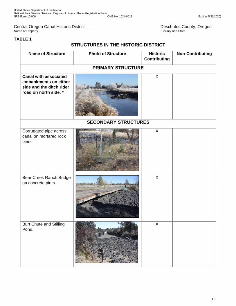
TABLE 1 STRUCTURES IN THE HISTORIC DISTRICT
Name of Structure Photo of Structure Historic Contributing
Non-Contributing
PRIMARY STRUCTURE
Canal with associated embankments on either side and the ditch rider road on north side. *
X
SECONDARY STRUCTURES
Corrugated pipe across canal on mortared rock piers
X
Bear Creek Ranch Bridge on concrete piers.
X
Burt Chute and Stilling Pond.
X
United States Department of the Interior National Park Service / National Register of Historic Places Registration Form NPS Form 10-900 OMB No. 1024-0018 (Expires 5/31/2020)
Central Oregon Canal Historic District Deschutes County, Oregon Name of Property County and State
16
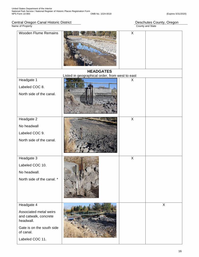
Wooden Flume Remains
X
HEADGATES Listed in geographical order, from west to east
Headgate 1
Labeled COC 8.
North side of the canal.
X
Headgate 2
No headwall
Labeled COC 9.
North side of the canal.
X
Headgate 3
Labeled COC 10.
No headwall.
North side of the canal. *
X
Headgate 4
Associated metal weirs and catwalk, concrete headwall.
Gate is on the south side of canal.
Labeled COC 11.
X
United States Department of the Interior National Park Service / National Register of Historic Places Registration Form NPS Form 10-900 OMB No. 1024-0018 (Expires 5/31/2020)
Central Oregon Canal Historic District Deschutes County, Oregon Name of Property County and State
17
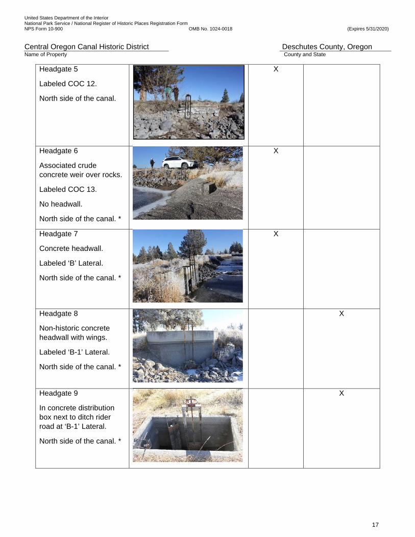
Headgate 5
Labeled COC 12.
North side of the canal.
X
Headgate 6
Associated crude concrete weir over rocks.
Labeled COC 13.
No headwall.
North side of the canal. *
X
Headgate 7
Concrete headwall.
Labeled ‘B’ Lateral.
North side of the canal. *
X
Headgate 8
Non-historic concrete headwall with wings.
Labeled ‘B-1’ Lateral.
North side of the canal. *
X
Headgate 9
In concrete distribution box next to ditch rider road at ‘B-1’ Lateral.
North side of the canal. *
X

United States Department of the Interior National Park Service / National Register of Historic Places Registration Form NPS Form 10-900 OMB No. 1024-0018 (Expires 5/31/2020)
Central Oregon Canal Historic District Deschutes County, Oregon Name of Property County and State
18
Headgate 10
Non-historic concrete, angled headwall.
South side of canal. *
X
Headgate 11
Non-historic concrete headwall with wings.
Non-historic gate.
North side of the canal.
X
Headgate12
Associated crude concrete and metal weir.
Shares headwall with Headgate 13.
Labeled ‘C’ Lateral.
North side of the canal. *
X
Headgate 13
Associated concrete and metal weir.
Shares headwall with Headgate 12.
Labeled COC 15.
North side of the canal.
X
Headgate 14
Non-historic, angled, concrete headwall.
South side of canal. *
X

United States Department of the Interior National Park Service / National Register of Historic Places Registration Form NPS Form 10-900 OMB No. 1024-0018 (Expires 5/31/2020)
Central Oregon Canal Historic District Deschutes County, Oregon Name of Property County and State
19
Headgate 15
Non-historic concrete headwall with wings.
Labeled COC 16.
North side of the canal. *
X
Headgates 16, 17, 18
Associated metal and wood catwalk.
Shared concrete headwall.
South side of canal.
X
Headgate19
Non-historic concrete headwall with wings.
Labeled COC 17.
North side of the canal. *
X
Headgate 20
Non-historic concrete headwall.
Labeled COC 18.
North side of the canal.
X
Headgate 21
Newest gate, non-historic concrete headwall with wings.
South side of canal.
X
Totals 13 11
* Photos taken on December 7, 2017 by Patricia Kliewer.
See Figure 5 for a location map of all structures.

United States Department of the Interior National Park Service / National Register of Historic Places Registration Form NPS Form 10-900 OMB No. 1024-0018 (Expires 5/31/2020)
Central Oregon Canal Historic District Deschutes County, Oregon Name of Property County and State
20
Historic Contributing Main Canal The primary historic contributing structure is the open, trapezoidal shaped Central Oregon Canal itself. This segment of the canal was constructed in 1905 and enlarged in 1907 and 1914. The Crook County Journal newspaper reported on April 13, 1905 that the first 12 miles east of the Deschutes River were completed.42 The field inspection and comparison of the canal today with historic descriptions and aerial photos of the area revealed that the canal in the historic district has survived nearly intact since it was last enlarged in 1914, using the same construction techniques as were used in 1905.43 Its route has not been altered and it is in its original location. The level of historic integrity is very high. The survey located evidence of the historic construction methodology, drilling rock, blasting rock, moving soil and small rocks with Fresno scrapers, digging and moving rock with horses and steam shovels, and using local materials where possible. The portion of the main canal within the historic district presented construction challenges that were met with the best technology of the time and that methodology and workmanship is on display. (See Figure 21 for a detailed description of the district.) One small section of the canal bed has undergone a visible, non-historic alteration. Historically, an island that was annually planted with flowers by the property owner, was located in rapids about fifty feet upstream of the Bear Creek Ranch Bridge. COID crews removed the island about 8 years ago. The work inadvertently exposed a lava tube that sucked in all the water from the canal along with adjacent rocks, earth and fences. The cavern took weeks to fill with dozens of truckloads of rock and concrete.44 Upstream rocks have rolled with the force of the water to cover the repair, and its location is not visible. The canal retains its impressive historic open, trapezoidal shape, dimensions and characteristics. Haphazardly-placed, angular, rough grey and black rocks are in its bed. It is characterized by the volcanic rock flows, native materials, rocky bed and sides, and its hurried, crude workmanship. These remain significant elements giving a unique character to this stretch of the canal. Water flowing over especially rocky areas creates rapids. (See aerial photo in Figure 2.) Intermittently, water churns, dives, and splashes over and around large rocks and rock flows. The rough, rocky characteristics of the canal and terrain are conveyed in a strong expression of the aesthetic quality of the canal. The appearance and sounds of the water in the canal during irrigation season indicate what is beneath it. Water is smooth and quiet where projecting rock is minimal, or the canal is deep, while rapids and the sound of moving water indicate dense, large rocks below, a shallow area or a sudden drop in elevation. Engineers measured the drops in elevation, roughness, and other factors of friction, as well as the size and shape of a channel, all of which were known to contribute to either a faster velocity of water in a canal or a slower one. Known as the value of ‘n’, Manning’s Roughness Coefficient, the 1914 state engineer’s report on the Deschutes Project to the Desert Land Board commented on the rocky stretch of the canal in the district: “The values of ‘n’ on the main canal are found to be much larger than in the original plans, the reason being that the construction left the canal with a very rough rock bottom. On the Central Oregon Canal in the historic district, the values of ‘n’ are like that of the natural water channels and are the highest in the length of the canal.”45 The canal bed retains its historic roughness. The roughness of the rock bed is obvious for the entire length of the canal in the district, except for Burt Chute, and is a character-defining feature. The date that the 350’-long wooden flume at the east end of the historic district was removed is unknown, but historic maps indicate its presence after the period of significance. COID purchased the 40 acres nearby called the COI District Reservoir in 1932. It was the source of materials to make replacement embankments. It is therefore likely that the tall berms or embankments on either side of the canal in this location were constructed after 1937, and are a major alteration. The embankments were constructed with native rock and soil scraped from the COID land on the south side of the canal, as was done during the historic period. They
42 Crook County Journal Newspaper, April 1905, page 1. 43 Bend Bulletin, Friday, May 13, 1904, “Water on Desert”, Bend, OR 44 Interview with Suzanne and Gary Grund, April 3, 2017. 45 Id., pages 16-19.
United States Department of the Interior National Park Service / National Register of Historic Places Registration Form NPS Form 10-900 OMB No. 1024-0018 (Expires 5/31/2020)
Central Oregon Canal Historic District Deschutes County, Oregon Name of Property County and State
21
have the same appearance as the other original embankments and have haphazardly-placed rock as riprap on the interior side slopes of the canal. The force of the water has moved riprap and rock annually.46
Rock upstream of the Bear Creek Ranch Bridge, ca 1928, looking east.47
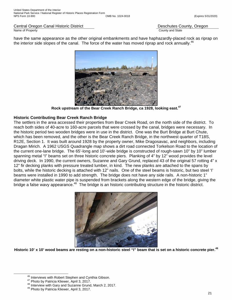
Historic Contributing Bear Creek Ranch Bridge The settlers in the area accessed their properties from Bear Creek Road, on the north side of the district. To reach both sides of 40-acre to 160-acre parcels that were crossed by the canal, bridges were necessary. In the historic period two wooden bridges were in use in the district. One was the Burt Bridge at Burt Chute, which has been removed, and the other is the Bear Creek Ranch Bridge, in the northwest quarter of T18S, R12E, Section 1. It was built around 1928 by the property owner, Mike Dragosavac, and neighbors, including Dragan Mirich. A 1962 USGS Quadrangle map shows a dirt road connected Torkelson Road to the location of the current one-lane bridge. The 65’-long and 10’-wide bridge is constructed of rough-sawn 10” by 10” lumber spanning metal “I” beams set on three historic concrete piers. Planking of 4” by 12” wood provides the level driving deck. In 1990, the current owners, Suzanne and Gary Grund, replaced 43 of the original 57 rotting 4” x 12” fir decking planks with pressure treated lumber, in kind. The new planks are attached to the spans by bolts, while the historic decking is attached with 12” nails. One of the steel beams is historic, but two steel ‘I’ beams were installed in 1990 to add strength. The bridge does not have any side rails. A non-historic 1” diameter white plastic water pipe is suspended from brackets along the western edge of the bridge, giving the bridge a false wavy appearance.48 The bridge is an historic contributing structure in the historic district.
Historic 10’ x 10’ wood beams are resting on a non-historic steel “I” beam that is set on a historic concrete pier.49
46 Interviews with Robert Stephen and Cynthia Gibson. 47 Photo by Patricia Kliewer, April 3, 2017. 48 Interview with Gary and Suzanne Grund, March 2, 2017. 49 Photo by Patricia Kliewer, April 3, 2017.
United States Department of the Interior National Park Service / National Register of Historic Places Registration Form NPS Form 10-900 OMB No. 1024-0018 (Expires 5/31/2020)
Central Oregon Canal Historic District Deschutes County, Oregon Name of Property County and State
22
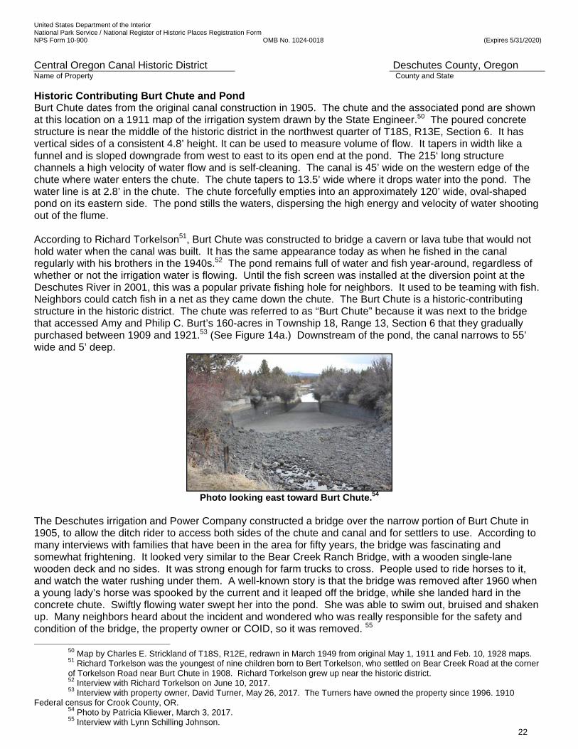
Historic Contributing Burt Chute and Pond Burt Chute dates from the original canal construction in 1905. The chute and the associated pond are shown at this location on a 1911 map of the irrigation system drawn by the State Engineer.50 The poured concrete structure is near the middle of the historic district in the northwest quarter of T18S, R13E, Section 6. It has vertical sides of a consistent 4.8’ height. It can be used to measure volume of flow. It tapers in width like a funnel and is sloped downgrade from west to east to its open end at the pond. The 215‘ long structure channels a high velocity of water flow and is self-cleaning. The canal is 45’ wide on the western edge of the chute where water enters the chute. The chute tapers to 13.5’ wide where it drops water into the pond. The water line is at 2.8’ in the chute. The chute forcefully empties into an approximately 120’ wide, oval-shaped pond on its eastern side. The pond stills the waters, dispersing the high energy and velocity of water shooting out of the flume. According to Richard Torkelson51, Burt Chute was constructed to bridge a cavern or lava tube that would not hold water when the canal was built. It has the same appearance today as when he fished in the canal regularly with his brothers in the 1940s.52 The pond remains full of water and fish year-around, regardless of whether or not the irrigation water is flowing. Until the fish screen was installed at the diversion point at the Deschutes River in 2001, this was a popular private fishing hole for neighbors. It used to be teaming with fish. Neighbors could catch fish in a net as they came down the chute. The Burt Chute is a historic-contributing structure in the historic district. The chute was referred to as “Burt Chute” because it was next to the bridge that accessed Amy and Philip C. Burt’s 160-acres in Township 18, Range 13, Section 6 that they gradually purchased between 1909 and 1921.53 (See Figure 14a.) Downstream of the pond, the canal narrows to 55’ wide and 5’ deep.
Photo looking east toward Burt Chute.54
The Deschutes irrigation and Power Company constructed a bridge over the narrow portion of Burt Chute in 1905, to allow the ditch rider to access both sides of the chute and canal and for settlers to use. According to many interviews with families that have been in the area for fifty years, the bridge was fascinating and somewhat frightening. It looked very similar to the Bear Creek Ranch Bridge, with a wooden single-lane wooden deck and no sides. It was strong enough for farm trucks to cross. People used to ride horses to it, and watch the water rushing under them. A well-known story is that the bridge was removed after 1960 when a young lady’s horse was spooked by the current and it leaped off the bridge, while she landed hard in the concrete chute. Swiftly flowing water swept her into the pond. She was able to swim out, bruised and shaken up. Many neighbors heard about the incident and wondered who was really responsible for the safety and condition of the bridge, the property owner or COID, so it was removed. 55
50 Map by Charles E. Strickland of T18S, R12E, redrawn in March 1949 from original May 1, 1911 and Feb. 10, 1928 maps. 51 Richard Torkelson was the youngest of nine children born to Bert Torkelson, who settled on Bear Creek Road at the corner of Torkelson Road near Burt Chute in 1908. Richard Torkelson grew up near the historic district. 52 Interview with Richard Torkelson on June 10, 2017. 53 Interview with property owner, David Turner, May 26, 2017. The Turners have owned the property since 1996. 1910
Federal census for Crook County, OR. 54 Photo by Patricia Kliewer, March 3, 2017. 55 Interview with Lynn Schilling Johnson.
United States Department of the Interior National Park Service / National Register of Historic Places Registration Form NPS Form 10-900 OMB No. 1024-0018 (Expires 5/31/2020)
Central Oregon Canal Historic District Deschutes County, Oregon Name of Property County and State
23
Burt Chute discharges water into a wide stilling pond. Photographer looking east. 56
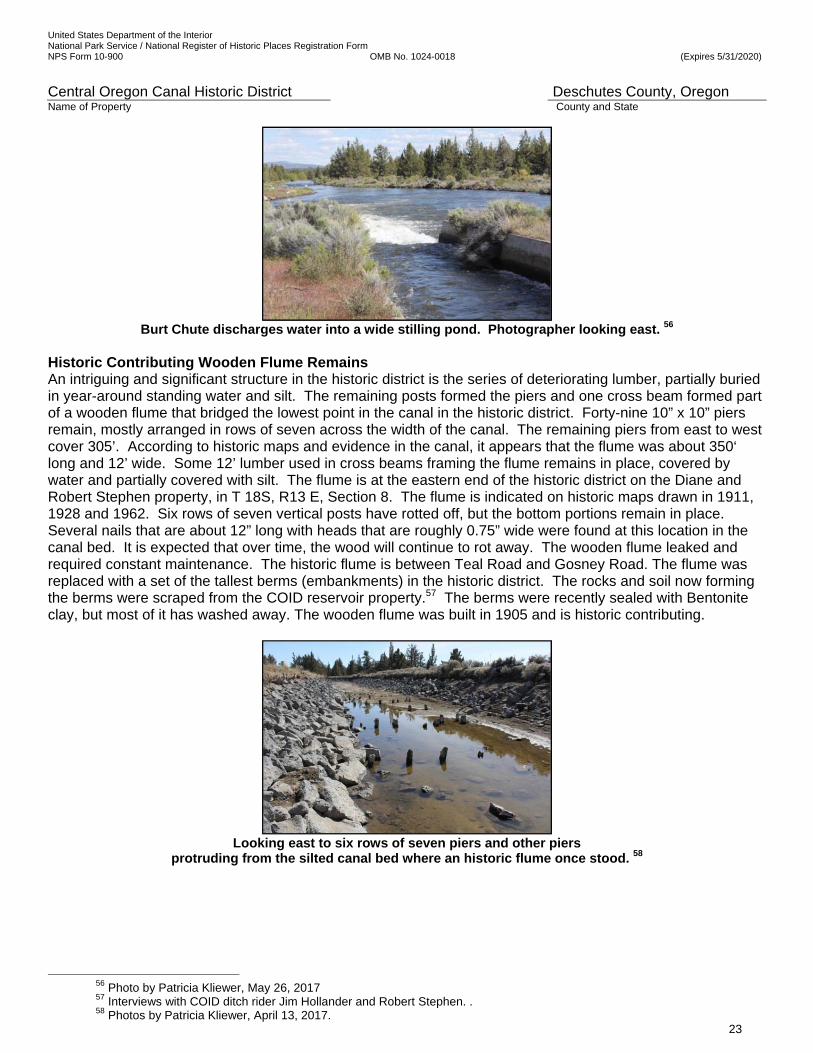
Historic Contributing Wooden Flume Remains An intriguing and significant structure in the historic district is the series of deteriorating lumber, partially buried in year-around standing water and silt. The remaining posts formed the piers and one cross beam formed part of a wooden flume that bridged the lowest point in the canal in the historic district. Forty-nine 10” x 10” piers remain, mostly arranged in rows of seven across the width of the canal. The remaining piers from east to west cover 305’. According to historic maps and evidence in the canal, it appears that the flume was about 350‘ long and 12’ wide. Some 12’ lumber used in cross beams framing the flume remains in place, covered by water and partially covered with silt. The flume is at the eastern end of the historic district on the Diane and Robert Stephen property, in T 18S, R13 E, Section 8. The flume is indicated on historic maps drawn in 1911, 1928 and 1962. Six rows of seven vertical posts have rotted off, but the bottom portions remain in place. Several nails that are about 12” long with heads that are roughly 0.75” wide were found at this location in the canal bed. It is expected that over time, the wood will continue to rot away. The wooden flume leaked and required constant maintenance. The historic flume is between Teal Road and Gosney Road. The flume was replaced with a set of the tallest berms (embankments) in the historic district. The rocks and soil now forming the berms were scraped from the COID reservoir property.57 The berms were recently sealed with Bentonite clay, but most of it has washed away. The wooden flume was built in 1905 and is historic contributing.
Looking east to six rows of seven piers and other piers
protruding from the silted canal bed where an historic flume once stood. 58
56 Photo by Patricia Kliewer, May 26, 2017 57 Interviews with COID ditch rider Jim Hollander and Robert Stephen. . 58 Photos by Patricia Kliewer, April 13, 2017.
United States Department of the Interior National Park Service / National Register of Historic Places Registration Form NPS Form 10-900 OMB No. 1024-0018 (Expires 5/31/2020)
Central Oregon Canal Historic District Deschutes County, Oregon Name of Property County and State
24
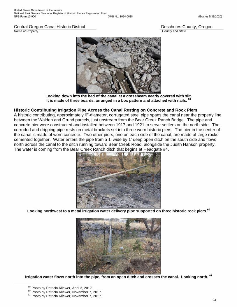
Looking down into the bed of the canal at a crossbeam nearly covered with silt. It is made of three boards. arranged in a box pattern and attached with nails. 59
Historic Contributing Irrigation Pipe Across the Canal Resting on Concrete and Rock Piers A historic contributing, approximately 6”-diameter, corrugated steel pipe spans the canal near the property line between the Walden and Grund parcels, just upstream from the Bear Creek Ranch Bridge. The pipe and concrete pier were constructed and installed between 1917 and 1921 to serve settlers on the north side. The corroded and dripping pipe rests on metal brackets set into three worn historic piers. The pier in the center of the canal is made of worn concrete. Two other piers, one on each side of the canal, are made of large rocks cemented together. Water enters the pipe from a 1’ wide by 1’ deep open ditch on the south side and flows north across the canal to the ditch running toward Bear Creek Road, alongside the Judith Hanson property. The water is coming from the Bear Creek Ranch ditch that begins at Headgate #4.
Looking northwest to a metal irrigation water delivery pipe supported on three historic rock piers.60
Irrigation water flows north into the pipe, from an open ditch and crosses the canal. Looking north. 61
59 Photo by Patricia Kliewer, April 3, 2017. 60 Photo by Patricia Kliewer, November 7, 2017. 61 Photo by Patricia Kliewer, November 7, 2017.
United States Department of the Interior National Park Service / National Register of Historic Places Registration Form NPS Form 10-900 OMB No. 1024-0018 (Expires 5/31/2020)
Central Oregon Canal Historic District Deschutes County, Oregon Name of Property County and State
25
Non-Historic Replacement Structures at Stearns Waste A non-historic catwalk crosses the canal near the southern end of Teal Road. The 45’10”-long and 22”-wide catwalk was installed in 1988 to allow the ditch rider to rapidly access the three wastegates on the south side of the canal in an emergency. The headgates are the same style as all 21 headgates in the historic district. They are hand operated by metal wheel controls, threaded screw lift rod assemblies and metal slides across corrugated steel pipes. The set of three 40” diameter pipes in a shared board-formed, poured concrete headwall with a flat face and wingwalls were also installed in 1988 on the south side of the canal to allow COID staff to drain the canal in an emergency. The set of three large pipes convey water downhill under the 20’ wide and 19’ deep south berm to a drainage ditch on COID land. The pipes allow the ditch rider to divert the water from the canal into the low portions of COID’s 40 acre “reservoir” and a portion of the 11.3 acres to the east owned by Diane and Robert Stephen Stearns Waste is named for Sidney Summer Stearns (1856-1923), a well-known cattle rancher. In 1920 Stearns purchased the original settler’s, Norman Weyand, 40-acre parcel in a Central Oregon Irrigation Company mortgage lien foreclosure proceeding. He was the highest bidder of $2,673.58 at an auction at the courthouse door. Stearns widow, Francis Stearns, sold the 40 acres of scrub land to COID in 1932. COID has used it as an emergency reservoir since then.62 (See Figures 14a, 18, 19, and 20.) Typically, Stearns Waste is used to drain the canal when the canal is damaged downstream, and water is flooding out of the canal bed, or when ice dams during winter stock runs back up the water, causing it to overflow the canal banks. Although the intake gate at the Deschutes River is closed as soon as possible in an emergency, it takes a full day after the intake is closed to empty the canal, if the waste gates are not opened. The tremendous volume of water conveyed by the canal can quickly flood personal property and roads. A series of waste gates are spaced along the canal and are used to safely and quickly drain the canal downstream. The current Stearns Waste structures replaced a set of three historic headgates, installed around 1933, in the same location. The historic gates were similar metal wheel controls, threaded screw lift rod assemblies and metal slides across corrugated steel pipe, but they were smaller in diameter than the current gates that replaced them. While they are an important part of the irrigation system, because they were installed in 1988 to replace the earlier set, they are classified as non-historic, non-contributing
Looking south at Stearns Waste, three headgates and pipes to a reservoir on the south side of canal.63
62 Deschutes County Deeds, Metzger Maps, interview with Richard Torkelson and interview with ditch rider Jim Hollander. 63 Ibid.
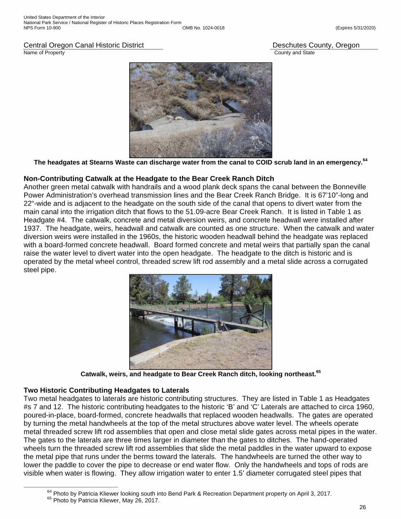
United States Department of the Interior National Park Service / National Register of Historic Places Registration Form NPS Form 10-900 OMB No. 1024-0018 (Expires 5/31/2020)
Central Oregon Canal Historic District Deschutes County, Oregon Name of Property County and State
26
The headgates at Stearns Waste can discharge water from the canal to COID scrub land in an emergency.64
Non-Contributing Catwalk at the Headgate to the Bear Creek Ranch Ditch Another green metal catwalk with handrails and a wood plank deck spans the canal between the Bonneville Power Administration’s overhead transmission lines and the Bear Creek Ranch Bridge. It is 67’10”-long and 22“-wide and is adjacent to the headgate on the south side of the canal that opens to divert water from the main canal into the irrigation ditch that flows to the 51.09-acre Bear Creek Ranch. It is listed in Table 1 as Headgate #4. The catwalk, concrete and metal diversion weirs, and concrete headwall were installed after 1937. The headgate, weirs, headwall and catwalk are counted as one structure. When the catwalk and water diversion weirs were installed in the 1960s, the historic wooden headwall behind the headgate was replaced with a board-formed concrete headwall. Board formed concrete and metal weirs that partially span the canal raise the water level to divert water into the open headgate. The headgate to the ditch is historic and is operated by the metal wheel control, threaded screw lift rod assembly and a metal slide across a corrugated steel pipe.
Catwalk, weirs, and headgate to Bear Creek Ranch ditch, looking northeast.65
Two Historic Contributing Headgates to Laterals Two metal headgates to laterals are historic contributing structures. They are listed in Table 1 as Headgates #s 7 and 12. The historic contributing headgates to the historic ‘B’ and ‘C’ Laterals are attached to circa 1960, poured-in-place, board-formed, concrete headwalls that replaced wooden headwalls. The gates are operated by turning the metal handwheels at the top of the metal structures above water level. The wheels operate metal threaded screw lift rod assemblies that open and close metal slide gates across metal pipes in the water. The gates to the laterals are three times larger in diameter than the gates to ditches. The hand-operated wheels turn the threaded screw lift rod assemblies that slide the metal paddles in the water upward to expose the metal pipe that runs under the berms toward the laterals. The handwheels are turned the other way to lower the paddle to cover the pipe to decrease or end water flow. Only the handwheels and tops of rods are visible when water is flowing. They allow irrigation water to enter 1.5’ diameter corrugated steel pipes that
64 Photo by Patricia Kliewer looking south into Bend Park & Recreation Department property on April 3, 2017. 65 Photo by Patricia Kliewer, May 26, 2017.

United States Department of the Interior National Park Service / National Register of Historic Places Registration Form NPS Form 10-900 OMB No. 1024-0018 (Expires 5/31/2020)
Central Oregon Canal Historic District Deschutes County, Oregon Name of Property County and State
27
dump water into laterals on the north side of the ditch rider road to convey water north for several miles, branching out into smaller ditches. The ‘B’ Lateral crosses under Bear Creek Road and US Highway 20 and continues north to the intersection of Nelson Road and the Powell Butte Highway. It serves the Bend Airport and some farms around it.
Screw assembly to operate the headgate to the ‘B’ Lateral looking east. . 66
Water flows under the north berm in a metal pipe to the ‘B’ Lateral, looking north toward Bear Creek Road.67
‘ Old headgates to ‘C’ Lateral and a ditch named COC 15 in a shared non-historic board-formed,
concrete headwall with wings, looking north from center of canal bed.68
66 Photo taken on April 3, 2017 by Patricia Kliewer. 67 Photo taken on May 26, 2017 by Patricia Kliewer. 68 Photo by Patricia Kliewer, April 3, 2017
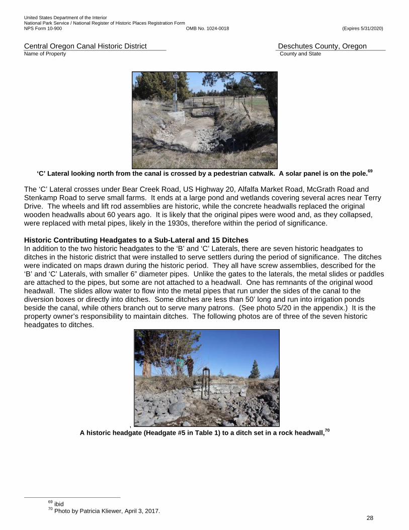
United States Department of the Interior National Park Service / National Register of Historic Places Registration Form NPS Form 10-900 OMB No. 1024-0018 (Expires 5/31/2020)
Central Oregon Canal Historic District Deschutes County, Oregon Name of Property County and State
28
‘C’ Lateral looking north from the canal is crossed by a pedestrian catwalk. A solar panel is on the pole.69
The ‘C’ Lateral crosses under Bear Creek Road, US Highway 20, Alfalfa Market Road, McGrath Road and Stenkamp Road to serve small farms. It ends at a large pond and wetlands covering several acres near Terry Drive. The wheels and lift rod assemblies are historic, while the concrete headwalls replaced the original wooden headwalls about 60 years ago. It is likely that the original pipes were wood and, as they collapsed, were replaced with metal pipes, likely in the 1930s, therefore within the period of significance. Historic Contributing Headgates to a Sub-Lateral and 15 Ditches In addition to the two historic headgates to the ‘B’ and ‘C’ Laterals, there are seven historic headgates to ditches in the historic district that were installed to serve settlers during the period of significance. The ditches were indicated on maps drawn during the historic period. They all have screw assemblies, described for the ‘B’ and ‘C’ Laterals, with smaller 6” diameter pipes. Unlike the gates to the laterals, the metal slides or paddles are attached to the pipes, but some are not attached to a headwall. One has remnants of the original wood headwall. The slides allow water to flow into the metal pipes that run under the sides of the canal to the diversion boxes or directly into ditches. Some ditches are less than 50’ long and run into irrigation ponds beside the canal, while others branch out to serve many patrons. (See photo 5/20 in the appendix.) It is the property owner’s responsibility to maintain ditches. The following photos are of three of the seven historic headgates to ditches.
, A historic headgate (Headgate #5 in Table 1) to a ditch set in a rock headwall,70
69 ibid 70 Photo by Patricia Kliewer, April 3, 2017.
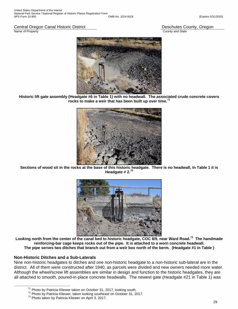
United States Department of the Interior National Park Service / National Register of Historic Places Registration Form NPS Form 10-900 OMB No. 1024-0018 (Expires 5/31/2020)
Central Oregon Canal Historic District Deschutes County, Oregon Name of Property County and State
29
Historic lift gate assembly (Headgate #6 in Table 1) with no headwall. The associated crude concrete covers
rocks to make a weir that has been built up over time.71
Sections of wood sit in the rocks at the base of this historic headgate. There is no headwall, In Table 1 it is
Headgate # 2.72
Looking north from the center of the canal bed to historic headgate, COC 8/9, near Ward Road.73 The handmade
reinforcing-bar cage keeps rocks out of the pipe. It is attached to a worn concrete headwall. The pipe serves two ditches that branch out from a weir box north of the berm. (Headgate #1 in Table )
Non-Historic Ditches and a Sub-Laterals Nine non-historic headgates to ditches and one non-historic headgate to a non-historic sub-lateral are in the district. All of them were constructed after 1940, as parcels were divided and new owners needed more water. Although the wheel/screw lift assemblies are similar in design and function to the historic headgates, they are all attached to smooth, poured-in-place concrete headwalls. The newest gate (Headgate #21 in Table 1) was
71 Photo by Patricia Kliewer taken on October 31, 2017, looking south. 72 Photo by Patricia Kliewer, taken looking southeast on October 31, 2017. 73 Photo taken by Patricia Kliewer on April 3, 2017.
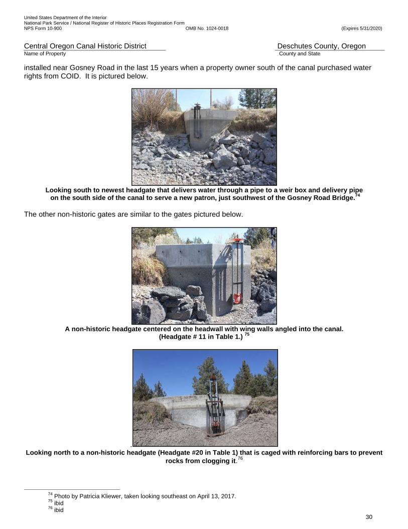
United States Department of the Interior National Park Service / National Register of Historic Places Registration Form NPS Form 10-900 OMB No. 1024-0018 (Expires 5/31/2020)
Central Oregon Canal Historic District Deschutes County, Oregon Name of Property County and State
30
installed near Gosney Road in the last 15 years when a property owner south of the canal purchased water rights from COID. It is pictured below.
Looking south to newest headgate that delivers water through a pipe to a weir box and delivery pipe on the south side of the canal to serve a new patron, just southwest of the Gosney Road Bridge.74
The other non-historic gates are similar to the gates pictured below.
A non-historic headgate centered on the headwall with wing walls angled into the canal.
(Headgate # 11 in Table 1.) 75
. Looking north to a non-historic headgate (Headgate #20 in Table 1) that is caged with reinforcing bars to prevent
rocks from clogging it.76
74 Photo by Patricia Kliewer, taken looking southeast on April 13, 2017. 75 ibid 76 ibid
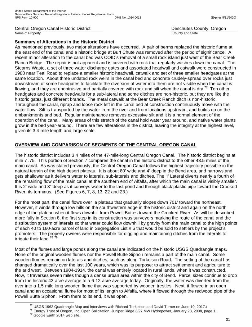
United States Department of the Interior National Park Service / National Register of Historic Places Registration Form NPS Form 10-900 OMB No. 1024-0018 (Expires 5/31/2020)
Central Oregon Canal Historic District Deschutes County, Oregon Name of Property County and State
31
Summary of Alterations in the Historic District As mentioned previously, two major alterations have occurred. A pair of berms replaced the historic flume at the east end of the canal and a historic bridge at Burt Chute was removed after the period of significance. A recent minor alteration to the canal bed was COID’s removal of a small rock island just west of the Bear Creek Ranch Bridge. The repair is not apparent and is covered with rock that regularly washes down the canal. The Stearns Waste, a set of three water discharge gates and associated headwall and catwalk were constructed in 1988 near Teal Road to replace a smaller historic headwall, catwalk and set of three smaller headgates at the same location. About three undated rock weirs in the canal bed and concrete crudely-spread over rocks just downstream of some headgates to facilitate the diversion of water into them are not visible when the canal is flowing, and they are unobtrusive and partially covered with rock and silt when the canal is dry.77 Ten other headgates and concrete headwalls for a sub-lateral and some ditches are non-historic, but they are like the historic gates, just different brands. The metal catwalk at the Bear Creek Ranch ditch is non-historic. Throughout the canal, riprap and loose rock left in the canal bed at construction continuously move with the water flow. Silt is transported by the water from the river and from locations upstream, and builds up on the embankments and bed. Regular maintenance removes excessive silt and it is a normal element of the operation of the canal. Many areas of this stretch of the canal hold water year around, and native water plants grow in the bed year-around. There are few alterations in the district, leaving the integrity at the highest level, given its 3.4-mile length and large scale.
OVERVIEW AND COMPARISON OF SEGMENTS OF THE CENTRAL OREGON CANAL The historic district includes 3.4 miles of the 47-mile-long Central Oregon Canal. The historic district begins at mile 7 .75. This portion of Section 7 compares the canal in the historic district to the other 43.5 miles of the main canal. As was stated previously, the Central Oregon Canal follows the highest trajectory possible in the natural terrain of the high desert plateau. It is about 80’ wide and 4’ deep in the Bend area, and narrows and gets shallower as it delivers water to laterals, sub-laterals and ditches. The ‘I’ Lateral diverts nearly a fourth of the remaining flow of the main canal at the southern end of Alfalfa, after which the main canal is visibly smaller. It is 2’ wide and 3” deep as it conveys water to the last pond and through black plastic pipe toward the Crooked River, its terminus. (See Figures 6, 7, 8, 13, 22 and 23.) For the most part, the canal flows over a plateau that gradually slopes down 701’ toward the northeast. However, it winds through low hills on the southwestern edge in the historic district and again on the north edge of the plateau when it flows downhill from Powell Buttes toward the Crooked River. As will be described more fully in Section 8, the first step in its construction was surveyors marking the route of the canal and the distribution system of laterals so that water could flow downhill by gravity from the main canal to the high points of each 40 to 160-acre parcel of land in Segregation List # 6 that would be sold to settlers by the project’s promoters. The property owners were responsible for digging and maintaining ditches from the laterals to irrigate their land.78 79 Most of the flumes and large ponds along the canal are indicated on the historic USGS Quadrangle maps. None of the original wooden flumes nor the Powell Butte Siphon remains a part of the main canal. Some wooden flumes remain on laterals and ditches, such as along Torkelson Road. The setting of the canal has changed dramatically over the last 100 years, which was its purpose: to attract settlement and agriculture to the arid west. Between 1904-1914, the canal was entirely located in rural lands, when it was constructed. Now, it traverses seven miles though a dense urban area within the city of Bend. Parcel sizes continue to drop from the historic 43-acre average to a 6-12-acre average today. Originally, the water was diverted from the river into a 1.5-mile long wooden flume that was supported by wooden trestles. Next, it flowed in an open canal and an occasional flume for most of its length to Alfalfa, where it flowed through the redwood pipe of the Powell Butte Siphon. From there to its end, it was open.
77 USGS 1962 Quadrangle Map and interviews with Richard Torkelson and David Turner on June 10, 2017.t 78 Energy Trust of Oregon, Inc. Open Solicitation, Juniper Ridge 3/27 MW Hydropower, January 23, 2008, page 1.
79 Google Earth 2014 web site.

United States Department of the Interior National Park Service / National Register of Historic Places Registration Form NPS Form 10-900 OMB No. 1024-0018 (Expires 5/31/2020)
Central Oregon Canal Historic District Deschutes County, Oregon Name of Property County and State
32
Today, the first 6,261 feet of the Central Oregon Canal are piped (where it was in a wooden flume). The non-historic pipe empties into a constrained and altered open canal with repaired native rock rip-rapped sloping sides and a rocky bed in an urban density housing development. That stretch is scheduled for piping. The canal flows under the four-lane Bend Parkway through a concrete underpass and enters the Bend commercial/retail area.
The 20-year old, four-lane Bend Parkway crosses over the Central Oregon Canal in Bend,
just south of Reed Market Road. Photographer looking west.80
As it enters the Bend commercial district next to the Bend Parkway, the canal generally runs along the northern edge of a gentle slope, has a cut in the earth on the south side and a 7’-tall berm to hold the water in on the north side. The beds are nearly solid rock flows, and many rocky locations hold water year around. Generally being 40’ to 80’ wide and 2’ to 8’ deep, the canal flows through urban commercial, industrial, and residential subdivisions and is piped under urban roads and streets. Next, the canal winds through the commercial area along Third Street (US Business Hwy 97) in Bend, where it is wide and shallow. Motels back up to its banks, and shopping centers are beside it. The ‘A’ Lateral delivers water north for six miles to urban residences and commercial users, a trailer park, and an industrial park, and then turns to the northeast crossing the city limits and irrigates small hobby farms of ½ acre to 20 acres northeast of the city, in an area that is urbanizing. The ‘A’ lateral ends in two ponds near Butler Market Road and Hamehook Road.
The Fred Meyer Shopping Center at Third Street is on the south side of the Central Oregon Canal. The shallow
canal bed is cut on the south side (right) and is bermed on the north side. Looking southeast.81 Reed Market Road is a primary east-west road in Bend, running between the Deschutes River and 27th Street, near the eastern city limits. Reed Market Road parallels the canal though new three-story multi-family and two-story single family residential subdivisions and an industrial park between Third Street and 15th Street. The canal is heavily constrained by the urban development and has been altered to facilitate roads and bridge construction.
80 Patricia Kliewer photo, October 23, 2015, after irrigation season. 81 Patricia Kliewer photo, October 23, 2015.
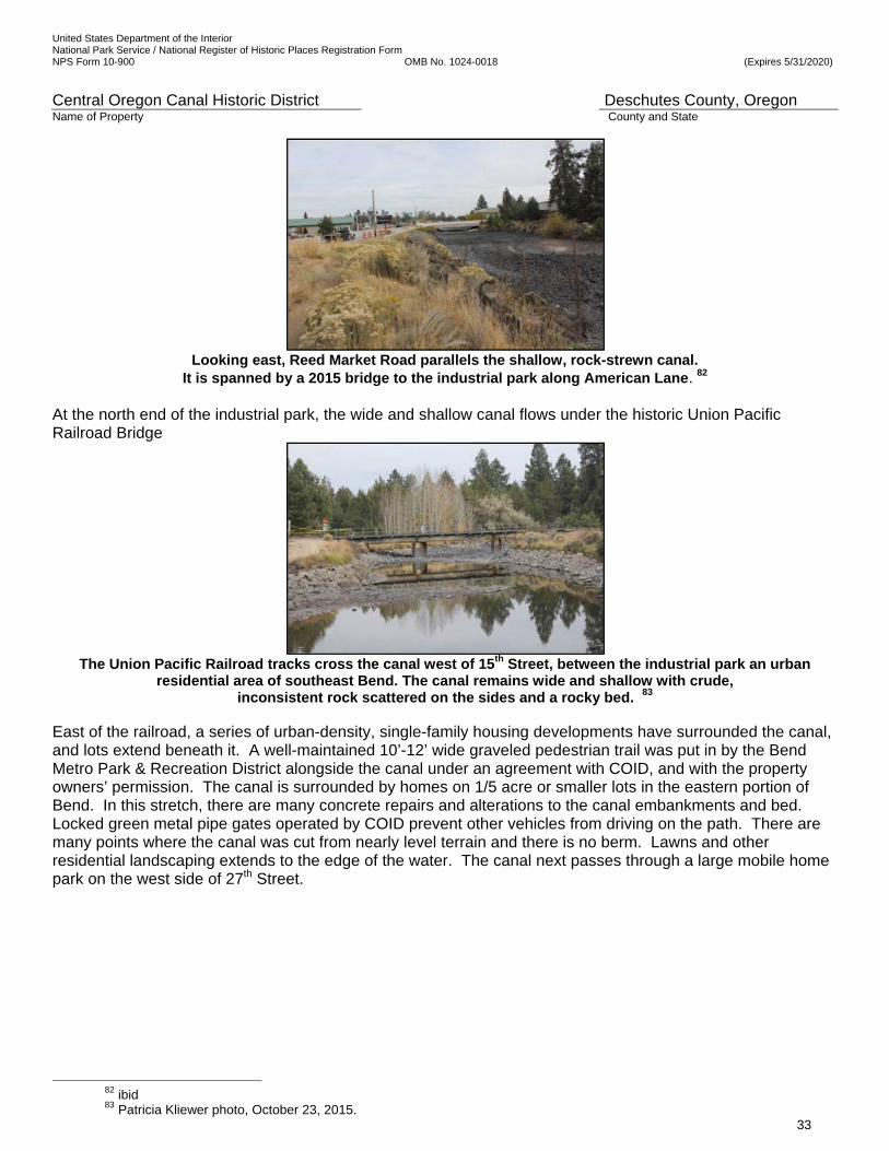
United States Department of the Interior National Park Service / National Register of Historic Places Registration Form NPS Form 10-900 OMB No. 1024-0018 (Expires 5/31/2020)
Central Oregon Canal Historic District Deschutes County, Oregon Name of Property County and State
33
Looking east, Reed Market Road parallels the shallow, rock-strewn canal.
It is spanned by a 2015 bridge to the industrial park along American Lane. 82 At the north end of the industrial park, the wide and shallow canal flows under the historic Union Pacific Railroad Bridge
The Union Pacific Railroad tracks cross the canal west of 15th Street, between the industrial park an urban
residential area of southeast Bend. The canal remains wide and shallow with crude, inconsistent rock scattered on the sides and a rocky bed. 83
East of the railroad, a series of urban-density, single-family housing developments have surrounded the canal, and lots extend beneath it. A well-maintained 10’-12’ wide graveled pedestrian trail was put in by the Bend Metro Park & Recreation District alongside the canal under an agreement with COID, and with the property owners’ permission. The canal is surrounded by homes on 1/5 acre or smaller lots in the eastern portion of Bend. In this stretch, there are many concrete repairs and alterations to the canal embankments and bed. Locked green metal pipe gates operated by COID prevent other vehicles from driving on the path. There are many points where the canal was cut from nearly level terrain and there is no berm. Lawns and other residential landscaping extends to the edge of the water. The canal next passes through a large mobile home park on the west side of 27th Street.
82 ibid 83 Patricia Kliewer photo, October 23, 2015.
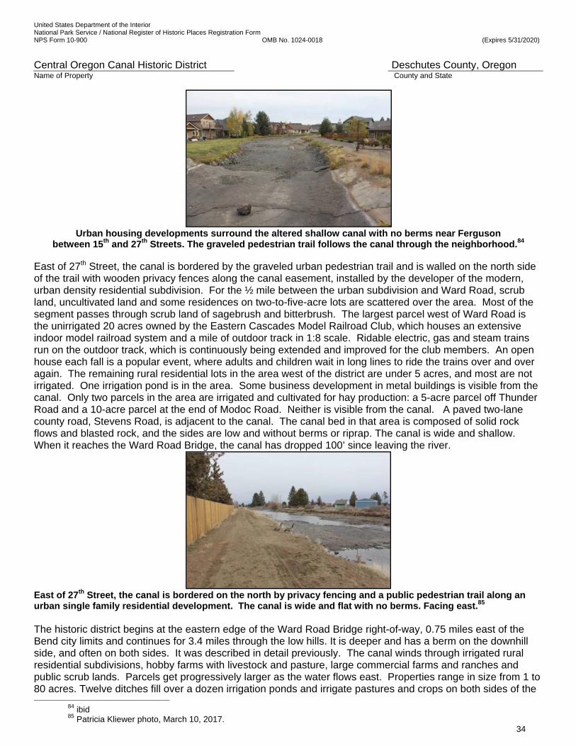
United States Department of the Interior National Park Service / National Register of Historic Places Registration Form NPS Form 10-900 OMB No. 1024-0018 (Expires 5/31/2020)
Central Oregon Canal Historic District Deschutes County, Oregon Name of Property County and State
34
Urban housing developments surround the altered shallow canal with no berms near Ferguson
between 15th and 27th Streets. The graveled pedestrian trail follows the canal through the neighborhood.84
East of 27th Street, the canal is bordered by the graveled urban pedestrian trail and is walled on the north side of the trail with wooden privacy fences along the canal easement, installed by the developer of the modern, urban density residential subdivision. For the ½ mile between the urban subdivision and Ward Road, scrub land, uncultivated land and some residences on two-to-five-acre lots are scattered over the area. Most of the segment passes through scrub land of sagebrush and bitterbrush. The largest parcel west of Ward Road is the unirrigated 20 acres owned by the Eastern Cascades Model Railroad Club, which houses an extensive indoor model railroad system and a mile of outdoor track in 1:8 scale. Ridable electric, gas and steam trains run on the outdoor track, which is continuously being extended and improved for the club members. An open house each fall is a popular event, where adults and children wait in long lines to ride the trains over and over again. The remaining rural residential lots in the area west of the district are under 5 acres, and most are not irrigated. One irrigation pond is in the area. Some business development in metal buildings is visible from the canal. Only two parcels in the area are irrigated and cultivated for hay production: a 5-acre parcel off Thunder Road and a 10-acre parcel at the end of Modoc Road. Neither is visible from the canal. A paved two-lane county road, Stevens Road, is adjacent to the canal. The canal bed in that area is composed of solid rock flows and blasted rock, and the sides are low and without berms or riprap. The canal is wide and shallow. When it reaches the Ward Road Bridge, the canal has dropped 100’ since leaving the river.
East of 27th Street, the canal is bordered on the north by privacy fencing and a public pedestrian trail along an urban single family residential development. The canal is wide and flat with no berms. Facing east.85
The historic district begins at the eastern edge of the Ward Road Bridge right-of-way, 0.75 miles east of the Bend city limits and continues for 3.4 miles through the low hills. It is deeper and has a berm on the downhill side, and often on both sides. It was described in detail previously. The canal winds through irrigated rural residential subdivisions, hobby farms with livestock and pasture, large commercial farms and ranches and public scrub lands. Parcels get progressively larger as the water flows east. Properties range in size from 1 to 80 acres. Twelve ditches fill over a dozen irrigation ponds and irrigate pastures and crops on both sides of the
84 ibid 85 Patricia Kliewer photo, March 10, 2017.
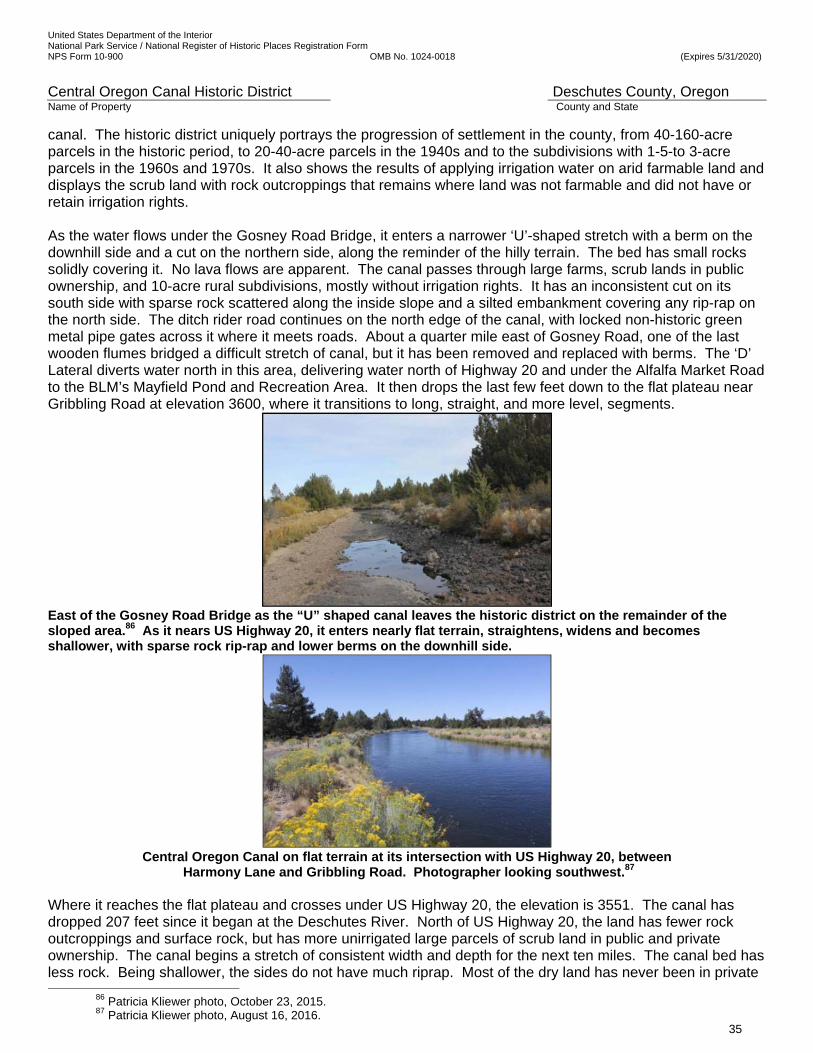
United States Department of the Interior National Park Service / National Register of Historic Places Registration Form NPS Form 10-900 OMB No. 1024-0018 (Expires 5/31/2020)
Central Oregon Canal Historic District Deschutes County, Oregon Name of Property County and State
35
canal. The historic district uniquely portrays the progression of settlement in the county, from 40-160-acre parcels in the historic period, to 20-40-acre parcels in the 1940s and to the subdivisions with 1-5-to 3-acre parcels in the 1960s and 1970s. It also shows the results of applying irrigation water on arid farmable land and displays the scrub land with rock outcroppings that remains where land was not farmable and did not have or retain irrigation rights. As the water flows under the Gosney Road Bridge, it enters a narrower ‘U’-shaped stretch with a berm on the downhill side and a cut on the northern side, along the reminder of the hilly terrain. The bed has small rocks solidly covering it. No lava flows are apparent. The canal passes through large farms, scrub lands in public ownership, and 10-acre rural subdivisions, mostly without irrigation rights. It has an inconsistent cut on its south side with sparse rock scattered along the inside slope and a silted embankment covering any rip-rap on the north side. The ditch rider road continues on the north edge of the canal, with locked non-historic green metal pipe gates across it where it meets roads. About a quarter mile east of Gosney Road, one of the last wooden flumes bridged a difficult stretch of canal, but it has been removed and replaced with berms. The ‘D’ Lateral diverts water north in this area, delivering water north of Highway 20 and under the Alfalfa Market Road to the BLM’s Mayfield Pond and Recreation Area. It then drops the last few feet down to the flat plateau near Gribbling Road at elevation 3600, where it transitions to long, straight, and more level, segments.
East of the Gosney Road Bridge as the “U” shaped canal leaves the historic district on the remainder of the sloped area.86 As it nears US Highway 20, it enters nearly flat terrain, straightens, widens and becomes shallower, with sparse rock rip-rap and lower berms on the downhill side.
Central Oregon Canal on flat terrain at its intersection with US Highway 20, between
Harmony Lane and Gribbling Road. Photographer looking southwest.87 Where it reaches the flat plateau and crosses under US Highway 20, the elevation is 3551. The canal has dropped 207 feet since it began at the Deschutes River. North of US Highway 20, the land has fewer rock outcroppings and surface rock, but has more unirrigated large parcels of scrub land in public and private ownership. The canal begins a stretch of consistent width and depth for the next ten miles. The canal bed has less rock. Being shallower, the sides do not have much riprap. Most of the dry land has never been in private
86 Patricia Kliewer photo, October 23, 2015. 87 Patricia Kliewer photo, August 16, 2016.
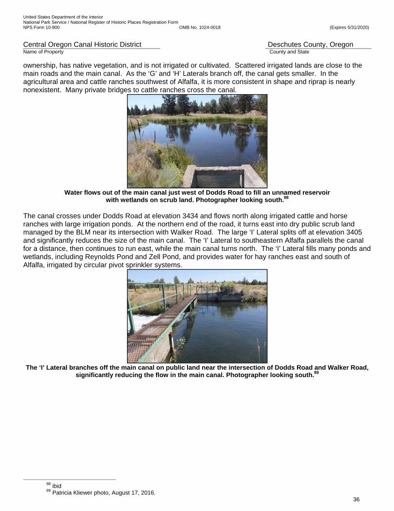
United States Department of the Interior National Park Service / National Register of Historic Places Registration Form NPS Form 10-900 OMB No. 1024-0018 (Expires 5/31/2020)
Central Oregon Canal Historic District Deschutes County, Oregon Name of Property County and State
36
ownership, has native vegetation, and is not irrigated or cultivated. Scattered irrigated lands are close to the main roads and the main canal. As the ‘G’ and ‘H’ Laterals branch off, the canal gets smaller. In the agricultural area and cattle ranches southwest of Alfalfa, it is more consistent in shape and riprap is nearly nonexistent. Many private bridges to cattle ranches cross the canal.
Water flows out of the main canal just west of Dodds Road to fill an unnamed reservoir
with wetlands on scrub land. Photographer looking south.88 The canal crosses under Dodds Road at elevation 3434 and flows north along irrigated cattle and horse ranches with large irrigation ponds. At the northern end of the road, it turns east into dry public scrub land managed by the BLM near its intersection with Walker Road. The large ‘I’ Lateral splits off at elevation 3405 and significantly reduces the size of the main canal. The ‘I’ Lateral to southeastern Alfalfa parallels the canal for a distance, then continues to run east, while the main canal turns north. The ‘I’ Lateral fills many ponds and wetlands, including Reynolds Pond and Zell Pond, and provides water for hay ranches east and south of Alfalfa, irrigated by circular pivot sprinkler systems.
The ‘I’ Lateral branches off the main canal on public land near the intersection of Dodds Road and Walker Road,
significantly reducing the flow in the main canal. Photographer looking south.89
88 ibid 89 Patricia Kliewer photo, August 17, 2016.
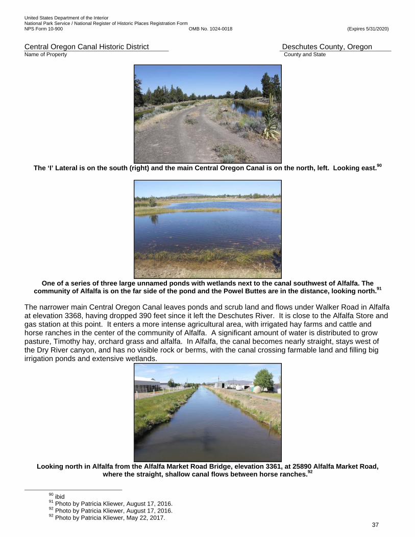
United States Department of the Interior National Park Service / National Register of Historic Places Registration Form NPS Form 10-900 OMB No. 1024-0018 (Expires 5/31/2020)
Central Oregon Canal Historic District Deschutes County, Oregon Name of Property County and State
37
The ‘I’ Lateral is on the south (right) and the main Central Oregon Canal is on the north, left. Looking east.90
One of a series of three large unnamed ponds with wetlands next to the canal southwest of Alfalfa. The
community of Alfalfa is on the far side of the pond and the Powel Buttes are in the distance, looking north.91
The narrower main Central Oregon Canal leaves ponds and scrub land and flows under Walker Road in Alfalfa at elevation 3368, having dropped 390 feet since it left the Deschutes River. It is close to the Alfalfa Store and gas station at this point. It enters a more intense agricultural area, with irrigated hay farms and cattle and horse ranches in the center of the community of Alfalfa. A significant amount of water is distributed to grow pasture, Timothy hay, orchard grass and alfalfa. In Alfalfa, the canal becomes nearly straight, stays west of the Dry River canyon, and has no visible rock or berms, with the canal crossing farmable land and filling big irrigation ponds and extensive wetlands.
Looking north in Alfalfa from the Alfalfa Market Road Bridge, elevation 3361, at 25890 Alfalfa Market Road,
where the straight, shallow canal flows between horse ranches.92
90 ibid 91 Photo by Patricia Kliewer, August 17, 2016. 92 Photo by Patricia Kliewer, August 17, 2016. 92 Photo by Patricia Kliewer, May 22, 2017.

United States Department of the Interior National Park Service / National Register of Historic Places Registration Form NPS Form 10-900 OMB No. 1024-0018 (Expires 5/31/2020)
Central Oregon Canal Historic District Deschutes County, Oregon Name of Property County and State
38
North of Alfalfa, the canal flows toward Powell Buttes, looming directly north of Alfalfa, leaving private irrigated land, and enters a long stretch of dry public scrub land. It flows in a shallow canal through dry, unfarmable land along the western edge of the Dry River Canyon.
The canal flows through dry sagebrush and small juniper trees along the western edge of the Dry River Canyon
between Alfalfa and Powell Butte. Looking southeast from the canal embankment.93 Above the Brasada Ranch Resort and Equestrian Center in the Dry River Canyon, which formerly was Shumway Ranch, the canal enters a non-historic steel pipe called the Powell Butte Siphon which drops down into the bottom of the Dry River Canyon and crosses under Johnson Ranch Road. The 20-year-old steel pipe is buried beside the road in the County right-of-way and follows the road north past the entrance to the resort golf course and visitor center until it climbs the eastern edge of the canyon, crosses Shumway Road, and dumps into an open canal once more. Brasada Ranch Resort, a re-created Shumway Pond, the Golf Course and Equestrian Center are irrigated with water delivered by the ‘J’ Lateral.
The water forcefully rushes out of the Powell Butte Siphon pipe on the eastern ridge of the Dry River and enters a dispersion pond at elevation 3229, and begins its northerly route toward Powell Butte. Looking north. 94 In the community of Powell Butte, the 30’ wide and 2’ deep canal is consistent in width and depth and runs in gentle curves or in straight lines as it flows north and east through irrigated farmland on the western and northern edges of the Powell Buttes. It has either no berms on flat stretches or short, inconspicuous berms on the downhill side of gentle slopes. Irrigated grasses grow up to the water’s edge. Rock is sparse. Most parcels are 10 to 160 acres and are irrigated and in pasture, although there are some rural residential subdivisions and 1-acre lots. Horse and cattle ranches are common, as are sheep and goat herds. A ditch rider road parallels the canal on the west/north side. In Powell Butte, a large volume of water is split off to the laterals.
93 Photo by Patricia Kliewer, May 22, 2017. 94 Photo by Patricia Kliewer, May 22, 2017.
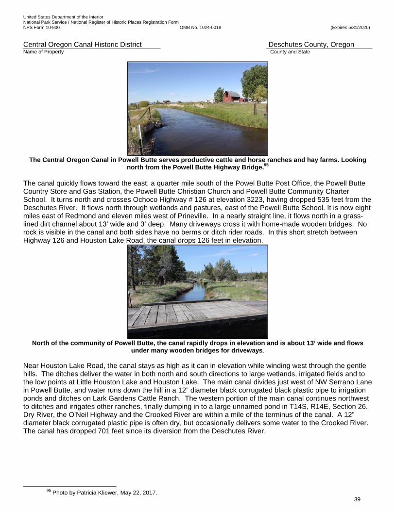
United States Department of the Interior National Park Service / National Register of Historic Places Registration Form NPS Form 10-900 OMB No. 1024-0018 (Expires 5/31/2020)
Central Oregon Canal Historic District Deschutes County, Oregon Name of Property County and State
39
The Central Oregon Canal in Powell Butte serves productive cattle and horse ranches and hay farms. Looking
north from the Powell Butte Highway Bridge.95 The canal quickly flows toward the east, a quarter mile south of the Powel Butte Post Office, the Powell Butte Country Store and Gas Station, the Powell Butte Christian Church and Powell Butte Community Charter School. It turns north and crosses Ochoco Highway # 126 at elevation 3223, having dropped 535 feet from the Deschutes River. It flows north through wetlands and pastures, east of the Powell Butte School. It is now eight miles east of Redmond and eleven miles west of Prineville. In a nearly straight line, it flows north in a grass-lined dirt channel about 13’ wide and 3’ deep. Many driveways cross it with home-made wooden bridges. No rock is visible in the canal and both sides have no berms or ditch rider roads. In this short stretch between Highway 126 and Houston Lake Road, the canal drops 126 feet in elevation.
North of the community of Powell Butte, the canal rapidly drops in elevation and is about 13’ wide and flows
under many wooden bridges for driveways. Near Houston Lake Road, the canal stays as high as it can in elevation while winding west through the gentle hills. The ditches deliver the water in both north and south directions to large wetlands, irrigated fields and to the low points at Little Houston Lake and Houston Lake. The main canal divides just west of NW Serrano Lane in Powell Butte, and water runs down the hill in a 12” diameter black corrugated black plastic pipe to irrigation ponds and ditches on Lark Gardens Cattle Ranch. The western portion of the main canal continues northwest to ditches and irrigates other ranches, finally dumping in to a large unnamed pond in T14S, R14E, Section 26. Dry River, the O’Neil Highway and the Crooked River are within a mile of the terminus of the canal. A 12” diameter black corrugated plastic pipe is often dry, but occasionally delivers some water to the Crooked River. The canal has dropped 701 feet since its diversion from the Deschutes River.
95 Photo by Patricia Kliewer, May 22, 2017.

United States Department of the Interior National Park Service / National Register of Historic Places Registration Form NPS Form 10-900 OMB No. 1024-0018 (Expires 5/31/2020)
Central Oregon Canal Historic District Deschutes County, Oregon Name of Property County and State
40
The canal is about 8 inches deep and 48 inches wide where it splits into two ditches at Serrano Lane and Lark
Gardens Cattle Ranch, northwest of Powell Butte. Photo looking west from 1570 NW Serrano Lane.
Looking north down Serrano Lane to the end of the ditch conveying water from the
canal in the irrigated Lark Gardens Cattle Ranch.96 THE CENTRAL OREGON CANAL DELIVERS WATER TO MANY LAKES AND PONDS In addition to the hundreds of irrigation water storage ponds on private property, a unique feature of this canal is the number of large, engineered reservoirs and recreational lakes and ponds that are filled by the water diverted from the Deschutes River and conveyed by the Central Oregon Canal. The 6-acre Mayfield Pond is in the BLM Mayfield Pond Recreational Area, four miles northeast of the historic district and north of Alfalfa Market Road in T 17 S, R 13 W, Section 23. Camping and fishing are popular activities there. Just 1 mile south of the Alfalfa Store, on the ‘I’ Lateral, is the 12-acre Reynolds Pond on BLM land in T17S, R14 E, Section 35. A 0.75-mile pedestrian trail circles the shoreline. Non-motorized boats and fishing are the main activities there. Further east on the ‘I’ Lateral is Zell Pond. Zell Pond is 7.7 acres in size and is partly on BLM and partly on private land in T17S, R14 E, Section 25. An above-grade-piped stretch of the ‘I’ Lateral of the Central Oregon Canal forms a berm to hold water in Zell Pond. Near the Dry River was the 11.7-acre Shumway Lake in T16S. R14E, Sections 28 and 33, on private property. It has been re-created for the Brasada Ranch Resort. Near the terminus of the canal between O’Neil Hwy. and Hwy.126, and northeast of Powell Butte, is Houston Lake (sometimes spelled Huston Lake), located on private property. At an elevation of 3,022, just south of a slough, Houston Lake and Little Houston Lake are natural lakes that occupy low points in the area. They were dry most of the year, until irrigation ditches supplied water to them in 1914. Other lakes filled by water from the canal are unnamed. The ponds and lakes on BLM land were created to provide wildlife habitat for fish and wildlife as well as recreational opportunities for the public.97 The ‘C’ Lateral that begins in the historic district
96 Photo by Patricia Kliewer, May 22, 2017. 97 Interview with BLM staff at Prineville BLM office, May 19, 2017.
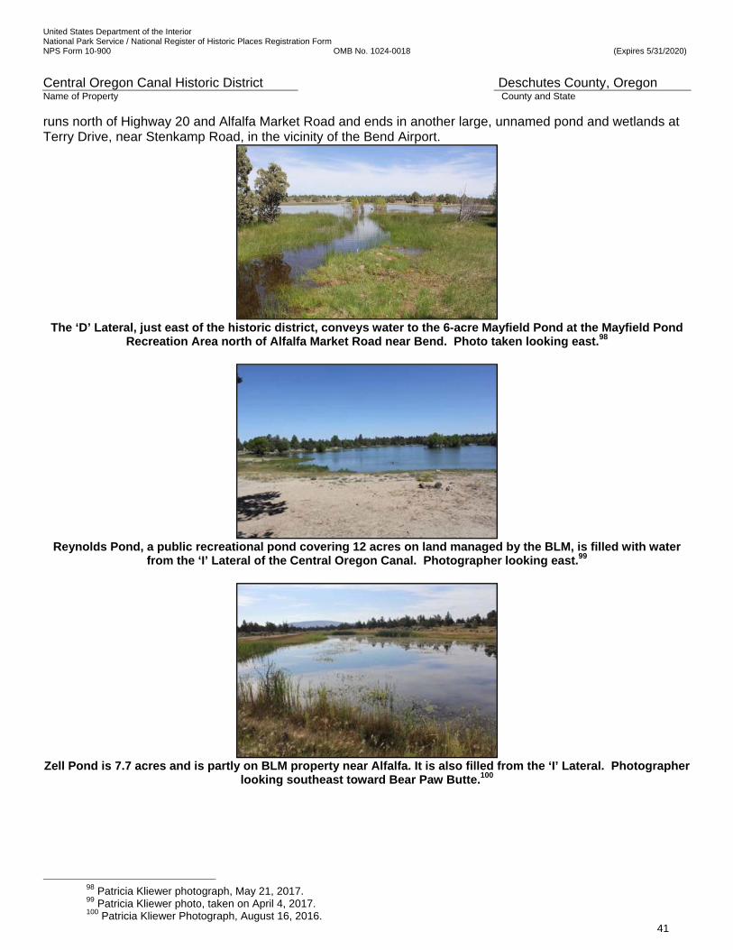
United States Department of the Interior National Park Service / National Register of Historic Places Registration Form NPS Form 10-900 OMB No. 1024-0018 (Expires 5/31/2020)
Central Oregon Canal Historic District Deschutes County, Oregon Name of Property County and State
41
runs north of Highway 20 and Alfalfa Market Road and ends in another large, unnamed pond and wetlands at Terry Drive, near Stenkamp Road, in the vicinity of the Bend Airport.
The ‘D’ Lateral, just east of the historic district, conveys water to the 6-acre Mayfield Pond at the Mayfield Pond
Recreation Area north of Alfalfa Market Road near Bend. Photo taken looking east.98
Reynolds Pond, a public recreational pond covering 12 acres on land managed by the BLM, is filled with water
from the ‘I’ Lateral of the Central Oregon Canal. Photographer looking east.99
Zell Pond is 7.7 acres and is partly on BLM property near Alfalfa. It is also filled from the ‘I’ Lateral. Photographer
looking southeast toward Bear Paw Butte.100
98 Patricia Kliewer photograph, May 21, 2017. 99 Patricia Kliewer photo, taken on April 4, 2017. 100 Patricia Kliewer Photograph, August 16, 2016.
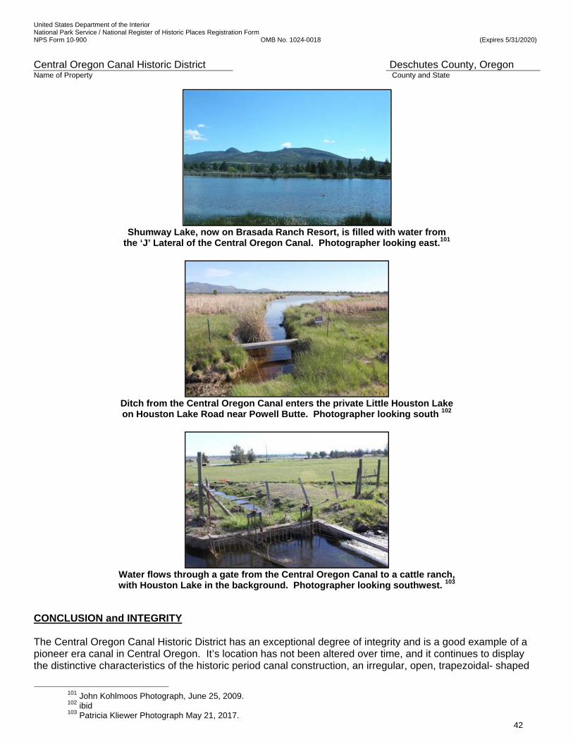
United States Department of the Interior National Park Service / National Register of Historic Places Registration Form NPS Form 10-900 OMB No. 1024-0018 (Expires 5/31/2020)
Central Oregon Canal Historic District Deschutes County, Oregon Name of Property County and State
42
Shumway Lake, now on Brasada Ranch Resort, is filled with water from
the ‘J’ Lateral of the Central Oregon Canal. Photographer looking east.101
Ditch from the Central Oregon Canal enters the private Little Houston Lake on Houston Lake Road near Powell Butte. Photographer looking south 102
Water flows through a gate from the Central Oregon Canal to a cattle ranch, with Houston Lake in the background. Photographer looking southwest. 103
CONCLUSION and INTEGRITY The Central Oregon Canal Historic District has an exceptional degree of integrity and is a good example of a pioneer era canal in Central Oregon. It’s location has not been altered over time, and it continues to display the distinctive characteristics of the historic period canal construction, an irregular, open, trapezoidal- shaped
101 John Kohlmoos Photograph, June 25, 2009. 102 ibid 103 Patricia Kliewer Photograph May 21, 2017.
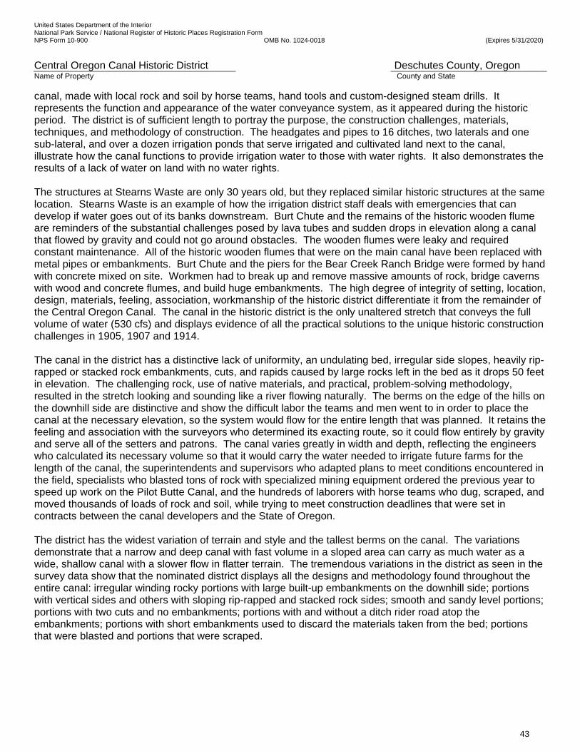
United States Department of the Interior National Park Service / National Register of Historic Places Registration Form NPS Form 10-900 OMB No. 1024-0018 (Expires 5/31/2020)
Central Oregon Canal Historic District Deschutes County, Oregon Name of Property County and State
43
canal, made with local rock and soil by horse teams, hand tools and custom-designed steam drills. It represents the function and appearance of the water conveyance system, as it appeared during the historic period. The district is of sufficient length to portray the purpose, the construction challenges, materials, techniques, and methodology of construction. The headgates and pipes to 16 ditches, two laterals and one sub-lateral, and over a dozen irrigation ponds that serve irrigated and cultivated land next to the canal, illustrate how the canal functions to provide irrigation water to those with water rights. It also demonstrates the results of a lack of water on land with no water rights. The structures at Stearns Waste are only 30 years old, but they replaced similar historic structures at the same location. Stearns Waste is an example of how the irrigation district staff deals with emergencies that can develop if water goes out of its banks downstream. Burt Chute and the remains of the historic wooden flume are reminders of the substantial challenges posed by lava tubes and sudden drops in elevation along a canal that flowed by gravity and could not go around obstacles. The wooden flumes were leaky and required constant maintenance. All of the historic wooden flumes that were on the main canal have been replaced with metal pipes or embankments. Burt Chute and the piers for the Bear Creek Ranch Bridge were formed by hand with concrete mixed on site. Workmen had to break up and remove massive amounts of rock, bridge caverns with wood and concrete flumes, and build huge embankments. The high degree of integrity of setting, location, design, materials, feeling, association, workmanship of the historic district differentiate it from the remainder of the Central Oregon Canal. The canal in the historic district is the only unaltered stretch that conveys the full volume of water (530 cfs) and displays evidence of all the practical solutions to the unique historic construction challenges in 1905, 1907 and 1914. The canal in the district has a distinctive lack of uniformity, an undulating bed, irregular side slopes, heavily rip-rapped or stacked rock embankments, cuts, and rapids caused by large rocks left in the bed as it drops 50 feet in elevation. The challenging rock, use of native materials, and practical, problem-solving methodology, resulted in the stretch looking and sounding like a river flowing naturally. The berms on the edge of the hills on the downhill side are distinctive and show the difficult labor the teams and men went to in order to place the canal at the necessary elevation, so the system would flow for the entire length that was planned. It retains the feeling and association with the surveyors who determined its exacting route, so it could flow entirely by gravity and serve all of the setters and patrons. The canal varies greatly in width and depth, reflecting the engineers who calculated its necessary volume so that it would carry the water needed to irrigate future farms for the length of the canal, the superintendents and supervisors who adapted plans to meet conditions encountered in the field, specialists who blasted tons of rock with specialized mining equipment ordered the previous year to speed up work on the Pilot Butte Canal, and the hundreds of laborers with horse teams who dug, scraped, and moved thousands of loads of rock and soil, while trying to meet construction deadlines that were set in contracts between the canal developers and the State of Oregon. The district has the widest variation of terrain and style and the tallest berms on the canal. The variations demonstrate that a narrow and deep canal with fast volume in a sloped area can carry as much water as a wide, shallow canal with a slower flow in flatter terrain. The tremendous variations in the district as seen in the survey data show that the nominated district displays all the designs and methodology found throughout the entire canal: irregular winding rocky portions with large built-up embankments on the downhill side; portions with vertical sides and others with sloping rip-rapped and stacked rock sides; smooth and sandy level portions; portions with two cuts and no embankments; portions with and without a ditch rider road atop the embankments; portions with short embankments used to discard the materials taken from the bed; portions that were blasted and portions that were scraped.
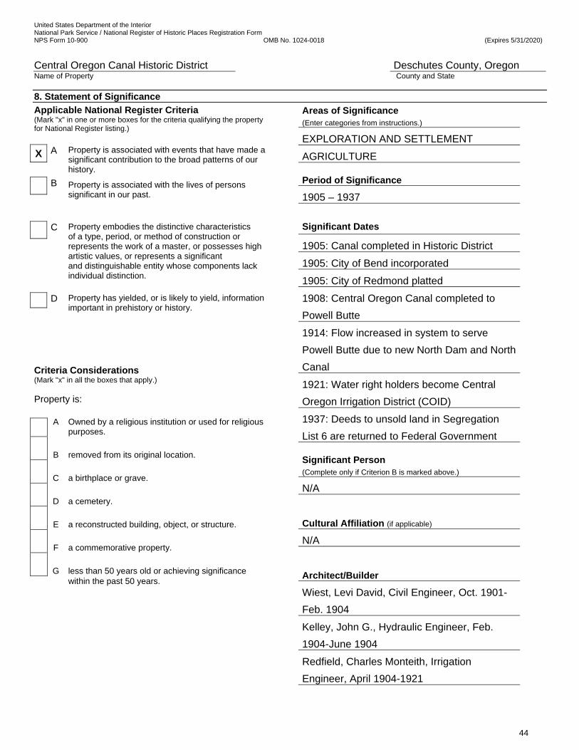
United States Department of the Interior National Park Service / National Register of Historic Places Registration Form NPS Form 10-900 OMB No. 1024-0018 (Expires 5/31/2020)
Central Oregon Canal Historic District Deschutes County, Oregon Name of Property County and State
44
8. Statement of Significance
Applicable National Register Criteria (Mark "x" in one or more boxes for the criteria qualifying the property for National Register listing.)
X A Property is associated with events that have made a significant contribution to the broad patterns of our history.
B Property is associated with the lives of persons significant in our past.
C Property embodies the distinctive characteristics of a type, period, or method of construction or represents the work of a master, or possesses high artistic values, or represents a significant and distinguishable entity whose components lack individual distinction.
D Property has yielded, or is likely to yield, information important in prehistory or history.
Criteria Considerations (Mark "x" in all the boxes that apply.) Property is:
A
Owned by a religious institution or used for religious purposes.
B
removed from its original location.
C
a birthplace or grave.
D
a cemetery.
E
a reconstructed building, object, or structure.
F
a commemorative property.
G
less than 50 years old or achieving significance
within the past 50 years.
Areas of Significance (Enter categories from instructions.)
EXPLORATION AND SETTLEMENT
AGRICULTURE Period of Significance
1905 – 1937
Significant Dates
1905: Canal completed in Historic District
1905: City of Bend incorporated
1905: City of Redmond platted
1908: Central Oregon Canal completed to
Powell Butte
1914: Flow increased in system to serve
Powell Butte due to new North Dam and North
Canal
1921: Water right holders become Central
Oregon Irrigation District (COID)
1937: Deeds to unsold land in Segregation
List 6 are returned to Federal Government Significant Person (Complete only if Criterion B is marked above.)
N/A
Cultural Affiliation (if applicable)
N/A
Architect/Builder
Wiest, Levi David, Civil Engineer, Oct. 1901-
Feb. 1904
Kelley, John G., Hydraulic Engineer, Feb.
1904-June 1904
Redfield, Charles Monteith, Irrigation
Engineer, April 1904-1921
United States Department of the Interior National Park Service / National Register of Historic Places Registration Form NPS Form 10-900 OMB No. 1024-0018 (Expires 5/31/2020)
Central Oregon Canal Historic District Deschutes County, Oregon Name of Property County and State
45
__________________________________________________________________________________________________________________
Period of Significance (justification) The period of significance for the Central Oregon Canal Historic District (Ward Road-Gosney Road Segment) is between 1905 and 1937. It begins with the 1905 construction of the 3.4-mile long segment of the canal in the historic district as a for-profit commercial enterprise under the Carey Act in Oregon. The successive companies developing the canal sold land to the settlers to fund the project and make a profit. Settlers began purchasing land in the historic district in 1909 from the Deschutes Irrigation and Power Company. The contract between the irrigation system development company and the State of Oregon required the developers to reclaim the land by delivering water to the highest point on each settler’s property that had a water right to enable settlement and agriculture. Construction of the historic headwalls, headgates and pipes to the ‘B’ and ‘C’ Laterals and the nine original water delivery ditches in the historic district continued as land was sold to settlers and cultivated throughout the period of significance. The period of significance ends in 1937 when the deeds to eight unsold 40-acre parcels that are in and adjacent to the historic district were included in the transfer of 8,829 acres of unsold land in Deschutes County that had been in Segregation Lists 6 and 19. On June 30, 1937, Charles H. Martin, Governor, on behalf of the State Reclamation Commission, relinquished and re-conveyed the deeds to the United States of America. By 1937, settlers had purchased all of the irrigable and farmable land in Segregation List 6 that was under and along the canal in the historic district and agriculture and settlement was established in the area. ___________________________________________________________________________________________________________________
Criteria Considerations (explanation, if necessary) N/A _______________________________________________________________________________________________________________
Statement of Significance Summary Paragraph (Provide a summary paragraph that includes level of significance, applicable criteria, justification for the period of significance, and applicable criteria considerations).. The Central Oregon Canal Historic District (Ward Road – Gosney Road Segment) is being nominated for its local significance under Criterion A, in the areas of Exploration and Settlement and Agriculture. It is significant for its association with the exploration and exacting mapping of the high desert that allowed an open canal system that conveyed water by gravity, and with the development of an ambitious canal system that provided necessary irrigation water for agriculture in the vast 47-mile long irrigated corridor between the Deschutes River in Bend and the Powell Butte area, and with the nationwide, private, marketing campaign that attracted thousands of settlers to the arid high desert. The Central Oregon Project was the largest and most successful Carey Act irrigation and settlement project in the Northwest.104 The nominated section is a significant stretch of the 112-year-old canal that carries an impressive 530 cubic feet per minute of water diverted from the Deschutes River through a structure crudely made of native rock and soils. The canal in the historic district was a critical stretch and was the most challenging to construct. While most of the gradually-narrowing canal traverses a relatively flat plateau, this stretch is the hilliest, rockiest and most uneven and has lava tubes and sudden drops in elevations to bridge. It took a year to complete and was originally under-sized, to meet demanding construction schedules with a shortage of laborers. That resulted in its being a bottleneck, and it was therefore widened twice (in 1907 and 1914) to facilitate water volumes downstream to deliver adequate water to settlers in Powell Butte. The accomplishment of moving tons of rock, building the 350-foot long wooden flume, the 215-foot- long concrete Burt Chute and constructing miles of huge embankments on the downhill sides, exemplifies private enterprise and laborers overcoming the challenges presented by the region’s geology. It reflects the construction methods and materials used throughout the irrigation system. It took an extraordinary amount of private capital, exceptional expertise in the utilization of technology, and enormous labor and horse-power to build the canal through the district. Farmable land in the historic district was sold to settlers by the development companies under a contract with the State of Oregon under the Carey Act, beginning in 1909. By 1937, settlement of irrigable and farmable land in the district was complete, but, some poor land with no water rights remained in public ownership. Setters in the historic district included five women and people from Austria, Australia, Yugoslavia, Norway, England, and at least eight states. Typical of the thousands of settlers in the area, a minority of setters along the canal in the district, such as dairy farmers
104 Michael Hall, Irrigation Development in Oregon’s Upper Deschutes River Basin, 1871-1957, A Historic Context Statement
United States Department of the Interior National Park Service / National Register of Historic Places Registration Form NPS Form 10-900 OMB No. 1024-0018 (Expires 5/31/2020)
Central Oregon Canal Historic District Deschutes County, Oregon Name of Property County and State
46
Philip Burt and the Bradetich Brothers, became long-term, successful farmers. Most settlers supplemented the farm income by holding other occupations, because productivity of the land was marginal. Others were not successful farming in the rocky, volcanic soil in the high desert with its short growing season and harsh winters, and sold their land. Others lost their land through COID, tax or mortgage foreclosures, often in the 1920s and 1930s. One settler in the district rebought their land when finances improved. _______________________________________________________________________________________________________________ Narrative Statement of Significance. (Provide at least one paragraph for each area of significance.) INTRODUCTION TO THE CENTRAL OREGON PROJECT Overview Construction of the Pilot Butte Canal and the Central Oregon Canal changed the history of Central Oregon. The Deschutes country was relatively unknown and unsettled when the irrigation project began as an idea in 1900. The Pilot Butte Development Company had the plateau in the high desert east of the Deschutes River and south of the Crooked River meticulously explored, surveyed, mapped, and documented to determine opportunities for a vast irrigation system and consider the potential for income to investors by reclaiming and selling the land. By providing the primary means of watering the arid land for agriculture and by bringing in a vast amount of capital, the Pilot Butte Development Company (1900-1904) and its successors, the Deschutes Irrigation and Power Company (1904- October 1910) and the Central Oregon Irrigation Company (October 1910-1921), constructed Central Oregon Project with private funding under an agreement with the State of Oregon under the Carey Act.105 The irrigation project was the largest irrigation project in the Northwest, irrigating 140,714 acres in Segregation Lists #6 and #19. The project was a successful, for-profit, commercial enterprise under the Carey Act. It brought significant private investments from Central and Eastern United States capitalists and railroad men. The project was directly related to the founding of Bend, Redmond, and Centrallo (later called Deschutes Junction), and the settlement and economic enhancement of Alfalfa and Powell Butte. The companies aggressively marketed the project and attracted settlers from across the United States and other countries to buy the reclaimed land, and establish new churches, schools, homes, ranches, farms, and businesses. The private funds were used to build the irrigation system that was worth $3 million when it was transferred to users as the Central Oregon Irrigation District in 1921. By linking the investment in the irrigation company with corporate goals to attract business owners and farmers; sell the irrigated land; expand the agricultural sector; plat and develop Bend and Redmond, and the town of Centrallo between them; and to deliver water to the far corners of the plain; the project transformed the central Oregon high desert. Investment capital flowed into the region from the irrigation company as the canal system was built, bringing value to the lands, and flowed back to the company as settlers purchased lands and bought water. Investment flowed to the purchasers of city lots as the company invested in businesses, buildings, and urban infrastructure and as products and services were bought and sold. The region experienced new economic opportunities, population growth, and prosperity. In addition, development of these communities led ongoing economic expansion, which brought the local area into the greater economy of Oregon and the Pacific Northwest. Michael Hall wrote in his book, Irrigation Development in Oregon’s Upper Deschutes River Basin, 1871-1957, A Historic Context Statement, “From 1878 to 1902, irrigation expansion became a critical issue in the West. Eastern speculators and the region’s residents reclaimed large portions of the ‘Great American Desert’ to create an economic base to foster settlement. Almost none of the hundreds of irrigation companies formed with eastern capital in the 1870s and 1880s survived beyond 10 years. Their failures resulted from not understanding that expansion of agricultural development required storage reservoirs and sophisticated dams and canals.”106
105 Michael Hall, Irrigation Development in Oregon’s Upper Deschutes River Basin 1871-1957, A Historic Context Statement,
1994, pages 19-30. 106 Michael Hall, Irrigation Development in Oregon’s Upper Deschutes River Basin, 1871-1957, A Historic Context Statemen,
p. 5.

United States Department of the Interior National Park Service / National Register of Historic Places Registration Form NPS Form 10-900 OMB No. 1024-0018 (Expires 5/31/2020)
Central Oregon Canal Historic District Deschutes County, Oregon Name of Property County and State
47
One successful for-profit project funded with eastern capital was the Central Oregon Project. It included the construction of the 47-mile long Central Oregon Canal, the 22-mile long Pilot Butte Canal, the 1-mile North Canal, and the North Dam (sometimes later referred to as the North Canal Dam) on the Deschutes River. The canals it built were not sophisticated structures, but were adequate, and it did unexpectedly need a large, expensive dam. However, the investment in the project covered the cost of the unanticipated structures The Central Oregon Project began with Alexander Drake’s vision of a vast irrigation system on the high desert plateau, east of the Deschutes River, in 1900. Most settlers had received water by 1914 when the Central Oregon Canal reached Powell Butte. In 1921, the for-profit Central Oregon Irrigation Company’s operation and maintenance responsibilities plus the assets were transferred to the water users as a district. The project ended in 1937, when the deeds to 8,829 acres of unsold land in Deschutes County that had been in Segregation Lists 6 and 19 were returned to the federal government. On June 30, 1937, Charles H. Martin, Governor, on behalf of the State Reclamation Commission, relinquished and re-conveyed the deeds to the United States of America. Until 1912, the two large canals shared a diversion point at the Deschutes River as well as the first few miles of huge wooden flume that crossed over a volcanic rock flow. The Pilot Butte Canal was finished in February 1905, just after the Central Oregon Canal was begun in the fall of 1904. In 1912, the Pilot Butte Canal was split from the Central Oregon Canal and diverted water from the Deschutes River at the new North Dam in Bend. The Pilot Butte Canal runs north through Bend and Redmond and serves Terrebonne, and turns east for the last five miles to it terminus at the Crooked River near Smith Rock State Park. The unexpected dam that allowed the Pilot Butte Canal to have its own diversion gate off the river added greatly to the cost of the project. State Engineer John Dubuis and local civil engineer Levi. D. Wiest designed the North Dam and diversion canals that were part of the Central Oregon Project and were built to solve water volume shortages on the two canals. The HAER: OR-61-C states, “The North Canal Dam and diversion canals constitute one of the most historically significant irrigation engineering complexes in Central Oregon. The complex is associated with important developments in agriculture as well as with locally prominent investors and pioneer irrigation companies in the Bend area. The North Canal Dam (1912) is the largest dam on the Deschutes River in the Bend area and is the oldest dam built for irrigation. When constructed, the 33-foot high, 200-foot wide concrete arch dam was a significant engineering feat. The canal was the primary influence in the founding of Redmond and also contributed to the growth and stability of other communities in the area.”107 Today, the Central Oregon Canal continues to divert water at its original 1903 diversion point at the Deschutes River at the southern end of Bend and runs east to the Dry River, then north through Alfalfa and Powell Butte, then circles northwest toward the Crooked River and Smith Rock State Park, ending near the terminus of the Pilot Butte Canal. The two canals frame the high desert plateau with the Deschutes River on the west, the Crooked River on the north, the Dry River and Powell Buttes on the east and the Newberry Crater National Monument on the south. The plateau is more than 30 miles in each direction and consists of 900 square miles. The irrigation system was to serve about half of it, 227,383 acres, that had potential to be cultivated.108 Thousands of acres are unfarmable because they are covered with thin topsoil over rock, or have large amounts of rock outcroppings or are not irrigable. The amount of land sold to settlers, and cultivated and irrigated by the system amounted to 139,000 acres in November 1913. The Central Oregon Canal is the larger of the two canals in width, length and volume of water conveyed and it took the longest to construct. (See Figures 1, 7 and 8.) Alexander Drake saw the opportunity to develop a vast irrigation system when he visited the area in 1900. (See Figure 24.) Thirteen years later, the Central Oregon Irrigation Company manager described what Drake
107 HAER: OR-61-C, p. 1. 108 Bend Bulletin Newspaper, July 30, 1913, pps. 1, 21, 22.
United States Department of the Interior National Park Service / National Register of Historic Places Registration Form NPS Form 10-900 OMB No. 1024-0018 (Expires 5/31/2020)
Central Oregon Canal Historic District Deschutes County, Oregon Name of Property County and State
48
saw. “The land slopes gently from the Deschutes River and consists of plain and slightly rolling country. It falls toward the north at the rate of about 30 feet per mile. It will be readily seen that these features present ideal conditions for an irrigation system.”109 The highest elevation is at the diversion gate at the Deschutes River at the southwest corner of the plateau. The lowest point is at the Crooked River, an altitude difference of 701’, near the northeast corner of the plateau. The Pilot Butte Development Company hired surveyors and engineers to explore the area and to create a detailed topographic map of the plateau in 10-foot contours, to map out the canals and delivery systems to serve the purchasers of irrigable and saleable land. It was necessary to locate the canals along the highest contours possible to have the water flow gradually downhill, but remain high enough to fill laterals and ditches. The irrigation company viewed the opportunities to make a large profit for its investors through developing the irrigation project and selling the irrigated land. “By reason of the light rainfall, the lands of this part of the country, like the greater portion of the lands west of the Rocky Mountains, are classed as ‘arid’ and for many years it was generally supposed that they were almost worthless, but it is found that when supplied with additional moisture – by irrigation – they are among the most fertile of any on earth, and they produce crops of such abundance as to almost unbelievable.”110 The company describes the “disintegrated lava and volcanic ash” soil as rich and “practically inexhaustible.” Drake made four filings for water rights on November 5, 1900. Planning, surveying, engineering, and financing, along with trips to Salem and eastern states to form coalitions with state and federal politicians began right away. The State of Oregon approved its Carey Act enabling legislation on February 28, 1901. The Pilot Butte Development Company entered into a contract with the State of Oregon on May 31, 1902 to reclaim 84,707.74 acres under the Carey Act. By 1903, the diversion point and the canals were under construction. The two canals shared an immense wooden flume at the diversion structure at the eastern bank of the Deschutes River south of Bend until they split in 1912. The flume was enlarged and repaired several times, but it was always inadequate. In 1909, while the flume at the diversion point was shared, the incomplete Central Oregon Canal was furnishing water to 56,000 acres. In 1912, a new dam and connecting canal, the North Canal, were completed at the north end of Bend to serve only the Pilot Butte Canal. The Intake for the Central Oregon Canal remained in the original location. The Pilot Butte Canal was built first, and was largely completed on February 10, 1905. The Pilot Butte Canal was built with hard labor by men and horse teams that worked well in areas with little volcanic rock. But, specialized construction equipment was ordered at the end of 1904 to more efficiently blast through the challenging solid basalt lava rock flows in the Bend area and move thousands of tons of rock. That specialized equipment and the techniques learned by constructing the Pilot Butte Canal were applied to the more extensive project, the Central Oregon Canal. Crews that worked on the last five miles of the Pilot Butte Canal and the new equipment they were using were brought to Bend in February 1905 to join the crew already working on the Central Oregon Canal south of Bend near the flume. During 1905, the Central Oregon Canal was constructed in the historic district. By 1907, the Central Oregon Canal was 28 miles long and reached the community of Alfalfa and the Dry River. In 1908, the canal was 45-miles long and was completed to the Powell Butte community, but it did not irrigate the entire area that was required to be irrigated by the company’s contract with the state and promised to the settlers, due to bottlenecks in the system. In 1912, the Pilot Butte Canal’s intake was moved to the North Dam and the intake with Central Oregon Canal was no longer shared. The laterals on the Central Oregon Canal were nearing completion and water flow in the main canal and laterals was increased. But the water volume was still inadequate. In 1913, the main canal through the rock east of Bend, including in the nominated historic district, was determined to be too small and it was enlarged again the following year. Most of Powell Butte was finally served in 1914, although settlers complained about the volume until the new Central Oregon Irrigation District addressed the problems after 1921.
109 ibid. 110 ibid
United States Department of the Interior National Park Service / National Register of Historic Places Registration Form NPS Form 10-900 OMB No. 1024-0018 (Expires 5/31/2020)
Central Oregon Canal Historic District Deschutes County, Oregon Name of Property County and State
49
The Central Oregon Canal, this mighty 47-mile long canal, today serves the southern and eastern half of the high desert plateau. The main canal’s completion in 1908 and the delivery system’s completion in 1914 spearheaded the settlement of southern and eastern Bend and continued the settlement in the older communities of Alfalfa and Powell Butte. This construction and operation changed the history and appearance of these communities more than any other event. Water flow through the canal initiated the development of agriculture on a large scale in the Deschutes Country. The Central Oregon Project was the second contract in Oregon under the Carey Act. The Pilot Butte Development Company (1900-1904) and its successors, the Deschutes Irrigation and Power Company (1904-October 1910), and the Central Oregon Irrigation Company (1910-1921) were successful because they used experienced financiers, encouraged colleagues to plan and construct the railroad from the Columbia River Gorge to Bend in 1911 that further facilitated the influx of settlers and goods, and implemented an aggressive national advertising campaign. They had offices in Prineville and Portland and actively participated in an agricultural experimental farm and sponsored competitions among the settlers to learn about the possibilities of growing crops and raising livestock in the high desert. They formed political coalitions with the Governor, the Oregon Land Board and other politicians. They brought in experienced civil engineers and construction supervisors to find solutions to the challenges presented by the construction of the canals. Their local leadership and practical experience on similar projects, such as founding towns and railroad building, also contributed to the project’s success and the settlement of Central Oregon. The Pilot Butte Canal’s history and its significance and impact on Central Oregon and the associated founding and development of the cities of Bend and Redmond was documented in the Pilot Butte Canal (Cooley Road – Yeoman Road Segment) nomination that was listed on the National Register of Historic Places in 2016. Both canals, along with the North Canal, and North Dam, were one project and together are integral to the success of the Central Oregon Project. Robert Morgan, revered irrigation engineering historian, said: “The destiny of the human race has been influenced by irrigation water ever since man’s first attempts at agriculture in the dawn of civilization.”111 Alexander M. Drake stood at the forefront of a vast wilderness and had the vision to build the Central Oregon Project for the settlement and farming of the Deschutes Country. The Central Oregon Canal brought historic changes to the region from that day forward. The phenomenal growth of Bend began in 1904 with the initiation of the large irrigation project and the platting of the town, followed by substantial settlement and significant agricultural growth. The great investment in the Central Oregon Project by investors who saw the promise of the region now known as Central Oregon was critical to its success. SIGNIFICANCE OF THE NOMINATED STRETCH OF THE CENTRAL OREGON CANAL Significance of the Nominated Stretch The 3.4-mile long nominated historic district was a critical and difficult section of the canal to construct. It needed to be enlarged in 1907 and in 1914 to allow the irrigation company to fulfill its contract and deliver water necessary to flow to the end of the irrigation system at Powell Butte. Crews did only the minimum excavation each time they worked on the stretch, because it was expensive and time consuming to blast through the rock and build the huge berms that were necessary on the downhill edge of the sloped terrain and to build flumes across low points and caverns. The rock in the nominated district presented a great construction challenge, and reflects the historic construction techniques used. Because of the toughness of the terrain and the exceeding difficulty in removing the volcanic rocks, characteristics of the district reflect the type of terrain and the construction methods which prevailed there. It took an extraordinary amount of capital, exceptional expertise in the utilization of technology, and enormous man and horse-power to build the canal in this location, three times.
111 Morgan, Robert M., Water and the Land: A History of American Irrigation, (Fairfax, Virginia: The Irrigation Association,
1993), 3.
United States Department of the Interior National Park Service / National Register of Historic Places Registration Form NPS Form 10-900 OMB No. 1024-0018 (Expires 5/31/2020)
Central Oregon Canal Historic District Deschutes County, Oregon Name of Property County and State
50
Today, the 1904-1914 labor on the Central Oregon Canal is easily recognized and observed in the nominated stretch. The district includes nearly all of the portion of the now 47-mile-long canal that is on the side of a slope. The terrain before and after the district is relatively flat. It is distinctive for the tall berms in rolling terrain. The canal bed is the widest and deepest in the system. The immense accomplishment of constructing this section exemplifies how ditch crews overcame the challenge presented by the region’s geology. It required great tenacity, ingenuity, technology, labor and money. The canal in the district took a year to construct. There were delays caused by a 500’ collapse in the intake flume in 1905 that took laborers away from the work of constructing the canal in the historic district. Also in 1905, laborers left their canal construction positions in this location to work instead on the Columbia Southern irrigation project that offered better wages. The canal was built too small in this location and had to be widened twice, because the company pushed the crews too hard due to the desire to meet state deadlines, and to move on to the east where the project was less difficult, and to show more progress to the state inspectors. There was an immense amount of rock and soil to move. Two flumes were built, a 350’ long by 12’ wide wooden flume to bridge the low point, and a hand-mixed and hand-poured 215’ long concrete flume called Burt Chute, to bridge an underground cavern. The remains of the wooden flume are still visible where it has been replaced with high berms on each side of the canal. Burt Chute is in good condition. Two headgates and pipes through berms to Laterals ‘B’ and ‘C’ and a third to sub-lateral ‘B-1’ add to the understanding of the function of the main canal. A dozen headgates to ditches and irrigation ponds show how the water was conveyed to the settlers’ land. An original settler’s one-lane wooden bridge at the Bear Creek Ranch is illustrative of the methodology of crossing the canal in the historic period. Parcels remain in the district that are more than 40 acres in size. They are large enough to represent the purpose of the canal, to encourage settlers to buy the land and to cultivate it with irrigated crops and to raise livestock. Small rural subdivisions with hobby farms on the western end of the district show the progression of settlement and development that was begun by the Central Oregon Project, when only 50 people lived in the area. Because of the toughness of the terrain, and the exceeding difficulty in removing the rock, the resulting structure in the district was irregular in dimensions and shape. Sudden drops in elevation resulted in small waterfalls and rapids. Compared to the flow in the 37 miles east of the historic district, the volume of water through this section is perceived as significantly greater; the full force of the water is seen and heard. The innumerable boulders strewn down its bed and the riprap, both randomly applied and carefully stacked along its banks in three locations, further intensify the turbulence, fluctuations, and wavering of the swiftly flowing water. The demanding work of hammers and drills, men with shovels and horse-drawn Fresno scrapers in the hard, uncompromising volcanic lava of the high desert are strikingly evident when the canal is dry. Widely varying widths and depths, earthen banks reinforced with irregularly-placed riprap, and rock left in the bed, reflect the solutions found for the difficulties encountered in the canal construction and the shortage of laborers during its construction. The qualities of design, materials, and workmanship reflected by the flowing water are extraordinary. Other than the Powell Butte Siphon made with a redwood pipe which was designed and supervised two years later by Chief Engineer Charles M. Redfield, and constructed by a contractor, all of the canal was built the same way as this portion in the historic district. The greatest challenges were encountered in the historic district. As they moved east, the crews encountered less rock and flatter terrain, and the canal became smaller and easier and therefore faster to construct. The historic district retains some undeveloped native setting that was present during the canal’s construction. The sagebrush, juniper, wild grasses, and lava outcroppings along the banks are the same features and characteristics that challenged the irrigation company and homesteaders more than 100 years ago. The canal and its surrounding natural environment illustrate a sense of what it was like in the historic period. Farms along the canal on irrigated parcels remind us of the pioneer spirit and show us the results of irrigation and agricultural practices that are appropriate for the volcanic soil, climate, and short growing season. The Central

United States Department of the Interior National Park Service / National Register of Historic Places Registration Form NPS Form 10-900 OMB No. 1024-0018 (Expires 5/31/2020)
Central Oregon Canal Historic District Deschutes County, Oregon Name of Property County and State
51
Oregon Canal at this location is an assemblage of man-made and natural features joined together that illustrate the 1905-1937 construction and settlement experience. The nominated district is also significant for its representative settlement by people from many countries and states who were attracted to the area by the developers. Not all the land was farmable, and some was not included in the land deeded from the federal government to the state and in turn to the development company under the Carey Act. The land with water rights was sold to settlers. Smaller parcels today are typical of the land around the canal in the system. Owners today continue to use their land as commercial and hobby farms and for residences. Some land in the district today remains in public ownership. Eighty acres are owned by the parks department and used for rural trails. Forty acres are used as an emergency reservoir by the irrigation district when it needs to quickly divert water from the downstream sections. PURPOSE OF THE WATER DELIVERED BY THE CENTRAL OREGON CANAL For 112 years, under the 1900 water right to the Pilot Butte Development Company, the Central Oregon Canal has delivered irrigation water from the Deschutes River to reclaim (irrigate) arid land between Bend and Powell Butte and around the compact community of Alfalfa. The canal flows continuously for six months during the irrigation season, generally April 15 to October 15, depending on the weather, plus a stock runs a few days every five to six weeks during the late fall, winter, and early spring.112 Typically, flows vary by the amount of irrigation water needed by farmers due to the weather, the snowpack on the Cascade Mountains to the west, and the stage of crop development. Water conveyed by the Central Oregon Canal has a variety of beneficial uses. It irrigates residential, industrial, and commercial landscaping in urban areas and crops in the rural areas, such as potatoes, onions, and horticultural plants. Primary crops are hay for baled animal feed and grass pastures for livestock. The canal provides water to the Bend Airport, urban trailer parks, urban residences, hobby farms north and east of Bend, commercial farms and cattle ranches, recreational ponds and reservoirs, wildlife habitat ponds, a golf course, and residential landscaping. Pastures from 0.5 to 80 acres in size for goats, sheep, horses, lamas, alpacas, and cattle dot the landscape. It fills cisterns and stock ponds and irrigates school lawns and play fields. This canal is distinctive in the high desert in that it fills many large public and private recreational ponds and lakes, in addition to the usual irrigation ponds. Also, several parcels have multiple irrigation ponds and many of the irrigation ponds cover more than an acre. HISTORIC CONTEXT: THE DESCHUTES RIVER and UPPER DESCHUTES REGION’S POTENTIAL Post Frontier Period, 1883-1917 Schwantes says that, “During the years bracketed by the completion of the Northern Pacific Railroad in 1883 and the U.S. entry in the First World War in 1917, the Pacific Northwest moved inexorably into a post frontier world … The generation of men and women who came to the West in covered wagons … passed from the scene. They had committed to building a new society in the wilderness; those who followed them were also builders — of cities, transcontinental railroad lines, [and] irrigation works ...”113 These ‘builders’, Eastern capitalists, had accumulated wealth from investments in railroads, oil and gas, lumber, banking, and other enterprises. They sought to further amass capital and, at the turn of the century, the Deschutes Country offered the last region in the nation with seemingly unlimited resources for those first to exploit its water, land, and timber. Portland Oregonian editor Harvey W. Scott observed similar changes occurring in Oregon as those described by Schwantes. Scott wrote about changes taking place over the entire Northwest. In 1901, Scott told an audience, “Under operation of forces that press upon us from contact with the world at large, and under the law
112 Central Oregon Irrigation District website, www.coid.org. 125. Schwantes, The Pacific Northwest: An Interpretive History, 287; Dennis, Matthew, “Natives and Pioneers,” (Oregon Historical Quarterly, vol. 115, no. 3), p. 288. 1996
United States Department of the Interior National Park Service / National Register of Historic Places Registration Form NPS Form 10-900 OMB No. 1024-0018 (Expires 5/31/2020)
Central Oregon Canal Historic District Deschutes County, Oregon Name of Property County and State
52
of our own internal development, we are moving rapidly away from old conditions. Pioneer life is now but a memory; it will soon be but a legend.” The U.S. Department of the Interior in 1890 reported the irrigation potential of the Deschutes River and the adjacent lands: “It appears not improbable … that a great irrigating system can be profitably constructed along this river. There seems to be no question as to the permanence of the water supply, the fertility of the land when irrigated, and the favorable character of the climate.” The report’s author, Frederick H. Newell, would become chief engineer of the U.S. Reclamation Service upon its creation in 1902, and its first director in 1907.114 F.F. Henshaw, John H. Lewis and E.J. McCaustland were three outstanding engineers who served in state and federal roles in which they conducted research on the Deschutes River that aided agencies in managing its waters over the first two decades of the twentieth century. Their research a century ago pointed out the river’s irrigation and power potential:
“In several respects [the] Deschutes River is unique among rivers of the United States. Its natural flow is remarkably constant; its headwaters afford reservoir sites sufficiently large and so distributed that the total flow of the river may be utilized both for irrigation and for power; the irrigable lands in the valley, aggregating 300,000 to 500,000 acres, are so situated on a plateau in the upper part of the basin that the total flow of the upper river and its principal tributaries may be utilized for irrigation; and below the irrigable area the river flows in a deep canyon having a fair slope and affording excellent opportunities for power development, a reliable water supply being assured by the return water from the irrigated areas above and by the lower tributaries of the river. The future of this exceptional combination of abundant water supply, large area of irrigable land, and great water powers will transform the Deschutes Valley into a region whose agricultural importance will be enhanced by the many hydroelectric plants that will furnish power for local use or for transmission to distant power markets.”115
At the turn of the twentieth century, Central Oregon, known then as the Deschutes Country, was the most remote region in the nation. It presented opportunities to capitalize on the Deschutes River, promising lands for agriculture, and timber from immense pine forests. Americans and new immigrants had been spurred westward by visions of productive farmlands, riches of gold, and vast stands of timber. A major factor in westward expansion was the building of transcontinental railroads. By 1900, Portland, Oregon, Seattle and Tacoma, Washington, were served by the railroads, and trunk and other lines linked smaller communities to the social and economic fabric of the nation.116 The Deschutes Country, however, was not connected by rail to the rest of the nation. George Palmer Putnam, of New York publishing house G.P. Putnam’s Sons, In the Oregon Country, “The map of Oregon had long shown a huge area without a single railroad crossing it. This rail-less land was Central Oregon, the largest territory in the United States without transportation.”117 In 1900, the Columbia Southern
114 Newell, F. H., Report on Agriculture in the United States at the Eleventh Census: 1890, (Department of the Interior, Census Office, Washington: Government Printing Office, 1894), 207. Newell became the first director in 1907 when the Reclamation Service broke away from the U.S. Geological Survey (USGS) to become a separate agency under the Department of the Interior.
115 Henshaw, F.F., John H. Lewis and E.J. McCaustland, Deschutes River, Oregon and Its Utilization, Water Supply Paper 344, Prepared in Cooperation with The State of Oregon, John H. Lewis, State Engineer, (Department of the Interior, U.S. Geological Survey, Washington: Government Printing Office, 1914), 9. ‘Introduction’ by N.C. Grover; “ Geological Survey Report on the Deschutes River,” (The Bend Bulletin, November 25, 1914), 1. The authors were District Engineer F.F. Henshaw, State Engineer John H. Lewis and their colleague E.J. McCaustland. Detailed plans were presented for the development of water power at 18 sites along the river. The question of irrigation was presented.
116 Culp, Edwin D., Early Oregon Days, (Caldwell, Idaho, The Caxton Printers, 1987), 107. Culp writes, “In 1883 the Northern Pacific Railroad reached Portland by using the Oregon Railway and Navigation (OR&N) tracks from Wallula Junction to Portland, a line that followed the south side of the Columbia River. At Portland, the NP had previously built its own right-of-way to Tacoma and Seattle ... In 1887 the NP again reached Tacoma and Seattle, this time by continuing its track-laying program entirely in Washington Territory … The OR&N was soon to become property of the Union Pacific (UP), a line that would be competitive with the NP.”
117 Putnam, George Palmer, In the Oregon Country, (New York: G.P. Putnam’s Son, 1915), 54.
United States Department of the Interior National Park Service / National Register of Historic Places Registration Form NPS Form 10-900 OMB No. 1024-0018 (Expires 5/31/2020)
Central Oregon Canal Historic District Deschutes County, Oregon Name of Property County and State
53
railroad arrived in the small city of Shaniko, sixty-nine miles south of Biggs, Oregon, on the Columbia River. Shaniko became the connection point between the Deschutes Country and the outside world. 118 It was a twelve to fourteen hour and an eighty-mile trip from Shaniko by stage to Prineville. From Prineville, the trip was several more hours to the Bend area. Urling C. Coe, M.D., one of Bend’s first doctors, described the land he first saw in January 1905. “This vast unfenced area … was the largest area in the United States without a railroad, and the last frontier of the thrilling and romantic Old West.”119 The Carey Act And the Settlement of the West “Large-scale settlement of irrigated lands in the twentieth century marked the final phase of a process that began when immigrants first traveled west along the trail to Oregon,” according to Carlos Arnaldo Schwantes. In his comprehensive history of the region, The Pacific Northwest: an Interpretive History, he writes that “[b]y the turn of the century, people who still dreamed of acquiring a farm from Uncle Sam placed their faith in the power of irrigation to transform the region’s countless parched acres into desert gardens.”120 The new approach to encourage settlement of the West was for the federal government to cede up to a million acres of land to each of the ten arid states, if they caused the land to be irrigated, settled, and cultivated.. The Carey Desert Land Act of 1894 (Carey Act) was the process by which the federal government, acting through the State, agreed to make available up to 160 acres of arid land to a settler who made application for such a tract, settled upon it, and improved at least one-eighth of it into irrigated acreage. The state was responsible to the Secretary of the Interior to have a map and a plan thoroughly sufficient to irrigate and reclaim the designated land to raise ordinary crops, and to bring about the settlement and cultivation of the lands.121 Oregon accepted the Carey Act process with enabling legislation on February 28, 1901. The legislation made it State policy that Oregon’s arid land should be reclaimed and settled. The State was to rely completely upon private development corporations to bring about reclamation and settlement of the arid lands.122 At the end of 1904, twenty-three Carey Act segregations (potential project areas) had been created by the State under the Carey Act, but only four of the twenty-three had been approved by the Secretary of the Interior. Three of these four Oregon irrigation projects were in the Deschutes Country.123 The three projects were the Pilot Butte Development Company, the Three Sisters Irrigation Company, and the Deschutes Reclamation & Irrigation Company. Irrigation in the Deschutes Country had begun before the turn of the century and ventures were of two types. One was the cooperative organizations of land owners established to irrigate their farms and ranches. The second was the companies organized as private, for-profit investment enterprises. Local cooperatives
118 Due, John F. and Giles French, Rails to the Mid-Columbia Wheatlands: The Columbia Southern and Great Southern
Railroads and the Development of Sherman and Wasco Counties, Oregon, (Washington: University Press of America, 1979), 43-52. The railroad arrived in Shaniko, “an artificial creation of the railway,” on March 7, 1990. Elmer Elm (E.E.) Lytle was the person who got the project underway in 1887, and was its president from 1889-1906.
119 Coe, Urling C., Frontier Doctor: Observations on Central Oregon and the Changing West, (Corvallis: Oregon State University Press, 1996), 4. Coe arrived in Bend January 10, 1905. He was the city’s first medically trained doctor. His book was copyrighted 1940. 120 Schwantes, Carlos Arnaldo, The Pacific Northwest: An Interpretive History, (Lincoln: University of Nebraska Press, 1996),
295, 297. Carlos Arnaldo Schwantes, Curriculum Vitae. Accessed November 13, 2014. 121 Winch, Martin T., “Tumalo — Thirsty Land,” (Oregon Historical Quarterly, vol. 85, no. 4., Winter 1984), 347. Winch is
considered Oregon’s preeminent expert on Tumalo Irrigation District’s history because of his seminal, six-part series on the district, published in the Oregon Historical Quarterly (1984-86). He served on the district’s board. Winch cites U.S.C.A., Sections 641-48; Water Rights of Deschutes River and Tributaries, 134 OR 623, 286 P 563, 578-80 (1930). The Carey Act was modified in 1886 and 1901.
122 Ibid. 349. Winch cites Oregon Session Laws for 1901, 378; Seventh Biennial Report of the Desert Land Board (1925), 40-46. In order to administer the act in Oregon, legislation created the State Land Board, which consisted of the Governor, the Secretary of State, and the State Treasurer. In 1909 the State of Oregon created the Desert Land Board to oversee the duties relative to the Carey Act conducted previously by the State Land Board. The State Engineer was appointed secretary to the Board. See also: Teele, Ray Palmer, The Economics of Land Reclamation in the United States, (Chicago & New York: A.W. Shaw,1927), 67-69, 152-158.
123 “State View of Irrigation: What Official Biennial Report to the Legislature Says,” (The Bend Bulletin, January 27, 1905), 4.. (See following footnotes).

United States Department of the Interior National Park Service / National Register of Historic Places Registration Form NPS Form 10-900 OMB No. 1024-0018 (Expires 5/31/2020)
Central Oregon Canal Historic District Deschutes County, Oregon Name of Property County and State
54
included the Squaw Creek Irrigation Company124 and the Deschutes Reclamation and Irrigation Company.125 The two cooperatives were formed before Oregon adopted the Carey Act, and were characterized by little or no capital investment and minimal engineering. The Deschutes Reclamation and Irrigation Company (later known as the Swalley Irrigation District) was a cooperative formed in 1899. Land was selected under the Desert Land Act. Promoters encouraged settlers to acquire an interest by doing an equal amount of work or by purchasing rights from the company. Settlers did much of the work on the canals and ditches, although laborers were occasionally hired as money was available. They had completed a segregation of 1,280 acres by 1913. Water was diverted to the Swalley Canal at the North Dam. The Squaw Creek Irrigation Company was a cooperative venture between neighboring farms formed in 1895 and used/uses water from Squaw Creek (now named Whychus Creek), not the Deschutes River. The canal companies formed as commercial investment enterprises under the Carey Act and were generally larger in scope than the cooperative ventures. Local commercial projects included a project in the Tumalo Creek126 area, the Arnold Irrigation Company,127 and two organizations which came under the management of the Deschutes Irrigation and Power Company: The Pilot Butte Development Company and the Oregon Irrigation Company. In 1902, Congress enacted the Reclamation Act, providing for the construction of irrigation works by the federal government with the proceeds from the sale of public lands.128 Due to the water in the river being over-allocated, in 1913, the state indefinitely withdrew the Deschutes River from further appropriation until a study could be completed,129 in 1935-37. THE PILOT BUTTE DEVELOPMENT CO. BEGINS THE CENTRAL OREGON PROJECT A.M. Drake Arrives on the Deschutes River, 1900 Alexander McClurg (A.M.) Drake, along with his wife Florence W. and Charles J. Cottor, travelling in their covered wagon to visit friends, arrived in the area that became Bend, Oregon, in June of 1900. Cotter served as the couple’s guide, cook and general handy man. That year, William H. Staats sold the land along the river that included the future townsite of Bend to Drake for $4,000. In the fall of that year, construction of the couple’s vacation home, a rustic log home, built and decorated in the style of a mountain hunting lodge, was started on the east bank of the Deschutes River in what would become the western edge of Bend.130 Florence
124 A History of Deschutes Country in Oregon, (Deschutes County Historical Society, Bend, OR., 1985), 30-31. In 1917, the company became the Squaw Creek Irrigation District. No actual irrigated acres for the period were identified.
125 Shaver, F.A., et al., An Illustrated History of Central Oregon, (Spokane: Western History Publishing, 1905), 713-14. 126 Winch, Martin T., “Tumalo — Thirsty Land,” (Oregon Historical Quarterly, vol. 86, no. 4, winter, 1985), 388. The Tumalo
Creek project did not utilize Deschutes River water until 1923; Ibid., 377. Winch states: “[By 1920], only 4,080 of the irrigated acres were actively farmed, on 102 units, producing, for the most part, grains and hay. An average irrigated acre sold for $75 and yielded a gross return of $29. The district’s population was 317”; Winch, Martin T., “Tumalo — Thirsty Land,” Oregon Historical Quarterly, winter 1984 – spring 1986. The irrigation system suffered engineering, managerial, and financial disasters throughout its history; Smith, Dwight A., Cultural Resources Specialist, Historic Context: The Development of Irrigation in the Bend Area c. 1890 to 1940, (Oregon Department of Transportation, Salem: Oregon Department of Transportation, June 1991), n.p., Table 1. The organization has been known and operated under different names including the following: Three Sisters Irrigation Ditch Co. (1893); Three Sisters Irrigation Co. (1900); Columbia Southern Irrigation Co. (1905); State “Tumalo Project” (1913); Tumalo Irrigation District (1919); Deschutes County Municipal Improvement District (1922); and Tumalo Irrigation District (1959).
127 A History of the Deschutes Country in Oregon, (Deschutes County Historical Society, Bend, OR., 1985), 17. Water was not delivered by the Arnold Irrigation Company until June 1911; Federal Power Commission, Report to the Federal Power Commission on Uses of the Deschutes River, Oregon, (Washington: Printing Office, 1922), 70. A company reported figure of 3,000 acres ‘in crop’ was provided in 1920.
123. Teele, Ray Palmer, M.A., Irrigation in the United States, (New York: D. Appleton, 1915), 12; The Act was also known as the Newlands Reclamation Act, after Nevada Representative Francis G. Newlands who worked for its congressional support. 129 State Engineer, [Presumed to be John Lewis], Deschutes Project: Oregon Cooperative Work, (Department of the Interior, U.S. Reclamation Service, Portland, 1914), 10-12. 130 A History of the Deschutes Country in Oregon, (Deschutes County Historical Society, Bend, OR., 1985), 212-213. Drake
was born in Xenia, Ohio, on January 11, 1859. The family moved to St. Paul, Minnesota, following the close of the Civil War. The couple retired to Pasadena, California, in 1911. He died October 10, 1934, following his wife’s death on May 15, 1933; Brogan, Phil F., East of the Cascades, (Portland: Binford and Mort, 1964), 181-185.

United States Department of the Interior National Park Service / National Register of Historic Places Registration Form NPS Form 10-900 OMB No. 1024-0018 (Expires 5/31/2020)
Central Oregon Canal Historic District Deschutes County, Oregon Name of Property County and State
55
Drake decorated the house with Asian carpets and concrete landscape lanterns, purchased during a trip to Asia, and portraits of local Native Americans that she painted.
Alexander M. Drake, Visionary and President of the Pilot Butte Development Company131
Alexander Drake was a wealthy Minneapolis, Minnesota, capitalist who had been interested for years with his father in railroad and land business. He was “nurtured in the philosophy of development.”132 His father, Elias Franklin Drake, had been engaged in banking and had built railroads in the mid-to-late 1800s in Ohio, Indiana, Minnesota, and in other areas of the central part of the nation, including the first ten miles of railroad in Minnesota, which became a section of the Great Northern Railway. While building railroads, the Drake company founded several towns, including St. James and Worthington, Minnesota. Elias Drake served three terms in the Ohio House of Representatives, one term in the Minnesota Senate, and retired as president from the St. Paul & Sioux City Railroad in 1880.133 He and James J. Hill, who built the Oregon Trunk Railroad to Bend in 1911, had lived a few blocks from one another in St. Paul, Minnesota.134 A.M. Drake learned the lesson to form partnerships with those in power and wealth and build coalitions with those of influence.
Florence and Alexander Drake’s log lodge and outbuildings on Garden Row on the Deschutes River, c. 1904135 Alexander Drake’s plans for irrigation development and the incorporation and settlement of Bend. Oregon, were born out of significant Eastern wealth and the lure of late nineteenth century capitalism, fueled by the rich promises of the Deschutes River. Drake clearly understood the opportunities before him, including irrigation
131 Photograph: Deschutes County Historical Society, unknown date. 132 Clark, Keith, Redmond: Where the Desert Blooms, (Portland: Western Imprints, 1985), 4; Shaver, F.A., et al., An Illustrated
History of Central Oregon, (Spokane: Western History Publishing, 1905), 717. 133 Minnesota Historical Society, Collections of the Minnesota Historical Society, “Elias Franklin Drake Obituary” (Accessed
October 15, 2014); Schmiedeler, Tom, Minnesota Historical Society, “Civic Geometry: Frontier Forms of Minnesota's County Seats” (Accessed October 15, 2014).
134 Millett, Larry, E-mail to Michael Hall, (April 16, 2014). Miller, an author of several books on the history of architecture in Minnesota, indicated Elias F. Drake’s 1866 residence on Lafayette Road was about six blocks from Hill’s 1878 home on Canada Street in the Lowertown neighborhood. In 1891 Hill moved to a much larger new residence about a mile-and-a-half from Drake’s place. Though, it is not entirely clear how long Drake lived at the Lafayette address, one city directory indicates he was still living there in 1879, so he and Hill were indeed neighbors at one point.
135 Undated photograph: Deschutes County Historical Society.
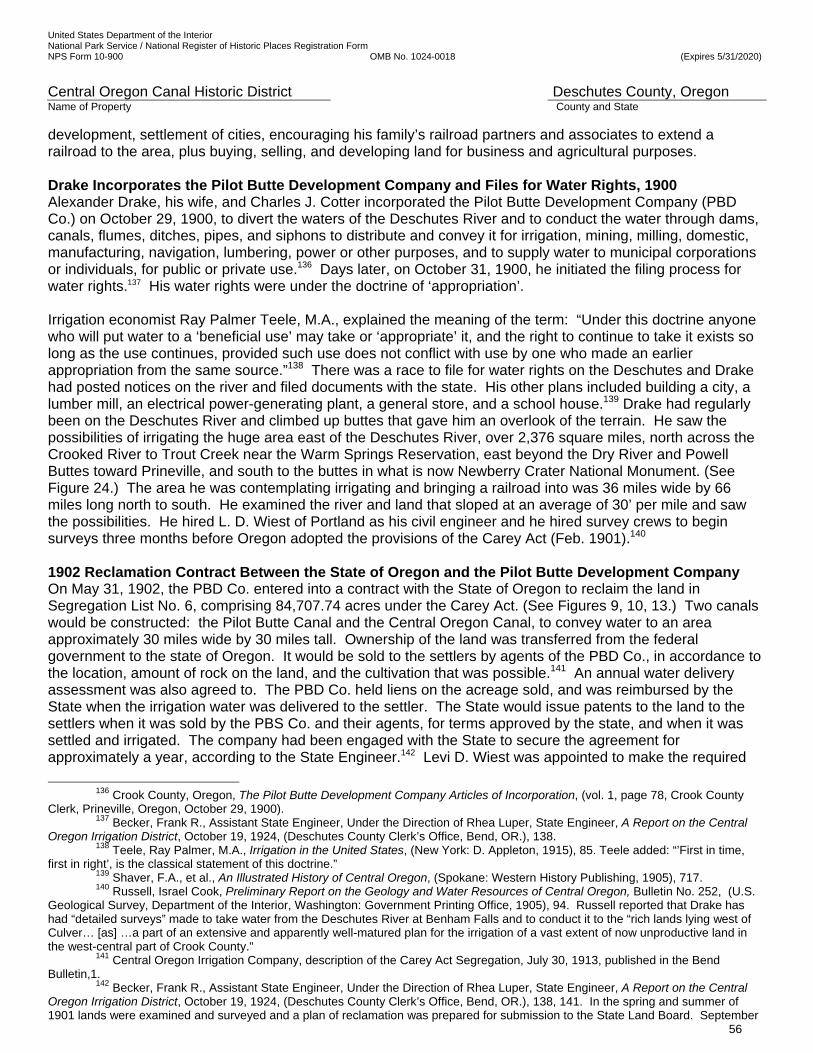
United States Department of the Interior National Park Service / National Register of Historic Places Registration Form NPS Form 10-900 OMB No. 1024-0018 (Expires 5/31/2020)
Central Oregon Canal Historic District Deschutes County, Oregon Name of Property County and State
56
development, settlement of cities, encouraging his family’s railroad partners and associates to extend a railroad to the area, plus buying, selling, and developing land for business and agricultural purposes. Drake Incorporates the Pilot Butte Development Company and Files for Water Rights, 1900 Alexander Drake, his wife, and Charles J. Cotter incorporated the Pilot Butte Development Company (PBD Co.) on October 29, 1900, to divert the waters of the Deschutes River and to conduct the water through dams, canals, flumes, ditches, pipes, and siphons to distribute and convey it for irrigation, mining, milling, domestic, manufacturing, navigation, lumbering, power or other purposes, and to supply water to municipal corporations or individuals, for public or private use.136 Days later, on October 31, 1900, he initiated the filing process for water rights.137 His water rights were under the doctrine of ‘appropriation’. Irrigation economist Ray Palmer Teele, M.A., explained the meaning of the term: “Under this doctrine anyone who will put water to a ‘beneficial use’ may take or ‘appropriate’ it, and the right to continue to take it exists so long as the use continues, provided such use does not conflict with use by one who made an earlier appropriation from the same source.”138 There was a race to file for water rights on the Deschutes and Drake had posted notices on the river and filed documents with the state. His other plans included building a city, a lumber mill, an electrical power-generating plant, a general store, and a school house.139 Drake had regularly been on the Deschutes River and climbed up buttes that gave him an overlook of the terrain. He saw the possibilities of irrigating the huge area east of the Deschutes River, over 2,376 square miles, north across the Crooked River to Trout Creek near the Warm Springs Reservation, east beyond the Dry River and Powell Buttes toward Prineville, and south to the buttes in what is now Newberry Crater National Monument. (See Figure 24.) The area he was contemplating irrigating and bringing a railroad into was 36 miles wide by 66 miles long north to south. He examined the river and land that sloped at an average of 30’ per mile and saw the possibilities. He hired L. D. Wiest of Portland as his civil engineer and he hired survey crews to begin surveys three months before Oregon adopted the provisions of the Carey Act (Feb. 1901).140 1902 Reclamation Contract Between the State of Oregon and the Pilot Butte Development Company On May 31, 1902, the PBD Co. entered into a contract with the State of Oregon to reclaim the land in Segregation List No. 6, comprising 84,707.74 acres under the Carey Act. (See Figures 9, 10, 13.) Two canals would be constructed: the Pilot Butte Canal and the Central Oregon Canal, to convey water to an area approximately 30 miles wide by 30 miles tall. Ownership of the land was transferred from the federal government to the state of Oregon. It would be sold to the settlers by agents of the PBD Co., in accordance to the location, amount of rock on the land, and the cultivation that was possible.141 An annual water delivery assessment was also agreed to. The PBD Co. held liens on the acreage sold, and was reimbursed by the State when the irrigation water was delivered to the settler. The State would issue patents to the land to the settlers when it was sold by the PBS Co. and their agents, for terms approved by the state, and when it was settled and irrigated. The company had been engaged with the State to secure the agreement for approximately a year, according to the State Engineer.142 Levi D. Wiest was appointed to make the required
136 Crook County, Oregon, The Pilot Butte Development Company Articles of Incorporation, (vol. 1, page 78, Crook County
Clerk, Prineville, Oregon, October 29, 1900). 137 Becker, Frank R., Assistant State Engineer, Under the Direction of Rhea Luper, State Engineer, A Report on the Central
Oregon Irrigation District, October 19, 1924, (Deschutes County Clerk’s Office, Bend, OR.), 138. 138 Teele, Ray Palmer, M.A., Irrigation in the United States, (New York: D. Appleton, 1915), 85. Teele added: “’First in time,
first in right’, is the classical statement of this doctrine.” 139 Shaver, F.A., et al., An Illustrated History of Central Oregon, (Spokane: Western History Publishing, 1905), 717. 140 Russell, Israel Cook, Preliminary Report on the Geology and Water Resources of Central Oregon, Bulletin No. 252, (U.S.
Geological Survey, Department of the Interior, Washington: Government Printing Office, 1905), 94. Russell reported that Drake has had “detailed surveys” made to take water from the Deschutes River at Benham Falls and to conduct it to the “rich lands lying west of Culver… [as] …a part of an extensive and apparently well-matured plan for the irrigation of a vast extent of now unproductive land in the west-central part of Crook County.”
141 Central Oregon Irrigation Company, description of the Carey Act Segregation, July 30, 1913, published in the Bend Bulletin,1.
142 Becker, Frank R., Assistant State Engineer, Under the Direction of Rhea Luper, State Engineer, A Report on the Central Oregon Irrigation District, October 19, 1924, (Deschutes County Clerk’s Office, Bend, OR.), 138, 141. In the spring and summer of 1901 lands were examined and surveyed and a plan of reclamation was prepared for submission to the State Land Board. September

United States Department of the Interior National Park Service / National Register of Historic Places Registration Form NPS Form 10-900 OMB No. 1024-0018 (Expires 5/31/2020)
Central Oregon Canal Historic District Deschutes County, Oregon Name of Property County and State
57
surveys, and J.C.S. Taber was hired as selecting agent. It was the largest Carey Act contract entered by the State at the time, to be conducted over a period of ten years, with ten percent of the project being completed each year. Construction deadlines were set and construction of the first canal, the shorter Pilot Butte Canal, was on a fast timetable. The cost of construction and the amount of the lien was fixed at $848,557, the amount estimated by the PBD Co. that was needed to build two main canals and a water distribution system, which was about $10 per acre. After an examination made in the field, the State Engineer reported to the State Land Board, “the land is irrigable and the soil is good except for lava dykes ‘cutting it up’ and there is no alkali; the water supply in the ‘Big Des Chutes’ is ample for complete reclamation, and the dimensions of the proposed canals are sufficient; the general plan of irrigation is feasible and the work proposed, when executed, should reclaim the land; the estimate of cost is not too high, but the estimate for maintenance is too high.”143 L.D. Wiest, Engineer, 1900-07144 For thousands of years, one of the greatest engineering challenges has been to bring water to where it is needed, whether to irrigate crops, provide for cities, or to create shipping lanes. Civil engineer Levi D. Wiest was hired by Drake in the fall of 1900 and stayed with the PBD Co. until 1907. He had entered the classical course at Pennsylvania College in 1879 and began to study land surveying. From 1881 to 1883 he pursued courses in drafting and civil engineering at the University of Michigan. By 1884 he was a transit man on a locating party for the Gulf, Colorado and Santa Fe Railroad in Texas. Wiest was employed in the engineering department of the Union Pacific Railway in Nebraska and also the Missouri Pacific Railway, working different survey instrument positions. He was a typographer and field draughtsman on locating parties and held positions on the construction crew. He spent ten months in auditing. Next, in Wyoming in1889, he located approximately 200 miles of canals, laterals, and ditches, which were all built. Arriving in Portland, Oregon, in December that year, he made a survey for the Chehalis, Washington water system and afterward entered the auditing department for the Oregon Washington Railroad and Navigation Company, a system of the Union Pacific. He transferred to a locating party in Idaho for the Oregon Short Line and later to a construction party in Oregon where he worked to reconstruct the main line of the Union Pacific through the Columbia River Gorge. On October 1, 1900, Wiest began work in Bend for A. M. Drake, serving as the chief engineer of the Pilot Butte Development Company (PBD Co.) until 1904. From the time of the company’s early organization, he supervised crews who made all of the surveys of the canal routes and land examinations required under the Carey Act for segregation and for construction purposes. He was the vice-president of the PBD Co., and his duties went beyond canal work to securing land and water rights and similar matters. He surveyed and drew the plans for the Bend townsite plat; designed and erected buildings for the company; designed the PBD Co. sawmill; designed Bend’s first water system; and designed Bend’s power dam.145 When the Deschutes Irrigation and Power Company took over operations of the canals in February 1904, CC Hutchinson brought his civil engineer, Joseph G. Kelley with him. Wiest was replaced as Chief Engineer for canal construction in April 1904 by Kelley, a haudralic engineer, formerly with the US Army Corps of Engineers. Wiest continued as 11, 1901, PBD Co. made an application to the State Land Board for a preliminary contract covering the land included in what was later designated as Carey Act Segregation List No. 6. December 2, 1901, a preliminary contract between PBD Co. and State of Oregon was executed. May 31, 1902, a final contract between PBD Co. and State of Oregon, providing for the reclamation of lands in Segregation List No 6, was executed; State of Oregon, Report of State Land Board Relative to Desert Lands, Granted the State Under the “Carey Act” for the Period Commencing October 1, 1902, and Ending September 30, 1904, to the Twenty-Third Legislative Assembly [Regular Session], (Salem, Oregon, 1905), 11.
143 State of Oregon, Report of State Land Board Relative to Desert Lands for the Period Ending September 30, 1902, (Salem, Oregon, 1902), 26-28.
144 Wiest, Levi D. Biography from Deschutes Pioneers Gazette, Deschutes County Historical Society, and Family Sources. (Compiled by Pat Kliewer, Bend, Oregon, 2014).
145 Family history indicates he saw an advertisement in the Portland Oregonian placed by Drake and traveled to Prineville, the Crook County seat, to meet him, then visited what would become Bend, and accepted the position. Beginning about 1907, Wiest was the Arnold Irrigation system engineer for about fifteen years. During 1908-1910, he surveyed a canal for the Suttle Lake Improvement District. From 1923-1927, he surveyed for a railroad between Bend and Sisters for logging purposes. He served as school board director for at least seven years in the school’s formative years. He was involved in a number of other enterprises.
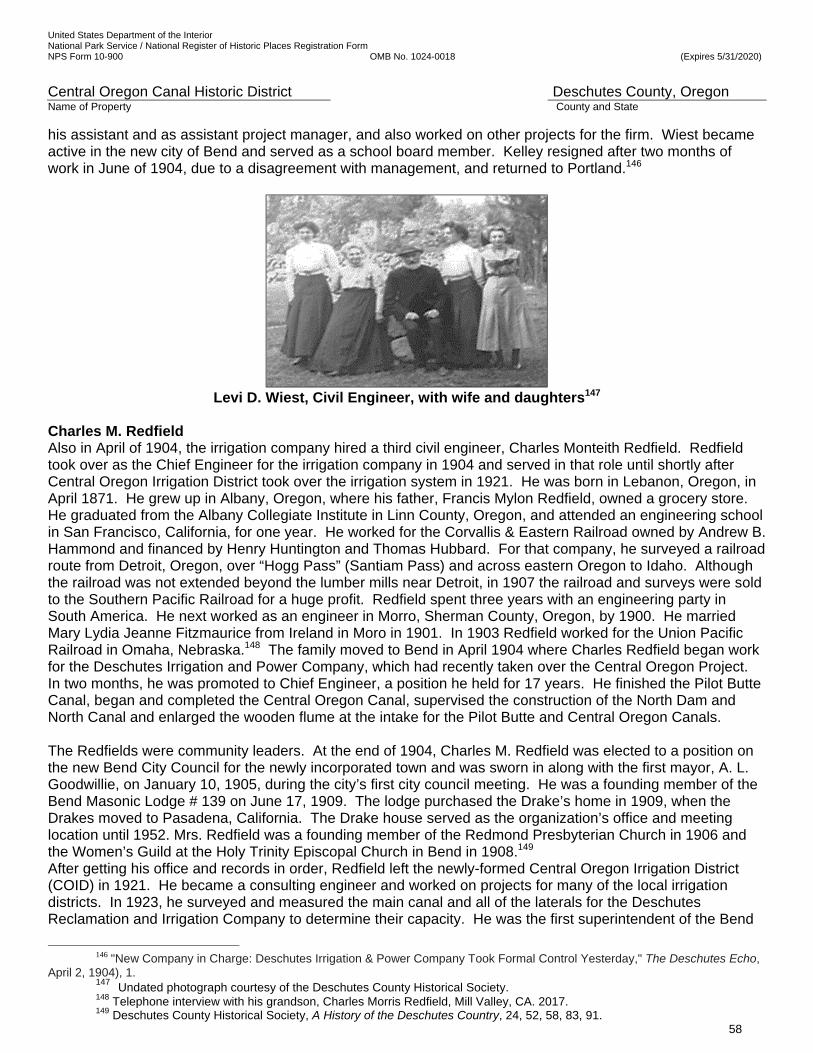
United States Department of the Interior National Park Service / National Register of Historic Places Registration Form NPS Form 10-900 OMB No. 1024-0018 (Expires 5/31/2020)
Central Oregon Canal Historic District Deschutes County, Oregon Name of Property County and State
58
his assistant and as assistant project manager, and also worked on other projects for the firm. Wiest became active in the new city of Bend and served as a school board member. Kelley resigned after two months of work in June of 1904, due to a disagreement with management, and returned to Portland.146
Levi D. Wiest, Civil Engineer, with wife and daughters147
Charles M. Redfield Also in April of 1904, the irrigation company hired a third civil engineer, Charles Monteith Redfield. Redfield took over as the Chief Engineer for the irrigation company in 1904 and served in that role until shortly after Central Oregon Irrigation District took over the irrigation system in 1921. He was born in Lebanon, Oregon, in April 1871. He grew up in Albany, Oregon, where his father, Francis Mylon Redfield, owned a grocery store. He graduated from the Albany Collegiate Institute in Linn County, Oregon, and attended an engineering school in San Francisco, California, for one year. He worked for the Corvallis & Eastern Railroad owned by Andrew B. Hammond and financed by Henry Huntington and Thomas Hubbard. For that company, he surveyed a railroad route from Detroit, Oregon, over “Hogg Pass” (Santiam Pass) and across eastern Oregon to Idaho. Although the railroad was not extended beyond the lumber mills near Detroit, in 1907 the railroad and surveys were sold to the Southern Pacific Railroad for a huge profit. Redfield spent three years with an engineering party in South America. He next worked as an engineer in Morro, Sherman County, Oregon, by 1900. He married Mary Lydia Jeanne Fitzmaurice from Ireland in Moro in 1901. In 1903 Redfield worked for the Union Pacific Railroad in Omaha, Nebraska.148 The family moved to Bend in April 1904 where Charles Redfield began work for the Deschutes Irrigation and Power Company, which had recently taken over the Central Oregon Project. In two months, he was promoted to Chief Engineer, a position he held for 17 years. He finished the Pilot Butte Canal, began and completed the Central Oregon Canal, supervised the construction of the North Dam and North Canal and enlarged the wooden flume at the intake for the Pilot Butte and Central Oregon Canals. The Redfields were community leaders. At the end of 1904, Charles M. Redfield was elected to a position on the new Bend City Council for the newly incorporated town and was sworn in along with the first mayor, A. L. Goodwillie, on January 10, 1905, during the city’s first city council meeting. He was a founding member of the Bend Masonic Lodge # 139 on June 17, 1909. The lodge purchased the Drake’s home in 1909, when the Drakes moved to Pasadena, California. The Drake house served as the organization’s office and meeting location until 1952. Mrs. Redfield was a founding member of the Redmond Presbyterian Church in 1906 and the Women’s Guild at the Holy Trinity Episcopal Church in Bend in 1908.149 After getting his office and records in order, Redfield left the newly-formed Central Oregon Irrigation District (COID) in 1921. He became a consulting engineer and worked on projects for many of the local irrigation districts. In 1923, he surveyed and measured the main canal and all of the laterals for the Deschutes Reclamation and Irrigation Company to determine their capacity. He was the first superintendent of the Bend
146 "New Company in Charge: Deschutes Irrigation & Power Company Took Formal Control Yesterday," The Deschutes Echo,
April 2, 1904), 1. 147 Undated photograph courtesy of the Deschutes County Historical Society. 148 Telephone interview with his grandson, Charles Morris Redfield, Mill Valley, CA. 2017. 149 Deschutes County Historical Society, A History of the Deschutes Country, 24, 52, 58, 83, 91.
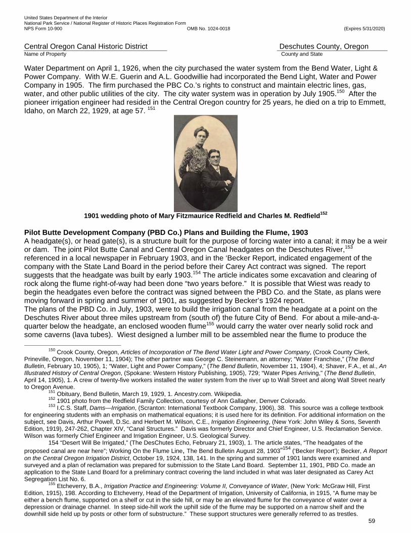
United States Department of the Interior National Park Service / National Register of Historic Places Registration Form NPS Form 10-900 OMB No. 1024-0018 (Expires 5/31/2020)
Central Oregon Canal Historic District Deschutes County, Oregon Name of Property County and State
59
Water Department on April 1, 1926, when the city purchased the water system from the Bend Water, Light & Power Company. With W.E. Guerin and A.L. Goodwillie had incorporated the Bend Light, Water and Power Company in 1905. The firm purchased the PBC Co.’s rights to construct and maintain electric lines, gas, water, and other public utilities of the city. The city water system was in operation by July 1905.150 After the pioneer irrigation engineer had resided in the Central Oregon country for 25 years, he died on a trip to Emmett, Idaho, on March 22, 1929, at age 57. 151
1901 wedding photo of Mary Fitzmaurice Redfield and Charles M. Redfield152
Pilot Butte Development Company (PBD Co.) Plans and Building the Flume, 1903 A headgate(s), or head gate(s), is a structure built for the purpose of forcing water into a canal; it may be a weir or dam. The joint Pilot Butte Canal and Central Oregon Canal headgates on the Deschutes River,153 referenced in a local newspaper in February 1903, and in the ‘Becker Report, indicated engagement of the company with the State Land Board in the period before their Carey Act contract was signed. The report suggests that the headgate was built by early 1903.154 The article indicates some excavation and clearing of rock along the flume right-of-way had been done “two years before.” It is possible that Wiest was ready to begin the headgates even before the contract was signed between the PBD Co. and the State, as plans were moving forward in spring and summer of 1901, as suggested by Becker’s 1924 report. The plans of the PBD Co. in July, 1903, were to build the irrigation canal from the headgate at a point on the Deschutes River about three miles upstream from (south of) the future City of Bend. For about a mile-and-a-quarter below the headgate, an enclosed wooden flume155 would carry the water over nearly solid rock and some caverns (lava tubes). Wiest designed a lumber mill to be assembled near the flume to produce the
150 Crook County, Oregon, Articles of Incorporation of The Bend Water Light and Power Company, (Crook County Clerk, Prineville, Oregon, November 11, 1904); The other partner was George C. Steinemann, an attorney; “Water Franchise,” (The Bend Bulletin, February 10, 1905), 1; “Water, Light and Power Company,” (The Bend Bulletin, November 11, 1904), 4; Shaver, F.A., et al., An Illustrated History of Central Oregon, (Spokane: Western History Publishing, 1905), 729; “Water Pipes Arriving," (The Bend Bulletin, April 14, 1905), 1. A crew of twenty-five workers installed the water system from the river up to Wall Street and along Wall Street nearly to Oregon Avenue.
151 Obituary, Bend Bulletin, March 19, 1929, 1. Ancestry.com. Wikipedia. 152 1901 photo from the Redfield Family Collection, courtesy of Ann Gallagher, Denver Colorado. 153 I.C.S. Staff, Dams—Irrigation, (Scranton: International Textbook Company, 1906), 38. This source was a college textbook
for engineering students with an emphasis on mathematical equations; it is used here for its definition. For additional information on the subject, see Davis, Arthur Powell, D.Sc. and Herbert M. Wilson, C.E., Irrigation Engineering, (New York: John Wiley & Sons, Seventh Edition, 1919), 247-262, Chapter XIV, “Canal Structures.” Davis was formerly Director and Chief Engineer, U.S. Reclamation Service. Wilson was formerly Chief Engineer and Irrigation Engineer, U.S. Geological Survey.
154 “Desert Will Be Irrigated,” (The DesChutes Echo, February 21, 1903), 1. The article states, “The headgates of the proposed canal are near here”; Working On the Flume Line, The Bend Bulletin August 28, 1903”154 (‘Becker Report’); Becker, A Report on the Central Oregon Irrigation District, October 19, 1924, 138, 141. In the spring and summer of 1901 lands were examined and surveyed and a plan of reclamation was prepared for submission to the State Land Board. September 11, 1901, PBD Co. made an application to the State Land Board for a preliminary contract covering the land included in what was later designated as Carey Act Segregation List No. 6.
155 Etcheverry, B.A., Irrigation Practice and Engineering: Volume II, Conveyance of Water, (New York: McGraw Hill, First Edition, 1915), 198. According to Etcheverry, Head of the Department of Irrigation, University of California, in 1915, “A flume may be either a bench flume, supported on a shelf or cut in the side hill, or may be an elevated flume for the conveyance of water over a depression or drainage channel. In steep side-hill work the uphill side of the flume may be supported on a narrow shelf and the downhill side held up by posts or other form of substructure.” These support structures were generally referred to as trestles.
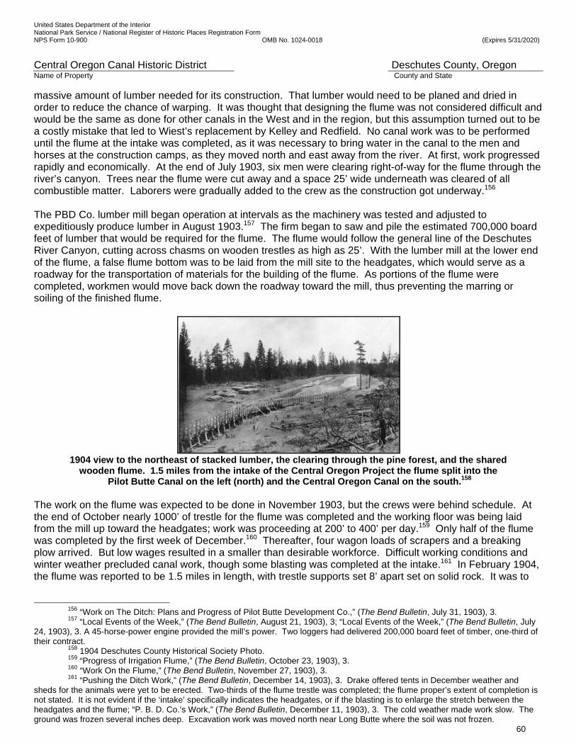
United States Department of the Interior National Park Service / National Register of Historic Places Registration Form NPS Form 10-900 OMB No. 1024-0018 (Expires 5/31/2020)
Central Oregon Canal Historic District Deschutes County, Oregon Name of Property County and State
60
massive amount of lumber needed for its construction. That lumber would need to be planed and dried in order to reduce the chance of warping. It was thought that designing the flume was not considered difficult and would be the same as done for other canals in the West and in the region, but this assumption turned out to be a costly mistake that led to Wiest’s replacement by Kelley and Redfield. No canal work was to be performed until the flume at the intake was completed, as it was necessary to bring water in the canal to the men and horses at the construction camps, as they moved north and east away from the river. At first, work progressed rapidly and economically. At the end of July 1903, six men were clearing right-of-way for the flume through the river’s canyon. Trees near the flume were cut away and a space 25’ wide underneath was cleared of all combustible matter. Laborers were gradually added to the crew as the construction got underway.156 The PBD Co. lumber mill began operation at intervals as the machinery was tested and adjusted to expeditiously produce lumber in August 1903.157 The firm began to saw and pile the estimated 700,000 board feet of lumber that would be required for the flume. The flume would follow the general line of the Deschutes River Canyon, cutting across chasms on wooden trestles as high as 25’. With the lumber mill at the lower end of the flume, a false flume bottom was to be laid from the mill site to the headgates, which would serve as a roadway for the transportation of materials for the building of the flume. As portions of the flume were completed, workmen would move back down the roadway toward the mill, thus preventing the marring or soiling of the finished flume.
1904 view to the northeast of stacked lumber, the clearing through the pine forest, and the shared
wooden flume. 1.5 miles from the intake of the Central Oregon Project the flume split into the Pilot Butte Canal on the left (north) and the Central Oregon Canal on the south.158
The work on the flume was expected to be done in November 1903, but the crews were behind schedule. At the end of October nearly 1000’ of trestle for the flume was completed and the working floor was being laid from the mill up toward the headgates; work was proceeding at 200’ to 400’ per day.159 Only half of the flume was completed by the first week of December.160 Thereafter, four wagon loads of scrapers and a breaking plow arrived. But low wages resulted in a smaller than desirable workforce. Difficult working conditions and winter weather precluded canal work, though some blasting was completed at the intake.161 In February 1904, the flume was reported to be 1.5 miles in length, with trestle supports set 8’ apart set on solid rock. It was to
156 “Work on The Ditch: Plans and Progress of Pilot Butte Development Co.,” (The Bend Bulletin, July 31, 1903), 3. 157 “Local Events of the Week,” (The Bend Bulletin, August 21, 1903), 3; “Local Events of the Week,” (The Bend Bulletin, July
24, 1903), 3. A 45-horse-power engine provided the mill’s power. Two loggers had delivered 200,000 board feet of timber, one-third of their contract.
158 1904 Deschutes County Historical Society Photo. 159 “Progress of Irrigation Flume,” (The Bend Bulletin, October 23, 1903), 3. 160 “Work On the Flume,” (The Bend Bulletin, November 27, 1903), 3. 161 “Pushing the Ditch Work,” (The Bend Bulletin, December 14, 1903), 3. Drake offered tents in December weather and
sheds for the animals were yet to be erected. Two-thirds of the flume trestle was completed; the flume proper’s extent of completion is not stated. It is not evident if the ‘intake’ specifically indicates the headgates, or if the blasting is to enlarge the stretch between the headgates and the flume; “P. B. D. Co.’s Work,” (The Bend Bulletin, December 11, 1903), 3. The cold weather made work slow. The ground was frozen several inches deep. Excavation work was moved north near Long Butte where the soil was not frozen.
United States Department of the Interior National Park Service / National Register of Historic Places Registration Form NPS Form 10-900 OMB No. 1024-0018 (Expires 5/31/2020)
Central Oregon Canal Historic District Deschutes County, Oregon Name of Property County and State
61
be finished by March; however, work toward completion did not occur.162 No further significant work by Drake’s PBD Co. was conducted at that time. Another assumption proved inaccurate: building the canal in an open channel for twenty miles below the flume, beyond the surface rock flow, was also expected to be comparatively easy work. The company thought that for most of the distance, natural channels would be followed and the canal water would “wash its own way” through the light volcanic soil. The remaining canal work, it was said, would “amount to little more than leading the water along the surveyed course.”163 The company expected to deliver water to the Bend townsite before the end of the year. James H. Drake and James G. and Arthur L. Goodwillie of Chicago Visit the Deschutes, 1903 As early as 1891, A.M. Drake sat on the board of directors of the Chicago, St. Paul & Kansas City Railway Company.164 Just over a decade later, in November of 1903, Colonel James H. Drake, and James G. Goodwillie and his son Arthur L. Goodwillie, all of Chicago, spent ten days with Drake and his wife on the banks of the Deschutes. Colonel Drake was a cousin to A.M. Drake. The Colonel was formerly the land commissioner of the St. Paul & Sioux City Railroad (the same railroad as Elias Drake was president) and its assistant manager, but more recently had been a Chicagoan, and for twenty-five years had been a member of the Chicago Board of Trade.165 Elias F. Drake died in 1892, leaving the Colonel as the elder family member and confidant that had been associated with him. James H. Drake had experience acquiring congressional land grants and in supervising engineering and construction, finance and other matters.166 He was not a Board of Trade commission member, nor did he represent a bank, brokerage house or any other type of firm. He was an independent speculator-investor. He held substantial wealth and understood sizeable investments.167 James G. Goodwillie was for thirty years engaged in extensive lumber manufacturing as Goodwillie & Goodwillie at Wausau, Wisconsin, and then was a member of Goodwillie Bros. in Chicago. His firm had built wooden boxes since 1873 and was the oldest manufacturer of boxes in the United States, with plants in several cities.168 His son, A. L. Goodwillie, had recently graduated from the prestigious Williams College in 1901 and then worked for a large banking concern in Chicago.169
162 “To Open Empire: Big Irrigation Companies in Combine,” (Morning Oregonian, February 16, 1904), 10. It is possible the extent of the flume’s completion was overstated for investors, or what component of the flume was completed was simply misunderstood, i.e. the entire flume was not completed, though the trestle structure may have been.
163 “Working On the Flume Line,” (The Bend Bulletin, August 28, 1903), 3. In addition to the excavation indicated to have been done “two years before,” it is possible that Wiest began the headgates, referenced in the DesChutes Echo of February 21, 1903, and cited in the first sentence of this section, also in 1901; “Clearing Flume Right of Way,” (The DesChutes Echo, August 8, 1903), 1. A track was to be laid along the flume route for the purpose of conveying material for the structure, as the route was inaccessible to teams.
164 Fourteenth Annual Report of the Board of Railroad Commissioners for the Year Ending June 30, 1891, State of Iowa, “Annual Report of the Chicago, St. Paul & Kansas City Railway Company for the Year Ending June 30, 1891,” (Des Moines: State Printer, 1891), 258; “Chicago, St. Paul & Kansas City Railway Company,” Annual Report of the Railroad and Warehouse Commission of Minnesota to the Governor for the Year Ending Nov. 30, 1892, (Minneapolis: Harrison & Smith Printers, 1893), 235; “Thompson v. Chicago, St. P. & K.C. RY. Co. et al.,” (Circuit Court, D. Minnesota, First Division, April 14, 1894), 778. The court document indicates it was organized under the laws of the State of Iowa; Park Genealogical Books. The railroad was started in 1887 and ended in 1983. 165 “A Revelation to Chicagoans,” (The Bend Bulletin, November 6, 1903), 6.
166 Legislative Documents Submitted to the Twenty-third General Assembly of the State or Iowa, Which Convened at Des Moines, January 13, 1890, vol. vi, (Des Moines: State Printer, 1890). As an example, in the year reported, the Chicago, Milwaukee & St. Paul Railway Company received congressional grants in Iowa of 372,133.27 acres of land. In that year, the Chicago, St. Paul & Kansas City Railway Company, the railroad on whose board A.M. Drake is known to have sat in 1892, the amount of stock representing railroad in Iowa was $8,538,978.91 (p. 48). The actual cash value of the railroad and equipment was $43,737,728.50 (p. 55).
167 Stone, George F., The Forty-Second Annual Report of the Trade and Commerce of Chicago for the Year Ending December 31, 1899, Compiled for the Board of Trade, (Chicago: The J.M.W. Jones Stationery and Printing Co., 1900), 239; Stone, George F., The Forty-Fourth Annual Report of the Trade and Commerce of Chicago for the Year Ending December 31, 1901, Compiled for the Board of Trade, (Chicago: The J.M.W. Jones Stationery and Printing Co., 1902), 231; Keller, Megan, Project Archivist, CME Group Collections, University of Illinois At Chicago, E-mail to Michael Hall, (March 23, 2015). James H. Drake was a member of the Chicago Board of Trade from Nov. 13, 1876 to Jan. 14, 1903.
168 “A Revelation to Chicagoans,” (The Bend Bulletin, November 6, 1903), 6; Leonard, John William, The Book of Chicagoans, (1911, vol. 2), 273. It appears the Wausau firm was called Goodwillie & Goodwillie, 1873-1890, and the Chicago firm, 1890 to at least 1911 (the publication date of this book), called Goodwillie Bros. Another plant was in Manistique, Michigan.
169 “A. L. Goodwillie Is Dead At 67,” (Lynchburg News, Lynchburg, Virginia, January 15, 1946), n.p. The obituary says, “He
United States Department of the Interior National Park Service / National Register of Historic Places Registration Form NPS Form 10-900 OMB No. 1024-0018 (Expires 5/31/2020)
Central Oregon Canal Historic District Deschutes County, Oregon Name of Property County and State
62
Alexander Drake took his guests for a tour of the Deschutes River area, and to view the PBD Co.’s irrigation works and the lands to be irrigated. They rode in a wagon along the proposed route of the Pilot Butte Canal to Forked Horn Butte near the future city of Redmond to see the broad area to be served by the canal and to gain an understanding of the Deschutes country.170 Before leaving the area, Colonel Drake commented on what they had discovered during their visit:
“This country is a revelation to us. Nobody can get an adequate conception of this section by reading about it. It is an empire and I am fairly astonished at the display of native resource and possibilities of development that I observe here. Here I find actually present, and in a form to appeal to any business judgment, such native wealth and much opportunity for using it that I am surprised and gratified beyond expression.”171
Alexander and Florence Drake accompanied the group to Portland, where they took the train to the Midwest. They were absent from the Deschutes Country for about two months.172 Returning in January, 1904, Drake announced “that important plans had been made for the watering of the wilderness, the development of Bend and the colonization of the Deschutes Country. He had been as far east as Chicago ‘to lay plans for immigration’ and to attend to other business connected with his irrigation enterprises.”173 Contesting Irrigation Companies: PBD Co. and Oregon Irrigation Company, 1900-1903 A.M. Drake and Charles C. Hutchinson, president of the Oregon Irrigation Company (OI Co.), were early irrigation development partners, then competitors, in the Deschutes Country, which provided the impetus for a contentious relationship. “Inevitably there was competition,” wrote historians Keith and Donna Clark in “Pioneers of Deschutes Country,” High & Mighty: Select Sketches about the Deschutes County.174 Describing the Drake-Hutchinson contest, they say:
“Hutchinson was on the Deschutes with engineers making surveys and water filings two years before Drake appeared in 1900. Since Hutchinson needed capital, in 1899 he wrote to Drake at Spokane, representing to him the potential profits in irrigation development near Bend. Drake came, assessed the prospect and asked for Hutchinson’s proposal. He was offered half of the company stock, with agreement that he be president and manager, conditional on his supplying needed capital. Drake agreed to the terms, and paid for surveys. About two months afterwards, Drake informed Hutchinson that he saw no reason for partnership in the venture, in effect elbowing Hutchinson aside.”175
was attracted to the West from his native Chicago by the potentialities of a huge irrigation plan. With a friend, he purchased large tracts of land in the area. When only twenty-three he was named mayor of the town he founded, and received nation-wide recognition as the youngest ‘town father’ in the country; Family Search, “Arthur Lawson Goodwillie,” (Individual Record, Pedigree Resource File); “First Mayor Dies in Virginia,” (The Bend Bulletin, January 22, 1946), 1.
170 “A Revelation to Chicagoans,” (The Bend Bulletin, November 6, 1903), 6; “Why It Is Called Forked Horn Butte,” The Redmond Spokesman, December 14, 1911), 2. According to the local story, “In the early days a homesteader went hunting on the butte and killed a forked horn deer, and ever since that time in speaking of the locality it has been designated as ‘Forked Horn Butte’.”
171 “A Revelation to Chicagoans,” (The Bend Bulletin, November 6, 1903), 6. 172 “Local News,” (The Bend Bulletin, November 13, 1903), 3; Brogan, Phil F., “The Watering of the Wilderness,” (The Bend
Bulletin, January 27, 1931), n.p. 173 Brogan, Phil F., “The Watering of the Wilderness,” (The Bend Bulletin, January 27, 1931), n.p. Brogan article, Drake statement.
174 Vaughan, Thomas, ed., Keith and Donna Clark, “Pioneers of Deschutes Country,” High & Mighty: Select Sketches about the Deschutes Country, (Portland: Oregon Historical Society, 1981), This text was researched and written by those who lived, or had lived, in Deschutes country or were otherwise particularly familiar with its characteristics and the history surrounding it. Keith Clark’s involvement with Oregon Historical Quarterly and the Oregon Historical Society Press spanned many years. Besides contributing to High and Mighty, he authored Redmond: Where the Desert Blooms, he co-edited with his wife, Donna, Daring Donald McKay, or The Last War Trail of the Modocs, and was a contributor to the Oregon Historical Quarterly, and served for many years on the OHQ Editorial Advisory Board. With Lowell Tiller, he co-authored Terrible Trail: The Meek Cutoff, 1845. Clark also served as president of the Deschutes County Historical Society and on the Deschutes County Historical Landmarks Commission. He taught history at Central Oregon Community College; "Keith Clark Obituary," Oregon Historical Quarterly, 2002, HighBeam Research, (November 15, 2014); Oregon History Project, (November 15, 2014).
175 Vaughan, ed., “Keith and Donna Clark, “Pioneers of Deschutes Country,” High & Mighty: Select Sketches about the
United States Department of the Interior National Park Service / National Register of Historic Places Registration Form NPS Form 10-900 OMB No. 1024-0018 (Expires 5/31/2020)
Central Oregon Canal Historic District Deschutes County, Oregon Name of Property County and State
63
The two companies then proceeded to make new water filings on the upper Deschutes River, in two instances side by side. Hutchinson protested to the General Land Office, which dismissed it. Secretary of the Interior Hitchcock affirmed the decision, and recognized the legitimacy of the PBD Co.’s claim.176 In early December, 1903, Hutchinson returned to revisit the Deschutes Country after being gone “for a year or more,” with W.E. Guerin and H.D. Turney, of New York, who represented capitalists favorable to investment in irrigation development.177 A January 20, 1904 letter to the State Land Board, composed of the Oregon Governor, Secretary of State and the Treasurer, from Hutchinson indicated his plans to move forward on a number of matters that conflicted with the PBD Co.’s plans, which Drake had previously protested in a letter to the State Land Board. Hutchinson’s plan to build a dam across the Deschutes River was a threat to the PBD Co., as it could divert needed water away from the intake for the Pilot Butte and Central Oregon Canals that was under construction downstream from the proposed dam. Hutchinson pointed out to the land board that the applicable law allowed a dam located on private land to be built.178 The letter further indicated that his Oregon Irrigation Company had complied with all of the requisites for a contract for reclamation.179 The letter refuted Drake’s responses, pointing out that the land board’s own engineer had made an examination of the feasibility of the plan, and that the Oregon Irrigation Company would demonstrate to the satisfaction of the land board its financial ability to conduct the project.180 The plans called for, among other actions, irrigating northeast from a diversion point, similar to Drake’s plan.181 On January 30, 1904, the PBD Co. had another setback when its sawmill, which was producing lumber for flumes and other irrigation structures and buildings, burned. The mill had competed cutting rough lumber for the flume, but the lumber had not been planed. The mill crew saved the planer; however. The sawmill proper was “totally ruined and the engine was subjected to a great heat and many parts were ruined.” 182. Also in January, 1904, Hutchinson, who had “done no actual construction work,”183 brought Eastern capitalists and a civil engineer, Joseph Kelley, into the area for nearly a week.184 The state engineer also arrived then to
Deschutes Country. The Clarks cite a letter, “C.C. Hutchinson to Binger Herman,” dated October 10, 1901, in author file. Binger Herman, of Oregon, was commissioner of the General Land Office.
176 Ibid.; Becker, Frank R., A Report on the Central Oregon Irrigation District, 1924, “Report: Duty of Water,”1-2. Becker summarized Hutchinson’s plans. The Oregon Irrigation Company had been incorporated November 14, 1899, by C.C. Hutchinson and others, and made application to the board in 1901 for a contract to reclaim lands in Central Oregon. The application was protested by A.M. Drake. On January 21, 1902, upon request of the Oregon Irrigation Company, all papers and maps previously filed with the board were withdrawn and returned to the company. On December 22, 1903, the Oregon Irrigation Company made a second application for a contract to reclaim lands in Central Oregon. This application was also protested by Drake. The lands included were designated as Segregation List No. 19, an area of 56,006.90 acres.
177 “Hutchinson Again Here: Brings New Yorkers to Look Over His Irrigation Project,” (The Bend Bulletin, December 4, 1903), 3. The report said: “The result of their inspection was not made known before the party left for Portland Wednesday, but there was more or less talk about starting operations on a large scale in the spring [of 1904].”
178 Oregon State Archives, Letter from A.M. Drake, Pilot Butte Development Company, to State Land Board, January 6, 1904, Desert Land Board Reclamation Records, no. 10-18, box 15, folder 2; Oregon State Archives, Letter from C.C. Hutchinson, Oregon Irrigation Company, to State Land Board, January 20, 1904, Desert Land Board Reclamation Records, no. 10-18, box 15, folder 2.
179 Ibid. The requisites required having a number of documents filed showing matters including: having an engineer and selecting agent appointed by the land board, a map showing plan of contemplated irrigation and source of water, field notes of survey showing connections of termini with ditch, statement of available water, list of lands selected, contracts with the Secretary of Interior and State, application for contract with an estimate of reclamation costs and annual maintenance charge, and deposit for fees required by the State and the United States land office.
180 Ibid. 181 Ibid. 182 “Two Fires: Sawmill Burns Here, Pilot Butte Development Company’s Mill Destroyed Last Saturday Afternoon — Will Not
Be Rebuilt,” (The DesChutes Echo, February 6, 1904), 1. “Lumber to Build: Pilot Butte Mill Is Now In Full Operation,” (The Bend Bulletin, May 13, 1905), 1. Rebuilding the mill to plane (finish) the flume lumber would take over four months.
183 “To Open Empire: Big Irrigation Companies in Combine,” (Morning Oregonian, February 16, 1904), 10. Hutchinson had made a number of surveys.
184 “Work to Begin Soon: The Oregon Irrigation Company Making Its Final Arrangements,” (The DesChutes Echo, January 30, 1904), 1. Capitalists included Guerin, Turney, and Elliot. The engineer was J.G. Kelley, who would become the D. I. & P. Co.’s chief engineer.
United States Department of the Interior National Park Service / National Register of Historic Places Registration Form NPS Form 10-900 OMB No. 1024-0018 (Expires 5/31/2020)
Central Oregon Canal Historic District Deschutes County, Oregon Name of Property County and State
64
inspect the progress made by the PBD Co. and to estimate the value of its work.185 Drake’s contract with the state was for work over ten years, calling for at least ten percent of the project to be done each year, or about $85,000 of construction to be conducted by the end of a year, beginning six months after signing the contract of May 31, 1902. By December 1903, a year-and-a-half had passed; Drake’s deadline to produce 10% of the project had passed. If another company with a feasible plan and the financial ability to conduct the project was available, an unfavorable report on the extent of the PBD Co.’s construction by the state engineer to the State Land Board could result in Drake being out of compliance in his contract with the state and being compelled to sell out. By mid-February, Hutchinson and his capitalists were meeting with the State Land Board to take advantage of the situation.186 THE DESCHUTES IRRIGATION & POWER COMPANY TAKES OVER THE DELAYED PROJECT. Deschutes Irrigation & Power Company Buys Out PBD Co. and Oregon Irrigation Company in 1904 A timely consolidation and takeover of the rivals seemed like the best option. In an action, the Oregonian called “the most important step which has yet been taken in the work of reclaiming the vast empire of interior Oregon,”187 the Deschutes Irrigation and Power Company (D. I. & P. Co.) incorporated and representatives went before the State Land Board to announce they had bought out both the rights of the PBD Co. and the Oregon Irrigation Company in mid-February 1904. The D. I. & P. Co. was capitalized at $2,500,000. The State Land Board was informed that the PBD Co.’s rights and contract were bought out at $70,000; the rights of the Oregon Irrigation Company, owned by C.C. Hutchinson, were obtained at about half that amount. Drake’s buyout price indicates he did not meet the $85,000 objective (10% of the project’s value) set in the contract with the state. “We will have water running in our flumes inside of sixty days,” boasted W.E. Guerin, Sr. “Inside of four months, and possibly in three months, we will have water on 25,000 acres of desert land.”188 Guerin was no stranger to challenging projects. He built the Palmer cut-off on the Northern Pacific Railroad as president of the Seattle and San Francisco Railroad & Navigation Company, bringing the mainline into Seattle, and sold its rights to the Northern Pacific.189 His promises that day stemmed from a career of successfully satisfying both railroad investors and government regulators. There was a message to investors in the 25,000-acre figure promised in three or four months: Lands would be irrigated in the time promised; irrigated lands would be selling soon; ten percent of the company’s $2,500,000 capitalization (investment), $250,000, equaling one-third of the contract price with the state, would be returned to the company soon;190 and the return on their investment was safe and forthcoming.191 The promise was also made to potential settlers that the lands would
185 “State Engineer In Town,” (The DesChutes Echo, January 30, 1904), 1. E.A. Hammond was the new State Engineer. 186 “Work Will Soon Begin: Oregon Irrigation Company Completing Arrangements with State Land Board,” (The DesChutes
Echo, February 13, 1904), 1. Capitalists included Turney, Guerin, Johnston, and Elliott. One or more provided letters from “Governor Herrick of Ohio and from a number of strong Eastern banks.”
187 “To Open Empire: Big Irrigation Companies in Combine,” (Morning Oregonian, February 16, 1904), 10. 188 “Water In Sixty Days: Deschutes Irrigation Company Buys Out Others,” (The Sunday Oregonian, February 14, 1904), 6;
“Articles of Incorporation: Filed in the Office of State at Salem,” (The Sunday Oregonian, February 14, 1904, Portland, OR.), 1. Deschutes Irrigation & Power Company, Portland, Oregon, was incorporated on February 10, 1904, by W.A. Munly, George H. Hill, and E.B. Holmes, all of Portland; “The Pilot Butte Development Co. to Deschutes Irrigation & Power Co.,” [Filed] March 14, 1904, vol. 2, pp. 449-452, (Deschutes County Clerk’s Office, Bend, Oregon [Crook County Clerk’s Office, vol. 12, p. 189]). Date of March 14, 1904, and sum of $848,557.00 are indicated in document; “Reclaim Desert Lands: Large Company Will Operate in Crook County — Begin at Once,” (Daily Capital Journal, February 15, 1904), 3; “Deschutes Irrigation & Power Co. Organized: P.B.D. Co. Sells Out,” (The DesChutes Echo, February 20, 1904), 1.
189 “Feeling In the East,” (The DesChutes Echo, May 14, 1904), 1. 190 Figures are as follows: 25,000 acres x an average of $10 per acre = $250,000, i.e. 10 percent of the capitalization;
$250,000 / $848,557 (contract price) = 33.9 percent, i.e. 1/3 of the contract price would returned to the company immediately; therefore, the remaining irrigation development would occur rapidly, as well, and afterward profit would be realized. See following footnote for further explanation.
191 “Concerning Water Rights,” (The DesChutes Echo, (June 25, 1904), 1. “State View of Irrigation: What Official Biennial Report to the Legislature Says,” (The Bend Bulletin, January 27, 1905), 4. This article indicates the price fixed ranged from $2.50 per acre for tracts wholly unfit for cultivation to $14.75 per acre for tracts all tillable and irrigable, the average being the amount fixed in the contract between the state and the company of $10 per acre.
United States Department of the Interior National Park Service / National Register of Historic Places Registration Form NPS Form 10-900 OMB No. 1024-0018 (Expires 5/31/2020)
Central Oregon Canal Historic District Deschutes County, Oregon Name of Property County and State
65
be ready for farming soon. The State Land Board, consisting of the governor and the state’s three other top elected officials, would have requested specific goals and a well-defined timeline.192 It had been understood that negotiations were pending for consolidation of the two enterprises and the land board expressed satisfaction in the news, as it felt a contest between the two companies of certain water rights had resulted in not much progress being made, and that the irrigation work in the Deschutes Country should be undertaken under one management.193 The primary components of the transaction were completed by mid-March.194 The principal backers of the new enterprise were “understood to command unlimited means and intend to push the work to completion as rapidly as possible.” They were largely interested in railroads and the oil and gas fields of Ohio and Indiana.195 In addition to W.E. Guerin, Sr., of New York, the capitalists included J.O. Johnston and H.D. Turney, both of Columbus, Ohio. Johnston was general manager of the Columbus Gas Light and Heating Company, Columbus.196 Turney held investments in oil and gas, and also had operations in New York City.197 Portland stockholders included Harvey W. Scott, editor of The Oregonian, and J. Frank Watson, president of the Merchants Bank. Others were R.H. Eliott, mayor of Birmingham, and chief engineer of the Louisville & Nashville Railroad; Geo. W. Sinks, president, Desher National Bank; and John Desher, both of Columbus. J.O. Johnston, elected vice president, would be the project’s general manager. His work in the gas fields of Ohio was highly respected and his experience working in rock would be an asset to the group.198 C.C. Hutchinson was a stockholder, board member, and land commissioner.199 W.E. (Eugene) Guerin, Jr.,200 would be a part of the vanguard, involved in establishing and managing many essential settlement businesses, and in promotion of the area. Drake retained ownership of the townsite and other properties and rights.201 J.O. Johnston, Vice President and General Manager, D. I. & P. Co.
192 Research at the Oregon State Archives did not identify any minutes or other documents associated with the February 1904, announcement which could illuminate these matters.
193 “Water in Sixty Days: Deschutes Irrigation Company Buys Out Others,” (The Sunday Oregonian, February 14, 1904), 6 194 United States Circuit Court of Appeals for the Ninth Circuit, Frank R. Shinn and Louis G. Addison, and Frank R. Shinn and
Louis G. Addison as a Committee for Certain Bondholders, Complainants Appellees, vs. The Deschutes Irrigation and Power Company, a corporation, A.F. Biles, Howard Contract Company, a corporation, Merchants Savings and Trust Company, formerly Merchants Investments and Trust Company, an Oregon corporation, Respondents Appellees vs. R.S. Howard, Jr., Receiver of the Title Guarantee & Trust Company, Intervenor Appellant vs. Alexander M. Drake and Pilot Butte Development Company, Intervenors Appellees, No. 1915, 15. The 1915 circuit court decision indicates that on February 12, 1904, a “Contract between A.M. Drake and Turney, Johnston and Guerin for rights of the Pilot Butte Development Co.” was executed. The same day, “Assignment of Drake Contract by Turney and others to The Deschutes Irrigation & Power Company” was concluded. Also, that same day, “Assignment of rights of Oregon Irrigation Co. to The Deschutes Irrigation & Power Co., viz., its capital stock” was affected. On March 14, 1904, “Conveyance by Pilot Butte Development Co. to The Deschutes Irrigation & Power Co., of rights of way, etc.” was finalized. The same day, “Assignment of Contract with State Land Board by Pilot Butte Development Co. to The Deschutes Irrigation & Power Co.” was completed.
195 “To Open Empire: Big Irrigation Companies in Combine,” (Morning Oregonian, February 16, 1904, Portland, OR.), 10. 196 Proceedings of the Ohio Gas Light Association, (Columbus: Spahr & Glenn, 1904), 661. Proceedings include seventeenth
annual meeting of 1901, eighteenth annual meeting of 1902, and nineteenth annual meeting of 1903. Index of association members indicates Johnston, John O., General Manager, The Columbus Gas Light and Heating Company, Columbus, Ohio. Elected to membership March 21, 1900; 197 Ibid., 667. Proceedings include seventeenth annual meeting of 1901, eighteenth annual meeting of 1902, and nineteenth annual meeting of 1903. Index of association members indicates Turney, Henry D., Director and Member of Association’s Executive Committee, Columbus, Ohio. President, Gas Lighting and Heating Company, 80 Broadway, New York, NY. Elected to membership March 21, 1900; Natural Gas Journal, (vol. 5, July 1911), 39. (Google Book). In or about 1911, Henry D. Turney was the president of Columbia Gas & Fuel Company in Columbus, with 29,000 customers.
198 “The Deschutes Irrigation and Power Company at Bend,” (The Pacific Homestead, Salem, OR., November 10, 1904), 70; “Local Notes,” (The DesChutes Echo, February 27, 1904), 3. Named to the board of directors were H.D. Turney, J.O. Johnston, R.F. Guerin (a son of W.E.), Harvey W. Scott, E.E. Lytle, J.F. Watson and C.C. Hutchinson. Officers elected were H.D. Turney, president; J.O. Johnston, vice-president and general manager; and R.F. Guerin, secretary and treasurer.
199 Ibid.; United States Circuit Court of Appeals for the Ninth Circuit…, 1915, 15. The document indicates “Assignment of rights of Oregon Irrigation Co. to The Deschutes Irrigation & Power Co., viz., its capital stock,” made C.C. Hutchinson a stockholder.
200 Shaver, F.A., et al., An Illustrated History of Central Oregon, (Spokane: Western History Publishing, 1905), 804. Shaver indicates W.E. Guerin, Jr. was a prominent banker and leading businessman of Bend, Crook County, matriculated in Cornell University, from which he graduated with honors. Admitted to the Ohio bar in 1893, he was elected to the state legislator of the seventy-fifth assembly of that state.
201 “Untitled,” (The Bend Bulletin, April 29, 1904), 4. Indicates Drake was still the owner of the Townsite; “To Open Empire: Big Irrigation Companies in Combine,” (Morning Oregonian, February 16, 1904), 10; Pilot Butte Development Company, Plat of Bend, Filed June 7, 1904. The townsite plat was not filed until almost four months after this announcement.

United States Department of the Interior National Park Service / National Register of Historic Places Registration Form NPS Form 10-900 OMB No. 1024-0018 (Expires 5/31/2020)
Central Oregon Canal Historic District Deschutes County, Oregon Name of Property County and State
66
J.O. Johnston drew from his experience in the oil and gas industry in Ohio to develop the specifications for the steam-powered drills and to devise a system to use them effectively. He was not a college-trained geologist or engineer. However, his practical geological knowledge, understanding of engineering, and, importantly, his acumen out in the field made a significant difference in the successful outcome of the Central Oregon Project. His background in natural gas field development did not provide experience with lava as it is found in the Deschutes Country, but he had a respected, proven record of success working under unique geological conditions.202 His drilling experience proved itself useful to the project, too, in the difficult, elemental rock of the Deschutes-Columbia plateau, as he determined the use of steam-powered drilling was imperative in the rock near Bend. According to the 1890 Geological Survey of Ohio, J.O. Johnston is credited with the discovery of the most important gas field in Ohio, up to that time. The Thurston field was “by far the largest and most important yet found established on the new gas rock.” It comprised parts of four townships. “The discovery of the field is due, more than to any one person, to Mr. J.O. Johnston, Superintendent of the Central Ohio Natural Gas Company, an operator in the eastern field and also practically acquainted with the new oil field of northern Ohio,” said the report.203
J.O. Johnston204
202 Orton, Edward, State Geologist, Geological Survey of Ohio, (Columbus: The Westrote Co., State Printers, 1890), 241-42.
For example, in Ohio, while engaged in the work of exploration, Johnston studied the axes of the anticlines and other factors to determine the points to drill natural gas wells.
203 Ibid. A company was soon formed in Columbus in which abundant capital, energy, and business sagacity were joined. The well was drilled deep into the Clinton limestone. As a result, a large nearly contiguous territory was held by his company. In 1889, the Columbus city council granted a franchise that brought gas-powered lights and heat, with 45,000 customers, and fuel to numerous large industrial users; Waples, David A., The Natural Gas Industry in Appalachia: A History of the First Discovery to the Tapping of the Marcellus Shale, (Jefferson, North Carolina: McFarland & Co., Second Edition, 2012), 110. According to the author: “In 1888, the Thurston gas field was discovered between Lancaster, Fairfield County, and Newark, Licking County. The following year, gas from the Clinton sand wells drilled at Newark was used in the town, and a ten-inch line was laid to the capital at Columbus in Franklin County.”
204 Photo from the Progressive Men of Northern Ohio, 1906204
United States Department of the Interior National Park Service / National Register of Historic Places Registration Form NPS Form 10-900 OMB No. 1024-0018 (Expires 5/31/2020)
Central Oregon Canal Historic District Deschutes County, Oregon Name of Property County and State
67
Plans for Settlement and Agricultural Development At the time of the D. I. & P. Co. transaction, on February 14, 1904, the Portland Oregonian summarized the benefits of the project and pronounced the significance of settlement and agricultural development in the Deschutes country:
“It means that 250,000 acres which are now non-productive will eventually be made to sustain a population of several thousand persons, and the building of one or more thriving towns. It means a large addition to Oregon’s crop production, and the extension of Portland’s commercial territory. More than all it means a practical demonstration of what the investment of capital in irrigation projects can do for a large portion of the state which is now practically worthless by reason of its arid character. It is an opening wedge which will be followed by the construction of many other irrigation systems and the reclamation of much of Oregon’s domain. A thoroughly organized immigration bureau will be organized and a large amount of money will be spent in advertising the lands throughout the United States and Canada.”
The company’s inducements, including the price per acre, which was much lower than elsewhere, was expected to result in heavy immigration. The company was operating its own stage line to and from Shaniko, 82 miles to the north by way of Prineville on a rough, dirt road, to bring in people who were interested in purchasing land in the segregation.205 Prineville was the Crook County seat and the largest city in Central Oregon. It was platted in 1877. Shaniko was the terminus of the Columbia Southern Railway, which entered Central Oregon from Biggs on the Columbia River in 1900. General Manager J. O. Johnston stated, “Our purpose is to employ immigration agents, if necessary, to find settlers for the land thus reclaimed. We will form colonies when we can, and induce individual settlers to come. We will lose no time in putting that arid land into condition to raise alfalfa and other crops.”206 The D. I. & P. Co. followed the Carey Act process relative to the Pilot Butte Development Company’s Segregation List No. 6. In a May 14, 1904 DesChutes Echo article, the company explained that the segregation had placed a lien upon all lands in it, covering the cost of bringing water through its system to each 40-acre tract, amounting to an average lien of $10 per acre. The State Land Board apportioned the total amount of the lien on each 40-acre tract according to its agricultural value. The cost of bringing water to the land was estimated by both the state engineer and the company engineer. A 40-acre tract with 40 irrigable acres cost the settler/farmer $590.00, the lien the company held on it, or $14.75 per acre. A price was placed on each 40-acre tract, depending upon the number of irrigable acres in each. Not all of the land was farmable or irrigable. When the amount of the lien was paid, the purchaser secured release of the lien and a perpetual water right. When the purchaser presented the release of the lien to the State Land Board, it issued a deed or patent to the land to the purchaser. The new property owner paid $1 per year per acre for the perpetual water right. In the example of 40 irrigable acres, this amounted to $40 per year.207 As costs to construct the system increased over time and unexpected challenges arose, the irrigation companies re-negotiated the contract with the state periodically to allow them to sell the land for higher prices. 1904, WORK PROGRESSES ON THE CONSTRUCTION OF THE PILOT BUTTE AND CENTRAL OREGON CANALS Equipment, Supplies, Workforce and Teams Buildup, 1904 The Central Oregon Project was summarized in 1904. “Expert engineers have pronounced the headgate of this project the finest in the United States,” said the Morning Oregonian of February 16, 1904. “The diversion works are in a deep canyon among immense rocks, which afford admirable protection to the permanence of
205 “To Open Empire: Big Irrigation Companies in Combine,” (Morning Oregonian, February 16, 1904), 10. The new company would “offer lands varying from $5 to $15 per acre, guaranteeing water rights,” and “irrigated lands elsewhere which offer no greater advantages are selling as high as $300 per acre.”
206 “Water In Sixty Days: Deschutes Irrigation Company Buys Out Others,” (The Sunday Oregonian, February 14, 1904), 6. 207 “Feeling In the East,” (The DesChutes Echo, May 14, 1904), 1.
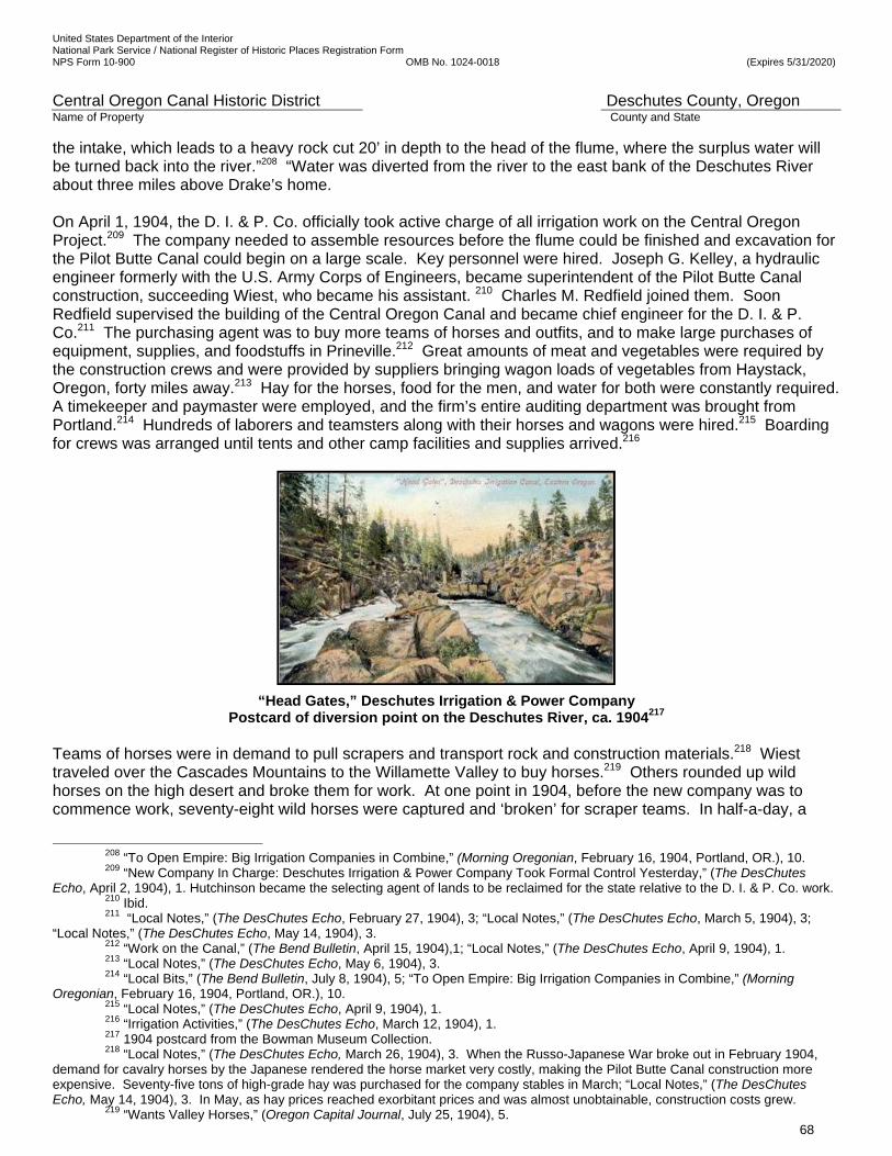
United States Department of the Interior National Park Service / National Register of Historic Places Registration Form NPS Form 10-900 OMB No. 1024-0018 (Expires 5/31/2020)
Central Oregon Canal Historic District Deschutes County, Oregon Name of Property County and State
68
the intake, which leads to a heavy rock cut 20’ in depth to the head of the flume, where the surplus water will be turned back into the river.”208 “Water was diverted from the river to the east bank of the Deschutes River about three miles above Drake’s home. On April 1, 1904, the D. I. & P. Co. officially took active charge of all irrigation work on the Central Oregon Project.209 The company needed to assemble resources before the flume could be finished and excavation for the Pilot Butte Canal could begin on a large scale. Key personnel were hired. Joseph G. Kelley, a hydraulic engineer formerly with the U.S. Army Corps of Engineers, became superintendent of the Pilot Butte Canal construction, succeeding Wiest, who became his assistant. 210 Charles M. Redfield joined them. Soon Redfield supervised the building of the Central Oregon Canal and became chief engineer for the D. I. & P. Co.211 The purchasing agent was to buy more teams of horses and outfits, and to make large purchases of equipment, supplies, and foodstuffs in Prineville.212 Great amounts of meat and vegetables were required by the construction crews and were provided by suppliers bringing wagon loads of vegetables from Haystack, Oregon, forty miles away.213 Hay for the horses, food for the men, and water for both were constantly required. A timekeeper and paymaster were employed, and the firm’s entire auditing department was brought from Portland.214 Hundreds of laborers and teamsters along with their horses and wagons were hired.215 Boarding for crews was arranged until tents and other camp facilities and supplies arrived.216
“Head Gates,” Deschutes Irrigation & Power Company Postcard of diversion point on the Deschutes River, ca. 1904217
Teams of horses were in demand to pull scrapers and transport rock and construction materials.218 Wiest traveled over the Cascades Mountains to the Willamette Valley to buy horses.219 Others rounded up wild horses on the high desert and broke them for work. At one point in 1904, before the new company was to commence work, seventy-eight wild horses were captured and ‘broken’ for scraper teams. In half-a-day, a
208 “To Open Empire: Big Irrigation Companies in Combine,” (Morning Oregonian, February 16, 1904, Portland, OR.), 10. 209 “New Company In Charge: Deschutes Irrigation & Power Company Took Formal Control Yesterday,” (The DesChutes
Echo, April 2, 1904), 1. Hutchinson became the selecting agent of lands to be reclaimed for the state relative to the D. I. & P. Co. work. 210 Ibid. 211 “Local Notes,” (The DesChutes Echo, February 27, 1904), 3; “Local Notes,” (The DesChutes Echo, March 5, 1904), 3;
“Local Notes,” (The DesChutes Echo, May 14, 1904), 3. 212 “Work on the Canal,” (The Bend Bulletin, April 15, 1904),1; “Local Notes,” (The DesChutes Echo, April 9, 1904), 1. 213 “Local Notes,” (The DesChutes Echo, May 6, 1904), 3. 214 “Local Bits,” (The Bend Bulletin, July 8, 1904), 5; “To Open Empire: Big Irrigation Companies in Combine,” (Morning
Oregonian, February 16, 1904, Portland, OR.), 10. 215 “Local Notes,” (The DesChutes Echo, April 9, 1904), 1. 216 “Irrigation Activities,” (The DesChutes Echo, March 12, 1904), 1. 217 1904 postcard from the Bowman Museum Collection. 218 “Local Notes,” (The DesChutes Echo, March 26, 1904), 3. When the Russo-Japanese War broke out in February 1904,
demand for cavalry horses by the Japanese rendered the horse market very costly, making the Pilot Butte Canal construction more expensive. Seventy-five tons of high-grade hay was purchased for the company stables in March; “Local Notes,” (The DesChutes Echo, May 14, 1904), 3. In May, as hay prices reached exorbitant prices and was almost unobtainable, construction costs grew.
219 “Wants Valley Horses,” (Oregon Capital Journal, July 25, 1904), 5.
United States Department of the Interior National Park Service / National Register of Historic Places Registration Form NPS Form 10-900 OMB No. 1024-0018 (Expires 5/31/2020)
Central Oregon Canal Historic District Deschutes County, Oregon Name of Property County and State
69
range horse was ‘broken’ for pulling scrapers and further training came in the regular course of its work. Three men were employed to break horses.220 A vast amount of resources was hauled by horse teams pulling loaded wagons from the railroad terminus at Shaniko. The treacherous trip took at least two days and could take much longer to pull heavy wagons loaded with equipment to the project site. Nielsen, et al., the region’s pioneer road historians, describe one leg of the Shaniko-Prineville-Bend route: “Most freight outfits consisted of three wagons pulled by eight-to-twelve horses. At the base of Hunter Grade, the last wagon had to be dropped. After the first two wagons were pulled to the top, the horses had to return to the bottom to pull up the third wagon.”221 Loads coming into the project area aggregated nearly 50,000 pounds (25 tons) each.222 There was infrastructure to build including bridges, camps, and structures. The Deschutes Lumber Company increased its production to serve the project’s timber and lumber needs223 while Drake rebuilt his PBD Co. lumbermill.224 Bridges were built across the canals where the county roads and canals would intersect.225 The company built an office, a club house, stables, a blacksmith shop, a granary, a warehouse, a powder house, a cook house, a mess hall, a barn, buildings at its experimental farm, and a residence for management.226 Progression of Work, 1904 After the D. I. & P. Co. took over the project, the joint flume to serve both canals near the intake was successfully tested in March 1904, having been upgraded to the satisfaction of the new owners.227 It was not until early April when snow was off the ground and the ground had thawed out that canal construction began.228 Fourteen survey crews were sent to the field in advance of the actual canal construction. The survey crews drew exacting 10-foot contours around the route selected earlier for the main canal and along land in Segregation List 6, and set stakes for the route, so construction teams would know where to locate the canals, laterals, and service ditches. The entire system would flow by gravity. The canals needed to be higher in elevation than the laterals, while the laterals needed to be higher than the ditches to the settlers’ land. Construction began in earnest on the Pilot Butte Canal. “The excavation of the canal “down to Wiest’s homestead [west of Bend] is nearly completed,” a later report said.229 However, water did not arrive through the approximately three miles of open canal to Wiest’s property until June 3, 1904. The Bend Bulletin recognized “this diversion of water from the Pilot Butte Canal is historic because it mark[ed] the first actual use of it on the soil to produce crops.”230 Thus, the company had achieved the first part of what it promised to the State Land Board in February. It had water running in its flume from the headgates at the river up to the future townsite of Bend, irrigating Wiest’s forty acres. But, it did not have water on 25,000 acres, the second promise made in February. That acreage was north between their position in June 1904 and the Crooked River
220 “Breaking Wild Horses,” (The Bend Bulletin, October 7, 1904), 1; “More Horses for Ditch Work,” (The Bend Bulletin, September 30, 1904), 1. Horses were purchased when they were available. During spring, one-hundred tons of hay was stacked at the Forest ranch on the Crooked River, but high water made it impossible to cross the river and bring the fodder to the horses.
221 Nielsen, Lawrence E., Doug Newman, and George McCart, Pioneer Roads in Central Oregon, (Bend: Maverick Publications, 1985), 99-100. A road up Hunter Grade was necessary because Hay Creek runs through a spectacular, impassable gorge; “Local Notes,” (The DesChutes Echo, March 5, 1904), 3. Any precipitation, from early fall to late spring, resulted in “veritable seas of mud” that presented additional difficulties on the route; “Local Notes,” (The DesChutes Echo, May 6, 1904), 3.
222 “To Enlarge Flume,” (The Bend Bulletin, August 12, 1904), 1. Freighters were bringing in loads from across the state; “Local Notes,” (The DesChutes Echo, April 9, 1904), 1. J.O. Johnston, vice-president and general manager, purchased the first automobile to make an appearance in Crook County to facilitate his business travel.
223 “Local Notes,” (The DesChutes Echo, May 28, 1904), 3. The lumber company purchased a new Samson turbine water wheel; “Local Notes,” (The DesChutes Echo, March 26, 1904), 3.
224 “Local Notes,” (The DesChutes Echo, March 19, 1904), 3; “Local Notes,” (The DesChutes Echo, April 2, 1904), 3. 225 “Local Notes,” (The DesChutes Echo, April 16, 1904), 3; “Work on the Canal,” (The Bend Bulletin, April 15, 1904),1. 226 “More Than $100,000,” (The Bend Bulletin, January 6, 1905), 1. 227 “Irrigation Activities,” (The DesChutes Echo, March 12, 1904), 1. It is possible that the D. I. & P. Co. decided to make upgrades to the flume they acquired. New Company in Charge: Deschutes Irrigation & Power Company Took Formal Control Yesterday,” (The DesChutes Echo, April 2, 1904), 1. 229 “Work on the Canal,” (The Bend Bulletin, April 15, 1904),1.
230 “First Water on Soil,” (The Bend Bulletin, June 3, 1904), 1. Chief engineer J.G. Kelly resigned the same week.
United States Department of the Interior National Park Service / National Register of Historic Places Registration Form NPS Form 10-900 OMB No. 1024-0018 (Expires 5/31/2020)
Central Oregon Canal Historic District Deschutes County, Oregon Name of Property County and State
70
Canyon. The stretch in the Pilot Butte Canal Historic District (Cooley Road-Yeoman Road Segment), at miles 6 to 7.5, was nearly solid rock, with twists and turns, and had to be completed before water could flow past it into the northern half of the canal, where other crews were progressing quickly. During the summer of 1904, four crews, at four camps, were working at different points on the Pilot Butte Canal.231 Work was progressing slower than expected and more laborers were needed. In mid-August a report from Eugene, Oregon, indicated that at the completion of sewer construction contracts, the city would release a number of men for work on the Pilot Butte Canal. The superintendent went to Eugene to hire laborers.232 Nearing the end of September, the company had about 200 men and 100 horse teams at work and was trying to double the force as soon as possible. About 50 Italian laborers were brought in for the upper Pilot Butte Canal and more were expected to come. Twenty Americans were clearing the right-of-way for the Pilot Butte Canal. More than 100 men were at the lower construction camp in the rock. Two surveying and engineering parties were still in the field making topographical examinations and contour maps of the country. The company bought 50 horse teams to put on the canal work. Scrapers and a great quantity of food and general supplies were being received by railroad at Shaniko. The company was pushing the freighters to bring in more.233 More Problems on the Headgate and Shared Flume It became apparent that the Oregonian newspaper’s February 16, 1904 exuberant praise for the engineering on the headgate had been premature. The headgate and flume system was not able to carry enough water for the two canals it was to serve. Even if all the water was diverted for the Pilot Butte Canal, it would be underserved. The intake and flume must be significantly enlarged. In early October at the headgate a force of rock men was blasting out a new intake, engineers and surveyors were taking levels and guiding workmen, and the flume was being enlarged to carry water in the Central Oregon Canal that would soon be under way. In all, about 350 men and 100 horse teams were employed by the company at various places along the canal.234 Near the end of October the headgates were closed, bringing to a standstill water service to the future Bend townsite, and the work of enlarging the channel through this stretch was expected to take two weeks. The capacity of the 6,680’ flume near the headgate was more than tripled. It was carrying only 80 cubic feet per second (cfs) for the Pilot Butte Canal.235 It originally was 5’3” wide and 3’9” deep. (Today the Pilot Butte Canal carries 400 cfs.) Therefore, the flume was enlarged to 16’ wide by 5’ tall. Ten feet were added to the flume’s width and a foot to its depth, increasing its carrying capacity to 650 cubic feet per second, enough to irrigate 85,000 acres, it was thought at the time. A part of the miscalculation in sizing the flume and canals was due to the ‘surprising tenacity of the soil.’ The additional excavation that was expected to be done naturally by the water when it was sent through the channel failed. It was anticipated during construction that after the laborers and horse teams shaped the canal bed, the water would be let into the canals and it would cut the channel deeper, but that did not turn out to be the case. The water flowed over the dry soil and did not move it. “The land holds up against it and must be dug away with scrapers, demolishing pretty effectively the old bugbear that the Deschutes soil is so light and loose that it will not even give direction to streams of water.”236 The unexpected excessive loss of water through rocks, caverns and fissures in the canal beds, the roughness of the rocky canal bed in the stretches near Bend and the inconsistent shapes, width and depth of the canals, also contributed to the problems in accurately sizing the structures.
231 “Local Notes,” (The DesChutes Echo, March 5, 1904), 3. 232 “To Enlarge Flume,” (The Bend Bulletin, August 12, 1904), 1. 233 “Pushing the Work,” (The Bend Bulletin, September 23, 1904), 1. C.M. Redfield was the new chief engineer; “C.M.
Redfield Dies Suddenly,” (The Bend Bulletin), March 19, 1924), 1. Article indicates Redfield had come to work for the company in April 1904, apparently taking over the chief engineer position in early June, 1904, when J.G. Kelly resigned.
234 “On the New Flume,” (The Bend Bulletin, October 7, 1904), 1. 235 “Digs Ditch Bigger,” (The Bend Bulletin, October 21, 1904), 1. The canal was enlarged to carry 250 cubic feet per second rather than 80 cfs. New calculations had concluded more water was needed than the PBD Co. had initially determined. 236 The Bend Bulletin, October 21, 1904, 1, “Digs Ditch Bigger.”
United States Department of the Interior National Park Service / National Register of Historic Places Registration Form NPS Form 10-900 OMB No. 1024-0018 (Expires 5/31/2020)
Central Oregon Canal Historic District Deschutes County, Oregon Name of Property County and State
71
1923 photo of men standing in the enlarged Central Oregon canal flume.237
John Dubuis, in the “Report to the Desert Land Board on Central Oregon Project” wrote, “Canals have been built wider and more shallow than proper, in order to avoid rock excavation. Where natural depressions were used, the water has been allowed to spread over large areas. Since the loss of water is to a certain degree directly proportional to the wetted area, some of the excess loss is the natural result of this excess area.”238 He was saying that the canals were built to be much wider and shallower than they were designed to be, and that the larger surface in the beds resulted in more seepage. During two weeks in October, 160 men on the Pilot Butte Canal were moved south from the end of the canal to two camps at the southern rocky half to enlarge the canal so it could convey 250 cubic feet per second for the spring 1905 irrigation season. Construction of the Central Oregon Canal had just begun ‘with a heavy force of men’239 at the end of the intake flume. The Central Oregon Canal was to convey 400 cubic feet per second from the enlarged flume as it headed east toward Powell Butte. (It conveys 530 cfs today.) The Bend area was the most difficult terrain of the entire irrigation system. Rock outcroppings and nearly solid rock below the thin layer of soil and unexpected lava tubes were encountered in the first third of the Pilot Butte Canal and the first ten miles of the Central Oregon Canal, where the canals needed to convey the full amount of water and be wide and deep. Those conditions and the rolling terrain caused a challenge for both water volume calculations and construction. The company discovered that it would be more time consuming than anticipated to construct the canals though the rock and would require blasting as well as digging and scraping. At this time, late in 1904, winter approached at 3,600’ above sea level at the foot of the Cascades. The company feared that snow, ice, and freezing temperatures could quickly halt all construction on both canals until spring. The February 1904 promises of the D. I. & P. Co. to have water on thousands of acres of desert land would soon be a year old. Being behind in its schedule, and the smaller half of the Pilot Butte Canal farther north completed, the company quickly had to meet the challenge posed by the geological conditions presented in the rocky stretch in the Pilot Butte Canal Historic District (Cooley Road-Yeoman Road Segment) and prove to investors, the State Land Board, and to potential settlers that they were committed to completing the canal in time for spring farming in the Deschutes country. J.O. Johnson knew he would meet ten miles of the same rock near Bend on the Central Oregon Canal. A new approach to the rock was necessary.
Construction Utilizes Technology, Man-and Horse-Power, 1904-05 Fortunately, the D. I. & P. Co. was able to take advantage of a propitious period in the history of irrigation and land development technology. A revolution in horse-drawn earth moving came in 1883. John Porteus, a
237 1923 photo from the Deschutes County Historical Society Collection. 238 Dubuis, John, Report to Desert Land Board on Central Oregon Project, 1914, 5. 239 ibid
United States Department of the Interior National Park Service / National Register of Historic Places Registration Form NPS Form 10-900 OMB No. 1024-0018 (Expires 5/31/2020)
Central Oregon Canal Historic District Deschutes County, Oregon Name of Property County and State
72
Men using horse-drawn Fresno scrapers240
Fresno Township blacksmith, invented the Fresno scraper. “The device was a metal scoop with unique steel runners, pulled by two to four draft animals. Like the skip scraper, the teamster controlled the depth of cut from behind. However, the Fresno could be skidded along for reasonable distances and dumped on a controlled basis. Porteus’ invention was an impressive improvement over the skip.”241 By using these scrapers with the ability to haul material over a short distance and to control the dump, the company was able to not only excavate loose canal material, but was also able to build canal embankments where they wanted them, and to the specifications they needed them to be by systematic dumping. John H. Lienhard, PhD, Professor Emeritus of Mechanical Engineering and History at the University of Houston explains the operation of the Fresno, a designated Historic Mechanical Engineering Landmark:
“Porteus’ C-shaped scraper had a blade along the bottom. It scooped as it was pulled along. [Different from all predecessors], this machine rode on runners and could be tilted. An operator walking behind it could change the angle. When it was full, he tilted it back and let it slide on the runners. He could dump as he passed over low spots and smooth out terrain. He could vary the angle of attack to match the [cut required]”.242
Mechanical engineers Davis and Wilson wrote that the Fresno scraper can be used for hauls of any distance, but it is not very advantageous for long hauls. It is also suitable for making ditches, dikes, and any other scraper work where the haul is not great enough to require wheels.243 However, the most significant utilization of technology, steam-powered drilling, was used in the excavation of the most difficult basalt rock, beginning in November 1904. General Manager J.O. Johnston understood the difficulty deep lava flows would present to construction and had commented on it in February 1904: “That lava bed is very rough, requiring expensive work in cutting out rock.”244 Typically, steel miners’ drills were pounded with sledge hammers to drill holes for blasting charges. After a blast was detonated, teams of men and horses with Fresno scrapers, along with men and shovels, excavated shattered rock to bring the canal to grade.245
240 1904 photograph courtesy of the Deschutes County Historical Society. 241 Ibid. ‘Slip’ and ‘skip’ are interchangeable terms, referring to the same type of equipment. 242 University of Houston, “No. 353: The Fresno Scraper,” Engines of Our Ingenuity, (Accessed March 27, 2015); University of
Houston, “Dr. John L. Lienhard,” Engines of Our Ingenuity, (Accessed March 27, 2015). Lienhard received BS and MS degrees from Oregon State and the University of Washington, his PhD from the University of California at Berkeley, and holds two honorary doctorates; San Joaquin County Historical Society and Museum, “Designating the Fresno Scraper as an Engineering Landmark,” (Accessed March 27, 2015). On March 26, 2011, in a ceremony at the Museum the American Society of Mechanical Engineers (ASME) designated the Fresno Scraper as a Historic Mechanical Engineering Landmark. The society noted the Fresno was used throughout the world, including in the construction of the Panama Canal, and was the forerunner of virtually all earthmoving implements.
243 American Society of Mechanical Engineers; Davis, Arthur Powell, D.Sc., and Herbert M. Wilson, C.E., Irrigation Engineering, (New York: John Wiley & Sons, Seventh Edition, 1919), 109.
244 “Water In Sixty Days: Deschutes Irrigation Company Buys Out Others,” (The Sunday Oregonian, February 14, 1904), 6. 245 Coe, Urling C., Frontier Doctor, 13-14. Coe describes injuries from rock and dynamite and medical attention he provided.
United States Department of the Interior National Park Service / National Register of Historic Places Registration Form NPS Form 10-900 OMB No. 1024-0018 (Expires 5/31/2020)
Central Oregon Canal Historic District Deschutes County, Oregon Name of Property County and State
73
Being familiar with building railroads and drilling for gas, the D. I. & P. Co. invested in the best equipment for the job to be done to make the work more efficient and timely. J.O. Johnston stated, “We have paid cash and a lot of it, for everything as we went along, and we expect to continue this course in the future until every detail of the reclamation work is completed.”246
Fresno Scraper Modes of Operation247
By the turn of the twentieth century, steam power propelled eighty percent of the factories in the nation. It was portable and allowed regulation of the power that was generated.248 The D. I. & P. Co. purchased two portable steam boilers, “specially made for the work of this company in the Bend section “and shipped from Columbus, Ohio” to provide power for operating rock drills. One boiler was twenty horsepower and drove four drills. The other was six horsepower and drove one. Together, they could bore 400’ per day in the hard, demanding strata of lava, where typically it would take three men to bore 18’ to 20’ per day. The drills were ‘worked by steam direct from the boiler, the steam serving the same purpose as compressed air in another kind of drilling contrivance’ noted the report. 249 “Monster Drills At Work,” headlined the East Oregonian. “Power will be generated for driving four drills into lava rock. The two boilers with their big steel drills will do more work in a day than 300 men.”250 Before these machines were brought into operation, General Manager J.O. Johnston calculated that a “force of 388 rock men would be required to do the necessary work.” The impossibility of getting such a force led Johnston to devise this method of drilling powder holes in the rock. Hand drilling was used where there was little drilling to be done, but the big ledges were ‘bored by the steam-powered drills.’ The report indicated the shipment filled an entire railroad car, and was hauled by freighters from Shaniko in multiple wagon loads to the work site, taking several days to get all of the equipment delivered.251 The procedure to form the two canals was more than just blasting, scraping, and dumping repetitively. Canal banks were carefully built in successive layers of compacted rock and soil and kept as level as practicable. The travel over the canal banks during construction was performed in a manner to distribute the compacting
246 “Cheap Land Gives Start to Redmond,” (The Redmond Spokesman, August 21, 1952), 2. Article suggests there were some ‘slips,’ another type of excavation equipment. Indications are this was not the case in the nominated section; Davis, Arthur Powell, D.Sc., and Herbert M. Wilson, C.E., Irrigation Engineering, 233. The authors indicate the Fresno scraper is the most satisfactory in handling tough earth too heavy to be handled by other types of scrapers; “D. I. & P. Co. Is Here to Stay,” (Crook County Journal, April 9, 1905), 1.
247 Boulder Community Network, Boulder County, Colorado, The Ditch Project: 150 Years of Ditches—Boulder’s Constructed Landscape, (Accessed March 27, 2015). Image, Courtesy of American Society of Mechanical Engineers; Davis, Arthur Powell, D.Sc., and Herbert M. Wilson, C.E., Irrigation Engineering, (New York: John Wiley & Sons, Seventh Edition, 1919), 109.
248 Preston, Daniel, “The Industrial Age: Steam Technology,” (20th Century United States History, New York: Harper Perennial, 1992), 6.
249 ”To Drill By Steam,” (The Bend Bulletin, November 18, 1904), 1. 250 “Monster Drills at Work,” (East Oregonian, November 28, 1904), 8. Originally in undated Crook County Journal.
251 ”To Drill By Steam,” (The Bend Bulletin, November 18, 1904), 1.
United States Department of the Interior National Park Service / National Register of Historic Places Registration Form NPS Form 10-900 OMB No. 1024-0018 (Expires 5/31/2020)
Central Oregon Canal Historic District Deschutes County, Oregon Name of Property County and State
74
effect of the horses and scrapers to the best advantage possible.252 In the fall of 1904, 400-500 men and 215 horse teams were working on the two canals.253 It is estimated that 215 teams moved 214,500 loads with almost 1,000 loads per team over approximately 25 straight days of work. This would have amounted to 40 loads per day per team/scraper, or five per hour over an eight-hour day.254 Hundreds of men used shovels and laid riprap by hand. Completion of the Pilot Butte Canal It was pivotal to have the steam-powered drills to excavate lava flows. Otherwise, the timely completion of the entire Pilot Butte Canal would have been jeopardized. The D. I. & P. Co., nor any other company, could have assembled and fed a force of 388 rock men estimated to be needed to do the necessary work by hand. Additionally, it was crucial to amass a very substantial workforce and several hundred horse teams. The PBC Historic District (Cooley Road-Yeoman Road Segment) was the ‘make or break’ part of the project on which the future of the D. I. & P. Co., the cities of Bend and Redmond, and the agricultural potential of the Deschutes Country rested. Failure in the project management and excavation of this key piece would have effectively terminated all of the broader, more extensive plans for the settlement and agricultural development of the Deschutes Country. The D. I. & P. Co. did have an extraordinary amount of capital, exceptional expertise in the utilization of technology, and enormous man- and horse-power to find a successful methodology for dealing with the rock plus meeting schedules and deadlines set by the State. On February 10, 1905, the challenges had been met, work was finally done, and water could flow in the Pilot Butte Canal to its terminus just south of the Crooked River for the 1905 irrigation season. The water was let into the Pilot Butte Canal on March 5, 1905.255 At the end of March The Bend Bulletin reported the company’s investment in the previous twelve months as $500,000,256 equivalent to over $12 million in 2017 dollars.257 The construction of laterals branching off of the Pilot Butte Canal, bringing water to farmers, began in April 1905.258 1904 -1914, CENTRAL OREGON CANAL DESIGN AND CONSTRUCTION, FLUME COLLAPSE Progression of Work on the Central Oregon Canal On September 4, 1904, a Bend Bulletin article said, “Work is being pushed rapidly on the right-of-way of the new canal south of town, five miles of which has already been cleared.” The October 7, 1904 The Bend Bulletin reported that 350 men and 100 horse teams are living in tented camps and are employed by the construction work of the D. I. & P. Co., finishing the middle rocky portion of the Pilot Butte Canal, enlarging the southern end of the Pilot Butte Canal, enlarging the wooden intake flume, blasting rock in the intake, and constructing the Central Oregon Canal. The article says, “…the Central Oregon Canal will be fed 400 cubic feet a second from the enlarged flume. The first plan was to feed the Central Oregon Canal from a flume to be
252 Davis, Arthur Powell, D.Sc. and Herbert M. Wilson, C.E., Irrigation Engineering, 557. Specifications for constructing
embankments in this Civil Engineer’s book indicates layers were generally not to exceed 12” in thickness. 253 “Pay Back to Old Figures: Men Don’t Like It and Many of Them Quit,” (The Bend Bulletin, March 17, 1905), 1. Figures are
based on numbers from the article indicating that as the result of the reduction in pay about 200 men and 125 teams left the canal work in the first week of March, leaving about 200 men and 90 teams on the work.
254 Steam drills arrived just after the first week of November. Assuming all team/scraper work began by Friday, November 11, 1904, and concluded on or about December 5, 1904, provides twenty-five days. 214,500 loads / 215 teams/scrapers = 997.67 loads per team. 997.67 loads per team / 25 days = 39.9 loads per day, per team/scraper. Or, 40 loads per day over an 8-hr. day = 5 loads per hour for each team/scraper; Oregon State Archives, Desert Land Board Reclamation Records, Deschutes Irrigation & Power Co., no. 37-43, box 15, folder 10. Letter, J.O. Johnston, vice president and general manager, Deschutes Irrigation & Power Company, Columbus, Ohio, December 5, 1904, to G.G. Brown, Clerk, State Land Board, Salem, Oregon. General Manger Johnston indicates 400- 500 men had been at work; Timedate.com. Including December 5 as the end date provides 25 days.
255 “Hundreds At Work,” (The Bend Bulletin, March 10, 1905), 1. Article indicates water turned into canal on March 5, 1905. 256 “Still Bend Is Growing,” (The Bend Bulletin, March 31, 1905), 4. 257 Federal Reserve Bank of Minneapolis, “CPI Calculator Information,” (Accessed March 30, 2015). Using the Consumer
Price Index (CPI) for 2015 (239.7) and the CPI for 1913 (9.9; 1913 being the earliest available) the calculation is (239.7/9.9) x $500,000 = $12,106,060.61 in today’s dollars.
258 “Now Building Laterals,” (The Bend Bulletin, April 14, 1905), 1. The article noted: “Now comes the system of laterals distributing the water for the use of the farmers.”
United States Department of the Interior National Park Service / National Register of Historic Places Registration Form NPS Form 10-900 OMB No. 1024-0018 (Expires 5/31/2020)
Central Oregon Canal Historic District Deschutes County, Oregon Name of Property County and State
75
taken out at Lava Island, five miles above the Pilot Butte intake. But, the plan was recently modified so as to ma[k}e the one enlarged flume supply the two canals. The Central Oregon Canal now starts at the foot of the flume and keeps to the higher ground. For a mile or so, it stays beside the Pilot Butte canal, but when it gets out past the rim rock, it bears to the east and will extend out to Powell Buttes.” The October 21, 1904 The Bend Bulletin said, “Work on the Central Oregon Canal is pushed with a heavy force of men near the foot of the flume. That work will not in any way be slackened for the enlargement of the Pilot Butte Canal.” In November 1904, crews and horse teams were moved from the Pilot Butte Canal project to start clearing the first ten miles of the route for the Central Oregon Canal, below the wooden intake flume, while the fall weather lasted. On January 13, 1905, the front-page article in The Bend Bulletin exclaimed that the Central Oregon Canal will run in the old Dry River bed. It said, “The well-marked old river channel reaching across Central Oregon half way between Bend and Prineville will again carry a volume of sparkling water next summer. For the first time since man has known this country, the ‘old river bed’ will be a veritable river, big enough for steamboats.” The writer went on to say that the canal will be completed for 30 miles to the river bed by May. “Trout will take the place of sand lizards,” the writer exclaimed. On Feb. 3, 1905, The Bend Bulletin reported that the ground is torn up for a distance of six miles from the flume for the Central Oregon Canal. Work was continuing on the flume. The crews and equipment were stationed along the first 10 miles of the Central Oregon Canal route and it was being constructed. Crews were aided by having the specialized rock drilling equipment ordered by J.O. Johnson to speed the process of blasting rock and steam shovels to scoop up broken rock and load it in wagons. On February 10, 1905, the company moved men and horse teams from the Pilot Butte Canal to work on the Central Oregon Canal.259 On February 17, 1905, the headline exclaimed that the work on the Pilot Butte Canal was finished to the Crooked River. “This will add about 125 men and 40 horse teams to the Central Oregon Canal work, which is at mile 10.” (This point is at the eastern end of the nominated historic district.) “The transferred camp will take up work on the Central Oregon Canal at a point about 10 miles east of Bend, as soon as the retiring frosts will permit canal excavation. That will put a force of about 300 men and 200 teams, to say nothing of machine drills, road machines, and patent excavators, on the one big canal and it will carry water to the old river bed early in the spring.” On March 10, 1905, the crews included 400 men and 250 horse teams. Two more miles were being excavated and the rock work was going well with the energy of the crew and the specialized equipment. But, there were more setbacks. A huge sink hole opened on the canal near the intake flume at the river and was challenging to plug. The next week the newspaper extolled all the new settlers between Bend and Powell Butte, who were arriving due to the Pilot Butte Canal’s completion, the Central Oregon Canal’s construction, and the company’s advertising campaign. In early April, 500 feet of the newly enlarged wooden flume at the diversion point at the river collapsed. Lumber was in short supply. Because the water had to be shut off to the two canals again, the construction camps had to be temporarily moved into town, so the men and horses could have water to drink and use for domestic purposes. Within a month, the flume was repaired. Water flowed for the irrigation season through the Pilot Butte Canal and out 10 miles on the Central Oregon Canal, so the crews could resume work there. The crews were reduced when many workmen quit and went to the Columbia Southern ditch work that was offering higher wages. The Bend Bulletin on July 14, 1905 said, “Several leaks have developed along the Central Oregon work, where rock was shattered by blasting, opening crevices to subterranean chambers. These are generally stopped by
259 “To Crooked River,” (The Bend Bulletin, February 3, 1905), 1. Indicates Central Oregon Canal just started at this time, with the breaking up of ground; “Canal Is Finished,” (The Bend Bulletin, February 17, 1905), 1. This article indicates work completed to the Crooked River on February 10; Brogan, Phil F., “The Watering of the Wilderness,” (The Bend Bulletin, February 4, 1931), n.p. Brogan states February 9 as the completion date.
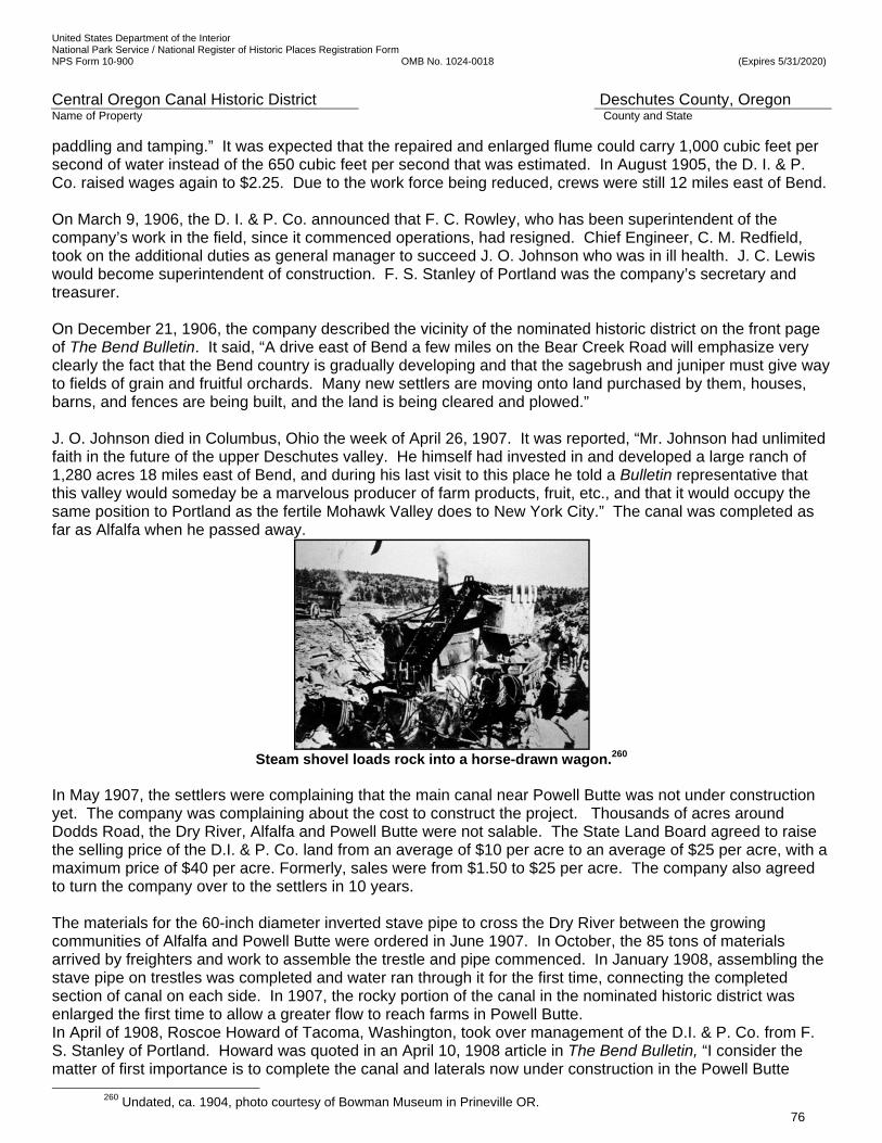
United States Department of the Interior National Park Service / National Register of Historic Places Registration Form NPS Form 10-900 OMB No. 1024-0018 (Expires 5/31/2020)
Central Oregon Canal Historic District Deschutes County, Oregon Name of Property County and State
76
paddling and tamping.” It was expected that the repaired and enlarged flume could carry 1,000 cubic feet per second of water instead of the 650 cubic feet per second that was estimated. In August 1905, the D. I. & P. Co. raised wages again to $2.25. Due to the work force being reduced, crews were still 12 miles east of Bend. On March 9, 1906, the D. I. & P. Co. announced that F. C. Rowley, who has been superintendent of the company’s work in the field, since it commenced operations, had resigned. Chief Engineer, C. M. Redfield, took on the additional duties as general manager to succeed J. O. Johnson who was in ill health. J. C. Lewis would become superintendent of construction. F. S. Stanley of Portland was the company’s secretary and treasurer. On December 21, 1906, the company described the vicinity of the nominated historic district on the front page of The Bend Bulletin. It said, “A drive east of Bend a few miles on the Bear Creek Road will emphasize very clearly the fact that the Bend country is gradually developing and that the sagebrush and juniper must give way to fields of grain and fruitful orchards. Many new settlers are moving onto land purchased by them, houses, barns, and fences are being built, and the land is being cleared and plowed.” J. O. Johnson died in Columbus, Ohio the week of April 26, 1907. It was reported, “Mr. Johnson had unlimited faith in the future of the upper Deschutes valley. He himself had invested in and developed a large ranch of 1,280 acres 18 miles east of Bend, and during his last visit to this place he told a Bulletin representative that this valley would someday be a marvelous producer of farm products, fruit, etc., and that it would occupy the same position to Portland as the fertile Mohawk Valley does to New York City.” The canal was completed as far as Alfalfa when he passed away.
Steam shovel loads rock into a horse-drawn wagon.260
In May 1907, the settlers were complaining that the main canal near Powell Butte was not under construction yet. The company was complaining about the cost to construct the project. Thousands of acres around Dodds Road, the Dry River, Alfalfa and Powell Butte were not salable. The State Land Board agreed to raise the selling price of the D.I. & P. Co. land from an average of $10 per acre to an average of $25 per acre, with a maximum price of $40 per acre. Formerly, sales were from $1.50 to $25 per acre. The company also agreed to turn the company over to the settlers in 10 years. The materials for the 60-inch diameter inverted stave pipe to cross the Dry River between the growing communities of Alfalfa and Powell Butte were ordered in June 1907. In October, the 85 tons of materials arrived by freighters and work to assemble the trestle and pipe commenced. In January 1908, assembling the stave pipe on trestles was completed and water ran through it for the first time, connecting the completed section of canal on each side. In 1907, the rocky portion of the canal in the nominated historic district was enlarged the first time to allow a greater flow to reach farms in Powell Butte. In April of 1908, Roscoe Howard of Tacoma, Washington, took over management of the D.I. & P. Co. from F. S. Stanley of Portland. Howard was quoted in an April 10, 1908 article in The Bend Bulletin, “I consider the matter of first importance is to complete the canal and laterals now under construction in the Powell Butte
260 Undated, ca. 1904, photo courtesy of Bowman Museum in Prineville OR.

United States Department of the Interior National Park Service / National Register of Historic Places Registration Form NPS Form 10-900 OMB No. 1024-0018 (Expires 5/31/2020)
Central Oregon Canal Historic District Deschutes County, Oregon Name of Property County and State
77
neighborhood in order to supply the settlers in that vicinity with water. That work will be pushed with all due dispatch”. By mid-June, the canal was delivering water for 28 miles, including to some setters in Powell Butte. In December, the company was saying that, if the weather would hold up, the canal could deliver water to the settlers for the entire 45 miles in the next year. In January 1909, the company was irrigating 84,000 acres with both canals. On February 3, 1909, a letter from a settler in Powell Butte was printed in the Bend Bulletin newspaper that slush ice filled the Central Oregon Canal so full that the water ran over the frozen banks and flooded the old river bed, washed out some of the furrow laterals, and washed mud into some of the cisterns. By the 1909 irrigation season, most of the settlers had water and the 45 miles of the Central Oregon Canal were constructed. Other improvements and laterals and ditches continued to be built through the next five years. The D. I. & P. Co. was reorganized as the Central Oregon Irrigation Company in 1910.261 In November of that year The Bend Bulletin reported that “Oregon’s greatest irrigation enterprise [is] actively and firmly on its feet again.”262
COID employee fills an underground cavern in the Central Oregon Canal near Dodds Road,
two miles east of the historic district. 263 In 1912, the North Dam was completed by the company. From a new diversion point and headgate at the new dam, a new 1.4 mile long “U” shaped channel, called the North Canal, was constructed in flat terrain to connect the river to the existing Pilot Butte Canal at approximately milepost 8 of the Pilot Butte system.264 The new
261 McGuffie, J. G., Secretary, Central Oregon Irrigation, Letter to Fred F. Henshaw, Federal Power Commission Board of Engineers, April 23, 1921. McGuffie wrote that during the 1907-1910 period, the D. I. & P. Co. “proceeded actively in the reclamation of lands embraced in Segregation List No. 6, but the bond holders became restive and litigation arose which resulted in the foreclosure by the bond holders [into receivership] and a reorganization of the affairs of the company, and a transfer of all contract rights of the [D. I. & P. Co.] to the Central Oregon Irrigation Company, a corporation, which … continued in the construction and management of the system from November, 1910”; “D. I. & P. Co. To Reorganize: Change in Irrigation Co. Effected This Week,” (The Redmond Spokesman, November 9, 1910), 1. The Central Oregon Irrigation Company filed its articles of incorporation, October 16, 1910, with a capital stock of $1.5 million. The directorate was Frederick F. Stanley, A.F. Biles, Jesse Stearns, and others representing New York and Columbus interests.
262 “Troubles Over,” (The Bend Bulletin, November 2, 1910), 1. Other interests included I.N. Farnum of New York, representing J.G. White & Co.; and L.G. Addision, of Columbus, representing the Ohio bondholders. Roscoe Howard was manager and C.W. Redfield chief engineer. For the new firm, Stanley was president, Biles was vice-president, and Stearns was secretary-treasurer.
263 Undated Deschutes County Historical Society photo. 264 Federal Power Commission, Report to the Federal Power Commission on Uses of the Deschutes River, Oregon,
(Washington, D.C.: Printing Office, 1922), 75. The water for the Pilot Butte Canal system thus remained in the Deschutes River rather than being diverted where it had been since 1904-05, and passed down the river where it was then diverted through the North Canal and into the Pilot Butte Canal, above the nominated section. The Pilot Butte Canal system continued to irrigate the same historic lands north of the nominated section; Hadlow, Robert W., Cultural Resources Specialist, Findings of Effect on Bend’s Historic Irrigation Canals, Bend Parkway, The Dalles-California Highway, U.S. 97, Deschutes County, (Salem: Oregon Department of Transportation, Environmental Section, June 1992), 4. The North Canal became generally known as the North/Pilot Butte Canal. The portion of the
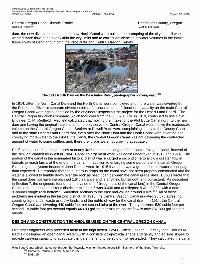
United States Department of the Interior National Park Service / National Register of Historic Places Registration Form NPS Form 10-900 OMB No. 1024-0018 (Expires 5/31/2020)
Central Oregon Canal Historic District Deschutes County, Oregon Name of Property County and State
78
dam, the new diversion point and the new North Canal were built at the prompting of the city council who wanted more flow in the river within the city limits and to correct deficiencies of water volumes in the intake flume south of Bend and in both the Pilot Butte and Central Oregon Canals.
The 1912 North Dam on the Deschutes River, photographer looking east. 265
In 1914, after the North Canal Dam and the North Canal were completed and more water was diverted from the Deschutes River at separate diversion points for each canal, deficiencies in capacity on the main Central Oregon Canal were again identified by the engineers inspecting the project for the Desert Land Board. The Central Oregon Irrigation Company, which took over from the D. I. & P. Co. in 1910, continued to use Chief Engineer C. M. Redfield. Redfield calculated that moving the intake for the Plot Butte Canal north to the new dam and having the original intake and flume only serve the Central Oregon Canal would solve the inadequate volume on the Central Oregon Canal. Settlers at Powell Butte were complaining loudly to the County Court and to the state Desert Land Board that, even after the North Dam and the North Canal were diverting and conveying more water to the Pilot Butte Canal, the Central Oregon Canal was not delivering the contracted amount of water to some settlers and, therefore, crops were not growing adequately. Redfield measured seepage losses at nearly 40% on the total length of the Central Oregon Canal, instead of the 30% anticipated by Wiest in 1904. Canal enlargement work was again undertaken in 1913 and 1914. The portion of the canal in the nominated historic district was enlarged a second time to allow a greater flow in laterals to reach farms at the end of the canal. In addition to enlarging some portions of the canal, Oregon State irrigation system inspector John Dubuis wrote in 1915 that there was a greater loss of water to seepage than expected. He reported that the numerous drops on the canal have not been properly constructed and the water is allowed to tumble down over the rock as best it can between the canal grade lines. Dubuis wrote that the canal does not have the planned 1.5’ clearance and is anything but smooth and consistent. As described in Section 7, the engineers found that the value of “n” (roughness of the canal bed) in the Central Oregon Canal in the nominated historic district at milepost 7 was 0.036 and at milepost 8 was 0.038, with a note, “Channel rough: rock bottom.” Smoother sections to the east had values around 0.025.266 All of these problems are evident in the historic district. In 1915, the Central Oregon Canal irrigated 25,573 acres, not counting high lands, waste or rocky lands, and the rights-of-way for the canal itself. In 1914, the Central Oregon Canal was diverting 440 cubic feet per second (cfs) at the river. Today it diverts 530 cubic feet per second. A cubic foot per second equals 448.83 gallons per minute, so the flow is now 237,880 gallons per minute. DESIGN AND CONSTRUCTION TECHNIQUES USED ON THE CENTRAL OREGON CANAL Like other engineers who preceded them in the high desert, Levi D. Wiest, Joseph G. Kelley, and Charles M. Redfield designed an open canal system with a consistent trapezoidal shape and gently angled side slopes to provide carrying capacity to adequately irrigate the land to be sold or homesteaded. They calculated the canal
Pilot Butte Canal which had come through the Townsite was terminated about 1.5 miles north of the Bend Townsite.
265 Photo by Patricia Kliewer, March 2015. 266 Ibid., 19.
United States Department of the Interior National Park Service / National Register of Historic Places Registration Form NPS Form 10-900 OMB No. 1024-0018 (Expires 5/31/2020)
Central Oregon Canal Historic District Deschutes County, Oregon Name of Property County and State
79
sizes necessary to convey enough water to distribute to the settlers, accounting for expected losses from seepage into the soil, evaporation, and “carry water” needs to irrigate the 84,707 acres in Segregation List # 6.267 The canal was designed for ‘safe capacity,’ which is the maximum amount of water that the canal can carry without causing the velocity of flow to become so great as to cause serious erosion of the bottom and sides.268 Safe capacity also leaves sufficient clearance between the top of the water surface and the top of the banks to prevent ill effects of wave action, rise and fall of the water surface due to the regulation of the headgates and the wearing down of the banks by weathering and trampling of cattle. The design gave a 1.5 to 2-foot clearance between the top of the moving water and the top of the banks. As mentioned previously, another factor in their designs was the expected average roughness of the canal. The greater the roughness, the greater friction it causes and the velocity reduces. The canals near the headgate were the largest because the canals carried the full amount of water diverted there. The designs showed a consistent shape with flat beds 4’ deep by 40’ wide for the Pilot Butte Canal and 4’ deep by 50’ wide for the Central Oregon Canal, to prevent extensive digging while providing capacity. Seepage losses were expected to be 30%, but they were measured at near 40% by John Dubuis in 1914. Evaporation losses were measured at less than 1%.269 Design and Size of the Central Oregon Canal and ‘A’ and ‘B’ Laterals Except for the wooden flume at the intake, concrete or wooden flumes bridging low spots and caverns, concrete and wooden bridges over roads, and the wooden pipe at the Powell Butte Siphon, only native materials found in place were used in canal construction. In the nominated historic district, Charles M. Redfield oversaw survey crews and located the Central Oregon Canal and headgates for two laterals, while ditches were located later as settlers arrived, but were mainly in place by 1912. Laterals are assigned consecutive letter names, with the lateral closest to the river source being ‘A’. The ‘A’ Lateral diverted enough water to irrigate 5,292 acres in Bend and to the north and east side of Bend to Butler Market Road. At the beginning of the nominated historic district, in 1914, at Ward Road, the canal volume was 365 cfs. In the nominated historic district, the headgate to Lateral ‘B’ is on the north side of the canal and it irrigates 1,319 acres. The ‘B’ Lateral slightly reduced the volume in the main canal to 356 cfs. The headgate for the ‘C’ Lateral is also on the north side of the canal in the nominated historic district and it irrigated 2,498 acres to the north. The flow at the end of the district at Gosney Road was 286 cfs. As water is delivered to its users through laterals and ditches, it carries less water and becomes successively smaller. An average of 4’ deep and about 50’ wide canal at full capacity would carry the necessary amount of water in the district. But, to have a minimum of excavation while providing capacity, the canal shows great variability in width, depth, and shape. (See Figure 21 for canal measurements in the nominated historic district.) Building Techniques in the Canal in the Historic District After the canal route was surveyed and contours of the land were drawn, the selected route was marked. Clear and grub crews cleared the route of juniper, pine trees, and shrubs like sagebrush and bitterbrush with hand saws. Horse teams pulled out stumps by dragging stout chains draped around the shrubs’ bases, pulling them out, roots and all. Next, the volcanic topsoil and loose rocks were moved with hand shovels and horse-pulled Fresno scrapers to create the bed and form the embankments.270 Where the rocks and volcanic rock flows were only inches below the surface rock was blasted into movable sizes. The rock was drilled with 2.25” diameter drills. Blasting powder was poured into the holes and exploded to break rock into smaller pieces that could be removed. The solid rock layer was up to 100’ deep, so when the top layer was removed, solid rock below that layer remained in the bed. Soil and rocks that were dug and blasted out of the canal bed, called ‘spoils,’ were used to build embankments or placed irregularly as riprap on the insides of the banks and in the canal bed to fill in fissures. (See attached
The Deschutes Irrigation and Power Company, Cross Sections of Pilot Butte Canals and Laterals, Levi Wiest, Oregon State Archives. 268 Dubuis, John, Report to Desert Land Board on Central Oregon Project, 1915, State Printing Department, 1915 269 Oregon State Engineer, United States Department of the Interior, Bureau of Reclamation, “Deschutes Project”, December 1914, UC Berkley Library, 110. 270 Interview with Kenneth Lowe, son of homesteaders, 20220 Sturgeon Road, Bend, February 2014.
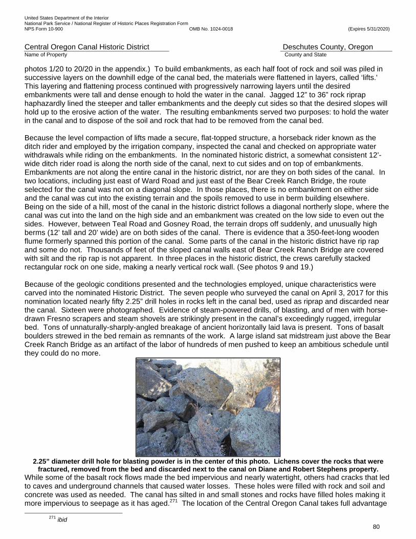
United States Department of the Interior National Park Service / National Register of Historic Places Registration Form NPS Form 10-900 OMB No. 1024-0018 (Expires 5/31/2020)
Central Oregon Canal Historic District Deschutes County, Oregon Name of Property County and State
80
photos 1/20 to 20/20 in the appendix.) To build embankments, as each half foot of rock and soil was piled in successive layers on the downhill edge of the canal bed, the materials were flattened in layers, called ‘lifts.' This layering and flattening process continued with progressively narrowing layers until the desired embankments were tall and dense enough to hold the water in the canal. Jagged 12” to 36” rock riprap haphazardly lined the steeper and taller embankments and the deeply cut sides so that the desired slopes will hold up to the erosive action of the water. The resulting embankments served two purposes: to hold the water in the canal and to dispose of the soil and rock that had to be removed from the canal bed. Because the level compaction of lifts made a secure, flat-topped structure, a horseback rider known as the ditch rider and employed by the irrigation company, inspected the canal and checked on appropriate water withdrawals while riding on the embankments. In the nominated historic district, a somewhat consistent 12’-wide ditch rider road is along the north side of the canal, next to cut sides and on top of embankments. Embankments are not along the entire canal in the historic district, nor are they on both sides of the canal. In two locations, including just east of Ward Road and just east of the Bear Creek Ranch Bridge, the route selected for the canal was not on a diagonal slope. In those places, there is no embankment on either side and the canal was cut into the existing terrain and the spoils removed to use in berm building elsewhere. Being on the side of a hill, most of the canal in the historic district follows a diagonal northerly slope, where the canal was cut into the land on the high side and an embankment was created on the low side to even out the sides. However, between Teal Road and Gosney Road, the terrain drops off suddenly, and unusually high berms (12’ tall and 20’ wide) are on both sides of the canal. There is evidence that a 350-feet-long wooden flume formerly spanned this portion of the canal. Some parts of the canal in the historic district have rip rap and some do not. Thousands of feet of the sloped canal walls east of Bear Creek Ranch Bridge are covered with silt and the rip rap is not apparent. In three places in the historic district, the crews carefully stacked rectangular rock on one side, making a nearly vertical rock wall. (See photos 9 and 19.) Because of the geologic conditions presented and the technologies employed, unique characteristics were carved into the nominated Historic District. The seven people who surveyed the canal on April 3, 2017 for this nomination located nearly fifty 2.25” drill holes in rocks left in the canal bed, used as riprap and discarded near the canal. Sixteen were photographed. Evidence of steam-powered drills, of blasting, and of men with horse-drawn Fresno scrapers and steam shovels are strikingly present in the canal’s exceedingly rugged, irregular bed. Tons of unnaturally-sharply-angled breakage of ancient horizontally laid lava is present. Tons of basalt boulders strewed in the bed remain as remnants of the work. A large island sat midstream just above the Bear Creek Ranch Bridge as an artifact of the labor of hundreds of men pushed to keep an ambitious schedule until they could do no more.
2.25” diameter drill hole for blasting powder is in the center of this photo. Lichens cover the rocks that were
fractured, removed from the bed and discarded next to the canal on Diane and Robert Stephens property. While some of the basalt rock flows made the bed impervious and nearly watertight, others had cracks that led to caves and underground channels that caused water losses. These holes were filled with rock and soil and concrete was used as needed. The canal has silted in and small stones and rocks have filled holes making it more impervious to seepage as it has aged.271 The location of the Central Oregon Canal takes full advantage
271 ibid
United States Department of the Interior National Park Service / National Register of Historic Places Registration Form NPS Form 10-900 OMB No. 1024-0018 (Expires 5/31/2020)
Central Oregon Canal Historic District Deschutes County, Oregon Name of Property County and State
81
of natural water courses and draws and was described by some of the settlers as ‘a chain of ponds.’272 The rockier, less impervious portions of the canal still look like a chain of ponds today where they hold pools of water with crayfish and trout long after the irrigation season is finished. Attempting to dig into rock to carefully follow the engineer’s plans and build a canal with a smooth bed and equal trapezoidal sides was abandoned and instead crews settled on a practical technique that exactly followed the carefully marked route to keep the necessary elevation, but resulted in an irregular canal that differed greatly from the plans, but usually functioned to carry the necessary volume of water. Where the laborers were slowed by solid rock, they made the canal shallower and wider with more inconsistent side slopes than the plans called for. But, a problem arose when the unavoidable rough bottom differed so much from the original plans that the friction inadvertently reduced the capacity of the canal. This and other issues resulted this stretch being widened twice, in 1907 and 1914. THE CENTRAL OREGON PROJECT AND THE FOUNDING OF THE CITY OF BEND Founding the new towns of Bend and Redmond, developing infrastructure, utilities like electric power service and basic businesses such as banks, and aggressively attracting ministers, settlers, businesspeople, tradesmen and farmers by selling thousands of acres of land in city lots and in 40 to 160-acre parcels a short time was the key to the financial success of the irrigation project. The development companies were involved in every aspect of the new towns, Bend and Redmond, making them prosperous and desirable as soon as possible. Early Bend, 1900-1904 Brogan’s East of the Cascades describes the area along the Deschutes River as the Alexander M. Drakes arrived in early June 1900: “The Cascade peaks to the west were white and beautiful above green skirts of pine, fir, and hemlock. .... There were no signs of life along the sweeping bend of the river … Upstream a short distance, the W.H. Staats ranch was hidden in timber around a curve in the river. Still farther upstream … was the … Farewell Bend Ranch. To the north, within sight of the stream, were other small ranch houses, little more than cabins, most of them with histories dating to the early eighties (1880s) and most of them abandoned.”273 Before the Pilot Butte Canal and the Central Oregon Canal were built, the area was a small, remote frontier site about 25 miles southwest of Prineville, the Crook County seat. It was located in the Deschutes River canyon at one of the few places where in pioneer days it was easy to get a wagon down to the water’s edge and ford the stream. Moreover, this site along the Deschutes River was the most accessible of these places, and the point where a canyon was not in evidence. It was at a pronounced double bend in the river, which afforded a good place to camp, beginning in the days of the emigrants, but how early is not known. “The place began to be known as Farewell Bend, and the name was appropriate irrespective of the destination of the traveler, north, south, east or west,” according to Oregon Geographic Names.274
272 Dubuis Report to Desert Land Board on the Central Oregon Project, 28.
273 Brogan, Phil F., East of the Cascades, (Binford and Mort, Portland, OR., 1964), 181. 274 McArthur, Lewis A., “Oregon Geographic Names,” (Oregon Historical Quarterly, vol. 27, 1926), 138-39; McArthur, Lewis A.,
“Oregon Geographic Names: II; Additions Since 1944,” (Oregon Historical Quarterly, vol. 47, 1946), 64-65. The various ‘Bend’ post offices are discussed. The Bend post office was established January 18, 1886, with John Sisemore postmaster. On March 7, 1904, a new Bend post office was established near the site of the Pilot Butte Inn (built in 1917).
United States Department of the Interior National Park Service / National Register of Historic Places Registration Form NPS Form 10-900 OMB No. 1024-0018 (Expires 5/31/2020)
Central Oregon Canal Historic District Deschutes County, Oregon Name of Property County and State
82
In November 1904, the PBD Co. was clearing the pine trees out of Minnesota and Bond streets in the newly-platted townsite. The Bend Bulletin described the work. “A powerful capstan, chains, a team of horses and an axe are the instruments of this work, and they make a clean job of it, pulling over great pines four feet in diameter without difficulty, after the surface roots are cut.”275 Vandevert indicated that he had seen the area change “from a few little log cabins to the present town of Bend … I’ve seen the whole country change from what you might say was a wilderness, but a very beautiful wilderness .…” 276 Settlement of Bend, 1904-05 A.L. Goodwillie277 was the Secretary of the PBD Co., signing the Plat of Bend with Drake on May 31, 1904,278 two-and-a-half months after Drake’s sale of the firm’s irrigation contract and rights to the D. I. & P. Co., filed in Crook County on March 14, 1904. He became a partner with Drake in the PBD Co. sometime just after the two-family get-together in Bend and Portland. In addition to eastern capital, Goodwillie brought youthful energy, leadership, in addition to organizational and public relations skills. The D. I. & P. Co. finished the first four miles of the Pilot Butte Canal and delivered water to the land close to the townsite in June 1904, so that by December, as the town incorporated, real estate prices were increasing.279 At this time, the PBD Co.’s business associated with settlement of the townsite went well. Streets, blocks, and lots were delineated; townsite land was cleared; lots were sold, and the town was developed in various ways.280 Goodwillie and Drake rebuilt the flour mill downtown following the January 1904 fire and it was back into ‘full operation’ in May, with forty employees. 281 The PBD Co. offered an impressive selection of home-building materials.282 Drake had incorporated the Bend Mercantile Company in 1903 to also provide to the settlers building products and a wide variety of other merchandise needed, and constructed a building in which to retail them in 1904.283 In 1909, he was treasurer of the newly formed Bend Board of Trade.284 He built a dam and power plant just north of the townsite, bringing electricity to the city on November 1, 1910.285 As the Pilot Butte Canal was being completed, the company could focus on advertising the land for sale and attracting settlers to the area. The townsite was due to be incorporated, ordinances were written, and a network of dirt streets was in place. Goodwillie was named as the chief petitioner for the incorporation of the City of Bend.286 On December 19, 1904, an election was held, overwhelmingly deciding in favor of the matter
275 “Local Bits,” (The Bend Bulletin, November 11, 1904), 5. 276 “Ranch On the River,” (The Central Oregon Answer Book, Bend: The Bend Bulletin, March 27, 1994), 17. Taken from a
transcription of an interview with W.H. (‘Billy’) Vandevert conducted in 1953 by KBND radio’s Kessler Cannon as part of Bend’s 50th anniversary celebration.
277 National Register of Historic Places, Goodwillie-Allen-RademacherHouse, Bend, Deschutes, Oregon, NRIS 07000493. Arthur Lawson Goodwillie is a Significant Person (Criterion B). Areas of Significance recognized by the National Register in which he contributed include Community Planning and Development, Commerce, Communications, Education, Industry, Politics/Government, and Social History.
278 Pilot Butte Development Company, Plat of Bend, Filed June 7, 1904. Document signed by Drake and Goodwillie on May 31, 1904.
279 “Real Estate Is Up: Paid $450 and Sold for $900,” (The Bend Bulletin, December 8, 1904), 1. 280 “Week’s Sales of Lots,” (The Bend Bulletin, July 8, 1904), 5. This week the PBD Co. sold seven lots in Bend. 281 “Lumber to Build,” (The Bend Bulletin, May 13, 1905), 1; “Notes of the Builders,” (The Bend Bulletin, April 29, 1904), 2; A
“sawmill outfit arriving from the railroad” in April 1904 was machinery to rebuild the mill; “Local Bits,” (The Bend Bulletin, March 17, 1905), 5.
282 Advertisement, (The Bend Bulletin, May 31, 1907), 1. The PBD Co.’s ad lists the following: “Inch Common, Dimension, Shiplap, Rustic, T. & G. Flooring, Beaded Ceiling, Window Jambs, Window Casing, Head Blocks, O.G. Baseboard, Stair Treads, Water Table, O.G. Battins, Moldings, P.B.D. Patent Roofing, Fence Pickets, Shingles, Etc., Etc.”
283 “Local Events,” (The Bend Bulletin, June 5, 1903), 3. Drake’s partners were Alexander Thomson, A.H. Grant and T.M. Baldwin; “General Building Note,” (The Bend Bulletin, May 20, 1904), 1. The company sold lumber, shingles, molding and sash from its two-story building; Advertisement, (The Bend Bulletin, October 14, 1904), 1. John Deere agricultural implements, Phoenix Paints, dry goods, groceries, and other products were soon added.
284 “Bend Men Form Board of Trade,” (The Bend Bulletin, September 8, 1909), 1; A History of Deschutes Country in Oregon, 212-13.
285 “Power Plant for Bend,” (The Bend Bulletin, January 6, 1909),1; “Try Out Power Plant: Machinery Works Well—Lights May Be Ready in Few Days,” (The Bend Bulletin, November 2, 1910), 1. John Steidl and others were partners.
286 “The City of Bend: Petition for Incorporation is Signed,” (The Bend Bulletin, November 4, 1904), 1. Goodwillie presented the
United States Department of the Interior National Park Service / National Register of Historic Places Registration Form NPS Form 10-900 OMB No. 1024-0018 (Expires 5/31/2020)
Central Oregon Canal Historic District Deschutes County, Oregon Name of Property County and State
83
of incorporation, and electing Goodwillie as the city’s first mayor and the Chief Engineer Charles M. Redfield as a city councilor.287 “BEND IS NOW A CITY” announced The Bend Bulletin on January 6, 1905.288 More than $100,000 in building construction had been invested in the city in the previous year. This included $10,025 by the PBD Co. and $11,000 by the D. I. & P. Co.289 The first city council meetings were held in the office of the PBD Co., beginning on January 10, 1905.290 Initial matters concerned making the city respectable and attractive to settlers, potential new business owners, and professionals. Doctor Urling C. Coe, M.D., observed in his memoirs, Frontier Doctor, “The irrigation company had a number of (canal) construction camps within a short distance of town where hundreds of men were employed at high wages…. [Those camps were for the Central Oregon Canal construction close to Bend.] There were eight saloons with open gambling.”291 The Bend Bulletin summarized the first ordinance. “The most important ordinance was that fixing the license of retail liquor saloons at $600 per year, none to be granted for a less period than a year. A bond of $1,000 was required of the licensee.” 292 Only five saloons were in operation by March 1905. A contract was also let for the building of a jail.293 To provide for the infrastructural needs of settlers including banking, utilities, and communication, A.L. Goodwillie founded and invested in several other firms. W.E. Guerin, Jr., was a partner or officer with him in these. With Guerin, he incorporated the Central Oregon Banking & Trust Company.294 By early February 1905, two franchise ordinances were passed by the city council: one for the water, light and power company and a second for the telephone company.295 With Guerin and another partner, Goodwillie incorporated the Bend Light, Water and Power Company. The firm purchased the PBC Co.’s rights to construct and maintain electric lines, gas, water, and other public utilities of the city. The city water system was in operation by July 1905.296 To connect settlers with the greater region, Goodwillie and partners incorporated the Deschutes Telephone Company, the city’s first telephone company that began by running a line to Prineville. On August 17, 1904, the first voice communication was carried from just outside of Prineville to Bend over the thirty-mile long line that was also used for telegraph messages.
297
document to the county court on November 26, 1904.
287 “Goodwillie Winner: To Be Mayor of New City of Bend,” (The Bend Bulletin, December 23, 1904), 1. 288 “Bend Is Now A City: Incorporation Approved by County Court,” (The Bend Bulletin, January 6, 1905), 1. The Crook County
Court canvassed the Bend municipal electorate, finding the election legal and officially declared the result; “Elect New Officers,” (The Bend Bulletin, December 8, 1905), 1. Goodwillie was re-elected to a two-year term on December 5, 1905; Crook County, Oregon, An Order Granting the Incorporation of a Municipal Corporation of Bend, Oregon, (Crook County Court, Prineville, Oregon, January 11, 1905); Shaver, F.A., et al., An Illustrated History of Central Oregon, (Spokane: Western Historical Publishing Company, 1905), 728-729.
289 “More Than $100,000,” (The Bend Bulletin, January 6, 1905), 1. PBD Co. building investments included: sawmill, $4,500; office, $1,450; barn, $800; PBD Co. residence, $375, Drake addition to residence, $1,100; and Goodwillie residence, $1,800. D. I. & P. Co.’s building investments included: office, $2,200; club house, $1,700; stables and shops, $1,200; granary, $700; warehouse, $600; powder house, cook house, etc. at experimental farm, $600, barn, $500, and Guerin residence, $3,500. “Minutes of the Common Council of the City of Bend,” December 1905. In December 1905, the council learned the total amount of taxable property in the City of Bend to be $50,005 and passed a (retroactive) tax levy for 1905.
290 “Minutes of the Common Council of the City of Bend,” January 5, 1905. Attorney W.E. Guerin, Jr. and his law partner, George C. Steinemann, provided legal services to the City. The firm charged $150 to incorporate the City of Bend.
291 Coe, Urling C., Frontier Doctor: Observations on Central Oregon and the Changing West, (Corvallis: Oregon State University Press, 1996), 4. Coe arrived in Bend on January 10, 1905.
292 “Saloon License $600,” (The Bend Bulletin, December 23, 1904), 1; “Minutes of the Common Council of the City of Bend,” December 1905. The city’s chief revenue would come from the liquor license in its first year.
293 “For A New City Jail,” (The Bend Bulletin, January 20, 1905. Contract awarded to the Brosterhouses. 294 “New Bank for Bend,” (The Bend Bulletin, July 8, 1904), 1. Firm incorporated July 8, 1904. Goodwillie served as vice-
president, Guerin as president, and J.M. Lawrence as secretary. The authorized capital was $25,000; Crook County, Oregon, Articles of Incorporation of the Central Oregon Banking & Trust Company, (Crook County Clerk, Prineville, Oregon, July 8, 1904).
295 “Franchise Ordinances Pass,” (The Bend Bulletin, February 3, 1905), 1. 296 Crook County, Oregon, Articles of Incorporation of The Bend Water Light and Power Company, (Crook County Clerk,
Prineville, Oregon, November 11, 1904); The other partner was George C. Steinemann, an attorney; “Water Franchise,” (The Bend Bulletin, February 10, 1905), 1; “Water, Light and Power Company,” (The Bend Bulletin, November 11, 1904), 4; Shaver, F.A., et al., An Illustrated History of Central Oregon, (Spokane: Western History Publishing, 1905), 729; “Water Pipes Arriving," (The Bend Bulletin, April 14, 1905), 1. A crew of 25 workers installed the water system from the river up to Wall Street and along Wall Street to nearly Oregon Avenue.
297 “Hello, Prineville,” (The Bend Bulletin, August 19, 1904), 1. Guerin was president. Goodwillie was vice-president, secretary and treasurer. Gerald Grosbeck was manager; Crook County, Oregon, Articles of Incorporation of the Deschutes Telephone Company,
United States Department of the Interior National Park Service / National Register of Historic Places Registration Form NPS Form 10-900 OMB No. 1024-0018 (Expires 5/31/2020)
Central Oregon Canal Historic District Deschutes County, Oregon Name of Property County and State
84
An Illustrated History of Central Oregon captured the period succinctly, stating, “In 1905, the City of Bend marked a new era in the development of Central Oregon, and is a fine example of what can be accomplished when energy and capital unite in the development of vast resources.”298 Governor Impressed with Settlement, June 1906 The Deschutes’ Settlers Association welcomed in June 1906 Oregon Governor Chamberlain, who as head of the State Land Board had visited Bend in 1904, and had returned in that role. With him were the entire land board and some other state officials, including future governor Oswald West, then State Land Agent. Chamberlain was “well pleased with the work of the D. I. & P. Co.” He said its canals and entire reclamation works showed the marks of permanency,” said the newspaper. He was “impressed ... to the greatest degree … [by] the remarkable development of this region during the past two years. At that time, he had … found a few scattering cottages along the river and two or three buildings at the townsite. Now he was entertained in a prosperous little city with well laid streets, beautiful lawns, a fine gravity water pressure system and [a] new public school building suitable to a city many times the size and age of Bend. Where before he found barren desert wastes now he could count prosperous ranches by the score.”
299
Bend Area Population Increases with Pilot Butte and Central Oregon Canals, 1900-1920 Bend’s population showed growth as the canals were constructed and in the years after they were built. Approximately 312 people lived in what became Deschutes County in 1900, 21 in the Bend Precinct. Canal construction brought the town’s population to 400 or 500 people by 1905. Thereafter, both the city and the adjacent areas grew as settlement occurred and farming developed. The U.S. Department of Interior reported on Bend and the adjacent areas in 1913: “The result of this [irrigation] development is reflected in a gradually increasing population, that of the entire [area] being estimated at 4,000, which is distributed among four towns as follows: Terrebonne, 75; Redmond, 800; Deschutes, 50; Bend, 1,500.”300
Bend Tax Assessment Grows, 1905-1913 The increased property tax assessments for the City of Bend resulted from irrigation development, settlement, and farming in the region. From 1905 to the 1910-1911 period, the assessed value of the City of Bend quadrupled as the Central Oregon Project provided irrigation water for settlers who earned income from farm and ranch products and, subsequently, sought products, services, and supplies from city manufacturers, service businesses, and merchants. 301 In 1905, Bend property tax assessments totaled $50,005. In 1913, they had leaped to $358,820. If the approximately $200,000 assessed against the D. I. & P. Co, and exempted by the supreme court was included in the 1910 figure, it would be nearly an eight-fold (800 percent) increase in assessed value of property in the City of Bend from 1905.302 Bend School System Swells Following Pilot Butte Canal and Central Oregon Canal, 1904-1913 Water was flowing in the Pilot Butte Canal in the 1905 irrigation system. Water also flowed in the Central Oregon Canal as it was constructed, beginning in the fall of 1904, to provide water to the hundreds of men and horses working in the desert on construction crews. The Central Oregon Canal was completed in 1914. (Crook County Clerk, Prineville, Oregon, July 18, 1904). Incorporating with Goodwillie were P. L. Tomkins and George C. Steinemann; “Companies Merged,” (The Bend Bulletin, May 10, 1907), 1. In May 1907, the telephone company merged with the State Central Telephone Company at Prineville to become The Pioneer Telegraph and Telephone Company.
298 Shaver, F.A., et al., An Illustrated History of Central Oregon, (Spokane: Western History Publishing, 1905), 717. 299 “Gala Day at Bend: State Land Board Present at Farmer’s Institute,” (The Bend Bulletin, June 22, 1906), 1. The newspaper summarized Chamberlain’s remarks. Chamberlain was governor 1903-09, then an Oregon Senator 1909-21. Oswald West served as governor 1911-1915. Approximately 1,500 trout were barbequed for 500-600 attendees. Speakers included A.M. Drake; Jesse Stearns, a prominent stockholder in the D I. & P. Co; H.F. Jones, president of the D. I. & P. Settler’s Association at Redmond; Mayor Goodwillie; John Lewis, state engineer; and Dr. U.C. Coe speaking about using pure water and avoiding pollution of the Deschutes. 300 Oregon Cooperative Work, U.S. Department of the Interior, Reclamation Service, Deschutes River Projects, Bulletin No. 1, (Washington: Government Printing Office, 1914), 4. Deschutes refers to a town just outside of Bend, used by the irrigation company, and not the 1902 plat of Deschutes adjacent to the City of Bend.
301 “County Assessment Is $10,316,157: Some City Figures,” (The Bend Bulletin, October 22, 1913), 1. Though some increase may be attributed to an expansion of the city limits, it remains an increase in the valuation of the property within the city.
302 The assessed value of property in the City of Bend in 1910 of $191,524 + $200,000 (D. I .& P. Co. exemption) = $391,524. Just somewhat over that figure ($400,040) would be eight times (800%) more than the City’s 1905 assessment of $50,005.

United States Department of the Interior National Park Service / National Register of Historic Places Registration Form NPS Form 10-900 OMB No. 1024-0018 (Expires 5/31/2020)
Central Oregon Canal Historic District Deschutes County, Oregon Name of Property County and State
85
The school system quickly grew during the construction of the canals and the subsequent settlement of the area. A.L. Goodwillie, L.D. Wiest and James M. Lawrence, of the federal land office, were the Bend School District’s Board of Directors, beginning in August 1904. There were 47 students at the beginning of the 1904-05 school year; in 1905, there were 102. By November 1908 there were over 200 students.303 Student enrollment increased from 344 in 1910, to 377 in 1911, to 487 by December 1912.304 Opening day for school in September 1919, saw 1,015 students register, an increase of 200 over opening day of 1918, partially attributed to the opening of the two great sawmills, the Brooks-Scanlon and Shevlin-Hixon Lumber Mills. .305 Registered students totaled 1,408 on opening day in 1920 Railroad Officials Visit Bend In April, 1905, the D. I. & P. Co. had finished the Pilot Butte Canal and was working on the Central Oregon Canal “when it came to the conclusion that rail transportation was essential to the settlement of the lands.306 Drake used his family connections with owners and developers of railroads and returned to Bend in late May with news the entire region wanted to hear: “From what I am able to learn, east and west, Bend’s chances for a railroad are very good.”307 Mayor Goodwillie appointed a committee of aldermen and citizens, including Drake, to receive a party of railroad officials soon to visit Bend. 308 The officials arrived shortly thereafter to look over the locality and examine its resources and possibilities of development. The group visited the canals and the company’s agricultural experimental farm just out of Bend. They had travelled from Shaniko in the ‘big automobile of the Central Oregon Transportation Company,’309 a subsidiary of the D. I. & P. Co., which served as a stage line for the firm in its irrigation development and settlement businesses.310 The railroad delegation expressed surprise over the advancement the area had made in the last few years. Industrial agent Judson was enthusiastic: “The country has grown faster than there was reason to expect and there is no room for doubt that it will make a great deal of business for a railroad.” Professor French, of the University of Idaho, said, “I know of no better locality for the development of the sugar beet industry.” General Manager O’Brien remarked, “I am greatly surprised and gratified at what I have seen. The extent and richness of this region is beyond anything I have been led to believe. Of course, you will have a railroad here, you must have it.”311 A week later O’Brien said, “When I see people putting hundreds of thousands of dollars into
303 “Ready for School,” (The Bend Bulletin, August 26, 1904), 1; “Local Bits,” (The Bend Bulletin, December 30, 1908), 5;
“School Election,” (The DesChutes Echo, June 25, 1904), 1; “New Books for School Library,” (The Bend Bulletin, October 7, 1904), 4. 304 “487 Pupils In Bend District”. (The Bend Bulletin,” December 25, 1912), 1. The 487 students in 1912 were divided between
251 boys and 236 girls. 305 “Attendance At Schools Show City’s Growth,” (The Bend Bulletin, September 18, 1919), 1. The number of registered
students at the end of the first month, in 1918, was 885. By school, registration was as follows: junior high, 160; senior high, 150; Central 115; Kenwood 215; Reid 325; timber camps 50.
306 “Drawing to a Head,” (The Bend Bulletin, April 14, 1905), 1. D. I. & P. Co. officials, President Turney, General Manger Johnston, and stockholder Fred S. Stanley, visited the area to analyze its condition.
307 “Talk of a Railroad: Plans to Build to Bend Taking Shape,” (The Bend Bulletin, June 2, 1905), 1. Drake noted: “This matter has been all but clinched two or three times lately. But the railroad world has been struggling with important adjustments and plans have been changed on short notice. Railroad affairs cannot be said to be wholly settled yet, but they are approaching that condition. I believe before a full settlement comes, arrangements will be made for putting Bend in railway connection with the commercial world.”
308 “Minutes of the Common Council of the City of Bend,” June 20, 1905. Appointed were A.M. Drake, John Steidl, C.A. Chapman, E.F. Batten, Hugh O’Kane, R.B. Mutzig, W.E. Guerin, Jr., F.C. Rowlee and J.M. Lawrence; “Full Fire Protection,” (The Bend Bulletin, June 23, 1905), 1. Committee of same individuals named by Goodwillie.
309 “Looking for Traffic: Railroad Men Examining the Bend Country,” (The Bend Bulletin, June 23, 1905), 1. Officials included W.W. Cotton, former U.S. judge for the judicial district of Oregon, then counsel for the Oregon Railroad and Navigation Company (O. R. & N.); J.P. O’Brien, general manager for the Harriman railway lines in Oregon, Washington, and Northern Idaho; R.R. Miller, freight agent of the same; R.C. Judson, industrial agent of the same; G.W. Boschke, chief engineer of the same; E.E. Lytle, president of the Columbia Southern railway (an O. R. & N. branch); H.P French, president of the University of Idaho; and Fred S. Stanley, secretary of the D. I. & P. Co.
310 “Direct Stageline,” (The Bend Bulletin, July 8, 1904), 1. By July, the firm had two big automobiles running stage between Bend and Shaniko for both passengers and express, with mail to be added by September. The route was to make stops between Bend and Shaniko as well as travel south to Paisley, Silver Lake, and Summer Lake; “Biggest Automobile in the United States Was Built in Portland,” (The Sunday Oregonian, March 12, 1905), pt. III, 22. A.E. Hammond, former chief engineer of the Columbia Southern Railway and former State Engineer, was the president of the transportation company; “Direct to the Railroad: Starting of the Automobile Service,” (The Bend Bulletin, April 14, 1905), 1. 311 “Train to Come Soon: That’s What Railroad Delegation Says,” (The Bend Bulletin, June 30, 1905),1. Regarding sugar
United States Department of the Interior National Park Service / National Register of Historic Places Registration Form NPS Form 10-900 OMB No. 1024-0018 (Expires 5/31/2020)
Central Oregon Canal Historic District Deschutes County, Oregon Name of Property County and State
86
reclamation work in the Bend section I think they must know what they are doing and that practical results will follow.”312 INVESTORS PROMOTE AND CAPITALIZE ON CENTRAL OREGON PROJECT William G. Robbins, PhD, Emeritus Distinguished Professor of History at Oregon State University, in his environmental history of Oregon, Landscapes of Promise, described the promoters and investors of the period: “Those who promoted development in the Oregon country were epic poets of sorts, harbingers of change, visionaries whose imaginations knew few restraints other than those dictated by the most obvious limits of technology and natural obstacles.”313 The Deschutes Country was quite successful in its marketing efforts. Author and former Tumalo Irrigation District director Martin T. Winch in “Tumalo — Thirsty Land,” his seminal, six-part series on the Tumalo Irrigation District, published in the Oregon Historical Quarterly, said: “[In 1902] the Deschutes Valley was reported to be ‘the best advertised district today in the United States.’”314 Successful Promotional Efforts of A.M. Drake Promotional efforts for settlement were ongoing as Drake used his extensive business and family connections and friendships to politicians, government officials, regional and national newspapers, banking and financiers, and railroad tycoons “to lay plans for immigration”. His early promotional efforts were primarily through local and state newspapers and in working with others, such as with A.L. Goodwillie in incorporating the City of Bend, and subsequently with the Bend Board of Trade. The Board put the Central Oregon Project in the headlines and involved community business members in promotion and development. His work was essentially behind the scenes, seemingly his forte. Sadie Niswonger of Powell Butte and later Bend, who knew Drake well, called him “an organizer” in a 1953 interview.315 Shortly after forming the Bend Board of Trade in 1909, Drake secured space in two publications with large circulations, the Portland Chamber of Commerce Bulletin and the Pacific Homestead, for an article describing the advantages of the Bend country for the home seeker, farmer, manufacturer and investor, referring to water power, excellent farm lands, raw materials, business opportunities, and good schools. A small portion read, “Today all eyes are directed toward Central Oregon. The railroads are about to give transportation to the greatest and richest undeveloped area in the West. Now indeed watch Central Oregon grow, for the development of this country in the next three years will surpass anything hitherto seen even in the wonderful Northwest.” The article promptly received responses, indicating the growing interest in the prosperity of the Deschutes country following the completion of the Pilot Butte Canal in 1905 and the Central Oregon Canal in 1908. The Board received forty-five letters in the first week following the article, with fifteen referring specifically to the article in the Pacific Homestead.316
beets, the professor added, “The soil is right, and the climate is favorable. A family can make a good living on a farm raising sugar beets.”
312 “Two Steps To Bend,” (The Bend Bulletin, July 7, 1905), 1. A week later reports indicated that the Oregon Railroad and Navigation Company was “in the field with the assurance of an extension of the Columbia Southern from Shaniko.” O’Brien stated his plans. “I believe that conditions at the present time warrant building to the Agency Plains [near Madras] … And by the time the railroad is completed to Madras, I expect conditions to be such that I can recommend an immediate advancement from there to Bend.”
313 Robbins, William G., Landscapes of Promise: The Oregon Story 1800-1940, (Seattle: University of Washington Press, 1997), 244. In addition, Robbins’ books include: Landscapes of Conflict: The Oregon Story, 1940-2000; Hard Times in Paradise: Coos Bay, Oregon, 1850-1896; Colony and Empire: The Capitalist Transformation of the American West; and The Great Northwest: The Search for Regional Identity.
314 Winch, Martin T., “Tumalo — Thirsty Land,” (Oregon Historical Quarterly, vol. 85, no. 4., Winter, 1984), 351. Winch cites the following sources: “ The DesChutes Echo (Bend), Dec. 6, 1902, p.1, and Nov. 29, 1902, p. 1. Due and French, Rails to the Mid-Columbia Wheatlands (note 8), 44, 52. [title not provided], Bend Bulletin, April 3, 1903, p. 2. E.D. Culp, Stations West, (Caldwell, Idaho, 1972), 100.”
315 Deschutes Country Yesteryear, “Interview: Sadie Niswonger,” (no. 16, summer 1995), 489. Transcription of interview of Mrs. C.P (Sadie) Niswonger by Kesslor Cannon, KBND, 1953. The Niswongers came to Powell Butte in the fall of 1907 and moved to Bend in the fall of 1909. Drake asked the Niswongers to release four lots on the railroad right-of-way, presenting them with a lot at 44 Irving and had the band hall moved to that lot for them to live in until they built a house.
316 “Board of Trade Work Valuable,” (The Bend Bulletin, October 27, 1909), 1.
United States Department of the Interior National Park Service / National Register of Historic Places Registration Form NPS Form 10-900 OMB No. 1024-0018 (Expires 5/31/2020)
Central Oregon Canal Historic District Deschutes County, Oregon Name of Property County and State
87
Drake’s ability to quickly sell his irrigation company to the D. I. & P. Co. indicated experienced investors understood the canal’s long-term financial opportunity. In addition, he played a crucial part in getting the railroad officials to visit the Deschutes country and made a calculated assessment of its economic potential. At the time of the officials’ visit with Mayor Goodwillie’s committee in June 1905, which included Drake, Frederick S. Stanley was present and Secretary of the D. I. & P. Co. He eventually invested several million dollars in the irrigation company. Moreover, he leveraged other investments in lumber, banking, and railroads, and his political connections as former chairman of the committee on railroads and transportation in the Oregon House of Representatives, to promote and grow his investment in the region.317 He remained with the Central Oregon Irrigation Company until 1921. Goodwillie, Drake’s PBD Co. partner, disposed of “his holdings in Bend on a rising market” in 1907, including his stock in the PBD Co. to Drake, resigned as mayor and returned to Chicago with his wife who was expecting their first child.318 He continued to own property and visited Bend many times, saying his years in Bend were the happiest in his life. D. I. & P. Co. Promotions The D. I. & P. Co. was a polished public relations organization for its period of history and its area of the nation, with the marketing and publishing experience of eastern businessmen. Moreover, the Central Oregon Project was a good irrigation system, embraced by suitable land for farming and ranching, and the ownership knew it. In April 1904, the company had issued a well written and illustrated booklet describing the Deschutes Country and its irrigation work. It described in detail the character of the soil, source of water supply and the prices that products raised on the lands were bringing. Ten thousand copies were printed and distributed to regions from where new settlers were likely to originate.319 Months before the project was completed, settlers had applied for 1,845 acres by September 30, 1904.320 The Morning Oregonian said in early 1911, “Central Oregon is well styled the ‘most-talked-of territory in the West’ … and the heart in geographical position and economic possibility.”321 Indeed, a newspaper advertisement found even before the canal was completed invited prospective settlers:
FREE LAND IN OREGON. In the richest grain, fruit and stock section in the world. Thousands of acres of land at actual cost of irrigation. Deed direct from State of Oregon. WRITE TO-DAY. BOOKLET and MAP FREE. Deschutes Irrigation and Power Company, 610-11-12 McKay Building, Portland, Oregon.322
The D. I. & P. Co. opened real estate offices in Portland and Prineville. Promotional efforts were not historically unique to the D. I. & P. Co., nor were such efforts unique to irrigation development companies. The railroads were among the first and best to develop the marketing of government lands long before the Carey Act was enacted. Not only were corporations involved in these efforts, many cities and towns, through
317 Duniway, David C., State Archivist, Oregon State Library, Members of the Legislature State of Oregon 1860-1949, (Oregon
State Archives, Bulletin No 2, publication no. 14, 1949), 32. Frederick S. Stanley had served in the Oregon House of Representatives from Union County in 1897, 1898, and 1899. In 1899, he was the chairman of the committee on railroads and transportation; Gaston, Joseph, Portland, Oregon: Its History and Its Builders, (Chicago—Portland: S.J. Clarke, 1911, vol. 2), 58-59. Stanley, originally from Wisconsin, organized the Grand Ronde Lumber Company at Perry and the Stanley-Smith Lumber Company at Hood River. In 1904, he organized the First National Bank of Hood River with headquarters in Portland. He was president of the Railway Exchange. Source indicates Stanley’s work with the irrigation company would be an investment of four million dollars; “Right of Way Is Now Approved,” (The Bend Bulletin, July 21, 1909), 1. Stanley had been vice-president of the D. I. & P. Co. as early as July, 1909, and had been doing whatever he could to resolve conflicts with the Harriman railroad operations where there were surveys in areas of the Central Oregon Railroad Company’s line, which was being operated under the management of the irrigation company.
318 “A. L. Goodwillie Is Dead At 67,” (Lynchburg News, Lynchburg, Virginia, January 15, 1946), n.p.; “Local Bites,” (The Bend Bulletin, June 21, 1907), 5; “Election Day Soon,” (The Bend Bulletin, November 12, 1907), 1.
319 “Advertising the Country,” (The DesChutes Echo, April 16, 1904), 1. 320 State of Oregon, Report of State Land Board Relative to Desert Lands, Granted the State Under the “Carey Act” for the
Period Commencing October 1, 1902, and Ending September 30, 1904, to the Twenty-Third Legislative Assembly [Regular Session], (Salem, Oregon, 1905), 11.
321 “Railroads Will Open Great Inland Empire: Crook County,” (The Morning Oregonian, February 4, 1911 )42. 322 Advertisement, (Oregon Daily Journal, July 11, 1904), 16.
United States Department of the Interior National Park Service / National Register of Historic Places Registration Form NPS Form 10-900 OMB No. 1024-0018 (Expires 5/31/2020)
Central Oregon Canal Historic District Deschutes County, Oregon Name of Property County and State
88
commercial clubs, made efforts to encourage settlers to ‘buy now’, and even individual land owners sought to encourage settlers to purchase from them, as ‘the railroad will soon be passing by’.323 Schwantes observed, “All had a common desire to attract settlers and investors in order to promote economic growth and guarantee a prosperous future.”324 Promotion was not limited to printed materials. Elaborate displays for fairs and expositions were used to promote the land irrigated by the canals and for sale. In 1908, a representative of the Oregon Commission of the Alaska-Yukon-Pacific Exposition, to be held in Seattle, visited Bend to prepare an exhibit for the event. He took three photographs of the shared headgates and photographs of a field of clover and of a large vegetable garden grown on irrigated land. These were made “into stereopticon views 10’ or 20’ square and were to be used to illustrate lectures given” at the exposition. Commitments from settlers to send a variety of farm products were obtained.325 The Promotional Campaign of the Great Northern Railroad Nothing quite compared, however, to the promotional campaign by the Great Northern railroad once the Deschutes Country had developed and ‘built-up’ the area’s population and infrastructure, and had established financial institutions326 and communication technology of sufficient scale to bring the region into the economic lifeblood of the nation. The Great Northern Railroad’s objective was “the thorough advertising and colonization of Central Oregon.” The railroad joined efforts with New York publishing house G. P. Putnam’s Sons, with its actual son, George Palmer Putnam, whose writings on Central Oregon had already appeared at intervals in the Oregonian. Besides a bulletin to be published with Putnam’s stories and photographs to advertise Central Oregon, the railroad had collected farm products to be placed on exhibit in St. Paul, Philadelphia, Boston, and other locations.327 Putnam moved to Bend and had a house with a basement theater built on State Street. (See the Drake Park Neighborhood Historic District nomination.) Schwantes noted, “The transcontinental railroads spent fortunes to advertise the [Pacific Northwest] to prospective tourists and settlers.”328 The Promotional Campaign of the Southern Pacific and the Oregon Railroad & Navigation Company The Southern Pacific and the Oregon Railroad & Navigation Company in 1910 co-published and widely distributed a promotional booklet about the Central Oregon Irrigation Project called, Redmond Now. The railroad companies hoped to attract settlers to Central Oregon to increase the trafficking of passengers and commodities on their rail lines. The Oregon Historical Society wrote that the booklet stated, “Everything points to Redmond as a commercial center. Merchants, professional men, manufacturers, home-seekers should investigate Redmond now, before the railroad [the Oregon Trunk Railway] is completed, before values enhance greatly, before the big opportunities are all taken.”
323 Davis, H.L., Honey in the Horn, (New York: Avon, 1935, 1962), 330-363. This practice was so ingrained in Central
Oregonians and others, it became a part of the narrative of this 1936 Pulitzer Prize-winning novel by a native Oregonian who lived in Wasco County near the Deschutes River during his teenage years. Set in the homesteading years of 1906-08, it follows the characters from the Oregon coast to the Willamette Valley and, finally, to Central Oregon, where many were expecting “old E.H. Harriman” to soon build a railroad. Mr. Pringle, of “Pringleville, the Gateway too [sic] Eastern Oregon, [offered] Home Sites on Easy Terms, Industrial Locations Free. Parties interested were invited to lay their cases before the J.B. Pringle Real Estate Company, whose offices adjoined the hotel dining-room” (p. 346).
324 Schwantes, The Pacific Northwest, 288-89. 325 “More Advertising,” (The Bend Bulletin, July 31, 1908), 1. 326 “A National Bank,” (The Bend Bulletin, August 7, 1908), 1. The Central Oregon Banking & Trust Company was dissolved,
and an institution known as the First National Bank of Bend, Oregon took its place. 327 “Great Northern Begins Extensive Campaign to Advertise Central Oregon,” (The Bend Bulletin, February 16, 1910), 1. The
railroad had already begun advertising in Montana and Washington. 328 Schwantes, The Pacific Northwest, 291.
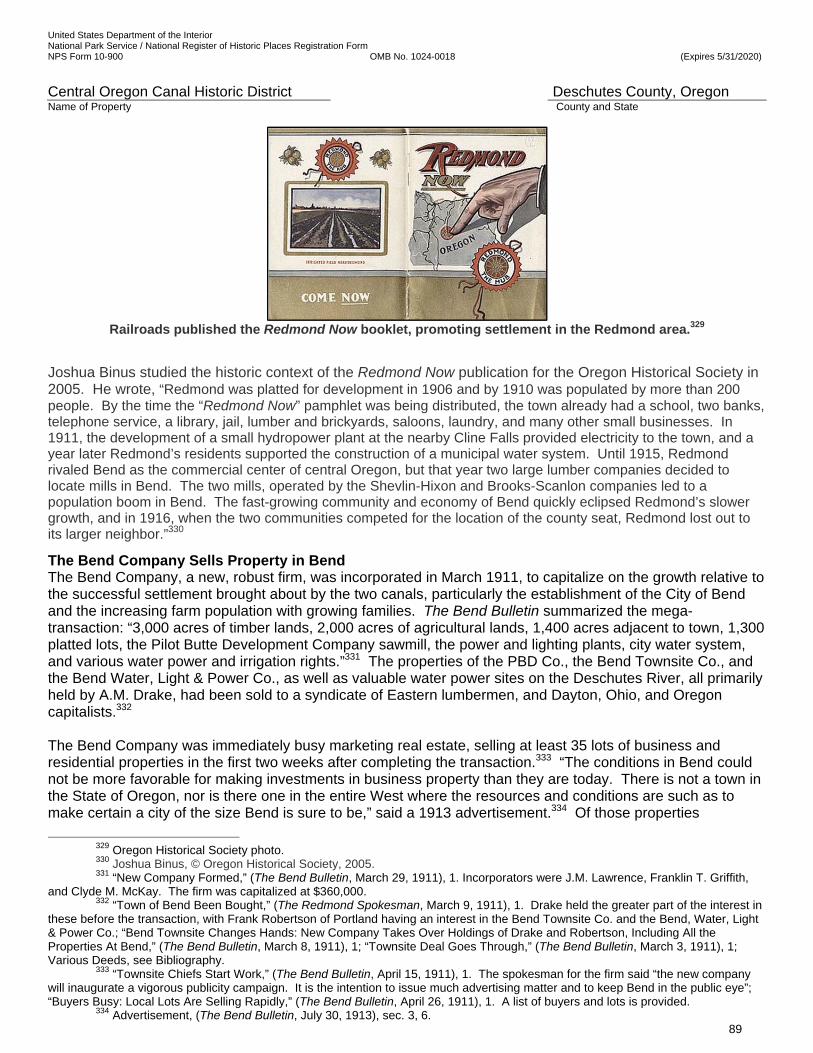
United States Department of the Interior National Park Service / National Register of Historic Places Registration Form NPS Form 10-900 OMB No. 1024-0018 (Expires 5/31/2020)
Central Oregon Canal Historic District Deschutes County, Oregon Name of Property County and State
89
Railroads published the Redmond Now booklet, promoting settlement in the Redmond area.329
Joshua Binus studied the historic context of the Redmond Now publication for the Oregon Historical Society in 2005. He wrote, “Redmond was platted for development in 1906 and by 1910 was populated by more than 200 people. By the time the “Redmond Now” pamphlet was being distributed, the town already had a school, two banks, telephone service, a library, jail, lumber and brickyards, saloons, laundry, and many other small businesses. In 1911, the development of a small hydropower plant at the nearby Cline Falls provided electricity to the town, and a year later Redmond’s residents supported the construction of a municipal water system. Until 1915, Redmond rivaled Bend as the commercial center of central Oregon, but that year two large lumber companies decided to locate mills in Bend. The two mills, operated by the Shevlin-Hixon and Brooks-Scanlon companies led to a population boom in Bend. The fast-growing community and economy of Bend quickly eclipsed Redmond’s slower growth, and in 1916, when the two communities competed for the location of the county seat, Redmond lost out to its larger neighbor.”330
The Bend Company Sells Property in Bend The Bend Company, a new, robust firm, was incorporated in March 1911, to capitalize on the growth relative to the successful settlement brought about by the two canals, particularly the establishment of the City of Bend and the increasing farm population with growing families. The Bend Bulletin summarized the mega-transaction: “3,000 acres of timber lands, 2,000 acres of agricultural lands, 1,400 acres adjacent to town, 1,300 platted lots, the Pilot Butte Development Company sawmill, the power and lighting plants, city water system, and various water power and irrigation rights.”331 The properties of the PBD Co., the Bend Townsite Co., and the Bend Water, Light & Power Co., as well as valuable water power sites on the Deschutes River, all primarily held by A.M. Drake, had been sold to a syndicate of Eastern lumbermen, and Dayton, Ohio, and Oregon capitalists.332 The Bend Company was immediately busy marketing real estate, selling at least 35 lots of business and residential properties in the first two weeks after completing the transaction.333 “The conditions in Bend could not be more favorable for making investments in business property than they are today. There is not a town in the State of Oregon, nor is there one in the entire West where the resources and conditions are such as to make certain a city of the size Bend is sure to be,” said a 1913 advertisement.334 Of those properties
329 Oregon Historical Society photo. 330 Joshua Binus, © Oregon Historical Society, 2005. 331 “New Company Formed,” (The Bend Bulletin, March 29, 1911), 1. Incorporators were J.M. Lawrence, Franklin T. Griffith,
and Clyde M. McKay. The firm was capitalized at $360,000. 332 “Town of Bend Been Bought,” (The Redmond Spokesman, March 9, 1911), 1. Drake held the greater part of the interest in
these before the transaction, with Frank Robertson of Portland having an interest in the Bend Townsite Co. and the Bend, Water, Light & Power Co.; “Bend Townsite Changes Hands: New Company Takes Over Holdings of Drake and Robertson, Including All the Properties At Bend,” (The Bend Bulletin, March 8, 1911), 1; “Townsite Deal Goes Through,” (The Bend Bulletin, March 3, 1911), 1; Various Deeds, see Bibliography.
333 “Townsite Chiefs Start Work,” (The Bend Bulletin, April 15, 1911), 1. The spokesman for the firm said “the new company will inaugurate a vigorous publicity campaign. It is the intention to issue much advertising matter and to keep Bend in the public eye”; “Buyers Busy: Local Lots Are Selling Rapidly,” (The Bend Bulletin, April 26, 1911), 1. A list of buyers and lots is provided.
334 Advertisement, (The Bend Bulletin, July 30, 1913), sec. 3, 6.

United States Department of the Interior National Park Service / National Register of Historic Places Registration Form NPS Form 10-900 OMB No. 1024-0018 (Expires 5/31/2020)
Central Oregon Canal Historic District Deschutes County, Oregon Name of Property County and State
90
purchased, The Bend Company sold 46% of the Bend Townsite lots; 41% of Park Addition lots; 31% of North Addition lots; and 73% of Center Addition lots, or an overall average of 59% of the lots in these four neighborhoods of Bend by March 31, 1916. The firm controlled all of the actual business lots and nearly all of the intermediate lots that could be developed into business lots.335 It donated lots for churches. The Railroad Arrives in Redmond and Bend in 1911 The development of the canals directly resulted in the arrival of railroads in the region. Bend’s first mayor, Arthur Goodwillie’s committee was successful in showing the railroad officials the richness of the Deschutes Country between 1905 and 1907. The economic stimulus and population growth which followed the completion of the Central Oregon Project could not be overlooked. ‘Railroad Day’ was put on as a promotion of the area by The Bend Company, and was celebrated in Bend on October 5, 1911, with a crowd of 1,500 to 2,000 people and distinguished dignitaries. The Oregon Trunk’s James J. Hill swept into Bend and drove the golden spike at the Bend depot marking the completion of the route.336 Hill’s speech that day was one of great promotion of the area. He had that day seen “the vegetables and grains and grasses, the products of the soil that reflect the power and the natural wealth of the soil. And, there is no mistake about it,” he said, “it can be done because it has been done.”337 The fruit, vegetable and grain exhibit that day in the middle of Oregon Avenue between Wall and Bond streets reportedly “was an eye-opener not only to the visitors but to a majority of the Bend people themselves.”338 His representative, John I. Springer, had been in the region and set in motion a number of matters two years earlier, and had met with Drake and other members of the Bend Board of Trade. Hill’s operations had been advertising the lands in the area for some time by the time the railroad arrived.339 The railroad provided the avenue for settlers in greater number to arrive and for irrigated farm products, livestock, lumber, and other products to travel to regional and national markets.340 THE CENTRAL OREGON PROJECT AND THE CITY OF REDMOND Settlement of Redmond, 1905-1911 In the Pacific Northwest, Schwantes points out, “when irrigation opened new lands to settlement, cities, and towns typically spearheaded agricultural development of the surrounding countryside and formed local markets for farmers.”341 The D. I. & P. Co.’s Supplemental Articles of Incorporation provided: “To establish colonies, cities, villages ,and towns, including the layout of said towns into lots and blocks and dedicating the streets and alleys of the same to public use.”342 The company developed a plan to establish a town near the north end of the Pilot Butte Canal in the area to be irrigated and then formed the Redmond Townsite Company. In May of 1905, as water flowed in the Pilot Butte Canal and was delivered to settlers, engineers began surveying and staking out the town, and crews of laborers cleared streets and lots for the Townsite of Redmond in May 1905, beginning with 20 acres, with a total of 320 acres set aside. The PBD Co. platted the new town shortly thereafter.343
335 “Notes,” The Bend Company, Price, Waterhouse & Co., March 31, 1916; “Bend Townsite Changes Hands: New Company
Takes Over Holdings of Drake and Robertson, Including All the Properties At Bend,” (The Bend Bulletin, March 8, 1911), 1. Among the holdings affected by the transfer included portions of the Bend Townsite, and Center, Park, and North Additions. Figures are the percentage that had been sold by March 31, 1916, of the total number of properties transferred from Drake’s holdings to The Bend Company. 336 “Railroad Day Here Is Great Event: James J. Hill Drives Golen [sic] Spike and Bill Hanley Lays Cornerstone—Nearly 2000 People Here for Celebration,” (The Bend Bulletin, October 11, 1911), 1.
337 Ibid., 8. 338 “Exhibits Surpass Expectations“ (The Bend Bulletin, October 11, 1911), 6. 339 “Hills Interested In Deschutes Country,” (The Bend Bulletin, October 6, 1909), 1. 340 “At Last,” (The Bend Bulletin, August 28, 1908), 4. The Bend Bulletin opined on the matter several years before, saying
“There will be a top-notch market for every pound of hay, grain, vegetables, butter, and eggs that the country can produce.” 341 Schwantes, Carlos Arnaldo, The Pacific Northwest: An Interpretive History, (Lincoln: University of Nebraska Press, 1996),
295. 342 Oregon State Archives, Articles of Incorporation # 9549, Deschutes Irrigation & Power Company, February 10, 1904.
Clause found in Article III, 13. 343 “Townsite of Redmond,” (The Bend Bulletin, May 5, 1905), 1. B.S. Cook & Co. was the realty firm; Cook was an irrigation company engineer. Location was about four miles east of Cline Falls in section sixteen, township fifteen south, range 13 east.
United States Department of the Interior National Park Service / National Register of Historic Places Registration Form NPS Form 10-900 OMB No. 1024-0018 (Expires 5/31/2020)
Central Oregon Canal Historic District Deschutes County, Oregon Name of Property County and State
91
Redmond was located on the Pilot Butte Canal and was named for Frank T. and Josephine Redmond, husband and wife, who had left school teaching positions in North Dakota, settling in Wasco, Oregon, for a short time. At the end of the school year in 1904, they set up their homestead tent amid the sagebrush and junipers on land to be served by the Pilot Butte Canal. According to Brogan, “The Redmonds, records indicate, were the first purchasers of Carey Act land in Central Oregon.”344 For two years, they hauled water from the Deschutes River several miles away, later building a farmhouse and outbuildings, bordered on one side by the Pilot Butte Canal and, in 1911, on the other side by the railroad. The Redmonds exhibited the greatest number of farm products at the first (1906) and second Potato Show sponsored by the D. I. & P. Co. However, their toughest competition came from the company’s experimental farm.345 The city incorporated on July 6, 1910. Challenges of Early Settlers near Redmond Challenges of the early settlers were described by noted local author and historian Keith Clark in Redmond: Where the Desert Blooms: “Settlers who came to Redmond came there to farm, to improve the land, to subsist from it, or sell it for a profit. The circumstances of water made land prices higher, but the certainty of some sort of harvest was worth the gamble. When the land was acquired in its pristine state of sagebrush, juniper, and lava rock, it had to be tamed. The sagebrush and the junipers were little hindrance to pioneers whose fathers and grandfathers had cut their way west from the eastern seaboard. The rocks were something else … Farmers built stone boats, heavy sleds upon which the rocks picked painfully from the land could be dragged to a disposal point. Some rocks defied removal, and since there was obviously no soil under them, they were left intact. Sans rocks, the sandy acres must then be leveled and made ready for planting … All [of] this with horse and hand power from dawn to dusk.”346 Rocks moved toward the surface with plowing and the freeze/thaw cycle of winter, and had to be removed every year. Reflecting on Redmond’s Settlement A February 9, 1911, Redmond Spokesman article reflected the city’s settlement, growth, and optimism, counting a variety of business and social opportunities in the city:
“Redmond has a garage, two banks, two doctors, one bakery, a brickyard, four lawyers, three saloons, two dentists, two railroads, one tailor shop, a skating rink, novelty works, two feed stores, a public library, a reading circle, two newspapers, two drugstores, one harness shop, two barbershops, three restaurants, two transfer lines, one hand laundry, a city water plant, two lumber yards, one jewelry store, a fire department, a basketball team, two photographers, one millinery store, two meat markets, two bowling alleys, one furniture store, a social dancing club, a woodworking plant, two hardware stores, three blacksmith shops, an electric light system, two large general stores, five real estate agencies, four confectionary stores, a central telephone office, five church organizations, two billiard and pool halls, a brass band and orchestra, a passenger and express line, two large sale and feed stables, four fraternal organizations, one cleaning and pressing establishment, ladies auxiliary to the Commercial Club, a public school to the tenth grade, the largest department store in Central Oregon, a Commercial Club with a membership of over 100, [and] two hotels.”347
344 Brogan, Phil F., “The Watering of the Wilderness,” (The Bend Bulletin, February 12, 1931), n.p.; A History of the Deschutes
Country in Oregon, (Deschutes County Historical Society, Bend, OR., 1985), 410. 345 Hole, Leslie Pugmire and Trish Pinkerton, Images of America, Redmond, (San Francisco: Arcadia Publishing, 2009), 41. Authors cite a September 21, 1933, Redmond Spokesman article; “D. I. & P. Headquarters to be Located at Redmond,” (The Redmond Spokesman, September 15, 1910), 1. The company announced, at that time, it would move its headquarters from Bend to Redmond; Ward, Elizabeth, Redmond; Rose of the Desert, (Redmond: Midstate Printing, June 1975), 2-3. Ward writes that Redmond got its name from a conversation Mr. Redmond had with two D. I. & P. Co engineers, Charles M. Redfield and B. S. Cook. The engineers suggested the named ‘Redmond’; “Waterworks Plant: Plans Drawn for System at Redmond,” (The Bend Bulletin, June 28, 1907), 1. By the summer of 1907, D. I. & P. Co. engineer C.M. Redfield had drawn up plans for a waterworks system for Redmond.
346 Clark, Keith, Redmond: Where the Desert Blooms, (Portland: Western Imprints, 1985), 8-9. Clark’s qualifications as historian and author are presented above in earlier material. 347 “What We Have in the Hub City,” (Redmond Spokesman, February 9, 1911), sec. 2, 1; Oregon Cooperative Work, U.S. Department of the Interior, Reclamation Service, Deschutes River Projects, Bulletin No. 1, (Washington: Government Printing Office, 1914), 4. The federal government reported Redmond with a population of 800 in its 1914 bulletin. Terrebonne, just five miles north, had 75 residents.
United States Department of the Interior National Park Service / National Register of Historic Places Registration Form NPS Form 10-900 OMB No. 1024-0018 (Expires 5/31/2020)
Central Oregon Canal Historic District Deschutes County, Oregon Name of Property County and State
92
In an April 23, 1921, letter to Fred Henshaw of the Federal Power Commission Board of Engineers, from J.G. McGuffie, Secretary and Counsel for the Central Oregon Irrigation Company, a successor of the D. I. & P. Co., McGuffie observed “the thrifty town of Redmond with its banks and mercantile establishments is wholly dependent upon the agricultural community surrounding it, which is the result of irrigation” [emphasis added].348 Powell Butte is 8 miles east of Redmond and 25 miles northeast of Bend. The development of Redmond provided shopping and services much closer than in Bend for the settlers in Powell Butte. THE RESULT of IRRIGATION: FARMING and AGRICULTURE IN THE DESCHUTES COUNTRY D. I. & P. Co.’s Experimental Farm, June 1905 Reclaiming the arid land was a goal of the project. The company knew that most people coming to buy land and try farming on the high desert in volcanic soil did not have any experience in the conditions found there. Another factor in the success of the Central Oregon Project was the company’s research and a series of news articles and booklets dispensing information to settlers about which crops could be successful in the high desert and about the best methods to distribute the irrigation water to the crops. The D. I. & P. Co. established an ‘experimental farm’ on 100 acres just outside Bend to demonstrate what its lands could produce, as part of its promotional campaign to attract settlers to visit and buy the segregated lands. It showed positive results after a year of operation. The land was cleared and leveled, the soil was prepared and seeded, and then ditches brought water on to it, and cultivation began. Water was introduced at every part of the farm, and was applied in numerous ways to a variety of crops under various conditions. Careful records of the results were kept. Grain was subjected to irrigation by different plans. Beets had the water carefully measured out to them. Data from various measurements were used as a basis for calculating how much water a farm might need for certain crops under various circumstances and conditions. The products were tried on the market and they were ‘snapped up in a hurry. No man has ever [eaten] more delicious vegetables than come from the farm,’ a reporter noted. A wide variety of experiments were conducted with multiple crops grown together. There were fields of oats and vetch, oats and peas, and the three were sown separately. There were dry-land crops and wet-land crops. After one year of development the experimental farm was a success.349 Competitions were held to bring in the private experiences of farmers in Alfalfa and Powell Butte and the results were published in the newspapers. The following two photographs show promotional photographs of farming methods being tested at the Deschutes Irrigation & Power Company’s Experimental Farm were aggressively published across the country. The first one appears to be in summer, the second one appears to be near harvest time.
348 McGuffie, J. G., Secretary, Central Oregon Irrigation, Letter to Fred F. Henshaw, Federal Power Commission Board of Engineers, April 23, 1921.
349 “Change of a Year: Transformation at the Experiment Farm of the D. I. & P. Co.—Crops in Excellent Condition,” (The Bend Bulletin, June 16, 1905), 1; “Our Land and Water: Experiments to Learn Behavior,” (The Bend Bulletin, April 7, 1905), 1.
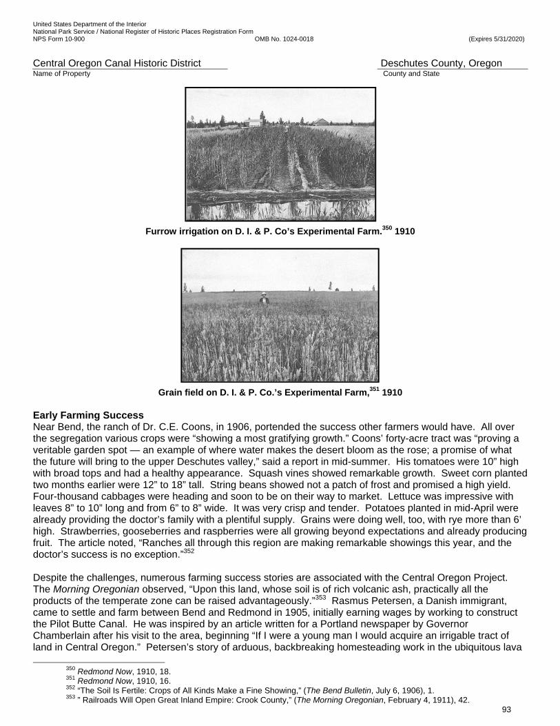
United States Department of the Interior National Park Service / National Register of Historic Places Registration Form NPS Form 10-900 OMB No. 1024-0018 (Expires 5/31/2020)
Central Oregon Canal Historic District Deschutes County, Oregon Name of Property County and State
93
Furrow irrigation on D. I. & P. Co’s Experimental Farm.350 1910
Grain field on D. I. & P. Co.’s Experimental Farm,351 1910 Early Farming Success Near Bend, the ranch of Dr. C.E. Coons, in 1906, portended the success other farmers would have. All over the segregation various crops were “showing a most gratifying growth.” Coons’ forty-acre tract was “proving a veritable garden spot — an example of where water makes the desert bloom as the rose; a promise of what the future will bring to the upper Deschutes valley,” said a report in mid-summer. His tomatoes were 10” high with broad tops and had a healthy appearance. Squash vines showed remarkable growth. Sweet corn planted two months earlier were 12” to 18” tall. String beans showed not a patch of frost and promised a high yield. Four-thousand cabbages were heading and soon to be on their way to market. Lettuce was impressive with leaves 8” to 10” long and from 6” to 8” wide. It was very crisp and tender. Potatoes planted in mid-April were already providing the doctor’s family with a plentiful supply. Grains were doing well, too, with rye more than 6’ high. Strawberries, gooseberries and raspberries were all growing beyond expectations and already producing fruit. The article noted, “Ranches all through this region are making remarkable showings this year, and the doctor’s success is no exception.”352 Despite the challenges, numerous farming success stories are associated with the Central Oregon Project. The Morning Oregonian observed, “Upon this land, whose soil is of rich volcanic ash, practically all the products of the temperate zone can be raised advantageously.”353 Rasmus Petersen, a Danish immigrant, came to settle and farm between Bend and Redmond in 1905, initially earning wages by working to construct the Pilot Butte Canal. He was inspired by an article written for a Portland newspaper by Governor Chamberlain after his visit to the area, beginning “If I were a young man I would acquire an irrigable tract of land in Central Oregon.” Petersen’s story of arduous, backbreaking homesteading work in the ubiquitous lava
350 Redmond Now, 1910, 18. 351 Redmond Now, 1910, 16. 352 “The Soil Is Fertile: Crops of All Kinds Make a Fine Showing,” (The Bend Bulletin, July 6, 1906), 1. 353 ” Railroads Will Open Great Inland Empire: Crook County,” (The Morning Oregonian, February 4, 1911), 42.
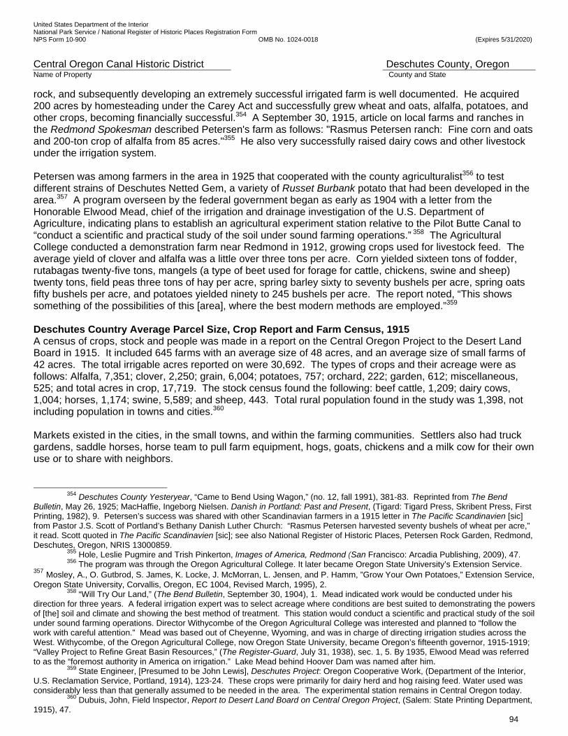
United States Department of the Interior National Park Service / National Register of Historic Places Registration Form NPS Form 10-900 OMB No. 1024-0018 (Expires 5/31/2020)
Central Oregon Canal Historic District Deschutes County, Oregon Name of Property County and State
94
rock, and subsequently developing an extremely successful irrigated farm is well documented. He acquired 200 acres by homesteading under the Carey Act and successfully grew wheat and oats, alfalfa, potatoes, and other crops, becoming financially successful.354 A September 30, 1915, article on local farms and ranches in the Redmond Spokesman described Petersen's farm as follows: "Rasmus Petersen ranch: Fine corn and oats and 200-ton crop of alfalfa from 85 acres."355 He also very successfully raised dairy cows and other livestock under the irrigation system. Petersen was among farmers in the area in 1925 that cooperated with the county agriculturalist356 to test different strains of Deschutes Netted Gem, a variety of Russet Burbank potato that had been developed in the area.357 A program overseen by the federal government began as early as 1904 with a letter from the Honorable Elwood Mead, chief of the irrigation and drainage investigation of the U.S. Department of Agriculture, indicating plans to establish an agricultural experiment station relative to the Pilot Butte Canal to “conduct a scientific and practical study of the soil under sound farming operations.” 358 The Agricultural College conducted a demonstration farm near Redmond in 1912, growing crops used for livestock feed. The average yield of clover and alfalfa was a little over three tons per acre. Corn yielded sixteen tons of fodder, rutabagas twenty-five tons, mangels (a type of beet used for forage for cattle, chickens, swine and sheep) twenty tons, field peas three tons of hay per acre, spring barley sixty to seventy bushels per acre, spring oats fifty bushels per acre, and potatoes yielded ninety to 245 bushels per acre. The report noted, “This shows something of the possibilities of this [area], where the best modern methods are employed.”359 Deschutes Country Average Parcel Size, Crop Report and Farm Census, 1915 A census of crops, stock and people was made in a report on the Central Oregon Project to the Desert Land Board in 1915. It included 645 farms with an average size of 48 acres, and an average size of small farms of 42 acres. The total irrigable acres reported on were 30,692. The types of crops and their acreage were as follows: Alfalfa, 7,351; clover, 2,250; grain, 6,004; potatoes, 757; orchard, 222; garden, 612; miscellaneous, 525; and total acres in crop, 17,719. The stock census found the following: beef cattle, 1,209; dairy cows, 1,004; horses, 1,174; swine, 5,589; and sheep, 443. Total rural population found in the study was 1,398, not including population in towns and cities.360 Markets existed in the cities, in the small towns, and within the farming communities. Settlers also had truck gardens, saddle horses, horse team to pull farm equipment, hogs, goats, chickens and a milk cow for their own use or to share with neighbors.
354 Deschutes County Yesteryear, “Came to Bend Using Wagon,” (no. 12, fall 1991), 381-83. Reprinted from The Bend
Bulletin, May 26, 1925; MacHaffie, Ingeborg Nielsen. Danish in Portland: Past and Present, (Tigard: Tigard Press, Skribent Press, First Printing, 1982), 9. Petersen’s success was shared with other Scandinavian farmers in a 1915 letter in The Pacific Scandinavien [sic] from Pastor J.S. Scott of Portland’s Bethany Danish Luther Church: “Rasmus Petersen harvested seventy bushels of wheat per acre,” it read. Scott quoted in The Pacific Scandinavien [sic]; see also National Register of Historic Places, Petersen Rock Garden, Redmond, Deschutes, Oregon, NRIS 13000859.
355 Hole, Leslie Pugmire and Trish Pinkerton, Images of America, Redmond (San Francisco: Arcadia Publishing, 2009), 47. 356 The program was through the Oregon Agricultural College. It later became Oregon State University’s Extension Service.
357 Mosley, A., O. Gutbrod, S. James, K. Locke, J. McMorran, L. Jensen, and P. Hamm, ”Grow Your Own Potatoes,” Extension Service, Oregon State University, Corvallis, Oregon, EC 1004, Revised March, 1995), 2.
358 “Will Try Our Land,” (The Bend Bulletin, September 30, 1904), 1. Mead indicated work would be conducted under his direction for three years. A federal irrigation expert was to select acreage where conditions are best suited to demonstrating the powers of [the] soil and climate and showing the best method of treatment. This station would conduct a scientific and practical study of the soil under sound farming operations. Director Withycombe of the Oregon Agricultural College was interested and planned to “follow the work with careful attention.” Mead was based out of Cheyenne, Wyoming, and was in charge of directing irrigation studies across the West. Withycombe, of the Oregon Agricultural College, now Oregon State University, became Oregon’s fifteenth governor, 1915-1919; “Valley Project to Refine Great Basin Resources,” (The Register-Guard, July 31, 1938), sec. 1, 5. By 1935, Elwood Mead was referred to as the “foremost authority in America on irrigation.” Lake Mead behind Hoover Dam was named after him.
359 State Engineer, [Presumed to be John Lewis], Deschutes Project: Oregon Cooperative Work, (Department of the Interior, U.S. Reclamation Service, Portland, 1914), 123-24. These crops were primarily for dairy herd and hog raising feed. Water used was considerably less than that generally assumed to be needed in the area. The experimental station remains in Central Oregon today.
360 Dubuis, John, Field Inspector, Report to Desert Land Board on Central Oregon Project, (Salem: State Printing Department, 1915), 47.
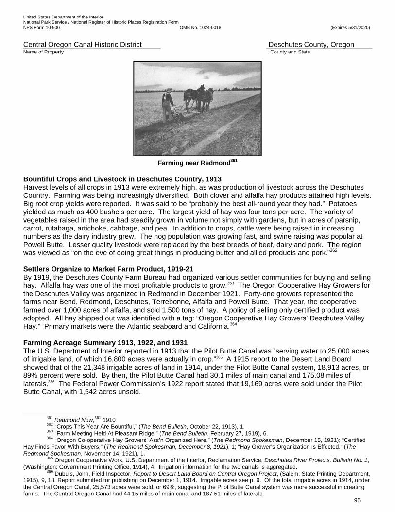
United States Department of the Interior National Park Service / National Register of Historic Places Registration Form NPS Form 10-900 OMB No. 1024-0018 (Expires 5/31/2020)
Central Oregon Canal Historic District Deschutes County, Oregon Name of Property County and State
95
Farming near Redmond361 Bountiful Crops and Livestock in Deschutes Country, 1913 Harvest levels of all crops in 1913 were extremely high, as was production of livestock across the Deschutes Country. Farming was being increasingly diversified. Both clover and alfalfa hay products attained high levels. Big root crop yields were reported. It was said to be “probably the best all-round year they had.” Potatoes yielded as much as 400 bushels per acre. The largest yield of hay was four tons per acre. The variety of vegetables raised in the area had steadily grown in volume not simply with gardens, but in acres of parsnip, carrot, rutabaga, artichoke, cabbage, and pea. In addition to crops, cattle were being raised in increasing numbers as the dairy industry grew. The hog population was growing fast, and swine raising was popular at Powell Butte. Lesser quality livestock were replaced by the best breeds of beef, dairy and pork. The region was viewed as “on the eve of doing great things in producing butter and allied products and pork.”362 Settlers Organize to Market Farm Product, 1919-21 By 1919, the Deschutes County Farm Bureau had organized various settler communities for buying and selling hay. Alfalfa hay was one of the most profitable products to grow.363 The Oregon Cooperative Hay Growers for the Deschutes Valley was organized in Redmond in December 1921. Forty-one growers represented the farms near Bend, Redmond, Deschutes, Terrebonne, Alfalfa and Powell Butte. That year, the cooperative farmed over 1,000 acres of alfalfa, and sold 1,500 tons of hay. A policy of selling only certified product was adopted. All hay shipped out was identified with a tag: “Oregon Cooperative Hay Growers’ Deschutes Valley Hay.” Primary markets were the Atlantic seaboard and California.364 Farming Acreage Summary 1913, 1922, and 1931 The U.S. Department of Interior reported in 1913 that the Pilot Butte Canal was “serving water to 25,000 acres of irrigable land, of which 16,800 acres were actually in crop.”365 A 1915 report to the Desert Land Board showed that of the 21,348 irrigable acres of land in 1914, under the Pilot Butte Canal system, 18,913 acres, or 89% percent were sold. By then, the Pilot Butte Canal had 30.1 miles of main canal and 175.08 miles of laterals.366 The Federal Power Commission’s 1922 report stated that 19,169 acres were sold under the Pilot Butte Canal, with 1,542 acres unsold.
361 Redmond Now,361 1910 362 “Crops This Year Are Bountiful,” (The Bend Bulletin, October 22, 1913), 1. 363 “Farm Meeting Held At Pleasant Ridge,” (The Bend Bulletin, February 27, 1919), 6. 364 “Oregon Co-operative Hay Growers’ Ass’n Organized Here,” (The Redmond Spokesman, December 15, 1921); “Certified
Hay Finds Favor With Buyers,” (The Redmond Spokesman, December 8, 1921), 1; “Hay Grower’s Organization Is Effected.“ (The Redmond Spokesman, November 14, 1921), 1. 365 Oregon Cooperative Work, U.S. Department of the Interior, Reclamation Service, Deschutes River Projects, Bulletin No. 1, (Washington: Government Printing Office, 1914), 4. Irrigation information for the two canals is aggregated.
366 Dubuis, John, Field Inspector, Report to Desert Land Board on Central Oregon Project, (Salem: State Printing Department, 1915), 9, 18. Report submitted for publishing on December 1, 1914. Irrigable acres see p. 9. Of the total irrigable acres in 1914, under the Central Oregon Canal, 25,573 acres were sold, or 69%, suggesting the Pilot Butte Canal system was more successful in creating farms. The Central Oregon Canal had 44.15 miles of main canal and 187.51 miles of laterals.
United States Department of the Interior National Park Service / National Register of Historic Places Registration Form NPS Form 10-900 OMB No. 1024-0018 (Expires 5/31/2020)
Central Oregon Canal Historic District Deschutes County, Oregon Name of Property County and State
96
The Central Oregon Canal had 45 miles of main canal and 11 laterals and was serving 26,400 acres.367 There were 27,208 acres sold under the Central Oregon Canal system and 9,170 acres unsold. 368 The engineer reports showed that there was ‘a material shortage of capacity in the main canal’ and enlargement efforts were begun and undertaken as funds were available. Polk’s Deschutes County Directory for 1924-25 stated, “We have … 1,000 farms producing alfalfa, potatoes, grain and other farm crops suitable to our soil and climate.”369 The Bend Chamber of Commerce reported, “The number of farms in Deschutes County increased twenty-three percent from 1925 to 1930, according to United States census figures, exceeded by only three counties in the State of Oregon, and the value of farmlands and buildings increased eighteen-and-a-half percent, exceeded, again, by only three counties in the state. These Deschutes County increases were all in irrigated sections.”370 Author and historian Phil Brogan’s research a decade later (1931) summarized the work that had been accomplished by both canals during the period: “Actual construction started in 1903 and up until 1921 approximately 600 miles of canals and laterals had been built and 45,371 acres of land reclaimed for irrigation.”371 END OF THE COMMERCIAL ENTERPRISE UNDER THE CAREY ACT SETTLERS BECOME THE CENTRAL OREGON IRRIGATION DISTRICT, 1921 To complete the June 17, 1907 requirement of the State Desert Land Board to turn the D. I. & P. Co. over to the settlers within 10 years, a proposal arose in 1915 that the Central Oregon Irrigation settlers begin to form a district.372 At that time, irrigation economist Ray Palmer Teele, M.A., wrote in his 1915 book, “Few large Carey Act enterprises have reached the stage of being turned over to the purchasers of water rights.”373 A district, it was proposed, could be perfected by the settlers themselves without any great difficulty. Specifically, it noted: “After the district has been organized, arrangements can be made with the Central Oregon Irrigation Company to acquire all its water rights, construction works, contracts with the State, and all the liens on unsold reclaimed lands within the limits of the Pilot Butte and Central Oregon Canals. It is to the best interests of all those who now own land under the system and who have acquired water rights there to formulate some feasible plan of reorganization. It is also evident that the Central Oregon Irrigation Company has certain rights which cannot be eliminated or overlooked. It would seem also that the best interests of the neighboring towns, as well as the settlers on the project would be best protected by the management of all matters pertaining to the project by the settlers and farmers themselves, as would be the case under the district idea.”374
A date for the vote to form an irrigation district was set by the Desert Land Board. The vote was in favor of forming a district to take over and operate the irrigation system in lieu of a Water Users Association, as had been provided for in the company’s contract with the State of June 17, 1907.375 Following the settlers’
367 Ibid, 58. 368 Federal Power Commission, Report to the Federal Power Commission on Uses of the Deschutes River, Oregon,
(Washington: Printing Office, 1922), 72. There were 27,208 acres sold under the Central Oregon Canal system and 9,170 acres unsold.
369 Polk’s Deschutes County Directory 1924-25, 40. 370 Cramb, L.K., The Irrigation Situation In Central Oregon: A Proposal that the Federal Government Provide Storage, (Bend:
Bend Chamber of Commerce, October 15, 1931), sec. I, 18. 371 Brogan, Phil F., “The Watering of the Wilderness,” (The Bend Bulletin, March 21, 1931), n.p. These figures include both
Pilot Butte and Central Oregon canals. 372 Brogan, Phil F., “The Watering of the Wilderness,” (The Bend Bulletin, March 3, 1931), n.p. On October 27, 1915, Olaf
Laurgaard, a well-respected irrigation engineer, proposed that the Central Oregon Irrigation settlers form a district. He wrote to Oregon Governor Withycombe (1915-1919) for whom he had consulted on irrigation matters. His suggestion, therefore, was regarded as worthy of consideration. It was Laurgaard’s view that all the land in private ownership, Carey Act lands, homesteads, tracts under the Pilot Butte and Central Oregon canals, as well as some other lands should be included within the limits of an irrigation district.
373 Teele, Ray Palmer, M.A., Irrigation in the United States, (New York: D. Appleton, 1915), 200. 374 Brogan, Phil F., “The Watering of the Wilderness,” (The Bend Bulletin, March 3, 1931), n.p.; 375 Brogan, Phil F., “The Watering of the Wilderness,” (The Bend Bulletin, March 10, 1931), n.p. The vote was on December
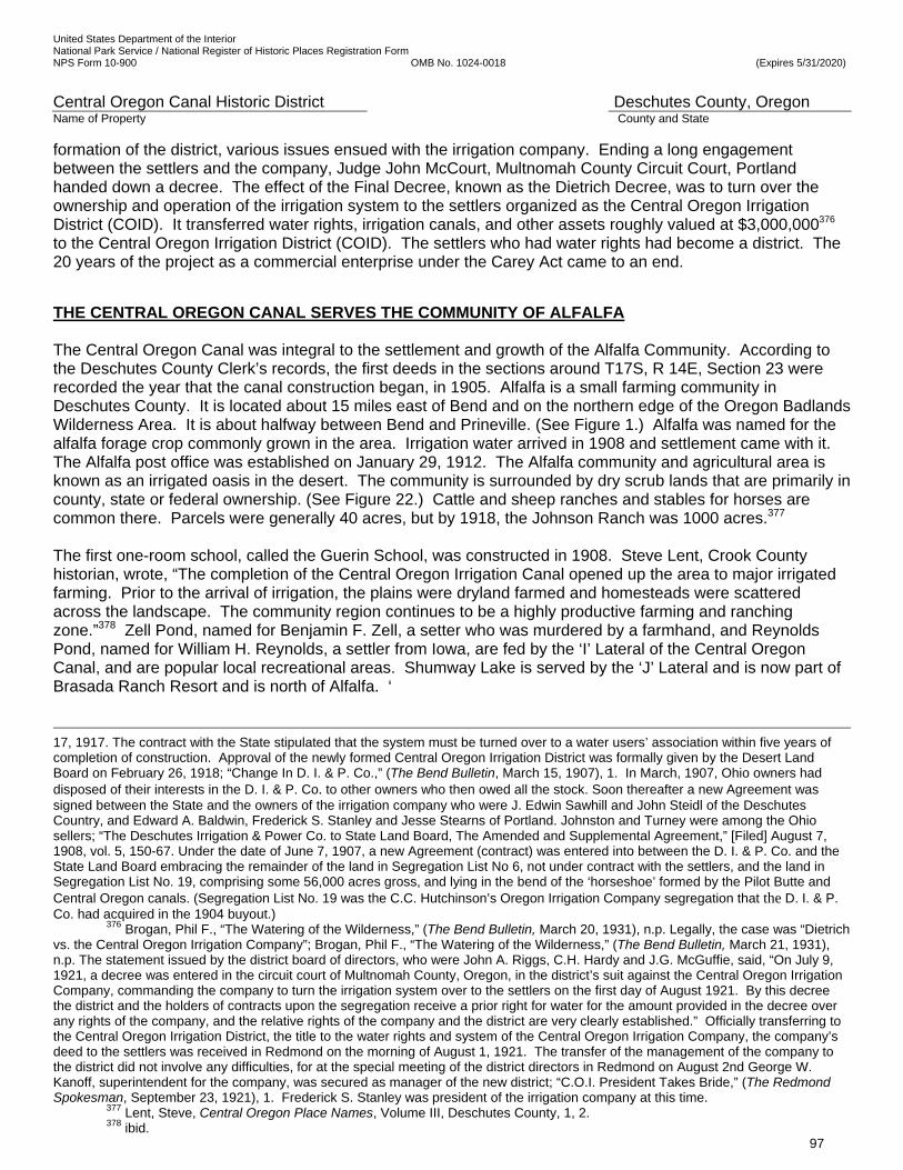
United States Department of the Interior National Park Service / National Register of Historic Places Registration Form NPS Form 10-900 OMB No. 1024-0018 (Expires 5/31/2020)
Central Oregon Canal Historic District Deschutes County, Oregon Name of Property County and State
97
formation of the district, various issues ensued with the irrigation company. Ending a long engagement between the settlers and the company, Judge John McCourt, Multnomah County Circuit Court, Portland handed down a decree. The effect of the Final Decree, known as the Dietrich Decree, was to turn over the ownership and operation of the irrigation system to the settlers organized as the Central Oregon Irrigation District (COID). It transferred water rights, irrigation canals, and other assets roughly valued at $3,000,000376 to the Central Oregon Irrigation District (COID). The settlers who had water rights had become a district. The 20 years of the project as a commercial enterprise under the Carey Act came to an end.
THE CENTRAL OREGON CANAL SERVES THE COMMUNITY OF ALFALFA The Central Oregon Canal was integral to the settlement and growth of the Alfalfa Community. According to the Deschutes County Clerk’s records, the first deeds in the sections around T17S, R 14E, Section 23 were recorded the year that the canal construction began, in 1905. Alfalfa is a small farming community in Deschutes County. It is located about 15 miles east of Bend and on the northern edge of the Oregon Badlands Wilderness Area. It is about halfway between Bend and Prineville. (See Figure 1.) Alfalfa was named for the alfalfa forage crop commonly grown in the area. Irrigation water arrived in 1908 and settlement came with it. The Alfalfa post office was established on January 29, 1912. The Alfalfa community and agricultural area is known as an irrigated oasis in the desert. The community is surrounded by dry scrub lands that are primarily in county, state or federal ownership. (See Figure 22.) Cattle and sheep ranches and stables for horses are common there. Parcels were generally 40 acres, but by 1918, the Johnson Ranch was 1000 acres.377 The first one-room school, called the Guerin School, was constructed in 1908. Steve Lent, Crook County historian, wrote, “The completion of the Central Oregon Irrigation Canal opened up the area to major irrigated farming. Prior to the arrival of irrigation, the plains were dryland farmed and homesteads were scattered across the landscape. The community region continues to be a highly productive farming and ranching zone.”378 Zell Pond, named for Benjamin F. Zell, a setter who was murdered by a farmhand, and Reynolds Pond, named for William H. Reynolds, a settler from Iowa, are fed by the ‘I’ Lateral of the Central Oregon Canal, and are popular local recreational areas. Shumway Lake is served by the ‘J’ Lateral and is now part of Brasada Ranch Resort and is north of Alfalfa. ‘
17, 1917. The contract with the State stipulated that the system must be turned over to a water users’ association within five years of completion of construction. Approval of the newly formed Central Oregon Irrigation District was formally given by the Desert Land Board on February 26, 1918; “Change In D. I. & P. Co.,” (The Bend Bulletin, March 15, 1907), 1. In March, 1907, Ohio owners had disposed of their interests in the D. I. & P. Co. to other owners who then owed all the stock. Soon thereafter a new Agreement was signed between the State and the owners of the irrigation company who were J. Edwin Sawhill and John Steidl of the Deschutes Country, and Edward A. Baldwin, Frederick S. Stanley and Jesse Stearns of Portland. Johnston and Turney were among the Ohio sellers; “The Deschutes Irrigation & Power Co. to State Land Board, The Amended and Supplemental Agreement,” [Filed] August 7, 1908, vol. 5, 150-67. Under the date of June 7, 1907, a new Agreement (contract) was entered into between the D. I. & P. Co. and the State Land Board embracing the remainder of the land in Segregation List No 6, not under contract with the settlers, and the land in Segregation List No. 19, comprising some 56,000 acres gross, and lying in the bend of the ‘horseshoe’ formed by the Pilot Butte and Central Oregon canals. (Segregation List No. 19 was the C.C. Hutchinson’s Oregon Irrigation Company segregation that the D. I. & P. Co. had acquired in the 1904 buyout.)
376 Brogan, Phil F., “The Watering of the Wilderness,” (The Bend Bulletin, March 20, 1931), n.p. Legally, the case was “Dietrich vs. the Central Oregon Irrigation Company”; Brogan, Phil F., “The Watering of the Wilderness,” (The Bend Bulletin, March 21, 1931), n.p. The statement issued by the district board of directors, who were John A. Riggs, C.H. Hardy and J.G. McGuffie, said, “On July 9, 1921, a decree was entered in the circuit court of Multnomah County, Oregon, in the district’s suit against the Central Oregon Irrigation Company, commanding the company to turn the irrigation system over to the settlers on the first day of August 1921. By this decree the district and the holders of contracts upon the segregation receive a prior right for water for the amount provided in the decree over any rights of the company, and the relative rights of the company and the district are very clearly established.” Officially transferring to the Central Oregon Irrigation District, the title to the water rights and system of the Central Oregon Irrigation Company, the company’s deed to the settlers was received in Redmond on the morning of August 1, 1921. The transfer of the management of the company to the district did not involve any difficulties, for at the special meeting of the district directors in Redmond on August 2nd George W. Kanoff, superintendent for the company, was secured as manager of the new district; “C.O.I. President Takes Bride,” (The Redmond Spokesman, September 23, 1921), 1. Frederick S. Stanley was president of the irrigation company at this time.
377 Lent, Steve, Central Oregon Place Names, Volume III, Deschutes County, 1, 2. 378 ibid.

United States Department of the Interior National Park Service / National Register of Historic Places Registration Form NPS Form 10-900 OMB No. 1024-0018 (Expires 5/31/2020)
Central Oregon Canal Historic District Deschutes County, Oregon Name of Property County and State
98
A man works on an evaporation pond and weir next to a lateral and irrigated field on the
Central Oregon Canal near Alfalfa379 THE CENTRAL OREGON CANAL SERVES THE COMMUNITY OF POWELL BUTTE Powell Butte is an unincorporated ranching community in Crook County with a population of 1,768. It is adjacent to Prineville, which was platted in 1877, and is the Crook County seat and the main shopping and governmental center for Powell Butte. The Powell Butte community is centered around T16S, R14E, Section 23, at the base of Powell Buttes. Powell Butte is located a half hour’s drive northeast of Bend, nine miles southwest of Prineville and eight miles east of Redmond. The post office at Powell Butte was established on March 12, 1909. The area was dry farmed prior to 1908 and water had to be hauled from springs near the base of Powell Buttes for domestic use, orchards and livestock. The first school there was LaFollette School, established in 1893. The irrigation companies did not establish the community of Powell Butte. Settlement in Powell Butte began twenty years previously, in the 1880s, because of its proximity to the Crook County seat in Prineville and partly because the area has deeper soil and less rock than other areas. The Central Oregon Project facilitated widespread irrigation of crops, and attracted more people to the community. Some of the land in Segregation List #6 was in the Powell Butte area and the irrigation companies were required to provide water to the purchasers of the land they sold. Providing enough water in the canal and laterals to reach settlers at the end of the line proved to be exceedingly expensive and challenging. In August 1905, the original shared flume at the south diversion point had been enlarged again and could convey 650 cubic feet per second for both the Pilot Butte Canal and the Central Oregon Canal. It was figured that it took one cubic foot per second for each 160 acres to be irrigated. The first six miles of the Central Oregon Canal were constructed at the time. It was thought that there would be enough water in the Central Oregon Canal system to serve 96,000 acres, including Alfalfa and Powell Butte. But, there were concerns about the capacity at the original intake at the river and the City of Bend was pressuring the D. I. & P. Co. to move the intake to the north side of town so that more water would flow through town during irrigation season. The project’s chief engineer, Redfield, thought he had found a solution to both problems by moving the intake for the Pilot Butte Canal and separating the two systems. In September 1907, surveyors were north of Bend locating the best place for the proposed North Dam and diversion point. The dam would be 39’ tall and 313’ wide. Water would be delivered to the Pilot Butte Canal by a proposed 1.41-mile-long North Canal. Redfield’s plan was to disconnect the Pilot Butte Canal from the eight miles of canal located between the original diversion point and the eastern end of the new North Canal. As conceived that year, the dam would also divert water for the Powell Butte area and it would be conveyed by a new 28-mile canal that would run northeast to Powell Butte, bypassing the Central Oregon Canal entirely. But, his idea was found to be too expensive, and it was decided to water Powell Butte with increased flows in the Central Oregon Canal, when the Pilot Butte Canal had its own diversion point at the North Dam. The dam and the North Canal were completed for $220,000 and connected to the Pilot Butte Canal in 1912.
379 Undated photo in Bowman Museum Collection, Prineville, Oregon.
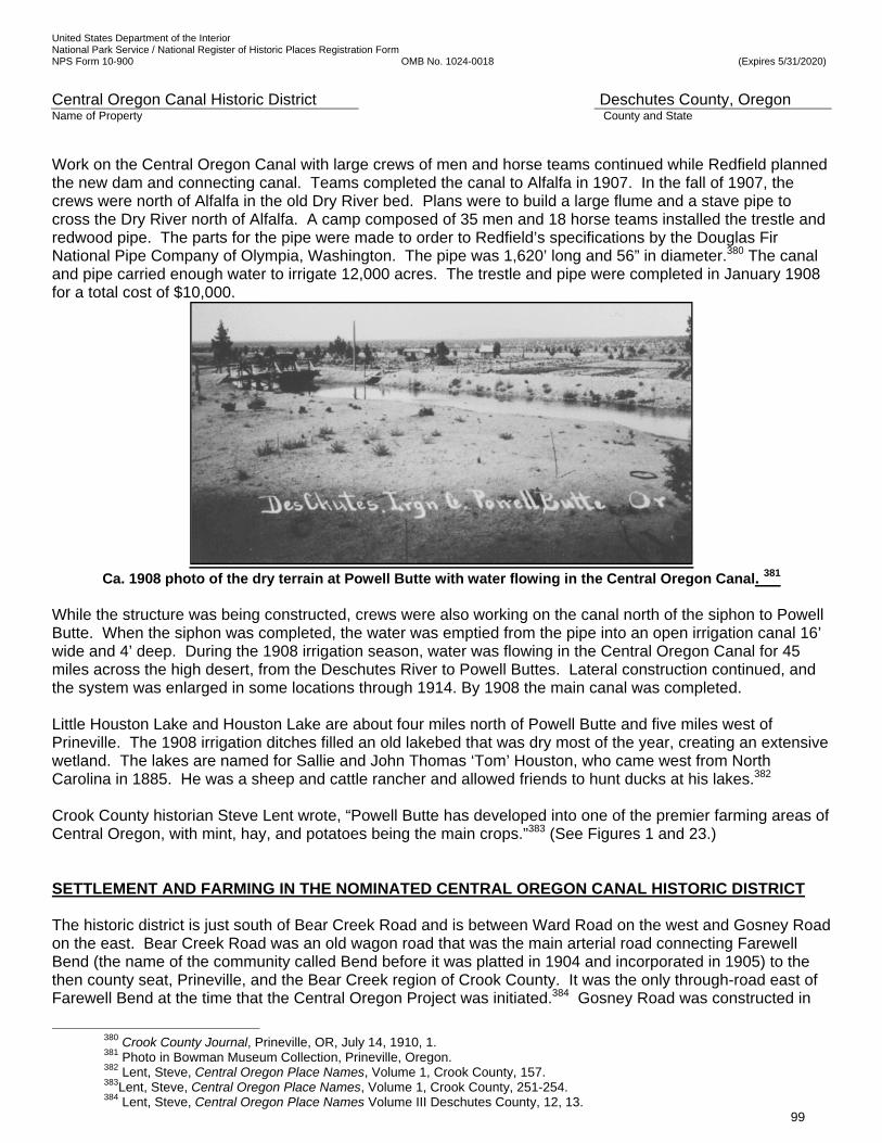
United States Department of the Interior National Park Service / National Register of Historic Places Registration Form NPS Form 10-900 OMB No. 1024-0018 (Expires 5/31/2020)
Central Oregon Canal Historic District Deschutes County, Oregon Name of Property County and State
99
Work on the Central Oregon Canal with large crews of men and horse teams continued while Redfield planned the new dam and connecting canal. Teams completed the canal to Alfalfa in 1907. In the fall of 1907, the crews were north of Alfalfa in the old Dry River bed. Plans were to build a large flume and a stave pipe to cross the Dry River north of Alfalfa. A camp composed of 35 men and 18 horse teams installed the trestle and redwood pipe. The parts for the pipe were made to order to Redfield’s specifications by the Douglas Fir National Pipe Company of Olympia, Washington. The pipe was 1,620’ long and 56” in diameter.380 The canal and pipe carried enough water to irrigate 12,000 acres. The trestle and pipe were completed in January 1908 for a total cost of $10,000.
Ca. 1908 photo of the dry terrain at Powell Butte with water flowing in the Central Oregon Canal. 381
While the structure was being constructed, crews were also working on the canal north of the siphon to Powell Butte. When the siphon was completed, the water was emptied from the pipe into an open irrigation canal 16’ wide and 4’ deep. During the 1908 irrigation season, water was flowing in the Central Oregon Canal for 45 miles across the high desert, from the Deschutes River to Powell Buttes. Lateral construction continued, and the system was enlarged in some locations through 1914. By 1908 the main canal was completed. Little Houston Lake and Houston Lake are about four miles north of Powell Butte and five miles west of Prineville. The 1908 irrigation ditches filled an old lakebed that was dry most of the year, creating an extensive wetland. The lakes are named for Sallie and John Thomas ‘Tom’ Houston, who came west from North Carolina in 1885. He was a sheep and cattle rancher and allowed friends to hunt ducks at his lakes.382 Crook County historian Steve Lent wrote, “Powell Butte has developed into one of the premier farming areas of Central Oregon, with mint, hay, and potatoes being the main crops.”383 (See Figures 1 and 23.) SETTLEMENT AND FARMING IN THE NOMINATED CENTRAL OREGON CANAL HISTORIC DISTRICT The historic district is just south of Bear Creek Road and is between Ward Road on the west and Gosney Road on the east. Bear Creek Road was an old wagon road that was the main arterial road connecting Farewell Bend (the name of the community called Bend before it was platted in 1904 and incorporated in 1905) to the then county seat, Prineville, and the Bear Creek region of Crook County. It was the only through-road east of Farewell Bend at the time that the Central Oregon Project was initiated.384 Gosney Road was constructed in
380 Crook County Journal, Prineville, OR, July 14, 1910, 1. 381 Photo in Bowman Museum Collection, Prineville, Oregon. 382 Lent, Steve, Central Oregon Place Names, Volume 1, Crook County, 157. 383Lent, Steve, Central Oregon Place Names, Volume 1, Crook County, 251-254. 384 Lent, Steve, Central Oregon Place Names Volume III Deschutes County, 12, 13.

United States Department of the Interior National Park Service / National Register of Historic Places Registration Form NPS Form 10-900 OMB No. 1024-0018 (Expires 5/31/2020)
Central Oregon Canal Historic District Deschutes County, Oregon Name of Property County and State
100
1920 by Deschutes County and named for property owner Glen R. Gosney, who petitioned for the road. Ward Road is named for Arthur Ward, another property owner who petitioned for the road in 1921.385 The 1928 irrigation maps show bridges over the Central Oregon Canal at Ward Road and Gosney Road. (See Figures 11, 12.) Access to the farms was good and Bend was only 5 miles away when the canal was planned. Due to the phenomenal city growth, it was only 1.5 to 2.0 miles away during the historic period. Weekly, the local Bend Bulletin newspaper reported on a few visitors staying in hotels or looking for land. A typical article would be like the following: May 5, 1909, page 5, “Phillip C. Burt of Battle Creek Michigan, has been spending the past week in Bend. Mr. Burt is looking over the section with a view to investing in land. Water Rights on Parcels around the Historic District The main canal in the Central Oregon Canal Historic District (Ward Road – Gosney Road Segment) passes through four Sections: T18S, R12 E, Section 1; T18S, R13 E, Section 5; T18S, R13 E, Section 6; and T18S, R13 E, Section 8. (See Figure 3.) Each section contains approximately a square mile, 640 acres of land. Some of the land was offered for sale with water rights. (See Figures 11 and 12.) The section with the highest percentage of irrigation rights was in T18S, R12 E, Section 1: 59%. T18S, R13 E, Section 6 had 29% of the land with irrigation rights. T18S, R13 E, Section 5 had only 12% of its land with irrigation rights. T18S, R13 E, Section 8 offered less than 1% of its land with irrigation rights. All of the irrigation rights on the downhill (north) side of the canal are for water delivered by the Central Oregon Canal. Some of the water on the high side (south) is delivered by the Arnold Canal.
Location By Section Acres with Water Rights
Percent of Land With Water Rights
T18S, R12 E, Section 1 378.0 59%
T18S, R13 E, Section 5 76.5 12%
T18S, R13 E, Section 6 190.5 29%
T18S, R13 E, Section 8 57.3 0.8%
Table 2. Acres of Land with Water Rights in Vicinity of Historic District
Settlers Purchase Land in the Historic District The point of developing the irrigation system was to make a profit for the investors by selling reclaimed land to settlers under the Carey Act contract with the State. If all went well, and it did for the most part, the income from property sales would exceed the expenditures needed to construct the dam and canals, build urban infrastructure, run the experimental farm, hold local promotional events, and promote the project nationally. To be financially successful and meet the terms of the contract with the State of Oregon, the companies had to attract settlers and provide irrigation water to the highest point on their land. The success of the settlers was important to balance the equation.
Access to the area from Prineville and Bend was on Bear Creek Road and was very good, and its location was close to Bend. But, due to the hills, slopes, and rock, the land south of Bear Creek Road between Ward Road and Gosney Road was not the best in the area and was settled after better land was taken up. The best land was purchased in 40 to 160-acre parcels, while the canal was under construction. Poorer land was settled last or not at all. Land on flat terrain with water rights and sparse, loose rock and deeper soils was the most valuable. Taller juniper trees and denser vegetation often signaled deeper soil, but created more work to clear the land.
Figures 14a., 14b., and 14c. illustrate the size and location of the original parcels and original owners (settlers) in the four sections crossed by the Central Oregon Canal Historic District (Ward Road-Gosney Road Segment). Of the 640 acres in T18S, R12 E, Section 1, with 59% of the land having water rights, all of the
385 Lent, Steve, Central Oregon Place Names Volume III Deschutes County, 101, 300.

United States Department of the Interior National Park Service / National Register of Historic Places Registration Form NPS Form 10-900 OMB No. 1024-0018 (Expires 5/31/2020)
Central Oregon Canal Historic District Deschutes County, Oregon Name of Property County and State
101
deeds of sales were recorded after COID was formed, between 1921 and 1954. Original owners included Dragan Wuyo Mirich with 280 acres, George and John Bradetich with 160 acres, Lilla I. Ford with 120 acres, and Mike Dragosavac with 80 acres.
Of the 640 acres in T18S, R13 E, Section 5, with only 12% of the land with water rights, a deed to the 120 unsold acres in Segregation List # 6 was returned in 1937 by Oregon State to the federal government. The remainder of the land was sold between 1913 and 1922. Original owners included Dora McNaught, R. A. Puett, John O’Donnell, and Theodore E. Olson, each with 80- acre parcels; and William P. Erickson and partner John Pinoniemi, Oscar J. Erickson, Esther Cockerhan, Charles Durand, and Ivan R. Knotts, each with 40-acre parcels.
Of the 640 acres in T18S, R13 E, Section 6, with 29% of the land with water rights, 120 acres were returned in 1937 by Oregon State to the federal government. The remainder of the land was sold between 1910 and 1951. Dragon Wuyo Mirich bought 160 acres. Philip C. Burt bought 160 acres. J. S. Smythe bought 80 acres. W. F. McNaught, Elizabeth Dixon, and Felix G. Allen each bought 40-acre parcels.
Of the 640 acres in T18S, R13 E, Section 8, with 0.8% of the acreage with water rights, 160 acres were returned in 1937 by Oregon State to the federal government. The remainder of the land was sold to private parties between 1910 and 1924. Quinton W. Hungate and Ada Hanson Stowell each bought 160-acre parcels. Ben Alsup bought 120 acres. Norman Wygand bought 40 acres.
Of the 24 owners in the four sections, Dragan Wuyo Mirich owned the most land, with a total of 440 acres. When Lilla I. Ford sold her 20 acres to John Bradetich in 1927, the Bradetich bothers then owned 380 acres. Five women (20% of the owners) were original settlers of the parcels. Esther Cockerham, Beth Dixon, Lilla Ford, Dora McNaught, and Ada Hanson Stowell owned a total of 440 acres.
To determine the effect of the promotional efforts, using the federal census for 1900, 1910, and 1920, it was determined where many of the owners were living before they settled on the land in the historic district. They came from many countries and states. Some examples are Mike Dragosavac from Austria, Oscar Erickson from Norway, George and John Bradetich from Austria, Esther Cockerham from England, Ada Hanson Stowell from Australia, Dragan Mirich from Yugoslavia, Beth Dixon from Pennsylvania, William F. McNaught from Iowa, Dora McNaught from Washington, R. A. Puett from North Carolina, Ben Alsup from Iowa, Amy and Philip Burt from Illinois, Ivan Knots born in Oregon, and John S. Smythe from Ohio.
Many of the settlers were farmers, but many held other occupations. Dragan Mirich was a well-known stone mason in Bend, who built the railroad overpass across Third Street in Bend, the tunnels between Reid School, Bend High School and the Amateur Athletic Club for the shared steam heating system, the 1930 rock Bradetich house and the stone milk house in 1935, and other stone buildings in Bend. Ben Alsup was a civil engineer who designed roads. Ivan Knotts was a lumber handler in a saw mill.
After working in a Portland lumber camp, John and George Bradetich worked on the vexed Tumalo Project dam. Then they worked in 1916 at the Shevlin-Hixon Company Lumber Mill. In 1919, they purchased their first 160-acre parcel in the historic district. They grew potatoes and started the first Grade A dairy in Central Oregon with cows they purchased from a dairy in Weiser, Idaho. They also raised swine. 386
386 Deschutes County Historical Society, A History of the Deschutes Country in Oregon, 147-149.
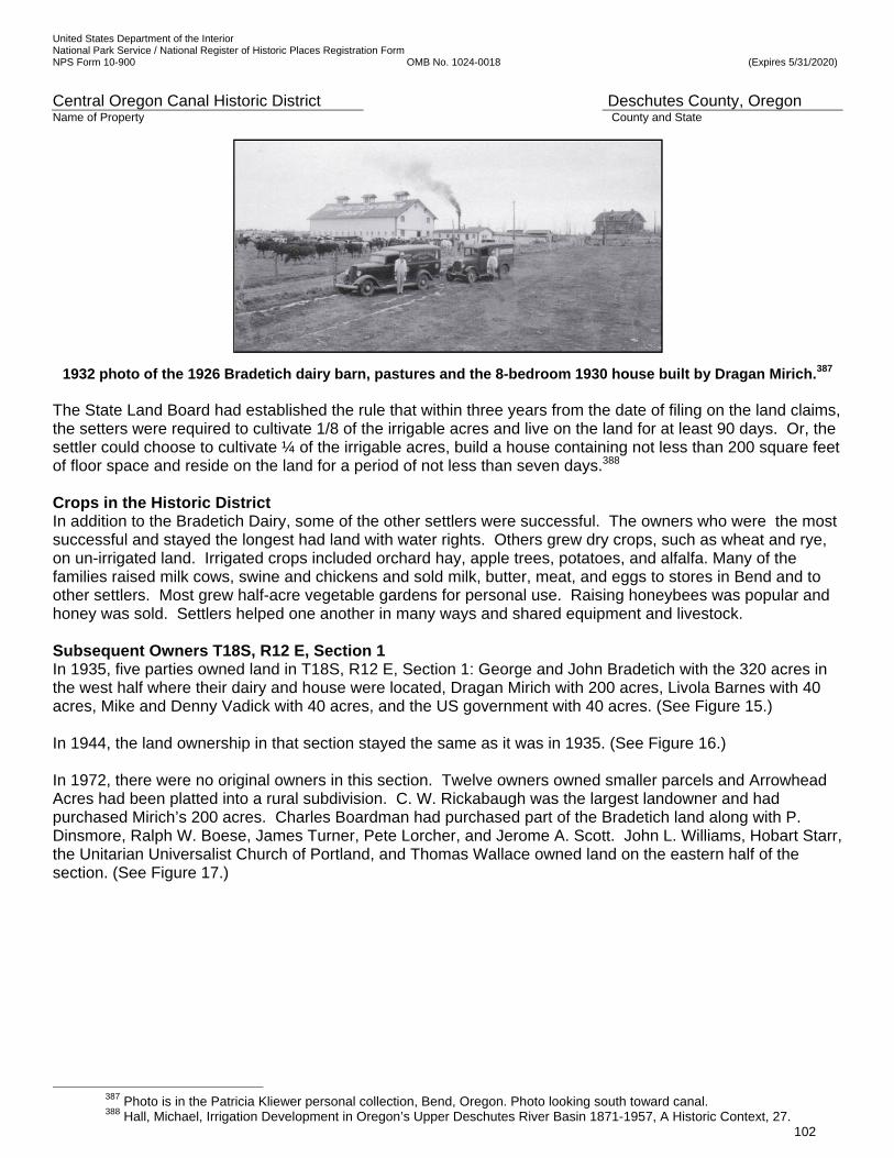
United States Department of the Interior National Park Service / National Register of Historic Places Registration Form NPS Form 10-900 OMB No. 1024-0018 (Expires 5/31/2020)
Central Oregon Canal Historic District Deschutes County, Oregon Name of Property County and State
102
1932 photo of the 1926 Bradetich dairy barn, pastures and the 8-bedroom 1930 house built by Dragan Mirich.387 The State Land Board had established the rule that within three years from the date of filing on the land claims, the setters were required to cultivate 1/8 of the irrigable acres and live on the land for at least 90 days. Or, the settler could choose to cultivate ¼ of the irrigable acres, build a house containing not less than 200 square feet of floor space and reside on the land for a period of not less than seven days.388 Crops in the Historic District In addition to the Bradetich Dairy, some of the other settlers were successful. The owners who were the most successful and stayed the longest had land with water rights. Others grew dry crops, such as wheat and rye, on un-irrigated land. Irrigated crops included orchard hay, apple trees, potatoes, and alfalfa. Many of the families raised milk cows, swine and chickens and sold milk, butter, meat, and eggs to stores in Bend and to other settlers. Most grew half-acre vegetable gardens for personal use. Raising honeybees was popular and honey was sold. Settlers helped one another in many ways and shared equipment and livestock. Subsequent Owners T18S, R12 E, Section 1 In 1935, five parties owned land in T18S, R12 E, Section 1: George and John Bradetich with the 320 acres in the west half where their dairy and house were located, Dragan Mirich with 200 acres, Livola Barnes with 40 acres, Mike and Denny Vadick with 40 acres, and the US government with 40 acres. (See Figure 15.) In 1944, the land ownership in that section stayed the same as it was in 1935. (See Figure 16.) In 1972, there were no original owners in this section. Twelve owners owned smaller parcels and Arrowhead Acres had been platted into a rural subdivision. C. W. Rickabaugh was the largest landowner and had purchased Mirich’s 200 acres. Charles Boardman had purchased part of the Bradetich land along with P. Dinsmore, Ralph W. Boese, James Turner, Pete Lorcher, and Jerome A. Scott. John L. Williams, Hobart Starr, the Unitarian Universalist Church of Portland, and Thomas Wallace owned land on the eastern half of the section. (See Figure 17.)
387 Photo is in the Patricia Kliewer personal collection, Bend, Oregon. Photo looking south toward canal. 388 Hall, Michael, Irrigation Development in Oregon’s Upper Deschutes River Basin 1871-1957, A Historic Context, 27.
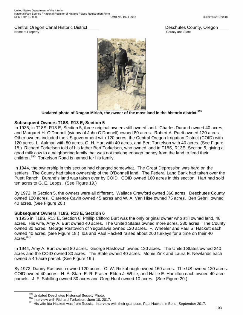
United States Department of the Interior National Park Service / National Register of Historic Places Registration Form NPS Form 10-900 OMB No. 1024-0018 (Expires 5/31/2020)
Central Oregon Canal Historic District Deschutes County, Oregon Name of Property County and State
103
Undated photo of Dragan Mirich, the owner of the most land in the historic district.389
Subsequent Owners T18S, R13 E, Section 5 In 1935, in T18S, R13 E, Section 5, three original owners still owned land. Charles Durand owned 40 acres, and Margaret H. O’Donnell (widow of John O’Donnell) owned 80 acres. Robert A. Puett owned 120 acres. Other owners included the US government with 120 acres; the Central Oregon Irrigation District (COID) with 120 acres, L. Aulman with 80 acres, G. H. Hart with 40 acres, and Bert Torkelson with 40 acres. (See Figure 18.) Richard Torkelson told of his father Bert Torkelson, who owned land in T18S, R13E, Section 5, giving a good milk cow to a neighboring family that was not making enough money from the land to feed their children.390 Torkelson Road is named for his family. In 1944, the ownership in this section had changed somewhat. The Great Depression was hard on the settlers. The County had taken ownership of the O’Donnell land. The Federal Land Bank had taken over the Puett Ranch. Durand’s land was taken over by COID. COID owned 160 acres in this section. Hart had sold ten acres to G. E. Lepps. (See Figure 19.) By 1972, in Section 5, the owners were all different. Wallace Crawford owned 360 acres. Deschutes County owned 120 acres. Clarence Cavin owned 45 acres and W. A. Van Hise owned 75 acres. Ben Sebrill owned 40 acres. (See Figure 20.) Subsequent Owners T18S, R13 E, Section 6 In 1935 in T18S, R13 E, Section 6, Phillip Clifford Burt was the only original owner who still owned land, 40 acres. His wife, Amy A. Burt owned 40 acres. The United States owned more acres, 280 acres. The County owned 80 acres. George Rastovich of Yugoslavia owned 120 acres. F. Wheeler and Paul S. Hackett each owned 40 acres. (See Figure 18.) Ida and Paul Hackett raised about 200 turkeys for a time on their 40 acres.391 In 1944, Amy A. Burt owned 80 acres. George Rastovich owned 120 acres. The United States owned 240 acres and the COID owned 80 acres. The State owned 40 acres. Monie Zink and Laura E. Newlands each owned a 40-acre parcel. (See Figure 19.) By 1972, Danny Rastovich owned 120 acres. C. W. Rickabaugh owned 160 acres. The US owned 120 acres. COID owned 40 acres. H. A. Starr, E. R. Fraser, Eldon J. White, and Hallie E. Hamilton each owned 40-acre parcels. J. F. Schilling owned 30 acres and Greg Hunt owned 10 acres. (See Figure 20.)
389 Undated Deschutes Historical Society Photo. 390 Interview with Richard Torkelson, June 10, 2017. 391 His wife Ida Hackett was from Russia. Interview with their grandson, Paul Hackett in Bend, September 2017.
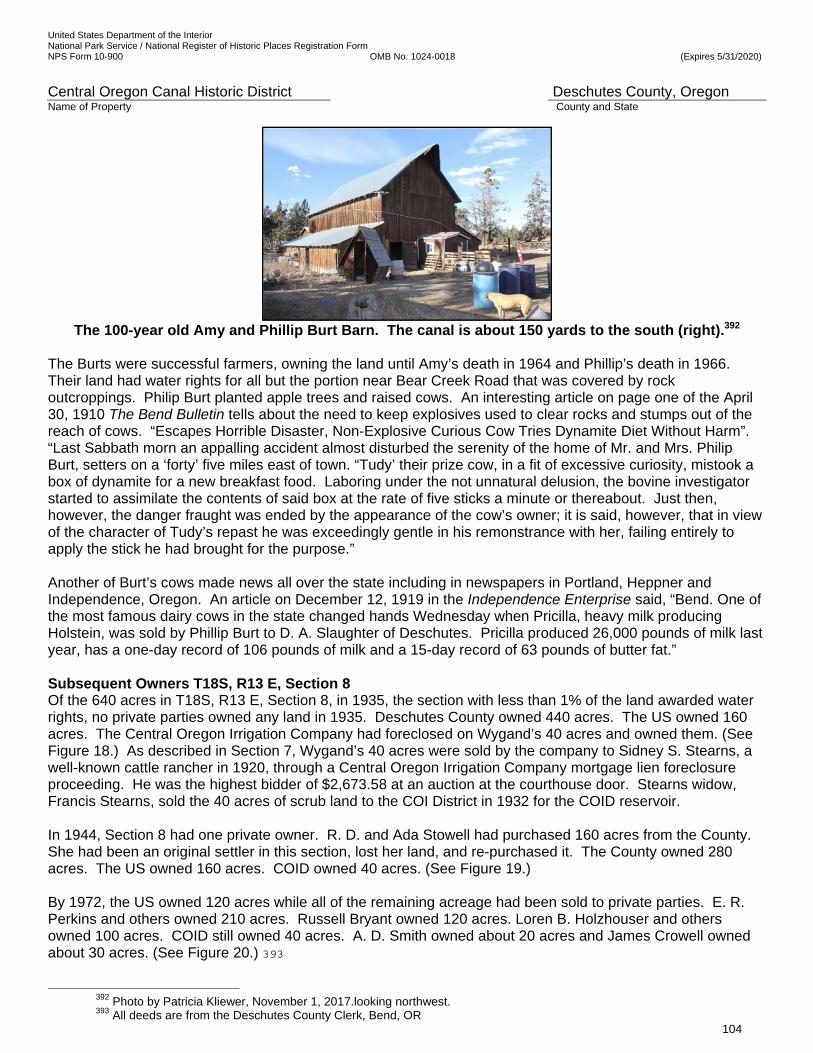
United States Department of the Interior National Park Service / National Register of Historic Places Registration Form NPS Form 10-900 OMB No. 1024-0018 (Expires 5/31/2020)
Central Oregon Canal Historic District Deschutes County, Oregon Name of Property County and State
104
The 100-year old Amy and Phillip Burt Barn. The canal is about 150 yards to the south (right).392
The Burts were successful farmers, owning the land until Amy’s death in 1964 and Phillip’s death in 1966. Their land had water rights for all but the portion near Bear Creek Road that was covered by rock outcroppings. Philip Burt planted apple trees and raised cows. An interesting article on page one of the April 30, 1910 The Bend Bulletin tells about the need to keep explosives used to clear rocks and stumps out of the reach of cows. “Escapes Horrible Disaster, Non-Explosive Curious Cow Tries Dynamite Diet Without Harm”. “Last Sabbath morn an appalling accident almost disturbed the serenity of the home of Mr. and Mrs. Philip Burt, setters on a ‘forty’ five miles east of town. “Tudy’ their prize cow, in a fit of excessive curiosity, mistook a box of dynamite for a new breakfast food. Laboring under the not unnatural delusion, the bovine investigator started to assimilate the contents of said box at the rate of five sticks a minute or thereabout. Just then, however, the danger fraught was ended by the appearance of the cow’s owner; it is said, however, that in view of the character of Tudy’s repast he was exceedingly gentle in his remonstrance with her, failing entirely to apply the stick he had brought for the purpose.” Another of Burt’s cows made news all over the state including in newspapers in Portland, Heppner and Independence, Oregon. An article on December 12, 1919 in the Independence Enterprise said, “Bend. One of the most famous dairy cows in the state changed hands Wednesday when Pricilla, heavy milk producing Holstein, was sold by Phillip Burt to D. A. Slaughter of Deschutes. Pricilla produced 26,000 pounds of milk last year, has a one-day record of 106 pounds of milk and a 15-day record of 63 pounds of butter fat.” Subsequent Owners T18S, R13 E, Section 8 Of the 640 acres in T18S, R13 E, Section 8, in 1935, the section with less than 1% of the land awarded water rights, no private parties owned any land in 1935. Deschutes County owned 440 acres. The US owned 160 acres. The Central Oregon Irrigation Company had foreclosed on Wygand’s 40 acres and owned them. (See Figure 18.) As described in Section 7, Wygand’s 40 acres were sold by the company to Sidney S. Stearns, a well-known cattle rancher in 1920, through a Central Oregon Irrigation Company mortgage lien foreclosure proceeding. He was the highest bidder of $2,673.58 at an auction at the courthouse door. Stearns widow, Francis Stearns, sold the 40 acres of scrub land to the COI District in 1932 for the COID reservoir. In 1944, Section 8 had one private owner. R. D. and Ada Stowell had purchased 160 acres from the County. She had been an original settler in this section, lost her land, and re-purchased it. The County owned 280 acres. The US owned 160 acres. COID owned 40 acres. (See Figure 19.) By 1972, the US owned 120 acres while all of the remaining acreage had been sold to private parties. E. R. Perkins and others owned 210 acres. Russell Bryant owned 120 acres. Loren B. Holzhouser and others owned 100 acres. COID still owned 40 acres. A. D. Smith owned about 20 acres and James Crowell owned about 30 acres. (See Figure 20.) 393
392 Photo by Patricia Kliewer, November 1, 2017.looking northwest. 393 All deeds are from the Deschutes County Clerk, Bend, OR
United States Department of the Interior National Park Service / National Register of Historic Places Registration Form NPS Form 10-900 OMB No. 1024-0018 (Expires 5/31/2020)
Central Oregon Canal Historic District Deschutes County, Oregon Name of Property County and State
105
Farming in the rocky sections of the High Desert was difficult and nearly impossible without irrigation water. At each point in time, from 1905 to 1972, increasingly more land in the district was in government ownership and was reverting back to scrub land. Even successful settlers, such as Phillip Burt, had sold most of his unirrigated land prior to 1944, and was farming part of a 40-acre parcel near Bear Creek Road. Today, the four 640-acre sections contain some irrigated farms and a large amount of land that was never cleared or cultivated or that has reverted back from dry farming to native vegetation, including a 79.60-acre parcel owned by the Bend Park & Recreation District and several parcels owned by COID. Most of Bradetich’s land is now subdivided into rural residential lots. Some of Mirich’s land is being farmed by the Suzanne and Gary Grund family (51.09 acres) and Tony Licitra (58.96 acres). Looking at the aerial photo of current conditions, it is apparent that the entire western third of the land around the Central Oregon Canal in the historic district is now subdivided into rural residential lots of primarily 1 to 3-acres, including some hobby farms with personal livestock and small irrigated pastures. The middle third of the CO Canal in the historic district has entirely scrub land south of the canal and hobby farms and scrub land on the north side of the canal. The eastern third of the CO Canal in the historic district has entirely scrub lands on the south and only one irrigated farm to the north, at the corner with Gosney Road. (See Figure 2.) Conclusion of Settlement in the Historic District Due to the thin topsoil and rock in the district being undesirable for farming, no settlers purchased land along the canal in the district when it was being constructed. The presence of the canal did attract settlers to some, but not all, of the land along the canal in the historic district, because most of it did not have water rights. Rural residential development on 1 to 3-acre lots with water rights occurred between Ward Road and the Bear Creek Ranch Bridge, in 1/4th of the district, primarily between 1965 and 1975. However, most of the historic setting, with its farms, rolling hills, rock outcroppings, and native juniper and sagebrush vegetation that was present in 1921 near and alongside the canal on the eastern 3/4ths of the district, remains. The historic district uniquely demonstrates the power of the canal and irrigation water to attract settlers, and the progression of settlement from large to smaller parcels over the past 100 years. The largest parcels along the district’s length have never been irrigated or developed, and historic vegetation was never cleared. The nominated stretch uniquely displays both the historic setting at the time the canal was constructed and the use of the irrigation water for beneficial uses and agriculture. The small irrigated hobby farms and larger commercial farms today with irrigation ponds and irrigated pasture for livestock represent the purpose of the canal: to attract settlers and farmers to Deschutes County by supplying irrigation water to the arid land. The area is accessible to the public, especially along the 80-acre parcel owned by Bend Park & Recreation District. Its interpretation can be achieved in an attractive, well-organized fashion without crowding or overwhelming the resource itself. CONCLUSION OF CENTRAL OREGON PROJECT In 1921, when the assets of the Central Oregon irrigation Company were transferred to the water users formed as the Central Oregon Irrigation District, the water rights, irrigation canals and other assets were valued at $3 million. Between 1903 and 1921, approximately 600 miles of canals and laterals had been built for both the Pilot Butte and Central Oregon Canal systems. The North Canal Dam, the Pilot Butte Canal, the Central Oregon Canal and the North Canal had been completed. The irrigation companies had founded the towns of Bend, Redmond, and Deschutes (platted as Centrallo in 1911 along the railroad about half way between Bend and Redmond) and facilitated the rapid growth of Alfalfa and Powell Butte and rural Deschutes County, which was carved from Crook County in 1916. The irrigation system had transformed the appearance of the high plateau on the east side of the Deschutes River. The developer’s connections resulted in James J. Hill completing the railroad from the Columbia River to Bend in October 1911. The arrival of the railroad, in turn, facilitated the development of the huge timber industry in Central Oregon and brought in setters and goods and allowed a nationwide market for timber and agricultural products In 1922, the Federal Power Commission summarized the accomplishment of providing irrigation to 57,089 acres of land in a report on the Central Oregon Project. By any standards, the Central Oregon Project was
United States Department of the Interior National Park Service / National Register of Historic Places Registration Form NPS Form 10-900 OMB No. 1024-0018 (Expires 5/31/2020)
Central Oregon Canal Historic District Deschutes County, Oregon Name of Property County and State
106
successful and has transformed the high desert plateau and brought settlement and agriculture to the towns that he founded and the surrounding area that likely exceeded Alexander Drake’s 1900 vision.
IRRIGABLE ACRES BY CANAL SYSTEM, 1922 SOLD IRRIGABLE
ACRES UNSOLD IRRIGABLE ACRES
TOTAL IRRIGABLE ACRES
Central Oregon Canal 27,208 9,170 36,378 North Canal/Pilot Butte Canal
19,169 1,542 20,711
TOTAL 46,377 10,712 57,089 Table 3
Irrigable Acres in 1922 under the Central Oregon Project by Canal System394 COMPARISON OF THE CENTRAL OREGON CANAL WITH THREE OTHER IRRIGATION CANALS IN THE UPPER DESCHUTES RIVER BASIN According to the USGS, there are 38 canals in the tri-county area of the Upper Deschutes River Basin that generally includes Deschutes County, Jefferson County, and Crook County. The USGS defines a canal as a manmade waterway used by watercraft or for drainage, irrigation, mining or water power. The districts are indicated in the maps in Figures 7, 8.395 Other irrigation projects in the Upper Deschutes River Basin include the Tumalo Project west of Bend, the Walker Basin Irrigation Company south of Bend near La Pine, the Arnold Irrigation Company serving areas south and east of Bend, the Three Sisters Irrigation District west of Bend, the Lone Pine District (also known as the Crook County Improvement District No. 1) north of the Crooked River, and the Deschutes Reclamation and Irrigation Project, called the Swalley Ditch. The most ambitious and largest project was the North Unit Project, completed in 1946 which irrigates more than 50,000 acres north of the Crooked River. The Pilot Butte Canal that serves the area north and northeast of Bend and Redmond and the Central Oregon Canal that serves users east of Bend and in Alfalfa and Powell Butte are managed by the Central Oregon Irrigation District.
The following descriptions are illustrative of three other historic irrigation canals in the Bend area. Two were commercial enterprises, and one was a cooperative venture. None was of the size and scale of the Central Oregon canal and none had the financial impact on development of the high plateau.
Arnold Irrigation District The Arnold Irrigation District is a small district that serves users in Bend and others south and east of Bend in Deschutes County. It was organized on December 27, 1904. On January 9, 1905 Oregon’s Secretary of State certified its Articles of Incorporation. Like the Central Oregon Project, it was a commercial enterprise under the Carey Act. The purpose was to acquire, buy, own, sell or improve any real estate or water rights, construct flumes and canals for irrigation purposes, and to conduct general irrigation business. Its capital stock was $5,000. It filed for water rights on February 1, April 15 and April 25, 1905. Construction began in April 1905. Arnold Irrigation District’s founders were W. Arnold, T.O. Harshman and J.J. Reed. The project engineer was Levi David Wiest, the same man who was the first engineer for the Pilot Butte Canal. The DBBC states that as one of Oregon’s oldest irrigation districts, the district has long embraced water conservation, has repaired leaks in a historic metal flume, lined 1.5 miles of its main canal and laterals, piped 5.5 miles of laterals, and even eliminated 4.5 miles of old laterals. Some historic segments now have concrete lining. The source of the district’s water is the Deschutes River at a diversion point south of Bend and stored water in Crane Prairie
394 Hall, Michael, Irrigation Development in Oregon’s Upper Deschutes River Basin 1871-1957,A Historic Context Statement.,
28. 395 USGS website, Oregon.

United States Department of the Interior National Park Service / National Register of Historic Places Registration Form NPS Form 10-900 OMB No. 1024-0018 (Expires 5/31/2020)
Central Oregon Canal Historic District Deschutes County, Oregon Name of Property County and State
107
Reservoir. The canal was 17 miles long and was later shortened to 14 miles, due to deficient water volume. Since 1997, it has diverted an average of 25 cfs from the river to the patrons. The Arnold Irrigation District serves 647 patrons on an average of 6.78 acres per account. The acres covered today are 4,384. 600 of the acres are within Bend’s Urban Growth Boundary or Urban Reserve Areas and will be urbanized. The district absorbed the Pine Forest Ditch Company, the Bend Company and North Irrigation Company. 396 (See Figure 25, photos of the canal.) Tumalo Irrigation District Tumalo – Thirsty Land, by Martin Winch, published in six successive issues of the Oregon Historical Quarterly (vol. 84 no. 4 through vol. 87 no. 1) details the saga of the Tumalo Irrigation District. Tumalo Irrigation District was Oregon State’s third contract under the Carey Act and the first ‘failed’ Carey Act project. The project to build the canal was a commercial enterprise under the Carey Act, but was taken over by the State of Oregon. 397 Michael Hall states in his history of the irrigation districts in the Upper Deschutes Basin, “The Carey Act lands which became known as the ‘Tumalo Project’ hold a distinction in history as the most seriously vexed Carey Act project in Oregon, and possibly the Nation, suffering nearly simultaneous engineering, managerial, and financial disasters”398. In 1900, the Three Sisters Irrigation Company took over from the Three Sisters Ditch Company that had been incorporated in 1893. The founders were the settlers on Wilmer Flat, the location of the failed Tumalo Reservoir. The plans were to water the area with water from Tumalo Creek, just west of Bend. Other key dates for this district are as follows: Nov. 1, 1905, Project sold to the Columbia Southern Irrigation Company; 1911, Project deeded to the Oregon, Washington & Idaho Finance Company that was hired by the state to prepare finance and engineering reports on the project; 1913, Oregon Legislature passed the Columbia Southern Act authorizing $450,000 of public funding to reorganize and construct the project. State of Oregon took control of the project as Tumalo Irrigation Project through 1919. The primary project engineer was Olaf Laurfaard for the state in 1913; 1920, turned over to Tumalo Irrigation District until 1922; 1922, to 1924; Deschutes County Improvement District; Development on the system continued through the1950s. Presently, it is called the Tumalo Irrigation District (TIF).
In 1902, Columbia Southern (affiliated with the Columbia Southern Railroad) acquired the right to Tumalo Creek’s flow and sold $100,000 shares of capital stock. The canal was partially constructed in 1903-1904 and primarily during 1913-1924. The Columbia Southern Company founded the unincorporated town of Laidlaw (now called Tumalo) and promoted the area to attract settlers. Tumalo Irrigation District absorbed the Columbia Southern Canal, Bend Feed Canal, Tumalo Feed Canal, and the Cloverdale Irrigation Company. The Deschutes Basin Board of Control states, “TID has improved its system’s efficiency, conserved water, and improved habitat. The District recently closed the Columbia Southern Diversion and Feed Canal, restoring instream flows to 8.5 miles of Tumalo Creek. Working to reduce diversion losses, the District has piped over 60% of the 11 miles of its main canals. TID has committed to return all future water savings on the Tumalo Feed Main Canal to instream uses. TID has protected over 10 cfs of senior water rights on Tumalo Creek below its diversion and another 6 cfs on Crescent Creek. Upon the completion of the Tumalo Feed Canal piping project, with leasing, over 22 cfs will be permanently protected below TID diversions. TID is replacing another 3,000 linear feet of open canal with pipe in 2015-2016”. Most of the two main canals are piped. The various sources of the irrigation water for the district are the Deschutes River in central Bend, Crescent Creek and Tumalo Creek and its upper tributaries and stored water from Crescent Lake. The District has 11 miles of main canal and 69 miles of laterals and ditches. It diverts 45,725-acre-feet to serve 635 patrons on 60 square
396 Arnold Irrigation District web site, www.arnoldirrigationdistrict.com
Deschutes River Conservancy and Deschutes Water Alliance, Deschutes Water Planning Initiative, Water Supply Goals and Objectives Final Report, February 26, 2013, 11-16. Deschutes Basin Board of Control Website, www.dbbcirrigation .com. Bureau of Reclamation web site, www.usbr.gov.
397397Hetzel, Christopher, Draft National Register of Historic Places Multiple Property Documentation Form, Irrigation Projects in Oregon, 1850 – 1964. January 12, 2015, ICF International, Seattle, WA.
398 Michael Hall, Irrigation Development in Oregon’s Upper Deschutes River Basin 1871-1957, A Historic Context Statement, 1994, 16-18.

United States Department of the Interior National Park Service / National Register of Historic Places Registration Form NPS Form 10-900 OMB No. 1024-0018 (Expires 5/31/2020)
Central Oregon Canal Historic District Deschutes County, Oregon Name of Property County and State
108
miles or 8,093 acres. The average account size is 13 acres. The district serves 690 acres inside the city of Bend.399 (See Figure 27, photos of the Tumalo Irrigation Canal.)
Swalley Irrigation District Two area ranchers, George W. Swalley and C. R. Swalley filed in 1892 for some water from the Deschutes River to apply to their farms. They lived about halfway between the future cities of Redmond and Bend, just east of the river. On September 1, 1899, the Swalleys and six other land holders, including James R. Benham, filed for water rights under the Swalley’s prior claim. In October 1899, they formed the Deschutes Reclamation and Irrigation Company as a cooperative venture. Each man was to contract for or personally work to build the system of ditches, flumes, and roads to deliver water to their ranches. They also worked at the O. B. Riley lumber mill to produce the lumber that was necessary to build the flumes. Irrigation began in 1902 and in 1904 the corporation issued 4,800 shares of stock to settlers. The settlers were generally responsible for digging ditches to connect their land to the laterals. In 1912, the company acquired a right to divert water from the Deschutes River at the new North Dam in Bend. By 1931, the canal was 13 miles long. It served the area north of Bend between the Deschutes River and the Pilot Butte Canal. The original filing was to irrigate 6,638 acres, but the segregation approved by the State of Oregon under the provisions of the Carey Act was for 1,280 acres. Michael Hall states that, of seven Carey Act projects approved by the State of Oregon between 1901 and 1906, the Deschutes Reclamation and Irrigation Company project for 1,280 acres was only one completed by 1913.400 Later segregations and projects increased the acreage to 4,331 today.
Swalley Irrigation District has 28 miles of canals and laterals providing water delivery to the 662 district water users. The main canal is 13 miles long. The canal diverts 80 to 90 cubic feet per second from the Deschutes River in Bend, 16% of the flow in the Central Oregon Canal. As urbanization occurs, some stretches of open canal and laterals have been piped, especially through the Cascade Village Shopping Center and the Bend River Mall. The district piped the approximately three miles of main canal between the northern city limits of Bend and its hydroelectric plant at Deschutes Junction. 401 The Deschutes Basin Board of Control web site states,
“Despite being one of Oregon’s smaller irrigation districts, SID has returned the largest amount of water to the Deschutes River through its conservation projects. In 2009, the district completed the piping of 5.1 miles of its main canal along with several smaller laterals. Altogether, the district has returned 38 cfs of water, with an 1899 water right (the most senior on the river), to the Deschutes River. A year later, SID completed the first small in-conduit hydroelectric plant in the state of Oregon in 20 years. This new 0.75 mw facility is capable of producing enough clean, renewable electricity for up to 350 homes. (See Figure 26, photos of the Swalley Irrigation Canal.)
Conclusion of Comparison to Other Irrigation Districts Between 1901 and 1906 seven irrigation projects in the Upper Deschutes River Basin were approved by the State, covering a total of 194,138 acres of segregated land. The Pilot Butte Development Company’s planned reclamation of 84,707.74 acres with two canals was the second project approved in Oregon. The third was the Three Sisters Irrigation Company. The Deschutes Reclamation and Irrigation Company was fourth. The others were the Oregon Irrigation Company, the Deschutes Land Company, the Deschutes Land Board, and the Deschutes Irrigation and Power Company. Of the agreements for 23 segregations made by the State by the end of 1904, only three in the Upper Deschutes River Basin and one in the Harney Valley had been approved by the Department of the Interior in Washington, DC.402 The Central Oregon Project was the largest, most expensive, most profitable and most successful private irrigation development project under the Carey Act in the region. It brought the most settlers to the region and to the historic district.
399 Michael Hall, Irrigation Development in Oregon’s Upper Deschutes River Basin 1871-1957, A Historic Context Statement, 400 Ibid, 15. 401 COID web site, www.coid.org; Deschutes River Conservancy and Deschutes Water Alliance, Deschutes Water Planning
Initiative, Water Supply Goals and Objectives Final Report, February 26, 2013. Pages 17-24; Deschutes Basin Board of Control Website, www.dbbcirrigation .com; Bureau of Reclamation web site, www.usbr.gov.
402 Michael Hall, Irrigation Development in Oregon’s Upper Deschutes River Basin 1871-1957 A Historic Context Statement, 12.
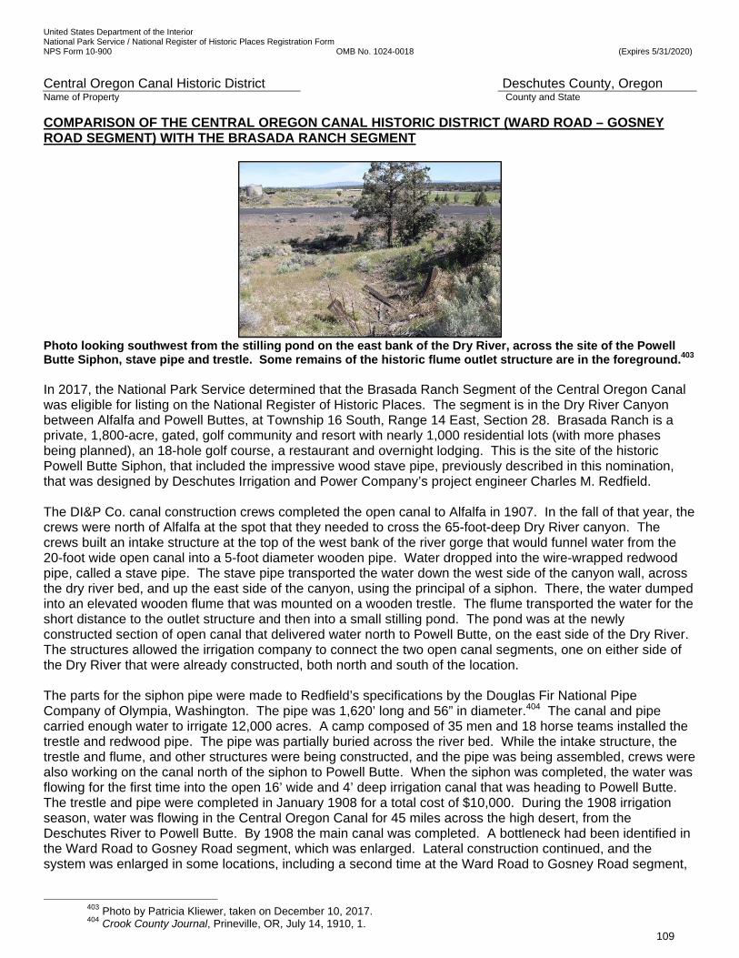
United States Department of the Interior National Park Service / National Register of Historic Places Registration Form NPS Form 10-900 OMB No. 1024-0018 (Expires 5/31/2020)
Central Oregon Canal Historic District Deschutes County, Oregon Name of Property County and State
109
COMPARISON OF THE CENTRAL OREGON CANAL HISTORIC DISTRICT (WARD ROAD – GOSNEY ROAD SEGMENT) WITH THE BRASADA RANCH SEGMENT
Photo looking southwest from the stilling pond on the east bank of the Dry River, across the site of the Powell Butte Siphon, stave pipe and trestle. Some remains of the historic flume outlet structure are in the foreground.403 In 2017, the National Park Service determined that the Brasada Ranch Segment of the Central Oregon Canal was eligible for listing on the National Register of Historic Places. The segment is in the Dry River Canyon between Alfalfa and Powell Buttes, at Township 16 South, Range 14 East, Section 28. Brasada Ranch is a private, 1,800-acre, gated, golf community and resort with nearly 1,000 residential lots (with more phases being planned), an 18-hole golf course, a restaurant and overnight lodging. This is the site of the historic Powell Butte Siphon, that included the impressive wood stave pipe, previously described in this nomination, that was designed by Deschutes Irrigation and Power Company’s project engineer Charles M. Redfield. The DI&P Co. canal construction crews completed the open canal to Alfalfa in 1907. In the fall of that year, the crews were north of Alfalfa at the spot that they needed to cross the 65-foot-deep Dry River canyon. The crews built an intake structure at the top of the west bank of the river gorge that would funnel water from the 20-foot wide open canal into a 5-foot diameter wooden pipe. Water dropped into the wire-wrapped redwood pipe, called a stave pipe. The stave pipe transported the water down the west side of the canyon wall, across the dry river bed, and up the east side of the canyon, using the principal of a siphon. There, the water dumped into an elevated wooden flume that was mounted on a wooden trestle. The flume transported the water for the short distance to the outlet structure and then into a small stilling pond. The pond was at the newly constructed section of open canal that delivered water north to Powell Butte, on the east side of the Dry River. The structures allowed the irrigation company to connect the two open canal segments, one on either side of the Dry River that were already constructed, both north and south of the location. The parts for the siphon pipe were made to Redfield’s specifications by the Douglas Fir National Pipe Company of Olympia, Washington. The pipe was 1,620’ long and 56” in diameter.404 The canal and pipe carried enough water to irrigate 12,000 acres. A camp composed of 35 men and 18 horse teams installed the trestle and redwood pipe. The pipe was partially buried across the river bed. While the intake structure, the trestle and flume, and other structures were being constructed, and the pipe was being assembled, crews were also working on the canal north of the siphon to Powell Butte. When the siphon was completed, the water was flowing for the first time into the open 16’ wide and 4’ deep irrigation canal that was heading to Powell Butte. The trestle and pipe were completed in January 1908 for a total cost of $10,000. During the 1908 irrigation season, water was flowing in the Central Oregon Canal for 45 miles across the high desert, from the Deschutes River to Powell Butte. By 1908 the main canal was completed. A bottleneck had been identified in the Ward Road to Gosney Road segment, which was enlarged. Lateral construction continued, and the system was enlarged in some locations, including a second time at the Ward Road to Gosney Road segment,
403 Photo by Patricia Kliewer, taken on December 10, 2017. 404 Crook County Journal, Prineville, OR, July 14, 1910, 1.
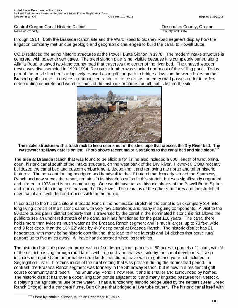
United States Department of the Interior National Park Service / National Register of Historic Places Registration Form NPS Form 10-900 OMB No. 1024-0018 (Expires 5/31/2020)
Central Oregon Canal Historic District Deschutes County, Oregon Name of Property County and State
110
through 1914. Both the Brasada Ranch site and the Ward Road to Gosney Road segment display how the irrigation company met unique geologic and geographic challenges to build the canal to Powell Butte. COID replaced the aging historic structures at the Powell Butte Siphon in 1978. The modern intake structure is concrete, with power driven gates. The steel siphon pipe is not visible because it is completely buried along Alfalfa Road, a paved two-lane county road that traverses the center of the river bed. The unused wooden trestle was disassembled in 1993-1994. Re-usable lumber was stacked northeast of the stilling pond. Today, part of the trestle lumber is adaptively re-used as a golf cart path to bridge a low spot between holes on the Brasada golf course. It creates a dramatic entrance to the resort, as the entry road passes under it. A few deteriorating concrete and wood remains of the historic structures are all that is left on the site.
The intake structure with a trash rack to keep debris out of the steel pipe that crosses the Dry River bed. The wastewater spillway gate is on left. Photo shows recent major alterations to the canal bed and side slope.405
The area at Brasada Ranch that was found to be eligible for listing also included a 600’ length of functioning, open, historic canal south of the intake structure, on the west bank of the Dry River. However, COID recently bulldozed the canal bed and eastern embankment, deepening it and removing the riprap and other historic features. The non-contributing headgate and headwall to the ‘J’ Lateral that formerly served the Shumway Ranch and now serves the resort, remains in its historic location in this stretch, but was significantly upgraded and altered in 1978 and is non-contributing. One would have to see historic photos of the Powell Butte Siphon and learn about it to imagine it crossing the Dry River. The remains of the other structures and the stretch of open canal are secluded and inaccessible to the public. In contrast to the historic site at Brasada Ranch, the nominated stretch of the canal is an exemplary 3.4-mile-long living stretch of the historic canal with very few alterations and many intriguing components. A visit to the 80-acre public parks district property that is traversed by the canal in the nominated historic district allows the public to see an unaltered stretch of the canal as it has functioned for the past 110 years. The canal there holds more than twice as much water as the Brasada Ranch segment and is much larger, up to 78 feet wide and 9 feet deep, than the 16’- 22’ wide by 4‘-9’ deep canal at Brasada Ranch. The historic district has 21 headgates, with many being historic contributing, that lead to three laterals and 14 ditches that serve rural patrons up to five miles away. All have hand-operated wheel assemblies. The historic district displays the progression of settlement, from parcels of 80 acres to parcels of 1 acre, with ¾ of the district passing through rural farms with irrigated land that was sold by the canal developers. It also includes unirrigated and unfarmable scrub lands that did not have water rights and were not included in Segregation List 6. It retains much of the rural setting that was present during the homestead period. In contrast, the Brasada Ranch segment was formerly in the Shumway Ranch, but is now in a residential golf course community and resort. The Shumway Pond is now rebuilt and is smaller and surrounded by homes. The historic district has over a dozen irrigation ponds adjacent to it and many irrigated pastures for livestock, displaying the agricultural use of the water. It has a functioning historic bridge used by the settlers (Bear Creek Ranch Bridge), and a concrete flume, Burt Chute, that bridged a lava tube cavern. The historic canal itself with
405 Photo by Patricia Kliewer, taken on December 10, 2017.

United States Department of the Interior National Park Service / National Register of Historic Places Registration Form NPS Form 10-900 OMB No. 1024-0018 (Expires 5/31/2020)
Central Oregon Canal Historic District Deschutes County, Oregon Name of Property County and State
111
its tall berms and extensive rock left in the bed, dozens of drill holes, remnants of the historic wooden flume, and two settlers’ barns can be seen. The historic district displays how the construction crews and staff met challenges and the techniques they used between 1905 and 1914 to locate and build the canal. One can see and feel the full power of the mighty canal that changed the appearance and history of the high desert, east of the Deschutes River and south of the Crooked River, and that brought thousands of settlers from all over the world to the previously unknown region.
United States Department of the Interior National Park Service / National Register of Historic Places Registration Form NPS Form 10-900 OMB No. 1024-0018 (Expires 5/31/2020)
Central Oregon Canal Historic District Deschutes County, Oregon Name of Property County and State
112
9. Major Bibliographical References
Bibliography (Cite the books, articles, and other sources used in preparing this form.) Books Aylward, Bruce, PhD. Growth, Urbanization and Land Use Change: Impacts on Agriculture and Irrigation
Districts in Central Oregon, DWA Final Report. Bend: Deschutes Water Alliance. 2006. Baker, Donald M. and Harold Conkling. Water Supply and Utilization. New York: John Wiley & Sons. 1930. Brogan, Phil F. East of the Cascades. Portland: Binford and Mort. 1964. Coe, Urling C. Frontier Doctor: Observations on Central Oregon and the Changing West. Corvallis: Oregon
State University Press. 1996. Clark, Keith. Redmond: Where the Desert Blooms. Portland: Western Imprints. 1985. Clark, Robert Carlton, Robert Horace Down and George Verne Blue. A History of Oregon. Chicago-New York:
Row, Peterson and Company. 1925. Crowe, William S. Eds. Lynn McGlothlin and Ann McGlothin Weller. Lumberjack: Inside An Era In The Upper
Peninsula of Michigan. Skandia, MI: North Country Publishing. Third Edition. 2002. Culp, Edwin D. Early Oregon Days. Caldwell, Idaho. The Caxton Printers. 1987. Davidson, Stanley Roland. The Leadership of the Reclamation Movement, 1875-1902 (Doctoral Dissertation.
University of California, Berkeley. 1952). New York: Arno Press. 1979. Davis, Arthur Powell, D.Sc. and Herbert M. Wilson, C.E. Irrigation Engineering. Seventh Edition. New York:
John Wiley & Sons. 1919.
Davis, H.L. Honey in the Horn. New York: Avon. 1935. New York: Bard/Avon. Paperback. 1962. Deschutes County Historical Society. A History of the Deschutes Country in Oregon. Redmond: Midstate
Printing. 1985. ____. 100 Years of History. Canada: Pediment Publishing. 2004. Due, John F. and Giles French. Rails to the Mid-Columbia Wheatlands: The Columbia Southern and Great
Southern Railroads and the Development of Sherman and Wasco Counties, Oregon. Washington: University Press of America. 1979
Duniway, David C, State Archivist, Oregon State Library. Members of the Legislature State of Oregon 1860
1949. Oregon State Archives. Bulletin No 2. Publication No. 14. 1949. Edwards, G. Thomas and Carlos A. Schwantes. Eds. Experiences in a Promised Land: Essays in Pacific
Northwest History. Seattle: University of Washington Press. 1990. Egan, Timothy. The Good Rain: Across Time and Terrain in the Pacific Northwest. New York: Knopf. 1990. Etcheverry, B.A. Irrigation Practice and Engineering: Volume II, Conveyance of Water. New York: McGraw Hill.
First Edition. 1915. Bibliography Continued

United States Department of the Interior National Park Service / National Register of Historic Places Registration Form NPS Form 10-900 OMB No. 1024-0018 (Expires 5/31/2020)
Central Oregon Canal Historic District Deschutes County, Oregon Name of Property County and State
113
Etulain, Richard W. Beyond the Missouri: The Story of the American West. Albuquerque: University of New
Mexico Press. 2006. Gaston, Joseph. Portland, Oregon: Its History and Its Builders. Chicago & Portland: S.J. Clarke. 1911. Vol. 2. Harris, Stephen L. Fire & Ice: The Cascade Volcanoes. Seattle: The Mountaineers, Pacific Search Express.
Revised Edition. Third Printing. June 1980. Hole, Leslie Pugmire and Trish Pinkerton. Images of America, Redmond. San Francisco. CA: Arcadia
Publishing. 2009. I.C.S. Staff. Dams—Irrigation. Scranton: International Textbook Company. 1906. Lavender, David. Land of Giants: The Drive to the Pacific Northwest 1750-1950. Lincoln: University of
Nebraska Press. 1979. Lent, Steve. Central Oregon Place Names, Volume I Crook County, Crook County Historical Society, 2001. Lent, Steve. Central Oregon Place Names, Volume III Deschutes County, Crook County Historical Society.
2015. Leonard, John William. The Book of Chicagoans. Vol. 2. Chicago: A.N. Marquis. 1911. Lowndes, William S., Ph. B. [Ph.B. is correct] “Excavating, Shoring, and Piling.” International Library of
Technology: Foundations and Stonework. Scranton, PA: International Textbook Co. 1919. MacHaffie, Ingeborg Nielsen. Danish in Portland: Past and Present. Tigard: Tigard Press. Skribent Press. First
Printing. 1982. McArthur, Lewis L. Oregon Geographic Names. Portland: Western Imprints, The Press of the Oregon
Historical Society. Fifth Edition. Revised & Enlarged. 1982. Metsker, Charles F., Civil Engineer. Maps of T. 17 S, R. 12 E, W.M. 1935. Metsker, Charles F., Civil Engineer. Maps of T. 17 S, R. 12 E, W.M. 1944. Metsker, Charles F., Civil Engineer. Maps of T. 17 S, R. 12 E, W.M. 1972. Morgan, Robert M. Water and the Land: A History of American Irrigation. Fairfax, Virginia: The Irrigation
Association.1993. Morison, Samuel Eliot. The Oxford History of the American People. New York: Oxford University Press. 1965. Newell, F.H. Report on Agriculture By Irrigation in the Western Part of the United States at the Eleventh
Census: 1890. Department of the Interior, Census Office. Washington: Government Printing Office. 1894.
Newell, Frederick Haynes. Irrigation In The United States. New York: Thomas Y. Crowell. 1902. Bibliography Continued

United States Department of the Interior National Park Service / National Register of Historic Places Registration Form NPS Form 10-900 OMB No. 1024-0018 (Expires 5/31/2020)
Central Oregon Canal Historic District Deschutes County, Oregon Name of Property County and State
114
Newell, Frederick Haynes and Daniel William Murphy. Principles of Irrigation Engineering: Arid Lands, Water Supply, Storage Works, Dams, Canals, Water Rights and Products. New York: McGraw-Hill. 1913.
Newhouse, Elizabeth L. Ed. The Builders: Marvels of Engineering. Washington D.C.: The Book Division, National Geographic Society. 1992. Nielsen, Lawrence E., Doug Newman, and George McCart. Pioneer Roads in Central Oregon. Bend, OR: Maverick Publications. 1985. Oregon Agricultural Experiment Station. 100 Years of Progress: The Oregon Agricultural Experiment Station
Oregon State University 1888-1988. Oregon Agricultural Experiment Station. College of Agricultural Sciences. Corvallis: Oregon State University. 1990.
Orr, Elizabeth L. and William N. and Ewart M. Baldwin. Geology of Oregon. Dubuque: Kendall/Hunt. Fourth
Edition. 1992. Osgood, Judy, Ed. The River Flows As The Mountains Watch: Deschutes Memories. Bend: RSVP. 2000. Pinkerton, Trish, Ed. Redmond Local Legacies. Redmond: The Redmond Spokesman. 2005. Preston, Daniel, “The Industrial Age: Steam Technology.” 20th Century United States History. New York:
Harper Perennial, 1992. Putnam, George Palmer. In the Oregon Country. New York: G.P. Putnam’s Son. 1915. Robbins, William G. Landscapes of Promise: The Oregon Story 1800-1940. Seattle: University of Washington
Press. 1997. Schwantes, Carlos Arnaldo. The Pacific Northwest: An Interpretive History. Lincoln: University of Nebraska
Press. 1996. Shaver, F.A., et al. An Illustrated History of Central Oregon. Spokane: Western History Publishing. 1905. Smyth, William E. The Conquest of Arid America. Seattle: University of Washington Press. 1899. Paperback
Edition 1970. Staff, I.C.S. Dams—Irrigation. Scranton: International Textbook Company.1906. Stegner, Wallace. Beyond the Hundredth Meridian: John Wesley Powell and the Second Opening of the West.
Cambridge, Massachusetts: The Riverside Press. Houghton Mifflin Company. Boston. 1954. Stone, George F. The Forty-Second Annual Report of the Trade and Commerce of Chicago for the Year
Ending December 31, 1899, Compiled for the Board of Trade. Chicago: The J.M.W. Jones Stationery and Printing Co., 1900).
Teele, Ray Palmer, M.A. Irrigation in the United States. New York: D. Appleton. 1915. ____. The Economics of Land Reclamation in the United States. Chicago & New York: A.W. Shaw. 1927 Bibliography Continued The Manual of Statistics: The Stock Exchange Hand-Book for Investors and Stock Operators. Vol. XIV. New
United States Department of the Interior National Park Service / National Register of Historic Places Registration Form NPS Form 10-900 OMB No. 1024-0018 (Expires 5/31/2020)
Central Oregon Canal Historic District Deschutes County, Oregon Name of Property County and State
115
York: The Investors Publishing Company. 1892. Vaughan, Thomas, Ed. High & Mighty: Select Sketches about the Deschutes Country. Portland: Oregon
Historical Society. 1981. Waples, David A. The Natural Gas Industry in Appalachia: A History of the First Discovery to the Tapping of
the Marcellus Shale. Jefferson, North Carolina: McFarland & Co. Second Edition. 2012. Ward, Elizabeth. Redmond; Rose of the Desert. Redmond: Midstate Printing. June 1975. Wilcox, Lute. Irrigation: A Handbook for the Practical Application of Water in the Production of Crops. New
York: Orange Judd Company. 1895. Wills, Charles A. Ed. The Visual Dictionary of the Earth. New York: Dorling Kindersley. First American Edition.
1993. Worster, Donald. Rivers of Empire: Water, Aridity, and the Growth of the American West. New York:
Pantheon. 1985. Government Documents Autobee, Robert. Bureau of Reclamation. Central Oregon Project, 1996. Becker, Frank R., Assistant State Engineer, Under the Direction of Rhea Luper, State Engineer. A Report on
the Central Oregon Irrigation District. October 19, 1924. Deschutes County Clerk’s Office. Bend, Oregon.
Brogan, Phil F. Visitor Information Service: Deschutes National Forest. Deschutes National Forest. Bend,
Oregon. 1969. Central Oregon Irrigation District. “Juniper Ridge Phase II, A Project Associated with North Unit District Water
and Energy Conservation Initiative, Reclamation WaterSMART Water and Energy Efficiency Grant Proposal.” January 2, 2013. Steve Johnson, General Manager. Pp. 30 and 31.
“Chicago, St. Paul & Kansas City Railway Company.” Annual Report of the Railroad and Warehouse
Commission of Minnesota to the Governor for the Year Ending Nov. 30, 1892. Minneapolis: Harrison & Smith Printers. 1893.
City of Bend. “Minutes of the Common Council of the City of Bend.” January 10, 1905 – November 12, 1907.
Bend Planning Department. City of Bend. Bend, Oregon. Cramb, L.K. The Irrigation Situation In Central Oregon: A Proposal that the Federal Government Provide
Storage. Bend: Bend Chamber of Commerce. October 15, 1931. Crook County, Oregon. An Order Granting the Incorporation of a Municipal Corporation of Bend, Oregon.
Crook County Court. Prineville, Oregon. January 11, 1905. Bibliography Continued Crook County, Oregon. Articles of Incorporation of the Bend Water Light and Power Company. Crook County
Clerk. Prineville, Oregon. November 11, 1904. Articles of Incorporation. Book 1. pp. 74-75. Deschutes
United States Department of the Interior National Park Service / National Register of Historic Places Registration Form NPS Form 10-900 OMB No. 1024-0018 (Expires 5/31/2020)
Central Oregon Canal Historic District Deschutes County, Oregon Name of Property County and State
116
County Clerk’s Office. Bend, Oregon. Crook County, Oregon. Articles of Incorporation of the Central Oregon Banking & Trust Company. Crook
County Clerk. Prineville, Oregon. July 8, 1904. Articles of Incorporation. Book 1. pp. 70-71. Deschutes County Clerk’s Office. Bend, Oregon.
Crook County, Oregon. Articles of Incorporation of the Deschutes Telephone Company. Crook County Clerk.
Prineville, Oregon. July 18, 1904. Articles of Incorporation. Book 1. pp. 72-73. Deschutes County Clerk’s Office. Bend, Oregon.
Crook County, Oregon. The Pilot Butte Development Company, Articles of Incorporation. Vol. 1. p. 78. Crook County Clerk. Prineville, Oregon. October 29, 1900. Deschutes River Conservancy and Deschutes Water Alliance. Deschutes Water Planning Initiative, Water
Supply Goals and Objectives, Final Report. Bend: Deschutes River Conservancy and Deschutes Water Alliance. February 26, 2013.
Deschutes Soil and Water Conservation District. Deschutes County Rural Living Handbook: A Resource for
Country Living and Land Stewardship. 2011. Dubuis, John. Field Inspector. Report to Desert Land Board on Central Oregon Project. Salem: State Printing
Department. 1915.
Energy Trust of Oregon, Inc. Open Solicitation, Juniper Ridge 3/27 MW Hydropower. January 23, 2008. Federal Power Commission. Report to the Federal Power Commission on Uses of the
Deschutes River, Oregon. Washington: Printing Office. 1922. Hadlow, Robert W., Cultural Resources Specialist. Findings of Effect on Bend’s Historic Irrigation Canals,
Bend Parkway, The Dalles-California Highway, U.S. 97, Deschutes County. Salem: Oregon Department of Transportation, Environmental Section. June 1992.
Hall, Michael A. Irrigation Development in Oregon's Upper Deschutes River Basin, 1871-1957: A Historic
Context Statement. Prepared for Deschutes County, the Cities of Bend, Redmond and Sisters and the State Historic Preservation Office. Prepared by the Deschutes County Historical Landmarks Commission. August 31, 1994.
Henshaw, F. F., E. C. La Rue and G.C. Stevens. Surface Water Supply of the United States 1910: Water Supply Paper 292. Part XII. North Pacific Coast. Department of the Interior, U.S. Geological Survey.
1913. Henshaw, F.F., John H. Lewis and E.J. McCaustland. Deschutes River, Oregon and Its
Utilization: Water Supply Paper 344. Prepared in Cooperation with the State of Oregon. John H. Lewis, State Engineer. Department of the Interior, U.S. Geological Survey. Washington: Government Printing Office. 1914.
Linenberger, Toni Rae. Bureau of Reclamation. The Crooked River Project. 2001. Bibliography Continued Legislative Documents Submitted to the Twenty-third General Assembly of the State of Iowa Which Convened
at Des Moines. January 13, 1890. Vol. VI. Des Moines: State Printer. 1890.

United States Department of the Interior National Park Service / National Register of Historic Places Registration Form NPS Form 10-900 OMB No. 1024-0018 (Expires 5/31/2020)
Central Oregon Canal Historic District Deschutes County, Oregon Name of Property County and State
117
National Register of Historic Places. Goodwillie-Allen House. Bend, Deschutes, Oregon. NRIS 07000493. National Register of Historic Places. Historic Development of The Bend Company in Bend, Oregon. Bend, Deschutes, Oregon. NRIS 64500507. National Register of Historic Places. Petersen Rock Garden. Redmond, Deschutes, Oregon. NRIS 13000859. National Register of Historic Places, Pilot Butte Canal (Yeoman Road-Gosney Road Segment) Newell, F. H. Report on Agriculture in the United States at the Eleventh Census: 1890. Department of the
Interior, Census Office. Washington: Government Printing Office. 1894. Oregon Cooperative Work. U.S. Department of the Interior, Reclamation Service. Deschutes River Projects,
Bulletin No. 1. Washington: Government Printing Office. 1914. Oregon Department of Transportation, Historic American Engineering Record, Pilot Butte Canal. (Old Pilot Butte Canal and O.P.B.C. Lateral). HAER OR-62. Oregon Department of Transportation, Historic American Engineering Record, Central Oregon Irrigation Canal. (Deschutes Irrigation and Power Company Canal) HAER OR-63. Patent No. 2. United States to State of Oregon. January 8, 1908. Deschutes County Book 4. pp. 552-58.
Deschutes County Clerk’s Office. Bend, Oregon. Pilot Butte Development Company. Plat of Bend. June 7, 1904. Deschutes County Clerk’s Office. Bend,
Oregon. Portland Chamber of Commerce. Public Lands in Oregon. Circular No. 9 (Fourth Edition) Revised to January
1, 1914. Portland, Oregon. Ross, D.W., J.T. Whistler and T.A. Noble. Report of the Progress of Stream Measurements for the Calendar
Year 1905. Prepared Under the Direction of F.H. Newell, Part XIV—Columbia River and Puget Sound Drainages. Department of the Interior, U.S. Geological Survey. Washington: Government
Printing Office. 1906. Russell, Israel Cook. Preliminary Report on the Geology and Water Resources of Central Oregon. Bulletin No.
252. U.S. Geological Survey, Department of the Interior. Washington D. C. Government Printing Office. 1905.
Smith, Dwight A., Cultural Resources Specialist. Historic Context: The Development of Irrigation in the Bend Area c. 1890 to 1940. Oregon Department of Transportation. Salem: Oregon Department of
Transportation. June 1991. Speulda, Lou Ann. Oregon’s Agricultural Development: A Historic Context. Salem: State Historic Preservation Office. Salem, OR. 1989. Bibliography Continued State Engineer, [Presumed to be John Lewis], Deschutes Project: Oregon Cooperative Work. Department of the Interior, U.S. Reclamation Service. Portland. [Printing location not given.] 1914. State of Iowa. Fourteenth Annual Report of the Board of Railroad Commissioners for the Year ending June 30,

United States Department of the Interior National Park Service / National Register of Historic Places Registration Form NPS Form 10-900 OMB No. 1024-0018 (Expires 5/31/2020)
Central Oregon Canal Historic District Deschutes County, Oregon Name of Property County and State
118
1891. Des Moines: Ragsdale, State Printer. State of Kansas. Tenth Annual Report of the Board of Railroad Commissioners, State of Kansas, for the Year
Ending December 1, 1892. Topeka: Press of the Hamilton Printing Company, State Printer. 1892. State of Oregon. Report of State Land Board Relative to Desert Lands for the Period Ending September 30,
1902. Salem, Oregon.1902. State of Oregon. Report of State Land Board Relative to Desert Lands, Granted the State Under the “Carey
Act” for the Period Commencing October 1, 1902, and Ending September 30, 1904, to the Twenty- Third Legislative Assembly [Regular Session]. 1905. Salem, Oregon.
“The Deschutes Irrigation & Power Co. to State Land Board, The Amended and Supplemental Agreement.”
[of June 17, 1907; Filed] August 7, 1908. Vol. 5. pp. 150-67. Deschutes County Clerk’s Office. Bend, Oregon.
“The Pilot Butte Development Co. to Deschutes Irrigation & Power Co.” March 14, 1904. Vol. 2. pp. 449-452.
Deschutes County Clerk’s Office. Bend, Oregon. “Thompson v. Chicago, St. P. & K.C. RY. Co. et al.” Circuit Court, D. Minnesota, First Division. April 14, 1894. Tonsfeldt, Ward and Dennis J. Gray. East Slope Cultural Services, Inc. “Cultural Resources Inventory of a Segment of the Pilot Butte Canal, Deschutes County, Oregon.” Prepared for David Evans and Associates, Inc. Bend, Oregon. December, 2008. United States Circuit Court of Appeals for the Ninth Circuit, In the. Frank R. Shinn and Louis G. Addison, and
Frank R. Shinn and Louis G. Addison as a Committee for Certain Bondholders, Complainants Appellees, vs. The Deschutes Irrigation and Power Company, a corporation, A.F. Biles, Howard Contract Company, a corporation, Merchants Savings and Trust Company, formerly Merchants Investments and Trust Company, an Oregon corporation, Respondents Appellees vs. R.S. Howard, Jr., Receiver of the Title Guarantee & Trust Company, Intervenor Appellant vs. Alexander M. Drake and Pilot Butte Development Company, Intervenors Appellees, No. 1915.
Newspapers and Periodicals Billington, Ray Allen. “How the Frontier Shaped the American Character.” American Heritage. Vol. IX. No. 3.
April 1958. Bohemia Nugget. Various issues, cited in text. Brogan, Phil F. “The Watering of the Wilderness.” The Bend Bulletin. January - March 1931. Daily Capital Journal. Various issues, cited in text. Deschutes County Yesteryear. “Came to Bend Using Wagon.” No. 12. Fall 1991. Bibliography Continued ___ . “Central Oregon As I First Knew It.” No. 1. Spring 1986. ___ . “Interview: Sadie Niswonger.” No. 16. Summer 1995. Deschutes Echo. Various issues, cited in text.

United States Department of the Interior National Park Service / National Register of Historic Places Registration Form NPS Form 10-900 OMB No. 1024-0018 (Expires 5/31/2020)
Central Oregon Canal Historic District Deschutes County, Oregon Name of Property County and State
119
East Oregonian. Various issues, cited in text. Heppner Gazette. Various issues, cited in text. Historic Transportation Corridors: A New and Dynamic Element of Heritage Preservation. Cultural Resources
Management. Vol. 16. No. 11. 1993. Kliewer, Pat. “A Legacy of Water.” Redmond Spokesman. April 19, 2000. Lincoln County Leader. Various issues, cited in text. Lynchburg News. Issue, cited in text. Oregon Historical Quarterly. Various issues cited in text. Polk’s Deschutes County Directory 1924-25. The Bend Bulletin. Various issues, cited in text. The Oregonian. Various issues, cited in text. The Pacific Homestead. Issue cited in text. The Redmond Spokesman. Various Issues, cited in text. The Register-Guard. Issues cited in text. Winch, Martin T. “Tumalo—Thirsty Land.” Vol. LXXXV, No 4; Vol. LXXXVI, No. 1-4; Vol. LXXXVII,
No. 1. Oregon Historical Quarterly. Winter 1984 – Spring 1986. Websites and E-mails Allen, Jason. Oregon State Historic Preservation Office. E-mail to Bruce White. October 15, 2014. Ancestry.com. Arnold Irrigation District website. Accessed October 2015. <www.arnoldirrigationdistrict.com> Boulder Community Network. Boulder County, Colorado. The Ditch Project: 150 Years of Ditches—Boulder’s
Constructed Landscape. Image, American Society of Mechanical Engineers. (Accessed March 27, 2015). <http://bcn.boulder.co.us/basin/ditchproject/?History:Ditch_Design_and_Construction:The_Fresno_Scraper>
Bureau of Reclamation website. Accessed September 2014 and October 2015. <www.usbr.gov/projects> Bibliography Continued Carlos Arnaldo Schwantes. Curriculum Vitae. Accessed November 13, 2014.
< http://www.umsl.edu/divisions/artscience/history/faculty/schwantesvitae.pdf> Central Oregon Irrigation District website. Accessed June 2014 and October 2015. <www.coid.org> Clark, Keith. “Donald McKay.” Oregon History Project. Accessed November 15, 2014.
United States Department of the Interior National Park Service / National Register of Historic Places Registration Form NPS Form 10-900 OMB No. 1024-0018 (Expires 5/31/2020)
Central Oregon Canal Historic District Deschutes County, Oregon Name of Property County and State
120
< http://www.ohs.org/education/oregonhistory/historical_records/dspDocument.cfm?doc_ID=8945DF03-D630-4AD12200C6E2B2BC7AA3>
Clark, Keith. [Obituary]. Oregon Historical Quarterly. 2002. HighBeam Research. Accessed November 15, 2014. <http://www.highbeam.com/doc/1G1-96402194.html> Deschutes County Clerk. Subdivision Grantor/Grantee Indices (prior to 1960). Deschutes County, Oregon.
Accessed November 30, 2014. <http://www.deschutes.org/Clerks-Office/Recording/Research-Room-Online/Research-by-Property/Subdivisions.aspx>
Deschutes Basin Board of Control website. Accessed September 2014 and October 2015.
<www.dbbcirrigation.com> ___ . Subdivision Plat Maps (prior to 1960). Accessed November 30, 2014.<http://www.deschutes.org/Clerks-
Office/Recording/Research-Room-Online/Research-by-Property/Subdivision-Maps.aspx> Elias Franklin Drake Obituary. Google Book. Accessed October 15, 2014. Family Search. “Arthur Lawson Goodwillie” Individual Record. Pedigree Resource File. Accessed October 17,
2006. FamilySearch.org. Federal Reserve Bank of Minneapolis. “CPI Calculator Information.” Accessed March 30, 2015.
Minneapolisfed.org. In Memorial to Dr. Edwart Baldwin. University of Oregon. Department of Geology. Accessed November 15,
2014. <http://geology.uoregon.edu/2009/05/10/in-memorial-to-dr-ewart baldwin/http://geology.uoregon.edu/2009/05/10/in-memorial-to-dr-ewart-baldwin/>
Oregon Geology. Vol. 49. No. 12. December 1987. pp. 151-52. Accessed November 15, 2014.
<http://www.oregongeology.org/pubs/og/OGv49n12.pdf> Orton, Edward, State Geologist. Geological Survey of Ohio. (Google Book) Columbus: The Westrote Co.,
State Printers. 1890. Accessed March 27, 2015. Google Earth. 2014.
Hall, Jim. Hall Construction Services. E-mail to Michael Hall. April 5, 2015.
<https://www.linkedin.com/pub/jim-hall/87/6b9/476> James Withycombe papers, Mss 1129. Oregon Historical Society Research Library. Accessed October 22, 2014. <http://nwda.orbiscascade.org/ark:/80444/xv31818> Keller, Megan. Project Archivist, CME Group Collections. University of Illinois Chicago. E-mail to Michael Hall.
March 23, 2015. Bibliography Continued Lee, Lisa. COID Map of Irrigation System Drawn for Redmond Spokesman. April 2000. Millett, Larry. E-mail to Michael Hall. April 16, 2014. Mosley, A., O. Gutbrod, S. James, K. Locke, J. McMorran, L Jensen, and P. Hamm. ”Grow Your Own Potatoes.” Extension Service, Oregon State University. Corvallis, Oregon. EC 1004, Revised March
United States Department of the Interior National Park Service / National Register of Historic Places Registration Form NPS Form 10-900 OMB No. 1024-0018 (Expires 5/31/2020)
Central Oregon Canal Historic District Deschutes County, Oregon Name of Property County and State
121
1995, 2. Accessed March 16, 2015. <http://extension.oregonstate.edu/deschutes/sites/default/files/ec1004.pdf>
North Unit Irrigation District website. Accessed October 2015. <www.northunitid.com> Orr, Elizabeth L. Oregon State University Press. Accessed November 15, 2014. <http://osupress.oregonstate.edu/author/elizabeth-orr> Orr, William M. Oregon State University Press. Accessed November 15, 2014. <http://osupress.oregonstate.edu/author/william-orr> Park Genealogical Books. Accessed October 2014. <http://www.parkbooks.com/Html/res_rail.html> "Phil Brogan," Wikipedia, The Free Encyclopedia.
<http://en.wikipedia.org/w/index.php?title=Phil_Brogan&oldid=618589305>.Accessed November 16, 2014.
Plain Dealer Publishing. Progressive Men of Northern Ohio. (Google Book) Cleveland: Plain Dealer Press.
1906. Proceedings of the Ohio Gas Light Association. Columbus: Spahr & Glenn. 1904. (Google Book). Accessed
March 27, 2015. Natural Gas Journal. Vol.5. July, 1911. (Google Book). Henry D. Turney. Accessed October, 2014. San Joaquin County Historical Society and Museum. “Designating the Fresno Scraper as an Engineering
Landmark.” (Accessed March 27, 2015) <http://www.sanjoaquinhistory.org/featured-activities.php?id=7> Schmiedeler, Tom. Minnesota Historical Society.
“Civic Geometry: Frontier Forms of Minnesota's County Seats.” Accessed October 15, 2014. < http://www.mnhs.org/market/mhspress/mnhistmag/seatlist.php>
Stene, Eric A. The Umatilla Project. Bureau of Reclamation. U.S. Department of Interior. 1993. Accessed
March 30, 2015. (Google PDF Document) Swalley Irrigation District website. Accessed February 2015 and October 2015. <www.swalley.com> Three Sisters Irrigation District. Accessed October 2015. <www.tsidweb.org> Timeanddate.com Tumalo Irrigation District. Accessed October 2015. <www.tumalo.org> Bibliography Continued Natural Resources Conservation Service. Soil Survey: Deschutes Area. Series 1945, No. 2. U.S. Department
of Agriculture. Soil Conservation Service. In Cooperation with Oregon Agricultural Experiment Station. Washington D.C.: Government Printing Office. December 1958. Accessed November 19, 2014. <http://www.nrcs.usda.gov/Internet/FSE_MANUSCRIPTS/oregon/deschutesOR1958/DeschutesOR_1958.pd>
University of Houston “Dr. John L. Lienhard.” Engines of Our Ingenuity. Accessed March 27, 2015.
United States Department of the Interior National Park Service / National Register of Historic Places Registration Form NPS Form 10-900 OMB No. 1024-0018 (Expires 5/31/2020)
Central Oregon Canal Historic District Deschutes County, Oregon Name of Property County and State
122
<http://www.uh.edu/engines/jhlbio.htm> ___ . “No. 353: The Fresno Scraper.” Engines of Our Ingenuity. Accessed March 27, 2015.
<http://www.uh.edu/engines/epi353.htm> Collections “Head Gates.” Deschutes Irrigation & Power Company. Postcard. c. 1904. McGuffie, J. G., Secretary, Central Oregon Irrigation. Letter to Fred F. Henshaw, Federal Power Commission
Board of Engineers. April 23, 1921. “Notes.” The Bend Company, Price, Waterhouse & Co. March 31, 1916. Office of State Engineer. “Lands Segregated for Reclamation by the State Under the Provisions of the Carey
Act." Crook County. John H. Lewis, State Engineer. State of Oregon. Salem, Oregon. April 1907. Oregon Historical Society. Collections, Maps. Portland, Oregon.
Oregon State Archives. State Land Board Minutes, March 14 and April 26, 1904. State Land Board-Desert
Land Board. No 1-18. Folders 1 and 2. Salem, Oregon. ___ . Pilot Butte Survey—Pilot Butte Segregation Map. Desert Land Board Reclamation Records, Deschutes
Irrigation & Power Co. No. 1-18. Box 15. Folders 1-2. ___ . Articles of Incorporation of the Oregon Irrigation Company. Desert Land Board Reclamation Records,
Deschutes Irrigation & Power Co. No. 1-18. Box 15. Folders 1-2. ___ . Articles of Incorporation # 9549. Deschutes Irrigation & Power Company. February 10, 1904. ___ . Letter from C.C. Hutchinson, Oregon Irrigation Company, to State Land Board, January 20, 1904. Desert
Land Board Reclamation Records. No. 10-18. Box 15. Folder 2. ___ . Letter from A.M. Drake, Pilot Butte Development Company, to State Land Board, January 6, 1904.
Desert Land Board Reclamation Records. No. 10-18. Box 15. Folder 2. ___ . Letter, J.O. Johnston, Vice President and General Manager, Deschutes Irrigation & Power Company,
Columbus, Ohio, December 5, 1904, to G.G. Brown, Clerk, State Land Board. Desert Land Board Reclamation Records. Deschutes Irrigation & Power Co. No. 37-43 Box 15. Folder 10.
“Redmond in 1911: Water Was Gold; Farming King.” Scrapbook #82-32-23. Deschutes County Historical
Society. Bend, Oregon. Undated, untitled magazine page. Bibliography Continued Redmond Now. Booklet Issued Under the Co-operative Community Plan of the Oregon
Railroad & Navigation Company and Southern Pacific Lines in Oregon. Sunset Magazine Homeseekers’ Bureau. Wells Fargo Building. Portland, Oregon. 1910. [A 1973 Reprint].
Smith, Dwight A. Cultural Resources Specialist, Highway Division, Environmental Section. “General Guidelines
for Evaluating Historic Linear Resources.” November 15, 1988. The Deschutes Irrigation and Power Company. Irrigated Lands, Bend District. Deschutes Valley, Central
United States Department of the Interior National Park Service / National Register of Historic Places Registration Form NPS Form 10-900 OMB No. 1024-0018 (Expires 5/31/2020)
Central Oregon Canal Historic District Deschutes County, Oregon Name of Property County and State
123
Oregon. July 7, 1909. Oregon Historical Society. Collections, Maps. Portland, Oregon. Wiest, Levi D. Biography from Deschutes Pioneers Gazette, Deschutes County Historical Society, and Wiest
Deeds 9849. A.M Drake & Wife to The Bend Company. April 26, 1911. Deschutes County Book. Vol. 9. p.
401-403. Deschutes County Clerk’s Office. Bend, Oregon. 9850. Alexander M. Drake & Wife to The Bend Company. April 26, 1911. Deschutes County Book.
Vol. 9. p. 403-404. Deschutes County Clerk’s Office. Bend, Oregon. 9851. Alexander M. Drake & Wife to The Bend Company. April 26, 1911. Deschutes County Book.
Vol. 9. p. 404-405. Deschutes County Clerk’s Office. Bend, Oregon. 9852. Alexander M. Drake & Wife to Bend Townsite Company. April 26, 1911. Deschutes County
Book. Vol. 9. p. 406-407. Deschutes County Clerk’s Office. Bend, Oregon. 9853. The Pilot Butte Development Company to The Bend Company. April 26, 1911. Deschutes
County Book. Vol. 9. p. 408-409. Deschutes County Clerk’s Office. Bend, Oregon. 9854. The Pilot Butte Development Company to The Bend Company. April 26, 1911. Deschutes
County Book. Vol. 9.. p. 409-412. Deschutes County Clerk’s Office. Bend, Oregon. 9855. The Pilot Butte Development Company to The Bend Water, Light and Power Company. April
26, 1911. Deschutes County Book. Vol 9. p. 413-414. Deschutes County Clerk’s Office. Bend, Oregon.
9856. Bend Townsite Company to The Bend Company. April 26, 1911. Deschutes County Book. Vol.
9. p. 415-419. Deschutes County Clerk’s Office. Bend, Oregon.
Deschutes County Clerk, Bend, Oregon, various property deeds.
Family Sources. Compiled by Pat Kliewer. Bend, Oregon. 2014
Interviews by Preparer Ann Gallagher, June 23, 2017, Denver, Colorado (Charles Monteith Redfield) Linda Gelbrich, May 22, 2017, Corvallis, OR (Murich Family) Jason Gillam, November 1, 2017, Bend, OR (Philip Burt Ranch) Linda Gilliland, April 5, 2017, Bend, OR (Bradetich Family) Mac Goelst, May 26, 2017, Bend, OR (Bradetich Family and buildings constructed by Dragan Mirich) Suzanne Grund, March 2, 2017, Bend, OR (Rickabaugh Family) Gary Grund, April 3, 2017, Bend, OR (Farming, historic structures and early residents) Paul and Olivia Hackett, September 27. 2017, Tepic, Mexico (Ida and Paul Hackett Family) Loretta Ann Hadley, October 31, 2017, Bend, OR (Dragan Mirich)
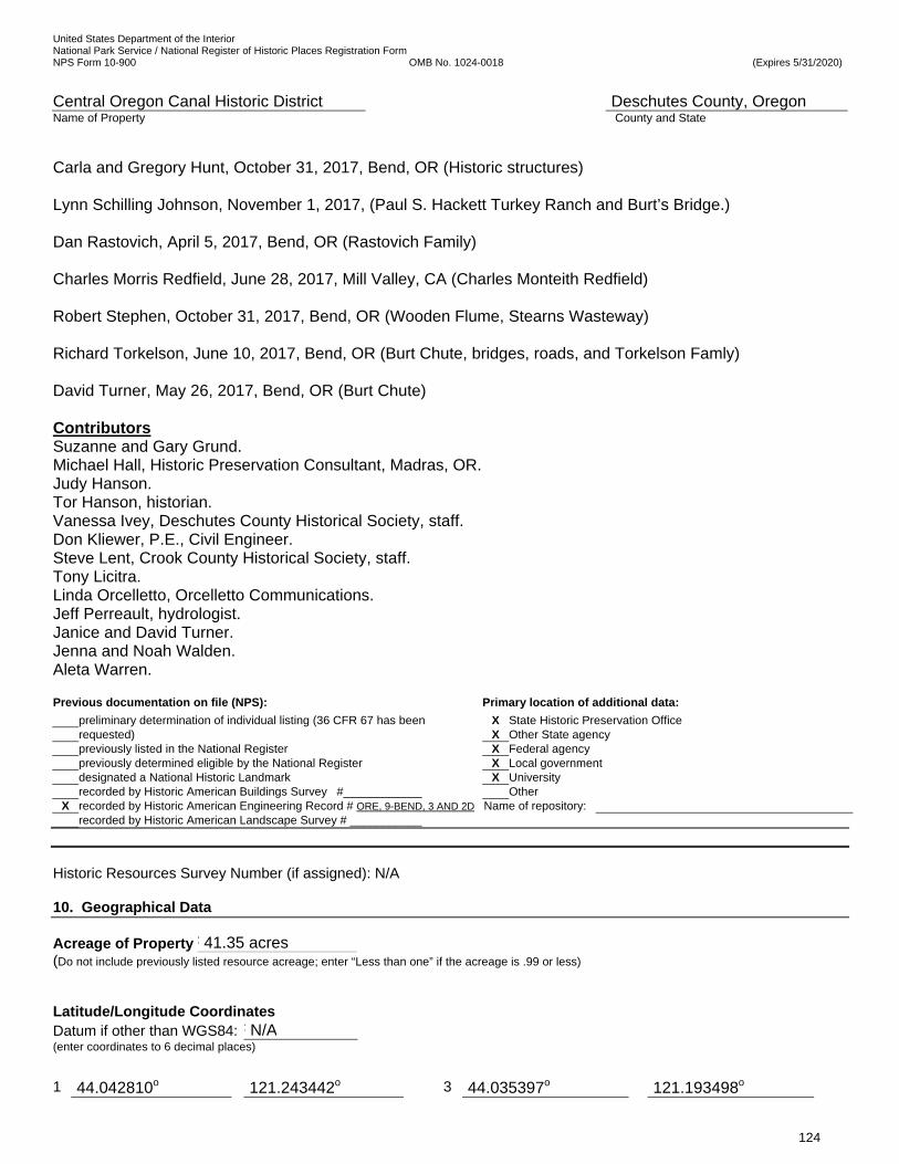
United States Department of the Interior National Park Service / National Register of Historic Places Registration Form NPS Form 10-900 OMB No. 1024-0018 (Expires 5/31/2020)
Central Oregon Canal Historic District Deschutes County, Oregon Name of Property County and State
124
Carla and Gregory Hunt, October 31, 2017, Bend, OR (Historic structures) Lynn Schilling Johnson, November 1, 2017, (Paul S. Hackett Turkey Ranch and Burt’s Bridge.) Dan Rastovich, April 5, 2017, Bend, OR (Rastovich Family) Charles Morris Redfield, June 28, 2017, Mill Valley, CA (Charles Monteith Redfield) Robert Stephen, October 31, 2017, Bend, OR (Wooden Flume, Stearns Wasteway) Richard Torkelson, June 10, 2017, Bend, OR (Burt Chute, bridges, roads, and Torkelson Famly) David Turner, May 26, 2017, Bend, OR (Burt Chute) Contributors Suzanne and Gary Grund. Michael Hall, Historic Preservation Consultant, Madras, OR. Judy Hanson. Tor Hanson, historian. Vanessa Ivey, Deschutes County Historical Society, staff. Don Kliewer, P.E., Civil Engineer. Steve Lent, Crook County Historical Society, staff. Tony Licitra. Linda Orcelletto, Orcelletto Communications. Jeff Perreault, hydrologist. Janice and David Turner. Jenna and Noah Walden. Aleta Warren. Previous documentation on file (NPS): Primary location of additional data:
preliminary determination of individual listing (36 CFR 67 has been X State Historic Preservation Office requested) X Other State agency previously listed in the National Register X Federal agency previously determined eligible by the National Register X Local government designated a National Historic Landmark X University recorded by Historic American Buildings Survey #____________ Other
X recorded by Historic American Engineering Record # ORE, 9-BEND, 3 AND 2D Name of repository: recorded by Historic American Landscape Survey # ___________
Historic Resources Survey Number (if assigned): N/A 10. Geographical Data
Acreage of Property F 41.35 acres (Do not include previously listed resource acreage; enter “Less than one” if the acreage is .99 or less)
Latitude/Longitude Coordinates Datum if other than WGS84: F N/A (enter coordinates to 6 decimal places)
1 44.042810o 121.243442o 3 44.035397o 121.193498o

United States Department of the Interior National Park Service / National Register of Historic Places Registration Form NPS Form 10-900 OMB No. 1024-0018 (Expires 5/31/2020)
Central Oregon Canal Historic District Deschutes County, Oregon Name of Property County and State
125
_____________________________________________________________________________________________________________________ NEW Verbal Boundary Description (Describe the boundaries of the property.) The nominated area in the historic district includes the length of the Central Oregon Canal within the west half and the northeast quarter of Township 18 South, Range 12 East, Section 1, W.M.; the north half and southeast quarter of Section 6 and the southwest quarter of Section 5 and the northwest quarter of Section 8 of Township 18 South, Range 13 East, W.M. Its western boundary is the eastern edge of the Deschutes County right-of-way for Ward Road. Ward Road runs north-south along the western section line of T18S, R12W Section 1. The historic district’s eastern boundary is the western edge of the Deschutes County right-of-way for Gosney Road. Gosney Road generally follows the north-south midsection line through Sections 5 and 8 of T18S, R13E. The northern and southern boundaries are lines drawn 50’ on either side of the centerline of the Central Oregon Canal, establishing a 100’ wide corridor. The district includes the canal, historic-contributing features and its historic setting within the 100-foot corridor. The district excludes outdoor lighting, private fences and other structures within the nominated corridor that are not related to the operation of the Central Oregon Canal and not noted in Section 7 of this document. (See Figures 2-5.) ____________________________________________________________________________________________________________________ NEW Boundary Justification (Explain why the boundaries were selected.) The boundary of the Central Oregon Canal Historic District includes the entirety of the nominated stretch of the Central Oregon Canal itself and associated structures that are necessary to convey and deliver irrigation water to patrons, including headgates, headwalls, pipes, flumes, catwalks, the Bear Creek Ranch bridge and embankments. It includes the intact immediate historic setting within the 100’ corridor as described above. The wide variation in the canal’s width in this stretch precludes a tighter boundary; however, the selected 100’ corridor includes the canal itself and most of the associated historic features and structures necessary for the irrigation system to convey water to its patrons. The western boundary of the district is at a 1968 two-lane concrete bridge, the Ward Road Bridge, built out of the period of significance. West of the bridge, the canal flows through an increasingly urbanized environment with a substantially altered setting with wooden privacy fences and wide public pedestrian and bike trails within 50 feet of the centerline of the canal, representing a substantial break in the continuity of the historic canal and historic setting. It is a segment of canal that has only two headgates to ditches and two residential sized irrigation ponds and no commercial agriculture. Only a handful of property owners have water rights and water is used only for landscaping. The vicinity of the canal is urbanizing and has lost its ability to interpret the development of the irrigation system. The largest parcel, 20 acres, is owned by the Eastern Cascades Model Railroad Club, which has nearly 2000 feet of track. The historic district’s eastern boundary of the district is at the 1968, two lane concrete Gosney Road Bridge, built out of the period of significance. The canal east of Gosney Road is distinctively “U” in shape and has historic integrity. However, the 3.4 miles of canal in the historic district is adequate to interpret the canal. The two modern bridges form strong ends to the district. The district boundaries selected include a stretch of the canal that is long enough to include the various slopes and flat terrain that the canal passes through during its 47 mile-length. In the district, there are flat areas in which the canal was scraped out after cuts were made in the earth on both sides of the bed, sloping areas that required a cut on the high side and a berm of various heights on the low side, and areas of exceptional drops in the terrain that originally needed to be spanned by a wooden flume that was later replaced by the tallest berms on the irrigation system to allow the water to flow at the desired elevation. The district boundaries include the typical elements of an irrigation system: the historic canal, two laterals, one sub-lateral, headwalls, pipes, catwalks, flumes, embankments and many ditches. It includes many headgates to regulate water flow to the laterals and ditches that serve the patrons nearby and miles away from the canal, and a historic wooden bridge typical of those built by settlers to bridge the canal. The setting of the historic canal within the historic district boundaries includes a variety of sizes of parcels. A stretch of the canal in the district passes through nearly 80 acres of land in public ownership with native vegetation, remaining uncultivated and undeveloped, as
Latitude Longitude Latitude
Longitude
2 44.042534o 121.243437o 4 44.035128o 121.193494o Latitude
Longitude
Latitude Longitude

United States Department of the Interior National Park Service / National Register of Historic Places Registration Form NPS Form 10-900 OMB No. 1024-0018 (Expires 5/31/2020)
Central Oregon Canal Historic District Deschutes County, Oregon Name of Property County and State
126
it was when the canal was constructed. It also includes 12 large parcels of irrigated and cultivated land that have associated irrigation ponds and water rights. Five parcels are between 30 and 51 acres, three parcels between 20 and 30 acres, and five parcels between 10 and 20 acres. There are three irrigated hobby farms with sheep, goats, horse and cattle in the pastures beside the canal. Finally, the canal crosses 23 parcels that are between 1 and 5 acres in size, in rural subdivisions that were platted in the early 1970s with water rights. It is representative of the progression of the settlement and the development of agriculture led by the construction of the canal. 11. Form Prepared By
name/title Patricia A. Kliewer, MPA, Historic Preservation Planner date June 27, 2017
organization Kliewer Engineering and Associates telephone 541 617-0805 : (street & number 60465 Sunridge Drive, Bend, OR 97702 email [email protected] city or town Bend state OR zip code 97702
Additional Documentation
Submit the following items with the completed form: Regional Location Map Local Location Map Tax Lot Map Site Plan Floor Plans (As Applicable) Photo Location Map (Include for historic districts and properties having large acreage or numerous resources. Key all photographs to
this map and insert immediately after the photo log and before the list of figures).Paperwork Reduction Act Statement: This information is being collected for applications to the National Register of Historic Places to nominate properties for listing or determine eligibility for listing, to list properties, and to amend existing listings. Response to this request is required to obtain a benefit in accordance with the National Historic Preservation Act, as amended (16 U.S.C.460 et seq.).
Estimated Burden Statement: Public reporting burden for this form is estimated to average 100 hours per response including time for reviewing instructions, gathering and maintaining data, and completing and reviewing the form. Direct comments regarding this burden estimate or any aspect of this form to the Office of Planning and Performance Management. U.S. Dept. of the Interior, 1849 C. Street, NW, Washington, DC.
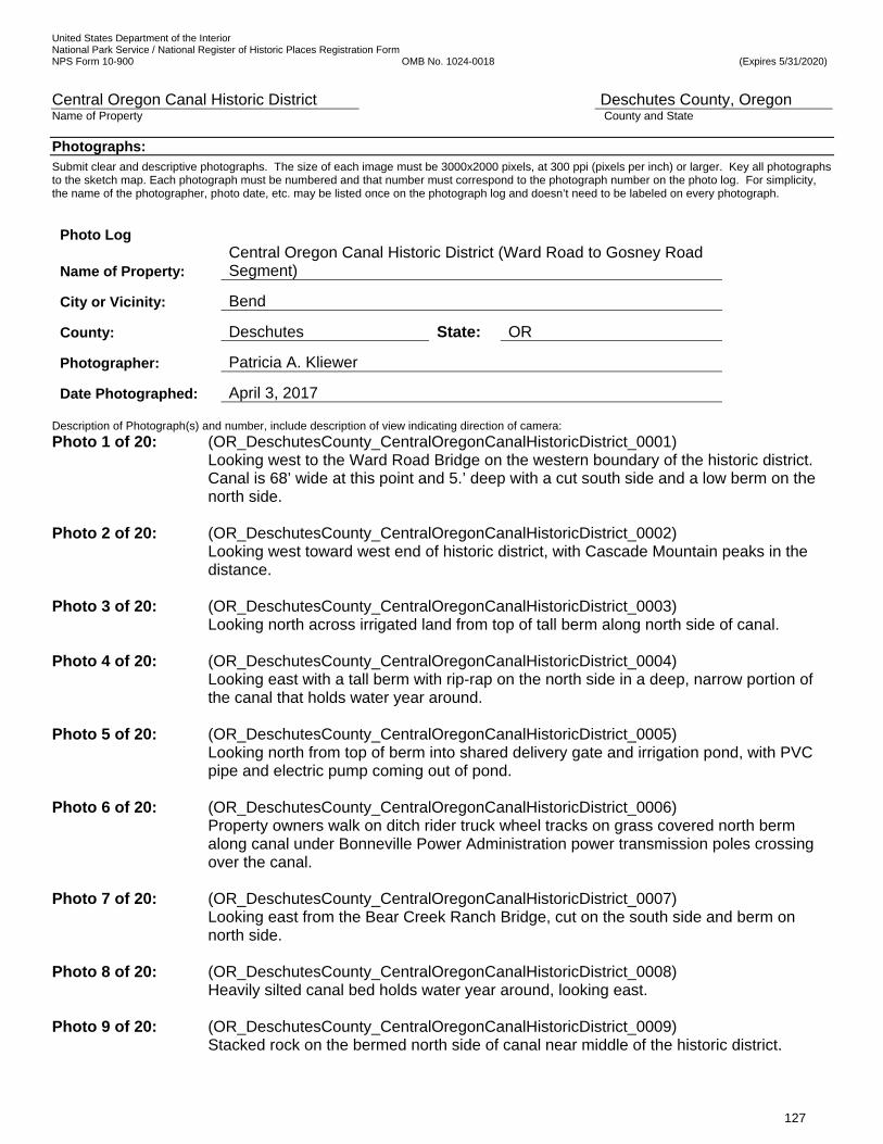
United States Department of the Interior National Park Service / National Register of Historic Places Registration Form NPS Form 10-900 OMB No. 1024-0018 (Expires 5/31/2020)
Central Oregon Canal Historic District Deschutes County, Oregon Name of Property County and State
127
Photographs:
Submit clear and descriptive photographs. The size of each image must be 3000x2000 pixels, at 300 ppi (pixels per inch) or larger. Key all photographs to the sketch map. Each photograph must be numbered and that number must correspond to the photograph number on the photo log. For simplicity, the name of the photographer, photo date, etc. may be listed once on the photograph log and doesn’t need to be labeled on every photograph.
Photo Log
Name of Property: Central Oregon Canal Historic District (Ward Road to Gosney Road Segment)
City or Vicinity: Bend
County: Deschutes State: OR
Photographer: Patricia A. Kliewer
Date Photographed: April 3, 2017
Description of Photograph(s) and number, include description of view indicating direction of camera:
Photo 1 of 20: (OR_DeschutesCounty_CentralOregonCanalHistoricDistrict_0001) Looking west to the Ward Road Bridge on the western boundary of the historic district. Canal is 68’ wide at this point and 5.’ deep with a cut south side and a low berm on the north side.
Photo 2 of 20: (OR_DeschutesCounty_CentralOregonCanalHistoricDistrict_0002) Looking west toward west end of historic district, with Cascade Mountain peaks in the distance.
Photo 3 of 20: (OR_DeschutesCounty_CentralOregonCanalHistoricDistrict_0003)
Looking north across irrigated land from top of tall berm along north side of canal. Photo 4 of 20: (OR_DeschutesCounty_CentralOregonCanalHistoricDistrict_0004)
Looking east with a tall berm with rip-rap on the north side in a deep, narrow portion of the canal that holds water year around.
Photo 5 of 20: (OR_DeschutesCounty_CentralOregonCanalHistoricDistrict_0005)
Looking north from top of berm into shared delivery gate and irrigation pond, with PVC pipe and electric pump coming out of pond.
Photo 6 of 20: (OR_DeschutesCounty_CentralOregonCanalHistoricDistrict_0006)
Property owners walk on ditch rider truck wheel tracks on grass covered north berm along canal under Bonneville Power Administration power transmission poles crossing over the canal.
Photo 7 of 20: (OR_DeschutesCounty_CentralOregonCanalHistoricDistrict_0007)
Looking east from the Bear Creek Ranch Bridge, cut on the south side and berm on north side.
Photo 8 of 20: (OR_DeschutesCounty_CentralOregonCanalHistoricDistrict_0008)
Heavily silted canal bed holds water year around, looking east. Photo 9 of 20: (OR_DeschutesCounty_CentralOregonCanalHistoricDistrict_0009)
Stacked rock on the bermed north side of canal near middle of the historic district.
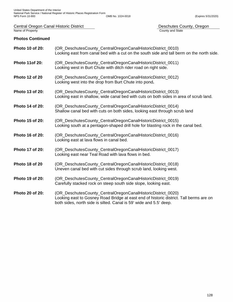
United States Department of the Interior National Park Service / National Register of Historic Places Registration Form NPS Form 10-900 OMB No. 1024-0018 (Expires 5/31/2020)
Central Oregon Canal Historic District Deschutes County, Oregon Name of Property County and State
128
Photos Continued Photo 10 of 20: (OR_DeschutesCounty_CentralOregonCanalHistoricDistrict_0010)
Looking east from canal bed with a cut on the south side and tall berm on the north side. Photo 11of 20: (OR_DeschutesCounty_CentralOregonCanalHistoricDistrict_0011)
Looking west in Burt Chute with ditch rider road on right side. Photo 12 of 20 (OR_DeschutesCounty_CentralOregonCanalHistoricDistrict_0012)
Looking west into the drop from Burt Chute into pond. Photo 13 of 20: (OR_DeschutesCounty_CentralOregonCanalHistoricDistrict_0013)
Looking east in shallow, wide canal bed with cuts on both sides in area of scrub land. Photo 14 of 20: (OR_DeschutesCounty_CentralOregonCanalHistoricDistrict_0014)
Shallow canal bed with cuts on both sides, looking east through scrub land Photo 15 of 20: (OR_DeschutesCounty_CentralOregonCanalHistoricDistrict_0015)
Looking south at a pentagon-shaped drill hole for blasting rock in the canal bed. Photo 16 of 20: (OR_DeschutesCounty_CentralOregonCanalHistoricDistrict_0016)
Looking east at lava flows in canal bed. Photo 17 of 20: (OR_DeschutesCounty_CentralOregonCanalHistoricDistrict_0017)
Looking east near Teal Road with lava flows in bed. Photo 18 of 20 (OR_DeschutesCounty_CentralOregonCanalHistoricDistrict_0018)
Uneven canal bed with cut sides through scrub land, looking west. Photo 19 of 20: (OR_DeschutesCounty_CentralOregonCanalHistoricDistrict_0019)
Carefully stacked rock on steep south side slope, looking east. Photo 20 of 20: (OR_DeschutesCounty_CentralOregonCanalHistoricDistrict_0020)
Looking east to Gosney Road Bridge at east end of historic district. Tall berms are on both sides, north side is silted. Canal is 59’ wide and 5.5’ deep.
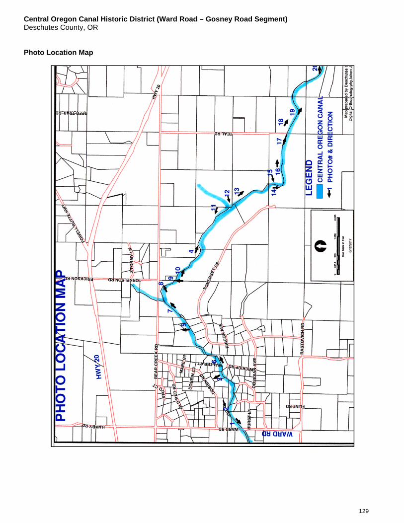
Central Oregon Canal Historic District (Ward Road – Gosney Road Segment) Deschutes County, OR
129
Photo Location Map
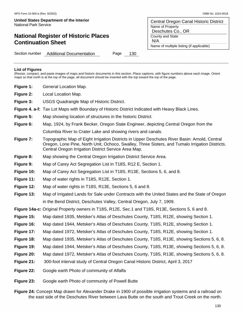
NPS Form 10-900-a (Rev. 8/2002) OMB No. 1024-0018
United States Department of the Interior Put Here National Park Service National Register of Historic Places Continuation Sheet Section number Additional Documentation Page 130
130
Central Oregon Canal Historic District Name of Property Deschutes Co., OR County and State N/A Name of multiple listing (if applicable)
List of Figures (Resize, compact, and paste images of maps and historic documents in this section. Place captions, with figure numbers above each image. Orient maps so that north is at the top of the page, all document should be inserted with the top toward the top of the page. Figure 1: General Location Map.
Figure 2: Local Location Map.
Figure 3: USGS Quadrangle Map of Historic District.
Figure 4. a-f: Tax Lot Maps with Boundary of Historic District Indicated with Heavy Black Lines.
Figure 5: Map showing location of structures in the historic District.
Figure 6: Map, 1924, by Frank Becker, Oregon State Engineer, depicting Central Oregon from the
Columbia River to Crater Lake and showing rivers and canals.
Figure 7: Topographic Map of Eight Irrigation Districts in Upper Deschutes River Basin: Arnold, Central Oregon, Lone Pine, North Unit, Ochoco, Swalley, Three Sisters, and Tumalo Irrigation Districts.
Central Oregon Irrigation District Service Area Map.
Figure 8: Map showing the Central Oregon Irrigation District Service Area.
Figure 9: Map of Carey Act Segregation List in T18S, R12 E, Section 1.
Figure 10: Map of Carey Act Segregation List in T18S, R13E, Sections 5, 6, and 8.
Figure 11: Map of water rights in T18S, R12E, Section 1.
Figure 12: Map of water rights in T18S, R13E, Sections 5, 6 and 8.
Figure 13: Map of Irrigated Lands for Sale under Contracts with the United States and the State of Oregon
in the Bend District, Deschutes Valley, Central Oregon, July 7, 1909.
Figure 14a-c: Original Property owners in T18S, R12E, Sec.1 and T18S, R13E, Sections 5, 6 and 8.
Figure 15: Map dated 1935, Metsker’s Atlas of Deschutes County, T18S, R12E, showing Section 1.
Figure 16: Map dated 1944, Metsker’s Atlas of Deschutes County, T18S, R12E, showing Section 1.
Figure 17: Map dated 1972, Metsker’s Atlas of Deschutes County, T18S, R12E, showing Section 1.
Figure 18: Map dated 1935, Metsker’s Atlas of Deschutes County, T18S, R13E, showing Sections 5, 6, 8.
Figure 19: Map dated 1944, Metsker’s Atlas of Deschutes County, T18S, R13E, showing Sections 5, 6, 8.
Figure 20: Map dated 1972, Metsker’s Atlas of Deschutes County, T18S, R13E, showing Sections 5, 6, 8.
Figure 21: 300-foot interval study of Central Oregon Canal Historic District, April 3, 2017
Figure 22: Google earth Photo of community of Alfalfa
Figure 23: Google earth Photo of community of Powell Butte
Figure 24: Concept Map drawn for Alexander Drake in 1900 of possible irrigation systems and a railroad on the east side of the Deschutes River between Lava Butte on the south and Trout Creek on the north.
NPS Form 10-900-a (Rev. 8/2002) OMB No. 1024-0018
United States Department of the Interior Put Here National Park Service National Register of Historic Places Continuation Sheet Section number Additional Documentation Page 131
131
Central Oregon Canal Historic District Name of Property Deschutes Co., OR County and State N/A Name of multiple listing (if applicable)
Figure 25: Photos of Arnold Irrigation Canal
Figure 26: Photos of Swalley Irrigation District, Swalley Canal. Figure 27: Photos of Tumalo Irrigation District.
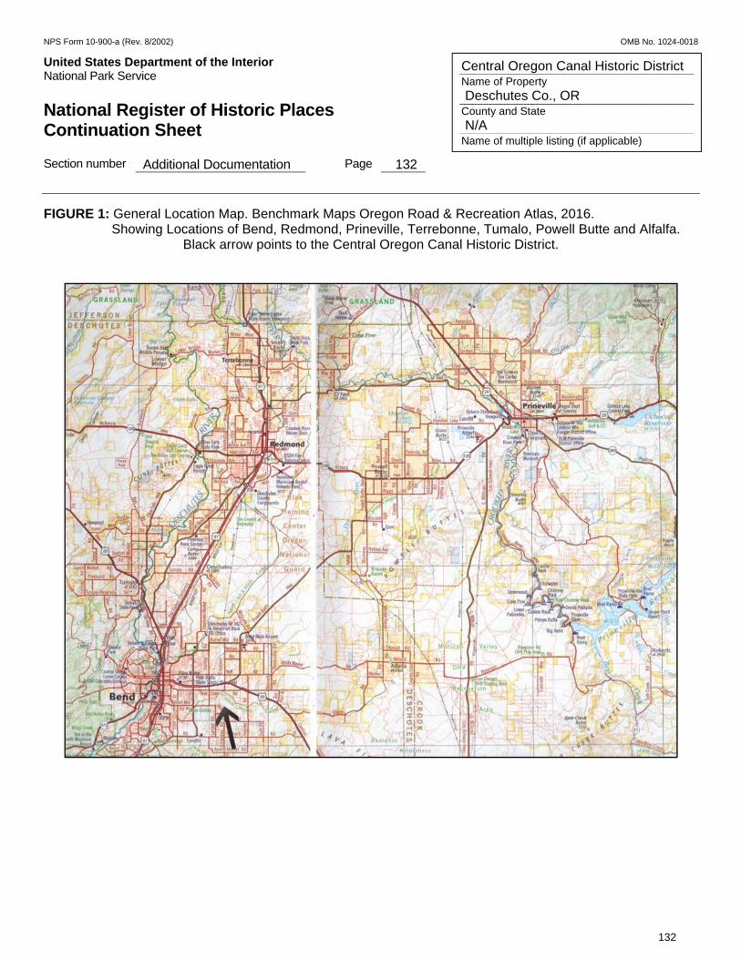
NPS Form 10-900-a (Rev. 8/2002) OMB No. 1024-0018
United States Department of the Interior Put Here National Park Service National Register of Historic Places Continuation Sheet Section number Additional Documentation Page 132
132
Central Oregon Canal Historic District Name of Property Deschutes Co., OR County and State N/A Name of multiple listing (if applicable)
FIGURE 1: General Location Map. Benchmark Maps Oregon Road & Recreation Atlas, 2016. Showing Locations of Bend, Redmond, Prineville, Terrebonne, Tumalo, Powell Butte and Alfalfa.
Black arrow points to the Central Oregon Canal Historic District.
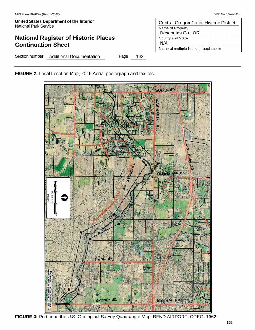
NPS Form 10-900-a (Rev. 8/2002) OMB No. 1024-0018
United States Department of the Interior Put Here National Park Service National Register of Historic Places Continuation Sheet Section number Additional Documentation Page 133
133
Central Oregon Canal Historic District Name of Property Deschutes Co., OR County and State N/A Name of multiple listing (if applicable)
FIGURE 2: Local Location Map, 2016 Aerial photograph and tax lots.
FIGURE 3: Portion of the U.S. Geological Survey Quadrangle Map, BEND AIRPORT, OREG. 1962
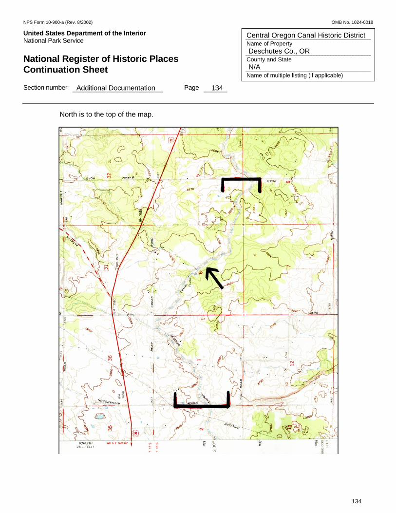
NPS Form 10-900-a (Rev. 8/2002) OMB No. 1024-0018
United States Department of the Interior Put Here National Park Service National Register of Historic Places Continuation Sheet Section number Additional Documentation Page 134
134
Central Oregon Canal Historic District Name of Property Deschutes Co., OR County and State N/A Name of multiple listing (if applicable)
North is to the top of the map.
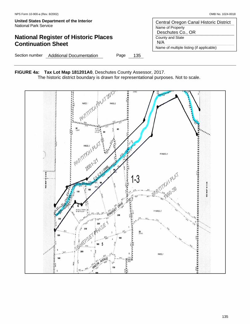
NPS Form 10-900-a (Rev. 8/2002) OMB No. 1024-0018
United States Department of the Interior Put Here National Park Service National Register of Historic Places Continuation Sheet Section number Additional Documentation Page 135
135
Central Oregon Canal Historic District Name of Property Deschutes Co., OR County and State N/A Name of multiple listing (if applicable)
FIGURE 4a: Tax Lot Map 181201A0, Deschutes County Assessor, 2017. The historic district boundary is drawn for representational purposes. Not to scale.
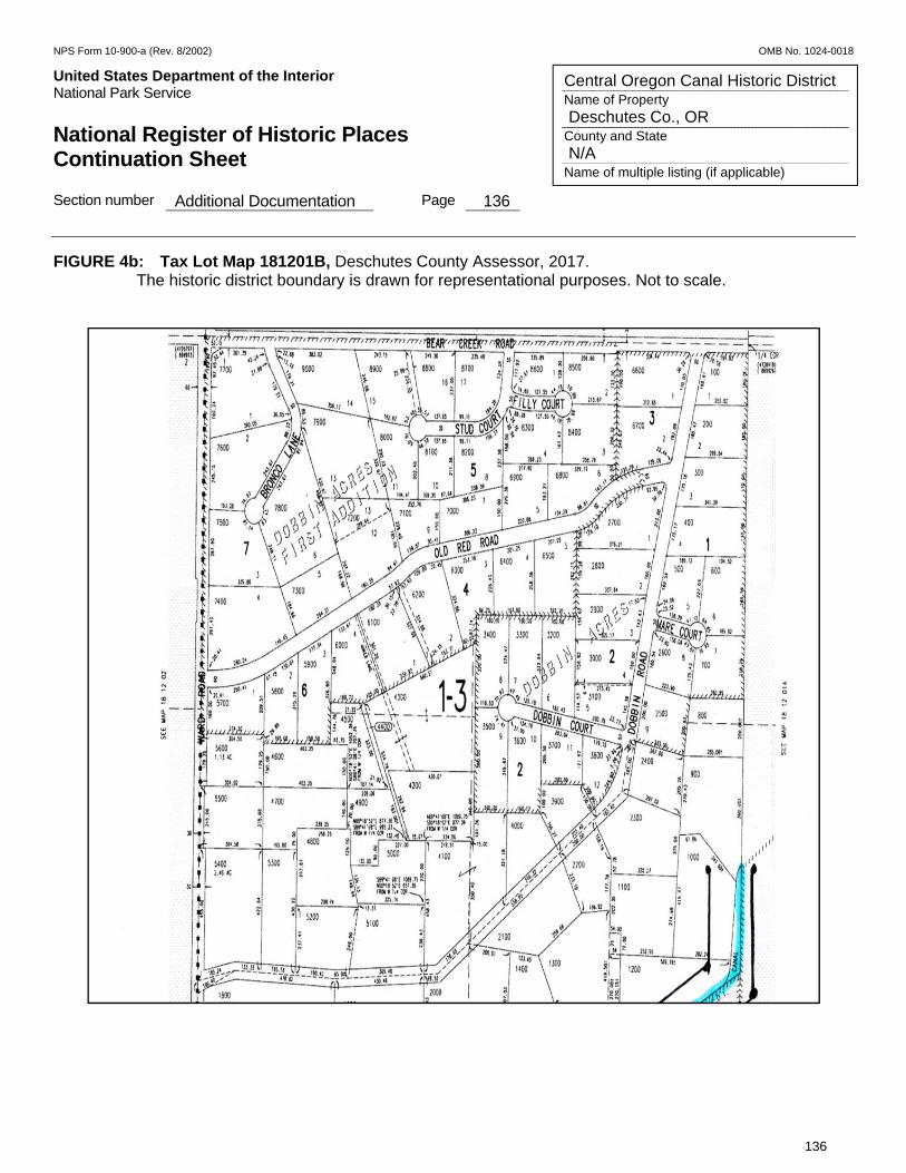
NPS Form 10-900-a (Rev. 8/2002) OMB No. 1024-0018
United States Department of the Interior Put Here National Park Service National Register of Historic Places Continuation Sheet Section number Additional Documentation Page 136
136
Central Oregon Canal Historic District Name of Property Deschutes Co., OR County and State N/A Name of multiple listing (if applicable)
FIGURE 4b: Tax Lot Map 181201B, Deschutes County Assessor, 2017. The historic district boundary is drawn for representational purposes. Not to scale.
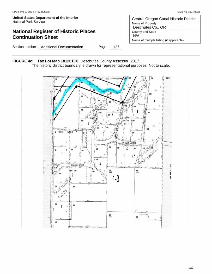
NPS Form 10-900-a (Rev. 8/2002) OMB No. 1024-0018
United States Department of the Interior Put Here National Park Service National Register of Historic Places Continuation Sheet Section number Additional Documentation Page 137
137
Central Oregon Canal Historic District Name of Property Deschutes Co., OR County and State N/A Name of multiple listing (if applicable)
FIGURE 4c: Tax Lot Map 181201C0, Deschutes County Assessor, 2017. The historic district boundary is drawn for representational purposes. Not to scale.
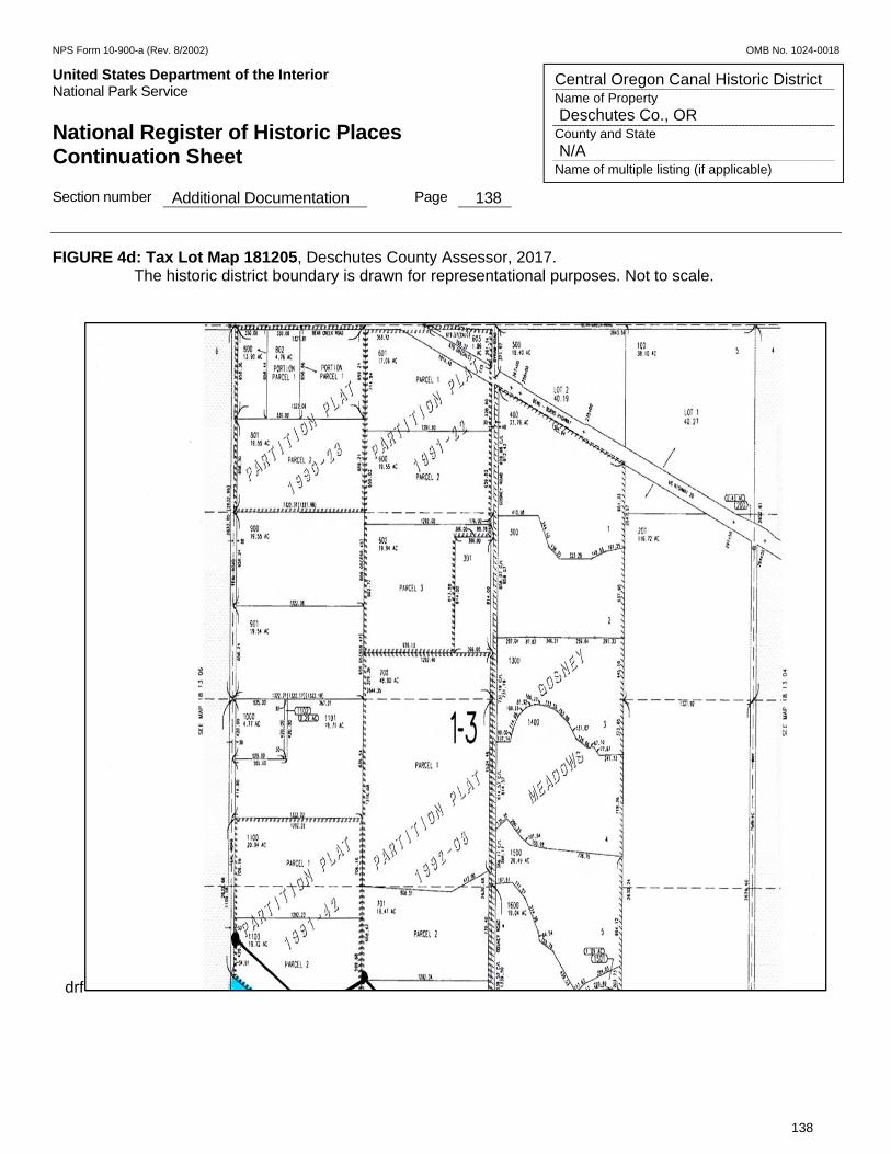
NPS Form 10-900-a (Rev. 8/2002) OMB No. 1024-0018
United States Department of the Interior Put Here National Park Service National Register of Historic Places Continuation Sheet Section number Additional Documentation Page 138
138
Central Oregon Canal Historic District Name of Property Deschutes Co., OR County and State N/A Name of multiple listing (if applicable)
FIGURE 4d: Tax Lot Map 181205, Deschutes County Assessor, 2017. The historic district boundary is drawn for representational purposes. Not to scale.
drf

NPS Form 10-900-a (Rev. 8/2002) OMB No. 1024-0018
United States Department of the Interior Put Here National Park Service National Register of Historic Places Continuation Sheet Section number Additional Documentation Page 139
139
Central Oregon Canal Historic District Name of Property Deschutes Co., OR County and State N/A Name of multiple listing (if applicable)
FIGURE 4e: Tax Lot Map 181206, Deschutes County Assessor, 2017. The historic district boundary is drawn for representational purposes. Not to scale.
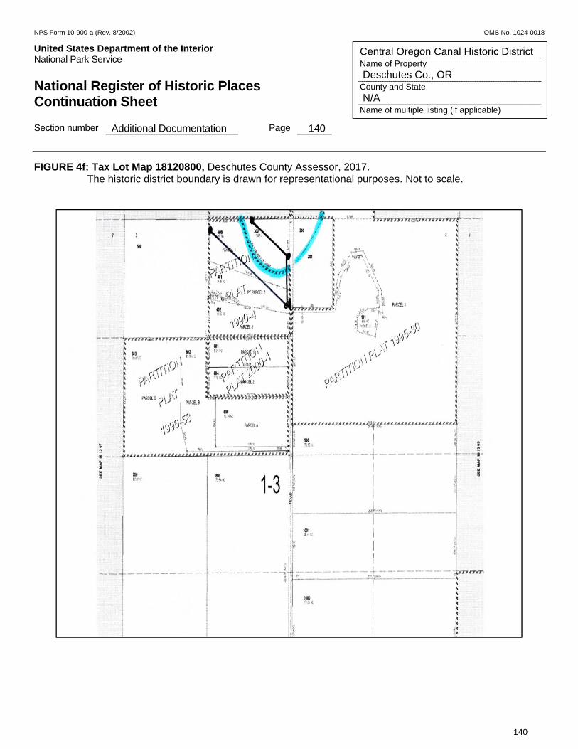
NPS Form 10-900-a (Rev. 8/2002) OMB No. 1024-0018
United States Department of the Interior Put Here National Park Service National Register of Historic Places Continuation Sheet Section number Additional Documentation Page 140
140
Central Oregon Canal Historic District Name of Property Deschutes Co., OR County and State N/A Name of multiple listing (if applicable)
FIGURE 4f: Tax Lot Map 18120800, Deschutes County Assessor, 2017. The historic district boundary is drawn for representational purposes. Not to scale.
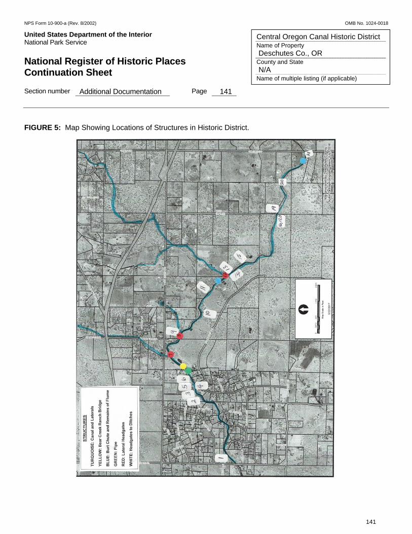
NPS Form 10-900-a (Rev. 8/2002) OMB No. 1024-0018
United States Department of the Interior Put Here National Park Service National Register of Historic Places Continuation Sheet Section number Additional Documentation Page 141
141
Central Oregon Canal Historic District Name of Property Deschutes Co., OR County and State N/A Name of multiple listing (if applicable)
FIGURE 5: Map Showing Locations of Structures in Historic District.
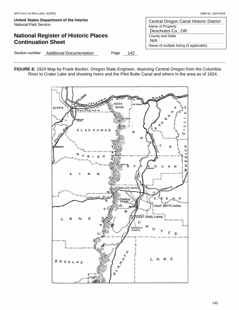
NPS Form 10-900-a (Rev. 8/2002) OMB No. 1024-0018
United States Department of the Interior Put Here National Park Service National Register of Historic Places Continuation Sheet Section number Additional Documentation Page 142
142
Central Oregon Canal Historic District Name of Property Deschutes Co., OR County and State N/A Name of multiple listing (if applicable)
FIGURE 6: 1924 Map by Frank Becker, Oregon State Engineer, depicting Central Oregon from the Columbia River to Crater Lake and showing rivers and the Pilot Butte Canal and others in the area as of 1924.

NPS Form 10-900-a (Rev. 8/2002) OMB No. 1024-0018
United States Department of the Interior Put Here National Park Service National Register of Historic Places Continuation Sheet Section number Additional Documentation Page 143
143
Central Oregon Canal Historic District Name of Property Deschutes Co., OR County and State N/A Name of multiple listing (if applicable)
FIGURE 7: Topographic Map of Eight Irrigation Districts in Upper Deschutes River Basin: Arnold, Central Oregon, Lone Pine, North Unit, Ochoco, Swalley, Three Sisters, and Tumalo Irrigation Districts.
Source of Topographic Map: Deschutes Basin Board of Control (DBBC), 2010.
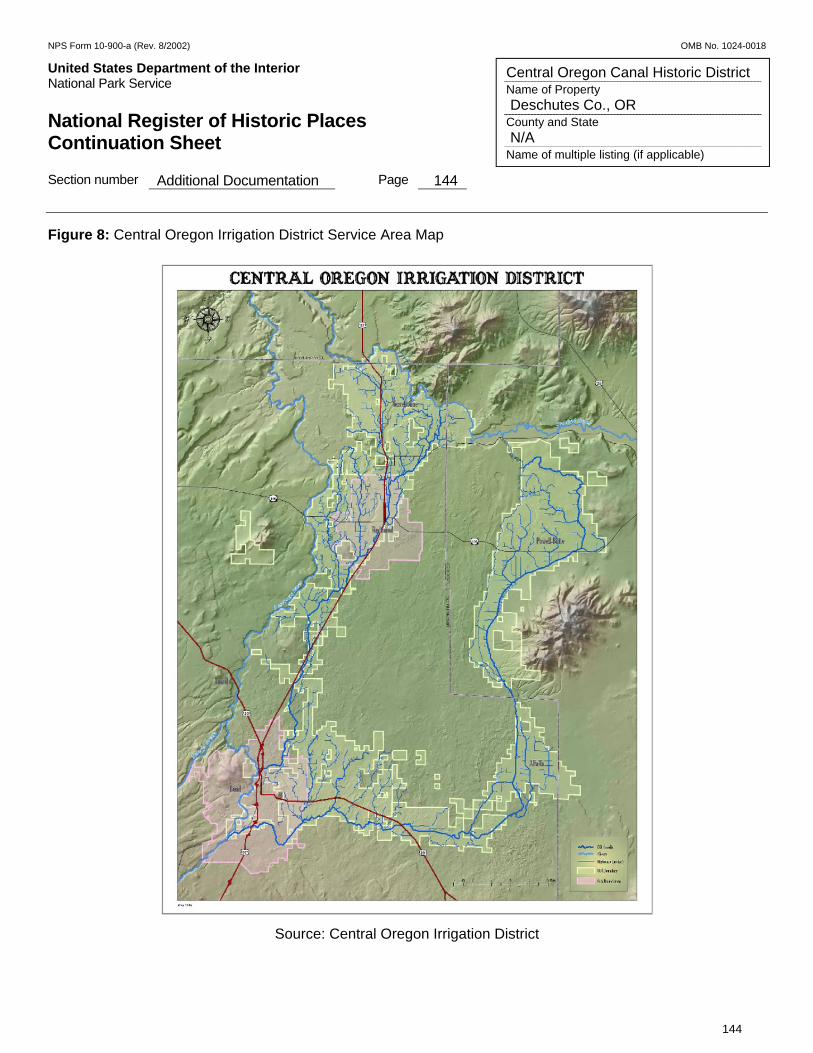
NPS Form 10-900-a (Rev. 8/2002) OMB No. 1024-0018
United States Department of the Interior Put Here National Park Service National Register of Historic Places Continuation Sheet Section number Additional Documentation Page 144
144
Central Oregon Canal Historic District Name of Property Deschutes Co., OR County and State N/A Name of multiple listing (if applicable)
Figure 8: Central Oregon Irrigation District Service Area Map
Source: Central Oregon Irrigation District
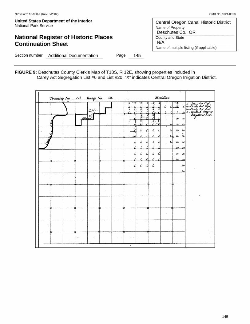
NPS Form 10-900-a (Rev. 8/2002) OMB No. 1024-0018
United States Department of the Interior Put Here National Park Service National Register of Historic Places Continuation Sheet Section number Additional Documentation Page 145
145
Central Oregon Canal Historic District Name of Property Deschutes Co., OR County and State N/A Name of multiple listing (if applicable)
FIGURE 9: Deschutes County Clerk’s Map of T18S, R 12E, showing properties included in Carey Act Segregation List #6 and List #20. “X” indicates Central Oregon Irrigation District.

NPS Form 10-900-a (Rev. 8/2002) OMB No. 1024-0018
United States Department of the Interior Put Here National Park Service National Register of Historic Places Continuation Sheet Section number Additional Documentation Page 146
146
Central Oregon Canal Historic District Name of Property Deschutes Co., OR County and State N/A Name of multiple listing (if applicable)
FIGURE 10: Deschutes County Clerk’s Map of T18S, R 13E, showing properties included in Carey Act Segregation List #6. “X” indicates Central Oregon Irrigation District.
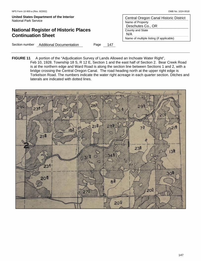
NPS Form 10-900-a (Rev. 8/2002) OMB No. 1024-0018
United States Department of the Interior Put Here National Park Service National Register of Historic Places Continuation Sheet Section number Additional Documentation Page 147
147
Central Oregon Canal Historic District Name of Property Deschutes Co., OR County and State N/A Name of multiple listing (if applicable)
FIGURE 11 A portion of the “Adjudication Survey of Lands Allowed an Inchoate Water Right”, Feb 10, 1928. Township 18 S, R 12 E, Section 1 and the east half of Section 2. Bear Creek Road is at the northern edge and Ward Road is along the section line between Sections 1 and 2, with a bridge crossing the Central Oregon Canal. The road heading north at the upper right edge is Torkelson Road. The numbers indicate the water right acreage in each quarter section. Ditches and laterals are indicated with dotted lines.

NPS Form 10-900-a (Rev. 8/2002) OMB No. 1024-0018
United States Department of the Interior Put Here National Park Service National Register of Historic Places Continuation Sheet Section number Additional Documentation Page 148
148
Central Oregon Canal Historic District Name of Property Deschutes Co., OR County and State N/A Name of multiple listing (if applicable)
FIGURE 12: A portion of the “Adjudication Survey of Lands Allowed an Inchoate Water Right”, Feb 10, 1928 for Township 18 S, R 13 E, Sections 5, 6, 7 and 8. Gosney Road runs north-south through the middle of Section 5 is, with a bridge crossing the Central Oregon Canal. The numbers indicate the water right acreage in each quarter section. Ditches and laterals are indicated with dotted lines. Burt Chute is in the center of Section 6.

NPS Form 10-900-a (Rev. 8/2002) OMB No. 1024-0018
United States Department of the Interior Put Here National Park Service National Register of Historic Places Continuation Sheet Section number Additional Documentation Page 149
149
Central Oregon Canal Historic District Name of Property Deschutes Co., OR County and State N/A Name of multiple listing (if applicable)
FIGURE 13: Map of Irrigated Lands for Sale under Contracts with the United States and the State of Oregon in the Bend District, Deschutes Valley, Central Oregon, July 7, 1909.
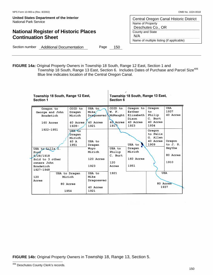
NPS Form 10-900-a (Rev. 8/2002) OMB No. 1024-0018
United States Department of the Interior Put Here National Park Service National Register of Historic Places Continuation Sheet Section number Additional Documentation Page 150
150
Central Oregon Canal Historic District Name of Property Deschutes Co., OR County and State N/A Name of multiple listing (if applicable)
FIGURE 14a: Original Property Owners in Township 18 South, Range 12 East, Section 1 and
Township 18 South, Range 13 East, Section 6. Includes Dates of Purchase and Parcel Size406 Blue line indicates location of the Central Oregon Canal.
FIGURE 14b: Original Property Owners in Township 18, Range 13, Section 5. 406 Deschutes County Clerk’s records.
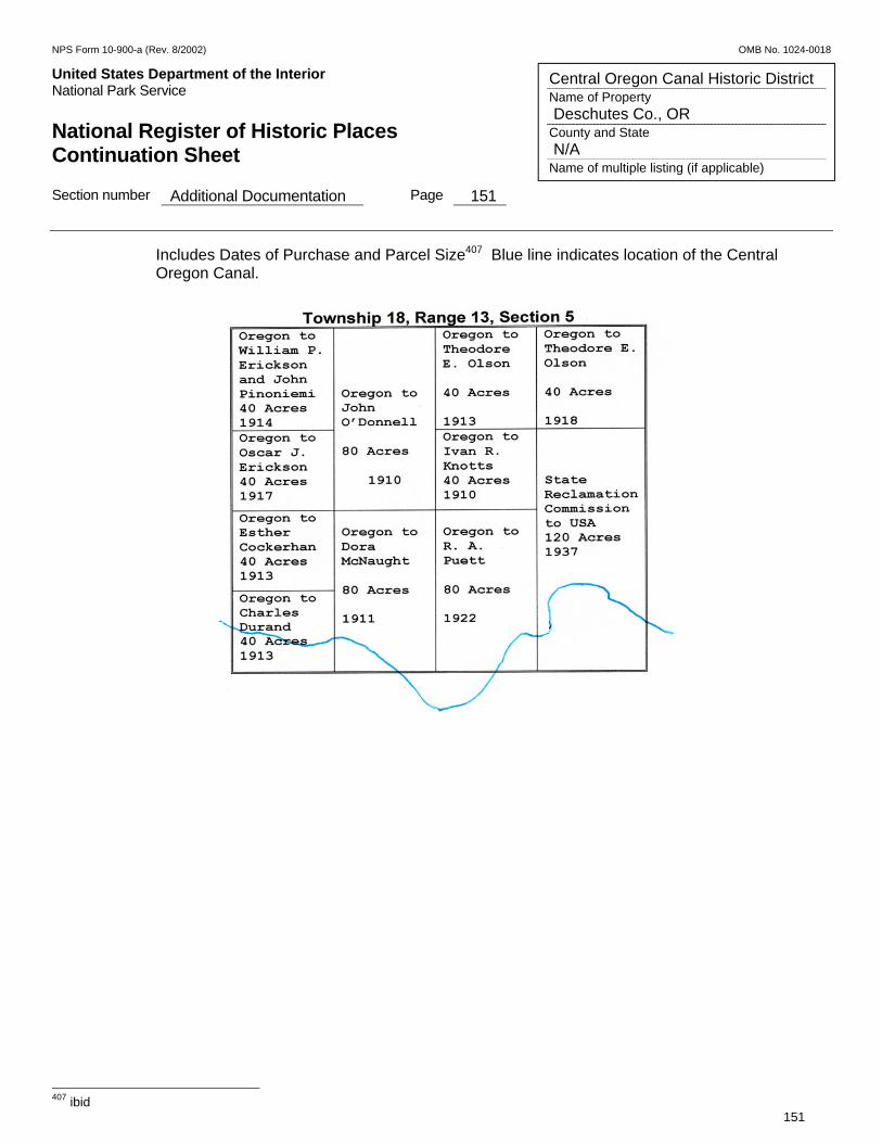
NPS Form 10-900-a (Rev. 8/2002) OMB No. 1024-0018
United States Department of the Interior Put Here National Park Service National Register of Historic Places Continuation Sheet Section number Additional Documentation Page 151
151
Central Oregon Canal Historic District Name of Property Deschutes Co., OR County and State N/A Name of multiple listing (if applicable)
Includes Dates of Purchase and Parcel Size407 Blue line indicates location of the Central Oregon Canal.
407 ibid
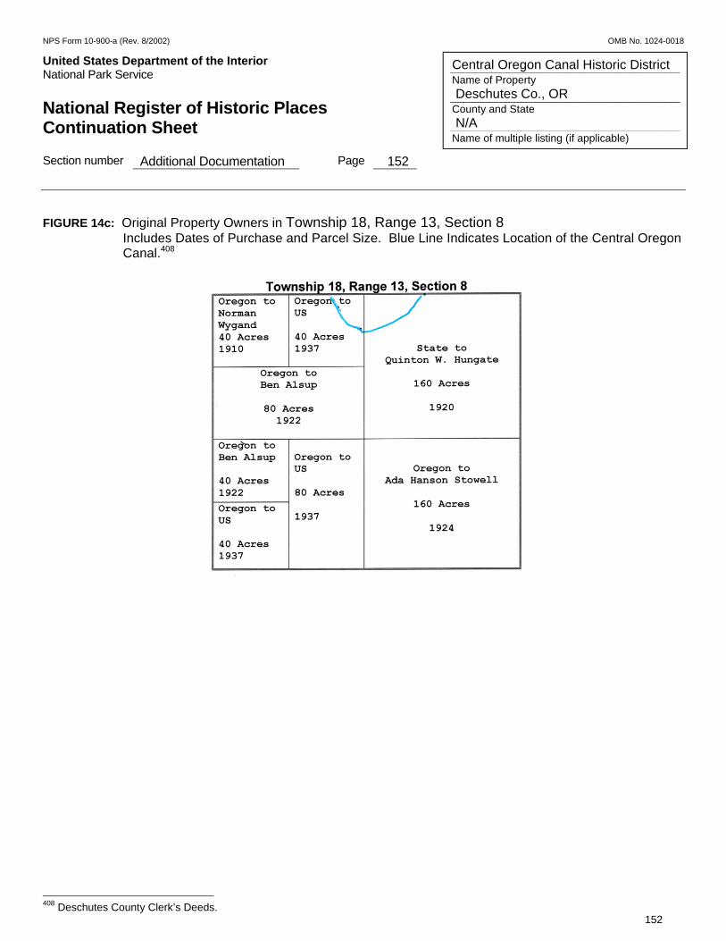
NPS Form 10-900-a (Rev. 8/2002) OMB No. 1024-0018
United States Department of the Interior Put Here National Park Service National Register of Historic Places Continuation Sheet Section number Additional Documentation Page 152
152
Central Oregon Canal Historic District Name of Property Deschutes Co., OR County and State N/A Name of multiple listing (if applicable)
FIGURE 14c: Original Property Owners in Township 18, Range 13, Section 8
Includes Dates of Purchase and Parcel Size. Blue Line Indicates Location of the Central Oregon Canal.408
408 Deschutes County Clerk’s Deeds.
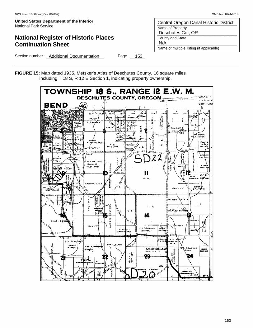
NPS Form 10-900-a (Rev. 8/2002) OMB No. 1024-0018
United States Department of the Interior Put Here National Park Service National Register of Historic Places Continuation Sheet Section number Additional Documentation Page 153
153
Central Oregon Canal Historic District Name of Property Deschutes Co., OR County and State N/A Name of multiple listing (if applicable)
FIGURE 15: Map dated 1935, Metsker’s Atlas of Deschutes County, 16 square miles including T 18 S, R 12 E Section 1, indicating property ownership.
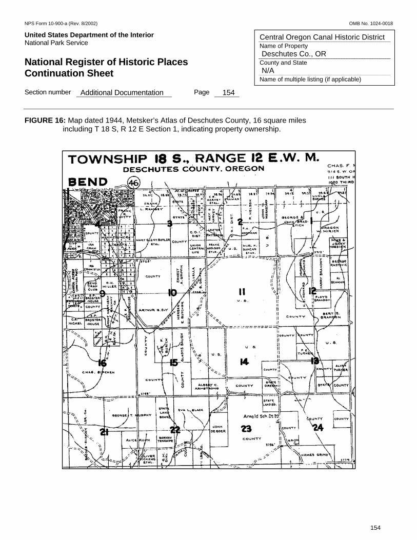
NPS Form 10-900-a (Rev. 8/2002) OMB No. 1024-0018
United States Department of the Interior Put Here National Park Service National Register of Historic Places Continuation Sheet Section number Additional Documentation Page 154
154
Central Oregon Canal Historic District Name of Property Deschutes Co., OR County and State N/A Name of multiple listing (if applicable)
FIGURE 16: Map dated 1944, Metsker’s Atlas of Deschutes County, 16 square miles including T 18 S, R 12 E Section 1, indicating property ownership.
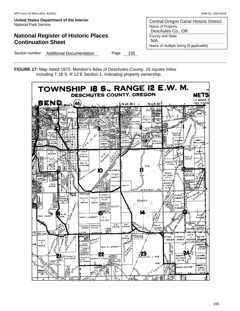
NPS Form 10-900-a (Rev. 8/2002) OMB No. 1024-0018
United States Department of the Interior Put Here National Park Service National Register of Historic Places Continuation Sheet Section number Additional Documentation Page 155
155
Central Oregon Canal Historic District Name of Property Deschutes Co., OR County and State N/A Name of multiple listing (if applicable)
FIGURE 17: Map dated 1972, Metsker’s Atlas of Deschutes County, 16 square miles including T 18 S, R 12 E Section 1, indicating property ownership.
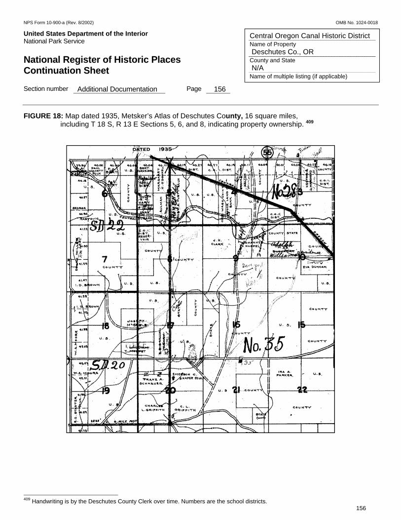
NPS Form 10-900-a (Rev. 8/2002) OMB No. 1024-0018
United States Department of the Interior Put Here National Park Service National Register of Historic Places Continuation Sheet Section number Additional Documentation Page 156
156
Central Oregon Canal Historic District Name of Property Deschutes Co., OR County and State N/A Name of multiple listing (if applicable)
FIGURE 18: Map dated 1935, Metsker’s Atlas of Deschutes County, 16 square miles, including T 18 S, R 13 E Sections 5, 6, and 8, indicating property ownership. 409
409 Handwriting is by the Deschutes County Clerk over time. Numbers are the school districts.
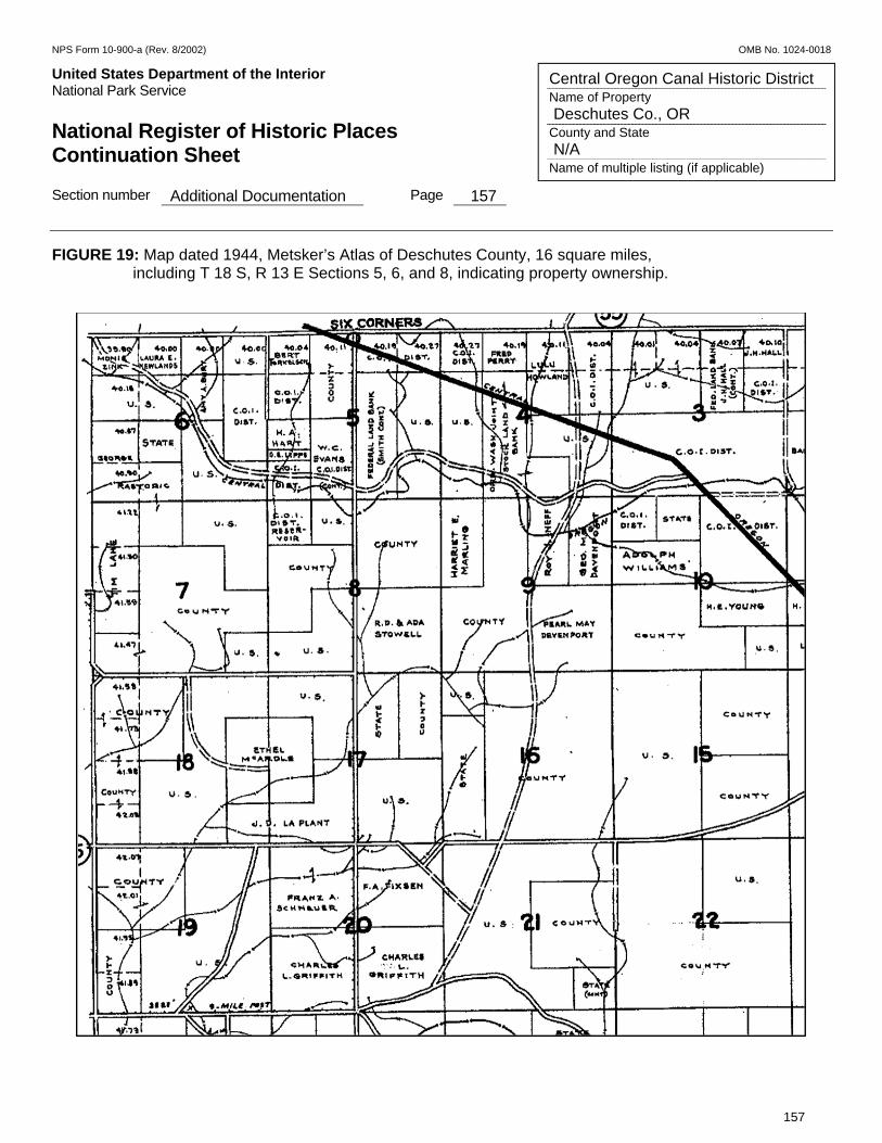
NPS Form 10-900-a (Rev. 8/2002) OMB No. 1024-0018
United States Department of the Interior Put Here National Park Service National Register of Historic Places Continuation Sheet Section number Additional Documentation Page 157
157
Central Oregon Canal Historic District Name of Property Deschutes Co., OR County and State N/A Name of multiple listing (if applicable)
FIGURE 19: Map dated 1944, Metsker’s Atlas of Deschutes County, 16 square miles, including T 18 S, R 13 E Sections 5, 6, and 8, indicating property ownership.
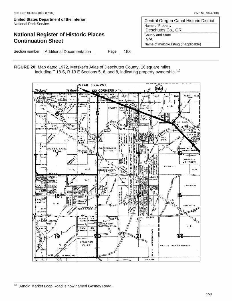
NPS Form 10-900-a (Rev. 8/2002) OMB No. 1024-0018
United States Department of the Interior Put Here National Park Service National Register of Historic Places Continuation Sheet Section number Additional Documentation Page 158
158
Central Oregon Canal Historic District Name of Property Deschutes Co., OR County and State N/A Name of multiple listing (if applicable)
FIGURE 20: Map dated 1972, Metsker’s Atlas of Deschutes County, 16 square miles, including T 18 S, R 13 E Sections 5, 6, and 8, indicating property ownership.410
410 Arnold Market Loop Road is now named Gosney Road.
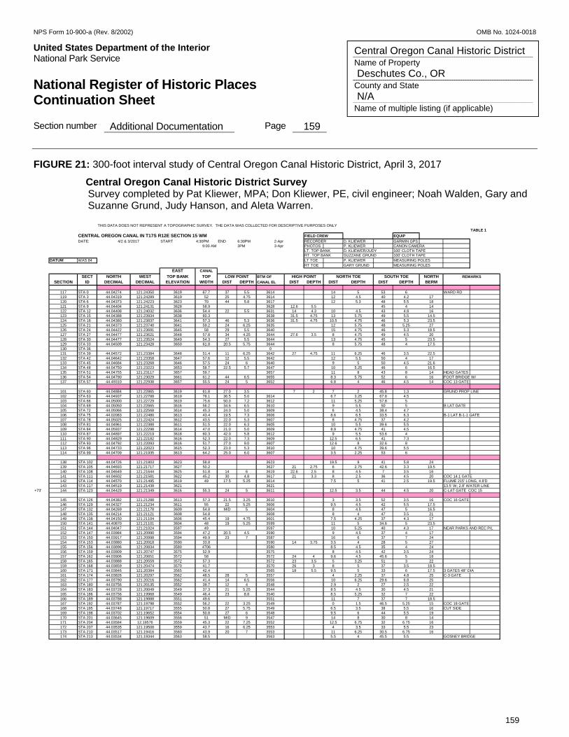
NPS Form 10-900-a (Rev. 8/2002) OMB No. 1024-0018
United States Department of the Interior Put Here National Park Service National Register of Historic Places Continuation Sheet Section number Additional Documentation Page 159
159
Central Oregon Canal Historic District Name of Property Deschutes Co., OR County and State N/A Name of multiple listing (if applicable)
FIGURE 21: 300-foot interval study of Central Oregon Canal Historic District, April 3, 2017
Central Oregon Canal Historic District Survey Survey completed by Pat Kliewer, MPA; Don Kliewer, PE, civil engineer; Noah Walden, Gary and Suzanne Grund, Judy Hanson, and Aleta Warren.
THIS DATA DOES NOT REPRESENT A TOPOGRAPHIC SURVEY. THE DATA WAS COLLECTED FOR DESCRIPTIVE PURPOSES ONLYTABLE 1
CENTRAL OREGON CANAL IN T17S R12E SECTION 15 WM EQUIP
DATE: START 4:30PM END 6:30PM 2-Apr RECORDER D. KLIEWER GARMIN GPS9:00 AM 3PM 3-Apr PHOTOS P. KLIEWER CANON CAMERA
LT. TOP BANK D. KLIEWER/JUDY 100' CLOTH TAPERT. TOP BANK SUZZANE GRUND 100' CLOTH TAPE
DATUM WAS 84 LT TOE P. KLIEWER MEASURING POLESRT TOE GARY GRUND MEASURING POLES
EAST CANAL
SECT NORTH WEST TOP BANK TOP BTM OF NORTHSECTION ID DECIMAL DECIMAL ELEVATION WIDTH DIST DEPTH CANAL EL DIST DEPTH DIST DEPTH DIST DEPTH BERM
117 STA 0 44.04274 121.24350 3619 67.7 37 5.5 3614 14 5 53 6 WARD RD119 STA 3 44.04319 121.24289 3619 52 25 4.75 3614 12 4.5 40 4.2 17120 STA 6 44.04373 121.24223 3623 70 44 5.8 3617 12 5.3 48 5.5 18121 STA 9 44.04404 121.24131 3628 58.9 3628 12.6 5.5 45 4 14122 STA 12 44.04408 121.24032 3636 54.4 22 5.5 3631 14 4.3 10 4.5 43 4.8 16123 STA 15 44.04388 121.23934 3638 60.3 3638 31.5 4.75 13 5.75 49 5.5 14.5124 STA 18 44.04380 121.23837 3641 57.3 46 5.3 3636 31.5 4.75 10.5 4.75 46 5.3 23.5125 STA 21 44.04373 121.23740 3641 59.2 24 6.25 3635 12 5.75 48 5.25 27126 STA 24 44.04422 121.23691 3645 58 29 5.5 3640 15 4.75 46 5.3 18.5127 STA 27 44.04477 121.23621 3648 57.8 34 4.25 3644 27.6 3.5 8 4.75 49 4.5 20128 STA 30 44.04477 121.23524 3649 54.3 27 5.5 3644 13 4.75 45 5 23.5129 STA 33 44.04509 121.23428 3650 61.8 20.5 5.75 3644 8 5.75 48 4 17.5130 STA 36 0131 STA 39 44.04572 121.23384 3648 51.4 11 6.25 3642 27 4.75 11 6.25 46 3.5 22.5132 STA 42 44.04642 121.23358 3647 57.6 12 5.5 3642 12 5.5 50 4 17133 STA 45 44.04684 121.23268 3646 57.5 24 6 3640 9 5 50 4.5 21.6134 STA 48 44.04750 121.23223 3653 58.7 22.5 5.7 3647 10 5.25 46 6 16.5135 STA 51 44.04755 121.23117 3657 59.7 3657 11 8 43 8 14 HEAD GATES136 STA 54 44.04790 121.23029 3661 61.2 44 6.5 3655 8.3 5.75 52 6 16 FOOT BRIDGE W/ 137 STA 57 44.49310 121.22938 3657 55.5 24 5 3652 6.8 4 46 4.5 14 COC 13 GATE
101 STA 60 44.04884 121.22865 3619 61.8 27.0 3.5 7 2 7 2 45.8 1.3 GRUND PROP LINE102 STA 63 44.04937 121.22788 3619 78.1 36.5 5.0 3614 6.7 3.25 67.8 4.5103 STA 66 44.05000 121.22729 3619 75.6 50.0 7.2 3612 11 5.25 57.8 5104 STA 69 44.05050 121.22665 3616 56.2 34.6 6.5 3610 9 5.5 50 5 B LAT GATE105 STA 72 44.05066 121.22568 3614 45.3 24.0 5.0 3609 6 4.5 38.4 4.7106 STA 75 44.02083 121.22480 3613 43.4 19.5 7.3 3606 8.6 6.5 33.5 6.3 B-1 LAT B-1-1 GATE107 STA 78 44.05025 121.22424 3612 43.5 22.0 5.3 3607 8 4.75 37 4.2108 STA 81 44.04961 121.22388 3611 51.5 22.0 6.3 3605 10 5.5 39.6 5.5109 STA 84 44.05937 121.22298 3614 47.0 21.0 5.0 3609 8.9 4.75 41 4.5110 STA 87 44.04897 121.22219 3618 60.3 42.0 5.8 3612 9 5.5 53.6 4111 STA 90 44.04829 121.22182 3616 52.3 22.0 7.3 3609 12.5 6.5 41 7.3112 STA 93 44.04792 121.22093 3616 51.7 27.0 9.0 3607 12.6 8 32.6 8113 STA 96 44.04733 121.22023 3615 52.3 23.0 5.3 3610 10 4.75 39.6 5.5114 STA 99 44.04709 121.21935 3613 64.2 25.0 6.0 3607 3.5 2.25 53 6
138 STA 102 44.04726 121.21803 3623 58.8 3623 19.5 9 41 5.8 24139 STA 105 44.04693 121.21717 3627 50.2 3627 21 2.75 6 2.75 42.6 3.3 19.5140 STA 108 44.04649 121.21644 3625 51.8 14 6 3619 22.6 2.5 8 4.5 7 3.5 16141 STA 111 44.04602 121.21581 3622 45.2 30 4.8 3617 21 3.3 8 2.5 36 4.5 20 COC 14.1 GATE142 STA 114 44.04570 121.21495 3619 49 17.5 5.25 3614 7.5 5 41 2.5 19.5 FLUME 215' LONG, 4.8'D143 STA 117 44.04519 121.21438 3621 3621 13.5' W; 2.8' WATER LINE
+73' 144 STA 123 44.04429 121.21349 3616 55.3 24 5 3611 12.5 3.5 44 4.5 20 C-LAT GATE COC 15
145 STA 126 44.04382 121.21288 3613 57.3 21.5 3.25 3610 3 3.5 52 3.5 16 COC 16 GATE146 STA 129 44.04327 121.21234 3611 55 22 5.25 3606 9.5 4.5 42 5.5 17.5147 STA 132 44.04269 121.21178 3609 54.8 MID 5 3604 8 4.5 47 5 16.5148 STA 135 44.04214 121.21121 3608 54.8 3608 8 4 47 3.5 21149 STA 138 44.04150 121.21104 3606 45.4 19 4.75 3601 7.5 4.25 37 4.3 17150 STA 141 44.40870 121.21101 3604 48 19 5.25 3599 11 5 34.6 5 23.5151 STA 144 44.04047 121.21024 3597 49 3597 10 5.25 40 4.3 17 NEAR PARKS AND REC P/L152 STA 147 44.03984 121.20990 3594 47.2 20.5 4.5 3590 9 4.5 37 4 17153 STA 150 44.03917 121.20998 3594 49.9 23 7 3587 16 6 37 7 24154 STA 153 44.03880 121.20918 3590 33.8 3590 14 3.75 3.5 4 28 5 27155 STA 156 44.03896 121.20834 3580 4706 3580 8.5 4.5 35 4 24156 STA 159 44.03909 121.20747 3575 52.9 3575 8 4.5 42 3.5 24157 STA 162 44.03906 121.20651 3572 58 3572 24 4 9.6 4.5 45.6 5 18158 STA 165 44.03888 121.20559 3572 57.3 3572 23 3.5 5 3.25 51 3 22159 STA 168 44.03859 121.20474 3570 41.7 3570 26 3 8 5 37 3.5 18.5160 STA 171 44.03846 121.20384 3565 42.4 3565 18 5.5 9.5 5 33 6 17.5 3 GATES 48" DIA161 STA 174 44.03826 121.20297 3562 48.5 28 5 3557 4 2.25 37 4.8 25 C-3 GATE162 STA 177 44.03790 121.20216 3562 41.4 14 6.5 3556 10 6.25 29.6 6.8 25163 STA 180 44.03756 121.20135 3552 39.7 12 4 3548 2.9 2 27 2.5 22164 STA 183 44.03728 121.20049 3549 37.3 21 5.25 3544 8.5 4.5 30 4.5 21165 STA 186 44.03756 121.19968 3549 46.4 23 8.8 3540 8.5 5.25 32 7 22166 STA 189 44.03788 121.19888 3551 49.6 3551 11 7 37 7 18.5167 STA 192 44.03787 121.19798 3552 56.2 22 3.25 3549 0 1.5 46.5 5.25 15 COC 18 GATE168 STA 195 44.03748 121.19717 3555 50.8 27 5.75 3549 6.5 3.5 38 5.5 16 CUT SIDE169 STA 198 44.03702 121.19652 3554 50.8 27 6 3548 9.5 6 44 5.5 19170 STA 201 44.03645 121.19609 3556 51 MID 9 3547 14 8 30 8 14171 STA 204 44.03584 12.19576 3559 45.3 22 7.25 3552 12.5 6.75 32 6.75 16172 STA 207 44.03535 121.19508 3559 43.7 16 6.25 3553 4 3.5 33 5.5 23173 STA 210 44.03517 121.19416 3560 43.9 20 7 3553 11 6.25 30.5 6.75 16174 STA 213 44.03534 121.19344 3563 58.5 3563 5.5 4 45.5 5.5 GOSNEY BRIDGE
SOUTH TOE REMARKS
FIELD CREW
4/2 & 3/2017
LOW POINT HIGH POINT NORTH TOE
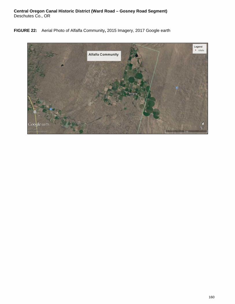
Central Oregon Canal Historic District (Ward Road – Gosney Road Segment) Deschutes Co., OR
160
FIGURE 22: Aerial Photo of Alfalfa Community, 2015 Imagery, 2017 Google earth
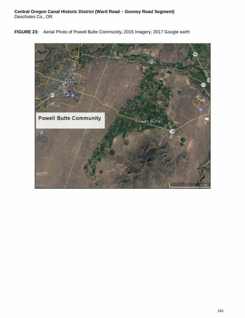
Central Oregon Canal Historic District (Ward Road – Gosney Road Segment) Deschutes Co., OR
161
FIGURE 23: Aerial Photo of Powell Butte Community, 2015 Imagery, 2017 Google earth
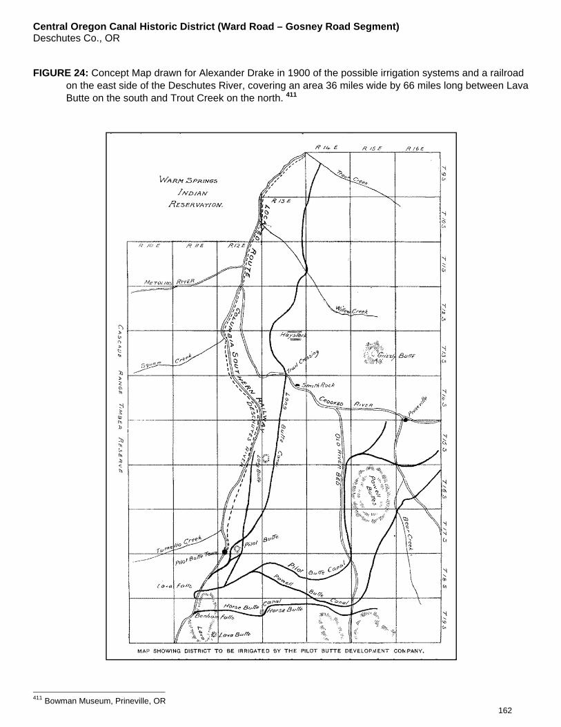
Central Oregon Canal Historic District (Ward Road – Gosney Road Segment) Deschutes Co., OR
162
FIGURE 24: Concept Map drawn for Alexander Drake in 1900 of the possible irrigation systems and a railroad on the east side of the Deschutes River, covering an area 36 miles wide by 66 miles long between Lava Butte on the south and Trout Creek on the north. 411
411 Bowman Museum, Prineville, OR
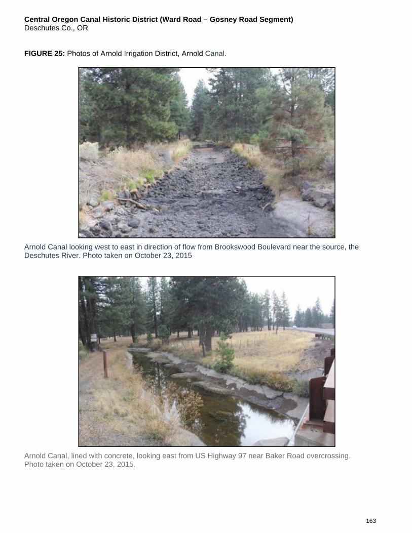
Central Oregon Canal Historic District (Ward Road – Gosney Road Segment) Deschutes Co., OR
163
FIGURE 25: Photos of Arnold Irrigation District, Arnold Canal.
Arnold Canal looking west to east in direction of flow from Brookswood Boulevard near the source, the Deschutes River. Photo taken on October 23, 2015
Arnold Canal, lined with concrete, looking east from US Highway 97 near Baker Road overcrossing. Photo taken on October 23, 2015.
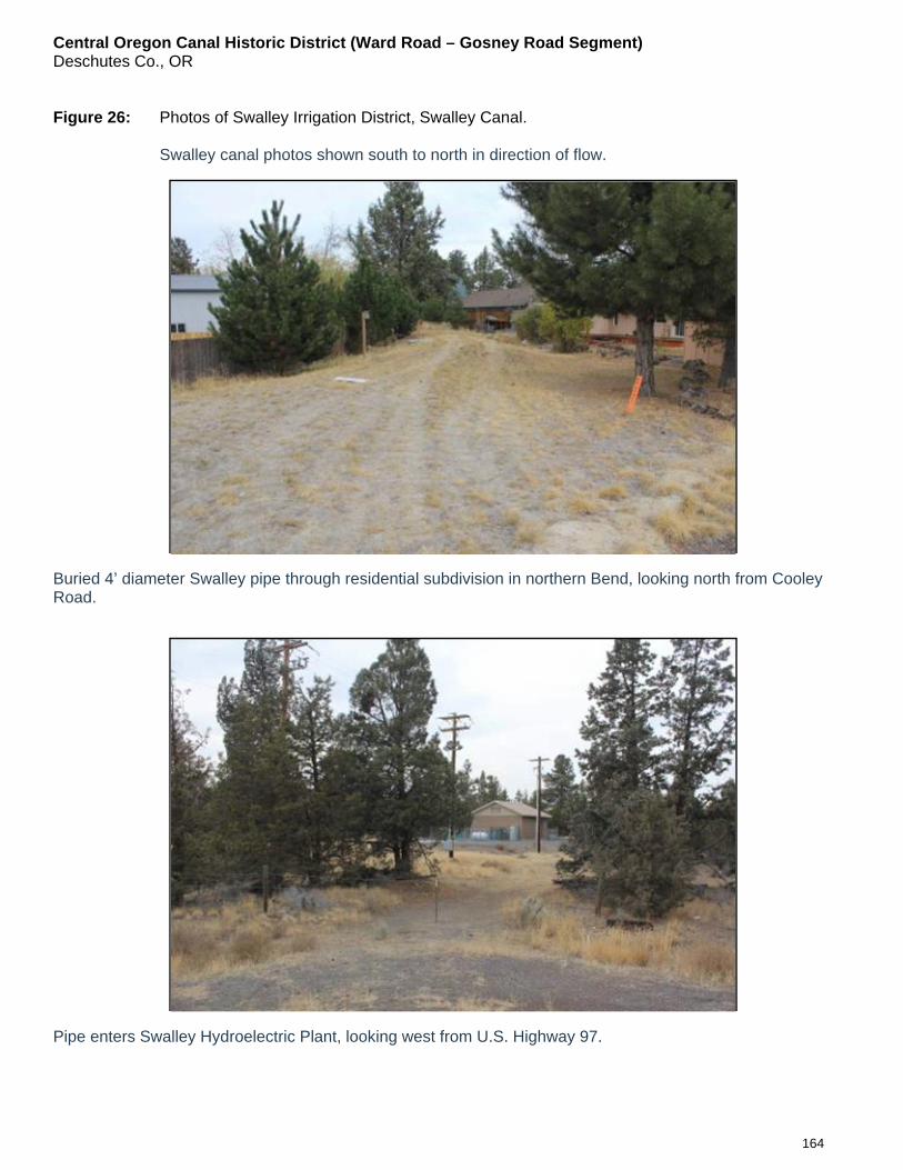
Central Oregon Canal Historic District (Ward Road – Gosney Road Segment) Deschutes Co., OR
164
Figure 26: Photos of Swalley Irrigation District, Swalley Canal.
Swalley canal photos shown south to north in direction of flow.
Buried 4’ diameter Swalley pipe through residential subdivision in northern Bend, looking north from Cooley Road.
Pipe enters Swalley Hydroelectric Plant, looking west from U.S. Highway 97.
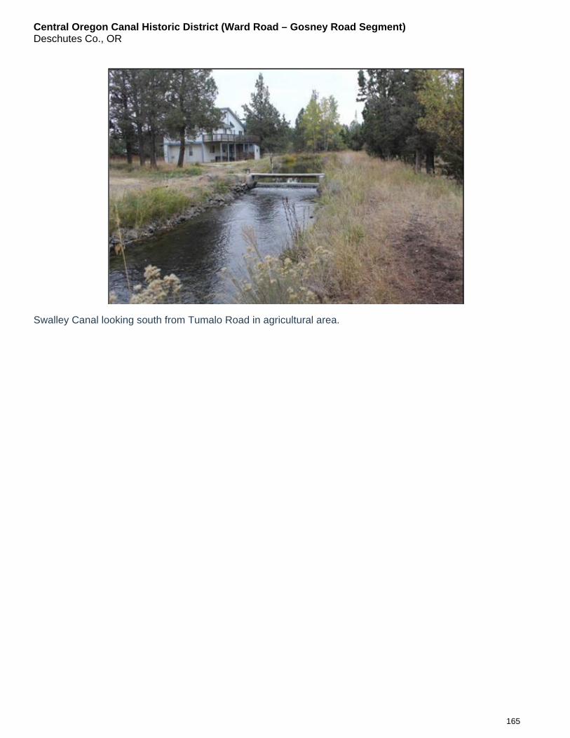
Central Oregon Canal Historic District (Ward Road – Gosney Road Segment) Deschutes Co., OR
165
Swalley Canal looking south from Tumalo Road in agricultural area.

Central Oregon Canal Historic District (Ward Road – Gosney Road Segment) Deschutes Co., OR
166
Figure 27: Photos of Tumalo Irrigation District.
Columbia Southern Feed Canal is buried in a pipe near downtown Bend. The pipe is under the pedestrian trail. The Deschutes River was the source and is seen on the right side of photo. Photo taken on October 23, 2015, looking north, in downtown Bend.
Section of the Tumalo Canal that diverts water from Tumalo Creek, buried in pipe, looking south from Buck Drive, west of Bend. Photo taken on October 23, 2015.
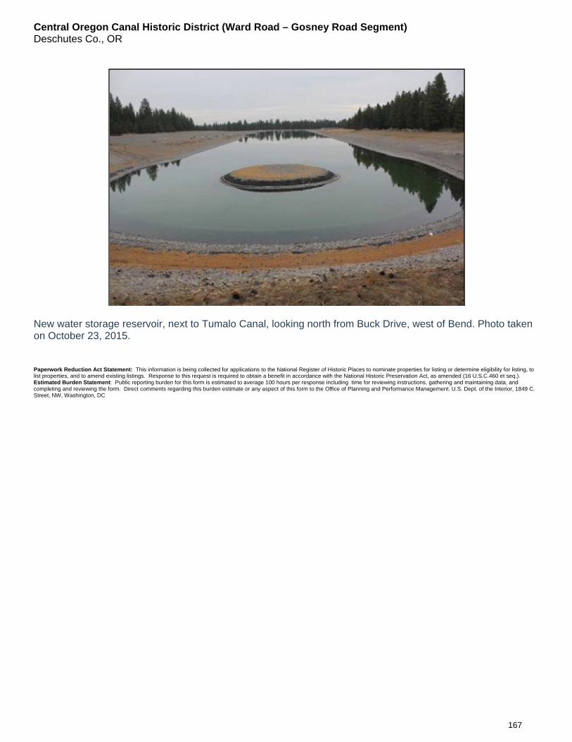
Central Oregon Canal Historic District (Ward Road – Gosney Road Segment) Deschutes Co., OR
167
New water storage reservoir, next to Tumalo Canal, looking north from Buck Drive, west of Bend. Photo taken on October 23, 2015.
Paperwork Reduction Act Statement: This information is being collected for applications to the National Register of Historic Places to nominate properties for listing or determine eligibility for listing, to list properties, and to amend existing listings. Response to this request is required to obtain a benefit in accordance with the National Historic Preservation Act, as amended (16 U.S.C.460 et seq.). Estimated Burden Statement: Public reporting burden for this form is estimated to average 100 hours per response including time for reviewing instructions, gathering and maintaining data, and completing and reviewing the form. Direct comments regarding this burden estimate or any aspect of this form to the Office of Planning and Performance Management. U.S. Dept. of the Interior, 1849 C. Street, NW, Washington, DC

Central Oregon Canal Historic District (Ward Road – Gosney Road Segment) Deschutes County, OR
168
20 PHOTOS OF THE CENTRAL OREGON CANAL HISTORIC DISTRICT (WARD ROAD TO GOSNEY ROAD SEGMENT)
Photo 1 of 20: Looking west to the Ward Road Bridge on the western boundary of the historic district.
Canal is 68’ wide and 5.’ deep at this point with a cut south side and a low berm on the north side.
Photo 2 of 20: Looking west toward west end of historic district, with Cascade Mountain peaks in the distance.
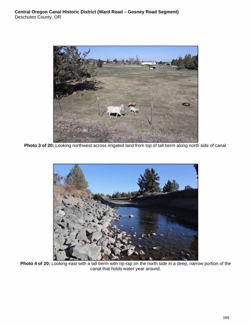
Central Oregon Canal Historic District (Ward Road – Gosney Road Segment) Deschutes County, OR
169
Photo 3 of 20: Looking northwest across irrigated land from top of tall berm along north side of canal.
Photo 4 of 20: Looking east with a tall berm with rip-rap on the north side in a deep, narrow portion of the
canal that holds water year around.

Central Oregon Canal Historic District (Ward Road – Gosney Road Segment) Deschutes County, OR
170
Photo 5 of 20: Looking north from top of berm into shared delivery gate and irrigation pond, with PVC pipe and
electric pump coming out of pond.
Photo 6 of 20: Property owners walk on ditch rider truck wheel tracks on grass covered north berm along
canal under Bonneville Power Administration power transmission poles crossing over the canal.
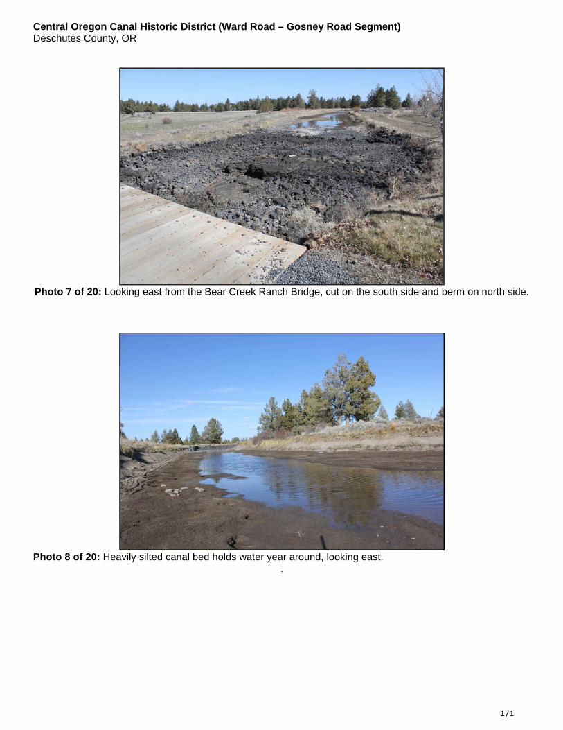
Central Oregon Canal Historic District (Ward Road – Gosney Road Segment) Deschutes County, OR
171
Photo 7 of 20: Looking east from the Bear Creek Ranch Bridge, cut on the south side and berm on north side.
Photo 8 of 20: Heavily silted canal bed holds water year around, looking east.
.

Central Oregon Canal Historic District (Ward Road – Gosney Road Segment) Deschutes County, OR
172
Photo 9 of 20: Stacked rock on the bermed north side of canal near middle of the historic district.
Photo 10 of 20: Looking east from canal bed with a cut on the south side and tall berm on the north side.
.
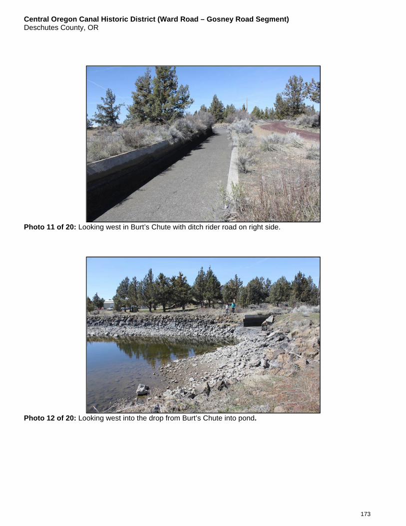
Central Oregon Canal Historic District (Ward Road – Gosney Road Segment) Deschutes County, OR
173
Photo 11 of 20: Looking west in Burt’s Chute with ditch rider road on right side.
Photo 12 of 20: Looking west into the drop from Burt’s Chute into pond.
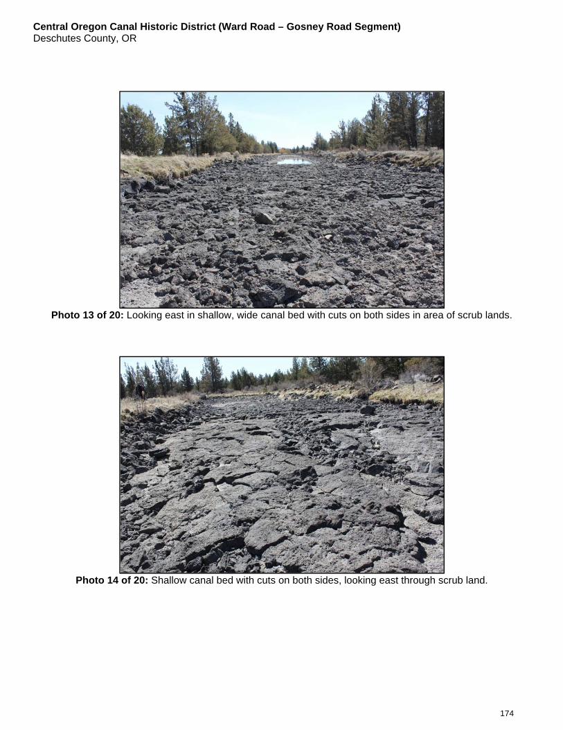
Central Oregon Canal Historic District (Ward Road – Gosney Road Segment) Deschutes County, OR
174
Photo 13 of 20: Looking east in shallow, wide canal bed with cuts on both sides in area of scrub lands.
Photo 14 of 20: Shallow canal bed with cuts on both sides, looking east through scrub land.
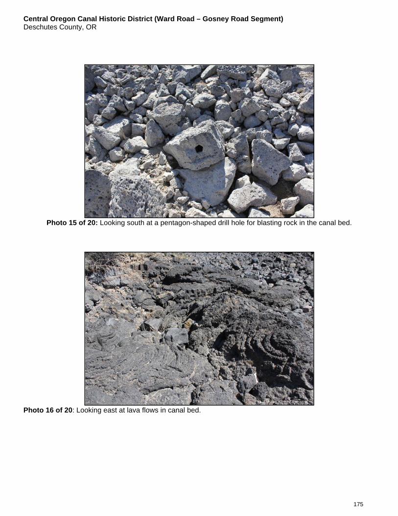
Central Oregon Canal Historic District (Ward Road – Gosney Road Segment) Deschutes County, OR
175
Photo 15 of 20: Looking south at a pentagon-shaped drill hole for blasting rock in the canal bed.
Photo 16 of 20: Looking east at lava flows in canal bed.
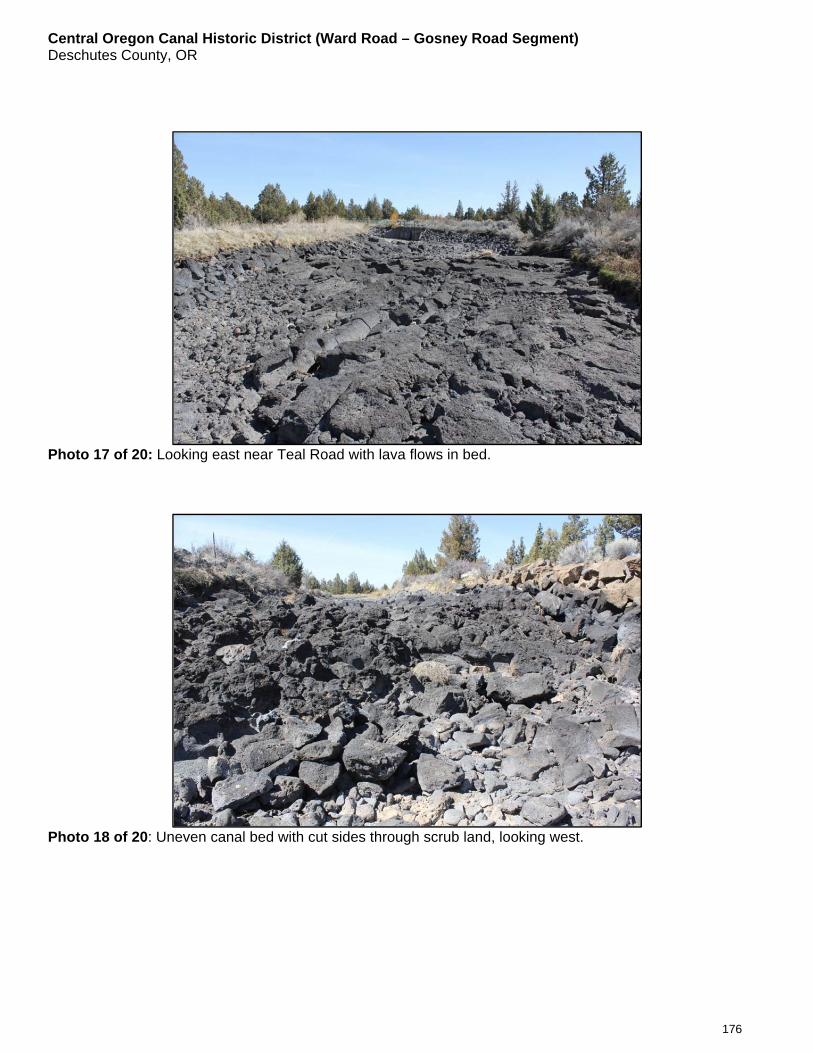
Central Oregon Canal Historic District (Ward Road – Gosney Road Segment) Deschutes County, OR
176
Photo 17 of 20: Looking east near Teal Road with lava flows in bed.
Photo 18 of 20: Uneven canal bed with cut sides through scrub land, looking west.
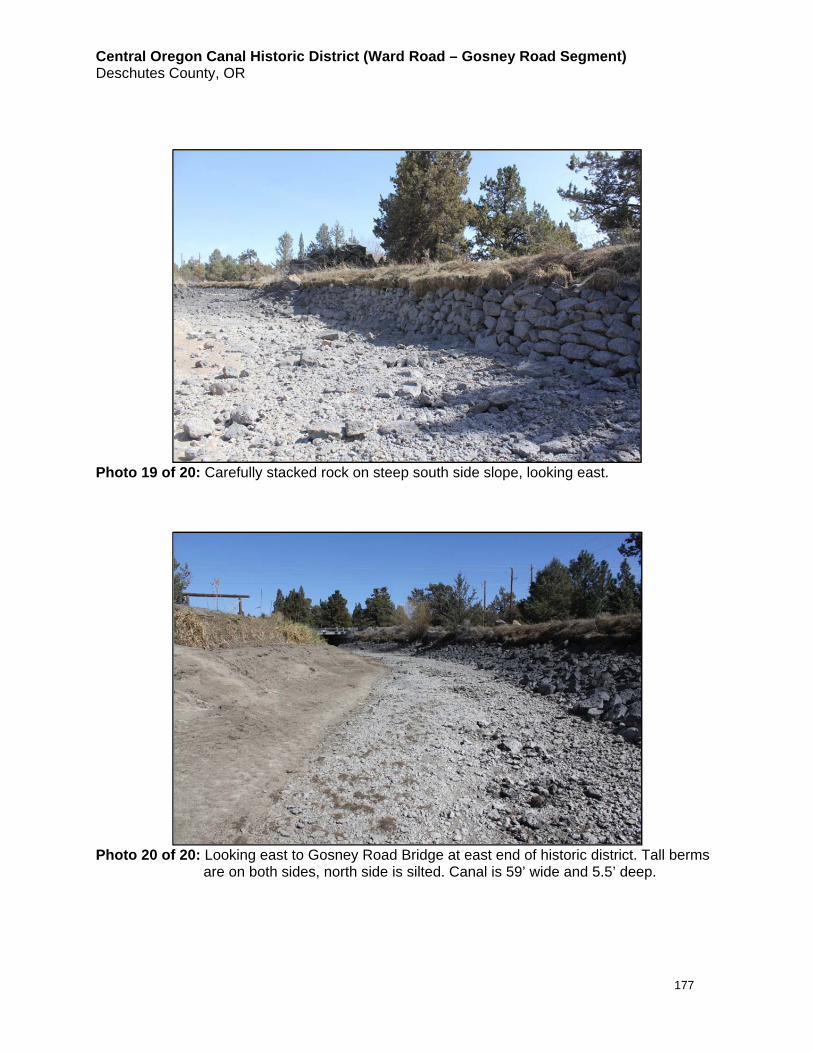
Central Oregon Canal Historic District (Ward Road – Gosney Road Segment) Deschutes County, OR
177
Photo 19 of 20: Carefully stacked rock on steep south side slope, looking east.
Photo 20 of 20: Looking east to Gosney Road Bridge at east end of historic district. Tall berms
are on both sides, north side is silted. Canal is 59’ wide and 5.5’ deep.

Central Oregon Canal Historic District (Ward Road – Gosney Road Segment) Deschutes County, OR
178
Related Documents