Unit 1: Canada, Geography and You September 2014

Unit 1: Canada, Geography and You September 2014.
Dec 24, 2015
Welcome message from author
This document is posted to help you gain knowledge. Please leave a comment to let me know what you think about it! Share it to your friends and learn new things together.
Transcript
Unit 1: Canada, Geography and You
September 2014
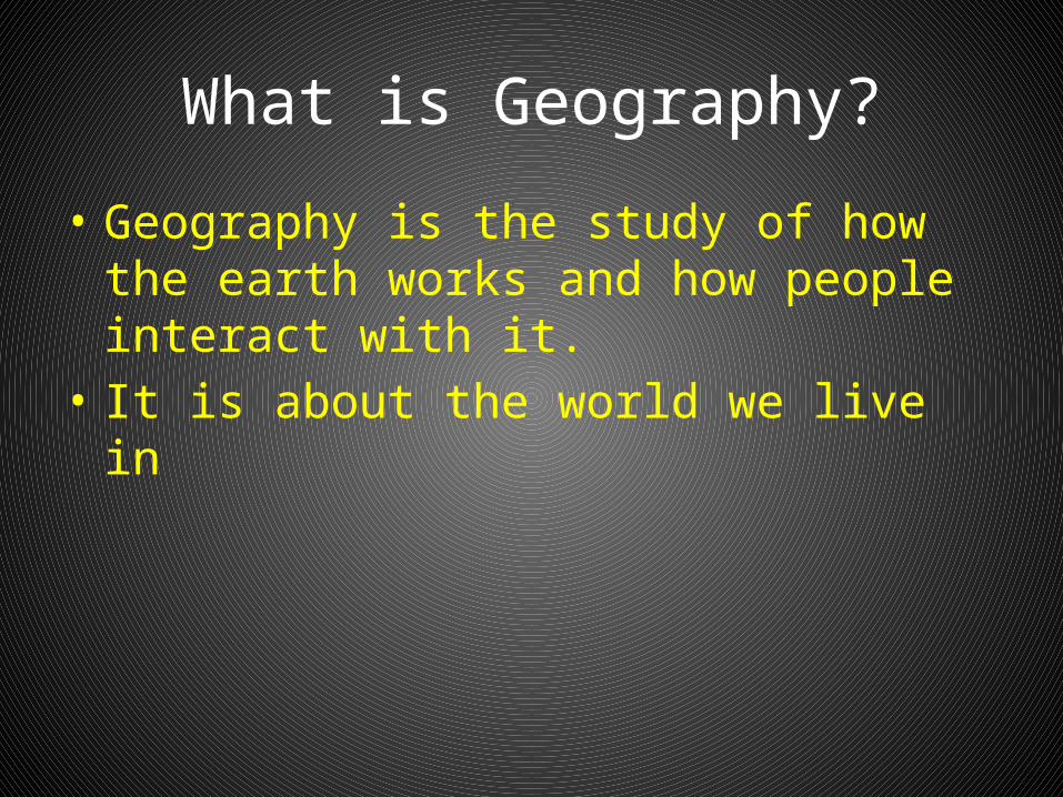
What is Geography?
• Geography is the study of how the earth works and how people interact with it.
• It is about the world we live in

Take the Challenge?
• Which country is Canada’s largest trading partner?
• Which province borders on the 4 Great Lakes?• Which highway is the longest national highway
in the world?• Name the prairie province that has an ocean
coast?• What island province is connected to the
mainland by a 13 km bridge?
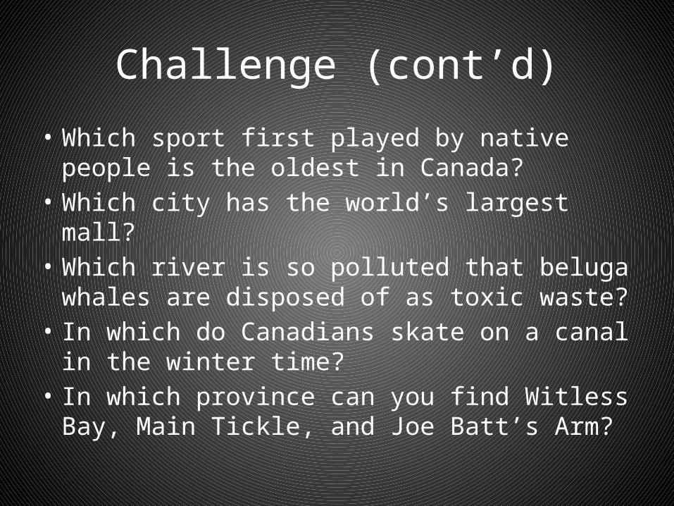
Challenge (cont’d)
• Which sport first played by native people is the oldest in Canada?
• Which city has the world’s largest mall?• Which river is so polluted that beluga whales
are disposed of as toxic waste?• In which do Canadians skate on a canal in the
winter time?• In which province can you find Witless Bay,
Main Tickle, and Joe Batt’s Arm?

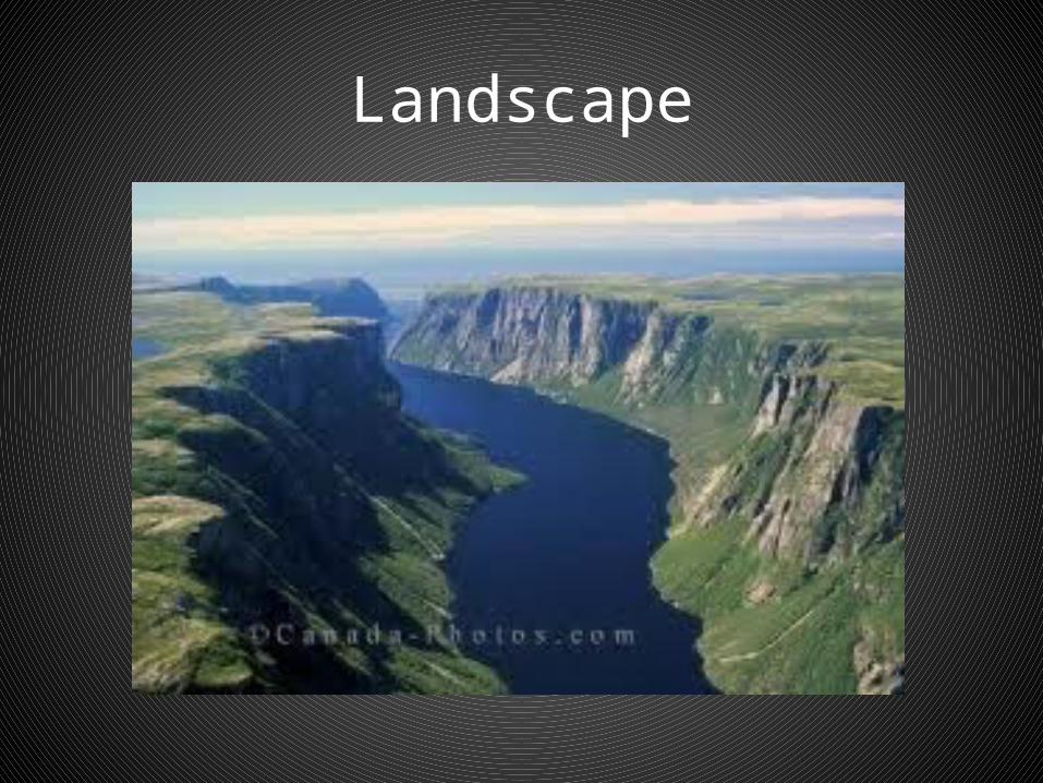
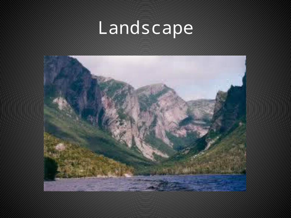
Canada’s Places
• What does landscape mean?• Landscape refers to the natural features
(mountains, rivers) and human features (farmers fields, buildings) that you can see in an area
• How would you describe Canada’s landscape?• Look at the images on pp.2-5
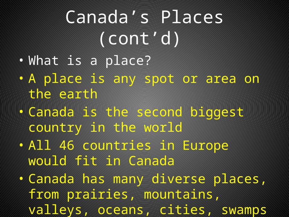
Canada’s Places (cont’d)
• What is a place?• A place is any spot or area on the earth• Canada is the second biggest country in the
world• All 46 countries in Europe would fit in Canada• Canada has many diverse places, from
prairies, mountains, valleys, oceans, cities, swamps
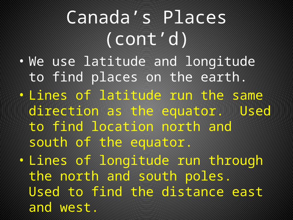
Canada’s Places (cont’d)
• We use latitude and longitude to find places on the earth.
• Lines of latitude run the same direction as the equator. Used to find location north and south of the equator.
• Lines of longitude run through the north and south poles. Used to find the distance east and west.

To Finish Up!
• Any questions?• Read pp 2-9
• Have a great weekend!
Canadian Landforms
• Mountains: Areas of high relief with elevations higher than 300-600 metres. Most occur in long linear chains called ranges. Located along the edges of continents
• Plains: A level tract of land. Found along coastal areas or lower elevations. Very gentle slope and no relief of 30 m or more
• Plateaus: An extensive, flat upland area, often found on the top of mountains. Raised upwards
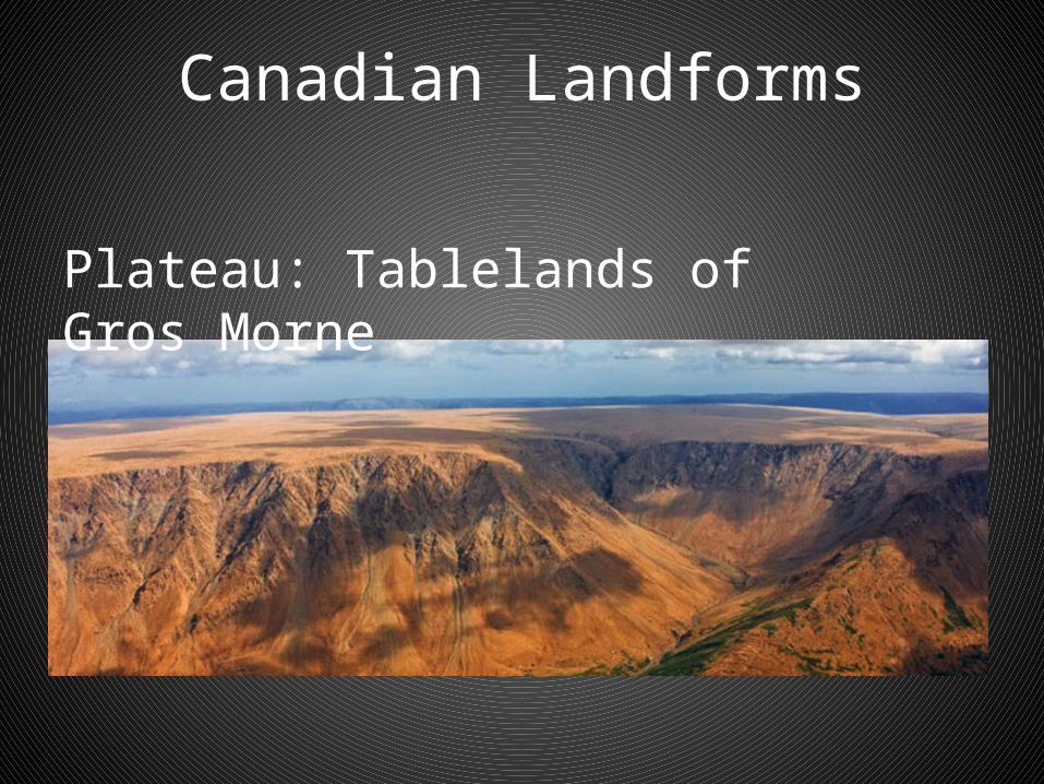
Canadian Landforms
Plateau: Tablelands of Gros Morne
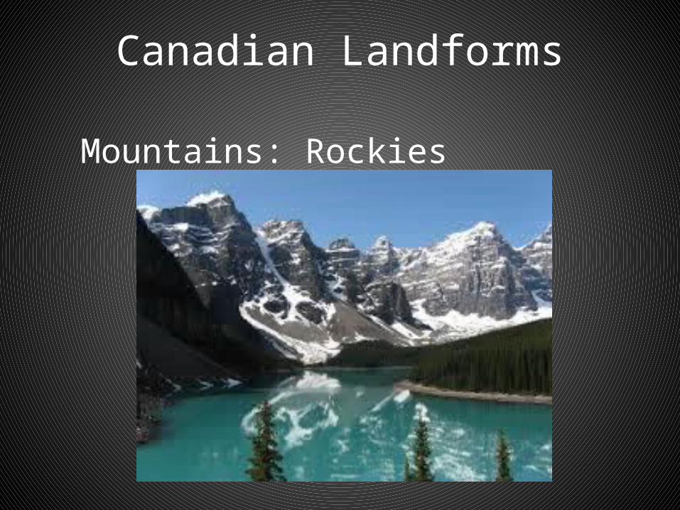
Canadian Landforms
Mountains: Rockies

Canadian Landforms
Plains:
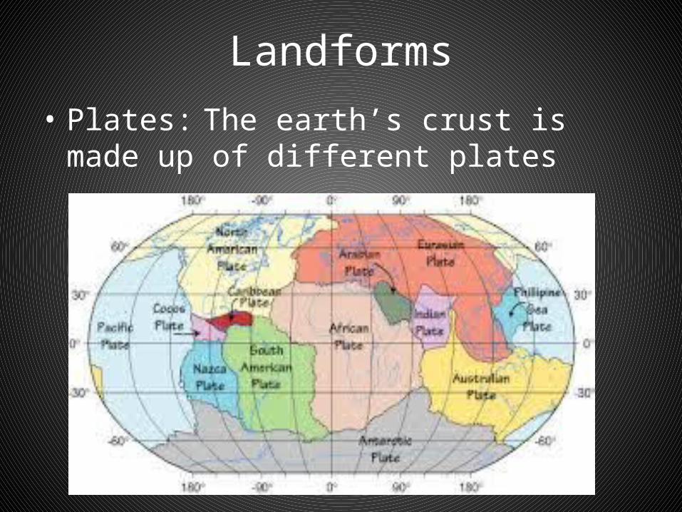
Landforms• Plates: The earth’s crust is made up of
different plates

Landforms
• Plateaus (cont’d): by movements of the earth’s crust. Often found in the interior of continents. Deeply eroded by stream valleys and often have more rugged appearances

Landforms
• Plate Tectonics: Movement of the earth’s plates. Both compressional and stretching forces
• Compression Stretching
Landform Processes
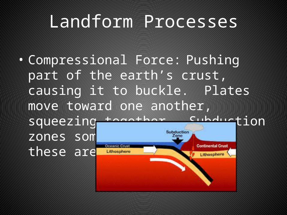
• Compressional Force: Pushing part of the earth’s crust, causing it to buckle. Plates move toward one another, squeezing together. Subduction zones sometimes form along these areas
Landforms
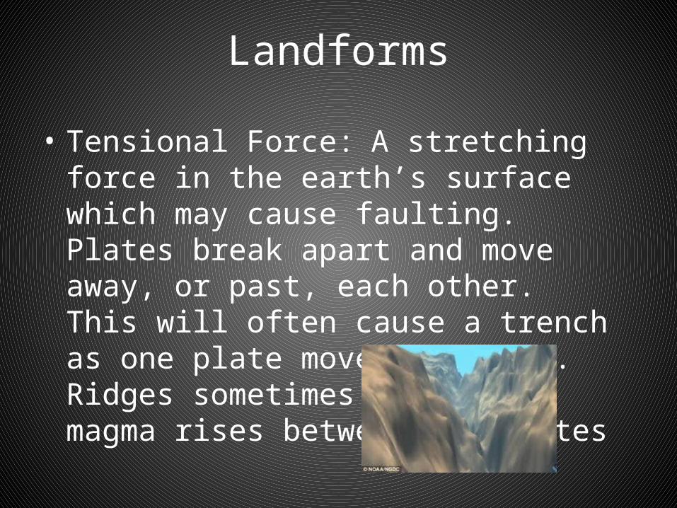
• Tensional Force: A stretching force in the earth’s surface which may cause faulting. Plates break apart and move away, or past, each other. This will often cause a trench as one plate moves downward. Ridges sometimes form a the magma rises between the plates
Building the Landscape
• Two kinds of forces are at work:– Building-up (Mountain building) – Wearing down (Erosion and weathering)
Building Mountains
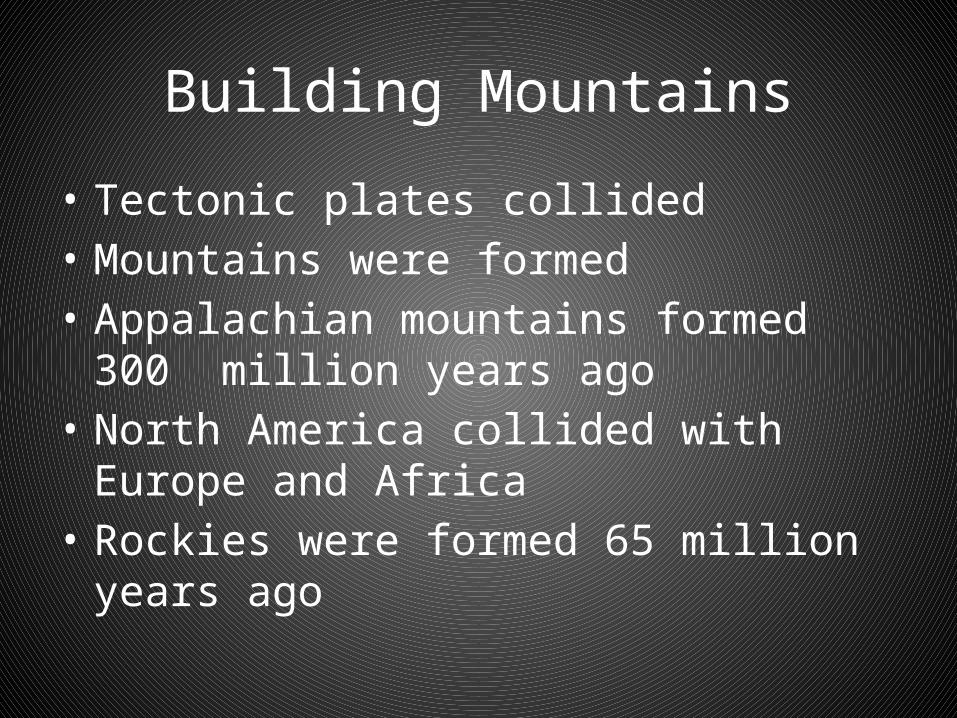
Building Mountains
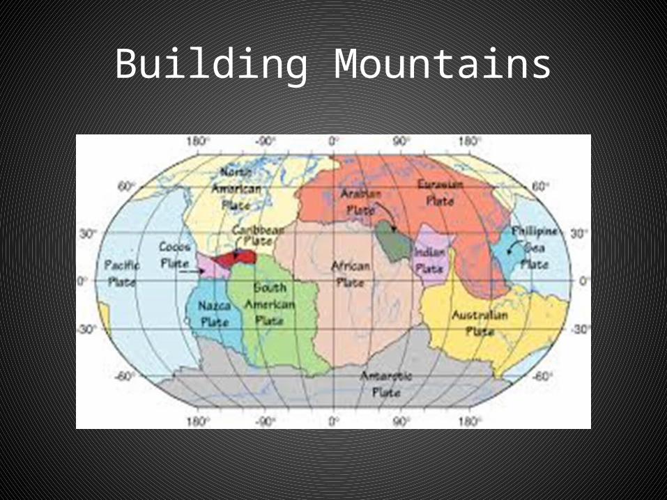
• Tectonic plates collided• Mountains were formed• Appalachian mountains formed 300 million
years ago• North America collided with Europe and Africa• Rockies were formed 65 million years ago
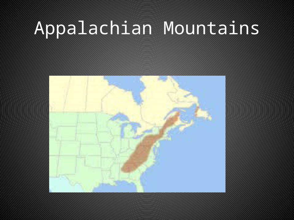
Appalachian Mountains

Appalachian Mountains

Rocky Mountains
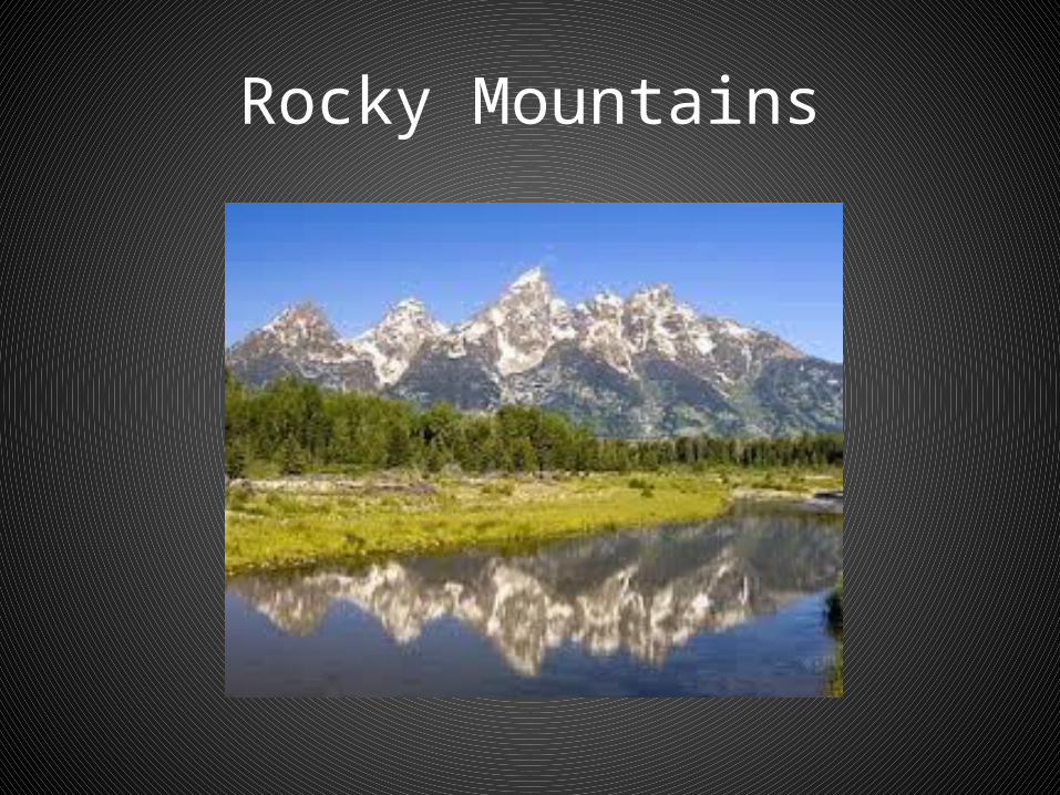
Rocky Mountains
Building the Landscape
• Wearing down: The Power of Ice• Glaciers eroding landscape and deposited soil,
gravel and trees• Scraped holes and left bare rock• Created valleys and fiords• 20,000 years ago
Landscape
Landscape

Landscape - Weathering
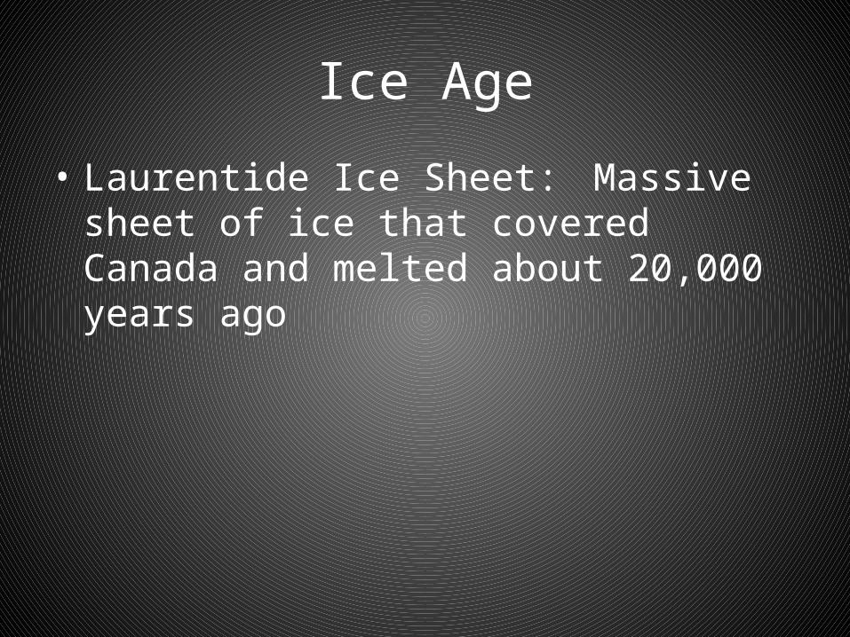
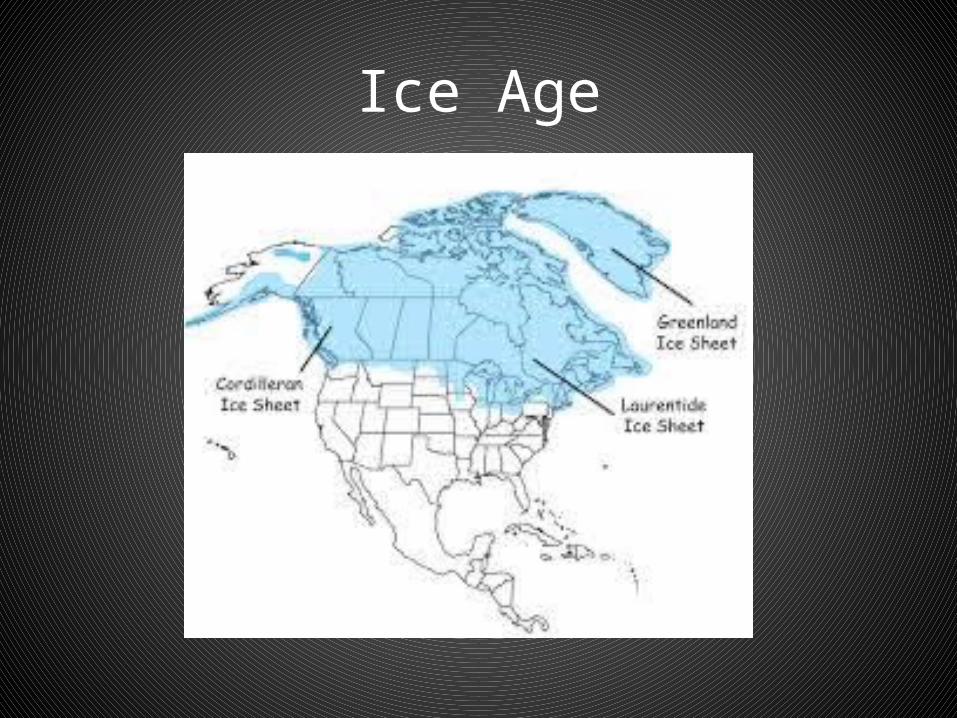
Ice Age
• Laurentide Ice Sheet: Massive sheet of ice that covered Canada and melted about 20,000 years ago
Ice Age
Earth’s Building Blocks - Rocks
• Rocks: the building blocks of earth. Made up of different kinds of minerals, calcium, granite, gold, copper and so on
• Grouped based how they were formed
Rocks
• Igneous:– Contain iron, copper, zinc and gold– Form when magma cools and solidifies under the
earth– Large interlocking crystals form– Examples include granite and quartz
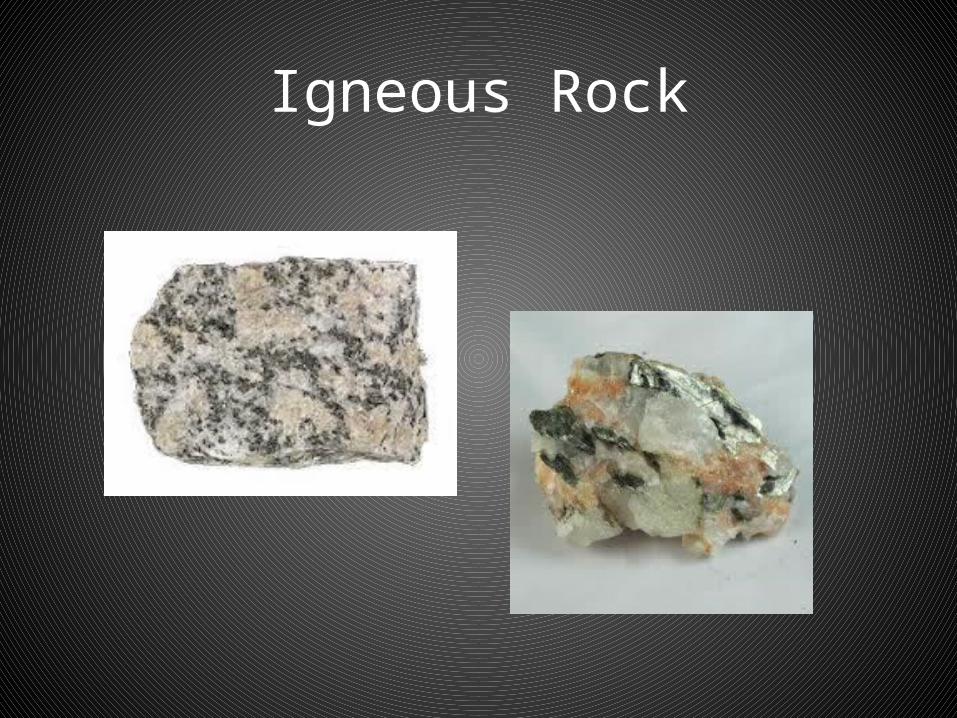
Igneous Rock
Sedimentary Rock
• Sedimentary– Form when grains of sand are carried away by
water and wind– Laid down in layers– Mixed together– Compress and harden– Mixed with organic matter and fossils– Contain deposits of fossil fuels such as coal, oil and
natural gas
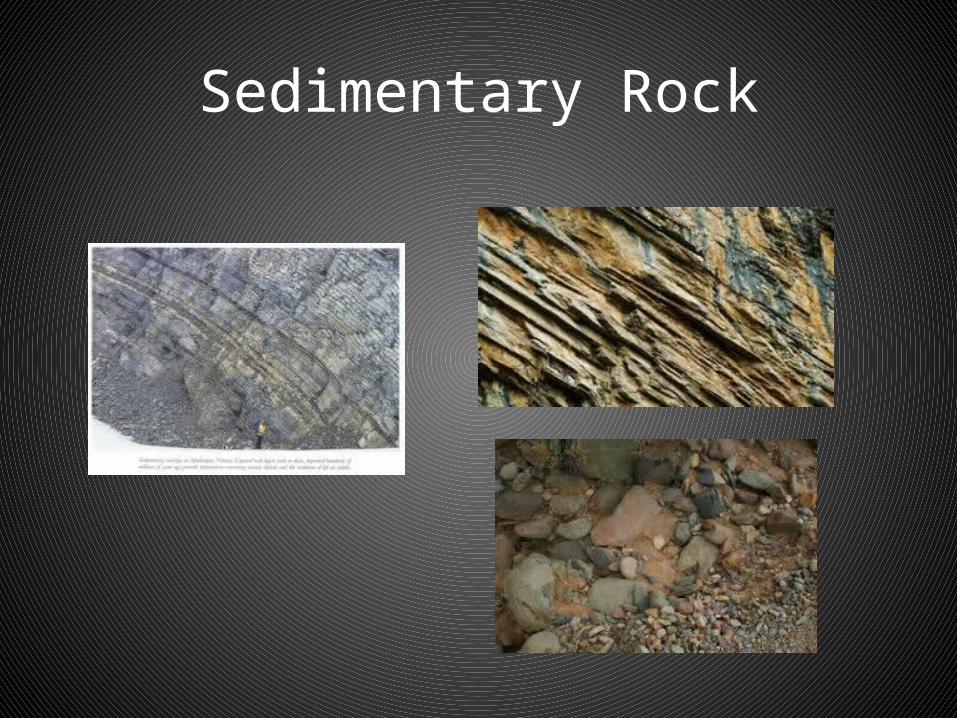
Sedimentary Rock
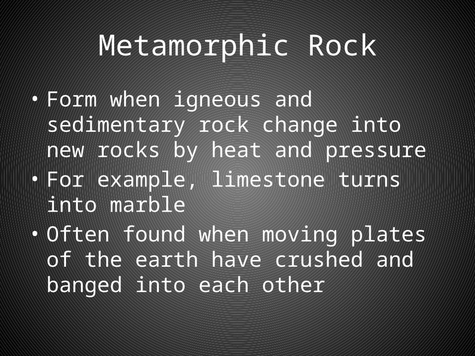
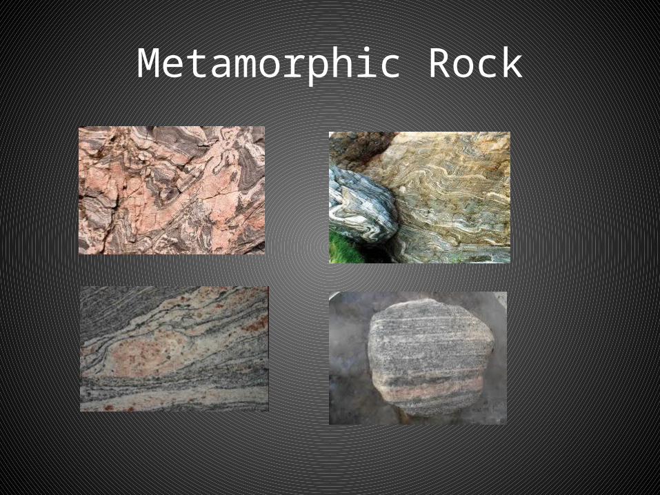
Metamorphic Rock
• Form when igneous and sedimentary rock change into new rocks by heat and pressure
• For example, limestone turns into marble• Often found when moving plates of the earth
have crushed and banged into each other
Metamorphic Rock
Terms
• Relative Location: Location in comparison to another point on the map. Tells us how places are connected
• Absolute Location: Using lines of latitude to find a place on a map
Questions
• Activate your Learning Page 9• Do questions 1-4• 1. a) Two symbols best represent
Canadab) Explain why
2. Local topography outside home or school3. Relative and absolute location4. a) Location follows line of latitude
b) Provinces south
Review Questions
• 1. a) Themes: Sports (hockey, lacrosse, baseball, animals (moose, beaver), products (maple moose)
• 1. b) Ideas things Canadians are proud of
• 2. Should include things that relate to plants, animals, landforms, soils and climate
• 3. Relative location should relate community to another natural or human feature
• 4. a) Canada’s border along the 49th parallel with the US
• 4. b) The provinces are BC, Ontario, Quebec, NB, PEI and NS
What is Geography?
• Geography is the study of how the earth works and how people interact with their earthly home. Since geography is about the world that you live in, it is all about you.
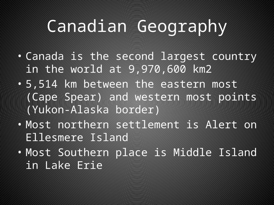
Canadian Geography
• Canada is the second largest country in the world at 9,970,600 km2
• 5,514 km between the eastern most (Cape Spear) and western most points (Yukon-Alaska border)
• Most northern settlement is Alert on Ellesmere Island
• Most Southern place is Middle Island in Lake Erie
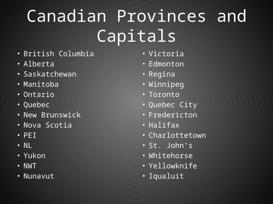
Canadian Provinces and Capitals• British Columbia• Alberta• Saskatchewan• Manitoba• Ontario• Quebec• New Brunswick• Nova Scotia• PEI• NL• Yukon• NWT• Nunavut
• Victoria• Edmonton• Regina• Winnipeg• Toronto• Quebec City• Fredericton• Halifax• Charlottetown• St. John’s• Whitehorse• Yellowknife• Iqualuit

Why Study Geography?
• You use geography for things such as: • 1. Determining your route to a particular place.• 2. Deciding where to shop or go on vacation.• 3. Understanding current events.• 4. Learning about your country.• 5. Learning about controversial issues that affect Canada.• 6. We can prepare for these events so that there are fewer
lives lost and less damage.• 7. Help us manage our resources in a sustainable way to be
used for future generations.
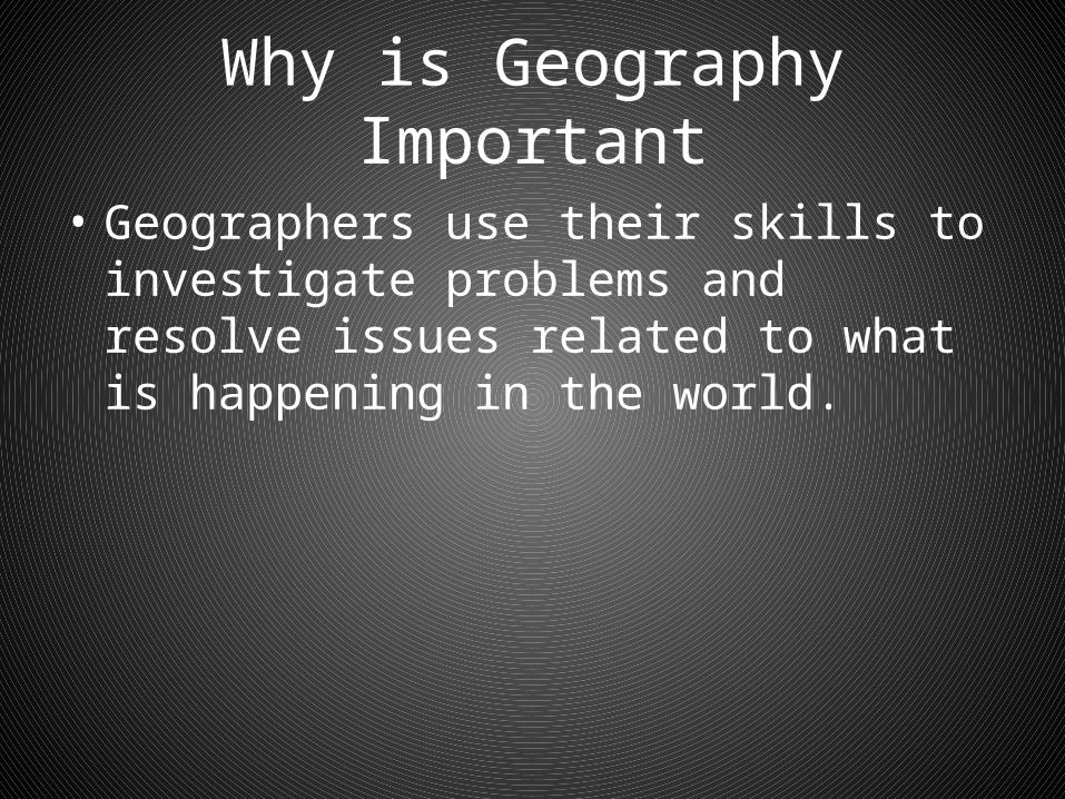
Why is Geography Important
• Geographers use their skills to investigate problems and resolve issues related to what is happening in the world.
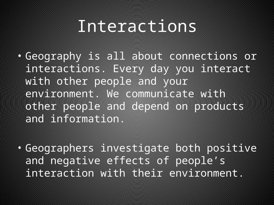
Interactions
• Geography is all about connections or interactions. Every day you interact with other people and your environment. We communicate with other people and depend on products and information.
• Geographers investigate both positive and negative effects of people’s interaction with their environment.

Interactions (cont’d)
• Three types of interactions include:• a. Nature having an impact on people.• b. People having an impact on their
environment.• c. People’s actions affecting other people.

What can Geography Teach us?
• 1. Where natural features, human features, people, and species are located
• 2. Why they are located there• 3. The imprints (effects) and patterns made by
these features• 4. The economic, environmental, and social
consequences of changes to the environment• 5. Geography can help you improve your spatial
skills.

Political Boundaries
• Two types:• 1. Natural Boundaries: Take the form of mountains,
rivers, lakes, or seas. i.e. Physical features (Rocky Mountains) separate BC and Alberta, and the Cabot Strait separate Nova Scotia and Newfoundland
• 2. Artificial (human) Boundaries: These boundaries are not established by any physical features. i.e. 49oN USA and Canada
Weather and Seasons
• The Earth and the angle of sunlight have a huge impact on our weather and climate!
• Earth tilts on its axis 23.5 degree• As the Earth tilts towards the sun, more heat
is absorbed because the angle of sunlight is more direct.
• And vice versa...
Weather and Seasons
• http://www.youtube.com/watch?v=ip0LRTIgj0M

Weather and Seasons
• Seasons are determined by the position of the Earth in its ORBIT as it revolves around the sun (average distance 93 000 000 miles).
• The Earth takes 365.25 days to revolve around the sun once = one year.
• Every four years we have a “leap year” on Feb 29th.
Equinoxes
• The equinoxes: Occur when the suns rays directly strike the Earth’s surface at the equator.
• Daylight and night are of equal length.• Vernal equinox (northern spring) begins
March 21.• Autumnal equinox (northern fall) begins
September 23.

Solstices
The summer solstice:• Sun is over the Tropic of Cancer -• Sun’s rays hit us most directly now.• Northern summer begins around June 21, the
longest day of the year.
• The winter solstice:• Sun is over the Tropic of Capricorn - sun’s rays
hit us at a steep angle now.• Northern winter begins around December 21,
the shortest day of the year.
• Earth’s Rotation:• If you were looking down at the Earth from
the North pole, the Earth is spinning counterclockwise.
• One complete rotation of the Earth takes 24 hours (1 day,1 night).

Finding your Way Around
• The world is divided into 4 hemispheres:• 1. Northern• 2. Southern• 3. Eastern• 4. Western
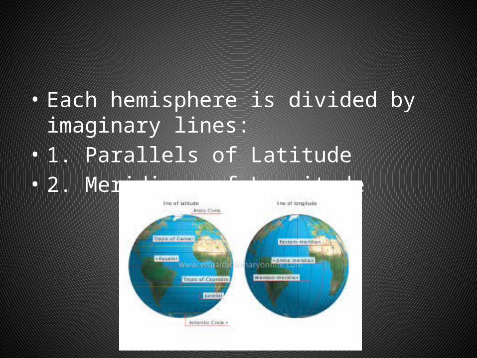
• Each hemisphere is divided by imaginary lines:• 1. Parallels of Latitude• 2. Meridians of Longitude

Parallels of Latitude
1. Parallels of Latitude
• Lines of latitude run horizontally around the earth and are measured in degrees from north to south.
• These parallels of latitude indicate the angle created by the equator and the earth’s axis.
• They are called parallels because they are always the same distance apart and they never meet.
Parallels of Latitude
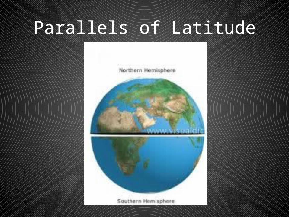
• The Equator is labeled 0o since it does not make an angle with itself.
• Places north of the Equator – Northern Hemisphere
• Places south of the Equator – Southern Hemisphere
Parallels of Latitude
1. Parallels of Latitude
• The highest measurement of latitude is either 90oN or 90oS.
• - We read 75* 63N latitude as 75 degrees, 63 minutes north latitude.
• - Each parallel is 1o = 111 km on the earth’s surface.
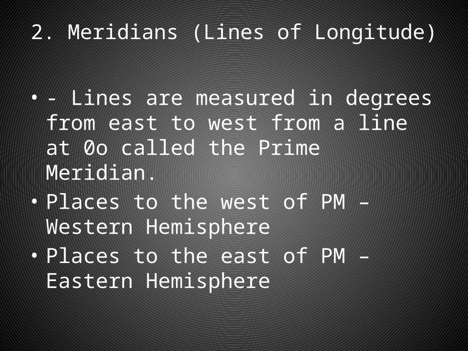
2. Meridians (Lines of Longitude)
• Drawn from north to south and unlike parallels, the lines of longitude all meet at the poles.
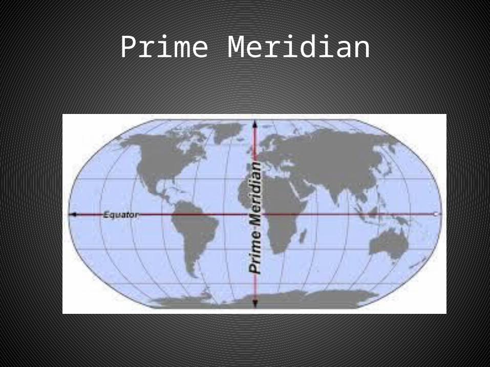
• Longitude – Imaginary vertical lines drawn between the poles showing positions measured in degrees, minutes and seconds, east and west from the Prime Meridian.
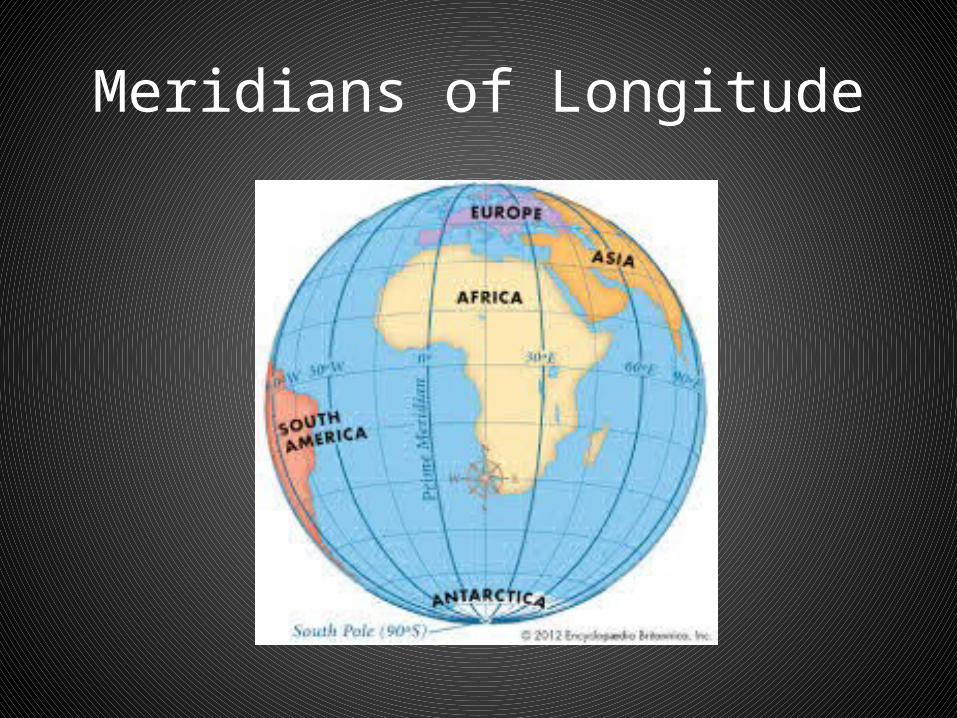
Meridians of Longitude
2. Meridians (Lines of Longitude)
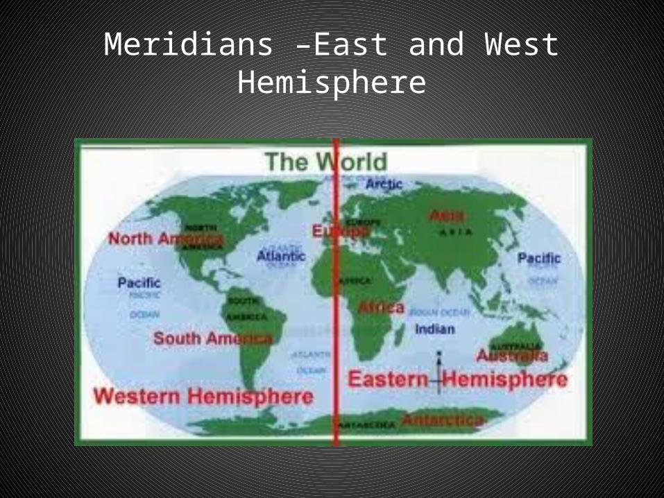
• - Lines are measured in degrees from east to west from a line at 0o called the Prime Meridian.
• Places to the west of PM – Western Hemisphere
• Places to the east of PM – Eastern Hemisphere
Prime Meridian
Meridians –East and West Hemisphere
Latitude and Longitude:
• Latitude and longitude make it possible to locate any place in the world.
• When giving a position, the degree of latitude is given first, followed by the degree of longitude. Example: Ottawa – located at 45oN 75oW.
2. Meridians (Lines of Longitude)
• Co-coordinates: Points on a map using lines of latitude and longitude
Video –Parallels of Latitude and Meridians of Longitude
• http://www.youtube.com/watch?v=swKBi6hHHMA
Questions
• 1. What are the advantages of using absolute location? Relative location?
• 2. What are the differences between the equator and the prime meridian?
• 1. What are the advantages of using absolute location? Relative location?
• Absolute location: Pinpoint exact location. Not open to interpretation or confusion
• Relative location: Can be gained quickly. Without technology
• 2. What are the differences between the equator and the prime meridian?
• Equator: East and west. Divide earth into northern and southern hemipshere
• Prime Meridian: Run north and south. Lines meet at the north and south poles
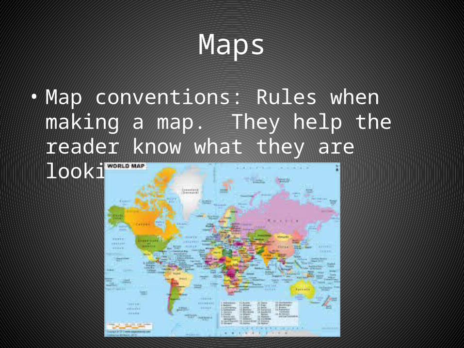
Maps
• Map conventions: Rules when making a map. They help the reader know what they are looking at on the map
• Map conventions usually include; • 1. A title• 2. Legend• 3. Direction• 4. Scale• 5. Date• 6. Mapmaker
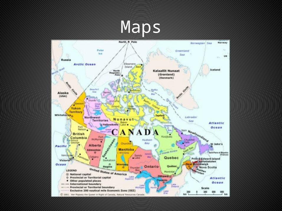
Maps
Types of Maps
• 1. Topographic• 2. Climate• 3. Economic• 4. Physical• 5. Political• 6. Road

1. Topographic Maps
• Show the distribution of natural and human features on Earth.
• Reveal relief profile shows height• Use contour lines to show differences in
elevation.
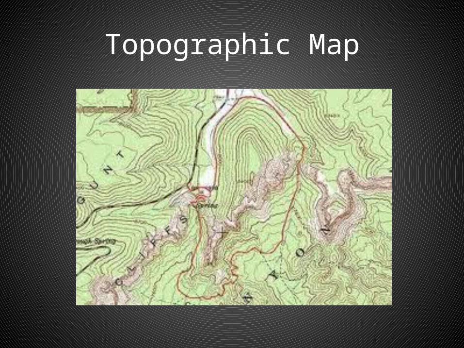
Topographic Map

1. Topographic Maps
• They are used to:• a. Find distance on road trips• b. Locate a suitable route (i.e. hikers)• c. Find the best way to control floods or forest
fire• d. Resolve environmental issues• e. Where to build a new housing development
2. Climate Maps
• Climate maps: give general information about the climate and precipitation (rain and snow) of a region.
• Cartographers, or mapmakers, use colors to show different climate or precipitation zones.
3. Economic Maps
• Economic maps: feature the type of natural resources or economic activity that dominates an area.
• Cartographers use symbols to show the locations of natural resources or economic activities. For example, oranges on a map of Florida tell you that oranges are grown there.

4. Physical Maps
• Physical maps: illustrate the physical features of an area, such as the mountains, rivers and lakes. The water is usually shown in blue. Colors are used to show relief—differences in land elevations. Green is typically used at lower elevations, and orange or brown indicate higher elevations.
5. Political Maps
• Political maps do not show physical features. Instead, they indicate state and national boundaries and capital and major cities. A capital city is usually marked with a star within a circle.
6. Road Maps
• Road maps show major—some minor highways—and roads, airports, railroad tracks, cities and other points of interest in an area. People use road maps to plan trips and for driving directions.
Related Documents