A.P. Pradeepkumar, F.-J. Behr, F.T. Illiyas and E. Shaji 2014 Proc. 2nd Disaster, Risk and Vulnerability Conference 2014 (DRVC2014) 24-26 April 2014 Dept of Geology, Uni Kerala, Trivandrum, India pp57-64 ISBN 9788192344928 1 UNDERSTANDING THE CAUSES OF UTTARAKHAND DISASTER OF JUNE 2013: A SCIENTIFIC REVIEW Aravind S Nair and S.K.Singh Department of Geology, University of Delhi, New Delhi 110 007, India Email: [email protected], [email protected] Mobile: +918860775202 Abstract India often faces natural calamities like earth quakes, landslides, floods, cyclones and drought occurring fairly frequently in different parts of the country. At times, the same area is subjected to one or more of these disasters situation in successive seasons or years. While not all natural calamities can be predicted and prevented, a state of preparedness and ability to respond quickly to a natural calamity can considerably mitigate loss of life and property and the human suffering and restore normalcy at the earliest. Hence it is important for a detailed study and analysis of each disaster. Against this background, this paper reviews the different possible causes behind the Uttarakhand Disaster of 15-17 th June 2013 in detail. Uttarakhand district lies on the southern slope of the Himalayan range. The climate and vegetation vary greatly with elevation, from glaciers at the highest elevations to subtropical forests at the lower elevations. The district, in general, is prone to different disasters and the order of severity of damage are; earthquakes, excessive rains and cloud bursts, landslides, floods, forest fires and hailstorms. However, there have been numerous debates and controversies ever since the flash floods hit the state of Uttarakhand in June 2013. This has been one of the worst Himalayan tragedies in recent years in which the actual number of people buried or perished is not known as thousands are still missing. The entire Rambara, a large part of Gaurikund and many villages of Mandakini valley were also fully wiped out. Government sources have reported large number of deaths including missing of over ~5000 people in the wake of the devastating flooding. The death toll of 5,748 tops India's previous record worst monsoon flood death toll of 4892 set in July 1968 in Rajasthan and Gujarat provinces. The fact remains the same that the torrential rains triggered a massive landslide that hit Uttarakhand's Hindu shrine in Kedarnath, which lies just a short distance from the snout of two mountain glaciers. From 15 to 17 June 2013, the Indian state of Uttarakhand and adjoining area received heavy rainfall, which was about 375% more than the benchmark rainfall during a normal monsoon. This might have caused the melting of Chorabari Glacier at the height of 3800 metres, and eruption of the Mandakini River which led to heavy floods near Gobindghat, Kedar Dome, Rudraprayag district, Uttarakhand, Himachal Pradesh and Western Nepal, and acute rainfall in other nearby regions of Delhi, Haryana, Uttar Pradesh and some adjoining areas. It has been reported that the complete destruction of Mandakini River in Kedarnath on 16 th and 17 th June 2013 which resulted in large number of casualties especially among the floating population of pilgrims could have been avoided, if some regulations was in place to counter the mushrooming of different types of dwelling places in Kedarnath. In this context, it is important to understand torrential rain induced geodynamic processes of flash flood resulting rock falls and debris flow, Chorabari lake collapse and deposition of glacial material. This paper review the different scientific studies that have emerged during the last six months emphasizing Meteorological, Geological, Anthropogenic and other causes that lead to this catastrophic disaster.

Welcome message from author
This document is posted to help you gain knowledge. Please leave a comment to let me know what you think about it! Share it to your friends and learn new things together.
Transcript
A.P. Pradeepkumar, F.-J. Behr, F.T. Illiyas and E. Shaji 2014 Proc. 2nd Disaster, Risk and Vulnerability Conference 2014 (DRVC2014) 24-26 April 2014 Dept ofGeology, Uni Kerala, Trivandrum, India pp57-64 ISBN 9788192344928 1
UNDERSTANDING THE CAUSES OF UTTARAKHANDDISASTER OF JUNE 2013: A SCIENTIFIC REVIEW
Aravind S Nair and S.K.SinghDepartment of Geology, University of Delhi, New Delhi 110 007, India
Email: [email protected], [email protected]: +918860775202
Abstract
India often faces natural calamities like earth quakes, landslides, floods, cyclones and droughtoccurring fairly frequently indifferent parts of the country. At times, the same area is subjected to one or more of these disasterssituation in successiveseasons or years. While not all natural calamities can be predicted and prevented, a state ofpreparedness and ability torespond quickly to a natural calamity can considerably mitigate loss of life and property and the humansuffering and restorenormalcy at the earliest. Hence it is important for a detailed study and analysis of each disaster.Against this background, thispaper reviews the different possible causes behind the Uttarakhand Disaster of 15-17th June 2013 indetail. Uttarakhanddistrict lies on the southern slope of the Himalayan range. The climate and vegetation vary greatlywith elevation, fromglaciers at the highest elevations to subtropical forests at the lower elevations. The district, ingeneral, is prone to differentdisasters and the order of severity of damage are; earthquakes, excessive rains and cloud bursts,landslides, floods, forest firesand hailstorms. However, there have been numerous debates and controversies ever since the flash floodshit the state ofUttarakhand in June 2013. This has been one of the worst Himalayan tragedies in recent years in whichthe actual number ofpeople buried or perished is not known as thousands are still missing. The entire Rambara, a large partof Gaurikund andmany villages of Mandakini valley were also fully wiped out. Government sources have reported largenumber of deathsincluding missing of over ~5000 people in the wake of the devastating flooding. The death toll of 5,748tops India's previousrecord worst monsoon flood death toll of 4892 set in July 1968 in Rajasthan and Gujarat provinces. Thefact remains thesame that the torrential rains triggered a massive landslide that hit Uttarakhand's Hindu shrine inKedarnath, which lies justa short distance from the snout of two mountain glaciers. From 15 to 17 June 2013, the Indian state ofUttarakhand andadjoining area received heavy rainfall, which was about 375% more than the benchmark rainfall during anormal monsoon.This might have caused the melting of Chorabari Glacier at the height of 3800 metres, and eruption ofthe Mandakini Riverwhich led to heavy floods near Gobindghat, Kedar Dome, Rudraprayag district, Uttarakhand, HimachalPradesh and WesternNepal, and acute rainfall in other nearby regions of Delhi, Haryana, Uttar Pradesh and some adjoiningareas. It has beenreported that the complete destruction of Mandakini River in Kedarnath on 16th and 17th June 2013 whichresulted in largenumber of casualties especially among the floating population of pilgrims could have been avoided, ifsome regulations was inplace to counter the mushrooming of different types of dwelling places in Kedarnath. In this context,it is important tounderstand torrential rain induced geodynamic processes of flash flood resulting rock falls and debrisflow, Chorabari lakecollapse and deposition of glacial material. This paper review the different scientific studies thathave emerged during the lastsix months emphasizing Meteorological, Geological, Anthropogenic and other causes that lead to thiscatastrophic disaster.

A.P. Pradeepkumar, F.-J. Behr, F.T. Illiyas and E. Shaji 2014 Proc. 2nd Disaster, Risk and Vulnerability Conference 2014 (DRVC2014) 24-26 April 2014 Dept ofGeology, Uni Kerala, Trivandrum, India pp57-64 ISBN 9788192344928 2
IntroductionNatural disasters are events of the Nature which cause sudden disruptions to the normal life ofthe community. Iteventually cause damage to the lives and property to such an extent that normal social andeconomic mechanism that arelocally available to the community become inadequate to restore normalcy. About 80% of India'sland often faces naturaldisasters like earthquakes, landslides, floods, cyclones, drought, lightening, avalanche, summerdust storms, hail stormsforest fires, coastal erosion etc. India ranks 4th in the list of countries that were most hit bynatural disasters in the year2006. A large number of man-made disasters such as biological (pest attack, epidemics etc.);industrial and technological;environmental (air, water and land pollution); fire, road and railway accidents etc, are alsocause severe setbacks to thecommunity. More than 50 million people are affected by disasters annually in the country, and onan average over onemillion houses are damaged each year. "Natural disasters continue to strike and increase inmagnitude, complexity,frequency and economic impact. Whilst the natural phenomena causing disasters are in most casesbeyond humancontrol, vulnerability is generally a result of human activity. Therefore, the community mustrecognize and strengthentraditional methods and explore new ways to live with such risk, and take urgent actions toprevent as well as to reducethe effects of such disasters. The capacities to do so are available" (Anon, 1994). Consideringthe increasing causalityfigures in the natural disasters, the United Nations launched the International Decade of NaturalDisaster Reduction(IDNDR) during 1990 to 2000 to reduce through concerted international action on the loss of life,property damage, socialand economic disruption which helped in creating awareness and initiative across the world. It istrue that geographicaland meteorological conditions are mainly responsible for the occurrence of frequent disastersresulting huge loss of lifeand property, it cannot be denied that the factors like inadequacy of warning communicationsystems, lack ofpreparedness and workable disaster management plans (CEE, 2004). There are many proven records inIndia (frequentcyclones in the coastal tracts of Andhra Pradesh, Orissa Super Cyclone, Bhuj Earthquake inGujarat and occurrence ofTsunami in the west and east coasts of India) and Bangladesh (Floods and Cyclones) afterundertaking disaster

A.P. Pradeepkumar, F.-J. Behr, F.T. Illiyas and E. Shaji 2014 Proc. 2nd Disaster, Risk and Vulnerability Conference 2014 (DRVC2014) 24-26 April 2014 Dept ofGeology, Uni Kerala, Trivandrum, India pp57-64 ISBN 9788192344928 3
prevention and mitigation measures, the effects of disaster have come down drastically. The Government of Indiarealizing the importance of addressing disaster management more holistically have ended up with 'The DisasterManagement Act, 2005'. Although it is impossible to fully recoup the damage caused by these disasters, it was possible tominimize the potential risks by developing early warning strategies, mobilise resources including communication,telemedicine services, food and supplies and to help in rehabilitation and post disaster reconstruction.Geographical set upThe Himalayas are among the youngest mountain ranges on the planet and consist mostly of upliftedsedimentary andmetamorphic rocks. The name Himalayas is derived from the Sanskrit word 'Hima' meaning snow and'Laya' meaningdwelling which literally means "abode of snow". Tectonically the Himalaya comprises of fourseparable major litho-stratigraphical units - Siwalik, Lesser, Central Crystalline and Tethyan Group. These groups areseparated from each otherby a major tectonic contact - Main Boundary Fault (MBF), Main Central Thrust (MCT) and ThethyanThrust and thesethrust contacts are traceable all along the Himalayan belt. The Himalayan range crosses 5 Nationsnamely, Bhutan, India,Nepal, China and Pakistan (Dubey, et al 2013). The first three nations are having the autonomyover the most of theranges. The Himalayas was lifted by the collision between Indian Tectonic Plate and EurasianPlate. According to themodern theory of Plate Tectonics, their formation is a result of a continental orogeny along theconvergent boundarybetween the Indo-Australian Plate and the Eurasian Plate. About 70 million years ago, the north-moving Indo-AustralianPlate was moving at about 15 cm per year. 50 million years ago, this fast moving Indo-Australianplate had completelyclosed the Tethys Ocean. Since both plates were composed of low density continental crust, theywere thrust faulted andfolded into mountain ranges rather than sub ducting into the mantle along an ocean-trench. Anoften-cited fact used toillustrate this process is that the summit of Mount Everest is made of marine limestone from thisancient ocean. It isestimated that around 10 million years from now, the Indo-Australian plate will travel 1500 kminto Asia as it is stillmoving at the speed of 67mm annually. The tectonic movements of these plates also results in therising of the Himalayasby 5 mm per year, making these mountain ranges geologically active. These deep seated tectonicactivities in Himalayashave made it very unstable and fragile, resulting to increase susceptibility towards naturalhazards. The movement of theIndian plate into the Asian plate, further, makes this region prone to natural hazards likeearthquakes and landslides, soilerosion, forest fires, flash floods, snow avalanches etc. The Siwalik is mainly consists ofsedimentary rocks, LesserHimalaya consists of sedimentary, meta-sedimentary and low grade metamorphic rocks, CentralCrystallines are mainlyconsist of high grade metamorphic, while the Tethyans are sedimentaries (Wadia, 1976). By thetectonic set up it appearthat the Himalayan rocks have subjected to several phases of tectonic movements, resulting localfaults, folds and thrusts.Due to several phases of tectonic movements, the incidence of landslides and mass wastings arehigher in number thanany other part of the country (Joshi, et al 1998). The good example of this can be taken from therecent floods occurredin the month of June 2013 in Uttarakhand (Nair, 2013). Against this background, it has beendisappointing to note the

A.P. Pradeepkumar, F.-J. Behr, F.T. Illiyas and E. Shaji 2014 Proc. 2nd Disaster, Risk and Vulnerability Conference 2014 (DRVC2014) 24-26 April 2014 Dept ofGeology, Uni Kerala, Trivandrum, India pp57-64 ISBN 9788192344928 4
management of Uttarakhand disaster of 15-17th of June, 2013.
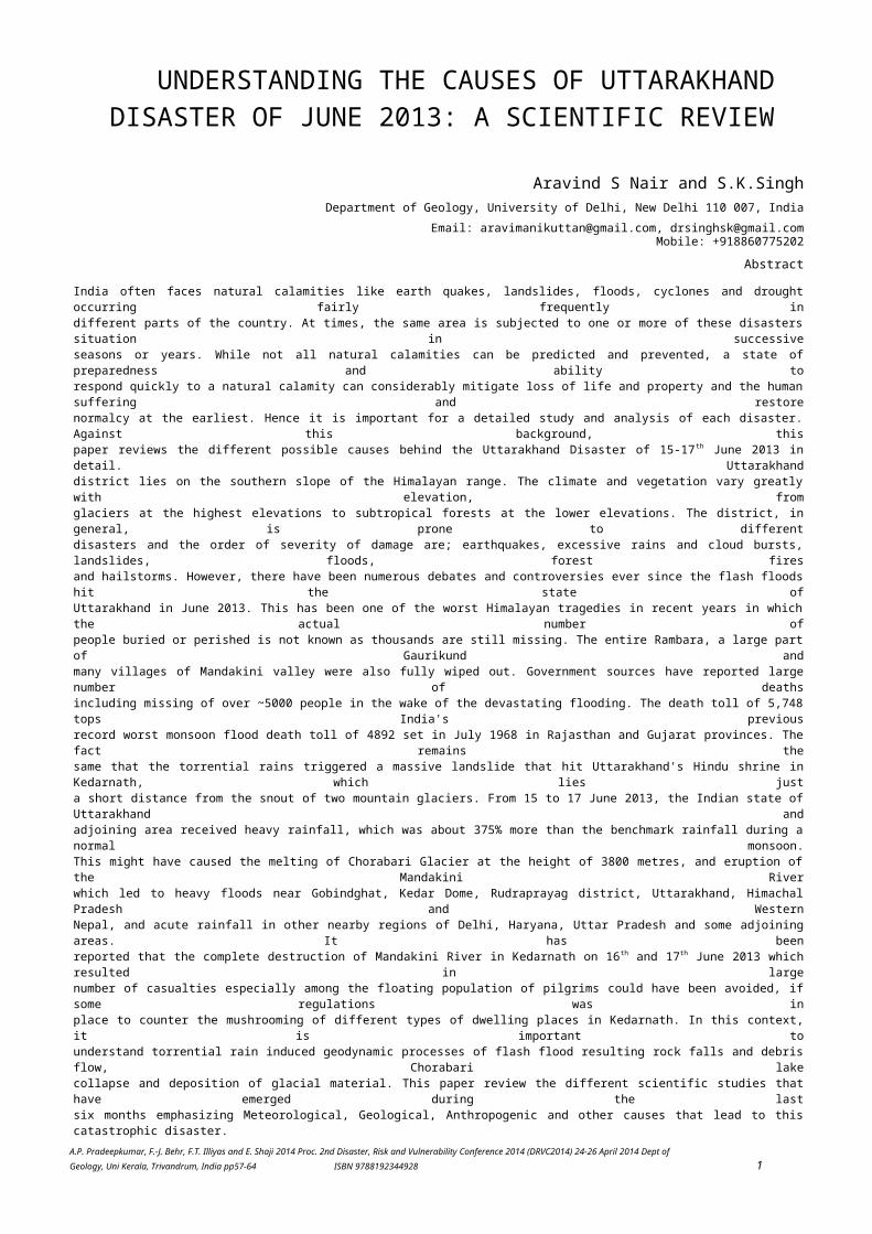
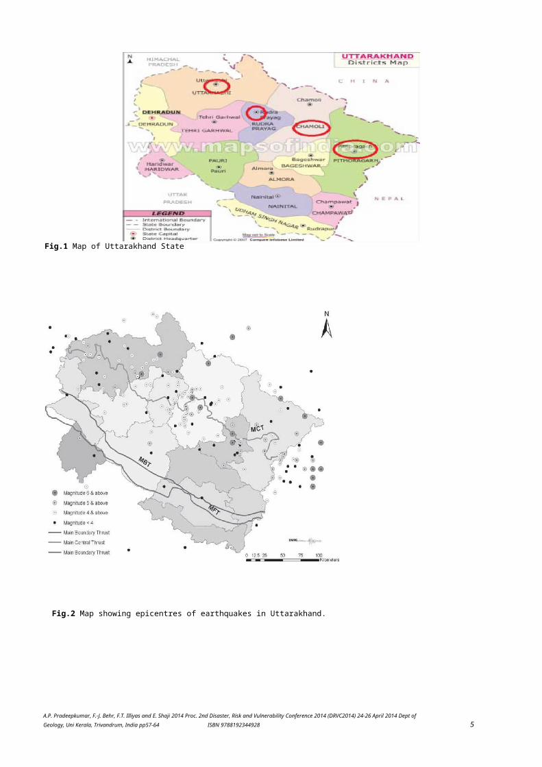
Uttarakhand stateThe Uttarakhand is a Himalayan State, located between Himachal Pradesh of India and Nepal; withTibet lying to itsnorth. The entire state of Uttarakhand is a hilly terrain, incorporating the Tethys, Higher,Lesser and Sub Himalayan partalong with the Great Indo-Gangetic plain falling in the Hardwar and Udham Singh Nagar districts.It covers an area ofabout 53,500 sq km. The state is composed of 13 districts grouped in to two division calledGarhwal and Kumaon.Garhwal division includes seven districts; Chamoli, Dehradun, Hardwar, Pauri Garhwal,Rudraprayag, Tehri andUttarkashi whereas Kumaon division includes six districts; Almora, Bageshwar, Champawat,Nainital, Pithoragarh andUdham Singh Nagar (Fig.1). The state, in general, is prone to different disasters such asearthquakes, excessive rains andcloud bursts, landslides, floods, forest fires and hailstorms. The seismic risk in the state isconsidered to be high. Four ofthe 13 districts of the state (Pithoragarh, Chamoli, Bageshwar and Rudraprayag) fall completelyin Zone V of the seismicrisk map of India (representing damage risk of > IX on MSK scale) while five other distrcits(Uttarkashi, Tehri Garhwal,Pauri, Almora and Champawat)fall partially in Zone V and partially in Zone IV (damage risk ofVIII on MSK scale) and therest (Dehradun, Haridwar, Nainital and Udham Singh Nagar) fall totally in Zone IV (Fig.2). In therecent past the statehas experienced two major earthquakes (Uttarkashi, 1991 and Chamoli, 1999). The non-occurrence ofa major earthquake(M > 8 on the Richter scale) in the region in the last more than 200 years enhances seismic riskin the region. The flashfloods resulted from the heavy torrential rainfall between 15th and 17th June 2013 has been one ofthe worst Himalayantragedies in recent years in which the actual number of people buried or perished is not known asthousands are stillmissing (Uniyal, 2013). The entire Rambara, a large part of Gaurikund and many villages ofMandakini valley were alsofully wiped out (Dobhal, et al 2013). As reported by media, a total no. of 28 persons includingtwo children and three firefighters were killed and others went missing after being washed away by flash floods inUttarkashi and Chamoli districts.Hundreds were left homeless. A dozen bridges were washed away and debris from landslips blockedmost roads includingnational highways leading to Gangotri, Yamunotri, Badrinath, Kedarnath and Hemkunt Sahib. TheBhagirathi soaredabove the danger level in Uttarkashi and the Ganga was just short of the danger mark at Haridwar.An alert was soundedin areas along the Ganga and its tributaries. The Gangotri fire station was destroyed and a firetender and some privatevehicles were washed away. The administration evacuated 200 families from the area and lodgedthem in governmentbuildings. Tents were erected for people stranded in inaccessible areas. Several kilometres ofthe Gangotri highway andGangotri hanging bridge were washed away (Nair, 2013). The present review summarises theMeteorological, Geological,Anthropogenic and other causes that lead to this catastrophic disaster.
A.P. Pradeepkumar, F.-J. Behr, F.T. Illiyas and E. Shaji 2014 Proc. 2nd Disaster, Risk and Vulnerability Conference 2014 (DRVC2014) 24-26 April 2014 Dept ofGeology, Uni Kerala, Trivandrum, India pp57-64 ISBN 9788192344928 5
Fig.2 Map showing epicentres of earthquakes in Uttarakhand.
Fig.1 Map of Uttarakhand State
A.P. Pradeepkumar, F.-J. Behr, F.T. Illiyas and E. Shaji 2014 Proc. 2nd Disaster, Risk and Vulnerability Conference 2014 (DRVC2014) 24-26 April 2014 Dept ofGeology, Uni Kerala, Trivandrum, India pp57-64 ISBN 9788192344928 6
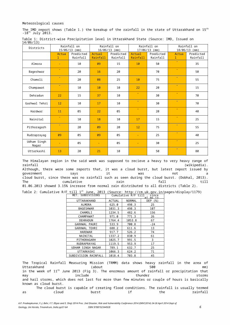
Meteorological causesThe IMD report shows (Table 1.) the breakup of the rainfall in the state of Uttarakhand on 15th
-18th July 2013.Table 1: District-wise Precipitation level in Uttarakhand State (Source: IMD, Issued on 14/06/13)
Districts Rainfall on15/06/13 (mm)
Rainfall on16/06/13 (mm)
Rainfall on17/06/13 (mm)
Rainfall on18/06/13 (mm)
ActualRainf
PredictedRainfall
ActualRainfall
PredictedRainfall
ActualRainfall
PredictedRainfall
ActualRainf
PredictedRainfall
Almora - 10 09 15 10 50-
35
Bageshwar-
20 16 20 70-
50
Chamoli-
20 08 25 10 75-
55
Champawat-
10 10 10 22 20-
15
Dehradun 22 15 37 10-
30-
70
Garhwal Tehri 12 10 17 10-
30-
70
Hardwar 11 05 22 05-
20-
40
Nainital-
10 18 10 17 15-
25
Pithoragarh-
20 09 20 12 75-
55
Rudraprayag 09 05 09 05 - 25-
40
Udham SinghNagar - 05 - 05 - 30
-25
Uttarkashi 13 20 21 10 50-
80
The Himalayan region in the said week was supposed to recieve a heavy to very heavy range ofrainfall (wikipedia).Although, there were some reports that, it was a cloud burst, but latest report issued bygovernment says it was not acloud burst, since there was no rainfall such as seen during the cloud burst. (Dobhal, 2013).The cumulative rain fall till01.06.2013 showed 3.15% increase from normal rain distributed to all districts (Table 2).Table 2: Cumulative R/F till 1st June, 2013 (Source: http://cm.uk.gov.in/pages/display/1179)
MET. SUBDIVISIONS Cumulative R/F till , since01.06.13
UTTARAKHAND ACTUAL NORMAL DEP (%)ALMORA 625.0 498.3 25
BAGESHWAR 1031.3 498.3 107CHAMOLI 1234.5 482.6 156CHAMPAWAT 971.0 771.3 26DEHRADUN 1764.4 1053.8 67
GARHWAL PAURI 533.9 700.8 -24GARHWAL TEHRI 688.2 611.6 13
HARDWAR 917.7 526.2 74NAINITAL 1337.2 830.9 61
PITHORAGARH 1025.7 991.5 3RUDRAPRAYAG 1119.5 953.9 17
UDHAM SINGH NAGAR 789.1 632.7 25UTTARKASHI 1066.3 624.2 71
SUBDIVISION RAINFALL 1018.4 703.8 45
The Tropical Rainfall Measuring Mission (TRMM) data shows heavy rainfall in the area ofUttarakhand (about 500 mm)in the week of 11th June 2013 (Fig 3). The enormous amount of rainfall or precipitation thatmay include thunder stormsand hail storms, which does not last for more than few minutes or couple of hours is basicallyknown as cloud burst.
The cloud burst is capable of creating flood conditions. The rainfall is usually termedas cloud burst if the rainfall

A.P. Pradeepkumar, F.-J. Behr, F.T. Illiyas and E. Shaji 2014 Proc. 2nd Disaster, Risk and Vulnerability Conference 2014 (DRVC2014) 24-26 April 2014 Dept ofGeology, Uni Kerala, Trivandrum, India pp57-64 ISBN 9788192344928 7
measured is more than 100 mm per hour. Usually, in the Indian subcontinent, the cloudburstoccurs when the pregnantmonsoon cloud drift towards the Northern parts from the Bay of Bengal or the Arabian Sea,across the plains and over theHimalayan belt. The ascending clouds that are laden with moisture tend to become heavy after acertain point and henceproduce violent and heavy rainfall in a short period of time. The cloud burst mostly occurs inthe hilly areas and not theplains. The reason behind this is the orographic lifting of moisture laden unstable air thattakes place in the area that hasthe potential energy necessary for cloudburst in the hilly terrain. The image of 17th June2013, released by NASA's spacesatellite shows us the cloud formation over the northern parts of India, which are moreprominent over Himalayan region
A.P. Pradeepkumar, F.-J. Behr, F.T. Illiyas and E. Shaji 2014 Proc. 2nd Disaster, Risk and Vulnerability Conference 2014 (DRVC2014) 24-26 April 2014 Dept ofGeology, Uni Kerala, Trivandrum, India pp57-64 ISBN 9788192344928 8
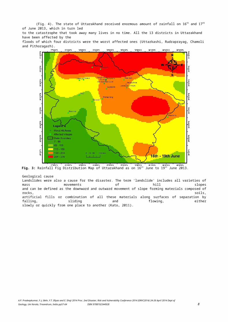
(Fig. 4). The state of Uttarakhand received enormous amount of rainfall on 16th and 17th
of June 2013, which in turn ledto the catastrophe that took away many lives in no time. All the 13 districts in Uttarakhand have been affected by thefloods of which four districts were the worst affected ones (Uttarkashi, Rudraprayag, Chamoli and Pithoragarh).
Geological causeLandslides were also a cause for the disaster. The term 'landslide' includes all varieties ofmass movements of hill slopesand can be defined as the downward and outward movement of slope forming materials composed ofrocks, soils,artificial fills or combination of all these materials along surfaces of separation byfalling, sliding and flowing, eitherslowly or quickly from one place to another (Kato, 2011).
Fig. 3: Rainfall Fig Distribution Map of Uttarakhand as on 16th June to 19th June 2013.

A.P. Pradeepkumar, F.-J. Behr, F.T. Illiyas and E. Shaji 2014 Proc. 2nd Disaster, Risk and Vulnerability Conference 2014 (DRVC2014) 24-26 April 2014 Dept ofGeology, Uni Kerala, Trivandrum, India pp57-64 ISBN 9788192344928 9
Fig. 4: Satellite imagery showing the cloud cover over Uttarakhand on 16 June 2013 (NASA)

A.P. Pradeepkumar, F.-J. Behr, F.T. Illiyas and E. Shaji 2014 Proc. 2nd Disaster, Risk and Vulnerability Conference 2014 (DRVC2014) 24-26 April 2014 Dept ofGeology, Uni Kerala, Trivandrum, India pp57-64 ISBN 9788192344928 10
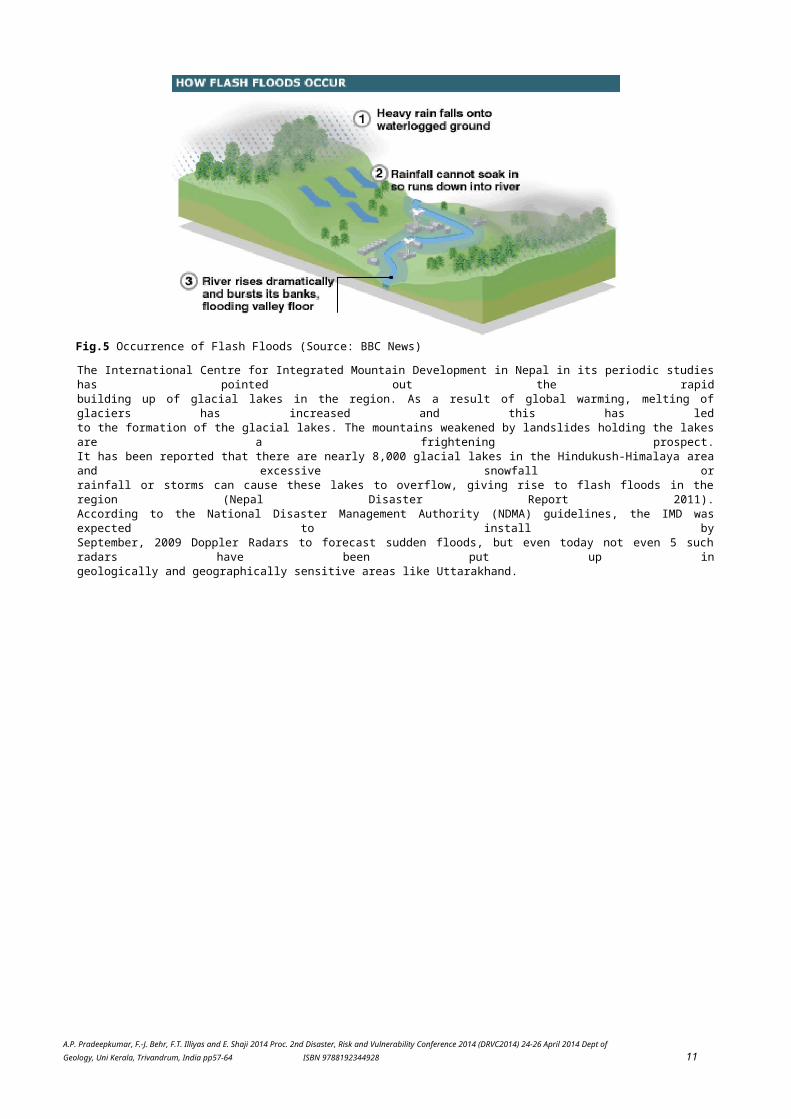
Although the landslides are primarily associated with mountainous terrains, these can alsooccur in areas where anactivity such as surface excavations for highways, buildings and open pit mines takes place.Many factors contribute toslides, including geology, gravity, weather, groundwater, wave action and human actions.Although landslides usuallyoccur on steep slopes, they also can occur in areas of low relief. Underwater landslidesusually involve areas of low reliefand small slope gradients in lakes and reservoirs or in offshore marine settings. Typically,a landslide occurs when severalof these factors converge. Some of the Natural causes are mainly (i) Gravity (ii) Geological(iii) Heavy and prolongedrainfall and (iv) Earthquakes (Nair, 2013).. When earthquakes occur on areas with steepslopes, many times the soil slipscausing landslides. Furthermore, debris flows caused by earthquakes can also trigger massmovement of soil.Flood/flash flood/glacial lake outburst flood (GLOF)Flash floods are known to occur in the hilly terrain in India. Flash floods are described asrapid and sudden flooding oflow lying areas (Fig. 5). The main causes of flash floods can be heavy rain associated withthunderstorms, cloud bursts,hurricane, severe tropical storms or melt water from ice or snow. Flash flood occurs whenrain falls rapidly on saturatedsoil or dry soil that has poor absorption ability. The runoff collects in gullies andstreams, which join to form largervolumes of the water body and often forms into a fast flowing water front along with debris.It mostly occurs in normallydry areas that have received heavy rainfall recently. It may be seen anywhere downstream fromthe source of theprecipitation, at times it can be seen even many km away from the source. Flash flooding canalso be caused by extensiveprecipitation released by storms as well as the sudden thawing effect of ice dams(Wikipedia). A flash flood is an eventthat occurs within six hours following the end of the causative event that result in life andproperty loss. It usually evolvesrapidly and the steep and sloppy terrains are more prone to it. Flash floods do not lastlonger; in fact it rarely lasts morethan 12 hours. This event, like flash floods, results in loss of life and property. Same asthe flash floods, the hilly terrainare prone to the floods, but it can also occur in the plains, especially the low lying areasand areas closer to the sea.Usually floods last longer than flash floods, it is often seen that these lasts for more than24 hours (Nair, 2013)..Glacial lakesAs the country emerges from the devastation caused by the cloudburst and flood in theUttarakhand Himalayas,geographers have sounded a grim warning that can be perceived as a ticking natural time bomb.There have been foundto be 200 such lakes in the Himalayan region which can burst anytime. Now if a cloudburst andthe resultant floods cancause so much of destruction to have turned the pilgrimage towns of the region into 'ghosttowns', imagine the destructionthat would be caused by all the water from the 200 lakes hurtling down at a incredible speedand force down the ruggedHimalayan slopes.
A.P. Pradeepkumar, F.-J. Behr, F.T. Illiyas and E. Shaji 2014 Proc. 2nd Disaster, Risk and Vulnerability Conference 2014 (DRVC2014) 24-26 April 2014 Dept ofGeology, Uni Kerala, Trivandrum, India pp57-64 ISBN 9788192344928 11
The International Centre for Integrated Mountain Development in Nepal in its periodic studieshas pointed out the rapidbuilding up of glacial lakes in the region. As a result of global warming, melting ofglaciers has increased and this has ledto the formation of the glacial lakes. The mountains weakened by landslides holding the lakesare a frightening prospect.It has been reported that there are nearly 8,000 glacial lakes in the Hindukush-Himalaya areaand excessive snowfall orrainfall or storms can cause these lakes to overflow, giving rise to flash floods in theregion (Nepal Disaster Report 2011).According to the National Disaster Management Authority (NDMA) guidelines, the IMD wasexpected to install bySeptember, 2009 Doppler Radars to forecast sudden floods, but even today not even 5 suchradars have been put up ingeologically and geographically sensitive areas like Uttarakhand.
Fig.5 Occurrence of Flash Floods (Source: BBC News)

A.P. Pradeepkumar, F.-J. Behr, F.T. Illiyas and E. Shaji 2014 Proc. 2nd Disaster, Risk and Vulnerability Conference 2014 (DRVC2014) 24-26 April 2014 Dept ofGeology, Uni Kerala, Trivandrum, India pp57-64 ISBN 9788192344928 12
Anthropogenic causesUttarakhand's geography is very dynamic, vast and 90% of the area is mountainous region.Deforestation, land grazing,illegal development on the soft bed of rock leads to disasters when a flash flood hit thearea. Experts are of view thatwhile tampering with the Himalayan slopes, one need to be extra careful as these are theslopes, which have evolved byexogenic and endogenic processes and hence are dangerously balanced, which makes them morevulnerable to disasters.The Uttarakhand floods have seen such a disaster, ranging from multiple landslides, run offs,to buildings on the low lyingareas being pulled down by the floods, damaged roads, etc. The satellite pictures of therecent disaster shows that theriver Mandakini changed its route in many places and also geographically many tributaries weredeveloped affectingmany places that otherwise should not have been affected (Nair, 2013). The experts further addthat environmentaldegradation and glacial melt down is for this massive destruction. The release of 17.6 cusecsof water further added tothe disaster. Of late the glaciers of Mandakini Valley have been melting down at a fasterspeed. The evidence can betraced by noting the U shaped valley and moraines up to Rambara. In the recent past the Valleyof Mandakini has facedclimatic changes to an extent that has affected the glaciers in the valley (Mehta, 2012)Adding to the melting glaciers thehuge infrastructural growth has further led to the environmental degradation in the region.The antecedent rainfallsaturated the region and exceeded the limit on 16th and 17 June, which triggered multiplelandslides and flash floods inthe Mandakini Valley. Although the Chaurabari Glacier is seasonal in nature but the heavyrainfall and snow cover in thearea increased the water level that made the lake over flow due to saturation of the moraines,hence, increasing thevolume of the streams in the region, making them broader and therefore submerging the lowlying areas in the valley. Thepicture below shows the increased size of the streams and generation of many other streams dueto heavy downwardsflow of water and debris, which destroyed the Kedarnath region of Uttarakhand. The imageillustrates that the stream inthe background of Kedarnath was narrow prior to the flash floods. Due to heavy flow of waterthe riverine widened up.Some signs of mobilization of the lateral moraine over the catchment of the Companion Glacierare noticeable. This tookdown the debris to hit the settlement coming in its way destroying Kedarnath. A new stream canalso be seen in thesatellite imagery (Fig. 6). The occurrence of many streams has fresh sediments in its bed nowdue to the flash floods(Nair, 2013).
It can be seen that a very high gradient of glacier has snout, steep to moderate slopein the areas of morainedeposits and moderate to gentle slopes in the Kedarnath valley followed by the increasinggradient from very steeptowards Gaurikund. Due to high gradient slope the velocity of debris was really fast fromKedarnath to Gaurikund andRambara. This in turn led to the colossal damage to infrastructure, lives and property in theareas lying near thedownstream. There was a large devastation of property near Kedarnath Dham and surroundingareas. The roads andbuildings are heavily damaged due to multiple landslides. Maximum damages can be seen in theareas of Kedarnath,Guriaya, Lenchuri, Hhindurpani, Rambara, Gaurikund and downstream areas up to Rudraprayag.Although there havebeen no damages in glaciers Chaurabari and Companion but the middle moraine debris has beenwashed out due tooverflowing single stream. Initially it was being believed that Vasuki Tal may have been

A.P. Pradeepkumar, F.-J. Behr, F.T. Illiyas and E. Shaji 2014 Proc. 2nd Disaster, Risk and Vulnerability Conference 2014 (DRVC2014) 24-26 April 2014 Dept ofGeology, Uni Kerala, Trivandrum, India pp57-64 ISBN 9788192344928 13
responsible in the colossaldamage but the satellite imagery confirms that Vasuki Tal did not play any role indevastation.
Fig. 6: Streams in Kedaranath before and after the disaster (NRSA).
A.P. Pradeepkumar, F.-J. Behr, F.T. Illiyas and E. Shaji 2014 Proc. 2nd Disaster, Risk and Vulnerability Conference 2014 (DRVC2014) 24-26 April 2014 Dept ofGeology, Uni Kerala, Trivandrum, India pp57-64 ISBN 9788192344928 14
A combination of factors such as degraded forest cover, change of moderate debris-laden slopesinto near vertical slopesduring road widening and illegal building construction without keeping in view the safety andlacking adequate andappropriate engineering measures made the slopes vulnerable to the onslaught of torrentialrainfall in the region.
In the urban clusters the obstructed natural drainage was responsible for slopedestabilization and diversion ofthe debris-laden water into the settlements. Approximately two-thirds of the landslides in theAlaknanda Valley wereaccelerated by anthropogenic intervention, mostly by the removal of slope toes for the purposeof road construction.There is no denial that the existing roads in Uttarakhand are unable to cope with the increasein traffic. According to anestimate, during the pilgrim season nearly 200,000-300,000 vehicles barrage between Rishikeshand Badrinath; similar isthe case on the Gangotri route, which is heavy for the soft rock bed like that in the state ofUttarakhand. In addition,innumerable hydel projects which have increased in the river valleys require wider roads forthe transportation of heavymachinery. Additionally, since the creation of Uttrakhand, a noteworthy increase in the builtup areas in the AlakanandaValley has been seen particularly, in the areas around Srinagar, Devprayag, Rudraprayag,Karnprayag, Nandprayag andJoshimath. Unfortunately, knowing the fact that India is situated on an active tectonic plate,the government has yet todo much to safeguard its population from natural hazards. Diggings down mountains to constructroads also have addedto this massacre. The roads and building are being built in this area without understandingthe geology of the region. Theblasting often moves the rocks and makes the area vulnerable to hazards (Nair, 2013).Other causesThe disaster in Uttarakhand has many reasons. The rumours are rife that this could be the caseof Cloud seeding done byChina. The other belief is that this is due to shifting of Dhari Devi temple from its actualsite to the other venue (Down ToEarth, July, 2013). And yet another belief that due to human intervention the environment hasdegraded to an extent thatit can't be replenished. Where some believes it was due to heavy rainfall, the other says itwas due to environmentalcauses and some want to blame it on the geology of the region?
The government needs to wake up to the call of environment and find out the bestpossible plan for therehabilitation of the highly vulnerable region of Uttarakhand. The need of the planned andsustainable developmentrather than just increase in economic growth of the region must be the main priority now(Panda, 2014).. Since thevulnerable area only faces a disaster when it is exploited, now it's the time that we must notfurther damage theenvironment of the area and by undergoing proper scientific and geological studies in thisarea, rebuild a better and saferenvironment to live in. The government now has a greater role to play, since this disaster wasonly due to one majorreason that the "Ecologically Sensitive Areas" are overburdened with a lot of establishmentsof poor quality and improperplanning. Now it is high time for the Government of India to think for a proper "Land UsePlan" for the entire Himalayanregion on a watershed basis.Acknowledgement: The first author thanks the Director, National Institute of DisasterManagement, New Delhi forproviding an Internship for conducting this study.ReferencesAnon. (1994) Strategy and Plan of Action for a Safer World, Yokohama, 22p.
A.P. Pradeepkumar, F.-J. Behr, F.T. Illiyas and E. Shaji 2014 Proc. 2nd Disaster, Risk and Vulnerability Conference 2014 (DRVC2014) 24-26 April 2014 Dept ofGeology, Uni Kerala, Trivandrum, India pp57-64 ISBN 9788192344928 15
Anon. (2004) Dealing with disaster - Awareness, Preparedness, Response, Centre for Environment Education,Ahmadabad, 156p.
Anon. (2013) Heaven's Rage, Down to Earth, New Delhi, July 1-15, 2013, pp.22-32.Dobhal, D.P, Gupta, A.K, Mehta, M, Khandelwal, D.D. (2013) Kedarnath disaster: facts and plausible causesCurrent Science, vol. 105,no. 2, pp.171-174
Dubey, C.S, Dericks P. Shukla, A. S. Ningreichon, Arnold L. Usham (2013) Orographic control of theKedarnath disaster, Current Science,vol.105, no.11, pp.1474-1476.
Joshi, V., Naithani, A and Negi, G.C.S., (1998) Study of landslides caused by natural and anthropogenicreasons in Garhwal Himalaya,Proc. Nat. Conf. On Disaster and Technology, Dept. Of Architecture, Manipal Institute of Technology,
Manipal, Karnataka, pp.48-54.Kato, S and R. Mutonyi (2011) The Challenges of Managing Increasing Landslides Vulnerability in Mount Elgon ecosystem, Uganda: ACase of Human Interactions with its Environment on the verge of collapsing.
Mehta, M, Zahid, M, Dobhal, D.P. and Srivastava, P. (2012), Geomorphological evidences of post- LGMglacial advancements in theHimalaya: A study from Chorabari Glacier, Garhwal Himalaya, India, J. Earth Syst. Sci. 121, No. 1, pp.
149-163Nair, A.S., (2013) Causes of Uttarakhand Disaster June 2013, Internship Report, NIDM, New Delhi, 20p.Panda, S., (2014) Sustainable development of disaster-affected rural landscape of Kedar valey throughsimple technologicalinterventions, Current Science, vol.106, no.7, pp.915-916.
Sati, S. P, Sundriyal, Y.P., Rana, N and Dangwal, S. (2011) Recent landslides in Uttarakhand: Nature'sfury or human folly, CurrentScience, vol.100, no.11, 1617p
Uniyal. A (2013) Lessons from Kedarnath tragedy of Uttarakhand Himalaya, India, Current Science, vol.105, no.11, 1472ppWadia, D.N., (1976) Geology of India, Tata Mc-Graw Hills Pub Co., New Delhi, 450p.http://www.thehindu.com/todays-paper/flash-floods-pummel-himalayan-region/article3 729575.eceen.wikipedia.org/wiki/Climatic_regions_of_Indiahttp://www.thehindu.com/news/national/no-evidence-of-cloudburst-says-climate-scientist/article4895584.eceen.wikipedia.org/wiki/Cloudburst; en.wikipedia.org/wiki/FlashfloodNepal Disaster Report (2011), Govt. of Nepal.http://daily.bhaskarxom/article/CHD-there-are-200-himalayan-lakes-which-could-explode-while-authorities-remain-indif-4309954-PHO.html
Glacial Lakes and Glacial Lake Outburst Floods in Nepal (GLGLOFN), (2011) International Centre forIntegrated Mountain Development,Kathmandu, Nepal http://www.icimod.org/dvds/201104_GLOF/reports/final_report.pdf
en.wikipedia.org/wiki/Uttarakhand; http://en.wikipedia.org/wiki/World_Heritage_Sitewww.tribuneindia.com/2011/20110720/dplus.htm (2011)http://www.downtoearth.org.in/content/moef-opposes-relocation-dhari-devi-temple-hydropower-project-alaknanda.
Related Documents