The International Working Group onSatellite-based Emergency Mapping (IWG-SEM) proposal Fabio Giulio-Tonolo, ITHACA, Italy [email protected] 6th Annual UN-SPIDER Conference in Beijing United Nations International Conference on Space-based Technologies for Disaster Risk Reduction - "Understanding Disaster Risk“ Breakout Session 2 Procedural guidelines for sharing space-based information during emergency response

Welcome message from author
This document is posted to help you gain knowledge. Please leave a comment to let me know what you think about it! Share it to your friends and learn new things together.
Transcript
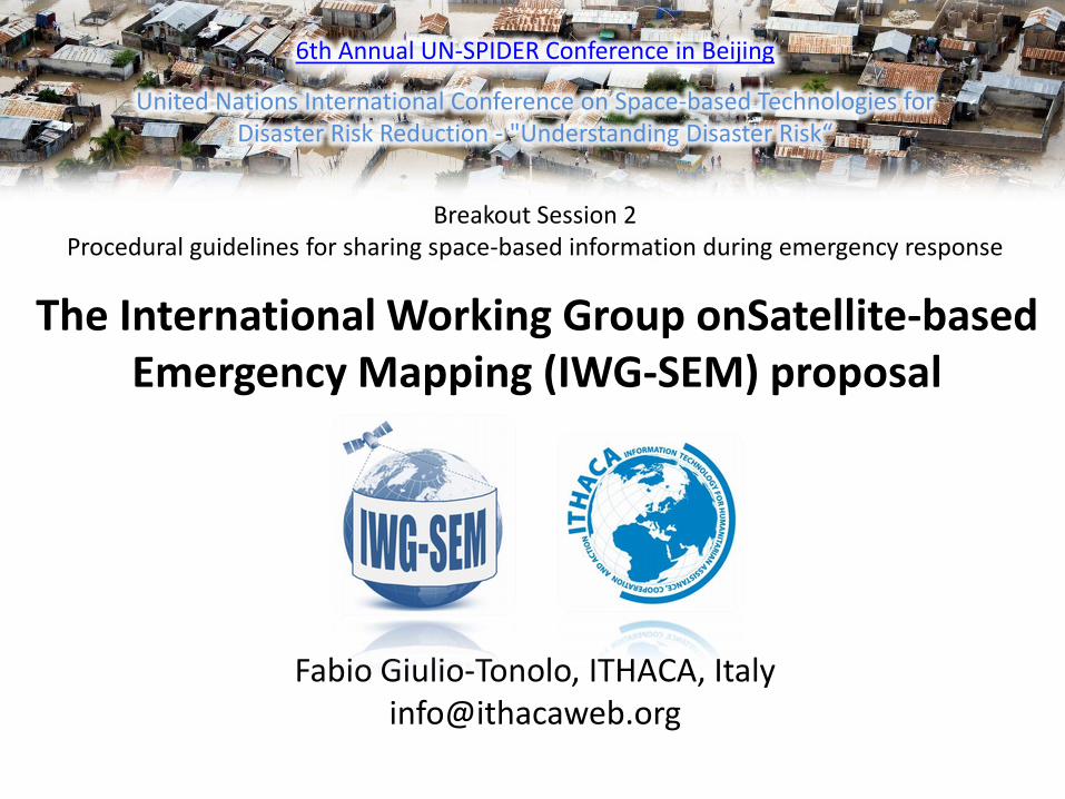
The International Working Group onSatellite-based
Emergency Mapping (IWG-SEM) proposal
Fabio Giulio-Tonolo, ITHACA, Italy [email protected]
6th Annual UN-SPIDER Conference in Beijing
United Nations International Conference on Space-based Technologies for Disaster Risk Reduction - "Understanding Disaster Risk“
Breakout Session 2 Procedural guidelines for sharing space-based information during emergency response
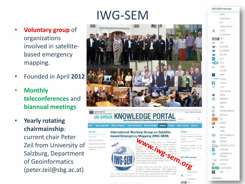
IWG-SEM • Voluntary group of
organizations involved in satellite-based emergency mapping.
• Founded in April 2012
• Monthly teleconferences and biannual meetings
• Yearly rotating chairmainship: current chair Peter Zeil from University of Salzburg, Department of Geoinformatics ([email protected])
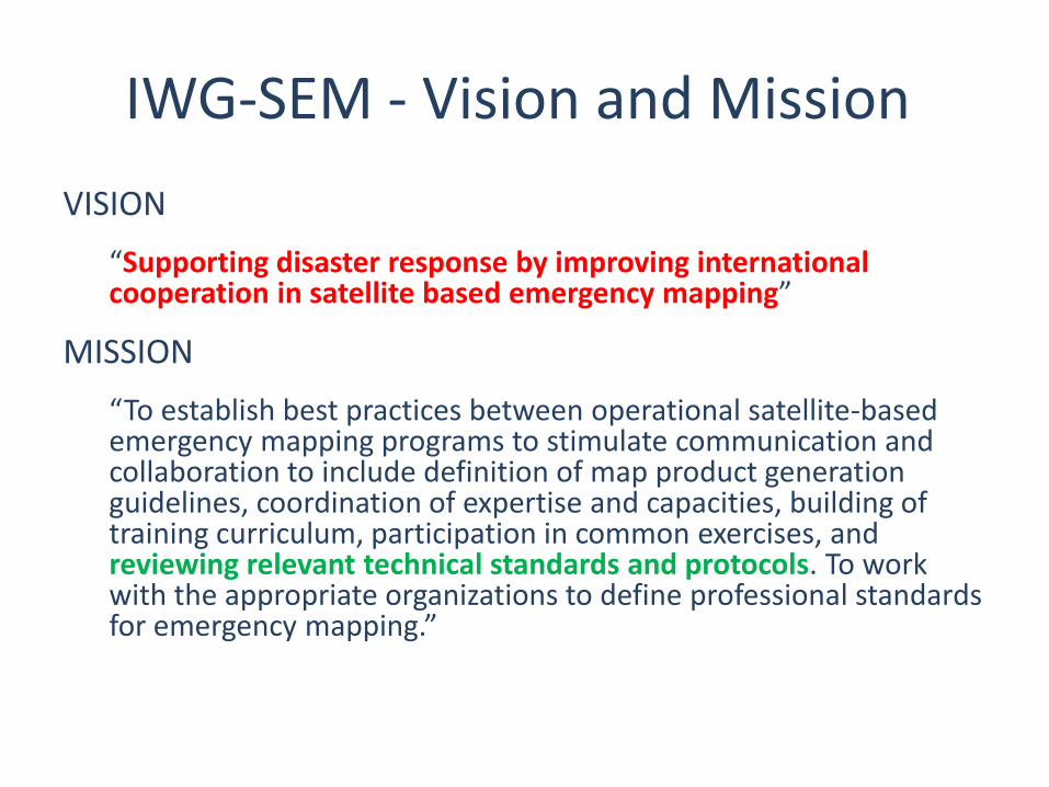
IWG-SEM - Vision and Mission
VISION
“Supporting disaster response by improving international cooperation in satellite based emergency mapping”
MISSION
“To establish best practices between operational satellite-based emergency mapping programs to stimulate communication and collaboration to include definition of map product generation guidelines, coordination of expertise and capacities, building of training curriculum, participation in common exercises, and reviewing relevant technical standards and protocols. To work with the appropriate organizations to define professional standards for emergency mapping.”
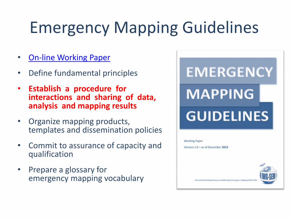
Emergency Mapping Guidelines
• On-line Working Paper
• Define fundamental principles
• Establish a procedure for interactions and sharing of data, analysis and mapping results
• Organize mapping products, templates and dissemination policies
• Commit to assurance of capacity and qualification
• Prepare a glossary for emergency mapping vocabulary
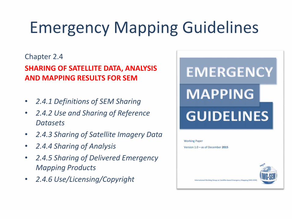
Emergency Mapping Guidelines
Chapter 2.4
SHARING OF SATELLITE DATA, ANALYSIS AND MAPPING RESULTS FOR SEM
• 2.4.1 Definitions of SEM Sharing
• 2.4.2 Use and Sharing of Reference Datasets
• 2.4.3 Sharing of Satellite Imagery Data
• 2.4.4 Sharing of Analysis
• 2.4.5 Sharing of Delivered Emergency Mapping Products
• 2.4.6 Use/Licensing/Copyright
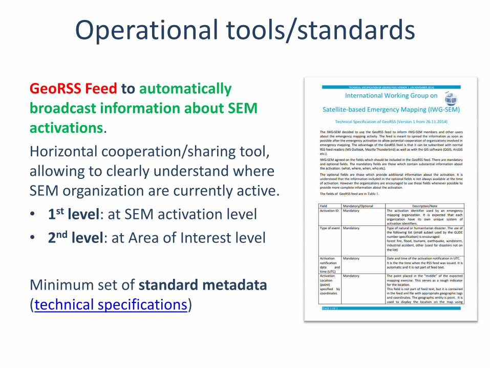
GeoRSS Feed to automatically broadcast information about SEM activations.
Horizontal cooperation/sharing tool, allowing to clearly understand where SEM organization are currently active.
• 1st level: at SEM activation level
• 2nd level: at Area of Interest level
Minimum set of standard metadata (technical specifications)
Operational tools/standards
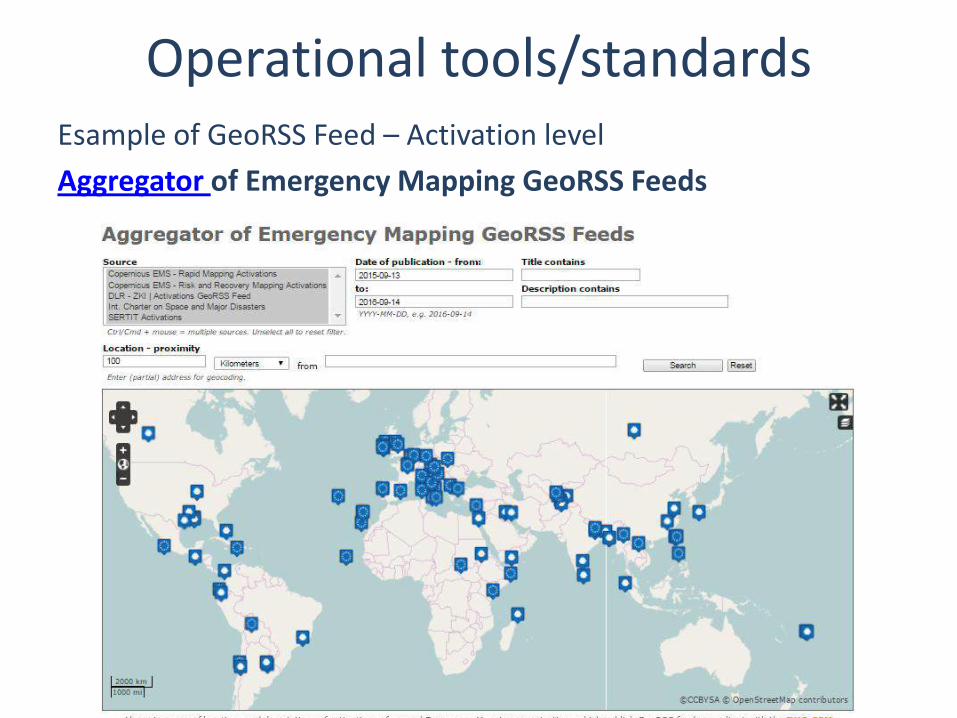
Operational tools/standards Esample of GeoRSS Feed – Activation level
Aggregator of Emergency Mapping GeoRSS Feeds
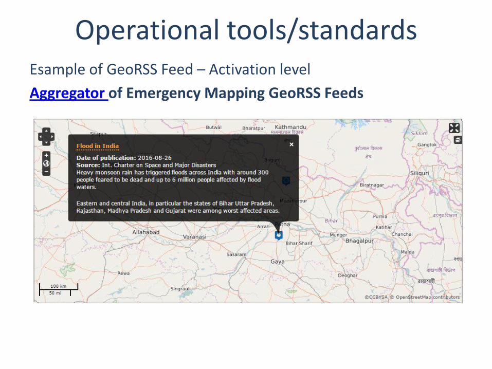
Esample of GeoRSS Feed – Activation level
Aggregator of Emergency Mapping GeoRSS Feeds
Operational tools/standards
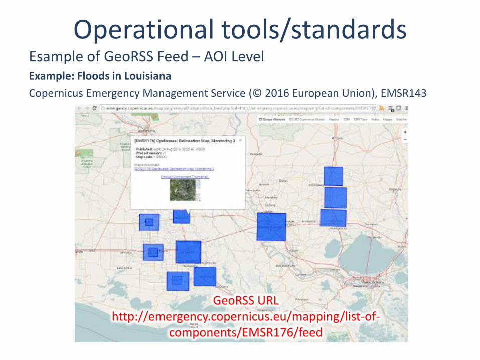
Esample of GeoRSS Feed – AOI Level Example: Floods in Louisiana
Copernicus Emergency Management Service (© 2016 European Union), EMSR143
Operational tools/standards
GeoRSS URL http://emergency.copernicus.eu/mapping/list-of-
components/EMSR176/feed
The International Working Group on Satellite-
based Emergency Mapping (IWG-SEM) proposal
Fabio Giulio-Tonolo, ITHACA, Italy [email protected]
6th Annual UN-SPIDER Conference in Beijing
United Nations International Conference on Space-based Technologies for Disaster Risk Reduction - "Understanding Disaster Risk“
Breakout Session 2 Procedural guidelines for sharing space-based information during emergency response
Related Documents