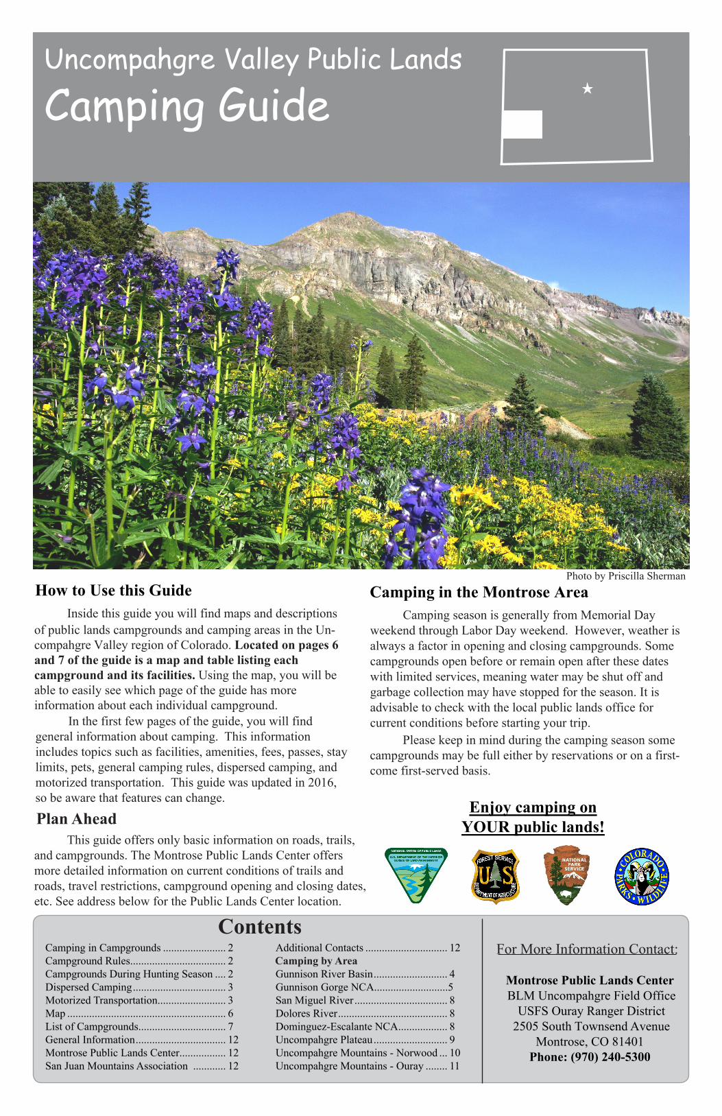
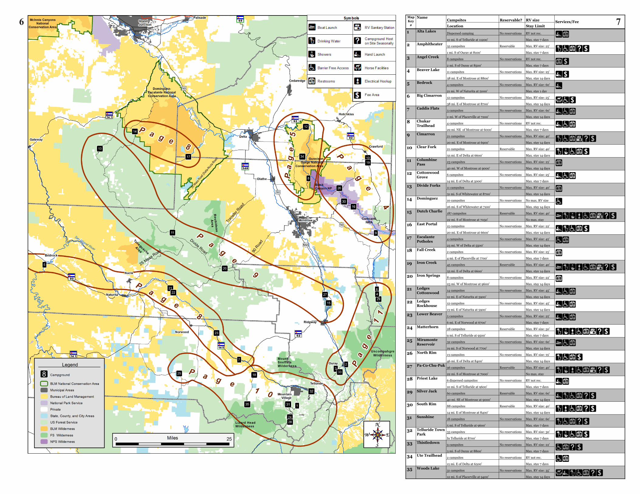
Uncompahgre Valley Public Lands Camping Guide Inside this guide you will find maps and descriptions of public lands campgrounds and camping areas in the Un- compahgre Valley region of Colorado. Located on pages 6 and 7 of the guide is a map and table listing each campground and its facilities. Using the map, you will be able to easily see which page of the guide has more information about each individual campground. In the first few pages of the guide, you will find general information about camping. This information includes topics such as facilities, amenities, fees, passes, stay limits, pets, general camping rules, dispersed camping, and motorized transportation. This guide was updated in 2016, so be aware that features can change. Enjoy camping on YOUR public lands! Camping season is generally from Memorial Day weekend through Labor Day weekend. However, weather is always a factor in opening and closing campgrounds. Some campgrounds open before or remain open after these dates with limited services, meaning water may be shut off and garbage collection may have stopped for the season. It is advisable to check with the local public lands office for current conditions before starting your trip. Plan Ahead This guide offers only basic information on roads, trails, and campgrounds. The Montrose Public Lands Center offers more detailed information on current conditions of trails and roads, travel restrictions, campground opening and closing dates, etc. See address below for the Public Lands Center location. Please keep in mind during the camping season some campgrounds may be full either by reservations or on a first- come first-served basis. For More Information Contact: Montrose Public Lands Center BLM Uncompahgre Field Office USFS Ouray Ranger District 2505 South Townsend Avenue Montrose, CO 81401 Phone: (970) 240-5300 Contents Camping in Campgrounds ....................... 2 Campground Rules................................... 2 Campgrounds During Hunting Season .... 2 Dispersed Camping .................................. 3 Motorized Transportation......................... 3 Map .......................................................... 6 List of Campgrounds................................ 7 General Information ................................. 12 Montrose Public Lands Center................. 12 San Juan Mountains Association ............ 12 Additional Contacts .............................. 12 Camping by Area Gunnison River Basin ........................... 4 Gunnison Gorge NCA...........................5 San Miguel River .................................. 8 Dolores River ........................................ 8 Dominguez-Escalante NCA.................. 8 Uncompahgre Plateau ........................... 9 Uncompahgre Mountains - Norwood ... 10 Uncompahgre Mountains - Ouray ........ 11 Photo by Priscilla Sherman How to Use this Guide Camping in the Montrose Area

Welcome message from author
This document is posted to help you gain knowledge. Please leave a comment to let me know what you think about it! Share it to your friends and learn new things together.
Transcript
Uncompahgre Valley Public Lands
Camping Guide
InsidethisguideyouwillfindmapsanddescriptionsofpubliclandscampgroundsandcampingareasintheUn-compahgreValleyregion of Colorado.Located on pages 6 and 7 of the guide is a map and table listing each campground and its facilities.Usingthemap,youwillbeabletoeasilyseewhichpageoftheguidehasmoreinformationabouteachindividualcampground.
Inthefirstfewpagesoftheguide,youwillfindgeneralinformationaboutcamping.Thisinformationincludestopicssuchasfacilities,amenities,fees,passes,staylimits,pets,generalcampingrules,dispersedcamping,andmotorizedtransportation. This guide was updated in 2016, so be aware that features can change. Enjoy camping on
YOUR public lands!
CampingseasonisgenerallyfromMemorialDayweekendthroughLaborDayweekend.However,weatherisalwaysafactorinopeningandclosingcampgrounds.Somecampgroundsopenbeforeorremainopenafterthesedateswithlimitedservices,meaningwatermaybeshutoffandgarbagecollectionmayhavestoppedfortheseason.Itisadvisabletocheckwiththelocalpubliclandsofficeforcurrentconditionsbeforestartingyourtrip.
Plan AheadThisguideoffersonlybasicinformationonroads,trails,
and campgrounds.TheMontrosePublicLandsCenteroffersmore detailedinformationoncurrentconditionsoftrails and roads, travelrestrictions,campgroundopeningandclosingdates,etc. See address below for the Public Lands Center location.
Pleasekeepinmindduringthecampingseasonsomecampgroundsmaybefulleitherbyreservationsoronafirst-comefirst-servedbasis.
ForMoreInformationContact:
Montrose Public Lands Center BLMUncompahgreFieldOffice
USFSOurayRangerDistrict 2505SouthTownsendAvenue
Montrose,CO81401Phone: (970) 240-5300
ContentsCampinginCampgrounds....................... 2CampgroundRules................................... 2CampgroundsDuringHuntingSeason.... 2DispersedCamping.................................. 3MotorizedTransportation......................... 3Map.......................................................... 6ListofCampgrounds................................ 7GeneralInformation................................. 12MontrosePublicLandsCenter................. 12SanJuanMountainsAssociation............ 12
AdditionalContacts.............................. 12 Camping by Area
GunnisonRiverBasin........................... 4GunnisonGorgeNCA...........................5SanMiguelRiver.................................. 8DoloresRiver........................................ 8Dominguez-EscalanteNCA.................. 8UncompahgrePlateau........................... 9UncompahgreMountains-Norwood... 10UncompahgreMountains-Ouray........ 11
PhotobyPriscillaShermanHow to Use this Guide Camping in the Montrose Area
Facilities and AmenitiesMostdevelopedcampgroundsprovidedesignatedcampsites,toi-
lets, picnictables,andfirerings.Somecampgroundsalsoprovidewaterand Recreational Vehicle (RV)hookups.Pleaseusedumpstersorothertrash receptacles when they areavailable.Otherwise,bepreparedtofollow the “pack it in/pack it out”rulewithyourwaste.
Universal AccessibilityUniversally accessiblefacilities,suchaspicnictables,fire
rings,andrestroomsareavailableatsomecampsitesinsomecampgrounds.Formoreinformationrefertothecampgroundtableordescriptionsorcontactthelocalpubliclandsoffice.
Campgroundhostsarestationedatmanyofthecampgroundslisted in theguide.Theyaretheretohelpandwillbemorethanhappyto provide directions,answerquestions,andlistentoyourcomments.
Fees
Feesapplyatmostdevelopedcampgrounds.Feeinformationisposted attheentrancetoeachcampgroundandpaymentisrequiredtocamp. Feesarepayabletothecampgroundhostonsiteorthrough theself-serve registrationandfee-paymentstations.Feesgenerally rangefrom $5 to $20 per campsiteandadditionalfeesmayapplyforextravehicles, picnicking, or dayuse.
Federal Recreation Passes
AtmanysitesoperatedbytheForestService,NationalParkService,FishandWildlifeService,BureauofLandManagement,and BureauofReclamation,holdersoftheAmericatheBeautifulInteragency SeniorPass(forUnited States residentsover62)ortheAmericatheBeautifulInteragency AccessPass(forthosewithapermanentdisability)receivediscountsonExpandedAmenityFees(suchascamping,boatlaunching,andguidedtours).Advance Reservations
Some federal campgroundshavecampsitesthatcanbereservedin advance. Generally, reservationscanbemadeupto 180 days in advance for individualsitesandupto360daysinadvanceforgroupsites. You may paybycreditcard, over the phone, or online. In addition to a camping fee,anon-refundablereservationfeeischarged.Changes, no-shows, andcancellationsaresubjecttoservicefees.Tobookreservations, call toll-free877-444-6777; TDD877-833-6777,orgoto
National Forests.Generally,throughouttheGrandMesa,Un-compahgreandGunnisonNationalForestsoccupyingonecampsiteisallowedforamaximumof14days.However,withinspecificdesignatedcampgrounds,theallowedlengthsofstaymayvaryfromsevento30days.Pleasenotethatleavingunattendedpropertywithinacampsiteisalsoconsideredtobeoccupancy.Formoreinformation,refertothecampgrounddescriptionorcontactthelocalpubliclandsoffice.
Bureau of Land Management.Generally,campinginonelocationisallowedfor14consecutivedays,includinganydevelopedcampground.After14days,campersmustmoveaminimumof30airmilesawayandnotreturnfor30days.However,withinspecificdesignatedcampgroundsorcampingareas,theallowedlengthsofstaymayvary.Formoreinformationrefertothecampgrounddescriptionorcontactthelocalpubliclandsoffice.
Pets and LivestockPetsarewelcomeinallcampgrounds.Dogsmustbeleashed
andundercontrolatalltimes. Donotallowpetstoharassothervisitors,dogs,orwildlife.Donotleavepetsunattendedatanycampground.Campgroundsdonotallowpackstockunlessspecificallydesignated.Fordesignatedcampgroundsandmoreinformationrefertothecampgrounddescriptionsorcontactthelocalpubliclandsoffice.
Campground Rules
Upon entering a campground take a moment to read the posted regulations and information. Please remember that many
campgrounds and camping areas are patrolled and it is your responsibility to know and follow the current regulations.
The following are general regulations for all campgrounds.
Quiet TimePleasebeagoodneighborincampgrounds.Don’tmakeloud
noises or playloudmusic, especiallyatnight. Postedquiethoursaretypicallyfrom10p.m.–6a.m. Atotherhoursoftheday,berespectfulofothersandlimittheuseof generatorstonomorethanonehouratatime.
Vehicles
Driveslowlythroughcampgroundloopsandwatchcare-fully for childrenandpedestrians. Off-highway vehicles (OHVs), such as motorcycles, All Terrain Vehicles (ATVs) and Utility Task Vehicles (UTVs) are generally, but not always, permitted to travel on campground roads to and from campsites and other locations; look for posted signs for regulations. Recreational driving of OHVs within campgrounds is not permitted anywhere.
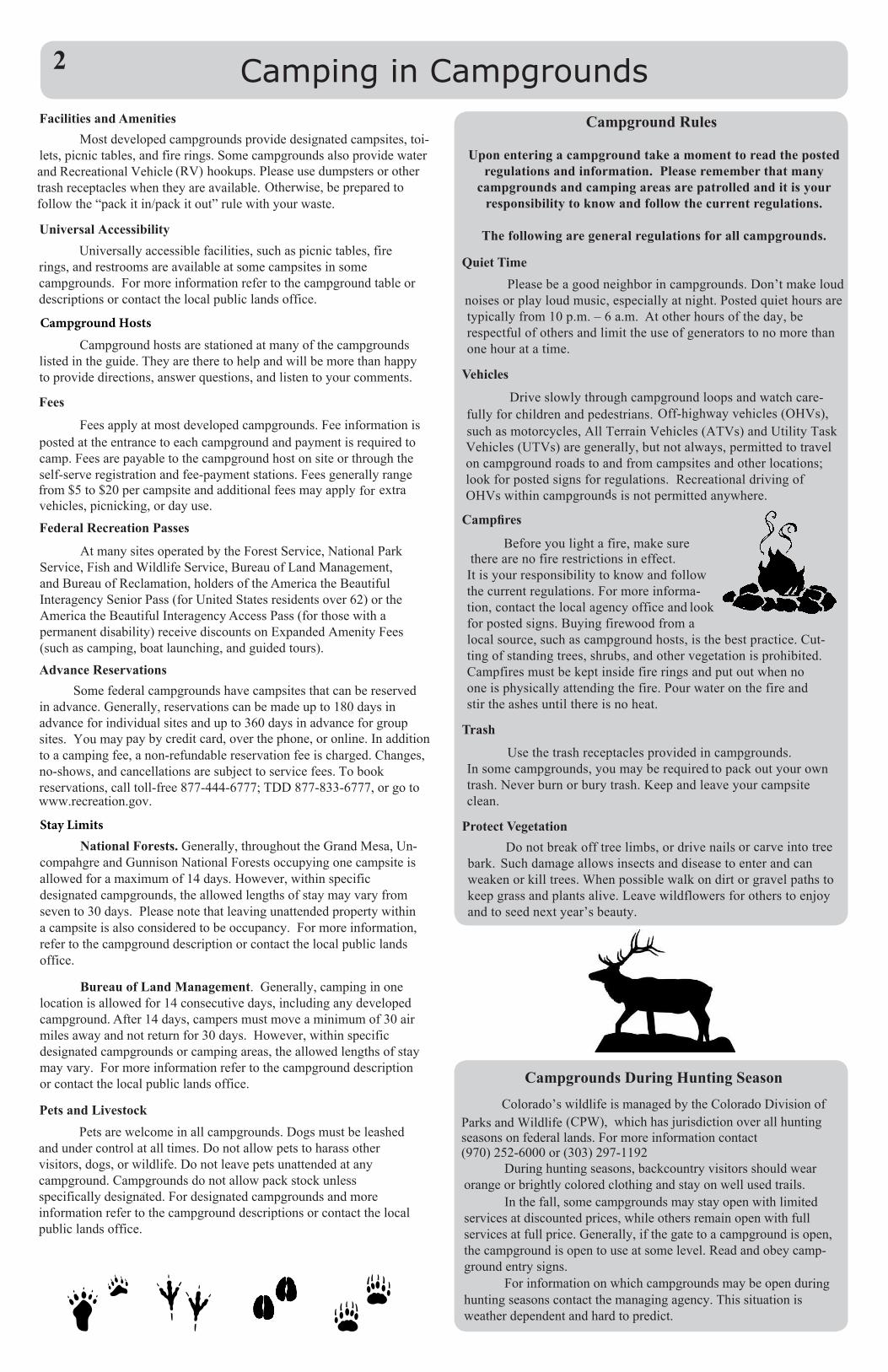
Campfires
Beforeyoulightafire,makesuretherearenofirerestrictionsineffect.
Itisyourresponsibilitytoknowandfollowthecurrentregulations.Formoreinforma-tion,contactthelocalagencyofficeand lookforpostedsigns.Buyingfirewoodfromalocalsource,suchascampgroundhosts,isthebestpractice. Cut-tingofstandingtrees,shrubs,andothervegetationisprohibited.Campfiresmustbekeptinsidefireringsandputoutwhennooneisphysicallyattendingthefire.Pourwateronthefireandstirtheashesuntilthereisnoheat.
Trash
Usethetrashreceptaclesprovided in campgrounds.Insomecampgrounds, youmayberequiredtopackoutyourowntrash.Neverburnor burytrash.Keepandleaveyourcampsiteclean.
Protect VegetationDonotbreakofftree limbs,or drivenails orcarveinto tree
bark. Suchdamageallowsinsectsanddiseasetoenterandcanweakenorkilltrees.Whenpossiblewalkondirtorgravelpathstokeepgrassandplantsalive.Leavewildflowersforotherstoenjoyandtoseed next year’s beauty.
Camping in Campgrounds
Campgrounds During Hunting SeasonColorado’swildlifeismanagedbytheColoradoDivisionof
Parks and Wildlife(CPW), which has jurisdiction over all hunting seasons on federal lands. For more information contact (970) 252-6000 or (303) 297-1192
Duringhuntingseasons,backcountryvisitorsshould wear orange or brightly colored clothing and stay on well used trails.
Inthefall,somecampgroundsmaystayopenwithlimitedservices at discounted prices, while others remain open with full services at full price. Generally, if the gate to a campground is open, the campground is open to use at some level. Read and obey camp-ground entry signs.
Forinformationonwhichcampgroundsmaybeopenduringhunting seasons contact the managing agency. This situation is weather dependent and hard to predict.
2
Campground Hosts
www.recreation.gov.
Stay Limits
rlewis
Sticky Note
Marked set by rlewis
Getting Along With ResidentsWildanimalsaretheresidentsofthisdiverseterrain.
Campgroundvisitorsarelikelytoseesquirrels,chipmunks,marmots,deer,elk,skunks,porcupines,raccoons,andmanyofthesome300speciesofbirds.Backcountryvisitorsmaycatchaglimpseofbighornsheep,mountaingoats,blackbear,beaver,riverotters,orevenmountainlions.Viewwildlifefromasafedistanceandtreatwildanimalswithrespect.
Unwanted VisitorsDon’tattractunwantedvisitorstoyourcampsite.Smalland
large mammalsmaybeluredintoyourcampsitebythearomaoffood ortrash. Theycancausealotofdamage.Somerodentshavea taste forleatherandanythingsweatyorsalty;storetheseitemscarefully. Neverfeedwildanimalsorencouragethemtobecomeunafraid of humans;thisisasdangeroustoyouasitistothem.
Dogs and Wildlife DO NOT Mix!Dogsmustbeleashedorotherwisephysicallyrestrainedin
campgroundsandshouldbeundervoicecontrolatyoursideatalltimes.Dogscanseverelystressandendangerwildanimalsbychasingthem.Inaddition,manywildcreaturesposedangerstodogs.Yourpetcanbeattackedbypredatorsorsufferwhenaskunkorporcupinedefendsitselfagainstcuriosityorattack.
Store Food ProperlyBlackbearscancausealotofdamagetoyourbelongings
andifabearisdesensitizedtohumansbyyourbehavioritmayhavetobedestroyed.Food,containers,packaging,cookingutensils,garbage,andpetfoodmustbestoredinabear-proofmanner.Storetheseitemsinsideahard-sidedvehicleorcamper;hungatleast10feetabovegroundandfour feetawayfromatreeorothersupport;insideanapprovedbear-resistantcontainer;orwithinanelectrifiedenclosure.
Findingasitetocampandenjoyremoteareasinrelativesolitudehasbecomeincreasinglypopular.Dispersedcampingoutsideofcampgroundsisusuallyallowed,butsomeareasmaybepostedasclosed.Duetointerminglingofprivateandpubliclands,besuretouseacurrentlandstatusmapshowingpublicandprivatelandownership.
Caring for Your Favorite Camping SpotDevelopedcampgroundsaredesignedandmaintainedtoprotect
vegetation,soils,andnaturalsettings.Whencampinginundevelopedareas,campersareresponsiblefortakingcaretoprotectvegetation,soils,watersources,andnaturalsettingswiththoughtfulplacementofvehiclesandtents.• Toavoiddamagingvegetation,campinareaspreviouslyused.• Selectalevelsitewithgooddrainage.Donottrytolevelasiteordigtrenches.• Protectriparianareasbycampingandparkingatleast200feet(70adult-sizedsteps)fromallwatersources.• Leaveplants,rocks,andhistoricalartifactsasfound.• Donotbuildstructuresorfurniture.• Useexistingfirerings,or bring a firepanorstove.• Protectwildlifeandyourfoodbystoringprovisionssecurely.Donotleavefoodoutunattended.Packoutalltrash,leftoverfood,andlitter.•Donotallowpetstoharasswildlifeorothervisitors.
Dispose of Human Waste ProperlyTheuseofportabletoiletsishighlyrecommendedandmay
berequiredinsomedispersedcampingareas.Inareaswhereportabletoiletsarenotrequiredandifnoportabletoiletisavailable,solidbodywasteandurineshouldbeburiedinaholesixtotwelveinchesdeep.Thedisposalsiteshouldbelocatedwellawayfromstreams,campsites,andotheruseareas.Placetoiletpaper,wipes,diapers,andhygieneproductsinaplasticbagandaddittoyourcamptrashbag.
Washing Towashyourself,dishes, orclothing,carrywater200feetaway
from streamsorlakes.Usebiodegradablesoap.Straindishwaterandpack outfoodremnants.Scatterwashwaterawayfromyourcampsite.
FireFires may be prohibited in some areas or during times of high
firedanger.Followpostedregulationsregardingfireuse.Carryalightweightstoveforcooking.Whenandwherefiresare
permitted,useestablishedfirerings,firepans,ormoundfires.Ifyouusethesecarefully,itispossibletoleaveacampsitewithnoscarsorevidenceofyouruse.
Keepfiressmall,usingsticksfromthegroundthatcanbebrokenbyhand.Donotsnapbranchesofflivetrees.Donotputitemssuchasplastics,cans,bottles,oraluminumfoilintoafirering.Donotattempttoburnfood,asitwillnotburncompletelyandwillattractwildlifetoyourcamp.
Beforeyouleavecamp,alwaysdouseyourfirewithwater,stiritwithastick,anddouseitagaintomakesureitiscompletelyout.
Bureau of Land Management (BLM)OHVdesignationsonBLMadministeredpubliclandsare:Open, Limited, and Closed.
Open:Off-roaduseisallowed,aslongasitdoesnotresultinsignificant,unduedamagetoordisturbanceofsoil,wildlife,wildlifehabitat improvements,cultural resources,vegetativeresources,orotherauthorizedusesofthepubliclands.
Limited:Vehicleuseisrestrictedasdefinedintheappropriatelanduseplan.Limitationscouldincludesuchdesignationsas“limitedtoexistingroadsandtrails,”“limitedtodesignatedroadsandtrails,”orseasonallimitationssuchas“novehicleuseduringelkcalvingseason”.
Closed:Motorizedvehicleuseisnotallowed.
Forest ServiceOtherthanwintersnowmobileusein
unrestrictedareas,motorizedtravelisrestrictedtodesignatedroadsandtrailsasshownontheMotorVehicleUseMap(MVUM).TheMVUMsarefreetothepublicandavailableatallForestServiceofficesandonlineatwww.fs.fed.us.National Parks and Recreation Areas
Motorizedtravelisallowedonlyondesignatedroads.
Motorized Transportation
3Dispersed Camping
Off-Highway Vehicles (OHV)It is your responsibility to know and
abide by regulations relating to motor vehicle travel. Federal law prohibits operation of any mechanical or motorized equipment within the boundaries of Wilderness, Wilderness Study Areas, or other special closure areas.
All OHVs and over-snow vehicles operated on public lands in Colorado must have a current Colorado State registration. For more information, visit CPW's website, www.cpw.state.co.us.
Curecanti National Recreation AreaThreereservoirs,namedforcorrespondingdamsonthe
GunnisonRiver,formtheheartofCurecanti.BlueMesaReservoirisColorado’slargestbodyofwater,and itisthelargestkokaneesalmonfisheryintheMorrowPointReservoiristhebeginningoftheBlackCanyon,andbelow, the EastPortalisthesiteoftheGunnisonDiversionTunnel,aNationalHistoricCivilEngineeringLandmark. AllmotorizedwatercraftatCurecantiarerequiredtobeinspectedforaquatic invasive species before and after launch. For moreinformation, including camping opportunities, gotowww.nps.gov/cure.
• Cimarron CampgroundThecampgroundhas21sites,somesuitableforlargeRVs,ona
pavedlooproad.Toiletsareavailableseasonally(mid-May–October1) atthecampground,picnicareaandvisitorcenter.Drinkingwaterisavailableseasonallyinthecampgroundandpicnicarea.ThereisanRVdumpstation(openseasonally)acrossfromthepicnicarearestroom. Thepicnicareahasfive tableswithgrillspartiallyshadedbylargecottonwoodsandonecabanawithseveraltables.
FromMontrose(Jct.US50&US550),traveleastonUS50about20 miles.Turnleftatthesign“Cimarron,CurecantiNationalRecreationArea,TrainExhibit,MorrowPointDam.”Crossthebridge.Thepicnicareaistotheright.Thecampgroundistotheleftjustpastthevisitorcenter.
GPS:N38.44294W107.55504
InresponsetothethreatsposedbyAquaticNuisanceSpecies,likeZebraandQuaggamussels,manywatersinColoradonowrequireinspectionsbeforelaunch.Allboatsandotherfloatingdevicesofanykindincludingtheircontent,motors,trailersandotherassoci-atedequipmentaresubjecttoinspectionspriortolaunchorde-partureinthesewaters.Formoreinformation,visithttp://cpw.state.co.us/thingstodo/Pages/BoatInspection.aspx.
Gunnison River BasinBlack Canyon of the Gunnison National Park
BlackCanyonoftheGunnisonNationalParkisrenownedforitssteepanddeepcanyoncarvedovermillenniabytheGunnisonRiver.Prepareyourselffor2,000-foothigh,narrowcanyonwallsdroppingalmostverticallytotheGunnisonRiver.Formoreinformationgotowww.nps.gov/blca.
• East Portal CampgroundSituatedintheshadeofagroveofboxeldertrees,thecamp-
groundislocatedatthebottomofBlackCanyon,oneandahalfmilesdownstreamfromCrystalDam.ThecampgroundislocatednearthehistoricGunnisonRiverDiversionTunnelwhereexhibitstellthestoryofthetunnelandtown.TheroadintotheareaisamongthemostimpressivescenicdrivesintheUnited States.
Thereare15tentsitesavailableonafirst-come,first-servedbasis.Tenofthesitesarewalk-in.Thecampgroundandpicnicareaisopenspringthroughfall.Waterisavailablemid-MaytoearlyOctober.Boththecampgroundandpicnicareahavevaulttoilets.Thepicnicareahasalargecabana,twogrills,andseveraltables.TheentrancefeetothenationalparkappliestothoseaccessingtheEastPortalarea.
From Montrose(Jct.US50&US550),go8.3mileseastonUS50toCO347ontheleft(north),awell-signedjunction.Proceed5.6milesonCO347totheparkentrancestation.Turnrightjustpasttheentrancestation and go 5.4 miles to the bottom of the canyon. Turn hard left for the campground and continue straight ahead to the picnic area. Due to the steep grades of the East Portal road, use lowest gear and watch for rock fall. Vehicles exceeding 22 feet in length (including trailer) are not permitted on the East Portal road because of the steep 16% grade and sharp, narrow curves.
GPS:N38.52658W107.64919• North Rim Campground
Onthenorthrimofthecanyon,thiscampgroundoffers13first-come, first-served campsites within the forest. A nature trail to theNorth Chasm View, some 1,800 feet above the river, begins at the campground and there are many opportunities for hiking and climbing in the area. The trail leads to a second overlook with views of Painted Wall and Serpent Point where swifts, swallows, and raptors are frequently seen.
There are no hook-ups at the North Rim and vehicles greater than 35 feet total combined length are not recommended. There is a maximum of eight people and two vehicles per site. Water is trucked tothe campground; therefore, RV water filling is not available. Vault toilets are available. There is not an RV dump station. Bears frequent the area. All food must be kept in approved containers. Bear boxes are provided.
From Delta (Jct.US 50 & CO 92), take CO 92 east 35 miles
follow the signs 12.2 miles to the North Rim Campground (6.6 miles are gravel road).
through Hotchkiss and Crawford to Black Canyon Road (about threemiles south of Crawford). Turn right (west) on Black Canyon Road;
GPS:N38.58677W107.70491• South Rim Campground
Onthesouthrimofthepark gorge,thiscampgroundoffers88siteswithinanoak brushforest.Thereareopportunitiesforhiking,rockclimbing,birdwatching,in-terpretivetours,andeveningprograms.Theself-guidedRimRockNatureTrailbeginsatthecampground.TherearemanyexcellentviewsoftheGunnisonRiverandthesheerwallsofthecanyon.Bearsfrequentthearea.Allfoodmustbekeptinapprovedcontainers,andbearboxesareprovided.Wateristruckedtothecampground;therefore,RVwaterfillingisnotavailable.Electricalhookups(30amp)areavailableinLoopB.However,onlyLoopAisopenyearround.Vehiclesgreaterthan40feetarenotrecom-mendedandnogeneratoruseisallowedinthecampground.ForRVslongerthan25feet,reservationsarestronglyrecommended.Sitescanbereservedthroughwww.recreation.govorbycalling(877) 444-6777.
From Montrose (Jct. US 50 & US 550),go8.3mileseastonUS50 to CO347ontheleft(north),awell-signedjunction.Proceed5.6miles onCO347totheparkentrancestation.Continueanother0.2milesto thecampgroundentranceontheright(east).
GPS:N38.54097W107.68940
Crawford State ParkOpenyear-round,CrawfordStateParkwithits400-acre
reservoirand337landacresofferscamping,fishing,watersports,hunting,andscenicmountainterrain.Winterrecreationincludesicefishingandcross-countryskiing.TheparkoffersconvenientaccesstotheNorthRimportionoftheBlackCanyonoftheGunnisonNationalPark.Inadditiontofourday-useareas,playgrounds,andtrails,theparkofferstwomodern,universally-accessiblecampgrounds.CampsitesmaybereservedfromMay1 throughLaborDay.Allwatercraftmustbeinspectedbeforelaunchingintothereservoir.
FromDelta (Jct.US50&CO92),takeCO92eastabout33milesthroughthetownsofHotchkissandCrawfordtothepark’sVisitorCenterwheredetailed,currentinformationonfacilitiesandactivitiesmaybeobtained.
GPS:N38.68743W107.59531
• Clear Fork Campgroundoffers21sitesforbasiccamp-ing.Whileitcanaccommodatealltypesofcampingunits,itisbestsuitedfortentsandsmallRVs.Payshowers,restrooms,anddrinkingwaterareavail-able.Cabanasatsomesitesprovidetheonlyshade.
• Iron Creek Campgroundoffers45sitessuitableforalltypesofcampingunits,haselectricandwaterhookups,withsomesiteshaving50-ampservice.ThecampgroundalsohasanRVdumpstation,rest-rooms,payshowers,boatramp,accessiblefishingrampandwalk-inpicnicarea.Cabanasatsomesitesprovidetheonlyshade.
4
Gunnison Gorge National Conservation Area TheGunnisonGorgeNationalConservationArea(NCA)isjust
downstreamfromtheBlackCanyonoftheGunnisonNationalParkandisaunitof theBLM’sNational Conservation Lands.TheNCAoffersarangeofboating, hiking,biking,equestrian,andmotorizedridingadventuresonprimitiveroadsandtrailsthatwindtheirwaythroughimposingadobebadlandformations,scenicsandstonecanyons,anddiversenativeplantcommunities.
Motorized watercraft are prohibited on all river sections in the NCA.
LocatedintheheartoftheNCA,theGunnisonGorgeWildernessfeaturesaspectaculardoublecanyonformedbytheGunnisonRiver.Thewildernessareaencompassesabout17,700acresofpubliclands,including14milesoftheriver,extendingnorth fromtheboundaryoftheBlackCanyonoftheGunnisonNationalPark.
TheGunnisonGorgeWildernessoffersawildandpristinebackcountry experience,spectaculargeology,worldclasstroutfishing,and challengingwhitewaterboatingadventures.
• Camping Within the Gunnison Gorge Wilderness
TheGunnisonGorgeWildernessismanagedtopreserveandprotectitswilderness,scenic,andrecreationalvalues.Motorizedrivercraft,othermotorizedvehicles,andmountainbikesareprohibitedinthewilderness.
Dayuseandcampingfeesarechargedinthewildernessareaandcanbepaidattrailheads.Interagencypassesarenotvalidforwildernesspermitfees.
CampingwithintheGunnisonGorgeWildernessandGunnisonRivercorridorisallowedinprimitivecampsitesthataredesignatedforeitherboaterorhikeruse.
Visitorsmustpurchasecampingpermits,register,andreserverivercampsitesatthewildernesstrailheadsuponarrival.Sitesareavail-ableonafirst-come,first-servedbasis.Maximumgroupsizeis12;maximumlengthofstayistwo nights.Woodfiresareprohibited.Usecampstovesand/orfirepanswithcharcoal.Portabletoiletsystemsarerequiredforallovernightboateruse.BackpackersmayuseprimitivepittoiletslocatedinUtePark,attheDuncanriveraccess,orattheChukarrivercampsite.
ChecktheBLMwebsite,signs,andmapsforadditionalregulationsandinformation.
Gunnison Gorge National Conservation Area
River RaftingAllboatersarerequiredtocarryadequatesafetyequipmentand
complywithboatingregulations.Boatersmustuseeitheracampstoveorcharcoalinafirepanandpackoutallashes.Portable,reusablecamptoiletsarerequired.AboaterwastestationislocatedattheGunnisonForkstakeoutfordisposalofhumanwaste.OnepersonfromeachgroupmustregisterattheeithertheChukarput-in,or GunnisonForks,Bobcat,Duncan,orUtetrailheads.
• Non-Wilderness River CampingCampingisallowedonlyattheCottonwoodGrovecampground
anddesignatedrivercampsitesidentifiedonBLMmapsandsigns.Useofa portabletoiletsystemisrequiredinallriversiteswithoutrestrooms.Maximumstaylengthissixnights/sevendaysforsitesdownstreamofthe GunnisonForks.
• Dispersed Vehicle CampingCampingisallowedintheremainderoftheNCAuptosix
consecutivenights,unlessotherwiseposted.CheckBLMmaps, signs,andwebsiteforcampinginformation.
Gold Medal Fishing RegulationsThefollowingfishingregulationsapplyontheGunnisonRiver
fromtheupstreamboundaryoftheBlackCanyonNationalPark,throughtheGunnisonGorgeWilderness,anddownstreamtotheReliefDiversionDitchlocatedfivemilesbelowtheNorthForkoftheGunnisonRiver:· Fishingbyartificialfliesorartificialluresonly.·Allrainbowtroutcaughtmustbereturnedtothewaterimmediately.· Four fishlimitonbrowntrout.
• Cottonwood Grove CampgroundTheCottonwoodGroveCampgroundhassixsites.Threehave
cabanaswithtablesandgrillsandthreehaveonlytablesandgrills.Oneofthecabanasitesprovidesuniversalaccesscamping.Itislocated
nearthewheelchairaccessiblefishing pier.Thereisatoiletandhand-carryboatlaunchrampbutnodrinkingwaterortrashservice.Thereareadditionaldesignatedprimitivecampanddayusesitesalongtheriver. Visitors mustprovidetheirownportabletoilettousethesesites.
FromDelta(Jct.US50&CO92),goeastonCO 92 for5.5milestoCRH75Roadontheright(south).VeerrightontoH75Roadandcontinuefor4.3miles,passingaparkingareawithtoiletbe-forecomingtoajunctionwithSouthRiverRoad.TurnrightontoSouthRiverRoadandgo4.1milestothecampgroundentranceontheleft.Caution:Thelast2.6milesofSouthRiverRoadisnarrow,roughandsteepwithfewopportunitiesforvehiclestopass.ChecktheroadconditionsbeforetakingRVsintothisarea.Theroadmaybeimpassableifwet.
GPS:N38.77872W107.85281
• Chukar TrailheadAlthoughitrequiresaone mile
hiketotheriver,ChukarTrailheadisthemainboateraccessforraftingtheGunni-sonGorgesectionoftheGunnisonRiver.Italsoprovidesfourdesignatedcampsiteswithcabanas,picnictables,andgrillsforamaximumof25people.Thereisatoiletbutnodrinkingwaterortrashservice.
Althoughtherearenofeestousethetrailhead,permitsandfeesarerequiredforenteringtheadjacentGunnisonGorgeWilderness.Furtherinformationispostedandaself-registerfeestationislocatedatChukarTrailhead.
FromMontrose(Jct.US50&US550),takeUS50north8.4milestoFalconRoad.TurnrightontoFalconRoadandgo3.6miles.Atthatpoint,FalconRoadbecomestheunpavedPeachValleyRoad.Continuefor1.4milesonPeachValleyRoadtothesignontheright,“ChukarTrail7Mi.” TurnrightontoChukarRoad,arough4WDroadthatisnotsuitableforRVs.Warning:Past3.7milesonChukarRoad,a4WD,high-clearanceve-hicleisrequiredandthedirtroadwilllikelybeimpassablewhenwet.
GPS:N38.61283W107.83625• Ute Trailhead
TheUteTrailheadprovidesaccesstoahikingandequine trailintotheGunnison GorgeWilderness.Outsidethatarea,thereareadditionalopportunitiesforhiking,mountainbiking,andfour-wheeldrivinginthisarea.Thetrailheadprovidestwositeswithcabanas,picnictables,andgrills.Thereisatoiletandhitchrailforhorses,butnodrinkingwaterortrashservice.
Although there are no fees to use the trailhead, day use orcampingfeesarerequiredfortheadjacentGunnisonGorgeWilderness.Furtherinformationispostedandaself-registerfeestationislocatedatUteTrailhead.
FromDelta(Jct.US50&CO92),gosouthonUS50for9.3milestoCarnationRoad.Turnleft(east)andgo3milesto6200Road.Turnleft(north)onto6200Roadandcontinue3.8milestowhere6200Roaddead-endsatPeachValleyRoad.TurnleftontoPeachValleyRoadandgo0.4milestothesignontheright“UteTrail2.5Mi.”Turnrightandproceedtothetrailhead.
Warning:PastthePeachValleyRoadturn-off,a4WD,high-clearance vehicleisrequiredandthesteep,rough,rockydirtroadmaybeimpassablewhenwet.RVsarenotrecommended.
FromMontrose(Jct.US50&US550),takeUS50north.2.2milesnorthofthestoplightinOlathe,lookforCarnationRoadontheright.Turnright(east)andfollowtheabovedirections.
GPS:N38.68270W107.86401
5
Gunnison Gorge Wilderness
Campsites Reservable? RV size
Location Stay Limit
Dispersed camping No reservations RV not rec.
10 mi. S of Telluride at 11200' Max. stay 7 days
35 campsites Reservable Max. RV size: 25'
1 mi. S of Ouray at 8100' Max. stay 7 days
8 campsites No reservations RV not rec.
2 mi. S of Ouray at 8500' Max. stay 7 days
11 campsites No reservations Max. RV size: 25'
38 mi. E of Montrose at 8800' Max. stay 14 days
4 campsites No reservations Max. RV size: 60'
21 mi. W of Naturita at 5000' Max. stay 1 day
12 campsites No reservations Max. RV size: 25'
38 mi. E of Montrose at 8700' Max. stay 14 days
3 campsites No reservations Max. RV size: 60'
2 mi. W of Placerville at 7200' Max. stay 14 days
4 campsites No reservations RV not rec.
29 mi. NE of Montrose at 6000' Max. stay 7 days
21 campsites No reservations Max. RV size: 40'
20 mi. E of Montrose at 6900' Max. stay 14 days
10 Clear Fork21 campsites Reservable Max. RV size: 40'
33 mi. E of Delta at 6600' Max. stay 14 days
23 campsites No reservations Max. RV size: 25'
40 mi. W of Montrose at 9000' Max. stay 14 days
6 campsites No reservations Max. RV size: 25'
14 mi. E of Delta at 5000' Max. stay 7 days
13 11 campsites No reservations Max. RV size: 40'
31 mi. S of Whitewater at 8700' Max. stay 14 days
10 campsites No reservations No max. RV size
26 mi. S of Whitewater at 7100' Max. stay 14 days
187 campsites Reservable Max. RV size: 40'
22 mi. S of Montrose at 7050' No max. stay
15 campsites No reservations Max. RV size: 22'
20 mi. E of Montrose at 6600' Max. stay 14 days
4 campsites No reservations Max. RV size: 45'
23 mi. W of Delta at 5500' Max. stay 14 days
2 campsites No reservations Max. RV size: 25'
4 mi. E of Placerville at 7700' Max. stay 7 days
45 campsites Reservable Max. RV size: 40'
33 mi. E of Delta at 6600' Max. stay 14 days
8 campsites No reservations Max. RV size: 22'
23 mi. W of Montrose at 9600' Max. stay 14 days
14 campsites No reservations Max. RV size: 45'
12 mi. E of Naturita at 5900' Max. stay 14 days
12 campsites No reservations Max. RV size: 45'
13 mi. E of Naturita at 5900' Max. stay 14 days
5 campsites No reservations Max. RV size: 25'
6 mi. E of Norwood at 6700' Max. stay 7 days
28 campsites Reservable Max. RV size: 50'
9 mi. S of Telluride at 9500' Max. stay 7 days
32 campsites No reservations Max. RV size: 60'
19 mi. S of Norwood at 7700' Max. stay 14 days
13 campsites No reservations Max. RV size: 35'
46 mi. E of Delta at 8400' Max. stay 14 days
96 campsites Reservable Max. RV size: 40'
22 mi. S of Montrose at 7000' No max. stay
6 dispersed campsites No reservations RV not rec.
10 mi. S of Telluride at 9600' Max. stay 7 days
60 campsites Reservable Max. RV size: 60'
40 mi. SE of Montrose at 9000' Max. stay 14 days
88 campsites Reservable Max. RV size: 40'
14 mi. E of Montrose at 8400' Max. stay 14 days
18 campsites No reservations Max. RV size: 60'
5 mi. S of Telluride at 9600' Max. stay 7 days
33 campsites No reservations Max. RV size: 30'
In Telluride at 8700' Max. stay 7 days
9 campsites No reservations Max. RV size: 22'
3 mi. S of Ouray at 8800' Max. stay 7 days
2 campsites No reservations RV not rec.
15 mi. E of Delta at 6500' Max. stay 7 days
31 campsites No reservations Max. RV size: 35'
12 mi. S of Placerville at 9400' Max. stay 14 days
Name
Beaver Lake4
Angel Creek3
Amphitheater2
Caddis Flats7
6
Bedrock5
14
Divide Forks
12
11
Cimarron9
18
17
East Portal16
Dutch Charlie15
22
21
Iron Springs20
Iron Creek19
25
Matterhorn24
Lower Beaver23
29
28
North Rim26
Priest Lake
27
32
Sunshine31
South Rim30
35
Ute Trailhead34
Thistledown33
Map Key
#
EHNPJO
Q
SHO
Chukar Trailhead
QHN
QHN
QN
EHNJO
NO
QO
Services/Fee
Big Cimarron
Alta Lakes 1
8
EMHNOColumbine Pass N Cottonwood Grove QHN
N
H
HEMRHNPJO
QEHNO Escalante Potholes HN
Dominguez
N
HEMRHNPJO
NLedges Cottonwood QHN
Fall Creek
Ledges Rockhouse QHN
QHN
EMRHNPJOMiramonte Reservoir HHN
EHNOPa-Co-Chu-Puk
EMRHNPJO
QN
QEHNJOSilver Jack
HN
SQEHNJO
ERHNJO
EHNJOTelluride Town Park EMHNO
HNJO
Woods Lake
6 7
San Miguel RiverTheSanMiguelRiverbeginsintheSanJuanMountainsabove
TellurideandendsattheconfluencewiththeDoloresRiver72milesdownstream.WhiletheSanMiguelismoreorlessfree-flowing,diver-siondamsdottheriverandalteritsflow.TheSanMigueldropsover7,000feetfromanalpinetoadesertecosystem.Theripariancorridorislushandcontainsnumerousgloballyrareriparianplantcommunities.
TheSanMigueloffersthewhitewaterboateravarietyofruns,withinClassII+toIVrange.Theconsistentgradientandcontinuousflowoftheriverprovidetheboaterwithanabundanceofwhitewaterrapids.Whiletherivershouldbeeasilynegotiablebytheintermediatewhitewaterboater,numerousstrainersanddownedwoodfromspringfloodscanmaketherivermorechallengingthanitsratingwouldsug-gest.Usecautioninmaneuveringaroundtheseever-changingobstacles.
• Caddis Flats CampgroundThiscampgroundandboatlaunchislocatedalongtheUn-
aweep/TabeguacheScenicandHis-toricByway(CO145).Thecanyoninthisareamakesthetransitionfromfor-esttohighdesertandisquitescenic.Thecampgroundhasthreedevel-opedcampsites,onewithacabana.FourparkingareaswillaccommodatelargeRVsandboattrailerpark-ing.Thereisatoiletbutnodrinkingwater.Thereisahand-carryboatlaunch.
FromPlacerville(Jct.CO145&CO62),gowestonCO1451.8miles.Entranceisontheleft(south).
From Norwood, go east on CO145about16.5miles.Entranceisontheright(south).
GPS:N38.02724W108.09330
• Ledges Cottonwood and Ledges Rock House CampgroundsLocatedingrovesofcottonwoods,theLedgescampgrounds
areaboutonemileapartalongtheSanMiguelRiver.Theriverinthissectionflowsoversandstonebedrockwhererockledgesformlargeholescreatingrapidsduringhighwater.
Cottonwood (14 sites) and Rock House (12 sites) campgrounds have RV and tent sites, a few cabanas, picnic tables, grills, toilets, and hand-carry ramps. No drinking water or trash services.
From Naturita, go about 2 miles east on CO 141 to CR 90 on the left (north). Go north 1.1 miles on CR 90 toward the power plant. At the “Y” near the power plant, keep right on CR 90 toward Montrose. Go another 6.8 miles to the bridge over the San Miguel River (unsigned). Immediately after crossing the bridge, turn hard right onto the unsigned road that parrallels the river. Cottonwood campground is about 2 miles from the bridge, and Rock House is about 1 mile beyond Cottonwood. Caution: During wet weather, the narrow, one-lane road along the river may become slick and impassable.
GPS: N38.24701 W108.39197
• Lower Beaver CampgroundThis campground is also located along CO 145 about 0.4 miles
down river from the Beaver Creek Boat Ramp. There are three tent sites with tables and grills. Two parking areas will accommodate a few small RVs. A toilet and hand-carry boat launch is present.
From Placerville (Jct CO 145 & CO 62), go west 10.5 miles. Entrance is between MM 94 and 95, on the left (south).
From Norwood, go east on CO 145 about 5.5 miles. Entrance is on the right (south).
GPS: N38.11134 W108.18991.
Dolores RiverTheDoloresRiverflowsformorethan200milesthroughsouth-
westernColorado,startinghighintheSanJuanMountainsanddescendingtoitsconfluencewiththeColoradoRiverneartheColorado-Utahborder.TheDoloresflowsthroughfivemajorwesternlifezones,fromthealpinelifezoneatitsheadwaterstotheUpperSonoranlifezonealongmuchofitslowerreaches.
Inanaveragesnowpackyear,sections of theriverarefloatablefromlateApriltoJune or July.Inaverydryyear,theremaybenoboatableflowsatall.FlowsonthelowerDoloresRiverarecontrolledbyspillreleasesfromMcPheeReservoir,12.5milesupstreamoftheBradfieldlaunchsite.ThespillreleasesaremanagedbytheBureauofReclamation.Formoreinformationonspillreleasescall970-565-7562.
• Bedrock CampgroundTheBedrocksiteisadjacenttotheDoloresRiver.Thereisa
boatrampandfourcabanaswithtablesandgrillsplusalargeflatareatoaccommodateadditionaltentsandRVs.Thereisnodrinkingwaterorpermanenttoilet.Seasonallythereisaportabletoiletlocatedattheboatramp.Thereareopportunitiesforrafting,hikingandscenicviewing.Openyear-round.Campingislimitedtoonenight.
AtBedrock,atthejunctionofCO90&CRY9(justwestoftheDoloresRiverbridgeattheeasternedgeofBedrock),turnsouthonCRY9.Go1mileonthedirtroadtothesite.Bedrockisabout21mileswestofNaturitaviaCO141/CO90,andabout40mileswestofNorwoodviaCO145/CO141/CO90.
GPS:N38.30394W108.89414
Dominguez-Escalante National Conservation Area
• Escalante Potholes Recreation SiteAtEscalantePotholesRecreationSitetherearefourdesignated
campsites.Campingisallowedonlyinthedesignatedsites.Thesiteshaveatoilet,cabanas,tablesandgrills.Thereisnodrinkingwaterortrashservice.Woodfiresarenotpermitted.SitescanaccommodateRVsupto45feet.Therearehikingtrailsandhistoricalsitesnearby.
FromDelta(Jct.US50&CO92),gowestonUS50about12milestoCR6.50/EscalanteCanyonRoadontheleft(southwest).WatchforthesignspointingtotheDominguez-EscalanteNationalConservationArea.ProceedonCR6.50about12milestotherecreationsite.Deltaisabout21milesnorthwestofMontrose.
• Dominguez CampgroundDominguezCampgroundisnestledamongponderosapine,cot-
tonwoodtreesandwillowsnexttotheDominguezCanyonWildernessandtheUncompahgreNationalForest.Thesurroundingredcanyoncountryhasopportunitiesforhiking,mountainbiking,andhorsebackriding.Off-highwayvehiclesandmountainbikesarenotallowedintheadjoiningwildernessarea.BigDominguezCreekrunsthroughthecampgroundandisverypopularforfishing.Therearetencampsites,nofees,andnodrinkingwaterortrashservice.Due to road conditions, RVs and travel trailers are not recommended.
FromWhitewater(Jct.US50&CO141),driveabout15milessouthonCO141toCR26.10.Asignatthejunctionreads“NationalForestAccess.DivideRoad.UncompahgreNationalForest”.TurnleftontoCR26.10andproceedsouthaboutsixmilestothejunctionofCR26.10andCR24.40.WatchfortheDominguez-EscalanteNationalConservationAreasigns.FollowCR24.40aboutfivemilestothecampground.
FromMontrosetotheUS50/CO141junctionisabout52milesnorthwest.Totaldistanceabout63miles.FromGrand Junction,theUS 50/CO141junctionisabouteightmileseastonUS 50. Caution:CR24.40isextremelyhazardousinwetconditions. Watchforrockslidesonthelasttwo milesofroad.
GPS: N38.74516 W108.54980
8
The Dominguez-Escalante National Conservation Area (NCA), a unit of the National Conservation Lands system, encompasses 210,172 acres of BLM-managed land in western Colorado. Within the NCA, 66,280 acres make up the Dominguez Canyon Wilderness Area. These lands are popular for those wanting to see
the spectacular red-rock canyons and sandstone bluffs, which include geological and paleontological resources spanning 600 million years, as well as many cultural and historic sites. Nearly 30 miles of the Gunnison River flow through the NCA. The Old Spanish National Historic Trail, a 19th Century land trade route, lies within the NCA.
Uncompahgre PlateauTheUncompahgrePlateauisadistinctivelargeupliftrisingfrom
theColoradoRiverat4,600feettoelevationsthatexceed10,000feet.Theplateauextendsabout70milesborderedontheeastbythewidevalleysoftheGunnisonandUncompahgreRiversandonthewestbythenarrowgorgesoftheSanMiguelandDoloresRivers.
Thesummitridgeoftheplateauisrelativelyflatandrunssouth-easttonorthwest.Theplateauisincisedbymanymulti-coloreddeepcanyons—BigDominguez,Escalante,Roubideau,Tabeguache,andUnaweep—separatedbyrelativelyflatmesas.
• Iron Springs CampgroundIronSpringsCampgroundhaseight
campsitesfortents,tenttrailers,pickupcampers,orsmallRVs,andonewalk-insitesuitableforagroup.PopularactivitiesintheareaareOHVtrailriding,hiking,mountainbiking,andbiggamehunting.Atoiletisavailable,butthereisnodrinkingwaterortrashservice.
FromMontrose:FromtheJct.of US550andCO90(Main&Townsend),gowestonCO90.AsCO90leavesMontrose,itmakesseveralturns–watchfordirectionsigns.Highway90becomesagravelroadandbecomesFS540attheforestboundary.Travelabout23.5milesfromMontrosetothecampgroundontheleft.
GPS:N38.31673W108.16328
• Divide Forks CampgroundSituatedinalargeaspengrove,therusticDivideForksCamp-
groundhas11campsites.Thecampsitesvaryinsizefromsuitableonlyfortents,tenttrailers,orpickupcamperstosuitableforlargeRVs.ManyOHVopportunities,aswellashikingandhorsetrails,arenearby.Therearenofees,waterortrashservice,butatoiletispresent.
FromWhitewater(Jct.US50&CO141),driveabout15milessouthonCO141toCR26.10.Asignatthejunctionreads“National
ForestAccess.DivideRoad.UncompahgreNationalForest”.TurnleftontoCR26.10(whichbecomesFS402)andproceedsouthabout15.5milestothecampgroundentranceontheright.FromMontrosetotheUS50/CO141junctionisabout52miles.Totaldistanceabout82miles.
FromMontroseviaDivideRoad:FromtheJct.US550andCO90(Main&Townsend),gowestonCO90.AsCO90leavesMontrose,itmakesseveral
turns–watchfordirectionsigns.Highway90becomesagravelroadandbecomesFS540attheForestServiceboundary.Travelabout24milesfromMontrosetoFS540/FS402junction.TakeFS402(DivideRoad)westabout16.5milestotheFS402/FS503junction.Turnleft,continuingonFS402foranadditional33.5milestothecampgroundentranceontheleft.Totaldistanceabout74miles.
GPS:N38.68375W108.68787
• Columbine Pass Campground
FromMontrose via Divide Road:FromtheJct.of US550andCO90(Main&Townsend),gowestonCO90.AsCO90leavesMontrose,itmakesseveralturns–watchfordirectionsigns.Highway90becomesagravelroadandbecomesFS540attheForestServiceboundary.Travelabout24milesfromMontrosetoFS540/FS402junction.TakeFS402(DivideRoad)westabout16.2milestothecampgroundontheleft.
From Montrose via 25 Mesa Road: Take US 50 north to the Jct. of US 50 & CO 348 in Olathe (about 10 miles). Turn west on CO 348, and follow it about 12 miles to the junction with 25 Mesa Road (CR D.00). Turn left (west) on 25 Mesa Road and follow it about 25 miles southwest until it ends at Divide Road (FS 402). Turn left on FS 402 and go about 0.2 miles to the campground entrance on the right. 25 Mesa Road is named variously CR D.00, CR Q37, and FS 503.
GPS: N38.42534 W108.38148• Silesca Cabin
The historic Silesca Cabin is located on the Uncompahgre Plateau in a beautiful meadow surrounded by aspen and spruce/fir forests. This rustic cabin will accommodate up to six guests. Amenities include non potable running water, a shower, flush toilet, electric stove, refrigerator, and wood burning stove.
Recreation opportunities nearby include hiking, mountain bik-ing, OHV trails, horseback riding, hunting, and wildlife viewing.The cabin is located about 40 minutes southwest of Montrose, For more information and reservations, visit www.recreation.gov. Information may also be obtained by contacting the Ouray Ranger District at(970) 240-5300.
Camping in the Forest Service Wilderness
Ridgway State ParkRidgwayStateParkisagreatcentrallocationtoenjoymoun-
tainsceneryandafive-milelongreservoir.Theparkoffersmodern,universally-accessiblecampgroundswithyear-roundcamping,restrooms,threeyurts,picnicareas,playgrounds,swimmingareaandtrails.Also,duringthehighseason,coin operatedshowers,alaundro-mat,snackmachines,andachangemachineareavailableintheCamperServicesBuilding.Allwatercraftissubjecttoinspection.
FromMontrose,takeUS550southfor22milestotheparkentranceontheright(west)sideoftheroad.
FromRidgway,takeUS550northforfourmilestotheentranceontheleft(west)sideofthe road.
GPS:N38.21267W107.73384
• Dutch Charlie CampgroundsThebestmountainviewsarefoundinthe
Dakota Terraces Campgroundatsites1-79.Thiscampgroundiswithinwalkingdistanceofthereservoirandswimbeach.Allcamp-siteshaveRVelectricalhookupsandsharedwater.Adumpstationislocatedattheentrancetothecampground.Thisistheonlyareaoftheparkwithyear-roundRVcamping.
Elk Ridge Campgroundisonthetopofamesacoveredinpiñonpineandjunipertreesandofferscampsites80-187.RVcamp-siteshaveelectrichookupsandsharedwater.Thereare10walk-intentsites.
• PA-CO-CHU-PUK CampgroundCampsites200-295arewithinPa-Co-Chu-PukCampground
atthenorthendofthepark.Twoloopsprovidefullhookups.Camp-sites200-280areclosetotheUncompahgreRiver.Tentcamperscanenjoythe15walk-incampsites(281-295)locatedacrosstheriverinasecludedponderosapineforest.
For more information, call 970-626-5822, or email ridgway.park@ state.co.us. For reservations, call 1-800-678-2267 or go to http://cpw.state.co.us/.
9
There are several ways to experience the pristine resources and solitude of wilderness in this area -- visit the Lizard Head, Uncompahgre, and Mount Sneffels Wildernesses. In order to protect the unique character of our Wilderness, there are several rules and regulations that must be observed when traveling in wilderness areas - here are just a few of the most common ones: The use of motorized and mechanized equipment is not allowed; group sizes must be no more than 15 people, with a maximum group size of 25, including people and livestock; visitors must camp at least 100 feet from a trail or water system; building campfires above treeline or within 100 feet of a water system or Forest Service trail is not allowed..
Note: Within the Blue Lakes are of the Mount Sneffels Wilderness and Navajo Basin area of the Lizard Head Wilderness, no fires are allowed.
Please visit www.wilderness.net for more information regarding wilderness rules and regulations. This site contains specific information about wilderness areas around the country and is a helpful resource to consult before embarking on a trip.
Located on the top of the Plateau, the Columbine Campground has 23 campsites (a mixture of group and individual) each equipped with a fire ring. No water is available for visitors, but there are two vault toilets on site for public use. The sites are first-come, first-served. The campground is open seasonally and offers opportunities for recreation both on-site and nearby, including an open OHV area and fishing ponds stocked by CPW.
Uncompahgre Mountains-Norwood DistrictThemountaindivisionoftheUncompahgreNationalForestand
surroundinglandsconsistofruggednorthernslopesoftheSanJuanMountains,highplateaus,narrowstreamvalleys,andsteepwalledcan-yonslikethosesurroundingthetownsofTelluride,OurayandLakeCity.• Matterhorn Campground
AtMatterhornCampgroundthereare28campsites.Hikingandbikingtrails,fishing,andjeeproadsarefoundnearby.LizardHeadWildernessisaboutthreemilesaway.Therearewalk-intentsites,vehiclesites,and several campsites that offer RV hookups for electricity and septic. Showers are available.
Seasonal Information:AconcessionairemanagesthiscampgroundwithdailycampingfeesfromMemorialDaythroughmid-September.
FromTelluride(Jct.CO145&CO145Spur,the“T”),travelsouthonCO145foraboutninemiles.Entranceisontheleft(east).
GPS:N37.84698W107.88251• Sunshine Campground
Sunshineisasinglepavedloopcampgroundwith18campsitesnestledinamixedaspen/coniferforest.Drinkingwaterandtoiletsareavailable.LargeRVscanbeaccommodatedinsomesites.Biking,hiking,OHVand4WDopportunitiesareinthearea.
Seasonal Information:AconcessionairemanagesthiscampgroundwithdailycampingfeesfromMemorialDaythroughmid-September.Intheoff-season,thecampgroundisclosed.
FromTelluride(Jct.of CO145&CO145Spur,the“T”),travelsouthonCO145for4.9miles.Entranceisontheright(west).
GPS:N39.88936W107.88851• Woods Lake Campground
Situatedinanaspenstand,thecampgroundhas41campsites,including fivewithhorsefacilities.Thehorseloop,sites32-36,hasacorralwithfivepaddocks,awateringtrough,hitchingrails,feedholders,andstocktrailerparking.LocatednearWoodsLakeandtheLizardHeadWilderness,itservesasanexcellentbasecamp.Mountainbikersandmotorcyclistsmayridethe11.5-mileWilsonMesaTrail.NativeColoradocutthroattroutarefoundinWoodsLake.
Seasonal Information:Aconcessionairemanagesthiscamp-groundwithdailycampingfeesfromMemorialDaythroughmid-Sepember. In the off-season, the Forest Service manages the campground, no fees are charged, and services are limited.
From Placerville (Jct. of CO 145 & CO 62), travel east 2.9 miles to Fall Creek Road (CR 57P). Turn left (south) and continue 9.4 miles on CR 57P, FS 618 and FS 362 to the campground.
From Telluride (Jct. of CO 145 & CO 145 Spur, the “T”), travel west 9.7 miles to Fall Creek Road (CR 57P). Turn left (south) and continue 9.4 miles as above.
GPS:N37.88759W108.05254
Alta Lakes Dispersed Camping
FromTelluride(Jct.of CO145&CO145Spur,the“T”),travelsouthonCO145for5.2miles.Proceed4.3milestotheAltaLakesarea.
GPS:N37.88462W107.84663
• Priest Lake Dispersed Camping AreaAdjacenttothesmallman-madePriestLake,theareahasroom
foraboutsixcamps.Thesitehasatoiletbutnodrinkingwater.Highpeaksandmixedpine/aspenforestsurroundingtheareamaketheviewsspectacular.Hiking,biking,andOHV/4WDopportunitiesaboundinthearea.
GPS:N39.83466W107.88049
• Fall Creek BLM Dispersed Camping
Thisisadispersedcampingareathatwillaccommodatetwo to threetentsorsmallRVs.Thereisapicnictable,cabanaandgrillon-site. Duringthesummerportabletoiletsareprovided. Thereisnodrinkingwateravailable. AfewadditionalunimproveddispersedcampsitesarealongFallCreekRoadnorthandsouthofthecabanasite. Mountainhikingandbikingtrailsandfishingarenearby.
From Placerville (Jct. of CO 145 & CO 62), travel east 2.9 miles to Fall Creek Road (CR 57P). Turn left (south) and continue 1.1 miles to unmarked site on right (west). From Telluride (Jct. ofCO 145 & CO 145 Spur, the “T”), travel west 9.7 miles to Fall Creek Road (CR 57P). Turn left (south) and continue 1.1 miles as above.
GPS:N37.97920W108.03054
• Telluride Town Park CampgroundManaged by the town of Telluride, Telluride Town Park is a
public park with a campground and festival grounds. There are 28 vehicle campsites & five walk-in campsites. Showers are available on site. During festivals and concerts, the campground is reserved for festival attendees. At other times, camping is available on a first-come, first-served basis. For more information and listing of festivals call (970) 728-2173 or visit www.telluride-co.gov.
The campground is at the east end of town just past the business district on the south side of Colorado Avenue across the San Miguel River. The entrance is well-signed.
GPS:N37.93513W109.80573
Miramonte ReservoirLocatedwithintheDanNobleStateWildlifeArea,camping
isallowedindesignatedsiteswithintheMiramonteReservoirtract.Thecampsitesarewithinsagebrushuplandsandareunshaded.Thereareopportunitiesforlakefishing,powerboating,sailsurfing,waterskiing,andwildlifeviewing.Facilitieswithinthestatewildlifeareaincluderestrooms andboatramps.MiramonteReservoirismanagedbythe ColoradoDivisionofParksandWildlife.Formoreinformationgotocpw.state.co.us/.
FromNorwood,go1.5mileseastonCO145,turnright(south)onLoneConeRd/CR44ZS(betweenMM100&101).Followthesignstothereservoir,about18milesfromCO145.
GPS:N37.97312W108.33469
10
Lone Cone Cabin, located 24 miles southeast of Norwood, is a great destination for an overnight get-away or a week-long hunting trip. This rustic cabin is available year-round and can be accessed in summer and fall by passenger vehicle or 4WD. The cabin sleeps six with two bedrooms. There is no potable water, so guests must bring water or a water filter. Amenities include electricity, refrigerator, oven, microwave oven, woodstove, cookware, dishes and utensils. During the summer, the cabin has running water, flush toilet and shower. For more information or to make a reservation visit www.recreation.gov.
Lone Cone Cabin
•
Matterhorn Cabin, located 10 miles south of Telluride along Highway 145, is a great destination for a family reunion, or a weeklong group trip to enjoy the Telluride area. This large cabin is available year-round and can be accessed by passenger vehicle. The cabin has five bedrooms (two twin beds each), and one double sleeper coach. Amenities include electricity, forced air heat, two bathrooms with flush toilets and showers, refrigerator, oven, microwave, cookware, dishes, and utensils. For more information or to make a reservation visit www.recreation.gov or call 1-877-444-6777.
Matterhorn Cabin
From Telluride (Jct. of CO 145 & CO 145 Spur, the “T”), travel south on CO 145 for about 11 miles to Trout Lake Road on the left (east). Follow Trout Lake Road about 0.2 miles to Priest Lake Road on the left (north). Follow Priest Lake Road north to the campground. Not recommended for RVs.
At Alta Lakes there are a number of primitive, dispersed camping sites. This scenic location with three small alpine lakes has opportunities for fishing, hiking, backpacking, picnicking, mountain biking, jeeping, and wildlife viewing all with the jagged peaks and open alpine grassland of the San Juan Mountains as the backdrop.
Uncompahgre Mountains-Ouray DistrictTheOuray Ranger District is divided into two divisions
encompassing parts of theUncompahgrePlateauand the San Juanmountains.TheSanJuanmountainrangehasfourpeaksover14,000feetandanother100peaksover13,000feetinelevation.ItincludestheUncompahgre,MountSneffels,andLizardHeadWildernessAreas.PortionsoftheMountSneffelsandUncompahgreWildernessesarelocatedonthisdistrict (see page 10 for more information).
TheOwlCreekPassRoadisascenicloopfromMontroseonHighway50totheCimarronRoadtoSilverJackReservoir,overOwlCreekPassandwesttoRidgway.Thisareagivesaccesstotrailheadsandareasfordispersedcamping.Popularrecreationactivitiesincludehiking,hunting,fishing,four-wheeldriving,sightseeing,picnicking,mountainbiking,horsebackriding,mountainclimbing,backpacking,cross-countryskiingandsnowmobiling.
Afternoonsummerthunderstormsarecommon.Snowispossibleatanytimeofyearinthehighestelevations.Thehighelevationroadsandtrailsareoftenimpassable due tosnowuntilatleastmid-July.
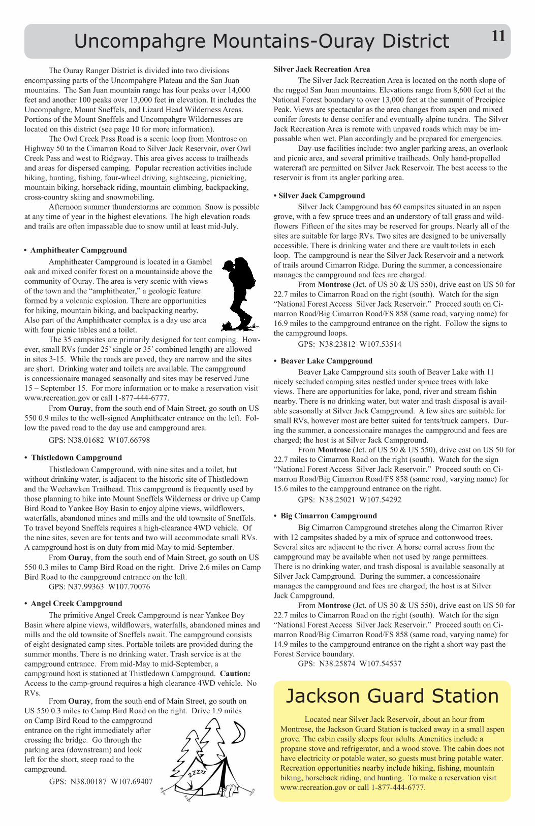
• Amphitheater CampgroundAmphitheaterCampgroundislocatedinaGambel
oakandmixedconiferforestonamountainsideabovethecommunityofOuray.Theareaisveryscenicwithviewsofthetownandthe“amphitheater,”ageologicfeatureformedbyavolcanicexplosion.Thereareopportunitiesforhiking,mountainbiking,andbackpackingnearby.AlsopartoftheAmphitheatercomplexisadayuseareawithfourpicnictablesandatoilet.
The35campsitesareprimarilydesignedfortentcamping.How-ever,smallRVs(under25’singleor35’combinedlength)areallowedinsites3-15.Whiletheroadsarepaved,theyarenarrowandthesitesareshort.Drinkingwaterandtoiletsareavailable.ThecampgroundisconcessionairemanagedseasonallyandsitesmaybereservedJune15–September15.Formoreinformationortomakeareservationvisitwww.recreation.govorcall1-877-444-6777.
FromOuray,fromthesouthendofMainStreet,gosouthonUS5500.9milestothewell-signedAmphitheaterentranceontheleft.Fol-lowthepavedroadtothedayuseandcampgroundarea.
GPS:N38.01682W107.66798
• Thistledown CampgroundThistledownCampground,withninesitesandatoilet,but
withoutdrinkingwater,isadjacenttothehistoricsiteofThistledownandtheWeehawkenTrailhead.ThiscampgroundisfrequentlyusedbythoseplanningtohikeintoMountSneffelsWildernessordriveupCampBirdRoadtoYankeeBoyBasintoenjoyalpineviews,wildflowers,waterfalls,abandonedminesandmillsandtheoldtownsiteofSneffels.TotravelbeyondSneffelsrequiresahigh-clearance4WDvehicle.Oftheninesites,sevenarefortentsandtwowillaccommodatesmallRVs.Acampgroundhostisondutyfrommid-Maytomid-September.
FromOuray,fromthesouthendofMainStreet,gosouthonUS5500.3milestoCampBirdRoadontheright.Drive2.6milesonCampBirdRoadtothecampgroundentranceontheleft.
GPS:N37.99363W107.70076
• Angel Creek CampgroundTheprimitiveAngelCreekCampgroundisnearYankeeBoy
Basinwherealpineviews,wildflowers,waterfalls,abandonedminesandmillsandtheoldtownsiteofSneffelsawait.Thecampgroundconsistsofeightdesignatedcampsites.Portabletoiletsareprovidedduringthesummermonths.Thereisnodrinkingwater.Trashserviceisatthecampgroundentrance.Frommid-Maytomid-September,acampgroundhostisstationedatThistledownCampground. Caution: Accesstothecamp-groundrequiresahighclearance4WDvehicle.NoRVs.
FromOuray,fromthesouthendofMainStreet,gosouthonUS 5500.3milestoCampBirdRoadontheright.Drive1.9milesonCampBirdRoadtothecampgroundentranceontherightimmediatelyaftercrossingthebridge.Gothroughtheparkingarea(downstream)andlookleftfortheshort,steeproadtothecampground.
GPS:N38.00187W107.69407
Silver Jack Recreation AreaTheSilverJackRecreationAreaislocatedonthenorthslopeof
theruggedSanJuanmountains.Elevationsrangefrom8,600feetattheNational Forestboundarytoover13,000feetatthesummitofPrecipicePeak.Viewsarespectacularastheareachangesfromaspenandmixedconiferforeststodenseconiferandeventuallyalpinetundra.TheSilverJackRecreationAreaisremotewithunpavedroadswhichmaybeim-passablewhenwet.Planaccordinglyandbepreparedforemergencies.
Day-usefacilitiesinclude:twoanglerparkingareas,anoverlookandpicnicarea,andseveralprimitivetrailheads.Onlyhand-propelledwatercraftarepermittedonSilverJackReservoir.Thebestaccesstothereservoirisfromitsanglerparkingarea.
• Silver Jack CampgroundSilverJackCampgroundhas60campsitessituatedinanaspen
grove,withafewsprucetreesandanunderstoryoftallgrassandwild-flowers Fifteenofthesitesmaybereservedforgroups.NearlyallofthesitesaresuitableforlargeRVs.Twositesaredesignedtobeuniversallyaccessible.Thereisdrinkingwaterandtherearevaulttoiletsineachloop.ThecampgroundisneartheSilverJackReservoirandanetworkoftrailsaroundCimarronRidge.Duringthesummer,aconcessionairemanagesthecampgroundandfeesarecharged.
FromMontrose(Jct.of US50&US550),driveeastonUS50for22.7milestoCimarronRoadontheright(south).Watchforthesign“NationalForestAccessSilverJackReservoir.”ProceedsouthonCi-marronRoad/BigCimarronRoad/FS858(sameroad,varyingname)for16.9milestothecampgroundentranceontheright.Followthesignstothecampgroundloops.
GPS:N38.23812W107.53514
• Beaver Lake CampgroundBeaverLakeCampgroundsitssouthofBeaverLakewith11
nicelysecludedcampingsitesnestledundersprucetreeswithlakeviews.Thereareopportunitiesforlake,pond,riverandstreamfishin nearby.Thereisnodrinkingwater,butwaterandtrashdisposalisavail-ableseasonallyatSilverJackCampground.AfewsitesaresuitableforsmallRVs,howevermostarebettersuitedfortents/truckcampers.Dur-ingthesummer,aconcessionairemanagesthecampgroundandfeesarecharged;thehostisatSilverJackCampground.
FromMontrose(Jct.of US50&US550),driveeastonUS50for22.7milestoCimarronRoadontheright(south).Watchforthesign“NationalForestAccessSilverJackReservoir.”ProceedsouthonCi-marronRoad/BigCimarronRoad/FS858(sameroad,varyingname)for15.6milestothecampgroundentranceontheright.
GPS:N38.25021W107.54292
• Big Cimarron CampgroundBigCimarronCampgroundstretchesalongtheCimarronRiver
with12campsitesshadedbyamixofspruceandcottonwoodtrees.Severalsitesareadjacenttotheriver.Ahorsecorralacrossfromthecampgroundmaybeavailablewhennotusedbyrangepermittees.Thereisnodrinkingwater, andtrashdisposalisavailableseasonallyatSilverJackCampground.Duringthesummer,aconcessionairemanagesthecampgroundandfeesarecharged;thehostisatSilverJackCampground.
FromMontrose(Jct.of US50&US550),driveeastonUS50for22.7milestoCimarronRoadontheright(south).Watchforthesign“NationalForestAccessSilverJackReservoir.”ProceedsouthonCi-marronRoad/BigCimarronRoad/FS858(sameroad,varyingname)for14.9milestothecampgroundentranceontherightashortwaypasttheForestServiceboundary.
GPS:N38.25874W107.54537
Jackson Guard StationLocatednearSilverJackReservoir,aboutanhourfrom
Montrose,theJacksonGuardStationistuckedawayinasmallaspengrove.Thecabineasilysleepsfouradults.Amenitiesincludeapropanestoveandrefrigerator,andawoodstove.Thecabindoesnothaveelectricityorpotablewater,soguestsmustbringpotablewater.Recreationopportunitiesnearbyincludehiking,fishing,mountainbiking,horsebackriding,andhunting.Tomakeareservationvisitwww.recreation.govorcall1-877-444-6777.
11
General Information
MontrosePublicLandsCenter
Forthosewhowanttoexplore,hike,mountainbike,flatandwhitewaterboat,fish,hunt,andrideATVs,avisittotheMontrosePub-licLandsCenter,2505S.TownsendAvenue,isamust.ThevisitorcenterisopenMondaythroughFridayfrom8a.m.to4:30p.m.TheBureauofLandManagementUncompahgreFieldOfficeandForestServiceOurayRangerDistrictbothoperatefromtheMontrosePublicLandsCenter,withtheNationalParkServicerepresentedaswell.
Everydayfriendlyandknowledgeablestaffandvolunteers,whohavefirst-hand experienceexploringandpreservingthescenicsurroundings,areavailabletoassistyouinplanningyournextadventure.
TheMontrosePublicLandsCentersellstheAmericatheBeauti-fulFederalrecreationpasses,as well as permitsforfirewoodcutting,rockremoval,andChristmastreecutting.
AvaluablepartnershipwiththeSanJuanMountainsAssociationprovidesvisitorswithabookstoreofferingalargeselectionofmaps,books, clothing, and more.Whenyoupurchaseitemsfromthebookstore10%ofallprofitscomebacktotheMontroseareatohelpoperateeducationandvolunteerprogramsbenefitingpubliclands.
IfyouvisittheMontrosePublicLandsCenterwhenitisclosed,a large outdoor kiosk is updated frequently and offers free Coloradomaps, brochures and seasonal information aboutwhat’s happening inthearea.
Welcome to Montrose and enjoy your public lands!
San Juan Mountains AssociationTheSanJuanMountainsAssociation(SJMA)
isanon-profit501(c)(3)organizationlocatedinDurango,Coloradowhosemissionistopromoteresponsiblecareofnaturalandculturalresourcesthrougheducationandhands-oninvolvementthatinspiresrespectandreverenceforourlands.
SJMAmanagesbookstoresinmanypubliclandsvisitorcenterswithallprofitsgoingbacktoeducationandoutreachefforts.
Formoreinformationvisitwww.sjma.org or contact [email protected] or (970) 247-4874.
TheBureauofLandManagement(BLM) isthestewardformanyofthegreatAmericanlandscapes.TheBLM’sNationalConservation Lands, also known as the National Landscape Conservation System,highlightsomeoftheWest’smostspectacularpubliclands so they may be protected, conserved, or restored. These lands are congressionally or presidentially designatedareaswithspecialnatural,cultural,ecologicalandscientificvalues. Nationalmonuments,nationalconservationareas,nationalscenicandhistorictrails,wildandscenicrivers,wildernessareas,andwildernessstudyareas are all part of the National Landscape Conservation System.The National Conservation Lands are managedbytheBLMasanAmericantreasureofvast,wide-openspaces and help to increase the public's awarenessof,andappreciationfor,thesepublictreasures.
ColoradoCanyonsAssociationfosterscommunitystewardshipofNationalConservationLandswithafocusonDominguez-Escalante,GunnisonGorgeandMcInnisCanyonsNationalConservationAreasinWesternColorado.Theyareanon-partisan,non-profit organizationencouragingcooperationamongallNationalConservationArea(NCA)usersandinterests.
Formoreinformationortobecomeamembervisit www.coloradocanyonsassociation.org.
Additional ContactsNorwoodRangerDistrict 1150ForestNorwood,CO81423(970)327-4261
PaoniaRangerDistrict403NorthRioGrandeAvenue Paonia,CO81428(970)527-4131
BLMGunnisonGorgeNationalConservationArea 2465SouthTownsend Montrose,CO81401(970)240-5300
BLMGunnisonFieldOffice 650South11thStreet Gunnison,CO81230 (970)642-4940
GrandMesa,Uncompahgre,andGunnisonNationalForest 2250Highway50Delta,CO81416(970)874-6600
GrandValleyRangerDistrict2777CrossroadsBlvd,Suite1GrandJunction,CO81506(970)242-8211
GrandMesaVisitorCenter (970)856-4153OpenSeasonally
GunnisonRangerDistrict 216N.Colorado Gunnison,CO 81230(970)641-0471
OurayRangerDistrict 2505S.TownsendAve Montrose,CO81401 (970)240-5300
BLMUncompahgreFieldOffice 2465SouthTownsendAvenue Montrose,CO81401(970)240-5300
BLMGrandJunctionFieldOffice 2815HRoadGrandJunction,CO81506 (970) 244-3000
ColoradoDivisionofParksandWildlife2300STownsendAvenue Montrose,CO81401(970)252-6000
NationalParkServiceBlackCanyonoftheGunnisonCurecantiNationalRecreationAreaMailingAddress:102ElkCreekGunnison,CO81230(970)641-2337 or 249-1915
OurayChamber of Commerce 1230MainStreet Ouray,CO81427 (970)325-4746
TellurideVisitorCenter 700WColoradoAveTelluride,CO81435 (866) 237-5341
DeltaChamberofCommerce 301MainSt.Delta,CO81416(970)874-8616MontroseVisitor Center
107 S. Cascade Ave Montrose,CO81401 (970) 497-8558
Related Documents