UKSeaMap UKSeaMap The mapping of seabed and water The mapping of seabed and water column features of UK seas column features of UK seas David Connor David Connor MESH UK stakeholders workshop MESH UK stakeholders workshop London, 19 October 2006 London, 19 October 2006

UKSeaMap The mapping of seabed and water column features of UK seas David Connor MESH UK stakeholders workshop London, 19 October 2006.
Dec 18, 2015
Welcome message from author
This document is posted to help you gain knowledge. Please leave a comment to let me know what you think about it! Share it to your friends and learn new things together.
Transcript
UKSeaMapUKSeaMapThe mapping of seabed and water The mapping of seabed and water
column features of UK seascolumn features of UK seas
David ConnorDavid Connor
MESH UK stakeholders workshopMESH UK stakeholders workshopLondon, 19 October 2006London, 19 October 2006

www.searchMESH.net
OutlineOutline
Origins of UKSeaMapOrigins of UKSeaMapData and methods usedData and methods usedOutcomesOutcomesApplicationsApplications
Focus on seabed mappingFocus on seabed mapping

www.searchMESH.net
Origins of the projectOrigins of the project
Roff and Taylor Roff and Taylor (2000)(2000)
Review of Marine Review of Marine Nature Nature ConservationConservation
Irish Sea PilotIrish Sea PilotUKSeaMap began UKSeaMap began
November 2004November 2004Completed 2006Completed 2006

www.searchMESH.net
Funding partners & project teamFunding partners & project team
JNCC project team:JNCC project team:
David ConnorDavid ConnorNeil GoldingNeil GoldingKirsteen McKenzieKirsteen McKenziePaul RobinsonPaul RobinsonDylan ToddDylan ToddEmma VerlingEmma Verling
A contribution to:A contribution to:

www.searchMESH.net
UKSeaMap - aimsUKSeaMap - aims
To provide To provide broadscale maps of broadscale maps of all UK seas via all UK seas via modellingmodelling
To use existing To use existing physical and physical and hydrographic datahydrographic data
To produce maps of To produce maps of ecological relevance ecological relevance for regional and for regional and national management national management and planningand planning
www.searchMESH.net
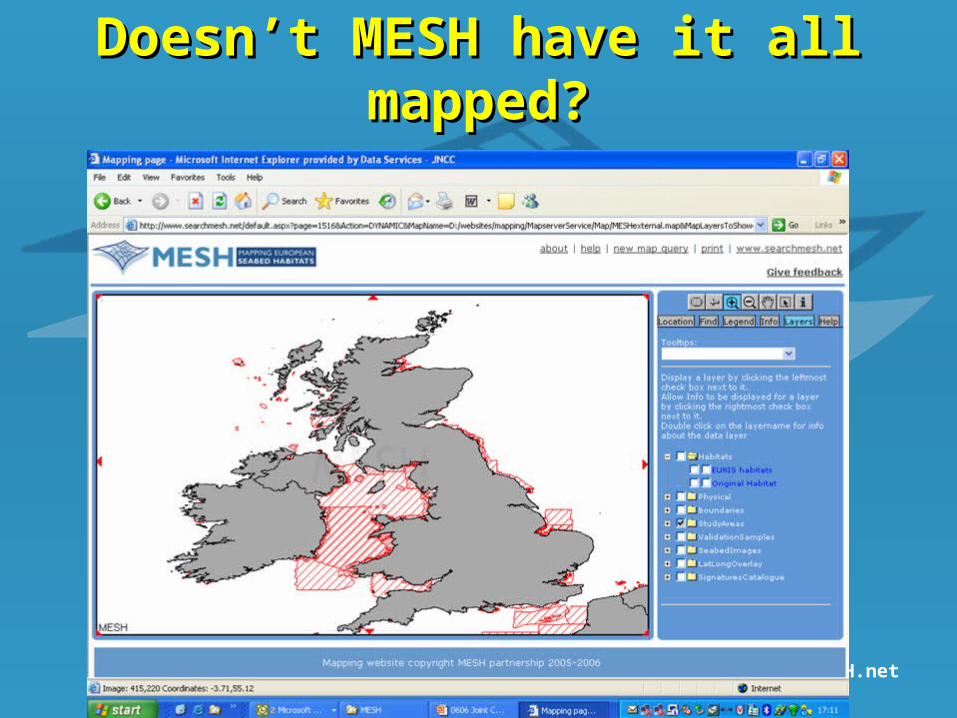
Doesn’t MESH have it all Doesn’t MESH have it all mapped?mapped?

www.searchMESH.net
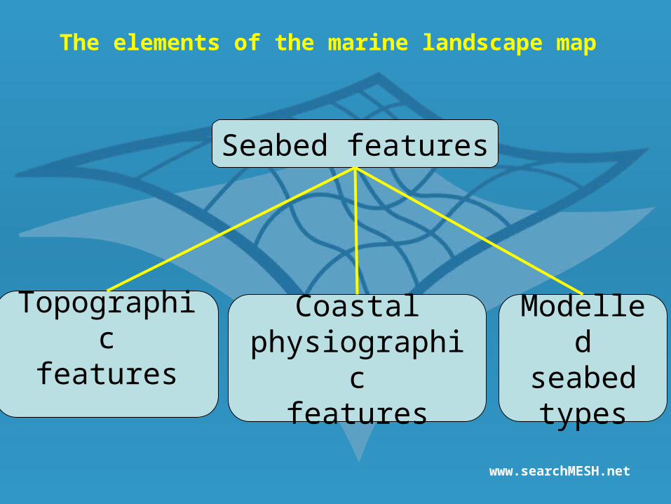
Seabed features
Topographicfeatures
Coastalphysiographic
features
Modelledseabedtypes
The elements of the marine landscape map

www.searchMESH.net
Data typesData types Used:Used:
SlopeSlope SubstratumSubstratum Light penetrationLight penetration DepthDepth Bottom temperatureBottom temperature Wave-baseWave-base Near-bed stressNear-bed stress
Also considered:Also considered: Tidal rangeTidal range OxygenOxygen NutrientsNutrients pHpH SalinitySalinity Wave exposureWave exposure

www.searchMESH.net

www.searchMESH.net
CanyonCanyon
Subtidal Subtidal sediment sediment
bankbank
Shelf Shelf troughtrough
Deep Deep ocean riseocean rise
Iceberg Iceberg plough-mark plough-mark
zonezone
www.searchMESH.net
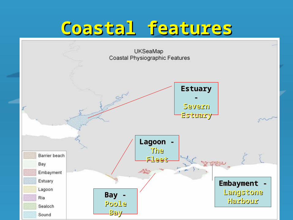
Coastal featuresCoastal features
Estuary -Estuary -Severn Severn EstuaryEstuary
Embayment -Embayment -Langstone Langstone
HarbourHarbour
Lagoon -Lagoon -The FleetThe Fleet
Bay -Bay -Poole BayPoole Bay
www.searchMESH.net
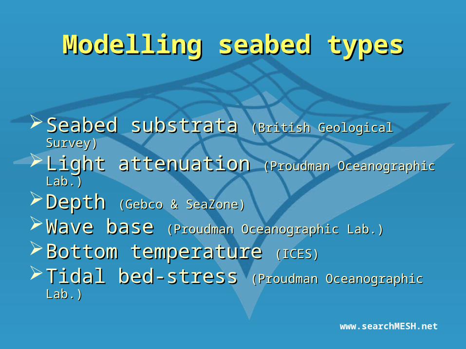
Modelling seabed typesModelling seabed types
Seabed substrata Seabed substrata (British Geological Survey)(British Geological Survey)
Light attenuation Light attenuation (Proudman Oceanographic Lab.)(Proudman Oceanographic Lab.)
Depth Depth (Gebco & SeaZone)(Gebco & SeaZone)
Wave base Wave base (Proudman Oceanographic Lab.)(Proudman Oceanographic Lab.)
Bottom temperature Bottom temperature (ICES)(ICES)
Tidal bed-stress Tidal bed-stress (Proudman Oceanographic Lab.)(Proudman Oceanographic Lab.)

www.searchMESH.net
Substratum
Depth Zone
Bed Stress
Rock
CoarseSediment
MixedSediment
Sand Mud
Photic
Shallow Shelf
Deep water
Aphotic Cold
Weak StrongModerate
Warm
Modelling seabed typesModelling seabed types

www.searchMESH.net
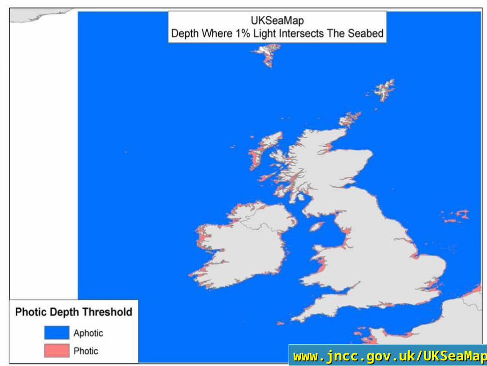
www.jncc.gov.uk/UKSeaMapwww.jncc.gov.uk/UKSeaMap

www.searchMESH.net
Depth zonationDepth zonation
1.1. Photic zonePhotic zonefrom coastline to photic depth (rocky substrata only)from coastline to photic depth (rocky substrata only)
2.2. Shallow zoneShallow zonefrom coastline to wave basefrom coastline to wave base
3.3. Shelf zoneShelf zonefrom wave base to shelf break (200m depth)from wave base to shelf break (200m depth)
4.4. Deep water zoneDeep water zone>200m depth>200m depthWarm water > 4ºCWarm water > 4ºCCold water <4ºCCold water <4ºC
www.searchMESH.net
www.jncc.gov.uk/UKSeaMapwww.jncc.gov.uk/UKSeaMap

www.searchMESH.net
www.jncc.gov.uk/UKSeaMapwww.jncc.gov.uk/UKSeaMap

www.searchMESH.net
ºC
www.jncc.gov.uk/UKSeaMapwww.jncc.gov.uk/UKSeaMap

www.searchMESH.netSource Proudman Oceanographic Laboratorywww.jncc.gov.uk/UKSeaMapwww.jncc.gov.uk/UKSeaMap

www.searchMESH.net
0.1 decimal 0.1 decimal degreesdegrees
0.02 decimal 0.02 decimal degreesdegrees
No. of cellsNo. of cellsCoarse – 5,908Coarse – 5,908Fine – 1,292,276Fine – 1,292,276

www.searchMESH.net
Supervised classificationSupervised classificationClassification tree exampleClassification tree example
Sediment:coarse
Depth:shallow
Bed stress:strong
Shallow coarsesediment plain – strong bed stress

www.searchMESH.netwww.jncc.gov.uk/UKSeaMapwww.jncc.gov.uk/UKSeaMap
www.searchMESH.net
Seabed features
Topographicfeatures
Coastalphysiographic
features
Modelledseabedtypes
The elements of the marine landscape map

www.searchMESH.netwww.jncc.gov.uk/UKSeaMapwww.jncc.gov.uk/UKSeaMap

www.searchMESH.netwww.jncc.gov.uk/UKSeaMapwww.jncc.gov.uk/UKSeaMap

www.searchMESH.net
Most commonMost common
Landscape typeLandscape type % of % of UKCSUKCS kmkm22
Shelf sand plainShelf sand plain 24.724.7 215,215215,215
UncategorisedUncategorised 13.613.6 118,808118,808
Deep ocean riseDeep ocean rise 10.110.1 87,90787,907
Shelf coarse sediment plainShelf coarse sediment plain 8.88.8 76,49276,492
Deep-sea warm-water mud plainDeep-sea warm-water mud plain 6.56.5 56,32756,327
Shallow sand plainShallow sand plain 5.55.5 48,21848,218
Shelf mud plainShelf mud plain 5.15.1 44,60544,605

www.searchMESH.net
Least commonLeast common
Landscape typeLandscape type kmkm22
LagoonsLagoons 2424
Barrier beachBarrier beach 2929
Deep water mounds (Darwin Mounds)Deep water mounds (Darwin Mounds) 5252
SoundSound 9191
RiaRia 104104
Shelf mixed sediment plain – strong tide stressShelf mixed sediment plain – strong tide stress 285285
Deep-sea cold-water coarse sediment plainDeep-sea cold-water coarse sediment plain 386386
EmbaymentEmbayment 596596
Shallow mixed sediment plain - strong bed stressShallow mixed sediment plain - strong bed stress 952952
Shelf mounds or pinnaclesShelf mounds or pinnacles 11241124

www.searchMESH.net
Biological validationBiological validationPredicted relationship to EUNISPredicted relationship to EUNIS
EUNIS level
EUNIS code
EUNIS name
Lag
oon
Est
uar
y
Ria
Sea
loch
/Voe
Em
bay
men
t
Bar
rier
bea
ch
Sou
nd
or
stra
it
Bay
Ph
otic
roc
k
Ap
hot
ic r
ock
Sh
allo
w c
oars
e se
dim
ent
pla
in -
w
eak
tid
e st
ress
Sh
allo
w c
oars
e se
dim
ent
pla
in -
m
oder
ate
tid
e st
ress
3 A4.7 Features of circalittoral rock 0 0 0 1 0 0 1 1 -1 1 -1 -1
2 A5 Sublittoral sediment 1 1 1 1 1 1 1 1 -1 -1 1 1
3 A5.1 Sublittoral coarse sediment 1 0 0 0 0 0 0 0 -1 -1 1 1
3 A5.2 Sublittoral sand 1 1 1 1 1 1 1 1 -1 -1 -1 -1
3 A5.3 Sublittoral mud 1 1 1 1 1 0 0 0 -1 -1 -1 -1
3 A5.4 Sublittoral mixed sediments 1 1 1 1 1 1 1 1 -1 -1 -1 -1
3 A5.5Sublittoral macrophyte-dominated sediment 1 1 1 1 1 1 1 1 -1 -1 1 1
3 A5.6 Sublittoral biogenic reefs 0 1 1 1 0 0 1 1 1 1 0 0
3 A5.7 Features of sublittoral sediments 0 0 0 0 0 0 0 0 -1 -1 0 0
2 A6 Deep-sea bed -1 -1 -1 0 -1 -1 -1 -1 -1 -1 -1 -1
3 A6.1Deep-sea rock and artificial hard substrata -1 -1 -1 0 -1 -1 -1 -1 -1 -1 -1 -1
3 A6.2 Deep-sea mixed substrata -1 -1 -1 0 -1 -1 -1 -1 -1 -1 -1 -1
Landscape typesLandscape typesHabitatHabitattypestypes
www.searchMESH.net
www.jncc.gov.uk/UKSeaMapwww.jncc.gov.uk/UKSeaMap
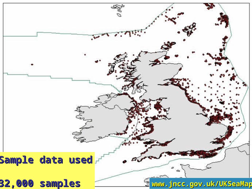
Sample data usedSample data used
32,000 samples32,000 samples
www.searchMESH.net
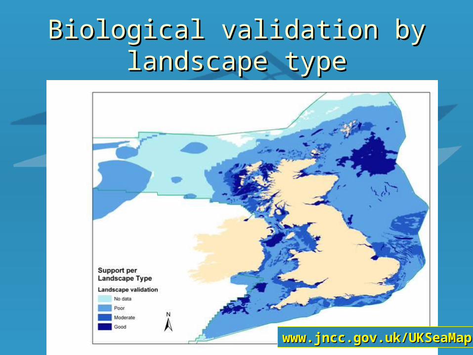
Biological validation by landscape Biological validation by landscape typetype
www.jncc.gov.uk/UKSeaMapwww.jncc.gov.uk/UKSeaMap

www.searchMESH.net
ApplicationsApplications
Protection through Protection through better informed end usersbetter informed end users Strategic planningStrategic planning advice to industry advice to industry Essential environmental data forEssential environmental data for marine spatial marine spatial
planningplanning Marine protected areasMarine protected areas – representative network – representative network Monitoring and surveillance programmesMonitoring and surveillance programmes European DirectiveEuropean Directive implementation – Water implementation – Water
Framework Directive & Marine Strategy DirectiveFramework Directive & Marine Strategy Directive Regional seasRegional seas – confirm boundaries – confirm boundaries

www.searchMESH.net
ConclusionsConclusions Successful use of available physical & Successful use of available physical &
hydrographic data to produce first ecological hydrographic data to produce first ecological
map for UK seasmap for UK seas
Recognise limitations in data coverage & Recognise limitations in data coverage &
resolutionresolution
Number of applications at regional & national Number of applications at regional & national
levellevel
Work towards improving data and models to Work towards improving data and models to
refine maprefine map
[email protected]@jncc.gov.uk www.jncc.gov.uk/UKSeaMapwww.jncc.gov.uk/UKSeaMap
Related Documents