A mission planning solution for UAV professionals.

UgCS For Professionals (with screenshots)
Aug 06, 2015
Welcome message from author
This document is posted to help you gain knowledge. Please leave a comment to let me know what you think about it! Share it to your friends and learn new things together.
Transcript

A mission planning solution for UAV professionals.

Why go Pro with UgCS?
- Sophisticated mission planning software
- No restrictions
- An enterprise solution for unmanned vehicles
- Deploy and monitor multiple UAVs at the same time
- Store all flight data on a single server
- Fly safely with ADS-B
- Support

Store everything on a single server
Multi-node deployment allows you to have seperate parts of UgCS running onseperate computers. With UgCS Pro you can have a single server allowing you to have the data from all your client installations on the same place.
Monitor pilots in the field from a single ground station.

An unlimited airspace
With UgCS Pro there are no limitations in radius and altitude of opperations, allowing you to set the vehicle to fly as far as necessary.

Use No-Fly zones
UgCS comes with airport no-fly zones pre-enabled.
In UgCS Pro you have full control over theno-fly zones, allowing you to disable theexisting and create your own.

Mission planning in animmersive 3D environment
The world we live in is 3-dimensional and not 2-dimensional space.
UgCS allows you to import 3D buildingsand other obstacles in order to accountfor them when calculating the flightpath.

Data import
UgCS offers a world open to customization.
Import your own DEM terrain elevation models into UgCS. Use your own map overlays.
We support KML data file import to allow customization of the map according your requirements.

Fly safe with ADS-B
Be more aware of what`s around you in the sky.
UgCS Pro version comes with in-built support for ADS-B receivers.
Simply connect the receiver to your computer through the USB hub and UgCS willnotify you of approaching aircraft.
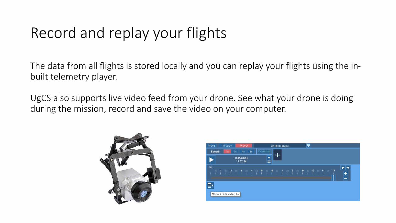
Record and replay your flights
The data from all flights is stored locally and you can replay your flights using the in-built telemetry player.
UgCS also supports live video feed from your drone. See what your drone is doing during the mission, record and save the video on your computer.

Suitable for aerialmonitoring
UgCS automatically calculates Area Scan missions taking into account the resolution of a camera equipped and parameters of a vehicle.
UgCS supports camera footprint, meaning that you can see in real time which area is filmed by the camera on the map.

Support
At UgCS we have a team of experienced andskilled engineers available for support andassistance to UgCS Pro customers.

For more information please visit www.ugcs.com
E-mail: [email protected]: +371 25453422
Daugavgrivas 140, Aerodrome «Spilve», Riga, Latvia
Related Documents