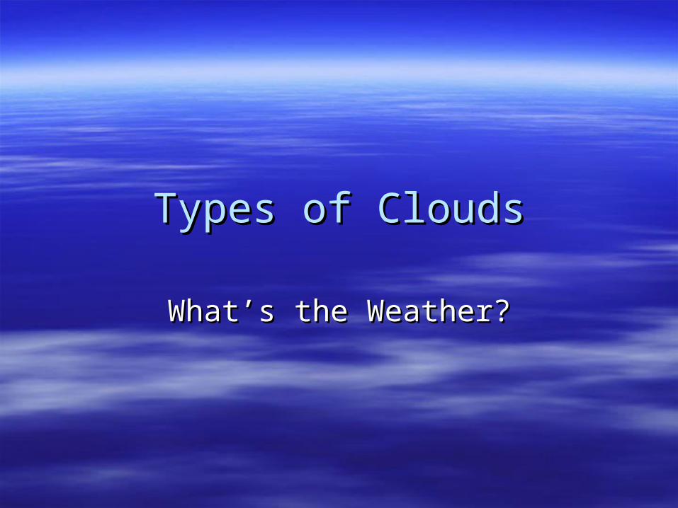
Types of Clouds Types of Clouds What’s the Weather? What’s the Weather?

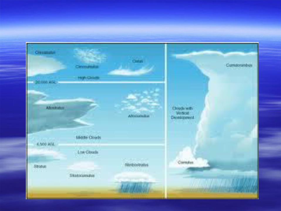
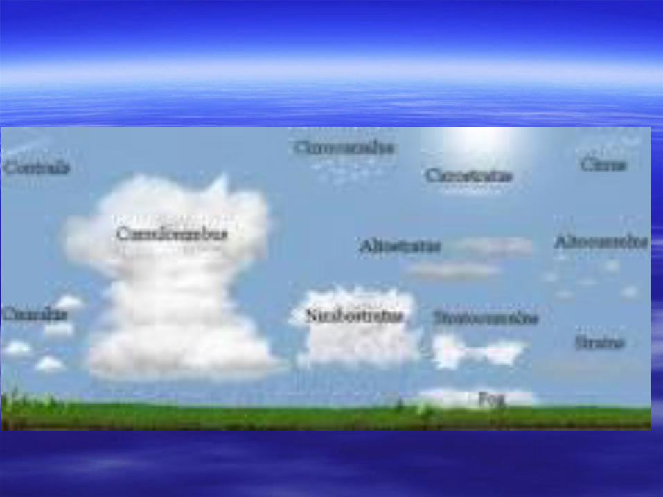
Types of Clouds What’s the Weather?. Cirrus, Cirrocumulus and Cirrostratus (high 5000-16,000 m) thin and often wispy composed of ice crystals.
Dec 11, 2015
Welcome message from author
This document is posted to help you gain knowledge. Please leave a comment to let me know what you think about it! Share it to your friends and learn new things together.
Transcript
Types of CloudsTypes of Clouds
What’s the Weather?What’s the Weather?


Cirrus, Cirrocumulus and Cirrus, Cirrocumulus and CirrostratusCirrostratus
(high 5000-16,000 m)(high 5000-16,000 m)
thin and often wispy thin and often wispy composed of ice crystals that originate from the composed of ice crystals that originate from the
freezing of supercooled water droplets. freezing of supercooled water droplets. Generally occur in fair weather and point in the Generally occur in fair weather and point in the
direction of air movement at their elevation. direction of air movement at their elevation.

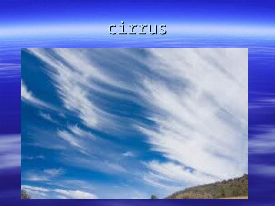
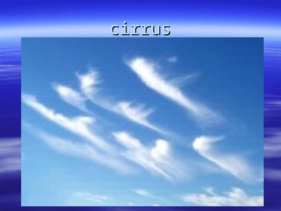
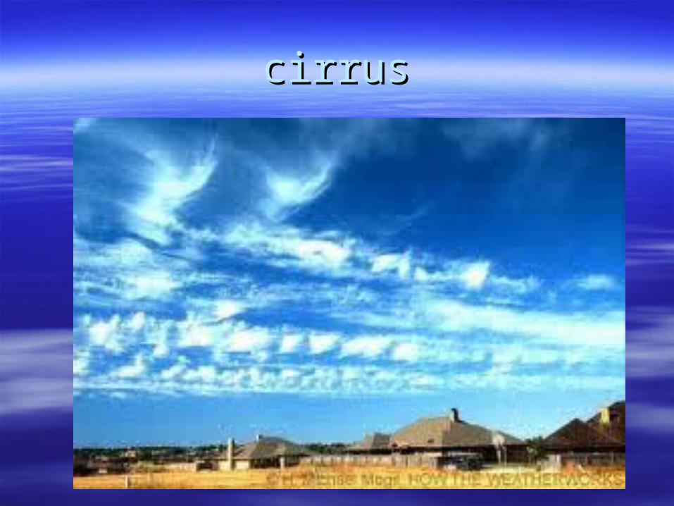
CirrusCirrus
They are made of ice crystals and have long, thin, They are made of ice crystals and have long, thin, wispy streamers. wispy streamers.
Cirrus clouds are usually white and predict fair Cirrus clouds are usually white and predict fair weather. weather.

cirruscirrus
cirruscirrus
cirruscirrus

cirruscirrus

cirruscirrus
cirruscirrus

CirrocumulusCirrocumulus
They are small rounded puffs that usually appear in long They are small rounded puffs that usually appear in long rows. rows.
Cirrocumulus are usually white, but sometimes appear Cirrocumulus are usually white, but sometimes appear gray. gray.
Cirrocumulus are usually seen in the winter time and mean Cirrocumulus are usually seen in the winter time and mean that there will be fair, but cold weather. that there will be fair, but cold weather.

CirrostratusCirrostratus
Sheetlike thin clouds that usually cover the Sheetlike thin clouds that usually cover the entire sky. entire sky.
Cirrostratus clouds usually come 12-24 Cirrostratus clouds usually come 12-24 hours before a rain or snow storm. hours before a rain or snow storm.

Altocumulus and AltostratusAltocumulus and Altostratus(middle 2,000 to 7, 000 m)(middle 2,000 to 7, 000 m)
Middle clouds are made of ice crystals and water Middle clouds are made of ice crystals and water droplets. droplets.
The base of a middle cloud above the surface can The base of a middle cloud above the surface can be anywhere from 2000-8000m in the tropics to be anywhere from 2000-8000m in the tropics to 2000-4000m in the polar regions. An2000-4000m in the polar regions. An
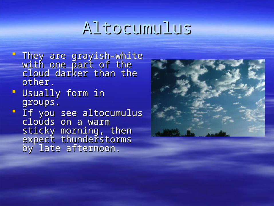
AltocumulusAltocumulus
They are grayish-white with They are grayish-white with one part of the cloud darker one part of the cloud darker than the other. than the other.
Usually form in groups. Usually form in groups. If you see altocumulus clouds If you see altocumulus clouds
on a warm sticky morning, on a warm sticky morning, then expect thunderstorms by then expect thunderstorms by late afternoon. late afternoon.

AltostratusAltostratus
An altostratus cloud usually An altostratus cloud usually covers the whole sky. covers the whole sky.
The cloud looks gray or The cloud looks gray or blue-gray. blue-gray.
Usually forms ahead of Usually forms ahead of storms that have a lot of storms that have a lot of rain or snow. Sometimes, rain or snow. Sometimes, rain will fall from an rain will fall from an altostratus cloud. altostratus cloud.
If the rain hits the ground, If the rain hits the ground, then the cloud is called a then the cloud is called a nimbostratus cloud. nimbostratus cloud.
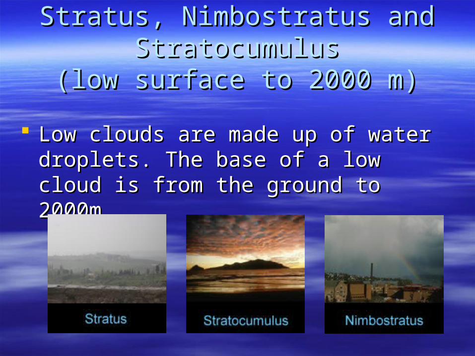
Stratus, Nimbostratus and Stratus, Nimbostratus and StratocumulusStratocumulus
(low surface to 2000 m)(low surface to 2000 m)
Low clouds are made up of water droplets. Low clouds are made up of water droplets. The base of a low cloud is from the ground The base of a low cloud is from the ground to 2000m. to 2000m.
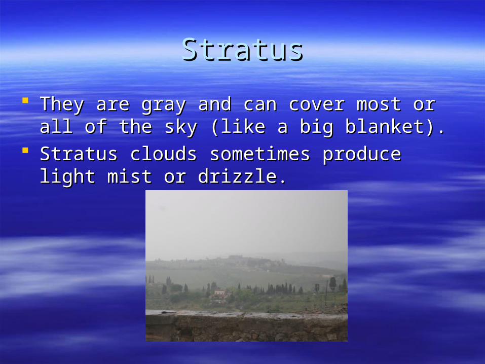
StratusStratus
They are gray and can cover most or all of the sky They are gray and can cover most or all of the sky (like a big blanket). (like a big blanket).
Stratus clouds sometimes produce light mist or Stratus clouds sometimes produce light mist or drizzle. drizzle.

stratusstratus

stratusstratus
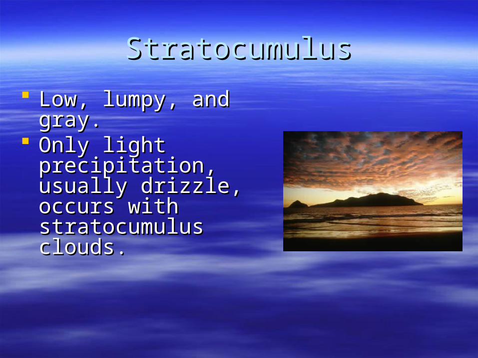
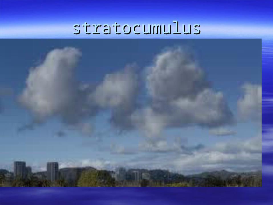
StratocumulusStratocumulus
Low, lumpy, and gray. Low, lumpy, and gray. Only light precipitation, Only light precipitation,
usually drizzle, occurs usually drizzle, occurs with stratocumulus with stratocumulus clouds. clouds.

statocumulusstatocumulus

NimbostratusNimbostratus
They are dark gray with a ragged base. They are dark gray with a ragged base. Produce rain or snow. Produce rain or snow. Sometimes they cover the whole sky and Sometimes they cover the whole sky and
you can't see the edges of the cloud. you can't see the edges of the cloud.

stratocumulusstratocumulus
stratocumulusstratocumulus
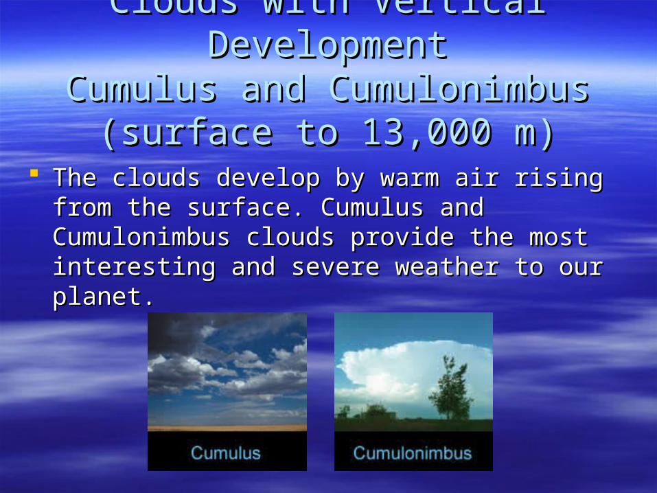
Clouds with Vertical DevelopmentClouds with Vertical DevelopmentCumulus and CumulonimbusCumulus and Cumulonimbus
(surface to 13,000 m)(surface to 13,000 m)
The clouds develop by warm air rising from the The clouds develop by warm air rising from the surface. Cumulus and Cumulonimbus clouds surface. Cumulus and Cumulonimbus clouds provide the most interesting and severe weather to provide the most interesting and severe weather to our planet. our planet.

CumulusCumulus
Puffy white or light gray clouds that look like floating cotton Puffy white or light gray clouds that look like floating cotton balls. balls.
Cumulus clouds have sharp outlines and a flat base. Cumulus clouds have sharp outlines and a flat base. Seeing cumulus clouds in the sky can mean the weather Seeing cumulus clouds in the sky can mean the weather
will be good or bad. will be good or bad.

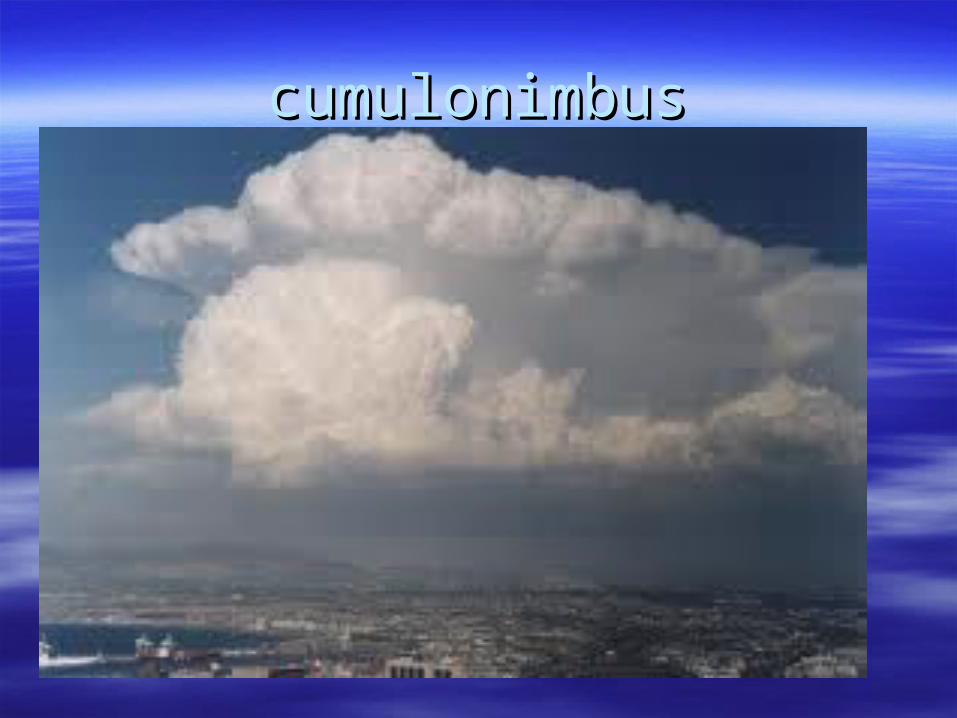
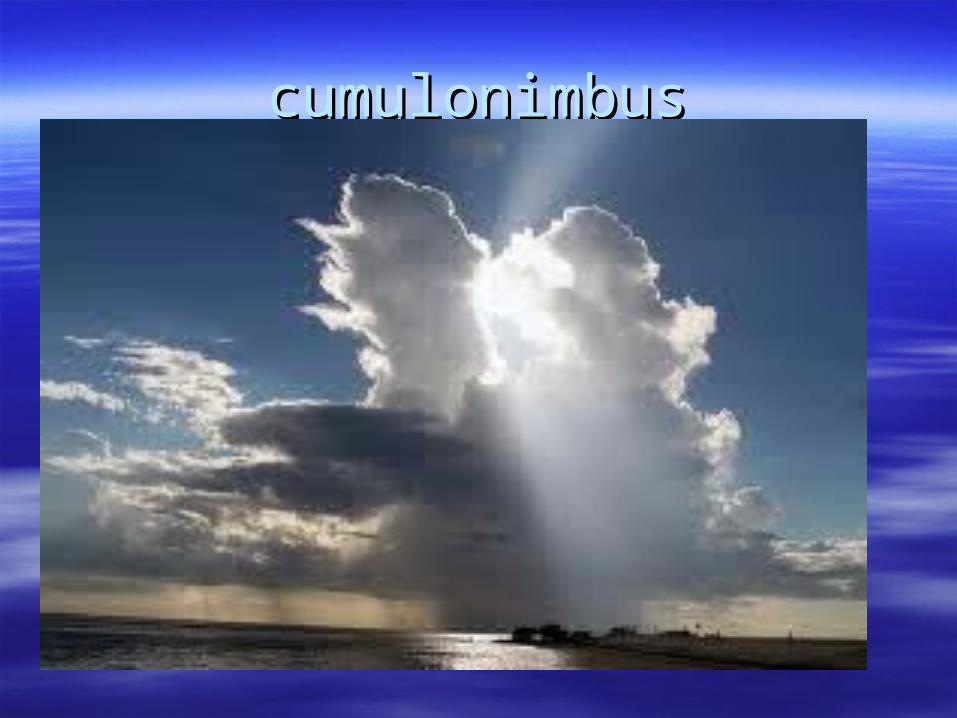
CumulonimbusCumulonimbus
Known as thunderstorm clouds. Known as thunderstorm clouds. Can grow up to 10km high. Can grow up to 10km high. High winds make the top of the cloud flat.High winds make the top of the cloud flat. Cumulonimbus clouds can produce heavy rain, Cumulonimbus clouds can produce heavy rain,
hail, lightning, and tornadoes. hail, lightning, and tornadoes.
cumulonimbuscumulonimbus
cumulonimbuscumulonimbus

cumulonimbuscumulonimbus

supercellsupercell

supercellsupercell


How do clouds formHow do clouds form
Adiabatic temperature changeAdiabatic temperature change Orographic liftOrographic lift Frontal wedgingFrontal wedging ConvergenceConvergence Fog is a cloud (many types steam, upslope, Fog is a cloud (many types steam, upslope,
evaporative, frontal, precipitation, and evaporative, frontal, precipitation, and radiation.radiation.

Adiabatic temperature changeAdiabatic temperature change
As one travels up through the atmosphere As one travels up through the atmosphere temperature drops or cools and temperature drops or cools and condensation occurscondensation occurs

Orographic liftOrographic lift
When air comes into contact with elevated When air comes into contact with elevated terrain, mountain slopes act like ramps lifting terrain, mountain slopes act like ramps lifting air causing cooling and condensationair causing cooling and condensation

Frontal wedgingFrontal wedging
Occurs when cool or cold air acts like a Occurs when cool or cold air acts like a barrier over which warmer less dense air barrier over which warmer less dense air risesrises
ConvergenceConvergence
Whenever 2 air masses collide resulting in Whenever 2 air masses collide resulting in upward air movementupward air movement
Related Documents