2520002 SHI Number Tweed Heritage Inventory Item Name: Lisnagar House and Dairy Location: Numinbah Road, Kynnumboon [Tweed] State Heritage Inventory Study Number Current Use: Former Uses: Statement of Significance: Lisnagar is a large picturesque timber house which is a rare example of the Victorian style two storey house built in the tropical Queensland 'single skin' method. The Twohill family is one of the earliest families in the Tweed Valley and have occupied the house continually; contemporary fittings and furniture have been retained. Whilst some repairs are required to the verandah and porch the house itself is in excellent condition. Historical Notes or Provenance: Ambitious mansions along the Tweed's banks still speak of the confidence of an earlier age. One of the most striking, "Lisnagar", stands a couple of miles outside the present town of Murwillumbah, on the site of the first private block in the Tweed valley. It is in fact on the spot where the original Murwillumbah was intended to be, but the Tweed became subject to flooding as it started to silt up, and the site of the town had to be shifted several times. "Lisnagar" was built by Edward Twohill, one of a typical family of 19th century Irish emigrants. Five brothers left the ancestral home om Castlelyons, Cork, at various intervals. Two finally settled in Australia, two in New Zealand, and it is believed the other later went to America. One of them, Edward Twohill, found his way to the Tweed and from local cedar floated down the river, he built "Lisnagar", - there his children, Emma, Vince, and Kevin still live - a sprightly trio, though getting on in years. It is their belief that Edward built his homestead after the style of Lisnagar Castle, which was near his old home in Ireland. His mother was an O'Keeffe, descended from the O'Keeffes of Lisnagar Castle. The O'Keeffes are descended from the royal Race of Munster and King Fionghnine, King of Munster, 906. Endorsed Significance: Local Assessed Significance: Local Item Type: Built Category: House Group: Residential buildings ( Admin Codes: Code 2: Code 3: Curtilage/Boundary: Located 1.5 km north-west of Murwillumbah, on the north side of Kynnumboon Bridge over the Rous River. Owner: Private - Corporate Other/Former Names: Area/Group/Complex: Group ID: Aboriginal Area: Local Govt Area: Tweed Planning: Northern Historic Region: North Coast Address: #Name? Suburb / Nearest Town: #Name? State: NSW Parish: Murwillumbah County: Rous #Name? Page 5 Full Report with Images State Heritage Inventory This report was produced using the Heritage Database Software provided by the Heritage Branch, NSW Department of Planning.

Welcome message from author
This document is posted to help you gain knowledge. Please leave a comment to let me know what you think about it! Share it to your friends and learn new things together.
Transcript

2520002
SHI Number
Tweed Heritage Inventory
Item Name: Lisnagar House and Dairy
Location: Numinbah Road, Kynnumboon [Tweed]
State Heritage Inventory Study Number
Current Use:
Former Uses:
Statement of
Significance:Lisnagar is a large picturesque timber house which is a rare example of the Victorian style two storey house built in the tropical Queensland 'single skin' method. The Twohill family is one of the earliest families in the Tweed Valley and have occupied the house continually; contemporary fittings and furniture have been retained. Whilst some repairs are required to the verandah and porch the house itself is in excellent condition.
Historical Notes
or Provenance:Ambitious mansions along the Tweed's banks still speak of the confidence of an earlier age. One of the most striking, "Lisnagar", stands a couple of miles outside the present town of Murwillumbah, on the site of the first private block in the Tweed valley. It is in fact on the spot where the original Murwillumbah was intended to be, but the Tweed became subject to flooding as it started to silt up, and the site of the town had to be shifted several times.
"Lisnagar" was built by Edward Twohill, one of a typical family of 19th century Irish emigrants. Five brothers left the ancestral home om Castlelyons, Cork, at various intervals. Two finally settled in Australia, two in New Zealand, and it is believed the other later went to America. One of them, Edward Twohill, found his way to the Tweed and from local cedar floated down the river, he built "Lisnagar", - there his children, Emma, Vince, and Kevin still live - a sprightly trio, though getting on in years.
It is their belief that Edward built his homestead after the style of Lisnagar Castle, which was near his old home in Ireland. His mother was an O'Keeffe, descended from the O'Keeffes of Lisnagar Castle. The O'Keeffes are descended from the royal Race of Munster and King Fionghnine, King of Munster, 906.
Endorsed Significance: LocalAssessed Significance: Local
Item Type: Built Category: HouseGroup: Residential buildings (
Admin Codes: Code 2: Code 3:
Curtilage/Boundary: Located 1.5 km north-west of Murwillumbah, on the north side of Kynnumboon Bridge over the Rous River.
Owner: Private - Corporate
Other/Former Names:
Area/Group/Complex: Group ID:
Aboriginal Area:
Local Govt Area: Tweed
Planning: Northern
Historic Region: North Coast
Address: #Name?
Suburb / Nearest Town: #Name?
State: NSW
Parish: Murwillumbah
County: Rous
#Name? Page 5 Full Report with Images
State Heritage Inventory
This report was produced using the Heritage Database Software provided by the Heritage Branch, NSW Department of Planning.

2520002
SHI Number
Tweed Heritage Inventory
Item Name: Lisnagar House and Dairy
Location: Numinbah Road, Kynnumboon [Tweed]
State Heritage Inventory Study Number
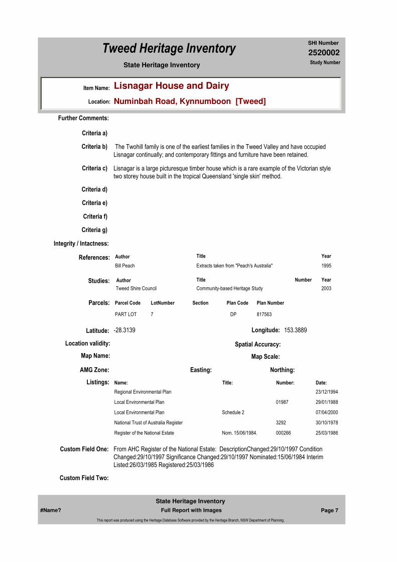
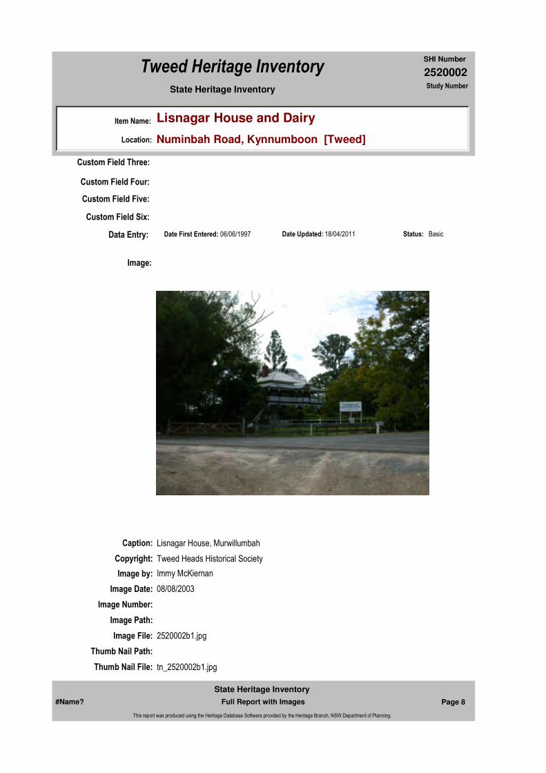
The two storeyed house has graceful verandahs and iron lace fittings. It looks like a genteel decaying residence that might have been built by some Louisana planter before the American Civil War.
Edward Twohill came to Australia by way of the American South, and obviously had his eye on American building styles while he was passing through. Still he was an Irishman. He called his house "Lisnagar", he painted it green and his children recall that they were taught by an Irish nun from Cork, and sang Irish songs in the home and danced Irish Jigs.
Nothing has changed at "Lisnagar" since Edward's time. None of the fittings, furniture, photographs and paintings have been changed or sold or given away. The Twohill children are content to live in a home of antiques, amongst their personal memories, and things that gain a greater value with the passing of time.
Extracts taken from "Peach's Australia" written by Bill Peach of the ABC television series.
Physical Description: Two storey timber house in a square shape with encircling two storey verandah and projecting entrance. Built in 1906 by Edward Twohill as his third homestead at Kynnumboon Bridge - previous two homesteads have been demolished. Named after 'Lisnagar Castle' near his old home in Ireland. Constructed in cedar in Queensland 'single skin' style on wooden piers. Verandah has wooden columns with decorative iron lace infill, iron curved roof. French doors open to verandah. Hipped roof, short ridge, with two decorative iron finials and offset brick chimney. Interior has basic four room floor plan with central hall on each floor, four panel doors with rectangular headlights, stencilling in the major rooms. Kitchen was built into the north west ground floor verandah. Dairy built about 1925 and a barn are at the rear of the house; both are in need of repair. Building Material: Timber
Physical Condition:
Modification Dates:
Designer:
Maker / Builder:
Year Started: Year Completed: 1906 Circa: No
Recommended Management:
Themes:
Management:
National Theme State Theme Local Theme
4. Settlement Accommodation (Housing) Farmhouse
#Name? Page 6 Full Report with Images
State Heritage Inventory
This report was produced using the Heritage Database Software provided by the Heritage Branch, NSW Department of Planning.
2520002
SHI Number
Tweed Heritage Inventory
Item Name: Lisnagar House and Dairy
Location: Numinbah Road, Kynnumboon [Tweed]
State Heritage Inventory Study Number
Custom Field One: From AHC Register of the National Estate: DescriptionChanged:29/10/1997 Condition Changed:29/10/1997 Significance Changed:29/10/1997 Nominated:15/06/1984 Interim Listed:26/03/1985 Registered:25/03/1986
References:
Studies:
Listings:
Further Comments:
Criteria a)
Criteria c) Lisnagar is a large picturesque timber house which is a rare example of the Victorian style two storey house built in the tropical Queensland 'single skin' method.
Criteria d)
Criteria e)
Criteria g)
Criteria f)
Integrity / Intactness:
Custom Field Two:
Criteria b) The Twohill family is one of the earliest families in the Tweed Valley and have occupied Lisnagar continually; and contemporary fittings and furniture have been retained.
Parcels:
Latitude: -28.3139 Longitude: 153.3889
AMG Zone: Easting: Northing:
Map Name: Map Scale:
Spatial Accuracy:Location validity:
Author Title Year
Bill Peach Extracts taken from "Peach's Australia" 1995
Author Title YearNumber
Tweed Shire Council Community-based Heritage Study 2003
Name: Date:Number:Title:
Regional Environmental Plan 23/12/1994
Local Environmental Plan 29/01/198801987
Local Environmental Plan 07/04/2000Schedule 2
National Trust of Australia Register 30/10/19783292
Register of the National Estate 25/03/1986000266Nom. 15/06/1984.
Parcel Code LotNumber Section Plan Code Plan Number
PART LOT 7 DP 817563
#Name? Page 7 Full Report with Images
State Heritage Inventory
This report was produced using the Heritage Database Software provided by the Heritage Branch, NSW Department of Planning.
2520002
SHI Number
Tweed Heritage Inventory
Item Name: Lisnagar House and Dairy
Location: Numinbah Road, Kynnumboon [Tweed]
State Heritage Inventory Study Number
Date Updated: 18/04/2011 Status: BasicDate First Entered: 06/06/1997Data Entry:
Custom Field Three:
Custom Field Four:
Custom Field Five:
Custom Field Six:
Caption: Lisnagar House, Murwillumbah
Copyright: Tweed Heads Historical Society
Image:
Image by: Immy McKiernan
Image Date: 08/08/2003
Image Number:
Image Path:
Image File: 2520002b1.jpg
Thumb Nail Path:
Thumb Nail File: tn_2520002b1.jpg
#Name? Page 8 Full Report with Images
State Heritage Inventory
This report was produced using the Heritage Database Software provided by the Heritage Branch, NSW Department of Planning.
2520002
SHI Number
Tweed Heritage Inventory
Item Name: Lisnagar House and Dairy
Location: Numinbah Road, Kynnumboon [Tweed]
State Heritage Inventory Study Number
#Name? Page 9 Full Report with Images
State Heritage Inventory
This report was produced using the Heritage Database Software provided by the Heritage Branch, NSW Department of Planning.

2520002
SHI Number
Tweed Heritage Inventory
Item Name: Lisnagar House and Dairy
Location: Numinbah Road, Kynnumboon [Tweed]
State Heritage Inventory Study Number
Caption: Lisnagar House, Murwillumbah
Copyright: Tweed Heads Historical Society
Image:
Image by: Immy McKiernan
Image Date: 08/08/2003
Image Number:
Image Path:
Image File: 2520002b2.jpg
Thumb Nail Path:
Thumb Nail File: tn_2520002b2.jpg
#Name? Page 10 Full Report with Images
State Heritage Inventory
This report was produced using the Heritage Database Software provided by the Heritage Branch, NSW Department of Planning.

2520002
SHI Number
Tweed Heritage Inventory
Item Name: Lisnagar House and Dairy
Location: Numinbah Road, Kynnumboon [Tweed]
State Heritage Inventory Study Number
#Name? Page 11 Full Report with Images
State Heritage Inventory
This report was produced using the Heritage Database Software provided by the Heritage Branch, NSW Department of Planning.
2520007
SHI Number
Tweed Heritage Inventory
Item Name: Murwillumbah Police Station and Courthouse Gro
Location: 61 - 83 Murwillumbah Street, Murwillumbah [Tweed]
State Heritage Inventory Study Number
Current Use:
Former Uses:
Statement of
Significance:An exceptional group of Federation style government buildings all sensitively designed to suit the semitropical climate, all well related by use of form, colour and scale one to the other to create a fine range of civic streetscape. The Police Station and Courthouse buildings are significant as part of the Murwillumbah Main Street Urban Conservation Area. The Federation Free style facade of the building contributes to the character of the conservation precinct.
Historical Notes
or Provenance:Fire in 1907 destroyed the first Courthouse precinct, which was built on an elevated site. Excavation and realignment of the street frontage allowed for a more convenient access.
Physical Description: An exceptional group of Federation Free style government buildings all sensitively designed
Designer: Vernon, W.L.
Maker / Builder:
Year Started: Year Completed: 1909 Circa: No
Endorsed Significance: LocalAssessed Significance: Local
Item Type: Complex / Group Category: Other - Law EnforcemGroup: Law Enforcement
Admin Codes: Code 2: Code 3:
Curtilage/Boundary:
Owner:
Other/Former Names:
Area/Group/Complex: Murwillumbah Main Street Urban Conservation Area Group ID: 15
Themes:
Aboriginal Area:
Local Govt Area: Tweed
Planning: Northern
Historic Region: North Coast
Address: #Name?
Suburb / Nearest Town: #Name?
State: NSW
Parish: Murwillumbah
County: Rous
National Theme State Theme Local Theme
7. Governing Law and order (none)
#Name? Page 33 Full Report with Images
State Heritage Inventory
This report was produced using the Heritage Database Software provided by the Heritage Branch, NSW Department of Planning.

2520007
SHI Number
Tweed Heritage Inventory
Item Name: Murwillumbah Police Station and Courthouse Gro
Location: 61 - 83 Murwillumbah Street, Murwillumbah [Tweed]
State Heritage Inventory Study Number
to suit the semi-tropical climate, all well related by use of form, colour and scale one to the other to create a fine range of civic streetscape.Station - A single storey face brick cottage type building with two storey addition at one end having a pebble dash stucco finish to the upper floor. The facade is sheltered by a well detailed timber verandah in the Federation style containing lattice screens and brackets. The building is set back from the street and the space is landscaped with trees and lawn. The roof is a simple hipped form of corrugated iron.Residence - Once a Federation residence, now offices with its facade sheltered by a fine timber verandah supported on brick pylons with panels of lattice work to walls and valances. The hipped roof is of corrugated iron and windows and doors of timber. A pleasant garden of trees and shrubs screens the building from the street.Courthouse - A symmetrically arranged courthouse having a central pavilion for the courtroom flanked by lower single storey wings containing offices and jury rooms, it is constructed of face brick with relief given by pebble dash stuccoed panels and decorations to piers. Interest is given by arched clerestory lights and colonnade like entrances. The roof is a series of hipped forms sheeted in corrugated iron.
Physical Condition:
Modification Dates:
Recommended Management:
Conserve the exterior and interior elements of significance; adapt services and facilities to ensure continued use; remove redundant signs and signs which detract from the style of architecture; provide a suitable colour scheme which compliments the architecture and matches the aspirations of the building owner and tenant; restore damaged and missing original architectural features based on early photographs or technical drawings.
Further Comments:
Criteria a)
Criteria c) An exceptional group of Federation style government buildings all sensitively designed to suit the semitropical climate, all well related by use of form, colour and scale one to the other to create a fine range of civic streetscape.
Criteria d)
Criteria e)
Criteria g)
Criteria f)
Integrity / Intactness:
Criteria b) The Police Station and Courthouse buildings are significant as part of the Murwillumbah Main Street Urban Conservation Area. The Federation Free style facade of the building contributes to the character of the conservation precinct.
Management:
#Name? Page 34 Full Report with Images
State Heritage Inventory
This report was produced using the Heritage Database Software provided by the Heritage Branch, NSW Department of Planning.
2520007
SHI Number
Tweed Heritage Inventory
Item Name: Murwillumbah Police Station and Courthouse Gro
Location: 61 - 83 Murwillumbah Street, Murwillumbah [Tweed]
State Heritage Inventory Study Number
Custom Field One:
References:
Studies:
Listings:
Date Updated: 18/04/2011 Status: BasicDate First Entered: 06/06/1997Data Entry:
Custom Field Two:
Custom Field Three:
Custom Field Four:
Custom Field Five:
Custom Field Six:
Parcels:
Latitude: Longitude:
AMG Zone: Easting: 538852 Northing: 6866397
Map Name: Map Scale: ADD
Spatial Accuracy:Location validity:
Author Title YearNumber
Tweed Shire Council Community-based Heritage Study 2003
Name: Date:Number:Title:
Local Environmental Plan 07/04/2000Schedule 2
National Trust of Australia Register 18/02/19804124
Register of the National Estate 21/03/1978
Register of the National Estate 21/03/1978000258Nom. 28/03/1977.
Parcel Code LotNumber Section Plan Code Plan Number
LOT 4 1 DP 758739
#Name? Page 35 Full Report with Images
State Heritage Inventory
This report was produced using the Heritage Database Software provided by the Heritage Branch, NSW Department of Planning.

2520007
SHI Number
Tweed Heritage Inventory
Item Name: Murwillumbah Police Station and Courthouse Gro
Location: 61 - 83 Murwillumbah Street, Murwillumbah [Tweed]
State Heritage Inventory Study Number
Caption: Police Station, part of the Murwillumbah Police Station and Courthouse Group.
Copyright: Tweed Heads Historical Society
Image:
Image by: Immy McKiernan
Image Date: 07/08/2003
Image Number:
Image Path:
Image File: 2520007b8.jpg
Thumb Nail Path:
Thumb Nail File: tn_2520007b8.jpg
#Name? Page 36 Full Report with Images
State Heritage Inventory
This report was produced using the Heritage Database Software provided by the Heritage Branch, NSW Department of Planning.
2520007
SHI Number
Tweed Heritage Inventory
Item Name: Murwillumbah Police Station and Courthouse Gro
Location: 61 - 83 Murwillumbah Street, Murwillumbah [Tweed]
State Heritage Inventory Study Number
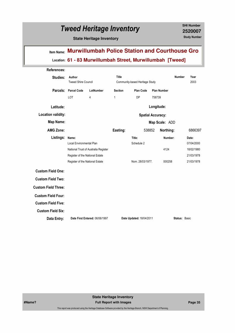
Caption: Courthouse building, part of the Murwillumbah Police Station and Courthouse Group.
Copyright: Tweed Heads Historical Society
Image:
Image by: Immy McKiernan
Image Date: 07/08/2003
Image Number:
Image Path:
Image File: 2520007b1.jpg
Thumb Nail Path:
Thumb Nail File: tn_2520007b1.jpg
#Name? Page 37 Full Report with Images
State Heritage Inventory
This report was produced using the Heritage Database Software provided by the Heritage Branch, NSW Department of Planning.

2520007
SHI Number
Tweed Heritage Inventory
Item Name: Murwillumbah Police Station and Courthouse Gro
Location: 61 - 83 Murwillumbah Street, Murwillumbah [Tweed]
State Heritage Inventory Study Number
Caption: Courthouse building, part of the Murwillumbah Police Station and Courthouse Group.
Copyright: Tweed Heads Historical Society
Image:
Image by: Bill Bainbridge
Image Date: 25/09/2003
Image Number:
Image Path:
Image File: 2520007b2.jpg
Thumb Nail Path:
Thumb Nail File: tn_2520007b2.jpg
#Name? Page 38 Full Report with Images
State Heritage Inventory
This report was produced using the Heritage Database Software provided by the Heritage Branch, NSW Department of Planning.
2520007
SHI Number
Tweed Heritage Inventory
Item Name: Murwillumbah Police Station and Courthouse Gro
Location: 61 - 83 Murwillumbah Street, Murwillumbah [Tweed]
State Heritage Inventory Study Number
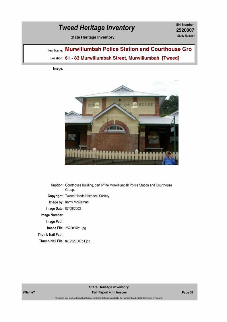
Caption: Police Station, part of the Murwillumbah Police Station and Courthouse Group.
Copyright: Tweed Heads Historical Society
Image:
Image by: Immy McKiernan
Image Date: 07/08/2003
Image Number:
Image Path:
Image File: 2520007b6.jpg
Thumb Nail Path:
Thumb Nail File: tn_2520007b6.jpg
#Name? Page 39 Full Report with Images
State Heritage Inventory
This report was produced using the Heritage Database Software provided by the Heritage Branch, NSW Department of Planning.
2520007
SHI Number
Tweed Heritage Inventory
Item Name: Murwillumbah Police Station and Courthouse Gro
Location: 61 - 83 Murwillumbah Street, Murwillumbah [Tweed]
State Heritage Inventory Study Number
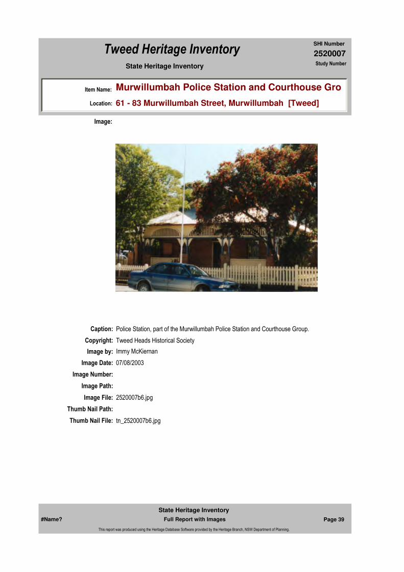
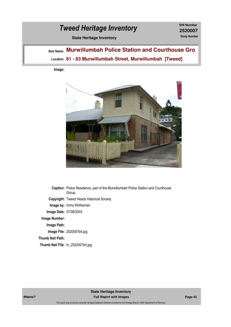
Caption: Police Residence, part of the Murwillumbah Police Station and Courthouse Group.
Copyright: Tweed Heads Historical Society
Image:
Image by: Immy McKiernan
Image Date: 07/08/2003
Image Number:
Image Path:
Image File: 2520007b5.jpg
Thumb Nail Path:
Thumb Nail File: tn_2520007b5.jpg
#Name? Page 40 Full Report with Images
State Heritage Inventory
This report was produced using the Heritage Database Software provided by the Heritage Branch, NSW Department of Planning.
2520007
SHI Number
Tweed Heritage Inventory
Item Name: Murwillumbah Police Station and Courthouse Gro
Location: 61 - 83 Murwillumbah Street, Murwillumbah [Tweed]
State Heritage Inventory Study Number
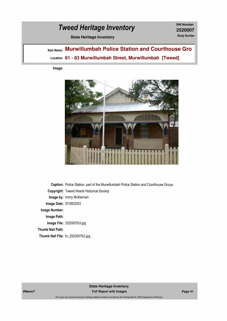
Caption: Police Station, part of the Murwillumbah Police Station and Courthouse Group.
Copyright: Tweed Heads Historical Society
Image:
Image by: Immy McKiernan
Image Date: 07/08/2003
Image Number:
Image Path:
Image File: 2520007b3.jpg
Thumb Nail Path:
Thumb Nail File: tn_2520007b3.jpg
#Name? Page 41 Full Report with Images
State Heritage Inventory
This report was produced using the Heritage Database Software provided by the Heritage Branch, NSW Department of Planning.
2520007
SHI Number
Tweed Heritage Inventory
Item Name: Murwillumbah Police Station and Courthouse Gro
Location: 61 - 83 Murwillumbah Street, Murwillumbah [Tweed]
State Heritage Inventory Study Number
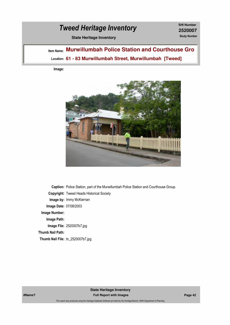
Caption: Police Station, part of the Murwillumbah Police Station and Courthouse Group.
Copyright: Tweed Heads Historical Society
Image:
Image by: Immy McKiernan
Image Date: 07/08/2003
Image Number:
Image Path:
Image File: 2520007b7.jpg
Thumb Nail Path:
Thumb Nail File: tn_2520007b7.jpg
#Name? Page 42 Full Report with Images
State Heritage Inventory
This report was produced using the Heritage Database Software provided by the Heritage Branch, NSW Department of Planning.
2520007
SHI Number
Tweed Heritage Inventory
Item Name: Murwillumbah Police Station and Courthouse Gro
Location: 61 - 83 Murwillumbah Street, Murwillumbah [Tweed]
State Heritage Inventory Study Number
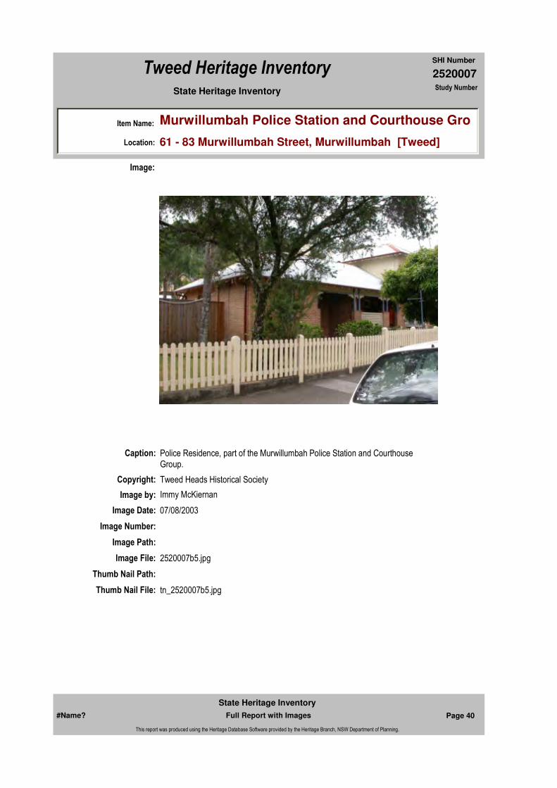
Caption: Police Residence, part of the Murwillumbah Police Station and Courthouse Group.
Copyright: Tweed Heads Historical Society
Image:
Image by: Immy McKiernan
Image Date: 07/08/2003
Image Number:
Image Path:
Image File: 2520007b4.jpg
Thumb Nail Path:
Thumb Nail File: tn_2520007b4.jpg
#Name? Page 43 Full Report with Images
State Heritage Inventory
This report was produced using the Heritage Database Software provided by the Heritage Branch, NSW Department of Planning.

2520007
SHI Number
Tweed Heritage Inventory
Item Name: Murwillumbah Police Station and Courthouse Gro
Location: 61 - 83 Murwillumbah Street, Murwillumbah [Tweed]
State Heritage Inventory Study Number
#Name? Page 44 Full Report with Images
State Heritage Inventory
This report was produced using the Heritage Database Software provided by the Heritage Branch, NSW Department of Planning.
2520008
SHI Number
Tweed Heritage Inventory
Item Name: Fingal Head Lighthouse and Cottage Foundations
Location: Lighthouse Road, Fingal Head [Tweed]
State Heritage Inventory Study Number
Current Use:
Former Uses:
Statement of
Significance:Fingal Head Lighthouse, built in 1872, is significant as a lighthouse designed by the colonial architect, James Barnet, and as one of a series of five small lights established along the northern New South Wales coast in the late nineteenth century. It exhibits a simple and practical approach to lighthouse design (Criteria H.1 and B.2). The lighthouse is significant for its association with the maritime navigational aids established along the eastern coast of Australia and its contribution to the once vital north coast run of shipping and cargo between Queensland and New South Wales (Criterion A.4). Simple and unpretentious, this building displays admirable architectural sensitivity to the sturdy, weather defiant characteristics required in the design of nautical landmarks. The building's link with men, ships and cargoes of the once vital 'North Coast Run' is one of considerable historic importance.
Historical Notes
or Provenance:4.0 Fingal Head Lighthouse4.1 Construction Fingal Head was the northernmost lighthouse in New South Wales in the nineteenth century. There have been two lighthouses on the site, the first an impermanent one made of wood (1872 - 1879), the second a permanent one, built in 1879, which still stands. Their purpose was to signal the mouth of the Tweed River and Point Danger on the northern side of the Tweed estuary.
For northbound ships in the nineteenth century they also indicated the Queensland border, where customs would have to be gone through: Queensland had been declared a colony in 1859 and its border fixed just north of Point Danger in 1863. That purpose became redundant in 1901 when intercolonial customs were abolished under clause 92 of the Constitution: 'trade, commerce and intercourse among the States, whether by means of internal carriage or ocean navigation, shall be absolutely free' (cited in Cremin 1901, 63).
Endorsed Significance:Assessed Significance: State
Item Type: Built Category: Lighthouse TowerGroup: Transport - Water
Admin Codes: Code 2: Code 3:
Curtilage/Boundary:
Owner:
Other/Former Names:
Area/Group/Complex: Group ID:
Aboriginal Area:
Local Govt Area: Tweed
Planning: Northern
Historic Region: North Coast
Address: #Name?
Suburb / Nearest Town: #Name?
State: NSW
Parish: Terranora
County: Rous
#Name? Page 45 Full Report with Images
State Heritage Inventory
This report was produced using the Heritage Database Software provided by the Heritage Branch, NSW Department of Planning.

2520008
SHI Number
Tweed Heritage Inventory
Item Name: Fingal Head Lighthouse and Cottage Foundations
Location: Lighthouse Road, Fingal Head [Tweed]
State Heritage Inventory Study Number
The lighthouse itself seemed redundant by 1913, when it was recommended for closure 'when light on Cook Island is established' (Brewis 1913, 8). The current Royal Australian Navy hydrographic chart does not show any lighthouse on Cook Island and Fingal Head is still in service. It has, however, been unmanned since 1906, when its keeper William Arnold (!831 - 1912) retired. He had served for 32 years and brought up 11 children there (Keats 1996, 45).
4.2 Tweed Heads and the Tweed River ... His [McGregor's] logbook has survived and on 7 Februray 1972 he records the arrival of a new boatman, William Arnold, 'with two cases of American kerosene, a jar with tap for the "Light" ' (Keats 1996, 26). This was for the first, wooden, lighthouse on Fingal Head. McGregor does not mention how he came to choose the site, but it was probably the closest practicable point to Cook Island. ...
4.3 The Lighthouses at Fingal Head - First Light (1872 - 1879) The site is on the headland which forms the southern bank of the Tweed River. It faces due east towards Cook Island. To its west was Cave Point, a place of Aboriginal importance but used in the 1890's as a quarry and workshop for the building of the deep-sea channel. The siting of the light, though criticised by Brewis (1913) seems to have been reasonably effective, since only two shipwrecks are recorded as happening off the Head: the Chaerea in 1937 and the Dellie in 1941. As noted above most shipwrecks happened at or within the Tweed River mouth.
The first lighthouse was created in 1872 and was basically a wooden box on four timber columns, built by McGregor and the boatmen in February-March 1872. One of the keeper's daughters recalled it as being 'shaped like a large meat safe and mounted on a wooden structure resembling a pigeon loft. It was to warn ships of the existence of Cook Island' (cited in Keats, 1996, 38). The light was first 'exhibited' on 19 March 1872 and thereafter supervised by the boatmen from the Pilot Station, there being as yet no officially designated keeper. Pilot McGregor's logbook, meticulously analysed by Keats, starts each entry from March 1872 to January 1879 with the words "Light burned well all night' (Keats 1996, 41).
To keep the light functioning through the night, there had to be somebody there, which meant building a house, as the boatmen resided at Tweed Heads, across the River. This created other problems both with the men, one of whom had to be sacked for drinking, and with the timber structures, which were prone to termite attack (Keats 1996, 42-44). These structures were on the same site as the present (1879) lighthouse and there is today no visible trace of them. They were pulled down in May 1879.There was therefore a strong incentive to ask for better conditions, a permanent lighthouse and cottage and a fully-employed keeper. The boatman William Arnold applied for the job and got it, when the permanent lighthouse was approved, as part of the chain of buildings initiated by Francis Hixson, President of the NSW Marine Board. Arnold was known to Hixson and was an excellent choice, able to hold down the job of keeper for over 30 years, a period during which there was not one single wreck off Fingal Head. He was already a family man, having listed three children, Henrietta (8), Ellen (6) and William (4), when Tweed Heads applied for a school in 1876 (Keats 1996, 56).
4.4 Second Light (1879 to present) The 1879 lighthouse is identical in design to Crowdy Head and the other 1879-1880's lighthouses studied for this report. Construction started in
#Name? Page 46 Full Report with Images
State Heritage Inventory
This report was produced using the Heritage Database Software provided by the Heritage Branch, NSW Department of Planning.

2520008
SHI Number
Tweed Heritage Inventory
Item Name: Fingal Head Lighthouse and Cottage Foundations
Location: Lighthouse Road, Fingal Head [Tweed]
State Heritage Inventory Study Number
mid-1878, probably under the supervision of a Mr Mortley, and the lighthouse started operating on 8 January, 1879, with Arnold as keeper (Keats, 1996, 44). The lighthouse itself still stands, but its service rooms were pulled down in 1923 and are now viusible only as foundations.
Brewis described the lighthouse in 1913: it had one fixed light, catadioptric, of 1,000 candlepower, its focal plane was at a height of 80 ft above high water and visible for 12 nautical miles (p10). It had a telephone but no Morse (p. 4). Brewis didn't like the location and wanted a new lighthouse to be built on Cook Island (p. 35). This didn't happen and instead the 1879 lighthouse has been updated, in 1920 to automated acetylene gas, to electricity in 1970 and again in 1980, with its range increased to 17 nautical miles, with 28,000 candlepower. ...
Arnold moved into his new cottage in March 1879. The cottage was sited northwest of the lighthouse and slightly below it in a more sheltered spot. It was identical in design to that at Tacking Point, except that the exterior toilet was replaced by a watertank. ...
The cottage is now visible as foundations only, incorporated into a walking track, which is damaging the surfaces."Fingal Head Lighthouse: CMP" Draft January 2003 DPWS Heritage Design services pages 24 - 26
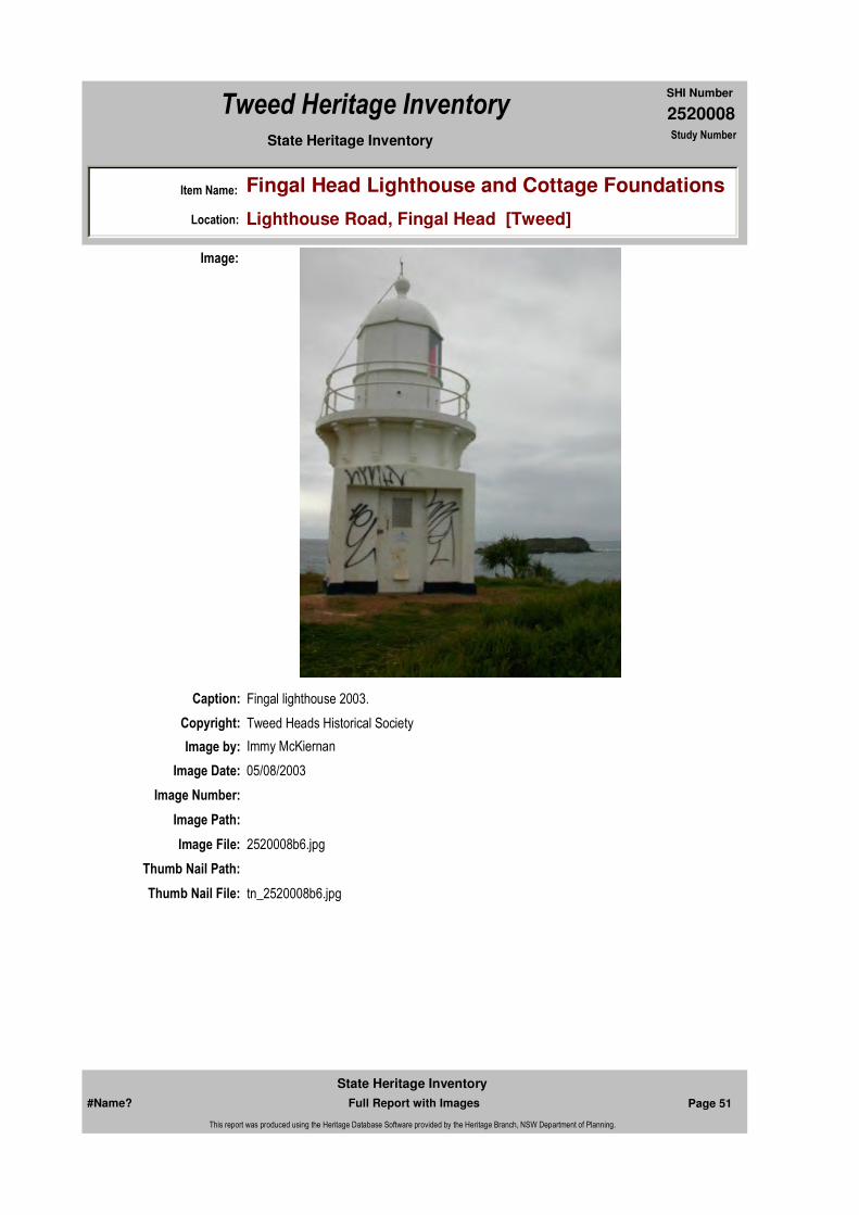
Physical Description: The current Fingal Head Lighthouse was build in 1879 to a design prepared in the office of colonial architect, James Barnet. It was the third in a series of five small lights, the others being Richmond River, Yamba (demolished), Hastings River and Crowdy Head. The lighthouse consists of a fixed white light of fourth order catadioptric type exhibited from a brick tower. It is circular in plan and capped by an oversailing bluestone platform supported by shapped bluestone corbels at 12ft (3.6m) above ground level. External walls of the tower have been cement rendered and it is surmounted by a simple domed lantern which encases the optical apparatus. A handrail at the platform's perimeter has metal standards and rails. The light was originally manned by one lighthkeeper but on 15 June 1920 it was converted to automatic acetylene operation, the power of the light being increased from under 1,000 to 1,500 candle power, and the character changed from fixed to group flashing. Soon after this, the lightkeeper was withdrawn. About the same time the enclosed porch and annex containing the keepers's duty room and oil store were demolished.
Designer: James Barnet
Maker / Builder:
Year Started: Year Completed: 1879 Circa: No
Themes: National Theme State Theme Local Theme
3. Economy Transport Lighthouse
#Name? Page 47 Full Report with Images
State Heritage Inventory
This report was produced using the Heritage Database Software provided by the Heritage Branch, NSW Department of Planning.
2520008
SHI Number
Tweed Heritage Inventory
Item Name: Fingal Head Lighthouse and Cottage Foundations
Location: Lighthouse Road, Fingal Head [Tweed]
State Heritage Inventory Study Number
Physical Condition:
Modification Dates: The light was originally manned by one lighthkeeper but on 15 June 1920 it was converted to automatic acetylene operation, the power of the light being increased from under 1,000 to 1,500 candle power, and the character changed from fixed to group flashing. Soon after this, the lightkeeper was withdrawn. About the same time the enclosed porch and annex containing the keepers's duty room and oil store were demolished.
Recommended
Management:
References:
Studies:
Further Comments: Tweed River, South Head
Criteria a) The lighthouse is significant for its association with the maritime navigational aids established along the eastern coast of Australia and its contribution to the once vital north coast run of shipping and cargo between Queensland and New South Wales (Criterion A.4).The building's link with men, ships and cargoes of the once vital 'North Coast Run' is one of considerable historic importance.
Criteria c) As one of a series of five small lights established along the northern New South Wales coast in the late nineteenth century, it exhibits a simple and practical approach to lighthouse design. Simple and unpretentious, this building displays admirable architectural sensitivity to the sturdy, weather defiant characteristics required in the design of nautical landmarks.
Criteria d)
Criteria e)
Criteria g)
Criteria f)
Integrity / Intactness:
Criteria b) Fingal Head Lighthouse, built in 1872, is significant as a lighthouse designed by the colonial architect, James Barnet.
Parcels:
Management:
Author Title Year
"Fingal Head Lighthouse: CMP" Draft 2003
Charleton, H.R. 'N.S.W. Lighthouses' Report to Royal Society of N.S.W
Richards, M 'North Coast Run'
Walker, E J
Author Title YearNumber
Tweed Shire Council Community-based Heritage Study 2003
Parcel Code LotNumber Section Plan Code Plan Number
LOT 1 DP 847751
#Name? Page 48 Full Report with Images
State Heritage Inventory
This report was produced using the Heritage Database Software provided by the Heritage Branch, NSW Department of Planning.
2520008
SHI Number
Tweed Heritage Inventory
Item Name: Fingal Head Lighthouse and Cottage Foundations
Location: Lighthouse Road, Fingal Head [Tweed]
State Heritage Inventory Study Number
Custom Field One: Australian Heritage Commission Register of the National Estate Nom. 01/01/1982. # 000263 Listed 1/11/83
Listings:
Date Updated: 18/04/2011 Status: BasicDate First Entered: 06/06/1997Data Entry:
Custom Field Two: National Trust of Australia NSW National Trust of Australia register # 2278 1/05/78 New South Wales Lighthouses, Report to Royal Society of NSW, 1898 by H.R. Carleton. North Coast Run, by Mike Richards, T & A 1977
Custom Field Three: Department of Transport and Department of Administrative Services (Australian Government)
Custom Field Four:
Custom Field Five:
Custom Field Six:
Latitude: -28.2011 Longitude: 153.57
AMG Zone: Easting: Northing:
Map Name: Map Scale:
Spatial Accuracy:Location validity:
Name: Date:Number:Title:
Local Environmental Plan 07/04/2000Schedule 2
Register of the National Estate 01/11/1983
#Name? Page 49 Full Report with Images
State Heritage Inventory
This report was produced using the Heritage Database Software provided by the Heritage Branch, NSW Department of Planning.
2520008
SHI Number
Tweed Heritage Inventory
Item Name: Fingal Head Lighthouse and Cottage Foundations
Location: Lighthouse Road, Fingal Head [Tweed]
State Heritage Inventory Study Number
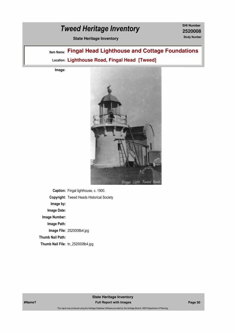
Caption: Fingal lighthouse, c. 1900.
Copyright: Tweed Heads Historical Society
Image:
Image by:
Image Date:
Image Number:
Image Path:
Image File: 2520008b4.jpg
Thumb Nail Path:
Thumb Nail File: tn_2520008b4.jpg
#Name? Page 50 Full Report with Images
State Heritage Inventory
This report was produced using the Heritage Database Software provided by the Heritage Branch, NSW Department of Planning.
2520008
SHI Number
Tweed Heritage Inventory
Item Name: Fingal Head Lighthouse and Cottage Foundations
Location: Lighthouse Road, Fingal Head [Tweed]
State Heritage Inventory Study Number
Caption: Fingal lighthouse 2003.
Copyright: Tweed Heads Historical Society
Image:
Image by: Immy McKiernan
Image Date: 05/08/2003
Image Number:
Image Path:
Image File: 2520008b6.jpg
Thumb Nail Path:
Thumb Nail File: tn_2520008b6.jpg
#Name? Page 51 Full Report with Images
State Heritage Inventory
This report was produced using the Heritage Database Software provided by the Heritage Branch, NSW Department of Planning.
2520008
SHI Number
Tweed Heritage Inventory
Item Name: Fingal Head Lighthouse and Cottage Foundations
Location: Lighthouse Road, Fingal Head [Tweed]
State Heritage Inventory Study Number
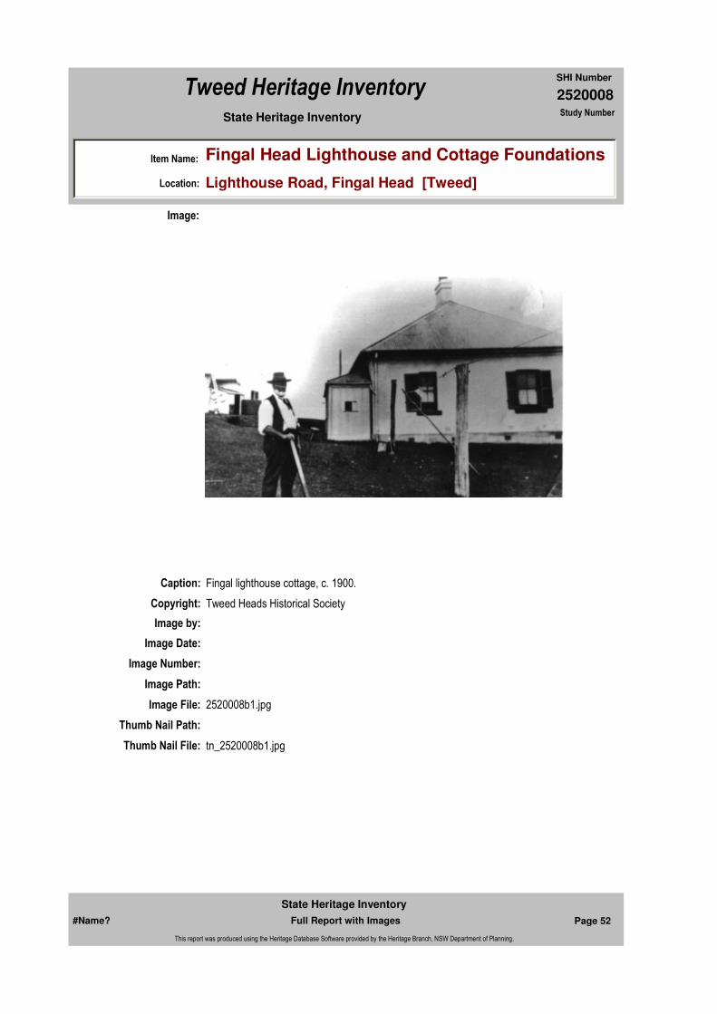
Caption: Fingal lighthouse cottage, c. 1900.
Copyright: Tweed Heads Historical Society
Image:
Image by:
Image Date:
Image Number:
Image Path:
Image File: 2520008b1.jpg
Thumb Nail Path:
Thumb Nail File: tn_2520008b1.jpg
#Name? Page 52 Full Report with Images
State Heritage Inventory
This report was produced using the Heritage Database Software provided by the Heritage Branch, NSW Department of Planning.
2520008
SHI Number
Tweed Heritage Inventory
Item Name: Fingal Head Lighthouse and Cottage Foundations
Location: Lighthouse Road, Fingal Head [Tweed]
State Heritage Inventory Study Number
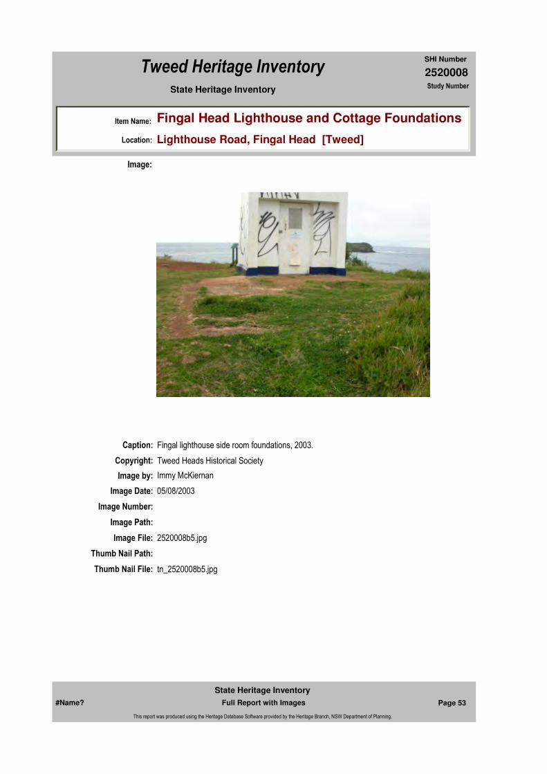
Caption: Fingal lighthouse side room foundations, 2003.
Copyright: Tweed Heads Historical Society
Image:
Image by: Immy McKiernan
Image Date: 05/08/2003
Image Number:
Image Path:
Image File: 2520008b5.jpg
Thumb Nail Path:
Thumb Nail File: tn_2520008b5.jpg
#Name? Page 53 Full Report with Images
State Heritage Inventory
This report was produced using the Heritage Database Software provided by the Heritage Branch, NSW Department of Planning.
2520008
SHI Number
Tweed Heritage Inventory
Item Name: Fingal Head Lighthouse and Cottage Foundations
Location: Lighthouse Road, Fingal Head [Tweed]
State Heritage Inventory Study Number
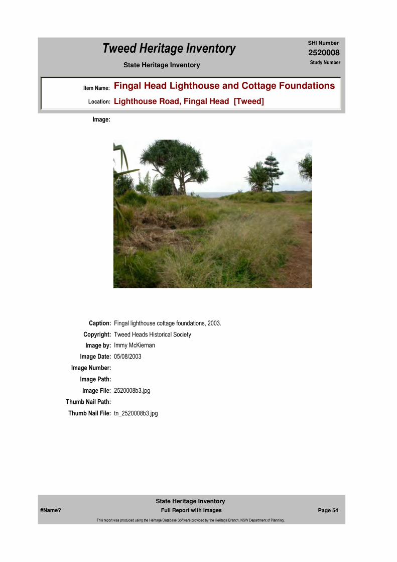
Caption: Fingal lighthouse cottage foundations, 2003.
Copyright: Tweed Heads Historical Society
Image:
Image by: Immy McKiernan
Image Date: 05/08/2003
Image Number:
Image Path:
Image File: 2520008b3.jpg
Thumb Nail Path:
Thumb Nail File: tn_2520008b3.jpg
#Name? Page 54 Full Report with Images
State Heritage Inventory
This report was produced using the Heritage Database Software provided by the Heritage Branch, NSW Department of Planning.
2520008
SHI Number
Tweed Heritage Inventory
Item Name: Fingal Head Lighthouse and Cottage Foundations
Location: Lighthouse Road, Fingal Head [Tweed]
State Heritage Inventory Study Number
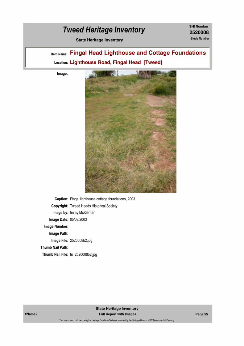
Caption: Fingal lighthouse cottage foundations, 2003.
Copyright: Tweed Heads Historical Society
Image:
Image by: Immy McKiernan
Image Date: 05/08/2003
Image Number:
Image Path:
Image File: 2520008b2.jpg
Thumb Nail Path:
Thumb Nail File: tn_2520008b2.jpg
#Name? Page 55 Full Report with Images
State Heritage Inventory
This report was produced using the Heritage Database Software provided by the Heritage Branch, NSW Department of Planning.
2520008
SHI Number
Tweed Heritage Inventory
Item Name: Fingal Head Lighthouse and Cottage Foundations
Location: Lighthouse Road, Fingal Head [Tweed]
State Heritage Inventory Study Number
#Name? Page 56 Full Report with Images
State Heritage Inventory
This report was produced using the Heritage Database Software provided by the Heritage Branch, NSW Department of Planning.

2520014
SHI Number
Tweed Heritage Inventory
Item Name: B.G.F. Building
Location: 1 - 3 Murwillumbah Street, Murwillumbah [Tweed]
State Heritage Inventory Study Number
Current Use: Offices of the Banana Growers Federation
Former Uses: 1899 - original Australian Joint Stock Bank, burnt in 1907 fire. (Plan 6 Sec 16);1946 Bank of Australasia & Residence (Joyce Martin); pre 1974 ANZ bank
Statement of
Significance:The B.G.F. Building is significant as part of the Murwillumbah Main Street Urban Conservation Area. The Interwar Georgian style façade contributes to the character of the precinct.
Historical Notes or Provenance:
1899 - original Australian Joint Stock Bank, burnt in 1907 fire. (Plan 6 Sec 16);1946 Bank of Australasia & Residence (Joyce Martin); pre 1974 ANZ bank
Designer:
Endorsed Significance:Assessed Significance: Local
Item Type: Built Category: Commercial Office/BuilGroup: Commercial
Admin Codes: Code 2: Code 3:
Curtilage/Boundary:
Owner: Private - Individual
Other/Former Names: Australian Joint Stock Bank (site); Bank of Australasia and Residence; ANZ Bank
Area/Group/Complex: Murwillumbah Main Street Urban Conservation Area Group ID: 12
Themes:
Aboriginal Area:
Local Govt Area: Tweed
Planning: Northern
Historic Region: North Coast
Address: #Name?
Suburb / Nearest Town: #Name?
State: NSW
Parish: Murwillumbah
County: Rous
Local Govt Area: Tweed
Planning: Northern
Historic Region: North Coast
Address: #Name?
Suburb / Nearest Town: #Name?
State: NSW
Parish: Murwillumbah
County: Rous
National Theme State Theme Local Theme
3. Economy Commerce Bank
#Name? Page 79 Full Report with Images
State Heritage Inventory
This report was produced using the Heritage Database Software provided by the Heritage Branch, NSW Department of Planning.

2520014
SHI Number
Tweed Heritage Inventory
Item Name: B.G.F. Building
Location: 1 - 3 Murwillumbah Street, Murwillumbah [Tweed]
State Heritage Inventory Study Number
Physical Description: Inter war Georgian Revival. Excellent response to distorted frontage. Building still retains symmetrical feel and rectangular prismatic shape. Simple classical balustrade feature. Fine textured roof slates on simple hipped roof. Exposed rafters. Regular repetitive fenestration. High style classical entry, with pediments and simplified entabliture, pilasters and top light. Quoning to recessed vertical double hung windows on ground floor. Cornice to ground floor. Large plinth to window sills.
Physical Condition:
Modification Dates:
Maker / Builder:
Year Started: Year Completed: Circa: No
Recommended
Management:Conserve the exterior and interior elements of significance; adapt services and facilities to ensure continued use; remove redundant signs and signs which detract from the style of architecture; provide a suitable colour scheme which compliments the architecture and matches the aspirations of the building owner and tenant; restore damaged and missing original architectural features based on early photographs or technical drawings.
References:
Studies:
Further Comments:
Criteria a)
Criteria c)
Criteria d)
Criteria e)
Criteria g)
Criteria f)
Integrity / Intactness:
Criteria b) The B.G.F. Building is significant as part of the Murwillumbah Main Street Urban Conservation Area. The Interwar Georgian style façade contributes to the character of the precinct.
Parcels:
Management:
Author Title YearNumber
Tweed Shire Council Community-based Heritage Study 2003
Parcel Code LotNumber Section Plan Code Plan Number
LOT A DP 934804
#Name? Page 80 Full Report with Images
State Heritage Inventory
This report was produced using the Heritage Database Software provided by the Heritage Branch, NSW Department of Planning.

2520014
SHI Number
Tweed Heritage Inventory
Item Name: B.G.F. Building
Location: 1 - 3 Murwillumbah Street, Murwillumbah [Tweed]
State Heritage Inventory Study Number
Custom Field One: National Trust of Australia NSW, National Trust of Australia register , # 4119, nominated 12/11/79.
Listings:
Date Updated: 31/10/2004 Status: 0Date First Entered: 06/06/1997Data Entry:
Custom Field Two: Australian Heritage Commission, Register of the National Estate, Interim, Indicative Place, # 013996, nominated 23/12/1984.
Custom Field Three: Royal Australian Institute of Architects register, 30/12/1985, photograph 55.
Custom Field Four:
Custom Field Five:
Custom Field Six:
Latitude: Longitude:
AMG Zone: Easting: 538952 Northing: 6866390
Map Name: Map Scale: ADD
Spatial Accuracy:Location validity:
Name: Date:Number:Title:
Local Environmental Plan 29/01/198801987
#Name? Page 81 Full Report with Images
State Heritage Inventory
This report was produced using the Heritage Database Software provided by the Heritage Branch, NSW Department of Planning.
2520014
SHI Number
Tweed Heritage Inventory
Item Name: B.G.F. Building
Location: 1 - 3 Murwillumbah Street, Murwillumbah [Tweed]
State Heritage Inventory Study Number
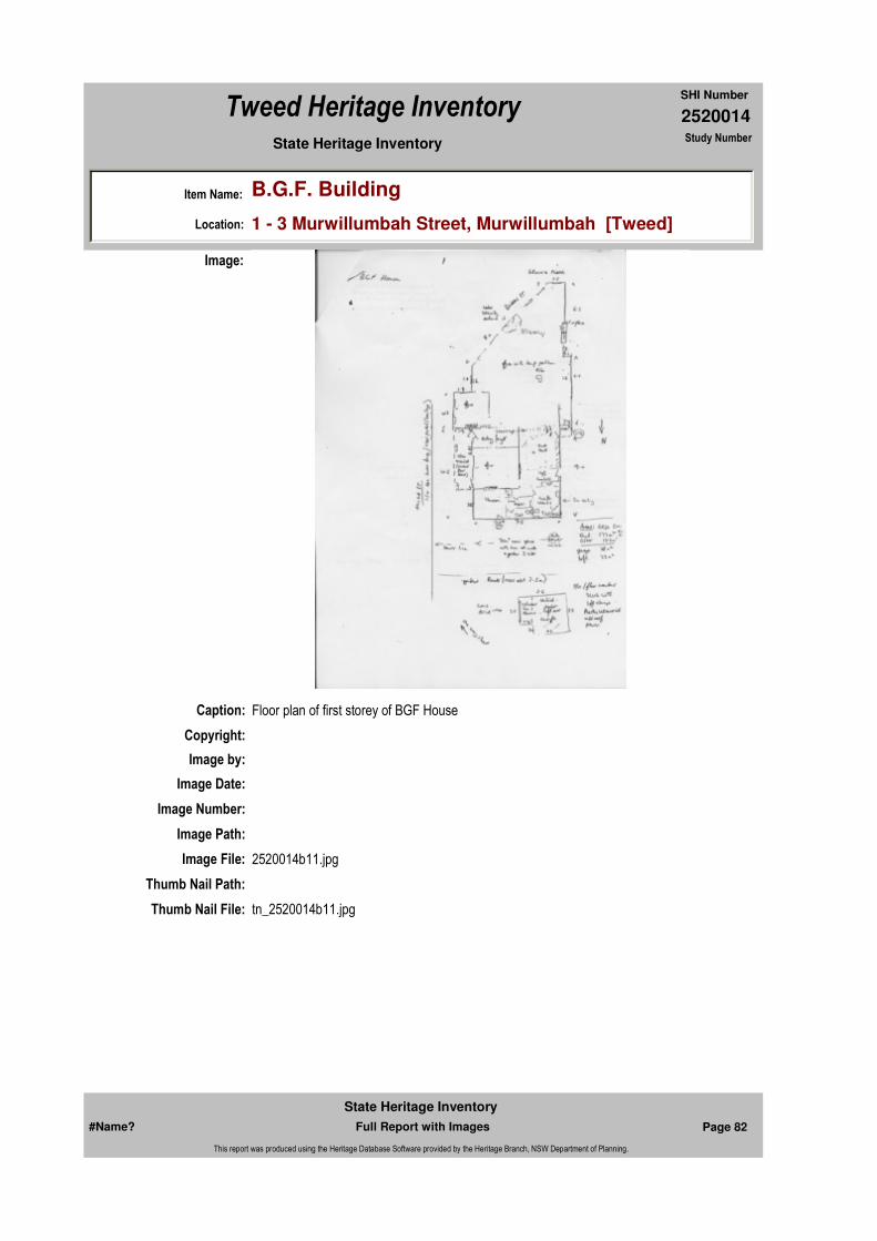
Caption: Floor plan of first storey of BGF House
Copyright:
Image:
Image by:
Image Date:
Image Number:
Image Path:
Image File: 2520014b11.jpg
Thumb Nail Path:
Thumb Nail File: tn_2520014b11.jpg
#Name? Page 82 Full Report with Images
State Heritage Inventory
This report was produced using the Heritage Database Software provided by the Heritage Branch, NSW Department of Planning.

2520014
SHI Number
Tweed Heritage Inventory
Item Name: B.G.F. Building
Location: 1 - 3 Murwillumbah Street, Murwillumbah [Tweed]
State Heritage Inventory Study Number
Caption: Side view of the BGF Building, from Wharf Street, Murwillumbah.
Copyright: Tweed Heads Historical Society
Image:
Image by: Immy McKiernan
Image Date: 22/03/2004
Image Number:
Image Path:
Image File: 2520014b1.jpg
Thumb Nail Path:
Thumb Nail File: tn_2520014b1.jpg
#Name? Page 83 Full Report with Images
State Heritage Inventory
This report was produced using the Heritage Database Software provided by the Heritage Branch, NSW Department of Planning.
2520014
SHI Number
Tweed Heritage Inventory
Item Name: B.G.F. Building
Location: 1 - 3 Murwillumbah Street, Murwillumbah [Tweed]
State Heritage Inventory Study Number
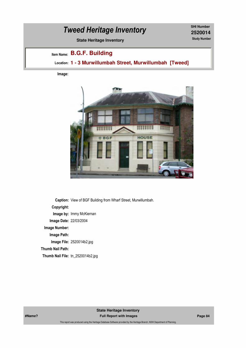
Caption: View of BGF Building from Wharf Street, Murwillumbah.
Copyright:
Image:
Image by: Immy McKiernan
Image Date: 22/03/2004
Image Number:
Image Path:
Image File: 2520014b2.jpg
Thumb Nail Path:
Thumb Nail File: tn_2520014b2.jpg
#Name? Page 84 Full Report with Images
State Heritage Inventory
This report was produced using the Heritage Database Software provided by the Heritage Branch, NSW Department of Planning.
2520014
SHI Number
Tweed Heritage Inventory
Item Name: B.G.F. Building
Location: 1 - 3 Murwillumbah Street, Murwillumbah [Tweed]
State Heritage Inventory Study Number
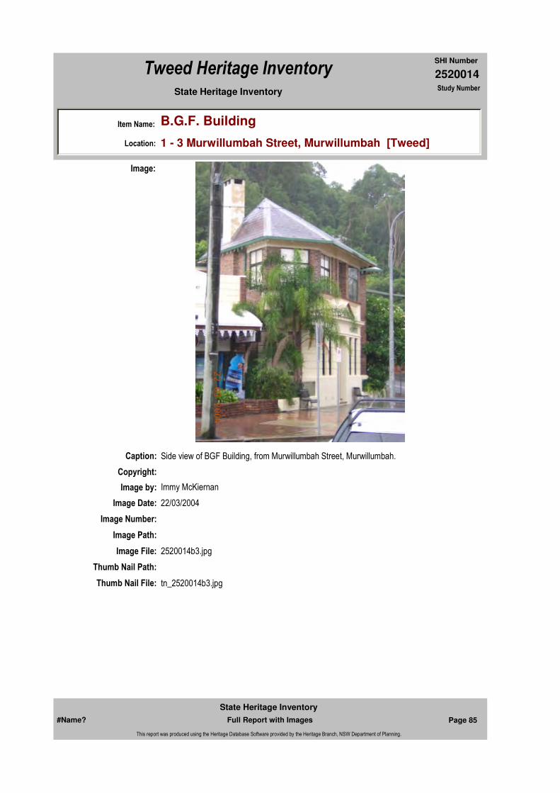
Caption: Side view of BGF Building, from Murwillumbah Street, Murwillumbah.
Copyright:
Image:
Image by: Immy McKiernan
Image Date: 22/03/2004
Image Number:
Image Path:
Image File: 2520014b3.jpg
Thumb Nail Path:
Thumb Nail File: tn_2520014b3.jpg
#Name? Page 85 Full Report with Images
State Heritage Inventory
This report was produced using the Heritage Database Software provided by the Heritage Branch, NSW Department of Planning.

2520014
SHI Number
Tweed Heritage Inventory
Item Name: B.G.F. Building
Location: 1 - 3 Murwillumbah Street, Murwillumbah [Tweed]
State Heritage Inventory Study Number
Caption: BGF Building, upstairs boardroom.
Copyright: Tweed Heads Historical Society
Image:
Image by: Immy McKiernan
Image Date: 22/03/2004
Image Number:
Image Path:
Image File: 2520014b4.jpg
Thumb Nail Path:
Thumb Nail File: tn_2520014b4.jpg
#Name? Page 86 Full Report with Images
State Heritage Inventory
This report was produced using the Heritage Database Software provided by the Heritage Branch, NSW Department of Planning.

2520014
SHI Number
Tweed Heritage Inventory
Item Name: B.G.F. Building
Location: 1 - 3 Murwillumbah Street, Murwillumbah [Tweed]
State Heritage Inventory Study Number
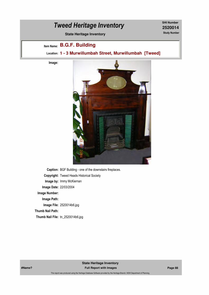
Caption: BGF Building - one of the downstairs fireplaces.
Copyright: Tweed Heads Historical Society
Image:
Image by: Immy McKiernan
Image Date: 22/03/2004
Image Number:
Image Path:
Image File: 2520014b5.jpg
Thumb Nail Path:
Thumb Nail File: tn_2520014b5.jpg
#Name? Page 87 Full Report with Images
State Heritage Inventory
This report was produced using the Heritage Database Software provided by the Heritage Branch, NSW Department of Planning.
2520014
SHI Number
Tweed Heritage Inventory
Item Name: B.G.F. Building
Location: 1 - 3 Murwillumbah Street, Murwillumbah [Tweed]
State Heritage Inventory Study Number
Caption: BGF Building - one of the downstairs fireplaces.
Copyright: Tweed Heads Historical Society
Image:
Image by: Immy McKiernan
Image Date: 22/03/2004
Image Number:
Image Path:
Image File: 2520014b6.jpg
Thumb Nail Path:
Thumb Nail File: tn_2520014b6.jpg
#Name? Page 88 Full Report with Images
State Heritage Inventory
This report was produced using the Heritage Database Software provided by the Heritage Branch, NSW Department of Planning.

2520014
SHI Number
Tweed Heritage Inventory
Item Name: B.G.F. Building
Location: 1 - 3 Murwillumbah Street, Murwillumbah [Tweed]
State Heritage Inventory Study Number
Caption: BGF Building - faux fireplace in upstairs boardroom.
Copyright: Tweed Heads Historical Society
Image:
Image by: Immy McKiernan
Image Date: 22/03/2004
Image Number:
Image Path:
Image File: 2520014b7.jpg
Thumb Nail Path:
Thumb Nail File: tn_2520014b7.jpg
#Name? Page 89 Full Report with Images
State Heritage Inventory
This report was produced using the Heritage Database Software provided by the Heritage Branch, NSW Department of Planning.
2520014
SHI Number
Tweed Heritage Inventory
Item Name: B.G.F. Building
Location: 1 - 3 Murwillumbah Street, Murwillumbah [Tweed]
State Heritage Inventory Study Number
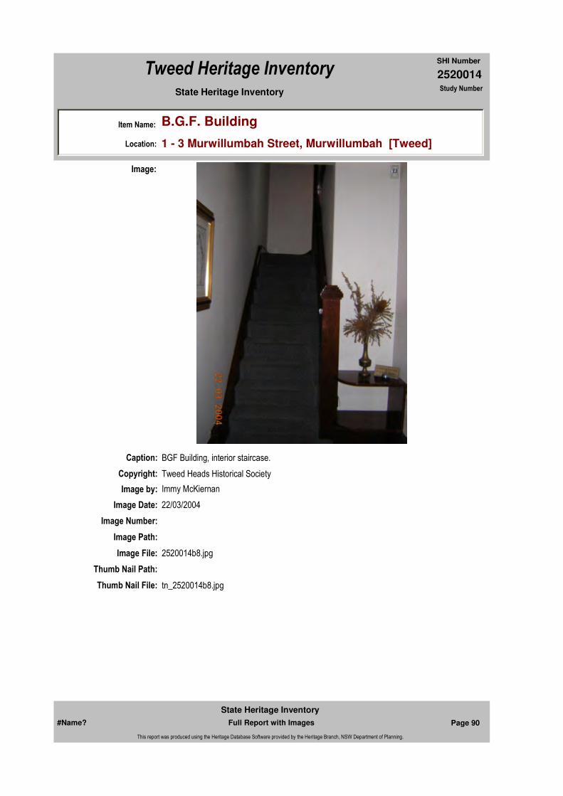
Caption: BGF Building, interior staircase.
Copyright: Tweed Heads Historical Society
Image:
Image by: Immy McKiernan
Image Date: 22/03/2004
Image Number:
Image Path:
Image File: 2520014b8.jpg
Thumb Nail Path:
Thumb Nail File: tn_2520014b8.jpg
#Name? Page 90 Full Report with Images
State Heritage Inventory
This report was produced using the Heritage Database Software provided by the Heritage Branch, NSW Department of Planning.
2520014
SHI Number
Tweed Heritage Inventory
Item Name: B.G.F. Building
Location: 1 - 3 Murwillumbah Street, Murwillumbah [Tweed]
State Heritage Inventory Study Number
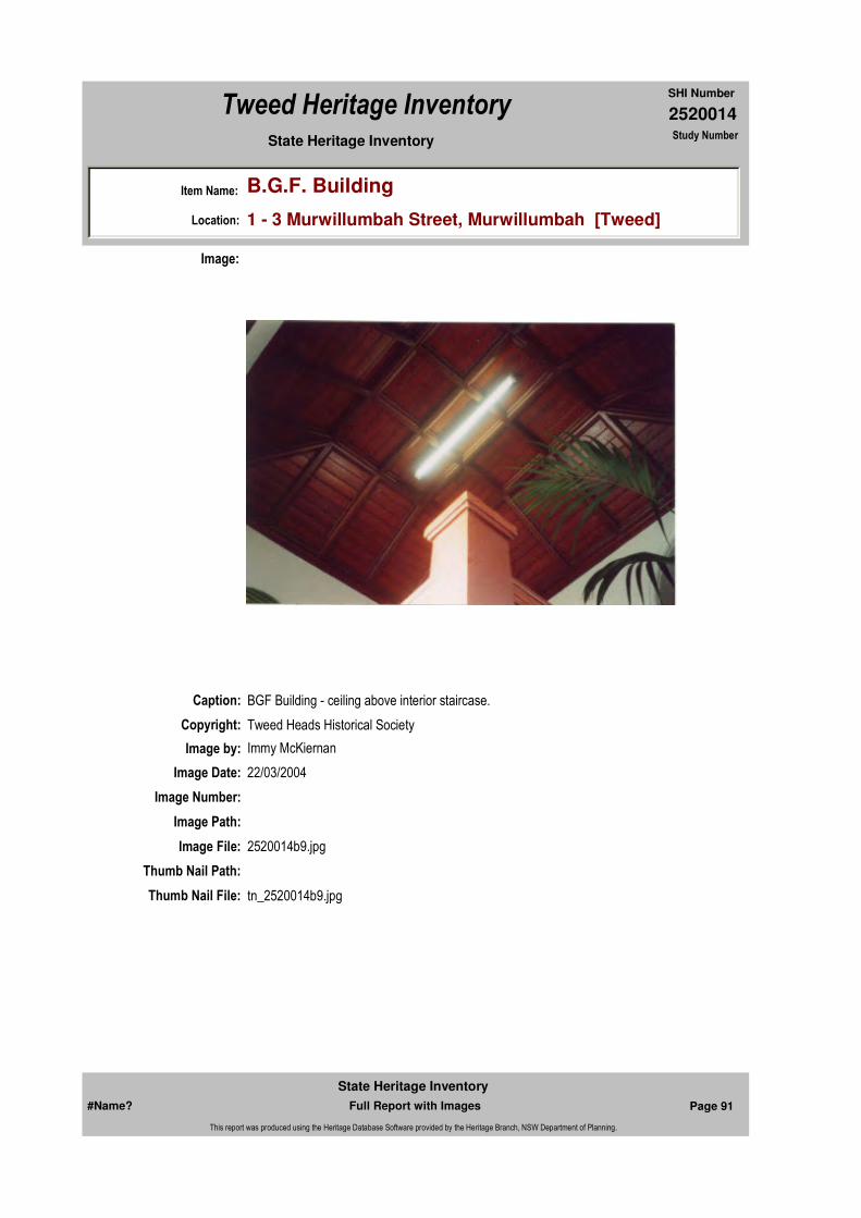
Caption: BGF Building - ceiling above interior staircase.
Copyright: Tweed Heads Historical Society
Image:
Image by: Immy McKiernan
Image Date: 22/03/2004
Image Number:
Image Path:
Image File: 2520014b9.jpg
Thumb Nail Path:
Thumb Nail File: tn_2520014b9.jpg
#Name? Page 91 Full Report with Images
State Heritage Inventory
This report was produced using the Heritage Database Software provided by the Heritage Branch, NSW Department of Planning.
2520014
SHI Number
Tweed Heritage Inventory
Item Name: B.G.F. Building
Location: 1 - 3 Murwillumbah Street, Murwillumbah [Tweed]
State Heritage Inventory Study Number
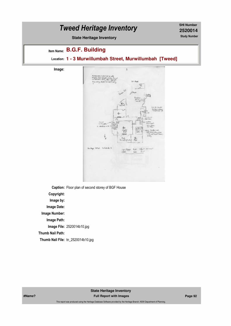
Caption: Floor plan of second storey of BGF House
Copyright:
Image:
Image by:
Image Date:
Image Number:
Image Path:
Image File: 2520014b10.jpg
Thumb Nail Path:
Thumb Nail File: tn_2520014b10.jpg
#Name? Page 92 Full Report with Images
State Heritage Inventory
This report was produced using the Heritage Database Software provided by the Heritage Branch, NSW Department of Planning.

2520014
SHI Number
Tweed Heritage Inventory
Item Name: B.G.F. Building
Location: 1 - 3 Murwillumbah Street, Murwillumbah [Tweed]
State Heritage Inventory Study Number
#Name? Page 93 Full Report with Images
State Heritage Inventory
This report was produced using the Heritage Database Software provided by the Heritage Branch, NSW Department of Planning.

2520015
SHI Number
Tweed Heritage Inventory
Item Name: Wollumbin Wildlife Refuge [Record Only]
Location: (Portions 67 & 3), Wollumbin [Tweed]
State Heritage Inventory Study Number
Current Use:
Former Uses:
Statement of
Significance:
Historical Notes or Provenance:
Physical Description:
Physical Condition:
Modification Dates:
Designer:
Maker / Builder:
Year Started: Year Completed: Circa: No
Recommended
Management:
Endorsed Significance:
Further Comments:
Assessed Significance:
Item Type: Category:Group:
Admin Codes: Code 2: Code 3:
Curtilage/Boundary:
Owner:
Other/Former Names:
Area/Group/Complex: Group ID:
Themes:
Aboriginal Area:
Management:
Local Govt Area: Tweed
Planning: Northern
Historic Region: North Coast
Address: #Name?
Suburb / Nearest Town: #Name?
State: NSW
Parish:
County:
#Name? Page 94 Full Report with Images
State Heritage Inventory
This report was produced using the Heritage Database Software provided by the Heritage Branch, NSW Department of Planning.

2520015
SHI Number
Tweed Heritage Inventory
Item Name: Wollumbin Wildlife Refuge [Record Only]
Location: (Portions 67 & 3), Wollumbin [Tweed]
State Heritage Inventory Study Number
Custom Field One:
References:
Studies:
Listings:
Date Updated: 07/04/2004 Status: 0Date First Entered: 06/06/1997Data Entry:
Criteria a)
Criteria c)
Criteria d)
Criteria e)
Criteria g)
Criteria f)
Integrity / Intactness:
Custom Field Two:
Custom Field Three:
Custom Field Four:
Custom Field Five:
Custom Field Six:
Criteria b)
Parcels:
Latitude: Longitude:
AMG Zone: Easting: Northing:
Map Name: Map Scale: ADD
Spatial Accuracy:Location validity:
Author Title YearNumber
Tweed Shire Council Community-based Heritage Study 2003
Name: Date:Number:Title:
Local Environmental Plan 07/04/2000
Local Environmental Plan 29/01/198801987Schedule 2
Parcel Code LotNumber Section Plan Code Plan Number
LOT 67 DP 755754
#Name? Page 95 Full Report with Images
State Heritage Inventory
This report was produced using the Heritage Database Software provided by the Heritage Branch, NSW Department of Planning.
2520015
SHI Number
Tweed Heritage Inventory
Item Name: Wollumbin Wildlife Refuge [Record Only]
Location: (Portions 67 & 3), Wollumbin [Tweed]
State Heritage Inventory Study Number
#Name? Page 96 Full Report with Images
State Heritage Inventory
This report was produced using the Heritage Database Software provided by the Heritage Branch, NSW Department of Planning.

2520017
SHI Number
Tweed Heritage Inventory
Item Name: Tweed River Museum
Location: 2 Queensland Road, Murwillumbah [Tweed]
State Heritage Inventory Study Number
Current Use: Museum
Former Uses: Council Chambers
Statement of
Significance:Tweed River Museum is significant as part of the Murwillumbah Main Street Urban Conservation Area. The Federation Free style façade of the building contributes to the character of the conservation precinct.
Historical Notes
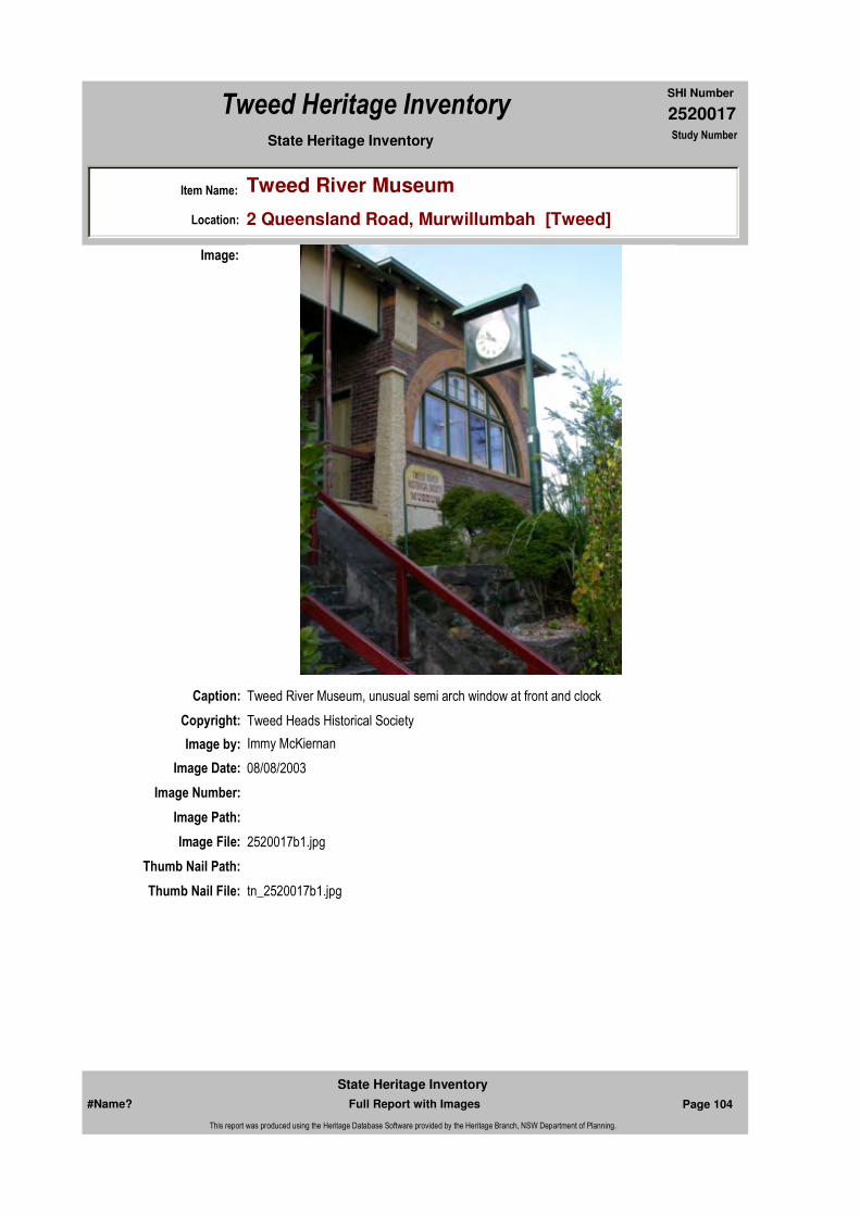
or Provenance:Original Tweed Shire Council Chambers building now occupied by the Tweed Historical Society and Museum. It is a brick building in a Federation style with steel roof and compliments the Main Street Murwillumbah complex and the Catholic Presbytery across the road.
The clock at the front of the Museum is a dual faced electric clock, two feet, six inches in diameter, which was donated to the Museum. The clock hung on the awning of the shop belonging to Ernie Newell in the Main Street of Murwillumbah and was a favourite with the locals. It is over 70 years old.
Designer:
Endorsed Significance:Assessed Significance: Local
Item Type: Built Category: Council ChambersGroup: Government and Adm
Admin Codes: Code 2: Code 3:
Curtilage/Boundary:
Owner: Private - Community Group
Other/Former Names: Tweed Shire Council Chambers (former), Civil Defence Headquarters
Area/Group/Complex: Murwillumbah Main Street Urban Conservation Area Group ID: 26
Themes:
Aboriginal Area:
Local Govt Area: Tweed
Planning: Northern
Historic Region: North Coast
Address: #Name?
Suburb / Nearest Town: #Name?
State: NSW
Parish: Murwillumbah
County: Rous
National Theme State Theme Local Theme
7. Governing Government and administra (none)
8. Culture Leisure Museum
#Name? Page 101 Full Report with Images
State Heritage Inventory
This report was produced using the Heritage Database Software provided by the Heritage Branch, NSW Department of Planning.

2520017
SHI Number
Tweed Heritage Inventory
Item Name: Tweed River Museum
Location: 2 Queensland Road, Murwillumbah [Tweed]
State Heritage Inventory Study Number
Physical Description: A single storey brick building of federation free style c.1910 with a symmetrical facade using light red and dark contrasting bricks as well as painted rendered surfaces. It has a simple corrugated iron hipped roof with projections at each end of the building, prominent eaves with brackets and central turned columns. The building has tapering piers to the corners, a central porch and staircase as entry. There are dominant arched windows which are divided into four lights.
Physical Condition:
Modification Dates:
Maker / Builder:
Year Started: Year Completed: Circa: No
Recommended
Management:
References:
Studies:
Further Comments:
Criteria a)
Criteria c)
Criteria d)
Criteria e)
Criteria g)
Criteria f)
Integrity / Intactness:
Criteria b) Tweed River Museum is significant as part of the Murwillumbah Main Street Urban Conservation Area. The Federation Free style façade of the building contributes to the character of the conservation precinct.
Parcels:
Latitude: Longitude:
Spatial Accuracy:Location validity:
Management:
Author Title YearNumber
Tweed Shire Council Community-based Heritage Study 2003
Parcel Code LotNumber Section Plan Code Plan Number
LOT 1 30 DP 75839
#Name? Page 102 Full Report with Images
State Heritage Inventory
This report was produced using the Heritage Database Software provided by the Heritage Branch, NSW Department of Planning.
2520017
SHI Number
Tweed Heritage Inventory
Item Name: Tweed River Museum
Location: 2 Queensland Road, Murwillumbah [Tweed]
State Heritage Inventory Study Number
Custom Field One:
Listings:
Date Updated: 22/05/2004 Status: 0Date First Entered: 06/06/1997Data Entry:
Custom Field Two:
Custom Field Three:
Custom Field Four:
Custom Field Five:
Custom Field Six:
AMG Zone: Easting: Northing:
Map Name: Map Scale: ADD
Name: Date:Number:Title:
Local Environmental Plan 07/04/2000Schedule 2
Local Environmental Plan 29/01/198801987
National Trust of Australia Register 11/02/19744118
Royal Australian Institute of Architects register 30/12/1985
Register of the National Estate - Interim 013998Indicative Place, Nom. 23/
#Name? Page 103 Full Report with Images
State Heritage Inventory
This report was produced using the Heritage Database Software provided by the Heritage Branch, NSW Department of Planning.
2520017
SHI Number
Tweed Heritage Inventory
Item Name: Tweed River Museum
Location: 2 Queensland Road, Murwillumbah [Tweed]
State Heritage Inventory Study Number
Caption: Tweed River Museum, unusual semi arch window at front and clock
Copyright: Tweed Heads Historical Society
Image:
Image by: Immy McKiernan
Image Date: 08/08/2003
Image Number:
Image Path:
Image File: 2520017b1.jpg
Thumb Nail Path:
Thumb Nail File: tn_2520017b1.jpg
#Name? Page 104 Full Report with Images
State Heritage Inventory
This report was produced using the Heritage Database Software provided by the Heritage Branch, NSW Department of Planning.

2520017
SHI Number
Tweed Heritage Inventory
Item Name: Tweed River Museum
Location: 2 Queensland Road, Murwillumbah [Tweed]
State Heritage Inventory Study Number
Caption: Tweed River Museum, formerly the Tweed Shire Council Offices.
Copyright: Tweed Heads Historical Society
Image:
Image by: Immy McKiernan
Image Date: 08/08/2003
Image Number:
Image Path:
Image File: 2520017b2.jpg
Thumb Nail Path:
Thumb Nail File: tn_2520017b2.jpg
#Name? Page 105 Full Report with Images
State Heritage Inventory
This report was produced using the Heritage Database Software provided by the Heritage Branch, NSW Department of Planning.
2520017
SHI Number
Tweed Heritage Inventory
Item Name: Tweed River Museum
Location: 2 Queensland Road, Murwillumbah [Tweed]
State Heritage Inventory Study Number
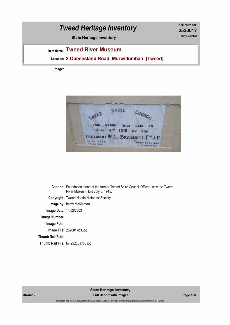
Caption: Foundation stone of the former Tweed Shire Council Offices, now the Tweed River Museum, laid July 8, 1915.
Copyright: Tweed Heads Historical Society
Image:
Image by: Immy McKiernan
Image Date: 14/02/2003
Image Number:
Image Path:
Image File: 2520017b3.jpg
Thumb Nail Path:
Thumb Nail File: tn_2520017b3.jpg
#Name? Page 106 Full Report with Images
State Heritage Inventory
This report was produced using the Heritage Database Software provided by the Heritage Branch, NSW Department of Planning.

2520017
SHI Number
Tweed Heritage Inventory
Item Name: Tweed River Museum
Location: 2 Queensland Road, Murwillumbah [Tweed]
State Heritage Inventory Study Number
#Name? Page 107 Full Report with Images
State Heritage Inventory
This report was produced using the Heritage Database Software provided by the Heritage Branch, NSW Department of Planning.

2520018
SHI Number
Tweed Heritage Inventory
Item Name: National Australia Banking Chambers
Location: 38 Murwillumbah Street, Murwillumbah [Tweed]
State Heritage Inventory Study Number
Current Use:
Former Uses:
Statement of
Significance:An unusual example of 1950s 'modern' style in a small bank building, especially interesting occuring in a small country town. It features a substantially intact interior. This building is significant as part of the Murwillumbah Main Street Urban Conservation Area. The Interwar Free Classical style facade contributes to the character of the conservation precinct.
Historical Notes
or Provenance:
Physical Description: The building is of Interwar Free Classical style with a central bay and heavy simple piers to end. The pilasters are tiled with metal stylised capitals to top. The symmetrical wings are in Georgean Revival. Simpilicity usually found to buildings behind facade. There are pilasters
Designer: D G Agnew
Maker / Builder: R J Want.
Year Started: Year Completed: 1953 Circa: No
Endorsed Significance:Assessed Significance: Local
Item Type: Built Category: BankGroup: Commercial
Admin Codes: Code 2: Code 3:
Curtilage/Boundary:
Owner: Private - Corporate
Other/Former Names: Commercial Banking Company of Sydney (former)
Area/Group/Complex: Murwillumbah Main Street Urban Conservation Area Group ID: 56
Themes:
Aboriginal Area:
Local Govt Area: Tweed
Planning: Northern
Historic Region: North Coast
Address: #Name?
Suburb / Nearest Town: #Name?
State: NSW
Parish: Murwillumbah
County: Rous
National Theme State Theme Local Theme
3. Economy Commerce Bank
#Name? Page 108 Full Report with Images
State Heritage Inventory
This report was produced using the Heritage Database Software provided by the Heritage Branch, NSW Department of Planning.

2520018
SHI Number
Tweed Heritage Inventory
Item Name: National Australia Banking Chambers
Location: 38 Murwillumbah Street, Murwillumbah [Tweed]
State Heritage Inventory Study Number
between the window in wings. It is quite ornamental for the period and style. There are glass brick lights above the awning.
Physical Condition:
Modification Dates:
Recommended Management:
References:
Studies:
Listings:
Further Comments:
Criteria a)
Criteria c)
Criteria d)
Criteria e)
Criteria g)
Criteria f)
Integrity / Intactness:
Criteria b) This building is significant as part of the Murwillumbah Main Street Urban Conservation Area. The Interwar Free Classical style facade contributes to the character of the conservation precinct.
Parcels:
Latitude: Longitude:
AMG Zone: Easting: Northing:
Map Name: Map Scale: ADD
Spatial Accuracy:Location validity:
Management:
Author Title YearNumber
Tweed Shire Council Community-based Heritage Study 2003
Name: Date:Number:Title:
Local Environmental Plan 29/01/198801987
National Trust of Australia Register 22/07/19744120
Parcel Code LotNumber Section Plan Code Plan Number
LOT 1 DP 772600
#Name? Page 109 Full Report with Images
State Heritage Inventory
This report was produced using the Heritage Database Software provided by the Heritage Branch, NSW Department of Planning.
2520018
SHI Number
Tweed Heritage Inventory
Item Name: National Australia Banking Chambers
Location: 38 Murwillumbah Street, Murwillumbah [Tweed]
State Heritage Inventory Study Number
Custom Field One:
Date Updated: 20/05/2004 Status: 0Date First Entered: 06/06/1997Data Entry:
Custom Field Two:
Custom Field Three:
Custom Field Four:
Custom Field Five:
Custom Field Six:
Royal Australian Institute of Architects register 30/12/1985
Register of the National Estate - Interim 013997Indicative Place, Nom. 23/
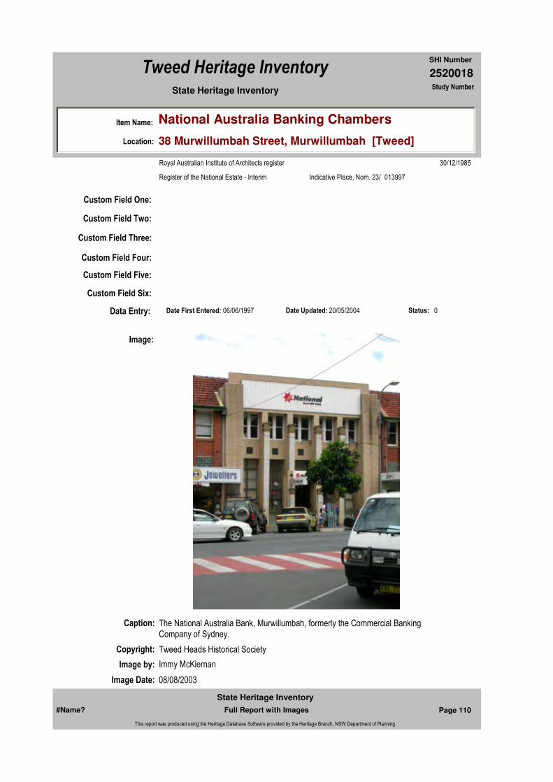
Caption: The National Australia Bank, Murwillumbah, formerly the Commercial Banking Company of Sydney.
Copyright: Tweed Heads Historical Society
Image:
Image by: Immy McKiernan
Image Date: 08/08/2003
#Name? Page 110 Full Report with Images
State Heritage Inventory
This report was produced using the Heritage Database Software provided by the Heritage Branch, NSW Department of Planning.

2520018
SHI Number
Tweed Heritage Inventory
Item Name: National Australia Banking Chambers
Location: 38 Murwillumbah Street, Murwillumbah [Tweed]
State Heritage Inventory Study Number
Image Number:
Image Path:
Image File: 2520018b1.jpg
Thumb Nail Path:
Thumb Nail File: tn_2520018b1.jpg
#Name? Page 111 Full Report with Images
State Heritage Inventory
This report was produced using the Heritage Database Software provided by the Heritage Branch, NSW Department of Planning.
2520018
SHI Number
Tweed Heritage Inventory
Item Name: National Australia Banking Chambers
Location: 38 Murwillumbah Street, Murwillumbah [Tweed]
State Heritage Inventory Study Number
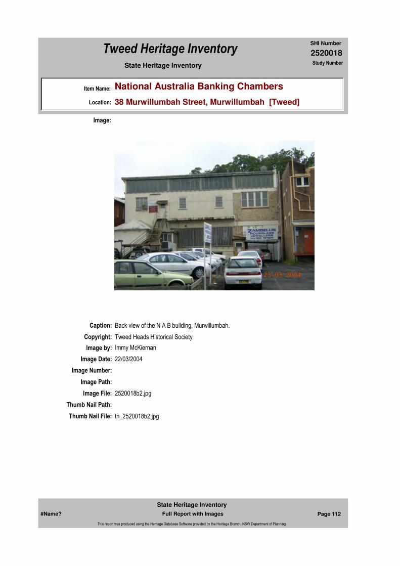
Caption: Back view of the N A B building, Murwillumbah.
Copyright: Tweed Heads Historical Society
Image:
Image by: Immy McKiernan
Image Date: 22/03/2004
Image Number:
Image Path:
Image File: 2520018b2.jpg
Thumb Nail Path:
Thumb Nail File: tn_2520018b2.jpg
#Name? Page 112 Full Report with Images
State Heritage Inventory
This report was produced using the Heritage Database Software provided by the Heritage Branch, NSW Department of Planning.
2520018
SHI Number
Tweed Heritage Inventory
Item Name: National Australia Banking Chambers
Location: 38 Murwillumbah Street, Murwillumbah [Tweed]
State Heritage Inventory Study Number
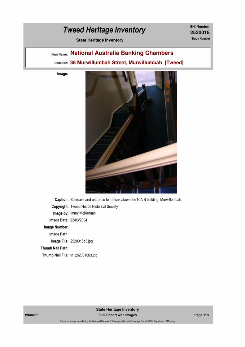
Caption: Staircase and entrance to offices above the N A B building, Murwillumbah.
Copyright: Tweed Heads Historical Society
Image:
Image by: Immy McKiernan
Image Date: 22/03/2004
Image Number:
Image Path:
Image File: 2520018b3.jpg
Thumb Nail Path:
Thumb Nail File: tn_2520018b3.jpg
#Name? Page 113 Full Report with Images
State Heritage Inventory
This report was produced using the Heritage Database Software provided by the Heritage Branch, NSW Department of Planning.
2520018
SHI Number
Tweed Heritage Inventory
Item Name: National Australia Banking Chambers
Location: 38 Murwillumbah Street, Murwillumbah [Tweed]
State Heritage Inventory Study Number
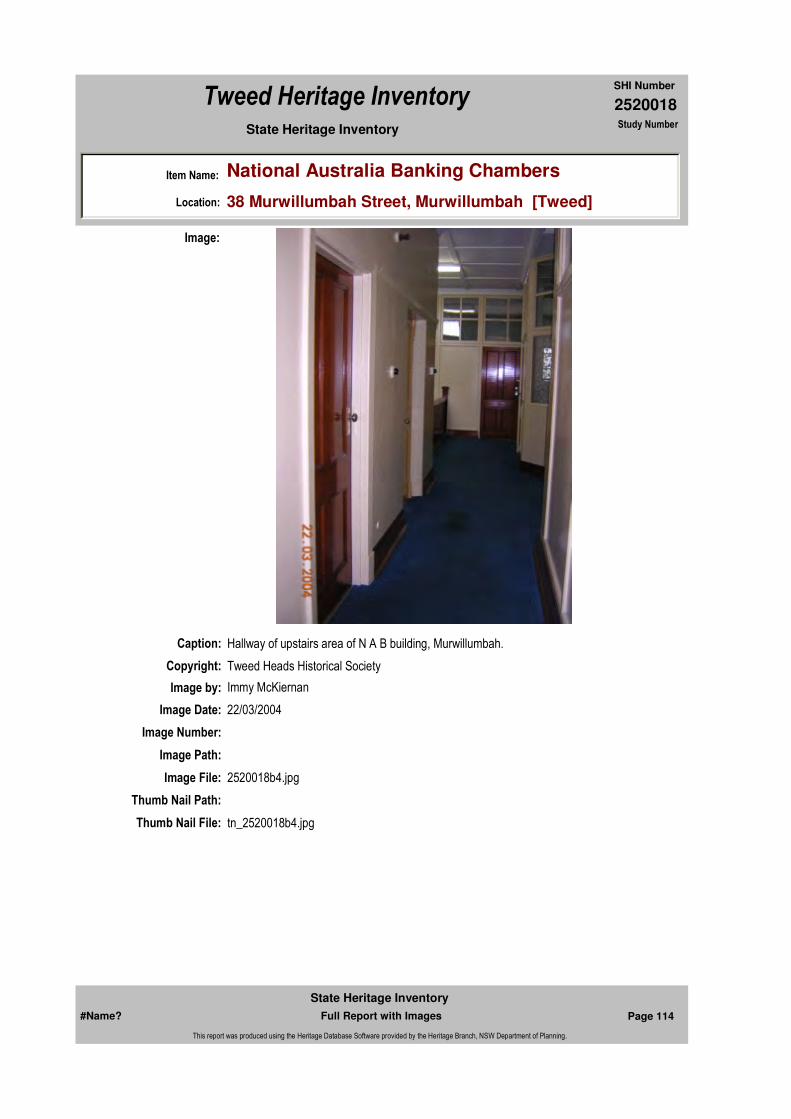
Caption: Hallway of upstairs area of N A B building, Murwillumbah.
Copyright: Tweed Heads Historical Society
Image:
Image by: Immy McKiernan
Image Date: 22/03/2004
Image Number:
Image Path:
Image File: 2520018b4.jpg
Thumb Nail Path:
Thumb Nail File: tn_2520018b4.jpg
#Name? Page 114 Full Report with Images
State Heritage Inventory
This report was produced using the Heritage Database Software provided by the Heritage Branch, NSW Department of Planning.
2520018
SHI Number
Tweed Heritage Inventory
Item Name: National Australia Banking Chambers
Location: 38 Murwillumbah Street, Murwillumbah [Tweed]
State Heritage Inventory Study Number
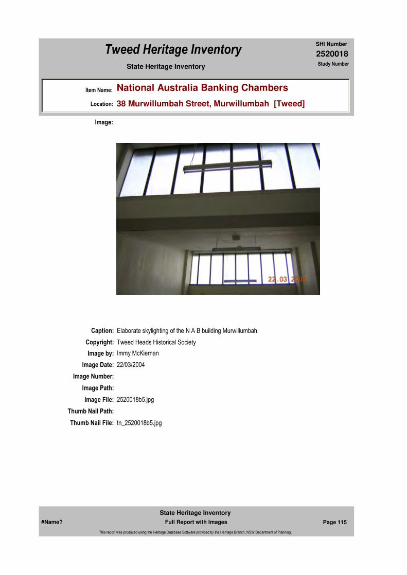
Caption: Elaborate skylighting of the N A B building Murwillumbah.
Copyright: Tweed Heads Historical Society
Image:
Image by: Immy McKiernan
Image Date: 22/03/2004
Image Number:
Image Path:
Image File: 2520018b5.jpg
Thumb Nail Path:
Thumb Nail File: tn_2520018b5.jpg
#Name? Page 115 Full Report with Images
State Heritage Inventory
This report was produced using the Heritage Database Software provided by the Heritage Branch, NSW Department of Planning.

2520018
SHI Number
Tweed Heritage Inventory
Item Name: National Australia Banking Chambers
Location: 38 Murwillumbah Street, Murwillumbah [Tweed]
State Heritage Inventory Study Number
Caption: Old safe door, upstairs at the N A B building, Murwillumbah.
Copyright: Tweed Heads Historical Society
Image:
Image by: Immy McKiernan
Image Date: 22/03/2004
Image Number:
Image Path:
Image File: 2520018b6.jpg
Thumb Nail Path:
Thumb Nail File: tn_2520018b6.jpg
#Name? Page 116 Full Report with Images
State Heritage Inventory
This report was produced using the Heritage Database Software provided by the Heritage Branch, NSW Department of Planning.
2520018
SHI Number
Tweed Heritage Inventory
Item Name: National Australia Banking Chambers
Location: 38 Murwillumbah Street, Murwillumbah [Tweed]
State Heritage Inventory Study Number
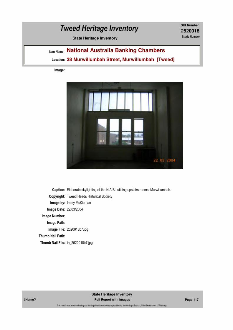
Caption: Elaborate skylighting of the N A B building upstairs rooms, Murwillumbah.
Copyright: Tweed Heads Historical Society
Image:
Image by: Immy McKiernan
Image Date: 22/03/2004
Image Number:
Image Path:
Image File: 2520018b7.jpg
Thumb Nail Path:
Thumb Nail File: tn_2520018b7.jpg
#Name? Page 117 Full Report with Images
State Heritage Inventory
This report was produced using the Heritage Database Software provided by the Heritage Branch, NSW Department of Planning.

2520018
SHI Number
Tweed Heritage Inventory
Item Name: National Australia Banking Chambers
Location: 38 Murwillumbah Street, Murwillumbah [Tweed]
State Heritage Inventory Study Number
#Name? Page 118 Full Report with Images
State Heritage Inventory
This report was produced using the Heritage Database Software provided by the Heritage Branch, NSW Department of Planning.

2520019
SHI Number
Tweed Heritage Inventory
Item Name: Residence "Goldsborough"
Location: 4 Eyles Avenue, Murwillumbah [Tweed]
State Heritage Inventory Study Number
Current Use:
Former Uses:
Statement of
Significance:Timber and steel residence on a corner site with fine timber detailing. Maintained in original condition. Goldsborough is part of the Hartigan's Hill Conservation Area.
Historical Notes or Provenance:
Physical Description: Timber cladding on brick base bungalow. Large simple roof wrapped around gable at end. Dormer in roof. Deep shady verandah on two sides, wide eaves with exposed rafters. First floor room in roof space. Ornate brackets to gable eaves. Louvred roof vents. Masonry verandah pier with timber posts to lintel beam. (period undetermined, could be pre war/ pre californian - gable too steep. some arts and crafts picturesque feel)
Designer:
Maker / Builder:
Year Started: Year Completed: Circa: No
Endorsed Significance:Assessed Significance: Local
Item Type: Built Category: BungalowGroup: Residential buildings (
Admin Codes: Code 2: Code 3:
Curtilage/Boundary:
Owner: Private - Individual
Other/Former Names:
Area/Group/Complex: Hartigan's Hill Conservation Area Group ID: 2
Themes:
Aboriginal Area:
Local Govt Area: Tweed
Planning: Northern
Historic Region: North Coast
Address: #Name?
Suburb / Nearest Town: #Name?
State: NSW
Parish: Murwillumbah
County: Rous
National Theme State Theme Local Theme
4. Settlement Accommodation (Housing) Housing
#Name? Page 119 Full Report with Images
State Heritage Inventory
This report was produced using the Heritage Database Software provided by the Heritage Branch, NSW Department of Planning.
2520019
SHI Number
Tweed Heritage Inventory
Item Name: Residence "Goldsborough"
Location: 4 Eyles Avenue, Murwillumbah [Tweed]
State Heritage Inventory Study Number
Physical Condition:
Modification Dates:
Custom Field One:
Recommended
Management:
References:
Studies:
Listings:
Further Comments:
Criteria a)
Criteria c) Timber and steel residence on a corner site with fine timber detailing. Maintained in original condition.
Criteria d)
Criteria e)
Criteria g)
Criteria f)
Integrity / Intactness:
Custom Field Two:
Custom Field Three:
Criteria b)
Parcels:
Latitude: Longitude:
AMG Zone: Easting: Northing:
Map Name: Map Scale: ADD
Spatial Accuracy:Location validity:
Management:
Author Title YearNumber
Tweed Shire Council Community-based Heritage Study 2003
Name: Date:Number:Title:
Local Environmental Plan 29/01/198801987
Parcel Code LotNumber Section Plan Code Plan Number
LOT 5, 6 28 DP 8950
#Name? Page 120 Full Report with Images
State Heritage Inventory
This report was produced using the Heritage Database Software provided by the Heritage Branch, NSW Department of Planning.

2520019
SHI Number
Tweed Heritage Inventory
Item Name: Residence "Goldsborough"
Location: 4 Eyles Avenue, Murwillumbah [Tweed]
State Heritage Inventory Study Number
Date Updated: 22/11/2006 Status: 0Date First Entered: 06/06/1997Data Entry:
Custom Field Four:
Custom Field Five:
Custom Field Six:
Caption: Goldsborough, Eyles Avenue, Murwillumbah
Copyright: Tweed Heads Historical Society
Image:
Image by: Immy McKiernan
Image Date: 07/08/2003
Image Number:
Image Path:
Image File: 2520019b1.jpg
Thumb Nail Path:
Thumb Nail File: tn_2520019b1.jpg
#Name? Page 121 Full Report with Images
State Heritage Inventory
This report was produced using the Heritage Database Software provided by the Heritage Branch, NSW Department of Planning.
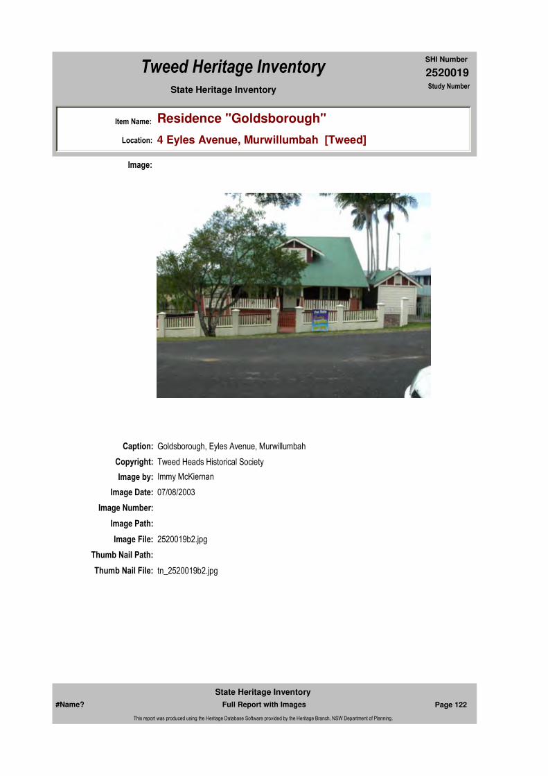
2520019
SHI Number
Tweed Heritage Inventory
Item Name: Residence "Goldsborough"
Location: 4 Eyles Avenue, Murwillumbah [Tweed]
State Heritage Inventory Study Number
Caption: Goldsborough, Eyles Avenue, Murwillumbah
Copyright: Tweed Heads Historical Society
Image:
Image by: Immy McKiernan
Image Date: 07/08/2003
Image Number:
Image Path:
Image File: 2520019b2.jpg
Thumb Nail Path:
Thumb Nail File: tn_2520019b2.jpg
#Name? Page 122 Full Report with Images
State Heritage Inventory
This report was produced using the Heritage Database Software provided by the Heritage Branch, NSW Department of Planning.
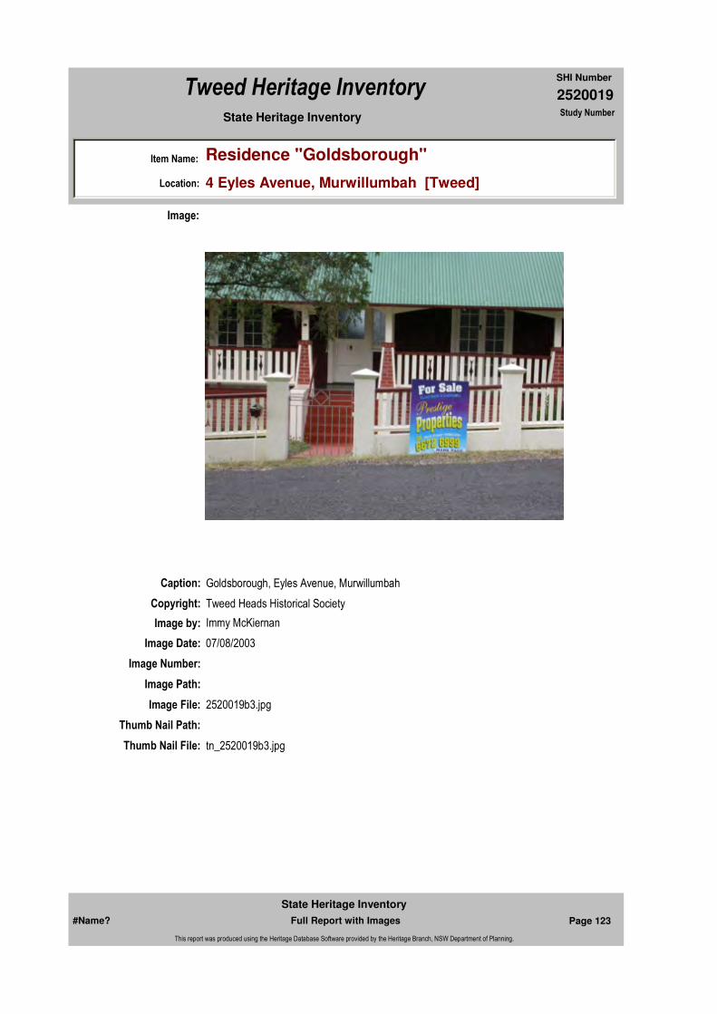
2520019
SHI Number
Tweed Heritage Inventory
Item Name: Residence "Goldsborough"
Location: 4 Eyles Avenue, Murwillumbah [Tweed]
State Heritage Inventory Study Number
Caption: Goldsborough, Eyles Avenue, Murwillumbah
Copyright: Tweed Heads Historical Society
Image:
Image by: Immy McKiernan
Image Date: 07/08/2003
Image Number:
Image Path:
Image File: 2520019b3.jpg
Thumb Nail Path:
Thumb Nail File: tn_2520019b3.jpg
#Name? Page 123 Full Report with Images
State Heritage Inventory
This report was produced using the Heritage Database Software provided by the Heritage Branch, NSW Department of Planning.

2520019
SHI Number
Tweed Heritage Inventory
Item Name: Residence "Goldsborough"
Location: 4 Eyles Avenue, Murwillumbah [Tweed]
State Heritage Inventory Study Number
Caption: Sketch of verandah pier at Goldsborough, Eyles Avenue, Murwillumbah
Copyright:
Image:
Image by: Bruce Duffield
Image Date:
Image Number:
Image Path:
Image File: 2520019b4.jpg
Thumb Nail Path:
Thumb Nail File: tn_2520019b4.jpg
#Name? Page 124 Full Report with Images
State Heritage Inventory
This report was produced using the Heritage Database Software provided by the Heritage Branch, NSW Department of Planning.

2520019
SHI Number
Tweed Heritage Inventory
Item Name: Residence "Goldsborough"
Location: 4 Eyles Avenue, Murwillumbah [Tweed]
State Heritage Inventory Study Number
#Name? Page 125 Full Report with Images
State Heritage Inventory
This report was produced using the Heritage Database Software provided by the Heritage Branch, NSW Department of Planning.

2520020
SHI Number
Tweed Heritage Inventory
Item Name: Sacred Heart Roman Catholic Presbytery
Location: Murwillumbah Street, Murwillumbah [Tweed]
State Heritage Inventory Study Number
Current Use:
Former Uses:
Statement of
Significance:The Sacred Heart Presbytery is part of the exuberant and showy buildings of the Roman Catholic Church Group, which includes higher style, Carpenter and Interwar Gothic Churches, Federation Filigree Convent and the Queen Anne Presbytery. The Roman Catholic Church buildings are significant as part of the Murwillumbah Main Street Urban Conservation Area. The facades contribute to the character of the conservation precinct.
Historical Notes or Provenance:
Physical Description: The Roman Catholic Church Group consists of the double storey timber convent, timber church hall, brick church and presbytery. The timber buildings are all good examples of
Designer:
Maker / Builder:
Year Started: 1904 Year Completed: Circa: No
Endorsed Significance:Assessed Significance: Local
Item Type: Built Category: Presbytery/Rectory/ ViGroup: Religion
Admin Codes: Code 2: Code 3:
Curtilage/Boundary:
Owner: Religious Organisation
Other/Former Names:
Area/Group/Complex: Murwillumbah Main Street Urban Conservation Area Group ID: 27
Themes:
Aboriginal Area:
Local Govt Area: Tweed
Planning: Northern
Historic Region: North Coast
Address: #Name?
Suburb / Nearest Town: #Name?
State: NSW
Parish: Murwillumbah
County: Rous
National Theme State Theme Local Theme
8. Culture Religion Presbytery
#Name? Page 126 Full Report with Images
State Heritage Inventory
This report was produced using the Heritage Database Software provided by the Heritage Branch, NSW Department of Planning.

2520020
SHI Number
Tweed Heritage Inventory
Item Name: Sacred Heart Roman Catholic Presbytery
Location: Murwillumbah Street, Murwillumbah [Tweed]
State Heritage Inventory Study Number
regional timber architecture with emphasis on fine detailing and are in reasonable condition. The Presbytery is of Queen Ann style.
Physical Condition:
Modification Dates:
Recommended Management:
Restore presbytery elevation. Conserve the exterior and interior elements of significance; adapt services and facilities to ensure continued use; remove redundant signs and signs which detract from the style of architecture; provide a suitable colour scheme which compliments the architecture and matches the aspirations of the building owner and tenant; restore damaged and missing original architectural features based on early photographs or technical drawings.
References:
Studies:
Further Comments:
Criteria a)
Criteria c) The Sacred Heart Presbytery is part of the exuberant and showy buildings of the Roman Catholic Church Group, which includes higher style, Carpenter and Interwar Gothic Churches, Federation Filigree Convent and the Queen Anne Presbytery.
Criteria d)
Criteria e)
Criteria g)
Criteria f)
Integrity / Intactness:
Criteria b) The Roman Catholic Church buildings are significant as part of the Murwillumbah Main Street Urban Conservation Area. The facades contribute to the character of the conservation precinct.
Parcels:
Latitude: Longitude:
Map Name: Map Scale: LGA
Spatial Accuracy:Location validity:
Management:
Author Title YearNumber
Tweed Shire Council Community-based Heritage Study 2003
Parcel Code LotNumber Section Plan Code Plan Number
LOT 2 DP 225827
#Name? Page 127 Full Report with Images
State Heritage Inventory
This report was produced using the Heritage Database Software provided by the Heritage Branch, NSW Department of Planning.
2520020
SHI Number
Tweed Heritage Inventory
Item Name: Sacred Heart Roman Catholic Presbytery
Location: Murwillumbah Street, Murwillumbah [Tweed]
State Heritage Inventory Study Number
Custom Field One:
Listings:
Date Updated: 02/11/2004 Status: 0Date First Entered: 06/06/1997Data Entry:
Custom Field Two:
Custom Field Three: AHC: DescriptionChanged:11/12/1996 Condition Changed:11/12/1996 Significance (nominators) Changed:11/12/1996 Nominated:23/12/1984
Custom Field Four:
Custom Field Five:
Custom Field Six:
AMG Zone: Easting: Northing:
Name: Date:Number:Title:
Local Environmental Plan 07/04/2000Schedule 2
Local Environmental Plan 29/01/198801987
National Trust of Australia Register 12/11/19794125
Royal Australian Institute of Architects register 24/05/2000
Register of the National Estate - Interim 013995Indicative Place, Nom. 23/
#Name? Page 128 Full Report with Images
State Heritage Inventory
This report was produced using the Heritage Database Software provided by the Heritage Branch, NSW Department of Planning.
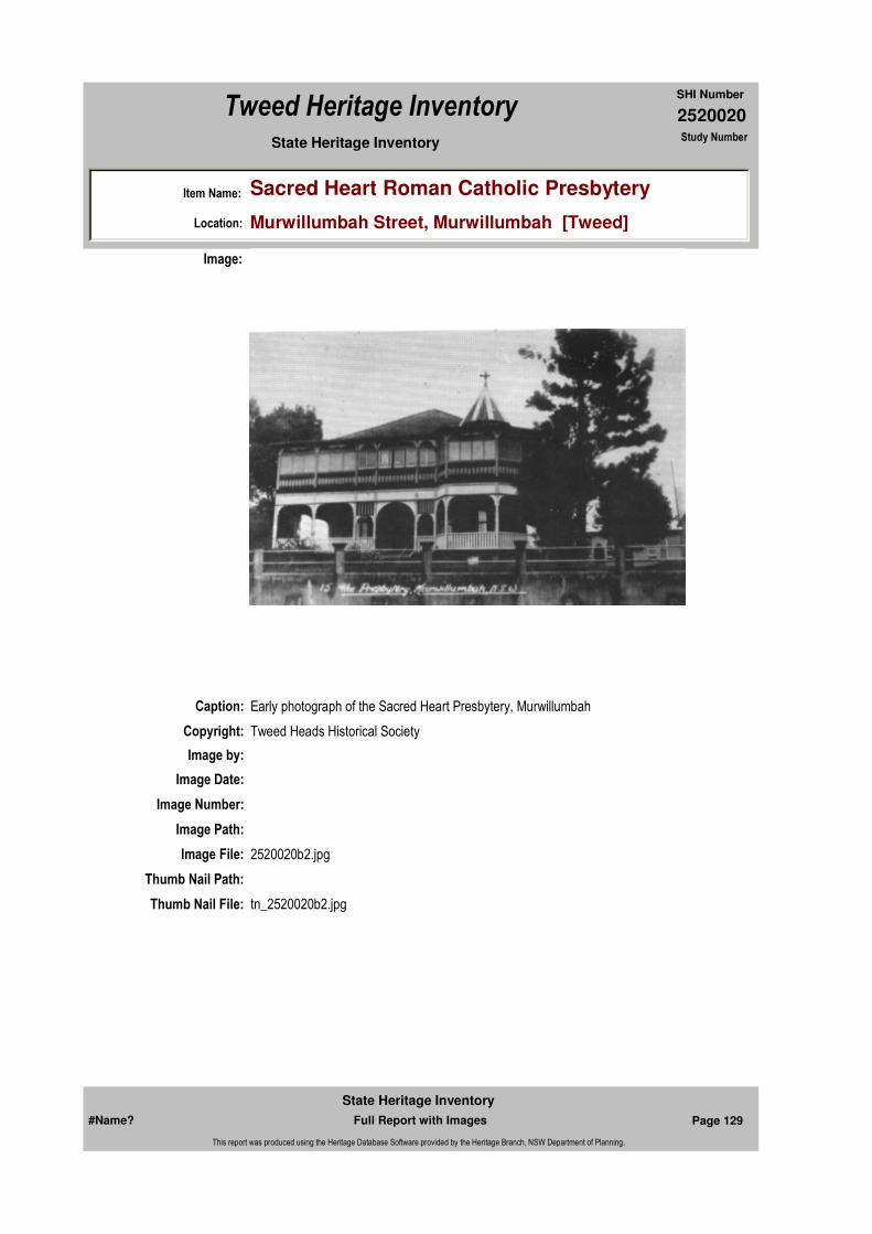
2520020
SHI Number
Tweed Heritage Inventory
Item Name: Sacred Heart Roman Catholic Presbytery
Location: Murwillumbah Street, Murwillumbah [Tweed]
State Heritage Inventory Study Number
Caption: Early photograph of the Sacred Heart Presbytery, Murwillumbah
Copyright: Tweed Heads Historical Society
Image:
Image by:
Image Date:
Image Number:
Image Path:
Image File: 2520020b2.jpg
Thumb Nail Path:
Thumb Nail File: tn_2520020b2.jpg
#Name? Page 129 Full Report with Images
State Heritage Inventory
This report was produced using the Heritage Database Software provided by the Heritage Branch, NSW Department of Planning.
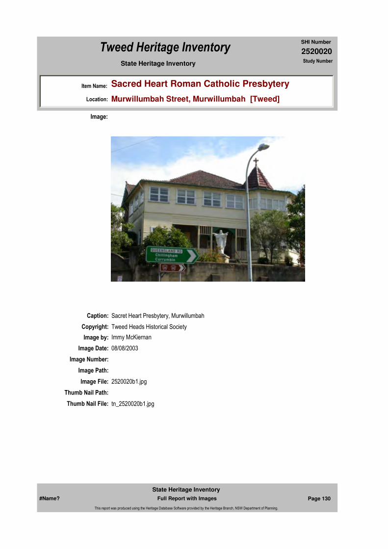
2520020
SHI Number
Tweed Heritage Inventory
Item Name: Sacred Heart Roman Catholic Presbytery
Location: Murwillumbah Street, Murwillumbah [Tweed]
State Heritage Inventory Study Number
Caption: Sacret Heart Presbytery, Murwillumbah
Copyright: Tweed Heads Historical Society
Image:
Image by: Immy McKiernan
Image Date: 08/08/2003
Image Number:
Image Path:
Image File: 2520020b1.jpg
Thumb Nail Path:
Thumb Nail File: tn_2520020b1.jpg
#Name? Page 130 Full Report with Images
State Heritage Inventory
This report was produced using the Heritage Database Software provided by the Heritage Branch, NSW Department of Planning.

2520020
SHI Number
Tweed Heritage Inventory
Item Name: Sacred Heart Roman Catholic Presbytery
Location: Murwillumbah Street, Murwillumbah [Tweed]
State Heritage Inventory Study Number
#Name? Page 131 Full Report with Images
State Heritage Inventory
This report was produced using the Heritage Database Software provided by the Heritage Branch, NSW Department of Planning.
2520022
SHI Number
Tweed Heritage Inventory
Item Name: Dum Dum Homestead
Location: 973 Kyogle Road, Dum Dum [Tweed]
State Heritage Inventory Study Number
Current Use:
Former Uses:
Statement of
Significance:The homestead is an excellent example of the rural domestic architecture of the prosperous farmer. The house and its setting are representative of the architecture of the successful settlers. The homestead has strong links with the Buchanan family who were important as farmers businessmen and benefactors to the development of the Tweed Shire.
Historical Notes
or Provenance:Dum Dum means many yams and was named by James Buchanan who selected Lot 10 in 1878. He purchased more land from James Hall and John Berry and the farm then comprised 331 acres. It was used a cattle run The first house, built in 1900 by J.M. Holston was a share farmer's residence and Mr. Neil McDonald commenced dairying. This house was removed in late 1970's.
Born in Ireland, James snr arrived in Australia as a gold seeker in 1862 and later came to the Tweed to buy land at Condong from James Ford on which he established a dairy farm called "Mayfield". This is now the industrial area for Murwillumbah. He was a one of the founding members of Norco and helped in the development of the butter industry on the Tweed.
Mr Buchanan had broad business interests, owning the Condong Hotel and the original Australian Hotel in the Broadway in Murwillumbah. He was a Justice of the Peace and a benefactor to the Presbyterian Church. He was also a road contractor and responsible for the construction of many vital links for the Shire. He pioneered the Nightcap Track to the Richmond River and the Dungay Road to Tallebudgera to the north.
James Graham Buchanan, son of James snr. was the first of the family to live at Dum Dum.
Endorsed Significance:Assessed Significance: Local
Item Type: Built Category: Homestead buildingGroup: Residential buildings (
Admin Codes: Code 2: Code 3:
Curtilage/Boundary: 973 Kyogle Rd, 8 km south-west of Murwillumbah.
Owner: Private - Individual
Other/Former Names:
Area/Group/Complex: Group ID:
Aboriginal Area:
Local Govt Area: Tweed
Planning: Northern
Historic Region: North Coast
Address: #Name?
Suburb / Nearest Town: #Name?
State: NSW
Parish: Kunghur
County: Rous
#Name? Page 132 Full Report with Images
State Heritage Inventory
This report was produced using the Heritage Database Software provided by the Heritage Branch, NSW Department of Planning.
2520022
SHI Number
Tweed Heritage Inventory
Item Name: Dum Dum Homestead
Location: 973 Kyogle Road, Dum Dum [Tweed]
State Heritage Inventory Study Number
He built the present homestead in 1911 at a cost of 400 pounds. Timber for the house was milled at Uki. The land stayed in the family for over100 years.
In 1918, part of Dum Dum was leased to the Department of Education for the construction of a school and residence. During WW2, a stand of bamboo was planted at the gateway reportedly as part of a government scheme. This bamboo remains a significant landmark. The farm was worked as a dairy for many years. After its sale by the family in 1990's it was a Limousine stud, and a replacement workers cottage was used for Farm Stay accommodation. Currently the land has been planted with grape vines and will be developed as a boutique winery.
Physical Description: Some Queen Anne influences. Assymetrical entrance, enslemble of roofs. Wide verandah with curvilinear Art Nouveau ornamentation to entry. Timber curtain screen below verandah. Single story residence of weatherboard and iron with magnificent views to Mount Warning. The house is set back from the road but clearly visible. The house is early Federation domestic in style with fretwork and gable decorations typical of the times. A large stand of bamboo marks the entrance and a replacement share-farmer's cottage and modern concrete bails, now a pottery, are adjacent.
Physical Condition:
Modification Dates: Currently restoration and renovations are under way (2004). Additions will be made at the rear to adapt the homestead for tourism. These have been designed by Gary Fiddler, architect and approved by TSC. They consist of a verandah and disabled access.
Designer: Eads.
Maker / Builder:
Year Started: Year Completed: 1911 Circa: No
Recommended
Management:
Further Comments:
Criteria a)
Criteria b) Dum Dum Homestead has strong links with the Buchanan family who were important as farmers businessmen and benefactors to the development of the Tweed Shire
Themes:
Management:
National Theme State Theme Local Theme
3. Economy Agriculture Homestead
#Name? Page 133 Full Report with Images
State Heritage Inventory
This report was produced using the Heritage Database Software provided by the Heritage Branch, NSW Department of Planning.
2520022
SHI Number
Tweed Heritage Inventory
Item Name: Dum Dum Homestead
Location: 973 Kyogle Road, Dum Dum [Tweed]
State Heritage Inventory Study Number
Custom Field One: National Trust of Australia register 30/10/1978 # 4126 National Trust of Australia NSW DescriptionChanged:11/12/1996 Condition Changed:11/12/1996 Significance (nominators) Changed:11/12/1996 Nominated:23/12/1984
References:
Studies:
Listings:
Date Updated: 01/11/2004 Status: 0Date First Entered: 06/06/1997Data Entry:
Criteria c)
Criteria d)
Criteria e)
Criteria g) The homestead is an excellent example of the rural domestic architecture of the prosperous farmer The cottage contributes to the understanding of the organisation of farm labour. The house and its setting are representative of the architecture of the successful settlers.
Criteria f)
Integrity / Intactness:
Custom Field Two: Australian Heritage Commission Register of the National Estate Interim Indicative Place, Nom. 23/12/1984 # 013999
Custom Field Three:
Custom Field Four:
Custom Field Five:
Custom Field Six:
Parcels:
Latitude: Longitude:
AMG Zone: Easting: Northing:
Map Name: Map Scale: ADD
Spatial Accuracy:Location validity:
Author Title Year
National Trust of Australia (NSW) National Trust of Australia (NSW)
Author Title YearNumber
Tweed Shire Council Community-based Heritage Study 2003
Name: Date:Number:Title:
Local Environmental Plan 29/01/198801987
Parcel Code LotNumber Section Plan Code Plan Number
LOT 13 DP 882836
#Name? Page 134 Full Report with Images
State Heritage Inventory
This report was produced using the Heritage Database Software provided by the Heritage Branch, NSW Department of Planning.

2520022
SHI Number
Tweed Heritage Inventory
Item Name: Dum Dum Homestead
Location: 973 Kyogle Road, Dum Dum [Tweed]
State Heritage Inventory Study Number
Caption: Dum Dum homestead.
Copyright: Tweed Heads Historical Society
Image:
Image by: Immy McKiernan
Image Date: 14/02/2004
Image Number:
Image Path:
Image File: 2520022b1.jpg
Thumb Nail Path:
Thumb Nail File: tn_2520022b1.jpg
#Name? Page 135 Full Report with Images
State Heritage Inventory
This report was produced using the Heritage Database Software provided by the Heritage Branch, NSW Department of Planning.
2520022
SHI Number
Tweed Heritage Inventory
Item Name: Dum Dum Homestead
Location: 973 Kyogle Road, Dum Dum [Tweed]
State Heritage Inventory Study Number
#Name? Page 136 Full Report with Images
State Heritage Inventory
This report was produced using the Heritage Database Software provided by the Heritage Branch, NSW Department of Planning.

2520023
SHI Number
Tweed Heritage Inventory
Item Name: Grave Site and Headstone of Patrick Smith
Location: Dulguigan Road, Dulguigan [Tweed]
State Heritage Inventory Study Number
Current Use:
Former Uses:
Statement of
Significance:The headstone marks the grave of one of the first team of cedar getters to work the Tweed from 1844 and a significant pioneer. He was the father of the first white boy to be born on the Tweed.
Historical Notes
or Provenance:Patrick Smith was one of the first cedar getters on the Tweed. Convicted of theft in Dublin at the age of twelve he was transported to Australia. He arrived on the Tweed around 1845 having walked with his wife along the beaches from Southport. In 1851,his son, also Patrick, was the first white child born in the valley. Paddy's son became the first auctioneer in Murwillumbah and was an Alderman on the first Municipal Council and later Mayor.
Paddy was killed in a timber felling accident in 1871.
The stone also commemorates his sister-in-law, Kate Burke who was born in Tipperary, Ireland and died on the Tweed, April 1878.
H.W. Denning. Historical Manuscript of the Tweed 1989
Endorsed Significance:Assessed Significance: Local
Item Type: Complex / Group Category: Isolated Grave/Burial Group: Cemeteries and Buria
Admin Codes: Code 2: Code 3:
Curtilage/Boundary:
Owner: Private - Individual
Other/Former Names:
Area/Group/Complex: Group ID:
Themes:
Aboriginal Area:
Local Govt Area: Tweed
Planning: Northern
Historic Region: North Coast
Address: #Name?
Suburb / Nearest Town: #Name?
State: NSW
Parish: Tygalgah
County: Rous
National Theme State Theme Local Theme
9. Phases of Life Birth and Death Isolated Graves
#Name? Page 137 Full Report with Images
State Heritage Inventory
This report was produced using the Heritage Database Software provided by the Heritage Branch, NSW Department of Planning.

2520023
SHI Number
Tweed Heritage Inventory
Item Name: Grave Site and Headstone of Patrick Smith
Location: Dulguigan Road, Dulguigan [Tweed]
State Heritage Inventory Study Number
Physical Description: Single stone grave marker with carved fern leaf pattern surrounded by wrought iron fence.
Physical Condition:
Modification Dates:
Designer:
Maker / Builder:
Year Started: Year Completed: 1871 Circa: No
Recommended
Management:Ensure general weed maintenance occurs on a regular basis and that structures are stable.
References:
Studies:
Further Comments:
Criteria a)
Criteria c)
Criteria d)
Criteria e)
Criteria g)
Criteria f)
Integrity / Intactness:
Criteria b) The headstone marks the grave of one of the first team of cedar getters to work the Tweed from 1844 and a significant pioneer. He was the father of the first white boy to be born on the Tweed.
Parcels:
Latitude: Longitude:
Management:
Author Title YearNumber
Tweed Shire Council Community-based Heritage Study 2003
Parcel Code LotNumber Section Plan Code Plan Number
LOT 6 DP 807962
#Name? Page 138 Full Report with Images
State Heritage Inventory
This report was produced using the Heritage Database Software provided by the Heritage Branch, NSW Department of Planning.

2520023
SHI Number
Tweed Heritage Inventory
Item Name: Grave Site and Headstone of Patrick Smith
Location: Dulguigan Road, Dulguigan [Tweed]
State Heritage Inventory Study Number
Custom Field One:
Listings:
Date Updated: 22/05/2004 Status: 0Date First Entered: 06/06/1997Data Entry:
Custom Field Two:
Custom Field Three:
Custom Field Four:
Custom Field Five:
Custom Field Six:
AMG Zone: Easting: Northing:
Map Name: Map Scale: ADD
Spatial Accuracy:Location validity:
Name: Date:Number:Title:
Local Environmental Plan 29/01/198801987
Caption: Headstone of Paddy Smith.
Image:
#Name? Page 139 Full Report with Images
State Heritage Inventory
This report was produced using the Heritage Database Software provided by the Heritage Branch, NSW Department of Planning.

2520023
SHI Number
Tweed Heritage Inventory
Item Name: Grave Site and Headstone of Patrick Smith
Location: Dulguigan Road, Dulguigan [Tweed]
State Heritage Inventory Study Number
Copyright: Uki & South Arm Historical Society
Image by: Mary Lee Connery
Image Date: 23/11/2003
Image Number:
Image Path:
Image File: 2520023b1.jpg
Thumb Nail Path:
Thumb Nail File: tn_2520023b1.jpg
#Name? Page 140 Full Report with Images
State Heritage Inventory
This report was produced using the Heritage Database Software provided by the Heritage Branch, NSW Department of Planning.
2520027
SHI Number
Tweed Heritage Inventory
Item Name: Osprey Nests as mapped by NPWS
Location: 18 sites, [Tweed]
State Heritage Inventory Study Number
Current Use:
Former Uses:
Statement of
Significance:The nests represent a major collaborative initiative to preserve a highly threatened species. The birds are protected by both the National Parks & Wildlife Service and Threatened Species Act.
Historical Notes
or Provenance:Tweed Osprey Breeding Observations 1998 season (www.bigvolcano.com.au) by David Palmer
Vigilance on the part of the 17 volunteer observers has brought a handsome reward this year. On Saturday the 14th of November they met for a field trip with NSW National Parks and Wildlife Service Ranger Bob Moffat and group leader Andy Reimanis. Each team or individual observer submitted their observation report sheets for compilation, and the results have now been released.
Over the season 21 nest sites were observed on a regular basis. Twenty osprey pairs attempted breeding, and though two nests were destroyed by wind or collapse of supporting branches, a record 22 young osprey were probably fledged!
Ospreys face many natural perils as well a perils initiated by humans, so this is indeed a great result. One nest succeeded in spite of sugar cane being burnt directly beneath it, and another tolerated the interference of an observation mirror being attached, possibly by a developer's consultant, and removed by NPWS officers.
A banding program by NPWS officers was probably instrumental in saving the lives of two chicks which became fouled by fishing tackle brought to the nest with their food.
Endorsed Significance:Assessed Significance: Local
Item Type: Landscape Category: Fauna habitatGroup: Landscape - Natural
Admin Codes: Code 2: Code 3:
Curtilage/Boundary:
Owner:
Other/Former Names:
Area/Group/Complex: Group ID:
Aboriginal Area:
Local Govt Area: Tweed
Planning: Northern
Historic Region: North Coast
Address: #Name?
Suburb / Nearest Town: #Name?
State: NSW
Parish:
County:
#Name? Page 150 Full Report with Images
State Heritage Inventory
This report was produced using the Heritage Database Software provided by the Heritage Branch, NSW Department of Planning.
2520027
SHI Number
Tweed Heritage Inventory
Item Name: Osprey Nests as mapped by NPWS
Location: 18 sites, [Tweed]
State Heritage Inventory Study Number
The resilience of this species is truly remarkable. It is beginning to look like their decline in this area was largely due to lack of suitable nesting sites. What is also remarkable is the incredible fish productivity of the Tweed River and estuary. Not only does it support an abundance of Ospreys but equally impressive populations of Sea Eagles, Brahminy Kites, Whistling Kites, pelicans and the ubiquitous shags and cormorants.
Congratulations to Bob Moffat, Andy Reimanis and all the volunteers.
Ospreys fouled with fishing tackle by David Palmer (www.bigvolcano.com.au)
A banding operation for osprey nesting early this spring, might well have been the salvation of a pair of nestlings. In late August the NSW National Parks and Wildlife Service, as part of its annual Osprey survey, was carrying out banding of chicks in several nests in the Wollumbin area.
In one nest they found two nearly fledged juveniles which had become seriously fouled with fishing lines, leaders, swivels and hooks. One chick had both wings and legs fouled by fishing line and the other had swallowed a stainless steel hook, still attached by a leader, to a brass swivel which was hanging out of the corner of its mouth.
NPWS ranger Bob Moffat, who is based at Alstonville, said that one of the young fish hawks was freed from fishing line and immediately tagged and returned to its nest. The other was taken to the Alstonville veterinary clinic where an x-ray showed a fish hook deep in its stomach.
Evan Kovac, the veterinarian, administered an emulsion which fortunately induced the young bird to regurgitate the hook overnight.
If the hook had been caught in the chick's gut it might have required major surgery to remove it. The second youngster was banded and returned to the care of its anxious parents the next day.
Mr. Moffat said that as the birds had never left the nest, the line and tackle must have been delivered to them by their parents attached to, or even inside fish the adult birds had caught.
He appeals to anglers to recover all possible tackle and waste line, and to never use stainless steel hooks or tackle.
Mild steel tackle rust away quite quickly especially in salt water or the acid conditions inside the gut.
Over the past ten years, Mr Moffat has been instrumental in establishing a network of artificial nesting poles for the osprey, in co-operation with the local electricity supply company, Northpower.
In spite of such hazards as described here, the endangered ospreys are now using
#Name? Page 151 Full Report with Images
State Heritage Inventory
This report was produced using the Heritage Database Software provided by the Heritage Branch, NSW Department of Planning.

2520027
SHI Number
Tweed Heritage Inventory
Item Name: Osprey Nests as mapped by NPWS
Location: 18 sites, [Tweed]
State Heritage Inventory Study Number
approximately 90 nesting sites in New South Wales, a great improvement on the 10 breeding pairs known in the late 1970's.
Webmaster's Note - 15/06/03: Recfish Australia's mission is to represent the interests of recreational and sport fishers at a national level to ensure quality fishing. We seek your support in promoting the voluntary National Code of Practice and applying its principles in all your fishing activities.
National Parks & Wildlife Service Seeks Support from FishermenRepublished from the Tweed Link, with permission of the Tweed Shire Council
This Osprey chick is lucky to be alive after having swallowed a stainless steel fishhook. TWEED fishermen have been urged to help protect the Tweed's ten pairs of Osprey - an endangered species - by taking better care of their fishing tackle.
The call from National Parks and Wildlife Service officers was made last week after they discovered two Osprey chicks entangled in fishing line. The discovery was made during a banding operation which involves inspection of Osprey nesting poles.
"One had a piece of fishing line coming out of its throat and this was wrapped around another chick's neck," NPWS ranger Dwayne Binge told the Tweed Link.
Mr Binge advised fishermen against using stainless steel hooks as these do not break down in salt water, or in the stomach acid of fish or birds, like ordinary hooks.
He also suggested fishermen use fishing line that breaks down in ultraviolet light. "Ospreys are an endangered species. We have quite a few of them in the Tweed - 10 breeding pairs - and we need to protect them," he said.
Tweed's river management co-ordinator Jane Lofthouse last week said discarded fishing line was a major problem for sea birds. She encouraged fishermen to recover tackle whenever possible and to thoughtfully dispose of fishing line.
Physical Description: Osprey nests as mapped from time to time by the National Parks and Wildlife Service and
Designer:
Maker / Builder:
Year Started: Year Completed: Circa: No
Themes: National Theme State Theme Local Theme
1. Environment Environment - naturally evol (none)
#Name? Page 152 Full Report with Images
State Heritage Inventory
This report was produced using the Heritage Database Software provided by the Heritage Branch, NSW Department of Planning.
2520027
SHI Number
Tweed Heritage Inventory
Item Name: Osprey Nests as mapped by NPWS
Location: 18 sites, [Tweed]
State Heritage Inventory Study Number
notified to the Council.In 2004, there were 18 nests.
Physical Condition:
Modification Dates:
Custom Field One:
Recommended Management:
References:
Studies:
Listings:
Further Comments:
Criteria a)
Criteria c)
Criteria d)
Criteria e)
Criteria g)
Criteria f) The nests represent a major collaborative initiative to preserve a highly threatened species. The birds are protected by both the National Parks & Wildlife service and Threatened Species Act.
Integrity / Intactness:
Criteria b)
Parcels:
Latitude: Longitude:
AMG Zone: Easting: Northing:
Map Name: Map Scale: LGA
Spatial Accuracy:Location validity:
Management:
Author Title Year
David Palmer Tweed Osprey Breeding Observations 1998 season by
Author Title YearNumber
Tweed Shire Council Community-based Heritage Study 2003
Name: Date:Number:Title:
Local Environmental Plan 29/01/198801987
#Name? Page 153 Full Report with Images
State Heritage Inventory
This report was produced using the Heritage Database Software provided by the Heritage Branch, NSW Department of Planning.
2520027
SHI Number
Tweed Heritage Inventory
Item Name: Osprey Nests as mapped by NPWS
Location: 18 sites, [Tweed]
State Heritage Inventory Study Number
Date Updated: 02/11/2004 Status: 0Date First Entered: 06/06/1997Data Entry:
Custom Field Two:
Custom Field Three:
Custom Field Four:
Custom Field Five:
Custom Field Six:
#Name? Page 154 Full Report with Images
State Heritage Inventory
This report was produced using the Heritage Database Software provided by the Heritage Branch, NSW Department of Planning.
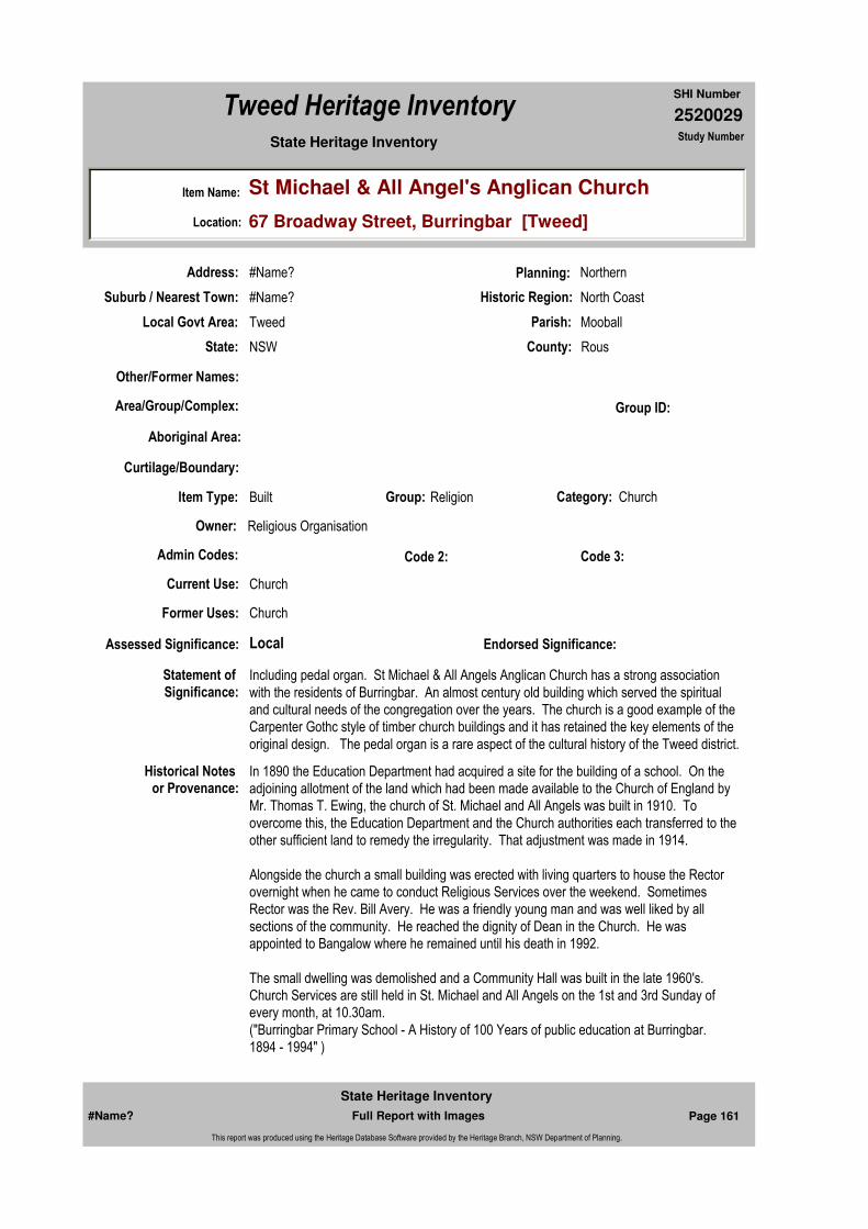
2520029
SHI Number
Tweed Heritage Inventory
Item Name: St Michael & All Angel's Anglican Church
Location: 67 Broadway Street, Burringbar [Tweed]
State Heritage Inventory Study Number
Current Use: Church
Former Uses: Church
Statement of
Significance:Including pedal organ. St Michael & All Angels Anglican Church has a strong association with the residents of Burringbar. An almost century old building which served the spiritual and cultural needs of the congregation over the years. The church is a good example of the Carpenter Gothc style of timber church buildings and it has retained the key elements of the original design. The pedal organ is a rare aspect of the cultural history of the Tweed district.
Historical Notes or Provenance:
In 1890 the Education Department had acquired a site for the building of a school. On the adjoining allotment of the land which had been made available to the Church of England by Mr. Thomas T. Ewing, the church of St. Michael and All Angels was built in 1910. To overcome this, the Education Department and the Church authorities each transferred to the other sufficient land to remedy the irregularity. That adjustment was made in 1914.
Alongside the church a small building was erected with living quarters to house the Rector overnight when he came to conduct Religious Services over the weekend. Sometimes Rector was the Rev. Bill Avery. He was a friendly young man and was well liked by all sections of the community. He reached the dignity of Dean in the Church. He was appointed to Bangalow where he remained until his death in 1992.
The small dwelling was demolished and a Community Hall was built in the late 1960's. Church Services are still held in St. Michael and All Angels on the 1st and 3rd Sunday of every month, at 10.30am.("Burringbar Primary School - A History of 100 Years of public education at Burringbar. 1894 - 1994" )
Endorsed Significance:Assessed Significance: Local
Item Type: Built Category: ChurchGroup: Religion
Admin Codes: Code 2: Code 3:
Curtilage/Boundary:
Owner: Religious Organisation
Other/Former Names:
Area/Group/Complex: Group ID:
Aboriginal Area:
Local Govt Area: Tweed
Planning: Northern
Historic Region: North Coast
Address: #Name?
Suburb / Nearest Town: #Name?
State: NSW
Parish: Mooball
County: Rous
#Name? Page 161 Full Report with Images
State Heritage Inventory
This report was produced using the Heritage Database Software provided by the Heritage Branch, NSW Department of Planning.

2520029
SHI Number
Tweed Heritage Inventory
Item Name: St Michael & All Angel's Anglican Church
Location: 67 Broadway Street, Burringbar [Tweed]
State Heritage Inventory Study Number
On 1 July 1916, the Upper Tweed, together with Burringbar, was formed into a Parochial District.
The Rev. Hamilton Armstrong Haslam was Curate of Murwillumbah, residing at Uki, from February to June 1916. From 1 July 1916 he was Priest-in-charge of the newly formed Parochial District, remaining until April 1917, when he went to Coramba. For a year the area was cared for by an overworked Vicar of Murwillumbah, who gratefully reported: "Since Rev Haslam left many months ago, the parochial district of Burringbar and the Upper Tweed has been in a bad way for services, and the spiritual ministration of the Church having to exist entirely on a very occasional service which could be provided by the already very busy Vicar of this Parish. It will therefore be very welcome news for all concerned that Mr H. H. Thomas, a missionary who was some time at Yarrabah, has taken up permanent work in the parochial district. It is a great pity that a priest could not be obtained, but, however, in these times of distress, we must be extremely thankful for even the assistance of a devoted layman."
On 14 February, Henry Howard Thomas, who had been a lay Missionary at Yarrabah, Queensland, was installed as Reader-in-Charge and remained until 31 December 1918. The Bishop reported: "On Feb 14 visited the P. D. of Burringbar and the Upper Tweed, which has been without minister or reader for nearly a year. A service was held at Burringbar in the morning and at Uki at night, both being unfortunately marred by teeming rain. I was glad to have the opportunity, however of thus installing Mr H. H. Thomas as Reader-in-Charge of the district."
The year 1919 heralded a new era for the Parish with the arrival of the Rev. Cornelius Foley, who had been born in London in 1884, was educated at St John's College, Armidale, made deacon on 17 December 1916 and priest on 14 July 1918. He arrived as Priest-in-Charge of the Parochial District on 1 May 1919 and remained until 14 November 1922, when he went to Coraki. He died at Woodburn on 14 July 1942.
The only churches in the Parochial District were St. Michael and All Angels at Burringbar, and the 'tin church', the first St John's, at Tyalgum. At Uki, the centre of the Parochial District, services were held in a small hall known as the little 'Red Church' situated where the Fire Station stands, and then owned by the Methodist Church.
From April 1954 till February 1960, the Parochial District of Burringbar-Upper Tweed was cared for by the Parish of Murwillumbah.
A full time Rector, the Rev. Herbert Robey was appointed to commence from 16 February 1960. It was hoped that raising the status of the area to a Parish would result in greater support. The Rev. H. Robey had a formidable task but endeared himself to the parishioners of his new parish and encouraged their enthusiasm. However, the rural economy was in decline and in May 1965 the Parish was closed, with Rev. H. Robey going to Booval, Qld.
("Faith in the Valley" The Anglican Church in the Tweed ValleyCompilers : Geoffrey Evan Foley & Ross William Johnson Chapter 7 - Parish Development Beyond Murwillumbah Parish (Excerpts from Pages 81 - 97)
#Name? Page 162 Full Report with Images
State Heritage Inventory
This report was produced using the Heritage Database Software provided by the Heritage Branch, NSW Department of Planning.

2520029
SHI Number
Tweed Heritage Inventory
Item Name: St Michael & All Angel's Anglican Church
Location: 67 Broadway Street, Burringbar [Tweed]
State Heritage Inventory Study Number
Parochial district of Burringbar and the Upper Tweed (pages 87 - 91))
Physical Description: St Michael and All Angels church is a Carpenter Gothic church with weather board cladding and Gothic pointed arch motif to windows and doors. It ha a corrugated iron roof with decorative projecting/flying gable, medium steep gables and a gabled entry porch.
Physical Condition:
Modification Dates:
Designer:
Maker / Builder:
Year Started: Year Completed: Circa: No
Recommended Management:
Maintain the exterior and interior in a sympathetic manner. Adapt as required to ensure continued use.
References:
Further Comments:
Criteria a)
Criteria c) The church is a good example of the Carpenter Gothc style of timber church buildings and it has retained the key elements of the original design.
Criteria d) St Michael & All Angels Anglican Church has a strong association with the residents of Burringbar. An almost century old building which served the spiritual and cultural needs of the congregation over the years.
Criteria e)
Criteria g)
Criteria f) The pedal organ is a rare aspect of the cultural history of the Tweed district.
Integrity / Intactness:
Criteria b)
Themes:
Management:
Author Title Year
Burringbar Primary School - A History of 100 Years of
National Theme State Theme Local Theme
8. Culture Religion Church
#Name? Page 163 Full Report with Images
State Heritage Inventory
This report was produced using the Heritage Database Software provided by the Heritage Branch, NSW Department of Planning.
2520029
SHI Number
Tweed Heritage Inventory
Item Name: St Michael & All Angel's Anglican Church
Location: 67 Broadway Street, Burringbar [Tweed]
State Heritage Inventory Study Number
Custom Field One:
Studies:
Listings:
Date Updated: 02/11/2004 Status: 0Date First Entered: 06/06/1997Data Entry:
Custom Field Two:
Custom Field Three:
Custom Field Four:
Custom Field Five:
Custom Field Six:
Parcels:
Latitude: Longitude:
AMG Zone: Easting: 545535 Northing: 6854207
Map Name: Map Scale: LGA
Spatial Accuracy:Location validity:
public education at Burringbar. 1894 - 1994
Geoffrey Evan Foley & Ross William Johnson
"Faith in the Valley" The Anglican Church in the Tweed Valley
Author Title YearNumber
Tweed Shire Council Community-based Heritage Study 2003
Name: Date:Number:Title:
Local Environmental Plan 29/01/198801987
National Trust of Australia Register 01/10/19791383
Parcel Code LotNumber Section Plan Code Plan Number
LOT 1 DP 119104
#Name? Page 164 Full Report with Images
State Heritage Inventory
This report was produced using the Heritage Database Software provided by the Heritage Branch, NSW Department of Planning.

2520029
SHI Number
Tweed Heritage Inventory
Item Name: St Michael & All Angel's Anglican Church
Location: 67 Broadway Street, Burringbar [Tweed]
State Heritage Inventory Study Number
Caption: St. Michael and All Angels Anglican Church, Burringbar.
Copyright: Tweed Heads Historical Society
Image:
Image by: Immy McKiernan
Image Date: 11/12/2003
Image Number:
Image Path:
Image File: 2520029b1.jpg
Thumb Nail Path:
Thumb Nail File: tn_2520029b1.jpg
#Name? Page 165 Full Report with Images
State Heritage Inventory
This report was produced using the Heritage Database Software provided by the Heritage Branch, NSW Department of Planning.
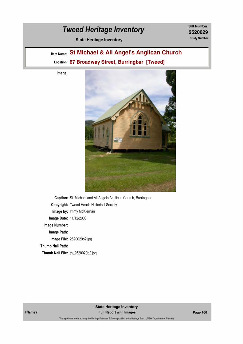
2520029
SHI Number
Tweed Heritage Inventory
Item Name: St Michael & All Angel's Anglican Church
Location: 67 Broadway Street, Burringbar [Tweed]
State Heritage Inventory Study Number
Caption: St. Michael and All Angels Anglican Church, Burringbar.
Copyright: Tweed Heads Historical Society
Image:
Image by: Immy McKiernan
Image Date: 11/12/2003
Image Number:
Image Path:
Image File: 2520029b2.jpg
Thumb Nail Path:
Thumb Nail File: tn_2520029b2.jpg
#Name? Page 166 Full Report with Images
State Heritage Inventory
This report was produced using the Heritage Database Software provided by the Heritage Branch, NSW Department of Planning.

2520029
SHI Number
Tweed Heritage Inventory
Item Name: St Michael & All Angel's Anglican Church
Location: 67 Broadway Street, Burringbar [Tweed]
State Heritage Inventory Study Number
Caption: Pedal organ at St. Michael and All Angels Anglican Church, Burringbar.
Copyright: Tweed Heads Historical Society
Image:
Image by: Immy McKiernan
Image Date: 11/12/2003
Image Number:
Image Path:
Image File: 2520029b3.jpg
Thumb Nail Path:
Thumb Nail File: tn_2520029b3.jpg
#Name? Page 167 Full Report with Images
State Heritage Inventory
This report was produced using the Heritage Database Software provided by the Heritage Branch, NSW Department of Planning.

2520029
SHI Number
Tweed Heritage Inventory
Item Name: St Michael & All Angel's Anglican Church
Location: 67 Broadway Street, Burringbar [Tweed]
State Heritage Inventory Study Number
#Name? Page 168 Full Report with Images
State Heritage Inventory
This report was produced using the Heritage Database Software provided by the Heritage Branch, NSW Department of Planning.

2520032
SHI Number
Tweed Heritage Inventory
Item Name: Austral Building
Location: 1 Wollumbin Street, Murwillumbah [Tweed]
State Heritage Inventory Study Number
Current Use:
Former Uses:
Statement of
Significance:The Austral Building is significant as part of the Murwillumbah Main Street Urban Conservation Area. The Interwar Georgian style façade contributes to the character of the precinct. The building is a good example of an Inter-war Georgian Revival buildinig which has retained the integrity of the original design.
Historical Notes
or Provenance:Tong's Drapers etc c1935 to late 1980's. M'bah Hospital Book Photo c1935.1946 General Store, Chemist, Café , Wireless Supplies (Joyce Martin)
Physical Description: A building of Interwar/ Georgian Revival/Mediterranean style with a simple Art Deco motif throughout. There are symmetrical parapets to the central window and a round fan motif over central windows. The building has a medium sloped hip roof of Marseilles tiles and
Designer: Frank Board
Maker / Builder:
Year Started: Year Completed: Circa: No
Endorsed Significance:Assessed Significance:
Item Type: Built Category: Commercial Office/BuilGroup: Commercial
Admin Codes: Code 2: Code 3:
Curtilage/Boundary:
Owner: Private - Individual
Other/Former Names:
Area/Group/Complex: Murwillumbah Main Street Urban Conservation Area Group ID: 68
Themes:
Aboriginal Area:
Local Govt Area: Tweed
Planning: Northern
Historic Region: North Coast
Address: #Name?
Suburb / Nearest Town: #Name?
State: NSW
Parish: Murwillumbah
County: Rous
National Theme State Theme Local Theme
3. Economy Commerce Shop
#Name? Page 177 Full Report with Images
State Heritage Inventory
This report was produced using the Heritage Database Software provided by the Heritage Branch, NSW Department of Planning.

2520032
SHI Number
Tweed Heritage Inventory
Item Name: Austral Building
Location: 1 Wollumbin Street, Murwillumbah [Tweed]
State Heritage Inventory Study Number
light coloured smooth walling. There is a pressed metal ceiling under awning. The original, beautiful shop fronts are still intact. The lights above leadlight are of Art Deco motif, of various patterns. The building has face black tiling with a green stripe and the motif still evident. There are multi-paned casement windows of vertical proportion and side lights to double door entry.
Physical Condition:
Modification Dates:
Recommended Management:
Conserve the exterior and interior elements of significance; adapt services and facilities to ensure continued use; remove redundant signs and signs which detract from the style of architecture; provide a suitable colour scheme which compliments the architecture and matches the aspirations of the building owner and tenant; restore damaged and missing original architectural features based on early photographs or technical drawings.
References:
Studies:
Further Comments:
Criteria a)
Criteria c) The building is a good example of an Inter-war Georgian Revival buildinig which has retained the integrity of the original design.
Criteria d)
Criteria e)
Criteria g)
Criteria f)
Integrity / Intactness:
Criteria b) The Austral Building is significant as part of the Murwillumbah Main Street Urban Conservation Area. The Interwar Georgian style façade contributes to the character of the precinct.
Parcels:
Latitude: Longitude:
Spatial Accuracy:Location validity:
Management:
Author Title YearNumber
Tweed Shire Council Community-based Heritage Study 2003
Parcel Code LotNumber Section Plan Code Plan Number
LOT 1 DP 772596
#Name? Page 178 Full Report with Images
State Heritage Inventory
This report was produced using the Heritage Database Software provided by the Heritage Branch, NSW Department of Planning.

2520032
SHI Number
Tweed Heritage Inventory
Item Name: Austral Building
Location: 1 Wollumbin Street, Murwillumbah [Tweed]
State Heritage Inventory Study Number
Custom Field One:
Listings:
Date Updated: 18/04/2011 Status: BasicDate First Entered: 11/07/2001Data Entry:
Custom Field Two:
Custom Field Three:
Custom Field Four:
Custom Field Five:
Custom Field Six:
AMG Zone: Easting: Northing:
Map Name: Map Scale:
Name: Date:Number:Title:
Local Environmental Plan 07/04/2000Schedule 2
Caption: Austral Building, Wollumbin Street, Murwillumbah, c. 1930.
Copyright: Tweed Heads Historical Society
Image:
#Name? Page 179 Full Report with Images
State Heritage Inventory
This report was produced using the Heritage Database Software provided by the Heritage Branch, NSW Department of Planning.

2520032
SHI Number
Tweed Heritage Inventory
Item Name: Austral Building
Location: 1 Wollumbin Street, Murwillumbah [Tweed]
State Heritage Inventory Study Number
Image by:
Image Date:
Image Number:
Image Path:
Image File: 2520032b1.jpg
Thumb Nail Path:
Thumb Nail File: tn_2520032b1.jpg
#Name? Page 180 Full Report with Images
State Heritage Inventory
This report was produced using the Heritage Database Software provided by the Heritage Branch, NSW Department of Planning.
2520032
SHI Number
Tweed Heritage Inventory
Item Name: Austral Building
Location: 1 Wollumbin Street, Murwillumbah [Tweed]
State Heritage Inventory Study Number
Caption: Austral Building, Wollumbin Street, Murwillumbah.
Copyright: Tweed Heads Historical Society
Image:
Image by: Immy McKiernan
Image Date: 23/03/2004
Image Number:
Image Path:
Image File: 2520032b2.jpg
Thumb Nail Path:
Thumb Nail File: tn_2520032b2.jpg
#Name? Page 181 Full Report with Images
State Heritage Inventory
This report was produced using the Heritage Database Software provided by the Heritage Branch, NSW Department of Planning.
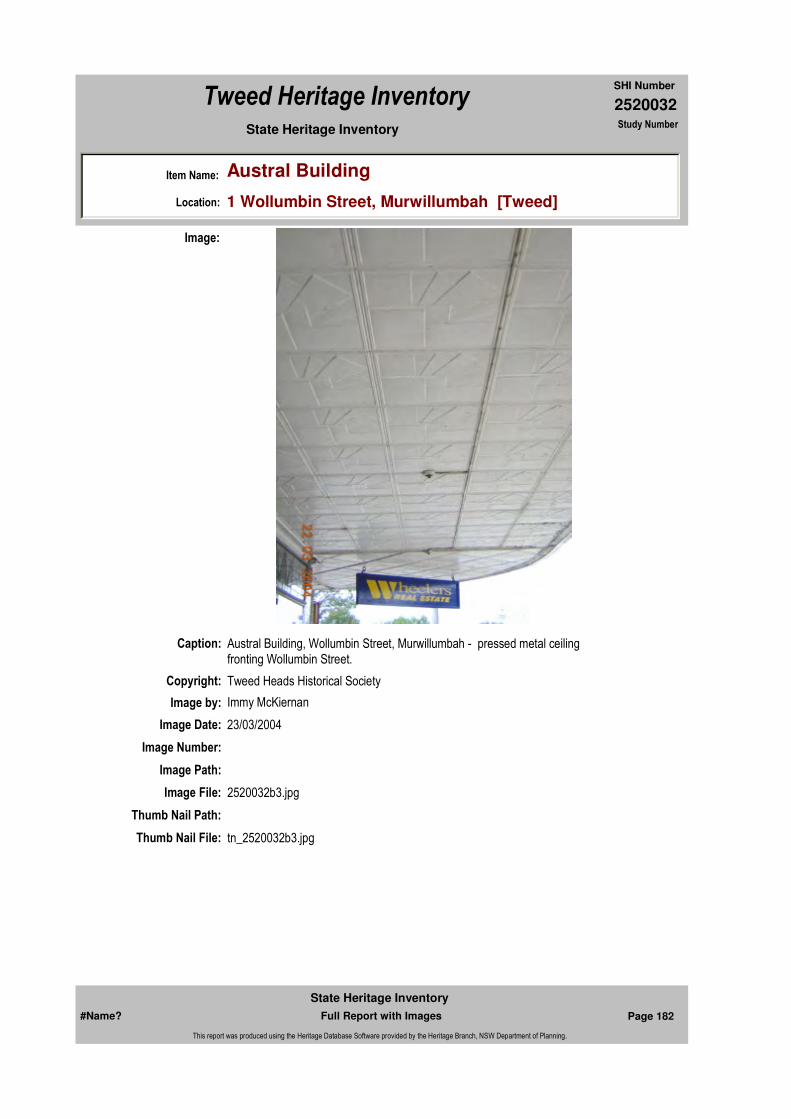
2520032
SHI Number
Tweed Heritage Inventory
Item Name: Austral Building
Location: 1 Wollumbin Street, Murwillumbah [Tweed]
State Heritage Inventory Study Number
Caption: Austral Building, Wollumbin Street, Murwillumbah - pressed metal ceiling fronting Wollumbin Street.
Copyright: Tweed Heads Historical Society
Image:
Image by: Immy McKiernan
Image Date: 23/03/2004
Image Number:
Image Path:
Image File: 2520032b3.jpg
Thumb Nail Path:
Thumb Nail File: tn_2520032b3.jpg
#Name? Page 182 Full Report with Images
State Heritage Inventory
This report was produced using the Heritage Database Software provided by the Heritage Branch, NSW Department of Planning.
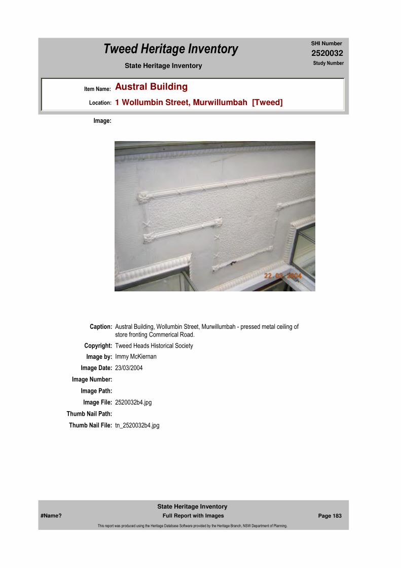
2520032
SHI Number
Tweed Heritage Inventory
Item Name: Austral Building
Location: 1 Wollumbin Street, Murwillumbah [Tweed]
State Heritage Inventory Study Number
Caption: Austral Building, Wollumbin Street, Murwillumbah - pressed metal ceiling of store fronting Commerical Road.
Copyright: Tweed Heads Historical Society
Image:
Image by: Immy McKiernan
Image Date: 23/03/2004
Image Number:
Image Path:
Image File: 2520032b4.jpg
Thumb Nail Path:
Thumb Nail File: tn_2520032b4.jpg
#Name? Page 183 Full Report with Images
State Heritage Inventory
This report was produced using the Heritage Database Software provided by the Heritage Branch, NSW Department of Planning.
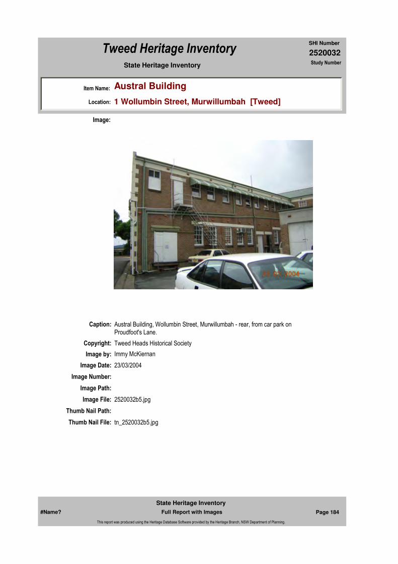
2520032
SHI Number
Tweed Heritage Inventory
Item Name: Austral Building
Location: 1 Wollumbin Street, Murwillumbah [Tweed]
State Heritage Inventory Study Number
Caption: Austral Building, Wollumbin Street, Murwillumbah - rear, from car park on Proudfoot's Lane.
Copyright: Tweed Heads Historical Society
Image:
Image by: Immy McKiernan
Image Date: 23/03/2004
Image Number:
Image Path:
Image File: 2520032b5.jpg
Thumb Nail Path:
Thumb Nail File: tn_2520032b5.jpg
#Name? Page 184 Full Report with Images
State Heritage Inventory
This report was produced using the Heritage Database Software provided by the Heritage Branch, NSW Department of Planning.
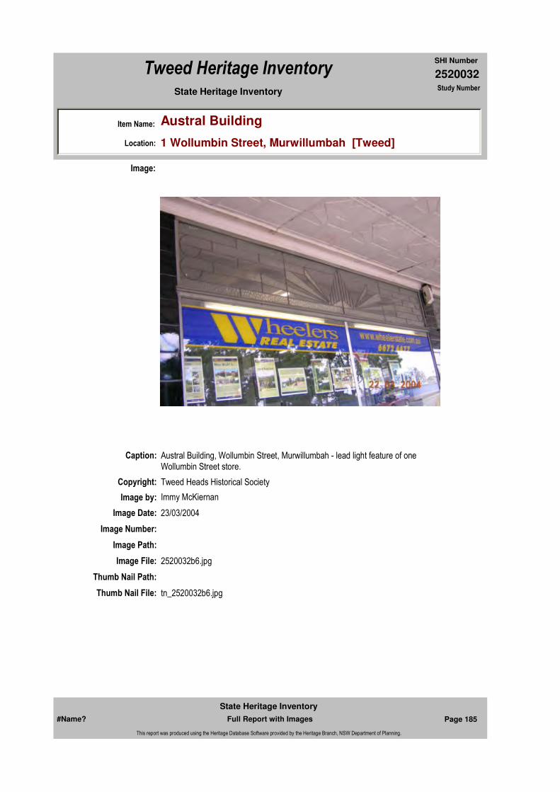
2520032
SHI Number
Tweed Heritage Inventory
Item Name: Austral Building
Location: 1 Wollumbin Street, Murwillumbah [Tweed]
State Heritage Inventory Study Number
Caption: Austral Building, Wollumbin Street, Murwillumbah - lead light feature of one Wollumbin Street store.
Copyright: Tweed Heads Historical Society
Image:
Image by: Immy McKiernan
Image Date: 23/03/2004
Image Number:
Image Path:
Image File: 2520032b6.jpg
Thumb Nail Path:
Thumb Nail File: tn_2520032b6.jpg
#Name? Page 185 Full Report with Images
State Heritage Inventory
This report was produced using the Heritage Database Software provided by the Heritage Branch, NSW Department of Planning.

2520032
SHI Number
Tweed Heritage Inventory
Item Name: Austral Building
Location: 1 Wollumbin Street, Murwillumbah [Tweed]
State Heritage Inventory Study Number
Caption: Austral Building, Wollumbin Street, Murwillumbah - lead light feature of one Commercial Road store.
Copyright: Tweed Heads Historical Society
Image:
Image by: Immy McKiernan
Image Date: 23/03/2004
Image Number:
Image Path:
Image File: 2520032b7.jpg
Thumb Nail Path:
Thumb Nail File: tn_2520032b7.jpg
#Name? Page 186 Full Report with Images
State Heritage Inventory
This report was produced using the Heritage Database Software provided by the Heritage Branch, NSW Department of Planning.

2520032
SHI Number
Tweed Heritage Inventory
Item Name: Austral Building
Location: 1 Wollumbin Street, Murwillumbah [Tweed]
State Heritage Inventory Study Number
Caption: Austral Building, Wollumbin Street, Murwillumbah - lead light feature of one store on Commercial Road.
Copyright: Tweed Heads Historical Society
Image:
Image by: Immy McKiernan
Image Date: 23/03/2004
Image Number:
Image Path:
Image File: 2520032b8.jpg
Thumb Nail Path:
Thumb Nail File: tn_2520032b8.jpg
#Name? Page 187 Full Report with Images
State Heritage Inventory
This report was produced using the Heritage Database Software provided by the Heritage Branch, NSW Department of Planning.

2520032
SHI Number
Tweed Heritage Inventory
Item Name: Austral Building
Location: 1 Wollumbin Street, Murwillumbah [Tweed]
State Heritage Inventory Study Number
Caption: Austral Building, Wollumbin Street, Murwillumbah - lead light feature of one Wollumbin Street store.
Copyright: Tweed Heads Historical Society
Image:
Image by: Immy McKiernan
Image Date: 23/03/2004
Image Number:
Image Path:
Image File: 2520032b9.jpg
Thumb Nail Path:
Thumb Nail File: tn_2520032b9.jpg
#Name? Page 188 Full Report with Images
State Heritage Inventory
This report was produced using the Heritage Database Software provided by the Heritage Branch, NSW Department of Planning.

2520032
SHI Number
Tweed Heritage Inventory
Item Name: Austral Building
Location: 1 Wollumbin Street, Murwillumbah [Tweed]
State Heritage Inventory Study Number
Caption: Austral Building, Wollumbin Street, Murwillumbah - interior view of front of bicycle store on Commercial Road.
Copyright: Tweed Heads Historical Society
Image:
Image by: Immy McKiernan
Image Date: 23/03/2004
Image Number:
Image Path:
Image File: 2520032b10.jpg
Thumb Nail Path:
Thumb Nail File: tn_2520032b10.jpg
#Name? Page 189 Full Report with Images
State Heritage Inventory
This report was produced using the Heritage Database Software provided by the Heritage Branch, NSW Department of Planning.

2520032
SHI Number
Tweed Heritage Inventory
Item Name: Austral Building
Location: 1 Wollumbin Street, Murwillumbah [Tweed]
State Heritage Inventory Study Number
Caption: Austral Building, Wollumbin Street, Murwillumbah.
Copyright: Tweed Heads Historical Society
Image:
Image by: Immy McKiernan
Image Date: 23/03/2004
Image Number:
Image Path:
Image File: 2520032b11.jpg
Thumb Nail Path:
Thumb Nail File: tn_2520032b11.jpg
#Name? Page 190 Full Report with Images
State Heritage Inventory
This report was produced using the Heritage Database Software provided by the Heritage Branch, NSW Department of Planning.

2520032
SHI Number
Tweed Heritage Inventory
Item Name: Austral Building
Location: 1 Wollumbin Street, Murwillumbah [Tweed]
State Heritage Inventory Study Number
Caption: Austral Building, Wollumbin Street, Murwillumbah - rear view from Proudfoot's Lane.
Copyright: Tweed Heads Historical Society
Image:
Image by: Immy McKiernan
Image Date: 23/03/2004
Image Number:
Image Path:
Image File: 2520032b12.jpg
Thumb Nail Path:
Thumb Nail File: tn_2520032b12.jpg
#Name? Page 191 Full Report with Images
State Heritage Inventory
This report was produced using the Heritage Database Software provided by the Heritage Branch, NSW Department of Planning.

2520032
SHI Number
Tweed Heritage Inventory
Item Name: Austral Building
Location: 1 Wollumbin Street, Murwillumbah [Tweed]
State Heritage Inventory Study Number
#Name? Page 192 Full Report with Images
State Heritage Inventory
This report was produced using the Heritage Database Software provided by the Heritage Branch, NSW Department of Planning.

2520035
SHI Number
Tweed Heritage Inventory
Item Name: The Old Bank
Location: 1468 Kyogle Road, Uki [Tweed]
State Heritage Inventory Study Number
Current Use: Private Residence
Former Uses: E S & A Bank; Local meeting place; banana ripening room; Tweed Building Designs; Art Gallery
Statement of
Significance:Early this century Uki and surrounding districts supported prosperous dairy and timber industries, and as a result of these activities a branch of the ES and A Bank was established to service the needs of the community. The ES and A Bank opened in 1910, was ninety percent destroyed by fire in 1914 and rebuilt the same year incorporating the original strong room and twin fire places. In September 1931, during the Depression, the bank became an agency. (from nominators)
Historical Notes or Provenance:
The first bank, opened in 1910, was burnt down in 1914. The building that replaced it was constructed as bank and residence and opened in 1915. The original safe, still in place, was built in England by Chubb and Co. The bank closed in mid 1950's with the downturn in the rural economy. The Connolly family first rented and then purchased the building. The front was then used as a meeting place for local organisations and later as a banana ripening room. The awning was removed in 1980 and restored by Jim Cutcliffe in 1992, after he had purchased the building. Mr. Cutcliffe operated Tweed Building Designs from the Old Bank and rented the front rooms to an alternative healing practice. In 2000, a commercial Art Gallery opened there. Classes in ceramics and life drawing were held and a potters' studio operated. The building is now a residence.
Endorsed Significance:Assessed Significance:
Item Type: Built Category: BankGroup: Commercial
Admin Codes: Code 2: Code 3:
Curtilage/Boundary: 1468 Kyogle Road (Main Street), Uki.
Owner: Private - Individual
Other/Former Names: Gallery, English, Scottish and Australian Bank (former)
Area/Group/Complex: Group ID:
Themes:
Aboriginal Area:
Local Govt Area: Tweed
Planning: Northern
Historic Region: North Coast
Address: #Name?
Suburb / Nearest Town: #Name?
State: NSW
Parish: Kunghur
County: Rous
National Theme State Theme Local Theme
3. Economy Commerce Bank
#Name? Page 193 Full Report with Images
State Heritage Inventory
This report was produced using the Heritage Database Software provided by the Heritage Branch, NSW Department of Planning.
2520035
SHI Number
Tweed Heritage Inventory
Item Name: The Old Bank
Location: 1468 Kyogle Road, Uki [Tweed]
State Heritage Inventory Study Number
Physical Description: Hardwood timber frame set on hardwood timber stumps. Floor is yellow teak (crows ash) 100 wide, T and G. The external walls are clad with fibro cement sheeting with hardwood cover strips. The fibro was manufactured in France and shipped to Australia by James Hardie prior to James Hardie beginning to manufacture the first fibro cement sheets in 1917. Window hoods are galvanised iron, painted. Windows and doors appear to be generally cedar: windows, double hung doors, French with fan light over, panel with fan light over. Roof and guttering, galvanised corregated iron. Interal sheeting is fibro cement with hardwood cover strips, skirtings. Window and door frames appear to be cedar. Lighting was by piped carbide gas to the main rooms only, such as the bank chambers and office, the living and kitchen. The lower area below floor framing line were oiled battens. The original garage, stables, laundry, toilet block and tank stand have all been demolished. The awning and fence too have been demolished. However, it is intended that these items along with the outside toilet block, shall be rebuilt.
Symetrical facade. Federation free classical gable parapet employing classical motif, classical pediment. Decorative accent to skyline. Brackets to post Art Nouveau inflence. Pilasters to finials at ends and under pediment. Galvanised corrugated iron roof and guttering to verandah and turned timber columns. French doors with fanlight on verandah. Commercial section has Office, safe and banking room. Residence has six rooms plus kitchen and return verandah.
Physical Condition:
Modification Dates: 1970's Awning removed. 1980's restoration and renovation by Jim Cutcliffe, Tweed Building Designs. Rear deck and steps added
Designer:
Maker / Builder:
Year Started: Year Completed: 1914 Circa: No
Recommended
Management:
Further Comments:
Criteria a)
Criteria b) This is the first bank in the Uki area, and had a special and central association with the farming community in the first half of the 20th century.
Management:
#Name? Page 194 Full Report with Images
State Heritage Inventory
This report was produced using the Heritage Database Software provided by the Heritage Branch, NSW Department of Planning.

2520035
SHI Number
Tweed Heritage Inventory
Item Name: The Old Bank
Location: 1468 Kyogle Road, Uki [Tweed]
State Heritage Inventory Study Number
Custom Field One: Australian Heritage Commission Register of the National Estate - Interim Indicative Place, Nom. 21/02/1991, #018340. DescriptionChanged: 30/10/1997 Condition Changed: 08/04/1995 Significance (nominators) Changed: 30/10/1997
References:
Studies:
Listings:
Date Updated: 18/04/2011 Status: BasicDate First Entered: 11/07/2001Data Entry:
Criteria c)
Criteria d)
Criteria e)
Criteria g)
Criteria f)
Integrity / Intactness:
Custom Field Two: NSW Heritage Office, 21/08/2002
Custom Field Three:
Custom Field Four:
Custom Field Five:
Custom Field Six:
The Old Bank has a strong association for the people of South Arm of the Tweed River because it important to the area's cultural history. It has had a continual use in the community and strongly contributes to the streetscape of the village.
Parcels:
Latitude: Longitude:
AMG Zone: Easting: Northing:
Map Name: Map Scale:
Spatial Accuracy:Location validity:
Author Title YearNumber
Tweed Shire Council Community-based Heritage Study 2003
Name: Date:Number:Title:
Local Environmental Plan 07/04/2000Schedule 2
Parcel Code LotNumber Section Plan Code Plan Number
LOT 6 DP 8107
#Name? Page 195 Full Report with Images
State Heritage Inventory
This report was produced using the Heritage Database Software provided by the Heritage Branch, NSW Department of Planning.

2520035
SHI Number
Tweed Heritage Inventory
Item Name: The Old Bank
Location: 1468 Kyogle Road, Uki [Tweed]
State Heritage Inventory Study Number
Caption: Gallery, former E S & A Bank, Uki
Copyright: Tweed Heads Historical Society
Image:
Image by: Immy McKiernan
Image Date: 07/08/2003
Image Number:
Image Path:
Image File: 2520035b1.jpg
Thumb Nail Path:
Thumb Nail File: tn_2520035b1.jpg
#Name? Page 196 Full Report with Images
State Heritage Inventory
This report was produced using the Heritage Database Software provided by the Heritage Branch, NSW Department of Planning.

2520035
SHI Number
Tweed Heritage Inventory
Item Name: The Old Bank
Location: 1468 Kyogle Road, Uki [Tweed]
State Heritage Inventory Study Number
Caption: Late Victorian motif to roof decoration.
Copyright: Tweed Heads Historical Society
Image:
Image by: Immy McKiernan
Image Date: 07/08/2003
Image Number:
Image Path:
Image File: 2520035b2.jpg
Thumb Nail Path:
Thumb Nail File: tn_2520035b2.jpg
#Name? Page 197 Full Report with Images
State Heritage Inventory
This report was produced using the Heritage Database Software provided by the Heritage Branch, NSW Department of Planning.
2520035
SHI Number
Tweed Heritage Inventory
Item Name: The Old Bank
Location: 1468 Kyogle Road, Uki [Tweed]
State Heritage Inventory Study Number
#Name? Page 198 Full Report with Images
State Heritage Inventory
This report was produced using the Heritage Database Software provided by the Heritage Branch, NSW Department of Planning.

2520036
SHI Number
Tweed Heritage Inventory
Item Name: Holy Trinity Church of England
Location: 1473 Kyogle Road, Uki [Tweed]
State Heritage Inventory Study Number
Current Use:
Former Uses:
Statement of
Significance:Church of the Holy Trinity has a strong association with the residents of Uki, which served the spiritual and cultural needs of the congregation over the years. This simple wooden building is a fine example of rural Church Architecture. Dedicated as a War memorial, as the church contains War memorials, furniture donated and dedicated by the residents of the South Arm to the fallen soldiers of WW1. The Holy Trinity Church is sited in the Main Street, and important to the identity of the heritage conservation Village of Uki.
Historical Notes
or Provenance:Holy Trinity Church was built on land purchased from Charlotte Higgins. The foundation stone was laid on 31st Dec by Bishop Atkins of the Grafton Diocese as a War Memorial church. The vicar at the time was Rev. Cornelius Foley. Unusuall, the lectern, prayer desk and font were donated by families of different faiths as memorials to sons killed in action in World War I.
Prior to the Church being opened services were held in the Hall or in the Methodist Church.The first baptism was Robert Frederick Parkes aged 10 months on 30th Aug 1922.The first marriage was George Thomas Zeitsch and Eva Myra Tunstead on 18th April 1922.
A rectory was built on adjacent land but was destroyed by fire on 21st May 1968.
Source: Written. Author: unknown Title: Diamond Jubilee Holy Trinity Church, Uki. Year:1981 Repository: Uki & Sth. Arm Hist SocLetter Author: G. Glance, Registrar, Diocese of Grafton. Year 1981. Repository Uki & Sth. Arm Hist. Soc Inc.
Endorsed Significance:Assessed Significance:
Item Type: Built Category: ChurchGroup: Religion
Admin Codes: Code 2: Code 3:
Curtilage/Boundary:
Owner: Religious Organisation
Other/Former Names:
Area/Group/Complex: Group ID:
Aboriginal Area:
Local Govt Area: Tweed
Planning: Northern
Historic Region: North Coast
Address: #Name?
Suburb / Nearest Town: #Name?
State: NSW
Parish: Kunghur
County: Rous
#Name? Page 199 Full Report with Images
State Heritage Inventory
This report was produced using the Heritage Database Software provided by the Heritage Branch, NSW Department of Planning.
2520036
SHI Number
Tweed Heritage Inventory
Item Name: Holy Trinity Church of England
Location: 1473 Kyogle Road, Uki [Tweed]
State Heritage Inventory Study Number
Physical Description: Church of Interwar Gothic style. Good example of timber construction church architecture. Weatherboard cladding. Medium slope roof of corrugated iron. Timber post and pilon to entry. Pointed arch motif to decorative projecting gable. Lancet windows.
Physical Condition:
Modification Dates:
Designer: F.J. Board, Lismore
Maker / Builder: Robb and Brown, Lismore.
Year Started: 1921 Year Completed: 1922 Circa: No
Recommended
Management:
References:
Further Comments:
Criteria a)
Criteria c)
Criteria d) Church of the Holy Trinity has a strong association with the residents of Uki, which served the spiritual and cultural needs of the congregation over the years. This simple wooden building is a fine example of rural Church Architecture. Dedicated as a War memorial, this church contains War memorials, furniture donated and dedicated by the residents of the South Arm to the fallen soldiers of WW1. It is sited in the Main Street, and important to the identity of the heritage conservation Village of Uki.
Criteria e)
Criteria g) Holy Trinity Church is a fine example the "Carpenter Gothic" churches in rural villages of the early 20th century.
Criteria f)
Integrity / Intactness:
Criteria b)
Themes:
Management:
National Theme State Theme Local Theme
8. Culture Religion Church
#Name? Page 200 Full Report with Images
State Heritage Inventory
This report was produced using the Heritage Database Software provided by the Heritage Branch, NSW Department of Planning.

2520036
SHI Number
Tweed Heritage Inventory
Item Name: Holy Trinity Church of England
Location: 1473 Kyogle Road, Uki [Tweed]
State Heritage Inventory Study Number
Custom Field One: Royal Australian Institute of Architects register 30/12/1985
Studies:
Listings:
Date Updated: 18/04/2011 Status: BasicDate First Entered: 11/07/2001Data Entry:
Custom Field Two:
Custom Field Three:
Custom Field Four:
Custom Field Five:
Custom Field Six:
Parcels:
Latitude: Longitude:
AMG Zone: Easting: Northing:
Map Name: Map Scale:
Spatial Accuracy:Location validity:
Author Title YearNumber
Tweed Shire Council Community-based Heritage Study 2003
Name: Date:Number:Title:
Local Environmental Plan 07/04/2000Schedule 2
Parcel Code LotNumber Section Plan Code Plan Number
LOT 1116 DP 755730
#Name? Page 201 Full Report with Images
State Heritage Inventory
This report was produced using the Heritage Database Software provided by the Heritage Branch, NSW Department of Planning.
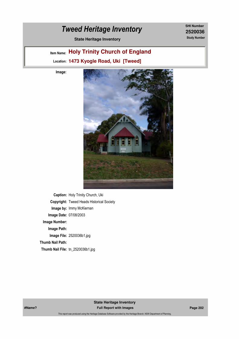
2520036
SHI Number
Tweed Heritage Inventory
Item Name: Holy Trinity Church of England
Location: 1473 Kyogle Road, Uki [Tweed]
State Heritage Inventory Study Number
Caption: Holy Trinity Church, Uki
Copyright: Tweed Heads Historical Society
Image:
Image by: Immy McKiernan
Image Date: 07/08/2003
Image Number:
Image Path:
Image File: 2520036b1.jpg
Thumb Nail Path:
Thumb Nail File: tn_2520036b1.jpg
#Name? Page 202 Full Report with Images
State Heritage Inventory
This report was produced using the Heritage Database Software provided by the Heritage Branch, NSW Department of Planning.

2520036
SHI Number
Tweed Heritage Inventory
Item Name: Holy Trinity Church of England
Location: 1473 Kyogle Road, Uki [Tweed]
State Heritage Inventory Study Number
#Name? Page 203 Full Report with Images
State Heritage Inventory
This report was produced using the Heritage Database Software provided by the Heritage Branch, NSW Department of Planning.
2520041
SHI Number
Tweed Heritage Inventory
Item Name: Salvation Army Building (former)
Location: 21 Queen Street, Murwillumbah [Tweed]
State Heritage Inventory Study Number
Current Use: Antique Furniture Store
Former Uses: Salvation Army Citadel
Statement of
Significance:The former Salvation Army Citadel is significant as part of the Murwillumbah Main Street Urban Conservation Area. The Federation Free style façade of the building contributes to the character of the conservation precinct.
Historical Notes
or Provenance:Saturday, April 17, 1920 was a red letter day for the Salvation Army, for that day the Citadel at Murwillumbah was officially opened by the mayoress Mrs. A. R. Hynes. in the presence of a large gathering.
The local corps was out in full strength. and among the large attendance at function were Rev's. M. G. Hart and G. Moore.
Proceedings were opened with a hymn by the Salvation Army band, after which Mrs. Hamilton unveiled the tablet bearing the inscription, "This building was opened to the Glory of God, and for the Salvation of the people on 17th April 1920".
Brigadier Orames after placing the key in the door, invited the Mayoress to officially open the Citadel. The assembly then took their seats in the hall.
The program commenced with the singing of "O, God Our Help in Ages Past". Later Rev. Hart led the meeting in prayer, while Adjutant Atkins (Lismore) read a passage of scripture.
Mayor Ald Hynes said he regarded it as high honour that he should be called upon to preside over such an important and interesting function.
Endorsed Significance:Assessed Significance: Local
Item Type: Built Category: ChurchGroup: Religion
Admin Codes: Code 2: Code 3:
Curtilage/Boundary:
Owner: Private - Individual
Other/Former Names: Salvation Army Citadel (former), commercial premises
Area/Group/Complex: Murwillumbah Main Street Urban Conservation Area Group ID: 9
Aboriginal Area:
Local Govt Area: Tweed
Planning: Northern
Historic Region: North Coast
Address: #Name?
Suburb / Nearest Town: #Name?
State: NSW
Parish: Murwillumbah
County: Rous
#Name? Page 204 Full Report with Images
State Heritage Inventory
This report was produced using the Heritage Database Software provided by the Heritage Branch, NSW Department of Planning.
2520041
SHI Number
Tweed Heritage Inventory
Item Name: Salvation Army Building (former)
Location: 21 Queen Street, Murwillumbah [Tweed]
State Heritage Inventory Study Number
Commenting on the building, the Mayor said that it was a credit to the architect, the contractor and the good Salvation Army. It was not long since Ensign Hamilton had embarked on a collection campaign with a view of constructing the Citadel, and the Ensign must have been gratified with the spontaneous response by the people of the district.
The Mayor continuing expressed his wishes that the people be long spared to worship within the precincts of its walls.
The chairman then called upon Brigadier Orames to address the gathering. The Brigadier, who was a chaplain with the AIF, said that at the end of November 1919, he visited Murwillumbah and gave an address on the Great War at the School of Arts.
However, this was not his first visit to the town, as he had been there in 1906, at which time the place was not particularly large.
He made an appeal in connection with the Citadel and this he believed was the first time the matter had been mentioned.
Brigadier Orames then read a telegram from Commissioner Hay, who it was mentioned was at Perth waiting the arrival of General Booth. The telegram read: "Heartiest congratulations new Citadel. Town deserves worthy Army hall. Army work requires it. Let God's glory and man's good be your chief aim. Honour Him, help the children, and push the salvation like those who believe".
A telegram was also read from Brigadier Mackay, formerly Divisional Commissioner of the Northern Rivers. "Congratulations; delighted you have your Citadel. I have many pleasant recollections of Murwillumbah. God speed the work".
There had been a suggestion that the Citadel be a wooden building, but a brick building looked as if it was to stay and the Salvation Army had come to stay.
The Brigadier congratulated the contractor, Mr. Lipscombe.
He said the hall was capable of holding some 260 people. Some would say that it was small, but it was quite large enough to hold ordinary meetings and a public hall could be engaged for special meetings.There was also a band room built and a building to be used in connection with the children's work was in the course of construction. It was intended to erect special room for the use of the Ensign.
In view of the fact that some buildings were uncompleted, it was hard to say what the final cost would be, but it would probably reach the £2000 mark ($4000) which was considerably over the original estimate.
From that opening the work of the Salvation Army has progressed with the town and the district.The Army has extended the hand of help to all classes of unfortunates, and has been involved in helping the victims of all major disasters. It is a very important part of the spiritual
#Name? Page 205 Full Report with Images
State Heritage Inventory
This report was produced using the Heritage Database Software provided by the Heritage Branch, NSW Department of Planning.
2520041
SHI Number
Tweed Heritage Inventory
Item Name: Salvation Army Building (former)
Location: 21 Queen Street, Murwillumbah [Tweed]
State Heritage Inventory Study Number
life of the Tweed District.
('Salvation Army Establishes Citadel' Look Back with Peter Winter "The Log Book" Vol 39, pages 12, 13.)
Physical Description: A religious hall of Federation free style with some Romanesque features and more reminiscent of Federation Free style. Features include a large round entry arch, piers projecting above parapet which resembles turrets topped with cupola motifs, rounded off in the centre of the gable. There are moulded architraves and round arch windows and doors.
Physical Condition:
Modification Dates:
Designer:
Maker / Builder: Mr Lipscombe
Year Started: Year Completed: 1920 Circa: No
Recommended Management:
Further Comments:
Criteria a)
Criteria c)
Criteria d)
Criteria e)
Criteria g)
Criteria f)
Integrity / Intactness:
Criteria b) The former Salvation Army Citadel is significant as part of the Murwillumbah Main Street Urban Conservation Area. The Federation Free style façade of the building contributes to the character of the conservation precinct.
Themes:
Management:
National Theme State Theme Local Theme
8. Culture Religion Church
#Name? Page 206 Full Report with Images
State Heritage Inventory
This report was produced using the Heritage Database Software provided by the Heritage Branch, NSW Department of Planning.

2520041
SHI Number
Tweed Heritage Inventory
Item Name: Salvation Army Building (former)
Location: 21 Queen Street, Murwillumbah [Tweed]
State Heritage Inventory Study Number
Custom Field One: Nominated on Royal Australian Institute of Architects register as the Salvation Army Building, a taggged item, 24/05/2000, with photograph 59. Art Deco. Name changed by CBHS to current usage.
References:
Studies:
Listings:
Date Updated: 18/04/2011 Status: BasicDate First Entered: 11/07/2001Data Entry:
Custom Field Two:
Custom Field Three:
Custom Field Four:
Custom Field Five:
Custom Field Six:
Parcels:
Latitude: Longitude:
AMG Zone: Easting: 539035 Northing: 6866425
Map Name: Map Scale:
Spatial Accuracy:Location validity:
Author Title Year
Peter Winter Salvation Army Establishes Citadel
Author Title YearNumber
Tweed Shire Council Community-based Heritage Study 2003
Name: Date:Number:Title:
Local Environmental Plan 07/04/2000Schedule 2
Parcel Code LotNumber Section Plan Code Plan Number
LOT A DP 395020
#Name? Page 207 Full Report with Images
State Heritage Inventory
This report was produced using the Heritage Database Software provided by the Heritage Branch, NSW Department of Planning.

2520041
SHI Number
Tweed Heritage Inventory
Item Name: Salvation Army Building (former)
Location: 21 Queen Street, Murwillumbah [Tweed]
State Heritage Inventory Study Number
Caption: Former Salvation Army Citadel, now Antique store, Murwillimbah.
Copyright: Tweed Heads Historical Society
Image:
Image by: Immy McKiernan
Image Date: 08/08/2003
Image Number:
Image Path:
Image File: 2520041b1.jpg
Thumb Nail Path:
Thumb Nail File: tn_2520041b1.jpg
#Name? Page 208 Full Report with Images
State Heritage Inventory
This report was produced using the Heritage Database Software provided by the Heritage Branch, NSW Department of Planning.

2520041
SHI Number
Tweed Heritage Inventory
Item Name: Salvation Army Building (former)
Location: 21 Queen Street, Murwillumbah [Tweed]
State Heritage Inventory Study Number
Caption: Foundation Stone of the Salvation Army Citadel, Murwillumbah, laid April 17, 1920
Copyright: Tweed Heads Historical Society
Image:
Image by: Immy McKiernan
Image Date: 14/12/2003
Image Number:
Image Path:
Image File: 2520041b2.jpg
Thumb Nail Path:
Thumb Nail File: tn_2520041b2.jpg
#Name? Page 209 Full Report with Images
State Heritage Inventory
This report was produced using the Heritage Database Software provided by the Heritage Branch, NSW Department of Planning.
2520041
SHI Number
Tweed Heritage Inventory
Item Name: Salvation Army Building (former)
Location: 21 Queen Street, Murwillumbah [Tweed]
State Heritage Inventory Study Number
#Name? Page 210 Full Report with Images
State Heritage Inventory
This report was produced using the Heritage Database Software provided by the Heritage Branch, NSW Department of Planning.

2520043
SHI Number
Tweed Heritage Inventory
Item Name: Murwillumbah High School (Block A)
Location: Riverview Street, Murwillumbah [Tweed]
State Heritage Inventory Study Number
Current Use:
Former Uses:
Statement of
Significance:The high school was the first public high school in the Tweed Shire.
Historical Notes or Provenance:
Physical Description: A school of Georgian Rival Interwar style, built in 1929. A large 3 storey brick building with school hall and stage complex in a prominent position on Uki/ Kyogle Road overlooking the town. Repetitive simple regularity. Symmetry with projecting gabled ends and central parapet gable. Stepped parapet. Narrow bays formed by pilasters. Too narrow for Classical proportions. Vertical motif at top of pilaster. Central facade. Spandrels expressing story
Designer:
Maker / Builder:
Year Started: Year Completed: 1929 Circa: No
Endorsed Significance: StateAssessed Significance: State
Item Type: Built Category: School - State (public)Group: Education
Admin Codes: Code 2: Code 3:
Curtilage/Boundary:
Owner: Department of Education and Training
Other/Former Names:
Area/Group/Complex: Group ID:
Themes:
Aboriginal Area:
Local Govt Area: Tweed
Planning: Northern
Historic Region: North Coast
Address: #Name?
Suburb / Nearest Town: #Name?
State: NSW
Parish: Murwillumbah
County: Rous
National Theme State Theme Local Theme
6. Educating Education School
#Name? Page 211 Full Report with Images
State Heritage Inventory
This report was produced using the Heritage Database Software provided by the Heritage Branch, NSW Department of Planning.
2520043
SHI Number
Tweed Heritage Inventory
Item Name: Murwillumbah High School (Block A)
Location: Riverview Street, Murwillumbah [Tweed]
State Heritage Inventory Study Number
dimensions. Vertical structural elements treated as pilasters. Vertical double hung windows. Gridded facade.
Physical Condition:
Modification Dates:
Custom Field One:
Recommended Management:
References:
Studies:
Listings:
Further Comments:
Criteria a) Important in the course of the history of the Tweed as the first high school in the district, where the educational needs of the local children were met.
Criteria c)
Criteria d)
Criteria e)
Criteria g) This item is aesthetically representative
Criteria f)
Integrity / Intactness:
Criteria b)
Parcels:
Latitude: Longitude:
AMG Zone: Easting: Northing:
Map Name: Map Scale:
Spatial Accuracy:Location validity:
Management:
Author Title YearNumber
Tweed Shire Council Community-based Heritage Study 2003
Name: Date:Number:Title:
Local Environmental Plan 07/04/2000Schedule 2
Royal Australian Institute of Architects register 24/05/2000
Parcel Code LotNumber Section Plan Code Plan Number
LOT 6 DP 820602A
#Name? Page 212 Full Report with Images
State Heritage Inventory
This report was produced using the Heritage Database Software provided by the Heritage Branch, NSW Department of Planning.

2520043
SHI Number
Tweed Heritage Inventory
Item Name: Murwillumbah High School (Block A)
Location: Riverview Street, Murwillumbah [Tweed]
State Heritage Inventory Study Number
Date Updated: 18/04/2011 Status: BasicDate First Entered: 11/07/2001Data Entry:
Custom Field Two: Art deco
Custom Field Three:
Custom Field Four:
Custom Field Five:
Custom Field Six:
Caption: Murwillumbah High School, Block A, built in 1929.
Copyright: Tweed Heads Historical Society
Image:
Image by: Immy McKiernan
Image Date: 08/08/2003
Image Number:
Image Path:
Image File: 2520043b1.jpg
Thumb Nail Path:
#Name? Page 213 Full Report with Images
State Heritage Inventory
This report was produced using the Heritage Database Software provided by the Heritage Branch, NSW Department of Planning.
2520043
SHI Number
Tweed Heritage Inventory
Item Name: Murwillumbah High School (Block A)
Location: Riverview Street, Murwillumbah [Tweed]
State Heritage Inventory Study Number
Thumb Nail File: tn_2520043b1.jpg
#Name? Page 214 Full Report with Images
State Heritage Inventory
This report was produced using the Heritage Database Software provided by the Heritage Branch, NSW Department of Planning.
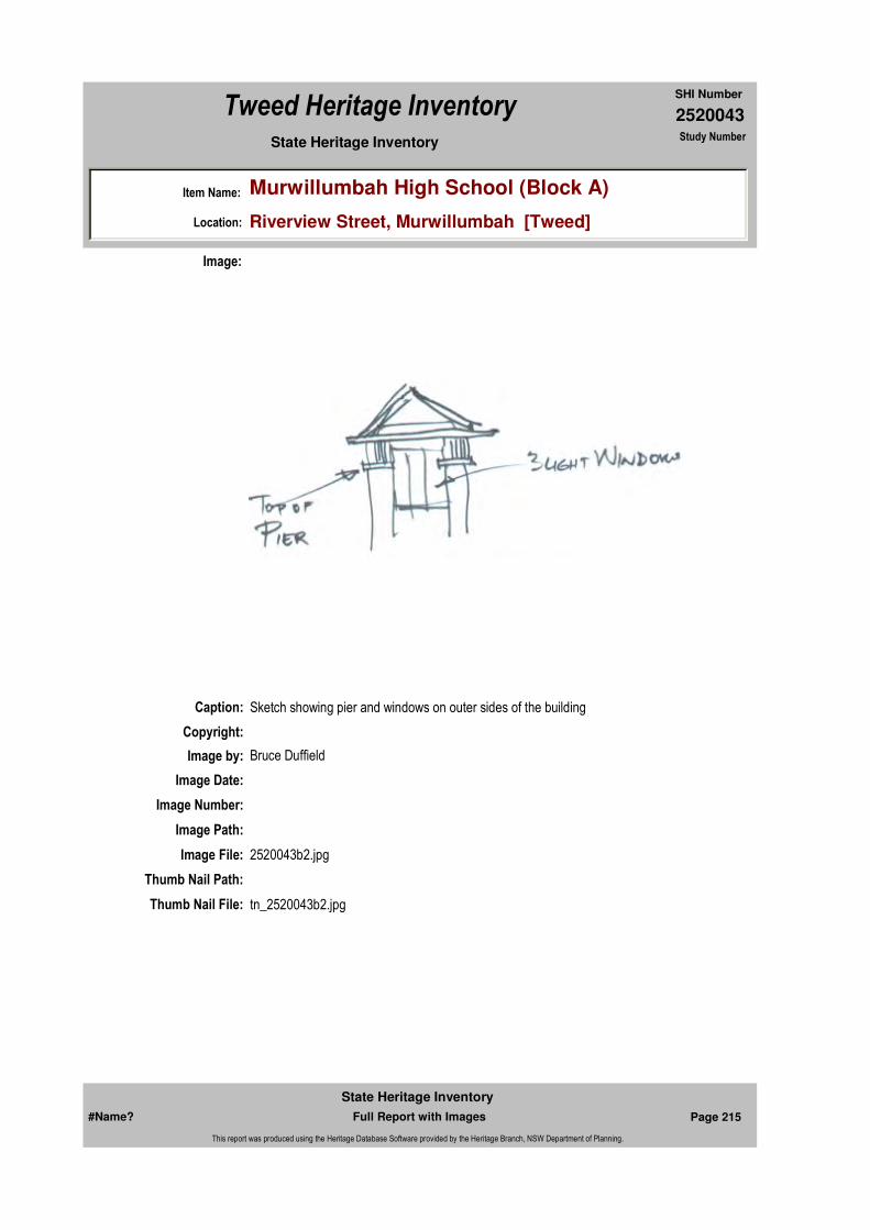
2520043
SHI Number
Tweed Heritage Inventory
Item Name: Murwillumbah High School (Block A)
Location: Riverview Street, Murwillumbah [Tweed]
State Heritage Inventory Study Number
Caption: Sketch showing pier and windows on outer sides of the building
Copyright:
Image:
Image by: Bruce Duffield
Image Date:
Image Number:
Image Path:
Image File: 2520043b2.jpg
Thumb Nail Path:
Thumb Nail File: tn_2520043b2.jpg
#Name? Page 215 Full Report with Images
State Heritage Inventory
This report was produced using the Heritage Database Software provided by the Heritage Branch, NSW Department of Planning.
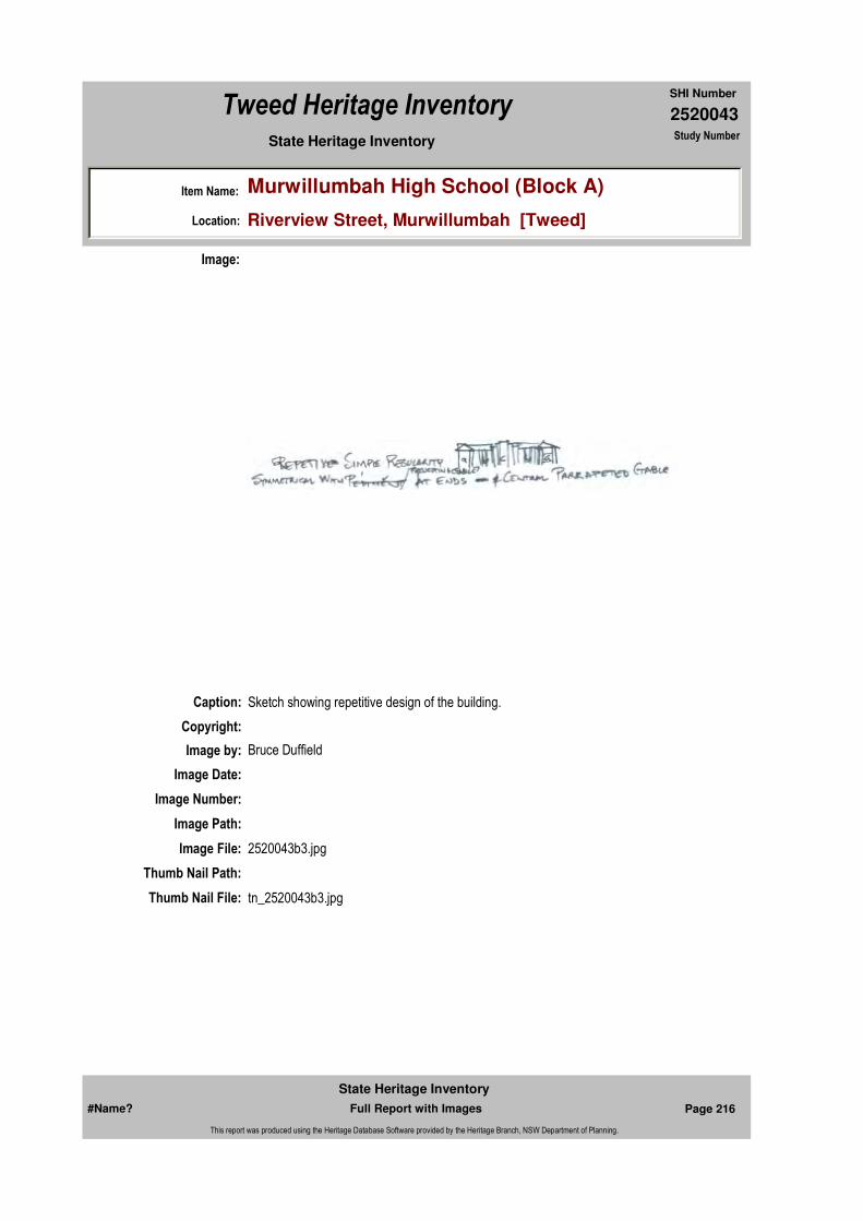
2520043
SHI Number
Tweed Heritage Inventory
Item Name: Murwillumbah High School (Block A)
Location: Riverview Street, Murwillumbah [Tweed]
State Heritage Inventory Study Number
Caption: Sketch showing repetitive design of the building.
Copyright:
Image:
Image by: Bruce Duffield
Image Date:
Image Number:
Image Path:
Image File: 2520043b3.jpg
Thumb Nail Path:
Thumb Nail File: tn_2520043b3.jpg
#Name? Page 216 Full Report with Images
State Heritage Inventory
This report was produced using the Heritage Database Software provided by the Heritage Branch, NSW Department of Planning.
2520043
SHI Number
Tweed Heritage Inventory
Item Name: Murwillumbah High School (Block A)
Location: Riverview Street, Murwillumbah [Tweed]
State Heritage Inventory Study Number
#Name? Page 217 Full Report with Images
State Heritage Inventory
This report was produced using the Heritage Database Software provided by the Heritage Branch, NSW Department of Planning.

2520044
SHI Number
Tweed Heritage Inventory
Item Name: Dunbible Creek Railway Bridge
Location: Stokers Road (near), Dunbible [Tweed]
State Heritage Inventory Study Number
Current Use:
Former Uses:
Statement of
Significance:This bridge was one of the first railway bridges built using the American Pratt truss design which replaced the heavier British design previously favoured by government engineers. It is a seminal example in the region.
The Dunbible rail bridge is an excellent example of the work of Henry Deane, who was responsible for many of the design features of the North Coast Railway
Historical Notes
or Provenance:The railway line between Lismore and Murwillumbah was opened on 24/12/1894. Originally dubbed the "railway from Nowhere to Nowhere" the line was crucial in the development of the district, enabling goods and produce to reach their markets. The last section completed, between Mullumbimby and Murwillumbah, a distance of 37 kms necessitated the building of 6 steel bridges and 7 tunnels.
In 1932 with the building of a bridge over the river at Grafton, the link to Sydney was completed but the often- promised line to Tweed Heads and Brisbane never eventuated.
The Railway has served the Shire well though the withdrawal of the Motor-rail was regretted. Currently the State Government is proposing withdrawal of the daily XPT, a move not welcomed by local residents.
Endorsed Significance: StateAssessed Significance: State
Item Type: Built Category: Railway Bridge/ ViaduGroup: Transport - Rail
Admin Codes: Code 2: Code 3:
Curtilage/Boundary:
Owner: State Rail Authority
Other/Former Names:
Area/Group/Complex: Group ID:
Themes:
Aboriginal Area:
Local Govt Area: Tweed
Planning: Northern
Historic Region: North Coast
Address: #Name?
Suburb / Nearest Town: #Name?
State: NSW
Parish: Dunbible
County: Rous
National Theme State Theme Local Theme
3. Economy Transport Rail
#Name? Page 218 Full Report with Images
State Heritage Inventory
This report was produced using the Heritage Database Software provided by the Heritage Branch, NSW Department of Planning.
2520044
SHI Number
Tweed Heritage Inventory
Item Name: Dunbible Creek Railway Bridge
Location: Stokers Road (near), Dunbible [Tweed]
State Heritage Inventory Study Number
Physical Description: Steel on concrete piers in 5 sections; 1 of 4.2cm + 1 of 6.0m. + 1 of 36.5m (steel span) + 1 of 6.4m. + 1 of 4.2m
Physical Condition:
Modification Dates:
Designer: Henry Deane
Maker / Builder: N.S.W. Government Railways
Year Started: Year Completed: 1894 Circa: No
Recommended Management:
References:
Studies:
Further Comments:
Criteria a)
Criteria c) Dunbible Railway bridge is an excellent intact example of the technical achievement of the 19th centuary engineer, Henry Deane
Criteria d)
Criteria e)
Criteria g)
Criteria f)
Integrity / Intactness:
Criteria b) This bridge was an essential component in the railway common known as "the railway from nowhere to nowhere", which ran from Lismore, Byron Bay to Murwillumbah and opened up the Tweed Valley to southern markets.
Parcels:
Management:
Author Title YearNumber
Tweed Shire Council Community-based Heritage Study 2003
Parcel Code LotNumber Section Plan Code Plan Number
#Name? Page 219 Full Report with Images
State Heritage Inventory
This report was produced using the Heritage Database Software provided by the Heritage Branch, NSW Department of Planning.
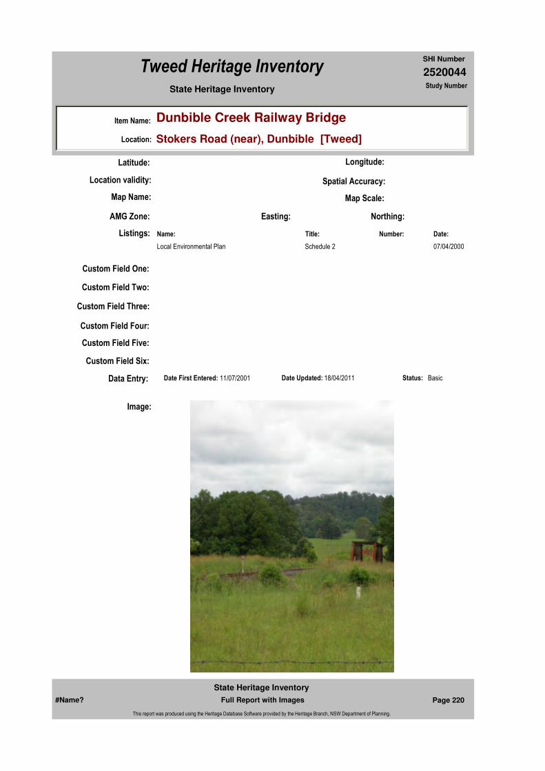
2520044
SHI Number
Tweed Heritage Inventory
Item Name: Dunbible Creek Railway Bridge
Location: Stokers Road (near), Dunbible [Tweed]
State Heritage Inventory Study Number
Custom Field One:
Listings:
Date Updated: 18/04/2011 Status: BasicDate First Entered: 11/07/2001Data Entry:
Custom Field Two:
Custom Field Three:
Custom Field Four:
Custom Field Five:
Custom Field Six:
Latitude: Longitude:
AMG Zone: Easting: Northing:
Map Name: Map Scale:
Spatial Accuracy:Location validity:
Name: Date:Number:Title:
Local Environmental Plan 07/04/2000Schedule 2
Image:
#Name? Page 220 Full Report with Images
State Heritage Inventory
This report was produced using the Heritage Database Software provided by the Heritage Branch, NSW Department of Planning.
2520044
SHI Number
Tweed Heritage Inventory
Item Name: Dunbible Creek Railway Bridge
Location: Stokers Road (near), Dunbible [Tweed]
State Heritage Inventory Study Number
Caption: Dunbible Creek Rail Bridge
Copyright: Tweed Heads Historical Society
Image by: Immy McKiernan
Image Date: 23/11/2003
Image Number:
Image Path:
Image File: 2520044b1.jpg
Thumb Nail Path:
Thumb Nail File: tn_2520044b1.jpg
#Name? Page 221 Full Report with Images
State Heritage Inventory
This report was produced using the Heritage Database Software provided by the Heritage Branch, NSW Department of Planning.

2520044
SHI Number
Tweed Heritage Inventory
Item Name: Dunbible Creek Railway Bridge
Location: Stokers Road (near), Dunbible [Tweed]
State Heritage Inventory Study Number
Caption: Dunbible Creek Rail Bridge
Copyright: Uki & South Arm Historical Society
Image:
Image by: Immy McKiernan
Image Date: 23/11/2003
Image Number:
Image Path:
Image File: 2520044b2.jpg
Thumb Nail Path:
Thumb Nail File: tn_2520044b2.jpg
#Name? Page 222 Full Report with Images
State Heritage Inventory
This report was produced using the Heritage Database Software provided by the Heritage Branch, NSW Department of Planning.
2520044
SHI Number
Tweed Heritage Inventory
Item Name: Dunbible Creek Railway Bridge
Location: Stokers Road (near), Dunbible [Tweed]
State Heritage Inventory Study Number
#Name? Page 223 Full Report with Images
State Heritage Inventory
This report was produced using the Heritage Database Software provided by the Heritage Branch, NSW Department of Planning.
2520051
SHI Number
Tweed Heritage Inventory
Item Name: St Brigid's Roman Catholic Church
Location: 61- 63 Broadway Street, Burringbar [Tweed]
State Heritage Inventory Study Number
Current Use: Church
Former Uses: Church
Statement of
Significance:St. Brigid's Catholic Church has a strong association with the residents of Burringbar. A century old building which served the spiritual and cultural needs of the congregation over the years. The building demonstrates simple timber design, materials and finishes for church buildings of the period. Alterations have generally been sympathetic to the original design.
Historical Notes or Provenance:
"The Catholic Parish of Murwillumbah Centenary 1989" pages 113, 114
Prior to 1904, Mass at Burringbar was celebrated in "Murphy's House" behind the Pioneer Hotel. Kit McCormack tells how Alice and Agnes Murnane (later Alice McCormack and Agnes Gilles) used to walk along the railway line from Crabbes Creek to attend Mass there. Hotel licensee was Walter Murphy, who in later years donated a house in Burringbar (the old Police residence) to supply accommodation for a priest. It was never actually used as a full-time residence.
On 31st January 1904, the small St. Brigid's Church was blessed and opened.
By 1920 arrangements had been made for Sisters of St. Joseph to open a school in Burringbar. The three sisters who comprised the first community were Sister M. Canice; Sister M. Vianney; and Sister M. Dympna.
Conditions were not easy when the school opened in 1921. Sixty children enrolled and took their lessons in the Church, sitting on a kneeler and using the pew as a desk. The Sisters also lived in frugal circumstances although parishioners supplied them with farm produce.
Endorsed Significance: LocalAssessed Significance: Local
Item Type: Built Category: ChurchGroup: Religion
Admin Codes: Code 2: Code 3:
Curtilage/Boundary:
Owner: Religious Organisation
Other/Former Names: St Michael's Roman Catholic Church
Area/Group/Complex: Group ID:
Aboriginal Area:
Local Govt Area: Tweed
Planning: Northern
Historic Region: North Coast
Address: #Name?
Suburb / Nearest Town: #Name?
State: NSW
Parish: Mooball
County: Rous
#Name? Page 224 Full Report with Images
State Heritage Inventory
This report was produced using the Heritage Database Software provided by the Heritage Branch, NSW Department of Planning.
2520051
SHI Number
Tweed Heritage Inventory
Item Name: St Brigid's Roman Catholic Church
Location: 61- 63 Broadway Street, Burringbar [Tweed]
State Heritage Inventory Study Number
Lighting was by kerosene lamp, with a fuel copper and fuel stove. Ice would melt if sent by wagon from Murwillumbah so it came by train and would be collected by children from the school. Parishioners drove the Sisters by sulky to visit outlying families in a successful effort to increase enrolments.
In 1923 St. Brigid's Church was enlarged. By the late l920's Mass was said each Sunday, with Benediction on Sunday night and Mass on Monday morning before the priest returned to Murwillumbah. The Blessed Sacrament would be kept in the Convent during the week, since lessons were held in the church. One of the two assistant priests from Murwillumbah generally had responsibility for Burringbar, the other for Uki. Parishioners would be rostered to transport the priest and Sisters from Burringbar to Stokers Siding where Mass would be celebrated in the hall and catechism taught before they returned to Burringbar.
Father Leonard recollects Burringbar Church/School at the time he was a curate in the early 1950's. The Sisters taught in one classroom, one in the back of the church and one in a tin-roofed weather-shed. The floor of the church had sunk here and there, giving a "wavy" effect. Old benches were in use. He remembers one had a broken leg, propped up with a lump of wood from the wood-heap.
Major extensions were made to Burringbar Church in 1954. The improvements were so extensive that the building was likened to a "new Church". Incorporated in the building was a new wing, which would serve as a classroom.
Changed education policies had their effect on all country schools. With the centralisation of secondary education in larger towns, in this case Murwillumbah, numbers of pupils at Burringbar declined from 1963. From an enrolment of 106 in 1962 numbers fell to 77 in 1963 and only 48 in 1969. A contributing factor was the opening of a Catholic School at Kingscliff, and the arrangement of school buses which carried children living just south of Burringbar to the town of Mullumbimby, further south, rather by than returning them to Burringbar.
In 1969 the Burringbar Convent School was closed. At the same time Tumbulgum Convent School, operated by the Presentation Sisters, closed. A new school, St. Joseph's Primary School centrally located in South Murwillumbah, commenced classes in January 1970 with an enrolment of 111 pupils.The Burringbar Sisters of St. Joseph travelled to St. Joseph's South Murwillumbah for two years before temporarily residing in the convent at Tumbulgum whilst their Burringbar Convent was moved to a site adjoining the new school in South Murwillumbah. They continued to teach at St Joseph's Primary, South Murwillumbah, and in local State Schools until 1982.
St. Brigid's Church, Burringbar, has in 1989 received further renovations and improvements, strengthening it as the spiritual focus of the Catholic community of Burringbar and district.
Themes: National Theme State Theme Local Theme
8. Culture Religion Church
#Name? Page 225 Full Report with Images
State Heritage Inventory
This report was produced using the Heritage Database Software provided by the Heritage Branch, NSW Department of Planning.

2520051
SHI Number
Tweed Heritage Inventory
Item Name: St Brigid's Roman Catholic Church
Location: 61- 63 Broadway Street, Burringbar [Tweed]
State Heritage Inventory Study Number
Physical Description: Carpenter Gothic church. Simple church building with very modest decoration. Weatherboard cladding. Medium roof pitch in corrugated iron. Only simple decoration of round vent to gabled front. Large assymmetrical gables, symetric entry porch to front gable. Pointed arch motif to doors and windows.
Physical Condition:
Modification Dates: Extensions 1923, 1954, 1989
Designer:
Maker / Builder:
Year Started: Year Completed: 1903 Circa: No
Recommended
Management:Maintain the building and services to ensure continued use and sympathetic character.
References:
Studies:
Further Comments:
Criteria a)
Criteria c) The building demonstrates simple timber design, materials and finishes for church buildings of the period. Alterations have generally been sympathetic to the original design.
Criteria d) St. Brigid's Catholic Church has a strong association with the residents of Burringbar. A century old building which served the spiritual and cultural needs of the congregation over the years.
Criteria e)
Criteria g)
Criteria f)
Integrity / Intactness:
Criteria b)
Management:
Author Title Year
The Catholic Parish of Murwillumbah Centenary 1989
Author Title YearNumber
Tweed Shire Council Community-based Heritage Study 2003
#Name? Page 226 Full Report with Images
State Heritage Inventory
This report was produced using the Heritage Database Software provided by the Heritage Branch, NSW Department of Planning.
2520051
SHI Number
Tweed Heritage Inventory
Item Name: St Brigid's Roman Catholic Church
Location: 61- 63 Broadway Street, Burringbar [Tweed]
State Heritage Inventory Study Number
Custom Field One:
Listings:
Date Updated: 18/04/2011 Status: BasicDate First Entered: 11/07/2001Data Entry:
Custom Field Two:
Custom Field Three: DescriptionChanged:28/05/1996 Condition Changed:28/05/1996 Significance (nominators) Changed:28/05/1996 Nominated:23/12/1984
Custom Field Four:
Custom Field Five:
Custom Field Six:
Parcels:
Latitude: Longitude:
AMG Zone: Easting: 545722 Northing: 6854278
Map Name: Map Scale:
Spatial Accuracy:Location validity:
Name: Date:Number:Title:
Local Environmental Plan 07/04/2000Schedule 2
Register of the National Estate - Interim 013989Indicative Place, Nom. 23/
Parcel Code LotNumber Section Plan Code Plan Number
LOT 11 2 DP 571794
LOT 9 DP 6696
#Name? Page 227 Full Report with Images
State Heritage Inventory
This report was produced using the Heritage Database Software provided by the Heritage Branch, NSW Department of Planning.
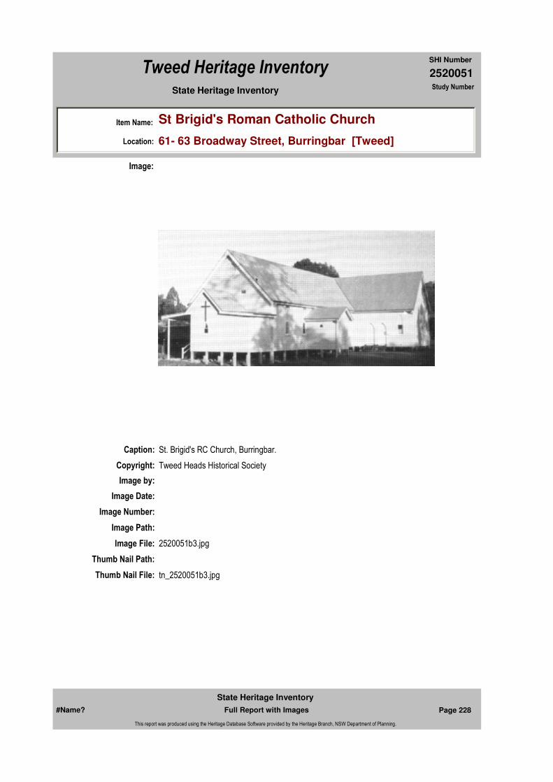
2520051
SHI Number
Tweed Heritage Inventory
Item Name: St Brigid's Roman Catholic Church
Location: 61- 63 Broadway Street, Burringbar [Tweed]
State Heritage Inventory Study Number
Caption: St. Brigid's RC Church, Burringbar.
Copyright: Tweed Heads Historical Society
Image:
Image by:
Image Date:
Image Number:
Image Path:
Image File: 2520051b3.jpg
Thumb Nail Path:
Thumb Nail File: tn_2520051b3.jpg
#Name? Page 228 Full Report with Images
State Heritage Inventory
This report was produced using the Heritage Database Software provided by the Heritage Branch, NSW Department of Planning.

2520051
SHI Number
Tweed Heritage Inventory
Item Name: St Brigid's Roman Catholic Church
Location: 61- 63 Broadway Street, Burringbar [Tweed]
State Heritage Inventory Study Number
Caption: St. Brigid's RC Church, Burringbar.
Copyright: Tweed Heads Historical Society
Image:
Image by: Immy McKiernan
Image Date: 07/08/2003
Image Number:
Image Path:
Image File: 2520051b2.jpg
Thumb Nail Path:
Thumb Nail File: tn_2520051b2.jpg
#Name? Page 229 Full Report with Images
State Heritage Inventory
This report was produced using the Heritage Database Software provided by the Heritage Branch, NSW Department of Planning.
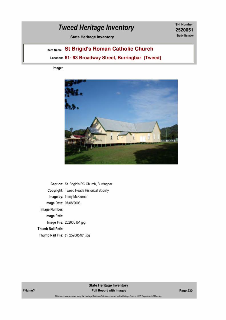
2520051
SHI Number
Tweed Heritage Inventory
Item Name: St Brigid's Roman Catholic Church
Location: 61- 63 Broadway Street, Burringbar [Tweed]
State Heritage Inventory Study Number
Caption: St. Brigid's RC Church, Burringbar.
Copyright: Tweed Heads Historical Society
Image:
Image by: Immy McKiernan
Image Date: 07/08/2003
Image Number:
Image Path:
Image File: 2520051b1.jpg
Thumb Nail Path:
Thumb Nail File: tn_2520051b1.jpg
#Name? Page 230 Full Report with Images
State Heritage Inventory
This report was produced using the Heritage Database Software provided by the Heritage Branch, NSW Department of Planning.

2520051
SHI Number
Tweed Heritage Inventory
Item Name: St Brigid's Roman Catholic Church
Location: 61- 63 Broadway Street, Burringbar [Tweed]
State Heritage Inventory Study Number
#Name? Page 231 Full Report with Images
State Heritage Inventory
This report was produced using the Heritage Database Software provided by the Heritage Branch, NSW Department of Planning.

2520052
SHI Number
Tweed Heritage Inventory
Item Name: Burringbar Railway Station
Location: Masterton Park, Broadway Street, Burringbar [Tweed]
State Heritage Inventory Study Number
Current Use:
Former Uses:
Statement of
Significance:
Historical Notes or Provenance:
The line to Burringbar was completed 24th November, 1894 and the line to Murwillumbah 24 December, 1894 by Willcocks and Firth ... The Railway provided a Gantry for the loading of logs to the railway wagons. The completion of the railway brought enormous benefits. Provision was made for the cream which went to Norco in Murwillumbah, and wagons were available for the cartage of pigs and cattle. The biggest advantage was for the people, they were able to move about and travel in comfort to towns between Casino and Murwillumbah ... The coming of the railway to Burringbar in 1894 made a tremendous difference to the village. It soon became a thriving centre and the township was relocated by the time the line opened. Broadway Street ran up the hill past the School of Arts and the rest of town was down on the flat south of Dignan's Bridge ... There were 17 bullock teams drawing logs from Upper Burringbar, Mooball and Cudgera to the railway station for transport to the sawmills ... Burringbar Station was the meeting place of the people. The train brought everything they needed. Communications had improved with daily newspapers and mail. The first Post Office was at the station and Miss Winifred Kirby was the postmistress. Everything revolved around the station. The farmers bringing in their cream and collecting their empty cans. The Storekeepers collecting their supplies and of course the passengers waiting to board the train. Burringbar was a Staff station. The staff stops any other train from being on the section between Staff Stations. Murwillumbah and Mullumbimby were the two stations controlled by Burringbar. No train could leave Murwillumbah going south or Mullumbimby going north until the staff was cleared at Burringbar. This Safety First system was considered the best in the world ... Burringbar had a passing loop and it was not uncommon
Endorsed Significance:Assessed Significance:
Item Type: Built Category: Railway Platform/ StatiGroup: Transport - Rail
Admin Codes: Code 2: Code 3:
Curtilage/Boundary:
Owner:
Other/Former Names:
Area/Group/Complex: Group ID:
Aboriginal Area:
Local Govt Area: Tweed
Planning: Northern
Historic Region: North Coast
Address: #Name?
Suburb / Nearest Town: #Name?
State: NSW
Parish: Mooball
County: Rous
#Name? Page 232 Full Report with Images
State Heritage Inventory
This report was produced using the Heritage Database Software provided by the Heritage Branch, NSW Department of Planning.

2520052
SHI Number
Tweed Heritage Inventory
Item Name: Burringbar Railway Station
Location: Masterton Park, Broadway Street, Burringbar [Tweed]
State Heritage Inventory Study Number
to see two trains in the station and a third waiting on the siding. The station platform was not built until 1919. From the early 1930's to the mid 1960's there was an average of 8 trains being cleared through Burringbar a day. This includes the seasonal cane trains. The railway yard was a hive of industry. In the early days there were 17 bullock teams drawing logs from Upper Burringbar, Mooball and Cudgera for loading onto the wagons. There was the loading and unloading of livestock and the freight trains. The Fettlers who maintained the line were stationed at Burringbar. The length of line they worked was south to the other side of the Crabbe's Creek tunnel and north to the other side of the Upper Burringbar tunnel. A small trolley which could be operated by one man was used by the head fettler (called a ganger) every day to run the length checking for any problems that needed attention. It took 4 men to lift the large trolley which carried the equipment needed for repairs, onto the line, also 4 men, 2 at the front and 2 at the back to operate the up and down action of the Sheffield System that moved the trolley along. Both trolleys used the same method of movement. The large trolley was housed in a shed opposite the school. The smaller trolley or 'trike' as it was sometimes called was kept at the western end of the platform near the line … The fettlers pumped water from Burringbar creek into the tank on the water tower which was situated alongside the line at the back of Dignan's home. Any train needing water stopped and a hose from the tank would gravitate the water into the boiler. With the coming of the diesel locomotives this service was no longer required. The coming of the Gold coast Motorail in April 1973 was to bring many changes to our railway system. Six months later in October 1973 Mooball, Crabbe's creek and Dunbible stations were closed to be followed by the closure of Stoker's Siding on 30th June, 1974. Every assurance was given that this would not happen to Burringbar and Billinudgel but in the Daily News 7th November, 1980, "District Superintendent of Railways in Grafton, Tom Cuthbert, yesterday announced the re-classification of both stations. They have been reduced to siding and platform status, effective from Monday. This means there will be no one in attendance at the two stations and no parcels, freight or bookings will be handled there. Trains will continue to stop at both Billinudgel and Burringbar to let off passengers." Tickets could be obtained on the train for short trips. The fettlers were transferred from Burringbar and worked out of Mullumbimby. With the mechanisation of the railway track the fettlers have now become redundant. In February 1990 trains no longer stopped at Burringbar. Every effort was made by Burringbar Progress Association to retain the Station for historical purposes but to no avail. The station was dismantled and removed in June/July 1993 together with the B. G. F. loading sheds.
There were 24 stations between Lismore and Murwillumbah when the line opened, with other sidings where the train could be hailed. With the exception of Byron Bay and Mullumbimby all have now been closed and most cleared of any vestige of railway occupation. Bangalow Station while still standing is no longer served by train.
A list of some of the Burringbar Stationmasters :- 1910 Mr. Albert Overall - Mr. Maher - Mr. Hamilton -Mr. Clissold - Joe Cobcroft - Bill Ryan - Bill McFadden - Mr. Carter - 1962 Les Sweeney - Len Dove.A list of some of the Railway Fettlers :- 1914 Tom O'Connor Snr. (Ganger) - Arthur Jacobson - George Beech - John Bull - Jack Flanagan (Ganger) - Les Everson (Ganger) - Jack Crawford - Vince Johnstone - Fred Wooderson (Ganger) - Mr. Marsh - Tommy Tammock - Ron Freeman (Ganger). Bernie Walls was the last Acting Ganger. - Les Radunz.
In a final tribute to Burringbar Railway Station special mention should be made of Mr. Les
#Name? Page 233 Full Report with Images
State Heritage Inventory
This report was produced using the Heritage Database Software provided by the Heritage Branch, NSW Department of Planning.

2520052
SHI Number
Tweed Heritage Inventory
Item Name: Burringbar Railway Station
Location: Masterton Park, Broadway Street, Burringbar [Tweed]
State Heritage Inventory Study Number
Sweeney the Stationmaster who was appointed to Burringbar in 1962. In the Daily News 27th November 1968 under the heading "BURRINGBAR RAILWAY GARDEN WAS BEST IN STATE". A picture shows Mr. Sweeney tending his garden beside the platform. The article continues:- Mr. Sweeney who has been at Burringbar six years, had previously won one championship first prize and two second prizes in the competition. Mr. Sweeney has achieved what he believes to be a unique feat - he has won the first prize at two different railway stations. His first win was at Illabo in southern New South Wales. Mr. Sweeney's first prize in railway garden competitions was won in 1953 and he has won a prize every year since then. The competition is judged by the Chief Railway Gardener, Mr. W. Benson of the Homebush Nursery who visits each garden in the state during April and October. The gardens are awarded points on both occasions, and a final result is arrived at during November. Mr. Sweeney said Burringbar was judged in April and the first week of October. At present a well-kept park between the roadway and the station is edged with red roses. Dotted around the lawn are hibiscus and shrubs with a border of attractive pine trees. A garden beside the platform is amassed with roses, salvia, petunias, yellow violas and other colourful flowers. On the platform itself, Mr. Sweeney has placed 200 potplants with several staghorns. Mr. Sweeney said for the April judging he had had dahlias bordered by salvia in the garden. He thanked the local residents, Mr. R. Rumsey (rosegrower) of Sydney, who supplied the roses, the Lismore Garden Centre and staff at the Railway Garden Nursery at Homebush for assistance. Mr. Sweeney said it was very pleasing to see the interest taken in the station gardens which made the approaches to railway transport more attractive.
An extract from the Daily News 25th April 1969 "the Burringbar railway station master, Mr. Les Sweeney, was presented with an attractive hand-painted trophy for the winning railway garden by the Tweed Shire Council President Cr. C.H. Hall. The presentation function, held at the Murwillumbah Golf Club was arranged by Tweed Shire Council. The North Coast railways inspector, Mr. J. Liddiard told the guests of Mr. Sweeney's gardening history. The 1968 award was not Mr. Sweeney's first, he said. When stationed at Illabo he won the award in 1960,1961 and 1962. Cr. T. K. O'Connor speaking on behalf of the residents of Burringbar congratulated Mr. Sweeney on his great achievement not only for himself but for Burringbar."
Today Tweed Shire Council maintains the Park and a lot of the trees planted by Mr. Sweeney are still there. The station name BURRINGBAR has been relocated into this Park [Masterton Park] and for many it will be a constant reminder of a past era.
The TrainsThe Locomotives, rolling stock and materials were brought to Lismore by Steamship, via the Richmond River, where they were unloaded and prepared for working the line.
The first trains on the line operated between Lismore and Murwillumbah. They were drawn by Steam powered Locomotives and hauled both Passenger Cars and Freight Vans. The Guard's Van carried the Mail, Newspapers, Packages and supplies for the Shops. There was a special Van for the Cream and other farm produce.
Freight trains brought the heavy supplies like flour, machinery, stoves and furniture etc. There were special wagons for the Livestock. The logs were hauled to the seaport at Byron Bay to be reloaded into the Steamships en route to Sydney or Brisbane.
#Name? Page 234 Full Report with Images
State Heritage Inventory
This report was produced using the Heritage Database Software provided by the Heritage Branch, NSW Department of Planning.

2520052
SHI Number
Tweed Heritage Inventory
Item Name: Burringbar Railway Station
Location: Masterton Park, Broadway Street, Burringbar [Tweed]
State Heritage Inventory Study Number
For the early settlers it was the opening up of a new way of life with access to medical and dental treatment, the luxury of travelling in comfort, spending the day in Murwillumbah shopping and meeting up with friends and neighbours.
For approximately 15 years the trains ran only between Lismore and Murwillumbah a distance of 60 miles thus earning the name 'the train from nowhere to nowhere'. The daily morning train arrived Murwillumbah 10 am left Murwillumbah 11 am and terminated at Byron Bay, returning to Murwillumbah about 2 pm departing Murwillumbah 3 pm for the return trip to Lismore.
This short trip to Byron Bay was apparently to cater for the passengers boarding the Steamships for Sydney and bring back passengers disembarking for destinations north, and also for the carrying of some of the farm produce. Even though there was a connecting train service through to Sydney in 1923 many didn't favour the inconvenience of changing from train to omnibus and back to train, when it was such a relaxing journey on the ship with all amenities provided. This service continued until the mid 1930's.
The North Coast Mail started to run in 1932 and in a short time sleeping cars were introduced and the passenger ships became redundant.
Steam locomotives with sleeper carriages worked the line until early 1960. Canteen service was available at some stations. There was three to four changes of engine on the 24 hour trip to Sydney. When the steam locomotives were replaced with diesel units no change of engine was necessary.In May 1973 the Gold Coast MotoRail came with sleeper services, dining cars and Motor Rail service, where your car travelled on the same train to be available when you arrived at your destination.
The Motor Rail was a much loved train locally and while no right thinking person would set their watch by it, it performed a useful service. Youngsters from Lismore and Casino would use it to have a day surfing at Byron Bay, and the train trip from Lismore to Murwillumbah could be a relaxing outing where one could saunter into the dining car for a cup of coffee or afternoon tea while watching the magnificent Northern Rivers scenery pass by. The view of Byron Bay as the train rounded the curve a St. Helena, must have been one of the most superb sights to be had from a carriage window in Australia.
In 1986 the MotoRail did the trip in 16½ hours. The train left Sydney 6.40pm arriving Murwillumbah 11.30am next morning. On the return journey it departed Murwillumbah 3.30pm arriving Sydney 8.40am following morning.
The XPT a push-pull rail car was brought into service in Feb.1990 and it completes the journey in 13½ hours. Although this would seem a much faster time, many intermediate stations are closed and because of the shorter length the XPT only stops once whereas the MotoRail had to stop three times at some stations because of short platform. In addition the XPT does not have the additional weight of dining cars or MotoRail wagons.
The most important trains were the early log trains, the freight trains and later the cane and
#Name? Page 235 Full Report with Images
State Heritage Inventory
This report was produced using the Heritage Database Software provided by the Heritage Branch, NSW Department of Planning.

2520052
SHI Number
Tweed Heritage Inventory
Item Name: Burringbar Railway Station
Location: Masterton Park, Broadway Street, Burringbar [Tweed]
State Heritage Inventory Study Number
banana trains. They were invaluable to the livelihood of the people and the prosperity of the district.Today there are no log trains, cane or B.G.F. trains and very few freight trains most everything is carried by road transport which is adding to the congestion and deterioration on our roads and highways.
Trains no longer stop at Burringbar. Progress has caught up and swept away many of these features which made our railway and trains special.
During the war years of 1939-1945 an occasional troop train came through. These trains had right of way on the line.
There was also the Commemorative Trains.
In August 1964 a vintage train came from Sydney for the Tweed Banana Festival. On board were 200 people in period costume. There wore also people dressed in the same fashion on Burringbar platform who later boarded the train for Murwillumbah. The train stayed in the station for a considerable time and many took advantage of going through the carriages and seeing the magnificent Vice Regal Car embellished with luxurious drapes and furnishings with people in period costume seated on the lounges. The sight was overwhelming with the feeling of the relaxation of those bygone days.
Two steam locomotives hauled special trains marking the Australian Bi-Centenary on 24th September 1988. It was over 25 years since these Locomotives had worked the line.
The Flying Scotsman a well known English train was brought out from England and came through on 27th May 1989.
The first Santa Special stopped at Burringbar on the 4th December 1989 much to the delight of the young children.
In 1991 during School holidays a special steam train came to Murwillumbah and did excursion trips to Mullumbimby and Byron Bay for two weeks. Hundreds of people took advantage of this for many had never ridden on a steam train and lots of children had never been on a train at all. It was a trap for the unwary who put their heads out the window to get a better look at the engine and ended up with an eye full of soot.
For a lot of older people it brought back a lot of memories as our trains were really special."Burringbar Primary School - A History of 100 Years of public education at Burringbar. 1894 - 1994" Pages 17 - 20
Designer:
Maker / Builder:
Year Started: Year Completed: Circa: No
Themes:
#Name? Page 236 Full Report with Images
State Heritage Inventory
This report was produced using the Heritage Database Software provided by the Heritage Branch, NSW Department of Planning.

2520052
SHI Number
Tweed Heritage Inventory
Item Name: Burringbar Railway Station
Location: Masterton Park, Broadway Street, Burringbar [Tweed]
State Heritage Inventory Study Number
Physical Description:
Physical Condition:
Modification Dates: The Burringbar Railway Station was demolished in 1993
Custom Field One:
Recommended
Management:Interpretative sign to be erected in Masterton Park near the site.
References:
Studies:
Listings:
Further Comments:
Criteria a)
Criteria c)
Criteria d)
Criteria e)
Criteria g)
Criteria f)
Integrity / Intactness:
Custom Field Two:
Criteria b)
Parcels:
Latitude: Longitude:
AMG Zone: Easting: Northing:
Map Name: Map Scale:
Spatial Accuracy:Location validity:
Management:
Author Title Year
"Burringbar Primary School - A History of 100 Years of public education at Burringbar. 1894 - 1994"
Author Title YearNumber
Tweed Shire Council Community-based Heritage Study 2003
Name: Date:Number:Title:
Local Environmental Plan 07/04/2000Schedule 2
#Name? Page 237 Full Report with Images
State Heritage Inventory
This report was produced using the Heritage Database Software provided by the Heritage Branch, NSW Department of Planning.

2520052
SHI Number
Tweed Heritage Inventory
Item Name: Burringbar Railway Station
Location: Masterton Park, Broadway Street, Burringbar [Tweed]
State Heritage Inventory Study Number
Date Updated: 18/04/2011 Status: BasicDate First Entered: 11/07/2001Data Entry:
Custom Field Three:
Custom Field Four:
Custom Field Five:
Custom Field Six:
#Name? Page 238 Full Report with Images
State Heritage Inventory
This report was produced using the Heritage Database Software provided by the Heritage Branch, NSW Department of Planning.
2520053
SHI Number
Tweed Heritage Inventory
Item Name: Chinderah Cemetery
Location: Chinderah Road, Chinderah [Tweed]
State Heritage Inventory Study Number
Current Use:
Former Uses:
Statement of
Significance:This item has a strong association with the pioneers of the Tweed Heads district, especially the South Sea Islanders.
Historical Notes or Provenance:
One sunny morning when we were driving down the road that leads down from Cudgen to Chinderah, we came upon a tiny cemetery. It contained only a few headstones.
One of these monuments commemorates Thomas Boyd. In the archives of the Postal Department there is a note dated 1877.
Tenders were called for the conveyance of mails "between Tweed Junction and Tweed Heads calling at Cudgen where a Mr. Boyd is living at the wharf."
The inscriptions on several of the other monuments tell of men who are buried here, but whose native land lies far away across the sea. We read of Willie Bulco, a native of Tonga who died in 1908 at the age of 57; Harry Brown, a native of the New Hebrides, who died in 1927 at the age of 80; and Dick Longsickie, who died at the age of 60. He was a native of the Solomons.
Those inscriptions are mute reminders of the fact that often, sometimes too often, events that take place far away may have far reaching and unexpected results for people here in the Tweed. The story that lies behind what we read on those three last tombstones in a quiet little
Endorsed Significance: StateAssessed Significance: State
Item Type: Complex / Group Category: Cemetery/Graveyard/Group: Cemeteries and Buria
Admin Codes: Code 2: Code 3:
Curtilage/Boundary:
Owner: Local Government
Other/Former Names:
Area/Group/Complex: Group ID:
Aboriginal Area:
Local Govt Area: Tweed
Planning: Northern
Historic Region: North Coast
Address: #Name?
Suburb / Nearest Town: #Name?
State: NSW
Parish: Cudgen
County: Rous
#Name? Page 239 Full Report with Images
State Heritage Inventory
This report was produced using the Heritage Database Software provided by the Heritage Branch, NSW Department of Planning.

2520053
SHI Number
Tweed Heritage Inventory
Item Name: Chinderah Cemetery
Location: Chinderah Road, Chinderah [Tweed]
State Heritage Inventory Study Number
graveyard at Chinderah had its beginning nearly a century and a quarter ago now and thousands of kilometres away and in another hemisphere.
In 1861, disagreements between the Northern and the Southern States in America led to a bitter civil war. The warships of the Northern States closely blockaded the ports of the Southern States. This action cut off the supply of cotton to the mills of England's Manchester; and that caused great distress amongst the mill workers and their families.
It was then that enterprising men saw the opportunity of building up a new and lucrative industry - cotton growing - in Queensland.
There was one troublesome problem facing the prospective cotton growers. Where would they find the labor to work their plantations? At the time there was an acute shortage of labor in the colonies, for the cheap labor afforded by the transportation of convicts had ceased; and to make matters worse, the gold rushes had drawn off great numbers of workmen, and business and professional men, too, from the towns and rural areas of the eastern States. Where were the laborers to be found? Robert Towns found the answer to that question.
Robert Towns enjoyed few advantages in his early life. He had little education. He went to sea as an apprentice in a collier sailing out of South Shields. Soon by dint of hard work and study he began to rise in the world of seamanship, and at the early age of 19, he was a master of a vessel trading in the Mediterranean.
When he was 33, he arrived in Sydney and he was soon trading in sandalwood and trepang amongst the islands of the Pacific. He married a sister of the famous William Charles Wentworth.
Towns saw a great reservoir of labor amongst the islands of the Pacific. He sent a schooner to recruit laborers for his plantations. The vessel returned with 73 laborers indentured to work in Queensland for ten shillings each month as wages.
In addition, each man was to be fed and housed. At the end of his period of service, he was to be repatriated to his own native island. Thus was begun a trade in South Sea Islanders, Kanakas as they came to be known (the word Kanaka being the Hawaiian word for "a man").
The trade degenerated into incidents involving kidnapping, murder and slavery when it passed into the hands of some other traders. It was a trade that finally had to be terminated by Government intervention.
The close of the American Civil War allowed the American cotton trade with England to be resumed. The Queensland cotton growers found themselves placed at a disadvantage. Many turned to growing sugar cane.
#Name? Page 240 Full Report with Images
State Heritage Inventory
This report was produced using the Heritage Database Software provided by the Heritage Branch, NSW Department of Planning.
2520053
SHI Number
Tweed Heritage Inventory
Item Name: Chinderah Cemetery
Location: Chinderah Road, Chinderah [Tweed]
State Heritage Inventory Study Number
Towns needed a base on the North Queensland coast for his operations there. To select such a site, Towns sent J. M. Black. He chose land on the shores of Cleveland Bay, and there Towns built a wool store, a boiling down works and a wharf.
These three structures were the nucleus of the present fine city of Townsville. It is said that when Towns heard that the settlement that was forming at the site of his buildings was to be called Townsville, he told someone that he was very grateful that the Government had paid him such a compliment.
Towns entered politics in 1856 as a member of the New South Wales Legislative Council. He resigned in 1861, but two years later he entered the Council once more as a life member.
In his later years, Towns bought a property at Rose Bay. There at his home "Cranbrook", he lived until his death in 1873.
After that digression, let me return to where this story began at the little cemetery at Chinderah.
On the nearby Cudgen upland, W. W. Julius obtained a part of a property which had belonged to Henry Clarke. There he planted an area of sugar cane, and in anticipation of a harvest, he built a small mill to crush it.
The next venture in the sugar industry on the Cudgen, came when John Robb, who had been engaged in railway construction, headed a company which took up land and began clearing it using, it is said, about 300 men, many of whom were South Sea Islanders. When the land had been cleared, cane was planted and a mill was built.
Robb laid light railways built so that the sugar cane could be easily carried to the mill in trucks drawn by locomotives. One of these little saddle engines was named "Torpedo". One record states that the other was named "Fowler".
All the activity brought with it an expansion in the little Cudgen village. At one time, the village could boast two churches, a store which also housed the post office, a hairdresser, and two hotels, as well as the public school.
As is inevitable changes were to come to Cudgen after the death of Mr Robb. Later much of the land was subdivided and sold as separate farms.
Through the closing years of the old century and the early years of the new, South Sea Islanders figured in the work force of the Cudgen area. Some of their children attended the local public school.In 1917, Inspector Dunlop, in his report to his department, wrote of the colored children in the school were mainly South Sea Island stock and that they were "a most healthy active lot of children, quite equal in attainments to the white children."
Seven years later, Inspector Barlex touched on the same subject. In his report he wrote that "the Kanaka children look clean and tidy at school. They hold. their own on the score of intelligence with other children."
#Name? Page 241 Full Report with Images
State Heritage Inventory
This report was produced using the Heritage Database Software provided by the Heritage Branch, NSW Department of Planning.
2520053
SHI Number
Tweed Heritage Inventory
Item Name: Chinderah Cemetery
Location: Chinderah Road, Chinderah [Tweed]
State Heritage Inventory Study Number
And here in this little graveyard at Chinderah are mute memorials that remind us of those who lie beneath them, but also log the thousands who came or were kidnapped and brought here far from their homes.
Some, like Willie Bulco, Harry Brown and Dick Longsickie, were never to see their island homelands again.
Tweed Daily article Harold W Denning "Tombstones act as reminders Pacific Islands of cheap labor"
The remaining headstones (in 2004) are those of:Leslie Slockee & Janelle Slockee (children) headstones with white picket fence 1944; 1953John Surconner headstone with metal rails 1918Harry Boy headstone with metal rails 1911Alick Karisi headstone 1908Willie Bucco headstone 1908metal rails - headstone missingJohn Dora headstone 1927Harry Brown headstone 1927Eliza King headstone 1919Sullivan Bulolo headstone with metal rails 1913metal rail - headstone missingDickie Longsickie headstone with metal rails 1933Samuel Lindo headstoneGeorge Coles headstone 1907Mervyn Luxton headstone 1912Samuel Ephe headstone 1917Margaret King headstone 1885William Clifford & Bridget Clifford headstone with metal rail 1897; 1924headstone (illegible)Stephen Maher & Catherine Maher headstone with metal rail 1975; 1906Thomas Boyd & Mary Boyd headstone with metal rail 1884; ?Richard William Boyd headstone with concrete surrounds 1887Eliza McGregor headstone with metal rails 1884George Browning headstone 1908Eileen Mye headstone 1960
Designer:
Maker / Builder:
Themes: National Theme State Theme Local Theme
9. Phases of Life Birth and Death Cemeteries
#Name? Page 242 Full Report with Images
State Heritage Inventory
This report was produced using the Heritage Database Software provided by the Heritage Branch, NSW Department of Planning.
2520053
SHI Number
Tweed Heritage Inventory
Item Name: Chinderah Cemetery
Location: Chinderah Road, Chinderah [Tweed]
State Heritage Inventory Study Number
Physical Description: The area is grassed and lightly wooded with mainly native trees. The gravestones in the Chinderah cemetery were relocated here and a large stone and plaque erected with the inscription 'For their preservation and significance, the headstones and relics in this section have been moved to this dedicated cemetery area from various sites on private property 300m south-south-east of this spot'. There are 25 headstones in this cemetery. The Chinderah Cemetery is located approximately 300m north-west of the Cudgen Burial Ground. In 1968 the whole of the dedication for the cemetery at Chinderah was revoked and a small area within its boundaries was reserved for the preservation of graves. A road has been constructed on private land between the Chinderah Cemetery and Cudgen Burial Ground to access a golf range. Surveyors plans indicate that the road was constructed over several of the burials.
Physical Condition:
Modification Dates:
Year Started: Year Completed: Circa: No
Recommended Management:
Erect an interpretative panel to illustrate the history and significance of the site.
References:
Studies:
Further Comments:
Criteria a)
Criteria c)
Criteria d)
Criteria e)
Criteria g)
Criteria f)
Integrity / Intactness:
Criteria b) This item has a strong association with the pioneers of the Tweed Heads district. especially the South Sea Islanders.
Parcels:
Management:
Author Title Year
Harold W Denning "Tombstones act as reminders Pacific Islands of cheap labor"
Author Title YearNumber
Tweed Shire Council Community-based Heritage Study 2003
Parcel Code LotNumber Section Plan Code Plan Number
LOT 493 DP 720407
#Name? Page 243 Full Report with Images
State Heritage Inventory
This report was produced using the Heritage Database Software provided by the Heritage Branch, NSW Department of Planning.
2520053
SHI Number
Tweed Heritage Inventory
Item Name: Chinderah Cemetery
Location: Chinderah Road, Chinderah [Tweed]
State Heritage Inventory Study Number
Custom Field One:
Listings:
Date Updated: 18/04/2011 Status: BasicDate First Entered: 11/07/2001Data Entry:
Custom Field Two:
Custom Field Three:
Custom Field Four:
Custom Field Five:
Custom Field Six:
Latitude: Longitude:
AMG Zone: Easting: Northing:
Map Name: Map Scale:
Spatial Accuracy:Location validity:
Name: Date:Number:Title:
Local Environmental Plan 07/04/2000Schedule 2
LOT 49 DP 841783
#Name? Page 244 Full Report with Images
State Heritage Inventory
This report was produced using the Heritage Database Software provided by the Heritage Branch, NSW Department of Planning.

2520053
SHI Number
Tweed Heritage Inventory
Item Name: Chinderah Cemetery
Location: Chinderah Road, Chinderah [Tweed]
State Heritage Inventory Study Number
Caption: Chinderah Cemetery, 2003.
Copyright: Tweed Heads Historical Society
Image:
Image by: Immy McKiernan
Image Date: 20/07/2003
Image Number:
Image Path:
Image File: 2520053b1.jpg
Thumb Nail Path:
Thumb Nail File: tn_2520053b1.jpg
#Name? Page 245 Full Report with Images
State Heritage Inventory
This report was produced using the Heritage Database Software provided by the Heritage Branch, NSW Department of Planning.
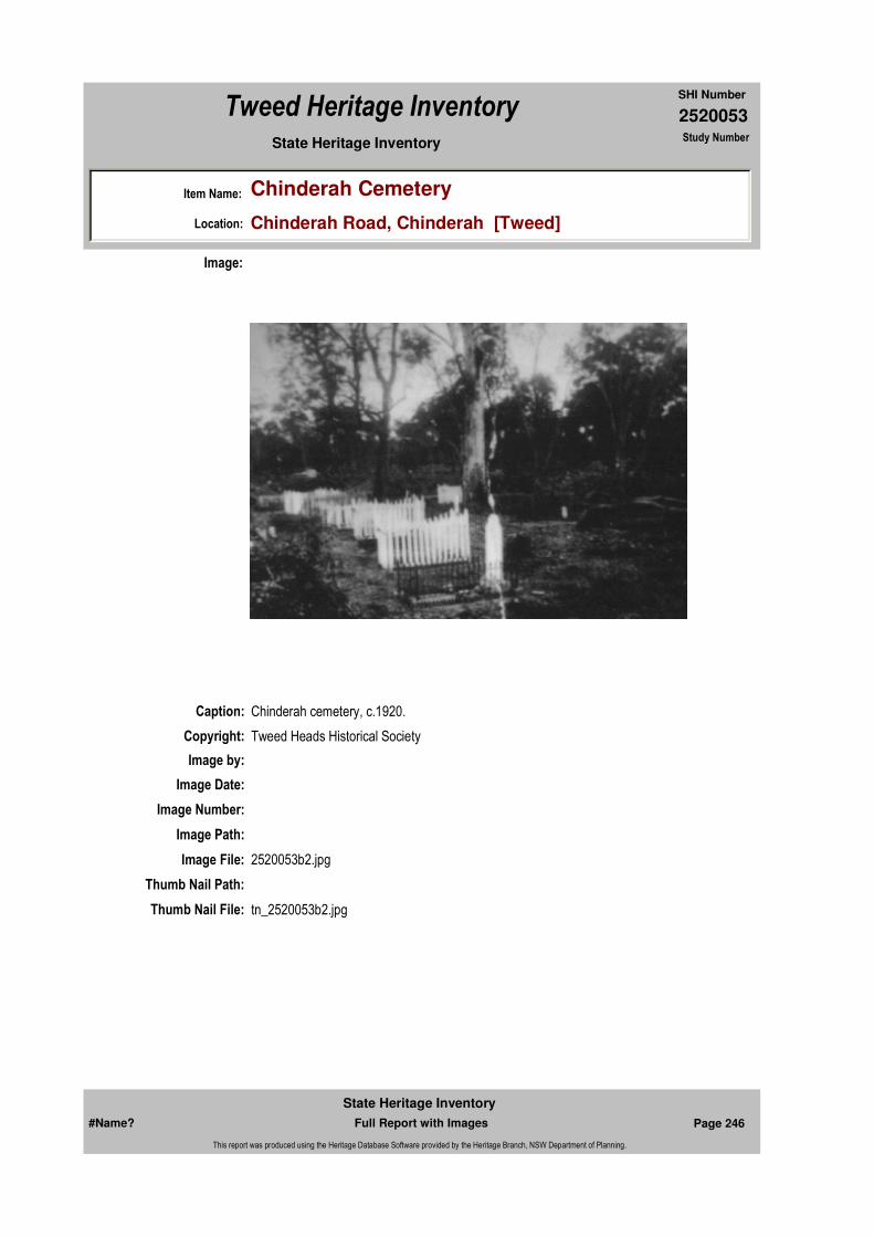
2520053
SHI Number
Tweed Heritage Inventory
Item Name: Chinderah Cemetery
Location: Chinderah Road, Chinderah [Tweed]
State Heritage Inventory Study Number
Caption: Chinderah cemetery, c.1920.
Copyright: Tweed Heads Historical Society
Image:
Image by:
Image Date:
Image Number:
Image Path:
Image File: 2520053b2.jpg
Thumb Nail Path:
Thumb Nail File: tn_2520053b2.jpg
#Name? Page 246 Full Report with Images
State Heritage Inventory
This report was produced using the Heritage Database Software provided by the Heritage Branch, NSW Department of Planning.

2520053
SHI Number
Tweed Heritage Inventory
Item Name: Chinderah Cemetery
Location: Chinderah Road, Chinderah [Tweed]
State Heritage Inventory Study Number
Caption: Plaque at Chinderah Cemetery, 2003.
Copyright: Tweed Heads Historical Society
Image:
Image by: Immy McKiernan
Image Date: 20/07/2003
Image Number:
Image Path:
Image File: 2520053b3.jpg
Thumb Nail Path:
Thumb Nail File: tn_2520053b3.jpg
#Name? Page 247 Full Report with Images
State Heritage Inventory
This report was produced using the Heritage Database Software provided by the Heritage Branch, NSW Department of Planning.

2520053
SHI Number
Tweed Heritage Inventory
Item Name: Chinderah Cemetery
Location: Chinderah Road, Chinderah [Tweed]
State Heritage Inventory Study Number
#Name? Page 248 Full Report with Images
State Heritage Inventory
This report was produced using the Heritage Database Software provided by the Heritage Branch, NSW Department of Planning.

2520060
SHI Number
Tweed Heritage Inventory
Item Name: Murwillumbah Police Station
Location: 61 - 83 Murwillumbah Street, Murwillumbah [Tweed]
State Heritage Inventory Study Number
Current Use:
Former Uses:
Statement of
Significance:A fine Edwardian Police Station that has been admirably adapted by the government architect's design to suit it to semitropical conditions. The Police Station and Courthouse buildings are significant as part of the Murwillumbah Main Street Urban Conservation Area. The Federation Free style facade of the building contributes to the character of the conservation precinct.
Historical Notes
or Provenance:Fire in 1907 destroyed the first Courthouse precinct, which was built on an elevated site. Excavation and realignment of the street frontage allowed for a more convenient access.
Physical Description: The station is a single storey face brick cottage type building with two storey addition at one
Designer: Vernon, W.L.
Maker / Builder:
Year Started: Year Completed: 1909 Circa: No
Endorsed Significance:Assessed Significance: Local
Item Type: Built Category: Police stationGroup: Law Enforcement
Admin Codes: 000260 Code 2: Code 3:
Curtilage/Boundary: Part of Police Station and Courthouse Group, Murwillumbah Street, Murwillumbah.
Owner:
Other/Former Names:
Area/Group/Complex: Murwillumbah Main Street Urban Conservation Area Group ID: 15
Themes:
Aboriginal Area:
Local Govt Area: Tweed
Planning: Northern
Historic Region: North Coast
Address: #Name?
Suburb / Nearest Town: #Name?
State: NSW
Parish: Murwillumbah
County: Rous
National Theme State Theme Local Theme
7. Governing Law and order (none)
#Name? Page 249 Full Report with Images
State Heritage Inventory
This report was produced using the Heritage Database Software provided by the Heritage Branch, NSW Department of Planning.

2520060
SHI Number
Tweed Heritage Inventory
Item Name: Murwillumbah Police Station
Location: 61 - 83 Murwillumbah Street, Murwillumbah [Tweed]
State Heritage Inventory Study Number
end having a pebble dash stucco finish to the upper floor. The facade is sheltered by a well detailed timber verandah in the Federation style containing lattice screens and brackets. The building is set back from the street and the space is landscaped with trees and lawn. The roof is a simple hipped form of corrugated iron. It is part of an exceptional group of Federation Free style government buildings, which are sensitively designed to suit the semi-tropical climate, and well related by use of form, colour and scale one to the other to create a fine range of civic streetscape.
Physical Condition:
Modification Dates:
Recommended Management:
Conserve the exterior and interior elements of significance; adapt services and facilities to ensure continued use; remove redundant signs and signs which detract from the style of architecture; provide a suitable colour scheme which compliments the architecture and matches the aspirations of the building owner and tenant; restore damaged and missing original architectural features based on early photographs or technical drawings.
References:
Studies:
Further Comments:
Criteria a)
Criteria c) A fine Edwardian Police Station that has been admirably adapted by the government architect's design to suit it to semitropical conditions.
Criteria d)
Criteria e)
Criteria g)
Criteria f)
Integrity / Intactness:
Criteria b) The Police Station and Courthouse buildings are significant as part of the Murwillumbah Main Street Urban Conservation Area. The Federation Free style facade of the building contributes to the character of the conservation precinct.
Parcels:
Latitude: -28.3278 Longitude: 153.3956
Management:
Author Title YearNumber
Tweed Shire Council Community-based Heritage Study 2003
Parcel Code LotNumber Section Plan Code Plan Number
LOT 4 1 DP 758739
#Name? Page 250 Full Report with Images
State Heritage Inventory
This report was produced using the Heritage Database Software provided by the Heritage Branch, NSW Department of Planning.

2520060
SHI Number
Tweed Heritage Inventory
Item Name: Murwillumbah Police Station
Location: 61 - 83 Murwillumbah Street, Murwillumbah [Tweed]
State Heritage Inventory Study Number
Custom Field One:
Listings:
Date Updated: 01/11/2004 Status: PartialDate First Entered: 23/11/2000Data Entry:
Custom Field Two: c 1905
Custom Field Three: DescriptionChanged:29/10/1997 Condition Changed:26/09/1996 Significance Changed:29/10/1997 Nominated:28/03/1977 Interim Listed:14/06/1977 Registered:21/03/1978
Custom Field Four:
Custom Field Five:
Custom Field Six:
AMG Zone: Easting: 538852 Northing: 6866397
Map Name: Map Scale:
Spatial Accuracy:Location validity:
Name: Date:Number:Title:
National Trust of Australia Register 18/02/19804123
Royal Australian Institute of Architects register 30/12/1985
Register of the National Estate 21/03/1978000260Nom. 28/03/1977.
#Name? Page 251 Full Report with Images
State Heritage Inventory
This report was produced using the Heritage Database Software provided by the Heritage Branch, NSW Department of Planning.
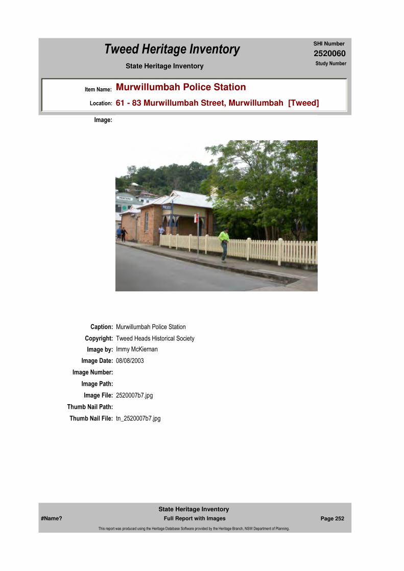
2520060
SHI Number
Tweed Heritage Inventory
Item Name: Murwillumbah Police Station
Location: 61 - 83 Murwillumbah Street, Murwillumbah [Tweed]
State Heritage Inventory Study Number
Caption: Murwillumbah Police Station
Copyright: Tweed Heads Historical Society
Image:
Image by: Immy McKiernan
Image Date: 08/08/2003
Image Number:
Image Path:
Image File: 2520007b7.jpg
Thumb Nail Path:
Thumb Nail File: tn_2520007b7.jpg
#Name? Page 252 Full Report with Images
State Heritage Inventory
This report was produced using the Heritage Database Software provided by the Heritage Branch, NSW Department of Planning.

2520060
SHI Number
Tweed Heritage Inventory
Item Name: Murwillumbah Police Station
Location: 61 - 83 Murwillumbah Street, Murwillumbah [Tweed]
State Heritage Inventory Study Number
Caption: Murwillumbah Police Station
Copyright: Tweed Heads Historical Society
Image:
Image by: Immy McKiernan
Image Date: 08/08/2003
Image Number:
Image Path:
Image File: 2520007b8.jpg
Thumb Nail Path:
Thumb Nail File: tn_2520007b8.jpg
#Name? Page 253 Full Report with Images
State Heritage Inventory
This report was produced using the Heritage Database Software provided by the Heritage Branch, NSW Department of Planning.

2520060
SHI Number
Tweed Heritage Inventory
Item Name: Murwillumbah Police Station
Location: 61 - 83 Murwillumbah Street, Murwillumbah [Tweed]
State Heritage Inventory Study Number
Caption: Murwillumbah Police Station
Copyright: Tweed Heads Historical Society
Image:
Image by: Immy McKiernan
Image Date: 08/08/2003
Image Number:
Image Path:
Image File: 2520007b3.jpg
Thumb Nail Path:
Thumb Nail File: tn_2520007b3.jpg
#Name? Page 254 Full Report with Images
State Heritage Inventory
This report was produced using the Heritage Database Software provided by the Heritage Branch, NSW Department of Planning.

2520060
SHI Number
Tweed Heritage Inventory
Item Name: Murwillumbah Police Station
Location: 61 - 83 Murwillumbah Street, Murwillumbah [Tweed]
State Heritage Inventory Study Number
Caption: Murwillumbah Police Station
Copyright: Tweed Heads Historical Society
Image:
Image by: Bill Bainbridge
Image Date: 27/09/2003
Image Number:
Image Path:
Image File: 2520007b6.jpg
Thumb Nail Path:
Thumb Nail File: tn_2520007b6.jpg
#Name? Page 255 Full Report with Images
State Heritage Inventory
This report was produced using the Heritage Database Software provided by the Heritage Branch, NSW Department of Planning.

2520060
SHI Number
Tweed Heritage Inventory
Item Name: Murwillumbah Police Station
Location: 61 - 83 Murwillumbah Street, Murwillumbah [Tweed]
State Heritage Inventory Study Number
Caption: Offices & Police Station
Copyright: Contact AHC
Image:
Image by: Houldsworth, J. Date taken: Jun-96
Image Date:
Image Number: 22014 RT48320 Register Number:000260
Image Path:
Image File:
Thumb Nail Path:
Thumb Nail File:
#Name? Page 256 Full Report with Images
State Heritage Inventory
This report was produced using the Heritage Database Software provided by the Heritage Branch, NSW Department of Planning.

2520060
SHI Number
Tweed Heritage Inventory
Item Name: Murwillumbah Police Station
Location: 61 - 83 Murwillumbah Street, Murwillumbah [Tweed]
State Heritage Inventory Study Number
#Name? Page 257 Full Report with Images
State Heritage Inventory
This report was produced using the Heritage Database Software provided by the Heritage Branch, NSW Department of Planning.
2520061
SHI Number
Tweed Heritage Inventory
Item Name: Murwillumbah Courthouse
Location: 61 - 83 Murwillumbah Street, Murwillumbah [Tweed]
State Heritage Inventory Study Number
Current Use:
Former Uses:
Statement of
Significance:An excellent example of an Edwardian courthouse well adapted to its regional environment. The building is, in conjunction with its related police station and offices, an important civic group in the centre of Murwillumbah. The Police Station and Courthouse buildings are significant as part of the Murwillumbah Main Street Urban Conservation Area. The Federation Free style facade of the building contributes to the character of the conservation precinct.
Historical Notes or Provenance:
Fire in 1907 destroyed the first Courthouse precinct, which was built on an elevated site. Excavation and realignment of the street frontage allowed for a more convenient access.
Designer: Vernon, W.L.
Maker / Builder:
Year Started: Year Completed: 1909 Circa: No
Endorsed Significance:Assessed Significance: Local
Item Type: Built Category: CourthouseGroup: Law Enforcement
Admin Codes: 000259 Code 2: Code 3:
Curtilage/Boundary: Part of Police Station and Courthouse Group, Murwillumbah Street, Murwillumbah.
Owner:
Other/Former Names:
Area/Group/Complex: Murwillumbah Main Street Urban Conservation Area Group ID: 15
Themes:
Aboriginal Area:
Local Govt Area: Tweed
Planning: Northern
Historic Region: North Coast
Address: #Name?
Suburb / Nearest Town: #Name?
State: NSW
Parish: Murwillumbah
County: Rous
National Theme State Theme Local Theme
7. Governing Government and administra (none)
#Name? Page 258 Full Report with Images
State Heritage Inventory
This report was produced using the Heritage Database Software provided by the Heritage Branch, NSW Department of Planning.
2520061
SHI Number
Tweed Heritage Inventory
Item Name: Murwillumbah Courthouse
Location: 61 - 83 Murwillumbah Street, Murwillumbah [Tweed]
State Heritage Inventory Study Number
Physical Description: An exceptional group of Federation Free style government buildings all sensitively designed to suit the semi-tropical climate, all well related by use of form, colour and scale one to the other to create a fine range of civic streetscape.Station - A single storey face brick cottage type building with two storey addition at one end having a pebble dash stucco finish to the upper floor. The facade is sheltered by a well detailed timber verandah in the Federation style containing lattice screens and brackets. The building is set back from the street and the space is landscaped with trees and lawn. The roof is a simple hipped form of corrugated iron.Residence - Once a Federation residence, now offices with its facade sheltered by a fine timber verandah supported on brick pylons with panels of lattice work to walls and valances. The hipped roof is of corrugated iron and windows and doors of timber. A pleasant garden of trees and shrubs screens the building from the street.Courthouse - A symmetrically arranged courthouse having a central pavilion for the courtroom flanked by lower single storey wings containing offices and jury rooms, it is constructed of face brick with relief given by pebble dash stuccoed panels and decorations to piers. Interest is given by arched clerestory lights and colonnade like entrances. The roof is a series of hipped forms sheeted in corrugated iron.
Physical Condition:
Modification Dates:
Recommended Management:
Conserve the exterior and interior elements of significance; adapt services and facilities to ensure continued use; remove redundant signs and signs which detract from the style of architecture; provide a suitable colour scheme which compliments the architecture and matches the aspirations of the building owner and tenant; restore damaged and missing original architectural features based on early photographs or technical drawings.
Further Comments:
Criteria a)
Criteria c) An excellent example of an Edwardian courthouse well adapted to its regional environment. The building is, in conjunction with its related police station and offices, an important civic group in the centre of Murwillumbah.
Criteria d)
Criteria e)
Criteria g)
Criteria f)
Criteria b) The Police Station and Courthouse buildings are significant as part of the Murwillumbah Main Street Urban Conservation Area. The Federation Free style facade of the building contributes to the character of the conservation precinct.
Management:
#Name? Page 259 Full Report with Images
State Heritage Inventory
This report was produced using the Heritage Database Software provided by the Heritage Branch, NSW Department of Planning.

2520061
SHI Number
Tweed Heritage Inventory
Item Name: Murwillumbah Courthouse
Location: 61 - 83 Murwillumbah Street, Murwillumbah [Tweed]
State Heritage Inventory Study Number
Custom Field One:
References:
Studies:
Listings:
Date Updated: 20/05/2004 Status: PartialDate First Entered: 23/11/2000Data Entry:
Integrity / Intactness:
Custom Field Two: 1909
Custom Field Three: DescriptionChanged:29/10/1997 Condition Changed:08/04/1995 Significance Changed:26/09/1996 Nominated:28/03/1977 Interim Listed:14/06/1977 Registered:21/03/1978
Custom Field Four:
Custom Field Five:
Custom Field Six:
Parcels:
Latitude: -28.3278 Longitude: 153.3958
AMG Zone: Easting: 538852 Northing: 6866397
Map Name: Map Scale:
Spatial Accuracy:Location validity:
Author Title YearNumber
Tweed Shire Council Community-based Heritage Study 2003
Name: Date:Number:Title:
National Trust of Australia Register 18/02/19804122
Royal Australian Institute of Architects register 30/12/1985
Register of the National Estate 21/03/1978000259Nom. 28/03/1977.
Parcel Code LotNumber Section Plan Code Plan Number
LOT 4 1 DP 758739
#Name? Page 260 Full Report with Images
State Heritage Inventory
This report was produced using the Heritage Database Software provided by the Heritage Branch, NSW Department of Planning.

2520061
SHI Number
Tweed Heritage Inventory
Item Name: Murwillumbah Courthouse
Location: 61 - 83 Murwillumbah Street, Murwillumbah [Tweed]
State Heritage Inventory Study Number
Caption: Murwillumbah Courthouse
Copyright: Tweed Heads Historical Society
Image:
Image by: Immy McKiernan
Image Date: 08/08/2003
Image Number:
Image Path:
Image File: 2520007b1.jpg
Thumb Nail Path:
Thumb Nail File:
#Name? Page 261 Full Report with Images
State Heritage Inventory
This report was produced using the Heritage Database Software provided by the Heritage Branch, NSW Department of Planning.
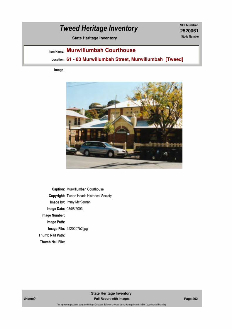
2520061
SHI Number
Tweed Heritage Inventory
Item Name: Murwillumbah Courthouse
Location: 61 - 83 Murwillumbah Street, Murwillumbah [Tweed]
State Heritage Inventory Study Number
Caption: Murwillumbah Courthouse
Copyright: Tweed Heads Historical Society
Image:
Image by: Immy McKiernan
Image Date: 08/08/2003
Image Number:
Image Path:
Image File: 2520007b2.jpg
Thumb Nail Path:
Thumb Nail File:
#Name? Page 262 Full Report with Images
State Heritage Inventory
This report was produced using the Heritage Database Software provided by the Heritage Branch, NSW Department of Planning.
2520061
SHI Number
Tweed Heritage Inventory
Item Name: Murwillumbah Courthouse
Location: 61 - 83 Murwillumbah Street, Murwillumbah [Tweed]
State Heritage Inventory Study Number
Caption: Murwillumbah Courthouse
Copyright: Contact AHC
Image:
Image by: Houldsworth, J. Date taken: Jun-96
Image Date:
Image Number: 22013 RT48314 Register Number:000259
Image Path:
Image File:
Thumb Nail Path:
Thumb Nail File:
#Name? Page 263 Full Report with Images
State Heritage Inventory
This report was produced using the Heritage Database Software provided by the Heritage Branch, NSW Department of Planning.
2520061
SHI Number
Tweed Heritage Inventory
Item Name: Murwillumbah Courthouse
Location: 61 - 83 Murwillumbah Street, Murwillumbah [Tweed]
State Heritage Inventory Study Number
#Name? Page 264 Full Report with Images
State Heritage Inventory
This report was produced using the Heritage Database Software provided by the Heritage Branch, NSW Department of Planning.

2520063
SHI Number
Tweed Heritage Inventory
Item Name: Murwillumbah Police Station Residence
Location: 61 - 83 Murwillumbah Street, Murwillumbah [Tweed]
State Heritage Inventory Study Number
Current Use:
Former Uses:
Statement of
Significance:A well designed example of Federation residential architecture adapted for semitropical conditions from the Office of the Government Architect. The Police Station and Courthouse buildings are significant as part of the Murwillumbah Main Street Urban Conservation Area. The Federation Free style facade of the building contributes to the character of the conservation precinct.
Historical Notes
or Provenance:Fire in 1907 destroyed the first Courthouse precinct, which was built on an elevated site. Excavation and realignment of the street frontage allowed for a more convenient access.
Physical Description: Once a Federation residence, now offices with its facade sheltered by a fine timber verandah
Designer:
Maker / Builder:
Year Started: Year Completed: Circa: No
Endorsed Significance:Assessed Significance: Local
Item Type: Built Category: Staff AccommodationGroup: Law Enforcement
Admin Codes: 000261 Code 2: Code 3:
Curtilage/Boundary: Part of Courthouse and Police Station Group, Murwillumbah Street, Murwillumbah.
Owner:
Other/Former Names: Police Residence
Area/Group/Complex: Murwillumbah Main Street Urban Conservation Area Group ID: 15
Themes:
Aboriginal Area:
Local Govt Area: Tweed
Planning: Northern
Historic Region: North Coast
Address: #Name?
Suburb / Nearest Town: #Name?
State: NSW
Parish: Murwillumbah
County: Rous
National Theme State Theme Local Theme
7. Governing Law and order (none)
#Name? Page 265 Full Report with Images
State Heritage Inventory
This report was produced using the Heritage Database Software provided by the Heritage Branch, NSW Department of Planning.

2520063
SHI Number
Tweed Heritage Inventory
Item Name: Murwillumbah Police Station Residence
Location: 61 - 83 Murwillumbah Street, Murwillumbah [Tweed]
State Heritage Inventory Study Number
supported on brick pylons with panels of lattice work to walls and valances. The hipped roof is of corrugated iron and windows and doors of timber. A pleasant garden of trees and shrubs screens the building from the street.
Physical Condition:
Modification Dates:
Recommended
Management:Conserve the exterior and interior elements of significance; adapt services and facilities to ensure continued use; remove redundant signs and signs which detract from the style of architecture; provide a suitable colour scheme which compliments the architecture and matches the aspirations of the building owner and tenant; restore damaged and missing original architectural features based on early photographs or technical drawings.
References:
Studies:
Further Comments:
Criteria a)
Criteria c) A well designed example of Federation residential architecture adapted for semitropical conditions from the Office of the Government Architect.
Criteria d)
Criteria e)
Criteria g)
Criteria f)
Integrity / Intactness:
Criteria b) The Police Station and Courthouse buildings are significant as part of the Murwillumbah Main Street Urban Conservation Area. The Federation Free style facade of the building contributes to the character of the conservation precinct.
Parcels:
Latitude: -28.3278 Longitude: 153.3953
Map Name: Map Scale:
Spatial Accuracy:Location validity:
Management:
Author Title YearNumber
Tweed Shire Council Community-based Heritage Study 2003
Parcel Code LotNumber Section Plan Code Plan Number
LOT 4 1 DP 758739
#Name? Page 266 Full Report with Images
State Heritage Inventory
This report was produced using the Heritage Database Software provided by the Heritage Branch, NSW Department of Planning.
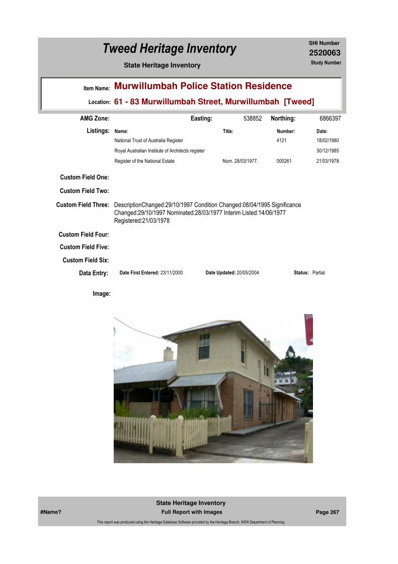
2520063
SHI Number
Tweed Heritage Inventory
Item Name: Murwillumbah Police Station Residence
Location: 61 - 83 Murwillumbah Street, Murwillumbah [Tweed]
State Heritage Inventory Study Number
Custom Field One:
Listings:
Date Updated: 20/05/2004 Status: PartialDate First Entered: 23/11/2000Data Entry:
Custom Field Two:
Custom Field Three: DescriptionChanged:29/10/1997 Condition Changed:08/04/1995 Significance Changed:29/10/1997 Nominated:28/03/1977 Interim Listed:14/06/1977 Registered:21/03/1978
Custom Field Four:
Custom Field Five:
Custom Field Six:
AMG Zone: Easting: 538852 Northing: 6866397
Name: Date:Number:Title:
National Trust of Australia Register 18/02/19804121
Royal Australian Institute of Architects register 30/12/1985
Register of the National Estate 21/03/1978000261Nom. 28/03/1977.
Image:
#Name? Page 267 Full Report with Images
State Heritage Inventory
This report was produced using the Heritage Database Software provided by the Heritage Branch, NSW Department of Planning.

2520063
SHI Number
Tweed Heritage Inventory
Item Name: Murwillumbah Police Station Residence
Location: 61 - 83 Murwillumbah Street, Murwillumbah [Tweed]
State Heritage Inventory Study Number
Caption: Murwillumbah Police Station residence.
Copyright: Tweed Heads Historical Society
Image by: Immy McKiernan
Image Date: 08/08/2003
Image Number:
Image Path:
Image File: 2520007b4.jpg
Thumb Nail Path:
Thumb Nail File: tn_2520007b4.jpg
#Name? Page 268 Full Report with Images
State Heritage Inventory
This report was produced using the Heritage Database Software provided by the Heritage Branch, NSW Department of Planning.
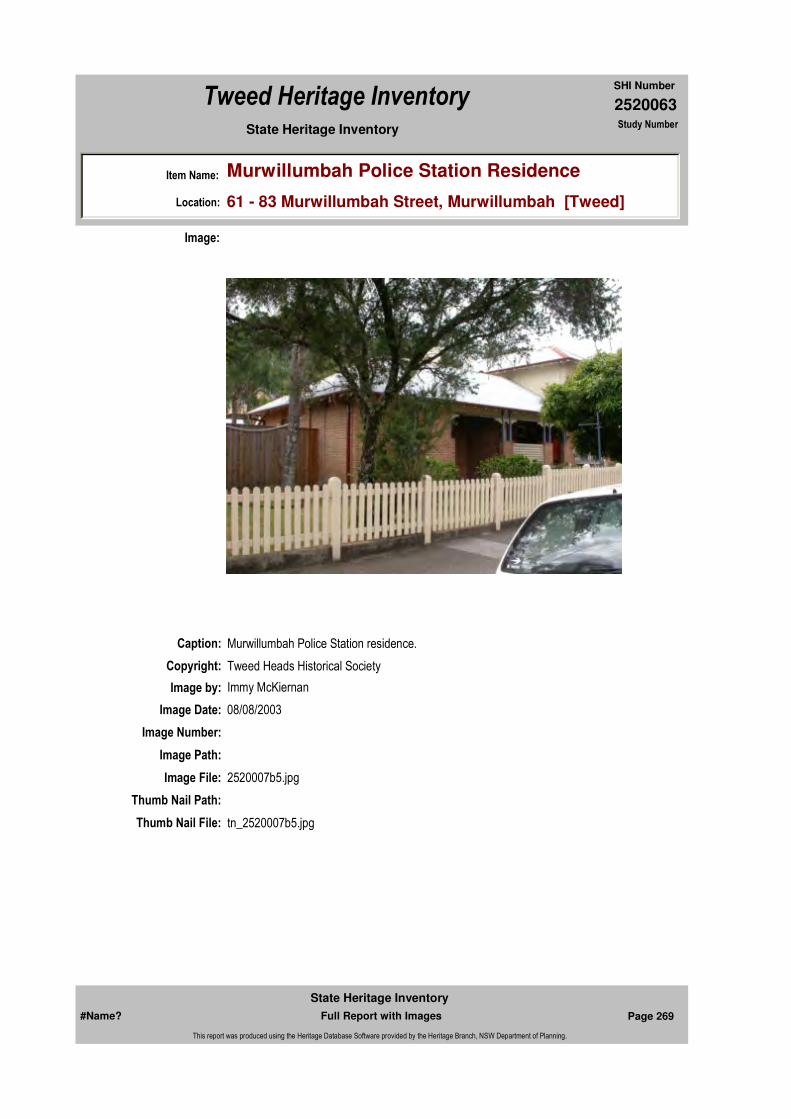
2520063
SHI Number
Tweed Heritage Inventory
Item Name: Murwillumbah Police Station Residence
Location: 61 - 83 Murwillumbah Street, Murwillumbah [Tweed]
State Heritage Inventory Study Number
Caption: Murwillumbah Police Station residence.
Copyright: Tweed Heads Historical Society
Image:
Image by: Immy McKiernan
Image Date: 08/08/2003
Image Number:
Image Path:
Image File: 2520007b5.jpg
Thumb Nail Path:
Thumb Nail File: tn_2520007b5.jpg
#Name? Page 269 Full Report with Images
State Heritage Inventory
This report was produced using the Heritage Database Software provided by the Heritage Branch, NSW Department of Planning.
2520063
SHI Number
Tweed Heritage Inventory
Item Name: Murwillumbah Police Station Residence
Location: 61 - 83 Murwillumbah Street, Murwillumbah [Tweed]
State Heritage Inventory Study Number
#Name? Page 270 Full Report with Images
State Heritage Inventory
This report was produced using the Heritage Database Software provided by the Heritage Branch, NSW Department of Planning.
2520065
SHI Number
Tweed Heritage Inventory
Item Name: Sacred Heart Roman Catholic Church Group
Location: Murwillumbah Street, Murwillumbah [Tweed]
State Heritage Inventory Study Number
Current Use:
Former Uses:
Statement of Significance:
The exuberant and showy buildings of the Roman Catholic Church Group include higher style, Carpenter and Interwar Gothic Churches, Federation Filigree Convent and the Queen Anne Presbytery. The Roman Catholic Church buildings are significant as part of the Murwillumbah Main Street Urban Conservation Area. The facades contribute to the character of the conservation precinct.
Historical Notes or Provenance:
Endorsed Significance:Assessed Significance: Local
Item Type: Complex / Group Category: Other - ReligionGroup: Religion
Admin Codes: 013993 Code 2: Code 3:
Curtilage/Boundary: Group includes timber convent and church, brick church, and presbytery, at the corner of Murwillumbah and Mooball Streets, Murwillumbah.
Owner: Religious Organisation
Other/Former Names:
Area/Group/Complex: Murwillumbah Main Street Urban Conservation Area Group ID: 27
Themes:
Aboriginal Area:
Local Govt Area: Tweed
Planning: Northern
Historic Region: North Coast
Address: #Name?
Suburb / Nearest Town: #Name?
State: NSW
Parish: Murwillumbah
County: Rous
Local Govt Area: Tweed
Planning: Northern
Historic Region: North Coast
Address: #Name?
Suburb / Nearest Town: #Name?
State: NSW
Parish: Murwillumbah
County: Rous
National Theme State Theme Local Theme
8. Culture Religion Church
#Name? Page 271 Full Report with Images
State Heritage Inventory
This report was produced using the Heritage Database Software provided by the Heritage Branch, NSW Department of Planning.

2520065
SHI Number
Tweed Heritage Inventory
Item Name: Sacred Heart Roman Catholic Church Group
Location: Murwillumbah Street, Murwillumbah [Tweed]
State Heritage Inventory Study Number
Physical Description: The Roman Catholic Church Group consists of the double storey timber convent, timber church hall, brick church and presbytery.The timber buildings are all good examples of regional timber architecture with emphasis on fine detailing and are in reasonable condition. Built - 1904Brick church of Interwar Gothic style is a large imposing brick structure of red brick with strong verticality and form, particularly the tower. It is in good condition Modification - 1934Community hall . Large Carpenter Gothic hall, former church, divided into two sections and expressed as two gable patched spaces clad in timber. reasonable conditionPresbytery - Queen Ann styleConvent - Federation Filigree, fine detailling
Physical Condition:
Modification Dates:
Designer:
Maker / Builder:
Year Started: 1904 Year Completed: 1938 Circa: No
Recommended
Management:Restore presbytery elevation. Conserve the exterior and interior elements of significance; adapt services and facilities to ensure continued use; remove redundant signs and signs which detract from the style of architecture; provide a suitable colour scheme which compliments the architecture and matches the aspirations of the building owner and tenant; restore damaged and missing original architectural features based on early photographs or technical drawings.
Further Comments:
Criteria a)
Criteria c) The exuberant and showy buildings of the Roman Catholic Church Group include higher style, Carpenter and Interwar Gothic Churches, Federation Filigree Convent and the Queen Anne Presbytery.
Criteria d)
Criteria e)
Criteria g) This item is aesthetically representative
Criteria f)
Integrity / Intactness:
Criteria b) The Roman Catholic Church buildings are significant as part of the Murwillumbah Main Street Urban Conservation Area. The facades contribute to the character of the conservation precinct.
Management:
#Name? Page 272 Full Report with Images
State Heritage Inventory
This report was produced using the Heritage Database Software provided by the Heritage Branch, NSW Department of Planning.
2520065
SHI Number
Tweed Heritage Inventory
Item Name: Sacred Heart Roman Catholic Church Group
Location: Murwillumbah Street, Murwillumbah [Tweed]
State Heritage Inventory Study Number
Custom Field One:
References:
Studies:
Listings:
Date Updated: 22/05/2004 Status: PartialDate First Entered: 20/12/2000Data Entry:
Custom Field Two: 1896 - 1938
Custom Field Three: DescriptionChanged:30/10/1997 Condition Changed:05/02/1996 Significance (nominators) Changed:18/09/1996 Nominated:12/01/1996
Custom Field Four:
Custom Field Five:
Custom Field Six:
Parcels:
Latitude: 0 Longitude: 0
AMG Zone: Easting: Northing:
Map Name: Map Scale:
Spatial Accuracy:Location validity:
Author Title YearNumber
Tweed Shire Council Community-based Heritage Study 2003
Name: Date:Number:Title:
Royal Australian Institute of Architects register 30/12/1985
Register of the National Estate - Interim 013993Indicative Place, Nom. 12/
Parcel Code LotNumber Section Plan Code Plan Number
LOT 2 DP 225827
#Name? Page 273 Full Report with Images
State Heritage Inventory
This report was produced using the Heritage Database Software provided by the Heritage Branch, NSW Department of Planning.

2520065
SHI Number
Tweed Heritage Inventory
Item Name: Sacred Heart Roman Catholic Church Group
Location: Murwillumbah Street, Murwillumbah [Tweed]
State Heritage Inventory Study Number
Caption: Early photograph of the first Sacred Heart Church, Murwillumbah. It is now the church hall.
Copyright: Tweed Heads Historical Society
Image:
Image by: Immy McKiernan
Image Date: 08/08/2003
Image Number:
Image Path:
Image File: 2520065b1.jpg
Thumb Nail Path:
Thumb Nail File: tn_2520065b1.jpg
#Name? Page 274 Full Report with Images
State Heritage Inventory
This report was produced using the Heritage Database Software provided by the Heritage Branch, NSW Department of Planning.

2520065
SHI Number
Tweed Heritage Inventory
Item Name: Sacred Heart Roman Catholic Church Group
Location: Murwillumbah Street, Murwillumbah [Tweed]
State Heritage Inventory Study Number
Caption: Side view of the Sacred Heart church hall.
Copyright: Tweed Heads Historical Society
Image:
Image by: Immy McKiernan
Image Date: 08/08/2003
Image Number:
Image Path:
Image File: 2520065b2.jpg
Thumb Nail Path:
Thumb Nail File: tn_2520065b2.jpg
#Name? Page 275 Full Report with Images
State Heritage Inventory
This report was produced using the Heritage Database Software provided by the Heritage Branch, NSW Department of Planning.

2520065
SHI Number
Tweed Heritage Inventory
Item Name: Sacred Heart Roman Catholic Church Group
Location: Murwillumbah Street, Murwillumbah [Tweed]
State Heritage Inventory Study Number
Caption: Street view of the first Sacred Heart church, now a hall.
Copyright: Tweed Heads Historical Society
Image:
Image by: Immy McKiernan
Image Date: 08/08/2003
Image Number:
Image Path:
Image File: 2520065b3.jpg
Thumb Nail Path:
Thumb Nail File: tn_2520065b3.jpg
#Name? Page 276 Full Report with Images
State Heritage Inventory
This report was produced using the Heritage Database Software provided by the Heritage Branch, NSW Department of Planning.

2520065
SHI Number
Tweed Heritage Inventory
Item Name: Sacred Heart Roman Catholic Church Group
Location: Murwillumbah Street, Murwillumbah [Tweed]
State Heritage Inventory Study Number
Caption: Street view of the first Sacred Heart church, now a hall, prior to recent renovations.
Copyright: Tweed Heads Historical Society
Image:
Image by: Immy McKiernan
Image Date: 08/08/2003
Image Number:
Image Path:
Image File: 2520065b4.jpg
Thumb Nail Path:
Thumb Nail File: tn_2520065b4.jpg
#Name? Page 277 Full Report with Images
State Heritage Inventory
This report was produced using the Heritage Database Software provided by the Heritage Branch, NSW Department of Planning.

2520065
SHI Number
Tweed Heritage Inventory
Item Name: Sacred Heart Roman Catholic Church Group
Location: Murwillumbah Street, Murwillumbah [Tweed]
State Heritage Inventory Study Number
Caption: The new Sacred Heart Church, built in the 1930's.
Copyright: Tweed Heads Historical Society
Image:
Image by: Immy McKiernan
Image Date: 08/08/2003
Image Number:
Image Path:
Image File: 2520065b5.jpg
Thumb Nail Path:
Thumb Nail File: tn_2520065b5.jpg
#Name? Page 278 Full Report with Images
State Heritage Inventory
This report was produced using the Heritage Database Software provided by the Heritage Branch, NSW Department of Planning.
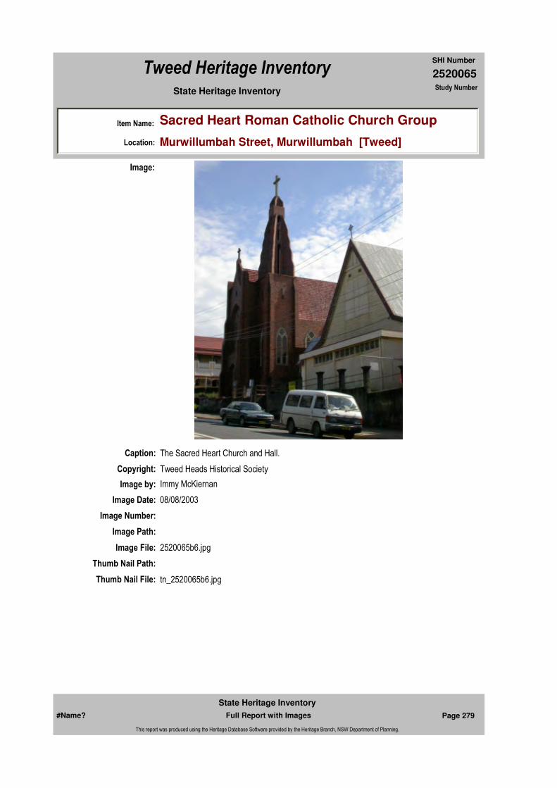
2520065
SHI Number
Tweed Heritage Inventory
Item Name: Sacred Heart Roman Catholic Church Group
Location: Murwillumbah Street, Murwillumbah [Tweed]
State Heritage Inventory Study Number
Caption: The Sacred Heart Church and Hall.
Copyright: Tweed Heads Historical Society
Image:
Image by: Immy McKiernan
Image Date: 08/08/2003
Image Number:
Image Path:
Image File: 2520065b6.jpg
Thumb Nail Path:
Thumb Nail File: tn_2520065b6.jpg
#Name? Page 279 Full Report with Images
State Heritage Inventory
This report was produced using the Heritage Database Software provided by the Heritage Branch, NSW Department of Planning.
2520065
SHI Number
Tweed Heritage Inventory
Item Name: Sacred Heart Roman Catholic Church Group
Location: Murwillumbah Street, Murwillumbah [Tweed]
State Heritage Inventory Study Number
#Name? Page 280 Full Report with Images
State Heritage Inventory
This report was produced using the Heritage Database Software provided by the Heritage Branch, NSW Department of Planning.
2520066
SHI Number
Tweed Heritage Inventory
Item Name: Mt St Patrick's Catholic School (former)
Location: Mooball Street, Murwillumbah [Tweed]
State Heritage Inventory Study Number
Current Use:
Former Uses:
Statement of Significance:
The Mt St Patrick's school has historic significance as the first private Catholic school on the Tweed and with it's association with the Roma Catholic Church.
Historical Notes or Provenance:
"The Catholic Parish of Murwillumbah Centenary 1989." compiled by Denise Banner.P 27 The first Catholic school at Murwillumbah was opened on 20 March, 1904, with more than 50 pupils arriving for class.
P30 The large piece of land extending from the Presbytery and Convent grounds to the Showgrounds was purchased c. 1915 as a school playground. The original state of this playground was a ti-tree swamp. At the same time the Church acquired another substantial piece of land on the opposite side of Queensland Road, on part of which tennis courts were constructed. These courts fell into disrepair over the years, but in 1984 new courts and facilities have been constructed on the same site.
P42 (1951) The primary school was suffering from overcrowding and a new infants school was planned. Following the erection of the new infants school, the total Primary School enrolment for 1953 was 336 pupils.
Endorsed Significance:Assessed Significance: Local
Item Type: Built Category: School - PrivateGroup: Education
Admin Codes: 013994 Code 2: Code 3:
Curtilage/Boundary: Corner of Mooball and Murwillumbah Streets, Murwillumbah.
Owner: Religious Organisation
Other/Former Names:
Area/Group/Complex: Group ID:
Aboriginal Area:
Local Govt Area: Tweed
Planning: Northern
Historic Region: North Coast
Address: #Name?
Suburb / Nearest Town: #Name?
State: NSW
Parish: Murwillumbah
County: Rous
Local Govt Area: Tweed
Planning: Northern
Historic Region: North Coast
Address: #Name?
Suburb / Nearest Town: #Name?
State: NSW
Parish:
County:
#Name? Page 281 Full Report with Images
State Heritage Inventory
This report was produced using the Heritage Database Software provided by the Heritage Branch, NSW Department of Planning.

2520066
SHI Number
Tweed Heritage Inventory
Item Name: Mt St Patrick's Catholic School (former)
Location: Mooball Street, Murwillumbah [Tweed]
State Heritage Inventory Study Number
Some time after 1989 the original primary school building was moved to the corner of Queensland Road and Ewing Street, the site of the tennis courts.
Physical Description: Simple Edwardian timber building, decorative arched gables. Modern hopper windows installed at front, near original entrance.
Physical Condition:
Modification Dates:
Designer:
Maker / Builder:
Year Started: Year Completed: Circa: No
Recommended Management:
References:
Further Comments:
Criteria a) The Mt St Patrick's school has historic significance as the first private Catholic school on the Tweed.
Criteria c) The Mt St Patrick's school has aesthetic significance.
Criteria d) The Mt St Patrick's school has social significance.
Criteria e)
Criteria g)
Criteria f)
Integrity / Intactness:
Criteria b)
Themes:
Management:
Author Title Year
Denise Banner. "The Catholic Parish of Murwillumbah Centenary 1989." 1989
National Theme State Theme Local Theme
6. Educating Education School
#Name? Page 282 Full Report with Images
State Heritage Inventory
This report was produced using the Heritage Database Software provided by the Heritage Branch, NSW Department of Planning.
2520066
SHI Number
Tweed Heritage Inventory
Item Name: Mt St Patrick's Catholic School (former)
Location: Mooball Street, Murwillumbah [Tweed]
State Heritage Inventory Study Number
Custom Field One:
Studies:
Listings:
Date Updated: 01/11/2004 Status: PartialDate First Entered: 20/12/2000Data Entry:
Custom Field Two:
Custom Field Three: DescriptionChanged:10/12/1996 Condition Changed:10/12/1996 Significance (nominators) Changed:10/12/1996 Nominated:28/12/1984
Custom Field Four:
Custom Field Five:
Custom Field Six:
Parcels:
Latitude: 0 Longitude: 0
AMG Zone: Easting: Northing:
Map Name: Map Scale:
Spatial Accuracy:Location validity:
Author Title YearNumber
Tweed Shire Council Community-based Heritage Study 2003
Name: Date:Number:Title:
National Trust of Australia Register 12/11/19794127
Register of the National Estate - Interim 013994Indicative Place, Nom. 28/
Parcel Code LotNumber Section Plan Code Plan Number
LOT 1 DP 873014
#Name? Page 283 Full Report with Images
State Heritage Inventory
This report was produced using the Heritage Database Software provided by the Heritage Branch, NSW Department of Planning.
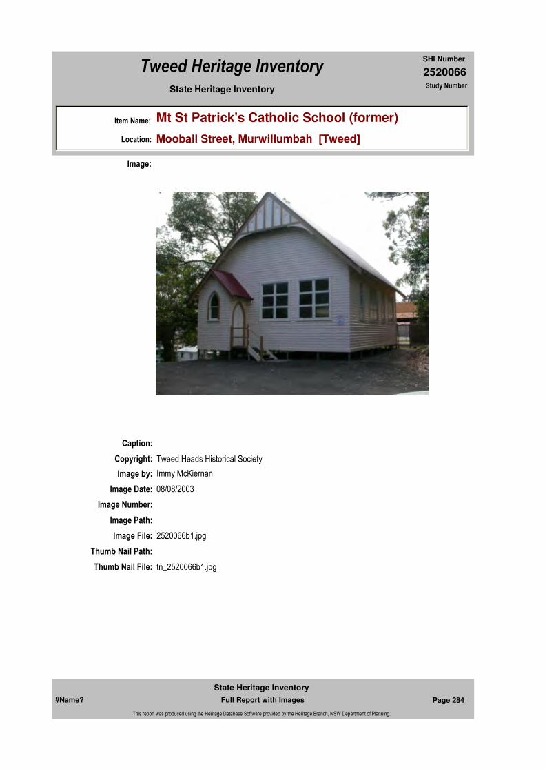
2520066
SHI Number
Tweed Heritage Inventory
Item Name: Mt St Patrick's Catholic School (former)
Location: Mooball Street, Murwillumbah [Tweed]
State Heritage Inventory Study Number
Caption:
Copyright: Tweed Heads Historical Society
Image:
Image by: Immy McKiernan
Image Date: 08/08/2003
Image Number:
Image Path:
Image File: 2520066b1.jpg
Thumb Nail Path:
Thumb Nail File: tn_2520066b1.jpg
#Name? Page 284 Full Report with Images
State Heritage Inventory
This report was produced using the Heritage Database Software provided by the Heritage Branch, NSW Department of Planning.

2520066
SHI Number
Tweed Heritage Inventory
Item Name: Mt St Patrick's Catholic School (former)
Location: Mooball Street, Murwillumbah [Tweed]
State Heritage Inventory Study Number
#Name? Page 285 Full Report with Images
State Heritage Inventory
This report was produced using the Heritage Database Software provided by the Heritage Branch, NSW Department of Planning.
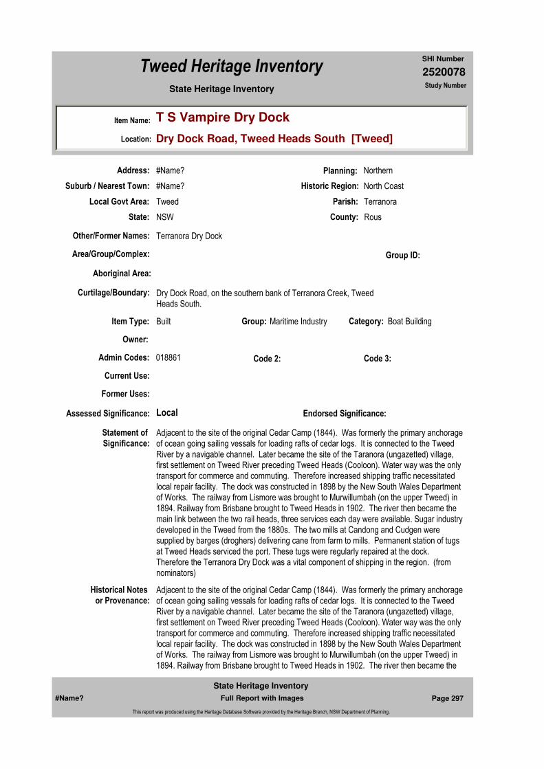
2520078
SHI Number
Tweed Heritage Inventory
Item Name: T S Vampire Dry Dock
Location: Dry Dock Road, Tweed Heads South [Tweed]
State Heritage Inventory Study Number
Current Use:
Former Uses:
Statement of
Significance:Adjacent to the site of the original Cedar Camp (1844). Was formerly the primary anchorage of ocean going sailing vessals for loading rafts of cedar logs. It is connected to the Tweed River by a navigable channel. Later became the site of the Taranora (ungazetted) village, first settlement on Tweed River preceding Tweed Heads (Cooloon). Water way was the only transport for commerce and commuting. Therefore increased shipping traffic necessitated local repair facility. The dock was constructed in 1898 by the New South Wales Department of Works. The railway from Lismore was brought to Murwillumbah (on the upper Tweed) in 1894. Railway from Brisbane brought to Tweed Heads in 1902. The river then became the main link between the two rail heads, three services each day were available. Sugar industry developed in the Tweed from the 1880s. The two mills at Candong and Cudgen were supplied by barges (droghers) delivering cane from farm to mills. Permanent station of tugs at Tweed Heads serviced the port. These tugs were regularly repaired at the dock. Therefore the Terranora Dry Dock was a vital component of shipping in the region. (from nominators)
Historical Notes
or Provenance:Adjacent to the site of the original Cedar Camp (1844). Was formerly the primary anchorage of ocean going sailing vessals for loading rafts of cedar logs. It is connected to the Tweed River by a navigable channel. Later became the site of the Taranora (ungazetted) village, first settlement on Tweed River preceding Tweed Heads (Cooloon). Water way was the only transport for commerce and commuting. Therefore increased shipping traffic necessitated local repair facility. The dock was constructed in 1898 by the New South Wales Department of Works. The railway from Lismore was brought to Murwillumbah (on the upper Tweed) in 1894. Railway from Brisbane brought to Tweed Heads in 1902. The river then became the
Endorsed Significance:Assessed Significance: Local
Item Type: Built Category: Boat BuildingGroup: Maritime Industry
Admin Codes: 018861 Code 2: Code 3:
Curtilage/Boundary: Dry Dock Road, on the southern bank of Terranora Creek, Tweed Heads South.
Owner:
Other/Former Names: Terranora Dry Dock
Area/Group/Complex: Group ID:
Aboriginal Area:
Local Govt Area: Tweed
Planning: Northern
Historic Region: North Coast
Address: #Name?
Suburb / Nearest Town: #Name?
State: NSW
Parish: Terranora
County: Rous
#Name? Page 297 Full Report with Images
State Heritage Inventory
This report was produced using the Heritage Database Software provided by the Heritage Branch, NSW Department of Planning.

2520078
SHI Number
Tweed Heritage Inventory
Item Name: T S Vampire Dry Dock
Location: Dry Dock Road, Tweed Heads South [Tweed]
State Heritage Inventory Study Number
main link between the two rail heads, three services each day were available. Sugar industry developed in the Tweed from the 1880s. The two mills at Candong and Cudgen were supplied by barges (droghers) delivering cane from farm to mills. Permanent station of tugs at Tweed Heads serviced the port. These tugs were regularly repaired at the dock.
Physical Description: The dry dock has been kept in reasonable condition. Built to last, it is a worthy costruction of its period. The dock gate was removed several years ago and replaced with a barrier of fabricated steel. The two buildings at the dockside were used for blacksmithing and engineering storing and purposes. One building was clad with corrugated iron and the other is in the act of repair. White ant infestation is prevalent.
Physical Condition:
Modification Dates:
Designer:
Maker / Builder:
Year Started: 1898 Year Completed: Circa: No
Recommended
Management:
References:
Further Comments:
Criteria a)
Criteria c) The Terranora Dry Dock was a vital component of shipping in the region.
Criteria d)
Criteria e)
Criteria g)
Criteria f)
Integrity / Intactness:
Criteria b)
Themes:
Management:
National Theme State Theme Local Theme
3. Economy Transport Dry Dock
#Name? Page 298 Full Report with Images
State Heritage Inventory
This report was produced using the Heritage Database Software provided by the Heritage Branch, NSW Department of Planning.

2520078
SHI Number
Tweed Heritage Inventory
Item Name: T S Vampire Dry Dock
Location: Dry Dock Road, Tweed Heads South [Tweed]
State Heritage Inventory Study Number
Custom Field One:
Studies:
Listings:
Date Updated: 03/11/2004 Status: PartialDate First Entered: 02/01/2001Data Entry:
Custom Field Two: 1898
Custom Field Three: DescriptionChanged:30/10/1997 Condition Changed:08/04/1995 Significance (nominators) Changed:30/10/1997 Nominated:03/07/1992
Custom Field Four:
Custom Field Five:
Custom Field Six:
Parcels:
Latitude: 0 Longitude: 0
AMG Zone: Easting: 551693 Northing: 6881190
Map Name: Map Scale:
Spatial Accuracy:Location validity:
Author Title YearNumber
Tweed Shire Council Community-based Heritage Study 2003
Name: Date:Number:Title:
Register of the National Estate - Interim 018861Indicative Place, Nom. 03/
Parcel Code LotNumber Section Plan Code Plan Number
LOT 7039 DP 92898
#Name? Page 299 Full Report with Images
State Heritage Inventory
This report was produced using the Heritage Database Software provided by the Heritage Branch, NSW Department of Planning.
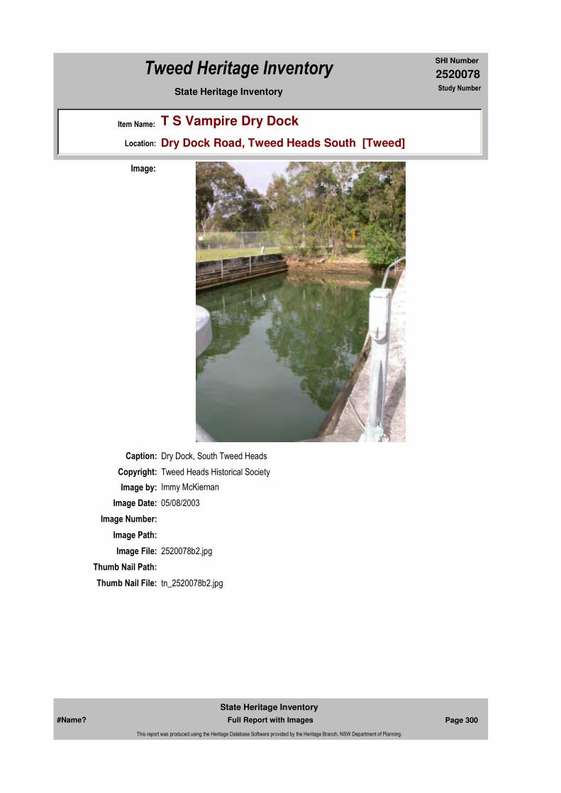
2520078
SHI Number
Tweed Heritage Inventory
Item Name: T S Vampire Dry Dock
Location: Dry Dock Road, Tweed Heads South [Tweed]
State Heritage Inventory Study Number
Caption: Dry Dock, South Tweed Heads
Copyright: Tweed Heads Historical Society
Image:
Image by: Immy McKiernan
Image Date: 05/08/2003
Image Number:
Image Path:
Image File: 2520078b2.jpg
Thumb Nail Path:
Thumb Nail File: tn_2520078b2.jpg
#Name? Page 300 Full Report with Images
State Heritage Inventory
This report was produced using the Heritage Database Software provided by the Heritage Branch, NSW Department of Planning.

2520078
SHI Number
Tweed Heritage Inventory
Item Name: T S Vampire Dry Dock
Location: Dry Dock Road, Tweed Heads South [Tweed]
State Heritage Inventory Study Number
Caption: Crane at the South Tweed Heads Dry Dock.
Copyright: Tweed Heads Historical Society
Image:
Image by: Immy McKiernan
Image Date: 05/08/2003
Image Number:
Image Path:
Image File: 2520078b3.jpg
Thumb Nail Path:
Thumb Nail File: tn_2520078b3.jpg
#Name? Page 301 Full Report with Images
State Heritage Inventory
This report was produced using the Heritage Database Software provided by the Heritage Branch, NSW Department of Planning.
2520078
SHI Number
Tweed Heritage Inventory
Item Name: T S Vampire Dry Dock
Location: Dry Dock Road, Tweed Heads South [Tweed]
State Heritage Inventory Study Number
Caption: Dry Dock South Tweed Heads.
Copyright: Tweed Heads Historical Society
Image:
Image by: Immy McKiernan
Image Date: 05/08/2003
Image Number:
Image Path:
Image File: 2520078b1.jpg
Thumb Nail Path:
Thumb Nail File: tn_2520078b1.jpg
#Name? Page 302 Full Report with Images
State Heritage Inventory
This report was produced using the Heritage Database Software provided by the Heritage Branch, NSW Department of Planning.

2520078
SHI Number
Tweed Heritage Inventory
Item Name: T S Vampire Dry Dock
Location: Dry Dock Road, Tweed Heads South [Tweed]
State Heritage Inventory Study Number
Caption: Building the Dry Dock South Tweed Heads in 1898.
Copyright: Tweed Heads Historical Society
Image:
Image by:
Image Date:
Image Number:
Image Path:
Image File: 2520078b4.jpg
Thumb Nail Path:
Thumb Nail File: tn_2520078b4.jpg
#Name? Page 303 Full Report with Images
State Heritage Inventory
This report was produced using the Heritage Database Software provided by the Heritage Branch, NSW Department of Planning.

2520078
SHI Number
Tweed Heritage Inventory
Item Name: T S Vampire Dry Dock
Location: Dry Dock Road, Tweed Heads South [Tweed]
State Heritage Inventory Study Number
#Name? Page 304 Full Report with Images
State Heritage Inventory
This report was produced using the Heritage Database Software provided by the Heritage Branch, NSW Department of Planning.

2520083
SHI Number
Tweed Heritage Inventory
Item Name: Uki Village Urban Conservation Area
Location: Uki [Tweed]
State Heritage Inventory Study Number
Current Use:
Former Uses:
Statement of
Significance:The village typifies a pattern of settlement no longer practiced. The elements of Uki: its landform and setting, its layout, its approaches, its views within and without the town, its buildings, all combine to form a townscape of high quality. The presence of a significant number of buildings which date from the first decades of development, and strongly reflect its history. It typifies the character of settlements in the Tweed and in northern New South Wales generally. (from nominators)
Historical Notes or Provenance:
Uki is believed to mean bandicoot in the local Yugembeh language. Lying at the foot of Wollumbin/Mt. Warning, the area is rich in cultural significance to many of the local original inhabitants. This is currently the subject of a detailed analysis under the Northern Rivers Catchment Management Plan. The village area was originally a reserve for travelling stock and in 1887 an unknown surveyor wrote on a map, "It has been suggested that should a village be proclaimed here, the name Uki should be adopted." The Village was never proclaimed but in 1905 the first land sales were held in the Uki Mechanics Institute, built in 1904.
The Village grew as the surrounding valleys were opened for selection. The usual commercial, educational and government services were provided as demand increased. A timber mill was built in 1908 and the butter factory opened in 1910. Other important buildings such as churches, the Hotel and the convent followed along with housing for workers, tradesmen and merchants.
The landforms of the region meant that Uki was an important service area for the many
Endorsed Significance:Assessed Significance: Local
Item Type: Built Category:Group:
Admin Codes: 014001 Code 2: Code 3:
Curtilage/Boundary: Uki, on the southern bank of the Tweed River, about 12 km south-south-west of Murwillumbah.
Owner:
Other/Former Names:
Area/Group/Complex: Group ID:
Aboriginal Area:
Local Govt Area: Tweed
Planning: Northern
Historic Region: North Coast
Address: #Name?
Suburb / Nearest Town: #Name?
State: NSW
Parish: Kunghur
County: Rous
#Name? Page 311 Full Report with Images
State Heritage Inventory
This report was produced using the Heritage Database Software provided by the Heritage Branch, NSW Department of Planning.

2520083
SHI Number
Tweed Heritage Inventory
Item Name: Uki Village Urban Conservation Area
Location: Uki [Tweed]
State Heritage Inventory Study Number
small creeks and valleys in the catchment area. It was also a vital link in communication with the Richmond River and the Tablelands. These factors remain despite modern transport, communication and changes to the rural economy. Floods and their effects have also shaped development and culture. Rainfall can measure 508mm in 24 hours so a feeling of isolation is common.
In 1954 and 1956,Uki and the South Arm suffered devastating floods. Bridges were lost, phone lines went down and roads destroyed. Houses were swept away by floodwaters, which reached their peak at 11.07 metres. These floods caused the relocation of several houses to other sites within the village.The death of the timber getting and more recently the dairying industry has meant changes in the rural industries and land use. This in turn has affected the village. The school has grown with children travelling by bus from the outlying areas where schools were closed due the fall in the rural population. The nature of services has changed with the adoption of modern technology and the village is still an important provider of cultural, commercial and educational opportunities.
During the 70's following the Aquarius Festival in nearby Nimbin, many new settlers or "alternatives" made their homes in the district and made a distinct contribution to the economy and cultural practices. They have become an accepted and integral part of the community. Assisted by State legislation for rural Multiple Occupancy, they were the beginning of a new wave of migration from urban areas. This is continuing but today's newcomers tend to be more affluent and to have higher expectations. In 1992, '93 and '95 Uki was a place getter in the Tidy Towns competition.
The population of the village has grown slowly and some modern infill housing and shops have been built as the village adapts to new requirements.
Despite many National Trust management recommendations not being followed, the village retains, and is proud of, many heritage features. In 2003, local residents old and new fought and won a battle against the building of a 6 unit multiple dwelling development on a steep ridge within the Heritage Conservation Area. (Report to TSC by Meredith Walker on behalf of The National Trust of Australia [N.S.W.] 1979.) As a result of this resident action, which was supported strongly by the wider community, Tweed Shire Council is formulating a Rural Village Strategy, which it is hoped will strengthen development constraints for Uki and other small Villages on the Tweed.
The story of the village typifies a continuing pattern of settlement in northern N.S.W., which has been shaped by the environment. Its natural setting is outstandingly beautiful and the village retains a townscape of high quality.
Significant buildings include the former butter factory, the Hall, the Post Office, the former Bank, Anglican Church, Mt. Warning Hotel, Catholic Church and former Convent, War Memorial. Various other items, including housing are also worthy of preservation. The buildings are modest in scale and architecture and were once commonplace but they are now rare and valuable as part of the history of Tweed Shire.
The buildings of significance are: the butter factory, the butcher's shop, former bakery
#Name? Page 312 Full Report with Images
State Heritage Inventory
This report was produced using the Heritage Database Software provided by the Heritage Branch, NSW Department of Planning.

2520083
SHI Number
Tweed Heritage Inventory
Item Name: Uki Village Urban Conservation Area
Location: Uki [Tweed]
State Heritage Inventory Study Number
(facing the Memorial Park), the hall (both buildings), the post office/newsagent, the former bank (now a residence), the hotel, the Church of England and the vicarage, the Catholic Church and vestry, the Masonic Hall, various houses, the older school building various other structures, the three bridges, the war memorial and the fence posts at the school.
Listing as a conservation area in the Tweed Local Environment Plan clause 42.
Physical Description: The buildings in Uki are modest in both scale and architecture. Along the main road are a collection of community buildings and uses: a hall (once the School of Arts), former butter factory, post office/newsagent, general store (four square), former bank, former bakery, State school, Church of England, and hotel, and a garage and panel beater. The buildings are typical of local style, and reflect the importance of timber in the growth and development of the district. Whilst buildings such as those in Uki might once have been commonplace, and not especially highly regarded by their users, such as those at Uki are extremely rare and valuable both in themselves and as part of local history. Not all the buildings listed below are of equal significance: but each makes its contribution to the townscape and is worthy of retention. The most significant buildings are those which are prominent in the town scene such as the hotel and the butter factory. @@The buildings of significance are: the butter factory, the butcher's shop, former bakery (facing the Memorial Park), the hall (both buildings), the post office/newsagent, the former bank (now a residence), the hotel, the Church of England and the vicarage, the Catholic Church and vestry, the Masonic Hall, various houses, the older school building various other structures, the three bridges, the war memorial and the fence posts at the school.Significant items in this precinct have been nominated individually.
Physical Condition:
Modification Dates:
Designer:
Maker / Builder:
Year Started: Year Completed: Circa: No
Recommended Management:
A Conservation Management Plan to be drawn up for this area.
Further Comments:
Criteria a) Uki is important in demonstrating a pattern of rural development in the cultural history of the Shire
Criteria c)
Criteria b)
Themes:
Management:
#Name? Page 313 Full Report with Images
State Heritage Inventory
This report was produced using the Heritage Database Software provided by the Heritage Branch, NSW Department of Planning.
2520083
SHI Number
Tweed Heritage Inventory
Item Name: Uki Village Urban Conservation Area
Location: Uki [Tweed]
State Heritage Inventory Study Number
Custom Field One:
References:
Studies:
Listings:
Date Updated: 03/11/2004 Status: PartialDate First Entered: 04/01/2001Data Entry:
Criteria d)
Criteria e)
Criteria g) Uki is outstanding for the esteem with which it is regarded by its community and visitors.
Criteria f) The unique qualities of Uki are under threat from continuing demands from development.
Integrity / Intactness:
Custom Field Two:
Custom Field Three: DescriptionChanged:30/10/1997 Condition Changed:08/04/1995 Significance (nominators) Changed:18/09/1996 Nominated:28/12/1984
Custom Field Four:
Custom Field Five: Kyogle Rd, Rolands Creek Rd, Main St, Mitchell Rd Murwillumbah, Dum Dum
Custom Field Six:
Parcels:
Latitude: 0 Longitude: 0
AMG Zone: Easting: Northing:
Map Name: Map Scale:
Spatial Accuracy:Location validity:
Author Title YearNumber
Tweed Shire Council Community-based Heritage Study 2003
Name: Date:Number:Title:
National Trust of Australia Register 5517
Register of the National Estate - Interim 014001Indicative Place, Nom. 28/
#Name? Page 314 Full Report with Images
State Heritage Inventory
This report was produced using the Heritage Database Software provided by the Heritage Branch, NSW Department of Planning.
2520083
SHI Number
Tweed Heritage Inventory
Item Name: Uki Village Urban Conservation Area
Location: Uki [Tweed]
State Heritage Inventory Study Number
#Name? Page 315 Full Report with Images
State Heritage Inventory
This report was produced using the Heritage Database Software provided by the Heritage Branch, NSW Department of Planning.
2520115
SHI Number
Tweed Heritage Inventory
Item Name: Mt St Patrick's Roman Catholic Church
Location: []
State Heritage Inventory Study Number
Current Use:
Former Uses:
Statement of
Significance:Part of the exuberant and showy buildings of the Roman Catholic Church Group, which includes higher style, Carpenter and Interwar Gothic Churches, Federation Filigree Convent and the Queen Anne Presbytery.
Historical Notes
or Provenance:
Physical Description:
Physical Condition:
Modification Dates:
Designer:
Maker / Builder:
Year Started: Year Completed: Circa: No
Recommended
Management:
Endorsed Significance:Assessed Significance:
Item Type: Built Category: ChurchGroup: Religion
Admin Codes: RECORDED Code 2: Country Code 3:
Curtilage/Boundary:
Owner: Religious Organisation
Other/Former Names:
Area/Group/Complex: Murwillumbah CBD Conservation Area Group ID: 27
Themes:
Aboriginal Area:
Management:
Local Govt Area: Tweed
Planning: Northern
Historic Region: North Coast
Address: #Name?
Suburb / Nearest Town: #Name?
State: NSW
Parish: Murwillumbah
County: Rous
#Name? Page 354 Full Report with Images
State Heritage Inventory
This report was produced using the Heritage Database Software provided by the Heritage Branch, NSW Department of Planning.
2520115
SHI Number
Tweed Heritage Inventory
Item Name: Mt St Patrick's Roman Catholic Church
Location: []
State Heritage Inventory Study Number
Custom Field One:
References:
Studies:
Listings:
Date Updated: 06/04/2004 Status: BasicDate First Entered: 02/10/1998Data Entry:
Further Comments: Mooball Street Corner Murwillumbah Street (part Of Romand Catholic Buildings Group - Card 1 Of 3)
Criteria a)
Criteria c)
Criteria d)
Criteria e)
Criteria g)
Criteria f)
Integrity / Intactness:
Custom Field Two:
Custom Field Three:
Custom Field Four:
Custom Field Five: Roman Catholic Buildings Group: Consisting Of: Roman Catholic Presbyter, Roman Catholic School
Custom Field Six:
Criteria b)
Parcels:
Latitude: Longitude:
AMG Zone: Easting: Northing:
Map Name: Map Scale: ADD
Spatial Accuracy:Location validity:
Author Title Year
National Trust of Australia (NSW) National Trust of Australia (NSW) 0
Author Title YearNumber
National Trust of Australia (NSW) National Trust Country Register
Name: Date:Number:Title:
National Trust of Australia Register 12/11/19794128
#Name? Page 355 Full Report with Images
State Heritage Inventory
This report was produced using the Heritage Database Software provided by the Heritage Branch, NSW Department of Planning.
2520115
SHI Number
Tweed Heritage Inventory
Item Name: Mt St Patrick's Roman Catholic Church
Location: []
State Heritage Inventory Study Number
#Name? Page 356 Full Report with Images
State Heritage Inventory
This report was produced using the Heritage Database Software provided by the Heritage Branch, NSW Department of Planning.
2520120
SHI Number
Tweed Heritage Inventory
Item Name: Tumbulgum Village Urban Conservation Area
Location: Riverside Drive, Tumbulgum [Tweed]
State Heritage Inventory Study Number
220
Current Use:
Former Uses:
Statement of
Significance:This village has an important association with Tweed history since the days of the cedar getters in the 1850's. The conservation area was the first major population and business area of the Tweed, prior to the development of Murwillumbah.
Historical Notes
or Provenance:
Physical Description: Significant items in this precinct have been nominated individually.
Physical Condition:
Modification Dates:
Designer:
Maker / Builder:
Year Started: Year Completed: Circa: No
Recommended Management:
A Conservation Management Plan to be drawn up for this area.
Endorsed Significance:Assessed Significance: Local
Item Type: Complex / Group Category: Other - CommercialGroup: Commercial
Admin Codes: CLASSIFIED Code 2: Country Code 3:
Curtilage/Boundary: Tumbulgum Urban Conservation Area: comprises Riverside Drive (and adjacent allotments Tweed River and Reserve) from Government Road north to the Alexander Twohill Bridge.
Owner: Multiple Owners
Other/Former Names:
Area/Group/Complex: Group ID:
Themes:
Aboriginal Area:
Local Govt Area: Tweed
Planning: Northern
Historic Region: North Coast
Address: #Name?
Suburb / Nearest Town: #Name?
State: NSW
Parish: Condong
County: Rous
#Name? Page 360 Full Report with Images
State Heritage Inventory
This report was produced using the Heritage Database Software provided by the Heritage Branch, NSW Department of Planning.
2520120
SHI Number
Tweed Heritage Inventory
Item Name: Tumbulgum Village Urban Conservation Area
Location: Riverside Drive, Tumbulgum [Tweed]
State Heritage Inventory Study Number
220
Custom Field One:
References:
Studies:
Listings:
Further Comments: Tumbulgum Urban Conservation Area: comprises Riverside Street (and adjacent allotments Tweed River and Reserve) from Government Road north to the 1987 Bridge over the Tweed River.
Criteria a)
Criteria c)
Criteria d)
Criteria e)
Criteria g)
Criteria f)
Integrity / Intactness:
Custom Field Two:
Custom Field Three:
Custom Field Four:
Custom Field Five:
Criteria b) Tumbulgum village has an association with Tweed history since the days of the cedar getters in the 1850's. The conservation area was the first major population and business area of the Tweed prior to the development of Murwillumbah.
Parcels:
Latitude: Longitude:
AMG Zone: Easting: Northing:
Map Name: Map Scale: ADD
Spatial Accuracy:Location validity:
Management:
Author Title Year
National Trust of Australia (NSW) National Trust of Australia (NSW) 0
Author Title YearNumber
National Trust of Australia (NSW) National Trust Country Register 220
Tweed Shire Council Community-based Heritage Study 2003
Name: Date:Number:Title:
National Trust of Australia Register 5491
#Name? Page 361 Full Report with Images
State Heritage Inventory
This report was produced using the Heritage Database Software provided by the Heritage Branch, NSW Department of Planning.
2520120
SHI Number
Tweed Heritage Inventory
Item Name: Tumbulgum Village Urban Conservation Area
Location: Riverside Drive, Tumbulgum [Tweed]
State Heritage Inventory Study Number
220
Date Updated: 18/05/2004 Status: BasicDate First Entered: 02/10/1998Data Entry:
Custom Field Six:
#Name? Page 362 Full Report with Images
State Heritage Inventory
This report was produced using the Heritage Database Software provided by the Heritage Branch, NSW Department of Planning.
2520123
SHI Number
Tweed Heritage Inventory
Item Name: Murwillumbah Railway Station and Yard Group
Location: Casino-Murwillumbah Railway, Murwillumbah [Tweed]
State Heritage Inventory Study Number
SRA193
Current Use:
Former Uses:
Statement of Significance:
Murwillimbah is a good example of a station constructed in the 1920's from pre cast concrete, the predominant material of the period of which relatively little has survived. The building is a substantial structure which has maintained the form of the earlier building with the change of material. It forms part of a group that contains a very good goods shed example and a rare water tank on a round brick base, only three of these were built, all on the north coast line.The station building has had some recent additions of poor quality which detract from significance.The site is also significant because of its connection with the carrying of vehicles on the Motorail service (no longer operating) and the facilities connected with that activity.
Historical Notes or Provenance:
Lismore - Murwillumbah railway line centenary Ron Johansen "Tales of our Times" Vol 03 page 26
Well, its 100 years this year since the first steam train chugged its way into Murwillumbah Railway Station, the first sod was turned on the Lismore - Murwillumbah line at Lismore on March 20, 1891 and on Christmas Eve 1894 the train pulled into Murwillumbah.But before the line was even started there was approximately 30 years of talk by the various departments concerned about where the railway was going to be built on the Far North Coast, on what towns it was going to link, whether it was going up to Tenterfield, what port it was going to service etc.
Endorsed Significance: StateAssessed Significance: State
Item Type: Complex / Group Category: Railway Platform/ StatiGroup: Transport - Rail
Admin Codes: 193 Code 2: Code 3:
Curtilage/Boundary: The listing boundary is formed by Bray St to the west (Pacific Highway), Railway St to the east the road crossing to the north a nd a line crossing the tracks opposite the end of Orme St connecting to the end of Railway St at the south end of the site.
Owner: State Rail Authority
Other/Former Names:
Area/Group/Complex: Group ID:
Aboriginal Area:
Local Govt Area: Tweed
Planning: Northern
Historic Region: North Coast
Address: #Name?
Suburb / Nearest Town: #Name?
State: NSW
Parish: Murwillumbah
County: Rous
#Name? Page 367 Full Report with Images
State Heritage Inventory
This report was produced using the Heritage Database Software provided by the Heritage Branch, NSW Department of Planning.
2520123
SHI Number
Tweed Heritage Inventory
Item Name: Murwillumbah Railway Station and Yard Group
Location: Casino-Murwillumbah Railway, Murwillumbah [Tweed]
State Heritage Inventory Study Number
SRA193
As usual the jealousies of different districts came to the fore, each wanting to be connected to the rail, which was only natural as the only other means of transport on the land was by horse-drawn vehicles.A public meeting was held in Lismore in 1881 and it was moved that a railway line be built from Byron Bay, Bexhill, Lismore Tenterfield. A letter in the Northern Star stated the line should be Lismore, Hanging Rock, Nimbin and along the floor of the Tweed Valley to Murwillumbah, it was claimed this was 17km shorter than going through Byron to Murwillumbah.The surveyors had been in the district more or less continuously for about 10 years, and in 1884 it was passed by Parliament for the line to be built from Grafton to the Tweed, at a cost of $980,000. By 1886 the plans for the first 20 miles was unanimously approved, but when submitted to the Legislative Council, that body by 17 votes to 7 called for a report, and in 1887 an officer was dispatched to the district to collect information. However, at this time an act was passed in parliament that any public works costing over £20,000 should be inquired into and reported by a parliamentary committee. Any work approved and not started lapsed and was automatically cancelled. Also at this time there was considerable instability in parliament and little was done about the railway.Then in 1889 Sir Henry Parkes came to power, and a great advocate for the line was Thomas Thomson Ewing, the member for Richmond, who fought long and hard for his electorate. The committee (of which Thomas Ewing was a member) that was set up, tabled their report and recommended that the Grafton-Murwillumbah line be proceeded with. The committee also stated that information regarding the route and results regarding surveys were not as complete as they would have liked. So the final result was that the railway from Lismore to Tweed should be the first section built.So it was on March 20,1891 that the first sod was turned at Lismore on the construction of the line, the forest was cleared just north of the present Lismore station for the ceremony and it was performed by Bruce Smith, Member for Richmond. A crowd of 8000 people attended the ceremony, two bullock were roasted for the public, and with free bread and free beer, who could afford to stay away? The silver spade to be used turning the first sod was late on arriving, so a workman's spade was used, decorated with ribbons. However, the silver spade is now in the Richmond River Historical Society's Museum in Lismore.The locomotives and rolling stock were all brought up by steamer from Sydney and unloaded at Lismore. It was decided to complete the Lismore-Mullumbimby section first. This was duly opened by May 1894 when the honourable W J Lynn came up from Sydney amid much flag waving. However the people of Brunswick Heads had a deputation to meet Mr Lynn expressing their disappointment of the railway bypassing Brunswick Heads. In earlier surveys the line was to go through their town and they felt they had been snubbed. So the next 39km to Murwillumbah was to be finished, this section included six steel bridges, seven tunnels and 35 level crossings.James Buckley, a long time resident of Stokers Siding, told years ago how his grandfather worked on the Burringbar, Stokers-Dunbible section and there was a small township at Dunbible including a general store, blacksmith's shop and hotel. Apparently there was also a big workers' camp at Dunbible.On Christmas Eve 1894, the first train arrived at Murwillumbah from Lismore. Although told there would be no official function on their arrival, they were a little non-plussed when only a few people bothered to turn up for the momentous occasion. It is not recorded how the passengers filled in their time before the 3.l5pm departure. Probably some walked to Buchanan's Condong Hotel (where sawmill is now), others probably walked to the ferry
#Name? Page 368 Full Report with Images
State Heritage Inventory
This report was produced using the Heritage Database Software provided by the Heritage Branch, NSW Department of Planning.

2520123
SHI Number
Tweed Heritage Inventory
Item Name: Murwillumbah Railway Station and Yard Group
Location: Casino-Murwillumbah Railway, Murwillumbah [Tweed]
State Heritage Inventory Study Number
SRA193
(Riverview Hotel now) and talked to the ferryman, Billy Doig, as he winched them across the river.However, at departure time, about 150 residents turned up for the historic occasion of the passengers return to Lismore, who by now had finally wiped the cinders from their eyes and had learnt to close the windows going through the tunnels. The critics looked at the rail line as going from "nowhere to nowhere" but the line did open up better lines of transport by linking us with the deep port of Byron Bay 1932 a bridge was built over the Clarence River replacing the rail ferry and the railway line was completed to Sydney.Between Lismore and Murwillumbah there were 24 stations with additional hailing stops. In 1930 it took over 24 hours to reach Sydney, the MotorRail was 16.5 hours in 1973, now the XPT takes 13.5 hours.In 1903 the Queensland Government extended the railway line from Nerang to Tweed Heads in anticipation of the NSW line coming from Murwillumbah. This missing link has been talked about for years, sometimes as election bait for political purposes only.For 100 years politicians of every colour have described the situation as scandalous, atrocious, disgraceful, shocking, shameful and outrageous to name a few. Maybe they will run out of words and then we'll get action. An old map of Murwillumbah shows a dotted line from the station, crossing the river north of Murwiilumbah and sweeps away off the map towards Queensland.Coal, the nostalgic engine whistle, the paper boy selling comics on the station, or maybe it's the refreshment room at Byron Bay where he had a few minutes to grab a solid railway pie or a cup of tea with what seemed permanent sandwiches, half finished and its"All Aboard!" But that's long ago, today its 'time' that counts as the XPT speeds through the north coast at night and we miss seeing the scenic wonders of this area.
See also: I. Dunn. 2002. Byways of Steam No 18. The Tweed Railway.
Physical Description: BUILDINGSstation building - type 12, pre cast concrete freight station, c. 1926 goods shed - side shed without awning with end platform, 1894 STRUCTURESplatform face - concrete/steel/brickwater tower - round brick base with cast iron tank over, c. 1894jib crane - T533, 1894
Designer:
Maker / Builder:
Year Started: Year Completed: Circa: No
Themes: National Theme State Theme Local Theme
3. Economy Transport Rail
#Name? Page 369 Full Report with Images
State Heritage Inventory
This report was produced using the Heritage Database Software provided by the Heritage Branch, NSW Department of Planning.
2520123
SHI Number
Tweed Heritage Inventory
Item Name: Murwillumbah Railway Station and Yard Group
Location: Casino-Murwillumbah Railway, Murwillumbah [Tweed]
State Heritage Inventory Study Number
SRA193
Physical Condition:
Modification Dates:
Recommended
Management:Council to pursue State Rail and associated departments to find a Conservation Management Plan with the objectives of securing significant items and proposing a scope of works for encouraging adaptive uses for the area.
References:
Studies:
Listings:
Further Comments:
Criteria a)
Criteria c)
Criteria d)
Criteria e)
Criteria g)
Criteria f) This item is assessed as historically rare. This item is assessed as scientifically rare. This item is assessed as arch. rare. This item is assessed as socially rare.
Integrity / Intactness:
Criteria b)
Parcels:
Latitude: Longitude:
AMG Zone: Easting: Northing:
Map Name: Map Scale:
Spatial Accuracy:Location validity:
Management:
Author Title YearNumber
State Rail Authority State Rail Authority Heritage Register Study 1999SRA193
Tweed Shire Council Community-based Heritage Study 2003
Name: Date:Number:Title:
Heritage Act - State Heritage Register 02/04/199901206
Heritage Act - s.170 NSW State agency heritage register
Parcel Code LotNumber Section Plan Code Plan Number
LOT 100 DP 865105
#Name? Page 370 Full Report with Images
State Heritage Inventory
This report was produced using the Heritage Database Software provided by the Heritage Branch, NSW Department of Planning.

2520123
SHI Number
Tweed Heritage Inventory
Item Name: Murwillumbah Railway Station and Yard Group
Location: Casino-Murwillumbah Railway, Murwillumbah [Tweed]
State Heritage Inventory Study Number
SRA193
Custom Field One:
Date Updated: 22/11/2006 Status: BasicDate First Entered: 26/10/1999Data Entry:
Custom Field Two: 935
Custom Field Three: SRA of NSW
Custom Field Four: SRA of NSW \ RAC
Custom Field Five: 12 freight station
Custom Field Six:
Caption: Murwillumbah Railway platform and Station looking south.
Copyright: Tweed Heads Historical Society
Image:
Image by: Immy McKiernan
Image Date: 08/08/2003
Image Number:
Image Path:
Image File: 2520123b4.jpg
#Name? Page 371 Full Report with Images
State Heritage Inventory
This report was produced using the Heritage Database Software provided by the Heritage Branch, NSW Department of Planning.

2520123
SHI Number
Tweed Heritage Inventory
Item Name: Murwillumbah Railway Station and Yard Group
Location: Casino-Murwillumbah Railway, Murwillumbah [Tweed]
State Heritage Inventory Study Number
SRA193
Thumb Nail Path:
Thumb Nail File: tn_2520123b4.jpg
#Name? Page 372 Full Report with Images
State Heritage Inventory
This report was produced using the Heritage Database Software provided by the Heritage Branch, NSW Department of Planning.

2520123
SHI Number
Tweed Heritage Inventory
Item Name: Murwillumbah Railway Station and Yard Group
Location: Casino-Murwillumbah Railway, Murwillumbah [Tweed]
State Heritage Inventory Study Number
SRA193
Caption: Street façade of Murwillumbah Railway Station
Copyright: Tweed Heads Historical Society
Image:
Image by: Immy McKiernan
Image Date: 08/08/2003
Image Number:
Image Path:
Image File: 2520123b1.jpg
Thumb Nail Path:
Thumb Nail File: tn_2520123b1.jpg
#Name? Page 373 Full Report with Images
State Heritage Inventory
This report was produced using the Heritage Database Software provided by the Heritage Branch, NSW Department of Planning.

2520123
SHI Number
Tweed Heritage Inventory
Item Name: Murwillumbah Railway Station and Yard Group
Location: Casino-Murwillumbah Railway, Murwillumbah [Tweed]
State Heritage Inventory Study Number
SRA193
Caption: Murwillumbah Railway platform and Station looking south.
Copyright: Tweed Heads Historical Society
Image:
Image by: Immy McKiernan
Image Date: 08/08/2003
Image Number:
Image Path:
Image File: 2520123b2.jpg
Thumb Nail Path:
Thumb Nail File: tn_2520123b2.jpg
#Name? Page 374 Full Report with Images
State Heritage Inventory
This report was produced using the Heritage Database Software provided by the Heritage Branch, NSW Department of Planning.
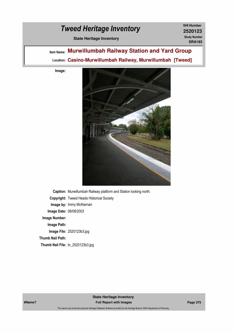
2520123
SHI Number
Tweed Heritage Inventory
Item Name: Murwillumbah Railway Station and Yard Group
Location: Casino-Murwillumbah Railway, Murwillumbah [Tweed]
State Heritage Inventory Study Number
SRA193
Caption: Murwillumbah Railway platform and Station looking north.
Copyright: Tweed Heads Historical Society
Image:
Image by: Immy McKiernan
Image Date: 08/08/2003
Image Number:
Image Path:
Image File: 2520123b3.jpg
Thumb Nail Path:
Thumb Nail File: tn_2520123b3.jpg
#Name? Page 375 Full Report with Images
State Heritage Inventory
This report was produced using the Heritage Database Software provided by the Heritage Branch, NSW Department of Planning.

2520123
SHI Number
Tweed Heritage Inventory
Item Name: Murwillumbah Railway Station and Yard Group
Location: Casino-Murwillumbah Railway, Murwillumbah [Tweed]
State Heritage Inventory Study Number
SRA193
Caption: Murwillumbah Railway Barracks
Copyright: Tweed Heads Historical Society
Image:
Image by: Immy McKiernan
Image Date: 15/01/2004
Image Number:
Image Path:
Image File: 2520123b5.jpg
Thumb Nail Path:
Thumb Nail File: tn_2520123b5.jpg
#Name? Page 376 Full Report with Images
State Heritage Inventory
This report was produced using the Heritage Database Software provided by the Heritage Branch, NSW Department of Planning.
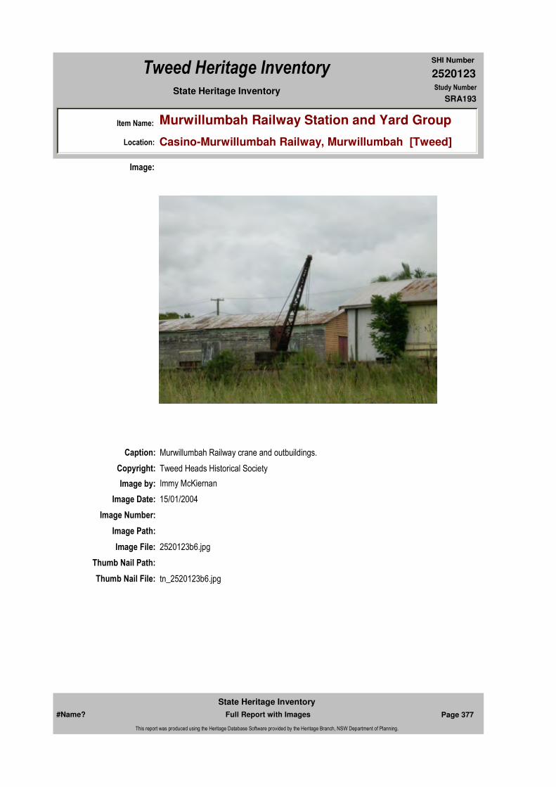
2520123
SHI Number
Tweed Heritage Inventory
Item Name: Murwillumbah Railway Station and Yard Group
Location: Casino-Murwillumbah Railway, Murwillumbah [Tweed]
State Heritage Inventory Study Number
SRA193
Caption: Murwillumbah Railway crane and outbuildings.
Copyright: Tweed Heads Historical Society
Image:
Image by: Immy McKiernan
Image Date: 15/01/2004
Image Number:
Image Path:
Image File: 2520123b6.jpg
Thumb Nail Path:
Thumb Nail File: tn_2520123b6.jpg
#Name? Page 377 Full Report with Images
State Heritage Inventory
This report was produced using the Heritage Database Software provided by the Heritage Branch, NSW Department of Planning.
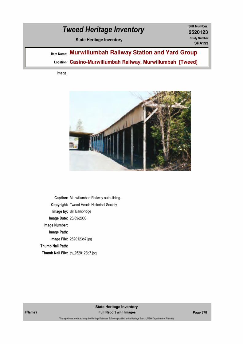
2520123
SHI Number
Tweed Heritage Inventory
Item Name: Murwillumbah Railway Station and Yard Group
Location: Casino-Murwillumbah Railway, Murwillumbah [Tweed]
State Heritage Inventory Study Number
SRA193
Caption: Murwillumbah Railway outbuilding.
Copyright: Tweed Heads Historical Society
Image:
Image by: Bill Bainbridge
Image Date: 25/09/2003
Image Number:
Image Path:
Image File: 2520123b7.jpg
Thumb Nail Path:
Thumb Nail File: tn_2520123b7.jpg
#Name? Page 378 Full Report with Images
State Heritage Inventory
This report was produced using the Heritage Database Software provided by the Heritage Branch, NSW Department of Planning.

2520123
SHI Number
Tweed Heritage Inventory
Item Name: Murwillumbah Railway Station and Yard Group
Location: Casino-Murwillumbah Railway, Murwillumbah [Tweed]
State Heritage Inventory Study Number
SRA193
Caption: Murwillumbah Railway Station and tracks.
Copyright: Tweed Heads Historical Society
Image:
Image by: Immy McKiernan
Image Date: 15/01/2004
Image Number:
Image Path:
Image File: 2520123b8.jpg
Thumb Nail Path:
Thumb Nail File: tn_2520123b8.jpg
#Name? Page 379 Full Report with Images
State Heritage Inventory
This report was produced using the Heritage Database Software provided by the Heritage Branch, NSW Department of Planning.
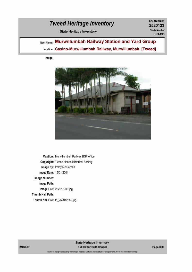
2520123
SHI Number
Tweed Heritage Inventory
Item Name: Murwillumbah Railway Station and Yard Group
Location: Casino-Murwillumbah Railway, Murwillumbah [Tweed]
State Heritage Inventory Study Number
SRA193
Caption: Murwillumbah Railway BGF office.
Copyright: Tweed Heads Historical Society
Image:
Image by: Immy McKiernan
Image Date: 15/01/2004
Image Number:
Image Path:
Image File: 2520123b9.jpg
Thumb Nail Path:
Thumb Nail File: tn_2520123b9.jpg
#Name? Page 380 Full Report with Images
State Heritage Inventory
This report was produced using the Heritage Database Software provided by the Heritage Branch, NSW Department of Planning.

2520123
SHI Number
Tweed Heritage Inventory
Item Name: Murwillumbah Railway Station and Yard Group
Location: Casino-Murwillumbah Railway, Murwillumbah [Tweed]
State Heritage Inventory Study Number
SRA193
Caption: Murwillumbah Railway carriage and tracks.
Copyright: Tweed Heads Historical Society
Image:
Image by: Immy McKiernan
Image Date: 15/01/2004
Image Number:
Image Path:
Image File: 2520123b10.jpg
Thumb Nail Path:
Thumb Nail File: tn_2520123b10.jpg
#Name? Page 381 Full Report with Images
State Heritage Inventory
This report was produced using the Heritage Database Software provided by the Heritage Branch, NSW Department of Planning.
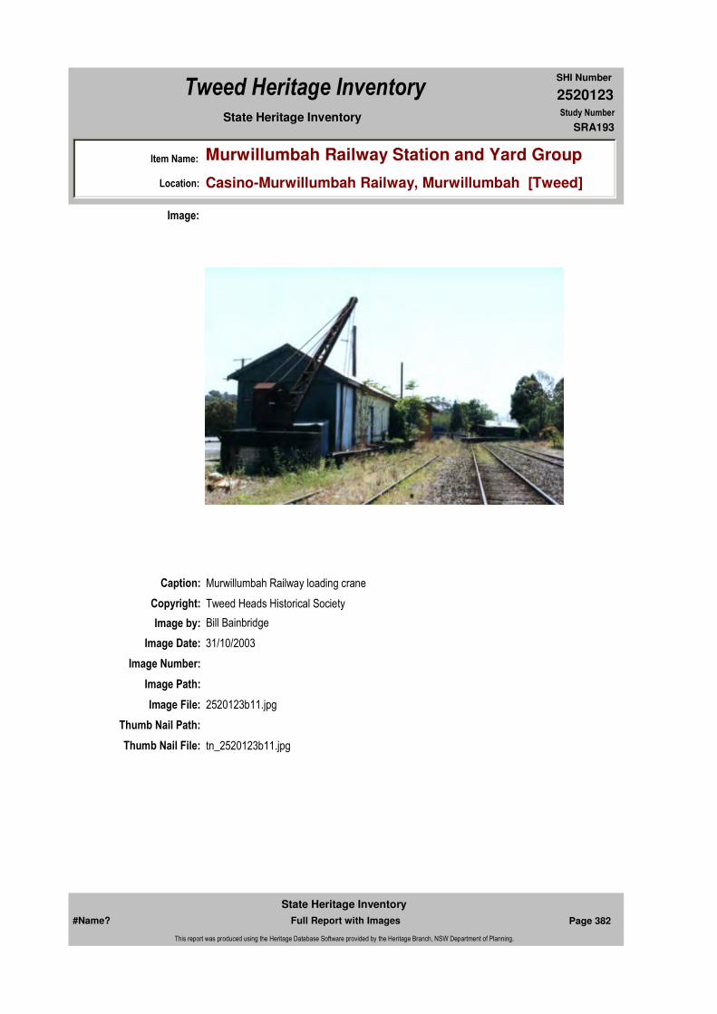
2520123
SHI Number
Tweed Heritage Inventory
Item Name: Murwillumbah Railway Station and Yard Group
Location: Casino-Murwillumbah Railway, Murwillumbah [Tweed]
State Heritage Inventory Study Number
SRA193
Caption: Murwillumbah Railway loading crane
Copyright: Tweed Heads Historical Society
Image:
Image by: Bill Bainbridge
Image Date: 31/10/2003
Image Number:
Image Path:
Image File: 2520123b11.jpg
Thumb Nail Path:
Thumb Nail File: tn_2520123b11.jpg
#Name? Page 382 Full Report with Images
State Heritage Inventory
This report was produced using the Heritage Database Software provided by the Heritage Branch, NSW Department of Planning.

2520123
SHI Number
Tweed Heritage Inventory
Item Name: Murwillumbah Railway Station and Yard Group
Location: Casino-Murwillumbah Railway, Murwillumbah [Tweed]
State Heritage Inventory Study Number
SRA193
Caption: Murwillumbah Railway water tower
Copyright: Tweed Heads Historical Society
Image:
Image by: Immy McKiernan
Image Date: 15/01/2004
Image Number:
Image Path:
Image File: 2520123b12.jpg
Thumb Nail Path:
Thumb Nail File: tn_2520123b12.jpg
#Name? Page 383 Full Report with Images
State Heritage Inventory
This report was produced using the Heritage Database Software provided by the Heritage Branch, NSW Department of Planning.
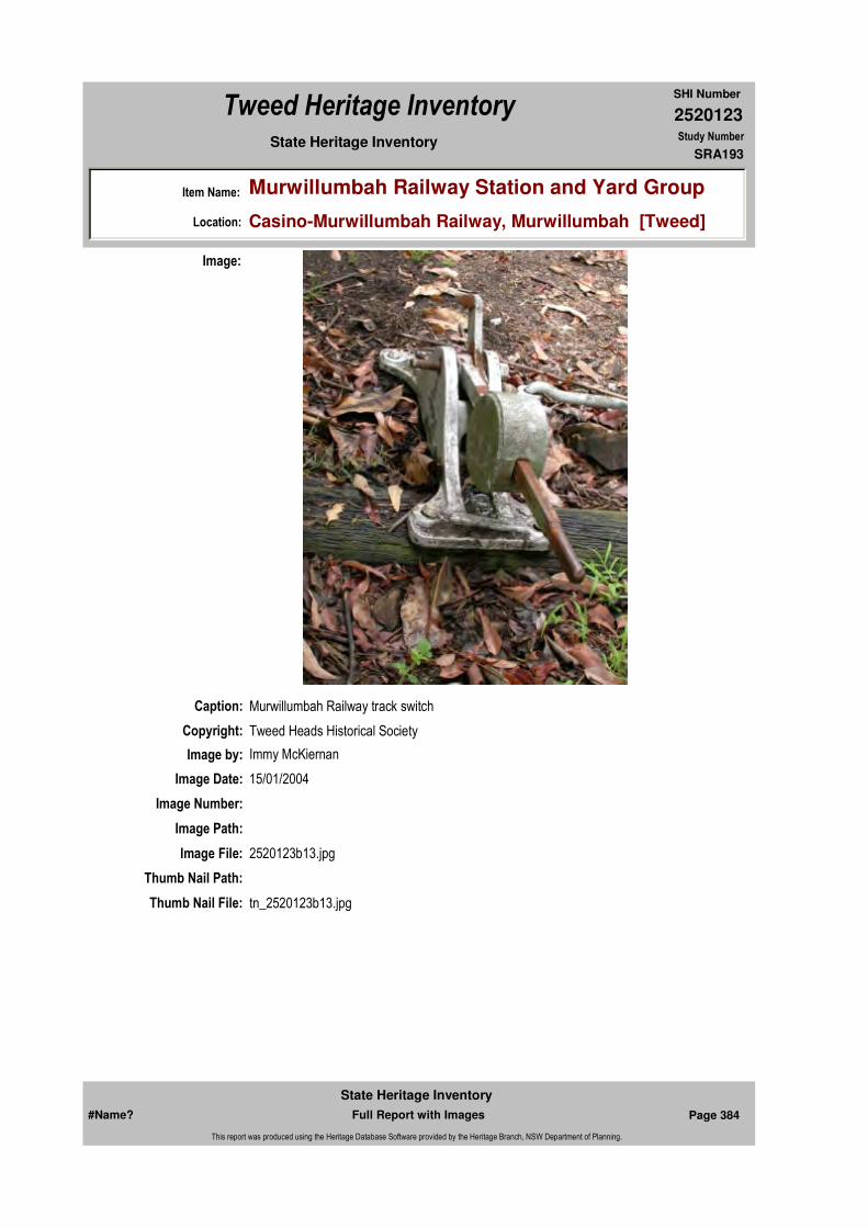
2520123
SHI Number
Tweed Heritage Inventory
Item Name: Murwillumbah Railway Station and Yard Group
Location: Casino-Murwillumbah Railway, Murwillumbah [Tweed]
State Heritage Inventory Study Number
SRA193
Caption: Murwillumbah Railway track switch
Copyright: Tweed Heads Historical Society
Image:
Image by: Immy McKiernan
Image Date: 15/01/2004
Image Number:
Image Path:
Image File: 2520123b13.jpg
Thumb Nail Path:
Thumb Nail File: tn_2520123b13.jpg
#Name? Page 384 Full Report with Images
State Heritage Inventory
This report was produced using the Heritage Database Software provided by the Heritage Branch, NSW Department of Planning.
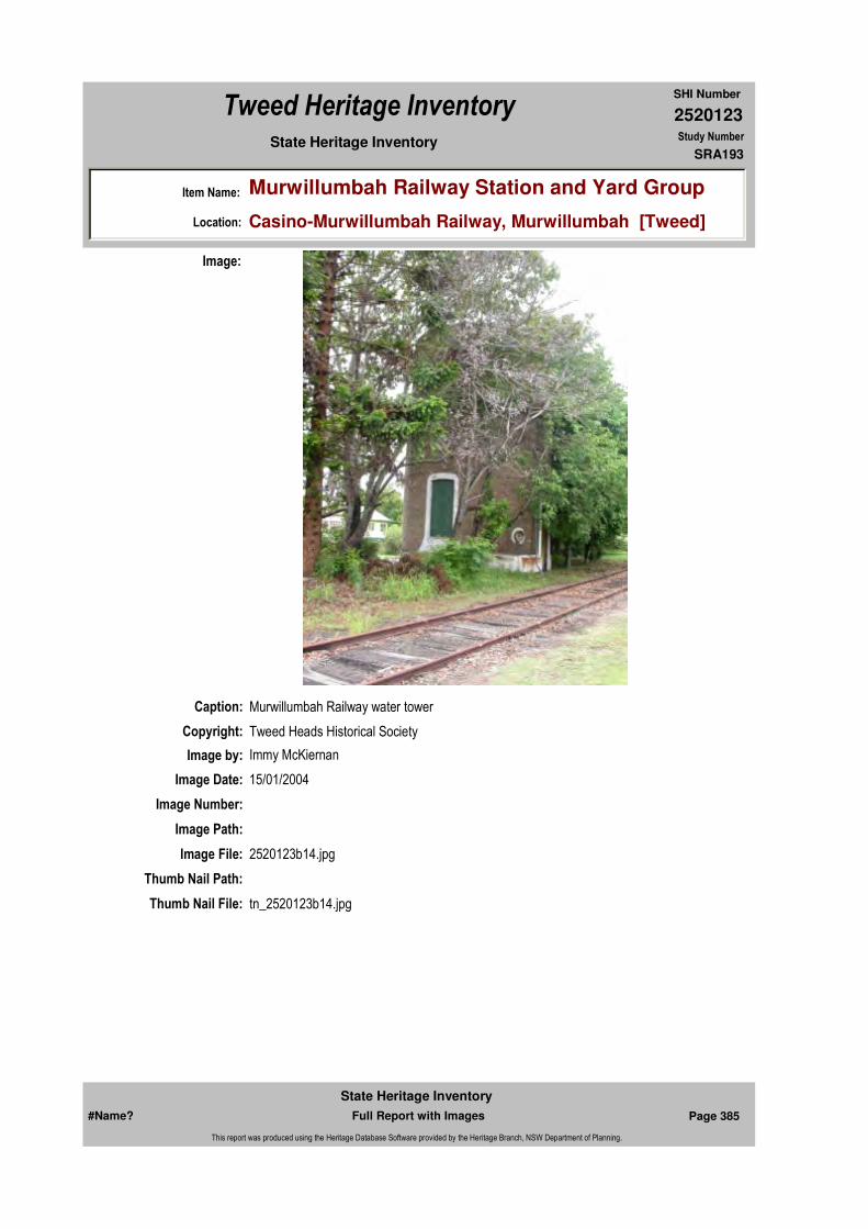
2520123
SHI Number
Tweed Heritage Inventory
Item Name: Murwillumbah Railway Station and Yard Group
Location: Casino-Murwillumbah Railway, Murwillumbah [Tweed]
State Heritage Inventory Study Number
SRA193
Caption: Murwillumbah Railway water tower
Copyright: Tweed Heads Historical Society
Image:
Image by: Immy McKiernan
Image Date: 15/01/2004
Image Number:
Image Path:
Image File: 2520123b14.jpg
Thumb Nail Path:
Thumb Nail File: tn_2520123b14.jpg
#Name? Page 385 Full Report with Images
State Heritage Inventory
This report was produced using the Heritage Database Software provided by the Heritage Branch, NSW Department of Planning.

2520123
SHI Number
Tweed Heritage Inventory
Item Name: Murwillumbah Railway Station and Yard Group
Location: Casino-Murwillumbah Railway, Murwillumbah [Tweed]
State Heritage Inventory Study Number
SRA193
Caption: Location Plan
Copyright: State Rail Authority
Image:
Image by:
Image Date:
Image Number:
Image Path:
Image File: 4440193s.jpg
Thumb Nail Path:
Thumb Nail File:
#Name? Page 386 Full Report with Images
State Heritage Inventory
This report was produced using the Heritage Database Software provided by the Heritage Branch, NSW Department of Planning.
2520123
SHI Number
Tweed Heritage Inventory
Item Name: Murwillumbah Railway Station and Yard Group
Location: Casino-Murwillumbah Railway, Murwillumbah [Tweed]
State Heritage Inventory Study Number
SRA193
#Name? Page 387 Full Report with Images
State Heritage Inventory
This report was produced using the Heritage Database Software provided by the Heritage Branch, NSW Department of Planning.

2520124
SHI Number
Tweed Heritage Inventory
Item Name: Hotel Victory
Location: Pacific Highway, Mooball [Tweed]
State Heritage Inventory Study Number
Current Use: Hotel
Former Uses: Hotel
Statement of
Significance:The Hotel Victory is a good example of the characteristics of a 1930's country brick hotel, which has served the social needs of the community for 70 years.
Historical Notes or Provenance:
Once upon a time in the Tweed Valley there were two sleepy hamlets, they were situated very close together and the people were very friendly towards each other.
One hamlet had shops, a hotel and a railway station. The other had a shop and a railway station.Then one dismal day in 1931 the hotel and its parlour were destroyed by fire, along with Grays Bakery and store.
A temporary bar was erected among the ashes and the people could still get their beer.
Then the people learned that the owner, Mr. Jack Watterson, was going to rebuild beside the main road in the neighbouring village of Mooball, presumably to pick up the passing trade, although cars were few and there was no bitumen and no .05 limit.
This made the people of Burringbar very angry and they started a petition to have the pub rebuilt on the old site.
Donations were sought to bring a barrister from Sydney to fight their cause in court.
Although it was the depression years money flowed in. Of course the Mooball people wanted the pub in their village. With no radical greenies, environmentalists or electoral lobbies (they
Endorsed Significance:Assessed Significance: Local
Item Type: Built Category: HotelGroup: Commercial
Admin Codes: Y Code 2: NC Code 3:
Curtilage/Boundary:
Owner: Private - Individual
Other/Former Names:
Area/Group/Complex: Group ID:
Aboriginal Area:
Local Govt Area: Tweed
Planning: Northern
Historic Region: North Coast
Address: #Name?
Suburb / Nearest Town: #Name?
State: NSW
Parish: Mooball
County: Rous
#Name? Page 388 Full Report with Images
State Heritage Inventory
This report was produced using the Heritage Database Software provided by the Heritage Branch, NSW Department of Planning.

2520124
SHI Number
Tweed Heritage Inventory
Item Name: Hotel Victory
Location: Pacific Highway, Mooball [Tweed]
State Heritage Inventory Study Number
were still 40 years away) to side track the people the issues were clear.
The day of the court case, held in Murwillumbah, arrived. Not even a placard or a demonstrator was outside the courthouse, possibly because T.V. had not yet arrived.
The people of both communities waited with bated breath, the judge have his decision and Mr. Watterson won.
An appeal was held in Sydney, but to no avail.
The people of Burringbar were outraged and said the case was fixed and vowed never to set foot in the Mooball pub. So instead of becoming a village with no beer they formed a club, obtained a licence and had their beer in a room at the back of Alex Phillip's garage.
The community was split. Mooball withdrew all players from the combined sporting teams and formed their own cricket, hockey and vigoro clubs and when Burringbar met Mooball it was a clash with a vengeance.
Sergeant Wilde was the policeman stationed at Burringbar with his calm approach and popularity was able to keep the peace. And so the pub was built in Mooball, filling for the site was carted by a german wagon pulled by six bullocks from what is now Quinn's Farm over the railway line and when the building was finished Mr. Watterson rubbed salt into the wounds by calling it the Victory Hotel.
Some of the old timers never set foot in the pub and as their sons grew up they went there secretly without their knowledge.
And as time healeth all things, 20 years later the two villages again combined and form a hockey club, and not to mention any names they called it The Waratahs.
Now 60 years later, the pub story is part of local history, the people are back on neighbourly terms, the houses are nearly joined between the two villages, nobody worries where the boundaries are and Burringbar has its Post Office approximately on the old pub site and Mooball has its Victory Hotel. See you in the bar! ("Tales of our Times")
NEW HOTEL AT MOOBALL Imposing Building with Modern Improvements
The new hotel now being erected at Mooball for Mr J H C Watterson is replacing the old, wooden hotel at Burringbar, recently destroyed by fire.
The new building contains the most modern improvements, with bar, private parlours, spacious lounges on both floors and dining rooms, writing rooms, music room, large airy bedrooms, ample bathing accommodation, laundries and garages, and sleep-out accommodation.
#Name? Page 389 Full Report with Images
State Heritage Inventory
This report was produced using the Heritage Database Software provided by the Heritage Branch, NSW Department of Planning.
2520124
SHI Number
Tweed Heritage Inventory
Item Name: Hotel Victory
Location: Pacific Highway, Mooball [Tweed]
State Heritage Inventory Study Number
In addition, the hotel will be completed with modern hot and cold water services, and scientifically sewered. It also will be equipped with a complete electric light and power plant.
The building is being constructed of brick, concrete and steel, with ornamental ceilings, and the internal furnishings are of selected Australian figured timbers.
The construction is well in hand and, when completed, will be one of the most up-to-date country hotels in the State. It will be opened to the public during March of next year.
The contract of the hotel is being carried out by Mr H W Stevenson, builder, of Lismore, and Mr W H Jones, A R A I A, of Lismore, and Murwillumbah, is the architect.
HISTORY OF BURRINGBAR HOTELSThe first hotel in this district was situated on what is now known as Jervis's Hill, midway between Crabbes Creek and Billinudgel, where an hotel also existed at that time. As the pioneers worked north and new settlements opened, so also did the business follow and in 1889 a two-storey hotel, built of sawn beech timber, was erected on the original site for the village of Burringbar. This hotel was built on what is now known as Strong Bros. Property and Mr W L Murphy, of Burringbar, was the first proprietor.About 1890 a rather box shaped two storey hotel was built at Burringbar on the hill near the present day residence of Mr W L Murphy. The hotel, known as the "Pioneer", was conducted by two sisters who had come from Brisbane.
With the erection of the railway line to Murwillumbah in the mid "Nineties", a siding was constructed at Burringbar and accordingly Mr Murphy removed his hotel about three-quarters of a mile to Burringbar. For about 12 months there were then two two storey hotels at Burringbar, after which time Mr Murphy purchased the "Pioneer", demolished it, and erected cottages with the material.
Some short time later the Burringbar Hotel was destroyed by fire and Mr Murphy erected a single storey building which he sold to the late James Gill, who added another storey. The next owner of the hotel was the late John Devereaux who extensively improved its appearance and inside fittings. From his estate the building was purchased by the present owner of the license, Mr J H C Watterson.
This hotel was destroyed by fire on October 22nd, 1932 and upon application to the Licensing Court, permission was first refused for construction of the new brick hotel at Mooball, instead of Burringbar. Upon appeal to the District Court the decision was reversed and permission granted.
While the railway was under construction two hotels were conducted on the Upper Burringbar side of the "big tunnel" and one at the Stoker's Siding incline. The principle of these hotels was the "Munster", a large sawn timber single storey building erected in 1902 on Mr John Mills' property in front of his present home. This hotel was conducted by Mr Thomas Ryan, then by Mr W Horell and finally by Mr John Mills himself, who later demolished it in 1906.
While the early hotels flourished at Burringbar great support was forthcoming from the
#Name? Page 390 Full Report with Images
State Heritage Inventory
This report was produced using the Heritage Database Software provided by the Heritage Branch, NSW Department of Planning.

2520124
SHI Number
Tweed Heritage Inventory
Item Name: Hotel Victory
Location: Pacific Highway, Mooball [Tweed]
State Heritage Inventory Study Number
Cudgera district, from which area all produce was sent to Burringbar to be railed.
The greater portion of Mooball was at that time swamp and covered in places with a considerable depth of water. A little over twenty years ago the Government sanctioned and created the present Mooball Drainage Trust. With the reclaiming of land, so also has the quality improved and recently £50 per acre was refused for a farm of 115 acres.
This land is yielding this year 13,000 tons of sugar cane which is railed to the mill at Condong. Dairy farming is also extensively carried on, and on a recent Monday morning 760 gallons of cream was railed from Mooball to the factory at Murwillumbah.
With its most modern improvements and situation in a prosperous district and on the main Murwillumbah-Lismore road, the hotel being erected at Mooball will no doubt more than justify its erection.(Tweed Daily 09 December, 1933)
"Highway pub's new era Mooball watering hole adjusts to quieter times"
Greener pastures are in store for the Mooball pub, despite a dramatic downturn in trade since the opening of the Yelgun to Chinderah motorway.
A $60,000 renovation of the Victory Hotel, die to start next week, is to transform the basic upstairs hotel rooms into cosier, more self-contained accommodation.
Owner Peter Bell said the changes would enable the hotel to appeal to a wider market but he was adamant it would not lose the country, down-to-earth ambience it was known for.
"It's a good country pub," he said.
"The local clientele are nice people who all work - there is no unemployment here - and who like a bit of a drink, a bit of a gamble. Since I've been here there's been no fights and the pub's involved with the local community, we support the local teams like the hockey, which is big here, and touch football teams."
The pub used to be a popular drop-in for passing traffic, providing a welcoming break from a long journey for a counter lunch, a cheap night's sleep or to stock up on grog from the hotel's bottleshop before reaching the hiked prices at popular holiday destinations such as Byron Bay.
"Lots of trucks used to stop here and we had a shower out the back they could use because there were no truckstops along the way," Mr Bell said.
"They could have a bite to eat and a bet while they had a rest."
But those days are gone. For many businesses along the old highway the loss of trade has hit hard. Mr Bell, his wife Karen and their daughters Sarah, 11, and Laura, 5, have not been spared
#Name? Page 391 Full Report with Images
State Heritage Inventory
This report was produced using the Heritage Database Software provided by the Heritage Branch, NSW Department of Planning.

2520124
SHI Number
Tweed Heritage Inventory
Item Name: Hotel Victory
Location: Pacific Highway, Mooball [Tweed]
State Heritage Inventory Study Number
the hurt with the hotel's bottleshop, pub and restaurant trade all dropping off significantly.
But they have been fortunate to find an avenue to enable them to turn a negative into a positive.They believe Mooball's location close to tourist meccas such as Byron Bay, Nimbin and Mullumbimby - while still being within easy reach of Mt Warning, the beaches and Tweed Heads and Coolangatta - will convince travellers and locals alike to pay them a visit.
"When I first stayed here the trucks used to rumble past all night and their exhausts were way up near the balcony so there was no point pushing the accommodation side," said Mr Bell.
"But now we are thinking let's get the accommodation cleaned up we've got a lot of people to come here, perhaps for a drive and the counter lunch and I think it will really go up.
"At Christmas we put on a promotion of $20 a head for a meal and a night's accommodation to try to get people to come here to see what we are like and the phones rang hot."
Built in the early 1930's on the railway line, the only significant additions to the hotel through the decades have been the restaurant and beer garden, as well as the swimming pool and tennis court.A large cedar staircase leads from the main area of the hotel up to a spacious sitting room central to the eight bedrooms with a big balcony out the front.
The renovations, due to begin next week, are expected to take eight solid weeks to complete with the plasterers and plumbers likely to be kept particularly busy.
The hotel's striking pressed ceilings are in need of paint but are otherwise in good condition whilst the old bathrooms are peeling and crying out for some new plumbing.
The changes will see the eight existing rooms cut back to seven to enable each room to be ensuited, airconditioned and also fitted out with a fridge and television along with the old furniture and lamps.The original silky oak door frames and old architraves will be retained and special care will be taken to repair and replace the ornate ceiling using old plaster casts.
Mr Bell is hoping to give each room a different theme, such as the 1940's, 50's and 60's, or differing colour schemes.
An al fresco dining area for the hotel's Martini's Restaurant, run by Peter Martin, the founder of Fins Restaurant at Brunswick Heads in the 1980's, is also planned.
Mr Bell is awaiting permits for the outdoor dining and for the alcohol licence to be extended to the area beneath the front balcony.
Once complete, they will place more emphasis on promoting the hotel with Mr Bell keen to encourage functions, group golfing trips and other getaways using his free courtesy bus.
#Name? Page 392 Full Report with Images
State Heritage Inventory
This report was produced using the Heritage Database Software provided by the Heritage Branch, NSW Department of Planning.

2520124
SHI Number
Tweed Heritage Inventory
Item Name: Hotel Victory
Location: Pacific Highway, Mooball [Tweed]
State Heritage Inventory Study Number
"It lets people get away from the madhouse because it's nice and quiet here. Mooball is a little hideaway - that's what we say here."
Marshall Builders has been employed to carry out the renovations and hopes to have the renovations completed in time for Easter.(Tweed Sun January 15, 2003)
Physical Description: The hotel is of brick construction with deep verandahs with timber balustrades, in good condition. It is a fine example of a two storey brick hotel built over the footpath or road reserve with upper verandah intact and has fine brick detailing. It has neo-Georgian influences with some classical freestyle and is a simple symmetric building. There is a strong entry parapet with central bay portico feel, verandah panned reminiscent of high style, double hung windows. Prominent eaves with exposed rafters. Hipped roof. Piers projecting above parapet. Large arch over entry. Strongly contrasting materials and colours.
Physical Condition:
Modification Dates:
Designer: Mr W H Jones, of Lismore & Murwillumbah
Maker / Builder: Mr H W Stevenson, of Lismore
Year Started: Year Completed: 1933 Circa: No
Recommended Management:
Restore original architectural features and colour scheme, remove redundant signs and adapt facilities and services to ensure continued use.
Further Comments:
Criteria a)
Criteria c) a good example of the characteristics of a 1930's country brick hotel.
Criteria d) This hotel has served the social needs of the community for 70 years.
Criteria e)
Criteria f)
Criteria b)
Themes:
Management:
National Theme State Theme Local Theme
8. Culture Social institutions Hotels
#Name? Page 393 Full Report with Images
State Heritage Inventory
This report was produced using the Heritage Database Software provided by the Heritage Branch, NSW Department of Planning.
2520124
SHI Number
Tweed Heritage Inventory
Item Name: Hotel Victory
Location: Pacific Highway, Mooball [Tweed]
State Heritage Inventory Study Number
Custom Field One:
References:
Studies:
Listings:
Date Updated: 01/11/2004 Status: BasicDate First Entered: 24/05/2000Data Entry:
Criteria g)
Integrity / Intactness:
Custom Field Two:
Custom Field Three: B
Custom Field Four: RAIA Register June 2000
Custom Field Five:
Custom Field Six:
Parcels:
Latitude: Longitude:
AMG Zone: Easting: Northing:
Map Name: Map Scale:
Spatial Accuracy:Location validity:
Author Title Year
NEW HOTEL AT MOOBALL Imposing Building with Modern Improvements
1933
Highway pub's new era Mooball watering hole adjusts to quieter times
2003
Ron Johansen Burringbar - Mooball Feud of 1932 "Tales of our Times" Vol 1
Author Title YearNumber
Tweed Shire Council Community-based Heritage Study 2003
Name: Date:Number:Title:
Royal Australian Institute of Architects register 30/12/1985
Parcel Code LotNumber Section Plan Code Plan Number
LOT 1 DP 123205
LOT 1 DP 329318
LOT 1 DP 393596
#Name? Page 394 Full Report with Images
State Heritage Inventory
This report was produced using the Heritage Database Software provided by the Heritage Branch, NSW Department of Planning.
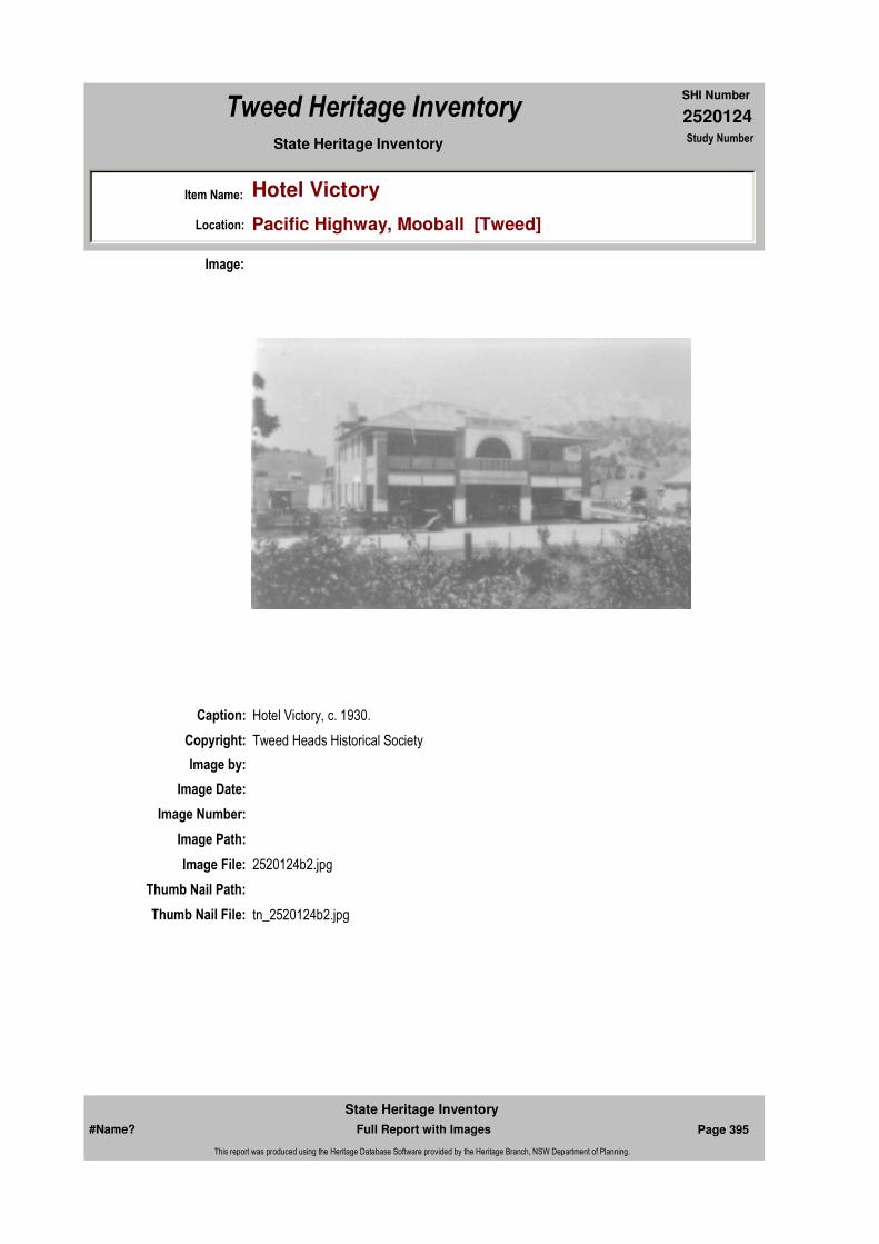
2520124
SHI Number
Tweed Heritage Inventory
Item Name: Hotel Victory
Location: Pacific Highway, Mooball [Tweed]
State Heritage Inventory Study Number
Caption: Hotel Victory, c. 1930.
Copyright: Tweed Heads Historical Society
Image:
Image by:
Image Date:
Image Number:
Image Path:
Image File: 2520124b2.jpg
Thumb Nail Path:
Thumb Nail File: tn_2520124b2.jpg
#Name? Page 395 Full Report with Images
State Heritage Inventory
This report was produced using the Heritage Database Software provided by the Heritage Branch, NSW Department of Planning.
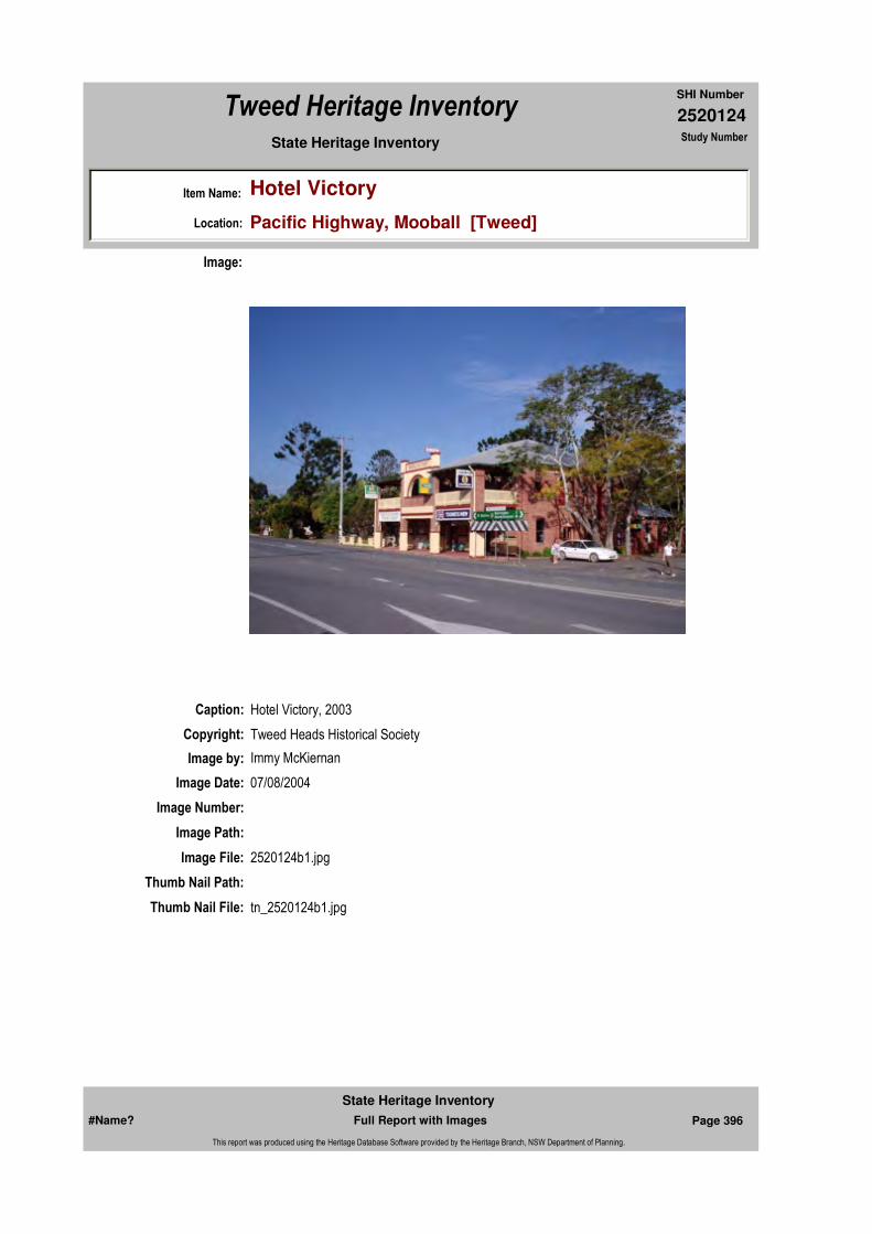
2520124
SHI Number
Tweed Heritage Inventory
Item Name: Hotel Victory
Location: Pacific Highway, Mooball [Tweed]
State Heritage Inventory Study Number
Caption: Hotel Victory, 2003
Copyright: Tweed Heads Historical Society
Image:
Image by: Immy McKiernan
Image Date: 07/08/2004
Image Number:
Image Path:
Image File: 2520124b1.jpg
Thumb Nail Path:
Thumb Nail File: tn_2520124b1.jpg
#Name? Page 396 Full Report with Images
State Heritage Inventory
This report was produced using the Heritage Database Software provided by the Heritage Branch, NSW Department of Planning.

2520124
SHI Number
Tweed Heritage Inventory
Item Name: Hotel Victory
Location: Pacific Highway, Mooball [Tweed]
State Heritage Inventory Study Number
#Name? Page 397 Full Report with Images
State Heritage Inventory
This report was produced using the Heritage Database Software provided by the Heritage Branch, NSW Department of Planning.
2520131
SHI Number
Tweed Heritage Inventory
Item Name: Sacred Heart Roman Catholic Convent
Location: Murwillumbah Street, Murwillumbah [Tweed]
State Heritage Inventory Study Number
Current Use:
Former Uses:
Statement of
Significance:The Sacred Heart Convent is part of the exuberant and showy buildings of the Roman Catholic Church Group, which includes higher style, Carpenter and Interwar Gothic Churches, Federation Filigree Convent and the Queen Anne Presbytery. The Roman Catholic Church buildings are significant as part of the Murwillumbah Main Street Urban Conservation Area. The facades contribute to the character of the conservation precinct.
Historical Notes or Provenance:
Physical Description: The convent is of Federation Filigree style with fine detailling.
Designer:
Maker / Builder:
Year Started: Year Completed: 1904 Circa: No
Endorsed Significance:Assessed Significance: Local
Item Type: Built Category: Convent/NunneryGroup: Religion
Admin Codes: Y Code 2: NC Code 3:
Curtilage/Boundary:
Owner: Religious Organisation
Other/Former Names:
Area/Group/Complex: Murwillumbah Main Street Urban Conservation Area Group ID: 27
Themes:
Aboriginal Area:
Local Govt Area: Tweed
Planning: Northern
Historic Region: North Coast
Address: #Name?
Suburb / Nearest Town: #Name?
State: NSW
Parish: Murwillumbah
County: Rous
National Theme State Theme Local Theme
8. Culture Religion Convent
#Name? Page 404 Full Report with Images
State Heritage Inventory
This report was produced using the Heritage Database Software provided by the Heritage Branch, NSW Department of Planning.

2520131
SHI Number
Tweed Heritage Inventory
Item Name: Sacred Heart Roman Catholic Convent
Location: Murwillumbah Street, Murwillumbah [Tweed]
State Heritage Inventory Study Number
Physical Condition:
Modification Dates: 1904
Recommended
Management:Restore presbytery elevation. Conserve the exterior and interior elements of significance; adapt services and facilities to ensure continued use; remove redundant signs and signs which detract from the style of architecture; provide a suitable colour scheme which compliments the architecture and matches the aspirations of the building owner and tenant; restore damaged and missing original architectural features based on early photographs or technical drawings.
References:
Studies:
Further Comments:
Criteria a)
Criteria c) The Sacred Heart Convent is part of the exuberant and showy buildings of the Roman Catholic Church Group, which includes higher style, Carpenter and Interwar Gothic Churches, Federation Filigree Convent and the Queen Anne Presbytery.
Criteria d)
Criteria e)
Criteria g)
Criteria f)
Integrity / Intactness:
Criteria b) The Roman Catholic Church buildings are significant as part of the Murwillumbah Main Street Urban Conservation Area. The facades contribute to the character of the conservation precinct.
Parcels:
Latitude: Longitude:
AMG Zone: Easting: Northing:
Map Name: Map Scale:
Spatial Accuracy:Location validity:
Management:
Author Title YearNumber
Tweed Shire Council Community-based Heritage Study 2003
Parcel Code LotNumber Section Plan Code Plan Number
LOT 2 DP 225827
#Name? Page 405 Full Report with Images
State Heritage Inventory
This report was produced using the Heritage Database Software provided by the Heritage Branch, NSW Department of Planning.
2520131
SHI Number
Tweed Heritage Inventory
Item Name: Sacred Heart Roman Catholic Convent
Location: Murwillumbah Street, Murwillumbah [Tweed]
State Heritage Inventory Study Number
Custom Field One:
Listings:
Date Updated: 17/05/2004 Status: BasicDate First Entered: 24/05/2000Data Entry:
Custom Field Two:
Custom Field Three: B
Custom Field Four: RAIA Register June 2000
Custom Field Five:
Custom Field Six:
Name: Date:Number:Title:
Royal Australian Institute of Architects register 30/12/1985
Caption:
Copyright:
Image:
Image by:
Image Date:
#Name? Page 406 Full Report with Images
State Heritage Inventory
This report was produced using the Heritage Database Software provided by the Heritage Branch, NSW Department of Planning.
2520131
SHI Number
Tweed Heritage Inventory
Item Name: Sacred Heart Roman Catholic Convent
Location: Murwillumbah Street, Murwillumbah [Tweed]
State Heritage Inventory Study Number
Image Number: 520
Image Path:
Image File:
Thumb Nail Path:
Thumb Nail File:
#Name? Page 407 Full Report with Images
State Heritage Inventory
This report was produced using the Heritage Database Software provided by the Heritage Branch, NSW Department of Planning.
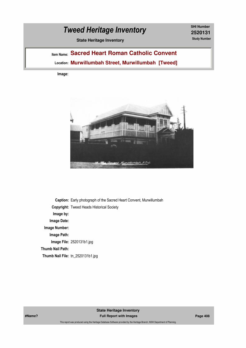
2520131
SHI Number
Tweed Heritage Inventory
Item Name: Sacred Heart Roman Catholic Convent
Location: Murwillumbah Street, Murwillumbah [Tweed]
State Heritage Inventory Study Number
Caption: Early photograph of the Sacred Heart Convent, Murwillumbah
Copyright: Tweed Heads Historical Society
Image:
Image by:
Image Date:
Image Number:
Image Path:
Image File: 2520131b1.jpg
Thumb Nail Path:
Thumb Nail File: tn_2520131b1.jpg
#Name? Page 408 Full Report with Images
State Heritage Inventory
This report was produced using the Heritage Database Software provided by the Heritage Branch, NSW Department of Planning.
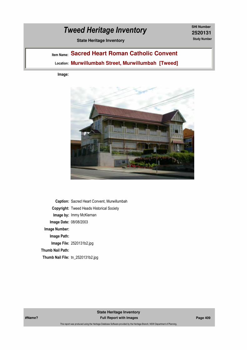
2520131
SHI Number
Tweed Heritage Inventory
Item Name: Sacred Heart Roman Catholic Convent
Location: Murwillumbah Street, Murwillumbah [Tweed]
State Heritage Inventory Study Number
Caption: Sacred Heart Convent, Murwillumbah
Copyright: Tweed Heads Historical Society
Image:
Image by: Immy McKiernan
Image Date: 08/08/2003
Image Number:
Image Path:
Image File: 2520131b2.jpg
Thumb Nail Path:
Thumb Nail File: tn_2520131b2.jpg
#Name? Page 409 Full Report with Images
State Heritage Inventory
This report was produced using the Heritage Database Software provided by the Heritage Branch, NSW Department of Planning.

2520131
SHI Number
Tweed Heritage Inventory
Item Name: Sacred Heart Roman Catholic Convent
Location: Murwillumbah Street, Murwillumbah [Tweed]
State Heritage Inventory Study Number
#Name? Page 410 Full Report with Images
State Heritage Inventory
This report was produced using the Heritage Database Software provided by the Heritage Branch, NSW Department of Planning.

2520135
SHI Number
Tweed Heritage Inventory
Item Name: Murwillumbah P S 1911 Block
Location: Riverview Street, Murwillumbah [Tweed]
State Heritage Inventory Study Number
Current Use:
Former Uses:
Statement of Significance:
The school building is significant in that it is a representative building of its type that is not repeated anywhere else on the Tweed. The building maintains the character, detail and finishes of the original design.
Historical Notes
or Provenance:
Designer: W.l. Vernon
Maker / Builder:
Endorsed Significance:Assessed Significance: Local
Item Type: Built Category: School - State (public)Group: Education
Admin Codes: Y Code 2: NC Code 3:
Curtilage/Boundary:
Owner: Department of Education and Training
Other/Former Names:
Area/Group/Complex: Group ID:
Themes:
Aboriginal Area:
Local Govt Area: Tweed
Planning: Northern
Historic Region: North Coast
Address: #Name?
Suburb / Nearest Town: #Name?
State: NSW
Parish: Murwillumbah
County: Rous
Local Govt Area: Tweed
Planning: Northern
Historic Region: North Coast
Address: #Name?
Suburb / Nearest Town: #Name?
State: NSW
Parish: Murwillumbah
County: Rous
National Theme State Theme Local Theme
6. Educating Education School
#Name? Page 420 Full Report with Images
State Heritage Inventory
This report was produced using the Heritage Database Software provided by the Heritage Branch, NSW Department of Planning.

2520135
SHI Number
Tweed Heritage Inventory
Item Name: Murwillumbah P S 1911 Block
Location: Riverview Street, Murwillumbah [Tweed]
State Heritage Inventory Study Number
Physical Description: This building abuts Eyles Avenue. The school building has parapet gabled ends with stucco surface above window sill line in rough cast and interesting interior with clerestory lights. Strong influence of English architects such as Voysey. reasonable condition.
Physical Condition:
Modification Dates: 1911
Year Started: Year Completed: 1911 Circa: No
Recommended
Management:
References:
Studies:
Listings:
Further Comments:
Criteria a) An excellent example of an Edwardian infant school hall.
Criteria c) The school maintains the character, detail and finishes of the original design.
Criteria d)
Criteria e)
Criteria g)
Criteria f)
Integrity / Intactness:
Criteria b)
Parcels:
Latitude: Longitude:
AMG Zone: Easting: Northing:
Map Name: Map Scale:
Spatial Accuracy:Location validity:
Management:
Author Title YearNumber
Tweed Shire Council Community-based Heritage Study 2003
Name: Date:Number:Title:
Royal Australian Institute of Architects register 30/12/1985
Parcel Code LotNumber Section Plan Code Plan Number
LOT 1 DP 937265
#Name? Page 421 Full Report with Images
State Heritage Inventory
This report was produced using the Heritage Database Software provided by the Heritage Branch, NSW Department of Planning.
2520135
SHI Number
Tweed Heritage Inventory
Item Name: Murwillumbah P S 1911 Block
Location: Riverview Street, Murwillumbah [Tweed]
State Heritage Inventory Study Number
Custom Field One:
Date Updated: 22/11/2006 Status: BasicDate First Entered: 24/05/2000Data Entry:
Custom Field Two:
Custom Field Three: B
Custom Field Four: RAIA Register June 2000
Custom Field Five:
Custom Field Six:
Caption:
Copyright:
Image:
Image by:
Image Date:
Image Number: 536
Image Path:
Image File:
#Name? Page 422 Full Report with Images
State Heritage Inventory
This report was produced using the Heritage Database Software provided by the Heritage Branch, NSW Department of Planning.

2520135
SHI Number
Tweed Heritage Inventory
Item Name: Murwillumbah P S 1911 Block
Location: Riverview Street, Murwillumbah [Tweed]
State Heritage Inventory Study Number
Thumb Nail Path:
Thumb Nail File:
#Name? Page 423 Full Report with Images
State Heritage Inventory
This report was produced using the Heritage Database Software provided by the Heritage Branch, NSW Department of Planning.

2520135
SHI Number
Tweed Heritage Inventory
Item Name: Murwillumbah P S 1911 Block
Location: Riverview Street, Murwillumbah [Tweed]
State Heritage Inventory Study Number
Caption: Murwillumbah Primary School room, built 1911
Copyright: Tweed Heads Historical Society
Image:
Image by: Bill Bainbridge
Image Date: 30/06/2003
Image Number:
Image Path:
Image File: 2520135b1.jpg
Thumb Nail Path:
Thumb Nail File: tn_2520135b1.jpg
#Name? Page 424 Full Report with Images
State Heritage Inventory
This report was produced using the Heritage Database Software provided by the Heritage Branch, NSW Department of Planning.

2520135
SHI Number
Tweed Heritage Inventory
Item Name: Murwillumbah P S 1911 Block
Location: Riverview Street, Murwillumbah [Tweed]
State Heritage Inventory Study Number
#Name? Page 425 Full Report with Images
State Heritage Inventory
This report was produced using the Heritage Database Software provided by the Heritage Branch, NSW Department of Planning.

2520139
SHI Number
Tweed Heritage Inventory
Item Name: Commonwealth Bank
Location: 11 Wharf Street, Murwillumbah [Tweed]
State Heritage Inventory Study Number
Current Use: Commonwealth Bank, ground floor; Accountant, 1st floor.
Former Uses: Commonwealth Bank, ground floor; Manager's Residence, 1st floor.
Statement of
Significance:The Commonwealth Bank is significant as part of the Murwillumbah Main Street Urban Conservation Area. The Neo-Greek façade contributes to the character of the precinct.
Historical Notes or Provenance:
Physical Description: Bank of Interwar free classical style. Large imposing facade in streetscape. Neo-Greek symmetrical facade,treatment in painted and rendered surface. Portico derived from classical temple front. Enriched classical cornice. Simplified giant classical order. The 1st floor former manager's residence has marble window sills in the front room, former lounge room, and Queensland maple timbering throughout.
Designer:
Maker / Builder:
Year Started: Year Completed: 1936 Circa: No
Endorsed Significance:Assessed Significance:
Item Type: Built Category: BankGroup: Commercial
Admin Codes: Y Code 2: NC Code 3:
Curtilage/Boundary:
Owner: Private - Corporate
Other/Former Names:
Area/Group/Complex: Murwillumbah Main Street Urban Conservation Area Group ID: 5
Themes:
Aboriginal Area:
Local Govt Area: Tweed
Planning: Northern
Historic Region: North Coast
Address: #Name?
Suburb / Nearest Town: #Name?
State: NSW
Parish: Murwillumbah
County: Rous
National Theme State Theme Local Theme
3. Economy Commerce Bank
#Name? Page 426 Full Report with Images
State Heritage Inventory
This report was produced using the Heritage Database Software provided by the Heritage Branch, NSW Department of Planning.
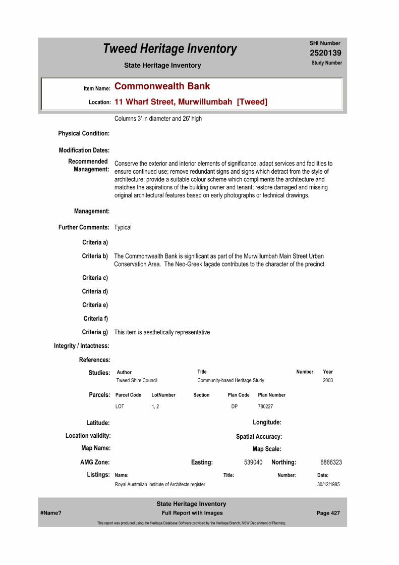
2520139
SHI Number
Tweed Heritage Inventory
Item Name: Commonwealth Bank
Location: 11 Wharf Street, Murwillumbah [Tweed]
State Heritage Inventory Study Number
Columns 3' in diameter and 26' high
Physical Condition:
Modification Dates:
Recommended Management:
Conserve the exterior and interior elements of significance; adapt services and facilities to ensure continued use; remove redundant signs and signs which detract from the style of architecture; provide a suitable colour scheme which compliments the architecture and matches the aspirations of the building owner and tenant; restore damaged and missing original architectural features based on early photographs or technical drawings.
References:
Studies:
Listings:
Further Comments: Typical
Criteria a)
Criteria c)
Criteria d)
Criteria e)
Criteria g) This item is aesthetically representative
Criteria f)
Integrity / Intactness:
Criteria b) The Commonwealth Bank is significant as part of the Murwillumbah Main Street Urban Conservation Area. The Neo-Greek façade contributes to the character of the precinct.
Parcels:
Latitude: Longitude:
AMG Zone: Easting: 539040 Northing: 6866323
Map Name: Map Scale:
Spatial Accuracy:Location validity:
Management:
Author Title YearNumber
Tweed Shire Council Community-based Heritage Study 2003
Name: Date:Number:Title:
Royal Australian Institute of Architects register 30/12/1985
Parcel Code LotNumber Section Plan Code Plan Number
LOT 1, 2 DP 780227
#Name? Page 427 Full Report with Images
State Heritage Inventory
This report was produced using the Heritage Database Software provided by the Heritage Branch, NSW Department of Planning.

2520139
SHI Number
Tweed Heritage Inventory
Item Name: Commonwealth Bank
Location: 11 Wharf Street, Murwillumbah [Tweed]
State Heritage Inventory Study Number
Custom Field One:
Date Updated: 17/05/2004 Status: BasicDate First Entered: 24/05/2000Data Entry:
Custom Field Two: Art deco
Custom Field Three: B
Custom Field Four: RAIA Register June 2000
Custom Field Five:
Custom Field Six:
Caption:
Copyright:
Image:
Image by:
Image Date:
Image Number: 53
Image Path:
Image File:
#Name? Page 428 Full Report with Images
State Heritage Inventory
This report was produced using the Heritage Database Software provided by the Heritage Branch, NSW Department of Planning.

2520139
SHI Number
Tweed Heritage Inventory
Item Name: Commonwealth Bank
Location: 11 Wharf Street, Murwillumbah [Tweed]
State Heritage Inventory Study Number
Thumb Nail Path:
Thumb Nail File:
#Name? Page 429 Full Report with Images
State Heritage Inventory
This report was produced using the Heritage Database Software provided by the Heritage Branch, NSW Department of Planning.

2520139
SHI Number
Tweed Heritage Inventory
Item Name: Commonwealth Bank
Location: 11 Wharf Street, Murwillumbah [Tweed]
State Heritage Inventory Study Number
Caption: Commonwealth Bank Murwillumbah
Copyright: Tweed Heads Historical Society
Image:
Image by: Immy McKiernan
Image Date: 08/08/2003
Image Number:
Image Path:
Image File: 2520139b1.jpg
Thumb Nail Path:
Thumb Nail File: tn_2520139b1.jpg
#Name? Page 430 Full Report with Images
State Heritage Inventory
This report was produced using the Heritage Database Software provided by the Heritage Branch, NSW Department of Planning.

2520139
SHI Number
Tweed Heritage Inventory
Item Name: Commonwealth Bank
Location: 11 Wharf Street, Murwillumbah [Tweed]
State Heritage Inventory Study Number
Caption: Commonwealth Bank, Murwillumbah - Mezzanine storage room.
Copyright: Tweed Heads Historical Society
Image:
Image by: Immy McKiernan
Image Date: 08/08/2003
Image Number:
Image Path:
Image File: 2520139b7.jpg
Thumb Nail Path:
Thumb Nail File: tn_2520139b7.jpg
#Name? Page 431 Full Report with Images
State Heritage Inventory
This report was produced using the Heritage Database Software provided by the Heritage Branch, NSW Department of Planning.
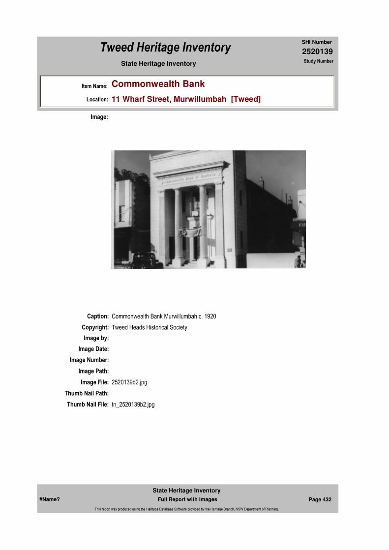
2520139
SHI Number
Tweed Heritage Inventory
Item Name: Commonwealth Bank
Location: 11 Wharf Street, Murwillumbah [Tweed]
State Heritage Inventory Study Number
Caption: Commonwealth Bank Murwillumbah c. 1920
Copyright: Tweed Heads Historical Society
Image:
Image by:
Image Date:
Image Number:
Image Path:
Image File: 2520139b2.jpg
Thumb Nail Path:
Thumb Nail File: tn_2520139b2.jpg
#Name? Page 432 Full Report with Images
State Heritage Inventory
This report was produced using the Heritage Database Software provided by the Heritage Branch, NSW Department of Planning.
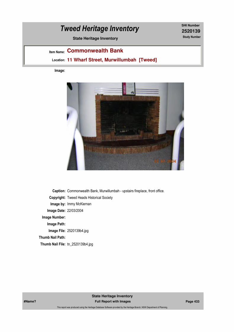
2520139
SHI Number
Tweed Heritage Inventory
Item Name: Commonwealth Bank
Location: 11 Wharf Street, Murwillumbah [Tweed]
State Heritage Inventory Study Number
Caption: Commonwealth Bank, Murwillumbah - upstairs fireplace, front office.
Copyright: Tweed Heads Historical Society
Image:
Image by: Immy McKiernan
Image Date: 22/03/2004
Image Number:
Image Path:
Image File: 2520139b4.jpg
Thumb Nail Path:
Thumb Nail File: tn_2520139b4.jpg
#Name? Page 433 Full Report with Images
State Heritage Inventory
This report was produced using the Heritage Database Software provided by the Heritage Branch, NSW Department of Planning.

2520139
SHI Number
Tweed Heritage Inventory
Item Name: Commonwealth Bank
Location: 11 Wharf Street, Murwillumbah [Tweed]
State Heritage Inventory Study Number
Caption: Commonwealth Bank, Murwillumbah - Upstairs front office marble window sill.
Copyright: Tweed Heads Historical Society
Image:
Image by: Immy McKiernan
Image Date: 08/08/2003
Image Number:
Image Path:
Image File: 2520139b5.jpg
Thumb Nail Path:
Thumb Nail File: tn_2520139b5.jpg
#Name? Page 434 Full Report with Images
State Heritage Inventory
This report was produced using the Heritage Database Software provided by the Heritage Branch, NSW Department of Planning.
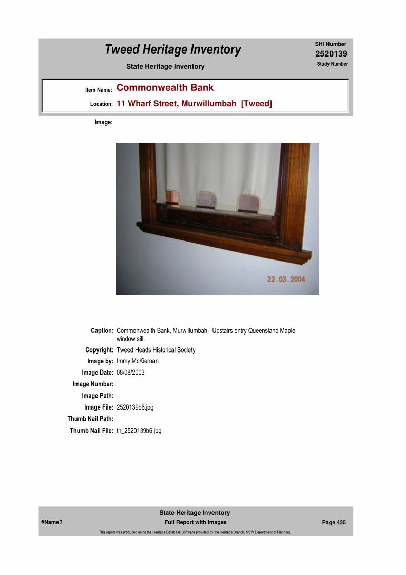
2520139
SHI Number
Tweed Heritage Inventory
Item Name: Commonwealth Bank
Location: 11 Wharf Street, Murwillumbah [Tweed]
State Heritage Inventory Study Number
Caption: Commonwealth Bank, Murwillumbah - Upstairs entry Queensland Maple window sill.
Copyright: Tweed Heads Historical Society
Image:
Image by: Immy McKiernan
Image Date: 08/08/2003
Image Number:
Image Path:
Image File: 2520139b6.jpg
Thumb Nail Path:
Thumb Nail File: tn_2520139b6.jpg
#Name? Page 435 Full Report with Images
State Heritage Inventory
This report was produced using the Heritage Database Software provided by the Heritage Branch, NSW Department of Planning.
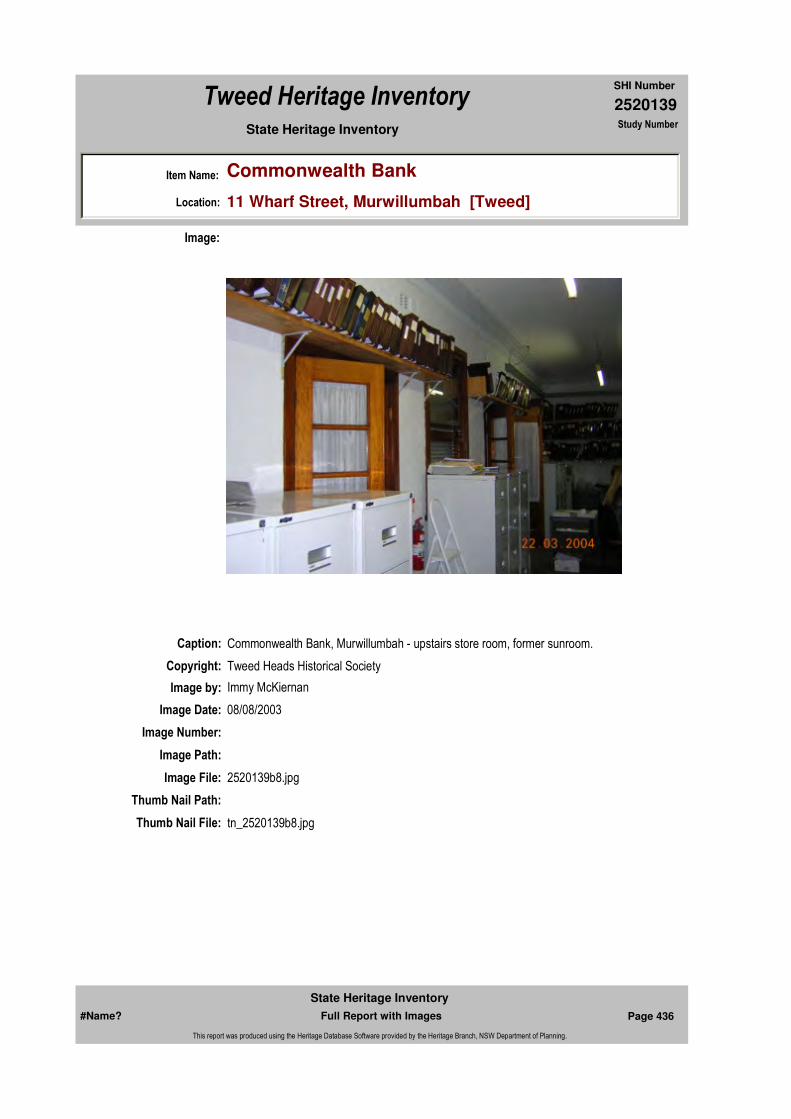
2520139
SHI Number
Tweed Heritage Inventory
Item Name: Commonwealth Bank
Location: 11 Wharf Street, Murwillumbah [Tweed]
State Heritage Inventory Study Number
Caption: Commonwealth Bank, Murwillumbah - upstairs store room, former sunroom.
Copyright: Tweed Heads Historical Society
Image:
Image by: Immy McKiernan
Image Date: 08/08/2003
Image Number:
Image Path:
Image File: 2520139b8.jpg
Thumb Nail Path:
Thumb Nail File: tn_2520139b8.jpg
#Name? Page 436 Full Report with Images
State Heritage Inventory
This report was produced using the Heritage Database Software provided by the Heritage Branch, NSW Department of Planning.

2520139
SHI Number
Tweed Heritage Inventory
Item Name: Commonwealth Bank
Location: 11 Wharf Street, Murwillumbah [Tweed]
State Heritage Inventory Study Number
#Name? Page 437 Full Report with Images
State Heritage Inventory
This report was produced using the Heritage Database Software provided by the Heritage Branch, NSW Department of Planning.

2520146
SHI Number
Tweed Heritage Inventory
Item Name: St Colomba's Catholic Church
Location: 7 Old Convent Road, Uki [Tweed]
State Heritage Inventory Study Number
Current Use:
Former Uses:
Statement of
Significance:St Colomba's Catholic Church has a strong association with the residents of Uki, which served the spiritual and cultural needs of the congregation over the years. St Columba's is an excellent example of a timber rural church of the early 20th century. The building reflects the development of the South Arm of the Tweed River and the importance of religion to the early settlers.
Historical Notes or Provenance:
Built on land donated by Gerald Parker and financed by further sub division of the land, the church was constructed of local timber from Newell's sawmill in Uki. the foundation stone was laid by Bishop Carroll on 9th June 1911.
A priest's room in the apse allowed the priest to stay overnight in the days before motor cars. Mass was held fortnightly with Confession and Benediction the Saturday night before.
The first baptism was Vincent Thomas Columbil O'Neill on 25th Aug 1912. The first wedding was William Mills and May Askew 10th Aug 1920. Four generations of this family have been married in the church, the latest in 2001.
The church filled a social as well as a spiritual need for Catholics scattered through the valleys of the South Arm of the Tweed River. After Mass the men would cross to the Hotel by a path called the Duck Track, while the women caught up on local happenings.
Between 1923 and 1931 the Sisters of St Josephs held their classes in the back of the church until a school, later removed, was built.
Endorsed Significance:Assessed Significance:
Item Type: Built Category: ChurchGroup: Religion
Admin Codes: Y Code 2: NC Code 3:
Curtilage/Boundary:
Owner: Religious Organisation
Other/Former Names:
Area/Group/Complex: Group ID:
Aboriginal Area:
Local Govt Area: Tweed
Planning: Northern
Historic Region: North Coast
Address: #Name?
Suburb / Nearest Town: #Name?
State: NSW
Parish: Kunghur
County: Rous
#Name? Page 451 Full Report with Images
State Heritage Inventory
This report was produced using the Heritage Database Software provided by the Heritage Branch, NSW Department of Planning.
2520146
SHI Number
Tweed Heritage Inventory
Item Name: St Colomba's Catholic Church
Location: 7 Old Convent Road, Uki [Tweed]
State Heritage Inventory Study Number
St. Columba's Catholic Church. 1911-1986
Physical Description: Carpenter Gothic. Pointed arch windows and doors. Medium to high slope roof. Simplified Gothic Motif on decorative projecting gables.
Physical Condition:
Modification Dates: Circular window at front removed during 1950's after hailstorm damage
Designer:
Maker / Builder: Alf Modini and Percy Clough
Year Started: 1911 Year Completed: 1912 Circa: No
Recommended
Management:
References:
Further Comments:
Criteria a)
Criteria c)
Criteria d) St Colomba's Catholic Church has a strong association with the residents of Uki, which served the spiritual and cultural needs of the congregation over the years. St Columba's is an excellent example of a timber rural church of the early 20th century. The building reflects the development of the South Arm of the Tweed River and the importance of religion to the early settlers.
Criteria e)
Criteria g)
Criteria f)
Integrity / Intactness:
Criteria b)
Themes:
Management:
Author Title Year
St. Columba's Catholic Church. 1911-1986
National Theme State Theme Local Theme
8. Culture Religion Church
#Name? Page 452 Full Report with Images
State Heritage Inventory
This report was produced using the Heritage Database Software provided by the Heritage Branch, NSW Department of Planning.

2520146
SHI Number
Tweed Heritage Inventory
Item Name: St Colomba's Catholic Church
Location: 7 Old Convent Road, Uki [Tweed]
State Heritage Inventory Study Number
Custom Field One:
Studies:
Listings:
Date Updated: 02/11/2004 Status: BasicDate First Entered: 24/05/2000Data Entry:
Custom Field Two:
Custom Field Three: B
Custom Field Four: RAIA Register June 2000
Custom Field Five:
Custom Field Six:
Parcels:
Latitude: Longitude:
AMG Zone: Easting: Northing:
Map Name: Map Scale:
Spatial Accuracy:Location validity:
Author Title YearNumber
Tweed Shire Council Community-based Heritage Study 2003
Name: Date:Number:Title:
Royal Australian Institute of Architects register 30/12/1985
Parcel Code LotNumber Section Plan Code Plan Number
LOT 4 DP 563015
#Name? Page 453 Full Report with Images
State Heritage Inventory
This report was produced using the Heritage Database Software provided by the Heritage Branch, NSW Department of Planning.

2520146
SHI Number
Tweed Heritage Inventory
Item Name: St Colomba's Catholic Church
Location: 7 Old Convent Road, Uki [Tweed]
State Heritage Inventory Study Number
Caption: St Colombs'a Catholic Church, Uki
Copyright: Tweed Heads Historical Society
Image:
Image by: Immy McKiernan
Image Date: 23/09/2003
Image Number:
Image Path:
Image File: 2520146b2.jpg
Thumb Nail Path:
Thumb Nail File: tn_2520146b2.jpg
#Name? Page 454 Full Report with Images
State Heritage Inventory
This report was produced using the Heritage Database Software provided by the Heritage Branch, NSW Department of Planning.
2520146
SHI Number
Tweed Heritage Inventory
Item Name: St Colomba's Catholic Church
Location: 7 Old Convent Road, Uki [Tweed]
State Heritage Inventory Study Number
Caption:
Copyright:
Image:
Image by:
Image Date:
Image Number: 616
Image Path:
Image File:
Thumb Nail Path:
Thumb Nail File:
#Name? Page 455 Full Report with Images
State Heritage Inventory
This report was produced using the Heritage Database Software provided by the Heritage Branch, NSW Department of Planning.
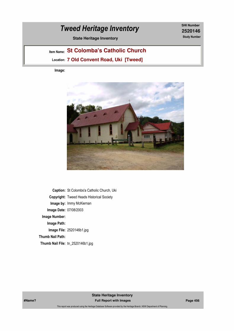
2520146
SHI Number
Tweed Heritage Inventory
Item Name: St Colomba's Catholic Church
Location: 7 Old Convent Road, Uki [Tweed]
State Heritage Inventory Study Number
Caption: St Colombs'a Catholic Church, Uki
Copyright: Tweed Heads Historical Society
Image:
Image by: Immy McKiernan
Image Date: 07/08/2003
Image Number:
Image Path:
Image File: 2520146b1.jpg
Thumb Nail Path:
Thumb Nail File: tn_2520146b1.jpg
#Name? Page 456 Full Report with Images
State Heritage Inventory
This report was produced using the Heritage Database Software provided by the Heritage Branch, NSW Department of Planning.
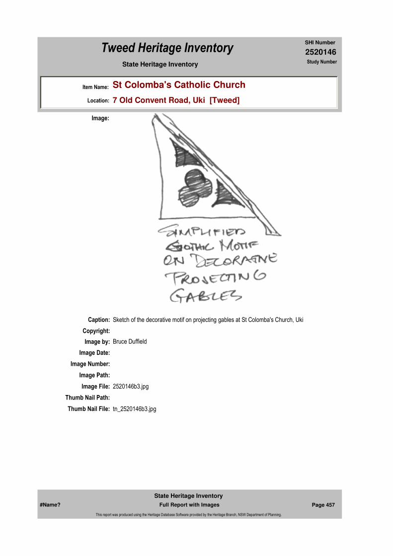
2520146
SHI Number
Tweed Heritage Inventory
Item Name: St Colomba's Catholic Church
Location: 7 Old Convent Road, Uki [Tweed]
State Heritage Inventory Study Number
Caption: Sketch of the decorative motif on projecting gables at St Colomba's Church, Uki
Copyright:
Image:
Image by: Bruce Duffield
Image Date:
Image Number:
Image Path:
Image File: 2520146b3.jpg
Thumb Nail Path:
Thumb Nail File: tn_2520146b3.jpg
#Name? Page 457 Full Report with Images
State Heritage Inventory
This report was produced using the Heritage Database Software provided by the Heritage Branch, NSW Department of Planning.
2520146
SHI Number
Tweed Heritage Inventory
Item Name: St Colomba's Catholic Church
Location: 7 Old Convent Road, Uki [Tweed]
State Heritage Inventory Study Number
#Name? Page 458 Full Report with Images
State Heritage Inventory
This report was produced using the Heritage Database Software provided by the Heritage Branch, NSW Department of Planning.
2520154
SHI Number
Tweed Heritage Inventory
Item Name: Kelly Bros Store
Location: Pacific Highway, Mooball [Tweed]
State Heritage Inventory Study Number
Current Use: Store
Former Uses: Store
Statement of
Significance:Kelly Bros. Store is aesthetically representative of an art deco country store built in the 1930's.
Historical Notes or Provenance:
When one walks into Kelly Bros. Post Office and Store at Mooball, the impression is pleasant and modern, with the two up-to-date cash registers each end of the big counter, placed there for the customers self service convenience. Electronic scales and National Bank EFTPOS machine complete the picture.
However, a closer inspection will reveal an old wooden counter bought second hand from McDermotts in Lismore 60 years ago for £45 ($90).
Leo and Bernadette decided to keep the old counter when the shop was renovated, it reminds them and their customers of the old fashioned service of yesteryear. Kelly Eros. motto "we are always at your service" on their dockets for 60 years is still faithfully carried out today.
Just looking at the counter brings back nostalgia to the oldies. One can visualise the weighed-up sugar, flour, icing sugar, biscuits etc. in their brown paper bags stacked expertly in their respective pile. Behind the counter during the early years stood the Kelly boys in their neatly-pressed long white aprons with a cord around the waist and at the bottom of the apron the threads were pulled out to form a fringe. On a dull winter's afternoon the kerosene light on the counter would provide some illumination.One only bad to be near the back door to get the aroma off the stack of four gallon kerosene tins (Mooball had no electricity until 1952). Kerosene was used for many things, from
Endorsed Significance:Assessed Significance: Local
Item Type: Built Category: ShopGroup: Retail and Wholesale
Admin Codes: N Code 2: NC Code 3:
Curtilage/Boundary:
Owner: Private - Individual
Other/Former Names:
Area/Group/Complex: Group ID:
Aboriginal Area:
Local Govt Area: Tweed
Planning: Northern
Historic Region: North Coast
Address: #Name?
Suburb / Nearest Town: #Name?
State: NSW
Parish: Mooball
County: Rous
#Name? Page 472 Full Report with Images
State Heritage Inventory
This report was produced using the Heritage Database Software provided by the Heritage Branch, NSW Department of Planning.
2520154
SHI Number
Tweed Heritage Inventory
Item Name: Kelly Bros Store
Location: Pacific Highway, Mooball [Tweed]
State Heritage Inventory Study Number
lighting to healing gravel rash. Many young aspiring cricketer was bowled when the ball hit the empty kero tin from Kelly's Store.
In the post office section the mail is still sorted into the original boxes of long ago, the door to the public phone is still there (inside) because the public phone could only be used when the post office was open 9 to 5.
But the Kelly saga really goes back more than 60 years ago, it all started when Patrick and Amelia Kelly with their six children, James, Terence, Margaret, Arthur, Mary and Thomas (Fred) lived behind the first little post office and shop owned by Mrs Jenkins. This post office and shop was on the northern side of the railway line and is now the road to Pottsville.
Patrick owned two farms in the area and land in the village, in fact as the children married he gave them a block of land and built a house on it and so the locals referred to the village as "Kellyville". Five of these houses were on the Old Lismore Rd (Pacific Highway) side by side. But Mary's house was not part of this togetherness, her house was built on the northern side of the line.
In 1929 Patrick bought the post office and store from MrsJ enkins for £600 ($1200) and Jim became postmaster and managed the store for his father.
Big things began to happen in Burringbar-Mooball area, first in 1931 the hotel was burnt to the ground at Burringbar. The licensee, Jack Watterson bought land from Patrick Kelly in Mooball with the intention of moving the license to Mooball. This caused much tension between the two villages, however Jack Watterson won the battle and the "Victory" Hotel was born.
Prior to the railway the road to Lismore followed the hills behind the village, dodging the swampy lower flats.
Jim Kelly saw the potential of a shop beside the new hotel on the main "highway", so it was in 1934 that Jim decided to build a post office and store next to the hotel, a big step for a young man 23 years of age.
He employed the same architect who designed the Victory Hotel and the builder was H Stephenson from Lismore who won the contract with a tender of £997 ($1994).
Terence became a partner and so "Kelly Bros" came into being. With a time limit of up to 16 weeks the project began, the bricks arriving by rail, they were then loaded onto Kelly Bros, horse and cart for delivery to the building site.
Delays and frustrations were evident even in those early relaxing times, the first day while pouring the foundations the concrete mixer broke down, so things were held up until a new mixer arrived.
Finally the building was finished and the new premises were open for business on Monday July 30,1934. It was at this time Arch Mills of Burringbar won the contract to collect cream from the dairy farms at Mooball, Sleepy Hollow and Mooball Beach, so three days a week
#Name? Page 473 Full Report with Images
State Heritage Inventory
This report was produced using the Heritage Database Software provided by the Heritage Branch, NSW Department of Planning.
2520154
SHI Number
Tweed Heritage Inventory
Item Name: Kelly Bros Store
Location: Pacific Highway, Mooball [Tweed]
State Heritage Inventory Study Number
Kelly Bros. Store opened from 6am-6.30pm to catch the cream lorry with mail and papers and often orders for the farmers.
From this period the Mills and Kelly families have had a business and personal friendship spanning 60 years. At this time the Kelly's horse and cart delivered to the farms and at the beginning of the month it was always the huge monthly order, bags of flour, sugar, potatoes etc. A far cry from today when the farmer slips into the village in a few minutes to obtain supplies.
During the war years the store became a family affair with many members of the family working in the store. Jim's son Leo left school in 1952 and began work in the store. Terry died in 1962 but the shop continued to trade under "Kelly Bros".
After being Postmaster for years Jim passed away in 1968 and son Leo became Postmaster, a position he still holds today (1994).
Since 1968 Leo's wife Bernadette has been a partner in the business and so "Kelly Bros." still prospers today. With their three children, Linda, Judith and Peter working far away in their own field of work, it is an unknown factor whether another generation of Kelly's will take over the reins at Kelly Bros.
However Bernadette and Leo think after 60 years of successful trading its time for a celebration, so on Monday November 21 at 5pm they hope to see as many as possible at the store for a barbecue and entertainment for all the family.
Maybe Leo will wrap a few groceries in brown paper, tie it with string, twist the string around his finger and snap! Ask for a demonstration, particularly checkout girls!
Physical Description: Symmetric facade, parapet creating a stepped skyline. Strong 3 dimensional qualities with the use of emphatic vertical piers and horizontal pediments. Stylised ornamentation to top of central bay of parapet. Large central entry.
Physical Condition:
Modification Dates:
Designer:
Maker / Builder:
Year Started: Year Completed: Circa: No
Themes: National Theme State Theme Local Theme
3. Economy Commerce Shop
#Name? Page 474 Full Report with Images
State Heritage Inventory
This report was produced using the Heritage Database Software provided by the Heritage Branch, NSW Department of Planning.

2520154
SHI Number
Tweed Heritage Inventory
Item Name: Kelly Bros Store
Location: Pacific Highway, Mooball [Tweed]
State Heritage Inventory Study Number
Custom Field One:
Recommended Management:
Maintain the exterior in a sympathetic manner with appropriate signs, colour scheme and services.
References:
Studies:
Listings:
Further Comments: Typical
Criteria a)
Criteria c) This item is aesthetically representative of an art deco country store of the 1930's
Criteria d)
Criteria e)
Criteria g) This item is aesthetically representative
Criteria f)
Integrity / Intactness:
Custom Field Two: Art deco
Custom Field Three: B
Custom Field Four:
Criteria b)
Parcels:
Latitude: Longitude:
AMG Zone: Easting: Northing:
Map Name: Map Scale:
Spatial Accuracy:Location validity:
Management:
Author Title Year
Ron Johansen Mooball Store's 60 years Trading "Tales of our Times" Vol 3
Author Title YearNumber
Tweed Shire Council Community-based Heritage Study 2003
Name: Date:Number:Title:
Royal Australian Institute of Architects register
Parcel Code LotNumber Section Plan Code Plan Number
LOT 1, 2 DP 316479
#Name? Page 475 Full Report with Images
State Heritage Inventory
This report was produced using the Heritage Database Software provided by the Heritage Branch, NSW Department of Planning.
2520154
SHI Number
Tweed Heritage Inventory
Item Name: Kelly Bros Store
Location: Pacific Highway, Mooball [Tweed]
State Heritage Inventory Study Number
Date Updated: 01/11/2004 Status: BasicDate First Entered: 24/05/2000Data Entry:
Custom Field Five:
Custom Field Six:
Caption:
Copyright:
Image:
Image by:
Image Date:
Image Number: 930
Image Path:
Image File:
Thumb Nail Path:
Thumb Nail File:
#Name? Page 476 Full Report with Images
State Heritage Inventory
This report was produced using the Heritage Database Software provided by the Heritage Branch, NSW Department of Planning.

2520154
SHI Number
Tweed Heritage Inventory
Item Name: Kelly Bros Store
Location: Pacific Highway, Mooball [Tweed]
State Heritage Inventory Study Number
Caption: Kelly Bros. Store, Mooball.
Copyright: Tweed Heads Historical Society
Image:
Image by: Immy McKiernan
Image Date: 07/08/2004
Image Number:
Image Path:
Image File: 2520154b1.jpg
Thumb Nail Path:
Thumb Nail File: tn_2520154b1.jpg
#Name? Page 477 Full Report with Images
State Heritage Inventory
This report was produced using the Heritage Database Software provided by the Heritage Branch, NSW Department of Planning.

2520154
SHI Number
Tweed Heritage Inventory
Item Name: Kelly Bros Store
Location: Pacific Highway, Mooball [Tweed]
State Heritage Inventory Study Number
#Name? Page 478 Full Report with Images
State Heritage Inventory
This report was produced using the Heritage Database Software provided by the Heritage Branch, NSW Department of Planning.
2520155
SHI Number
Tweed Heritage Inventory
Item Name: Commercial Premises former Regent Theatre
Location: Brisbane Street, Murwillumbah [Tweed]
State Heritage Inventory Study Number
Current Use:
Former Uses:
Statement of Significance:
The site and building is a landmark and focal point in the town centre. The cinema function is valued by the community as a place of public entertainment.
Historical Notes or Provenance:
Designer:
Maker / Builder:
Endorsed Significance:Assessed Significance: Local
Item Type: Built Category: CinemaGroup: Recreation and Entert
Admin Codes: N Code 2: NC Code 3:
Curtilage/Boundary:
Owner: Private - Individual
Other/Former Names: Regent Cinema
Area/Group/Complex: Group ID:
Themes:
Aboriginal Area:
Local Govt Area: Tweed
Planning: Northern
Historic Region: North Coast
Address: #Name?
Suburb / Nearest Town: #Name?
State: NSW
Parish: Murwillumbah
County: Rous
Local Govt Area: Tweed
Planning: Northern
Historic Region: North Coast
Address: #Name?
Suburb / Nearest Town: #Name?
State: NSW
Parish: Murwillumbah
County: Rous
National Theme State Theme Local Theme
8. Culture Leisure Cinema
#Name? Page 479 Full Report with Images
State Heritage Inventory
This report was produced using the Heritage Database Software provided by the Heritage Branch, NSW Department of Planning.

2520155
SHI Number
Tweed Heritage Inventory
Item Name: Commercial Premises former Regent Theatre
Location: Brisbane Street, Murwillumbah [Tweed]
State Heritage Inventory Study Number
Physical Description: Cinema of Interwar art deco style. Interiors detailed in fine deco style with fitments and terazzo floor detailing. External building renovated into shops out of character.Exuberant use of art deco motif to building facade above awning to attract film goers. Stepping up skyline to central fins. Fine brick walling with emphatic vertical fins providing a central focus to the facade. Parallel line motif. White vertical lacework panels each side of central.
Physical Condition:
Modification Dates:
Year Started: Year Completed: Circa: No
Recommended
Management:
References:
Studies:
Further Comments: Typical
Criteria a)
Criteria c)
Criteria d) The cinema function is valued by the community as a place of public entertainment.
Criteria e)
Criteria g) This item is aesthetically representative
Criteria f)
Integrity / Intactness:
Criteria b)
Parcels:
Latitude: Longitude:
Map Name: Map Scale:
Spatial Accuracy:Location validity:
Management:
Author Title YearNumber
Tweed Shire Council Community-based Heritage Study 2003
Parcel Code LotNumber Section Plan Code Plan Number
LOT 1, 2 DP 772368
LOT 1 DP 780041
#Name? Page 480 Full Report with Images
State Heritage Inventory
This report was produced using the Heritage Database Software provided by the Heritage Branch, NSW Department of Planning.

2520155
SHI Number
Tweed Heritage Inventory
Item Name: Commercial Premises former Regent Theatre
Location: Brisbane Street, Murwillumbah [Tweed]
State Heritage Inventory Study Number
Custom Field One:
Listings:
Date Updated: 22/11/2006 Status: BasicDate First Entered: 24/05/2000Data Entry:
Custom Field Two: Art deco
Custom Field Three: B
Custom Field Four:
Custom Field Five:
Custom Field Six:
AMG Zone: Easting: Northing:
Name: Date:Number:Title:
Royal Australian Institute of Architects register
Caption:
Copyright:
Image:
Image by:
#Name? Page 481 Full Report with Images
State Heritage Inventory
This report was produced using the Heritage Database Software provided by the Heritage Branch, NSW Department of Planning.
2520155
SHI Number
Tweed Heritage Inventory
Item Name: Commercial Premises former Regent Theatre
Location: Brisbane Street, Murwillumbah [Tweed]
State Heritage Inventory Study Number
Image Date:
Image Number: 525
Image Path:
Image File:
Thumb Nail Path:
Thumb Nail File:
#Name? Page 482 Full Report with Images
State Heritage Inventory
This report was produced using the Heritage Database Software provided by the Heritage Branch, NSW Department of Planning.

2520155
SHI Number
Tweed Heritage Inventory
Item Name: Commercial Premises former Regent Theatre
Location: Brisbane Street, Murwillumbah [Tweed]
State Heritage Inventory Study Number
Caption: Early photograph of the Regent Cinema, Murwillumbah
Copyright: Tweed Heads Historical Society
Image:
Image by:
Image Date:
Image Number:
Image Path:
Image File: 2520155b1.jpg
Thumb Nail Path:
Thumb Nail File: tn_2520155b1.jpg
#Name? Page 483 Full Report with Images
State Heritage Inventory
This report was produced using the Heritage Database Software provided by the Heritage Branch, NSW Department of Planning.
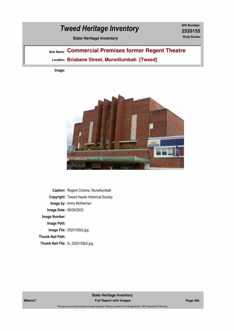
2520155
SHI Number
Tweed Heritage Inventory
Item Name: Commercial Premises former Regent Theatre
Location: Brisbane Street, Murwillumbah [Tweed]
State Heritage Inventory Study Number
Caption: Regent Cinema, Murwillumbah
Copyright: Tweed Heads Historical Society
Image:
Image by: Immy McKiernan
Image Date: 08/08/2003
Image Number:
Image Path:
Image File: 2520155b2.jpg
Thumb Nail Path:
Thumb Nail File: tn_2520155b2.jpg
#Name? Page 484 Full Report with Images
State Heritage Inventory
This report was produced using the Heritage Database Software provided by the Heritage Branch, NSW Department of Planning.

2520155
SHI Number
Tweed Heritage Inventory
Item Name: Commercial Premises former Regent Theatre
Location: Brisbane Street, Murwillumbah [Tweed]
State Heritage Inventory Study Number
Caption: Regent Cinema, Murwillumbah
Copyright: Tweed Heads Historical Society
Image:
Image by: Immy McKiernan
Image Date: 08/08/2003
Image Number:
Image Path:
Image File: 2520155b3.jpg
Thumb Nail Path:
Thumb Nail File: tn_2520155b3.jpg
#Name? Page 485 Full Report with Images
State Heritage Inventory
This report was produced using the Heritage Database Software provided by the Heritage Branch, NSW Department of Planning.
2520155
SHI Number
Tweed Heritage Inventory
Item Name: Commercial Premises former Regent Theatre
Location: Brisbane Street, Murwillumbah [Tweed]
State Heritage Inventory Study Number
#Name? Page 486 Full Report with Images
State Heritage Inventory
This report was produced using the Heritage Database Software provided by the Heritage Branch, NSW Department of Planning.
2520159
SHI Number
Tweed Heritage Inventory
Item Name: Murwillumbah Hospital
Location: Ewing Street, Murwillumbah [Tweed]
State Heritage Inventory Study Number
Current Use:
Former Uses:
Statement of
Significance:This Murwillumbah Hospital precinct is a significant collection of a variety of purpose-built buildings associated with hospital services from the Edwardian era onwards. The complex exhibits good examples of a range of architectural styles selected for each stage of the project. The site is held in high esteem by the local community for services delivered.
Historical Notes
or Provenance:ForwardThe history of the hospital at Murwillumbah is inseparable in many ways from the history of the town itself and the wider Tweed Valley.
Indeed, the establishment of the Tweed Cottage Hospital in 1903 was largely due to the efforts of the Murwillumbah community to provide a health service for the people of the Tweed Valley.
As the hospital grew over the following years the community continued to support it in various ways. This support was seen as vital to the ongoing operation of the hospital and was consolidated in 1926 through the formation of the first Hospital Auxiliary in the Tweed Valley.
Over the next 75 years the Hospital Auxiliary continued to faithfully support the Tweed Cottage Hospital and its subsequent development to become the Tweed District Hospital in 1939. It then became known as the Murwillumbah District Hospital following the opening of the Tweed Heads District Hospital in 1972. The support of the Auxiliary made a significant and positive contribution to the hospital and enabled it to provide better facilities and services for its patients and the community.
Endorsed Significance:Assessed Significance: Local
Item Type: Built Category: HospitalGroup: Health Services
Admin Codes: N Code 2: NC Code 3:
Curtilage/Boundary:
Owner:
Other/Former Names:
Area/Group/Complex: Group ID:
Aboriginal Area:
Local Govt Area: Tweed
Planning: Northern
Historic Region: North Coast
Address: #Name?
Suburb / Nearest Town: #Name?
State: NSW
Parish: Murwillumbah
County: Rous
#Name? Page 508 Full Report with Images
State Heritage Inventory
This report was produced using the Heritage Database Software provided by the Heritage Branch, NSW Department of Planning.
2520159
SHI Number
Tweed Heritage Inventory
Item Name: Murwillumbah Hospital
Location: Ewing Street, Murwillumbah [Tweed]
State Heritage Inventory Study Number
The present Hospital Auxiliary continues this proud tradition of support and service which is as important today as it was back in 1926 when the Auxiliary was formed.
Indeed, the value of hospital auxiliaries had previously been recognised through the establishment of the United Hospital Auxiliaries of New South Wales which supports hospitals throughout this state."
Tweed District Hospital, earlier known as the Tweed Cottage Hospital.The foundation stone for the above was laid by the late Sir H H Rawson, then Governor of New South Wales, on the 14th May, 1903.
The first meeting in connection with the institution was held in 1899 at the residence of Mrs W J Grime, whose husband was then Postmaster at Murwillumbah.
The first committee consisted of: Mesdames Ewing, Hartigan, Wardrop, Proudfoot, B Skinner, Martin, Wilson, J Marks, Davies, McIlrath, Solomons, Black, Linabury, Corcoran, A Osborne, Isaacs, F Johnson, P K Buchanan, Misses Proudfoot, Marks and Corcoran. There were others present whose names were not recorded. Executive - The executive consisted of Mr W R Isaacs, president, the Rev L Nye and Mr J B Newman Vice Presidents; Mr R Campbell, secretary, Mr J Poole, treasurer, and Mesdames Isaacs, Grime, Solomons, A A Wilson, A C Wilson, B Skinner, McIlrath, Nicklin, Wilcock, Wardrop, Nye, Buchanan, and Miss Nye. Trustees - Messrs W Wardrop, D Hartigan, J G Proudfoot, Rev Nye and W R Isaacs.
In speaking at the laying of the foundation stone the President, Mr W R Isaacs, concluded his address with the following words "This stone is laid in the hope that the hospital may ever be a blessing to the sick and suffering, and ever receive the liberal support of the people of the Tweed District."
First building - The first consisted of a male ward, 20ft x 19, with three beds; a female ward, 20ft x 13, with two beds. There was a matron's room, 18ft x 11 with a hall, bathroom and offices. There was also a kitchen, wardsman's room, store and laundry.
The architect of the building was Mr F J Board of Lismore.
The funds of the committee were materially assisted by a grant from the Government of £250 towards the cost of the building.
Collections on the day the foundation stone was laid realised £50.3.0, £33 being collected by the ladies, and £17.3.0 was placed on the stone.
The first matron was Nurse Gulliford, appointed from 18 applicants from the 3rd March, 1904.Official Opening - the building was officially opened by Mr R D Meagher, M L A, the member for the Tweed at that time on the 20th May, 1904.
The contractors were Messrs Gilbert and Doyle, the contract price being £807, and extras on the whole of the work only amounted to £6."
#Name? Page 509 Full Report with Images
State Heritage Inventory
This report was produced using the Heritage Database Software provided by the Heritage Branch, NSW Department of Planning.

2520159
SHI Number
Tweed Heritage Inventory
Item Name: Murwillumbah Hospital
Location: Ewing Street, Murwillumbah [Tweed]
State Heritage Inventory Study Number
A collection was taken up in the day of the opening which realised £60.
Notes for Mr A E Budd, M L A, for the Opening of the new building for the Tweed District Hospital on 27th August, 1939.
President: T Gibson Secretary: J Knudsen Matron: W Connell BUILDINGSNew Main Building : The new 3 storied hospital has just been erected at a cost of approximately £50, 303.
This amount is being financed on the half cost basis and the hospital has borrowed £20,000 from the Mutual Life and Citizens' Assurance Company Ltd at 4¼% to meet most of its share.
The accommodation provided is as follows: Basement : Laundry, boiler room etc.
Ground Floor: Kitchen, Nurses' and Staff dining rooms, Board room, Secretary's offices, Casualty department, 25 beds in the following arrangement - 2 single war (private), 3 x 2 bed wards (intermediate), 4 x 4-bed wards (public), Segregation ward.
1st Floor: Operating room, X-ray department, Children's ward of 6 beds, 26 beds in the following arrangement - 5 single bed wards (private), 2 x 2-bed wards (intermediate), Segregation ward, 4 x 4-bed wards (public).
2nd Floor : Maternity Unit - 2 maternity wards each of 4 beds, Labour ward, Sterising room, Babies room. General - 5 single bed wards, )private), 1 special ward, 2 x 2-bed wards (intermediate), 1 x 4-bed ward (public).
New Staff Quarters of 4 single rooms and a sitting room are also being provided.
The new building will also have a lift, balconies and a flat roof.
Accommodation for Aborigines will be provided in the structures now being used as temporary wards.
New Nurses' Quarters. Owing to the need for the provision of additional accommodation which has arisen with the building of the new hospital, a new nurses' home is being built at an estimated cost of £9,625 in which is included the cost of building a 20,000 gallon concrete storage tank for the supply of soft water to the hospital.The accommodation to be provided is as follows:
Basement: Calorifier room.
Ground Floor: Matron's suite, bedroom, sitting room, bathroom and verandah, General laundry and kitchen, 10 single bedrooms.
1st Floor: Sister's sitting room and study, 14 bedrooms.
#Name? Page 510 Full Report with Images
State Heritage Inventory
This report was produced using the Heritage Database Software provided by the Heritage Branch, NSW Department of Planning.

2520159
SHI Number
Tweed Heritage Inventory
Item Name: Murwillumbah Hospital
Location: Ewing Street, Murwillumbah [Tweed]
State Heritage Inventory Study Number
This work has been proceeding for about one month.
A loan of £10,000 at 4½% was being negotiated and was on the point of finalisation when a point was raised regarding the legality of an agreement between the Commission and the board to the effect that the Commission would be responsible for half the periodic repayments of principal and interest. As such agreement would have been illegal, Cabinet has approved of the commission's quota's being met from it's Loan Fund allocation for 1939/40 and of the board's being allowed to borrow up to a limit of £5,000, to enable it to meet its portion of the cost.
The board has been asked to advise the commission whether it concurs in this arrangement and, on receipt of this advice, steps will be taken to finalise the loan.
Equipment
X-Ray UnitWhen the question of meeting half the cost of the installation of a plant to cost £1,540 was before the commission on 18/5/39, it was decided to inform the board that the commission could not consider the request for the installation of high powered x-ray plant, unless a radiologist was available to operate it.The board was asked whether, in the event of a high powered plant's being installed, it would be in a position to arrange for the services of an expert radiologist to carry out the x-ray work at the hospital and under what conditions. The board replied that the members of the honorary staff wee competent to undertake all ordinary types of x-ray examinations and asked what minimum standard of post-graduate work was considered necessary for any one of them to undertake in order that he should be sufficiently competent to carry out barium meal work. This was referred to Dr V M Coppleson, Hon. Secretary of the Post graduate Committee for report and a reply is awaited. The secretary of the hospital has now advised that Dr Stabback, radiologist at the Lismore Base Hospital, would be willing to visit Murwillumbah at regular intervals and to carry out all the more complicated x-ray examinations on certain terms.
The board has asked the Commission's opinion and the proposal is to be considered at the next meeting of the Commission.
1947 Industrial Dispute
In January 1947 an industrial dispute erupted at the Tweed District Hospital in Murwillumbah. The domestic staff ceased duties and 32 nurses threatened to strike unless the engineer was sacked.My mother, Mrs Susan North, took charge of the kitchen with the help of auxiliary members and others. They carried on these duties for approximately ten days until the dispute was resolved and the engineer gave notice.
When my mother drove to the hospital each morning to prepare meals, some domestic staff tried to block her car, she said she would run over them if they didn't move, which they soon did. The patients complemented the temporary staff on the tasty meals.
#Name? Page 511 Full Report with Images
State Heritage Inventory
This report was produced using the Heritage Database Software provided by the Heritage Branch, NSW Department of Planning.

2520159
SHI Number
Tweed Heritage Inventory
Item Name: Murwillumbah Hospital
Location: Ewing Street, Murwillumbah [Tweed]
State Heritage Inventory Study Number
My mother trained at the Murwillumbah hospital during World War I and I followed in her footsteps completing my training there during World War II. My eldest daughter Susan has since trained at the same hospital.
My mother was also an auxiliary member. I have been a member, President and Treasurer of the auxiliary, along with my husband Eric and daughter Rae.
We have our hospital at heart.
Muriel (Tup) Loder. "The Tradition Continues" published on the 75th Anniversary of the Hospital Auxiliary
The final groups of student nurses from Murwillumbah District Hospital graduated to become sisters at a ceremony at the Murwillumbah Services Memorial Club.
Certificates of merit, prizes and badges were presented to graduates who later took part in the formal reciting of the Nurses' Pledge.
The Far North Coast Hospital Shield, won for the hospital by Sister Cheryl Colley, was presented to the board of directors.
Chairman of the board, Mr Eddie Ring, said that the graduation was a sad occasion in some ways because it represented the end of an era in which Murwillumbah District Hospital was closely and successfully associated with nurse education in NSW.
Mr Ring said debate would continue for years on the pros and cons of the changes in nurse education but he felt sure most people in this area would have preferred nurses to be educated in hospitals like Murwillumbah's.
Mr Ring also announced that Director of Nursing at Murwillumbah hospital, Miss Zoe Jennings, had been given a special project by the Regional Director of Health, Dr D Harris.
"This project involves investigating and making recommendations on the future of nurse education in the North coast Region," Mr Ring said.
Guest speaker by request of the students, was clinical supervisor at Lismore Base Hospital, Miss Joy Phelps.
Miss Phelps was closely involved in the education of the nurses while attending the group school at Lismore.
Miss Phelps said now students had completed their basic nursing course, it was important they kept up with advancing technical skills to maintain effective nursing.
She said technology contributed to the solution of problems related to basic physiological
#Name? Page 512 Full Report with Images
State Heritage Inventory
This report was produced using the Heritage Database Software provided by the Heritage Branch, NSW Department of Planning.
2520159
SHI Number
Tweed Heritage Inventory
Item Name: Murwillumbah Hospital
Location: Ewing Street, Murwillumbah [Tweed]
State Heritage Inventory Study Number
needs."Problems related to needs of a higher order, such as those of self-esteem and self-actualisation are better solved when nurses have a sound education in behavioural sciences," Miss Phelps said."Such education provides knowledge which contributes to the tenderness and sympathetic understanding which make u p the public image of the ideal nurse."The Final Graduation (undated newspaper report)
Physical Description: Hospital of Interwar functionalist style.
Physical Condition:
Modification Dates: c1940'S
Designer:
Maker / Builder:
Year Started: Year Completed: 1939 Circa: No
Recommended Management:
Further investigation required of the various stages based on surviving archival drawings and records.
Further Comments: Typical
Criteria a) This precinct is a significant collection of a variety of purpose-built buildings associated with hospital services from the Edwardian era onwards.
Criteria c) The complex exhibits good examples of a range of architectural styles selected for each stage of the project.
Criteria d) The site is held in high esteem by the local community for services delivered.
Criteria e)
Criteria g) This item is aesthetically representative
Criteria f)
Integrity / Intactness:
Criteria b)
Themes:
Management:
National Theme State Theme Local Theme
3. Economy Health Hospital
#Name? Page 513 Full Report with Images
State Heritage Inventory
This report was produced using the Heritage Database Software provided by the Heritage Branch, NSW Department of Planning.
2520159
SHI Number
Tweed Heritage Inventory
Item Name: Murwillumbah Hospital
Location: Ewing Street, Murwillumbah [Tweed]
State Heritage Inventory Study Number
Custom Field One:
References:
Studies:
Listings:
Date Updated: 01/11/2004 Status: BasicDate First Entered: 24/05/2000Data Entry:
Custom Field Two: Art deco
Custom Field Three: B
Custom Field Four:
Custom Field Five:
Custom Field Six:
Parcels:
Latitude: Longitude:
AMG Zone: Easting: Northing:
Map Name: Map Scale:
Spatial Accuracy:Location validity:
Author Title Year
"The Tradition Continues" published on the 75th Anniversary of the Hospital Auxiliary
Author Title YearNumber
Tweed Shire Council Community-based Heritage Study 2003
Name: Date:Number:Title:
Royal Australian Institute of Architects register
Parcel Code LotNumber Section Plan Code Plan Number
LOT 1 DP 722529
#Name? Page 514 Full Report with Images
State Heritage Inventory
This report was produced using the Heritage Database Software provided by the Heritage Branch, NSW Department of Planning.
2520159
SHI Number
Tweed Heritage Inventory
Item Name: Murwillumbah Hospital
Location: Ewing Street, Murwillumbah [Tweed]
State Heritage Inventory Study Number
Caption:
Copyright:
Image:
Image by:
Image Date:
Image Number: 64
Image Path:
Image File:
Thumb Nail Path:
Thumb Nail File:
#Name? Page 515 Full Report with Images
State Heritage Inventory
This report was produced using the Heritage Database Software provided by the Heritage Branch, NSW Department of Planning.
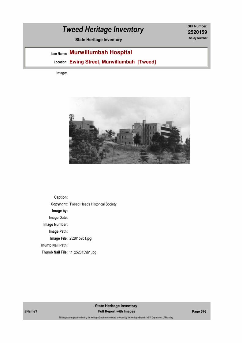
2520159
SHI Number
Tweed Heritage Inventory
Item Name: Murwillumbah Hospital
Location: Ewing Street, Murwillumbah [Tweed]
State Heritage Inventory Study Number
Caption:
Copyright: Tweed Heads Historical Society
Image:
Image by:
Image Date:
Image Number:
Image Path:
Image File: 2520159b1.jpg
Thumb Nail Path:
Thumb Nail File: tn_2520159b1.jpg
#Name? Page 516 Full Report with Images
State Heritage Inventory
This report was produced using the Heritage Database Software provided by the Heritage Branch, NSW Department of Planning.

2520159
SHI Number
Tweed Heritage Inventory
Item Name: Murwillumbah Hospital
Location: Ewing Street, Murwillumbah [Tweed]
State Heritage Inventory Study Number
#Name? Page 517 Full Report with Images
State Heritage Inventory
This report was produced using the Heritage Database Software provided by the Heritage Branch, NSW Department of Planning.
2520169
SHI Number
Tweed Heritage Inventory
Item Name: Government Offices
Location: 135 Murwillumbah Street, Murwillumbah [Tweed]
State Heritage Inventory Study Number
Current Use:
Former Uses:
Statement of Significance:
This building is significant as part of the Murwillumbah Main Street Urban Conservation Area. The Interwar Free Classical style facade of the building contributes to the character of the conservation precinct.
Historical Notes
or Provenance:
Designer:
Maker / Builder:
Endorsed Significance:Assessed Significance:
Item Type: Built Category: Office buildingGroup: Government and Adm
Admin Codes: N Code 2: NC Code 3:
Curtilage/Boundary:
Owner:
Other/Former Names:
Area/Group/Complex: Murwillumbah Main Street Urban Conservation Area Group ID: 24
Themes:
Aboriginal Area:
Local Govt Area: Tweed
Planning: Northern
Historic Region: North Coast
Address: #Name?
Suburb / Nearest Town: #Name?
State: NSW
Parish: Murwillumbah
County: Rous
Local Govt Area: Tweed
Planning: Northern
Historic Region: North Coast
Address: #Name?
Suburb / Nearest Town: #Name?
State: NSW
Parish: Murwillumbah
County: Rous
National Theme State Theme Local Theme
7. Governing Government and administra (none)
#Name? Page 537 Full Report with Images
State Heritage Inventory
This report was produced using the Heritage Database Software provided by the Heritage Branch, NSW Department of Planning.
2520169
SHI Number
Tweed Heritage Inventory
Item Name: Government Offices
Location: 135 Murwillumbah Street, Murwillumbah [Tweed]
State Heritage Inventory Study Number
Physical Description: Interwar free classical with symmetrical facade, divided into bays with pilasters and columns of simplified entabliture. The painted section of the building resembles a Greek Temple. There are elements of earlier building ornamentation eg bracketed awning over windows. The building has a simplified classic front piece of portico balcony and simple brick cladding. Much of the interior is generally intact.
Physical Condition:
Modification Dates:
Year Started: Year Completed: Circa: No
Recommended Management:
Conserve the exterior and interior elements of significance; adapt services and facilities to ensure continued use; remove redundant signs and signs which detract from the style of architecture; provide a suitable colour scheme which compliments the architecture and matches the aspirations of the building owner and tenant; restore damaged and missing original architectural features based on early photographs or technical drawings.
References:
Studies:
Further Comments: Typical
Criteria a)
Criteria c)
Criteria d)
Criteria e)
Criteria g) This item is aesthetically representative
Criteria f)
Integrity / Intactness:
Criteria b) This building is significant as part of the Murwillumbah Main Street Urban Conservation Area. The Interwar Free Classical style facade of the building contributes to the character of the conservation precinct.
Parcels:
Latitude: Longitude:
Spatial Accuracy:Location validity:
Management:
Author Title YearNumber
Tweed Shire Council Community-based Heritage Study 2003
Parcel Code LotNumber Section Plan Code Plan Number
LOT 14 DP 758739
#Name? Page 538 Full Report with Images
State Heritage Inventory
This report was produced using the Heritage Database Software provided by the Heritage Branch, NSW Department of Planning.

2520169
SHI Number
Tweed Heritage Inventory
Item Name: Government Offices
Location: 135 Murwillumbah Street, Murwillumbah [Tweed]
State Heritage Inventory Study Number
Custom Field One:
Listings:
Date Updated: 17/05/2004 Status: BasicDate First Entered: 24/05/2000Data Entry:
Custom Field Two: Art deco
Custom Field Three: B
Custom Field Four:
Custom Field Five:
Custom Field Six:
AMG Zone: Easting: Northing:
Map Name: Map Scale:
Name: Date:Number:Title:
Royal Australian Institute of Architects register
Caption:
Copyright:
Image:
#Name? Page 539 Full Report with Images
State Heritage Inventory
This report was produced using the Heritage Database Software provided by the Heritage Branch, NSW Department of Planning.
2520169
SHI Number
Tweed Heritage Inventory
Item Name: Government Offices
Location: 135 Murwillumbah Street, Murwillumbah [Tweed]
State Heritage Inventory Study Number
Image by:
Image Date:
Image Number: 516
Image Path:
Image File:
Thumb Nail Path:
Thumb Nail File:
#Name? Page 540 Full Report with Images
State Heritage Inventory
This report was produced using the Heritage Database Software provided by the Heritage Branch, NSW Department of Planning.
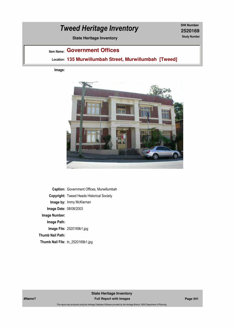
2520169
SHI Number
Tweed Heritage Inventory
Item Name: Government Offices
Location: 135 Murwillumbah Street, Murwillumbah [Tweed]
State Heritage Inventory Study Number
Caption: Government Offices, Murwillumbah
Copyright: Tweed Heads Historical Society
Image:
Image by: Immy McKiernan
Image Date: 08/08/2003
Image Number:
Image Path:
Image File: 2520169b1.jpg
Thumb Nail Path:
Thumb Nail File: tn_2520169b1.jpg
#Name? Page 541 Full Report with Images
State Heritage Inventory
This report was produced using the Heritage Database Software provided by the Heritage Branch, NSW Department of Planning.

2520169
SHI Number
Tweed Heritage Inventory
Item Name: Government Offices
Location: 135 Murwillumbah Street, Murwillumbah [Tweed]
State Heritage Inventory Study Number
Caption: Government Offices, Murwillumbah
Copyright: Tweed Heads Historical Society
Image:
Image by: Immy McKiernan
Image Date: 08/08/2003
Image Number:
Image Path:
Image File: 2520169b2.jpg
Thumb Nail Path:
Thumb Nail File: tn_2520169b2.jpg
#Name? Page 542 Full Report with Images
State Heritage Inventory
This report was produced using the Heritage Database Software provided by the Heritage Branch, NSW Department of Planning.
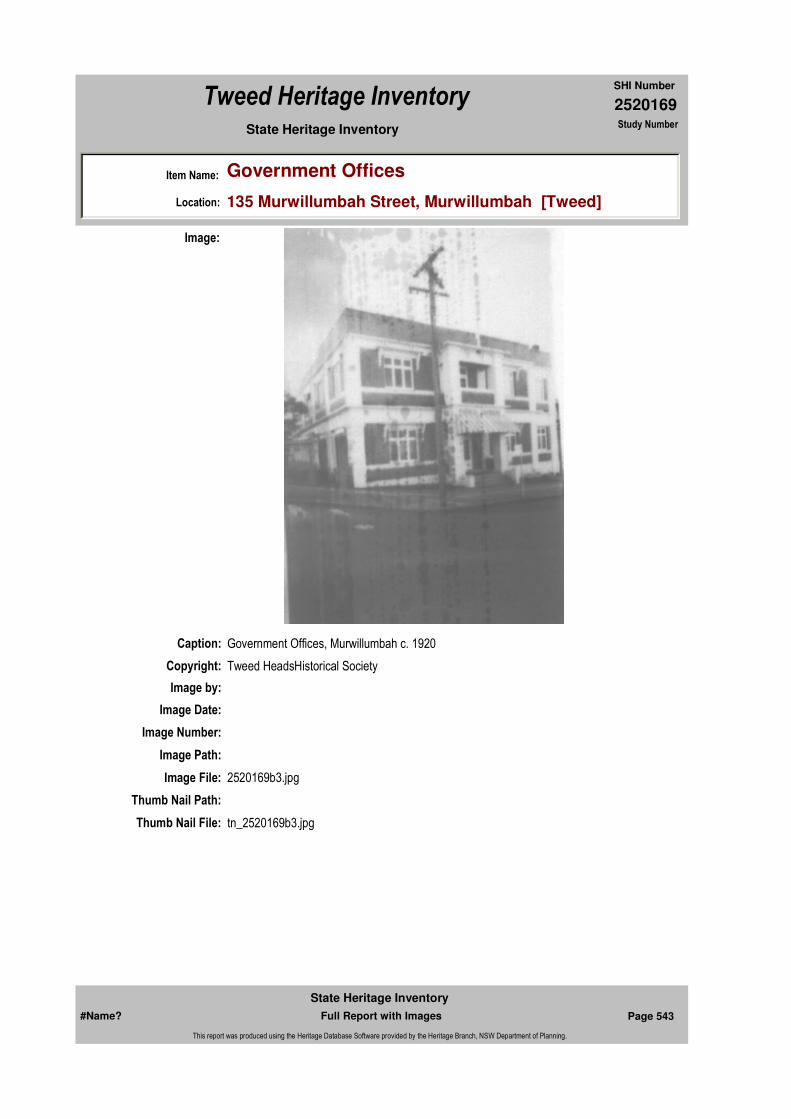
2520169
SHI Number
Tweed Heritage Inventory
Item Name: Government Offices
Location: 135 Murwillumbah Street, Murwillumbah [Tweed]
State Heritage Inventory Study Number
Caption: Government Offices, Murwillumbah c. 1920
Copyright: Tweed HeadsHistorical Society
Image:
Image by:
Image Date:
Image Number:
Image Path:
Image File: 2520169b3.jpg
Thumb Nail Path:
Thumb Nail File: tn_2520169b3.jpg
#Name? Page 543 Full Report with Images
State Heritage Inventory
This report was produced using the Heritage Database Software provided by the Heritage Branch, NSW Department of Planning.
2520169
SHI Number
Tweed Heritage Inventory
Item Name: Government Offices
Location: 135 Murwillumbah Street, Murwillumbah [Tweed]
State Heritage Inventory Study Number
#Name? Page 544 Full Report with Images
State Heritage Inventory
This report was produced using the Heritage Database Software provided by the Heritage Branch, NSW Department of Planning.
2520172
SHI Number
Tweed Heritage Inventory
Item Name: Southern Cross Credit Union
Location: Wharf Street, Murwillumbah [Tweed]
State Heritage Inventory Study Number
Current Use: Credit Union
Former Uses: Commercial Bank of Australia; offices of C.W. Beer and Co. accountants
Statement of Significance:
The Southern Cross Credit Union building is significant as part of the Murwillumbah Main Street Urban Conservation Area. The Interwar free classical style of the building contributes to the character of the precinct.
Historical Notes
or Provenance: Built on the site of Doctor Bell's home and surgery, it was first used by the Banking industry when in 1919 it was the site of the Commercial Bank of Australia. In 1956 it was the offices of C.W. Beer and Co. accountants. In 1973 the Banana Growers Federation purchased the building as headquarters for the members Credit Union which had begun in 1966. In 1976 the name was changed to the Tweed-Byron Credit Union following expansion and a merger with the Lismore Community Credit Union. In 1984 the building was extended to cater for the growth of the business. This building replicated the style of the original. In 199?, the name was again changed following another merger and is now Southern Cross Credit Union. In 2003 the interior underwent extensive renovations.
1946 Accountant (Joyce Martin)
Endorsed Significance:Assessed Significance: Local
Item Type: Built Category: BankGroup: Commercial
Admin Codes: N Code 2: NC Code 3:
Curtilage/Boundary:
Owner: Private - Corporate
Other/Former Names: Credit Union House
Area/Group/Complex: Murwillumbah Main Street Urban Conservation Area Group ID: 70
Themes:
Aboriginal Area:
Local Govt Area: Tweed
Planning: Northern
Historic Region: North Coast
Address: #Name?
Suburb / Nearest Town: #Name?
State: NSW
Parish: Murwillumbah
County: Rous
Local Govt Area: Tweed
Planning: Northern
Historic Region: North Coast
Address: #Name?
Suburb / Nearest Town: #Name?
State: NSW
Parish: Murwillumbah
County: Rous
National Theme State Theme Local Theme
3. Economy Commerce Bank
#Name? Page 551 Full Report with Images
State Heritage Inventory
This report was produced using the Heritage Database Software provided by the Heritage Branch, NSW Department of Planning.

2520172
SHI Number
Tweed Heritage Inventory
Item Name: Southern Cross Credit Union
Location: Wharf Street, Murwillumbah [Tweed]
State Heritage Inventory Study Number
Physical Description: An Interwar free classical style bank building with two extensions completed with faithful attention to detail.
Physical Condition:
Modification Dates: A major extension to the southern facade in 2003.
Designer:
Maker / Builder:
Year Started: Year Completed: 1919 Circa: No
Recommended Management:
References:
Studies:
Further Comments: Typical
Criteria a)
Criteria c)
Criteria d)
Criteria e)
Criteria g) This item is aesthetically representative
Criteria f)
Integrity / Intactness:
Criteria b) The Southern Cross Credit Union building is significant as part of the Murwillumbah Main Street Urban Conservation Area. The Interwar free classical style of the building contributes to the character of the precinct.
Parcels:
Latitude: Longitude:
Management:
Author Title YearNumber
Tweed Shire Council Community-based Heritage Study 2003
Parcel Code LotNumber Section Plan Code Plan Number
LOT 1 DP 780240
#Name? Page 552 Full Report with Images
State Heritage Inventory
This report was produced using the Heritage Database Software provided by the Heritage Branch, NSW Department of Planning.
2520172
SHI Number
Tweed Heritage Inventory
Item Name: Southern Cross Credit Union
Location: Wharf Street, Murwillumbah [Tweed]
State Heritage Inventory Study Number
Custom Field One:
Listings:
Date Updated: 02/11/2004 Status: BasicDate First Entered: 24/05/2000Data Entry:
Custom Field Two: Art deco
Custom Field Three: B
Custom Field Four:
Custom Field Five:
Custom Field Six:
AMG Zone: Easting: Northing:
Map Name: Map Scale:
Spatial Accuracy:Location validity:
Name: Date:Number:Title:
Royal Australian Institute of Architects register
Caption:
Image:
#Name? Page 553 Full Report with Images
State Heritage Inventory
This report was produced using the Heritage Database Software provided by the Heritage Branch, NSW Department of Planning.
2520172
SHI Number
Tweed Heritage Inventory
Item Name: Southern Cross Credit Union
Location: Wharf Street, Murwillumbah [Tweed]
State Heritage Inventory Study Number
Copyright:
Image by:
Image Date:
Image Number: 435
Image Path:
Image File:
Thumb Nail Path:
Thumb Nail File:
#Name? Page 554 Full Report with Images
State Heritage Inventory
This report was produced using the Heritage Database Software provided by the Heritage Branch, NSW Department of Planning.

2520172
SHI Number
Tweed Heritage Inventory
Item Name: Southern Cross Credit Union
Location: Wharf Street, Murwillumbah [Tweed]
State Heritage Inventory Study Number
Caption: Southern Cross Credit Union, Wharf Street, Murwillumbah
Copyright: Tweed Heads Historical Society
Image:
Image by: Immy McKiernan
Image Date: 08/08/2003
Image Number:
Image Path:
Image File: 2520172b1.jpg
Thumb Nail Path:
Thumb Nail File: tn_2520172b1.jpg
#Name? Page 555 Full Report with Images
State Heritage Inventory
This report was produced using the Heritage Database Software provided by the Heritage Branch, NSW Department of Planning.

2520172
SHI Number
Tweed Heritage Inventory
Item Name: Southern Cross Credit Union
Location: Wharf Street, Murwillumbah [Tweed]
State Heritage Inventory Study Number
#Name? Page 556 Full Report with Images
State Heritage Inventory
This report was produced using the Heritage Database Software provided by the Heritage Branch, NSW Department of Planning.
2520174
SHI Number
Tweed Heritage Inventory
Item Name: ANZ Bank
Location: 99 - 103 Murwillumbah Street, Murwillumbah [Tweed]
State Heritage Inventory Study Number
Current Use: ANZ Bank, downstairs; Solicitor upstairs
Former Uses: E S and A Bank (c. 1946) downstairs; Solicitors upstairs
Statement of
Significance:The ANZ Bank is significant as part of the Murwillumbah Main Street Urban Conservation Area. The Interwar free classical style façade of the building contributes to the character of the conservation precinct.
Historical Notes
or Provenance:
Physical Description: Bank of Interwar free classical style. Symmetrical facade. Columns unconventional order of architecture. Giant order. Entablature as parapet.
Physical Condition: Good, appropriate heritage colour scheme recommended
Designer:
Maker / Builder:
Year Started: Year Completed: 1923 Circa: No
Endorsed Significance:Assessed Significance: Local
Item Type: Built Category: BankGroup: Commercial
Admin Codes: N Code 2: NC Code 3:
Curtilage/Boundary:
Owner: Private - Corporate
Other/Former Names: English, Scottish and Australian Bank
Area/Group/Complex: MurwillumbahMain Street Urban Conservation Area Group ID: 18
Themes:
Aboriginal Area:
Local Govt Area: Tweed
Planning: Northern
Historic Region: North Coast
Address: #Name?
Suburb / Nearest Town: #Name?
State: NSW
Parish: Murwillumbah
County: Rous
National Theme State Theme Local Theme
3. Economy Commerce Bank
#Name? Page 557 Full Report with Images
State Heritage Inventory
This report was produced using the Heritage Database Software provided by the Heritage Branch, NSW Department of Planning.
2520174
SHI Number
Tweed Heritage Inventory
Item Name: ANZ Bank
Location: 99 - 103 Murwillumbah Street, Murwillumbah [Tweed]
State Heritage Inventory Study Number
Modification Dates: 1923
Custom Field One:
Recommended Management:
Conserve the exterior and interior elements of significance; adapt services and facilities to ensure continued use; remove redundant signs and signs which detract from the style of architecture; provide a suitable colour scheme which compliments the architecture and matches the aspirations of the building owner and tenant; restore damaged and missing original architectural features based on early photographs or technical drawings.
References:
Studies:
Listings:
Further Comments: Typical
Criteria a)
Criteria c)
Criteria d)
Criteria e)
Criteria g) This item is aesthetically representative
Criteria f)
Integrity / Intactness:
Custom Field Two: Art deco
Criteria b) The ANZ Bank is significant as part of the Murwillumbah Main Street Urban Conservation Area. The Interwar free classical style façade of the building contributes to the character of the conservation precinct.
Parcels:
Latitude: Longitude:
AMG Zone: Easting: Northing:
Map Name: Map Scale:
Spatial Accuracy:Location validity:
Management:
Author Title YearNumber
Tweed Shire Council Community-based Heritage Study 2003
Name: Date:Number:Title:
Royal Australian Institute of Architects register
Parcel Code LotNumber Section Plan Code Plan Number
LOT 2 DP 772895
#Name? Page 558 Full Report with Images
State Heritage Inventory
This report was produced using the Heritage Database Software provided by the Heritage Branch, NSW Department of Planning.
2520174
SHI Number
Tweed Heritage Inventory
Item Name: ANZ Bank
Location: 99 - 103 Murwillumbah Street, Murwillumbah [Tweed]
State Heritage Inventory Study Number
Date Updated: 19/05/2004 Status: BasicDate First Entered: 24/05/2000Data Entry:
Custom Field Three: B
Custom Field Four:
Custom Field Five:
Custom Field Six:
Caption:
Copyright:
Image:
Image by:
Image Date:
Image Number: 513
Image Path:
Image File:
Thumb Nail Path:
Thumb Nail File:
#Name? Page 559 Full Report with Images
State Heritage Inventory
This report was produced using the Heritage Database Software provided by the Heritage Branch, NSW Department of Planning.
2520174
SHI Number
Tweed Heritage Inventory
Item Name: ANZ Bank
Location: 99 - 103 Murwillumbah Street, Murwillumbah [Tweed]
State Heritage Inventory Study Number
#Name? Page 560 Full Report with Images
State Heritage Inventory
This report was produced using the Heritage Database Software provided by the Heritage Branch, NSW Department of Planning.

2520174
SHI Number
Tweed Heritage Inventory
Item Name: ANZ Bank
Location: 99 - 103 Murwillumbah Street, Murwillumbah [Tweed]
State Heritage Inventory Study Number
Caption: ANZ bank, Murwillumbah Street, Murwillumbah.
Copyright: Tweed Heads Historical Society
Image:
Image by: Immy McKiernan
Image Date: 08/08/2003
Image Number:
Image Path:
Image File: 2520174b1.jpg
Thumb Nail Path:
Thumb Nail File: tn_2520174b1.jpg
#Name? Page 561 Full Report with Images
State Heritage Inventory
This report was produced using the Heritage Database Software provided by the Heritage Branch, NSW Department of Planning.

2520174
SHI Number
Tweed Heritage Inventory
Item Name: ANZ Bank
Location: 99 - 103 Murwillumbah Street, Murwillumbah [Tweed]
State Heritage Inventory Study Number
#Name? Page 562 Full Report with Images
State Heritage Inventory
This report was produced using the Heritage Database Software provided by the Heritage Branch, NSW Department of Planning.
2520175
SHI Number
Tweed Heritage Inventory
Item Name: Commercial Premises
Location: Wharf Street, Murwillumbah [Tweed]
State Heritage Inventory Study Number
Current Use: Vacant
Former Uses: Bank
Statement of
Significance:The former Rural Bank is significant as part of the Murwillumbah Main Street Urban Conservation Area. The Interwar Art Deco style façade of the building contributes to the character of the conservation precinct.
Historical Notes
or Provenance: Originally the Rural Bank, also traded as the State Bank
Physical Description: Bank of Interwar art deco style with classical influences. Breakfront central projecting facade. Emphatic portal over two floors with narrow quoining as frame. Windows have been significantly adjusted. Strong base. Stylised vertical motif above portal. Horizontal parrallel line motif to upper floor balcony. Accordian brickwork. Frieze/string course and cornice.
Designer:
Maker / Builder: Jock Sutton
Year Started: Year Completed: Circa: No
Endorsed Significance:Assessed Significance: Local
Item Type: Built Category: BankGroup: Commercial
Admin Codes: N Code 2: NC Code 3:
Curtilage/Boundary:
Owner: Private - Individual
Other/Former Names: Rural Bank (former)
Area/Group/Complex: Murwillumbah Main Street Urban Conservation Area Group ID: 2
Themes:
Aboriginal Area:
Local Govt Area: Tweed
Planning: Northern
Historic Region: North Coast
Address: #Name?
Suburb / Nearest Town: #Name?
State: NSW
Parish: Murwillumbah
County: Rous
National Theme State Theme Local Theme
3. Economy Commerce Bank
#Name? Page 563 Full Report with Images
State Heritage Inventory
This report was produced using the Heritage Database Software provided by the Heritage Branch, NSW Department of Planning.
2520175
SHI Number
Tweed Heritage Inventory
Item Name: Commercial Premises
Location: Wharf Street, Murwillumbah [Tweed]
State Heritage Inventory Study Number
Rounded corners to projecting facade. Vertical motif above portal.
Physical Condition:
Modification Dates:
Custom Field One:
Recommended Management:
References:
Studies:
Listings:
Further Comments: Typical
Criteria a)
Criteria c)
Criteria d)
Criteria e)
Criteria g) This item is aesthetically representative
Criteria f)
Integrity / Intactness:
Custom Field Two: Art deco
Criteria b) The former Rural Bank is significant as part of the Murwillumbah Main Street Urban Conservation Area. The Interwar Art Deco style façade of the building contributes to the character of the conservation precinct.
Parcels:
Latitude: Longitude:
AMG Zone: Easting: 539068 Northing: 6866300
Map Name: Map Scale:
Spatial Accuracy:Location validity:
Management:
Author Title YearNumber
Tweed Shire Council Community-based Heritage Study 2003
Name: Date:Number:Title:
Royal Australian Institute of Architects register
Parcel Code LotNumber Section Plan Code Plan Number
LOT 1, 2 DP 780225
#Name? Page 564 Full Report with Images
State Heritage Inventory
This report was produced using the Heritage Database Software provided by the Heritage Branch, NSW Department of Planning.
2520175
SHI Number
Tweed Heritage Inventory
Item Name: Commercial Premises
Location: Wharf Street, Murwillumbah [Tweed]
State Heritage Inventory Study Number
Date Updated: 22/11/2006 Status: BasicDate First Entered: 24/05/2000Data Entry:
Custom Field Three: B
Custom Field Four:
Custom Field Five:
Custom Field Six:
Caption:
Copyright:
Image:
Image by:
Image Date:
Image Number: 52
Image Path:
Image File:
Thumb Nail Path:
Thumb Nail File:
#Name? Page 565 Full Report with Images
State Heritage Inventory
This report was produced using the Heritage Database Software provided by the Heritage Branch, NSW Department of Planning.

2520175
SHI Number
Tweed Heritage Inventory
Item Name: Commercial Premises
Location: Wharf Street, Murwillumbah [Tweed]
State Heritage Inventory Study Number
#Name? Page 566 Full Report with Images
State Heritage Inventory
This report was produced using the Heritage Database Software provided by the Heritage Branch, NSW Department of Planning.
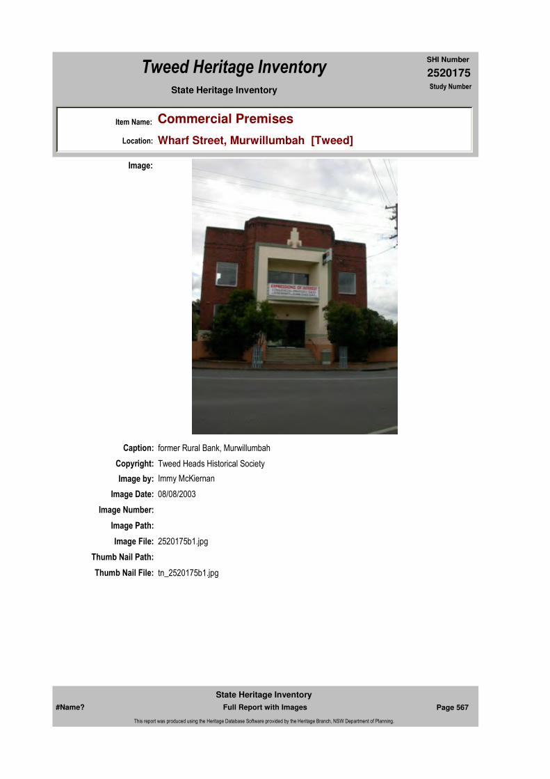
2520175
SHI Number
Tweed Heritage Inventory
Item Name: Commercial Premises
Location: Wharf Street, Murwillumbah [Tweed]
State Heritage Inventory Study Number
Caption: former Rural Bank, Murwillumbah
Copyright: Tweed Heads Historical Society
Image:
Image by: Immy McKiernan
Image Date: 08/08/2003
Image Number:
Image Path:
Image File: 2520175b1.jpg
Thumb Nail Path:
Thumb Nail File: tn_2520175b1.jpg
#Name? Page 567 Full Report with Images
State Heritage Inventory
This report was produced using the Heritage Database Software provided by the Heritage Branch, NSW Department of Planning.

2520175
SHI Number
Tweed Heritage Inventory
Item Name: Commercial Premises
Location: Wharf Street, Murwillumbah [Tweed]
State Heritage Inventory Study Number
Caption: Rural Bank, Murwillumbah
Copyright: Tweed Heads Historical Society
Image:
Image by:
Image Date:
Image Number:
Image Path:
Image File: 2520175b2.jpg
Thumb Nail Path:
Thumb Nail File: tn_2520175b2.jpg
#Name? Page 568 Full Report with Images
State Heritage Inventory
This report was produced using the Heritage Database Software provided by the Heritage Branch, NSW Department of Planning.

2520175
SHI Number
Tweed Heritage Inventory
Item Name: Commercial Premises
Location: Wharf Street, Murwillumbah [Tweed]
State Heritage Inventory Study Number
#Name? Page 569 Full Report with Images
State Heritage Inventory
This report was produced using the Heritage Database Software provided by the Heritage Branch, NSW Department of Planning.

2520190
SHI Number
Tweed Heritage Inventory
Item Name: Tweed Heads Maritime Museum - former Tweed H
Location: Pioneer Park, Kennedy Drive, Tweed Heads West [Tweed]
State Heritage Inventory Study Number
Current Use: Museum Building
Former Uses: Court House
Statement of
Significance:The Tweed Heads courthouse is important in the course of the Tweed Shire's cultural history. This item has a strong association with the community of Tweed Heads. This building was constructed to the standard police station/ courthouse PWD plan of the Edwardian era.
Historical Notes
or Provenance:Before the early 1890's there existed no law and order in the Cooloon district, the nearest Police Station being located twenty miles south in Murwillumbah and twenty miles north in Southport.
It was decided around the time (early 1890's) that law and order should be established locally at Cooloon, which is now known as Tweed Heads. So plans and specifications were drawn up under the supervision of the then Government Architect Walter Vernon. Tenders were called for on the 22nd October 1895 for the construction of Police Buildings at Cooloon (Tweed River Heads). On the 9th day of September in the year of 1895 it was announced that a tender had been accepted for the erection of the Police Station at Cooloon.
The tender that was approved was the one submitted by a Murwillumbah builder by the name of H. Mimnow.
It was shown by the 30th June 1895 that exactly £546/6/6 had been already expended on the construction of the weatherboard building. A finishing date is unobtainable and so it can be reckoned that the building was finished sometime in the later half of 1896 because the amount mentioned previously (£546/6/6) was nearly the completed cost.
Endorsed Significance:Assessed Significance: Local
Item Type: Built Category: CourthouseGroup: Law Enforcement
Admin Codes: N Code 2: NC Code 3:
Curtilage/Boundary:
Owner: Private - Community Group
Other/Former Names: former Courthouse building
Area/Group/Complex: Tweed Heads Maritime Museum Group ID:
Aboriginal Area:
Local Govt Area: Tweed
Planning: Northern
Historic Region: North Coast
Address: #Name?
Suburb / Nearest Town: #Name?
State: NSW
Parish: Terranora
County: Rous
#Name? Page 623 Full Report with Images
State Heritage Inventory
This report was produced using the Heritage Database Software provided by the Heritage Branch, NSW Department of Planning.

2520190
SHI Number
Tweed Heritage Inventory
Item Name: Tweed Heads Maritime Museum - former Tweed H
Location: Pioneer Park, Kennedy Drive, Tweed Heads West [Tweed]
State Heritage Inventory Study Number
With the growth of the town of Tweed Heads the services of a Judge and Magistrate were required to relieve Murwillumbah of some of its burden. So on the 2lst January 1907, a Court was established at Tweed Heads to relieve Murwillumbah. Though it is not certain where the court sittings were held, probably at the Police Station or maybe in a rented building for the purpose of Court Hearings, it was eventually necessary to erect a permanent building designed specifically for that purpose. So by the end of 1925, to do away with the previous makeshift arrangements, plans for the alterations of the existing Police Station, and to have a new Court House Complex attached to it were drawn up under the supervision of the then Government Architect Gorris McGleish Blaire.
The contract was put to tender on the 16th July 1926 and the work was completed in 1927 for a total cost of £ 1727 ($2454). The original Police Station was to the south east end of the complex which is to the left of the Police Station/Court House complex as viewed from Wharf St., or the Gold Coast Highway.
TWEED HEADS MUSEUM.The Court and offices are the only part of the Tweed Heads Police Station and Court House that will be preserved as a museum. The reason for this is as it is with most things, the cost involved. The positioning of the Twin Towns Services Club had a lot to do with this, their need for additional car parking facilities prompted them to make an offer to relocate the Tweed Heads Police Station and Court House to Recreation St., so that they could have the old site as extra parking. Because of the historical value of the buildings it was desirous to try and preserve them. But because of costs it was possible only to save the smaller Court House section.
The original Police Station was completed in 1896. Nine years later the first Court of Petty Sessions was held on January 21st 1907. This was to relieve Murwillumbah District Court House of some burden.In 1925 plans were drawn up for alterations to the Police Station and Court House.
The preservation of the old Court House, when it was moved on the back of a semi-trailer to a site on Kennedy Drive, West Tweed Heads, near the Cobaki Bridge, was thus completed. The Coolangatta/Tweed Heads Lions Club handed over the building to Tweed Shire Council President Max Boyd on Sunday the 29th March 1965 at 11 am. The idea was to provide a housing for historical information and photographs of the local area, and what better way to do it than in the Old Court House.Members of the Tweed Heads Chamber of Commerce and the Coolangatta/Tweed Heads Lions Club talked it over about the possibility of saving the Court House from demolition and preserving it as a Museum.
The Twin Towns Services Club co-operated and handed the building over to the Community.The Baker brothers, developers of Banora Hills and the Cobaki Village put up $6000.00 for the buildings removal.
Once the official approval was granted by the Lands Department through the Tweed Shire Council work was commenced by the Terranora Lions to install and site the building on its present location.A great deal of carpentry work was necessary to restore the western wall, where it where it
#Name? Page 624 Full Report with Images
State Heritage Inventory
This report was produced using the Heritage Database Software provided by the Heritage Branch, NSW Department of Planning.

2520190
SHI Number
Tweed Heritage Inventory
Item Name: Tweed Heads Maritime Museum - former Tweed H
Location: Pioneer Park, Kennedy Drive, Tweed Heads West [Tweed]
State Heritage Inventory Study Number
originally joined the Old Police Station, to the original weather proof condition.
Tweed Shire Council was right behind the project and installed the necessary electrical wiring and a great deal was spent towards the landscaping of the surrounding parklands.
Security bars were fitted to all the windows and a professional paint job have combined to bring back the old Court House to life.
The park now known as the Lions Pioneer Park is being transformed into a major tourist attraction with the old Court House as its centre. Amenities are going to be installed such as a kiosk on the waterfront, a jetty for visitors who will arrive by boat across the water, barbecues and a walk-way out over the water and under the Cobaki Bridge for the Pedestrians are all on the Council's drawing board.A committee has been formed to administer the building and organise its affairs to see the whole project through to its ultimate fulfilment of becoming the Tweed Heads Photographic Museum capturing the very history of the local area in eyewitness pictures.
The committee known as the Committee For The Restoration of the Court House Museum, consists of representatives from. the Tweed Shire Council, the Tweed Heads Chamber of Commerce, Coolangatta/Tweed Heads Lions and the Lower Tweed Heads Historical Society.
Sunday's ceremony will formally pass control of the building to this committee.( The Old Tweed Heads District Courthouse by Randolph Wood Assignment - History of Construction 1986)
Retaining the 98-year-old former Tweed Heads Court House as an historic building has preserved something really special to Tweed Heads, shire president Max Boyd said on Sunday as the old building was handed over to his council for safekeeping.
It is destined to become the town's first museum. Cr. Boyd said the Lions of Coolangatta-Tweed Heads had created something lasting and special for the town by renovating and re-siting the building alongside the banks of Terranora Inlet.
Former Lions president, Peter Mason, and current president Bert Morton, formally handed over responsibility for the building to Cr. Boyd, who acted on behalf of a special committee of management, comprising representatives of the newly former Lower Tweed Historical Society, the Chamber of Commerce, Lions and council.
Mr Mason thanked various organisations and people for assistance which helped make this Lions project a reality.
However, it was Cr. Boyd, with his vast knowledge of the area's history, who entertained the audience, as he spoke of the role the old court house had played in its heyday.
"There are very few significant structures remaining 160 years after Oxley arrived here in 1823, so to take that step was quite a courageous one and I commend Jock and the
#Name? Page 625 Full Report with Images
State Heritage Inventory
This report was produced using the Heritage Database Software provided by the Heritage Branch, NSW Department of Planning.

2520190
SHI Number
Tweed Heritage Inventory
Item Name: Tweed Heads Maritime Museum - former Tweed H
Location: Pioneer Park, Kennedy Drive, Tweed Heads West [Tweed]
State Heritage Inventory Study Number
Chamber for accepting that challenge", Cr. Boyd said.
If it hadn't been for the generous support from Mr Baker and his developments to the amount of $6000 it would have been somebody else's job to come up with that amount of finance to move the building from its old site to this particular one.
'The whole history of this centre evolved around the river and the Terranora Inlet, because, those of you who know your history would know that over on the other side of the inlet, down Dry Dock Road was where the very first settlers of the Tweed Shire established a small village called Terranora."As time went by and the advantage improved, it seemed a better idea to move from there down to what became known as "Cooloon" and that was how the settlement remained for a great number of years as a government town.
"On October 22, 1895 this magnificent structure was put into Tweed Heads as the first courthouse to serve the Tweed River Heads, as it was called then.
"It's hard to really build a soul or to create a soul but here in Tweed Heads I believe that this is the sort of vocal point that will enhance living here by providing a location to store historical artifacts.
"I'm delighted that Tweed Shire took the trouble to go up and have a look at Fred Lang's tremendous volume of photography at his home not only photographs but negatives and cameras galore.
"The whole council went and had a look at some of what he had there and we picked out a selection of about 30 or 40 particular subjects, black and white, which we purchased from him.
"The largest percentage of which we are going to make available to this building for the walls, so at least you've got a few things to start with.
A brief history of the Tweed Heads Courthouse:By the early 1890's the vicinity of the Tweed River Heads was known as Cooloon when it was decided to establish law and order locally.
On December 9, 1895, it was given that the tender of H. Mimnaw of Murwillumbah had been accepted for the erection of the police station at Cooloon. By June 30, 1896, it was shown that 546 pound, 6 shillings, and 6 pence had been expended already on the construction of the weatherboard building.However, as this was very nearly the completed cost it can be taken that it was finished in the latter half of 1896.
Subsequently on January 21, 1907, with the growth of Tweed Heads, a Court of Petty Sessions was established at Tweed Heads to relieve Murwillum-bah court house of some of its burden.
By the end of 1925 plans for alterations to the police station, together with a new court
#Name? Page 626 Full Report with Images
State Heritage Inventory
This report was produced using the Heritage Database Software provided by the Heritage Branch, NSW Department of Planning.

2520190
SHI Number
Tweed Heritage Inventory
Item Name: Tweed Heads Maritime Museum - former Tweed H
Location: Pioneer Park, Kennedy Drive, Tweed Heads West [Tweed]
State Heritage Inventory Study Number
house added to it, had been drawn up under the government architect, Gorrie McLeish Blair.
The work went to tender on July 16, 1926 and was completed in 1927 for 1727 pounds.
I'd like to mention a few brief highlights of history in this area which is related to the history of Queensland.
In 1824 the Moreton Bay penal settlement was established, bearing in mind Oxley, on his way there, established the Tweed in 1873.
The very first escapees from that settlement arrived in Port Macquarie in 1825 so we had our first visitors through here then.
In 1828 the number of runaways reached such a figure that Captain Logan decided that he had better send a contingent of soldiers down to Point Danger to capture escapees as they came through.In 1842 the Moreton Bay penal settlement closed and the first serious settlement on the Tweed occurred. Not quite sure of the source but I think Lyell will probably follow this through and just see how authentic that really is, but even historian's like Mr Longhurst can make mistakes.
I'm not too sure of his authenticity but these are some of the points that he wrote. He also said that one of the first boats to cross the Tweed bar was a 60 ton schooner in 1843, followed by a series of wrecks in 1846,1847 and 1848. Of these the most famous was Coolangatta which was wrecked on the beach in 1846.
In 1847 the Rosin was wrecked followed in May 1848 by the Fanny Morris, the Lyell James, and in 1859 our own relatives were drowned in a wreck in July.
In 1869 thousands of acres of land were taken up with regard to sugar cane and one of the first cane dwellers was Michael Guilfoyle in the Cudgen area.
It is interesting to go through documents and delve into the history rather than the highlights of the Tweed and Rous.
I'm sure that this building will be the focal point of a great deal of research to perpetuate the valuable history that exists in Tweed Heads and surrounding areas and preserve it for all time.
I hope that in the very near future we'll see a very marked change to what we have in here now, it will be filled with artifacts, photographs and all sorts of things that are part of the history of this area.(Daily News, April 4 1985 - "Court House harbours history")
An historic building will on Sunday take on a new lease of life, destined to become the home
#Name? Page 627 Full Report with Images
State Heritage Inventory
This report was produced using the Heritage Database Software provided by the Heritage Branch, NSW Department of Planning.
2520190
SHI Number
Tweed Heritage Inventory
Item Name: Tweed Heads Maritime Museum - former Tweed H
Location: Pioneer Park, Kennedy Drive, Tweed Heads West [Tweed]
State Heritage Inventory Study Number
for a Tweed Heads Historical museum.
The former Tweed Heads Court House has been restored and refurbished by the Coolangatta-Tweed Heads Lions club, and at 11am on Sunday morning club president Bert Morton will hand the building over to Tweed Shire council president Max Boyd, who will accept it on behalf of the administering body.Mr Morton said yesterday he hoped many local people would be at the Lions Pioneer Park, near the Cobaki Bridge off Kennedy Drive to see the handover of the historic building.
Lion Peter Mason who was president of the club when the project to move the Court House from its site opposite the Twin Towns Services Club and restore it alongside the Terranora Inlet, began, has traced the two-year history of the plan to provide the town with its own home for historical memorabilia.
"Members of the Tweed Heads Chamber of Commerce in February 1983 discussed with members of Coolangatta/Tweed Heads Lions the possibility of saving the Tweed Heads Court House from demolition and preserving it for posterity on a site to be used as a museum.
"The Twin Towns Services Club, which had acquired the land and buildings, was approached and made a decision to hand the Court House building over to the community
"The initial transfer of the building would not have come about without a generous donation of $6000 put up through the chamber of commerce by the Baker Bros. developers of Banora Hills and the Cobaki Village, for the building's removal," Mr Mason said.
Lions club took on the mammoth task of organising the move to its present site adjacent to the Cobaki Bridge and the tedious and costly renovation work to restore the building to its original condition.Once official approval was granted by the Lands Department through the Tweed Shire Council, work commenced by the Terranora Lions to install and site the building on its present foundations.
A great deal of carpentry work was necessary to restore the western wall, where it originally joined the old police station, to original weatherproof condi-tion.
Tweed Shire Council were right behind the project and installed the necessary electrical wiring and a great deal towards the landscaping of the surrounding park.
Security bars fitted to all windows and a professional paint job have combined to bring back the old Court House to life.
The park, now known as the Lions Pioneer Park, is slowing being transformed into what will be a must for visitors and locals.
Amenities such as a new kiosk on the waterfront, a jetty for visitors by boat, barbecues and a walkway out over the water and under the bridge for pedestrians are all on the council's drawing board.
#Name? Page 628 Full Report with Images
State Heritage Inventory
This report was produced using the Heritage Database Software provided by the Heritage Branch, NSW Department of Planning.

2520190
SHI Number
Tweed Heritage Inventory
Item Name: Tweed Heads Maritime Museum - former Tweed H
Location: Pioneer Park, Kennedy Drive, Tweed Heads West [Tweed]
State Heritage Inventory Study Number
A committee has been formed to administer the building and see it through to the ultimate dream of creating a photographic museum of Tweed Heads and its past.
The committee known as The Committee for the restoration of the Court House Museum, consists of representatives from the Tweed Shire Council, the Tweed Heads Chamber of Commerce, Coolangat-ta/Tweed Heads Lions and the Lower Tweed River Historical Society.
Sunday's ceremony will formally pass control of the building to this committee.(Daily News March 29, 1985 "Historic building becomes museum")
Physical Description: A relocated 1920's building, removed to Pioneer Park from its original site in Wharf Street Tweed Heads, adjacent to the border and restored. Includes cedar interiors dock, partitioning and bench.
Physical Condition:
Modification Dates:
Designer:
Maker / Builder:
Year Started: Year Completed: Circa: No
Recommended
Management:
Further Comments:
Criteria a) The Tweed Heads courthouse is important in the course of the Tweed Shire's cultural history.
Criteria c)
Criteria d)
Criteria e)
Criteria b) This item has a strong association with the community of Tweed Heads. This building was constructed to the standard police station/ courthouse PWD plan of the Edwardian era
Themes:
Management:
National Theme State Theme Local Theme
7. Governing Law and order Courthouse
8. Culture Leisure Museum
#Name? Page 629 Full Report with Images
State Heritage Inventory
This report was produced using the Heritage Database Software provided by the Heritage Branch, NSW Department of Planning.
2520190
SHI Number
Tweed Heritage Inventory
Item Name: Tweed Heads Maritime Museum - former Tweed H
Location: Pioneer Park, Kennedy Drive, Tweed Heads West [Tweed]
State Heritage Inventory Study Number
Custom Field One:
References:
Studies:
Listings:
Date Updated: 03/11/2004 Status: BasicDate First Entered: 24/05/2000Data Entry:
Criteria g)
Criteria f)
Integrity / Intactness:
Custom Field Two:
Custom Field Three: B
Custom Field Four:
Custom Field Five:
Custom Field Six:
Parcels:
Latitude: Longitude:
AMG Zone: Easting: Northing:
Map Name: Map Scale:
Spatial Accuracy:Location validity:
Author Title Year
Historic building becomes museum 1985
Court House harbours history 1985
Randolph Wood The Old Tweed Heads District Courthouse History of Construction
1986
Author Title YearNumber
Tweed Shire Council Community-based Heritage Study 2003
Name: Date:Number:Title:
Royal Australian Institute of Architects register
Parcel Code LotNumber Section Plan Code Plan Number
LOT 3 DP 44829
#Name? Page 630 Full Report with Images
State Heritage Inventory
This report was produced using the Heritage Database Software provided by the Heritage Branch, NSW Department of Planning.
2520190
SHI Number
Tweed Heritage Inventory
Item Name: Tweed Heads Maritime Museum - former Tweed H
Location: Pioneer Park, Kennedy Drive, Tweed Heads West [Tweed]
State Heritage Inventory Study Number
Caption:
Copyright:
Image:
Image by:
Image Date:
Image Number: 411
Image Path:
Image File:
Thumb Nail Path:
Thumb Nail File:
#Name? Page 631 Full Report with Images
State Heritage Inventory
This report was produced using the Heritage Database Software provided by the Heritage Branch, NSW Department of Planning.

2520190
SHI Number
Tweed Heritage Inventory
Item Name: Tweed Heads Maritime Museum - former Tweed H
Location: Pioneer Park, Kennedy Drive, Tweed Heads West [Tweed]
State Heritage Inventory Study Number
Caption: The former Tweed Heads Courthouse at Tweed Heads Maritime Museum, West Tweed Heads
Copyright: Tweed Heads Historical Society
Image:
Image by: Immy McKiernan
Image Date: 15/11/2003
Image Number:
Image Path:
Image File: 2520190b1.jpg
Thumb Nail Path:
Thumb Nail File: tn_2520190b1.jpg
#Name? Page 632 Full Report with Images
State Heritage Inventory
This report was produced using the Heritage Database Software provided by the Heritage Branch, NSW Department of Planning.

2520190
SHI Number
Tweed Heritage Inventory
Item Name: Tweed Heads Maritime Museum - former Tweed H
Location: Pioneer Park, Kennedy Drive, Tweed Heads West [Tweed]
State Heritage Inventory Study Number
Caption: The Tweed Heads Courthouse in its original location in Wharf Street, Tweed Heads, 1963
Copyright: Tweed Heads Historical Society
Image:
Image by:
Image Date:
Image Number:
Image Path:
Image File: 2520190b2.jpg
Thumb Nail Path:
Thumb Nail File: tn_2520190b2.jpg
#Name? Page 633 Full Report with Images
State Heritage Inventory
This report was produced using the Heritage Database Software provided by the Heritage Branch, NSW Department of Planning.

2520190
SHI Number
Tweed Heritage Inventory
Item Name: Tweed Heads Maritime Museum - former Tweed H
Location: Pioneer Park, Kennedy Drive, Tweed Heads West [Tweed]
State Heritage Inventory Study Number
#Name? Page 634 Full Report with Images
State Heritage Inventory
This report was produced using the Heritage Database Software provided by the Heritage Branch, NSW Department of Planning.

2520195
SHI Number
Tweed Heritage Inventory
Item Name: Hall and School of Arts
Location: Kyogle Road, Uki [Tweed]
State Heritage Inventory Study Number
Current Use:
Former Uses:
Statement of
Significance:Including war memorial housed in hall. The Uki Hall has a strong association with the residents of Uki. It has acted as a centre for social and cultural activities for nearly 100 years. Uki Hall continues to hold significant importance in the social and cultural life of the Shire. It is important to the streetscape of the village.The memorial is part of the cultural history of the Tweed Valley and has a special association with the community in which it is housed. The Honour Board has special significance for the community of Uki and the South Arm as it marks the contribution made by the residents to service during the First World War.
Historical Notes or Provenance:
The first building in Uki, the "small" Hall was erected on land reserved for a Mechanics' Institute in the Government Gazette of 25th June 1904. The "big" Hall was built on adjacent land in 1911and was financed by the district residents and an overdraft at the E.S&A Bank at a cost of 700 pounds.
In 1914, the Hall was saved from fire by volunteers, lead by Jim Mitchell. The fire destroyed the Bank, Post Office, Auctioneers and Loder's Store. Mr. Loder re-opened his store in the hall until the new shop was built.
Reserve 37862 was revoked in the Government gazette of 14th April 1915 and replaced by a dedication for a Literary Institute. The trustees appointed were David Cleaton Marshall, John Radel, George Sweetnam, John McCollum, Patrick Hector McDonald, Charles Roberts and William Oliver Irvine.
The hall has served as a vital part of the social, religious and educational life of the village.
Endorsed Significance:Assessed Significance: Local
Item Type: Built Category: Other - Community FaGroup: Community Facilities
Admin Codes: N Code 2: NC Code 3:
Curtilage/Boundary:
Owner: Private - Community Group
Other/Former Names:
Area/Group/Complex: Group ID:
Aboriginal Area:
Local Govt Area: Tweed
Planning: Northern
Historic Region: North Coast
Address: #Name?
Suburb / Nearest Town: #Name?
State: NSW
Parish: Kunghur
County: Rous
#Name? Page 635 Full Report with Images
State Heritage Inventory
This report was produced using the Heritage Database Software provided by the Heritage Branch, NSW Department of Planning.

2520195
SHI Number
Tweed Heritage Inventory
Item Name: Hall and School of Arts
Location: Kyogle Road, Uki [Tweed]
State Heritage Inventory Study Number
The first land sales for the Village were held there in 1905. Before the churches were built, services were held there with people of all denominations attending. Balls, dances travelling picture shows, concerts, roller-skating and indoor bowls, all drew crowds from the surrounding valleys. Classes were held in Arts and Crafts and a lending Library operated for many years, patronised not only for the literature available but also as a meeting place for young people with other interests in mind.
The hall continues to play a vital role in the community as a meeting place for a range of organisations and with educational activities ranging from Aikido to belly dancing. Weekly social card days for the older residents and a craft and produce market fill a need for both long- term and new residents.Hall trustees in 2003 are Kay Bristow, Kevin Donaldson, Jayne Parrott, Janaki Pearson, Jeanette Simpson and Marion Roberts, a descendant of Charles Roberts.
Physical Description: Simple gable concealing parapet. Projecting piers with central gable.Community hallWar memorial: Beaten copper mounted on timber board. Year: 1947
Physical Condition: good. New fire doors needed.
Modification Dates: 1911 Kitchen and "big" Hall added.1946 Concrete stumps and new teak dance floor.Modifications to war memorial: central badge has been stolen.
Designer:
Maker / Builder: Clarke and Clough ("big" Hall-1911)
Year Started: Year Completed: 1904 Circa: Yes
Recommended
Management:
Further Comments:
Criteria a)
Criteria b) The Uki Hall has a strong association with the residents of Uki. It has acted as a centre for social and cultural activities for nearly 100 years. Uki Hall continues to hold significant importance in the social and cultural life of the Shire. It is important to the streetscape of the village.The memorial is part of the cultural history of the Tweed Valley and has a special association
Themes:
Management:
National Theme State Theme Local Theme
8. Culture Social institutions Community Hall
#Name? Page 636 Full Report with Images
State Heritage Inventory
This report was produced using the Heritage Database Software provided by the Heritage Branch, NSW Department of Planning.

2520195
SHI Number
Tweed Heritage Inventory
Item Name: Hall and School of Arts
Location: Kyogle Road, Uki [Tweed]
State Heritage Inventory Study Number
Custom Field One:
References:
Studies:
Listings:
Date Updated: 01/11/2004 Status: BasicDate First Entered: 24/05/2000Data Entry:
Criteria c)
Criteria d)
Criteria e)
Criteria g)
Criteria f)
Integrity / Intactness:
Custom Field Two:
Custom Field Three: B
Custom Field Four:
Custom Field Five:
Custom Field Six:
with the community in which it is housed. The Honour Board has special significance for the community of Uki and the South Arm as it marks the contribution made by the residents to service during the First World War.
Parcels:
Latitude: Longitude:
AMG Zone: Easting: Northing:
Map Name: Map Scale:
Spatial Accuracy:Location validity:
Author Title Year
H.J. Irvine "History of Uki School of Arts" 1987
Author Title YearNumber
Tweed Shire Council Community-based Heritage Study 2003
Name: Date:Number:Title:
Royal Australian Institute of Architects register
Parcel Code LotNumber Section Plan Code Plan Number
LOT 233 DP 721129
#Name? Page 637 Full Report with Images
State Heritage Inventory
This report was produced using the Heritage Database Software provided by the Heritage Branch, NSW Department of Planning.

2520195
SHI Number
Tweed Heritage Inventory
Item Name: Hall and School of Arts
Location: Kyogle Road, Uki [Tweed]
State Heritage Inventory Study Number
Caption:
Copyright:
Image:
Image by:
Image Date:
Image Number: 610
Image Path:
Image File:
Thumb Nail Path:
Thumb Nail File:
#Name? Page 638 Full Report with Images
State Heritage Inventory
This report was produced using the Heritage Database Software provided by the Heritage Branch, NSW Department of Planning.
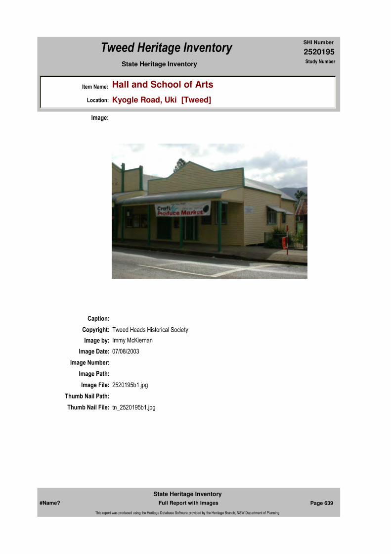
2520195
SHI Number
Tweed Heritage Inventory
Item Name: Hall and School of Arts
Location: Kyogle Road, Uki [Tweed]
State Heritage Inventory Study Number
Caption:
Copyright: Tweed Heads Historical Society
Image:
Image by: Immy McKiernan
Image Date: 07/08/2003
Image Number:
Image Path:
Image File: 2520195b1.jpg
Thumb Nail Path:
Thumb Nail File: tn_2520195b1.jpg
#Name? Page 639 Full Report with Images
State Heritage Inventory
This report was produced using the Heritage Database Software provided by the Heritage Branch, NSW Department of Planning.

2520195
SHI Number
Tweed Heritage Inventory
Item Name: Hall and School of Arts
Location: Kyogle Road, Uki [Tweed]
State Heritage Inventory Study Number
Caption:
Copyright: Tweed Heads Historical Society
Image:
Image by: Immy McKiernan
Image Date: 07/08/2003
Image Number:
Image Path:
Image File: 2520195b2.jpg
Thumb Nail Path:
Thumb Nail File: tn_2520195b2.jpg
#Name? Page 640 Full Report with Images
State Heritage Inventory
This report was produced using the Heritage Database Software provided by the Heritage Branch, NSW Department of Planning.
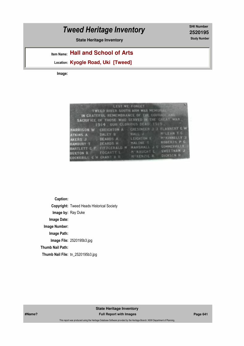
2520195
SHI Number
Tweed Heritage Inventory
Item Name: Hall and School of Arts
Location: Kyogle Road, Uki [Tweed]
State Heritage Inventory Study Number
Caption:
Copyright: Tweed Heads Historical Society
Image:
Image by: Ray Duke
Image Date:
Image Number:
Image Path:
Image File: 2520195b3.jpg
Thumb Nail Path:
Thumb Nail File: tn_2520195b3.jpg
#Name? Page 641 Full Report with Images
State Heritage Inventory
This report was produced using the Heritage Database Software provided by the Heritage Branch, NSW Department of Planning.
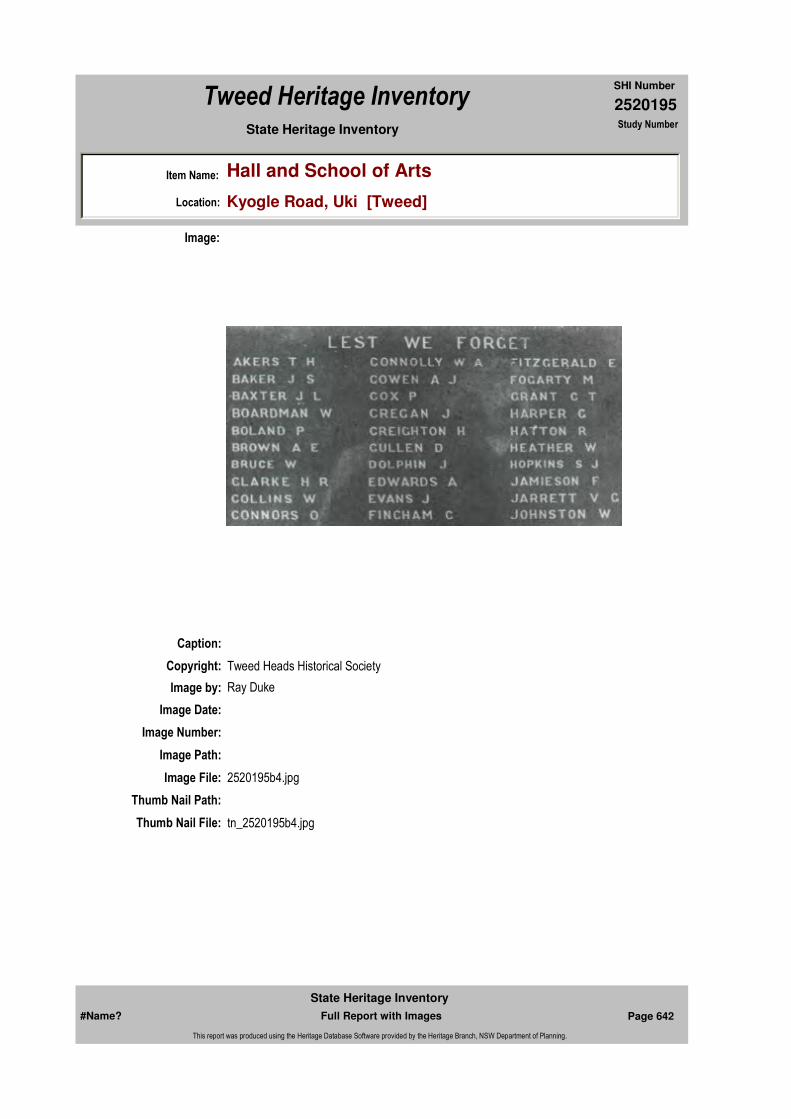
2520195
SHI Number
Tweed Heritage Inventory
Item Name: Hall and School of Arts
Location: Kyogle Road, Uki [Tweed]
State Heritage Inventory Study Number
Caption:
Copyright: Tweed Heads Historical Society
Image:
Image by: Ray Duke
Image Date:
Image Number:
Image Path:
Image File: 2520195b4.jpg
Thumb Nail Path:
Thumb Nail File: tn_2520195b4.jpg
#Name? Page 642 Full Report with Images
State Heritage Inventory
This report was produced using the Heritage Database Software provided by the Heritage Branch, NSW Department of Planning.
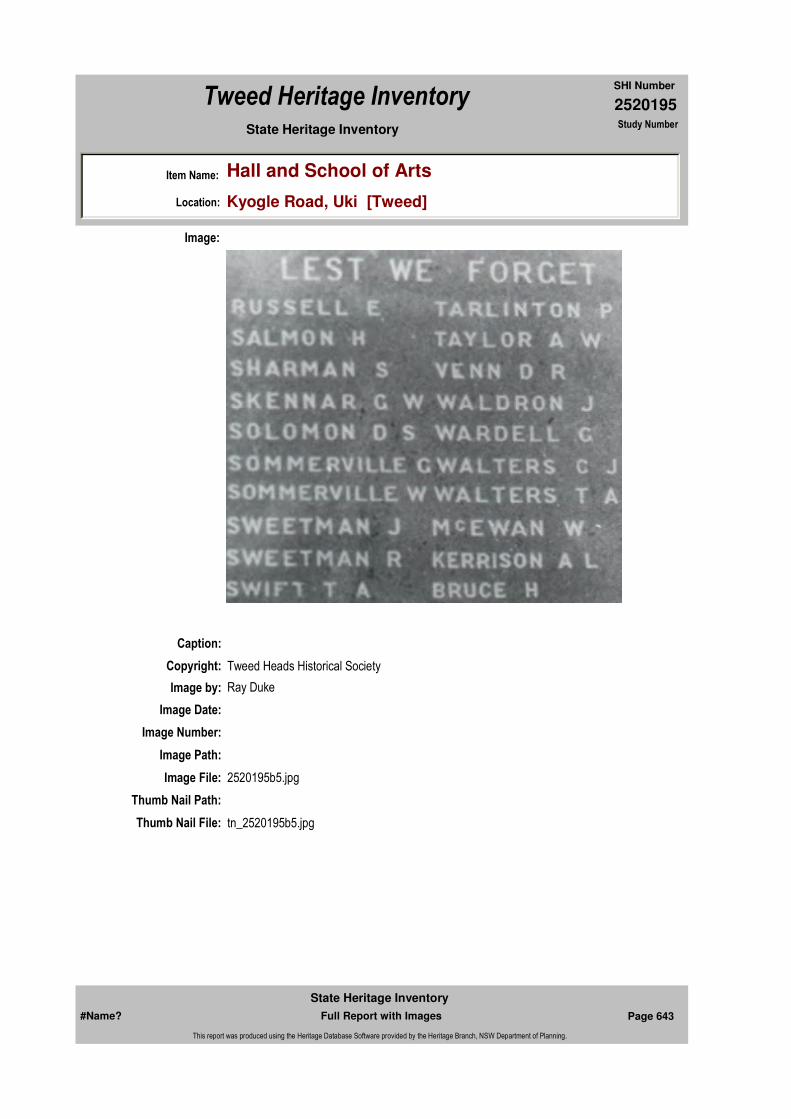
2520195
SHI Number
Tweed Heritage Inventory
Item Name: Hall and School of Arts
Location: Kyogle Road, Uki [Tweed]
State Heritage Inventory Study Number
Caption:
Copyright: Tweed Heads Historical Society
Image:
Image by: Ray Duke
Image Date:
Image Number:
Image Path:
Image File: 2520195b5.jpg
Thumb Nail Path:
Thumb Nail File: tn_2520195b5.jpg
#Name? Page 643 Full Report with Images
State Heritage Inventory
This report was produced using the Heritage Database Software provided by the Heritage Branch, NSW Department of Planning.
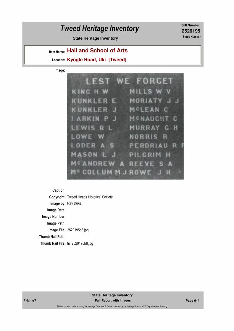
2520195
SHI Number
Tweed Heritage Inventory
Item Name: Hall and School of Arts
Location: Kyogle Road, Uki [Tweed]
State Heritage Inventory Study Number
Caption:
Copyright: Tweed Heads Historical Society
Image:
Image by: Ray Duke
Image Date:
Image Number:
Image Path:
Image File: 2520195b6.jpg
Thumb Nail Path:
Thumb Nail File: tn_2520195b6.jpg
#Name? Page 644 Full Report with Images
State Heritage Inventory
This report was produced using the Heritage Database Software provided by the Heritage Branch, NSW Department of Planning.
2520195
SHI Number
Tweed Heritage Inventory
Item Name: Hall and School of Arts
Location: Kyogle Road, Uki [Tweed]
State Heritage Inventory Study Number
#Name? Page 645 Full Report with Images
State Heritage Inventory
This report was produced using the Heritage Database Software provided by the Heritage Branch, NSW Department of Planning.
2520196
SHI Number
Tweed Heritage Inventory
Item Name: Norco Co-op Butter Building
Location: Kyogle Road, Uki [Tweed]
State Heritage Inventory Study Number
Current Use:
Former Uses:
Statement of
Significance:The Norco Butter Factory is an indicative example of secondary processing for the dairy industry common throughout the 20th century and has a deep significance for the community of the Tweed Shire because it has been an integral part of its cultural and social life since the building of the first factory.The Butter Factory is important to the community for its association with a defunct industry, which once was the main source of its income. It has continued to be important to a changing population for cultural reasons. The building provides good evidence of the butter making process. The building shows evidence of the technical skill of its builders in the exceptional fineness of the finished render and is the most intact example in the Shire. The Butter Factory is important in demonstrating the principal characteristics of the area's cultural environment.
Historical Notes or Provenance:
The first Butter factory was opened in 1910 on land purchased from John Peate. By that time, many farms had started on the South Arm but it was not feasible for many of them to transport their cream to Murwillumbah. The downstream farmers were able to use river transport. Two houses were built at the same time to provide homes for the manager and the engine driver.
The factory became an essential part of the district economy. Eight cream carriers delivered to the factory and returned the cans to the farms often filled with goods from the Store and with ice produced at the factory. Buttermilk was collected by farmers to feed to pigs, a common sideline. The factory produced many tons of butter, the best of which was for export. The factory was open to customers for ice and small goods and operated on a friendly, informal but efficient basis. It is important to remember that it was a Co-Operative,
Endorsed Significance:Assessed Significance: Local
Item Type: Built Category: ButteryGroup: Farming and Grazing
Admin Codes: N Code 2: NC Code 3:
Curtilage/Boundary:
Owner: Private - Community Group
Other/Former Names:
Area/Group/Complex: Uki Village Urban Conservation Area Group ID:
Aboriginal Area:
Local Govt Area: Tweed
Planning: Northern
Historic Region: North Coast
Address: #Name?
Suburb / Nearest Town: #Name?
State: NSW
Parish: Kunghur
County: Rous
#Name? Page 646 Full Report with Images
State Heritage Inventory
This report was produced using the Heritage Database Software provided by the Heritage Branch, NSW Department of Planning.
2520196
SHI Number
Tweed Heritage Inventory
Item Name: Norco Co-op Butter Building
Location: Kyogle Road, Uki [Tweed]
State Heritage Inventory Study Number
owned by the community it served.
In 1939-40 the present building was erected while the factory continued to operate. In 1946 manufacture ceased but the building continued to operate as a depot and outlet for small goods produced by Norco. The depot closed in 1960. In 1983 a group of residents bought the building from Mr. W. Taylor, a Murwillumbah businessman who had mainly used it for storage. During the time of his ownership the community continued to use the building in many "unofficial" ways as evidenced by graffiti on the Norco signboard which could only be accessed by climbing onto the verandah roof. Neighbouring mothers used the engine room for drying nappies. It was customary for a fire to be lit in a drum during dances at the Hall and much "social interaction" took place away from the lights. The verandah has also proved irresistible to skateboarders and has constantly been used by workmen as a "lunch room".
The Uki Buttery Prop Ltd consisted of a mix of newcomers and longer-term residents. They ranged from the local butcher and an accountant to an engineer and farmers. During their ownership a successful monthly market was established and rooms were rented to a variety of commercial, cultural and community groups.
The local Historical Society had an office there and used the building for displays of photographs and memorabilia on special occasions. Local farmer Bernard Kinneally donated the butter churn used in factory to the Historical Society and the Company, assisted by Norco and many practical community members rehoused it as a display to honour the dairy farmers of the past. It was unveiled in1987 at a reunion held to celebrate the Centenary of the naming of Uki.
Uki Primary used the Churn Room for its Art classes. These achieved State recognition by the Department of Education for their excellence and were awarded "Lighthouse School" status. In 2003, the building was bought by the Uki Residents and Ratepayers Association. The Community Technology Centre will begin operations in the churn room in Dec and a Visitors Information Centre opens in January in the cool room.
Similar butter factories in the Shire have been demolished or altered beyond significance.
Opening of Uki Butter Factory "Tales of our Times" By Ron Johansen Vol 10 page 3 2002In 1904 a group of farmers from Tyalgum urged "Norco" or "The North Coast Co-operative Ltd" as it was known at the time to open a butter factory in Murwillumbah. After investigating the situation Norco agreed providing that 2000 shares be subscribed. These were duly taken up and the factory opened on May 2nd 1906.More and more dairy farms were opening up with good returns and this was before Edwin Seccombe introduced paspalum grass to the Richmond resulting in a huge increase in the production of butter.The years 1908/9 saw a pattern for progress for Norco starting with a Uki proposal for suppliers to erect a factory and the company to manage its operations. The society recommended to shareholders in 1909 that the factory be built subject to the subscription of
#Name? Page 647 Full Report with Images
State Heritage Inventory
This report was produced using the Heritage Database Software provided by the Heritage Branch, NSW Department of Planning.

2520196
SHI Number
Tweed Heritage Inventory
Item Name: Norco Co-op Butter Building
Location: Kyogle Road, Uki [Tweed]
State Heritage Inventory Study Number
2000 shares and a guarantee of supply to manufacture two and a half tons weekly. Norco declared the Uki factory was not to be regarded as a precedent, but only as an experiment to examine if small factories could be made a payable proposition.Whether they were payable or not, Norco at its peak operated 20 factories, but as time went on and costs increased, centralisation was a must and most factories closed.Things were different in 1910 - Uki was all set for its grand factory opening on 26th. October. Financially they could have "gone on their own" as an independent co-operative. A canvass had met with a ready response, but ultimately it was decided to become a branch of Norco.There was a very large attendance of farmers and others at he opening, including many from Murwillumbah and some Byron Bay directors and other distinguished guests. The opening ceremony was performed by Mr. W.R. Baker, chairman of Norco who congratulated Uki on its progress and having such an up to date factory. His own ambition was to see one big co--operative company on the whole of the North Coast. He was sure in a short time Uki would have to double the plant, so rapidly was settlement progressing.As Mr Baker declared the factory open and cut the ribbon, the whole of the machinery was set in motion. In the engine room one dairyman had arranged a bottle of milk so that on the first revolution of the large flywheel the contents of a bottle of milk were dashed on the engine, the christening being thus done in milk, which was very fitting for the occasion.Here is a description of the new factory - The factory is situated on the main business side of the street next to the School of Arts and having the river at the back. Facing the street are the chilling and freezing rooms and a storeroom. The chilling room is l6ft x l0ft. and freezing room l6ft. x l1ft. both being insulated with charcoal.The main workroom is behind the chilling, freezing and storeroom. The most striking object in this room is the Waugh and Josephson churn, mounted on solid steel rests and bearings upon a concrete pedestal 4 or 5 feet above floor level. Immediately under the churn is a marble slab, upon which the 15 cwt. pat of butter is dropped after churning.The churn is built on the Danish model, and contains many improvements. Its driving gear is somewhat different of other similar churns and the mountings and bearings are exceptionally strong. Opposite the churn are the circular mixer and salter. Alongside the mixer is the weighing and boxing machine, a No.18 Hussey packer, by which the boxes are properly packed. The floor of this room is concrete measuring 41 x 31 ft.Alongside the churn but at a height of 9ft. is a platform on which are two 800 gallon copper cream tanks fitted with cooling apparatus another eight foot higher is a 600 gallon cold water tank containing filtered water for washing butter and cleansing the churn.The receiving platform is on the School of Arts side, on here are scales where the cans of cream are weighed and slid across to a large trough in which the cream is poured and then pumped to the copper tanks.The engine room is large and contains a 35hp Hindley engine and a two cylinder Waugh and Josephson refrigerating plant. The boiler is of tubular make and burns wood fuel. The factory was designed by and the construction supervised by Mr Fraser, Norco's head carpenter who used hardwood timber and the result was a very substantial and solid building. Cost of construction was £2672. Two cottages were erected for employees at the same time.So the good years came and went - among other things butter consumption declined, factory cost spiralled and Norco went back to centralisation and the Uki Butter factory closed as a butter factory in September 1947 and until 1961 became a cream depot for the Murwillumbah factory. It was then sold to Mr. W. Taylor and later purchased by a group who
#Name? Page 648 Full Report with Images
State Heritage Inventory
This report was produced using the Heritage Database Software provided by the Heritage Branch, NSW Department of Planning.

2520196
SHI Number
Tweed Heritage Inventory
Item Name: Norco Co-op Butter Building
Location: Kyogle Road, Uki [Tweed]
State Heritage Inventory Study Number
called it the Buttery and now rent out sections of the old factory.
Physical Description: Fronting Norco Road is a long wooden verandah on concrete piers with a deep pit at the rear. On the left hand side an extension of the verandah roof covers a small rectangular concrete building, the former ice making room. A small room to the right steps to the pit. From the pit another set of steps leads to the Churn room mezzanine. Along Kyogle Road are four rooms and hallway. Churn room has small cement verandah at road level and two doors, one single and one double. The former cool room is accessed through a door in the churn room, which has a high mezzanine floor at the rear. Under this and accessible only from the outside is a large storage area. Windows are metal framed. No original doors are left. Ceilings are fibro cement sheeting with hardwood battens. Large timber trusses support the roof structure. Most of the ancillary machinery and out buildings were removed in 1960's, where the factory was sold. The boiler shed was removed in1986 due to structural unsafety. Large industrial building of the mid-20th century. Reinforced Concrete and steel with galvanised roof. The rendered finish is of very high quality. Raised gable section has 5 metal ventilators along ridge and timber framed clerestory windows. Lower gable has one ventilator on ridge and simple louvres in end.
Physical Condition:
Modification Dates: 1983-4: some internal machinery bases removed. Small drainage pit filled. Lining of cool room walls removed because of vandalism. 2003: External gutter cut and cement patio built along Kyogle Road frontage. Cork removed from cool room and door cut in wall to patio. Internal partitions constructed in churn room and internally the gable roof space has been divided above mezzanine to provide security.
Designer:
Maker / Builder:
Year Started: Year Completed: 1910 Circa: No
Recommended
Management:
Further Comments:
Criteria a)
Criteria b) An indicative example of secondary processing for the dairy industry common throughout the 20th century. The Uki Butter Factory has a deep significance for the community of the
Themes:
Management:
National Theme State Theme Local Theme
3. Economy Agriculture Dairy
#Name? Page 649 Full Report with Images
State Heritage Inventory
This report was produced using the Heritage Database Software provided by the Heritage Branch, NSW Department of Planning.
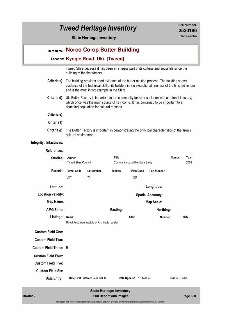
2520196
SHI Number
Tweed Heritage Inventory
Item Name: Norco Co-op Butter Building
Location: Kyogle Road, Uki [Tweed]
State Heritage Inventory Study Number
Custom Field One:
References:
Studies:
Listings:
Date Updated: 01/11/2004 Status: BasicDate First Entered: 24/05/2000Data Entry:
Criteria c) The building provides good evidence of the butter making process. The building shows evidence of the technical skill of its builders in the exceptional fineness of the finished render and is the most intact example in the Shire.
Criteria d) Uki Butter Factory is important to the community for its association with a defunct industry, which once was the main source of its income. It has continued to be important to a changing population for cultural reasons.
Criteria e)
Criteria g) The Butter Factory is important in demonstrating the principal characteristics of the area's cultural environment.
Criteria f)
Integrity / Intactness:
Custom Field Two:
Custom Field Three: B
Custom Field Four:
Custom Field Five:
Custom Field Six:
Tweed Shire because it has been an integral part of its cultural and social life since the building of the first factory.
Parcels:
Latitude: Longitude:
AMG Zone: Easting: Northing:
Map Name: Map Scale:
Spatial Accuracy:Location validity:
Author Title YearNumber
Tweed Shire Council Community-based Heritage Study 2003
Name: Date:Number:Title:
Royal Australian Institute of Architects register
Parcel Code LotNumber Section Plan Code Plan Number
LOT 71 DP
#Name? Page 650 Full Report with Images
State Heritage Inventory
This report was produced using the Heritage Database Software provided by the Heritage Branch, NSW Department of Planning.

2520196
SHI Number
Tweed Heritage Inventory
Item Name: Norco Co-op Butter Building
Location: Kyogle Road, Uki [Tweed]
State Heritage Inventory Study Number
Caption:
Copyright:
Image:
Image by:
Image Date:
Image Number: 69
Image Path:
Image File:
Thumb Nail Path:
Thumb Nail File:
#Name? Page 651 Full Report with Images
State Heritage Inventory
This report was produced using the Heritage Database Software provided by the Heritage Branch, NSW Department of Planning.

2520196
SHI Number
Tweed Heritage Inventory
Item Name: Norco Co-op Butter Building
Location: Kyogle Road, Uki [Tweed]
State Heritage Inventory Study Number
Caption: Uki Butter Factory
Copyright: Uki & South Arm Historical Society
Image:
Image by: Mary Lee Connery
Image Date: 02/11/2003
Image Number:
Image Path:
Image File: 2520196b1.jpg
Thumb Nail Path:
Thumb Nail File: tn_2520196b1.jpg
#Name? Page 652 Full Report with Images
State Heritage Inventory
This report was produced using the Heritage Database Software provided by the Heritage Branch, NSW Department of Planning.
2520196
SHI Number
Tweed Heritage Inventory
Item Name: Norco Co-op Butter Building
Location: Kyogle Road, Uki [Tweed]
State Heritage Inventory Study Number
Caption: An ealry photograph of the Uki Butter Factory
Copyright: Uki & South Arm Historical Society
Image:
Image by:
Image Date:
Image Number:
Image Path:
Image File: 2520196b2.jpg
Thumb Nail Path:
Thumb Nail File: tn_2520196b2.jpg
#Name? Page 653 Full Report with Images
State Heritage Inventory
This report was produced using the Heritage Database Software provided by the Heritage Branch, NSW Department of Planning.

2520196
SHI Number
Tweed Heritage Inventory
Item Name: Norco Co-op Butter Building
Location: Kyogle Road, Uki [Tweed]
State Heritage Inventory Study Number
Caption: Interior ceiling of Uki Butter Factory
Copyright: Uki & South Arm Historical Society
Image:
Image by: Mary Lee Connery
Image Date: 02/11/2003
Image Number:
Image Path:
Image File: 2520196b3.jpg
Thumb Nail Path:
Thumb Nail File: tn_2520196b3.jpg
#Name? Page 654 Full Report with Images
State Heritage Inventory
This report was produced using the Heritage Database Software provided by the Heritage Branch, NSW Department of Planning.

2520196
SHI Number
Tweed Heritage Inventory
Item Name: Norco Co-op Butter Building
Location: Kyogle Road, Uki [Tweed]
State Heritage Inventory Study Number
#Name? Page 655 Full Report with Images
State Heritage Inventory
This report was produced using the Heritage Database Software provided by the Heritage Branch, NSW Department of Planning.

2520197
SHI Number
Tweed Heritage Inventory
Item Name: Post Office - Store
Location: Kyogle Road, Uki [Tweed]
State Heritage Inventory Study Number
Current Use: Store
Former Uses: Post Office
Statement of
Significance:The Uki Post Office has a special association with the pioneer Milsom family who provided post masters for three generations from 1919 to 2000. The Post Office is valued by the community for its contribution to the streetscape of the village. It is also important to their sense of identity. It is held in high esteem for the way it typifies the customs of a rural population.
Uki Post Office is highly valued by the community it serves for its social and cultural values.The building is a fine example of small rural Post Office and shop and is outstanding for the esteem in which it is held.
Historical Notes
or Provenance: The original Post Office was burned down in 1914. For some years the business was run in the office of W.O. Irvine, Auctioneer. Around 1917, permission was given by the Hall trustees for a small shop to be erected on adjacent land owned by the trust, "at no cost to the Hall Committee or the Trustees." It was hoped the rent from this building would reduce the debt on the Hall. (Ms. Hedley Irvine)
In 1919, C.V. Milsom was appointed Post Master and served until 1971, when his son Victor succeeded him. Phillip and Norah Milsom took over the business in 1993 and sold it to Peter and Lyn Messing on1st April, 2002.
In 1922, due to a wounded leg suffered during the War, Mr. Milsom was given permission to build a residence at the rear of the shop and the manual telephone exchange was installed at the Post Office that year. Mr. Milsom purchased the newsagency rights from Cecil Chilcott to add to the sweet and drinks already part of the business. The telephone service was
Endorsed Significance:Assessed Significance:
Item Type: Built Category: Post OfficeGroup: Postal and Telecomm
Admin Codes: N Code 2: NC Code 3:
Curtilage/Boundary:
Owner: Private - Individual
Other/Former Names:
Area/Group/Complex: Group ID:
Aboriginal Area:
Local Govt Area: Tweed
Planning: Northern
Historic Region: North Coast
Address: #Name?
Suburb / Nearest Town: #Name?
State: NSW
Parish: Kunghur
County: Rous
#Name? Page 656 Full Report with Images
State Heritage Inventory
This report was produced using the Heritage Database Software provided by the Heritage Branch, NSW Department of Planning.

2520197
SHI Number
Tweed Heritage Inventory
Item Name: Post Office - Store
Location: Kyogle Road, Uki [Tweed]
State Heritage Inventory Study Number
automated in 1941.
The Post Master was also responsible for recording river levels in times of flood until an automatic gauge system was installed.
Despite expanded roadside delivery in outlying areas, the villagers and many rural residents still collect their mail in person. The Post Office has adapted to modern technology and new methods of communication, offering EFT and fax facilities. The residence is now professional offices.
Australia Post Archives. "Uki Post Office History" 1985
Physical Description: Post office .
Physical Condition:
Modification Dates: 1922 residence added at rear. 1992 shop windows removed for the installation of private Mailboxes
Designer:
Maker / Builder:
Year Started: Year Completed: 1917 Circa: No
Recommended Management:
Further Comments: Internally some changes have been made to accommodate the needs of a modern community facility. Original counters remain. Rear is no longer a residence.
Criteria a)
Criteria b) The Uki Post Office has a special association with the pioneer Milsom family who provided post masters for three generations from 1919 to 2000. The Post Office is valued by the community for its contribution to the streetscape of the village. It is also important to their sense of identity. It is held in high esteem for the way it typifies the customs of a rural population
Themes:
Management:
National Theme State Theme Local Theme
3. Economy Communication Post Office
#Name? Page 657 Full Report with Images
State Heritage Inventory
This report was produced using the Heritage Database Software provided by the Heritage Branch, NSW Department of Planning.
2520197
SHI Number
Tweed Heritage Inventory
Item Name: Post Office - Store
Location: Kyogle Road, Uki [Tweed]
State Heritage Inventory Study Number
Custom Field One:
References:
Studies:
Listings:
Date Updated: 02/11/2004 Status: BasicDate First Entered: 24/05/2000Data Entry:
Criteria c)
Criteria d) Uki Post Office is highly valued by the community it serves for its social and cultural values.
Criteria e)
Criteria g) The building is a fine example of small rural Post Office and shop and is outstanding for the esteem in which it is held.
Criteria f)
Integrity / Intactness:
Custom Field Two:
Custom Field Three: B
Custom Field Four:
Custom Field Five:
Custom Field Six:
Parcels:
Latitude: Longitude:
AMG Zone: Easting: Northing:
Map Name: Map Scale:
Spatial Accuracy:Location validity:
Author Title YearNumber
Tweed Shire Council Community-based Heritage Study 2003
Name: Date:Number:Title:
Royal Australian Institute of Architects register
Parcel Code LotNumber Section Plan Code Plan Number
LOT 232 DP 721129
#Name? Page 658 Full Report with Images
State Heritage Inventory
This report was produced using the Heritage Database Software provided by the Heritage Branch, NSW Department of Planning.

2520197
SHI Number
Tweed Heritage Inventory
Item Name: Post Office - Store
Location: Kyogle Road, Uki [Tweed]
State Heritage Inventory Study Number
Caption:
Copyright:
Image:
Image by:
Image Date:
Image Number: 612
Image Path:
Image File:
Thumb Nail Path:
Thumb Nail File:
#Name? Page 659 Full Report with Images
State Heritage Inventory
This report was produced using the Heritage Database Software provided by the Heritage Branch, NSW Department of Planning.
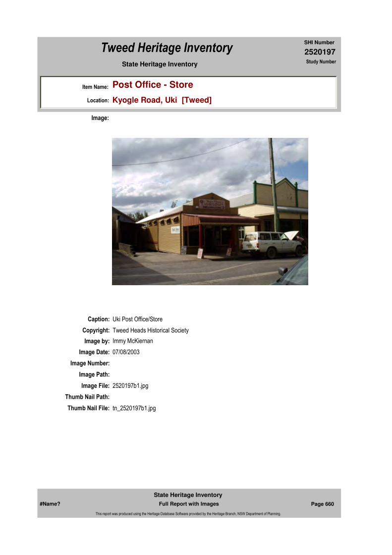
2520197
SHI Number
Tweed Heritage Inventory
Item Name: Post Office - Store
Location: Kyogle Road, Uki [Tweed]
State Heritage Inventory Study Number
Caption: Uki Post Office/Store
Copyright: Tweed Heads Historical Society
Image:
Image by: Immy McKiernan
Image Date: 07/08/2003
Image Number:
Image Path:
Image File: 2520197b1.jpg
Thumb Nail Path:
Thumb Nail File: tn_2520197b1.jpg
#Name? Page 660 Full Report with Images
State Heritage Inventory
This report was produced using the Heritage Database Software provided by the Heritage Branch, NSW Department of Planning.

2520197
SHI Number
Tweed Heritage Inventory
Item Name: Post Office - Store
Location: Kyogle Road, Uki [Tweed]
State Heritage Inventory Study Number
#Name? Page 661 Full Report with Images
State Heritage Inventory
This report was produced using the Heritage Database Software provided by the Heritage Branch, NSW Department of Planning.

2520199
SHI Number
Tweed Heritage Inventory
Item Name: Residence
Location: Old Convent Lane, Uki [Tweed]
State Heritage Inventory Study Number
Current Use: Private home
Former Uses: Convent
Statement of
Significance:The former convent has a special association with the Roman Catholic Church of Uki, in that it housed the nuns who provided spiritual and educational needs to many generations.
Historical Notes or Provenance:
St. Joseph's Convent was built in 1922, on land donated to the Catholic Church by Gerald Parker, one of original selectors whose land adjoined the Village. The first nuns were Sister Avelina, Sister Theodore and Sister Julita. They began teaching in 1923 with 57 pupils. With no school, classes were held in the church and in a weather shed. This continued until 1931 when the school, later removed, was opened.
The Convent also provided for boarders, children who were too young or who lived too far away to ride to school. Fees were often paid in farm produce, cream or baked goods.
The nuns taught shorthand and typing and also provided an education in music to non-Catholics.
The school closed in 1963, having had over 600 pupils.
The building is now in private ownership and provides rental accommodation in 4 flats.
"St. Columba's Catholic Church 1911-86" 1986
Endorsed Significance:Assessed Significance: Local
Item Type: Built Category: Convent/NunneryGroup: Religion
Admin Codes: N Code 2: NC Code 3:
Curtilage/Boundary:
Owner: Private - Individual
Other/Former Names: Convent
Area/Group/Complex: Group ID:
Themes:
Aboriginal Area:
Local Govt Area: Tweed
Planning: Northern
Historic Region: North Coast
Address: #Name?
Suburb / Nearest Town: #Name?
State: NSW
Parish: Kunghur
County: Rous
National Theme State Theme Local Theme
8. Culture Religion Convent
#Name? Page 662 Full Report with Images
State Heritage Inventory
This report was produced using the Heritage Database Software provided by the Heritage Branch, NSW Department of Planning.
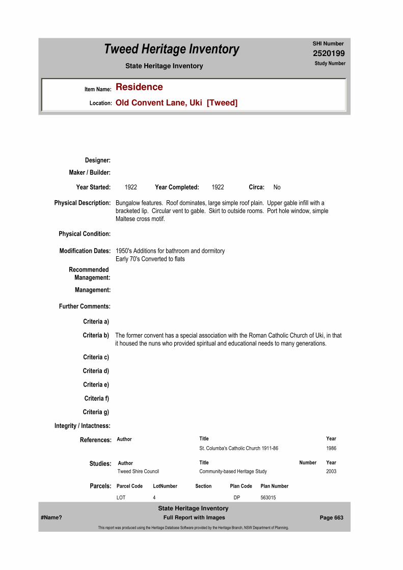
2520199
SHI Number
Tweed Heritage Inventory
Item Name: Residence
Location: Old Convent Lane, Uki [Tweed]
State Heritage Inventory Study Number
Physical Description: Bungalow features. Roof dominates, large simple roof plain. Upper gable infill with a bracketed lip. Circular vent to gable. Skirt to outside rooms. Port hole window, simple Maltese cross motif.
Physical Condition:
Modification Dates: 1950's Additions for bathroom and dormitoryEarly 70's Converted to flats
Designer:
Maker / Builder:
Year Started: 1922 Year Completed: 1922 Circa: No
Recommended Management:
References:
Studies:
Further Comments:
Criteria a)
Criteria c)
Criteria d)
Criteria e)
Criteria g)
Criteria f)
Integrity / Intactness:
Criteria b) The former convent has a special association with the Roman Catholic Church of Uki, in that it housed the nuns who provided spiritual and educational needs to many generations.
Parcels:
Management:
Author Title Year
St. Columba's Catholic Church 1911-86 1986
Author Title YearNumber
Tweed Shire Council Community-based Heritage Study 2003
Parcel Code LotNumber Section Plan Code Plan Number
LOT 4 DP 563015
#Name? Page 663 Full Report with Images
State Heritage Inventory
This report was produced using the Heritage Database Software provided by the Heritage Branch, NSW Department of Planning.
2520199
SHI Number
Tweed Heritage Inventory
Item Name: Residence
Location: Old Convent Lane, Uki [Tweed]
State Heritage Inventory Study Number
Custom Field One:
Listings:
Date Updated: 02/11/2004 Status: BasicDate First Entered: 24/05/2000Data Entry:
Custom Field Two:
Custom Field Three: B
Custom Field Four:
Custom Field Five:
Custom Field Six:
Latitude: Longitude:
AMG Zone: Easting: Northing:
Map Name: Map Scale:
Spatial Accuracy:Location validity:
Name: Date:Number:Title:
Royal Australian Institute of Architects register
Image:
#Name? Page 664 Full Report with Images
State Heritage Inventory
This report was produced using the Heritage Database Software provided by the Heritage Branch, NSW Department of Planning.

2520199
SHI Number
Tweed Heritage Inventory
Item Name: Residence
Location: Old Convent Lane, Uki [Tweed]
State Heritage Inventory Study Number
Caption:
Copyright:
Image by:
Image Date:
Image Number: 617
Image Path:
Image File:
Thumb Nail Path:
Thumb Nail File:
#Name? Page 665 Full Report with Images
State Heritage Inventory
This report was produced using the Heritage Database Software provided by the Heritage Branch, NSW Department of Planning.
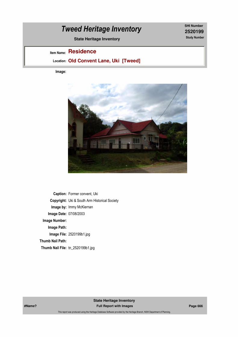
2520199
SHI Number
Tweed Heritage Inventory
Item Name: Residence
Location: Old Convent Lane, Uki [Tweed]
State Heritage Inventory Study Number
Caption: Former convent, Uki
Copyright: Uki & South Arm Historical Society
Image:
Image by: Immy McKiernan
Image Date: 07/08/2003
Image Number:
Image Path:
Image File: 2520199b1.jpg
Thumb Nail Path:
Thumb Nail File: tn_2520199b1.jpg
#Name? Page 666 Full Report with Images
State Heritage Inventory
This report was produced using the Heritage Database Software provided by the Heritage Branch, NSW Department of Planning.
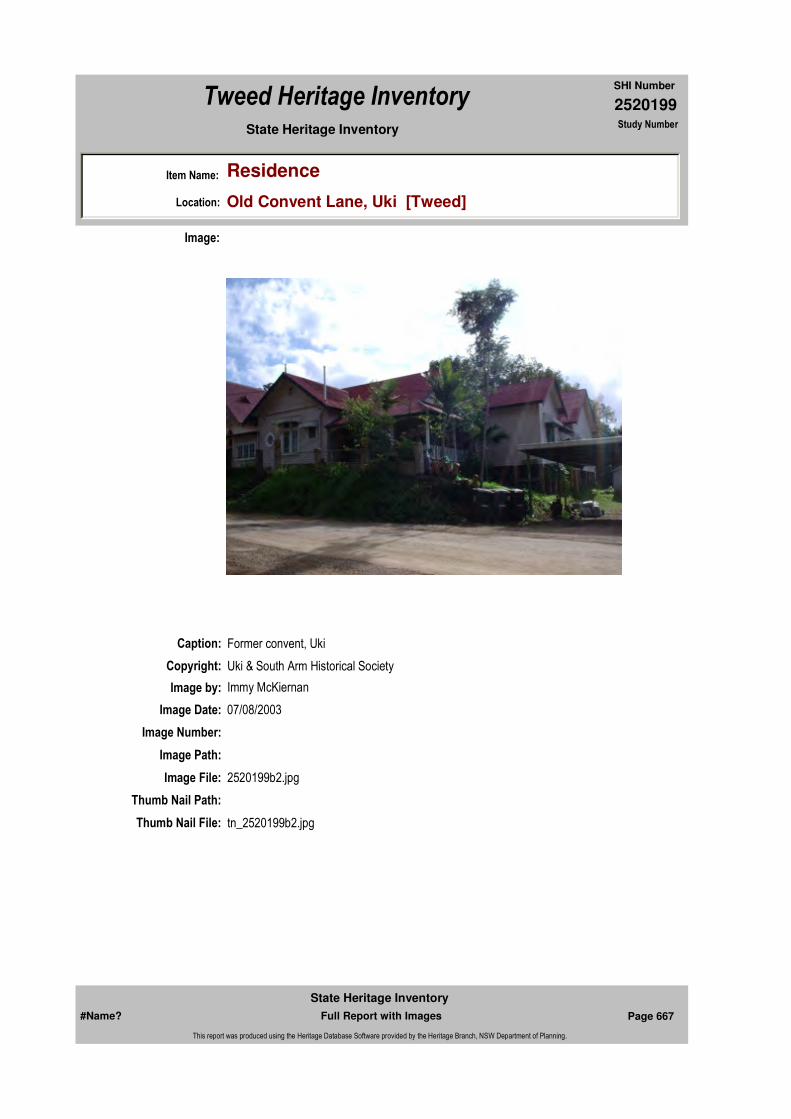
2520199
SHI Number
Tweed Heritage Inventory
Item Name: Residence
Location: Old Convent Lane, Uki [Tweed]
State Heritage Inventory Study Number
Caption: Former convent, Uki
Copyright: Uki & South Arm Historical Society
Image:
Image by: Immy McKiernan
Image Date: 07/08/2003
Image Number:
Image Path:
Image File: 2520199b2.jpg
Thumb Nail Path:
Thumb Nail File: tn_2520199b2.jpg
#Name? Page 667 Full Report with Images
State Heritage Inventory
This report was produced using the Heritage Database Software provided by the Heritage Branch, NSW Department of Planning.
2520199
SHI Number
Tweed Heritage Inventory
Item Name: Residence
Location: Old Convent Lane, Uki [Tweed]
State Heritage Inventory Study Number
#Name? Page 668 Full Report with Images
State Heritage Inventory
This report was produced using the Heritage Database Software provided by the Heritage Branch, NSW Department of Planning.
2520204
SHI Number
Tweed Heritage Inventory
Item Name: Numinbah Methodist Church (former)
Location: 1141 Numinbah Road, Chillingham [Tweed]
State Heritage Inventory Study Number
Current Use:
Former Uses:
Statement of
Significance:The Numinbah Methodist Church has a special association with the Numinbah community as it provided the spiritual needs of the Numinbah community for many years. The church is also indicitive of a range of very small church buildings built by the early settlers.
Historical Notes
or Provenance:The land was donated in 1899 by William George Thomson, and the church built in 1908.
The building was purchased from Uniting Church in 1999, along with the adjoining building, the former Numinbah School building, which had been moved to this location in 1938. They are now Chillingham Pre-school.
Physical Description: Carpenter Gothic church. Weatherboard cladding. Steep pitch gable, pointed arch motif. Entry porch central to gable. The Numinbah church is 6.2m x 5m. It has a porch built in
Designer:
Maker / Builder:
Year Started: Year Completed: 1908 Circa: No
Endorsed Significance:Assessed Significance: Local
Item Type: Built Category: ChurchGroup: Religion
Admin Codes: N Code 2: Code 3:
Curtilage/Boundary:
Owner: Private - Community Group
Other/Former Names: Numinbah Church, Hall and Organ
Area/Group/Complex: Group ID:
Themes:
Aboriginal Area:
Local Govt Area: Tweed
Planning: Northern
Historic Region: North Coast
Address: #Name?
Suburb / Nearest Town: #Name?
State: NSW
Parish: Chillingham
County: Rous
National Theme State Theme Local Theme
8. Culture Religion Church
#Name? Page 696 Full Report with Images
State Heritage Inventory
This report was produced using the Heritage Database Software provided by the Heritage Branch, NSW Department of Planning.

2520204
SHI Number
Tweed Heritage Inventory
Item Name: Numinbah Methodist Church (former)
Location: 1141 Numinbah Road, Chillingham [Tweed]
State Heritage Inventory Study Number
similar style to the main building, offset to the east by 10cm, that has been added at some stage. It is 1.56m X 1.56m with an open entrance and two steps to the east. Unlike any other timber hall on the Tweed the arched windows of the building demonstrate the original purpose of the building. The church was moved from its original position and is now part of the Chillingham pre-school complex. The hall and organ no longer exist.
Physical Condition:
Modification Dates:
Recommended Management:
Maintain the exterior and interior and setting. Adapt services and facilities (disabled access) to ensure continued use.
References:
Studies:
Listings:
Further Comments:
Criteria a)
Criteria c) The church is indicitive of a range of very small church buildings built by the early settlers.
Criteria d) The Numinbah Methodist Church has a special association with the Numinbah community as it provided the spiritual needs of the Numinbah community for many years.
Criteria e)
Criteria g)
Criteria f)
Integrity / Intactness:
Criteria b)
Parcels:
Latitude: Longitude:
AMG Zone: Easting: Northing:
Map Name: Map Scale:
Spatial Accuracy:Location validity:
Management:
Author Title YearNumber
Tweed Shire Council Community-based Heritage Study 2003
Parcel Code LotNumber Section Plan Code Plan Number
LOT 1 DP 516332
#Name? Page 697 Full Report with Images
State Heritage Inventory
This report was produced using the Heritage Database Software provided by the Heritage Branch, NSW Department of Planning.

2520204
SHI Number
Tweed Heritage Inventory
Item Name: Numinbah Methodist Church (former)
Location: 1141 Numinbah Road, Chillingham [Tweed]
State Heritage Inventory Study Number
Custom Field One: N
Date Updated: 01/11/2004 Status: BasicDate First Entered: 22/04/1999Data Entry:
Custom Field Two:
Custom Field Three:
Custom Field Four: 1
Custom Field Five: 1
Custom Field Six: 2372
Caption: Former Numinbah Methodist church.
Copyright: Tweed Heads Historical Society
Image:
Image by: Immy McKiernan
Image Date: 07/08/2003
Image Number:
Image Path:
Image File: 2520204b1.jpg
#Name? Page 698 Full Report with Images
State Heritage Inventory
This report was produced using the Heritage Database Software provided by the Heritage Branch, NSW Department of Planning.
2520204
SHI Number
Tweed Heritage Inventory
Item Name: Numinbah Methodist Church (former)
Location: 1141 Numinbah Road, Chillingham [Tweed]
State Heritage Inventory Study Number
Thumb Nail Path:
Thumb Nail File: tn_2520204b1.jpg
#Name? Page 699 Full Report with Images
State Heritage Inventory
This report was produced using the Heritage Database Software provided by the Heritage Branch, NSW Department of Planning.

2520204
SHI Number
Tweed Heritage Inventory
Item Name: Numinbah Methodist Church (former)
Location: 1141 Numinbah Road, Chillingham [Tweed]
State Heritage Inventory Study Number
Caption: Former Numinbah Methodist church.
Copyright: Tweed Heads Historical Society
Image:
Image by: Immy McKiernan
Image Date: 07/08/2003
Image Number:
Image Path:
Image File: 2520204b2.jpg
Thumb Nail Path:
Thumb Nail File: tn_2520204b2.jpg
#Name? Page 700 Full Report with Images
State Heritage Inventory
This report was produced using the Heritage Database Software provided by the Heritage Branch, NSW Department of Planning.

2520204
SHI Number
Tweed Heritage Inventory
Item Name: Numinbah Methodist Church (former)
Location: 1141 Numinbah Road, Chillingham [Tweed]
State Heritage Inventory Study Number
Caption: Former Numinbah Methodist church.
Copyright: Tweed Heads Historical Society
Image:
Image by: Immy McKiernan
Image Date: 07/08/2003
Image Number:
Image Path:
Image File: 2520204b3.jpg
Thumb Nail Path:
Thumb Nail File: tn_2520204b3.jpg
#Name? Page 701 Full Report with Images
State Heritage Inventory
This report was produced using the Heritage Database Software provided by the Heritage Branch, NSW Department of Planning.

2520204
SHI Number
Tweed Heritage Inventory
Item Name: Numinbah Methodist Church (former)
Location: 1141 Numinbah Road, Chillingham [Tweed]
State Heritage Inventory Study Number
#Name? Page 702 Full Report with Images
State Heritage Inventory
This report was produced using the Heritage Database Software provided by the Heritage Branch, NSW Department of Planning.
2520207
SHI Number
Tweed Heritage Inventory
Item Name: Tweed Heads Maritime Museum - Deckhouse
Location: Pioneer Park, Kennedy Drive, Tweed Heads West [Tweed]
State Heritage Inventory Study Number
Current Use: Museum Building
Former Uses: Deckhouse on Drogher "Murwillumbah"
Statement of
Significance:This item is indicatve of a period of Tweed history where all personal and industrial transport was by means of water. The deckhouse was designed to be placed and moved from tugs and workboats and provided the sleeping and recreational accommodation for the crew.
Historical Notes
or Provenance:Deck houses were prefabricated structures used in the main as crew accommoda-tion. They came into vogue about 1870 and were at first used aboard sailing ships. They were assembled ashore and lifted into position onto the decks of vessels where they were bolted to the ship deck and further made rigid by having wire stays and turnbuckles attached.
On sailing ships they housed the starboard and port watchkeepers with as many as a dozen sailors billetting inside. Deck houses also contained mess tables (for eating at), with stools and lockers for seamen's belongings. When steam vessels began to replace sail, deck houses were found to be still useful appendages for certain types of ships. They became very common on shallow-draft, wide-beamed, and paddle-wheelers. They were particularly suitable on the various types of vessels used in the river trade, especially on droghers, the fore-runner of the later tug boats. Being a complete unit, the deck house could be transferred from vessel to vessel. This was a distinct advantage when a vessel was grounded, for the deck house could be salvaged intact before the wrecked craft broke up, and could be put aboard another vessel.
The deck house now being refurbished at the Tweed Maritime Museum, is thought to be of 1870-1880 vintage. It belonged to Colonial Sugar Refining Co. and is thought to have been aboard the CSR drogher "Murwillumhah" wrecked on the Tweed bar in 1909, salvaged and placed aboard another CSR drogher, "Leander'. In the 1920's, it was removed from
Endorsed Significance:Assessed Significance: Local
Item Type: Archaeological-Maritim Category: Other - Maritime IndusGroup: Maritime Industry
Admin Codes: Code 2: Code 3:
Curtilage/Boundary:
Owner: Private - Community Group
Other/Former Names:
Area/Group/Complex: Tweed Heads Maritime Museum Group ID:
Aboriginal Area:
Local Govt Area: Tweed
Planning: Northern
Historic Region: North Coast
Address: #Name?
Suburb / Nearest Town: #Name?
State: NSW
Parish: Terranora
County: Rous
#Name? Page 712 Full Report with Images
State Heritage Inventory
This report was produced using the Heritage Database Software provided by the Heritage Branch, NSW Department of Planning.

2520207
SHI Number
Tweed Heritage Inventory
Item Name: Tweed Heads Maritime Museum - Deckhouse
Location: Pioneer Park, Kennedy Drive, Tweed Heads West [Tweed]
State Heritage Inventory Study Number
"Leander", placed at the dry dock at South Tweed Heads as a workman's' lunch room. The dry dock has long since been disused and has been taken over as the local Naval Cadet Depot. The old deck house fell in disrepair . Then the LTRHS became aware that this relic of our maritime past was being threatened with demolition. What is history to some is rubbish to others. A new building was being planned. Negotiations to save the deck house were commenced immediately. Finally the LTRHS was given but a 24 hour ultimatum - remove it forth with or it would be destroyed along with other defunct sheds on the site. After a failed attempt to negotiate for more time, it was decided that the situation called for immediate and direct action to save this historic maritime structure from an ignominious end. A mobile crane and truck was hired and we proceeded to the dry dock. It was just two hours before the deadline.
But on arrival there, we found a large crowd of people gathered and the police present. The commotion had been caused by a vehicle, a van, being sighted beneath the surface of the water adjacent to dry dock as the tide ran out. At that stage it was thought that the van could contain the body of the driver. On seeing our crane, the police immediately confiscated it and proceeded to use it to haul the van from the inlet. It was achieved but with some difficulty and all were relieved when the van was found to be empty.
Straight away, whilst all the attention was still on the van, the crane was redirected to raise the deck house (which measures 5x3x3 metres) onto the back of the waiting truck. A sigh of relief when the lift went without a hitch. We half expected the deck house to collapse under the strain of the wire slings! It was promptly transported to the museum site and placed by the crane into a selected position.
The Tweed Shire Council was then notified of the matter and they were entirely magnanimous about the sudden appearance of the deck house in Pioneer Park alongside the other heritage buildings.
Since then, the deck house has been lifted onto a cement base and a roof cover put over it in a manner of a car port. A successful grant of $3500 has been received from the Federal Government through Museums Australia to refurbish it. The LTRHS intend to restore this historic maritime artifact to its original condition. On a recent visit to the Tweed, Mr. Alfred Settree of Huskinson NSW a fourth generation ship wright and now the oldest living ship wright in Australia, examined the deck house. Taking slivers of the timbers used in its construction, he identified it as being built possibly late last century. The deck house walls are made of American redwood and the deck Kauri pine. Restored, it will be a fine exhibit of past maritime usage and practice and enjoyed by future visitors to the museum Complex. References:Information sent by Mr. Alfred Settree O.A.M.Extracts from Forest Giants - Timbergetting in N.S.W. Forests1800-1950, by Helen Hannah (Forestry Commission of N.S.W, Sydney 1986).Article by Norman Hewitt.Historical Manuscript of the Tweed by H. W. Denning.("The Log Book" Quarterly Journal of Tweed Heads & District Historical Society) Vol 41, pages 7,8. THE DECK HOUSE By W. D. Keats.)
#Name? Page 713 Full Report with Images
State Heritage Inventory
This report was produced using the Heritage Database Software provided by the Heritage Branch, NSW Department of Planning.

2520207
SHI Number
Tweed Heritage Inventory
Item Name: Tweed Heads Maritime Museum - Deckhouse
Location: Pioneer Park, Kennedy Drive, Tweed Heads West [Tweed]
State Heritage Inventory Study Number
Physical Description: Deckhouse - Mr. Alfred Settree O.A.M of Huskinson NSW a fourth generation ship wright and now the oldest living ship wright in Australia, examined the deck house. Taking slivers of the timbers used in its construction, he identified it as being built possibly late last century. The deck house walls are made of American redwood and the deck Kauri pine.
Physical Condition:
Modification Dates:
Designer:
Maker / Builder:
Year Started: Year Completed: Circa: No
Recommended
Management:
References:
Further Comments:
Criteria a)
Criteria c)
Criteria d)
Criteria e)
Criteria g)
Criteria f)
Integrity / Intactness:
Criteria b) This item is indicatve of a period of Tweed history where all personal and industrial transport was by means of water. The deckhouse was designed to be placed and moved from tugs and workboats and provided the sleeping and recreational accommodation for the crew.
Themes:
Management:
Author Title Year
W. D. Keats The DeckhouseTHE DECK HOUSE By.)
1997
National Theme State Theme Local Theme
3. Economy Transport Deckhouse
#Name? Page 714 Full Report with Images
State Heritage Inventory
This report was produced using the Heritage Database Software provided by the Heritage Branch, NSW Department of Planning.

2520207
SHI Number
Tweed Heritage Inventory
Item Name: Tweed Heads Maritime Museum - Deckhouse
Location: Pioneer Park, Kennedy Drive, Tweed Heads West [Tweed]
State Heritage Inventory Study Number
Custom Field One:
Studies:
Listings:
Date Updated: 03/11/2004 Status: BasicDate First Entered: 21/08/2002Data Entry:
Custom Field Two:
Custom Field Three:
Custom Field Four:
Custom Field Five:
Custom Field Six:
Parcels:
Latitude: Longitude:
AMG Zone: Easting: Northing:
Map Name: Map Scale:
Spatial Accuracy:Location validity:
Author Title YearNumber
Tweed Shire Council Community-based Heritage Study 2003
Parcel Code LotNumber Section Plan Code Plan Number
LOT 3 DP 44829
#Name? Page 715 Full Report with Images
State Heritage Inventory
This report was produced using the Heritage Database Software provided by the Heritage Branch, NSW Department of Planning.
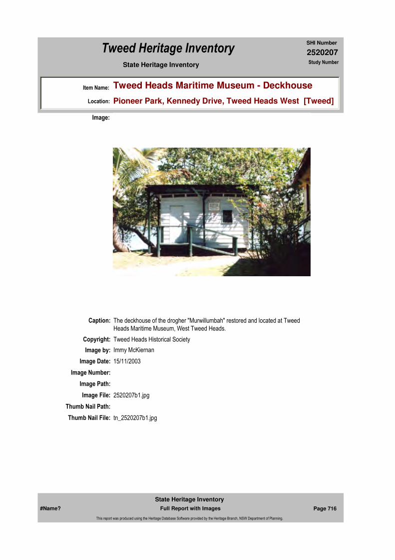
2520207
SHI Number
Tweed Heritage Inventory
Item Name: Tweed Heads Maritime Museum - Deckhouse
Location: Pioneer Park, Kennedy Drive, Tweed Heads West [Tweed]
State Heritage Inventory Study Number
Caption: The deckhouse of the drogher "Murwillumbah" restored and located at Tweed Heads Maritime Museum, West Tweed Heads.
Copyright: Tweed Heads Historical Society
Image:
Image by: Immy McKiernan
Image Date: 15/11/2003
Image Number:
Image Path:
Image File: 2520207b1.jpg
Thumb Nail Path:
Thumb Nail File: tn_2520207b1.jpg
#Name? Page 716 Full Report with Images
State Heritage Inventory
This report was produced using the Heritage Database Software provided by the Heritage Branch, NSW Department of Planning.

2520207
SHI Number
Tweed Heritage Inventory
Item Name: Tweed Heads Maritime Museum - Deckhouse
Location: Pioneer Park, Kennedy Drive, Tweed Heads West [Tweed]
State Heritage Inventory Study Number
#Name? Page 717 Full Report with Images
State Heritage Inventory
This report was produced using the Heritage Database Software provided by the Heritage Branch, NSW Department of Planning.

2520209
SHI Number
Tweed Heritage Inventory
Item Name: Coffee Shop
Location: Coolman Street, Tyalgum [Tweed]
State Heritage Inventory Study Number
Current Use:
Former Uses:
Statement of
Significance:The former old Bakery at Tyalgum is a simple commercial building which retains its original character and remnant bakery elements have historical significance of a previous use.
Historical Notes or Provenance:
Physical Description: Simple timber and iron building. Square parapet. Retains baker's oven and tools.
Physical Condition:
Modification Dates:
Designer:
Maker / Builder:
Year Started: Year Completed: Circa: No
Endorsed Significance:Assessed Significance: Local
Item Type: Built Category: BakeryGroup: Manufacturing and Pr
Admin Codes: Code 2: Code 3:
Curtilage/Boundary:
Owner: Private - Individual
Other/Former Names: Old Bakery
Area/Group/Complex: Tyalgum Village Conservation Area Group ID:
Themes:
Aboriginal Area:
Local Govt Area: Tweed
Planning: Northern
Historic Region: North Coast
Address: #Name?
Suburb / Nearest Town: #Name?
State: NSW
Parish: Tyalgum
County: Rous
National Theme State Theme Local Theme
3. Economy Commerce Bakery
#Name? Page 718 Full Report with Images
State Heritage Inventory
This report was produced using the Heritage Database Software provided by the Heritage Branch, NSW Department of Planning.
2520209
SHI Number
Tweed Heritage Inventory
Item Name: Coffee Shop
Location: Coolman Street, Tyalgum [Tweed]
State Heritage Inventory Study Number
Custom Field One:
Recommended Management:
References:
Studies:
Listings:
Further Comments:
Criteria a) Remnant bakery elements have historical significance of a previous use.
Criteria c) A simple commercial building which retains its original character
Criteria d)
Criteria e)
Criteria g)
Criteria f)
Integrity / Intactness:
Custom Field Two:
Custom Field Three:
Custom Field Four:
Custom Field Five:
Custom Field Six:
Criteria b)
Parcels:
Latitude: Longitude:
AMG Zone: Easting: 520123 Northing: 6863105
Map Name: Map Scale:
Spatial Accuracy:Location validity:
Management:
Author Title YearNumber
Tweed Shire Council Community-based Heritage Study 2003
Parcel Code LotNumber Section Plan Code Plan Number
LOT 5 662423
LOT A DP 354819
#Name? Page 719 Full Report with Images
State Heritage Inventory
This report was produced using the Heritage Database Software provided by the Heritage Branch, NSW Department of Planning.

2520209
SHI Number
Tweed Heritage Inventory
Item Name: Coffee Shop
Location: Coolman Street, Tyalgum [Tweed]
State Heritage Inventory Study Number
Date Updated: 22/11/2006 Status: BasicDate First Entered: 21/08/2002Data Entry:
Caption:
Copyright: Tweed Heads Historical Society
Image:
Image by: Immy McKiernan
Image Date: 07/08/2003
Image Number:
Image Path:
Image File: 2520209b1.jpg
Thumb Nail Path:
Thumb Nail File: tn_2520209b1.jpg
#Name? Page 720 Full Report with Images
State Heritage Inventory
This report was produced using the Heritage Database Software provided by the Heritage Branch, NSW Department of Planning.
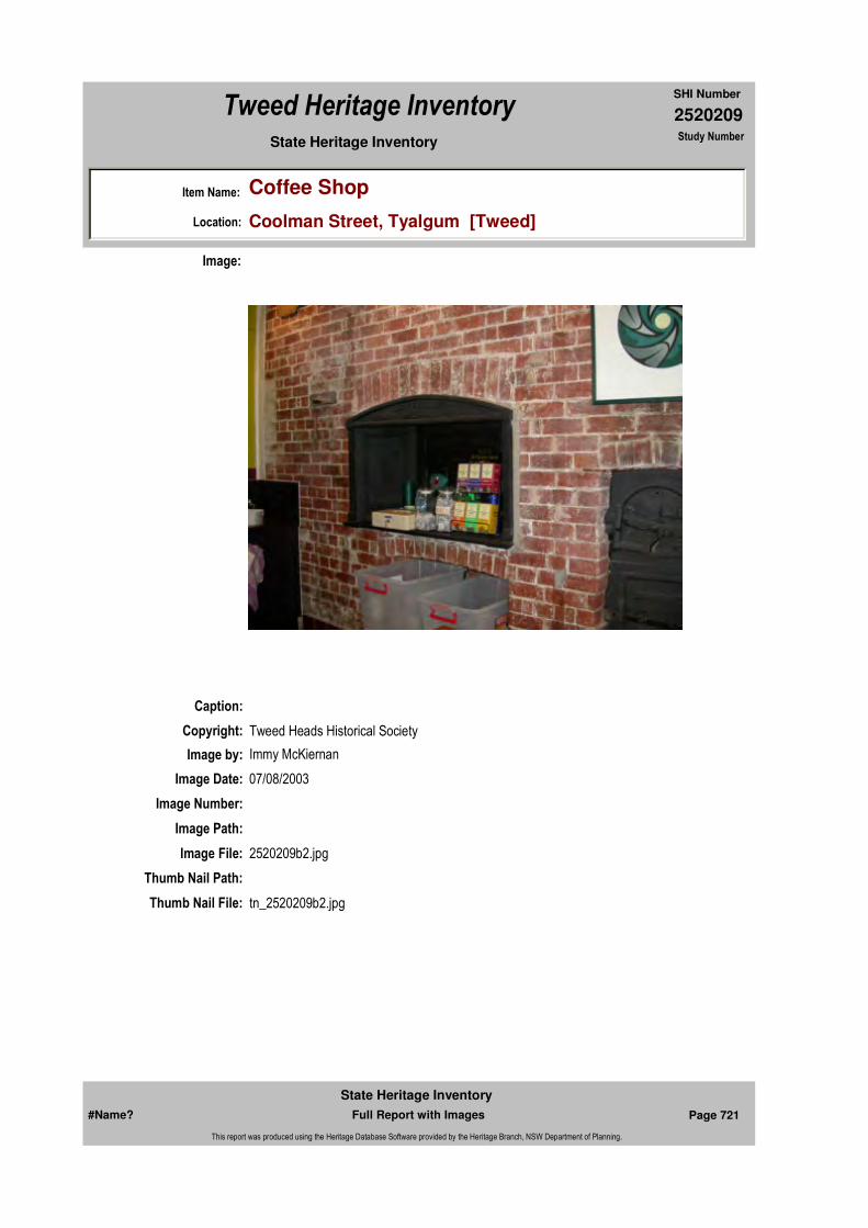
2520209
SHI Number
Tweed Heritage Inventory
Item Name: Coffee Shop
Location: Coolman Street, Tyalgum [Tweed]
State Heritage Inventory Study Number
Caption:
Copyright: Tweed Heads Historical Society
Image:
Image by: Immy McKiernan
Image Date: 07/08/2003
Image Number:
Image Path:
Image File: 2520209b2.jpg
Thumb Nail Path:
Thumb Nail File: tn_2520209b2.jpg
#Name? Page 721 Full Report with Images
State Heritage Inventory
This report was produced using the Heritage Database Software provided by the Heritage Branch, NSW Department of Planning.
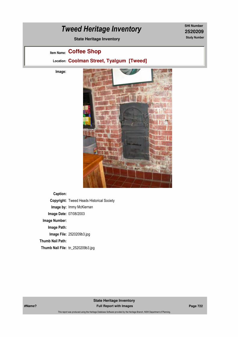
2520209
SHI Number
Tweed Heritage Inventory
Item Name: Coffee Shop
Location: Coolman Street, Tyalgum [Tweed]
State Heritage Inventory Study Number
Caption:
Copyright: Tweed Heads Historical Society
Image:
Image by: Immy McKiernan
Image Date: 07/08/2003
Image Number:
Image Path:
Image File: 2520209b3.jpg
Thumb Nail Path:
Thumb Nail File: tn_2520209b3.jpg
#Name? Page 722 Full Report with Images
State Heritage Inventory
This report was produced using the Heritage Database Software provided by the Heritage Branch, NSW Department of Planning.

2520209
SHI Number
Tweed Heritage Inventory
Item Name: Coffee Shop
Location: Coolman Street, Tyalgum [Tweed]
State Heritage Inventory Study Number
#Name? Page 723 Full Report with Images
State Heritage Inventory
This report was produced using the Heritage Database Software provided by the Heritage Branch, NSW Department of Planning.

2520210
SHI Number
Tweed Heritage Inventory
Item Name: Tweed Heads Maritime Museum - Boyd Fishermen
Location: Kennedy Drive, Tweed Heads West [Tweed]
State Heritage Inventory Study Number
Current Use: Museum Building
Former Uses: Fishing shed
Statement of
Significance:The shed has a strong association with of the pioneering Boyd family who specialised in beach and fishing in the first half of the 20th century. This was indicative of an industry in which many Tweed residents were involved at the time. The shed was re-located to the Tweed Maritime Museum in 1996 and restored.
Historical Notes
or Provenance:"Mogul Dodula" is the technical name for a mullet and it is appropriate that this name was applied to Boyd's shed at Boyd's Bay.This most talked about building was the headquarters and meeting place of the Boyd Brothers who were possibly the best known net fishermen in Australia. Certainly during their long career they handled many mullet and the tales of their hauls from the local beaches have become legendary in the Twin Towns.
The first section of Boyd's shed was built on the present site in 1906. In those days a tick fence ran right along the riverbank and the earlier crews had to climb this fence each day to reach the shed. In 1915 the rowing club shed, which was situated near where Markwell's now stands was blown out in a storm and was later disposed of to the Boyds.They moved the sections by punt and had them added to their existing building.The shed was built just above the high water mark, which made it easy to load fish and equipment from the boats. During the early '30's they did one more extension to the building, and this became known to all as the east wing.The building was painted a rusty coloured red with the waterproof paint popular in those days, and took on the appearance that remains today.
The shed became the hub of the whole family as they all lived on the hill above the bay, and tracks ran from all the home to the shed.The brothers would all assemble at the shed before
Endorsed Significance:Assessed Significance: Local
Item Type: Built Category: FishingGroup: Maritime Industry
Admin Codes: Code 2: Code 3:
Curtilage/Boundary:
Owner: Local Government
Other/Former Names:
Area/Group/Complex: Tweed Heads Maritime Museum Group ID:
Aboriginal Area:
Local Govt Area: Tweed
Planning: Northern
Historic Region: North Coast
Address: #Name?
Suburb / Nearest Town: #Name?
State: NSW
Parish: Terranora
County: Rous
#Name? Page 724 Full Report with Images
State Heritage Inventory
This report was produced using the Heritage Database Software provided by the Heritage Branch, NSW Department of Planning.
2520210
SHI Number
Tweed Heritage Inventory
Item Name: Tweed Heads Maritime Museum - Boyd Fishermen
Location: Kennedy Drive, Tweed Heads West [Tweed]
State Heritage Inventory Study Number
dawn, and then move out to their days work, which would either up the river, or to sit on one of the headlands and wait for the sea mullet to move.The Boyds had the oyster lease extending from their shed to the bridge, and across the other side of the bay. After gathering the oysters, they were brought back to the shed to be opened and bottled.
The shed was also used to store large amounts of iron bark and bottlebrush bark used for tanning the cotton and hemp nets in use in those days. It also held u p to 1,000 wooden cases used to transport fist to the Brisbane markets.They were stacked in every corner of the building and up in the rafters. During its long active history the shed which always contained boats, nets, parts and other equipment was never locked and never at any time suffered from vandalism. Their net racks were situated across the bay just up stream from the present rowing club.
It was here they had their large boilers to boil down the tan from the bark, and the racks used for net making and repairs.
In an experiment to always have a supply of fresh fish available, the brothers built a large wire enclosure near the shed.They then stocked it from their catches, but the venture was unsuccessful as the fish knocked themselves around too much on the netting and rocks.
If the shed was the work headquarters of the Boyds, it was also the social centre where they could relax after working in sometimes unspeakable conditions. The shed played host to judges, politicians, business leaders and people from every section of the community. Most subjects were discussed over a social drink and every Seagulls football match was replayed in the shed.The elements were never allowed to interfere with a social event.
During the 1954 flood, the water came up about four feet into the building, but undaunted, the Boyds rowed a boat inside and enjoyed their refreshments from a floating bar.
History has been witnessed from the shed, and patrons have seen the passing of the ferry, which operated nearby, and the opening of the old Boyds Bay bridge in 1934, and the new in 1984. The area under the shed was a source of revenue for the younger Boyds, who spent much time there collecting the many coins which fell through many cracks in the floor. Brian Boyd, the son of Charlie, has taken on the job of curator of the old building, and it is a credit to this young man, who with great foresight has preserved so much local history. He has the walls covered with old photos and paintings and makes the shed available to any worthwhile organisation. It has been used by the swimming club from Twin Town Services Club, and there have been many family reunions and even dances in the old shed. With the new road works in Kennedy Drive, Brian can only look forward from day to day.(Look Back with Peter Winter Daily News September 26, 1985 - "Shed marks time")
It is hard to imagine a better known group of fishermen than the Boyd Brothers. Jack, Herb, Fred, Charlie, Bob and George (Nourie) became famous Australia-wide with their great hauls on local beaches and it is almost certain that their feats will never be repeated. The last remaining member of the Boyd brothers Charlie Boyd, now 82, lives in retirement in his original home on Razorback overlooking Boyds Bay. He enjoys good health and though
#Name? Page 725 Full Report with Images
State Heritage Inventory
This report was produced using the Heritage Database Software provided by the Heritage Branch, NSW Department of Planning.
2520210
SHI Number
Tweed Heritage Inventory
Item Name: Tweed Heads Maritime Museum - Boyd Fishermen
Location: Kennedy Drive, Tweed Heads West [Tweed]
State Heritage Inventory Study Number
unable to see, his alert mind is full of tales of that great era of net fishing.
Charlie Boyd was born in a small house on Cobaki Road (Kennedy Drive) on October 6, 1903. The house had a dirt floor and a large log on the floor, which was moved into a fireplace for cooking. Emma Adams, who became Charlie's wife about 24 years later, was born in a house just behind the Boyd home. Charlie chuckles about the fact that their home had an iron roof while Emma's was covered with canvas.
In 1906 the Boyd family moved up on the hill overlooking the bay, and a little later the father William and the two eldest boys Jack and Herb began fishing. When only eight years old Charlie and his brother Fred had to deliver fish around town pulling a small cart with wooden wheels cut from a tree trunk. One of the boys would take the cart to deliver to Fagans, Greenmount, the Queensland Hotel and that area of town. The other would carry the fish in sugar bags for delivery around the Kirra area. The Kirra boy would walk back on a track between Mt Murraba and Razorback and meet his brother near the cemetery, They would walk home together, clean out the cart and sugar bags, get dressed and walk back to the Tweed Heads school.
Charlie left school at 14 and went fishing with the family in their first fishing motor boat, the Violet with Herb acting as the engineer. They fished all areas of the Tweed and during holidays ran their boat along the Back Channel and sold fish to the campers in their tents along the foreshore. They started beach fishing in 1921 using a boat loaned by Jim McDonough. The boat was transported around by Charlie Simonson with his horse and cart.
The first boat they owned was built by local builder Gus Green. They built rails from planks butted together and with rollers made from logs were able to move their boat and nets to various positions on the beach. They soon developed their well-remembered pattern of spotting from one of the hills and when a school was sighted, leaving one spotter on the hill while the others went to the beach to man the boat and nets. On a signal from the hill man, two of the crew would row for all their might in a 91-metre sprint to get the net around the school. With 75 metres of net and 73 metres of rope each end, the net weighted by lead, the two rowers were pulling a weight of about one tonne. The men were pretty exhausted when they arrived back at the beach. The nets of the day were able to catch to a depth of six metres.
When not actually fishing, the brothers could always be seen making and repairing nets. Their tanning racks were across Boyds Bay near the rowing club. On one occasion while the boat was in the water ready to ring a school, the fish started to move away and the two oarsmen followed, eventually getting as far as Currumbin before losing them. They had the boat returned on Bob Johnson's horse and dray. In 1925 they purchased their first truck, an Overland. In 1928 they purchased a Chev and used the front assem-bly of the Overland to make a trailer.
During the following years the brothers made some massive hauls from the beaches with their best being pre--war at Kirra when they landed more than 1,000 18kg cases of sea mullet. Their best haul of tailor was at Duranbah (Flagstaff) Beach in the early 50's, when they landed almost 1,000 cases. They hauled lots of jewfish around the mouth of the river, often herding them along by rattling chains in the water. On one occasion they had a large
#Name? Page 726 Full Report with Images
State Heritage Inventory
This report was produced using the Heritage Database Software provided by the Heritage Branch, NSW Department of Planning.
2520210
SHI Number
Tweed Heritage Inventory
Item Name: Tweed Heads Maritime Museum - Boyd Fishermen
Location: Kennedy Drive, Tweed Heads West [Tweed]
State Heritage Inventory Study Number
haul of kingfish weighing an average of 11kg. The fish were packed in boxes and covered in ice to be transported to Brisbane by train. They were guaranteed (10c) a pound (0.4kg), with ninepence (8c) a pound (0.4kg) in glut time.
During the Depression when money was scarce, peo-ple took to catching their own fish to supplement their diet.
At this time the Boyds were limited by law to eight trays a week per man and they were paid 10 shillings ($1) a tray.
The Boyds were a real tourist attraction and people from all over Australia, from judges and politicians to small children, came year after year to sit with the crew on the hill and to lend assistance with the haul. In 1937 they purchased another Chev and they were well-known and recognised as they moved around with "Nourie" at the wheel, and the crew in the back in their uniform of shorts, grey flannel shirt and no shoes.
In the first double wedding held at Tweed Heads, Charlie married Emma Adams and his sister Florrie married Carl Green at the Tweed Heads Church of England on December 7, 1927. For this happy occasion the Norco butter factory tied down their steam whistle in a continuous blast and deto-nators were placed on the railway line as they left by train for their honeymoon.
The Boyds sold sea mullet on the beaches for three pence (2c) each and gave away as much as they sold.
Amateur fishermen like Ron Cronk, Bill Trew and Len Thompson often notified them when a school of fish were around. During World War 2 when the Americans were sta-tioned at Point Danger, the Boyds were mistaken for in-vaders while fishing off Snapper Rocks. The Americans started shooting at them. Charlie can still hear the bullets whipping into the water as they took cover. They were later dressed down by the American officer for being in that area. In the post war years as the brothers got older, the younger family members were discouraged from joining the fishermen. With the uncertainty of prices there just didn't seem to be any money in the game. With the fall-off of the quan-tity of fish, the Boyds had their last haul at Dodd's Island in 1969, catching whiting, bream and tiger mullet. They sold the whiting and gave away the rest.(Daily News 25 July 1985 - "Local History - The Boyd Boys - A Legend on the Tweed Coast" by Peter Winter)
The historic Boyds boat shed which was located on Kennedy Drive up stream from the old Markwells factory recently made the final journey from the river bank at Boyds Bay to its new home near the Historical Society West Tweed Heads.
The shed will become an integral part of the lower Tweed River Historical Society's display near the Cobaki Creek bridge.
On Thursday September 19, work trainees from the Landcare and Environment Action
#Name? Page 727 Full Report with Images
State Heritage Inventory
This report was produced using the Heritage Database Software provided by the Heritage Branch, NSW Department of Planning.
2520210
SHI Number
Tweed Heritage Inventory
Item Name: Tweed Heads Maritime Museum - Boyd Fishermen
Location: Kennedy Drive, Tweed Heads West [Tweed]
State Heritage Inventory Study Number
Program (LEAP) loaded the wall pan-els, jetty and flooring onto Kirkham's oyster barge for relocation upriver.
Spokesman for project co-ordinator Adult and Community Education Inc. (ACE) North Coast said foundations for the shed had been laid and the wall panels were erected over the next couple of weeks.The restoration of the shed will leave behind many memories. According to one of the local church pastors, this building became a haven for sly-grogging in its earlier days.
The reborn 90-year-old building will start looking like a shed again in about a month and should be ready for opening in early mid-December.
In the meantime five of the trainees will be working with a local designer on an historical display which will be mounted inside the completed shed.(Lakeside Leader 29October 1996 "We've Moved")
More than two years of planning are due to come to fruition with the impending relocation of the Boyd's Bay boat shed.The historic shed, a local landmark on the shore of Boy's Bay for 90 years, is to be moved to the rear of the Lower Tweed River Historical Society headquarters in Kennedy Drive. The move has been given the green light by Tweed Shire Council, with historical society president Warren Keats hopeful of starting removal work in two or three weeks time.
Mr Keats said yesterday the restored boat shed would not only be a fitting memorial to the Boyd family and other old-time fishermen, but would become an integral part of the maritime museum complex. "The shed is where the Tweed's fishing industry started," he said. "It was first built as a rowing shed but was not long after purchased by the Boyd brothers at auction and moved to its present site in 1906." The shed will be restored as "close as possible" to its original condition, with Mr Keats promising to retain its unique character. "As it is the shed is falling apart," he said. "It is inaccessible, has the welcome mat out for vandals and we are desperately worried that someone is going to burn it or it is just going to rot away and fall into the water. "Once it is relocated and restored it will saved for ever."
About 100 years ago, this building was built as a base for the Boyd family at Boyd's Bay. They started net fishing about 1907 and used the shed to store their nets, ropes and boat's spares. The Boyd families were probably the first net fishermen to use trucks on the local beach to move their boats to the best place for net fishing. The first truck was purchased in the early 1920's. The crew would drive the vehicle to the water to get bogged in the soft sand, hop in and off again to launch the net boat. Most of the catches were sea mullet and hauls of two to three hundred cases were common. A good haul would be a thousand cases, a lot of fish. The men would have to carry the fish from the net up the beach, in cane baskets, sort and pack into wooden boxes, ice on the top of each one, then transport them to the Brisbane Fish Markets. For a big catch, this would take hours.
When they married, all the Boyd's sons and daughters built their homes on the hill called
#Name? Page 728 Full Report with Images
State Heritage Inventory
This report was produced using the Heritage Database Software provided by the Heritage Branch, NSW Department of Planning.
2520210
SHI Number
Tweed Heritage Inventory
Item Name: Tweed Heads Maritime Museum - Boyd Fishermen
Location: Kennedy Drive, Tweed Heads West [Tweed]
State Heritage Inventory Study Number
Razorback, above Boyd's Bay. The men all fished together as one crew on the rivers and beaches of the district. They were a big family, six men and four women. The tops of the Headlands were the spots to look out for fish moving up the Coast. When a school of fish was sighted a suitable beach was selected and the net boats launched. Two men would row around the fish and then back to the beach. There were usually plenty of sightseers on hand to help with pulling in the nets. They always went home with a fish or two. All the Boyd's were very strong, and when the locals wanted to move something, a boat a shed or any heavy object, the crew did the job. Always noted for their love of the "wee drop" they were not to be denied. When the 1954 flood raised the level of the River to four feet, they simply moved in a boat and used it as a floating bar - another first. Sunday was a special day at the shed and everybody and anybody was welcome to a drink or two or three. It didn't matter if you were a doctor or a judge or "Joe Blow" down the road, "Come in and have a glass". Most of the problems of the world would be solved would be solved with a great deal of philosophy, boy if these walls could only talk.(Daily News 26 April, 1996 "Fishing shed up stumps up river" (Extract).)
Physical Description: A rowing club/fishing shed made of timber and extended from time to time with what ever materials came to hand.
Physical Condition:
Modification Dates:
Designer:
Maker / Builder:
Year Started: Year Completed: Circa: No
Recommended Management:
Further Comments:
Criteria a)
Criteria c)
Criteria b) The shed has a strong association with of the pioneering Boyd family who specialised in beach and net fishing in the first half of the 20th century. This was indicative of an industry in which many Tweed residents were involved at the time.
Themes:
Management:
National Theme State Theme Local Theme
3. Economy Fishing Boat Shed
#Name? Page 729 Full Report with Images
State Heritage Inventory
This report was produced using the Heritage Database Software provided by the Heritage Branch, NSW Department of Planning.
2520210
SHI Number
Tweed Heritage Inventory
Item Name: Tweed Heads Maritime Museum - Boyd Fishermen
Location: Kennedy Drive, Tweed Heads West [Tweed]
State Heritage Inventory Study Number
Custom Field One:
References:
Studies:
Listings:
Date Updated: 03/11/2004 Status: BasicDate First Entered: 21/08/2002Data Entry:
Criteria d)
Criteria e)
Criteria g)
Criteria f)
Integrity / Intactness:
Custom Field Two:
Custom Field Three:
Custom Field Four:
Custom Field Five:
Custom Field Six:
Parcels:
Latitude: Longitude:
AMG Zone: Easting: Northing:
Map Name: Map Scale:
Spatial Accuracy:Location validity:
Author Title Year
Fishing shed up stumps up river (Extract). 1996
We've Moved 1996
Peter Winter Local History - The Boyd Boys - A Legend on the Tweed Coast
1985
Peter Winter Look Back with Peter Winter "Shed marks time" 1985
Author Title YearNumber
Tweed Shire Council Community-based Heritage Study 2003
Parcel Code LotNumber Section Plan Code Plan Number
LOT 3 DP 44829
#Name? Page 730 Full Report with Images
State Heritage Inventory
This report was produced using the Heritage Database Software provided by the Heritage Branch, NSW Department of Planning.

2520210
SHI Number
Tweed Heritage Inventory
Item Name: Tweed Heads Maritime Museum - Boyd Fishermen
Location: Kennedy Drive, Tweed Heads West [Tweed]
State Heritage Inventory Study Number
Caption: Boyd's Shed, relocated and restored to Tweed Heads Maritime Museum, Pioneer Park, West Tweed heads.
Copyright: Tweed Heads Historical Society
Image:
Image by: Immy McKiernan
Image Date: 02/11/2003
Image Number:
Image Path:
Image File: 2520210b1.jpg
Thumb Nail Path:
Thumb Nail File: tn_2520210b1.jpg
#Name? Page 731 Full Report with Images
State Heritage Inventory
This report was produced using the Heritage Database Software provided by the Heritage Branch, NSW Department of Planning.

2520210
SHI Number
Tweed Heritage Inventory
Item Name: Tweed Heads Maritime Museum - Boyd Fishermen
Location: Kennedy Drive, Tweed Heads West [Tweed]
State Heritage Inventory Study Number
Caption: Boyd's Shed at original location in Boyd's Bay Tweed Heads.
Copyright: Tweed Heads Historical Society
Image:
Image by:
Image Date:
Image Number:
Image Path:
Image File: 2520210b2.jpg
Thumb Nail Path:
Thumb Nail File: tn_2520210b2.jpg
#Name? Page 732 Full Report with Images
State Heritage Inventory
This report was produced using the Heritage Database Software provided by the Heritage Branch, NSW Department of Planning.
2520210
SHI Number
Tweed Heritage Inventory
Item Name: Tweed Heads Maritime Museum - Boyd Fishermen
Location: Kennedy Drive, Tweed Heads West [Tweed]
State Heritage Inventory Study Number
#Name? Page 733 Full Report with Images
State Heritage Inventory
This report was produced using the Heritage Database Software provided by the Heritage Branch, NSW Department of Planning.
2520211
SHI Number
Tweed Heritage Inventory
Item Name: Coolamon Cultural Centre
Location: Tumbulgum Road, Murwillumbah [Tweed]
State Heritage Inventory Study Number
Current Use: City of the Arts Space
Former Uses: Private Residence, Art Gallery
Statement of
Significance:This was originally the home of the Proudfoot family who were successful merchants in the latter part of the 1800's and early 1900's. It became the former Tweed Regional Art Gallery is important in the cultural history of the Tweed Shire as the Tweed's first municipal Art Gallery. It is sited on the banks of the Tweed River, and retains the character of its previous use. Its development into a cultural facility has had a major impact on the development of the appreciation and growth of the creative arts in the Shire.
Historical Notes
or Provenance:The land was originally owned by Joshua Bray, a pioneer of the Tweed Valley. Sold to William Kelly in 1884 it was the site for the 24 room Cosmopolitan Hotel beside the ferry ramp which carried passengers across the river until the building of a bridge further up stream.
In 1923, storeowner William Proudfoot built a home to accommodate his wife, seven children and a maid. Proudfoot supervised the work himself and used local timbers such as red gum, teak, cedar and beech. The cedar came from one tree, felled locally and milled on site. A tennis court was built on the northern side.
A.S. Loder bought the building in1946 and sold it in1950 to the Country Women's Association to be used as a girls' hostel. In 1951 TSC bought the building and converted it into four flats to accommodate employees.
In November 1986 with the launching of the Doug Moran National Portrait Prize in the Tweed Shire, the Council received donations towards the conversion, which would enable the building to house the winning entries as well as a small existing collection of art works.
Endorsed Significance:Assessed Significance: Local
Item Type: Built Category: HouseGroup: Residential buildings (
Admin Codes: Code 2: Code 3:
Curtilage/Boundary:
Owner: Local Government
Other/Former Names: Proudfoot Residence; Tweed Regional Art Gallery; City of the Arts Space
Area/Group/Complex: Group ID:
Aboriginal Area:
Local Govt Area: Tweed
Planning: Northern
Historic Region: North Coast
Address: #Name?
Suburb / Nearest Town: #Name?
State: NSW
Parish: Murwillumbah
County: Rous
#Name? Page 734 Full Report with Images
State Heritage Inventory
This report was produced using the Heritage Database Software provided by the Heritage Branch, NSW Department of Planning.

2520211
SHI Number
Tweed Heritage Inventory
Item Name: Coolamon Cultural Centre
Location: Tumbulgum Road, Murwillumbah [Tweed]
State Heritage Inventory Study Number
Work commenced in1987 and the Gallery opened in 1988. The collection was expanded and a program of regular touring exhibitions, workshops and concerts has been developed. Due to the success of these policies the gallery has outgrown the site and in 2004 will open in a purpose built facility on land donated by Doug and Margo Anthony. The building will then be the centre for the City of the Arts 2003-05 program.
A. Schardin Gallery History 1989
Physical Description: Assymetrical massing. Timber piers and post segmented large shady verandah. Visually prominent low pitched roof, with large gable to one end. Small gabled wing to other end, either transitional design between Edwardian bungalow or built on to and remodeled. Edwardian chimney pots. Internal alterations included removal of dividing walls, which are marked by lighter hoop pine inserts in the floor. The main room retains the polished beech panelling.
Physical Condition:
Modification Dates: 1987
Designer:
Maker / Builder:
Year Started: 1923 Year Completed: Circa: No
Recommended Management:
Any future adaptive re-use should rerspect the significance of the original use and the current gallery/community use.
Further Comments:
Criteria a) Important in the cultural history of the Tweed Shire as the Tweed's first municipal Art Gallery. Sited on the banks of the Tweed River, the Art Gallery retains the character of its previous use. Its development into a cultural facility has had a major impact on the development of the appreciation and growth of the creative arts in the Shire. The building has been the focal point for artistic expression and education.
Criteria c)
Criteria b) Excellent example of a home built for successful merchant of Murwillumbah, Proudfoot.
Themes:
Management:
National Theme State Theme Local Theme
8. Culture Creative endeavour (Cultur Art Gallery
#Name? Page 735 Full Report with Images
State Heritage Inventory
This report was produced using the Heritage Database Software provided by the Heritage Branch, NSW Department of Planning.

2520211
SHI Number
Tweed Heritage Inventory
Item Name: Coolamon Cultural Centre
Location: Tumbulgum Road, Murwillumbah [Tweed]
State Heritage Inventory Study Number
Custom Field One:
References:
Studies:
Listings:
Date Updated: 22/11/2006 Status: BasicDate First Entered: 21/08/2002Data Entry:
Criteria d)
Criteria e)
Criteria g)
Criteria f)
Integrity / Intactness:
Custom Field Two:
Custom Field Three:
Custom Field Four:
Custom Field Five:
Custom Field Six:
Parcels:
Latitude: Longitude:
AMG Zone: Easting: Northing:
Map Name: Map Scale:
Spatial Accuracy:Location validity:
Author Title Year
A. Schardin Gallery History 1989
Author Title YearNumber
Tweed Shire Council Community-based Heritage Study 2003
Parcel Code LotNumber Section Plan Code Plan Number
LOT 2 DP 907903
#Name? Page 736 Full Report with Images
State Heritage Inventory
This report was produced using the Heritage Database Software provided by the Heritage Branch, NSW Department of Planning.
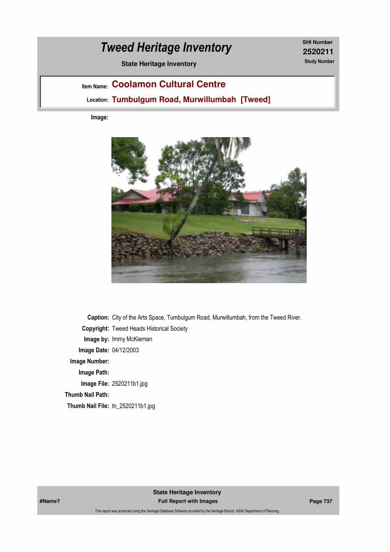
2520211
SHI Number
Tweed Heritage Inventory
Item Name: Coolamon Cultural Centre
Location: Tumbulgum Road, Murwillumbah [Tweed]
State Heritage Inventory Study Number
Caption: City of the Arts Space, Tumbulgum Road, Murwillumbah, from the Tweed River.
Copyright: Tweed Heads Historical Society
Image:
Image by: Immy McKiernan
Image Date: 04/12/2003
Image Number:
Image Path:
Image File: 2520211b1.jpg
Thumb Nail Path:
Thumb Nail File: tn_2520211b1.jpg
#Name? Page 737 Full Report with Images
State Heritage Inventory
This report was produced using the Heritage Database Software provided by the Heritage Branch, NSW Department of Planning.

2520211
SHI Number
Tweed Heritage Inventory
Item Name: Coolamon Cultural Centre
Location: Tumbulgum Road, Murwillumbah [Tweed]
State Heritage Inventory Study Number
Caption: City of the Arts Space, Tumbulgum Road, Murwillumbah, from the Tweed River.
Copyright: Tweed Heads Historical Society
Image:
Image by: Immy McKiernan
Image Date: 04/12/2003
Image Number:
Image Path:
Image File: 2520211b2.jpg
Thumb Nail Path:
Thumb Nail File: tn_2520211b2.jpg
#Name? Page 738 Full Report with Images
State Heritage Inventory
This report was produced using the Heritage Database Software provided by the Heritage Branch, NSW Department of Planning.

2520211
SHI Number
Tweed Heritage Inventory
Item Name: Coolamon Cultural Centre
Location: Tumbulgum Road, Murwillumbah [Tweed]
State Heritage Inventory Study Number
Caption: City of the Arts Space, Tumbulgum Road, Murwillumbah, from the Tweed River.
Copyright: Tweed Heads Historical Society
Image:
Image by: Immy McKiernan
Image Date: 04/12/2003
Image Number:
Image Path:
Image File: 2520211b3.jpg
Thumb Nail Path:
Thumb Nail File: tn_2520211b3.jpg
#Name? Page 739 Full Report with Images
State Heritage Inventory
This report was produced using the Heritage Database Software provided by the Heritage Branch, NSW Department of Planning.

2520211
SHI Number
Tweed Heritage Inventory
Item Name: Coolamon Cultural Centre
Location: Tumbulgum Road, Murwillumbah [Tweed]
State Heritage Inventory Study Number
Caption: City of the Arts Space, Tumbulgum Road, Murwillumbah, from the Tweed River.
Copyright: Tweed Heads Historical Society
Image:
Image by: Immy McKiernan
Image Date: 04/12/2003
Image Number:
Image Path:
Image File: 2520211b4.jpg
Thumb Nail Path:
Thumb Nail File: tn_2520211b4.jpg
#Name? Page 740 Full Report with Images
State Heritage Inventory
This report was produced using the Heritage Database Software provided by the Heritage Branch, NSW Department of Planning.

2520211
SHI Number
Tweed Heritage Inventory
Item Name: Coolamon Cultural Centre
Location: Tumbulgum Road, Murwillumbah [Tweed]
State Heritage Inventory Study Number
Caption: City of the Arts Space, Tumbulgum Road, Murwillumbah, from the Tumbulgum Road.
Copyright: Tweed Heads Historical Society
Image:
Image by: Immy McKiernan
Image Date: 08/08/2004
Image Number:
Image Path:
Image File: 2520211b5.jpg
Thumb Nail Path:
Thumb Nail File: tn_2520211b5.jpg
#Name? Page 741 Full Report with Images
State Heritage Inventory
This report was produced using the Heritage Database Software provided by the Heritage Branch, NSW Department of Planning.
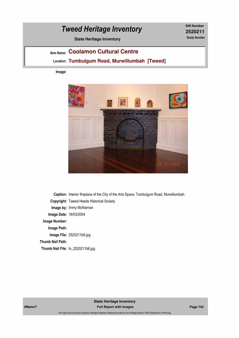
2520211
SHI Number
Tweed Heritage Inventory
Item Name: Coolamon Cultural Centre
Location: Tumbulgum Road, Murwillumbah [Tweed]
State Heritage Inventory Study Number
Caption: Interior fireplace of the City of the Arts Space, Tumbulgum Road, Murwillumbah.
Copyright: Tweed Heads Historical Society
Image:
Image by: Immy McKiernan
Image Date: 18/03/2004
Image Number:
Image Path:
Image File: 2520211b6.jpg
Thumb Nail Path:
Thumb Nail File: tn_2520211b6.jpg
#Name? Page 742 Full Report with Images
State Heritage Inventory
This report was produced using the Heritage Database Software provided by the Heritage Branch, NSW Department of Planning.

2520211
SHI Number
Tweed Heritage Inventory
Item Name: Coolamon Cultural Centre
Location: Tumbulgum Road, Murwillumbah [Tweed]
State Heritage Inventory Study Number
Caption: Ornate interior passageway of the City of the Arts Space, Tumbulgum Road, Murwillumbah.
Copyright: Tweed Heads Historical Society
Image:
Image by: Immy McKiernan
Image Date: 18/03/2004
Image Number:
Image Path:
Image File: 2520211b7.jpg
Thumb Nail Path:
Thumb Nail File: tn_2520211b7.jpg
#Name? Page 743 Full Report with Images
State Heritage Inventory
This report was produced using the Heritage Database Software provided by the Heritage Branch, NSW Department of Planning.

2520211
SHI Number
Tweed Heritage Inventory
Item Name: Coolamon Cultural Centre
Location: Tumbulgum Road, Murwillumbah [Tweed]
State Heritage Inventory Study Number
Caption: Ceiling panelling of the City of the Arts Space, Tumbulgum Road, Murwillumbah.
Copyright: Tweed Heads Historical Society
Image:
Image by: Immy McKiernan
Image Date: 18/03/2004
Image Number:
Image Path:
Image File: 2520211b8.jpg
Thumb Nail Path:
Thumb Nail File: tn_2520211b8.jpg
#Name? Page 744 Full Report with Images
State Heritage Inventory
This report was produced using the Heritage Database Software provided by the Heritage Branch, NSW Department of Planning.
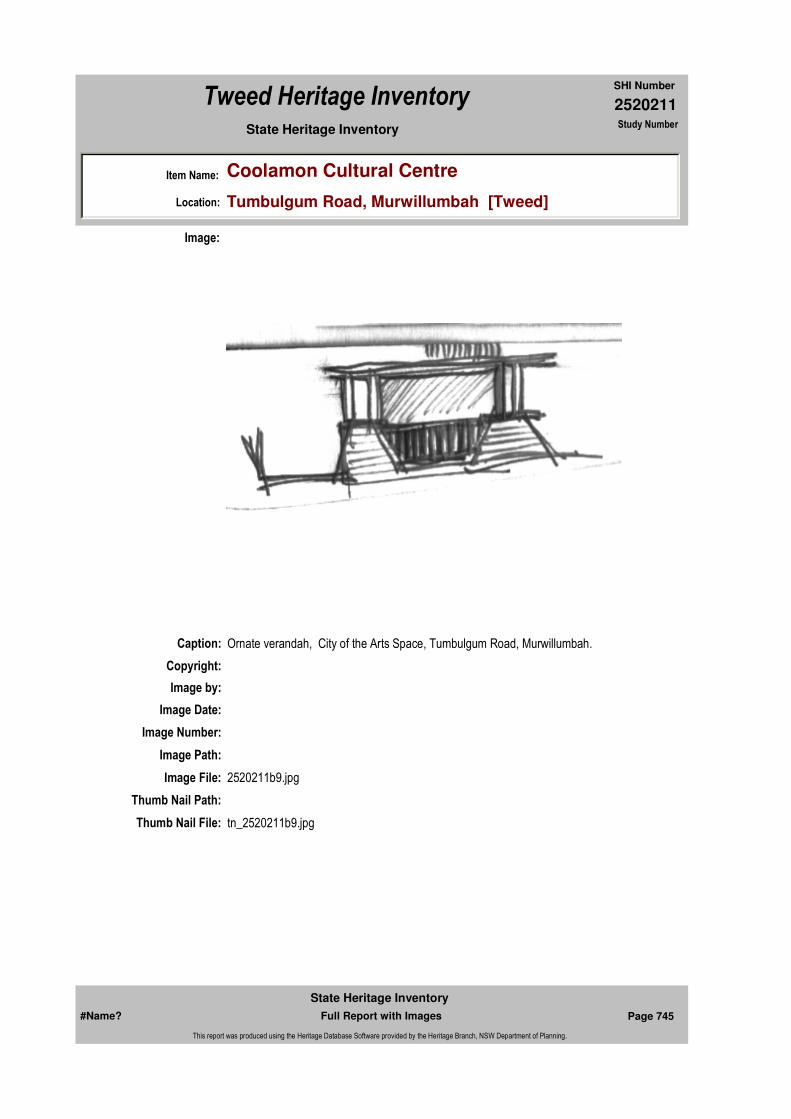
2520211
SHI Number
Tweed Heritage Inventory
Item Name: Coolamon Cultural Centre
Location: Tumbulgum Road, Murwillumbah [Tweed]
State Heritage Inventory Study Number
Caption: Ornate verandah, City of the Arts Space, Tumbulgum Road, Murwillumbah.
Copyright:
Image:
Image by:
Image Date:
Image Number:
Image Path:
Image File: 2520211b9.jpg
Thumb Nail Path:
Thumb Nail File: tn_2520211b9.jpg
#Name? Page 745 Full Report with Images
State Heritage Inventory
This report was produced using the Heritage Database Software provided by the Heritage Branch, NSW Department of Planning.

2520211
SHI Number
Tweed Heritage Inventory
Item Name: Coolamon Cultural Centre
Location: Tumbulgum Road, Murwillumbah [Tweed]
State Heritage Inventory Study Number
Caption: Ornate chimney pots, City of the Arts Space, Tumbulgum Road, Murwillumbah.
Copyright:
Image:
Image by:
Image Date:
Image Number:
Image Path:
Image File: 2520211b10.jpg
Thumb Nail Path:
Thumb Nail File: tn_2520211b10.jpg
#Name? Page 746 Full Report with Images
State Heritage Inventory
This report was produced using the Heritage Database Software provided by the Heritage Branch, NSW Department of Planning.

2520211
SHI Number
Tweed Heritage Inventory
Item Name: Coolamon Cultural Centre
Location: Tumbulgum Road, Murwillumbah [Tweed]
State Heritage Inventory Study Number
#Name? Page 747 Full Report with Images
State Heritage Inventory
This report was produced using the Heritage Database Software provided by the Heritage Branch, NSW Department of Planning.

2520407
SHI Number
Tweed Heritage Inventory
Item Name: Bilambil Hall
Location: Bilambil Road, Bilambil [Tweed]
State Heritage Inventory Study Number
Current Use: Community Hall
Former Uses: Community Hall
Statement of Significance:
Includes Bilambil War Memorial Board. The Bilambil Hall has a strong association with the people of the Bilambil, Duroby and, later, Carool districts of the Tweed Shire. It has acted as a centre for social and cultural activities for nearly 100 years. The Bilambil Hall holds a wooden memorial to the soldiers from the Bilambil district who served in the First World War. The memorial is part of the cultural history of the Tweed Valley and has a special association with the community in which it is housed.
Historical Notes
or Provenance:The Bilambil Hall is believed to be one of the best maintained in the district and one of the few still running functions on a regular basis.
The first building was started in about 1906 on a quarter acre block which was sold to a local committee by Peter Christensen for 10 shillings ($1).
The driving force behind the building of the hall were John Hogan, James Duffy, Peter Christensen, John Suter and Dan Prindable. Builder was John Suter, assisted by voluntary labour.
The main idea was to have a central meeting place which could be used to serve all
Endorsed Significance:Assessed Significance: Local
Item Type: Built Category: Hall Public Group: Community Facilities
Admin Codes: Code 2: Code 3:
Curtilage/Boundary:
Owner: Private - Community Group
Other/Former Names:
Area/Group/Complex: Group ID:
Aboriginal Area:
Local Govt Area: Tweed
Planning: Northern
Historic Region: North Coast
Address: #Name?
Suburb / Nearest Town: #Name?
State: NSW
Parish: Terranora
County: Rous
Local Govt Area: Tweed
Planning: Northern
Historic Region: North Coast
Address: #Name?
Suburb / Nearest Town: #Name?
State: NSW
Parish: Terranora
County: Rous
#Name? Page 762 Full Report with Images
State Heritage Inventory
This report was produced using the Heritage Database Software provided by the Heritage Branch, NSW Department of Planning.

2520407
SHI Number
Tweed Heritage Inventory
Item Name: Bilambil Hall
Location: Bilambil Road, Bilambil [Tweed]
State Heritage Inventory Study Number
purposes of Bilambil and Duroby other than industrial and commercial.
In those days there were only gravel tracks into the village, no vehicle bridges, only creek crossings, with a little later the odd elevated pedestrian creek crossing constructed.
Dances were held regularly in the hall, with music in the early days often supplied by local citizens Frank Dee, Paddy Maher, and Bernie and George Gilliett.
The hall was used by most denominations to hold their church services, and the Presbyterian congregation worshipped there until they built their own church in 1919.
Father Hanly drove his horse and buggy to say Mass in the hall, prior to the building of the Catholic Church in 1932.
He ran his horse in a nearby paddock while he conducted the service, and whistled it up when it was time to return to Tweed Heads.
Old timers recall that Tom Cranney, a Catholic, rode his horse down to attend church at the hall, but had his Sundays mixed up and attended the Church of England service.
During World War 1 the hall was put to good use with functions to assist the war effort. The Red Cross and Comforts Funds met at the hall, where the ladies knitted garments and packed food parcels for the troops overseas.
When the Soldier Settlement at Carool was in full swing in the early 1920's, the citizens all banded together and added an extension to the hall.
Touring troupes and concert parties, as well as the travelling picture shows used the hall extensively during the mid war years. It would be difficult to put a figure on the number of local girls given a kitchen tea by the local citizens in their hall.
People arrived at the hall in all modes of transport. Ducat's boat dropped them at the wharf, then near the building. They cane on horse back, walked for miles and in later years, travelled in buses from Murwillumbah, Kingscliff and the Twin Towns.
Football training has actually taken place in the hall, and during World War Two it was put to good use by the local platoon of the Volunteer Defence Corp (V.D.C.).
The original lighting was gas, and it wasn't until 1958 that electricity was installed. Some of the early balls went right through until daylight, and a lot of romances commenced at the Bilambil Hall.
All the communities have worked voluntarily for the hall and names like Duffy, Prindable, Tully, Vardy, McAllister, Thomas, Spurway, Lacey and O'Brien come to mind. In the 50's the committee grew vegetables, which they sold to bolster hall funds. Dennis O'Brien donated a cow which raised $190, and others donated money as well as their time.
The hall was rented in the 50's for one pound, 10 shillings, or 10 shillings a meeting.
#Name? Page 763 Full Report with Images
State Heritage Inventory
This report was produced using the Heritage Database Software provided by the Heritage Branch, NSW Department of Planning.
2520407
SHI Number
Tweed Heritage Inventory
Item Name: Bilambil Hall
Location: Bilambil Road, Bilambil [Tweed]
State Heritage Inventory Study Number
Revenue for August 1953 was eight pounds, 15 shillings ($17.50). One expense the committee had in the 50's was to pay the taxi fare of Mr Lockyer, a drummer, of seven shillings and sixpence from Kingscliff to Bilambil.In the early days a patron could get a bus from Tweed Heads, admission to the dance and supper for three shillings (30c). Today a patron pays $4 to dance, supper and free door prize.
Dennis O'Brien has been a committee man for 21 years, and Ron Garbett for 19. For most of that time Dennis has been the doorman at functions, and his wife has helped to provide the supper. Although spending long hours at each function each pay their admission to help the hall funds.
A supper room was built in 1953, and modern toilets were built in the 70's.
The hall is still a great place to visit, and is a great credit to the hundreds of Bilambil citizens, past and present, who gave of their time voluntarily to ensure its success.
BILAMBIL HALL "Bilambil Public School Centenary 1898 - 1998" pages 64, 65Bilambil Hall was the social centre of the village. It provided a meeting place for all committees - Red Cross, Sports Ground, Banana Growers Fed., First Aid Classes, Sunday School, dance classes and so on. Its main use of course, was for the Monthly Dance and Euchre Party. Admission 4/-. These dances were a highlight. People travelled from Tweed Heads and Murwillumbah to attend. As in most country places, the supper was lavish. On the morning of the dance, the local ladies would gather in the supper room and cut up sandwiches while the pre-schoolers played on the dance floor. That night, the ladies would bring along their cakes, set the table, serve supper and finally wash up. Now and then they would be whisked off for a dance. The children played or danced on the dance floor and as the tiny ones grew sleepy, they were bedded down on the stage behind the orchestra or on top or underneath the forms on which their parents were sitting. Fortunately no-one ever woke up next morning with the wrong baby in the cot. (Father was not to be trusted?).
Lighting of course was provided by pressure lamps. Every now and then the lanterns would be lowered, pumped and the illumination restored.
Water for tea and coffee was boiled in a 4 gallon kerosene tin (what else?) out in the galley. This arduous chore was the responsibility of the men who always had a bottle of the favourite cold repellent handy (just in case). If by some ill fortune the fire was late in being lit or inadvertently allowed to die down, the stoker could always get a flying start with the judicious use of "woof wood".
Bands from anywhere between here and there provided the music. No power so no amplification ... what a shame! Two popular bands that come to mind were Barney Burns and Russ and Edna Robertson. They provided dance music far and wide. There were other bands of course but memory fails to recall. Probably too much time was spent helping the "firemen" stoke the fire.
The school had its fair share of usage of the hall as a fundraising centre - particularly at
#Name? Page 764 Full Report with Images
State Heritage Inventory
This report was produced using the Heritage Database Software provided by the Heritage Branch, NSW Department of Planning.

2520407
SHI Number
Tweed Heritage Inventory
Item Name: Bilambil Hall
Location: Bilambil Road, Bilambil [Tweed]
State Heritage Inventory Study Number
Christmas when the pupils put on their annual performance. Plays, skits, poems etc. were performed. Prior to the Gala Night, many rehearsals were held. The children would traipse down to the hall and back again. These breaks in the routine were looked forward to by all concerned.
One particular play night in the 50's, as the main performance began, it started to rain. It pelted down and the noise was deafening. The cast egged on by the teacher began to shout. It was in vain, not a word could be heard over the din. The kids loved it and put on a very spirited but silent performance. As the play drew to a close, the rain eased somewhat but as an encore was being considered, it was discovered that the water level had reached the top step at the hall's entrance. Bedlam reigned. How to get home? The "local" locals were O.K. but everyone else had to make do in the hall until the water subsided.
The play "The Golden Shanty" was repeated in the following year by popular request, naturally.
"Look Back" with Peter Winter, Daily News Gold Coaster, February 18, 1988 "Hall has a long and illustrious history. Bilambil's meeting place since 1906."
Names on Honour Board Bilambil: J Drylie; H B Austin; P Duffy; V Hogan; T Hogan; J Kelly; H Bourke; T Bourke; W Mulvena; G D Ford; C Paxton; F Dee; S Gray; A Gray; J Cqmpbell; H Collins; W Christensen; T Gillieatt; R Drylie; J Adams; E Beasley; A Drylie; G Warne; T Cranny; P Maher; E Martin; M Fitzgerald; E C Harris; B Higgins; D higgins; G Leitsch; W Robinson; J Dowling.
Physical Description: Hall: Simple form of Community Hall ubiquitous throughout Australia. Simple gable, centrally located, in line with entry/porch. Weatherboard cladding with corrugated roofing. Metal window hoods recent addition.Memorial Roll: Wooden honour roll inscribed with 33 names of WW1 soldiers from the Bilambil district. There are 7 photographs of the soldiers who lost their lives during the war.
Physical Condition:
Modification Dates: Extensions 1920'sSupper room 1953Modern amenities 1970's
Designer:
Maker / Builder: John Suter
Year Started: Year Completed: 1906 Circa: No
Themes: National Theme State Theme Local Theme
8. Culture Social institutions Community Hall
#Name? Page 765 Full Report with Images
State Heritage Inventory
This report was produced using the Heritage Database Software provided by the Heritage Branch, NSW Department of Planning.

2520407
SHI Number
Tweed Heritage Inventory
Item Name: Bilambil Hall
Location: Bilambil Road, Bilambil [Tweed]
State Heritage Inventory Study Number
Custom Field One:
Recommended Management:
Continue regular building maintenance to the exterior, interior and services. Adopt services and facilities as required to support demand and use.
References:
Studies:
Listings:
Further Comments:
Criteria a)
Criteria c)
Criteria d) The Bilambil Hall has a strong association with the people of the Bilambil, Duroby and, later, Carool districts of the Tweed Shire. It has acted as a centre for social and cultural activities for nearly 100 years. The Bilambil Hall holds a wooden memorial to the soldiers from the Bilambil district who served in the First World War. The memorial is part of the cultural history of the Tweed Valley and has a special association with the community in which it is housed.
Criteria e)
Criteria g)
Criteria f)
Integrity / Intactness:
Criteria b)
Parcels:
Latitude: Longitude:
AMG Zone: Easting: 545603 Northing: 6877610
Map Name: Map Scale:
Spatial Accuracy:Location validity:
Management:
Author Title Year
BILAMBIL HALL "Bilambil Public School Centenary 1898 - 1998"
"Look Back" with Peter Winter "Hall has a long and illustrious history. Bilambil's meeting place since 1906."
1988
Author Title YearNumber
Tweed Shire Council Community-based Heritage Study 2003
Parcel Code LotNumber Section Plan Code Plan Number
LOT 1 DP 937212
#Name? Page 766 Full Report with Images
State Heritage Inventory
This report was produced using the Heritage Database Software provided by the Heritage Branch, NSW Department of Planning.

2520407
SHI Number
Tweed Heritage Inventory
Item Name: Bilambil Hall
Location: Bilambil Road, Bilambil [Tweed]
State Heritage Inventory Study Number
Date Updated: 31/10/2004 Status: BasicDate First Entered: 07/04/2004Data Entry:
Custom Field Two:
Custom Field Three:
Custom Field Four:
Custom Field Five:
Custom Field Six:
Caption: Bilambil Hall
Copyright: Tweed Heads Historical Society
Image:
Image by: Immy McKiernan
Image Date: 07/08/2003
Image Number:
Image Path:
Image File: 2520407b2.jpg
Thumb Nail Path:
#Name? Page 767 Full Report with Images
State Heritage Inventory
This report was produced using the Heritage Database Software provided by the Heritage Branch, NSW Department of Planning.

2520407
SHI Number
Tweed Heritage Inventory
Item Name: Bilambil Hall
Location: Bilambil Road, Bilambil [Tweed]
State Heritage Inventory Study Number
Thumb Nail File: tn_2520407b2.jpg
#Name? Page 768 Full Report with Images
State Heritage Inventory
This report was produced using the Heritage Database Software provided by the Heritage Branch, NSW Department of Planning.

2520407
SHI Number
Tweed Heritage Inventory
Item Name: Bilambil Hall
Location: Bilambil Road, Bilambil [Tweed]
State Heritage Inventory Study Number
Caption: Bilambil Hall
Copyright: Tweed Heads Historical Society
Image:
Image by: Immy McKiernan
Image Date: 07/08/2003
Image Number:
Image Path:
Image File: 2520407b4.jpg
Thumb Nail Path:
Thumb Nail File: tn_2520407b4.jpg
#Name? Page 769 Full Report with Images
State Heritage Inventory
This report was produced using the Heritage Database Software provided by the Heritage Branch, NSW Department of Planning.
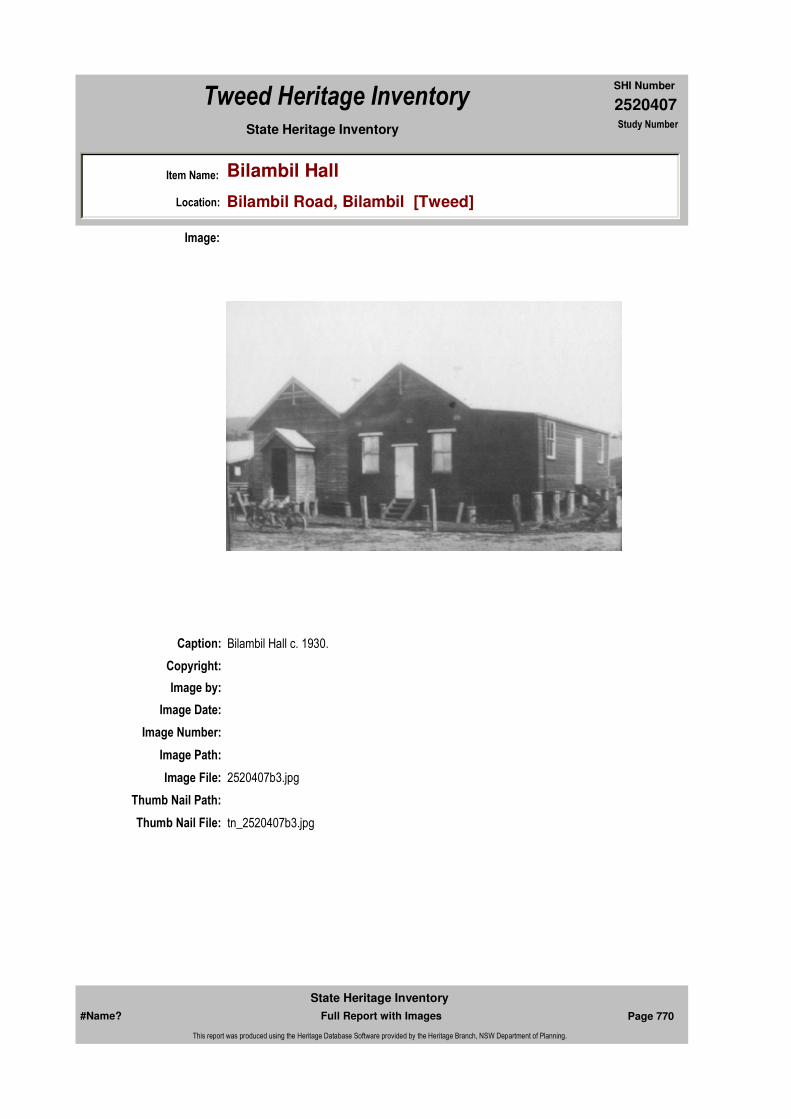
2520407
SHI Number
Tweed Heritage Inventory
Item Name: Bilambil Hall
Location: Bilambil Road, Bilambil [Tweed]
State Heritage Inventory Study Number
Caption: Bilambil Hall c. 1930.
Copyright:
Image:
Image by:
Image Date:
Image Number:
Image Path:
Image File: 2520407b3.jpg
Thumb Nail Path:
Thumb Nail File: tn_2520407b3.jpg
#Name? Page 770 Full Report with Images
State Heritage Inventory
This report was produced using the Heritage Database Software provided by the Heritage Branch, NSW Department of Planning.

2520407
SHI Number
Tweed Heritage Inventory
Item Name: Bilambil Hall
Location: Bilambil Road, Bilambil [Tweed]
State Heritage Inventory Study Number
Caption: Bilambil War Memorial Roll
Copyright: Tweed Heads Historical Society
Image:
Image by:
Image Date:
Image Number:
Image Path:
Image File: 2520407b1.jpg
Thumb Nail Path:
Thumb Nail File: tn_2520407b1.jpg
#Name? Page 771 Full Report with Images
State Heritage Inventory
This report was produced using the Heritage Database Software provided by the Heritage Branch, NSW Department of Planning.

2520407
SHI Number
Tweed Heritage Inventory
Item Name: Bilambil Hall
Location: Bilambil Road, Bilambil [Tweed]
State Heritage Inventory Study Number
#Name? Page 772 Full Report with Images
State Heritage Inventory
This report was produced using the Heritage Database Software provided by the Heritage Branch, NSW Department of Planning.

2520409
SHI Number
Tweed Heritage Inventory
Item Name: Residence "Bungalora"
Location: 858 Terranora Road, Bungalora [Tweed]
State Heritage Inventory Study Number
Current Use:
Former Uses:
Statement of
Significance:This house was constructed by Caleb Marks, the first selector in the area, who took up the land in 1871 as a ten year old. Mr Marks went on to play a significant role in municipal government, in the sugar industry and community affairs throughout the Tweed Valley over 50 years. The building is a good example of a substantial residence from the late Victorian period which has retained the key distinctive features.
Historical Notes or Provenance:
Excerpts from "A presentation to the Tweed Shire Council supporting official recognition and adoption of the area name Bungalora". by Audrey Cramp 1994
Bungalora is an aboriginal word meaning 'red soil hills'. Originally Bungalora encompassed a high area of rich red soil hills lying between North Tumbulgum and Taranora and it also included adjacent lowlands to the north side of the Tweed River.
Mr E C J (Caleb) Marks arrived on the Tweed with his father, William, in 1871 and they were the first settlers on these ridges.
The early years were years of hard labour, with many setbacks and crop failures for these pioneers. E C J Marks developed a close association and knowledge of the local Aborigines, who assisted with the spotting of cedar trees on the property during the 1870's.
The Aboriginal descriptive name Bungalora was adopted by E C J Marks about ths time for his property. Mr E C J Marks was a pioneer settler, cane grower and a former Tweed Shire President and Engineer.
Endorsed Significance:Assessed Significance: Local
Item Type: Built Category: Homestead buildingGroup: Residential buildings (
Admin Codes: Code 2: Code 3:
Curtilage/Boundary:
Owner: Private - Individual
Other/Former Names:
Area/Group/Complex: Group ID:
Aboriginal Area:
Local Govt Area: Tweed
Planning: Northern
Historic Region: North Coast
Address: #Name?
Suburb / Nearest Town: #Name?
State: NSW
Parish: Terranora
County: Rous
#Name? Page 773 Full Report with Images
State Heritage Inventory
This report was produced using the Heritage Database Software provided by the Heritage Branch, NSW Department of Planning.

2520409
SHI Number
Tweed Heritage Inventory
Item Name: Residence "Bungalora"
Location: 858 Terranora Road, Bungalora [Tweed]
State Heritage Inventory Study Number
Physical Description: Late Victorian Italianate features.
Physical Condition:
Modification Dates:
Designer:
Maker / Builder:
Year Started: Year Completed: Circa: No
Recommended
Management:
References:
Further Comments:
Criteria a)
Criteria c) The building is a good example of a substantial residence from the late Victorian period which has retained the key distinctive features.
Criteria d)
Criteria e)
Criteria g)
Criteria f)
Integrity / Intactness:
Criteria b) This house was constructed by Caleb Marks, the first selector in the area, who took up the land in 1871 as a ten year old. Mr Marks went on to play a significant role in municipal government, in the sugar industry and community affairs throughout the Tweed Valley over 50 years.
Themes:
Management:
Author Title Year
Audrey Cramp "A presentation to the Tweed Shire Council supporting official recognition and adoption of the area name Bungalora".
1994
National Theme State Theme Local Theme
4. Settlement Accommodation (Housing) Farmhouse
#Name? Page 774 Full Report with Images
State Heritage Inventory
This report was produced using the Heritage Database Software provided by the Heritage Branch, NSW Department of Planning.

2520409
SHI Number
Tweed Heritage Inventory
Item Name: Residence "Bungalora"
Location: 858 Terranora Road, Bungalora [Tweed]
State Heritage Inventory Study Number
Custom Field One:
Studies:
Listings:
Date Updated: 31/10/2004 Status: BasicDate First Entered: 07/04/2004Data Entry:
Custom Field Two:
Custom Field Three:
Custom Field Four:
Custom Field Five:
Custom Field Six:
Parcels:
Latitude: 28 20 Longitude: 153 34
AMG Zone: Easting: Northing:
Map Name: Map Scale:
Spatial Accuracy:Location validity:
Author Title YearNumber
Tweed Shire Council Community-based Heritage Study 2003
Tweed Shire Council Community-based Heritage Study 2003
#Name? Page 775 Full Report with Images
State Heritage Inventory
This report was produced using the Heritage Database Software provided by the Heritage Branch, NSW Department of Planning.

2520409
SHI Number
Tweed Heritage Inventory
Item Name: Residence "Bungalora"
Location: 858 Terranora Road, Bungalora [Tweed]
State Heritage Inventory Study Number
Caption: Bungalora residence
Copyright:
Image:
Image by:
Image Date:
Image Number:
Image Path:
Image File: 2520409b1.jpg
Thumb Nail Path:
Thumb Nail File:
#Name? Page 776 Full Report with Images
State Heritage Inventory
This report was produced using the Heritage Database Software provided by the Heritage Branch, NSW Department of Planning.

2520409
SHI Number
Tweed Heritage Inventory
Item Name: Residence "Bungalora"
Location: 858 Terranora Road, Bungalora [Tweed]
State Heritage Inventory Study Number
#Name? Page 777 Full Report with Images
State Heritage Inventory
This report was produced using the Heritage Database Software provided by the Heritage Branch, NSW Department of Planning.

2520410
SHI Number
Tweed Heritage Inventory
Item Name: Burringbar Community Hall
Location: 1 Old Pacific Highway, Burringbar [Tweed]
State Heritage Inventory Study Number
Current Use: Community Hall
Former Uses: Community Hall
Statement of
Significance:The Burringbar Community Hall has a strong association with the residents of Burringbar. It has acted as a centre for social and cultural activities for nearly 100 years. The timber building demonstrates the simple design materials and finishes associated with local community structures and has retained the integrity of the original construction.
Historical Notes
or Provenance:The Burringbar School of Arts was established in 1909 and served the community as a meeting place for social events and housed a library for many years. Farewell functions for men going off to fight in World War 1 and 2 were held in the hall.
In 1949 a projection box was erected to allow films to be shown.
For the first half of its life the supper room had to be reached via a covered walkway. This supper room was pulled down in mid 1940 and another constructed adjoining the main hall and paid for by local fund raising functions.
In 1967 an extensive doorknock appeal paid for a new roof over the hall and in 1970 septic toilets were installed. In 1972 the hall was given a face-lift with a new coat of paint.
There has always been a hall committee in existence at Burringbar with numbers from five or six, swelling some years to more than 20.
In March, 1980, new extensions, costing $25,000 were officially opened during an afternoon and night of festivities.
Endorsed Significance:Assessed Significance: Local
Item Type: Built Category: Hall Public Group: Community Facilities
Admin Codes: Code 2: Code 3:
Curtilage/Boundary:
Owner: Private - Community Group
Other/Former Names:
Area/Group/Complex: Group ID:
Aboriginal Area:
Local Govt Area: Tweed
Planning: Northern
Historic Region: North Coast
Address: #Name?
Suburb / Nearest Town: #Name?
State: NSW
Parish: Mooball
County: Rous
#Name? Page 778 Full Report with Images
State Heritage Inventory
This report was produced using the Heritage Database Software provided by the Heritage Branch, NSW Department of Planning.

2520410
SHI Number
Tweed Heritage Inventory
Item Name: Burringbar Community Hall
Location: 1 Old Pacific Highway, Burringbar [Tweed]
State Heritage Inventory Study Number
The opening celebrations included an afternoon with the usual carnival attractions, a disco in the early evening for the younger crowd and a social at night for those willing to dance the night away.
The new-look Burringbar School of Arts continued to host balls, banquets, weddings, socials and a new activity - indoor hockey.
There are no records of the Inaugral Committee of the School of Arts, as the records were inadvertently destroyed. The following list is compiled from memory:
Presidents:- 1922 Mr. W.H. Farrell; 1927 Mr. C. Halliday; 1929 Mr. P. Hockey; 1930 Mr. J. Gray; 1931 Mr. S. Carthy; 1932 Mr. D.S. Mills; 1933-1956 Mr. A. Philip; 1956 Mr. K. Philip; 1990 Mr. P. J. Farrell
Secretaries:- Mr. D.S. Mills; Mr. W. H. Farrell; Mr. Thomas O'Connor Snr.; Mr. S.A. Masterson; 1990 Secretary/Treasurer: Mrs. Dorothy Crook
Treasurers:- Mr. Gus Dignan Snr.; Mr. W. Thorburn; Mr. W. G. Quinn; Mr. Bill Lane Jnr.; Mr. Bill Lane Jnr. was Treasurer for 30 years.
Over a span of 85 years Burringbar School of Arts has been a wonderful source of enjoyment for an enormous number of people. There has been all types of functions and all forms of entertainment. The Hall holds hundreds of treasured memories for so many, even reaching back to when they were children.
A lot of improvement have been done on the Hall over the years. In 1962 an amount of sixteen hundred pounds ($3,200) was given in donations for the roof to be replaced.
Shortly after Tweed Shire Council obtained grants for some of the Halls in the Shire, and Burringbar did extension work with the money it received. Approximately 12 years ago the Supper Room was re-designed and relief money was obtained to do the painting. The Hall, thanks to the committee has been able to finance a considerable amount of work, some with the help of voluntary labour. At present the Burringbar School of Arts is 100 per cent structurally sound, and voluntary labour is doing inside repair work in the expectation of receiving another grant.
Although Burringbar School of Arts played host to many happy events, there was one solemn occasion back in the late 1920's when "Avenal" (Sir Thomas Ewing's Home) was burnt down. The Coroner's Court of Inquiry was held in the Burringbar School of Arts.
Tweed Sun 04 June, 2003A cash boost for Burringbar hallThe Burringbar School of Arts Hall will have an additional $15,000 to spend on its maintenance and upkeep.
A $15,000 grant from the NSW Government's Living Centres Community Partnership Grants Program has been added to the $30,000 raised by the Burringbar community to renovate the hall.
#Name? Page 779 Full Report with Images
State Heritage Inventory
This report was produced using the Heritage Database Software provided by the Heritage Branch, NSW Department of Planning.
2520410
SHI Number
Tweed Heritage Inventory
Item Name: Burringbar Community Hall
Location: 1 Old Pacific Highway, Burringbar [Tweed]
State Heritage Inventory Study Number
Most of the money will be spent on refurbishing the building and making the toilets accessible to people with disabilities.
Committee member Debra Allard said Work For The Dole participants had made a good start on the project but there was still a long way to go to finish the job.
"The guttering is non-existent, there needs to be a fully functioning kitchen and the stage area needs a massive overhaul including lighting to name just a few projects," she said.
The hall had been neglected for many years until the community decided to get 'stuck in' to the maintenance before the task became too big and too daunting.
Ms Allard said resident Fred Grace started the ball rolling by approaching local banana growers for a $50 donation which led to a dedicated committee being formed to develop fundraising ideas.
She said Burringbar's honour as host of the Tweed's official Australia Day celebrations - with Julie Anthony as the official guest - was a highlight of the hard work that had been achieved over the years."This hall is our main meeting area in the community and will be utilised by all age groups - the Burringbar Gumnut preschool, the Burringbar public school, seniors groups, sporting groups and many others who will use the hall for meetings and activities," said Ms Allard.
"With a fresher, cleaner look the hall will once again attract events where Burringbar will be proud to say 'we did it'."
Already the hall will play host to the Burringbar debutante ball on June 27, as well as a bingo fundraising night for the local school on June 28, a Burringbar Plays the Blues benefit night for the hall on August 1 and the Tweed Country Ball on August 9.
Burringbar public school's annual concert, which will this year be a play about Marilyn Munroe, will be held in the hall on September 9 and 11.
"We can already see an increase in the hall being utilised as it should be where the locals are getting excited about the opportunities for a great time in an historic environment," said Ms Allard.
"We are looking at having a monthly market held at the hall where locals can sell their wares like they probably would have back when the hall was first built.
"Since the highway traffic has been diverted to the new freeway, Burringbar has become a safe little village - to visit and what nicer way to meet the people.""Burringbar Primary School - A History of 100 Years of Public Education at Burringbar. 1894 - 1994" Page 43
Burringbar Hall is turning 100 years old and the local are preparing to celebrate.
#Name? Page 780 Full Report with Images
State Heritage Inventory
This report was produced using the Heritage Database Software provided by the Heritage Branch, NSW Department of Planning.
2520410
SHI Number
Tweed Heritage Inventory
Item Name: Burringbar Community Hall
Location: 1 Old Pacific Highway, Burringbar [Tweed]
State Heritage Inventory Study Number
The Burringbar School of Arts Hall was built in 1904 and on Saturday will host its centenary celebrations with the 100th centennial Ball.
The hall was established between 1902 and 1904 on land donated by a local farmer, Mr W L Murphy and the first trustees were Hugh O'Keefe, David Heckey, Charles Allard, Percy Steer, John Watterson, Francis Ewing and William Farrell.
Hall committee member Debra Allard, whose husband is a descendant of Charles Allard, said Burringbar Hall like halls in many small country towns and villages was the centre for much of the community's social life throughout its long history.
"When World War 1 started, many send-offs were held at the Hall as well as bazaars, ballroom dancing, concerts, meetings, plays and there was a lovely nook for a lobrary and reading room with an open fireplace," Ms Allard said.
The committee had recently received a grant from the State Governnment to repair the roof and guttering, and there were plans to repaint the building.
Ms Allard said the Centennial Ball was not only a time for the locals to celebrate the anniversary of a magnificent building but a chance for anyone who hadn't experienced a country ball to come along and party.
"There will be dancing until late and a delicious supper by the famous local Italian cook Faye Laffranchi." Ms Allard promised.
"We would love to see any past debutante squeeze into her dress and relive the memory of her coming out," Ms Allard said.
"Bring along the old photos, it is going to be a great opportunity to frock up and feel great for a night."
Ms Allard said the organisers would especially like any descendants from the original trustees to come along and share the oments and the history.
She said local members Larry Anthony and Neville Newell and Mayor Warren Polglase would be attending as official guests.
Ms Allard urged intending ballgoers to book early as there was only room for 200 at the ball.
Tickets for the Centennial Ball are $30 per head. "B'bar Hall turns 100" Daily News, 23 September, 2004
Themes: National Theme State Theme Local Theme
8. Culture Social institutions Community Hall
#Name? Page 781 Full Report with Images
State Heritage Inventory
This report was produced using the Heritage Database Software provided by the Heritage Branch, NSW Department of Planning.
2520410
SHI Number
Tweed Heritage Inventory
Item Name: Burringbar Community Hall
Location: 1 Old Pacific Highway, Burringbar [Tweed]
State Heritage Inventory Study Number
Physical Description: An excellent example of hall architecture circa 1910 timber structure with minimal appropriate detailing. Decorative flying gables with finials and simple collar tie to front of symetrical facade. Some late Victorian, Carpenter Gothic influences. Roof broken into segments. Style of community halls throughout the country. Weatherboard cladding, with corrugated steel roofing. Prominent 'circular' roof vent to main gable.
Physical Condition:
Modification Dates: In 1949 a projection box was erected to allow films to be shown.The supper room was pulled down in mid 1940 and another constructed adjoining the main hall and paid for by local fund raising functions.In 1967 an extensive doorknock appeal paid for a new roof over the hall1970 septic toilets were installed. 1972 the hall was given a face-lift with a new coat of paint.
Designer:
Maker / Builder:
Year Started: Year Completed: 1909 Circa: No
Recommended Management:
Continue regular building maintenance to the exterior, interior and services. Adopt services and facilities as required to support demand and use.
Further Comments:
Criteria a)
Criteria c) The timber building demonstrates the simple design materials and finishes associated with local community structures and has retained the integrity of the original construction.
Criteria d) The Burringbar Community Hall has a strong association with the residents of Burringbar. It has acted as a centre for social and cultural activities for nearly 100 years.
Criteria e)
Criteria g)
Criteria f)
Integrity / Intactness:
Criteria b)
Management:
#Name? Page 782 Full Report with Images
State Heritage Inventory
This report was produced using the Heritage Database Software provided by the Heritage Branch, NSW Department of Planning.
2520410
SHI Number
Tweed Heritage Inventory
Item Name: Burringbar Community Hall
Location: 1 Old Pacific Highway, Burringbar [Tweed]
State Heritage Inventory Study Number
Custom Field One:
References:
Studies:
Listings:
Date Updated: 31/10/2004 Status: BasicDate First Entered: 07/04/2004Data Entry:
Custom Field Two:
Custom Field Three:
Custom Field Four:
Custom Field Five:
Custom Field Six:
Parcels:
Latitude: Longitude:
AMG Zone: Easting: 546267 Northing: 6854419
Map Name: Map Scale:
Spatial Accuracy:Location validity:
Author Title Year
B'Bar Hall turns 100 2004
"Burringbar Primary School - A History of 100 Years of Public Education at Burringbar. 1894 - 1994"
1994
A cash boost for Burringbar hallA cash boost for Burringbar hall
2003
Author Title YearNumber
Tweed Shire Council Community-based Heritage Study 2003
Parcel Code LotNumber Section Plan Code Plan Number
LOT 1 DP 972819
#Name? Page 783 Full Report with Images
State Heritage Inventory
This report was produced using the Heritage Database Software provided by the Heritage Branch, NSW Department of Planning.

2520410
SHI Number
Tweed Heritage Inventory
Item Name: Burringbar Community Hall
Location: 1 Old Pacific Highway, Burringbar [Tweed]
State Heritage Inventory Study Number
Caption: Burringbar Community Hall, back view.
Copyright: Tweed Heads Historical Society
Image:
Image by: Immy McKiernan
Image Date: 07/08/2003
Image Number:
Image Path:
Image File: 2520410b1.jpg
Thumb Nail Path:
Thumb Nail File: tn_2520410b1.jpg
#Name? Page 784 Full Report with Images
State Heritage Inventory
This report was produced using the Heritage Database Software provided by the Heritage Branch, NSW Department of Planning.

2520410
SHI Number
Tweed Heritage Inventory
Item Name: Burringbar Community Hall
Location: 1 Old Pacific Highway, Burringbar [Tweed]
State Heritage Inventory Study Number
Caption: Burringbar Community Hall, front.
Copyright: Tweed Heads Historical Society
Image:
Image by: Immy McKiernan
Image Date: 07/08/2003
Image Number:
Image Path:
Image File: 2520410b2.jpg
Thumb Nail Path:
Thumb Nail File: tn_2520410b2.jpg
#Name? Page 785 Full Report with Images
State Heritage Inventory
This report was produced using the Heritage Database Software provided by the Heritage Branch, NSW Department of Planning.

2520410
SHI Number
Tweed Heritage Inventory
Item Name: Burringbar Community Hall
Location: 1 Old Pacific Highway, Burringbar [Tweed]
State Heritage Inventory Study Number
#Name? Page 786 Full Report with Images
State Heritage Inventory
This report was produced using the Heritage Database Software provided by the Heritage Branch, NSW Department of Planning.

2520411
SHI Number
Tweed Heritage Inventory
Item Name: Cattle Bridge - Highway Overpass
Location: Tweed Valley Way, Burringbar [Tweed]
State Heritage Inventory Study Number
Current Use:
Former Uses:
Statement of
Significance:The highway overpass at Burringbar is an uncommon aspect of the cultural history of the Tweed Shire, and is indicative of the measures taken to alleviate the relocation of the highway.
Historical Notes
or Provenance:Constructed in 1937 to provide access for the dairy farmer as his land had been divided by the new location of the highway. Still in use.
Physical Description: The cattle bridge at Burringbar is constructed of timber, of girder/beam type. The bridge is 19.6 metres in length and 4.7 metres wide, with three spans and was constructed in 1937 to allow the farmer access to the remainder of his farm, which was bisected when the Pacific Highway was relocated and upgraded.
Designer:
Maker / Builder:
Year Started: Year Completed: Circa: No
Endorsed Significance:Assessed Significance: Local
Item Type: Built Category: Road BridgeGroup: Transport - Land
Admin Codes: Code 2: Code 3:
Curtilage/Boundary:
Owner: Local Government
Other/Former Names:
Area/Group/Complex: Group ID:
Themes:
Aboriginal Area:
Local Govt Area: Tweed
Planning: Northern
Historic Region: North Coast
Address: #Name?
Suburb / Nearest Town: #Name?
State: NSW
Parish: Mooball
County: Rous
National Theme State Theme Local Theme
3. Economy Transport (none)
#Name? Page 787 Full Report with Images
State Heritage Inventory
This report was produced using the Heritage Database Software provided by the Heritage Branch, NSW Department of Planning.
2520411
SHI Number
Tweed Heritage Inventory
Item Name: Cattle Bridge - Highway Overpass
Location: Tweed Valley Way, Burringbar [Tweed]
State Heritage Inventory Study Number
Physical Condition:
Modification Dates:
Custom Field One:
Recommended
Management:The structure should be restored and maintained in a condition so as to not be a hazard. If access is a risk then appropriate barriers and signs should be erected.
References:
Studies:
Listings:
Further Comments:
Criteria a)
Criteria c)
Criteria d)
Criteria e) Indicative of the measures taken to alleviate the relocation of the highway.
Criteria g)
Criteria f) The highway overpass at Burringbar is an uncommon aspect of the cultural history of the Tweed Shire.
Integrity / Intactness:
Custom Field Two:
Custom Field Three:
Custom Field Four:
Custom Field Five:
Criteria b)
Parcels:
Latitude: Longitude:
AMG Zone: Easting: 546196 Northing: 6854372
Map Name: Map Scale:
Spatial Accuracy:Location validity:
Management:
Author Title YearNumber
Tweed Shire Council Community-based Heritage Study 2003
#Name? Page 788 Full Report with Images
State Heritage Inventory
This report was produced using the Heritage Database Software provided by the Heritage Branch, NSW Department of Planning.
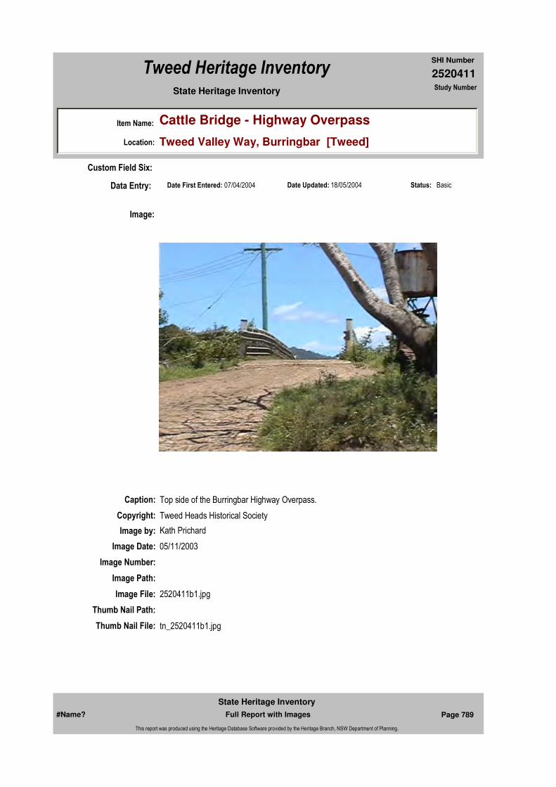
2520411
SHI Number
Tweed Heritage Inventory
Item Name: Cattle Bridge - Highway Overpass
Location: Tweed Valley Way, Burringbar [Tweed]
State Heritage Inventory Study Number
Date Updated: 18/05/2004 Status: BasicDate First Entered: 07/04/2004Data Entry:
Custom Field Six:
Caption: Top side of the Burringbar Highway Overpass.
Copyright: Tweed Heads Historical Society
Image:
Image by: Kath Prichard
Image Date: 05/11/2003
Image Number:
Image Path:
Image File: 2520411b1.jpg
Thumb Nail Path:
Thumb Nail File: tn_2520411b1.jpg
#Name? Page 789 Full Report with Images
State Heritage Inventory
This report was produced using the Heritage Database Software provided by the Heritage Branch, NSW Department of Planning.
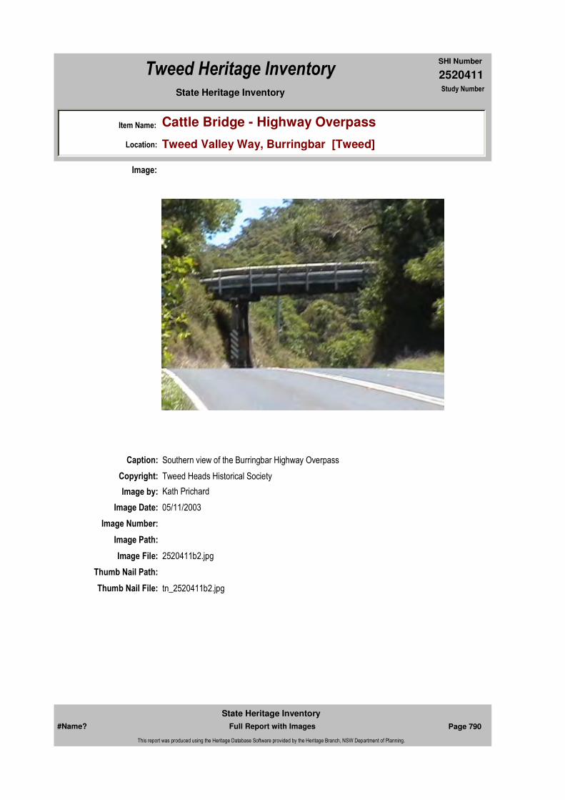
2520411
SHI Number
Tweed Heritage Inventory
Item Name: Cattle Bridge - Highway Overpass
Location: Tweed Valley Way, Burringbar [Tweed]
State Heritage Inventory Study Number
Caption: Southern view of the Burringbar Highway Overpass
Copyright: Tweed Heads Historical Society
Image:
Image by: Kath Prichard
Image Date: 05/11/2003
Image Number:
Image Path:
Image File: 2520411b2.jpg
Thumb Nail Path:
Thumb Nail File: tn_2520411b2.jpg
#Name? Page 790 Full Report with Images
State Heritage Inventory
This report was produced using the Heritage Database Software provided by the Heritage Branch, NSW Department of Planning.
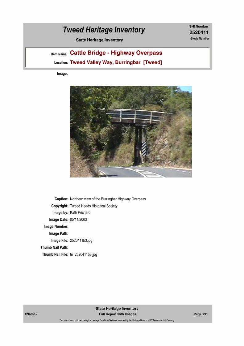
2520411
SHI Number
Tweed Heritage Inventory
Item Name: Cattle Bridge - Highway Overpass
Location: Tweed Valley Way, Burringbar [Tweed]
State Heritage Inventory Study Number
Caption: Northern view of the Burringbar Highway Overpass
Copyright: Tweed Heads Historical Society
Image:
Image by: Kath Prichard
Image Date: 05/11/2003
Image Number:
Image Path:
Image File: 2520411b3.jpg
Thumb Nail Path:
Thumb Nail File: tn_2520411b3.jpg
#Name? Page 791 Full Report with Images
State Heritage Inventory
This report was produced using the Heritage Database Software provided by the Heritage Branch, NSW Department of Planning.

2520411
SHI Number
Tweed Heritage Inventory
Item Name: Cattle Bridge - Highway Overpass
Location: Tweed Valley Way, Burringbar [Tweed]
State Heritage Inventory Study Number
#Name? Page 792 Full Report with Images
State Heritage Inventory
This report was produced using the Heritage Database Software provided by the Heritage Branch, NSW Department of Planning.
2520412
SHI Number
Tweed Heritage Inventory
Item Name: War Memorial Cenotaph
Location: Masterton Park, Broadway Street, Burringbar [Tweed]
State Heritage Inventory Study Number
Current Use:
Former Uses:
Statement of
Significance:The cenotaph is part of the cultural history of the Tweed Valley and has a special association with the community in which it is housed.
Historical Notes or Provenance:
It is now a long time, perhaps over a year, since this matter was mooted here. The school of Arts Committee first took the matter up, but beyond some promises of support, little progress was made. The Girls Guild, also made the erection of a roll of honour a plank of their platform and even asked the School of Arts Committee to hand over the whole business to them. It was, however, after consideration, decided to ask the co-operation of the Girls Guild, but the latter added another plank, that of suitably welcoming returned soldiers and presenting each with a souvenir of their efforts to uphold their country's honour. A public meeting was then decided on, and a deputation consisting of hon. Sec. School of Arts, Messrs. Murphy and Carthy, members of the S A Committee, Mesdames Ewing and Allard, ex-presidents of the Burringbar Ladies War Chest, and Mrs J Gray, President of the War Chest and Miss Carthy, President of the Girls Guild, was appointed to wait upon the chief Commissioner for railways with a view of getting one-fifth of an acre of land from the local railway site, right in the centre of the town for patriotic purposes. This was immediately granted, so that if the public intended to erect a roll of honour there, there is nothing to prevent them from going on with the business. During the past couple of months, and more frequently of late, many local residents, farmers, etc., but especially women folk, are asking what is being done regarding the proposal. In fact they have been and are spoiling to do something. The way soon be over then the people will be concerned with other welcomes and with settling people on the land, etc., in the midst of which those who paid the supreme penalty may be entirely overlooked. Burringbar is noted for its patriotic spirit, and it is about time that a start was made to honour the lads who enlisted from this centre. It is merely a
Endorsed Significance:Assessed Significance: Local
Item Type: Built Category: War MemorialGroup: Monuments and Mem
Admin Codes: Code 2: Code 3:
Curtilage/Boundary:
Owner: Private - Community Group
Other/Former Names:
Area/Group/Complex: Group ID:
Aboriginal Area:
Local Govt Area: Tweed
Planning: Northern
Historic Region: North Coast
Address: #Name?
Suburb / Nearest Town: #Name?
State: NSW
Parish: Mooball
County: Rous
#Name? Page 793 Full Report with Images
State Heritage Inventory
This report was produced using the Heritage Database Software provided by the Heritage Branch, NSW Department of Planning.
2520412
SHI Number
Tweed Heritage Inventory
Item Name: War Memorial Cenotaph
Location: Masterton Park, Broadway Street, Burringbar [Tweed]
State Heritage Inventory Study Number
matter of getting a start on, deciding on a suitable scheme and the matter is as good as done and done properly, too, at that. Burringbar is not the place to leave such an important matter half done. The public are anxiously awaiting a start and it is now up to all of us, after the busy, happy time of Christmas, to duly consider the brave lads who took their lives in their hands to go to Galipoli, France and Palestine for our benefit. We should also consider that many of those are returning wounded, but still more so, that many, a large proportion too - shall not be passing their way again.(Tweed Daily 8 February 1918 "Roll of Honour")
This event took place yesterday (Wednesday) at R C Ewing and Co's. local yards. There was a full attendance of buyers, and a very fair number of stock, poultry, etc. Many settlers relied on buying and returning stock, while others preferred giving cheques. The stock sold realised £118, which should put up the present receipts well into the third hundred. A detailed report, up-to-date, will appear in the course of a few days.(Tweed Daily 7 June, 1918 "Stock Sale for Roll of Honour")
Reports to hand are very favourable concerning the Burringbar District Soldier's Honour Roll and Memorial. Messrs, Edwards and Roberts, of Lismore, have the work well in hand, which will soon adorn the reserve in the railway yards. The neatly fenced enclosure will soon prove an attractive spot for many.(Tweed Daily 20 June 1919 "Soldiers' Memorial")
Physical Description: An inscribed cenotaph of unique design to the Tweed Shire. Classical. Entablature - cornice only, both above and below column. Column - Tuscan capital. Resembles classical temple. This is of concrete construction 12' 3" high. The base consists of 3 stepped steps, 8' 9", 7'1" and 5' 3" square. On this sits a plain square plinth. At the top of the plinth are attached 4 marble pillars and marble scrolls inset, followed by a capping and a King Edward Crown. All the exposed concrete has been painted. However the marble pillars are showing signs of weathering and need attention for preservation or replacment.
Designer:
Maker / Builder: Edwards and Roberts, of Lismore.
Year Started: Year Completed: Circa: No
Themes: National Theme State Theme Local Theme
7. Governing Defence War Memorial
#Name? Page 794 Full Report with Images
State Heritage Inventory
This report was produced using the Heritage Database Software provided by the Heritage Branch, NSW Department of Planning.
2520412
SHI Number
Tweed Heritage Inventory
Item Name: War Memorial Cenotaph
Location: Masterton Park, Broadway Street, Burringbar [Tweed]
State Heritage Inventory Study Number
Physical Condition:
Modification Dates:
Custom Field One:
Recommended
Management:The memorial requires stripping of surface coatings, restoration of exposed reinforcing and infilling with appropriate material and paint finish. Repair and restore damaged lettering.
References:
Studies:
Listings:
Further Comments:
Criteria a)
Criteria c)
Criteria d) The memorial is part of the cultural history of the Tweed Valley and has a special association with the community in which it is housed.
Criteria e)
Criteria g)
Criteria f)
Integrity / Intactness:
Custom Field Two:
Criteria b)
Parcels:
Latitude: Longitude:
AMG Zone: Easting: Northing:
Map Name: Map Scale:
Spatial Accuracy:Location validity:
Management:
Author Title Year
"Soldiers' Memorial" 1919
"Stock Sale for Roll of Honour" 1918
"Roll of Honour" 1918
Author Title YearNumber
Tweed Shire Council Community-based Heritage Study 2003
#Name? Page 795 Full Report with Images
State Heritage Inventory
This report was produced using the Heritage Database Software provided by the Heritage Branch, NSW Department of Planning.

2520412
SHI Number
Tweed Heritage Inventory
Item Name: War Memorial Cenotaph
Location: Masterton Park, Broadway Street, Burringbar [Tweed]
State Heritage Inventory Study Number
Date Updated: 03/11/2004 Status: BasicDate First Entered: 07/04/2004Data Entry:
Custom Field Three:
Custom Field Four:
Custom Field Five:
Custom Field Six:
Caption: War meorial cenotaph, Masterton Park, Burringbar.
Copyright: Tweed Heads Historical Society
Image:
Image by: Bill Bainbridge
Image Date: 30/06/2003
Image Number:
Image Path:
Image File: 2520412b1.jpg
Thumb Nail Path:
Thumb Nail File: tn_2520412b1.jpg
#Name? Page 796 Full Report with Images
State Heritage Inventory
This report was produced using the Heritage Database Software provided by the Heritage Branch, NSW Department of Planning.
2520412
SHI Number
Tweed Heritage Inventory
Item Name: War Memorial Cenotaph
Location: Masterton Park, Broadway Street, Burringbar [Tweed]
State Heritage Inventory Study Number
#Name? Page 797 Full Report with Images
State Heritage Inventory
This report was produced using the Heritage Database Software provided by the Heritage Branch, NSW Department of Planning.
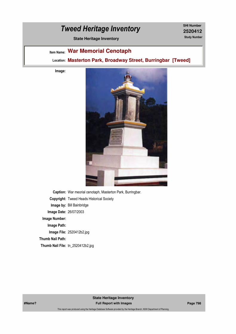
2520412
SHI Number
Tweed Heritage Inventory
Item Name: War Memorial Cenotaph
Location: Masterton Park, Broadway Street, Burringbar [Tweed]
State Heritage Inventory Study Number
Caption: War meorial cenotaph, Masterton Park, Burringbar.
Copyright: Tweed Heads Historical Society
Image:
Image by: Bill Bainbridge
Image Date: 26/07/2003
Image Number:
Image Path:
Image File: 2520412b2.jpg
Thumb Nail Path:
Thumb Nail File: tn_2520412b2.jpg
#Name? Page 798 Full Report with Images
State Heritage Inventory
This report was produced using the Heritage Database Software provided by the Heritage Branch, NSW Department of Planning.

2520412
SHI Number
Tweed Heritage Inventory
Item Name: War Memorial Cenotaph
Location: Masterton Park, Broadway Street, Burringbar [Tweed]
State Heritage Inventory Study Number
#Name? Page 799 Full Report with Images
State Heritage Inventory
This report was produced using the Heritage Database Software provided by the Heritage Branch, NSW Department of Planning.

2520414
SHI Number
Tweed Heritage Inventory
Item Name: Byrrill Creek Road Bridge
Location: Byrrill Creek Road, Byrrill Creek [Tweed]
State Heritage Inventory Study Number
Current Use:
Former Uses:
Statement of
Significance:The Byrrill Creek Road Bridge has a strong association with the farming community at Byrill Creek who were provided with reliable transport to the service centres and markets from the 1920's. Locals and visitors treasure the Byrrill Creek Bridge because it is representative of a means of communication fast disappearing in the Shire. The setting is picturesque and the ruins of the old bridge are a short scramble down stream or are just visible from the road. The round pole and timber decking construction is an excellent example of the early bridges which are being replaced throughout the Tweed Shire.
Historical Notes
or Provenance:
Designer:
Maker / Builder:
Year Started: Year Completed: 1944 Circa: No
Endorsed Significance:Assessed Significance: Local
Item Type: Built Category: Road BridgeGroup: Transport - Land
Admin Codes: Code 2: Code 3:
Curtilage/Boundary:
Owner: Local Government
Other/Former Names:
Area/Group/Complex: Group ID:
Themes:
Aboriginal Area:
Local Govt Area: Tweed
Planning: Northern
Historic Region: North Coast
Address: #Name?
Suburb / Nearest Town: #Name?
State: NSW
Parish: Wollumbin
County: Rous
National Theme State Theme Local Theme
3. Economy Transport Road Bridge
#Name? Page 804 Full Report with Images
State Heritage Inventory
This report was produced using the Heritage Database Software provided by the Heritage Branch, NSW Department of Planning.
2520414
SHI Number
Tweed Heritage Inventory
Item Name: Byrrill Creek Road Bridge
Location: Byrrill Creek Road, Byrrill Creek [Tweed]
State Heritage Inventory Study Number
Physical Description: Low level; rounded concrete piers with squared concrete cross beams. Steel brackets hold round timbers to cross beams. Squared plank decking topped by large timber sidewalls. Single lane carriageway.
Physical Condition: Bridge foundations are excellent; some of the decking and beams will need replacement over time.
Modification Dates: Timbers have been replaced as necessary after floods.
Recommended Management:
Obtain advice from Engineer with timber structures skills to ensure conservation; erect an interpretative panel to illustrate the history and significance of the structure.
References:
Studies:
Further Comments:
Criteria a)
Criteria c)
Criteria d) The Byrrill Creek Road Bridge has a strong association with the farming community at Byrill Creek who were provided with reliable transport to the service centres and markets from the 1920's.Locals and visitors treasure the Byrrill Creek Bridge because it is representative of a means of communication fast disappearing in the Shire. The setting is picturesque and the ruins of the old bridge are a short scramble down stream or are just visible from the road.
Criteria e)
Criteria g) The round pole and timber decking construction is an excellent example of the early bridges which are being replaced throughout the Tweed Shire.
Criteria f)
Integrity / Intactness:
Criteria b)
Parcels:
Latitude: Longitude:
AMG Zone: Easting: 527378 Northing: 6854168
Map Name: Map Scale:
Spatial Accuracy:Location validity:
Management:
Author Title YearNumber
Tweed Shire Council Community-based Heritage Study 2003
#Name? Page 805 Full Report with Images
State Heritage Inventory
This report was produced using the Heritage Database Software provided by the Heritage Branch, NSW Department of Planning.

2520414
SHI Number
Tweed Heritage Inventory
Item Name: Byrrill Creek Road Bridge
Location: Byrrill Creek Road, Byrrill Creek [Tweed]
State Heritage Inventory Study Number
Custom Field One:
Listings:
Date Updated: 18/05/2004 Status: BasicDate First Entered: 07/04/2004Data Entry:
Custom Field Two:
Custom Field Three:
Custom Field Four:
Custom Field Five:
Custom Field Six:
Caption: Byrrill Creek Road Bridge, Byrrill Creek.
Copyright: Uki & South Arm Historical Society
Image:
Image by: Mary Lee Connery
Image Date: 14/12/2003
Image Number:
#Name? Page 806 Full Report with Images
State Heritage Inventory
This report was produced using the Heritage Database Software provided by the Heritage Branch, NSW Department of Planning.
2520414
SHI Number
Tweed Heritage Inventory
Item Name: Byrrill Creek Road Bridge
Location: Byrrill Creek Road, Byrrill Creek [Tweed]
State Heritage Inventory Study Number
Image Path:
Image File: 2520414b1.jpg
Thumb Nail Path:
Thumb Nail File: tn_2520414b1.jpg
#Name? Page 807 Full Report with Images
State Heritage Inventory
This report was produced using the Heritage Database Software provided by the Heritage Branch, NSW Department of Planning.

2520415
SHI Number
Tweed Heritage Inventory
Item Name: Byrrill Creek Road Bridge - Remains
Location: Byrrill Creek Road, Byrrill Creek [Tweed]
State Heritage Inventory Study Number
Current Use:
Former Uses:
Statement of
Significance:The remains of the first Byrrill Creek Road Bridge have a strong association with the farming community at Byrill Creek who were provided with reliable transport to the service centres and markets from the 1920's.
Historical Notes
or Provenance:"The Tweed Daily" 1/10/1928 & "The Tweed Daily" 4/10/ 1928
The first Byrrill Creek Bridge was opened on 29th Sept.1928 by Cr. Faulks, President of Tweed Shire Council. Mrs R. Spurway, wife of the Secretary of the bridge committee and one of the earliest selectors, cut the ribbon. The first vehicle across was dispatched to the Uki Hotel to fetch the beer for the celebration. The lengthy speeches alluded to improved economic opportunities and increase in tourism
This was the last link in a chain of four bridges connecting the district to the nearest village, Uki and crossed the Tweed River. Before that, supplies were mainly carried from and produce carried to Tyalgum. A low river crossing often flooded and was unreliable.
The farmers of the district supplied the round timbers needed and construction cost 615 pounds.
The new bridge meant that the farmers could send their cream to the butter factory at Uki and that the timber mills had access to the pine from Mebbin Forest
Endorsed Significance:Assessed Significance: Local
Item Type: Built Category: Road BridgeGroup: Transport - Land
Admin Codes: Code 2: Code 3:
Curtilage/Boundary:
Owner: Local Government
Other/Former Names:
Area/Group/Complex: Group ID:
Aboriginal Area:
Local Govt Area: Tweed
Planning: Northern
Historic Region: North Coast
Address: #Name?
Suburb / Nearest Town: #Name?
State: NSW
Parish: Wollumbin
County: Rous
#Name? Page 808 Full Report with Images
State Heritage Inventory
This report was produced using the Heritage Database Software provided by the Heritage Branch, NSW Department of Planning.

2520415
SHI Number
Tweed Heritage Inventory
Item Name: Byrrill Creek Road Bridge - Remains
Location: Byrrill Creek Road, Byrrill Creek [Tweed]
State Heritage Inventory Study Number
On 18 February 1954 the bridge was washed away in a torrential flood, which measured 10.90m.at Uki. The devastating flood also destroyed the Doon Doon and Mt. Warning bridges and washed out many low level crossings, wreaking havoc with communication for a long period of time.
Physical Description: High level bridge, 90 ft long consisting of 3 spans, 1 of 40 ft long and 2 of 25 ft. Timber deck built on tall concrete piers.
Physical Condition: One pier remains.
Modification Dates:
Designer: H.J. Aarons, Tweed Shire Engineer.
Maker / Builder: W.A. Brandon, Coolangatta
Year Started: Year Completed: 1928 Circa: No
Recommended
Management:Interpretative panel in conjunction with timber (2nd) road bridge.
Further Comments:
Criteria a)
Criteria c)
Criteria d) The remains of the first Byrrill Creek Road Bridge have a strong association with the farming community at Byrill Creek who were provided with reliable transport to the service centres and markets from the 1920's. The Byrrill Creek bridge was the first bridge built across the South Arm of the Tweed River and contributed significantly to the commercial and social life of the residents
Criteria e)
Criteria g)
Criteria f)
Integrity / Intactness:
Criteria b)
Themes:
Management:
National Theme State Theme Local Theme
3. Economy Transport Road Bridge
#Name? Page 809 Full Report with Images
State Heritage Inventory
This report was produced using the Heritage Database Software provided by the Heritage Branch, NSW Department of Planning.
2520415
SHI Number
Tweed Heritage Inventory
Item Name: Byrrill Creek Road Bridge - Remains
Location: Byrrill Creek Road, Byrrill Creek [Tweed]
State Heritage Inventory Study Number
Custom Field One:
References:
Studies:
Listings:
Date Updated: 18/05/2004 Status: BasicDate First Entered: 07/04/2004Data Entry:
Custom Field Two:
Custom Field Three:
Custom Field Four:
Custom Field Five:
Custom Field Six:
Parcels:
Latitude: Longitude:
AMG Zone: Easting: 527373 Northing: 685419
Map Name: Map Scale:
Spatial Accuracy:Location validity:
Author Title Year
1928
Author Title YearNumber
Tweed Shire Council Community-based Heritage Study 2003
#Name? Page 810 Full Report with Images
State Heritage Inventory
This report was produced using the Heritage Database Software provided by the Heritage Branch, NSW Department of Planning.
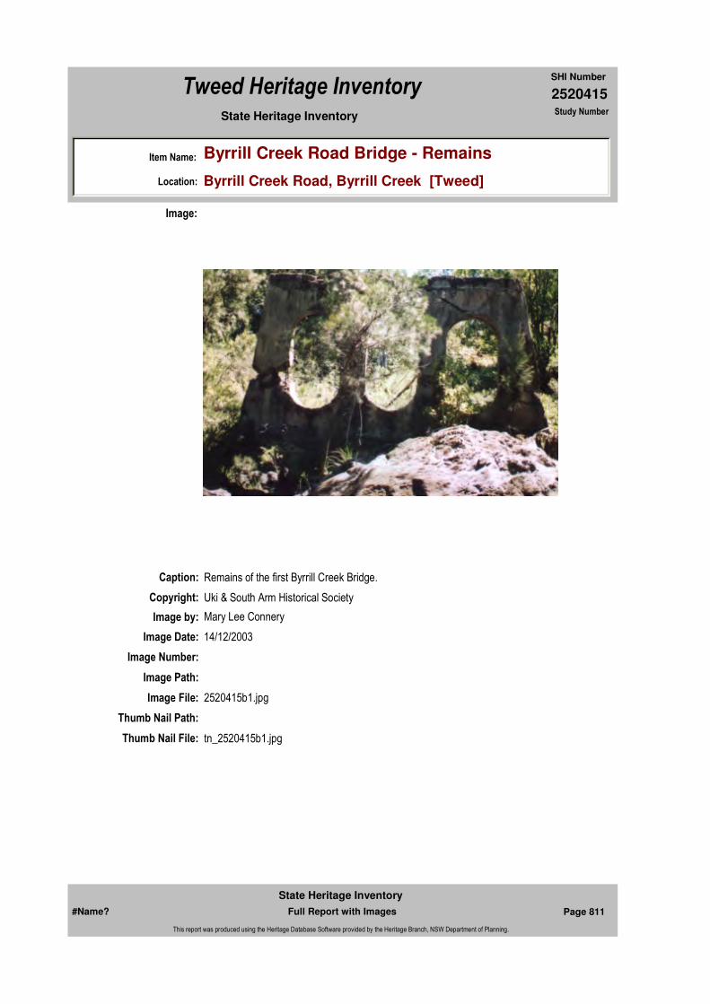
2520415
SHI Number
Tweed Heritage Inventory
Item Name: Byrrill Creek Road Bridge - Remains
Location: Byrrill Creek Road, Byrrill Creek [Tweed]
State Heritage Inventory Study Number
Caption: Remains of the first Byrrill Creek Bridge.
Copyright: Uki & South Arm Historical Society
Image:
Image by: Mary Lee Connery
Image Date: 14/12/2003
Image Number:
Image Path:
Image File: 2520415b1.jpg
Thumb Nail Path:
Thumb Nail File: tn_2520415b1.jpg
#Name? Page 811 Full Report with Images
State Heritage Inventory
This report was produced using the Heritage Database Software provided by the Heritage Branch, NSW Department of Planning.
2520415
SHI Number
Tweed Heritage Inventory
Item Name: Byrrill Creek Road Bridge - Remains
Location: Byrrill Creek Road, Byrrill Creek [Tweed]
State Heritage Inventory Study Number
#Name? Page 812 Full Report with Images
State Heritage Inventory
This report was produced using the Heritage Database Software provided by the Heritage Branch, NSW Department of Planning.
2520416
SHI Number
Tweed Heritage Inventory
Item Name: Community Hall
Location: Numinbah Road, Chillingham [Tweed]
State Heritage Inventory Study Number
Current Use: Community Hall
Former Uses: Community Hall
Statement of Significance:
Including Chillingham War Memorial Roll. The hall has acted as a centre for social and cultural activities for nearly 100 years. The hall holds a memorial to soldiers from the Chillingham District. The memorial is part of the cultural history of the Tweed Valley and has a special association with the community in which it is housed. The hall is a good example of a simple timber structure which has retained the character of the original design, materials and details.
Historical Notes
or Provenance:The Chillingham Hall was built by Charlie and Harry Lesleighter in 1910 for a cost of £284. Mick Guinea gave logs and Snow's Sawmill from Mooball cut the timber which was transported by Banney Brothers on a tabletop lorry.
Chillingham Hall by Hazel H. Jeffery, 1984 "Historical & Pioneering Records of Chillingham & Surrounding Districts" page 51
The organisers of the movement to provide an Honour Board for Chillingham, had originally decided to purchase a plain oak board, but Mr. Lorriman (Hopkin's Creek) promptly came forward with £1, provided the organisers raised £20, to erect to the memory of our heroes, a
Endorsed Significance:Assessed Significance: Local
Item Type: Built Category: Hall Public Group: Community Facilities
Admin Codes: Code 2: Code 3:
Curtilage/Boundary:
Owner: Local Government
Other/Former Names:
Area/Group/Complex: Group ID:
Aboriginal Area:
Local Govt Area: Tweed
Planning: Northern
Historic Region: North Coast
Address: #Name?
Suburb / Nearest Town: #Name?
State: NSW
Parish: Chillingham
County: Rous
Local Govt Area: Tweed
Planning: Northern
Historic Region: North Coast
Address: #Name?
Suburb / Nearest Town: #Name?
State: NSW
Parish:
County:
#Name? Page 813 Full Report with Images
State Heritage Inventory
This report was produced using the Heritage Database Software provided by the Heritage Branch, NSW Department of Planning.
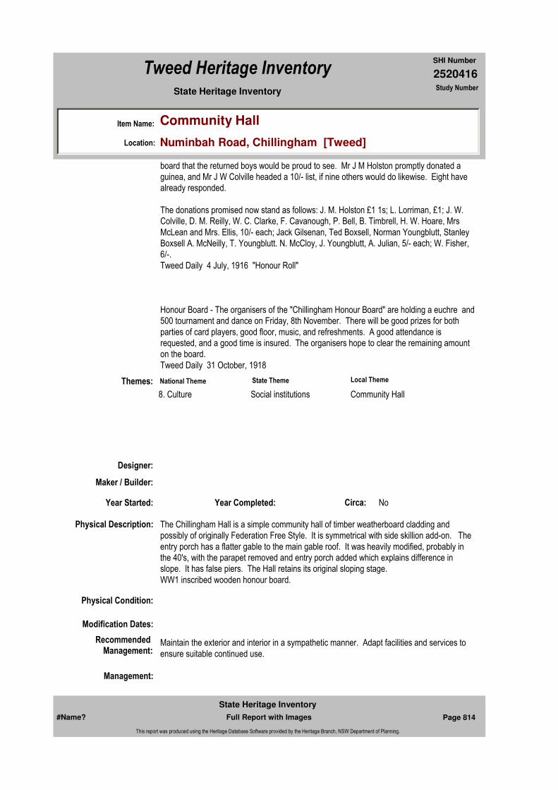
2520416
SHI Number
Tweed Heritage Inventory
Item Name: Community Hall
Location: Numinbah Road, Chillingham [Tweed]
State Heritage Inventory Study Number
board that the returned boys would be proud to see. Mr J M Holston promptly donated a guinea, and Mr J W Colville headed a 10/- list, if nine others would do likewise. Eight have already responded.
The donations promised now stand as follows: J. M. Holston £1 1s; L. Lorriman, £1; J. W. Colville, D. M. Reilly, W. C. Clarke, F. Cavanough, P. Bell, B. Timbrell, H. W. Hoare, Mrs McLean and Mrs. Ellis, 10/- each; Jack Gilsenan, Ted Boxsell, Norman Youngblutt, Stanley Boxsell A. McNeilly, T. Youngblutt. N. McCloy, J. Youngblutt, A. Julian, 5/- each; W. Fisher, 6/-.Tweed Daily 4 July, 1916 "Honour Roll"
Honour Board - The organisers of the "Chillingham Honour Board" are holding a euchre and 500 tournament and dance on Friday, 8th November. There will be good prizes for both parties of card players, good floor, music, and refreshments. A good attendance is requested, and a good time is insured. The organisers hope to clear the remaining amount on the board.Tweed Daily 31 October, 1918
Physical Description: The Chillingham Hall is a simple community hall of timber weatherboard cladding and possibly of originally Federation Free Style. It is symmetrical with side skillion add-on. The entry porch has a flatter gable to the main gable roof. It was heavily modified, probably in the 40's, with the parapet removed and entry porch added which explains difference in slope. It has false piers. The Hall retains its original sloping stage. WW1 inscribed wooden honour board.
Physical Condition:
Modification Dates:
Designer:
Maker / Builder:
Year Started: Year Completed: Circa: No
Recommended Management:
Maintain the exterior and interior in a sympathetic manner. Adapt facilities and services to ensure suitable continued use.
Themes:
Management:
National Theme State Theme Local Theme
8. Culture Social institutions Community Hall
#Name? Page 814 Full Report with Images
State Heritage Inventory
This report was produced using the Heritage Database Software provided by the Heritage Branch, NSW Department of Planning.
2520416
SHI Number
Tweed Heritage Inventory
Item Name: Community Hall
Location: Numinbah Road, Chillingham [Tweed]
State Heritage Inventory Study Number
Custom Field One:
References:
Studies:
Listings:
Further Comments:
Criteria a)
Criteria c) The hall is a good example of a simple timber structure which has retained the character of the original design, materials and details.
Criteria d) The hall has acted as a centre for social and cultural activities for nearly 100 years. The hall holds a memorial to soldiers from the Chillingham District. The memorial is part of the cultural history of the Tweed Valley and has a special association with the community in which it is housed.
Criteria e)
Criteria g)
Criteria f)
Integrity / Intactness:
Custom Field Two:
Custom Field Three:
Custom Field Four:
Criteria b)
Parcels:
Latitude: Longitude:
AMG Zone: Easting: 527285 Northing: 6867714
Map Name: Map Scale:
Spatial Accuracy:Location validity:
Author Title Year
1918
1916
Hazel H. Jeffery "Historical & Pioneering Records of Chillingham & Surrounding Districts"
1984
Author Title YearNumber
Tweed Shire Council Community-based Heritage Study 2003
Parcel Code LotNumber Section Plan Code Plan Number
LOT 2 DP 129078
#Name? Page 815 Full Report with Images
State Heritage Inventory
This report was produced using the Heritage Database Software provided by the Heritage Branch, NSW Department of Planning.
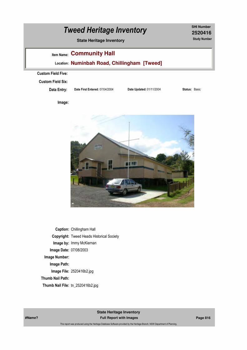
2520416
SHI Number
Tweed Heritage Inventory
Item Name: Community Hall
Location: Numinbah Road, Chillingham [Tweed]
State Heritage Inventory Study Number
Date Updated: 01/11/2004 Status: BasicDate First Entered: 07/04/2004Data Entry:
Custom Field Five:
Custom Field Six:
Caption: Chillingham Hall
Copyright: Tweed Heads Historical Society
Image:
Image by: Immy McKiernan
Image Date: 07/08/2003
Image Number:
Image Path:
Image File: 2520416b2.jpg
Thumb Nail Path:
Thumb Nail File: tn_2520416b2.jpg
#Name? Page 816 Full Report with Images
State Heritage Inventory
This report was produced using the Heritage Database Software provided by the Heritage Branch, NSW Department of Planning.

2520416
SHI Number
Tweed Heritage Inventory
Item Name: Community Hall
Location: Numinbah Road, Chillingham [Tweed]
State Heritage Inventory Study Number
Caption: Chillingham Hall
Copyright: Tweed Heads Historical Society
Image:
Image by: Immy McKiernan
Image Date: 07/08/2003
Image Number:
Image Path:
Image File: 2520416b3.jpg
Thumb Nail Path:
Thumb Nail File: tn_2520416b3.jpg
#Name? Page 817 Full Report with Images
State Heritage Inventory
This report was produced using the Heritage Database Software provided by the Heritage Branch, NSW Department of Planning.
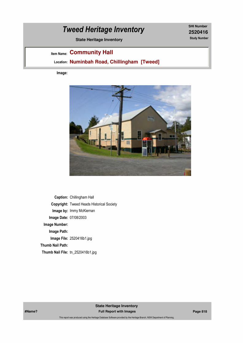
2520416
SHI Number
Tweed Heritage Inventory
Item Name: Community Hall
Location: Numinbah Road, Chillingham [Tweed]
State Heritage Inventory Study Number
Caption: Chillingham Hall
Copyright: Tweed Heads Historical Society
Image:
Image by: Immy McKiernan
Image Date: 07/08/2003
Image Number:
Image Path:
Image File: 2520416b1.jpg
Thumb Nail Path:
Thumb Nail File: tn_2520416b1.jpg
#Name? Page 818 Full Report with Images
State Heritage Inventory
This report was produced using the Heritage Database Software provided by the Heritage Branch, NSW Department of Planning.

2520416
SHI Number
Tweed Heritage Inventory
Item Name: Community Hall
Location: Numinbah Road, Chillingham [Tweed]
State Heritage Inventory Study Number
#Name? Page 819 Full Report with Images
State Heritage Inventory
This report was produced using the Heritage Database Software provided by the Heritage Branch, NSW Department of Planning.
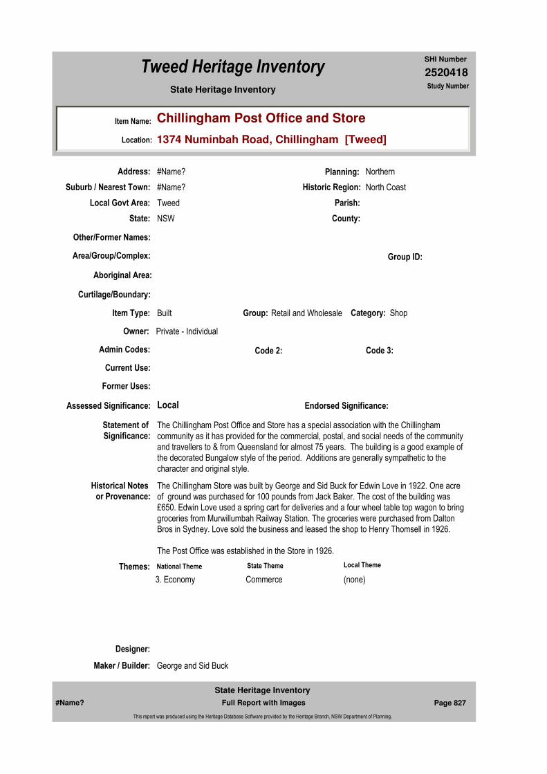
2520418
SHI Number
Tweed Heritage Inventory
Item Name: Chillingham Post Office and Store
Location: 1374 Numinbah Road, Chillingham [Tweed]
State Heritage Inventory Study Number
Current Use:
Former Uses:
Statement of
Significance:The Chillingham Post Office and Store has a special association with the Chillingham community as it has provided for the commercial, postal, and social needs of the community and travellers to & from Queensland for almost 75 years. The building is a good example of the decorated Bungalow style of the period. Additions are generally sympathetic to the character and original style.
Historical Notes or Provenance:
The Chillingham Store was built by George and Sid Buck for Edwin Love in 1922. One acre of ground was purchased for 100 pounds from Jack Baker. The cost of the building was £650. Edwin Love used a spring cart for deliveries and a four wheel table top wagon to bring groceries from Murwillumbah Railway Station. The groceries were purchased from Dalton Bros in Sydney. Love sold the business and leased the shop to Henry Thomsell in 1926.
The Post Office was established in the Store in 1926.
Designer:
Maker / Builder: George and Sid Buck
Endorsed Significance:Assessed Significance: Local
Item Type: Built Category: ShopGroup: Retail and Wholesale
Admin Codes: Code 2: Code 3:
Curtilage/Boundary:
Owner: Private - Individual
Other/Former Names:
Area/Group/Complex: Group ID:
Themes:
Aboriginal Area:
Local Govt Area: Tweed
Planning: Northern
Historic Region: North Coast
Address: #Name?
Suburb / Nearest Town: #Name?
State: NSW
Parish:
County:
National Theme State Theme Local Theme
3. Economy Commerce (none)
#Name? Page 827 Full Report with Images
State Heritage Inventory
This report was produced using the Heritage Database Software provided by the Heritage Branch, NSW Department of Planning.

2520418
SHI Number
Tweed Heritage Inventory
Item Name: Chillingham Post Office and Store
Location: 1374 Numinbah Road, Chillingham [Tweed]
State Heritage Inventory Study Number
Physical Description: The store was built by George and Sid Buck for Edwin Love in 1922. It is weatherboard clad, with a corrugated iron hip roof, and gabled wings each end of different sizes (may mean one an addition), some batten. The upper gable infill to protruding gable. Verandah to shop possibly a modified replacement. Building appears to have been raised and filled in at ground level. Verandah battens match battens on gable probably recent addition. The interior of the shop retains many of its original features.
Physical Condition:
Modification Dates:
Year Started: Year Completed: 1922 Circa: No
Recommended
Management:Maintain the exterior and adapt services and facilities to ensure continued use.
References:
Studies:
Further Comments:
Criteria a)
Criteria c) The building is a good example of the decorated Bungalow style of the period. Additions are generally sympathetic to the character and original style.
Criteria d) The Chillingham Post Office and Store has a special association with the Chillingham community as it has provided for the commercial, postal, and social needs of the community and travellers to & from Queensland for almost 75 years.
Criteria e)
Criteria g)
Criteria f)
Integrity / Intactness:
Criteria b)
Parcels:
Latitude: Longitude:
Map Name: Map Scale:
Spatial Accuracy:Location validity:
Management:
Author Title YearNumber
Tweed Shire Council Community-based Heritage Study 2003
Parcel Code LotNumber Section Plan Code Plan Number
LOT 15 DP 631225
#Name? Page 828 Full Report with Images
State Heritage Inventory
This report was produced using the Heritage Database Software provided by the Heritage Branch, NSW Department of Planning.

2520418
SHI Number
Tweed Heritage Inventory
Item Name: Chillingham Post Office and Store
Location: 1374 Numinbah Road, Chillingham [Tweed]
State Heritage Inventory Study Number
Custom Field One:
Listings:
Date Updated: 18/05/2004 Status: BasicDate First Entered: 07/04/2004Data Entry:
Custom Field Two:
Custom Field Three:
Custom Field Four:
Custom Field Five:
Custom Field Six:
AMG Zone: Easting: 527242 Northing: 6867754
Caption: Chillingham Post Office and Store
Copyright: Tweed Heads Historical Society
Image:
Image by: Immy McKiernan
Image Date: 07/08/2003
#Name? Page 829 Full Report with Images
State Heritage Inventory
This report was produced using the Heritage Database Software provided by the Heritage Branch, NSW Department of Planning.

2520418
SHI Number
Tweed Heritage Inventory
Item Name: Chillingham Post Office and Store
Location: 1374 Numinbah Road, Chillingham [Tweed]
State Heritage Inventory Study Number
Image Number:
Image Path:
Image File: 2520418b1.jpg
Thumb Nail Path:
Thumb Nail File: tn_2520418b1.jpg
#Name? Page 830 Full Report with Images
State Heritage Inventory
This report was produced using the Heritage Database Software provided by the Heritage Branch, NSW Department of Planning.
2520418
SHI Number
Tweed Heritage Inventory
Item Name: Chillingham Post Office and Store
Location: 1374 Numinbah Road, Chillingham [Tweed]
State Heritage Inventory Study Number
Caption:
Copyright: Tweed Heads Historical Society
Image:
Image by: Immy McKiernan
Image Date: 07/08/2003
Image Number:
Image Path:
Image File: 2520418b2.jpg
Thumb Nail Path:
Thumb Nail File: tn_2520418b2.jpg
#Name? Page 831 Full Report with Images
State Heritage Inventory
This report was produced using the Heritage Database Software provided by the Heritage Branch, NSW Department of Planning.
2520418
SHI Number
Tweed Heritage Inventory
Item Name: Chillingham Post Office and Store
Location: 1374 Numinbah Road, Chillingham [Tweed]
State Heritage Inventory Study Number
Caption: Chillingham Post Office and Store
Copyright: Tweed Heads Historical Society
Image:
Image by: Immy McKiernan
Image Date: 07/08/2003
Image Number:
Image Path:
Image File: 2520418b3.jpg
Thumb Nail Path:
Thumb Nail File: tn_2520418b3.jpg
#Name? Page 832 Full Report with Images
State Heritage Inventory
This report was produced using the Heritage Database Software provided by the Heritage Branch, NSW Department of Planning.

2520418
SHI Number
Tweed Heritage Inventory
Item Name: Chillingham Post Office and Store
Location: 1374 Numinbah Road, Chillingham [Tweed]
State Heritage Inventory Study Number
#Name? Page 833 Full Report with Images
State Heritage Inventory
This report was produced using the Heritage Database Software provided by the Heritage Branch, NSW Department of Planning.

2520422
SHI Number
Tweed Heritage Inventory
Item Name: Condong General Store and Storage Sheds
Location: McLeod Street, Condong [Tweed]
State Heritage Inventory Study Number
Current Use: Store
Former Uses: Store
Statement of
Significance:This item is a component of the sugar mill precinct conservation area. On site are a factory and associated buildings, machinery, a wide range of C.S.R. staff houses, a shop and storage sheds, railway tracks and spur line to Murwillumbah, wharves, sunken punts, river pylons, navigation markers, recreation facilities and landscape features. This precinct is unique on the Tweed and is of state significance in that it has been the site of the continuous production of sugar and associated activities and infrastructure since 1888 and contains a remarkable and largely intact historical record of its 125 years of use.
Historical Notes
or Provenance:The CSR built the general store in 1901 and was established as 'Conaghan and Fry' (Photo P1-28 TRvHS). The store was held by the Conaghan's until the late 1960's. The residence was behind the store, as were numerous sheds, each holding the bulk items - one shed for jams, one for honey, one each for kerosene, turps, shellite, one for the grains,etc. [pers. comm. Terese Hawkey nee Conaghan]
Designer:
Maker / Builder:
Endorsed Significance:Assessed Significance: Local
Item Type: Built Category: ShopGroup: Retail and Wholesale
Admin Codes: Code 2: Code 3:
Curtilage/Boundary:
Owner: Private - Individual
Other/Former Names:
Area/Group/Complex: Condong Conservation Area Group ID: 1
Themes:
Aboriginal Area:
Local Govt Area: Tweed
Planning: Northern
Historic Region: North Coast
Address: #Name?
Suburb / Nearest Town: #Name?
State: NSW
Parish: Condong
County: Rous
National Theme State Theme Local Theme
4. Settlement Towns, suburbs and village Commerce
#Name? Page 859 Full Report with Images
State Heritage Inventory
This report was produced using the Heritage Database Software provided by the Heritage Branch, NSW Department of Planning.
2520422
SHI Number
Tweed Heritage Inventory
Item Name: Condong General Store and Storage Sheds
Location: McLeod Street, Condong [Tweed]
State Heritage Inventory Study Number
Physical Description: Simple weatherboard and iron roof building. Timber parapet with rounded pediment. Large open verandah and extension separate roof to main roof. The three sheds are made of corrugated iron with pitched roof, gable ended. The windows are top-hung iron windows.
Physical Condition:
Modification Dates:
Year Started: Year Completed: Circa: No
Recommended
Management:That funds be sought to enable a professional investigation and report on the entire Sugar Mill Precinct by an industrial archaeologist and heritage planner - with a view to defining significance and potential for conservation and adaptive reuse.
References:
Studies:
Further Comments:
Criteria a)
Criteria c)
Criteria d) The general store at Condong has a strong association with the community of Condong. A century old building which served the local community and sugar mill workers over the years. This is the second store, the original being built at the same time as the mill in 1878 (this store was situated between the tennis court and the mill. There was a road to the wharf, and the store was on this road, and was mostly probably a public house and store
Criteria e)
Criteria g)
Criteria f)
Integrity / Intactness:
Criteria b)
Parcels:
Latitude: Longitude:
Spatial Accuracy:Location validity:
Management:
Author Title YearNumber
Tweed Shire Council Community-based Heritage Study 2003
Parcel Code LotNumber Section Plan Code Plan Number
LOT 18 DP 225029
#Name? Page 860 Full Report with Images
State Heritage Inventory
This report was produced using the Heritage Database Software provided by the Heritage Branch, NSW Department of Planning.

2520422
SHI Number
Tweed Heritage Inventory
Item Name: Condong General Store and Storage Sheds
Location: McLeod Street, Condong [Tweed]
State Heritage Inventory Study Number
Custom Field One:
Listings:
Date Updated: 15/05/2004 Status: BasicDate First Entered: 08/04/2004Data Entry:
Custom Field Two:
Custom Field Three:
Custom Field Four:
Custom Field Five:
Custom Field Six:
AMG Zone: Easting: Northing:
Map Name: Map Scale:
Caption: Condong General Store
Copyright: Tweed Heads Historical Society
Image:
Image by: Immy McKiernan
#Name? Page 861 Full Report with Images
State Heritage Inventory
This report was produced using the Heritage Database Software provided by the Heritage Branch, NSW Department of Planning.

2520422
SHI Number
Tweed Heritage Inventory
Item Name: Condong General Store and Storage Sheds
Location: McLeod Street, Condong [Tweed]
State Heritage Inventory Study Number
Image Date: 07/08/2003
Image Number:
Image Path:
Image File: 2520422b1.jpg
Thumb Nail Path:
Thumb Nail File: tn_2520422b1.jpg
#Name? Page 862 Full Report with Images
State Heritage Inventory
This report was produced using the Heritage Database Software provided by the Heritage Branch, NSW Department of Planning.

2520422
SHI Number
Tweed Heritage Inventory
Item Name: Condong General Store and Storage Sheds
Location: McLeod Street, Condong [Tweed]
State Heritage Inventory Study Number
Caption: Former storage sheds on site of General Store, Condong.
Copyright: Tweed Heads Historical Society
Image:
Image by: Immy McKiernan
Image Date: 15/01/2004
Image Number:
Image Path:
Image File: 2520422b2.jpg
Thumb Nail Path:
Thumb Nail File: tn_2520422b2.jpg
#Name? Page 863 Full Report with Images
State Heritage Inventory
This report was produced using the Heritage Database Software provided by the Heritage Branch, NSW Department of Planning.
2520422
SHI Number
Tweed Heritage Inventory
Item Name: Condong General Store and Storage Sheds
Location: McLeod Street, Condong [Tweed]
State Heritage Inventory Study Number
#Name? Page 864 Full Report with Images
State Heritage Inventory
This report was produced using the Heritage Database Software provided by the Heritage Branch, NSW Department of Planning.
2520424
SHI Number
Tweed Heritage Inventory
Item Name: Residence
Location: 99 - 121 McLeod Street, Condong [Tweed]
State Heritage Inventory Study Number
Current Use:
Former Uses:
Statement of
Significance:This item is a component of the sugar mill precinct conservation area. On site are a factory and associated buildings, machinery, a wide range of C.S.R. staff houses, a shop and storage sheds, railway tracks and spur line to Murwillumbah, wharves, sunken punts, river pylons, navigation markers, recreation facilities and landscape features. This precinct is unique on the Tweed and is of state significance in that it has been the site of the continuous production of sugar and associated activities and infrastructure since 1888 and contains a remarkable and largely intact historical record of its 125 years of use.
Historical Notes
or Provenance:
Designer:
Maker / Builder:
Year Started: Year Completed: Circa: No
Endorsed Significance:Assessed Significance: State
Item Type: Built Category: Other - Residential BuiGroup: Residential buildings (
Admin Codes: Code 2: Code 3:
Curtilage/Boundary:
Owner: Private - Corporate
Other/Former Names:
Area/Group/Complex: Condong Conservation Area Group ID: 3
Themes:
Aboriginal Area:
Local Govt Area: Tweed
Planning: Northern
Historic Region: North Coast
Address: #Name?
Suburb / Nearest Town: #Name?
State: NSW
Parish: Condong
County: Rous
National Theme State Theme Local Theme
4. Settlement Accommodation (Housing) Housing
#Name? Page 869 Full Report with Images
State Heritage Inventory
This report was produced using the Heritage Database Software provided by the Heritage Branch, NSW Department of Planning.

2520424
SHI Number
Tweed Heritage Inventory
Item Name: Residence
Location: 99 - 121 McLeod Street, Condong [Tweed]
State Heritage Inventory Study Number
Physical Description: Federation bungalow 1890 - 1915 with large expansive hip iron roof providing roof to building, extending over shady verandahs. It has and external frame, and is single clad tongue and groove walls to verandah. The balustrades have been changed. It is gabled with a roof vent and has a large french door to verandah which has a lattice screen as shading, screening device.
Physical Condition:
Modification Dates:
Recommended Management:
That funds be sought to enable a professional investigation and report on the entire Sugar Mill Precinct by an industrial archaeologist and heritage planner - with a view to defining significance and potential for conservation and adaptive reuse.
References:
Studies:
Listings:
Further Comments:
Criteria a)
Criteria c) Important in demonstrating aesthetic characteristics of an 1880's sugar mill manager's residence.
Criteria d)
Criteria e)
Criteria g)
Criteria f)
Integrity / Intactness:
Criteria b)
Parcels:
Latitude: Longitude:
AMG Zone: Easting: Northing:
Map Name: Map Scale:
Spatial Accuracy:Location validity:
Management:
Author Title YearNumber
Tweed Shire Council Community-based Heritage Study 2003
Parcel Code LotNumber Section Plan Code Plan Number
LOT 1 DP 717109
#Name? Page 870 Full Report with Images
State Heritage Inventory
This report was produced using the Heritage Database Software provided by the Heritage Branch, NSW Department of Planning.
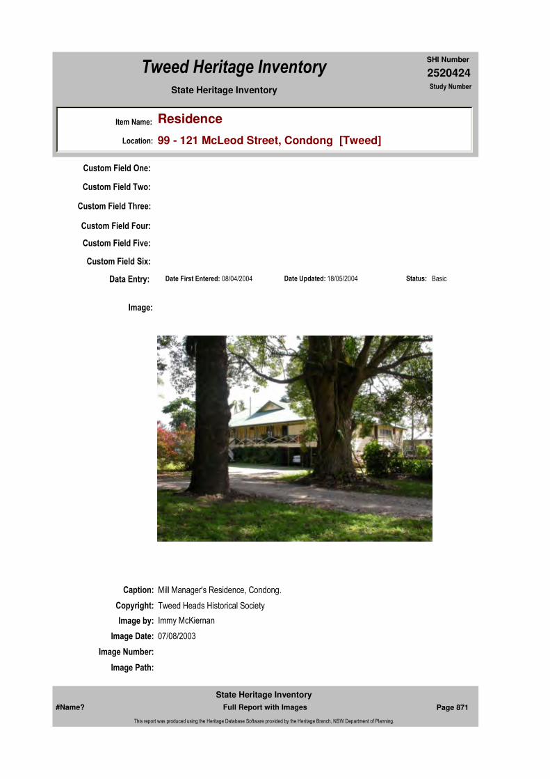
2520424
SHI Number
Tweed Heritage Inventory
Item Name: Residence
Location: 99 - 121 McLeod Street, Condong [Tweed]
State Heritage Inventory Study Number
Custom Field One:
Date Updated: 18/05/2004 Status: BasicDate First Entered: 08/04/2004Data Entry:
Custom Field Two:
Custom Field Three:
Custom Field Four:
Custom Field Five:
Custom Field Six:
Caption: Mill Manager's Residence, Condong.
Copyright: Tweed Heads Historical Society
Image:
Image by: Immy McKiernan
Image Date: 07/08/2003
Image Number:
Image Path:
#Name? Page 871 Full Report with Images
State Heritage Inventory
This report was produced using the Heritage Database Software provided by the Heritage Branch, NSW Department of Planning.

2520424
SHI Number
Tweed Heritage Inventory
Item Name: Residence
Location: 99 - 121 McLeod Street, Condong [Tweed]
State Heritage Inventory Study Number
Image File: 2520424b1.jpg
Thumb Nail Path:
Thumb Nail File: tn_2520424b1.jpg
#Name? Page 872 Full Report with Images
State Heritage Inventory
This report was produced using the Heritage Database Software provided by the Heritage Branch, NSW Department of Planning.
2520425
SHI Number
Tweed Heritage Inventory
Item Name: Tennis Courts and Gazebo
Location: 99 - 121 McLeod Street, Condong [Tweed]
State Heritage Inventory Study Number
Current Use:
Former Uses:
Statement of
Significance:The tennis court and gazebo are important in demonstrating aesthetic characteristics of an 1880's sugar mill manager's residence and its social aspects.
Historical Notes or Provenance:
Physical Description: 2 grass tennis courts and timber gazebo. Of note are 5 Bunya Pines of up to 50 metres in height behind the tennis court.
Physical Condition:
Designer:
Maker / Builder:
Year Started: Year Completed: Circa: No
Endorsed Significance:Assessed Significance: State
Item Type: Built Category: Court Tennis Group: Recreation and Entert
Admin Codes: Code 2: Code 3:
Curtilage/Boundary:
Owner: Private - Corporate
Other/Former Names:
Area/Group/Complex: Condong Conservation Area Group ID: 4
Themes:
Aboriginal Area:
Local Govt Area: Tweed
Planning: Northern
Historic Region: North Coast
Address: #Name?
Suburb / Nearest Town: #Name?
State: NSW
Parish:
County:
National Theme State Theme Local Theme
8. Culture Leisure Tennis
#Name? Page 873 Full Report with Images
State Heritage Inventory
This report was produced using the Heritage Database Software provided by the Heritage Branch, NSW Department of Planning.
2520425
SHI Number
Tweed Heritage Inventory
Item Name: Tennis Courts and Gazebo
Location: 99 - 121 McLeod Street, Condong [Tweed]
State Heritage Inventory Study Number
Modification Dates:
Custom Field One:
Recommended
Management:That funds be sought to enable a professional investigation and report on the entire Sugar Mill Precinct by an industrial archaeologist and heritage planner - with a view to defining significance and potential for conservation and adaptive reuse
References:
Studies:
Listings:
Further Comments:
Criteria a)
Criteria c) Important in demonstrating aesthetic characteristics of an 1880's sugar mill manager's residence and its social aspects.
Criteria d)
Criteria e)
Criteria g)
Criteria f)
Integrity / Intactness:
Custom Field Two:
Custom Field Three:
Custom Field Four:
Criteria b)
Parcels:
Latitude: Longitude:
AMG Zone: Easting: Northing:
Map Name: Map Scale:
Spatial Accuracy:Location validity:
Management:
Author Title YearNumber
Tweed Shire Council Community-based Heritage Study 2003
Parcel Code LotNumber Section Plan Code Plan Number
LOT 1 DP 717109
#Name? Page 874 Full Report with Images
State Heritage Inventory
This report was produced using the Heritage Database Software provided by the Heritage Branch, NSW Department of Planning.

2520425
SHI Number
Tweed Heritage Inventory
Item Name: Tennis Courts and Gazebo
Location: 99 - 121 McLeod Street, Condong [Tweed]
State Heritage Inventory Study Number
Date Updated: 18/05/2004 Status: BasicDate First Entered: 08/04/2004Data Entry:
Custom Field Five:
Custom Field Six:
Caption: Tennis Court and Gazebo at the Condong Mill Manager's Residence, Condong.
Copyright: Tweed Heads Historical Society
Image:
Image by: Immy McKiernan
Image Date: 14/11/2003
Image Number:
Image Path:
Image File: 2520425b1.jpg
Thumb Nail Path:
Thumb Nail File: tn_2520425b1.jpg
#Name? Page 875 Full Report with Images
State Heritage Inventory
This report was produced using the Heritage Database Software provided by the Heritage Branch, NSW Department of Planning.

2520425
SHI Number
Tweed Heritage Inventory
Item Name: Tennis Courts and Gazebo
Location: 99 - 121 McLeod Street, Condong [Tweed]
State Heritage Inventory Study Number
#Name? Page 876 Full Report with Images
State Heritage Inventory
This report was produced using the Heritage Database Software provided by the Heritage Branch, NSW Department of Planning.

2520426
SHI Number
Tweed Heritage Inventory
Item Name: Tram Tracks
Location: McLeod Street, Condong [Tweed]
State Heritage Inventory Study Number
Current Use:
Former Uses:
Statement of
Significance:The tram track is important in the course of the agricultural history of the Tweed district. This railway was an extension from the Murwillumbah Railway station and in the early part of the 20th century provided transport of sugar cane from the Crabbes Creek area north and the transport south of the products of the mill to Byron Bay for shipment further south. It is part of the longest siding on the NSW rail system when opened in 1894.
Historical Notes or Provenance:
The site chosen for Condong mill on the southern bank of the Tweed River, 2½ miles downstream from Murwillumbah, was bought for the CSR as early as 1877. It was known that the mouth of the Tweed was difficult to negotiate and had a treacherous bar, and this was an important factor in an approach to the Queensland Government in March, 1878, sounding out its views on construction of a railway from the Nerang River to the border. A steamboat service operated from the Nerang to Brisbane and the company intended to rail its sugar to Nerang for export through Queensland port facilities. The suggestion was politely declined though it was inferred there would be little objection to the promoters building a line themselves, providing it was "based upon grounds conducive to public welfare and sound economic principles".
Though the company did not construct the line, a Government railway was later constructed from Nerang to Tweed Heads as an extension of the ill-fated South Coast line. By then alternative transport arrangements had of course been made.
The company went ahead with construction of a central mill in 1879 and in August, 1880, it made its first crushing. Cane supplies were drawn at first from farms near the Tweed River and its North Arm and river transport played the major role in early development.
Endorsed Significance:Assessed Significance: State
Item Type: Built Category: Other - Transport - RaiGroup: Transport - Rail
Admin Codes: Code 2: Code 3:
Curtilage/Boundary: Roadside reserve
Owner: Local Government
Other/Former Names:
Area/Group/Complex: Condong Conservation Area Group ID: 5
Aboriginal Area:
Local Govt Area: Tweed
Planning: Northern
Historic Region: North Coast
Address: #Name?
Suburb / Nearest Town: #Name?
State: NSW
Parish: Condong
County: Rous
#Name? Page 877 Full Report with Images
State Heritage Inventory
This report was produced using the Heritage Database Software provided by the Heritage Branch, NSW Department of Planning.

2520426
SHI Number
Tweed Heritage Inventory
Item Name: Tram Tracks
Location: McLeod Street, Condong [Tweed]
State Heritage Inventory Study Number
However, the river frontages were prone to frost, and after the first decade there was a move to cultivate cane in higher areas such as Terranora and Duranbah, necessitating the construction of tramways.
The date when they first started is not known by the writer. A guess would be in the mid-1890's. However, there were seven miles of track laid by 1897 and horses were being used to haul cane in 72 iron cane trucks that had been purchased.
Opening up of the high land to cane farming also led to the use of aerial ropeways, a dry flume, and - from Terranora - a 600' funicular from the heights to the river at Joubert's Wharf. This was a self acting incline as evidenced by an overall photograph of it published many years ago while it was still in operation before the First World War. A half mile tramway ran from the top of this incline alongside the Bungalora-Terranora road. It was horse operated and was stated by the late C C Singleton to be of 2' 6" gauge, which was not usual, if not unique for an Australian cane line. At this point of time, confirmation of the gauge may be difficult to establish.
Although Condong to some degree had offset the problem of insufficient cane supplies by opening up new estates and encouraging farmers to take up cultivation, it did suffer from lack of adequate supplies, and when the Cudgen estate became available in 1912, there was little hesitation in closing Cudgen Mill, as previously mentioned, and concentrating crushing activities at Condong Mill. The company was assured of additional cane, brought up river from Chinderah from the Cudgen plantations, and was able to utilise machinery from its newly acquired plant.
Coastal steamers were used to convey sugar from the mill to refineries and markets, for although the Queensland Government had built a line to Tweed Heads, and the New South Wales Government had built a standard gauge railway from Lismore to Murwillumbah, neither provided direct access. In fact, the final connection to the south was not completed until May, 1932, with the opening of the Clarence River bridge at Grafton, 27 years after the Lismore line had reached that settlement. However, the latter did provide a connection to a new cane growing area south of Murwillumbah.(Excerpt from "The Australian Railway Historical Society Bulletin No. 464, June 1976)
Designer:
Maker / Builder:
Year Started: 1894 Year Completed: Circa: No
Themes: National Theme State Theme Local Theme
3. Economy Industry Sugar
#Name? Page 878 Full Report with Images
State Heritage Inventory
This report was produced using the Heritage Database Software provided by the Heritage Branch, NSW Department of Planning.
2520426
SHI Number
Tweed Heritage Inventory
Item Name: Tram Tracks
Location: McLeod Street, Condong [Tweed]
State Heritage Inventory Study Number
Physical Description: A short length of the original NSW standard guage track from Murwillumbah retained alongside a replanted area.
Physical Condition:
Modification Dates:
Recommended Management:
That funds be sought to enable a professional investigation and report on the entire Sugar Mill Precinct by an industrial archaeologist and heritage planner - with a view to defining significance and potential for conservation and adaptive reuse
References:
Studies:
Further Comments:
Criteria a) The tram track is important in the course of the agricultural history of the Tweed district. This railway was an extension from the Murwillumbah Railway station and in the early part of the 20th century provided transport of sugar cane from the Crabbes Creek area and the transport south of the products of the mill to Byron Bay for shipment further south. It is part of the longest siding on the NSW rail system when opened in 1894.
Criteria c)
Criteria d)
Criteria e)
Criteria g)
Criteria f)
Integrity / Intactness:
Criteria b)
Parcels:
Latitude: Longitude:
AMG Zone: Easting: Northing:
Map Name: Map Scale:
Spatial Accuracy:Location validity:
Management:
Author Title Year
The Australian Railway Historical Society Bulletin No. 464 1976
Author Title YearNumber
Tweed Shire Council Community-based Heritage Study 2003
Parcel Code LotNumber Section Plan Code Plan Number
LOT 17 DP 255029
#Name? Page 879 Full Report with Images
State Heritage Inventory
This report was produced using the Heritage Database Software provided by the Heritage Branch, NSW Department of Planning.

2520426
SHI Number
Tweed Heritage Inventory
Item Name: Tram Tracks
Location: McLeod Street, Condong [Tweed]
State Heritage Inventory Study Number
Custom Field One:
Listings:
Date Updated: 03/11/2004 Status: BasicDate First Entered: 08/04/2004Data Entry:
Custom Field Two:
Custom Field Three:
Custom Field Four:
Custom Field Five:
Custom Field Six:
Caption: Remnant tram tracks, part of the Condong Mill Precinct Conservation Area, now incorporated into a roadside reserve.
Copyright: Tweed Heads Historical Society
Image:
Image by: Immy McKiernan
Image Date: 07/08/2003
Image Number:
#Name? Page 880 Full Report with Images
State Heritage Inventory
This report was produced using the Heritage Database Software provided by the Heritage Branch, NSW Department of Planning.

2520426
SHI Number
Tweed Heritage Inventory
Item Name: Tram Tracks
Location: McLeod Street, Condong [Tweed]
State Heritage Inventory Study Number
Image Path:
Image File: 2520426b1.jpg
Thumb Nail Path:
Thumb Nail File: tn_2520426b1.jpg
#Name? Page 881 Full Report with Images
State Heritage Inventory
This report was produced using the Heritage Database Software provided by the Heritage Branch, NSW Department of Planning.
2520429
SHI Number
Tweed Heritage Inventory
Item Name: Community Hall
Location: 29 Crabbes Creek Road, Crabbes Creek [Tweed]
State Heritage Inventory Study Number
Current Use: Community Hall
Former Uses: Community Hall
Statement of
Significance:The Crabbes Creek Community Hall has a strong association with the residents of Crabbes Creek. It has acted as a centre for social and cultural activities over nearly 100 years. The hall retains the timber character of the original design.
Historical Notes
or Provenance:All early records have been lost so these are personal memories of some residents.
In January 1908 a 99 year lease was given to James Stoker, George Gow Crabbe and Augustus William Mack as trustees of the land for a hall to be built for community purposes. The land was given by James Torrens. A small hall was originally built with additions being made at a later date to add to its length. In the 1930's the stage was added.
With the construction of the Pacific Highway in the early 1930's the many workers who camped in the area made frequent use of the many social functions at the hall which swelled the attendance numbers and the profits greatly.
The main use for the hall in those days was for dances with Bill Rolls supplying the music for 1 pound 5 shillings. There were also Kitchen Teas, a Billiards club and the travelling pictures (Penz and Keevers Touring Talkers). The Pastime Club was also a strong feature of those days. On Friday nights members played table tennis, darts and a variety of indoor games including cards. Tea and cakes were provided for supper.
Each year there was a Bachelors Ball and a Hall Ball and there were two church services a month - Methodist and Church of England. (When the hall was built it was stipulated that hall use be free for recognised church services.)
Endorsed Significance:Assessed Significance: Local
Item Type: Built Category: Hall Public Group: Community Facilities
Admin Codes: Code 2: Code 3:
Curtilage/Boundary:
Owner: Private - Community Group
Other/Former Names:
Area/Group/Complex: Group ID:
Aboriginal Area:
Local Govt Area: Tweed
Planning: Northern
Historic Region: North Coast
Address: #Name?
Suburb / Nearest Town: #Name?
State: NSW
Parish: Mooball
County: Rous
#Name? Page 892 Full Report with Images
State Heritage Inventory
This report was produced using the Heritage Database Software provided by the Heritage Branch, NSW Department of Planning.
2520429
SHI Number
Tweed Heritage Inventory
Item Name: Community Hall
Location: 29 Crabbes Creek Road, Crabbes Creek [Tweed]
State Heritage Inventory Study Number
In the 1950's there was a lot of activity. The Sloggetts provided the music for many of the dances then. The hall was licenced to hold 296 people with an annual licence fee of 2 pounds.
Electricity came to the valley in 1956 and this was celebrated with an official switching on ceremony with a social function. The function was chaired by Mr. Alwyn Ingram. Admission was Gents 5 shillings and Ladies 3 shillings and a cake. The oldest resident at that time, Mr. Bert Mack was asked to perform the ceremony of switching on.
Mock Deb Balls were organised by Mrs Ross and Mr Dudley Hull. At these Balls the women dressed as men and the men dressed as women. The music for these balls was supplied by the bands of Mrs Marks and Cyril Clapperton.
The hall was also the centre for the community's fund raising for the construction of 4 creek crossings on Crabbes Creek road. The Progress Association instituted a levee on all produce leaving the valley of 1 shilling per pig, 1 shilling per calf, 6 pence per case of bananas and 2 shillings per can of cream. The money raised was given to a private contractor to get the construction done.
The school concert was always held in the Hall with enthusiastic children dressing up for plays and singing.
After some quiet years the hall was revitalised in the 1980's with the arrival of many new settlers from the city. Once again there were dances, parties, play group and exercise classes. The Hall participated in the Festival of the Villages in 1983. The celebration took the form of a market day, a fun run, a street parade and a bush dance. Many visitors and former residents came to the creek for a highly successful day.
Septic toilets were installed in 1984. Again the local community provided fund raising and labour. The work was supervised by Darryl Harder - our local plumber.
In 1988 Crabbes Creek joined the successful Miss Tweed Ball Series.
An awning was added to the hall in 1989 which greatly increased the versatility of the hall. This work was led by Terry Thoresby.
As a result of local subdivisions Tweed Council permanently secured the Hall land for the community in 1996.
The Hall has greatly contributed to the life of the community over many years and many people have contributed greatly to the Hall. Some of these deserve a special mention. The Stoker family has maintained a continuous association with the hall since its earliest days. Eric Stoker commenced work on the management committee in the mid 1930's and is still active today.
The Mack/Boorman family also has a continuous record of service. Alwyn Ingram, Dudley Hull and Jack Kellen held committee positions for many years. Miss Ebling was doorkeeper
#Name? Page 893 Full Report with Images
State Heritage Inventory
This report was produced using the Heritage Database Software provided by the Heritage Branch, NSW Department of Planning.

2520429
SHI Number
Tweed Heritage Inventory
Item Name: Community Hall
Location: 29 Crabbes Creek Road, Crabbes Creek [Tweed]
State Heritage Inventory Study Number
for many years until 1947.
The Vincent family has worked for the hall from 1956 onwards. Since the 1980's Elsie Graham has been a dedicated worker and a force for getting things done.
Crabbes Creek hall was used for Anglican and Methodist Church services for over fifty years.Ambrose Jones from Jones Rd. Yelgun, started a Sunday school there in 1926. His sister Alice took over in 1929. They drove there in a horse drawn sulky, often in wet weather, and their dedication was an inspiration to their pupils.
Anne McDonald (nee Jones) tells how sometimes the horse was not available and she and her aunt and young brothers would walk to the railway crossing, near where the road underpass is now, and then along the railway. Miss Jones thought nothing of walking over the railway bridge. Anne was terrified but went just the same. Several members of the Jones family kept the Sunday school going until they left the district.
"Crabbes Creek Public School 1898 - 1998"
Physical Description: Timber and iron community hall. Medium steep gable to main hall with a louvred vent. Entry porch appears to be added on, due to asymmetric location. Steep gable and obvious line in weather boards in wall area.
Physical Condition:
Modification Dates:
Designer:
Maker / Builder:
Year Started: 1908 Year Completed: Circa: No
Recommended Management:
Maintain the exterior and interior of the hall in a manner sympathetic with the original character. Adapt services and facilities to ensure continued use.
Further Comments:
Criteria a)
Criteria b)
Themes:
Management:
National Theme State Theme Local Theme
8. Culture Social institutions Community Hall
#Name? Page 894 Full Report with Images
State Heritage Inventory
This report was produced using the Heritage Database Software provided by the Heritage Branch, NSW Department of Planning.
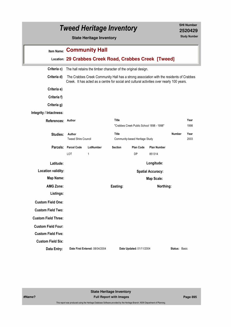
2520429
SHI Number
Tweed Heritage Inventory
Item Name: Community Hall
Location: 29 Crabbes Creek Road, Crabbes Creek [Tweed]
State Heritage Inventory Study Number
Custom Field One:
References:
Studies:
Listings:
Date Updated: 01/11/2004 Status: BasicDate First Entered: 08/04/2004Data Entry:
Criteria c) The hall retains the timber character of the original design.
Criteria d) The Crabbes Creek Community Hall has a strong association with the residents of Crabbes Creek. It has acted as a centre for social and cultural activities over nearly 100 years.
Criteria e)
Criteria g)
Criteria f)
Integrity / Intactness:
Custom Field Two:
Custom Field Three:
Custom Field Four:
Custom Field Five:
Custom Field Six:
Parcels:
Latitude: Longitude:
AMG Zone: Easting: Northing:
Map Name: Map Scale:
Spatial Accuracy:Location validity:
Author Title Year
"Crabbes Creek Public School 1898 - 1998" 1998
Author Title YearNumber
Tweed Shire Council Community-based Heritage Study 2003
Parcel Code LotNumber Section Plan Code Plan Number
LOT 1 DP 851314
#Name? Page 895 Full Report with Images
State Heritage Inventory
This report was produced using the Heritage Database Software provided by the Heritage Branch, NSW Department of Planning.

2520429
SHI Number
Tweed Heritage Inventory
Item Name: Community Hall
Location: 29 Crabbes Creek Road, Crabbes Creek [Tweed]
State Heritage Inventory Study Number
Caption: Crabbes Creek Community Hall.
Copyright: Tweed Heads Historical Society
Image:
Image by: Kath Prichard
Image Date: 04/10/2003
Image Number:
Image Path:
Image File: 2520429b1.jpg
Thumb Nail Path:
Thumb Nail File: tn_2520429b1.jpg
#Name? Page 896 Full Report with Images
State Heritage Inventory
This report was produced using the Heritage Database Software provided by the Heritage Branch, NSW Department of Planning.
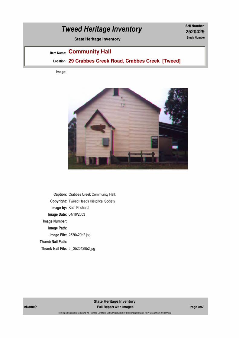
2520429
SHI Number
Tweed Heritage Inventory
Item Name: Community Hall
Location: 29 Crabbes Creek Road, Crabbes Creek [Tweed]
State Heritage Inventory Study Number
Caption: Crabbes Creek Community Hall.
Copyright: Tweed Heads Historical Society
Image:
Image by: Kath Prichard
Image Date: 04/10/2003
Image Number:
Image Path:
Image File: 2520429b2.jpg
Thumb Nail Path:
Thumb Nail File: tn_2520429b2.jpg
#Name? Page 897 Full Report with Images
State Heritage Inventory
This report was produced using the Heritage Database Software provided by the Heritage Branch, NSW Department of Planning.
2520429
SHI Number
Tweed Heritage Inventory
Item Name: Community Hall
Location: 29 Crabbes Creek Road, Crabbes Creek [Tweed]
State Heritage Inventory Study Number
#Name? Page 898 Full Report with Images
State Heritage Inventory
This report was produced using the Heritage Database Software provided by the Heritage Branch, NSW Department of Planning.
2520430
SHI Number
Tweed Heritage Inventory
Item Name: Macedonian Church Hall (former)
Location: 47 Crabbes Creek Road, Crabbes Creek [Tweed]
State Heritage Inventory Study Number
Current Use:
Former Uses:
Statement of
Significance:The Crabbes Creek Macedonian Church Hall served the spiritual and social needs of the immigrant Macedonian community who were a significant force in the district in the 1940's and 50's, This hall was the first Macedonian community centre in Australia. The hall retains the traditional timber materials, finishes and details from the original.
Historical Notes
or Provenance:The Macedonian Community of Crabbes Creek and surrounding areas numbered about 200 at its peak in the late 40's and through the 50's with sufficient support to build the church hall at 47 Crabbe's Creek Rd, which opened with an Orthodox Easter service in April, 1949, and has the honour of being the first Macedonian church built in Australia. The hall naturally became the focal point for the Macedonian community with feast days and Holy days celebrated there and at least one dance each month.
The need for the hall is obvious from the group photo of the Pechinis wedding taken in 1947 outside my grandparents house, where the ceremony and reception were held. My grandparents were noumkoi (best man and matron of honour). It's also nice to see the sprinkling of non-Macedonians in the group.At these gatherings, one source of constant amusement was the retelling of problems that new arrivals encountered because of their inability to speak English. One incident I remember was on a rare day when I had one penny to spend. I walked into the General Store from the school next door, visualising the four aniseed balls I would soon have in my hand when I was confronted by a Macedonian woman down on her haunches, elbows flapping up and down like wings, and making chicken noises. Poor Col Vincent had been pointing to eggs and scratching his head and then pointing to eggs again which only produced a more vehement chicken display from the woman. Fortunately, I was able to
Endorsed Significance:Assessed Significance: State
Item Type: Built Category: Church HallGroup: Religion
Admin Codes: Code 2: Code 3:
Curtilage/Boundary:
Owner: Private - Individual
Other/Former Names:
Area/Group/Complex: Group ID:
Aboriginal Area:
Local Govt Area: Tweed
Planning: Northern
Historic Region: North Coast
Address: #Name?
Suburb / Nearest Town: #Name?
State: NSW
Parish: Mooball
County: Rous
#Name? Page 899 Full Report with Images
State Heritage Inventory
This report was produced using the Heritage Database Software provided by the Heritage Branch, NSW Department of Planning.
2520430
SHI Number
Tweed Heritage Inventory
Item Name: Macedonian Church Hall (former)
Location: 47 Crabbes Creek Road, Crabbes Creek [Tweed]
State Heritage Inventory Study Number
translate for her that she wanted some live chickens to start her own egg supply, but, as you can imagine, shopping by gestures produced many memorable moments.
My late grandparents, Jack Vane (Stojan Milankov, Theophanis Milianis) and Petra moved to Crabbes Creek in 1940 and my parents Tom Michael (Mike Jengalov, Mihali Tsakalos) and Sopha followed with their two children Maria and George in 1941. Together, they worked a patch of bananas on the south western side of Crabbe's Creek and all 6 of them lived in the labourer's 2 bedroom timber shack; no power, electricity or running water, of course. My parents bought that property in 1944 and are still there today. In 1945, my grandparents bought their property in Crabbe's Creek Rd; immediately on the right after the first creek crossing. They moved to Queanbeyan, NSW, in their twilight years but lived to celebrate their 79th wedding anniversary, which the Sydney Morning Herald claims may be an Australian record.
By the time my parents bought their farm I had been born, but all seven of us continued to live in the shack because Dad's very dear friend, Norm Pavlovich, was having gazumping and associated problems in buying the property directly across the highway and needed a place for him and his family in the interim. As the shack was close to the bananas it made sense for us to stay there and allow the Pavlovichs the main house which they occupied for nearly two years, rent free. Strong friendships were not sullied by money in those days.
Two more children, John and Arthur, were born after we moved into the main house and all five of us attended the Crabbe's Creek school for our primary education.
My introduction to school life was a little earlier than expected. My brother George, who was 2 years older than I, didn't think it fair that he should have to go to school while I was allowed to stay at home. He couldn't be forced to walk to school and when he was driven in our old Prefect he positioned himself in the space under the back seat with each of his limbs strongly attached to the four metal legs holding the seat in place. One adult could not get him out and on the rare occasions when they were able to leave him at school, he simply walked the one mile home. The problem was brought up at a P & C meeting which decided that I should be allowed to attend school until George settled. However Mr Lea, the only teacher, understandably was not impressed. Why should he be responsible for an extra child who couldn't speak a word of English and a four year old at that. When 6 weeks of the school year had passed without George's attendance, Mr Lea relented. He insisted that the first words I learned in English were "May I be excused please, Sir" and that's fair enough because I needed to take care of my own toilette, but he positioned me at the back of the classroom and refused to acknowledge my presence other than to place a piece of blank paper and pencil in front of me each morning. After the first week even the pencil and paper vanished and, of course, children were not allowed to make a sound of any kind in class. Looking back, its hard to imagine why, but I loved school and was thrilled that Mr Lea allowed me to continue even after George had settled. The following year I commenced as a real student.
Generally speaking, the Crabbe's Creek community can be very proud of the way that they accepted such a large number of foreigners into the area. Certainly there was some minor racial intolerance but the only incident my dad remembers happened in the Billinudgel Hotel where he was enjoying a quiet beer. Someone, who had obviously been in the hotel a little
#Name? Page 900 Full Report with Images
State Heritage Inventory
This report was produced using the Heritage Database Software provided by the Heritage Branch, NSW Department of Planning.

2520430
SHI Number
Tweed Heritage Inventory
Item Name: Macedonian Church Hall (former)
Location: 47 Crabbes Creek Road, Crabbes Creek [Tweed]
State Heritage Inventory Study Number
too long, started shouting some racial remarks which prompted Ma Ring to grab the offender by the ear and escort him outside. Anyone, she insisted, who had paid good money for a drink had a right to enjoy it in peace in her pub. This attitude was true for most of the community; reasonable people were treated reasonably well. On the whole, the Macedonians were generally respected throughout the community for being reliable and very hard workers. Any minor intolerances paled into insignificance because, at least in Australia, they were free to speak their own language and celebrate their culture. They certainly could not do that in their homeland.
(Crabbes Creek Hall History - taken from "Crabbes Creek Public School 1898 - 1998"The Macedonians of Crabbes Creek. By Anna Watson (nee Michael))
Physical Description: Simple timber and iron hall.
Physical Condition:
Modification Dates:
Designer:
Maker / Builder:
Year Started: Year Completed: 1949 Circa: No
Recommended Management:
Potential State Significance due to social significance in relation to the association with the Macedonian community. Maintain the exterior and interior in a manner sympathetic with the original character and integrity. Adapt the services and facilities to ensure continued use, in a sympathetic manner.
Further Comments:
Criteria a)
Criteria c) The hall retains the traditional timber materials, finishes and details from the original.
Criteria d) The Crabbes Creek Macedonian Church Hall served the spiritual and social needs of the immigrant Macedonian community who were a significant force in the district in the 1940's
Criteria b)
Themes:
Management:
National Theme State Theme Local Theme
2. Peopling Migration Macedonian
8. Culture Religion Church
#Name? Page 901 Full Report with Images
State Heritage Inventory
This report was produced using the Heritage Database Software provided by the Heritage Branch, NSW Department of Planning.
2520430
SHI Number
Tweed Heritage Inventory
Item Name: Macedonian Church Hall (former)
Location: 47 Crabbes Creek Road, Crabbes Creek [Tweed]
State Heritage Inventory Study Number
Custom Field One:
References:
Studies:
Listings:
Date Updated: 01/11/2004 Status: BasicDate First Entered: 08/04/2004Data Entry:
and 50's, This hall was the first Macedonian community centre in Australia.
Criteria e)
Criteria g)
Criteria f)
Integrity / Intactness:
Custom Field Two:
Custom Field Three:
Custom Field Four:
Custom Field Five:
Custom Field Six:
Parcels:
Latitude: Longitude:
AMG Zone: Easting: Northing:
Map Name: Map Scale:
Spatial Accuracy:Location validity:
Author Title Year
Anna Watson (nee Michael) "Crabbes Creek Public School 1898 - 1998"The Macedonians of Crabbes Creek.
1998
Author Title YearNumber
Tweed Shire Council Community-based Heritage Study 2003
Parcel Code LotNumber Section Plan Code Plan Number
LOT A DP 397718
#Name? Page 902 Full Report with Images
State Heritage Inventory
This report was produced using the Heritage Database Software provided by the Heritage Branch, NSW Department of Planning.
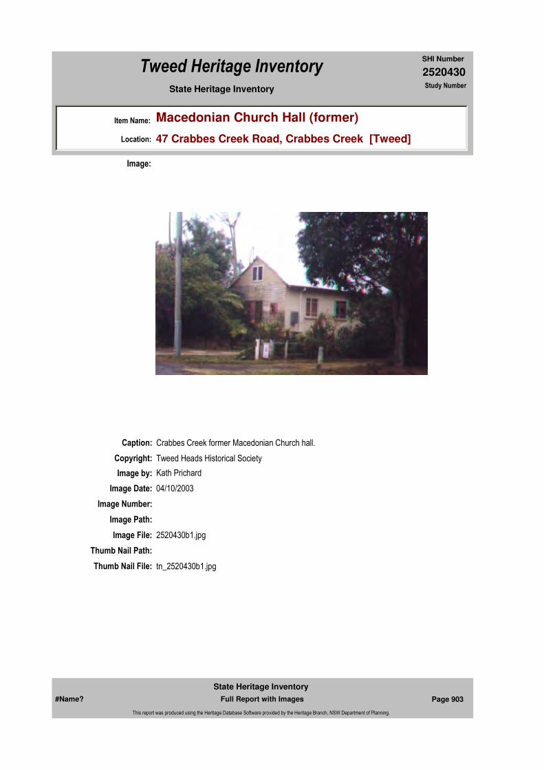
2520430
SHI Number
Tweed Heritage Inventory
Item Name: Macedonian Church Hall (former)
Location: 47 Crabbes Creek Road, Crabbes Creek [Tweed]
State Heritage Inventory Study Number
Caption: Crabbes Creek former Macedonian Church hall.
Copyright: Tweed Heads Historical Society
Image:
Image by: Kath Prichard
Image Date: 04/10/2003
Image Number:
Image Path:
Image File: 2520430b1.jpg
Thumb Nail Path:
Thumb Nail File: tn_2520430b1.jpg
#Name? Page 903 Full Report with Images
State Heritage Inventory
This report was produced using the Heritage Database Software provided by the Heritage Branch, NSW Department of Planning.

2520430
SHI Number
Tweed Heritage Inventory
Item Name: Macedonian Church Hall (former)
Location: 47 Crabbes Creek Road, Crabbes Creek [Tweed]
State Heritage Inventory Study Number
#Name? Page 904 Full Report with Images
State Heritage Inventory
This report was produced using the Heritage Database Software provided by the Heritage Branch, NSW Department of Planning.
2520431
SHI Number
Tweed Heritage Inventory
Item Name: Dry Stone Walls
Location: Cudgen Road, Cudgen [Tweed]
State Heritage Inventory Study Number
Current Use:
Former Uses:
Statement of
Significance:Dry walls are of particular historical interest and add character to the rural nature of country roads. Many walls have been lost to development and this represents one of the remaining few.
Historical Notes
or Provenance:"The farmers came in and cleared all the farms, and built the stone walls. They were used on the farm as dividing walls between paddocks on the hill and also to stop erosion. Some were built as fences. The work was mainly done by the farmers families though the South Sea Islanders did a lot of work on the farms. I'm not too sure if they helped build the stone wall, I think most likely they would have been involved. My dad built a lot of stone walls."
James Herbert Peate, was one of the first selectors of Cudgen land following the CSR takeover from Robb in 1912. His selection was the next farm east of the one in the photograph. Pers comm, 2004, Doris Madden nee Peate (daughter of James), born 1924.
Designer:
Maker / Builder:
Endorsed Significance:Assessed Significance: Local
Item Type: Built Category: Stone wallGroup: Farming and Grazing
Admin Codes: Code 2: Code 3:
Curtilage/Boundary:
Owner:
Other/Former Names:
Area/Group/Complex: Group ID:
Themes:
Aboriginal Area:
Local Govt Area: Tweed
Planning: Northern
Historic Region: North Coast
Address: #Name?
Suburb / Nearest Town: #Name?
State: NSW
Parish: Cudgen
County: Rous
National Theme State Theme Local Theme
4. Settlement Land tenure Stone Wall
#Name? Page 905 Full Report with Images
State Heritage Inventory
This report was produced using the Heritage Database Software provided by the Heritage Branch, NSW Department of Planning.

2520431
SHI Number
Tweed Heritage Inventory
Item Name: Dry Stone Walls
Location: Cudgen Road, Cudgen [Tweed]
State Heritage Inventory Study Number
Physical Description: Dry stone wall in Cudgen Road 200m long. This wall is 1/2m wide and 1m high.
Physical Condition:
Modification Dates:
Year Started: Year Completed: Circa: No
Recommended
Management:
References:
Studies:
Further Comments:
Criteria a) The stone wall is important in the course of the history of the South Sea Islanders in the Tweed district. The land was cleared by immigrant Kanaka labour brought into the area by the local sugar growers who cleared considerable quantities of land for sugar growing in the 1880's. Dry walls are of particular historical interest and add character to the rural nature of country roads. Many walls have been lost to development and this represents some of the remaining few.
Criteria c)
Criteria d)
Criteria e)
Criteria g)
Criteria f)
Integrity / Intactness:
Criteria b)
Parcels:
Latitude: Longitude:
AMG Zone: Easting: 553304 Northing: 6872315
Map Name: Map Scale:
Spatial Accuracy:Location validity:
Management:
Author Title Year
Doris Madden 2004
Author Title YearNumber
Tweed Shire Council Community-based Heritage Study 2003
Parcel Code LotNumber Section Plan Code Plan Number
LOT 7, 8 DP 812933
#Name? Page 906 Full Report with Images
State Heritage Inventory
This report was produced using the Heritage Database Software provided by the Heritage Branch, NSW Department of Planning.

2520431
SHI Number
Tweed Heritage Inventory
Item Name: Dry Stone Walls
Location: Cudgen Road, Cudgen [Tweed]
State Heritage Inventory Study Number
Custom Field One:
Listings:
Date Updated: 01/11/2004 Status: BasicDate First Entered: 08/04/2004Data Entry:
Custom Field Two:
Custom Field Three:
Custom Field Four:
Custom Field Five:
Custom Field Six:
Caption: Dry stone walls, Cudgen
Copyright: Tweed Heads Historical Society
Image:
Image by: Immy McKiernan
Image Date: 09/08/2003
Image Number:
#Name? Page 907 Full Report with Images
State Heritage Inventory
This report was produced using the Heritage Database Software provided by the Heritage Branch, NSW Department of Planning.
2520431
SHI Number
Tweed Heritage Inventory
Item Name: Dry Stone Walls
Location: Cudgen Road, Cudgen [Tweed]
State Heritage Inventory Study Number
Image Path:
Image File: 2520431b2.jpg
Thumb Nail Path:
Thumb Nail File: tn_2520431b2.jpg
#Name? Page 908 Full Report with Images
State Heritage Inventory
This report was produced using the Heritage Database Software provided by the Heritage Branch, NSW Department of Planning.

2520431
SHI Number
Tweed Heritage Inventory
Item Name: Dry Stone Walls
Location: Cudgen Road, Cudgen [Tweed]
State Heritage Inventory Study Number
Caption: Dry stone walls, Cudgen
Copyright: Tweed Heads Historical Society
Image:
Image by: Immy McKiernan
Image Date: 09/08/2003
Image Number:
Image Path:
Image File: 2520431b1.jpg
Thumb Nail Path:
Thumb Nail File: tn_2520431b1.jpg
#Name? Page 909 Full Report with Images
State Heritage Inventory
This report was produced using the Heritage Database Software provided by the Heritage Branch, NSW Department of Planning.

2520431
SHI Number
Tweed Heritage Inventory
Item Name: Dry Stone Walls
Location: Cudgen Road, Cudgen [Tweed]
State Heritage Inventory Study Number
#Name? Page 910 Full Report with Images
State Heritage Inventory
This report was produced using the Heritage Database Software provided by the Heritage Branch, NSW Department of Planning.

2520434
SHI Number
Tweed Heritage Inventory
Item Name: War Memorial Cenotaph and Public School Rolls
Location: Collier Street, Cudgen [Tweed]
State Heritage Inventory Study Number
Current Use:
Former Uses:
Statement of
Significance:The memorial is part of the cultural history of the Tweed Valley and has a special association with the community in which it is housed.
Historical Notes or Provenance:
Cudgen's new war memorial extension became a reality on Saturday after residents pitched in to construct the $3000 wall and columns.
It was case of many hands make light work as volunteers placed the hundreds of bricks required to build the wall.
War memorial committee president Frank Kapel praised the volunteer brickies for the standard of their work and their dedication to the task. The wall was completed by 3pm and two of the three columns were also completed.
He said another working bee next Saturday will see the entire job finished.
Situated near the original memorial, the extension is entirely within the grounds of the Cudgen Public School.
But Mr Kapel said gaining access would not be a problem.
He had been given an assurance from the. NSW Department of Education that the school grounds would never be closed off to members of the public wishing to visit the memorial.
The. memorial had a lasting connection to the school itself as the bricks used came from the
Endorsed Significance:Assessed Significance: Local
Item Type: Built Category: War MemorialGroup: Monuments and Mem
Admin Codes: Code 2: Code 3:
Curtilage/Boundary:
Owner: Private - Community Group
Other/Former Names:
Area/Group/Complex: Group ID:
Aboriginal Area:
Local Govt Area: Tweed
Planning: Northern
Historic Region: North Coast
Address: #Name?
Suburb / Nearest Town: #Name?
State: NSW
Parish: Cudgen
County: Rous
#Name? Page 925 Full Report with Images
State Heritage Inventory
This report was produced using the Heritage Database Software provided by the Heritage Branch, NSW Department of Planning.
2520434
SHI Number
Tweed Heritage Inventory
Item Name: War Memorial Cenotaph and Public School Rolls
Location: Collier Street, Cudgen [Tweed]
State Heritage Inventory Study Number
originial school building, he said.
The bricks were made in 1882. After the school building was demolished about eight years ago the bricks had been moved for storage at a local brickyard. They were later taken back to the school grounds. All the materials required for the 30 metre wall were donated by local business houses. Mr Kapel said many other groups, such as service and sports clubs, and individuals had supported the effort with time, money and materials. The only outstanding commitment was the $500 needed to pay for the pyramid, which rests on top of the central columns. The columns represent the Army, Navy and Air Force and they encircle a memorial plaque dedicated to the fallen of all wars. Australian troops' efforts in World War II are recognised on the new wall, extending the dedication to the fallen of World War I which is inscribed on the original memorial wall. Mr Kapel said he was pleased the old school bricks had been used for such a worthwhile purpose.(Daily News December 3, 1990 "Cudgen completes its memorial")
The ceremony of unveiling a handsome marble tablet, erected to the memory of the late Cpl. James Lewis, who fell in France on October 10th last year, took place in St. Mark's Church, Cudgen, on Thursday evening last, October 10th. The tablet was placed in the church by the widow of the late soldier, and bears the inscription: "To the greater glory of God, and in memory of Corporal James Lewis, killed in action in France, October 10th, 1917. Peace, perfect peace. Erected by his loving wife, Anna." Mr. A. Armitage, of Tweed heads, executed the work.
Although the night was dark and wet, the congregation that assembled more than half filled the church. The service was conducted by the Rev. H. Lilley who, after the third Collect at Evensong, drew aside the Union Jack, with which the face of the tablet was covered, the congregation standing in reverent silence. The sermon was based on the words of St. John, chap. xv., 13th verse: "Greater love hath no man than this, that a man lay down his life for his friend."
Special war hymns were sung, including "We Pray Thee in Thy Pity Shield our Soldiers on the Battlefield". "For The Passing Souls We Pray", and "Remember, Lord, Australia's Sons To-night". After the benediction, the National Anthem was sung, and the Dead March in Saul was played, Mrs. Genge presiding at the organ.
Beneath the tablet and surrounding it were wreaths of beautiful flowers, the work of Mrs. Furey, of Cudgen.(Tweed Daily October 12, 1918 MEMORIAL Tablet Unveiling Ceremony at Cudgen)
Names on Honour Rolls:Marble 1914-1918: R S Baker; C Baker; F Barnett; R Baxendell; C Bird; R Bonning; L Cess; A Clarke; R Clarke; H Clarke; T Cowen; A Cullen; W Curtis; F G Dinsey; G Dinsey; C Ellis; D Graham; C Hansen; C Harper; J A Turnock; J Harper; R Harper; L J Hayes; J G Higgins; C Holland; H Johnston; W J Julius; J Lewis; T Lillee; A S Loder; C M Mann; Clive Mann; E Mann; F Mann; G Mann; B McCarthy; M McCollum; R D McEwan; J McInnes; W McLeish; P Noels; L O'Neill; E O'Keeffe; M Price; P Price; E Powell; A Quigan; R Redgewell; E C
#Name? Page 926 Full Report with Images
State Heritage Inventory
This report was produced using the Heritage Database Software provided by the Heritage Branch, NSW Department of Planning.

2520434
SHI Number
Tweed Heritage Inventory
Item Name: War Memorial Cenotaph and Public School Rolls
Location: Collier Street, Cudgen [Tweed]
State Heritage Inventory Study Number
Ritchie; L SCott; D H Sprange; W Soorley; W Taylor; E Todd; R Tredwell; W Turnbull; G Watego; M Watego; L Wogas.
Wooden School Roll, 1914-1918: A Brown; H Clarke; R Clarke; H Condran; T Gillieatt; R Baxendell; K Burnett; A Clarke; L Clarke; H Collins; M Collier; O Condran; V Condran; H Dodds; R Dodds; Rd Dodds; S Dodds; E Gaenshirt; T Gardiner; J Hulcombe; W Hulcombe; T Lillee; E Mann; F Mann; P O'Brien; W Turnbull; W Jones; C M Mann; C Mann; G Mann; W Nunn; C Piercy; F Piercy; H Piercy; A Quigan; E Ritchie; C Rosenthal; J Simpson; M Watego; G Whalan; A Williams; E Williams; L Wogas.
Wooden School Roll, 1939-1945: C McPhail; G Quirk; D G Bentley; F Dinsey; K Dinsey; F L Eglington; W Eglingotn; Miss I Foster; J Foster; H Foster; K Hollands; R Hollands; Miss B Hansen; D J Hansen; G Jay; Miss L Johnson; L Johnson; N Johnson; J Julius, R Julius; J D Korsch; J H Korsch; C Kent; A Ling; Miss F McDonald; G McDonald; A M McDonald; Miss H McPhail; A McCollum; M McCollum; M McConnell; D McIntyre; F Mackay; R Mye; W Mye; T S Peate; C Peate; J Peate; R Peate; J R PAddon; R C Price; C Quirk; J Small; J Spencer; D A Spencer; Miss M Smith; C Smith; B Smith; H Smith; J Sanotti; J Sellick; M H Turnock.
Physical Description: The cenotaph and surrounds are made from bricks from the original school building of 1890, which was demolished in the 1980's to enlarge the school. 2 inscribed marble plaques are mounted on one of the walls of the complex , these are WW1 memorials. Also in the garden is the headstone of one of the soldiers, James Lewis, who didn't return from WW1. It was erected by his wife in the Cudgen Church of England yard, where it remained until unearthed in a garden in about 1980. The headstone was donated to the RSL and re-erected on the cenotaph wall. 2 inscribed wooden honour boards are inside the school office building, one for WW1 and one for WW2 to commemorate the enlistments of the school boys.
Physical Condition:
Modification Dates:
Designer:
Maker / Builder:
Year Started: Year Completed: 1990 Circa: No
Recommended Management:
Themes:
Management:
National Theme State Theme Local Theme
7. Governing Defence War Memorial
#Name? Page 927 Full Report with Images
State Heritage Inventory
This report was produced using the Heritage Database Software provided by the Heritage Branch, NSW Department of Planning.

2520434
SHI Number
Tweed Heritage Inventory
Item Name: War Memorial Cenotaph and Public School Rolls
Location: Collier Street, Cudgen [Tweed]
State Heritage Inventory Study Number
Custom Field One:
References:
Studies:
Listings:
Further Comments:
Criteria a)
Criteria c)
Criteria d) The memorial is part of the cultural history of the Tweed Valley and has a special association with the community in which it is housed.
Criteria e)
Criteria g)
Criteria f)
Integrity / Intactness:
Custom Field Two:
Custom Field Three:
Custom Field Four:
Custom Field Five:
Custom Field Six:
Criteria b)
Parcels:
Latitude: Longitude:
AMG Zone: Easting: Northing:
Map Name: Map Scale:
Spatial Accuracy:Location validity:
Author Title Year
"Cudgen completes its memorial" 1990
MEMORIAL Tablet Unveiling Ceremony at Cudgen 1918
Author Title YearNumber
Tweed Shire Council Community-based Heritage Study 2003
Parcel Code LotNumber Section Plan Code Plan Number
LOT 1 DP 407094
LOT 71 DP 755701
#Name? Page 928 Full Report with Images
State Heritage Inventory
This report was produced using the Heritage Database Software provided by the Heritage Branch, NSW Department of Planning.

2520434
SHI Number
Tweed Heritage Inventory
Item Name: War Memorial Cenotaph and Public School Rolls
Location: Collier Street, Cudgen [Tweed]
State Heritage Inventory Study Number
Date Updated: 03/11/2004 Status: BasicDate First Entered: 10/04/2004Data Entry:
Caption: Cudgen War Memorial Cenotaph
Copyright: Tweed Heads Historical Society
Image:
Image by: Kath Prichard
Image Date: 05/11/2003
Image Number:
Image Path:
Image File: 2520434b1.jpg
Thumb Nail Path:
Thumb Nail File: tn_2520434b1.jpg
#Name? Page 929 Full Report with Images
State Heritage Inventory
This report was produced using the Heritage Database Software provided by the Heritage Branch, NSW Department of Planning.

2520434
SHI Number
Tweed Heritage Inventory
Item Name: War Memorial Cenotaph and Public School Rolls
Location: Collier Street, Cudgen [Tweed]
State Heritage Inventory Study Number
Caption: Marble Honour Rolls, before erection at the Cudgen Cenotaph, c.1990.
Copyright: Tweed Heads Historical Society
Image:
Image by:
Image Date:
Image Number:
Image Path:
Image File: 2520434b2.jpg
Thumb Nail Path:
Thumb Nail File: tn_2520434b2.jpg
#Name? Page 930 Full Report with Images
State Heritage Inventory
This report was produced using the Heritage Database Software provided by the Heritage Branch, NSW Department of Planning.
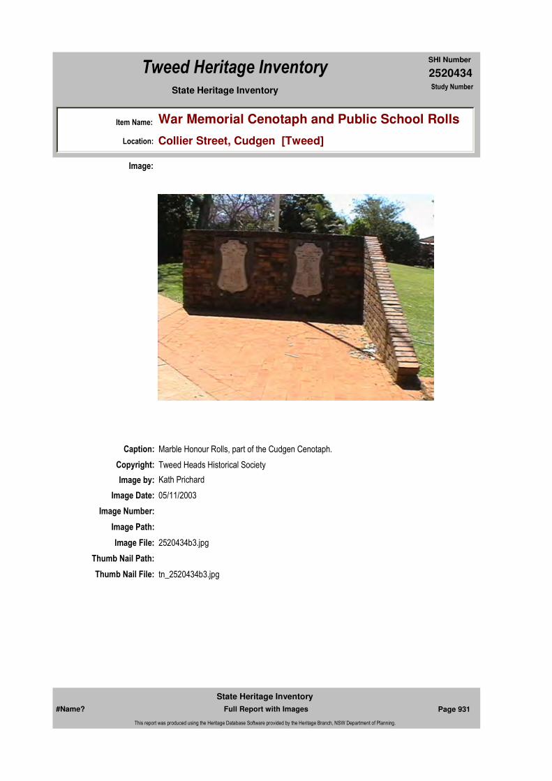
2520434
SHI Number
Tweed Heritage Inventory
Item Name: War Memorial Cenotaph and Public School Rolls
Location: Collier Street, Cudgen [Tweed]
State Heritage Inventory Study Number
Caption: Marble Honour Rolls, part of the Cudgen Cenotaph.
Copyright: Tweed Heads Historical Society
Image:
Image by: Kath Prichard
Image Date: 05/11/2003
Image Number:
Image Path:
Image File: 2520434b3.jpg
Thumb Nail Path:
Thumb Nail File: tn_2520434b3.jpg
#Name? Page 931 Full Report with Images
State Heritage Inventory
This report was produced using the Heritage Database Software provided by the Heritage Branch, NSW Department of Planning.

2520434
SHI Number
Tweed Heritage Inventory
Item Name: War Memorial Cenotaph and Public School Rolls
Location: Collier Street, Cudgen [Tweed]
State Heritage Inventory Study Number
Caption: Cudgen School Roll of Honour, 1939 - 1945.
Copyright: Tweed Heads Historical Society
Image:
Image by:
Image Date:
Image Number:
Image Path:
Image File: 2520434b4.jpg
Thumb Nail Path:
Thumb Nail File: tn_2520434b4.jpg
#Name? Page 932 Full Report with Images
State Heritage Inventory
This report was produced using the Heritage Database Software provided by the Heritage Branch, NSW Department of Planning.
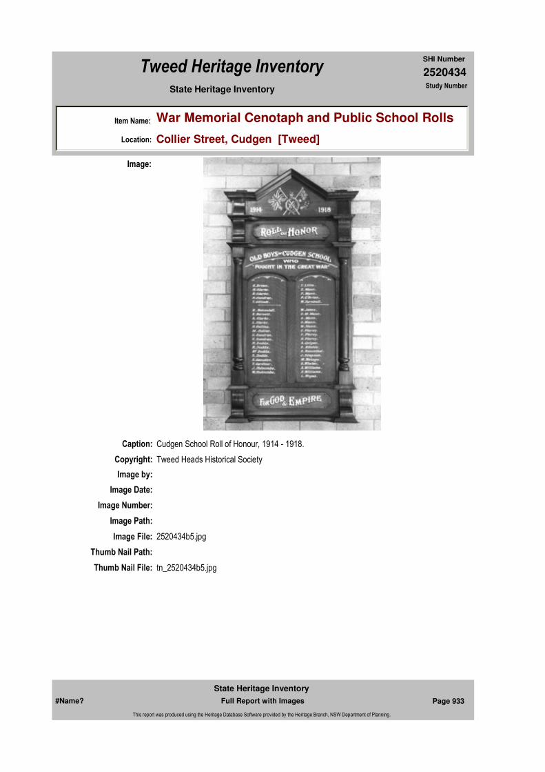
2520434
SHI Number
Tweed Heritage Inventory
Item Name: War Memorial Cenotaph and Public School Rolls
Location: Collier Street, Cudgen [Tweed]
State Heritage Inventory Study Number
Caption: Cudgen School Roll of Honour, 1914 - 1918.
Copyright: Tweed Heads Historical Society
Image:
Image by:
Image Date:
Image Number:
Image Path:
Image File: 2520434b5.jpg
Thumb Nail Path:
Thumb Nail File: tn_2520434b5.jpg
#Name? Page 933 Full Report with Images
State Heritage Inventory
This report was produced using the Heritage Database Software provided by the Heritage Branch, NSW Department of Planning.

2520434
SHI Number
Tweed Heritage Inventory
Item Name: War Memorial Cenotaph and Public School Rolls
Location: Collier Street, Cudgen [Tweed]
State Heritage Inventory Study Number
#Name? Page 934 Full Report with Images
State Heritage Inventory
This report was produced using the Heritage Database Software provided by the Heritage Branch, NSW Department of Planning.
2520435
SHI Number
Tweed Heritage Inventory
Item Name: Cudgen Sugar Mill Remains
Location: Tweed Coast Road, Cudgen [Tweed]
State Heritage Inventory Study Number
Current Use:
Former Uses:
Statement of
Significance:The sugar mill on this site was unique in NSW in that is was the only fully developed "plantation" mill using Islander labour, with barracks, recreational facilities, hotel, churches, etc. The site has archaeological value.
Historical Notes
or Provenance:Construction of the sugar mill at Cudgen was started by Mr W W Julius in 1869, but it was several years before milling operations began. After some years, Julius took in partners John Robb, snr, head of a Melbourne construction firm, and J J Casey, a Melbourne judge. Julius stayed on for a few years as manager, then sold his share and went to Western Australia. It appears that John Robb, jnr, and his brother, Arthur, came to Cudgen in c. 1888 and between them and the Mill company owned a great portion of the land at Cudgen and Duranbah. At the mill, during the time of Robb & Co, a store, barracks, manager's homes, stables etc were built . In 1893, Robb applied for, and was granted, a lease to run a tramway from the mill to Chinderah, to take the milled sugar to the river for shipment to Sydney. He also laid tramlines around the farms for collection of the cut cane. There was approximately 11 miles of tram track through the plantation and to the Chinderah Wharf.
John Robb snr died in 1895, after being declared bankrupt and penniless in 1893. It is not known how the mill and land were retained, assumably the deeds were transferred to John jnr prior to bankruptcy. The company of Robb and Co traded until the death of John Robb, jnr, in 1911. His brother, Arthur, negotiated the sale of the mill and lands with the CSR and it was taken over in 1912.
Following the takeover by the CSR, the land was cut up into small blocks of approximately 50 acres, and sold, but most of the mill buildings and stack were retained as storage sheds
Endorsed Significance:Assessed Significance: Local
Item Type: Archaeological-Terrest Category: Sugar MillGroup: Manufacturing and Pr
Admin Codes: Code 2: Code 3:
Curtilage/Boundary:
Owner: Private - Corporate
Other/Former Names:
Area/Group/Complex: Group ID:
Aboriginal Area:
Local Govt Area: Tweed
Planning: Northern
Historic Region: North Coast
Address: #Name?
Suburb / Nearest Town: #Name?
State: NSW
Parish:
County:
#Name? Page 935 Full Report with Images
State Heritage Inventory
This report was produced using the Heritage Database Software provided by the Heritage Branch, NSW Department of Planning.

2520435
SHI Number
Tweed Heritage Inventory
Item Name: Cudgen Sugar Mill Remains
Location: Tweed Coast Road, Cudgen [Tweed]
State Heritage Inventory Study Number
for many years. It is believed one of the storage sheds was transported to the Condong mill and it still survives in 2004. The tramline was also retained and used to transport the cut cane to the wharf at Chinderah for transport to the mill at Condong by barge. This mode of transport ceased c. 1965, being superseded by road transport.
The chimney stack, reputedly the highest sugar mill stack in Australia and one of the oldest, was constructed of 70,000 imported ironstone bricks. It was demolished in 1962, following a lightning strike, which dislodged a few bricks, making the stack very unstable. The mill buildings had been dismantled several years prior to the demolition of the chimney.
Physical Description: A number of concrete blocks which had been broken up in 1962 when the chimney was declared unsafe and bulldozed into a heap beneath some huge fig trees. One of these block has remnants of a fireplace. The chimney stack, reputedly the highest sugar mill stack in Australia and one of the oldest, was constructed of 70,000 imported ironstone bricks.
Physical Condition:
Modification Dates:
Designer:
Maker / Builder:
Year Started: Year Completed: Circa: No
Recommended Management:
Statutory listing. Erect an interpretative panel illustrating the history and significance of the site, in an appropriate location. Consider potential for stabilising the site as part of an industrical archaeology project, associated with the Condong Mill CMP project.
Further Comments:
Criteria a) The Cudgen Sugar Mill was the first large sugar mill built in the Tweed district and the only one in NSW built by the farmer, W W Julius, for his own sugar crop. The chimney stack, reputedly the highest sugar mill stack in Australia and one of the oldest, was constructed of 70,000 imported ironstone bricks.
Criteria c) The site has archaeological value.
Criteria d)
Criteria b)
Themes:
Management:
National Theme State Theme Local Theme
3. Economy Industry Sugar
#Name? Page 936 Full Report with Images
State Heritage Inventory
This report was produced using the Heritage Database Software provided by the Heritage Branch, NSW Department of Planning.
2520435
SHI Number
Tweed Heritage Inventory
Item Name: Cudgen Sugar Mill Remains
Location: Tweed Coast Road, Cudgen [Tweed]
State Heritage Inventory Study Number
Custom Field One:
References:
Studies:
Listings:
Date Updated: 01/11/2004 Status: BasicDate First Entered: 10/04/2004Data Entry:
Criteria e)
Criteria g)
Criteria f)
Integrity / Intactness:
Custom Field Two:
Custom Field Three:
Custom Field Four:
Custom Field Five:
Custom Field Six:
Parcels:
Latitude: Longitude:
AMG Zone: Easting: Northing:
Map Name: Map Scale:
Spatial Accuracy:Location validity:
Author Title YearNumber
Tweed Shire Council Community-based Heritage Study 2003
#Name? Page 937 Full Report with Images
State Heritage Inventory
This report was produced using the Heritage Database Software provided by the Heritage Branch, NSW Department of Planning.

2520435
SHI Number
Tweed Heritage Inventory
Item Name: Cudgen Sugar Mill Remains
Location: Tweed Coast Road, Cudgen [Tweed]
State Heritage Inventory Study Number
Caption: Concrete rubble, remains of the Cudgen Sugar Mill.
Copyright: Tweed Heads Historical Society
Image:
Image by:
Image Date:
Image Number:
Image Path:
Image File: 2520435b1.jpg
Thumb Nail Path:
Thumb Nail File: tn_2520435b1.jpg
#Name? Page 938 Full Report with Images
State Heritage Inventory
This report was produced using the Heritage Database Software provided by the Heritage Branch, NSW Department of Planning.
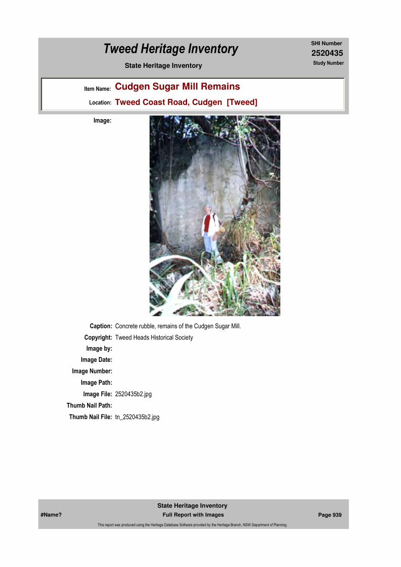
2520435
SHI Number
Tweed Heritage Inventory
Item Name: Cudgen Sugar Mill Remains
Location: Tweed Coast Road, Cudgen [Tweed]
State Heritage Inventory Study Number
Caption: Concrete rubble, remains of the Cudgen Sugar Mill.
Copyright: Tweed Heads Historical Society
Image:
Image by:
Image Date:
Image Number:
Image Path:
Image File: 2520435b2.jpg
Thumb Nail Path:
Thumb Nail File: tn_2520435b2.jpg
#Name? Page 939 Full Report with Images
State Heritage Inventory
This report was produced using the Heritage Database Software provided by the Heritage Branch, NSW Department of Planning.

2520435
SHI Number
Tweed Heritage Inventory
Item Name: Cudgen Sugar Mill Remains
Location: Tweed Coast Road, Cudgen [Tweed]
State Heritage Inventory Study Number
Caption: Concrete rubble, remains of the Cudgen Sugar Mill.
Copyright: Tweed Heads Historical Society
Image:
Image by:
Image Date:
Image Number:
Image Path:
Image File: 2520435b3.jpg
Thumb Nail Path:
Thumb Nail File: tn_2520435b3.jpg
#Name? Page 940 Full Report with Images
State Heritage Inventory
This report was produced using the Heritage Database Software provided by the Heritage Branch, NSW Department of Planning.

2520435
SHI Number
Tweed Heritage Inventory
Item Name: Cudgen Sugar Mill Remains
Location: Tweed Coast Road, Cudgen [Tweed]
State Heritage Inventory Study Number
Caption: Concrete rubble, remains of the Cudgen Sugar Mill.
Copyright: Tweed Heads Historical Society
Image:
Image by:
Image Date:
Image Number:
Image Path:
Image File: 2520435b4.jpg
Thumb Nail Path:
Thumb Nail File: tn_2520435b4.jpg
#Name? Page 941 Full Report with Images
State Heritage Inventory
This report was produced using the Heritage Database Software provided by the Heritage Branch, NSW Department of Planning.
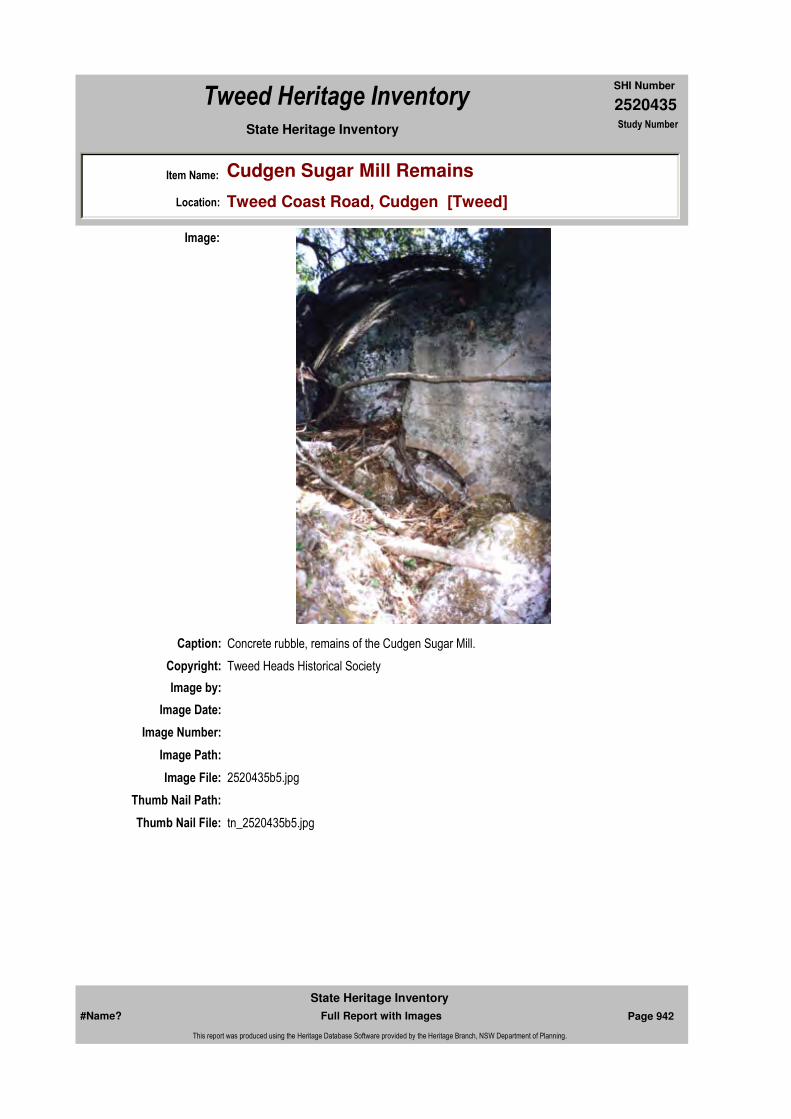
2520435
SHI Number
Tweed Heritage Inventory
Item Name: Cudgen Sugar Mill Remains
Location: Tweed Coast Road, Cudgen [Tweed]
State Heritage Inventory Study Number
Caption: Concrete rubble, remains of the Cudgen Sugar Mill.
Copyright: Tweed Heads Historical Society
Image:
Image by:
Image Date:
Image Number:
Image Path:
Image File: 2520435b5.jpg
Thumb Nail Path:
Thumb Nail File: tn_2520435b5.jpg
#Name? Page 942 Full Report with Images
State Heritage Inventory
This report was produced using the Heritage Database Software provided by the Heritage Branch, NSW Department of Planning.
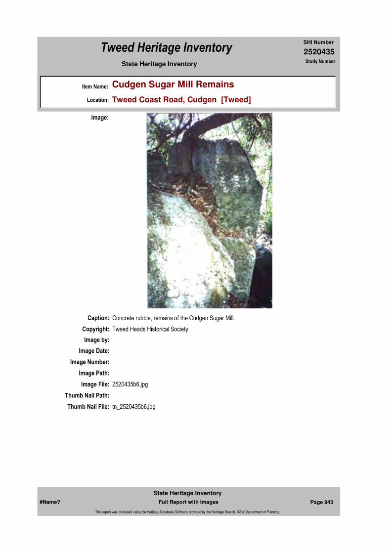
2520435
SHI Number
Tweed Heritage Inventory
Item Name: Cudgen Sugar Mill Remains
Location: Tweed Coast Road, Cudgen [Tweed]
State Heritage Inventory Study Number
Caption: Concrete rubble, remains of the Cudgen Sugar Mill.
Copyright: Tweed Heads Historical Society
Image:
Image by:
Image Date:
Image Number:
Image Path:
Image File: 2520435b6.jpg
Thumb Nail Path:
Thumb Nail File: tn_2520435b6.jpg
#Name? Page 943 Full Report with Images
State Heritage Inventory
This report was produced using the Heritage Database Software provided by the Heritage Branch, NSW Department of Planning.
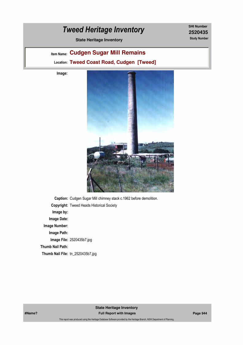
2520435
SHI Number
Tweed Heritage Inventory
Item Name: Cudgen Sugar Mill Remains
Location: Tweed Coast Road, Cudgen [Tweed]
State Heritage Inventory Study Number
Caption: Cudgen Sugar Mill chimney stack c.1962 before demolition.
Copyright: Tweed Heads Historical Society
Image:
Image by:
Image Date:
Image Number:
Image Path:
Image File: 2520435b7.jpg
Thumb Nail Path:
Thumb Nail File: tn_2520435b7.jpg
#Name? Page 944 Full Report with Images
State Heritage Inventory
This report was produced using the Heritage Database Software provided by the Heritage Branch, NSW Department of Planning.

2520435
SHI Number
Tweed Heritage Inventory
Item Name: Cudgen Sugar Mill Remains
Location: Tweed Coast Road, Cudgen [Tweed]
State Heritage Inventory Study Number
#Name? Page 945 Full Report with Images
State Heritage Inventory
This report was produced using the Heritage Database Software provided by the Heritage Branch, NSW Department of Planning.

2520437
SHI Number
Tweed Heritage Inventory
Item Name: Dungay Public School and War Memorial Rolls
Location: Queensland Road, Dungay [Tweed]
State Heritage Inventory Study Number
Current Use:
Former Uses:
Statement of
Significance:The Dungay School is important in demonstrating the principal characteristics of early Tweed district two room 1890 schools, where the educational needs of the local children were/are met.
The War Memorial Roll, which is housed at Dungay School, is part of the cultural history of the Tweed Valley and has a special association with the community in which it is housed.
Historical Notes
or Provenance:The school opened as a Provisional School in August, when Miss Sarah Arnold was appointed teacher. By the end of the year the enrolment was 27, and the average attendance 22.4, which was more than that needed for a Public School, and the school was raised to Public School status on 1st July, 1894. The original name of the school was Dungay Creek. The next teacher was Mr. Joshua Ford, who was appointed in 1895 until 1897.
The original school house was an unlined wooden building measuring approximately 17' x 14'. At the beginning of 1897 it was decided that the walls should be lined and the work was done by W. Gillies for £6/10/0. Soon afterwards the parents asked the Department to enlarge the building, and Inspector Board supported the request, pointing out that the building contained floor space for 29 and air space for 25, while the enrolment was 49 and the average attendance 35.7. He recommended that 14 feet should be added to the building. This was approved, and a tender accepted from C. McCarthy for £36/3/9. The work was completed in August, 1897.
So far the playground had not been fenced, but in 1900 it was decided to put up a fence on
Endorsed Significance:Assessed Significance: Local
Item Type: Built Category: School - State (public)Group: Education
Admin Codes: Code 2: Code 3:
Curtilage/Boundary:
Owner: Department of Education and Training
Other/Former Names:
Area/Group/Complex: Group ID:
Aboriginal Area:
Local Govt Area: Tweed
Planning: Northern
Historic Region: North Coast
Address: #Name?
Suburb / Nearest Town: #Name?
State: NSW
Parish: Kynnumboon
County: Rous
#Name? Page 951 Full Report with Images
State Heritage Inventory
This report was produced using the Heritage Database Software provided by the Heritage Branch, NSW Department of Planning.

2520437
SHI Number
Tweed Heritage Inventory
Item Name: Dungay Public School and War Memorial Rolls
Location: Queensland Road, Dungay [Tweed]
State Heritage Inventory Study Number
the north and west sides of the playground in order to keep out cattle. A post and rail fence was put up on these two sides for £2/18/6. It was not thought necessary to fence the other two sides as they were bordered by thick scrub. However, soon afterwards the land on these sides was acquired by Mr. G. Lawson, who cleared the scrub, and in January, 1903, he asked the Department to complete the school fence so as to keep the children's horses off his land. The Department agreed to this, and a 4-wire fence was put up on these sides of the playground for £4/12/10.
At first the teachers had boarded locally, but at the beginning of 1901 the teacher, Mr. Culbert, married, and he then rented a house from Mrs. B. Smith, of Dungay House, Murwillumbah for 12/- per week. He reported that the house had a paddock of 5 acres attached, which included an orchard. He was granted a rent allowance of £31/4/0 per annum.
In August, 1903, Mr. Culbert pointed out that the school building measured 31' x 14', and that the enrolment had increased to 59, while the usual attendance was about 50. It was decided to lengthen the building. It is not clear from the papers how much was added, as the builder was merely told how much extra furniture was needed and it was left to him to provide enough room for it, but it was probably about 10 feet. In December a tender from Alf Davis for £78 was accepted, but before the contract could be signed Mr. Davis went to live in Toowoomba, and refused to continue with the work. Since his tender had been the only one received fresh tenders were invited, and in March that of Edward Fackerell (£92) was accepted. There was some delay in completing the arrangements, owing to lack of funds, but the work was done in September and October, 1904. Painting and repairs were also carried out.
Mr. Culbert was succeeded by Miss Augusta Meares at the beginning of 1907. She was unable to find a place to live near the school and was forced to stay in Murwillumbah, and to keep a horse and sulky to drive to school. She was given a forage allowance of £5 per annum.
In May, 1912, Miss Meares wrote to Chief Inspector Daw-son, pointing out that new Regulations said that women might not have charge of schools of higher than 6th class, and that Dungay Creek was 5th class. (At that time there were seven classes of schools). She continued: "Three years ago I made and furnished a home in Murwillumbah for my parents, both of whom were aged. Since then I have been their main support, and my removal from the home would alter their circumstances considerably." She asked to be allowed to remain at Dungay Creek. Inspector Henry reported that Miss Meares was doing good work, and that the enrolment and average attendance were 41 and 28.4, which meant that the school was only just within the 5th class. He suggested that the school should be reduced to 6th class at the end of the year and that Miss Meares should be allowed to remain. Something of the sort seems to have been done, because Miss Meares was not moved until the end of 1914.
She was succeeded by Thomas Moore, and he was for some time unable to rent a house either at Dungay or Murwillumbah. In March, 1915, he reported that he was being forced to board, because "the house agents say there is no prospect of a vacant house". He drove to the school every day in a sulky and was granted £10 per annum forage allowance. In
#Name? Page 952 Full Report with Images
State Heritage Inventory
This report was produced using the Heritage Database Software provided by the Heritage Branch, NSW Department of Planning.

2520437
SHI Number
Tweed Heritage Inventory
Item Name: Dungay Public School and War Memorial Rolls
Location: Queensland Road, Dungay [Tweed]
State Heritage Inventory Study Number
October he succeeded in renting a house in Murwillumbah for 15/- per week, and he seems to have continued to live in Murwillumbah during the 30 years that he remained teacher of the school. As a result of these difficulties the parents petitioned the Department to build a vested residence. Inspector Henry reported that the enrolment was 42 and the school was permanent, and he recommended that a residence should be built when funds were available. Evidently they were not available.
In July, 1919, permission was given for the Parents and Citizens' Association to erect a sundial, windvane and memorial tablet on the occasion of the peace celebrations.
At some time about this period a new school building appears to have been erected. Unfortunately all the papers dealing with it seem to have disappeared, and all that can be said is that the new building was officially opened on 28th July, 1921, and that the ceremony was followed by a Social Evening. Inspector Fraser was present.
A surveyed road ran along the western boundary of the school grounds. It was not used by the public, since it was only a quarter of a mile long and ended in a swamp, and in March, 1920, the Parents and Citizens' Association asked for permission to fence that part of it abutting on the school grounds for use by the children as a horse paddock. The Department approached the Lands Department on their behalf, but Mr. F. P. Chambers, the owner of the adjoining property, objected, saying that he used the road to get to his back paddocks. The Lands Department then agreed to the Association's request on condition that gates were provided for anyone who wished to pass through. In July, Chief Inspector Dawson informed the Association that the Minister had decided that the work must wait until the next financial year, so the Association then did the work themselves.
This arrangement continued until the end of 1925, when an application to the Land Board was made to have the surveyed road incorporated in Chamber's property. The Parents and Citizens' Association wrote to the Department protesting against this proposal, since if it was agreed to it would mean that part of the playground would have to be used as a horse paddock, and suggesting as an alternative that part of the road which had been enclosed should be incorporated in the school grounds. The Department instructed Inspector Barlex to attend the Land Board enquiry and object to the request, and nothing seems to have come of it.
In February, 1925, Inspector Fraser reported: "Mr. Moore, the teacher at Dungay Creek, has previously traveled between Murwillumbah and the school by horse and sulky. He has now purchased a motor car. On sewing days and wet days he will use the motor car, and on other days ride a bicycle to school". In view of the greater cost of running a car his forage allowance was increased to £15 per annum. Later this was changed to 1/2 per school day, plus £8 per annum. (On sewing days, Mr. Moore was accompanied to school by his wife, who taught sewing).
At the beginning of 1927, Mr. Moore was unable to open the school for a week after the ending of the summer holiday because the road from Murwillumbah to Dungay was impassable, owing to a flood. The school was closed on 5th and 6th April, 1933, for the same reason. Then the next summer seems to have been very wet. School was closed owing to flood on 22nd February. On 5th and 6th April water on the road was too deep for a
#Name? Page 953 Full Report with Images
State Heritage Inventory
This report was produced using the Heritage Database Software provided by the Heritage Branch, NSW Department of Planning.

2520437
SHI Number
Tweed Heritage Inventory
Item Name: Dungay Public School and War Memorial Rolls
Location: Queensland Road, Dungay [Tweed]
State Heritage Inventory Study Number
car so Mr. Moore hired a horse and rode to school, but only six children were present on each occasion so he decided it was not worth the expense, and when the road was again flooded on 13th April and 9th May the school remained closed.
Mr. O'Toole took over the school in 1945 and remained for two and a half years, and then Mr. Stephen Engel arrived in July, 1947. Enrolment had increased by this time, so that an additional teacher had been appointed and an extra room supplied by the provision of half an R.A.A.F. hut from Evans Head aerodrome.
Mr. John Callaghan, in 1952, took over as headmaster, and during his term the Department converted the R.A.A.F. hut into quite a pleasant room and also approved the construction of an entirely new school building with improvements to grounds and amenities. His assistant was Miss M. Theyer.The name of the school was changed from Dungay Creek to Dungay on 20th July, 1954.
Mr. Callaghan retired at the end of 1957 and was succeeded by Mr. E. Newland, with Miss J. Lowrey as assistant. The new school building was erected (approx. £5,000) and the school was repaired and painted. Mrs. F. Mitchell commenced duty as visiting sewing teacher.
Horse transport has given way to school buses. For some years children from the Urliup district have traveled by Special School Bus, and in 1958 a school bus service commenced from Tomewin.By the end of first term, 1960, enrolment had increased to 90 pupils and a second assistant was appointed to the school - Mr. S. Hollands.
The new building which was occupied in 1958, was erected by Mr. Peter Furness, of Murwillumbah.Electricity was installed in 1961 and the telephone con-nected in 1969.
The road beside the school and the horse paddock were resumed for playground purposes in 1965.Dungay is the only school on the Tweed holding a cane permit. The P. and C. cuts the cane, and the proceeds go to school funds.
Annual events of importance are: Commonwealth Day celebrations, accompanied by a picnic; Christmas Tree party, sponsored by the parents; participation in the district Sports Carnival and an annual swimming school, held in Murwillumbah baths.
It is anticipated that septic toilets will be installed at the school in the forseeable future.
The Parents and Citizens' Association and a very active Mothers' Club have been sources of great assistance to the school, in the provision of equipment, amenities and opportunities for social and cultural development."Dungay School 75th Anniversary" (1969) HISTORY OF THE DUNGAY SCHOOL
Names on Memorial Roll: S A Baker; F Barrett; C S Bazter; C W Baxter; J Geasley; Blundell; F Bond; J Boyd; E Bostock; G H Brooks; G R Brooks; J Brooks; W Byrnes; S A
#Name? Page 954 Full Report with Images
State Heritage Inventory
This report was produced using the Heritage Database Software provided by the Heritage Branch, NSW Department of Planning.
2520437
SHI Number
Tweed Heritage Inventory
Item Name: Dungay Public School and War Memorial Rolls
Location: Queensland Road, Dungay [Tweed]
State Heritage Inventory Study Number
Cheers; R H Cheers; N V Cheers; G Choate; J Collins; B Dinsey; F Dinsey; H Evans; B Fackerell; H Fackerell; P Garner; H Gill; G Grahan; M Johnson; H Johnson; A Manning; T Mudge; F mudge; E Myers; F McLeod; A McGilvery; R Norris; J Smart; H Sweetnam; R Sweetnam; J Sweetnam; W Taylor; W Tree; R Tredwell; J Walker; H Walker.
Physical Description: This is the original school building, the first unlined section of which was built in 1894. Although it has a new roof line and extension it is an excellent example of school design of the period.Memorial: Names inscribed on metal plaque.
Physical Condition:
Modification Dates: Extensions C McCathy 1897E Fackerell 1904
Designer:
Maker / Builder: W Gillies, 1897
Year Started: 1894 Year Completed: Circa: No
Recommended
Management:Secure and protect plaque.
Further Comments:
Criteria a)
Criteria c)
Criteria d) The memorial is part of the cultural history of the Tweed Valley and has a special association with the community in which it is housed.
Criteria e)
Criteria g) Important in demonstrating the principal characteristics of early Tweed district two room 1890 schools, where the educational needs of the local children were/are met.
Criteria f)
Criteria b)
Themes:
Management:
National Theme State Theme Local Theme
6. Educating Education School
7. Governing Defence War Memorial
#Name? Page 955 Full Report with Images
State Heritage Inventory
This report was produced using the Heritage Database Software provided by the Heritage Branch, NSW Department of Planning.
2520437
SHI Number
Tweed Heritage Inventory
Item Name: Dungay Public School and War Memorial Rolls
Location: Queensland Road, Dungay [Tweed]
State Heritage Inventory Study Number
Custom Field One:
References:
Studies:
Listings:
Date Updated: 01/11/2004 Status: BasicDate First Entered: 11/04/2004Data Entry:
Integrity / Intactness:
Custom Field Two:
Custom Field Three:
Custom Field Four:
Custom Field Five:
Custom Field Six:
Parcels:
Latitude: Longitude:
AMG Zone: Easting: Northing:
Map Name: Map Scale:
Spatial Accuracy:Location validity:
Author Title Year
"Dungay School 75th Anniversary" 1969
Author Title YearNumber
Tweed Shire Council Community-based Heritage Study 2003
Parcel Code LotNumber Section Plan Code Plan Number
LOT 2 DP 360748
#Name? Page 956 Full Report with Images
State Heritage Inventory
This report was produced using the Heritage Database Software provided by the Heritage Branch, NSW Department of Planning.
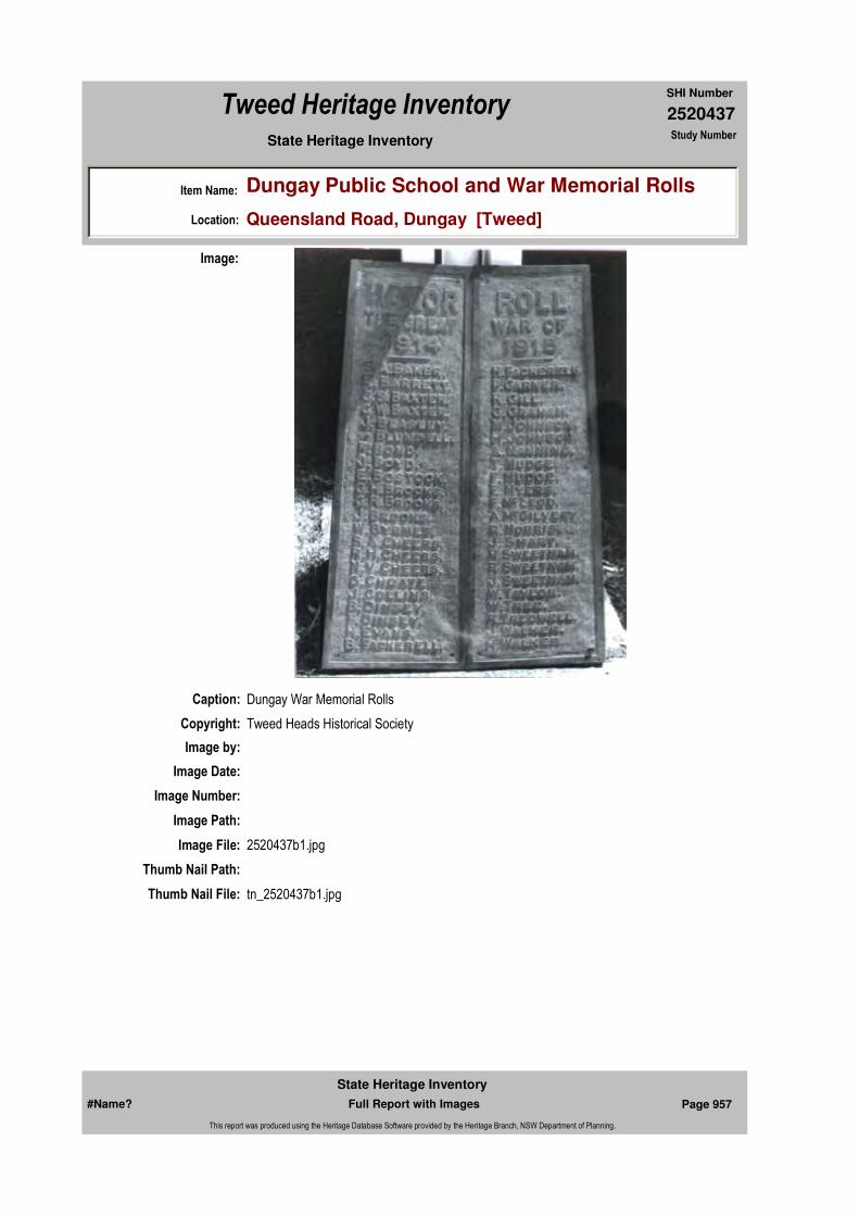
2520437
SHI Number
Tweed Heritage Inventory
Item Name: Dungay Public School and War Memorial Rolls
Location: Queensland Road, Dungay [Tweed]
State Heritage Inventory Study Number
Caption: Dungay War Memorial Rolls
Copyright: Tweed Heads Historical Society
Image:
Image by:
Image Date:
Image Number:
Image Path:
Image File: 2520437b1.jpg
Thumb Nail Path:
Thumb Nail File: tn_2520437b1.jpg
#Name? Page 957 Full Report with Images
State Heritage Inventory
This report was produced using the Heritage Database Software provided by the Heritage Branch, NSW Department of Planning.
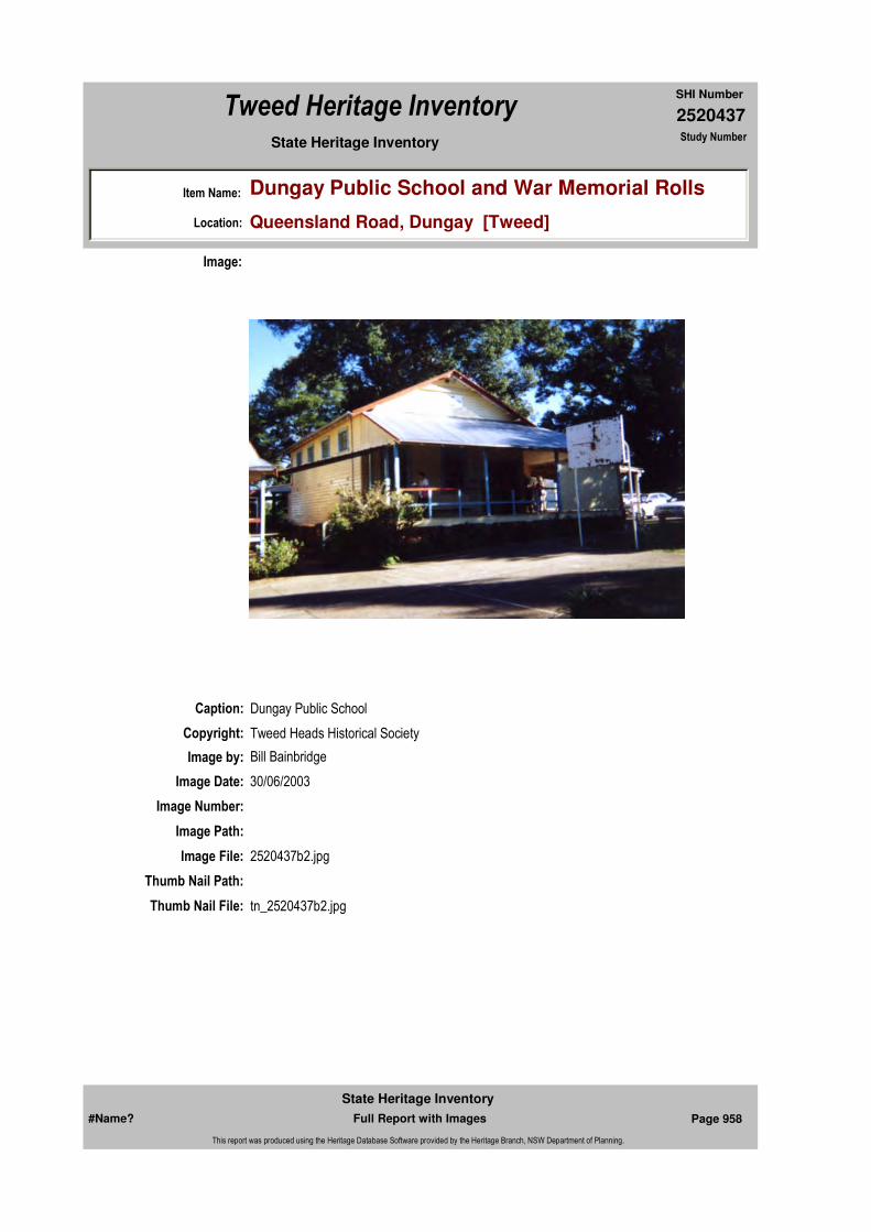
2520437
SHI Number
Tweed Heritage Inventory
Item Name: Dungay Public School and War Memorial Rolls
Location: Queensland Road, Dungay [Tweed]
State Heritage Inventory Study Number
Caption: Dungay Public School
Copyright: Tweed Heads Historical Society
Image:
Image by: Bill Bainbridge
Image Date: 30/06/2003
Image Number:
Image Path:
Image File: 2520437b2.jpg
Thumb Nail Path:
Thumb Nail File: tn_2520437b2.jpg
#Name? Page 958 Full Report with Images
State Heritage Inventory
This report was produced using the Heritage Database Software provided by the Heritage Branch, NSW Department of Planning.
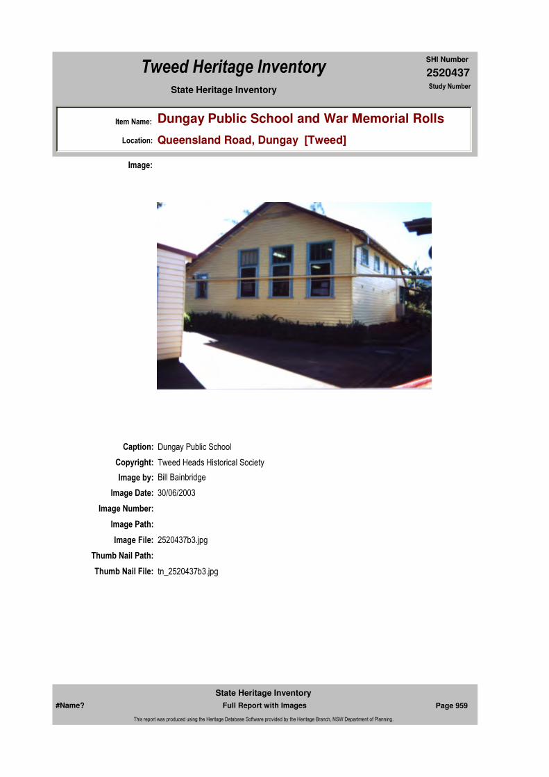
2520437
SHI Number
Tweed Heritage Inventory
Item Name: Dungay Public School and War Memorial Rolls
Location: Queensland Road, Dungay [Tweed]
State Heritage Inventory Study Number
Caption: Dungay Public School
Copyright: Tweed Heads Historical Society
Image:
Image by: Bill Bainbridge
Image Date: 30/06/2003
Image Number:
Image Path:
Image File: 2520437b3.jpg
Thumb Nail Path:
Thumb Nail File: tn_2520437b3.jpg
#Name? Page 959 Full Report with Images
State Heritage Inventory
This report was produced using the Heritage Database Software provided by the Heritage Branch, NSW Department of Planning.
2520437
SHI Number
Tweed Heritage Inventory
Item Name: Dungay Public School and War Memorial Rolls
Location: Queensland Road, Dungay [Tweed]
State Heritage Inventory Study Number
#Name? Page 960 Full Report with Images
State Heritage Inventory
This report was produced using the Heritage Database Software provided by the Heritage Branch, NSW Department of Planning.
2520438
SHI Number
Tweed Heritage Inventory
Item Name: Duranbah Public School Honour Roll
Location: 256 Duranbah Road, Duranbah [Tweed]
State Heritage Inventory Study Number
Current Use:
Former Uses:
Statement of
Significance:A wooden WW1 Honour Roll housed at the Duranbah Public School . The memorial is part of the cultural history of the Tweed Valley and has a special association with the community in which it is housed.
Historical Notes
or Provenance:A fine Honour Roll has just been completed at Mr. J M Holston's factory, South Murwillumbah, for erection in the Duranbah Public School. It contains the names of 18 old boys of that school who are fighting for king and country, one of whom has given his life. The board, which stands some 5ft high, is highly polished and is a handsome piece of workmanship. The panel on which the names are inscribed is of fumed silky oak, and the rest of the board is English oak, with rosewood mouldings. The roll itself is surmounted by a carved inscription "for King and Country", together with a crown, cannon and Union Jack and Australian flags, with crossed swords. This work was carried out by Rev. G. M. Hart. The front of the roll is to be glassed in. Inscribed in letters of gold on the board are the following names:- W. Booty, A. Black (killed), C. Blakeney, L. Black, C. H. Bird, A. K. Brown, L. Clark, H. Collins, J. Finn, J. Hogg, A. S. Loder, E. O'Keefe, L. O'Neil, E. Ritchie, W. Waugh, A. Winterford, T. Wheatley, H. Wheatley and M. Wheatley.Tweed Daily March 19, 1918 Duranbah School Honour Roll
Wednesday, March 20th, time 12 O'clock, place Duranbah Public School. The old flag fluttered strongly from an improvised flag pole; the road and school grounds were lined with vehicles of every description; and among the youngsters, at any rate, there was a sound of revelry - by day. Duranbah had put on her best attire and from the constant round of toil had called a holiday - a day never to be forgotten.
Endorsed Significance:Assessed Significance: Local
Item Type: Movable / Collection Category: War MemorialGroup: Monuments and Mem
Admin Codes: Code 2: Code 3:
Curtilage/Boundary:
Owner:
Other/Former Names:
Area/Group/Complex: Group ID:
Aboriginal Area:
Local Govt Area: Tweed
Planning: Northern
Historic Region: North Coast
Address: #Name?
Suburb / Nearest Town: #Name?
State: NSW
Parish: Cudgen
County: Rous
#Name? Page 961 Full Report with Images
State Heritage Inventory
This report was produced using the Heritage Database Software provided by the Heritage Branch, NSW Department of Planning.

2520438
SHI Number
Tweed Heritage Inventory
Item Name: Duranbah Public School Honour Roll
Location: 256 Duranbah Road, Duranbah [Tweed]
State Heritage Inventory Study Number
Unveiling the School Honour BoardAt 12:30 the scholars were marched into school; more than 50 eager and excited faces; quick to obey every order of the master - Mr. A. A. Brown (Stott's Creek), who had drilled them well. Visitors and parents and friends must have numbered nearly three figures; altogether the school was crowded, porch also; windows being utilised by the late comers who could get no nearer.
The programme commences with the National Anthem, after which the scholars rendered "Australia Fair" and "Boys of the Dardanelles". A recitation, "The Six Starred Flag of Anzac", by Miss B. Kelleher, followed, after which Miss Susie Crosswaithe recited "Queen of the Sea", "My England" by Miss Alice Anderson, and "The Anzac" by Miss Doreas Bird brought the recitative part of the programme to a close. Prior to the unveiling ceremony the scholars chanted the beautiful prayer "As a Nation we Implore" Mrs. Loder was then called upon by the Chairman (Mr. Brown) to unveil the Honour Board, which has already been described in the columns of the "Daily".
As Mrs. Loder drew back the mother and the daughter flags all were more than satisfied that the Board is all that was claimed for it - a chaste and beautiful piece of workmanship: with 19 names inscribed thereon; the standing audience sang "God Save Our Splendid Men", after which the Chairman called upon Mr. Brown, the Methodist minister of the Tweed, to deliver an address, which was appropriate, forceful and timely. In voicing his pleasure at being present, the speaker trusted that they would honour their lads by doing all that was possible to make their lives comfortable and happy; after which he plunged into a 12 minutes subject on the debt of gratitude we owe to the Public schools, from which the very smallest to the largest; and even to the great Universities, they had given their best to the Empire. In the bosom of the Public School, based on righteousness, was the future of our Empire, win or lose, in this titanic conflict. Educated boys and girls were the asset of future Empire.
Mrs. J. J. Quirk sang, after which Mr. Allison spoke on the honouring of the lads at the front; they were sacrificing, enduring and suffering for our liberty and freedom, and we ought to remember them. It was a racy and forceful speech. The children sang "Keep the Home Fires Burning", then Mr. Johnston spoke a few words of gratitude on having his name on the Board as the master of the school prior to Mr. Brown.
After singing "Rule Britannia" Mr. Loder returned thanks to the speakers and all who had helped to make the day and function so pleasant, the Chairman read apologies from Mr. McDonald Cudgen Public School, and Rev. Mr. Lilley, of Tweed Heads, and apologised for Father Hanley's absence. The singing of the National Anthem brought the programme to a close, after which a basket picnic was participated in by young and old. Altogether it was a splendid function and one, in every way, thanks to Mr. Brown for his work and thoughtfulness, worthy of the occasion.Tweed Daily March 22, 1918 DURANBAH
Themes: National Theme State Theme Local Theme
7. Governing Defence War Memorial
#Name? Page 962 Full Report with Images
State Heritage Inventory
This report was produced using the Heritage Database Software provided by the Heritage Branch, NSW Department of Planning.

2520438
SHI Number
Tweed Heritage Inventory
Item Name: Duranbah Public School Honour Roll
Location: 256 Duranbah Road, Duranbah [Tweed]
State Heritage Inventory Study Number
Physical Description: Wooden honour board with 19 names of men who had attended Duranbah School and had enlisted in WW1.
The board, which stands 5ft high, is highly polished and is a handsome piece of workmanship. The panel on which the names are inscribed is of fumed silky oak, and the rest of the board is English oak, with rosewood mouldings. The roll itself is surmounted by a carved inscription "for King and Country", together with a crown, cannon and Union Jack and Australian flags, with crossed swords. This work was carried out by Rev. G. M. Hart.
13 names of ex-students who enlisted in WW2 have also been inscribed on the board.
Physical Condition:
Modification Dates:
Designer:
Maker / Builder: Mr. J M Holston & Co. & Rev. G. M. Hart
Year Started: Year Completed: 1918 Circa: No
Recommended
Management:
References:
Further Comments:
Criteria a)
Criteria c)
Criteria d)
Criteria e)
Criteria g)
Criteria f)
Integrity / Intactness:
Criteria b) Wooden Honour Roll at the Duranbah PS .The memorial is part of the cultural history of the Tweed Valley and has a special association with the community in which it is housed.
Management:
Author Title Year
#Name? Page 963 Full Report with Images
State Heritage Inventory
This report was produced using the Heritage Database Software provided by the Heritage Branch, NSW Department of Planning.

2520438
SHI Number
Tweed Heritage Inventory
Item Name: Duranbah Public School Honour Roll
Location: 256 Duranbah Road, Duranbah [Tweed]
State Heritage Inventory Study Number
Custom Field One:
Studies:
Listings:
Date Updated: 01/11/2004 Status: BasicDate First Entered: 11/04/2004Data Entry:
Custom Field Two:
Custom Field Three:
Custom Field Four:
Custom Field Five:
Custom Field Six:
Parcels:
Latitude: Longitude:
AMG Zone: Easting: Northing:
Map Name: Map Scale:
Spatial Accuracy:Location validity:
Duranbah School Honour Roll 1918
Author Title YearNumber
Tweed Shire Council Community-based Heritage Study 2003
Parcel Code LotNumber Section Plan Code Plan Number
LOT 331 DP 755701
LOT 256 DP 755701
#Name? Page 964 Full Report with Images
State Heritage Inventory
This report was produced using the Heritage Database Software provided by the Heritage Branch, NSW Department of Planning.

2520438
SHI Number
Tweed Heritage Inventory
Item Name: Duranbah Public School Honour Roll
Location: 256 Duranbah Road, Duranbah [Tweed]
State Heritage Inventory Study Number
Caption: Duranbah Public School Honour Roll.
Copyright: Tweed Heads Historical Society
Image:
Image by: Kath Prichard
Image Date: 03/11/2003
Image Number:
Image Path:
Image File: 2520438b1.jpg
Thumb Nail Path:
Thumb Nail File: tn_2520438b1.jpg
#Name? Page 965 Full Report with Images
State Heritage Inventory
This report was produced using the Heritage Database Software provided by the Heritage Branch, NSW Department of Planning.

2520438
SHI Number
Tweed Heritage Inventory
Item Name: Duranbah Public School Honour Roll
Location: 256 Duranbah Road, Duranbah [Tweed]
State Heritage Inventory Study Number
#Name? Page 966 Full Report with Images
State Heritage Inventory
This report was produced using the Heritage Database Software provided by the Heritage Branch, NSW Department of Planning.

2520439
SHI Number
Tweed Heritage Inventory
Item Name: Fernvale Public School (former)
Location: Fernvale Road, Fernvale [Tweed]
State Heritage Inventory Study Number
Current Use: Headquarters of Murwillumbah Potters
Former Uses: School
Statement of
Significance:The former Fernvale Public School is important in demonstrating the principal characteristics of early Tweed district one room schools, where the educational needs of the local children were met.
Historical Notes
or Provenance:Fernvale school was opened in 1916 as a Provisional school, applied for by William Watson and Chas. Watt, with 24 pupils promised. The first teacher appointed was Alexander Edwards, a temporary war-time teacher.
In 1920, the school was raised to Public School status but in 1923 was made a half-time school with the teacher being shared with Commissioner's Creek School. In July 1924, the Commissioner's Creek School was closed and Fernvale became a Provisional School again.
The School closed in March 1928 and re-opened in January 1930 when the Bourke family, with 13 children, moved to the district. Fernvale School became a Public School in 1953, but closed permanently in 1976.
In 1995, the Fernvale Community held a re-union at the school, which is now headquarters to the Murwillumbah Potters group.
Endorsed Significance:Assessed Significance: Local
Item Type: Built Category: School - State (public)Group: Education
Admin Codes: Code 2: Code 3:
Curtilage/Boundary:
Owner: Private - Community Group
Other/Former Names:
Area/Group/Complex: Group ID:
Themes:
Aboriginal Area:
Local Govt Area: Tweed
Planning: Northern
Historic Region: North Coast
Address: #Name?
Suburb / Nearest Town: #Name?
State: NSW
Parish: Murwillumbah
County: Rous
National Theme State Theme Local Theme
6. Educating Education School
#Name? Page 967 Full Report with Images
State Heritage Inventory
This report was produced using the Heritage Database Software provided by the Heritage Branch, NSW Department of Planning.

2520439
SHI Number
Tweed Heritage Inventory
Item Name: Fernvale Public School (former)
Location: Fernvale Road, Fernvale [Tweed]
State Heritage Inventory Study Number
Physical Description: Simple school building, weatherboard and corrugated iron. Gable roof extended over verandah and wrapped around end to make entry at end of room.The building is in very near original condition, most of the stumps are original and are round, hand shaped, worked with an adze or axe with metal ant caps. There is an original open paling door to the storeroom and the pegs for the children's bags etc are still in place in the corner of the verandah. The chimney, fireplace, central ceiling vent, floor, slat bench on north verandah, windows and cladding are original. A timber cage under the building was constructed between 1937 and 1965 as a safe place to keep lawn mower.Roof sheeting has been replaced recently.
Physical Condition:
Modification Dates:
Designer:
Maker / Builder:
Year Started: 1916 Year Completed: Circa: No
Recommended
Management:Maintain the building in a sympathetic manner.
References:
Further Comments:
Criteria a)
Criteria c)
Criteria d)
Criteria e)
Criteria g) Important in demonstrating the principal characteristics of early Tweed district one room schools, where the educational needs of the local children were met.
Criteria f)
Integrity / Intactness:
Criteria b)
Management:
#Name? Page 968 Full Report with Images
State Heritage Inventory
This report was produced using the Heritage Database Software provided by the Heritage Branch, NSW Department of Planning.

2520439
SHI Number
Tweed Heritage Inventory
Item Name: Fernvale Public School (former)
Location: Fernvale Road, Fernvale [Tweed]
State Heritage Inventory Study Number
Custom Field One:
Studies:
Listings:
Date Updated: 01/11/2004 Status: BasicDate First Entered: 11/04/2004Data Entry:
Custom Field Two:
Custom Field Three:
Custom Field Four:
Custom Field Five:
Custom Field Six:
Parcels:
Latitude: Longitude:
AMG Zone: Easting: Northing:
Map Name: Map Scale:
Spatial Accuracy:Location validity:
Author Title YearNumber
Tweed Shire Council Community-based Heritage Study 2003
Parcel Code LotNumber Section Plan Code Plan Number
LOT 181 DP 755698
LOT 7005 DP 92890
#Name? Page 969 Full Report with Images
State Heritage Inventory
This report was produced using the Heritage Database Software provided by the Heritage Branch, NSW Department of Planning.

2520439
SHI Number
Tweed Heritage Inventory
Item Name: Fernvale Public School (former)
Location: Fernvale Road, Fernvale [Tweed]
State Heritage Inventory Study Number
Caption: Former Fernvale Public School, side view.
Copyright: Tweed Heads Historical Society
Image:
Image by: Bill Bainbridge
Image Date: 07/08/2003
Image Number:
Image Path:
Image File: 2520439b3.jpg
Thumb Nail Path:
Thumb Nail File: tn_2520439b3.jpg
#Name? Page 970 Full Report with Images
State Heritage Inventory
This report was produced using the Heritage Database Software provided by the Heritage Branch, NSW Department of Planning.
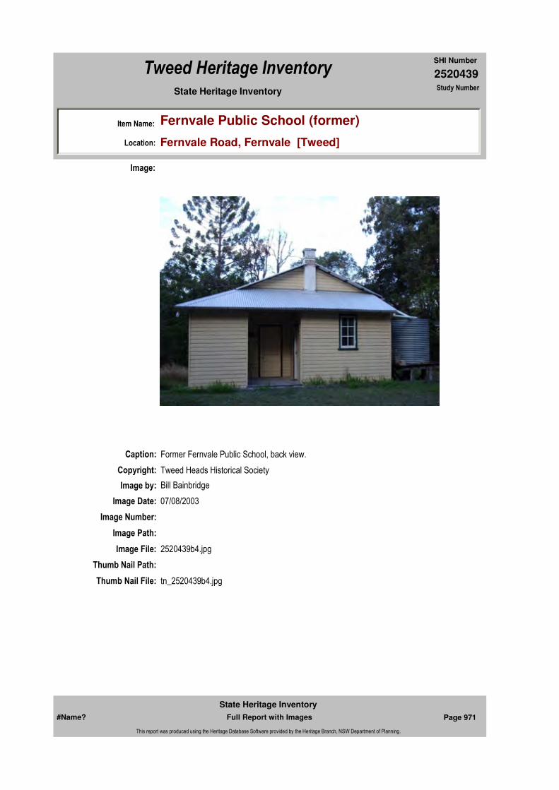
2520439
SHI Number
Tweed Heritage Inventory
Item Name: Fernvale Public School (former)
Location: Fernvale Road, Fernvale [Tweed]
State Heritage Inventory Study Number
Caption: Former Fernvale Public School, back view.
Copyright: Tweed Heads Historical Society
Image:
Image by: Bill Bainbridge
Image Date: 07/08/2003
Image Number:
Image Path:
Image File: 2520439b4.jpg
Thumb Nail Path:
Thumb Nail File: tn_2520439b4.jpg
#Name? Page 971 Full Report with Images
State Heritage Inventory
This report was produced using the Heritage Database Software provided by the Heritage Branch, NSW Department of Planning.
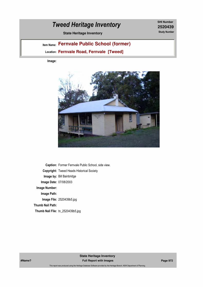
2520439
SHI Number
Tweed Heritage Inventory
Item Name: Fernvale Public School (former)
Location: Fernvale Road, Fernvale [Tweed]
State Heritage Inventory Study Number
Caption: Former Fernvale Public School, side view.
Copyright: Tweed Heads Historical Society
Image:
Image by: Bill Bainbridge
Image Date: 07/08/2003
Image Number:
Image Path:
Image File: 2520439b5.jpg
Thumb Nail Path:
Thumb Nail File: tn_2520439b5.jpg
#Name? Page 972 Full Report with Images
State Heritage Inventory
This report was produced using the Heritage Database Software provided by the Heritage Branch, NSW Department of Planning.
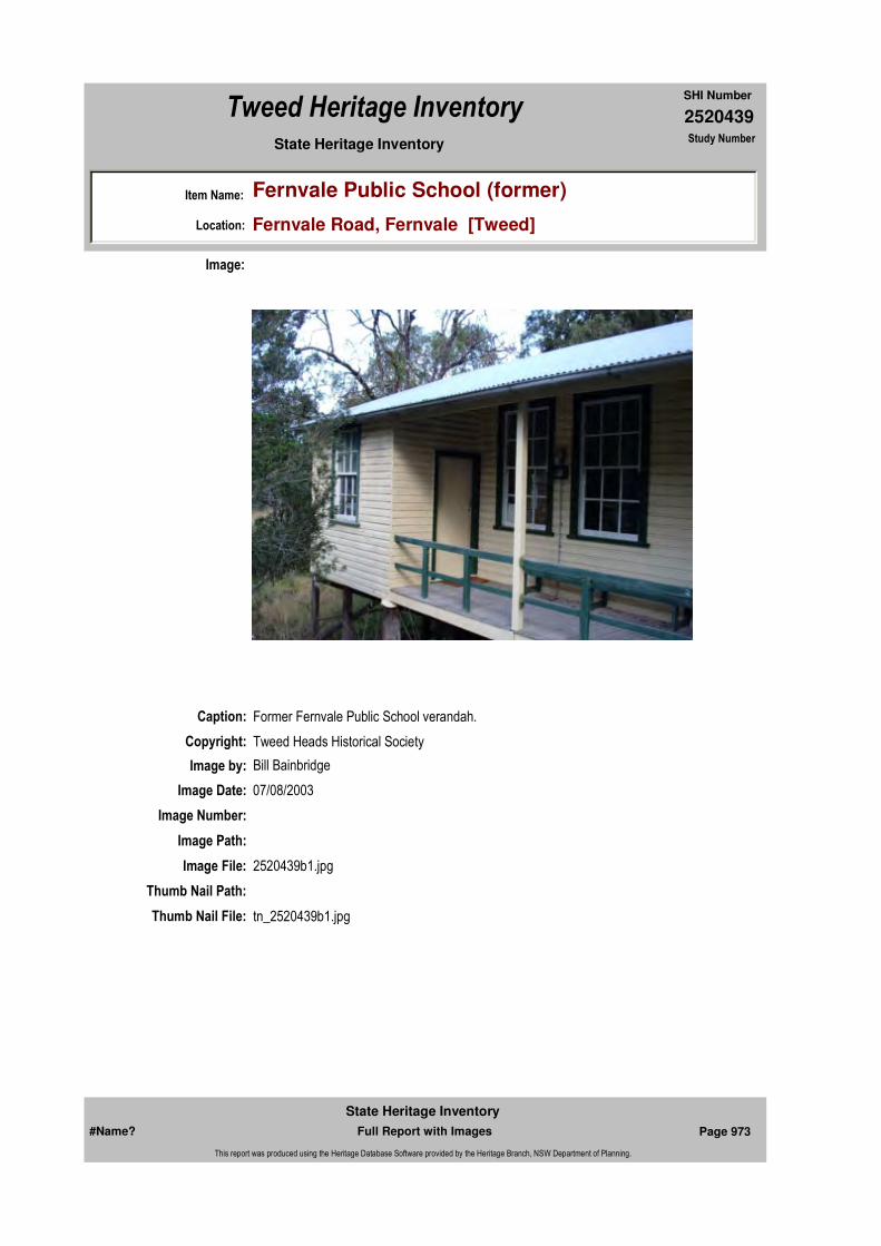
2520439
SHI Number
Tweed Heritage Inventory
Item Name: Fernvale Public School (former)
Location: Fernvale Road, Fernvale [Tweed]
State Heritage Inventory Study Number
Caption: Former Fernvale Public School verandah.
Copyright: Tweed Heads Historical Society
Image:
Image by: Bill Bainbridge
Image Date: 07/08/2003
Image Number:
Image Path:
Image File: 2520439b1.jpg
Thumb Nail Path:
Thumb Nail File: tn_2520439b1.jpg
#Name? Page 973 Full Report with Images
State Heritage Inventory
This report was produced using the Heritage Database Software provided by the Heritage Branch, NSW Department of Planning.

2520439
SHI Number
Tweed Heritage Inventory
Item Name: Fernvale Public School (former)
Location: Fernvale Road, Fernvale [Tweed]
State Heritage Inventory Study Number
Caption: Former Fernvale Public School windows from interior.
Copyright: Tweed Heads Historical Society
Image:
Image by: Bill Bainbridge
Image Date: 07/08/2003
Image Number:
Image Path:
Image File: 2520439b2.jpg
Thumb Nail Path:
Thumb Nail File: tn_2520439b2.jpg
#Name? Page 974 Full Report with Images
State Heritage Inventory
This report was produced using the Heritage Database Software provided by the Heritage Branch, NSW Department of Planning.

2520439
SHI Number
Tweed Heritage Inventory
Item Name: Fernvale Public School (former)
Location: Fernvale Road, Fernvale [Tweed]
State Heritage Inventory Study Number
#Name? Page 975 Full Report with Images
State Heritage Inventory
This report was produced using the Heritage Database Software provided by the Heritage Branch, NSW Department of Planning.
2520442
SHI Number
Tweed Heritage Inventory
Item Name: Loading Ramp
Location: Fingal Road, Fingal Head [Tweed]
State Heritage Inventory Study Number
Current Use:
Former Uses:
Statement of
Significance:The ramp is important in the course of the history of the Tweed River, being the remains of the quarrying activity at "The Caves" for the purpose of building the Tweed River training walls and the Barney's Point Bridge approaches.
Historical Notes
or Provenance:Toward the end of my primary school days the old Brooks Australian Readers were replaced in schools by the Commonwealth School Paper which, in turn, was superseded by the School Magazine. In one of those old readers, the fifth, if I remember rightly, there was the story of a wreck on the Richmond River bar and of the gallant efforts that were made by the local cedar-getters to rescue members of the crew.
This story was published anonymously and it was not until a few months ago that I discovered, quite accidentally, that the author was Sir Thomas Ewing, a man to whom the North Coast people owe a great debt of gratitude.
Every river of our North Coast has its story of the loss of lives, both of passengers and of crew members, of sturdy ships and their valuable cargoes on its bar and, in this, the Tweed has certainly been no exception.
The earliest recorded and one of the most poignant of the stories concerning the wrecks on the Tweed bar was that which involved the loss of the little Ebenezer in July, 1859. That disaster claimed the lives of the wife and two year-old son of John Boyd and the wife and two year-old son of Edward Boyd.The Boyd brothers had cut cedar on the Brunswick and had then moved on to the Tweed. Members of the present generation of the Boyd family are today prominent in the public life
Endorsed Significance:Assessed Significance: Local
Item Type: Archaeological-Maritim Category: Other - Transport - WaGroup: Transport - Water
Admin Codes: Code 2: Code 3:
Curtilage/Boundary:
Owner:
Other/Former Names:
Area/Group/Complex: Group ID:
Aboriginal Area:
Local Govt Area: Tweed
Planning: Northern
Historic Region: North Coast
Address: #Name?
Suburb / Nearest Town: #Name?
State: NSW
Parish: Terranora
County: Rous
#Name? Page 984 Full Report with Images
State Heritage Inventory
This report was produced using the Heritage Database Software provided by the Heritage Branch, NSW Department of Planning.

2520442
SHI Number
Tweed Heritage Inventory
Item Name: Loading Ramp
Location: Fingal Road, Fingal Head [Tweed]
State Heritage Inventory Study Number
of the district that their forefathers pioneered.
Down the years that have passed since the Ebenezer wreck, the bar has continued to exact its toll on those who have dared its turbulent water.
As the years passed and the population of the Tweed Valley increased and more and more land was cleared and brought under cultivation, the need for improvements to the river entrance became apparent.
It is difficult for us who enjoy rapid trasport by plane and train and motor car to fully realise how important the coastal shipping trade was to the residents of the Tweed in those early days.It was by the way of the ocean that their supplies of groceries and clothing and hardware came to them from the city stores; and it was by the same way that the timber that they cut and their harvested crops reached the Sydney market.
Even apart from the bar at the river's mouth, there were so many shifting shoals that made the channels intricate and difficult for navigation that steamers and other craft had to be unloaded at a convenient point inside the bar and their carried up to the river ports in flat-bottomed punts or in droghers.
DangerWhen the bar was too dangerous to cross for long periods, there was consternation amongst the settlers and a general tightening of belts.
A report, not from the Tweed, but from the Brunswick, dated April, 1888, gives us a picture of the conditions that prevailed on such occasions. "The bar has been silted up and there is now only a depth of nine inches on it at low tide. This is becoming a serious matter as our storekeepers are already nearly out of flour and sugar, and it will be at the very least (even if the bar improves at the next spring tides) five weeks before vessels can make a run to Sydney and back, as they are at present barbound inside the river. There is a strong south-west wind blowing at present, with every indication of more rain behind it."
In such circumstances, it is not to be wondered at if the settlers grew restive and began an agitiation toward the Government to do something about the conditions at the mouth of the river and along its lower course.
"Rome was not built in a day," says the old adage; and it is certain that the improvements to the Tweed bar and the river channel were not to come in a day, or a month, or a year.
Indeed, those youngsters who saw the work commence would have been in their late seventies if they had been present when it was completed.
Toward the end of the 1870's, the agitation became so vocal that it could not be ignored. The Government decided to have something done.
The Tweed was as far away from the metropolis as a coastal river could be. Many politicians would know little about the district and its problems and many would not want to
#Name? Page 985 Full Report with Images
State Heritage Inventory
This report was produced using the Heritage Database Software provided by the Heritage Branch, NSW Department of Planning.

2520442
SHI Number
Tweed Heritage Inventory
Item Name: Loading Ramp
Location: Fingal Road, Fingal Head [Tweed]
State Heritage Inventory Study Number
trouble themselves about a matter that probably, or at least in their eyes, had little political significance.
However, the first step was taken. The Government sent one of its officers, Fredrick Howard, to examine the Tweed and to make suggestions as to what improvements could be made there.
Howard was a retired Royal Navy officer. He had spent over 20 years in the Hydrographic Department of the Admiralty and in that time he had gained a wide experience in marine survey work.He had carried out surveys amongst the islands of the South Seas, on the coast of West Australia, on the northern coast of our Continent and in the Coral Sea. On his retirement from the Navy with the rank of commander, he received an appointment with the "Department of Harbours and Rivers under the Colonial Government".
Close StudyHe made a close study of the Tweed and its problems. He noted that the bar itself was 'fairly navigable at times", incoming vessels could only get as far as the estuary of the river, for the river itself was beset by so many sandbanks that navigation by vessels of any size was impossible.
His report mentioned that there were extensive sand flats between the Heads and Cudgen, and the water on them was very shallow.
Above Cudgen, he wrote, there was a good clear channel as far as Stott's Island, where at either end there were further obstructions. Between the Condong mill and Murwillumbah the river was very shallow.
He found that there were extensive flats of sand and gravel in the North Arm, while in the main stream punts could not get beyond the junction of the main and south arms at Byangum.
Five years passed before a further examination of the river was made by the engineer in chief of the Department of Public Works. He recommended the construction of training walls.
This work was put in hand at 1891, though it was not until the following year that sufficient preliminary work had been doen to allow the first stone in the wall to be set in place.
The work continued until April, 1893, when it was stopped, evidently because of the financial situation at the time. When work ceased, 2857 metres of wall, in which 6778 tonnes of stone had been used, had been constructed.
Work on the project was resumed in June 1894. Duing the next four years a good deal of progress was made in the construction of the various walls - the eastern and western training walls, the Terranora Creek wall and the walls at the entrance. The total length of these was more than eight kilometres and contained nearly a quarter of a million tonnes of rock.
#Name? Page 986 Full Report with Images
State Heritage Inventory
This report was produced using the Heritage Database Software provided by the Heritage Branch, NSW Department of Planning.
2520442
SHI Number
Tweed Heritage Inventory
Item Name: Loading Ramp
Location: Fingal Road, Fingal Head [Tweed]
State Heritage Inventory Study Number
In 1898, the Parliamentary Committee on Public Works, under the chairmanship of Thomas Ewing, was asked to consider and report on the expediency of constructing harbour works at Tweed River.
After a thorough examination of the submissions placed before it, the committee was able to report that the work already carried out appeared to have had a beneficial effect upon the channel between Chinderah and the mouth of the river.
DredgingThe training wall and the dredging had resuIted in a channel up to four metres deep and 28 metres wide. It was hoped that further dredging would enable steamers to reach Murwillumbah.
The committee, in making this report, sounded a note of caution. "It is claimed by the department that this results from the works already constructed; but as previous to the commencement of the works there was, at times, a similar depth, it is not certain that the present satisfactory bar is attributable to this cause; still, there is little doubt that the works in progress have contributed to the improvement.
The committee also hoped that as a result of future dredging, steamers would be able to proceed up the river to Murwillumbah as the officers of the department had some confidence that they would.
A recommendation was made that the projected work should be carried out in order that the full benefit of the work already done should be obtained and further, that the north and south breakwaters ought to be constructed.
In fact, the members of the committee felt that so much work had already been carried out that at this juncture it would be wrong to either abandon it or materially alter the plans that had already been prepared.
It was also felt that the great potential of the Tweed Valley warranteed the expenditure of money on river and harbour works.
As a result of the report of the committee, attention was now turned to breakwater construction. Preliminary steps included the opening up of quarries at Point Danger and Caves Point. The offices that had been sited at Caves Point were transferred to a more convenient location at Point Danger and a short tramway was laid down to connect the quarry at Point Danger with the tipping site.
BreakwatersShortly after the work had started on breakwaters, the Caves Point quarry was closed down and in future all the stone that was needed was taken from Point Danger.
The work that had been authorised by the Harbor Act of 1899 was completed in 1904. From that year onwards to 1961, no major work was undertaken. Indeed, in the 10 year period from 1921 to 1931, no work at all was carried out.
#Name? Page 987 Full Report with Images
State Heritage Inventory
This report was produced using the Heritage Database Software provided by the Heritage Branch, NSW Department of Planning.
2520442
SHI Number
Tweed Heritage Inventory
Item Name: Loading Ramp
Location: Fingal Road, Fingal Head [Tweed]
State Heritage Inventory Study Number
In 1960, there was a renewal of interest in the problems associated with the Tweed entrance.
Time and again those with an interest in the fleet of trawlers based on the Tweed complained about the condition of the bar and the channel immediately inside it.
In times of unfavorable weather, the entrance became dangerous because vessels entering and leaving the river had to negotiate areas of breaking water. It was difficult, too, to know where the channel lay, it shifted so often. To meet these problems, further work on the breakwater system was proposed.
Observations were made on the behaviour of currents and the movement of sand about the entrance. Plans were also devised for the reclamation at Greenbank Island. Investigations were carried out to ascertain a site for a quarry where suitable and accessible stone could be obtained.
Preparations for the proposed new work were continued well into 1962; access roads were constructed. Further consideration, in conjunction with The Department of Lands, was given to the Greenbank Reclamation Scheme.
Some machinery and plant were brought from the Brunswick River and a small quantity of stone was tipped at a point where the work for the southern breakwater was commence.
Thc dredge, Harwood, continued with its work upstream and during the year she dredged almost 2000 tonnes of sand.
During 1963, work went on apace. It was estimated that 35% of the authorised work was completed during that year.
Nearly 60,000 tonnes of stone were taken from Johnson's quarry.
1964 saw the work being continued at an accelerated pace and on February 27, 1965, the Hon P. N. Ryan, M.L.A.. Minister for Works, unveiled a plaque which had been set up near the landward end of the northern breakwater to commemorate the completion of the work that had been begun nearly three quarters of a century earlier.
The training walls and the breakwaters and the dredged channels, though they have been of assistance to the trawling fleet and to pleasure craft, were completed long after the great days of the coastal shipping trade had gone forever.
And with the passing of that coastal trade a fascinating chapter of maritime and local history has been forever closed.(Daily News June 14, 1977 "Training Walls at Tweed Heads" by Harold W Denning)
Themes: National Theme State Theme Local Theme
3. Economy Transport Port Development
#Name? Page 988 Full Report with Images
State Heritage Inventory
This report was produced using the Heritage Database Software provided by the Heritage Branch, NSW Department of Planning.

2520442
SHI Number
Tweed Heritage Inventory
Item Name: Loading Ramp
Location: Fingal Road, Fingal Head [Tweed]
State Heritage Inventory Study Number
Physical Description: A compacted 'S' shaped rising embankment with the highest section overlooking the Tweed River, opposite the old quarry.
Physical Condition:
Modification Dates:
Designer:
Maker / Builder:
Year Started: Year Completed: Circa: No
Recommended Management:
Erect an interpretative panel illustrating the history and significance of the site.
References:
Studies:
Further Comments:
Criteria a) The ramp is important in the course of the history of the Tweed River, being the remains of the quarrying activity at "The Caves" for the purpose of building the Tweed River training walls and the Barney's Point Bridge approaches.
Criteria c)
Criteria d)
Criteria e)
Criteria g)
Criteria f)
Integrity / Intactness:
Criteria b)
Parcels:
Management:
Author Title Year
Harold W Denning "Training Walls at Tweed Heads" 1977
Author Title YearNumber
Tweed Shire Council Community-based Heritage Study 2003
Parcel Code LotNumber Section Plan Code Plan Number
LOT 7012 DP 755740
#Name? Page 989 Full Report with Images
State Heritage Inventory
This report was produced using the Heritage Database Software provided by the Heritage Branch, NSW Department of Planning.

2520442
SHI Number
Tweed Heritage Inventory
Item Name: Loading Ramp
Location: Fingal Road, Fingal Head [Tweed]
State Heritage Inventory Study Number
Custom Field One:
Listings:
Date Updated: 01/11/2004 Status: BasicDate First Entered: 11/04/2004Data Entry:
Custom Field Two:
Custom Field Three:
Custom Field Four:
Custom Field Five:
Custom Field Six:
Latitude: Longitude:
AMG Zone: Easting: Northing:
Map Name: Map Scale:
Spatial Accuracy:Location validity:
Caption: Loading ramp at Fingal, as seen from the Tweed River.
Image:
#Name? Page 990 Full Report with Images
State Heritage Inventory
This report was produced using the Heritage Database Software provided by the Heritage Branch, NSW Department of Planning.

2520442
SHI Number
Tweed Heritage Inventory
Item Name: Loading Ramp
Location: Fingal Road, Fingal Head [Tweed]
State Heritage Inventory Study Number
Copyright: Tweed Heads Historical Society
Image by: Immy McKiernan
Image Date: 04/12/2003
Image Number:
Image Path:
Image File: 2520442b1.jpg
Thumb Nail Path:
Thumb Nail File: tn_2520442b1.jpg
#Name? Page 991 Full Report with Images
State Heritage Inventory
This report was produced using the Heritage Database Software provided by the Heritage Branch, NSW Department of Planning.

2520442
SHI Number
Tweed Heritage Inventory
Item Name: Loading Ramp
Location: Fingal Road, Fingal Head [Tweed]
State Heritage Inventory Study Number
Caption: Fingal loading ramp as seen from the Tweed River.
Copyright: Tweed Heads Historical Society
Image:
Image by: Immy McKiernan
Image Date: 04/12/2003
Image Number:
Image Path:
Image File: 2520442b2.jpg
Thumb Nail Path:
Thumb Nail File: tn_2520442b2.jpg
#Name? Page 992 Full Report with Images
State Heritage Inventory
This report was produced using the Heritage Database Software provided by the Heritage Branch, NSW Department of Planning.

2520442
SHI Number
Tweed Heritage Inventory
Item Name: Loading Ramp
Location: Fingal Road, Fingal Head [Tweed]
State Heritage Inventory Study Number
Caption: Fingal loading ramp
Copyright: Tweed Heads Historical Society
Image:
Image by: Immy McKiernan
Image Date: 08/08/2003
Image Number:
Image Path:
Image File: 2520442b3.jpg
Thumb Nail Path:
Thumb Nail File: tn_2520442b3.jpg
#Name? Page 993 Full Report with Images
State Heritage Inventory
This report was produced using the Heritage Database Software provided by the Heritage Branch, NSW Department of Planning.

2520442
SHI Number
Tweed Heritage Inventory
Item Name: Loading Ramp
Location: Fingal Road, Fingal Head [Tweed]
State Heritage Inventory Study Number
Caption: Fingal loading ramp
Copyright: Tweed Heads Historical Society
Image:
Image by: Immy McKiernan
Image Date: 20/08/2003
Image Number:
Image Path:
Image File: 2520442b4.jpg
Thumb Nail Path:
Thumb Nail File: tn_2520442b4.jpg
#Name? Page 994 Full Report with Images
State Heritage Inventory
This report was produced using the Heritage Database Software provided by the Heritage Branch, NSW Department of Planning.

2520442
SHI Number
Tweed Heritage Inventory
Item Name: Loading Ramp
Location: Fingal Road, Fingal Head [Tweed]
State Heritage Inventory Study Number
#Name? Page 995 Full Report with Images
State Heritage Inventory
This report was produced using the Heritage Database Software provided by the Heritage Branch, NSW Department of Planning.
2520443
SHI Number
Tweed Heritage Inventory
Item Name: Plaque dedicated to American WW2 Camp
Location: Fingal Road, Fingal Head [Tweed]
State Heritage Inventory Study Number
Current Use:
Former Uses:
Statement of
Significance:The monument is important in the history of the Tweed Shire. There are no visible remains of the occupation by the US troops during the second World War. This memorial is indicative of a R & R camp site.
Historical Notes
or Provenance:In December, 1995, the Association was able to complete the Project, though some of the facts are still not established.
The Project was to identify the location of a camp established in 1943 on the Fingal Peninsula for the use of the 32nd Division of the U.S. Army. The brief was to identify the location with a memorial plaque and to record any other information that may be learned from the research.
The location has been established and a plaque has been placed on a cairn near the site. The location of the cairn was determined by the conditions placed upon the Association's Development Application to Tweed Shire Council.
The camp was located on what is, now, part of an unresolved Land Claim by the Tweed/Byron Aboriginal Land Council and so the cairn could not be placed on the actual site. It would also have been inaccessible and Council preferred that the rock cairn be located in the light of a street light for safety reasons.
The rock cairn and its attached plaque are located on the western bank of the Tweed River, some 20 metres south of No.45 Fingal Road, Fingal Head.
Endorsed Significance:Assessed Significance: Local
Item Type: Built Category: MemorialsGroup: Monuments and Mem
Admin Codes: Code 2: Code 3:
Curtilage/Boundary:
Owner: Local Government
Other/Former Names:
Area/Group/Complex: Group ID:
Aboriginal Area:
Local Govt Area: Tweed
Planning: Northern
Historic Region: North Coast
Address: #Name?
Suburb / Nearest Town: #Name?
State: NSW
Parish: Terranora
County: Rous
#Name? Page 996 Full Report with Images
State Heritage Inventory
This report was produced using the Heritage Database Software provided by the Heritage Branch, NSW Department of Planning.
2520443
SHI Number
Tweed Heritage Inventory
Item Name: Plaque dedicated to American WW2 Camp
Location: Fingal Road, Fingal Head [Tweed]
State Heritage Inventory Study Number
ESTABLISHING THE LOCATION.Through the assistance of Joe McRae of Auslig, Canberra, a series of aerial photographs of the potential sites were purchased. The photos covered the period from 1930 to 1966 and provided the vital clue that was making the location of the camp difficult.
Early press reports stated that the camp was "along the river" at Fingal Head and local oral history stated that the camp was "near the big lagoon".
The latter statement led to confusion as the initial response was to believe that this meant Wommin Lake as opposed to Wommin Lagoon. Other oral history stated that the camp was closer to the houses of Dune Street than where Wommin Lake is on the Peninsula.
The aerials show quite clearly that another wetland existed, prior to 1966, between Wommin Lagoon in the north and Wommin Lake in the south. Records from the N.S.W Dept. of Public Works show that, following the commencement of sand-mining operations along the Dreamtime Beach in 1962, the Pacific Ocean breached, during a cyclonic disturbance when there were no frontal dunes, into Wommin Lake.
The aerial photographs clearly show that the ocean also entered the central lagoon and that this was subsequently filled as the sand-mining progressed along the Dreamtime Beach in a northerly direction. It is also established, by N.S.W. Public Works, that sand-mining was also responsible for the closure of the northerly outlets of both Wommin Lagoon and Wommin Lake.
The conclusion is that the camp was located on what was locally called "The Big Lagoon" which has since been filled. This is clearly shown in the 1947 aerial photographs.
WHY AT FINGAL HEAD?The 32nd Division's main recreational camp was located in Tweed Heads known now as the Recreation Ground.
Research into the location of the camp at Fingal Head also sought to answer the question as to why a secondary camp was established in what was then a very isolated area.
This has not been factually established.
The Defense Attache of the Embassy of the United States of America in Canberra sought the answer from the U.S. Department of Army's Centre of Military History in Washington, on behalf of the Association.
"A search of Center of Military History files did not reveal any information ...." and it was suggested that the Association make contact with the 32nd Division's Veterans' Association.
All attempts by the Association to make contact with that Veterans' Association have proved futile.The first suggestion put forward to the Association was that the camp was a desegregated one, being for American negro soldiers of the 32nd Division. This was very soon discounted as the probable reason for the separate camp's establishment, as all oral history failed to
#Name? Page 997 Full Report with Images
State Heritage Inventory
This report was produced using the Heritage Database Software provided by the Heritage Branch, NSW Department of Planning.
2520443
SHI Number
Tweed Heritage Inventory
Item Name: Plaque dedicated to American WW2 Camp
Location: Fingal Road, Fingal Head [Tweed]
State Heritage Inventory Study Number
recall any American Africans in the camp at all.
The next, and the most probable reason for the camp, is that most of the members of the Division that were at Fingal Head are remembered as being ill. One suggestion is that they were in a type of quarantine condition due to them suffering from sexually transmitted disease. However, as there was free movement, both of the soldiers and the residents into and out of the camp, this is unlikely but cannot be dismissed entirely. The other fact is that the 32nd Division had been repatriated from Buna in some disarray, to Mt. Tambourine to be regrouped and that the Tweed Heads camp was for Rest and Recreation.
Another suggestion for the temporary camp at Fingal Head is that the soldiers were suffering from various tropical diseases, including malaria.
Also one recollection is that the American negroes were located at Parry's Place, South Tweed Heads, but this too has not been verified.
SOME MEMORIES:Most of the people that made reports to the Association following a public request for information, were aged in thier 70's and so were in their early teens in 1943. Much of what has been reported has that tinge of memories associated with that age group. One young girl, at the time of the camp in 1943, recalls that the latrines were located on the River Bank, facing the river, and that they had no doors. She and some other teenagers would row upstream "just to have a look!".
She also recalled that the family became very friendly with one Officer in particular and that they maintained contact for many years.
Others reported that there were several drownings but this is not established as fact. One report said that some drowned in the Tweed River, crossing by boat to Tweed Heads and another reported that some drowned in the ocean.
One recollection is of bunkers on the beach and guards on Fingal Road but another reported that the Blue and White buses and the Tweed Heads taxi drivers made a fortune out of transporting "the Yanks" to and from Fingal Head.
One young man used to ride his bicycle to and from Banora Point, mostly on a Saturday, to the camp so he could listen to the regular Saturday Afternoon concerts held on a wooden stage at the Fingal Head camp. The artists were brought in to entertain the soldiers (and others) and he recalls that most of the men were lying around on stretchers.
In 1943 there were very few services in Fingal Head. The Americans had to bring everything that they needed into the camp by road, and sometimes, river transport. This included carting water and all food. The first road into Fingal Head was a "corduroy" road made from the trunks of melaleuca trees.One constant rumour about the American camp in Fingal Head has been the suggestion that the Americans buried "everything" when they abandoned the camp after a few months. This has led to some people, even in very recent times, looking for machinery etc. What is known is that the 32nd buried its tinned food and that this was very quickly retrieved by the
#Name? Page 998 Full Report with Images
State Heritage Inventory
This report was produced using the Heritage Database Software provided by the Heritage Branch, NSW Department of Planning.
2520443
SHI Number
Tweed Heritage Inventory
Item Name: Plaque dedicated to American WW2 Camp
Location: Fingal Road, Fingal Head [Tweed]
State Heritage Inventory Study Number
locals . . . and there is nothing left!
ASSISTANCE:The Fingal Progress Association Inc. wishes to acknowledge the assistance received from:members of the Tweed community that provided oral history Austlig, CanberraEmbassy of the United Statesof America, Canberra Rodney Keevers, Tweed Shire CouncilFranc Krasna and Lee Scarlett, Fingal Progress Association Inc. Jenny Leader and Ray Kent, Fingal Head Public School Josephine Brown and Peter Winter, "Daily News"and the Dept. of Veteran Affairs.
Report re the Fingal Progress Association Inc's "Australia Remembers" Project, 1995.
Physical Description: Basalt plinth with brass plaque.
Physical Condition:
Modification Dates:
Designer:
Maker / Builder:
Year Started: Year Completed: Circa: No
Recommended
Management:
Further Comments:
Criteria a) The monument is important in the history of the Tweed Shire. There are no visible remains of the occupation by the US troops during the second World War. This memorial is indicative of a R & R camp site.
Criteria c)
Criteria d)
Criteria b)
Themes:
Management:
National Theme State Theme Local Theme
7. Governing Defence War Memorial
#Name? Page 999 Full Report with Images
State Heritage Inventory
This report was produced using the Heritage Database Software provided by the Heritage Branch, NSW Department of Planning.
2520443
SHI Number
Tweed Heritage Inventory
Item Name: Plaque dedicated to American WW2 Camp
Location: Fingal Road, Fingal Head [Tweed]
State Heritage Inventory Study Number
Custom Field One:
References:
Studies:
Listings:
Date Updated: 02/11/2004 Status: BasicDate First Entered: 11/04/2004Data Entry:
Criteria e)
Criteria g)
Criteria f)
Integrity / Intactness:
Custom Field Two:
Custom Field Three:
Custom Field Four:
Custom Field Five:
Custom Field Six:
Parcels:
Latitude: Longitude:
AMG Zone: Easting: Northing:
Map Name: Map Scale:
Spatial Accuracy:Location validity:
Author Title Year
Report re the Fingal Progress Association Inc's "Australia Remembers" Project
1995
Author Title YearNumber
Tweed Shire Council Community-based Heritage Study 2003
#Name? Page 1000 Full Report with Images
State Heritage Inventory
This report was produced using the Heritage Database Software provided by the Heritage Branch, NSW Department of Planning.
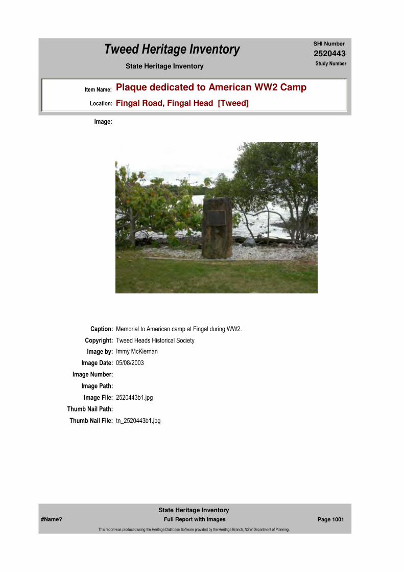
2520443
SHI Number
Tweed Heritage Inventory
Item Name: Plaque dedicated to American WW2 Camp
Location: Fingal Road, Fingal Head [Tweed]
State Heritage Inventory Study Number
Caption: Memorial to American camp at Fingal during WW2.
Copyright: Tweed Heads Historical Society
Image:
Image by: Immy McKiernan
Image Date: 05/08/2003
Image Number:
Image Path:
Image File: 2520443b1.jpg
Thumb Nail Path:
Thumb Nail File: tn_2520443b1.jpg
#Name? Page 1001 Full Report with Images
State Heritage Inventory
This report was produced using the Heritage Database Software provided by the Heritage Branch, NSW Department of Planning.
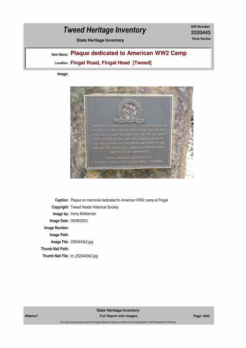
2520443
SHI Number
Tweed Heritage Inventory
Item Name: Plaque dedicated to American WW2 Camp
Location: Fingal Road, Fingal Head [Tweed]
State Heritage Inventory Study Number
Caption: Plaque on memorial dedicated to American WW2 camp at Fingal.
Copyright: Tweed Heads Historical Society
Image:
Image by: Immy McKiernan
Image Date: 05/08/2003
Image Number:
Image Path:
Image File: 2520443b2.jpg
Thumb Nail Path:
Thumb Nail File: tn_2520443b2.jpg
#Name? Page 1002 Full Report with Images
State Heritage Inventory
This report was produced using the Heritage Database Software provided by the Heritage Branch, NSW Department of Planning.

2520443
SHI Number
Tweed Heritage Inventory
Item Name: Plaque dedicated to American WW2 Camp
Location: Fingal Road, Fingal Head [Tweed]
State Heritage Inventory Study Number
Caption: Denoting location of American camp at Fingal during WW2.
Copyright: Tweed Heads Historical Society
Image:
Image by:
Image Date:
Image Number:
Image Path:
Image File: 2520443b3.jpg
Thumb Nail Path:
Thumb Nail File: tn_2520443b3.jpg
#Name? Page 1003 Full Report with Images
State Heritage Inventory
This report was produced using the Heritage Database Software provided by the Heritage Branch, NSW Department of Planning.
2520443
SHI Number
Tweed Heritage Inventory
Item Name: Plaque dedicated to American WW2 Camp
Location: Fingal Road, Fingal Head [Tweed]
State Heritage Inventory Study Number
#Name? Page 1004 Full Report with Images
State Heritage Inventory
This report was produced using the Heritage Database Software provided by the Heritage Branch, NSW Department of Planning.
2520446
SHI Number
Tweed Heritage Inventory
Item Name: Amenities Hall
Location: Marine Parade, Kingscliff [Tweed]
State Heritage Inventory Study Number
Current Use: Community Hall
Former Uses: Community Hall
Statement of
Significance:The Kingscliff Amenities Hall has a strong association with the residents of Kingscliff. It has acted as a centre for social and cultural activities for over 40 years.
Historical Notes or Provenance:
"Kingscliff Amenities Building Opens." The modern, new £22,000 amenities building at Kingscliff beach, to be officially opened tomorrow by the Tweed Shire President, Cr C H Hall, is a great contribution towards the development of the Tweed end of the Gold Coast.
For many years, the beach foreshore has been the Christmas rendezvous of campers from all States. With the modern facilities to be made available tomorrow, Kingscliff now claims to be the best camping area in Australia.
In an official ceremony at 3 o'clock tomorrow afternoon, Cr Hall will hand the keys of the buildings and with them the responsibility of care and management to the Kingscliff Urban Committee.
Chairman of the official ceremony will be Kingscliff pioneer and former canefarmer, Mr A McPhail.Receiving the keys in behalf of the Urban Committee will the committee chairman, Mr E J Parker.Other speakers will be Mr J D Anthony, MHR., Mr S T Stephens, MLA., and the Byron Shire President, Mr E Giles.
The extensive and attractively designed buildings visitors will see tomorrow are far beyond the hopes of the people who first advocated an amenities building on the foreshore, more
Endorsed Significance:Assessed Significance: Local
Item Type: Built Category: Hall Public Group: Community Facilities
Admin Codes: Code 2: Code 3:
Curtilage/Boundary:
Owner: Local Government
Other/Former Names:
Area/Group/Complex: Group ID:
Aboriginal Area:
Local Govt Area: Tweed
Planning: Northern
Historic Region: North Coast
Address: #Name?
Suburb / Nearest Town: #Name?
State: NSW
Parish: Cudgen
County: Rous
#Name? Page 1015 Full Report with Images
State Heritage Inventory
This report was produced using the Heritage Database Software provided by the Heritage Branch, NSW Department of Planning.
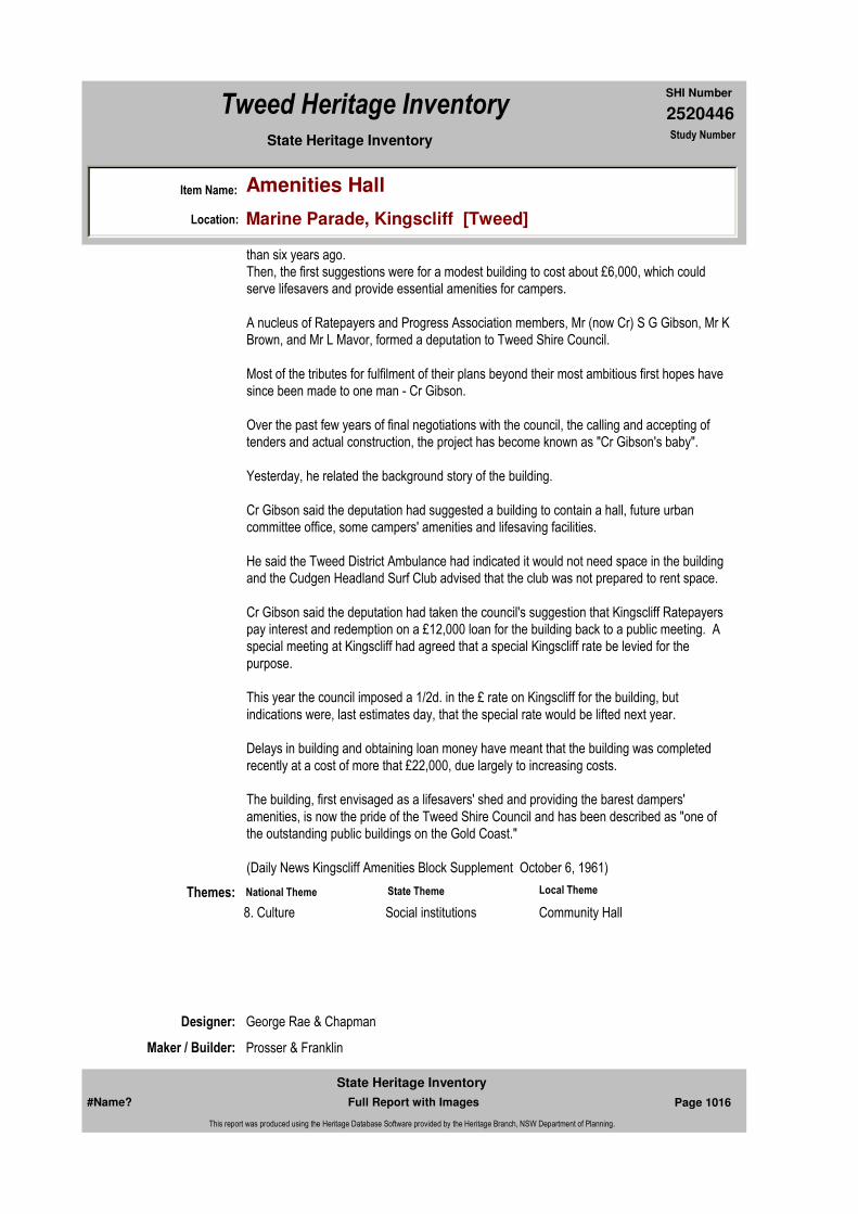
2520446
SHI Number
Tweed Heritage Inventory
Item Name: Amenities Hall
Location: Marine Parade, Kingscliff [Tweed]
State Heritage Inventory Study Number
than six years ago.Then, the first suggestions were for a modest building to cost about £6,000, which could serve lifesavers and provide essential amenities for campers.
A nucleus of Ratepayers and Progress Association members, Mr (now Cr) S G Gibson, Mr K Brown, and Mr L Mavor, formed a deputation to Tweed Shire Council.
Most of the tributes for fulfilment of their plans beyond their most ambitious first hopes have since been made to one man - Cr Gibson.
Over the past few years of final negotiations with the council, the calling and accepting of tenders and actual construction, the project has become known as "Cr Gibson's baby".
Yesterday, he related the background story of the building.
Cr Gibson said the deputation had suggested a building to contain a hall, future urban committee office, some campers' amenities and lifesaving facilities.
He said the Tweed District Ambulance had indicated it would not need space in the building and the Cudgen Headland Surf Club advised that the club was not prepared to rent space.
Cr Gibson said the deputation had taken the council's suggestion that Kingscliff Ratepayers pay interest and redemption on a £12,000 loan for the building back to a public meeting. A special meeting at Kingscliff had agreed that a special Kingscliff rate be levied for the purpose.
This year the council imposed a 1/2d. in the £ rate on Kingscliff for the building, but indications were, last estimates day, that the special rate would be lifted next year.
Delays in building and obtaining loan money have meant that the building was completed recently at a cost of more that £22,000, due largely to increasing costs.
The building, first envisaged as a lifesavers' shed and providing the barest dampers' amenities, is now the pride of the Tweed Shire Council and has been described as "one of the outstanding public buildings on the Gold Coast."
(Daily News Kingscliff Amenities Block Supplement October 6, 1961)
Designer: George Rae & Chapman
Maker / Builder: Prosser & Franklin
Themes: National Theme State Theme Local Theme
8. Culture Social institutions Community Hall
#Name? Page 1016 Full Report with Images
State Heritage Inventory
This report was produced using the Heritage Database Software provided by the Heritage Branch, NSW Department of Planning.

2520446
SHI Number
Tweed Heritage Inventory
Item Name: Amenities Hall
Location: Marine Parade, Kingscliff [Tweed]
State Heritage Inventory Study Number
Physical Description: Internationalist style building, simple design with prominent vertical bays of windows reaching from ground to roof, recessed by projecting mullions and piers. It has a low pitch flat roof.
Physical Condition:
Modification Dates:
Custom Field One:
Year Started: Year Completed: 1961 Circa: No
Recommended
Management:Maintain in a sympathetic manner. Adapt service and facilities to ensure continued use.
References:
Studies:
Listings:
Further Comments:
Criteria a)
Criteria c)
Criteria d)
Criteria e)
Criteria g)
Criteria f)
Integrity / Intactness:
Criteria b) The Kingscliff Amenities Hall has a strong association with the residents of Kingscliff. It has acted as a centre for social and cultural activities for over 40 years.
Parcels:
Latitude: Longitude:
AMG Zone: Easting: Northing:
Map Name: Map Scale:
Spatial Accuracy:Location validity:
Management:
Author Title Year
"Kingscliff Amenities Building Opens." 1961
Author Title YearNumber
Tweed Shire Council Community-based Heritage Study 2003
#Name? Page 1017 Full Report with Images
State Heritage Inventory
This report was produced using the Heritage Database Software provided by the Heritage Branch, NSW Department of Planning.

2520446
SHI Number
Tweed Heritage Inventory
Item Name: Amenities Hall
Location: Marine Parade, Kingscliff [Tweed]
State Heritage Inventory Study Number
Date Updated: 31/10/2004 Status: BasicDate First Entered: 11/04/2004Data Entry:
Custom Field Two:
Custom Field Three:
Custom Field Four:
Custom Field Five:
Custom Field Six:
Caption: Kingscliff Amenities Building, Marine Parade, Kingscliff.
Copyright: Tweed Heads Historical Society
Image:
Image by: Immy McKiernan
Image Date: 11/12/2003
Image Number:
Image Path:
Image File: 2520446b1.jpg
Thumb Nail Path:
#Name? Page 1018 Full Report with Images
State Heritage Inventory
This report was produced using the Heritage Database Software provided by the Heritage Branch, NSW Department of Planning.

2520446
SHI Number
Tweed Heritage Inventory
Item Name: Amenities Hall
Location: Marine Parade, Kingscliff [Tweed]
State Heritage Inventory Study Number
Thumb Nail File: tn_2520446b1.jpg
#Name? Page 1019 Full Report with Images
State Heritage Inventory
This report was produced using the Heritage Database Software provided by the Heritage Branch, NSW Department of Planning.

2520446
SHI Number
Tweed Heritage Inventory
Item Name: Amenities Hall
Location: Marine Parade, Kingscliff [Tweed]
State Heritage Inventory Study Number
Caption: Amenities Building, Marine Parade, Kingscliff.
Copyright: Tweed Heads Historical Society
Image:
Image by: Immy McKiernan
Image Date: 11/12/2003
Image Number:
Image Path:
Image File: 2520446b2.jpg
Thumb Nail Path:
Thumb Nail File: tn_2520446b2.jpg
#Name? Page 1020 Full Report with Images
State Heritage Inventory
This report was produced using the Heritage Database Software provided by the Heritage Branch, NSW Department of Planning.
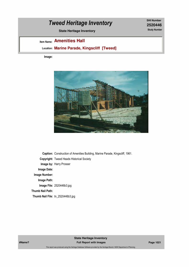
2520446
SHI Number
Tweed Heritage Inventory
Item Name: Amenities Hall
Location: Marine Parade, Kingscliff [Tweed]
State Heritage Inventory Study Number
Caption: Construction of Amenities Building, Marine Parade, Kingscliff, 1961.
Copyright: Tweed Heads Historical Society
Image:
Image by: Harry Prosser
Image Date:
Image Number:
Image Path:
Image File: 2520446b3.jpg
Thumb Nail Path:
Thumb Nail File: tn_2520446b3.jpg
#Name? Page 1021 Full Report with Images
State Heritage Inventory
This report was produced using the Heritage Database Software provided by the Heritage Branch, NSW Department of Planning.
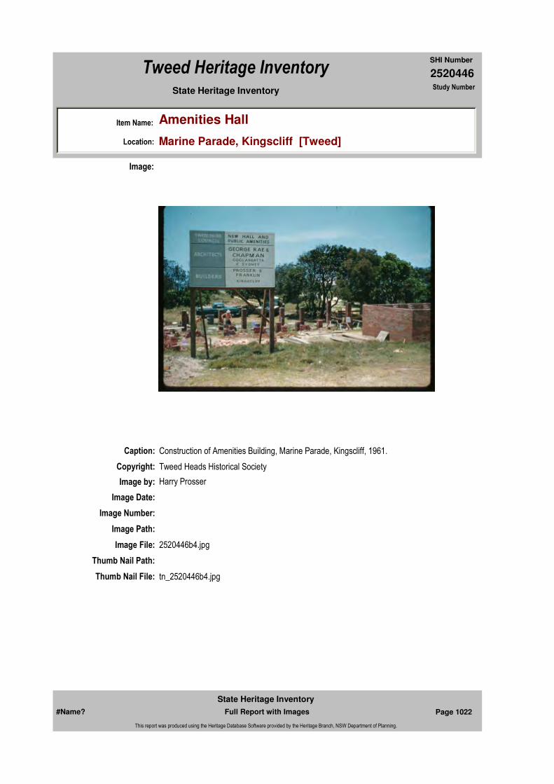
2520446
SHI Number
Tweed Heritage Inventory
Item Name: Amenities Hall
Location: Marine Parade, Kingscliff [Tweed]
State Heritage Inventory Study Number
Caption: Construction of Amenities Building, Marine Parade, Kingscliff, 1961.
Copyright: Tweed Heads Historical Society
Image:
Image by: Harry Prosser
Image Date:
Image Number:
Image Path:
Image File: 2520446b4.jpg
Thumb Nail Path:
Thumb Nail File: tn_2520446b4.jpg
#Name? Page 1022 Full Report with Images
State Heritage Inventory
This report was produced using the Heritage Database Software provided by the Heritage Branch, NSW Department of Planning.
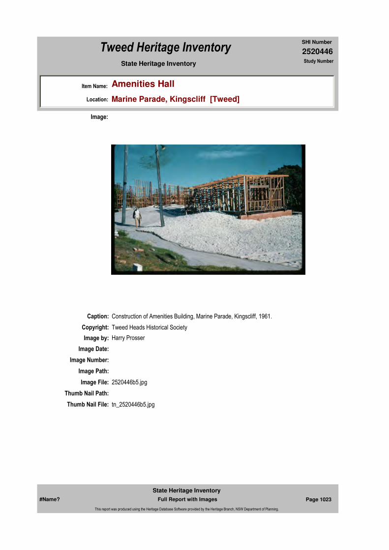
2520446
SHI Number
Tweed Heritage Inventory
Item Name: Amenities Hall
Location: Marine Parade, Kingscliff [Tweed]
State Heritage Inventory Study Number
Caption: Construction of Amenities Building, Marine Parade, Kingscliff, 1961.
Copyright: Tweed Heads Historical Society
Image:
Image by: Harry Prosser
Image Date:
Image Number:
Image Path:
Image File: 2520446b5.jpg
Thumb Nail Path:
Thumb Nail File: tn_2520446b5.jpg
#Name? Page 1023 Full Report with Images
State Heritage Inventory
This report was produced using the Heritage Database Software provided by the Heritage Branch, NSW Department of Planning.

2520446
SHI Number
Tweed Heritage Inventory
Item Name: Amenities Hall
Location: Marine Parade, Kingscliff [Tweed]
State Heritage Inventory Study Number
Caption: Opening of Amenities Building, Marine Parade, Kingscliff, 1961.
Copyright: Tweed Heads Historical Society
Image:
Image by: Harry Prosser
Image Date:
Image Number:
Image Path:
Image File: 2520446b6.jpg
Thumb Nail Path:
Thumb Nail File: tn_2520446b6.jpg
#Name? Page 1024 Full Report with Images
State Heritage Inventory
This report was produced using the Heritage Database Software provided by the Heritage Branch, NSW Department of Planning.
2520446
SHI Number
Tweed Heritage Inventory
Item Name: Amenities Hall
Location: Marine Parade, Kingscliff [Tweed]
State Heritage Inventory Study Number
#Name? Page 1025 Full Report with Images
State Heritage Inventory
This report was produced using the Heritage Database Software provided by the Heritage Branch, NSW Department of Planning.
2520447
SHI Number
Tweed Heritage Inventory
Item Name: War Memorial Cenotaph
Location: Marine Parade, Kingscliff [Tweed]
State Heritage Inventory Study Number
Current Use:
Former Uses:
Statement of
Significance:The memorial is part of the cultural history of the Tweed Valley and has a special association with the Kingscliff community.
Historical Notes or Provenance:
Physical Description: The Kingscliff Cenotaph has a two step tiled base, 3m x 3m and 2m x 2m, with a 5m high brown mottled marble sheeted obelisk. On the street side facade of the obelisk are the words "Lest We Forget" chiseled near the bottom, and further up are the Coats of Arms of the three services in brass and a brass laurel wreath is at the top of the obelisk.
Designer:
Maker / Builder:
Year Started: Year Completed: Circa: No
Endorsed Significance:Assessed Significance: Local
Item Type: Complex / Group Category: War MemorialGroup: Monuments and Mem
Admin Codes: Code 2: Code 3:
Curtilage/Boundary:
Owner:
Other/Former Names:
Area/Group/Complex: Group ID:
Themes:
Aboriginal Area:
Local Govt Area: Tweed
Planning: Northern
Historic Region: North Coast
Address: #Name?
Suburb / Nearest Town: #Name?
State: NSW
Parish: Cudgen
County: Rous
National Theme State Theme Local Theme
7. Governing Defence War Memorial
#Name? Page 1026 Full Report with Images
State Heritage Inventory
This report was produced using the Heritage Database Software provided by the Heritage Branch, NSW Department of Planning.

2520447
SHI Number
Tweed Heritage Inventory
Item Name: War Memorial Cenotaph
Location: Marine Parade, Kingscliff [Tweed]
State Heritage Inventory Study Number
Physical Condition:
Modification Dates:
Custom Field One:
Recommended
Management:
References:
Studies:
Listings:
Further Comments:
Criteria a)
Criteria c)
Criteria d) The memorial is part of the cultural history of the Tweed Valley and has a special association with the Kingscliff community.
Criteria e)
Criteria g)
Criteria f)
Integrity / Intactness:
Custom Field Two:
Custom Field Three:
Custom Field Four:
Criteria b)
Parcels:
Latitude: Longitude:
AMG Zone: Easting: Northing:
Map Name: Map Scale:
Spatial Accuracy:Location validity:
Management:
Author Title YearNumber
Tweed Shire Council Community-based Heritage Study 2003
Parcel Code LotNumber Section Plan Code Plan Number
LOT 169 DP 755701
#Name? Page 1027 Full Report with Images
State Heritage Inventory
This report was produced using the Heritage Database Software provided by the Heritage Branch, NSW Department of Planning.

2520447
SHI Number
Tweed Heritage Inventory
Item Name: War Memorial Cenotaph
Location: Marine Parade, Kingscliff [Tweed]
State Heritage Inventory Study Number
Date Updated: 21/05/2004 Status: BasicDate First Entered: 11/04/2004Data Entry:
Custom Field Five:
Custom Field Six:
Caption: Kingscliff War Memorial Cenotaph.
Copyright: Tweed Heads Historical Society
Image:
Image by: Immy McKiernan
Image Date: 05/08/2003
Image Number:
Image Path:
Image File: 2520447b1.jpg
Thumb Nail Path:
Thumb Nail File: tn_2520447b1.jpg
#Name? Page 1028 Full Report with Images
State Heritage Inventory
This report was produced using the Heritage Database Software provided by the Heritage Branch, NSW Department of Planning.

2520447
SHI Number
Tweed Heritage Inventory
Item Name: War Memorial Cenotaph
Location: Marine Parade, Kingscliff [Tweed]
State Heritage Inventory Study Number
#Name? Page 1029 Full Report with Images
State Heritage Inventory
This report was produced using the Heritage Database Software provided by the Heritage Branch, NSW Department of Planning.
2520448
SHI Number
Tweed Heritage Inventory
Item Name: Fig Tree Roundabout
Location: Marine Parade, Kingscliff [Tweed]
State Heritage Inventory Study Number
Current Use:
Former Uses:
Statement of Significance:
The Kingscliff Fig Tree Roundabout is an iconic landmark for residents and a substantial example of a significant tree. It is one of the first roundabouts in NSW.
Historical Notes or Provenance:
The fig tree is approximately 90 years old, being a sizable tree in 1920 (Gladys Lee). It is reported to have been planted by a Mr Anderson. The roundabout was constructed in 1963.
Designer:
Maker / Builder:
Endorsed Significance:Assessed Significance: Local
Item Type: Landscape Category: TreeGroup: Parks, Gardens and T
Admin Codes: Code 2: Code 3:
Curtilage/Boundary:
Owner:
Other/Former Names:
Area/Group/Complex: Group ID:
Themes:
Aboriginal Area:
Local Govt Area: Tweed
Planning: Northern
Historic Region: North Coast
Address: #Name?
Suburb / Nearest Town: #Name?
State: NSW
Parish: Cudgen
County: Rous
Local Govt Area: Tweed
Planning: Northern
Historic Region: North Coast
Address: #Name?
Suburb / Nearest Town: #Name?
State: NSW
Parish: Cudgen
County: Rous
National Theme State Theme Local Theme
3. Economy Environment - cultural lands (none)
#Name? Page 1030 Full Report with Images
State Heritage Inventory
This report was produced using the Heritage Database Software provided by the Heritage Branch, NSW Department of Planning.

2520448
SHI Number
Tweed Heritage Inventory
Item Name: Fig Tree Roundabout
Location: Marine Parade, Kingscliff [Tweed]
State Heritage Inventory Study Number
Physical Description: Ficus macrophylla, Moreton Bay Fig.This tree has been included in the roadway of Marine Parade, with a concrete roundabout erected at it's base.
Physical Condition:
Modification Dates:
Custom Field One:
Year Started: Year Completed: Circa: No
Recommended
Management:Arborist to review and provide recommendations for the conservation of the tree.
References:
Studies:
Listings:
Further Comments:
Criteria a) The Kingscliff Fig Tree Roundabout is one of the first roundabouts in NSW.
Criteria c) The Kingscliff Fig Tree Roundabout is a substantial example of a significant tree.
Criteria d) The Kingscliff Fig Tree Roundabout is an iconic landmark for residents.
Criteria e)
Criteria g)
Criteria f)
Integrity / Intactness:
Custom Field Two:
Criteria b)
Parcels:
Latitude: Longitude:
AMG Zone: Easting: Northing:
Map Name: Map Scale:
Spatial Accuracy:Location validity:
Management:
Author Title YearNumber
Tweed Shire Council Community-based Heritage Study 2003
#Name? Page 1031 Full Report with Images
State Heritage Inventory
This report was produced using the Heritage Database Software provided by the Heritage Branch, NSW Department of Planning.
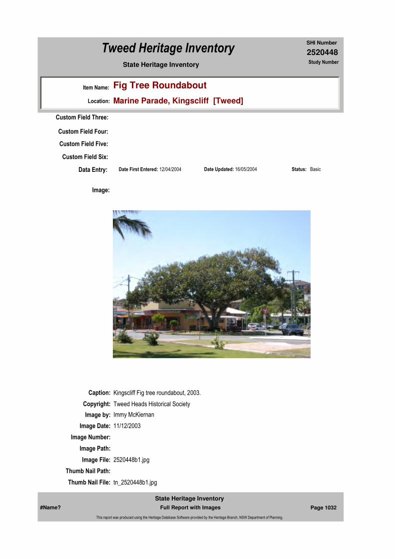
2520448
SHI Number
Tweed Heritage Inventory
Item Name: Fig Tree Roundabout
Location: Marine Parade, Kingscliff [Tweed]
State Heritage Inventory Study Number
Date Updated: 16/05/2004 Status: BasicDate First Entered: 12/04/2004Data Entry:
Custom Field Three:
Custom Field Four:
Custom Field Five:
Custom Field Six:
Caption: Kingscliff Fig tree roundabout, 2003.
Copyright: Tweed Heads Historical Society
Image:
Image by: Immy McKiernan
Image Date: 11/12/2003
Image Number:
Image Path:
Image File: 2520448b1.jpg
Thumb Nail Path:
Thumb Nail File: tn_2520448b1.jpg
#Name? Page 1032 Full Report with Images
State Heritage Inventory
This report was produced using the Heritage Database Software provided by the Heritage Branch, NSW Department of Planning.

2520448
SHI Number
Tweed Heritage Inventory
Item Name: Fig Tree Roundabout
Location: Marine Parade, Kingscliff [Tweed]
State Heritage Inventory Study Number
#Name? Page 1033 Full Report with Images
State Heritage Inventory
This report was produced using the Heritage Database Software provided by the Heritage Branch, NSW Department of Planning.

2520448
SHI Number
Tweed Heritage Inventory
Item Name: Fig Tree Roundabout
Location: Marine Parade, Kingscliff [Tweed]
State Heritage Inventory Study Number
Caption: Kingscliff fig tree roundabout 2003.
Copyright: Tweed Heads Historical Society
Image:
Image by: Immy McKiernan
Image Date: 11/12/2003
Image Number:
Image Path:
Image File: 2520448b2.jpg
Thumb Nail Path:
Thumb Nail File: tn_2520448b2.jpg
#Name? Page 1034 Full Report with Images
State Heritage Inventory
This report was produced using the Heritage Database Software provided by the Heritage Branch, NSW Department of Planning.
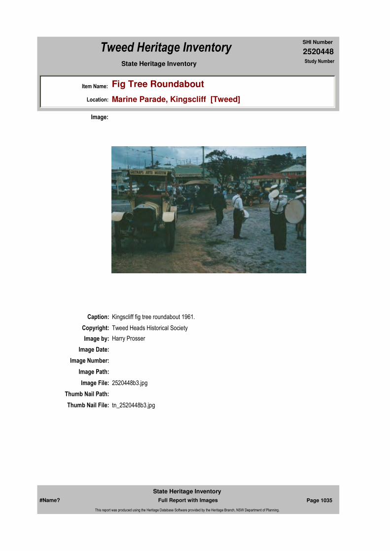
2520448
SHI Number
Tweed Heritage Inventory
Item Name: Fig Tree Roundabout
Location: Marine Parade, Kingscliff [Tweed]
State Heritage Inventory Study Number
Caption: Kingscliff fig tree roundabout 1961.
Copyright: Tweed Heads Historical Society
Image:
Image by: Harry Prosser
Image Date:
Image Number:
Image Path:
Image File: 2520448b3.jpg
Thumb Nail Path:
Thumb Nail File: tn_2520448b3.jpg
#Name? Page 1035 Full Report with Images
State Heritage Inventory
This report was produced using the Heritage Database Software provided by the Heritage Branch, NSW Department of Planning.
2520448
SHI Number
Tweed Heritage Inventory
Item Name: Fig Tree Roundabout
Location: Marine Parade, Kingscliff [Tweed]
State Heritage Inventory Study Number
#Name? Page 1036 Full Report with Images
State Heritage Inventory
This report was produced using the Heritage Database Software provided by the Heritage Branch, NSW Department of Planning.
2520449
SHI Number
Tweed Heritage Inventory
Item Name: The Studio and surrounding remnant riverine sub-
Location: 63 Numinbah Road, Kynnumboon [Tweed]
State Heritage Inventory Study Number
Current Use:
Former Uses:
Statement of
Significance:The Studio is the only remaining part of the original Kynnumboon Homestead est. 1862 and has a strong association with pioneer run holder Joshua Bray. The remnant riverine sub-tropical rainforest is within the curtilage of the original Kynnumboon homestead.
Historical Notes
or Provenance:Diary of Frank Bray 9 March 1897
"Did 1'6" for four cutters today. We knocked off at dinner time on account of water. I got letters from Nina, Ethel, Shirley, Eveleen - Percy sent two great photos, one of the Studio with Shirley, Ethel and the Two Miss Whishes, and one of the house from the bamboo. Thring has got a new water barrel."
Designer:
Maker / Builder:
Year Started: Year Completed: Circa: No
Endorsed Significance:Assessed Significance: Local
Item Type: Built Category: Private studio/outbuildiGroup: Residential buildings (
Admin Codes: Code 2: Code 3:
Curtilage/Boundary:
Owner: Private - Individual
Other/Former Names:
Area/Group/Complex: Group ID:
Themes:
Aboriginal Area:
Local Govt Area: Tweed
Planning: Northern
Historic Region: North Coast
Address: #Name?
Suburb / Nearest Town: #Name?
State: NSW
Parish: Kynnumboon
County: Rous
National Theme State Theme Local Theme
8. Culture Creative endeavour (Cultur (none)
#Name? Page 1037 Full Report with Images
State Heritage Inventory
This report was produced using the Heritage Database Software provided by the Heritage Branch, NSW Department of Planning.
2520449
SHI Number
Tweed Heritage Inventory
Item Name: The Studio and surrounding remnant riverine sub-
Location: 63 Numinbah Road, Kynnumboon [Tweed]
State Heritage Inventory Study Number
Physical Description: Slab hut, known as 'the Studio'. It is the only remaining part of the original Kynnumboon Homestead est. 1862. The Studio was built in the early 1890's for an artistic Bray daughter. It is a mixture of pit and hand sawn timbers. 2.8 x 3.8 metres, 3.2 metres high with a hip roof. Original lead light window on south west wall and lattice work. Modern concrete blocks support the building.
Physical Condition:
Modification Dates:
Recommended Management:
Maintain the structure in a sympathetic manner.
References:
Studies:
Further Comments:
Criteria a)
Criteria c)
Criteria d)
Criteria e)
Criteria g)
Criteria f)
Integrity / Intactness:
Criteria b) The Studio is the only remaining part of the original Kynnumboon Homestead est. 1862, one of the first homes built on the Tweed and has a strong association with pioneer run holder Joshua Bray. The remnant riverine sub-tropical rainforest is within the curtilage of the original Kynnumboon homestead.
Parcels:
Latitude: Longitude:
AMG Zone: Easting: Northing:
Map Name: Map Scale:
Spatial Accuracy:Location validity:
Management:
Author Title Year
Frank Bray Diary 1897
Author Title YearNumber
Tweed Shire Council Community-based Heritage Study 2003
Parcel Code LotNumber Section Plan Code Plan Number
LOT 6 DP 263221
#Name? Page 1038 Full Report with Images
State Heritage Inventory
This report was produced using the Heritage Database Software provided by the Heritage Branch, NSW Department of Planning.
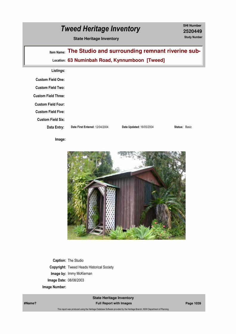
2520449
SHI Number
Tweed Heritage Inventory
Item Name: The Studio and surrounding remnant riverine sub-
Location: 63 Numinbah Road, Kynnumboon [Tweed]
State Heritage Inventory Study Number
Custom Field One:
Listings:
Date Updated: 16/05/2004 Status: BasicDate First Entered: 12/04/2004Data Entry:
Custom Field Two:
Custom Field Three:
Custom Field Four:
Custom Field Five:
Custom Field Six:
Caption: The Studio
Copyright: Tweed Heads Historical Society
Image:
Image by: Immy McKiernan
Image Date: 08/08/2003
Image Number:
#Name? Page 1039 Full Report with Images
State Heritage Inventory
This report was produced using the Heritage Database Software provided by the Heritage Branch, NSW Department of Planning.

2520449
SHI Number
Tweed Heritage Inventory
Item Name: The Studio and surrounding remnant riverine sub-
Location: 63 Numinbah Road, Kynnumboon [Tweed]
State Heritage Inventory Study Number
Image Path:
Image File: 2520449b2.jpg
Thumb Nail Path:
Thumb Nail File: tn_2520449b2.jpg
#Name? Page 1040 Full Report with Images
State Heritage Inventory
This report was produced using the Heritage Database Software provided by the Heritage Branch, NSW Department of Planning.
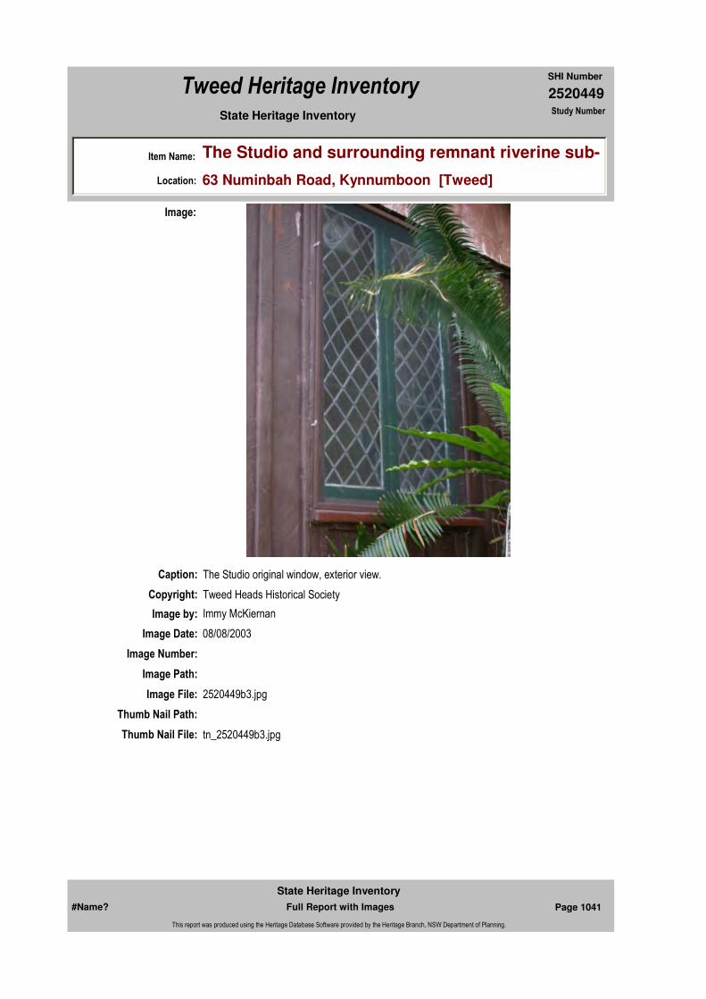
2520449
SHI Number
Tweed Heritage Inventory
Item Name: The Studio and surrounding remnant riverine sub-
Location: 63 Numinbah Road, Kynnumboon [Tweed]
State Heritage Inventory Study Number
Caption: The Studio original window, exterior view.
Copyright: Tweed Heads Historical Society
Image:
Image by: Immy McKiernan
Image Date: 08/08/2003
Image Number:
Image Path:
Image File: 2520449b3.jpg
Thumb Nail Path:
Thumb Nail File: tn_2520449b3.jpg
#Name? Page 1041 Full Report with Images
State Heritage Inventory
This report was produced using the Heritage Database Software provided by the Heritage Branch, NSW Department of Planning.

2520449
SHI Number
Tweed Heritage Inventory
Item Name: The Studio and surrounding remnant riverine sub-
Location: 63 Numinbah Road, Kynnumboon [Tweed]
State Heritage Inventory Study Number
Caption: The Studio, rear view
Copyright: Tweed Heads Historical Society
Image:
Image by: Immy McKiernan
Image Date: 08/08/2003
Image Number:
Image Path:
Image File: 2520449b4.jpg
Thumb Nail Path:
Thumb Nail File: tn_2520449b4.jpg
#Name? Page 1042 Full Report with Images
State Heritage Inventory
This report was produced using the Heritage Database Software provided by the Heritage Branch, NSW Department of Planning.
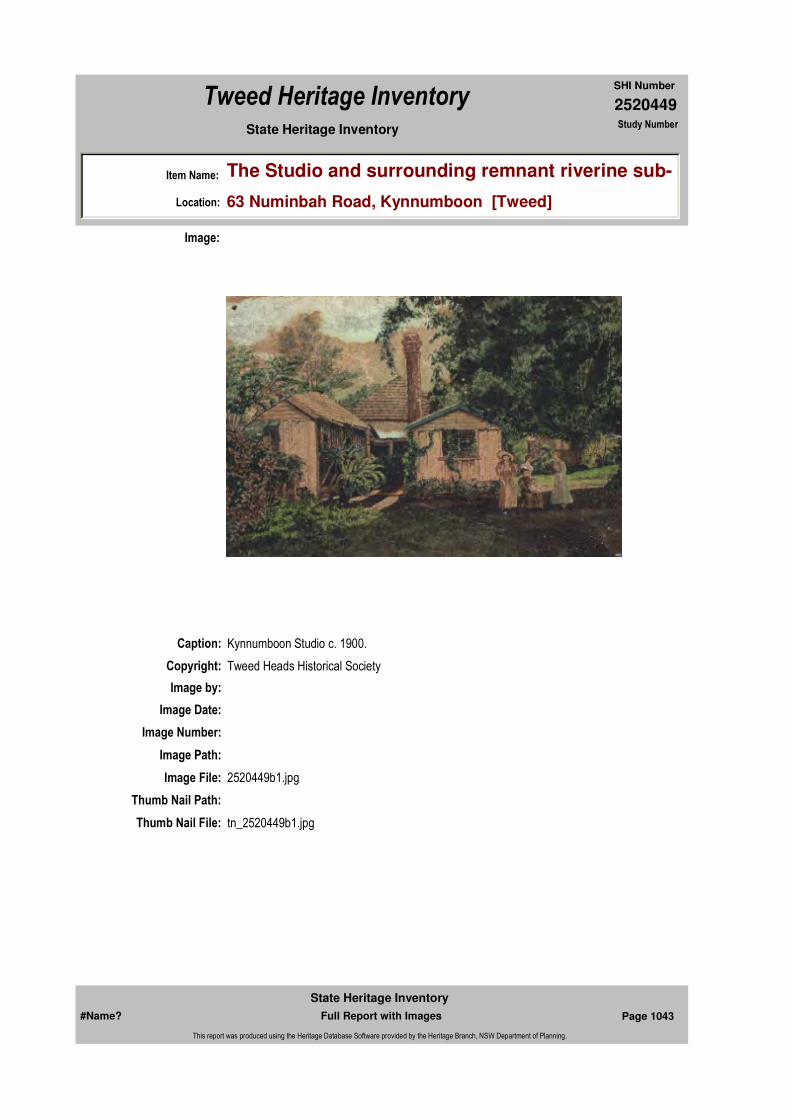
2520449
SHI Number
Tweed Heritage Inventory
Item Name: The Studio and surrounding remnant riverine sub-
Location: 63 Numinbah Road, Kynnumboon [Tweed]
State Heritage Inventory Study Number
Caption: Kynnumboon Studio c. 1900.
Copyright: Tweed Heads Historical Society
Image:
Image by:
Image Date:
Image Number:
Image Path:
Image File: 2520449b1.jpg
Thumb Nail Path:
Thumb Nail File: tn_2520449b1.jpg
#Name? Page 1043 Full Report with Images
State Heritage Inventory
This report was produced using the Heritage Database Software provided by the Heritage Branch, NSW Department of Planning.

2520449
SHI Number
Tweed Heritage Inventory
Item Name: The Studio and surrounding remnant riverine sub-
Location: 63 Numinbah Road, Kynnumboon [Tweed]
State Heritage Inventory Study Number
Caption: Original window of Studio, from interior.
Copyright: Tweed Heads Historical Society
Image:
Image by: Bill Bainbridge
Image Date: 31/08/2003
Image Number:
Image Path:
Image File: 2520449b6.jpg
Thumb Nail Path:
Thumb Nail File: tn_2520449b6.jpg
#Name? Page 1044 Full Report with Images
State Heritage Inventory
This report was produced using the Heritage Database Software provided by the Heritage Branch, NSW Department of Planning.

2520449
SHI Number
Tweed Heritage Inventory
Item Name: The Studio and surrounding remnant riverine sub-
Location: 63 Numinbah Road, Kynnumboon [Tweed]
State Heritage Inventory Study Number
Caption: Remnant riverine sub-tropical rainforest at Kynnumboon.
Copyright: Tweed Heads Historical Society
Image:
Image by: Immy McKiernan
Image Date: 08/08/2003
Image Number:
Image Path:
Image File: 2520449b5.jpg
Thumb Nail Path:
Thumb Nail File: tn_2520449b5.jpg
#Name? Page 1045 Full Report with Images
State Heritage Inventory
This report was produced using the Heritage Database Software provided by the Heritage Branch, NSW Department of Planning.
2520449
SHI Number
Tweed Heritage Inventory
Item Name: The Studio and surrounding remnant riverine sub-
Location: 63 Numinbah Road, Kynnumboon [Tweed]
State Heritage Inventory Study Number
#Name? Page 1046 Full Report with Images
State Heritage Inventory
This report was produced using the Heritage Database Software provided by the Heritage Branch, NSW Department of Planning.

2520450
SHI Number
Tweed Heritage Inventory
Item Name: Water Pumping Station
Location: Numinbah Road, North Arm [Tweed]
State Heritage Inventory Study Number
Current Use:
Former Uses:
Statement of
Significance:The Boatharbour Water Pumping Station was the first water supply for the Municipality of Murwillumbah, and was initiated after the disastrous fire in the center of town in 1907.
Historical Notes or Provenance:
An ex-serviceman Edward Gregor gained the adj. block by ballot after the First World War ands then spend many years reading the water levels for Council. G.Hart.
Physical Description:
Physical Condition:
Modification Dates:
Designer:
Maker / Builder:
Year Started: Year Completed: Circa: No
Endorsed Significance:Assessed Significance: Local
Item Type: Built Category: Water Pump House/PGroup: Utilities - Water
Admin Codes: Code 2: Code 3:
Curtilage/Boundary:
Owner: Local Government
Other/Former Names:
Area/Group/Complex: Group ID:
Themes:
Aboriginal Area:
Local Govt Area: Tweed
Planning: Northern
Historic Region: North Coast
Address: #Name?
Suburb / Nearest Town: #Name?
State: NSW
Parish: Kynnumboon
County: Rous
National Theme State Theme Local Theme
4. Settlement Utilities Water
#Name? Page 1047 Full Report with Images
State Heritage Inventory
This report was produced using the Heritage Database Software provided by the Heritage Branch, NSW Department of Planning.

2520450
SHI Number
Tweed Heritage Inventory
Item Name: Water Pumping Station
Location: Numinbah Road, North Arm [Tweed]
State Heritage Inventory Study Number
Custom Field One:
Recommended Management:
Comments from an experienced civil/water supply engineer on the rarity, design and significance of the sturcture. Maintain the integrity and appearance through practical asset maintenance. Erect an interpretative panel to illustrate the history and significance of the structure
References:
Studies:
Listings:
Further Comments:
Criteria a)
Criteria c) First water supply for the Municipality of Murwillumbah, and was initiated after the disastrous fire in the center of town in 1907.
Criteria d)
Criteria e)
Criteria g)
Criteria f)
Integrity / Intactness:
Custom Field Two:
Custom Field Three:
Custom Field Four:
Criteria b)
Parcels:
Latitude: Longitude:
AMG Zone: Easting: Northing:
Map Name: Map Scale:
Spatial Accuracy:Location validity:
Management:
Author Title YearNumber
Tweed Shire Council Community-based Heritage Study 2003
Parcel Code LotNumber Section Plan Code Plan Number
PART LOT 6 DP 1039957
#Name? Page 1048 Full Report with Images
State Heritage Inventory
This report was produced using the Heritage Database Software provided by the Heritage Branch, NSW Department of Planning.

2520450
SHI Number
Tweed Heritage Inventory
Item Name: Water Pumping Station
Location: Numinbah Road, North Arm [Tweed]
State Heritage Inventory Study Number
Date Updated: 18/05/2004 Status: BasicDate First Entered: 12/04/2004Data Entry:
Custom Field Five:
Custom Field Six:
Caption: Water Pumping Station, Boatharbour
Copyright: Uki & South Arm Historical Soceity
Image:
Image by: Mary Lee Connery
Image Date: 30/10/2003
Image Number:
Image Path:
Image File: 2520450b1.jpg
Thumb Nail Path:
Thumb Nail File: tn_2520450b1.jpg
#Name? Page 1049 Full Report with Images
State Heritage Inventory
This report was produced using the Heritage Database Software provided by the Heritage Branch, NSW Department of Planning.

2520450
SHI Number
Tweed Heritage Inventory
Item Name: Water Pumping Station
Location: Numinbah Road, North Arm [Tweed]
State Heritage Inventory Study Number
#Name? Page 1050 Full Report with Images
State Heritage Inventory
This report was produced using the Heritage Database Software provided by the Heritage Branch, NSW Department of Planning.
2520452
SHI Number
Tweed Heritage Inventory
Item Name: Community Hall
Location: Limpinwood Valley Road, Limpinwood [Tweed]
State Heritage Inventory Study Number
Current Use:
Former Uses:
Statement of
Significance: The Limpinwood Community Hall has a strong association with the residents of the Limpinwood Valley. It has acted as a centre for social and cultural activities for 90 years.
Historical Notes or Provenance:
Limpinwood Hall was built by Mr. D. McLeod in 1923. His wages were £34. The opening ball was held on 23rd October, 1923 and was officially opened by Frank Baker. J. Dean and F. S. Baker were the first trustees.
The first Committee Members were W. Hayes, J Dean, S. Egan, R. Hayes, H. Faulks, S. Perry, H. Holt, E. Alexander, F. Baker, G. Bartlett.First President: W. Hayes.Vice-Presidents: F Baker and H. Holt.First Secretary: R. HayesFirst Treasurer: E. Alexander,First Caretaker: S. Perry
The hall bought an accordian for £3 and it was played by Jack Cecil, Frank Nobbs and other local players were Bill Hayes, piano; Mrs. B. Holt and F. Baker, violin; also Mr. Hayes, Arthur Smith, Len Hayes, Doreen Hayes were local musicians
The first Public Meeting held in the Hall was on the 19th November, 1923. Before the ball was built meetings were held in the Baptist Church.
Mr. Egan's offer of two miller lamps for 25 shillings each and a mirror thrown in was accepted.
Endorsed Significance:Assessed Significance: Local
Item Type: Built Category: Hall Public Group: Community Facilities
Admin Codes: Code 2: Code 3:
Curtilage/Boundary:
Owner: Private - Community Group
Other/Former Names:
Area/Group/Complex: Group ID:
Aboriginal Area:
Local Govt Area: Tweed
Planning: Northern
Historic Region: North Coast
Address: #Name?
Suburb / Nearest Town: #Name?
State: NSW
Parish: Chillingham
County: Rous
#Name? Page 1070 Full Report with Images
State Heritage Inventory
This report was produced using the Heritage Database Software provided by the Heritage Branch, NSW Department of Planning.
2520452
SHI Number
Tweed Heritage Inventory
Item Name: Community Hall
Location: Limpinwood Valley Road, Limpinwood [Tweed]
State Heritage Inventory Study Number
Mr. K. Faulks donated a lantern.
Rent for the hall in the early years was 12/- half night, £1 for a full night.
Smoking was prohibited in the hall when ladies were present. Early meetings were held on or before full moon on Thursday following.
"Historical & Pioneering Records of Chillingham & Surrounding Districts" page 98LIMPINWOOD HALL by Dorothy Sproule, 1984
Physical Description: Timber and iron community hall. Medium steep gable. Comparison with 1923 photo suggests that it is externally unaltered since construction.
Physical Condition:
Modification Dates:
Designer:
Maker / Builder:
Year Started: Year Completed: 1923 Circa: No
Recommended
Management:Maintain in a sympathetic manner. Adapt service and facilities to ensure continued use.
Further Comments:
Criteria a)
Criteria c)
Criteria d) The Limpinwood Community Hall has a strong association with the residents of the Limpinwood Valley. It has acted as a centre for social and cultural activities for 90 years.
Criteria e)
Criteria f)
Criteria b)
Themes:
Management:
National Theme State Theme Local Theme
8. Culture Social institutions Community Hall
#Name? Page 1071 Full Report with Images
State Heritage Inventory
This report was produced using the Heritage Database Software provided by the Heritage Branch, NSW Department of Planning.
2520452
SHI Number
Tweed Heritage Inventory
Item Name: Community Hall
Location: Limpinwood Valley Road, Limpinwood [Tweed]
State Heritage Inventory Study Number
Custom Field One:
References:
Studies:
Listings:
Date Updated: 01/11/2004 Status: BasicDate First Entered: 21/04/2004Data Entry:
Criteria g)
Integrity / Intactness:
Custom Field Two:
Custom Field Three:
Custom Field Four:
Custom Field Five:
Custom Field Six:
Parcels:
Latitude: Longitude:
AMG Zone: Easting: Northing:
Map Name: Map Scale:
Spatial Accuracy:Location validity:
Author Title Year
Dorothy Sproule "Historical & Pioneering Records of Chillingham & Surrounding Districts"
1984
Author Title YearNumber
Tweed Shire Council Community-based Heritage Study 2003
Parcel Code LotNumber Section Plan Code Plan Number
LOT 731 DP 863375
#Name? Page 1072 Full Report with Images
State Heritage Inventory
This report was produced using the Heritage Database Software provided by the Heritage Branch, NSW Department of Planning.
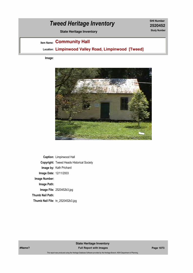
2520452
SHI Number
Tweed Heritage Inventory
Item Name: Community Hall
Location: Limpinwood Valley Road, Limpinwood [Tweed]
State Heritage Inventory Study Number
Caption: Limpinwood Hall
Copyright: Tweed Heads Historical Society
Image:
Image by: Kath Prichard
Image Date: 12/11/2003
Image Number:
Image Path:
Image File: 2520452b3.jpg
Thumb Nail Path:
Thumb Nail File: tn_2520452b3.jpg
#Name? Page 1073 Full Report with Images
State Heritage Inventory
This report was produced using the Heritage Database Software provided by the Heritage Branch, NSW Department of Planning.

2520452
SHI Number
Tweed Heritage Inventory
Item Name: Community Hall
Location: Limpinwood Valley Road, Limpinwood [Tweed]
State Heritage Inventory Study Number
Caption: Limpinwood Hall
Copyright: Tweed Heads Historical Society
Image:
Image by: Kath Prichard
Image Date: 12/11/2003
Image Number:
Image Path:
Image File: 2520452b2.jpg
Thumb Nail Path:
Thumb Nail File: tn_2520452b2.jpg
#Name? Page 1074 Full Report with Images
State Heritage Inventory
This report was produced using the Heritage Database Software provided by the Heritage Branch, NSW Department of Planning.
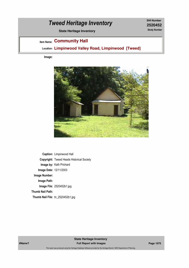
2520452
SHI Number
Tweed Heritage Inventory
Item Name: Community Hall
Location: Limpinwood Valley Road, Limpinwood [Tweed]
State Heritage Inventory Study Number
Caption: Limpinwood Hall
Copyright: Tweed Heads Historical Society
Image:
Image by: Kath Prichard
Image Date: 12/11/2003
Image Number:
Image Path:
Image File: 2520452b1.jpg
Thumb Nail Path:
Thumb Nail File: tn_2520452b1.jpg
#Name? Page 1075 Full Report with Images
State Heritage Inventory
This report was produced using the Heritage Database Software provided by the Heritage Branch, NSW Department of Planning.

2520452
SHI Number
Tweed Heritage Inventory
Item Name: Community Hall
Location: Limpinwood Valley Road, Limpinwood [Tweed]
State Heritage Inventory Study Number
#Name? Page 1076 Full Report with Images
State Heritage Inventory
This report was produced using the Heritage Database Software provided by the Heritage Branch, NSW Department of Planning.
2520454
SHI Number
Tweed Heritage Inventory
Item Name: Tree stump with spring board
Location: Mt Jerusalem National Park [Tweed]
State Heritage Inventory Study Number
Current Use:
Former Uses:
Statement of
Significance:This item is symbolic of an industrial era from 1840 to 1920 which saw the denuding of the Tweed Valley rainforests for the purposes of providing timber to meet the housing needs of Sydney and Brisbane. Demonstrates the technological methodology of the original timber getters in the use of springboards. The item is a rare and endangered element within the forest environment.
Historical Notes or Provenance:
Physical Description:
Designer:
Maker / Builder:
Year Started: Year Completed: Circa: No
Endorsed Significance:Assessed Significance: Local
Item Type: Landscape Category: TreeGroup: Parks, Gardens and T
Admin Codes: Code 2: Code 3:
Curtilage/Boundary:
Owner: National Parks & Wildlife Service
Other/Former Names:
Area/Group/Complex: Group ID:
Themes:
Aboriginal Area:
Local Govt Area: Tweed
Planning: Northern
Historic Region: North Coast
Address: #Name?
Suburb / Nearest Town: #Name?
State: NSW
Parish:
County:
National Theme State Theme Local Theme
3. Economy Forestry (new theme - previ (none)
#Name? Page 1083 Full Report with Images
State Heritage Inventory
This report was produced using the Heritage Database Software provided by the Heritage Branch, NSW Department of Planning.

2520454
SHI Number
Tweed Heritage Inventory
Item Name: Tree stump with spring board
Location: Mt Jerusalem National Park [Tweed]
State Heritage Inventory Study Number
Physical Condition:
Modification Dates:
Custom Field One:
Recommended
Management:Review the site to determine the best method for conserving the item; erect a protective post and railfence with interpretative panel to illustrate the history and significance of the item; provide a walking trail guide for user of the route.
References:
Studies:
Listings:
Further Comments:
Criteria a) This item is symbolic of an industrial era from 1840 to 1920 which saw the denuding of the Tweed Valley rainforests for the purposes of providing timber to meet the housing needs of Sydney and Brisbane. Demonstrates the technological methodology of the original timber getters in the use of springboards.
Criteria c)
Criteria d)
Criteria e)
Criteria g)
Criteria f) The item is a rare and endangered element within the forest environment.
Integrity / Intactness:
Custom Field Two:
Custom Field Three:
Criteria b)
Parcels:
Latitude: Longitude:
AMG Zone: Easting: Northing:
Map Name: Map Scale:
Spatial Accuracy:Location validity:
Management:
Author Title YearNumber
Tweed Shire Council Community-based Heritage Study 2003
#Name? Page 1084 Full Report with Images
State Heritage Inventory
This report was produced using the Heritage Database Software provided by the Heritage Branch, NSW Department of Planning.

2520454
SHI Number
Tweed Heritage Inventory
Item Name: Tree stump with spring board
Location: Mt Jerusalem National Park [Tweed]
State Heritage Inventory Study Number
Date Updated: 16/05/2004 Status: BasicDate First Entered: 21/04/2004Data Entry:
Custom Field Four:
Custom Field Five:
Custom Field Six:
Caption: Tree stump in Mt Jerusalem National Park - springboard abandoned, reasons unknown.
Copyright: Tweed Heads Historical Society
Image:
Image by: Immy McKiernan
Image Date: 04/10/2003
Image Number:
Image Path:
Image File: 2520454b1.jpg
Thumb Nail Path:
Thumb Nail File: tn_2520454b1.jpg
#Name? Page 1085 Full Report with Images
State Heritage Inventory
This report was produced using the Heritage Database Software provided by the Heritage Branch, NSW Department of Planning.

2520454
SHI Number
Tweed Heritage Inventory
Item Name: Tree stump with spring board
Location: Mt Jerusalem National Park [Tweed]
State Heritage Inventory Study Number
Caption: Tree stump in Mt Jerusalem National Park, log beside - abandoned for reasons unknown
Copyright: Tweed Heads Historical Society
Image:
Image by: Immy McKiernan
Image Date: 04/10/2003
Image Number:
Image Path:
Image File: 2520454b2.jpg
Thumb Nail Path:
Thumb Nail File: tn_2520454b2.jpg
#Name? Page 1086 Full Report with Images
State Heritage Inventory
This report was produced using the Heritage Database Software provided by the Heritage Branch, NSW Department of Planning.
2520454
SHI Number
Tweed Heritage Inventory
Item Name: Tree stump with spring board
Location: Mt Jerusalem National Park [Tweed]
State Heritage Inventory Study Number
#Name? Page 1087 Full Report with Images
State Heritage Inventory
This report was produced using the Heritage Database Software provided by the Heritage Branch, NSW Department of Planning.

2520455
SHI Number
Tweed Heritage Inventory
Item Name: Forestry Commission Bridge
Location: Mt Jerusalem National Park [Tweed]
State Heritage Inventory Study Number
Current Use:
Former Uses:
Statement of
Significance:This item is symbolic of an industrial era from 1840 to 1920 which saw the denuding of the Tweed Valley rainforests for the purposes of providing timber to meet the housing needs of Sydney and Brisbane. The item is rare and endangered through lack of continued use and maintenance.
Historical Notes
or Provenance:
Physical Description: Built from round timbers as bearers and decking. This bridge is in a fair condition but others, with their location in the forest, will continue to deteriorate quickly.
Designer:
Maker / Builder:
Year Started: Year Completed: Circa: No
Endorsed Significance:Assessed Significance: Local
Item Type: Built Category: Road BridgeGroup: Transport - Land
Admin Codes: Code 2: Code 3:
Curtilage/Boundary:
Owner: National Parks & Wildlife Service
Other/Former Names:
Area/Group/Complex: Group ID:
Themes:
Aboriginal Area:
Local Govt Area: Tweed
Planning: Northern
Historic Region: North Coast
Address: #Name?
Suburb / Nearest Town: #Name?
State: NSW
Parish:
County:
National Theme State Theme Local Theme
3. Economy Forestry (new theme - previ Bridge
#Name? Page 1088 Full Report with Images
State Heritage Inventory
This report was produced using the Heritage Database Software provided by the Heritage Branch, NSW Department of Planning.
2520455
SHI Number
Tweed Heritage Inventory
Item Name: Forestry Commission Bridge
Location: Mt Jerusalem National Park [Tweed]
State Heritage Inventory Study Number
Physical Condition:
Modification Dates:
Custom Field One:
Recommended
Management:Additional research into stabilising and maintaining the best examples - Forestry Commission FundingMaintain sufficient to presernve integrity of the structure. Provide a walking trail guide for users of the route.
References:
Studies:
Listings:
Further Comments:
Criteria a) This item is symbolic of an industrial era from 1840 to 1920 which saw the denuding of the Tweed Valley rainforests for the purposes of providing timber to meet the housing needs of Sydney and Brisbane.
Criteria c)
Criteria d)
Criteria e)
Criteria g)
Criteria f) The item is rare and endangered through lack of continued use and maintenance.
Integrity / Intactness:
Custom Field Two:
Custom Field Three:
Criteria b)
Parcels:
Latitude: Longitude:
AMG Zone: Easting: Northing:
Map Name: Map Scale:
Spatial Accuracy:Location validity:
Management:
Author Title YearNumber
Tweed Shire Council Community-based Heritage Study 2003
#Name? Page 1089 Full Report with Images
State Heritage Inventory
This report was produced using the Heritage Database Software provided by the Heritage Branch, NSW Department of Planning.

2520455
SHI Number
Tweed Heritage Inventory
Item Name: Forestry Commission Bridge
Location: Mt Jerusalem National Park [Tweed]
State Heritage Inventory Study Number
Date Updated: 19/05/2004 Status: BasicDate First Entered: 21/04/2004Data Entry:
Custom Field Four:
Custom Field Five:
Custom Field Six:
Caption: Forestry Commission Bridge in Mt Jerusalem National Park
Copyright: Tweed Heads Historical Society
Image:
Image by: Immy McKiernan
Image Date: 04/10/2004
Image Number:
Image Path:
Image File: 2520455b1.jpg
Thumb Nail Path:
Thumb Nail File: tn_2520455b1.jpg
#Name? Page 1090 Full Report with Images
State Heritage Inventory
This report was produced using the Heritage Database Software provided by the Heritage Branch, NSW Department of Planning.

2520455
SHI Number
Tweed Heritage Inventory
Item Name: Forestry Commission Bridge
Location: Mt Jerusalem National Park [Tweed]
State Heritage Inventory Study Number
Caption: Forestry Commission Bridge in Mt Jerusalem National Park
Copyright: Tweed Heads Historical Society
Image:
Image by: Immy McKiernan
Image Date: 04/10/2004
Image Number:
Image Path:
Image File: 2520455b2.jpg
Thumb Nail Path:
Thumb Nail File: tn_2520455b2.jpg
#Name? Page 1091 Full Report with Images
State Heritage Inventory
This report was produced using the Heritage Database Software provided by the Heritage Branch, NSW Department of Planning.

2520455
SHI Number
Tweed Heritage Inventory
Item Name: Forestry Commission Bridge
Location: Mt Jerusalem National Park [Tweed]
State Heritage Inventory Study Number
#Name? Page 1092 Full Report with Images
State Heritage Inventory
This report was produced using the Heritage Database Software provided by the Heritage Branch, NSW Department of Planning.

2520456
SHI Number
Tweed Heritage Inventory
Item Name: Murwillumbah Main St. Urban Conservation Area
Location: Murwillumbah Street, Murwillumbah [Tweed]
State Heritage Inventory Study Number
Current Use:
Former Uses:
Item Type: Complex / Group Category: Other - CommercialGroup: Commercial
Admin Codes: Code 2: Code 3:
Curtilage/Boundary: Wharf Street, part Commercial Road, Murwillumbah Street, part Queensland Road, part Wollumbin Street
Owner: Multiple Owners
Other/Former Names:
Area/Group/Complex: Murwillumbah Main Street Urban Conservation Area Group ID:
Aboriginal Area:
Local Govt Area: Tweed
Planning: Northern
Historic Region: North Coast
Address: #Name?
Suburb / Nearest Town: #Name?
State: NSW
Parish: Murwillumbah
County: Rous
Local Govt Area: Tweed
Planning: Northern
Historic Region: North Coast
Address: #Name?
Suburb / Nearest Town: #Name?
State: NSW
Parish: Murwillumbah
County: Rous
Local Govt Area: Tweed
Planning: Northern
Historic Region: North Coast
Address: #Name?
Suburb / Nearest Town: #Name?
State: NSW
Parish: Murwillumbah
County: Rous
Local Govt Area: Tweed
Planning: Northern
Historic Region: North Coast
Address: #Name?
Suburb / Nearest Town: #Name?
State: NSW
Parish: Murwillumbah
County: Rous
Local Govt Area: Tweed
Planning: Northern
Historic Region: North Coast
Address: #Name?
Suburb / Nearest Town: #Name?
State: NSW
Parish: Murwillumbah
County: Rous
#Name? Page 1093 Full Report with Images
State Heritage Inventory
This report was produced using the Heritage Database Software provided by the Heritage Branch, NSW Department of Planning.

2520456
SHI Number
Tweed Heritage Inventory
Item Name: Murwillumbah Main St. Urban Conservation Area
Location: Murwillumbah Street, Murwillumbah [Tweed]
State Heritage Inventory Study Number
Statement of
Significance:The number, variety and quality of the interwar buildings is unique for a country town and provides an almost full spectrum of styles of the period, with quality examples of Georgian Revival, Mediterranean, Spanish Mission, Art Deco, Free Classical and Functionalist buildings of the period. These styles are not just represented in shopfronts but also in offices, cinema, amenity buildings and hotels.
Historical Notes or Provenance:
Physical Description: The Murwillumbah Conservation Area is characterised by a number of themes. The first being fire. The majority of Main Street was devastated in the 1907 fire, which resulted in new buildings in the Court House precinct and a number of pre World War One shop fronts throughout the centre of town. Further fires in the 1920's and 1930's combined with the growth in viability of the rural industries in the area resulted in many new buildings constructed in the Main Street and adjacent streets.The number, variety and quality of the interwar buildings is unique for a country town and provides an almost full spectrum of styles of the period, with quality examples of Georgian Revival, Mediterranean, Spanish Mission, Art Deco, Free Classical and Functionalist buildings of the period. These styles are not just represented in shopfronts but also in offices, cinema, amenity buildings and hotels. (State significance).An important sub-theme provides representative examples of the development of the modernist movement in architecture in Australian country towns with quality representatives of Interwar Functionalist and Art Deco and Post War Internationalist styles.The contrasting church themes of the simple, austere and modest Carpenter Gothic Methodist Church and Hall with the exuberant and showy buildings of the Catholic Precinct, which includes higher style, Carpenter and Interwar Gothic Churches, Federation Filigree Convent and the Queen Anne Presbytery.
Physical Condition:
Modification Dates:
Designer:
Maker / Builder:
Year Started: Year Completed: Circa: No
Recommended Management:
State significance. A Conservation Management Plan to be drawn up for this area.
Endorsed Significance:
Further Comments:
Assessed Significance: State
Criteria a)
Themes:
Management: Recommended Management Produce a Conservation Management Plan (CMP)
#Name? Page 1094 Full Report with Images
State Heritage Inventory
This report was produced using the Heritage Database Software provided by the Heritage Branch, NSW Department of Planning.
2520456
SHI Number
Tweed Heritage Inventory
Item Name: Murwillumbah Main St. Urban Conservation Area
Location: Murwillumbah Street, Murwillumbah [Tweed]
State Heritage Inventory Study Number
Custom Field One:
References:
Studies:
Listings:
Date Updated: 21/05/2004 Status: BasicDate First Entered: 21/04/2004Data Entry:
Criteria c)
Criteria d)
Criteria e)
Criteria g)
Criteria f)
Integrity / Intactness:
Custom Field Two:
Custom Field Three:
Custom Field Four:
Custom Field Five:
Custom Field Six:
Criteria b) The number, variety and quality of the interwar buildings is unique for a country town and provides an almost full spectrum of styles of the period, with quality examples of Georgian Revival, Mediterranean, Spanish Mission, Art Deco, Free Classical and Functionalist buildings of the period. These styles are not just represented in shopfronts but also in offices, cinema, amenity buildings and hotels.
Parcels:
Latitude: Longitude:
AMG Zone: Easting: Northing:
Map Name: Map Scale:
Spatial Accuracy:Location validity:
Author Title YearNumber
Tweed Shire Council Community-based Heritage Study 2003
#Name? Page 1095 Full Report with Images
State Heritage Inventory
This report was produced using the Heritage Database Software provided by the Heritage Branch, NSW Department of Planning.
2520456
SHI Number
Tweed Heritage Inventory
Item Name: Murwillumbah Main St. Urban Conservation Area
Location: Murwillumbah Street, Murwillumbah [Tweed]
State Heritage Inventory Study Number
#Name? Page 1096 Full Report with Images
State Heritage Inventory
This report was produced using the Heritage Database Software provided by the Heritage Branch, NSW Department of Planning.

2520457
SHI Number
Tweed Heritage Inventory
Item Name: Wharf Pylon Remains
Location: Tweed River, Murwillumbah [Tweed]
State Heritage Inventory Study Number
Current Use:
Former Uses:
Statement of
Significance:These two piles are all that remains of the Government Wharf, Murwillumbah, that provided facility for all forms of river craft and small coastal schooners and steamers in the late 1800's and first half of the 1900's.
Historical Notes
or Provenance:
Physical Description: Two wooden pylons
Physical Condition:
Designer:
Maker / Builder:
Year Started: Year Completed: Circa: No
Endorsed Significance:Assessed Significance: Local
Item Type: Built Category: WharfGroup: Transport - Water
Admin Codes: Code 2: Code 3:
Curtilage/Boundary:
Owner:
Other/Former Names:
Area/Group/Complex: Murwillumbah Main Street Urban Conservation Area Group ID: 1
Themes:
Aboriginal Area:
Local Govt Area: Tweed
Planning: Northern
Historic Region: North Coast
Address: #Name?
Suburb / Nearest Town: #Name?
State: NSW
Parish:
County:
National Theme State Theme Local Theme
4. Settlement Towns, suburbs and village (none)
#Name? Page 1097 Full Report with Images
State Heritage Inventory
This report was produced using the Heritage Database Software provided by the Heritage Branch, NSW Department of Planning.

2520457
SHI Number
Tweed Heritage Inventory
Item Name: Wharf Pylon Remains
Location: Tweed River, Murwillumbah [Tweed]
State Heritage Inventory Study Number
Modification Dates:
Custom Field One:
Recommended
Management:
References:
Studies:
Listings:
Date Updated: 19/05/2004 Status: BasicDate First Entered: 21/04/2004Data Entry:
Further Comments:
Criteria a)
Criteria c)
Criteria d)
Criteria e)
Criteria g)
Criteria f)
Integrity / Intactness:
Custom Field Two:
Custom Field Three:
Custom Field Four:
Custom Field Five:
Custom Field Six:
Criteria b)
Parcels:
Latitude: Longitude:
AMG Zone: Easting: 539106 Northing: 6866263
Map Name: Map Scale:
Spatial Accuracy:Location validity:
Management:
Author Title YearNumber
Tweed Shire Council Community-based Heritage Study 2003
#Name? Page 1098 Full Report with Images
State Heritage Inventory
This report was produced using the Heritage Database Software provided by the Heritage Branch, NSW Department of Planning.
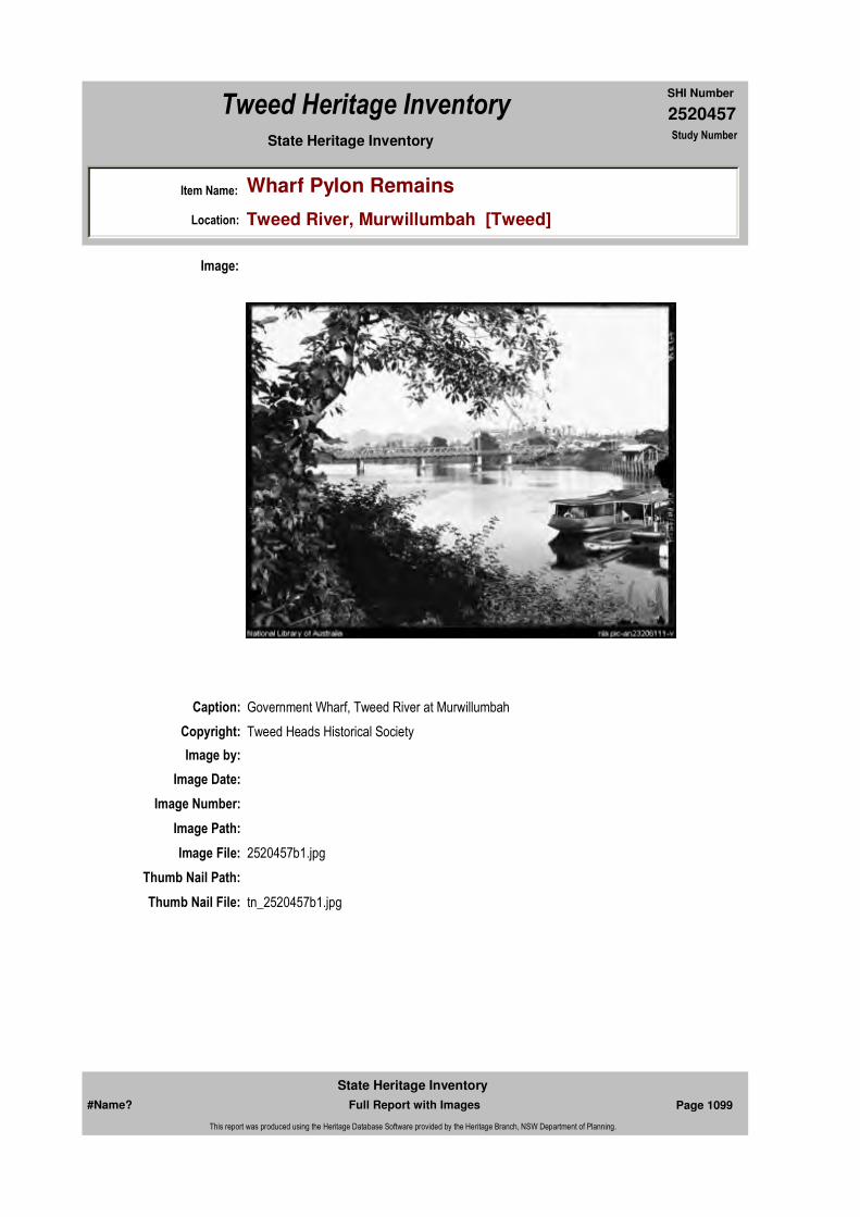
2520457
SHI Number
Tweed Heritage Inventory
Item Name: Wharf Pylon Remains
Location: Tweed River, Murwillumbah [Tweed]
State Heritage Inventory Study Number
Caption: Government Wharf, Tweed River at Murwillumbah
Copyright: Tweed Heads Historical Society
Image:
Image by:
Image Date:
Image Number:
Image Path:
Image File: 2520457b1.jpg
Thumb Nail Path:
Thumb Nail File: tn_2520457b1.jpg
#Name? Page 1099 Full Report with Images
State Heritage Inventory
This report was produced using the Heritage Database Software provided by the Heritage Branch, NSW Department of Planning.

2520457
SHI Number
Tweed Heritage Inventory
Item Name: Wharf Pylon Remains
Location: Tweed River, Murwillumbah [Tweed]
State Heritage Inventory Study Number
Caption: 2004 remains of the Government Wharf, Tweed River at Murwillumbah
Copyright: Tweed Heads Historical Society
Image:
Image by: Immy McKiernan
Image Date: 28/09/2003
Image Number:
Image Path:
Image File: 2520457b2.jpg
Thumb Nail Path:
Thumb Nail File: tn_2520457b2.jpg
#Name? Page 1100 Full Report with Images
State Heritage Inventory
This report was produced using the Heritage Database Software provided by the Heritage Branch, NSW Department of Planning.

2520457
SHI Number
Tweed Heritage Inventory
Item Name: Wharf Pylon Remains
Location: Tweed River, Murwillumbah [Tweed]
State Heritage Inventory Study Number
#Name? Page 1101 Full Report with Images
State Heritage Inventory
This report was produced using the Heritage Database Software provided by the Heritage Branch, NSW Department of Planning.

2520460
SHI Number
Tweed Heritage Inventory
Item Name: Kingsford Flats
Location: 35 Commercial Road, Murwillumbah [Tweed]
State Heritage Inventory Study Number
Current Use:
Former Uses:
Statement of
Significance:Kingsford Flats represents 1930's architecture of which there are not many examples on the Tweed. Constructed of blue bricks, also an unusual component in Tweed architecture.
Historical Notes or Provenance:
Physical Description: Two storey flats circa 1930 with fine detailing and site planning on the bank of the Tweed River. Georgian Revival. Unusual massing. Interesting asymmetrical design Northern block has a different orientation to the rest of the buildings. Allows some symmetry to main section with central tower entry yet stepping out from building. Reasonably complex for Georgian as a whole. Simple individual pieces. Regular repetitive fenistration. Plain wall cladding of face
Designer:
Maker / Builder:
Year Started: Year Completed: 1930 Circa: Yes
Endorsed Significance:Assessed Significance: Local
Item Type: Built Category: FlatGroup: Residential buildings (
Admin Codes: Code 2: Code 3:
Curtilage/Boundary:
Owner: Private - Individual
Other/Former Names:
Area/Group/Complex: Group ID:
Themes:
Aboriginal Area:
Local Govt Area: Tweed
Planning: Northern
Historic Region: North Coast
Address: #Name?
Suburb / Nearest Town: #Name?
State: NSW
Parish: Murwillumbah
County: Rous
National Theme State Theme Local Theme
4. Settlement Accommodation (Housing) Flats
#Name? Page 1113 Full Report with Images
State Heritage Inventory
This report was produced using the Heritage Database Software provided by the Heritage Branch, NSW Department of Planning.

2520460
SHI Number
Tweed Heritage Inventory
Item Name: Kingsford Flats
Location: 35 Commercial Road, Murwillumbah [Tweed]
State Heritage Inventory Study Number
brick. Restrained and simple classical form of columns above arched logia forming porch to southern end. Round headed arches motif used other buildings as windows.Regular prismatic shapes dominate, however boxed eaves. String course of vertical lighter bricks. Tower reminiscent of earlier Pre Great War styles. Tiled roof. Some mild pilaster use to porches. ShuttersMinimum external changes and additions. Some aluminium windows to upper porch and openings. Metal scroll work to lower floor arches.
Physical Condition:
Modification Dates:
Recommended Management:
References:
Studies:
Further Comments:
Criteria a)
Criteria c)
Criteria d)
Criteria e)
Criteria g)
Criteria f)
Integrity / Intactness:
Criteria b) Kingscford Flats represents 1930's architecture of which there are not many examples on the Tweed. Constructed of blue bricks, also an unusual component in Tweed architecture.
Parcels:
Latitude: Longitude:
AMG Zone: Easting: Northing:
Map Name: Map Scale:
Spatial Accuracy:Location validity:
Management:
Author Title YearNumber
Tweed Shire Council Community-based Heritage Study 2003
Parcel Code LotNumber Section Plan Code Plan Number
LOT 2 DP 576041
#Name? Page 1114 Full Report with Images
State Heritage Inventory
This report was produced using the Heritage Database Software provided by the Heritage Branch, NSW Department of Planning.

2520460
SHI Number
Tweed Heritage Inventory
Item Name: Kingsford Flats
Location: 35 Commercial Road, Murwillumbah [Tweed]
State Heritage Inventory Study Number
Custom Field One:
Listings:
Date Updated: 17/05/2004 Status: BasicDate First Entered: 21/04/2004Data Entry:
Custom Field Two:
Custom Field Three:
Custom Field Four:
Custom Field Five:
Custom Field Six:
Caption: Kingsford Flats, Commercial Road, Murwillumbah
Copyright: Tweed Heads Historical Society
Image:
Image by: Immy McKiernan
Image Date: 08/08/2003
Image Number:
#Name? Page 1115 Full Report with Images
State Heritage Inventory
This report was produced using the Heritage Database Software provided by the Heritage Branch, NSW Department of Planning.
2520460
SHI Number
Tweed Heritage Inventory
Item Name: Kingsford Flats
Location: 35 Commercial Road, Murwillumbah [Tweed]
State Heritage Inventory Study Number
Image Path:
Image File: 2520460b1.jpg
Thumb Nail Path:
Thumb Nail File: tn_2520460b1.jpg
#Name? Page 1116 Full Report with Images
State Heritage Inventory
This report was produced using the Heritage Database Software provided by the Heritage Branch, NSW Department of Planning.
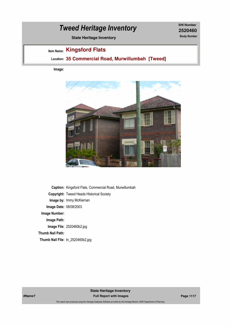
2520460
SHI Number
Tweed Heritage Inventory
Item Name: Kingsford Flats
Location: 35 Commercial Road, Murwillumbah [Tweed]
State Heritage Inventory Study Number
Caption: Kingsford Flats, Commercial Road, Murwillumbah
Copyright: Tweed Heads Historical Society
Image:
Image by: Immy McKiernan
Image Date: 08/08/2003
Image Number:
Image Path:
Image File: 2520460b2.jpg
Thumb Nail Path:
Thumb Nail File: tn_2520460b2.jpg
#Name? Page 1117 Full Report with Images
State Heritage Inventory
This report was produced using the Heritage Database Software provided by the Heritage Branch, NSW Department of Planning.

2520460
SHI Number
Tweed Heritage Inventory
Item Name: Kingsford Flats
Location: 35 Commercial Road, Murwillumbah [Tweed]
State Heritage Inventory Study Number
Caption: Kingsford Flats, Commercial Road, Murwillumbah
Copyright: Tweed Heads Historical Society
Image:
Image by: Immy McKiernan
Image Date: 08/08/2003
Image Number:
Image Path:
Image File: 2520460b3.jpg
Thumb Nail Path:
Thumb Nail File: tn_2520460b3.jpg
#Name? Page 1118 Full Report with Images
State Heritage Inventory
This report was produced using the Heritage Database Software provided by the Heritage Branch, NSW Department of Planning.
2520460
SHI Number
Tweed Heritage Inventory
Item Name: Kingsford Flats
Location: 35 Commercial Road, Murwillumbah [Tweed]
State Heritage Inventory Study Number
#Name? Page 1119 Full Report with Images
State Heritage Inventory
This report was produced using the Heritage Database Software provided by the Heritage Branch, NSW Department of Planning.

2520463
SHI Number
Tweed Heritage Inventory
Item Name: Tumbulgum Cemetery
Location: Dulguigan Road, North Tumbulgum [Tweed]
State Heritage Inventory Study Number
Current Use:
Former Uses:
Statement of
Significance:The Tumbulgum Cemetery is important in the course of the Tweed Shire's cultural history as the oldest existing cemetery in the Tweed Valley.
Historical Notes or Provenance:
Historic Tumbulgum Cemetery established 1883
North Tumbulgum Cemetery is the oldest cemetery in the Tweed Valley (1887 - 1947). Located above the shores of the Rous River, the magnificent monuments rise out of the bush as a constant reminder of the hardships and struggles of our earliest pioneers. The cemetery is surrounded by sub-tropical rain forest, with commanding views across the lush valley and beyond to Mount Warning.
This is your opportunity to capture the spirit of a bygone era through information plaques and the poignant epitaphs which adorn the ornate headstones.
Midway between Tweed Heads and Murwillumbah, is the turn off to the historic town of Tumbulgum. Sign posts will guide you along 3km of sealed road to the car park located at the foot of the cemetery.
An Historical JourneyBeside the walking track, signs are located which trace the history from the earliest inhabitants to the decline of the settlement in the 1900's. The journey to the top will take approximately 5 minutes, with seats and viewing stations provided at regular intervals.
Original Inhabitants
Endorsed Significance:Assessed Significance: Local
Item Type: Complex / Group Category: Cemetery/Graveyard/Group: Cemeteries and Buria
Admin Codes: Code 2: Code 3:
Curtilage/Boundary:
Owner: Local Government
Other/Former Names: Tweed Junction Cemetery
Area/Group/Complex: Group ID:
Aboriginal Area:
Local Govt Area: Tweed
Planning: Northern
Historic Region: North Coast
Address: #Name?
Suburb / Nearest Town: #Name?
State: NSW
Parish:
County:
#Name? Page 1133 Full Report with Images
State Heritage Inventory
This report was produced using the Heritage Database Software provided by the Heritage Branch, NSW Department of Planning.

2520463
SHI Number
Tweed Heritage Inventory
Item Name: Tumbulgum Cemetery
Location: Dulguigan Road, North Tumbulgum [Tweed]
State Heritage Inventory Study Number
The area surrounding the junction of the Tweed River was the tribal land of the Moorung-Moobar Clan. It was a lush and bountiful sub-tropical rainforest with more than 250 edible plants, abundant aquatic life and all the necessary raw material to create tools, shelter and other wanted items. The people on the Tweed were collectively known as Goori's (not Koori's), and were less nomadic than most tribes, largely due to the plentiful food supply. The Goori's were hunter-gatherers, living in harmony with the earth, their culture and way of life had left this continent relatively unchanged for tens of thousands of years. The arrival of the white man would change this forever.
Arrival of the White ManBetween 1842 and 1844, the first cedar-getters arrived from Moreton Bay and Sydney and the decimation of the forests began. The dense sub-tropical rain forest with Lawyer vines, stinging trees, thorns, leeches, mosquitoes and the oppressive humidity took its toll. The work was hard and dangerous, with the only recreation being in the form of rum and tobacco brought down the river by tiny schooners and ketches. The cedar-getters employed many natives as labourers, they cleared tracks, carried water, felled trees and found food. Within the first few years, introduced diseases wiped out hundreds of the north coast aborigines.
By the 1860's, the cedar trade had attracted the paddle wheel, then screw propelled steamers to the junction of the Tweed River. They brought corn, arrowroot, potato and sugar cane and thus a settlement began on the left bank, and was named there after the Junction.
With the introduction of the Robertson Land Act of 1861, more land was cleared and the population grew. It was the Skinner Bros. of "Inglewood" farm who began the first regular passenger ferry service, and with it, the growth of the settlement was assured. In 1870, Captain Alexander Logan established the 'Junction Inn', a General store and wharf on the north bank, a rival establishment, the 'Junction Hotel' soon appeared on the opposite bank. Between 1870 and 1890, the town gained a Post Office, School, five stores, three hotels, three doctors, two chemist, two churches, a blacksmith and boat builders.
In 1880, the residents of Tweed Junction successfully petitioned the government to have the name of the Post Office changed to Tumbulgum, the aboriginal word for 'meeting of the waters'.
The financial depression in 1893 was extremely hard on the businesses of the town, resulting in the closure of the bank later that year. The focus for development was now on Murwillumbah, and in 1894 a rail service was opened and road development began to radiate from the town.
In 1902 the Tumbulgum Post Office was downgraded, the best timber was all but gone and the town decline rapidly.
The North Tumbulgum CemeteryFor his services to shipping, Captain Alexander Logan was granted land, and in turn donated 6½ acres for the establishment of a cemetery. Burials had been recorded from 1870, but the first documented at this cemetery was that of a drowned infant in 1873. Two survey plans were submitted to the Land Board, District of Grafton, and following an amendment,
#Name? Page 1134 Full Report with Images
State Heritage Inventory
This report was produced using the Heritage Database Software provided by the Heritage Branch, NSW Department of Planning.

2520463
SHI Number
Tweed Heritage Inventory
Item Name: Tumbulgum Cemetery
Location: Dulguigan Road, North Tumbulgum [Tweed]
State Heritage Inventory Study Number
dedication took place on the 12th January, 1883. The plans divided the site into seven separate areas, Church of England, Roman Catholic, Presbyterian, Wesleyan, General Cemetery, Jews and Independents. Although sectarian boundaries have recently been surveyed, it appears that the majority of burials took place on the most accessible and convenient site.
Between 1872 and 1890, 47 burials had been recorded, with only two headstones remaining from that time, those of Christina Sarah Logan (12th April, 1877), infant child of Alexander and Eliza, and Alexander Logan himself at the age of 58 years (15th September, 1888)
By 1900, 80 registered burials had taken place, with 30 being babies and young infants, 13 deaths by drowning and several others from tree falling accidents. In all, more than 150 burials were recorded before the closure of the cemetery in 1947.
FuneralsPrior to the introduction of ferry services from the south to the north banks, small boats would carry the coffins across the river. Among the stories recounted, was that of the death of a 10 hour old baby. The father was a carpenter and built the tiny coffin, then rowed across the river and carried it to the cemetery, returning to fetch the minister. The marker was also hand made, with an etched inscription. It appears that the first suffered damage and a second was erected, both remain at the site.
With the advent of the ferry service, the cortege would be brought to the north bank (near Shaw's Woodcraft), and make the remainder of the journey on foot or by carriage. Ornate marble and granite headstones were brought to the site from as far afield as Sydney and Brisbane. The craftsmanship is outstanding, with each piece individually created.
For every grave there is a story waiting to be told, some have been documented and so many more may have been lost forever. Amongst the epitaphs are the heartfelt words of the grieving families, but none more clearly portrays the struggles so many endured as that on Alexander Logan's grave.Rest for the toiling handsRest for the anxious browRest for the weary way torn feetRest from all labour now
The following is a list of surnames known to be represented in the cemetery (many graves are unmarked):Boyd, Burke, Boardman, Brand, Baker, Booth, Cameron, Cashin, Cochrane, Cook, Clancy, Chappell, Doig, Dinsey, Evens, Fletcher, Forder, Fanning, Finn, Gray, Gilbert, Graham, Homes, Hawkins, Hildridge, Hamilton, Higgins, Houseman, Hanley, Holm, Jones, Johnston, Jamieson, Jaggers, Logan, Liffo, Law, McLeod, McGilvray, McKell, McKinnon, Moriarty, Martin, Milm, Marshal, Myres, Modder, Maye, Nelson, North, Numling, Nichols, Osbourne, Oglive, Ostrom, Pringle, Poole, Parker, Page, Prewitt, Pohles, Rush, Ryan, Ritchie, Riley, Roberts, Rivers, Smith, Skinner, Straughair, Stanley, Stewart, Seivewright, Sullivan, Trute, Thompson, Tanna, Turner, Tree, Waugh, Woods, Wallace, Wonki, Wacim, Warne.
The Rebirth of the Cemetery (LEAP 1993)
#Name? Page 1135 Full Report with Images
State Heritage Inventory
This report was produced using the Heritage Database Software provided by the Heritage Branch, NSW Department of Planning.

2520463
SHI Number
Tweed Heritage Inventory
Item Name: Tumbulgum Cemetery
Location: Dulguigan Road, North Tumbulgum [Tweed]
State Heritage Inventory Study Number
Due to the inaccessibility of the site, and the declining population of Tumbulgum, the cemetery was not used after 1947. The natural vegetation, including brush-box and rainforest species gradually reclaimed the burial ground.
In 1993 Tweed Council successfully nominated the restoration as a worthy undertaking for the Landcare Environment Action Programme (LEAP) being administrated by Murwillumbah Youth Enterprise Scheme Inc (MYES).
Many headstones and grave surrounds required extensive rebuilding and painstaking restoration. Some lay in pieces, others had subsided and were at risk of collapsing. A team of twelve dedicated people spent six months at the site to ensure that this unique piece of our heritage would be preserved for generations to come.
The Project team designed and built the car park wall, access path, seats, rest areas, and conducted the research for information signs which guide you to the top. The original rainforest species have been identified and returned to the site, which has included the creation of a habitat for the endangered Richmond River Bird Wing Butterfly. Along the path you will notice a number of different species of vine, the one which is of greatest significance to the Bird Wing, is known as Aristolochia praevenosa. This is the only vine on which the female will deposit eggs, therefore its reintroduction and that of suitable nectar plants, such as the Fire Wheel Tree are essential for the survival of this magnificent butterfly.
The principal burial site has been surrounded by post and rail fencing, and the area within has undergone extensive landscaping using natural materials where possible. More than 500 trees and shrubs were planted, not only for your enjoyment, but also to provide food and nesting sites for the many spectacular birds which inhabit the site.
Participant in this Project researched original burial records, and were privileged to hear stories from the past from many families whose ancestors lived through the bustling days of Tumbulgum.There is so much to be told about the cemetery, Tumbulgum and the families who pioneered this beautiful place. From LEAP 1993, we thank you for allowing us to share a very special time in our lives and know that you will enjoy your visit to this magic place.Written by Alexandra & Associates
Historic Tumbulgum Cemetery Revisited Ron Johansen "Tales of our Times" Volume 3, page 58It was about 30 years ago that I last tried to visit the old Tumbulgum Cemetery. That day it was a case of crossing the river by ferry from the Pacific Highway, (the highway then did not bypass the village) turn left until Mayes Hill turnoff was reached.
Just past there, on the side of the hill among the bracken fern, lantana, vines and trees of all descriptions was the cemetery of the pioneers.
So when an invitation came to visit the restored historic Tumbulgum cemetery, it was a pleasant surprise to see at firsthand, the marvelous job done by this band of willing workers who accepted the challenge to restore the cemetery.
#Name? Page 1136 Full Report with Images
State Heritage Inventory
This report was produced using the Heritage Database Software provided by the Heritage Branch, NSW Department of Planning.
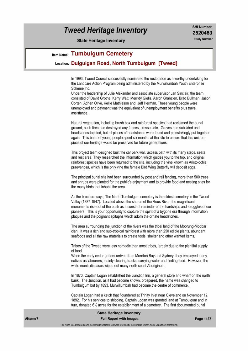
2520463
SHI Number
Tweed Heritage Inventory
Item Name: Tumbulgum Cemetery
Location: Dulguigan Road, North Tumbulgum [Tweed]
State Heritage Inventory Study Number
In 1993, Tweed Council successfully nominated the restoration as a worthy undertaking for the Landcare Action Program being administered by the Murwillumbah Youth Enterprise Scheme Inc.Under the leadership of Julie Alexander and associate supervisor Jan Sinclair, the team consisted of David Grothe, Kerry Watt, Merridy Gielis, Aaron Granzien, Brad Bullman, Jason Corten, Adrien Olive, Kellie Mathieson and Jeff Herman. These young people were unemployed and payment was the equivalent of unemployment benefits plus travel assistance.
Natural vegetation, including brush box and rainforest species, had reclaimed the burial ground, bush fires had destroyed any fences, crosses etc. Graves had subsided and headstones toppled, but all pieces of headstones were found and painstakingly put together again. This band of young people spent six months at the site to ensure that this unique piece of our heritage would be preserved for future generations.
This project team designed built the car park wall, access path with its many steps, seats and rest area. They researched the information which guides you to the top, and original rainforest species have been returned to the site, including the vine known as Aristolochia praevenosa, which is the only vine the female Bird Wing Butterfly will deposit eggs.
The principal burial site had been surrounded by post and rail fencing, more than 500 trees and shrubs were planted for the public's enjoyment and to provide food and nesting sites for the many birds that inhabit the area.
As the brochure says, The North Tumbulgum cemetery is the oldest cemetery in the Tweed Valley (1887-1947). Located above the shores of the Rous River, the magnificent monuments rise out of the bush as a constant reminder of the hardships and struggles of our pioneers. This is your opportunity to capture the spirit of a bygone era through information plaques and the poignant epitaphs which adorn the ornate headstones.
The area surrounding the junction of the rivers was the tribal land of the Moorung-Moobar clan. It was a rich and sub-tropical rainforest with more than 250 edible plants, abundant seafoods and all the raw materials to create tools, shelter and other wanted items.
Tribes of the Tweed were less nomadic than most tribes, largely due to the plentiful supply of food.When the early cedar getters arrived from Moreton Bay and Sydney, they employed many natives as labourers, mainly clearing tracks, carrying water and finding food. However, the white men's diseases wiped out many north coast Aborigines.
In 1870, Captain Logan established the Junction Inn, a general store and wharf on the north bank. The Junction, as it had become known, prospered, the name was changed to Tumbulgum but by 1893, Murwillumbah had become the centre of commerce.
Captain Logan had a ketch that floundered at Trinity Inlet near Cleveland on November 12, 1892. For his services to shipping, Captain Logan was granted land at Tumbulgum and in turn, donated 6½ acres for the establishment of a cemetery. The first documented burial
#Name? Page 1137 Full Report with Images
State Heritage Inventory
This report was produced using the Heritage Database Software provided by the Heritage Branch, NSW Department of Planning.

2520463
SHI Number
Tweed Heritage Inventory
Item Name: Tumbulgum Cemetery
Location: Dulguigan Road, North Tumbulgum [Tweed]
State Heritage Inventory Study Number
was a drowned infant in 1873.Plans show the site was divided into seven separate areas; Church of England, Roman Catholic, Presbyterian, Wesleyan, General, Jews and Independents. However, it appears that most were buried in the easiest and most accessible site. Among the epitaphs, none more clearly portrays the hardships endured as that on Alexander Logan's grave:rest for tire toiling hands rest for the anxious browrest for the weary way torn feet rest from all labour now.
So, when you make the pilgrimage to see the restoration and everything that has been done, count the steps, and remember that everything was carried by hand to the top, even the metal dust was carried up in buckets by these young people. Here's hoping that Tumbulgum Cemetery will be added to the long list of Tweed Shire maintenance projects.
Physical Description: Dedicated 12 January, 1883, although burials had taken place before this date. It is now closed and promoted as a tourist attraction with approximately 150 burials, 112 records.
Located above the shores of the Rous River, the magnificent monuments rise out of the bush as a constant reminder of the hardships and struggles of our earliest pioneers. The cemetery is surrounded by sub-tropical rainforest, with commanding views across the lush valley and beyond to Mount Warning.
The restored cemetery (1993) is open to the public and well signposted. It is in a unique setting, as it has been overgrown and many trees now grow from within grave sites, giving the cemetery an individual character.
Physical Condition:
Modification Dates:
Designer:
Maker / Builder:
Year Started: 1883 Year Completed: 1947 Circa: No
Recommended Management:
Themes:
Management:
National Theme State Theme Local Theme
9. Phases of Life Birth and Death Cemeteries
#Name? Page 1138 Full Report with Images
State Heritage Inventory
This report was produced using the Heritage Database Software provided by the Heritage Branch, NSW Department of Planning.

2520463
SHI Number
Tweed Heritage Inventory
Item Name: Tumbulgum Cemetery
Location: Dulguigan Road, North Tumbulgum [Tweed]
State Heritage Inventory Study Number
Custom Field One:
References:
Studies:
Listings:
Date Updated: 03/11/2004 Status: BasicDate First Entered: 28/04/2004Data Entry:
Further Comments:
Criteria a) Important in the course of the Tweed Shire's cultural history as the oldest existing cemetery in the Tweed Valley.
Criteria c)
Criteria d)
Criteria e)
Criteria g)
Criteria f)
Integrity / Intactness:
Custom Field Two:
Custom Field Three:
Custom Field Four:
Custom Field Five:
Custom Field Six:
Criteria b)
Parcels:
Latitude: Longitude:
AMG Zone: Easting: 544641 Northing: 6873001
Map Name: Map Scale:
Spatial Accuracy:Location validity:
Author Title Year
Historic Tumbulgum Cemetery Brochure
Ron Johansen "Tales of our Times" Historic Tumbulgum Cemetery Revisited
Author Title YearNumber
Tweed Shire Council Community-based Heritage Study 2003
Parcel Code LotNumber Section Plan Code Plan Number
LOT 7003 DP 1052274
#Name? Page 1139 Full Report with Images
State Heritage Inventory
This report was produced using the Heritage Database Software provided by the Heritage Branch, NSW Department of Planning.

2520463
SHI Number
Tweed Heritage Inventory
Item Name: Tumbulgum Cemetery
Location: Dulguigan Road, North Tumbulgum [Tweed]
State Heritage Inventory Study Number
Caption:
Copyright: Tweed Heads Historical Society
Image:
Image by: Immy McKiernan
Image Date: 20/07/2003
Image Number:
Image Path:
Image File: 2520463b1.jpg
Thumb Nail Path:
Thumb Nail File: tn_2520463b1.jpg
#Name? Page 1140 Full Report with Images
State Heritage Inventory
This report was produced using the Heritage Database Software provided by the Heritage Branch, NSW Department of Planning.

2520463
SHI Number
Tweed Heritage Inventory
Item Name: Tumbulgum Cemetery
Location: Dulguigan Road, North Tumbulgum [Tweed]
State Heritage Inventory Study Number
Caption:
Copyright: Tweed Heads Historical Society
Image:
Image by: Immy McKiernan
Image Date: 20/07/2003
Image Number:
Image Path:
Image File: 2520463b2.jpg
Thumb Nail Path:
Thumb Nail File: tn_2520463b2.jpg
#Name? Page 1141 Full Report with Images
State Heritage Inventory
This report was produced using the Heritage Database Software provided by the Heritage Branch, NSW Department of Planning.
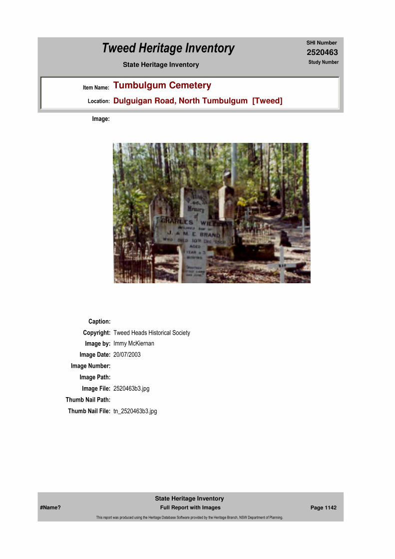
2520463
SHI Number
Tweed Heritage Inventory
Item Name: Tumbulgum Cemetery
Location: Dulguigan Road, North Tumbulgum [Tweed]
State Heritage Inventory Study Number
Caption:
Copyright: Tweed Heads Historical Society
Image:
Image by: Immy McKiernan
Image Date: 20/07/2003
Image Number:
Image Path:
Image File: 2520463b3.jpg
Thumb Nail Path:
Thumb Nail File: tn_2520463b3.jpg
#Name? Page 1142 Full Report with Images
State Heritage Inventory
This report was produced using the Heritage Database Software provided by the Heritage Branch, NSW Department of Planning.

2520463
SHI Number
Tweed Heritage Inventory
Item Name: Tumbulgum Cemetery
Location: Dulguigan Road, North Tumbulgum [Tweed]
State Heritage Inventory Study Number
Caption: Headstone of Alexander Logan at Tumbulgum Cemetery.
Copyright: Tweed Heads Historical Society
Image:
Image by: Immy McKiernan
Image Date: 26/07/2004
Image Number:
Image Path:
Image File: 2520463b4.jpg
Thumb Nail Path:
Thumb Nail File: tn_2520463b4.jpg
#Name? Page 1143 Full Report with Images
State Heritage Inventory
This report was produced using the Heritage Database Software provided by the Heritage Branch, NSW Department of Planning.

2520463
SHI Number
Tweed Heritage Inventory
Item Name: Tumbulgum Cemetery
Location: Dulguigan Road, North Tumbulgum [Tweed]
State Heritage Inventory Study Number
#Name? Page 1144 Full Report with Images
State Heritage Inventory
This report was produced using the Heritage Database Software provided by the Heritage Branch, NSW Department of Planning.

2520464
SHI Number
Tweed Heritage Inventory
Item Name: Piggabeen Hall
Location: 525 Piggabeen Road, Piggabeen [Tweed]
State Heritage Inventory Study Number
Current Use: Community Hall
Former Uses: Community Hall
Statement of
Significance:Including the Piggabeen & Cobaki War Memorial Roll, The Piggabeen/Cobaki Hall has a strong association with the Piggabeen and Cobaki communities. It has acted as a centre for social and cultural activities for nearly 100 years. It has acted as a centre for social and cultural activities over nearly 100 years.The memorial is part of the cultural history of the Tweed Valley and has a special association with the community in which it is housed.
Historical Notes
or Provenance:
Physical Description: Timber hall in Carpenter Gothic style.
Designer:
Maker / Builder:
Year Started: Year Completed: Circa: No
Endorsed Significance:Assessed Significance: Local
Item Type: Built Category: Hall Public Group: Community Facilities
Admin Codes: Code 2: Code 3:
Curtilage/Boundary:
Owner: Local Government
Other/Former Names:
Area/Group/Complex: Group ID:
Themes:
Aboriginal Area:
Local Govt Area: Tweed
Planning: Northern
Historic Region: North Coast
Address: #Name?
Suburb / Nearest Town: #Name?
State: NSW
Parish: Terranora
County: Rous
National Theme State Theme Local Theme
8. Culture Social institutions Community Hall
#Name? Page 1145 Full Report with Images
State Heritage Inventory
This report was produced using the Heritage Database Software provided by the Heritage Branch, NSW Department of Planning.

2520464
SHI Number
Tweed Heritage Inventory
Item Name: Piggabeen Hall
Location: 525 Piggabeen Road, Piggabeen [Tweed]
State Heritage Inventory Study Number
Physical Condition:
Modification Dates:
Custom Field One:
Recommended
Management:
References:
Studies:
Listings:
Further Comments:
Criteria a)
Criteria c)
Criteria d) The Piggabeen/Cobaki Hall has a strong association with the Piggabeen and Cobaki communities. It has acted as a centre for social and cultural activities for nearly 100 years. Piggabeen & Cobaki Roll Inscribed Marble Plaque at the Piggabeen Hall.^The memorial is part of the cultural history of the Tweed Valley and has a special association with the community in which it is housed. It has acted as a centre for social and cultural activities over nearly 100 years.
Criteria e)
Criteria g)
Criteria f)
Integrity / Intactness:
Custom Field Two:
Criteria b)
Parcels:
Latitude: Longitude:
AMG Zone: Easting: 545329 Northing: 6881848
Map Name: Map Scale:
Spatial Accuracy:Location validity:
Management:
Author Title YearNumber
Tweed Shire Council Community-based Heritage Study 2003
Parcel Code LotNumber Section Plan Code Plan Number
LOT 203 DP 755740
#Name? Page 1146 Full Report with Images
State Heritage Inventory
This report was produced using the Heritage Database Software provided by the Heritage Branch, NSW Department of Planning.

2520464
SHI Number
Tweed Heritage Inventory
Item Name: Piggabeen Hall
Location: 525 Piggabeen Road, Piggabeen [Tweed]
State Heritage Inventory Study Number
Date Updated: 22/11/2006 Status: BasicDate First Entered: 28/04/2004Data Entry:
Custom Field Three:
Custom Field Four:
Custom Field Five:
Custom Field Six:
Caption: Piggabeen Hall
Copyright: Tweed Heads Historical Society
Image:
Image by: Robert Ford
Image Date:
Image Number:
Image Path:
Image File: 2520464b1.jpg
Thumb Nail Path:
Thumb Nail File: tn_2520464b1.jpg
#Name? Page 1147 Full Report with Images
State Heritage Inventory
This report was produced using the Heritage Database Software provided by the Heritage Branch, NSW Department of Planning.

2520464
SHI Number
Tweed Heritage Inventory
Item Name: Piggabeen Hall
Location: 525 Piggabeen Road, Piggabeen [Tweed]
State Heritage Inventory Study Number
#Name? Page 1148 Full Report with Images
State Heritage Inventory
This report was produced using the Heritage Database Software provided by the Heritage Branch, NSW Department of Planning.
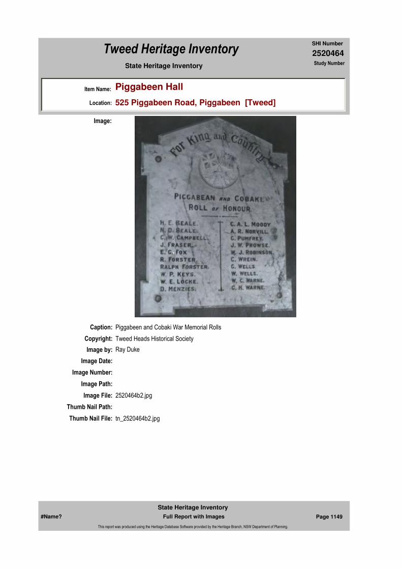
2520464
SHI Number
Tweed Heritage Inventory
Item Name: Piggabeen Hall
Location: 525 Piggabeen Road, Piggabeen [Tweed]
State Heritage Inventory Study Number
Caption: Piggabeen and Cobaki War Memorial Rolls
Copyright: Tweed Heads Historical Society
Image:
Image by: Ray Duke
Image Date:
Image Number:
Image Path:
Image File: 2520464b2.jpg
Thumb Nail Path:
Thumb Nail File: tn_2520464b2.jpg
#Name? Page 1149 Full Report with Images
State Heritage Inventory
This report was produced using the Heritage Database Software provided by the Heritage Branch, NSW Department of Planning.

2520464
SHI Number
Tweed Heritage Inventory
Item Name: Piggabeen Hall
Location: 525 Piggabeen Road, Piggabeen [Tweed]
State Heritage Inventory Study Number
Caption: Piggabeen and Cobaki War Memorial Rolls
Copyright: Tweed Heads Historical Society
Image:
Image by: Ray Duke
Image Date:
Image Number:
Image Path:
Image File: 2520464b3.jpg
Thumb Nail Path:
Thumb Nail File: tn_2520464b3.jpg
#Name? Page 1150 Full Report with Images
State Heritage Inventory
This report was produced using the Heritage Database Software provided by the Heritage Branch, NSW Department of Planning.
2520464
SHI Number
Tweed Heritage Inventory
Item Name: Piggabeen Hall
Location: 525 Piggabeen Road, Piggabeen [Tweed]
State Heritage Inventory Study Number
#Name? Page 1151 Full Report with Images
State Heritage Inventory
This report was produced using the Heritage Database Software provided by the Heritage Branch, NSW Department of Planning.
2520465
SHI Number
Tweed Heritage Inventory
Item Name: Border Fence Posts
Location: Boundary Street, Point Danger [Tweed]
State Heritage Inventory Study Number
Current Use:
Former Uses:
Statement of
Significance:The fence between NSW & Queensland was erected as a result of the tick scare in 1898. The posts on Point Danger are all that is left and are a reminder of the measures taken to prevent the spread of the cattle tick into NSW.
Historical Notes
or Provenance:The fence between NSW & Queensland was erected as a result of the tick scare in 1898. The posts on Point Danger are all that is left and are a reminder of the measures taken to prevent the spread of the cattle tick into NSW.
The establishment of the Customs Station in 1872 was unwelcome, but when the Cattle tick "Boophilus Microplus" was discovered at the Newmarket salesyards in Brisbane in 1897 the measures taken by the N. S. W. Government at Tweed Heads to keep its territory tick free caused much inconvenience and frustration to Tweed Heads residents. A writer in the Brisbane Courier of 14th August, 1926, reported "When erected in 1898, no means of access between the two states was provided for pedestrians, other than a pair of double gates which were only opened to allow the coach to pass through to Southport. Residents at other periods being required to scramble through the barb wire as best they could.
A few who had the temerity to try and improve the access by wrapping the barb wire in bags were at once threatened with prosecution, to which threat the citizens replied by holding a public meeting at which it was resolved to issue an ultimatum to the Government to the effect that if proper access was provided the citizens would take the matter into their own hands. The threat proved effective, for within a short period puzzle gates were erected and at a later date were followed by a number of elevated bridges provided with steps set at an acute angle enough to prevent them being negotiated by stock. [The bridges] which have
Endorsed Significance:Assessed Significance: State
Item Type: Built Category: FenceGroup: Farming and Grazing
Admin Codes: Code 2: Code 3:
Curtilage/Boundary:
Owner: Local Government
Other/Former Names:
Area/Group/Complex: Group ID:
Aboriginal Area:
Local Govt Area: Tweed
Planning: Northern
Historic Region: North Coast
Address: #Name?
Suburb / Nearest Town: #Name?
State: NSW
Parish: Terranora
County: Rous
#Name? Page 1152 Full Report with Images
State Heritage Inventory
This report was produced using the Heritage Database Software provided by the Heritage Branch, NSW Department of Planning.

2520465
SHI Number
Tweed Heritage Inventory
Item Name: Border Fence Posts
Location: Boundary Street, Point Danger [Tweed]
State Heritage Inventory Study Number
even the cause of numerous accidents including more than one case of broken limbs".
"The Log Book" (Quarterly Journal of Tweed Heads & District Historical Society) Vol 12, page 4
Physical Description: Two original timber border fence posts indicating the line of the twin border fence for the control of stock from the invasion of ticks.
Physical Condition:
Modification Dates:
Designer:
Maker / Builder:
Year Started: 1898 Year Completed: Circa: Yes
Recommended
Management:Restoration to prevent further decay; interpretative sign
References:
Further Comments:
Criteria a) The timber fence posts are important in the course of the history of the Tweed Shire. and NSW & Queensland.
Criteria c)
Criteria d)
Criteria e)
Criteria g)
Criteria f)
Integrity / Intactness:
Criteria b)
Themes:
Management:
Author Title Year
"The Log Book""The Log Book" (Quarterly Journal of Tweed Heads &
National Theme State Theme Local Theme
3. Economy Agriculture Fence
#Name? Page 1153 Full Report with Images
State Heritage Inventory
This report was produced using the Heritage Database Software provided by the Heritage Branch, NSW Department of Planning.

2520465
SHI Number
Tweed Heritage Inventory
Item Name: Border Fence Posts
Location: Boundary Street, Point Danger [Tweed]
State Heritage Inventory Study Number
Custom Field One:
Studies:
Listings:
Date Updated: 31/10/2004 Status: BasicDate First Entered: 28/04/2004Data Entry:
Custom Field Two:
Custom Field Three:
Custom Field Four:
Custom Field Five:
Custom Field Six:
Parcels:
Latitude: 28 10 Longitude: 153 32
AMG Zone: Easting: Northing:
Map Name: Map Scale:
Spatial Accuracy:Location validity:
District Historical Society) "The Log Book" (Quarterly Journal of Tweed Heads & District Historical Society) Vol 12, page 4
Author Title YearNumber
Tweed Shire Council Community-based Heritage Study 2003
Parcel Code LotNumber Section Plan Code Plan Number
LOT 7061 DP 755740
#Name? Page 1154 Full Report with Images
State Heritage Inventory
This report was produced using the Heritage Database Software provided by the Heritage Branch, NSW Department of Planning.
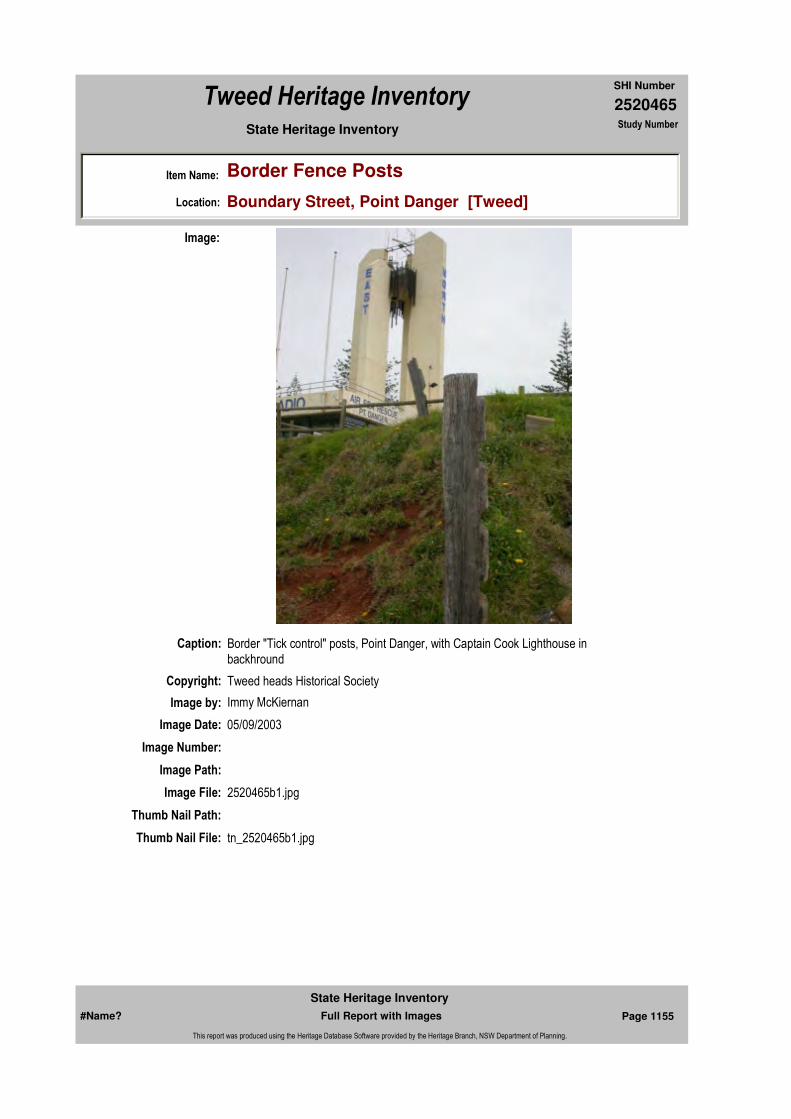
2520465
SHI Number
Tweed Heritage Inventory
Item Name: Border Fence Posts
Location: Boundary Street, Point Danger [Tweed]
State Heritage Inventory Study Number
Caption: Border "Tick control" posts, Point Danger, with Captain Cook Lighthouse in backhround
Copyright: Tweed heads Historical Society
Image:
Image by: Immy McKiernan
Image Date: 05/09/2003
Image Number:
Image Path:
Image File: 2520465b1.jpg
Thumb Nail Path:
Thumb Nail File: tn_2520465b1.jpg
#Name? Page 1155 Full Report with Images
State Heritage Inventory
This report was produced using the Heritage Database Software provided by the Heritage Branch, NSW Department of Planning.
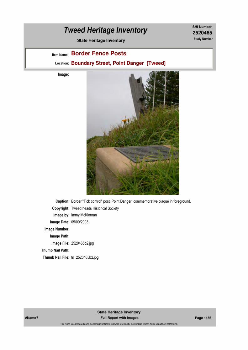
2520465
SHI Number
Tweed Heritage Inventory
Item Name: Border Fence Posts
Location: Boundary Street, Point Danger [Tweed]
State Heritage Inventory Study Number
Caption: Border "Tick control" post, Point Danger, commemorative plaque in foreground.
Copyright: Tweed heads Historical Society
Image:
Image by: Immy McKiernan
Image Date: 05/09/2003
Image Number:
Image Path:
Image File: 2520465b2.jpg
Thumb Nail Path:
Thumb Nail File: tn_2520465b2.jpg
#Name? Page 1156 Full Report with Images
State Heritage Inventory
This report was produced using the Heritage Database Software provided by the Heritage Branch, NSW Department of Planning.
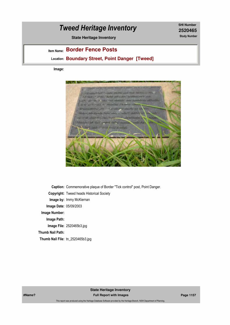
2520465
SHI Number
Tweed Heritage Inventory
Item Name: Border Fence Posts
Location: Boundary Street, Point Danger [Tweed]
State Heritage Inventory Study Number
Caption: Commemorative plaque of Border "Tick control" post, Point Danger.
Copyright: Tweed heads Historical Society
Image:
Image by: Immy McKiernan
Image Date: 05/09/2003
Image Number:
Image Path:
Image File: 2520465b3.jpg
Thumb Nail Path:
Thumb Nail File: tn_2520465b3.jpg
#Name? Page 1157 Full Report with Images
State Heritage Inventory
This report was produced using the Heritage Database Software provided by the Heritage Branch, NSW Department of Planning.

2520465
SHI Number
Tweed Heritage Inventory
Item Name: Border Fence Posts
Location: Boundary Street, Point Danger [Tweed]
State Heritage Inventory Study Number
#Name? Page 1158 Full Report with Images
State Heritage Inventory
This report was produced using the Heritage Database Software provided by the Heritage Branch, NSW Department of Planning.
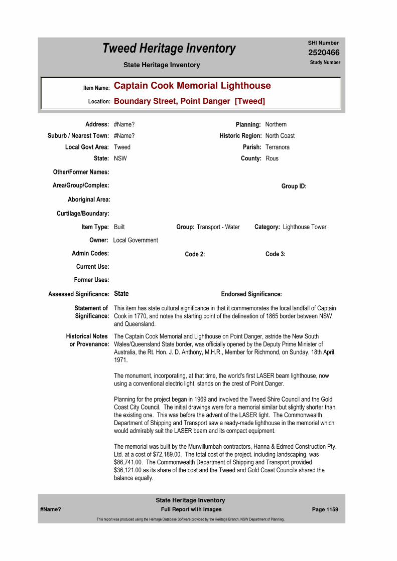
2520466
SHI Number
Tweed Heritage Inventory
Item Name: Captain Cook Memorial Lighthouse
Location: Boundary Street, Point Danger [Tweed]
State Heritage Inventory Study Number
Current Use:
Former Uses:
Statement of
Significance:This item has state cultural significance in that it commemorates the local landfall of Captain Cook in 1770, and notes the starting point of the delineation of 1865 border between NSW and Queensland.
Historical Notes
or Provenance:The Captain Cook Memorial and Lighthouse on Point Danger, astride the New South Wales/Queensland State border, was officially opened by the Deputy Prime Minister of Australia, the Rt. Hon. J. D. Anthony, M.H.R., Member for Richmond, on Sunday, 18th April, 1971.
The monument, incorporating, at that time, the world's first LASER beam lighthouse, now using a conventional electric light, stands on the crest of Point Danger.
Planning for the project began in 1969 and involved the Tweed Shire Council and the Gold Coast City Council. The initial drawings were for a memorial similar but slightly shorter than the existing one. This was before the advent of the LASER light. The Commonwealth Department of Shipping and Transport saw a ready-made lighthouse in the memorial which would admirably suit the LASER beam and its compact equipment.
The memorial was built by the Murwillumbah contractors, Hanna & Edmed Construction Pty. Ltd. at a cost of $72,189.00. The total cost of the project. including landscaping. was $86,741.00. The Commonwealth Department of Shipping and Transport provided $36,121.00 as its share of the cost and the Tweed and Gold Coast Councils shared the balance equally.
Endorsed Significance:Assessed Significance: State
Item Type: Built Category: Lighthouse TowerGroup: Transport - Water
Admin Codes: Code 2: Code 3:
Curtilage/Boundary:
Owner: Local Government
Other/Former Names:
Area/Group/Complex: Group ID:
Aboriginal Area:
Local Govt Area: Tweed
Planning: Northern
Historic Region: North Coast
Address: #Name?
Suburb / Nearest Town: #Name?
State: NSW
Parish: Terranora
County: Rous
#Name? Page 1159 Full Report with Images
State Heritage Inventory
This report was produced using the Heritage Database Software provided by the Heritage Branch, NSW Department of Planning.

2520466
SHI Number
Tweed Heritage Inventory
Item Name: Captain Cook Memorial Lighthouse
Location: Boundary Street, Point Danger [Tweed]
State Heritage Inventory Study Number
The design of the memorial, based on the concept of the Gold Coast City Architect Mr. Les Nyerges. sparked off international interest. A model of the memorial and its associated lighthouse was displayed in the 1970 Electronics Trade Fair in Stockholm and interest in the LASER beam drew enquiries from more than thirty countries.
The project met with construction problems - perched almost on the edge of Point Danger, the towering structure needed solid foundations. Exhaustive diamond drilling tests on the site revealed a rock foundation but this was later revealed to be only a huge boulder. It had to be blasted out and as a result, the depth of the footings was taken down from 6 metres to about 11.5 metres. The structure consists of 33½ tonnes of reinforcement and 273 cubic metres of concrete. It is an imposing four column structure towering some 18 metres above Point Danger and 48 metres above sea level. Each of the 609 millimetre thick columns are placed accurately on the four cardinal points of the compass and the outside face of each column carries, in large lettering, the words - NORTH, SOUTH, EAST and WEST. The memorial is clearly visible by day and at night the pillars are illuminated.
The platform incorporated in the top of the memorial was to have housed the LASER light and was obscured from view by an aluminium sculptural screen which tends to "crown" the memorial.Cast iron ballast hauled from the spot where it was dumped overboard by Captain Cook on the Great Barrier Reef, has been melted down and cast in the shape of a capstan by the Gold Coast Engineering firm, James Kemp Pty. Ltd., and placed centrally at the base of the memorial.
With a slight reduction in scale, historical experts from the Commonwealth Department of Shipping and Transport have designed a replica of the wooden capstan used to raise the anchor on the "Endeavour". Mounted on top of the capstan is a raised brass dome showing the chart of Cook's voyage around the world.
Master mind of the capstan pattern was Mr W.G. Douglas. a former Regional Controller for the Department of Shipping and Transport. Mr Douglas. who figured as the official receiver of the articles salvaged from the "Endeavour" after they were located by an American diving team in 1968, developed a little more than a professional interest in the Captain Cook Memorial and Lighthouse. Mr Douglas even made a study of early sailing ships to ensure that the cast iron capstan would be as true to life as possible.
His pattern has provision for eight capstan bars - used by seamen to wind up the anchor. Lord Nelson's ship "Victory", by comparison had 14 bars spoking out from the capstan. Ten men were needed on each bar making a total of 40 men to raise the anchor. Seated atop the capstan was usually the "fiddler" who played sea shanties as the men pushed away at the capstan bars.The LASER - a name generally associated with science fiction and James Bond movies - took on a realistic significance with its installation as a navigational aid in the memorial, but, with the experience of operation, it was found to be unsuccessful. The lighthouse now carries a conventional electric light.Amongst the multiplicity of suggestions for a memorial considered early in 1970, the Nyerges column retained the widest appeal. The joint Committee of the Tweed and Gold Coast Councils called for a decision which would not only be aesthetically pleasing but functional
#Name? Page 1160 Full Report with Images
State Heritage Inventory
This report was produced using the Heritage Database Software provided by the Heritage Branch, NSW Department of Planning.

2520466
SHI Number
Tweed Heritage Inventory
Item Name: Captain Cook Memorial Lighthouse
Location: Boundary Street, Point Danger [Tweed]
State Heritage Inventory Study Number
also. This brief gave Mr Nyerges the inspiration he needed and a monument which could double as a navigational aid and a landmark for the hundreds of small ships and fishing craft which use the Tweed River entrance, was the obvious choice.
Service clubs traditionally show great public spirit and readiness to assist in civic projects and this memorial was no exception. In fact the two Councils recognised that it was the Lions Club of Coolangatta-Tweed which presented the original proposal that Captain Cook and his achievements be recognised during 1970. Following initial announcements on the subject, a great deal of public interest was shown by organisations and individuals who submitted a number of ideas for a suitable memorial.
When the joint Council Committee took on the construction of the Captain Cook Memorial. the Coolangatta-Tweed Lions Club retained its interest and made a contribution of $1,000 towards the cost of a drinking fountain which is set in the northern garden wall of the memorial.
The Rotary movement also showed interest in the project and made their contribution in the form of the artwork for the relief sketch of Captain Cook which is attached to one of the inside surfaces of the memorial. The artwork was done for Rotary by Mr Ure Oswath, a former Professor of Art in Hungary. The Chairman of the joint Council Committee, Tweed Shire President. Cr. C. H. Hall A.M. said at the opening - "the project is of considerable significance. It will become one of the world shipping landmarks and an imposing monument on the Australian coastline".
The following is an account of Cook's voyage by John Hawkesworth. LL.D., 1770:-May. Tues. 15th: "At noon our latitude by observation was 28º39' south, and the longitude 206º27'West. A high point of land which I have named CAPE BYRON, bore NW by W at the distance of 3 miles. It lies in lat. 28º37'30s, longitude 206º30' west and may be known by a remarkable mountain which lies inland and bears from it NW by W. From this point the land trends N 13ºW, inland and it is high and hilly but low near the shore; to the southward of the point it is also low and level. We continued to steer along the shore with a fresh gale till sunset when suddenly discovered breakers ahead, directly in the ship's course, and also on our starboard bow. At this time we were about 5 miles from land and had 20 fathoms of water, we hauled up East till eight when we ran 8 miles and increased our depth of water to 44 fathoms, we then brought to with the ship's head to the Eastward and lay upon this tak till ten, when having increased our sounding to 70 fathoms. we were and lay with the ship's head to land till 5 a.m. Wed. 16th - when we made sail at daylight were greatly surprised to find ourselves farther to the southward than we had been the evening before, though the wind had been southerly and blown fresh all night, we now saw breakers again within us passed them at a distance of one league. They lie in lat. 28º8'S, stretching off E 2 leagues from a point of land under which is a small island. Their situation may always be known by the peaked mountain which has been mentioned and which bears from them SW by W, for this reason I named MOUNT WARNING. It lies 7 or 8 leagues inland at lat. 28º22'2. The land about is high and hilly but it is sufficiently conspicuous to be distinguished. The point off which these shoals lie I name POINT DANGER. To the north of this point the land is low and trends NW by N, but soon turns again north."
Tweed Byron Ballina Tourist Association Pamphlet
#Name? Page 1161 Full Report with Images
State Heritage Inventory
This report was produced using the Heritage Database Software provided by the Heritage Branch, NSW Department of Planning.
2520466
SHI Number
Tweed Heritage Inventory
Item Name: Captain Cook Memorial Lighthouse
Location: Boundary Street, Point Danger [Tweed]
State Heritage Inventory Study Number
CAPTAIN COOK MEMORIAL LIGHTHOUSE
Physical Description: The monument, incorporating, at that time, the world's first LASER beam lighthouse, now using a conventional electric light, stands on the crest of Point Danger. The structure consists of 33½ tonnes of reinforcement and 273 cubic metres of concrete. It is an imposing four column structure towering some 18 metres above Point Danger and 48 metres above sea level. Each of the 609 millimetre thick columns are placed accurately on the four cardinal points of the compass and the outside face of each column carries, in large lettering, the words - NORTH, SOUTH, EAST and WEST. The memorial is clearly visible by day and at night the pillars are illuminated. The platform incorporated in the top of the memorial was to have housed the LASER light and was obscured from view by an aluminium sculptural screen which tends to "crown" the memorial.Cast iron ballast hauled from the spot where it was dumped overboard by Captain Cook on the Great Barrier Reef, has been melted down and cast in the shape of a capstan by the Gold Coast Engineering firm, James Kemp Pty. Ltd., and placed centrally at the base of the memorial.With a slight reduction in scale, historical experts from the Commonwealth Department of Shipping and Transport have designed a replica of the wooden capstan used to raise the anchor on the "Endeavour". Mounted on top of the capstan is a raised brass dome showing the chart of Cook's voyage around the world.
Physical Condition:
Modification Dates:
Designer: Les Nyerges
Maker / Builder: Hanna & Edmed Construction Pty. Ltd
Year Started: Year Completed: 1971 Circa: No
Recommended Management:
Further Comments:
Criteria a) This item has state cultural significance in that it commemorates the local landfall of Captain Cook in 1770. And notes the starting point of the delineation of 1865 border between NSW and Queensland.
Criteria b)
Themes:
Management:
National Theme State Theme Local Theme
3. Economy Transport Lighthouse
#Name? Page 1162 Full Report with Images
State Heritage Inventory
This report was produced using the Heritage Database Software provided by the Heritage Branch, NSW Department of Planning.

2520466
SHI Number
Tweed Heritage Inventory
Item Name: Captain Cook Memorial Lighthouse
Location: Boundary Street, Point Danger [Tweed]
State Heritage Inventory Study Number
Custom Field One:
References:
Studies:
Listings:
Date Updated: 31/10/2004 Status: BasicDate First Entered: 28/04/2004Data Entry:
Criteria c)
Criteria d)
Criteria e)
Criteria g)
Criteria f)
Integrity / Intactness:
Custom Field Two:
Custom Field Three:
Custom Field Four:
Custom Field Five:
Custom Field Six:
Parcels:
Latitude: 28 10 Longitude: 153 32
AMG Zone: Easting: Northing:
Map Name: Map Scale:
Spatial Accuracy:Location validity:
Author Title Year
Tweed Byron Ballina Tourist Association Pamphlet
Captain Cook Memorial Lighthouse 1971
Author Title YearNumber
Tweed Shire Council Community-based Heritage Study 2003
Parcel Code LotNumber Section Plan Code Plan Number
LOT 7061 DP 755740
#Name? Page 1163 Full Report with Images
State Heritage Inventory
This report was produced using the Heritage Database Software provided by the Heritage Branch, NSW Department of Planning.

2520466
SHI Number
Tweed Heritage Inventory
Item Name: Captain Cook Memorial Lighthouse
Location: Boundary Street, Point Danger [Tweed]
State Heritage Inventory Study Number
Caption:
Copyright: Tweed Heads Historical Society
Image:
Image by: Immy McKiernan
Image Date: 05/08/2003
Image Number:
Image Path:
Image File: 2520466b1.jpg
Thumb Nail Path:
Thumb Nail File: tn_2520466b1.jpg
#Name? Page 1164 Full Report with Images
State Heritage Inventory
This report was produced using the Heritage Database Software provided by the Heritage Branch, NSW Department of Planning.
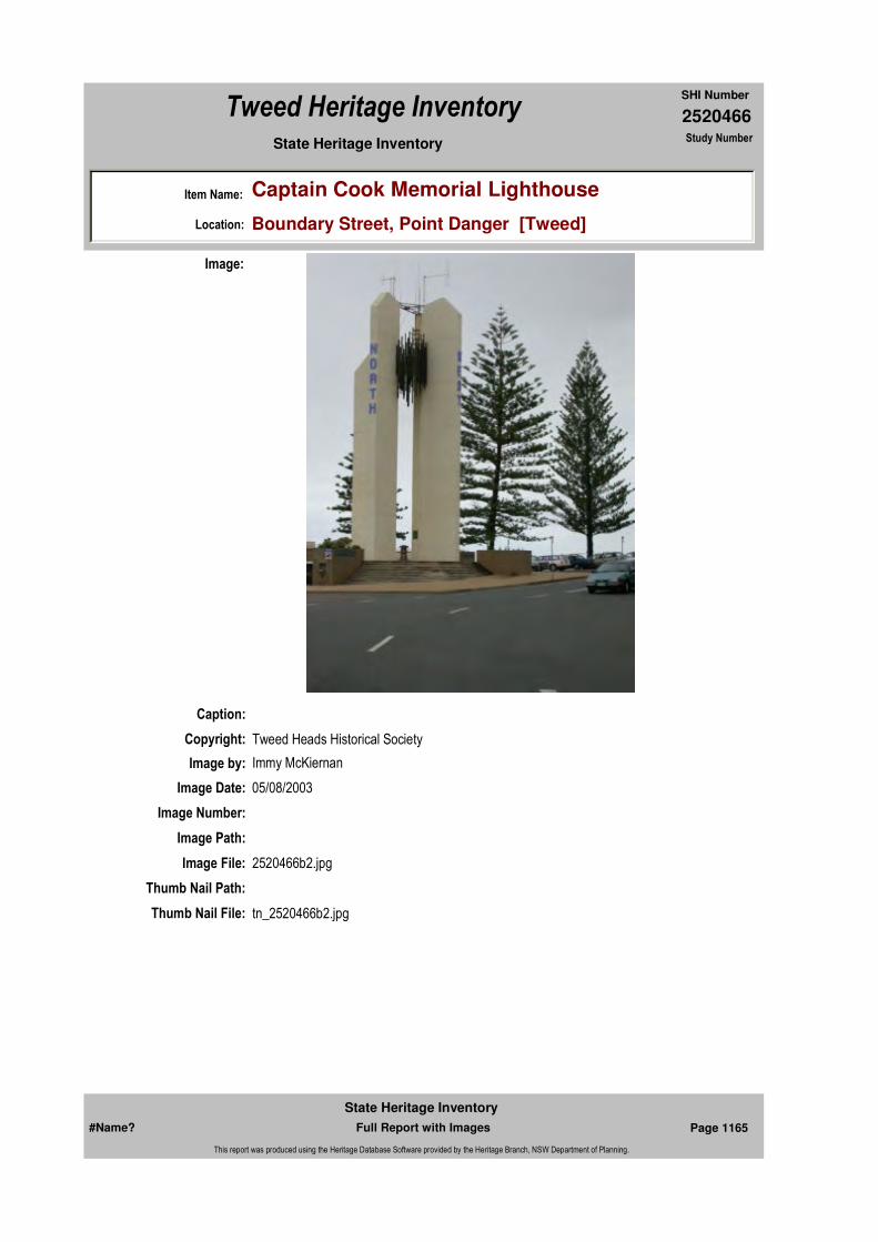
2520466
SHI Number
Tweed Heritage Inventory
Item Name: Captain Cook Memorial Lighthouse
Location: Boundary Street, Point Danger [Tweed]
State Heritage Inventory Study Number
Caption:
Copyright: Tweed Heads Historical Society
Image:
Image by: Immy McKiernan
Image Date: 05/08/2003
Image Number:
Image Path:
Image File: 2520466b2.jpg
Thumb Nail Path:
Thumb Nail File: tn_2520466b2.jpg
#Name? Page 1165 Full Report with Images
State Heritage Inventory
This report was produced using the Heritage Database Software provided by the Heritage Branch, NSW Department of Planning.
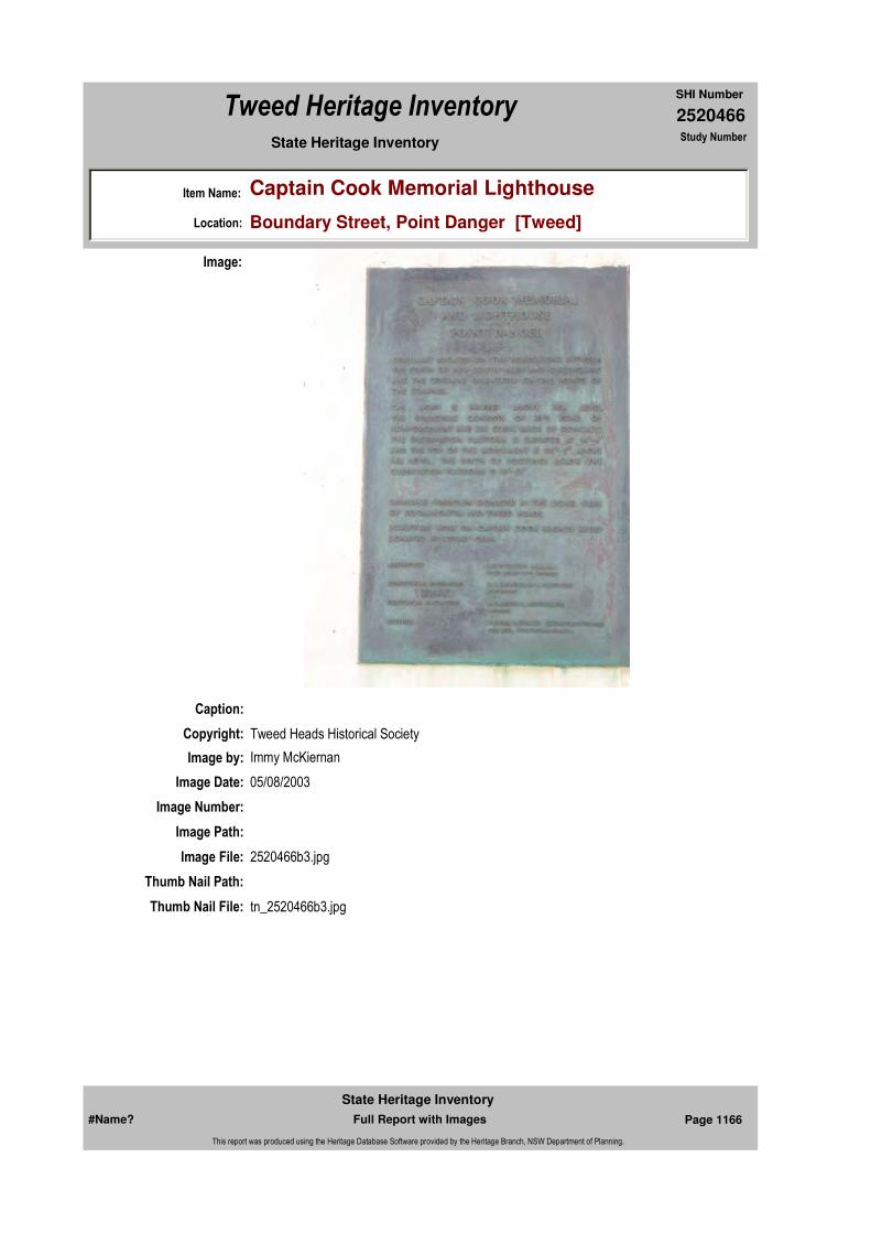
2520466
SHI Number
Tweed Heritage Inventory
Item Name: Captain Cook Memorial Lighthouse
Location: Boundary Street, Point Danger [Tweed]
State Heritage Inventory Study Number
Caption:
Copyright: Tweed Heads Historical Society
Image:
Image by: Immy McKiernan
Image Date: 05/08/2003
Image Number:
Image Path:
Image File: 2520466b3.jpg
Thumb Nail Path:
Thumb Nail File: tn_2520466b3.jpg
#Name? Page 1166 Full Report with Images
State Heritage Inventory
This report was produced using the Heritage Database Software provided by the Heritage Branch, NSW Department of Planning.

2520466
SHI Number
Tweed Heritage Inventory
Item Name: Captain Cook Memorial Lighthouse
Location: Boundary Street, Point Danger [Tweed]
State Heritage Inventory Study Number
Caption:
Copyright: Tweed Heads Historical Society
Image:
Image by: Immy McKiernan
Image Date: 05/08/2003
Image Number:
Image Path:
Image File: 2520466b4.jpg
Thumb Nail Path:
Thumb Nail File: tn_2520466b4.jpg
#Name? Page 1167 Full Report with Images
State Heritage Inventory
This report was produced using the Heritage Database Software provided by the Heritage Branch, NSW Department of Planning.

2520466
SHI Number
Tweed Heritage Inventory
Item Name: Captain Cook Memorial Lighthouse
Location: Boundary Street, Point Danger [Tweed]
State Heritage Inventory Study Number
Caption:
Copyright: Tweed Heads Historical Society
Image:
Image by: Immy McKiernan
Image Date: 05/08/2003
Image Number:
Image Path:
Image File: 2520466b5.jpg
Thumb Nail Path:
Thumb Nail File: tn_2520466b5.jpg
#Name? Page 1168 Full Report with Images
State Heritage Inventory
This report was produced using the Heritage Database Software provided by the Heritage Branch, NSW Department of Planning.

2520466
SHI Number
Tweed Heritage Inventory
Item Name: Captain Cook Memorial Lighthouse
Location: Boundary Street, Point Danger [Tweed]
State Heritage Inventory Study Number
Caption:
Copyright: Tweed Heads Historical Society
Image:
Image by: Immy McKiernan
Image Date: 05/08/2003
Image Number:
Image Path:
Image File: 2520466b6.jpg
Thumb Nail Path:
Thumb Nail File: tn_2520466b6.jpg
#Name? Page 1169 Full Report with Images
State Heritage Inventory
This report was produced using the Heritage Database Software provided by the Heritage Branch, NSW Department of Planning.

2520466
SHI Number
Tweed Heritage Inventory
Item Name: Captain Cook Memorial Lighthouse
Location: Boundary Street, Point Danger [Tweed]
State Heritage Inventory Study Number
Caption:
Copyright: Tweed Heads Historical Society
Image:
Image by: Immy McKiernan
Image Date: 05/08/2003
Image Number:
Image Path:
Image File: 2520466b7.jpg
Thumb Nail Path:
Thumb Nail File: tn_2520466b7.jpg
#Name? Page 1170 Full Report with Images
State Heritage Inventory
This report was produced using the Heritage Database Software provided by the Heritage Branch, NSW Department of Planning.
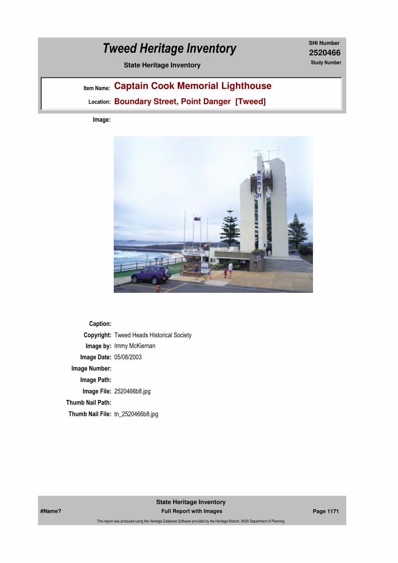
2520466
SHI Number
Tweed Heritage Inventory
Item Name: Captain Cook Memorial Lighthouse
Location: Boundary Street, Point Danger [Tweed]
State Heritage Inventory Study Number
Caption:
Copyright: Tweed Heads Historical Society
Image:
Image by: Immy McKiernan
Image Date: 05/08/2003
Image Number:
Image Path:
Image File: 2520466b8.jpg
Thumb Nail Path:
Thumb Nail File: tn_2520466b8.jpg
#Name? Page 1171 Full Report with Images
State Heritage Inventory
This report was produced using the Heritage Database Software provided by the Heritage Branch, NSW Department of Planning.

2520466
SHI Number
Tweed Heritage Inventory
Item Name: Captain Cook Memorial Lighthouse
Location: Boundary Street, Point Danger [Tweed]
State Heritage Inventory Study Number
#Name? Page 1172 Full Report with Images
State Heritage Inventory
This report was produced using the Heritage Database Software provided by the Heritage Branch, NSW Department of Planning.
2520469
SHI Number
Tweed Heritage Inventory
Item Name: Pottsville Kiosk
Location: Tweed Coast Road, Pottsville Beach [Tweed]
State Heritage Inventory Study Number
Current Use: Picnic Shelter
Former Uses: Picnic Shelter
Statement of
Significance:The Pottsville Kiosk has a strong association with the Pottsville community as the centre of social activities over many years.
Historical Notes or Provenance:
In the settlement days of the area Bill Potts acquired 16 hectares of land including the headland and it stretched from there northwards.
The area was named Potts Point and remained so for many years. Mail addressed to residents often ended up in Potts Point in Sydney so the area was renamed Pottsville Beach.
The kiosk is situated near the entrance to Pottsville South Caravan Park. Many people refer to the building as the 'Shelter Shed' and that is its current use.
There were originally three of these buildings in the area. One at Hastings Point, at the rear of the Amenities Block in the Council Caravan Park and another at Mooball Beach Camping Ground one or two kilometres past Black Rocks on the beach side of the Coast Road, and of course our Kiosk at Pottsville Beach.
'Potts Point kiosk' was built in 1927. The hardwood timber was milled in 1926/1927 at Bennet Brothers Sawmill at Casino and came by train to Burringbar Railway Station.
George Rogan, a local carrier, unloaded the timber from the rail tracks into his lorry and carted it over the Cudgen Mountain to Potts Point, making many trips to complete delivery.
Bill Potts was a builder and he built the Kiosk, apparently under contract to the local
Endorsed Significance:Assessed Significance: Local
Item Type: Built Category: PavilionGroup: Community Facilities
Admin Codes: Code 2: Code 3:
Curtilage/Boundary:
Owner: Local Government
Other/Former Names:
Area/Group/Complex: Group ID:
Aboriginal Area:
Local Govt Area: Tweed
Planning: Northern
Historic Region: North Coast
Address: #Name?
Suburb / Nearest Town: #Name?
State: NSW
Parish: Mooball
County: Rous
#Name? Page 1190 Full Report with Images
State Heritage Inventory
This report was produced using the Heritage Database Software provided by the Heritage Branch, NSW Department of Planning.

2520469
SHI Number
Tweed Heritage Inventory
Item Name: Pottsville Kiosk
Location: Tweed Coast Road, Pottsville Beach [Tweed]
State Heritage Inventory Study Number
governing body. Murwillumbah was a municipality in those days.
It was called a 'kiosk' because there was a small room at the eastern end of the original structure from which the picnic ground caretaker sold all kinds of goodies available at the time. Boiled lollies, liquorice sticks, bullseyes, biscuits and hot soft drinks (no refrigeration a block of ice wouldn't last the slow trip from Munwillumbah), fishing lines, hooks and sinkers. The 'Kiosk' did its best trade on a Sunday and Mrs. Potts and Grandma Hayes often assisted in the Kiosk.
At Christmas and Easter the picnic/camping ground stretched from the bottom of the headland to the north, south to where the bridge is now and west to the banks of the canal, (the canal no longer exists). In 1934 Alec Phillips, then the owner of a garage in Burringbar, stated it was common to see at least 500 tents pitched in the grounds.
The Kiosk was the social centre of Potts Point over many years. Regular dances were held with hurricane lamps hanging from the roof beams. Later Tilly lamps were used to provide better light. Music was supplied by accordion player, Clarrie Hardy, and by others on violins. A lovely combination.Albert Hardy was the principal violinist ably assisted by Mr. Viv Hardy. Other menfolk of the Hardy families also played violins. After the war Phil Bonner joined in playing accordion and mouth organ.After the first general stores opened in Pottsville in 1940 and 1941 the Kiosk shop closed. The walls were demolished and some of the timber was used to add a small lean-to at the rear of the Eastern end.
The cost of the building was £132 ($264.00). Council paid Phil Bonner to build a nww roof in 1947.In 1994 Pottsville Dune Care Group carried out necessary carpentry repairs and painted the interior and exterior of the structure, the Council and the Community Association supplied the materials and students from Kingscliff High School painted a mural on the inside wail. The building is still used today.The Kiosk and its site are of historical value to the residents of Pottsville. Over the last 75 years, it has been used for political meetings, weddings, birthdays, citizenship ceremonies, community meetings and was the site of the first church services in Pottsville.
Many descendents of the original settlers still reside in the area and regard the Kiosk as a direct link with their heritage.
It has survived cyclones and floods and constant use. It is a landmark in the village. Having survived all of this, surely it deserves to be listed as a heritage building.
Themes: National Theme State Theme Local Theme
8. Culture Social institutions Community Hall
#Name? Page 1191 Full Report with Images
State Heritage Inventory
This report was produced using the Heritage Database Software provided by the Heritage Branch, NSW Department of Planning.

2520469
SHI Number
Tweed Heritage Inventory
Item Name: Pottsville Kiosk
Location: Tweed Coast Road, Pottsville Beach [Tweed]
State Heritage Inventory Study Number
Physical Description: 1920's picnic shelter. Single skin timber cladding internal frame. A mural has been painted by Art Students at Kingscliff High School on the back interior wall.
Physical Condition:
Modification Dates:
Designer:
Maker / Builder:
Year Started: Year Completed: 1920 Circa: Yes
Recommended Management:
Maintain public access; repair damaged timber; heritage colour scheme.
References:
Studies:
Further Comments:
Criteria a)
Criteria c) The structure maintains the integrity of the original timber structure and is well sited in the park setting.
Criteria d) The Pottsville Kiosk has a strong association with the Pottsville community as the centre of social activities over many years.
Criteria e)
Criteria g)
Criteria f)
Integrity / Intactness:
Criteria b)
Parcels:
Latitude: Longitude:
Map Name: Map Scale:
Spatial Accuracy:Location validity:
Management:
Author Title Year
Pat Hardy Pottsville Kiosk
Author Title YearNumber
Tweed Shire Council Community-based Heritage Study 2003
Parcel Code LotNumber Section Plan Code Plan Number
LOT 7037 DP 755701
#Name? Page 1192 Full Report with Images
State Heritage Inventory
This report was produced using the Heritage Database Software provided by the Heritage Branch, NSW Department of Planning.

2520469
SHI Number
Tweed Heritage Inventory
Item Name: Pottsville Kiosk
Location: Tweed Coast Road, Pottsville Beach [Tweed]
State Heritage Inventory Study Number
Custom Field One:
Listings:
Date Updated: 18/05/2004 Status: BasicDate First Entered: 28/04/2004Data Entry:
Custom Field Two:
Custom Field Three:
Custom Field Four:
Custom Field Five:
Custom Field Six:
AMG Zone: Easting: 555340 Northing: 6859386
Caption: Pottsville Kiosk
Copyright: Tweed Heads Historical Society
Image:
Image by: Immy McKiernan
Image Date: 16/04/2003
#Name? Page 1193 Full Report with Images
State Heritage Inventory
This report was produced using the Heritage Database Software provided by the Heritage Branch, NSW Department of Planning.
2520469
SHI Number
Tweed Heritage Inventory
Item Name: Pottsville Kiosk
Location: Tweed Coast Road, Pottsville Beach [Tweed]
State Heritage Inventory Study Number
Image Number:
Image Path:
Image File: 2520469b1.jpg
Thumb Nail Path:
Thumb Nail File: tn_2520469b1.jpg
#Name? Page 1194 Full Report with Images
State Heritage Inventory
This report was produced using the Heritage Database Software provided by the Heritage Branch, NSW Department of Planning.

2520470
SHI Number
Tweed Heritage Inventory
Item Name: War Memorial Complex
Location: Coronation Avenue, Pottsville Beach [Tweed]
State Heritage Inventory Study Number
Current Use: Memorial and sporting fields
Former Uses: Memorial and sporting fields
Statement of Significance:
The memorial is part of the cultural history of the Tweed Valley and has a special association with the community in which it is housed.
Historical Notes or Provenance:
The Pottsville Cenotaph was dedicated in 1988, the Memorial Gates & Pylons officially opened 1997 and the Pottsville Anzac Park and Memorial Walkway was dedicated on 11 Nov 2001 .
The Founding of the Pottsville R.S.L. Memorial Park
In 1946 I was admitted to membership of the Burringbar Sub-branch of the Returned Sailors, Soldiers & Airmen Imperial League of Australia (R.S.S.A.I.L.A) now known as the R.S.L.
Living in Pottsville I realised that there were quite a number of ex-servicemen in the Cudgera/ Pottsville/Round Mountain area and that a Sub-branch of the R.S.S.A.I.L.A could be possible, based at Pottsville. I spoke to some of the Pottsville ex-service residents who became enthusiastic and as a consequence a meeting was convened and held in the kiosk, now referred to as the "shelter shed". The interest was astonishing and a sub-branch was
Endorsed Significance:Assessed Significance: Local
Item Type: Complex / Group Category: War MemorialGroup: Monuments and Mem
Admin Codes: Code 2: Code 3:
Curtilage/Boundary:
Owner: Local Government
Other/Former Names:
Area/Group/Complex: Group ID:
Aboriginal Area:
Local Govt Area: Tweed
Planning: Northern
Historic Region: North Coast
Address: #Name?
Suburb / Nearest Town: #Name?
State: NSW
Parish: Mooball
County: Rous
Local Govt Area: Tweed
Planning: Northern
Historic Region: North Coast
Address: #Name?
Suburb / Nearest Town: #Name?
State: NSW
Parish: Mooball
County: Rous
#Name? Page 1195 Full Report with Images
State Heritage Inventory
This report was produced using the Heritage Database Software provided by the Heritage Branch, NSW Department of Planning.
2520470
SHI Number
Tweed Heritage Inventory
Item Name: War Memorial Complex
Location: Coronation Avenue, Pottsville Beach [Tweed]
State Heritage Inventory Study Number
formed. It is called a "sub-branch" because there is a Federal Body and each State is a "branch", therefore the State is made up of "sub-branches". I was elected Foundation President, Jack Sleith as Foundation Secretary and Len Raison as Foundation Treasurer. I didn't want to be President, preferring to be Secretary, and so with the agreement of our nominees and the others present at the meeting, Jack Sleith and I swapped positions and so I became the Foundation Secretary.
Of course, there were a few "knockers" who said that we wouldn't get started and I won't mentioned their names, but after about twelve months they joined us saying that they could do more good for us by staying with another sub-branch and assisting from within the establishment. To me, that was a lot of bunkum. I recall the time where within three years we had forty-seven members and that was marvelous for the sparsely settled area.
There were five schools in the local area and they were at Reserve Creek, Round Mountain, Cudgera Creek, Pottsville and Mooball. The school known as Mooball one would have thought to be at Mooball but instead it was situated about three hundred metres up the Warwick Park Road, where at the time of writing, there are some slash pine trees growing in a paddock to the left of the road. School children were involved in the P.S.A.A.A. (Public Schools Annual Athletic Association) and this was a statewide association. We (members of the Sub-branch) realised that the children of these country schools were at a disadvantage because they couldn't get together on a common field to practice. So we had the idea that an area of land at Pottsville should be developed as a sports oval. It became my job as Secretary to acquire the land and such a parcel of land was ideal for the project.
It was about fifty years ago (give or take a few months) since negotiations for the land took place so I cannot remember every detail, but I recall that it was Crown Land held in Trust by the local council and I had to negotiate with Council for the Sub-branch to take over the land. It was never made freehold so the Sub-branch never owned it, but the Council allowed us to develop it. The land is where the Pottsville Oval is now, and it was a mess. Overgrown with bracken fern, bladey grass, lantana, stunted banksia (and some not so stunted), some big old ti--trees, not to mention the old dead stumps and logs. And of course, black snakes and the occasional Death (deaf) Adder.
A few of us burnt it oft, felled the trees, grubbed out stumps, logged it up and burnt it again and again, until is was all cleared. All this work was done with manpower and one light draught horse owned by somebody. When it was all cleared we decided that a way to make some money to further develop the oval was to plant a crop of peas. We ploughed an area of it and planted a bushel of peas. The seed cost us two pound ten shillings ($5 in today's money) and fertilizer had to be bought also. We nurtured this crop but the poor soil (sand of a gray colour) and lack of rain didn't pose much of a chance for a good crop and at harvest time, we got back the price of the seed, two pound ten shillings.Undaunted, we continued by leveling the whole area. This was done by using the steel rim off the wheel of an old spring cart and, with the horse, this was pulled back and forth, this way and that, for days until it was level. Couch grass was acquired and planted, harrowed in and rolled. When this started to come up it looked magnificent. Some of the residents had house cows and there were some horses around, not to mention same hares and a few rabbits. Our grass! (I had a house cow also). It became a dire necessity that the oval be fenced.
#Name? Page 1196 Full Report with Images
State Heritage Inventory
This report was produced using the Heritage Database Software provided by the Heritage Branch, NSW Department of Planning.

2520470
SHI Number
Tweed Heritage Inventory
Item Name: War Memorial Complex
Location: Coronation Avenue, Pottsville Beach [Tweed]
State Heritage Inventory Study Number
The fence, which was recently demolished (1995), had stood since it was erected during the early 1950's. That fence was cut by a local saw-miller whose name was "Jimmie" Johanson. He offered to provide posts and top rail for a fence free of charge. This was a most generous offer. Not only did he cut the timber in his mill, he had first to go into the bush and fell the trees, and then with is small team of bullocks, haul the logs out to his truck and transport them to his mill, which was situated just to the western end of Pottsville. The fence around the park was erected mainly by voluntary labour, predominantly ex--servicemen and when completed, the Tweed Shire Council donated the paint to have it painted. That was a long and time consuming job but there was a little ex-serviceman who lived in a tent in the camping ground and he called it "The Doo Drop Inn". He later lived in a little hut behind Tom Rundle's house which is the first house on the right as you enter Pottsville from the beach end. His name was Freddie Bergeman. He worked around on banana plantations. In his spare time he painted practically the whole of the fence. There were others who wielded paintbrushes also but "little Freddie" did most of it. There were others who did an enormous amount of work, including Tom Rundle, Greg Brown, Ted Carah, and others whose names elude me. I personally didn't do any work on the fence because I had bought a property at Chillingham, west of Murwillumbah, and moved there to live in 1950, returning to Pottsville in 1958 when I continued to work with the Sub-branch. The foregoing was told to me by those who worked on it. Freddie Bergeman was eventually presented with a Certificate of Appreciation by the State Branch of the R.S.L, a very high and distinguished presentation to receive.
Between coming home from the war and then going to live at Chillingham, I was building some houses in Pottsville. I used to mix concrete by hand to make concrete posts for under the houses. I had the idea the R.S.L should construct a local War Memorial. Permission was granted to do this so I spent some weeks making concrete blocks similar to today's Besser Blocks, only mine were solid and weighed "a ton". I drew up a plan for two piers to be erected with a flagpole protruding from the tip of each and these were to be at a site, which was selected as the entrance to the "Park". The site was directly opposite the junction of the Wooyung Road with the present Coast Road, or just across the road form the public toilet block at Pottsville.
There was a resident bricklayer living in Pottsville and his name was "Bobby" Graham. He offered to erect the piers and plaster them and when finished, they looked stunning and impressive. They were painted white and on Anzac Day and school sports days, the Union Jack flew from one pier and the Flag of Australian flew from the other. Members of the Sub-branch were very proud of their achievement. The longer-term plan was to get together the name of all the servicemen who enlisted into the services from this area engraved onto brass plates and fix these to the sides of the "Memorial Piers". The entrance was called the "Memorial Gate".
It was essential, of course, that the Park be given a name. The members of the Sub-branch decided that the area should be named "Pottsville R.S.L. Memorial Park". This name was approved by the Tweed Shire Council of the day and should be recorded in the Council's archives somewhere.One of the immediate benefits to the community following the completion of the Park was that school children of the five schools mentioned earlier, were able to compete in their
#Name? Page 1197 Full Report with Images
State Heritage Inventory
This report was produced using the Heritage Database Software provided by the Heritage Branch, NSW Department of Planning.
2520470
SHI Number
Tweed Heritage Inventory
Item Name: War Memorial Complex
Location: Coronation Avenue, Pottsville Beach [Tweed]
State Heritage Inventory Study Number
sports, one school against the other, on a round-robin basis as practice in preparation for the big P.S.A.A.A, and due to this preparation, were able to compete more vigorously against the "town schools" who had sports fields on which to practice and compete all year round.
What happened to the "Memorial Piers"? An out of control motor vehicle crashed into one of them, wrecked the vehicle and the pier. Council ordered the other pier be demolished as it was considered a danger to motorists. It was only a gravel road nearby.
On Anzac Day the members of the R.S.L would assemble near the butcher's shop, together with children from the school and march to the "Memorial Gates". At times there would be a piano mounted on the back of a truck to provide music for the service, and at other times music would be from a PA system owned by Mr. Ted Carab who ran the Pottsville-Murwillumbah Bus Service, but before that owned a radio shop in Murwillumbah.
I am the only executive ex-serviceman left from the original Pottsville R.S.L Sub-branch and I am concerned that somebody who doesn't know the history of the Park might decide that it should be given a name. It is commonly refereed to as the "Pottsville Oval" but its proper name is "The Pottsville R.S.L. Memorial Park.
Perhaps the present day Shire Council might be persuaded to erect a sign to this effect.
("Stories of Pottsville's Past" Philip G Bonnor 2004p. 19-25)
Physical Description: Gates & Cenotaph
Physical Condition:
Modification Dates:
Designer:
Maker / Builder:
Year Started: Year Completed: Circa: No
Recommended Management:
Further Comments:
Themes:
Management:
National Theme State Theme Local Theme
7. Governing Defence War Memorial
#Name? Page 1198 Full Report with Images
State Heritage Inventory
This report was produced using the Heritage Database Software provided by the Heritage Branch, NSW Department of Planning.
2520470
SHI Number
Tweed Heritage Inventory
Item Name: War Memorial Complex
Location: Coronation Avenue, Pottsville Beach [Tweed]
State Heritage Inventory Study Number
Custom Field One:
References:
Studies:
Listings:
Date Updated: 22/11/2006 Status: BasicDate First Entered: 28/04/2004Data Entry:
Criteria a)
Criteria c)
Criteria d) The memorial is part of the cultural history of the Tweed Valley and has a special association with the community in which it is housed.
Criteria e)
Criteria g)
Criteria f)
Integrity / Intactness:
Custom Field Two:
Custom Field Three:
Custom Field Four:
Custom Field Five:
Custom Field Six:
Criteria b)
Parcels:
Latitude: Longitude:
AMG Zone: Easting: Northing:
Map Name: Map Scale:
Spatial Accuracy:Location validity:
Author Title Year
Philip G Bonnor "Stories of Pottsville's Past" 2004
Author Title YearNumber
Tweed Shire Council Community-based Heritage Study 2003
Parcel Code LotNumber Section Plan Code Plan Number
LOT 8027 DP 755701
#Name? Page 1199 Full Report with Images
State Heritage Inventory
This report was produced using the Heritage Database Software provided by the Heritage Branch, NSW Department of Planning.
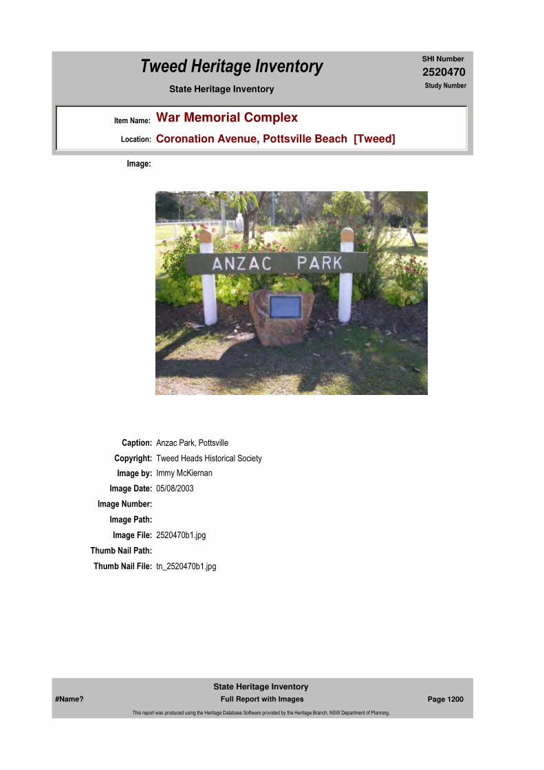
2520470
SHI Number
Tweed Heritage Inventory
Item Name: War Memorial Complex
Location: Coronation Avenue, Pottsville Beach [Tweed]
State Heritage Inventory Study Number
Caption: Anzac Park, Pottsville
Copyright: Tweed Heads Historical Society
Image:
Image by: Immy McKiernan
Image Date: 05/08/2003
Image Number:
Image Path:
Image File: 2520470b1.jpg
Thumb Nail Path:
Thumb Nail File: tn_2520470b1.jpg
#Name? Page 1200 Full Report with Images
State Heritage Inventory
This report was produced using the Heritage Database Software provided by the Heritage Branch, NSW Department of Planning.

2520470
SHI Number
Tweed Heritage Inventory
Item Name: War Memorial Complex
Location: Coronation Avenue, Pottsville Beach [Tweed]
State Heritage Inventory Study Number
Caption: Plaque for Anzac Park, Pottsville
Copyright: Tweed Heads Historical Society
Image:
Image by: Immy McKiernan
Image Date: 05/08/2003
Image Number:
Image Path:
Image File: 2520470b2.jpg
Thumb Nail Path:
Thumb Nail File: tn_2520470b2.jpg
#Name? Page 1201 Full Report with Images
State Heritage Inventory
This report was produced using the Heritage Database Software provided by the Heritage Branch, NSW Department of Planning.
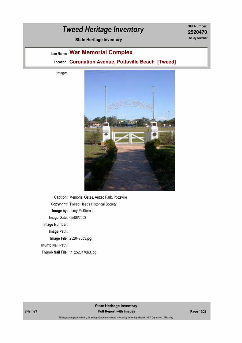
2520470
SHI Number
Tweed Heritage Inventory
Item Name: War Memorial Complex
Location: Coronation Avenue, Pottsville Beach [Tweed]
State Heritage Inventory Study Number
Caption: Memorial Gates, Anzac Park, Pottsville
Copyright: Tweed Heads Historical Society
Image:
Image by: Immy McKiernan
Image Date: 05/08/2003
Image Number:
Image Path:
Image File: 2520470b3.jpg
Thumb Nail Path:
Thumb Nail File: tn_2520470b3.jpg
#Name? Page 1202 Full Report with Images
State Heritage Inventory
This report was produced using the Heritage Database Software provided by the Heritage Branch, NSW Department of Planning.

2520470
SHI Number
Tweed Heritage Inventory
Item Name: War Memorial Complex
Location: Coronation Avenue, Pottsville Beach [Tweed]
State Heritage Inventory Study Number
Caption: Memorial Gate, Anzac Park, Pottsville
Copyright: Tweed Heads Historical Society
Image:
Image by: Immy McKiernan
Image Date: 05/08/2003
Image Number:
Image Path:
Image File: 2520470b4.jpg
Thumb Nail Path:
Thumb Nail File: tn_2520470b4.jpg
#Name? Page 1203 Full Report with Images
State Heritage Inventory
This report was produced using the Heritage Database Software provided by the Heritage Branch, NSW Department of Planning.

2520470
SHI Number
Tweed Heritage Inventory
Item Name: War Memorial Complex
Location: Coronation Avenue, Pottsville Beach [Tweed]
State Heritage Inventory Study Number
Caption: Memorial Gate, Anzac Park, Pottsville
Copyright: Tweed Heads Historical Society
Image:
Image by: Immy McKiernan
Image Date: 05/08/2003
Image Number:
Image Path:
Image File: 2520470b5.jpg
Thumb Nail Path:
Thumb Nail File: tn_2520470b1.jpg
#Name? Page 1204 Full Report with Images
State Heritage Inventory
This report was produced using the Heritage Database Software provided by the Heritage Branch, NSW Department of Planning.

2520470
SHI Number
Tweed Heritage Inventory
Item Name: War Memorial Complex
Location: Coronation Avenue, Pottsville Beach [Tweed]
State Heritage Inventory Study Number
#Name? Page 1205 Full Report with Images
State Heritage Inventory
This report was produced using the Heritage Database Software provided by the Heritage Branch, NSW Department of Planning.
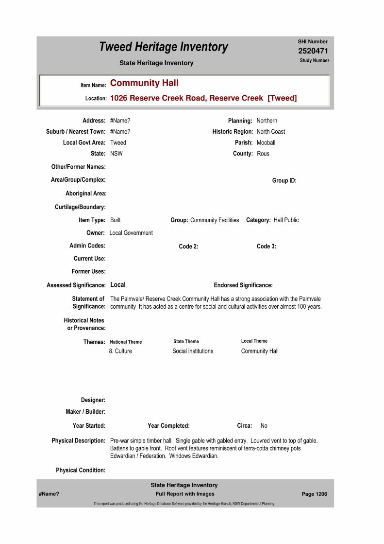
2520471
SHI Number
Tweed Heritage Inventory
Item Name: Community Hall
Location: 1026 Reserve Creek Road, Reserve Creek [Tweed]
State Heritage Inventory Study Number
Current Use:
Former Uses:
Statement of
Significance:The Palmvale/ Reserve Creek Community Hall has a strong association with the Palmvale community It has acted as a centre for social and cultural activities over almost 100 years.
Historical Notes or Provenance:
Physical Description: Pre-war simple timber hall. Single gable with gabled entry. Louvred vent to top of gable. Battens to gable front. Roof vent features reminiscent of terra-cotta chimney pots Edwardian / Federation. Windows Edwardian.
Physical Condition:
Designer:
Maker / Builder:
Year Started: Year Completed: Circa: No
Endorsed Significance:Assessed Significance: Local
Item Type: Built Category: Hall Public Group: Community Facilities
Admin Codes: Code 2: Code 3:
Curtilage/Boundary:
Owner: Local Government
Other/Former Names:
Area/Group/Complex: Group ID:
Themes:
Aboriginal Area:
Local Govt Area: Tweed
Planning: Northern
Historic Region: North Coast
Address: #Name?
Suburb / Nearest Town: #Name?
State: NSW
Parish: Mooball
County: Rous
National Theme State Theme Local Theme
8. Culture Social institutions Community Hall
#Name? Page 1206 Full Report with Images
State Heritage Inventory
This report was produced using the Heritage Database Software provided by the Heritage Branch, NSW Department of Planning.
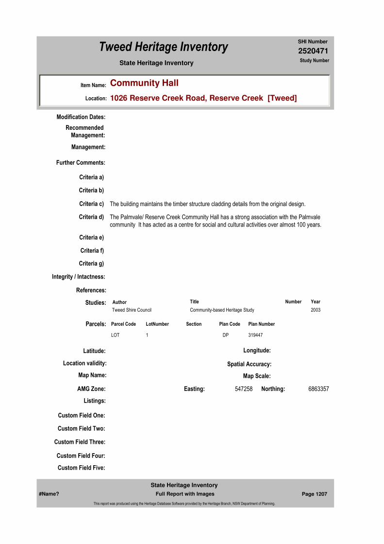
2520471
SHI Number
Tweed Heritage Inventory
Item Name: Community Hall
Location: 1026 Reserve Creek Road, Reserve Creek [Tweed]
State Heritage Inventory Study Number
Modification Dates:
Custom Field One:
Recommended Management:
References:
Studies:
Listings:
Further Comments:
Criteria a)
Criteria c) The building maintains the timber structure cladding details from the original design.
Criteria d) The Palmvale/ Reserve Creek Community Hall has a strong association with the Palmvale community It has acted as a centre for social and cultural activities over almost 100 years.
Criteria e)
Criteria g)
Criteria f)
Integrity / Intactness:
Custom Field Two:
Custom Field Three:
Custom Field Four:
Custom Field Five:
Criteria b)
Parcels:
Latitude: Longitude:
AMG Zone: Easting: 547258 Northing: 6863357
Map Name: Map Scale:
Spatial Accuracy:Location validity:
Management:
Author Title YearNumber
Tweed Shire Council Community-based Heritage Study 2003
Parcel Code LotNumber Section Plan Code Plan Number
LOT 1 DP 319447
#Name? Page 1207 Full Report with Images
State Heritage Inventory
This report was produced using the Heritage Database Software provided by the Heritage Branch, NSW Department of Planning.
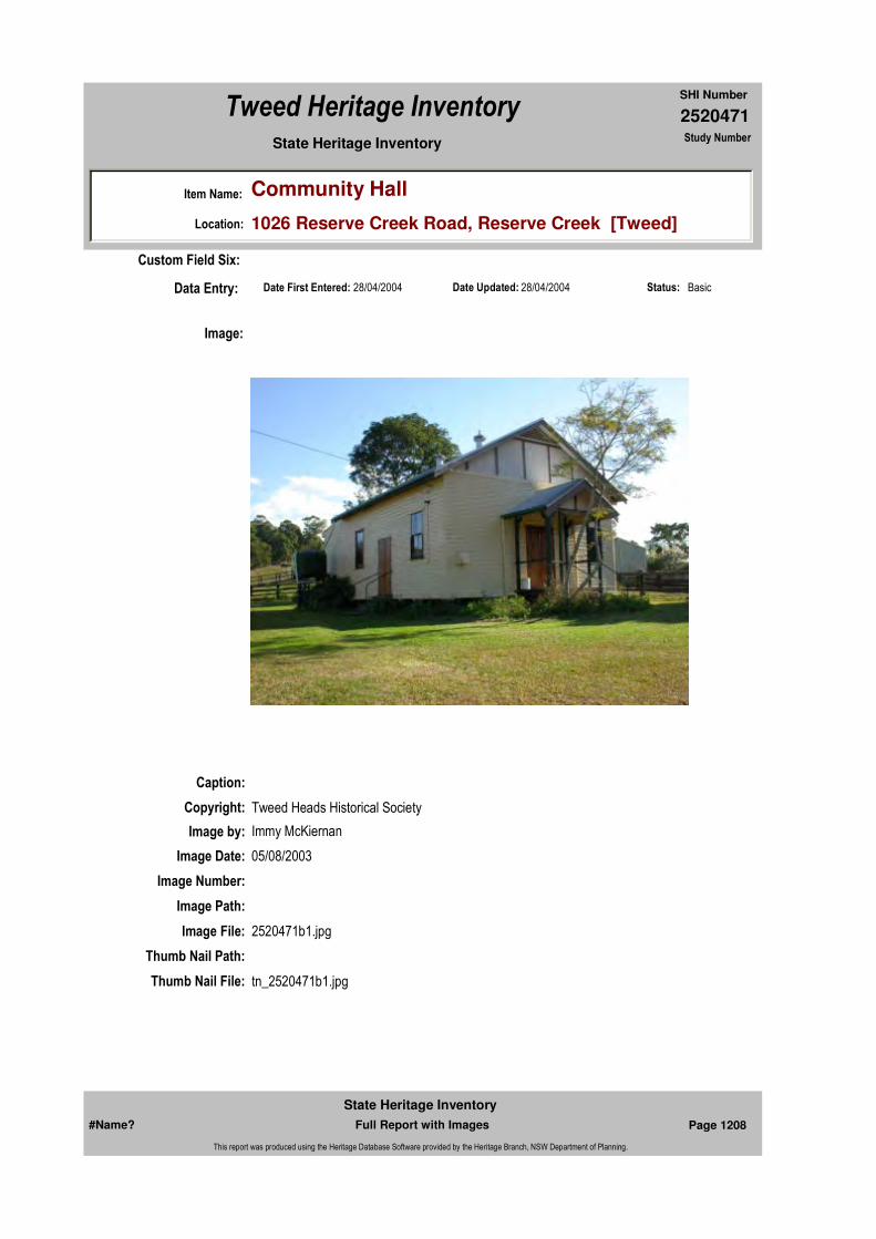
2520471
SHI Number
Tweed Heritage Inventory
Item Name: Community Hall
Location: 1026 Reserve Creek Road, Reserve Creek [Tweed]
State Heritage Inventory Study Number
Date Updated: 28/04/2004 Status: BasicDate First Entered: 28/04/2004Data Entry:
Custom Field Six:
Caption:
Copyright: Tweed Heads Historical Society
Image:
Image by: Immy McKiernan
Image Date: 05/08/2003
Image Number:
Image Path:
Image File: 2520471b1.jpg
Thumb Nail Path:
Thumb Nail File: tn_2520471b1.jpg
#Name? Page 1208 Full Report with Images
State Heritage Inventory
This report was produced using the Heritage Database Software provided by the Heritage Branch, NSW Department of Planning.
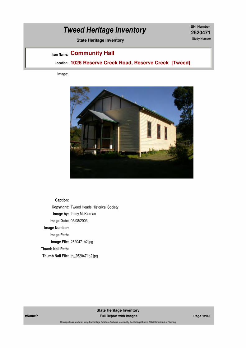
2520471
SHI Number
Tweed Heritage Inventory
Item Name: Community Hall
Location: 1026 Reserve Creek Road, Reserve Creek [Tweed]
State Heritage Inventory Study Number
Caption:
Copyright: Tweed Heads Historical Society
Image:
Image by: Immy McKiernan
Image Date: 05/08/2003
Image Number:
Image Path:
Image File: 2520471b2.jpg
Thumb Nail Path:
Thumb Nail File: tn_2520471b2.jpg
#Name? Page 1209 Full Report with Images
State Heritage Inventory
This report was produced using the Heritage Database Software provided by the Heritage Branch, NSW Department of Planning.

2520471
SHI Number
Tweed Heritage Inventory
Item Name: Community Hall
Location: 1026 Reserve Creek Road, Reserve Creek [Tweed]
State Heritage Inventory Study Number
Caption:
Copyright: Tweed Heads Historical Society
Image:
Image by: Immy McKiernan
Image Date: 05/08/2003
Image Number:
Image Path:
Image File: 2520471b3.jpg
Thumb Nail Path:
Thumb Nail File: tn_2520471b3.jpg
#Name? Page 1210 Full Report with Images
State Heritage Inventory
This report was produced using the Heritage Database Software provided by the Heritage Branch, NSW Department of Planning.

2520471
SHI Number
Tweed Heritage Inventory
Item Name: Community Hall
Location: 1026 Reserve Creek Road, Reserve Creek [Tweed]
State Heritage Inventory Study Number
#Name? Page 1211 Full Report with Images
State Heritage Inventory
This report was produced using the Heritage Database Software provided by the Heritage Branch, NSW Department of Planning.

2520475
SHI Number
Tweed Heritage Inventory
Item Name: Stokers Siding Pottery
Location: 224 Stokers Road, Stokers Siding [Tweed]
State Heritage Inventory Study Number
Current Use: Pottery Factory and Showroom
Former Uses: General Store
Statement of
Significance:This item has a special association with the pioneering Johansen family, whose store served the commercial and social needs of the Stoker's Siding community until 1979. Since 1979, this building has been the centre of excellence in the deveolpment of glazed technology. The pottery is important in the development of a high degree of creative achievement in the local area. Stokers Siding Pottery is significant for the development of a new form of Reduced Lustre glazes. This technique which dates back to 9th century Persia involves the application of gold, copper and silver salts mixed with clay to specifically formulated fired glazes, then firing the pots to red heat with cycles of oxidation and heavy smoke reduction.
Historical Notes or Provenance:
Built by Reg and Orrie Johansen as a shop and residence, the original store had a bake house out the back and a butcher shop next door. The Post Office was moved into a small room next to the shop in 1926. The Johansens sold the business in 1945 to Eric and Tup Loder who in turn sold in 1960.The store was leased over the years by many people the last being Jeff Parkes who transferred the post office to the old railway station in 1973. In 1976, the building was purchased by a partnership of newcomers to the district, with the intent of developing some form of craft workshop. In 1978, Bob Connery and Laine Langridge established Stokers Siding Pottery, which is today highly regarded for the Reduced Lustre glazes, developed by Bob, a former science teacher. Many of these works have been exhibited in Japan where Bob was a guest instructor. The retail craft business shows the work of many local and outside craft workers. The Pottery has been host workshop for many local and overseas students and is the longest running craft outlet in the Tweed Shire.
Endorsed Significance:Assessed Significance: Local
Item Type: Built Category: ShopGroup: Retail and Wholesale
Admin Codes: Code 2: Code 3:
Curtilage/Boundary:
Owner: Private - Individual
Other/Former Names: former Johansen General Store
Area/Group/Complex: Group ID:
Themes:
Aboriginal Area:
Local Govt Area: Tweed
Planning: Northern
Historic Region: North Coast
Address: #Name?
Suburb / Nearest Town: #Name?
State: NSW
Parish: Dunbible
County: Rous
National Theme State Theme Local Theme
3. Economy Commerce Shop
#Name? Page 1236 Full Report with Images
State Heritage Inventory
This report was produced using the Heritage Database Software provided by the Heritage Branch, NSW Department of Planning.

2520475
SHI Number
Tweed Heritage Inventory
Item Name: Stokers Siding Pottery
Location: 224 Stokers Road, Stokers Siding [Tweed]
State Heritage Inventory Study Number
Physical Description: Some bungalow features possibly pre WW1. Two story timber building of early 20th cent. Low gable roof over large verandah at front with battening and posts with curved bullock horn brackets. Decorative coloured glass panels above display windows. Attached is timber storeroom. At rear is old bakery converted to pottery. Residence upstairs 4 rooms plus bathroom, has interesting bracing.
Physical Condition: Fair
Modification Dates: 1977, Outside stair to residence removed because it was over boundary; internal access installed; main shop area divided by half high hardwood tongue and groove partitions. 1982, Kitchen and storage created in storage area.1985, Roof replaced after being blown off in a cyclone. 1995, Loading dock doors removed and floor installed. 2003, Upstairs external stove and chimney removed.
Designer:
Maker / Builder: Tegge and Fisher
Year Started: Year Completed: 1923 Circa: No
Recommended Management:
Further Comments:
Criteria a)
Criteria c)
Criteria d) This item served the commercial and social needs of the Stoker's Siding community until 1979.This item has been the centre of excellence in the deveolpment of glazed technology since 1979.
Criteria e)
Criteria g) The pottery is important in the development of a high degree of creative achievement in the local area
Criteria f)
Integrity / Intactness:
Criteria b) This item has a special association with the pionnering Johansen family.
Management:
#Name? Page 1237 Full Report with Images
State Heritage Inventory
This report was produced using the Heritage Database Software provided by the Heritage Branch, NSW Department of Planning.

2520475
SHI Number
Tweed Heritage Inventory
Item Name: Stokers Siding Pottery
Location: 224 Stokers Road, Stokers Siding [Tweed]
State Heritage Inventory Study Number
Custom Field One:
References:
Studies:
Listings:
Date Updated: 02/11/2004 Status: BasicDate First Entered: 28/04/2004Data Entry:
Custom Field Two:
Custom Field Three:
Custom Field Four:
Custom Field Five:
Custom Field Six:
Parcels:
Latitude: Longitude:
AMG Zone: Easting: 539525 Northing: 6858664
Map Name: Map Scale:
Spatial Accuracy:Location validity:
Author Title Year
B.Connery "Pottery in Australia" Vol.36 1997
B.Connery "Ceramics Technical" No.7 1998
L Langridge "The Story of Stokers Siding." 1988
Author Title YearNumber
Tweed Shire Council Community-based Heritage Study 2003
Parcel Code LotNumber Section Plan Code Plan Number
LOT 2 DP 211544
#Name? Page 1238 Full Report with Images
State Heritage Inventory
This report was produced using the Heritage Database Software provided by the Heritage Branch, NSW Department of Planning.
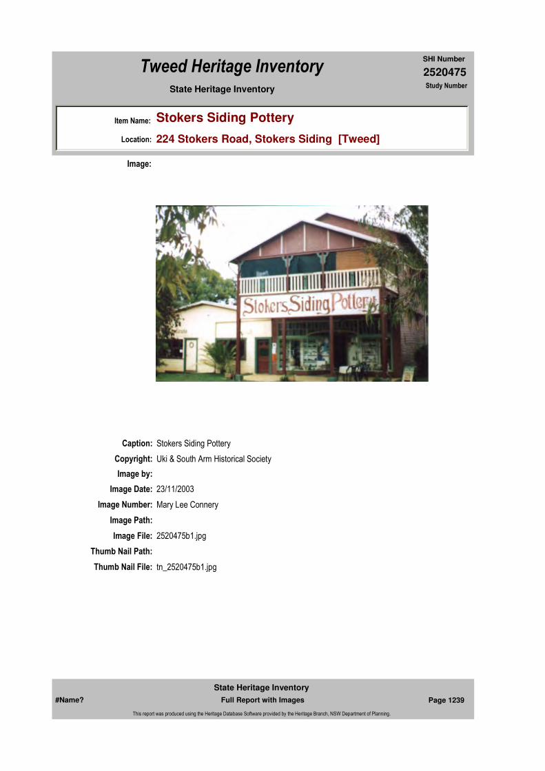
2520475
SHI Number
Tweed Heritage Inventory
Item Name: Stokers Siding Pottery
Location: 224 Stokers Road, Stokers Siding [Tweed]
State Heritage Inventory Study Number
Caption: Stokers Siding Pottery
Copyright: Uki & South Arm Historical Society
Image:
Image by:
Image Date: 23/11/2003
Image Number: Mary Lee Connery
Image Path:
Image File: 2520475b1.jpg
Thumb Nail Path:
Thumb Nail File: tn_2520475b1.jpg
#Name? Page 1239 Full Report with Images
State Heritage Inventory
This report was produced using the Heritage Database Software provided by the Heritage Branch, NSW Department of Planning.

2520475
SHI Number
Tweed Heritage Inventory
Item Name: Stokers Siding Pottery
Location: 224 Stokers Road, Stokers Siding [Tweed]
State Heritage Inventory Study Number
Caption: Front entrance of Stokers Siding Pottery building
Copyright: Uki & South Arm Historical Society
Image:
Image by: Mary Lee Connery
Image Date: 23/11/2003
Image Number:
Image Path:
Image File: 2520475b2.jpg
Thumb Nail Path:
Thumb Nail File: tn_2520475b2.jpg
#Name? Page 1240 Full Report with Images
State Heritage Inventory
This report was produced using the Heritage Database Software provided by the Heritage Branch, NSW Department of Planning.

2520475
SHI Number
Tweed Heritage Inventory
Item Name: Stokers Siding Pottery
Location: 224 Stokers Road, Stokers Siding [Tweed]
State Heritage Inventory Study Number
Caption: Exterior of Stokers Siding Pottery building
Copyright: Uki & South Arm Historical Society
Image:
Image by: Mary Lee Connery
Image Date: 23/11/2003
Image Number:
Image Path:
Image File: 2520475b3.jpg
Thumb Nail Path:
Thumb Nail File: tn_2520475b3.jpg
#Name? Page 1241 Full Report with Images
State Heritage Inventory
This report was produced using the Heritage Database Software provided by the Heritage Branch, NSW Department of Planning.

2520475
SHI Number
Tweed Heritage Inventory
Item Name: Stokers Siding Pottery
Location: 224 Stokers Road, Stokers Siding [Tweed]
State Heritage Inventory Study Number
Caption: Ceiling beams of Stokers Siding Pottery building
Copyright: Uki & South Arm Historical Society
Image:
Image by: Mary Lee Connery
Image Date: 23/11/2003
Image Number:
Image Path:
Image File: 2520475b4.jpg
Thumb Nail Path:
Thumb Nail File: tn_2520475b4.jpg
#Name? Page 1242 Full Report with Images
State Heritage Inventory
This report was produced using the Heritage Database Software provided by the Heritage Branch, NSW Department of Planning.
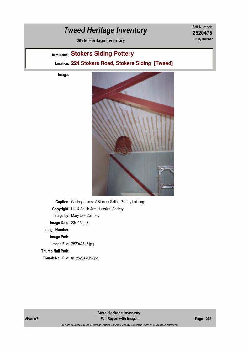
2520475
SHI Number
Tweed Heritage Inventory
Item Name: Stokers Siding Pottery
Location: 224 Stokers Road, Stokers Siding [Tweed]
State Heritage Inventory Study Number
Caption: Ceiling beams of Stokers Siding Pottery building
Copyright: Uki & South Arm Historical Society
Image:
Image by: Mary Lee Connery
Image Date: 23/11/2003
Image Number:
Image Path:
Image File: 2520475b5.jpg
Thumb Nail Path:
Thumb Nail File: tn_2520475b5.jpg
#Name? Page 1243 Full Report with Images
State Heritage Inventory
This report was produced using the Heritage Database Software provided by the Heritage Branch, NSW Department of Planning.
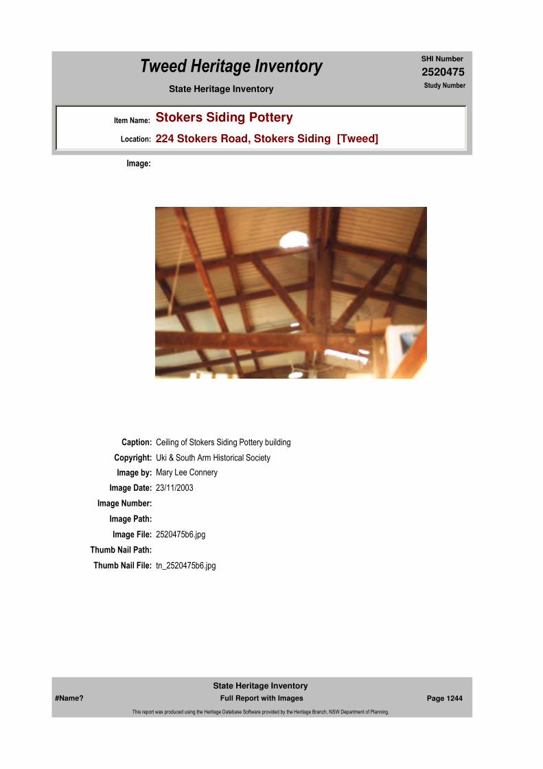
2520475
SHI Number
Tweed Heritage Inventory
Item Name: Stokers Siding Pottery
Location: 224 Stokers Road, Stokers Siding [Tweed]
State Heritage Inventory Study Number
Caption: Ceiling of Stokers Siding Pottery building
Copyright: Uki & South Arm Historical Society
Image:
Image by: Mary Lee Connery
Image Date: 23/11/2003
Image Number:
Image Path:
Image File: 2520475b6.jpg
Thumb Nail Path:
Thumb Nail File: tn_2520475b6.jpg
#Name? Page 1244 Full Report with Images
State Heritage Inventory
This report was produced using the Heritage Database Software provided by the Heritage Branch, NSW Department of Planning.

2520475
SHI Number
Tweed Heritage Inventory
Item Name: Stokers Siding Pottery
Location: 224 Stokers Road, Stokers Siding [Tweed]
State Heritage Inventory Study Number
Caption: Interior panelling of Stokers Siding Pottery building
Copyright: Uki & South Arm Historical Society
Image:
Image by: Mary Lee Connery
Image Date: 23/11/2003
Image Number:
Image Path:
Image File: 2520475b7.jpg
Thumb Nail Path:
Thumb Nail File: tn_2520475b7.jpg
#Name? Page 1245 Full Report with Images
State Heritage Inventory
This report was produced using the Heritage Database Software provided by the Heritage Branch, NSW Department of Planning.

2520475
SHI Number
Tweed Heritage Inventory
Item Name: Stokers Siding Pottery
Location: 224 Stokers Road, Stokers Siding [Tweed]
State Heritage Inventory Study Number
Caption: Interior panelling of Stokers Siding Pottery building
Copyright: Uki & South Arm Historical Society
Image:
Image by: Mary Lee Connery
Image Date: 23/11/2003
Image Number:
Image Path:
Image File: 2520475b8.jpg
Thumb Nail Path:
Thumb Nail File: tn_2520475b8.jpg
#Name? Page 1246 Full Report with Images
State Heritage Inventory
This report was produced using the Heritage Database Software provided by the Heritage Branch, NSW Department of Planning.
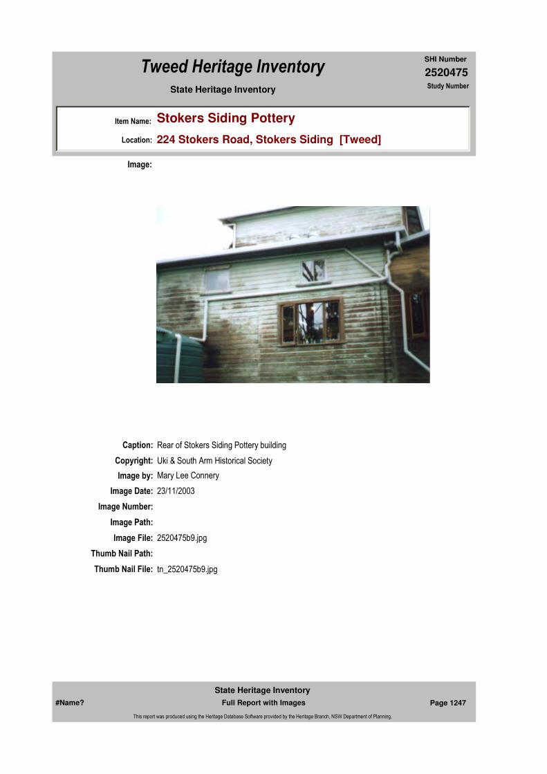
2520475
SHI Number
Tweed Heritage Inventory
Item Name: Stokers Siding Pottery
Location: 224 Stokers Road, Stokers Siding [Tweed]
State Heritage Inventory Study Number
Caption: Rear of Stokers Siding Pottery building
Copyright: Uki & South Arm Historical Society
Image:
Image by: Mary Lee Connery
Image Date: 23/11/2003
Image Number:
Image Path:
Image File: 2520475b9.jpg
Thumb Nail Path:
Thumb Nail File: tn_2520475b9.jpg
#Name? Page 1247 Full Report with Images
State Heritage Inventory
This report was produced using the Heritage Database Software provided by the Heritage Branch, NSW Department of Planning.
2520475
SHI Number
Tweed Heritage Inventory
Item Name: Stokers Siding Pottery
Location: 224 Stokers Road, Stokers Siding [Tweed]
State Heritage Inventory Study Number
#Name? Page 1248 Full Report with Images
State Heritage Inventory
This report was produced using the Heritage Database Software provided by the Heritage Branch, NSW Department of Planning.

2520476
SHI Number
Tweed Heritage Inventory
Item Name: Residence, "St Elmo's"
Location: Smiths Creek Road, Stokers Siding [Tweed]
State Heritage Inventory Study Number
Current Use: Private Residence
Former Uses: Private Residence
Statement of
Significance:St Elmo's has a special association with the pionnering Johansen family. The house is a fine example of the family home of a small prosperous merchant and is strongly associated with Reg Johansen who contributed to the development of the Tweed Shire.
Historical Notes
or Provenance:Built by Reg Johansen, bullocky, farmer and merchant, who was largely responsible for the commercial development of Stokers Siding. The timber in the house came from a fig tree, which he felled on his farm at Blakeney's Rd and carted by bullock wagon to Standard Sawmill in Murwillumbah where it was milled in to all the timber needed to build the house.
Physical Description: Symmetrical front to house. Pylon each side of dual front steps wth gablet above. Short ridge pyramidal roof to building. General form of the Queensland house with features reminiscent of bungalows.
Designer:
Maker / Builder: Reg Johansen
Year Started: Year Completed: 1928 Circa: No
Endorsed Significance:Assessed Significance: Local
Item Type: Built Category: Other - Residential BuiGroup: Residential buildings (
Admin Codes: Code 2: Code 3:
Curtilage/Boundary:
Owner: Private - Individual
Other/Former Names:
Area/Group/Complex: Group ID:
Themes:
Aboriginal Area:
Local Govt Area: Tweed
Planning: Northern
Historic Region: North Coast
Address: #Name?
Suburb / Nearest Town: #Name?
State: NSW
Parish: Dunbible
County: Rous
National Theme State Theme Local Theme
4. Settlement Accommodation (Housing) Housing
#Name? Page 1249 Full Report with Images
State Heritage Inventory
This report was produced using the Heritage Database Software provided by the Heritage Branch, NSW Department of Planning.
2520476
SHI Number
Tweed Heritage Inventory
Item Name: Residence, "St Elmo's"
Location: Smiths Creek Road, Stokers Siding [Tweed]
State Heritage Inventory Study Number
Physical Condition: good
Modification Dates: c.1936 Mr. Johansen enclosed end of verandah to make an office and a breakfast room.
Custom Field One:
Recommended
Management:
References:
Studies:
Listings:
Further Comments:
Criteria a)
Criteria c)
Criteria d)
Criteria e)
Criteria g)
Criteria f)
Integrity / Intactness:
Custom Field Two:
Criteria b) The house has a special association with the pionnering Johansen family and is a fine example of the family home of a small prosperous merchant. St Elmo's is strongly associated with Reg Johansen who contributed to the development of the Tweed Shire.
Parcels:
Latitude: Longitude:
AMG Zone: Easting: Northing:
Map Name: Map Scale:
Spatial Accuracy:Location validity:
Management:
Author Title Year
L.Langridge "The Story of Stokers Siding" 1988
Author Title YearNumber
Tweed Shire Council Community-based Heritage Study 2003
Parcel Code LotNumber Section Plan Code Plan Number
LOT 2 DP 321698
#Name? Page 1250 Full Report with Images
State Heritage Inventory
This report was produced using the Heritage Database Software provided by the Heritage Branch, NSW Department of Planning.
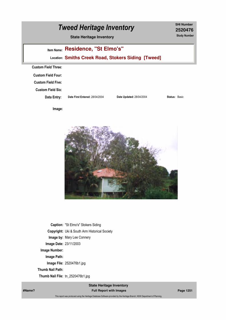
2520476
SHI Number
Tweed Heritage Inventory
Item Name: Residence, "St Elmo's"
Location: Smiths Creek Road, Stokers Siding [Tweed]
State Heritage Inventory Study Number
Date Updated: 28/04/2004 Status: BasicDate First Entered: 28/04/2004Data Entry:
Custom Field Three:
Custom Field Four:
Custom Field Five:
Custom Field Six:
Caption: "St Elmo's" Stokers Siding
Copyright: Uki & South Arm Historical Society
Image:
Image by: Mary Lee Connery
Image Date: 23/11/2003
Image Number:
Image Path:
Image File: 2520476b1.jpg
Thumb Nail Path:
Thumb Nail File: tn_2520476b1.jpg
#Name? Page 1251 Full Report with Images
State Heritage Inventory
This report was produced using the Heritage Database Software provided by the Heritage Branch, NSW Department of Planning.

2520476
SHI Number
Tweed Heritage Inventory
Item Name: Residence, "St Elmo's"
Location: Smiths Creek Road, Stokers Siding [Tweed]
State Heritage Inventory Study Number
#Name? Page 1252 Full Report with Images
State Heritage Inventory
This report was produced using the Heritage Database Software provided by the Heritage Branch, NSW Department of Planning.
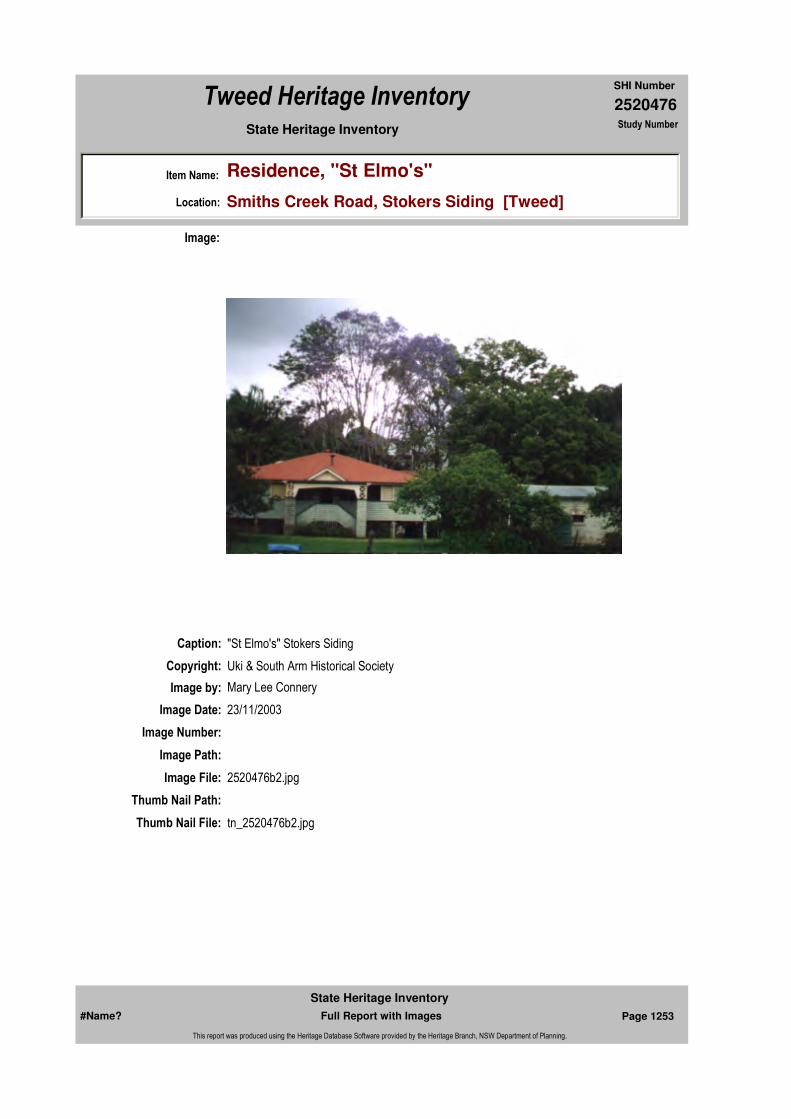
2520476
SHI Number
Tweed Heritage Inventory
Item Name: Residence, "St Elmo's"
Location: Smiths Creek Road, Stokers Siding [Tweed]
State Heritage Inventory Study Number
Caption: "St Elmo's" Stokers Siding
Copyright: Uki & South Arm Historical Society
Image:
Image by: Mary Lee Connery
Image Date: 23/11/2003
Image Number:
Image Path:
Image File: 2520476b2.jpg
Thumb Nail Path:
Thumb Nail File: tn_2520476b2.jpg
#Name? Page 1253 Full Report with Images
State Heritage Inventory
This report was produced using the Heritage Database Software provided by the Heritage Branch, NSW Department of Planning.
2520476
SHI Number
Tweed Heritage Inventory
Item Name: Residence, "St Elmo's"
Location: Smiths Creek Road, Stokers Siding [Tweed]
State Heritage Inventory Study Number
#Name? Page 1254 Full Report with Images
State Heritage Inventory
This report was produced using the Heritage Database Software provided by the Heritage Branch, NSW Department of Planning.

2520477
SHI Number
Tweed Heritage Inventory
Item Name: School Bell
Location: Stokers Road, Stokers Siding [Tweed]
State Heritage Inventory Study Number
Current Use:
Former Uses:
Statement of
Significance:The only surviving example of this technology in use on the Tweed River.
Historical Notes or Provenance:
Physical Description:
Physical Condition:
Modification Dates:
Designer:
Maker / Builder:
Year Started: Year Completed: Circa: No
Endorsed Significance:Assessed Significance: Local
Item Type: Built Category: School - State (public)Group: Education
Admin Codes: Code 2: Code 3:
Curtilage/Boundary:
Owner: Department of Education and Training
Other/Former Names:
Area/Group/Complex: Group ID:
Themes:
Aboriginal Area:
Local Govt Area: Tweed
Planning: Northern
Historic Region: North Coast
Address: #Name?
Suburb / Nearest Town: #Name?
State: NSW
Parish: Dunbible
County: Rous
National Theme State Theme Local Theme
6. Educating Education (none)
#Name? Page 1255 Full Report with Images
State Heritage Inventory
This report was produced using the Heritage Database Software provided by the Heritage Branch, NSW Department of Planning.

2520477
SHI Number
Tweed Heritage Inventory
Item Name: School Bell
Location: Stokers Road, Stokers Siding [Tweed]
State Heritage Inventory Study Number
Custom Field One:
Recommended Management:
References:
Studies:
Listings:
Date Updated: 28/04/2004 Status: BasicDate First Entered: 28/04/2004Data Entry:
Further Comments:
Criteria a)
Criteria c) The only surviving example of this technology in use on the Tweed River.
Criteria d)
Criteria e)
Criteria g)
Criteria f)
Integrity / Intactness:
Custom Field Two:
Custom Field Three:
Custom Field Four:
Custom Field Five:
Custom Field Six:
Criteria b)
Parcels:
Latitude: Longitude:
AMG Zone: Easting: Northing:
Map Name: Map Scale:
Spatial Accuracy:Location validity:
Management:
Author Title YearNumber
Tweed Shire Council Community-based Heritage Study 2003
Parcel Code LotNumber Section Plan Code Plan Number
LOT 1 DP 950649
#Name? Page 1256 Full Report with Images
State Heritage Inventory
This report was produced using the Heritage Database Software provided by the Heritage Branch, NSW Department of Planning.

2520477
SHI Number
Tweed Heritage Inventory
Item Name: School Bell
Location: Stokers Road, Stokers Siding [Tweed]
State Heritage Inventory Study Number
Caption:
Copyright: Uki & South Arm Historical Society
Image:
Image by: Mary Lee Connery
Image Date: 30/06/2003
Image Number:
Image Path:
Image File: 2520477b1.jpg
Thumb Nail Path:
Thumb Nail File: tn_2520477b1.jpg
#Name? Page 1257 Full Report with Images
State Heritage Inventory
This report was produced using the Heritage Database Software provided by the Heritage Branch, NSW Department of Planning.
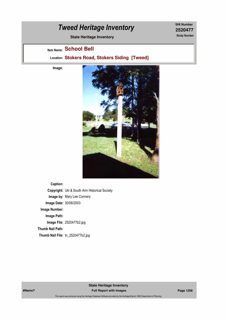
2520477
SHI Number
Tweed Heritage Inventory
Item Name: School Bell
Location: Stokers Road, Stokers Siding [Tweed]
State Heritage Inventory Study Number
Caption:
Copyright: Uki & South Arm Historical Society
Image:
Image by: Mary Lee Connery
Image Date: 30/06/2003
Image Number:
Image Path:
Image File: 2520477b2.jpg
Thumb Nail Path:
Thumb Nail File: tn_2520477b2.jpg
#Name? Page 1258 Full Report with Images
State Heritage Inventory
This report was produced using the Heritage Database Software provided by the Heritage Branch, NSW Department of Planning.
2520477
SHI Number
Tweed Heritage Inventory
Item Name: School Bell
Location: Stokers Road, Stokers Siding [Tweed]
State Heritage Inventory Study Number
#Name? Page 1259 Full Report with Images
State Heritage Inventory
This report was produced using the Heritage Database Software provided by the Heritage Branch, NSW Department of Planning.

2520479
SHI Number
Tweed Heritage Inventory
Item Name: Residence
Location: 238 Stokers Road, Stokers Siding [Tweed]
State Heritage Inventory Study Number
Current Use: Private residence
Former Uses: Anglican Church
Statement of
Significance:This building is an excellent example of the adaptive re-use of a redundant church.
Historical Notes or Provenance:
Built on land donated by Arthur Byrnes, the Church was originally Methodist as they were the largest religious group. However the building was used in turn by other denominations except the Catholics who held their services in the Hall. In 1936 the church became the property of the Anglican Church and was named St. John the Baptist. In 1982 the last service was held and the church closed due a dwindling attendance as the population declined with the downturn of the rural economy. In 1983, Laine Langridge bought the property and converted it to a residence.
Designer:
Maker / Builder:
Year Started: Year Completed: 1911 Circa: No
Endorsed Significance:Assessed Significance: Local
Item Type: Built Category: ChurchGroup: Religion
Admin Codes: Code 2: Code 3:
Curtilage/Boundary:
Owner: Private - Individual
Other/Former Names: St John the Baptist Church (former)
Area/Group/Complex: Group ID:
Themes:
Aboriginal Area:
Local Govt Area: Tweed
Planning: Northern
Historic Region: North Coast
Address: #Name?
Suburb / Nearest Town: #Name?
State: NSW
Parish: Dunbible
County: Rous
National Theme State Theme Local Theme
8. Culture Religion Church
#Name? Page 1264 Full Report with Images
State Heritage Inventory
This report was produced using the Heritage Database Software provided by the Heritage Branch, NSW Department of Planning.

2520479
SHI Number
Tweed Heritage Inventory
Item Name: Residence
Location: 238 Stokers Road, Stokers Siding [Tweed]
State Heritage Inventory Study Number
Physical Description: Simple timber rural church in late Victorian style. Gable ends have decorative fretwork; lancet arch windows.
Physical Condition: good
Modification Dates: 1983: addition on right hand side for bedroom bath room and laundry. Vestry removed from rear for use as a garden room and replaced by a verandah. Skillion roof and recycled widows are sympathetic to but do not replicate original detailing.
Custom Field One:
Recommended Management:
References:
Studies:
Listings:
Further Comments:
Criteria a)
Criteria c)
Criteria d)
Criteria e)
Criteria g) This building is an excellent example of the adaptive re-use of a redundant church.
Criteria f)
Integrity / Intactness:
Criteria b)
Parcels:
Latitude: Longitude:
AMG Zone: Easting: Northing:
Map Name: Map Scale:
Spatial Accuracy:Location validity:
Management:
Author Title Year
L. Langridge "The Story of Stokers Siding" 1988
Author Title YearNumber
Tweed Shire Council Community-based Heritage Study 2003
Parcel Code LotNumber Section Plan Code Plan Number
LOT 1 DP 133946
#Name? Page 1265 Full Report with Images
State Heritage Inventory
This report was produced using the Heritage Database Software provided by the Heritage Branch, NSW Department of Planning.
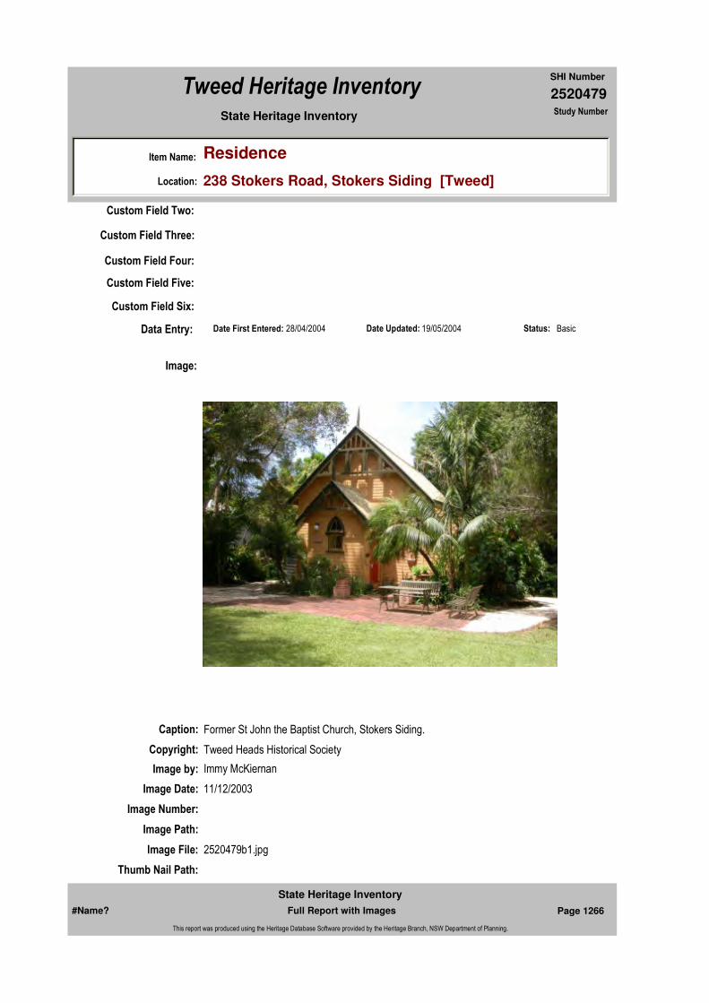
2520479
SHI Number
Tweed Heritage Inventory
Item Name: Residence
Location: 238 Stokers Road, Stokers Siding [Tweed]
State Heritage Inventory Study Number
Date Updated: 19/05/2004 Status: BasicDate First Entered: 28/04/2004Data Entry:
Custom Field Two:
Custom Field Three:
Custom Field Four:
Custom Field Five:
Custom Field Six:
Caption: Former St John the Baptist Church, Stokers Siding.
Copyright: Tweed Heads Historical Society
Image:
Image by: Immy McKiernan
Image Date: 11/12/2003
Image Number:
Image Path:
Image File: 2520479b1.jpg
Thumb Nail Path:
#Name? Page 1266 Full Report with Images
State Heritage Inventory
This report was produced using the Heritage Database Software provided by the Heritage Branch, NSW Department of Planning.

2520479
SHI Number
Tweed Heritage Inventory
Item Name: Residence
Location: 238 Stokers Road, Stokers Siding [Tweed]
State Heritage Inventory Study Number
Thumb Nail File: tn_2520479b1.jpg
#Name? Page 1267 Full Report with Images
State Heritage Inventory
This report was produced using the Heritage Database Software provided by the Heritage Branch, NSW Department of Planning.

2520479
SHI Number
Tweed Heritage Inventory
Item Name: Residence
Location: 238 Stokers Road, Stokers Siding [Tweed]
State Heritage Inventory Study Number
Caption: Rear of residence, former St John the Baptist Church, Stokers Siding.
Copyright: Tweed Heads Historical Society
Image:
Image by: Immy McKiernan
Image Date: 11/12/2003
Image Number:
Image Path:
Image File: 2520479b2.jpg
Thumb Nail Path:
Thumb Nail File: tn_2520479b2.jpg
#Name? Page 1268 Full Report with Images
State Heritage Inventory
This report was produced using the Heritage Database Software provided by the Heritage Branch, NSW Department of Planning.
2520479
SHI Number
Tweed Heritage Inventory
Item Name: Residence
Location: 238 Stokers Road, Stokers Siding [Tweed]
State Heritage Inventory Study Number
#Name? Page 1269 Full Report with Images
State Heritage Inventory
This report was produced using the Heritage Database Software provided by the Heritage Branch, NSW Department of Planning.

2520480
SHI Number
Tweed Heritage Inventory
Item Name: Stokers Siding / Dunbible Hall
Location: 244 Stokers Road, Stokers Siding [Tweed]
State Heritage Inventory Study Number
Current Use:
Former Uses:
Statement of
Significance:Including the Stokers Siding and Dunbible War Memorial Rolls, The Stoker's Siding / Dunbible Hall has a strong association with the residents of Stoker's Siding and Dunbible. It has acted as a centre for social and cultural activities for nearly 100 years. The memorial is part of the cultural history of the Tweed Valley and has a special association with the community in which it is housed.
Historical Notes or Provenance:
Physical Description:
Designer:
Maker / Builder:
Year Started: Year Completed: Circa: No
Endorsed Significance:Assessed Significance: Local
Item Type: Built Category: Hall Public Group: Community Facilities
Admin Codes: Code 2: Code 3:
Curtilage/Boundary:
Owner: Local Government
Other/Former Names:
Area/Group/Complex: Group ID:
Themes:
Aboriginal Area:
Local Govt Area: Tweed
Planning: Northern
Historic Region: North Coast
Address: #Name?
Suburb / Nearest Town: #Name?
State: NSW
Parish: Dunbible
County: Rous
National Theme State Theme Local Theme
8. Culture Social institutions Community Hall
#Name? Page 1270 Full Report with Images
State Heritage Inventory
This report was produced using the Heritage Database Software provided by the Heritage Branch, NSW Department of Planning.
2520480
SHI Number
Tweed Heritage Inventory
Item Name: Stokers Siding / Dunbible Hall
Location: 244 Stokers Road, Stokers Siding [Tweed]
State Heritage Inventory Study Number
Physical Condition:
Modification Dates:
Custom Field One:
Recommended
Management:
References:
Studies:
Listings:
Further Comments:
Criteria a)
Criteria c)
Criteria d)
Criteria e)
Criteria g)
Criteria f)
Integrity / Intactness:
Custom Field Two:
Custom Field Three:
Custom Field Four:
Custom Field Five:
Criteria b)
Parcels:
Latitude: Longitude:
AMG Zone: Easting: Northing:
Map Name: Map Scale:
Spatial Accuracy:Location validity:
Management:
Author Title YearNumber
Tweed Shire Council Community-based Heritage Study 2003
Parcel Code LotNumber Section Plan Code Plan Number
LOT 2 DP 307029
#Name? Page 1271 Full Report with Images
State Heritage Inventory
This report was produced using the Heritage Database Software provided by the Heritage Branch, NSW Department of Planning.

2520480
SHI Number
Tweed Heritage Inventory
Item Name: Stokers Siding / Dunbible Hall
Location: 244 Stokers Road, Stokers Siding [Tweed]
State Heritage Inventory Study Number
Date Updated: 28/04/2004 Status: BasicDate First Entered: 28/04/2004Data Entry:
Custom Field Six:
Caption: Stoker Siding and Dunbible Hall, Stokers Road, Stokers Siding
Copyright: Tweed Heads Historical Society
Image:
Image by: Immy McKiernan
Image Date: 15/01/2004
Image Number:
Image Path:
Image File: 2520480b1.jpg
Thumb Nail Path:
Thumb Nail File: tn_2520480b1.jpg
#Name? Page 1272 Full Report with Images
State Heritage Inventory
This report was produced using the Heritage Database Software provided by the Heritage Branch, NSW Department of Planning.

2520480
SHI Number
Tweed Heritage Inventory
Item Name: Stokers Siding / Dunbible Hall
Location: 244 Stokers Road, Stokers Siding [Tweed]
State Heritage Inventory Study Number
Caption: Stoker Siding and Dunbible Hall, Stokers Road, Stokers Siding
Copyright: Tweed Heads Historical Society
Image:
Image by: Immy McKiernan
Image Date: 15/01/2004
Image Number:
Image Path:
Image File: 2520480b2.jpg
Thumb Nail Path:
Thumb Nail File: tn_2520480b2.jpg
#Name? Page 1273 Full Report with Images
State Heritage Inventory
This report was produced using the Heritage Database Software provided by the Heritage Branch, NSW Department of Planning.
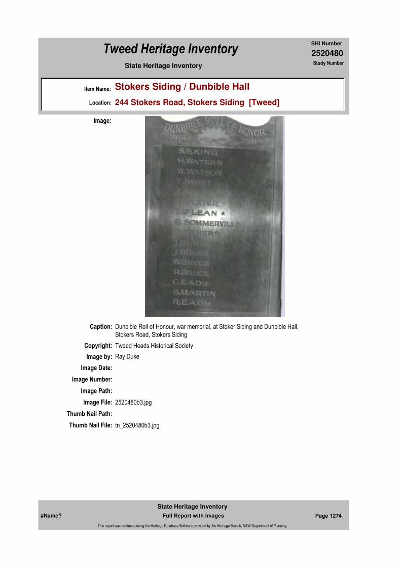
2520480
SHI Number
Tweed Heritage Inventory
Item Name: Stokers Siding / Dunbible Hall
Location: 244 Stokers Road, Stokers Siding [Tweed]
State Heritage Inventory Study Number
Caption: Dunbible Roll of Honour, war memorial, at Stoker Siding and Dunbible Hall, Stokers Road, Stokers Siding
Copyright: Tweed Heads Historical Society
Image:
Image by: Ray Duke
Image Date:
Image Number:
Image Path:
Image File: 2520480b3.jpg
Thumb Nail Path:
Thumb Nail File: tn_2520480b3.jpg
#Name? Page 1274 Full Report with Images
State Heritage Inventory
This report was produced using the Heritage Database Software provided by the Heritage Branch, NSW Department of Planning.
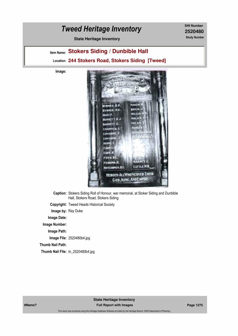
2520480
SHI Number
Tweed Heritage Inventory
Item Name: Stokers Siding / Dunbible Hall
Location: 244 Stokers Road, Stokers Siding [Tweed]
State Heritage Inventory Study Number
Caption: Stokers Siding Roll of Honour, war memorial, at Stoker Siding and Dunbible Hall, Stokers Road, Stokers Siding
Copyright: Tweed Heads Historical Society
Image:
Image by: Ray Duke
Image Date:
Image Number:
Image Path:
Image File: 2520480b4.jpg
Thumb Nail Path:
Thumb Nail File: tn_2520480b4.jpg
#Name? Page 1275 Full Report with Images
State Heritage Inventory
This report was produced using the Heritage Database Software provided by the Heritage Branch, NSW Department of Planning.

2520480
SHI Number
Tweed Heritage Inventory
Item Name: Stokers Siding / Dunbible Hall
Location: 244 Stokers Road, Stokers Siding [Tweed]
State Heritage Inventory Study Number
#Name? Page 1276 Full Report with Images
State Heritage Inventory
This report was produced using the Heritage Database Software provided by the Heritage Branch, NSW Department of Planning.
2520481
SHI Number
Tweed Heritage Inventory
Item Name: War Memorial Gates
Location: Bawden Street, Tumbulgum [Tweed]
State Heritage Inventory Study Number
Current Use:
Former Uses:
Statement of
Significance:The inscribed Marble Plaques attached to the gates posts of the Brian Breckenridge Field Tumbulgum are a part of the cultural history of the Tweed Valley and has a special association with the community in which it is housed.
Historical Notes
or Provenance:
Physical Description: Inscribed marble plaques attached to the gate posts.
Physical Condition:
Designer:
Maker / Builder:
Year Started: Year Completed: Circa: No
Endorsed Significance:Assessed Significance: Local
Item Type: Built Category: War MemorialGroup: Monuments and Mem
Admin Codes: Code 2: Code 3:
Curtilage/Boundary:
Owner: Local Government
Other/Former Names:
Area/Group/Complex: Group ID:
Themes:
Aboriginal Area:
Local Govt Area: Tweed
Planning: Northern
Historic Region: North Coast
Address: #Name?
Suburb / Nearest Town: #Name?
State: NSW
Parish: Condong
County: Rous
National Theme State Theme Local Theme
7. Governing Defence War Memorial
#Name? Page 1277 Full Report with Images
State Heritage Inventory
This report was produced using the Heritage Database Software provided by the Heritage Branch, NSW Department of Planning.
2520481
SHI Number
Tweed Heritage Inventory
Item Name: War Memorial Gates
Location: Bawden Street, Tumbulgum [Tweed]
State Heritage Inventory Study Number
Modification Dates:
Custom Field One:
Recommended
Management:
References:
Studies:
Listings:
Further Comments:
Criteria a)
Criteria c)
Criteria d)
Criteria e)
Criteria g)
Criteria f)
Integrity / Intactness:
Custom Field Two:
Custom Field Three:
Custom Field Four:
Custom Field Five:
Criteria b) The memorial is part of the cultural history of the Tweed Valley and has a special association with the community in which it is housed.
Parcels:
Latitude: Longitude:
AMG Zone: Easting: Northing:
Map Name: Map Scale:
Spatial Accuracy:Location validity:
Management:
Author Title YearNumber
Tweed Shire Council Community-based Heritage Study 2003
Parcel Code LotNumber Section Plan Code Plan Number
LOT 8272 DP 755698
#Name? Page 1278 Full Report with Images
State Heritage Inventory
This report was produced using the Heritage Database Software provided by the Heritage Branch, NSW Department of Planning.
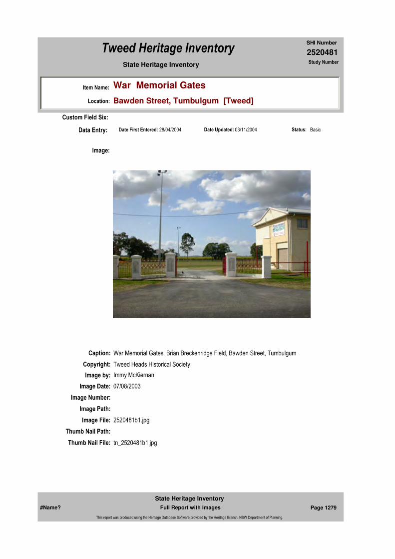
2520481
SHI Number
Tweed Heritage Inventory
Item Name: War Memorial Gates
Location: Bawden Street, Tumbulgum [Tweed]
State Heritage Inventory Study Number
Date Updated: 03/11/2004 Status: BasicDate First Entered: 28/04/2004Data Entry:
Custom Field Six:
Caption: War Memorial Gates, Brian Breckenridge Field, Bawden Street, Tumbulgum
Copyright: Tweed Heads Historical Society
Image:
Image by: Immy McKiernan
Image Date: 07/08/2003
Image Number:
Image Path:
Image File: 2520481b1.jpg
Thumb Nail Path:
Thumb Nail File: tn_2520481b1.jpg
#Name? Page 1279 Full Report with Images
State Heritage Inventory
This report was produced using the Heritage Database Software provided by the Heritage Branch, NSW Department of Planning.

2520481
SHI Number
Tweed Heritage Inventory
Item Name: War Memorial Gates
Location: Bawden Street, Tumbulgum [Tweed]
State Heritage Inventory Study Number
Caption: War Memorial Gates, Brian Breckenridge Field, Bawden Street, Tumbulgum
Copyright: Tweed Heads Historical Society
Image:
Image by: Immy McKiernan
Image Date: 07/08/2003
Image Number:
Image Path:
Image File: 2520481b2.jpg
Thumb Nail Path:
Thumb Nail File: tn_2520481b2.jpg
#Name? Page 1280 Full Report with Images
State Heritage Inventory
This report was produced using the Heritage Database Software provided by the Heritage Branch, NSW Department of Planning.

2520481
SHI Number
Tweed Heritage Inventory
Item Name: War Memorial Gates
Location: Bawden Street, Tumbulgum [Tweed]
State Heritage Inventory Study Number
Caption: War Memorial Gates, Brian Breckenridge Field, Bawden Street, Tumbulgum
Copyright: Tweed Heads Historical Society
Image:
Image by: Immy McKiernan
Image Date: 07/08/2003
Image Number:
Image Path:
Image File: 2520481b3.jpg
Thumb Nail Path:
Thumb Nail File: tn_2520481b3.jpg
#Name? Page 1281 Full Report with Images
State Heritage Inventory
This report was produced using the Heritage Database Software provided by the Heritage Branch, NSW Department of Planning.
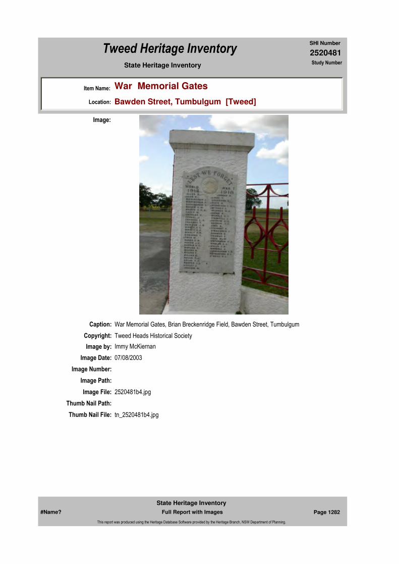
2520481
SHI Number
Tweed Heritage Inventory
Item Name: War Memorial Gates
Location: Bawden Street, Tumbulgum [Tweed]
State Heritage Inventory Study Number
Caption: War Memorial Gates, Brian Breckenridge Field, Bawden Street, Tumbulgum
Copyright: Tweed Heads Historical Society
Image:
Image by: Immy McKiernan
Image Date: 07/08/2003
Image Number:
Image Path:
Image File: 2520481b4.jpg
Thumb Nail Path:
Thumb Nail File: tn_2520481b4.jpg
#Name? Page 1282 Full Report with Images
State Heritage Inventory
This report was produced using the Heritage Database Software provided by the Heritage Branch, NSW Department of Planning.

2520481
SHI Number
Tweed Heritage Inventory
Item Name: War Memorial Gates
Location: Bawden Street, Tumbulgum [Tweed]
State Heritage Inventory Study Number
#Name? Page 1283 Full Report with Images
State Heritage Inventory
This report was produced using the Heritage Database Software provided by the Heritage Branch, NSW Department of Planning.

2520482
SHI Number
Tweed Heritage Inventory
Item Name: St Peter's Anglican Church
Location: 122-124 Riverside Drive, Tumbulgum [Tweed]
State Heritage Inventory Study Number
Current Use:
Former Uses:
Statement of
Significance:St Peter's Anglican Church has a strong association with the residents of Tumbulgum from 1888 which served the spiritual and cultural needs of the congregation over the years.
Historical Notes or Provenance:
The church of St Peter, on the corner of Bawden and Government Streets, Tumbulgum, was opened on St Peter's Day, 1888. The first Anglican Church had been opened in Murwillumbah in 1882. The Parish of the Tweed was established in 1887 and was under the charge of the Rev. T. E. Fox who also administered to the churches of the Brunswick River district. Tumbulgum remained part of the separate Parish of Tweed when it was established in 1901.
"The Tweed River Parish Chronicle", dated 5th August, 1907 (price One Penny, or One Shilling per annum) lists the services held in the Parish, with Tumbulgum have service on the second and fourth Sundays of every month. So it remains today! The Vicar was the Rev. A. W. King, and St Peter's Church Warden is recorded as Mr. J. G. Hibbard. The Vicar's letter to his congregation concerns the finances of the church, and calls for "a more liberal support towards carrying on the work of the Church in this Parish." He urges people to "give with method", a certain sum every Sunday, and the full amount made up after absences from worship.
In 1916 Tumbulgum was part of the Parish of Murwillumbah, then in 1936 part of the Home Mission District of Tumbulgum/Condong, with the Rev. G Titus--Ress as its first incumbent.
In 1941 the clergy of Murwillumbah again accepted responsibility for St. Peter's and during the Rectorship of Rev. R. MacFarlane it was re-incorporated in the Murwillumbah Parish.
Endorsed Significance:Assessed Significance: Local
Item Type: Built Category: ChurchGroup: Religion
Admin Codes: Code 2: Code 3:
Curtilage/Boundary:
Owner: Religious Organisation
Other/Former Names:
Area/Group/Complex: Group ID:
Aboriginal Area:
Local Govt Area: Tweed
Planning: Northern
Historic Region: North Coast
Address: #Name?
Suburb / Nearest Town: #Name?
State: NSW
Parish: Condong
County: Rous
#Name? Page 1284 Full Report with Images
State Heritage Inventory
This report was produced using the Heritage Database Software provided by the Heritage Branch, NSW Department of Planning.

2520482
SHI Number
Tweed Heritage Inventory
Item Name: St Peter's Anglican Church
Location: 122-124 Riverside Drive, Tumbulgum [Tweed]
State Heritage Inventory Study Number
Features of the original building were its red wood ceiling and a gallery where, according to long time worshpper, the late Mrs. Elsie Wright, the coloured people, "who were terribly shy" used to sit. Her memories dated back to about 1912. On 25th November 1943 the church was blown down in a freak storm. "The Tweed Daily" reported the next day: "A fierce storm, accompanied by a high wind, which swept over Murwillumbah and many parts of the Tweed caused considerable damage ... Two inches of rain fell in half an hour ... Worst country damage reported was the razing of the Church of England at Tumbulgum. Situated behind the hall, the Church, although an old building was in good repair."
Because it was wartime there was no immediate possibility of re-building. The materials were auctioned and the furniture and ornaments stored. For the next eleven years services were held in the local hall.
In 1954 the congregation was in a position financially to build a new church on its present site, then fronting the Pacific Highway, and on higher ground. The foundation stone was laid by Bishop Storrs on 26th September, 1954 and the building dedicated on 20th November that year. The original furniture, much of which had been given in memory of early members was restored. This included a beautifully carved prayer desk, priest's chairs, altar, reredos, altar rails, the stone font, pews and lectern. The original organ had been damaged beyond repair, but the widow of former church warden Mr. J. C. Hibbard, herself an organist, was able to locate an instrument in keeping with the old furniture, and gave it as a memorial to her husband.
Some years latter the church was extended and a vestry and meeting room added. The building was declared debt free in 1969 and was consecrated by Bishop Arthur on 29th September.
Over its hundred years there have been many families who have been part of St. Peter's Tumbulgum - To mention but a few - the Logans, Wrights, Turners, Vickerys, Bonds, Martins, Hibbards, Silleys, Dores, Jaggers, Higgins. Most of them have gone, and their places taken by new-comers to Tumbulgum and its surrounding areas. There are, however, some whose descendants are still members of the congregation. The present incumbent is the Rev. L. Thompson.
Physical Description: Late Carpenter Gothic. Large vertical window. very late Gothic feature, strongly sloping
Designer:
Maker / Builder:
Year Started: Year Completed: 1954 Circa: No
Themes: National Theme State Theme Local Theme
8. Culture Religion Church
#Name? Page 1285 Full Report with Images
State Heritage Inventory
This report was produced using the Heritage Database Software provided by the Heritage Branch, NSW Department of Planning.
2520482
SHI Number
Tweed Heritage Inventory
Item Name: St Peter's Anglican Church
Location: 122-124 Riverside Drive, Tumbulgum [Tweed]
State Heritage Inventory Study Number
gable. Windows domestic in shape. Door simple rectangular
Physical Condition:
Modification Dates:
Custom Field One:
Recommended Management:
References:
Studies:
Listings:
Further Comments:
Criteria a)
Criteria c)
Criteria d) St Peter's Anglican Church has a strong association with the residents of Tumbulgum from 1888 which served the spiritual and cultural needs of the congregation over the years.
Criteria e)
Criteria g)
Criteria f)
Integrity / Intactness:
Criteria b)
Parcels:
Latitude: Longitude:
AMG Zone: Easting: Northing:
Map Name: Map Scale:
Spatial Accuracy:Location validity:
Management:
Author Title Year
St Peter's, Tumbulgum (Pamphlet from St Peter's Tumbulgum Centenary)
1988
Author Title YearNumber
Tweed Shire Council Community-based Heritage Study 2003
Parcel Code LotNumber Section Plan Code Plan Number
LOT 8 1 DP 1223
LOT 7 DP 1223
#Name? Page 1286 Full Report with Images
State Heritage Inventory
This report was produced using the Heritage Database Software provided by the Heritage Branch, NSW Department of Planning.

2520482
SHI Number
Tweed Heritage Inventory
Item Name: St Peter's Anglican Church
Location: 122-124 Riverside Drive, Tumbulgum [Tweed]
State Heritage Inventory Study Number
Date Updated: 02/11/2004 Status: BasicDate First Entered: 28/04/2004Data Entry:
Custom Field Two:
Custom Field Three:
Custom Field Four:
Custom Field Five:
Custom Field Six:
Caption: St Peter's Anglican Church, Tumbulgum
Copyright: Tweed Heads Historical Society
Image:
Image by: Immy McKiernan
Image Date: 07/08/2003
Image Number:
Image Path:
Image File: 2520482b1.jpg
Thumb Nail Path:
#Name? Page 1287 Full Report with Images
State Heritage Inventory
This report was produced using the Heritage Database Software provided by the Heritage Branch, NSW Department of Planning.

2520482
SHI Number
Tweed Heritage Inventory
Item Name: St Peter's Anglican Church
Location: 122-124 Riverside Drive, Tumbulgum [Tweed]
State Heritage Inventory Study Number
Thumb Nail File: tn_2520482b1.jpg
#Name? Page 1288 Full Report with Images
State Heritage Inventory
This report was produced using the Heritage Database Software provided by the Heritage Branch, NSW Department of Planning.

2520482
SHI Number
Tweed Heritage Inventory
Item Name: St Peter's Anglican Church
Location: 122-124 Riverside Drive, Tumbulgum [Tweed]
State Heritage Inventory Study Number
Caption: St Peter's Anglican Church, Tumbulgum
Copyright: Tweed Heads Historical Society
Image:
Image by: Immy McKiernan
Image Date: 07/08/2003
Image Number:
Image Path:
Image File: 2520482b2.jpg
Thumb Nail Path:
Thumb Nail File: tn_2520482b2.jpg
#Name? Page 1289 Full Report with Images
State Heritage Inventory
This report was produced using the Heritage Database Software provided by the Heritage Branch, NSW Department of Planning.
2520482
SHI Number
Tweed Heritage Inventory
Item Name: St Peter's Anglican Church
Location: 122-124 Riverside Drive, Tumbulgum [Tweed]
State Heritage Inventory Study Number
#Name? Page 1290 Full Report with Images
State Heritage Inventory
This report was produced using the Heritage Database Software provided by the Heritage Branch, NSW Department of Planning.
2520483
SHI Number
Tweed Heritage Inventory
Item Name: Tumbulgum Hall
Location: Government Road, Tumbulgum [Tweed]
State Heritage Inventory Study Number
Current Use:
Former Uses:
Statement of Significance:
Including War Memorial Roll, the Tumbulgum Community Hall has a strong association with the residents of Tumbulgum. It has acted as a centre for social and cultural activities for nearly 100 years. The memorial is part of the cultural history of the Tweed Valley and has a special association with the community in which it is housed.
Historical Notes or Provenance:
Designer:
Endorsed Significance:Assessed Significance: Local
Item Type: Built Category: Hall Public Group: Community Facilities
Admin Codes: Code 2: Code 3:
Curtilage/Boundary:
Owner: Local Government
Other/Former Names:
Area/Group/Complex: Group ID:
Themes:
Aboriginal Area:
Local Govt Area: Tweed
Planning: Northern
Historic Region: North Coast
Address: #Name?
Suburb / Nearest Town: #Name?
State: NSW
Parish: Condong
County: Rous
Local Govt Area: Tweed
Planning: Northern
Historic Region: North Coast
Address: #Name?
Suburb / Nearest Town: #Name?
State: NSW
Parish: Condong
County: Rous
National Theme State Theme Local Theme
8. Culture Social institutions Community Hall
#Name? Page 1291 Full Report with Images
State Heritage Inventory
This report was produced using the Heritage Database Software provided by the Heritage Branch, NSW Department of Planning.

2520483
SHI Number
Tweed Heritage Inventory
Item Name: Tumbulgum Hall
Location: Government Road, Tumbulgum [Tweed]
State Heritage Inventory Study Number
Physical Description: Simple early 20th Century country hall & wooden honour board
Physical Condition:
Modification Dates:
Maker / Builder:
Year Started: Year Completed: Circa: No
Recommended
Management:
References:
Studies:
Listings:
Further Comments:
Criteria a) The memorial is part of the cultural history of the Tweed Valley and has a special association with the community in which it is housed.
Criteria c)
Criteria d)
Criteria e)
Criteria g)
Criteria f)
Integrity / Intactness:
Criteria b) The Tumbulgum Community Hall has a strong association with the residents of Tumbulgum. It has acted as a centre for social and cultural activities for nearly 100 years.
Parcels:
Latitude: Longitude:
AMG Zone: Easting: Northing:
Map Name: Map Scale:
Spatial Accuracy:Location validity:
Management:
Author Title YearNumber
Tweed Shire Council Community-based Heritage Study 2003
Parcel Code LotNumber Section Plan Code Plan Number
LOT 40 1 DP 1223
#Name? Page 1292 Full Report with Images
State Heritage Inventory
This report was produced using the Heritage Database Software provided by the Heritage Branch, NSW Department of Planning.

2520483
SHI Number
Tweed Heritage Inventory
Item Name: Tumbulgum Hall
Location: Government Road, Tumbulgum [Tweed]
State Heritage Inventory Study Number
Custom Field One:
Date Updated: 29/04/2004 Status: BasicDate First Entered: 29/04/2004Data Entry:
Custom Field Two:
Custom Field Three:
Custom Field Four:
Custom Field Five:
Custom Field Six:
Caption: Tumbulgum Hall
Copyright: Tweed Heads Historical Society
Image:
Image by: Immy McKiernan
Image Date: 07/08/2003
Image Number:
Image Path:
Image File: 2520483b1.jpg
#Name? Page 1293 Full Report with Images
State Heritage Inventory
This report was produced using the Heritage Database Software provided by the Heritage Branch, NSW Department of Planning.
2520483
SHI Number
Tweed Heritage Inventory
Item Name: Tumbulgum Hall
Location: Government Road, Tumbulgum [Tweed]
State Heritage Inventory Study Number
Thumb Nail Path:
Thumb Nail File: tn_2520483b1.jpg
#Name? Page 1294 Full Report with Images
State Heritage Inventory
This report was produced using the Heritage Database Software provided by the Heritage Branch, NSW Department of Planning.
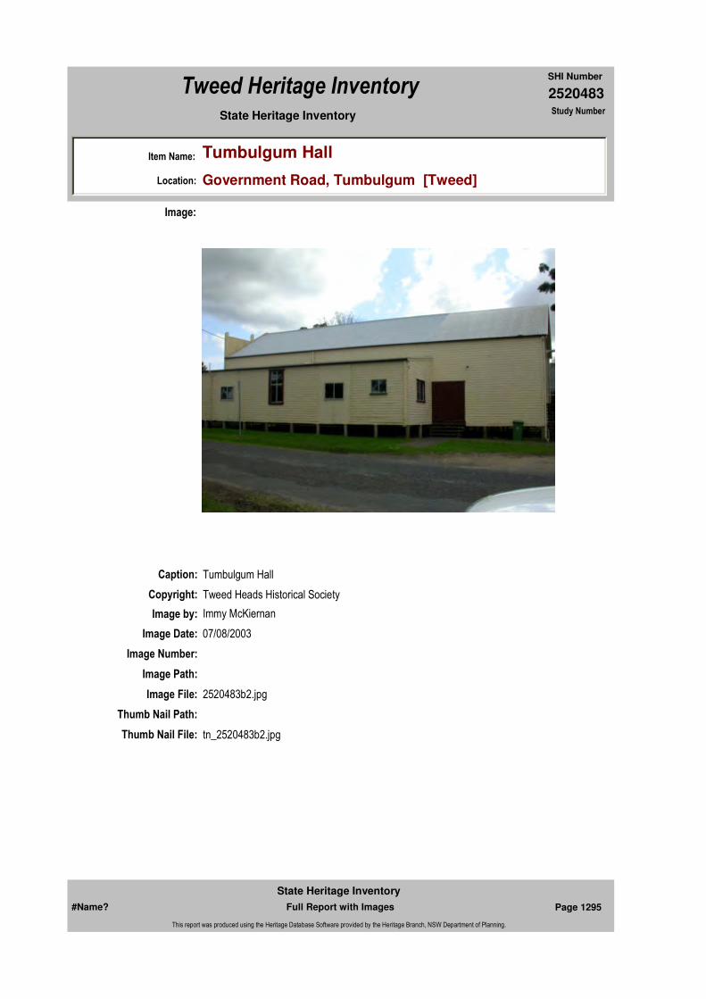
2520483
SHI Number
Tweed Heritage Inventory
Item Name: Tumbulgum Hall
Location: Government Road, Tumbulgum [Tweed]
State Heritage Inventory Study Number
Caption: Tumbulgum Hall
Copyright: Tweed Heads Historical Society
Image:
Image by: Immy McKiernan
Image Date: 07/08/2003
Image Number:
Image Path:
Image File: 2520483b2.jpg
Thumb Nail Path:
Thumb Nail File: tn_2520483b2.jpg
#Name? Page 1295 Full Report with Images
State Heritage Inventory
This report was produced using the Heritage Database Software provided by the Heritage Branch, NSW Department of Planning.

2520483
SHI Number
Tweed Heritage Inventory
Item Name: Tumbulgum Hall
Location: Government Road, Tumbulgum [Tweed]
State Heritage Inventory Study Number
Caption: Tumbulgum Hall
Copyright: Tweed Heads Historical Society
Image:
Image by: Immy McKiernan
Image Date: 07/08/2003
Image Number:
Image Path:
Image File: 2520483b3.jpg
Thumb Nail Path:
Thumb Nail File: tn_2520483b3.jpg
#Name? Page 1296 Full Report with Images
State Heritage Inventory
This report was produced using the Heritage Database Software provided by the Heritage Branch, NSW Department of Planning.
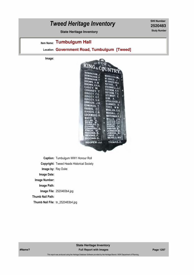
2520483
SHI Number
Tweed Heritage Inventory
Item Name: Tumbulgum Hall
Location: Government Road, Tumbulgum [Tweed]
State Heritage Inventory Study Number
Caption: Tumbulgum WW1 Honour Roll
Copyright: Tweed Heads Historical Society
Image:
Image by: Ray Duke
Image Date:
Image Number:
Image Path:
Image File: 2520483b4.jpg
Thumb Nail Path:
Thumb Nail File: tn_2520483b4.jpg
#Name? Page 1297 Full Report with Images
State Heritage Inventory
This report was produced using the Heritage Database Software provided by the Heritage Branch, NSW Department of Planning.

2520483
SHI Number
Tweed Heritage Inventory
Item Name: Tumbulgum Hall
Location: Government Road, Tumbulgum [Tweed]
State Heritage Inventory Study Number
#Name? Page 1298 Full Report with Images
State Heritage Inventory
This report was produced using the Heritage Database Software provided by the Heritage Branch, NSW Department of Planning.
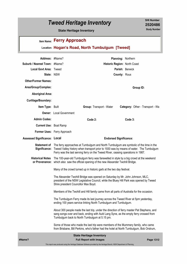
2520486
SHI Number
Tweed Heritage Inventory
Item Name: Ferry Approach
Location: Hogan's Road, North Tumbulgum [Tweed]
State Heritage Inventory Study Number
Current Use: Boat Ramp
Former Uses: Ferry Approach
Statement of
Significance:The ferry approaches at Tumbulgum and North Tumbulgum are symbolic of the time in the Tweed Valley history when transport prior to 1930 was by means of water. The Tumbulgum Ferry was the last serving ferry on the Tweed River, ceasing operations in 1987.
Historical Notes
or Provenance:The 100-year-old Tumbulgum ferry was farewelled in style by a big crowd at the weekend which also saw the official opening of the new Alexander Twohill Bridge.
Many of the crowd turned up in historic garb at the two day festival.
The Alexander Twohill Bridge was opened on Saturday by Mr. John Johnson, MLC, president of the NSW Legislative Council, while the Bluey Hill Park was opened by Tweed Shire president Councillor Max Boyd.
Members of the Twohill and Hill family came from all parts of Australia for the occasion.
The Tumbulgum Ferry made its last journey across the Tweed River at 5pm yesterday, ending 100 years service linking North Tumbulgum and Tumbulgum.
About 300 people made the last trip, under the direction of ferry master Pat Stephens, and sang songs over and back, ending with Auld Lang Syne, as the empty ferry crossed from Tumbulgum back to North Tumbulgum at 5.15 pm.
Some of those who made the last trip were members of the Mummery family, who came from Brisbane, Bill Perkins, who's father had the hotel at North Tumbulgum, Bob Orstrum,
Endorsed Significance:Assessed Significance: Local
Item Type: Built Category: Other - Transport - WaGroup: Transport - Water
Admin Codes: Code 2: Code 3:
Curtilage/Boundary:
Owner: Local Government
Other/Former Names:
Area/Group/Complex: Group ID:
Aboriginal Area:
Local Govt Area: Tweed
Planning: Northern
Historic Region: North Coast
Address: #Name?
Suburb / Nearest Town: #Name?
State: NSW
Parish: Berwick
County: Rous
#Name? Page 1312 Full Report with Images
State Heritage Inventory
This report was produced using the Heritage Database Software provided by the Heritage Branch, NSW Department of Planning.

2520486
SHI Number
Tweed Heritage Inventory
Item Name: Ferry Approach
Location: Hogan's Road, North Tumbulgum [Tweed]
State Heritage Inventory Study Number
and members of the Vickery, Williams, Cranney and Twohill families, all long-time patrons of the ferry.
In a farewell speech, Deputy Shire President Tom Hogan said the ferry was now a part of history and it was a sad but happy day for Tumbulgum.
Mr. George Beattie, in his sea plane, did four fly-pasts as the ferry made its last crossing.
From Brisbane came the son of a former ferry master, Morrie Watts, who said that as a child he made the trip with his late father when the new service came into operation and wanted to be there for the last trip.
The oldest resident to make the last trip was a former post mistress 96-year-old Mrs Johnson, and the youngest, six-month-old Leon McClymont.
The Tumbulgum post office was the second one established on the Tweed, while the Tumbulgum school was the first school built on the Tweed.
Opening the Alexander Twohill Bridge Mr. Johnson said he had had a long association with the late Alexander Twohill, a former president of the Tweed Shire Council.
Councillor Alex Pearson, chair-man of the Tweed Coast Tourism Association, who staged the weekend festival, has suggested it become an annual event.
Cr Pearson said a sugar festival should be staged about the same time every year, blending in with the normal end of the sugar cane crush.
Physical Description:
Physical Condition:
Modification Dates:
Designer:
Maker / Builder:
Year Started: Year Completed: Circa: No
Recommended
Management:
Themes: National Theme State Theme Local Theme
3. Economy Transport Ferry
#Name? Page 1313 Full Report with Images
State Heritage Inventory
This report was produced using the Heritage Database Software provided by the Heritage Branch, NSW Department of Planning.

2520486
SHI Number
Tweed Heritage Inventory
Item Name: Ferry Approach
Location: Hogan's Road, North Tumbulgum [Tweed]
State Heritage Inventory Study Number
Custom Field One:
References:
Studies:
Listings:
Date Updated: 01/11/2004 Status: BasicDate First Entered: 29/04/2004Data Entry:
Further Comments:
Criteria a) The ferry approaches at Tumbulgum and North Tumbulgum are symbolic of the time in the Tweed Valley history when transport prior to 1930 was by means of water. The Tumbulgum Ferry was the last serving ferry on the Tweed River, ceasing operations in 1987.
Criteria c)
Criteria d)
Criteria e)
Criteria g)
Criteria f)
Integrity / Intactness:
Custom Field Two:
Custom Field Three:
Custom Field Four:
Custom Field Five:
Custom Field Six:
Criteria b)
Parcels:
Latitude: Longitude:
AMG Zone: Easting: 544925 Northing: 6872266
Map Name: Map Scale:
Spatial Accuracy:Location validity:
Management:
Author Title Year
"Ferry's last run as bridge opens" "Tears, and cheers at Tumbulgum"
1988
Author Title YearNumber
Tweed Shire Council Community-based Heritage Study 2003
#Name? Page 1314 Full Report with Images
State Heritage Inventory
This report was produced using the Heritage Database Software provided by the Heritage Branch, NSW Department of Planning.
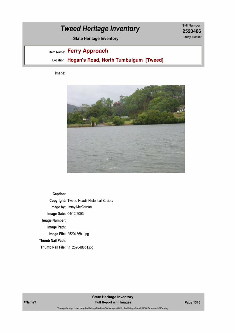
2520486
SHI Number
Tweed Heritage Inventory
Item Name: Ferry Approach
Location: Hogan's Road, North Tumbulgum [Tweed]
State Heritage Inventory Study Number
Caption:
Copyright: Tweed Heads Historical Society
Image:
Image by: Immy McKiernan
Image Date: 04/12/2003
Image Number:
Image Path:
Image File: 2520486b1.jpg
Thumb Nail Path:
Thumb Nail File: tn_2520486b1.jpg
#Name? Page 1315 Full Report with Images
State Heritage Inventory
This report was produced using the Heritage Database Software provided by the Heritage Branch, NSW Department of Planning.

2520486
SHI Number
Tweed Heritage Inventory
Item Name: Ferry Approach
Location: Hogan's Road, North Tumbulgum [Tweed]
State Heritage Inventory Study Number
#Name? Page 1316 Full Report with Images
State Heritage Inventory
This report was produced using the Heritage Database Software provided by the Heritage Branch, NSW Department of Planning.

2520487
SHI Number
Tweed Heritage Inventory
Item Name: Charles Street Cemetery
Location: Charles Street, Tweed Heads [Tweed]
State Heritage Inventory Study Number
Current Use:
Former Uses:
Statement of Significance:
This item has a strong association with the pioneers of the Tweed Heads district.
Historical Notes or Provenance:
The study of the cemetery selected for this assignment, that in Florence Street, Tweed Heads, would be incomplete without brief comment on its place in the sequence of burial grounds which have been in use since the first white settlers arrived here. There are four such cemeteries including one now in use in South Tweed Heads:1. Terranora camp was the foundation settlement in the Tweed estuary with shipyards, a shanty, many rough dwellings and a cemetery. The cemetery disappeared into the river in subsequent floods, but some of the headstones were recovered, particularly those of the Bodd family who lost their lives in the Ebenezer disaster on 30 July 1859.2. At North Tumbulgum there is an old cemetery which was in use from 1873 until 1947. Following its restoration by the Tweed Council and LEAP, it is now a place of peace and beauty, and worth a visit for those interested in the history of the region.3. The Chinderah cemetery was in use for the residents of the Lower Tweed in the last few decades of the 19th century. The wife of the Tweed Pilot Capt McGregor died of typhoid in 1884. The mourners were unsuccessful in rowing her coffin upriver against the tide, and had
Endorsed Significance:Assessed Significance: Local
Item Type: Complex / Group Category: Cemetery/Graveyard/Group: Cemeteries and Buria
Admin Codes: Code 2: Code 3:
Curtilage/Boundary:
Owner: Local Government
Other/Former Names: Florence Street Cemetery; Cooloon Cemetery
Area/Group/Complex: Group ID:
Aboriginal Area:
Local Govt Area: Tweed
Planning: Northern
Historic Region: North Coast
Address: #Name?
Suburb / Nearest Town: #Name?
State: NSW
Parish: Terranora
County: Rous
Local Govt Area: Tweed
Planning: Northern
Historic Region: North Coast
Address: #Name?
Suburb / Nearest Town: #Name?
State: NSW
Parish: Terranora
County: Rous
#Name? Page 1317 Full Report with Images
State Heritage Inventory
This report was produced using the Heritage Database Software provided by the Heritage Branch, NSW Department of Planning.

2520487
SHI Number
Tweed Heritage Inventory
Item Name: Charles Street Cemetery
Location: Charles Street, Tweed Heads [Tweed]
State Heritage Inventory Study Number
to borrow a steam tug from CSR to get Mrs McGregor to her final resting place at Chinderah.4. The cemetery at Florence Street, Tweed Heads is the subject of this study, and detailed comment follows.There is also a graveyard at Fingal which has been used by the Aboriginal and Islander peoples.
CEMETERY SURVEYName of Cemetery: Tweed HeadsLocation: Florence St. Tweed HeadsCategory: PublicArea or Dimensions: Approx. l00m by 120m. Not fenced.Estimated number of Monuments: 825Chief material used in Monuments: Concrete and marble, some granite.Legibility of inscriptions on Monuments: Moderate, but deteriorating.Dates of oldest Monuments: 1890-1910Is the cemetery still used ? Occasionally - see below.Does a constituted body administer the cemetery? Yes, Tweed CouncilPlans and Records of the cemetery: Yes, at Lower Tweed Heads Historical Society
Graves of people considered significant:Name Year RemarksLane, John 1946 age 81 (John, co founder of the New Australia Lane, Jane 1955 age 87 settlement, with his wife & two children, both Cosma Annie 1963 born in Paraguay. John was finally Headmaster Hilda Mary 1976 at Coolangatta School) Hewitt, Norman C 1956 aged 77 Historian of the Northern Rivers of NSWSeymour William P. 1938 age98 Boatman; Crimean & US Civil War VeteranSexton, John 1921 age6l Landowner
General condition of the cemeteryThe grounds are fairly well kept and there is little evidence of vandalism. Most of the monuments are in good condition; however some of the oldest and most elaborate, on the top of the ridge are subsiding. The old Brady headstone has fallen and shattered. These are problems which warrant financial support and some individual effort to resolve. The interest of the Historical Society and the fact that the cemetery is still in use for relatives of people already interred there, offers some assurance that the area will continue to be properly maintained.The significance of this cemetery lies in its role as the final resting place over the first half of this century, for many of the district's pioneer settlers. The pressures of the population growth began to influence its future use by the 1930's. The Border Star of 28 May 1831 said in its Editorial -"until recently Tweed Heads cemetery was sufficiently large to fulfil all requirement but this is no longer so a siutable site should be immediately secured in Coolangatta. Interstate rivalry was in evidence even in death -"Many people would like to have their dear departed laid to rest in the town and district in which they have lived and laboured, and not in another State"
By 1932 interments were limited, and an application to the Minister for its reopening for
#Name? Page 1318 Full Report with Images
State Heritage Inventory
This report was produced using the Heritage Database Software provided by the Heritage Branch, NSW Department of Planning.

2520487
SHI Number
Tweed Heritage Inventory
Item Name: Charles Street Cemetery
Location: Charles Street, Tweed Heads [Tweed]
State Heritage Inventory Study Number
general use was declined.
CEMETERY SURVEYDate of Survey: 25 Feb.1994 Tweed Heads Cemetery, Florence StreetOldest Monuments:Name Date RemarksBrady, John 1909 Nov 25 Cedar getter. Arrived Tweed c.1850Brady, Kate 1887 May 5 These are possibly re-interments or monuments toBrady, John 1875 May 20 John's wife & two children, who it is known wereBrady, John Louis 1881 May 26 buried on the family farm at Piggabeen.McCauley, Alexander 1909 Feb 21 late Postmaster, Tweed HeadsFaust, Nicholas Clifford 1912 Oct 25Faust, Nicholas 1919 Aug 1Ducat, Adelaide 1912 Nov 5Keys, William 1907 Aug 28Keys, Annie 1915, Apr 6
Earliest Dates of birth:Brady, John 1831-1909Ducat, Adelaide 1839-1911 do. also symbolic headstoneArnold, William 1838-1911Powell, William 1842-1912Sullivan, James P 1855-1947
Places of Origin:McReynold, Thomas 1839 born Londonderry, Ire.Trute, John 1846 born Salcombe, Eng.Birch, Louis 1863 born Manchester, Eng.Chishoim, Mary Ann 1869 born Castlemaine Vic. Caroline Chisholm's son Henry married and returned to this area about this time - Caroline's granddaughter perhaps?
Evidence of Occupation:Arnold, William 1911 Aug14 First lighthouse keeper, FingalHamilton-Smith, Thomas 1923 July 8 Pilot, Tweed HeadsKirkwood, Joseph 1930 Mar11 Master MarinerDavies, David M.A, Oxen. 1934 June3 First Chaplain, Sydney C. of E.G Grammar School, b. Landovery WalesHatton, Elizabeth M. 1944 June13 "Erected by the New Hebrideans of the Tweed River in memory of their beloved Missionary".
#Name? Page 1319 Full Report with Images
State Heritage Inventory
This report was produced using the Heritage Database Software provided by the Heritage Branch, NSW Department of Planning.
2520487
SHI Number
Tweed Heritage Inventory
Item Name: Charles Street Cemetery
Location: Charles Street, Tweed Heads [Tweed]
State Heritage Inventory Study Number
Evidence of causes of death:There is no predominant cause evident, other than that which might be expected seaport - very many drownings. In the area studied, there were 11 such cases, mainly lost at sea or off nearby surfing beaches. From the arrival of the first cedar getters to this day, the river mouth has claimed many victims. One of these was Arthur Arnold, whose headstone reveals that he accidentally drowned while crossing the Tweed River bar, 10 July 1914, age 28.Next to him is the grave of his brother, Pte. John Arnold, died 1 Sept 1918, age 31. There are many references to losses in the first World War, though mainly as memorials only.Infant mortality appears quite low. The district did suffer during the 1919 flu epidemic when with much publicity, the NSW Queensland border was closed. Based on an analysis of ages given at death, there is a higher proportion in the 20 to 30 age group in the 1920' possibly due to this cause. In the cemetery's 'busiest' period, 1920 to 1950, Out of a total of 290 with ages given, there were 201 (69%) over 50 years. One would have thought this was satisfactorily high, but the comparable figures for Paramatta and Moonbi are given, and are up to 90%. In the case of Tweed, it means that the area has always been popular with aging populations, people moving in from other districts.
Materials used:Generally cement, some granite, with an occasional ornate red marble. Few graves are railed; there are some with an inexpensive iron railing.
Monumental Masons:Dunn & Sons, Murwillumbah. They are still in business, and in this era had much local support, with many of the more expensive headstones.Armitage & Co., Murwillumbah. General local, mainly cement.A.L. Petrie, Toowong Qld. This well respected Queensland firm had fairly extensive business here.F.M. Downs, Brisbane
Most pretentious or elaborate Monuments:There is an air of simplicity generally in this cemetery. No altar or table monuments were observed - the sloping site may have presented a problem for their construction.The most ornate headstone is located in Row l, grave 1 on the top of the hill. It depicts the figure of Christ on the Cross, the grave of the Sexton family, John who died 17April 1921, Bridget on 19 January, 1944, and nearby, their daughter Ellen May Gair. She died in 1983 widow of a former Premier of Queensland, Federal Senator and Ambassador to Ireland.William Arnold, Fingal lighthouse keeper also lies in Row 1, with his wife and Sons. William died in 1921, but his headstone is similar to one of the elaborate Victorian monuments, tall and topped with a draped vase.Alexander McCauley has a tall but graceful obelisk, in surprisingly good condition. There are a number of other smaller obelisks in the area studied.
Symbolism:There are many Masonic symbols, and some of the seafarers have ships wheels on their headstones, including Joseph Kirkwood, Master Mariner, who died in 1930. In the early days he left his bar-bound vessel at Ballina and walked along the beaches to Brisbane for help. He retired and lived many years in the Tweed.There are a number of Celtic Crosses and one Cornish Cross, on the grave of Adelaide
#Name? Page 1320 Full Report with Images
State Heritage Inventory
This report was produced using the Heritage Database Software provided by the Heritage Branch, NSW Department of Planning.
2520487
SHI Number
Tweed Heritage Inventory
Item Name: Charles Street Cemetery
Location: Charles Street, Tweed Heads [Tweed]
State Heritage Inventory Study Number
Ducat (1939-1912).
Lettering Styles and Spelling:Fairly standard - no special forms observed.
Verses:Bourke, Alfred 1947 Oct 2 age25"His sun went down. while it was yet day".Son of the old Crimean and Confederate soldier (see above)"Here lies William Perry Seymour, boat builder son of William Perry Seymour. died 15 Sept.1981 age 94. The last of the Seymour line".Arnold, Private John l9l8 Sept 1"He rose responsive to his country's call and gave her his best, his life, his all".
NSW Gazette 43 of 10 March 1923 appoints new Trustees, and refers to the Dedication of the Cemetery which took place on 21 September 1901.
Physical Description: The Charles Street Cemetery is on sloping ground about two hundred metres west of the main commercial centre of Tweed Heads, at the base of an eminence known locally as "Razorback". It occupies about two acres of what would, in the late nineteenth century, have been regarded as wasteland and is in two sections, the original graveyard and on its northern border and separated by a narrow unmade roadway , a new section first used in 1941. On both sides internments began at the top of the hill - certainly the preferred situation to the living, with water views and cooling breezes - and over the years, worked their way down the slope. There are twenty four rows of graves on the left hand side and twenty one rows on the right. Judgeing by the evidence that remains there are 424 graves and 594 internments on the left and 229 graves and 313 internments on the right. All graves bar two face the east. Chief material used in Monuments: Concrete and marble, some granite.
Physical Condition:
Modification Dates:
Designer:
Maker / Builder:
Year Started: 1890 Year Completed: Circa: No
Themes: National Theme State Theme Local Theme
9. Phases of Life Birth and Death Cemeteries
#Name? Page 1321 Full Report with Images
State Heritage Inventory
This report was produced using the Heritage Database Software provided by the Heritage Branch, NSW Department of Planning.

2520487
SHI Number
Tweed Heritage Inventory
Item Name: Charles Street Cemetery
Location: Charles Street, Tweed Heads [Tweed]
State Heritage Inventory Study Number
Custom Field One:
Recommended Management:
References:
Studies:
Listings:
Further Comments:
Criteria a)
Criteria c)
Criteria d)
Criteria e)
Criteria g)
Criteria f)
Integrity / Intactness:
Custom Field Two:
Custom Field Three:
Custom Field Four:
Custom Field Five:
Criteria b) This item has a strong association with the pioneers of the Tweed Heads district.
Parcels:
Latitude: Longitude:
AMG Zone: Easting: Northing:
Map Name: Map Scale:
Spatial Accuracy:Location validity:
Management:
Author Title Year
David Waight Early Graveyards of the Lower Tweed Valley in particular the Florence Street Cemetery, Tweed Headsy
1994
Author Title YearNumber
Tweed Shire Council Community-based Heritage Study 2003
Parcel Code LotNumber Section Plan Code Plan Number
LOT 449 DP 755740
LOT 7072 DP 1053084
#Name? Page 1322 Full Report with Images
State Heritage Inventory
This report was produced using the Heritage Database Software provided by the Heritage Branch, NSW Department of Planning.
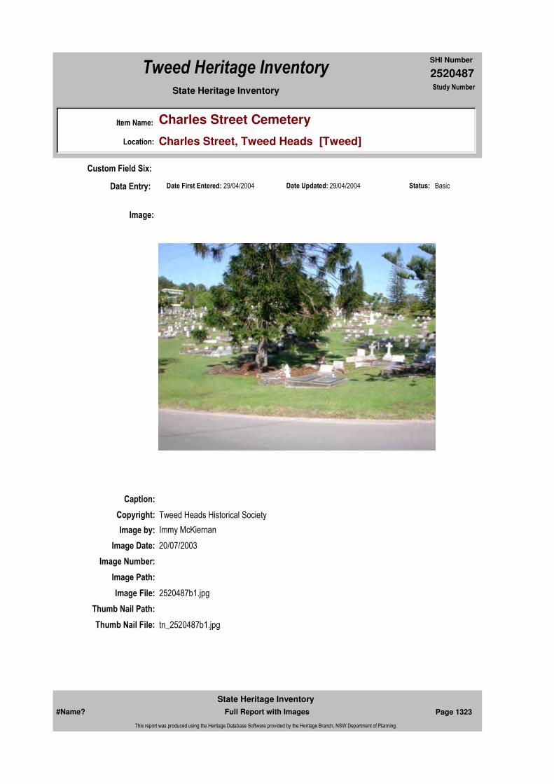
2520487
SHI Number
Tweed Heritage Inventory
Item Name: Charles Street Cemetery
Location: Charles Street, Tweed Heads [Tweed]
State Heritage Inventory Study Number
Date Updated: 29/04/2004 Status: BasicDate First Entered: 29/04/2004Data Entry:
Custom Field Six:
Caption:
Copyright: Tweed Heads Historical Society
Image:
Image by: Immy McKiernan
Image Date: 20/07/2003
Image Number:
Image Path:
Image File: 2520487b1.jpg
Thumb Nail Path:
Thumb Nail File: tn_2520487b1.jpg
#Name? Page 1323 Full Report with Images
State Heritage Inventory
This report was produced using the Heritage Database Software provided by the Heritage Branch, NSW Department of Planning.

2520487
SHI Number
Tweed Heritage Inventory
Item Name: Charles Street Cemetery
Location: Charles Street, Tweed Heads [Tweed]
State Heritage Inventory Study Number
Caption: Headstone of Elizabeth Hatton, Charles Street Cemetery, Tweed Heads
Copyright: Tweed Heads Historical Society
Image:
Image by: Immy McKiernan
Image Date: 26/07/2004
Image Number:
Image Path:
Image File: 2520487b2.jpg
Thumb Nail Path:
Thumb Nail File: tn_2520487b2.jpg
#Name? Page 1324 Full Report with Images
State Heritage Inventory
This report was produced using the Heritage Database Software provided by the Heritage Branch, NSW Department of Planning.
2520487
SHI Number
Tweed Heritage Inventory
Item Name: Charles Street Cemetery
Location: Charles Street, Tweed Heads [Tweed]
State Heritage Inventory Study Number
#Name? Page 1325 Full Report with Images
State Heritage Inventory
This report was produced using the Heritage Database Software provided by the Heritage Branch, NSW Department of Planning.

2520489
SHI Number
Tweed Heritage Inventory
Item Name: St Cuthbert's Anglican Church
Location: 13 Powell Street, Tweed Heads [Tweed]
State Heritage Inventory Study Number
Current Use:
Former Uses:
Statement of
Significance:Including war memorial rolls and stained glass window memorial, St Cuthbert's Anglican Church has a strong association with the residents of Tweed Heads, which served the spiritual and cultural needs of the congregation over the years. The memorials ares part of the cultural history of the Tweed Valley and has a special association with the community in which it is housed.
Historical Notes or Provenance:
A very large congregation attended the Evening Service held at St. Cuthbert's Church on Sunday. Special interest was added to the Service, inasmuch as the honour boards, recently to hand, were unveiled at the service. The night was anything but an ideal one for persons to be out owing to the strong southerly gale that was raging, but, notwithstanding this fact, the Church was crowded for the occasion.
Two boards of very effective design were unveiled, one bearing the names of the members of the Church numbering 50 on active service. While the other bears a solemn record of members who have laid down their lives, namely Frederick William Mann, John Arnold, and John Shepherd Howarth. Both boards are of polished silky oak, and the names thereon are in gold lettering.
Owing to the absence of Captain T H Smith, who was to have performed the unveiling ceremony and from whom an apology was received owing to his being indisposed, Mr. Charles Morley was asked to perform the Ceremony.
Each board was covered with a flag, and after the Third Collect, at Evensong, the flags were drawn aside, the congregation reverently standing. Especially solemn was the moment
Endorsed Significance:Assessed Significance: Local
Item Type: Built Category: ChurchGroup: Religion
Admin Codes: Code 2: Code 3:
Curtilage/Boundary:
Owner: Religious Organisation
Other/Former Names:
Area/Group/Complex: Group ID:
Aboriginal Area:
Local Govt Area: Tweed
Planning: Northern
Historic Region: North Coast
Address: #Name?
Suburb / Nearest Town: #Name?
State: NSW
Parish: Terranora
County: Rous
#Name? Page 1326 Full Report with Images
State Heritage Inventory
This report was produced using the Heritage Database Software provided by the Heritage Branch, NSW Department of Planning.

2520489
SHI Number
Tweed Heritage Inventory
Item Name: St Cuthbert's Anglican Church
Location: 13 Powell Street, Tweed Heads [Tweed]
State Heritage Inventory Study Number
when the flag covering the board containing the names of those who had laid down their lives was removed. A beautiful wreath, the work of Mrs. R Thornton, occupied a position underneath the board containing the names of the heroes, who had laid down their lives. After the service this wreath was given to Miss Jessie Arnold to be placed on her brother's (Jack) grave in the Tweed Heads Cemetery.
The Honor Boards were place in position in the Church by Mr. J Gray. The Reverend Lilley conducted the Service and preached a most impressive sermon, taken from the words: "Let not your hearts be troubled. Ye Believe in God, Believe also in Me". His words were listened to by the congregation with great interest. The following hymns were also nicely rendered during the service: "Onward Christian Soldiers", "Eternal Father, Strong to Save", "Holy Father, in Thy Mercy", and "All Hail the Power of Jesus Name". The Litany of War was also read.
During the Service, Mrs. Lilley officiated at the organ in her usual efficient manner.(Tweed Heads Coolangatta Star 09 May 1916. SAINT CUTHBERT'S CHURCH "Unveiling of Honour Boards")
The honour boards, which have been placed in St. Cuthbert's Church, Tweed Heads were unveiled on Sunday night last. Despite the inclement weather, a large congregation was present, the Church being quite full. The boards are of polished silky oak, the names being lettered in gold.
The unveiling ceremony was to have been performed by Captain T H Smith but he was unable to be present owing to indisposition and forwarded an apology for non-attendance. Mr. Charles Morley, whose son Reg, is on his way to the front, was asked to perform the ceremony. Each board was covered with a flag, and immediately after the third collect at Evensong, each flag was drawn aside, the congregation reverently standing. Especially solemn, was the moment the flag covering the board containing the names of those who had laid down their lives was removed. Underneath this Board was a beautiful wreath, the work of Mrs. R Thornton.
Fifty names of those on Active Service are on the Honor Roll, three being placed on the Roll of lives laid down. They are, Frederick William Mann, John Arnold and John Shepherd Howarth.
The Service was conducted by the Rev. H Lilley, who preached an appropriate Sermon from the words, "Let not your hearts be troubled". "Ye Believe in God, Believe also in Me". The Hymns sung were. "Onward Christian Soldiers", "Eternal Father, Strong to Save", "Holy Father in Thy Mercy", and "All Hail the Power of Jesus Name", also the Litany for War. Mrs. Lilley presided at the organ. The flags were kindly lent by Mr. Charles Morley, Mr. W R Greenwood and the Tweed Heads Coolangatta Life Saving Club. Mr. J Gray placed the boards in position in the Church. After the Service, the wreath was given to Miss Arnold to be placed by her on her brother Jack's grave in the local cemetery.
Excerpt from "My St. Cuthbert's" (Researched from Parish Council meetings by Arthur Bale)Because the "old church" could only accommodate 150 and was in need of major repair, the
#Name? Page 1327 Full Report with Images
State Heritage Inventory
This report was produced using the Heritage Database Software provided by the Heritage Branch, NSW Department of Planning.

2520489
SHI Number
Tweed Heritage Inventory
Item Name: St Cuthbert's Anglican Church
Location: 13 Powell Street, Tweed Heads [Tweed]
State Heritage Inventory Study Number
need to build a larger one was discussed on October 4, 1965 with Rev. W Doak as Chairman - size 250 seating.
Various designs were discussed after visits to other parishes for inspections, but no progress until Rev. Ron Dyson chaired his first meeting on July 24, 1967. That was an Annual General Meeting (A. G. M.) and it was there it was decided to call "Special General Meeting to discuss a new church site", but there is no record of any special meeting until December 12,1968 where the new church site was not discussed.(The Tweed Daily, 09 May 1916. Saint Cuthbert's Church.)
On August 28, 1967 A. Bale (Hon. Sec) was directed to write to Tweed Shire Council President, that our Parish Council was interested in building a new church on Greenbank Estate, that the Tweed Shire Council was developing as a housing estate at that time, and to ascertain what land was available and at what cost. As the result of another letter from Arthur Bale to Tweed Shire Council on October 28, 1968, Rector Dyson and his Warden, Hal Jones had a meeting with the Shire Council executives to see a possible site on Greenbank for a new church. (A Bale also reported on further talks on this matter).
However, on December 02, 1968 at a Special Meeting of the Parish Council it was moved, W Bayfield - R Burrows, that we advise the Bishop that we have decided not to proceed towards building on Greenbank - having decided to build on the 2 blocks already owned on the western side of Enid Street and that a new Building Committee be formed. This was carried with one dissentient, A Bale. (From previous discussions with both Rector Dyson and Bishop Gordon Arthur, who both agreed with him that it was obvious that the present state of traffic congestion and parking difficulties in being side by side with the Roman Catholic Church (and service times) that with the Catholics having recently expanded their presence to the extent of remaining in Enid St., that St Cuthbert's should move our presence and where better than Greenbank where 750 new home sites were planned).
The new building committee elected were H. Gerry, W Bayfield, M. Annard, D. Budd and Rector Dyson and plans and design of the new church were submitted to Bishop Arthur for approval - he suggested some alterations and it appeared he was not in a hurry to build in Enid St. He had insisted on an architect drawing up plans which he was to review. On February 24, 1969 Tweed Shire Council were again to be approached re cost of blocks 82, 83 and 84 or plus 85 as shown on the schedule of 4th release (moved M Bennett - L Tunstall). Council following discussion raised by A Bale after the Building Committees report on progress with designs of new church in Enid St.
On June 02, 1969 A. Bale and H. Jones reported that blocks 82, 83, 84 and 85 were not available but blocks 110 to 114 (Comer Florence and Powell Streets) were - Rector Dyson had advised Shire Council, that at a special meeting called by him, lots 110 - 113 had been selected and advised A. Bale to get prices by further discussion with C. Hall.
On the October 27, 1969 H. Gerry in reporting for the Building Committee stated that the New Church Building Fund now stood at $23,502.95, stated also that an offer had come from Tweed Shire Council to make available lots 110-114 (Corner Florence and Powell Streets) for $16,000 for the 4 x 40 perch blocks (1 acre) - this price would mean a considerable discount from the list price of $22,000 - and the Building Committee had made
#Name? Page 1328 Full Report with Images
State Heritage Inventory
This report was produced using the Heritage Database Software provided by the Heritage Branch, NSW Department of Planning.
2520489
SHI Number
Tweed Heritage Inventory
Item Name: St Cuthbert's Anglican Church
Location: 13 Powell Street, Tweed Heads [Tweed]
State Heritage Inventory Study Number
a tentative offer of $15,000. He also stated that $12,000 could be realised on the 2 blocks on the western side of Enid Street where it had been intended to build. The Building Committees action was endorsed by motion, L Wahles - L Dickinson and Council also rescinds motion re building in Enid St. At this meeting, also present (to give figures and facts on the church model displayed) was T. A. Reddacliff, Architect from Coffs Harbour (for Greenbank site).On November 24, 1969 - Following receipt of advice from Tweed Shire Council that $16,000 was the price acceptable for lots 110 - 114, it was moved D. Budd - A. Bale "that subject to approval of the Bishop-in-Council, we accept the offer from Tweed Shire Council of the I acre site for $16,000 providing they plan a square site to meet our wishes".
Also moved H. Coupe - D. Dunn "that we request permission from Bishop-in-Council to sell the 2 blocks on the west side of Enid St. and buy the I acre on the Greenbank Estate". Carried. Also moved H Gerry - H Jones "that we advise agents re selling land (west Enid St.) at $6,500 per block". carried. (It was eventually sold for $I2,500 - Beryl Street property bought and later sold for $7,000 - later Enid St. (eastern side) $24,500 plus Greenbank present church site $16,000 - all legal aspects handled by Derek Budd free of charge to the parish. I believe should be recorded and thanks said.
April 19, 1971 moved S. O'Donnell - A. Bale "that the plan and outlook as submitted by T A. Reddecliff (Architect) subject to reports, shingle roof costs - be accepted". Carried (17 votes to 3). January 21, 1972 decided to build church total cost $80,000 and $11,000 Rectory. May 13, 1972 Foundation stone for new church set by Canon Sanders (a previous Rector in old St. Cuthbert's) and lead container made by F. Makepeace and containing 1972 coins, copies of church service and Daily News buried with the foundation stone. July 10, 1972 Contract price of $3669 (Delivered) for seating of 334 accepted from D. Kay, Murgon, Qld. October 20, 1972 Opening Service (and Blessing) for new church and Hall by Bishop Gordon Arthur. First council meeting in new hall October 23, 1973.
May 21, 1973 At a special meeting (of Parish Council) Ray Pascoe's tender for $27,850 was accepted and notice of its Blessing by Bishop Donald Shearman given on November 26, 1973.(Arthur Bale, JP. ex Parish Council Hon. Sec 1962 - 1983)
Names on Memorials: Window: James Adams; John Arnold; Walter Blackman; Thomas J Cowan; Frederick M Mann; John Roberts; John C A Smith; Reginald Smith; Eugene Sullivan; Leonard J Sullivan; William Welldon; George Wells.Roll of Honour: J C A Smith; C R Morley; R Mason; J D G MacNeill; C Mannn; G Mann; E Mann; W L Peate; H W Brown; V H A Brwon; J Dawson; N R Dowling; D R Dowling; H Sullivan; P W Sullivan; F B Brown; H Root; J A Turnock; C Howarth; H B Howarth; D J Howarth; D B MacEwan; W Sullivan; R W Gray; F W Mann; G Wells; W Wappett; G Thornton; E Lowe; C Campbell; R Smith; D Wright; J Roberts; H Roberts; W Ayre; W Y Cunningham; A Grant; J M Watson; D M Watson; A Carne; Eric Boyce; F E Stumm; C M Hobler; H W Gibson; L G Ricketts; T J Cowan; E G Fox; J R Short; A W Ferrell; Nurse R Allen; J S Howarth.
Themes: National Theme State Theme Local Theme
#Name? Page 1329 Full Report with Images
State Heritage Inventory
This report was produced using the Heritage Database Software provided by the Heritage Branch, NSW Department of Planning.
2520489
SHI Number
Tweed Heritage Inventory
Item Name: St Cuthbert's Anglican Church
Location: 13 Powell Street, Tweed Heads [Tweed]
State Heritage Inventory Study Number
Physical Description: 1970's church indicative of the innovative architecture of the time.The boards are of polished silky oak, the names being lettered in gold.
Physical Condition:
Modification Dates:
Designer:
Maker / Builder:
Year Started: Year Completed: 1970 Circa: Yes
Recommended
Management:
References:
Further Comments:
Criteria a)
Criteria c)
Criteria d) St Cuthbert's Anglican Church has a strong association with the residents of Tweed Heads, which served the spiritual and cultural needs of the congregation over the years.
Criteria e)
Criteria g)
Criteria f)
Integrity / Intactness:
Criteria b) The memorial is part of the cultural history of the Tweed Valley and has a special association with the community in which it is housed.
Management:
Author Title Year
SAINT CUTHBERT'S CHURCH "Unveiling of Honour Boards"
1916
Saint Cuthbert's Church. 1916
Arthur Bale Excerpt from "My St. Cuthbert's"
7. Governing Defence War Memorial
8. Culture Religion Church
#Name? Page 1330 Full Report with Images
State Heritage Inventory
This report was produced using the Heritage Database Software provided by the Heritage Branch, NSW Department of Planning.
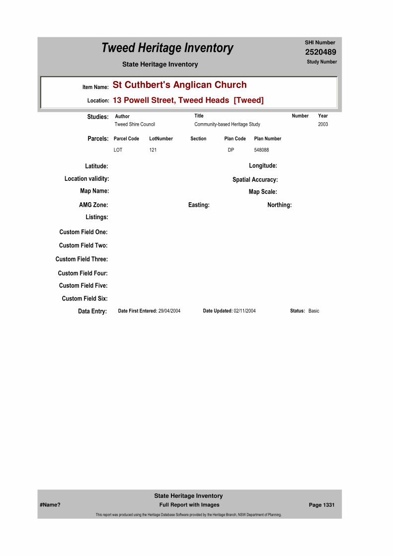
2520489
SHI Number
Tweed Heritage Inventory
Item Name: St Cuthbert's Anglican Church
Location: 13 Powell Street, Tweed Heads [Tweed]
State Heritage Inventory Study Number
Custom Field One:
Studies:
Listings:
Date Updated: 02/11/2004 Status: BasicDate First Entered: 29/04/2004Data Entry:
Custom Field Two:
Custom Field Three:
Custom Field Four:
Custom Field Five:
Custom Field Six:
Parcels:
Latitude: Longitude:
AMG Zone: Easting: Northing:
Map Name: Map Scale:
Spatial Accuracy:Location validity:
Author Title YearNumber
Tweed Shire Council Community-based Heritage Study 2003
Parcel Code LotNumber Section Plan Code Plan Number
LOT 121 DP 548088
#Name? Page 1331 Full Report with Images
State Heritage Inventory
This report was produced using the Heritage Database Software provided by the Heritage Branch, NSW Department of Planning.

2520489
SHI Number
Tweed Heritage Inventory
Item Name: St Cuthbert's Anglican Church
Location: 13 Powell Street, Tweed Heads [Tweed]
State Heritage Inventory Study Number
Caption: St Cuthbert's Anglican Church, Powell Street, Tweed Heads
Copyright: Tweed Heads Historical Society
Image:
Image by: Immy McKiernan
Image Date: 11/12/2003
Image Number:
Image Path:
Image File: 2520489b1.jpg
Thumb Nail Path:
Thumb Nail File: tn_2520489b1.jpg
#Name? Page 1332 Full Report with Images
State Heritage Inventory
This report was produced using the Heritage Database Software provided by the Heritage Branch, NSW Department of Planning.
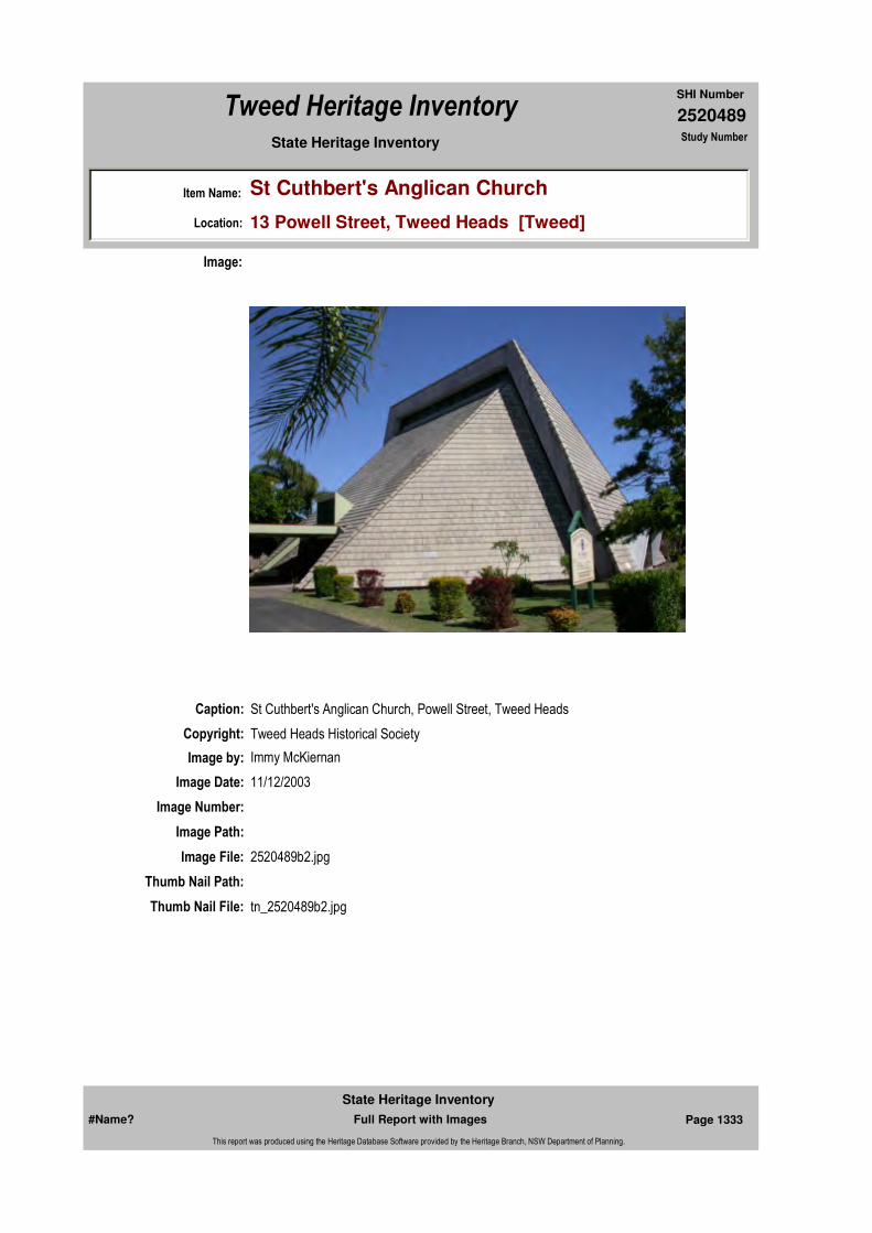
2520489
SHI Number
Tweed Heritage Inventory
Item Name: St Cuthbert's Anglican Church
Location: 13 Powell Street, Tweed Heads [Tweed]
State Heritage Inventory Study Number
Caption: St Cuthbert's Anglican Church, Powell Street, Tweed Heads
Copyright: Tweed Heads Historical Society
Image:
Image by: Immy McKiernan
Image Date: 11/12/2003
Image Number:
Image Path:
Image File: 2520489b2.jpg
Thumb Nail Path:
Thumb Nail File: tn_2520489b2.jpg
#Name? Page 1333 Full Report with Images
State Heritage Inventory
This report was produced using the Heritage Database Software provided by the Heritage Branch, NSW Department of Planning.
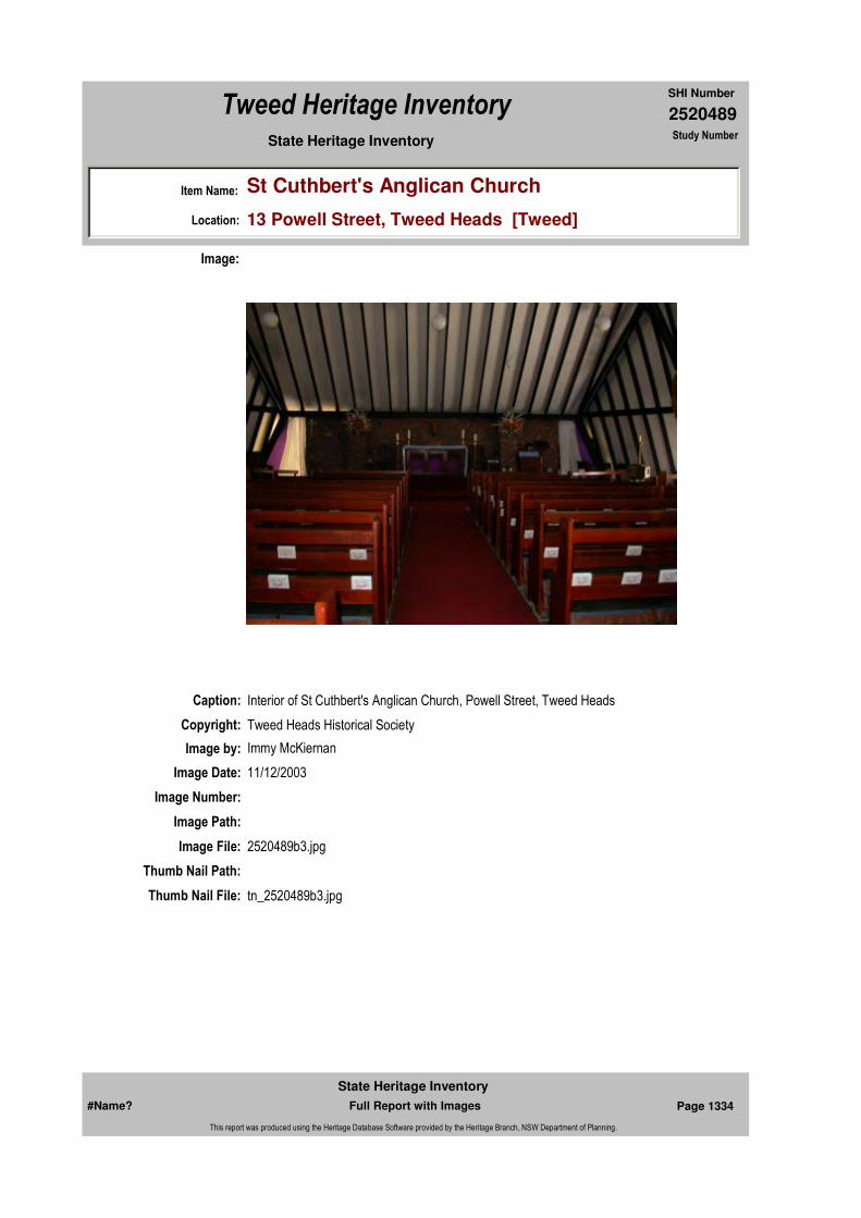
2520489
SHI Number
Tweed Heritage Inventory
Item Name: St Cuthbert's Anglican Church
Location: 13 Powell Street, Tweed Heads [Tweed]
State Heritage Inventory Study Number
Caption: Interior of St Cuthbert's Anglican Church, Powell Street, Tweed Heads
Copyright: Tweed Heads Historical Society
Image:
Image by: Immy McKiernan
Image Date: 11/12/2003
Image Number:
Image Path:
Image File: 2520489b3.jpg
Thumb Nail Path:
Thumb Nail File: tn_2520489b3.jpg
#Name? Page 1334 Full Report with Images
State Heritage Inventory
This report was produced using the Heritage Database Software provided by the Heritage Branch, NSW Department of Planning.

2520489
SHI Number
Tweed Heritage Inventory
Item Name: St Cuthbert's Anglican Church
Location: 13 Powell Street, Tweed Heads [Tweed]
State Heritage Inventory Study Number
Caption: Memorial stain glass window of St Cuthbert's Anglican Church, Powell Street, Tweed Heads
Copyright: Tweed Heads Historical Society
Image:
Image by: Immy McKiernan
Image Date: 11/12/2003
Image Number:
Image Path:
Image File: 2520489b4.jpg
Thumb Nail Path:
Thumb Nail File: tn_2520489b4.jpg
#Name? Page 1335 Full Report with Images
State Heritage Inventory
This report was produced using the Heritage Database Software provided by the Heritage Branch, NSW Department of Planning.
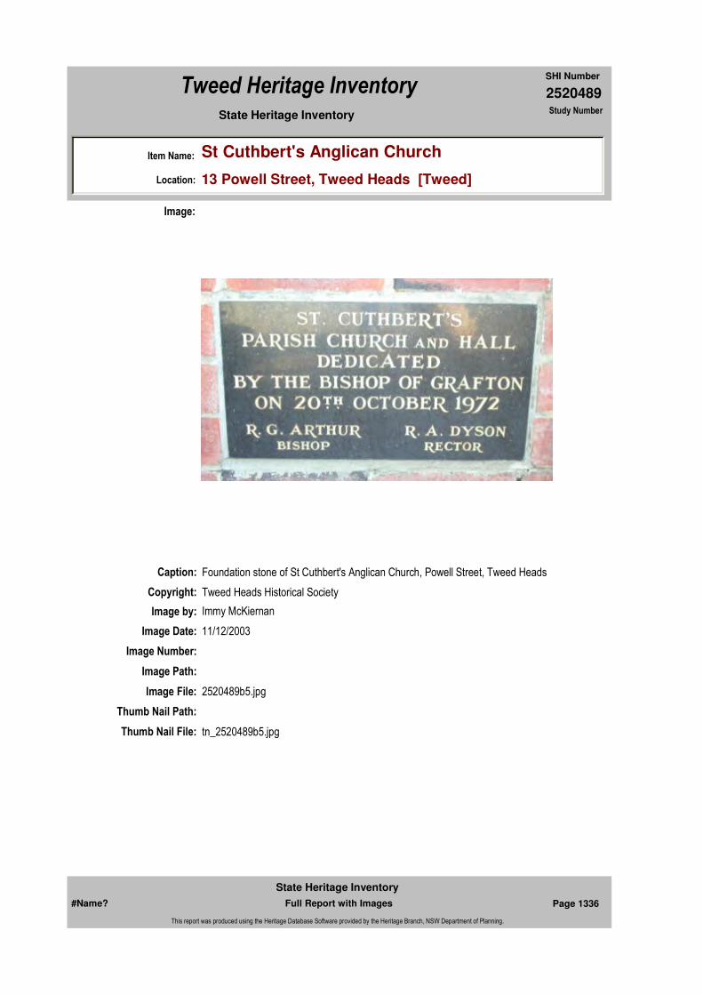
2520489
SHI Number
Tweed Heritage Inventory
Item Name: St Cuthbert's Anglican Church
Location: 13 Powell Street, Tweed Heads [Tweed]
State Heritage Inventory Study Number
Caption: Foundation stone of St Cuthbert's Anglican Church, Powell Street, Tweed Heads
Copyright: Tweed Heads Historical Society
Image:
Image by: Immy McKiernan
Image Date: 11/12/2003
Image Number:
Image Path:
Image File: 2520489b5.jpg
Thumb Nail Path:
Thumb Nail File: tn_2520489b5.jpg
#Name? Page 1336 Full Report with Images
State Heritage Inventory
This report was produced using the Heritage Database Software provided by the Heritage Branch, NSW Department of Planning.

2520489
SHI Number
Tweed Heritage Inventory
Item Name: St Cuthbert's Anglican Church
Location: 13 Powell Street, Tweed Heads [Tweed]
State Heritage Inventory Study Number
Caption: Interior view of memorial stain glass window at St Cuthbert's Anglican Church, Powell Street, Tweed Heads
Copyright: Tweed Heads Historical Society
Image:
Image by: Immy McKiernan
Image Date: 11/12/2003
Image Number:
Image Path:
Image File: 2520489b6.jpg
Thumb Nail Path:
Thumb Nail File: tn_2520489b6.jpg
#Name? Page 1337 Full Report with Images
State Heritage Inventory
This report was produced using the Heritage Database Software provided by the Heritage Branch, NSW Department of Planning.
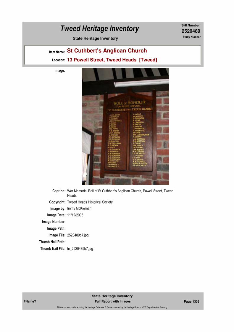
2520489
SHI Number
Tweed Heritage Inventory
Item Name: St Cuthbert's Anglican Church
Location: 13 Powell Street, Tweed Heads [Tweed]
State Heritage Inventory Study Number
Caption: War Memorial Roll of St Cuthbert's Anglican Church, Powell Street, Tweed Heads
Copyright: Tweed Heads Historical Society
Image:
Image by: Immy McKiernan
Image Date: 11/12/2003
Image Number:
Image Path:
Image File: 2520489b7.jpg
Thumb Nail Path:
Thumb Nail File: tn_2520489b7.jpg
#Name? Page 1338 Full Report with Images
State Heritage Inventory
This report was produced using the Heritage Database Software provided by the Heritage Branch, NSW Department of Planning.

2520489
SHI Number
Tweed Heritage Inventory
Item Name: St Cuthbert's Anglican Church
Location: 13 Powell Street, Tweed Heads [Tweed]
State Heritage Inventory Study Number
#Name? Page 1339 Full Report with Images
State Heritage Inventory
This report was produced using the Heritage Database Software provided by the Heritage Branch, NSW Department of Planning.

2520493
SHI Number
Tweed Heritage Inventory
Item Name: Taranora Cemetery and Memorial Stone
Location: Philp Parade, Tweed Heads South [Tweed]
State Heritage Inventory Study Number
Current Use:
Former Uses:
Statement of
Significance:The memorial stone indicates the locality of the first graveyard on the Tweed which served the cedar getters and pioneers from the 1840's onwards. Terranora (Taranora) camp was the foundation settlement in the Tweed estuary with shipyards, a shanty, many rough dwellings and a cemetery. The cemetery disappeared into the river in subsequent floods. The original headstone of the Boyd family from this cemetery is held by the Tweed Heads & District Historical Society. The memorial is erected on the site of the graves of members of the pioneering Boyd Family.
Historical Notes
or Provenance:Not the least of the things which make the borderland between New South Wales and Queensland such good holiday country is the Tweed River itself, with its many tributaries and backwaters. Whether one travels by the river or by land; and in the latter case by the high road or the low road, it affords an extraordinary variety of interest and beauty. Part of this attraction is the historical interest romantic if one will, which age always brings to the scenes and monuments of man's early struggle with primeval Nature. It is, of course, true that we in Australia are just a little shy of admitting this interest, and many, indeed, are still quite indifferent to the past. But, to say the least, the indulgence of such a taste will not hurt us, and a proper concern for origins, and for the memories of past history has always characterised self-respecting peoples, once they have reached the stage of leisure and self consciousness.
The purpose of this article, however, is not to discourse on the historical sense in general, but to urge upon those con-cerned the preservation of a particular memorial on the Tweed River.
Endorsed Significance:Assessed Significance: Local
Item Type: Complex / Group Category: Cemetery/Graveyard/Group: Cemeteries and Buria
Admin Codes: Code 2: Code 3:
Curtilage/Boundary:
Owner: Local Government
Other/Former Names: Taranora Graveyard
Area/Group/Complex: Group ID:
Aboriginal Area:
Local Govt Area: Tweed
Planning: Northern
Historic Region: North Coast
Address: #Name?
Suburb / Nearest Town: #Name?
State: NSW
Parish: Terranora
County: Rous
#Name? Page 1356 Full Report with Images
State Heritage Inventory
This report was produced using the Heritage Database Software provided by the Heritage Branch, NSW Department of Planning.
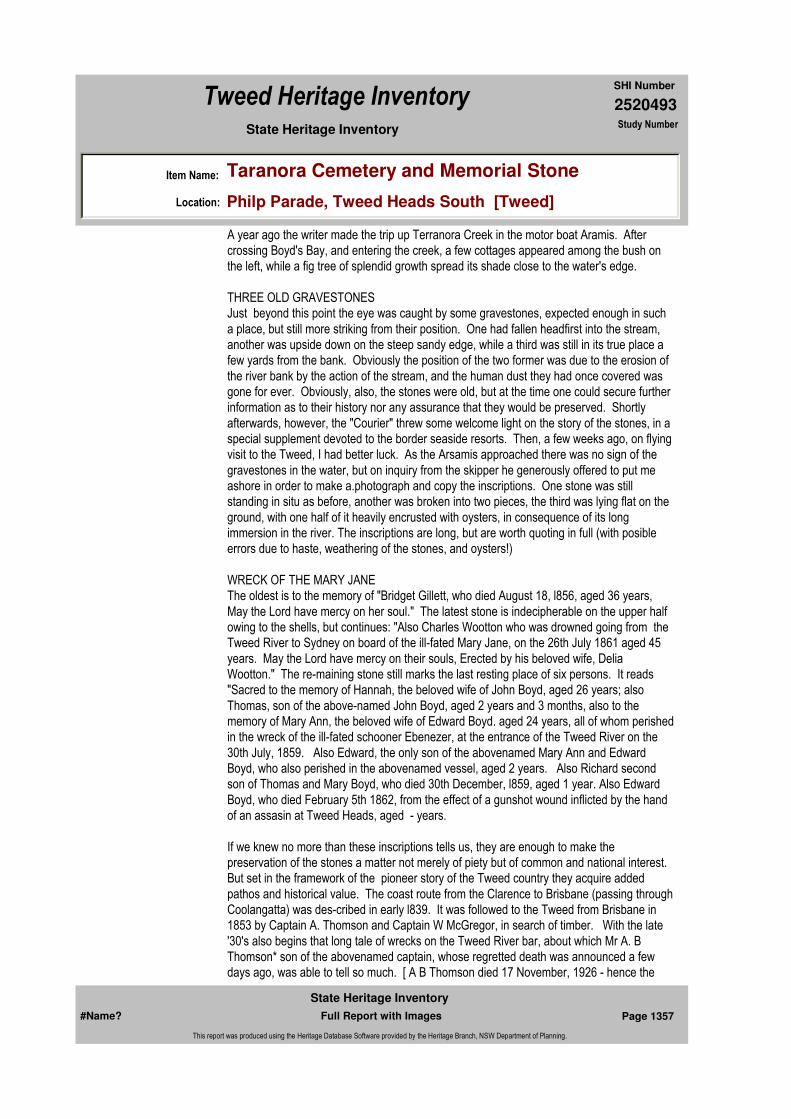
2520493
SHI Number
Tweed Heritage Inventory
Item Name: Taranora Cemetery and Memorial Stone
Location: Philp Parade, Tweed Heads South [Tweed]
State Heritage Inventory Study Number
A year ago the writer made the trip up Terranora Creek in the motor boat Aramis. After crossing Boyd's Bay, and entering the creek, a few cottages appeared among the bush on the left, while a fig tree of splendid growth spread its shade close to the water's edge.
THREE OLD GRAVESTONESJust beyond this point the eye was caught by some gravestones, expected enough in such a place, but still more striking from their position. One had fallen headfirst into the stream, another was upside down on the steep sandy edge, while a third was still in its true place a few yards from the bank. Obviously the position of the two former was due to the erosion of the river bank by the action of the stream, and the human dust they had once covered was gone for ever. Obviously, also, the stones were old, but at the time one could secure further information as to their history nor any assurance that they would be preserved. Shortly afterwards, however, the "Courier" threw some welcome light on the story of the stones, in a special supplement devoted to the border seaside resorts. Then, a few weeks ago, on flying visit to the Tweed, I had better luck. As the Arsamis approached there was no sign of the gravestones in the water, but on inquiry from the skipper he generously offered to put me ashore in order to make a.photograph and copy the inscriptions. One stone was still standing in situ as before, another was broken into two pieces, the third was lying flat on the ground, with one half of it heavily encrusted with oysters, in consequence of its long immersion in the river. The inscriptions are long, but are worth quoting in full (with posible errors due to haste, weathering of the stones, and oysters!)
WRECK OF THE MARY JANEThe oldest is to the memory of "Bridget Gillett, who died August 18, l856, aged 36 years, May the Lord have mercy on her soul." The latest stone is indecipherable on the upper half owing to the shells, but continues: "Also Charles Wootton who was drowned going from the Tweed River to Sydney on board of the ill-fated Mary Jane, on the 26th July 1861 aged 45 years. May the Lord have mercy on their souls, Erected by his beloved wife, Delia Wootton." The re-maining stone still marks the last resting place of six persons. It reads "Sacred to the memory of Hannah, the beloved wife of John Boyd, aged 26 years; also Thomas, son of the above-named John Boyd, aged 2 years and 3 months, also to the memory of Mary Ann, the beloved wife of Edward Boyd. aged 24 years, all of whom perished in the wreck of the ill-fated schooner Ebenezer, at the entrance of the Tweed River on the 30th July, 1859. Also Edward, the only son of the abovenamed Mary Ann and Edward Boyd, who also perished in the abovenamed vessel, aged 2 years. Also Richard second son of Thomas and Mary Boyd, who died 30th December, l859, aged 1 year. Also Edward Boyd, who died February 5th 1862, from the effect of a gunshot wound inflicted by the hand of an assasin at Tweed Heads, aged - years.
If we knew no more than these inscriptions tells us, they are enough to make the preservation of the stones a matter not merely of piety but of common and national interest. But set in the framework of the pioneer story of the Tweed country they acquire added pathos and historical value. The coast route from the Clarence to Brisbane (passing through Coolangatta) was des-cribed in early l839. It was followed to the Tweed from Brisbane in 1853 by Captain A. Thomson and Captain W McGregor, in search of timber. With the late '30's also begins that long tale of wrecks on the Tweed River bar, about which Mr A. B Thomson* son of the abovenamed captain, whose regretted death was announced a few days ago, was able to tell so much. [ A B Thomson died 17 November, 1926 - hence the
#Name? Page 1357 Full Report with Images
State Heritage Inventory
This report was produced using the Heritage Database Software provided by the Heritage Branch, NSW Department of Planning.
2520493
SHI Number
Tweed Heritage Inventory
Item Name: Taranora Cemetery and Memorial Stone
Location: Philp Parade, Tweed Heads South [Tweed]
State Heritage Inventory Study Number
estimate date of the article]
THE TWEED BAR.There is as little as 3ft at low water in the passage." This is a description of the bar as late as 1866. To return now to the gravestones. Of the ill fated Mary Jane I know nothing. Can any local authority give its story? Also of Bridget Gillett no knowledge could be gained, except there be a possible clue in the following detail taken from Mr W S Campbell's "Discoveries in the N E portion of N.S.W.," Royal Aust. Hist. Soc. jl., VIII, 1922. Craigs stories of the northern rivers were heard by Thomas Small, senr., of Kissing Point, Sydney. In 1837 he built a schooner named the Susan, the ship-wright's work on which was done by Henry Gillett, and in return Gillett was made a partner in the venture of sending the Susan with 12 pairs of sawyers and large quantities of stores and supplies to the "big" river (Clarence), cedar getting. Gillett, however, sold out his interest later to James Devlin, of Ryde, but it is just possible that Bridget Gillett was a member of the same family. There may be local evidence to prove or disprove this. Now for the Boyds. They were John, Edward, and Thomas, engaged in timber getting on the Tweed for some years prior to 1859. To recall the account given in the "Courier" in November, 1925, the brothers decided that conditions were so good and the blacks so friendly that they might bring up their young wives and children to the river.
STORY OF THE TRAGEDYIn the schooner Ebenezer they reached Tweed entrance on the afternoon of July 30, 1859, but the vessel grounded on a sandspit on the north side. The passengers were landed quite easily, but for greater comfort of the young children, returned to the vessel, which it was thought would be refloated at high tide. Instead, there came a storm in the night, which wrecked the schooner on the rocks of Pt. Danger, and drowned the young families aboard her. John Boyd, it is said, came rowing down next morning to meet his wife; he found instead, the body of his young son floating in the water, and his wife and the rest also perished. As to the third babe mentioned thereon, one may remark that in the pioneering days death from "natural" causes came either to the very young, as here, lacking as they did the merest approach to the care they needed, or to the very old. To young manhood or middle age death came most frequently by accident or by violence, as it did here to Edward Boyd. His "assassination," I understand, was due to an aboriginal.* [marked in hand, "not so, by cedargetter" ]Such is the story of these stones, subject to the correction and amplification, I hope of those who know the facts first hand. But the impression that even these few fragments give is that it would be difficult to lend a more touching monument of human pathos than they present to us or one more strikingly showing the typical chances of life and death which belonged to the pioneer story of Australia. And that arouses the further thought that if there must be cinema dramas, surely the naked truth of our own national story is more worthy, and even more sensational than the erudities we pay so much to import.
Who pulled the stones out of the water? Some months ago the Australian Workers' Union held their convention at Coolangatta. During a river excursion the delegates were landed at the gravestones, and realising their significanee, set to work with rope and pole to raise them into safety on the high bank. Then, with bared heads, as I was told, they stood round while Senator Barnes gave a brief speech in memory. For which things the thanks of Australians are due to the A.W.U. and Senator Barnes. It would now take hardly more than
#Name? Page 1358 Full Report with Images
State Heritage Inventory
This report was produced using the Heritage Database Software provided by the Heritage Branch, NSW Department of Planning.

2520493
SHI Number
Tweed Heritage Inventory
Item Name: Taranora Cemetery and Memorial Stone
Location: Philp Parade, Tweed Heads South [Tweed]
State Heritage Inventory Study Number
the work of an afternoon (given the necessary tools) to set the stones up again facing the river, where thousands of holiday trippers would see them. The oyster shells might be cleared from the inscription on the Wootton stone, but otherwise left on it as they grew. The lettering might also be cleaned and painted black. Perhaps the border people will be able to complete this work alone. If not, one would urge the Queensland Historical Society to undertake it in conjunction with the Royal Australian historical Society in Sydney, and thus ensure the permanent preservation of a striking memorial of the pioneers.
A SUGGESTION[In connection with the above article, we would suggest that the Tweed Heads Chamber of Commerce take the matter up with the Tweed Shire Council, with a view to having a suitable fence erected around these historic graves. If they turned the proposition down then an appeal could be made to the local residents. On the Bunya Mountains, near Dalby, such a grave has been fenced in and is an attraction on account of its historical connection. Passengers by the Aramis often ask to be put ashore so that they may view the ancient tombstones and go away impressed by the trials and hardships these pioneer people had to contend with. - Ed C C](The Coolangatta Chronicle November 1926 "Lonely Graves" "Tweed River Pioneers" by "FWR" in Brisbane Courier)
Physical Description: The Memorial is in the form of a six sided basalt column about 2 metres high and 1 metre in diameter. A bronze plaque is attached. The column rests on a concrete base. The Memorial is erected on the site of the graves of members of the pioneering Boyd family. Over many years floods caused subsidence of Terranora Creek bank, and the original grave stones fell into the water. Three stones were recovered, one is on display at the Tweed Heads Matitime Museum.Inscription: This sotne marks the burial site of Hannah Boyd aged 26 years wife of John Boyd, and their son Thomas aged 2 years; also of Mary Ann Boyd aged 24 years wife of Edward Boyd and their son Edward aged 2 years, who perished in the wreck of the "Ebenezer" on the 30th July, 1859. Also of Edward Boyd aged 34 years who was accidnetally shot on the 5th February, 1863. Also of Richard Boyd aged 1 year, second son of Thomas and Mary Boyd who died in December 1859. Erected by the Boyd Family 1984.
Information from research by Robert Ford, Tweed Heads & District Historical Society. 1987
Designer:
Maker / Builder:
Year Started: Year Completed: 1984 Circa: No
Themes: National Theme State Theme Local Theme
9. Phases of Life Birth and Death Cemeteries
#Name? Page 1359 Full Report with Images
State Heritage Inventory
This report was produced using the Heritage Database Software provided by the Heritage Branch, NSW Department of Planning.
2520493
SHI Number
Tweed Heritage Inventory
Item Name: Taranora Cemetery and Memorial Stone
Location: Philp Parade, Tweed Heads South [Tweed]
State Heritage Inventory Study Number
Physical Condition:
Modification Dates:
Recommended
Management:
References:
Studies:
Listings:
Further Comments:
Criteria a)
Criteria c)
Criteria d)
Criteria e)
Criteria g)
Criteria f)
Integrity / Intactness:
Criteria b) The memorial stone indicates the locality of the first graveyard on the Tweed which served the cedar getters and pioneers from the 1840's onwards. Terranora (Taranora) camp was the foundation settlement in the Tweed estuary with shipyards, a shanty, many rough dwellings and a cemetery. The cemetery disappeared into the river in subsequent floods. The original headstone of the Boyd family erected on the site is held by the Tweed Heads & District Historical Society. The Memorial is erected on the site of the graves of members of the pioneering Boyd Family.
Parcels:
Latitude: Longitude:
AMG Zone: Easting: 550772 Northing: 6881075
Map Name: Map Scale:
Spatial Accuracy:Location validity:
Management:
Author Title Year
"FWR" "Lonely Graves" "Tweed River Pioneers" 1926
Author Title YearNumber
Tweed Shire Council Community-based Heritage Study 2003
Parcel Code LotNumber Section Plan Code Plan Number
LOT 7024 DP 92687
#Name? Page 1360 Full Report with Images
State Heritage Inventory
This report was produced using the Heritage Database Software provided by the Heritage Branch, NSW Department of Planning.
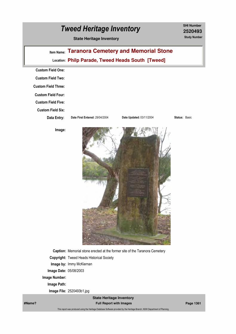
2520493
SHI Number
Tweed Heritage Inventory
Item Name: Taranora Cemetery and Memorial Stone
Location: Philp Parade, Tweed Heads South [Tweed]
State Heritage Inventory Study Number
Custom Field One:
Date Updated: 03/11/2004 Status: BasicDate First Entered: 29/04/2004Data Entry:
Custom Field Two:
Custom Field Three:
Custom Field Four:
Custom Field Five:
Custom Field Six:
Caption: Memorial stone erected at the former site of the Taranora Cemetery
Copyright: Tweed Heads Historical Society
Image:
Image by: Immy McKiernan
Image Date: 05/08/2003
Image Number:
Image Path:
Image File: 2520493b1.jpg
#Name? Page 1361 Full Report with Images
State Heritage Inventory
This report was produced using the Heritage Database Software provided by the Heritage Branch, NSW Department of Planning.

2520493
SHI Number
Tweed Heritage Inventory
Item Name: Taranora Cemetery and Memorial Stone
Location: Philp Parade, Tweed Heads South [Tweed]
State Heritage Inventory Study Number
Thumb Nail Path:
Thumb Nail File: tn_2520493b1.jpg
#Name? Page 1362 Full Report with Images
State Heritage Inventory
This report was produced using the Heritage Database Software provided by the Heritage Branch, NSW Department of Planning.
2520494
SHI Number
Tweed Heritage Inventory
Item Name: Taranora Park - site of Cedar Getters Camp
Location: Dry Dock Road, Tweed Heads South [Tweed]
State Heritage Inventory Study Number
Current Use: Parkland and picnic area
Former Uses: Pioneer settlers camp
Statement of
Significance:Taranora Park is the site of the first settlement and industrial site on the Tweed, circa 1844, which included village housing, store, hotel, and police station. It was the site of an intensive timber settlement of which nothing remains. It was situated on the banks of Terranora inlet located on the southern bank, west of the Terranora Inlet bridge.
Historical Notes
or Provenance:Taranora Cedar Camp; First Settlement on the Tweed River 1844 - 1849 Taranora was the local Aboriginal name for "Little River". This was to identity it from the main Tweed River and because it ran between what today is Ukerebagh Island and the mainland. The name Taranora later became anglicised and was changed to Terranora. Ukerebagh Island was named after the Aboriginal word "Ukerebagh" (Nganduwal dialect meant "a place for pippies") which was originally a place plentiful for shellfish. Pippies on the Tweed River and neighbouring Queensland beaches are still known as "Ukeries".
The foreshore of mainland Taranora was a sandy stretch of country mostly covered with brushlike bushland, except where there were soakages or swampland, and here paperbark trees grew and mangroves thrived along the water's edge. Taranora foreshores opposite Ukerebagh Island ran somewhat parallel (at a distance) with the coastline along Fingal Point. Taranora is a natural connecting waterway between the main river and the Terranora Broadwater and the inlet from Taranora to the Broadwater became known as Terranora Inlet. It was on the southern side of the Inlet that the first cedar camp on the Tweed River was established.
The choice of the first campsite, no doubt, took into consideration several factors. Terranora Inlet was away from the main currents of the river. The ground along the immediate
Endorsed Significance:Assessed Significance: Local
Item Type: Landscape Category: Urban ParkGroup: Parks, Gardens and T
Admin Codes: Code 2: Code 3:
Curtilage/Boundary:
Owner: Local Government
Other/Former Names:
Area/Group/Complex: Group ID:
Aboriginal Area:
Local Govt Area: Tweed
Planning: Northern
Historic Region: North Coast
Address: #Name?
Suburb / Nearest Town: #Name?
State: NSW
Parish: Terranora
County: Rous
#Name? Page 1363 Full Report with Images
State Heritage Inventory
This report was produced using the Heritage Database Software provided by the Heritage Branch, NSW Department of Planning.

2520494
SHI Number
Tweed Heritage Inventory
Item Name: Taranora Park - site of Cedar Getters Camp
Location: Dry Dock Road, Tweed Heads South [Tweed]
State Heritage Inventory Study Number
foreshores (today's Dry Dock Road) was above flood reach and free from the then swamplands situated to the rear of the camp a little further southward. The inlet provided a safe deep anchorage for the first cedar ships. There was also reasonable shelter from gales direct from the sea and the camp itself was high and dry from frequent serious river freshes in those days.
When the first parties of cedar getters arrived on the Tweed River they had whale boats. The whale boat or long boat was a must and an essential part of their equipment and mode of transport to explore the river, as they had no knowledge of Aborigine tracks at that premature stage. Though Smith and party had explored well upriver in 1843, when they came to harvest cedar in 1844 they commenced around the Terranora Broadwater area, where there were plentiful supplies of it easily available. Later, when they moved upriver they needed a boat for stores, bush tools, clothes, bedding, etc.; also to camp in at night away from the banks and possible surprise attacks from the as yet unknown attitude of the local Aborigines.
In 1844 when Paddy Smith, Jack Wright, Richard Keys and party arrived as the first of the cedar getters, the abundance of cedar was such that they did not have to penetrate too far upriver at first to secure plenteous supplies. It would be reasonable to assume they would come across good quantities of cedar up Cobaki, Piggabeen, Bilambil and Duroby Creeks, which run into Terranora Broadwater, as well as other adjacent areas. These supplies of cedar would be easily accessible. It must be remembered that the first cedar getters had no bullock teams as there were no tracks, almost impenetrable rain forest, and no grasslands of any consequence.In the year 1857 Captain W. A. B. Greaves, District Surveyor and Commissioner of Crown Lands (H Q Grafton) described the Tweed as being virtually grassless. In his own written words: "For grazing purposes was worthless being covered with an impenetrable scrub."
Paddy Smith introduced the first team comprising eight bullocks seven years later in 1851. According to legend, this was the same year his son Patrick was born at Terranora. Paddy Smith had married an Irish colleen from Brisbane in 1850. "Mr. and Mrs. Smith after the wedding at Brisbane went in a whale boat to Southport, and travelled from there to the Tweed along the beaches. Mr. P. Smith, their son, was the first white born on the Tweed, this was at Terranora in 1851" (Tweed Daily Centenary Supplement 1823-1923 September 12, 1923 - N. C. Hewitt).
The latter statement conflicts with the registered births on the Tweed of Thomas Benson in 1847, also Mary Ann Benson on July 29 1849. In the very early period the cedar men were content to only fell trees which grew along the banks of waterways. These logs could be poled and manhandled into the water and worked into the river and creeks later when freshes occurred. Cedar logs were buoyant soft-wood and floated easily, made up into rafts by driving hard wood staves or iron dogs into them and linking them together with ropes or chains. A suitable boat with several hands pulling on the ebb tide, or once into the current of a stream, was able to haul the logs or rafts downriver or out of the creeks into Terranora Inlet or the main river where the cedar vessels had good anchorage. At first the logs were shipped whole, but later on to save space, the cedar getters squared the logs or cut them into flitches in saw pits before loading.
#Name? Page 1364 Full Report with Images
State Heritage Inventory
This report was produced using the Heritage Database Software provided by the Heritage Branch, NSW Department of Planning.
2520494
SHI Number
Tweed Heritage Inventory
Item Name: Taranora Park - site of Cedar Getters Camp
Location: Dry Dock Road, Tweed Heads South [Tweed]
State Heritage Inventory Study Number
Later, when the cedar getters started to move upriver in earnest, and they became better acquainted with channels and river depths the cedar ships were able to load well upriver, when the river was normal and not swollen with floodwaters. So, initially, the cedar operation was compact and close at hand to the cedar camp and Terranora Inlet itself. As soon as the first party of Moreton Bay cedar cutters got the lay of the land i.e. the location of easily accessible cedar supplies with reasonable loading facilities, their living area along the foreshores of the Terranora Inlet began to take shape. There was good anchorage for the cedar ships right up to the foreshore line of the cedar camp itself, inside the inlet.
The first semblance of a primitive camp settlement soon took place with the erection of several bark huts and rough humpies along today's Dry Dock Road with one main building which, legend has it, they referred to as the "Rooming House". Later other hutments and shanties were scattered along the foreshores of Taranora River "The Rooming House" it appears, was erected very early in the piece. It served as a communal two-roomed bark dwelling and, according to legend, one end was a kitchen and dining area while the other end was more or less their recreation room. It was here they ate their meals, relaxed, drank, played cards, sometimes gambled, and met up with each other between treks upriver or creeks, and, later, temporarily left their rough bush shanties when "tucker" ran out and/or they wanted to sell or ship their cedar or collect mail and supplies.
There were several other main reasons as well; the continuous lack of sunshine brought about by the overhead tree canopy was not conducive to consistent well being. The heavy downpours attracted by the rainforests themselves made the cedar getters life a continuous health hazard. Their clothing and boots were wet most of the time. These facts, together with constant humidity, created by decaying leaf and branch fall underfoot, became unendurable after several weeks. There was also the infestation of mosquitoes and leeches; besides with snakes, centipedes, scorpions, spiders and the ever present stinging tree had to be constantly guarded against. Little wonder then that the men after a time would choose to get out of the scrubs for a "spell". There was also the added attraction of a change from their hard diet of corned beef and damper. They could fish, swim, re-sharpen axes, reset saws and "grog up" down at Taranora for a few days before "going bush" again. It was something they looked forward to as an alternative to the hard grind of cedar getting.
At Taranora cedar camp, no doubt, they would have also erected a communal black-smith shop to harden and weld equipment and tools, also to sharpen their saws and axes. Wells, for fresh water supplies, were sunk a little south of the camp at the rear. The old remains of one of these was still visible in 1966. There did not appear to be anyone solely in charge in the early stages, but it is evident there was nearly always someone around to protect their stores, utensils and gear from the curious Aborigines. The "Rooming House" was the first unofficial headquarters of the early cedar getters. It preceded the first hotel but provided a communal meeting place comparable to a rough frontier outpost. It served also as a place of contact for the cedar ships' crews to meet up with the cutters and, indeed, cedar buyers who eagerly came up from Sydney seeking to buy right at the source of supply.
The cedar getters conducted their own society. They had their own social behaviour and work codes and administered their own justice. The nearest settlements where officialdom existed were Moreton Bay and the Clarence River. The Commissioner for Crown Lands or their Border Police could not be called upon in an emergency. Deaths and other major
#Name? Page 1365 Full Report with Images
State Heritage Inventory
This report was produced using the Heritage Database Software provided by the Heritage Branch, NSW Department of Planning.

2520494
SHI Number
Tweed Heritage Inventory
Item Name: Taranora Park - site of Cedar Getters Camp
Location: Dry Dock Road, Tweed Heads South [Tweed]
State Heritage Inventory Study Number
happenings could only be reported sometimes days or weeks after they occurred, mostly by Captains of visiting cedar ships to Sydney authorities, rather than Moreton Bay or the Clarence, because of isolation and irregular means of contact with those centres.
Cedar cutters licences for the Tweed did not become effective until 1851 and with the Border Police far removed, the cedar getters on the Tweed were almost immune for a number of years. (The licence fee was six pounds per annum). It appears the number of those engaged in cedar cutting between 1844 and 1850 had not grown as extensively by that time as they did later. Shipping details in a further chapter will give convincing proof of the massive step-up in the cedar trade on the Tweed in years following 1850, and also give some indication of the increase in the number of cedar cutters who participated in "the rush".
At first there were no roads, only native bush tracks used by the Aborigines and Europeans alike. There were seemingly endless masses of dense rain forests with intermittent stretches of swamplands on some of the river frontages. There were family groups of Aborigines, not only at the mouth of the river, but along the banks and its tributaries. The latter were inhabited by the riverine horde group families; the cutters at first were loathe to camp in the scrubs overnight away from the main camp at Taranora Inlet where, because of their numbers, they felt more secure. When the easy to come by cedar started to wane around the immediate precincts of the Taranora Camp, the cedar men began to move up river, particularly when they had developed a more trustful relationship with the Aborigines and outright hostilities had become more subdued.
As described in previous pages, according to Edmund (Ned) Harper, two cedar getters, Hugh (Hughey) Pheeney and John Collins, who had arrived with the first lot of cutters in 1844, had by 1845 established a camp and sawpits well upriver and were cutting cedar on Kirrin Kirrin Creek (today's Murdering Creek). This tragedy of death at the hands of the Aborigines in that year (December 1844) has been dealt with elsewhere in another chapter. No doubt by then other cutters and sawyers had moved upstream into both arms of the river and its tributaries. This witnessed a change in methods of operation, lifestyle and the shipment of the cedar. The cedar getters were now living away from Taranora Camp for lengthy periods. This progressive move upriver for cedar witnessed the development of small groups, sometimes only two or three men working as partners, seeking out belts of cedar and working out that area before moving on.
The difficulty of handling the logs once felled, at times, became a problem for these isolated small work groups, and as the use of bullocks at this stage was impossible, the cutters were becoming more dependent on additional labour other than their own. So they started to encourage the Aborigines to assist them by clearing the underbrush beneath the trees to be felled with brush hooks, to help pole the logs on skid poles down into the creeks, where the logs would be hauled downstream into deeper water by means of a whale boat or similar craft. Then an accumulation of these would be made up into rafts and taken down river on the runout tides to saw pits and loading points.
Many rafts of cedar were brought down river to the loading points by working the tides i.e. a couple of raft men aboard a raft would keep clear of the banks with poles on the ebb tide. When the tide turned they would tie up and wait for the next suitable tide to continue their journey downstream. When the rafts were coming from well upriver the raft men would set
#Name? Page 1366 Full Report with Images
State Heritage Inventory
This report was produced using the Heritage Database Software provided by the Heritage Branch, NSW Department of Planning.
2520494
SHI Number
Tweed Heritage Inventory
Item Name: Taranora Park - site of Cedar Getters Camp
Location: Dry Dock Road, Tweed Heads South [Tweed]
State Heritage Inventory Study Number
up camp aboard the raft by placing sheets of bark over a section of the logs and erecting a tent where they would sleep whilst awaiting the next ebb tide. Another few sheets of bark adjacent to this with some soil on top would serve as a base for their fireplace for cooking.
Later on when cedar was felled along creeks with little water flow, the cutters would have to wait for flood rains or freshes and when the creeks were swollen they would pole the logs off the banks into the water and follow them downstream, breaking up the jams, until they reached navigable water. This was a dangerous exercise. Many men lost their lives doing this in early colonial history. The logs could then be recovered and made up into rafts. The cedar getters often referred to this stage of the waterway as "saleable" water to imply the logs were now within reach of sale.
A study of the shipping lists contained elsewhere in this book will show that the cedar trade, by 1850, was firmly established and that a great quantity of cedar had left the Tweed and that several ships were by then regularly involved as from 1845. It is also apparent that Tweed River shipments of cedar did occur prior to 1845. It appears the Sydney Morning Herald, throughout 1844, still nominated Moreton Bay as the Port of departure for shipments of Tweed cedar. The mention of the Tweed River as a definite independent port of departure was not mentioned until 1845, when the daily press showed for the first time that:-
"The 'Lark', 18 tons - Capt. Angus, arrived in Sydney from the Tweed with Cedar" on October 16, 1845 (Sydney Morning Herald Shipping Intelligence October 17, 1845).
However, there were many hazards and long delays associated with shipments in and out. River floods and freshes were frequent, which caused ships to be hung up outside and inside the entrance to the Tweed for weeks on end. Gales and heavy seas, a shifting, dangerously shallow bar, added to the peril of men and ships alike, as recorded in another chapter.(CHAPTER 6 "Wollumbin" by N C Keats pages 204 - 211 )
Physical Description:
Physical Condition:
Modification Dates:
Designer:
Maker / Builder:
Year Started: Year Completed: Circa: No
Themes: National Theme State Theme Local Theme
4. Settlement Towns, suburbs and village (none)
#Name? Page 1367 Full Report with Images
State Heritage Inventory
This report was produced using the Heritage Database Software provided by the Heritage Branch, NSW Department of Planning.
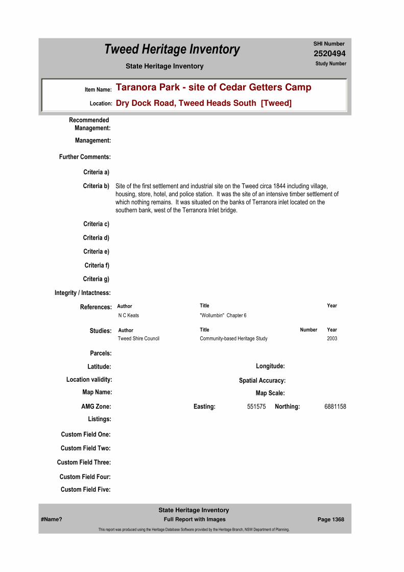
2520494
SHI Number
Tweed Heritage Inventory
Item Name: Taranora Park - site of Cedar Getters Camp
Location: Dry Dock Road, Tweed Heads South [Tweed]
State Heritage Inventory Study Number
Custom Field One:
Recommended Management:
References:
Studies:
Listings:
Further Comments:
Criteria a)
Criteria c)
Criteria d)
Criteria e)
Criteria g)
Criteria f)
Integrity / Intactness:
Custom Field Two:
Custom Field Three:
Custom Field Four:
Custom Field Five:
Criteria b) Site of the first settlement and industrial site on the Tweed circa 1844 including village, housing, store, hotel, and police station. It was the site of an intensive timber settlement of which nothing remains. It was situated on the banks of Terranora inlet located on the southern bank, west of the Terranora Inlet bridge.
Parcels:
Latitude: Longitude:
AMG Zone: Easting: 551575 Northing: 6881158
Map Name: Map Scale:
Spatial Accuracy:Location validity:
Management:
Author Title Year
N C Keats "Wollumbin" Chapter 6
Author Title YearNumber
Tweed Shire Council Community-based Heritage Study 2003
#Name? Page 1368 Full Report with Images
State Heritage Inventory
This report was produced using the Heritage Database Software provided by the Heritage Branch, NSW Department of Planning.
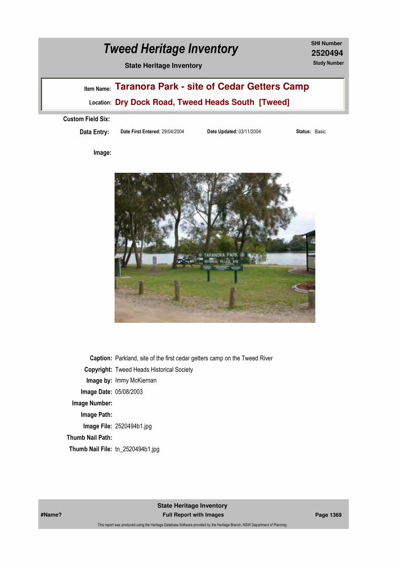
2520494
SHI Number
Tweed Heritage Inventory
Item Name: Taranora Park - site of Cedar Getters Camp
Location: Dry Dock Road, Tweed Heads South [Tweed]
State Heritage Inventory Study Number
Date Updated: 03/11/2004 Status: BasicDate First Entered: 29/04/2004Data Entry:
Custom Field Six:
Caption: Parkland, site of the first cedar getters camp on the Tweed River
Copyright: Tweed Heads Historical Society
Image:
Image by: Immy McKiernan
Image Date: 05/08/2003
Image Number:
Image Path:
Image File: 2520494b1.jpg
Thumb Nail Path:
Thumb Nail File: tn_2520494b1.jpg
#Name? Page 1369 Full Report with Images
State Heritage Inventory
This report was produced using the Heritage Database Software provided by the Heritage Branch, NSW Department of Planning.

2520494
SHI Number
Tweed Heritage Inventory
Item Name: Taranora Park - site of Cedar Getters Camp
Location: Dry Dock Road, Tweed Heads South [Tweed]
State Heritage Inventory Study Number
Caption: Parkland, site of the first cedar getters camp on the Tweed River
Copyright: Tweed Heads Historical Society
Image:
Image by: Immy McKiernan
Image Date: 05/08/2003
Image Number:
Image Path:
Image File: 2520494b2.jpg
Thumb Nail Path:
Thumb Nail File: tn_2520494b2.jpg
#Name? Page 1370 Full Report with Images
State Heritage Inventory
This report was produced using the Heritage Database Software provided by the Heritage Branch, NSW Department of Planning.
2520494
SHI Number
Tweed Heritage Inventory
Item Name: Taranora Park - site of Cedar Getters Camp
Location: Dry Dock Road, Tweed Heads South [Tweed]
State Heritage Inventory Study Number
#Name? Page 1371 Full Report with Images
State Heritage Inventory
This report was produced using the Heritage Database Software provided by the Heritage Branch, NSW Department of Planning.
2520495
SHI Number
Tweed Heritage Inventory
Item Name: Tyalgum Hall
Location: 1 Cudrigan Street, Tyalgum [Tweed]
State Heritage Inventory Study Number
Current Use:
Former Uses:
Statement of
Significance:Including war memorial rolls, the Tyalgum Hall has a strong association with the residents of Tyalgum. It has acted as a centre for social and cultural activities for nearly 100 years. The memorial is part of the cultural history of the Tweed Valley and has a special association with the community in which it is housed. It has acted as a centre for social and cultural activities over nearly 100 years.
Historical Notes or Provenance:
Opened May 23, 1908, the hall was also used as a library with books loaned by the Public Library of Sydney. The yearly birthday celebrations grew into the Empire Day Sports, which later became the Tyalgum Diggers Sports. One successful fundraising event was and Ugly Man Competition, won by C S Cook who raised £450.
The hall was used for a variety of purposes. It served as a hospital during the influenze epidemic; movie screenings started in 1916 and continued until 1962. The hall served as a meeting place for a variety of community groups and in 1991 the Tyalgum Music Festival commenced, bringing classical musicians of world stature to play in the accoustically superb hall.
Endorsed Significance:Assessed Significance: Local
Item Type: Built Category: Hall Public Group: Community Facilities
Admin Codes: Code 2: Code 3:
Curtilage/Boundary:
Owner: Local Government
Other/Former Names:
Area/Group/Complex: Tyalgum Village Conservation Area Group ID:
Themes:
Aboriginal Area:
Local Govt Area: Tweed
Planning: Northern
Historic Region: North Coast
Address: #Name?
Suburb / Nearest Town: #Name?
State: NSW
Parish: Tyalgum
County: Rous
National Theme State Theme Local Theme
8. Culture Social institutions Community Hall
#Name? Page 1372 Full Report with Images
State Heritage Inventory
This report was produced using the Heritage Database Software provided by the Heritage Branch, NSW Department of Planning.

2520495
SHI Number
Tweed Heritage Inventory
Item Name: Tyalgum Hall
Location: 1 Cudrigan Street, Tyalgum [Tweed]
State Heritage Inventory Study Number
Physical Description: The Tyalgum Hall had a balcony where the entry is now located. It is an interesting two storey building, acting as facade to rear building. Some very simple art deco feel to skyline and vertical pilasters, and fenestration in a Georgian form. There is a rectangular shape to the building. The vertical window is set in simple order.Wooden Roll of Honour at the Tyalgum Hall & as recorded in the History of Tyalgum & District.
Physical Condition:
Modification Dates:
Designer:
Maker / Builder:
Year Started: Year Completed: Circa: No
Recommended Management:
References:
Studies:
Further Comments:
Criteria a)
Criteria c)
Criteria d)
Criteria e)
Criteria g)
Criteria f)
Integrity / Intactness:
Criteria b) The Tyalgum Hall has a strong association with the residents of Tyalgum. It has acted as a centre for social and cultural activities for nearly 100 years.
The memorial is part of the cultural history of the Tweed Valley and has a special association with the community in which it is housed. It has acted as a centre for social and cultural activities over nearly 100 years.
Parcels:
Management:
Author Title Year
ed. Lofts, Peterkin, Smith. "History of Tyalgum and District" 1990
Author Title YearNumber
Tweed Shire Council Community-based Heritage Study 2003
Parcel Code LotNumber Section Plan Code Plan Number
#Name? Page 1373 Full Report with Images
State Heritage Inventory
This report was produced using the Heritage Database Software provided by the Heritage Branch, NSW Department of Planning.

2520495
SHI Number
Tweed Heritage Inventory
Item Name: Tyalgum Hall
Location: 1 Cudrigan Street, Tyalgum [Tweed]
State Heritage Inventory Study Number
Custom Field One:
Listings:
Date Updated: 22/11/2006 Status: BasicDate First Entered: 29/04/2004Data Entry:
Custom Field Two:
Custom Field Three:
Custom Field Four:
Custom Field Five:
Custom Field Six:
Latitude: Longitude:
AMG Zone: Easting: Northing:
Map Name: Map Scale:
Spatial Accuracy:Location validity:
LOT 9 5 DP 759012
Image:
#Name? Page 1374 Full Report with Images
State Heritage Inventory
This report was produced using the Heritage Database Software provided by the Heritage Branch, NSW Department of Planning.

2520495
SHI Number
Tweed Heritage Inventory
Item Name: Tyalgum Hall
Location: 1 Cudrigan Street, Tyalgum [Tweed]
State Heritage Inventory Study Number
Caption: Tyalgum Hall, Cudrigan Street, Tyalgum
Copyright: Tweed Heads Historical Society
Image by: Immy McKiernan
Image Date: 07/08/2003
Image Number:
Image Path:
Image File: 2520495b1.jpg
Thumb Nail Path:
Thumb Nail File: tn_2520495b1.jpg
#Name? Page 1375 Full Report with Images
State Heritage Inventory
This report was produced using the Heritage Database Software provided by the Heritage Branch, NSW Department of Planning.
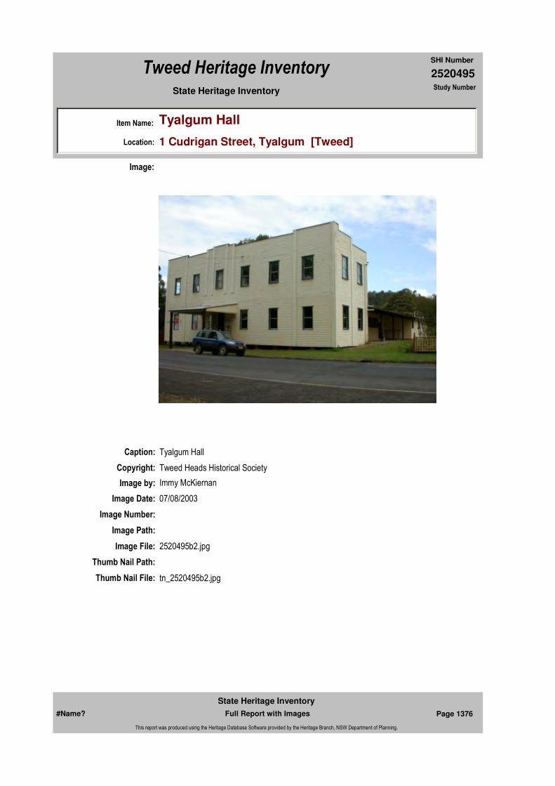
2520495
SHI Number
Tweed Heritage Inventory
Item Name: Tyalgum Hall
Location: 1 Cudrigan Street, Tyalgum [Tweed]
State Heritage Inventory Study Number
Caption: Tyalgum Hall
Copyright: Tweed Heads Historical Society
Image:
Image by: Immy McKiernan
Image Date: 07/08/2003
Image Number:
Image Path:
Image File: 2520495b2.jpg
Thumb Nail Path:
Thumb Nail File: tn_2520495b2.jpg
#Name? Page 1376 Full Report with Images
State Heritage Inventory
This report was produced using the Heritage Database Software provided by the Heritage Branch, NSW Department of Planning.

2520495
SHI Number
Tweed Heritage Inventory
Item Name: Tyalgum Hall
Location: 1 Cudrigan Street, Tyalgum [Tweed]
State Heritage Inventory Study Number
Caption: Rear of Tyalgum Hall
Copyright: Tweed Heads Historical Society
Image:
Image by: Immy McKiernan
Image Date: 07/08/2003
Image Number:
Image Path:
Image File: 2520495b3.jpg
Thumb Nail Path:
Thumb Nail File: tn_2520495b3.jpg
#Name? Page 1377 Full Report with Images
State Heritage Inventory
This report was produced using the Heritage Database Software provided by the Heritage Branch, NSW Department of Planning.
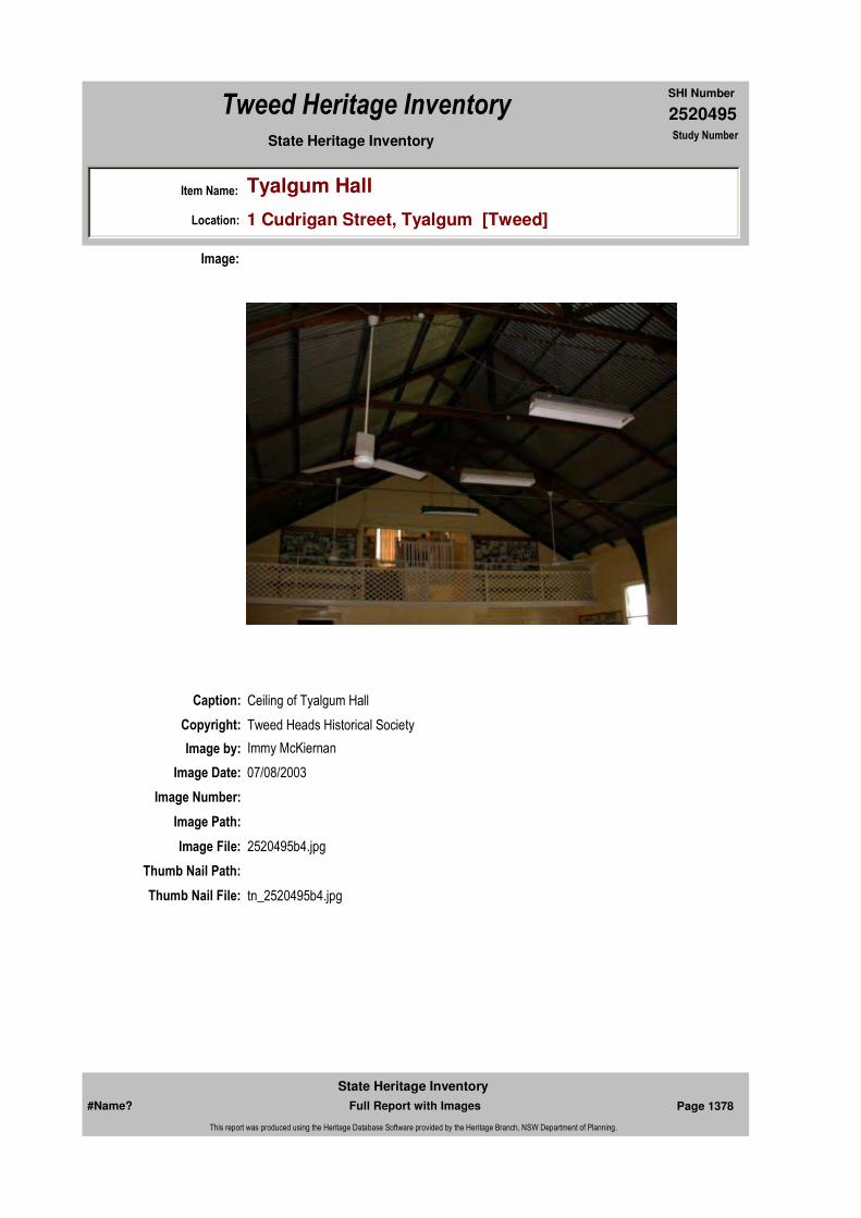
2520495
SHI Number
Tweed Heritage Inventory
Item Name: Tyalgum Hall
Location: 1 Cudrigan Street, Tyalgum [Tweed]
State Heritage Inventory Study Number
Caption: Ceiling of Tyalgum Hall
Copyright: Tweed Heads Historical Society
Image:
Image by: Immy McKiernan
Image Date: 07/08/2003
Image Number:
Image Path:
Image File: 2520495b4.jpg
Thumb Nail Path:
Thumb Nail File: tn_2520495b4.jpg
#Name? Page 1378 Full Report with Images
State Heritage Inventory
This report was produced using the Heritage Database Software provided by the Heritage Branch, NSW Department of Planning.

2520495
SHI Number
Tweed Heritage Inventory
Item Name: Tyalgum Hall
Location: 1 Cudrigan Street, Tyalgum [Tweed]
State Heritage Inventory Study Number
Caption: Stage of Tyalgum Hall
Copyright: Tweed Heads Historical Society
Image:
Image by: Immy McKiernan
Image Date: 07/08/2003
Image Number:
Image Path:
Image File: 2520495b5.jpg
Thumb Nail Path:
Thumb Nail File: tn_2520495b5.jpg
#Name? Page 1379 Full Report with Images
State Heritage Inventory
This report was produced using the Heritage Database Software provided by the Heritage Branch, NSW Department of Planning.
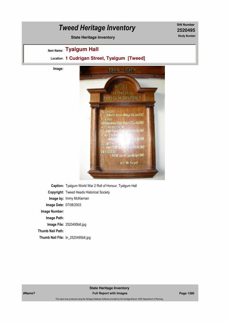
2520495
SHI Number
Tweed Heritage Inventory
Item Name: Tyalgum Hall
Location: 1 Cudrigan Street, Tyalgum [Tweed]
State Heritage Inventory Study Number
Caption: Tyalgum World War 2 Roll of Honour, Tyalgum Hall
Copyright: Tweed Heads Historical Society
Image:
Image by: Immy McKiernan
Image Date: 07/08/2003
Image Number:
Image Path:
Image File: 2520495b6.jpg
Thumb Nail Path:
Thumb Nail File: tn_2520495b6.jpg
#Name? Page 1380 Full Report with Images
State Heritage Inventory
This report was produced using the Heritage Database Software provided by the Heritage Branch, NSW Department of Planning.

2520495
SHI Number
Tweed Heritage Inventory
Item Name: Tyalgum Hall
Location: 1 Cudrigan Street, Tyalgum [Tweed]
State Heritage Inventory Study Number
Caption: Tyalgum World War 1 Roll of Honour, Tyalgum Hall
Copyright: Tweed Heads Historical Society
Image:
Image by: Immy McKiernan
Image Date: 07/08/2003
Image Number:
Image Path:
Image File: 2520495b7.jpg
Thumb Nail Path:
Thumb Nail File: tn_2520495b7.jpg
#Name? Page 1381 Full Report with Images
State Heritage Inventory
This report was produced using the Heritage Database Software provided by the Heritage Branch, NSW Department of Planning.
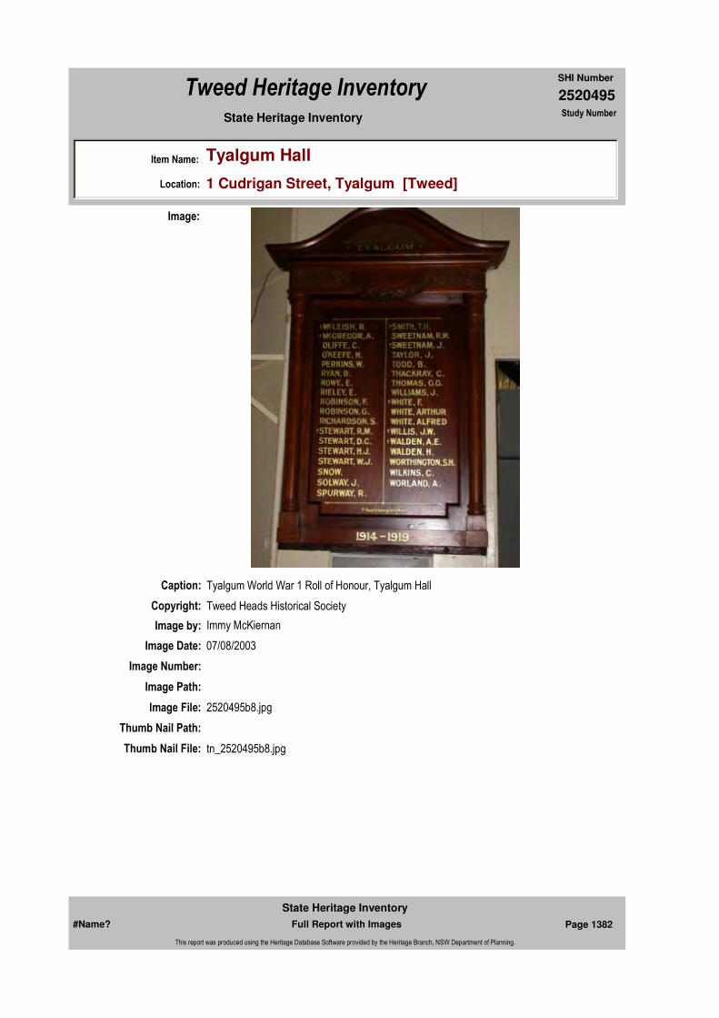
2520495
SHI Number
Tweed Heritage Inventory
Item Name: Tyalgum Hall
Location: 1 Cudrigan Street, Tyalgum [Tweed]
State Heritage Inventory Study Number
Caption: Tyalgum World War 1 Roll of Honour, Tyalgum Hall
Copyright: Tweed Heads Historical Society
Image:
Image by: Immy McKiernan
Image Date: 07/08/2003
Image Number:
Image Path:
Image File: 2520495b8.jpg
Thumb Nail Path:
Thumb Nail File: tn_2520495b8.jpg
#Name? Page 1382 Full Report with Images
State Heritage Inventory
This report was produced using the Heritage Database Software provided by the Heritage Branch, NSW Department of Planning.

2520495
SHI Number
Tweed Heritage Inventory
Item Name: Tyalgum Hall
Location: 1 Cudrigan Street, Tyalgum [Tweed]
State Heritage Inventory Study Number
#Name? Page 1383 Full Report with Images
State Heritage Inventory
This report was produced using the Heritage Database Software provided by the Heritage Branch, NSW Department of Planning.

2520497
SHI Number
Tweed Heritage Inventory
Item Name: Residence - Willis
Location: 7 Coodgee Street, Tyalgum [Tweed]
State Heritage Inventory Study Number
Current Use:
Former Uses:
Statement of
Significance:The house is strongly associated to Sir Eric Willis, former Premier of N.S.W., who grew up there.
Historical Notes or Provenance:
Sir Eric Willis was born in 1922 in Murwillumbah and grew up at Tyalgum. He obtained a B.A. from Sydney University with Honours in geography and history. He served in the Army in New Guinea and the Philippines. In 1950, he was elected MLA for Earlwood. He was deputy leader under Robin Askin and served as Minister for Labour and Industry and as Chief Secretary from1956-71. In 1972 he became Minister for Education. In 1976, he became Premier, replacing Tom Lewis. He was defeated by Neville Wran in an early election that year and resigned from Parliament in 1978.
Designer:
Maker / Builder:
Year Started: Year Completed: 1915 Circa: Yes
Endorsed Significance:Assessed Significance: Local
Item Type: Built Category: BungalowGroup: Residential buildings (
Admin Codes: Code 2: Code 3:
Curtilage/Boundary:
Owner: Private - Individual
Other/Former Names:
Area/Group/Complex: Tyalgum Village Conservation Area Group ID:
Themes:
Aboriginal Area:
Local Govt Area: Tweed
Planning: Northern
Historic Region: North Coast
Address: #Name?
Suburb / Nearest Town: #Name?
State: NSW
Parish: Tyalgum
County: Rous
National Theme State Theme Local Theme
4. Settlement Accommodation (Housing) Housing
#Name? Page 1388 Full Report with Images
State Heritage Inventory
This report was produced using the Heritage Database Software provided by the Heritage Branch, NSW Department of Planning.

2520497
SHI Number
Tweed Heritage Inventory
Item Name: Residence - Willis
Location: 7 Coodgee Street, Tyalgum [Tweed]
State Heritage Inventory Study Number
Physical Description: 1920's bungalow, Queensland vernacular. Shadow battens to large assymetrical gables. Timber pilons supporting slender posts to shady verandah. Some Art Nouveau infuence in lead lilghts.
Physical Condition:
Modification Dates:
Custom Field One:
Recommended
Management:
References:
Studies:
Listings:
Further Comments:
Criteria a)
Criteria c)
Criteria d)
Criteria e)
Criteria g)
Criteria f)
Integrity / Intactness:
Custom Field Two:
Criteria b) The house is strongly associated with the early life of Sir Eric Willis, former Premier of N.S.W., who was important in the course of the history of government in NSW.
Parcels:
Latitude: Longitude:
AMG Zone: Easting: Northing:
Map Name: Map Scale:
Spatial Accuracy:Location validity:
Management:
Author Title YearNumber
Tweed Shire Council Community-based Heritage Study 2003
Parcel Code LotNumber Section Plan Code Plan Number
LOT 11 8 DP 759012
#Name? Page 1389 Full Report with Images
State Heritage Inventory
This report was produced using the Heritage Database Software provided by the Heritage Branch, NSW Department of Planning.

2520497
SHI Number
Tweed Heritage Inventory
Item Name: Residence - Willis
Location: 7 Coodgee Street, Tyalgum [Tweed]
State Heritage Inventory Study Number
Date Updated: 22/11/2006 Status: BasicDate First Entered: 29/04/2004Data Entry:
Custom Field Three:
Custom Field Four:
Custom Field Five:
Custom Field Six:
Caption: Former residence of former NSW Premier, Sir Eric Willis, 7 Coodgee Street, Tyalgum
Copyright: Tweed Heads Historical Society
Image:
Image by: Bill Bainbridge
Image Date: 09/05/2004
Image Number:
Image Path:
Image File: 2520497b1.jpg
Thumb Nail Path:
#Name? Page 1390 Full Report with Images
State Heritage Inventory
This report was produced using the Heritage Database Software provided by the Heritage Branch, NSW Department of Planning.
2520497
SHI Number
Tweed Heritage Inventory
Item Name: Residence - Willis
Location: 7 Coodgee Street, Tyalgum [Tweed]
State Heritage Inventory Study Number
Thumb Nail File: tn_2520497b1.jpg
#Name? Page 1391 Full Report with Images
State Heritage Inventory
This report was produced using the Heritage Database Software provided by the Heritage Branch, NSW Department of Planning.
2520498
SHI Number
Tweed Heritage Inventory
Item Name: General Store
Location: 29 Coolman Street, Tyalgum [Tweed]
State Heritage Inventory Study Number
Current Use:
Former Uses:
Statement of
Significance:The Tyalgum store has a special association with the Tyalgum community as it has provided the commercial and social needs of the communities of the western end of the caldera and travelers for almost 100 years.
Historical Notes
or Provenance:
Physical Description: A timber store with a flat central gabled parapet.
Physical Condition:
Designer:
Maker / Builder:
Year Started: Year Completed: Circa: No
Endorsed Significance:Assessed Significance: Local
Item Type: Built Category: ShopGroup: Retail and Wholesale
Admin Codes: Code 2: Code 3:
Curtilage/Boundary:
Owner: Private - Individual
Other/Former Names:
Area/Group/Complex: Tyalgum Village Conservation Area Group ID:
Themes:
Aboriginal Area:
Local Govt Area: Tweed
Planning: Northern
Historic Region: North Coast
Address: #Name?
Suburb / Nearest Town: #Name?
State: NSW
Parish: Tyalgum
County: Rous
National Theme State Theme Local Theme
3. Economy Commerce Shop
#Name? Page 1392 Full Report with Images
State Heritage Inventory
This report was produced using the Heritage Database Software provided by the Heritage Branch, NSW Department of Planning.

2520498
SHI Number
Tweed Heritage Inventory
Item Name: General Store
Location: 29 Coolman Street, Tyalgum [Tweed]
State Heritage Inventory Study Number
Modification Dates:
Custom Field One:
Recommended
Management:
References:
Studies:
Listings:
Further Comments:
Criteria a)
Criteria c)
Criteria d) The Tyalgum store has a special association with the Tyalgum community as it has provided the commercial and social needs of the communities of the western end of the caldera and travelers for almost 100 years.
Criteria e)
Criteria g)
Criteria f)
Integrity / Intactness:
Custom Field Two:
Custom Field Three:
Custom Field Four:
Custom Field Five:
Criteria b)
Parcels:
Latitude: Longitude:
AMG Zone: Easting: Northing:
Map Name: Map Scale:
Spatial Accuracy:Location validity:
Management:
Author Title YearNumber
Tweed Shire Council Community-based Heritage Study 2003
Parcel Code LotNumber Section Plan Code Plan Number
LOT 1, 2 DP 772864
#Name? Page 1393 Full Report with Images
State Heritage Inventory
This report was produced using the Heritage Database Software provided by the Heritage Branch, NSW Department of Planning.
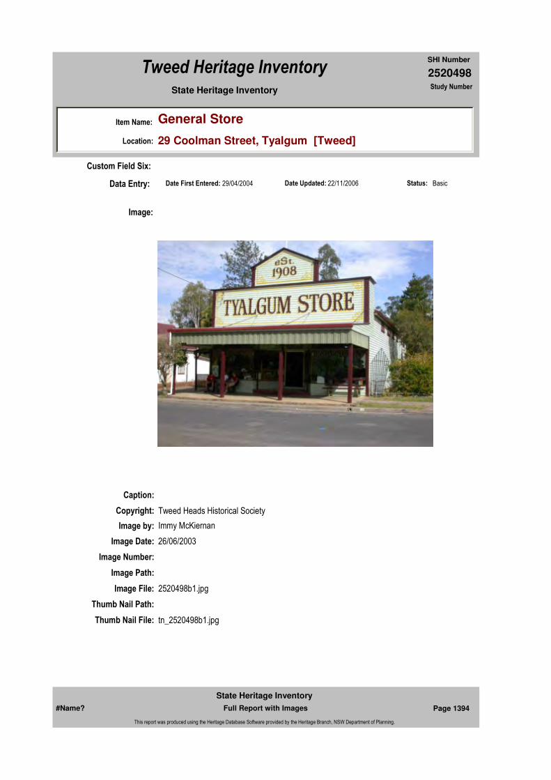
2520498
SHI Number
Tweed Heritage Inventory
Item Name: General Store
Location: 29 Coolman Street, Tyalgum [Tweed]
State Heritage Inventory Study Number
Date Updated: 22/11/2006 Status: BasicDate First Entered: 29/04/2004Data Entry:
Custom Field Six:
Caption:
Copyright: Tweed Heads Historical Society
Image:
Image by: Immy McKiernan
Image Date: 26/06/2003
Image Number:
Image Path:
Image File: 2520498b1.jpg
Thumb Nail Path:
Thumb Nail File: tn_2520498b1.jpg
#Name? Page 1394 Full Report with Images
State Heritage Inventory
This report was produced using the Heritage Database Software provided by the Heritage Branch, NSW Department of Planning.
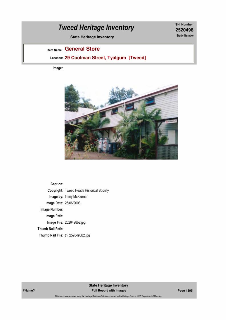
2520498
SHI Number
Tweed Heritage Inventory
Item Name: General Store
Location: 29 Coolman Street, Tyalgum [Tweed]
State Heritage Inventory Study Number
Caption:
Copyright: Tweed Heads Historical Society
Image:
Image by: Immy McKiernan
Image Date: 26/06/2003
Image Number:
Image Path:
Image File: 2520498b2.jpg
Thumb Nail Path:
Thumb Nail File: tn_2520498b2.jpg
#Name? Page 1395 Full Report with Images
State Heritage Inventory
This report was produced using the Heritage Database Software provided by the Heritage Branch, NSW Department of Planning.

2520498
SHI Number
Tweed Heritage Inventory
Item Name: General Store
Location: 29 Coolman Street, Tyalgum [Tweed]
State Heritage Inventory Study Number
#Name? Page 1396 Full Report with Images
State Heritage Inventory
This report was produced using the Heritage Database Software provided by the Heritage Branch, NSW Department of Planning.

2520499
SHI Number
Tweed Heritage Inventory
Item Name: Tyalgum Cemetery
Location: Swift's Road, Tyalgum [Tweed]
State Heritage Inventory Study Number
Current Use:
Former Uses:
Statement of
Significance:The Tyalgum Cemetery has a strong association with the pioneers of the Tyalgum district being their last resting place. It is important in marking the birth of the village as it was laid out in the original plan. Other villages established in the Shire during this period also had land set aside for burials but they were never used.
Historical Notes
or Provenance:
Physical Description: The Tyalgum Cemetery which is located on the southern side of Tyalgum Road before the Ted Bartrim Bridge approach to the Tyalgum Village off Swift's Road, was notified by Government Gazette on December 5, 1906. It comproses an area of 3.642 hectares. The
Designer:
Maker / Builder:
Year Started: 1906 Year Completed: Circa: No
Endorsed Significance:Assessed Significance: Local
Item Type: Complex / Group Category: Cemetery/Graveyard/Group: Cemeteries and Buria
Admin Codes: Code 2: Code 3:
Curtilage/Boundary:
Owner: Local Government
Other/Former Names:
Area/Group/Complex: Group ID:
Themes:
Aboriginal Area:
Local Govt Area: Tweed
Planning: Northern
Historic Region: North Coast
Address: #Name?
Suburb / Nearest Town: #Name?
State: NSW
Parish: Tyalgum
County: Rous
National Theme State Theme Local Theme
9. Phases of Life Birth and Death Cemeteries
#Name? Page 1397 Full Report with Images
State Heritage Inventory
This report was produced using the Heritage Database Software provided by the Heritage Branch, NSW Department of Planning.

2520499
SHI Number
Tweed Heritage Inventory
Item Name: Tyalgum Cemetery
Location: Swift's Road, Tyalgum [Tweed]
State Heritage Inventory Study Number
site contains a small number of graves and enquiries have been made as to its continued use. The existing burals have mainly occurred in the central area of the site in an area approximately 100m x 40m wide. The southern and western portions of the site have been fenced and are being used for grazing. The majority of the existing burials have been fenced off to protect the graves from roaming stock. Few burials have occurred on the site in recent times but occasional requests are still received. Accordingly, it is considered that Council should now make a decision as to whether the cemetery should remain open or whether it should in fact be closed.
Physical Condition:
Modification Dates:
Recommended Management:
References:
Studies:
Further Comments:
Criteria a)
Criteria c)
Criteria d)
Criteria e)
Criteria g)
Criteria f)
Integrity / Intactness:
Criteria b) The Tyalgum Cemetery has a strong association with the pioneers of the Tyalgum district being their last resting place. It is important in marking the birth of the village as it was laid out in the original plan. Other villages established in the Shire during this period also had land set aside for burials but they were never used.
Parcels:
Latitude: Longitude:
AMG Zone: Easting: Northing:
Map Name: Map Scale:
Spatial Accuracy:Location validity:
Management:
Author Title YearNumber
Tweed Shire Council Community-based Heritage Study 2003
#Name? Page 1398 Full Report with Images
State Heritage Inventory
This report was produced using the Heritage Database Software provided by the Heritage Branch, NSW Department of Planning.
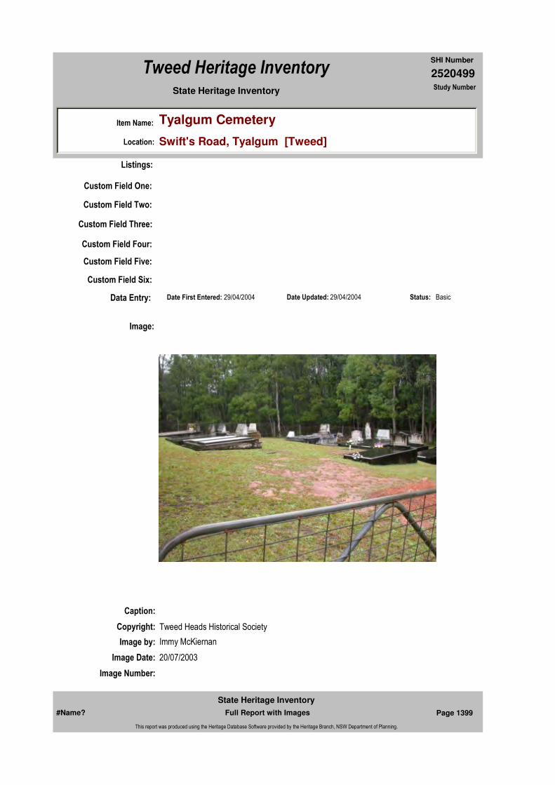
2520499
SHI Number
Tweed Heritage Inventory
Item Name: Tyalgum Cemetery
Location: Swift's Road, Tyalgum [Tweed]
State Heritage Inventory Study Number
Custom Field One:
Listings:
Date Updated: 29/04/2004 Status: BasicDate First Entered: 29/04/2004Data Entry:
Custom Field Two:
Custom Field Three:
Custom Field Four:
Custom Field Five:
Custom Field Six:
Caption:
Copyright: Tweed Heads Historical Society
Image:
Image by: Immy McKiernan
Image Date: 20/07/2003
Image Number:
#Name? Page 1399 Full Report with Images
State Heritage Inventory
This report was produced using the Heritage Database Software provided by the Heritage Branch, NSW Department of Planning.

2520499
SHI Number
Tweed Heritage Inventory
Item Name: Tyalgum Cemetery
Location: Swift's Road, Tyalgum [Tweed]
State Heritage Inventory Study Number
Image Path:
Image File: 2520499b1.jpg
Thumb Nail Path:
Thumb Nail File: tn_2520499b1.jpg
#Name? Page 1400 Full Report with Images
State Heritage Inventory
This report was produced using the Heritage Database Software provided by the Heritage Branch, NSW Department of Planning.

2520499
SHI Number
Tweed Heritage Inventory
Item Name: Tyalgum Cemetery
Location: Swift's Road, Tyalgum [Tweed]
State Heritage Inventory Study Number
Caption:
Copyright: Tweed Heads Historical Society
Image:
Image by: Immy McKiernan
Image Date: 20/07/2003
Image Number:
Image Path:
Image File: 2520499b2.jpg
Thumb Nail Path:
Thumb Nail File: tn_2520499b2.jpg
#Name? Page 1401 Full Report with Images
State Heritage Inventory
This report was produced using the Heritage Database Software provided by the Heritage Branch, NSW Department of Planning.

2520499
SHI Number
Tweed Heritage Inventory
Item Name: Tyalgum Cemetery
Location: Swift's Road, Tyalgum [Tweed]
State Heritage Inventory Study Number
#Name? Page 1402 Full Report with Images
State Heritage Inventory
This report was produced using the Heritage Database Software provided by the Heritage Branch, NSW Department of Planning.

2520500
SHI Number
Tweed Heritage Inventory
Item Name: Residence - Campbell's
Location: 238 Tumbulgum Road, Tygalgah [Tweed]
State Heritage Inventory Study Number
Current Use:
Former Uses:
Statement of
Significance:This residence has a special association with the pioneering Campbell family. This item is important in demonstrating aesthetic characteristics of a c.1890's brick home built in the Tweed district. The building, siting and landscaping are an outstanding example of a substantial brick residence which has been maintained in accordance with the original design.
Historical Notes or Provenance:
Physical Description: Very fine Federation detailing and brickwork with timber pergolas in fine condition on the northern bank of the Tweed River. An avenue of camphor trees line the driveway.
Designer:
Maker / Builder:
Year Started: Year Completed: Circa: No
Endorsed Significance:Assessed Significance: Local
Item Type: Built Category: Other - Residential BuiGroup: Residential buildings (
Admin Codes: Code 2: Code 3:
Curtilage/Boundary:
Owner: Private - Individual
Other/Former Names:
Area/Group/Complex: Group ID:
Themes:
Aboriginal Area:
Local Govt Area: Tweed
Planning: Northern
Historic Region: North Coast
Address: #Name?
Suburb / Nearest Town: #Name?
State: NSW
Parish: Tygalgah
County: Rous
National Theme State Theme Local Theme
4. Settlement Accommodation (Housing) Farmhouse
#Name? Page 1403 Full Report with Images
State Heritage Inventory
This report was produced using the Heritage Database Software provided by the Heritage Branch, NSW Department of Planning.

2520500
SHI Number
Tweed Heritage Inventory
Item Name: Residence - Campbell's
Location: 238 Tumbulgum Road, Tygalgah [Tweed]
State Heritage Inventory Study Number
Physical Condition:
Modification Dates:
Custom Field One:
Recommended
Management:
References:
Studies:
Listings:
Further Comments:
Criteria a)
Criteria c) The building, siting and landscaping are an outstanding example of a substantial brick residence which has been maintained in accordance with the original design.
Criteria d)
Criteria e)
Criteria g)
Criteria f)
Integrity / Intactness:
Criteria b) This residence has a special association with the pioneering Campbell family. This item is important in demonstrating aesthetic characteristics of a c.1890's brick home built in the Tweed district.
Parcels:
Latitude: Longitude:
AMG Zone: Easting: Northing:
Map Name: Map Scale:
Spatial Accuracy:Location validity:
Management:
Author Title YearNumber
Tweed Shire Council Community-based Heritage Study 2003
Parcel Code LotNumber Section Plan Code Plan Number
LOT 1 DP 117073
LOT 1 DP 308105
LOT 2 DP 557660
#Name? Page 1404 Full Report with Images
State Heritage Inventory
This report was produced using the Heritage Database Software provided by the Heritage Branch, NSW Department of Planning.
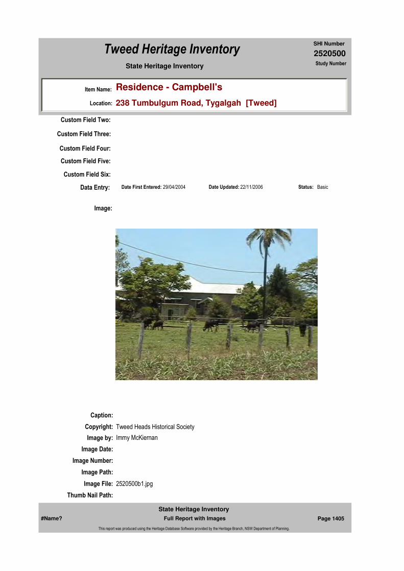
2520500
SHI Number
Tweed Heritage Inventory
Item Name: Residence - Campbell's
Location: 238 Tumbulgum Road, Tygalgah [Tweed]
State Heritage Inventory Study Number
Date Updated: 22/11/2006 Status: BasicDate First Entered: 29/04/2004Data Entry:
Custom Field Two:
Custom Field Three:
Custom Field Four:
Custom Field Five:
Custom Field Six:
Caption:
Copyright: Tweed Heads Historical Society
Image:
Image by: Immy McKiernan
Image Date:
Image Number:
Image Path:
Image File: 2520500b1.jpg
Thumb Nail Path:
#Name? Page 1405 Full Report with Images
State Heritage Inventory
This report was produced using the Heritage Database Software provided by the Heritage Branch, NSW Department of Planning.

2520500
SHI Number
Tweed Heritage Inventory
Item Name: Residence - Campbell's
Location: 238 Tumbulgum Road, Tygalgah [Tweed]
State Heritage Inventory Study Number
Thumb Nail File: tn_2520500b1.jpg
#Name? Page 1406 Full Report with Images
State Heritage Inventory
This report was produced using the Heritage Database Software provided by the Heritage Branch, NSW Department of Planning.

2520500
SHI Number
Tweed Heritage Inventory
Item Name: Residence - Campbell's
Location: 238 Tumbulgum Road, Tygalgah [Tweed]
State Heritage Inventory Study Number
Caption:
Copyright: Tweed Heads Historical Society
Image:
Image by: Immy McKiernan
Image Date:
Image Number:
Image Path:
Image File: 2520500b2.jpg
Thumb Nail Path:
Thumb Nail File: tn_2520500b2.jpg
#Name? Page 1407 Full Report with Images
State Heritage Inventory
This report was produced using the Heritage Database Software provided by the Heritage Branch, NSW Department of Planning.
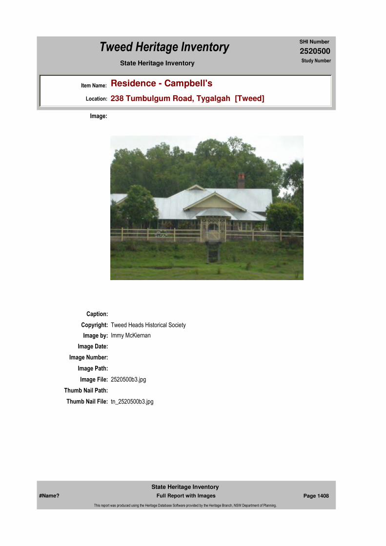
2520500
SHI Number
Tweed Heritage Inventory
Item Name: Residence - Campbell's
Location: 238 Tumbulgum Road, Tygalgah [Tweed]
State Heritage Inventory Study Number
Caption:
Copyright: Tweed Heads Historical Society
Image:
Image by: Immy McKiernan
Image Date:
Image Number:
Image Path:
Image File: 2520500b3.jpg
Thumb Nail Path:
Thumb Nail File: tn_2520500b3.jpg
#Name? Page 1408 Full Report with Images
State Heritage Inventory
This report was produced using the Heritage Database Software provided by the Heritage Branch, NSW Department of Planning.

2520500
SHI Number
Tweed Heritage Inventory
Item Name: Residence - Campbell's
Location: 238 Tumbulgum Road, Tygalgah [Tweed]
State Heritage Inventory Study Number
Caption:
Copyright: Tweed Heads Historical Society
Image:
Image by: Immy McKiernan
Image Date:
Image Number:
Image Path:
Image File: 2520500b4.jpg
Thumb Nail Path:
Thumb Nail File: tn_2520500b4.jpg
#Name? Page 1409 Full Report with Images
State Heritage Inventory
This report was produced using the Heritage Database Software provided by the Heritage Branch, NSW Department of Planning.

2520500
SHI Number
Tweed Heritage Inventory
Item Name: Residence - Campbell's
Location: 238 Tumbulgum Road, Tygalgah [Tweed]
State Heritage Inventory Study Number
#Name? Page 1410 Full Report with Images
State Heritage Inventory
This report was produced using the Heritage Database Software provided by the Heritage Branch, NSW Department of Planning.

2520502
SHI Number
Tweed Heritage Inventory
Item Name: Flying Fox Remains
Location: Milsom's Lane, Uki [Tweed]
State Heritage Inventory Study Number
Current Use:
Former Uses:
Statement of
Significance:The flying fox at Uki is a significant example of the solutions found by the dairy farmers to cope with times of flooding. This flying fox was built by a pioneering family, the Milsoms who played an important role in the commercial and social development of Uki and district. It represents the ingenuity of the farmers in face of a sometimes adverse environment. It demonstrates clearly the hardships faced by the farmer and his family and is a now rare example of its kind. It is a rare example of an activity related to dairy farming which was a significant part of the history of the Tweed Shire and demonstrates a custom no longer common in the Shire
Historical Notes or Provenance:
Built because of frequent flooding, the flying fox was used primarily to convey cream across the South Arm of the Tweed River to the Norco Butter Factory from farms on the opposite bank. At that time, the farm "Sunnybank" was owned by W.O. Irvine, Uki's first auctioneer and farmed on the shares by the Moore brothers. The flying fox also enabled flood bound farmers to get supplies across. Often it carried children to school. After the 1974 flood had washed out the low level bridge that was their only access the Lange family used it for three months for Mr. Lange to go to work and the children to go to school while his wife Dot stayed on the farm for the whole period. She says it was their lifeline. Often if the carrier was on the wrong side the boys would cross the river hand over hand. Many farms used these devices but changes in the regulations regarding the handling of cream meant that the cream could not be transported by this means. However they were still in use for times of emergency when bridges went under flood. It should be noted that these occasions were often marked by a degree of enjoyment and hilarity mixed with terror and are recalled with deep affection and nostalgia.
Endorsed Significance:Assessed Significance: Local
Item Type: Movable / Collection Category: Other - Farming & GraGroup: Farming and Grazing
Admin Codes: Code 2: Code 3:
Curtilage/Boundary:
Owner: Local Government
Other/Former Names:
Area/Group/Complex: Group ID:
Aboriginal Area:
Local Govt Area: Tweed
Planning: Northern
Historic Region: North Coast
Address: #Name?
Suburb / Nearest Town: #Name?
State: NSW
Parish: Nullum
County: Rous
#Name? Page 1417 Full Report with Images
State Heritage Inventory
This report was produced using the Heritage Database Software provided by the Heritage Branch, NSW Department of Planning.
2520502
SHI Number
Tweed Heritage Inventory
Item Name: Flying Fox Remains
Location: Milsom's Lane, Uki [Tweed]
State Heritage Inventory Study Number
Source: oral D.Lange. 2003
Physical Description: Large timber stumps with metal brackets and steel cable
Physical Condition:
Modification Dates: Cable dropped and carrier removed c1995 because of public risk concerns
Designer:
Maker / Builder: Moore brothers
Year Started: Year Completed: 1930 Circa: Yes
Recommended
Management:
References:
Studies:
Further Comments:
Criteria a)
Criteria c)
Criteria d)
Criteria e)
Criteria g) The Flying Fox demonstrates a custom no longer common in the Shire.
Criteria f) The Flying Fox is a rare example of an activity related to dairy farming which was a significant part of the history of the Tweed Shire.
Integrity / Intactness:
Criteria b) The flying fox is a significant example of the solutions found by the dairy farmers to cope with times of flooding. This flying fox was built by a pioneering family, the Milsoms who played an important role in the commercial and social development of Uki and district. It represents the ingenuity of the farmers in face of a sometimes adverse environment. It demonstrates clearly the hardships faced by the farmer and his family and is a now rare example of its kind.
Themes:
Management:
Author Title Year
D.Lange Milsom's Lane Flying Fox 2003
Author Title YearNumber
Tweed Shire Council Community-based Heritage Study 2003
#Name? Page 1418 Full Report with Images
State Heritage Inventory
This report was produced using the Heritage Database Software provided by the Heritage Branch, NSW Department of Planning.

2520502
SHI Number
Tweed Heritage Inventory
Item Name: Flying Fox Remains
Location: Milsom's Lane, Uki [Tweed]
State Heritage Inventory Study Number
Custom Field One:
Listings:
Date Updated: 01/11/2004 Status: BasicDate First Entered: 29/04/2004Data Entry:
Custom Field Two:
Custom Field Three:
Custom Field Four:
Custom Field Five:
Custom Field Six:
Parcels:
Latitude: Longitude:
AMG Zone: Easting: 532703 Northing: 6856766
Map Name: Map Scale:
Spatial Accuracy:Location validity:
Image:
#Name? Page 1419 Full Report with Images
State Heritage Inventory
This report was produced using the Heritage Database Software provided by the Heritage Branch, NSW Department of Planning.

2520502
SHI Number
Tweed Heritage Inventory
Item Name: Flying Fox Remains
Location: Milsom's Lane, Uki [Tweed]
State Heritage Inventory Study Number
Caption:
Copyright: Uki & South Arm Historical Society
Image by: Mary Lee Connery
Image Date: 31/10/2003
Image Number:
Image Path:
Image File: 2520502b1.jpg
Thumb Nail Path:
Thumb Nail File: tn_2520502b1.jpg
#Name? Page 1420 Full Report with Images
State Heritage Inventory
This report was produced using the Heritage Database Software provided by the Heritage Branch, NSW Department of Planning.
2520504
SHI Number
Tweed Heritage Inventory
Item Name: War Memorial and Town Clock
Location: Kyogle Road, Uki [Tweed]
State Heritage Inventory Study Number
Current Use:
Former Uses:
Statement of
Significance:The Uki War Memorial is a significant marker of the contribution paid by the men of the South Arm district of the Tweed Shire in the two World Wars, Malaya, Korea and the Vietnam War.
Historical Notes
or Provenance:In 1920, at a meeting in the Uki Hall convened by Mr. Alleyne S Loder and Mr. Charles Milsom, a local branch of the RSS and AILLA was formed. In 1922, Mr. Milsom, who had been wounded in action, applied to the Shire for permission to erect a memorial on a vacant triangle of land in the centre of the village. The memorial was paid for public subscription and unveiled in 1925 by D.C. Marshall whose son Jack had been killed in action and Mrs Donoghue whose nephew, John Sweetnam was killed at Poziers.
In 1947 the names of those who served in World War 11 were added to the memorial and in 1974, a simple tablet in honour of those who had taken part in campaigns in Korea, Malaya and Vietnam was unveiled by His Excellency Sir Roden Cutler, V.C.
The Dawn Service is held on Anzac Day and is well attended both by veterans and the survivors of those who were killed or have died since.
Memories of the Great War of 1914-1918 were revived in the minds of many residents of the Tweed River on Saturday, when the South Arm War Memorial was unveiled. Vividly they pictured well-known faces now gone forever from the sight of man - those brave young men who went forth to fight for the freedom of their country, and returned not again.
Endorsed Significance:Assessed Significance: Local
Item Type: Built Category: War MemorialGroup: Monuments and Mem
Admin Codes: Code 2: Code 3:
Curtilage/Boundary:
Owner: Local Government
Other/Former Names:
Area/Group/Complex: Group ID:
Aboriginal Area:
Local Govt Area: Tweed
Planning: Northern
Historic Region: North Coast
Address: #Name?
Suburb / Nearest Town: #Name?
State: NSW
Parish: Nullum
County: Rous
#Name? Page 1427 Full Report with Images
State Heritage Inventory
This report was produced using the Heritage Database Software provided by the Heritage Branch, NSW Department of Planning.

2520504
SHI Number
Tweed Heritage Inventory
Item Name: War Memorial and Town Clock
Location: Kyogle Road, Uki [Tweed]
State Heritage Inventory Study Number
It is nine years since peace was declared between the warring nations, and if memory of some deceased soldiers has been dimmed, that of the South arm men who paid the supreme sacrifice has been immortalised until the end of time. A column of stone has been erected, with the names of the killed and returned soldiers thereon, and its structure is such that it will withstand the elements right through the ages in honour of the dead and the living. From a utility standpoint, it will serve to tell South Arm residents the time of day, for embedded in two faces of the column are large clocks, worked by electric batteries installed in the public school, which is nearby.
The greater portion of the South Arm gathered around the cenotaph at Uki on Saturday afternoon when the unveiling ceremony was performed by Mrs George Sweetnam, of Murwillumbah, who has the distinction of being the oldest lady resident of the South Arm who lost a son in the Great War. Mr. D. C Marshall, another old resident, a staunch friend of the Digger, and chairman of the Memorial Committee, presided. The ceremony opened with the National Anthem, played by Murwillumbah Town Band.
Cr. J. H McCollum (President of Tweed Shire Council), said the gathering would remember that a few weeks ago they celebrated the ninth anniversary of the Armistice. All would call to mind the elation when news came through that the sheer waste of blood and the dreadful carnage necessitated by the war was to cease, but mingled with that elation was a note of sadness. They could not forgot that many who went forth would never return, and that many others would come back maimed. It was a long time, comparatively, since the war ended, and many were apt to forget the long drawn-out suffering. The human mind was so constituted that it could forget suffering easily, and remember pleas-ures for a long time. Perhaps it was better that it was so.
INSPIRE RISING GENERATIONThe memorial they were going to unveil that day would call to mind men who went and gallantly fell; also those men who sallied forth, risked their lives and returned to their loved ones. They had the greatest sympathy for the relatives of the fallen - they were all thought of, even amongst the jubilation at the signing of the Armistice. The monument would be an inspiration to the rising generation. It would show them what the men of the South Arm had done at one time, and that, should occasion arise again (he fervently hoped it would not), they could do no less than emulate those who went before them.Cr. McCollum appealed to school teachers throughout the South Arm to inculcate in the minds of the children under their charge, respect and reverence for the monument. He added that, perhaps a few of the men who went to the war were not a credit to the army, but they could not detract from, or lower, the status of the whole.
In the olden days, particularly among the northern nations of Europe, the women fought alongside the men. Any nation whose soldiers were not backed up by its women was doomed. However, he was pleased to say that during the European War the Australian women came forward courageously, and staunchly backed up the men. Cr. McCollum referred particularly to Mrs. Culbert and Mrs. Milsom, who had given time freely in the interests of the Red Cross and other war work.
#Name? Page 1428 Full Report with Images
State Heritage Inventory
This report was produced using the Heritage Database Software provided by the Heritage Branch, NSW Department of Planning.
2520504
SHI Number
Tweed Heritage Inventory
Item Name: War Memorial and Town Clock
Location: Kyogle Road, Uki [Tweed]
State Heritage Inventory Study Number
Ald. J. A. Jay (Mayor of Murwillumbah), thanked the citizens of the South Arm, for the honour they had done him, and the citizens of Murwillumbah, in extending him an invitation to be present. He congratulated the people of Uki and the South Arm on the splendid memorial they had erected to the honour of the men who went to the war. It was argued by some people that the erection of such monuments was waste of time, and that the money would be better expended in providing relief to returned men. People who said that were very short-sighted in their viewpoint. Australia had not been neglectful of her returned heroes. Since the war ended the Government had expended the sum of £140,000,000 in according relief to returned men, the yearly expenditure being something over £11,000,000. He thought these figures showed conclusively that the returned soldiers had not been neglected. In addition, thousands of pounds had been subscribed to public funds, but in spite of all this it could not be denied that there were individual cases of hardship. On the other hand, the sentiment behind the erection of a memorial, to his mind, was one of the best in the world.The soldiers went forth to uphold the honour of the country and to keep Australia free, and in the war, thank- God, they had been triumphant. But what a great sacrifice of men and money, which we could ill afford, had been necessary to keep Australia free for Australians! The monument would tend to show at what cost. There was a clarion call coming across from the poppy fields of Flanders, where many of our bravest and best lay sleeping and it was - "Lest We Forget!"
DETAILS OF MEMORIALMr. Marshall said many people might be wondering why he was chairman that day. It had been his honour and privilege to preside at every send-off to South Arm soldiers, also at every welcome-home function, and in addition he was chairman of the Memorial Committee. Those were the reasons why he was presiding. The material used in the monument was everlasting, and should another war occur the memorial might serve to inculcate in the minds of the young men of that generation a spirit of emulation of the glorious sacrifices of the soldiers of 1914-18. The material was the best procurable - Gosford stone and Bowral trachyte. The clock was one of Proud's electric models, driven by batteries from a master clock placed in the school. There were 93 names inscribed on the monument - those who fell and those who returned. The original estimate for the monument, which had been design by Sir John Sulman, and the erection supervised by a Government officer had been greatly increased through having all the names of the men who enlisted from the South Arm inscribed. The contract price for the monument was £300, and the cost of the trachyte tablet and engraving of names amounted to £82. Installed, the clocks cost £85, while the architect's fees amounted to £10. It was proposed to erect a fence with galvanised railing around the monument, and this was estimated to cost £20. The timber for the fence, to cost £7, had been donated by Mr. J. Priest. Efforts to raise funds to finance the work resulted in a sum of £325, and this amount he had placed in the hank to earn interest of £25. There was still a balance of £147 required to complete payment.
Mr. E. E. Newell, popularly known as the "'Tweed Diggers' Friend," and who was responsible for the construction and beautification of the park near Murwillumbah bridge (now named after him) and for the erection of the splendid monument in it to the honour and memory of Tweed Diggers, declared it was an honour for him to be invited to attend the function. However, it was always an honour, a privilege and pleasure, for him to assist in furthering the interests of the returned men. He had no greater admiration than for the man who had
#Name? Page 1429 Full Report with Images
State Heritage Inventory
This report was produced using the Heritage Database Software provided by the Heritage Branch, NSW Department of Planning.
2520504
SHI Number
Tweed Heritage Inventory
Item Name: War Memorial and Town Clock
Location: Kyogle Road, Uki [Tweed]
State Heritage Inventory Study Number
fought in the face of awful danger that we might live peacefully, own our own farms and businesses, and so on. Mr. Newell congratulated the committee on the fine memorial they had erected, their selection of a design and site. Such a monument was a necessity to show the children of coming generations what the soldiers had done, and what was properly inculcated in a child's mind would stay forever.
Continuing, Mr. Newell said: "While we regret the necessity for erecting such monuments throughout Australia, we must congratulate the soldiers on the ready response they made to the call to arms, and particularly those who went from the South Arm. The mothers, fathers, sisters and brothers left behind must have found it hard to suffer the months and years of suspense, anxiety and sorrow. To those who have not returned we bow and bare our heads; to those who have been bereaved we offer our most sincere and heartfelt sympathy, and to those who have returned we offer our congratulations and express our great pride in their fine achievements. The South Arm folk, in the provision of this splendid monument, intend that the memory of their fallen heroes shall forever be kept green.
WORTHY OF SACRIFICE."The district those men worked in and fought for,"' said Mr. Newell, "'is worthy of them. It is still in process of development, and on those left behind devolves the task of completing the work started by the pioneers. The desired development, however, can only be attained by work and the money resulting from the produce of such work. In this connection, I am pleased to say that the prospects look better than they have done for some seasons past. The recognition by the Federal Parliament of our claims for increased duties on imported butter is a matter on which we can congratulate our-selves, and it is a matter for equal congratulations that such increase, in a large measure, has been obtained for us by our Digger member, Mr. Roland Green.
"Put your hands together for the Digger,"' continued Mr. Newell, and the gathering responded with loud applause. Mr. Newell added that our next objective should be legislation to prevent the lowering of prices through inter-state competition. When that was accomplished the Tweed should prosper, not only as we would wish it, but as our Digger boys of 1914-18 hoped to see it - the brightest, happiest and most prosperous countryside in the Commonwealth.
Mr F Spratt, Kunghur, said that when one looked upon the monument one could truthfully say the fallen had not been forgotten. The monument would be a great example to the generation; it should act as the rising post for them to go and do likewise should occasion demand. The soldiers of 1914-18 had made Australia a nation. The Commonwealth would not be free today if the men had not gone forth to do battle. And the men from the Land of the Sun had played a very big part in the war; so big a part, in fact, that Australia had been placed on the map among nations. Their deeds permitted us to say to Japan, "We want a White Australia, and we intend to have it, while other nations accorded us due respect and would be careful not to tread on our corns. Their hearts went out to the bereaved ones, but when they looked up at the monument they would be able to say that the sacrifice of their boys had not been forgotten. It must be balm to their suffering to see that the great sacrifice was to be immortalised. Mr. Spratt pointed out that £147 was needed to complete payment for the monument, and he appealed for donations and the organisation of functions to liquidate the debt.
#Name? Page 1430 Full Report with Images
State Heritage Inventory
This report was produced using the Heritage Database Software provided by the Heritage Branch, NSW Department of Planning.
2520504
SHI Number
Tweed Heritage Inventory
Item Name: War Memorial and Town Clock
Location: Kyogle Road, Uki [Tweed]
State Heritage Inventory Study Number
ENDURE TO END OF TIMEMr. C. H. Fuge said he looked upon the ceremony not only as a mark of respect to the fallen, but as an appreciation of those who returned. The monument would be handed down through the ages, and with it the his-tory of the great war. It would endure to the end of time. Tourists passing through the district might per-haps stop to read the names inscribed, and if they had been privileged to read some of the tombstones in France and other theatres of war, they might find some identical names. That would serve to bring to their minds the great sacrifice. The monument was indestructible, and under the shadow of Mount Warning it would serve as a beacon to the whole district. Mr Fuge extended sympathy to the relatives of the fallen.
There was impressive silence when Mrs Sweetnam pulled a cord, allowing the flags that draped the monument to flutter to the ground. The people stood with bared heads, and the Band rendered the National Anthem.
Mrs J.H. McCollum then placed "Lest We Forget" wreathes on the monument, another being deposited by relatives of a deceased soldier. "The Last Post" was then sounded by Mr J Pike.
Rev. J. Naish, Church of England Minister in charge of Upper Tweed, next took charge of the proceedings. He apologised for the absence of Rev. Owen Evans, Ven. Archdeason Quinn and a representative of the Salvation Army.
After the hymn, "O God Our Help in Ages Past," had been sung, Rev. Naish led the gathering in prayer. Delivering an address, he took for his text, "What Mean Ye by These Stones?" He said that when the Israelites were being led through the desert of the land of Canaan they experienced a very trying time. But they last came to the Nile, on the other aide of which was the promised land. The Israelites, however, despaired of crossing the river, but by the act of God they crossed on dry land. Their leader, Joshua, then ordered them to take stones from the bottom of the river and erect them, so as to remind their children of what God had done. The people of the South Arm had now erected a monument, because they wanted to remember those who went forth to do battle in the cause of truth, liberty and righteousness. As the years went by, children would ask why the monument was there, and what it signified. It would be duty of the parents to give them a full and proper answer, so that their children would regard it in the same light as they themselves did. They would have to tell their children that once in days gone by there was a call to arms - a matter of right against wrong - and that the men whose names appeared on the monument went forth, in the cause of righteousness and peace. The monument should be made a lasting memorial of the sacrifices made unselfishly by men in order that those who came after them should live in peace.
The hymn "God of Our Fathers Known of Old" was sung, after which Rev. Naish dedicated the monument and pronounced the Benediction. The National Anthem, rendered by the band, concluded the ceremony.(Tweed Daily 12 December, 1927 "Unveiled South Arm War Memorial Fitting monument to Heroes of Great War")
#Name? Page 1431 Full Report with Images
State Heritage Inventory
This report was produced using the Heritage Database Software provided by the Heritage Branch, NSW Department of Planning.
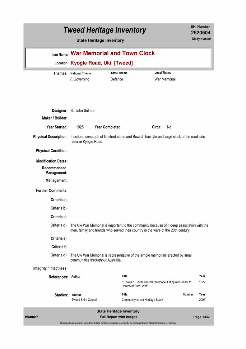
2520504
SHI Number
Tweed Heritage Inventory
Item Name: War Memorial and Town Clock
Location: Kyogle Road, Uki [Tweed]
State Heritage Inventory Study Number
Physical Description: Inscribed cenotaph of Gosford stone and Bowral trachyte and large clock at the road side reserve Kyogle Road.
Physical Condition:
Modification Dates:
Designer: Sir John Sulman
Maker / Builder:
Year Started: 1925 Year Completed: Circa: No
Recommended Management:
References:
Studies:
Further Comments:
Criteria a)
Criteria c)
Criteria d) The Uki War Memorial is important to the community because of it deep association with the men, family and friends who served their country in the wars of the 20th century
Criteria e)
Criteria g) The Uki War Memorial is representative of the simple memorials erected by small communities throughout Australia.
Criteria f)
Integrity / Intactness:
Criteria b)
Themes:
Management:
Author Title Year
"Unveiled South Arm War Memorial Fitting monument to Heroes of Great War"
1927
Author Title YearNumber
Tweed Shire Council Community-based Heritage Study 2003
National Theme State Theme Local Theme
7. Governing Defence War Memorial
#Name? Page 1432 Full Report with Images
State Heritage Inventory
This report was produced using the Heritage Database Software provided by the Heritage Branch, NSW Department of Planning.

2520504
SHI Number
Tweed Heritage Inventory
Item Name: War Memorial and Town Clock
Location: Kyogle Road, Uki [Tweed]
State Heritage Inventory Study Number
Custom Field One:
Listings:
Date Updated: 03/11/2004 Status: BasicDate First Entered: 29/04/2004Data Entry:
Custom Field Two:
Custom Field Three:
Custom Field Four:
Custom Field Five:
Custom Field Six:
Parcels:
Latitude: Longitude:
AMG Zone: Easting: 532783 Northing: 6856705
Map Name: Map Scale:
Spatial Accuracy:Location validity:
Image:
#Name? Page 1433 Full Report with Images
State Heritage Inventory
This report was produced using the Heritage Database Software provided by the Heritage Branch, NSW Department of Planning.

2520504
SHI Number
Tweed Heritage Inventory
Item Name: War Memorial and Town Clock
Location: Kyogle Road, Uki [Tweed]
State Heritage Inventory Study Number
Caption: Uki War Memorial and town clock.
Copyright: Uki & South Arm Historical Society
Image by: Mary Lee Connery
Image Date: 19/09/2003
Image Number:
Image Path:
Image File: 2520504b1.jpg
Thumb Nail Path:
Thumb Nail File: tn_2520504b1.jpg
#Name? Page 1434 Full Report with Images
State Heritage Inventory
This report was produced using the Heritage Database Software provided by the Heritage Branch, NSW Department of Planning.

2520505
SHI Number
Tweed Heritage Inventory
Item Name: Doon Doon and Commissioner's Creek War Memo
Location: Norco Road, Uki [Tweed]
State Heritage Inventory Study Number
Current Use:
Former Uses:
Statement of
Significance:The Honour Board has special significance for the community of Doon Doon and Commissioner's Creek as it marks the contribution made by the residents to service during the Second World War
Historical Notes
or Provenance:Created by the residents of Doon Doon and Commissioner's Creek and paid for by public subscription, the Honour Board was installed in the Doon Doon Hall. During the late 1980's, the Board was removed from the Hall to protect it from vandalism. In 2003 Tweed Shire Council agreed to the re-siting of the Hall to Cram's Farm, a recreation area on the Clarrie Hall Dam in the Doon Doon valley. Source: Oral. M. Sweetnam 2001
Designer: Cecil Onions
Maker / Builder: Cecil Onions
Year Started: Year Completed: 1948 Circa: Yes
Endorsed Significance:Assessed Significance: Local
Item Type: Movable / Collection Category: War MemorialGroup: Monuments and Mem
Admin Codes: Code 2: Code 3:
Curtilage/Boundary:
Owner: Private - Community Group
Other/Former Names:
Area/Group/Complex: Group ID:
Themes:
Aboriginal Area:
Local Govt Area: Tweed
Planning: Northern
Historic Region: North Coast
Address: #Name?
Suburb / Nearest Town: #Name?
State: NSW
Parish: Nullum
County: Rous
National Theme State Theme Local Theme
7. Governing Defence War Memorial
#Name? Page 1435 Full Report with Images
State Heritage Inventory
This report was produced using the Heritage Database Software provided by the Heritage Branch, NSW Department of Planning.

2520505
SHI Number
Tweed Heritage Inventory
Item Name: Doon Doon and Commissioner's Creek War Memo
Location: Norco Road, Uki [Tweed]
State Heritage Inventory Study Number
Physical Description: Simple cedar tablet with plain mouldings and painted inscription. It records the names of fifty-two men from the district.
Physical Condition: good
Modification Dates:
Custom Field One:
Recommended Management:
References:
Studies:
Listings:
Further Comments: The Honour board is in the care of the Uki and South Arm Historical Society until the fate of the Doon Doon Hall is ascertained.
Criteria a)
Criteria c)
Criteria d) The Honour Board has special significance for the community of Doon Doon and Commissioner's Creek as it marks the contribution made by the residents to service during the Second World War
Criteria e)
Criteria g)
Criteria f)
Integrity / Intactness:
Custom Field Two:
Criteria b)
Parcels:
Latitude: Longitude:
AMG Zone: Easting: Northing:
Map Name: Map Scale:
Spatial Accuracy:Location validity:
Management:
Author Title Year
M. Sweetnam 2001
Author Title YearNumber
Tweed Shire Council Community-based Heritage Study 2003
#Name? Page 1436 Full Report with Images
State Heritage Inventory
This report was produced using the Heritage Database Software provided by the Heritage Branch, NSW Department of Planning.

2520505
SHI Number
Tweed Heritage Inventory
Item Name: Doon Doon and Commissioner's Creek War Memo
Location: Norco Road, Uki [Tweed]
State Heritage Inventory Study Number
Date Updated: 29/04/2004 Status: BasicDate First Entered: 29/04/2004Data Entry:
Custom Field Three:
Custom Field Four:
Custom Field Five:
Custom Field Six:
Caption: Doon Doon & Commissioner's Creek War Memorial Roll
Copyright: Uki & South Arm Historical Society
Image:
Image by:
Image Date:
Image Number:
Image Path:
Image File: 2520505b1.jpg
Thumb Nail Path:
Thumb Nail File: tn_2520505b1.jpg
#Name? Page 1437 Full Report with Images
State Heritage Inventory
This report was produced using the Heritage Database Software provided by the Heritage Branch, NSW Department of Planning.

2520505
SHI Number
Tweed Heritage Inventory
Item Name: Doon Doon and Commissioner's Creek War Memo
Location: Norco Road, Uki [Tweed]
State Heritage Inventory Study Number
#Name? Page 1438 Full Report with Images
State Heritage Inventory
This report was produced using the Heritage Database Software provided by the Heritage Branch, NSW Department of Planning.
2520506
SHI Number
Tweed Heritage Inventory
Item Name: Mount Warning Dam
Location: Mount Warning Road, Uki [Tweed]
State Heritage Inventory Study Number
Current Use:
Former Uses:
Statement of Significance:
The Mount Warning Dam was the first dam that supplied water to the Municipality of Murwillumbah and was instrumental in the development of the town as a service area. It represents an important stage in the economic and public works development of the Murwillumbah area generally and the settlements surrounding the village of Uki and Mt warning specifically. The site represents an important phase in the development of the Tweed Shire. The Mount Warning Dam is also significant from an engineering perspective, in that it is one of twenty thin arch concrete dams constructed in NSW between 1896 and 1920. Before this construction type, most Australian dams were earth embankments following the English experience (Chanson & James, 1998a). The design of the thin arch dam was based on the thin arch formula, and was probably a world first in the standardisation of the design technique.
Historical Notes
or Provenance:Mr Harris, officer in charge of the waterworks, stated yesterday that Kor-umbyn dam will probably be completed in about a month's time. The wall is within two feet six inches of the height it will be when completed. There remains also a little work to do on the auxiliary dam, but this should occupy less than two days.
The Gunbar on her present trip, brought about 500 bags of cement and this will serve to relieve a shortage which was threatening to interrupt the con-struction work.
When completed, it is anticipated that the dam will be capable of storing 7,000,000 gallons of
Endorsed Significance:Assessed Significance: State
Item Type: Built Category: Water Supply ReservoGroup: Utilities - Water
Admin Codes: Code 2: Code 3:
Curtilage/Boundary: Located approximately 5 km west of Uki and 16 km south-west of Murwillumbah. Korrumbyn Creek water supply dam is located within Mount Warning National Park on what was formerly a Crown Reserve for Water Supply.
Owner: National Parks & Wildlife Service
Other/Former Names: Korrumbyn Creek Dam
Area/Group/Complex: Group ID:
Aboriginal Area:
Local Govt Area: Tweed
Planning: Northern
Historic Region: North Coast
Address: #Name?
Suburb / Nearest Town: #Name?
State: NSW
Parish: Nullum
County: Rous
#Name? Page 1439 Full Report with Images
State Heritage Inventory
This report was produced using the Heritage Database Software provided by the Heritage Branch, NSW Department of Planning.
2520506
SHI Number
Tweed Heritage Inventory
Item Name: Mount Warning Dam
Location: Mount Warning Road, Uki [Tweed]
State Heritage Inventory Study Number
water. This is somewhat more than the original estimate, but a vast quantity of stone removed from the bed of the storage area and used in concrete work has appreciably increased the holding capacity of the dam. It is satisfactory to learn that throughout the recent dry spell, the flow of water in the creek continued uninterrupted, which is a good augury for the future reliability of the supply.
It is probable that when the dam is completed, some work will be done in extending the reticulation area in town, application for which has been made by the Council.(Tweed Daily 17 August, 1918 "KORUMBYN DAM Early Completion Likely")
Korumbyn waterworks dam was completed yesterday. It only remains now to clear up the ground of all the tools, buildings; etc., and the Korumbyn valley will once more settle down to silence. For two years next month the sound of workmen's tools, of blasting and various other operations, has resounded in the quiet valley of Korumbyn Creek and startled the birds and animals in the encircling scrub. And all the time, almost right under Mt. Warning's lofty peak, there has been mounting up a solid concrete wall till now the Korumbyn dam from which Murwillumbah is to draw her water supply, is complete. The works are in an out-of-the-way place, right up one of the valleys that lie in the foot-hills of Mt. Warning. The distance is about 12 or 13 miles from Murwillumbah all told, and about two miles from where the road of access leaves the South Arm road. This last is a narrow and tortuous track, with plenty of creek crossings. Towards the end it has been dug out of a veritable face of rock. Cliffs tower up on one side, while it almost takes ones breath away to look over the other. A foot or two off the track and there would be no time to say one's prayers. At last, after a continuous ascent, the valley opens out and crossing a small stream, the dam and the settlement comes in sight. Still another walk and the wall is reached.
A White City.Clustered round the dam and perched on the steep hillside are dwellings of the workmen -primitive, most of them, made of calico, cement bags and even walls of clay, and anything that could be brought in to use. For two years they have housed the men, some with their wives and children, but now they will soon be demolished. And not one of the inmates but will be glad that they are going. Women follow their husbands into unheard of places, but to go to Korumbyn is to practically isolate one self completely from the outside world. Perhaps this has had something to do with the labor difficulties that hampered the works for many months. Men came and went like day and night. Up on the hillside is the "'boarding house" -so it is called by the Government Department which originally established it. Considering principally of old cement bags, it would fall far short of the average man's conception of such a lodging. Nearest the dam is the hut and office of the offi-cer-in-charge, Mr. J. H. Harris.
A Big Undertaking.The dam has not to be viewed very long before the onlooker begins to realise the magnitude of the undertaking. From the bottom of the valley, at first sight it looks a comparatively small affair, but this impression fades away as one gets closer. The total length of the great wall at the top is 371 feet, while it is 45 feet high. The wall is really in two sections, what is known as the radius dam, a big semicircular wall, and the abutment dam, a massive piece of masonry at the northern side. The story of the latter is well known. It is
#Name? Page 1440 Full Report with Images
State Heritage Inventory
This report was produced using the Heritage Database Software provided by the Heritage Branch, NSW Department of Planning.

2520506
SHI Number
Tweed Heritage Inventory
Item Name: Mount Warning Dam
Location: Mount Warning Road, Uki [Tweed]
State Heritage Inventory Study Number
told in one word "foundations." Through apparently faulty soundings, a proper rock foundation could not be found on one side, and so the abutment wall had to be constructed to make up for the deficiency. It is really a great buttress, battered on both sides. At the bottom it is no less than 32 feet thick. At the top, however, it is the same thickness' as the remainder of the wall, i.e.. 3 feet 6 inches. In the construction of the wall no less than 3730 yards of concrete were used. Other ingredients that go to make up the wall are 10,100 bags of cement, costing 7/ a bag to land at the dam, 1428 cubic yards of sand, and 2439 cubic yards of metal. The sand was all carted from the South Arm near the Main South Arm road, while the metal, a variety known as diorite, and very hard was all blasted near the dam. Altogether about 500 men have been engaged at the work, but the most ever there at one time was 35. Yesterday there were only five; all of whom finished that day. The whole construction was carried out by day labour. Throughout the two years of work, not a single man was injured on the work, bar one who fell and slightly hurt his head. One of the workmen was accidentally drowned in the creek crossing while in flood, but this was not while he was at work. The dam, when full, will hold between 6,000,000 and 7,000,000 gallons of water. At present it only contains about 1,000,000 gallons, but it is slowly and surely filling up. It will eventually overflow in a big cascade extending for about 100 feet along the top of the wall. The gravitation main connects with an intake valve that will be about two feet under the surface of the water. From here the best water will be drawn, uncontaminated by sediment from the bottom, or floating matter on the surface of the dam. An escape valve is provided at the bottom of the wall to empty the dam when necessary. A railing leads out to a little platform in the centre of the wall from where the various valves can be operated, and observations made. Connected with the dam, of course, is the gravitation line. Over hill and dale, and under creeks this travels until it eventually empties into the service reservoir in Muir-willumbah. Without any mechanical means of propulsion in the whole scheme, the water transfers itself from a clear mountain stream to the tap of the consumers in Murwillumbah. At the suggestion of the officer-in-charge of the works (Mr. J. H. Harris) a small pipe-head weir, about three feet high, was constructed away from the dam in the North Korumbyn Creek. This has proved a wonderful success in relieving the demand on the main dam. Despite all the dry weather, it is now, and for some time past, has been supplying the whole of the demand in Murwillumbah. By this means the main dam, in times of dry weather, will be allowed to accumulate a reserve supply. The run in this second creek is only about a quarter that in the creek proper. The land at present reserved as a catchment area is about 40 acres but the Council would be well advised to push on with the proposal to reserve a further area in order to prevent undue contamination of the water. The dam requires little or no attention beyond an occasional visit after a flood or in dry weather. In the former case, logs will in all probability have to be cleared away from the top of the dam; where they might possibly become jammed. By means of a small block in the creek a few chains up above the wall, the whole settlement and all the works was provided with a supply of water, being conveyed about is small pipes.
"A Fine Job."Asked his opinion on Murwillumbah's water supply scheme, the Superintendent, Mr J H. Harris, voted it "a fine job".
(Tweed Daily 10 October, 1918 "COMPLETION OF DAM YESTERDAY. SOME BIG FIGURES.)
#Name? Page 1441 Full Report with Images
State Heritage Inventory
This report was produced using the Heritage Database Software provided by the Heritage Branch, NSW Department of Planning.

2520506
SHI Number
Tweed Heritage Inventory
Item Name: Mount Warning Dam
Location: Mount Warning Road, Uki [Tweed]
State Heritage Inventory Study Number
Physical Description: The 14.1 metre high dam was designed with advanced structural features, including a single arch wall 1.1 metres thick at the crest and 5.2 metres thick at the base. The dam has a plan radius of 61 metres, with the left bank tangent of gravity cross-section, with a vertical upstream wall and battered vertical face. The dam is constructed of Portland cement concrete. Construction was undertaken by hand. The volume of the reservoir was 27280 cubic metres with a catchment area of about 3km squared.
Physical Condition:
Modification Dates:
Designer: E M de Burgh
Maker / Builder:
Year Started: 1917 Year Completed: 1919 Circa: No
Recommended
Management:Erect an interpretative panel at an appropriate location to illustrate the history and significance of the site.
Further Comments:
Criteria a)
Criteria c) The Mount Warning Dam represents an important stage in the economic and public works development of the Murwillumbah area generally and the settlements surrounding the village of Uki and Mt warning specifically. The site represents an important phase in the development of the Tweed Shire. The dam is also significant from an engineering perspective, in that it is one of twenty thin arch concrete dams constructed in NSW between 1896 and 1920. Before this construction type, most Australian dams were earth embankments following the English experience (Chanson & James, 1998a). The design of the thin arch dam was based on the thin arch formula, and was probably a world first in the standardisation of the design technique.
Criteria d)
Criteria e)
Criteria b) The Mount Warning Dam was the first dam that supplied water to the Municipality of Murwillumbah and was instrumental in the development of the town as a service area.
Themes:
Management:
National Theme State Theme Local Theme
4. Settlement Utilities Water
#Name? Page 1442 Full Report with Images
State Heritage Inventory
This report was produced using the Heritage Database Software provided by the Heritage Branch, NSW Department of Planning.
2520506
SHI Number
Tweed Heritage Inventory
Item Name: Mount Warning Dam
Location: Mount Warning Road, Uki [Tweed]
State Heritage Inventory Study Number
Custom Field One:
References:
Studies:
Listings:
Date Updated: 01/11/2004 Status: BasicDate First Entered: 29/04/2004Data Entry:
Criteria g)
Criteria f)
Integrity / Intactness:
Custom Field Two:
Custom Field Three:
Custom Field Four:
Custom Field Five:
Custom Field Six:
Parcels:
Latitude: Longitude:
AMG Zone: Easting: Northing:
Map Name: Map Scale:
Spatial Accuracy:Location validity:
Author Title Year
Completion of Dam Yesterday. Some Big Figures. 1918
"Korumbyn Dam. Early Completion Likely" 1918
Author Title YearNumber
Tweed Shire Council Community-based Heritage Study 2003
#Name? Page 1443 Full Report with Images
State Heritage Inventory
This report was produced using the Heritage Database Software provided by the Heritage Branch, NSW Department of Planning.

2520506
SHI Number
Tweed Heritage Inventory
Item Name: Mount Warning Dam
Location: Mount Warning Road, Uki [Tweed]
State Heritage Inventory Study Number
Caption: Korrumbyn Dam
Copyright: Tweed Heads Historical Society
Image:
Image by:
Image Date:
Image Number:
Image Path:
Image File: 2520506b1.jpg
Thumb Nail Path:
Thumb Nail File: tn_2520506b1.jpg
#Name? Page 1444 Full Report with Images
State Heritage Inventory
This report was produced using the Heritage Database Software provided by the Heritage Branch, NSW Department of Planning.

2520506
SHI Number
Tweed Heritage Inventory
Item Name: Mount Warning Dam
Location: Mount Warning Road, Uki [Tweed]
State Heritage Inventory Study Number
#Name? Page 1445 Full Report with Images
State Heritage Inventory
This report was produced using the Heritage Database Software provided by the Heritage Branch, NSW Department of Planning.

2520507
SHI Number
Tweed Heritage Inventory
Item Name: Log Loading Ramp
Location: Wollumbin Forest [Tweed]
State Heritage Inventory Study Number
Current Use:
Former Uses:
Statement of
Significance: The log loading ramp has a strong association with the work of the Forestry Commission and timber industry in the Tweed Shire. The ramp was important in the course of NSW's cultural history of the Tweed district. Its construction is indicative of this type of structure.
Historical Notes
or Provenance:
Physical Description: The ramp is not in good condition and with its location in the forest and it will continue to deteriorate. There is one log lying across the bottom, approximately 3/4 metre in diameter, with two smaller logs lying in cut out pieces over the bigger log to make a level ramp for rolling logs
Designer:
Maker / Builder:
Year Started: Year Completed: Circa: No
Endorsed Significance:Assessed Significance: Local
Item Type: Built Category: Timber extraction - logGroup: Forestry and Timber I
Admin Codes: Code 2: Code 3:
Curtilage/Boundary:
Owner: National Parks & Wildlife Service
Other/Former Names:
Area/Group/Complex: Group ID:
Themes:
Aboriginal Area:
Local Govt Area: Tweed
Planning: Northern
Historic Region: North Coast
Address: #Name?
Suburb / Nearest Town: #Name?
State: NSW
Parish:
County:
National Theme State Theme Local Theme
3. Economy Forestry (new theme - previ Loading Ramp
#Name? Page 1446 Full Report with Images
State Heritage Inventory
This report was produced using the Heritage Database Software provided by the Heritage Branch, NSW Department of Planning.
2520507
SHI Number
Tweed Heritage Inventory
Item Name: Log Loading Ramp
Location: Wollumbin Forest [Tweed]
State Heritage Inventory Study Number
onto vehicles. Today, trees have grown on the ramp, the path/roadway is overgrown and the ramp is almost inaccessible, except by the enthusiastic hiker.
Physical Condition:
Modification Dates:
Custom Field One:
Recommended
Management:Obtain espert advice on conserving the structure so as to slow the rate of decay; provide an interpretative panel or guide to mark and illustrate the history and significance of the site.
References:
Studies:
Listings:
Further Comments:
Criteria a) The log loading ramp has a strong association with the work of the Forestry Commission and timber industry in the Tweed Shire. The ramp was important in the course of NSW's cultural history of the Tweed district.
Criteria c) Its construction is indicative of a typical log loading ramp.
Criteria d)
Criteria e)
Criteria g)
Criteria f)
Integrity / Intactness:
Custom Field Two:
Criteria b)
Parcels:
Latitude: Longitude:
AMG Zone: Easting: Northing:
Map Name: Map Scale:
Spatial Accuracy:Location validity:
Management:
Author Title YearNumber
Tweed Shire Council Community-based Heritage Study 2003
#Name? Page 1447 Full Report with Images
State Heritage Inventory
This report was produced using the Heritage Database Software provided by the Heritage Branch, NSW Department of Planning.
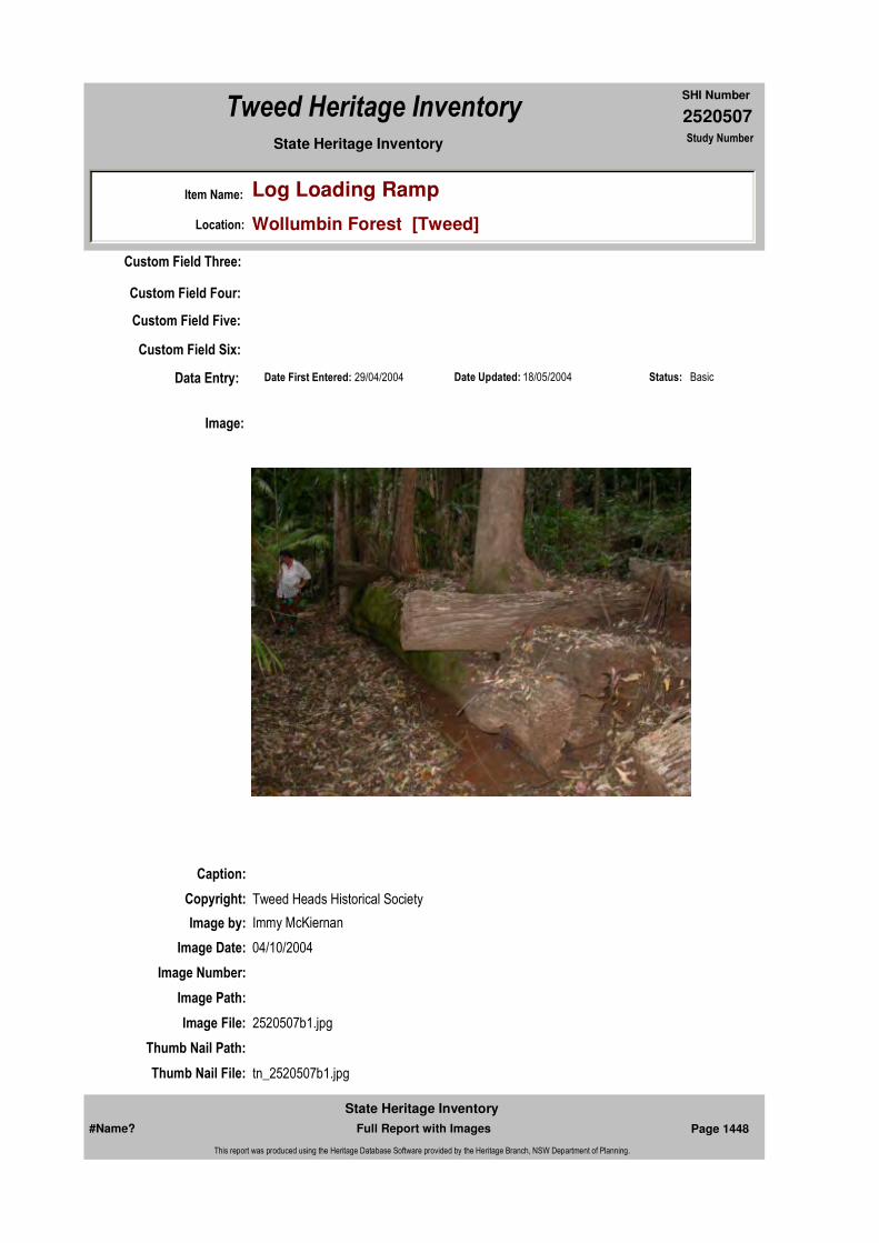
2520507
SHI Number
Tweed Heritage Inventory
Item Name: Log Loading Ramp
Location: Wollumbin Forest [Tweed]
State Heritage Inventory Study Number
Date Updated: 18/05/2004 Status: BasicDate First Entered: 29/04/2004Data Entry:
Custom Field Three:
Custom Field Four:
Custom Field Five:
Custom Field Six:
Caption:
Copyright: Tweed Heads Historical Society
Image:
Image by: Immy McKiernan
Image Date: 04/10/2004
Image Number:
Image Path:
Image File: 2520507b1.jpg
Thumb Nail Path:
Thumb Nail File: tn_2520507b1.jpg
#Name? Page 1448 Full Report with Images
State Heritage Inventory
This report was produced using the Heritage Database Software provided by the Heritage Branch, NSW Department of Planning.
2520507
SHI Number
Tweed Heritage Inventory
Item Name: Log Loading Ramp
Location: Wollumbin Forest [Tweed]
State Heritage Inventory Study Number
#Name? Page 1449 Full Report with Images
State Heritage Inventory
This report was produced using the Heritage Database Software provided by the Heritage Branch, NSW Department of Planning.
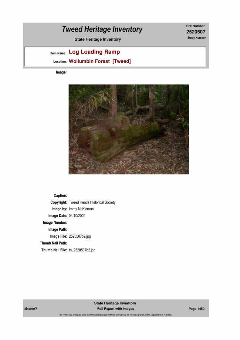
2520507
SHI Number
Tweed Heritage Inventory
Item Name: Log Loading Ramp
Location: Wollumbin Forest [Tweed]
State Heritage Inventory Study Number
Caption:
Copyright: Tweed Heads Historical Society
Image:
Image by: Immy McKiernan
Image Date: 04/10/2004
Image Number:
Image Path:
Image File: 2520507b2.jpg
Thumb Nail Path:
Thumb Nail File: tn_2520507b2.jpg
#Name? Page 1450 Full Report with Images
State Heritage Inventory
This report was produced using the Heritage Database Software provided by the Heritage Branch, NSW Department of Planning.

2520507
SHI Number
Tweed Heritage Inventory
Item Name: Log Loading Ramp
Location: Wollumbin Forest [Tweed]
State Heritage Inventory Study Number
Caption:
Copyright: Tweed Heads Historical Society
Image:
Image by: Immy McKiernan
Image Date: 04/10/2004
Image Number:
Image Path:
Image File: 2520507b3.jpg
Thumb Nail Path:
Thumb Nail File: tn_2520507b3.jpg
#Name? Page 1451 Full Report with Images
State Heritage Inventory
This report was produced using the Heritage Database Software provided by the Heritage Branch, NSW Department of Planning.

2520507
SHI Number
Tweed Heritage Inventory
Item Name: Log Loading Ramp
Location: Wollumbin Forest [Tweed]
State Heritage Inventory Study Number
Caption:
Copyright: Tweed Heads Historical Society
Image:
Image by: Immy McKiernan
Image Date: 04/10/2004
Image Number:
Image Path:
Image File: 2520507b4.jpg
Thumb Nail Path:
Thumb Nail File: tn_2520507b4.jpg
#Name? Page 1452 Full Report with Images
State Heritage Inventory
This report was produced using the Heritage Database Software provided by the Heritage Branch, NSW Department of Planning.

2520507
SHI Number
Tweed Heritage Inventory
Item Name: Log Loading Ramp
Location: Wollumbin Forest [Tweed]
State Heritage Inventory Study Number
#Name? Page 1453 Full Report with Images
State Heritage Inventory
This report was produced using the Heritage Database Software provided by the Heritage Branch, NSW Department of Planning.

2520508
SHI Number
Tweed Heritage Inventory
Item Name: Condong Mill Precinct Conservation Area
Location: Condong [Tweed]
State Heritage Inventory Study Number
Current Use:
Former Uses:
Statement of
Significance:On site are a factory and associated buildings, machinery, a wide range of C.S.R. staff houses, a shop and storage sheds, railway tracks and spur line to Murwillumbah, wharves, sunken punts, river pylons, navigation markers, recreation facilities and landscape features. This precinct is unique on the Tweed and is of state significance in that it has been the site of the continuous production of sugar and associated activities and infrastructure since 1888 and contains a remarkable and largely intact historical record of its 125 years of use.
Historical Notes
or Provenance:Excerpts of Historical Notes on Condong by Myrtle Hilliar, 1920, aged about 12 daughter of the head master at Condong PS at the time. The information contained in the paper apparently is largely the work of Thomas Boyd, who was born on the Tweed in 1850.
"Condong is a sugar manufacturing town on the south bank of the Tweed River. It was called Condong on account of the great number of Condong trees that grew in the locality. The Aboriginals called the place Kulgari Karn, which means "thick scrub".
The first free selection on the Tweed was taken up by Mr John McLeod. It was 320 acres and included the land on which the town of Condong now stands. This occurred in 1866.
In 1878 the Colonial Sugar Refining Company sent a man to the Tweed to inquire as to its
Endorsed Significance:Assessed Significance: State
Item Type: Complex / Group Category: Sugar MillGroup: Manufacturing and Pr
Admin Codes: Code 2: Code 3:
Curtilage/Boundary: Tweed River south bank from lot 1, DP 500202 to the west of Cane Road ... Tweed Valley Way ... Clothiers Creek Road ... McLeod Street, both sides to boat ramp road to river bank reserve, incoporating the reserve to the east to end of Lot 21, DP 878567 ... to the north bank of the river to the bridge and mid stream to the boundary of Lot 1, DP 500202.
Owner: Private - Corporate
Other/Former Names:
Area/Group/Complex: Condong Mill Precinct Conservation Area Group ID:
Aboriginal Area:
Local Govt Area: Tweed
Planning: Northern
Historic Region: North Coast
Address: #Name?
Suburb / Nearest Town: #Name?
State: NSW
Parish: Condong
County: Rous
#Name? Page 1454 Full Report with Images
State Heritage Inventory
This report was produced using the Heritage Database Software provided by the Heritage Branch, NSW Department of Planning.
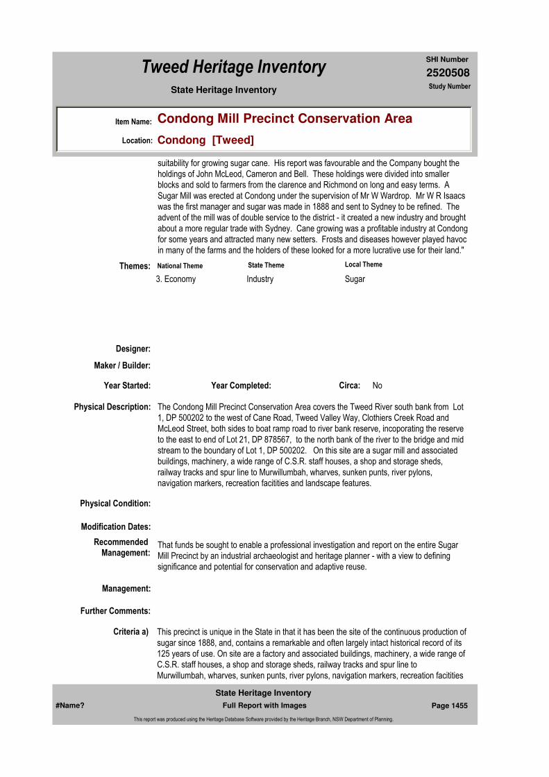
2520508
SHI Number
Tweed Heritage Inventory
Item Name: Condong Mill Precinct Conservation Area
Location: Condong [Tweed]
State Heritage Inventory Study Number
suitability for growing sugar cane. His report was favourable and the Company bought the holdings of John McLeod, Cameron and Bell. These holdings were divided into smaller blocks and sold to farmers from the clarence and Richmond on long and easy terms. A Sugar Mill was erected at Condong under the supervision of Mr W Wardrop. Mr W R Isaacs was the first manager and sugar was made in 1888 and sent to Sydney to be refined. The advent of the mill was of double service to the district - it created a new industry and brought about a more regular trade with Sydney. Cane growing was a profitable industry at Condong for some years and attracted many new setters. Frosts and diseases however played havoc in many of the farms and the holders of these looked for a more lucrative use for their land."
Physical Description: The Condong Mill Precinct Conservation Area covers the Tweed River south bank from Lot 1, DP 500202 to the west of Cane Road, Tweed Valley Way, Clothiers Creek Road and McLeod Street, both sides to boat ramp road to river bank reserve, incoporating the reserve to the east to end of Lot 21, DP 878567, to the north bank of the river to the bridge and mid stream to the boundary of Lot 1, DP 500202. On this site are a sugar mill and associated buildings, machinery, a wide range of C.S.R. staff houses, a shop and storage sheds, railway tracks and spur line to Murwillumbah, wharves, sunken punts, river pylons, navigation markers, recreation facitities and landscape features.
Physical Condition:
Modification Dates:
Designer:
Maker / Builder:
Year Started: Year Completed: Circa: No
Recommended Management:
That funds be sought to enable a professional investigation and report on the entire Sugar Mill Precinct by an industrial archaeologist and heritage planner - with a view to defining significance and potential for conservation and adaptive reuse.
Further Comments:
Criteria a) This precinct is unique in the State in that it has been the site of the continuous production of sugar since 1888, and, contains a remarkable and often largely intact historical record of its 125 years of use. On site are a factory and associated buildings, machinery, a wide range of C.S.R. staff houses, a shop and storage sheds, railway tracks and spur line to Murwillumbah, wharves, sunken punts, river pylons, navigation markers, recreation facitities
Themes:
Management:
National Theme State Theme Local Theme
3. Economy Industry Sugar
#Name? Page 1455 Full Report with Images
State Heritage Inventory
This report was produced using the Heritage Database Software provided by the Heritage Branch, NSW Department of Planning.

2520508
SHI Number
Tweed Heritage Inventory
Item Name: Condong Mill Precinct Conservation Area
Location: Condong [Tweed]
State Heritage Inventory Study Number
Custom Field One:
References:
Studies:
Listings:
Date Updated: 01/11/2004 Status: BasicDate First Entered: 08/05/2004Data Entry:
and landscape features.
Criteria c)
Criteria d)
Criteria e)
Criteria g)
Criteria f)
Integrity / Intactness:
Custom Field Two:
Custom Field Three:
Custom Field Four:
Custom Field Five:
Custom Field Six:
Criteria b)
Parcels:
Latitude: Longitude:
AMG Zone: Easting: Northing:
Map Name: Map Scale:
Spatial Accuracy:Location validity:
Author Title Year
Myrtle Hilliar Excerpts of Historical Notes on Condong 1920
Author Title YearNumber
Tweed Shire Council Community-based Heritage Study 2003
#Name? Page 1456 Full Report with Images
State Heritage Inventory
This report was produced using the Heritage Database Software provided by the Heritage Branch, NSW Department of Planning.

2520508
SHI Number
Tweed Heritage Inventory
Item Name: Condong Mill Precinct Conservation Area
Location: Condong [Tweed]
State Heritage Inventory Study Number
Caption: Condong Sugar Mill, view west from the Tweed River, part of the Condong Mill Precinct Conservation Area..
Copyright: Tweed Heads Historical Society
Image:
Image by: Immy McKiernan
Image Date: 14/12/2003
Image Number:
Image Path:
Image File: 2520508b3.jpg
Thumb Nail Path:
Thumb Nail File: tn_2520508b3.jpg
#Name? Page 1457 Full Report with Images
State Heritage Inventory
This report was produced using the Heritage Database Software provided by the Heritage Branch, NSW Department of Planning.

2520508
SHI Number
Tweed Heritage Inventory
Item Name: Condong Mill Precinct Conservation Area
Location: Condong [Tweed]
State Heritage Inventory Study Number
Caption: Condong General Store, part of the Condong Mill Precinct Conservation Area.
Copyright: Tweed Heads Historical Society
Image:
Image by: Immy McKiernan
Image Date: 15/01/2004
Image Number:
Image Path:
Image File: 2520508b1.jpg
Thumb Nail Path:
Thumb Nail File: tn_2520508b1.jpg
#Name? Page 1458 Full Report with Images
State Heritage Inventory
This report was produced using the Heritage Database Software provided by the Heritage Branch, NSW Department of Planning.
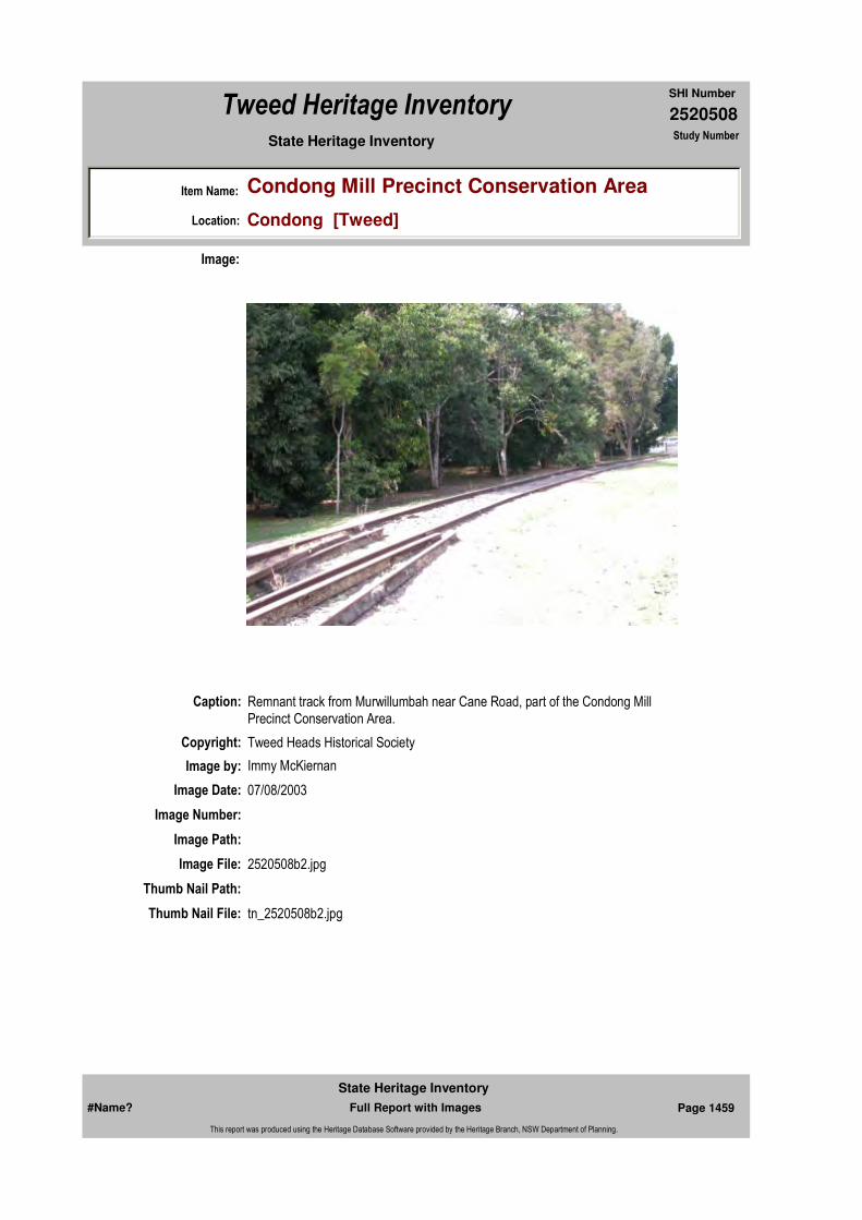
2520508
SHI Number
Tweed Heritage Inventory
Item Name: Condong Mill Precinct Conservation Area
Location: Condong [Tweed]
State Heritage Inventory Study Number
Caption: Remnant track from Murwillumbah near Cane Road, part of the Condong Mill Precinct Conservation Area.
Copyright: Tweed Heads Historical Society
Image:
Image by: Immy McKiernan
Image Date: 07/08/2003
Image Number:
Image Path:
Image File: 2520508b2.jpg
Thumb Nail Path:
Thumb Nail File: tn_2520508b2.jpg
#Name? Page 1459 Full Report with Images
State Heritage Inventory
This report was produced using the Heritage Database Software provided by the Heritage Branch, NSW Department of Planning.
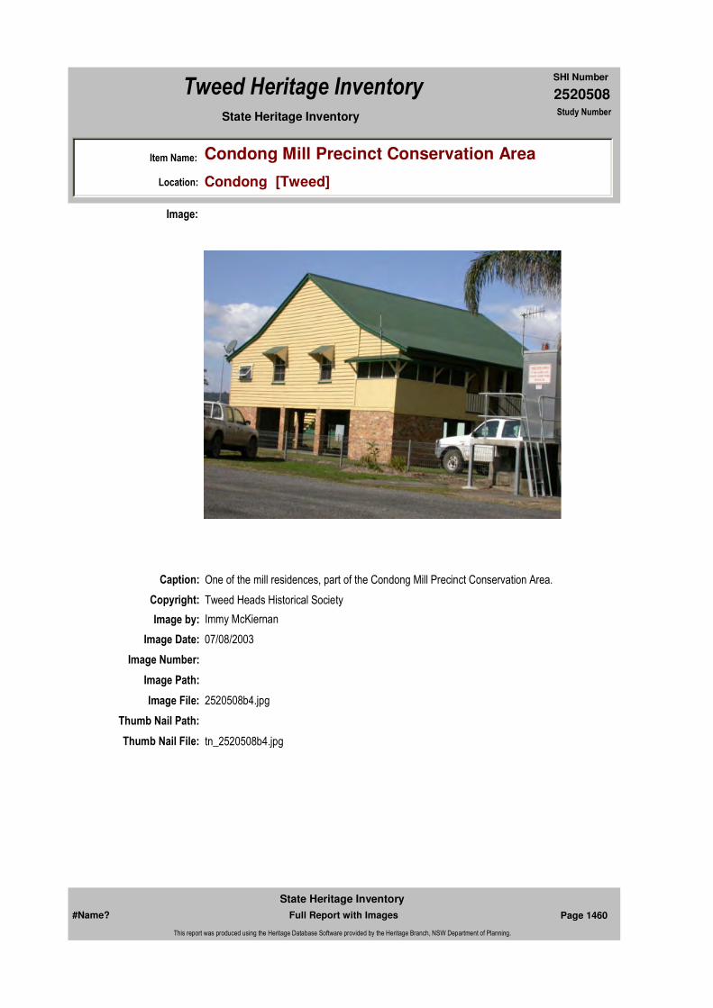
2520508
SHI Number
Tweed Heritage Inventory
Item Name: Condong Mill Precinct Conservation Area
Location: Condong [Tweed]
State Heritage Inventory Study Number
Caption: One of the mill residences, part of the Condong Mill Precinct Conservation Area.
Copyright: Tweed Heads Historical Society
Image:
Image by: Immy McKiernan
Image Date: 07/08/2003
Image Number:
Image Path:
Image File: 2520508b4.jpg
Thumb Nail Path:
Thumb Nail File: tn_2520508b4.jpg
#Name? Page 1460 Full Report with Images
State Heritage Inventory
This report was produced using the Heritage Database Software provided by the Heritage Branch, NSW Department of Planning.
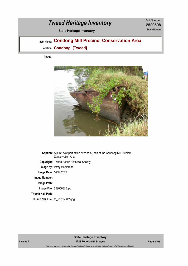
2520508
SHI Number
Tweed Heritage Inventory
Item Name: Condong Mill Precinct Conservation Area
Location: Condong [Tweed]
State Heritage Inventory Study Number
Caption: A punt, now part of the river bank, part of the Condong Mill Precinct Conservation Area.
Copyright: Tweed Heads Historical Society
Image:
Image by: Immy McKiernan
Image Date: 14/12/2003
Image Number:
Image Path:
Image File: 2520508b5.jpg
Thumb Nail Path:
Thumb Nail File: tn_2520508b5.jpg
#Name? Page 1461 Full Report with Images
State Heritage Inventory
This report was produced using the Heritage Database Software provided by the Heritage Branch, NSW Department of Planning.

2520508
SHI Number
Tweed Heritage Inventory
Item Name: Condong Mill Precinct Conservation Area
Location: Condong [Tweed]
State Heritage Inventory Study Number
#Name? Page 1462 Full Report with Images
State Heritage Inventory
This report was produced using the Heritage Database Software provided by the Heritage Branch, NSW Department of Planning.

2520509
SHI Number
Tweed Heritage Inventory
Item Name: Tram tracks, rail siding
Location: Tweed Valley Way, Condong [Tweed]
State Heritage Inventory Study Number
Current Use:
Former Uses:
Statement of
Significance:The entire line of track from Murwillumbah station to Condong was the longest siding on the NSW rail system when it opened in 1894. This section of line was vital to sugar industry on the Tweed.
Historical Notes
or Provenance:
Physical Description: A single standard gauge line from the Murwillumbah Railway Station to the Condong Mill following the southern edge of the Tweed Valley Way to just west of Cane Road, Condong, where it crossed the highway into the mill. It is 5 kilometres long.
Designer:
Maker / Builder:
Year Started: Year Completed: 1894 Circa: No
Endorsed Significance:Assessed Significance: State
Item Type: Built Category: Other - Transport - RaiGroup: Transport - Rail
Admin Codes: Code 2: Code 3:
Curtilage/Boundary: Roadside Reserve
Owner: Local Government
Other/Former Names:
Area/Group/Complex: Group ID:
Themes:
Aboriginal Area:
Local Govt Area: Tweed
Planning: Northern
Historic Region: North Coast
Address: #Name?
Suburb / Nearest Town: #Name?
State: NSW
Parish: Condong
County: Rous
National Theme State Theme Local Theme
3. Economy Industry Sugar
#Name? Page 1463 Full Report with Images
State Heritage Inventory
This report was produced using the Heritage Database Software provided by the Heritage Branch, NSW Department of Planning.

2520509
SHI Number
Tweed Heritage Inventory
Item Name: Tram tracks, rail siding
Location: Tweed Valley Way, Condong [Tweed]
State Heritage Inventory Study Number
Physical Condition:
Modification Dates:
Custom Field One:
Recommended
Management:Maintain general clearance of weeds from track and prevent any destruction of the track and right of way.Erect an interpretative panel illustrating the history and significance of the line.
References:
Studies:
Listings:
Further Comments:
Criteria a)
Criteria c)
Criteria d)
Criteria e)
Criteria g)
Criteria f) The entire line of track from Murwillumbah station to Condong was the longest siding on the NSW rail system when it opened in 1894. 5 kilometres long. Information source, SRA Heritage Advisor, 2004
Integrity / Intactness:
Custom Field Two:
Custom Field Three:
Criteria b)
Parcels:
Latitude: Longitude:
AMG Zone: Easting: Northing:
Map Name: Map Scale:
Spatial Accuracy:Location validity:
Management:
Author Title YearNumber
Tweed Shire Council Community-based Heritage Study 2003
#Name? Page 1464 Full Report with Images
State Heritage Inventory
This report was produced using the Heritage Database Software provided by the Heritage Branch, NSW Department of Planning.

2520509
SHI Number
Tweed Heritage Inventory
Item Name: Tram tracks, rail siding
Location: Tweed Valley Way, Condong [Tweed]
State Heritage Inventory Study Number
Date Updated: 18/05/2004 Status: BasicDate First Entered: 09/05/2004Data Entry:
Custom Field Four:
Custom Field Five:
Custom Field Six:
Caption: Part of the rail siding viewed from west.
Copyright: Tweed Heads Historical Society
Image:
Image by: Immy McKiernan
Image Date: 15/01/2004
Image Number:
Image Path:
Image File: 2520509b1.jpg
Thumb Nail Path:
Thumb Nail File: tn_2520509b1.jpg
#Name? Page 1465 Full Report with Images
State Heritage Inventory
This report was produced using the Heritage Database Software provided by the Heritage Branch, NSW Department of Planning.
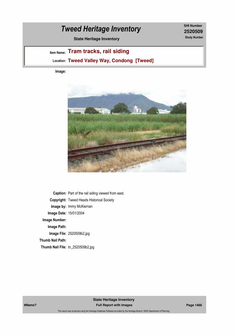
2520509
SHI Number
Tweed Heritage Inventory
Item Name: Tram tracks, rail siding
Location: Tweed Valley Way, Condong [Tweed]
State Heritage Inventory Study Number
Caption: Part of the rail siding viewed from east.
Copyright: Tweed Heads Historical Society
Image:
Image by: Immy McKiernan
Image Date: 15/01/2004
Image Number:
Image Path:
Image File: 2520509b2.jpg
Thumb Nail Path:
Thumb Nail File: tn_2520509b2.jpg
#Name? Page 1466 Full Report with Images
State Heritage Inventory
This report was produced using the Heritage Database Software provided by the Heritage Branch, NSW Department of Planning.

2520509
SHI Number
Tweed Heritage Inventory
Item Name: Tram tracks, rail siding
Location: Tweed Valley Way, Condong [Tweed]
State Heritage Inventory Study Number
#Name? Page 1467 Full Report with Images
State Heritage Inventory
This report was produced using the Heritage Database Software provided by the Heritage Branch, NSW Department of Planning.

2520511
SHI Number
Tweed Heritage Inventory
Item Name: Korn's Crossing Bridge
Location: Crystal Creek [Tweed]
State Heritage Inventory Study Number
Current Use:
Former Uses:
Statement of
Significance:The replica bridge replaces the original bridge was completed in 1916. The Korns Crossing bridge is a Dare type timber truss bridge, and was completed in 1916. In 1998 it was in good condition. As a timber truss road bridge, it has many associational links with important historical events, trends, and people, including the expansion of the road network and economic activity throughout NSW, and Harvey Dare, the designer of this type of truss. Dare trusses were fifth in the five stage design evolution of NSW timber truss road bridges. They were similar to Allan trusses, but contain improvements which make them stronger and easier to maintain. This engineering enhancement represents a significant evolution of the design of timber truss bridges, and gives Dare trusses some technical significance. In 1998 there were 27 surviving Dare trusses in NSW of the 40 built, and 82 timber truss road bridges survive from the over 400 built.
Historical Notes
or Provenance:Timber truss road bridges have played a significant role in the expansion and improvement of the NSW road network. Prior to the bridges being built, river crossings were often dangerous in times of rain, which caused bulk freight movement to be prohibitively expensive for most agricultural and mining produce. Only the high priced wool clip of the time was able to carry the costs and inconvenience imposed by the generally inadequate river crossings that often existed prior to the trusses construction. Timber truss bridges were preferred by the Public Works Department from the mid 19th to the early 20th century because they were relatively cheap to construct, and used mostly local materials. The financially troubled governments of the day applied pressure to the Public Works Department to produce as much road and bridge work for as little cost as possible, using local materials. This condition effectively prohibited the use of iron and steel,
Endorsed Significance:Assessed Significance: Local
Item Type: Built Category: Road BridgeGroup: Transport - Land
Admin Codes: Code 2: Code 3:
Curtilage/Boundary:
Owner: Local Government
Other/Former Names:
Area/Group/Complex: Group ID:
Aboriginal Area:
Local Govt Area: Tweed
Planning: Northern
Historic Region: North Coast
Address: #Name?
Suburb / Nearest Town: #Name?
State: NSW
Parish:
County:
#Name? Page 1468 Full Report with Images
State Heritage Inventory
This report was produced using the Heritage Database Software provided by the Heritage Branch, NSW Department of Planning.

2520511
SHI Number
Tweed Heritage Inventory
Item Name: Korn's Crossing Bridge
Location: Crystal Creek [Tweed]
State Heritage Inventory Study Number
as these, prior to the construction of the steel works at Newcastle in the early 20th century, had to be imported from England.
Harvey Dare, the designer of Dare truss and other bridges, was a leading engineer in the Public Works Department, and a prominent figure in early 20th century NSW.
Timber truss bridges, and timber bridges generally were so common that NSW was known to travellers as the "timber bridge state".
Physical Description: This bridge is a replica. The bridge over the Rouss River at Korn's Crossing is a Dare type timber truss road bridge. It has a single timber truss span of 27.4m (90ft). There is a single timber approach span at each end giving the bridge an overall length of 43.9m (144ft). The bridge super structure is supported by timber trestles and provides a single lane carriage way. The current deck is of SLT (stress laminated timber) construction and can be seen from the underside. The road surface has been coated with asphalt. An Armco guard rail extends the full length of the bridge. Recent rectification works include a pre-cast concrete abutment strengthened with timber logs.
Physical Condition: Good
Modification Dates: Replacement SLT (Stress Laminated Timber) Deck Precast concrete abutment
Designer: Harvey Dare
Maker / Builder: Lawson C V, Murrwillumbah
Year Started: Year Completed: 1916 Circa: No
Recommended
Management:Erect an interpretative panel illustrating the history and significance of the bridge.
Further Comments: This assessment made in 1998.
Criteria a) Through the bridge's association with the expansion of the NSW road network, its ability to demonstrate historically important concepts such as the gradual acceptance of NSW people of American design ideas, and its association with Harvey Dare, it has historical significance.
Criteria c) The bridge exhibits the technical excellence of its design, as all of the structural detail is clearly visible. In the context of its landscape it is visually attractive. As such, the bridge has a small amount of aesthetic significance.
Criteria d) The Korns Crossing bridge is valued by the people of the Murwillumbah district. Timber truss bridges are prominent to road travellers, and NSW has in the past been referred to as the
Criteria b)
Themes:
Management:
#Name? Page 1469 Full Report with Images
State Heritage Inventory
This report was produced using the Heritage Database Software provided by the Heritage Branch, NSW Department of Planning.
2520511
SHI Number
Tweed Heritage Inventory
Item Name: Korn's Crossing Bridge
Location: Crystal Creek [Tweed]
State Heritage Inventory Study Number
Custom Field One:
References:
Studies:
Listings:
Date Updated: 01/11/2004 Status: BasicDate First Entered: 09/05/2004Data Entry:
"timber truss bridge state". Through this, the complete set of bridges gain some social significance, as they could be said to be held in reasonable esteem by many travellers in NSW.
Criteria e)
Criteria g) Representative of Dare truss bridges
Criteria f) Rare - In 1998 there were 27 surviving Dare trusses in NSW of the 40 built, and 82 timber truss road bridges survive from the over 400 built.
Integrity / Intactness:
Custom Field Two:
Custom Field Three:
Custom Field Four:
Custom Field Five:
Custom Field Six:
Parcels:
Latitude: Longitude:
AMG Zone: Easting: Northing:
Map Name: Map Scale:
Spatial Accuracy:Location validity:
Author Title Year
Korn's Crossing Bridge over Rous River 1999
Author Title YearNumber
Tweed Shire Council Community-based Heritage Study 2003
#Name? Page 1470 Full Report with Images
State Heritage Inventory
This report was produced using the Heritage Database Software provided by the Heritage Branch, NSW Department of Planning.
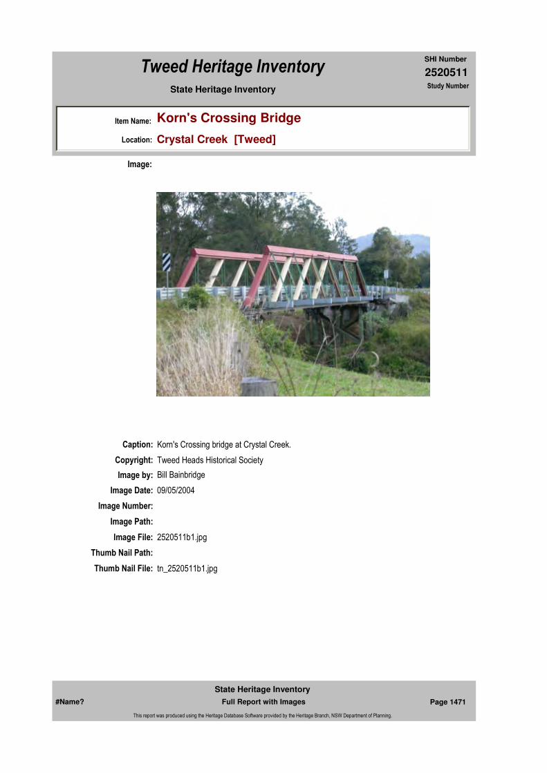
2520511
SHI Number
Tweed Heritage Inventory
Item Name: Korn's Crossing Bridge
Location: Crystal Creek [Tweed]
State Heritage Inventory Study Number
Caption: Korn's Crossing bridge at Crystal Creek.
Copyright: Tweed Heads Historical Society
Image:
Image by: Bill Bainbridge
Image Date: 09/05/2004
Image Number:
Image Path:
Image File: 2520511b1.jpg
Thumb Nail Path:
Thumb Nail File: tn_2520511b1.jpg
#Name? Page 1471 Full Report with Images
State Heritage Inventory
This report was produced using the Heritage Database Software provided by the Heritage Branch, NSW Department of Planning.
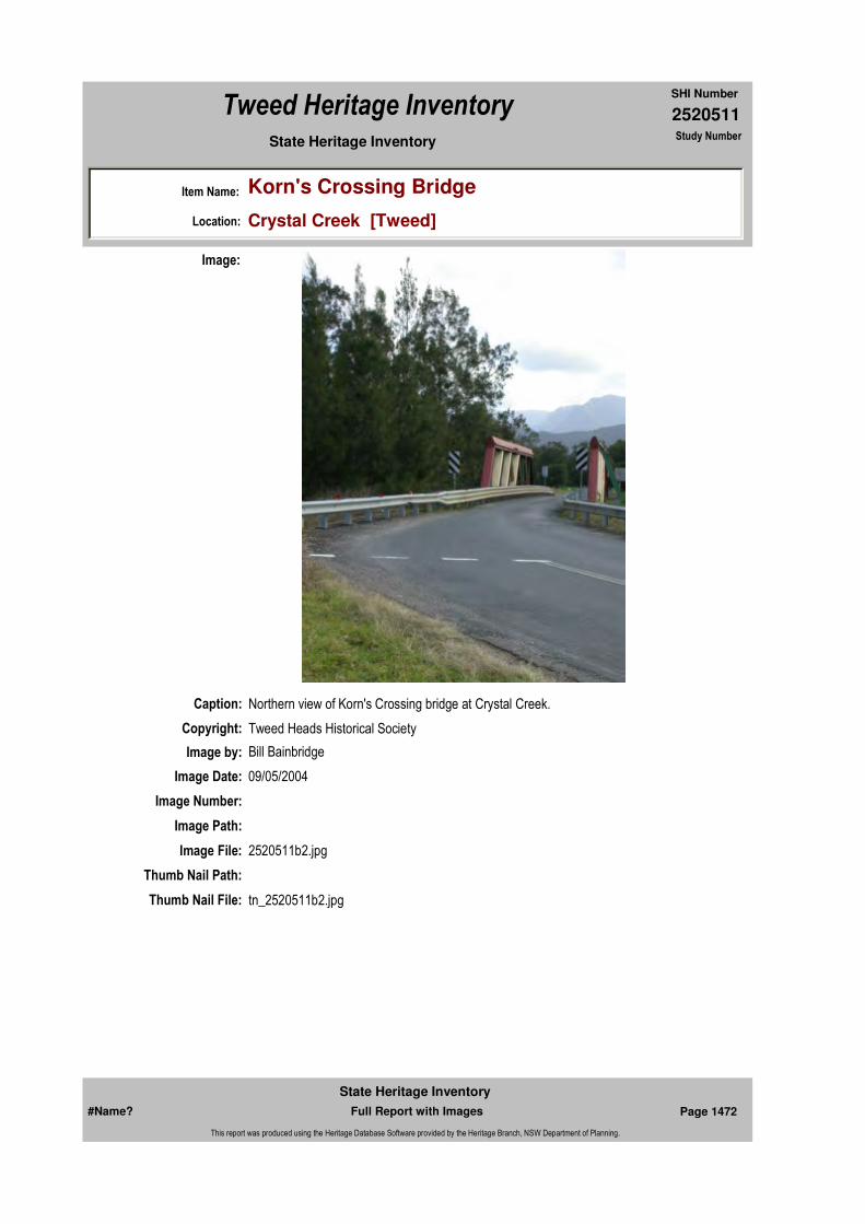
2520511
SHI Number
Tweed Heritage Inventory
Item Name: Korn's Crossing Bridge
Location: Crystal Creek [Tweed]
State Heritage Inventory Study Number
Caption: Northern view of Korn's Crossing bridge at Crystal Creek.
Copyright: Tweed Heads Historical Society
Image:
Image by: Bill Bainbridge
Image Date: 09/05/2004
Image Number:
Image Path:
Image File: 2520511b2.jpg
Thumb Nail Path:
Thumb Nail File: tn_2520511b2.jpg
#Name? Page 1472 Full Report with Images
State Heritage Inventory
This report was produced using the Heritage Database Software provided by the Heritage Branch, NSW Department of Planning.

2520511
SHI Number
Tweed Heritage Inventory
Item Name: Korn's Crossing Bridge
Location: Crystal Creek [Tweed]
State Heritage Inventory Study Number
Caption: Korn's Crossing bridge at Crystal Creek.
Copyright: Tweed Heads Historical Society
Image:
Image by: Bill Bainbridge
Image Date: 09/05/2004
Image Number:
Image Path:
Image File: 2520511b3.jpg
Thumb Nail Path:
Thumb Nail File: tn_2520511b3.jpg
#Name? Page 1473 Full Report with Images
State Heritage Inventory
This report was produced using the Heritage Database Software provided by the Heritage Branch, NSW Department of Planning.
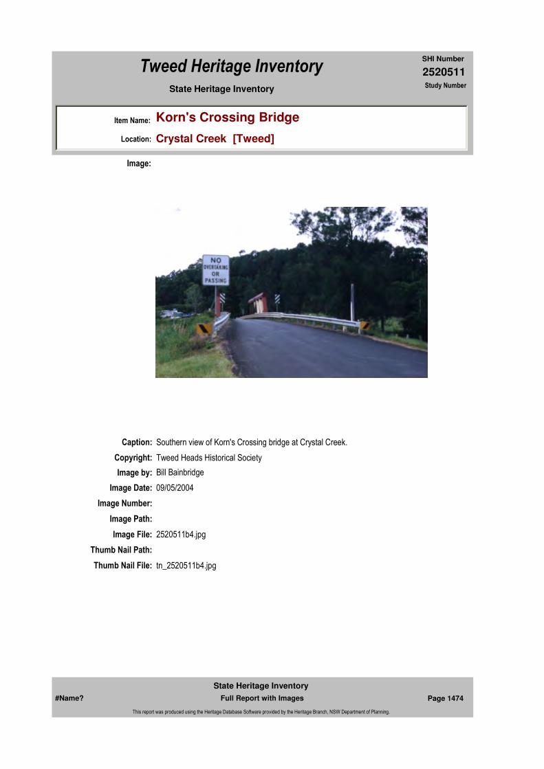
2520511
SHI Number
Tweed Heritage Inventory
Item Name: Korn's Crossing Bridge
Location: Crystal Creek [Tweed]
State Heritage Inventory Study Number
Caption: Southern view of Korn's Crossing bridge at Crystal Creek.
Copyright: Tweed Heads Historical Society
Image:
Image by: Bill Bainbridge
Image Date: 09/05/2004
Image Number:
Image Path:
Image File: 2520511b4.jpg
Thumb Nail Path:
Thumb Nail File: tn_2520511b4.jpg
#Name? Page 1474 Full Report with Images
State Heritage Inventory
This report was produced using the Heritage Database Software provided by the Heritage Branch, NSW Department of Planning.

2520511
SHI Number
Tweed Heritage Inventory
Item Name: Korn's Crossing Bridge
Location: Crystal Creek [Tweed]
State Heritage Inventory Study Number
#Name? Page 1475 Full Report with Images
State Heritage Inventory
This report was produced using the Heritage Database Software provided by the Heritage Branch, NSW Department of Planning.

2520516
SHI Number
Tweed Heritage Inventory
Item Name: Tyalgum Village Conservation Area
Location: Tyalgum [Tweed]
State Heritage Inventory Study Number
Current Use:
Former Uses:
Statement of
Significance:The village, established in the Edwardian era, contains representative commercial and residential buildings indicative of the time and the area.
Historical Notes or Provenance:
In 1868, the area now called the Village of Tyalgum was part of 16,200 h leased by Samuel Grey and known as the Tyalgrun Run (sic). He and Joshua Bray mainly used the area as a source of cedar.In 1898 the area was opened for selection. Among the first selectors were Dick James, Den Guinea, Tom Ward, Jack Marks and Jim Hall. The village, proclaimed in 1906 was sited on land known as "The Flat" where the Forest Ranger's hut was situated and where the settlers collected goods delivered weekly from Murwillumbah. It was also an important gathering place for social events for an isolated community.Important early dates are: 1907 Provisional School opened1908 The Beehive Store opened by Hedley Foster Literary and Mechanics Institute opened Post Office and Telephone opened1909 Butcher shop opened by William lane and Joseph Connor1910 Tyalgum Butchering and Baking Co-op opened1913 Butter factory opened1916 2nd Beehive Store opened1919 2 storey additions to hall for RSL room, reading room and library plus kitchen1926 New State Hotel built by John Fowler Fitzhenry. 21 bedrooms and 4 shops First Tyalgum Diggers Sports held1927 Current store built by McCallum and Poynting.
Endorsed Significance:Assessed Significance: Local
Item Type: Complex / Group Category: Other - Residential BuiGroup: Residential buildings (
Admin Codes: Code 2: Code 3:
Curtilage/Boundary:
Owner: Multiple Owners
Other/Former Names:
Area/Group/Complex: Tyalgum Village Conservation Area Group ID:
Aboriginal Area:
Local Govt Area: Tweed
Planning: Northern
Historic Region: North Coast
Address: #Name?
Suburb / Nearest Town: #Name?
State: NSW
Parish: Tyalgum
County: Rous
#Name? Page 1494 Full Report with Images
State Heritage Inventory
This report was produced using the Heritage Database Software provided by the Heritage Branch, NSW Department of Planning.

2520516
SHI Number
Tweed Heritage Inventory
Item Name: Tyalgum Village Conservation Area
Location: Tyalgum [Tweed]
State Heritage Inventory Study Number
Source: History of Tyalgum and District Lofts, Peterkin and Smith. 1980
In the 1990's Tyalgum began a Classical Music Festival using the excellent acoustic qualities of the hall to feature overseas and Australian artists. The Wollumbin Festival, a celebration of indigenous and alternative culture, started in 2000 as part of the Save Wollumbin Forest campaign.
Physical Description: A strip of housing and commercial buildings facing the southern edge of Coolman Street and the Butter Factory on the northern side, the Willis residence in Coodgee Street. Significant items in this precinct have been nominated indivudually.
Physical Condition:
Modification Dates:
Designer:
Maker / Builder:
Year Started: Year Completed: Circa: No
Recommended Management:
A Conservation Management Plan to be drawn up for this area.
References:
Studies:
Further Comments:
Criteria a)
Criteria c)
Criteria d)
Criteria e)
Criteria g)
Criteria f)
Integrity / Intactness:
Criteria b)
Themes:
Management:
Author Title Year
Lofts, Peterkin and Smith History of Tyalgum and District 1980
Author Title YearNumber
Tweed Shire Council Community-based Heritage Study 2003
#Name? Page 1495 Full Report with Images
State Heritage Inventory
This report was produced using the Heritage Database Software provided by the Heritage Branch, NSW Department of Planning.

2520516
SHI Number
Tweed Heritage Inventory
Item Name: Tyalgum Village Conservation Area
Location: Tyalgum [Tweed]
State Heritage Inventory Study Number
Custom Field One:
Listings:
Date Updated: 22/11/2006 Status: BasicDate First Entered: 10/05/2004Data Entry:
Custom Field Two:
Custom Field Three:
Custom Field Four:
Custom Field Five:
Custom Field Six:
Parcels:
Latitude: Longitude:
AMG Zone: Easting: Northing:
Map Name: Map Scale:
Spatial Accuracy:Location validity:
#Name? Page 1496 Full Report with Images
State Heritage Inventory
This report was produced using the Heritage Database Software provided by the Heritage Branch, NSW Department of Planning.

2520519
SHI Number
Tweed Heritage Inventory
Item Name: Murwillumbah Main Street Clock
Location: Murwillumbah Street, Murwillumbah [Tweed]
State Heritage Inventory Study Number
Current Use: Clock
Former Uses: Clock
Statement of
Significance:The Main Street clock is significant as part of the Murwillumbah Main Street Urban Conservation Area.
Historical Notes or Provenance:
Built 1952
Physical Description: Built 1952.
Physical Condition:
Modification Dates:
Designer:
Maker / Builder:
Year Started: Year Completed: 1952 Circa: No
Recommended
Management:Conserve the exterior and interior elements of significance; adapt services and facilities to ensure continued use; remove redundant signs and signs which detract from the style of architecture; provide a suitable colour scheme which compliments the architecture and matches the aspirations of the building owner and tenant; restore damaged and missing original architectural features based on early photographs or technical drawings.
Endorsed Significance:Assessed Significance: Local
Item Type: Built Category: Other - Community FaGroup: Community Facilities
Admin Codes: Code 2: Code 3:
Curtilage/Boundary:
Owner: Local Government
Other/Former Names:
Area/Group/Complex: Murwillumbah Main Street Urban Conservation Area Group ID: 7
Themes:
Aboriginal Area:
Local Govt Area: Tweed
Planning: Northern
Historic Region: North Coast
Address: #Name?
Suburb / Nearest Town: #Name?
State: NSW
Parish: Murwillumbah
County: Rous
#Name? Page 1501 Full Report with Images
State Heritage Inventory
This report was produced using the Heritage Database Software provided by the Heritage Branch, NSW Department of Planning.
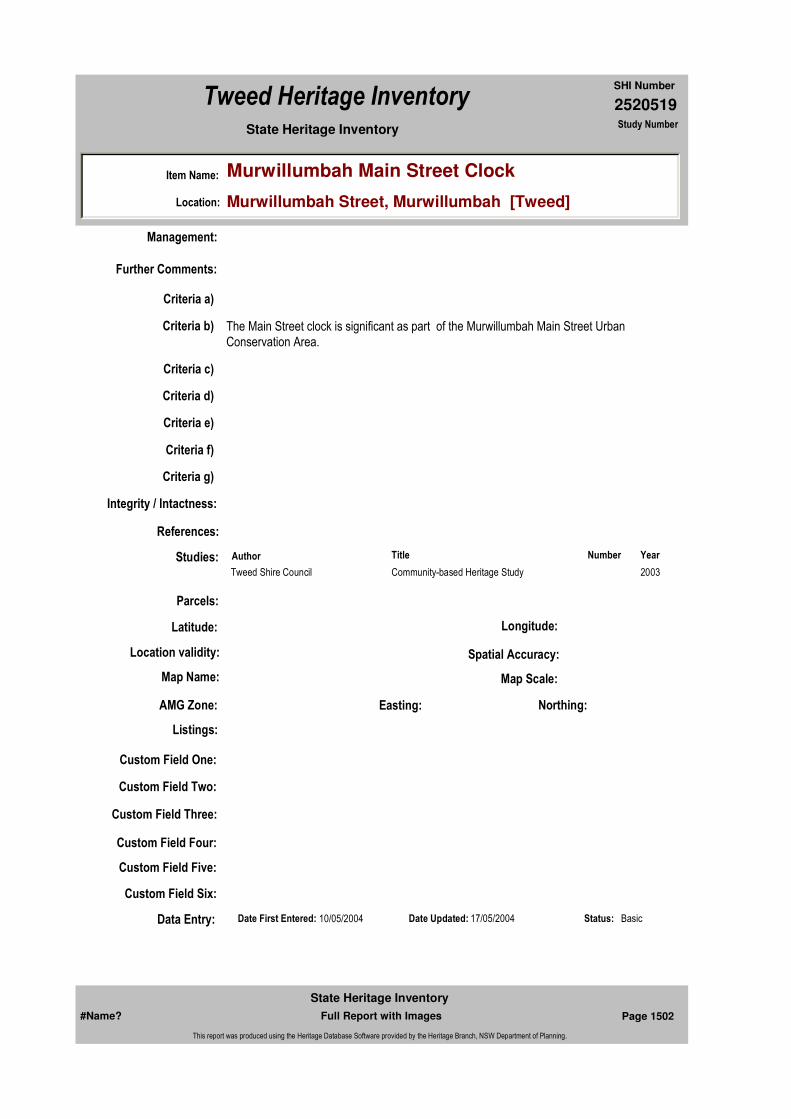
2520519
SHI Number
Tweed Heritage Inventory
Item Name: Murwillumbah Main Street Clock
Location: Murwillumbah Street, Murwillumbah [Tweed]
State Heritage Inventory Study Number
Custom Field One:
References:
Studies:
Listings:
Date Updated: 17/05/2004 Status: BasicDate First Entered: 10/05/2004Data Entry:
Further Comments:
Criteria a)
Criteria c)
Criteria d)
Criteria e)
Criteria g)
Criteria f)
Integrity / Intactness:
Custom Field Two:
Custom Field Three:
Custom Field Four:
Custom Field Five:
Custom Field Six:
Criteria b) The Main Street clock is significant as part of the Murwillumbah Main Street Urban Conservation Area.
Parcels:
Latitude: Longitude:
AMG Zone: Easting: Northing:
Map Name: Map Scale:
Spatial Accuracy:Location validity:
Management:
Author Title YearNumber
Tweed Shire Council Community-based Heritage Study 2003
#Name? Page 1502 Full Report with Images
State Heritage Inventory
This report was produced using the Heritage Database Software provided by the Heritage Branch, NSW Department of Planning.
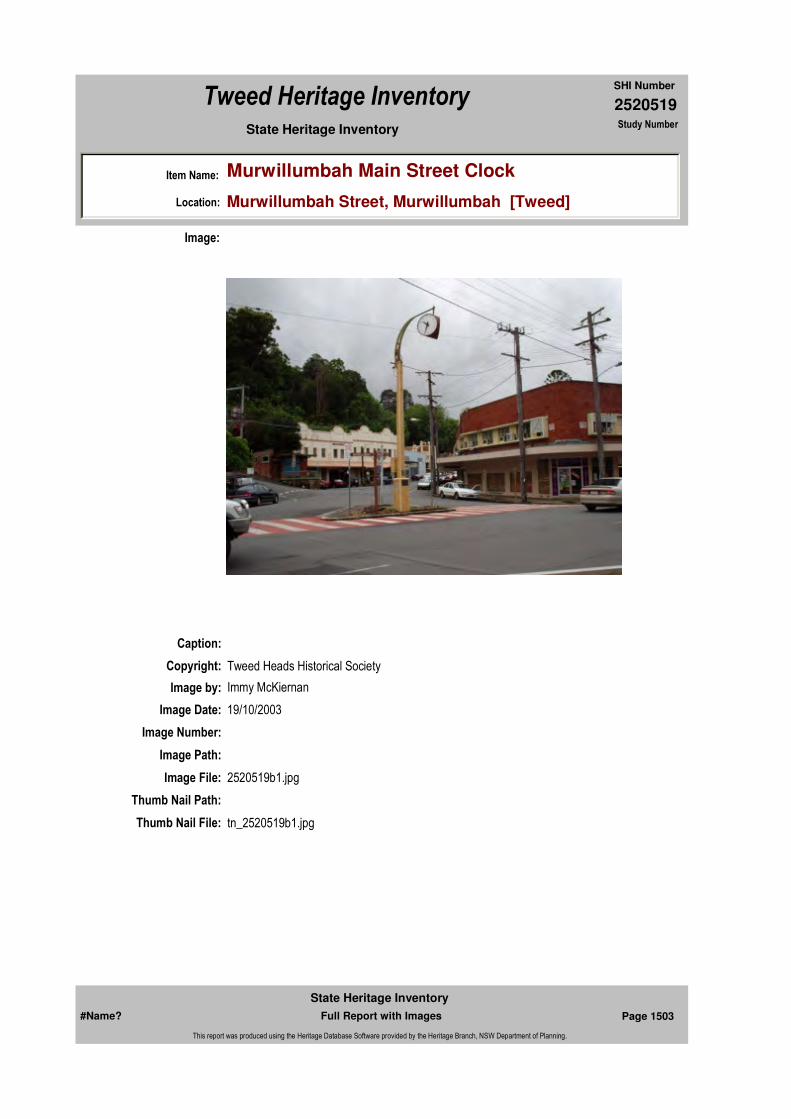
2520519
SHI Number
Tweed Heritage Inventory
Item Name: Murwillumbah Main Street Clock
Location: Murwillumbah Street, Murwillumbah [Tweed]
State Heritage Inventory Study Number
Caption:
Copyright: Tweed Heads Historical Society
Image:
Image by: Immy McKiernan
Image Date: 19/10/2003
Image Number:
Image Path:
Image File: 2520519b1.jpg
Thumb Nail Path:
Thumb Nail File: tn_2520519b1.jpg
#Name? Page 1503 Full Report with Images
State Heritage Inventory
This report was produced using the Heritage Database Software provided by the Heritage Branch, NSW Department of Planning.

2520519
SHI Number
Tweed Heritage Inventory
Item Name: Murwillumbah Main Street Clock
Location: Murwillumbah Street, Murwillumbah [Tweed]
State Heritage Inventory Study Number
Caption:
Copyright: Tweed Heads Historical Society
Image:
Image by: Immy McKiernan
Image Date: 22/03/2004
Image Number:
Image Path:
Image File: 2520519b2.jpg
Thumb Nail Path:
Thumb Nail File: tn_2520519b2.jpg
#Name? Page 1504 Full Report with Images
State Heritage Inventory
This report was produced using the Heritage Database Software provided by the Heritage Branch, NSW Department of Planning.

2520519
SHI Number
Tweed Heritage Inventory
Item Name: Murwillumbah Main Street Clock
Location: Murwillumbah Street, Murwillumbah [Tweed]
State Heritage Inventory Study Number
#Name? Page 1505 Full Report with Images
State Heritage Inventory
This report was produced using the Heritage Database Software provided by the Heritage Branch, NSW Department of Planning.

2520531
SHI Number
Tweed Heritage Inventory
Item Name: Steam Engine
Location: 2 Queensland Road, Murwillumbah [Tweed]
State Heritage Inventory Study Number
Current Use:
Former Uses:
Statement of
Significance:A rare surviving 1896 12 ton Robey steam engine retrieved from the forest and restored by volunteers for the Tweed River Museum/Tweed River Historical Society
Historical Notes or Provenance:
In 1996 the Tweed River Historical Society at Murwillumbah received a letter from The Tweed Shire Council asking if we were interested in an old steam engine on their property at Mt. Nullum. They had already received a letter from another organisation in Queensland asking if they could have it. However they would rather see it stay locally. So it was up to us!
On finding out its location about ten members drove as far as we could and then armed with brush hooks and food and a young local who knew the area we crossed Marion Roberts property and into the shire property where it was eventually found.
It was not actually found until we were a few yards away, because it was covered in thick lantana and trees 30 ft. high were growing between the rear wheels. It had no front wheels as they had been removed and that part of the engine rested on a huge log to make it more stable to drive many saws in a large sawmill owned by the T.C. Mclntyre.
The 12 ton Robey steam engine had arrived in Australia from England approximately 100 years ago. It was in Sydney for a while then to Brisbane and on to Killarney, Queensland where it slaved away until a team of bullocks pulled it to Mt. Nullum 60 odd years ago.
Locals who worked in the sawmill were Bob French, Noel Henry, Jim and Jack McIntyre, Bill McNeilly, Phil Lazenby and John Walsh. The mill cut banana cases and scantling for houses that were transported to Brisbane by Ted Radel and Col Evans.
Endorsed Significance:Assessed Significance: Local
Item Type: Movable / Collection Category: Forestry MachineryGroup: Forestry and Timber I
Admin Codes: Code 2: Code 3:
Curtilage/Boundary:
Owner: Private - Community Group
Other/Former Names:
Area/Group/Complex: Murwillumbah Main Street Urban Conservation Area Group ID: 25
Aboriginal Area:
Local Govt Area: Tweed
Planning: Northern
Historic Region: North Coast
Address: #Name?
Suburb / Nearest Town: #Name?
State: NSW
Parish: Murwillumbah
County: Rous
#Name? Page 1537 Full Report with Images
State Heritage Inventory
This report was produced using the Heritage Database Software provided by the Heritage Branch, NSW Department of Planning.
2520531
SHI Number
Tweed Heritage Inventory
Item Name: Steam Engine
Location: 2 Queensland Road, Murwillumbah [Tweed]
State Heritage Inventory Study Number
So there we sat and looked at this massive piece of rusty machinery. Was it worth the effort to get it to the Museum? Creeks had to be crossed, one with a bridge which would not take the weight - there were obstacles galore, front wheels to be found - years of work ahead, but the opportunity of getting another steam engine was remote, especially one this size so it was decided to give it a go!
After about eighteen months the job of removing the engine to the Museum was approaching. We had been held up by the weather, rain had swollen the creeks and we needed weeks of fine weather before attempting the job.
The Harding boys of Uki were our saviours, they provided their truck for transport, their sawmill machinery to make creek crossings, a road to the engine, make a loading ramp and pulled the engine on to the back of a truck - and transporting it to the Museum all for no cost, a magnificent gesture to us and for future generations to see this massive engine.
Tweed Shire Council provided the thick concrete pad next to the Museum to place the engine on, and Murwillumbah Rotary provided money towards its restoration.
So the day arrived for the move - everything had to be at the right place at the right time. Hardings had the steam engine aboard with their machinery without mishap, although the engine was a bit off balance with a heavy six foot flywheel on one side near the top of the engine, we held our breath once as the overloaded truck tipped sideways coming out of a creek crossing. The truck was also bogged once but the heavy machinery pulled it out.
As we could not go over a bridge in another paddock, Marion Roberts gave permission for the trucks and bulldozer to go through her place and at last with a sigh of relief we were on the bitumen. On arrival at the Museum the electricity men were there waiting to disconnect the power so that Hanna and Edmed's crane could work safely around the power lines as they were only about 12 ft. from where the steam engine was being unloaded. The log was even in place for the front of the engine to rest on. So the engine was at its future home at no cost - thanks to the many helpers and generous assistance by the firms and clubs involved.
It was now down to the nitty gritty, hours and hours of chipping rust off the boiler etc. We looked for a set of front wheels, we tried everywhere, far and wide, but nobody seemed to have a set of front wheels off a 12 ton Robey Steam Engine, except Charlie Bryant on his farm at Tygalgah under a heap of healthy lantana. Many thanks to Charlie!
Gradually over the years we wore the rust problem down, then putting on rust preventative and paint. We had a new smoke stack made and a new door on the smoke box, these parts being made by Toby Fletchers Engineering. Finally it was finished and this year an opportunity came our way for the unveiling of a Plaque to honour those involved - It was during the Centenary of the first Murwillumbah Municipal Council, approximately the same age as our steam engine. The honours were performed by Tweed Shire Mayor, Warren Polglase, on 26th.May 2002.
The main workers from the Museum on the steam engine were- Jack Knight, Les Edwards,
#Name? Page 1538 Full Report with Images
State Heritage Inventory
This report was produced using the Heritage Database Software provided by the Heritage Branch, NSW Department of Planning.
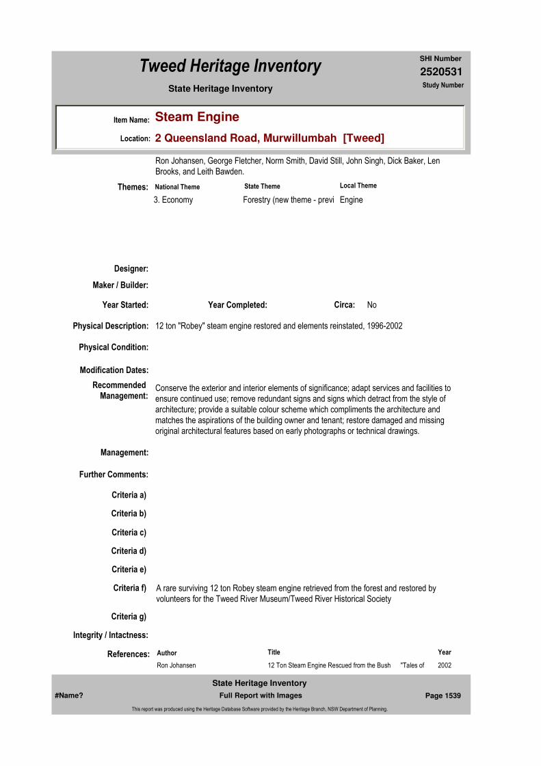
2520531
SHI Number
Tweed Heritage Inventory
Item Name: Steam Engine
Location: 2 Queensland Road, Murwillumbah [Tweed]
State Heritage Inventory Study Number
Ron Johansen, George Fletcher, Norm Smith, David Still, John Singh, Dick Baker, Len Brooks, and Leith Bawden.
Physical Description: 12 ton "Robey" steam engine restored and elements reinstated, 1996-2002
Physical Condition:
Modification Dates:
Designer:
Maker / Builder:
Year Started: Year Completed: Circa: No
Recommended
Management:Conserve the exterior and interior elements of significance; adapt services and facilities to ensure continued use; remove redundant signs and signs which detract from the style of architecture; provide a suitable colour scheme which compliments the architecture and matches the aspirations of the building owner and tenant; restore damaged and missing original architectural features based on early photographs or technical drawings.
References:
Further Comments:
Criteria a)
Criteria c)
Criteria d)
Criteria e)
Criteria g)
Criteria f) A rare surviving 12 ton Robey steam engine retrieved from the forest and restored by volunteers for the Tweed River Museum/Tweed River Historical Society
Integrity / Intactness:
Criteria b)
Themes:
Management:
Author Title Year
Ron Johansen 12 Ton Steam Engine Rescued from the Bush "Tales of 2002
National Theme State Theme Local Theme
3. Economy Forestry (new theme - previ Engine
#Name? Page 1539 Full Report with Images
State Heritage Inventory
This report was produced using the Heritage Database Software provided by the Heritage Branch, NSW Department of Planning.
2520531
SHI Number
Tweed Heritage Inventory
Item Name: Steam Engine
Location: 2 Queensland Road, Murwillumbah [Tweed]
State Heritage Inventory Study Number
Custom Field One:
Studies:
Listings:
Date Updated: 19/05/2004 Status: BasicDate First Entered: 10/05/2004Data Entry:
Custom Field Two:
Custom Field Three:
Custom Field Four:
Custom Field Five:
Custom Field Six:
Parcels:
Latitude: Longitude:
AMG Zone: Easting: Northing:
Map Name: Map Scale:
Spatial Accuracy:Location validity:
our Times" Vol 10
Author Title YearNumber
Tweed Shire Council Community-based Heritage Study 2003
#Name? Page 1540 Full Report with Images
State Heritage Inventory
This report was produced using the Heritage Database Software provided by the Heritage Branch, NSW Department of Planning.
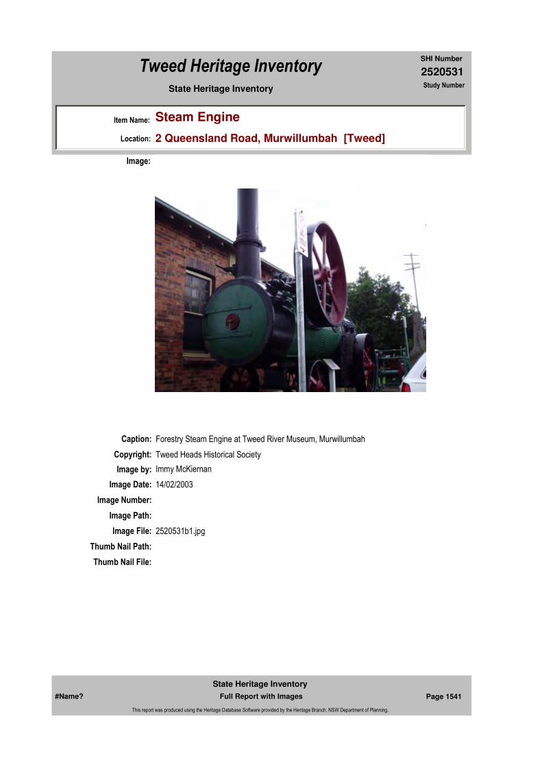
2520531
SHI Number
Tweed Heritage Inventory
Item Name: Steam Engine
Location: 2 Queensland Road, Murwillumbah [Tweed]
State Heritage Inventory Study Number
Caption: Forestry Steam Engine at Tweed River Museum, Murwillumbah
Copyright: Tweed Heads Historical Society
Image:
Image by: Immy McKiernan
Image Date: 14/02/2003
Image Number:
Image Path:
Image File: 2520531b1.jpg
Thumb Nail Path:
Thumb Nail File:
#Name? Page 1541 Full Report with Images
State Heritage Inventory
This report was produced using the Heritage Database Software provided by the Heritage Branch, NSW Department of Planning.
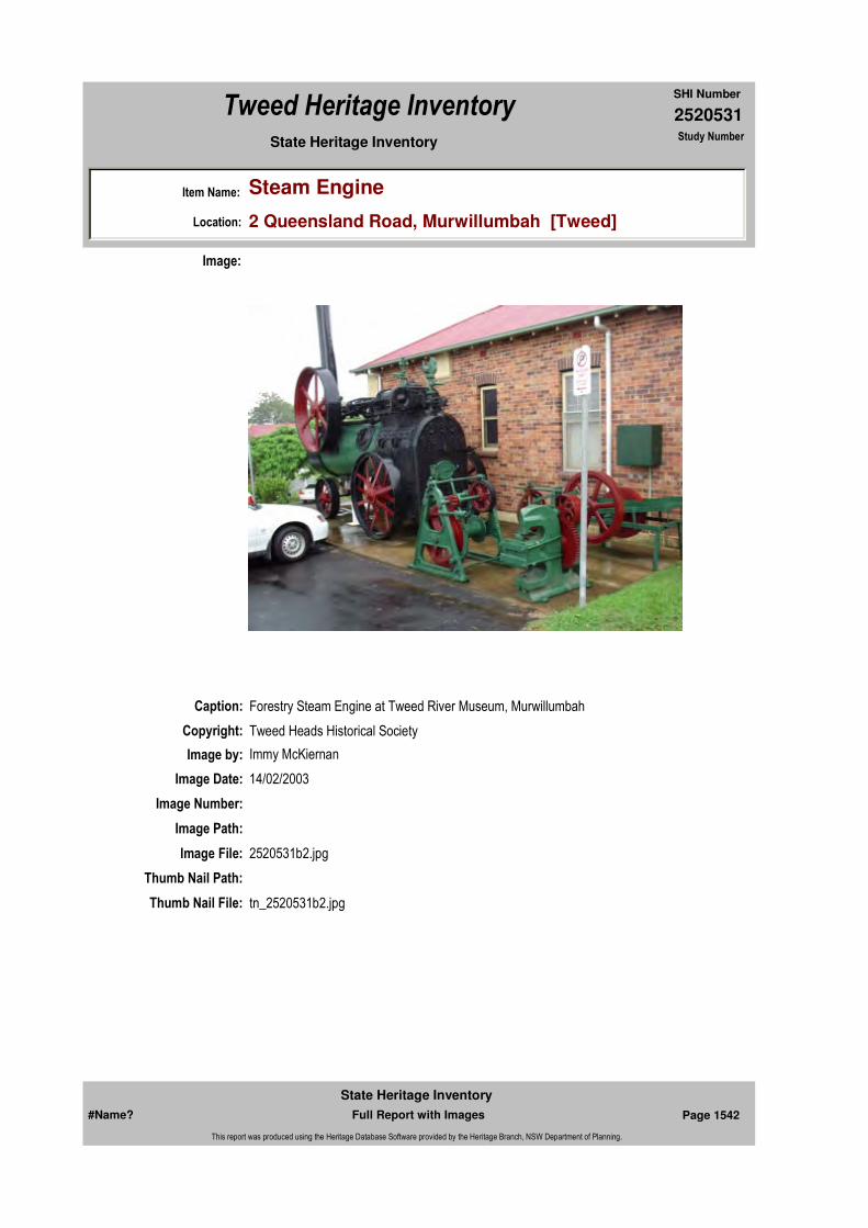
2520531
SHI Number
Tweed Heritage Inventory
Item Name: Steam Engine
Location: 2 Queensland Road, Murwillumbah [Tweed]
State Heritage Inventory Study Number
Caption: Forestry Steam Engine at Tweed River Museum, Murwillumbah
Copyright: Tweed Heads Historical Society
Image:
Image by: Immy McKiernan
Image Date: 14/02/2003
Image Number:
Image Path:
Image File: 2520531b2.jpg
Thumb Nail Path:
Thumb Nail File: tn_2520531b2.jpg
#Name? Page 1542 Full Report with Images
State Heritage Inventory
This report was produced using the Heritage Database Software provided by the Heritage Branch, NSW Department of Planning.

2520531
SHI Number
Tweed Heritage Inventory
Item Name: Steam Engine
Location: 2 Queensland Road, Murwillumbah [Tweed]
State Heritage Inventory Study Number
Caption: Forestry Steam Engine at Tweed River Museum, Murwillumbah
Copyright: Tweed Heads Historical Society
Image:
Image by: Immy McKiernan
Image Date: 14/02/2003
Image Number:
Image Path:
Image File: 2520531b3.jpg
Thumb Nail Path:
Thumb Nail File: tn_2520531b3.jpg
#Name? Page 1543 Full Report with Images
State Heritage Inventory
This report was produced using the Heritage Database Software provided by the Heritage Branch, NSW Department of Planning.

2520531
SHI Number
Tweed Heritage Inventory
Item Name: Steam Engine
Location: 2 Queensland Road, Murwillumbah [Tweed]
State Heritage Inventory Study Number
#Name? Page 1544 Full Report with Images
State Heritage Inventory
This report was produced using the Heritage Database Software provided by the Heritage Branch, NSW Department of Planning.

2520532
SHI Number
Tweed Heritage Inventory
Item Name: Uniting Church and Hall
Location: 2 - 4 Byangum Road, Murwillumbah [Tweed]
State Heritage Inventory Study Number
Current Use:
Former Uses:
Statement of
Significance:The Uniting Church is significant as part of the Murwillumbah CBD Conservation Area. The Carpenter Gothic facade contributes to the character of the conservation precinct. The Uniting Church has a strong association with the residents of Murwillumbah, which served the spiritual and cultural needs of the congregation over the years. The memorial is part of the cultural history of the Tweed Valley and has a special association with the community in which it is housed.
Historical Notes
or Provenance:At the evening service in the Methodist Church last Sunday, the handsome Honour Board of polished Silky oak, beautifully designed and chastely finished, containing the names of two score of soldier lads, was unveiled by Mrs. E. Warne, the mother of one of our returned men. The occasion was unique and will ever remain a memorable night in the history of Methodism on the Tweed River.
At half past 7 O'clock the church being crowded, the congregation rose to sing the Doxology, which was sung by many with full and thankful hearts, by others with sadness that patiently awaits the future gladness of re-union. Time honoured and appropriate hymns suitable to such an occasion rose in a great volume of praise from a reverent congregation, the choir contributing an anthem "Onward Christian Soldier". The lesson read was the 91st Psalm, after which Mrs Warne in a few well chosen words unveiled the Board to the singing of the National Anthem, which immediately preceded the unveiling, with its inborn companion verse following "God Save Our Splendid Men", coupled with a prayer f intercession for the heroes and the homes from which they went.
The address which followed was based on Paul's farewell letter to youthful timothy (2
Endorsed Significance:Assessed Significance: Local
Item Type: Built Category: ChurchGroup: Religion
Admin Codes: Code 2: Code 3:
Curtilage/Boundary:
Owner: Religious Organisation
Other/Former Names:
Area/Group/Complex: Murwillumbah Main Street Urban Conservation Area Group ID: 30
Aboriginal Area:
Local Govt Area: Tweed
Planning: Northern
Historic Region: North Coast
Address: #Name?
Suburb / Nearest Town: #Name?
State: NSW
Parish:
County:
#Name? Page 1545 Full Report with Images
State Heritage Inventory
This report was produced using the Heritage Database Software provided by the Heritage Branch, NSW Department of Planning.

2520532
SHI Number
Tweed Heritage Inventory
Item Name: Uniting Church and Hall
Location: 2 - 4 Byangum Road, Murwillumbah [Tweed]
State Heritage Inventory Study Number
Timothy 2v.3) "Take thy part in suffering hardship as a good soldier of Jesus Christ." The preacher said these words were appropriate to the occasion. It was a soldier's exhortation to a young man engaged in the same great warfare as himself. Paul had fought a good fight and experienced the hardships and the suffering of his conflict with the powers of evil. Every noble cause is attended and bound up with suffering both physical and mental. Paul had experienced both, and ere he passed away, for he was nigh to death, he exhorted Timothy for constancy, fidelity and the suffering of hardship. In applying the words, the preacher said, "Every lad whose name was on yonder war Board had suffered; some were spent and broken, was weary and fatigued; others were maimed and disfigured; they carried in their bodies the marks of the Empire's Cross. Some had laid down their lives - in the picturesque language of the camp "had gone west." All had suffered.
More than 40 months ago the Kings of the earth and their princes had taken counsel and had plunged the world into.
Physical Description: Carpenter Gothic. Minimal decoration except for pointed arch motif to doors and windows throughout. Weather board clad at rear. Rough cast wall finish to front of church building. Asymmetrical gables to street front. Steep gable roof. Projecting gables.
The original small church building is immediately behind the current church to the south.
Honour Rolls - Twin inscribed marble honour rolls
Physical Condition:
Modification Dates:
Designer:
Maker / Builder:
Year Started: Year Completed: Circa: No
Recommended
Management:Conserve the exterior and interior elements of significance; adapt services and facilities to ensure continued use; remove redundant signs and signs which detract from the style of architecture; provide a suitable colour scheme which compliments the architecture and matches the aspirations of the building owner and tenant; restore damaged and missing original architectural features based on early photographs or technical drawings.
Themes:
Management:
National Theme State Theme Local Theme
8. Culture Religion Church
#Name? Page 1546 Full Report with Images
State Heritage Inventory
This report was produced using the Heritage Database Software provided by the Heritage Branch, NSW Department of Planning.
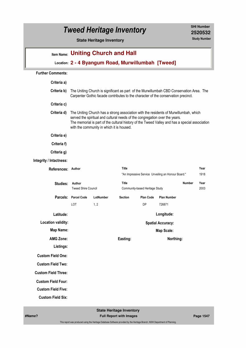
2520532
SHI Number
Tweed Heritage Inventory
Item Name: Uniting Church and Hall
Location: 2 - 4 Byangum Road, Murwillumbah [Tweed]
State Heritage Inventory Study Number
Custom Field One:
References:
Studies:
Listings:
Further Comments:
Criteria a)
Criteria c)
Criteria d) The Uniting Church has a strong association with the residents of Murwillumbah, which served the spiritual and cultural needs of the congregation over the years.The memorial is part of the cultural history of the Tweed Valley and has a special association with the community in which it is housed.
Criteria e)
Criteria g)
Criteria f)
Integrity / Intactness:
Custom Field Two:
Custom Field Three:
Custom Field Four:
Custom Field Five:
Custom Field Six:
Criteria b) The Uniting Church is significant as part of the Murwillumbah CBD Conservation Area. The Carpenter Gothic facade contributes to the character of the conservation precinct.
Parcels:
Latitude: Longitude:
AMG Zone: Easting: Northing:
Map Name: Map Scale:
Spatial Accuracy:Location validity:
Author Title Year
"An Impressive Service Unveiling an Honour Board." 1918
Author Title YearNumber
Tweed Shire Council Community-based Heritage Study 2003
Parcel Code LotNumber Section Plan Code Plan Number
LOT 1, 2 DP 726871
#Name? Page 1547 Full Report with Images
State Heritage Inventory
This report was produced using the Heritage Database Software provided by the Heritage Branch, NSW Department of Planning.
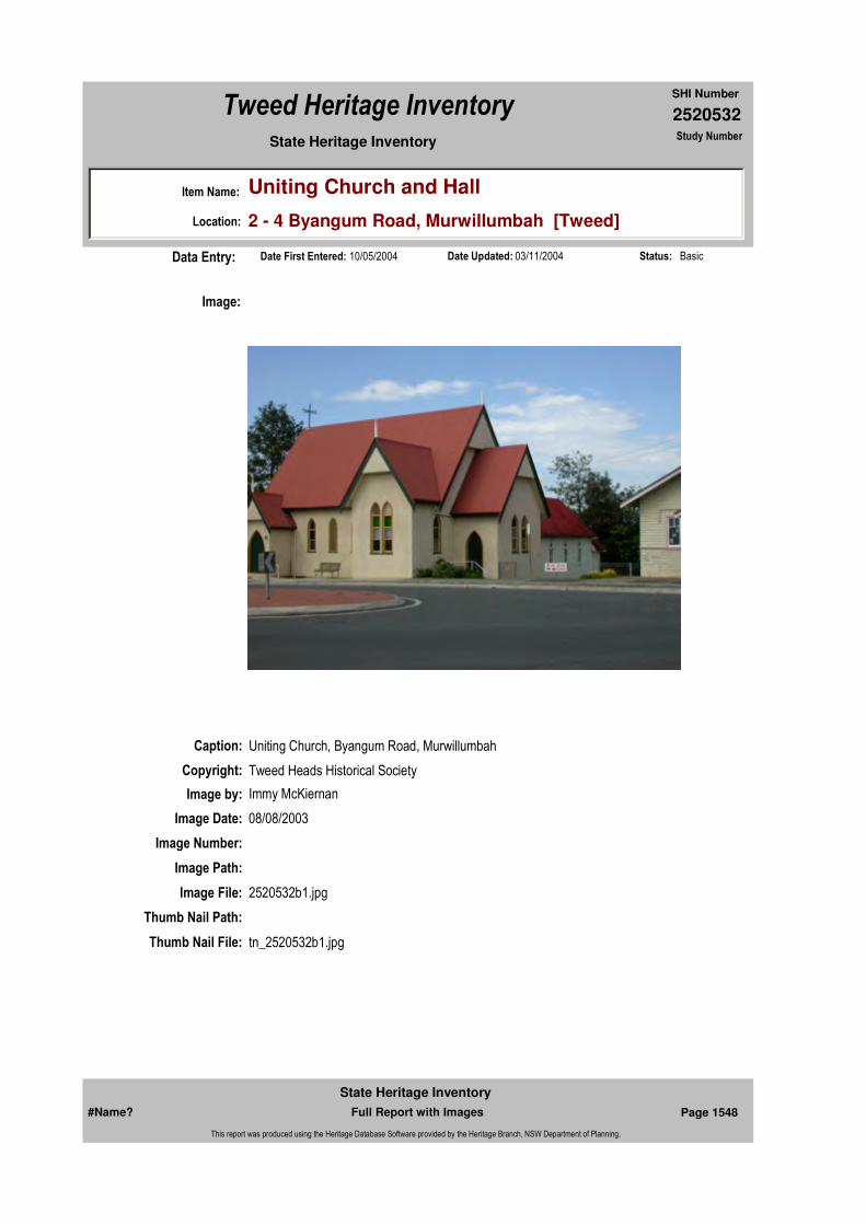
2520532
SHI Number
Tweed Heritage Inventory
Item Name: Uniting Church and Hall
Location: 2 - 4 Byangum Road, Murwillumbah [Tweed]
State Heritage Inventory Study Number
Date Updated: 03/11/2004 Status: BasicDate First Entered: 10/05/2004Data Entry:
Caption: Uniting Church, Byangum Road, Murwillumbah
Copyright: Tweed Heads Historical Society
Image:
Image by: Immy McKiernan
Image Date: 08/08/2003
Image Number:
Image Path:
Image File: 2520532b1.jpg
Thumb Nail Path:
Thumb Nail File: tn_2520532b1.jpg
#Name? Page 1548 Full Report with Images
State Heritage Inventory
This report was produced using the Heritage Database Software provided by the Heritage Branch, NSW Department of Planning.

2520532
SHI Number
Tweed Heritage Inventory
Item Name: Uniting Church and Hall
Location: 2 - 4 Byangum Road, Murwillumbah [Tweed]
State Heritage Inventory Study Number
Caption: Uniting Church, Byangum Road, Murwillumbah
Copyright: Tweed Heads Historical Society
Image:
Image by: Immy McKiernan
Image Date: 08/08/2003
Image Number:
Image Path:
Image File: 2520532b2.jpg
Thumb Nail Path:
Thumb Nail File: tn_2520532b2.jpg
#Name? Page 1549 Full Report with Images
State Heritage Inventory
This report was produced using the Heritage Database Software provided by the Heritage Branch, NSW Department of Planning.

2520532
SHI Number
Tweed Heritage Inventory
Item Name: Uniting Church and Hall
Location: 2 - 4 Byangum Road, Murwillumbah [Tweed]
State Heritage Inventory Study Number
Caption: Uniting Church, Byangum Road, Murwillumbah
Copyright: Tweed Heads Historical Society
Image:
Image by: Immy McKiernan
Image Date: 08/08/2003
Image Number:
Image Path:
Image File: 2520532b3.jpg
Thumb Nail Path:
Thumb Nail File: tn_2520532b3.jpg
#Name? Page 1550 Full Report with Images
State Heritage Inventory
This report was produced using the Heritage Database Software provided by the Heritage Branch, NSW Department of Planning.
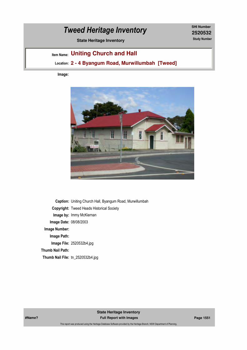
2520532
SHI Number
Tweed Heritage Inventory
Item Name: Uniting Church and Hall
Location: 2 - 4 Byangum Road, Murwillumbah [Tweed]
State Heritage Inventory Study Number
Caption: Uniting Church Hall, Byangum Road, Murwillumbah
Copyright: Tweed Heads Historical Society
Image:
Image by: Immy McKiernan
Image Date: 08/08/2003
Image Number:
Image Path:
Image File: 2520532b4.jpg
Thumb Nail Path:
Thumb Nail File: tn_2520532b4.jpg
#Name? Page 1551 Full Report with Images
State Heritage Inventory
This report was produced using the Heritage Database Software provided by the Heritage Branch, NSW Department of Planning.

2520532
SHI Number
Tweed Heritage Inventory
Item Name: Uniting Church and Hall
Location: 2 - 4 Byangum Road, Murwillumbah [Tweed]
State Heritage Inventory Study Number
Caption: Uniting Church, Byangum Road, Murwillumbah, rear.
Copyright: Tweed Heads Historical Society
Image:
Image by: Immy McKiernan
Image Date: 08/08/2003
Image Number:
Image Path:
Image File: 2520532b5.jpg
Thumb Nail Path:
Thumb Nail File: tn_2520532b5.jpg
#Name? Page 1552 Full Report with Images
State Heritage Inventory
This report was produced using the Heritage Database Software provided by the Heritage Branch, NSW Department of Planning.
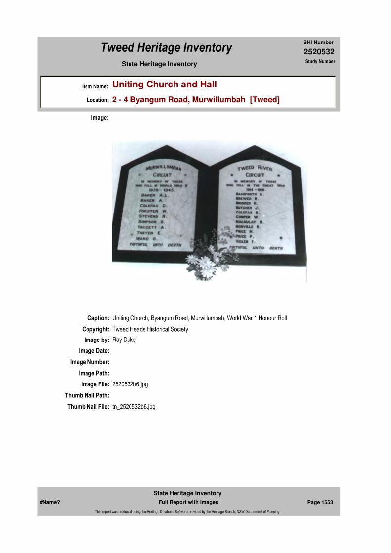
2520532
SHI Number
Tweed Heritage Inventory
Item Name: Uniting Church and Hall
Location: 2 - 4 Byangum Road, Murwillumbah [Tweed]
State Heritage Inventory Study Number
Caption: Uniting Church, Byangum Road, Murwillumbah, World War 1 Honour Roll
Copyright: Tweed Heads Historical Society
Image:
Image by: Ray Duke
Image Date:
Image Number:
Image Path:
Image File: 2520532b6.jpg
Thumb Nail Path:
Thumb Nail File: tn_2520532b6.jpg
#Name? Page 1553 Full Report with Images
State Heritage Inventory
This report was produced using the Heritage Database Software provided by the Heritage Branch, NSW Department of Planning.

2520532
SHI Number
Tweed Heritage Inventory
Item Name: Uniting Church and Hall
Location: 2 - 4 Byangum Road, Murwillumbah [Tweed]
State Heritage Inventory Study Number
#Name? Page 1554 Full Report with Images
State Heritage Inventory
This report was produced using the Heritage Database Software provided by the Heritage Branch, NSW Department of Planning.
2520541
SHI Number
Tweed Heritage Inventory
Item Name: Westpac Bank
Location: 116 Murwillumbah Street, Murwillumbah [Tweed]
State Heritage Inventory Study Number
Current Use:
Former Uses:
Statement of
Significance:This building is significant as part of the Murwillumbah CBD Conservation Area. The facade contributes to the character of the conservation precinct.
Historical Notes or Provenance:
In 1900 the Board of the Bank of NSW approved the opening of a branch in Murwillumbah. The premises were leased from William Wardrop on the corner of Queen and Alice Street and had previously been occupied by the Australian Joint Stock Bank. In 1902 land was bought on the corner of Murwillumbah and Brisbane Streets and in 1903 a tender by John Doyle for 2407 pounds was accepted. This building was destroyed in the fire of 1907 and replaced in1908at a cost of 7,627 pounds. This was a single story brick building with a residence attached.
In 1957, following yet another flood which had entered the building to a height of 6ft (2m.),inundating records and even entering the strong room, the present bank was constructed. Flood prevention included pile foundations, high ground floor with detachable flood gates at the main entrance steps and a mezzanine floor to house records and office equipment at times of peak flooding.
In 1978 the bank was the scene of Australia's biggest bank robbery. Thieves had entered through the back door and used a diamond drill to enter the strong room and remove $1.7million. which was intended to fill the pay packets of government employees. The thieves had jammed the dials and tumblers and it took nine hours for council workers with jackhammers to gain access and to discover the extent of the loss.
In 1982 the Commercial Bank of Australia merged with the Bank of NSW which changed its
Endorsed Significance:Assessed Significance: Local
Item Type: Built Category: BankGroup: Commercial
Admin Codes: Code 2: Code 3:
Curtilage/Boundary:
Owner: Private - Corporate
Other/Former Names:
Area/Group/Complex: Murwillumbah Main Street Urban Conservation Area Group ID: 39
Aboriginal Area:
Local Govt Area: Tweed
Planning: Northern
Historic Region: North Coast
Address: #Name?
Suburb / Nearest Town: #Name?
State: NSW
Parish: Murwillumbah
County: Rous
#Name? Page 1575 Full Report with Images
State Heritage Inventory
This report was produced using the Heritage Database Software provided by the Heritage Branch, NSW Department of Planning.

2520541
SHI Number
Tweed Heritage Inventory
Item Name: Westpac Bank
Location: 116 Murwillumbah Street, Murwillumbah [Tweed]
State Heritage Inventory Study Number
name to Westpac Banking Corporation.
Physical Description: A renovated building with vertical windows (classic origins), a symmetrical facade and an emphatic portal/entry.
Physical Condition:
Modification Dates:
Designer:
Maker / Builder:
Year Started: Year Completed: Circa: No
Recommended
Management:Conserve the exterior and interior elements of significance; adapt services and facilities to ensure continued use; remove redundant signs and signs which detract from the style of architecture; provide a suitable colour scheme which compliments the architecture and matches the aspirations of the building owner and tenant; restore damaged and missing original architectural features based on early photographs or technical drawings.
References:
Further Comments:
Criteria a)
Criteria c)
Criteria d)
Criteria e)
Criteria g)
Criteria f)
Integrity / Intactness:
Criteria b) This building is significant as part of the Murwillumbah CBD Conservation Area. The facade contributes to the character of the conservation precinct.
Themes:
Management:
National Theme State Theme Local Theme
3. Economy Commerce Bank
#Name? Page 1576 Full Report with Images
State Heritage Inventory
This report was produced using the Heritage Database Software provided by the Heritage Branch, NSW Department of Planning.
2520541
SHI Number
Tweed Heritage Inventory
Item Name: Westpac Bank
Location: 116 Murwillumbah Street, Murwillumbah [Tweed]
State Heritage Inventory Study Number
Custom Field One:
Studies:
Listings:
Date Updated: 17/05/2004 Status: BasicDate First Entered: 10/05/2004Data Entry:
Custom Field Two:
Custom Field Three:
Custom Field Four:
Custom Field Five:
Custom Field Six:
Parcels:
Latitude: Longitude:
AMG Zone: Easting: Northing:
Map Name: Map Scale:
Spatial Accuracy:Location validity:
Author Title YearNumber
Tweed Shire Council Community-based Heritage Study 2003
Parcel Code LotNumber Section Plan Code Plan Number
LOT 1A DP 404253
#Name? Page 1577 Full Report with Images
State Heritage Inventory
This report was produced using the Heritage Database Software provided by the Heritage Branch, NSW Department of Planning.
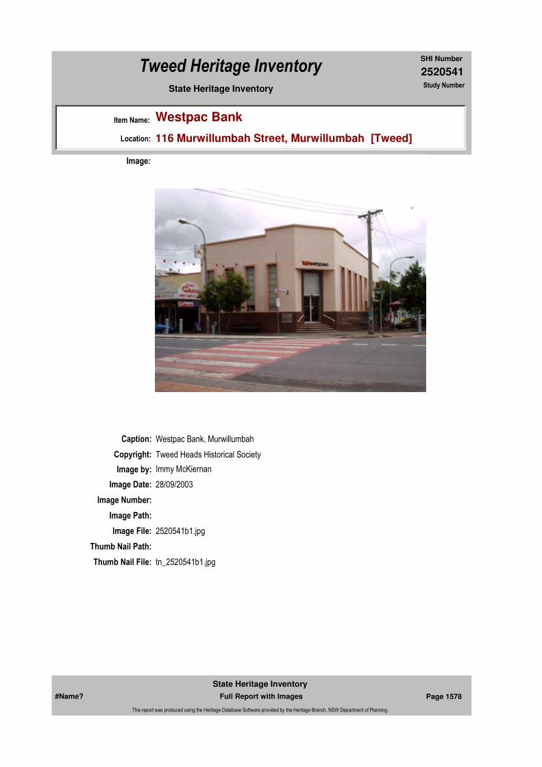
2520541
SHI Number
Tweed Heritage Inventory
Item Name: Westpac Bank
Location: 116 Murwillumbah Street, Murwillumbah [Tweed]
State Heritage Inventory Study Number
Caption: Westpac Bank, Murwillumbah
Copyright: Tweed Heads Historical Society
Image:
Image by: Immy McKiernan
Image Date: 28/09/2003
Image Number:
Image Path:
Image File: 2520541b1.jpg
Thumb Nail Path:
Thumb Nail File: tn_2520541b1.jpg
#Name? Page 1578 Full Report with Images
State Heritage Inventory
This report was produced using the Heritage Database Software provided by the Heritage Branch, NSW Department of Planning.
2520541
SHI Number
Tweed Heritage Inventory
Item Name: Westpac Bank
Location: 116 Murwillumbah Street, Murwillumbah [Tweed]
State Heritage Inventory Study Number
#Name? Page 1579 Full Report with Images
State Heritage Inventory
This report was produced using the Heritage Database Software provided by the Heritage Branch, NSW Department of Planning.
2520568
SHI Number
Tweed Heritage Inventory
Item Name: Hartigan's Hill Conservation Area
Location: Eyles Avenue, Murwillumbah [Tweed]
State Heritage Inventory Study Number
Current Use:
Former Uses:
Statement of Significance:
The area of Hartigan's Hill Conservation Area provides a good representative mix of dwellings built in Murwillumbah from the late 19th century to the mid 20th century. Eyles Avenue stands parallel with the Main Street of Murwillumbah in the mix of styles and quality, thereby providing a timeline of development for a north coast country town with a rich timber and dairy past.
Historical Notes or Provenance:
Designer:
Endorsed Significance:Assessed Significance: Local
Item Type: Complex / Group Category: Other - Residential BuiGroup: Residential buildings (
Admin Codes: Code 2: Code 3:
Curtilage/Boundary:
Owner: Multiple Owners
Other/Former Names:
Area/Group/Complex: Hartigan's Hill Conservation Area Group ID:
Themes:
Aboriginal Area:
Local Govt Area: Tweed
Planning: Northern
Historic Region: North Coast
Address: #Name?
Suburb / Nearest Town: #Name?
State: NSW
Parish: Murwillumbah
County: Rous
Local Govt Area: Tweed
Planning: Northern
Historic Region: North Coast
Address: #Name?
Suburb / Nearest Town: #Name?
State: NSW
Parish: Murwillumbah
County: Rous
National Theme State Theme Local Theme
4. Settlement Towns, suburbs and village (none)
#Name? Page 1713 Full Report with Images
State Heritage Inventory
This report was produced using the Heritage Database Software provided by the Heritage Branch, NSW Department of Planning.
2520568
SHI Number
Tweed Heritage Inventory
Item Name: Hartigan's Hill Conservation Area
Location: Eyles Avenue, Murwillumbah [Tweed]
State Heritage Inventory Study Number
Physical Description: Many of the buildings show a north coast vernacular borrowing from a number of styles. The area includes buildings with Italianate, federation filigree and bungalow features, from the late Victorian, Edwardian, and Federation periods. Humble workers dwellings stand beside houses of the middle class in a country town setting. Also within the area are houses of the interwar and post-war period include Georgian Revival, Bungalow and internationalist styles.
The housing of the conservation area shows a stronger use of timber and iron than their southern counterparts of the same periods and styles with an obvious influence from the Queensland house. There is also a number of brick and tile houses giving the street a mix of construction materials not generally found in Queensland or in the southern part of New South Wales.
Within the area is a state primary school with buildings spanning the last century and a small timber store now used as a book shop. Also included are the separately nominated residences of "Goldsborough" at 4 Eyles, 1 Eyles, 13 Eyles and 15 Eyles Avenue.
Significant items in this precinct have been nominated individually.
Physical Condition:
Modification Dates:
Maker / Builder:
Year Started: Year Completed: Circa: No
Recommended Management:
This area to be included in a Conservation Management Plan
Further Comments:
Criteria a)
Criteria c) The area of Hartigan's Hill Conservation Area provides a good representative mix of dwellings built in Murwillumbah from the late 19th century to the mid 20th century. Eyles Avenue stands parallel with the Main Street of Murwillumbah in the mix of styles and quality, thereby providing a timeline of development for a north coast country town with a rich timber and dairy past.
Criteria d)
Criteria e)
Criteria g)
Criteria f)
Criteria b)
Management:
#Name? Page 1714 Full Report with Images
State Heritage Inventory
This report was produced using the Heritage Database Software provided by the Heritage Branch, NSW Department of Planning.

2520568
SHI Number
Tweed Heritage Inventory
Item Name: Hartigan's Hill Conservation Area
Location: Eyles Avenue, Murwillumbah [Tweed]
State Heritage Inventory Study Number
Custom Field One:
References:
Studies:
Listings:
Date Updated: 18/05/2004 Status: BasicDate First Entered: 10/05/2004Data Entry:
Integrity / Intactness:
Custom Field Two:
Custom Field Three:
Custom Field Four:
Custom Field Five:
Custom Field Six:
Parcels:
Latitude: Longitude:
AMG Zone: Easting: Northing:
Map Name: Map Scale:
Spatial Accuracy:Location validity:
Author Title YearNumber
Tweed Shire Council Community-based Heritage Study 2003
#Name? Page 1715 Full Report with Images
State Heritage Inventory
This report was produced using the Heritage Database Software provided by the Heritage Branch, NSW Department of Planning.

2520569
SHI Number
Tweed Heritage Inventory
Item Name: Residence
Location: 13 Eyles Avenue, Murwillumbah [Tweed]
State Heritage Inventory Study Number
Current Use:
Former Uses:
Statement of
Significance:This residence is a component of the Hartigan's Hill Conservation Area, with an historical association to the Anthony Family.
Historical Notes or Provenance:
Built for H.L Anthony, Federal Member for Richmond 1937-57, the house was his family home. Mr. Anthony was Postmaster General and Minister for Civil Aviation. After his death, he was succeeded by his son John Douglas Anthony who was leader of the Country Party and Deputy Prime Minister. His grandson Larry Anthony now holds the seat and is Minister for Commonwealth Department of Family Services.
Physical Description: Brick with tiled roof; lead light bay windows at front with rendered ledges and decorative brick overhang; wide entrance at front and side entrance; wide eaves; red cedar joinery.
Designer:
Maker / Builder:
Year Started: 1937 Year Completed: Circa: No
Endorsed Significance:Assessed Significance: Local
Item Type: Built Category: Other - Residential BuiGroup: Residential buildings (
Admin Codes: Code 2: Code 3:
Curtilage/Boundary:
Owner: Private - Individual
Other/Former Names:
Area/Group/Complex: Hartigan's Hill Conservation Area Group ID:
Themes:
Aboriginal Area:
Local Govt Area: Tweed
Planning: Northern
Historic Region: North Coast
Address: #Name?
Suburb / Nearest Town: #Name?
State: NSW
Parish: Murwillumbah
County: Rous
National Theme State Theme Local Theme
4. Settlement Accommodation (Housing) Housing
#Name? Page 1716 Full Report with Images
State Heritage Inventory
This report was produced using the Heritage Database Software provided by the Heritage Branch, NSW Department of Planning.

2520569
SHI Number
Tweed Heritage Inventory
Item Name: Residence
Location: 13 Eyles Avenue, Murwillumbah [Tweed]
State Heritage Inventory Study Number
Rendered brick fence with painted pipe and wire net insets. Early modern.
Physical Condition:
Modification Dates: Aluminium sliding wondows on LHS. Recently stucco rendered.
Custom Field One:
Recommended Management:
References:
Studies:
Listings:
Further Comments:
Criteria a) Associated with the Anthony Family.
Criteria c)
Criteria d)
Criteria e)
Criteria g)
Criteria f)
Integrity / Intactness:
Custom Field Two:
Custom Field Three:
Custom Field Four:
Custom Field Five:
Criteria b) This residence is a component of the Hartigan's Hill Conservation Area.
Parcels:
Latitude: Longitude:
AMG Zone: Easting: Northing:
Map Name: Map Scale:
Spatial Accuracy:Location validity:
Management:
Author Title YearNumber
Tweed Shire Council Community-based Heritage Study 2003
#Name? Page 1717 Full Report with Images
State Heritage Inventory
This report was produced using the Heritage Database Software provided by the Heritage Branch, NSW Department of Planning.
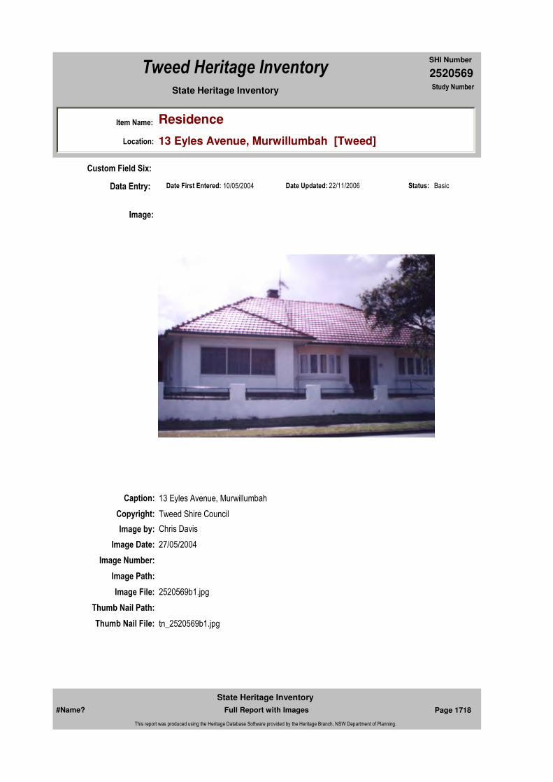
2520569
SHI Number
Tweed Heritage Inventory
Item Name: Residence
Location: 13 Eyles Avenue, Murwillumbah [Tweed]
State Heritage Inventory Study Number
Date Updated: 22/11/2006 Status: BasicDate First Entered: 10/05/2004Data Entry:
Custom Field Six:
Caption: 13 Eyles Avenue, Murwillumbah
Copyright: Tweed Shire Council
Image:
Image by: Chris Davis
Image Date: 27/05/2004
Image Number:
Image Path:
Image File: 2520569b1.jpg
Thumb Nail Path:
Thumb Nail File: tn_2520569b1.jpg
#Name? Page 1718 Full Report with Images
State Heritage Inventory
This report was produced using the Heritage Database Software provided by the Heritage Branch, NSW Department of Planning.
2520569
SHI Number
Tweed Heritage Inventory
Item Name: Residence
Location: 13 Eyles Avenue, Murwillumbah [Tweed]
State Heritage Inventory Study Number
#Name? Page 1719 Full Report with Images
State Heritage Inventory
This report was produced using the Heritage Database Software provided by the Heritage Branch, NSW Department of Planning.

2520570
SHI Number
Tweed Heritage Inventory
Item Name: Sacred Park Memorial
Location: Banner Street, Murwillumbah [Tweed]
State Heritage Inventory Study Number
Current Use:
Former Uses:
Statement of
Significance:This item has high social significance as it is the 1970's replacement monument for the original graveyard of the 2,500 pioneers of the district.
Historical Notes or Provenance:
Physical Description: A memorial with six individual brick walls form the shape of a hexagon covered with a tiled roof in parkland setting. Mounted to each wall are bronze plaques listing, in alphabetical order, the names and date of death of known persons interred in the old Cemetery. The condition of the memorial is good, although the names on the plaques are starting to deteriorate.
Designer:
Maker / Builder:
Year Started: Year Completed: 1979 Circa: No
Endorsed Significance:Assessed Significance: Local
Item Type: Complex / Group Category: Cemetery/Graveyard/Group: Cemeteries and Buria
Admin Codes: Code 2: Code 3:
Curtilage/Boundary:
Owner: Local Government
Other/Former Names: Murwillumbah General Cemetery
Area/Group/Complex: Group ID:
Themes:
Aboriginal Area:
Local Govt Area: Tweed
Planning: Northern
Historic Region: North Coast
Address: #Name?
Suburb / Nearest Town: #Name?
State: NSW
Parish: Murwillumbah
County: Rous
National Theme State Theme Local Theme
9. Phases of Life Birth and Death Cemeteries
#Name? Page 1720 Full Report with Images
State Heritage Inventory
This report was produced using the Heritage Database Software provided by the Heritage Branch, NSW Department of Planning.

2520570
SHI Number
Tweed Heritage Inventory
Item Name: Sacred Park Memorial
Location: Banner Street, Murwillumbah [Tweed]
State Heritage Inventory Study Number
Physical Condition:
Modification Dates:
Custom Field One:
Recommended
Management:
References:
Studies:
Listings:
Further Comments:
Criteria a)
Criteria c)
Criteria d) This item has high social significance as it is the 1970's replacement monument for the original graveyard of the 2,500 pioneers of the district.
Criteria e)
Criteria g)
Criteria f)
Integrity / Intactness:
Custom Field Two:
Criteria b)
Parcels:
Latitude: Longitude:
AMG Zone: Easting: Northing:
Map Name: Map Scale:
Spatial Accuracy:Location validity:
Management:
Author Title YearNumber
Tweed Shire Council Community-based Heritage Study 2003
Parcel Code LotNumber Section Plan Code Plan Number
LOT 4 14 DP 758739
LOT 1 DP 758739
LOT 7012 DP 92892
#Name? Page 1721 Full Report with Images
State Heritage Inventory
This report was produced using the Heritage Database Software provided by the Heritage Branch, NSW Department of Planning.

2520570
SHI Number
Tweed Heritage Inventory
Item Name: Sacred Park Memorial
Location: Banner Street, Murwillumbah [Tweed]
State Heritage Inventory Study Number
Date Updated: 18/05/2004 Status: BasicDate First Entered: 10/05/2004Data Entry:
Custom Field Three:
Custom Field Four:
Custom Field Five:
Custom Field Six:
Caption:
Copyright: Tweed Heads Historical Society
Image:
Image by: Immy McKiernan
Image Date: 20/07/2003
Image Number:
Image Path:
Image File: 2520570b1.jpg
Thumb Nail Path:
Thumb Nail File: tn_2520570b1.jpg
#Name? Page 1722 Full Report with Images
State Heritage Inventory
This report was produced using the Heritage Database Software provided by the Heritage Branch, NSW Department of Planning.

2520570
SHI Number
Tweed Heritage Inventory
Item Name: Sacred Park Memorial
Location: Banner Street, Murwillumbah [Tweed]
State Heritage Inventory Study Number
#Name? Page 1723 Full Report with Images
State Heritage Inventory
This report was produced using the Heritage Database Software provided by the Heritage Branch, NSW Department of Planning.

2520570
SHI Number
Tweed Heritage Inventory
Item Name: Sacred Park Memorial
Location: Banner Street, Murwillumbah [Tweed]
State Heritage Inventory Study Number
Caption:
Copyright: Tweed Heads Historical Society
Image:
Image by: Immy McKiernan
Image Date: 20/07/2003
Image Number:
Image Path:
Image File: 2520570b2.jpg
Thumb Nail Path:
Thumb Nail File: tn_2520570b2.jpg
#Name? Page 1724 Full Report with Images
State Heritage Inventory
This report was produced using the Heritage Database Software provided by the Heritage Branch, NSW Department of Planning.

2520570
SHI Number
Tweed Heritage Inventory
Item Name: Sacred Park Memorial
Location: Banner Street, Murwillumbah [Tweed]
State Heritage Inventory Study Number
Caption:
Copyright: Tweed Heads Historical Society
Image:
Image by: Immy McKiernan
Image Date: 20/07/2003
Image Number:
Image Path:
Image File: 2520570b3.jpg
Thumb Nail Path:
Thumb Nail File: tn_2520570b3.jpg
#Name? Page 1725 Full Report with Images
State Heritage Inventory
This report was produced using the Heritage Database Software provided by the Heritage Branch, NSW Department of Planning.
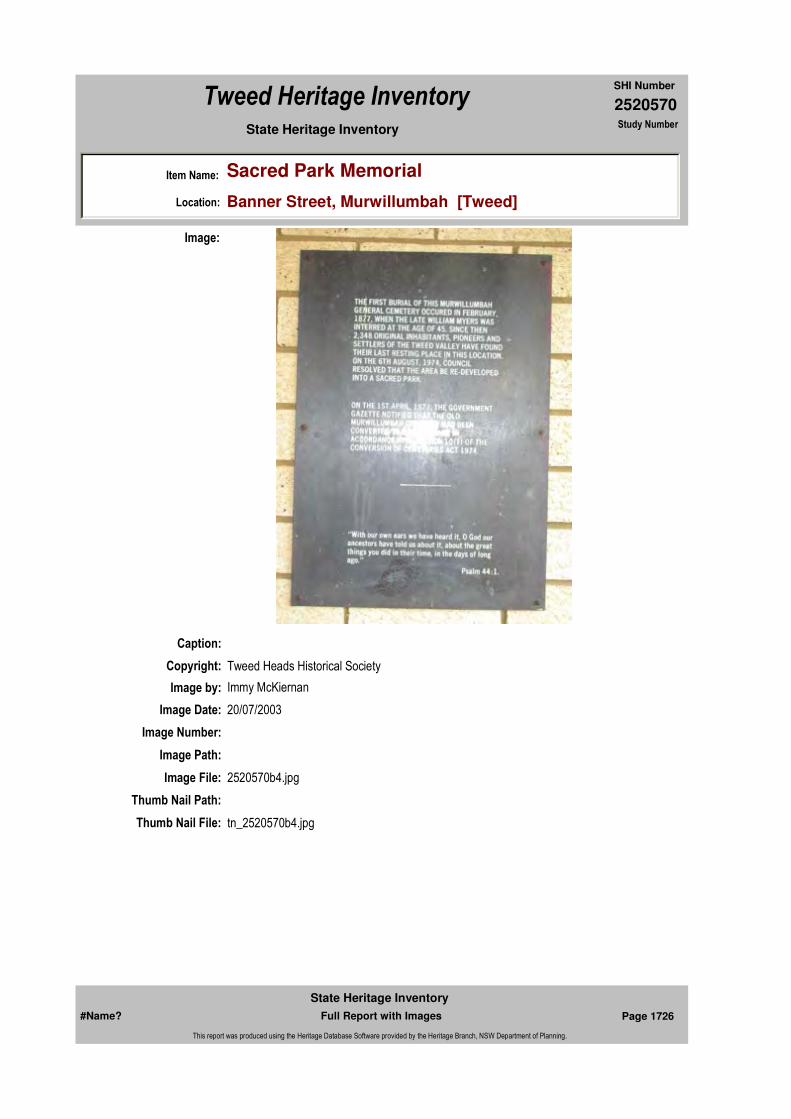
2520570
SHI Number
Tweed Heritage Inventory
Item Name: Sacred Park Memorial
Location: Banner Street, Murwillumbah [Tweed]
State Heritage Inventory Study Number
Caption:
Copyright: Tweed Heads Historical Society
Image:
Image by: Immy McKiernan
Image Date: 20/07/2003
Image Number:
Image Path:
Image File: 2520570b4.jpg
Thumb Nail Path:
Thumb Nail File: tn_2520570b4.jpg
#Name? Page 1726 Full Report with Images
State Heritage Inventory
This report was produced using the Heritage Database Software provided by the Heritage Branch, NSW Department of Planning.

2520570
SHI Number
Tweed Heritage Inventory
Item Name: Sacred Park Memorial
Location: Banner Street, Murwillumbah [Tweed]
State Heritage Inventory Study Number
#Name? Page 1727 Full Report with Images
State Heritage Inventory
This report was produced using the Heritage Database Software provided by the Heritage Branch, NSW Department of Planning.
2520572
SHI Number
Tweed Heritage Inventory
Item Name: St Andrew's Presbyterian Church and Hall
Location: 16 Wollumbin Street, Murwillumbah [Tweed]
State Heritage Inventory Study Number
Current Use:
Former Uses:
Statement of
Significance:St Andrew's Presbyterian Church, which served the spiritual and cultural needs of the congregation over the years, has a strong association with the residents of Murwillumbah. The Wooden Honour Roll memorial is part of the cultural history of the Tweed Valley and has a special association with the community in which it is housed.
Historical Notes
or Provenance:The initial effort to establish the Presbyterian Church on the Tweed was made in the early 1880's. A Mr. John McGregor Falconer was sent to the district. He first stayed with the McMillan family at Greenhills and later in a small house he erected on their land. It seems he knew a fair bit about building because he built a little hall practically with his own hands in Church Lane on the site where the Daily News building now stands. He held services in this small hall.
In those days the main centre of the Tweed was Tumbulgum and when the first ordained Minister arrived in 1884, the Rev. John Alexander Rainy Brotchie M. A., it was Tumbulgum where he settled and it was the headquarters for his whole 17 years in the district. He came from Scotland where he had been ordained the previous year.
At this time the Campbells, Quirks and Richies and a few others formed the basis of the Presbyterian congregation. Rev. Brotchie preached in the Junction Hall at Tumbulgum in the morning and in the Anglican Church, Murwillumbah, in the evening which was situated behind the Court House in Church Lane. During his seventeen years in the district he travelled the Tweed-Brunswick district on horseback, building for himself a name that became a household word throughout the district. A stained glass window in the present Murwillumbah Church in memory of Rev. Brotchie.
Endorsed Significance:Assessed Significance: Local
Item Type: Built Category: ChurchGroup: Religion
Admin Codes: Code 2: Code 3:
Curtilage/Boundary:
Owner: Religious Organisation
Other/Former Names:
Area/Group/Complex: Group ID:
Aboriginal Area:
Local Govt Area: Tweed
Planning: Northern
Historic Region: North Coast
Address: #Name?
Suburb / Nearest Town: #Name?
State: NSW
Parish: Murwillumbah
County: Rous
#Name? Page 1742 Full Report with Images
State Heritage Inventory
This report was produced using the Heritage Database Software provided by the Heritage Branch, NSW Department of Planning.

2520572
SHI Number
Tweed Heritage Inventory
Item Name: St Andrew's Presbyterian Church and Hall
Location: 16 Wollumbin Street, Murwillumbah [Tweed]
State Heritage Inventory Study Number
The church at Tumbulgum named St. Mark's was built in 1886 and the first church in Wollumbin Street, Murwillumbah, a little later. Very much associated with the Murwillumbah church in early days were Mr. & Mrs. T Campbell, Mr. & Mrs. James Buchanan, Mr. & Mrs. Alfred Ness, Mr. & Mrs. W Wardrop, Mr. & Mrs. McMillan and others. In 1898 to 1903 steps were taken to assist the Minister and T. Campbell, A. Ness, John Proudfoot, Bell McCallum, Bill Smiles and A. C. Breillat were ordained and inducted.
Mr. Brotchie in 1901 accepted a call to Carcoar and a large crowd held a farewell on the showground, where he accepted an illuminated address and a purse of eighty one sovereigns. In 1901 steps were taken to secure a site for a Manse and Mr. James Buchanan advanced the 60 pounds ($120) necessary to purchase the land. In 1902 the Rev. J. Beith Wilson B. A. arrived. The new Manse costing 40 pounds ($800) was approved and built in 1903. Towards the cost of this a flower show brought in 71 pounds ($142) and Buchanan and Ness collected 200 pounds ($400). In 1905 a new organ was purchased for the Tumbulgum church. Mr. Wilson resigned in 1906 and the Rev. Edwin Eldridge became the third minister. A visit to Tyalgum resulted in land being purchased for a church.In 1908 Tumbulgum held a meeting in which severance from Murwillumbah and attachment to Tweed Heads was discussed, but the proposal was not accommodated. After serving three years Rev. Eldridge resigned and after a time Rev. Matthew Graham Hart arrived.
With increasing closer settlement and the obvious increase in worshippers, a need for a new church was discussed, and Mr. Hart with a cheerfulness and hopefulness beyond all praise set about the task. He still made his regular long journeys into the surrounding district and giving religious instructions in Public Schools but with a dedicated group of men behind him the challenge was met. On 2nd August 1911, the foundation stone was laid by Mrs. James Buchanan, and the opening performance in March1912.
In one week Messrs. Ness and Buchanan collected 900 pounds ($1800) towards its cost. The site was donated by Mr. and Mrs. Buchanan. Besides the stained glass window in memory of Rev. Brotchie the church contains some beautiful hand carvings on the pulpit and communion table, work done by the Rev. Hart's own hands, and a memorial tablet on the eastern wall in memory of Rev. Hart. In 1916 three new members Messrs. Barron, Watt and Proudfoot were ordained and inducted.
Following an attack of dengue fever in 1927, Rev. Hart's health deteriorated and in April his resignation was regretfully agreed to. His last appearance in the pulpit he had so faithfully adorned by hand and heart was Sunday May 1st 1927. He died the next month after 17 years devoted service to the district and much sorrow was felt throughout the community.
After twelve months the Rev. P.W. Pearson arrived from Coonabarabran and stayed five years. During that time saw the building of a fine Sunday School Hall which was opened in 1931, in honour of one who had been superintendent for over 30 years. It was named the Jessie McMillan Hall. The site was donated by Mr. J.G. Buchanan of Dum Dum, a son of James Buchanan. The foundation stone was laid by Mrs. Wardrop Snr. At this time Miss Buchanan purchased an adjoining piece of land and donated it to the church. In 1933 six new elders were ordained and inducted. They were Messrs. W. Wardrop ,J. G. Buchanan, A. Black, C. D. G. Thomas, Martin Watt and E. D. A. Livermore. The Rev. Pearson decided
#Name? Page 1743 Full Report with Images
State Heritage Inventory
This report was produced using the Heritage Database Software provided by the Heritage Branch, NSW Department of Planning.

2520572
SHI Number
Tweed Heritage Inventory
Item Name: St Andrew's Presbyterian Church and Hall
Location: 16 Wollumbin Street, Murwillumbah [Tweed]
State Heritage Inventory Study Number
to accept a call to Brisbane in 1933.
Some of the long serving faithful were Mr. E McIlraith, treasurer for 32 years, Mr. Proudfoot, secretary for 27 years succeeding his father, Mr. A. C. Breillat, choirmaster for 34 years and most of that time played the organ as well. Also Miss McMillan devoted her life to the youth of the church over 30 years. The Rev. Hugh Robertson arrived just in time for the Jubilee celebrations (1884-1934) of Presbyterianism of the Tweed River held in Murwillumbah on 23, 26, 30 September, 1934.
Names on the Honour Board: H J McIlrath; G F Dickinson; C L Campbell; Chas Petersen; J McIntyre; G Bailllie; J McAllister; Warren Campbell; P Byrne; H Byrne; T Flemming; A McAndrew; G H McAndrew; T P Dunbar; G E Dinsey; G B White; T S Campbell; G Baker; W V Campbell; M McCollum; A Gossip; C A McIlrath; G Gossip; J R B Campbell;T North; J North; J L Holmes; H Kercher; W Wardrop; R A F Campbell; A Peade; R Peade; J Dawson; A Thompson; G L Thompson; G J Ritchie; J G Ritchie; L McNaught; W McNaught; A G Dixon; D Wilson; V Linklater; W McEwan; F McLeod; C Morrison; W Bowles; W McInnes; A McGilvray; V McEachran; T G McLean; J Gilmore; F G Wright; J Hogg; A Mitchell; Chris Petersen; S Hibbard; A Ostrom; T Ostrom; L C hicks; Wm Campbell; G A Lawson; A McGregor; E G Gregor; Dr Jas Aiken; R D McLeod; D Griffiths; O Connor; G Bignell; W Cruse; E Bowles; G McLennan; S Chadwick; R Harrison; J Sommerville; S Martin; R allen; F Baker; A North; DR DAvid Aiken; Karl Baltzer; Percy Phillips.
Physical Description: Federation Gothic style church, simple on low scale with excellent brick masonry. It has a steeply pitched roof and buttresses marking structural bays. Parapeted gable. 2 centred arch, pointed arch. Built 1912.
1931 interwar free classical hall with romanesque influences in round arches over entry and windows. Unconventional order of architecture. Columns at entry.
Inscribed wooden honour board
Physical Condition:
Modification Dates:
Designer:
Maker / Builder:
Year Started: Year Completed: Circa: No
Themes: National Theme State Theme Local Theme
8. Culture Religion Church
#Name? Page 1744 Full Report with Images
State Heritage Inventory
This report was produced using the Heritage Database Software provided by the Heritage Branch, NSW Department of Planning.

2520572
SHI Number
Tweed Heritage Inventory
Item Name: St Andrew's Presbyterian Church and Hall
Location: 16 Wollumbin Street, Murwillumbah [Tweed]
State Heritage Inventory Study Number
Custom Field One:
Recommended Management:
References:
Studies:
Listings:
Further Comments:
Criteria a)
Criteria c)
Criteria d)
Criteria e)
Criteria g)
Criteria f)
Integrity / Intactness:
Custom Field Two:
Custom Field Three:
Custom Field Four:
Criteria b) St Andrew's Presbyterian Church, which served the spiritual and cultural needs of the congregation over the years, has a strong association with the residents of Murwillumbah. The Wooden Honour Roll memorial is part of the cultural history of the Tweed Valley and has a special association with the community in which it is housed.
Parcels:
Latitude: Longitude:
AMG Zone: Easting: Northing:
Map Name: Map Scale:
Spatial Accuracy:Location validity:
Management:
Author Title Year
Ron Johansen Early history - Presbyterian Church "Tales of our Times" Vol 01
1992
Author Title YearNumber
Tweed Shire Council Community-based Heritage Study 2003
Parcel Code LotNumber Section Plan Code Plan Number
LOT 2, 3, 4 DP 615412
#Name? Page 1745 Full Report with Images
State Heritage Inventory
This report was produced using the Heritage Database Software provided by the Heritage Branch, NSW Department of Planning.
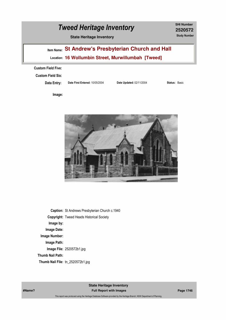
2520572
SHI Number
Tweed Heritage Inventory
Item Name: St Andrew's Presbyterian Church and Hall
Location: 16 Wollumbin Street, Murwillumbah [Tweed]
State Heritage Inventory Study Number
Date Updated: 02/11/2004 Status: BasicDate First Entered: 10/05/2004Data Entry:
Custom Field Five:
Custom Field Six:
Caption: St Andrews Presbyterian Church c.1940
Copyright: Tweed Heads Historical Society
Image:
Image by:
Image Date:
Image Number:
Image Path:
Image File: 2520572b1.jpg
Thumb Nail Path:
Thumb Nail File: tn_2520572b1.jpg
#Name? Page 1746 Full Report with Images
State Heritage Inventory
This report was produced using the Heritage Database Software provided by the Heritage Branch, NSW Department of Planning.
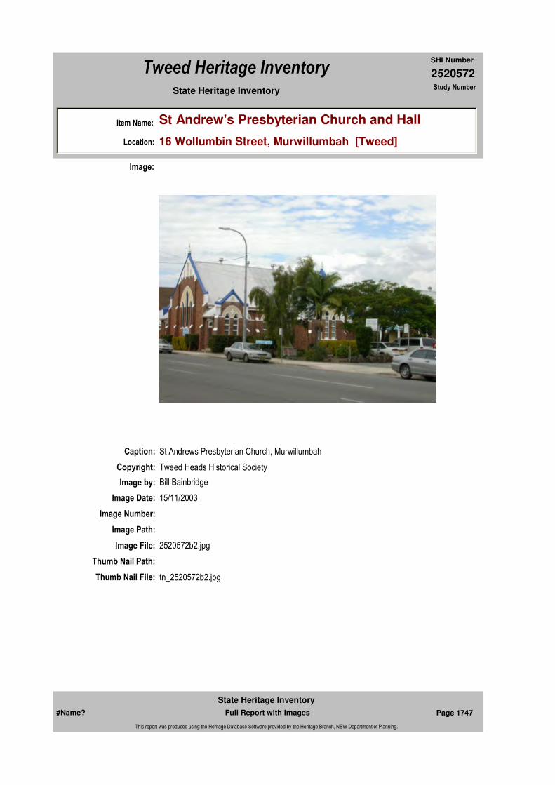
2520572
SHI Number
Tweed Heritage Inventory
Item Name: St Andrew's Presbyterian Church and Hall
Location: 16 Wollumbin Street, Murwillumbah [Tweed]
State Heritage Inventory Study Number
Caption: St Andrews Presbyterian Church, Murwillumbah
Copyright: Tweed Heads Historical Society
Image:
Image by: Bill Bainbridge
Image Date: 15/11/2003
Image Number:
Image Path:
Image File: 2520572b2.jpg
Thumb Nail Path:
Thumb Nail File: tn_2520572b2.jpg
#Name? Page 1747 Full Report with Images
State Heritage Inventory
This report was produced using the Heritage Database Software provided by the Heritage Branch, NSW Department of Planning.

2520572
SHI Number
Tweed Heritage Inventory
Item Name: St Andrew's Presbyterian Church and Hall
Location: 16 Wollumbin Street, Murwillumbah [Tweed]
State Heritage Inventory Study Number
Caption: St Andrews Presbyterian Church, Murwillumbah
Copyright: Tweed Heads Historical Society
Image:
Image by: Bill Bainbridge
Image Date: 15/11/2003
Image Number:
Image Path:
Image File: 2520572b3.jpg
Thumb Nail Path:
Thumb Nail File: tn_2520572b3.jpg
#Name? Page 1748 Full Report with Images
State Heritage Inventory
This report was produced using the Heritage Database Software provided by the Heritage Branch, NSW Department of Planning.
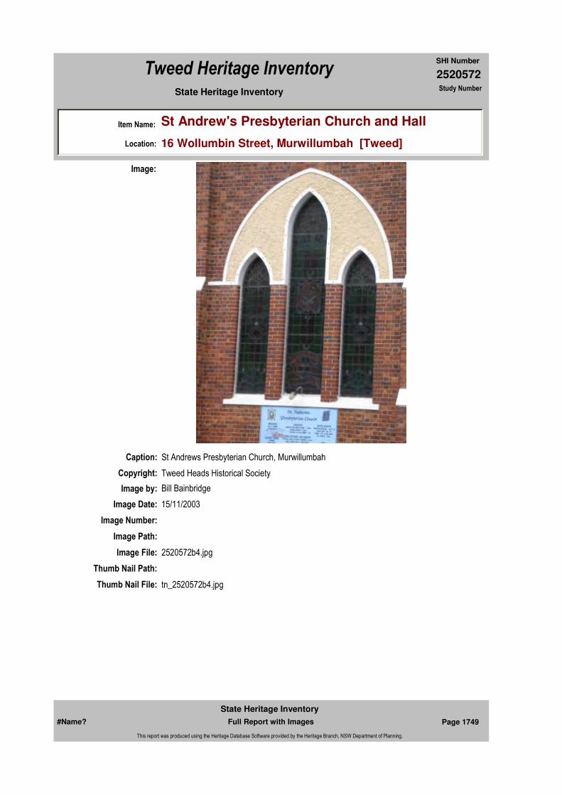
2520572
SHI Number
Tweed Heritage Inventory
Item Name: St Andrew's Presbyterian Church and Hall
Location: 16 Wollumbin Street, Murwillumbah [Tweed]
State Heritage Inventory Study Number
Caption: St Andrews Presbyterian Church, Murwillumbah
Copyright: Tweed Heads Historical Society
Image:
Image by: Bill Bainbridge
Image Date: 15/11/2003
Image Number:
Image Path:
Image File: 2520572b4.jpg
Thumb Nail Path:
Thumb Nail File: tn_2520572b4.jpg
#Name? Page 1749 Full Report with Images
State Heritage Inventory
This report was produced using the Heritage Database Software provided by the Heritage Branch, NSW Department of Planning.
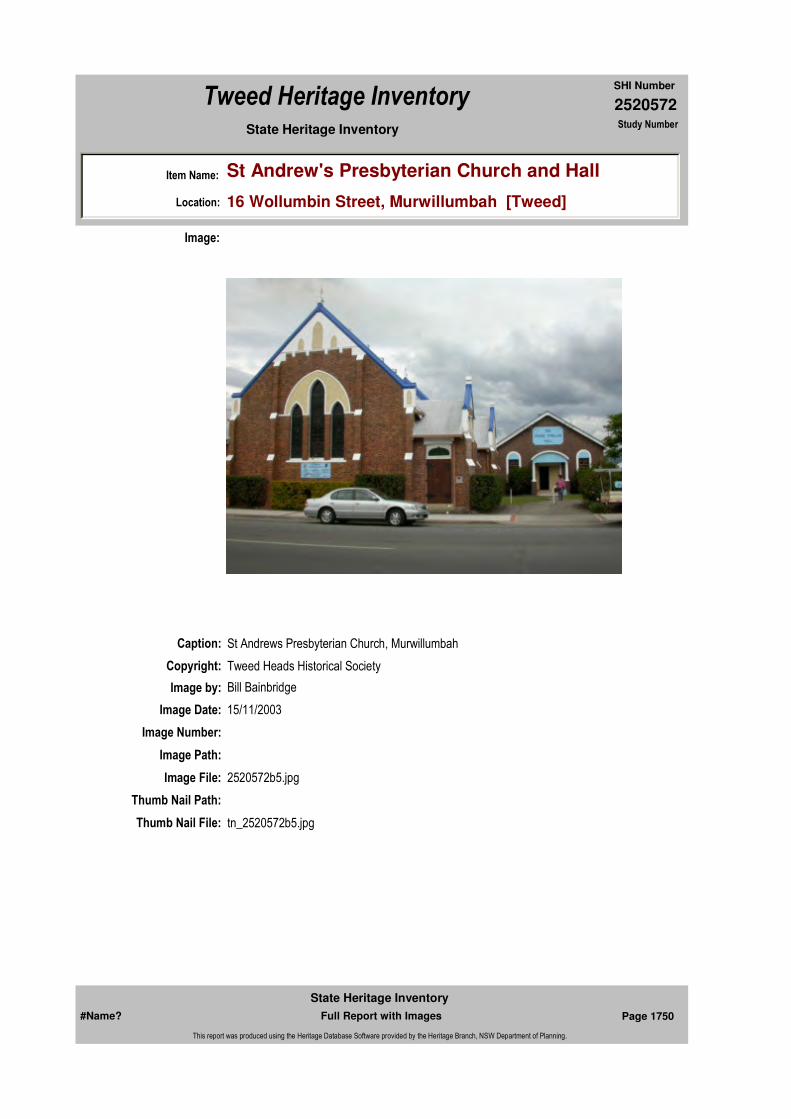
2520572
SHI Number
Tweed Heritage Inventory
Item Name: St Andrew's Presbyterian Church and Hall
Location: 16 Wollumbin Street, Murwillumbah [Tweed]
State Heritage Inventory Study Number
Caption: St Andrews Presbyterian Church, Murwillumbah
Copyright: Tweed Heads Historical Society
Image:
Image by: Bill Bainbridge
Image Date: 15/11/2003
Image Number:
Image Path:
Image File: 2520572b5.jpg
Thumb Nail Path:
Thumb Nail File: tn_2520572b5.jpg
#Name? Page 1750 Full Report with Images
State Heritage Inventory
This report was produced using the Heritage Database Software provided by the Heritage Branch, NSW Department of Planning.

2520572
SHI Number
Tweed Heritage Inventory
Item Name: St Andrew's Presbyterian Church and Hall
Location: 16 Wollumbin Street, Murwillumbah [Tweed]
State Heritage Inventory Study Number
Caption: Jessie McMillan Hall, Murwillumbah
Copyright: Tweed Heads Historical Society
Image:
Image by: Bill Bainbridge
Image Date: 15/11/2003
Image Number:
Image Path:
Image File: 2520572b6.jpg
Thumb Nail Path:
Thumb Nail File: tn_2520572b6.jpg
#Name? Page 1751 Full Report with Images
State Heritage Inventory
This report was produced using the Heritage Database Software provided by the Heritage Branch, NSW Department of Planning.
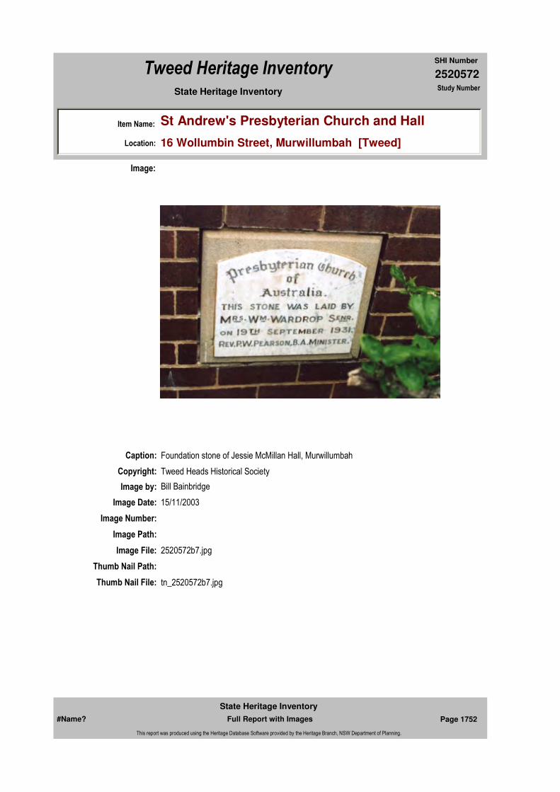
2520572
SHI Number
Tweed Heritage Inventory
Item Name: St Andrew's Presbyterian Church and Hall
Location: 16 Wollumbin Street, Murwillumbah [Tweed]
State Heritage Inventory Study Number
Caption: Foundation stone of Jessie McMillan Hall, Murwillumbah
Copyright: Tweed Heads Historical Society
Image:
Image by: Bill Bainbridge
Image Date: 15/11/2003
Image Number:
Image Path:
Image File: 2520572b7.jpg
Thumb Nail Path:
Thumb Nail File: tn_2520572b7.jpg
#Name? Page 1752 Full Report with Images
State Heritage Inventory
This report was produced using the Heritage Database Software provided by the Heritage Branch, NSW Department of Planning.

2520572
SHI Number
Tweed Heritage Inventory
Item Name: St Andrew's Presbyterian Church and Hall
Location: 16 Wollumbin Street, Murwillumbah [Tweed]
State Heritage Inventory Study Number
Caption: Foundation Stone of St Andrews Presbyterian Church, Murwillumbah
Copyright: Tweed Heads Historical Society
Image:
Image by: Bill Bainbridge
Image Date: 15/11/2003
Image Number:
Image Path:
Image File: 2520572b8.jpg
Thumb Nail Path:
Thumb Nail File: tn_2520572b8.jpg
#Name? Page 1753 Full Report with Images
State Heritage Inventory
This report was produced using the Heritage Database Software provided by the Heritage Branch, NSW Department of Planning.

2520572
SHI Number
Tweed Heritage Inventory
Item Name: St Andrew's Presbyterian Church and Hall
Location: 16 Wollumbin Street, Murwillumbah [Tweed]
State Heritage Inventory Study Number
#Name? Page 1754 Full Report with Images
State Heritage Inventory
This report was produced using the Heritage Database Software provided by the Heritage Branch, NSW Department of Planning.

2520573
SHI Number
Tweed Heritage Inventory
Item Name: The Grainery
Location: 1 Charles Lane, Murwillumbah [Tweed]
State Heritage Inventory Study Number
Current Use:
Former Uses:
Statement of
Significance:Historic landmark, an industrial and storage building.
Historical Notes or Provenance:
1955 Budd's stock feed and grass cleaning plant.
Physical Description: Distinctive timber framed and weatherboard clad industrial building which has retained key features and undergone several extensions.
Physical Condition:
Designer:
Maker / Builder:
Year Started: Year Completed: Circa: No
Endorsed Significance:Assessed Significance: Local
Item Type: Built Category: Commercial Office/BuilGroup: Commercial
Admin Codes: Code 2: Code 3:
Curtilage/Boundary:
Owner: Private - Individual
Other/Former Names: Budd's Seed Supplies
Area/Group/Complex: Group ID:
Themes:
Aboriginal Area:
Local Govt Area: Tweed
Planning: Northern
Historic Region: North Coast
Address: #Name?
Suburb / Nearest Town: #Name?
State: NSW
Parish: Murwillumbah
County: Rous
National Theme State Theme Local Theme
3. Economy Commerce (none)
#Name? Page 1755 Full Report with Images
State Heritage Inventory
This report was produced using the Heritage Database Software provided by the Heritage Branch, NSW Department of Planning.

2520573
SHI Number
Tweed Heritage Inventory
Item Name: The Grainery
Location: 1 Charles Lane, Murwillumbah [Tweed]
State Heritage Inventory Study Number
Modification Dates:
Custom Field One:
Recommended
Management:Restoration of distinctive elements; Appropriate heritage colour scheme; integrate signs
References:
Studies:
Listings:
Further Comments:
Criteria a) Historic landmark, an industrial and storage building.
Criteria c)
Criteria d)
Criteria e)
Criteria g)
Criteria f)
Integrity / Intactness:
Custom Field Two:
Custom Field Three:
Custom Field Four:
Custom Field Five:
Criteria b)
Parcels:
Latitude: Longitude:
AMG Zone: Easting: 539589 Northing: 6866566
Map Name: Map Scale:
Spatial Accuracy:Location validity:
Management:
Author Title YearNumber
Tweed Shire Council Community-based Heritage Study 2003
Parcel Code LotNumber Section Plan Code Plan Number
LOT 2, 3 DP 21815
LOT 8 DP 343522
#Name? Page 1756 Full Report with Images
State Heritage Inventory
This report was produced using the Heritage Database Software provided by the Heritage Branch, NSW Department of Planning.

2520573
SHI Number
Tweed Heritage Inventory
Item Name: The Grainery
Location: 1 Charles Lane, Murwillumbah [Tweed]
State Heritage Inventory Study Number
Date Updated: 03/11/2004 Status: BasicDate First Entered: 10/05/2004Data Entry:
Custom Field Six:
Caption:
Copyright: Tweed Heads Historical Society
Image:
Image by: Immy McKiernan
Image Date: 15/11/2003
Image Number:
Image Path:
Image File: 2520573b1.jpg
Thumb Nail Path:
Thumb Nail File: tn_2520573b1.jpg
#Name? Page 1757 Full Report with Images
State Heritage Inventory
This report was produced using the Heritage Database Software provided by the Heritage Branch, NSW Department of Planning.

2520573
SHI Number
Tweed Heritage Inventory
Item Name: The Grainery
Location: 1 Charles Lane, Murwillumbah [Tweed]
State Heritage Inventory Study Number
Caption:
Copyright: Tweed Heads Historical Society
Image:
Image by: Immy McKiernan
Image Date: 15/11/2003
Image Number:
Image Path:
Image File: 2520573b2.jpg
Thumb Nail Path:
Thumb Nail File: tn_2520573b2.jpg
#Name? Page 1758 Full Report with Images
State Heritage Inventory
This report was produced using the Heritage Database Software provided by the Heritage Branch, NSW Department of Planning.

2520573
SHI Number
Tweed Heritage Inventory
Item Name: The Grainery
Location: 1 Charles Lane, Murwillumbah [Tweed]
State Heritage Inventory Study Number
Caption:
Copyright: Tweed Heads Historical Society
Image:
Image by: Immy McKiernan
Image Date: 15/11/2003
Image Number:
Image Path:
Image File: 2520573b3.jpg
Thumb Nail Path:
Thumb Nail File: tn_2520573b3.jpg
#Name? Page 1759 Full Report with Images
State Heritage Inventory
This report was produced using the Heritage Database Software provided by the Heritage Branch, NSW Department of Planning.

2520573
SHI Number
Tweed Heritage Inventory
Item Name: The Grainery
Location: 1 Charles Lane, Murwillumbah [Tweed]
State Heritage Inventory Study Number
#Name? Page 1760 Full Report with Images
State Heritage Inventory
This report was produced using the Heritage Database Software provided by the Heritage Branch, NSW Department of Planning.

2520574
SHI Number
Tweed Heritage Inventory
Item Name: All Saints Anglican Church
Location: 26 - 28 Byangum Road, Murwillumbah [Tweed]
State Heritage Inventory Study Number
Current Use: Church
Former Uses: Church
Statement of
Significance:Including the war memorial honour roll held at the church. All Saints' Anglican Church, Murwillumbah and wooden Honour Roll memorial are part of the cultural history of the Tweed Valley and have a special association with the community.
Historical Notes
or Provenance:There is no doubt as to how many other diocesan churches had the planning input of All Saints', Murwillumbah. It was to be the last major church built within the diocese using traditional architecture with a modern approach. Five and a half years of planning had gone into the building.
The parish had long suffered an inadequate, unsafe building. Although a landmark when built in 1909, it was totally inadequate by the l940's. Problems with structural safety, very poor ventilation in the sanctuary and the high cost of maintenance was common. Fortunately a proposal to move it to Nullum Street, minus the bell tower, in April 1954 was abandoned.
The advice of Mr G Hanna in not recommending this due to the size of the building and the expense and loss of timber through demolition was further endorsed by a directive from Bishop-in-Council given to the Annual General Meeting in August 1955.
Council was directed that a new building should be constructed in brick, and if the Nullum Street site was to be used, floor level had to be 14 feet (5 metres) with vehicle access ramps to floor level. As has been stated, attention turned to a new Riverview Street to Byangum Road site in 1956.
Endorsed Significance:Assessed Significance: Local
Item Type: Built Category: ChurchGroup: Religion
Admin Codes: Code 2: Code 3:
Curtilage/Boundary:
Owner: Religious Organisation
Other/Former Names:
Area/Group/Complex: Group ID:
Aboriginal Area:
Local Govt Area: Tweed
Planning: Northern
Historic Region: North Coast
Address: #Name?
Suburb / Nearest Town: #Name?
State: NSW
Parish: Murwillumbah
County: Rous
#Name? Page 1761 Full Report with Images
State Heritage Inventory
This report was produced using the Heritage Database Software provided by the Heritage Branch, NSW Department of Planning.
2520574
SHI Number
Tweed Heritage Inventory
Item Name: All Saints Anglican Church
Location: 26 - 28 Byangum Road, Murwillumbah [Tweed]
State Heritage Inventory Study Number
By the Annual General Meeting of 12 August 1957, with 110 parishioners present, a report was presented by Mr Aubrey Budd on planning to date by the Building Committee. The committee comprised. the Rector. Mr H. Hockey (a District School Counsellor), Mr J Catterall (Manager of Sly's Sawmill) and Mr Aubrey Budd. In the early planning stages Mr G Hanna had been involved but resigned because of his desire to tender for the church's construction. The extensive report and accompanying photographic slides gave the meeting clarity of what was intended.
The report stated in part:-"There are among our parishioners many schools of thought on both aspects, ranging from the strictly traditional type of building. to the ultra modern. with seating accommodation ranging up to 800 and more.
My Comniittee's view on the design of the building is that it should combine the outstanding traditional features of the old idea of a church building, in other words it should look like a church, preserving the dignity and dedicated atmosphere of the older designs, but incorporate modern trends towards greater utility and more economic constructions and maintenance.
Churches in the past have been elaborately built. The construction and craftmanship were superb. Windows have been installed on a grand scale, in all making a magnificent building. However, how many people would favour the construction of such a church today? Very few, the reason being that, apart from costs on a luxury scale, the design is not suitable for our modern way of life. The windows are usually small and mainly ornamental, restricting natural light. Ventilation in most cases is poor and the building would not be adaptable to our advanced ideas of colour combinations, which play a big part in our everyday life.
The new church should be large enough to accommodate and seat comfortably approximately 400 people. The design should be such as to give protection to a large number of people outside the Church proper particularly in wet weather, and the construction should be completely of brick with a Bell Tower and tiled roof."
In its inspection of churches erected during the past ten years, your Committee considered each one from the standpoint of these essential features.
Of all the buildings inspected and considered, the Gympie Church (erected in 1954, at a cost of approximately $52,000), is outstanding, and your Committee strongly recommends that the design of our new Church should in all major features, closely conform to that of this church.
In particular it favours the provision of external cloisters, with access from the church by means of side aisles and wide plate glass doors opening outward the location of the choir in the organ loft, and provision for as large a space as possible at the rear of the building, for use as a Baptistry, and to be available for additional seating accommodation as the need arises in future years.
Several carloads of interested parishioners journeyed to Gympie to inspect the church, which bears many similarities to All Saints'.
#Name? Page 1762 Full Report with Images
State Heritage Inventory
This report was produced using the Heritage Database Software provided by the Heritage Branch, NSW Department of Planning.

2520574
SHI Number
Tweed Heritage Inventory
Item Name: All Saints Anglican Church
Location: 26 - 28 Byangum Road, Murwillumbah [Tweed]
State Heritage Inventory Study Number
A report to Parochial Council on 7 November 1957 was that the new church should resemble in general outline the Church of St Peter's with some variations. The architects who designed the Gympie Church, Conrad and Gargett of Brisbane were commissioned to design All Saints'.
A main variation from the tower entry in Gympie was that All Saints' main entry be via the Western Wall with a subsidiary tower entry. The architects were also to be consulted about whether a cantilever awning over the front entrance would be appropriate, to provide shelter on the occasion of a wedding or a funeral. The architects were also asked to shift the tower to the southwest corner. Provision was to be made for a crying room and Narthex (glass doors opening from the nave to the cloisters). The ridge of the chapel and vestry roof, unlike Gympie, was to have a North South Ridge to form a crucifix plan.
By 31 January 1959, satisfactory financial arrangements had been made to enable building to start in July. Financing the building over the past five years was an incredible achievement when it is realised that at the time the parish was striving hard to meet its operational commitments. A feature of the financial and building planning staged was the many general meetings of parishioners to keep them fully informed.
On 28 May 1959. the planning committee accompanied by Messrs G. Hanna, M. Davies and D. Stainlay met with Mr Hamilton of Conrad and Gargett. At this meeting, siting on the property was agreed upon, and details not obvious in the plans were recommended for inclusion.
It is interesting to note that aluminium window frames were recommended and lighting experts were to be consulted for this aspect. The Bishop's letter contained many suggestions for furniture. The Sanctuary cross was to be wood, but the external east end cross of metal was to be fixed out from the wall with a view to placing strip lighting behind it at a later stage. If tender costs were too high, the chapel was to be deleted. On the lower floor (undercroft) it was suggested the following be provided: - Rector's study, Curate's study, Secretary's Office, Printing Room, Meeting Room, Council room. Library, Strong room, small kitchen and an additional clergy vestry.
By the 13 July 1959 advice was received from the architect that plans and specifications had been sent to builders selected by the committee. These included G. Hanna; W. Edmed; J. J. Williams; J. L. Prosser, all of Murwillumbah. Other builders included R. Want (Grafton), Robb and Brown (Lismore), A. Strong (Lismore) and a Brisbane builder to be recommended by the architects.
At a special meeting of Parochial Council held on 21 September 1959 the Planning Committee's recommendation accepting the tender of Geo. Hanna Pty Ltd, for $89,334 was carried. On 9 November the architects were thanked for their assistance and advised that they were no longer required to furnish detailed drawings but were thanked for their offer of future help if needed.
Building began in February 1960 with thirty-five men under builder Mr George Hanna of Murwillumbah. Twenty other workers for various sub--contractors worked on the building.
#Name? Page 1763 Full Report with Images
State Heritage Inventory
This report was produced using the Heritage Database Software provided by the Heritage Branch, NSW Department of Planning.
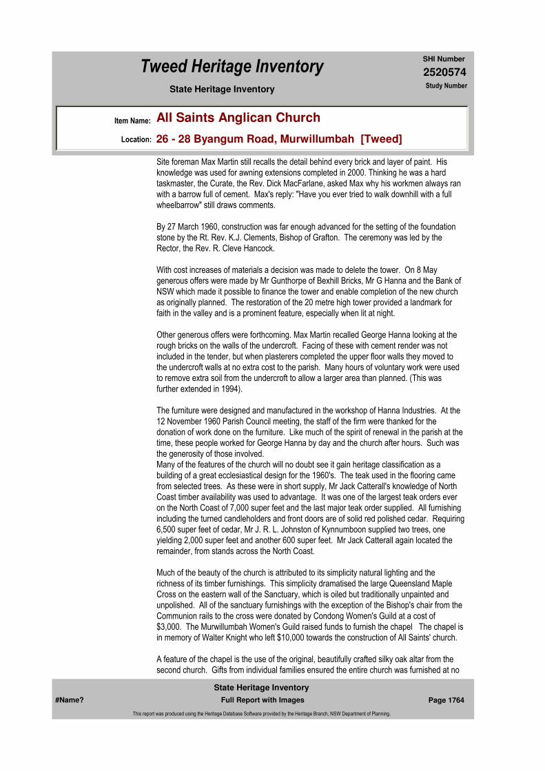
2520574
SHI Number
Tweed Heritage Inventory
Item Name: All Saints Anglican Church
Location: 26 - 28 Byangum Road, Murwillumbah [Tweed]
State Heritage Inventory Study Number
Site foreman Max Martin still recalls the detail behind every brick and layer of paint. His knowledge was used for awning extensions completed in 2000. Thinking he was a hard taskmaster, the Curate, the Rev. Dick MacFarlane, asked Max why his workmen always ran with a barrow full of cement. Max's reply: "Have you ever tried to walk downhill with a full wheelbarrow" still draws comments.
By 27 March 1960, construction was far enough advanced for the setting of the foundation stone by the Rt. Rev. K.J. Clements, Bishop of Grafton. The ceremony was led by the Rector, the Rev. R. Cleve Hancock.
With cost increases of materials a decision was made to delete the tower. On 8 May generous offers were made by Mr Gunthorpe of Bexhill Bricks, Mr G Hanna and the Bank of NSW which made it possible to finance the tower and enable completion of the new church as originally planned. The restoration of the 20 metre high tower provided a landmark for faith in the valley and is a prominent feature, especially when lit at night.
Other generous offers were forthcoming. Max Martin recalled George Hanna looking at the rough bricks on the walls of the undercroft. Facing of these with cement render was not included in the tender, but when plasterers completed the upper floor walls they moved to the undercroft walls at no extra cost to the parish. Many hours of voluntary work were used to remove extra soil from the undercroft to allow a larger area than planned. (This was further extended in 1994).
The furniture were designed and manufactured in the workshop of Hanna Industries. At the 12 November 1960 Parish Council meeting, the staff of the firm were thanked for the donation of work done on the furniture. Like much of the spirit of renewal in the parish at the time, these people worked for George Hanna by day and the church after hours. Such was the generosity of those involved.Many of the features of the church will no doubt see it gain heritage classification as a building of a great ecclesiastical design for the 1960's. The teak used in the flooring came from selected trees. As these were in short supply, Mr Jack Catterall's knowledge of North Coast timber availability was used to advantage. It was one of the largest teak orders ever on the North Coast of 7,000 super feet and the last major teak order supplied. All furnishing including the turned candleholders and front doors are of solid red polished cedar. Requiring 6,500 super feet of cedar, Mr J. R. L. Johnston of Kynnumboon supplied two trees, one yielding 2,000 super feet and another 600 super feet. Mr Jack Catterall again located the remainder, from stands across the North Coast.
Much of the beauty of the church is attributed to its simplicity natural lighting and the richness of its timber furnishings. This simplicity dramatised the large Queensland Maple Cross on the eastern wall of the Sanctuary, which is oiled but traditionally unpainted and unpolished. All of the sanctuary furnishings with the exception of the Bishop's chair from the Communion rails to the cross were donated by Condong Women's Guild at a cost of $3,000. The Murwillumbah Women's Guild raised funds to furnish the chapel The chapel is in memory of Walter Knight who left $10,000 towards the construction of All Saints' church.
A feature of the chapel is the use of the original, beautifully crafted silky oak altar from the second church. Gifts from individual families ensured the entire church was furnished at no
#Name? Page 1764 Full Report with Images
State Heritage Inventory
This report was produced using the Heritage Database Software provided by the Heritage Branch, NSW Department of Planning.

2520574
SHI Number
Tweed Heritage Inventory
Item Name: All Saints Anglican Church
Location: 26 - 28 Byangum Road, Murwillumbah [Tweed]
State Heritage Inventory Study Number
cost to the parish. This extensive list is recorded in the Book of Memory.
Whilst there is respect for tradition, especially in its cruciform shape the main feature is the emphasis on utility and suitability for this climate. The spacious external cloisters assist with natural ventilation and light. Whilst designed to seat 400, large floor areas provide space for seating another 200 for special services.
Publicity for the church's construction and opening was extensive and would have used eight pages in today's paper.
The local press commented:"All Saints' Murwillumbah will combine a place of teaching and worship in the Christian faith with an example of eye-pleasing beauty of which not only Anglicans, but all Christian believers should be proud."
The church, at a total cost on completion of $110,000, was opened and dedicated on 1 November 1960 by the Rt Rev. Kenneth Clements B.A. Th.D., Bishop of Grafton. The occasional sermon was delivered by the Most Rev. Reginald Halse, M.A., Archbishop of Brisbane.
The opening ceremony was an occasion of great joy for members of the Anglican faith of the Tweed.The largest congregation to ever attend a service in Murwillumbah, estimated at 1,350, packed the church to capacity. A thunderstorm which broke minutes after the procession had entered the church forced an estimated 300 people, in the grounds, to return home.
It was reported in the Daily News that:"Heavy rain in the afternoon had turned the new surrounds of the building into a quagmire, which added to the discomfort of the big crowd. Tweed Shire Council works in Byangum Road during the day meant that the solemn procession of about 350 members of the church organisations had to walk over a broken bitumen surface for about 40 yards.
People began gathering at the old and new churches before 6pm - over an hour before the dedication service was to start.
The procession took place between showers, several minutes late. Leading the procession as crucifer was 17 year old Jeff Miller, senior server of Murwillumbah. An apprentice carpenter, he helped build the church. Behind him was the Tweed Shire President Cr C H Lundberg, and groups from each of the many church organisations. About 30 members of the Anglican clergy brought up the rear."
Included in the thirty visiting clergy was Rev. Canon Charles Egerton, who had been Rector of Murwillumbah when the planning and fund raising had commenced.
The Rector of Murwillumbah, the Rev. R. Cleve Hancock was a very elated minister. His zeal and foresight proved to be an inspiration to his parish council and the parishioners in bringing a dream to reality.
#Name? Page 1765 Full Report with Images
State Heritage Inventory
This report was produced using the Heritage Database Software provided by the Heritage Branch, NSW Department of Planning.

2520574
SHI Number
Tweed Heritage Inventory
Item Name: All Saints Anglican Church
Location: 26 - 28 Byangum Road, Murwillumbah [Tweed]
State Heritage Inventory Study Number
The dedication was completed the following morning, All Soul's Day, when the Archbishop of Brisbane celebrated Holy Communion. The same night 64 children and 20 adults were confirmed by the Bishop of Grafton.
On 3 November 1968, All Saints', Murwillumbah was consecrated at a service of thanksgiving, again on the occasion of our patronal festival, All Saints' day, during the incumbency of the Rev. Dick MacFarlane. The Bishop of Grafton, the Rt. Rev. R.G. Arthur performed the consecration.
The very generous bequest of Victor Worley and Fred Fellows had enabled the consecration to take place much sooner than anticipated.
Apart from general maintenance, no major refurbishment of the building took place until 1995-96 when the undercroft storage areas were extended, a new kitchen installed and the office relocated and expanded to allow for the installation of modern technology.
In May 1999, planning commenced to improve access for the disabled and to provide better wet weather entry. On 9 March 2000 a contract was signed with builder Rod Smith to construct awnings at the main west end entry to the church and the southern undercroft entry. With the rectory now located on the southern side of the church, and no steps to the undercroft on this side, it has become the main entry to our undercroft facilities.
At the same time driveways were reconstructed and path access to the undercroft improved with the elimination of several steps. At all times the original architecture was respected. Although there were difficulties in matching building materials of forty years ago the building now has added features that receive praise from a wide sector of the community.
The Rt. Rev. Philip Huggins Bishop of Grafton, dedicated the extension on 10 September 2000. The current Rector, the Rev. Harold Reuss was very supportive of the project and believes we now have 'the best plant in the diocese'.
All Saints is a much-used building, not only as a church by Anglicans and other denominations oil special occasions, but by a wide spectrum of the community in this valley.
Designer:
Maker / Builder: George Hanna Pty Ltd, Murwillumbah
Year Started: Year Completed: 1960 Circa: No
Themes: National Theme State Theme Local Theme
8. Culture Religion Church
#Name? Page 1766 Full Report with Images
State Heritage Inventory
This report was produced using the Heritage Database Software provided by the Heritage Branch, NSW Department of Planning.
2520574
SHI Number
Tweed Heritage Inventory
Item Name: All Saints Anglican Church
Location: 26 - 28 Byangum Road, Murwillumbah [Tweed]
State Heritage Inventory Study Number
Physical Description:
2 Wooden honour boards
Physical Condition:
Modification Dates: Extensions: 1994, 2000
Recommended
Management:
References:
Studies:
Further Comments:
Criteria a)
Criteria c)
Criteria d) All Saints' Anglican Church, Murwillumbah and wooden Honour Roll memorial are part of the cultural history of the Tweed Valley and have a special association with the community.
Criteria e)
Criteria g)
Criteria f)
Integrity / Intactness:
Criteria b)
Parcels:
Latitude: Longitude:
AMG Zone: Easting: Northing:
Map Name: Map Scale:
Spatial Accuracy:Location validity:
Management:
Author Title Year
Rev Geoff Foley & Ross Johnson "Faith In The Valley The Anglican Church in the Tweed Valley"
Author Title YearNumber
Tweed Shire Council Community-based Heritage Study 2003
Parcel Code LotNumber Section Plan Code Plan Number
LOT A, B DP 335911
LOT 1 DP 301393
#Name? Page 1767 Full Report with Images
State Heritage Inventory
This report was produced using the Heritage Database Software provided by the Heritage Branch, NSW Department of Planning.

2520574
SHI Number
Tweed Heritage Inventory
Item Name: All Saints Anglican Church
Location: 26 - 28 Byangum Road, Murwillumbah [Tweed]
State Heritage Inventory Study Number
Custom Field One:
Listings:
Date Updated: 31/10/2004 Status: BasicDate First Entered: 10/05/2004Data Entry:
Custom Field Two:
Custom Field Three:
Custom Field Four:
Custom Field Five:
Custom Field Six:
Caption: All Saints Anglican Church Honour Board, WW2, Korea, Malaya and Vietnam.
Copyright: Tweed Heads Historical Society
Image:
Image by:
Image Date:
Image Number:
#Name? Page 1768 Full Report with Images
State Heritage Inventory
This report was produced using the Heritage Database Software provided by the Heritage Branch, NSW Department of Planning.

2520574
SHI Number
Tweed Heritage Inventory
Item Name: All Saints Anglican Church
Location: 26 - 28 Byangum Road, Murwillumbah [Tweed]
State Heritage Inventory Study Number
Image Path:
Image File: 2520574b1.jpg
Thumb Nail Path:
Thumb Nail File: tn_2520574b1.jpg
#Name? Page 1769 Full Report with Images
State Heritage Inventory
This report was produced using the Heritage Database Software provided by the Heritage Branch, NSW Department of Planning.
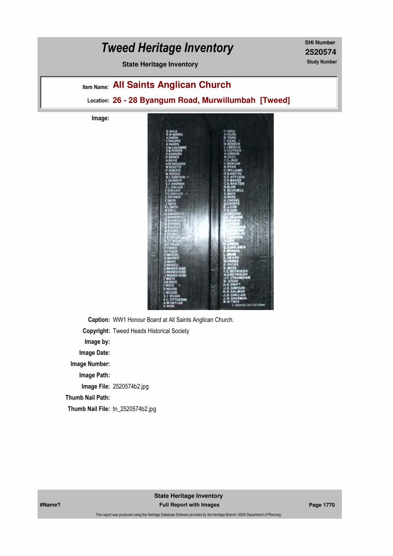
2520574
SHI Number
Tweed Heritage Inventory
Item Name: All Saints Anglican Church
Location: 26 - 28 Byangum Road, Murwillumbah [Tweed]
State Heritage Inventory Study Number
Caption: WW1 Honour Board at All Saints Anglican Church.
Copyright: Tweed Heads Historical Society
Image:
Image by:
Image Date:
Image Number:
Image Path:
Image File: 2520574b2.jpg
Thumb Nail Path:
Thumb Nail File: tn_2520574b2.jpg
#Name? Page 1770 Full Report with Images
State Heritage Inventory
This report was produced using the Heritage Database Software provided by the Heritage Branch, NSW Department of Planning.

2520574
SHI Number
Tweed Heritage Inventory
Item Name: All Saints Anglican Church
Location: 26 - 28 Byangum Road, Murwillumbah [Tweed]
State Heritage Inventory Study Number
#Name? Page 1771 Full Report with Images
State Heritage Inventory
This report was produced using the Heritage Database Software provided by the Heritage Branch, NSW Department of Planning.
2520575
SHI Number
Tweed Heritage Inventory
Item Name: War Memorial Cenotaph
Location: Tumbulgum Road, Murwillumbah [Tweed]
State Heritage Inventory Study Number
Current Use:
Former Uses:
Statement of
Significance:The memorial is part of the cultural history of the Tweed Valley and has a special association with the community in which it is housed.
Historical Notes or Provenance:
On the 3rd March 1922 a meeting was held to see if a war memorial could be built in Murwillumbah.
It was decided to go ahead but much controversy ensued as to where to erect the memorial, and tempers flared at the meeting. Most people favoured a spot in the centre of Broadway, but the Mayor (Cr Connors) claimed it would be a traffic hazard in future years. No agreement could be reached and another meeting was to be called later. However, it was decided to build a wooden replica and place it in Broadway on trial.
At the second meeting, the Mayor occupied the chair, and said a conspicuous place should be chosen, and suggested the bridge reserve (now Newell Park) the Fire Station had been removed from here a few years previously. A gentleman stood up in the audience and voted that it be built on top of Mt Warning, but the Mayor silenced him with one word ... RUBBISH!!!
Many people spoke in favour of the Bridge Reserve claiming that the Replica Monument in Broadway had been shifted around five times and they still had not found the right place. Others claimed that the iron cart wheels would chip the comers of the monument. So a vote was taken and the result was 28 to 29 in favour of the Bridge Reserve; and three hearty cheers were given by the winning voters.
Tenders were called in May 1922 and an agreement drawn up between local Monumental
Endorsed Significance:Assessed Significance: Local
Item Type: Built Category: War MemorialGroup: Monuments and Mem
Admin Codes: Code 2: Code 3:
Curtilage/Boundary:
Owner: Local Government
Other/Former Names:
Area/Group/Complex: Group ID:
Aboriginal Area:
Local Govt Area: Tweed
Planning: Northern
Historic Region: North Coast
Address: #Name?
Suburb / Nearest Town: #Name?
State: NSW
Parish: Murwillumbah
County: Rous
#Name? Page 1772 Full Report with Images
State Heritage Inventory
This report was produced using the Heritage Database Software provided by the Heritage Branch, NSW Department of Planning.

2520575
SHI Number
Tweed Heritage Inventory
Item Name: War Memorial Cenotaph
Location: Tumbulgum Road, Murwillumbah [Tweed]
State Heritage Inventory Study Number
Masons, Armitage Bros and the committee which consisted of Emest Edward Newell - Saddler, Harry Watson - Bank Manager. Norman Lewis - Builder, John Smith - Clerk of Works and John Holston - Cabinet maker. All signatures were witnessed by F K Budd. The contractor was given six months to complete the work at a cost of 600 pounds ($1200).
The memorial was completed on time, but could not be unveiled on Anzac Day because all the names of deceased soldiers had not been obtained for the plaque. So it was decided to hold the unveiling on Empire Day, but once again the names were not forthcoming and Mr Newell said it would probably be Anzac Day 1924 before the memorial would be unveiled.
So Anzac Day 1924 arrived, the March started at the Post Office with 50 Ex-servicemen, Scouts and other organisations which was led by the Municipal Band. Mr A E Budd was in charge of the proceedings as he had become Mayor at the last Municipal Elections.
The two guns had been firmly entrenched in concrete at the Cenotaph. The gun trophies a German Howitzer and a Trench Mortar were captured by the 3rd Battalion near Harincourt (there had been controversy over the big gun as many people wanted it in front of the Railway Station). Most towns had guns as war trophies given to them, Tweed Head's ceremony was marred somewhat at their unveiling as someone had stolen the barrel of the principal gun.
At the Murwillumbah ceremony every Mother who had lost a husband or son was allowed to hold a long white ribbon which was attached to the curtain for the unveiling of the names on the plaque. and were allowed to keep the ribbon as a memento. It was usual in that era to hold a "Smoko" in the School of Arts that night, and a good time was had by all.
The Cenotaph in Newell Park heard the bugle blow 53 times before it was shifted to its present site in from of the Civic Centre.
The new bridge built in 1968 had taken up some of Newell Park and in 1976 it was decided to shift the memorial to a more spacious and convenient area.
This has proven a boom as the Anzac Day March becomes longer and more school children become involved, and no streets have to be blocked for the ceremony.
The dawn service at the Cenotaph has become popular, and deep emotions are felt with the Bugler playing the Last Post. And out of the midst comes the drone of the Aero Club Planes flying overhead in salute; and one realises Anzac Day is here forever!!!
Twelve months ago I asked what happened to the Guns? There's been a lot of talk, a lot of letters, but we still don't know!!
See you at the March!
Themes: National Theme State Theme Local Theme
7. Governing Defence War Memorial
#Name? Page 1773 Full Report with Images
State Heritage Inventory
This report was produced using the Heritage Database Software provided by the Heritage Branch, NSW Department of Planning.

2520575
SHI Number
Tweed Heritage Inventory
Item Name: War Memorial Cenotaph
Location: Tumbulgum Road, Murwillumbah [Tweed]
State Heritage Inventory Study Number
Physical Description: Inscribed cenotaph in the grounds of the Civic Centre, Tumbulgum Road, Murwillumbah
Physical Condition:
Modification Dates:
Designer:
Maker / Builder:
Year Started: Year Completed: Circa: No
Recommended
Management:
References:
Studies:
Further Comments:
Criteria a)
Criteria c)
Criteria d)
Criteria e)
Criteria g)
Criteria f)
Integrity / Intactness:
Criteria b) The memorial is part of the cultural history of the Tweed Valley and has a special association with the community in which it is housed.
Parcels:
Latitude: Longitude:
Management:
Author Title Year
Ron Johansen The Cenotaph "Tales of our Times" 1992
Author Title YearNumber
Tweed Shire Council Community-based Heritage Study 2003
Parcel Code LotNumber Section Plan Code Plan Number
LOT 1 DP 863851
#Name? Page 1774 Full Report with Images
State Heritage Inventory
This report was produced using the Heritage Database Software provided by the Heritage Branch, NSW Department of Planning.
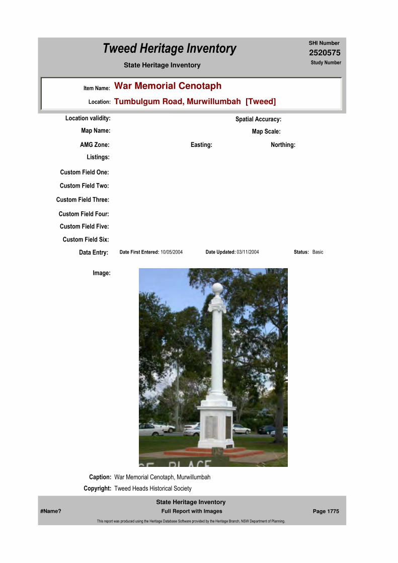
2520575
SHI Number
Tweed Heritage Inventory
Item Name: War Memorial Cenotaph
Location: Tumbulgum Road, Murwillumbah [Tweed]
State Heritage Inventory Study Number
Custom Field One:
Listings:
Date Updated: 03/11/2004 Status: BasicDate First Entered: 10/05/2004Data Entry:
Custom Field Two:
Custom Field Three:
Custom Field Four:
Custom Field Five:
Custom Field Six:
AMG Zone: Easting: Northing:
Map Name: Map Scale:
Spatial Accuracy:Location validity:
Caption: War Memorial Cenotaph, Murwillumbah
Copyright: Tweed Heads Historical Society
Image:
#Name? Page 1775 Full Report with Images
State Heritage Inventory
This report was produced using the Heritage Database Software provided by the Heritage Branch, NSW Department of Planning.
2520575
SHI Number
Tweed Heritage Inventory
Item Name: War Memorial Cenotaph
Location: Tumbulgum Road, Murwillumbah [Tweed]
State Heritage Inventory Study Number
Image by: Immy McKiernan
Image Date: 08/08/2003
Image Number:
Image Path:
Image File: 2520575b1.jpg
Thumb Nail Path:
Thumb Nail File: tn_2520575b1.jpg
#Name? Page 1776 Full Report with Images
State Heritage Inventory
This report was produced using the Heritage Database Software provided by the Heritage Branch, NSW Department of Planning.
2520576
SHI Number
Tweed Heritage Inventory
Item Name: Concrete Road
Location: Queensland Road, Murwillumbah [Tweed]
State Heritage Inventory Study Number
Current Use:
Former Uses:
Statement of
Significance:Remnant sections of a road building technique that was common throughout the shire particularly in areas covering swamp lands.
Historical Notes or Provenance:
Broadway and the Main Street of the town were becoming boggy during the wet season and very dusty during dry spells. Much money was being spent on maintenance and watering the streets so tenders were called for the concreting of Wharf Street, Broadway and Main Street, this was in August 1928 and was completed three months after tenders closed. Additional roads and streets were concreted in 1932 and the concrete is still there such as Riverview Street and Bray Street!
Physical Description: Residual stretch of concrete road, approximately 1 kilometre, on the Queensland Rd leading
Designer:
Maker / Builder:
Year Started: Year Completed: 1930 Circa: Yes
Endorsed Significance:Assessed Significance: Local
Item Type: Built Category: RoadGroup: Transport - Land
Admin Codes: Code 2: Code 3:
Curtilage/Boundary:
Owner: Local Government
Other/Former Names:
Area/Group/Complex: Group ID:
Themes:
Aboriginal Area:
Local Govt Area: Tweed
Planning: Northern
Historic Region: North Coast
Address: #Name?
Suburb / Nearest Town: #Name?
State: NSW
Parish: Murwillumbah
County: Rous
National Theme State Theme Local Theme
3. Economy Transport Road
#Name? Page 1777 Full Report with Images
State Heritage Inventory
This report was produced using the Heritage Database Software provided by the Heritage Branch, NSW Department of Planning.

2520576
SHI Number
Tweed Heritage Inventory
Item Name: Concrete Road
Location: Queensland Road, Murwillumbah [Tweed]
State Heritage Inventory Study Number
north from Murwilumbah past the Show Grounds towards the North Arm.
Physical Condition:
Modification Dates:
Custom Field One:
Recommended Management:
References:
Studies:
Listings:
Further Comments:
Criteria a)
Criteria c) Remnant sections of a road building technique that was common throughout the shire particularly in areas covering swamp lands.
Criteria d)
Criteria e)
Criteria g)
Criteria f)
Integrity / Intactness:
Custom Field Two:
Custom Field Three:
Criteria b)
Parcels:
Latitude: Longitude:
AMG Zone: Easting: Northing:
Map Name: Map Scale:
Spatial Accuracy:Location validity:
Management:
Author Title Year
Ron Johansen "Tales of our Times"
Author Title YearNumber
Tweed Shire Council Community-based Heritage Study 2003
#Name? Page 1778 Full Report with Images
State Heritage Inventory
This report was produced using the Heritage Database Software provided by the Heritage Branch, NSW Department of Planning.
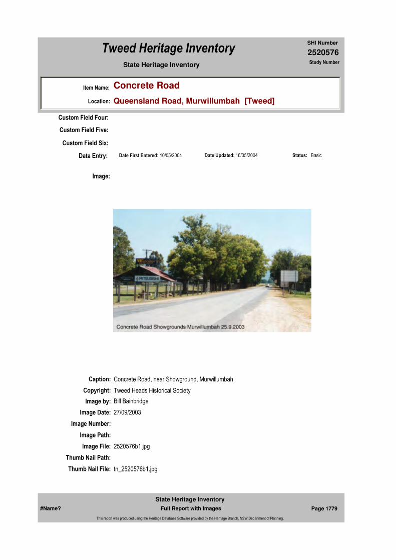
2520576
SHI Number
Tweed Heritage Inventory
Item Name: Concrete Road
Location: Queensland Road, Murwillumbah [Tweed]
State Heritage Inventory Study Number
Date Updated: 16/05/2004 Status: BasicDate First Entered: 10/05/2004Data Entry:
Custom Field Four:
Custom Field Five:
Custom Field Six:
Caption: Concrete Road, near Showground, Murwillumbah
Copyright: Tweed Heads Historical Society
Image:
Image by: Bill Bainbridge
Image Date: 27/09/2003
Image Number:
Image Path:
Image File: 2520576b1.jpg
Thumb Nail Path:
Thumb Nail File: tn_2520576b1.jpg
#Name? Page 1779 Full Report with Images
State Heritage Inventory
This report was produced using the Heritage Database Software provided by the Heritage Branch, NSW Department of Planning.

2520576
SHI Number
Tweed Heritage Inventory
Item Name: Concrete Road
Location: Queensland Road, Murwillumbah [Tweed]
State Heritage Inventory Study Number
#Name? Page 1780 Full Report with Images
State Heritage Inventory
This report was produced using the Heritage Database Software provided by the Heritage Branch, NSW Department of Planning.
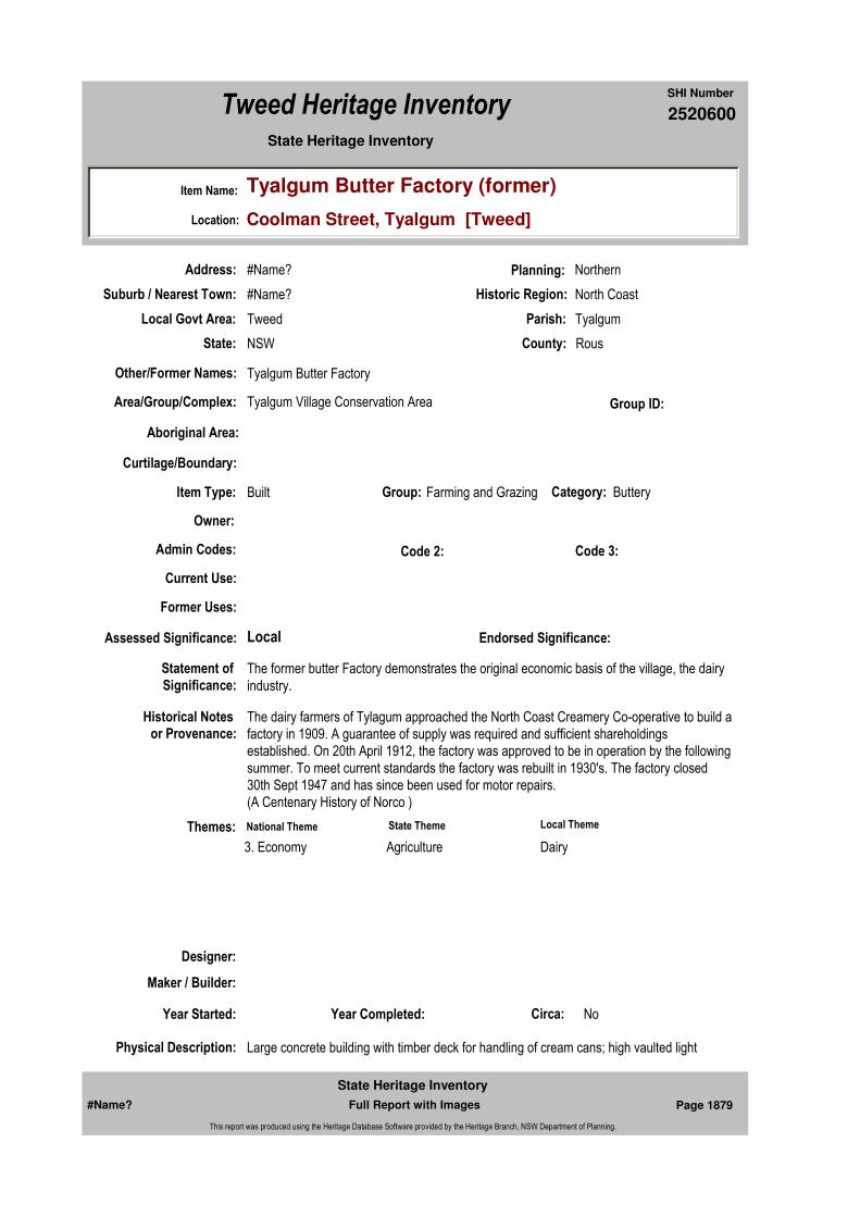
2520600
SHI Number
Tweed Heritage Inventory
Item Name: Tyalgum Butter Factory (former)
Location: Coolman Street, Tyalgum [Tweed]
State Heritage Inventory
Current Use:
Former Uses:
Statement of
Significance:The former butter Factory demonstrates the original economic basis of the village, the dairy industry.
Historical Notes or Provenance:
The dairy farmers of Tylagum approached the North Coast Creamery Co-operative to build a factory in 1909. A guarantee of supply was required and sufficient shareholdings established. On 20th April 1912, the factory was approved to be in operation by the following summer. To meet current standards the factory was rebuilt in 1930's. The factory closed 30th Sept 1947 and has since been used for motor repairs.(A Centenary History of Norco )
Physical Description: Large concrete building with timber deck for handling of cream cans; high vaulted light
Designer:
Maker / Builder:
Year Started: Year Completed: Circa: No
Endorsed Significance:Assessed Significance: Local
Item Type: Built Category: ButteryGroup: Farming and Grazing
Admin Codes: Code 2: Code 3:
Curtilage/Boundary:
Owner:
Other/Former Names: Tyalgum Butter Factory
Area/Group/Complex: Tyalgum Village Conservation Area Group ID:
Themes:
Aboriginal Area:
Local Govt Area: Tweed
Planning: Northern
Historic Region: North Coast
Address: #Name?
Suburb / Nearest Town: #Name?
State: NSW
Parish: Tyalgum
County: Rous
National Theme State Theme Local Theme
3. Economy Agriculture Dairy
#Name? Page 1879 Full Report with Images
State Heritage Inventory
This report was produced using the Heritage Database Software provided by the Heritage Branch, NSW Department of Planning.
2520600
SHI Number
Tweed Heritage Inventory
Item Name: Tyalgum Butter Factory (former)
Location: Coolman Street, Tyalgum [Tweed]
State Heritage Inventory
source, high quality internal rendering for health regulations; ancillary store rooms and offices.
Physical Condition:
Modification Dates:
Custom Field One:
Recommended Management:
References:
Studies:
Listings:
Further Comments:
Criteria a)
Criteria c)
Criteria d)
Criteria e)
Criteria g) The building represents a style of architecture and construction specific to a now vanished industry, once the mainstay of the village.
Criteria f) The building is a now one of two remaining examples of a butter factory in the Tweed Shire. It is the most intact.
Integrity / Intactness:
Custom Field Two:
Custom Field Three:
Criteria b)
Parcels:
Latitude: Longitude:
AMG Zone: Easting: Northing:
Map Name: Map Scale:
Spatial Accuracy:Location validity:
Management:
#Name? Page 1880 Full Report with Images
State Heritage Inventory
This report was produced using the Heritage Database Software provided by the Heritage Branch, NSW Department of Planning.
2520600
SHI Number
Tweed Heritage Inventory
Item Name: Tyalgum Butter Factory (former)
Location: Coolman Street, Tyalgum [Tweed]
State Heritage Inventory
Date Updated: 03/11/2004 Status: BasicDate First Entered: 03/11/2004Data Entry:
Custom Field Four:
Custom Field Five:
Custom Field Six:
Caption: Tyalgum Butter Factory
Copyright: Tweed Heads Historical Society
Image:
Image by: Bill Bainbridge
Image Date: 09/05/2004
Image Number:
Image Path:
Image File: 2520600b1.jpg
Thumb Nail Path:
Thumb Nail File: tn_2520600b1.jpg
#Name? Page 1881 Full Report with Images
State Heritage Inventory
This report was produced using the Heritage Database Software provided by the Heritage Branch, NSW Department of Planning.

2520600
SHI Number
Tweed Heritage Inventory
Item Name: Tyalgum Butter Factory (former)
Location: Coolman Street, Tyalgum [Tweed]
State Heritage Inventory
#Name? Page 1882 Full Report with Images
State Heritage Inventory
This report was produced using the Heritage Database Software provided by the Heritage Branch, NSW Department of Planning.

2520610
SHI Number
Tweed Heritage Inventory
Item Name: Roman Catholic Presbytery
Location: 143 Murwillumbah Street, Murwillumbah [Tweed]
State Heritage Inventory
Current Use:
Former Uses:
Statement of
Significance:
Historical Notes or Provenance:
Physical Description:
Physical Condition:
Modification Dates:
Designer:
Maker / Builder:
Year Started: Year Completed: Circa: No
Recommended
Management:
Endorsed Significance:
Further Comments:
Assessed Significance:
Item Type: Built Category: Presbytery/Rectory/ ViGroup: Religion
Admin Codes: Code 2: Code 3:
Curtilage/Boundary:
Owner:
Other/Former Names:
Area/Group/Complex: Group ID:
Themes:
Aboriginal Area:
Management:
Local Govt Area: Tweed
Planning: Northern
Historic Region: North Coast
Address: #Name?
Suburb / Nearest Town: #Name?
State: NSW
Parish:
County:
#Name? Page 1910 Full Report with Images
State Heritage Inventory
This report was produced using the Heritage Database Software provided by the Heritage Branch, NSW Department of Planning.

2520610
SHI Number
Tweed Heritage Inventory
Item Name: Roman Catholic Presbytery
Location: 143 Murwillumbah Street, Murwillumbah [Tweed]
State Heritage Inventory
Custom Field One:
References:
Studies:
Listings:
Date Updated: 18/04/2011 Status: BasicDate First Entered: 18/04/2011Data Entry:
Criteria a)
Criteria c)
Criteria d)
Criteria e)
Criteria g)
Criteria f)
Integrity / Intactness:
Custom Field Two:
Custom Field Three:
Custom Field Four:
Custom Field Five:
Custom Field Six:
Criteria b)
Parcels:
Latitude: Longitude:
AMG Zone: Easting: Northing:
Map Name: Map Scale:
Spatial Accuracy:Location validity:
Name: Date:Number:Title:
Local Environmental Plan 07/04/2000Schedule 2
Parcel Code LotNumber Section Plan Code Plan Number
LOT 2 DP 225827
#Name? Page 1911 Full Report with Images
State Heritage Inventory
This report was produced using the Heritage Database Software provided by the Heritage Branch, NSW Department of Planning.

2520610
SHI Number
Tweed Heritage Inventory
Item Name: Roman Catholic Presbytery
Location: 143 Murwillumbah Street, Murwillumbah [Tweed]
State Heritage Inventory
#Name? Page 1912 Full Report with Images
State Heritage Inventory
This report was produced using the Heritage Database Software provided by the Heritage Branch, NSW Department of Planning.

2520612
SHI Number
Tweed Heritage Inventory
Item Name: Tweed Shire Council Chambers (former)
Location: 2 Queensland Road, Murwillumbah [Tweed]
State Heritage Inventory
Current Use:
Former Uses:
Statement of
Significance:
Historical Notes or Provenance:
Physical Description:
Physical Condition:
Modification Dates:
Designer:
Maker / Builder:
Year Started: Year Completed: Circa: No
Recommended
Management:
Endorsed Significance:
Further Comments:
Assessed Significance:
Item Type: Built Category: Council ChambersGroup: Government and Adm
Admin Codes: Code 2: Code 3:
Curtilage/Boundary:
Owner:
Other/Former Names:
Area/Group/Complex: Group ID:
Themes:
Aboriginal Area:
Management:
Local Govt Area: Tweed
Planning: Northern
Historic Region: North Coast
Address: #Name?
Suburb / Nearest Town: #Name?
State: NSW
Parish:
County:
#Name? Page 1916 Full Report with Images
State Heritage Inventory
This report was produced using the Heritage Database Software provided by the Heritage Branch, NSW Department of Planning.
2520612
SHI Number
Tweed Heritage Inventory
Item Name: Tweed Shire Council Chambers (former)
Location: 2 Queensland Road, Murwillumbah [Tweed]
State Heritage Inventory
Custom Field One:
References:
Studies:
Listings:
Date Updated: 18/04/2011 Status: BasicDate First Entered: 18/04/2011Data Entry:
Criteria a)
Criteria c)
Criteria d)
Criteria e)
Criteria g)
Criteria f)
Integrity / Intactness:
Custom Field Two:
Custom Field Three:
Custom Field Four:
Custom Field Five:
Custom Field Six:
Criteria b)
Parcels:
Latitude: Longitude:
AMG Zone: Easting: Northing:
Map Name: Map Scale:
Spatial Accuracy:Location validity:
Name: Date:Number:Title:
Local Environmental Plan 07/04/2000Schedule 2
Parcel Code LotNumber Section Plan Code Plan Number
LOT 1 30 DP 75839
#Name? Page 1917 Full Report with Images
State Heritage Inventory
This report was produced using the Heritage Database Software provided by the Heritage Branch, NSW Department of Planning.

2520612
SHI Number
Tweed Heritage Inventory
Item Name: Tweed Shire Council Chambers (former)
Location: 2 Queensland Road, Murwillumbah [Tweed]
State Heritage Inventory
#Name? Page 1918 Full Report with Images
State Heritage Inventory
This report was produced using the Heritage Database Software provided by the Heritage Branch, NSW Department of Planning.
Related Documents