Turkish Journal of Engineering 104 Turkish Journal of Engineering (TUJE) Vol. 4, Issue 3, pp. 104-112, July 2020 ISSN 2587-1366, Turkey DOI: 10.31127/tuje.637050 Research Article IMPORTANCE OF UNMANNED AERIAL VEHICLES (UAVs) IN THE DOCUMENTATION OF CULTURAL HERITAGE Ali Ulvi * 1 1 Selcuk University, Hadim Vocational High School, Konya, Turkey ORCID ID 0000-0003-3005-8011 [email protected] * Corresponding Author Received: 23/10/2019 Accepted: 27/11/2019 ABSTRACT Cultural heritage is the most important resource providing communication between the past and future. The societies utilizing this resource in the best way, have had an inventory of cultural heritage and contributed to world culture. The efforts made for being able to the accurate and healthy data in the documentation of cultural heritage led the new techniques to emerge other than documentation and, together with the developing technology, documentation with traditional method replaced with modern documentation techniques using new technological devices. One of these documentation techniques is the use of Unmanned Aerial Vehicles (UAVs) in the documentation studies. In this study, the usability of unmanned aerial vehicles in the studies of cultural heritage was studied. Keywords: Cultural Heritage, UAV, Documentation

Welcome message from author
This document is posted to help you gain knowledge. Please leave a comment to let me know what you think about it! Share it to your friends and learn new things together.
Transcript
Turkish Journal of Engineering
104
Turkish Journal of Engineering (TUJE)
Vol. 4, Issue 3, pp. 104-112, July 2020
ISSN 2587-1366, Turkey
DOI: 10.31127/tuje.637050
Research Article
IMPORTANCE OF UNMANNED AERIAL VEHICLES (UAVs) IN THE
DOCUMENTATION OF CULTURAL HERITAGE
Ali Ulvi *1
1 Selcuk University, Hadim Vocational High School, Konya, Turkey
ORCID ID 0000-0003-3005-8011
* Corresponding Author
Received: 23/10/2019 Accepted: 27/11/2019
ABSTRACT
Cultural heritage is the most important resource providing communication between the past and future. The societies
utilizing this resource in the best way, have had an inventory of cultural heritage and contributed to world culture. The
efforts made for being able to the accurate and healthy data in the documentation of cultural heritage led the new
techniques to emerge other than documentation and, together with the developing technology, documentation with
traditional method replaced with modern documentation techniques using new technological devices. One of these
documentation techniques is the use of Unmanned Aerial Vehicles (UAVs) in the documentation studies. In this study,
the usability of unmanned aerial vehicles in the studies of cultural heritage was studied.
Keywords: Cultural Heritage, UAV, Documentation
Turkish Journal of Engineering (TUJE)
Vol. 4, Issue 3, pp. 104-112, July 2020
105
1. INTRODUCTION
Cultural heritage is one of the most important
bridges between the past and future of the people. It has
an important place in the individual and social
development of human being. Originally leaving these
heritages to the next generations is an important issue
on the name of humanity.
Historical artifacts that stand as cultural heritage are
buildings that connect the past and future of the
world(Şasi &Yakar,2018).
Many international organizations such as
UNESCO (United Nations Educational, Scientific and
Cultural Organization ), ICOMOS (International Council
for Monuments and Sites), ISPRS (International Society
for Photogrammetry &Remote Sensing), ICOM
(International Council for Museums), ICCROM
(International Centre for the Conservation and
Restoration of Monuments) and UIA (International
Union of Architects) have undertaken some missions to
conserve world cultural heritages (Callegari , 2003) .
Besides producing information regarding the various
physical, social, economic, cultural, and historical
aspects of cultural heritage in the various quality and
scale, processing much amount of information
produced and transforming it into the usable information
is an indispensable requirement in terms of conserving
(URL-1, 2007).
1.1. Cultural Heritage and Conservation
Just as cultural entities can be divided as movable
and immovable entities, they are also classified as the
intangible and tangible entities. While the tangible
monumental ruins and archeological antiques used to be
included in the scope of cultural heritage, today, the
scope of this term enlarged and has begun to cover
intangible ethnographic, industrial, and intellectual
heritage (e.g. language, beliefs, traditions) (Can, 2009).
Cultural heritages are the history of the nations, and
history forms the identities of the nations. Therefore,
protection of cultural heritages means protection of the
history and identity of the nations(Yakar&Doğan,2018).
Cultural heritages due to have their different natural
characteristics, different sizes, and complicated structure
they require more sophisticated measurement tools and
techniques to documentation (Ulvi & Toprak, 2016)
Among the values UNESCO includes in tangible
cultural heritage, the historical cities are also cultural
landscapes, natural and holy sites, underwater cultural
heritages, and museums. Cultural heritage revealing
itself as historical spaces of a city is the most valuable
part of social welfare. Therefore, “adopting conservation
of heritage not only provides the possibility of healthy
life for a city but also it helps recognition of cultural
identity of that city” (Tweed & Shutherland,2007).
1.2. The importance of documenting Cultural
Heritage
Documenting a structure covers the studies carried
out on the purpose of measuring it as well as
identifying its quality and variation process (Kuban ,
2000).
Nowadays, with the development of data acquisition
technologies, digital works of architectural works are
documented and restoration projects are being used in
many fields (Ulvi et al.,2020).
The importance of documenting cultural heritage has
been more recognized in the recent years, and an
increasing pressure about conserving and documenting
this heritage has formed. The existing technologies and
methodologies related to this issue give 2D and 3D
results, in order to be used with the archeological, digital
conservation, restoration, and conservation purposes and
many purposes such as VR applications, catalogues, web,
geographical systems, and visualization (Remondino, F.
& Rizzi, A. 2009).
In addition, in documenting cultural heritage, the
accuracy of relievo should also compatible with the
scale of the project to be carried out (English Heritage,
2003).
Table 1.The relationship between project scale and error
margin (English Heritage.,2003).
Scale Acceptable Error Margin
1/10 +/- 5 mm
1/20 +/‐ 6 mm
1/50 +/- 15 mm
1/100 +/- 30 mm
1/200 +/- 60 mm
1/500 +/- 150 mm
In documenting our cultural heritage, the efforts
made to be able to obtain the accurate and healthy data
led new techniques to emerge in the documentation area
and, together with developing technology,
documentation with traditional method has replaced with
modern documentation techniques, and this enabled
contemporary documentation techniques to rapidly
improve. The current technology enables the historical
works and structures to be conserved to any longer to be
documented more rapidly and transferred to the next
generations (Korumaz., Dülgerler & Yakar .2011).
One of modern documentation techniques is also
documentation with unmanned aerial vehicles (UAVs).
2. UAV OVERVIEW
According to the international definition of UVs
(Unmanned Vehicle System), an unmanned aerial
vehicle (UAV) is a generic aircraft design that does not
accommodate humans in it. (URL-25).
The use of UAVs has become a recently adopted
method in acquiring needed spatial data(Ulvi,2018).
“UAVs should be understood as uninhabited and
reusable motorized air vehicles.” states van Blyenburgh,
1999 (Van Blyenburgh,1999). These vehicles are
remote-controlled, semi-autonomous, autonomous or
have some combination of these capabilities.
When comparing the UAV to human aircraft, it is
clear that the main difference between the two systems
is that no pilot in the UAV is physically present in the
aircraft. This does not necessarily mean that a UAV flies
autonomously by itself. In many cases, the crew
responsible for the UAV (operator, backup pilot, etc.) Is
larger than a conventional aircraft (Everaerts, 2008).
The term UAV is commonly used in Computer
Turkish Journal of Engineering (TUJE)
Vol. 4, Issue 3, pp. 104-112, July 2020
106
Science, Robotics, and artificial intelligence, as well as
in the photogrammetry and Remote Sensing
communities.
Additionally, synonyms such as remote-controlled
vehicle (RPV), remote-controlled Air Transport (ROA)
or remote-controlled Air Transport (RPA) and
Unmanned Vehicle Systems (UVS) can also be rarely
found in the literature.
RPV is a term used to describe a robotic aircraft
flown by the pilot using a ground control station. The
first use of the term may have been directed at the
United States (U.S.) Department of Defense in the 1970s
and 1980s. The terms ROA and RPA have been used by
the National Aeronautics and Space Administration
(NASA) and Federal Aviation Administration (FAA) in
the United States instead of the UAV. The term
Unmanned Aircraft System (UAS) is also used.
(Colomina et al., 2008).
The FAA adopted the general class UAS, originally
introduced by the U.S. Navy. The common
understanding is that UAS terminology represents the
entire system, including unmanned aerial vehicle (UA)
and Ground Control Station (GCS). (Eisenbeiss,
Stempfhuber & Kolb. 2009).
2.1. Classification of UAVs
When the literature is examined, Unmanned Aerial
Vehicles are classified in various ways. However, it is
much more accurate to divide the UAVs into two classes
as fixed-wing and rotary-wing UAVs. In addition, kite,
balloon and zeppelins were used in the study of cultural
heritage under the name of UAV.
2.1.1. Rotary -Wing UAV Systems
4-wing Quadrotor, 6-wing Hexacopter and 8-wing
Octocopter systems are included in this group. These
systems have the features such as balanced flight feature
by means of pilot even if complete manual flights; return
feature with GPS, altitude fixing, carefree (orientation
freedom) feature, routing flight through map, and full
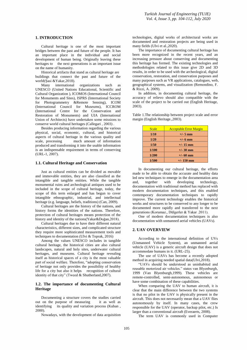
autonomous flight. This system is seen n in Fig. 1.
Fig. 1. Autonomous Routing Flight through Map (URL-
2).
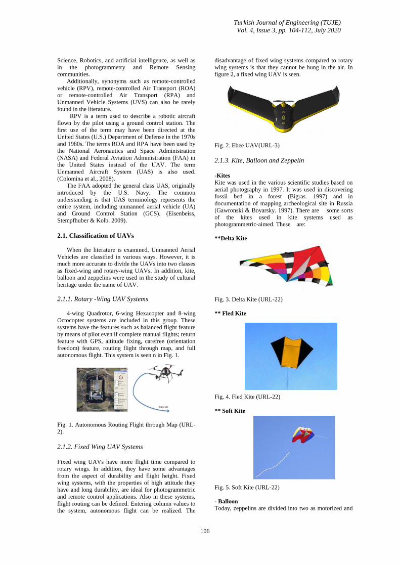
2.1.2. Fixed Wing UAV Systems
Fixed wing UAVs have more flight time compared to
rotary wings. In addition, they have some advantages
from the aspect of durability and flight height. Fixed
wing systems, with the properties of high attitude they
have and long durability, are ideal for photogrammetric
and remote control applications. Also in these systems,
flight routing can be defined. Entering column values to
the system, autonomous flight can be realized. The
disadvantage of fixed wing systems compared to rotary
wing systems is that they cannot be hung in the air. In
figure 2, a fixed wing UAV is seen.
Fig. 2. Ebee UAV(URL-3)
2.1.3. Kite, Balloon and Zeppelin
-Kites
Kite was used in the various scientific studies based on
aerial photography in 1997. It was used in discovering
fossil bed in a forest (Bigras. 1997) and in
documentation of mapping archeological site in Russia
(Gawronski & Boyarsky. 1997). There are some sorts
of the kites used in kite systems used as
photogrammetric-aimed. These are:
**Delta Kite
Fig. 3. Delta Kite (URL-22)
** Fled Kite
Fig. 4. Fled Kite (URL-22)
** Soft Kite
Fig. 5. Soft Kite (URL-22)
- Balloon
Today, zeppelins are divided into two as motorized and
Turkish Journal of Engineering (TUJE)
Vol. 4, Issue 3, pp. 104-112, July 2020
107
non-motorized. Non-motorized zeppelins are driven by
means of ground –controlled ropes the same as balloons.
Zeppelins include helium gas according to carrying
capacity. If the load you will carry is heavy, you have to
use bigger zeppelin and, thus, there is need for more
helium gas. This certainly increases cost. In addition,
motorized systems have generally two wings and carry
2-3 electric motors.
Fig. 6. General Appearance of Zeppelin (URL-24).
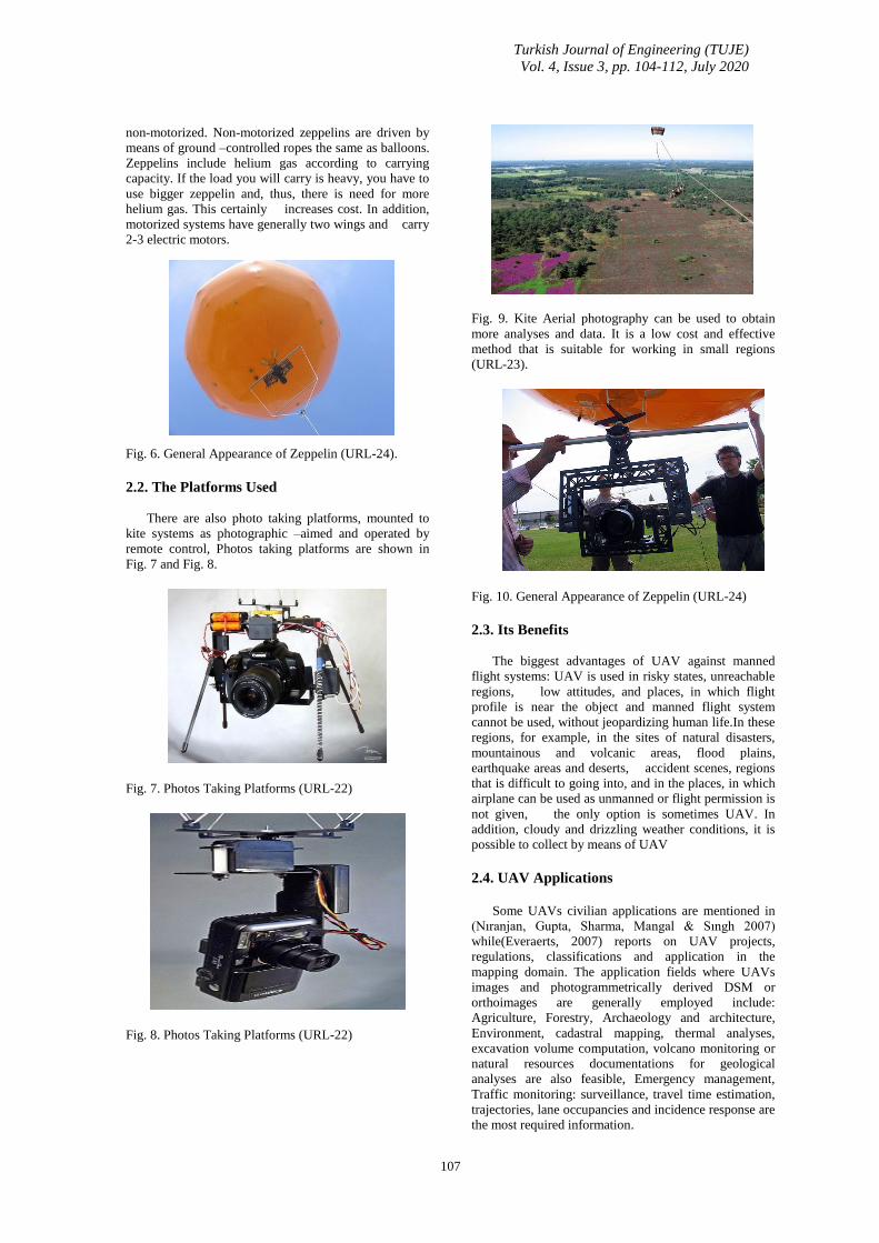
2.2. The Platforms Used
There are also photo taking platforms, mounted to
kite systems as photographic –aimed and operated by
remote control, Photos taking platforms are shown in
Fig. 7 and Fig. 8.
Fig. 7. Photos Taking Platforms (URL-22)
Fig. 8. Photos Taking Platforms (URL-22)
Fig. 9. Kite Aerial photography can be used to obtain
more analyses and data. It is a low cost and effective
method that is suitable for working in small regions
(URL-23).
Fig. 10. General Appearance of Zeppelin (URL-24)
2.3. Its Benefits
The biggest advantages of UAV against manned
flight systems: UAV is used in risky states, unreachable
regions, low attitudes, and places, in which flight
profile is near the object and manned flight system
cannot be used, without jeopardizing human life.In these
regions, for example, in the sites of natural disasters,
mountainous and volcanic areas, flood plains,
earthquake areas and deserts, accident scenes, regions
that is difficult to going into, and in the places, in which
airplane can be used as unmanned or flight permission is
not given, the only option is sometimes UAV. In
addition, cloudy and drizzling weather conditions, it is
possible to collect by means of UAV
2.4. UAV Applications
Some UAVs civilian applications are mentioned in
(Nıranjan, Gupta, Sharma, Mangal & Sıngh 2007)
while(Everaerts, 2007) reports on UAV projects,
regulations, classifications and application in the
mapping domain. The application fields where UAVs
images and photogrammetrically derived DSM or
orthoimages are generally employed include:
Agriculture, Forestry, Archaeology and architecture,
Environment, cadastral mapping, thermal analyses,
excavation volume computation, volcano monitoring or
natural resources documentations for geological
analyses are also feasible, Emergency management,
Traffic monitoring: surveillance, travel time estimation,
trajectories, lane occupancies and incidence response are
the most required information.

Turkish Journal of Engineering (TUJE)
Vol. 4, Issue 3, pp. 104-112, July 2020
108
3. UAV PHOTOGRAMMETRY
Terminology UAV photogrammetry (Eisenbeiss.
2008c) defines a photogrammetric measurement
platform, which operates remote controllably and is
semi- independent or independent, and in which there is
not any pilot. Platform was equipped by
photogrammetric measurement systems. This also
includes small or medium sized fixed video or video
camera, thermic or infrared camera systems, and aerial
LIDAR systems. The existent standard UAV enables to
monitor the record and position and the direction of
sensors applied in a local or local coordinate system.
Hence, UAV photogrammetry can be understood as a
technique that makes photogrammetric measurements
with the help of an unmanned aerial vehicle.
UAV photogrammetry, combining aerial and
terrestrial photogrammetry, leads to the new applications
in close distance effective area but also it introduces
traditional aerial photogrammetry with the new (close)
real time applications and low cost options..
4. STUDIES WITH UAV
4.1. UAVs for The Documentatıon of
Archaeologıcal Excavatıons
This study made by M. Sauerbier and H. Eisenbeiss.
In this study, Sauerbier and Eisenbeis, the
deployment of drones for the certification of such sites,
or 3D digital Surface models, Ortho images provide a
basis for further processing and the derivation of
different products such as high quality offers 3 different
case studies that are caused in the image data.
The second is the documentation of a Maya site in
Copán, Honduras, and the second is the quick and
simple documentation of an excavation site in Palpa,
Peru. Different types of UAVs were used in these
projects: in Honduras and Peru we worked with
Surveycopter 1B (Aeroscout, Switzerland) driven by a
two-stroke engine, in Bhutan we used a quadrocopter
MD 4-100 supplied by Microdrones. by the company
omnisight (Switzerland). The experiences gathered by
the projects described above and the test site surveys
allowed them to come to different conclusions regarding
the actual state of the UAVs, especially in terms of their
applicability in photogrammetric projects for the cultural
heritage site. Compared to the Falcon 8 and MD4-200
systems, the positional accuracy of Copter 1B (1m) is
quite high compared to 2-5m for multi-rotor systems
(Sauerbier & Eisenbeiss.2010).
4.2. Uav Platforms For Cultural Heritage Survey:
First Results
This study made by M. Lo Brutto, A. Garraffa,P.
Meli.
In this study, the two systems were tested in two
different regions: the site of the Temple of Isis at the
temples Valley Archaeological Park in Agrigento was
examined by the md4-200 microdron, the site of the
“Gibellina Cretto Cretto”. "Near the town of Trapani
with Swinglet glass. The first is one of the least-known
areas of the entire archaeological park, followed by
being released by tourists. The temple is located only in
a partially excavated area and is formed with a podium
and triportico identifying a square.
This study shows the potential of the UAV survey in
the area of Cultural Heritage. Although it requires earlier
and more detailed research, some initial results can
already be deduced. In particular, initial tests on
orientation phases do not highlight any reduction in the
increments of CPS using more stable block
configurations. 2000-4000 points per image and the
percentage of overlap of the images, respectively, due to
the number of binding points for each image High, A lot
of measurements (on average, at every point there is at
least 8-10 ledge) , may make unnecessary the use of
photogrammetric blocks with a more stable
configuration.
The final products (3D models and Ortho-images)
show a very high level of detail, allowing you to do very
accurate work and analysis. Due to the high level of
automation achieved through the software used, the
processes followed were very fast.
In the assessment of 3D point clouds, the vertical
residues obtained both for all the data sets of the Temple
of Isis and for two of the three data sets of “Cretto of
Gibellina” appear to be quite high. Apart from the
distribution of residues, 3D models show some slight
deformations. In order to better understand the reasons
for these latest results, certainly more extensive testing
needs to be done (Eisenbeiss. 2008c)
4.3. Balloon photogrammetry for cultural heritage
Altan et al. (2004) took aerial photographs in Patara
antique city by means of Helium gas balloon system.
Balloon is in 25 m of diameter and filled with 8 m3 of
Helium gas. This system consists of flight unit and
ground control unit. Flight unit consist of helium
balloon, camera platform, and Olympus Camedia C-
40404 Camera of Mega-Pixel. Ground control unit
consists of monitor remote control for camera, and
control ropes.
Fig. 11. Camera platform, camera, and balancing ropes
under balloon (Altan.2004)
Fig. 12. Ground control unit with monitor (Altan.2004)
Turkish Journal of Engineering (TUJE)
Vol. 4, Issue 3, pp. 104-112, July 2020
109
4.4. Studying the usability of non-metric digital
camera, mounted to kite platform, in
archeological documentation studies
This study was conducted by Ali Ulvi in Uzuncaburç
Diocaesarea Antique Theater, located in Silifke district
of Mersin province. in the scope of doctorate
study.
Fig. 13. Digital Camera and its carrying platform
Fig. 14. Ground Control Points used in aerial
photographs
Fig. 15. Mounting the camera and platform to a kite
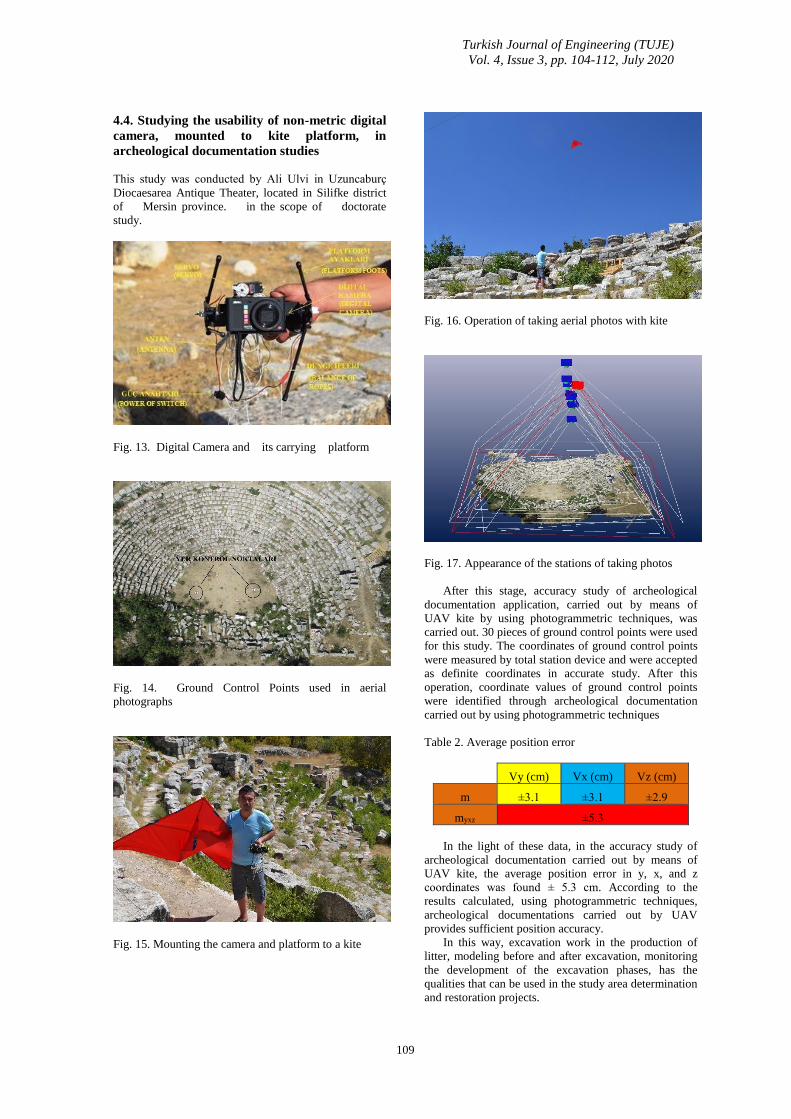
Fig. 16. Operation of taking aerial photos with kite
Fig. 17. Appearance of the stations of taking photos
After this stage, accuracy study of archeological
documentation application, carried out by means of
UAV kite by using photogrammetric techniques, was
carried out. 30 pieces of ground control points were used
for this study. The coordinates of ground control points
were measured by total station device and were accepted
as definite coordinates in accurate study. After this
operation, coordinate values of ground control points
were identified through archeological documentation
carried out by using photogrammetric techniques
Table 2. Average position error
Vy (cm) Vx (cm) Vz (cm)
m ±3.1 ±3.1 ±2.9
myxz ±5.3
In the light of these data, in the accuracy study of
archeological documentation carried out by means of
UAV kite, the average position error in y, x, and z
coordinates was found ± 5.3 cm. According to the
results calculated, using photogrammetric techniques,
archeological documentations carried out by UAV
provides sufficient position accuracy.
In this way, excavation work in the production of
litter, modeling before and after excavation, monitoring
the development of the excavation phases, has the
qualities that can be used in the study area determination
and restoration projects.
Turkish Journal of Engineering (TUJE)
Vol. 4, Issue 3, pp. 104-112, July 2020
110
4.5. Neptune Temple in the Archeolojical area
in Italy
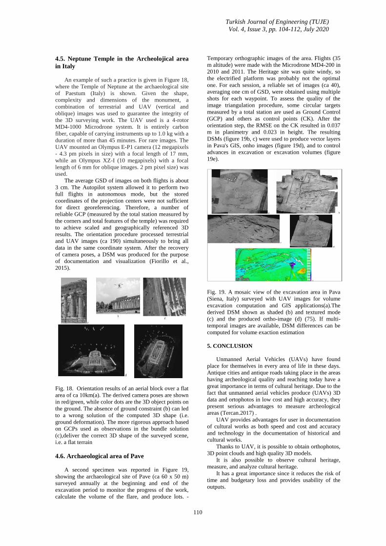
An example of such a practice is given in Figure 18,
where the Temple of Neptune at the archaeological site
of Paestum (Italy) is shown. Given the shape,
complexity and dimensions of the monument, a
combination of terrestrial and UAV (vertical and
oblique) images was used to guarantee the integrity of
the 3D surveying work. The UAV used is a 4-rotor
MD4-1000 Microdrone system. It is entirely carbon
fiber, capable of carrying instruments up to 1.0 kg with a
duration of more than 45 minutes. For rare images. The
UAV mounted an Olympus E-P1 camera (12 megapixels
- 4.3 pm pixels in size) with a focal length of 17 mm,
while an Olympus XZ-I (10 megapixels) with a focal
length of 6 mm for oblique images. 2 pm pixel size) was
used.
The average GSD of images on both flights is about
3 cm. The Autopilot system allowed it to perform two
full flights in autonomous mode, but the stored
coordinates of the projection centers were not sufficient
for direct georeferencing. Therefore, a number of
reliable GCP (measured by the total station measured by
the corners and total features of the temple) was required
to achieve scaled and geographically referenced 3D
results. The orientation procedure processed terrestrial
and UAV images (ca 190) simultaneously to bring all
data in the same coordinate system. After the recovery
of camera poses, a DSM was produced for the purpose
of documentation and visualization (Fiorillo et al.,
2015).
Fig. 18. Orientation results of an aerial block over a flat
area of ca 10km(a). The derived camera poses are shown
in red/green, while color dots are the 3D object points on
the ground. The absence of ground constraint (b) can led
to a wrong solution of the computed 3D shape (i.e.
ground deformation). The more rigorous approach based
on GCPs used as observations in the bundle solution
(c),deliver the correct 3D shape of the surveyed scene,
i.e. a flat terrain
4.6. Archaeological area of Pave
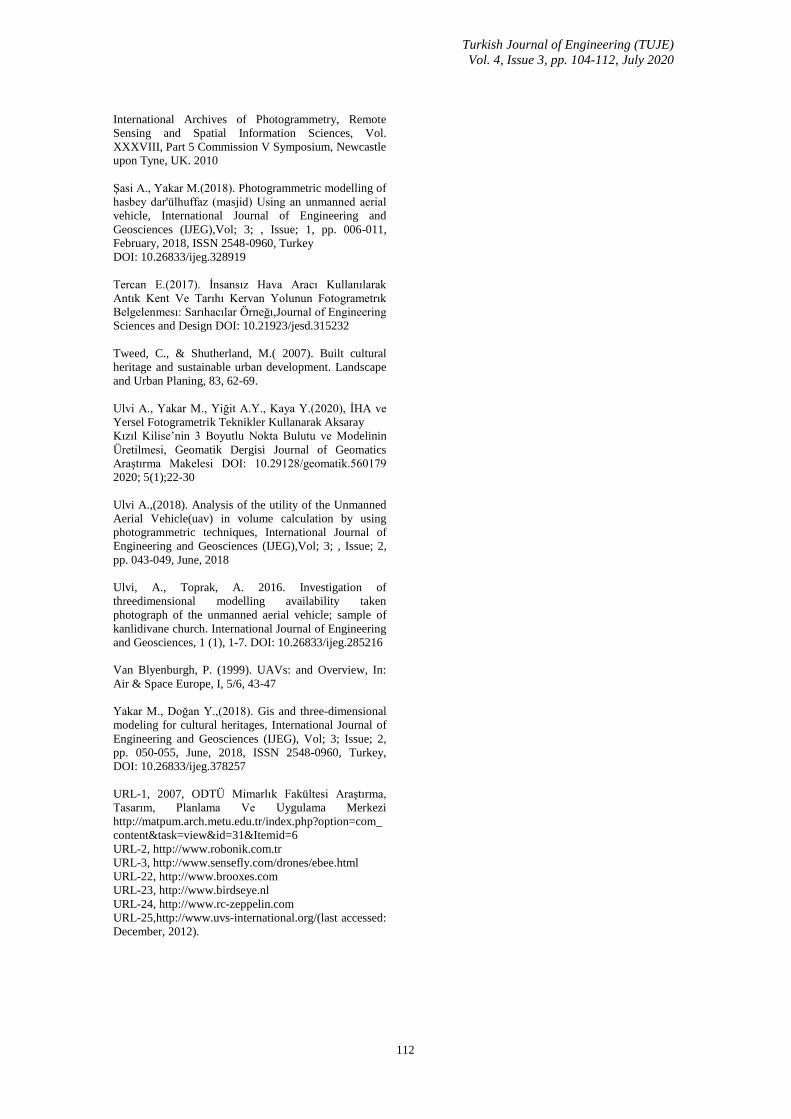
A second specimen was reported in Figure 19,
showing the archaeological site of Pave (ca 60 x 50 m)
surveyed annually at the beginning and end of the
excavation period to monitor the progress of the work,
calculate the volume of the flare, and produce lots. -
Temporary orthographic images of the area. Flights (35
m altitude) were made with the Microdrone MD4-200 in
2010 and 2011. The Heritage site was quite windy, so
the electrified platform was probably not the optimal
one. For each session, a reliable set of images (ca 40),
averaging one cm of GSD, were obtained using multiple
shots for each waypoint. To assess the quality of the
image triangulation procedure, some circular targets
measured by a total station are used as Ground Control
(GCP) and others as control points (CK). After the
orientation step, the RMSE on the CK resulted in 0.037
m in planimetry and 0.023 in height. The resulting
DSMs (figure 19b, c) were used to produce vector layers
in Pava's GIS, onho images (figure 19d), and to control
advances in excavation or excavation volumes (figure
19e).
Fig. 19. A mosaic view of the excavation area in Pava
(Siena, Italy) surveyed with UAV images for volume
excavation computation and GIS applications(a).The
derived DSM shown as shaded (b) and textured mode
(c) and the produced ortho-image (d) (75). If multi-
temporal images are available, DSM differences can be
computed for volume exaction estimation
5. CONCLUSION
Unmanned Aerial Vehicles (UAVs) have found
place for themselves in every area of life in these days.
Antique cities and antique roads taking place in the areas
having archeological quality and reaching today have a
great importance in terms of cultural heritage. Due to the
fact that unmanned aerial vehicles produce (UAVs) 3D
data and ortophotos in low cost and high accuracy, they
present serious advantages to measure archeological
areas (Tercan.2017) .
UAV provides advantages for user in documentation
of cultural works as both speed and cost and accuracy
and technology in the documentation of historical and
cultural works.
Thanks to UAV, it is possible to obtain orthophotos,
3D point clouds and high quality 3D models.
It is also possible to observe cultural heritage,
measure, and analyze cultural heritage.
It has a great importance since it reduces the risk of
time and budgetary loss and provides usability of the
outputs.

Turkish Journal of Engineering (TUJE)
Vol. 4, Issue 3, pp. 104-112, July 2020
111
Results are presented of photogrammetric projects
after his drone archaeological research contexts can be
evaluated as highly effective in the field, and excavation
of archaeological features and structures in relation to
the needs thanks to the versatility of the process.
Unmanned Aerial vehicle can be considered as a
quick documentation tool for low-cost mapping.
In the meantime, 3D models will become a
convenient database for placing / collecting /
accumulating other reading data in a geospatial
perspective, such as findings from digging activities and
stratigraphic information, and for performing
comparative analyses.
Today, thanks to the tilted camera contribution,
which studies applications and optimizations in current
geography research, 3D models achieve high descriptive
performance in terms of geometric surfaces and
radiometry, both on the tops and on the vertical facades
of steep walls.
In complex and dense areas it can be extremely
effective at both detecting details and comparing them.
REFERENCES
Altan, M. O., Celikoyan, T. M., Kemper, G. & Toz,
G.(2004). Balloon photogrammetry for cultural heritage
In: International Archives of the Photogrammetry,
Remote Sensing and Spatial Information Sciences, XX
ISPRS Congress, Istanbul, Turkey, XXXV-B5, 964-968.
Berni, J.A.J.; Zarco-Tejada, P.J.; Suárez, L.; Fereres,
E.(2009). Thermal and Narrowband Multispectral
Remote Sensing for Vegetation Monitoring From an
Unmanned Aerial Vehicle. Transactions on Geoscience
and Remote Sensing, 2009, Vol. 47, pp. 722-738.
Bigras, C. (1997). Kite aerial photography of the Axel
Heiberg Island fossil forest, In: American Society of
Photogrammetry and Remote Sensing, First North
American Symposium on Small Format Aerial
Photography, University of Minnesota, USA, 147-153
Callegari, F. (2003). Sustainable development prospects
for Italian coastal cultural heritage: a Ligurian case study,
Journal of Cultural Heritage, pp. 49–56
Can, M. (2009). Kültürel Miras ve Müzecilik; Çalışma
Raporu. Erişim: 12 Eylül 2009.
http://www.kultur.gov.tr/teftis/Genel/BelgeGoster.aspx?
F6E10F-
8892433CFF530CECBE8DDD19208B89614C9154F63
1
Chiabrandoa F., D'Andriab F., Sammartanoa G. &
Spanòa A.(2016). Uav Photogrammetry For
Archaeologıcal Sıte Survey. 3d Models At The
Hıerapolıs In Phrygıa (Turkey),Virtual Archaeology
Review, 9(18): 28-43, 2018
http://dx.doi.org/10.4995/var.2018.5958 © UPV, SEAV,
2015 Received: June 16, 2016 Accepted: August 4, 2017,
Filiberto Chiabrandoa
Colomina, I., Blázquez, M., Molina, P., Parés, M. E. &
Wis, M. (2008). Towards A New Paradigm for High-
Resolution Low-Cost Photogrammetryand Remote
Sensing, In: The International Archives of the
Photogrammetry, Remote Sensing and Spatial
Information Sciences, ISPRS Congress, Beijing, China,
XXXVII. Part B1, 1201-1206.
Eisenbeiss, H., 2008c. UAV photogrammetry in plant
sciences and geology, In: 6th ARIDA Workshop on
"Innovations in 3D Measurement, Modeling and
Visualization, Povo (Trento), Italy.
Eisenbeiss, H., (2009). Stempfhuber, W. & Kolb, M.,
2009.
English Heritage. (2003). Metric Survey for Heritage
Documentation, Documentation for Conservation:A
Manual for Teaching Metric Survey Skills.
Everaerts, J. (2007).The Use of Unmanned Aerial
Vehicles (UAVS) for Remote Sensing and Mapping. In:
Int. Archives of Photogrammetry, Remote Sensing and
Spatial Information Sciences, Beijing, China, 2008; Vol.
37 (B1), pp. 1187-1192.
Everaerts, J. (2008). The Use of Unmanned Aerial
Vehicles (UAVS) for Remote Sensing and Mapping, In:
The International Archives of the Photogrammetry,
Remote Sensing and Spatial
Information Sciences, ISPRS Congress, Beijing, China,
XXXVII. Part B1, 1187-1192
Fiorillo F, Jimenez F.-Palacios B, Remondino F, Barba
S, 2012. 3D Surveying and modeling of the
archaeological area of Paestum, Italy. In: Proc. 3rd Inter.
Conference Arquelogica 2.0, 2012, Sevilla, Spain.
Gawronski, J. H. G. & Boyarsky, P. V., (1997).
Northbound with Barents: Russian-Dutch integrated
archaeologic research on the Archipelago Novaya
Zemlya, Uitgeverij Jan Mets, Amsterdam, p. 255.
Korumaz, A.G., Dülgerler O.N. & Yakar M. (2011).
Digital Techniques in Cultural Heritage Documentation,
Selçuk Üniversitesi Mühendislik-Bilim ve Teknoloji
Dergisi.
Kuban, D. (2000). Tarihi çevre Koruma ve Onarımın
Mimarlık Boyutu Kuram ve Uygulama, Yapı Endüstri
Merkezi Yayınları, İstanbul.
Manyoky, M.; Theiler, P.; Steudler, D.; Eisenbeiss,
H.(2011). Unmanned aerial vehicle in cadastral
applications. In: Int. Archives of Photogrammetry,
Remote Sensing and Spatial Information Sciences,
Zurich, Switzerland, 2011; Vol. 38 (1/C22).
Niranjan, S., Gupta, G. Sharma N.,Mangal, M. & Singh,
V.(2007). Initial efforts toward mission-specific imaging
surveys from aerial exploring platforms: UAV. In: Map
World Forum, Hyderabad, India, 2007; on CD-ROM.
Remondino, F. & Rizzi, A. (2009). “Reality‐Based 3D
Documentation of World Heritage Sites:Methodologies,
Problems and Examples”, 22nd CIPA Symposium,
Kyoto, Japan, October 11‐15 2009.
Sauerbier M. , Eisenbeiss H.,2010. Uavs for the
documentatıon of archaeologıcal excavatıons,
Turkish Journal of Engineering (TUJE)
Vol. 4, Issue 3, pp. 104-112, July 2020
112
International Archives of Photogrammetry, Remote
Sensing and Spatial Information Sciences, Vol.
XXXVIII, Part 5 Commission V Symposium, Newcastle
upon Tyne, UK. 2010
Şasi A., Yakar M.(2018). Photogrammetric modelling of
hasbey dar'ülhuffaz (masjid) Using an unmanned aerial
vehicle, International Journal of Engineering and
Geosciences (IJEG),Vol; 3; , Issue; 1, pp. 006-011,
February, 2018, ISSN 2548-0960, Turkey
DOI: 10.26833/ijeg.328919
Tercan E.(2017). İnsansız Hava Aracı Kullanılarak
Antık Kent Ve Tarıhı Kervan Yolunun Fotogrametrık
Belgelenmesı: Sarıhacılar Örneğı,Journal of Engineering
Sciences and Design DOI: 10.21923/jesd.315232
Tweed, C., & Shutherland, M.( 2007). Built cultural
heritage and sustainable urban development. Landscape
and Urban Planing, 83, 62-69.
Ulvi A., Yakar M., Yiğit A.Y., Kaya Y.(2020), İHA ve
Yersel Fotogrametrik Teknikler Kullanarak Aksaray
Kızıl Kilise’nin 3 Boyutlu Nokta Bulutu ve Modelinin
Üretilmesi, Geomatik Dergisi Journal of Geomatics
Araştırma Makelesi DOI: 10.29128/geomatik.560179
2020; 5(1);22-30
Ulvi A.,(2018). Analysis of the utility of the Unmanned
Aerial Vehicle(uav) in volume calculation by using
photogrammetric techniques, International Journal of
Engineering and Geosciences (IJEG),Vol; 3; , Issue; 2,
pp. 043-049, June, 2018
Ulvi, A., Toprak, A. 2016. Investigation of
threedimensional modelling availability taken
photograph of the unmanned aerial vehicle; sample of
kanlidivane church. International Journal of Engineering
and Geosciences, 1 (1), 1-7. DOI: 10.26833/ijeg.285216
Van Blyenburgh, P. (1999). UAVs: and Overview, In:
Air & Space Europe, I, 5/6, 43-47
Yakar M., Doğan Y.,(2018). Gis and three-dimensional
modeling for cultural heritages, International Journal of
Engineering and Geosciences (IJEG), Vol; 3; Issue; 2,
pp. 050-055, June, 2018, ISSN 2548-0960, Turkey,
DOI: 10.26833/ijeg.378257
URL-1, 2007, ODTÜ Mimarlık Fakültesi Araştırma,
Tasarım, Planlama Ve Uygulama Merkezi
http://matpum.arch.metu.edu.tr/index.php?option=com_
content&task=view&id=31&Itemid=6
URL-2, http://www.robonik.com.tr
URL-3, http://www.sensefly.com/drones/ebee.html
URL-22, http://www.brooxes.com
URL-23, http://www.birdseye.nl
URL-24, http://www.rc-zeppelin.com
URL-25,http://www.uvs-international.org/(last accessed:
December, 2012).
Related Documents