Semestrale di Studi e Ricerche di Geografia

Travelling through place-names. A Methodological approach for the development of a geo-atlas of toponyms
Dec 23, 2015
La toponomastica è una testimonianza della “saggezza del passato”,
il patrimonio culturale stratificato di una comunità. È quindi necessario
preservare i toponimi come espressione di questo patrimonio con una
attenta analisi critica, interdisciplinare e “globale” delle loro proprietà
geografiche e della loro genesi. In quest’ottica, il Laboratorio di Cartografia
e Toponomastica Storica dell’Università degli Studi di Salerno raccoglie,
cataloga, analizza e utilizza scientificamente, per la ricerca e la didattica
della geografia, mappe e toponimi antichi su scala nazionale ed europea.
Le ricerche, finora pubblicate in diversi saggi, sono basate su un modello
originale di analisi e classificazione che mira a considerare tutti i diversi
metodi di indagine geo-toponomastica, in senso diacronico e sincronico,
con riferimento ai temi dell’identità e della pianificazione territoriale “geo
culturalmente” sostenibile.
Il presente contributo propone in particolare l’applicazione delle nuove
tecnologie, con la realizzazione di una geo-atlante di toponomastica
basato su GIS e web semantico, in grado di interfacciarsi con altre banche
dati e aperto all’interazione attraverso l’attuazione di un sistema di codici
a barre (basato su Web Tag, guide virtuali e mappe georeferenziate).
Welcome message from author
This document is posted to help you gain knowledge. Please leave a comment to let me know what you think about it! Share it to your friends and learn new things together.
Transcript

Semestrale di Studi e Ricerche
di Geografia
Semestrale di Studi e Ricerche di Geografia Roma, XXV, Fascicolo 2, luglio – dicembre 2013
Gino De Vecchis
The joint IGU/ICA Commission/Working Group on Toponymy. A short introductionPeter Jordan
Features of toponyms forming of Alakol basin of Kazakhstan Particolarità della formazione dei toponimi del bacino del lago Alakol del KazakistanCaractéristiques de la formation des toponymes de la piscine du lac Alakol qui se trouve dans le sud-est du KazakhstanStanislav Yerdavletov, Abdreeva Sholpan, Aizholova Gulzhan
Naming methods of folk agricultural plot names in Japanese villages: a connection between geography and cognitive linguisticsI metodi di denominazione di piccoli appezzamenti nei villagi rurali giapponesi: un collegamento tra la geografia e la linguistica cognitiva Méthode de nommage des noms folkloriques des parcelles agricoles dans des villages japonais – connexion entre la géographie et la linguistique cognitiveSatoshi Imazato
Is exonym an appropriate term for names of features beyond any sovereignty?Esonimo è un termine appropriato per i toponimi utilizza-ti in contesti extraterritoriali? Exonyme est-il un terme approprié pour les noms des car-actéristiques au-delà de toute souveraineté?Peter Jordan
The Changing Toponymy: The Place Names and their VitalityI cambiamenti della toponimia. I nomi di luogo e la loro vitalità Les changements de noms de lieux: les noms des lieux et leur vitalitéCosimo Palagiano
7
11
17
27
41
55

Degrees of precision in toponyms containing compass pointsLivelli di precisione in toponimi contenenti i punti cardinaliDegrés de précision en toponymes qui contiennent des points cardinaux et intercardinauxRiemer Reinsma
Travelling through place-names. A Methodological approach for the development of a geo-atlas of toponymsViaggio attraverso toponimi. Un approccio metodologico perlo sviluppo di un geo-atlante dei toponimiVoyage à travers les toponymes. Une approche méthodologique pour le développement d’un geo-atlas des toponymesSilvia Siniscalchi
Standardisation of Place Names in Countries Influenced by the Chinese Writing System Standardizzazione dei nomi delle località nei Paesi influenzati dal sistema di scrittura cineseStandardisation des Noms de Lieux dans les Pays influencés par le Système à écrire Caractère chinoisHiroshi Tanabe, Kohei Watanabe
A study of the toponyms of places and areas in relation to the physical characteristics of the terrain of the province of Cuenca, Spain I toponimi di luoghi e di aree in relazione alle caratteristiche fisiche del terreno della provincia di Cuenca, in Spagna.Étude des toponymes en rapport à la nature du sol. Le cas de l’expression de “bourbier”, “marais” dans la province de Cuenca (Espagne)Emilio Nieto Ballester, José A. Rodríguez Esteban, Pilar Lacasta Reoyo
GEOFRAME
a cura di Marco Maggioli
Roma: visione o pre-visione sinottica?Sandra Leonardi
73
91
115
123
141
DIARIO
a cura di Riccardo Morri
I Bisogni Educativi Speciali. Verso una Geografia inclusivaAngela Caruso
La Sicilia nell’assetto dello spazio euromediterraneoLiberata Nicoletti
La Dichiarazione di Roma sull’educazione geografica in Europa. Una road map per la geografiaCristiano Giorda
Rome Declaration on Geographical Education in Europe.IV EUGEO Congress 2013
LO SCAFFALE
a cura di Riccardo Morri
C. LOMBARDI-DIOP AND C. ROMEO (a cura di), Postcolonial Italy. Challenging National Homogeneity (R. Noel Welch)
P. BONORA (a cura di), Atlante del consumo di suolo, per un progetto di città metropolitana (A. Mengozzi)
The AuthorsGli autoriLes auteurs
147
151
155
157
161
163
165

91
Travelling through place-names. A Methodological approach for the development of a geo-atlas of toponyms
Silvia Siniscalchi*
1. Introduction
Toponymy, “disciplinary crossroad”, is a testimony of the “wisdom of the past” and the stratified heritage of a community. It is so necessary to preserve place names as “cultural heritages” contained in various sources (maps, cadastres, dictionaries, guides, archives, literary texts, oral sources, and so on), with a careful critical analysis, interdisciplinary and “global”, of their geographical properties (location, relevance, scale of observation, classifications, relationships, etc.) and of their genesis (in the form and/or in the meaning) during the centuries. That's just the work of the Laboratory of Historical Cartography and Toponymy of the University of Salerno (founded by Prof. V. Aversano and now directed by me), which collects, catalogues, analyzes and uses scientifically, for research and geographical education, ancient maps and toponyms of the European and, above all, Italian territory. The outcome of its research – so far published in several essays, as the scientific review “Studi del La.Car.Topon.St.” (n.1-2 [2005-06] and n. 3-4 [2007-08]) – is based on an original model of analysis and classification which aims at encompassing all the different methods of the geo-toponymy investigation, in a diachronic and synchronic sense, for a research concerning identity and spatial planning “geo culturally” sustainable.
For this goal, the present contribution aims to strengthen the aforementioned model through new technologies, with a geo-atlas of place names based on the G.I.S. and on the semantic web, capable of interfacing with other information systems equally organized and opened to interaction through the implementation of a barcoding system (based on Web Tag, virtual guides and georeferenced maps). So, through a simple connection to the Internet, everyone can interact with information concerning a specific toponym and its space, recovering the past for a better understanding of the present.
To show practically this premise we would like to present a case study concerning the Cilento1, a sub-region of the Campania (region of Italy) about
* Salerno, Dipartimento di Scienze Politiche, Sociali e della Comunicazione, Università degli Studi di Salerno, Italy.

which a few years ago an analysis of its place names was carried out by comparing five historical maps of the seventeenth and nineteenth centuries. The purpose of the analysis, based on the adoption of an analytical-semantic method of classification of place names developed by Prof. Aversano, showed changes and continuities of the “way of life” (using the famous definition of Vidal de la Blache) of the territories of the Cilento through a series of reflections on the changes and continuities of their place names in the centuries2.
2. The Cilento’s territorial identity through its place names of the XVII-XIX centuries
The above-mentioned analysis, in general, showed the persistence during the centuries of a strong interaction between place names with anthropogenic-territorial meanings (especially of those showing human settlements and/or religious in nature) and with physical and natural meanings, thus indicating the priority of the difficult relationship between man and nature in the events and, therefore, in the process of creation of place names of the Cilento.
This importance is contained in the special economic vocation of this sub-region, inhabited since ancient times but founded, for historical reasons (from the Middle Ages onwards, as mentioned later), especially on the agricultural and forestry-pastoral activities and less on the commercial ones, of the valleys and sea, as confirmed by the local toponymy.
The interaction between society and nature of places, characterized in many respects by a wild landscape and a rugged morphology, with many towns, mostly of medieval origin and perched on hills, is therefore the basis of the framework of the territorial identity of the Cilento and contains its most important geo-historic elements and the conditions for its future development, today often put at risk by unwise and foolish changes.
The progressive loss of memory of geographical locations and of the genius loci that identifies them, in the multiplication of anonymous, fragmented and commodified landscapes, in fact, is an ongoing process even in the Cilento region, especially along its coasts. The alteration of the identity of the territories through processes of uncontrolled constructions (also unauthorized), is often worsened by some demeaning pseudo cultural initiatives or avowedly “national-popular”, completely unrelated to the geographical realities of reference and also causes of a further degradation
1 The geographic definition of “Cilento” denotes the entire southern part of the province of Salerno, bounded by Mount Marzano and Mount Eremita (at north-east) and by Valley of Diano (at east), starting from the plain to the left of the Sele River down to the Gulf of Policastro.
2 The classification scheme is based on the transposition of each name in a symbol that expresses in an abbreviated form its general and specific meaning. The procedure makes it easier to quantify the prevalence of certain types of place names in a territorial context, simplifying their interpretation from a geographical point of view.
92
Sem
estr
ale d
i S
tu
di e
Ric
er
ch
e d
i G
EO
GR
AFIA
S. Siniscalchi Travelling through place-names

93
and “barbarization” of the places.The recovery of the identity of the latter is therefore a necessary step for
the protection and enhancement of their vocations and of their singularity, according to current program guidelines, state and local, of preservation and enhancement of the cultural identity characteristics of a community. Among the last, place names, as immaterial elements but important for the place names, as immaterial but important elements for the the perception of the territorial identity, are the preferred instruments to thoroughly investigate the relationship between man and his environment in its socio-economic-cultural past and present. As is known, in fact, the geo-historical characteristics of a territory are contained also in the genesis, formation, distribution and in the original sense of its place names. That is why the Toponymy, despite being a discipline traditionally reserved for linguists, has long been used in research a geographic method of comparative and diachronic study, connecting, by virtue of its complexity, a significant amount of multidisciplinary studies3.
In the most recent research programs we find those relating to the concept of “Semantic Web”, one of the branches of I.C.T. (Information and Communications Technologies), officially recognized in the early 90s of the last century by the International Geographical Community (through the creation of the Commission for Geography of Telecommunications and Information the International Geographical Union) and by the European Commission itself4.
3 As “geographical indicators” (Cassi and Marcaccini, 1998) of civilization, kinds of life, events and interrelationships of environmental, economic, political, social and cultural development and as synthesis and compendium of the various branches of knowledge (geographical, historical, linguistic, socio-anthropological, etc.), also for practical purposes (Cassi, 1991; Deli, 1992), the place names require some diversified studies and a stratigraphic reading which have to put into focus the period of their history, the society and the ethnicity of reference (Nocentini, 2004, p. 698). If they are rare and/or unique witnesses of particular ‘roots' of the past, they also become immaterial “cultural heritage”, not only worthy of being reported and interpreted, but also saved and safeguarded (Aversano, 2006 [b], p. 170). In each name there is, therefore, a fragment of culture and “identity” of an area which has to be rebuilded and protected, understanding the latter as a «palimpsest of nature and history, result of the changing relationships over time (built and sometimes unstructured), of vertical [...] and horizontal kind» (Aversano, 2006 [a], p. 54).
4 Considering the “information society” as a new area of interest for EU territorial policies, the current design guidelines of the EU promote the advanced use of I.C.T. by citizens, businesses and administrations, recognizing their usefulness for the processes of management and planning in the activation of the governance through the interaction between management action “from above” and collective action “from below”. Geography, in turn, given the current technological changes, having examined the relationship between communities and places of origin (the main object of investigation) from innovative points of view, contributes to the growth and consolidation of theoretical and empirical studies on the Information Society with the birth of a special field of geographical research (Hall and Preston, 1988; Feldman, Florida, 1994; Lawson, 1997; Lazzeroni, 2004, 2009; Paradiso, 2004, 2006, 2009).
Semestrale di Studi e Ricerche di Geografia Roma - XXV, Fascicolo 2, luglio-dicembre 2013

2.1 Convergence of Toponimy, semantic web and administrative guidelines in a geo-systemic viewpoint - According to this orientation we propose the description of a wider “ontological” pattern of organization and representation of place names of the Cilento, based on the concept of Semantic Web5, on the basis of which the realization of a “Geo-atlas of the Cilento's toponimy” conceived as a dynamic information system and able to establish semantic relationships between elements formally different, highlighting the possibility of a theoretical development and of an use of the I.C. applied to geographic research.
The ultimate goal of the operation aims to interrelate, in a systemic perspective, the toponyms and the places on which they insist with all kinds of geographical, historical and cultural sources available that may affect them, to show the identity characteristics of their deeper geographical context and highlight the changes which have happened over the centuries, both for scientific knowledge as well as in view of a future planning.
The Geo-atlas as such meets the planning guidelines of the P.T.R. Campania 2006 and to all territorial policies based on a different organization of local administrative network that, in the case of Cilento and, in general, of the Campania region – «creature much more of a story than of geography» (G. Galasso)6 – is revealed very appropriate. It is in fact necessary to initiate policies of land management based on a direct and specific geographic knowledge of the places so to be able to really identify their strengths and weaknesses. In this operation, aimed at the exploitation of local territorial identities through the recovery and the development of the knowledge of their past and of their present, the geographers are personally involved, the more so because they are accustomed to directing their inquiries to the construction and implementation of “networks” based on the systemic-relational logic.
The latter, in fact, for almost two decades has been at the center of the regional plans of regeneration and development. Regarding the Cilento among the various projects oriented in this direction emerges one called “The City of the Park”, based on the idea of creating aggregations between municipalities (above all those included in the National Park of Cilento and
5 If ontology, according to the original definition of Aristotle (Metaphysics, IV, 2, 1003, a20), is “the science which considers the being as being,” in computer science it becomes the instrument to describe, represent, conceptualize the part of the world that we want modelled in an application. The term is then used to indicate a data structure that contains the relevant entities, relationships between them, rules and constraints of the domain that one wants to represent (Brida, 2010, p. 89).
6 The current Campania region was “built” after the unification of Italy (it was one of the “statistical compartments” of Pietro Maestri for the fulfillment of the Italian Statistical Yearbook), but does not correspond to a homogeneous geographical area. Just consider the contradiction between the meaning of its Latin etymology (campus = plain) and the preponderance, in its current extension, of the mountain and hill areas the (35%, 50% and 15% respectively according to the Campania's Statistical Yearbook).
94
Sem
estr
ale d
i S
tu
di e
Ric
er
ch
e d
i G
EO
GR
AFIA
S. Siniscalchi Travelling through place-names
95
Semestrale di Studi e Ricerche di Geografia Roma - XXV, Fascicolo 2, luglio-dicembre 2013
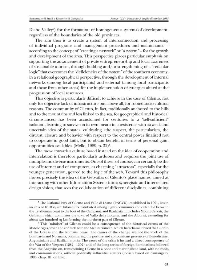
Diano Valley7) for the formation of homogeneous systems of development, regardless of the boundaries of the old provinces.
The aim thus is to create a system of interconnection and processing of individual programs and management procedures and maintenance – according to the concept of “creating a network” or “a system” – for the growth and development of the area. This perspective places particular emphasis on supporting the advancement of private entrepreneurship and local awareness of sustainable tourism, through building and/or strengthening of a “reticular logic” that overcomes the “deficiencies of the system” of the southern economy, in a relational geographical perspective, through the development of internal networks (among local participants) and external (among local participants and those from other areas) for the implementation of synergies aimed at the progression of local resources.
This objective is particularly difficult to achieve in the case of Cilento, not only for objective lack of infrastructure but, above all, for rooted socio-cultural reasons. The community of Cilento, in fact, traditionally anchored to the hills and to the mountains and less linked to the sea, for geographical and historical circumstances, has been accustomed for centuries to a “self-sufficient” isolation, learning to survive on its own means in coexistence with «a weak and uncertain idea of the state», cultivating «the suspect, the particularism, the distrust, closure and behavior with respect to the central power finalized not to cooperate in good faith, but to obtain benefit, in terms of personal gain, opportunities available» (Mello, 1989, p. 32)8.
The move towards a culture based instead on the idea of cooperation and interrelation is therefore particularly arduous and requires the joint use of multiple and diverse instruments. One of these, of course, can certainly be the use of internet and of computers, as charming “attractors”, especially for the younger generation, geared to the logic of the web. Toward this philosophy moves precisely the idea of the Geo-atlas of Cilento's place names, aimed at interacting with other Information Systems into a synergistic and interrelated design vision, that sees the collaboration of different disciplines, combining
7 The National Park of Cilento and Vallo di Diano (PNCVD), established in 1991, lies in an area of 1810 square kilometers distributed among eighty communes and extended between the Tyrrhenian coast to the foot of the Campania and Basilicata. It includes Mount Cervati, the Gelbison, which dominates the town of Vallo della Lucania, and the Alburni, extending for about two hundred sq km forming the northern part of Cilento.
8 This “mindset” of Cilento could be a consequence of the historical events of the Middle Ages, when the contacts with the Mediterranean, which had characterized the Cilento of the Greeks and the Romans, cease. The causes of the change are not the work of the Lombards and Normans, considering the positive and concomitant presence of Benedictine, Augustinians and Basilian monks. The cause of the crisis is instead a direct consequence of the War of the Vespers (1282 - 1302) and of the long series of foreign dominations followed from the Angevins on, transforming Cilento in a poor and marginalized land, with no roads and communications, without politically influential centers (loosely based on Santangelo, 1993, chap. III, on line).

the logic of the semantic web with the one of a renewed geography, economic and administrative, oriented toward a systemic perspective.
3. Case study: the town of Ascea
To provide a practical example about how the Atlas intends operate within this perspective, we chose to study the town of Ascea which includes the ruins of Velia-Elea (an ancient town founded in the sixth century B.C. by the Greeks of Asia Minor, becoming one of the main cultural centers of “Magna Grecia”)9 and still preserves the memory of its past as a Greek colony and as the house of the famous Eleatic school of philosophy10.
Ascea can be considered an emblematic location of Cilento's reality as early as the meaning of the name, which embodies the deep connection between man and nature and is linked to the positive position of the center (well exposed to the sun and to the winds), to the shape of the hilly ground on which it is built (near to white cliffs overlooking the sea, alternated with wide sandy beaches) and to the presence of the waterways (river Alento and terminal portions of some of its tributaries)11. In the positive elements of Ascea we could write also the richness of the natural and cultivated vegetation – the forest, the garrigue, the arable land, the orchard, the olive grove, the chestnut tree – and an anthropic landscape characterized by the presence of hill towns and, on the plain, of scattered rural homes. But in addition to natural resources, to geo-historical memories and unexpressed potential, Ascea also stands out because of the obvious landscape and environmental problems that afflict it.
9 Strabo (Geography, VI, I), describing the Gulf of Salerno, between Punta Campanella and the plain of Paestum, so writes about Elea: «The Phoenicians who founded it, called her iela; others, by a certain fountain that is located there, call it Ella and the contemporaries Elea. Then they were of this city Parmenides and Zeno, Pythagorean philosophers. It seems to me that through the work of these two, or even before them, the city was governed by good laws [...] Antiochus says that, after that Phocaea was conquered from Harpagus, general of Cyrus, the citizens which were successful to escape trough the sea with their families, first sailed under Creontide to Cirno and Messalia; then, driven away by this places, they founded Elea: the name of which some people derive from the river Eleeto. This city is far from Posidonia about two hundred stadia; after it, there is the promontory Palinuro».
10 For this purpose, since about fifteen years, has been operating in the territory the Foundation Alario for Elea-Velia, a non-profit organization, working in the culture and in the high training, born on 6 June 1986 and operational since 1997, created by the will of Ms Gaetana Alario, the last descendant of a known and distinguished family of Cilento. The Foundation is a private institution that operates in the public interest, supported by its own statute and recognized by the Campania Region with Decree No. 350 of 22 January 1988.
11 The name (in dialect “a sia” and the “l'ascea” or “Lascea” in the cartography of seventeenth and eighteenth centuries) according to Battisti is probably a deformation of the ancient name “Isacia”, an island with an harbor, 5 km from Velia, mentioned by Strabo and by Pliny, and now united to the hill on which is Ascea. For Finamore the name would find origin from a Byzantine name “ascaios” (?) which would mean a not obscure place, favorable to the seaport (Dictionary UTET).
96
Sem
estr
ale d
i S
tu
di e
Ric
er
ch
e d
i G
EO
GR
AFIA
S. Siniscalchi Travelling through place-names
97
Semestrale di Studi e Ricerche di Geografia Roma - XXV, Fascicolo 2, luglio-dicembre 2013
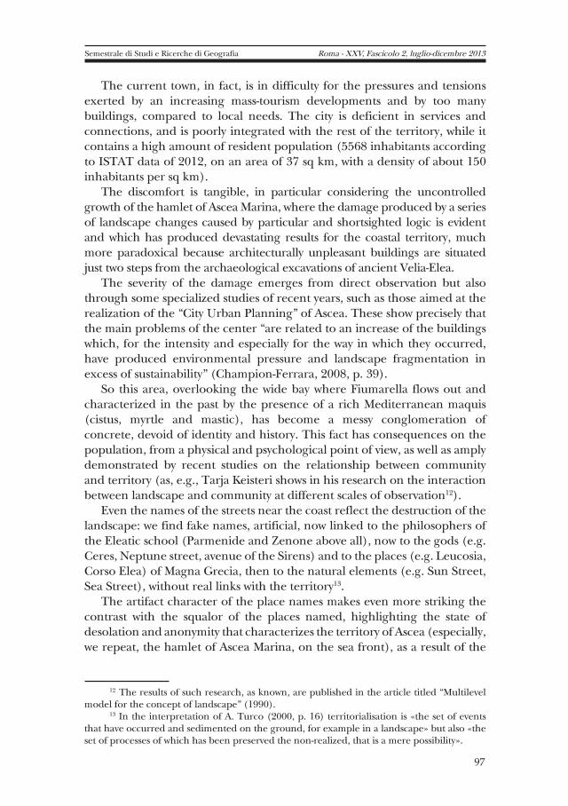
The current town, in fact, is in difficulty for the pressures and tensions exerted by an increasing mass-tourism developments and by too many buildings, compared to local needs. The city is deficient in services and connections, and is poorly integrated with the rest of the territory, while it contains a high amount of resident population (5568 inhabitants according to ISTAT data of 2012, on an area of 37 sq km, with a density of about 150 inhabitants per sq km).
The discomfort is tangible, in particular considering the uncontrolled growth of the hamlet of Ascea Marina, where the damage produced by a series of landscape changes caused by particular and shortsighted logic is evident and which has produced devastating results for the coastal territory, much more paradoxical because architecturally unpleasant buildings are situated just two steps from the archaeological excavations of ancient Velia-Elea.
The severity of the damage emerges from direct observation but also through some specialized studies of recent years, such as those aimed at the realization of the “City Urban Planning” of Ascea. These show precisely that the main problems of the center “are related to an increase of the buildings which, for the intensity and especially for the way in which they occurred, have produced environmental pressure and landscape fragmentation in excess of sustainability” (Champion-Ferrara, 2008, p. 39).
So this area, overlooking the wide bay where Fiumarella flows out and characterized in the past by the presence of a rich Mediterranean maquis (cistus, myrtle and mastic), has become a messy conglomeration of concrete, devoid of identity and history. This fact has consequences on the population, from a physical and psychological point of view, as well as amply demonstrated by recent studies on the relationship between community and territory (as, e.g., Tarja Keisteri shows in his research on the interaction between landscape and community at different scales of observation12).
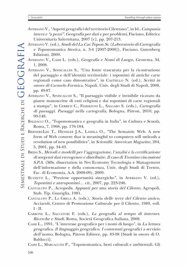
Even the names of the streets near the coast reflect the destruction of the landscape: we find fake names, artificial, now linked to the philosophers of the Eleatic school (Parmenide and Zenone above all), now to the gods (e.g. Ceres, Neptune street, avenue of the Sirens) and to the places (e.g. Leucosia, Corso Elea) of Magna Grecia, then to the natural elements (e.g. Sun Street, Sea Street), without real links with the territory13.
The artifact character of the place names makes even more striking the contrast with the squalor of the places named, highlighting the state of desolation and anonymity that characterizes the territory of Ascea (especially, we repeat, the hamlet of Ascea Marina, on the sea front), as a result of the
12 The results of such research, as known, are published in the article titled “Multilevel model for the concept of landscape” (1990).
13 In the interpretation of A. Turco (2000, p. 16) territorialisation is «the set of events that have occurred and sedimented on the ground, for example in a landscape» but also «the set of processes of which has been preserved the non-realized, that is a mere possibility».

destruction of the landscape of the past and, with it, of the identity elements contained in the natural and man-made features that distinguished it.
Therefore the recovery of the latter necessarily passes through the enhancement of the original landscape, with its tangible and intangible assets (including place names), as a no doubt key factor in the process of the local development of Ascea, «which includes in equal proportion the recovery of previous critical problems and the commissioning of potential values to date ignored», with a U-turn in the planning policy, which must put a stop to the proliferation of buildings and to the waste of resources (Champs-Ferrara, 2008, p. 39)14.
In fact, the foundation of this change of perspective is contained in the European Landscape Convention of 2000 (ratified by the Italian Parliament with Law no. 14 of 09/01/2006), which defines the perception of the landscape as a conceptual basis for every territorial practice and highlights the need to safeguard every its characteristic element. The landscape, in fact, is legally recognized as «an essential component of the living environment of the people, an expression of the diversity of their shared cultural and natural heritage, and a foundation of their identity» (2000, ch., Art. 5).
3.1. The recovery and enrichment of the landscape of Cilento through the Geo-atlas of place names – Based on these assumptions, considering that each name is an expression of a community in its relationship with the territory, in terms of material and psychological perception, the study of place names and their networking rightly enters within policies on the landscape and planning “from below” that underpin today's policies inspired by concept of territorial governance. The recovery, classification and processing of place-names as exportable elements in a database organized according to the model of the semantic web is just one of the tools for the strengthening and expansion of these guidelines.
According to the idea of its founder (Tim Berners-Lee), in fact, the Semantic Web is a “virtual” environment (as discloses his Latin meaning of “potential”) in which information and data are described as interrelated systems through an ontologic-semantic method (which describes the real
14 In the study the fields of intervention identified for the recovery of the landscape of Ascea are the followings: rebalance settlement systems, exposed to the consequences of building development or abandoned, by applying different rules for the reuse of the existing and for the containment of areas of expansion and land use; promote the recovery of identity of the built center, giving great importance to the prestige of urban place, by redefining its morphology, redrawing its boundaries, organizing its access, designing public spaces, establishing a constant dialogue between architecture and landscape; identify alternative ways for a new connotation of marginal areas or of frontier that now constitute the places of non-urban identity, even resorting to the use of green systems at small and medium scale; improve the welfare of the inhabitants, taking into account the leading role played by urban green spaces and not built for ecological recovery of the city and the control of the shape of the city (Champion-Ferrara, 2008, p. 40).
98
Sem
estr
ale d
i S
tu
di e
Ric
er
ch
e d
i G
EO
GR
AFIA
S. Siniscalchi Travelling through place-names

99
Semestrale di Studi e Ricerche di Geografia Roma - XXV, Fascicolo 2, luglio-dicembre 2013
objects through formal logic), so they may become available through search engines “smart” by fostering cooperation between scholars from all over the world (Berners-Lee and Hendler and Lassila, 2001). Therefore, the ontological description of place names and, in this case, of the names of the streets of Ascea – conceived from the point of view of the Geo-atlas as a geo-based location (spatial reproductions georeferred and identifiable by a G.P.S. and which can be represented by a G.I.S.) – can show all their connections and meanings within a virtual city, which is enhanced in terms of quantity and quality, making clear all the elements belonging to the territorial assets and to the geo-historic places. In view of the semantic web one can enhance investigations on geographical place names, overcoming every abstract etymological interpretation, so considering properly their territorial significance, based on an analysis of all possible points of view and of their intrinsic and extrinsic interrelationships.
According to this perspective, the place names of Cilento and also the names of the streets of its towns, selected, counted, interpreted, ontologically described, should be collated as “entries” in the information system of the Geo-Atlas, in connection with other documents and geographical objects, organized according to logic nodes of the semantic web. In this way, through the amplification of the possibilities of perception and understanding of ‘invisible' resources of the territory, the Geo-Atlas can help to promote the places from the point of view of landscape and of cultural tourism, in reference to their macro and micro areas.
The advantage in terms of representation of meanings and of their relationships for the geographical understanding of the dynamics of the Cilento area is therefore of considerable value15.
The problem is rather to define how to present a set of place-names in the context of the Semantic Web, that is how to show their relationships internal/external (in a diachronic and synchronic sense) and the link with
15 In the semantic model, in fact, the data and their meanings, at the conceptual level, are represented with the use of ontology languages that can express any kind of relationship with a hierarchical classification of the relationships (between objects, concepts and main connections) as well as produce other information automatically, expressing new concepts and relationships in addition to those existing in the original data through the implementation of formal logic. It is therefore an ideal model to integrate data from different sources, as are those of the Toponomastic. In fact, in the geographical research in particular, as anticipated, we must consider several reports about the place names of a given territory, including multiple sources of retrieval (historical maps and / or recent archival documents, literary works, oral traditions, etc). The meaning of a place name, therefore, must be interpreted considering the sources of specific place on which it stands and the relationships with other place names, more or less contiguous. The Semantic Web can interpret to the best this requirement, allowing to establish links from the point of view of the absolute and systemic space (deterministic/possibilistic/functional relationships between society and the environment) and mapping, through the development (in the ontologic language) of the semantic relationships between the elements of a representation.

the territory of which they are part. It could be of help at this point to imagine each place name in the geo-atlas as an open structure, where relationships are indefinitely expandable, potentially at least.
4. How to represent a territorial context of place names through the semantic web
The difficulty of representing the semantic relationships between place names derives primarily from having to decode their meaning from the geographic-historical context and then translate it into a language of formal logic. The meanings of place names, in fact, represent the product and not the simple sum of interdependent territorial elements16.
For this purpose, the names of the Geo-atlas of Cilento must first be investigated and based on an “integrated documentation”, as a result of the dynamic construction of ontologic relations between diversified sources, made visible through an appropriate interface. To provide an overall idea of the ontological relations of every name one can then use a map of reticular type, which shows the name in the center of a network of logical interrelationships with all possible information about it, underlining with evidence (potentially at different scales) its interrelations with other territorial elements.
These interrelationships – it is important to emphasize – are not static but dynamic, since, in time, they could change the links between place names and associated documents , thanks to discovery of more clues and research hypotheses. So new links could be added between place names and geographical features, be these historical or linguistic, of those places on which they insist, linked to the network to which they belong (along with micro-place names and names of the streets), to the various sources that contain them (archival documents, literary works, reference maps, oral sources, investigations on the ground), to their type and their classification17.
5. Conclusions
Through the idea of a Geo-atlas of the place names of the Cilento we have tried to make clear that the place names, from a geographical systemic
16 As noted by Aversano (2006 [b]), it follows that the place names can reveal the peculiar characteristics of a geographic area that, in isolation, they may not show by no means. So borns the aim of making explicit their meanings and their complex interrelationships through their representation in a semantic system.
17 In this respect, among the various proposals tested, is particularly useful the aforementioned classification system devised by V. Aversano (Aversano, 2006 [a]), based on the reduction of the meanings of the place names in initials read from a geographical viewpoint. This system could in fact become a useful starting point for the connection of the “nodes” of a large topographic network, consisting of multiple information systems and organized according to the rules of the semantic web.
100
Sem
estr
ale d
i S
tu
di e
Ric
er
ch
e d
i G
EO
GR
AFIA
S. Siniscalchi Travelling through place-names

point of view, combined with the modern technologies of the Semantic Web, are capable of producing visions of the landscapes enhanced in their geo-historical expressions and in their potential attitudes for a sustainable develop in their territorial areas of reference.
The combination among new technologies and geographical methods therefore produces results in line with the need for the contemporary geographers to investigate the territory in its many forms according to a relational logic, able to expand the reflection also to the intangible aspects of the territory, transforming it into a holistic system, in a virtual organism that reproduces and visibly manifests all the complex interactions present in a geographical area.
The model proposed for the realization of the Geo-Atlas of the place names of the Cilento, through the construction of a system based on geographical data systems – georeferred and interrelated with the geo-historic knowledge and with a direct investigation on site – aims to enhance territorial information with new sources, added to the previous knowledge, for the understanding of a geographic area, in its internal and external relations, vertical and horizontal, making them accessible, dynamic and updated in real time, even expendable for the purposes of cultural tourism, if we consider the current systems of barcoding18.
This objective also wants to promote the theme of the Kyoto International Conference of this year, related to the need for geographers to study the geographical changes that globalization and other changes of a planetary nature have caused to the world. The negative consequences on a local, national and global level of these changes stem also from the environmental and landscape changes: economic inequality, social fragmentation, political conflicts and social crises are their direct results. Hence the need to study the past and the geo-history of places and territories, investigating forms of human interaction with the environment, for the understanding of the present and for the identification of possible solutions to its current problems.
18 The barcoding system (based on Web Tags, virtual guides and georeferenced maps), through a mobile device, allows anyone to access and interact as a “sensor” with the being conveyed information. The system has a very simple operation: by framing an object “tagged” with a camera phone of new generation, can be displayed clickable icons and menus on the monitor that allow you to access detailed information concerning them, with the additional possibility to download other related information. The functionality of the barcoding can also be of a practical nature: it gives, e.g., the possibility of offering not only cultural information and/or tourist information but also of service, as the location of a public office, of a pharmacy, or of a hospital, and to be able immediately arrive at them (by downloading the route on your GPS) or communicate with them through phone or email.
Semestrale di Studi e Ricerche di Geografia Roma - XXV, Fascicolo 2, luglio-dicembre 2013
101

Fig. 1 – Johannes Janssonius, Itala nam tellus / Graeciamaior erat / Ovid IV Fastor / Haec Italiae pars / nunc primum de prisca / aerugine est abstersa et eiusmodi ut videre licet ni/tori reddita (1640 ca)]. The overthrow of the Italian boot (with Puglia at north and Campania, Calabria and Sicily at east and northeast) may be a gimmick inherited from the medieval cartography (one can think about the representation of Italy by Al Idrisi, e.g.), with which one wants to attach more importance to Southern Italy, already Magna Grecia, here showed with the ancient place names. In the red rectangle was highlighted the gulf in front of Ascea (which is called here with the ancient name of Elea-Hyele). Source: “Accurata Orbis antiqui Delineatio”, edited by Hornius and then inserted by Janssonius in the vol. VI of his “Atlas Novus”.
102
Sem
estr
ale d
i S
tu
di e
Ric
er
ch
e d
i G
EO
GR
AFIA
S. Siniscalchi Travelling through place-names
103
Semestrale di Studi e Ricerche di Geografia Roma - XXV, Fascicolo 2, luglio-dicembre 2013
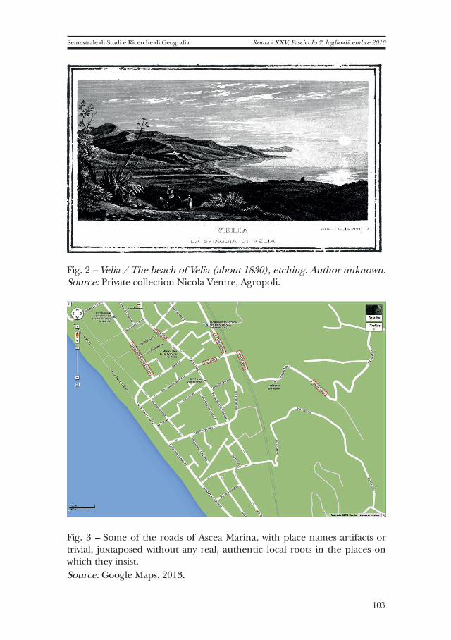
Fig. 2 – Velia / The beach of Velia (about 1830), etching. Author unknown. Source: Private collection Nicola Ventre, Agropoli.
Fig. 3 – Some of the roads of Ascea Marina, with place names artifacts or trivial, juxtaposed without any real, authentic local roots in the places on which they insist.Source: Google Maps, 2013.

Fig. 4 – A possible representation of a place name (in this case Ascea) in the Geo-Atlas of place names of Cilento. The contents and their links are not static, but the result of dynamic combinations between objects ontologically described.Source: image drawn by the author.
104
Sem
estr
ale d
i S
tu
di e
Ric
er
ch
e d
i G
EO
GR
AFIA
S. Siniscalchi Travelling through place-names

105
Semestrale di Studi e Ricerche di Geografia Roma - XXV, Fascicolo 2, luglio-dicembre 2013
References
AA.VV., Dizionario di toponomastica. Storia e significato dei nomi geografici italiani, Torino, UTET, 1990.
AA.VV., Il Parco del Cilento paesaggio vivente, Napoli, Electa, 1998.AA.VV., Intervento di “Ricerca Azione” nell’ambito del Progetto integrato
grande attrattore culturale Paestum-Velia [POR Campania 2000-2006-Asse II-Mis. 2.1 d)], Reg. Campania (online: <http://resources.regione.campania.it/slide/files/POR/biblioteca%20virtuale/Ricerca%20Azione%20Paestum%20Velia/file_7390_GNR.pdf>)
AA.VV., Le città leggibili. La toponomastica urbana tra passato e presente, Perugia, Deputaz. di Storia Patria per l'Umbria, 2004.
AFELTRA G., “Toponimi I.G.M.”, in AVERSANO V. (ed.), Toponimi e antroponimi. Beni-documento e spie di identità per la lettura, la didattica e il governo del territorio, Atti del convegno (Salerno, 14-16 novembre 2002), vol. 1-2, Soveria Mannelli, Rubbettino, 2007, pp. 79-89.
ASTONE F., “Alle origini del toponimo Cilento: la fondazione di Poseidonia ed i Tirreni-Etruschi del golfo di Salerno. Riflessioni ed ipotesi …”, in Annali Storici di Principato Citra, 10, n.1, 2012, pp. 5-44.
AVERSANO V., “Il toponimo Cilento e il centro fortificato sul Monte della Stella”, in Studi e Ricerche di Geografia, 5, n. 1, 1982, pp. 1-41.
AVERSANO V., “Il Coronimo Cilento e il suo territorio (1034-1552)”, in Studi e ricerche di Geografia, 6, n. 1, 1983, pp. 78-127.
AVERSANO V., “Alla ricerca dell'identità: percorsi interdisciplinari, didattici e scientifici, attraverso la toponomastica di un comune salernitano”, in Id. (ed.), Studi del CAR.TOPON.ST. (Laboratorio di Cartografia e Toponomastica Storica, n. 1-2 [2005-2006]), Fisciano, Gutenberg Edizioni, 2006[a], pp. 53-88.
AVERSANO V., “I toponimi nella ricerca-didattica: da fonti documentali a spie d'identità territoriale, con valore di beni culturali”, in Id., La Geografia interpreta il territorio. Cifra scientifico-applicativa e strategie didattiche, Salerno, Ed. Universitaria Salernitana, 2006[b], pp. 157-178.
AVERSANO V. (ed.), Toponimi e antroponimi. Beni-documento e spie di identità per la lettura, la didattica e il governo del territorio, Atti del convegno (Salerno, 14-16 novembre 2002), vol. 1-2, Soveria Mannelli, Rubbettino, 2007[a].
AVERSANO V., “L'identità del Comune di Pellezzano (Sa) per via toponimica ed extratoponimica: un percorso geo-interdisciplinare a fini didattico-scientifici”, in Id. (ed.), Toponimi e antroponimi. Beni-documento e spie di identità per la lettura, la didattica e il governo del territorio, Atti del convegno (Salerno, 14-16/11 2002), vol. I, Soveria Mannelli, Rubbettino, 2007[b], pp. 135-178.
AVERSANO V., “Aspetti geografici del territorio Cilentano”, in Id., Campania intera e “a pezzi”. Geografia per dati e per problemi, Fisciano, Editrice Universitaria Salernitana, 2007 [c], pp. 207-213.
AVERSANO V. (ed.), Studi del La.Car.Topon.St. (Laboratorio di Cartografia e Toponomastica Storica, n. 3-4 [2007-2008]), Fisciano, Gutenberg Edizioni, 2009.
AVERSANO V., CASSI L. (eds.), Geografia e Nomi di Luogo, Geotema, 34, 1, 2008.
AVERSANO V., SINISCALCHI S., “Una fonte trascurata per la ricostruzione del paesaggio e dell'identità territoriale: i toponimi di antiche carte regionali come caso dimostrativo”, in CASTIELLO N. (ed.), Scritti in onore di Carmelo Formica, Napoli, Univ. degli Studi di Napoli, 2008, pp. 49-87.
AVERSANO V., SINISCALCHI S., “Il paesaggio visibile e invisibile ricavato da piante manoscritte di enti religiosi e dai toponimi di carte regionali a stampa”, in CERRETI C., FEDERZONI L., SALGARO S. (eds.), Cartografia di paesaggi. Paesaggi nella cartografia, Bologna, Pàtron, 2010, pp. 99-148.
BALDACCI O., “Toponomastica e geografia in Italia”, in Cultura e Scuola, Roma, 7, 1968, pp. 176-184.
BERNERS-LEE T., HENDLER J.A., LASSILA O., “The Semantic Web. A new form of Web content that is meaningful to computers will unleash a revolution of new possibilities”, in Scientific American Magazine, 284, 5, 2001, pp. 34-43.
BRIDA S., Metodi e modelli per l’aggregazione, l’analisi e la certificazione di sorgenti dati eterogenee e distribuite. Il caso di Trentino riscossioni S.P.A. (MSc dissertation in Net Economy Tecnologia e Management dell'informazione e della conoscenza, Univ. degli Studi di Trento, Fac. di Economia, A.A. 2008-09), 2009.
BUZZETTI L., “Preziose opportunità sinergiche”, in AVERSANO V. (ed.), Toponimi e antroponimi… cit., 2007, pp. 223-246.
CANTALUPO P., Acropolis. Appunti per una storia del Cilento, Agropoli, Stab. Tip. Guariglia, 1981.
CANTALUPO P., LA GRECA A. (eds.), Storia delle terre del Cilento antico, Acciaroli, Centro di Promozione Culturale per il Cilento, 1989, voll. I - II.
CARBONE L., SALVATORI F. (eds.), La geografia al tempo di internet. Ricerche e Studi, Roma, Società Geografica Italiana, 2008.
CASSI L., 1991, “L'interesse geografico per i nomi di luogo”, in La lettura geografica. Il linguaggio geografico. I contenuti geografici a servizio dell’uomo, Bologna, Pàtron Editore, pp. 83-98 [Studi in onore di O. Baldacci].
CASSI L., MARCACCINI P., “Toponomastica, beni culturali e ambientali. Gli
106
Sem
estr
ale d
i S
tu
di e
Ric
er
ch
e d
i G
EO
GR
AFIA
S. Siniscalchi Travelling through place-names
107
Semestrale di Studi e Ricerche di Geografia Roma - XXV, Fascicolo 2, luglio-dicembre 2013
‘indicatori geografici' per un loro censimento”, in Memorie della Soc. Geogr. It. Vol. 56, Roma, Soc. Geogr. It., 1998.
CHELI E., Il paradigma sistemico, <http://www.enciclopediaolistica.com/enciclopedia/sci2/sci03.htm>.
COOKE P., “Introduction: regional innovation systems-an evolutionary approach”, in Cooke P. et al., Regional Innovation Systems, London, Routledge, 2008, pp. 1-18.
CORNA PELLEGRINI G., PARADISO M. (eds.), Nuove comunicazioni globali e nuove geografie, Milano, CUEM, 2009.
CRANG, M., CRANG P., MAY J. (eds.), Virtual Geographies: Bodies, Space and Relations, London, Routledge, 1999.
D'ARCANGELO E., “Guida della escursione nel Cilento (sintesi)”, in Atti del XXII Congresso Geografico Italiano. Salerno 18-22 aprile 1975, Cercola, Istituto Grafico Italiano, 1975.
DE ANGELIS V., La logica della complessità. Introduzione alle teorie dei sistemi, Milano, Mondadori, 1996.
DELI A., “La toponomastica, crocevia pluridisciplinare per una lettura critica dell'ambiente”, in MORETTI G., MELELLI A., BATINTI A. (eds.), I nomi di luogo in Umbria. Progetti di ricerca, Reg. Umbria-Univ. degli Studi di Perugia-M.U.R.S.T., Perugia, 1992, pp. 25-30 [Quad. Reg. Umbria, N.S., Coll., Toponomastica, 1].
DESERIIS M., MARANO G., Net. Art. L’arte della connessione, Milano, ShaKe Edizioni, 2003.
DE VECCHIS G., PALAGIANO C. (eds.), Le parole chiave della Geografia, Roma, Carocci, 2009.
DEVLIN K., Addio Cartesio. La fine della logica e la ricerca di una nuova cosmologia della mente, Milano, Bollati Boringhieri, 1999.
DODGE M., KITCHIN R., Mapping cyberspace, London, Routledge, 2001.EBNER P., Economia e società nel Cilento medievale, I, Roma, Edizioni di
Storia e Letteratura, 1979.EBNER P., Chiesa, baroni e popolo nel Cilento, I, Roma, Edizioni di Storia
e Letteratura, 1982.ETTORE M. DE JULIIS, Magna Grecia: l’Italia meridionale dalle origini
leggendarie alla conquista romana, Bari, Edizioni EDIPUGLIA, 1996.EVANGELISTA R., “Sectoral Patterns of Technological Change” in Services
Economics of Innovation and New Technology, 9, 2000, pp. 183-221.FABRIKANT S.I., BUTTENFIELD B.P., “Formalizing semantic spaces for
information access”, in Annals of the Association of American Geographers, 91, 2001, pp. 263-80.
FELDMAN M.P., FLORIDA R., “The geographic sources of innovation: technological infrastructure and product innovation in the United States”, in Annals of the Association of American Geographers, n. 84 (2), 1994.
FERRARA G., CAMPIONI G., “Verso l'Ascea di domani”, in Centro Interdipartimentale di Ricerca L.U.P.T.-Università degli Studi di Napoli Federico II, Il paesaggio nella storia, nella cultura, nell’arte e nella progettazione urbanistica; assunti teorici ed esperienze [Territorio della ricerca su insediamento e ambiente. Rivista internazionale di cultura urbanistica, 3], Napoli, E.S.I., 2008, pp. 37-46.
FONDAZIONE ALARIO PER ELEA-VELIA, La città del Parco, Relazione del Presidente della Fondazione Alario per Elea-Velia ONLUS On.le Carmelo Conte, Ascea, 8 novembre 2012 (online: <http://www.fondazionealario.it/public/file/Relaz%20Presidente%20FondAlario.pdf>)
FUSCHI M., MASSIMI G. (eds.), Toponomastica Italiana. L’eredità storica e le nuove tendenze, Roma, S.G.I., 2008.
GIORDA C., Cyber geografia. Estensione, rappresentazione e percezione dello spazio nell’epoca dell’informazione, Torino, Tirrenia stampatori, 2000.
GRILLOTTI DI GIACOMO M.G., 2007, “Il potenziale uso applicativo della toponomastica”, in AVERSANO V. (ed.), Toponimi e antroponimi… cit., pp. 297-307.
HALL P., PRESTON P., The Carrier Wave: New Information Technology and the Geography of Innovation 1846-2003, London, Unwin Hyman, 1988.
HOCHMAIR H., FRANK A.U., “A semantic map as basis for the decision process in the www navigation”, in MONTELLO D.R. (eds.), Conference on Spatial Information Theory, Springer, Morro Bay, CA (USA), 2001, pp. 173-88.
ICT Policy Support Programme as part of the Competitiveness and Innovation framework Programme (CIP), online: <http://ec.europa.eu/information_society/activities/ict_psp/index_en.htm>.
IST. GEOGR. DE AGOSTINI, Nomi d’Italia. Origine e significato dei nomi geografici e di tutti i comuni, Novara, 2006.
KELLERMAN A., The Internet on Earth: A Geography of Information, London, Wiley, 2002.
LA GRECA A., Appunti di storia del Cilento, Acciaroli (SA), Ed. CPC, 1993.LA GRECA A., DI RIENZO A., LA GRECA E., Viaggio nel Cilento. Guida
turistico-culturale dei borghi del Cilento tra storia e tradizione orale, Agropoli, Ed. Cilento Ricerche, 1984.
LAWSON C., “Territorial Clustering and High-technology Innovation: from Industrial Districts to Innovative Milieux”, Working Paper, 54, Cambridge, ESRC Centre for Business Research, University of Cambridge, 1997.
LAZZERONI M., Geografia della conoscenza e dell’innovazione tecnologica, Milano, F. Angeli, 2004.
108
Sem
estr
ale d
i S
tu
di e
Ric
er
ch
e d
i G
EO
GR
AFIA
S. Siniscalchi Travelling through place-names

109
Semestrale di Studi e Ricerche di Geografia Roma - XXV, Fascicolo 2, luglio-dicembre 2013
LAZZERONI M., “Tecnologie della comunicazione e spazi della conoscenza: nuovi rapporti tra luoghi reali e flussi virtuali”, in CORNA PELLEGRINI G. e PARADISO M. (eds.), Nuove comunicazioni globali e nuove geografia, Milano, CUEM, 2009, pp. 227-236.
LEMMI E., “Dinamiche e processi nella «geografia delle città» in Italia. Quadro storico di fine millennio”, Milano, Franco Angeli, 2012.
LUCARELLI F. (ed.), Il Parco Nazionale del Cilento e Vallo di Diano, La Rete MAB del Mediterraneo, PNCVD, Studio Idea Editrice, 1999.
MANGO FURNARI M., NAPOLI C., Distributed multimedia information systems for the World Wide Web. A case study for cultural heritage, tourism and publishing, Napoli, Liguori, 2003.
MARTINES R., VILLANI G. (eds.), Catalogo delle tipologie di intervento architettonico nelle aree paesaggistiche del Cilento, Viterbo, Beta Gamma Editrice, 1998.
MARULLO C., PERUGI R., High-tech e territorio. Il ruolo delle città nelle dinamiche di localizzazione delle imprese ad alta tecnologia, XXXII Conferenza Scientifica Annuale AISRe, online: <www.starnet.unioncamere.it/download.php?id=16064>.
MASTRELLI C.A., “Toponomastica: una ricerca complessa”, in MORETTI G., MELELLI A., BATINTI A. (eds.), I nomi di luogo in Umbria: Progetti di ricerca, Vol. II [Quad. Reg. dell'Umbria-Collana di Toponomastica 2], Reg. dell'Umbria, Perugia, 1994, pp. 11-13.
MELELLI A., BATINTI A. (eds.), Studi e Ricerche sui Nomi di Luogo, Ellera Umbra (PG), Ed Era Nuova s.r.l., 1998.
MELLO M., “Una terra da salvare, una cultura da rivalutare”, in Atti del convegno sul turismo del Centro Culturale “Cilento domani” di Agropoli, Salerno, 1989.
MUSONI F., “Criteri da seguire nelle ricerche toponomastiche”, in La Geografia nelle Scuole, XIII, 1968, pp. 61-64.
NAIMOLI M., Ascea e Vatolla. Centri del “Parco Nazionale del Cilento e Vallo di Diano”. Architettura e urbanistica, Università degli Studi di Napoli “Federico II”, Dottorato di Ricerca in “Storia della città e del paesaggio”-XIX Ciclo, A.A. 2006-2007 (Coordinatore: Prof. Arch. Francesco Starace) online: <http://www.fedoa.unina.it/1663/1/Naimoli_Storia_dell_Architettura_e_della_Citta.pdf>
NAPOLI M., Civiltà della Magna Grecia, Roma, Edizioni EURODES, 1985.NATELLA P., “Ascea: Storia di Ascea e del suo territorio, dal tardo antico
all'età contemporanea”, in DENTE D. (ed.), Ascea: storia di un borgo, Napoli, Editoriale scientifica s.r.l., 2002, vol. I.
NICOLETTI D., Controllo Ambientale e sviluppo territoriale del Cilento, Napoli, De Costanzo Ed., 1993.
NOCENTINI A., “Toponimi italiani: origine ed evoluzione”, in Atlante dei Tipi Geografici, Firenze, I.G.M., 2004, pp. 698-701.

PARADISO M., Geografia e pianificazione territoriale della Società dell’Informazione, Milano, Franco Angeli, 2004.
PARADISO M., “Geography of the Information Society: a new culture of hybrid spaces?”, in CLAVAL P., PAGNINI M.P., SCAINI M. (eds.), Cultural Geography new trends, Atti della Commissione di Geografia Culturale dell'IGU, Gorizia, 22-24 Settembre 2003, IGU, Università di Trieste e Gorizia Campus Press, 2006, pp. 167-176 (online: <www.openstarts.units.it/dspace/.../c1paradi.pdf>).
PARADISO M., “Geografie della comunicazione globale. Acquisizioni e frontiere degli studi per un'agenda di ricerca”, in CORNA PELLEGRINI G., PARADISO M. (eds.), Nuove comunicazioni globali e nuove geografie, cit., pp. 31-46.
PELLEGRINI G.B., Toponomastica italiana. 10000 nomi di città, paesi, frazioni, regioni, contrade, fiumi, monti spiegati nella loro origine e storia, Hoepli, Milano, 1994.
RANIERI L., Della ricerca toponomastica e del suo interesse per gli studi geografici, Bari, Cressati, 1953.
SANTANGELO T., Rivalutazione delle Risorse Agricole, Industriali e Culturali del Cilento nella prospettiva del Parco, Tesi di laurea in Storia Contemporanea [Relatore: prof.ssa A. Di Leo], Univ. degli Studi di Salerno, A.A. 1992-93 (online: <http://stioegorga.xoom.it/tesi/intro_capI.htm>).
SIMMIE J., Innovative Cities, London, E&FN Spon, 2001.SIMMIE J., “Innovation and Space: A Critical Review of the Literature”, in
Regional Studies, n. 39, 6, 2005, pp. 791-806.SINISCALCHI S., “L'identità ‘svelata': un esempio d'indagine geografico-
storica sul Cilento attraverso la toponomastica (XVII-XIX secc.)”, in AVERSANO V. (ed.), Il Territorio del Cilento nella Cartografia e nella Vedutistica (secc. XVII-XIX), Vatolla, Edizioni Palazzo Vargas, 2009, pp. 135-147.
SQUAZZONI F., La sociologia morfogenetica e processuale di Norbert Elias. Modelli, configurazioni e dimensioni dell’intreccio sociale, DSS PAPERS SOC 3-00 (online: <www.unibs.it/sites/default/files/ricerca/allegati/1217squazz00_0.pdf>).
STERNBERG R., “Reasons for the genesis of high-technology regions-theoretical explanation and empirical evidence”, in Geoforum, 27, 2, 1996, pp. 205–223.
STRABONE, Geografia. L’Italia (Libri V e VI), trad. italiana di A.M. Biraschi (testo greco a fronte), Milano, Rizzoli, 1988.
TRAMONTANA A., Il patrimonio dell’umanità dell’Unesco. Un’analisi di semiotica della cultura, Dottorato di Ricerca Semiotica M-FIL 05, Univ. degli Studi di Bologna, ciclo XIX, A.A. 2006-07, online: <http://amsdottorato.cib.unibo.it/222/1/Tesi_Tramontana.pdf>.
110
Sem
estr
ale d
i S
tu
di e
Ric
er
ch
e d
i G
EO
GR
AFIA
S. Siniscalchi Travelling through place-names

111
Semestrale di Studi e Ricerche di Geografia Roma - XXV, Fascicolo 2, luglio-dicembre 2013
TRIGILIA C., BURRONI L., Le città dell’innovazione in Italia e in Europa, Rapporto di Artimino sullo Sviluppo Locale, Firenze, il Mulino, 2010.
VASSALLUZZO M., Eléa-Velia del Cilento: dalle origini ai giorni nostri. Con pianta degli scavi e guida, Cava dei Tirreni, Palumbo and Esposito,1986.
VIGOLO M.T., “I nomi di luogo tra continuità e innovazione”, in MARCATO G. (ed.), Atti del Convegno “Dialetto, Memoria e Fantasia”, Sappada (Belluno) 28 giugno-2 luglio 2006, Padova, Unipress, 2007, pp. 31-36.
Riassunto - Viaggio attraverso toponimi. Un approccio metodologico per lo sviluppo di un geo-atlante dei toponimiLa toponomastica è una testimonianza della “saggezza del passato”, il patrimonio culturale stratificato di una comunità. È quindi necessario preservare i toponimi come espressione di questo patrimonio con una attenta analisi critica, interdisciplinare e “globale” delle loro proprietà geografiche e della loro genesi. In quest’ottica, il Laboratorio di Cartografia e Toponomastica Storica dell’Università degli Studi di Salerno raccoglie, cataloga, analizza e utilizza scientificamente, per la ricerca e la didattica della geografia, mappe e toponimi antichi su scala nazionale ed europea. Le ricerche, finora pubblicate in diversi saggi, sono basate su un modello originale di analisi e classificazione che mira a considerare tutti i diversi metodi di indagine geo-toponomastica, in senso diacronico e sincronico, con riferimento ai temi dell’identità e della pianificazione territoriale “geo culturalmente” sostenibile.
Il presente contributo propone in particolare l’applicazione delle nuove tecnologie, con la realizzazione di una geo-atlante di toponomastica basato su GIS e web semantico, in grado di interfacciarsi con altre banche dati e aperto all’interazione attraverso l’attuazione di un sistema di codici a barre (basato su Web Tag, guide virtuali e mappe georeferenziate).
Résumé - Voyage à travers les toponymes. Une approche méthodologique pour le développement d’un geo-atlas des toponymesLa toponymie est un témoignage de la “sagesse du passé” et le patrimoine stratifié d’une communauté. Il est donc nécessaire de préserver les noms de lieux comme «patrimoine culturel» dans leurs sources, avec une analyse critique minutieuse, interdisciplinaire et “globale” de leurs propriétés géographiques et de leur genèse dans les siècles.
A cet effet travaille à l’Université de Salerne le Laboratoire de Cartographie Historique et Toponymie, qui recueille, catalogues, analyse et utilise scientifiquement cartes anciennes et toponymes du territoire italien et européen, afin de la recherche et de l’enseignement géographique.
Les résultats de ses recherches, jusqu’ici publiés dans plusieurs essais, sont basés sur un modèle original d’analyse et de classification qui vise à englober toutes les différentes méthodes d’investigation géo-toponymie dans diachronique et synchronique sens, pour une recherche sur l’identité et l’aménagement du territoire “géo culturellement” durable.
Sur cette piste, la présente contribution vise à renforcer le modèle
112
Sem
estr
ale d
i S
tu
di e
Ric
er
ch
e d
i G
EO
GR
AFIA
S. Siniscalchi Travelling through place-names
113
Semestrale di Studi e Ricerche di Geografia Roma - XXV, Fascicolo 2, luglio-dicembre 2013
grâce aux nouvelles technologies, avec la réalisation d’une geo-atlas des noms de lieux basé sur SIG et web sémantique, capable de s’interfacer avec autres bases de données et ouvert à l’interaction avec le personnes, à travers la mise en œuvre d’un système de barcoding (basé sur Web Tag, guides virtuels et cartes géoréférencées).
Ainsi, grâce à une simple connexion à Internet, tous peuvent interagir avec les informations concernant un toponyme spécifique et son espace, il devient possible de récupérer le passé pour mieux comprendre le présent
Related Documents