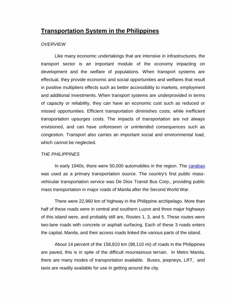
Transportation System in the Philippines OVERVIEW Like many economic undertakings that are intensive in infrastructures, the transport sector is an important module of the economy impacting on development and the welfare of populations. When transport systems are effectual, they provide economic and social opportunities and welfares that result in positive multipliers effects such as better accessibility to markets, employment and additional investments. When transport systems are underprovided in terms of capacity or reliability, they can have an economic cost such as reduced or missed opportunities. Efficient transportation diminishes costs, while inefficient transportation upsurges costs. The impacts of transportation are not always envisioned, and can have unforeseen or unintended consequences such as congestion. Transport also carries an important social and environmental load, which cannot be neglected. THE PHILIPPINES In early 1940s, there were 50,000 automobiles in the region. The carabao was used as a primary transportation source. The country's first public mass- vehicular transportation service was De Dios Transit Bus Corp., providing public mass transportation in major roads of Manila after the Second World War. There were 22,960 km of highway in the Philippine archipelago. More than half of these roads were in central and southern Luzon and three major highways of this island were, and probably still are, Routes 1, 3, and 5. These routes were two-lane roads with concrete or asphalt surfacing. Each of these 3 roads enters the capital, Manila, and their access roads linked the various parts of the island. About 14 percent of the 158,810 km (98,110 mi) of roads in the Philippines are paved, this is in spite of the difficult mountainous terrain. In Metro Manila, there are many modes of transportation available. Buses, jeepneys, LRT, and taxis are readily available for use in getting around the city.

Transportation System in the Philippines James
Nov 30, 2015
Transportation
Welcome message from author
This document is posted to help you gain knowledge. Please leave a comment to let me know what you think about it! Share it to your friends and learn new things together.
Transcript
Transportation System in the Philippines
OVERVIEW
Like many economic undertakings that are intensive in infrastructures, the
transport sector is an important module of the economy impacting on
development and the welfare of populations. When transport systems are
effectual, they provide economic and social opportunities and welfares that result
in positive multipliers effects such as better accessibility to markets, employment
and additional investments. When transport systems are underprovided in terms
of capacity or reliability, they can have an economic cost such as reduced or
missed opportunities. Efficient transportation diminishes costs, while inefficient
transportation upsurges costs. The impacts of transportation are not always
envisioned, and can have unforeseen or unintended consequences such as
congestion. Transport also carries an important social and environmental load,
which cannot be neglected.
THE PHILIPPINES
In early 1940s, there were 50,000 automobiles in the region. The carabao
was used as a primary transportation source. The country's first public mass-
vehicular transportation service was De Dios Transit Bus Corp., providing public
mass transportation in major roads of Manila after the Second World War.
There were 22,960 km of highway in the Philippine archipelago. More than
half of these roads were in central and southern Luzon and three major highways
of this island were, and probably still are, Routes 1, 3, and 5. These routes were
two-lane roads with concrete or asphalt surfacing. Each of these 3 roads enters
the capital, Manila, and their access roads linked the various parts of the island.
About 14 percent of the 158,810 km (98,110 mi) of roads in the Philippines
are paved, this is in spite of the difficult mountainous terrain. In Metro Manila,
there are many modes of transportation available. Buses, jeepneys, LRT, and
taxis are readily available for use in getting around the city.
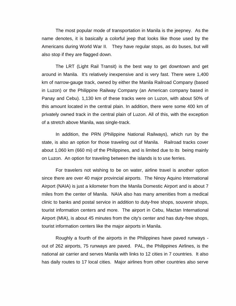
The most popular mode of transportation in Manila is the jeepney. As the
name denotes, it is basically a colorful jeep that looks like those used by the
Americans during World War II. They have regular stops, as do buses, but will
also stop if they are flagged down.
The LRT (Light Rail Transit) is the best way to get downtown and get
around in Manila. It's relatively inexpensive and is very fast. There were 1,400
km of narrow-gauge track, owned by either the Manila Railroad Company (based
in Luzon) or the Philippine Railway Company (an American company based in
Panay and Cebu). 1,130 km of these tracks were on Luzon, with about 50% of
this amount located in the central plain. In addition, there were some 400 km of
privately owned track in the central plain of Luzon. All of this, with the exception
of a stretch above Manila, was single-track.
In addition, the PRN (Philippine National Railways), which run by the
state, is also an option for those traveling out of Manila. Railroad tracks cover
about 1,060 km (660 mi) of the Philippines, and is limited due to its being mainly
on Luzon. An option for traveling between the islands is to use ferries.
For travelers not wishing to be on water, airline travel is another option
since there are over 40 major provincial airports. The Ninoy Aquino International
Airport (NAIA) is just a kilometer from the Manila Domestic Airport and is about 7
miles from the center of Manila. NAIA also has many amenities from a medical
clinic to banks and postal service in addition to duty-free shops, souvenir shops,
tourist information centers and more. The airport in Cebu, Mactan International
Airport (MIA), is about 45 minutes from the city's center and has duty-free shops,
tourist information centers like the major airports in Manila.
Roughly a fourth of the airports in the Philippines have paved runways -
out of 262 airports, 75 runways are paved. PAL, the Philippines Airlines, is the
national air carrier and serves Manila with links to 12 cities in 7 countries. It also
has daily routes to 17 local cities. Major airlines from other countries also serve

Manila. In addition, Cebu has chartered flights from Japan, Hong Kong and
Singapore.
For chartered travel to smaller locations, there are several carriers
available - Cebu Pacific, Asian Spirits, Mindanao Express Airlines, and SEAir,
Incorporated.
Cruise ships are served by Manila, with inter-island ships connecting
Manila to other major island ports. The busiest seaports are Manila, Cebu, Iloilo,
Davao, Cagayan de Oro and Zamboanga which are a part of the 3,219 km of
waterways and seaports.
Carabao as system of transportation
De Dios Transit Bus Corp
THE SYSTEM
Road System
The Philippines has 199,950 kilometers (124,240 mi) of roads, of which
39,590 kilometers (24,600 mi) are paved. As of 2004, the total length of the non-
toll road network was reported to be 202,860 km, with the following breakdown
according to type:
National roads - 15%
Provincial roads - 13%
City and municipal roads - 12%
Barangay roads - 60%
Road classification is based primarily on administrative responsibilities
(with the exception of barangays), i.e., which level of government built and
funded the roads. Most of the barangay roads are unpaved village-access roads
built in the past by the Department of Public Works and Highways (DPWH), but
responsibility for maintaining these roads have now been devolved to the Local
Government Units (LGUs). Farm-to-market roads fall under this category, and a
few are financed by the Department of Agrarian Reform and the Department of
Agriculture. However, despite having a large road network built over the country,
large parts of the road network continue to be in poor condition and only 20
percent of the total road network is paved.
Strong Republic Nautical Highway
The Strong Republic Nautical Highway links many of the islands' road
networks through a series of roll-on/roll-off ferries, some rather small covering
short distances and some larger vessels that might travel several hours or more.

Mass Transit
Mass transit in the Philippines range from bangkas (small pump boats
made out of aluminum or wood) to the large and sturdy trains that operate on
Luzon. The most ubiquitous form of transport is the jeepney, affluently named the
King of the Road. Other include buses, tricycles or motorcycles with sidecars,
motorcycles, and trisikads. Buses and jeepneys are lumped together and called
"public utility vehicles" or PUVs, or separated referred to as PUB for "public utility
bus" and PUJ for "public utility jeepney".
Bus Companies
Buses operate throughout the country, and they come in all forms and
sizes, from small, rusty boxes to large, luxury coaches that run through the
highways and roads of the Philippines. Routes run everywhere in the country,
with some companies operating through islands other than just Luzon.
Jeepney
The jeepney (commonly referred to as a jeep) is the equivalent of a mini-
bus found everywhere in the country. It carries between 16 to 30 passengers,
comes both in air conditioned and ordinary (non-air conditioned) forms, and
these usually operate where buses operate less frequently (e.g. side streets in
Metro Manila, provincial highways). The jeepney evolved from the surplus of
World War II jeeps that the Americans left behind after the war.
Railways
There are many railroads around the country but only a few in or serving
Metro Manila are operating.
Other Forms of Mass Transit
Taxis
Mini-buses - Derived from truck chassis.[dubious – discuss]
Tricycles - A type of Auto rickshaw. A typical form of mass
transportation in the Philippines. A regular motorcycle with additional passenger
seating. Designs vary but are usually fairly standard within a municipality.
Passenger seating is usually in a side car attached to the right side, but some
designs seat passengers in a towed trailer or enclose the motorcycle inside of a
body structure. Passenger seating capacity varies for different designs, ranging
from two up to seven or more. One or two additional passengers may be seated
behind the driver, usually riding sidesaddle on the motorcycle.
Kuliglig - Illegal DIY motorcycle using multi-purpose diesel or gasoline
engines, usually with a sidecar attached—similar to a tricycle.
Kalesa - A Spanish-era form of transportation that still exists in the
capital and in some provinces.
Trisikads - A cycle rickshaw or pedaled bike with a sidecar attached to the
side, much like a tricycle.
Wheel chairs - A Salumpo or a bicycle made of metal used to move
disabled people.
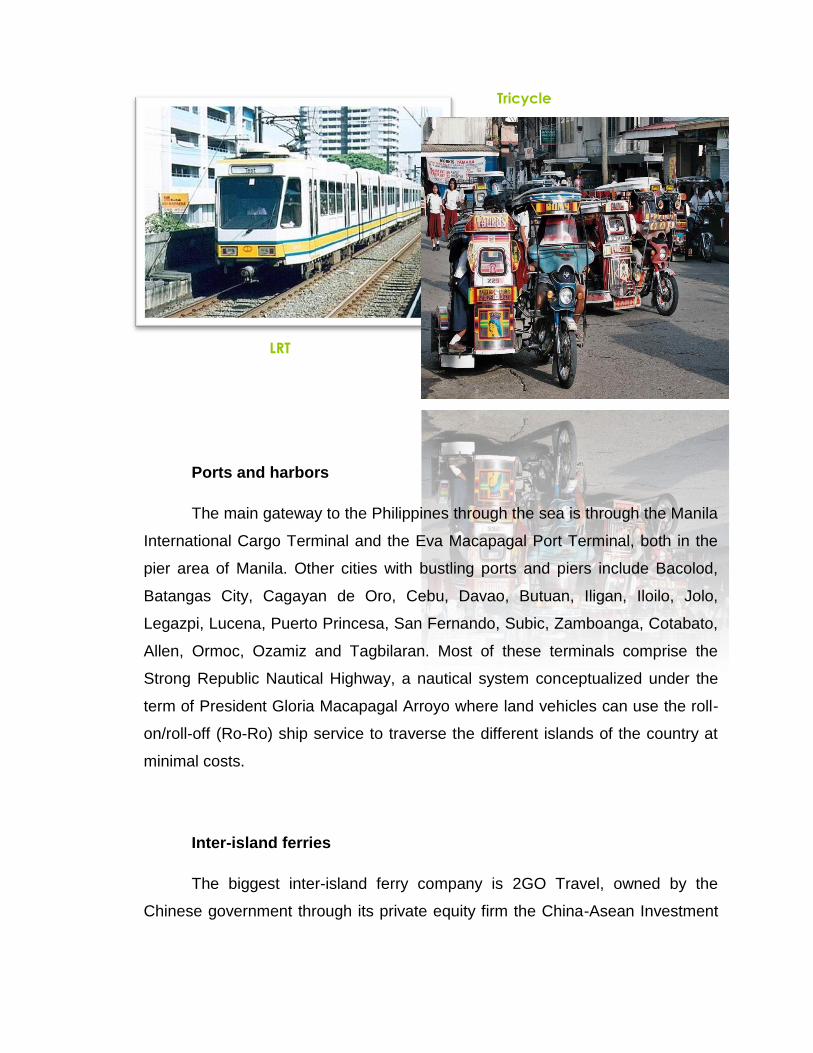
Ports and harbors
The main gateway to the Philippines through the sea is through the Manila
International Cargo Terminal and the Eva Macapagal Port Terminal, both in the
pier area of Manila. Other cities with bustling ports and piers include Bacolod,
Batangas City, Cagayan de Oro, Cebu, Davao, Butuan, Iligan, Iloilo, Jolo,
Legazpi, Lucena, Puerto Princesa, San Fernando, Subic, Zamboanga, Cotabato,
Allen, Ormoc, Ozamiz and Tagbilaran. Most of these terminals comprise the
Strong Republic Nautical Highway, a nautical system conceptualized under the
term of President Gloria Macapagal Arroyo where land vehicles can use the roll-
on/roll-off (Ro-Ro) ship service to traverse the different islands of the country at
minimal costs.
Inter-island ferries
The biggest inter-island ferry company is 2GO Travel, owned by the
Chinese government through its private equity firm the China-Asean Investment
LRT
Tricycle
Cooperation Fund. It is the successor to Negros Navigation, SuperFerry, Cebu
Ferries and SuperCat..
River ferries
The Pasig River Ferry Service - Used to serve the "Pasig River" from
Plaza Mexico, Intramuros, Manila to Barangay Kalawaan Sur, Pasig City. There
are also river ferries on the island of Samar.
Air transportation
The Philippines transport system relies on its roadways, inter-island
shipping, known as ―ro-ro’s‖ (roll-on roll-off) transport, and aviation. Despite its
archipelagic nature, road transport dominates other forms of transport. In 2006,
its roads served approximately 1.71 billion passengers and 25.9 billion tons of
freight. The Philippines has an extensive network of paved national roads,
municipal roads, and secondary roads especially in the urban areas. Due to
maintenance and rehabilitation costs and other competing priorities of the
government, the Main Line North (266km) and Main Line South (479km) has had
a difficult time and eventually became underutilized and under-maintained. This
is also why most of the freight in the Philippines is transported by road on trucks
and using the ―ro-ro‖ transport to connect to various islands. Integration of the
urban transport system is one of key challenges in the Philippines, especially
considering the existing para-transit modes such as jeepneys and tricycles in
urban areas. Most government effort in the past has been put on road
development and not on providing a more holistic transport system that includes
other motorized modes but as well walking and cycling.
Owing to the threat of air pollution, climate change, and fuel security, the
President of the Philippines issued an Administrative Order instructing the
Department of Transportation and Communications to develop a national
Environmentally Sustainable Transportation (EST) strategy for the Philippines in
30 January 2009. This has resulted to an action plan proposed by government to
establish targets and indicators for elements under the EST framework as

developed under the Aichi Statement of the UNCRD. The government has
allocated funds coming from the Special Vehicle Pollution Control Fund of the
Motor Vehicle User’s Charge in funding activities related to this. In addition, the
government has proposed under the Clean Technology Fund the inclusion of
projects on developing a BRT system for Metro Manila and Cebu as one of its
projects. Most of the current efforts and plans of the government are geared
towards improving passenger transport as compared to freight transport.
The Department of Environment and Natural Resources are responsible
for the Climate Change Act (2009).
Mitigation policies/measures with high potential to deliver reductions in
transport GHG emissions.
THE TRANSPORTATION
The main way to enter the Philippines is via Manila’s Ninoy Aquino
International Airport (NAIA), which will welcome you with long lines at the
Taxi
Bus
immigration counter. The second busiest (and much nicer) airport of the country
is Mactan-Cebu International Airport in Cebu City, which receives flights from
Hong Kong, Kuala Lumpur, Singapore, Tokyo and Seoul.
Francisco Bango International Airport (DVO) in Davao and Diosdado
Mascapagal International Airport (DMIA) in Angeles City both also receive
international flights from different Asian countries. Depending on your
destination, entering through one of the smaller airports may make more sense
and be more convenient for you.
Inter-Island Travel
Travelling by water is the main way of inter-island travel and the backbone
of the Philippine’s overall transportation system. Virtually any mode of water
transportation is available, ranging from high-class, air-conditioned ferries and
catamarans to small bangkas or pumpboats. Bangkas are the basis of inter-
island transportation in the Philippines. These small wooden boats run on
automotive engines. While bangkas lack the luxury provided by ferries and
catamarans, they are cheap and widely available.
If you prefer to travel on land, you can use one of the many reliable and
cheap bus services, which offer island hopping as well. Departures are frequent;
however, drivers sometimes tend to leave early if their bus is full. Alternatively,
you can also rent a car and drive yourself. Keep in mind though that traffic is
crazy in Manila and in Luzon’s central mountains. In other cities and in the
countryside, it can be quite a pleasant alternative.
City Transportation
In most cities, jeepneys, a cross between a jeep and a bus, are the main
mode of transportation. They are popular both for local travel and long-distance
journeys. Unfortunately, jeepney drivers like to wait until they have enough
passengers before they depart. As a result, you may have to wait a while before
the jeepney leaves for your desired destination.

Jeepneys travel on set routes for the average price of about 7 pesos. If
you choose to travel long distances with a jeepney, try to find out the fare in
advance. Other modes of transportation in the cities are light rail (in Manila),
tricycles or pedicabs and vans or minibuses.
Pedicabs are very traditional and cost from 5 pesos per trip. This is the
price for locals however and may be considerably higher for you as a foreigner.
Vans and minibuses are becoming a popular alternative to jeepneys and buses.
They are operated privately and cost you at least twice the fare of a jeepney. On
the other hand, they are more luxurious than jeepneys and come with air-
conditioning.
Land Transport
Despite the difficult terrain, the Philippines has an extensive road system.
However, only about 14 percent of roads in the Philippines are paved. The land
transportation system consists of roads, and railway networks, and modern
transit systems. There are about 200,000 kilometers of roads in the Philippines.
About two fifths of this mileage is paved. The rail system in the country,
concentrated on the northern region of Luzon, is limited and is used by only a few
people. The more popular light-rail transit system known as Metrorail was
opened in Manila in 1985 to help reduce traffic congestion. Other modes of
transportation for commuters include buses, taxis, pedicabs, horse-drawn
carriages, and the popular and colorful jeepney.
Rail Transit Systems
Light Rail Transit Authority (LRT-1/Metrorail/Yellow Line), from
Monumento, Caloocan City to Baclaran, Parañaque City.
Light Rail Transit Authority (MRT-2/Megatren/Purple Line), from
Santolan, Marikina City to Avenida, Manila.
Metro Rail Transit Corporation (MRT-3/Metrostar/Blue Line), from North
Avenue, Quezon City to Taft Avenue, Pasay City.
Main Highways
Pan Philippine Highway (Maharlika Highway)
North Luzon Expressway, from Balintawak, Quezon City in Metro Manila
to Santa Ines, Pampanga.
South Luzon Expressway, from Manila in Metro Manila to Calamba City in
Laguna.
Metro Manila Skyway, an elevated tollway that complements with the
South Luzon Expressway and runs from Sen. Gil Puyat Ave. (Buendia) in Makati
City to Bicutan, Parañaque City. It will extend from Bicutan to Filinvest.
Manila-Cavite Expressway (Manila Coastal Road), from Parañaque City
in Metro Manila to Bacoor, Cavite
Manila North Road (MacArthur Highway), from Caloocan City to San
Fernando City, La Union
Epifanio de los Santos Avenue, from SM Mall of Asia to Caloocan City
Water Transport
Both Manila and Cebu are hubs of interisland shipping. The Port of Manila
is a major international harbor. It is divided into three areas: North Harbor, which
serves the interisland vessels; South Harbor, for international shipping; and the
Manila International Container Terminal. It is Cebu City however that has a
greater number of interisland ships at its ports. Other cities with bustling ports
and piers include Batangas City, Cagayan de Oro, Cebu City, Davao City,
Guimaras Island, Iligan, Iloilo, Jolo, Legaspi, Lucena, Puerto Princesa, San
Fernando, Subic Bay Freeport, Zamboanga, Matnog, Allen, Ormoc, and
Dalahican.

Air Transport
The national air carrier of the Philippines is Philippine Airlines (PAL). The
country’s international airports are Ninoy Aquino International Airport in Manila
and Mactan International Airport near the city of Cebu.
Airports
Ninoy Aquino International Airport (Manila)
Mactan-Cebu International Airport (Cebu City)
Francisco Bangoy International Airport (Davao City)
Diosdado Macapagal International Airport (Clark Special Economic
Zone, Pampanga)
Subic Bay International Airport (Subic Bay Freeport Zone, Zambales)
Laoag International Airport (Laoag, Ilocos Norte)
General Santos International Airport (General Sant (General Santos
City)
Zamboanga International Airport (Zamboanga City)
(General Santos City)
Zamboanga International Airport (Zamboanga City)
Local Airlines
Air Philippines
Asian Spirit
Cebu Pacific
Interisland Airlines
Philippine Airlines (national flag carrier)
South East Asian Airlines
IMPROVING TRAFFIC PROBLEMS IN THE PHILIPPINES
The Philippines and the World Bank recently signed agreements for a
US$60 million loan and a US$1.3 million equivalent grant from the Global
Environment Facility (GEF) today for the Metro Manila Transport Integration
Project (MMURTRIP).
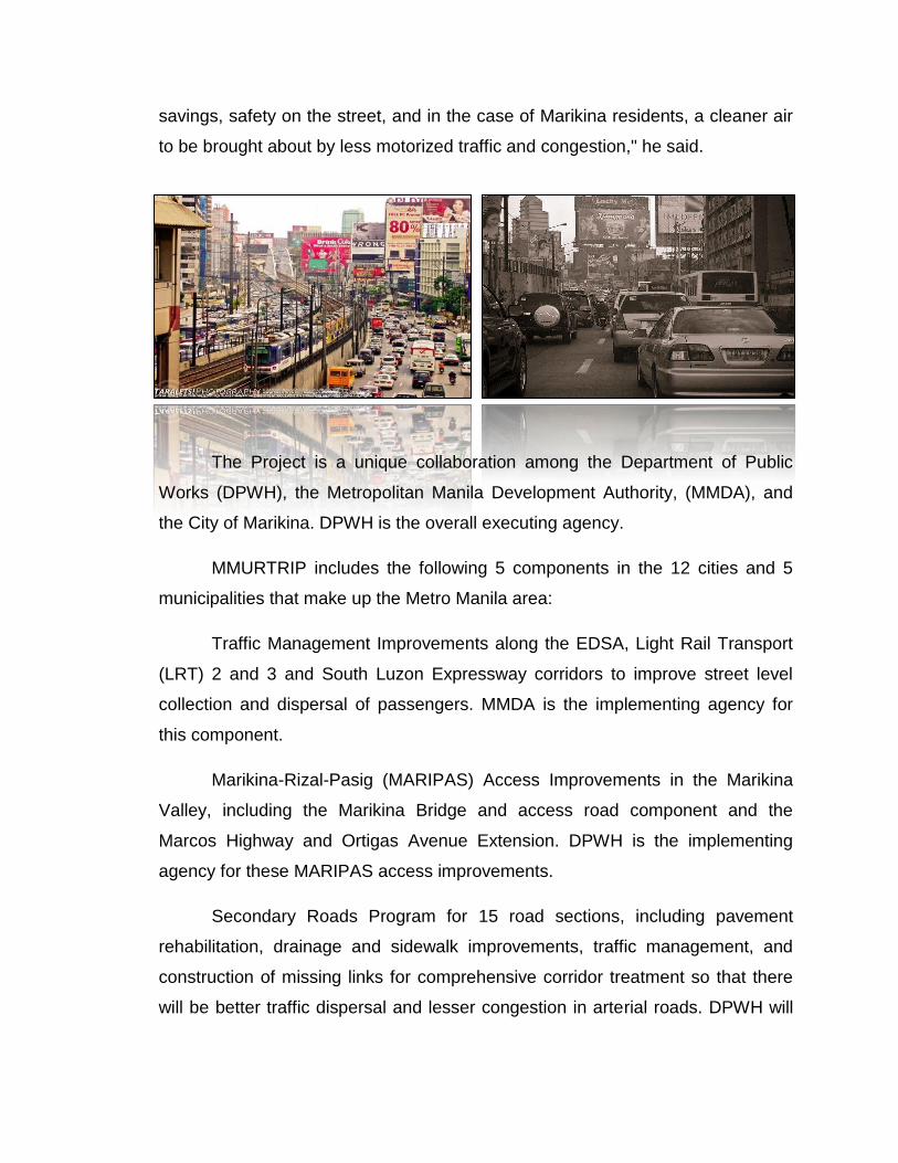
Traffic and related environmental problems have reached serious
proportions in Metro Manila, affecting its more than 10 million residents, with
vehicles traveling on the average no faster than 15 kph on a weekday along
Epifanio de los Santos Avenue.
Metro Manilans who often walk, use buses, jeepneys, and tricycles, are
the worst affected. The project is expected to improve traffic management,
thereby saving travel time for many pedestrians and commuters from the lower
income groups, who account for 75 percent of all trips in Metro Manila. A major
benefit, too, will be an improvement in the environment and safety of the city. The
project will provide good pedestrian interchange facilities, public transport lanes,
and will also focus on landscaping and improving the overall urban street
environment. The project will also build on the advances the government has
made recently in urban transport, for example phasing out leaded gasoline.
"It is my privilege to sign today the agreements for MMURTRIP—my first
to sign in my capacity as World Bank Country Director for the Philippines," said
the new World Bank Country Director for the Philippines, Robert Vance Pulley,
who assumed office in July. "I hope that, in due time, with the diligent
implementation of DPWH, MMDA and the City of Marikina, the general riding
public will reap maximum benefits from the Project, in terms of travel time
savings, safety on the street, and in the case of Marikina residents, a cleaner air
to be brought about by less motorized traffic and congestion," he said.
The Project is a unique collaboration among the Department of Public
Works (DPWH), the Metropolitan Manila Development Authority, (MMDA), and
the City of Marikina. DPWH is the overall executing agency.
MMURTRIP includes the following 5 components in the 12 cities and 5
municipalities that make up the Metro Manila area:
Traffic Management Improvements along the EDSA, Light Rail Transport
(LRT) 2 and 3 and South Luzon Expressway corridors to improve street level
collection and dispersal of passengers. MMDA is the implementing agency for
this component.
Marikina-Rizal-Pasig (MARIPAS) Access Improvements in the Marikina
Valley, including the Marikina Bridge and access road component and the
Marcos Highway and Ortigas Avenue Extension. DPWH is the implementing
agency for these MARIPAS access improvements.
Secondary Roads Program for 15 road sections, including pavement
rehabilitation, drainage and sidewalk improvements, traffic management, and
construction of missing links for comprehensive corridor treatment so that there
will be better traffic dispersal and lesser congestion in arterial roads. DPWH will
be the implementing agency for 10 of the roads while MMDA will implement for
the other 5 roads.
Nonmotorised Transport in the City of Marikina under Global Environment
Facility funding which will pilot a bikeways system to connect communities with
employment centers and LRT stations. The City of Marikina will implement this
component.
Institution Building/Technical Assistance to establish and strengthen
institutions responsible for future urban transport management in Metro Manila.
This is targeted at and will be implemented by the MMDA.
The Global Environment Facility was established to forge international
cooperation and finance actions to address four critical threats to the global
environment: biodiversity loss, climate change, degradation of international
waters, and ozone depletion.
The National Center for Transportation Studies is research and training
center originally created as the Transport Training Center in 12 July 1976. It is
attached to the University of the Philippines Diliman and was tasked mainly to
upgrade the capability of government personnel concerned with transportation
through intensive and practical training in the fields of traffic engineering,
planning and management. It has been one of the missions of NCTS to
contribute to national growth and development by supporting academic
instruction, conducting and promoting scholarly research, training, information
and other extension services in the field of transportation. The NCTS offer
technical expertise on traffic engineering and transportation planning, and
advocates environmentally sustainable transport (EST), including low carbon
transport, road safety, and people-friendly transport infrastructure.
NCTS is promotes sustainable development through its researches,
training programs and cooperation with government agencies and non-
government organizations with emphasis on the following:
-Sustainable Transport: NCTS is actively promoting the development and
greater use of sustainable modes of transport, including the Bus Rapid Transit
(BRT) and non-motorized transport (NMT) to address the ever worsening
problems of traffic congestion, road accidents, air pollution and Greenhouse Gas
(GHG) emissions from the transport sector. There are on-going research
activities that tackle the social, economic, as well as, environmental dimensions
in the transport sector.
-Integrated Transport System: The Philippines is an archipelago
consisting of around 7,100 islands and connecting economic centers and
communities continue present a national challenge. NCTS is actively cooperating
with concerned government agencies towards the development of a well-
integrated national tranportation system. On-going research activities are
focused on multi-modal transportation, land use and transport interaction,
planning and decision support systems, and other cross-cutting policy issues.
-Road Safety: Every year many lives are lost due to road crashes in
Philippine roads. NCTS is doing its part in promoting safety on the streets.
Forums involving different concerned agencies, LGUs and NGOs are regularly
conducted to discuss and formulate solutions in preventing and reducing
accident occurrences.
-Institutional Development: There is an urgent need to improve existing
Government processes in relation to the transport sector. Past studies in the
country have highlighted the need for clear strategies for the sector and the need
for institutional change and reforms. Since its inception, the Center has been
conducting training programs aimed at enhancing the capacities and capabilities
of the Philippine institutions involved in the transport sector. At present, the
Center continues to build and strengthen partnerships with concerned agencies
such as the Department of Transportation and Communications (DOTC), the
Department of Environment and Natural Resources (DENR), the Department of
Energy (DOE) and the Department of Public Works and Highways (DPWH),
academic units, and NGO’s and the private sector in the conduct of responsive
programs in the field of transportation.
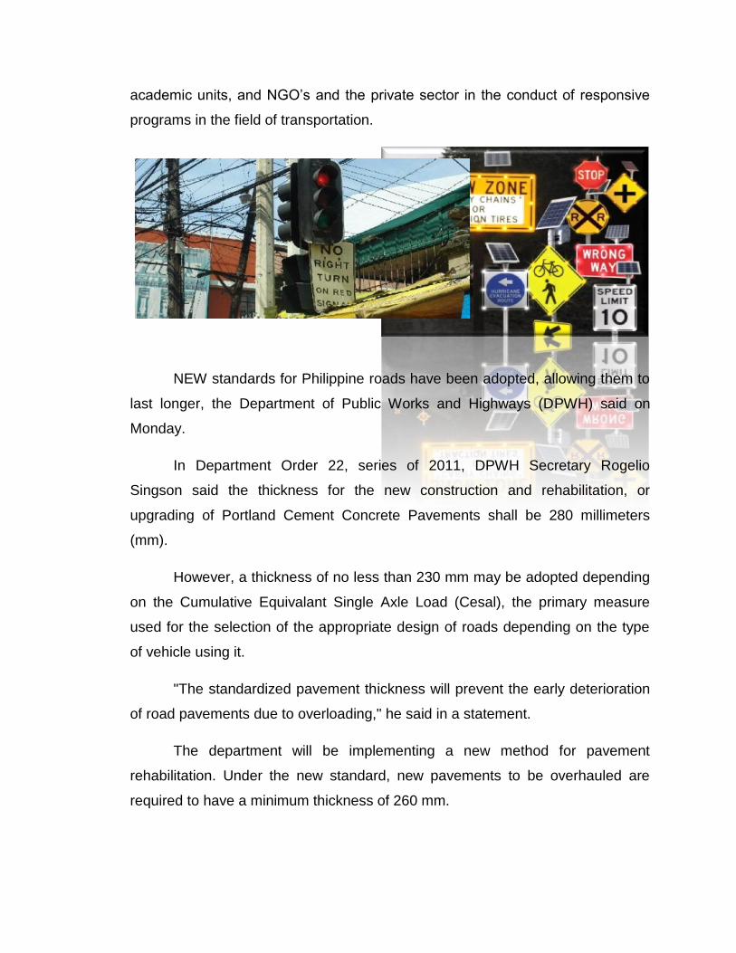
NEW standards for Philippine roads have been adopted, allowing them to
last longer, the Department of Public Works and Highways (DPWH) said on
Monday.
In Department Order 22, series of 2011, DPWH Secretary Rogelio
Singson said the thickness for the new construction and rehabilitation, or
upgrading of Portland Cement Concrete Pavements shall be 280 millimeters
(mm).
However, a thickness of no less than 230 mm may be adopted depending
on the Cumulative Equivalant Single Axle Load (Cesal), the primary measure
used for the selection of the appropriate design of roads depending on the type
of vehicle using it.
"The standardized pavement thickness will prevent the early deterioration
of road pavements due to overloading," he said in a statement.
The department will be implementing a new method for pavement
rehabilitation. Under the new standard, new pavements to be overhauled are
required to have a minimum thickness of 260 mm.
For pavement reblocking, the thickness of the new pavement will be the
same as the replaced blocks.
For asphalt pavements, a minimum thickness of 50 mm is prescribed for
overlaying works but on grounds of economy, pavement thickness of more than
50 mm will be considered only if the cost of the asphalt pavement of such
thickness is less than the cost of a 230 mm thick concrete pavement.
On both pavement types, the thickness of pavement will be verified from
pavement design analysis using the American Association of State Highway and
Transportation Officials (Aashto) method as contained on the DPWH Design
Guidelines.
Aashto is a standards setting body that publishes specifications, test
protocols and guidelines used in highway design and construction throughout the
United States.
The Philippines, through the DPWH, is the only country outside North
America authorized to use the Aashto Standards.
For pavement width, minimum width of the carriageway will be 6.70
meters. For rehabilitation or upgrading work involving for a road that is at least
500 meters, the minimum width of the carriageway to be adopted will also be
6.70 meters.
MANILA, Philippines -- A new standard for national road pavement
thickness has been adopted by the Department of Public Works and Highways
(DPWH), which aims to ensure quality and longer life span for national roads and
highways.
DPWH Secretary Rogelio Singson said the standardized pavement
thickness will prevent the early deterioration of roads due to overloading.
The DPWH has launched a campaign against overloaded trucks and
vehicles in Metro Manila, after studies show these contribute to the early wear
and tear of roads and highways.
Based on a department order, the thickness for the new construction and
rehabilitation or upgrading of Portland Cement Concrete Pavements from now on
shall be 280 mm.
However, a thickness of less than 280 mm, but in no case less than 230
mm may be adopted depending on the Cumulative Equivalent Single Axle Load
(CESAL).
CESAL is the primary criterion used for the selection of the appropriate
design of roads, which is dependent on the daily average effect of each vehicle
type passing on the pavement.
For pavement rehabilitation works using the crack and seat method, a
minimum thickness of 260mm is prescribed for the new pavement that will be
constructed on top of the deteriorated pavement.
For pavement re-blocking, the thickness of the new pavement will be the
same as the replaced blocks.
Singson said a minimum thickness of 50 mm is prescribed for overlaying
works. But on grounds of economy, pavement thickness of more that 50 mm will
be considered only if the cost of the asphalt pavement of such thickness is less
than the cost of a 230 mm thick concrete pavement.
The department order further states that on both pavement types, the
thickness of pavement will be verified from pavement design analysis using the
American Association of State Highway and Transportation Officials (AASHTO)
method as contained on the DPWH Design Guidelines.
AASHTO is a standards setting body which publishes specifications, test
protocols and guidelines which are used in highway design and construction
throughout the United States. The Philippines, through the DPWH, is the only
country outside North America authorized to use the AASHTO Standards.
For pavement width, the minimum width of the carriageway shall be 6.70
meters, while for rehabilitation or upgrading works involving at least 500 meters,
the minimum width of the carriageway to be adopted shall be 6.70 meters.
Are you sure that you’re living with environmentally safe surroundings? In
the Philippines we have Environmental Impact Statement System under
Presidential Decree 1586 which was ratified on June 11, 1978. The main
objective of this law is to maintain the balance between the environment and
socio- economic development in the country. It aims to protect the environment
despite of the increasing demand of natural resources and development to attain
sustainability.
Every proposed environmentally critical project or project located in
environmentally critical area shall prepare an Environmental Impact Statement to
justify why the project should be implemented. The Environmental impact
Statement also contains the predicted impact which is most likely to occur and
affect the environment and the surrounding communities as well. Along with it are
the proper mitigation or environmental measures to minimize if not prevented the
said negative impacts to the environment. However, the EIS or Environmental
Impact Statement does not end with that. It covers the monitoring program for
different environmental media such as air, water, soil and development program
for the existing community. When EIS is already approved, Environmental
Compliance Certificate will be issued by the Environmental Management Bureau.
On the other hand, the non- environmentally critical project or projects that
are not located in environmentally critical areas are required to submit Project

Description Report which indicates the environmental measures basic
information about the proposed project. When it is already approved, Certificate
of Non- Coverage or CNC will be issued by the Environmental Management
Bureau. Failure to comply with this law has a corresponding punishment like
Suspension or cancellation of certificates or fine not exceeding Php 50,000.00.
It is essential to comply with this law to protect the environment. Through
EIS, the likely adverse ecological impact of the project that might occur will
properly be mitigated. It is also for the benefit of the people in the community that
will be affected if the project will cause negative impact on the environment. The
permits like Environmental Compliance Certificate or Certificate of Non-
Coverage that will be issued by the DENR-EMB will certify that the project is
environmentally safe. With this, do you or your company have ECC or CNC? Do
you understand your duties and responsibilities on having those environmental
permits.
The practice of transportation engineering and planning has employed trip
rates to determine the number of trips generated by developments. Trip
generation serves as an input to modeling transportation requirements and traffic
flows influenced by the development. For example, a condominium may directly
impact traffic within a 10 km radius. Meanwhile, a shopping mall can impact an
area of over 50 km in radius. These trips generated and attracted are
represented by standard rates for trip generation like those published by the
Institute of Transportation Engineers. This paper discusses the trip rates used in
transportation research and practice in the Philippines. The paper also describes
the current efforts in the development of trip rates for various land use types. An
assessment of issues and concerns pertaining to local trip and rates are
examined, and recommendations for future research directions are also
presented.

TRAFFIC ANALYSIS
Traffic analysis is the process of intercepting and examining messages in
order to deduce information from patterns in communication. It can be performed
even when the messages are encrypted and cannot be decrypted. In general, the
greater the number of messages observed, or even intercepted and stored, the
more can be inferred from the traffic. Traffic analysis can be performed in the
context of military intelligence or counter-intelligence, and is a concern in
computer security.
Traffic analysis tasks may be supported by dedicated computer software
programs, including commercially available programs such as those offered by
i2, Visual Analytics, Memex, Orion Scientific, Pacific Northwest National Labs,
Genesis EW's GenCOM Suite, SynerScope and others. Advanced traffic analysis
techniques may include various forms of social network analysis.
MANILA, Philippines --- The Metropolitan Manila Development Authority
(MMDA) reported a marked improvement travel time along Epifanio de los
Santos Avenue (EDSA) in its latest survey, following the traffic schemes
implemented for the 24-kilometer highway.
MMDA Traffic Engineering Center (TEC) Director Noemi Recio said they
conducted a survey before the end of last year, citing that prior to the
enforcement of the new schemes, buses are usually at a crawling pace along
EDSA.
From a slow 16.82 kilometers per hour (kph) average speed, buses have
improved their travel time to 25.26 kph for Alabang-bound buses; 22.39 kph for
Baclaran-bound buses; and 19.12 for bus C or all-stop buses.
Also covered by the survey was the travel time of private vehicles traveling
between Roxas Boulevard and Monumento in Caloocan, with Recio citing
noticeable improvement from the previous 30 kph speed to the current 33.89 kph
speed.
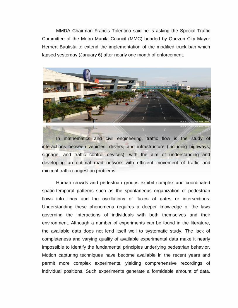
MMDA Chairman Francis Tolentino said he is asking the Special Traffic
Committee of the Metro Manila Council (MMC) headed by Quezon City Mayor
Herbert Bautista to extend the implementation of the modified truck ban which
lapsed yesterday (January 6) after nearly one month of enforcement.
In mathematics and civil engineering, traffic flow is the study of
interactions between vehicles, drivers, and infrastructure (including highways,
signage, and traffic control devices), with the aim of understanding and
developing an optimal road network with efficient movement of traffic and
minimal traffic congestion problems.
Human crowds and pedestrian groups exhibit complex and coordinated
spatio-temporal patterns such as the spontaneous organization of pedestrian
flows into lines and the oscillations of fluxes at gates or intersections.
Understanding these phenomena requires a deeper knowledge of the laws
governing the interactions of individuals with both themselves and their
environment. Although a number of experiments can be found in the literature,
the available data does not lend itself well to systematic study. The lack of
completeness and varying quality of available experimental data make it nearly
impossible to identify the fundamental principles underlying pedestrian behavior.
Motion capturing techniques have become available in the recent years and
permit more complex experiments, yielding comprehensive recordings of
individual positions. Such experiments generate a formidable amount of data.
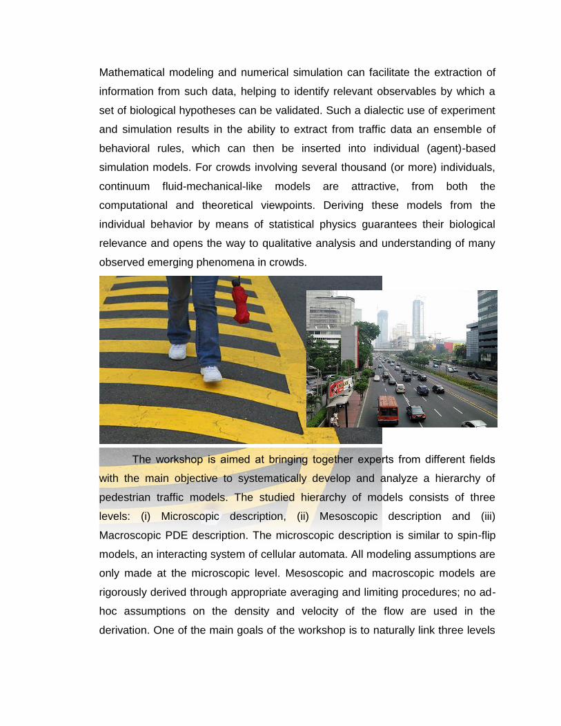
Mathematical modeling and numerical simulation can facilitate the extraction of
information from such data, helping to identify relevant observables by which a
set of biological hypotheses can be validated. Such a dialectic use of experiment
and simulation results in the ability to extract from traffic data an ensemble of
behavioral rules, which can then be inserted into individual (agent)-based
simulation models. For crowds involving several thousand (or more) individuals,
continuum fluid-mechanical-like models are attractive, from both the
computational and theoretical viewpoints. Deriving these models from the
individual behavior by means of statistical physics guarantees their biological
relevance and opens the way to qualitative analysis and understanding of many
observed emerging phenomena in crowds.
The workshop is aimed at bringing together experts from different fields
with the main objective to systematically develop and analyze a hierarchy of
pedestrian traffic models. The studied hierarchy of models consists of three
levels: (i) Microscopic description, (ii) Mesoscopic description and (iii)
Macroscopic PDE description. The microscopic description is similar to spin-flip
models, an interacting system of cellular automata. All modeling assumptions are
only made at the microscopic level. Mesoscopic and macroscopic models are
rigorously derived through appropriate averaging and limiting procedures; no ad-
hoc assumptions on the density and velocity of the flow are used in the
derivation. One of the main goals of the workshop is to naturally link three levels
of description, allowing for a detailed analysis of how various terms in the
macroscopic PDE model are affected by the microscopic assumptions.
Level of service (LOS) is a measure used by traffic engineers to determine
the effectiveness of elements of transportation infrastructure. LOS is most
commonly used to analyze highways by categorizing traffic flow with
corresponding safe driving conditions. The concept has also been applied to
intersections, transit, potable water, sanitary sewer service, solid waste removal,
drainage, and public open space and recreation facilities.
A branch of civil engineering that includes planning, design, construction,
operation, and maintenance of roads, bridges, and related infrastructure to
ensure effective movement of people and goods. Highway planning involves the
estimation of current and future traffic volumes on the road network. For
purposes of design, traffic volumes are needed for a representative period of
traffic flow. The capacity is the maximum theoretical traffic flow rate that a
highway section is capable of accommodating under a given set of
environmental, highway, and traffic conditions. The capacity of a highway
depends on factors such as the number of lanes, lane width, effectiveness of
traffic control systems, frequency and duration of traffic incidents, and efficiency
of collection and dissemination of highway traffic information. Traffic conditions
arising from the interplay of volume and capacity are perceived by road users in
a way that is quantitatively termed level of service.
Highway facilities often cause adverse effects on the environment, such
as noise pollution, air pollution, water pollution, and ecological impacts.
Tire/pavement interaction, vehicle exhausts, and engines cause traffic noise.
Highway engineers strive to predict and mitigate all possible impacts of highway
systems.
Through highway design, the most appropriate location, alignment, and
shape of the highway are selected. Highway design involves the consideration of
three major factors (human, vehicular, and roadway) and how these factors
interact to provide a safe highway. Human factors include reaction time for
braking and steering, visual acuity for traffic signs and signals, and car-following
behavior. Vehicle considerations include vehicle size and dynamics that are
essential for determining lane width and maximum slopes, and for the selection
of design vehicles. Engineers design road geometry to ensure stability of
vehicles when negotiating curves and grades and to provide adequate sight
distances for undertaking passing maneuvers along curves on two-lane, two-way
roads.
Location involves fitting the road efficiently onto the surrounding terrain
and environment. Horizontal alignment is represented by an aerial view of the
highway. It consists of straight lines and curves. Curves are fitted to provide a
smooth transition between straight highway sections.
Intersections and interchanges occur where two or more highways cross
each other at the same level. Since various vehicle maneuvers (turning, crossing,
and through movements) all occur within a limited area as the volumes of these
movements increase, there is increased likelihood of traffic conflicts and crashes.
One way of reducing such danger is to use channelization to limit each stream to
a unique path. In high traffic volume areas, movement of streams can be
separated in time using multiphased traffic signals. The vertical alignment of a
highway is represented by its longitudinal profile, which gives the elevation of all
points along the length of the highway. The purpose of vertical alignment design
is to determine the level of the highway at each point in order to ensure adequate
safety and drainage.
Highway cross section refers to the profile of the road, perpendicular to
the direction of travel and extending to the limits of the right of way within which
the facility is constructed. Highway cross-section elements may include driving
lanes, bicycle/pedestrian lanes, shoulders, medians, barriers, cross slope for
drainage, and superelevation.
Pavement design is the process of selecting pavement layer types and
thicknesses in order to withstand expected traffic loads in a cost-effective
manner. Each pavement layer usually consists of mineral aggregates such as
natural river or pit sand, natural gravel, and crushed rock. For rigid pavements,
portland cement is mixed with water and aggregates to produce a viscous
concrete mix that is poured into prepared forms and vibrated. See also Cement.
There are generally three types of pavements specified for pavement
design. Gravel pavement is the simplest type of pavement and is often designed
for lightly traveled roads. Flexible pavement is a multilayered structure that
includes a subbase, a base, and an asphaltic wearing course. Rigid pavement
consists of a plain or steel-reinforced portland cement concrete slab laid on a
prepared crushed-stone base course. See also Gravel; Pavement; Precast
concrete.
Highway construction usually follows planning and design, and involves
new or reconstructed facilities such as pavements, drainage structures, and
traffic control devices. Road construction is often preceded by detailed stakeout
surveys and preparation of the subgrade. See also Construction engineering;
Construction equipment.
Traffic signals are the most important traffic control devices. The typical
traffic signal for an intersection displays a sequence of green, amber, and red.
One complete signal sequence is called a cycle. Traffic signals are either
pretimed or demand-actuated. Flow-concentration controllers are capable of
sensing detailed demand information and responding to it by revising the cycle
length and phasing patterns of the signal.
The performance of highway infrastructure is measured in terms of
pavement and bridge condition, level of service, and safety. Pavement condition
is monitored over a period of time using a condition index or serviceability rating.
Through the development and implementation of bridge management systems,
many agencies have in place a decision support tool that supplies analyses and
summaries of data, uses mathematical models to make predictions of bridge
conditions, and provides the means by which alternative policies and programs
may be efficiently evaluated. Congestion management is maintained by
implementing measures to mitigate the magnitude and duration of traffic
congestion. Safety management is a systematic process that has the goal of
reducing the number and severity of traffic crashes by ensuring that all
opportunities and identified, considered, implemented as appropriate, and
evaluated in all phases of highway planning design, construction, maintenance,
and operation.
Traffic Management
"Traffic management is a term used to embody the activities undertaken
by a highway transportation agency to improve roadway system safety,
efficiency, and effectiveness for both providers and consumers of transportation
services. There are two distinct types of traffic management. The first one utilizes
traditional traffic engineering tools or simple devices to regulate or control traffic.
The second relies more on advanced technology through the use of Intelligent
Transportation Systems (ITS)." (Sigua, 2008)
In the Philippines, there are several government agencies which deal with
traffic management. These agencies include the Metropolitan Manila
Development Authority (MMDA), Department of Transportation and
Communications (DOTC), Department of Public Works and Highways (DPWH),
Traffic Engineering Center, Philippine National Police-Traffic Management
Group, and the Land Transportation Office. According to Lidasan as mentioned
in a news report, poor coordination among government agencies occur since
their functions and responsibilities often overlap. Moreover, even if policy making
and implementation or enforcement are assigned to specific agencies, these
organizations usually disregard or bypass one another in the performance of their
functions. The following paragraphs further identify the key roles of the different
agencies for an effective traffic management.

MMDA’s role is primarily to coordinate and integrate the efforts of local
governments and the central government in drawing up policies and plans and
implementing transport projects within Metro Manila. The responsibility for road
construction and maintenance is divided between DPWH for national roads and
LGUs for local roads. The DPWH Traffic Engineering Center has taken the
responsibility for road planning that requires traffic engineering. DOTC is in
charge of regulating vehicle fleet and driver licensing through its Land
Transportation Office. The Land Transportation Franchising Regulatory Board
regulates public transport services and fares. DOTC also plans the extensions to
Metro Manila’s rail systems through the Light Rail Transit Authority (LRTA) and
the Philippine National Railways.
Responsibilities for traffic management, however, should not just be relied
upon the government agencies but a collaborative effort among the policy
makers, implementors as well as the ordinary people - even children in grade
school to senior citizens. Every citizen has to be educated about road traffic
safety rules and signs. Rep. Narciso D. Santiago III has filed House Bill 4745
which aims to have a separate subject integrated in the grade school and high
school curricula that includes the teaching of road traffic safety rules and signs
since young people are the easiest to train.

Road Signs & Symbols
UNIVRSITY OF RIZAL SYSTEM
MORONG CAMPUS
GOLLEGE OF ENGINEERING
TRANSPORTATION ENGINEERING
ENGR. JOHN JOWHELL H. VILLEGAS
INSTRUCTOR
JAMES RUSSEL L. BRIONES
BSCE-V
Related Documents