Futuropa Futuropa Landscape Territory Nature Culture Heritage Human beings Society Sustainable development Ethics Aesthetic Inhabitants Perception Inspiration Genius loci Landscape and transfrontier co-operation n o 2 / 2010 – English A Council of Europe Magazine For a new vision of landscape and territory

Welcome message from author
This document is posted to help you gain knowledge. Please leave a comment to let me know what you think about it! Share it to your friends and learn new things together.
Transcript

FuturopaFuturopaLandscape
Territory
Nature
Culture
Heritage
Human beings
Society
Sustainable development
Ethics
Aesthetic
Inhabitants
Perception
Inspiration
Genius loci
Landscape and transfrontier co-operation
no 2 / 2010 – EnglishA Council of Europe Magazine
For a new vision of landscape and territory

FuturopaFuturopaEditorialTransfrontier landscapes – a challenge with multiple and sometimes confl icting approaches – Andreas Stalder.........................................................p. 3
PresentationCrossing frontiers: towards a common European landscape Graham Fairclough ............................................................................................p. 4
Some examples of co-operation within EuropeThe North Nordic multilateral co-operation on landscape – Audun Mofl ag, Jerker Moström, Søren Rasmussen, Ragnheiður Þórarinsdóttir and Satu Mikkonen-Hirvonen ....p. 6The WestThe experience of France’s transfrontier workshops for identifying and assessing landscapes – Jean-François Seguin ............................................... p. 8Transfrontier co-operation and landscapes: Walloon experiences Mireille Deconinck ............................................................................................p. 9The Planarch 2 Project: integrating archaeology and spatial planning Marie-Jeanne Ghenne and John Williams ......................................................p. 11The Spain-Portugal atlas of landscapesMaria José Festas and Margarita Ortega Delgado ..........................................p. 12The Centre and the EastIdentifying trans-border landscapes – Arthur Spiegler and Gernot Stöglehner ....p. 14Protecting landscapes to strengthen regional identities and local economies:the transnational project ‘Cultural Landscapes’ – Józef Hernik, Burkhardt Kolbmüller, Jacek Pijanowski and Agnieszka Was ........................................p. 16Transfrontier co-operation for preserving landscape in the Drava Valley, Croatia and Hungary – László Fenyosi, Balázs Trócsányi, Mirna Bojić and Gábor Kiss ........................................................................................................p. 18A transboundary landscape between Austria and Hungary around the Lake Fertö/Neusiedler – Éva Konkoly-Gyuró ................................................p. 22Riverbank forests of the Moldova-Ukraine Middle Nistru BasinAurel Lozan and Andrei Dumbraveanu ..............................................................p. 24Transfrontier co-operation projects in the South Caucasus: REC Caucasus Nune G. Harutyunyan ...........................................................................................p. 26European Christmas landscapes: a transfrontier analysis Alexander V. Drozdov ...........................................................................................p. 28The SouthA proposal for a shared landscape reading methodologyLionella Scazzosi and Anna Rossi ........................................................................p. 30The European Landscape Observatory of Arco Latino – Angelo Paladino, Domenico Nicoletti and Christine Garnero Morena .........................................p. 32Describing and labelling Mediterranean landscapes to protect their diversity – Nataša Bratina Jurkovic ............................................................p. 33The “Côteàcôte” Project: a sea viewed from its shores for greater co-operation between Mediterranean landscapes – Jean-Guy Ubiergo ............p. 35Co-operation between Mediterranean regions to encourage good landscape practices – Andreas Hildenbrand Scheid ............................................................p. 36
Co-operation across and beyond EuropeRivers as cultural infrastructures – Romeo Farinella ..........................................p. 38The potential of the Geopark European Network for the implementation of the European Landscape Convention – Martina Paskova .............................p. 39The role of landscape in co-operation between Andalusia and Morocco Florencio Zoido Naranjo .......................................................................................p. 41Towards landscape-centred transfrontier co-operation “Andalusia and Northern Morocco” – A model to emulate – Abdelhouahab Idelhadj .....p. 42Alliance of world heritage cultural landscapes – Luciano Sanchez ...................p. 43Co-operation for transfrontier landscape – Alberto A. Herrero de la Fuente ............................................................................................................p. 44“Landscape ambassadors” students – Yves Michelin .........................................p. 45
ConclusionCouncil of Europe: towards development of transfrontier co-operation in favour of the territory and the landscape – Maguelonne Déjeant-Pons ......p. 46
EditorsRobert Palmer, Director of Culture and Cultural and Natural Heritage of the Council of EuropeDaniel Thérond, Deputy to the Director of Culture and Cultural and Natural Heritage of the Council of Europe
Director of publicationMaguelonne Déjeant-Pons, Head of the Cultural Heritage, Landscape and Spatial Planning Division of the Council of Europe
With the co-operation ofAlison Cardwell, Administrator, Cultural Heritage, Landscape and Spatial Planning DivisionBéatrice Sauvageot, Assistant, Cultural Heritage, Landscape and Spatial Planning Division
Concept and editingAmy Ruffl eKristel JuradoClaudio Corsi
PrinterBietlot – Gilly (Belgium)
Articles may be freely reprinted provided that reference is made to the source and a copy sent to the editor. The copyright of all illustrations is reserved.
The opinions expressed in this publication are those of the authors and do not necessarily refl ect the views of the Council of Europe.
© Cover by James Thew – Fotolia.com
This issue has been printed with the support of the Swiss Federal Offi ce of the Environment, Forestry and Landscape.
no 2 – 2 0 1 0
3F u t u r o p a n o 2 / 2 0 1 0
CTransfrontier landscapes – confl icting approaches?
Under Article 9 of the European Landscape Convention (Florence Convention of 20 October 2000), the Parties undertake to encourage transfrontier co-operation at local and regional level and to implement joint landscape projects. What does this mean in practice? At fi rst sight, this provision seems to contradict itself. It can only really be understood and have any effect if it is read and understood in the spirit of the Convention and the other provisions. As we shall see, considerable political astuteness is required to interpret this article and put it into practice.
The central starting point is respect for the principle of subsidiarity and national constitutional principles, in other words the territorial organisation of the state concerned and the division of powers (Article 4). As a rule, relations with other states are a central-government responsibility, but there are exceptions to this of varying degrees in a number of countries.
Furthermore, the concept of landscape on which the Convention is based requires co-operation between regional authorities, stakeholders and the public to identify landscapes, categorise them, set protection and development goals and, of course, devise joint transfrontier landscape projects. The challenge of the participatory approach is to cater for regional populations’ needs while taking account of increasing mobility and their remoteness from their native regions, without however creating total uniformity. In practice this means that participation is possible only if it is guided by (regional) experts and by specialists with an understanding of wider landscape issues.
The discrepancy pointed out above should on no account be a barrier to promoting transfrontier landscapes and landscape projects. On the other hand, the public and the stakeholders do need to be made aware of the principles behind the approach to landscape and of regional and local landscape values. Only in this way can these specifi c values then serve to foster a sense of identifi cation with landscape and raise its profi le, and become a “unique selling proposition”. Creative problem-solving and close, preferably non-bureaucratic, co-operation are required between each country’s different sub-state tiers of government (vertical co-operation) and between the offi cial bodies at all levels of the various states concerned (horizontal co-operation). Actual landscape projects often arise not as the result of a specifi c landscape policy but as the by-product of a sectoral policy relevant to landscape (policy drivers), or are triggered by specifi c spatial confl icts. The watchword is multi-sectoral co-operation within States and between the different States involved, as this is the only way of ensuring that what emerges is not just a random “residual landscape”, but a real landscape development project based on clear and comprehensible foundations and goals.
Transfrontier landscapes – a multitude of approaches
Transfrontier landscapes also give us the opportunity to become aware of the multitude of natural habitats, cultures, mentalities and historical developments in Europe and the landscape development to which this has given rise. Causes and consequences, starting points and subsequent developments – often these things defy explanation, and often they are even interchangeable with one another. They show us that everything can be seen and interpreted from different viewpoints, and also be used for different purposes. Even the interpretation of the term “transfrontier landscape” varies and is often ambiguous:
– What frontiers are we talking about? Territorial boundaries? Or topographical, climatic, cultural, linguistic, religious, ethnic, geological or mental boundaries?
– Are the landscapes on either side of national borders different because they have developed differently or is the border there because natural conditions have shaped different landscapes, and different peoples and people have used and developed them differently?
– Are landscapes shaped by man-made territorial boundaries or are they the result of functional links and dependencies?
– Are rivers the arteries of landscapes, and mountains their backbones, or do rivers and mountains separate different landscapes? Where a national frontier is marked by a river or mountains, is that a natural or an artifi cial boundary?
– Some landscapes force humans to surpass themselves while others bring them up against their limits.
– If landscapes are progressively losing their character and hence their identity, then their frontiers are also fading and vanishing. If that is the case, can we talk about landscapes any more?
– Virtual landscapes involve any number of stakeholders, can be anywhere, have no beginning or end, and have no frontiers. If that is the case, can we talk about frontiers any more?
– What is the future for landscapes?
I hope that by exploring the “borderlines” of landscape, we can encourage a fresh understanding, build bridges and join together in developing new approaches. Let us give a new meaning to frontier landscapes so that Europe can continue to boast such a great variety of landscapes!
Andreas StalderVice-Chairman of the Steering Committee for Heritage and Landscape
of the Council of Europe (CDPATEP), Bern, [email protected]
Transfrontier landscapes – a challenge with multiple and sometimes confl icting approaches
Cou
ncil
of E
urop
e Ph
oto
Offi
ce
E d i t o r i a l

4 F u t u r o p a n o 2 / 2 0 1 0
:
Transfrontier co-operation enables us to share landscapes. Exploring new places, meeting new people and fi nding new ways of ‘seeing’ are benefi ts of trans-frontier co-operation. They support the aims of the Council of Europe’s European Landscape Convention, and they sup-port the Framework Convention on the value of cultural heritage for society by increasing understanding between countries and cultures and by contribut-ing to a sharper defi nition of Europe’s common heritage.
Landscape is one of the most impor-tant components of common herit-age. It provides a common ‘language’ that arises simply from being human (landscape is an area “as perceived by people”) transcending nationality, race, religion or culture. What, however, is the ‘European landscape’? It has been said to me that there can be no ‘European landscape’ because landscape exists in local or national perceptions, and the European scale is simply too big. It is true that we fi nd it easier to recognise specifi c areas or types of landscape (such as the Perigord or dehesa) than we do
with the ‘European landscape’, but any combination of landscapes in Europe is in character distinctively European, not American or African. There is indeed a ‘European landscape’, and transfron-tier co-operation – programmes and projects, workshops and exchanges – is an important way to understand it.
Working across borders extends percep-tions and opens up new perspectives. Seeing other landscapes (preferably in the company of those who ‘own’ them) causes a ‘European’ view of landscape to emerge. Furthermore, seeing our own landscapes, through the eyes of colleagues and friends from other countries revises our perceptions even of familiar areas, whilst having crossed a frontier we can look back from ‘the other side’ and re-imagine our own landscape.
It is often possible to see strong differ-ences between landscapes with similar topography or climate but divided by political frontiers, thus demonstrating the role of culture in shaping landscape. The relevance of national frontiers to
landscape, however, is challenged by noting that all Europe’s national fron-tiers are ‘young’ in relation to the deep ‘time-depth’ of the landscapes that cross them. ‘Local’ differences born of the spirit of a place are important, but comparing areas across borders reveals deeper pan-European similarities that arise from cultural fundamentals such as types of agriculture, social structures and long-term historical functional proc-esses.
Over recent years, I have been fortunate to have participated in several trans-frontier (or pan-European) projects. As a result, ‘my’ European landscape is becoming a diverse collection of images, memories and interpretations, a collage of Europe, an ever-changing kaleidoscope which speaks increasingly consistently to me of ‘Europe’.
The Meetings of the workshops for the implementation of the European Landscape Convention organised by the Council of Europe with various countries are a good example of this, allowing par-ticipants not only to see new landscapes
P r e s e n t a t i o n
Dehesa landscape, Portugal
Crossing frontiers: towards a commonEuropean la dscape n

5F u t u r o p a n o 2 / 2 0 1 0
but to discuss what they mean to both residents and visitors. More specifi cally, a recent Cost action (A27; Landmarks) led to many examples of transfrontier comparison, including exchange visits, joint projects (e.g. between Greece and Iceland) and a published overview of how ‘landscape’ is conceptualised, researched,
managed and protected in 13 different countries. An earlier project, European Pathways to the Cultural Landscape in the Culture 2000 programme, compared landscape and responses to landscape in 12 places in eight countries, using the metaphor of stories to frame different perceptions of landscape.
A still current project (the Culture 2007 Eucaland Project) considers the contri-bution to Europe’s landscape of past and present agricultural activity. It aims to create a provisional European-wide classifi cation of agricultural landscape so that a ‘reading’ of the landscape on a European scale will move closer together. Projects such as this, or the French transfrontier workshops, help us to look beyond the national or local perceptions that have emphasised each country’s exceptionalism without also noticing a higher commonality. Any area of landscape can have both local and transnational values.
Transfrontier work rises above and tran-scends borders of all kinds. It reveals what ‘landscape as common herit-age’ might mean, and it introduces an enlarged common perspective and understanding of the mechanics of landscape management. In return, land-scape offers a fertile area of research and action for transfrontier co-opera-tion. There have been many successful transfrontier or pan-European land-scape-based projects, as this issue of the Council of Europe magazine Futuropa testifi es, but the next few years – thanks to European Union programmes funded by Esf-Cost, FP7, Culture 2007 or Era-net – are likely to offer many more opportunities for using transfrontier co-operation to see landscape at European as well as local or national level.
Graham Fairclough Head of Characterisation, English Heritage,
London, United [email protected]
www.english-heritage.org.uk/characterisation
Pr
es
en
ta
ti
on
P r e s e n t a t i o n
A Périgord landscape, France

6 F u t u r o p a n o 2 / 2 0 1 0
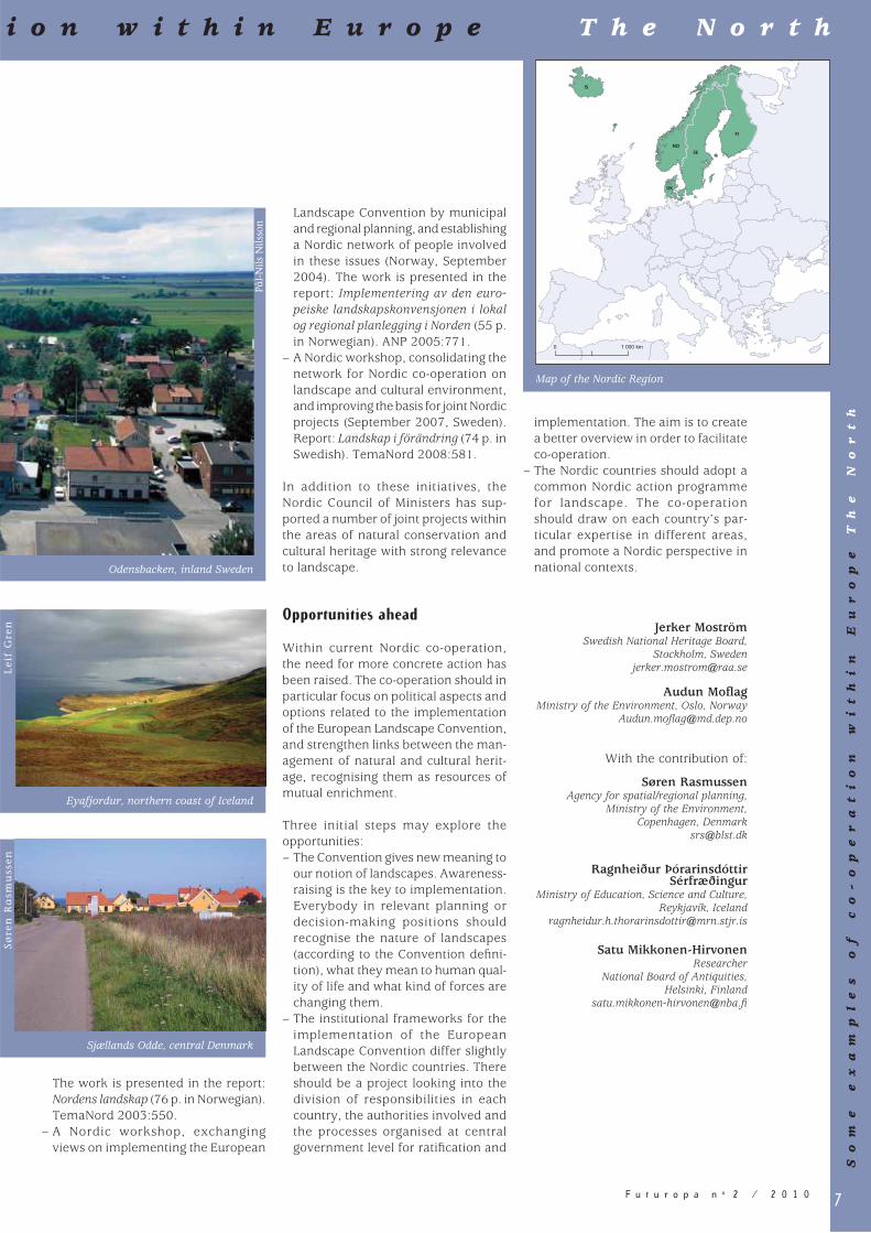
Nordic multilateral co-operation on landscapeThe Nordic context – a vast space
The Nordic region is among the most sparsely populated in Europe. Its 25 mil-lion people are just enough to cover the territory with some 21 people per square kilometre. The vast share of landscape per capita is a trait shared by most of the northern countries and it is both an asset and a challenge in terms of plan-ning, management and the protection of landscapes.
The concept of vast spaces and desola-tion is an important part of the branding of the Nordic landscape. The advertis-ing business and the tourist industry are carefully cultivating the exotic images of true wilderness, vast forests, archipelagos and the Nordic light, fully aware of the economic potential. But vast space also has obvious drawbacks. A truly un-exotic fact is that many countryside municipali-ties are facing a situation with a rapidly decreasing population. This may not be an exclusive Nordic trend, but taking into account the insignifi cant number of resi-dents housed by these municipalities, the challenge is striking.
A long tradition of multilateral co-operation
The Nordic countries are joined together by their common history, culture and, to a great extent, similarity of languages. The fi rst political union dates back to 1397-1523. In recent history, the Nordic countries have been working closely together on political issues for the last 50 years. This forms a basis also for a joint Nordic approach to landscape chal-lenges.
The Nordic Council was established in 1952. It is a forum for parliamentary co-operation between Denmark, Finland, Iceland, Norway and Sweden, and the autonomous territories of Greenland, the Faroe Islands and Åland. Initial suc-cesses in the 1950s include the passport union, the common labour market and social policy conventions.
The Nordic Council of Ministers, estab-lished in 1971, is a forum for governmen-tal co-operation. Under the Committee of Senior Offi cials for Environmental Affairs (EK-M), the Working group for
nature, open air and cultural environ-ment (NFK) is dealing with a broad spec-trum of themes – including biological diversity, landscape, cultural environ-ment and outdoor recreation. In the area of landscape and cultural environ-ment, the working group is supporting joint Nordic proposals for the imple-mentation of the European Landscape Convention. Through the facilitating work of the Nordic Council of Ministers, Nordic co-operation on landscape issues has a strong multilateral approach.
Intergovernmental actions
The national bodies responsible for the European Landscape Convention are co-operating within the framework of the Nordic Council of Ministers. The Nordic Council of Ministers’ Environmental Action Plan 2005-08 identifi ed the imple-mentation of the European Landscape Convention as a priority area of action. The NFK Working group has supported a series of important initiatives:– A preliminary project on the fol-
low-up to the European Landscape Convention, presenting information on the work on landscape in the Nordic countries, and identifying common priorities for co-operation in implementing the Convention.
S o m e e x a m p l e s o f c o - o p e r a t
Ta
pio
Hei
kk
ilä
Punkaharju, south eastern
Finland.
Ålesund, mid-western Norway
Jan
So
lgå
rd
7F u t u r o p a n o 2 / 2 0 1 0
The work is presented in the report: Nordens landskap (76 p. in Norwegian). TemaNord 2003:550.
– A Nordic workshop, exchanging views on implementing the European
Landscape Convention by municipal and regional planning, and establishing a Nordic network of people involved in these issues (Norway, September 2004). The work is presented in the report: Implementering av den euro-peiske landskapskonvensjonen i lokal og regional planlegging i Norden (55 p. in Norwegian). ANP 2005:771.
– A Nordic workshop, consolidating the network for Nordic co-operation on landscape and cultural environment, and improving the basis for joint Nordic projects (September 2007, Sweden). Report: Landskap i förändring (74 p. in Swedish). TemaNord 2008:581.
In addition to these initiatives, the Nordic Council of Ministers has sup-ported a number of joint projects within the areas of natural conservation and cultural heritage with strong relevance to landscape.
Opportunities ahead
Within current Nordic co-operation, the need for more concrete action has been raised. The co-operation should in particular focus on political aspects and options related to the implementation of the European Landscape Convention, and strengthen links between the man-agement of natural and cultural herit-age, recognising them as resources of mutual enrichment.
Three initial steps may explore the opportunities:– The Convention gives new meaning to
our notion of landscapes. Awareness-raising is the key to implementation. Everybody in relevant planning or decision-making positions should recognise the nature of landscapes (according to the Convention defi ni-tion), what they mean to human qual-ity of life and what kind of forces are changing them.
– The institutional frameworks for the implementation of the European Landscape Convention differ slightly between the Nordic countries. There should be a project looking into the division of responsibilities in each country, the authorities involved and the processes organised at central government level for ratifi cation and
implementation. The aim is to create a better overview in order to facilitate co-operation.
– The Nordic countries should adopt a common Nordic action programme for landscape. The co-operation should draw on each country’s par-ticular expertise in different areas, and promote a Nordic perspective in national contexts.
Jerker MoströmSwedish National Heritage Board,
Stockholm, [email protected]
Audun Mofl agMinistry of the Environment, Oslo, Norway
Audun.mofl [email protected]
With the contribution of:
Søren Rasmussen Agency for spatial/regional planning,
Ministry of the Environment, Copenhagen, Denmark
Ragnheiður Þórarinsdóttir Sérfræðingur
Ministry of Education, Science and Culture, Reykjavík, Iceland
Satu Mikkonen-Hirvonen Researcher
National Board of Antiquities, Helsinki, Finland
0 1 000 km
DK
SE
FI
IS
NO
Pål-
Nils
Nils
son
i o n w i t h i n E u r o p e T h e N o r t h
So
me
e
xa
mp
le
s
of
c
o-
op
er
at
io
n
wi
th
in
E
ur
op
e
Th
e
No
rt
h
Odensbacken, inland Sweden
Map of the Nordic Region
Eyafjordur, northern coast of Iceland
Sjællands Odde, central Denmark
Lei
f G
ren
Søre
n R
asm
uss
en

8 F u t u r o p a n o 2 / 2 0 1 0
The experience of France’s transfrontier workshops for identifying and assessing landscapesWe often hear it said that the European Landscape Convention is a groundbreak-ing instrument. Is there any truth to this claim or is it merely one of those trite statements of the kind that has become traditional at international gatherings?
In my view, and this will come as no sur-prise to anyone, the European Landscape Convention genuinely breaks new ground. It has generated real, signifi cant progress in the landscape policy implemented in France, and probably in many other countries besides. This progress has been made possible because the Convention has turned several of our habits, and even some of our fi rmly held beliefs, on their head. It has changed our conception of landscape in several fundamental ways. The innovations that the Convention brings are not actually original and the concepts behind them had been articu-lated before by various scientists, nota-bly geographers and sociologists. These concepts, however, had not yet, or only barely, begun to creep into legal instru-ments. This incorporation of research into a legal text was in large part due to the efforts of Yves Luginbühl, one of the two authors of the non-legal version of the convention. Such understanding between researchers and administrators remains all too rare and is one of those challenges that still needs to be addressed.
The European Landscape Convention provides that “identifi cation and assess-ment procedures shall be guided by the exchanges of experience and methodology, organised between the Parties at European level pursuant to Article 8” which states that “the Parties undertake to co-operate in order to enhance the effectiveness of measures taken under other articles of this Convention, and in particular … to render each other technical and scientifi c assistance in landscape matters through the pooling and exchange of experience, and the results of research projects”.
In order to give practical effect to these provisions and, at the same time, pre-pare a new version of the “Méthode pour des Atlas de paysages” (“Landscape Atlases Method”) used in France since 1994, in 2005 the Ministry of Ecology, Energy, Sustainable Development and
Maritime Affairs began holding trans-frontier workshops on the identifi cation and assessment of landscapes: – Transfrontier workshop with the
Walloon Region,– Transfrontier workshop with Spain,– Transfrontier workshop with Italy,– Transfrontier workshop with England,– Transfrontier workshop with Catalonia.
The French “Landscape Atlases Method” is constantly being improved by these exchanges of experience and methodology, in 2005 with the Walloon Region, in 2006 with Spain, in 2007 with Italy, in 2008 with England and in 2009 with Catalonia.
The idea behind these workshops is quite simple: in principle, landscapes form a continuum that does not stop at national borders. The workshops are held in areas which, although separated by a border between states, have common geographi-cal and landscape features. These prox-imities and similarities make it possible to draw valid comparisons between the methods used and the results achieved.
Work starts well before the actual work-shop, with documents being assembled and sent out to participants a month in advance. The workshop itself begins in the field, where participants can compare and contrast what they dis-cover there with the description of the landscape provided, according to the methods used on both sides of the bor-der. This vital “grounding” exercise con-tinues in the classroom with an in-depth discussion and exchange of views. The workshop ends with participants formu-lating the conclusions together, which are displayed “live” on a screen.
In an effort to keep costs down, the work-shops are run on a voluntary basis: every-one pays their own travel and subsistence costs and local resources are made avail-able by the relevant Regional Department of the Environment in France. The number of participants is deliberately kept to around 30 to encourage every-one to take an active part in the proceed-ings. Most of the time, no translation is provided, with participants being asked instead to speak in their own language. This helps to avoid misunderstandings, as
more often than not, the language being used as a means of communication dis-torts the true meaning of the vocabulary of landscape. Where necessary, however, individuals who are bilingual are invited to explain the meaning of certain words or concepts. This is very important because the landscape terms used in the different languages are littered with faux amis. As a regular at these transfrontier workshops, I have given up trying to fi nd “literal” translations of words, preferring instead to look for equivalent terms in the differ-ent languages, cultures or scientifi c and technical vocabularies.
Each workshop looks at a particular aspect of the process of identifying and assessing landscapes: with the Walloons, the focus was on the synopsis, i.e. all the themes and topics to be explored, with the Spanish, it was on landscape units, structures and elements, with the Italians, consideration for local perceptions, with the English, the dynamics and with the Catalans, the use made of the Landscape Atlases. A few experts or practitioners from other European countries or related disciplines (such as landscape ecology) are always invited as well, helping to produce more considered and better-thought-out conclu-sions. When it comes to landscapes, you can never have too much brainpower.
As I see it, this “meeting of minds” is one of the main contributions of the European Landscape Convention. The transfrontier workshops are a good example of this not only because various parties to the Convention attend them, but also because they bring together representatives of pub-lic authorities, states, regions, provinces and municipalities, scientists, practition-ers and NGOs. All of which goes to show that a lightweight structure, where each individual makes a contribution, can be an effective and useful complement to the Council of Europe Meetings of the workshops for the implementation of the European Landscape Convention.
Jean-François Seguin Chair of the Council of Europe Conference
of the European Landscape Convention,Head of the Landscape Offi ce, Ministry of Ecology,
Sustainable Development and Sea, FranceJean-Francois.seguin@developpement-
durable.gouv.fr
S o m e e x a m p l e s o f c o - o p e r a t
9F u t u r o p a n o 2 / 2 0 1 0
Transfrontier co-operation and landscapes : Walloon experiencesAlthough a modestly sized region, Wallonia has frontiers stretching for 1,231 kilometres. France, the Grand Duchy of Luxembourg, Germany and the Netherlands, without forgetting the Flemish region, border Wallonia, although there are no real physical barriers to mark its limits. Given this context, transfrontier co-operation becomes signifi cant. Indeed, a large part of the Walloon population lives close to a frontier and its landscapes have no administrative limits.
The European Landscape Convention, in force in Belgium since 2005 and rati-fi ed by the Walloon region since 2001, foresees a series of particular measures including the identifi cation and descrip-tion of landscapes, mutual assistance and exchange of information, and its application in transfrontier landscapes (articles 6, 7, 8 and 9).
Subtly combining all these measures, Wallonia has undertaken a series of actions, some completed, others still in progress.
The France-Wallonia transfrontier Workshop and landscape atlases
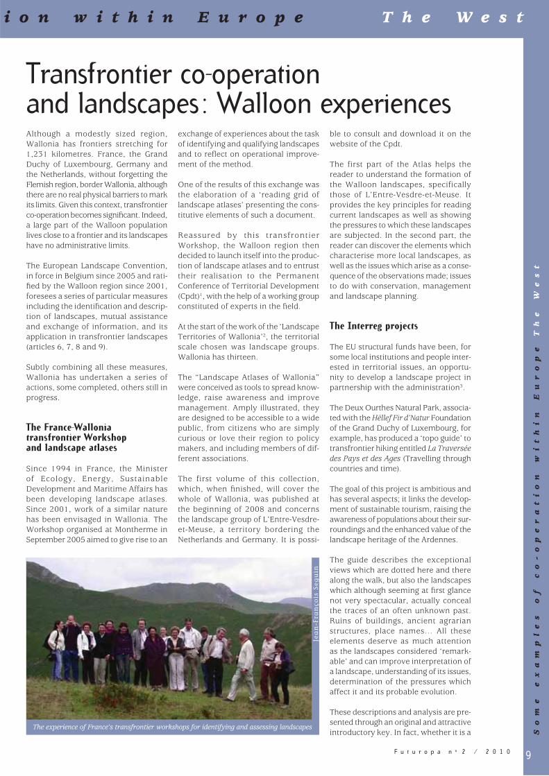
Since 1994 in France, the Minister of Ecology, Energy, Sustainable Development and Maritime Affairs has been developing landscape atlases. Since 2001, work of a similar nature has been envisaged in Wallonia. The Workshop organised at Montherme in September 2005 aimed to give rise to an
exchange of experiences about the task of identifying and qualifying landscapes and to refl ect on operational improve-ment of the method.
One of the results of this exchange was the elaboration of a ‘reading grid of landscape atlases’ presenting the cons-titutive elements of such a document.
Reassured by this transfrontier Workshop, the Walloon region then decided to launch itself into the produc-tion of landscape atlases and to entrust their realisation to the Permanent Conference of Territorial Development (Cpdt)1, with the help of a working group constituted of experts in the fi eld.
At the start of the work of the ‘Landscape Territories of Wallonia’2, the territorial scale chosen was landscape groups. Wallonia has thirteen.
The “Landscape Atlases of Wallonia” were conceived as tools to spread know-ledge, raise awareness and improve management. Amply illustrated, they are designed to be accessible to a wide public, from citizens who are simply curious or love their region to policy makers, and including members of dif-ferent associations.
The first volume of this collection, which, when fi nished, will cover the whole of Wallonia, was published at the beginning of 2008 and concerns the landscape group of L’Entre-Vesdre-et-Meuse, a territory bordering the Netherlands and Germany. It is possi-
ble to consult and download it on the website of the Cpdt.
The first part of the Atlas helps the reader to understand the formation of the Walloon landscapes, specifically those of L’Entre-Vesdre-et-Meuse. It provides the key principles for reading current landscapes as well as showing the pressures to which these landscapes are subjected. In the second part, the reader can discover the elements which characterise more local landscapes, as well as the issues which arise as a conse-quence of the observations made; issues to do with conservation, management and landscape planning.
The Interreg projects
The EU structural funds have been, for some local institutions and people inter-ested in territorial issues, an opportu-nity to develop a landscape project in partnership with the administration3.
The Deux Ourthes Natural Park, associa-ted with the Hëllef Fir d’Natur Foundation of the Grand Duchy of Luxembourg, for example, has produced a ‘topo guide’ to transfrontier hiking entitled La Traversée des Pays et des Ages (Travelling through countries and time).
The goal of this project is ambitious and has several aspects; it links the develop-ment of sustainable tourism, raising the awareness of populations about their sur-roundings and the enhanced value of the landscape heritage of the Ardennes.
The guide describes the exceptional views which are dotted here and there along the walk, but also the landscapes which although seeming at fi rst glance not very spectacular, actually conceal the traces of an often unknown past. Ruins of buildings, ancient agrarian structures, place names… All these elements deserve as much attention as the landscapes considered ‘remark-able’ and can improve interpretation of a landscape, understanding of its issues, determination of the pressures which affect it and its probable evolution.
These descriptions and analysis are pre-sented through an original and attractive introductory key. In fact, whether it is a
i o n w i t h i n E u r o p e T h e W e s t
So
me
e
xa
mp
le
s
of
c
o-
op
er
at
io
n
wi
th
in
E
ur
op
e
Th
e
We
st
The experience of France’s transfrontier workshops for identifying and assessing landscapes
Jea
n-F
ran
çois
Seg
uin

10 F u t u r o p a n o 2 / 2 0 1 0
S o m e e x a m p l e s o f c o - o p e r a t
Roman road, major cadastral axes put in place in Antiquity or a postal route used at the dawn of modern times, the routes shown in ‘Travelling through countries and time’ all have a long history.
The 48 km hike is marked out, as are routes allowing a shorter walk.
The topo guide is accompanied by a map (scale 1: 25,000) showing the dif-ferent routes. It also includes a series of useful addresses (accommodation, restaurants…).
Another project financed by the Interreg IV funds has just begun. It con-cerns the creation of a transfrontier pho-tographic observatory of landscape.
This project began in 2007 thanks to the resolve of the French side of the Natural Regional Park of Scarpe-Escaut and the Walloon side of the Natural Park of the Plains of Escaut, brought together in the Transfrontier Natural Park of Hainaut, to commit themselves to improving knowledge of these landscapes and to following their transformations.
The observatory is destined to illustrate the territory and its future on the basis of participation by citizens. It could cons titute a tool to help make deci-sions, in order to safeguard harmony between current landscapes and those of the future.
The project links a technical approach and a sensitive approach. Indeed, the transfrontier observatory of landscape aims to be:– an instrument of knowledge: to
understand and record the diversity of landscapes thanks to the creation of a photographic collection;
– an instrument of analysis: to observe and evaluate the evolutions of land-scapes, whether rapid or slow;
– an instrument of mobilisation: to raise awareness and involve the different actors and inhabitants in the evolution of local landscapes.
This project was inspired by other experiments run in Wallonia, France, and even other countries. It is supported by a driving committee which is trans-frontier and is now in its initial phase.
Atlas cover
L'Entre-Vesdre-et-Meuse
Atlasof landscapesof Wallonia
Border stone No 271 between Gouvy (Belgium) and Wincrange (Luxembourg)
It is therefore too early to learn from it; the lessons will emerge later.
Other experiments could have been discussed here but these few exam-ples illustrate the manner in which the Walloon region respects the engage-ments which it has undertaken by ratifying the European Landscape Convention.
1 For more information see: http://cpdt.wallonie.be/index.php
2 « Les territoires paysagers de Wallonie » (2004) Permanent Conference of Territorial Development, Studies and Documents 4, Ministry of the Walloon Region.
3 For more information, see the Cahiers de l’urbanisme no 64, June 2007, pages 68-73.
Gislaine Devillers First Offi cer
Public Service of Wallonia, DG04 Heritage Division, Belgium
Jambes (Namur), [email protected]
Mireille Deconinck Offi cer
Public Service of Wallonia, Planning and Urbanism Division, Belgium
Jambes (Namur), [email protected]
11F u t u r o p a n o 2 / 2 0 1 0
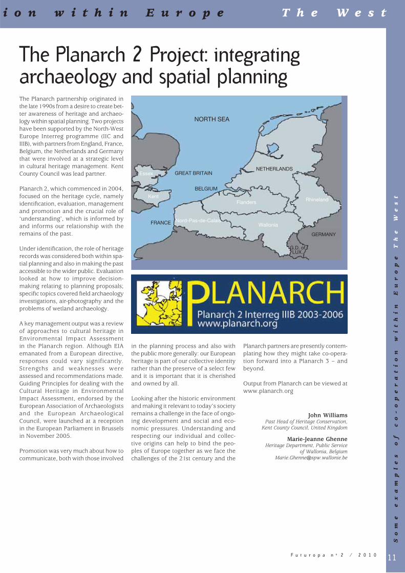
The Planarch partnership originated in the late 1990s from a desire to create bet-ter awareness of heritage and archaeo-logy within spatial planning. Two projects have been supported by the North-West Europe Interreg programme (IIC and IIIB), with partners from England, France, Belgium, the Netherlands and Germany that were involved at a strategic level in cultural heritage management. Kent County Council was lead partner.
Planarch 2, which commenced in 2004, focused on the heritage cycle, namely identifi cation, evaluation, management and promotion and the crucial role of ‘understanding’, which is informed by and informs our relationship with the remains of the past.
Under identifi cation, the role of heritage records was considered both within spa-tial planning and also in making the past accessible to the wider public. Evaluation looked at how to improve decision-making relating to planning proposals; specifi c topics covered fi eld archaeology investigations, air-photography and the problems of wetland archaeology.
A key management output was a review of approaches to cultural heritage in Environmental Impact Assessment in the Planarch region. Although EIA emanated from a European directive, responses could vary significantly. Strengths and weaknesses were assessed and recommendations made. Guiding Principles for dealing with the Cultural Heritage in Environmental Impact Assessment, endorsed by the European Association of Archaeologists and the European Archaeological Council, were launched at a reception in the European Parliament in Brussels in November 2005.
Promotion was very much about how to communicate, both with those involved
Planarch partners are presently contem-plating how they might take co-opera-tion forward into a Planarch 3 – and beyond.
Output from Planarch can be viewed at www.planarch.org
John Williams Past Head of Heritage Conservation,
Kent County Council, United Kingdom
Marie-Jeanne Ghenne Heritage Department, Public Service
of Wallonia, [email protected]
The Planarch 2 Project: integrating archaeology and spatial planning
in the planning process and also with the public more generally: our European heritage is part of our collective identity rather than the preserve of a select few and it is important that it is cherished and owned by all.
Looking after the historic environment and making it relevant to today’s society remains a challenge in the face of ongo-ing development and social and eco-nomic pressures. Understanding and respecting our individual and collec-tive origins can help to bind the peo-ples of Europe together as we face the challenges of the 21st century and the
i o n w i t h i n E u r o p e T h e W e s t
So
me
e
xa
mp
le
s
of
c
o-
op
er
at
io
n
wi
th
in
E
ur
op
e
Th
e
We
st
NORTH SEA
GREAT BRITAIN
BELGIUM
Essex
Kent
Nord-Pas-de-Calais
Flanders Rhineland
WalloniaFRANCE
NETHERLANDS
GERMANY
G.D. of LUX.

12 F u t u r o p a n o 2 / 2 0 1 0
The Spain-Portugal Atlas of landscapesAn innovative project of European co-operation for the acknowledgement of landscape
In 1998, two European States, Portugal and Spain, decided to approach their landscapes in a coordinated way. The three objectives were to: – identify, characterise and map the
landscape diversity; – extend this identifi cation to all the ter-
ritory in the format of an atlas; – incorporate landscape as a new basis
for wider co-operation in territorial management, in the framework of the European Union territorial process.
In this way, in the Interreg IIC Programme, South-western Europe was presented with the Project: “Characterisation and identifi cation of the landscapes of the Iberian peninsula and insular territories” as a proposal of the Portuguese Ministry of Environment and Spatial Planning and the Spanish Ministry of Environment. Two teams, from the University of Evora (Portugal) and the Autonomous University of Madrid (Spain), were commissioned to undertake the project1. After three years of joint work, the project produced two independent atlases, both published in each country.
The project considers landscape as an expression of the centuries-old relation-ship of societies with their surroundings and as a reality “that has become one of the components that land planning and territorial development policies and instruments should consider in the
design of territorial models”, and also as an “element for intervention favour-ing its protection and conservation and for aiming its improvement in land use transformation processes”.
Co-operative methodology and some shared cross-border landscapes in two independent atlases
The Project anticipated some of the aspects later considered in the European Landscape Convention, in particular “Identifi cation and assessment”, the contribution to European co-operation, integrating landscape in international programmes and the identifi cation of cross-border landscapes (Articles 6, 7 and 8). The Convention also planned three specifi c tasks: to identify their own landscapes (those of the signato-ries) within their territory as a whole; to analyse the characteristics thereof, along with the dynamics and pressures modifying them, and to monitor any transformations.
The two Atlases tackle the identifi ca-tion and characterisation of landscapes throughout the whole territory, both on the Iberian Peninsula and the islands (Madeira, The Azores, the Balearic Islands and the Canary Islands).
Typology of the landscapes of Portugal and Spain
Even though the methodologies used were not the same, the same types of variables were taken into account in each State.
The working method developed has allowed the establishment of a hierarchi-cal typology on three levels: landscape units or simply, landscapes; landscape types, and landscape associations.
Landscape units express the diversity of landscapes at a basic level. Each unit is defi ned by its internal homogeneity and its differences with neighbouring landscapes. Uniqueness is its most char-acteristic feature and results from the particular relationships between local communities and their territory.
The description of each landscape is conducted using standardised formats including basic aspects of the territo-rial and dynamic characterisation of the landscape: landscape organisation, landscape dynamics, perception of the landscape, and landscape values. Each landscape analysed is presented by a text, a cultural image of that landscape.
Landscape types represent grouped land-scapes whose fundamental structures are repeated throughout the territory. At the level of the atlas, the landscape types provide a synthetic but relatively detailed reading of large landscape configurations. In the identification and characterisation of the landscape types, the regional factor, understood as the landscape construction process based on different territorial histories, was in most cases decisive. Many of the landscapes respond to long-term proc-esses, which have occurred within the framework of historic territories, cur-rently within the regional scope.
Associations of such landscape types and landscape as the highest level of taxonomy, integrate landscape types that are similar due to their topographic confi guration, to their bioclimatic char-acteristics and to similarities in the land uses. In most cases, this font goes
S o m e e x a m p l e s o f c o - o p e r a t
Cantabrian mountains, Asturias, SpainHolm oaks with arable land, Ciudad Real, Spain
R.
Ma
ta

13F u t u r o p a n o 2 / 2 0 1 0
beyond the regional scope, as regards physiographical features of the territory and provides a map that is relatively abstract in relation to the reality of the landscape, but is useful as a general and synthetic cartographic expression.
Cartography and photographs
The Atlases are presented with maps on different scales (1:700.000, Spanish Atlas; 1:250.000, Portuguese Atlas).
Maps are completed with photographs, taken by the authors during their fi eld work, as a valuable testimony of the image of the landscapes in the transition from the 20th to the 21st century.
Margarita OrtegaSenior Adviser, Ministry of Environment,
Rural and Marine areas, [email protected]
Maria José FestasSenior Adviser, Ministry of Environment and
Spatial Planning, [email protected]
1 Alexandre Cancela d’Abreu and Teresa Pinto Correia (Universidade de Evora), Rafael Mata and Concepción Sanz (Universidad Autónoma de Madrid)
i o n w i t h i n E u r o p e T h e W e s t
So
me
e
xa
mp
le
s
of
c
o-
op
er
at
io
n
wi
th
in
E
ur
op
e
Th
e
We
st
Atlas of Spanish landscapes
14 F u t u r o p a n o 2 / 2 0 1 0
Identifying trans-border landscapes
Introductory remarks
In July 2006, the First Interreg Landscape Symposium was held in Pernegg, Austria, as a joint initiative of the University of Natural Resources and Applied Life Sciences of Vienna, the Southern Bohemian University Budvar, Ecovast Austria and Ecovast International. The main aim of the three day event was to discuss the problems of identifying landscapes that extend across national borders and to draw up solutions. The event dealt with four crucial points of the European Landscape Convention: to identify landscapes, involve local people in this process, raise their awareness and include landscape in education.
Identifying and appreciating landscapes
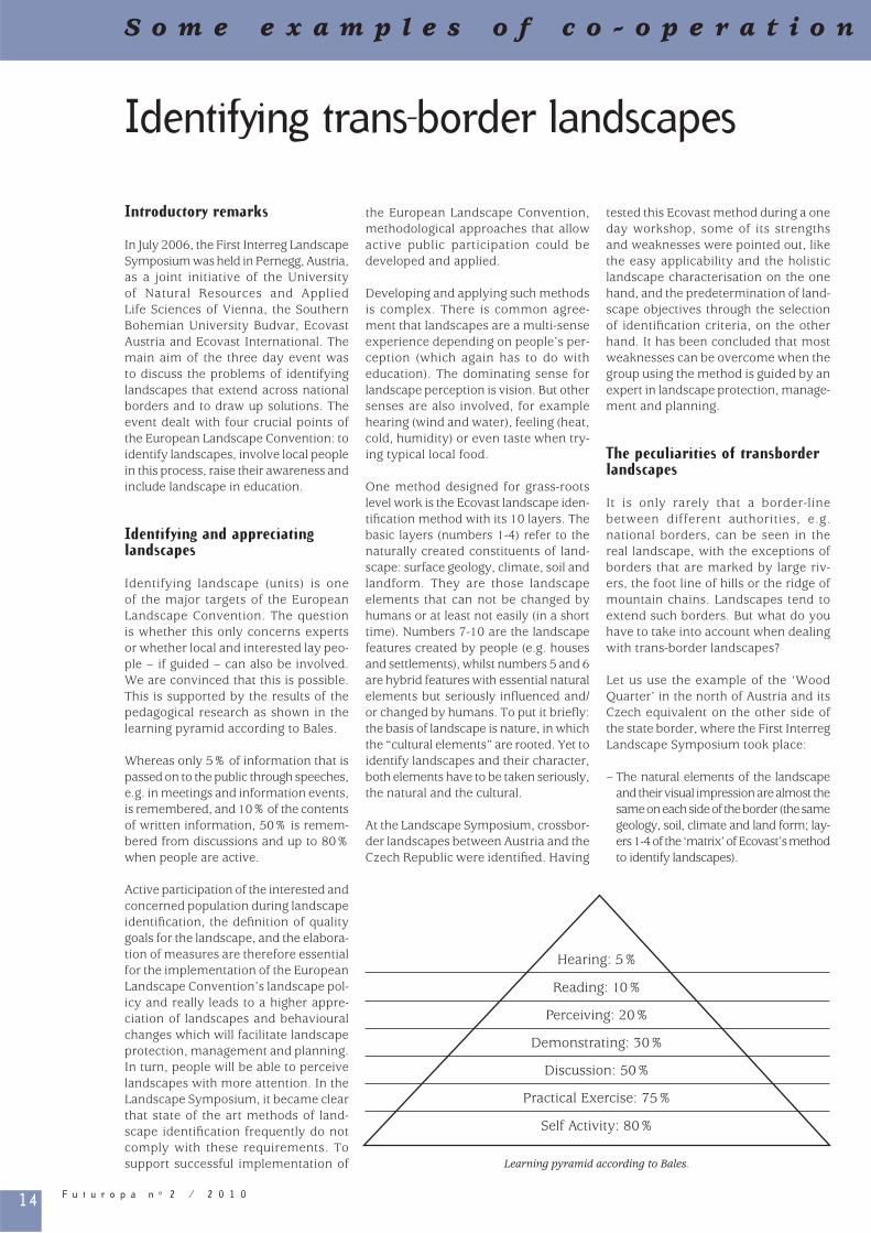
Identifying landscape (units) is one of the major targets of the European Landscape Convention. The question is whether this only concerns experts or whether local and interested lay peo-ple – if guided – can also be involved. We are convinced that this is possible. This is supported by the results of the pedagogical research as shown in the learning pyramid according to Bales.
Whereas only 5% of information that is passed on to the public through speeches, e.g. in meetings and information events, is remembered, and 10% of the contents of written information, 50% is remem-bered from discussions and up to 80% when people are active.
Active participation of the interested and concerned population during landscape identifi cation, the defi nition of quality goals for the landscape, and the elabora-tion of measures are therefore essential for the implementation of the European Landscape Convention’s landscape pol-icy and really leads to a higher appre-ciation of landscapes and behavioural changes which will facilitate landscape protection, management and planning. In turn, people will be able to perceive landscapes with more attention. In the Landscape Symposium, it became clear that state of the art methods of land-scape identifi cation frequently do not comply with these requirements. To support successful implementation of
the European Landscape Convention, methodological approaches that allow active public participation could be developed and applied.
Developing and applying such methods is complex. There is common agree-ment that landscapes are a multi-sense experience depending on people’s per-ception (which again has to do with education). The dominating sense for landscape perception is vision. But other senses are also involved, for example hearing (wind and water), feeling (heat, cold, humidity) or even taste when try-ing typical local food.
One method designed for grass-roots level work is the Ecovast landscape iden-tifi cation method with its 10 layers. The basic layers (numbers 1-4) refer to the naturally created constituents of land-scape: surface geology, climate, soil and landform. They are those landscape elements that can not be changed by humans or at least not easily (in a short time). Numbers 7-10 are the landscape features created by people (e.g. houses and settlements), whilst numbers 5 and 6 are hybrid features with essential natural elements but seriously infl uenced and/or changed by humans. To put it briefl y: the basis of landscape is nature, in which the “cultural elements” are rooted. Yet to identify landscapes and their character, both elements have to be taken seriously, the natural and the cultural.
At the Landscape Symposium, crossbor-der landscapes between Austria and the Czech Republic were identifi ed. Having
tested this Ecovast method during a one day workshop, some of its strengths and weaknesses were pointed out, like the easy applicability and the holistic landscape characterisation on the one hand, and the predetermination of land-scape objectives through the selection of identifi cation criteria, on the other hand. It has been concluded that most weaknesses can be overcome when the group using the method is guided by an expert in landscape protection, manage-ment and planning.
The peculiarities of transborder landscapes
It is only rarely that a border-line between different authorities, e.g. national borders, can be seen in the real landscape, with the exceptions of borders that are marked by large riv-ers, the foot line of hills or the ridge of mountain chains. Landscapes tend to extend such borders. But what do you have to take into account when dealing with trans-border landscapes?
Let us use the example of the ‘Wood Quarter’ in the north of Austria and its Czech equivalent on the other side of the state border, where the First Interreg Landscape Symposium took place:
– The natural elements of the landscape and their visual impression are almost the same on each side of the border (the same geology, soil, climate and land form; lay-ers 1-4 of the ‘matrix’ of Ecovast’s method to identify landscapes).
Hearing: 5%
Reading: 10%
Perceiving: 20%
Demonstrating: 30%
Discussion: 50%
Practical Exercise: 75%
Self Activity: 80%
Learning pyramid according to Bales.
S o m e e x a m p l e s o f c o - o p e r a t i o n

15F u t u r o p a n o 2 / 2 0 1 0
– The land cover and the characteristic features and patterns of agriculture and forestry are also almost the same (the ‘two-fold landscape’ dominated by the almost rhythmical alternation of big clearances/fields and areas of forest; you need a trained eye to notice the differences in details).
These six points (items 1-6 of the matrix) result in the fact that it will not be pos-sible to recognise the state border-line when looking at the landscape from either Austria or the Czech Republic (this even includes to a certain extent the ‘inlay of a karstic region’ around the famous cave ‘Macocha’ north of Brno).
The personal experiences of landscape on both sides of the border are not the same:
– There are differences in the fabric of the settlements (e.g. in the Czech Republic, almost every village – not to mention small towns – has at least one signifi cant building from ‘socialist times’, the so called ‘panelák’; it is an interesting fact that some architects have already begun arguing that some of those ‘panelák’ should be put under monument conservation, as symbols of their time).
– But what counts much more is that it feels like being in a strange country due to the totally different languages, giving the whole landscape experi-ence a different quality.
– It is the same with the signs: they are written in a different language and do not look alike.
– Here is an additional difference that applies to layer 10 ‘spirituality and added value’. The Austrian people living in the ‘Wood Quarter’ identify with the region and landscape; they call themselves ‘Wood-Quarters’. In
the Czech Republic, the landscape has not been given a specifi c name by the inhabitants; they do not iden-tify themselves with the name of their region or landscape. Only geographers or spatial planners call the region the ‘Moravian Uplands’.
Since it is agreed that landscape recogni-tion is a holistic and sensual experience, account has to be taken of all the impres-sions that add up to landscape perception, and not only those confi ned to the eye. So the challenge, when identifying cross-border landscapes, is to choose the appro-priate line on the map when working at European scale. The solution suggested to this problem (on the map) is: draw the usual black line surrounding the identi-fi ed landscape unit but add an additional broken and thinner black line to the red line that indicates the state border.
Involving local people
The Ecovast method of identifying landscapes has been designed to make a seemingly complicated matter more understandable and enable the involve-ment of local people. Ecovast has had some good experiences with this approach in various countries, and deal-ing with various landscapes. The hand-out for this method is an ‘open source’ for everybody and can be downloaded free of charge at: www.Ecovast.org. In the course of practising this method, it became obvious that dealing with land-scape, particularly landscape identifi ca-tion, has much to do with education; in fact, it is a matter of education!
Therefore, Ecovast has started a pilot project. From the beginning of 2009, four selected (higher) schools of the
region ‘Wood Quarter’ in Austria and in the corresponding region in the Czech Republic will start identifying their sur-rounding landscapes in both countries. If this project delivers good results, this approach will be extended to other parts of the ‘Wood Quarter’ and the neigh-bouring ‘Wine Quarter’. Ideally, it might end with something like a ‘Landscape Register’ achieved by local people and schools and other educational organi-sations.
To avoid misinterpretation, two points should be made clear from the begin-ning: – The method and its results will give a
fi rst rough but correct alternative view and description of the landscapes of a region or a country, their character and names on which further research can be based if need be.
– This task should not be confused with any wide scale or biotope mapping.
Final remark
The identifi cation of transborder land-scapes requires intensive co-operation between nations implementing the European Landscape Convention at all levels of administration, scientifi c insti-tutions, and the people living in those landscapes. Ecovast hopes to offer successful contributions with the help of local people after carrying out the intended cross-border school project.
Acknowledgements
Thank to the European Union, the European Regional Development Fund (Erdf) and the Province of Lower Austria, the Department of Spatial Planning and Regional Policy, the Department of Culture and Science, the Department of Nature Protection for co-fi nancing the First Interreg Landscape Symposium. Further thanks to the contributors and participants in the symposium for a vivid and in-depth dialogue on the con-ference issues.
Arthur Spiegler Ecovast Austria, Vienna, Austria
a.spiegler@refl ex.at
Gernot Stöglehner University of Natural Resources and Applied
Life Sciences, Vienna, [email protected]
http://www.boku.ac.at/irub
w i t h i n E u r o p e T h e C e n t r e a n d t h e E a s t
So
me
e
xa
mp
le
s
of
c
o-
op
er
at
io
n
wi
th
in
E
ur
op
e
Th
e
Ce
nt
re
a
nd
t
he
E
as
t
The Austrian Weinviertel, viewed from the threshold to the higher Waldviertel

16 F u t u r o p a n o 2 / 2 0 1 0
Protecting landscapes to strengthen regional and local economies: the transnational project Cultural landscapes of Central Europe are endangered. The reason for this is not only negligence of conservation but also poor spatial economies and socio-economic processes. However, the experiences of some European coun-tries, such as Germany or Austria, illus-trate that it is possible to protect cultural landscapes when local communities and regional authorities cooperate actively with each other.
The project ‘Cultural Landscapes’ sought to analyse and possibly adjust such an approach to the development and pro-tection of cultural landscapes in Central Europe. It aimed at the identifi cation, enhancement and development of cul-tural landscapes in the whole of the Cadses area.
Structure of the project
The project was one of the activities within the programme Interreg IIIB Cadses1. Over 24 months (2006-2008), the network brought together 11 part-ners from Poland, Germany, Austria, Romania and Ukraine and was directed by the University of Agriculture in Krakow, Poland 2.
The EU Structural Funds are a powerful instrument for the sustainable develop-ment of European regions. Many of the activities co-fi nanced by these funds
have a more or less direct impact on landscapes. They may help to maintain landscapes and to safeguard satisfactory living conditions for the inhabitants – an important precondition to avoid migra-tion and negative demographic impacts. Furthermore, the funds support activi-ties directly linked to landscape issues, such as the rehabilitation of brownfi elds or the protection of habitats. However, in some cases, such as the construc-tion of new roads or new commercial areas, they may have a negative impact on the landscape. It is therefore reason-able that the sustainable development of landscape is an important topic for the Interreg programme, funded by the European Regional Development Fund.
The fact that the project received the formal support of the Council of Europe also confi rms the importance of the chal-lenge facing the ‘Cultural Landscapes’ project.
Activities
Based on the inter-sectoral approach, including the protection of nature and heritage as well as the development of rural areas, and on international research structures, the project has developed the best examples as regards the implementation of the European Landscape Convention.
The main activities of the project were research, the development of new tools of landscape survey and new teaching curricula, the training and involvement of local experts, and pilot projects to strengthen local economies.
The level of landscape research and edu-cation in Central Europe is diverse. With the help of the Interreg project, univer-sities and research institutions from all the participating countries exchanged know-how and practical experiences to improve this situation. Amongst other activities, they developed a common methodology of identifying and catego-rising cultural landscapes of the Cadses area, and surveyed innovative research methods and planning tools. Intensive exchange of knowledge resulted in the creation of an international catalogue of historical cultural landscape elements of Central Europe.
Setting up an internet platform, ‘Landscape Wikipedia’, was another sig-nifi cant result of the academic research conducted. This platform makes it possi-ble to integrate the wider public into the process of cultural landscape identifi ca-tion and categorisation, and promotes social awareness of the signifi cance and quality of cultural landscape. The plat-form (currently available in German) consists of two parts: ‘Landscape Wiki’ (a glossary of elements) and maps / orthophotomaps which allow the digi-talising of elements provided by people with access to the portal.
Building social awareness regarding cultural landscape assets should already take place in formal education. That is why project activities have resulted in the development of teaching curricula involving cultural landscape and spatial planning issues to be introduced at uni-versity. Some of them were developed and implemented, based on the trans-national exchange of knowledge
The project also resulted in training ses-sions for ‘local experts’ (regional deci-sion-makers and local people) to make them aware of the cultural landscape concept. After all, the people who live in a certain region mainly decide on the development of ‘their’ landscape. Moreover, their knowledge is neces-
S o m e e x a m p l e s o f c o - o p e r a t i o n
Gessen Valley Bridge, Ronneburg, Germany
Sta
dtS
tra
teg
en,
Wei
ma
r
Bü
ro S
tock
+P
art
ne
r
Castle Leuchtenburg,
Middle Saale Valley,
Germany

17F u t u r o p a n o 2 / 2 0 1 0
identities ‘Cultural landscapes’
Results
Due to its wide scope, the Cultural Landscapes project substantially increased social and political aware-ness as regards the importance and role of cultural landscapes for sustainable development, and of the identity of the Cadses countries.
The protection of landscapes, which are the most basic elements of our European cultural heritage, supports the develop-ment and protection of local cultures. The project’s approach to cultural her-itage made participating regions more attractive for investment, especially as regards tourism and regional prod-ucts.
The project was an important step towards the implementation of the European Landscape Convention in Central Europe. However, the project results may be of interest to other regions and actors as well. These results are documented by several monogra-phies also available via the Internet. Currently, a follow-up project to be applied within the programme Interreg IVB Central Europe is under way.
Józef Hernik Project Coordinator, Agricultural University
of Kraków, [email protected]
www.cadses.ar.krakow.pl
Burkhardt KolbmüllerOffi ce for European Projects,
Weimar, [email protected]
Jacek PijanowskiUniversity of Agriculture, Kraków, Poland
Agnieszka Was University of Agriculture, Kraków, Poland
1 www.cadses.ar.krakow.pl2 The project partners were the University of
Agriculture in Krakow (PL) – Lead Partner, the Community of Miechów (PL), the Community of Wisniowa (PL), the University of Applied Science Erfurt (DE), the Heritage Association of Thuringia (DE), the Regional Planning Association East-Thuringia (DE), Environment Management Austria (AT), the Grazing Association Ramsar Site Valley of Lafnitz (AT), the University “ Babes-Bolyai ” Cluj-Napoca (RO), the Ethnographic Museum of Transylvania (RO) and Lviv Polytechnic National University (UA).
sary to complete academic research. Numerous meetings, seminars, and workshops were an opportunity to dis-seminate the results of the research carried out. These activities have set an example of the perfect integration of theoretical research and practical actions aimed at the promotion of land-scape issues among the wider public.
Transregional development tours and a series of thematic regional markets were aimed at strengthening local iden-tities and presenting the cultural land-scapes of other participating regions and countries. The tours enabled inter-national participants to become familiar with examples of approaches to cultural landscape issues and observe how land-scape can be managed and protected in accordance with the principles of sus-tainable development.
Finally, the project aimed at the inte-gration of landscapes with regional development through pilot projects in agriculture, tourism, regional market and renewable sources of energy. The community of Miechów created the Centre for Renewable Energies, which promotes energy production from pel-lets and briquettes (fields being the distinctive cultural landscape feature of the region). The project also made it possible to reconstruct the former retention basin in Wisniowa, which will now be used for recreation and water tourism. In co-operation with the city of Jena (central Germany) and the Saale-Holzland district, a detailed project of regional development, called ‘Middle Saale Valley’, was elaborated. This pilot project enhanced the industrial area of Göschwitz with a connection to the Saale River fl oodplain and led to the establish-ment of a general marketing concept of manor houses and castles in the area as well as drawing attention to the historic site of the town of Kahla. Moreover, the Cultural Landscapes project undertook integrated activities aimed at the devel-opment of agrotourism in the region of Schidnycia in Ukraine, based on the rich resources of medicinal waters.
w i t h i n E u r o p e T h e C e n t r e a n d t h e E a s t
So
me
e
xa
mp
le
s
of
c
o-
op
er
at
io
n
wi
th
in
E
ur
op
e
Th
e
Ce
nt
re
a
nd
t
he
E
as
t
Rural Christmas Market, Reinstedt, Middle Saale Valley, Germany
Gru
nd
gen
ug
e.V
.
Wooden Church, Malopolska, Poland

18 F u t u r o p a n o 2 / 2 0 1 0
Transfrontier co-operation for preserving in the Drava Valley, Croatia and HungaryThe River Drava has its source in the Tirol Alps, and, after its journey of 700 km through fi ve countries, it fl ows into the Danube at Aljmas, Croatia. The river course in Croatia is 305 km long and is the second longest river in Croatia. Around 140 km of the river mark the border with Hungary, from Örtilos to Eperjespuszta. Due to the border, this landscape remains dominantly natural, especially on the river section above the towns of Barcs and Virovitica, where regulation activities were kept at a nec-essary level. The Drava has buoys up to 198 km from the mouth of the Danube. However, only 13 km from the Danube to the town of Osijek are used intensively by traffi c. The river has variable water dynamics: the sloping gradient of the water surface at the upper reach is three times that measured in the lower sec-tion! The riverbed and the deposits vary from coarse pebbly gravel to fi ne-grain sand, this feature allowing colonisation by plant and animal communities with different ecological requirements.
There is evidence of human presence in the Drava lowlands, dating back to the Neolithic Age. During the Roman era, signifi cant military routes crossed the area, with strategic points defended
by fortresses. The river basin was suit-able for human settlement, because natural resources were suitable for both pastoral and farming activities. Forest coverage along the Drava were much higher in the past (about 60-80% at the time of the settling of the Magyars in Hungary), but later on were gradually reduced by deforestration. Grasslands and wooded grasslands, where forests had been removed, were used for graz-ing. In addition to grazing on grass-lands, water and forests, also, offered raw material for a number of ancient occupations and handicrafts, such as fi shing and hunting, fruit-growing, wood carving, weaving and wickerwork, pot-ash-production. Living in this area was always closely connected to the envi-ronment, with adjustment to the water regime of the Drava. A typical form of that is “fok” (canal) management, mean-ing that the fl ood water was directed so that it spread over the fl oodplain, serv-ing fi shing, grazing and fl oodplain fruit production. The reduction of traditional fl oodplain canal management occurred with river regulation and water man-agement interventions. The regulations served mostly to improve conditions for river navigation which was at its peak during the late 19th century. As a result
of water control and the discontinuation of fl oodplain farming, the proportions of farmland and arable areas grew steadily along the Drava and also in earlier fl ood-plain areas. Agricultural land along the river on Croatian territory forms one of the most interesting artifi cial landscape patterns, formed by many small strips of 10 ha, made by agrarian reforms in the past.
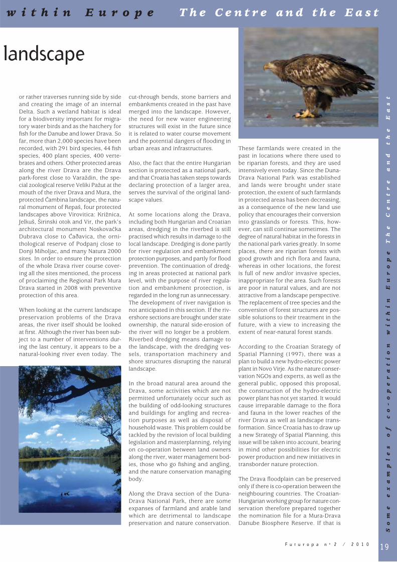
This area is also the central part of the Mura-Drava-Danube river network, the most important European west-east axe for nature conservation. Nature conser-vation activities have a long tradition in this area. The establishment of pro-tected areas along the Drava in Hungary started in 1942 when fi ve smaller plots were declared to be protected under the name “Középrigóc Grove”. The Barcs Juniper Woodland Landscape Protection Area was established in 1974, and was followed by another set of areas being brought under protection in 1987. In 1991, the Lankóci Forest Nature Reserve was created near Gyékényes, and, in 1996, the Duna-Drava National Park was proclaimed, covering a total of 50,000 hectares. The protected areas along the Drava cover 21,251 ha, and are shared by two counties: Somogy and Baranya. The phyto-geographical signifi cance of the Duna-Drava National Park is ensured by the fact that Illyrian and Pannonian fl ora border each other here, contributing to the presence of 150 different plant species and more than 100 protected plants in the area. The fauna of the Drava areas and of the Duna-Drava National Park are rich: nearly 4,500 animal species have been identifi ed in the area, and with over 300 protected species. The water qual-ity of the Drava is better than that of the average of our great rivers, as is demon-strated by the uniquely diverse fauna.
On the Croatian side of the river Drava, the most valuable natural area is the Kopacki rit Nature Park, situated at the mouth of the Drava and the Danube, covering a total of 22,894 hectares, with a special zoologi-cal reserve inside the park. Although this area has been protected since 1967, Kopacki rit has been explored since the middle of the 19th century. Its relief is the result of fl ood waters forming ponds,
S o m e e x a m p l e s o f c o - o p e r a t i o n
19F u t u r o p a n o 2 / 2 0 1 0
landscape
cut-through bends, stone barriers and embankments created in the past have merged into the landscape. However, the need for new water engineering structures will exist in the future since it is related to water course movement and the potential dangers of fl ooding in urban areas and infrastructures.
Also, the fact that the entire Hungarian section is protected as a national park, and that Croatia has taken steps towards declaring protection of a larger area, serves the survival of the original land-scape values.
At some locations along the Drava, including both Hungarian and Croatian areas, dredging in the riverbed is still practised which results in damage to the local landscape. Dredging is done partly for river regulation and embankment protection purposes, and partly for fl ood prevention. The continuation of dredg-ing in areas protected at national park level, with the purpose of river regula-tion and embankment protection, is regarded in the long run as unnecessary. The development of river navigation is not anticipated in this section. If the riv-ershore sections are brought under state ownership, the natural side-erosion of the river will no longer be a problem. Riverbed dredging means damage to the landscape, with the dredging ves-sels, transportation machinery and shore structures disrupting the natural landscape.
In the broad natural area around the Drava, some activities which are not permitted unfortunately occur such as the building of odd-looking structures and buildings for angling and recrea-tion purposes as well as disposal of household waste. This problem could be tackled by the revision of local building legislation and masterplanning, relying on co-operation between land owners along the river, water management bod-ies, those who go fi shing and angling, and the nature conservation managing body.
Along the Drava section of the Duna-Drava National Park, there are some expanses of farmland and arable land which are detrimental to landscape preservation and nature conservation.
These farmlands were created in the past in locations where there used to be riparian forests, and they are used intensively even today. Since the Duna-Drava National Park was established and lands were brought under state protection, the extent of such farmlands in protected areas has been decreasing, as a consequence of the new land use policy that encourages their conversion into grasslands or forests. This, how-ever, can still continue sometimes. The degree of natural habitat in the forests in the national park varies greatly. In some places, there are riparian forests with good growth and rich fl ora and fauna, whereas in other locations, the forest is full of new and/or invasive species, inappropriate for the area. Such forests are poor in natural values, and are not attractive from a landscape perspective. The replacement of tree species and the conversion of forest structures are pos-sible solutions to their treatment in the future, with a view to increasing the extent of near-natural forest stands.
According to the Croatian Strategy of Spatial Planning (1997), there was a plan to build a new hydro-electric power plant in Novo Virje. As the nature conser-vation NGOs and experts, as well as the general public, opposed this proposal, the construction of the hydro-electric power plant has not yet started. It would cause irreparable damage to the fl ora and fauna in the lower reaches of the river Drava as well as landscape trans-formation. Since Croatia has to draw up a new Strategy of Spatial Planning, this issue will be taken into account, bearing in mind other possibilities for electric power production and new initiatives in transborder nature protection.
The Drava fl oodplain can be preserved only if there is co-operation between the neighbouring countries. The Croatian-Hungarian working group for nature con-servation therefore prepared together the nomination fi le for a Mura-Drava Danube Biosphere Reserve. If that is
or rather traverses running side by side and creating the image of an internal Delta. Such a wetland habitat is ideal for a biodiversity important for migra-tory water birds and as the hatchery for fi sh for the Danube and lower Drava. So far, more than 2,000 species have been recorded, with 291 bird species, 44 fi sh species, 400 plant species, 400 verte-brates and others. Other protected areas along the river Drava are the Drava park-forest close to Varaždin, the spe-cial zoological reserve Veliki Pažut at the mouth of the river Drava and Mura, the protected Cambina landscape, the natu-ral monument of Repaš, four protected landscapes above Virovitica: Križnica, Jelkuš, Širinski otok and Vir, the park’s architectural monument Noskovacka Dubrava close to Caðavica, the orni-thological reserve of Podpanj close to Donji Miholjac, and many Natura 2000 sites. In order to ensure the protection of the whole Drava river course cover-ing all the sites mentioned, the process of proclaiming the Regional Park Mura Drava started in 2008 with preventive protection of this area.
When looking at the current landscape preservation problems of the Drava areas, the river itself should be looked at fi rst. Although the river has been sub-ject to a number of interventions dur-ing the last century, it appears to be a natural-looking river even today. The
w i t h i n E u r o p e T h e C e n t r e a n d t h e E a s t
So
me
e
xa
mp
le
s
of
c
o-
op
er
at
io
n
wi
th
in
E
ur
op
e
Th
e
Ce
nt
re
a
nd
t
he
E
as
t
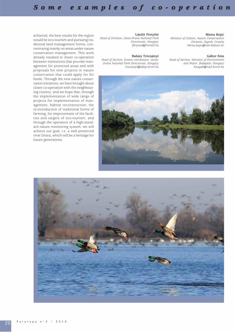
20 F u t u r o p a n o 2 / 2 0 1 0
S o m e e x a m p l e s o f c o - o p e r a t i o n
achieved, the best results for the region would be eco-tourism and pursuing tra-ditional land management forms, con-centrating mainly on areas under nature conservation management. This work already resulted in closer co-operation between institutions that provide man-agement for protected areas and with proposals for new projects in nature conservation that could apply for EU funds. Through the new nature conser-vation initiatives, we have brought about closer co-operation with the neighbour-ing country, and we hope that, through the implementation of wide range of projects for implementation of man-agement, habitat reconstruction, the re-introduction of traditional forms of farming, for improvement of the facili-ties and targets of eco-tourism, and through the operation of a high-stand-ard nature monitoring system, we will achieve our goal, i.e. a well preserved river Drava, which will be a heritage for future generations.
László Fenyosi Head of Division, Duna-Dráva National Park
Directorate, [email protected]
Balázs Trócsányi Head of Section, Grants coordinator, Duna-Dráva National Park Directorate, Hungary
Mirna BojicMinistry of Culture, Nature Conservation
Division, Zagreb, [email protected]
Gábor KissHead of Section, Ministry of Environment
and Water, Budapest, [email protected]

21F u t u r o p a n o 2 / 2 0 1 0
w i t h i n E u r o p e T h e C e n t r e a n d t h e E a s t
So
me
e
xa
mp
le
s
of
c
o-
op
er
at
io
n
wi
th
in
E
ur
op
e
Th
e
Ce
nt
re
a
nd
t
he
E
as
t
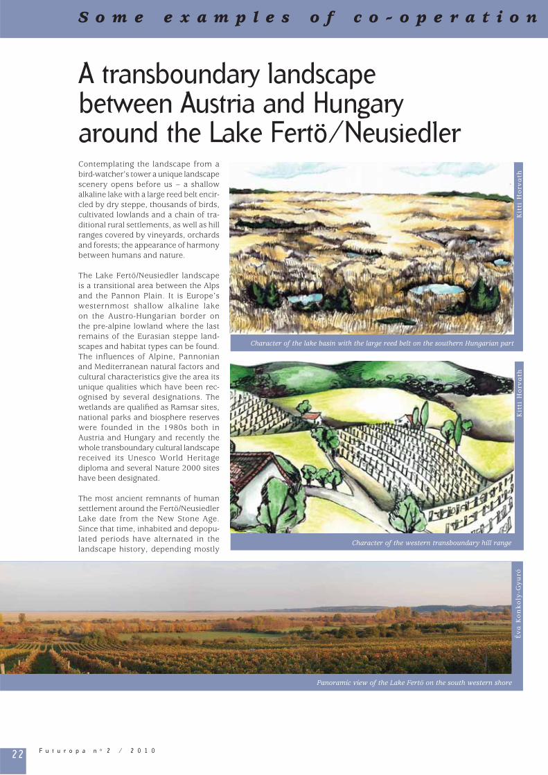
22 F u t u r o p a n o 2 / 2 0 1 0
A transboundary landscape between Austria and Hungary around the Lake Fertö/NeusiedlerContemplating the landscape from a bird-watcher’s tower a unique landscape scenery opens before us – a shallow alkaline lake with a large reed belt encir-cled by dry steppe, thousands of birds, cultivated lowlands and a chain of tra-ditional rural settlements, as well as hill ranges covered by vineyards, orchards and forests; the appearance of harmony between humans and nature.
The Lake Fertö/Neusiedler landscape is a transitional area between the Alps and the Pannon Plain. It is Europe’s westernmost shallow alkaline lake on the Austro-Hungarian border on the pre-alpine lowland where the last remains of the Eurasian steppe land-scapes and habitat types can be found. The infl uences of Alpine, Pannonian and Mediterranean natural factors and cultural characteristics give the area its unique qualities which have been rec-ognised by several designations. The wetlands are qualifi ed as Ramsar sites, national parks and biosphere reserves were founded in the 1980s both in Austria and Hungary and recently the whole transboundary cultural landscape received its Unesco World Heritage diploma and several Nature 2000 sites have been designated.
The most ancient remnants of human settlement around the Fertö/Neusiedler Lake date from the New Stone Age. Since that time, inhabited and depopu-lated periods have alternated in the landscape history, depending mostly
S o m e e x a m p l e s o f c o - o p e r a t i o n
Panoramic view of the Lake Fertö on the south western shore
Év
a K
on
ko
ly-G
yu
ró
Character of the western transboundary hill range
Character of the lake basin with the large reed belt on the southern Hungarian part
Kit
ti H
orv
ath
Kit
ti H
orv
ath

23F u t u r o p a n o 2 / 2 0 1 0
in the area. Amongst others, landscape scientists of the University of Vienna, the team of Austrian University of Life Sciences as well as the landscape research group of the University of West Hungary have been working together for several years on bilateral projects focusing on the natural and cultural heritage of landscape, on the landscape character and regional identity1.
References
Konkoly-Gyuró É., Wrbka, T. 2004. The Fertö-Neusiedler See Landscape. in Learning from European Transfrontier Landscapes. Ed. Wascher, D.M, Pérez-Soba, M. Landscape Europe. pp. 29-30.Palang, H., Printsmann, A., Konkoly-Gyuró É., Urbanc, M., Skowronek E, Woloszyn, W. 2005. The forgotten land-scapes of Central and Eastern Europe. Landscape Ecology. 20. pp 645-655.
Konkoly-Gyuró É. 2009. The Fertö/Neusiedlersee section of the Green Belt. pp. 126-135. In: The European Green Belt. Borders. Wilderness. Future. Eds. Wrbka, T., Zmelik, K., Grünweiss, M., Katalog of the Upper Austrian Museen.
Linz 2009 Kulturhauptstadt Europas. Verlag Bibliothek der Provinz.
Tirászi Á., Ziener, K., Konkoly-Gyuró É., Brandenburg C., Puskás L. 2009. Landscape perception and functions in the Austro-Hungarian area of the Lake Neusiedler/Fertö. Poster presen-tation at the European IALE Congress. Symposium No 2. Landscape multifunc-tionality in the eye of the stakeholders. Salzburg, 11-15 July 2009.
Eva Konkoly-GuyróProfessor, University of West Hungary,
Faculty of Forestry, Sopron, [email protected]
1 University of Vienna: Dr. Thomas Wrbka; the team of Austrian University of Life Sciences: Dr. Christiane Brandenburg and Dr. Karen Ziener; the University of West Hungary: Dr. Eva Konkoly-Gyuró
on the presence of water. Austria and Hungary shared their history for cen-turies. After the First World War and the collapse of the Austro-Hungarian monarchy, the new state border divided the lake. During the 20th century, the different political regimes and the sig-nifi cantly different demands towards the landscape resulted in a different development. In predominantly alpine Austria the need for agricultural produc-tion, vine-growing and water-related recreation were the main driving forces relating to land-use, while, in Hungary, the Iron Curtain zone became a ‘sleep-ing’ region, where depopulation and abandonment of the agricultural land resulted in a semi-natural landscape. Here nature conservation started earlier and had more signifi cance due to the low intensity of human use. However, the political changes 1989-90 witnessed the end of the Iron Curtain and the opening of the frontier. Increasingly intense development has taken place in the area, though the imprints of the 20th century are still evident.
The national and international research activities are more and more intensive
w i t h i n E u r o p e T h e C e n t r e a n d t h e E a s t
So
me
e
xa
mp
le
s
of
c
o-
op
er
at
io
n
wi
th
in
E
ur
op
e
Th
e
Ce
nt
re
a
nd
t
he
E
as
t
Location of the transboundary Fertö/Neusiedlersee landscape in Central Europe
Ev
a K
on
ko
ly-G
yu
ró

24 F u t u r o p a n o 2 / 2 0 1 0
Riverbank forests of the Moldova-Ukraine
Forests are a life-giving source to local communities and home to a wide diver-sity of plants and animals. The Nistru (Dniester) river, more than 1,300 km in length and with a basin area of around 72,100 km², partially borders both Ukraine and Moldova. The middle Nistru basin (or the Podol Dniester) is a steppe-forest area of hills (150-200 metres above sea level) with extensive agricul-ture and spectacularly beautiful, can-yon-shaped and steep-sided landscapes. Riverbank forests, amazingly resistant through diffi cult times, are closely asso-ciated with the history and culture of local people.
History and management
Moldova is a poorly-forested country; its current forestation (scattered and highly fragmented) covers 9.6% of its territory. Forests in Ukraine cover about 15.6% of its territory and the woodstock is quite
high. The forest coverage in the middle Nistru basin is comparatively low, i.e. 7% in Moldova and 11% in Ukraine.
A long history of management and intensive exploitation, through selective tree cutting for the shipbuilding industry (for the Russian Black Sea Fleet in the 19th century), massive wood extrac-tion during the Second World War, and the expansion of agriculture and bad droughts after the war, have caused colossal damage to the whole riverbank ecosystem.
The current ownership of the forest fund of Moldova is around 90% of the State Forest Agency “Moldsilva”, while the rest of the fund is managed mainly by local authorities and municipal administra-tions. About 66% of forests in Ukraine are owned by the State Committee of Forestry, while the rest are managed mainly by ministerial bodies (agricul-ture, defence) and state agencies.
Illicit cutting, cattle grazing, poaching, unau-thorised dumping of waste and pollution are having negative effects on the remain-ing forested areas. Many forests have been transformed into agricultural fi elds which has led to soil erosion and changes in the land. According to the Strategy of sustain-able development of the forest fund of the Republic of Moldova (2001), the State pro-gramme on regeneration and reforestation of forest lands for 2003-2020 (2003) and the Forest Code (1996), the forests should cover at least 15% of Moldovan territory by 2020-2025.
Climate change scenarios for Moldova, according to the National Communication under the UN Framework Convention on Climate Change (2000), may have con-sequences on the capacity of landscapes and forest habitats. However, the reha-bilitation and adequate management of forests is specifi ed in the National Action Plan to Combat Desertifi cation in Moldova (2000).
S o m e e x a m p l e s o f c o - o p e r a t i o n
Haidamak ravine, part of Historic-cultural Park, Busha (Ukraine)
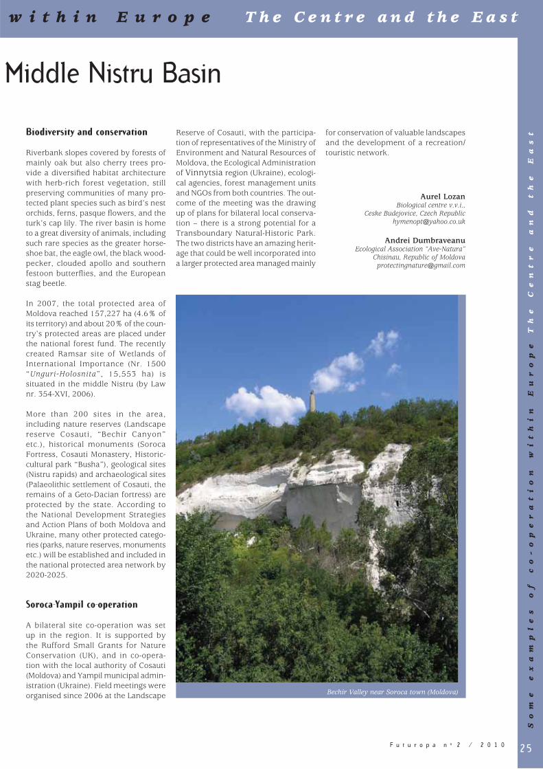
25F u t u r o p a n o 2 / 2 0 1 0
Middle Nistru Basin
w i t h i n E u r o p e T h e C e n t r e a n d t h e E a s t
So
me
e
xa
mp
le
s
of
c
o-
op
er
at
io
n
wi
th
in
E
ur
op
e
Th
e
Ce
nt
re
a
nd
t
he
E
as
tBiodiversity and conservation
Riverbank slopes covered by forests of mainly oak but also cherry trees pro-vide a diversifi ed habitat architecture with herb-rich forest vegetation, still preserving communities of many pro-tected plant species such as bird’s nest orchids, ferns, pasque fl owers, and the turk’s cap lily. The river basin is home to a great diversity of animals, including such rare species as the greater horse-shoe bat, the eagle owl, the black wood-pecker, clouded apollo and southern festoon butterfl ies, and the European stag beetle.
In 2007, the total protected area of Moldova reached 157,227 ha (4.6% of its territory) and about 20% of the coun-try’s protected areas are placed under the national forest fund. The recently created Ramsar site of Wetlands of International Importance (Nr. 1500 “Unguri-Holosnita”, 15,553 ha) is situated in the middle Nistru (by Law nr. 354-XVI, 2006).
More than 200 sites in the area, including nature reserves (Landscape reserve Cosauti, “Bechir Canyon” etc.), historical monuments (Soroca Fortress, Cosauti Monastery, Historic-cultural park “Busha”), geological sites (Nistru rapids) and archaeological sites (Palaeolithic settlement of Cosauti, the remains of a Geto-Dacian fortress) are protected by the state. According to the National Development Strategies and Action Plans of both Moldova and Ukraine, many other protected catego-ries (parks, nature reserves, monuments etc.) will be established and included in the national protected area network by 2020-2025.
Soroca-Yampil co-operation
A bilateral site co-operation was set up in the region. It is supported by the Rufford Small Grants for Nature Conservation (UK), and in co-opera-tion with the local authority of Cosauti (Moldova) and Yampil municipal admin-istration (Ukraine). Field meetings were organised since 2006 at the Landscape
Reserve of Cosauti, with the participa-tion of representatives of the Ministry of Environment and Natural Resources of Moldova, the Ecological Administration of Vinnytsia region (Ukraine), ecologi-cal agencies, forest management units and NGOs from both countries. The out-come of the meeting was the drawing up of plans for bilateral local conserva-tion – there is a strong potential for a Transboundary Natural-Historic Park. The two districts have an amazing herit-age that could be well incorporated into a larger protected area managed mainly
for conservation of valuable landscapes and the development of a recreation/touristic network.
Aurel Lozan Biological centre v.v.i.,
Ceske Budejovice, Czech [email protected]
Andrei Dumbraveanu Ecological Association “Ave-Natura”
Chisinau, Republic of [email protected]
Bechir Valley near Soroca town (Moldova)
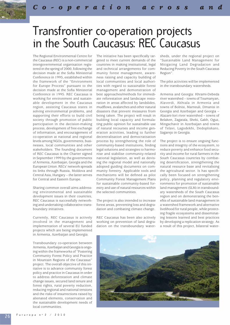
26 F u t u r o p a n o 2 / 2 0 1 0
C o - o p e r a t i o n a c r o s s a n d
Transfrontier co-operation projects in the South Caucasus: REC CaucasusThe Regional Environmental Centre for the Caucasus (REC) is a non-commercial intergovernmental organisation regis-tered in the spring of 2000, following the decision made at the Sofi a Ministerial Conference in 1995, established within the framework of the “Environment for Europe Process” pursuant to the decision made at the Sofi a Ministerial Conference in 1995. REC Caucasus is working for environment and sustain-able development in the Caucasus region, assisting Caucasus states in solving environmental problems, and supporting their efforts to build civil society through promotion of public participation in the decision-making process, development of free exchange of information, and encouragement of co-operation at national and regional levels among NGOs, governments, busi-nesses, local communities and other stakeholders. The founding document of REC Caucasus is the Charter signed in September 1999 by the governments of Armenia, Azerbaijan, Georgia and the European Union. RECs’ network spreads its links through Russia, Moldova and Central Asia, Hungary – the latter serves for Central and Eastern Europe.
Sharing common overall aims address-ing environmental and sustainable development issues in their countries, REC Caucasus is successfully network-ing and undertaking collaborative trans-boundary initiatives.
Currently, REC Caucasus is actively involved in the management and implementation of several EU funded projects which are being implemented in Armenia, Azerbaijan and Georgia.
Transboundary co-operation between Armenia, Azerbaijan and Georgia is ongo-ing within the frameworks of “Fostering Community Forest Policy and Practice in Mountain Regions of the Caucasus” project. The overall objective of this ini-tiative is to advance community forest policy and practice in Caucasus in order to address deforestation and climate change issues, secured land tenure and forest rights, rural poverty reduction, reducing regional and national tensions and the risks of insurrections raised by alienated elements, conservation and the sustainable development needs of local communities.
The initiative has been specifi cally tar-geted to meet current demands of the countries in making institutional, legal and technical arrangements for com-munity forest management, aware-ness raising and capacity building of local communities and local authori-ties with regard to sustainable forest management and demonstration of best approaches/methods for immedi-ate reforestation and landscape resto-ration in areas affected by landslides, mudfl ows, avalanches and other natural disasters that prevent measures from being taken. The project will result in building local capacity and formula-ting public opinion for sustainable use of natural recourses and income gen-eration activities, leading to further decentralisation and democratisation process by strengthening the role of community-based institutions, fi nding legal solutions and strategies to harmo-nise and stabilise community-related national legislation, as well as devis-ing the regional model and nationally adopted guiding documents on com-munity forestry. Applicable tools and mechanisms will be defi ned as pilot Community Forest Management Plans for sustainable community-based for-estry and use of natural resources within the selected communities.
The project is also intended to increase forest areas, preventing loss and degra-dation and combating climate change.
REC Caucasus has been also actively working on prevention of land degra-dation on the transboundary water-
sheds, under the regional project on “Sustainable Land Management for Mitigating Land Degradation and Reducing Poverty in the South Caucasus Region”.
The pilot activities will be implemented in the transboundary watersheds.
Armenia and Georgia: Khrami-Debeda river watershed – towns of Toumanyan, Alaverdi, Akhtala in Armenia and towns of Bolnisi, Marneuli, Dmanisi in Georgia and Azerbaijan and Georgia – Alazani-Iori river watershed – towns of Belaken, Zagatala, Sheki, Gakh, Oguz, Mingachavir in Azerbaijan and towns of Telavi, Lagodekhi, Dedopliskaro, Sagarejo in Georgia.
The project is to ensure ongoing func-tions and integrity of the ecosystem, to reduce poverty and enhance food secu-rity and income for rural farmers in the South Caucasus countries by combat-ing desertifi cation, strengthening the natural resource base and revitalising the agricultural sector. Is has specifi -cally been focused on strengthening policy, planning and regulatory envi-ronments for promotion of sustainable land management (SLM) in transbound-ary watersheds of the South Caucasus region and on demonstrating the ben-efi ts of sustainable land management in a watershed framework and alternative livelihood for rural people, while protect-ing fragile ecosystems and disseminat-ing lessons learned and best practices by developing a replication strategy. As a result of this project, bilateral water-
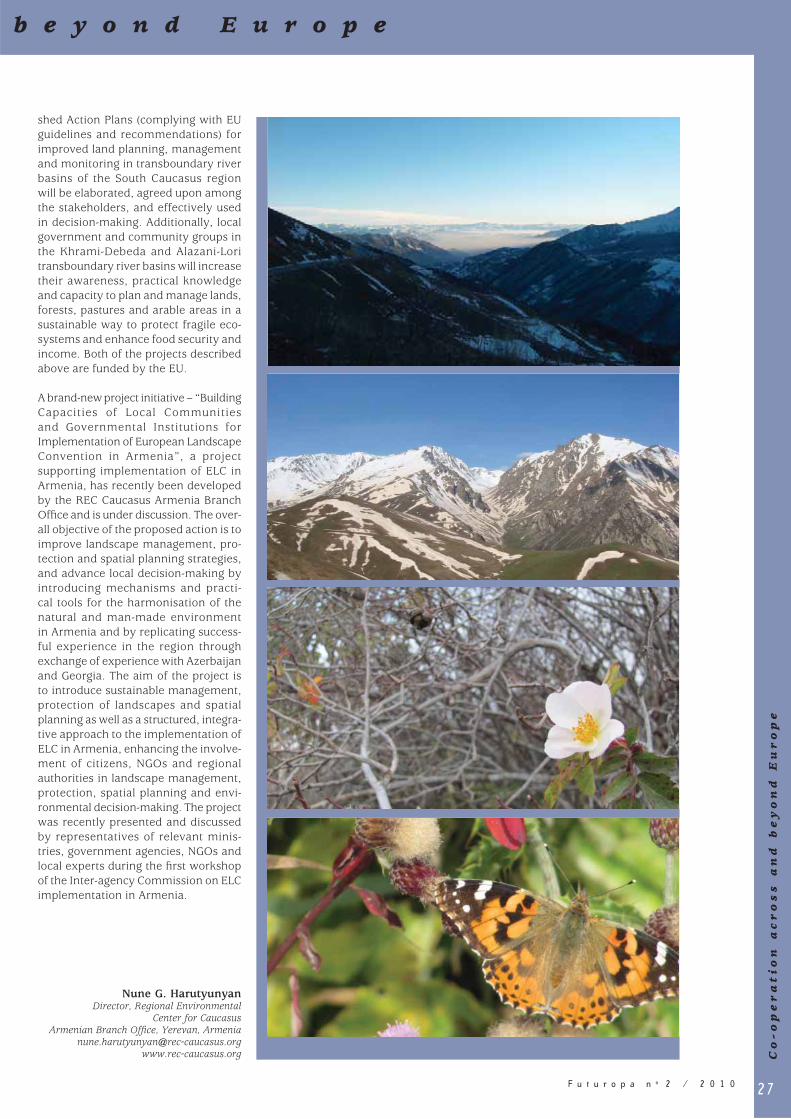
27F u t u r o p a n o 2 / 2 0 1 0
b e y o n d E u r o p e
Co
-o
pe
ra
tio
n a
cr
os
s a
nd
b
ey
on
d E
ur
op
e
shed Action Plans (complying with EU guidelines and recommendations) for improved land planning, management and monitoring in transboundary river basins of the South Caucasus region will be elaborated, agreed upon among the stakeholders, and effectively used in decision-making. Additionally, local government and community groups in the Khrami-Debeda and Alazani-Lori transboundary river basins will increase their awareness, practical knowledge and capacity to plan and manage lands, forests, pastures and arable areas in a sustainable way to protect fragile eco-systems and enhance food security and income. Both of the projects described above are funded by the EU.
A brand-new project initiative – “Building Capacities of Local Communities and Governmental Institutions for Implementation of European Landscape Convention in Armenia”, a project supporting implementation of ELC in Armenia, has recently been developed by the REC Caucasus Armenia Branch Offi ce and is under discussion. The over-all objective of the proposed action is to improve landscape management, pro-tection and spatial planning strategies, and advance local decision-making by introducing mechanisms and practi-cal tools for the harmonisation of the natural and man-made environment in Armenia and by replicating success-ful experience in the region through exchange of experience with Azerbaijan and Georgia. The aim of the project is to introduce sustainable management, protection of landscapes and spatial planning as well as a structured, integra-tive approach to the implementation of ELC in Armenia, enhancing the involve-ment of citizens, NGOs and regional authorities in landscape management, protection, spatial planning and envi-ronmental decision-making. The project was recently presented and discussed by representatives of relevant minis-tries, government agencies, NGOs and local experts during the fi rst workshop of the Inter-agency Commission on ELC implementation in Armenia.
Nune G. Harutyunyan Director, Regional Environmental
Center for CaucasusArmenian Branch Offi ce, Yerevan, Armenia
[email protected] www.rec-caucasus.org

28 F u t u r o p a n o 2 / 2 0 1 0
European Christmas landscapes: a transfrontier analysisAll European cultural landscapes have some universal or transfrontier features and some regional or national features. Undoubtedly, one of the key pan-Euro-pean cultural factors is Christianity and the individual manifestations of Christianity in the cultural landscapes of towns, villages, resorts and other locations. A striking example of this is provided by the images that form in people’s minds when they are asked to think of a Christmas landscape.
Mental landscapes of this sort are very interesting subjects for transfrontier analysis. We are all aware of universal Christmas images and symbols, such as the cave in the desert, the star of Bethlehem, the three kings, the shep-herds and the donkey. There are also national images such as the Christmas character, Santa Claus, and the Russian equivalent, “Ded Moroz” (literally “Father Frost”). What we should be investigat-ing here is whether there are other Christmas symbols which are refl ected in the regional features of cultural land-scapes. It is reasonable to suppose that they will be refl ected to varying degrees in cultural phenomena such as painting, poetry and music.
To ascertain whether this is true, we compared a large number of old and contemporary Russian and German Christmas cards. The results were as follows: – Many of the cards show rural land-
scapes or villages. In all of the pic-tures, there is snow, houses with lights in the windows, smoke rising gently from chimneys and the moon in the sky. However, the houses and churches on the German and Russian cards look different (Figs. 1 and 2). These are country-specifi c regional differences.
– Some of the scenes have a trans-regional character. For instance, on some modern Russian cards, there are pictures of the countryside villas of “New Russians” (nouveaux riches) and reindeers and Santa Claus, instead of
the traditional horse-drawn troika, driven by Ded Moroz (Fig. 3).
– Some trans-regional features can also be seen on old cards. However, on modern cards, there are clear refl ec-tions not only of trans-regional cul-tural infl uences but also of cultural globalisation (Fig. 4).
Combinations of trans-regional and regional symbols and the cross-border transfer of national images are also seen in Christmas poetry. Often, poets describe Christmas scenes quite real-istically but add some characteristic regional or national features. – In Russian poetry, a typical exam-
ple of this kind of transfer occurs in the poems of Joseph Brodsky and Boris Pasternak. Both poets portray the night when the magi came to Christ following the Christmas Star as a cold, snowy night. This was an obvious transposition of conditions at Christmas in Russia to Palestinian Bethlehem.
– The transposition of national images of Christmas is also found in German poetry. For instance, in the poem by Conrad Ferdinand Meyer Weihnachten in Ajaccio (Christmas in Ajaccio), there are descriptions of ripe oranges, blooming myrtle and shining sun, whereas the hero’s dream is about white snowfl akes.
– The scenery of Bethlehem seems very realistic in the poem by Russian poet Ivan Bunin “The Christmas Tree” whereas Alexander Blok’s poems contain descriptions of spar-kling snowy Christmas forest typical of Russia. Some of the scenes cre-ated by German poets are also very realistic. For instance, in Annette von Droste Hülshoff’s poetry, the three magi are tanned by hot winds and walk among palms and camels. The German Christmas portrayed by Gustav Hermann Kletke, however, is windy, snowy and frosty.
It is a complicated challenge to compare Christmas music in different countries.
It is reasonable to distinguish between different musical genres – liturgical music, professional sacred music, pro-fessional secular music and folk music – and to consider them separately.
If we compare Gregorian chants, the Christmas Oratorio by Johann Sebastian Bach, and Vingt Regards sur l’Enfant Jésus (Twenty Views of the Infant Jesus) by Olivier Messiaen, on the one hand, and the Znamenny Chant and the All-Night Vigil (Vespers) by Sergey Rachmaninov, Christmas Eve by Nikolai Rimsky-Korsakov, the Christmas Tree by Vladimir Rebikov and traditional Russian Kolyadka songs, on the other hand, we may come to the following conclusions: – Liturgical music does not include
regionally different landscape images. Regional distinctions seem to be more pronounced in folk music. However, these musical genres have to be stud-ied more carefully.
– It is easier to compare professional secular music. Landscape images can be clearly heard in Russian secular music devoted to Christmas. They are approximately the same as those in Russian poetry, including ele-ments such as frosty nights, stars, and Christmas trees in warm and cosy houses.
In conclusion, therefore,– Russian Christmas cards, poems and
secular music bear distinct regional or national features characterised by obvious landscape symbols such as snow-covered plains, fi r trees, heavy frost, night-time, stars, troikas, vil-lages and cosy candle-lit houses full of the scent of conifer needles.
– Some of these symbols, such as snow, fi r trees, lights and villages are also present in German mental Christmas landscapes. However, views of churches and Christmas markets are only seen on German cards.
– The mental Christmas landscapes of both countries also contain universal or transfrontier biblical symbols, such
S o m e e x a m p l e s o f c o - o p e r a t i o n

29F u t u r o p a n o 2 / 2 0 1 0
as the baby Jesus, Mary, Joseph, the kings or magi, camels, the Christ child, the ox and the donkey, the manger, the cave and the Star of Bethlehem.
Specifi c public opinion polls may be one means of revealing shared and local Christmas symbols in different coun-tries. The results of one such poll are given in the table below. Representatives of nine countries – Austria, United Kingdom, Germany, Denmark, Latvia, the Netherlands, Poland, Slovenia, and France – took part. They were asked to name fi ve major Christmas symbols. Overall, 29 different symbols were men-tioned. They included both frequently repeated and rarely mentioned sym-bols.
Admittedly, the results of this poll, which was conducted by just one group of experts, are somewhat tentative. However, they do point to the regional
diversity of mental Christmas images. Indeed, among the less frequently mentioned symbols, which may refl ect specifi c regional characteristics, there are some highly contrasting images such as grey rainy skies and stars. It can be supposed that if such polls were conducted more frequently on a more repre sentative sample, they would be very informative.
In further studies, it would be rea-sonable to compare Christmas land-scape images not only in Germany and in Russia but also in other large regions selected with due regard for their cultural and geographical identi-ties, including Scandinavia, the plains of northern Europe, the Alps, and the Mediterranean region. Subsequently, these large regions could be subdivided into smaller regions, particularly in the Mediterranean region. The results of such an analysis of mental Christmas
landscapes would show the similari-ties and differences between European regions in a new light and may be a key means of attaching identities to them.
Alexander V. DrozdovProfessor, Institute of Geography,
Russian Academy of Sciences, Moscou, Russian Federation
45 – 50%Christmas tree, snow
20 – 25%lighted windows in houses, lighted churches, hills and mountains, Christmas markets
4 – 5%the peals of bells, villages, grey sky and rain, stars
1 – 2%crowds in the countryside, fir trees, traffic jams, icy lakes, open landscapes, fields,
horrible American songs on the radio, snow-covered paths
Symbols of mental Christmas landscapes: frequency of occurrence in the answers to the poll, %
w i t h i n E u r o p e T h e C e n t r e a n d t h e E a s t
So
me
e
xa
mp
le
s
of
c
o-
op
er
at
io
n
wi
th
in
E
ur
op
e
Th
e
Ce
nt
re
a
nd
t
he
E
as
t
1. Traditional Russian village
2. Traditional German village
4. Merry Christmas everyone: Globalisation
3. “New Russian” village (stripped of any national identity)

30 F u t u r o p a n o 2 / 2 0 1 0
A proposal for a shared landscape reading methodologyProject aims
The aim of the transnational project Loto (Landscape Opportunities for Territorial Organisation), co-funded by the EU Interreg IIIB Cadses Programme, was to identify an interpretative reading methodology of landscape which could serve as a shared operating framework to steer and verify decisions regarding spatial change, restoration or enhance-ment1.
Given the principles expressed in the European Spatial Development Perspective and in the European Landscape Convention, Loto is founded on the awareness that the different landscapes of European territories are a legacy to be safeguarded and fun-damental to the quality of the places where we live, and on the principle that all territory is landscape and should be the object of a careful landscape pol-icy. It should be realised that territory is always changing and these changes should be guided in order to attain good landscape results.
The project’s approach is geared towards overcoming a sectoral vision in favour of an integrated and holistic vision of the landscape which interprets its evolution as a unitary system in which the eco-logical and natural components interact with the social, cultural and economic ones as well as the habitat.
However, integrating this landscape approach into spatial planning requires drawing up simple and effective land-scape interpretation methods. To involve inhabitants, an effort should be made to produce effective summaries, and clear, transparent forms for the presentation of landscape interpreta-tion results.
To this end, the Loto project intended to help providing tools for governing the landscape’s evolution, using the landscape as a frame of reference for any territorial project in order to focus spatial development instruments on it in a complementary way.
The project was divided into three phases: – preliminary: the study of other
experiences and analysis of skills, approaches and landscape planning methods currently used;
– intermediate: the fi rst methodological framework and pilot actions to test its effectiveness;
– fi nal: editing the shared document “Guidelines for a landscape reading and interpretation aimed at steering the choices of territorial transforma-tion”.
Within the processes of defi ning spa-tial transformation, the methodologi-cal path gives effectiveness to an open, frank discussion about:
– What kind of landscape do we have and how do we perceive it?
– What kind of landscape will it become?
– What kind of landscape do we want?
The basic preliminary requirements of the Loto methodology were: possi-ble reproduction and easy use of the method; open and fl exible procedure; transparency and repeatability; and main use of databases and informa-tion already available. Attention is paid to the whole territory and the reading intends to capture landscape characteri-sations and dynamics in order to under-stand the opportunities for its evolution. The proposed process is open and the various activities in the methodological process can be easily recognised and focus on building up clear information. Comparison of knowledge and shared landscape interpretative synthesis should become basic preconditions for effective landscape policy.
Landscape reading
According to the European Landscape Convention, methodology is based on the sites’ landscape knowledge. All terri-tory is involved, not only extraordinary parts. Loto proposes a different kind of knowledge from other methodologies; it is an analytical-descriptive method, based on an identifi cation-classifi cation process of homogeneous areas, describ-ing the sites’ landscape characteristics, without specifi c operational purposes; it proposes a description-interpretation of places, starting from a problem-solving approach or an interpretative hypothe-sis. Interdisciplinarity (bringing together different disciplinary approaches) and transdisciplinarity (the involvement of political authorities and populations) are the other methodological requirements of Loto methodology.
The methodological framework is organised into cognitive and operational activity cores: A. characterisation/qualifi cation; B. future evolution trends and transfor-
mation demands; C. interpretative synthesis; D. shared cognitive framework; E. defi nition of premises for landscape
policies and operational choices.
S o m e e x a m p l e s o f c o - o p e r a t
A Loto meeting
Rimini Exhibition
31F u t u r o p a n o 2 / 2 0 1 0
The phase concerning the cognitive activities A, B, and C has been ana-lysed in depth since the knowledge of sites from the landscape viewpoint is considered as the basis of quality trans-formations (protection, management, planning) which are suitable to, not just compatible with, the specifi c character-istics passed down to us.
Characterisation/qualification encom-passes:
– Identifi cation of basic elements and characteristics: physical features of sites (morphology, components such as water networks, buildings, terracing, woodland etc.), building materials (vegetable and mineral), colours, physical-chemical features (soil, water, air and climate, fl ora and fauna), current land uses, main char-acteristics of the local population and visitors interested in sites.
– Historic dynamics: the knowledge of how the current landscape organisa-tion has formed and changed over the centuries (dyachronic reading), in par-ticular creating a cultural and physi-cal space, and the signifi cant steps in the continuity and discontinuity of historical processes and of territorial impacts.
– Past and present social perception of sites from the landscape viewpoint (acknowledgement of the meaning that landscape has for people, from the symbolic, cultural, identity etc. viewpoints, for experts, for the herit-age of the collective local and general memory, etc.).
– An interpretative description of the current characteristics of “site archi-tecture” to record the morphological organisation of built and non-built areas, artifi cial and natural spaces, in their specifi c material aspects, under-lining the existing landscape relations, whether physical, functional, visual, symbolic, recent or historic differently linked (the cultural characteristics, but also the ecological functionality of sites).
The analysis of the main transforma-tion processes (under way, predicted and predictable) brought about by both anthropic and natural factors (future evolution trends and transformation demands) aims at predicting their impact on the sites’ physical character and on landscape meanings: evolution
trends (for economic, social and cultural reasons; biological and physical events or processes etc.); policies, territorial transformation plans and projects at the various administrative levels; stated and unstated transformation demands coming up; good projects and processes under way in the territory which may represent opportunities for developing effective policies.
Interpretative synthesis may lead to the prediction of one or more future scenarios expressed through technical, descriptive and explanatory reports and based on all the discussions between the authorities and populations concerned (shared cognitive framework). The syn-thesis is a sort of diagnosis defi ning the threats/problems and potentials/oppor-tunities of sites, from the landscape point of view, to defi ne landscape policies and operational choices (landscape quality objectives, defi nition of strategies and tools to realise these objectives; defi ni-tion of a management programme and plan over time; monitoring of landscape transformation and of the effect of poli-cies and reformulating new objectives). According to the European Landscape Convention, planning policies are a mixture of preservation, innovation, enhancement and rehabilitation all over the landscape.
A checklist is the fi nal formal structure of the Guidelines mentioned above: a summary of the key questions to be dealt with and to be analysed in depth where necessary.
The project follow-up
The fi rst effective outcome of the project began while it was still running; this is the landscape plan for the Municipality of Glonn, an integrative part of the regu-latory plan. After the conclusion of the project, many pilot actions were carried out with local public authorities. In any case, the Loto partners’ shared guide-lines can be considered a contribution to landscape assessment procedures, and also a tool to guide the start up of local shared processes on the defi nition of future spatial “scenarios” with particular attention to landscape upgrading. This is what is now happening in many areas of the Loto partners’ territory, with par-ticular success in some regions such as Lombardy and Emilia-Romagna.
Furthermore, the Lombardy Region decided to introduce the Loto guidelines
framework into the regional document criteria for landscape contents of a local urban plan, and the interregional public authority for the River Po Valley has referenced the Loto methodology in its guidelines for the management of mountain territory. Now, some new transnational project proposals are try-ing to implement and to develop Loto methodology with attention being paid to specifi c themes such as the manage-ment of periurban and rural areas or alpine cultural landscape preservation.
Lionella ScazzosiProfessor, Milan Polytechnic, Italy
[email protected]; [email protected]
Anna RossiProject Co-ordinator, Lombardy Region,
General Directorate for Territory and Urbanism, Milano, Italy
1. The Loto Project ran from March 2003 – Octo-ber 2005. The project, coordinated by Regione Lombardia, involved eight other partners – the Italian Ministry of Cultural Heritage, Umbria Region, Marche Region, Emilia Romagna Region, Veneto Regione, Istria Region, the Slovenian Ministry of Spatial Planning and the Environment, the Technical University of Munich – and two observers – the Institute of Urban Project of Bucharest and Corvinus University of Budapest. Many experts, research institutes, universi-ties and local public authorities took part in the Project work, allowing in-depth discussion of the various questions and a wide dissemination of the project’s results.
i o n w i t h i n E u r o p e T h e S o u t h
So
me
e
xa
mp
le
s
of
c
o-
op
er
at
io
n
wi
th
in
E
ur
op
e
Th
e
So
ut
h

32 F u t u r o p a n o 2 / 2 0 1 0
The European landscape observatory of Arco Latino“In order to promote its overall harmonious development, the Union shall develop and pursue its actions leading to the strength-ening of its economic, social and territorial cohesion” (Art. 174, 1° TEU).
Arco Latino 1, the second-tier local authority network of the Western Mediterranean Arco, with the aim of sustainable territorial development in Europe, launched in 2005 in Barcelona, a “Landscape Agreement” in the pres-ence of many public and private actors 2, who, in their capacity as promoters of the “European Landscape Observatory”, chose to locate their headquarters in the Province of Salerno.
On the occasion of the 2008 European Heritage Days, Arco Latino and the Province of Salerno established the European Landscape Observatory at the Certosa di San Lorenzo in Padula 3 under the high patronage of the President of the Italian Republic and the Ministries of Cultural Heritage, Environment and of Land and Sea Conservation, implement-ing Recommendation CM/Rec (2008) 3 of the Committee of Ministers to mem-ber states of the Council of Europe on the Guidelines for the implementation of the European Landscape Convention. The Centre brings together scientists, landscape specialists and technicians from the public and private sectors, who have given themselves the ambitious goals of: – describing the condition of the land-
scapes of Arco Latino at a given time; – exchanging information on policies
and experiences concerning pro-tection, management and planning of landscapes, and concerning participation in decisions at different levels;
– using, editing and compiling his-torical documents on landscapes for understanding and interpreting how landscape levels have developed (databases, archives, texts, photo-graphs, etc.);
– drawing up quantitative and qualita-tive indicators to assess the effective-ness of landscape policies following the Council of Europe guidelines;
– providing data and information lead-ing to an understanding of trends and forecasts (forward-looking sce-narios);
– organising exchanges of information and experiences between the regions of Arco Latino and territorial com-munities, including those already in place, based on examples and on the integration of political, social, ecologi-cal and cultural landscape policies.
Today, the Observatory brings together the network of its founding members and serves as a platform for the imple-mentation of several pilot projects, as: – The Master’s degree in European
Landscape (Master EuroMed) pre-sented by the University of Salerno in co-operation with universities in Spain and France involved in the project. This Master’s degree is primarily intended to train environmental experts either already active or able to hold central positions in environmental service companies, control bodies, and local government involved in landscape management and implementing the European Landscape Convention;
– The EuroMed Landscape Forum pre-sented by the High National Strasbourg School of Architecture. This is a place for training to pass on skills for under-standing landscape in all the countries along the Mediterranean shores;
– The Prize for policies that support land-scape and biodiversity in co-operation with the Coordination of Local Agenda 21, Hispa and the Italian Federation of Parks www.a21italy.it, www.hispa.it, www.parks.it.
The Observatory is open to all new projects compatible with its aims, and to all agencies willing to co-operate. This is an operative tool which will, its promoters hope, contribute not only to the implementation of the European Landscape Convention, but also to the development of a shared culture and to the protection and enhancement of landscape.
Domenico Nicoletti Director of HISPA, Italy
Christiane Garnero MorenaHigh National School of Architecture,
Strasbourg, [email protected]
Promoted byProvince of Salerme, Territorial
and Sustainable Development Commission
1 Arco Latino is an area of co-operation between terri-torial communities, within which integrated actions are implemented in different areas. The members of Arco Latino are represented by the Italian, French and Spanish second-tier local authorities.
2 Barcelona Council, Malaga Provincial Council, General Council of Gard, General Council of Hérault, Ecole Nationale Supérieure d’architecture de Lyon, Province of Allessandria, Province of La Spezia, Province of Matera, Province of Torino, Province of Viterbo, Province of Salerno, Ferderparchi, Legambiente, SITI (Istituto Superiore sui Sistemi Territoriali per l’innovazione), Coordination of Agenda 21, Interdepartmental Centre of the ‘Salerno Study Uniersity’, National Park of Cilento and Vallo di Diano, IPOGEA, Hispa.
3 La Certosa is one of the largest European Certosa, built by the Prince of Sanseverino in 1306. The monument was offi cially recognised by UNESCO in 1998 as part of The World Heritage list.
S o m e e x a m p l e s o f c o - o p e r a t
Certosa di San Lorenzo
Staircase Vanvitelli, Certosa di San
Lorenzo

33F u t u r o p a n o 2 / 2 0 1 0
Describing and labelling Mediterranean landscapes to protect their diversityValues of cultural and natural landscapes of the Mediterranean
The diversity of Mediterranean land-scapes contributes to local and regional identity, reflecting past and present relationships between people and their natural and human-made environment. Rich cultural landscapes have been developed over many millennia during which different human populations, cultures, and religions have fl ourished around the Mediterranean and have developed coastal landscapes in order to produce food, build living habitats, art, etc. Nowadays, however, increasing threats to cultural identity, heritage and landscape diversity of the region due to external (e.g. globalisation) and internal (e.g. rapid urbanisation of coastal areas with consequent impacts on traditional socio-economic structures) factors are apparent. As a result, natural and cul-tural landscapes have deteriorated sig-nifi cantly in several coastal areas.
The coastal landscapes of the Mediterranean have never been stud-ied as a specifi c group or type of land-scape. Existing landscape-specific methodologies and concepts have not been introduced or taken into account. Also, knowledge of the landscape typol-ogy, i.e. the variety of landscapes, and especially the most valuable and typi-cal Mediterranean landscapes, in other words outstanding landscapes, is not adequate, nor are the main processes and forces infl uencing their transforma-tion.
Identifi cation and assessment of land-scapes are two of the main obligations in the European Landscape Convention. In the preamble to the Convention, it is written “that the landscape is an impor-tant part of the quality of life for people everywhere: in urban areas and in the countryside, in degraded areas as well as in areas of high quality, in areas recog-nised as being of outstanding beauty as well as everyday areas”. The Barcelona Convention for the Protection of the Marine Environment and the Coastal Region of the Mediterranean. states that “Contracting Parties shall commit themselves to promote the integrated management of coastal zones, taking into account the protection of areas of
ecological and landscape interest and the rational use of natural resources”. Also, other implementation documents make landscape management an objec-tive, such as Mediterranean Action Plan and Priority Fields of Activities (1995), where countries commit themselves “to promote nature, and protect and enhance sites and landscapes of eco-logical or cultural values”. Unesco has issued legal instruments with some bearing upon landscape, either directly or indirectly.
Two actions are therefore proposed: – characterisation of all Mediterranean
coastal landscapes (Mediterranean Landscape atlas);
– evaluation and defi nition of outstand-ing landscapes.
Description and characterisation of Mediterranean coastal landscapes (Mediterranean landscape atlas)
The Landscape Character Assessment (LCA methodology) is a technique to classify, describe and understand the physical and cultural characteristics of the landscape. The objective of this methodology is to prepare a distribution of landscape types that are homogene-ous in their structure and have similar landscape patterns. It can be done at national, regional or local level or even internationally. Recommendations for
landscape change as part of the exercise are another important outcome. These recommendations serve the planners and public in decision-making proc-esses by presenting the spatial values and landscape structures that should be preserved or enhanced, as well as the level of their acceptable transformation or change so as to maintain the genius loci of the landscape unit in question. This characterisation also contributes to raising awareness about the land-scape and its values in the country. It contributes to maintaining European, national, regional and local identity through landscapes, which have been under globalisation pressures in recent decades due to similar techniques and technologies applied around the world, especially in agriculture and the urban sector. The LCA methodology, i.e. a functional hierarchy of abiotic, biotic and cultural components of the land-scape, involves a desk study, mapping of landscape types from layers of data, a fi eld survey and, fi nally, classifi cation and description to defi ne and commu-nicate landscape types.
The main steps in this study are to pre-pare a landscape typology for all coastal areas of the Mediterranean on the basis of national landscape characterisation. The main variables used to characterise landscapes in the study area include cli-mate, landform, geology and soils, land cover and land use. Each landscape type should be described, i.e. its main land-
i o n w i t h i n E u r o p e T h e S o u t h
So
me
e
xa
mp
le
s
of
c
o-
op
er
at
io
n
wi
th
in
E
ur
op
e
Th
e
So
ut
h
Outstanding landscapes have great potentials for cultural tourism
All
inea
plu
s d
.o.o
.
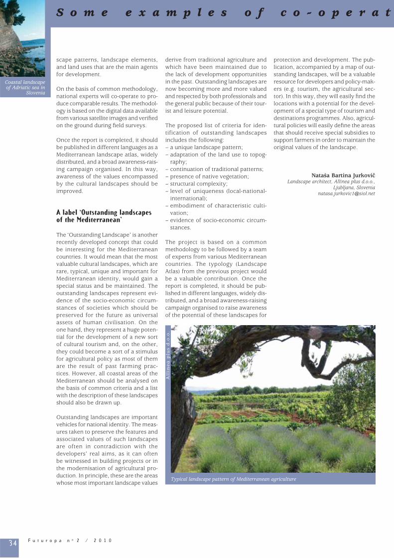
34 F u t u r o p a n o 2 / 2 0 1 0
scape patterns, landscape elements, and land uses that are the main agents for development. On the basis of common methodology, national experts will co-operate to pro-duce comparable results. The methodol-ogy is based on the digital data available from various satellite images and verifi ed on the ground during fi eld surveys.
Once the report is completed, it should be published in different languages as a Mediterranean landscape atlas, widely distributed, and a broad awareness-rais-ing campaign organised. In this way, awareness of the values encompassed by the cultural landscapes should be improved.
A label ‘Outstanding landscapes of the Mediterranean’
The ‘Outstanding Landscape’ is another recently developed concept that could be interesting for the Mediterranean countries. It would mean that the most valuable cultural landscapes, which are rare, typical, unique and important for Mediterranean identity, would gain a special status and be maintained. The outstanding landscapes represent evi-dence of the socio-economic circum-stances of societies which should be preserved for the future as universal assets of human civilisation. On the one hand, they represent a huge poten-tial for the development of a new sort of cultural tourism and, on the other, they could become a sort of a stimulus for agricultural policy as most of them are the result of past farming prac-tices. However, all coastal areas of the Mediterranean should be analysed on the basis of common criteria and a list with the description of these landscapes should also be drawn up.
Outstanding landscapes are important vehicles for national identity. The meas-ures taken to preserve the features and associated values of such landscapes are often in contradiction with the developers’ real aims, as it can often be witnessed in building projects or in the modernisation of agricultural pro-duction. In principle, these are the areas whose most important landscape values
derive from traditional agriculture and which have been maintained due to the lack of development opportunities in the past. Outstanding landscapes are now becoming more and more valued and respected by both professionals and the general public because of their tour-ist and leisure potential.
The proposed list of criteria for iden-tification of outstanding landscapes includes the following: – a unique landscape pattern;– adaptation of the land use to topog-
raphy;– continuation of traditional patterns;– presence of native vegetation;– structural complexity;– level of uniqueness (local-national-
international);– embodiment of characteristic culti-
vation;– evidence of socio-economic circum-
stances.
The project is based on a common methodology to be followed by a team of experts from various Mediterranean countries. The typology (Landscape Atlas) from the previous project would be a valuable contribution. Once the report is completed, it should be pub-lished in different languages, widely dis-tributed, and a broad awareness-raising campaign organised to raise awareness of the potential of these landscapes for
protection and development. The pub-lication, accompanied by a map of out-standing landscapes, will be a valuable resource for developers and policy-mak-ers (e.g. tourism, the agricultural sec-tor). In this way, they will easily fi nd the locations with a potential for the devel-opment of a special type of tourism and destinations programmes. Also, agricul-tural policies will easily defi ne the areas that should receive special subsidies to support farmers in order to maintain the original values of the landscape.
Nataša Bartina Jurkovic Landscape architect, Allinea plus d.o.o.,
Ljubljana, [email protected]
S o m e e x a m p l e s o f c o - o p e r a t
Typical landscape pattern of Mediterranean agriculture
All
inea
plu
s d
.o.o
.
Coastal landscape of Adriatic sea in
Slovenia

35F u t u r o p a n o 2 / 2 0 1 0
The “CôteàCôte” project: a sea viewed from its shores for greater co-operation between Mediterranean landscapesThe Mediterranean is a source both of fascination and of challenges. The issues now facing people around its shores once again confi rm Fernand Braudel’s vision of the Mediterranean as being central to co-operation and openness in Europe. In the current era of great regional changes, the “CôteACôte” (coast-to-coast) project seeks to restore the Mediterranean’s function of com-munication by involving writers and photographers in a contemporary inter-pretation of relationships with the sea.
In this context, the approach of the project is to re-establish dialogue between the founding myths of the Mediterranean as a “common herit-age” and the far-reaching changes and transformations now affecting it. The aim is to update the basis of this new Mediterranean identity and the aspects leading to shared values so as fi rmly
to establish a form of citizenship that meets the challenges of today.
In combining photographic and regional development approaches, the method-ology employed by the project devel-opers (the research consultancy, (MTP) prospective, and the photo agency, VU’) follows on from a long tradition of pho-tography for the surveys by the French regional development agency, DATAR. Beyond the involvement of images in the interpretation of regions and terri-tory, however, the original feature of the project lies in the multidisciplinary nature of the languages and points of view employed and expressed, involving a multicultural and pluralist approach made up of the views of women and men from different backgrounds.
By basing its methodology on “land-scape”, the project also contributes to
the implementation of the principles of the European Landscape Convention on the subject. Through these principles, the project seeks to promote not so much the permanence of iconic land-scapes but rather the interdependence of Mediterranean situations so as to capi talise on a forward-looking dimen-sion of landscape. The project now enjoys the patronage of the Secretary General of the Council of Europe.
Jean-Guy UbiergoResponsible for MTP Prospective,
Toulouse, [email protected]
UNE MER RACONTÉE PAR SES RIVES POUR UNE COOPÉRATION DES PAYSAGES MÉDITERRANÉENS
i o n w i t h i n E u r o p e T h e S o u t h
So
me
e
xa
mp
le
s
of
c
o-
op
er
at
io
n
wi
th
in
E
ur
op
e
Th
e
So
ut
h
Cover page
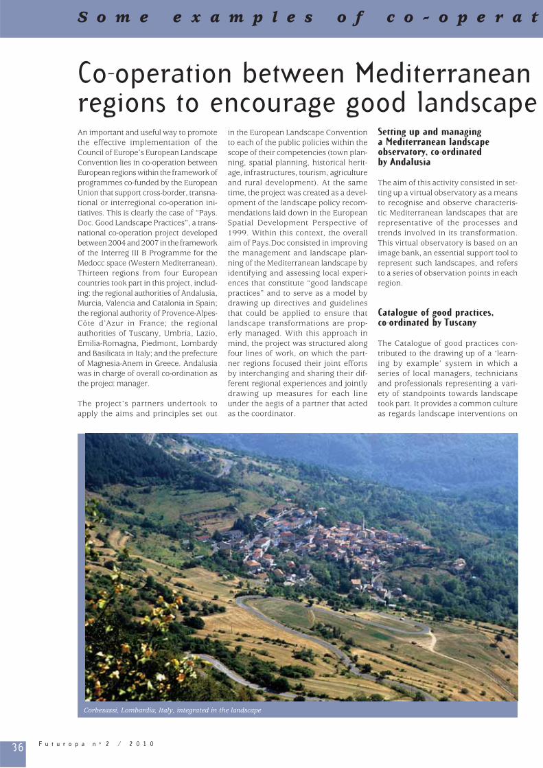
36 F u t u r o p a n o 2 / 2 0 1 0
Co-operation between Mediterranean regions to encourage good landscape An important and useful way to promote the effective implementation of the Council of Europe’s European Landscape Convention lies in co-operation between European regions within the framework of programmes co-funded by the European Union that support cross-border, transna-tional or interregional co-operation ini-tiatives. This is clearly the case of “Pays.Doc. Good Landscape Practices”, a trans-national co-operation project developed between 2004 and 2007 in the framework of the Interreg III B Programme for the Medocc space (Western Mediterranean). Thirteen regions from four European countries took part in this project, includ-ing: the regional authorities of Andalusia, Murcia, Valencia and Catalonia in Spain; the regional authority of Provence-Alpes-Côte d’Azur in France; the regional authorities of Tuscany, Umbria, Lazio, Emilia-Romagna, Piedmont, Lombardy and Basilicata in Italy; and the prefecture of Magnesia-Anem in Greece. Andalusia was in charge of overall co-ordination as the project manager.
The project’s partners undertook to apply the aims and principles set out
in the European Landscape Convention to each of the public policies within the scope of their competencies (town plan-ning, spatial planning, historical herit-age, infrastructures, tourism, agriculture and rural development). At the same time, the project was created as a devel-opment of the landscape policy recom-mendations laid down in the European Spatial Development Perspective of 1999. Within this context, the overall aim of Pays.Doc consisted in improving the management and landscape plan-ning of the Mediterranean landscape by identifying and assessing local experi-ences that constitute “good landscape practices” and to serve as a model by drawing up directives and guidelines that could be applied to ensure that landscape transformations are prop-erly managed. With this approach in mind, the project was structured along four lines of work, on which the part-ner regions focused their joint efforts by interchanging and sharing their dif-ferent regional experiences and jointly drawing up measures for each line under the aegis of a partner that acted as the coordinator.
Setting up and managing a Mediterranean landscape observatory, co-ordinated by Andalusia
The aim of this activity consisted in set-ting up a virtual observatory as a means to recognise and observe characteris-tic Mediterranean landscapes that are representative of the processes and trends involved in its transformation. This virtual observatory is based on an image bank, an essential support tool to represent such landscapes, and refers to a series of observation points in each region.
Catalogue of good practices, co-ordinated by Tuscany
The Catalogue of good practices con-tributed to the drawing up of a ‘learn-ing by example’ system in which a series of local managers, technicians and professionals representing a vari-ety of standpoints towards landscape took part. It provides a common culture as regards landscape interventions on
S o m e e x a m p l e s o f c o - o p e r a t
Corbesassi, Lombardia, Italy, integrated in the landscape
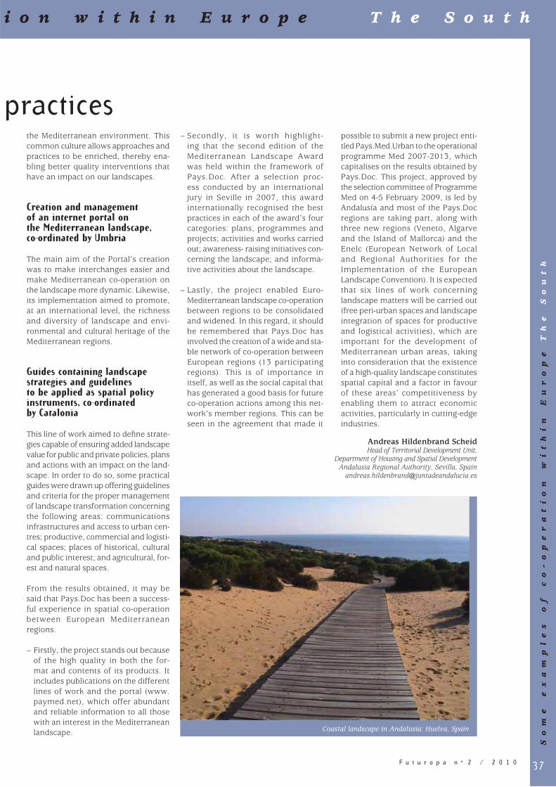
37F u t u r o p a n o 2 / 2 0 1 0
practicesthe Mediterranean environment. This common culture allows approaches and practices to be enriched, thereby ena-bling better quality interventions that have an impact on our landscapes.
Creation and management of an internet portal on the Mediterranean landscape, co-ordinated by Umbria
The main aim of the Portal’s creation was to make interchanges easier and make Mediterranean co-operation on the landscape more dynamic. Likewise, its implementation aimed to promote, at an international level, the richness and diversity of landscape and envi-ronmental and cultural heritage of the Mediterranean regions.
Guides containing landscape strategies and guidelines to be applied as spatial policy instruments, co-ordinated by Catalonia
This line of work aimed to defi ne strate-gies capable of ensuring added landscape value for public and private policies, plans and actions with an impact on the land-scape. In order to do so, some practical guides were drawn up offering guidelines and criteria for the proper management of landscape transformation concerning the following areas: communications infrastructures and access to urban cen-tres; productive, commercial and logisti-cal spaces; places of historical, cultural and public interest; and agricultural, for-est and natural spaces. From the results obtained, it may be said that Pays.Doc has been a success-ful experience in spatial co-operation between European Mediterranean regions.
– Firstly, the project stands out because of the high quality in both the for-mat and contents of its products. It includes publications on the different lines of work and the portal (www.paymed.net), which offer abundant and reliable information to all those with an interest in the Mediterranean landscape.
– Secondly, it is worth highlight-ing that the second edition of the Mediterranean Landscape Award was held within the framework of Pays.Doc. After a selection proc-ess conducted by an international jury in Seville in 2007, this award internationally recognised the best practices in each of the award’s four categories: plans, programmes and projects; activities and works carried out; awareness- raising initiatives con-cerning the landscape; and informa-tive activities about the landscape.
– Lastly, the project enabled Euro-Mediterranean landscape co-operation between regions to be consolidated and widened. In this regard, it should be remembered that Pays.Doc has involved the creation of a wide and sta-ble network of co-operation between European regions (13 participating regions). This is of importance in itself, as well as the social capital that has generated a good basis for future co-operation actions among this net-work’s member regions. This can be seen in the agreement that made it
possible to submit a new project enti-tled Pays.Med.Urban to the operational programme Med 2007-2013, which capitalises on the results obtained by Pays.Doc. This project, approved by the selection committee of Programme Med on 4-5 February 2009, is led by Andalusía and most of the Pays.Doc regions are taking part, along with three new regions (Veneto, Algarve and the Island of Mallorca) and the Enelc (European Network of Local and Regional Authorities for the Implementation of the European Landscape Convention). It is expected that six lines of work concerning landscape matters will be carried out (free peri-urban spaces and landscape integration of spaces for productive and logistical activities), which are important for the development of Mediterranean urban areas, taking into consideration that the existence of a high-quality landscape constitutes spatial capital and a factor in favour of these areas’ competitiveness by enabling them to attract economic activities, particularly in cutting-edge industries.
Andreas Hildenbrand ScheidHead of Territorial Development Unit,
Department of Housing and Spatial DevelopmentAndalusia Regional Authority, Sevilla, Spain
i o n w i t h i n E u r o p e T h e S o u t h
So
me
e
xa
mp
le
s
of
c
o-
op
er
at
io
n
wi
th
in
E
ur
op
e
Th
e
So
ut
h
Coastal landscape in Andalusia: Huelva, Spain
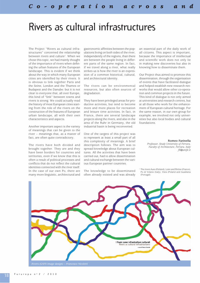
38 F u t u r o p a n o 2 / 2 0 1 0
Rivers as cultural infrastructures
The Project “Rivers as cultural infra-structures” concerned the relationship between rivers and culture1. When we chose this topic, we had mainly thought of the importance of rivers when defi n-ing the urban features of the European landscape. This is evident if we think about the way in which many European cities are identifi ed by their rivers. It is obvious to link together Paris and the Seine, London and the Thames or Budapest and the Danube: but it is not clear to everyone that, all over Europe, this kind of “link” between towns and rivers is strong. We could actually read the history of most European cities start-ing from the role of the rivers on the construction of the features of European urban landscape, all with their own characteristics and aspects.
Another important aspect is the variety of meanings that can be given to the river – meanings that, as a matter of fact, are often quite contradictory.
The rivers have both divided and brought together. They are and they have been borders for countries and territories, even if we know that this is often a result of political processes and confl icts that do not refl ect the cultural identities connected with the river itself. In the case of our own Po, there are many more linguistic, architectural and
gastronomic affi nities between the pop-ulations living on both sides of the river, independently of the regions, than there are between the people living in differ-ent parts of the same region. In fact, if we travel along a river, what really strikes us is how the river is an expres-sion of a common historical, cultural, and architectural identity.
The rivers can be environmental resources, but also often sources of degradation.
They have been privileged areas for pro-ductive activities, but tend to become more and more places for recreation and leisure time activities. In fact, in France, there are several landscape projects along the rivers, and also in the area of the Ruhr in Germany, the old industrial basin is being reconverted.
One of the targets of this project was to represent at least a small part of all this complexity of meanings. A brief description follows. The aim was to spread knowledge about European cul-tures. All the activities that have been carried out, had to allow dissemination and cultural exchange between the vari-ous European partner countries.
The knowledge to be disseminated often already existed and was already
an essential part of the daily work of all citizens. This aspect is important, because the importance of intellectual and scientifi c work does not only lie in making new discoveries but also in knowing how to disseminate them.
Our Project thus aimed to promote this dissemination, through the organisation of events that have facilitated dialogue and helped establish new research net-works that would allow other co-opera-tion and common projects in the future. This kind of dialogue is not only aimed at universities and research centres, but at all those who work for the enhance-ment of European cultural heritage. For the same reason, in our own group for example, we involved not only univer-sities but also local bodies and cultural foundations.
Romeo FarinellaProfessor, Study University of Ferrara,
Faculty of Architecture, Ferrara, Italyfl [email protected]
1 The rivers Aura (Finland), Loire and Rhône (France), Po di Volano (Italy), Vista (Poland and Guadiana (Portugal).
C o - o p e r a t i o n a c r o s s a n d
Rivers (GAFS image design) – Francesco Nicoletti

39F u t u r o p a n o 2 / 2 0 1 0
The potential of the European Geopark Network for the implementation of the European Landscape ConventionWhat is the essence of landscape? Is it the terrain formation, its diversifi ed forms of life, the scenery perceived as landscape aesthetics or its spiritual val-ues? What do geoparks with their philos-ophy have in common with landscape and with people living there?
Geoparks means a real bottom-up initia-tive where the landscape as perceived by local people plays a central role whilst the landscape type, objectives, characteristics and values represent key issues for the geopark movement.
The main objective of the geopark ini-tiative is to make people more curious about the story of the planet, to take care of it and to search for optimal and responsible ways of developing it.
In the context of the European Landscape Convention European, geoparks can be seen as one of the special landscape planning and management tools. The key phenomena can include for exam-ple rock cities, volcanic and karst areas, archaeological and palaentological sites, or abandoned mines including the min-ing facilities. But this landscape heritage is supposed to be not only conserved for future generations but also to be interpreted in an innovative and crea-tive way and to be used sustainably for local quality of life. The main idea of the geopark’s philosophy is sustain-able development, with an active role for the local community and for geo-tourism and other environment-friendly forms of tourism, with an emphasis on the modern way of interpreting the geo-logical and related landscape heritage values of the territory. The status of the geopark requires a systematic approach to landscape management with a clear landscape development vision.
Offi cial recognition and support for the geopark initiative was given by Unesco in 2004 – just four years after the European Geopark Network was founded by four European areas (Petrifi ed Forest
in Lesvos, Geological Reserve of Haute-Provence, Gerolstein/Vulkaneifel in Germany and the Maestrazgo Cultural Park in Spain). Nowadays, three geo-graphical levels of geopark networks exist: global, European and national. The global network based in Beijing, China, is in the process of preparing other continental networks. Apart from European geoparks (33 geoparks in 13 countries1), already about 20 Chinese geoparks, one Iranian, one Brazilian, one Malaysian and one Australian geopark are included (58 geoparks from
18 countries). The European Network represents a real motor in the dynamic geopark movement. The national geopark level was developed in China, Germany, Switzerland, Japan, Italy, Portugal, the United Kingdom and the Czech Republic. It provides verifi cation before entry to the European Geopark Network and, at the same time, repre-sents the system for geoparks with only national importance.
At the last meeting of the European Geopark Network in the Bohemian
b e y o n d E u r o p e
Co
-o
pe
ra
tio
n a
cr
os
s a
nd
b
ey
on
d E
ur
op
e
Klokocske skaly, Paradise Geopark, Bohemia
Tom
as R
idko
sil

40 F u t u r o p a n o 2 / 2 0 1 0
C o - o p e r a t i o n a c r o s s a n d
Paradise Geopark, Ladislav Miko, Director of Environment at the European Commission refl ected on the meaning of geology in the area of biodiversity protection, landscape ecology and land-scape mental mapping. He explained how geological and geomorphological characteristics infl uence both wildlife and cultural processes and phenomena: landscape is basically a result of mutual interconnections between geological, biological and cultural diversity. This implies that, in order to understand a complex system, a truly multidisciplinary approach is needed. According to him, geoparks offer just such a cross-discipli-nary, interesting and practical approach. He recognised that geoparks serve as a useful voluntary bottom-up instrument based on the activity and enthusiasm of local communities. He contrasted this approach with often directive-based con-cepts of protected areas and underlined the need to convince local people to join the geopark initiative.
L. Miko suggested that it would be inter-esting and helpful if the geopark net-work could contribute, with its expert
skills and knowledge, to the prepara-tion of management plans for Natura 2000 localities, specifi cally in the area of geodiversity and its relation to biodiver-sity. This proposal presents a signifi cant challenge for the European Geopark Network, as subsequently pointed out by its coordinator Nikolaos Zouros.
Other potential benefi ts of the geopark initiative for the European landscape lie in education, interpretation, land-scape research, landscape heritage conservation based on the knowledge of the importance and mutual relation between its three types of diversity and lastly the sustainable use of landscape heritage above all in the form of geotour-ism, local branding, eco/bio-agriculture, handicrafts etc.
The strength, comparative advantage and success of the geopark movement lie in networking instruments. A strict initial evaluation and periodical revali-dation is necessary to keep and enhance the quality and competitiveness of the network. It is based on the following criteria: conservation and interpretation
of geological and landscape heritage, human resources and fi nancial man-agement, sustainable tourism strategy, education and research, participation in network activities (common mar-keting, projects, magazines, periodical meetings of coordination committees, annual and biannual conferences).
In return, the network offers to its mem-bers the organisation of the activities mentioned above, training, information, know-how and best practices exchange (guidelines, manuals, communication and marketing systems etc.), exchange of experts and youth camps, technical support and expert consultation and fi nally active international co-operation. Unesco plays an important institutional role in the geopark movement and its performance is crucial from the glo-bal perspective. The last but not least benefi t of the geopark community is the mutual support resulting from the enthusiasm of individual members of the European Geopark Network in their work and efforts to conserve, present, interpret and use geology sustainably as a basis of landscape heritage.
It is clear that the philosophy of the geopark initiative is close to that of the European Landscape Convention and that parallel implementation of these concepts can produce substantial syn-ergies. It is mutually benefi cial when these initiatives support and promote each other.
Martina PaskovaEnvironmental Policy Department
Ministry of the Environment, Prague, Czech Republic
1 Austria, Croatia, Czech Republic, France, Greece, Germany, Italy, Norway, Portugal, Ireland, Romania, Spain, United Kingdom.
Meeting of the European Geopark Network
To
ma
s R
idk
osi
l

41F u t u r o p a n o 2 / 2 0 1 0
b e y o n d E u r o p e
Co
-o
pe
ra
tio
n a
cr
os
s a
nd
b
ey
on
d E
ur
op
e
Geographically speaking only three countries are both Mediterranean and Atlantic: Spain, France and Morocco, although Portugal could also be included because of the Mediterranean climate of its southern shores. On a regional scale, Andalusia and northern Morocco are the only areas that share seaboards with both the Mediterranean and the Atlantic. Nevertheless, despite this spe-cial location, the Mediterranean was always predominent historically and cul-turally until its infl uence was extended dramatically by the new horizons of the Atlantic.
The Mediterranean, as a sea and a geo-graphical region, was the fi rst area in the world of its size to be mapped com-pletely and given a name of its own. Although called Mare nostrum during Roman times, the Mediterranean has never been a culturally homogeneous area. The story of the development of the peoples and societies who have inhabited this corner of the planet is of confl ict and mutual interferences. As Pedrag Matvejevic remarked, in his history of the Mediterranean and its peoples, Mediteranski brevijar, “The idea of the Mediterranean and the Mediterranean itself have never man-aged to live in harmony”. In recent times, the Mediterranean is possibly the region where economic and cul-tural boundaries are most in confl ict and where, from both its shores, great efforts for co-operation are being under-taken.
The opportunities and tensions created by this situation are centred mainly on the Straits of Gibraltar and the border of Andalusia and Morocco. Many are the daily episodes and sporadic events that bear witness to this constant syn-ergy between the two continents. The straits are a veritable north-south east-west crossroads for travellers and mer-chandise and a strategic point in global geopolitics. Just to stand on a vantage point on one coast and look towards the other evokes strong emotions, not just because of the impressive landscapes but also because of the multitude of past and present events.
The intensity of life and its meaning centred around the Straits of Gibraltar do not receive the political reactions they deserve and, although things are moving in the right direction, the path of diplomacy and co-operation is bogged down by distrust and misun-derstandings. European and national programmes exist but real understand-ing only comes about when grass-roots political communities get together, and especially individuals. Thus co-opera-tion between Andalusia and Morocco is of the utmost importance.
Scientists have long observed that the same natural landscapes exist on each side of the straits, which are in fact no more than a narrow arm of the sea that opened quite recently in geological terms between two mountainous for-mations created by the same tectonic events and composed of the same types of rock. Even the vegetation includes the same endemic species. Latterly, a shared background has left the African and Spanish Mediterranean regions with many common features in their social and territorial organisation.
If, as in the European Landscape Convention, the landscape forms part of the framework of people’s lives, the similarities to be seen between Andalusia and northern Morocco would go a long way towards explaining simi-larities in the way people conduct their daily lives; for example, the times when people work in the fi elds are much the same, and so are their ways of using urban public areas.
Co-operation between Andalusia and Morocco recognises these common bases of understanding and, although many other fi elds of joint action exist, it is worth highlighting three joint meas-ures which have been taken with par-ticular regard to the landscape: – The creation in 2006 of the inter-
continental Biosphere Reserve of the Mediterranean, an area of more than 9,000 sq km , which is made up of land on both sides of the straits, including such important national nature reserves as those at Grazalema in Andalusia and Talassemtane in Morocco.
– The support of the Andalusian govern-ment in restoring the historical cen-tres of the towns of Larache, Tangiers and Tetuan, with buildings and areas of great symbolic value.
– Programmes for co-operation between the International University of Andalusia and the Abdelmalek Esaadi University of Morocco (Tangiers and Tetuan) have recently been respon-sible for devoting numerous activi-ties to natural and cultural heritage. In July 2008, the fi rst course devoted to landscape was held, during which the tenets of the European Landscape Convention were presented.
Florencio Zoido NaranjoDirector of the Study Center on Landscape
and Territory, Autonomous Community of Andalusia, Spain
The role of landscape in co-operation between Andalusia and Morocco
Gibraltar StraitTalassemtane
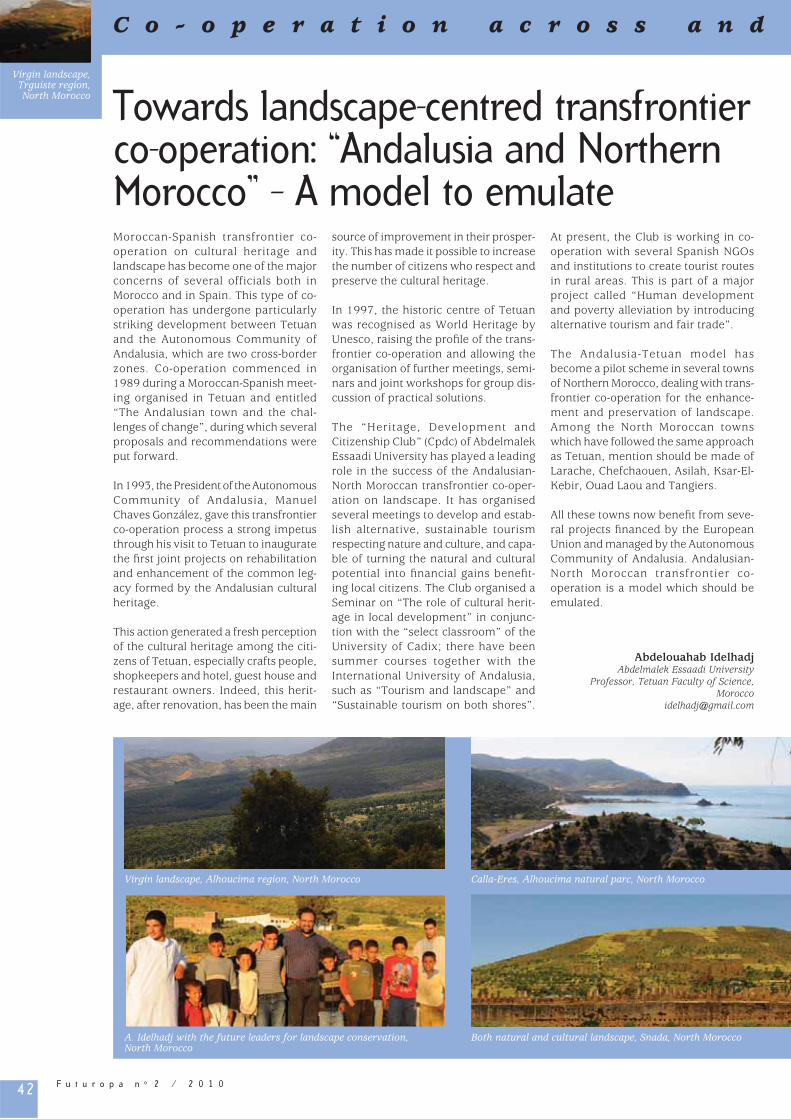
42 F u t u r o p a n o 2 / 2 0 1 0
C o - o p e r a t i o n a c r o s s a n d
Towards landscape-centred transfrontier co-operation: “Andalusia and Northern Morocco” – A model to emulateMoroccan-Spanish transfrontier co-operation on cultural heritage and landscape has become one of the major concerns of several officials both in Morocco and in Spain. This type of co-operation has undergone particularly striking development between Tetuan and the Autonomous Community of Andalusia, which are two cross-border zones. Co-operation commenced in 1989 during a Moroccan-Spanish meet-ing organised in Tetuan and entitled “The Andalusian town and the chal-lenges of change”, during which several proposals and recommendations were put forward.
In 1993, the President of the Autonomous Community of Andalusia, Manuel Chaves González, gave this transfrontier co-operation process a strong impetus through his visit to Tetuan to inaugurate the fi rst joint projects on rehabilitation and enhancement of the common leg-acy formed by the Andalusian cultural heritage.
This action generated a fresh perception of the cultural heritage among the citi-zens of Tetuan, especially crafts people, shopkeepers and hotel, guest house and restaurant owners. Indeed, this herit-age, after renovation, has been the main
source of improvement in their prosper-ity. This has made it possible to increase the number of citizens who respect and preserve the cultural heritage.
In 1997, the historic centre of Tetuan was recognised as World Heritage by Unesco, raising the profi le of the trans-frontier co-operation and allowing the organisation of further meetings, semi-nars and joint workshops for group dis-cussion of practical solutions.
The “Heritage, Development and Citizenship Club” (Cpdc) of Abdelmalek Essaadi University has played a leading role in the success of the Andalusian-North Moroccan transfrontier co-oper-ation on landscape. It has organised several meetings to develop and estab-lish alternative, sustainable tourism respecting nature and culture, and capa-ble of turning the natural and cultural potential into fi nancial gains benefi t-ing local citizens. The Club organised a Seminar on “The role of cultural herit-age in local development” in conjunc-tion with the “select classroom” of the University of Cadix; there have been summer courses together with the International University of Andalusia, such as “Tourism and landscape” and “Sustainable tourism on both shores”.
At present, the Club is working in co-operation with several Spanish NGOs and institutions to create tourist routes in rural areas. This is part of a major project called “Human development and poverty alleviation by introducing alternative tourism and fair trade”.
The Andalusia-Tetuan model has become a pilot scheme in several towns of Northern Morocco, dealing with trans-frontier co-operation for the enhance-ment and preservation of landscape. Among the North Moroccan towns which have followed the same approach as Tetuan, mention should be made of Larache, Chefchaouen, Asilah, Ksar-El-Kebir, Ouad Laou and Tangiers.
All these towns now benefi t from seve-ral projects fi nanced by the European Union and managed by the Autonomous Community of Andalusia. Andalusian-North Moroccan transfrontier co-operation is a model which should be emulated.
Abdelouahab IdelhadjAbdelmalek Essaadi University
Professor, Tetuan Faculty of Science, Morocco
Virgin landscape, Trguiste region, North Morocco
Calla-Eres, Alhoucima natural parc, North MoroccoVirgin landscape, Alhoucima region, North Morocco
Both natural and cultural landscape, Snada, North MoroccoA. Idelhadj with the future leaders for landscape conservation, North Morocco

43F u t u r o p a n o 2 / 2 0 1 0
b e y o n d E u r o p e
Co
-o
pe
ra
tio
n a
cr
os
s a
nd
b
ey
on
d E
ur
op
e
Alliance of World Heritage Cultural Landscapes In 2006, the City Council of Aranjuez called for a fi rst working meeting to dis-cuss places holding the World Heritage Declaration by Unesco, in the Cultural Landscape category. It was about start-ing up an initiative aimed at creating a network of Cultural Landscapes, which would be named the “Alliance of World Heritage Cultural Landscapes”.
Implementation
In December 2007, the First International Conference of the Alliance of World Heritage Cultural Landscapes was held in Aranjuez, attended by representa-tives of 16 Cultural Landscapes, the Spanish Ministry of Culture, the Unesco World Heritage Centre itself, and the offi cial organisations related to the WHC (Icomos, Iccrom, Iucn…)
The Conference ended with the sign-ing of the “Aranjuez Declaration” and the announcement of the Second International Conference and the Alliance Constituent Assembly, to be held in Sintra, Portugal, in 2008. The Aranjuez Declaration was intended to be a programing document, and form the basis of the Alliance.
The initiative is supported by the Spanish Ministry of Culture and the Unesco World Heritage Centre and is considered an important tool in the privi lege-commitments relationship of the Cultural Landscape. It is an instru-ment of solidarity for countries that have lower scientifi c, technical and fi nancial resources at their disposal, both to gain the Unesco Declaration and to keep it.
Working meetings have been organised, with representatives of other places declared World Heritage in similar cat-egories to Cultural Landscape, e.g. the case of the biodiversity and culture of Ibiza, the Alhambra and Generalife of Grenada, the Palmeral of Elche and the Médulas in León. The incorpora-tion of these places has created discus-sions about the forms which Cultural Landscapes can take, which may give rise to another Unesco Declaration.
Thus, the creation of the Alliance of World Heritage Cultural Landscapes
Association was proposed with these Spanish members as well as Sintra, in Aranjuez, in 2008. It offered the pos-sibility of incorporation to the other international partners.
National scope: optimisation through networking
The Alliance of World Heritage Cultural Landscapes is an opportunity to provide a national frame of reference so that the places declared Cultural Landscapes and given similar labels have suitable tools for the defence of common interests related to the management, mainte-nance and uses linked with the World Heritage Declaration.
The Alliance of World Heritage Cultural Landscapes may be an instrument for dialogue and exchange for the devel-opment of coordinated actions organi-sations and institutions related to the World Heritage Declaration, particularly in the relationships with the respective Ministries of Culture and the Unesco World Heritage Centre itself.
The coordination of actions is also important in connection with the deci-sions of local and regional administra-tions, as it shows the impact of the World Heritage Declaration on other management areas: town planning, environment, tourism, etc.
Besides, it is an important opportunity to activate social participation with local populations.
International scope
The Alliance provides the possibility of adding common elements to all Cultural Landscapes, it contributes to overcom-ing the existing gaps in the concept and defi nition of Cultural Landscape.
Scientifi c research carried out throughout history aimed at better understanding of the human-nature-activity relations, together with the sustainable use of the endogenous resources, is an important starting point to bring about an inno-vative advance in research that com-bines technical knowledge with political
decisions. It should also be maintained when looking for harmony between the principles of the European Landscape Convention and those included by Unesco in the World Heritage Cultural Landscapes Declaration.
This is one of the main contributions that the Alliance of World Heritage Cultural Landscapes can provide to sustainable development and spatial planning. All this work encourages a worldwide net-work, which could provide proposals and solutions in view of sustainable development, climate change and the challenges of conserving our cultural heritage. Its relationship with the con-tents and guidelines of the European Landscape Convention is clear.
Luciano Sánchez Pérez-Moneo Secretary General, Alliance of World Heritage
Cultural Landscapes, Aranjuez (Madrid), Spain
[email protected]://www.alianzadepaisajesculturales.es/
Representatives of the founder members of the Alliance

44 F u t u r o p a n o 2 / 2 0 1 0
C o - o p e r a t i o n a c r o s s a n d
Co-operation for transfrontier landscapes At the start of the 21st century, it may seem unnecessary to talk about the need to protect landscapes, as they have already been protected for many years. We need only to think of the great American national parks such as Yellowstone, which were established at the end of the 19th century and whose beautiful lakes, high snow-covered mountains and vast conifer forests have always been a source of wonder. They are sanctuaries for fauna and fl ora of outstanding beauty, in which all human activity remains banned in principle.
When European countries began pro-tecting landscapes of this kind a little later, they had to employ other meth-ods of protection because – with the possible exception of Scandinavia and Russia – population density lev-els meant that measures as drastic as those in the United States could not be adopted. Under these circumstances, the landscapes protected in Europe were relatively small but of great beauty and with a wide variety of fauna and fl ora. Accordingly, while account has to be taken of human presence, activities con-ducted in protected landscapes should be in harmony with nature. Landscapes featuring outstanding archaeological or historic monuments and parks and gardens laid out by humankind are also protected.
The protection of such landscapes, which may be regarded as traditional, subsequently transcended national boundaries with the adoption of inter-national treaties, including the Unesco Convention concerning the Protection of the World Cultural and Natural Heritage, which unquestionably marked a break-through. At regional level, the Council of Europe led the way in this area with the adoption, among others, of the European Convention on the Protection of the Archaeological Heritage (revised) (Valletta, 1992), the Convention on the Conservation of European Wildlife and Natural Habitats (Bern, 1979) and the Convention for the Protection of the Architectural Heritage of Europe (Granada, 1985).
The transfrontier co-operation promoted by the Council of Europe in recent years has also had consequences regarding the protection of landscapes: many nature reserves now cross-borders and are managed jointly. However, there is a need to extend this cross-border co-operation to a new type of land-scape which was clearly defi ned in the European Landscape Convention. It is no longer a matter of protecting only landscapes of outstanding beauty – protection also extends to any “area, as perceived by people, whose character is the result of the action and interaction of natural and/or human factors”. The Convention covers natural, rural, urban and peri-urban areas and concerns not only outstanding landscapes but also everyday or degraded landscapes, which all determine the quality of sur-roundings for all Europeans. The aim is to protect, manage and plan the land-scape on the basis of a new approach, in other words, as a common good which is the foundation of people’s cultural and local identities, an essential compo-nent of their environment and a refl ec-tion of the wealth and diversity of their cultural, ecological, social and economic heritage. Ultimately, the objective is to take into consideration the landscape, which, according to the preamble to the Convention, is “a key element of indi-vidual and social well-being” and “an important part of the quality of life for people everywhere” which contributes to “human well-being and consolidation of the European identity”.
Among the principles set out in the European Landscape Convention, spe-cial attention should be paid to inte-grating the protection of the landscape when developing regional planning, agricultural, social, cultural and envi-ronmental policies, etc. and also to the subsidiarity principle. The latter is also directly connected with Chapter III of the Convention concerning European co-operation, which includes a specifi c reference to transfrontier landscapes: “The Parties shall encourage transfron-tier co-operation on local and regional level and, wherever necessary, prepare
and implement joint landscape pro-grammes”. Although this is not an overly restrictive solution, it does involve an obligation for the Parties which have ratifi ed the Convention. People living on either side of a border should be able to call for protection, management and planning of the landscapes which they share. At the same time, the relevant public authorities are required to set “landscape quality objectives” which take account of the wishes of the peo-ple concerned, regardless of the side of the border on which they live. This is all found in the European Landscape Convention and stems from conventions such as the 1990 Espoo Convention on Environmental Impact Assessment in a Transboundary Context and the 1998 Aarhus Convention on Access to Information, Public Participation and Access to Justice in Environmental Matters 1.
Alberto A Herrero de la FuenteProfessor of International Environmental
Law, University of Valladolid, [email protected]
1 “La cooperación transfronteriza hispano-portu-guesa. Nuevos instrumentos internacionales”, in Relaçoes Portugal-España: Cooperaçao e identi-dade, Fundaçao Rei Afonso Henriques, Porto 2000, pp 263 ff.; “El Convenio europeo sobre el paisaje de 20 de octubre de 2000”, Anuario Español de Derecho Internacional, no XVI, 2000, pp. 393 ff.; “La evolución del marco jurídico de la cooper-ación transfronteriza en Europa”, in E.J. Martinez Pérez (Coord.), La adaptación de los organismos de cooperación transfronteriza por las Comunidades Autónomas, Ed. Junta de Castilla y León, Valladolid, 2006, pp. 9 ff.; “La cooperación transfronteriza entre regiones europeas. En busca de un instru-mento jurídico efi caz”, Revista de Derecho de la Unión Europea no 13, 2007, pp. 125 ff.
Windmills in Consuegra,
La Mancha, SpainM
. P
azo
s

45F u t u r o p a n o 2 / 2 0 1 0
b e y o n d E u r o p e
Co
-o
pe
ra
tio
n a
cr
os
s a
nd
b
ey
on
d E
ur
op
e
“ Landscape Ambassadors ” students
The aim of the “Landscape Ambassadors” programme is to help introduce land-scape and biotechnical science spe-cialists to the techniques of mediation required for the application of the European Landscape Convention. Led by a group of six teacher-researchers from different countries (France, Hungary, Norway, Portugal, Slovenia and Sweden) and from several speciali-ties (agronomy, ecology, forestry, geog-raphy and landscape), the programme is organised around a 15-day seminar bringing together about 30 students to work together on the territory. Each year, it takes place in a different coun-try where there is a local demand from specialists want to participate in the courses, in exchange expecting results from the work done by the students.
The teaching aims at involving the stu-dents as much as possible. Theoretical and methodological tools are also used on the terrain studied. As the work progresses, they are used at moments when students meet an obstacle which can be solved by teaching; this often means that the timetable has to be adapted during the project. The stu-
dents work in small groups which mix nationalities and disciplines and which investigate a theme through the expec-tations of the local partners. A teacher guides each group to make progress and to ease any tensions which may arise from the intensity of the work and con-frontations of different points of view.
The programme culminates in two pub-lic presentations: one for the authorities, in English, and the other for the local inhabitants, in the language of the coun-try. To do this, several students from the host country, who have participated in seminars in previous years, are recruited as assistants. They help the groups com-plete their tasks and act as translators in the interviews. Each year, a blog is set up to track the progress (http://lamb05.over-blog.com) and all the work (lessons, presentations, work produced by the stu-dents, etc) is put on a DVD given to the participants and partners from the local area and institutions.
After two years of experimentation in France in 2004 and 2005, the pro-gramme received the title of intensive Erasmus course, allowing it to take place
in three different countries (Slovenia in 2006, Portugal in 2007 and Sweden in 2008). Thanks to this European fund-ing, added to by local communities in the country concerned, all the students’ accommodation fees and spending money were covered, which allowed them to be selected based on their moti-vation and competence, whatever their fi nancial situation. In total, more than 150 students have benefi ted from the programme and, by maintaining con-tact with many of them, we know that this experience has been enriching and that they use the knowledge they gained in their professional lives.
We hope that this initiative will contrib-ute to the emergence of a new group of professionals who will act as media-tors between the local and the global levels, be both technically qualifi ed and real ‘landscape ambassadors’, and use an approach that privileges the human being and has trust in intelligence and generosity.
Yves Michelin Deputy Director UMR Metafort, (AgroParisTec,
Cemagref, Enita, INRA), [email protected]
Inquiry near farmers, Slovenia
Students at work, Portugal
Reporting for the elected representatives, Sweden
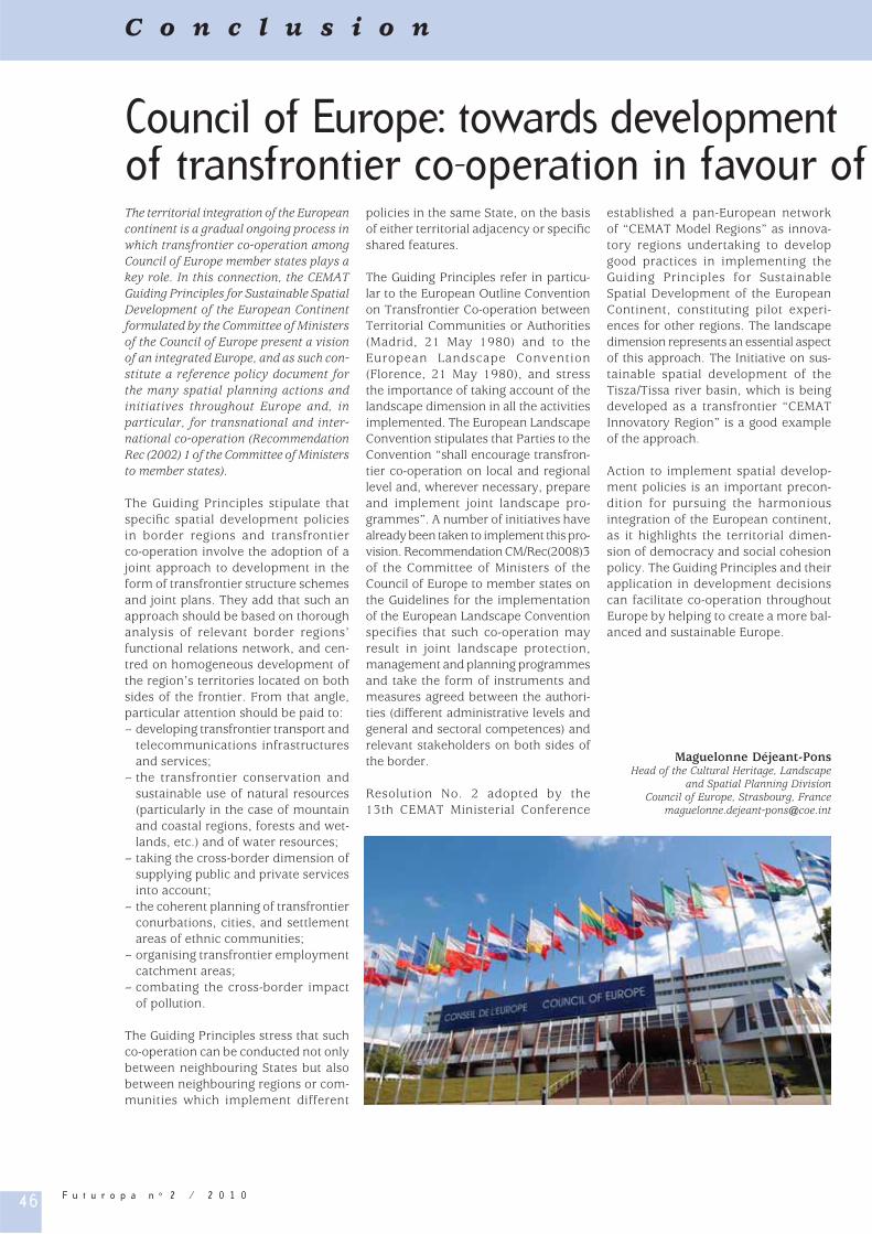
46 F u t u r o p a n o 2 / 2 0 1 0
Council of Europe: towards development of transfrontier co-operation in favour of The territorial integration of the European continent is a gradual ongoing process in which transfrontier co-operation among Council of Europe member states plays a key role. In this connection, the CEMAT Guiding Principles for Sustainable Spatial Development of the European Continent formulated by the Committee of Ministers of the Council of Europe present a vision of an integrated Europe, and as such con-stitute a reference policy document for the many spatial planning actions and initiatives throughout Europe and, in particular, for transnational and inter-national co-operation (Recommendation Rec (2002) 1 of the Committee of Ministers to member states).
The Guiding Principles stipulate that specifi c spatial development policies in border regions and transfrontier co-operation involve the adoption of a joint approach to development in the form of transfrontier structure schemes and joint plans. They add that such an approach should be based on thorough analysis of relevant border regions’ functional relations network, and cen-tred on homogeneous development of the region’s territories located on both sides of the frontier. From that angle, particular attention should be paid to: – developing transfrontier transport and
telecommunications infrastructures and services;
– the transfrontier conservation and sustainable use of natural resources (particularly in the case of mountain and coastal regions, forests and wet-lands, etc.) and of water resources;
– taking the cross-border dimension of supplying public and private services into account;
– the coherent planning of transfrontier conurbations, cities, and settlement areas of ethnic communities;
– organising transfrontier employment catchment areas;
– combating the cross-border impact of pollution.
The Guiding Principles stress that such co-operation can be conducted not only between neighbouring States but also between neighbouring regions or com-munities which implement different
policies in the same State, on the basis of either territorial adjacency or specifi c shared features.
The Guiding Principles refer in particu-lar to the European Outline Convention on Transfrontier Co-operation between Territorial Communities or Authorities (Madrid, 21 May 1980) and to the European Landscape Convention (Florence, 21 May 1980), and stress the importance of taking account of the landscape dimension in all the activities implemented. The European Landscape Convention stipulates that Parties to the Convention “shall encourage transfron-tier co-operation on local and regional level and, wherever necessary, prepare and implement joint landscape pro-grammes”. A number of initiatives have already been taken to implement this pro-vision. Recommendation CM/Rec(2008)3 of the Committee of Ministers of the Council of Europe to member states on the Guidelines for the implementation of the European Landscape Convention specifies that such co-operation may result in joint landscape protection, management and planning programmes and take the form of instruments and measures agreed between the authori-ties (different administrative levels and general and sectoral competences) and relevant stakeholders on both sides of the border.
Resolution No. 2 adopted by the 13th CEMAT Ministerial Conference
established a pan-European network of “CEMAT Model Regions” as innova-tory regions undertaking to develop good practices in implementing the Guiding Principles for Sustainable Spatial Development of the European Continent, constituting pilot experi-ences for other regions. The landscape dimension represents an essential aspect of this approach. The Initiative on sus-tainable spatial development of the Tisza/Tissa river basin, which is being developed as a transfrontier “CEMAT Innovatory Region” is a good example of the approach.
Action to implement spatial develop-ment policies is an important precon-dition for pursuing the harmonious integration of the European continent, as it highlights the territorial dimen-sion of democracy and social cohesion policy. The Guiding Principles and their application in development decisions can facilitate co-operation throughout Europe by helping to create a more bal-anced and sustainable Europe.
Maguelonne Déjeant-PonsHead of the Cultural Heritage, Landscape
and Spatial Planning Division Council of Europe, Strasbourg, France
C o n c l u s i o n

47F u t u r o p a n o 2 / 2 0 1 0
the territory and the landscape
Co
nc
lu
sio
n
Council of Europe references
– Council of Europe, Integration of the greater European spaces, Council of Europe Publishing, Strasbourg, European spatial planning and landscape Series, 2002, No. 65;
– Council of Europe, Landscape heritage, spatial planning and sustainable development, Council of Europe Publishing, Strasbourg, European spatial planning and landscape Series, 2003, No. 66;
– Council of Europe, The role of local and regional authorities in trans-national co-operation in the fi eld of regional/spa-tial development, Council of Europe Publishing, Strasbourg, European spatial planning and landscape Series, 2003, No. 67;
– Council of Europe, Spatial planning for the sustainable devleopment of particular types of European areas: mountains, coastal zones, rural zones, fl ood-plains and alluvial valleys, Council of Europe Publishing, Strasbourg, European spatial planning and landscape Series, 2003, No. 68;
– Council of Europe, Sustainable spatial development: strengthening intersectoral relations, Council of Europe Publishing, Strasbourg, European spatial planning and landscape Series, 2003, No. 69;
– Council of Europe, Integration of the greater European spaces, Council of Europe Publishing, Strasbourg, European spatial planning and landscape Series, 2002, No. 65;
– Council of Europe, 13th European Conference of Ministers responsible for Regional/Spatial Planning (CEMAT), Council of Europe Publishing, Strasbourg, European spatial planning and landscape Series, 2005, No. 71; -Documents of the Conference,Territory and Landscape Series, 2005, No. 1;
– Council of Europe, Second meeting of the Workshops for the implementation of the European Landscape Convention, Council of Europe Publishing, Strasbourg, European spatial planning and landscape Series, 2004, No. 72;
– Council of Europe, Spatial development governance: institutional co-operation networks, Council of Europe Publishing, Strasbourg, European spatial planning and landscape Series, 2005, No. 73;
– Council of Europe, Urban management in networking Europe, Council of Europe Publishing, Strasbourg, European spatial planning and landscape Series, 2006, No. 80;
– Council of Europe, Landscape and sustainable development: challenges of the European Landscape Convention, Council of Europe Publishing, Strasbourg, 2006, ISBN 92-871-5989-0;
– Council of Europe, Proceedings of the 14th Council of Europe Conference of Ministers responsible for Spatial/Regional Planning (CEMAT), Council of Europe Publishing, Strasbourg, European spatial planning and landscape Series, 2009, No. 86.
– Web sites: www.coe.int/CEMAT/fr - www.coe.int/CEMAT www.coe.int/Conventioneuropéennedupaysage - www.coe.int/EuropeanLandscapeConvention, www.coe.int/naturopa/fr - www.coe.int/naturopa
ISSN 1998-1457
Council of EuropeDirectorate of Culture and Cultural
and Natural HeritageCultural Heritage, Landscape and Spatial Planning Division
F-67075 Strasbourg cedexFax: 33-(0)3 33 41 37 83
Web: http://www.coe.int/futuropa
The Council of Europe is an intergovernmental organisation founded in 1949 with its headquarters in Strasbourg, France.
The statutes of the Organisation, which has 47 member states, mention that its aim is to achieve a greater unity between its
members for the purpose of safeguarding and realising the ideals and principles which are their common heritage and facilitating
their economic and social progress. The main objectives of the Organisation are to promote democracy, human rights and the rule of law and to seek common solutions to the main
problems facing European society. It is active in promoting sustainable spatial development in line with Recommendation
of the Committee of Ministers to member states on the “Guiding principles for sustainable spatial development of the European Continent”. The aim is to protect the life, the quality of life and well-being of Europeans taking into account landscape, cultural
and natural values of the territory.
The Futuropa magazine, previously named Naturopa, has been published since 1968. It is intended to raise
awareness among European citizens and decision-makers of the importance of sustainable development in Europe
by focusing on its unique heritage.
The magazine is published in the two offi cial languages of the Organisation: English and French.
In order to receive Futuropa or to obtain further information on the Council of Europe, please contact
the National Agency or the Focal Point for your country (see list on http://www.coe.int/futuropa).
Related Documents