Training Overview and Introduction to Satellite Remote Sensing Pawan Gupta Spring 2015 ARSET - AQ Applied Remote Sensing Education and Training – Air Quality A project of NASA Applied Sciences Week – 1 – April 01, 2015

Training Overview and Introduction to Satellite Remote Sensing Pawan Gupta Spring 2015 ARSET - AQ Applied Remote Sensing Education and Training – Air Quality.
Dec 19, 2015
Welcome message from author
This document is posted to help you gain knowledge. Please leave a comment to let me know what you think about it! Share it to your friends and learn new things together.
Transcript
Training Overview and
Introduction to Satellite Remote Sensing
Pawan Gupta
Spring 2015
ARSET - AQApplied Remote Sensing Education and Training – Air Quality
A project of NASA Applied Sciences
Week – 1 – April 01, 2015
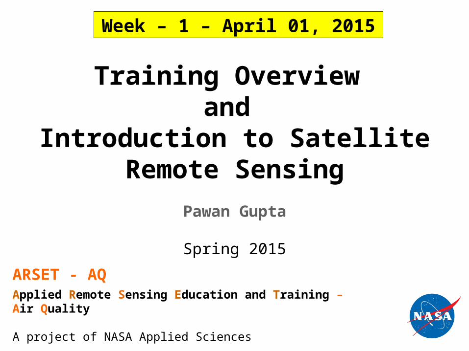
Outline
Introduction to ARSETTraining overviewFundamental of Satellite Remote
SensingTour to ARSET webpage

NASA Applied Sciences and Capacity Building
National and international activities to engage and train users applying NASA Earth Science satellites and modeling data in their decision making activities
Applied Remote SEnsing Training (ARSET ) Program
On-line and hands on basic/advanced trainings tailored to end-users &
organizations
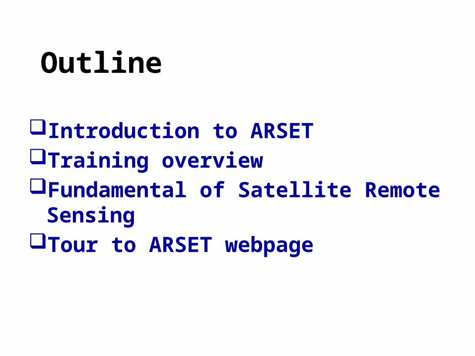
Applied Remote Sensing Training Program (ARSET)
GOAL:
Increase utilization of satellite observational and model data for decision-support
Online and hands-on courses:• Who: policy makers, environmental
managers, modelers and other professionals in the public and private sectors.
Where: U.S and internationally• When: throughout the year. Check
websites.• Do NOT require prior remote- sensing
background.• Presentations and hands-on guided computer exercises on how to access, interpret and use satellite images for decision-support.
NASA Training for California Air Resources Board, Sacramento
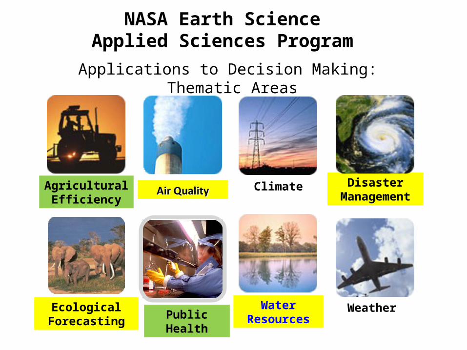
NASA Earth ScienceApplied Sciences Program
Ecological Forecasting
AgriculturalEfficiency
Weather
Climate
WaterResources
Disaster Management
Public Health
Applications to Decision Making: Thematic Areas

ARSET: 2008 – 2014+1600 End-users Reached
Number of participating organizations per country
For more information about ARSET visithttp://arset.gsfc.nasa.gov/
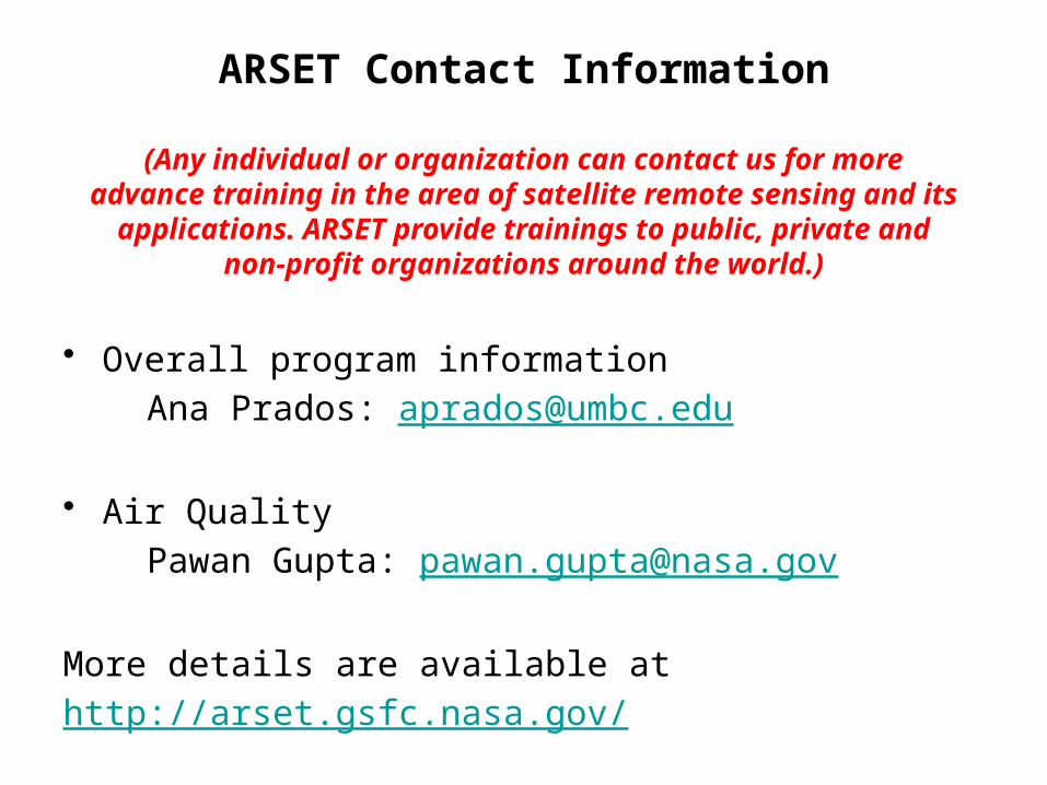
ARSET Contact Information
(Any individual or organization can contact us for more advance training in the area of satellite remote sensing and its
applications. ARSET provide trainings to public, private and non-profit organizations around the world.)
• Overall program information Ana Prados: [email protected]
• Air Quality Pawan Gupta: [email protected]
More details are available athttp://arset.gsfc.nasa.gov/
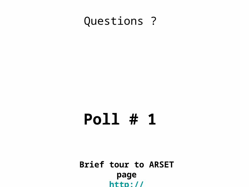
Poll # 1
Brief tour to ARSET pagehttp://arset.gsfc.nasa.gov
Questions ?
Fundamentals of Satellite Remote Sensing Instruments and Applications

Basics of Satellite Remote Sensing
Collecting information about an object without being in direct physical contact with it.
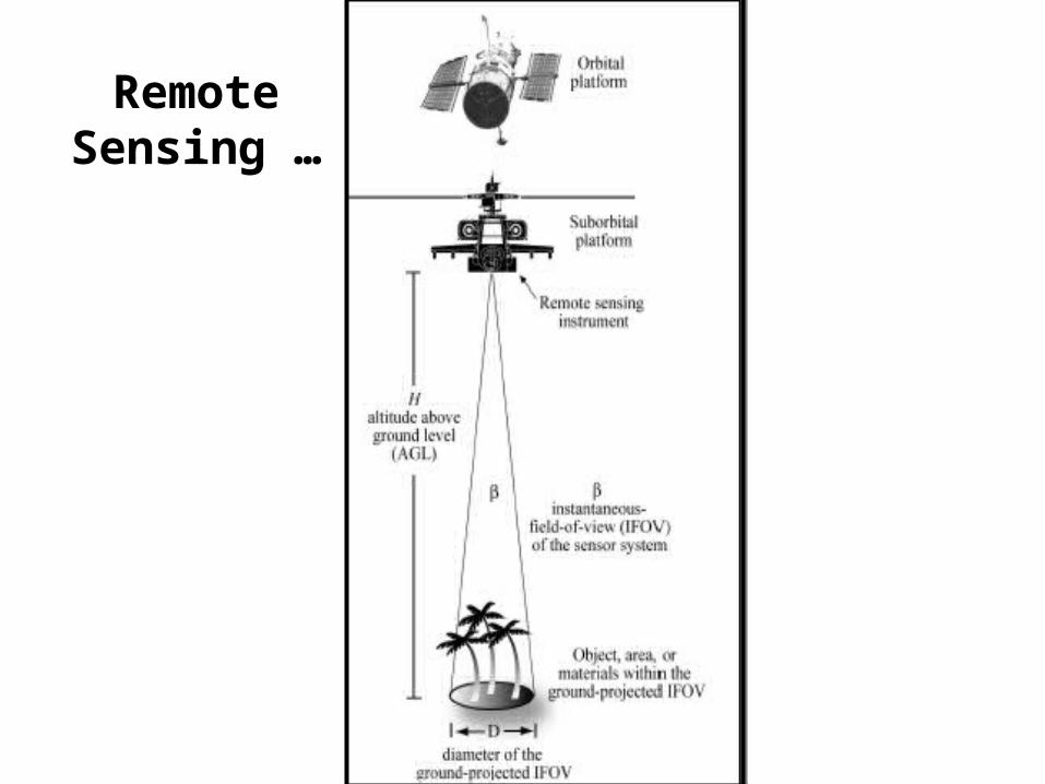
Remote Sensing …

Remote Sensing: Platforms
• Platform depends on application
• What information do we want?
• How much detail?
• What type of detail?
• How frequent?

Number of Satellites making daily observations of Earth-Atmosphere and Ocean Globally
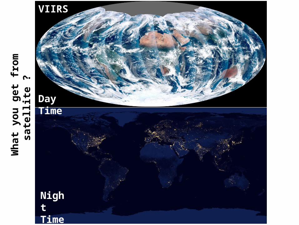
Day Time
Night Time
VIIRSW
hat
yo
u g
et f
rom
sa
tell
ite
?
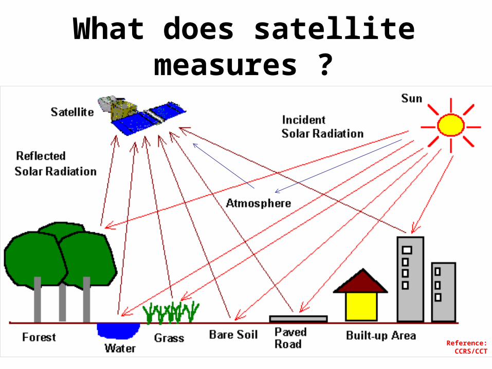
What does satellite measures ?
Reference: CCRS/CCT

Remote Sensing Process
Satellite measured spectral radiance
A priority information &
Radiative Transfer Theory
Retrieval Algorithm
Geophysical Parameters
Applications
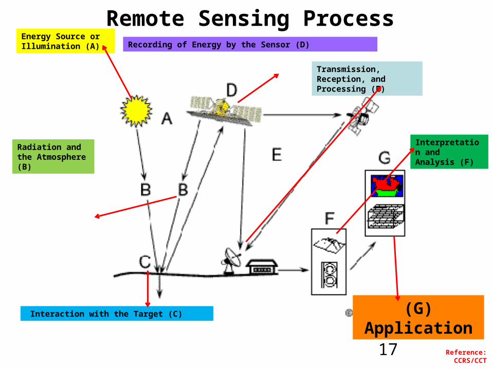
Remote Sensing ProcessEnergy Source or Illumination (A)
Radiation and the Atmosphere (B)
Interaction with the Target (C)
Transmission, Reception, and Processing (E)
Interpretation and Analysis (F)
(G)Application
Reference: CCRS/CCT
Recording of Energy by the Sensor (D)
17

Poll # 2
Questions ?
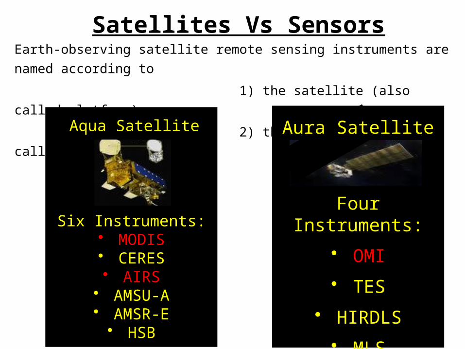
Earth-observing satellite remote sensing instruments are named according to
1) the satellite (also called platform)
2) the instrument (also called sensor)
Six Instruments:• MODIS• CERES• AIRS
• AMSU-A• AMSR-E
• HSB
Four Instruments:
• OMI
• TES
• HIRDLS
• MLS
Aura SatelliteAqua Satellite
Satellites Vs Sensors
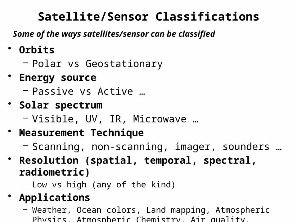
Satellite/Sensor Classifications
• Orbits– Polar vs Geostationary
• Energy source– Passive vs Active …
• Solar spectrum– Visible, UV, IR, Microwave …
• Measurement Technique– Scanning, non-scanning, imager, sounders …
• Resolution (spatial, temporal, spectral, radiometric) – Low vs high (any of the kind)
• Applications– Weather, Ocean colors, Land mapping, Atmospheric Physics, Atmospheric
Chemistry, Air quality, radiation budget, water cycle, coastal management …
Some of the ways satellites/sensor can be classified

Common types of orbits
Geostationary orbitAn orbit that has the same Earth’s rotational periodAppears ‘fixed’ above earth Satellite on equator at ~36,000km
Polar orbiting orbitfixed circular orbit above the earth, ~600-1000km in sun synchronous orbit with orbital pass at about same local solar time each day
Geostationary Polar
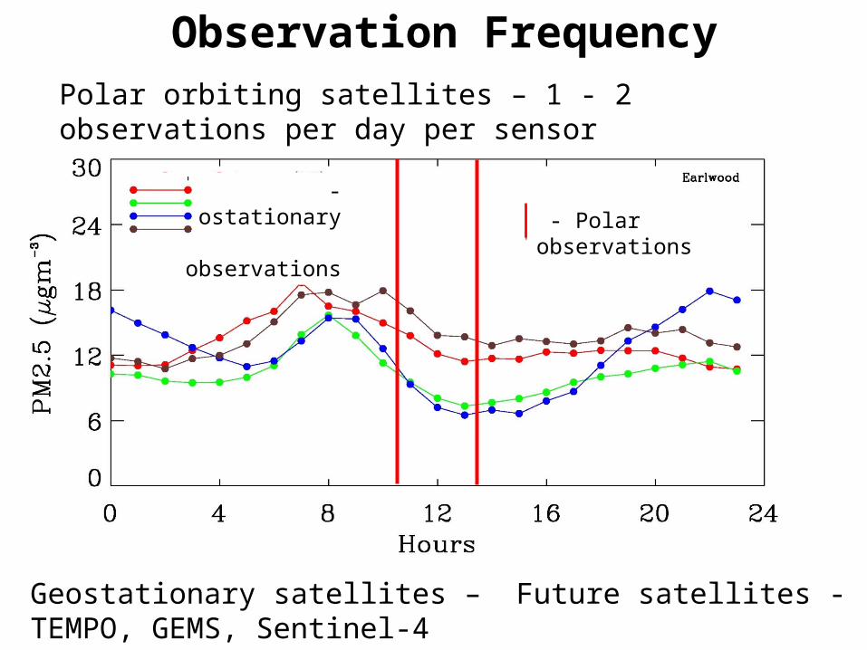
Observation FrequencyPolar orbiting satellites – 1 - 2 observations per day per sensor
Geostationary satellites – Future satellites - TEMPO, GEMS, Sentinel-4
- Polar observations - Geostationary observations
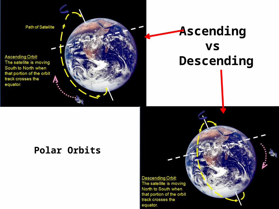
Ascending vs
Descending
Polar Orbits

MODIS-Aqua (“ascending” orbit)
MODIS-Terra (“descending”)
Approximately
1:30 PM local overpass time
Afternoon Satellite
Approximately
10:30 AM local overpass
timeMorning Satellite
24
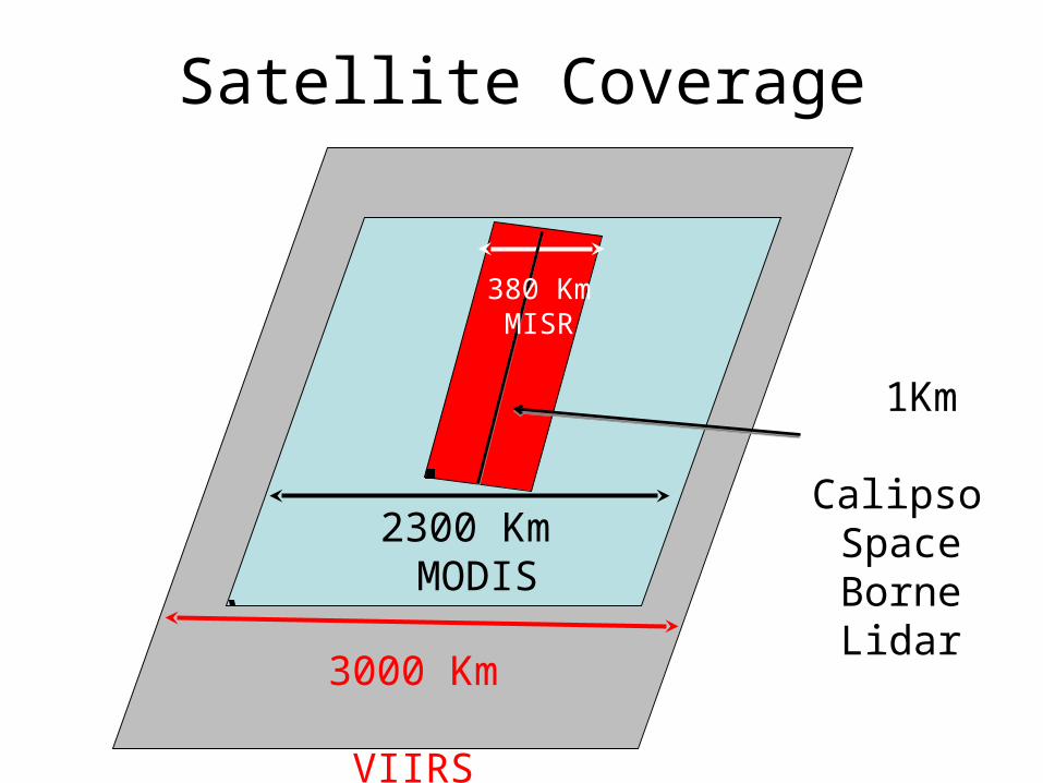
Satellite Coverage
2300 Km MODIS
3000 Km VIIRS
1Km Calipso
Space BorneLidar
380 Km MISR
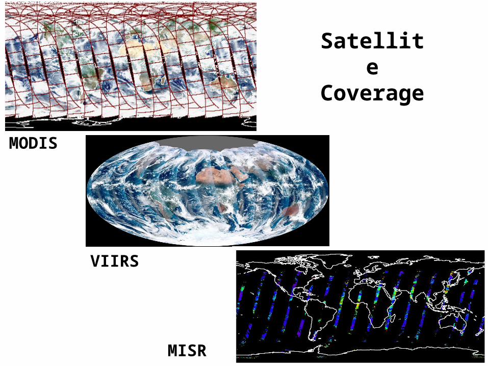
Satellite Coverage
MODIS
VIIRS
MISR
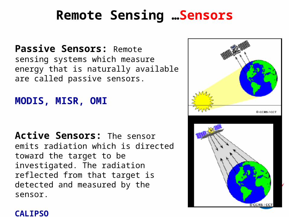
Remote Sensing …Sensors
Passive Sensors: Remote sensing systems which measure energy that is naturally available are called passive sensors.
MODIS, MISR, OMI
Active Sensors: The sensor emits radiation which is directed toward the target to be investigated. The radiation reflected from that target is detected and measured by the sensor.
CALIPSO
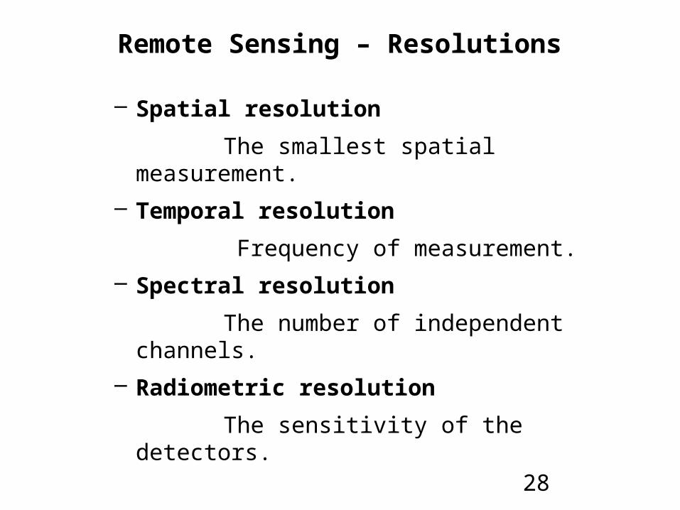
Remote Sensing – Resolutions
– Spatial resolution
The smallest spatial measurement.
– Temporal resolution
Frequency of measurement.
– Spectral resolution
The number of independent channels.
– Radiometric resolution
The sensitivity of the detectors.
28

Pixel
pixels - the smallest units of an image.
Image pixels are normally regular shape (but not necessary) and represent a certain area on an image/Earth.

Whyis spatial resolutio
n importan
t ?
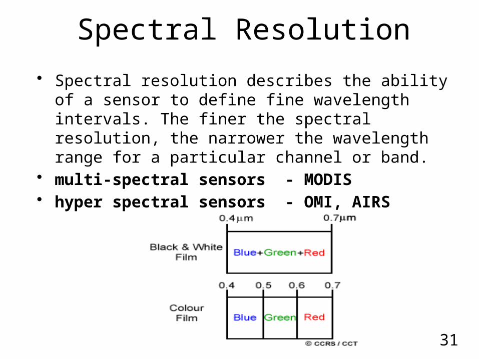
Spectral Resolution
• Spectral resolution describes the ability of a sensor to define fine wavelength intervals. The finer the spectral resolution, the narrower the wavelength range for a particular channel or band.
• multi-spectral sensors - MODIS• hyper spectral sensors - OMI, AIRS
31
755 760 765 770 775
Wavelength (nm)
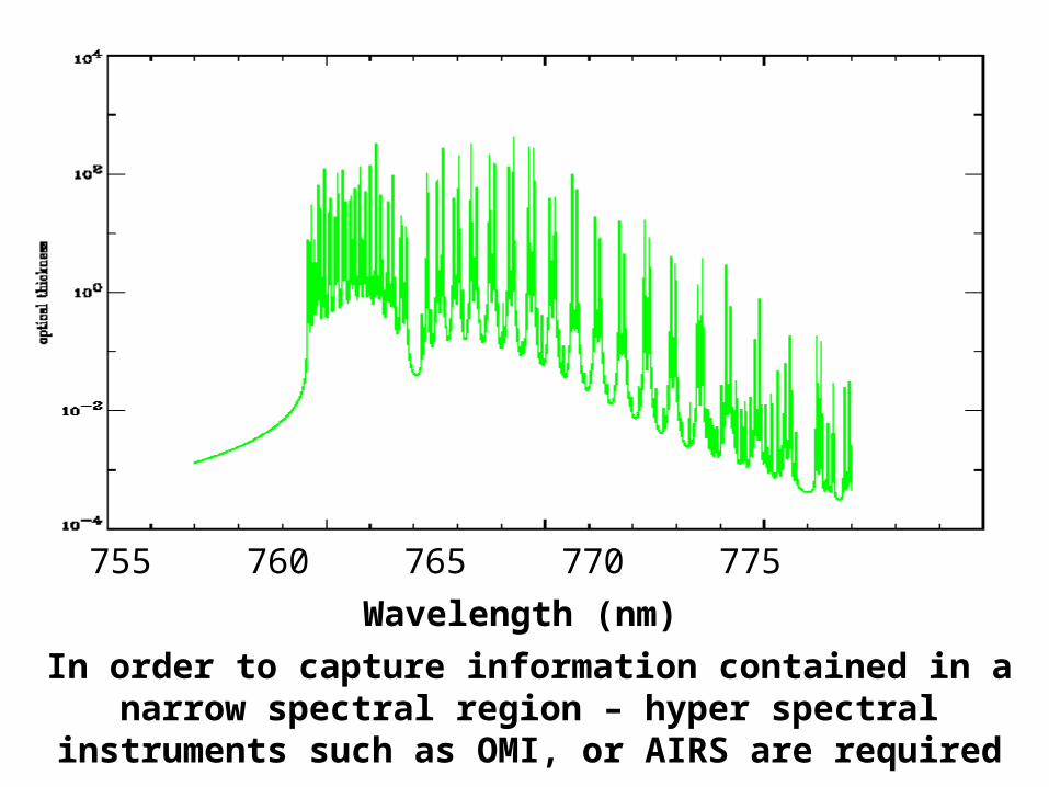
In order to capture information contained in a narrow spectral region – hyper spectral instruments such as OMI,
or AIRS are required

Radiometric Resolution• Imagery data are represented by positive digital numbers
which vary from 0 to (one less than) a selected power of 2.
• The maximum number of brightness levels available depends on the number of bits used in representing the energy recorded.
12 bit sensor (MODIS, MISR) – 212 or 4096 levels 10 bit sensor (AVHRR) – 210 or 1024 levels8 bit sensor (Landsat TM) – 28 or 256 levels (0-255)6 bit sensor (Landsat MSS) – 26 or 64 levels (0-63)
33

Radiometric Resolution2 - levels 4 - levels
8 - levels 16 - levels
In classifying a scene, different classes are more precisely identified if radiometric precision is high.
(MODIS 4096 levels)

Temporal Resolution
• How frequently a satellite can provide observation of same area on the earth
• It mostly depends on swath width of the satellite – larger the swath – higher the temporal resolution
• MODIS – 1-2 days – 16 day repeat cycle• OMI – 1-2 days • MISR – 6-8 days• Geostationary – 15 min to 1 hour (but limited to one specific area of the
globe)
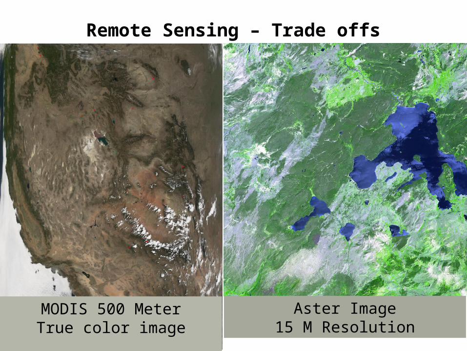
MODIS 500 MeterTrue color image
Remote Sensing – Trade offs
Aster Image15 M Resolution

MODIS 500 MeterTrue color image
Remote Sensing – Trade offs
60 KM2300 KM
• The different resolutions are the limiting factor for the utilization of the remote sensing data for different applications. Trade off is because of technical constraints.
• Larger swath is associated with low spatial resolution and vice versa
• Therefore, often satellites designs are applications oriented

Trade Offs
It is very difficult to obtain extremely high spectral, spatial, temporal and radiometric resolutions at the same time
MODIS, OMI and several other sensors can obtain global coverage every one – two days because of their wide swath width
Higher resolution polar orbiting satellites may take 8 – 16 days for global coverage or may never provide full coverage of the globe.
Geostationary satellites obtain much more frequent observations but at lower resolution
due to the much greater orbital distance.

Limitations of Satellite Data for Air Quality Applications
• Most of the satellite sensors are passive sensors.
• Most Passive sensors measure the entire column.
• Column measurements may or may not reflect what is happening at ground level.
• This is true whether we are measuring aerosols or trace gasses.
But new methods and algorithms have been developed (and developing) to convert column measurement for the surface
monitoring ..to learn attend rest of the webinar

Poll # 3
Questions ?
Next Week
• Visible satellite imagery and air quality applications
• Image information content, feature identification, and image archives
• Virtual tour of Earth observatory

Assignment Week - 1http://goo.gl/forms/XjhzniWcZR
Material and Recording will be available at
http://arset.gsfc.nasa.gov/airquality/webinars/observations-tools-south-east-asia
Related Documents