Seafloor Spreading

Topography Review: Ocean Floor Models Activity Instructions 1. Make marks 1 cm apart up the side of the box starting at the bottom using the marking.
Dec 16, 2015
Welcome message from author
This document is posted to help you gain knowledge. Please leave a comment to let me know what you think about it! Share it to your friends and learn new things together.
Transcript

Seafloor Spreading
Topography Review:Ocean Floor Models

Activity Instructions1. Make marks 1 cm apart up the side of the box starting
at the bottom using the marking pencil.2. Label the elevations 0 cm, 1 cm, 2 cm, etc.3. Carefully fill the container to the 1 cm line with water.4. Use the marking pencil to draw a line on the plastic
model following points of contact with the water exactly.
5. Fill the box to the 2 cm line and repeat step #4. Continue to do this until the model is completely submerged.
6. Put the clear lid on top of the container and carefully trace the lines from the model on to the lid labeling each line with its elevation (0 cm, 1 cm, 2 cm, etc.).
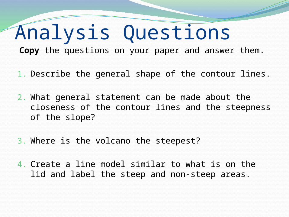
Analysis QuestionsCopy the questions on your paper and answer them.
1. Describe the general shape of the contour lines.
2. What general statement can be made about the closeness of the contour lines and the steepness of the slope?
3. Where is the volcano the steepest?
4. Create a line model similar to what is on the lid and label the steep and non-steep areas.

Studying the Sea FloorSonar Mapping Activity (complete first few
locations as a class)Harry Hess Reading/ Discussion
SS Sapona Shipwreck

The 17 positions on the map shown here give the length of time that a sonar pulse took to travel to the ocean floor and back to the sonar array onboard your boat. Use the formula discussed in the article to determine the depth at each location. Transfer the data to the Ocean floor worksheet to create an ocean floor profile.

Harry Hess Reading Questions1. What is echolocation and why did organisms evolve to use
echolocation?
2. Why was Wegner’s idea about Continental Drift rejected by the scientific community?
3. What did Harry Hess find in the Pacific Ocean?
4. What happens at a mid-ocean ridge?
5. Harry Hess’s discovery led to a new theory that supported continental drift. What is the name of this theory?

Harry Hess & the Sea Floor


Hess’s Next DiscoveryThe idea of continental drift had been
developed by Alfred Wegner, but Wegner could not explain WHY the continents move.
Hess’s discovery of the vast underwater mountain ranges called mid-ocean ridges were fundamental to explaining the mechanism by which the continents “drifted”Hess used sonar to discover the under-water
mountain ranges, which extend for over 80,000 km under Earth’s oceans

Geologic puzzles solved by HessIf the oceans have existed for at least 4 billion
years, why has so little sediment accumulated on the ocean floor?
Why are the rocks of the ocean floor significantly younger than rocks found on continents?
Why are fossils found in ocean sediments no more than 180 million years old?
How do the continents move?

Journey to the Ridge ActivityIn this activity we will be aboard a ship
traveling from the East Coast of the United States to the country of Morocco in Africa.
As we go we will be collecting rock samples and using radiometric dating to determine the age of the rocks
We will then graph our data as a function of distance from the East Coast of the U.S.


Mid-Ocean RidgesMid-Ocean Ridges
Undersea mountain chainIn 1968, the Glomar Challenger took rock
samples and discovered that the rock samples got older as they moved away from the MOR What does this mean?
Continents = ~3.8 byo Ocean = ~190 myo

Seafloor Spreading Demonstration

Sea Floor SpreadingHarry Hess (1960) – proposed idea of sea-floor
spreadingThe process by which new oceanic crust forms
along a mid-ocean ridge and older oceanic crust moves away from the ridge
Molten rock from inside Earth rises through cracks in ridges, cools, and forms new oceanic crust This process occurs over and over again, with new crust
being created along the mid-ocean ridge and the older crust being pushed away from the mid-ocean ridge
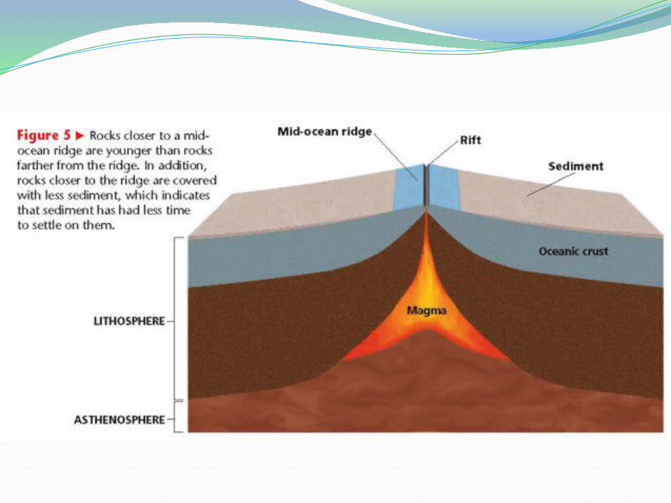


Age v. LocationThe closer the oceanic crust is to a
mid-ocean ridge,
the YOUNGER it is
Ocean crust that is farther away
from a mid-ocean ridge is OLDER

This begged the question: If the ocean floor is moving, why not the
continents?

Moving ContinentsContinents move as the seafloor spreads
along a mid-ocean ridge Continents do not move THROUGH the solid
mantle of the seafloor

Ocean TrenchesThe sea floor has been spreading for millions
of years, but it is not getting bigger… WHY?Ocean Trenches
Huge, deep canyons in the seafloorAt an ocean trench, dense oceanic crust is
sinking into the mantle Older crust is destroyed/ recycled (by
melting) at ocean trenches


Density of Earth’s Layers Activity

Google Earth Ridges & Trenches


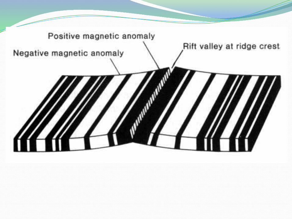
PaleomagnetismAs magma cools to
form rock, iron-rich minerals align with Earth’s magnetic field.Like a compass
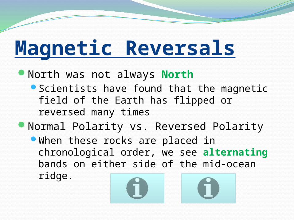
Magnetic ReversalsNorth was not always North
Scientists have found that the magnetic field of the Earth has flipped or reversed many times
Normal Polarity vs. Reversed PolarityWhen these rocks are placed in chronological
order, we see alternating bands on either side of the mid-ocean ridge.


Related Documents