Top Banner
Topographic Maps
11

Topographic Maps. Contour lines A line which connects points of equal elevation. Index Contours: Thick contour lines which have the elevation written.

Dec 29, 2015

Download

Documents

Karen Malone
Welcome message from author
This document is posted to help you gain knowledge. Please leave a comment to let me know what you think about it! Share it to your friends and learn new things together.
Transcript
Page 1: Topographic Maps. Contour lines A line which connects points of equal elevation. Index Contours: Thick contour lines which have the elevation written.

Topographic Maps

Page 2: Topographic Maps. Contour lines A line which connects points of equal elevation. Index Contours: Thick contour lines which have the elevation written.

Contour linesA line which connects points of equal elevation.Index Contours: Thick contour lines which have the elevation written on them.

Page 3: Topographic Maps. Contour lines A line which connects points of equal elevation. Index Contours: Thick contour lines which have the elevation written.
Page 4: Topographic Maps. Contour lines A line which connects points of equal elevation. Index Contours: Thick contour lines which have the elevation written.

Contour line properties:Contour lines never cross.The closer the lines the steeper the hill.At valleys, contour lines form “V”s which always point up hill.

Page 5: Topographic Maps. Contour lines A line which connects points of equal elevation. Index Contours: Thick contour lines which have the elevation written.
Page 6: Topographic Maps. Contour lines A line which connects points of equal elevation. Index Contours: Thick contour lines which have the elevation written.

Contour IntervalThe vertical distance between adjacent contour lines.

Ratio Scale

Graphic Scale

Page 7: Topographic Maps. Contour lines A line which connects points of equal elevation. Index Contours: Thick contour lines which have the elevation written.

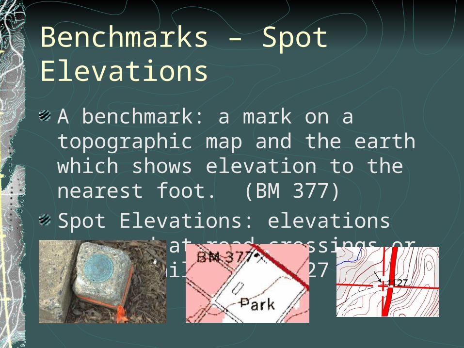
Benchmarks – Spot ElevationsA benchmark: a mark on a topographic map and the earth which shows elevation to the nearest foot. (BM 377)Spot Elevations: elevations measured at road crossings or tops of hills. (.1127 or X1127)

Page 8: Topographic Maps. Contour lines A line which connects points of equal elevation. Index Contours: Thick contour lines which have the elevation written.

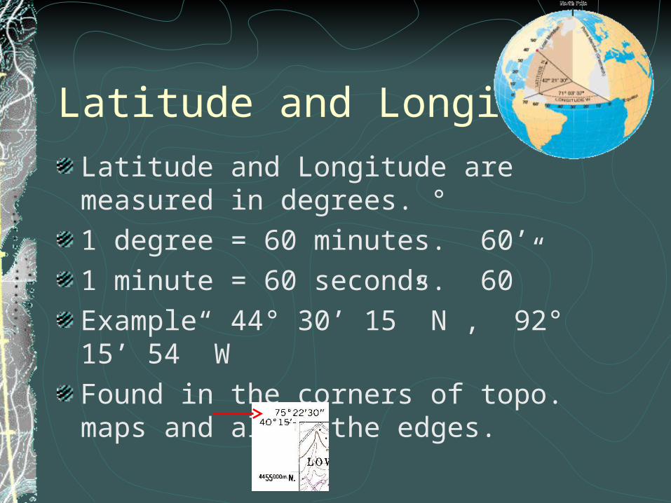
Latitude and LongitudeLatitude and Longitude are measured in degrees. °1 degree = 60 minutes. 60’1 minute = 60 seconds. 60”Example 44° 30’ 15” N , 92° 15’ 54” W Found in the corners of topo. maps and along the edges.

Page 9: Topographic Maps. Contour lines A line which connects points of equal elevation. Index Contours: Thick contour lines which have the elevation written.

LatitudeParallel lines which indicate angles North and South of the equator.Equator 0° LatitudeNorth pole 90 ° N LatitudeSouth pole 90 ° S Latitude

Page 10: Topographic Maps. Contour lines A line which connects points of equal elevation. Index Contours: Thick contour lines which have the elevation written.

LongitudeMeridians measuring angles East or West of the Prime meridian.Prime meridian 0 ° long.International Dateline 180 ° long.

Page 11: Topographic Maps. Contour lines A line which connects points of equal elevation. Index Contours: Thick contour lines which have the elevation written.

L a ti tud e / Lo ng itu de

6 0 S e con dsT h ere a re 60 S e co n ds in ev ery m inu teT h ere a re 36 0 0 secon ds in o ne d e gree

6 0 M inu tesT h ere a re 60 m in u te s in o ne de gree

O n e D eg ree