Curricular structure for Part –II (4thSem.) of the Full time Diploma Course in Mine Surveying WEST BENGAL STATE COUNCIL OF TECHNICAL EDUCATION TEACHING AND EXAMINATION SCHEME FOR DIPLOMA IN ENGINEERING COURSES COURSE NAME-MINE SURVEYING DURATION OF COURSE- 6 SEMESTERS SEMESTER-FORTH, DURATION- SIXTEEN WEEKS Sl. No. SUBJECT CREDITS PERIODS EVALUATION SCHEME L TU PR Internal Scheme ESE PR Total Marks TA CT Total 1 MINING TECHNOLOGY 3+2=5 4 3 10 20 30 70 100 200 2. BASIC SURVEYING-III 4+2=6 4 3 10 20 30 70 100 200 3. ADVANCE SURVEYING-I 3+2=5 3 3 10 20 30 70 100 200 4 MINING GEOLOGY 3+2=5 4 3 10 20 30 70 100 200 5. DEVELOPMENT OF LIFE SKILL-II 2 1 2 50 50 6 PROFESSIONAL PRACTICE-II 2 3 50 50 Grand Total 25 16 17 40 80 120 280 500 900 STUDENT CONTACT HOURS PER WEEK:33 HOURS Theory and Practical period of 60 minutes each. L-Lecture, TU-Tutorials, PR-Practical, TA-Teacher’s Assessment, CT-Class Test ,ESE-End Semester Exam

Welcome message from author
This document is posted to help you gain knowledge. Please leave a comment to let me know what you think about it! Share it to your friends and learn new things together.
Transcript

Curricular structure for Part –II (4thSem.) of the Full time Diploma Course in Mine Surveying
WEST BENGAL STATE COUNCIL OF TECHNICAL EDUCATION
TEACHING AND EXAMINATION SCHEME FOR DIPLOMA IN ENGINEERING COURSES
COURSE NAME-MINE SURVEYING
DURATION OF COURSE- 6 SEMESTERS
SEMESTER-FORTH, DURATION- SIXTEEN WEEKS
Sl. No. SUBJECT CREDITS PERIODS EVALUATION SCHEME
L TU PR Internal Scheme ESE PR Total
Marks TA CT Total
1 MINING TECHNOLOGY 3+2=5 4 3 10 20 30 70 100 200
2. BASIC SURVEYING-III 4+2=6 4 3 10 20 30 70 100 200
3. ADVANCE SURVEYING-I 3+2=5 3 3 10 20 30 70 100 200
4 MINING GEOLOGY 3+2=5 4 3 10 20 30 70 100 200
5. DEVELOPMENT OF LIFE
SKILL-II
2 1 2 50 50
6 PROFESSIONAL PRACTICE-II 2 3 50 50
Grand Total 25 16 17 40 80 120 280 500 900
STUDENT CONTACT HOURS PER WEEK:33 HOURS
Theory and Practical period of 60 minutes each.
L-Lecture, TU-Tutorials, PR-Practical, TA-Teacher’s Assessment, CT-Class Test ,ESE-End Semester Exam

SYLLABUS FOR MINING TECHNOLOGY
Name of the Course: Diploma in Mining Survey
Subject: Mining Technology
Subject Code: MNSR/S4/T1/MT Semester: Forth
Duration: 6 months Maximum Marks: 200
Teaching Scheme Examination Scheme
Theory: 4 hours/week Mid Semester Exam: 20 Marks
Tutorial: Nil Attendance, Assignment & Interaction: 10 Marks
Practical: 3 hrs/week End Semester Exam: 70 Marks
Credit:3+2= 5 Practical( Internal + External)= 50+50=100
Aim:
Sl. No.
1. To impart knowledge of mine environment and mine gases.
2. To make students learn how to detect poisonous and inflammable gases present in mine air.
3. To make them aware of the causes and preventive measures of spontaneous heating, mine
fires, coal dust and firedamp explosion and inundation.
4. To impart the knowledge of mine ventilation, its types and control of air current in the
underground mine.
Objective:

Sl. No. Upon successful completion of this syllabus students will be able to
1. Develop idea about mine environment and mine gases.
2. Learn how to detect poisonous and inflammable gases present in mine air.
3. Understand and explain the causes and preventive measures of spontaneous heating, mine
fires, coal dust and firedamp explosion and inundation.
4. Understand and explain mine ventilation, its types and control of air current in the
underground mine.
Pre-Requisite:
Sl. No.
1. Basic knowledge of mining activities of a mine.
2. Basic knowledge of physics and chemistry.
DETAIL COURSE CONTENT (THEORY)
GROUP A Hours/Unit Marks
Unit 1 1. Mine gases 1.1 Different gases found in mines- their occurrences, properties
physiological effects. 1.2 Detection of gases(overview)
12
Unit 2 2. Mine explosion & Mine Fire 2.1 Firedamp explosion –causes & preventive measures.
2.2 Coal dust explosion- factors affecting coal dust explosion,
causes & preventive measures
2.3 Spontaneous combustion-its causes & preventive measures. 2.4 Mine fires- Causes & methods of dealing, construction of fire
stopping.
18
GROUP B
Unit 3 3. Inundation Causes of inundation by surface & underground water- preventive
measures, construction & calculation of thickness of dam, method
of approaching old water logged workings.
12

Unit 4 4. Ventilation 4.1 Natural ventilation & motive column, laws of mine air friction.
4.2 Construction & uses of ventilation stopping, air-crossing , V-door, regulator & brattice partitions, equivalent orifice, air locks. 4.3 Homotropal & Antitropal ventilation, splitting of air current.
4.4 Numerical Problems on NVP, Ragulators & lawsof mine friction.
22
PRACTICAL Code: MNSR/S4/PI/MT
1. Study of Flame Safety Lamp , methanometers and CO detector.
2. Air measurement in a gallery by Anemometer. 3. Study and sketch of fire stopping with fittings 4. Model study of Bord and Pillar Method of working 5. Model study of Longwall Methods of working 6. Study of different types of hygrometer. 7. Study of Kata thermometer for measurement of cooling
power.
E X A M I N A T I O N S C H E M E
GGRROOUUPP
Unit OBJECTIVE QUESTIONS SUBJECTIVE QUESTIONS
TO BE
SET
TO BE
ANSWERED
MARKS PER
QUESTION
TOTAL
MARKS
TO BE
SET TTOO BBEE AANNSSWWEERREEDD
MARKS PER
QUESTION
TOTAL
MARKS
A 1,2 13 ANY
TWENTY
1 20 x 1
=20
FOUR FIVE, TAKING AT
LEAST TWO FROM
EACH GROUP
10
10 X 5 =
50 B 3,4 12 FOUR
Name of Authors Title of the Book Name of the Publisher
D.J Deshmukh Elements of Mining(Vol-II) Vidyasewa Prakashan, Nagpur
D.J Deshmukh Elements of Mining(Vol-II) Vidyasewa Prakashan, Nagpur
R.D. Singh Principles & Practices of Modern Coal
Mining
New Age International
S. Ghatak Winning & Working Coal Field Publishers

SYLLABUS FOR BASIC SURVEYING-III
Name of the Course: Diploma in Mining Survey
Subject: Basic Surveying-III
Subject Code: MNSR/S4/T2/BS-III Semester: Forth
Duration: 6 months Maximum Marks: 200
Teaching Scheme Examination Scheme
Theory: 4hours/week Mid Semester Exam: 20 Marks
Tutorial: Nil Attendance, Assignment & Interaction: 10 Marks
Practical: 3 hrs/week End Semester Exam: 70 Marks
Credit: 4+2= 6 Practical( Internal + External)= 50+50=100
Aim:
Sl. No.
1. To impart introductory knowledge about different basic terminologies
2. To impart knowledge of different leveling instruments and its accessories
3. To impart ideas about different methods of leveling and profile making
4. To impart concept of contouring
5. To impart basic ideas of errors in surveying
6. To impart knowledge about different types of error adjustment methods
Objective:
After successful completion of this syllabus students will be able to

1. Describe different terminologies
2. Explain different leveling instruments and its accessories
3. Describe different methods of leveling , make profile
4. Plot contour plan
5. Describe ideas of errors in surveying
6. Adjust error by various methods
Pre-Requisite: Elementary Mathematics, Engineering Drawing and Physics
DETAIL COURSE CONTENT (THEORY)
GROUP A Hours/Unit Marks
Unit 1 LEVELLING
1.1 Concept of levelling, uses of levelling, Definition of
important terms used in levelling.
1.2 Datum elevation, vertical angle, mean sea level and bench
mark.
1.3 Levelling Instruments- Different types- parts and function
of dumpy level, and automatic level.
1.4 Levelling staff- Self-reading staff and target staff, relative
merits of self-reading and target staves.
1.5 Sensitivity of spirit level- methods of determining
sensitivity. Parallel plate micrometer.
1.6 Tests and adjustments of dumpy level & tilting level.
1.7 (i) Methods of levelling- Spirit levelling,
(II)Special methods of spirit levelling- Details of
differential levelling, profile levelling, cross-sectioning & reciprocal levelling and Precise levelling.
(i) Methods of booking, calculation of reduced levels &plotting of level sections
(ii) Recording and plotting of longitudinal section of an alignment.
(iii) Levelling problems like taking level of an overhead point,
(iv) Levelling in an inclined plane on surface and underground
1.8 Sources of errors in levelling, precautions.
25

2.1
GROUP-B
Unit 2 2.0 CONTOURING
2.1 Basic concept, contour interval.
2.2 Characteristics of contour.
2.3 Methods of locating contours.
2.4 Interpolation & extrapolation of contour.
2.5 Contour gradient.
2.6 Use of contour maps.
2.7 Locating the proposed route for a road on a contour
map.
2.8 Establishing grade contours, stratum contour,
isopachytes.
15
GROUP-C
Unit 3 33..00 EERRRROORR AADDJJUUSSTTMMEENNTT
3.1 Classification of errors. 3.2 Laws of accidental errors. 3.3 Most probable values of directly and indirectly
observed independent quantities. 3.4 Least square. 3.5 Normal equation. 3.6 Method of co-relates.
24
PRACTICAL Code: MNSR/S4/P2/BS-III
1.0
2.0
3.0
4.0
Handling of dumpy level & automatic levels.
Leveling across a roadway & plotting of the level section.
Contouring of a given area by the method of gridding.
Plotting the contour.
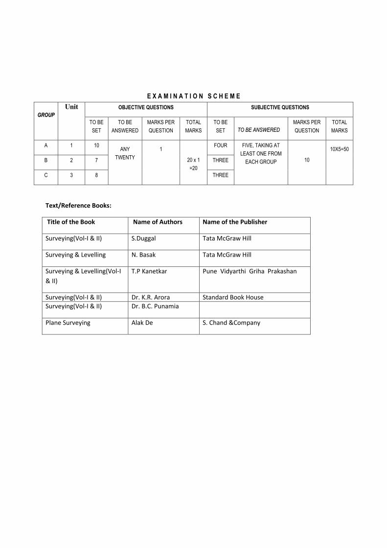
E X A M I N A T I O N S C H E M E
GGRROOUUPP
Unit OBJECTIVE QUESTIONS SUBJECTIVE QUESTIONS
TO BE
SET
TO BE
ANSWERED
MARKS PER
QUESTION
TOTAL
MARKS
TO BE
SET TTOO BBEE AANNSSWWEERREEDD
MARKS PER
QUESTION
TOTAL
MARKS
A 1 10 ANY
TWENTY
1
20 x 1
=20
FOUR FIVE, TAKING AT
LEAST ONE FROM
EACH GROUP
10
10X5=50
B 2 7 THREE
C 3 8 THREE
Text/Reference Books:
Title of the Book Name of Authors Name of the Publisher
Surveying(Vol-I & II) S.Duggal Tata McGraw Hill
Surveying & Levelling N. Basak Tata McGraw Hill
Surveying & Levelling(Vol-I
& II)
T.P Kanetkar Pune Vidyarthi Griha Prakashan
Surveying(Vol-I & II) Dr. K.R. Arora Standard Book House
Surveying(Vol-I & II) Dr. B.C. Punamia
Plane Surveying Alak De S. Chand &Company

SYLLABUS FOR ADVANCE SURVEYING-I
Name of the Course: Diploma in Mining Survey
Subject: ADVANCE SURVEYING-I
Subject Code: MNSR/S4/T3/AS-I Semester: Forth
Duration: 6 months Maximum Marks: 200
Teaching Scheme Examination Scheme
Theory: 3 hours/week Mid Semester Exam: 20 Marks
Tutorial: Nil Attendance, Assignment & Interaction: 10 Marks
Practical: 3 hrs/week End Semester Exam: 70 Marks
Credit: 3+2=5 Practical( Internal + External)= 50+50=100
Aim:
Sl. No.
1. To impart introductory idea about Horizontal and Vertical angle measuring instrument
2. To impart concept of different methods of angle measurement /traversing using Theodolite
3. To impart ideas about the steps of Temporary/Permanent adjustment of theodolite
4. To impart concept of Traverse Adjustment
5. To impart basic ideas of the principle of tacheometric surveying
6. To impart knowledge about finding out the horizontal distance and vertical RL difference in
different terrain condition
Objective:
After successful completion of this syllabus students will be able to
1. Describe different parts of vernier theodolite with their use

2. Explain different methods of angle measurement using theodolite
3. Describe different methods of traversing using Vernier/Micro-optic Theodolite
4. Calculate Partial and Total Co-ordinates of stations along with area using coordinates
5. Explain different methods of traverse Adjustment
6. Explain the principle of tacheometric surveying
7. Describe the methods of finding out the tacheometric constants
8 Find out the horizontal/incline distance and RL of different stations using Tacheometric
methods
Pre-Requisite: Mathematics, Engineering Drawing
DETAIL COURSE CONTENT (THEORY)
GROUP A Hours/Unit Marks
Unit 1 Theodolite Survey:
(a) Description of theodolite, function of its different parts.
(b) Different terms when manipulating a transit theodolite.
(c) Relations between fundamental lines. (d) Temporary adjustments of the theodolite. (e) Measurement of horizontal angles : - repetition
method, reiteration method. (f) Measurement of vertical angles. (g) Prolonging a straight line. (h) Traversing with the theodolite by bearing and
included angles. (i) Sources of error in theodolite work. (j) Traverse computation (k) Adjustment of closed traverse :- (i) Distribution of
angular errors. (ii) Balancing the traverse by bowditch’s rule and transit rule.
(l) Computation of area of a closed traverse by DMD method only.
(m) Computation of length and bearing from co-ordinates.
(n) Testing and permanent adjustment of a transit theodolite.
(o) Microptic Theodolite-Introduction and use
28

GROUP B
Unit 2 Tacheometry
Scope of tacheometric Survey.
Principle of tacheometric Survey.
Stadia and tangential system.
Principle of stadia method.
Determination of tacheometric constants.
Anallatic lens.
Distance and elevation formula – (i) Line of sight
horizontal, (ii) Line of sight inclined.
Relative merits of vertical and normal staff holding.
Sources of error, accuracy of measurement.
Problems on tacheometric survey.
20
PRACTICAL Code: MNSR/S4/P3/AS-I
1.0
2.0
3.0
4.0
Handling of Vernier/Micro-optic Theodolite. Practical thedolite traverse survey in the field. Co-ordinate plotting of a closed traverse with transit theodolite. Determination of horizontal distances & vertical difference by tacheometric methods.
E X A M I N A T I O N S C H E M E
GGRROOUUPP
Unit OBJECTIVE QUESTIONS SUBJECTIVE QUESTIONS
TO BE
SET
TO BE
ANSWERED
MARKS PER
QUESTION
TOTAL
MARKS
TO BE
SET TTOO BBEE AANNSSWWEERREEDD
MARKS PER
QUESTION
TOTAL
MARKS
A 1 15 ANY
TWENTY
1 20 x 1
=20
FIVE FIVE, TAKING AT
LEAST TWO FROM
EACH GROUP
10
10 X 5 =
50 B 2 10 FOUR

Text/Reference Books:
Title of the Book Name of Authors Name of the Publisher
Surveying(Vol-I & II) S.Duggal Tata McGraw Hill
Surveying & Levelling N. Basak Tata McGraw Hill
Surveying & Levelling(Vol-I
& II)
T.P Kanetkar Pune Vidyarthi Griha Prakashan
Surveying(Vol-I & II) Dr. K.R. Arora Standard Book House
Surveying(Vol-I & II) Dr. B.C. Punamia
Plane Surveying Alak De S. Chand &Company

SYLLABUS FOR MINING GEOLOGY
Name of the Course: Diploma in Mining Survey
Subject: Mining Geology
Subject Code: MNSR/S4/T4/MNG Semester: Forth
Duration: 6 months Maximum Marks: 200
Teaching Scheme Examination Scheme
Theory: 4 hours/week Mid Semester Exam: 20 Marks
Tutorial: Nil Attendance, Assignment & Interaction: 10 Marks
Practical: 3 hrs/week End Semester Exam: 70 Marks
Credit: 3+2=5 Practical( Internal + External)= 50+50=100
Aim:
Sl. No.
1. To impart introductory knowledge about geology and its branches
2. To impart knowledge about general stratigraphy giving particular attention to certain
Indian mineral/coal bearing zones
3. To impart knowledge about general economic geology giving particular attention to certain
Indian mineral/coal bearing zones
4. To impart brief ideas about different geological mapping and prospecting methods
Objective:
After successful completion of this syllabus students will be able to
1. Describe the origin, age etc. about the earth
2. Define terminologies used in different branches of geology

3. Outline Geology of the Indian sub-continent in its historical perspective
4. Identify different ore minerals and locate the occurrence of economically exploitable
deposits in India with emphasis on coal
5. Explain the principles of geological mapping and interpret them, also brief description of
different methods of prospecting
Pre-Requisite: Basic knowledge of Geography, Plans and Maps.
DETAIL COURSE CONTENT (THEORY)
GROUP A Hours/Unit Marks
Unit 1 1. Basic Geology
1.1 Brief idea about origin ,age & interior of the earth.
1.2 Branches of geology
1.3 Physical geology –definition of weathering, erosion and
denudation.
1.4 Definition of Crystal ,Rock & Mineral. Norms of crystal system,
physical properties of mineral, important rock forming & economic
mineral.
1.5 Petrology-kinds of rock, their classification, forms of rock,
characteristics with example.
1.6 Structural geology-
a) Primary structure, definition of bedding, cross-bedding,
current- bedding, graded bedding, ripple marks. Utility of studying
primary structure.
b)Secondary structure- definition of dip, strike, fold, fault,
joint & unconformity.
18
Unit 2 2. Stratigraphy
2.1 Stratigraphy; Principles of stratigraphy; Physiographic sub-
divisions of India; Geological time scale –including Indian system;
2.2 Precambrian stratigraphy( in brief) of the following regions of
Indian sub-continent;
12

a) Karnatak
b) Rajasthan
c)Singbhum
2.3 Stratigraphy of Gondwana system with special reference to
lower Gondwana coal fields.
GROUP B
Unit 3 3. Economic Geology
3.1 Definition of ores, Ore minerals, Gangue minerals, Tenor, Grade,
Metallogenic epoch , Metallogenic province.
3.2 Brief idea about the following
processes(sedimentation,hydrothermal deposits,metasomatic
replacement, cavity filling only)of formation of mineral deposits.
3.3 Indian occurrences & ore minerals of the following mineral
deposits; Iron, Manganese, Gold, Copper, Lead-Zinc, Bauxite,
Petroleum.
3.4 Brief geological idea about the following mineral deposits in
India;
a) Singbhum Copper & Iron ore deposit,
b) Manganese deposit of Madhya Pradesh.
c) Gold deposit of Karnataka.
3.5 Coal : Definition- Coal, Rank and grade of coal. Origin and
formation of coal. Indian occurrences of coal. Difference between
Lower-Gondwana and Tertiary Coals., effects of intrusives of coal
bearing horizons.
3.6 Brief geological idea about the
a) Jharia Coalfield.
b) Ranigunj Coalfield.
20
Unit 4 4. Geological Mapping and Prospecting.
4.1 Definition- Contour map and Geological map. Recognition of the
following structures: Horizontal, inclined and vertical beds, Folds,
Faults, Unconformities, Dykes, silts on geological maps.
14

4.2 Geological prospecting -Brief knowledge about Loaming, Huishing, Probing, Trenching, Trial pits, Diamond drilling and churn drilling. Name of the different geophysical prospecting methods only.
PRACTICAL Code: MNSR/S4/P4/MNG
1. Megascopic study of Minerals:
Study of important Mineral in hand specimen in the laboratory under
naked eyes with some minor aids:-
Study of important “Rock- forming Minerals” including some ore-
minerals
2. Megascopic study of Rocks
Study of Rocks in hand specimen under naked eyes with some
minor aids
Study of important common igneous rocks of acid-intermediate-basic
& ultra basic varieties.
Study of common varieties of sedimentary rocks particularly those
occurring in the coalfields.
3.Geological Maps
(a) study of different codes and symbols generally shown in the geological maps of the “coalfields” and to recognize different stages thereof and some structures by their colors.
(b) Recognize- simple folds, faults, unconformity igneous intrusions on geological maps of coalfields.
(c) To draw section from simple geological maps having simple structures( above mentioned)
(d) Description of simple type of geological maps.
E X A M I N A T I O N S C H E M E
GGRROOUUPP
Unit OBJECTIVE QUESTIONS SUBJECTIVE QUESTIONS
TO BE
SET
TO BE
ANSWERED
MARKS PER
QUESTION
TOTAL
MARKS
TO BE
SET TTOO BBEE AANNSSWWEERREEDD
MARKS PER
QUESTION
TOTAL
MARKS
A 1 ,2 13 ANY
TWENTY
1 20 x 1
=20
FOUR FIVE, TAKING AT
LEAST TWO FROM
EACH GROUP
10
10 X 5 =
50 B 3,4 12 FOUR

Title of the Book Name of Authors Name of the Publisher
A Text Book of Geology P.K Mukherjee The World Press Private Limited
Principle of Engineering
Geology
K.M. Bangar Standard Publication
A Text Book of Geology G.B. Mahapatra CBS Publishers & Distributors
Geology of India D.N Wadia Tata McGraw Hill

Syllabus for Professional Practice-II
Name of the Course: Diploma in Mining Survey
Subject: Professional Practice-II
Subject Code: MNSR/S4/P5/PP-II Semester: Forth
Duration: 6 months Maximum Marks: 50
Teaching Scheme Examination Scheme
Theory: Nil Mid Semester Exam:
Tutorial: Nil Attendance, Assignment & Interaction:
Continuous Assessment
Practical: 3 hrs/week End Semester Exam:
Credit: 2 Internal : 25 External : 25
Aim:
Sl. No.
1. To assist students develop assertiveness, self confidence and good habits.
2. Arrange counseling to generate interest and respect for the profession.
3. Conduct seminar, group discussion and debate
4. Motivate student for participation in Industrial training seriously
Objective:
After successful completion of this syllabus students will be able to
1. Enhance creativity, effectiveness and stress management skills.
2. Set the goal for personal development.
3. Face problems with confidence.

4. Present given topic in seminar, group discussion and debate.
5. Prepare report on Industrial Training and any other topic.
Pre-requisite:
1. Basic knowledge of attitude, behavior and self belief.
2. Knowledge of communicative language.
3. Basic knowledge of communication skill.
Professional Practice-II Hours
Unit 1 Industrial Visits:
Structured industrial visits be arranged and report of the same
should be submitted by the individual student to form part of the
team work.
Visits to any one of the following:
1. Nearby underground coal mines with board and pillar method of
working.
2. Nearby underground coal mines with longwall method of
working.
3. Mechanized Surface mines.
Unit 2 Lectures by Professional/Industrial Expert and Guest Faculty to be
organized from any two of the following areas:
1. Impact of mining on environment.
2. Methods of Mining.
3. Importance of surveying in mining fields.
Unit 3 Group Discussion/Debate :
Organizing Group Discussion and Debate in a group of five to ten
students and preparing reports on the same.

Some of the suggested topics may be:
i) Current affairs
ii) Any topic from the curriculum
iii) Sports
Unit 4 Student Activities:
The students in a group of 3 & 4 will perform any one of the
following activities:
i) Collect data about various Coal and Metal mines and their annual
production in India.
ii) Collect information about survey instruments and their uses.
iii) Collect information about various mining machinery and their
specifications.
iv) Draw sketches of Board and Pillar method and Longwall method
of mining.

UNITS Hours
Unit 1 5
Unit 2 8
Unit 3 8
DRAFT
Interpersonal Relation
Importance, Interpersonal conflicts, Resolution of conflicts, Developing effective
interpersonal skills communication and conversational skills, Human Relation
Skills (People Skills)
Problem Solving
I) Steps in Problem Solving (Who? What? Where? When? Why? How? How
much?)
1. Identify, understand and clarify the problem
2. Information gathering related to problem
3. Evaluate the evidence
4. Consider feasible options and their implications
5. Choose and implement the best alternative
6. Review
II) Problem Solving Technique
1. Trial and Error, 2. Brain Storming 3. Thinking outside the Box
Presentation Skills
Concept, Purpose of effective presentations,
Components of Effective Presentations :
understanding the topic,
selecting the right information,
organising the process interestingly,
Good attractive beginning,
Summarising and concluding,
adding impact to the ending,
Use of audio visual aids OHP, LCD projector, White board,
Non verbal communication :
Posture, Gestures, Eye contact and facial expression,
Voice and Language Volume, pitch, Inflection, Speed, Pause, Pronunciation,
Articulation, Language
Handling questions Respond, Answer, Check, Encourage, Return to presentation
Evaluating the presentation Before the presentation, During the presentation,
After the presentation
Name of the Course : All Branches in Diploma in Engineering and Technology
(Development of Life Skills II)
Semester : SECONDCourse code : CE/ME/IE/EJ/DE/ET/EX/EE/EP/CO/IF/IS/
CO/CM/IF/CV/MH/FE/IU/CD/ED/EI
Duration: One Semester ( 16 hours) MaximumMarks: 50
CONTENTS
Tutorial: hrs / week
Practical: 02 hrs / week
Examination Scheme:
Internal Sessional: 25
Teaching Scheme
Theory: 01 hrs / week
External Sessional : 25
DRAFT
SESESESESESESECOCOCOCOCOCOCOCOCOCOCOCOCOCOCOCOCOCOCOCOCOCOCOCOCOCOCOCOCOCOCOCOCOCOCOCOCOCOCOCOCOCOCOCOCOCOCOCOCOCOCOCOCOCOCOCOCOCOCOCOCOCOCOCOCOCOCOCOCOCOCOCOCOCOCOCOCOCOCOCOCOCOCOCOCOCOCOCOCOCOCOCOCOCOCOCOCOCONDNDNDNDNDNDNDNDNDNDNDNDNDNDNDNDNDNDNDNDNDNDNDNDNDNDNDNDNDNDNDNDNDNDNDNDNDNDNDNDNDNDNDNDNDNDNDNDNDNDNDNDND
1

Unit 4 5
Unit 5 10
Unit 6 6
Unit 7 6
Total 48
Unit 1
Interperson
al
Relation
Unit II
Problem
Solving
Unit III
Presentatio
n Skills
Unit IV
Looking for
a job
Sessional Activities
Case Studies:
1. from books
2. from real life situations
3. from students' experiences
Group discussions on the above and step by step write of any one or more of these in the sessional
copies
Case Studies:
1. from books
2. from real life situations
3. from students' experiences
Group discussions on the above and step by step write of any one or more of these in the sessional
copies
Prepare a Presentation (with the help of a Powerpoint) on a Particular topic. The students may
refer to the Sessional activity (sl. No. 8) of the Computer Fundamental syllabus of Semester 1.
For engineering subject oriented technical topics the co operation of a subject teacher may be
sought. Attach handout of PPT in the sessional copy
Write an effective CV and covering letter for it.
Write a Job Application letter in reponse to an advertisement and a Self Application Letter for a job.
Looking for a Job
Identifying different sources announcing Job vacancies,
Skim, scan and read advertisements in detail,
write efficacious CVs,
write covering letters to accompany CVs,
write Job Application Letters in response to advertisements and self applications
Formal Written Skills:
Memos, E mails, Netiquettes,
Business correspondence Letter of enquiry, Letter of Placing Orders, Letter of
Complaint
Job Interviews
Prepare for Interviews :
Intelligently anticipating possible questions and framing appropriate answers,
Do's and don'ts of an interview (both verbal and non verbal),
Group Discussion:
Use of Non verbal behaviour in Group Discussion,
Appropriate use of language in group interaction,
Do's and don'ts for a successful Group Discussion
Non verbal graphic communication
Non verbal codes: A Kinesics, B Proxemics, C Haptics, D Vocalics, E Physical
appearance, F Chronemics, G Artifacts
Aspects of Body Language
2

Unit V
Job
Interviews
& Group
Discussions
Unit 7
Formal
Written
Skills
write a memo,
write an effective official e mail,
write a letter of enquiry, letter of placing orders, letter of complaint
Write down the anticipated possible questions for personal interview (HR) along with their
appropriate responses
Face mock interviews. The co operation of HR personnels of industries may be sought if possible
Videos of Mock Group Discussions and Interviews may be shown
3
Related Documents


