the GIS PROFESSIONAL A publication of the Urban and Regional Information Systems Association Issue 257 • November/December 2013 IN THIS ISSUE continued on page 2 A couple of years ago, Clarksville Gas & Water was just finishing up its final Sanitary Sewer Evaluation Study (SSES) contract. We began thinking of ways that we could do the bulk of the work ourselves, while setting high quality standards. We began formulating a plan in which an SSES crew would use a GPS unit to gather data and I would use that data within our GIS to deter- mine a rehab schedule. Flow meters were set at various locations that were deemed as problem areas. These sub basins were infamous for their overflows caused by a number of conditions; inflow & infiltration, roots, debris, structural issues and hydrogen sulfide. We dedicated a crew that would primarily handle all of our SSES work. They took all three NASSCO certification programs; PACP, MACP and LACP (Pipeline, Manhole and Lateral). We wanted to make sure that we were using a standardized system, so that any software or tools we would use would easily handle formatting, as well as establishing a system that would be easy to understand. Manholes: I created a data dictionary for them to use on a Trimble GeoXH, where they could easily score the manholes and grab the GPS location. This enabled them to easily collect data without maintaining paperwork that could get wet or lost. The points were then brought in and exported to an access database. Some of the per- manent data (barrel diam- eter, material, frame cover), was appended directly to the GIS table. Most of the data stored in the access da- tabase, however, was just re- lated back to GIS. This allows SSES & GIS - A Low Cost Approach 3 GIS/CAMA in Jacksonville 4 GIS-PRO 2014 in New Orleans 10 Android Tablet GIS Solution for Bucks County 13 President’s Column 15 Welcome New Partners 16 Welcome New URISA Members 18 Partner Directory

Welcome message from author
This document is posted to help you gain knowledge. Please leave a comment to let me know what you think about it! Share it to your friends and learn new things together.
Transcript

theGIS ProfeSSIonalA publication of the Urban and Regional Information Systems Association Issue 257 • November/December 2013
IN THIS ISSUE
continued on page 2
A couple of years ago, Clarksville Gas & Water was just finishing up its final Sanitary Sewer Evaluation Study (SSES) contract. We began thinking of ways that we could do the bulk of the work ourselves, while setting high quality standards. We began formulating a plan in which an SSES crew would use a GPS unit to gather data and I would use that data within our GIS to deter-mine a rehab schedule.
Flow meters were set at various locations that were deemed as problem areas. These sub basins were infamous for their overflows caused by a
number of conditions; inflow & infiltration, roots, debris, structural issues and hydrogen sulfide.
We dedicated a crew that would primarily handle all of our SSES work. They took all three
NASSCO certification programs; PACP, MACP and LACP (Pipeline, Manhole and Lateral). We wanted to make sure that we were using a standardized system, so that any software or tools we would use would easily handle formatting, as well as establishing a system that would be easy to understand.
Manholes: I created a data dictionary for them to use on a Trimble GeoXH, where they could easily score the manholes and grab the GPS location. This enabled them to easily collect data without maintaining paperwork that could get wet or lost. The points were then brought in and exported to an access database. Some of the per-manent data (barrel diam-eter, material, frame cover), was appended directly to the GIS table. Most of the data stored in the access da-tabase, however, was just re-lated back to GIS. This allows
SSES & GIS - A Low Cost Approach3 GIS/CAMA in
Jacksonville
4 GIS-PRO 2014 in New Orleans
10 Android Tablet GIS Solution for Bucks County
13 President’s Column
15 Welcome New Partners
16 Welcome New URISA Members
18 Partner Directory

SSES continued from page 1
us to look back at multiple years’ worth of inspections. Photos are also taken with the GeoXH and linked back to GIS.
Sewer Mains: Inspections on sewer mains were all done via CCTV (closed-circuit television). The data is exported to an access database, from which we update GIS with. Some of data includes pipe size, ma-terial and whether or not it needs lining or point repairs. The actual TV report, gets exported to a PDF, which is linked back to GIS. This way, end users can select a line and open up the link to the entire TV report for that specific line. All of the video is captured on DVDs. They are named after the GIS ID (unique identifier) of the sewer main, so when we have enough server space, we can easily link those back to the individual lines as well.
Based on the data that was gathered, I generated lists of sewer mains and manholes recommended for rehab. Accompanying those lists were also digital map books in PDF, as well as paper maps. One of our engineers created work orders from these lists and sent those out to the contractors doing the rehab. When the rehab is completed, our engineer sends me back a list with the date in which each manhole, main and lateral was completed. I update the GIS from this list to reflect those changes. This way,
we can keep up with what, when and by whom, the work was completed.
Since we have flow data for before and after the rehab, we are able to determine just how much of an effect the work has had. We typically present these findings in an easy to read map at the conclusion of a project. Instead of simply rehabbing an entire sub basin with known problems, we are able to pinpoint just those utilities with concerns. So, we are saving money by not only conducting our own SSES, but also by narrowing down the number of utilities that are actually rehabbed.
About the Author: Robb Hodges has been the GIS Ad-ministrator at Clarksville Gas & Water in Clarksville, Ten-nessee for about 7 ½ years. He’s been in the GIS field for
a total of 9 years. He received his degree in Geosciences from Austin Peay State University. This year, Robb received his GISP. Reach Robb at [email protected]
The GIS Professional • NOVEMBER/DECEMBER 2013 • Page 2

URISA and the International Association of Assessing Officers (IAAO) are pleased to announce the program details, registration and sponsorship opportunities for the 18th Annual GIS/CAMA Technologies Conference, to be held February 24-27, 2014 at the Hyatt Regency Jacksonville Riverfront in Jacksonville, Florida.
GIS/CAMA 2014 will begin on Monday, February 24 with three comprehensive full-day workshops:• GIS Strategic Planning• Introduction to Valuation and Spatial Analysis• Interpretation of Real Property Descriptions - presented
in cooperation with the Florida Association of Cadastral Mappers
From “Leveraging Parcel Data Outside the Assessment Office” to “Defending Appraisals with Business Intelligence Data” and a panel session on “Statewide Parcel Data Standardization”, the program is full of important content. The program features 18 concurrent sessions within three outstanding education tracks:• Get It Done: At a time when budgets and staff sizes
are dwindling, getting your work done better and more efficiently is critical. Presentations in this track are designed to give you ideas for improving processes from field data collection to data integrity.
• Run the Numbers: Accurate and equitable valuations are the cornerstone of an assessment office. Learn new ways of analyzing data and take away the lessons learned from statistical models that are being used all over the world.
• Serve It Up: Public confidence can rise and fall based on effective sharing and communication of property data and values with taxpayers, businesses, and other entities. Let peers show you how they have stepped up to the challenge and changed the ways or methods they utilize, display, and communicate data.
The conference is pleased to feature three important key-note/plenary sessions:
Tuesday KeynoteWashed Away: Lessons Learned from the 1,000-Year Rain in Boulder County, ColoradoWhen extraordinary disaster strikes, even the best emergen-cy plans may need rethinking. Staff from the Boulder County Assessor’s Office share lessons learned from a 1,000-year rain that led to cataclysmic flooding and forever changed the landscape, business processes, and lives of residents in Boulder County.
Wednesday Plenary SessionSt. Johns River Water Management District Land Assessment Project: a GIS-based AnalysisLearn how GIS is being used to review water management district properties and determine if inventory can be re-duced or repurposed based on “overall conservation value.”
Thursday Closing PlenaryHow Unmanned Systems Can Help with Aerial ImageryUnmanned systems will never completely replace manned aerial imagery. But in very specific instances, the unmanned system is the right tool.
Exhibits & SponsorshipsThe opportunity to learn about new products by visiting with GIS/CAMA exhibitors and sponsors is always an impor-tant part of this conference. Thanks in advance to Esri - Plati-num Sponsor and Thomson Reuters - Bronze Sponsor and a number of exhibitors who have already reserved a booth space (note that discounts are available until December 31).
Complete conference details are posted online. Discounted early registration fees are offered until January 6, 2014.
18th Annual GIS/CAMA Technologies ConferenceAnnual Conference for Professionals in Property Assessment, Tax Administration, Mapping and Information Technology
The GIS Professional • NOVEMBER/DECEMBER 2013 • Page 3

ParticipateCall for Presentation ProposalsThe GIS-Pro 2014 Conference Committee welcomes your presentation ideas and proposes the following list of sug-gested topics for your consideration. In an effort to make the program more cohesive under the theme of Building Sustainable and Resilient Communities, the Committee has organized the topics into categories of the “3 Pillars of Sus-tainability”: Society, Environment, and Economy.
Submissions are due on or before January 27, 2014.
Though proposals for complete sessions are encouraged (with detailed learning objectives), individual presentations, lightning talks, panel discussions and interactive session formats are also welcome. (Click here for a description of presentation formats.)
Presentation topics for consideration (note that all abstracts received will be reviewed and considered for the conference program regardless of the list below...these are just suggestions.):
Society• Transportation & Transit: planning, mapping and
management of transportation GIS• Addressing: more than just a number on the side of a
building• Map communication: don’t make the “normal” mistakes• Public health: flu mapping, disease tracking, supporting
healthy community initiatives• GIS in the Social Sciences: How does looking at the
world through spatial eyeglasses change the way we act and interact?
• GIS in the First Nations/Tribal Agencies: First Nations are embracing GIS to map cultural values, governance, and management of territorial lands. Case studies of successful implementations are encouraged.
• Leveraging open source solutions
URISA is pleased to announce GIS-Pro 2014: URISA’s 52nd Annual Conference in New Orleans, Louisiana, September 8-11, 2014!
Leveraging Spatial Technology
to Support Sustainable and
Resilient Communities
Explore best practices and techniques to put
your organization on the map. Participate in
thought-provoking keynotes, intense workshops,
important breakout sessions and invaluable
discussions. Earn continuing education points
and credit toward professional designations
and credentialing. Build and nurture business
relationships and discover solutions being offered
by participating exhibitors and sponsors. Don’t
miss this learning experience in NOLA!
N L Anetwork opportunity learn achieve
URISA's 52nd Annual Conference September 8-11, 2014 ~ New Orleans GIS-Pro 2014
The GIS Professional • NOVEMBER/DECEMBER 2013 • Page 4

• GISP Certification: the ins and outs of becoming a Certified GIS Professional
• Esri Technical Certification: software certification and its merits in an ever-changing environment
• Education: how to cope with reductions in training budgets and still keep your staff on top of their game
• Professional practice standards: the foundations for defining and developing the GIS profession
• Business process re-engineering: business intelligence at its finest. How do organizations re-engineer themselves to be more agile in ever-changing markets?
• “New” Uses for GIS: Share your innovative applications for GIS.
• Geospatial Future: An incubator for next generation GIS applications.
• Managing GIS professionals: hiring, recruiting and retaining
• “Putting Out Your Shingle”: how to start a consulting business
Solution Central: Vendor Technical Presentations• Data storage methods: cloud or in-house; new methods
for compression; reducing data redundancy• Basemap updating/maintenance: best practices and
lessons learned• Maps in the Cloud: visualization and publication of GIS
information• Open Source GIS: a viable alternative to COTS in your
organization?• GIS Architecture: what are the best practices in
designing an enterprise system?• Server Technology or Cloud Computing: as a
service computing in relation to GIS or server based technologies, what is best for your organization?
• Leveraging the tablet explosion: Apple iPad, Google Nexus, and Microsoft Surface are all part of the tablet explosion, how can your organization leverage these technologies?
• Mobile applications: from tablet to smartphones, what is the best way to utilize mobile technologies with your GIS?
Review all of the details and submit via the online abstract form by January 27, 2014.
Environment• GIS uses in water quality analysis and coastal
management• Habitat and wildlife management• National Environmental Protection Act (NEPA) EAs
and EISs, phase I/II/III site assessments, permitting and compliance applications
• GIS in renewable energy, carbon monitoring, and atmospheric studies
• Green infrastructure, LEED, and facilities environmental management
• Crisis mapping, Humanitarian Open Street Map, GISCorps’ response to disasters
Economy• Regional Leaders in Industry: Oil & Gas/Petrochemical,
Shipping and Logistics, Aerospace Support• GIS Return on Investment (ROI): measure it, document
it, communicate it• Leveraging shared GIS investments: GIS consortiums,
data sharing agreements and more• GIS applications in marketing, business and competitive
intelligence, and economic development• Geospatial industry employment outlook and regional
job growth analysis
In addition, the Committee would like to offer two additional presentation categories specifically established to address specific issues: GIS Management – a track highlighting best practices in support of your GIS project; Solution Central – a track to showcase vendor-based solutions to technical challenges.
Management• Communicating with Maps: tell the right story in order
to get the point across to decision makers• Identifying ‘champions’ in your organization to propel
your technology ideas forward• PPGIS: how do you get the most out of crowd-sourced
and volunteered information? And how do you manage the process?
• RFPs that work: tailoring an RFP to encourage the right proposals for the job
The GIS Professional • NOVEMBER/DECEMBER 2013 • Page 5

Your Decisions Affect TheirsGovernment decisions affect more than 300
million Americans a year. With Esri® Technology,
you can connect with your entire constituency.
Esri helps you demonstrate accountability, foster
collaboration, and make the effective decisions
that keep your constituents happy.
Copyright © 2011 Esri. All rights reserved.
Learn more at esri.com/urisatgp
URISATheGISProf_March2012.indd 1 2/28/12 4:51 PM
Encouraging public agencies to share their geographic infor-mation with each other, and to make that data publicly ac-cessible are among URISA’s core advocacy principles.1 While a majority of governments do share their geodata accord-ingly, a substantial minority still do not.
Some agencies may be basing their policies on inaccurate myths about data sharing, and others are not fully aware of the increased benefits they can achieve through data sharing.
Recently, NSGIC (National States’ Geographic Information Council) produced two easy-to-read brochures that address these issues. The publications refute inaccurate myths about geodata distribution, and provide instructional examples of ROI and related methods for assessing the true value of geospatial operations and geodata sharing:
Data Sharing Guidelines (http://nsgic.org/public_resources/NSGIC_Data_Sharing_Guidelines_120211_Final.pdf) 2
1 See http://www.urisa.org/main/advocacy/,”Nationwide Development of High Quality, Publicly Accessible Geospatial Data”
2 As stated in URISA’s “Nationwide Development of High Quality, Publicly Accessible Geospatial Data,” “Sup-port the Coalition of Geospatial Organizations’ Data Sharing Initiative to develop a policy and legal framework for sharing geospatial data. The legal and policy impediments that keep government agencies from sharing geospatial data stand in the way of creating a shared geospatial data infrastructure.” and “Coordinate advocacy with NSGIC and others on For the Nation data initiatives.”
Economic Studies for GIS Operations (http://www.nsgic.org/roi_cba_review) 3
URISA supports the efforts of allied organizations, as stated in our Advocacy Agenda 4:• Coordinate advocacy with NSGIC and others on For the
Nation data initiatives• Support the Coalition of Geospatial Organizations
(COGO) Data Sharing Initiative
Further information is available in a recent Sensors & Sys-tems column by URISA member (and past Board Secretary).
3 As stated in URISA’s “Executive Support & Sustainable Funding for Geospatial Programs,” “Demonstrating return on investment from GIS relative to the executives’ issues and priorities is a powerful means of gaining their support and achieving sustainable funding for the geospatial program.” In the same document, “Organizations that use GIS should measure the return on their investment in a standard way that follows fundamental economic principles.”
4 See http://www.urisa.org/main/advocacy/, “Nationwide Development of High Quality, Publicly Accessible Geospatial Data”
URISA Supports NSGIC’s data sharing guidelines, promotes return-on-investment analyses.
We wish you a safe, healthy,
and joyful holiday season and a
wonderful 2014!
The GIS Professional • NOVEMBER/DECEMBER 2013 • Page 6

Your Decisions Affect TheirsGovernment decisions affect more than 300
million Americans a year. With Esri® Technology,
you can connect with your entire constituency.
Esri helps you demonstrate accountability, foster
collaboration, and make the effective decisions
that keep your constituents happy.
Copyright © 2011 Esri. All rights reserved.
Learn more at esri.com/urisatgp
URISATheGISProf_March2012.indd 1 2/28/12 4:51 PM
We help you putGIS to work!
206-263-5220www.kingcounty.gov/gis/training
Professional GIS training in our Seattle facility or at your site.Professional GIS training in our Seattle facility or at your site.
GIS TRAININGEXPRESS ™
✔ URISA’s Pacific Northwest Education Center
✔ ESRI®-Authorized Classes
✔ Custom Classes Created and taught by working GIS professionals
✔ GIS Academy“Beyond the Basics”
✔ GIS Certification Institute Qualified Earn GISCI points
✔ Veterans’ GI Bill BenefitsSelected programs of study at the King County GIS Center are approved for those eligible to receive benefits under Title 38 and Title 10, USC.
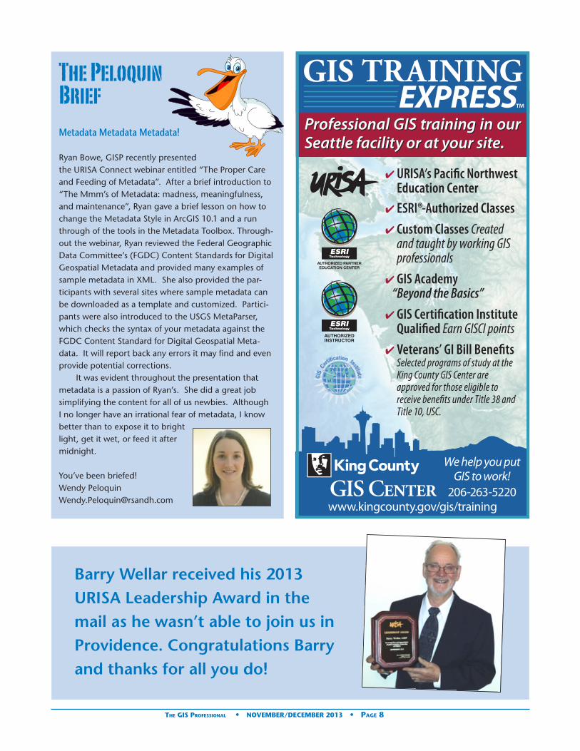
Metadata Metadata Metadata!
Ryan Bowe, GISP recently presented the URISA Connect webinar entitled “The Proper Care and Feeding of Metadata”. After a brief introduction to “The Mmm’s of Metadata: madness, meaningfulness, and maintenance”, Ryan gave a brief lesson on how to change the Metadata Style in ArcGIS 10.1 and a run through of the tools in the Metadata Toolbox. Through-out the webinar, Ryan reviewed the Federal Geographic Data Committee’s (FGDC) Content Standards for Digital Geospatial Metadata and provided many examples of sample metadata in XML. She also provided the par-ticipants with several sites where sample metadata can be downloaded as a template and customized. Partici-pants were also introduced to the USGS MetaParser, which checks the syntax of your metadata against the FGDC Content Standard for Digital Geospatial Meta-data. It will report back any errors it may find and even provide potential corrections.
It was evident throughout the presentation that metadata is a passion of Ryan’s. She did a great job simplifying the content for all of us newbies. Although I no longer have an irrational fear of metadata, I know better than to expose it to bright light, get it wet, or feed it after midnight.
You’ve been briefed!Wendy [email protected]
The Peloquin Brief
Barry Wellar received his 2013 URISA Leadership Award in the mail as he wasn’t able to join us in Providence. Congratulations Barry and thanks for all you do!
The GIS Professional • NOVEMBER/DECEMBER 2013 • Page 8


Problem Statement The Bureau of Environmental Health (BEH) within the Bucks County Health Department is responsible for enforcing all regulations related to the construction and maintenance of well sites within the County of Bucks, Pennsylvania. The enforcement of these regulations is performed by specially trained employees who inspect the work of licensed con-tractors to insure regulatory compliance and issue permits upon satisfactory construction. Contractors submit paper-based well permit applications. Once a permit application is received, the inspectors conduct field visits to inspect the well site prior to, during, and after well construction to en-sure regulatory compliance. The paper permit application is maintained on file at the County.
Prior to the implementation of the Android tablet solution, BEH well inspectors entered well inspection data into an on-line commercial web service but there were several limitations with this approach. First, because the on-line service was not designed to store well inspection data, the data were entered into “free form” memo fields which meant inspection data could not be indexed or searched as in traditional database management systems. Secondly, the on-line service did not offer a mapping component to view the key environment and cultural layers such as soil permeability, slope, hydrography, and property boundaries relative to the well location. This required inspectors to manually compile well map coordinates onto mylar soil and slope maps in order to review key environmental factors relative to the well site.
The Health Department envisioned a map-centric, tablet-deployed, field inspection solution that would eliminate manual compilation of map coordinates for proposed well sites, thereby improving efficiency of the permit review process and accuracy of well coordinates. While at the well site, inspectors could review crucial environmental and cultural map layers using the tablet’s interactive map window to increase the efficiency of the site inspection. Finally, there was an opportunity to improve data quality by capturing the tablet’s GPS coordinate while the inspector was standing at the well site, and by using data entry selection lists to minimize key entry of data combined with automated data validation routines.
The SolutionThe Health Department wanted to use lightweight, non-ruggedized Android tablets that bundle cellular broadband and GPS receivers and built-in cameras as the preferred platform for several reasons. First, there was a greater variety of manufacturers and models available that offered lighter weight and less expensive options compared to Windows tablets. Secondly, ruggedized tablets were not considered an option because, the Health Department reasoned, the replacement cost for non-ruggedized tablets that are lost, stolen, or broken is significantly cheaper than for ruggedized tablets. Thirdly, the Department had recently purchased another software package that required the Android operat-ing system. Finally, the opportunity to integrate the tablet’s peripheral devices into a native Android mapping solution would enable inspectors to navigate to the inspection site and capture accurate latitude/longitude coordinates of the proposed well site using the built in GPS, use the 3G/4G net-work to connect to the office in order edit well permit and
inspection data on-line, and attach photographs of the well site using the built-in camera.
The native Android tablet GIS application was designed and developed by geographIT® of Lancaster, Pennsylvania using the ArcGIS Runtime SDK for Android 2.0.
It connects to and consumes ArcGIS Server 10.1 published services hosted by the Bucks County Enterprise GIS via either 3G/4G cellular broadband or Wi-Fi hotspots. The application is designed to work both on-line and off-line since there are areas in Bucks County with weak cellular broadband signal coverage. When on-line, the application submits edits directly to a published ArcGIS Server feature service, so edited well data are immediately visible to anyone viewing well data whether in the field or back in the office. When cellular broadband signal is weak or unavailable, edits are cached locally until the network connection is restored at which time edits are submitted to the published ArcGIS Server feature service and deleted from the local cache. This off-line caching ensures that field edits are never lost due to inadequate network availability. In order to support continued operation when off-line, two ArcGIS map tile packages are periodically updated on a file server and transferred onto the Android tablet’s SD card when the tablet is connected at the Health Department office: one
Android Tablet GIS Solution Transforms Well Inspection for Bucks County Health Department
Welcome New URISA Business Partner
The GIS Professional • NOVEMBER/DECEMBER 2013 • Page 10

tile package contains fused base map layers and the other contains recent digital ortho-photography.
Supporting Office Processes:Several processes are per-formed at the Health Depart-ment office to support the Android tablet well inspection solution:1. Bucks County Enterprise
GIS periodically updates/rebuilds the fused base map tile packages and transfers them onto the Android tablets to ensure that the latest base maps are available when inspectors need to work off-line.
2. To maximize data entry efficiency, permit application information is entered using a web application prior to field inspection. This enables inspectors to verify/modify the well data while at the well site rather than performing extensive data entry using the tablet’s touchscreen keyboard. Inspectors have the ability to add new wells in the field, but they are only required to enter a minimum number of well attributes using the tablet’s touchscreen keyboard with the balance of well attributes added back at the office.
Android Tablet Field Inspection Capabilities:Well inspectors use the Android tablet to perform a variety of functions in the field related to well inspection: 1. Pan, zoom, and toggle map layer visibility in order to
display municipal and property boundaries, building footprints, soils, road centerlines, well locations, and digital ortho-photographs.
2. Identify nearby map features within a radial search distance of where the inspector clicks on the map by displaying feature attributes as map tips. The system administrator can configure the map layers that can be identified, the map tips that will be returned, and the radial search distance (in feet).
3. Measure linear distance in feet and area in feet2 by drawing a line or polygon in the map display.
4. Measure linear distance in feet by tracking the tablet GPS location as the inspector traverses a multi-point line at the well site.
5. Find a location by entering a latitude/longitude coordinate or a street address.
6. Display the current GPS location in the map as a green icon when the GPS receiver is receiving new coordinates. Display the last known GPS location as a red icon when the GPS receiver is not receiving new coordinates.
7. Auto-track the GPS location by panning the map window to keep the GPS icon in the center of the map display. If GPS signal is lost while auto-track is enabled, the auto-tracking feature is automatically disabled.
8. View and edit well permit and inspection data. The user can select a well using the Identify tool or Search tool to find a well by its serial number. Once selected, the well permit and inspection data can be viewed and edited. The system administrator can configure the set of well attributes that can be viewed and edited.
9. Create a new well by using the GPS coordinate location or by tapping at a location in the interactive map to indicate the well’s location. A data entry form is displayed to support entry of required data.
10. Take photographs using the tablet’s built-in camera and store the photographs as well attachments. Each photograph is stored with its geographic coordinate and date/time the photograph was taken.
The TechnologyThe Health Department selected the 3G/4G compatible Samsung Galaxy Note® 10.1 tablet as the platform. The tablet’s base configuration and physical characteristics as shipped from the factory include: • Android 4.1 Jellybean
Operating System• 5 MP camera with flash• 720P high definition
video camcorder• Bluetooth 4.0• Wi-Fi 802.11 a/b/g/n• Weight 1.3 pounds• 16 GB internal memory• 1.4 GHz Exynos quad core processor with 2 GB RAM• 64 GB Secure Digital (SD) cards for data storage• 10.1” WXGA display (1280 x 800 pixels)• Touch screen with S Pen • Virtual QWERTY keyboard• 16 hour battery use time• Innovation and Originally Factors
The variety of Android device manufacturers and models combined with the high cost of ruggedized tablets led to the selection of a non-ruggedized non-Windows mobile platform to support field operations primarily because significant cost savings and secondarily because of the smaller and lighter weight form factor available with Android tablets. Until recently, this type of field solution would have required Windows tablets or Windows Mobile hand held
continued on page 12
The GIS Professional • NOVEMBER/DECEMBER 2013 • Page 11

devices as there were few alternatives available for mobile platforms.
At this time of this project, Esri had not implemented out-of-the-box off-line editing capability with ArcGIS for Server 10.1 and the ArcGIS Runtime SDK for Android 2.0. So, it was necessary to develop a client service running on the tablet to monitor the feature service connection, and automatically switch to off-line mode whenever the connection is lost. It was also necessary to implement a local edit cache on the tablets using SQLite to store off-line edits until feature service connection is reestablished, and then submit all cached edits to the feature service and flush the cache once successful transmission is verified. Similarly, the commercial technology foundation did not support off-line capture and storage of photographs as feature attachments, so whenever the tablet is in off-line mode, new photographs are cached locally and transmitted to the well feature service when connection is reestablished.
Implementing the off-line edit functionality allows inspectors to access well locations throughout the county even when cellular broadband signal is inadequate to support on-line editing. The custom local caching service developed by geographIT® ensures edits and photographs are never lost when the solution switches to off-line mode. As soon as the on-line service connection is reestablished, the local cache is cleared, thereby enabling extended field operation.
On-line editing while in the field enables immediate enterprise access to the latest data, resulting in more timely data delivery compared to the traditional back office approach of synchronizing data after the mobile device returns to the office.
The well permit application was implemented on
Android tablets, but can also be used on Android smart phones without modification as it automatically adjusts to the screen size of the device. For example, the permit application works just as well on a Galaxy S3 smart phone as on the Galaxy Note 10.1 tablet for which it was designed.
Future Value to the Geospatial Profession and the PublicThe rapid proliferation of Android tablets and smartphones challenges the paradigm that custom GIS solutions must run on Windows platforms. According to an article by John Koetsier (VentureBeat, January 28, 2013), Android captured 68% of the global smartphone market share in 2012 followed by Apple iOS with 19%. This solution demonstrates both the feasibility and justification for deploying custom mobile GIS solutions for local government on non-Windows and non-ruggedized platforms. Furthermore, Android’s dominate market share of smartphones, combined with the ability to develop GIS applications for Android platforms, offers geo-spatial firms the opportunity to develop highly focused single purpose GIS application designed for a mass market and to distribute them to the general public through Google Play.
Local governments are becoming increasingly aware of the potential to achieve an ROI by deploying mobile GIS solutions to support field operations. Successful outcomes that demonstrate an ROI such as the Bucks County Health Department’s well inspection solution encourage the local government adoption of similar mobile GIS solutions at a time when local governments are seeking ways to reduce costs and increase revenues. This provides new market opportunities for geospatial firms that develop custom solutions.
For more information, contact Bruce E. Stauffer: [email protected]
Phone (717) 399-7007. www.geographIT.com
Business Partner continued from page 11
Dr. Barry Wellar, URISA Past President (1978), publishes AutoCarto Six Retrospective
This commemorative book celebrates the International Symposium on Automated Cartography, which was held in Ottawa in 1983. AutoCarto Six is considered one of the most influential conferences behind the origins, develop-ment, and growth of automated cartography, GIS, geo-matics, and related fields.
The retrospective book was designed and edited by Dr. Barry Wellar, Professor Emeritus, University of Ottawa, and currently owner and principal of Wellar Consulting Inc. He was the Director of the Technical Program for AutoCarto Six, and editor of the 1100-page symposium proceedings.
Dr. Wellar is a long-time URISA member who received the Horwood Award in 1985, is a two-time recipient of the URISA Leadership Award (1978, 2013), and was inducted
into the GIS Hall of Fame in 2011. His record of recognition includes the Anderson Medal of Honor in Applied Geography (2003) and the Edward Ullman Award (2006) from the AAG, and the Service to Government or Business Award from the CAG in 2004
AutoCarto Six Retrospective includes an Introduction by Jack Dangermond, President, Esri, a retrospective design paper by Barry Wellar, and 29 papers in which authors look back at the papers they presented 30 years ago at AutoCarto Six. The terms of reference used to retrospectively discuss papers include: Reason for paper; Thoughts shaping the design of the paper; Derivative attributions; Original contributions; Impacts; What was new in the paper; and, What was different in the paper. Read more
The GIS Professional • NOVEMBER/DECEMBER 2013 • Page 12

Systems have become more valuable. The Internet, cell phones, video conferencing, asset management systems, and other communication technologies allows people to work from their homes or at least closer to home than before. Access to data management and GIS tools enables urban and regional agencies to identify current
conditions, evaluate risks, and plan for capital expenditures to ensure our communities and their infrastructure will be able to handle the additional stress on these networks. Planning for greener approaches to facility management, for instance, includes using more trees for cooling, more efficient appliances, and more sustainable architectures. Information Systems tools are not only needed but are required to ensure we are successful in this endeavor for the next 50 years and beyond.
URISA offers a wide range of educational offerings relevant for urban and regional agencies that need to expand and further hone their information technology skills, including: • GIS/CAMA Technologies Conference: February 24-
27, 2014 in Jacksonville, Florida• URISA Leadership Academy: May 5-9, 2014 in
Calgary, Alberta and October 13-17, 2014 in Louisville, Kentucky
• GIS-Pro 2014: URISA’s 52nd Annual Conference: September 8-11, 2014 in New Orleans, Louisiana with a focus on the use of technology to improve sustainability and community resilience
• Other conferences including: GIS in Public Health, GIS in Transit, the URISA/NENA Addressing Conference and the Caribbean GIS Conference.
• URISA Certified Workshops covering topics ranging from GIS Return on Investment to Field Automation Options for Local Government.
• URISA Connect Webinars now offering full multi-part workshops in addition to the hot topic presentations to expand upon our virtual education offerings.
President’s Column
Allen Ibaugh, AICP, GISP
“Urban and Regional” Information Systems Association – 50+ Years Later, and Still More Relevant Than Ever
At the start of 2013, the United States population was well over 315 million people and increased by over 2.2 million people from the previous year. On average, the country gains a new resident every 17 seconds. Moreover, by the middle of the 21st Century, the Census Bureau estimates we will have a population of between 422 and 458 million residents. Let’s just be conservative and say: 400 million. In addition to this population growth trend, the U.S. is continuing to urbanize. What once was a nation predomi-nately seen as one dominated by rural, open spaces and as much of 75% of its population living in those spaces in the late 1800s, has now completely flip-flopped to having over 80% of the population living in urban areas (including core, suburbs, and exurbs) in 2010. That is a dramatic change in a short period of time and the urbanization rate continues to increase by a minimum of 1% every 10 years. Similar trends are occurring internationally. In Canada the population has grown by 6% over the latest 5 year census period, with close to 70% of the population living in what would be deemed urban and regional areas. Further, the Canadian population is continuing to become skewed to the older populations as people are living longer putting greater stress on the health-care system.
So what does that mean for our Urban and Regional infrastructure, community services, economic, and healthcare network? It means they are going to be even more strapped than they are today. Our infrastructure (water, transportation, facilities, etc.) is now more than 50 years old and even more so in certain parts of the country. Doing more with less, needing to provide more with less, understanding where we can and cannot leverage efficiencies and services throughout our urban communities has and will become more important than ever. How about access to specialized healthcare? Another issue as our population not only grows bigger, it grows older. Like it or not, our urban and regional American lifestyle (suburbia) are here to stay, it’s a reality, and we need to deal with its energy, economic, health, and infrastructure inefficiencies (long distance commutes, heavy reliance on fossil fuels, etc.).
My contention is that because of these issues, URISA has become more relevant and needed than ever before. When tackling these growing issues and concerns for Urban and Regional communities – Information continued on page 14
The GIS Professional • NOVEMBER/DECEMBER 2013 • Page 13

In addition, URISA has established the GIS Management Institute® (GMI) that will soon provide an additional resource to ensure that urban and regional organizations and agencies are adequately prepared to handle what is likely to come in our future population growth and consolidation. The GMI will provide an on-line resource to review your agency’s current GIS capability maturity, identify gaps, and provide recommendations for potential information system enhancements, or a pathway to those enhancements to support the increasing needs over time. GMI coupled with URISA’s educational offerings will be a valuable resource for our future Urban and Regional information system requirements to meet these demands.
A more competitive and economically/environmentally sustainable U.S. will rely on technology. So yes, URISA is more relevant than ever, and it will be incumbent on our volunteers, members, and stakeholders to work together to tackle these Urban and Regional issues now and in the years to come.
GIS Day 2013
President’s Column continued from page 13
URISA Chapter News
The Cumberland Chapter will be hosting their first ever an-nual meeting on January 24, 2014 in Bowling Green, KY. There will be a focus on GIS Education and a student poster competition. A draft program and more details are available at http://www.cumberlandurisa.org!
We sent a bunch of URISA materials to members hosting events for GIS Day this year. From tweets and emails about the day’s festivities, it seems a lot of outreach and fun was had!
Jason Clodfelter shared some images from Forsyth County, NC’s GIS Day event. They had approximately 135 high school students (AP Geography and a technology club) in attendance in addition to various other GIS professionals, users and local government employees.
The GIS Professional • NOVEMBER/DECEMBER 2013 • Page 14

Welcome New Partners
New Gold Corporate Partner!Cyclomedia
Cyclomedia is the market leader in the systematic imaging of the large-scale environments from cities to complete coun-tries. Cyclomedia started over 30 years ago pioneering the capture of the world from the street. We continue to inno-vate today by combining pictures to form an immersive view of the world. Cyclomedia operates in more than 12 countries in Europe and is bringing our state-of-the-art products to the United States in 2013.
New Business Partner!geographIT Depth and Breadth of Industry Experience Does Matter!
geographIT® offers the depth of experience, insight, and innovation that only comes from more than two decades of GIS consulting, custom software development, and system integration projects successfully completed for state and local governments, utilities, transportation, and law enforce-ment sectors. Technologies have changed significantly since the early days of GIS, allowing for tightly coupled GIS/IT system integration, deployment on multiple platforms, and quicker implementation of cost-effective solutions.
Our innovative solutions are custom tailored to your requirements so that information is accessed whenever, wherever and however it is needed. Our secure custom web and mobile GIS solutions support collecting and updating data in the field in both online and offline modes thereby eliminating concerns about cellular broadband coverage in remote areas. Automating paper based workflows, integrating database systems, and streamlining the way data collection and data maintenance are performed frequently yield significant returns on investment (ROI) through greater efficiency gains and increases in revenue generation of local government permitting and code enforcement systems. Implementing cloud hosted enterprise database servers maximizes utilization of GIS technicians when they are located in distant offices but need shared access to maintain an enterprise geodatabase. This is just a sampling the many ways our clients have benefited from our consulting and custom solutions.
Founded in 1990 as Advanced Technology Solutions Inc., we were a pioneering GIS consulting company in Pennsylva-nia when GIS commercialization was still in its infancy. We rebranded as geographIT in 2007 to highlight our compre-hensive and competitive offering of geospatial services and solutions. Contact us today ([email protected]) if you are looking to start GIS or improve the efficiency of your legacy GIS and IT systems.
URISA is pleased to announce that Ryan Elizabeth Bowe, GISP has been named URISA’s Young Professional of the Year in recognition of her out-standing efforts as part of URISA’s Van-guard Cabinet. Since 2005, Ryan has worked as a GIS Technician at Photo Science, Inc. – A Quantum Spatial Company, in Lexington, Kentucky. She is a Certified GIS Professional and has been an active and contributing member of numerous URISA commit-tees and programs, most notably leading a URISA Lab on “Metadata”.
The Vanguard Cabinet (VC) is a URISA initiative which debuted in 2011 to engage young GIS practitioners (35 and under), increase their numbers in the organization, and better understand the concerns facing these future leaders of the GIS community. The Cabinet’s mission is to collaborate with URISA’s Board of Directors and Committees in creating and promoting programs and policies of benefit to young professionals. Comprised entirely of passionate young members selected from different geospatial disciplines, the Cabinet aims to position URISA as the center of opportunities for creative young professionals who are committed to improving URISA and the geospatial profession via innovation, collaboration, networking, and professional development.
Ryan Bowe, GISP
Ryan Bowe Named URISA Young Professional of the Year
The GIS Professional • NOVEMBER/DECEMBER 2013 • Page 15

Welcome New URISA Members
Naz Ali, GISP—CBRE Limited—Vancouver, BC
Sonia Arbona,—GISP—Texas Dept. of State Health Services—Round Rock, TX
Frank Aryee—Bowling Green, KYGlen Ausse, GISP—TranSmart
Technologies Inc—Madison, WIAmanda Bentley, GISP—Connected
Nation—Bowling Green, KYZachary Berry —Johnson, Mirmiran,
and Thompson—Falls Church, VABenjamin Blandford—Lexington, KYSolonggowa Borzigin, GISP—
United Services Automobile Assosc. (USAA)—San Antonio, TX
Elizabeth Boyle, GISP—ARCADIS—Fuquay Varina, NC
Mark Castenson—Cedar Rapids, IAAllison Charko—Corporation of Teh
City of Windsor—Windsor, ONRobert Chasan, GISP—City of
Scottsdale—Scottsdale, AZJon Connick, GISP—Nexen
Energy—Calgary, ABDaniel Connolly —City of Derby—
Derby, KSPaul Couey —Metro Regional
Services—Portland, ORJonathan Cruz, GISP—Penbay
Media—Hatboro, PAJay Cummins, GISP—WorldView
Solutions Inc.—Richmond, VAKenneth Denson—Spatial Focus
Inc—Decatur, FLVanhvilai Douangchai—Atlanta, GAJohn Dziurlaj—Akron, OHHannah Eboh—Chicago, ILCatherine Escarpeta, GISP—Prince
George’s County—Capitol Heights, MD
Jonathan Fearns—Calgary, ABWilliam Ferguson—Davis, CATatiana Gonzalez —City of
Bradenton—Bradenton, FLAshleigh Harris —URISA - Ontario
Chapter—Toronto, ONChristian Hartnett—Austin, TXGraham Hayes—New Orleans, LATim Hayes —San Jose Santa Clara
Regional—San Joes, CAPaul Hoeffler, GISP—Ohio
Department of Natural
Resources—Fairview Park, OHDan Hoff —City of Raleigh—
Raleigh, NCRichard Hollatz, GISP—Skamania
County—Stevenson, WAJacqueline Horsford, GISP—Louis
Berger Group Inc—Lexington, MOLotta Jarnefelt Burns, GISP—
Kalamazoo County—Kalamazoo, MIMarlene Jeffers —CourthouseUSA—
Kansas City, MORyan Johnson, GISP—Oregon
Department of Transportation—Salem, OR
Lisa Kleinosky, GISP—Altoona Water Authority—Altoona, PA
Mele Koneya, GISP—City of Scottsdale—Scottsdale, AZ
Christine Lam—Los Angeles, CAZachary Lancaster —Spatial Focus
Inc—Decatur, FLNicholas LaRue —HDR
Engineering—Portland, OROlivia Lau —Herrera Environmental
Consultants—Seattle, WATimothy Ledrich—North Canton, OHScott Longerbeam—City of
Danville—Danville, VASteven Lowman, GISP—Vista West
Engineering—Sheridan, WYRodney Miceli—Kentucky
Department of Revenue—Frankfort, KY
Matthew Norris—Explosive Ordance Technologies Inc—Powell, TN
Frank Orr, GISP—Critigen—Centennial, CO
Christopher Pape, GISP—Washington County, Tennessee Zoning Office—Jonesborough, TN
Rachel Patterson, GISP—Moore County—Carthage, NC
Samuel Piel —Hanover Engineering Associates, Inc.—Saylorsburg, PA
William Pollock, GISP—Tallahassee, FL
Helvia Quinones, GISP—City of Houston—Kingwood, TX
Jeninfer Rolph—Edmonton, ABInger Sarappo, GISP—AMEC
Environment & Infrastructure—Nolensville, TN
Business PartnergeographIT• *Bruce Stauffer• Ashis B. Pal
Gold Corporate PartnerCyclomedia • Kenneth Anderson • Dan Bellissemo• Paul Burrows • Paul Smith • Renatta Tellez
New Government Agency MembershipsCity of Leduc, Alberta Canada• Jared Huang • *Bart Pouteau• *David Pearce
County of Grande Prairie, Alberta Canada• Glen Kilian • Kristen Milburn
Maryland-National Capital Park and Planning Com-mission• Ivy Lewis • Paul Patnode • Michael Shean
• Philip Taylor • Derick Berlage • Albert Dobbins • Asfaw Fanta • Barney Green • Alan Hirsch
City of Thornton, Colorado• Margaret Carew• Tyler Dunn• *John Herman• *Valorie Plesha
Columbia County (GA) Board of Commissioners• *Julinne Harman• *Mary Howard• *Chuck King• *Ernestine Phelps
City of Ocoee, Florida • *Al Butler• Majorie Dillingham• Michael O’Halloran• Zhenyan Ebaugh
*Current members who ‘upgraded’ to a new membership category with 2014 renewals.
Charles Shapiro —Spatial Focus Inc—Decatur, GA
Sudhir Shrestha, GISP—NOAA Climate Prediction Cntr.—Alexandria, VA
Lance Singleton —City of Rowlett—Rowlett, TX
Taciana Soerodimedjo —N V Energiebedrijven Suriname—Paramaribo,
Kyle Spencer—Moyock, NCSeth Stanbery, GISP—Beaufort
County GIS—Beaufort, SCJeff Stone —Central Texas Council
of Governments—Belton, TX
Bryan Swindell, GISP—DTM Consulting LLC—Livingston, MT
Bill Tenbroeck —Alachua County Fire Rescue—Gainesville, FL
Sean Tuohey, GISP—HDR Engineering—Golden Valley, MN
Micah Warnock, GISP—Albemarle County—Staunton, VA
Ty Wooten —National Emergency Number Association—Indianapolis, IN
Thomas Zumbado, GISP—Salt Lake County Planning & Development Services—Salt Lake City, UT
The GIS Professional • NOVEMBER/DECEMBER 2013 • Page 16

2013 Partner Directory
Platinum CorporatePartner
Esri
380 New York St, Redlands, CA 92373
Phone: (909) 793-2853
Since 1969, Esri® has been helping
organizations map and model our world.
Esri’s GIS software tools and methodolo-
gies enable them to effectively analyze
and manage their geographic informa-
tion and make better decisions. They
are supported by our experienced and
knowledgeable staff and extensive
network of business partners and inter-
national distributors.
A full-service GIS company, Esri supports
the implementation of GIS technology on
the desktop, servers, online services, and
mobile devices. These GIS solutions are
flexible, customizable, and easy to use.
Esri software is used by hundreds of
thousands of organizations who apply
GIS to solve problems and make our
world a better place to live. We pay
close attention to our users to ensure
they have the best tools possible to
accomplish their missions. A compre-
hensive suite of training options offered
worldwide helps our users fully leverage
their GIS. Esri is a socially conscious busi-
ness, actively supporting organizations
involved in education, conservation,
sustainable development, and humani-
tarian affairs.
Gold Corporate Partner
Cyclomedia
Cyclomedia is the market leader in the
systematic imaging of the large-scale
environments from cities to complete
countries. Cyclomedia started over 30
years ago pioneering the capture of the
world from the street. We continue to
innovate today by combining pictures
to form an immersive view of the world.
Cyclomedia operates in more than 12
countries in Europe and is bringing our
state-of-the-art products to the United
States in 2013.
Silver Corporate Partners
Data Transfer Solutions
3680 Avalon Park Blvd East, Suite 200,
Orlando, FL 32828
Phone: (407) 382-5222
Headquartered in Orlando, DTS is a
leader in asset management, geographic
information systems, and transporta-
tion planning. We specialize in creating
solutions to help clients automate their
worlds, reduce their workload and
organize their data through customized
technology.
DTS is comprised of seven divisions, each
with its own scope of services. Often
however, a single project spans several
divisions before completion because we
uniquely offer all the necessary cutting-
edge services, integrated within one
company.
Pictometry International
100 Town Centre Dr, Suite A, Rochester,
NY 14623
Phone: (585) 739-1854
Pictometry International Corp. is a lead-
ing provider of geo-referenced, aerial
image libraries and related software.
Pictometry has captured nearly 130
million digital aerial images which
represent more than 80 percent of the
United States population and all major
U.S. markets.
Using its proprietary imaging process,
Pictometry captures geo-referenced,
high-resolution orthogonal (straight
down view) and oblique (captured at an
angle) imagery within which structures
and land features can be measured.
Pictometry customizes and markets
these technologies for government and
commercial applications. Pictometry’s
standard oblique imagery includes
second order visualization tools that do
not produce authoritative or definitive
information (surveying).
Bronze Corporate Partners
British Columbia Assessment
400 - 3450 Uptown Blvd.
Victoria BC V8Z 0B9
(250) 595.6211
BC Assessment produces independent,
uniform and efficient property assess-
ments on an annual basis for all property
owners in the province.
Merrick & Company
2450 South Peoria Street, Aurora, CO
80014
Phone: (303) 751-0741
Merrick & Company provides compre-
hensive, client-focused land information
services, including image acquisition
(aerial and satellite), GPS Surveying,
digital photogrammetry, Light Detection
and Ranging (LIDAR), digital imaging,
digital orthophotography processing,
LiDAR software tools (MARS®), GIS da-
tabase design and application program-
ming. Merrick’s primary markets include
city/county, federal government, electric
utilities, engineering design firms and
pipeline operators.
Nokia
Location & Commerce is a Nokia business
unit established to build and monetize
location experiences for mobile prod-
ucts, the navigation industry and the
automotive market. A focus on Content
(including NAVTEQ® Maps), Social
Location Services (Platform, Apps), and
Local Commerce aims to complement
hardware, software and services with
“smart” location data.
Thomson Reuters
510 East Milham Ave.
Portage, MI 49002
Phone: 866.471.2900
www.thomsonreuters.com
continued on page 18
The GIS Professional • NOVEMBER/DECEMBER 2013 • Page 17

Thomson Reuters is the world’s leading
source of intelligent information for gov-
ernments, businesses, and professionals,
combining industry expertise with
innovative technology to deliver critical
information to leading decision makers.
Our integrated Government Revenue
Management (GRM) suite offers end-
to-end software with services to ensure
revenue through land and property tax
administration. Meeting the needs of
emerging economies, OpenTitleT is an af-
fordable registry and cadastre tool with
an all-inclusive approach to collecting,
documenting, and recording the docu-
mentary and geographic information
relating to property rights. At Thomson
Reuters, our goal is to use state-of-the-
art technology to develop and deliver
sustainable tax and land administration
solutions on time, within budget and
configured to client requirements.
Valtus Imagery Services
212, 5438-11th St NE, Calgary, AB T2E
7E9 Canada
Phone: (403) 295-0694 Toll Free: (800)
661-6782
Valtus Imagery Services provides best in
class solutions for the storage, manage-
ment and delivery of geospatial informa-
tion in the form of ortho-imagery and
elevation data through web delivery
systems.
VESTRA Resources
5300 Aviation Drive, Redding, CA 96002
Phone: (530) 223-2585
As a leader in GIS/IT, Environmental Solu-
tions, Engineering, and Surveying, VESTRA
has the depth of know-how and experience
to help clients achieve success. VESTRA, an
employee-owned corporation dating back to
1988, prides itself on our local presence and
commitment to the community. Our mission
is to be our clients’ most-valued consultant
by providing cost-effective, innovative, and
technically superior project solutions. What-
ever your current or future needs, VESTRA’s
full-service resources are available to sup-
port you on your next critical project.
Business Partners
ELYON International, Inc.
1111 Main Street, Suite 220, Vancouver,
WA 98660
(360) 696-5892
ELYON International Inc. is an informa-
tion technology company that provides
innovative, best-in-class consulting,
IT solutions and Professional Staffing
services. Our current core competency
solutions span the entire software life
cycle in the areas of system integration,
e-business, enterprise resource planning
(ERP), client/server, project outsourcing
and network support. In addition, ELYON
services other Professional, Technical and
other Specialized Staffing requirements.
ESEA
280 2nd Street
Suite 270
Los Altos CA 94022
(650) 941-4175
Primary Contact: Jack Booher
ESEA is the leading provider of map
conflation software that simplifies the
process of producing and updating vec-
tor maps. MapMerger is used worldwide
by organizations small and large to build
and maintain GIS data.
geographic Data Base Management Systems, Inc.
41 E. 4th Avenue, Collegeville, PA 19426-
2341
(610) 489-0353
gDBMS Services include:
Technical reviews and ongoing evalua-
tions of existing GIS programs. Making
sure GIS is all that it can be in your
jurisdiction.
geographIT
geographIT® offers the depth of experi-
ence, insight, and innovation that only
comes from more than two decades
of GIS consulting, custom software
development, and system integration
projects successfully completed for
state and local governments, utilities,
transportation, and law enforcement
sectors. Technologies have changed
significantly since the early days of GIS,
allowing for tightly coupled GIS/IT sys-
tem integration, deployment on multiple
platforms, and quicker implementation
of cost-effective solutions. Founded in
1990 as Advanced Technology Solutions
Inc., we were a pioneering GIS consult-
ing company in Pennsylvania when GIS
commercialization was still in its infancy.
We rebranded as geographIT in 2007 to
highlight our comprehensive and com-
petitive offering of geospatial services
and solutions. Contact us today (market-
[email protected]) if you are looking
to start GIS or improve the efficiency of
your legacy GIS and IT systems.
GeoPlanning Services, LLC
3564 Avalon Park Blvd E., Suite 1, #243,
Orlando, FL 32828
Phone: (407) 608-4186
GeoPlanning Services, LLC of Orlando, FL
was founded in early 2009 is a full service
provider of geospatial tools and analysis
to support urban planning, logistics,
real estate and economic development
organizations.
GISbiz, Inc
25 Century Blvd Ste 602
Nashville, TN 37214
Contact: Babu Krishnasamy
(615) 465-8287
www.gisbiz.com
GISbiz specializes in offering customized
mobile, web and desktop based GIS solu-
tions using popular geospatial technol-
ogy platforms.
GIS Services
4870 W. McElroy Drive, Tucson AZ 85745
(520) 991-0727
GIS Services is committed to finding the
best solution(s) for the client’s require-
ments while anticipating future needs,
in a world of a rapidly expanding range
of geospatial tools. GIS Services provides
commodities, services, and training for
implementing and integrating solutions
with GIS, GPS, and imagery.
GPC Global Information Solutions LLC
P O Box 129060, Abu Dhabi, United Arab
Emirates
Tel: + 971 2 666 6574
Based in Abu Dhabi, UAE, GPC Global
Information Solutions LLC (GPC-GIS),
was launched in 2008 by the Geographic
Planning Collaborative, Inc. (GPC) to
specialize in the delivery of geospatial
2013 Partner Directory (continued)
The GIS Professional • NOVEMBER/DECEMBER 2013 • Page 18

Thank you to all of URISA’s partners
information services to the MENA
Region. By harnessing more than 25
years experience of GPC partners, we
provide consulting services in Geospatial
Information Technology and Services
(GITS), Spatial Data Infrastructure (SDI),
Geospatial Education, Location Based
Services and Information Management
for a wide variety of organizations and
projects in the region.
MapWith.US
5512 NE 109th CT Ste J
Vancouver, WA 9866
(360) 718-8120
Primary Contact: Orest Pilskalos
MapWith.Us GIS provides mobile report-
ing tools for mapping field data directly
from your Smartphone or iPad.
MGP
701 Lee Street Suite 1020
Des Plaines, IL 60016
Tel: (847) 656-5698
www.mgpinc.com
MGP is an information systems services
company that specializes in geo-spatial
solutions. Our comprehensive range of
geographic, data modeling, and business
process solutions provide you new op-
portunities to find a better way. We believe
that innovation creates opportunity and
collaboration breeds success. MGP was
formed as a shared business model in
which clients are partners. This philosophy
enables significant cost savings and makes
it possible for any client, regardless of size,
to get where they need to go. MGP is the
managing partner of the GIS Consortium.
North River Geographic Systems, Inc.
215 Jarnigan Ave, Chattanooga, TN 37405
Phone: (423) 653-3611
North River Geographic Systems, Inc. is
a Geographic Information Systems and
Services Company located in southeast
Tennessee. Although in business for just
over two years, we bring over 15 years
experience in the GIS/Mapping industry.
NRGS has provided an array of services
such as GIS consulting, spatial analysis,
and cartography to an array of public
and private organizations. Being a small
company and Esri business partner gives
us the ability to keep costs low and solu-
tions innovative. Please give us a call/
email if you have any questions.
Open Spatial Corporation
5701 Lonetree Blvd, Suite 109
Rocklin, CA 95765
(800) 696-1238
Contact: Colin Hobson
Open Spatial is a multi-national company
delivering geospatial solutions based
on Oracle and Autodesk technologies.
Recognized for delivering applications
to government and utility sectors, our
solutions are based on internationally
accepted open standards and world-class
best practices. Open Spatial offers in-
novative spatial infrastructure solutions
to managing spatial data from survey
through to design, construction and
ongoing spatial data management. Our
clients efficiently manage cadastre,
water, wastewater, stormwater, roads,
electric and fiber networks.
Planning Communities, LLC
9131 Anson Way, Suite 304
Raleigh, North Carolina 27615
919-803-6862 (Office)
919-882-1206 (Fax)
Planning Communities, LLC provides
a wide range of multi-disciplinary
planning services for local, state and
federal agencies, tribal nations and
community organizations. Community,
transportation, environmental and GIS
services include local/regional planning,
visioning/scenario planning, land use,
socioeconomic, market and cost-benefit
analysis, community asset mapping,
tool/application support and develop-
ment, process improvement/integration,
consensus-building and facilitation.
Headquartered in Raleigh, North Carolina,
Planning Communities has additional
offices in Charlotte (NC) and Seattle (WA).
Planning Communities is a North Carolina
certified Small Professional Service Firm
(SPSF) and is certified as a DBE in North
Carolina, Tennessee, Florida and Delaware.
Spatial Focus, Inc.
6813 40th Ave, University Park, MD 20782
Phone: (301) 277-6212
Spatial Focus, Inc. is an independent
consulting firm, specializing in planning,
design, implementation and technical
services in the field of geographic infor-
mation systems.
Spatial Focus, Inc. was formed to offer a
new standard for vendor-independent
technical and consulting services in
geographic information of all kinds.
Organized in 1998, Spatial Focus, Inc.
specializes in integrating geographic in-
formation throughout public and private
enterprises, giving them spatial focus.
Somers-St. Claire GIS Management Consultants
3157 Babashaw Ct, Fairfax, VA 22031
Phone: (703) 204-0033
www.somers-stclaire.com
Independent consulting firm providing
GIS implementation and management
consulting and education.
Wellar Consulting
Ottawa, ON Canada
Phone: (613) 728-3483
Wellar Consulting services include design
and evaluation of education and train-
ing courses and currricula for GISystems
and GIScience programs; advice and
workshops on the development of quan-
titative measures to assess information
system and transportation system per-
formance; critical reviews of IS and GIS
RFPs; seminars on the safety and security
aspects of interdependent infrastruc-
tures; professional opinion on land use
planning and zoning issues; and, expert
opinion on liability for safety-related
incidents involving pedestrians, cyclists,
and motor vehicle operators.
Federal Agency Sponsor
U.S. Census Bureau
4600 Silver Hill Road, Washington, DC
20233
The Census Bureau serves as the leading
source of quality data about the nation’s
people and economy. We honor privacy,
protect confidentiality, share our expertise
globally, and conduct our work openly. We
are guided on this mission by our strong
and capable workforce, our readiness to
innovate, and our abiding commitment to
our customers.
For information about URISA Partnership, please visit:
http://www.urisa.org/about-us/become-a-
urisa-partner/ or contact Wendy Nelson at URISA
Headquarters.
The GIS Professional • NOVEMBER/DECEMBER 2013 • Page 19

Mark Your Calendar!
February 24-27, 2014GIS/CAMA Technologies ConferenceJacksonville, Florida
April 14-16, 2014CalGIS 2013 ConferenceMonterey, California
May 5-9, 2014URISA Leadership AcademyCalgary, Alberta Canada
September 8-11, 2014GIS-Pro 2013: URISA’s 52nd Annual ConferenceNew Orleans, Louisiana
October 13-17, 2014URISA Leadership AcademyLouisville, Kentucky
PRESIDENTAllen Ibaugh, AICP, GISP–Data Transfer Solutions (FL)[email protected]
PRESIDENT-ELECTCarl Anderson, GISP-Spatial Focus, Inc. (FL)[email protected]
IMMEDIATE PAST-PRESIDENTAl Butler, GISP, AICP – City of Ocoee (FL)[email protected]
SECRETARYDanielle Ayan, GISP–Georgia Tech Research [email protected]
TREASURERDoug Adams–Baltimore County (MD)[email protected]
Jochen Albrecht–Hunter College (NY)[email protected]
Tripp Corbin, GISP–eGIS Associates (GA)[email protected]
Amy Esnard, GISP– Hood River, [email protected]
Ashley Hitt, GISP–Connected Nation (KY)[email protected]
Claudia Paskauskas, GISP–East Central Florida Regional Planning [email protected]
Cindy Post–University of [email protected]
Teresa Townsend, AICP –Planning Communities LLC (NC)[email protected]
Chapter Advisory Board Representative: Cy Smith, GISP – State of Oregon [email protected]
THE GIS PROFESSIONALA publication of URISA – The Association for GIS Professionals.URISA is a non-profit professional and educational association that promotes the effective and ethical use of spatial information and information technologies for the understanding and management of urban and regional systems. It is a multidisciplinary association where professionals from all parts of the spatial data community can come together and share concerns and ideas.
URISA Headquarters701 Lee Street, Suite 680Des Plaines, IL 60016Phone (847) 824-6300Fax (847) 824-6363 [email protected]
SubmissionsManaging Editor – Wendy Nelson, Executive Director, [email protected] Editor – Comfort Manyame, GISP, [email protected] Editor – Keri Shearer, GISP, [email protected]
RFP Distribution
URISA members, remember that URISA will distribute your RFP/RFQ announcements to our corporate and business members at no charge. Simply email your announcement to [email protected] (Subject: RFP Service) and we’ll send it right out for you!
Related Documents