The geological action of water (La acción geológica del agua) Water shape the Earth´s surface through its movements in surface runoff, rivers, seas, glaciers and underwater stream. - Surface runoff or wild waters (Aguas de arroyada o aguas salvajes ) - Rivers (ríos) - Glaciers (glaciales) - Sea (el mar)

The geological action of water (La acción geológica del agua) Water shape the Earth´s surface through its movements in surface runoff, rivers, seas, glaciers.
Jan 03, 2016
Welcome message from author
This document is posted to help you gain knowledge. Please leave a comment to let me know what you think about it! Share it to your friends and learn new things together.
Transcript

The geological action of water(La acción geológica del agua)
Water shape the Earth´s surface through its movements in surface runoff, rivers, seas, glaciers and underwater stream.
- Surface runoff or wild waters (Aguas de arroyada o aguas salvajes )
- Rivers (ríos)
- Glaciers (glaciales)- Sea (el mar)
surface runoff or wild waters (AGUAS DE ARROYADA O
AGUAS SALVAJES):
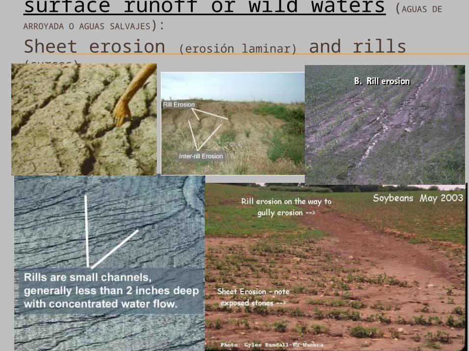
Sheet erosion (erosión laminar) and rills (surcos)

Surface runoff or wild waters (AGUAS DE
ARROYADA O AGUAS SALVAJES): rills (surcos), gullies (cárcavas)
and ravines (barrancos)
SURCOS (rills)
GULLIES (cárcavas)
Surface water from rainfall is known as wild waters or runoff water when it flows with no fixed course. Rainwater is a very effective agent for eroding and shaping landscape, especially in areas with dry
climates and torrential rains.

Cárcavas y barrancos del desierto de Tabernas, Almería
RILLS (surcos)
GULLIES (cárcavas)
RAVINES (barrancos)

BARRANCOS(ravines)
The surface runoff or wild waters passes through soft rocky materials, they produce small channels called rills (generally a few centimetres in size). As time passes these rills evolves into gullies. Gullies converge into ravines.

Badlands (areas with abundant gullies and ravines)
Ravines, gullies and rills are abundant in areas with soft rocky materials, steep hillsides (fuerte pendiente), dry climates (unprotected by a layer of vegetation) and torrential rains.

More badlands
Erosion by wild waters is a serious environmental problem (it leads to desertification). Although it does produce picturesque landscapes: badlands and fairy chimneys.

FAIRY CHIMNEYS (Chimeneas de hadas)
They are conical shapes where there is often resistant material in the upper part which has protected the softer materials beneath it from eroding.
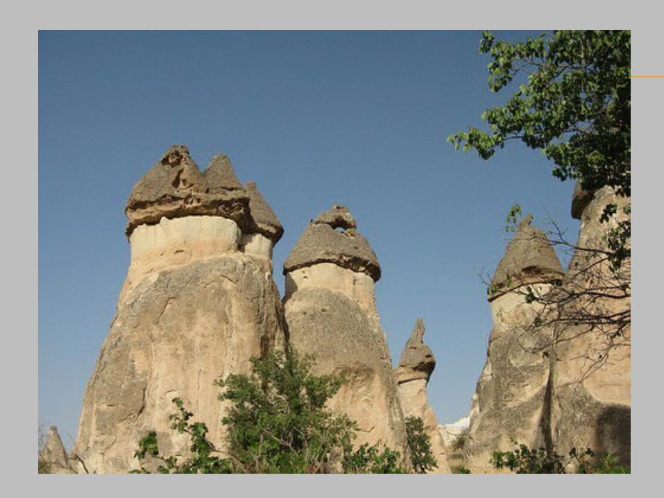

Process of forming the fairy chimneys.
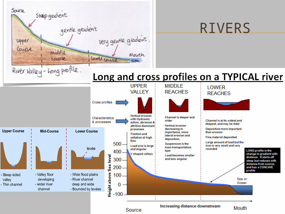
RIVERS

Upper course
V-shaped valleys GorgesRapids andwaterfalls
Upper course. Predominates erosion and transportation. We can see relief forms such as V-shaped valleys, gorges, waterfalls and rapids.
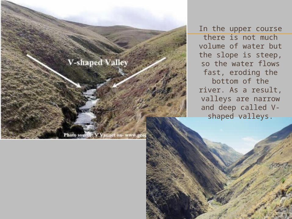
In the upper course there is not much
volume of water but the slope is steep, so the water flows fast,
eroding the bottom of the river. As a result,
valleys are narrow and deep called V-shaped
valleys.

GORGE
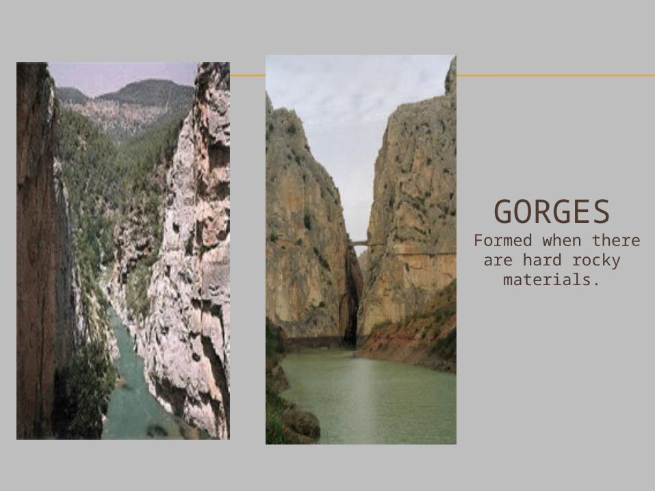
GORGES Formed when there
are hard rocky materials.
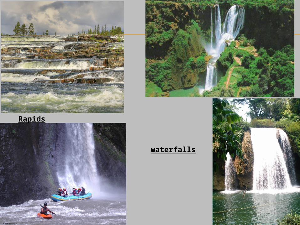
Rapids
waterfalls

Middle Course
Wider valleys Meanders
Middle course. We can see relief forms such as valleys with floodplanes or alluvial planes (sediments) and the river channel can form meanders (deep bends in a river).
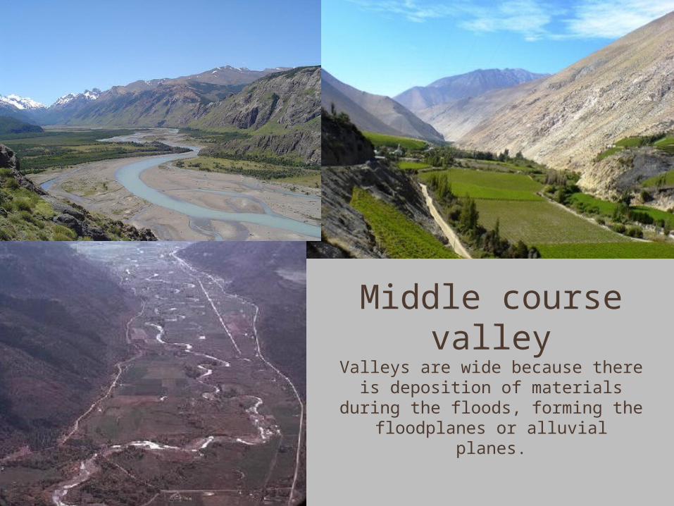
Middle course valley
Valleys are wide because there is deposition of materials during the floods, forming the floodplanes or
alluvial planes.

Meanders
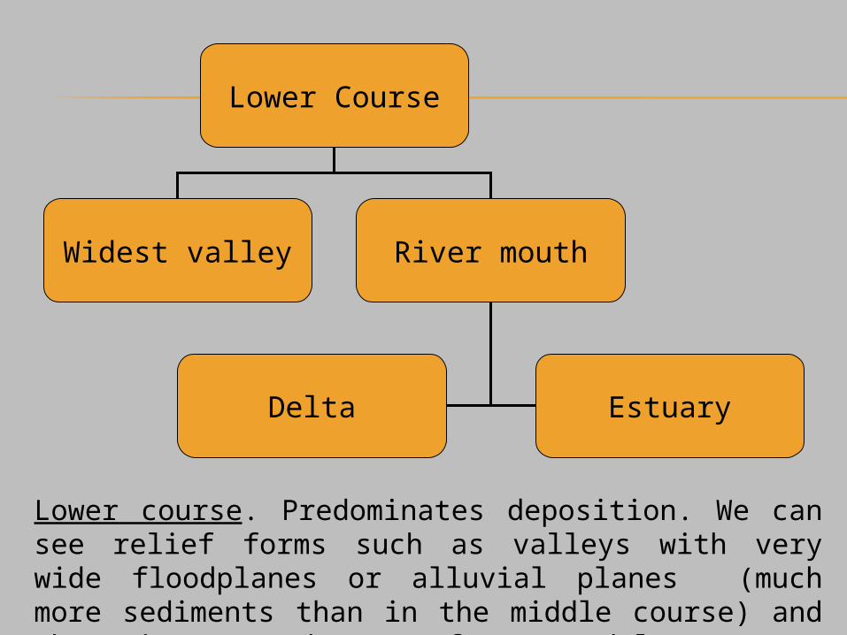
Lower Course
Widest valley River mouth
Delta Estuary
Lower course. Predominates deposition. We can see relief forms such as valleys with very wide floodplanes or alluvial planes (much more sediments than in the middle course) and the river mouth can form a delta or an estuary.
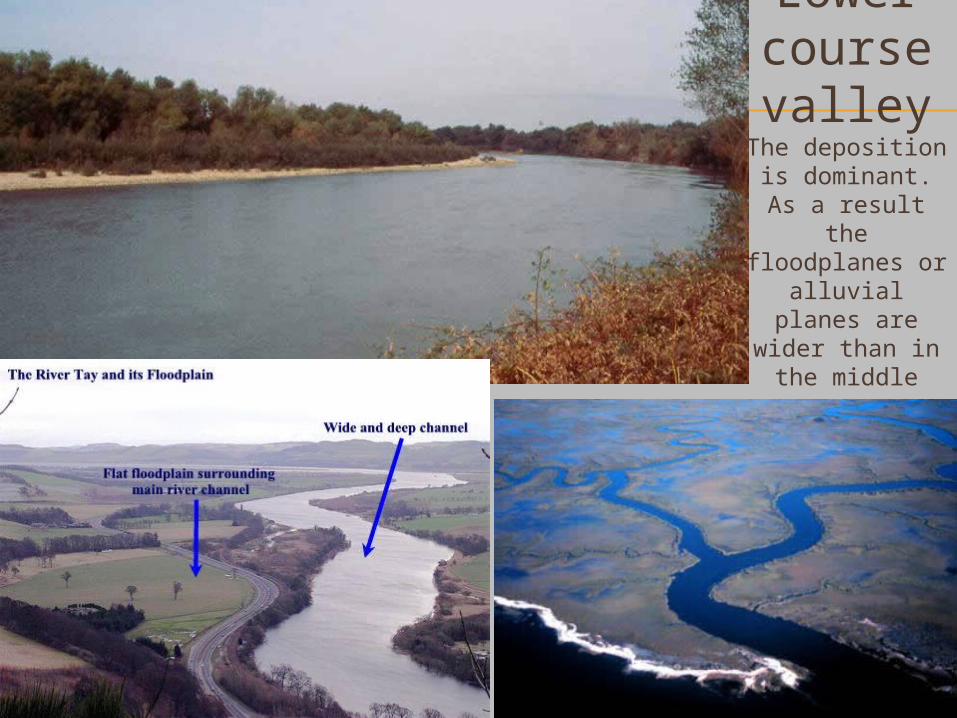
Lower course valley
The deposition is dominant. As a
result the floodplanes or alluvial planes
are wider than in the middle
course.
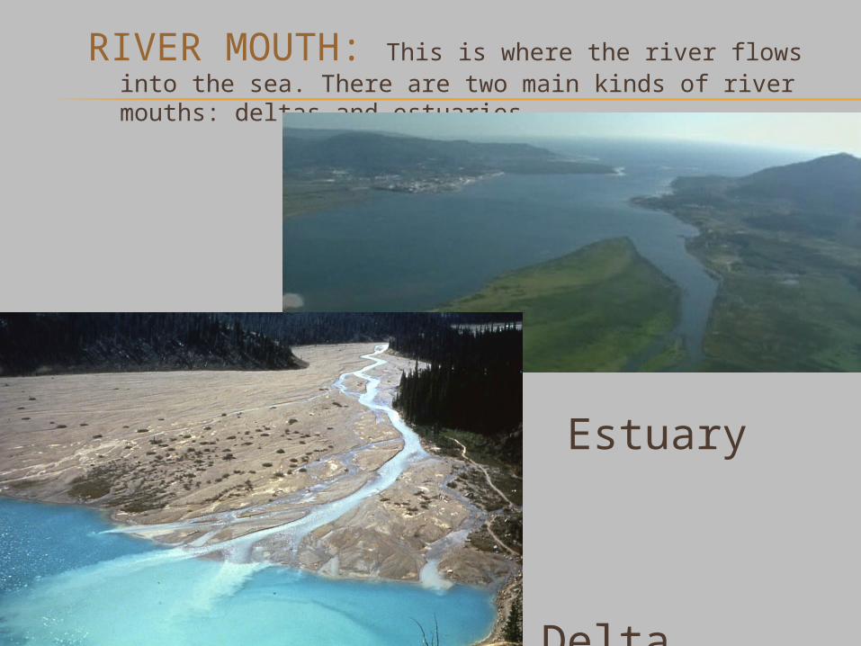
RIVER MOUTH: This is where the river flows into the sea. There are two main kinds of river mouths: deltas and estuaries.
Estuary
Delta

EBRO´S DELTA NILO´S DELTA
DELTASThey are deposits of sediments as
the river enters the sea. It is produced in calm seas (don´t have
strong currents to carry the sediments further).
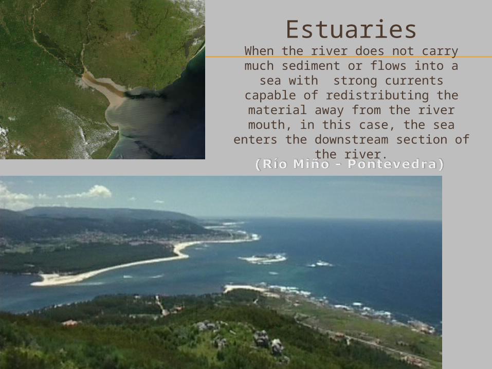
EstuariesWhen the river does not carry much sediment or flows into a sea with
strong currents capable of redistributing the material away from the river mouth, in this case, the sea enters the downstream section of the
river.

Estuary
Related Documents