THE 5 THEMES OF THE 5 THEMES OF GEOGRAPHY GEOGRAPHY CH 1 SECTION 1 NOTES CH 1 SECTION 1 NOTES

THE 5 THEMES OF GEOGRAPHY CH 1 SECTION 1 NOTES. What is Geography? * It is the study of our earth; our home. OR *Anything that can be mapped!
Dec 31, 2015
Welcome message from author
This document is posted to help you gain knowledge. Please leave a comment to let me know what you think about it! Share it to your friends and learn new things together.
Transcript

THE 5 THEMES OF THE 5 THEMES OF GEOGRAPHYGEOGRAPHY
CH 1 SECTION 1 NOTESCH 1 SECTION 1 NOTES

What is Geography?What is Geography?
**It is the study of our earth; our It is the study of our earth; our home.home.
OROR
*Anything that can be mapped!*Anything that can be mapped!

OwlTeacher.com
*Geography mixes up the *Geography mixes up the physical and human aspects physical and human aspects of our world into one field of of our world into one field of
study.study.
*Geography shows the *Geography shows the relationship between people relationship between people
and the environment.and the environment.
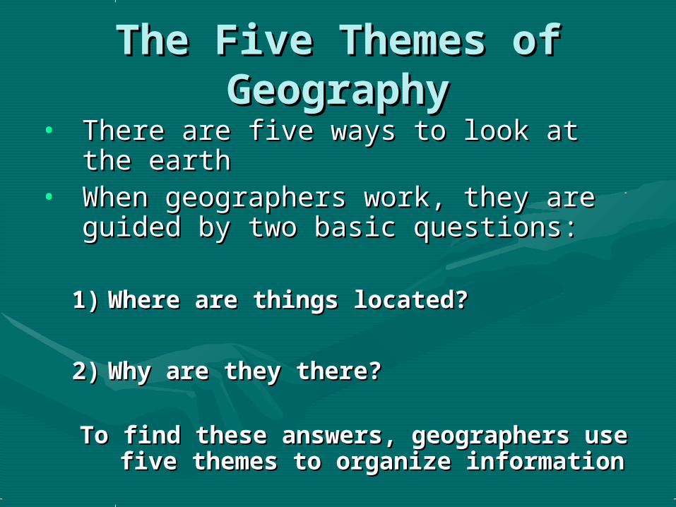
The Five Themes of The Five Themes of GeographyGeography
• There are five ways to look at the There are five ways to look at the earthearth
• When geographers work, they are When geographers work, they are guided by two basic questions:guided by two basic questions:
1)1) Where are things located?Where are things located?
2)2) Why are they there?Why are they there?
To find these answers, geographers use To find these answers, geographers use five themes to organize informationfive themes to organize information

THE FIVE THEMES OF THE FIVE THEMES OF GEOGRAPHYGEOGRAPHY
•LocationLocation•PlacePlace•Human-Environment Human-Environment
InteractionInteraction•MovementMovement•RegionsRegions

LOCATIONLOCATIONWhere are we?Where are we?
• Absolute Absolute LocationLocation– A latitude and A latitude and
longitude (global longitude (global location) or a street location) or a street address (local address (local location).location).
– Paris France is 48Paris France is 48o o
North Latitude and 2North Latitude and 2oo East Longitude.East Longitude.
– The White House is The White House is located at 1600 located at 1600 Pennsylvania Ave. Pennsylvania Ave.
• Relative Relative LocationLocation– Described by Described by
landmarks, time, landmarks, time, direction or direction or distance. From one distance. From one place to another.place to another.
– Go 1 mile west on Go 1 mile west on main street and main street and turn left for 1 turn left for 1 block.block.
You
are
Her
e
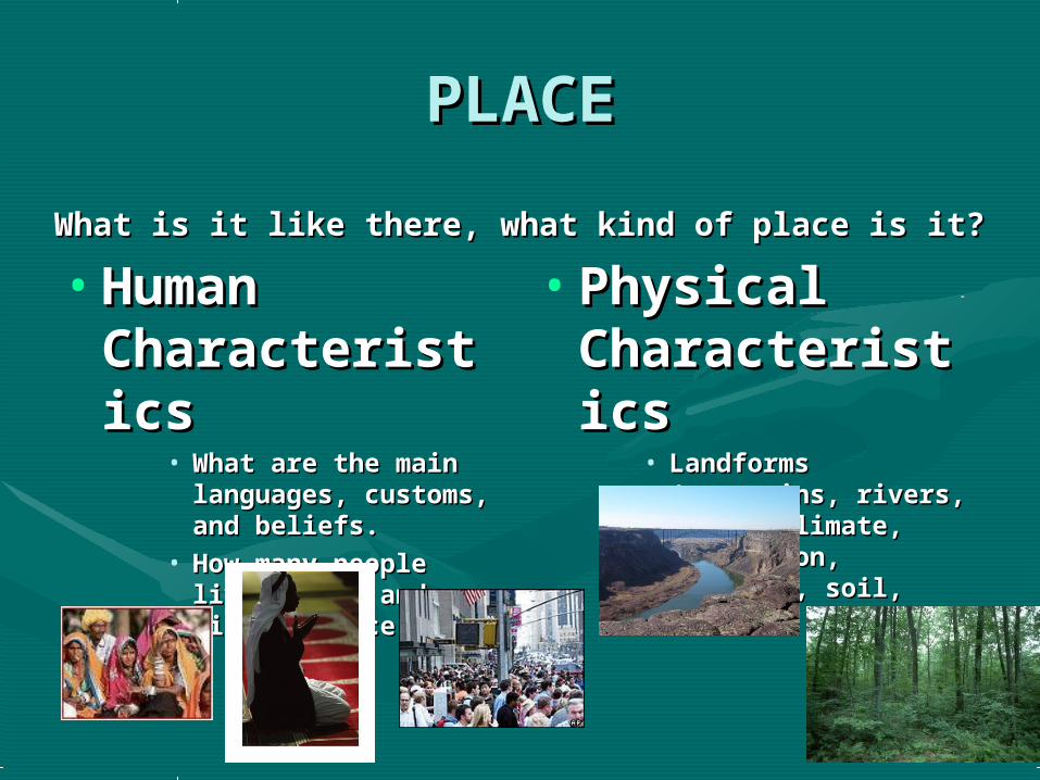
PLACEPLACE
What is it like there, what kind of place is it?What is it like there, what kind of place is it?
• Human Human CharacteristiCharacteristicscs
• What are the main What are the main languages, customs, languages, customs, and beliefs.and beliefs.
• How many people How many people live, work, and visit live, work, and visit a place.a place.
• Physical Physical CharacteristiCharacteristicscs
• Landforms Landforms (mountains, rivers, (mountains, rivers, etc.), climate, etc.), climate, vegetation, wildlife, vegetation, wildlife, soil, etc.soil, etc.

HUMAN-ENVIRONMENT HUMAN-ENVIRONMENT INTERACTIONINTERACTION
• How do humans and the How do humans and the environment affect each other?environment affect each other?– We depend on it.We depend on it.
• People depend on the Tennessee River for water People depend on the Tennessee River for water and transportation.and transportation.
– We modify it.We modify it.• People modify our environment by People modify our environment by
heating and cooling buildings for comfort.heating and cooling buildings for comfort.
– We adapt to it.We adapt to it. • We adapt to the environment by wearing We adapt to the environment by wearing
clothing suitable for summer (shorts) and clothing suitable for summer (shorts) and winter (coats).winter (coats).

MOVEMENTMOVEMENT
• How are people, goods, ideas moved How are people, goods, ideas moved from place to place?from place to place?– Human MovementHuman Movement
• Trucks, Trains, PlanesTrucks, Trains, Planes
– Information MovementInformation Movement• Phones, computer (email), mailPhones, computer (email), mail
– Idea MovementIdea Movement• How do fads move from place to place? How do fads move from place to place?
TV, Radio, MagazinesTV, Radio, Magazines

REGIONSREGIONS
• How are Regions similar to and How are Regions similar to and different from other places?different from other places?– Formal RegionsFormal Regions
• Regions defined by governmental or administrative Regions defined by governmental or administrative boundaries (States, Countries, Cities)boundaries (States, Countries, Cities)
• Regions defined by similar characteristics (Corn Belt, Regions defined by similar characteristics (Corn Belt, Rocky Mountain region, Chinatown).Rocky Mountain region, Chinatown).
– Functional RegionsFunctional Regions• Regions defined by a function (newspaper service Regions defined by a function (newspaper service
area, cell phone coverage area).area, cell phone coverage area).

Remembering the 5 Remembering the 5 themesthemes
• If you can’t remembering what If you can’t remembering what they are just ask MR. HELP!!!they are just ask MR. HELP!!!•MM – Movement – Movement•RR – Regions – Regions•HEHE – Human Environment – Human Environment interactioninteraction
•LL – Location – Location•PP - Place - Place

End of Day 1End of Day 1

Map SkillsMap Skills

The Geographer’s ToolsThe Geographer’s Tools• Globes and Maps:Globes and Maps:
– As people explored the Earth, they As people explored the Earth, they collected information about it.collected information about it.
– Mapmakers wanted to present this Mapmakers wanted to present this information correctly.information correctly.
– The best way was to put it on a The best way was to put it on a globe, a round ball that globe, a round ball that represented the Earth.represented the Earth.

– Because globes are not practical Because globes are not practical or easy or easy to use to carry, flat maps to use to carry, flat maps were invented.were invented.
– However, the earth is round and a However, the earth is round and a map is flat.map is flat.
– Mapmakers had to find ways to Mapmakers had to find ways to make maps accurate.make maps accurate.

OwlTeacher.com
• In 1569, a geographer named Gerardus Mercator created a flat map to help sailors navigate long journeys across the globe.
• The Mercator projection, or method of putting a map of the Earth onto a flat piece of paper, is used by nearly all deep-sea navigators.
• The Mercator projection is a conformal map, meaning that it shows correct shapes, but not true distances or sizes.
• There are many types of other projections of the globe.
Getting It All On the MapGetting It All On the MapThe World: Mercator Projection

OwlTeacher.com
There are many ways to show a globe on a flat map. The interrupted projection map, on the left, shows real sizes and shapes of continents. The equal area map , below left, shows size accurately. The Peters projection, below, shows land and oceans areas and correct directions accurately
The World: Three The World: Three ProjectionsProjections
Interrupted Projection
Equal-Area Projection
Peters Projection
OwlTeacher.com
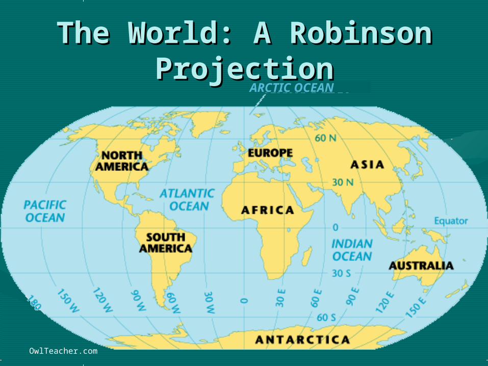
The World: A Robinson The World: A Robinson ProjectionProjection
ARCTIC OCEAN

Types of MapsTypes of Maps
There are three basic types of maps:
PHYSICAL POLITICAL
and THEMATIC.

Physical MapsPhysical Maps• Physical maps show
the natural features of the Earth.
• Physical maps do not contain man made features.
• For example, a
physical map would be a map of what you would see if you were looking down on Earth from space.

Physical MapsPhysical Maps
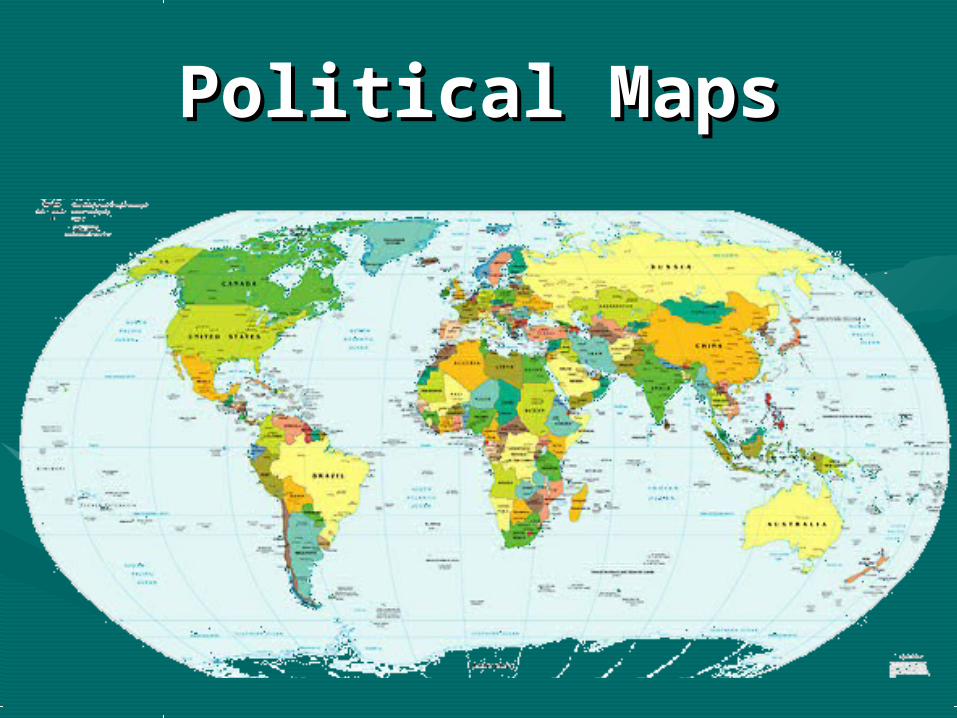
Political MapsPolitical Maps

Political MapsPolitical MapsUnlike physical maps, political maps show how humans have impacted the landscape. For example, city names, roads, country borders, etc. are all part of political maps.
Political maps change frequently (physical maps change very, very slowly through geologic processes) and must be redrawn often. A political map of the world that is 50 years old is no longer accurate.
Wars and ethnic conflict are two major causes political maps change.

Political MapsPolitical Maps

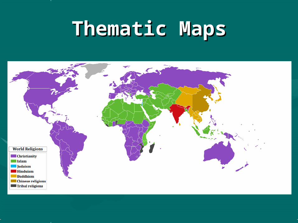
Thematic MapsThematic Maps
Thematic maps can represent a variety of information including things like climate, precipitation, vegetation, elevation, population, life expectancy, etc.
Thematic maps are generally used when you are looking at a single piece of information.
Thematic MapsThematic Maps

The Parts of a MapThe Parts of a Map
Title: Title: • The title tells what the map is about. This The title tells what the map is about. This
is the first part of the map you should look is the first part of the map you should look at. at.
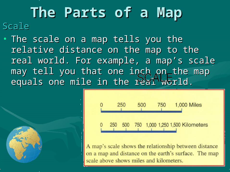
The Parts of a MapThe Parts of a MapScaleScale• The scale on a map tells you the relative The scale on a map tells you the relative
distance on the map to the real world. For distance on the map to the real world. For example, a map’s scale may tell you that one example, a map’s scale may tell you that one inch on the map equals one mile in the real inch on the map equals one mile in the real world.world.

Compass RoseCompass Rose• A compass rose is a model of a compass. It A compass rose is a model of a compass. It
tells the cardinal directions, which are north, tells the cardinal directions, which are north, south, east, and west.south, east, and west.

KeyKey• The key, or legend, on a map explains what The key, or legend, on a map explains what
the symbols on a map represent, such as the symbols on a map represent, such as triangles representing trees.triangles representing trees.

GridsGrids• Some maps use a grid of parallels and Some maps use a grid of parallels and
meridians. On a map of a small area, letters meridians. On a map of a small area, letters and numbers are often used to help you find and numbers are often used to help you find your location.your location.

How Latitude and How Latitude and Longitude Form the Global Longitude Form the Global
GridGrid

Latitude and longitudeLatitude and longitude
• Latitude lines run across the globe horizontally
• Lines of longitude run up and down, vertically on the globe.

OwlTeacher.com
The HemispheresThe Hemispheres

The HemispheresThe Hemispheres
• There are 4 hemispheres: Northern hemisphere, Southern hemisphere, Eastern hemisphere, and Western hemisphere
• The equator cuts the northern hemisphere and southern hemisphere in half.
• The Prime Meridian cuts the eastern and western hemisphere in half

End Day 2End Day 2
Related Documents